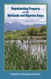
Landowners' Guide to MT Wetlands - Montana Watercourse
Landowners' Guide to MT Wetlands - Montana Watercourse
Landowners' Guide to MT Wetlands - Montana Watercourse
- No tags were found...

Create successful ePaper yourself
Turn your PDF publications into a flip-book with our unique Google optimized e-Paper software.
Andrew LaszloGovernor Schweitzer and landowner, Jeff Laszlo,discuss the Odell Creek headwaters wetland andriparian res<strong>to</strong>ration project on the Granger Ranchesnear Ennis.Cover pho<strong>to</strong>: Sue Ball
Fo r e w o r d:Good decisions emerge from access <strong>to</strong> solid information. Thisguide provides facts and resources <strong>to</strong> enable each <strong>Montana</strong>landowner <strong>to</strong> make informed decisions about managing wetlands,bringing <strong>to</strong> life the multiple options for wetland protection,enhancement, and res<strong>to</strong>ration. The basic information containedhere provides a starting point for landowners who wish <strong>to</strong> contactagency and organization partners <strong>to</strong> learn about possibletechnical and financial assistance and long term preservation.Agency personnel will find this guide useful when working withprivate landowners who need additional information regardingavailable management options.USFWSTa b l e o f Contents:Introduction . . . . . . . . . . . . . . . . . . . . . . . . . . . . . . . . . . . . . . . . . . . . . . . . . . . . . . . . . . . . . . . . . . . . . . . . . . . . 4Section 1 What Are <strong>Wetlands</strong>? ......................................................... 5Answers questions about wetlands, their value, and their functionSection 2 Working with <strong>Wetlands</strong> ..................................................... 20Presents profiles of <strong>Montana</strong>ns who now manage and reap the rewards of conserving wetlands,with the help of public agencies and conservation organizations as well as through traditionalland management practicesSection 3 Getting Help: Who, What, and Where. . . . . . . . . . . . . . . . . . . . . . . . . . . . . . . . . . . . . . . . 34Contains options for conservation or res<strong>to</strong>ration and enhancement projects ‘Section 4 Protection Laws, Permits, and Regulations . . . . . . . . . . . . . . . . . . . . . . . . . . . . . . . . . 42Provides an overview of federal, state, local, and tribal laws governing <strong>Montana</strong> wetlands,and answers frequently asked questions3
In t r o d u c t io nHav in g a We t l a n d<strong>Montana</strong>ns’ understanding of and management of wetlandshas evolved over time. For decades, wetlands were consideredwastelands and the federal government provided subsidies <strong>to</strong>fill and drain them. Today we know wetlands are a vital naturalresource for wildlife habitat and for maintaining water quality.Thankfully, many government and private programs helplandowners res<strong>to</strong>re and protect wetlands.This guide provides information about the importance andvalue of wetlands <strong>to</strong> help landowners make informed landuse and stewardship decisions. Managers on large and smallacreages as well as landowners in areas of rapid growth anddevelopment are faced with difficult land management questions.How can we balance the needs of property owners <strong>to</strong> farm, ranch,or build on their land while maintaining the beneficial functions ofnatural wetlands? How can we respect individual property rightsand ensure that traditional land uses continue in the face of growingdemands for other land uses, while conserving both privately andpublicly owned wetlands? Answers <strong>to</strong> these questions depend onwhether landowners appreciate the many functions of wetlands,and know how management choices affect these valuable resources.“It comes down <strong>to</strong> cooperation and wanting it <strong>to</strong>work. If you are open-minded, it becomes a win-winsituation.”—Jim Brady, Petroleum County rancher on workingwith government agenciesJodi Cos<strong>to</strong>n<strong>Wetlands</strong> are defined as lands where water is the dominant fac<strong>to</strong>r determiningsoil, plant, and animal communities.4
Do Yo u Hav e a Wetland?Is there a place on your land where you watch ducks, or where your trac<strong>to</strong>rseems <strong>to</strong> always get stuck? Chances are you have a wetland. <strong>Montana</strong>’s wetlandsinclude marshes, fens, wet meadows, riparian areas along rivers and streams, prairiepotholes, and spring seeps. In a wetland, water is often onor near the surface all or part of the year, the soil is poorlydrained and may smell like rotten eggs and look gray, andwater-<strong>to</strong>lerant plants such as cot<strong>to</strong>nwoods, willows, cattails,rushes, and sedges may be present.Section 1Wh at a r eWe t l a n d s?Wh at Do Yo u Lo o k Fo r?Identifying wetlands can be challenging. Generally,three attributes are present, as illustrated in thesepho<strong>to</strong>graphs:Pete Husby, NRCSHydrophytes are vegetation adapted <strong>to</strong> life inwet soils.Debbie Earl, <strong>Montana</strong> <strong>Watercourse</strong>Wetland hydrology is water at or near theland surface, all or part of the year.Pete Husby, NRCSHydric soils are soils that are poorly drained anddevelop certain soil characteristics due <strong>to</strong> thepresence of water and absence of oxygen.5
Ho w Ca n Yo u Be Su r e Th at Yo u Hav e a Wetland?<strong>Wetlands</strong> aren’t always wet. As demonstrated in the three pictures <strong>to</strong> theright, the amount of moisture in a wetland can vary during the year. During someseasons, a wetland may actually be dry.If you think your land contains a wetland, ask a wetland specialist who understandsvegetation, soils, and hydrology. Some work for agencies like the Natural ResourcesConservation Service and the Army Corps of Engineers, others are privateconsultants. Be sure <strong>to</strong> accompany this person so you can ask questions andunderstand the exact location and characteristics of your wetland. The wetlandspecialist can also provide the names of people <strong>to</strong> contact about projects that mightaffect the wetland. Most land management practices, building projects, and otheractions that occur in or near wetlands require state and/or federal permits. Sections 3and 4 of this guide display easy-<strong>to</strong>-use information on permits, water rights, and theagencies that issue them.Temporarily flooded pothole wetlands fill in thespring . . .Ducks Unlimited pho<strong>to</strong>s. . . and then slowly dry up during the summermonths.By fall, the wetland may no longer be wet.<strong>Wetlands</strong> provide valuable habitat for breeding birds.Terry Lonner, Media Works6
Wh at Ki n d s o f <strong>Wetlands</strong> Oc c u r in Mo n ta n a?Jeff LaszloRiverine wetlands are associated with flowingwater of rivers and streams. Examples: sloughs,abandoned meanders, and river and creekmargins.Jim Stutzman, USFWSDepressional wetlands are low spotson the landscape. Examples: glacialand prairie potholes, saline basins, wetmeadows, and ephemeral ponds.Pete Husby, NRCSSlope wetlands are groundwaterdischarge areas on a <strong>to</strong>pographicgradient. Examples: sloping wetmeadows, subalpine and montaneareas of higher elevation, fens,springs and seeps.Larry Urban, MDTLacustrine fringe wetlands areassociated with lakes or deep waterhabitats. Examples: margins aroundmud flats, lakes, reservoirs and ponds.Tom Hinz, <strong>Montana</strong> <strong>Wetlands</strong> Legacy PartnershipArtificial wetlands are created byhuman-related activities such asthis surface water impoundmentalong a Sheridan County road.7
Wh y a r e <strong>Wetlands</strong> Im p o r ta n t ?<strong>Montana</strong>’s wetlands provide services essential <strong>to</strong> our state’s wildlife, water quality, and floodcontrol. Although we were unaware of wetlands’ important functions for many years, we nowunderstand the irreplaceable role of natural wetlands.A healthy wetland can:• Absorb and retain large volumes ofwater and gradually release it <strong>to</strong> adjacentstreams and other bodies of water duringlow-flow periods and at other times of theyear.• Recharge aquifers by holding water on theland, allowing the water <strong>to</strong> percolate in<strong>to</strong>underlying soil <strong>to</strong> replenish groundwatersupplies. Groundwater provides 94% of<strong>Montana</strong>’s rural domestic water supplyand 39% of the state’s public water supply.• Support vegetation that acts as a floodbuffer and stabilizes streambanksand shorelines.• Maintain and improve water quality bytrapping sediment and <strong>to</strong>xic substancessuch as heavy metals, chemicals, andpathogens, and other undesirablesubstances that find their way in<strong>to</strong> surfacewaters. About 54% of <strong>Montana</strong>’s humanpopulation uses public drinking watersystems that rely on clean surface water.• Naturally purify water by absorbingexcess nutrients such as nitrogen andphosphorus.• Decompose organic matter, and cyclenutrients back in<strong>to</strong> the food chain.• Provide habitat for most of the nation’smigra<strong>to</strong>ry birds, including waterfowl,shorebirds, water birds, and songbirds.• Provide critical habitat for mammals,reptiles, insects, and amphibians.• Provide habitat for fish <strong>to</strong> breed,spawn, rear their young, grow, andsurvive <strong>Montana</strong> winters.• Protect habitat for threatened and endangeredspecies. According <strong>to</strong> U.S. Fish and WildlifeService, in <strong>Montana</strong>, nearly 85%of endangered species are foundin or are dependent on wetlands<strong>to</strong> complete at least part of theirlife cycle.• Increase property value throughenhanced aesthetics, s<strong>to</strong>ringwater, attracting wildlife, andother fac<strong>to</strong>rs.Pete Husby, NRCS• Enhance the quality of life for people <strong>to</strong>interact with nature by providing openspace, wild areas in public parks, andtrail systems in wetlands and riparianareas.• Provide recreational opportunities foranglers, hunters, wildlife watchers,hikers, and other water-based or waterrelatedhuman activities.Marcia Rueter LeritzJeff LaszloJeff LaszloJim Stutzman, USFWSDavid A. Thompson8
Threats <strong>to</strong> <strong>Wetlands</strong>Human alterations <strong>to</strong> the landscape have caused massive wetland loss. <strong>Wetlands</strong> in rural areas continue <strong>to</strong>be lost as land is put in<strong>to</strong> agricultural production. In urban areas, development fragments wetland areas and in somecases, eliminates wetlands. Human activities that cause wetland degradation include the following.Hydrologic alterations due <strong>to</strong>:• draining or filling for development and farming• dredging and stream channelization for flood control anddevelopment• diking and damming <strong>to</strong> form ponds and lakes• diverting flow <strong>to</strong> or from wetlands• adding impervious surfaces in the watershed, therebyincreasing water runoff in<strong>to</strong> wetlandsLand use changes due <strong>to</strong>:• plowing native grassland for crop production• locating homes and other development in riparian corridors• building roads and other infrastructure that fragment habitatand increase runoffVegetative damage due <strong>to</strong>:• overgrazing and trampling by lives<strong>to</strong>ck• browsing by wild and domestic ungulates• introduction of non-native species that compete withnatives• removal of riparian vegetation for unimpededwatershed viewsPollution inputs of sediment, fertilizer, human sewage,animal waste, road salts, pesticides, heavy metals, andselenium come from sources such as:• runoff from urban, agricultural, silvicultural, and miningareas• air pollution from cars, industries, and power plants• old landfills and dumps that leak <strong>to</strong>xic substancesDebbie Earl, <strong>Montana</strong> <strong>Watercourse</strong>Ducks Unlimited9
Wh e r e a r e Mo n ta n a’s <strong>Wetlands</strong>?<strong>Montana</strong> has lost almost 30% of its wetlands since aerial pho<strong>to</strong>graphy that has a degree of error. Landowners shouldsettlement in the 1860s. <strong>Wetlands</strong> are key habitats forcheck with the Army Corps of Engineers, a wetland delineationmany plants and animals in this arid state, yet the National expert, or agency representative <strong>to</strong> verify the presence of wetlands.Wetland Inven<strong>to</strong>ry (NWI) has never been completedAdditional information about wetland mapping and the <strong>Montana</strong>in <strong>Montana</strong>, unlike most of the nation. The few areasWetland and Riparian Mapping Center is posted at:that were mapped were recorded over 20 years ago.http://nhp.nris.mt.gov/community/wetlands/default.aspRiparian areas were not mapped at all. The <strong>Montana</strong>Land Information Advisory Council, whoseCurren t & Completed Nat i o n a l Wetland In v e n t o r y Mappingmission is <strong>to</strong> collect and disseminate digital2005 CIR Im a g e r yinformation about <strong>Montana</strong>’s naturaland artificial land characteristics, nowconsiders wetland mapping a priority.About 25% of <strong>Montana</strong> is now funded fornew NWI mapping, concentrating on rapidlydeveloping areas of western <strong>Montana</strong> and areasthat were not mapped in the original, incompleteNWI. The new NWI focus includes mapping theriparian areas along streams and rivers. Mappingwill be completed as funds become available.The wetland maps that result from this inven<strong>to</strong>rywill give landowners an indication of the presence ofwetlands on their property <strong>to</strong> help them with land usedecisions. However, these maps are developed fromGreen areas are completed.Yellow areas are currently being mapped.Crosshatched areas have 1970s NWIavailable.<strong>Montana</strong> Wetland and RiparianMapping Center10-Apr-200810
Irr igation a n d <strong>Wetlands</strong>The role of irrigation on landscapes is best unders<strong>to</strong>od over time. Lynn Owens grew up with flood irrigation and later addedsprinkler irrigation. He shares his observations of the changes he has seen on the Madison Valley ranch his family has owned forover sixty years, noting the relationship between types of irrigation and land use, and the resulting effects on the wetlands.Ly n n Ow e n s : A Ra n c h e r ’s Ir r i g at i o n St o r y“My family moved <strong>to</strong> a ranch onMeadow Creek in the Madison Valleyin 1946. At that time we used gravityflowflood irrigation. By late summerthe lower reaches of the creeks weredewatered by the irrigation diversionsupstream. Those with junior waterrights often went without water in latesummer or in dry years because thesenior water rights users <strong>to</strong>ok waterout of the streams and didn’t haveexcess water <strong>to</strong> return <strong>to</strong> the streams.This situation continues <strong>to</strong>day.The diversions in the upper streamreaches and the floodwater irrigationdispersion resulted in ditch-flowseepage and percolation of the floodirrigatedlands.“Small streams also flow from themountains on each side of the valley.Many never reach the river as surfaceflowingstreams, but instead they sinkin<strong>to</strong> the bench ground (mostly gravel)on their paths <strong>to</strong> the river. The waterfrom these streams plus the seepagefrom the flood irrigation contributed<strong>to</strong> the wetlands adjacent <strong>to</strong> the riverand lower creek lands.“In the 1940s the spin-off from floodirrigation caused increasingly higherwater tables along those lower landsthat are adjacent <strong>to</strong> the river and smallstreams. So by the 1950s the water tableshad risen, making some of the low-lyingcultivated lands <strong>to</strong>o wet for crops. Duringthis time the Soil Conservation Service (nowNRCS) cost-shared the excavation of manycanals <strong>to</strong> help us drain and salvage this landfor crop and pasture use. Some of this landhad gotten <strong>to</strong> the point that one old ranchersaid, “Don’t go through there, it will mire asaddle blanket.”“I installed some of the first sprinklerirrigation in the 1970s. Cheap power madeit economical <strong>to</strong> pump water <strong>to</strong> fields notirrigated by gravity ditches. It also madeit possible <strong>to</strong> irrigate three times moreland with the same amount of water usedpreviously, so we could put more land in<strong>to</strong>production and not pull more water fromthe river. However, the sprinklers made thewater more susceptible <strong>to</strong> evaporation due<strong>to</strong> the low humidity, windy environment,and large surface area covered by the water.This type of irrigation is resulting in adrastic reduction of recharge waters for thewetlands and riparian areas that had beencreated by flood irrigation.“The economically priced power is no longeravailable, and we’ve abandoned many of thehigh-energy–use sprinkler projects. Wherefeasible, we’re converting the sprinklerUSDA – NRCSprojects <strong>to</strong> gravity flow systems that demandhigher installation costs but result in lowerenergy costs.“Another large fac<strong>to</strong>r in the reduction ofrecharge flows is the change of land usefrom agriculture <strong>to</strong> housing developmentsand large recreation ranches that do notmake a living off the land. These are not asintensively irrigated. With little or no floodirrigation on the benches above them, thesprings and seeps that had developed in thebench break-off areas near the river are nowdry or drying up due <strong>to</strong> changed land use onthe benches above them.“What the wetlands were before white mancame here, I don’t know. But I do know thatI have seen a cycle happen that is still in astate of change. With the large decrease inflood irrigation, the wetlands in our area arenoticeably decreasing, and the riparian beltsalong the streams and river are changing.”~Lynn Owens12
Ho w Do <strong>Wetlands</strong> Benefit Ra n c h e r s a n d Farmers?In the arid West, the availability of water directly affects the value of land—especially for those whose livelihoods dependon agricultural production. <strong>Wetlands</strong> are often overlooked as a source of water. <strong>Wetlands</strong> benefit farms and ranches becausethey:• Provide water for lives<strong>to</strong>ck• Maintain late-summer stream flows, whichare critical for irrigating crops, waterings<strong>to</strong>ck, sustaining fisheries, and rechargingaquifers• Maintain a higher water table than nonwetlandareas, which increases subsurfaceirrigation and production of forage• Filter sediment, which protects the qualityof water, prolongs the life of irrigationpumps, and reduces siltation of ponds andirrigation ditches• Reduce velocity offloodwaters andbank erosion, whichminimizes propertylosses• Filter out chemicalsapplied <strong>to</strong> the land,such as nitrogen,phosphorus, andAlthough these wetland functions benefit farms and ranches, some of them also benefiteveryone who lives in <strong>Montana</strong>.Marcia Rueter Leritzpesticides, which helps keep these elements fromentering nearby lakes, streams, or groundwater• Sustain shrubs and trees that shelter lives<strong>to</strong>ckAd d i t i o n a l Wetland Benefits Fo r All• Recreational opportunities such as hiking, fishing, hunting, and wildlife viewing• Revenues from fishing, big game, waterfowl, and upland game bird licensesand activities• Educational opportunities <strong>to</strong> develop knowledge and skills in nature study• Wastewater treatment—a few small communities have constructed wetlandsfor this purposeDucks Unlimited<strong>Montana</strong> <strong>Watercourse</strong>13
Ca n Lives<strong>to</strong>ck En h a n c e <strong>Wetlands</strong>?While lives<strong>to</strong>ck grazing in wetland areas is generallynot advisable, research has shown that in the rightcircumstances and under the correct prescriptions lives<strong>to</strong>ckgrazing has the potential <strong>to</strong> enhance wetland healthand productivity. For instance, proper lives<strong>to</strong>ck grazingcan provide the disturbance mechanismoften needed by native wetland plants <strong>to</strong>rejuvenate and reproduce. The buildup ofplant litter, called thatch, can stifle newgrowth and prevent seed germination.Removal and disturbance of this littercan provide the impetus and conditionsnecessary for increases in wetland plantproductivity and diversity.the growing season, or for extended periods, can cause moredamage <strong>to</strong> wetland plants than the benefit of thatch removalcan compensate for. Accordingly, short-term, high-intensitylate fall or early winter grazing of thatch-laden wetlands islikely the best prescription <strong>to</strong> achieve improved wetland healthand productivity.Conversely, improperly timed and highintensitygrazing can permanently damagewetlands by reducing reproductiveefforts, providing a foothold opportunityfor invasive species, and by increasingsedimentation that adversely impactsaquatic plants and animals. Grazing duringMarcia Rueter Leritz14
Wo r k i n g w it h Wetland ChallengesThe values and benefits of wetlands are many. However, as a landowner you may deal with wetland issues thataren’t always positive:• <strong>Wetlands</strong> are sometimes not accessible <strong>to</strong>lives<strong>to</strong>ck, can be difficult or impossible <strong>to</strong> farmor hay, and may require extra time and fuel <strong>to</strong>manage around them.• Wildlife attracted by wetlands may cause damage<strong>to</strong> trees, ornamental plantings, and crops, ormay affect water levels such as when beaversdam watercourses next <strong>to</strong> homes or otherinfrastructure.• <strong>Wetlands</strong> can harbor mosqui<strong>to</strong>es.• Some wetlands are protected by the federal CleanWater Act. Such wetlands are referred <strong>to</strong> as“jurisdictional,” which means that the landowner’smanagement options for these areas may belimited.• Wetland res<strong>to</strong>ration may require a water right. SeeSection 4 for information.• Surface water heldin wetlands canresult in a highwater table that maybe problematic forseptic systems andbasements.In some cases, assistance from agencies and organizations can help turn thesechallenges in<strong>to</strong> opportunities. The real-life s<strong>to</strong>ries in Section 2 illustrate howsome <strong>Montana</strong> landowners found creative ways <strong>to</strong> tap in<strong>to</strong> resources andprograms <strong>to</strong> create positive outcomes. Section 3 provides contact informationfor assistance as you decide how <strong>to</strong> manage or develop wetlands.Jeanne Spaur, Manning Lake Wildlife RefugeManning Lake Wildlife Refuge near Poplar.15
Beavers — Nat u r e’s Lo w-Co s t Wetland Ma n a g e r s?Beaver dams can cause flooding near homes, agricultural fields, and other places they’re not wanted. Beavers might cut downtrees in areas where trees are needed for bank stability, shade, or aesthetic values. However, beavers can and do play a role inres<strong>to</strong>ring and maintaining wetland and riparian health in places where they do not pose a hazard or threat of damage.For example, beaver dams and canals can:• Reduce sediment loads in streams where trampled banks,lack of stream margin buffer strips, and other fac<strong>to</strong>rscause back erosion• Recharge groundwater and raise the groundwater table• Reduce flood damage by increasing the water-holdingcapacity of an area or stream• Maintain flow rates and, in some cases, release coolerwater in<strong>to</strong> streams during low-flow periods• Cause new wetlands <strong>to</strong> develop• Provide habitat for fish, waterfowl, and other wetland orwater-dependent wildlife and plants• Maintain a more stable water supply for wildlife andwetland vegetation• Provide wet meadows, shrub habitat, and eventuallygrassland habitat for lives<strong>to</strong>ck and wildlife <strong>to</strong> utilize whendammed ponds ultimately fill inSome landowners find they can move beyond just <strong>to</strong>leratingbeavers, <strong>to</strong> actually enjoying their presence. A range of optionsallows landowners <strong>to</strong> manage beavers on their property. Beaverwater control devices are commercially available <strong>to</strong> maintainwater levels and prevent flooding. Trees can be saved bywrapping trunks with wire mesh that should be loosened as thetrees grow. <strong>Montana</strong> Fish, Wildlife & Parks suggests paintingdesired trees with amixture of paint andsand as a deterrent<strong>to</strong> beaver activity.<strong>Wetlands</strong> & Dr o u g h t<strong>Wetlands</strong> play an increasingly important role duringperiods of drought. They provide water for s<strong>to</strong>ck in timesof scarcity, and allow continued habitat for many species ofplants and animals. <strong>Wetlands</strong> act as sponges, absorbing highflows, enhancing the rate of groundwater recharge for thesurrounding area, and slowly releasing water.16
Properly Fu n c t i o n i n g <strong>Wetlands</strong> Ad d <strong>to</strong> Property a n d Co m m u n it y Va l u e s<strong>Wetlands</strong> in urban or rural landscapes include not onlythose benefits previously discussed, but also benefit overall propertyvalues. Simply put, property near open water is worth more. Studiesreveal housing price increases for homes near a protected riparian corridorrange from 6% (Colby and Wishart, 2002) up <strong>to</strong> 15% (Quayle and Hamil<strong>to</strong>n,1999).Protected wetlands and riparian areas may not only increaseproperty value, but also provide additional local economicadvantages. Healthy wetlands and riparian areas provide:• Inexpensive flood protection• Inexpensive erosion control• Protection for surface and groundwater quality, thuseliminating the need for costlywater treatment facilities that manycommunities cannot afford<strong>Montana</strong> <strong>Watercourse</strong>Jefff LaszloJeff Laszlo17
Wh at Happens if We Interferew it h <strong>Wetlands</strong>?Destruction of wetlands can createfar-reaching impacts:• Decline in wildlife populations• Increased flood damage• Increased sediment and nutrients inlakes and streams• Contaminated drinking water andirrigation wells• Reduced fish productivity due <strong>to</strong>poor water quality and habitat loss• Increased costs of treating drinkingwater• Reduced recreational opportunitiesand loss of <strong>to</strong>urist dollars• Lower water tables• Reduced production of lives<strong>to</strong>ckBecause wetlands destruction can have suchextensive impacts, wetland alterations need<strong>to</strong> be reviewed by the appropriate agencies(see Section 4). As seen in the followingexample, one <strong>Montana</strong> landowner learnedthis lesson the hard way. He began <strong>to</strong> builda house and pond in a wetland withoutregard <strong>to</strong> wetland protection laws orgetting the necessary permits. After muchhard work, he had <strong>to</strong> comply with the lawand reclaim lost ground with the help of anenvironmental engineering company.Negative Im p a c t s o fLa n d o w n e r Ac t i o n s• Stripped entire streamside (riparian)area of vegetation and <strong>to</strong>psoil duringconstruction of a residential buildingpad, driveway, and recreational pond• Constructed pond (right) in thecentral portion of the wetland• Constructed building pad over aportion of the wetland using pondexcavation material• Piled cot<strong>to</strong>nwood trees and stumpsnear the streambank and burnedthem, which created the threat of ashand sediment washing in<strong>to</strong> the streamand impacting water qualityLa n d o w n e r’s Reclamation o fNegative Im p a c t s• Removed downed trees, ash, and otherdebris from the floodplain• Removed granular soil that wasoverlying the former ground surfaceon the floodplain• Returned the area <strong>to</strong> the approximategrade before construction began• Backfilled pond with similar granularsoilAfter landowner’s uninformed actions, but before reclamatioOne year later, following completion of reclamation work.• Reconstructed an irrigation ditchthat had flowed across the site beforeexcavation activities• Constructed erosion control featuresalong the south and east sides of thebuilding pad, and reconstructed theslopes of the building pad18
Do <strong>Wetlands</strong> Affect Hu m a n Health?n. Paul Burley pho<strong>to</strong>sHuman health is directly tied <strong>to</strong> wetlands because we all needclean water. <strong>Wetlands</strong> break down and hold nutrients, chemicalpesticides, salts, sediments, and organic wastes. The pollutantscan enter our water through runoff from sources such as citystreets, lawns, construction sites, mining operations, andagricultural fields. In times of normal flow, wetlands act likea filter, reducing the amount of these elements entering lakes,streams, and, ultimately, ourdrinking water!• Reduced sediment erosion duringspring floods by leaving boulders,cobbles, and woody debris on theground surface of the disturbed area• Re-established vegetation, includingnative wetland species, on thefloodplainThe <strong>Montana</strong> State Constitutionguarantees a healthyenvironment for its citizens.Shared responsibility forprotection and improvement of<strong>Montana</strong>’s wateris found in SectionOne of ArticleIX: “The stateand each personshall maintain andimprove a cleanand healthfulenvironmentin <strong>Montana</strong> forJeff Laszlopresent and future generations.”<strong>Montana</strong> <strong>Watercourse</strong>19
Section 2Wo r k in gw it hWe t l a n d s66 RANCHMEYER CORPORATIONCOTEAU FARMSAs you consider your ownwetland, read on <strong>to</strong> meet some<strong>Montana</strong>ns who have res<strong>to</strong>red and/orprotected their wetlands. Although eachsituation is unique, the common elementis that the landowners or communityof stakeholders <strong>to</strong>ok the first step. Theyrecognized that management practicescould and should be altered or augmented<strong>to</strong> protect and res<strong>to</strong>re the wetlandfeatures on their property. Their secondstep was <strong>to</strong> seek advice and help fromagency and organization professionals. Inthe case of the Mollet Park and WetlandRes<strong>to</strong>ration Project, a community ofvarious stakeholders worked <strong>to</strong>getherthrough the efforts of the BlackfootChallenge: Blackfoot Community Project,<strong>to</strong> enhance and manage public landsfor the benefit of many. Each of theses<strong>to</strong>ries shows various ways that <strong>Montana</strong>landowners have successfully managedwetlands in ways that enhance both theenvironmental and economic value ofthe land.BIRD CREEK RANCHMOLLET PARK & WETLANDRESTORATIONGRANGER RANCHESDOOLING LIVESTOCK COMPANYFeatured Mo n t a n a n s a n d PropertiesCHERRY CREEK RANCHBRADY RANCHBim and Janas Strauser – 66 Ranch, Hill CountyLon and Vicki Reukauf – Cherry Creek Ranch, Prairie CountyJim and Cindy Kittredge – Bird Creek Ranch, Cascade CountyJim and Diana Brady – Brady Ranch, Petroleum CountyVance, Myron, and Kim Meyer – Meyer Corporation, Sheridan CountyJohn Dooling & Family – Dooling Lives<strong>to</strong>ck Company, Beaverhead CountyJeff Laszlo – Granger Ranches, Madison CountyAl and Dennis Joyes – Coteau Farms, Sheridan CountyMollet Park and Wetland Res<strong>to</strong>ration Project – Powell County20
66 Ra n c hBim and Janas Strauser of northernHill County have done more than justtalk about their interest in improving thewetland/grassland habitat for wildlife—they have established partnerships <strong>to</strong>improve their land and <strong>to</strong> create a paradisefor area wildlife. The Strausers havepermanently protected approximately3,200 upland and wetland acres ontheir 66 Ranch. Previous owners hadestablished a conservation easement onthe land. With the easement in place, theStrausers worked with Natural ResourcesConservation Service and DucksUnlimited <strong>to</strong> develop wildlife habita<strong>to</strong>n the property. Their res<strong>to</strong>ration workthat was accomplished on wetlands atWild Horse Lake has corrected previousalterations <strong>to</strong> the natural water flow thathad depleted the wetland. The res<strong>to</strong>ration,completed in 2005, has already proven<strong>to</strong> have positive effects on a diversemix of upland and wetland wildlife.Additionally, the hydrology of the areahas responded well. A secondary benefi<strong>to</strong>f the partnership effort has been thedevelopment of a successful rotationalgrazing system that retains some aspect ofthe economic viability for the traditionalranching aspects while meeting theintent of the <strong>Wetlands</strong> Reserve Programconservation easement.Ac t i o n s• Res<strong>to</strong>red 514 wetland acres throughrehabilitated and new dikes, 5 watercontrolstructures, and 10 shallow-waterimpoundments.• Established 901 acres of native uplandvegetation.• Established a rotational grazing system <strong>to</strong>improve wildlife cover through the use oflives<strong>to</strong>ck grazing. Grazing adjustmentsare made following annual moni<strong>to</strong>ring.Wh o Helped?• Natural Resources Conservation Servicepaid easement cost, provided wetlandidentification, planned res<strong>to</strong>ration, andpaid res<strong>to</strong>ration costs.• Ducks Unlimited provided the design anddelivery of the wetland res<strong>to</strong>ration.Permits Required• NoneBenefits a n d Re w a r d s• Natural Resources ConservationService paid all costs of the wetlandres<strong>to</strong>ration work through theperpetual conservation easement.• Increase in all types of birds: ducks,geese, shorebirds, songbirds,upland game birds.• Increase in deer and pronghornantelope in the area.• Improved wildlife in all of thesurrounding area.La n d o w n e r’s Co m m e n t s“It’s been very exciting watching the projectdevelop, the wildlife increase, and we arepleased with the project. We would alsolike <strong>to</strong> thank NRCS and Ducks Unlimitedfor their assistance with getting this projectlined out and working.”~Bim Strauser22654 Road 280 NHavre, <strong>MT</strong> 59501(406) 394-351966ranch@mtin<strong>to</strong>uch.netMatt Walker, NRCSWater control structure in place in rehabilitatedwetland.Matt Walker, NRCSImproved wetlands attract waterfowl and wildlife.21
22Ch e r r y Creek Ra n c hThird-generation rancher LonReukauf, owner of Cherry Creek Ranch,manages the 1,100 acres purchased by hisparents in 1958, as well as 7,900 acres ofdeeded land purchased through the years,plus 16,000 acres of leased land. The ranchis located in the eastern rolling plains andbadlands of Prairie County, west of Terry.Native grassland comprises the majorityof this cattle ranch where Lon acquired hisenjoyment of wildlife from his father, anavid birder, angler, and hunter. This prairieregion is cut through with intermittentstreams and cot<strong>to</strong>nwood and ash draws.Riparian areas make up only about 7-8% ofthe land. Lon’s management goal has been<strong>to</strong> increase the productivity of the summergrazedrange through one six-pasturerest-rotation grazing, and two <strong>to</strong> threepasture-deferred rotation grazing systems,non-summer-only use of some riparianareas, and wise water management. Theplan has paid off, the result of years ofhard work and of taking advantage ofmanagement programs offered by severalagencies.Vicki ReukaufNon-summer use of riparian areas and water spreadingresults in improved wildlife habitat and riparian forage.Ac t i o n s• Developed a grazing system that includedfencing pastures for rotation andspreading of water supply.• Developed the water resource with use ofwindmills, s<strong>to</strong>rage tanks, and pipelines <strong>to</strong>draw cattle away from riparian areas.• Hand planted cot<strong>to</strong>nwood, ash,buffaloberry, chokecherry, and plumtrees along Cherry Creek and assortedtributaries.• Entered 25,000 acres in<strong>to</strong> the BlockManagement Hunting Access Program.• Enrolled 8,000 acres in<strong>to</strong> theConservation Security Program.• Supported 200 acres of alfalfa throughwater spreading and diking. Systemsutilize water from spring runoff andsummer flooding.Wh o Helped?• Natural Resources Conservation Servicecost-shared water development for offriparianwater s<strong>to</strong>rage and improvements,gravity-fed pipelines, 13 windmills, waterspreading through series of dikes, and arotation grazing program.• <strong>Montana</strong> Fish Wildlife & Parks providedfinancial incentive for healthy wildlifehabitat through Block ManagementProgram.• Bureau of Land Management purchasedmaterials for cross fencing and one mileof pipeline.• <strong>Montana</strong> State University professorsDon Ryerson, Jack Taylor, and Bob Rossprovided grazing management practicesinformation.• Gus Hormay, the origina<strong>to</strong>r of RestRotation Grazing ideas.• 90 years of family diaries and s<strong>to</strong>rieschronicling their experiences ranchingand farming in eastern <strong>Montana</strong>.Permits Required• NoneBenefits a n d Re w a r d s• Improved wildlife habitat, increasedhunting revenue from <strong>Montana</strong> Fish,Wildlife & Parks.• Greater riparian forage.• Greater diversity of mammal and birdspecies.• Increased nesting cover resulting inincrease of songbirds, wild turkeys, andnesting geese.• 10–15% increase in <strong>to</strong>tal carryingcapacity.• Higher percentage of cows bred in ashorter time span.La n d o w n e r’s Co m m e n t s“Resting a pasture for twelve <strong>to</strong> eighteencontinuous months every few years ismagical. Non-summer use of riparian areasis wonderful. Search out and be aware of theoptions open <strong>to</strong> you. I have found NRCS <strong>to</strong>be easy <strong>to</strong> work with and most helpful.”~Lon ReukaufP.O. Box 956Terry, <strong>MT</strong> 59349(406) 486-5600
Bi r d Creek Ra n c hJim and Cindy Kittredge own BirdCreek Ranch, near Cascade. This workingranch is home <strong>to</strong> Highland cattle,Icelandic sheep, and diverse wildlifespecies. Situated on Bird Creek, theranch sits on prime and unique soils, andcontains archaeological and his<strong>to</strong>ricallysignificant sites. The driving force behindtheir efforts <strong>to</strong> preserve the family ranchis the Kittredges’ understanding of theconnection between land and people.Building on the prior generation’slegacy and working in partnership withseveral agencies and organizations, theKittredges are improving the property forlives<strong>to</strong>ck production and wildlife whilesimultaneously increasing the overall valueof their land.• Enrolled the remainder of the ranchlandin the Farm and Ranchlands ProtectionProgram through NRCS, and leveragedthe easement costs with a <strong>Montana</strong> Fish,Wildlife & Parks conservation easementin 2007.• Replaced flood irrigation with sprinklerirrigation <strong>to</strong> conserve water, therebyallowing more <strong>to</strong> remain in the MissouriRiver.• Developed additional water sources andcross fencing <strong>to</strong> implement a prescribedgrazing system that will improve lives<strong>to</strong>ckforage and benefit wildlife with extraforage and additional nesting and broodrearingcover.Wh o Helped?• American Bird Conservancy providedfunding <strong>to</strong> fence the river boundary,provide a solar watering system forlives<strong>to</strong>ck, and buy cot<strong>to</strong>nwoods andwillows <strong>to</strong> res<strong>to</strong>re habitat.• <strong>Montana</strong> Conservation Corps built fencesand planted trees and willows.• <strong>Montana</strong> Fish, Wildlife & Parks provideda conservation easement and assistancein wetland res<strong>to</strong>ration work and grazingplan implementation.• Natural Resources Conservation Serviceassisted with a perpetual easementthrough the <strong>Wetlands</strong> Reserve Programon a 120-acre oxbow along the MissouriRiver and 162 acres of surroundinguplands, evaluated the ranch for Farmand Ranchlands Protection Program,provided technical assistance, andprovided cost-share information onagricultural improvements throughthe Environmental Quality IncentivesProgram.• American Lands provided input forkeeping the entire property intactthrough conservation easements.Permits Required• 310• 404• Floodplain permitBenefits a n d Re w a r d s• Natural Resources Conservation Servicepurchased the perpetual easement andwill pay 100% of wetland res<strong>to</strong>rationcosts.• Res<strong>to</strong>red wetlands will benefit wildlifeand riparian areas.• Improved grazing system will improveupland riparian habitat.• Maintained ability <strong>to</strong> preserve valuablewildlife habitat while operating andprotecting a working ranch in perpetuity.• Protected valuable habitat fromsubdivision and development.Dale Krause, NRCSWetland Reserve Program provides benefits <strong>to</strong>wildlife and lives<strong>to</strong>ck.Ac t i o n s• Placed 282 acres of wetland andsurrounding uplands in<strong>to</strong> a conservationeasement through Natural ResourcesConservation Service’s (NRCS) <strong>Wetlands</strong>Reserve Program.• Wetland res<strong>to</strong>ration includes repair of afailed dike and water control structure,<strong>to</strong> be completed in 2008.La n d o w n e r s’ Co m m e n t s“NRCS has helped us ensure the legacy ofthis ranch, while also demonstrating howthe wild and working landscapes can workin balance, benefiting each other.”~ Jim and Cindy Kittredge126 River RoadCascade, <strong>MT</strong> 59421(406) 468-2160info@birdcreekranch.com23
24Br a d y Ra n c hJim Brady grew up along the banks ofBox Elder Creek near Winnett, wherehe and his wife, Diana, now ranch over9,700 acres of private and public lands.In the 1990s they added <strong>to</strong> their ranchholdings by purchasing a riparian areathat had seen heavy grazing that resultedin trampled banks and impacted riparianvegetation, including shrubs and trees.Determined <strong>to</strong> improve that area, alongwith the upland native grass pastures,Jim worked with the Bureau of LandManagement (BLM) and <strong>Montana</strong>Fish, Wildlife & Parks <strong>to</strong> create somemanagement changes. A three-waypartnership ensued that enabled theBradys <strong>to</strong> create a rest-rotation programthat allowed the land <strong>to</strong> return <strong>to</strong>healthier conditions while supportingtheir lives<strong>to</strong>ck operation. Ten years later,the benefits of the work are evidentin more robust riparian and pasturehabitats.Dan Brunkhorst, BLMBox Elder Creek near Vogel Reservoir.Ac t i o n s• Developed a s<strong>to</strong>ck water well away fromthe riparian zone.• Laid about ten miles of pipelines andinstalled 10 s<strong>to</strong>ck water tanks.• Installed cross fencing for pasturerotation.• Initiated a two-pasture riparian restrotation,and four-pasture uplanddeferred program.• Future improvements include additionalwater spreading development.Wh o Helped?• Bureau of Land Management costsharedfor one well, electricity, andmaterials for 6½ miles of cross fencing.• <strong>Montana</strong> Fish, Wildlife & Parks costsharedfor 7½ miles of pipelines.Permits Required• NoneBenefits a n d Re w a r d s• Improved riparian area includes regrowthof willows and cot<strong>to</strong>nwoods.• Improved lives<strong>to</strong>ck distribution onprivate and public lands.• Improved native grass forage forlives<strong>to</strong>ck in pastures and riparian areas.• Improved cover for nesting, brooding,and winter habitat of upland birds.• Overall habitat improvement forlives<strong>to</strong>ck and wildlife.• Maintained lives<strong>to</strong>ck operations whileenhancing recreational value ofpublic lands.• Good working relationship with agencypersonnel.La n d o w n e r’s Co m m e n t s“Improving habitat for lives<strong>to</strong>ck shouldimprove habitat for wildlife. People getthe idea they can’t work with governmentagencies. It comes down <strong>to</strong> cooperation andwanting it <strong>to</strong> work. If you are open-minded,it becomes a win-win situation. I have beenvery pleased with what has been done sofar. Now we need more time <strong>to</strong> see moreimprovement.”~ Jim BradyP.O. Box 145Winnett, <strong>MT</strong> 59087(406) 429-5281jdbrady@midrivers.comBLMRiparian vegetation on Box Elder Creek improvedas a result of rest-rotation grazing program anddevelopment of off-creek s<strong>to</strong>ck water system.
Meyer Co r p o r at i o nBrothers Vance, Myron, and KimMeyer are second-generation landownerswho manage a ranching and farmingoperation on over 2,700 acres on theMissouri Coteau in Sheridan County.Approximately one third of the propertyis rangeland and two thirds have beenfarmed at one time. Many wetlandson the property had been drained andfarmed, as was normal practice in the1950s and ’60s when farmers werepaid <strong>to</strong> drain the sloughs <strong>to</strong> put moregrassland in<strong>to</strong> production. By the 1980s,when drier years brought evidence oferosion problems on the areas that werestrip farmed, the Meyers turned <strong>to</strong> theSoil Conservation Service (now NaturalResources Conservation Service) and theFarm Service Agency for help in puttingthis land in<strong>to</strong> the Conservation ReserveProgram. The next step was <strong>to</strong> res<strong>to</strong>re themany drained wetlands. With help fromthe U.S. Fish & Wildlife Service’s Partnersfor Fish and Wildlife program the drainedwetlands were res<strong>to</strong>red <strong>to</strong> hold water, helprecharge the groundwater, and providewildlife habitat. The Meyers have placedmost of the rangeland and associatedwetlands in<strong>to</strong> U.S. Fish & Wildlife Serviceeasements, assuring this importantgrassland/wetland complex is perpetuallyprotected, while retaining the right <strong>to</strong>graze, and grow and harvest hay on theland.Ac t i o n s• Enrolled 1,335 acres of marginalfarmland in the Conservation ReserveProgram in 1988. Re-enrolled the landin 1998.• Res<strong>to</strong>red 48 drained wetlands <strong>to</strong>talingover 140 surface acres.• Perpetually protected 705 rangelandacres and 68 wetland acres in 54 basinswith U.S. Fish & Wildlife Serviceeasements.Wh o Helped?• Farm Service Agency paid for placingland in<strong>to</strong> the Conservation ReserveProgram and for re-enrolling in theprogram ten years later.• Natural Resources Conservation Serviceguided the range res<strong>to</strong>ration process andprovided seed mix for twice reseedingthe marginal land in<strong>to</strong> more productivegrasses.• U.S. Fish & Wildlife Service designedand paid for wetland res<strong>to</strong>ration work,and purchased perpetual grassland andwetland easements.Permits Required• NoneBenefits a n d Re w a r d s• Monetary benefits throughConservation Reserve Programpayments and U.S. Fish & WildlifeService purchase of land easements.• Erosion control due <strong>to</strong> plantedgrasslands (grasses are holding morewater, resulting in less runoff).• Building the value of the land over timebecause of an improved soil profile.• Improved water table and water qualityfrom the res<strong>to</strong>red wetlands.• Improved habitat for wildlife and birds.• Increased wildlife on the land.La n d o w n e r’s Co m m e n t s“I hate <strong>to</strong> see all the land broken up. Someof this fragile land is not made for farmingso it is good for future generations if weres<strong>to</strong>re the land. It is a long-term deal.Breaking the ground for crops is shortlived.”~ Vance MeyerP.O. Box 55Westby <strong>MT</strong> 59275(406) 385-2351Ducks UnlimitedPrairie potholes of the Missouri Coteau.25
Th e Do o l i n g Li v e s t o c k Co m p a n yThe Dooling Lives<strong>to</strong>ck Company, situated in the upper BigHole Valley, serves as an example of how a working ranch canallow wetland conservation <strong>to</strong> provide dynamic functioninghabitat that benefits both lives<strong>to</strong>ck and wildlife. The property,which has been in the Dooling family for nearly 80 years, providesa home for migra<strong>to</strong>ry birds, and native fish and wildlife, whilesustaining a profitable ranching operation for owners Johnand Gail Dooling. In 2005, the ranch placed more than 6,300acres—including 2,736 acres of wetlands—in<strong>to</strong> a conservationeasement. Funded in part by the U.S. Fish & Wildlife Service’sNorth American <strong>Wetlands</strong> Conservation Act, the easementis held in perpetuity by The Nature Conservancy of <strong>Montana</strong>.Additionally, Dooling Lives<strong>to</strong>ck Company is voluntarily enrolled inthe Candidate Conservation Agreement with Assurances (CCAA)program <strong>to</strong> protect the last native population of fluvial (riverdwelling) Arctic grayling in the lower forty-eight states. As part ofthe CCAA program, which is overseen by <strong>Montana</strong> Fish, Wildlife& Parks, the ranch has benefited from a number of cooperativehabitat res<strong>to</strong>ration projects, including s<strong>to</strong>ck water wells and waterconservation projects.Ac t i o n s• Enrolled over 6,300 acres in<strong>to</strong> a conservation easement bydonating partial value of the land.• Installed a s<strong>to</strong>ck water well that allowed water <strong>to</strong> stayin-stream and benefit the fish population.• Installed headgates <strong>to</strong> better control irrigation of haymeadows through a cost share: Natural ResourcesConservation Service 75%, landowner 25%.• Future plans include installing additional s<strong>to</strong>ck waterwells and other water conservation measures.Wh o Helped?In addition <strong>to</strong> the help listed below, each of the partneringagencies and organizations provided either cost-share and/orfundraising for conservation efforts for this project and others inthe Big Hole.• The Nature Conservancy holds the conservation easement andconducts annual moni<strong>to</strong>ring.• U.S. Fish & Wildlife Service provides guidance and assistancewith water conservation projects, and moni<strong>to</strong>rs for stream andriparian health.• <strong>Montana</strong> Fish, Wildlife & Parks oversees the CCAA programand moni<strong>to</strong>rs the Arctic grayling population.• Natural Resources Conservation Service provides guidanceand assistance for future grazing management plans, andmoni<strong>to</strong>rs for range health.26• <strong>Montana</strong> Department of Natural Resources and Conservationis responsible for water rights management.
Permits Required• 310Benefits a n d Re w a r d s• The conservation easement has allowed the family <strong>to</strong> keepthe land <strong>to</strong>gether for ranching.• The land is protected from subdivision and development.• Neighbors are following suit and putting land inconservation easements. This will ultimately benefit thevalley on a landscape level.• Water conservation efforts are protecting the streamhealth for survival of the fluvial Arctic grayling.La n d o w n e r’s Co m m e n t s“Conservation easements are not cut and dried. Become informedand educated about the many possibilities. The information is outthere, so get the facts before you act. There is nothing <strong>to</strong> be afraidof, just make sure you have the accurate information.”~ John DoolingP.O. Box 0842Jackson, <strong>MT</strong> 59736(406) 834-3161dooling@smtel.comWayne MumfordThe agricultural heritage is maintained through partnerships and aconservation easement.27
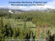
Gr a n g e r Ra n c h e sGranger Ranches is one of the Madison Valley’s oldestand largest traditional cattle ranches, operating on severaldistinct units. Most of the ranches’ 13,000 acres are pastureor irrigated hayfields, but the portion containing the OdellCreek headwaters has a special character. This area adjacent<strong>to</strong> the Madison River is a geologically unique wetland; waterpercolates out of the ground almost everywhere. In the 1950sthe headwaters of Odell Creek were ditched and drained <strong>to</strong>make the riverbot<strong>to</strong>m holdings more suitable for cattle andhay production. More than five miles of drainage canals wereexcavated <strong>to</strong> intercept the countless springs and move water offthe ranch as rapidly as possible. At the time, the only appreciablevalue of the Odell headwaters was in its carrying capacity for cattleand its abundant water for flood irrigation. No one unders<strong>to</strong>od theecological importance of wetlands and healthy riparian areas. Asranch owners began observing changes, including reduced creekflow and deterioration of streambanks, they began exploring whatcould be done. The Odell Creek headwaters res<strong>to</strong>ration projectevolved from these concerns and represents a fresh managerialconcept for a ranch that has been owned by the same family for 70years.28Ac t i o n s• Enrolled 340 acres in<strong>to</strong> Conservation Reserve EnhancementProgram.• Installed seven miles of fencing.• Filled five miles of drainage canals.• Res<strong>to</strong>red his<strong>to</strong>ric stream channels.• Future plans include continuing stream rehabilitation andclosing remaining drainage canals.Wh o Helped?• PPL <strong>Montana</strong> was the original funder for res<strong>to</strong>ration work, andthe continuing lead partner.• Natural Resources Conservation Service, <strong>Montana</strong> Fish,Wildlife & Parks, U.S. Fish & Wildlife Service, and PPL<strong>Montana</strong> have been cost-share partners for fencing, streamcrossings, and compensation for lost grazing and res<strong>to</strong>ration.• <strong>Montana</strong> Conservation Corps provided clean-up and finishinghand labor during the summers of 2005 and 2006.Jeff LaszloRes<strong>to</strong>ration work, in progress, focused on res<strong>to</strong>ring Odell Creekheadwaters <strong>to</strong> its his<strong>to</strong>ric floodplain.
Permits Required• 404• 310Benefits a n d Re w a r d s• Through working with partners, Granger Ranches has been able<strong>to</strong> return the Odell Creek headwaters <strong>to</strong> a pristine condition.• Stream channels have greater flows and improved watertemperatures, which are now in a constant optimum range fortrout production.• Bird species that are in decline across the entire Rocky Mountainregion have increased here.• The res<strong>to</strong>ration contributes <strong>to</strong> the future health of the area’s fishand wildlife.La n d o w n e r’s Co m m e n t s“It has been amazing <strong>to</strong> witness the rapid transformation ofthe headwaters area and the positive influence it is havingdownstream. All downstream users of this water will benefitfrom these results. One of the great pleasures of havingbeen involved with this endeavor has been the forging offriendships between the many people who have contributedtheir knowledge, time, and energy <strong>to</strong> this effort. I have learnedfrom them continually and been enriched by their passion forimproving our environment.”~ Jeff LaszloP.O. Box 691Ennis, <strong>MT</strong> 59729laszloj86@hotmail.comJeff LaszloRes<strong>to</strong>ration of Odell Creek and adjacent wetlands has improved water quality,water temperature, and overall trout habitat.29
Co t e au Fa r m sThe Joyes family manages Coteau Farms, in Sheridan County.Brothers Al and Dennis Joyes, along with other family members,are working <strong>to</strong> protect wetland and grassland habitat on over 5,000acres of land, while continuing a successful agricultural operation.Situated in prime Missouri Coteau country, the land is dottedwith wetlands and includes 1,400 acres of cultivated and hay landsas well as plenty of native range—prime habitat for a variety ofplants and birds. Moved by a desire <strong>to</strong> preserve native grasslandand improve grazing lands, Dennis and Al investigated alternatives.Looking back, Al understands that deciding what <strong>to</strong> do is oftenthe hardest part. “You, the landowner, have <strong>to</strong> take the first step inconservation and management issues, but nine out of ten times thepartnerships you build will be beneficial <strong>to</strong> the landowner and theenvironment.”30Ac t i o n s• Enrolled 36 acres of marginal farmland in<strong>to</strong> ConservationReserve Program.• Donated an initial easement on 280 acres of their bestnative range, including one permanent lake, <strong>to</strong> The NatureConservancy (TNC) for perpetual protection fromdevelopment. Over time, the amount of protected land hasincreased <strong>to</strong> about 900 acres.• Seeded cropland back <strong>to</strong> grass on over 100 acres of ownedand leased land.• Partnered with TNC in a land purchase/swap <strong>to</strong> secure akey piece of rangeland for the grazing system. The parcel isnow protected from development through easement.• Implemented a rest-rotation grazing program that involveddrilling wells, installing pipelines, and building cross fences.• Participated in USDA’s Environmental Quality IncentivesProgram for startup of a no-till system.• Entered in<strong>to</strong> a “Grazing Management Agreement” with<strong>Montana</strong> Fish, Wildlife & Parks for financial and technicalaid in the start-up of the grazing system.• Enhanced habitat for piping plover (a federally threatenedspecies) through U.S. Fish & Wildlife Service’s Partners forFish and Wildlife program. Added gravel on Coteau Farms’property along the shores of Salt Lake <strong>to</strong> create additionalnesting habitat.Brian Martin – TNCThis large prairie pothole naturally dries by mid-summer.• Created a waterfowl nesting island on another permanentlake.Wh o Helped?• Farm Service Agency administered Conservation ReserveProgram, with technical support from Natural ResourcesConservation Service.• Natural Resources Conservation Service providedtechnical support and cost-share for the grazing systemimprovements.
• The Nature Conservancy tailored conservation easements<strong>to</strong> protect and improve the areas while allowing privateproperty rights.• Ducks Unlimited provided technical support and funding<strong>to</strong> construct a waterfowl nesting island.• U.S. Fish & Wildlife Service provided technical supportfor the grazing system development, and funding <strong>to</strong>construct a waterfowl nesting island.• Partners for Fish and Wildlife completed permitapplications, provided funding for gravel, and supervisedconstruction of the piping plover habitat enhancementproject.• <strong>Montana</strong> Fish, Wildlife & Parks provided planning andfinancial assistance through its Migra<strong>to</strong>ry Bird StampProgram.Permits Required• Intraservice Section 7 Biological Evaluation Consultation(for piping plover habitat enhancement program)Benefits a n d Re w a r d s• Improved grazing patterns, land use, and rangelandconditions.• Increased amount of fall grazing after “turn-out.”• Increased carrying capacity and lives<strong>to</strong>ck numbers.• Enhanced habitat for Sprague’s pipits, Baird’s sparrows,and other upland birds and wildlife.• Good agency contacts; built a team that works <strong>to</strong>gether.• Neighboring farmers and ranchers are res<strong>to</strong>ring marginalcropland <strong>to</strong> native grasslands and developinggrazing systems.• The Nature Conservancy easement allows landowner thefreedom <strong>to</strong> control hunting on the land.Brian Martin – TNCLonetree Lake with native range provides habitat for lives<strong>to</strong>ck, waterfowl andother wildlife.La n d o w n e r’s Co m m e n t s“It is important <strong>to</strong> work <strong>to</strong> hammer out differences whilewatching out for your own interests. We learned <strong>to</strong> figure outa way <strong>to</strong> make money and at the same time demonstrate thatwe can keep some of the land native. Neighbors are buildingpartnerships with government agencies and conservationgroups. Maybe this is the most gratifying aspect, and mostbeneficial for conservation in the long run.”~ Al Joyes366 Ueland RoadWestby, <strong>MT</strong> 59275(406) 385-2579coteau@nemontel.net31
Mollet Pa r k a n d We t l a n d Re s t o r at i o n Pr o j e c tMollet Park and Wetland is a truly collaborative effort<strong>to</strong> res<strong>to</strong>re and protect lands at a watershed level. Located onthe west side of Ovando Mountain in northern Powell County,Mollet Park and Wetland is a native grassland and perennialpothole complex that is within an area currently managed asthe “Blackfoot Community Conservation Area,” a multi-partnereffort at community-based forestry and land management.The Nature Conservancy (TNC) purchased the wetlandand surrounding 10,000 acres in 2004 as part of the largerBlackfoot Community Project, in association with the BlackfootChallenge, the local watershed conservation organization.This area was formerly owned by timber corporations andhad been greatly altered over the past 80 years. The 20-acreperennial pothole wetland on the eastern edge of the parkhad been ditched and drained. Seventy acres of native prairieadjacent <strong>to</strong> the wetland had been bulldozed and planted inponderosa pines. A levee built along two sides of the wetlandprevented the ponderosa plantation from seasonal inundation.Additionally, the native prairie and wetland had been exposed <strong>to</strong>summer-long cattle grazing, which exacerbated problems withinvasive weeds such as spotted knapweed, common <strong>to</strong>adflax, andhounds<strong>to</strong>ngue.In 2005 TNC, with assistance from Natural ResourcesConservation Service, the U.S. Fish & Wildlife Service’s Partnersfor Fish and Wildlife program, and the Blackfoot Challenge,developed a multifaceted res<strong>to</strong>ration plan that continues <strong>to</strong>day.Ongoing res<strong>to</strong>ration and protection efforts in Mollet Park andWetland add <strong>to</strong> the work being done on a larger scale in the41,000-acre Blackfoot Community Conservation Area.Ac t i o n s in Progress• Return Mollet Wetland hydrology <strong>to</strong> its former elevation.• Remove as much of the plantation as is economically feasible,level the wetland dikes and <strong>to</strong>psoil windrows, and replant it<strong>to</strong> native prairie.• Manage cattle grazing in the wetland and native prairiethrough fencing and lives<strong>to</strong>ck rotation.• Manage noxious weeds in Mollet Park and Wetland throughlong-term spot herbicide treatment.Wh o Helped?• Natural Resources Conservation Service’s Wildlife HabitatIncentives Program provided the majority of the funding forthe res<strong>to</strong>ration implementation.• The Nature Conservancy provided funding for res<strong>to</strong>ration,aided in weed control, and oversaw contract res<strong>to</strong>ration work.Patrick Cole, University of IdahoReseeded grassland area with wetland <strong>to</strong> the left.• U.S. Fish & Wildlife Service provided funding, guidance, andassistance for wetland res<strong>to</strong>ration work.• Natural Resources Conservation Service, with input from the U.S.Fish & Wildlife Service’s Partners for Fish and Wildlife program,designed the water control device called a “canal check,” whichallows adjustment of the water elevation in the wetland.32
• Neighbors volunteered <strong>to</strong> help remove approximately threeacres of the pine plantation.• Big Blackfoot Chapter of Trout Unlimited, with assistancefrom the Blackfoot Challenge, is leading the grazingmanagement planning effort that will utilize rotationalpastures, temporary electric fences, and off-channel s<strong>to</strong>cktanks.Permits Required• Federal 404On g o i n g Benefits a n d Re w a r d s• Enhanced wetland size and species composition throughrecovery of his<strong>to</strong>ric water elevation and permanentlives<strong>to</strong>ck exclosure.• Improved wildlife habitat in a large perennial wetland,resulting in a greater diversity of bird species and greaternumber of amphibians and reptiles.• Recovery of native prairie adjacent <strong>to</strong> the wetland throughre-grading and seeding.• Protected habitat for Howell’s gumweed, an endemic nativeplant listed by the <strong>Montana</strong> Natural Heritage Program as aspecies of special concern.• Rehabilitation of the larger native prairie through weed andlives<strong>to</strong>ck management.• Better forage utilization and lives<strong>to</strong>ck health through activepasture management.• Local partnerships strengthened through collaboration.Steve Kloetzel, TNCThe water level and plant community of this large pothole wetland have been res<strong>to</strong>redfollowing reclamation of Mollet Park Wetland.Pa r t i c i p a n t s’ Co m m e n t s“Native plant recovery takes many years, so be patient, do a littlegardening <strong>to</strong> help it out, and do your best <strong>to</strong> keep the weeds andunmanaged grazing at bay.”~ Steve KloetzelBlackfoot Land StewardThe Nature Conservancy(406) 793-0038skloetzel@tnc.org“Trust is the foundation for cooperative conservation.”~ Hank GoetzBlackfoot Challenge Lands Direc<strong>to</strong>rP.O. Box 103Ovando, <strong>MT</strong> 59854(406) 793-5588info@blackfootchallenge.org33
Section 3Getting Help:Wh o, Wh at,a n d Wh e r eLandowners make new management decisions aboutwetlands on their properties for a variety of reasons. Peopledrawing close <strong>to</strong> retirement often envision the future ofthe property. Some wish it <strong>to</strong> remain as it was while theylived and worked on the land. In such circumstances, theselandowners can carefully consider ensuring the future of theproperty by putting some land in<strong>to</strong> conservation status asa legacy for future generations. In some cases financialneed predominates and the land is simply sold with noparameters on future land use. When landowners make nodecisions for the future, some of these lands may becomeresidential or commercial property with reduced or limitedconservation value. In some cases, open space, the ruralnature, and aesthetics of the property may be alteredforever.As illustrated by the farm and ranch family s<strong>to</strong>riesdescribed in Section 2, many <strong>Montana</strong> landowners aremotivated <strong>to</strong> make a change in order <strong>to</strong> increase theproductivity of their land. At the same time, they recognizethat the value of long-term protection of the naturallandscape may outweigh short-term economic gain. Otherlandowners are driven by the desire <strong>to</strong> preserve openspaces, <strong>to</strong> protect land from development, or becausethey’ve learned new partnerships and opportunities are nowavailable <strong>to</strong> help maintain their lifestyle and ties <strong>to</strong> the land.Jeff LaszloRo l e o f PartnershipsToday, most wetlands res<strong>to</strong>ration and protection projects happenthrough partnerships. Typically, no single organization, has all thatit takes <strong>to</strong> complete the comprehensive, multi-benefit endeavorsthat interest landowners <strong>to</strong>day. Completing these partnershipsrequires commitment and determination. The most successfulprojects result when landowners pursue the most completepartnerships before proceeding with the project, producing agreater likelihood of meeting all or most of the conservation goalsfor their property.Res<strong>to</strong>red meander on Odell Creek near Ennis.34
Partners may have different expectations for the landowner’sparticipation in funding the project, or for ensuring conservationof the area once res<strong>to</strong>ration is complete. Conservation easementsare most often the vehicle used <strong>to</strong> secure the future protectionof project investments. Generally speaking, the more financialresources that are required <strong>to</strong> res<strong>to</strong>re a wetland or riparian area,the greater the likelihood that the landowner will be asked <strong>to</strong>protect the res<strong>to</strong>red area through a conservation easement.Wh e r e Do I Sta r t?is possible that a given property may qualify for assistance fromseveral public agencies and conservation organizations. You mayneed <strong>to</strong> go beyond this initial contact <strong>to</strong> involve other partnersnecessary <strong>to</strong> complete the project. In some cases, the initialagency or organizational contact may not be aware of or open<strong>to</strong> the breadth of available opportunities <strong>to</strong> expand the project<strong>to</strong> create the greatest possible conservation benefits. Whateverroute you take, learn as much as possible about your options bycontinuing <strong>to</strong> make contacts and by asking questions.The type of assistance you seek will depend upon yourgoals for the land. Some landowners undertake res<strong>to</strong>ration andprotection projects at their own expense; others participate involuntary programs administered by public agencies and privateorganizations <strong>to</strong> help finance these projects. The Reference <strong>Guide</strong><strong>to</strong> Assistance on pages 38–39 outlines sources of help.If you have already established a relationship with the local FarmService Agency, Natural Resources Conservation Service, U.S.Fish, & Wildlife Service, <strong>Montana</strong> Fish, Wildlife & Parks, localConservation District office, or tribal government, you mayfind these avenues the best place <strong>to</strong> start as you consider yourconservation options. Another possibility is <strong>to</strong> contact <strong>Montana</strong><strong>Wetlands</strong> Legacy Partnership or one of their partner agencies ororganizations. The Legacy’s goal is “<strong>to</strong> bring people and resources<strong>to</strong>gether” for the common achievement of wetland protection.<strong>Montana</strong> <strong>Watercourse</strong>Assistance <strong>to</strong> landowners is available from manysources. If you have an established relationship with localagency personnel you may wish <strong>to</strong> contact them first,or contact the <strong>Montana</strong> <strong>Wetlands</strong> Legacy Partnership(see page 40). Their goal is <strong>to</strong> bring people and resources<strong>to</strong>gether.We recommend that you ask questions <strong>to</strong> learn as much aspossible about the various programs from a variety of sources. It35
So m e La n d o w n e r Op t i o n sIf you have a wetland on your property, you can choosefrom a wide range of options <strong>to</strong> res<strong>to</strong>re and/or conserve thewetland. They range from retaining ownership <strong>to</strong> donating theland, and are described next.1. Retain ownership and guide future use of the property. Youcan choose one or a combination of options:Technical assistance and education are the first steps<strong>to</strong> determine what, if any, options you will pursue. It may bebest <strong>to</strong> start with an agency or organization you are familiarwith, or contact <strong>Montana</strong> <strong>Wetlands</strong> Legacy Partnership.The Reference <strong>Guide</strong> on pages 38–39 offers suggestions forassistance.Cost-Share/Management Agreements are tailored<strong>to</strong> fit each individual res<strong>to</strong>ration and conservationproject. These agreements are worked out between thelandowner, conservation organizations, and agencies.Landowners may enter in<strong>to</strong> several cost-share/management agreements with several conservationentities for the same property.Term Leases are agreements by a landowner <strong>to</strong> rentland <strong>to</strong> a private conservation organization or agencyfor a specified period of time. The landowner receivesperiodic payments for the leased property while someuses of the property are controlled by the leasing agencyor organization. In all cases, leased land remains theproperty of the original owner throughout the period ofthe lease.Conservation Easements allow the propertyowner <strong>to</strong> retain ownership of the property whilepotentially receiving income and estate tax reductions.Conservation easements may be either term orperpetual; they run with the property’s deed for thelength of the easement.Other options:• Management Agreements are worked out between alandowner and a conservation agency. Either the landowneror conservation agency agrees <strong>to</strong> maintain the property in amanner consistent with the goals of the conservation agencyand the landowner.• Limited Development Strategies involve the sensitivedevelopment of the least environmentally significant portionsof property <strong>to</strong> finance conservation of the remaining propertyand meet the landowner’s economic needs and goals.• Remainder Interests transfer full or partial interest ina property <strong>to</strong> an appropriate grantee, such as a nonprofitconservation organization, after the death of a landowner.It may also affect any subsequent title holders named by thelandowner.2. Sell the propertyYou can sell land <strong>to</strong> a conservation organization at full marketvalue or as a bargain sale (a price below full market value) whichcould result in tax benefits. Other sale options are installmentsales or selling with a right of first refusal.3. Donate the landIf you donate land (transfer of title without compensation)<strong>to</strong> a conservation organization (land trust), you ensure <strong>to</strong>talprotection for the wetland and know that it will be maintainedand enhanced. This may entitle you <strong>to</strong> a reduction in incomeand/or estate taxes.Expect <strong>to</strong> actively participate inthe planning and execution of yourconservation project. As with anysuccessful endeavor, indentify your goalsand plan ahead <strong>to</strong> elicit the best results.36
La n d o w n e r Decision Tr e e37
Reference <strong>Guide</strong> <strong>to</strong> AssistanceFederalAgenciesSTATEAGENciESTribalGovernmentsFinancial Assistance Technical Assistance OtherConservation Easements(Purchase / Donation)Res<strong>to</strong>ration / EnhancementMoni<strong>to</strong>ringDetermination / DelineationPermittingRes<strong>to</strong>rationResearchEducationConservation Easements(Holding)*Agency /Organization Name contact e-mail or WebsiteU.S. Department of Agriculture cost share and annualFarm Service Agency rental and farm loansLocal FSA Office http://www.fsa.usda.gov/FSANatural Resources Conservation x x x x x x Local NRCS Office http://offices.sc.egov.usda.gov/Serviceloca<strong>to</strong>r/appU.S. Department of InteriorBureau of Land Management x x x (406) 895-5041 mphilbin@blm.gov<strong>Montana</strong> Interagency RiparianCadre x x (406) 895-5041 mphilbin@blm.govU.S. Fish & Wildlife ServicePartners for Fish & Wildlife x x x x x x (406) 727-7400 x224 jim_stutzman@fws.govRealty x x (406) 727-7400 x225 gary_l_sullivan@fws.govU.S. Army Corps of Engineers x (406) 441-1375 https://www.nwo.usace.army.mil/html/od-rmt/mthome.htm<strong>Montana</strong> Association of (406) 443-5711Conservation Districts(or contact your(or contact your locallocal ConservationConservation District) x x District) mail@macdnet.org<strong>Montana</strong> Fish, Wildlife & ParksHabitat Programs x x x x x x x Local FWP Office http://fwp.mt.gov/habitat/landowner.aspMigra<strong>to</strong>ry Bird Stamp Program x x x x (406) 994-7889 thinz@mt.gov<strong>Montana</strong> <strong>Wetlands</strong> LegacyPartnership x x x x x x x x x (406) 994-7889 http://www.wetlandslegacy.orgBlackfeet Reservation x x (406) 388-7421 mweatherwax@3rivers.netCrow Reservation x x x x (406) 638-3748 robertas@crownations.net38 * Holders of conservation easements sometimes do not purchase an easement from a landowner, but they do have the legal right andresponsibility <strong>to</strong> enforce the restrictions of the easement in order <strong>to</strong> ensure protection of the land’s conservation values.
Reference <strong>Guide</strong> <strong>to</strong> AssistanceTribalGovernmentsPRIVATE ORGANIZATIONS /OTHERSFinancial Assistance Technical Assistance OtherConservation Easements(Purchase / Donation)Res<strong>to</strong>ration / EnhancementMoni<strong>to</strong>ringDetermination / DelineationPermittingRes<strong>to</strong>rationResearchEducationConservation Easements(Holding)*Agency /Organization Name Contact e-mail or WebsiteFlathead Reservation x x x x x x (406) 883-2888 www.cskt.org/tr/epa.htmFort Belknap Reservation x x x x (406) 353-8412 dlongknife@ftbelknap.msn.govFort Peck Reservation x x x x x (406) 768-5155 x325 2horses@nemontel.netNorthern Cheyenne Reservation x x x x x (406) 477-6503 x102 yulber<strong>to</strong>n@yahoo.comRocky Boy’s Reservation x x x x x (406) 395-4225 (ask for Wetland Coordina<strong>to</strong>r)American Bird Conservancy x x x x (406) 756-2681 dcasey@abcbirds.orgDucks Unlimited x x x x x x x x x (406) 492-2002 rsanders@ducks.org<strong>Montana</strong> Association of Land x x (406) 490-1659 or see www.montanalandtrusts.org/Trusts chart in Sec. 3, Pg. 41<strong>Montana</strong> Audubon x x (406) 443-3949 mtaudubon@mtaudubon.org<strong>Montana</strong> Land Reliance x (406) 443-4027 Helena(406) 837-4980 Bigfork(406) 259-1328 Billings info@mtlandreliance.org<strong>Montana</strong> State University -http://www. extn.msu.Extension x x x x (406) 994-1750 montana.edu/Northern Rocky MountainScience Center x x (406) 994-7544 http://nrmsc.usgs.gov/aboutPheasants Forever x x x (406) 465-8126 dhare@pheasantsforever.orgRanchers Stewardship Alliance x x x x x (406) 658-2504 info@ranchersstewardshipalliance.orgRocky Mountain Elk Foundation x (406) 523-4500 www.rmef.org/homeThe Conservation Fund x x (406) 541-8555 www.conservationfund.orgThe Nature Conservancy x x (406) 443-0303 bee_hall@tnc.orgTrout Unlimited x x x x (406) 543-0054 Missoula(406) 449-9933 Helena www.montanatu.org/Trust for Public Land x x x x (406) 522-7450 www.tpl.org39
Mo n ta n a We t l a n d s Le g a c y Pa r t n e r s h i pThe <strong>Montana</strong> <strong>Wetlands</strong> Legacy Partnership is a voluntary,incentive-based program committed <strong>to</strong> conserving <strong>Montana</strong>’swetlands, riparian areas, and associated watershed lands. TheLegacy partners work <strong>to</strong> conserve about 50,000 acres per yearthrough conservation easements, wildlife habitat agreements,and fee title acquisitions. The Legacy is continually seeking newprojects that include high-quality wetlands and riparian areas thatlandowners and land managers are working <strong>to</strong> conserve. Priority isgiven <strong>to</strong> landscape-scale projects in conservation focus areas across<strong>Montana</strong>. To learn more about the Legacy’s work in your area,contact:<strong>Montana</strong> <strong>Wetlands</strong> Legacy Partnership Coordina<strong>to</strong>r1400 South Nineteenth StreetBozeman, <strong>MT</strong> 59718Phone: (406) 994-7889http://www.wetlandslegacy.org<strong>Montana</strong> <strong>Wetlands</strong> Legacy partners include the following organizations and agencies that protect and res<strong>to</strong>re wetlands and riparianareas in <strong>Montana</strong>:Army Corps of EngineersBitter Root Land TrustConfederated Salish and Kootenai TribesDucks UnlimitedFederal Highway AdministrationFive Valleys Land TrustFlathead Land TrustFort Peck TribesGallatin Local Water Quality DistrictGallatin Valley Land Trust<strong>Montana</strong> Association of Conservation Districts<strong>Montana</strong> Audubon Council<strong>Montana</strong> Department of Environmental Quality<strong>Montana</strong> Department of Natural Resources and Conservation<strong>Montana</strong> Department of Transportation<strong>Montana</strong> Fish, Wildlife & Parks<strong>Montana</strong> Fish, Wildlife & Parks Foundation<strong>Montana</strong> Land Reliance<strong>Montana</strong> Natural Heritage Program<strong>Montana</strong> Natural His<strong>to</strong>ry Center<strong>Montana</strong> <strong>Watercourse</strong>Pheasants ForeverPPL <strong>Montana</strong>Prickly Pear Land TrustRocky Mountain Elk FoundationThe Conservation FundThe Nature ConservancyTrout UnlimitedTrust for Public LandU.S. Bureau of Land ManagementU.S. Bureau of ReclamationU.S. Farm Service AgencyU.S. Fish & Wildlife ServiceU.S. Forest ServiceU.S. Natural Resources Conservation ServiceWatershed Education Network40
Mo n ta n a Co n s e r vat i o n EasementsConservation easements are legallybinding agreements that are voluntarilyentered in<strong>to</strong> by landowners who wish <strong>to</strong>protect land for future generations byagreeing <strong>to</strong> either sell or donate specifiedrights that limit certain uses of the land or<strong>to</strong> prevent future development on the land.The restrictions placed on the property aredetermined by the landowner and are eithersold or donated <strong>to</strong> a public agency or privateorganization. The holder of the conservationeasement holds the right <strong>to</strong> enforce thelandowner’s promise not <strong>to</strong> exercise thoserights.If you are considering a conservationeasement on your land, start by contactingvarious public agencies or privateorganizations such as land trusts. The tablebelow provides contact information forgroups that handle conservation easementsin <strong>Montana</strong>.<strong>Montana</strong> Organizations That Handle Conservation EasementsOrganization scope of Work C contact Phone/Email/WebsiteBitter Root Land Trust Bitterroot Valley & adjoining lands in Ravalli County P.O. Box 1806, Hamil<strong>to</strong>n, <strong>MT</strong> 59840 (406) 375-0956 www.BitterRootLandTrust.orgBlackfeet Land Trust Blackfeet Reservation & adjoining areas P.O. Box 3030, Browning, <strong>MT</strong> 59417 (406) 338-2992Clark Fork-Pend Oreille Sanders County, <strong>MT</strong> and Bonner County, ID P.O. Box 2123, Sandpoint, ID 83864 (208) 263-9471 CFPOConservancy@Sandpoint.net,Conservancywww.cfpoconservancy.orgDucks Unlimited Statewide P.O. Box 183, Ellis<strong>to</strong>n, <strong>MT</strong> 59728 (406) 492-2002 rsanders@ducks.orgFive Valleys Land Trust Deer Lodge, Granite, Lake, Lewis & Clark, Mineral, P.O. Box 8953, Missoula, <strong>MT</strong> 59807 (406) 549-0755Missoula, Powell, Ravalli, and Sanders counties fvlt@montana.com www.fvlt.orgFlathead Land Trust Flathead, Lake, Lincoln, and Sanders counties P.O. Box 1913, Kalispell, <strong>MT</strong> 59903 (406) 752-8293, flt@bigsky.net www.flatheadlandtrust.orgGallatin Valley Land Trust Broadwater, Gallatin, Jefferson, Madison, P.O. Box 7021, Bozeman, <strong>MT</strong> 59771 (406) 587-8404Meagher, and Park counties landtrust@gvlt.org www.gvlt.orgMid-Yellows<strong>to</strong>ne Land Trust Southeast and central <strong>Montana</strong> 907 Avenue B, Billings, <strong>MT</strong> 59012 (406) 252-2606<strong>Montana</strong> Fish Wildlife & Parks Statewide Contact Regional <strong>Montana</strong> http://fwp.mt.gov/habitat/landowner.aspFWP Supervisors<strong>Montana</strong> Land Reliance Statewide P.O. Box 355, Helena, <strong>MT</strong> 59624 (406) 443-7027info@mtlandreliance.org www.mtlandreliance.org<strong>Montana</strong> <strong>Wetlands</strong> Legacy Statewide 1400 S. 19th Ave. (406) 994-7889Partnership Bozeman, <strong>MT</strong> 59718 thinz@mt.gov www.wetlandslegacy.orgNatural Resources Statewide Contact Local NRCS Office www.mt.nrcs.usda.gov/programs/wrp/Conservation Service (USDA)or www.mt.nrcs.udsa.gov/contact/offices/localoff.htmlPrickly Pear Land Trust Broadwater, Jefferson, and Lewis & Clark counties P.O. Box 892, Helena, <strong>MT</strong> 59624 (406) 442-0490 www.pricklypearlt.orgRanchers Stewardship Alliance Phillips and adjoining counties 22787 Midale Road, Malta, <strong>MT</strong> 59538 (406) 658-2504 www.rancherstewardshipalliance.org/ index.aspRattlesnake Land Trust Missoula 411 1101 E Broadway Suite 2 (406) 549-6083 ssproull@montana.com(formerly Save Open Space) Missoula, <strong>MT</strong> 59802Rocky Mountain Elk Statewide 5705 Grant Creek 1-800-225-5355 www.rmef.orgFoundation Missoula, <strong>MT</strong> 59808The Conservation Fund Statewide 125 Bank Street Suite 612 (406) 541-8555 www.conservationfund.orgMissoula, <strong>MT</strong> 59802The Nature Conservancy Statewide 32 South Ewing, Helena, <strong>MT</strong> 59601 (406) 443-0303 www.nature.orgTrust for Public Land Statewide 111 S Grand Ave. Suite 203 (406) 522-7450 www.tpl.orgBozeman, <strong>MT</strong> 59715U.S. Fish & Wildlife Service Statewide Ben<strong>to</strong>n Lake National Wildlife Refuge (406) 727-7400922 Bootlegger Trail www.fws.gov/ben<strong>to</strong>nlake/Conservation%20Easements.htmGreat Falls, <strong>MT</strong> 59404Vital Ground Foundation Grizzly bear habitat in western <strong>Montana</strong> Building T-2 Fort Missoula Road (406) 549-8650 www.vitalground.orgMissoula, <strong>MT</strong> 59804 41
Section 4Pr o t e c t io nLa w s ,Pe r m it s, a n dRe g u l a t io n sWetland a n d Stream Permits f o r Res<strong>to</strong>rationSome wetland and stream res<strong>to</strong>ration work mayrequire federal, state, local, or tribal permits <strong>to</strong> ensurewater quality is protected and that private water rights areconsidered. Wading through the permitting system can bedifficult and confusing due <strong>to</strong> the number of agencies that havepermitting authority. To make the permit application processeasier, agencies responsible for some of the permits havecooperatively developed a Joint Application Form. “A <strong>Guide</strong> <strong>to</strong>Stream Permitting in <strong>Montana</strong>,” pictured below, also providesimportant information. Both of these resources are availableat any Conservation District office, via the internet at http://dnrc.mt.gov/permits/streampermitting/joint_application.asp,or by calling (406) 444-6667. The agenciesand/or consultants who work with youon your res<strong>to</strong>ration project can adviseabout necessary permits, but ultimately allpermits are your responsibility. Expect thatthe permitting process will take time. Insome cases it might take several months <strong>to</strong>more than a year <strong>to</strong> get everything in placebefore your project may begin.Co m m o n Permits Referred <strong>to</strong> in t h i s Gu i d eState 310 Permit – Required when working in or near a year-round(perennial) stream or river on private or public land.• Purpose is <strong>to</strong> protect stream or adjoining lands fromdamage.• Administered by Conservation Districts.• No fee. Permit is good for one year.• Permitting process takes 30 <strong>to</strong> 90 days.Federal 404 Certification (Clean Water Act Section 401)– Required when a project involves dredging and filling injurisdictional (waters protected by the Clean Water Act) lakes,rivers, streams (including perennial, intermittent, and ephemeralchannels with an ordinary high water mark), wetlands, and otheraquatic sites.• Purpose is <strong>to</strong> res<strong>to</strong>re and maintain the chemical,physical, and biological integrity of the nation’swaters.• Administered by Army Corps of Engineers.• Application fees for individual permits range from$10 for private individuals <strong>to</strong> $100 for commercialapplicants.• Process may take 45 <strong>to</strong> 160 days.42
Water Ri gh t s a n d <strong>Wetlands</strong>Naturally occurring wetlands don’t require water rights. Ifyou are creating, enhancing, or enlarging wetlands, then the lawmay require you <strong>to</strong> apply for some type of water right approval.Any time you interfere with the natural flow of water across yourproperty, you could be adversely affecting the prior water rights ofdownstream neighbors. By the same <strong>to</strong>ken, if you go <strong>to</strong> the time andexpense of developing a wetland, you probably want the legal right<strong>to</strong> prevent your upstream neighbors from excessive interference inthe water flowing <strong>to</strong> you.The general rule is that if water is being diverted in<strong>to</strong> or otherwiseartificially manipulated <strong>to</strong> remain in a wetland (such as throughexcavated ponds or dikes), a water right may be required. Makingthat determination and finding out what type of water right approvalmay be required is very site-specific. Remember that some basinsare closed <strong>to</strong> new water rights. Direct these questions <strong>to</strong> your local<strong>Montana</strong> Department of Natural Resources and Conservation WaterResources Regional Office.DNRC Water Resources Regional OfficesOffice Telephone Counties ServedBillings 247-4415 Big Horn, Carbon,Carter, Custer, Fallon,Powder River, Prairie,Rosebud, Stillwater,Sweet Grass, Treasure,Yellows<strong>to</strong>neBozeman 586-3136 Gallatin, Madison, ParkGlasgow 228-2561 Daniels, Dawson,Garfield, McCone,Phillips, Richland,Roosevelt, Sheridan,Valley, WibauxHavre 265-5516 Blaine, Chouteau,Glacier, Hill, Liberty,Pondera, Te<strong>to</strong>n, TooleHelena 444-6999 Beaverhead,Broadwater, DeerLodge, Jefferson, Lewis& Clark, Powell, SilverBowKalispell 752-2288 Flathead, Lake, Lincoln,SandersLewis<strong>to</strong>wn 538-7459 Cascade, Fergus,Golden Valley, JudithBasin, Meagher,Musselshell, Petroleum,WheatlandMissoula 721-4284 Granite, Mineral,Missoula, Ravalli43
Tr i b a l La w sTr i b a l La w s Affecting <strong>Wetlands</strong>There are seven Indian reservations in <strong>Montana</strong>. Alsowithin the state are what is commonly called the Turtle Mountainpublic domain allotments, primarily in northern <strong>Montana</strong> alongthe Hi-Line. Tribal governments safeguard the health, welfare, andeconomic security of their people. They protect aquatic resources,including wetlands that are critical for water quality, fisheries, andwildlife. Tribes on six reservations have entered in<strong>to</strong> legal compactswith the state of <strong>Montana</strong> pertaining <strong>to</strong> water. The ConfederatedSalish and Kootenai Tribes (Flathead Reservation) and theBlackfeet Tribe currently have regulations and ordinances in place(see below). If you own land adjacent <strong>to</strong> or within reservationboundaries, you need <strong>to</strong> consult the appropriate tribal governmen<strong>to</strong>ffices about wetlands on your property.<strong>Wetlands</strong> o n t h e Flathead ReservationThe Confederated Salish and Kootenai Tribes have specific codesfor wetland management. One ordinance addresses the banksbelow the high-water mark of the south half of Flathead Lake.Another ordinance protects wetlands and riparian areas throughoutthe remainder of the reservation. The Aquatic Lands ConservationOrdinance prevents degradation of reservation waters and aquaticlands by regulating construction whenever such a project will causeerosion, sedimentation, or other disturbances that adversely affectwater quality. Permits are obtained and processed through theShoreline Protection Program Office of the Confederated Salishand Kootenai Tribes. Failure <strong>to</strong> comply with the permit termsmay result in law enforcement. Presently, the Confederated Salishand Kootenai Tribes are developing a comprehensive managementplan that includes a “no net loss” policy and guidelines <strong>to</strong> increasethe quality and quantity of wetlands. The plan has evolved sincethe 1990s and includes wetlands mitigation for the 1.25-millionacreFlathead Reservation. <strong>Wetlands</strong> on reservation lands are beingmapped as part of the National Wetland Inven<strong>to</strong>ry.Th e Blackfeet Nat i o n’s <strong>Wetlands</strong> Pl a nThe Blackfeet Tribe protects wetlands through the use of theAquatic Lands Protection Ordinance and the tribe’s WetlandMitigation Policy. The ordinance requires that a permit be issuedprior <strong>to</strong> wetland work. The mitigation policy spells out the type ofwetland mitigation required <strong>to</strong> avoid wetland impacts. The tribehas authority <strong>to</strong> issue permits and <strong>to</strong> fine anyone working without apermit in wetlands or waters of the reservation, <strong>to</strong> revoke a permitfor non-compliance, and <strong>to</strong> require res<strong>to</strong>ration or replacemen<strong>to</strong>f damaged wetlands, riparian areas, and streams. The tribecoordinates efforts with the U.S. Army Corps of Engineers (Section404 Permitting), and with the Environmental Protection Agency(EPA) (Section 401 Water Quality Certification).44
The Blackfeet Tribe <strong>Wetlands</strong> Program is funded through the EPAwith the goal of developing and implementing a comprehensivewetlands protection program on the Blackfeet Indian Reservation.To meet that goal, the tribe’s wetlands moni<strong>to</strong>ring program collectsbaseline data on a subset of wetlands in all four watersheds withinthe reservation boundary. The <strong>Wetlands</strong> Program has developeda draft “<strong>Wetlands</strong> Conservation Strategy” <strong>to</strong> guide managementand protection of reservation wetlands. Additionally, the <strong>Wetlands</strong>Program has assisted with three wetland creation projects and onewetland res<strong>to</strong>ration project on the reservation. These projects are:creation of approximately 9 acres at Pikuni Park, creation of 27.6acres at the Perry Ranch, creation of approximately 9 acres alongHighway 2, and res<strong>to</strong>ration of about 176 acres at Alkali Lake.Sue BallPotholes near Charlo, <strong>Montana</strong>.Mo n ta n a Reservations Co n ta c t In f o r m at i o nBlackfeet ReservationBlackfeet Environmental Office (406) 338-7481Crow ReservationOffice of Legal Counsel (406) 638-2059Flathead Reservation<strong>Wetlands</strong> Conservation Program (406) 883-2888, x 7203Fort Belknap ReservationWater Rights Division (406) 353-8454Fort Peck ReservationWater Resource Office (406) 768-5846Northern CheyenneTribal Water Coordina<strong>to</strong>r (406) 477-6503, x 102Rocky Boy’s ReservationWater Resources (406) 395-4225Pete Kirwin Husby Werner, CSKTThese researchers are sampling amphibian larvae through dipnettingnear Perma on the Flathead Indian Reservation.45
46Fr e q u e n t ly As k e dQuestionsAs you considerwetland res<strong>to</strong>ration orenhancement, questionswill arise that areunique <strong>to</strong> your property. <strong>Montana</strong> <strong>Watercourse</strong>You may need <strong>to</strong> askmore than one agency or organization foradvice or assistance. Do not overlook theimportant permitting and regulations step,and remember that it is your responsibility<strong>to</strong> obtain all permits and landownerpermissions prior <strong>to</strong> beginning project work.Following are some typical questions askedby landowners as they consider projects thatmight impact wetlands and riparian areas.How do I know if I have a wetland on myproperty?A private consultant, the Natural ResourcesConservation Service (NRCS), or anotheragency wetland professional can visit yourproperty <strong>to</strong> make that determination. Ifyour land contains hydric soil, NRCS mayprovide a wetlands specialist for a wetlanddetermination. The Reference <strong>Guide</strong> <strong>to</strong>Assistance on pages 38–39 provides contactinformation.I have a construction project plannedfor an area that is a wetland. Whatregulations/permits could apply?Be aware that Section 404 of the federalClean Water Act requires applicants <strong>to</strong> firstavoid all impacts <strong>to</strong> jurisdictional watersof the U.S. including most wetlands, next<strong>to</strong> minimize impacts, and then <strong>to</strong> mitigatefor those impacts that can’t be avoided orminimized. Mitigation can be expensive andrequires permitting. You may need a 404Permit from the Army Corps of Engineers(ACOE) or a 310 Permit from your localConservation District. The Joint ApplicationForm (see page 42) is an easy way <strong>to</strong> accessinformation about these permits.I have a wetland that has filled in withsediment and plants. I would like <strong>to</strong>excavate. What regulations/permitscould apply?Heavy equipment often requires a 404Permit from ACOE. Section 404 of the CleanWater Act regulates discharge of dredgeor fill materials in<strong>to</strong> waters of the U.S.,including most wetlands. A state permit mayalso be required for water quality issues.The Joint Application Form (see page 42) isan easy way <strong>to</strong> access information on thesepermits.I would like <strong>to</strong> build a pond by excavatingin an upland area, or by damming acoulee. What regulations/permits couldapply?You may need a water right. The water rightsprocess varies between river basins. Somebasins in <strong>Montana</strong> are closed <strong>to</strong> furtherwater appropriations, so it is important <strong>to</strong>contact your local DNRC Water ResourcesOffice. Depending on the location, youmay be required <strong>to</strong> comply with a varietyof regulations. Contact your local planningoffice and check local county zoning laws.If your project will create even short-termwater quality changes, you may need a 318Permit issued through <strong>Montana</strong> DEQ whichis part of the Joint Application Form (seepage 42).I would like <strong>to</strong> remove woody plants frommy wetland. What regulations/permitscould apply?If you will use only hand-held equipmentsuch as chainsaws and shovels, you don’tneed a permit. Heavy equipment oftenrequires a 404 Permit from the ACOE.If your wetland is in a riparian area, theStreamside Management Zone Law mayapply. Contact the Forestry Division ofDNRC at (406) 542-4300. Be aware thatremoval of all woody plants may jeopardizeeligibility for some federal farm programbenefits. Contact your local FSA or NRCSoffice.I would like <strong>to</strong> drain a wetland forconstruction or agricultural activities.What are the possible implications?First of all, consider options. You are nowfamiliar with the important functions ofwetlands and their value <strong>to</strong> water qualityand quantity, habitat, recreation, andproperty. If you expect greater benefitsin draining the wetland, then begin bycontacting the ACOE <strong>to</strong> determine if a404 Permit is needed. Contact your localFSA or NRCS officeregarding activitiesthat might jeopardizeeligibility for federalfarm programbenefits.USDA NRCS
Informed landowners understand the importance of any actions takenon their land and manage wetlands with care. We hope this guide hasprovided concise, useful information that helps you consider wetlandconservation, res<strong>to</strong>ration, and enhancement projects.Co m m o n Ac r o n y m s En c o u n t e r e d in We t l a n d s Wo r kACOEBLMBORCCAACDCREPCRPDEQDNRCDUEPAEQIPFSAFWPFWSNRCSPFWUSDAUSDIWRPArmy Corps of Engineers (U.S.)Bureau of Land Management (U.S.)Bureau of Reclamation (U.S.)Candidate Conservation Agreement with Assurances(USFWS)Conservation DistrictConservation Reserve Enhancement Program (U.S.Farm Service Agency)Conservation Reserve Program (U.S. Natural ResourcesConservation Service)Department of Environmental Quality (<strong>Montana</strong>)Department of Natural Resources andConservation (<strong>Montana</strong>)Ducks Unlimited (nonprofit organization)Environmental Protection Agency (U.S.)Environmental Quality Incentives Program (U.S. NaturalResources Conservation Service)Farm Service Agency (U.S.)<strong>Montana</strong> Department of Fish, Wildlife & ParksFish & Wildlife Service (U.S.)Natural Resources Conservation Service (U.S.)Partners for Wildlife (USFWS)United States Department of AgricultureUnited States Department of the Interior<strong>Wetlands</strong> Reserve Program (U.S. Natural ResourcesConservation Service)47Marcia Rueter Leritz
Acknowledgments a n d Co n t r i b ut o r sThe following individuals provided valuable assistance, guidance, and/or data.Landowner <strong>Guide</strong> Advisory Committee:William Birch, Three Bar RanchTom Hinz, <strong>Montana</strong> <strong>Wetlands</strong> Legacy PartnershipPat Lauridson, NRCSJeff Laszlo, Granger RanchesLynda Saul, <strong>Montana</strong> DEQJim Stutzman, USFWSLandowner <strong>Guide</strong> Review Committee:Debbie Earl, <strong>Montana</strong> <strong>Watercourse</strong>Jim Hansen, <strong>Montana</strong> FWPKelly Hayden, <strong>Montana</strong> <strong>Watercourse</strong>Carrie Mosley, NRCSMike Philbin, BLMSpecial thanks <strong>to</strong> the landowners profiled in Section 2:Bim and Janas Strauser – 66 Ranch, Hill CountyLon and Vicki Reukauf – Cherry Creek Ranch, Prairie CountyJim and Cindy Kittredge – Bird Creek Ranch, Cascade CountyJim and Diana Brady – Brady Ranch, Petroleum CountyVance, Myron and Kim Meyer – Meyer Corporation, SheridanCountyJohn Dooling & Family – Dooling Lives<strong>to</strong>ck Company,Beaverhead CountyJeff Laszlo – Granger Ranches, Madison CountyAl and Dennis Joyes – Coteau Farms, Sheridan CountyMollett Park and Wetland Res<strong>to</strong>ration Project, Powell CountyContribu<strong>to</strong>rs:Sue Ball, Flathead Indian ReservationMary Claire Weatherwax, Blackfeet Indian ReservationLynn Owens, Madison Valley rancherUpdate Coordina<strong>to</strong>r/Draft Edi<strong>to</strong>r:Janet Bender-Keigley, <strong>Montana</strong> <strong>Watercourse</strong>Copy Edi<strong>to</strong>r:Beverly Magley, Edit-Write LLC, Helena, <strong>Montana</strong>Graphic Design and Layout:Kathy Lange, Graphic DesignerMartha Lonner, Production ManagerMedia Works, Bozeman, <strong>MT</strong>Printed by:Thomas Printing, Kalispell, <strong>Montana</strong>Produced by:<strong>Montana</strong> <strong>Watercourse</strong>P.O. Box 170575<strong>Montana</strong> State UniversityBozeman, <strong>MT</strong> 59717406-994-6671Funded by:U.S. Environmental Protection Agency Region 8/<strong>Montana</strong> DEQWetland Program Development GrantBureau of Land Management<strong>Montana</strong> Fish, Wildlife & Parks/Migra<strong>to</strong>ry Bird Stamp ProgramU.S. Fish & Wildlife ServiceDucks UnlimitedDocument available electronically athttp://www.mtwatercourse.org/Publications/Publications.htmPho<strong>to</strong>s: Copyright held by individuals or organizations cited on pho<strong>to</strong>s.Printed in the United States of America, July 2008.You may reproduce or copy any portion of this booklet bycontacting <strong>Montana</strong> <strong>Watercourse</strong> at (406) 994-6671.Please acknowledge this publication as the source.