

Duvall Downtown Sub-Area Plan - City of Duvall
Duvall Downtown Sub-Area Plan - City of Duvall
Duvall Downtown Sub-Area Plan - City of Duvall

Create successful ePaper yourself
Turn your PDF publications into a flip-book with our unique Google optimized e-Paper software.
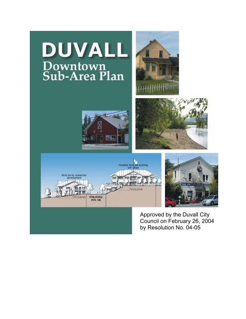
Approved by the <strong>Duvall</strong> <strong>City</strong>Council on February 26, 2004by Resolution No. 04-05
CreditsMayor’s OfficeBecky Nixon, Mayor<strong>City</strong> CouncilPat FullmerSteve HotchkissWill Ibersh<strong>of</strong>Tom LoutsisHeather PageJeffrey PossingerGreg Von Tobel<strong>Plan</strong>ning CommissionKaren Swenson, ChairMargie CoyKari DouglasDoug HansenJohn PetreeDiane Salz<strong>Plan</strong>ning Staff/Project TeamGeorge Steirer, Project ManagerDoreen Booth, <strong>City</strong> Hall Administrator/<strong>Plan</strong>ning DirectorConsultantsMAKERS architecture and urban designJohn OwenBob BengfordThanasorn KamolratanayothinJanis FordBerk & AssociatesChris MeffordThe Transpo GroupLarry ToedtliThe Watershed CompanyJenni Creveling
Table <strong>of</strong> ContentsIntroduction................................................................................................................... 1Background/Purpose .......................................................................................................1<strong>Plan</strong>ning Process.............................................................................................................1Problems and Opportunities........................................................................................ 3<strong>Downtown</strong> <strong>Plan</strong> Concept.............................................................................................. 5Land Use and Community Design Goals and Strategies .......................................... 9Old Town .......................................................................................................................11Riverside Village ............................................................................................................13Midtown .........................................................................................................................16Uptown (1st Avenue Corridor) .......................................................................................18Uptown (2nd Avenue Corridor) ......................................................................................20Multi-Family Neighborhood ............................................................................................21Transportation and Streetscape Goals and Strategies .......................................... 23Main Street/Old Town ....................................................................................................24<strong>Downtown</strong> Circulation ....................................................................................................27Main Street South <strong>of</strong> Old Town......................................................................................29Parking...........................................................................................................................30Transit............................................................................................................................31Pedestrian and Bicycle Access......................................................................................32Parks Goals and Strategies ....................................................................................... 35McCormick Park.............................................................................................................35Taylor Park ....................................................................................................................37Lake Rasmussen ...........................................................................................................38Economic Strategy ..................................................................................................... 39Implementation Strategy ............................................................................................ 43AppendicesA. <strong>Downtown</strong> Streetscape Elements.............................................................................49B. Technical Memorandum – The Transpo Group........................................................51DUVALL DOWNTOWN SUB-AREA PLAN –Draft5aPage i
Page ii f:\planning\comprehensive plan\_2004 comp plan update\downtown sub-area plan 2004\plan document\final downtown sub-area plan.doc - 8/10/05
IntroductionBackground/PurposeThis <strong>Downtown</strong> <strong>Plan</strong> was conceived as a critical follow up to the recently adopted <strong>City</strong>-WideVisioning <strong>Plan</strong>. Preservation and enhancement <strong>of</strong> <strong>Downtown</strong> was identified as the highestpriority goal <strong>of</strong> the Visioning <strong>Plan</strong>. The <strong>Downtown</strong> <strong>Plan</strong> provides a more detailed vision for the<strong>Downtown</strong> area, including historic Main Street and Old Town, McCormick Park and theriverfront area, the commercial area south <strong>of</strong> Old Town (herein referred to as Midtown), mixeduseand residential areas east (Uptown) and north <strong>of</strong> Old Town (Multi-Family Neighborhood).The <strong>Plan</strong> also includes a detailed road map on how to achieve the vision. This includes short andlong range actions in addition to goals and policies to guide the <strong>City</strong> over the next twenty-plusyears.<strong>Plan</strong>ning ProcessThe <strong>City</strong> hired the consultant team <strong>of</strong> MAKERS architecture and urban design (lead consultant),Berk & Associates (ECONorthwest for the <strong>City</strong>-Wide Visioning <strong>Plan</strong>), The Transpo Group, andThe Watershed Company in July 2002 to assist the community in developing the <strong>City</strong>-WideVisioning <strong>Plan</strong> (adopted in March as Phase 1) and the <strong>Downtown</strong> <strong>Plan</strong> (Phase 2). The consultantteam worked directly with the <strong>City</strong>’s Project Manager,George Steirer, and the <strong>Duvall</strong> <strong>Downtown</strong> Task Forcemembers to facilitate the process. The Task Force wasinstrumental in developing alternative scenarios, alternativedevelopment concepts, and establishing an overall planconcept for the city-wide vision.Specific events and activities included:• April 1 – Task Force Meeting: This was the projectkick-<strong>of</strong>f meeting and included introduction <strong>of</strong> theconsultant team, <strong>City</strong> staff members, and Task Forcemembers. Together, the “<strong>Downtown</strong> Team” discussedthe planning process, expectations, ground-rules forTask Force members, and summarized informationcollected to date.• May 3 – Old Town Walking Tour: Prior to theworkshop noted below, the project team andcommunity participants took a walking tour <strong>of</strong> MainFigure 1. Walking tour <strong>of</strong> Old Townwith the Task ForceDUVALL DOWNTOWN SUB-AREA PLAN March 10, 2004 Page 1
Street, 1 st Avenue NE, Riverside Avenue NE, and side streets to identify problems andopportunities. More than 20 people participated.• May 3 – <strong>Downtown</strong> Workshop #1: Following introductions about the <strong>Plan</strong>, Makerssummarized policies <strong>of</strong> the recently adopted Vision <strong>Plan</strong> that related to <strong>Downtown</strong>, and ChrisMefford <strong>of</strong> Berk and Associates summarized economic conditions and opportunities. Most<strong>of</strong> the workshop involved small group sessions working to identify problems, issues, andopportunities related to land use and development, streetscape and circulation, and parks andrecreation. The information was collected on maps and surveys.Also in late October, the <strong>Plan</strong>ning Department sent out a <strong>City</strong>-Wide Visioning Questionnaireto all utility customers within the city limits and property owners in the Urban Growth <strong>Area</strong>.• May 13– Task Force Meeting: The consultant team reviewed the project status andsummarized results from the first workshop. Makers presented preliminary ideas for<strong>Downtown</strong> <strong>Plan</strong> alternatives. A discussion and refinement <strong>of</strong> these ideas followed.• June 10 – Task Force Meeting: Based on the previous meeting, the project team developeda collection <strong>of</strong> land use, circulation, and parks options for <strong>Downtown</strong>. These preliminaryoptions were presented and discussed at this meeting.• July 8 – Task Force Meeting: A preliminary draft plan was completed and submitted to<strong>City</strong> staff and Task Force members prior to the meeting. Makers presented the overallconcept, zoning, and design guideline suggestions to the Task Force. Proposals for MainStreet, Riverside Village, Uptown, Midtown, and the North Neighborhood were discussed.• August 4+5 – Open House: <strong>City</strong> staff and Makers conducted informal open house sessionswith property and business owners and interested community members to discuss draft planproposals and other <strong>Downtown</strong> issues. presented the results <strong>of</strong> the second workshop andpresented preliminary ideas for preferred alternative. A discussion with Task Force membersfollowed. Makers also presented a draft outline <strong>of</strong> the <strong>City</strong>-Wide Vision <strong>Plan</strong>.• August 12 – Task Force Meeting: Makers presented a summary <strong>of</strong> community input fromthe Open House. Makers briefly led a discussion on land use and design proposals. LarryToedtli <strong>of</strong> the Transpo Group led a discussion <strong>of</strong> circulation and streetscape proposals.• September 27 – <strong>Downtown</strong> Workshop #2: The consultant team presented the draft plan tothe community for comment. Participants had an opportunity to prioritize the most importantactions and note whether specific actions were appropriate or if the plan was missinganything.• <strong>Plan</strong>ning Commission – The final draft plan was presented to the <strong>Plan</strong>ning Commission onNovember 6 th and November 20 th . The <strong>Plan</strong>ning Commission held public hearings on theplan on November 6 th and November 20th. On December 18 th , the <strong>Plan</strong>ning Commissionrecommended the plan for approval by the <strong>City</strong> Council.• <strong>City</strong> Council - The plan was distributed to the <strong>City</strong> Council for the January 8, 2004 meeting.Public hearings were held on January 22 nd and February 12, 2004. The plan was approved bythe <strong>City</strong> Council on February 26, 2004.Page 2 March 10, 2004f:\planning\comprehensive plan\_2004 comp plan update\downtown sub-area plan 2004\plan document\final downtown sub-area plan.doc - 8/10/05
Problems and Opportunities“<strong>Downtown</strong>” <strong>Duvall</strong> is identified as the areagenerally between the Snoqualmie River and 3 rdAvenue NE from Taylor Parkto NE Cherry Valley Road.Historic Old Town isconsidered the “heart” <strong>of</strong>downtown. The core <strong>of</strong> OldTown is the three block areaalong Main Street betweenNE Stewart and Stephensstreets – which containsnearly continuous storefronts– many in colorful historicalbuildings. Street trees and agreat variety <strong>of</strong> planting,artwork, and displayfeatures enliven thestreetscape here. OldTown’s most importantasset is its beautiful smalltown setting in theSnoqualmie River Valley.Much <strong>of</strong> the larger“<strong>Downtown</strong>” area is withinwalking distance <strong>of</strong> this area- a dash ¼ mile radius lineon Figure 3 indicatesthis. This includes thesurrounding commercialand residential areas,Snoqualmie Valley Trail,McCormick Park, and theriverfront. Other notablesites and valuable communityresources are the woodedFigure 2. Urban design analysis <strong>of</strong> downtown.Taylor Park, the historical DoughertyHomestead, and scenic agricultural lands. However, most <strong>of</strong> these community landmarks are notwell integrated as part <strong>of</strong> the town and due to heavy regional through traffic on Main Street/SR-203, are not very accessible to the pedestrian.DUVALL DOWNTOWN SUB-AREA PLAN March 10, 2004 Page 3
According to study’s economic analysis, the <strong>City</strong> can expect substantial new growth over thenext 20+ years. <strong>Downtown</strong> has the capacity for absorbing some <strong>of</strong> this growth – even whilemaintaining its unique historic character. To date, a number <strong>of</strong> barriers have limited the growth<strong>of</strong> the <strong>Downtown</strong>. They include natural barriers <strong>of</strong> Taylor Park and the Coe Clemons Creekravine in the south, steep slopes starting from 2 nd Avenue NE to the east and north <strong>of</strong> NEVirginia Street, and the Snoqualmie River to the west. These “barriers” provide great naturalassets to <strong>Duvall</strong> and should be protected for public enjoyment. The sloping terrain east <strong>of</strong> OldTown provides tremendous view opportunities <strong>of</strong> the Snoqualmie Valley and surrounding bluffs.Other barriers are man-made, including pockets <strong>of</strong> auto-oriented and/or lower qualitydevelopment (colored in pink and light red in Figure 3) that tend to isolate Old Town from therest <strong>of</strong> the community. Furthermore, development west <strong>of</strong> Main Street has long created a barrierbetween Old Town and the riverfront area. This area represents an important redevelopmentopportunity. Lastly, the mixed-use and residential development east <strong>of</strong> Old Town is poorlyutilized, considering the close proximity to Old Town and the tremendous view opportunities.Considering the projected population growth for <strong>Duvall</strong>, these sites, however, present greatopportunities to strengthen and enhance the <strong>Downtown</strong> area over the next 20 years.Main Street is the only main north-south access to town which also functions as a state highwayconnecting to Monroe and Carnation. This highway accommodates significant through truck andcommuting traffic. This traffic is the single largest source <strong>of</strong> frustration for <strong>Duvall</strong> residents andbusiness people since it disrupts access and <strong>of</strong>ten diminishes the desirability <strong>of</strong> Main Street. Adiscontinuous street grid downtown contributes a significant amount <strong>of</strong> local traffic on MainStreet as well. 3 rd Avenue NE is the only other through north-south roadway, but it is <strong>of</strong>ten to<strong>of</strong>ar east to serve as a realistic alternative. 1 st Avenue NE is <strong>of</strong>ten the best alternative for localtraffic, but does not continue beyond the core <strong>Downtown</strong> area. The street grid places morepressure on NE Cherry Valley Road to the north, which contains a dangerous intersection at thenorthern end <strong>of</strong> Old Town at Main Street. Alternative routes have been identified in the <strong>City</strong>’sComprehensive <strong>Plan</strong> to improve safety and access. Also, the streets west <strong>of</strong> Main Street(Riverside and Railroad avenues) could be better configured to serve Old Town, park goers, andfuture development.<strong>Downtown</strong> lacks an identifiable pedestrian network. There are no identified pedestrian routesthat link park areas and other neighborhoods to Old Town. Sidewalks are not provided on manyeast-west streets, which connect to residential areas. Even though there are sidewalks on NEStephens Street, this and most other east-west streets are too steep for most people to walk up.The existing Snoqualmie Valley Trail is popular with locals and visitors alike and links <strong>Duvall</strong>with Carnation and other Snoqualmie Valley towns to the south. However, connections to thetrail within <strong>Downtown</strong> are very limited and poorly identified. Beautiful Taylor Park is isolatedin the southeast corner <strong>of</strong> downtown due in part to poor pedestrian connections. Two unusedrights-<strong>of</strong>-way provide opportunities for future connections. Pedestrian connections to the Multi-Family Neighborhood are limited due to steep slopes and poor roadway connections. Anexpanded trail and sidewalk system has strong support from community residents interested inmaking downtown more pedestrian friendly. Furthermore, the study’s economic analysis alsostrongly supports the enhancement <strong>of</strong> the pedestrian environment as the best way to attract otherbusinesses and make <strong>Duvall</strong> a great place to live, to work, and visit.Page 4 March 10, 2004f:\planning\comprehensive plan\_2004 comp plan update\downtown sub-area plan 2004\plan document\final downtown sub-area plan.doc - 8/10/05
<strong>Downtown</strong> <strong>Plan</strong> Concept<strong>Duvall</strong> has grown substantially over the past decade andwill continue to add more residents over the next fewdecades. This growth has dramatically changed thefunction and appearance <strong>of</strong> the community. Theunique historic character <strong>of</strong> <strong>Downtown</strong>and its bucolic surroundings are a greatdraw for area residents and visitorsalike. However, this popularity creates agreat strain on the quality and character<strong>of</strong> the community. The principal goal <strong>of</strong>this <strong>Plan</strong> is to use these growth projectionsand trends as an advantage tostrengthen <strong>Downtown</strong>’s eclectic ruralcharacter - enhancing the quality <strong>of</strong> lifefor existing and future residents.Strategic ConceptThe <strong>City</strong> and local business ownershave worked hard over the pastdecades to create an attractive MainStreet with a mix <strong>of</strong> small buildingswith a “small town character” thatmany other rural communities mightenvy. But in order to grow and thriveover time, <strong>Duvall</strong>’s Old Town (and anydowntown, for that matter) needs thesurrounding commercial areas andresidential neighborhoods to behealthy and supportive <strong>of</strong> the coreactivities. The strategic conceptunderlying this plan is to strengthen the areassurrounding the Main Street core andintegrate them into a more cohesive unit.Figure 3. Strengthen Old Town by revitalizing theneighborhoods that surround it.This strategy addresses each sector; Riverside Village, Uptown, Midtown and the Multi-FamilyNeighborhood. The <strong>Plan</strong> recommends adjusting the zoning and design guidelines to encouragethe desired mix <strong>of</strong> uses, upgrading vehicular and pedestrian circulation to support and link thedistricts, and enhancing the parks, public facilities and other amenities that make the <strong>Downtown</strong>such a unique and desirable location.DUVALL DOWNTOWN SUB-AREA PLAN March 10, 2004 Page 5
The economic report prepared as part <strong>of</strong> the 2003 Vision <strong>Plan</strong> identifies three sectors where thedowntown has growth significant opportunities:• Personal and retail services serving a growing population.• Intra-regional tourist activities.• Business services sustaining a local economy.This plan exploits these opportunities by targeting specific opportunities in each district for thevarious sectors. For example, the Riverside Village provides an excellent opportunity for touristbased retail as it lies between Main Street and the Snoqualmie River, the town’s two biggest visitorattractions. Uptown, on the other hand will be an ideal setting for the pr<strong>of</strong>essional <strong>of</strong>fices andbusiness services when street access is improved and the design guidelines are adjusted. And, theresidential growth, which is encouraged in all districts, will support increased local andconvenience retail. More specifically the following list <strong>of</strong> directions is recommended:Commercial DevelopmentEncourage new commercial development in <strong>Downtown</strong> that provides goods and services to<strong>Duvall</strong> residents and regional tourists – and are designed in a way that enhances <strong>Downtown</strong>’sunique small town character.Residential DevelopmentEncourage new residential uses on upper floors in the business district and on sites adjacent tocommercial areas to add vitality to <strong>Downtown</strong> and accommodate projected population increases.Circulation and StreetscapeStrengthen the pedestrian environment on Main Street by installing traffic calming measuresincluding wider sidewalks, curb extensions, and landscaping. Expand the supply <strong>of</strong> available onstreetparking to support local businesses and enhance pedestrian safety. Provide circulationimprovements in the northern part <strong>of</strong> <strong>Downtown</strong> to improve safety and connectivity. Provide aframework <strong>of</strong> streetscape and circulation improvements that can be implemented as fundingbecomes available or in conjunction with new development.Community Design FeaturesEncourage pedestrian-friendly redevelopment <strong>of</strong> key sites surrounding Old Town to add civicand economic vitality to <strong>Duvall</strong>. The design <strong>of</strong> new development will build on <strong>Duvall</strong>’s historicand informal small town character and take advantage <strong>of</strong> the community’s unique landscape.The development <strong>of</strong> small plazas and pedestrian-oriented spaces throughout the business districtwill contribute to the character and vitality <strong>of</strong> downtown.Trails, Parks and Open SpaceThe <strong>Plan</strong> builds on <strong>Downtown</strong>’s impressive trail, park and open space resources by enhancing thevisibility and accessibility <strong>of</strong> these resources – without compromising the aesthetic naturalqualities <strong>of</strong> those resources. New sidewalk, trail, and pathways built in conjunction withredevelopment will improve access to McCormick Park and the Snoqualmie Valley Trail – whichwill be extended northward, and access the Doherty Farm and open space north <strong>of</strong> <strong>Downtown</strong>.Page 6 March 10, 2004f:\planning\comprehensive plan\_2004 comp plan update\downtown sub-area plan 2004\plan document\final downtown sub-area plan.doc - 8/10/05
Figure 4. Key <strong>Downtown</strong> <strong>Plan</strong> Features.DUVALL DOWNTOWN SUB-AREA PLAN March 10, 2004 Page 7
Figure 5. <strong>Downtown</strong> <strong>Plan</strong> Vision for 2023.Page 8 March 10, 2004f:\planning\comprehensive plan\_2004 comp plan update\downtown sub-area plan 2004\plan document\final downtown sub-area plan.doc - 8/10/05
Land Use and Community DesignGoals and Strategies<strong>Plan</strong> recommendations will require substantial updates to the <strong>City</strong>’s existing land usedesignations, zoning, and design guideline system and design review process. Most importantly,the <strong>Plan</strong> recommends the creation <strong>of</strong> four new “Mixed-Use” designations that encourage desireddevelopment within <strong>Downtown</strong>. They include “Old Town - Mixed-Use,” “Riverside Village -Mixed-Use,” “Midtown - Mixed-Use,” and “Uptown - Mixed-Use.” Table 1 below providessome key differences between the proposed designations. Figure 6 on Page 10 shows thelocation <strong>of</strong> applicable areas.Table 1: A comparison <strong>of</strong> proposed land use designationsUse (see use descriptionsbelow)STREET LEVELSmall Scale Commercialand/or Office1Large Scale Commercialand/or Office1Old TownMixed-UseProposed <strong>Downtown</strong> Land Use DesignationsRiversideVillageMixed-UseMidtownMixed-UseUptownMixed-UseMulti-Family(R-12)P P P P XCUP CUP P CUP XResidential X P2 X CUP P (12du/acre)UPPER FLOORSSmall Scale Commercial andOffice1Large Scale Commercial andOffice1P P P P XCUP CUP P CUP XResidential P P P P P (12du/acre)Table Notes:P = Permitted Use; CUP = Conditional Use Permit required; X = Use not permitted1 = Small scale commercial and <strong>of</strong>fice uses are those in buildings that occupy less than 7,500 square feet in totalbuilding footprint Thus, the use or combination <strong>of</strong> uses can occupy more than 7,500 square feet as long as thebuilding footprint does not exceed 7,500 square feet. Consequently, large scale commercial and <strong>of</strong>fice uses arethose in buildings that are 7,500 square feet in total building footprint or larger.2 = Ground floor residential uses are permitted west <strong>of</strong> Railroad Avenue only.While these mixed-use designations will share a great number <strong>of</strong> “base” provisions forconsistency, there are some unique land use and design recommendations critical to theimplementing the vision for <strong>Downtown</strong> that apply to each <strong>of</strong> the districts.DUVALL DOWNTOWN SUB-AREA PLAN March 10, 2004 Page 9
Figure 6. Land use designation recommendations.Page 10 March 10, 2004f:\planning\comprehensive plan\_2004 comp plan update\downtown sub-area plan 2004\plan document\final downtown sub-area plan.doc - 8/10/05
Goal: Old TownLU-1Preserve and enhance the unique historiccharacter <strong>of</strong> Old Town.Applicability: Old Town covers properties on both sides<strong>of</strong> Main Street between Stephens Street and the BirdStreet right-<strong>of</strong>-way. However, the strategies belowpropose to expand the Old Town area to the north andsouth.Policies• Promote infill development on Main Street thatcomplements the character <strong>of</strong> Main Street and addsvitality to the street and community.• Continue to promote the preservation andenhancement <strong>of</strong> Main Street’s contributing historicstructures.• Encourage tourism and heritage-oriented uses inexisting historic buildings.• Encourage residential and <strong>of</strong>fice uses on upper floorsin Old Town.• Enhance <strong>Downtown</strong>’s economic vitality.StrategiesLU-1a.Replace the existing Mxd-16 designation with a Figure 7. Proposed Mixed-Use –new Old Town - Mixed-Use (O-MU) land useOld Town (MU-O) District.designation. The Mxd-16 designation allows for avariety <strong>of</strong> pedestrian-oriented commercial uses – including eateries, retail uses, andcivic uses, with <strong>of</strong>fice uses on upper floors. The proposed O-MU designation wouldcontinue to encourage these uses. However, there are a number <strong>of</strong> land-use, density,and design guideline changes suggested to strengthen Old Town’s character andpromote infill mixed-use developments. Specifically:• Require a Conditional Use Permit for new commercial and/or <strong>of</strong>fice buildingswith a footprint larger than 7,500 square feet to ensure that new buildings anduses are compatible with the historic scale <strong>of</strong> development in Old Town.Performance standards should be included to ensure that any such structuresmitigate negative impacts <strong>of</strong> large development on the streetscape <strong>of</strong> Old Town.• Allow residential on upper floors. The current Mxd-16 district requires aConditional Use Permit for residential uses – which essentially discourages theirdevelopment. Residential uses would add more activity and vitality to MainStreet and its businesses. Such housing would also provide more choices in whereexisting and future residents in the city could live – especially those that want tobe close to services and amenities and do not want to take care <strong>of</strong> a large yard.DUVALL DOWNTOWN SUB-AREA PLAN March 10, 2004 Page 11
• Consider the implications <strong>of</strong> dropping the maximum dwelling units per acrestandard (currently 16 dwelling units per acre). The number <strong>of</strong> units a developercan place in such a mixed-use building will already be limited by height limits,parking requirements, lot size, market forces, and design guidelines. Droppingthe limit also provides more flexibility to developers in the types <strong>of</strong> units to becreated, more consistent with market forces, which is important since it iscomplicated and relatively expensive to build housing units in a multi-story,mixed-use environment. Residential uses would only be allowed on upper levels.• Allow increased height limits through the conditional use permit process. Currentcode generally allows 25-foot (two-story) structures on uphill side <strong>of</strong> a lot and 40-foot (three-story) structures on the downhill side <strong>of</strong> a lot. Consider proposals fortaller buildings if developments provide public pedestrian-oriented space such aspublic plazas with amenities such as benches, drinking fountains, etc., above andbeyond normal requirements and mitigate negative impacts on the streetscape andviews. Required sidewalks shall not be considered public space for the purpose <strong>of</strong>this section.• Review and update as necessary the existing applicable design standards for OldTown. The guidelines and standards in place for Main Street as part <strong>of</strong> the OldTown/Riverfront Design Overlay District and designated Main Street PedestrianCorridors appear to be working well and sufficiently address the design objectives<strong>of</strong> planning participants. They require horizontal building modulation at 25-footintervals to maintain the small historic scale <strong>of</strong> development along Main Street.The guidelines and standards also encourage pedestrian-friendly facades (zero lotlines required), quality building materials, and landscaping features that addinterest to the street and complementnearby historical storefront buildings.LU-1b.Extend the Old Town land use designation(proposed O-MU) northward andsouthward. The existing Mxd-16 zoningdesignation includes properties on the eastside <strong>of</strong> Main Street from NE Stephens Streetin the south to the NE Bird Street right-<strong>of</strong>wayin the north. Proposed Old Townextensions include:• Include the properties north <strong>of</strong> NE BirdStreet (see Figure 7 for specificboundaries).• Include the half-block <strong>of</strong> Main Streetsouth <strong>of</strong> NE Stephens Street – on theeast side <strong>of</strong> the street to encouragefuture redevelopment that reinforcesthis intersection as the gateway to“Historic Old Town.”Figure 8. Vision for an expandedOld TownPage 12 March 10, 2004f:\planning\comprehensive plan\_2004 comp plan update\downtown sub-area plan 2004\plan document\final downtown sub-area plan.doc - 8/10/05
Goal: Riverside VillageLU-2Encourage the development <strong>of</strong> an informal,mixed-use “Riverside Village” with festivalretail, civic, residential, and <strong>of</strong>fice uses thatenhances Old Town’s relationship with theriver and trail.Applicability: Riverside Village includes propertiesbordered by Riverside Avenue NE and Railroad AvenueNE on the east, the Snoqualmie Valley Trail to the west,the Woodinville-<strong>Duvall</strong> Road Bridge to the north, andNE Stephens Street to the south.Policies• Continue to encourage pedestrian-oriented developmentthat contributes to the unique character <strong>of</strong> Old Town.• Encourage multi-family residential development.• Ensure that new development protects the integrity <strong>of</strong>the Snoqualmie Valley Trail.• Ensure that new development enhances pedestrian accessto the park and trail.• Ensure that new development conforms with <strong>Duvall</strong>’sShoreline Management <strong>Plan</strong>.• Enhance downtown’s economic vitality.Figure 9. Proposed Mixed-Use –Riverside Village (MU-R) District.StrategiesLU-2a. Replace the existing Mxd-16 land use designation with a new Riverside Village –Mixed-Use (R-MU) designation. The proposed R-MU designation would continueto encourage pedestrian-oriented commercial uses now permitted in the Mxd-16District – including eateries, retail uses, and civic uses, with <strong>of</strong>fice uses on upperfloors. However, there are a few changes suggested for the new designation,specifically:• Require a Conditional Use Permit for new commercial and/or <strong>of</strong>fice buildingswith a footprint larger than 7,500 square feet to ensure compatibility with thearea and minimize impacts to surrounding uses.• Allow residential on upper floors and on all floors west <strong>of</strong> Railroad Avenue.See relevant notes in Strategy LU-1a.• Consider the implications <strong>of</strong> dropping the maximum dwelling units per acrestandard (currently 16 dwelling units per acre). See relevant notes in StrategyLU-1a.DUVALL DOWNTOWN SUB-AREA PLAN March 10, 2004 Page 13
LU-2b.Update the development standards for Riverside Village properties. Due to theunique site conditions and opportunities <strong>of</strong> these properties, a separate zoningdesignation and/or design overlay district is needed to guide the future development <strong>of</strong>Riverside Village. Below are some key design features to encourage or require in thisarea:• Development adjacent to the SnoqualmieValley Trail should incorporate a “s<strong>of</strong>t edge”<strong>of</strong> native and informal plantings thatcomplement the shoreline’s riparian habitatand create an environmental experience alongthis portion the trail. The “edge” or buffershould be at least 10-20 feet in width from thetrail right-<strong>of</strong>-way.• New development should facilitate publicaccess extending from the NE Stewart,Cherry, and Stella Street corridors to the trail.Each <strong>of</strong> these corridors should be added to thelist <strong>of</strong> defined “Pedestrian Corridors” in the<strong>Duvall</strong> Municipal Code (DMC)(see StrategyT-6b).• The most important <strong>of</strong> the PedestrianCorridors will be the NE Stella Street corridor.This corridor should be the focal point for newdevelopment in the Riverside Village districtand should incorporate pedestrian plazaspaces with landscaping, pedestrian amenities,and festival retail spaces that spill out onto theplaza spaces and corridor.Figure 10. Vision for RiversideVillage.• Buildings facing Riverside and Railroad avenues and the Pedestrian Corridorsnoted above should be subject to the same “Architectural Elements” designguidelines as historic Main Street including building frontage, modulation,alcoves, and decks, awnings and canopies, signage, materials, and solarorientation. Residential developments are encouraged to provide courtyard spacesthat orient towards the trail and river. Landscaping, placement, and other designtreatments should minimize the impact <strong>of</strong> parking areas on the development andstreetscape.Page 14 March 10, 2004f:\planning\comprehensive plan\_2004 comp plan update\downtown sub-area plan 2004\plan document\final downtown sub-area plan.doc - 8/10/05
LU-2c.Redevelop the <strong>City</strong>’s Public Works Site between NE Cherry and Stella streets forcivic use or mixed-use development. The Public Works Maintenance Shed hasquickly become insufficient in size and should be relocated to another part <strong>of</strong> the <strong>City</strong>.The site, however, presents an opportunity for a new and enlarged <strong>City</strong> Hall or Library(which have both outgrown their space as well). Due to the property’s centralizedlocation, the site is critical in the long term vision for the “village.” If these or othercivic uses are not practical, the <strong>City</strong> should consider redeveloping this site with mixedusesincorporating a public space and corridors noted above. It will be important toinvolve the public in the planning process for future uses on this site.Figure 11. Envisioned redevelopment between the Snoqualmie Valley Trail and Main Street.DUVALL DOWNTOWN SUB-AREA PLAN March 10, 2004 Page 15
Goal: MidtownLU-3Upgrade the Midtown area by encouragingpedestrian-oriented mixed-use.Applicability: Midtown includes the commercial areagenerally south <strong>of</strong> NE Stephens Street and bordered by 1 stAvenue NE to the east, Snoqualmie Valley Trail to the west,and Taylor Park to the south.Policies• Encourage mixed-use development.• Ensure that new development contributes to the pedestrianenvironment.• Enhance <strong>Downtown</strong>’s economic vitality.StrategiesLU-3aFigure 12. Proposed Mixed-Use –Midtown (MU-M) District.Replace the existing Commercial-Retail andOffice (Co) designation with the Midtown -Mixed-Use (M-MU) designation. Since much <strong>of</strong> the acreage in this area is currentlydevoted to parking lots, and most <strong>of</strong> the retail buildings are simple one-story buildings,this “Midtown” area provides a good opportunity for redevelopment activity over thenext 10-15 years. These uses should complement, but not necessarily compete with,the Old Town area. The new designation should continue to allow commercial and<strong>of</strong>fice developments that are allowed now in the Co zone. Specific changes from theCo zone include:• Allow residential on upper floors. See relevant notes in Strategy LU-1a.• Consider the implications <strong>of</strong> dropping the maximum dwelling unit per acrestandard. Again, density will be limited by parking requirements, height limits,design guidelines, and market forces, as described in Strategy LU-1a.LU-3b.Update the development standards for Midtown properties. The existing BrownAvenue/Midtown Design Overlay District standards and applicable PedestrianCorridor standards address pedestrian access, building design, and landscaping. Thesestandards should remain applicable to properties in the M-MU zone. The followingdesign elements should be incorporated into those guidelines and standards:• Add NE Richardson Street between 1 st Avenue NE and Main Street to the list<strong>of</strong> designated Pedestrian Corridors and encourage the development <strong>of</strong> apedestrian plaza between Brown Avenue NE and Main Street as the focal point<strong>of</strong> the area.• New developments should orient to the NE Richardson Street corridor.Parking areas for such developments can be located along NE Valley or Ringstreets.Page 16 March 10, 2004f:\planning\comprehensive plan\_2004 comp plan update\downtown sub-area plan 2004\plan document\final downtown sub-area plan.doc - 8/10/05
LU-3c.Consider Midtown properties as a high priority location if and when the KingCounty Library relocates. There is a larger supply <strong>of</strong> land here than in Old Town,and such a library could become a focal point for activity in the area.Figure 13. Redevelopment possibilities for the Midtown area.DUVALL DOWNTOWN SUB-AREA PLAN March 10, 2004 Page 17
Goal: Uptown (1 st Avenue Corridor)LU-4Encourage a mix <strong>of</strong> uses along the 1 stAvenue NE corridor that support andcomplement Old Town.Applicability: Uptown includes properties generally along1 st Avenue NE corridor between NE Bird Street and NEPark Street.Policies• New development along the 1 st Avenue NE corridor shouldupgrade the pedestrian environment.• Encourage multi-family residential development.• Encourage small businesses and <strong>of</strong>fices.• Enhance <strong>Downtown</strong>’s economic vitality.StrategiesLU-4aReplace the existing Commercial-Business land usedesignation with the Uptown – Mixed-Use (U-MU)designation. Continue to encourage a variety <strong>of</strong>pedestrian-oriented commercial uses – includingeateries, retail uses, churches, and <strong>of</strong>fice uses – butmake the following changes:• Require a Conditional Use Permit for newFigure 14. Proposed Uptown -commercial and/or <strong>of</strong>fice buildings with aMixed-Use (U-MU) District.footprint larger than 7,500 square feet toensure that new construction and uses are compatible with the historic scale <strong>of</strong>development in the Old Town area. Such buildings shall provide design measuresto minimize negative impacts on the streetscape.• Allow residential on upper floors outright. Allow residential on street levelsubject to a Conditional Use Permit. The current MU-16 district requires aConditional Use Permit for residential uses – which essentially discourages theirdevelopment. Allowing residential uses in part by right here adds vitality to thecorridor and will allow more flexibility to property owners and developers inresponding to local market opportunities – particularly if the <strong>of</strong>fice or retailmarket is weak at a particular time or for the particular site.• Require 5-foot setbacks in the front yard for buildings with residential uses on thestreet level to provide substantial landscaping. Exceptions should be provided forstructures with underground parking and where design treatments minimize blankwalls adjacent to the street.• When 1 st Avenue properties are used solely for parking for nearby uses, extensivelandscaping should be used to mitigate the negative visual impacts as seen fromadjacent streets and buildings.Page 18 March 10, 2004f:\planning\comprehensive plan\_2004 comp plan update\downtown sub-area plan 2004\plan document\final downtown sub-area plan.doc - 8/10/05
Figure 15. Vision for an upgraded FirstAvenue NE corridor.DUVALL DOWNTOWN SUB-AREA PLAN March 10, 2004 Page 19
Goal: Uptown (2nd Avenue Corridor)LU-5Encourage residential developmentalong the 2 nd Avenue corridor thatcontributes to the character <strong>of</strong> the areaand supports Old Town.Applicability: Properties generally one-half blockuphill from the Mixed-Use – Uptown area (generallyon the west side <strong>of</strong> 2 nd Avenue NE between NE BirdStreet to Taylor Park.Policies• Enhance <strong>Downtown</strong>’s economic vitality.• Ensure that new residential developments contribute tothe character <strong>of</strong> the area and minimize negative impactson the adjacent single family residential areas.StrategiesLU-5a. Update the land use designation for theseproperties to allow residential development at8 dwelling units per acre to encourageadditional residential development within closeproximity to <strong>Downtown</strong> services and amenities.LU-5b.Consider simple design requirements for allstructures to ensure their compatibility with<strong>Duvall</strong>’s historic single family residentialcontext. Possible requirements include:• Pitched ro<strong>of</strong>s – at least 4:12.• Separate entries – both covered.• Minimum façade modulation requirements (4feet deep and 5-30 feet in width).• At least one <strong>of</strong>f-street parking space per unit.• Perimeter landscaping.Figure 16. Encourage residentialdevelopment on these Uptownproperties.Page 20 March 10, 2004f:\planning\comprehensive plan\_2004 comp plan update\downtown sub-area plan 2004\plan document\final downtown sub-area plan.doc - 8/10/05
Goal: Multi-Family NeighborhoodLU-6Continue to encourage residentialdevelopment in the North Neighborhoodthat complements and supports OldTown.Applicability: Properties north <strong>of</strong> NE Bird Street tothe <strong>City</strong> limits and generally between Main Street/SR-203 and the 2 nd Avenue NE corridor.Policies• Encourage development that contributes to thecharacter <strong>of</strong> <strong>Duvall</strong>.• Ensure that new developments enhance thepedestrian environment and connectivity <strong>of</strong> thearea.• Enhance <strong>Downtown</strong>’s economic vitality.Figure 17. Encourage residentialdevelopment on these NorthNeighborhood properties.StrategiesLU-6a Consolidate existing residential zoning into one residential district allowing 12dwelling units per acre. The existing area includes R-12 and MR-12 zoningdesignations which are duplicative.LU-6bConsider simple design requirements for all multi-family structures to ensuretheir compatibility with <strong>Duvall</strong>’s historic single family residential context (seeStrategy LU-5b).DUVALL DOWNTOWN SUB-AREA PLAN March 10, 2004 Page 21
Page 22 March 10, 2004f:\planning\comprehensive plan\_2004 comp plan update\downtown sub-area plan 2004\plan document\final downtown sub-area plan.doc - 8/10/05
Transportation and StreetscapeGoals and StrategiesTo support the vision for <strong>Downtown</strong>, significant changesto the transportation system are needed. A key element <strong>of</strong>the <strong>Plan</strong> is to transform Main Street into a pedestrianfriendlytown center. This objective calls for slowingtravel speeds, reducing the impacts <strong>of</strong> truck and otherpass-through traffic, enhancing pedestrian and bicyclefacilities, and expanding parking.In addition to transforming Main Street, the <strong>Plan</strong> identifiesneeds to enhance other streets to support economicdevelopment and to provide alternative routes to reducepotential capacity and safety impacts in the <strong>Sub</strong>-<strong>Area</strong>.The overall plan is to provide convenient and safe accesswithin <strong>Downtown</strong> supporting economic development <strong>of</strong>the <strong>City</strong>. To further support the vision <strong>of</strong> Main Streetwithin <strong>Downtown</strong>, policies and design concepts for SR-203 from the south to north <strong>City</strong> limits are identified.Figure 18. <strong>Downtown</strong>circulation strategies.DUVALL DOWNTOWN SUB-AREA PLAN March 10, 2004 Page 23
Goal: Main Street/Old TownT-1 Complete streetscape, traffic calming, and access improvements onMain Street from Old Town Northward.Applicability: Main Street within Old Town and north to the proposed Cherry ValleyRoad connection.PoliciesMain Street will continue to serve the major traffic flows through the <strong>City</strong>, however, the <strong>City</strong>will continue to pursue the siting, funding, and construction <strong>of</strong> a truck bypass. Specific policies:• Minimize the impacts <strong>of</strong> major truck and commuting traffic on Old Town and thecommunity.• Provide improvements to enhance the pedestrian environment <strong>of</strong> Main Street.• Provide improvements that enhance the flow <strong>of</strong> traffic without increasing speeds orcompromising the pedestrian environment.• Maintain and expand the supply <strong>of</strong> on-street parking.StrategiesT-1a.Work with WSDOT, King County, and Snohomish County to exploreopportunities to develop a truck bypass <strong>of</strong> Main Street.T-1b.Maintain Main Street as a two-lane roadway with on-street parking. Narrowthe curb-to-curb width <strong>of</strong> Main Street from 56 feet to 44 feet based on conceptualTransportation Systems <strong>Plan</strong> and cross-sections. Work with WSDOT to establish a25-mph speed limit for Main Streetwithin Old Town.Figure 19. Existing andproposed cross-sections<strong>of</strong> Main Street.Page 24 March 10, 2004f:\planning\comprehensive plan\_2004 comp plan update\downtown sub-area plan 2004\plan document\final downtown sub-area plan.doc - 8/10/05
Figure 20. Existing Main Streetconfiguration between NE Stephensand Stella streets.Figure 21. Proposed Main Streetconfiguration between NE Stephens andStella streets. Sidewalks here aremaintained at 12’ to retain on-street parkingspaces.DUVALL DOWNTOWN SUB-AREA PLAN March 10, 2004 Page 25
Figure 22. Proposed Main Street configurations at intersections.T-1c.T-1d.T-1e.T-1f.T-1g.Realign NE Virginia Street at Main Street to align with Woodinville-<strong>Duvall</strong> Roadto improve traffic operations, safety, and facilitate left-turning traffic.Provide left-turn lanes at signalized Main Street/Woodinville-<strong>Duvall</strong>Road/Virginia Street and Main Street/Stephens Street intersections. A north-toeastright-turn lane may be needed on Main Street to enhance access to 1 st Avenue forparking and business/ commercial access. The loss <strong>of</strong> on-street parking spacesassociated with the improvements should be minimized.Minimize the number <strong>of</strong> access drives to Main Street to maintain capacity andsafety.Provide curb bulbs along Main Street within Old Town to reduce pedestriancrossing distances at unsignalized intersections.Monitor traffic operations and safety along Main Street. If problems develop,restrictions to left-turning traffic may be required. Implementation <strong>of</strong> left-turnrestrictions should start with the least restrictive (e.g., weekday peak hours only) basedon the location and type <strong>of</strong> operations or safety issues. Left-turn restrictions shouldnot be implemented along Main Street until improvements to 1 st Avenue NE are made(see Strategy T-2a).Page 26 March 10, 2004f:\planning\comprehensive plan\_2004 comp plan update\downtown sub-area plan 2004\plan document\final downtown sub-area plan.doc - 8/10/05
Goal: <strong>Downtown</strong> CirculationT-2 Complete <strong>Downtown</strong> Circulation and Access Improvements.Applicability: Streets within the <strong>Downtown</strong> core except Main Street (which is covered byT-1).Policies• Enhance 1 st , Railroad, and Riverside avenues, and other <strong>Downtown</strong> streets to reduce trafficpressure on Main Street.• Enhance the streetscape, parking, and access on <strong>Downtown</strong> streets to encourage positiveredevelopment.• Minimize negative impacts to existing single family residential areas.StrategiesT-2a. Improve 1 st Avenue NE betweenNE Valley and Virginia streets toserve local circulation and accessto parking within <strong>Downtown</strong> onthe east side <strong>of</strong> Main Street. Itshould include two travel lanes,parking on both sides <strong>of</strong> the street,and sidewalks. Curb bulbs shouldbe provided at intersections toreduce pedestrian crossingdistances.Figure 23. Proposed First Avenue NEconfiguration.T-2b.T-2c.T-2d.T-2e.Improve Railroad and Riverside avenues between Stephens and Stewart streetsconsistent with the conceptual Transportation System <strong>Plan</strong>. Where feasible, theroadways should provide two travel lanes, on-street parking, and sidewalks. Thesestreets will serve north-south local access and circulation west <strong>of</strong> Main Street.Develop and implement a signing and way-finding program to direct local trafficcirculation and access to parking for <strong>Downtown</strong> along 1 st , Railroad, andRiverside avenues. Primary access to these streets will be from the signalized MainStreet/Virginia Street and Main Street/Stephens Street intersections.Stella and Cherry streets should be improved to provide for local circulation andto serve as pedestrian corridors connecting 1 st Avenue to Riverside/Railroadavenues. Improvements should include curbs, gutters, sidewalks, and on-streetparking should be provided, where feasible.To provide an alternative route to Main Street, improve Virginia Street betweenMain Street and 3 rd Avenue to include two travel lanes, on-street parking, andsidewalks. Consider curb bulbs, where possible, to enhance pedestrian access on thisresidential street.DUVALL DOWNTOWN SUB-AREA PLAN March 10, 2004 Page 27
T-2f.T-2g.Pursue extension <strong>of</strong> 3 rd Avenue from Cherry Valley Road to SR 203 north <strong>of</strong><strong>Duvall</strong>.Extend and improve 1 st Avenue north <strong>of</strong> Virginia Street to connect to CherryValley Road to enhance local circulation and allow Cherry Valley Road to beclosed at Main Street.Figure 24. <strong>Downtown</strong> circulation improvements.Page 28 March 10, 2004f:\planning\comprehensive plan\_2004 comp plan update\downtown sub-area plan 2004\plan document\final downtown sub-area plan.doc - 8/10/05
Goal: Main Street South <strong>of</strong> Old TownT-3 Provide streetscape and accessimprovements on Main Street south <strong>of</strong>Old Town.Applicability: Main Street (SR 203) from Big RockRoad to NE Stephens Street.Policies• Reduce travel speeds.• Enhance pedestrian access along Main Street.• Enhance vehicular safety and access.StrategiesT-3a.Develop SR 203/Main Street as a two-lanehighway with on-street parking and sidewalksfrom Big Rock Road to Old Town.T-3b.T-3c.T-3d.T-3e.T-3f.Traffic signals should be limited along MainStreet south <strong>of</strong> Old Town to Big Rock Road and143 rd Street.Implement signing and improvements toestablish speed transitions along SR-203 at BigRock Road and the south gateway to Old Town.This could include medians, landscaping, widersidewalks, curb bulbs, street furniture, and/or entryfeature.The number <strong>of</strong> direct access drives to propertiesalong Main Street shall be minimized tomaintain capacity and enhance safety.1 st Avenue shall be improved and connectedbetween Big Rock Road and Kennedy Street toserve business access and local circulation.Curb bulbs should be developed, where feasible,at unsignalized pedestrian crosswalks.Figure 25. Main Streetimprovements south <strong>of</strong> Old Town.DUVALL DOWNTOWN SUB-AREA PLAN March 10, 2004 Page 29
Goal: ParkingT-4 Enhance on and <strong>of</strong>f-street parking opportunities <strong>Downtown</strong>.Applicability: <strong>Downtown</strong> core area.PoliciesAn adequate supply <strong>of</strong> parking is needed to support the desired land use plan. It must be visibleand easy to get to. Specifically:• Retain or expand on-street parking opportunities in conjunction with future streetimprovements.• Encourage <strong>Downtown</strong> businesses to reserve key on-street parking spaces for businesspatrons.• Enhance opportunities for short term parking <strong>Downtown</strong>.StrategiesT-4a.Provide on-street parking along Main Street, 1 st , Railroad, and Riversideavenues, and other local streets as part <strong>of</strong> their improvements.T-4b.T-4c.T-4d.T-4e.T-4f.T-4g.Create and implement a signing and way finding program to direct drivers toparking areas from the Main Street/Stephens Street and Main Street/VirginiaStreet intersections.Explore option to provide public parking in <strong>of</strong>f-street lots within Old Town via1 st , Riverside, and/or Railroad avenues.Consider a two- to four-hour parking limit on some public streets to discourageuse by transit users (alternatively, transit users should be encouraged to use the carpark).Provide public parking for McCormick Park jointly with the interim policefacility at Stephens Street/Railroad Avenue.Ensure that private developments provide adequate parking.Where feasible, parking areas for private developments should be located at theback or side <strong>of</strong> the development instead <strong>of</strong> adjacent to the street.Page 30 March 10, 2004f:\planning\comprehensive plan\_2004 comp plan update\downtown sub-area plan 2004\plan document\final downtown sub-area plan.doc - 8/10/05
Goal: TransitT-5 Enhance transit service <strong>Downtown</strong>.Applicability: Within <strong>Downtown</strong>.Policies• Enhance pedestrian access to transit facilities <strong>Downtown</strong>.• Enhance transit service commensurate with population growth and an increase in activity in<strong>Downtown</strong>.StrategiesT-5a. Work with King County Metro to reroute transit service within <strong>Downtown</strong> asareas are redeveloped and improvements are made to local streets such as 1 stAvenue. Possibly reroute service as a loop within <strong>Downtown</strong>, especially withcompletion <strong>of</strong> the extension <strong>of</strong> 3 rd Avenue to SR 203 north <strong>of</strong> <strong>Duvall</strong>.T-5b.T-5c.T-5d.Provide bus shelters and otherenhancements at higher volume busstops.Improve pedestrian connectionsbetween car park north <strong>of</strong>Woodinville-<strong>Duvall</strong> Road andexisting or a relocated bus stop nearWoodinville-<strong>Duvall</strong> Road.Work with King County Metro toprovide bus access to the CommunityCarPark (Park-and-Ride Lot).Figure 26. Existing bus shelter on Main Street.DUVALL DOWNTOWN SUB-AREA PLAN March 10, 2004 Page 31
Goal: Pedestrian and Bicycle AccessT-6 Enhance pedestrian and bicycle access throughout <strong>Downtown</strong>.Applicability: Throughout <strong>Downtown</strong>.PoliciesPedestrian and bicycles will serve an important transportation function within the <strong>City</strong>,especially within <strong>Downtown</strong>. Specifically:• Facilitate safe bicycle access through <strong>Downtown</strong>.• Enhance bicycle and pedestrian access to the riverfront and other <strong>Downtown</strong> parks.• Enhance <strong>Downtown</strong> streetscapes and pedestrian access in conjunction with newdevelopment.StrategiesT-6a. Develop improvements to Main Street and local streets to incorporate facilitiesfor pedestrians and bicyclists, per Strategies under T-1, T-2, and T-3. Thisincludes sidewalk widening on Main Street, the development <strong>of</strong> new sidewalks onother <strong>Downtown</strong> streets in conjunction with new development, and enhancedcrosswalks.T-6b.T-6c.Encourage King County to extend theSnoqualmie Valley Trail northwardfrom <strong>Duvall</strong>. The trail currentlyterminates at the park-and-ride lot north <strong>of</strong>the Woodinville-<strong>Duvall</strong> Bridge, but theold railroad right-<strong>of</strong>-way continuesnorthward towards Monroe. Thisextension could include a grade-separatedlink at SR-203 to the DoughertyHomestead at Cherry Valley Road.If and when the existing Cherry ValleyFigure 27. Snoqualmie Valley Train.Road connection to Main Street/SR-203is replaced with the proposed north connection (see T-2f), develop a multi-usebicycle and pedestrian pathway that extends from the sidewalk on the east side <strong>of</strong>Main Street along the existing Cherry Valley Road right-<strong>of</strong>-way to the DoughertyHomestead, Holy Innocents Church site, and beyond per the adopted <strong>Duvall</strong>Vision <strong>Plan</strong>.Page 32 March 10, 2004f:\planning\comprehensive plan\_2004 comp plan update\downtown sub-area plan 2004\plan document\final downtown sub-area plan.doc - 8/10/05
Figure 28. Proposed pedestrian corridors and trails.DUVALL DOWNTOWN SUB-AREA PLAN March 10, 2004 Page 33
T-6b.Update and implement the <strong>City</strong>’s current system <strong>of</strong> Pedestrian Corridors. Thesecorridors connect <strong>Downtown</strong> uses with each other and with other parts <strong>of</strong> the <strong>City</strong>,including parks and residential areas. The updated list includes new designationsincluding Primary and Secondary Corridors and Pedestrian Routes. This list isintended to specify different streetscape standards to accommodate the expected level<strong>of</strong> pedestrian traffic. Descriptions, standards, and locations (see Figure 27) are asfollows:• Primary Pedestrian Corridors –which require a minimum 12-footsidewalk with street trees,pedestrian lighting (12-14 feet inheight), and continuous pedestrianfriendlystorefronts on adjacentsites. These include Main Streetwithin Old Town, NE Stella Street,between the Snoqualmie ValleyTrail and 2 nd Avenue, and NERichardson Street within Midtown.• Secondary Pedestrian Corridors –these are most other streets in thecommercial areas and requiresidewalks <strong>of</strong> at least 8’ in width(preferably 10’) with street treesand/or other landscaping andlighting.• Pedestrian Route – These are otherimportant pedestrian connectionsthat require sidewalks - at least 4’in width and lighting. Theyinclude NE Stephens Street (theprimary connection to uplandneighborhoods), NE Stella Street(connection to Lake Rasmussen),the 1 st Avenue extension north <strong>of</strong>NE Virginia Street, and 2 nd and 3 rdavenues.Figure 29. Pedestrian corridor standards.Page 34 March 10, 2004f:\planning\comprehensive plan\_2004 comp plan update\downtown sub-area plan 2004\plan document\final downtown sub-area plan.doc - 8/10/05
Parks Goals and StrategiesGoal: McCormick ParkP-1 Protect and Enhance McCormick Park as the Jewel <strong>of</strong> the <strong>City</strong>’s ParkSystem.Policies• As the top priority, preserve andenhance the shoreline, wetlands,and riparian habitat within thepark.• Enhance public access to the parkand shoreline.• Maintain and expand publicparking areas available to parkgoers.• Protect the wooded character <strong>of</strong>the Snoqualmie Valley Trailthrough the park.• Maintain the informal naturalcharacter <strong>of</strong> the park.• Maintain and enhance the park for its ability to accommodate a wide variety <strong>of</strong> activitiesincluding walking, jogging, picnicking, swimming, relaxing, bird-watching, dog walking,and other informal recreational activities.• Maintain and enhance the park for its ability to accommodate the increasingly popularsummer festivals and events.• Provide a mixture <strong>of</strong> watercraft access opportunities including for kayakers, canoers, rowboaters, and rafters.• Provide additional environmental and historical information to park-goers.• Protect and integrate the depot into the park as an important historic landmark <strong>of</strong> the <strong>City</strong>.• Consider opportunities to provide low-level lighting in active areas <strong>of</strong> the park, wherepossible.Figure 30. McCormick Park.DUVALL DOWNTOWN SUB-AREA PLAN March 10, 2004 Page 35
StrategiesP-1a. Implement Phase 1 <strong>of</strong> theMcCormick Park <strong>Plan</strong>.This plan includes acombination <strong>of</strong> reforestationand wetland improvements,pedestrian accessimprovements and parkamenities, and enhancedsignage and interpretivefeatures (see Figure 31).Also see Strategy P-1bbelow for additional featuresand amenities proposedconsistent with plan policies.Figure 31. Implement the adopted McCormick Park <strong>Plan</strong>.P-1b. Work with King County’sDivision <strong>of</strong> NaturalResources and Parks and other relevant public agencies and private propertyowners to enhance waterfront access and shoreline preservation.P-1c.P-1d.P-1e.Integrate the following features and amenities into the park. Add these elementsto the improvements proposed in the McCormick Park <strong>Plan</strong> identified in Strategy P-1aand Figure 31.• Enhance the park entry from Stephens Street. This is the most prominent parkentry and should include signage and features that welcome visitors.• Consider formalizing river access to discourage multiple “bank-scrambling”which erodes shoreline vegetation.• Consider bioengineering solutions to eroded bank areas along the river.• Replace non-native vegetation, such as Himalayan Blackberries, with nativeplants to provide greater wildlife food and cover values.• Provide other features and amenities as specified in the park policies above.Work with developers <strong>of</strong> adjacent properties to ensure that developmentcomplements the park. See Strategy LU-2b for applicable design guidelines for theRiverside Village properties.Consider opportunities for passive recreation opportunities to the south <strong>of</strong> theexisting developed park area.Page 36 March 10, 2004f:\planning\comprehensive plan\_2004 comp plan update\downtown sub-area plan 2004\plan document\final downtown sub-area plan.doc - 8/10/05
Goal: Taylor ParkP-2 Upgrade Taylor Park as a valuable recreational and visual resourcefor <strong>Downtown</strong>.Policies<strong>Plan</strong>ning participants stressed the need toprovide safety and access improvementsto Taylor Park:• Enhance pedestrian access to the park.• Upgrade the recreational facilities andamenities in the park.• Provide measures and improvementsthat enhance the safety <strong>of</strong> park-goers.• Preserve and enhance theenvironmentalintegrity <strong>of</strong> thepark.Figure 32. Proposed TaylorPark trails and accessimprovements.Figure 33. Taylor Park.StrategiesP-2a. Provide safety and facility improvements, specifically:• Restore the restroom building.• Enhance existing structures and facilities.• Consider other measures that enhance safety at the park.P-2b.P-2c.Consider a new park entrance and pathway at 1 st Avenue NE at NE Valley Street.A public right-<strong>of</strong>-way exists in this location. Improvements could include signage andother entry features.Expand the system <strong>of</strong> pathways in Taylor Park. Trails from the new park entrypoint described above should link with existing park facilities adjacent to NE ParkStreet. Consider opportunities to extend a trail through the ravine that links with futuresidewalks along Main Street/SR-203 (this is currently in the Comprehensive <strong>Plan</strong> andadopted citywide “Pedestrian Boardwalk/Trail <strong>Plan</strong>”). Work with adjacent propertyowners to minimize impacts to those properties, and where possible and desirable,provide new trail access points from individual developments.DUVALL DOWNTOWN SUB-AREA PLAN March 10, 2004 Page 37
Goal: Lake RasmussenP-3 Enhance public access to Lake Rasmussen.PoliciesWhile much <strong>of</strong> the land surrounding LakeRasmussen is either publicly owned or withinpublic rights-<strong>of</strong>-way, the lake is difficult forthe public to access. This is the only lakewithin the <strong>City</strong> limits and provides a greatpark/recreation opportunity for <strong>Duvall</strong>residents. Specifically:• Enhance pedestrian access to the park.• Provide waterfront access improvementswithin the park.• Minimize negative impacts to adjacentproperty owners.• Preserve and enhance the environmentalintegrity <strong>of</strong> the lake and shoreline.Figure 34. Lake RasmussenStrategiesP-3a. Enhance pedestrian access on NE Stella Street leading to the park (see StrategyT-6b involving “Pedestrian Routes”).P-3b.P-3c.Provide public access improvements and amenities on the western lakeshorewithin existing public rights-<strong>of</strong>-way area. Take measures to protect privacy <strong>of</strong>adjacent residents.As a long term goal, acquire private property or easements around the lakenecessary to accommodate a circuitous pathway around the lake.Page 38 March 10, 2004f:\planning\comprehensive plan\_2004 comp plan update\downtown sub-area plan 2004\plan document\final downtown sub-area plan.doc - 8/10/05
Economic StrategyThe economic report in the <strong>Duvall</strong> Vision <strong>Plan</strong> identifies four categories <strong>of</strong> job producingeconomic development for the <strong>City</strong> to pursue:• Personal services and retail to serve its existing and growing population base. This is theproverbial “low-hanging fruit” that should be relatively easy to pick. Much <strong>of</strong> this businesswill locate in the southern portion <strong>of</strong> the <strong>City</strong>. Some will choose to locate in the Old Townwith the addition <strong>of</strong> more amenities in Old Town. These amenities will come and areimportant foundations for a small town economy.• Intra-regional tourist based retail and attractions. <strong>Duvall</strong> <strong>of</strong>fers a lot <strong>of</strong> small-town charmto attract weekend visitors. The community has dedicated stakeholders helping to producequality events. The <strong>City</strong> should support their efforts financially whenever possible. Urbandesign, streetscaping, and pedestrian amenities are all investments the <strong>City</strong> can foster toimprove intra-regional tourism.• Entrepreneurial activity. <strong>Duvall</strong> is home to a handful <strong>of</strong> entrepreneurs involved in crafts andtrades. Much <strong>of</strong> this is activity is concentrated in the “Tech Center” along Main Street. Thepopularity <strong>of</strong> the existing space is a positive sign that entrepreneurship exists in <strong>Duvall</strong>. The<strong>City</strong> should explore supporting this activity, in the long run, through incubator space orthrough increased flex-tech space such as the Tech Center.• Business services to sustain a local economy. As the economy grows and diversifies, thelocal economy must sustain itself through business services. Economic development groupssuch as the Chamber <strong>of</strong> Commerce can support this growth.Reference: <strong>City</strong> <strong>of</strong> <strong>Duvall</strong> <strong>City</strong>wide Visioning: Economic Conditions, Oct. 2002 Page 25.Of these four categories, <strong>Downtown</strong> is poised to attract three: Personal services and retail, Intraregionaltourist based retail, and Business services. In the first category, <strong>Downtown</strong> should not tryto compete with the larger footprint retail businesses that will gravitate to the south end <strong>of</strong> town.However, smaller specialty shops and services such as medical services, hairdressers, real estateagents and lawyers will be attracted to the varied and higher amenity character in the <strong>Downtown</strong>.The economics report summarizes <strong>Downtown</strong>’s short term prospects:• Old Town/Riverfront. The Old Town has real charm and a lot <strong>of</strong> potential. Traffic problemscurrently disrupt pedestrian activity. Vacancy rates are high. Retail activity and newcommercial developments south <strong>of</strong> this area will compete for scarce tenants in the short run.• Analysis <strong>of</strong> <strong>Duvall</strong>’s retail pull factors suggests that the biggest short-term opportunitiesare in the categories <strong>of</strong> Eating and Drinking Establishments, Miscellaneous Retail (acategory that includes things like drug stores, book stores, sporting good stores and florists),and Furniture/Furnishings. These are the kinds <strong>of</strong> short term opportunities that the <strong>City</strong>would want to see if it wanted to pursue a high-amenity, pedestrian-friendly Old Town.DUVALL DOWNTOWN SUB-AREA PLAN March 10, 2004 Page 39
This plan’s recommendations for street improvements, pedestrian amenities and linkages to theriver address the issues described above. During the next regional economic upswing and whenthe sewer capacity is expanded, the three categories <strong>of</strong> economic growth described above suggestthe following multi-pronged economic development strategy:To encourage retail and personal services the plan recommends the <strong>City</strong>:1. Improve vehicular circulation and parking in <strong>Downtown</strong>. See Strategies under T-2.2. Revise zoning and undertake public improvements to encourage new small scalecommercial development along Main Street, north <strong>of</strong> the Bird Street right-<strong>of</strong>-way (seeStrategies under T-1) and in the Midtown and Uptown neighborhoods (see Strategies underLU-3 and LU-4). Providing additional space for retail services will broaden the <strong>Downtown</strong>’sspectrum <strong>of</strong> attractions.3. Provide zoning modifications and street improvements to encourage pr<strong>of</strong>essional <strong>of</strong>ficesand personal services to areas surrounding the historic main street to add activity and supportretail businesses there. A lawyer or real estate agent working on First Avenue NE., forexample, is more likely to dine at a restaurant or buy a paperback on Main Street than if theywork elsewhere. See Strategies under T-2.4. Add significant residential population to the Riverside Village area (see Strategy LU-3a), theNorth Neighborhood (see Strategy LU-6a), and Midtown (see Strategy LU-3a) and Uptown(see Strategies LU-4a and LU-5a) neighborhoods. It is estimated that the average household inthe <strong>Duvall</strong> area spends a total <strong>of</strong> $54,700/year on various retail and personal services ($59,000for the average household within a ten-mile radius <strong>of</strong> <strong>Duvall</strong>). Consumer spending issubstantially higher than the $38,800 average state-wide. While the smaller <strong>Downtown</strong> shopscannot be expected to capture a large percentage <strong>of</strong> that amount, convenience and servicebusinesses will benefit from a greater number <strong>of</strong> local residents.5. Add and/or expand as appropriate, public facilities and services. The plan recommendsmoving the public works shop away from <strong>Downtown</strong> to make room for more service-baseduses such as an expanded city hall (see Strategy LU-2d). Retaining the police station in the<strong>Downtown</strong> will also be a plus, especially near the park. The <strong>City</strong> should also take steps toassist the King County Library system in finding a suitable <strong>Downtown</strong> location for a newlibrary (see Strategy LU-3c). There appear to be some attractive local sites. Providingadditional reasons for people to venture <strong>Downtown</strong> has boosted local commercial businesses.6. Improve pedestrian connections and park attractions (see Strategy T-6d). Pedestrianconnections have proven to be an essential part <strong>of</strong> revitalizing small <strong>Downtown</strong>s becausewithout attractive, convenient access, local residents and visitors will shop elsewhere. Thisplan recommends pedestrian improvements including curb bulbs on Main Street (see StrategyT-1b), sidewalks on Second Avenue NE (see Strategy T-2a) and on cross streets where theyare missing, street lights, street trees and other safety and accessibility improvements tocomplete the pedestrian network (see Strategy T-2d). It is envisioned that seniors will findclose-in living in <strong>Downtown</strong> attractive if walking is safe and comfortable and there are thesupport conveniences. The plan also recommends a river to lake pedestrian spine along NEStella Street. Completing the section <strong>of</strong> NE Stella Street between Main Street and theriverfront would open up the Riverside Village area for business activity. A plaza or othersmall open space would provide space for holiday celebrations, festivals, sales and civicPage 40 March 10, 2004f:\planning\comprehensive plan\_2004 comp plan update\downtown sub-area plan 2004\plan document\final downtown sub-area plan.doc - 8/10/05
events. In addition, park improvements programmed in the <strong>City</strong>’s Park <strong>Plan</strong> (see Strategy P-1a) will increase activity.To increase intra-regional tourism activities the <strong>Plan</strong> recommends the <strong>City</strong> (in addition to items1, 2 and 6 above, which will support tourist based businesses):7. Take proactive steps to encourage mixed use development in the Riverside Village area.Because this small district can potentially link Main Street to the River, it has the opportunityto significantly enlarge <strong>Duvall</strong>’s tourist based businesses and identity as a regional touristdestination. The slope <strong>of</strong> the land provides an attractive setting for mixed use developmentwith <strong>of</strong>fices or residential over small shops. The plan recommends that the scale <strong>of</strong> thisdevelopment fit with other businesses and not overpower local uses, but it appears that bothlocal and regional activities would complement each other in this district.8. Enhance the north and South entries into <strong>Downtown</strong>. The plan recommends an integratedset <strong>of</strong> improvements, a gateway element, intersection enhancements and street connections inthe north end to make it a safer, more attractive gateway into <strong>Downtown</strong>. Zoning and publicimprovements are also aimed at upgrading the development quality and general appearance <strong>of</strong>this area.To increase business services that support the local economy the plan recommends (in additionto items 1-5 and 7 above which will increase the demand for these pr<strong>of</strong>essional services):9. Revise zoning and undertake capital improvements to attract businesses that are notappropriate in <strong>Downtown</strong> to other parts <strong>of</strong> the <strong>City</strong>. The Vision <strong>Plan</strong> adopted in March,2003 recommends several actions for the <strong>City</strong> to take to encourage general commercialdevelopment in <strong>City</strong>’s Southwest Sector, (near the intersection <strong>of</strong> Main Street and Big RockRoad) and industrial/commercial activities along Big Rock Road, generally east <strong>of</strong> 3 rd AvenueNE. These activities will increase the employment base (thereby adding to the need forpersonal and retail services) and business activity (thereby adding to the need for pr<strong>of</strong>essionalbusiness support services). These areas will also provide space for those activities, such as the<strong>City</strong> Public Works shop, that choose to leave the <strong>Downtown</strong> for a more efficient location.To encourage all <strong>of</strong> these uses and activities in the <strong>Downtown</strong> area the plan recommends:10. Streamlining the permit review process for new development. The ability to save time andmoney on the planning process can be a powerful magnet for developers as long as marketconditions are supportive. Considerations:• Provide for administrative approval for all uses permitted “by right.” This would take atleast a month <strong>of</strong>f the review process and reduce development costs.• Reduce SEPA requirements for individual developments. This can be accomplished bysponsoring a <strong>Plan</strong>ned Action Environmental Impact Statement (which addresses allimpacts associated with development projected by the <strong>Plan</strong>) or completing smaller andless costly development impact analysis involving individual topics (such as a trafficimpact analysis). Given the upfront cost to the <strong>City</strong>, care should be given to assess thebenefits <strong>of</strong> such an action. For example, will it help bridge the gap in the market toencourage the desired type <strong>of</strong> development in downtown?DUVALL DOWNTOWN SUB-AREA PLAN March 10, 2004 Page 41
Table 2. Relationship between plan recommendations and desired outcomes.ActionEnhancePersonalRetailServicesIncreaseTourism-BasedActivitiesIncreaseBusinessServices1. Improve vehicular circulation X X X2. Redevelop North and South Ends and Riverside X O X3. Encourage pr<strong>of</strong>essional <strong>of</strong>fices X X4. Add residences X X5. Add public facilities X O6. Improve pedestrian and park facilities X X O7. Redevelop Riverside X X O8. Enhance entries O X9. Attract large commercial businesses in city O XX = Action directly enhances categoryO = Action indirectly enhances categoryToward an Integrated StrategyFrom the list on the previous page, it is obvious that the various recommendations interact withone another. In many cases, one action benefits 2 or 3 economic sectors. Table 2 summarizesthese interrelationships. An “X” indicates that the action is directly aimed at enhancing thecategory <strong>of</strong> business activity. An “O” indicates that the action indirectly enhances the category.From this, it is clear that the plan is aimed at the full spectrum <strong>of</strong> economic potential and focuseson those public actions that will provide maximum economic benefit while achieving othercommunity objectives.Page 42 March 10, 2004f:\planning\comprehensive plan\_2004 comp plan update\downtown sub-area plan 2004\plan document\final downtown sub-area plan.doc - 8/10/05
Implementation StrategyA basic purpose <strong>of</strong> this plan is to identify and define <strong>City</strong> and community sponsored actions(actions, programs, and regulatory changes) to further the community’s goals for <strong>Downtown</strong>. Bysetting priority for actions, the <strong>City</strong> can incorporate community objectives into its capitalimprovement and regulatory activities.The first priority is to revise the Comprehensive <strong>Plan</strong> land use designations and zoning, and updatethe development standards so they are in place before development proposals are submitted. Table3 below provides recommendations on the implementation timing for each <strong>of</strong> the <strong>Plan</strong>’s proposedactions. Specifically:• Ongoing – This refers to ongoing actions, monitoring, or planning, related to the proposal.• Phase 1 – Immediate actions – implement within first 2 years after plan adoption.• Phase 2 – Begin planning now – implement within 5 years.• Phase 3 – Important project, but not necessarily top priority – put on capital improvementplan list – implement within 10-15 years.• Long Term – Other projects that have merit, but due to costs, may be beyond the horizon <strong>of</strong>the plan.Table 3’s “Implementation Comments” column provides information on who initiates the action,notes where specific coordination or involvement is necessary for proper implementation, andwhether implementation can occur in conjunction with another project.Table 3: Implementation chart.Action Timing Implementation CommentsLAND USE AND COMMUNITY DESIGN ACTIONSLU-1a. Replace the Mxd-16 designationwith the (O-MU) designation.LU-1b. Expand the Old Town land usedesignation (O-MU).LU-2a. Replace the Mxd-16 designationwith the new Riverside - Mixed Use (R-MU) designation.LU-2b. Update development standardsfor Riverside Village propertiesPhase 1Phase 1Phase 1Phase 1Immediate <strong>City</strong> action.Immediate <strong>City</strong> action.Immediate <strong>City</strong> action.Immediate <strong>City</strong> action.DUVALL DOWNTOWN SUB-AREA PLAN March 10, 2004 Page 43
Action Timing Implementation CommentsLU-2c. Redevelop the <strong>City</strong>’s PublicWorks site.LU-3a. Replace the Co designation withthe new Midtown - Mixed Use (M-MU)designation.No timetablePhase 1<strong>City</strong> to begin exploring replacementsites; Coordinate with adjacentproperty owners on possibleredevelopment plans/timing; Involvethe public with regards to the type andnature <strong>of</strong> development.Immediate <strong>City</strong> action.LU-3b. Update development standardsfor Midtown propertiesLU-3c. Consider Midtown properties fora relocated King County LibraryLU-4a. Replace the MU-16 designationwith the new Uptown - Mixed Use (U-MU)designation.LU-5a. Update the land use designationfor Uptown properties on 2 nd Ave to allow8 dwelling units per acre.LU-5b. Adopt design standards for R-8zoned properties.LU-6a. Consolidate residential land usedesignations in the North Neighborhood.LU-6b. Adopt design standards for multifamilyzoned properties.Phase 1OngoingPhase 1Phase 1Phase 1Phase 1Phase 1Immediate <strong>City</strong> action.Coordinate with the King CountyLibrary regarding expansion andrelocation plans; Coordinate withproperty owners where applicable;Involve public as much as possible onplanning.Immediate <strong>City</strong> action.Immediate <strong>City</strong> action.Immediate <strong>City</strong> action.Immediate <strong>City</strong> action.Immediate <strong>City</strong> action.TRANSPORTATION AND STREETSCAPE ACTIONST-1a. Explore opportunities to develop atruck bypass <strong>of</strong> Main Street using WestSnoqualmie Valley Road and High BridgeRoad.Ongoing/Long TermOngoing coordination with KingCounty, Snohomish County, PSRC,and WSDOT on solutions – big andsmall.T-1b. Enhance Main St as a two-laneroadway with wider sidewalks, saferpedestrian crossings, and on-streetparking.T-1c. Realign Virginia Street at MainStreet to align with Woodinville-<strong>Duvall</strong>Road.Phase 1 toPhase 2With T-1b,Phase 2, orcoordinated withredevelopment<strong>City</strong> to work with WSDOT to developpreliminary design plan. <strong>City</strong> to beginsearching for funding immediately; One<strong>of</strong> the top city-wide priorities; Relatedprojects include T-1c to T-1h below.Construct together with T-1b improvements,if possible, or with privateredevelopment activity on adjacentproperties (coordinate with applicableproperty owners).Page 44 March 10, 2004f:\planning\comprehensive plan\_2004 comp plan update\downtown sub-area plan 2004\plan document\final downtown sub-area plan.doc - 8/10/05
Action Timing Implementation CommentsT-1d. Provide left-turn lanes at signalizedMain Street/Woodinville-<strong>Duvall</strong>Road/Virginia Street and Main/Stephensstreets intersections.OngoingMaintain with T-1b improvements;construct additional left-turn lanes atMain Street/Virginia Street with T-1c.T-1e. Minimize the number <strong>of</strong> accessdrives to Main Street.Ongoing <strong>City</strong> enforcement; Incorporate with T-1b improvements.T-1f. Provide curb bulbs along MainStreet within Old Town.T-1g. Monitor traffic operations andsafety along Main Street.T-2a. Improve 1 st Avenue betweenValley and Virginia streets.T-2b. Improve Railroad and Riversideavenues.T-2c. Develop and implement signingand way-finding program.T-2d. Stella and Cherry streets should beimproved to provide for local circulationand to serve as key pedestrian routes.T-2e. Improve Virginia Street betweenMain Street and 3 rd Avenue, in addition toT-1cPhase 1 toPhase 2OngoingIn conjunction w/redevelopment;Phase 2 or 3Coordinated withprivateredevelopment;Phase 3.Phase 1 and 2Timingcoordinated withprivateredevelopment;Phase 3.Phase 3Construct together with T-1b.Monitor annually with WSDOT.Implement possible left-turn restrictionsduring peak hours following anengineering determination <strong>of</strong> trafficoperations or safety problems.Coordinate with T-2a.<strong>City</strong> to create concept plan with publicand property owners; Property ownersto implement with development activity;<strong>City</strong> initiate most important blocks –such as between Stephens and StellaStreets.Timing tied to redevelopment activity –thus coordination with property ownersis crucial; Improvements may requirepartnership.Chamber <strong>of</strong> Commerce or businesslead.Coordinate with property owners –particularly if and when new developmentoccurs; Otherwise, <strong>City</strong> initiate inPhase 3 once L-1b is completed.<strong>City</strong> initiated. Improvement shouldfollow completion <strong>of</strong>, or be done inconjunction with T-1c.T-2f. Pursue extension <strong>of</strong> 3 rd Avenuefrom Cherry Valley Road to SR 203.T-2g. Extend and improve 1 st Avenuenorth <strong>of</strong> Virginia Street to connect toCherry Valley Road.Timing coordinatedwith privateredevelopment,Phase 3.In conjunctionwith privatedevelopment.Coordinate with property owners –particularly if and when newdevelopment occurs; Otherwise, <strong>City</strong>initiate in Phase 3Some privately initiated improvementsin the works; <strong>City</strong> to continuecoordination with property owners anddevelopers.DUVALL DOWNTOWN SUB-AREA PLAN March 10, 2004 Page 45
Action Timing Implementation CommentsT-3a. Maintain/develop SR 203/MainStreet as a two-lane highway with onstreetparking and sidewalks from BigRock Road to Old Town.T-3b. Limit traffic signals along MainStreet south <strong>of</strong> Old Town.T-3c. Implement signing andimprovements to establish speedtransitions along SR 203, Big Rock Road,and the south gateway to Old Town.T-3d. Minimize the number <strong>of</strong> directaccess drives to properties along MainStreet.Ongoing/Phase 1 and 2;In conjunctionwith privatedevelopmentOngoingOngoing/Phase 1 and 2;In conjunctionwith privatedevelopmentOngoingImplement with new development; <strong>City</strong>initiate improvement <strong>of</strong> key connectionssuch as near Coe Clemons Creek(sidewalks, drainage) – begin planningimmediately (high priority pedestrianconnection).<strong>City</strong> to work with WSDOT to definestreet design plan, including location <strong>of</strong>traffic signals,<strong>City</strong> to begin planning immediately;Implement signage improvements inPhase 1 and other physicalimprovements as described in T-3a.<strong>City</strong> enforcement.T-3e. Improve and connect 1 st Avenuebetween Big Rock Road and KennedyStreet.T-3f. Curb bulbs should be developed,where feasible, at unsignalizedpedestrian crosswalks.T-4a. Provide on-street parking alongMain Street, 1 st , Railroad, and Riversideavenues.T-4b. Create and implement wayfinding/signingtheme.T-4c. Explore option to provide publicparking in <strong>of</strong>f-street lots within Old Town.T-4d. Consider a two- to four-hour parkinglimit on some public streets to minimizeuse by Metro transit users, and encourageuse <strong>of</strong> joint use parking facility.T-4e. Provide public parking forMcCormick Park jointly with the interimpolice facility at Stephens Street/RailroadAvenue.T-4f. Ensure that private developmentsprovide adequate parking (in conjunctionwith available on-street parking).In conjunctionwith privatedevelopmentOngoing.In conjunctionwith T-1a, T-2aand T-2b or withprivatedevelopmentPhase 2Ongoing/Phase 3Phase 1Phase 1OngoingCoordinate with property owners anddevelopers.Policy language to support futureimprovements where warranted.Implement as part <strong>of</strong> city initiatedimprovements or together with privatedevelopment activity.Chamber <strong>of</strong> Commerce or businesslead, with assistance from the city.Coordinate with property owners –there may be opportunities to leaseland before development occurs onparticular sites.<strong>City</strong> to begin initiating low cost actionimmediately and monitor results. <strong>City</strong>will adjust as needed to meet planobjectives.Implement as part <strong>of</strong> plannedimprovements.<strong>City</strong> enforcement; Reexamine codescontinuously, particularly in response tonewer development to see how codesare working.Page 46 March 10, 2004f:\planning\comprehensive plan\_2004 comp plan update\downtown sub-area plan 2004\plan document\final downtown sub-area plan.doc - 8/10/05
Action Timing Implementation CommentsT-4g. Where feasible, encourage parkingareas for private developments to locateat the back or side <strong>of</strong> the development.OngoingContinue to incorporate policy indesign guidelines for new commercialand multi-family development.T-5a. Reroute transit service within<strong>Downtown</strong>.T-5b. Provide bus shelters and otherenhancements at higher volume busstops.T-5c. Improve pedestrian connectionsbetween the park and ride and bus stop.T-6a. Develop pedestrian and bicycleimprovements to Main St and localstreets, per T-1, T-2, and T-3.T-6b. Encourage King County to extendthe Snoqualmie Valley Trail northward.T-6c. Develop a multi-use bicycle andpedestrian pathway on a portion <strong>of</strong>Cherry Valley Rd, when vacated.T-6b. Update and implement the <strong>City</strong>’scurrent system <strong>of</strong> Pedestrian Corridors.Ongoing/Phase 3OngoingPhase 1 and/or2See Actionsunder T-1, T-2,and T-3.OngoingPhase 3Phase 1Continue to coordinate opportunitieswith METRO; Consider changes if T-2gimprovements involving a future CherryValley Road – SR-203 connection areimplemented.Coordinate with METRO and consideras part <strong>of</strong> new or redevelopmentprojects.Implement with T-1a or as a separatehigh priority pedestrian improvement iffunding for the larger Main Streetimprovement plans lack funding.Coordinate with Metro.Coordinate with King County.Incorporate with T-2g.<strong>City</strong> to update with zoning changes.PARKS ACTIONSP-1a. Implement Phase 1 <strong>of</strong> theMcCormick Park <strong>Plan</strong>.P-1b. Acquire additional property north <strong>of</strong>McCormick Park.P-1c. Integrate additional features andamenities into McCormick Park.P-1d. Work with developers <strong>of</strong> adjacentproperties to ensure that developmentcomplements the McCormick Park.P-2a. Construct planned Taylor Parkimprovements.P-2b. Provide new Taylor Park entrancesand pathways at 1 st Avenue at ValleyStreet.Ongoing toPhase 3Ongoing toPhase 3Ongoing toPhase 3OngoingPhase 1Phase 3Continue existing park implementationactivities.Work with King County and propertyowners.Continue existing park implementationactivities.Also see Actions under LU-2.Continue existing park implementationactivities.Put improvements in CIP plan andcoordinate with adjacent propertyowners, area residents andbusinesses.DUVALL DOWNTOWN SUB-AREA PLAN March 10, 2004 Page 47
Action Timing Implementation CommentsP-2c. Expand the system <strong>of</strong> pathways inTaylor Park.P-3a. Enhance pedestrian access onStella Street leading to Lake Rasmussen(see T-6b).Phase 3Phase 2Put improvements in CIP plan andcoordinate with adjacent propertyowners, area residents andbusinesses; Some improvements couldbe coordinated with new privatedevelopment on adjacent properties.One <strong>of</strong> the highest priority streets forsidewalks.P-3b. Provide public accessimprovements on Lake Rasmussen.P-3c. Acquire private property aroundLake Rasmussen to accommodate a trail.Phase 3Long TermCoordinate with adjacent propertyowners and area residents.Same as above – probably a long termaction due to cost – but begincoordination with property ownersearly.Page 48 March 10, 2004f:\planning\comprehensive plan\_2004 comp plan update\downtown sub-area plan 2004\plan document\final downtown sub-area plan.doc - 8/10/05
AppendicesA. <strong>Downtown</strong> Streetscape ElementsStreetscape Design RecommendationsThe chart below and illustration on the following page provide streetscape designrecommendations for downtown’s streets.Streets Street Trees Light Fixture BenchWasteReceptacleSpecialCrosswalkPrimary PedestrianCorridors • • • • •NE Railroad Ave. andNE Riverside Ave. • • • •1st Ave. NE betweenNE Virginia St. andNE Valley St.Other SecondaryCorridors • •• • •DUVALL DOWNTOWN SUB-AREA PLAN March 10, 2004 Page 49
Page 50 March 10, 2004f:\planning\comprehensive plan\_2004 comp plan update\downtown sub-area plan 2004\plan document\final downtown sub-area plan.doc - 8/10/05
B. Technical Memorandum - The TranspoGroupTECHNICAL MEMORANDUMTo: Doreen Wise, <strong>City</strong> <strong>of</strong> <strong>Duvall</strong> Date: March 9, 2004From: Larry Toedtli, P.E. TG: 02155.00cc:<strong>Sub</strong>ject:John Owen, MakersBob Bengford, MAKERS<strong>City</strong> <strong>of</strong> <strong>Duvall</strong> <strong>Downtown</strong> <strong>Plan</strong>—Transportation ElementJohn Owen requested that I prepare this memo to address a couple <strong>of</strong> transportation comments brought up bythe <strong>City</strong>’s <strong>Plan</strong>ning Commission related to the <strong>Downtown</strong> <strong>Plan</strong>. The first comment relates to the desire for abypass route, especially to move trucks out <strong>of</strong> downtown <strong>Duvall</strong>. The second comment relates to the futurelocation <strong>of</strong> the Woodinville-<strong>Duvall</strong> Road bridge, when it is ultimately replaced by King County. Thefollowing summarizes our input on these items.Bypass RouteThe <strong>Duvall</strong> <strong>City</strong>-Wide Visioning <strong>Plan</strong> includes a recommendation that the <strong>City</strong> <strong>of</strong> <strong>Duvall</strong> “work withWSDOT, King County, and Snohomish County to explore opportunities to redirect trucks from Main Streetas part <strong>of</strong> a long-term vision for the community.” One option for the truck route would be SR 203, NE 124 thStreet, W Snoqualmie Valley Road, Woodinville-<strong>Duvall</strong> Road, and back to SR 203. The north end <strong>of</strong> thetruck route could also extend into Snohomish County using Crescent Lake Road/Tualco Road to connectback to SR 203 south <strong>of</strong> Monroe.The <strong>Downtown</strong> <strong>Plan</strong> includes an action to coordinate with the agencies to explore bypass solutions. It isidentified as an ongoing process, yet acknowledges that it could be a long-term project.In the near-term, neither WSDOT nor either county have projects identified to implement such a bypass.Given the lack <strong>of</strong> funding and other priorities, funding for a bypass may not be available for at least 10 years.It is unlikely that trucks will divert from SR 203 to a bypass route unless they obtain some travel timesavings, it is more convenient, or use <strong>of</strong> SR 203 is restricted through regulation. Much <strong>of</strong> the truck trafficoccurs during non-peak hours, thus these trucks would not readily shift to an alternate route to save traveltime. SR 203/Main Street provides the most direct route for truck traffic traveling between SnohomishCounty and Fall <strong>City</strong> or other destinations south <strong>of</strong> <strong>Duvall</strong>. Truck traffic would shift to a bypass if and whenit provides a better route that reduces delays or minimizes stops.The PSRC Rural Corridors and Town Centers project has selected the SR 203 corridor as a case study forevaluating planning and implementation programs in the rural areas <strong>of</strong> the region. Makers will be the primeconsultant and The Transpo Group will be a subconsultant. The <strong>City</strong> will be part <strong>of</strong> the case study processalong with WSDOT and representatives from both counties and PSRC. This case study should provide aforum for discussing the bypass, including regional priorities and how funding might be secured. The casestudy will be undertaken in 2004.Consistent with the Vision and the <strong>Downtown</strong> <strong>Plan</strong>, the <strong>City</strong> is currently working with WSDOT to define aroadway cross-section for Main Street within <strong>Duvall</strong>. These conceptual cross-sections and channelizationDUVALL DOWNTOWN SUB-AREA PLAN March 10, 2004 Page 51
plans prepared by Transpo were presented at the September 27, 2003 workshop for the <strong>Downtown</strong> <strong>Plan</strong>. Theconceptual plan calls for narrowing the travel lanes and providing curb bulbs at various intersections. Theparking lane would also be narrowed. These types <strong>of</strong> design features have been successfully applied to slowtraffic down and enhance the pedestrian environment in cities <strong>of</strong> similar size. The width <strong>of</strong> the travel andparking lanes would still meet or exceed WSDOT design standards, so they should not result in safetyproblems in the corridor. The conceptual plan also calls for coordinating traffic signals to minimize the stopand-gotraffic patterns for through traffic. This would help reduce the noise and exhaust issues associatedwith trucks accelerating and decelerating within downtown. These types <strong>of</strong> changes to Main Street may notfully solve the truck issue, but should help in reducing the impacts.Woodinville-<strong>Duvall</strong> Road Bridge LocationThe Woodinville-<strong>Duvall</strong> Road bridge currently serves as a primary access route to/from <strong>Duvall</strong>. It alsoserves through traffic between Snohomish County and Woodinville or Redmond.Our previous discussions with Jim Markus, King County Managing Engineer, indicate that the countyrecently completed an improvement to upgrade the load capacity <strong>of</strong> the bridge and will be doing a seismicretr<strong>of</strong>it. According to Jim, the load upgrade likely added 25 or more years <strong>of</strong> life to the bridge. King Countydoes not have a project to replace the bridge in its current long-range transportation plan.Based on these discussions, the <strong>Downtown</strong> <strong>Plan</strong> includes recommendations to modify the existing VirginiaStreet/Main Street intersection in the next five years or so to better align with the bridge approach. This willimprove capacity and safety. It will also be compatible with the recommendation to have local traffic useVirginia Street to connect with 3 rd Avenue, instead <strong>of</strong> traveling through town on Main Street to StephensStreet.In terms <strong>of</strong> long-range planning (more than 20 years), several options could be considered for locating a newbridge. The basic option is to leave the bridge where it is currently located. Another option would have thebridge be moved south to connect with a local arterial such as Stephens Street. A third option would be torelocate the bridge to connect to SR 203 north <strong>of</strong> the proposed downtown expansion area. The potentialimplications <strong>of</strong> these strategies are discussed below.Leave Bridge Where It IsThis option has the advantage in that it would simply replace an existing bridge and thus would probably beless <strong>of</strong> an issue during a future environmental review. It would also tie in with the Virginia Street corridor,which hopefully would have been realigned and upgraded during the next five to ten years. This alignmentwould facilitate direct access to residential development in east <strong>Duvall</strong> via Virginia Street. In addition, thenew bridge could provide turn lanes to improve the future operations at the Main Street intersection.The major impact <strong>of</strong> leaving the bridge at this location would be the continued through traffic on Main Streetnorth <strong>of</strong> Woodinville-<strong>Duvall</strong> Road. The through traffic would make the area to the north less pedestrianfriendly. However, many <strong>of</strong> the businesses in the north area could benefit from the exposure that they getwith higher traffic volumes. The existing location is also in close proximity to the existing downtown coresouth <strong>of</strong> Woodinville-<strong>Duvall</strong> Road. This location is fairly convenient for traffic to divert to <strong>Duvall</strong> forshopping, dining, or other activities.Locate Bridge to Stephens StreetThis bridge location would provide a more direct connection to downtown <strong>Duvall</strong> and to Stephens Street.This would provide direct regional access to the community and the business district. It would also enhancebridge connections to areas south <strong>of</strong> Stephens Street.Much <strong>of</strong> the traffic using the existing bridge connects with Snohomish County. The Stephens Street bridgeterminus would result in the Snohomish County traffic going through the business district on Main Street.This would result in additional capacity deficiencies and potential safety problems.Page 52 March 10, 2004f:\planning\comprehensive plan\_2004 comp plan update\downtown sub-area plan 2004\plan document\final downtown sub-area plan.doc - 8/10/05
Locating the bridge to connect with Main Street at Stephens Street would require a new right-<strong>of</strong>-way andwould impact the park. It would likely have more environmental impacts than the existing bridge locationsince it would be a new alignment. Having a principal arterial connect at this location would also negativelyimpact the future Riverside development and pedestrian connections in the south part <strong>of</strong> downtown.Locate Bridge North <strong>of</strong> <strong>Duvall</strong>A new bridge could be located to connect with SR 203 north <strong>of</strong> the proposed extension <strong>of</strong> the downtownbusiness district. The new bridge could be aligned with the proposed extension <strong>of</strong> 3 rd Avenue from CherryValley Road to SR 203. This connection would provide a fairly direct route for traffic connecting betweeneast <strong>Duvall</strong> and Woodinville-<strong>Duvall</strong> Road, bypassing the downtown business district. The northerlyconnection would also keep through traffic between Woodinville-<strong>Duvall</strong> Road and Snohomish County out <strong>of</strong>downtown <strong>Duvall</strong>.The northerly connection will require any traffic connecting between Woodinville-<strong>Duvall</strong> Road and south<strong>Duvall</strong> (such as Big Rock Road) to travel through downtown via Main Street. This will primarily be anadditional impact on Main Street north <strong>of</strong> Woodinville-<strong>Duvall</strong> Road, since much <strong>of</strong> this traffic would alreadyuse Main Street south <strong>of</strong> Woodinville-<strong>Duvall</strong> Road. The northerly location could also make it lessconvenient for regional traffic to divert to downtown <strong>Duvall</strong> for shopping, dining, or other business needs.Shifting the bridge alignment to the north would require acquisition <strong>of</strong> right-<strong>of</strong>-way. The new alignmentwould likely have more environmental impacts than leaving the bridge at its current location.ConclusionGiven the long-term horizon for King County to replace the existing bridge, it would be prudent for the <strong>City</strong>to proceed with the identified improvements to realign and improve Virginia Street. The <strong>City</strong>’s plan shouldalso protect potential needs for right <strong>of</strong> way to widen the bridge to add turn lanes on the west leg <strong>of</strong> theintersection with Main Street in the future. The specific needs for right-<strong>of</strong>-way could be evaluated as part <strong>of</strong>the design process for the realignment <strong>of</strong> Virginia Street at Main Street. This will protect the option to leavethe bridge at this location in the future.In the future, the <strong>City</strong> should work with King County and WSDOT to assess potential relocation <strong>of</strong> thebridge to the north. The <strong>City</strong> should also consider if a combination <strong>of</strong> improvements to Main Street andmoving the bridge to the north would result in a decrease in truck traffic through <strong>Duvall</strong>. Some <strong>of</strong> thisevaluation may be incorporated into the PSRC Rural Corridors and Town Centers project case study(discussed above). As a minimum, the case study would provide a forum for discussing the long-term needsfor the bridge and options for connections with SR 203. The <strong>City</strong> will want to preserve the option to keep thebridge at its existing location and the long-range potential for an alignment north <strong>of</strong> the <strong>City</strong>.DUVALL DOWNTOWN SUB-AREA PLAN Page 53


