CAMBERLEY TOWN CENTRE - Surrey Heath Borough Council
CAMBERLEY TOWN CENTRE - Surrey Heath Borough Council
CAMBERLEY TOWN CENTRE - Surrey Heath Borough Council
- No tags were found...

Create successful ePaper yourself
Turn your PDF publications into a flip-book with our unique Google optimized e-Paper software.
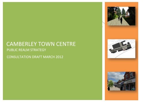
<strong>CAMBERLEY</strong> <strong>TOWN</strong> <strong>CENTRE</strong>PUBLIC REALM STRATEGYCONSULTATION DRAFT MARCH 2012
ContentsIntroduction 3Street Trees 28Policy Context 4Signage Strategy 30Urban Analysis 6Historic Context 6Permeability 7Existing Palette 8Public Art Strategy 32Detailing the Streetscape 33Overarching Strategy 9Streetscapes 10Knoll Walk 12High Street 14Pembroke Broadway 16Princess Way 18Bissingen Way 20Obelisk Way 22Knoll Road 24Park Street 26
IntroductionThe Public Realm Strategy for Camberley Town Centre (CTC) supportsthe CTC Area Action Plan (AAP) and provides a holistic approach tomanagement and enhancement of the public realm. It addresses the shortand long term issues of poor environmental quality in parts of the town andthe aspiration to pedestrianise the High Street.The focus of this Public Realm Strategy is the boundary identified withinthe Camberley Town Centre Area Action Plan (AAP) as shown in Figure 1opposite.The public realm is all space to which the public has ready physical andvisual access. It includes all streets and roads, public spaces, greenspaces, private gardens, squares, footpaths, and parks. Improving thepublic realm generates enormous benefits: it affects the way we feel aboutour everyday lives – where we live, work and play.The underlying principles of public realm improvements are to reduceclutter, co-ordinate design and to reinforce local character, whilstmaintaining safety for all.New development within town centre allocation sites (identified in the AAP)will provide the catalyst for improvements in the town centre alongsidemonies secured through the Community Infrastructure Levy. Monies raisedvia the Camberley BID scheme will also go some way to improving thepublic realm.
Policy ContextNationalPlanning Policy Statement 1: Delivering Sustainable DevelopmentGood design ensures attractive usable, durable and adaptable places andis a key element in achieving sustainable development. Good design isindivisible from good planning. Planning authorities should plan positivelyfor the achievement of high quality and inclusive design for alldevelopment, including individual buildings, public and private spaces andwider area development schemes. Good design should contributepositively to making places better for people. Design which is inappropriatein its context, or which fails to take the opportunities available forimproving the character and quality of an area and the way it functions,should not be accepted.High quality and inclusive design should be the aim of all those involved inthe development process. High quality and inclusive design should createwell-mixed and integrated developments which avoid segregation andhave well-planned public spaces that bring people together and provideopportunities for physical activity and recreation.RegionalSouth East Plan (2009)POLICY SP3: URBAN FOCUS AND URBAN RENAISSANCELocal planning authorities will formulate policies to ensure thatdevelopments in and around urban areas, including urbaninfill/intensification and new urban extensions are well designed andconsistent with the principles of urban renaissance and sustainabledevelopment.POLICY BE1: MANAGEMENT FOR AN URBAN RENAISSANCELocal authorities and their partners will use opportunities associated withnew development to help provide significant improvements to the builtenvironment. They will:i. through their community strategies and local development frameworks,set out an overall strategy for enhancing the quality of life in each urbanarea which reflects a vision developed in consultation with localcommunitiesii. work closely with key service providers to ensure that physical,community, cultural and green infrastructure is planned and phased inaccordance with planned developmentiii. in partnership with other public agencies, the private sector and thelocal community, establish innovative management arrangements for towncentres, business parks, and residential neighbourhoodsiv. develop and implement public realm and open space strategiesv. promote and support design solutions relevant to context and whichbuild upon local character and distinctiveness and sense of place,including the sensitive reuse of redundant or under-used historic buildingsvi. support and identify opportunities for appropriate higher density andmixed-use development schemesvii. draw up design-led supplementary planning documents to helpimplement development briefs, design codes and master plans for keysites in consultation with key stakeholders.
LocalCore Strategy and Development Management DPD (2012)DM9 DESIGN PRINCIPLESDevelopment will be acceptable where it achieves the following designprinciples: -(i) High quality design with layouts that maximise opportunities for linkagesto the surrounding area and local services; andbetween 2011 and 2015, and code level 5-6 from 2016 onwards withprovision for measures to reduce external water use.Development will be expected to incorporate and reflect design andcharacter measures as set out in either general or area specific SPD.Camberley Town Centre Area Action PlanPUBLIC REALM POLICYWording to be finalised…(ii) Respects and enhances the local, natural or historic character of theenvironment be it in an urban or rural setting, paying particular regard toscale, materials, massing, bulk and density; and(iii) Provide sufficient private and public amenity space and respect theamenities of occupiers of neighbouring property and uses; and(iv) Protect trees and other vegetation worthy of retention and provide highquality hard and soft landscaping where appropriate; and(v) Design to reduce the potential for crime and fear of crime; and(vi) Incorporate measures for the storage of waste including recyclablewaste and where appropriate waste collection through provision of bringsites; and(vii) Be accessible to all and be flexible towards future adaptation inresponse to changing life needs; and(viii) Facilitate provision of IT and other communications technology whichallow flexible working practices including employees working from home orfrom remote locations; and(ix) Reduce potable water consumption in residential development to waterefficiency standards equivalent to Code for Sustainable Homes level 3-4
Urban AnalysisHistoric ContextUp to as recently as the early 1800s the area now occupied by CamberleyTown Centre and its surrounding suburbs comprised heathland andfarmland. The Royal Military College (now the Royal Military Academy,Sandhurst) was built in 1812. There was a need for the college to beserviced by shops and trades to look after the building and grounds andsoon a small settlement grew up at the College gates known as Yorktown,about half a mile west of the current town centre along the London Road.In 1862, the Staff College was established within the grounds of the RMC.In order to accommodate the growth of shops and housing to serve theStaff College, a local landowner started to lay out a basic street patternand erected some houses to anticipate demand. This was the beginning ofthe current centre, originally known as Cambridge Town. A rail link fromthe new town to London was constructed and a new station opened in1878.The early layout of the town was a formal grid pattern and by 1915,development of the centre had largely filled the perimeter blocks. The towncentre saw extensive redevelopment after 1945 which resulted in the largescale removal of the mainly residential areas to the west of the HighStreet. This was to provide the shopping and commercial facilities to servea town which expanded greatly in the post war years.Junction of High Street/London Road circa early 20 th centuryThe largest development was the creation of an outdoor shopping precinctbetween High Street and Park Street in 1965 which followed the alignmentof the old streets. The 1970s and 1980s saw the construction of large freestanding office buildings particularly along Pembroke Broadway and KnollRoad. In 1990 the shopping precinct was refurbished to provide an indoorshopping mall and renamed Main Square. In 2009, the Atriumdevelopment was opened to the east of Park Street, providing newshopping, leisure and residential development.High Street towards London Road circa 1930’s
PermeabilityIt is evident from the historic maps that Camberley has expanded in the form of a conventional regulargrid pattern. The town centre functioned, in the context of permeability (ease of movement), mostefficiently during the period preceding the pedestrianisation of the Mall (see bottom left). The presentday situation (as seen above) raises concerns in respect of the ability to move in an east/westdirection and should be addressed as part of any public realm improvements.
PaletteThe existing palette within the town centre is dominated by manmade materials. The typical composition of buildings is a variation on red brick with somebuildings moving more towards a grey/purple brick although often this is not present on the principal elevation. On later developments, facades have beenbroken up by the introduction of white/cream render to add contrast and visual interest. Ground treatment in Camberley is dominated by concrete paversdating from the 1980’s although other treatments include granite setts, concrete flags and tarmacadam (carriageways). This has led, in some areas, to aconfusing and poor transition between different spaces.The dominance of muted colours such as purple/grey add little vibrancy to public spaces and can often result in quite a ‘cold’ feel to the environment. This isoften exacerbated by the absence of soft landscaping. The quality of materials is also an issue, with considerable signs of wear and tear evident. This has adetrimental effect on the feel of the spaces. There is a clear absence of natural materials within the town centre which tends to reflect the fairly modern natureof development.
Overarching StrategyCamberley Town Centre suffers from poor permeability(ease of movement) and poor legibility (the ability tounderstand your position within the urban environment).Key to improving the public realm is achieving improvedmovement corridors across the town centre in aneast/west direction and opening up improvedconnections to the London Road frontage to the northand public transport to the south. A comprehensivesignage strategy will aid movement around the towncentre.Camberley currently lacks any presence of civic spaceswhich can add vibrancy to the urban environment andreinforce it a destination of choice. It is intended that newspaces be introduced as part of redevelopmentproposals.The Edwardian/Victorian character of the High Streetprovides an important link to Camberley’s past.Development within the identified character area shouldnot prejudice the historic integrity of this part of the towncentre.Pedestrianisation of the High Street will address thecurrent dominance of vehicular movement and givepriority back to the pedestrian, helping to reinforce the desiredfunction of the street as a destination for shopping.It is proposed to make more effective use of the green space to the east of Knoll Road and better integrate the civic area with the retail core. ‘Green’ will be atheme that runs through the town centre with soft landscaping being an important element of public realm improvements.Park Street will benefit from a more considered, holistic approach to street furnishing and detailing along its length, building on the contemporary approachthat has been adopted as part of the Atrium redevelopment.
StreetscapesStreets and Civic Spaces make up 80% of urban public space. These arespaces that we have no choice but to use as we go about our daily lives.They should provide the best possible experience for everyone.Many of Camberley’s streets are filled with clutter, obstacles and barriers.Pedestrians are often marginalised on poorly maintained footways. Streetshave a greater role than simply catering for vehicular movement.Consideration has been given to the following locations:1. Park Street2. Obelisk Way3. High Street4. Bissingen Way5. Knoll Road6. Knoll Walk7. Princess Way8. Pembroke BroadwayThe amenity of different road users needs to be re-balanced so as toremove the visual and functional dominance of motor vehicles in thestreet, especially in high streets and other places where there is a heavypedestrian demand. A better balanced street is one that pays respect tothe competing needs of all users.Although there have been recent initiatives which have regenerated keypublic spaces, such as The Atrium and its impact on Park Street, generallythe quality of streetscapes within the existing retail core is poor and aconsistent approach has been lacking.The Mayor of London’s Better Streets 1 (2009) proposes six guidingprinciples (see opposite) to achieving improved streetscapes.Consideration has been given to these principles in informing public realmimprovements to existing streets within the town centre.1 http://www.london.gov.uk/greatoutdoors/docs/better-streets.pdf
Better Streets (2009)Guiding Principles:1. Understand FunctionA clear understanding of the function of a particular street and a brief thatarticulates this is one of the fundamentals of creating great streets.Improvements should reflect the function of the street.2. Imagine a blank canvasIt is always worth imagining the space as a blank canvas, challengingeach of its existing features as to whether it really needs to be preserved.Every feature that remains or is replaced should be carefully justified, andcare should be taken to minimise the clutter of lighting, signage andmaterials.3. Decide the degree of separationSegregation of road users should be avoided wherever possible and onlyintroduced where it is clearly essential for safety or other functionalreasons. That people can act responsibly and can take reasonable risksshould be recognised.4. Reflect characterThe design of the street should reflect the character, not through slavishpastiche but through recognition that the street is the foreground to thebuildings on it and that the buildings frame the street.5. Go for qualityMaterials should be used in a consistent way and should be of the highestquality and durability that can be afforded. The life of a public realm projectis long-term and the choice of materials should reflect the fact that goodquality materials often last much longer while still looking good.6. Avoid over-elaborationGreat streets are created by the buildings and trees that frame them andthe activities they contain. The purpose of street improvements is tocomplement the one and facilitate the other, not to make a loud statement.
Knoll WalkKnoll Walk is located to the south of the town centre and provides the primary pedestrian link between Knoll Road to the east and High Street to the west.Baseline AnalysisIn its present form, Knoll Walk fails to promote the desire linebetween Knoll Road and the High Street. There should be anunderstanding of where/what the route links to. The presence oflarge planters in the centre of the corridor and significant growth ofborder planting has resulted in a shaded, cumbersome route.The presence of substantial border growth that is not porous has alsoresulted in blind spots that, particularly at night, may put pedestriansoff using the corridor as a connection. The absence of naturalsurveillance along significant stretches of the Walk, particularly postwork-hours, also has a negative effect on the use of the space.
Public Realm ImprovementsIn order to improve legibility of the town centre, new signage at the eastern and western end of the Walk should be introduced. The eastern end should directusers to the High Street/Shopping and the western end should direct users to the CivicArea/Theatre/Parking.The massing of the existing vegetation should be scaled back in order to address the issue of ‘blindspots’ along the length of the route and consideration should be given to the introduction of moreporous planting schemes. The introduction of ‘Green Walls’ (see inset below) would be anattractive addition to the route and would help to screen existing views into service yards. The largeplanters that currently feature in the centre of the walk should be removed in order to improve thedesire line both in terms of movement and visibility.Contemporary seating should be introduced along the Walk to accommodate the needs ofpedestrians i.e. elderly users/mothers with pushchairs. Alongside the seating should be suitablelighting that ensures good surveillance opportunities at night.The existing paving of this area is considered to be appropriate in terms of type and colour. In thelonger term, it may be appropriate to integrate new paving with the pedestrianisation of the High
Street i.e. yorkstone paving.High Street (Central Section)Baseline AnalysisThe High Street functions as the historic core of the town centre and isenclosed by a number of late Victorian and Edwardian fine grainedproperties, particularly along the eastern elevation providing a verticalemphasis to views down the street.In its present form, the layout of the High Street prioritises vehicularmovement, much to the detriment of the pedestrian user. Pedestrianmovement is restricted to narrow pavements that are often cluttered by arange of signs, bollards, street columns and bins. On-street parking furthercontributes to the marginalisation of the pedestrian within the public realm.One of the guiding principles of Better Streets (2009) is to understand thefunction of the street and design it accordingly. The principle function of HighStreet is retail provision which would suggest improvements that prioritisepedestrian movement.
Public Realm ImprovementsIt is the <strong>Council</strong>’s aspiration to give priority to pedestrian movementalong the central section of the High Street. It is considered thattreatment of this space should reflect the historic character of theEdwardian/Victorian properties that front onto it. As such, a naturalmaterial would be preferable to man made in terms of groundtreatment to reinforce a historic context. A warmer palette (seeDetailing the Streetscape section for examples) in conjunction withheritage-led furnishing (litter bins, seating, lighting columns) will beappropriate.Street planting is desired in this location. It will need to bedetermined whether this is feasible along the High Street as thelocation of utility services may hinder the ability to excavate to thenecessary depth for a tree pit. If such planting is unachievable, the<strong>Council</strong> will seek to provide a series of large tree planters along thestreet in order to provide a green element to the environment. Treespecimens should be seasonal in order to provide a changingcontext to the public realm as the year progresses.
Pembroke BroadwayBaseline AnalysisPembroke Broadway forms the southern edge of thetown centre and provides a key connection fromeast to west. It is a prominent movement corridor forvehicles and is the gateway to Camberley for bothbus and train services with the railway stationlocated to the south-east edge.In its present composition, Pembroke Broadwayfunctions poorly as a gateway due to the absence ofa sense of arrival. This is due to the existing builtform that comprises the northern edge of theBroadway (Ashwood House/ Main Square MultistoreyCar Park) which serves as an imposingbarrier to movement with very little in the way ofactive frontage. The existing pedestrian link toPrincess Way (between Ashwood House and theCar Park) is narrow, overshadowed, suffers frompoor surveillance and is considered by many to be a‘no-go’ area particularly in the evening.Many of the existing buildings pay poor regard toproviding activity at street level due to orientation,set-backs and the presence of under-croft parkingwhich results in an absence of pedestrian presencealong the street.Consideration will also need to be given to the treespecies that are located along the centralreservation.
Public Realm ImprovementsThe key driver for public realm improvements is to address Pembroke Broadway’s function as a gateway to the town centre. This involves improving legibility(the way in which the environment is understood) and permeability (the ability to move through the town centre). The proposal outlined below considers arelocated station building which facilitates a pedestrian forecourt and station parking allocated to the west. In order to improve pedestrian movement, it isrecommended that a raised bed is implemented across Pembroke Broadway that will serve to reduce the speed of road traffic and provide an improved senseof connection for pedestrian movement. A consistent ground surface material should be utilised from the station forecourt to the south to the north side ofPembroke Broadway to reinforce the sense of priority given to pedestrian movement. Vehicular movement across this space will be delineated by thepresence of bollards, trees and street lighting only.The pedestrian connection to Princess Way will be widened in order to provide a sense of direction into the town centre for those arriving via public transport.It is anticipated that redevelopment of the existing blocks to the north of Pembroke Broadway will facilitate the delivery of active ground floor uses to addvibrancy to this part of the town.
Public Realm ImprovementsThe main driver for public realm improvements along Princess Way is the ability to improvepermeability, both across from High Street to Park Street and south to Pembroke Broadway.Key to delivering these aspirations is the relocation of The Mall entrance to the northern edgeof Princess Way to re-establish an east/west connection and a subsequent redevelopment ofthe existing southern blocks (Ashwood House and Main Square Multi-Storey Car Park) tofacilitate a wider pedestrian movement corridor in the direction of public transport hubs to thesouth along Pembroke Broadway.Redevelopment would also address the over-dominant canopies that are currently presentalong the southern edge of Princess Way. The change in levels that is currently experienced tothe front of Ashwood House may be addressed as part of a comprehensive redevelopment.Alternatively, it may be appropriate to utilised the existing retaining wall as part of a streetplanter scheme down the central section of the street. This would serve to soften the existingdivision whilst allowing retention of the change in levels.
Bissingen WayBaseline AnalysisBissingen Way operates predominantly as apedestrian link connecting the central sectionof High Street to Knoll Road. In addition topedestrian access, there is also vehicularaccess from the western entrance that linksinto small parking bays and the service yardbehind the currently vacant units that frontonto the southern edge of the route.Whilst a popular route, the current definitionand enclosure of the space is poor. Asignificant section of the route has exposedviews to a service yard/car park to theimmediate north which suffers from poorlandscaping. The southern edge is poorlymaintained with exposed areas of overgrowthand dead frontages resulting from the smallvacant units and the side elevation of HSBCBank on High Street.There are identified blind spots to the rear ofthe HSBC building and also to the side of thevacant office units that have the potential tohinder pedestrian movement particularly inthe evening in the evening when the arealacks natural surveillance.Bissingen Way (towardsthe High Street) andexposed Service Areas tothe north
Public Realm ImprovementsIn order to consolidate Bissingen Way as a pedestrianconnection, consideration should be given to removingvehicular access which can often hinder movement.Parking provision could potentially be accommodatedin the existing service yards to the immediate northand south. This issue will need to be considered aspart of the pedestrianisation of the High Street.Redevelopment of the existing vacant units to thesouthern edge will add vibrancy to the space throughanimating the edge and ensure better surveillance.The northern edge, currently exposed to the serviceyard, will benefit from improved, soft landscapedscreening. Improved levels of lighting will alsoenhance the connection.The existing concrete pavers that form the ground surface are quite dated and the connectionwould benefit from an overhaul that provides a warmer palette (See Detailing the Streetscapesection).The introduction of ‘fingerpoint’ signs is also necessary at each entrance point in order toimprove the legibility of the town centre.
Obelisk WayBaseline AnalysisObelisk Way suffers from similar issues toPrincess Way in that previously it provided aconnection from High Street to Park Streetbut has since been divided by The Malldevelopment in subsequent years. Thisrestricts movement across the town centre toMall operating hours only. It also restricts theopportunity to move north towards LondonRoad.The street also suffers from the problem ofexposed service yards at its eastern end withaccess both to the north and south. Thisserves to break up the sense of enclosure ofthe street scene in addition to marginalisingpedestrian movement in a retail dominantarea and results in unattractive vistas.The existing retail units that front onto theeastern end of Obelisk Way are tired and inneed of regeneration, particularly the existinglarge Allders building on the junction of HighStreet.For the most part, the street is welloverlooked in its existing form.
Public Realm ImprovementsIn almost a mirror image of the public realm improvementsidentified for Princess Way, the overarching aspiration is toachieve improved connections in both an east/west andnorth/south direction (creating an inverted T-junction forpedestrian movement). Redevelopment of the LondonRoad Block to the immediate north of Obelisk Way has thepotential to facilitate the creation of a town centre civicspace, subject to appropriate servicing arrangements beingachievable. This could be a vibrant space benefiting fromat least four access points ensuring significant levels ofmovement and activity.The square itself would be of a suitable size toaccommodate such events as Farmers Markets. Thedesign of this space will be contemporary, reflecting acooler palette with the introduction of up-lighting (seeDetailing the Streetscape section) and smaller, conicalstreet trees as definition of the square.Servicing will remain to the southern edge of Obelisk Wayvia the existing access point. However vehicular movementwill be restricted beyond this point with priority given topedestrian movement.
Knoll RoadBaseline AnalysisKnoll Road is located to the east of the town centre and is a focus for civicuses such as the <strong>Council</strong> Offices, Library and Theatre as well as the IanGoodchild Centre (IGC), Disability Initiative and High Cross Church. Thewestern edge of Knoll Road is defined by commercial (B1) uses.A key issue in respect of public realm is the segregation of civic uses, inparticular the library and theatre, from the heart of the town centre. Thesetting of these buildings needs improvement. The principal elevation ofthe library is obstructed by poor landscaping adjacent to Knoll Road andthe green spaces that front both the library and Theatre/IGC areunderutilised.The pedestrian crossing that connects Knoll Walk and the Theatre to thesouth is obstructed by substantial lengths of railings that only serve tofrustrate movement across the street particularly during quieter periods.There is also a lack of visual connection from Bissingen Way towards thelibrary and Camberley Park that needs to be addressed and made moreprominent.Active frontage at ground floor is absent from a majority of thedevelopment along the western edge of Knoll Road due to the presence ofunder-croft parking associated with office developments.
Public Realm ImprovementsThe key driver for public realmimprovements along Knoll Road is tobetter accommodate the desire linesstemming from both Knoll Walk andBissingen Way and subsequentlyimprove the sense of connectionbetween the town centre and civicspaces.The indicative proposals outlinedopposite seek to make better use of thegreen space to the front of the Libraryand IGC by removing the currentservice road that divides the space andconsolidating it as a formal parklandspace/civic entrance. Improved hardlandscaping will seek to reinforce theidentified desire lines via widened treelinedavenues and lighting forms thatelevates the space as a safe, civic focalpoint during the evening (see Detailingthe Streetscape section). A reorientationof the theatre entrance toembrace this space would furtherreinforce its role as a civic focal point.Knoll Road towards library (existing above andindicative below)This aspiration relies on vehicular access being achievable via the existing route to thesouth of the theatre building.The existing crossing point will be retained but railings will be scaled back to allow foreasier movement across the street. Consideration will be given to installing a raised bedfor crossing to further improve the sense of pedestrian connection.
Park StreetBaseline AnalysisPark Street functions as a key destination for retail and entertainment purposes and linksLondon Road to the north with Pembroke Broadway to the south.Following the recent Atrium development along its western edge, Park Street hasbenefitted from substantial interventions to the public realm including a contemporarygranite effect concrete paving along its length, the introduction of street trees and newstreet furniture (seating, bins, bollards and planters). Unfortunately, there has not been aconsistent approach to provision. This has resulted in a layout that appears haphazard,lacking in a planned approach. The limited presence of soft landscaping and small scaleof planting that does exist is dwarfed by the scale of built development and can result ina very hard feel to the environment.Public Realm ImprovementsSignificant interventions are not required along Park Street. A considered approach toboth hard and soft landscaping will help to improve the feel of the area and create amore welcoming environment.
Signage StrategyCamberley Town Centre suffers from poor legibility i.e. the ability to gaugeand understand position within the immediate and surroundingenvironment. This is compounded by a poor/inconsistent signage strategythat makes it difficult for visitors to negotiate their way around the town.Poor signage creates a poor impression of the maintenance of the towncentre.Focus needs to be given to improving signage within the town centre.There needs to be a hierarchical approach to signage focusing primarilyon the provision of Information Monoliths at key public transport arrivalpoints along Pembroke Broadway, Knoll Road and New Southern Roadand secondly on improved ‘fingerpoint’ signs across the town centre thataid pedestrians along routes.The approach taken should be consistent across the townscape. Toomany signs and signs of different types and colours clutter views and spoilaesthetics. Heterogeneous signs fail to establish a town ‘brand’. As part ofthe Atrium development, a signage strategy has been adopted along thelength of Park Street. These signs are contemporary in style and providean appropriate palette to adopt across the town centre.
Figure 1 Examples of Information MonolithsInformation Monoliths are a common feature of many urban areas. Theirfunction is to welcome and orientate the user in the context of the widertown centre. Typically these boards feature a static map of the wider areawith an indication of key destinations. They tend to be located in closeproximity to public transport hubs and public car parks i.e. the key point ofarrival.Figure 2 Examples of Contemporary Fingerpoint SignsThe current approach to Fingerpoint signage in Camberley is poor. Thereis inconsistency in approach due to separate phases of development overtime and often signage is lacking in places where it would be beneficial forpedestrians. A contemporary approach (see examples above)implemented across Camberley would help to improve the synergy of thetown centre.
Public Art StrategyPublic art can help to differentiate a town from all other places and help to establish a unique identity. The potential for public art to instil/reinforce a sense ofplace is particularly important for Camberley as there is currently a lack of a strong image or ‘brand’ identity.Public art can bring to the fore stories that define the town and its people and it can act as a landmark to improve the town’s legibility. The focus for public artinstallations should be in spaces that are focal points for pedestrian movement such as civic squares, green spaces and pedestrianised areas.Curzon Square, Curzon Street,Burnley Town Centre(Kate Maddison and Richard Hill)Bridge Street, Mansfield(David Annand)Martian Tripod, Woking(Michael Condron)
Detailing the StreetscapeGround Surfaces (footways, carriageways and kerbing)The following key principles should inform the selection of surface materials for Camberley:Consistent – The application of surface materials should be consistent to help unify the streets and spaces within the town centre and bring definition to keyareas.Neutral – Surfaces should form a seamless and neutral base that does not compete with the surrounding buildings, spaces and features. It should notbecome a focal point to try and enhance poor quality environments.Natural – Where possible, natural materials should be used ahead of manmade alternatives. The initial high cost of natural materials is offset by appearanceand durability.Robust – Surfaces should be fit for purpose, supporting the functions and demands placed upon them from all users.Footways/CarriagewaysBelow are examples of materials and finishes that provide a warmer palette e.g. yorkstone, sandstone. Such an approach would be effective on the HighStreet as part of any pedestrianisation scheme. The use of natural materials will emphasise the heritage importance of the High Street particularly whenapplied in conjunction with heritage-led furnishing.1 2 3 4 51. Palladio Stone Sandstone Paving Flags2. Lovell Purbeck Ltd Paving Setts and Cobbles3. Charcon Commercial Natural Yorkstone FlagPaving4. Caithness Stone Industries Stone Setts5. Bannold Supplies Services Millstone Setts(http://www.esi.info/)
The palette below represents materials that provide a contemporary, cooler palette e.g. granite, slate. The blue/grey finish reflects the approach that has beenadopted along Park Street following the Atrium redevelopment.1 2 3 4 5 1. Hanson Formpave Ecogranite Flags2. Granite Paving3. Cerrig Slate Paving4. Caledonian Stone Aged Granite5. Marshalls La Linia Concrete Paving(http://www.esi.info/)EdgingKerbing can come in a variety of shapes and finishes. Detailed below are three examples that may be appropriate within Camberley Town Centre. The granitekerb with an increased depth would be effective as part of heritage-led improvements along the High Street. A more contemporary approach such as thestandard kerb/K Lite Traditional kerb would be appropriate elsewhere. It may be the case that kerbing will not be as prominent particularly in areas that adapta shared space approach. In such areas, delineation will still be required to control vehicular movement but this can be achieved via other means such as acontrast in surface material or other means of guidance such as planting and bollards.1 2 31. Granite Kerb2. Marshalls Standard Kerb3. Charcon Commercial K Lite Traditional Kerb(http://www.esi.info/)
CONTEMPORARYStreet Furniture (seating, litter bins, cycle racks, bollards)It is vital to ensure an approach to the provision of street furniture that reflects the composition of the street scene i.e. the enclosing buildings, the role of thestreet e.g. pedestrianised space, shared space. Existing provision across Camberley is inconsistent and often poorly distributed. In particular, Park Streetfeatures a number of variations in terms of seating, bollards and litter bins that contribute to a haphazard, cluttered feel. As a minimum, a street should have aconsistent approach to furnishing along its length. Detailing along High Street should be ornate in style, incorporating heritage style seating as detailed below(e.g. Lost Art Sunflower Cast Iron Bench). The cast iron effect should run throughout the detailing to incorporate litter bins, lighting columns and planters.Examples of ornate styles are shown below.1 2 3 4 51. Benchmark Design CL0052. Woodhouse College Seat3. MG Olympic Products Ltd OLY 60094. Machan Engineering 09035. Hartecast HC2032 S(http://www.esi.info/)1 2 3 41. Streetmaster Georgian Seat2. Lost Art Sunflower Cast Iron Bench3. Hartecast Phoenix Park Seat4. Chris Nangle Charred Green Oak Ripple Bench(http://www.esi.info/)
CONTEMPORARY CONTEMPORARYHERITAGECONTEMPORARY1 2 31. Woodhouse Geo PAS 682. Omos Ltd S1133. MG Olympic Products Ltd OLY 7008(http://www.esi.info/)1 2 31. CIS Street Furniture DB 100 HT2. Furnitubes International COV 902 Covent Garden3. Broxap BX 2306(http://www.esi.info/)1 2 3 41. Lockit Safe Palio Stainless Steel Stand2. KFS Enterprises Puczynski Cycle Parking3. Falco UK Ltd F7 Cycle Wall Clamp4. Autopa Sheffield Cycle Stand(http://www.esi.info/)1 2 31. Omos Ltd S26 Stainless Steel Bollard with radially polished cap2. Marshalls Rhino RS 005 Stainless Steel Bollard3. Hartecast HC2065(http://www.esi.info/)
HERITAGE1 2331. Cast Iron Company B108 Bollard2. Autopa Manchester polyurethane bollard3. Woodhouse Escofet Bollard(http://www.esi.info/)Planting (street trees, planters, hanging baskets)Planting will play an important role in a vibrant Camberley Town Centre. Many of the existing street scenes are very hard in detailing, often lacking in thegreenery that is needed to soften and provide a human scale to the setting. This is particularly noticeable in sections of Park Street where the scale ofbuildings increases. In the first instance, street trees should be considered as part of any scheme. Where not feasible due to existing subterranean utilityservicing, consideration will be given to the provision of street planters such as those detailed below.1 2 3 41. Plantscape Ltd Bespoke Wooden Planters2. Machan Engineering 3102 Cast Iron Planter3. CIS 810SS Timber and Stainless Steel Planter4. Street Design Ltd Suffolk FSC Timber and Metal(http://www.esi.info/)
Lighting (lighting columns, ground lights, fixtures)HERITAGE CONTEMPORARY1 2 31 2 31. Geo Light Stack Luminaire2. Candela Traditional Lighting Lanark Luminaire3. Silka Max Contemporary Amenity Luminaire(http://www.esi.info/)1. Hatfield Classical Urban Luminaire2. Candela Traditional Lighting <strong>Borough</strong> Lantern3. Ely Classical Urban Luminaire(http://www.esi.info/)1. Kingfisher Lighting Klou Bollard Series2. Geo Illuminated Bollard3. Capra Ground Recessed Luminaire4. ACO Technologies Channel Lighting1 2 3 4(http://www.esi.info/)