

GIS Sana Sini - Malaysia Geoportal
GIS Sana Sini - Malaysia Geoportal
GIS Sana Sini - Malaysia Geoportal
- No tags were found...

You also want an ePaper? Increase the reach of your titles
YUMPU automatically turns print PDFs into web optimized ePapers that Google loves.
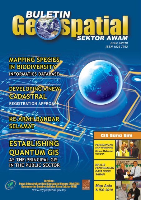
dari meja Ketua EditorAssalamualaikum dan Salam 1 <strong>Malaysia</strong>.Buletin Geospatial Edisi 2/2010 kali ini antara lain, memaparkan berkenaanpenggunaan teknologi <strong>GIS</strong> dalam bidang biodiversiti. Sejak berkurun lamanyamanusia bergantung kepada kepelbagaian biodiversiti dan sumber-sumber biologiyang membekalkan manusia dengan keperluan makanan, perubatan, produk-produkindustri dan juga berperanan penting untuk mengimbangi alam sekitar. Pada masakini, maklumat biodiversiti boleh dicapai melalui Global Biodiversity InformationFacility (GBIF), Fishbase, Encyclopedia of Life (EOL) dan sumber-sumber lain.Kesemua pangkalan data ini direka bentuk untuk memberikan maklumat taksonomi(iaitu kajian tentang prinsip, peraturan, dan amalan dalam pengkelasan organismahidup berdasarkan persamaan dan perbezaan sifat organisma itu) dandiselenggarakan dalam beberapa pangkalan data yang saling berhubungan(relational). Walaupun mudah untuk mendapatkan data mentah (raw data), namundata spatial sukar untuk divisualisasikan memandangkan pangkalan data yangdihasilkan diperoleh daripada flat file yang tidak dapat menampung trenddan corak geospatial. Dalam hubungan ini, <strong>GIS</strong> dapat membantu dalammemvisualisasikan hubungan antara spesis hidupan dan kedudukan geografi sertamengkaji karakter spesis hidupan tersebut.Selain itu, Jabatan Perancang Bandar dan Desa (JPBD) Semenanjung <strong>Malaysia</strong>,atas inisiatif sendiri telah mengkaji penggunaan open source software (OSS) yangdikenali sebagai Quantum <strong>GIS</strong> (Q<strong>GIS</strong>). Ia bertindak sebagai aplikasi multi-platformdan menjalankan operasi dengan sistem operasi yang berlainan seperti Mac OS X,GNU/Linux, Unix dan Microsoft Windows XP. Ini memudahkan aplikasi <strong>GIS</strong> dapatdijalankan untuk Windows dan OSS, yang mana ia dapat disesuaikan denganaplikasi <strong>GIS</strong> yang dibangunkan menggunakan perisian ArcView, Arc<strong>GIS</strong> dan MapInfo.Seterusnya, sumbangan aplikasi <strong>GIS</strong> dalam mewujudkan bandar yang lebih selamatmelalui pemetaan <strong>GIS</strong> Hotspot Jenayah. Melalui kaedah ini, rekod kawasan-kawasantinggi jenayah dapat dikenalpasti dan pihak berkuasa tempatan dapat mengambillangkah-langkah pencegahan yang lebih berkesan. Sehubungan itu, peranan dankerjasama semua pihak yang terlibat dalam merealisasikan projek ini turutdiperjelaskan.Dalam pada itu, peranan teknologi <strong>GIS</strong> juga tidak kurang pentingnya dalambidang Kadaster iaitu dalam proses pemodenan budaya kerja dalam bidangberkenaan. Sebelum ini, sistem kadaster 2D hanya berurusan dengan pemilikandi atas tanah sahaja. Namun, sejajar dengan arus kemodenan pada masa kini,pemilikan turut melibatkan bawah tanah dan bangunan bertingkat. Untuk itu,faktor vertikal (z) juga diperlukan dalam memastikan urusan pendaftaran berjalanlancar. Justeru, pendekatan sistem pendaftaran 3D telah diwujudkan dan iadiperincikan menerusi artikel Developing a New Cadastral Registration Approach.Saya berharap artikel-artikel yang dimuatkan dalam buletin pada kali ini dapatmemberikan manfaat kepada semua. Akhir kata, saya bagi pihak BGSA merakamkansetinggi-tinggi ucapan terima kasih kepada pihak-pihak yang telah memberikankerjasama dalam menerbitkan buletin edisi 2/2010 ini.Sekian.Selamat membaca.SIDANG PENGARANGPenaungY. Bhg. Dato’ Zoal Azha bin YusofKetua SetiausahaKementerian Sumber Asli dan AlamSekitarPenasihatY. Bhg. Dato’ Haji Azmi bin Che MatTimbalan Ketua Setiausaha II (AlamSekitar), Kementerian Sumber Asli danAlam SekitarKetua EditorFuziah binti Hj. Abu Hanifah, K. M. N.PengarahPusat Infrastruktur Data GeospatialNegara (MaCGDI)EditorShaharudin bin Idrus – (LESTARI, UKM)Dr. Azhari bin Mohamed – (JUPEM)Dr. Zainal bin A. MajeedHamdan bin Ab. AzizNorizam binti Che NohMariyam binti MohamadAnual bin Haji AzizYa’cob bin AbasRekabentuk/ JurufotoWan Faizal bin Wan MohamedMuhamad Zamri bin MustaphaFauzani binti AzamKANDUNGAN141223303132323233343536MAPPING SPECIES IN BIODIVERSITYINFORMATICS DATABASEDEVELOPING A NEW CADASTRALRE<strong>GIS</strong>TRATION APPROACHKE ARAH BANDAR SELAMATESTABLISHING QUANTUM <strong>GIS</strong>PERSIDANGAN DAN PAMERANSISTEM MAKLUMAT GEOGRAFI(<strong>GIS</strong>) KEBANGSAAN (N<strong>GIS</strong>)MAJLIS PENYERAHAN DATA SGDCSABAHTAKLIMAT PENYEDIAAN MyGDIMETADATA PERINGKAT NEGERIKEDAH & SELANGORMESYUARAT PENYEDIAAN RANGUNDANG-UNDANG GEOSPATIALKEBANGSAANSEMINAR STANDARDISASI DALAMSISTEM MAKLUMAT GEOGRAFI(<strong>GIS</strong>) TAHUN 2010MAP ASIA 2010 & ISG 2010BENGKEL TEKNOLOGI DANAPLIKASI GLOBAL NAVIGATIONSATELITE SYSTEM (GNSS) 2010<strong>GIS</strong> DAY 2010 DI SEKOLAHKEBANGSAAN TEMENGGONGIBRAHIM PENGGARAM,BATU PAHAT, JOHORKAMPUS NREPenerbitPusat Infrastruktur Data GeospatialNegara (MaCGDI)Kementerian Sumber Asli dan AlamSekitar (NRE)Aras 7 & 8, Wisma Sumber Asli,No. 25 Persiaran Perdana, Presint 4,62574 Putrajaya, <strong>Malaysia</strong>Tel : +603-88861111Faks : +603-88894851www.mygeoportal.gov.myPenafian : Kesahihan dan ketepatan tulisan atau pendapat adalah tertakluk pada cetusan idea pengirim artikel
MappingSpeciesMAPPING SPECIES IN BIODIVERSITY INFORMATICSDATABASE : ISSUES AND CHALLENGESGEOSPATIAL Sektor Awam Edisi 2/20101BULETINDisediakan Oleh:Mohd Shahir Shamsir, Muhammad Al-Hadi Ali AkhbarBioinformatics Research Lab, Biological Sciences Department, Faculty of Bioscience and Bioengineering,Universiti Teknologi <strong>Malaysia</strong> 81310 Skudai, Johorshahir@fbb.utm.myINRODUCTIONBiodiversity according to the Convention ofBiological Diversity (CBD) is defined as thevariability among living organisms from all sourcesincluding, inter alia, terrestrial, marine andother aquatic ecosystems and the ecologicalcomplexes of which they are part; this includesdiversity within species, between species and ofecosystems. The broad knowledge jurisdictionof which biodiversity is accountable and theincreasing recognition of the role of biodiversityin economic, scientific and educational aspectsof life have increased its importance and areconsidered as key issues in sustainabledevelopment policies. The recent growth inbiodiversity data available through digital archiveshas necessitated the creation of a biodiversitydatabases and information management systems.The interconnectivity of the Internet has also actas an effective tool for disseminating informationfor the global audience. Such phenomenoncombined with the increasing emphasis onbiodiversity has created a demand for biodiversityknowledge (Bisby 2000; Oliver et al. 2000;Edwards et al. 2000). The increase in demandand amount of biodiversity data has created aneed for structured information domain accessiblethrough the web. Various databases for biodiversityand conservation research have been createdto cater for this increasing demand. However,early databases were not robust and lack manyfunctionalities that is required for advancedbiodiversity research. Queries were limitedto basic keyword based search focusing ontaxonomic data. The types of data collected onspecies and their relationships vary greatly inaccuracy, and the methods used to accumulateand compile these data are almost as diverse asthe natural world they document. Furthermore,the range of datasets includes geographical,meteorological, geological, chemical, physical,and genomic sources. Therefore, databaseshave an unusual need to accommodatedifferences in data quality and types within ademocratized community informationinfrastructure that is both formal and informal(Schnase et al., 2007).MALAYSIAN BIODIVERSITYINFORMATICS DATABASES ANDGEOGRPHICAL INFORMATIONSYSTEM (<strong>GIS</strong>)The increase in demand and amount ofbiodiversity data has created a global needfor structured information domain by variousinstitutional and national databases forbiodiversity and conservation research. However,there is a conspicuous scarcity of <strong>Malaysia</strong>nbiodiversity databases with only a few robust andnotable examples. Among the leading examplesis the Systematic Marine Biodiversity InformationSystem (Symbiosis: http://symbiosis.nre.gov.my)SyMBiosIS is a searchable database for the
MappingSpecies2BULETIN GEOSPATIAL Sektor Awam Edisi 2/2010marine organisms which can be found in<strong>Malaysia</strong>; Flora of Peninsular <strong>Malaysia</strong> Online(FPM: http://www.tfbc.frim.gov.my), a searchableflora that includes ancillary data such as habit,habitat, taxonomic synonymy, distribution withinPeninsular <strong>Malaysia</strong> and Singapore. There areagriculturally focused databases such as AgrobIS(http://agrobis.mardi.gov.my/), an informationsystem developed by MARDI to provide thepublic direct access to data of more than 40,000accessions of Plant Genetic Resource for Foodand Agriculture (PGRFA) which includes fruits,rice, vegetables, and medicinal plants. The systemalso consists of information on 2,500 isolatesof microbial genetic resources and about 30,000specimens of arthropods. The Department ofAgriculture is also developing AgricultureInformation System Geodatabase Portal (AgrIS)http://www.agris.doa.gov.my, a Web-basedsystem integrates agricultural data in all theStates of <strong>Malaysia</strong> into a single unified systemwhere one can access up-to-date informationabout soil, rainfall, pests, land use etc. AgrISis currently in development and is expected tobe launched in May 2010. There are smallerinstitutional, state and research group databasessuch as Johor Biodiversity Databasehttp://www.jbiotech.gov.my/jbiodi/, Amphibian andReptiles of Peninsular <strong>Malaysia</strong> Database http://www.amphibia.my and <strong>Malaysia</strong>n IndigenousMicrobial Online Database System (MIMODS)that consists of a collection of data on indigenousmicroorganisms isolated by <strong>Malaysia</strong>nMicrobiologists (http://www.bioinformatik.um.edu.my). However, such commendable effort isdis-proportionate to the existing untappedbiodiversity data and the present researchcommunity in <strong>Malaysia</strong>. Among the 14 contributinginstitutions in the Global Biodiversity InformationFacility (GBIF: www.gbif.org), there are nodatabases originating from <strong>Malaysia</strong>. This isfurther compounded in the <strong>Malaysia</strong>n biodiversityscene as there is a conspicuous absence of <strong>GIS</strong>enabled biodiversity databases catering for thescientific community.<strong>GIS</strong> IN BIODIVERSITYCurrently, biodiversity information is accessiblethrough the web through global databasessuch as Global Biodiversity Information Facility(GBIF), Fishbase, Encyclopedia of Life (EOL),Zipcode-Zoo and Biodiversity Heritage Library(BHL) (Gwinn et al., 2009). These databases aredesigned to deliver taxonomic information aboutorganisms, providing a broad taxonomic scopeand are maintained in large distributed federatedrelational databases. Although it is deceptivelyeasy to access raw information, it is difficult tovisualise the spatial data within these datasets.Earlier versions of these databases that originatedfrom flat file sources are usually not robustand lack much functionality that is required toinfer geospatial trends and pattern. Initially,queries were limited to basic keyword basedsearch focusing on descriptive taxonomic data.Earlier versions of these databases originatedfrom flat file sources are usually not robust andlack much functionality that is required to infergeospatial trends and pattern.The more recent additions such as GBIF-Mappingand Analysis Portal Application (GBIF-MAPA)(Flemons et al., 2007), Australian VirtualHerbarium (AVH), ASEAN Centre of Biodiversity(ACB), Israel Biodiversity Information System(Bio<strong>GIS</strong>) or related tools (GBD-Explorer,Bio-Geomancer (Guralnick et al., 2006) Diva-<strong>GIS</strong>(http://www.diva-gis.org) have been enhanced byincorporating geographical, spatial and temporalvisualisation capabilities. Following the adage“a picture is worth a thousand words” the useof <strong>GIS</strong> will add a geographical dimension to thedatabase thus providing a novel perspective tothe data using the integration of information inspatial overlays or geographical “picture” foranalysis and interpretation, and visualisation. <strong>GIS</strong>will create a unique reference base (geographiclocation and maps), i.e. natural vegetation, soil,land use, topography, hydrology that enablesbiodiversity data to be combined and analysedto produce novel associations betweenenvironmental features and relationshipsbetween different species. Using <strong>GIS</strong> willfacilitate visualizing the relationship betweenspecies and geographical locations, inter andintra species locations and their relationshipsand examining distribution characteristics ofspecies (Oberlies et al., 2009).CHALLENGESBuilding online <strong>GIS</strong> web services to supportbiodiversity mapping has many majordevelopmental challenges and we attempt toelaborate the crucial ones that need to beanswered.Retrospective GeoreferencingA retrospective georeference is a conceptwhere the textual descriptions of places wheredata and specimens were collected (localitydescriptions such as “Sungai Johor, KampungTeluk Intan, etc”) are converted into theircorresponding geographic coordinates - especiallyfrom legacy or archival data that are descriptive innature This will create quantitative map
CadastralRegistration4BULETIN GEOSPATIAL Sektor Awam Edisi 2/2010DEVELOPING A NEW CADASTRAL RE<strong>GIS</strong>TRATIONAPPROACHDisediakan Oleh:Tan Liat Choon and Khadijah binti HussinDepartment of Land Administration and Development,Universiti Teknologi <strong>Malaysia</strong>, Johor, <strong>Malaysia</strong>.tanliatchoon@gmail.com, khadijah@utm.myABSTRACTThe urban population in Asia has increased by 550 million people during 1960-1990 and are expectedto increase by 1,286 million people by year 2020 (Ji, 2007). Since late 1990s, the population of<strong>Malaysia</strong> has increased from approximately 21.80 million to 27.73 million in 2008 (Statistic, 2008)and it is predicted to reach 31 million by 2020. Cities in State of Penang, Selangor, Kuala Lumpurand Johore have so far absorbed their growing numbers in settlements with a varying quality ofliving and the complexities of the extreme modern buildings are expected to be designed and builtin the near future. Unfortunately, the existing <strong>Malaysia</strong>n Cadastral System and legislation for 2Dparcel is unsuitable for representing the land rights in 3D situations for those rapid increases fordevelopment and technical purposes. Hence, an efficient 3D land use in real estate propertyespecially for multilayer objects is directly linked to the socio economic and environmentaldevelopment in <strong>Malaysia</strong>.This paper describes the overview of <strong>Malaysia</strong>n Cadastral System for 3D purpose and the situationin <strong>Malaysia</strong>. We explain the current practice of cadastral registration in <strong>Malaysia</strong> and elaborate moreabout <strong>Malaysia</strong>n Cadastral Data Model. The <strong>Malaysia</strong>n Digital Cadastral Database (DCDB),Computerised Land Registration System (CLRS) and Cadastral Data Management System(CDMS), the development of 3D Cadastre registration and the integration of CLRS and CDMSare illustrates respectively. Throughout the paper it is hope that this new approach can bringto planning and construction sustainability in <strong>Malaysia</strong>.KEYWORDSLand administration, 3D, legislation, cadastre, property rights.
CadastralRegistration6BULETIN GEOSPATIAL Sektor Awam Edisi 2/20101965 (Act 56 of 1965) & Regulations allow airspace rights above ground surface up to amaximum of 21 years in form ranging from anabsolute conveyance to splitting off individualrights associated with the air space parcel. Thisis always used in a complication urban multilevelmix development, or in the allocation of propertyrights concerning underground facilities in largeurban areas (Mitrofanova, 2002). There arecurrently many arguments about the surfaceunder different categories of land use, subdivision,partition and amalgamation; these argumentswould evidently be different if 3D property rightsare used. Without the possibility of using 3Dproperties, other legal rights have to be usedto allow separate parties to use different partsof one building or property. To make such rightspossible, different and new legal institutionshave to be created, such as mineral and air rights(Sandberg, 2003). Again, 3D property rights cantake on different forms and can vary from fullownership to rights of different extents (Paulsson,2007).The <strong>Malaysia</strong>n property market has not beenoperated accordingly with the value of realproperty depending on its location and parcelarea (length x wide) without volume (height).Hence, the price of the parcel unit is based onthe specific area and not the volumetric areasas well. The parcel areas in the Final Titles arebased on the area given in Certified Plan afterthe final survey has been completed, this isexemplified by the calculation of share unit instrata title for strata and stratum objects. Lowcost flats and medium cost flats are usuallylower in cost and height than apartments andcondominiums; however, if the parcel areasare same, it means that the apartment andcondominium owners are paying less moneyon the assessment, quit rent and maintenance feewhich reflects the cost for low and medium costflat owners.“Land administrationconsists of Cadastral Surveyand Mapping RegistrationSystem and Land RegistrationSystem where both of themcontain a set of recordsabout land.“In conclusion, there are many aspects toconsider in implementing the 3D property rightsof a legal and technical nature. Among theseaspects, the core of this research attempt toinvestigate problems occurs in the <strong>Malaysia</strong>cadastral system on the legal aspect which canbe seen as a foundation for 3D property andits technical aspect. The main legal documentsinvolved are National Land Code 1965 (Act 56 of1965) & Regulations; Strata Title Act 1985 (Act318)& Rules and Order; and Building and CommonProperty (Maintenance and Management) Act2007 (Act 663). Without proper land and cadastrallegislation, such property cannot be formed at all.As a result of this, it has also been necessary tolook into the legal systems of other countries,where 3D property formation is already possibleby law, and to gain information about what kindof problems are faced there and how they havehandled; this is so as to better understand theproblems that may occur for countries introducing3D property rights into their legislation. Forthis reason, the Swedish Land and CadastralLegislation is used as the legislation model in thisresearch. In regards to the technical aspects, thereferences above were used for designingappropriate methods as they would be thefundamental principles applied to cadastralsurvey and mapping practices.CADASTRAL MAP AND LAND TITLECadastre is a technical term for a set of recordsshowing the value and ownership of land parcel.It provides precise description and identificationof particular pieces of land and its acts as acontinuous record of rights in land. Meanwhile,a modern cadastre normally consists of series oflarge scale cadastral map and correspondingregister. Both the maps and registers may bestored in computers, such as Cadastral DatabaseManagement System (CDMS) and ComputerisedLand Registration System (CLRS) in <strong>Malaysia</strong>nCadastral System.After final survey of an individual parcel of landor a number of lands, a cadastral map, so-calledCertified Plan in <strong>Malaysia</strong> will be produced forthose plot/plots of land. Certified plan is preparedfollowing the format determined by theDepartment of Survey and Mapping <strong>Malaysia</strong>(DSMM). It shows the lot boundary in variousscales with a given Certified Plan number.Information pertaining to the lot location, number,area, bearing and distance are also displayed.Immediate after the approval of Certified Plan,the document of title, such as Registry Title andLand Office Title in <strong>Malaysia</strong> will be prepared,approved and issued to the owner. Registry
Title means title evidenced by a grant or Statelease or by any document of title registeredin a registry under the provisions of any previousland law while Land Office Title means titleevidenced by a Mukim grant or Mukim leaseor by any document of title registered in a registryunder the provisions of any previous land law.The digital Registry Title and Land Office Title canbe obtained in B1.tiff format.Unfortunately, these Certified Plan, Registry Titleand Land Office Title mostly only represents thesurface level of ground with individual land parcelsby 2D boundaries, descriptions, rights, restrictionsand responsibilities. These conventional 2D mapand title display geographical data and is vitalfor revealing spatial relationships and patterns(Ji, 2007). However, it has difficulties to recordand display the multiple uses of lands with theconstruction above and below the ground surface.CADASTRE RE<strong>GIS</strong>TRATION SYSTEMIN MALAYSIAThe traditional cadastre registration systemthat is practiced in <strong>Malaysia</strong> are parcel boundedsystem with 2D nature and provide essentiallands and properties information of the lots andland parcels (Hassan, 2008). Furthermore,Valstad (2006) points to the fact that traditionallyland has been described and registered into 2Dand all cadastral systems of the world are infact 2D nature.The current <strong>Malaysia</strong> Cadastral RegistrationSystem does not consist and includes 3Dobjects registration and 3D rights as well, butthis current system is more similar to landadministration system. As stated in (Tan, Hussinand Ernest Khoo, 2009), land administrationconsists of Cadastral Survey and MappingRegistration System and Land RegistrationSystem where both of them contain a set ofrecords about land. This type of 2D Cadastresystem being practice in <strong>Malaysia</strong> for a periodof one hundred years and it provides essentialinformation about land and property likeownerships of the lots and land parcels forthe country. In <strong>Malaysia</strong>, the cadastral systemis managed by three main authorities namelyDepartment of Survey and Mapping <strong>Malaysia</strong>(DSMM), State Land and Mines Office (PTG)and District Land Office (PTD). In general,cadastral survey and mapping is under thejurisdiction of DSMM where it responsible forcarrying out land survey and mapping, then followby registration of cadastral objects there arelots and land parcel boundaries while PTG andPTD are responsible for the land title registration(Registry Titles and Land Office Titles).In <strong>Malaysia</strong>n Cadastral System, there aretwo systems namely Cadastral DatabaseManagement System (CDMS) and ComputerisedLand Registration System (CLRS) whichoperated by DSMM and PTG as well as PTD.The CDMS database stored land attributes,spatial objects and other things while theCLRS database stored land ownerships, landtenures and so on, but these two systemsworks separately in each organisation withdifference legal aspect and still in nature of 2D.This mean, there are no 3D object propertyrights as well as 3D cadastral rights. These twosystems later on can be incorporated in theregistration form with the present advance andmodern technologies such as <strong>GIS</strong>, internet,web based and e-commerce applications.Figure 1 shows the current system with theproposed concept of legal aspect for 3D objectsregistration and visualisation rights as wellas 3D property rights. For more discussion anddetail on 3D property rights, see (Paulsson,2007).Land RegistrationLand AdminstrationProperty RightsDatabaseCadastre Registration SystemLegal Aspect3D PropertyRightsIntegrationCombinationof DatabaseCadastral RegistrationCadastral Objects/AttributesCadastral RightsDatabaseLegal Aspect3D ObjectsRegistration andVisualisation RightsFigure 1 : Current cadastral system withproposed concept of rightsCadastralRegistrationGEOSPATIAL Sektor Awam Edisi 2/20107BULETIN
CadastralRegistration8BULETIN GEOSPATIAL Sektor Awam Edisi 2/2010MALAYSIAN CADASTRAL DATAMODELThe CCDM which introduced in the currentversion of model (Van-Oosterom et al., 2006)mentioned that this data model is the foundationof most land administration. Which means that,this foundation of core cadastral data modelis designed for various land registration systemand cadastral system all over the world and asa base for all cadastral registration, therefore,in other words, the relationship between thethree core classes in the UML diagram as inFigure 2, there are Person (subject), RRR(right, restriction, responsibility) and RegisterObject (real property objects), can be used toillustrate <strong>Malaysia</strong> Cadastral Data Model.• share• tmin• tmaxRRR:::floatdatedateRegister Object• object_id : int• tmin : date• tmax : datePerson• subject_id• tmin• tmaxMALAYSIA CADASTRAL DATABASEThe arrival of computer and the rapiddevelopment of Information CommunicationTechnology (ICT) has resulted widespreadtechnological reforms in the field of cadastralsystem and in line with the governmentobjective of providing efficient and quality landadministration services to the public. Realisingthe importance and potential of this newtechnology, DSMM and PTG had initiated theircomputerisation programme in the early 1980’sand 1990’s respectively. The most significantchange that ICT has brought about is that theshift from conventional analogue data to digitaldata and consequently the introduction of theconcept of digital database which forms thebase component of a Land Information System(LIS) which in turn has been identified as havingan indispensable role in the process of decisionmaking in resource management and planning.For example, PTG has computerised two ofits main operations in land administration namedComputerised Land Registration System (CLRS)and Land Revenue Collection System (LRCS) to:::intdatedateFigure 2 : UML class diagram of CCDM: Adaptedfrom stoter, 2004; Van-Oostream et al.,2006 and Chong, 2006)“<strong>Malaysia</strong> land administrationare based on the Torrens systemwhere Cadastral Map and legaldocument with spatial andtextual information as a legalevident under the rules andregulations are needed in orderto have fully institutionalcoordination.cater the land registration and revenue collectionactivities. On the other hand, DSMM hasimplemented a data collection and processingfacility named Cadastral Data ManagementSystem (CDMS) for cadastral activity, theComputer Assisted Topographic Mapping System(CATMAPS) for mapping activity and also theAutomated District Survey Office System (ADSS)for district survey office activity, and then bothCLRS and CDMS enabled the process of landregistration and measurement of ownership to beaccelerated (Chong, 2006).The Cadastral Data Management System(CDMS) will provides a network for the surveydepartment to access the DCDB and the digitalimage library from any personal computerwithin the network, with a single window andsingle point of access. DCDB holds digitalcadastral base maps that are used for buildingup <strong>GIS</strong> and land related applications, whilethe image library holds scanned and indexedcertified plans stored in the disk arrays at everystate survey departments. CDMS is alsocapable of receiving orders from clients throughremote access, e-mail, dial-up and other thingsas well as providing an automatic invoicing,billing and accounting system and it also caterfor remote access to and from the DistrictSurvey offices (JUD). A system which formspart of the CDMS that is Quality AssuranceSystem (SPEK) is a module to preserve theintegrity, and accuracy of the DCDB.With the implementation of the CLRS, a systemto modernise and to facilitate the registrationof land title and dealings, data are extractedfrom both the documents of title and other landrelated documents. Meanwhile, the informationin the CLRS database are based on the records“
kept in the land registers and relevant files withinclude information on ownership (Person), landidentification (Register Object), restriction (RRR)and record of dealings. As mentioned by (Chong,2006), the register furnishes all informationpertaining to the ownership (person), the land(object, through description of area and locationand boundary limits3D CADASTRE RE<strong>GIS</strong>TRATIONDEVELOPMENT IN MALAYSIAThe development of 3D Cadastre registrationare more on technical part where researchersstudy on the process of adding 3D Cadastreobjects in the current cadastre data modeland information accessible among DSMM, PTGand PTD, unfortunately the two state databasewhich are DCDB and CLRS database worksseparately in different authorities and still in2D situation. As mentioned in this researchpreviously, <strong>Malaysia</strong> land administration arebased on the Torrens system where CadastralMap and legal document with spatial andtextual information as a legal evident underthe rules and regulations are needed in orderto have fully institutional coordination.The 3D Cadastre objects such as stratabuilding, construction on, above and belowthe ground surface, i.e. underground tunnel,metro station, skywalk and other things is areal property object that being built on the 2Dfrom the Certified Plan and rights (details ofencumbrance, expressed conditions, caveats andprohibitory orders and other things). However,not all restrictions are stated in the register, someare implied by law for example National LandCode 1965 (Act 56), planning control and so on.land parcel, which are the responsible by PTG,PTD and DSMM on the ownership registrationand object registration respectively. Apart fromthis 2D land parcel, there is also a 3D landparcel, which is similar to 3D physical objectbased on the hybrid solution by (Stoter 2004),together form from the Register Object, wherethe 2D land parcel is represented as a 2Dgeometry while 3D land parcel is form with 2Dgeometry and 3D information. Furthermore, the2D land parcel is inherited from the currentregistration system that is the cadastral lot thatconsists of boundary lines and boundary marks.On the other hand, 3D land parcel is projectedwith the 3D bounded space that consists offace, node and vertex with list of coordinatesthat form flat faces and forming of 3D objectswhich so-called 3D Cadastre object later.The combination of this concept data model canbe shown in Figure 3.CadastralRegistration9BULETIN GEOSPATIAL Sektor Awam Edisi 2/2010Legal Rights• land_attributes• share• tmin• tmaxRRR:::floatdatedatePerson• subject_id• tmin• tmax:::intdatedateRegister Object• object_id : int• tmin : date• tmax : dateBoundary Marine2.”1.”Boundary Lines1.”2D land Parcel• 2D_geometryCadastral Lines2.” 3.”VertexNode• X_Y_Z3D land Parcel• 2D_geometry• 3D_information3.”Face4.”Figure 3 : UML class diagram of 3D cadastre registration concept data model(Partly adapted from (Ahmad-Nasruddin and Abdul-Rahman, 2006)
CadastralRegistration10BULETIN GEOSPATIAL Sektor Awam Edisi 2/2010INTEGRATION OF COMPUTERISEDLAND RE<strong>GIS</strong>TRATION SYSTEM(CLRS) AND CADASTRAL DATAMANAGEMENT SYSTEM (CDMS)There could be extensive benefits if these twosystems, which are CLRS of PTG and CDMSof DSMM, are linked together. For that reason,a pilot project being started in Kuala Lumpurin 1st April 1995 to electronically connect andintegrate the CLRS with the CDMS for the wholeKuala Lumpur then to develop the operationalsystems that can subsequently be implementedthroughout the country in Peninsular <strong>Malaysia</strong>.Therefore, with the integration of attribute datafrom CLRS and spatial data from CDMS andthrough identified application, efficiency of landadministration can be greatly improved. Nordin(2001) stated that the envisaged applicationsinclude on-line registration for survey andpreparation of title, extending DCDB enquirymodule to the land administrators and on theother hand, linking the Qualified Title (QT)information to the DCDB. Although conceptuallytenable, the eventual implementation wouldneed substantial negotiation and compromisingin between PTG and DSMM.With the vast changing in the ICT, such as<strong>GIS</strong>, internet and web based application andtogether with the initiative of <strong>Malaysia</strong>nGeospatial Data Infrastructure (MyGDI) (NationalSpatial Data Infrastructure (NSDI)), e-Tanah ofMinistry of Natural Resources and Environment(NRE) and e-Cadastre, Electronic Strata Moduleof DSMM, CLRS and CDMS database couldbe integrated electronically. In order to achievethe goal of comprehensive Land InformationSystem from district level up to state andeventually at the national level, the integrationof spatial CDMS database with the textual CLRSdatabase play a preliminary requirement of allthese. Moreover, Mariappan (2005) introduceda mechanism to integrate these two stand-alonedatabases. Coordination among DSMM, PTGand PTD can be provided by the installation ofcentralised server or distributed server at eachof their office which act as the transporters andbridges in exchanging data between CLRSand CDMS. Figure 4 illustrates the conceptualintegration of cadastral survey and titleregistration databases. Although there are alot of benefits from an integrated textual titleregistration database and the graphic as wellas spatial cadastral database, but there are stillmany hurdles to solve at this stage.DistrictLevelPTDPTDPTDJUDJUDJUDStateLevelPTGSDSMNationalLevelJKPTGDSMMMaintenanceLandAdministration& ApprovalLand RelatedAgencyCP Submission& Status ReportUserInternet &E-CommerceLicense LandSurveyorDocumentSearchCPSubmissionCLRSCDMSStateCLRSDatabaseUPIStateCLRSDCDBIntegrationLevelUpdatingIntegrated State DatabaseCLRS + DCDBUpdatingFigure 4 : Conceptual model to integrate CLRS and DCDB(Partly adapted from Mariappan, 2005)
CONCLUSIONSMost traditional cadastral systems are basedon two-dimensional (2D) registers that dealonly with properties on the land surface. Thesesystems are unsuitable for today’s multi-levelreality. To cater to both above and below surfaceconstructions and to enable the registrationof real properties that are not limited to theland surface, it is necessary to amend thelegislation. A three-dimensional (3D) approachfor Cadastral System and Land RegistrationSystem can provide a better means to manageour modern world. The existing Cadastral Systemsdo have a number of inherent advantageslike responsibility for proprietary rights, up todate information coverage and good mapping(Benhamu and Doystsher, 2003). Theseadvantages notwithstanding, they suffer froma number of weaknesses arising from their2D limitations that result in their dealing onlywith properties on the land surface.This paper is part of the research on developinga 3D property registration system in <strong>Malaysia</strong>.As mentioned earlier, besides this technicalaspect, legal and organisational aspects alsoplay an essential role and cannot be ignoredor separated from the cadastre main body,therefore, all of these aspects should worktogether and concurrently. In short, this papercan be an initial start for research on thelegal and organisational aspects for developing<strong>Malaysia</strong>n 3D Property Registration System.REFERENCESAhmad-Nasruddin, M. H. and Abdul-Rahman(2006). Developing 3D Registration for 3DCadastre. In Abdul-Rahman, A., Zlatanova, S. andCoors, V. (Eds.) Innovations in 3D Geo InformationSystems (pp. 535-546). Berlin, Heidelberg, NewYork: Springer-Verlag.Benhamu, M. and Doytsher, Y., 2003. Towarda Spatial 3D Cadastre in Israel. Computers,Environment and Urban Systems. 27(2003),359-374.Chong, S. C. (2006). Towards a 3D Cadastrein <strong>Malaysia</strong>-An Implementation Evaluation.M.Sc. Thesis. Delft University of Technology,Delft, the Netherlands.Doytsher, Y., Forrai, J. and Kirschner, G. (2001).Initiatives Toward a 3D Gis-Related Multi-layerDigital Cadastre in Israel. Survey of Israel, Israel.Ji, Mingru. (2007). Registration of 3D Cadastralobjects in China. M.Sc. Thesis. Internationalinstitute for Geoinformation Science and EarthObservation, Enschede, the Netherlands.Mariappan, G. (2005). Isu-isu PengintegrasianPangkalan Data Ukur Kadaster dan SistemPendaftaran Tanah Berkomputer. M.Sc. Thesis.Universiti Teknologi <strong>Malaysia</strong>, Skudai, Johor,<strong>Malaysia</strong>.Mitrofanova, E. (2002). Property Rights and3D Determination. In Suchasni dosyagnennyageodezychnoyi nauky ta vyrobnyctva (Modernachievements of geodetic science andproduction). Zbirnyk naukovyh prac’ (Collectionof scientific works). Liga-Pres, Lviv, Ukraine.Nordin, A. F. (2001). Institutional Issues in TheImplementation of a Coordinated CadastralSystem for Peninsular <strong>Malaysia</strong> : A Study on TheLegal and Organisational Aspect. M.Sc. Thesis.Universiti Teknologi <strong>Malaysia</strong>, Skudai, Johor,<strong>Malaysia</strong>.Paulsson, J. (2007). 3D Property Rights-AnAnalysia of Key Factor Based on InternationalExperience. Ph.D. Thesis. Royal Institute ofTechnology, Stockholm, Sweden.Sandberg, H. (2003). Three-dimensional Partitionand Registration of Subsurface Space. Israel LawReview, Vol. 37, 120-167.Stoter, J. E. (2004). 3D Cadastre. Ph.D. Thesis. DelftUniversity of Technology, Delft, the Netherlands.Stoter, J. E. and Ploeger, H. D. (2002). MultipleUse of Space: Current Practice of Registration andDevelopment of a 3D Cadastre. In E. M. Fendel,K. Jones, R. Laurini et al. (Eds.); Proceedings ofUDMS 2002, 23rd Urban Data ManagementSymposium (pp. I.1-I.16). Prague, CzechRepublic: UDMS.Tan, L.C., Hussin, K. and Ernest Khoo, H.O. (2009).<strong>Malaysia</strong>n 3D Property Legislation: A PreliminaryApproach. In: Proceedings of ISPRS InternationalWorkshop on Multidimensional & Mobile DataModel (ISPRS WG II-5). 21-22 October 2009.Universiti Teknologi <strong>Malaysia</strong>, Skudai, Johor,<strong>Malaysia</strong>.UN-ECE (1996). Land Administration Guidelines.Meeting of Officials on Land Administration,United Nations Economic Commission ofEurope. ECE/HBP/96.Valstad, T. (2006). Development of 3D Cadastrein Norway. TS 14-3D and 4D Cadastres, In:Shaping the Changes, XXIII FIG Congress.8-13 October 2006. Munich, Germany.Van-Oosterom, P. J. M., Lemmen, C., Ingvarsson,T., Molen, P. V. D., Ploeger, H., Quak, W., Stoter,J. And Zevenbergen, J. (2006). The Core cadastralDomain Model. Computers, Environment andUrban Systems. 30(2006), 627-660.CadastralRegistration11BULETIN GEOSPATIAL Sektor Awam Edisi 2/2010
Kearah BandarSelamat12BULETIN GEOSPATIAL Sektor Awam Edisi 2/2010KE ARAH BANDAR SELAMAT :PENCEGAHAN JENAYAH BANDAR MELALUIPERKONGSIAN PEMETAAN <strong>GIS</strong> HOTSPOT JENAYAHDisediakan Oleh:Zaini Nordin 1 , Nor Shah Mohd Saad 2 .ABSTRAKProgram Bandar Selamat adalah inisiatif oleh Kementerian Perumahan dan Kerajaan Tempatan<strong>Malaysia</strong> dengan kerjasama Jabatan Perancang Bandar dan Desa Semenanjung <strong>Malaysia</strong> (JPBDSM),Polis Di Raja <strong>Malaysia</strong> (PDRM), Pihak Berkuasa Tempatan (PBT) dan Yayasan Pencegahan Jenayah<strong>Malaysia</strong> (MCPF). Inisiatif yang bermula sejak Januari 2004 dan dipantau oleh JPBD Semenanjung<strong>Malaysia</strong> ini mengandungi 3 teras strategi yang terdiri daripada 23 langkah pencegahan khusus untukmencegah jenayah bandar dengan matlamat untuk menjadikan bandar-bandar di <strong>Malaysia</strong> selamatdan sejahtera.Salah satu daripada 23 strategi tersebut ialah ‘Perkongsian maklumat jenayah melalui ‘<strong>GIS</strong>-Based CrimeMapping.’ Kertas kerja ini akan menggariskan panduan untuk membangunkan pemetaan jenayahbandar menggunakan Sistem Maklumat Geografi (<strong>GIS</strong>) untuk mengenal pasti kawasan-kawasankerap berlaku jenayah (Crime Prone Area) atau disebut kawasan ‘hotspot’ jenayah dan seterusnyaberkongsi maklumat pemetaan jenayah ini dalam strategi membenteras jenayah oleh PDRM dan PBT.Bahagian Pertama menerangkan pendahuluan dan proses perolehan data-data jenayah dariPDRM. Jenis-jenis data jenayah yang diperlukan untuk tujuan analisis jenayah diterangkandi Bahagian ketiga nanti. Bahagian kedua menerangkan proses ’Geocoding’, iaitu peringkat pentingdalam menspatialkan data-data jenayah PDRM untuk membentuk ’peta alamat’ jenayah bandar.Di sini diterangkan proses ’Geocoding’ dan limitasi-limitasi yang dihadapi. Bahagian ketigaadalah proses analisis spatial <strong>GIS</strong> untuk menghasilkan pemetaan hotspot jenayah bandar. Bahagianini akan menerangkan dengan terperinci hasil pemetaan hotspot mengikut jenis jenayah dananalisa tentang waktu-waktu jenayah kerap berlaku. Bahagian keempat dan terakhir akan menerangkanfaedah dan bagaimana pemetaan jenayah bandar ini dapat membantu mencegah jenayahbandar di masa hadapan dan seterusnya panduan untuk berkongsi maklumat jenayah antaraPBT, PDRM dan masyarakat setempat.Kata kunci : Pemetaan Jenayah Bandar, Hotspot, Geocoding, Sistem Maklumat Geografi (<strong>GIS</strong>), WebBased Crime Mapping, Program Bandar Selamat.
PENGENALANJenayah biasanya berkaitan dengan tempat danmasa. Di manakah kejadian jenayah berlaku danbila? Kejadian jenayah boleh berlaku di tempatdan masa yang sama berulang-ulang kali.Jenayah juga boleh berlaku semula berhampirandengan kawasan kejadian yang lepas.Pengumpulan data jenayah dari segi tempat danmasa kejadian membolehkan kita mengenalpastikawasan dan masa tumpuan jenayah. Kawasanmanakah jenayah sering berlaku? Waktu bilakahbanyak kes jenayah? Maklumat-maklumat inibanyak membantu pihak keselamatan dalammengenal pasti modus operandi jenayah. Inimemudahkan tindakan keselamatan dibuat sepertimempertingkatkan rondaan, menyediakan poskeselamatan atau meletakkan CCTV. Kawasansering berlaku jenayah ini dipanggil sebagaihotspot jenayah.Peringkat 1Peringkat 2Terdapat beberapa perisian <strong>GIS</strong> yang bolehdigunakan untuk menjana analisis hotspot.Namun data-data jenayah hendaklah terlebihdahulu dibangunkan dalam format <strong>GIS</strong> dandipetakan lokasi jenayah mengikut kedudukangeografi yang betul sebelum analisis tersebutdijalankan. Peringkat-peringkat perolehan data,geocoding dan penganalisisan pemetaan jenayahadalah seperti diterangkan dalam prosespemetaan jenayah di bawah.PROSES PEMETAAN JENAYAHProses pemetaan jenayah melibatkan 4 peringkatseperti yang ditunjukkan di dalam Rajah 1.0 dibawah.PEROLEHAN DATA JENAYAH BANDAR DARI SUMBER POLISPEROLEHAN DAN PEMBANGUNAN PETA ALAMATKEMASKINI REKOD JENAYAHKemaskini maklumat lokasi kejadianMembina medan untuk rekod tarikh mula & tarikh akhir kejadian jenayahMembina medan untuk rekod masa mula & masa akhir kejadian jenayahKearah BandarSelamat13BULETIN GEOSPATIAL Sektor Awam Edisi 2/2010Peringkat 3PROSES GEOCODINGAuto GeocodingManual GeocodingPeringkat 4PENGANALISISAN PEMETAAN JENAYAH BANDARAnalisis Pemetaan Hotspot JenayahAnalisis Time Hotspot (Time Line Graph)Analisis Time Hotspot (Time Chart Aoristic)Analisis Time Hotspot (Week Chart Aoristic)Rajah 1.0 : Proses Pemetaan <strong>GIS</strong> Jenayah BandarKEPERLUAN DATA UNTUK PEMETAANJENAYAHPEROLEHAN DATA DAN DATA UTAMATerdapat beberapa lapisan data yang perludisediakan sebelum pemetaan jenayah dibuat.Oleh kerana pangkalan data <strong>GIS</strong> telah disediakanoleh Pihak Berkuasa Tempatan (PBT), makapemetaan jenayah lebih mudah dilaksanakan.Lapisan data seperti jaringan jalan, sempadanpentadbiran, lot dan lain-lain sangat diperlukanuntuk menentukan lokasi jenayah.Pangkalan data <strong>GIS</strong> sedia ada di PBT memudahkanproses penentuan lokasi jenayah dibuat.Bagaimanapun, dua data asas yang diperlukanadalah seperti berikut :i. Data Jenayah (Borang Pol.55) dari IbuPejabat Polis Daerah (IPD)ii. Peta Jalan dan Alamat dari Pihak BerkuasaTempatan (PBT)
Kearah BandarSelamat14JENIS-JENIS DATA JENAYAHData jenayah yang diperolehi daripada sumber Ibu Pejabat Polis Daerah (IPD) perlu disisih terlebihdahulu. Ini kerana terdapat perbezaan sempadan pentadbiran di antara PBT dan IPD. Di PBT (A)contohnya, perolehan data jenayah diambil dari dua IPD iaitu IPD (A) dan IPD (B). Kerja-kerjasuntingan (sorting) data perlu dijalankan untuk memilih kejadian jenayah di kawasan PBT (A)sahaja, sedangkan IPD (B) membekalkan rekod jenayah di kawasan pentadbiran IPD(B). Jadual1.0 menunjukkan sumber data jenayah dan bilangannya bagi kawasan PBT (A).BULETIN GEOSPATIAL Sektor Awam Edisi 2/2010NO123456789NOJENIS JENAYAHCuri Kereta 2007Curi Motor 2007Curi Van Lori 2007Lain-lain Curi 2007Pecah Rumah Malam 2007Pecah Rumah Siang 2007Ragut 2007Samun berkawan tanpa senjataSamun tanpa senjataJUMLAH KESELURUHANIPD (A)280205813010483142741242354314894IPD (B)14159253284200244Sumber : Laporan Kajian Pemetaan Jenayah Bandar PBT (A), Januari 2009.KATEGORIJadual 1.0 : Data Jenayah Dari Dua IPD Untuk Kawasan PBT (A)JENIS JENAYAHPBT (A)(2007)JUMLAH294221715510803222781262354315138PBT (B)(2007)1.02.0Jenayah KeganasanJenayah Harta BendaJUMLAH KESELURUHAN1.1 Bunuh.1.2 Cuba bunuh.1.3 Samun berkawan bersenjata api.1.4 Samun berkawan tanpa bersenjata api.1.5 Samun bersenjata api.1.6 Samun tanpa senjata api.1.7 Rogol.1.8 Mencederakan manusia.2.1 Pecah rumah dan curi (siang)2.2 Pecah rumah dan curi (malam)2.3 Curi motor lori / van2.4 Curi motokar2.5 Curi motosikal2.6 Curi ragut2.7 Lain-lain curi.---235-430--274314130280205712410474891--------282788353884244734811896291Sumber : Laporan Kajian Pemetaan Jenayah Bandar PBT (A) dan PBT (B), Januari 2009.Jadual 2.0 : Kategori dan Jenis JenayahKedua-dua kategori jenayah di atas mempunyaimaklumat alamat dan lokasi jenayah di manajenayah tersebut berlaku. Namun bagi kesjenayah tertentu, lokasi kejadian mungkin bukantempat kejadian sebenar.Data-data jenayah yang diperolehi daripada IPDini adalah seperti yang terdapat di dalam BorangPOL.55. Borang POL.55 mengandungi berbagaidata mengenai sesuatu laporan Polis olehpengadu. Bagaimanapun hanya beberapamaklumat umum sahaja diperlukan untuk tujuanpemetaan jenayah. Manakala maklumat-maklumatperibadi tidak diperlukan untuk tujuan pemetaanjenayah. Maklumat-maklumat yang mesti adaialah :
i. Jenis Jenayahii. Tarikh / Masa Laporaniii. Tarikh / Masa Kejadianiv. Alamat kejadianv. KerugianKelima-lima maklumat ini sudah cukup untukproses pemetaan dan analisis hotspot jenayah.Setiap kes jenayah yang dipetakan nanti akandiletakkan unik ID. Dengan unik ID ini, IPD atauPBT boleh membuat linking data sendiri di antarapeta jenayah dengan database jenayah. Prosesini akan membentuk peta jenayah yang mempunyaimaklumat jenayah yang lebih lengkap sepertimaklumat mangsa dan suspek.Disyorkan supaya data yang perlu dibekalkanoleh IPD kepada PBT dalam bentuk digital(softcopy). Serahan data jenayah dalam bentukcetakan (hardcopy) memerlukan pembangunansemula pangkalan data digital tersebut.ISU BERKAITAN DATA JENAYAHTerdapat beberapa isu berkaitan perolehan dandata jenayah dan tindakan yang perlu diambiluntuk melancarkan proses pembangunanpemetaan jenayah di PBT.i. Masalah alamat tidak lengkap. Terdapatalamat kejadian yang tidak lengkap atauterlalu umum direkodkan di dalam laporanjenayah seperti di Jalan Utama atau Shah Alamsahaja. Alamat kejadian yang terlalu umumtidak dapat digeocode kemudian. Kaedahterbaik untuk mengatasi masalah ini ialah denganmemetakan terus lokasi jenayah semasa laporandibuat. Pihak polis boleh dibantu denganaplikasi mapbrowser untuk mencerap lokasijenayah semasa laporan mangsa dibuat.ii. IPD menyerahkan data-data rekod jenayahkepada PBT dalam bentuk digital bagimemudahkan proses geocoding dibuat. Datapolis yang diterima dalam bentuk hardcopymenyebabkan perlunya membangunkan semulapangkalan data digital jenayah tersebut.iii. Sempadan pentadbiran yang berbeza antarajabatan polis dan PBT menyebabkan pengumpulanmaklumat terpaksa dibuat di beberapa IPD untukpemetaan jenayah di sesebuah PBT. Oleh keranaterdapat data dari sumber IPD berlainan, prosesgeocoding perlu dibuat dengan berhati-hati.PEMBENTUKAN PETA ALAMATSebelum proses geocoding dibuat, suatu petaalamat yang lengkap perlu disediakan untukmenghubungkan data rekod jenayah di IPDmenggunakan field alamat dari pangkalan datadengan lokasi di tapak kejadian.Peta alamat boleh dibangunkan di atas poligonbangunan atau mengikut segmen jalanraya.Peta alamat yang tepat adalah mengikut poligonbangunan manakala di atas segmen jalanrayalebih kepada ’potential address range’ sahaja.Contoh peta alamat di atas segmen jalan adalahseperti dibangunkan oleh U.S. Census Bureaudipanggil TIGER Map (Topological IntegratedGeographic Encoding and Referencing).Rajah 2.0 : Contoh peta alamat di atassegmen jalan berbanding peta alamatsebenar di atas poligon bangunan.PETA ALAMAT DI ATAS SEGMENJALAN RAYAKaedah paling cepat dalam membina petaalamat adalah dengan memecahkan segmenjalan mengikut nombor bangunan/rumah yangterdapat di sepanjang jalan tersebut.Bagi pemetaan jenayah di PBT (A) dan PBT (B),perunding membangunkan peta alamat di atassegmen jalanraya. Ciri-ciri peta alamat di ataslapisan jalanraya tersebut ialah :i. Mengenalpasti line direction bagi jalanrayayang dirujuk.ii. Memasukkan nilai mula dan nilai akhir nomborbangunan/rumah di sebelah kiri dan kananjalanraya. Sistem ini memerlukan kitamenetapkan kedudukan nombor genap danganjil sama ada di sebelah kiri atau kananjalan.Kearah BandarSelamat15BULETIN GEOSPATIAL Sektor Awam Edisi 2/2010
Kearah BandarSelamat16BULETIN GEOSPATIAL Sektor Awam Edisi 2/2010Rajah 3.0 menunjukkan nombor rumah dari1 hingga 999 (nombor ganjil) di sebelah atasJalan SS3/62 manakala nombor 2 hingga 1000(nombor genap) dimasukkan di sebelah bawahjalan. Walau bagaimanapun, peta jalan rayahendaklah lengkap dan sedia ada di atas format<strong>GIS</strong>.Rajah 3.0 : Contoh Peta Alamat AtasJalan Untuk PBT (B)KELEMAHAN PETA ALAMAT DI ATASSEGMEN JALANRAYAHasil daripada pemetaan jenayah yang dijalankandi PBT (A) dan PBT (B), beberapa kelemahanpenggunaan peta alamat di atas segmenjalan raya telah dikesan. Kelemahan-kelemahantersebut ialah :i. Lokasi tidak tepat di atas poligon rumahyang dirujuk terutama untuk cerapan kejadianjenayah pecah rumah. Ini kerana proses geocodemenggunakan peta alamat di atas jalanbergantung kepada jarak offset dari centerlinejalan raya. Kebanyakan hasil geocoding ini tidakjatuh tepat ke atas poligon rumah tersebut.ii. Tidak semua alamat boleh dibina di atas lapisanjalan raya terutama alamat untuk pangsapuri ataubangunan pejabat. Alamat kediaman yang tidakberbentuk nombor atau campuran nombor danabjad juga tidak dapat digeocode seperti No.145Batau No.20C.iii. Kesilapan menentukan kedudukan nomborgenap dan ganjil mengikut line directionmenyebabkan lokasi jenayah digeocode kebahagian jalan yang bertentangan. Lokasisepatutnya di sebelah kanan tapi telah digeocodeke sebelah kiri jalan.PROSES GEOCODINGGeocoding adalah proses untuk membentukpemetaan spatial data-data jenayah di dalam<strong>GIS</strong>. Pada masa ini, rekod jenayah hanyamenyimpan maklumat tempat kejadian tanpamerujuk kepada koordinat geografi tempatkejadian di tanah. Salah satu kaedah untukmendapatkan koordinat geografi kejadian jenayahadalah dengan mencerap semula koordinat ditempat kejadian dengan menggunakan GPS.Setiap kes jenayah dari rekod Polis akanditandakan di atas peta <strong>GIS</strong> tersebut melaluikaedah on-screen digitizing. Kaedah lainadalah dengan cara padanan alamat kejadian(address-matching) dengan alamat di dalam peta<strong>GIS</strong>. Pelbagai pendekatan atau aplikasi <strong>GIS</strong> bolehdibangunkan bagi memudahkan proses geocodingjenayah dibuat.KAEDAH-KAEDAH GEOCODINGGeocoding boleh dibuat sama ada di atas segmenjalan, poligon blok bangunan atau pada titik tengah(centroid) sempadan kawasan seperti blok banci,poskod, taman perumahan dan lain-lain. Semuaproses geocoding ini adalah bergantung kepadaalamat dan kejituan peta yang ada. Sekiranyapeta alamat yang dibangunkan menunjukkanperincian sehingga ke peringkat poligon bangunan,peta jenayah (terutama jenayah pecah rumah)akan tepat sehingga ke unit bangunan.Bagi kajian pemetaan jenayah di PBT (A) danPBT (B), proses geocoding dijana menggunakanpeta alamat di atas segmen jalan raya. Terdapatdua kaedah geocoding yang dijalankan iaitu :i. Auto Geocoding Menggunakan MapInfoberdasarkan Peta AlamatAuto geocoding yang dijalankan di peringkatini adalah menggunakan perisian <strong>GIS</strong> MapInfoProfessional berdasarkan kepada peta alamatyang telah dibangunkan di atas. Proses geocodingdibuat secara automatik menggunakan keupayaan<strong>GIS</strong>. Data rekod jenayah cuba dipadankan secaraterus ke peta alamat berdasarkan kepadamaklumat nombor bangunan/rumah dan namajalan yang sama (address-matching).Untuk memastikan proses ini berjalan lancar,perunding perlu memastikan kemasukan maklumatterutama nama jalan adalah sama di dalam keduaduapangkalan data tersebut iaitu data rekodjenayah dan peta alamat. Kesilapan ejaan atausingkatan perkataan akan menyebabkan prosespadanan ini tidak dapat dijalankan secaraautomatik.
ii. Manual GeocodingManual geocoding dibuat melalui pemerhatiandan semakan ke atas peta, gambar satelit danpemahaman berkaitan lokasi di mana jenayahberlaku. Kaedah yang digunakan di sini adalahon-screen digitizing di mana perunding akanmendigit kedudukan jenayah apabila tempatkejadian telah ditemui semasa semakanpeta dibuat tadi. Terdapat pelbagai sumberpeta yang boleh dirujuk di internet seperti GoogleEarth, Google Maps, laman Wikimapia.Org,Yellow Pages untuk memudahkan pengesananlokasi jenayah secara manual.MASALAH AUTO GEOCODINGSemasa menjalankan proses auto geocodingterdapat beberapa isu dan masalah telahdikenal pasti. Masalah ini menyebabkan prosesauto geocoding tidak dapat dibuat sepenuhnya.Isu-isu tersebut ialah :i. Masalah berkaitan abbreviationsMasalah ini biasanya berkaitan dengan ejaanringkas nama tempat atau jalan. Sebagai contohuntuk perkataan ’Jalan’ kepada ’Jln’ atau ’Lorong’kepada ’Lrg’. <strong>GIS</strong> tidak dapat geocode keduaduadata ini kerana berbeza. Bagi kes-kes begini,proses manual geocode dijalankan dalaminteractive mode di mana perunding berperananmenentukan address-matching tersebut.ii. Nama tempat mengikut gelaran orangtempatanNama tempat berbeza dengan panggilan yangdiberi oleh penduduk tempatan. Walaupun iamerujuk kepada lokasi yang sama, tetapidisebabkan nama yang berbeza, prosesauto geocode tidak boleh dijalankan. Sebagaicontoh seperti ’Up Town’ sedangkan pada alamatia merujuk kepada ’Pusat Bandar DamansaraUtama’.iii. Silap ejaanKesilapan yang biasa dibuat ialah silap ejaanpada nama jalan. Kesilapan ejaan ini jugamungkin disebabkan nama tersebut boleh diejadalam dua cara. Contohnya seperti nama tempat’Air’ dengan ’Ayer’ atau ’Alor Star’ dengan ’AlorSetar’. Kesilapan ejaan begini banyak berlakudan proses auto geocode tidak dapat dijalankan.iv. Alamat penuh dimasukkan pada ruangdata yang salahMasalah ini adalah berkaitan dengan kesilapanmemasukkan maklumat pada ruang data yangdisediakan. Masalah ini memerlukan kerjakerjakemaskini dan semakan data dibuat dandiperbetulkan mengikut ruang data yang betul.Contoh kesilapan ini adalah seperti mencampurkannama jalan dengan nama taman di dalam saturuang data. Contohnya seperti ’Jalan Harmoni 3,Tmn Harmoni’ dimasukkan pada ruang data’Nama Jalan’.v. Alamat tidak lengkapAlamat tidak lengkap merupakan masalah datayang paling banyak ditemui di dalam data jenayahPBT (B) dan PBT (A). Terdapat maklumat alamatyang terlalu umum seperti ‘di depan Jalan Besar’dan lain-lain. Alamat kejadian tidak menyatakannombor bangunan/rumah dan proses geocodedengan peta alamat tidak dapat dibuat.vi. Alamat merujuk kepada kawasan lapangatau tempat awamTerdapat juga kes jenayah yang dilaporkanterjadi di tempat-tempat awam yang tidakberalamat seperti di tempat letak kereta, tamankanak-kanak atau di laluan penjalan kaki. Tempattempatkejadian jenayah seperti ini memerlukanproses manual geocoding.vii. Alamat tidak wujud atau peta alamattidak up to datePerkara yang biasa berlaku ialah peta alamattidak up-to-date. Maklumat-maklumat jalanbaru tidak dimasukkan di atas lapisan data petaalamat. Ini menyebabkan terdapat rekod jenayahtidak dapat digeocode.PENGHASILAN PETA JENAYAHHasil akhir daripada proses geocode adalah suatupeta digital pin jenayah. Peta ini menunjukkantaburan jenayah di dalam kawasan pentadbiranyang dirujuk dalam bentuk point. Dari peta ini, kitasebenarnya telah boleh mengenal pasti kawasanhotspot jenayah dengan melihat intensiti tompokpin jenayah.Rajah 4.0 menunjukkan peta jenayah untuk kawasanPBT (A) dan PBT (B) pada tahun 2007.Kearah BandarSelamat17BULETIN GEOSPATIAL Sektor Awam Edisi 2/2010
Kearah BandarSelamat18BULETIN GEOSPATIAL Sektor Awam Edisi 2/2010ANALISIS DATA JENAYAHRajah 4.0 : Peta Jenayah Kawasan PBT (A) dan PBT (B) 2007.Peringkat seterusnya ialah menjalankan analisisberdasarkan peta jenayah yang telah disediakanitu. Peta jenayah digital dalam format <strong>GIS</strong> lebihmudah untuk dianalisis. Analisis jenayah utamaadalah untuk mengenal pasti kawasan dan masahotspot jenayah. Di manakah kawasan yangselalu berlaku jenayah dan bilakah masanya.Rajah 5.0 di bawah menunjukkan peta pin jenayahcuri motor dan pecah rumah malam di kawasanPBT (B). Menggunakan teknik ini, kita denganmudah dapat mengenalpasti kawasan hotspotberdasarkan tumpuan titik-titik jenayah di ataspeta.Analisis data jenayah ini, terbahagi kepadadua iaitu Analisis Spatial Hotspot dan AnalisisTimeline Graf Hotspot.ANALISIS SPATIAL TOMPOK JENAYAH(HOTSPOT)Analisis spatial akan menunjukkan peta-petahotspot jenayah hasil daripada teknik-teknikpenganalisisan yang dibuat. Terdapat beberapateknik dan kaedah analisis kawasan hotspotyang biasa dibuat. Ada teknik-teknik yangboleh dibuat secara manual dan ada yangmemerlukan bantuan aplikasi atau perisian <strong>GIS</strong>tertentu untuk memprosesnya. Teknik-teknikanalisis hotspot tersebut adalah seperti yangditerangkan di bawah.PETA HOTSPOT JENAYAH DARI POINTMAPSProses geocode akan menghasilkan peta jenayahdalam bentuk titik di mana setiap satu titik akanmewakili satu kes jenayah. Ini merupakan teknikyang paling asas dan tradisi dalam pemetaanjenayah.Rajah 5.0 : Peta Pin Jenayah
Namun begitu, interpretasi hotspot mungkinberbeza dengan orang lain dari segi lokasi, saizdan bentuk. Setiap orang akan menterjemahkanhotspot masing-masing dan sukar untukmenentukan hotspot mana yang betul.Masalah lain dari teknik ini adalah untukmengesan titik-titik jenayah yang bertindihatau kes berulang pada tempat yang sama. Inidisebabkan lokasi jenayah dipaparkan dalambentuk point. Di samping itu, apabila terlalubanyak kes jenayah, kita mungkin tidak dapatmengenal pasti kawasan hotspot langsungatau mengkategorikan semua kawasan adalahhotspot.’THEMATIC MAPPING’ SEBAGAIHOTSPOT JENAYAHTeknik ini juga selalu digunakan denganmembuat thematic mapping berdasarkan kepadabilangan point jenayah di dalam sesuatusempadan kawasan. Disebabkan kes jenayahdipetakan dalam bentuk point, ia bolehdiagregatkan di dalam <strong>GIS</strong> mengikut sempadankawasan seperti Poskod, Sempadan Mukim,Sempadan Seksyen, Sempadan DUN, Blok Bancidan lain-lain. Thematic Mapping yang dibinaakan menunjukkan range kawasan yang palingtinggi bilangan jenayah hingga yang terendah.Rajah 6.0 menunjukkan thematic mappingkawasan jenayah. Daripada tone warna yangditunjukkan, kita dapat mengenal pasti kawasanhotspot. Namun terdapat beberapa kelemahandaripada teknik ini. Saiz dan bentuk sempadankawasan yang berbeza mempengaruhi kawasanhotspot. Di samping itu, taburan jenayah mungkinpada satu sudut di sempadan kawasan sahajatetapi hotspot merangkumi keseluruhan kawasansempadan tersebut. Di samping itu juga,sempadan kawasan yang berbeza akanGRID THEMATIC MAPPING SEBAGAIHOTSPOT JENAYAHTeknik yang boleh digunakan untuk mengatasimasalah saiz dan bentuk kawasan yang berbezaadalah dengan menggunakan grid yangseragam. Setiap sel grid mempunyai saiz yangsama. Jumlah point jenayah yang terdapatdi dalam grid tersebut akan digunakan untukmembina thematic mapping. Paparan petaakan menunjukkan density jenayah di dalam gridseperti ditunjukkan di dalam Rajah 7.0.menunjukkan kawasan hotspot yang berbezawalaupun menggunakan peta pin jenayah yangsama. Cuba bandingkan thematic mappingmenggunakan sempadan seksyen dan satu lagimenggunakan sempadan Blok Banci.Rajah 6.0 : Thematic Mapping Hotspot JenayahBagaimanapun, adalah sukar untuk menetapkansaiz grid yang sesuai digunakan. Panduan yangdigunakan untuk membina grid adalah denganmengambil jarak kawasan dan dibahagi dengan50. Teknik ini banyak bergantung kepada saiz grid.Grid yang besar dapat menunjukkan kawasanhotspot dengan lebih banyak tetapi sempadanspatial yang umum manakala grid yang terlalukecil pula tidak dapat menunjukkan kawasanhotspot dengan jelas atau tiada hotspot langsung.Kearah BandarSelamat19BULETIN GEOSPATIAL Sektor Awam Edisi 2/2010
Kearah BandarSelamat20BULETIN GEOSPATIAL Sektor Awam Edisi 2/2010CONTINUOUS SURFACE SMOOTHINGMETHODS Rajah 7.0 : Grid Thematic MappingTeknik ini lebih tepat dan sangat popular digunakan. Teknik ini menggunakan nilai intensiti ataupopulasi dari satu sampel lokasi untuk mengandaikan nilai bagi semua sampel lokasi yangberhampirannya. Teknik ini juga dikenali sebagai Teknik Quadratic Kernel Density Estimation. Teknik initelah digunakan dalam membangunkan pemetaan jenayah PBT (A) dan PBT (B).Biasanya dua parameter utama perlu dimasukkan semasa menjana analisis ini iaitu saiz sel danbandwith. Bandwith akan menjadi parameter utama untuk menentukan hasil hotspot tersebut.Rajah 9.0 : Bandwidth Hotspot JenayahHasil analisis adalah seperti di dalam Rajah 9.0. Rajah 9.0 : Analisis Continous Surface Smoothing MethodsAntara perisian <strong>GIS</strong> yang menggunakan model quadratic kernel density estimation adalahseperti Hotspot Detective dan Vertical Mapper di dalam perisian <strong>GIS</strong> MapInfo Professional.
ANALISIS TIMELINE GRAF TOMPOKJENAYAH (TIME HOTSPOT)Analisis tompok jenayah juga boleh ditunjukkandalam bentuk timeline graph. Tompok jenayahmengikut timeline ditunjukkan mengikut bulan,minggu, hari dan jam. Pengesanan masapanas (time hotspot) ini memudahkan jadualpemantauan dan rondaan pihak keselamatandibuat mengikut trend kejadian jenayah dari segiwaktu kejadian.Terdapat dua teknik pengiraan masa kejadianjenayah yang digunakan untuk mengenal pastitime hotspot. Teknik timeline tersebut adalahseperti disebutkan di bawah:KES JENAYAH MASA KEJADIANYANG SPESIFIK (SIMPLE COUNT)Teknik ini lebih mudah untuk mengenal pasti timehotspot iaitu dengan mengambil masa mula danmasa tamat kejadian sahaja. Kes-kes jenayahyang diketahui masa kejadian dengan tepatsesuai menggunakan teknik ini untukmengenal pasti time hotspot.KES JENAYAH MASA KEJADIANTIDAK SPESIFIK (AORISTICANALYSIS)Istilah aoristic diambil daripada perkataanGreek yang membawa maksud ’without definedoccurrence in time’. Istilah ini digunakan sebagaisatu teknik analisis hotspot bagi masa kejadianjenayah yang tidak tepat (unspecific time).Contoh jenayah yang mempunyai masa kejadianyang tidak tepat adalah seperti jenayah pecahrumah yang pemiliknya tiada di rumah semasakejadian berlaku. Biasanya masa kejadiankes seperti ini dilaporkan di dalam sela masatertentu. Contohnya seperti antara pukul10 malam hingga pukul 3 pagi hari esok.Kearah BandarSelamat21BULETIN GEOSPATIAL Sektor Awam Edisi 2/2010Rajah 10.0 : Timeline Graph - Weekly HistogramRajah 11.0 : Rajah Analisis AoristikRajah 11.0 menunjukkan rajah bagaimana analisisaoristic dibuat. (a-d) adalah jenis jenayah manakalasearch 1 – 4 adalah sela masa 1 jam. Jenayah (a)berlaku antara jam 1 hingga 4 jadi nilai pemberatjenayah (a) dipecahkan kepada 0.25. Nilaipemberat dibahagikan sama bagi setiap jam.Jumlah pemberat akan ditambah dan kita akandapat mengenal pasti waktu hotspot. Contoh hasilanalisis adalah seperti di dalam rajah di bawah.Rajah 12.0 : Hotspot Weekchart Pecah Rumah Malam 2007 di PBT (A)
Kearah BandarSelamat22BULETIN GEOSPATIAL Sektor Awam Edisi 2/2010PERKONGSIAN DATARajah 13.0 : Hotspot Timechart Pecah Rumah Malam 2007 di PBT (A)PERKONGSIAN LAPORAN DAN PETAHOTSPOTKaedah perkongsian data yang paling mudahadalah dengan menyediakan laporan dan petahotspot secara bulanan atau tahunan. Denganperkongsian peta hotspot ini, Pihak Berkuasaboleh membincangkan strategi untuk mencegahkejadian jenayah bagi bulan selanjutnya.PERKONGSIAN SECARA WEB BASED CRIMEMAPPINGData jenayah yang dipetakan boleh dikongsi olehPihak Berkuasa untuk mengenalpasti kawasantompok jenayah.Perkongsian secara Web BasedPemetaan Jenayah ini juga membolehkan’Community Policing’ boleh dilaksanakan dimana pihak NGO atau Persatuan Pendudukmengetahui status jenayah di tempat mereka.PENUTUPArtikel ini menunjukkan pemetaan jenayahhotspot melalui aplikasi <strong>GIS</strong> mampu untukmembantu Pihak Berkuasa untuk menanganikes-kes jenayah di negara ini. Dengan penghasilanpemetaan Hotspot Jenayah ia diharap mampumengenal pasti kawasan-kawasan jenayah untukmembolehkan Pihak Berkuasa melaksanakanlangkah-langkah pencegahan jenayah yangterkandung dalam Program Bandar Selamat.KPKT. Bagaimanapun terdapat beberapa cabarandalam melaksanakan pemetaan jenayah bandaradalah seperti berikut :i. Kesediaan IPD untuk berkongsi data jenayahdengan PBT masih lagi melalui prosesbirokratik dan kebenaran daripada pihakatasan.Data-data jenayah yang diperolehitelah pun ketinggalan masa (out of date). Adalahlebih berkesan jika pemetaan jenayah inidilaksanakan setiap bulan untuk membolehkanpencegahan dibuat pada bulan hadapannya.ii. Inisiatif IPD untuk membangunkan lamanweb di peringkat bandar dan daerah bagimemaklumkan kawasan tompok jenayahdalam bandar atau daerah adalah sangatdialu-alukan.iii. Kesediaan IPD untuk melaksanakanpemetaan jenayah secara intensif denganmenempatkan pegawai geomatik untukmengendalikan pemetaan jenayah di peringkatbandar dan daerah.iv. Kesediaan IPD mula mencerap koordinatlokasi jenayah dalam setiap laporan kesjenayah yang diterima bagi memudahkanpemetaan jenayah dibuat.RUJUKAN:Jabatan Perancang Bandar dan Desa Semenanjung<strong>Malaysia</strong> (2008). Manual Pelaksanaan Pemetaan<strong>GIS</strong> Jenayah Bandar untuk Pihak BerkuasaTempatan. Bahagian Penyelidikan danPembangunan, JPBD Semenanjung <strong>Malaysia</strong>,Kuala Lumpur.Integrated Geoplanning Sdn Bhd. (2008). LaporanPemetaan <strong>GIS</strong> Jenayah Bandar, Majlis BandarayaPetaling Jaya (PBT (B)). Jabatan PerancanganPembangunan Bandar, PBT (B), Selangor.U.S Department of Justice (2005). Mapping Crime: Principle and Practice. National Institute of Justice,Washington DC.Jerry Ratcliffe. Hotspot Detective for MapInfo,User Manual Version 2.0. Temple University.Spencer Chainey & Jerry Ratcliffe (2005). <strong>GIS</strong>and Crime Mapping. Wiley, LondonU.S Department of Justice (2005). Mapping Crime: Understanding Hot Spots. National Institute ofJustice, Washington DC.1,2Integrated Geoplanning Sdn BhdKuala Lumpur
EstablishingQuantum <strong>GIS</strong>23ESTABLISHING QUANTUM <strong>GIS</strong> AS THE PRINCIPAL<strong>GIS</strong> IN THE PUBLIC SECTORDisediakan Oleh:Deg. PLANNING (GCAD), M.Sc <strong>GIS</strong> (UPM), AMNFederal Department of Town and Country Planning, Peninsular <strong>Malaysia</strong>abbas@townplan.gov.myBULETIN GEOSPATIAL Sektor Awam Edisi 2/2010ABSTRACTThe Federal Department of Town and CountryPlanning, Peninsular <strong>Malaysia</strong> (JPBD) aware ofthe Ministry of Housing and Local Government’s(KPKT) effort to implement the <strong>Malaysia</strong>n PublicSector Open Source Master Plan decided in2009 to research on the availability of OpenSource Software (OSS) Geographical InformationSystem (<strong>GIS</strong>) which could meet the requirementsof currently used proprietary <strong>GIS</strong> because it isa heavy user of <strong>GIS</strong>. This eventually led toQuantum <strong>GIS</strong> (Q<strong>GIS</strong>) which JPBD promotesnationwide throughout the department and hopeswill extend to other public agencies that use a<strong>GIS</strong>.Q<strong>GIS</strong> is a multi-platform application availableon different operating systems including Mac,Linux, Unix and Windows. It was established in2002 and matured with the stable Q<strong>GIS</strong> 1.0 Korein January 2009. Community support is vital forOpen Source and to channel this support, Q<strong>GIS</strong>has a blog, forum, user mailing list and an Internetrelay chat (IRC) channel. Being available in manylanguages also led to its fast growth. The currentversion launched in January 2010 is Q<strong>GIS</strong> 1.4Enceladus.In effort to be thrifty, JPBD, like other governmentdepartments sees funds being substantiallysqueezed annually. Thus, it is timely to exploitOSS and JPBD sees Q<strong>GIS</strong> as a viable optionthat can still help achieve its mission under theOSS umbrella. JPBD also wants to contributetowards the betterment of other governmentagencies via OSS. To capitalize on this, thepublic sector is encouraged to exploit Q<strong>GIS</strong>. Togive added value, JPBD is currently embarkingon a pilot project to implement a Q<strong>GIS</strong>analytical plugin for hilly areas and highlands.Other plugins are waiting in queue. As thesuccess of any OSS multiplies itself when moreparties use the same application, it is hoped acommon interest in Q<strong>GIS</strong> will eventually benefitthe public sector particularly in the sphere of<strong>GIS</strong>, education, collaboration and publicspending.
EstablishingQuantum <strong>GIS</strong>24BULETIN GEOSPATIAL Sektor Awam Edisi 2/2010BACKGROUNDThe Federal Department of Town and CountryPlanning, Peninsular <strong>Malaysia</strong> (JPBD) had longacknowledged the importance of capitalizing onthe benefits of Open Source Software (OSS) as faras 2002 and fully established its own server farmbased on OSS by 2004. The <strong>Malaysia</strong>n PublicSector Open Source Master Plan came secondand was launched on 16.7.2004. It complimentsthe pioneer efforts made by JPBD.When JPBD migrated to a digitized environmentin the 80s, the use of proprietary software wasa norm as also with other public agencies. Inthe world of town and country planning, theGeographical Information System (<strong>GIS</strong>) is themost effective digital tool to transform hard copiesof geo-spatial work on town and country planninginto a digital format. In this respect, <strong>GIS</strong> withtown and country planning go hand-in-hand.Thus, it was common practice for JPBD to useproprietary <strong>GIS</strong> in the preparation of developmentplans for local planning authorities whomsubsequently also chose the similar <strong>GIS</strong> becauseit was convenient to retrieve or analyse that <strong>GIS</strong>data.As the majority of <strong>GIS</strong> applications throughoutthe world at the desktop level run on MicrosoftWindows, JPBD traditionally uses ESRI andMapInfo products. To compliment that, digitalinformation sourced from key agencies such aslocal planning agencies, state planningdepartments and the Survey and MappingDepartment (JUPEM) often came as shape ortab files. Although it would be ideal, JPBD did notset any policy when choosing a proprietary <strong>GIS</strong>because that could be misconstrued as havingulterior motives. Thus, it was left to users todecide which they prefer. As <strong>GIS</strong> is a complextool to master, more often than not, <strong>GIS</strong>procurement was based on familiarity of use.Here, it was found that users usually preferredMapInfo when mapping was emphasized and themore established ESRI products when analysiswas concerned though from a cost point-ofview,MapInfo was more popular.In early 2009, the department was told theMinistry of Housing and Local Government(KPKT) in line with MAMPU’s <strong>Malaysia</strong>n PublicSector Master Plan, was desirous of giving OSSpriority over proprietary software for alldepartments under its wing. KPKT’s seriousnessof adopting this policy saw OpenOffice.orginstalled as the office suite for new computersthroughout the Ministry beginning 2009. In theanticipation this move may eventually extendto the operating system, JPBD made a decisionto research on OSS <strong>GIS</strong>.OBJECTIVES1. To find a <strong>GIS</strong> application, if possible, that workson both Windows and the OSS platform. Thiswould help ease the transition from Windowsto the Open Source operating system;2. To find an OSS <strong>GIS</strong> that is user-friendly withfunctions and features similar to proprietary<strong>GIS</strong> currently used by JPBD;3. To establish a de facto <strong>GIS</strong> for JPBD andhopefully extend it to relevant public agencies;and4. To reduce the spending of public funds for ICTinfrastructure in the Public Sector.QUANTUM <strong>GIS</strong> (Q<strong>GIS</strong>)The Wikipedia list of <strong>GIS</strong> software found asmany as 14 OSS <strong>GIS</strong>. The best OSS <strong>GIS</strong> isarguably the Geographic Resources AnalysisSupport System (GRASS) developed by theU.S. Survey Department for the U.S. Military.While GRASS displays the real world situationthrough a 3-D <strong>GIS</strong> format, <strong>GIS</strong> applicationsused by JPBD use a 2 ½ D format. This meansintegration of JPBD’s <strong>GIS</strong> data with GRASSwould be messy and require a GRASS interfaceto synergize between the different formats. Tostart fresh JPBD’s <strong>GIS</strong> data with GRASS wouldbe tedious, time-consuming and expensive.Another minus point for GRASS is that it isheavy on script commands, therefore, not userfriendlyfor JPBD users whom are mainlynon-programmers.Q<strong>GIS</strong> is a multi-platform application availableon different operating systems including Mac,Linux, Unix and Windows. It aims to be andusers will agree it is easy to install and use. Ithas a small file size, requires less RAM orprocessing power which makes it appropriateon older hardwares or running simultaneousother applications where CPUs power maybe limited. Q<strong>GIS</strong> variety of analytical tools isgrowing with the development and enhancementof user-contributed plugins since Q<strong>GIS</strong> is avolunteer driven project of the Open SourceGeo-spatial Foundation (OSGeo). Q<strong>GIS</strong> wasestablished in 2002 and matured with the
elease of the stable Q<strong>GIS</strong> 1.0 Kore in January2009. Community support is vital for Open Sourceand to channel this support, Q<strong>GIS</strong> has a blog,forum, user mailing list and Internet relay chat(IRC) channel to provide access to help andadvice. Being available in over 30 differentlanguages also led to its fast growth. The currentversion launched in Jan 2010 is Q<strong>GIS</strong> 1.4Enceladus. The choice of OSS <strong>GIS</strong> eventuallycame down to Q<strong>GIS</strong> because:1. Q<strong>GIS</strong> is available in both Windows and OSSplatform. This makes it an excellent choice toencourage a gradual transition from Windowsto the OSS operating system;2. Q<strong>GIS</strong> looks alike and operates similarly inboth Windows and OSS versions. This reducesthe need to re-learn the ropes when migratingQ<strong>GIS</strong> from Windows to the OSS operatingsystem;JPBD research and development onQ<strong>GIS</strong> showed that:1. The installation of Q<strong>GIS</strong> 1.0.1 on an Ubuntu8.0.4 Pentium IV computer proved successfulinclusive of downloading plugins fromexternal repositories with the aid of theQ<strong>GIS</strong> Python Package Installer. Theinstallation of Q<strong>GIS</strong> 1.0.1 on a Windows XPPentium IV computer proved successfulbut faced problems in uploading the Q<strong>GIS</strong>Python Package Installer. That made itdifficult, if not impossible to downloadplugins.2. A change for the better came when Q<strong>GIS</strong>1.0.2 was released on 13.5.2009. Theinstallation of both versions of Q<strong>GIS</strong> 1.0.23. Q<strong>GIS</strong> web site offers fast, reliable and easilyaccessible downloads;4. Q<strong>GIS</strong> has an active and responsivecommunity support;5. Q<strong>GIS</strong> actively updates to improve versionsand this is a promising sign;6. Q<strong>GIS</strong> is available for the Linux Ubuntuoperating system already installed on anumber of office computers. This meansbetter integration between the two;7. GRASS modules are inter-changeable withQ<strong>GIS</strong>. There are over 300 GRASS modulesavailable to choose from; and8. Q<strong>GIS</strong> is easy, simple to use and user-friendly.http://en.wikipedia.org/wiki/List_of_geographic_information_systems_softwareproved successfully on the Ubuntu 8.0.4Pentium IV computer and the Windows XPPentium IV computer. The Q<strong>GIS</strong> PythonPackage Installer came as a default packageand now made possible the downloadingof plugins. On the Windows platform, theadditional installation of Microsoft C++Runtime Libraries 2005 and 2008 arerequired.3. As MIMOS Prisma computers and MIMOSCL-51 notebooks are used by the staff, testswere carried on spare units to determinewhether Q<strong>GIS</strong> could run on these hardware.It was found that the MIMOS Prismacomputer was incompatible with both Ubuntu8.0.4 and Ubuntu 9.0.4. Nevertheless,Q<strong>GIS</strong> ran smoothly on the MIMOS CL-51notebook installed with Ubuntu 8.0.4.EstablishingQuantum <strong>GIS</strong>25BULETIN GEOSPATIAL Sektor Awam Edisi 2/2010The buffering toolcan be a usefultool for landacquisition.
EstablishingQuantum <strong>GIS</strong>26BULETIN GEOSPATIAL Sektor Awam Edisi 2/2010FINDINGSThe identification of a specific lot with the attribute table works well.1. Q<strong>GIS</strong> being available in both Windows andLinux platform gives users more confidenceand ease to migrate from Windows to theOSS operating system.2. Q<strong>GIS</strong> installation is fast, easy and does notrequire much hard disk space.Mapinfo. All colours in that landuse plan arereplaced by a default colour. However, thecolour codes in the attribute table are notaffected. Colour recovery is possible andonly takes a few minutes.8. Previous complaints of the Plugin Installer isa non-issue since it became a defaultpackage with Q<strong>GIS</strong> 1.0.2.3. Q<strong>GIS</strong> is simple to use as claimed. Arc<strong>GIS</strong>users will be more at home with Q<strong>GIS</strong>because it operates closer to Arc<strong>GIS</strong> thanMapInfo where files are only saved as shapefiles.4. The default Coordinate Reference System(CRS) is WGS 84. <strong>Malaysia</strong>n CRS namely,Kertau (RSO), Kertau 1968 and CassiniGDM2000 for all states grid in Peninsular<strong>Malaysia</strong> are incorporated in Q<strong>GIS</strong> butcustomize CRS is available.5. Unlike proprietary <strong>GIS</strong>, Q<strong>GIS</strong> has the abilityto simultaneously view shape and tab files.There is no hassle in file conversion or lostof data accuracy as no data conversion isneeded. This saves a lot of time in work.6. Data analysis and editing as, with MapInfoand Arc<strong>GIS</strong>, is only possible when a file issaved in its default file extension and in thecase of Q<strong>GIS</strong>, a shape file.7. Retrieving a multi-coloured tab file such asa landuse plan with Q<strong>GIS</strong> is not perfect. Thisis similar when retrieving converted tabfiles for Arc<strong>GIS</strong> and converted shp files for9. Plugins are regularly being upgraded. Thisshows Q<strong>GIS</strong> developers actively improveplugins.10. Plugins for town planning needs are availablebut there is still room for improvement.11. The Q<strong>GIS</strong> User Guide based on Q<strong>GIS</strong> 1.4is comprehensive and easy to understand.12. Installation of plugins is simple under Linuxbut difficult for some under Windows probablybecause they were developed under OpenSource.13. The community at Q<strong>GIS</strong> Forum is helpfulin giving advice but the User Mailing List isbetter for fast replies and takes less than aday. Developers regularly give advice andpersonal experience showed that MasterDevelopers take pains to reply privatemessages.USEQ<strong>GIS</strong> was never deployed in JPBD any earlierthan 2009. In a way, that is good since the
period before 2009 was a teething period forQ<strong>GIS</strong>. A stable Q<strong>GIS</strong> only arrived with Q<strong>GIS</strong>1.0.0 Kore in January 2009. JPBD ICT SteeringCommittee was introduced to Q<strong>GIS</strong> in June2009 and acknowledged the benefits of Q<strong>GIS</strong>.The Committee in January 2010, impressed bya live demonstration of the Ubuntu operatingsystem and how this could make more efficientOSS such as Q<strong>GIS</strong> requested this knowledgebe shared through a training session. Thatsession was held in February 2010 to educateProject Office and State Planning Departmentrepresentatives how to install Ubuntu and Q<strong>GIS</strong>1.4 on a Windows and Ubuntu platform in a dualboot concept. This was because governmentagencies have to use eGovernment applicationsdependent on Active X. All the same, it gaveusers hands-on experience of the more efficientOpen Source operating system and let themdecide for themselves, without prejudice, whichoperating system is better suited for Q<strong>GIS</strong>.BENEFITS1. Savings on Government ExpenditureBased on a desktop Arc<strong>GIS</strong> that retails forRM10,000/pax, a department that requires100 desktop Arc<strong>GIS</strong> needs to spendRM1,000,000. This does not include annualsupport fee per license to obtain patch-upfiles and after-sales support. That amountcould be put to better use if Q<strong>GIS</strong> waschosen instead. The development of acustom Q<strong>GIS</strong> plugin also brings furtherfinancial benefits to the public sector. Onthe assumption that a custom plugin costsRM50,000 and if a similar proprietary pluginretails at RM10,000, the break-even isachieved after installation by the fifth user.When the Terms of Reference to developthat plugin states it can be distributedand installed freely to all users then thegovernment makes a saving of RM10,000per user after that break-even. When morepeople use it, the government saves more.This translates into much saving of publicmoney which the government can divert toother areas of need e.g. education, medical.2. Standardized <strong>GIS</strong> applicationA standardized <strong>GIS</strong> such as Q<strong>GIS</strong> throughout the public sector would enrich <strong>GIS</strong>knowledge as knowledge sharing is ofthe same marque. Training and the printingof user manuals become easier as usersonly need to be familiar in one make.Installation issues, mapping, data processingand analysis are more fruitful whendifferent agencies use the same <strong>GIS</strong>. Thissharing of common “<strong>GIS</strong>-ware” will definitelyfoster closer friendship between departmentsbecause related issues and knowledgesharingcan be easily cross-referenced.3. Ease of useNo time is wasted from file conversion whendifferent types of file format are used. Whenproprietary <strong>GIS</strong> are used for data conversion,chances are that the computer used cannotbe used for other works because it mayeasily hang/crash being over-exerted withextra tasks. This implies that acquiringanalytical results by Q<strong>GIS</strong> could be madeavailable faster.EstablishingQuantum <strong>GIS</strong>27BULETIN GEOSPATIAL Sektor Awam Edisi 2/2010Overlays help identify spatial differences of towns asdefined by JPBD and Department of Statistic (DOS).
EstablishingQuantum <strong>GIS</strong>28BULETIN GEOSPATIAL Sektor Awam Edisi 2/2010SECOND OPINIONQ<strong>GIS</strong> simultaneously retrieves shape and tab files without the needfor data conversion between flood and administrative maps.Eva Dodsworths in her review on the usabilityof Q<strong>GIS</strong> 0.11.0, July 2008 concluded “Thefeatures of Q<strong>GIS</strong> are easy to work with anda simple map can be generated quickly. Someof the more complex features such as thematicmapping and querying take more time tounderstand, and learn to successfully applyit. Some of the more basic features that <strong>GIS</strong>users would expect are surprisingly not available,such as text or graphic insertion, custom labelingand any image-related manipulation (clipping)or high resolution image export. However, fora free program it is remarkably sophisticatedwith some very valuable <strong>GIS</strong> tools. Whatstands out the most about this program is itsediting tools - the ability to easily create, edit anddelete shape files and files within it. The rastergeo-referencing plug-in is also a remarkablefeature. Q<strong>GIS</strong> would satisfy any <strong>GIS</strong> userwho is in need of viewing and manipulatinggeo-spatial files in a variety of formats, and isinterested in creating simple maps with thesedatasets.”Much of these shortcomings have been addressedwith the release of Q<strong>GIS</strong> 1.0.2.promote the use of the Ubuntu operatingsystem, OpenOffice.org and Q<strong>GIS</strong> at thedesktop level.2. A slide presentation entitled “EstablishingQuantum <strong>GIS</strong> as the principal <strong>GIS</strong> for thePublic Sector” was presented at the <strong>Malaysia</strong>nOpen Source Conference (MyGOSCCON)2009 to introduce Q<strong>GIS</strong> to the local OpenSource community.3. The article “Establishing Quantum <strong>GIS</strong> asthe principal <strong>GIS</strong> for the Public Sector” wonthe OSCC MAMPU Case Study Awards2009. This recognition by MAMPU endorsesthe point that Q<strong>GIS</strong> is a viable OSS againstproprietary <strong>GIS</strong>.4. The same article “Establishing Quantum <strong>GIS</strong>as the principal <strong>GIS</strong> for the Public Sector”has been approved for publication in theSurvey and Mapping Department’s firstquarterly <strong>GIS</strong> Bulletin 2010 as efforts todisseminate <strong>GIS</strong> knowledge sharing.CURRENT PROJECTS1. Q<strong>GIS</strong> PluginPROMOTIONSome efforts carried by JPBD to promote Q<strong>GIS</strong>are as follow:1. An article entitled “Towards Open Source atthe Desktop” was published in the OSCCNewsletter and the Townplan Journal toJPBD is currently embarking on a pilot projectto implement a hill analysis module inthe form of a plugin based on the PlanningGuideline for Hilly Areas and Highlands.This will assist local planning authoritiesat processing planning applications aroundhilly areas and JPBD Project Officesidentify for development plans such as a
local plan hilly, the sensitive areas aroundhilly areas and highlands which requirespecial attention. Currently, there is no suchfree module which the department cancapitalize on. JPBD is confident the customplugin can be developed and hopes todistribute it to local planning authorities inan effort to intensify inter-government agencycollaboration, share knowledge and help eachother to save cost.2. Q<strong>GIS</strong> User ManualThe preparation of a User Manual is thestarting point to train users and get themto appreciate and understand how to useQ<strong>GIS</strong>. Since the launch of Q<strong>GIS</strong> 1.4 inJanuary 2010, JPBD had been experimentingon the new capabilities of this version.A sketch Q<strong>GIS</strong> User Manual tailored for thepreparation of landuse plan was prepared inApril 2010.3. Q<strong>GIS</strong> training courseWith the completion of the Q<strong>GIS</strong> User Manual,it is expected in-house training will beconducted from the 3rd quarter of the yearto JPBD Project Offices whom are given thetask to prepare development plans, later,to state planning departments. In future,training course may be extended to othergovernment agencies.LOOKING AHEADThe department plans to simplify in thedistribution of that plugin or upgrades byuploading it at the Q<strong>GIS</strong> User-ContributedRepository. Through this approach, JPBD hopesto attract other public agencies to followsuit, develop their own plugins then share withother public agencies where as a team, can helpothers reduce their spending on analyticalmodules based on the plugins they uploaded.JPBD would like to implement a Q<strong>GIS</strong> planningcolour plugin so that landuse shape or tabfiles will automatically display colours accordingto the landuse planning colour code asspecified in JPBD’s <strong>GIS</strong> Manual. This will putQ<strong>GIS</strong> ahead of proprietary <strong>GIS</strong> since they donot provide that feature. If the Q<strong>GIS</strong> plugin forhilly areas and highlands materializes, theResearch and Development Division is alsokeen extending the development of new pluginsto other Planning Guidelines.CONCLUSIONThe path towards Open Source is the innovativeway to problem-solving issues that offers freedomover proprietary software. It also offers benefitsin cost saving. Q<strong>GIS</strong> represents a fine examplewhere public agencies can capitalize on a basic<strong>GIS</strong> without having to spend a cent and whereit is easy for the public sector to break-evenoverheads for custom plugins. It may be arguedthat the current Q<strong>GIS</strong> has limited functionsand features in comparison to proprietary <strong>GIS</strong>.This is true. Then again, Q<strong>GIS</strong> is still in its youthand must be given due time to improve just asproprietary <strong>GIS</strong> had. Unlike volunteer drivenQ<strong>GIS</strong>, proprietary <strong>GIS</strong> have the advantage of ahealthy bank account to finance themselves andin favour of Q<strong>GIS</strong>, it can be counter-argued that itis really unethical to question something for oneacquired free. It was gracious enough of the <strong>GIS</strong>developer to provide it free in the first place. Manypeople are also reluctant to support a particularapplication when there is a substitute they arefamiliar with as exemplified in the reluctant useof OpenOffice.org among public agencies.Adoption is also psychological because somepeople perceive free items as second class orinferior quality. At the end of the day, the matterof want or want not Q<strong>GIS</strong> depends on whetherpeople can change from an individualistic to asharing mind-set because there lies the strengthof an OSS <strong>GIS</strong>.REFERENCE1. Free <strong>GIS</strong>http://www.freegis.org/database/iewobj?obj=12112. Open Source <strong>GIS</strong>http://opensourcegis.org3. Quantum <strong>GIS</strong> web sitehttp://www.qgis.org4. Source Forge: Quantum <strong>GIS</strong>http://sourceforge.net/projects/qgis5. Wikipedia: Quantum <strong>GIS</strong>http://en.wikipedia.org/wiki/Qgis6. List of Geographical Information Systemssoftwaresen.wikipedia.org/wiki/List_of_geographic_information_systems_software7. Eva Dodsworth, Quantum <strong>GIS</strong> Software:Appliation User ReviewThe GeoCommunity:Quantum <strong>GIS</strong> Software-Application User ReviewEstablishingQuantum <strong>GIS</strong>29BULETIN GEOSPATIAL Sektor Awam Edisi 2/2010
<strong>GIS</strong> <strong>Sana</strong> <strong>Sini</strong>30BULETIN GEOSPATIAL Sektor Awam Edisi 2/2010PERSIDANGAN DAN PAMERAN SISTEMMAKLUMAT GEOGRAFI (<strong>GIS</strong>) Kebangsaan (ngis) 28 - 29 JUN 2010PERSIDANGAN DAN PAMERANSISTEM MAKLUMAT GEOGRAFI(<strong>GIS</strong>) atau dengan singkatan N<strong>GIS</strong>merupakan salah satu aktiviti dwitahunan anjuran Pusat InfrastrukturData Geospatial Negara (MaCGDI),Kementerian Sumber Asli dan AlamSekitar (NRE) yang telah dianjurkanbermula penganjuran pertama padatahun 2004.Justeru, sehingga sekarang N<strong>GIS</strong>telah diadakan untuk kali yangke-4 (N<strong>GIS</strong> ke-4). Matlamat utamapenganjurannya sebagai salah satuusaha membantu kerajaan dalammemantapkan lagi sistempenyampaian perkhidmatan denganmenggunakan teknologi <strong>GIS</strong>.Ukur dan Pemetaan <strong>Malaysia</strong> (JUPEM)dengan sokongan InternationalSymposium and Exhibition onGeoinformation (ISG).Y.B. Dato Sri Douglas Uggah Embas,Menteri Sumber Asli dan Alam Sekitartelah sudi menyempurnakan upacaraperasmian persidangan kali ini. Beliautelah diiringi oleh Y.B. Tan Sri DatukSeri Panglima Joseph Kurup, TimbalanMenteri Sumber Asli dan Alam Sekitar,Ketua Pengarah MAMPU Dato’Mohamad Zabidi bin Zainal dan KSUKementerian Sumber Asli dan AlamSekitar Y. Bhg. Dato’ Zoal Azha binYusof”Mengarusperdana <strong>GIS</strong> dalamMenghadapi Cabaran Negara”sebagai tema penganjuran N<strong>GIS</strong> kaliini amat relevan kepada cabaran,pembangunan dan arah tuju negarapada masa kini yang mementingkanmodernisasi dan inovasi cara kerjaserta berkomitmen kerajaan dalammencapai taraf negara maju.Sepanjang dua hari penganjuran,sebanyak tiga ucaptama telahBuat julung kalinya penganjuran N<strong>GIS</strong>ke-4 ini NRE adalah secara bersamadengan Unit Pemodenan Tadbirandan Perancangan Pengurusan<strong>Malaysia</strong> (MAMPU) dan juga Jabatan“Mengarusperdana<strong>GIS</strong> dalam MenghadapiCabaran Negara“
disampaikan dan empat belas kertaskerja dibentangkan.Sebelum ini, N<strong>GIS</strong> telah diadakantiga kali berturut-turut di PWTC,Kuala Lumpur. Pada tahun 2010 ini,NRE telah mengambil langkah beraniuntuk menjayakan N<strong>GIS</strong> kali ini diPICC, Putrajaya. Hasil daripadaperubahan tempat ini, NRE telahberjaya menarik minat lebih daripada700 peserta menghadiri N<strong>GIS</strong>, inijauh menlangkaui jangkaan asal iaituseramai 500 peserta sahaja.Buat pertama kalinya juga pelajarpelajarsekolah sekitar Putrajaya telahdijemput melawat pameran N<strong>GIS</strong>,sebagai pendedahan awal kepadamereka berkenaan <strong>GIS</strong>. Pelbagaiaktiviti kesedaran dan penerapanasas <strong>GIS</strong> telah dilaksanakan khususuntuk para pelajar sekolah dan guruguru.<strong>GIS</strong> <strong>Sana</strong> <strong>Sini</strong>31BULETIN GEOSPATIAL Sektor Awam Edisi 2/2010MAJLIS PENYERAHAN DATA SGDC SABAH12 JULAI 2010TAWAU, SABAH: Majlis penyerahandata projek SGDC Negeri Sabahsecara rasminya oleh MaCGDI, NREkepada Kerajaan Negeri Sabah.Taklimat ini telah dirasmikan olehY.Bhg. Dato’ Haji Azmi bin Che Mat,Timbalan Ketua Setiausaha II (AlamSekitar), Kementerian Sumber Aslidan Alam Sekitar. Selainpembentangan kertas kerja dariMaCGDI, demontrasi dan technologyupdate oleh syarikat <strong>GIS</strong> turutdimuatkan pada taklimat tersebut.Acara kemuncak majlis ini ialahpenyampaian data SGDC NegeriSabah oleh Y.Bhg. Dato’ Hj. Azmi bin CheMat kepada Pengerusi JawatankuasaTeknikal MyGDI Sabah Y.Bhg. DatukHj. Osman bin Hj. Jamal, PengarahJabatan Tanah dan Ukur Sabah.
<strong>GIS</strong> <strong>Sana</strong> <strong>Sini</strong>32negeri kedah dan selangorTaklimat Penyediaan Metadata MyGDI telah dianjurkan bagimenyemak dan mengemaskini metadata bagi produk-produk yangtelah diterbitkan secara online. Taklimat ini telah memberi pendedahankepada agensi-agensi pembekal data iaitu JUPEM, JKR, JMG & DOAmengenai kaedah pengisian borang MyGDI secara online.BULETIN GEOSPATIAL Sektor Awam Edisi 2/2010Taklimat-taklimat ini telah berlangsung di Hotel Regency, Alor Star,Kedah Darul Aman pada 19 Mei 2010 dan di Hotel De Palma, ShahAlam, Selangor Darul Ehsan pada 29 Julai 2010.mesyuarat PENYEDIAAN RANG UNDANG-UNDANG geospatial kebangsaanPUTERI RESORT, MELAKA: Mesyuarat Akta GeospatialKebangsaan yang pertama telah diadakan pada 5-7 Ogos2010. Y.Bhg. Dato’ Prof. Sr Dr. Abdul Kadir bin Taib, KetuaPengarah Ukur dan Pemetaan <strong>Malaysia</strong> telah mempengerusikanmesyuarat tersebut. Mesyuarat yang melibatkan agensi tunjakpembekal data MyGDI diadakan bagi mendapatkan maklumbalas ke atas draf Rang Undang-Undang berkenaan. Iabertujuan bagi memastikan aspek-aspek perancangan,pengurusan, pembangunan dan keselamatan data geospatialnegara diperkemaskan daripada perundangan. Mesyuaratyang melibatkan pihak akademia ini dijalankan bagimemastikan penggubalan Akta Geospatial Kebangsaandapat disiapkan dalam tempoh masa yang ditetapkan.seminar standardisasi dalam sistem maklumatgeografi (<strong>GIS</strong>) tahun 2010Seminar Standardisasi Dalam Sistem Maklumat Geografi (<strong>GIS</strong>) tahun2010 diadakan bertujuan untuk memberi pendedahan mengenaiaktiviti-aktiviti standard dalam bidang maklumat geospatial yangtelah digunapakai dalam penyediaan oleh agensi pembekal datanegara ini. Seminar ini dianjurkan dengan kerjasama ahli TC2/SIRIM.Beberapa kertas kerja berkaitan dengan MS1759, Unique ParcelIdentifier (UPI), Data Quality (DQ), Metadata, Positoning Services danImagery and Gridded Data telah dibentangkan di dalam seminar ini.Seminar Standardisasi dalam Bidang Sistem Maklumat Geografiperingkat Kebangsaan telah diadakan pada 22-23 Oktober 2009di Pulau Pinang. Manakala bagi tahun 2010, ia diperluaskan kepadazon-zon dan telah dilaksanakan pada 22-23 Mac 2010 bagi ZonTimur di Kuantan, Pahang dan pada 5-6 Oktober 2010 bagi ZonSelatan di Johor Bahru, Johor.
MAP ASIA 2010 & isg 2010<strong>GIS</strong> <strong>Sana</strong> <strong>Sini</strong>33BULETIN GEOSPATIAL Sektor Awam Edisi 2/2010KUALA LUMPUR, 26 JULY 2010: MapAsia 2010 & International Symposiumand Exhibition on Geoinformation(ISG) 2010 provides a platform forthe Asian geo-informatics communityto reveal the stages of disseminationof geospatial information. The eventwas officiated by Y.B. Dato SriDouglas Uggah Embas, Minister ofNatural Resources and Environmentat Kuala Lumpur Convention Centre(KLCC) on 26 July 2010. <strong>GIS</strong>Development and The Institution ofSurveyors, <strong>Malaysia</strong> (ISM) had jointlyorganised Map Asia 2010 and theISG to the growth of <strong>GIS</strong> and widenits benefits for the <strong>GIS</strong> community.With the theme “ConnectingGovernment and Citizen throughUbiquitous <strong>GIS</strong>”, Map Asia 2010and ISG 2010 turned out to be aphenomenal success where there wasan active and dynamic participation ofover 1358 members (801 registereddelegates and 557 exhibition visitors)of <strong>GIS</strong> community from over 41countries. An elegant ceremony markedthe inaugural of Map Asia 2010and ISG 2010 conference at theKuala Lumpur Convention Centre whilerecognising the significance ofgeospatial technology for developmentand vowing to raise the profile ofgeospatial industry in the Asiancontinent.The event had gathered a few ideasand approached from both the publicand private sectors on how to growtowards a connected government. Thekey success factor of this conference,is how to deliberate the ideas and getsolutions that give further leverageto the organizations, integratinghorizontally and vertically the nationalgoals. The exhibition involved variousagencies such as from local governmentand private sector which are thelead in Geoinformation technologynowadays. It is an international initiativeaimed to allow sharing and use ofgeospatial technologies. The eventalso had offers a unique networkingand marketing opportunity to the localand international geospatial industryon technology transfer.
<strong>GIS</strong> <strong>Sana</strong> <strong>Sini</strong>34Bengkel TEKNOLOGI DAN APLIKASIGLOBAL NAVIGATION SATELITE SYSTEM (GNSS) 2010ANJURAN AGENSI ANGKASA NEGARABULETIN GEOSPATIAL Sektor Awam Edisi 2/2010Bengkel Teknologi dan AplikasiGlobal Navigation Satellite System(GNSS) 2010 telah dianjurkanoleh Agensi Angkasa Negara dibawah Kementerian Sains, Teknologidan Inovasi (MOSTI) pada 27-28September 2010 di PICC, Putrajaya.Bengkel ini telah dirasmikan olehY.Brs. Dr. Mustafa Din Subari, KetuaPengarah Agensi Angkasa Negara.Beliau juga telah memberi ucaptamadan juga terlibat sebagai pembentangkertas kerja pada bengkel kali ini.Program ini bertujuan untuk memberisedikit sebanyak pendedahan kepadapeserta di sektor awam terhadapperkembangan terkini teknologiGNSS di <strong>Malaysia</strong>. Di samping itu, iajuga memberi pengenalan terhadapaplikasi-aplikasi GNSS terkini untukdiserap dan diimplementasikan disektor awam.Lebih seratus orang peserta dariJabatan kerajaan dan swasta telahhadir ke bengkel dua hari ini. Dalampada itu, sebanyak 19 orang wakiltelah membentangkan kertas kerjayang menerangkan pelbagai aplikasidan teknologi GNSS yang digunakandi Jabatan masing-masing.
<strong>GIS</strong> DAY 2010 di sekolah Kebangsaan temenggongibrahim penggaram, batu pahat johor<strong>GIS</strong> <strong>Sana</strong> <strong>Sini</strong>3518 NOVEMBER 2010, <strong>GIS</strong> DAYmerupakan hari di mana parapengamal <strong>GIS</strong> baik dari agensikerajaan atau swasta akanmenggembleng tenaga bersamasamauntuk mendidik orang awamuntuk mengetahui dan memahamimengenai <strong>GIS</strong>.BULETIN GEOSPATIAL Sektor Awam Edisi 2/2010Hari <strong>GIS</strong> seluruh dunia biasanyaakan disambut pada hari Rabuminggu ketiga pada bulan Novembersetiap tahun. Sambutan <strong>GIS</strong> DAY inidiadakan secara global. Komuniti<strong>GIS</strong> di seluruh dunia digalakkanuntuk menganjurkan <strong>GIS</strong> DAY merekasendiri.Bagi tahun 2010, sambutan <strong>GIS</strong>DAY terpaksa ditangguhkan seharikerana hari <strong>GIS</strong> sedunia jatuh pada17 November 2010, bersamaandengan sambutan Hari Raya AidilAdha atau Hari Raya Korban.Buat pertama kalinya <strong>GIS</strong> DAY 2010anjuran MaCGDI dengan kerjasamaPejabat Pelajaran Daerah (PPD) BatuPahat telah berjaya diadakan di luarkawasan Putrajaya, iaitu bertempatdi Sekolah Kebangsaan TemenggongIbrahim, Batu Pahat, Johor. Program initelah dirasmikan oleh guru besarSekolah Temenggong Ibrahim iaituTn. Hj. Idris bin Hj. Selamat.Program <strong>GIS</strong> DAY telah dimulakandengan taklimat mengenai MaCGDIdan pengenalan asas-asas <strong>GIS</strong>.Dianggarkan lebih dua ratus pelajarsekolah tersebut telah menyertai <strong>GIS</strong>DAY 2010 ini.Bersesuaian dengan tema <strong>GIS</strong> DAY,iaitu “melihat dunia melalui <strong>GIS</strong>”.Semua aktiviti yang dijalankan adalahsecara santai di mana pendekatansecara informal dilaksanakan untukmenyebarkan pengetahuan <strong>GIS</strong>.Dengan cara ini para pelajar dapatbergembira dan sambil itu dapatmempelajari mengenai <strong>GIS</strong> denganlebih mudah. Secara tidak langsungpara pelajar dapat mengetahuilokasi negeri-negeri di <strong>Malaysia</strong>.Antara aktiviti yang dijalankanadalah pertandingan Mix Match& Map, Jigsaw Puzzle, CrosswordPuzzle, dan berbagai-bagai aktivitilain yang menarik.Upacara penutup dan penyampaianhadiah bagi program <strong>GIS</strong> DAY 2010ini telah disempurnakan oleh wakildari Pejabat Pelajaran Daerah BatuPahat, iaitu Encik Mairop bin Amal.Objektif untuk mendidik generasimuda mengenai <strong>GIS</strong> telah berjayaberdasarkan kepada maklum balasyang diterima daripada guru-gurudan para pelajar yang hadir.
<strong>GIS</strong> <strong>Sana</strong> <strong>Sini</strong>KAMPUS NRE36BULETIN GEOSPATIAL Sektor Awam Edisi 2/2010Pusat Infrastruktur Data Geospatial Negara(MaCGDI) telah diberi peluang untuk menganjurkanKampus NRE pada 26 November 2010 bertempatdi Dewan Baiduri, NRE. Program kampus NRE yangdianjurkan oleh MaCGDI telah dirasmikan olehY. Bhg. Dato’ KSU Kementerian Sumber Asli danAlam Sekitar.Tema untuk Kampus NRE kali ini ialah“PENGGUNAAN MAKLUMAT GEOSPATIAL DALAMURUSAN KERAJAAN”. Program dimulakan dengantayangan montaj mengenai MaCGDI dan disusulidengan tiga taklimat mengenai penggunaanmaklumat geospatial dalam urusan kerajaan daripihak MaCGDI.Tajuk taklimat pertama ‘Peranan MaCGDI DalamPengurusan Maklumat Geospatial’ oleh Puan Fuziahbinti Abu Hanifah, bagi taklimat kedua‘Penggunaan Maklumat Geospatial dan Aplikasi<strong>GIS</strong>’ yang disampaikan oleh Dr. Zainal binA. Majeed. Bagi taklimat yang ketiga pula mengenai‘Perkongsian Maklumat Geospatial Melalui MyGDIdan G4NRE’ yang disampaikan oleh Puan Mariyambinti Mohamad telah mengakhiri sesi taklimatkampus NRE.Booth pameran MaCGDI yang berada di luardewan menyediakan pelbagai informasi berkaitanMaCGDI termasuk persembahan demo aplikasiaplikasiyang telah dibangunkan oleh MaCGDIkepada para pengunjung Kampus NRE.Dianggarkan lebih daripada dua ratus wargaNRE telah menyertai program ini. Borang kaji selidiktelah diedarkan kepada pengunjung dan hasildaripada kaji selidik tersebut akan digunakansebagai penambahbaikkan kepada programprogramyang akan datang.
BULETIN GEOSPATIALSEKTOR AWAMFORMAT DAN GARIS PANDUAN SUMBANGAN ARTIKELBuletin Geospatial Sektor Awam diterbitkan dua (2) kali setahun oleh Pusat Infrastruktur DataGeospatial Negara (MaCGDI). Sidang Pengarang amat mengalu-alukan sumbangan sama adaberbentuk artikel atau laporan bergambar mengenai perkembangan Sistem Maklumat Geografi diAgensi Kerajaan, Badan Berkanun dan Institusi Pengajian Tinggi.GARIS PANDUAN UNTUK PENULIS1. Manuskrip boleh ditulis dalam Bahasa Melayu atau Bahasa Inggeris.2. Setiap artikel perlu mempunyai abstrak dan perlu ditulis dengan huruf condong (italic).3. Format manuskrip adalah seperti berikut:Jenis huruf (font) : ArialSaiz huruf bagi tajuk : 12Saiz huruf : 10Langkau (spacing) : singleMargin: Atas, bawah, kiri dan kanan = 2.5 cmJustifikasi teks : KiriLajur (column) : Satu lajur setiap mukasurat4. Sumbangan hendaklah dikemukakan dalam bentuk softcopy dalam format Microsoft Word.5. Semua imej grafik hendaklah dibekalkan dalam format .tif atau .jpg dengan resolusi tidak kurangdaripada 150 d.p.i.6. Segala pertanyaan dan sumbangan hendaklah dikemukakan kepada :Ketua EditorBuletin Geospatial Sektor AwamPusat Infrastruktur Data Geospatial Negara (MaCGDI)Kementerian Sumber Asli dan Alam Sekitar,Aras 7 & 8, Wisma Sumber Asli,No. 25, Persiaran Perdana, Presint 4,62574 PutrajayaTel : 03-88861209Fax : 03-88894851Email : yaba@macgdi.gov.my


