Innisfil Official Plan OMB Approved - Town of Innisfil
Innisfil Official Plan OMB Approved - Town of Innisfil
Innisfil Official Plan OMB Approved - Town of Innisfil

Create successful ePaper yourself
Turn your PDF publications into a flip-book with our unique Google optimized e-Paper software.
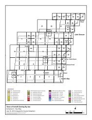
<strong>Town</strong> <strong>of</strong> <strong>Innisfil</strong> <strong>Official</strong> <strong>Plan</strong>LAND USE POLICIESconservation authority prior to any site alteration, development, interference withwetlands and alterations to shorelines and watercourses.3.7.11 Development will generally be directed to areas outside <strong>of</strong> hazardous lands adjacent toriver and stream systems, which are impacted by erosion hazards. The determination<strong>of</strong> the erosion hazard limit will be based on a combined influence <strong>of</strong> the: toe erosionallowance; stable slope allowance; erosion access allowance; and flooding hazard limitor meander belt allowance. A Geotechnical Engineering Study, prepared to thesatisfaction <strong>of</strong> the <strong>Town</strong> and applicable conservation authority, may be required tosupport any development within the erosion hazard limit.3.7.12 Development will generally be directed to areas outside <strong>of</strong> hazardous lands adjacent toLake Simcoe, which are impacted by flooding and erosion hazards. The determination<strong>of</strong> the flooding hazard limit along the shoreline <strong>of</strong> Lake Simcoe shall consider: theaverage annual high water mark <strong>of</strong> 219.15 metres above sea level; the flood allowancefor wave uprush; and the flood allowance for other water related hazards such as icepiling and ice jamming. The erosion hazard limit shall be determined whenconsidering: the stable slope allowance; the average annual recession, and theerosion allowance. The dynamic beach hazard limit will be determined by the floodinghazard limit and an associated allowance. A hazard land study, prepared to thesatisfaction <strong>of</strong> the <strong>Town</strong> and Lake Simcoe Region Conservation Authority, may berequired to support any development within the Hazard Land Area adjacent to LakeSimcoe.3.8 EXTRACTIVE INDUSTRIAL AREAS AND AGGREGATE RESOURCESGoals:To recognize the local, regional and provincial significance <strong>of</strong> mineral aggregateresources.Objectives:1. To protect mineral aggregate resources and existing extractive resources fromincompatible land uses and activities.2. To protect mineral aggregate resources for long-term use.Permitted Uses:3.8.1 Within the Extractive Industrial Area, as shown on Schedule B, uses permitted shall belimited to the following:i) on-site extraction, screening, crushing, stockpiling <strong>of</strong> aggregate or quarry material;ii) associated facilities used in extraction, transport, beneficiation, processing orrecycling <strong>of</strong> mineral aggregate resources and derived products such as asphalt andconcrete, or the production <strong>of</strong> secondary related products;iii) repair and maintenance facilities;iv) associated <strong>of</strong>fice facilities;v) agricultural; andvi) passive outdoor recreational uses provided that they are not developed to the extentthat they preclude the pit and quarry operation.77Adopted July 26, 2006 <strong>Approved</strong> by <strong>OMB</strong> May 2009, March 2010 & April 8, 2011