Innisfil Official Plan OMB Approved - Town of Innisfil
Innisfil Official Plan OMB Approved - Town of Innisfil
Innisfil Official Plan OMB Approved - Town of Innisfil

You also want an ePaper? Increase the reach of your titles
YUMPU automatically turns print PDFs into web optimized ePapers that Google loves.
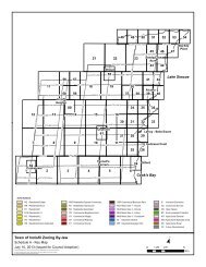
<strong>Town</strong> <strong>of</strong> <strong>Innisfil</strong> <strong>Official</strong> <strong>Plan</strong>MUNICIPAL STRUCTURE2.4.3 The Natural Heritage System, illustrated on Schedule A, includes the larger NaturalEnvironmental Area designations (as per Section 3.1.1) along with linkages amongthem. These linkages should, wherever possible, be located along watercourses orrecognizable topographical features. In some cases, connections may extend throughlands that are currently in agricultural use, and may also cross roads.Appeal #7 only ins<strong>of</strong>ar as it relates to the lands located at the southeast corner <strong>of</strong> the 25 thSideroad and Mapleview Drive.2.4.4 Through a watershed plan, Secondary <strong>Plan</strong> and /or Environmental Impact Study (EIS)additional linkages between Natural Environmental Area designations may be identifiedusing the principles <strong>of</strong> 2.4.7. These linkages will be considered to form part <strong>of</strong> theNatural Heritage System and shall be protected from development. Lands comprisingthe linkage may also be designated Natural Environmental Area as per Section 3.1.1.2.Appeal #8 only ins<strong>of</strong>ar as it relates to the lands located at the southeast corner <strong>of</strong> the 25 thSideroad and Mapleview Drive.2.4.5 Natural Environmental Areas referred to in Section 2.4.3, and as shown on Schedules Band B1 to B14, shall be protected and designated through the land use policies <strong>of</strong>Section 3.1, regardless <strong>of</strong> whether they are located within the Natural Heritage Systemas illustrated on Schedule A.Appeal #9 only ins<strong>of</strong>ar as it relates to the lands located at the southeast corner <strong>of</strong> the 25 thSideroad and Mapleview Drive.2.4.6 The uses permitted in the Natural Heritage System shall be those set out in Section3.1.1.4.Appeal #10 ins<strong>of</strong>ar as it relates to the lands located at the southeast corner <strong>of</strong> the 25 thSideroad and Mapleview Drive.2.4.7 The following general principles shall be used for delineating the Natural HeritageSystem:• Incorporate Natural Environmental Area designated features, as set out inSection 3.1, among which functional linkages can be established.• Preserve, and where possible improve, functional connections among naturalheritage features;• In particular, maintain connections between open water features (e.g., ponds andsmall lakes) and upland woods;• Include local level connections where ever practical and ecologically desirable;• Wherever possible, include coldwater streams, headwater wetlands andassociated woodlands;• Provide for linkages that extend outside <strong>of</strong> the <strong>Town</strong> boundaries as generallydelineated on Schedule A;• Link woodlands that occur along watercourses; and• Evaluate the role <strong>of</strong> smaller woodlands and meadows, and the linkages amongthem and other Natural Environmental Area features, and incorporate them intothe Natural Heritage System where appropriate.Appeal #11 only ins<strong>of</strong>ar as it relates to the lands located at the southeast corner <strong>of</strong> the12Adopted July 26, 2006 <strong>Approved</strong> by <strong>OMB</strong> May 2009, March 2010 & April 8, 2011