Innisfil Official Plan OMB Approved - Town of Innisfil
Innisfil Official Plan OMB Approved - Town of Innisfil
Innisfil Official Plan OMB Approved - Town of Innisfil

You also want an ePaper? Increase the reach of your titles
YUMPU automatically turns print PDFs into web optimized ePapers that Google loves.
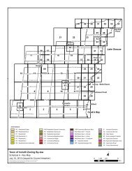
<strong>Town</strong> <strong>of</strong> <strong>Innisfil</strong> <strong>Official</strong> <strong>Plan</strong>LEFROY SECONDARY PLANshall be based on the difference between the number <strong>of</strong> spaces required and thenumber <strong>of</strong> spaces provided on site multiplied by the current space value. Thevalue <strong>of</strong> a parking space may be adjusted from time to time to reflect the localeconomic conditions and shall be established by the municipality based on theland cost and the cost to construct a space. Cash-in-lieu will be used to assist inproviding alternative <strong>of</strong>f-street parking facilities. An agreement to secure thecash-in-lieu arrangement may be required by the municipality.e) In the Core Commercial Area and Neighbourhood/ Mixed Use designations, the<strong>Town</strong> may reduce the parking requirements <strong>of</strong> the zoning by-law where on-streetparking is provided.13.6.5 Trailsa) The planned public trail system is schematically illustrated on ScheduleC2. It uses parks, natural heritage features, valleylands, stormwatermanagement ponds, and on and <strong>of</strong>f-street linkages to create a continuoussystem <strong>of</strong> pedestrian trails and bicycle routes.b) Adjustments to the trail system may be made including the addition or deletion <strong>of</strong>trails without amendment to this plan. The following principles shall apply to thedevelopment <strong>of</strong> such a trail system:i) The system shall respect the natural heritage features;ii) Trails will connect to residential development and link them to the CoreCommercial Area, parks, the arena and the NeighbourhoodCommercial/Mixed Use Area through the development <strong>of</strong> trails in NaturalEnvironmental Areas, buffers, parks, stormwater management ponds and theutilization <strong>of</strong> public sidewalks;iii) Trails will be established in appropriate buffer and open space areas adjacentto and on both sides <strong>of</strong> the rail line where possible;iv) North-south and east-west connections shall be encouraged in eachneighbourhood and linking to adjacent neighbourhoods;v) A wide, paved, lit trail including a crossing <strong>of</strong> Carson Creek shall be providedfrom the residential area north <strong>of</strong> Carson Creek to the north end <strong>of</strong> ChurchDrive.c) The trail system shall be identified on all draft plans <strong>of</strong> subdivision.d) Where a trail is to be constructed in, and adjacent to, an NaturalEnvironmental Area, and where not already addressed in theManagement <strong>Plan</strong> as set out in Section 13.5.1 a) x), the preparation <strong>of</strong> anEIS shall be required to confirm the route, fencing and any requiredmitigation measures.e) Potential pedestrian rail crossings are conceptually delineated onSchedule C2. These potential crossings are intended to providepedestrian linkage to the various neighbourhoods in the Lefroy communityand provide access to open space and the possible GO Rail station. The220Adopted July 26, 2006 <strong>Approved</strong> by <strong>OMB</strong> May 2009, March 2010 & April 8, 2011