Innisfil Official Plan OMB Approved - Town of Innisfil
Innisfil Official Plan OMB Approved - Town of Innisfil
Innisfil Official Plan OMB Approved - Town of Innisfil

Create successful ePaper yourself
Turn your PDF publications into a flip-book with our unique Google optimized e-Paper software.
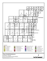
<strong>Town</strong> <strong>of</strong> <strong>Innisfil</strong> <strong>Official</strong> <strong>Plan</strong>MUNICIPAL STRUCTURE(xvi)The proposed expansion area <strong>of</strong>fers the most efficient alternative for utilizingexisting community facilities where capacity is available and can provide a fullrange <strong>of</strong> services to its residents.(xvii) Any area proposed for expansion shall be planned to:• accommodate a compact, transit-supportive form with a mix <strong>of</strong> uses anddensities,• meet the minimum density target <strong>of</strong> 50 residents and jobs per gross hectarein conjunction with other designated greenfield areas,• complement the existing Core Commercial Areas,• serve the needs <strong>of</strong> its population with ample parkland and facilities, and• maximize the use <strong>of</strong> land, existing infrastructure and community facilities.Appeal # 6 only ins<strong>of</strong>ar as it relates to the lands located at the southeast corner <strong>of</strong> the25 th Sideroad and Mapleview Drive.2.3.10 <strong>Plan</strong>ning for infrastructure and public service facilities shall be integrated with theplanning for development, both intensification and greenfield development, to ensurethat public infrastructure and services are available to meet current and projected needswhile being provided in an efficient and cost-effective manner.2.3.11 In identifying intensification areas as per Section 2.3.3 and areas for settlementboundary expansion as per Section 2.3.9, consideration should be given to opportunitiesto optimize existing infrastructure and public service facilities, wherever feasible and costeffective, prior to consideration <strong>of</strong> new infrastructure and public service facilities.2.4 NATURAL HERITAGE SYSTEMIntent:A Natural Heritage System (NHS) recognizes the interdependence <strong>of</strong> natural environmentalfeatures and seeks to incorporate them into a single system. Among a number <strong>of</strong> ecologicalfunctions, an NHS preserves linkages to facilitate the movement <strong>of</strong> flora and fauna, and protectsand enhances surface and groundwater quality. A Natural Heritage System thus seeks tomaintain ecological linkages among natural heritage features on an ecosystem basis, such thattheir existing functions are maintained or enhanced.The Natural Heritage System, shown on Schedule A, builds upon the County GreenlandsSystem such that it integrates and links local natural heritage features <strong>of</strong> significance with thebroader County level initiative.The Natural Heritage System represents areas where it is desirable to maintain existing functionand link environmental features within the <strong>Town</strong>. It is a schematic delineation <strong>of</strong> where localand regional linkages among natural environment features may exist. Only the larger naturalenvironmental features and those where an apparent linkage to the system exists are identified.Other natural environmental features are included in the Natural Environmental Areadesignation as set out in Section 3.1.10Adopted July 26, 2006 <strong>Approved</strong> by <strong>OMB</strong> May 2009, March 2010 & April 8, 2011