Kingscote Gateway Precinct Master Plan - Kangaroo Island Council
Kingscote Gateway Precinct Master Plan - Kangaroo Island Council
Kingscote Gateway Precinct Master Plan - Kangaroo Island Council

Create successful ePaper yourself
Turn your PDF publications into a flip-book with our unique Google optimized e-Paper software.
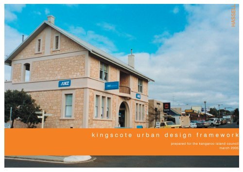
HASSELLk i n g s c o t e u r b a n d e s i g n f r a m e w o r kprepared for the kangaroo island councilmarch 2005
HASSELLc o n t e n t s01 Introduction 202 <strong>Kingscote</strong> in Context 403 Vision for <strong>Kingscote</strong> 604 Understanding <strong>Kingscote</strong> 905 <strong>Kingscote</strong> Framework 2106 Implementation <strong>Plan</strong> 41a p p e n d i xA separate document has been prepared as an Appendixto all four frameworks. This document includes:————Methodology for the projectReview of previous studiesConsultation resultsDevelopment <strong>Plan</strong> Policy Review
i n t r o d u c t i o n
i n t r o d u c t i o nINTRODUCTIONThe <strong>Kangaroo</strong> <strong>Island</strong> Centres Project involves the preparation of strategicurban design frameworks for the key townships of the <strong>Island</strong> being<strong>Kingscote</strong>, Penneshaw, American River and Parndana. The project isaimed at positioning the townships of <strong>Kangaroo</strong> <strong>Island</strong> to enhance theircharm and character, meeting community expectations and delivering onthe needs of the tourists who visit the <strong>Island</strong>.Urban design frameworks are relatively new instruments for <strong>Council</strong>sundertaking urban improvement strategies. They focus on collectivelyaddressing the various elements of urban environments, like movementand land use, that bear strong relationships. The output of frameworksinclude an interpretable vision for how a place should ‘look, feel andfunction’.The information contained in this framework broadly identifies thedirections for each town in both the short and long term. The frameworkshave been specifically developed to guide decision making and to ensurethat the many public and private initiatives that will inevitably occur overtime will act to achieve the desired outcome for each town.Consequently the actions arising from the framework target policychanges and capital works. This approach will help to deliver bettertownship environments in the long term ensuring they are welcoming,economically prosperous, and enjoyable places to live and visit.‘An Urban Design Frameworkis a tool to provide a visionand strategic direction tocreate more vibrant, attractiveand commercially successfulplaces. Such frameworks assist<strong>Council</strong>s, State GovernmentAgencies, the private sector andthe local community to focusresources and effort into areasof strategic importance– to achieve a long term visionTo develop a robust long-term series of frameworks for thekey townships of <strong>Kangaroo</strong> <strong>Island</strong>, position the townshipsto enhance their charm and character, meet communityexpectations and deliver on the needs of the tourist.or direction.’2
k i n g s c o t e i n c o n t e x t
k i n g s c o t e i n c o n t e x tKINGSCOTE IN CONTEXTBeing the largest of the towns on <strong>Kangaroo</strong> <strong>Island</strong> with a residentpopulation of approximately 1,800 people, <strong>Kingscote</strong> has developed asthe <strong>Island</strong>’s civic, commercial and community focus. The township issignificant as the original settlement of South Australia and is a gatewayfor many visitors arriving by air and sea.The town has appealing natural assets but has not made the transitionfrom a rural and industrial centre to a major tourist ‘destination’. The townhas not capitalised on the <strong>Island</strong>’s significant tourism opportunities.Key issues to address include the visual appeal of the town, developmentof key assets (such as the wharf), public realm improvements and theprovision and diversity of services and facilities.Key Assets of <strong>Kingscote</strong> Include—————Picturesque coastal settingMajor employment hub of the <strong>Island</strong>The <strong>Island</strong>’s civic, retail, education, health and servicesector focusHeritage and culture, with a particular emphasis on ReevesPointThe townships infrastructure - water, sewer and electricityservicesSignificant issues and pressures facing <strong>Kingscote</strong> include— The increasing demand for residential and rural livingallotments— Current pressures for coastal and marina developments— A lack of development and investment in the wharf area— A limited ‘capture’ of the tourist market – provision ofactivities and facilities to meet their needs——Poor legibility and sense of arrival in the townshipPolicy direction to protect and enhance the character of thetownship4
v i s i o n f o r k i n g s c o t e5
v i s o n f o r k i n g s c o t eWhat will <strong>Kingscote</strong> be in 20 years time?How will we achieve this?What will drive change?A ‘vision’ is something to strive for – it sets a clearly articulated directionof a desired outcome for current and future generations. A vision mustalso be flexible enough to respond to changing circumstances andopportunities.It is about balancing between community, economic and environmentalpriorities while retaining the historical and cultural significance of<strong>Kingscote</strong>.The development of a vision for <strong>Kingscote</strong> has involved communityengagement and extensive consultation.Vision for <strong>Kingscote</strong><strong>Kingscote</strong> will continue to develop as the principal township on the <strong>Island</strong>,being the civic, commercial and community focus, with a major role inservicing the <strong>Island</strong>’s tourist market.————Township growth will be concentrated, where possible, withinthe current township boundariesDauncey Street will be the major shopping and commercialprecinct of the <strong>Island</strong>Development adjacent to the <strong>Kingscote</strong> foreshore will focuson the tourism and hospitality industry, with cafés, outdoordining and tourist accommodation capitalising on the scenicbeauty of this areaThe <strong>Kingscote</strong> wharf will continue to be a working port andrecreational fishing facility, but with a significantly improvedtourism focus6
d e v e l o p i n g t h e v i s i o nDEVELOPING THE VISIONCommunity ConsultationCommunity involvement played a large role in the development of thevision and urban design framework for <strong>Kingscote</strong>. The community andlocal businesses were invited to participate in workshops to assist inthe development of a vision and to identify key issues and priorities for<strong>Kingscote</strong>.The community consultation process involved:————Reviewing past documentation involving extensive communityconsultation (including previous studies, reports, Development <strong>Plan</strong>reviews and updates)Public and stakeholder meetingsMedia releases, brochures and displaysCommunity survey and feedback opportunitiesCommunity FeedbackKeys issues and priorities arising form the <strong>Kingscote</strong> communityconsultation included:——————Improve entry statements and the overall appearance of thetownshipRetain the town’s identity, its safe, friendly and relaxedenvironment.Attract and retain small businessesDevelop the wharf area for community, commercial andrecreational useMaintain height restrictions for development along theforeshoreUpgrade the <strong>Kingscote</strong> ocean pool7
u n d e r s t a n d i n g k i n g s c o t e
u n d e r s t a n d i n g k i n g s c o t eUNDERSTANDING KINGSCOTEA ‘layered’ approach has been taken to understanding<strong>Kingscote</strong> – what makes up the town, how does itwork, how do the various layers relate?Such layers include:Breaking the town into identifiable <strong>Precinct</strong>sUnderstanding Movement patterns, including vehicle,freight, sea, and pedestrian/cycle patternsUnderstanding Urban FormAssessing Entrances and Legibility of the townshipInvestigating Public Space, Open Space and LinkagesRecognising Heritage, both cultural and built formEconomic Vitality of <strong>Kingscote</strong>9
u n d e r s t a n d i n g k i n g s c o t ePRECINCTSIdentifying precincts with similar characteristics is a useful way toassess their role, function, impact, activity and influence on the town.This is also a useful way of addressing land use policy changes andphysical changes that are needed within a discrete area. We haveidentified several precincts that can be addressed independently interms of physical and land use policy changes.1The initial precincts identified during the analysisphase included:41. Open Fields – <strong>Gateway</strong> Lands North2. Open Fields - <strong>Gateway</strong> Lands South33. Commercial/Industrial Entrance4. Recreation/Education5. Town Centre2576. Foreshore7. Wharf610
u n d e r s t a n d i n g k i n g s c o t e—Elevated land highly visible from entrance road—Provides visual/physical containment of the town—Acts as parkland surroundsOpen Fields - <strong>Gateway</strong> Lands North—Currently zone Deferred Urban—Zoned for future commercial use—Less visible due to thick screen of vegetation along roadside—More appropriate for development than northern areaOpen Fields - <strong>Gateway</strong> Lands South—Highly visible area that forms an urban gateway to the towncentre—Contains unattractive commercial and industrial sitesdominated by service and storage yards visible from the roadCommercial / Industrial Entrance <strong>Precinct</strong>—Streetcape includes little landscaping and is heavilyimpacted by overhead power lines—Includes main sports oval, high school, netball courts—Focus of recreation activityRecreation / Education <strong>Precinct</strong>——Oval area has scenic views to the coast.Could be further developed to expand and improve facilities11
u n d e r s t a n d i n g k i n g s c o t e—Includes a mix of residential, community and commercial land useactivities—Main retail area and focus of the precinct is Dauncey Street—Built form has a diverse and mixed appearance—Includes some significant historic buildingsTown Centre <strong>Precinct</strong>—Most cohesive development occurs along Dauncey Streetwhere building form, density and scale is consistent. Thisstyle and form of development needs to be replicated inother areas if activity within the centre is to expand—Includes the open space areas along the ocean front andstrip of development along the Esplanade—Unrealised as an asset for <strong>Kingscote</strong>—Few businesses, other than Ozone Hotel, capitalise on thescenic outlook to the coast—Area of high amenity value and could possibly support increasedcommercial activity to take advantage of the coastal outlookForeshore <strong>Precinct</strong>—Includes recreation assets (beach and ocean pool) that lackgood linkages with the town—Supports a range of activities including recreational boatingand commercial fishing—Could become a major destination and gateway to the town—Needs more activity to enliven the areaWharf <strong>Precinct</strong>——Should become an important node that complements thefunction of the town centre (Dauncey Street)Currently acts as a gateway for visitors arriving by sea12
u n d e r s t a n d i n g k i n g s c o t eMOVEMENTA review of the traffic issues associated with <strong>Kingscote</strong> identified:———Signed entry into town (currently at Murray Street) directstraffic into the middle of the one-way only main street(Dauncey Street). This junction could be improved with adedicated right turn lane and better delineation.Supplementary signs are needed on approach to towndirecting traffic to Dauncey Street and other activity areas.Main Street (Dauncey Street) is divided by Murray Street.Suggest extending pedestrian links in Dauncey Street toprovide continuous facility and change priority on MurrayStreet using traffic control devices.——A better option for access into the town centre may be viaCommercial Street to direct traffic to one end of the mainstreet. The intersection of Telegraph/ Giles/ Commericalwould need to be modified to reduce conflicts.Dauncey Street could benefit from additional pedestrian linksto the foreshore to provide greater integration between thetwo zones.13
u n d e r s t a n d i n g k i n g s c o t eURBAN FORM<strong>Kingscote</strong>’s urban form comprises a simple grid form of roads and a varietyof built form including historic commercial and residential buildings,industrial sheds, and the simple building forms of post war commercialdevelopment.General Comments—————Iconic buildings include the Ozone and Queenscliff Hotels,the <strong>Council</strong> offices and bank buildingIntense commercial development along Dauncey Streetcreates an interesting and vibrant street within the centreThe wide streets, variable setbacks and low density ofdevelopment around the centre contribute to a dull andlifeless appearanceTraditional building materials include stone, brick, andcorrugated ironThe heritage qualities of the town have been eroded by;modifications, neglect, the nature of new development,signage, and the visual dominance of elements such as theoverhead power lines14
u n d e r s t a n d i n g k i n g s c o t eENTRANCES & LEGIBILITYDescriptionTelegraph and Kohinoor Roads are the primary entrance roads to <strong>Kingscote</strong>and an important gateway influencing the ‘first impressions’ of thetown. Unfortunately, this entrance road lacks visual appeal due to the natureof land uses that line the road and the lack of prominent street treesand good landscaping. This is undesirable, especially in the context ofthe <strong>Island</strong>’s significant tourism industry. Furthermore, there are severalintersections that lead to the ‘central retail core’ of the town and it is difficultto understand which is the primary entrance road.Key OpportunitiesTelegraph Road – Introducing new street trees that create a strong visualavenue would help distract attention away from adjoining activities andpresent a better visual appearance. Longer term approaches wouldinclude removal of overhead powerlines and land use policy changes tosupport the precinct’s role as an important gateway.TELEGRAPH ROAD15
u n d e r s t a n d i n g k i n g s c o t eENTRANCES & LEGIBILITYTourist RoutesThere are two routes that could be developed/appropriately signed to actas tourist routes into the town. Importantly, these routes capitalise on thearea’s natural assets and scenic outlook to the coast.One route involves the existing turn-off from the main highway toBrownlow. This route provides coastal views and arrives at <strong>Kingscote</strong>’sforeshore. Unfortunately, this route passes through residential areaswhich could cause some conflict.The most scenic route of the two is accessible from the highway andenters the town via historic Reeves Point. Unfortunately, this route is yetto be fully developed and is constrained by native vegetation issues.DestinationsThe primary destination within the town is the retail precinct of DaunceyStreet. Dauncey is the Main Street of the town and main activity areafor social and economic activity. The foreshore and wharf areas aresubstantial assets of the town. These areas offer views of the ocean,and recreation areas, but could be further developed to attract morecommercial activity.Key Issues———Appearance of entrance road (Kohinoor Rd) and futurerezoningLack of streetscaping – generalLack of well defined route to town centre16
u n d e r s t a n d i n g k i n g s c o t eOPEN SPACE & LINKAGESMajor open space areas within <strong>Kingscote</strong> include the Recreation <strong>Precinct</strong>,the foreshore and the open rural surrounds of the town. These areas areimportant but lack good connections with the town. Some, like the wharfand foreshore area, are underdeveloped as recreation areas.The area is under-utilised and would benefit from some commercialactivity and improved infrastructure. In the future, the wharf may becomea gateway if a successful ferry service is introduced.Key OpportunitiesLinear NetworkA linear trail connecting open space nodes around the townwould provide better access to key areas for local residentsand serve as a tourist attraction for visitors. This is akey opportunity in the short term as there are no obviousbarriers to developing this infrastructure.Ocean PoolThe ocean pool is a unique asset and valuable recreationfacility. It could be further developed and enhanced toimprove its current condition. By connecting it with thelinear trail, it would become a more accessible and visiblefeature on the foreshore.WharfThe wharf is strategically important because of its closeproximity to the town, historical use, current operation andattractive outlook. However, it is disjointed and hard tounderstand, particularly in terms of public and private spaces.17
u n d e r s t a n d i n g k i n g s c o t eHERITAGE<strong>Kingscote</strong> has a significant heritage, being the site for the originalEuropean settlement of South Australia in 1836. The town failed toexpand as a colony following Colonel Light’s selection of Adelaide for theState’s capital.The site of the original settlement of <strong>Kingscote</strong>, at Reeves Point, has beenpreserved and is a key tourist and recreation asset for the town. Howeverlinkages with the town need to be reinforced.Based on a heritage survey, the character of the town is largelyderived from:—————The early port related buildings within the wharf precinctincluding the former police station, court house and cellsThe early buildings constructed of limestone with corrugatedroofs and projecting chimneysThe mix of domestic and commercial buildings within thetown centre indicating the growth of the town over variousperiodsThe landmark two storey buildings including the OzoneHotel, The Queenscliff Hotel, the Town Hall and current bankbuilding on the corner of Dauncey and Commercial StreetThe established planting of mature Norfolk <strong>Island</strong> Pinesalong the foreshoreA separate heritage study leading to amendments to the <strong>Kangaroo</strong><strong>Island</strong> Development <strong>Plan</strong> has been prepared18
u n d e r s t a n d i n g k i n g s c o t eECONOMIC VITALITY<strong>Kangaroo</strong> <strong>Island</strong> has essentially a rural economy, with a spread ofindustries and occupations which compliment its natural resources.While the labour market has diversified over the years, the sheep industryremains the dominant agricultural industry. Tourism continues to growas one of the <strong>Island</strong>’s major industries, with employment in retailing andhospitality almost matching agricultural employment (KI DevelopmentBoard Strategic <strong>Plan</strong> 2003-2008).The cost of living on <strong>Kangaroo</strong> <strong>Island</strong> is approximately 15% higher thanon the South Australian mainland. Further, with the growth in tourism andthe “sea change” trend, property values are escalating significantly.<strong>Kingscote</strong> is the largest town on <strong>Kangaroo</strong> <strong>Island</strong>, with almost half of the<strong>Island</strong>’s total population residing in this quaint coastal town.Being the <strong>Island</strong>’s civic, retail, education, health and services sectorfocus, <strong>Kingscote</strong> plays a significant role in the overall economy of<strong>Kangaroo</strong> <strong>Island</strong>.Retail/Commercial Activity———Dauncey Street remains the <strong>Island</strong>’s major retail, commercialand civic hubThe ‘Centre’ provides a range of convenient and comparisongoods – meeting the needs of the <strong>Island</strong>’s local communityDoes the ‘Centre’ meet tourist expectations and needs –tourist related facilities, limited trading hours, accessibility?Current Major Developments————Major residential development adjacent foreshore (underconstruction)Minor development (under consideration)Supermarket expansionNew large residential subdivisionRetail/Commercial Activity—————Reinforce the role and function of Dauncy Street as the ‘TownCentre’Extended retail trading hoursExpand the role and function of <strong>Kingscote</strong> as a ‘tourist town’Ensure sufficient serviced land is available for townshipgrowthDevelop strategies to retain and expand existing businesses19
k i n g s c o t e f r a m e w o r k
k i n g s c o t e f r a m e w o r kBACKGROUNDThe <strong>Kingscote</strong> Urban Design Framework consists of three separatecomponents:— Structure <strong>Plan</strong>— Township Form— Key <strong>Precinct</strong> <strong>Plan</strong>sThe Structure <strong>Plan</strong> sets the broad framework for the long termdevelopment of <strong>Kingscote</strong>. This plan relates to the whole of the town andits adjacent hinterland. In contrast, Township Form relates specificallyto the <strong>Kingscote</strong> Town Centre, addressing such issues as Built Form,Movement and Parking, Economic Vitality and Heritage Conservation.The Key <strong>Precinct</strong> <strong>Plan</strong>s identify site specific concepts and actions forlocations which will have the greatest opportunity for influencing longterm change and perceptions of <strong>Kingscote</strong>.Structure<strong>Plan</strong>TownshipFormKey <strong>Precinct</strong><strong>Plan</strong>s21
k i n g s c o t e f r a m e w o r kKINGSCOTE STRUCTURE PLANThe <strong>Kingscote</strong> Structure <strong>Plan</strong> has been developed to broadly recognisethe key features and desired outcomes for the town, such as gateways,appropriate areas for growth, linear trails and land use precincts.The Structure <strong>Plan</strong> has been developed in recognition of the town’s existingDevelopment <strong>Plan</strong>. It concentrates on the need to protect the town’srural qualities, accommodate growth, improve visual appeal and facilitatedevelopment in appropriate areas.Development <strong>Plan</strong> Implications/Directions——————The creation of additional land for residential expansionA township containment lineThe preservation of the rural/open space appearance of landat the entrance to the townRezoning of existing residential properties for infill developmentThe creation of a linear trail networkThe identification of policy areas for inclusion of theDevelopment <strong>Plan</strong>, to reinforce the role and nature of landuses within defined precincts within the town centre—————To bring into affect some or all of these changes will require anamendment to the existing Development <strong>Plan</strong> including further detailedinvestigation to justify the amendments.Introduce Structure <strong>Plan</strong> For <strong>Kingscote</strong> within theDevelopment <strong>Plan</strong> (based on plan shown in Framework).Review Residential zone provisions to address diversitybetween towns and the context of each site (current zoneapplies to whole <strong>Island</strong>).Specifically develop a policy area within <strong>Kingscote</strong> topromote infill development (as shown on Structure <strong>Plan</strong>).Infill development provisions should be revised to allowsuitable standards of medium density development (ie widthsand sizes of allotments).District Centre Zone to include policy areas to reinforcecharacter and land use in distinguishable precincts22
k i n g s c o t e f r a m e w o r kKINGSCOTE STRUCTURE PLAN1 Accommodating residential expansionLand in the south-west of the township (currently zonedcommercial) should be rezoned to residential. This is alogical extension of the existing urban form of <strong>Kingscote</strong>,resulting in greater capacity for township growth.2 Protecting rural urban contrastThe contrast between the rural and urban area of <strong>Kingscote</strong>helps define and characterise the town. The area nominatedon the structure plan is highly visible and should be protectedfrom ‘residential sprawl’. This land may be suitablefor rural living as a transition area.3 Landscape BufferA landscape buffer will be required between the proposedresidential growth area and the existing commercial (lightindustrial area).4/6 Key NodesKey nodes have been identified (such as Reeves Point andthe ocean pool) because of their importance as destinationswithin the town.5 Development ImpactThis land is currently zoned Deferred Urban, however it iswithin an area that is relatively untouched by intense formsof development within a picturesque environment.23
k i n g s c o t e f r a m e w o r kTOWNSHIP FORMThe Township form component of the framework applies to the towncentre area of <strong>Kingscote</strong>. It is intended to provide generic guidancefor the physical development of this area and specific directionfor movement to enhance the permeability, legibility, and safetywithin the centre. Essentially this means creating a structure thatpromotes vitality and animation, and is easy to move around in.The town centre of <strong>Kingscote</strong> comprises a relatively sparse array ofbuilt form apart from the more compact development along DaunceyStreet. This form of development creates a greater sense of the publicand private realm, encloses the street and creates a more legible andattractive pedestrian environment. Over time the opportunity exists to infillthe gaps between buildings or replace existing structures with built formthat encloses and addresses the street front. This is particularly importantalong the foreshore and along Commercial Road which should becomethe primary entrance to the town centre.Existing Development24
k i n g s c o t e f r a m e w o r kTOWNSHIP FORM1. Residential Development (under construction)2. Ozone Hotel – ensure surrounding development maintainsprominence of original building3. Key site at entrance to central area (parcel created byreconfiguration of intersection - see sketch on followingpages). Could be developed as an iconic structure including 2storey component.4. Future development along Commercial and Dauncey Streetshould seek to address and enclose the street. This shouldinclude shopfronts and businesses that open out onto the street5/6. Development along the foreshore should include existingcharacter buildings and respectful new development formsat 2 – 3 storeys, with active ground level activities – retail /restaurants.7. <strong>Kangaroo</strong> <strong>Island</strong> <strong>Council</strong> Offices: important building to beretained and upgraded8. Retain and expand on intensity of built form and land usesalong Dauncey Street.Note - This image is not intended to provide an exhaustive concept of infill development form but rather provide an indicative image of how new development can help reinforce important streets and entrances25
k i n g s c o t e f r a m e w o r kTOWNSHIP FORMGeneric Guidelines for the CentreGood architecture or design of the built form, such as interesting shopfronts,verandahs and detailing can provide interest and engage the visitor.Particular attention can be given to window to wall relationships (e.g.traditional heritage buildings before 1945 have smaller window to wallratios i.e. smaller areas of glass). Consistency in design of roof pitches isalso encouraged. The provision of awnings or verandas, or some form ofpublic shelter is desirable.Building up to the boundary, such as in the traditional Town Centrestreets, helps to create a more stimulating and animated environment byplacing the interface between private and public space right on the footpath.In terms of vertical scale, a maximum of 2 storeys is recommendedas the building height limit in the Town Centre, though some 3 storey builtform may be appropriate along the foreshore.Lot line development defines the pedestrian space in a designated area.To build right up to the edge of the boundary is interpreted as commercial,while a larger setback is interpreted as suburban and residential.In traditional streetscapes buildings are built to the boundary. There is atrend for new developments to provide parking at the front of premises,effectively decaying the edge and pushing the buildings back from thestreet. The distance between opposite buildings defined by the fronts ofbuildings is one of the key elements defining a street. To maintain thestreetscape character it is encouraged that new developments be built tothe boundary.Development <strong>Plan</strong> Implications / Directions——Provide strong Guidance for future development within theDistrict Centre by providing graphic prescriptions for setbacks,façade treatments, signage etc. in accordance with thecontent of this framework.Incorporate a concept plan highlighting the need for futurelinkages with the foreshore (as shown on the movement andparking framework plan).26
k i n g s c o t e f r a m e w o r kTOWNSHIP FORMMovementThe town centre of <strong>Kingscote</strong> benefits from a permeable grid layout ofroads. However it lacks a well defined ‘primary’ entrance to guide visitorsand create a strong sense of arrival. While there are no significantmovement issues within the town, future improvements are possible andmay be achieved by designating sites for off-street parking, improving pedestriansafety at intersections, developing more links between DaunceyStreet and the foreshore area, and establishing a primary entrance routealong Commercial Road.Creating a foreshore linear trail (forming part of a broader network) is animportant project in the short term. This would provide a valuable assetfor both visitors and the local community linking key features of the townincluding the Ocean Pool, Wharf, and Reeves Point.A.B.C.Create a Primary entrance to the centre at Commercial RoadCapitalise on future redevelopment opportunities to createnew linksChange traffic priority at crossing to improve pedestrian safetyMovement and Parking FrameworkACB27
k i n g s c o t e f r a m e w o r kTOWNSHIP FORMMovementThe ability to create a primary entrance along Commercial Road willdepend greatly on the treatment to the intersection with Telegraph Road.The current configuration of the intersection is a potential hazard andtakes up a large area of land. This intersection could be vastly improvedby redesigning the intersection and capitalising on the remaining land fora landscape feature or iconic built form.ExistingProposedTown Centre EntranceCreating a primary entrance to the centre at Commercial RoadExistingProposedDauncey Street CrossingsLinking Dauncey St with the foreshore28
k i n g s c o t e f r a m e w o r kKEY PRECINCT PLANSThe precinct plans focus on key areas of the town that serve differentroles and functions. The plans identify site specific actions, concepts andguidelines to improve the function, appearance and vitality of these areas.The precincts include areas that serve or will serve a vital role in the futureof <strong>Kingscote</strong> as a diverse and attractive centre that provides a good rangeof services and facilities, promotes community life and attracts morevisitors.The precincts include:— Wharf <strong>Precinct</strong>— Foreshore (Tourism) <strong>Precinct</strong>— Retail (Main Street) <strong>Precinct</strong>— <strong>Gateway</strong> <strong>Precinct</strong>— Business <strong>Precinct</strong>29
k i n g s c o t e f r a m e w o r kKINGSCOTE WHARF PRECINCTThe wharf is one of <strong>Kingscote</strong>’s most important and underutilised assets.Whilst there is a clear need to maintain the wharf’s operational functionsit needs to be developed in a way that maximises its tourism potential andappeal as a ‘destination’.This will be achieved by creating better public infrastructure, clearlydefined public spaces, attracting commercial (tourism related) operatorsand preserving its role as an operational wharf. Further work will be requiredat a detailed level to ensure existing and future operations (includingcommercial fish & ferry services) can be adequately catered for.Development <strong>Plan</strong> Implications / Directions——Existing concept plan should be revised and updated to incorporatechanges arising from the masterplan.Protection of habitat for penguins may be an issue to beaddressed in the zone provisions to ensure new developmentdoes not have adverse impacts.It is important to recognise that a separate wharf study has beencommissioned and is currently being prepared.30
k i n g s c o t e f r a m e w o r kKINGSCOTE WHARF PRECINCTKey priorities include:1.2.3.4.5.6.7.8.9.10.11.12.Formalise parking area to create a more legible space for parkingand introduce trees to soften harsh appearance of bitumen. Thiswill be an important facility for visitors arriving at <strong>Kingscote</strong> and anoverflow parking area for the centre.Ideal site for restaurant or café capitalising on elevated position andattractive outlook. Could become a significant tourist attractionCreate a well defined public space on the wharf as a refuge fromtransport and commercial operations. The space should be enclosedwith built form to define the area. Possible uses include touristoperators, marine interpretive centre, information centre. This wouldbe an ideal site for an iconic and central tourist attraction. Publicspace could be used as a weekend market area.Define road space to control movement of vehicles, accommodatemovement of vehicles and improve safetyProvide sufficient areas for car/boat and truck turn-around to supportcommercial fishing on wharfRetain and enhance public recreation area and ensure goodpedestrian link with town centrePreserve penguin habitat and improve conditions for viewingincluding boardwalks and platformsEnsure public spaces on the wharf have access to appealing ocean viewsProvide public viewing areas as part of the wharf pedestrian trail– would provide a refuge that allows people to view activitiesassociated with boating and commercial fishingIntegrate wharf trail with Foreshore Linear TrailInvestigate potential uses for buildingProtect pelican-feeding to maintain tourist appeal of the wharf31
k i n g s c o t e f r a m e w o r kFORESHORE (TOURISM) PRECINCTFuture development of the foreshore precinct will be critical to the successof the town as a destination for the substantial number of visitorsfrom both within and outside the <strong>Island</strong>. This area offers a unique andattractive outlook to the ocean with the main focus being the Ozone Hotel.However, with no other tourism or retail related land uses to generateactivity this precinct has a relatively ‘lifeless’ appearance. The naturalattributes of this precinct make it a highly desirable location as demonstratedby the current residential development opposite the Ozone Hotel.Tourist accommodation is a use that should be promoted in conjunctionwith hospitality related activities including cafés, restaurants and retailoutlets. To avoid eroding <strong>Kingscote</strong>’s township qualities it will be importantto limit excessive building heights and form that is not complimentaryto historic buildings within the precinct.Development <strong>Plan</strong> Implications / Directions————Development of a coastal linear trail with nodal points andfacilitiesDevelopment of new linkages with Dauncey StreetPreparation of Development Guidelines to control future builtform (in relation to height, mass & design)Creating good linkages with the Wharf area32
k i n g s c o t e f r a m e w o r kFORESHORE (TOURISM) PRECINCT33
k i n g s c o t e f r a m e w o r kFORESHORE (TOURISM) PRECINCTDevelopment <strong>Plan</strong> Implications / Directions——Create a Policy area within the District CentreZone to promote the foreshore area as aprecinct incorporating tourism and hospitalityservices (including cafes, restaurants, retailand tourist accommodation) capitalising on thescenic outlook to the coast.Integrate more specific controls for development(both prescriptive and performance based) toensure good minimum standards of developmentwhich are flexible enough to allow for a rangeof appropriate development forms. Prescriptivecontrols should be graphic and address issuesof height, style, future links with Dauncey Streetand public realm opportunitiesForeshore Tourism <strong>Precinct</strong>Existing Site34
k i n g s c o t e f r a m e w o r kRETAIL/COMMERCIAL (MAIN STREET) PRECINCTThe Retail/Commercial – (Main Street) <strong>Precinct</strong> expands the focus ofretail/commercial services and facilities beyond Dauncey Street to includeCommercial Street and the northern section of Dauncey Street. Thisproposal positions Commercial Street as the main entrance road withinthe town centre with the aim of creating a more visually appealing andvibrant strip of activities. This will present a more stimulating environmentand attractive gateway to Dauncey Street and the foreshore. In urbandesign terms this means creating an ‘active edge’ to the street front.Practically, this involves introducing new built form, at the street edgewith narrow frontages and numerous windows and doors. Dauncey Street(south of Commercial Street) represents a good example of this form ofdevelopment.35
k i n g s c o t e f r a m e w o r kRETAIL/COMMERCIAL (MAIN STREET) PRECINCT36
k i n g s c o t e f r a m e w o r kRETAIL/COMMERCIAL (MAIN STREET) PRECINCTDevelopment <strong>Plan</strong> Implications / Directions—Create Policy Area to distinguish and reinforcethe role of the Retail (main street) <strong>Precinct</strong> withinthe District Centre Zone. This would include adesired future character statement describing theintentions for the precinct as the principal locationfor local services including intense retail typical ofcentral ‘main street’ areas.—Establish policy areas for the remainder of theDistrict Centre Zone including the Business<strong>Precinct</strong> to reinforce its role for showrooms,offices, consulting rooms, and retail warehouses.—Incorporate graphic design guidelines to illustrate preferredforms of development within each policy area. The Entrance<strong>Precinct</strong> in particular requires more prescriptive descriptionsof preferred forms of development to that which exists in thecurrent zone provisions.37
k i n g s c o t e f r a m e w o r kBUSINESS PRECINCTThe business precinct is an area of <strong>Kingscote</strong>’s centre that accommodatesa mix of commercial and residential land uses. The area should retain itsmix of activity but within a more cohesive form. Particular attention shouldbe given to development of vacant parcels of land, avoiding blank walls atthe street front, signage control, and streetscaping.38
k i n g s c o t e f r a m e w o r kBUSINESS PRECINCTExample of mixed-use block within Business <strong>Precinct</strong>39
k i n g s c o t e f r a m e w o r kGATEWAY PRECINCTEnhance the entrance to <strong>Kingscote</strong> along Kohinoor and Telegraph Roads, through— undergrounding powerlines— integrated landscaping treatment— provision of a central landscaped median (requires further investigation)— consideration of complimentary land uses adjacent to entrance roads.40
i m p l e m e n t a t i o n p l a n41
i m p l e m e n t a t i o n p l a nItem Action DesignDevelopmentEntrance / Kohinoor Rd Prepare detailed streetscape plan including entrance statement(if appropriate).Work with owners of businesses along Kohinoor Rd to improvevisual appearance of service yards, parking areas etc.Adopt design guidelines / policies within Development <strong>Plan</strong> tofacilitate better appearance of built form and landscaping.CapitalWorksPAR Responsibility Priority<strong>Council</strong> / <strong>Plan</strong>ning SA /Progress AssociationPLECS<strong>Council</strong> / Business Owners<strong>Council</strong> / <strong>Plan</strong>ning SAImmediateOngoingMedium termTown Centre Update Development <strong>Plan</strong> to incorporate new policy areas thatreflect the desired land use and built form for each precinctwithin the centre and future linkage and parking areas.<strong>Council</strong> / <strong>Plan</strong>ning SAImmediate – Medium termAdopt design guidelines that promote better developmentparticularly along the retail/civic strips and foreshore area.<strong>Council</strong> / <strong>Plan</strong>ning SAMedium termPrepare streetscaping plan for commercial street as a focusand entrance to the central area.<strong>Council</strong> / <strong>Plan</strong>ning SAMedium termPrepare detailed concept for open space area along DarcyStreet (fronting Queenscliff Hotel).Change priority of vehicle movements at the intersection ofMurray/Dauncey Street and Commercial/Dauncey Street.<strong>Council</strong> / Traders /<strong>Plan</strong>ning SA<strong>Council</strong>Medium termImmediatePrepare a strategy for progressively improving streetscapingelements along all streets within the town centre includingplanting and street furniture scheduled for a consistentapproach.<strong>Council</strong>l / ProgressAssociationLong termForeshore Seek funding from the open space unit at <strong>Plan</strong>ning SA toprepare a detailed concept plan for a linear Foreshore Trail.<strong>Council</strong> / <strong>Plan</strong>ning SAImmediateUpgrade ocean swimming pool to improve and broaden theappeal of the facility.<strong>Council</strong>Medium termWharfReview outcome of independent wharf master plan exercise. Keyareas to address within include:Formalising the vacant parking areas adjacent <strong>Kingscote</strong>Esplanade.<strong>Council</strong> / EconomicDevelopment Board /Transport SAHighCreating a commercial development site at the eastern end ofthe existing car parking area.Defining public areas within the wharf including a centralpublic space area.42
i m p l e m e n t a t i o n p l a nItem Action DesignDevelopmentWharf Better delineation of roadways, parking areas and turn-aroundareas.Township Structure<strong>Plan</strong>Preservation of penguin areas and pelican feeding.Investigations for potential use of existing buildings includingthe potential for demolition and redevelopment.Seek funding from “Places for People” to update Development <strong>Plan</strong>via PAR to:Create a residential policy area for infill development tominimise pressures for residential expansion (see frameworkplan).Protect visually sensitive areas at the entrance to the town topreserve the strong rural/urban interface.Develop structure plan for the expansion and staging of newresidential areas – also undertake further investigations relatedto visual impact and servicing.Heritage Adopt policies to give greater protection to the historiccharacter of the township particularly around the town centrearea (refer heritage report for specific recommendations).Include local and contributory places of heritage significancewithin the Development <strong>Plan</strong> (as per Heritage Report)Appoint heritage advisor to assist with management andfunding of conservation activities.CapitalWorksPAR Responsibility Priority<strong>Council</strong> / <strong>Plan</strong>ning SAImmediate – Medium term <strong>Council</strong>/Heritage SA High – Medium <strong>Council</strong>/Heritage SA High – Medium<strong>Council</strong>/Heritage SA Progressively upgrade buildings nominated in heritage report <strong>Council</strong>/Heritage SALandlordsEconomic Development Develop ‘community owned business incubator’ with focus ongourmet food and wine production (see recommendation fromPeter Kenyon in appendices)<strong>Council</strong>/KIDB Expand current gallery space with a set of workshop spaces <strong>Council</strong> Upgrade current Town Hall facility as a conference facility <strong>Council</strong>Prepare local tourism and audit plan (see recommendationsfrom Peter Kenyon)<strong>Council</strong>/KIDB/SAJCMediumLowMedium43