Padma Multipurpose Bridge Project
Padma Multipurpose Bridge Project
Padma Multipurpose Bridge Project

Create successful ePaper yourself
Turn your PDF publications into a flip-book with our unique Google optimized e-Paper software.
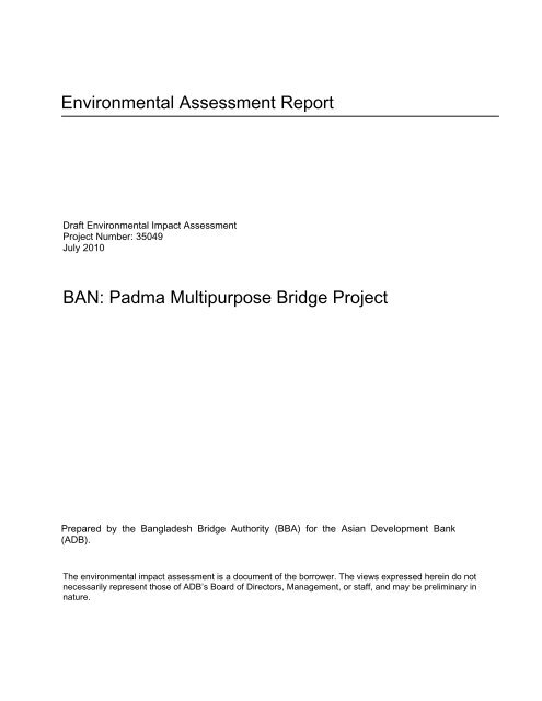
Environmental Assessment ReportDraft Environmental Impact Assessment<strong>Project</strong> Number: 35049July 2010BAN: <strong>Padma</strong> <strong>Multipurpose</strong> <strong>Bridge</strong> <strong>Project</strong>Prepared by the Bangladesh <strong>Bridge</strong> Authority (BBA) for the Asian Development Bank(ADB).The environmental impact assessment is a document of the borrower. The views expressed herein do notnecessarily represent those of ADB’s Board of Directors, Management, or staff, and may be preliminary innature.
Table of ContentsList of Abbreviations and Acronyms1 Introduction 1-11.1 <strong>Project</strong> Background 1-11.1.1 Need of the <strong>Project</strong> 1-11.1.2 <strong>Project</strong> Location/Setting 1-11.1.3 Key <strong>Project</strong> Components 1-31.1.4 <strong>Project</strong> Financing 1-41.1.5 Present Stage of <strong>Project</strong> Preparation 1-41.2 Environmental Policy, Legal, and Institutional Framework 1-51.2.1 Government Environmental Policy, Regulations, and Guidelines 1-51.3 Environmental Safeguards of Co-Financiers 1-141.3.1 ADB Environmental Requirements 1-141.3.2 The World Bank Requirements 1-141.3.3 The Japan International Cooperation Agency Requirements 1-151.3.4 The Islamic Development Bank (IDB) Requirements 1-161.4 Harmonized Environmental Safeguard Requirements of the Co-financiers 1-161.5 Review of the Past Environmental Assessment and Related Studies 1-161.5.1 Key elements of the Review 1-161.5.2 Pre-feasibility Study (February 2000 IEE) 1-171.5.3 JICA Feasibility Study (March 2005 IEE and EIA) 1-171.5.4 BBA Study (June 2006 EIA, EMP) 1-191.5.5 ADB Study (ADB PPTA May 2007) 1-211.5.6 Status on EIA Clearance by DOE 1-221.5.7 Findings of the Review Process 1-221.6 Key Additional Aspects for Consideration 1-231.6.1 Addressing Rail Components 1-231.6.2 Incorporating Climate Change Considerations 1-241.6.3 Addressing Associated and Induced Regional Impacts 1-241.6.4 Integration of Environment with Engineer’s Planning and Social Issues 1-241.7 Methodology and Process Followed 1-251.7.1 Development of Scoping Document and TOR 1-251.7.2 Methodology and Process 1-251.7.3 Impact Assessment and Prioritization 1-271.7.4 Organization of the Report 1-272 Description of the <strong>Project</strong> 2-22.1 <strong>Project</strong> Location and Setting 2-22.2 Existing Traffic and Forecasts 2-42.3 <strong>Project</strong> Design Details 2-62.3.1 Main <strong>Bridge</strong> 2-72.3.2 River Training Works 2-82.3.3 Approach Roads 2-142.3.4 <strong>Bridge</strong>-end-Facilities 2-152.3.5 Railway 2-182.3.6 Utility Crossings 2-18
2.3.7 Resettlement Sites 2-192.4 Summary of the Size or Magnitude of Operation 2-202.5 Sourcing of Resources for <strong>Project</strong> Implementation 2-212.6 Proposed Schedule for Implementation 2-222.7 Relevant Associated Components 2-252.7.1 Widening of Dhaka-Mawa Highway (N8) 2-252.7.2 Bypass Road in Group B of Rajuk 2-252.7.3 Railway Network Development 2-252.7.4 Gas Main Network Development 2-252.7.5 High Voltage Power Transmission Network Development 2-252.7.6 Telecommunication Network Development 2-253 Description of the Environment 3-13.1 Physical Resources 3-13.1.1 Topography 3-13.1.2 Soils 3-33.1.3 Landuse 3-73.1.4 Climate 3-113.1.5 Geology and Geomorphology 3-143.1.6 Surface Water Resources 3-173.1.7 Groundwater Resources 3-213.1.8 Bathymetry 3-213.2 Ecological Resources 3-233.2.1 State of Biodiversity 3-233.2.2 Forests and Protected Areas 3-253.2.3 Ecological Baseline Survey 3-253.2.4 Fisheries 3-423.2.5 Insects and Butterflies 3-493.2.6 Benthos 3-503.3 Environmental Quality 3-503.3.1 Air Quality 3-523.3.2 Noise Quality 3-533.3.3 Surface Water Quality 3-553.3.4 Groundwater Quality 3-563.3.5 Riverbed Sediment Quality 3-573.4 Social and Cultural Profile 3-593.4.1 Population and Community Characteristics 3-593.4.2 Socio-economic Conditions 3-593.4.3 Land Acquisition 3-603.4.4 Physical and Cultural Resources 3-613.5 Economic Activities 3-623.5.1 Agriculture 3-623.5.2 Fisheries 3-633.5.3 Ferry Operations and Ferry Ghats 3-633.5.4 Health and Safety 3-643.5.5 Tourism 3-643.5.6 Access to Health Services 3-653.5.7 Access to Education 3-653.5.8 Water Supply and Sanitation 3-673.5.9 Roads and Communication 3-67
3.5.10 Access to Energy 3-694 Scoping and Prioritization of Impacts/Risks 4-14.1 Scoping Framework 4-14.1.1 Methodology 4-14.1.2 <strong>Project</strong> Boundaries 4-24.2 Identification of Environmental Impacts 4-44.3 Prioritization of Environmental Impacts 4-44.4 Induced Environmental Impacts at Regional Level 4-125 Climate Change Considerations 5-15.1 Scoping 5-15.2 Data and Information Collection and Methods Followed 5-25.2.1 GHG Consideration 5-25.2.2 Impacts Consideration 5-25.3 Climate projections 5-35.3.1 Future Sea Level Rise 5-35.3.2 Temperature <strong>Project</strong>ion 5-55.3.3 Wind Forces 5-55.4 Analysis of Environmental Effects 5-55.4.1 GHG Considerations 5-55.4.2 Impact Consideration 5-65.5 Identification of Mitigation/Adaptive Measures 5-75.5.1 GHG Management Plan 5-75.5.2 Impacts Management/Adaptive Plan 5-85.6 Monitoring, Follow-up and Adaptive Management 5-86 Analysis of Alternatives 6-16.1 Framework for Assessment of Alternatives 6-16.1.1 Assessment Framework 6-16.2 Weighted Scores of Alternatives 6-26.3 Without the <strong>Project</strong> Alternative 6-36.4 Alternative Analysis during Feasibility Study 6-36.4.1 Location/Alignment of <strong>Bridge</strong> 6-36.4.2 Type of <strong>Bridge</strong> 6-106.5 Alternative Analysis during Detailed Design 6-106.5.1 Design of Main <strong>Bridge</strong> 6-106.5.2 Design of Transition Structures 6-186.5.3 Modifications of Feasibility Design: BEF & Navigation Clearance 6-186.6 River Training Works 6-196.6.1 Alternative 1 - Revetment on Bank of Southside Channel 6-196.6.2 Alternative 2 - : Guide Bund and Upstream Hard Points on South Bank 6-206.6.3 Alternative 2 Modified – Hard points in Char: 6-216.7 Preferred Options 6-296.8 Conclusion 6-307 Assessment of Impacts/Risks for Preferred Alternative 7-17.1 Preamble 7-17.2 <strong>Project</strong> Related Significant Impacts 7-1
10.2.3 Public Consultation 10-910.3 Feedback Obtained and Incorporated 10-1210.3.1 Expert Consultations 10-1210.3.2 Focus Group Discussion 10-1610.3.3 Public Consultation 10-2310.3.4 Information Disclosure 10-3211 Economic Assessment 11-111.1 Introduction 11-111.2 <strong>Project</strong> Costs 11-111.2.1 Overall <strong>Project</strong> Costs 11-111.2.2 Environmental Costs 11-211.3 Traffic Forecasts 11-311.3.1 Demographic Changes 11-311.3.2 Regional Economic Development Impacts 11-311.4 <strong>Project</strong> Benefits 11-511.4.1 Revenue Forecasts 11-511.5 Cost Benefit Analysis 11-611.5.1 Economic Evaluation Results 11-611.5.2 Sensitivity Analysis 11-712 Conclusions 12-1
List of Abbreviations and AcronymsADB Asian Development Bank km KilometerAIDS Acquired Immune Deficiency Syndrome LBS Left bank sideAHs Affected Households LGED Local Government Engineering DepartmentAPs Affected Persons LS LumpsumAQM Air Quality Monitoring LT Low Power TransmissionAs Arsenic m MeterBARI Bangladesh Agriculture Research Institute M&E Monitoring and EvaluationBBA Bangladesh <strong>Bridge</strong> Authority MAOP Maximum allowable operating pressureBMD Bangladesh Meteorological Department Mg MercuryBRTA Bangladesh Road Transport Authority MIS Management Information SystemBWDB Bangladesh Water Development Board MM Man monthBWTA Bangladesh Water Transport Authority Mn ManganeseCDF Confined Disposal Facility MOC Ministry of CommunicationCEAP Construction Environmental Action Plan MOEF Ministry of Environment and ForestCEMC Community Environmental Management Committee MOHFW Ministry of Health and Family WelfareCEMP Community Environmental Management PlanMOLGRDCMinistry of Local Government, Rural Developmentand CooperativesCommunity Environmental Management and MonitoringCEMMPPlan MSDS Material Safety Data SheetCl Chloride NEMAP National Environmental Management Action PlanCNG Compressed natural gas NGO Non Governmental OrganizationCNGO Coordinating NGO NMVOC Non Methane Volatile Organic CompoundsCP Cathode Protection NOx Nitrous OxidesCSC Construction Supervision Consultant O/M Operation and MaintenanceCY Construction Yard OH Occupational Healthd/s Downstream OHS Occupational Health and SafetyDC District Commissioner PAPs <strong>Project</strong> Affected PersonsDG Director General Pb LeadDMB Disaster Management Bureau PDB Power Development BoardDOE Department of Environment PEC Probable Effect ConcentrationDOF Directorate of Fisheries PEI Potential Environmental ImpactDPHE Department of Public Health Engineering PIU <strong>Project</strong> Implementation UnitDSMP Dredge Spoil Management Plan PM Particulate MatterEA Environmental Assessment PMBP <strong>Padma</strong> <strong>Multipurpose</strong> <strong>Bridge</strong> <strong>Project</strong>ECA Environment Conservation Act POE Panel of ExpertsECC Environmental Clearance Certificate PPE Personal Protection EquipmentECP Environmental Code of Practice PPP Public Private PartnershipED Executive Director PPTA<strong>Project</strong> Preparatory TechnicalAssistanceEEC Environmental Enhancement Committee PRA Participatory Rapid AppraisalEEF Environmental Enhancement Fund PRECIS Providing Regional Climates for Impacts StudiesEF Emission Factor PVAC Property Valuation Advisory CommitteeEFAR Economic and Financial Analysis Report PWD Public Works DatumEIA Environmental Impact Assessments RAP Resettlement Action PlanEMC Environmental Management Committee RBS Right bank sideEMMP Environmental Management and Monitoring Plan RCM Regional Climate ModelEMP Environmental Management Plan REA Rapid Environmental AssessmentEMS Environmental Management System REB Rural Electrification BoardEQS Environmental Quality Standards RF Resettlement FrameworkERC Emergency Response Center RHD Roads and Highways DepartmentKFAED Kuwait Fund for Arab Economic Development RS Resettlement Sites
ERP Emergency Response Plan RTWs River training worksERT Emergency Response Team RVA Range of Variability ApproachEU Environmental Unit SA Social AccountabilityFC Fecal Coliform SAM Social Accounting MatrixFD Forest Department SD Safeguard DepartmentFGDs Focus Group Discussions SDF Social Development FundFe Iron SEIA Summary EIAFHWA Federal Highway Administrators SHWL Standard High Water LevelFS Feasibility study SLR Sea Level RiseFWCs Family welfare centers SLWL Standard Low Water LevelGBM Ganges-Brahmaputra-Meghna SOx Sulphur OxidesGCM Global Climate Model SPM Suspended Particulate MatterGHG Greenhouse Gas STI Sexually Infected TransmissionsGIS Geographic Information System TC Total coliformGOB Government of Bangladesh TGB Target Group BeneficiariesGWAVA Global Water Availability Assessment Tk Bangladesh Taka (Currency)HIV Human Immunodeficiency Virus TL Trip LengthHWL Highest Water Level TNM Traffic Noise ModelHYV High Yield Variety TOR Terms of ReferenceIDB Islamic Development Bank TT Travel TimeIEC Information, Education and Communication TTC Travel Time CostsIECs Important Environmental Components u/s UpstreamIEE Initial Environmental Examination UHC Upazila Health ComplexIGS Income Generation Schemes UHFWC Union Health and Family Welfare CentresILRP Income and Livelihood Restoration Plan UP Union ParishadIMS Inner Marginal Strip VEC Valuable Ecosystem ComponentIOL Inventory of Losses vkm Vehicle kilometerISO International Standardization Organization WARPO Water Resources Planning OrganizationIUCN International Union of Conservation of Nature WB World BankJICA Japan International Cooperation Agency WSB Wildlife Society of BangladeshConversions1 ha = 10,000sq.m1 ha = 2.47acre1 acre = 100 decimal1 USD = Tk70
Table of Contents1 Introduction 1-11.1 <strong>Project</strong> Background 1-11.1.1 Need of the <strong>Project</strong> 1-11.1.2 <strong>Project</strong> Location/Setting 1-11.1.3 Key <strong>Project</strong> Components 1-31.1.4 <strong>Project</strong> Financing 1-41.1.5 Present Stage of <strong>Project</strong> Preparation 1-41.2 Environmental Policy, Legal, and Institutional Framework 1-51.2.1 Government Environmental Policy, Regulations, and Guidelines 1-51.3 Environmental Safeguards of Co-Financiers 1-141.3.1 ADB Environmental Requirements 1-141.3.2 The World Bank Requirements 1-141.3.3 The Japan International Cooperation Agency Requirements 1-151.3.4 The Islamic Development Bank (IDB) Requirements 1-161.4 Harmonized Environmental Safeguard Requirements of the Co-financiers 1-161.5 Review of the Past Environmental Assessment and Related Studies 1-161.5.1 Key elements of the Review 1-161.5.2 Pre-feasibility Study (February 2000 IEE) 1-171.5.3 JICA Feasibility Study (March 2005 IEE and EIA) 1-171.5.4 BBA Study (June 2006 EIA, EMP) 1-191.5.5 ADB Study (ADB PPTA May 2007) 1-211.5.6 Status on EIA Clearance by DOE 1-221.5.7 Findings of the Review Process 1-221.6 Key Additional Aspects for Consideration 1-231.6.1 Addressing Rail Components 1-231.6.2 Incorporating Climate Change Considerations 1-241.6.3 Addressing Associated and Induced Regional Impacts 1-241.6.4 Integration of Environment with Engineer’s Planning and Social Issues 1-241.7 Methodology and Process Followed 1-251.7.1 Development of Scoping Document and TOR 1-251.7.2 Methodology and Process 1-251.7.3 Impact Assessment and Prioritization 1-271.7.4 Organization of the Report 1-27List of AnnexureAnnex 1-1: Harmonized Safeguard PoliciesAnnex 1-2: Terms of Reference for the EIA StudyAnnex 1-3: DOE Approval of the TORList of TablesTable 1-1: Estimated <strong>Project</strong> Cost a 1-4Table 1-2: National Legal Instruments 1-7Table 1-3: List of International Treaties and Conventions Signed by Bangladesh 1-10List of FiguresFigure 1-1: <strong>Project</strong> Location Map 1-2Figure 1-2: <strong>Project</strong> Components 1-3Figure 1-3: Steps followed for Environmental Clearance Certificate for Red Category <strong>Project</strong>s 1-13Figure 1-4: Methods of Environmental Assessment Preparation. 1-26Figure 1-5: Flow Chart of the Process with Chapters 1-28
1 Introduction1.1 <strong>Project</strong> Background1.1.1 Need of the <strong>Project</strong>1. The proposed <strong>Padma</strong> <strong>Multipurpose</strong> <strong>Bridge</strong> Design <strong>Project</strong> (PMBDP) is a very important largescale infrastructure project in the communication sector. Implementation of the project will significantlybenefit various sectors of the economy of Bangladesh. The <strong>Padma</strong> River isolates the southwest zoneof Bangladesh from other parts of the country. There have been substantial improvements anddevelopment in the road network of the southwest zone of Bangladesh, yet this zone remains beyondthe advantages of integrated road network due to the lack of a bridge over the <strong>Padma</strong> River. Currentlythe link between the southwest zone and the rest of the country across the <strong>Padma</strong> River is only byferry. The capacity of ferry services is very limited, and waiting time at ferry ghats is more than 2 hoursfor buses and light vehicles and more than 10 hours for trucks. In addition, the Riverbanks of the<strong>Padma</strong> are very unstable, especially in the south side (Janjira) and the River width changes frequently,leaving approach ghats seasonally inoperative. The expansion of existing ferry terminals is madedifficult by these conditions.2. The proposed bridge will provide direct links between two major seaports of the country andconnects missing links for Tamabil-Sylhet-Sorail-Kanchpur-Dhaka-Mawa-Bhatiapara-Norail-Jessore-Benapole highway and will be an integral part of the Asian Highway No 1 and Trans-Asian railwaynetwork systems. The distance from Dhaka to nearly all major destinations in the southwest region willbe reduced by 100 kilometers (km) or more, that will bring considerable savings in passenger andcommodity movement time and costs, as well as vehicle operation and maintenance costs, whilelengthening the useful life of vehicles, savings in fuel consumption, and reducing the air emission.Riverbank protection will reduce bank erosion and the incidence of worsened vulnerability and povertyamong people affected by bank erosion. By constructing the bridge, economic development of thesouthwest will promote industrial and commercial activity and improve economic and employmentopportunities for local people. There will also be better access to healthcare facilities available atDhaka. Easier communication will help expand education and training facilities, and the resulting skillsdevelopment will ensure the availability of high-skilled workers. The construction of the bridge over the<strong>Padma</strong> River is a top priority development agenda for the Government of Bangladesh (GOB) that willnot only benefit the southwest region but the country as a whole.3. There is an urgent need to replace unsafe ferry and launch operations between Dhaka and thesouthwest region by safer and more reliable surface transport. Overloaded vessels frequently sink inthis waterway when passing through the turbulent confluence of the <strong>Padma</strong> and Meghna Rivers. Thesocial, economic, and industrial underdevelopment of the southwest zone, that encompassesBangladesh’s second major port, Mongla; its third main city, Khulna; and the inland port at Benapole,is due in part to difficult access across the <strong>Padma</strong> River to the rest of the country. A bridge across the<strong>Padma</strong> River will certainly strengthen links between the southwest and north-central zones. Amultipurpose bridge will enhance freight, passenger, railway transportation, and utility crossings (highpressure gas transmission, high voltage power transmission, and optical fiber telecommunicationcable) between Dhaka and major points in the southwest zone and contribute substantially to thedevelopment of the southwest zone as well as to the national and regional economic growth.1.1.2 <strong>Project</strong> Location/Setting4. The <strong>Project</strong> area is located in the south-central part (Munshiganj, Shariatpur, and MadaripurDistricts) of Bangladesh. The specific area at north side (Mawa) of the <strong>Padma</strong> <strong>Bridge</strong> comprisesLauhajang and Srinagar Upazila in Munshiganj District whereas at south side (Janjira) of the bridgecomprises Janjira Upazila under Shariatpur District and Shibchar Upazila under Madaripur District.The <strong>Project</strong> influence area will broadly cover (a) the corridor of the Asian Highway 1 (Tamabil-Sylhet-Sorail-Kanchpur-Dhaka-Mawa-Bhatiapara-Norail-Jessore-Benapole), (b) the corridor of Trans-Asianrailway network and the railway missing link from Gendaria-Mawa through the bridge to Bhanga-Kashiani-Narail-Jessore-Benapole and (c) the Charland in up and downstream of the <strong>Padma</strong> River. Inaddition, the network for utility connections (a) high pressure gas transmission line will link theBakhrabad Gas Field to Siddirganj to augment gas supply then through an off-take valve atLangalbandh of Sonargaon Upazila under Narayanganj District will be the source point for gas supplyto Mawa, which will cross the <strong>Bridge</strong> (on the lower deck) and will follow upto Khulna for completing the1-1
proposed National Gas Grid, (b) high voltage power transmission line will source power fromSiddirganj in Narayanganj district then Mawa and cross the River (running parallel and away from thebridge) then to Khulna, and (c) optical fiber telecommunication cable on the lower deck of the bridge.The detail of the project location is presented in Figure 1-1.Figure 1-1: <strong>Project</strong> Location Map1-2
1.1.3 Key <strong>Project</strong> Components5. The project consists of the following direct components:Main bridge (6.15km long) and transition structures (<strong>Bridge</strong> End Viaducts);River Training Works;<strong>Bridge</strong> Connecting Approach Roads (about 2.3km at Mawa side and 12.8km at Janjira side)and associated structures6 bridges, 14 culverts, 7 underpasses, and 11 junctions;2 Toll Plazas ( 1 at Mawa and other at Janjira);2 Construction Yards (area at Mawa= 81ha and at Janjira=78ha);2 Service Areas (area at Mawa=27.2ha and at Janjira=63.7ha);4 Resettlement Sites (2 at Mawa: RS02: Jashaldia with area 13.96ha, RS03: Kumarbhog with15.46ha and 2 at Janjira: RS04: Paschim Naodoba with area 19.95ha and RS05:Bakhorerkandi with area 18.45ha, respectively);Future provision of Railway on the lower deck of the bridge; andProvision of utility Crossings (high pressure gasmain and optical fiber telecommunicationcable).Figure 1-2: <strong>Project</strong> Components1-3
6. The main components of the <strong>Project</strong> are shown in Figure 1-2. More detail information on the<strong>Project</strong> components is given in Chapter 2.7. There are some components associated with the <strong>Project</strong>, which require further assessments like;widening of Dhaka-Mawa Highway from two to four-lanes, establishment of railway network fromGendaria-Mawa through the bridge to Bhanga-Kashiani-Narail-Jessore, and bypass Road in Group Bdevelopment area of Rajuk (Capital City Development Authority). Implementation of these componentsmay take place over a period of time. To draw full benefits of the <strong>Padma</strong> <strong>Bridge</strong> project,implementation of these components will be necessary. A general assessment is made since thecorrect alignment is not known at this stage.1.1.4 <strong>Project</strong> Financing8. The detailed cost estimate of the project is done during scheme design; the current estimate isabout US$2.4 billion (Table 1-1). GoB has been in discussion with various co-financiers to participatein the investment of the <strong>Project</strong>. A number of co-financers has already showed interest and extendedtheir commitments. These co-financiers include the Asian Development Bank (ADB), the World Bank(WB), the Japan International Cooperation Agency (JICA), and the Islamic Development Bank (IDB).In addition to the Co-financiers, GoB will also contribute in the implementation of the <strong>Project</strong>.Table 1-1: Estimated <strong>Project</strong> Cost a<strong>Project</strong>Final SchemeComponentUSD million1. Construction CostMain <strong>Bridge</strong>907.5 bServices on the Main <strong>Bridge</strong> 41.4Approach Roads 131.6Road Viaducts 60.5Rail Viaducts 7.8Rail facilities 36.8<strong>Bridge</strong> End Facilities 68.3River Training Works 597.4Ferry Route Adjustment 8.0Construction Yard 57.5Total Construction Cost 1916.82. Engineering CostConstruction Supervision46.4 c3. Administration CostConstruction supervision - 10% Construction Supervision 4.64. Land Acquisition & Resettlement & EMP cost 2105. Physical Contingency 85.9 d6. Duty Tax (VAT etc) 155.3 eTotal <strong>Project</strong> Cost 2,419Source: <strong>Project</strong> Cost Estimate, April 8, 2010Notes:a Cost will be updated once again after the engineers’s estimateb Includes contractor on‐costs for site overheads, supervision and margin (estimated at 11.57% of construction cost)c estimated at 3% of the construction cost excluding contractor on‐costsd estimated at 5.0% of the construction cost excluding contractor on‐costse estimated at 14.5% of the cost of imported items1.1.5 Present Stage of <strong>Project</strong> Preparation9. The <strong>Project</strong> is now in its detailed design stage. In the process of detailed design, variousalternatives have been reviewed to arrive at the preferred project design. In arriving at the preferred1-4
option, a consideration has been made to technical, economic, proven successful previous use,aesthetic, environmental and social aspects of the alternatives.1.2 Environmental Policy, Legal, and Institutional Framework10. Regulatory requirements toward protection and conservation of environment and variousenvironmental resources and also toward protection of social environment from adverse impact ofprojects and activities associated with them have been enunciated by the GoB as well as the cofinanciersPertinent among these requirements are summarized as under.1.2.1 Government Environmental Policy, Regulations, and Guidelines1.2.1.1 National Environmental Policy, 199211. The Bangladesh National Environmental Policy, approved in May 1992, sets out the basicframework for environmental action together with a set of broad sectoral action guidelines. Keyelements of the Policy are:Maintaining ecological balance and ensuring sustainable development of the country throughprotection and conservation of the environmentProtecting the country from natural disastersIdentifying and regulating all activities that pollute and destroy the environmentEnsuring environment-friendly development in all sectorsEnsuring sustainable and environmentally sound management of the natural resourcesMaintaining active association, as far as possible, with all international initiatives related toenvironment12. The Environmental Policy of 1992, which amongst other policies, seeks to ensure that transportsystems, including roads and inland waterways, do not pollute the environment or degrade resources.The Policy states that Environmental Impact Assessments (EIA) should be conducted before projectsare undertaken.1.2.1.2 National Environment Management Action Plan (NEMAP), 199513. The National Environmental Management Action Plan (NEMAP) is a wide-ranging and multifacetedplan, which builds on and extends the statements, set out in the National EnvironmentalPolicy. NEMAP was developed to address issues and management requirements during the period1995 to 2005, and set out of the framework within which the recommendations of the NationalConservation Strategy are to be implemented. NEMAP was developed based on the following broadobjectives:Identification of key environmental issues affecting BangladeshIdentification of actions necessary to halt or reduce the rate of environmental degradationImprovement of the natural environmentConservation of habitats and bio-diversityPromotion of sustainable developmentImprovement of the quality of life of the people14. To this end, it has grouped all the relevant necessary actions under four heads: institutional,sectoral, location-specific and long-term issues. The institutional aspects reflect the need of intersectoralcooperation to tackle environmental problems those need new and appropriate institutionalmechanisms at national and local levels. The sectoral aspects reflect the way the Ministries andagencies are organized and make it easier to identify the agency to carry out the recommendedactions. The location-specific aspect focuses on particularly acute environmental problems at locallevels that need to be addressed on a priority basis. The long-term issues include environmentaldegradation of such degree that it might become more serious and threatening than they seem to be iftheir cognizance is not immediately taken.1-5
1.2.1.3 The Environment Conservation Act, 1995 (subsequent amendments in 2000 and 2002)15. The provisions of the Act authorize the Director General (DG) of Department of Environment toundertake any activity he deems fit and necessary to conserve and enhance the quality of environmentand to control, prevent and mitigate pollution. The main highlights of the act are:Declaration of Ecologically Critical Areas;Obtaining Environmental Clearance Certificate;Regulation with respect to vehicles emitting smoke harmful for the environment;Regulation of development activities from environmental perspective;Promulgation of standards for quality of air, water, noise, and soils for different areas and fordifferent purposes;Promulgation of acceptable limits for discharging and emitting waste;Formulation of environmental guidelines relating to control and mitigation of environmentalpollution, conservation and improvement of environment1.2.1.4 Environment Conservation Rules, 1997 (subsequent amendments in 2002 and 2003)16. The Environment Conservation Rules, 1997 are the first set of rules promulgated under theEnvironment Conservation Act, 1995. These Rules provide for, inter alia, the following:The national Environmental Quality Standards (EQS) for ambient air, surface water,groundwater, drinking water, industrial effluents, emissions, noise and vehicular exhaust;Categorization of industries, development projects and other activities on the basis of actual(for existing industries/development projects/activities) and anticipated (for proposedindustries/development projects/activities) pollution load;Procedure for obtaining environmental clearance;Requirement for undertaking IEE and EIA as well as formulating EMP according to categoriesof industries/development projects/activities;Procedure for damage-claim by persons affected or likely to be affected due to pollutingactivities or activities causing hindrance to normal civic life.17. Depending upon location, size and severity of pollution loads, projects/activities have beenclassified in ECR, 1997 into four categories: Green, Orange A, Orange B and Red respectively, to nil,minor, medium and severe impacts on important environmental components (IECs). Correspondingcategories of bridge projects are based on lengths and are as under:‣ Red Category Item 67: include construction / reconstruction / extension of Regional, National andInternational highways/ railways. Item 68: include construction/ reconstruction / extension of bridges over 100 meters inlength.‣ Orange B Category Item 63: include construction / reconstruction / extension of Feeder road (District road),local streets. Item 64: include construction / reconstruction / extension of bridges under 100 meters inlength.1.2.1.5 The EIA Guidelines for Industry, 199718. The EIA Guidelines is a handbook for procedures for preparing the EIAs and for reviewing themfor the benefit of the development partners, EIA Consultants, reviewers, and academicians. Whilepreparing these guidelines, the present environmental status as well as the need for rapid economicdevelopment of Bangladesh has been kept in view. These considerations have essentially resulted insimpler procedures to be followed for preparing the EIAs and their review.1-6
1.2.1.6 Relevant National Polices19. Table 1-2 presents an outline of the other National legal instruments that will have relevance tothe proposed PMPB with respect to the social and environment considerations. The EIA is prepared incompliance with these national policies.Table 1-2: National Legal InstrumentsAct/Rule/Law/Ordinance Responsible Agency-Ministry/AuthorityEnvironment Court Act, 2000 Ministry of Environmentand subsequent amendments and Forestin 2002National Land TransportPolicy, 2004The National Water Policy,1999The Vehicle Act, 1927The Motor VehiclesOrdinance, 1983The Bengal Motor VehicleRules, 1940The Brick Burning (Control)Act, 1989The Brick Burning (Control)Amendment Act, 1992 and2001The Removal of Wrecks andObstructions in inlandNavigable Water Ways Rules1973Roads and HighwaysDepartmentMinistry of WaterResourcesBangladeshTransport(BRTA)RoadAuthorityMinistry of Environmentand ForestBangladesh WaterTransport AuthorityKey Features-Potential Applicability GOB has given highest priorityto environment pollution andpassed ‘Environment Court Act,2000 for completingenvironment related legalproceedings effectively All new roads and majorimprovements will be subjectedto an Environmental ImpactAssessment, Funding will be provided formitigation measures, The Government will publishenvironmental standards fornew roads and new designstandards addressingenvironmental issues. Protection, restoration andenhancement of waterresources; Protection of water quality,including strengtheningregulations concerning agrochemicalsand industrialeffluent; Sanitation and potable water; Fish and fisheries; and Participation of localcommunities in all water sectordevelopment. Exhaust emission; Vehicular air and noisepollution; Road/traffic safety; Vehicle Licensing andRegistration Fitness of Motor Vehicles Parking bylaws. Control of brick burning Requires a license from theMoEF for operation; Restricts brick burning with fuelwood Removal of wrecks andobstructions in inland NavigableWaterwaysWater Supply and Sanitation Ministry of Local Management and Control of1-7
Act/Rule/Law/Ordinance Responsible Agency-Ministry/AuthorityAct, 1996Government, RuralDevelopment andCooperativesThe Ground WaterUpazila ParishadManagement Ordinance 1985The Forest Act, 1927 andsubsequent amendments in1982 and 1989National Forest Policy, 1979with amendment in 1994The Private Forests OrdinanceAct, 1959Bangladesh Wild Life(Preservation) Act, 1974National Biodiversity Strategyand Action Plan (2004)The Protection andConservation of Fish Act 1950subsequent amendments in1982National Fisheries Policy,1998Ministry of Environmentand ForestMinistry of Environmentand ForestRegional Forest Officer,Forest DepartmentMinistry of Environmentand ForestBangladesh Wild LifeAdvisory BoardMinistry of Environmentand ForestBangladesh Wild LifeAdvisory BoardMinistry of Fisheries andLivestockMinistry of Fisheries andLivestockKey Features-Potential Applicabilitywater supply and sanitation inurban areas. Management of ground waterresources; Tube well shall not be installedin any place without the licensegranted by Upazila Parishad Reserve Forests; Protected Forests; Village Forests Afforestation of 20% land. Bio-diversity of the existingdegraded forests Strengthening of agriculturalsector Control of Global warming,desertification, control of tradein wild birds and animals Prevention illegal occupation ofthe forestlands, free felling andhaunting of wild animalsConservation of private forests and forthe afforestation on wastelandsPreservation of Wildlife Sanctuaries,parks, reserves Conserve, and restore thebiodiversity of the country forwell being of the present andfuture generations; Maintain and to improveenvironmental stability forecosystems; Ensure preservation of theunique biological heritage of thenation for the benefit of thepresent and future generations; Guarantee the safe passageand conservation of globallyendangered migratory species,especially birds and mammalsin the country; and Stop introduction of invasivealien species, geneticallymodified organisms and livingmodified organisms.Protection and Conservation of fishes inGovernment owned water bodiesPreservation, management andexploitation of fisheriesresources in inland open water;1-8
Act/Rule/Law/Ordinance Responsible Agency-Ministry/AuthorityThe Embankment andDrainage Act 1952Antiquities Act 1968The Acquisition andRequisition of ImmovableProperty Ordinance 1982 andsubsequent amendments in1994, 1995 and 2004The Factories Act, 1965Bangladesh Labour Law, 2006Ministry of WaterResourcesMinistry of CulturalAffairsKey Features-Potential Applicability Fish cultivation andmanagement in inland closedwater; Prawn and fish cultivation incoastal areas; and Preservation, management andexploitation of sea fisheryresourcesAn Act to consolidate the laws relatingto embankment and drainage and tomake better provision for theconstruction, maintenance,management, removal and control ofembankments and water courses forthe better drainage of lands and fortheir protection from floods, erosion andother damage by waterThis legislation governs preservation ofthe national cultural heritage, protectsand controls ancient monuments,regulates antiquities as well as themaintenance, conservation andrestoration of protected sites andmonuments, controls planning,exploration and excavation ofarchaeological sites.Ministry of Land Current GoB Act and Guidelines,relating to acquisition and requisition ofland.Ministry of LaborThis Act pertains to the occupationalrights and safety of factory workers andthe provision of a comfortable workenvironment and reasonable workingconditions.National Landuse Policy, 2001 Ministry of Land The plan deals with land uses forseveral purposes including agriculture(crop production, fishery and livestock),housing, forestry, industrialization,railways and roads, tea and rubber. Theplan basically identifies land useconstraints in all these sectors.National Agriculture Policy,1999Draft Wetland Policy, 1998Ministry of AgricultureMinistry of Environmentand ForestThe act deals with the programs relatedto make the nation self-sufficient in foodthrough increasing production of allcrops, including cereals, and ensure adependable food security system for all Establishment of principles forsustainable use of wetlandresource;Maintenance of existing level ofbiological diversity; Maintenance of the functionsand values of wetlands; and1-9
Act/Rule/Law/Ordinance Responsible Agency-Ministry/AuthorityKey Features-Potential Applicability Promotion and recognition ofthe value of wetland functionsin resource management andeconomic development.1.2.1.7 List of International Treaties and Conventions Signed by Bangladesh20. List of environment related international conventions, protocols, treaties signed/ratified oraccessed by Bangladesh are given in Table 1-3No.Table 1-3: List of International Treaties and Conventions Signed by BangladeshEnvironment Related InternationalConventions, Protocols and treaties01 International Plant Protection Convention(Rome, 1951)02 International Convention for thePrevention of Pollution of the Sea by Oil(London. 1954 (as amended on 11 April1962 and 21 October 1969)03 Plant Protection Agreement for theSouth East Asia and Pacific Region (asamended) (Rome, 1956)04 Treaty Banning Nuclear Weapon Testsin the Atmosphere, in Outer Space andunder Water (Moscow, 1963)05 Treaty on Principles governing theActivities of States in the Exploration anduse of outer Space Including the Moonand Other Celestial Bodies (London,Moscow, Washington, 1967)06 International Convention Relating toIntervention on the High Seas in Casesof Oil Pollution Casualties (Brussels,1969)07 Convention on Wetlands of InternationalImportance especially as WaterfowlHabitat (Ramsar, 1971) (“RamsarConvention”)08 Convention on the Prohibition of theDevelopment, Production andStockpiling of Bacteriological (Biological)and Toxic Weapons, and on TheirDestruction (London, Moscow,Washington, 1972)09 Convention Concerning the Protection ofthe World Cultural and natural Heritage(Paris, 1972)10 Convention on International Trade inEndangered Species of Wild Fauna andflora (Washington, 1973.) (“CITESConvention”)11 United Nations Convention on the Law ofthe Sea (Montego Bay, 1982.)12 Vienna Convention for the Protection ofthe Ozone Layer (Vienna, 1985.)Signed13.03.85Ratified/Accessed(AC)/Accepted(AT)/Adaptation (AD)01.09.7828.12.81(entry into force)04.12.74 (AC)(entry into force)14.10.86 (AC)04.02.82(entry into force)20.04.92(ratified)13.03.8503.08.83(Accepted)03.11.83 (ratified)20.11.81 18.02.8210.12.8202.08.90 (AC)31.10.90(entry into force)13 Montreal Protocol on Substances that 02.08.90Being Ratified1-10
No.Environment Related InternationalConventions, Protocols and treatiesDeplete the ozone Layer (Montreal1987.)13a. London Amendment to the MontrealProtocol on substances that Deplete theOzone Layer (London, 1990)13b. Copenhagen Amendment to theMontreal protocol on Substances thatDeplete the Ozone Layer, Copenhagen,1992.13c. Montreal Amendment of the MontrealProtocol on Substances that Deplete theOzone Layer, Montreal, 1997.14 Convention on Early Notification of aNuclear Accident (Vienna, 1986.)07.01.88 (ratified)15 Convention on Assistance in the Case ofa Nuclear Accident of RadiologicalEmergency (Vienna, 1986.)16 Agreement on the Network ofAquaculture Centres in Asia and thePacific (Bangkok, 1988.)17 Basel Convention on the Control ofTrans boundary Movements Wastes andTheir Disposal (Basel, 1989.)18 International Convention on Oil PollutionPreparedness, Response andCooperation (London, 1990.)19 United Nations Framework Conventionon Climate Change, (New York, 1992.)20 Convention on Biological Diversity, (RioDe Janeiro, 1992.)21 International Convention to CombatDesertification, (Paris 1994.)22 Convention on the Prohibition of Militaryor Any Other Hostile Use ofEnvironmental Modification Techniques,(Geneva, 1976.)23 Agreement Relating to theImplementation of Part XI of the UnitedNations Convention on the Law of theSea of 10 December 1982 (New York,1994.)24 Agreement for the Implementation of theProvisions of the United NationsConvention on the Law of the Sea of 10December 1982 Relating to theConservation and Management ofStraddling Fish Stocks and HighlyMigratory Fish Stocks (New York, 1995.)25 Convention on the Prohibition of theDevelopment, Production, Stockpilingand Use of Chemical Weapons and ontheir Destruction (Paris, 1993.)SignedRatified/Accessed(AC)/Accepted(AT)/Adaptation (AD)31.10.90(AC)(entry into force)18.03.94 (AC)16.06.94(entry into force)27.11.2000 (AT)26.02.2001(entry into force)27.07.2001(Accepted)26.10.2001(entry into force)07.02.88(entry into force)07.01.88 (ratified)07.02.88(entry into force)15.05.90(ratified)01.04.93 (AC)Being Ratified30.11.90 In the processof ratification09.06.92 15.04.9405.06.92 03.05.9414.10.94 26.01.1996(Ratification)26.12.1996(entry into force)03.10.79 (AC)(entry into force)28.07.9604.12.9514.01.931-11
No.Environment Related InternationalConventions, Protocols and treaties26 United Nations Convention to CombatDesertification in those CountriesExperiencing Serious Drought and / orDesertification, Particularly in Africa(Paris, 1994.)27 Convention on Nuclear Safety (Vienna,1994.)28 Cartagena protocol on Biosafety to theConvention on Biological Diversity.29 Convention on persistent OrganicPollutants, Stockholm.30 Kyoto protocol to the United NationsFramework Convention on ClimateChange.Signed Ratified/Accessed(AC)/Accepted(AT)/Adaptation (AD)14.10.94 26.01.9621.09.95 21.09.95 (AT)Being Ratified24.05.2000 In the processof ratification23.05.2001 In the processof ratification21.08.2001 (AC)11.12.1997 (AD)1.2.1.8 Environmental Clearance21. The Department of Environment (DOE), the technical arm of the Ministry of Environment andForest (MOEF) is the regulatory body and the enforcement agency of all environmental relatedactivities. Like all other projects, this project also needs to meet the requirement of the DOE. Anenvironmental assessment (EA) study needs to be undertaken for obtaining the environmentalclearance. As per ECR 1997, the proposed <strong>Padma</strong> Multi-purpose <strong>Bridge</strong> having the length of about6.15km falls under the Red Category and hence, necessitates a full-scale EIA. Steps to be followed forobtaining Environmental Clearance Certificate (ECC) in connection with the construction/reconstruction / extension of bridges over 100 meter in length (under Red Category) from DOE areoutlined in Figure 1-3. Public participation or consultation is not a condition in the ECR 1997 and orEIA Guidelines, however, DOE prefers the proponent to engage in public participation and putconditions while providing site clearance or during the approval of the EIA TOR.1-12
Red Category<strong>Project</strong>sIEE, NOCs, and othersupporting documentsIssuance of Site ClearanceWithin 60working days fromthe date ofapplicationWithin 15working days fromthe date ofsubmissionExemption Application forSite ClearancePrepare TOR for EIA Studyfor Approval by DOEApproved TORfor EIA StudyMay Start Land andInfrastructuralDevelopmentPrepare andSubmission of EIAwith EMP forApprovalApproved EIAwith EMPWithin 60working days fromthe date ofapplicationApplication forEnvironmentalClearance CertificateIssuance of ECCWithin 30working days fromthe date ofapplication<strong>Project</strong> StartsAnnual Renewal ofECC 30 days beforeExpiryFigure 1-3: Steps followed for Environmental Clearance Certificate for Red Category <strong>Project</strong>s1-13
1.3 Environmental Safeguards of Co-Financiers1.3.1 ADB Environmental Requirements22. According to ADB Safeguard Policy Statement (2009) and Operational Manual F1 (2010), the<strong>Project</strong> is classified as category “A” and therefore an EIA is required for the <strong>Project</strong>. The process ofdetermining a project’s environment category is to prepare a Rapid Environmental Assessment (REA).REA requires the completion of the environmental categorization form prior to the project initiation.REA uses sector-specific screening checklist, taking into account the type, size, and location of theproposed project; sensitivity and vulnerability of environmental resources in project area; and thepotential for the project to cause significant adverse environmental impacts. A project is classified asone of the four environmental categories (A, B, C, or FI) based on the most environmentally sensitivecomponent. Categories are as follows:Category A: A proposed project is classified as category A if it is likely to have significant adverseenvironmental impacts that are irreversible, diverse, or unprecedented. These impacts may affect anarea larger than the sites or facilities subject to physical works. An environmental impact assessment(EIA), including an environmental management plan (EMP), is required.Category B: A proposed project is classified as category B if its potential adverse environmentalimpacts are less adverse than those of category A projects. These impacts are site-specific, few if anyof them are irreversible, and in most cases mitigation measures can be designed more readily than forcategory A projects. An initial environmental examination (IEE), including an EMP, is required.Category C: A proposed project is classified as category C if it is likely to have minimal or no adverseenvironmental impacts. An EIA or IEE is not required, although environmental implications need to bereviewed.Category FI: A proposed project is classified as category FI if it involves the investment of ADB fundsto, or through, a financial intermediary.23. For Category ‘A’ projects, the EIA (including EMP), is reviewed by ADB’s Operations Departmentand the executing agency. Depending on the scope of public consultation activities, additionalcomments would be sought from the project affected people and other stakeholders. All comments areto be incorporated into the final documents. The BBA and DOE make a final review of the EIA report.The BBA then officially submits the reports to ADB for submission to the Board of Directors. When theborrower/client submits the EIA and/or IEE, , the operations department reviews them to confirm that(i) relevant information on potential project impacts and mitigation measures, including informationfrom the EIA and/or IEE, has been made available, in a timely manner and before project appraisal, inan accessible place, and in a form and language(s) understandable to project-affected people andother stakeholders; and (ii) information disclosure requirements during project implementation areappropriately specified.24. The operations department ensures that the following safeguard documents are posted on ADB’swebsite: (i) draft EIA report at least 120 days before Board consideration for an environment categoryA project; (ii) the final or updated EIA or IEE, upon receipt. The project team makes the draft IEEreports available to interested stakeholders before project approval by the Board on request. Inaddition, if the final IEE is not available upon Board approval, the draft IEE is posted on ADB's websiteupon Board approval of a project.1.3.2 The World Bank Requirements25. The World Bank procedures for EA study cover policies, guidelines and good practices. TheWorld Bank guidelines therefore follow the national best practices for such work in Bangladesh. Theenvironment safeguard policies those may be applicable to PMBP are the following:Environmental Assessment (EA) (OP 4.01/BP/GP 4.01): An Environmental Assessment isconducted to ensure that Bank-financed projects are environmentally sound and sustainable,and that decision-making is improved through appropriate analysis of actions and of their likelyenvironmental impacts. Any World Bank project that is likely to have potential adverse1-14
environmental risks and impacts in its area of influence requires an EA indicating the potentialrisks, mitigation measures and environmental management framework or plan.Natural Habitats (OP/BP 4.04): Natural habitats are land and water areas where most of theoriginal native plant and animal species are still present. Natural habitats comprise manytypes of terrestrial, freshwater, coastal, and marine ecosystems. They include areas lightlymodified by human activities, but retaining their ecological functions and native species. TheNatural habitats policy is triggered by any project (including any subproject under a sectorinvestment or financial intermediary loan) with the potential to cause significant conversion(loss) or degradation of natural habitats, whether directly (through construction) or indirectly(through human activities induced by the project). The policy has separate requirements forcritical (either legally or proposed to be protected or high ecological value) and non-criticalnatural habitats. The Bank’s interpretation of “significant conversion or degradation” is on acase-by-case basis for each project, based on the information obtained through the EA.Forest (OP/GP 4.36): This policy is triggered by forest sector activities and other Banksponsored interventions, which have the potential to impact significantly upon forested areas.The Bank does not finance commercial logging operations but aims to reduce deforestation,enhance the environmental contribution of forested areas, promote afforestation, reducepoverty and encourage economic development.Physical and Cultural Resources (OP 4.11): Physical cultural resources are defined asmovable or immovable objects, sites, structures, groups of structures, natural features andlandscapes that have archaeological, paleontological, historical, architectural, religious,aesthetic, or other cultural significance. Physical cultural resources may be located in urbanor rural settings, and may be above ground, underground, or underwater. The Bank seeks toassist countries to manage their physical cultural resources and to avoid or mitigate adverseimpact of development projects on these resources. This policy is triggered for any projectthat requires an EA.Policy on Disclosure of Information, 2002: There are disclosure requirements at every partof the project preparation and implementation process. Consultation with affected groups andlocal community should take place during scoping and before Terms of references (ToRs) areprepared; when the draft EA is prepared; and throughout project implementation asnecessary. The Borrower makes the draft EA and any separate EA report available in countryin a local language and at a public place accessible to project-affected groups and localcommunity prior to appraisal.World Bank Country Environmental Analysis, 2006: Chapter 4: Management of CaptureFisheries highlights how the inland capture fisheries, a valuable resource for the poor, havecome under threat due to encroachment and degradation of natural assets and rapidurbanization. It also underscores the need for management controls in the coastal capturefishery. This chapter also looks into policies and institutions for capture fisheries managementand offers recommendations for improving the situation.1.3.3 The Japan International Cooperation Agency Requirements26. “JICA Guidelines for Loan Aid (Japan Bank for International Cooperation Guidelines forConfirmation of Environmental and Social Considerations, April 2002)” provide four categories ofprojects as per its environmental classification system. The <strong>Project</strong>s classified under this system arescreened for the anticipated environmental impacts and are set under relevant categories. JICA hasclassified <strong>Project</strong>s in the following four categories:Category A: A proposed project is classified as Category A if it is likely to have significantadverse impact on the environment. Borrowers and related parties must submit EnvironmentalImpact Assessment (EIA) reports. For projects that will result in large-scale involuntaryresettlement, basic resettlement plans must be submitted. EIA and other reports need to besubmitted through the borrower before the JICA environmental reviews.1-15
Category B: A proposed project is classified as Category B if its potential adverseenvironmental impact is less adverse than that of Category A projects.Category C: A proposed project is classified as Category C if it is likely to have minimal or noadverse environmental impact.Category FI: A proposed project is classified as Category FI if it satisfies all of the following:o JICA’s funding of the project is provided to a financial intermediary etc.;o the selection and assessment of the actual sub-projects is substantially undertakenby such an institution only after JICA’s approval of the funding and therefore the subprojectscannot be specified prior to JICA’s approval of funding (or assessment of theproject); ando those sub-projects are expected to have potential impact on the environment.27. The PMBDP, as per the above categorization, falls under Category A for the purpose ofenvironmental investigations. Final EIA report approved by DOE needs to be laid open for publicinspection at the JICA headquarter 120 days before a loan agreement for category A projects.1.3.4 The Islamic Development Bank (IDB) Requirements28. The EA Guidelines of the Islamic Development Bank is reported to be in process and is yet to bepublished. Hence, no reference could be made to these guidelines.1.4 Harmonized Environmental Safeguard Requirements of the Co-financiers29. In view of the possibilities of support from the above co-financiers, the environmental assessmentof the <strong>Project</strong> will need to satisfy the requirements of the Government as well as those of ADB, WB,JICA, IDB, and KFAED. It is appropriate therefore to develop a harmonized environmental safeguardframework for conducting the EIA study for the <strong>Padma</strong> <strong>Bridge</strong> project. Accordingly, a harmonizedenvironmental safeguard framework is developed and presented in Annex 1-1. The terms-of-referencefor the environmental assessment (EA) study was prepared on this basis. These ToRs have beenreviewed and approved by the BBA, DOE and by the co-financiers.1.5 Review of the Past Environmental Assessment and Related Studies30. GoB has carried out a number of studies on its own and with the assistance from the co-financiersfor the <strong>Padma</strong> <strong>Bridge</strong>. A prefeasibility study was carried out in 2000 by GoB. This study was followedby the first feasibility study supported by JICA in 2005. The JICA study formed the basis for the GOBto proceed with the design and construction of the bridge. As a next step in 2006, BBA undertook asafeguard study and prepared environmental and resettlement documents. Asian Development Bank(ADB) prepared a project preparatory technical assistance (PPTA) in 2007. This led to preparation of aTA loan to develop the detailed design of the <strong>Padma</strong> bridge including River-training works andapproach roads, and to assist GoB in engaging detailed design consultant. These studies formed thebasis for the current design consultant’s work, especially in the area of environment and resettlementsafeguard issues.31. The present Environmental Assessment (EA) builds on the previous environmental studies withadditional focus in climate change, associated regional impacts, and railway and utility connections.The study covers impacts of project components such as 6.15km long bridge, approach roads, Rivertraining works (RTWs), bridge-end-facilities (service areas, construction yards and toll plazas),resettlement sites (RS), and railway integration with two stations and docking facilities, high pressuregasmain and high voltage power transmission lines and optical fiber cable on the bridge. In addition tothe above components, the EA also addressed regional impacts and on cumulative basis to reflect onassociated components such as widening of the national highway and connectivity to rail network thatmay be implemented in the future.1.5.1 Key elements of the Review32. Basis of the review process of each of the above studies have been: Environmental Guidelines followed; Scope or the Boundaries considered; Nature of the study (IEE, EIA and EMP);1-16
Baseline parameters;Level of consultations;Study findings;Mitigation/enhancement measures and the costs; andRecommendations made for further assessment.1.5.2 Pre-feasibility Study (February 2000 IEE)33. IEE process during the Pre-feasibility Study of the proposed <strong>Padma</strong> <strong>Multipurpose</strong> <strong>Bridge</strong> <strong>Project</strong>followed the requirements of the Environment Conservation Act, 1995 and the EnvironmentConservation Rules, 1997 as well as the guidelines on environmental issues related to physicalplanning formulated by the Local Government Engineering Department of the GoB.34. Boundaries considered for the IEE had been the two potential locations – Corridor 1: MawaCorridor and Corridor 2: Goalundo Corridor of the project of which the Corridor 1: Mawa Corridor hadbeen the primary focus. The preferred <strong>Project</strong> location was identified near the ferryghat of Mawaaround 35km upstream of the confluence between the <strong>Padma</strong> and the Meghna with the northernapproach roads crossing upazila Lauhajang and Srinagar of Munshiganj district and the southernapproach through upazila Shibchar and Bhanga, respectively, in Madaripur and Faridpur districts. Nospecific boundaries were considered for baseline environmental monitoring.35. Baseline environmental parameters that were considered in the IEE process had been thegeneral topography, geology, seismology and soils, climate, air quality and noise level, employmentand land use, and surface water and ground water for the project location. The February 2000 IEEanticipated project activities resulting in negative impacts on erosion, siltation and bank stability, soilquality, surface water quality, ground water quality, air quality and noise quality and agriculturalproductivity and in hindrance to navigation and road traffic, social disruption, lowering of nutritionalstatus, occupational and other health hazards.36. Cost toward mitigation of negative impacts and enhancement of positive impacts due to theproject toward the protection of the environmental interests in the project area has been estimated toTK 34.985 million.37. The following actions were recommended:Utilization of post-construction experience of Bangabandhu (Jamuna) <strong>Bridge</strong> in EIA and EMPof the proposed <strong>Padma</strong> <strong>Multipurpose</strong> <strong>Bridge</strong>Inventory of wildlife in and around project areaCollecting baseline information not covered in the study (hydrological impact due to the bridge,agricultural practices and production, cropping pattern, fish catch, ground and surface waterquality, quality of River bed materials etc.)Exploring ways of reducing noise pollution during construction phaseProviding for cross-drainage along and across flood-plains during design phaseUndertaking monitoring of ground water quality, ground water level and agricultural practiceswithin project area during and after construction phasesUndertaking monitoring of changes that are likely to take place in agricultural practices andachieved production in areas bordering the project-affected zonesAfforestation of approach road embankments and bridge-ends.1.5.3 JICA Feasibility Study (March 2005 IEE and EIA)38. JICA IEE and EIA studies had followed the guidelines of JICA and the GoB together with a reviewof those of the ADB and the World Bank. The studies had their focus on boundaries comprising twoproject sites: (a) the Paturia-Goalundo site encompassing Paturia ferry ghat in Shibalay upazila ofManikganj district and Daulatdia ferry ghat in Goalundo upazila of Rajbari district, and (b) the Mawa-Janjira site encompassing the point at about 2km from Mawa ferry ghat in Lauhajang upazila ofMunshiganj district and Janjira at about 10km from Kathalbari ferry ghat in Janjira upazila of Shariatpurdistrict. Of these two sites of the project, the Mawa-Janjira site was considered in the review process.1-17
39. Specific boundary for various components considered for the study comprised of access roadROW = 150m strip, RTW = 300m strip, service area (2.5km x 2.5km) = 6.25km 2 , and Toll gate (200m x400m) = 80,000m 2 .40. Baseline parameters selected for the above studies had been those belonging to the project areaare General Natural Environment (Meteorology, Topography and Geology, Hydrology and Landscape),Ecological Environment (Flora and Fauna), Environmentally Protected and Sensitive Areas,Environmental Pollution (Water, Air and Noise) and Social Environment (Socio-economic Condition,Social Infrastructure, Water Rights). The following are the details of the baseline environmental qualitysurvey:ComponentsAir QualityParametersPb, CO, SO x , NO x , andSPMNoise Average and peak of 10minute continuousSurface waterqualityGround waterqualityBOD, COD, pH, TDS,DO, SS and Grease &OilpH, Mn, Fe, As, Fe,NH 3 -N 2 and Chloride asChlorineSite of SampleCollection2 points at Mawa and 4points at Janjira, alongthe proposed alignment2 points at Mawa and 4points at Janjira, alongthe proposed alignment3 points at Mawa and 5points at Janjira (Note1)2 points at Mawa and 2points at Janjira, alongthe proposed alignmentDate of Sample CollectionDuring 8 to 9 and 22 to 26Sept 2004 at Mawa andJanjira respectively.During 8 to 9 and 22 to 26Sept 2004 at Mawa andJanjira respectively.9 September 2004 at Mawaand 25 Sep 2004 at Janjira9 September 2004 at Mawaand 25 Sep 2004 at JanjiraRiver bed Zn, Cu, Hg and Mn 1 point at Mawa and 1 9 and 18 Sept 2004 atmaterialpoint at JanjiraMawa and JanjiraNote 1: 3 points at Mawa end (one from <strong>Padma</strong> River, one from pond, and one from the flood plain)and 5 points at Janjira end (one from <strong>Padma</strong> River, one from pond, two from channel crossed, andone from the flood plain)41. The JICA study process undertook disclosure and public consultation meetings at both Mawa andJanjira sites in which the total number of persons attended had been 81 at Mawa site, while that atJanjira site had been 185. Participatory Rapid Appraisal (PRA) meetings involved presence of 48 inMawa site and 94 at Janjira site, while Focus Group Discussion (FDG) meetings involved 79 at Mawasite and 171 at Janjira site.42. JICA IEE and EIA studies had selected 40 Important Environmental Components (IECs)pertaining to the <strong>Project</strong> sites for impact analysis. The impact ratings had resulted in 8 IECs havingpositive impacts, 16 negative and the rest 8 having zero impacts. JICA EIA study had focused onMawa-Janjira site with the respective above boundary and 40 IECs pertaining to the project area.43. The specific findings of JICA Environmental Assessment study are as follows:From the hydro model study done by IWM it is known that impact of the bridge on regionalhydrology & flooding pattern will be minimal as WL of the <strong>Padma</strong> will be increased only about0.10m. As the width of the bridge will not be constricted (only about 1% obstruction due topiers) and the length of the proposed bridge span is 180m, River erosion/siltation will belimited.Adequate w/o of the 6 bridges and 14 culverts on the approach road at Janjira side willmitigate drainage congestion.A total of 327,868 trees of which 63,105 banana and 149,045 bamboo trees will need to becut. This loss can be compensated by re planting of 238,692 trees.A total of 58 ponds (A=4.18ha) and 74 ditches (A=2.66ha) will be affected by the project. As aresult, fish production loss will be about 11MT/Year which may be compensated by fish culturein new borrow pit ponds in the RS areas & other areas.Any designated EPA/ESA is not located within or close to any component of the project1-18
There is no exclusive habitat of any endangered species near the project site. However<strong>Padma</strong> is a secondary habitat of 2 endangered species namely Shushuk (Dolphin) & GangeticGharial. <strong>Padma</strong> River is an important migratory route for hilsha fish. Due to LA of 616ha, about 3,150 houses (3000 households) will be affected. RAP will beprepared to mitigate these important issues. Due to acquisition of 231ha agricultural land, agricultural production loss will be about2,396MT/Year. A total of 41 cultural establishments including school, madrasha, mosque, eidgah, graveyards& Hindu crematory places will be affected.44. With the proposed mitigation/enhancement measures, overall impact will be limited. Theestimated EMP cost for mitigating the negative impacts and enhance the positive impacts is aboutUSD 3 million.45. The study recommended the following actions: Ground water analysis for parameters pH, hardness, COD, NH3-N, nitrate, nitrite, PO4-as P,total coliform, fecal coliform, Cl-, Fe, As and Mn Surface water analysis for parameters pH, EC, Cl-, TSS, TDS, total coliform, fecal coliform,DO, BOD, COD, Ca, T-P, NH3-N, nitrate, nitrite, Fe, As, and oil and grease Present and future peak and average noise-level during both day and night Present and future air quality analysis (SOx, NOx, CO, SPM and Pb) Dredge material test for Zn, Cu, Hg, Mn, COD, Pb, CN, Cd, Cr, As, Se and VOCs Hydrological investigation (for use in EMP) on flooding, drainage, erosion and other indirectlosses Study on Hilsa migration Undertaking plan on landuse and landscape development Charland study Wildlife survey1.5.4 BBA Study (June 2006 EIA, EMP)46. The BBA EIA had in its focus the guidelines of the GoB and JICA with reviews on the AsianDevelopment Bank and the World Bank guidelines.47. The EIA report described the project area encompassing the districts of Munshiganj, Shariatpurand Madaripur with the proposed <strong>Padma</strong> <strong>Multipurpose</strong> <strong>Bridge</strong> (excluding bridge and viaducts) having atotal length of 5.58km along with approach roads comprising 0.273km at the Mawa site and 12km atthe Janjira site, and RTW comprising 6km on the Mawa site and 10km on the Janjira site. Boundaryconsidered for EIA study comprised of approach road ROW 150m) strip, RTW 100m for Mawa and150m for Janjira site, service area (2.5km x 2.5km) = 6,25km 2 and Toll gate at Janjira (200m x 400m) =80,000m 2 while that at Mawa (500m x 350m) = 175,000m 2 .48. Baseline considered for the BBA study had been Natural Environment of the project area(General Topography, Regional Hydrology and Flood Pattern, River Erosion and Siltation Pattern,Drainage Condition, Ecological Environment (Water bodies. Fisheries Situation, Tree Plantation,Wildlife), Environmental Pollution (Air, Noise and Vibration, Water Pollution) and Social Environment(Land use Pattern, Historical and Cultural Area, Navigation and Water Transport, Health andSanitation, Road Accident). It is noted that almost similar baseline environmental quality survey wascarried out during both BBA and JICA studies.49. Participants in FGD/PRA conducted during the course of the study process had been 675: 203(30%) of whom had been farmers, 199 (29%) belonged to the business community and othersconstituted the rest 273 (41%). Men and women comprised 586 (87%) and 89 (13%), respectively.50. Findings of the EIA had been based on the nature of impacts – positive, negative and zero – onthe selected 28 parameters. Without EMP, the study had anticipated 20 IECs to have negative impact1-19
and positive impacts on 8. On the other hand, implementation of proper EMP would result in 11 IECshaving negative impact while there would be positive to zero impact on 17 IECs.51. The specific findings of this EIA study are as follows:From the hydro model study done by IWM it is known that impact of the bridge on regionalhydrology and flooding pattern will be minimal as WL of the <strong>Padma</strong> will be increased onlyabout 0.10m and therefore Charland (Sandbar) impact also will be minimum. As the waterwayopening of the bridge will not be constricted (only about 1% obstruction due to piers), Rivererosion/siltation also will be limited.Adequate w/o of the 6 bridges and 14 culverts on the approach road at Janjira side willmitigate drainage congestion.The significant environmental pollution will be noise & vibration specially during construction.Appropriate specification of construction equipment based on ambient pollution level shouldbe prepared & followed it.A total of 177,676 trees (excluding 136,218 banana and 200,629 bamboo) will need to be cut.This loss can be compensated by replanting of 482,430 suitable local trees (50%wood, 30%fruits, 10% fuel & 10% medicine trees).A total of 65 ponds (A=4.5ha) and 88 derelict ponds (A=4ha) will be affected by the project. Asa result, fish production loss will be about 6.95 MT/Year which may be compensated by fishculture in new borrow pit ponds in the 5 RS areas.Any designated EPA/ESA is not located within or close to any component of the projectThere is no exclusive habitat of any endangered species near the project site. However<strong>Padma</strong> is a secondary habitat of 2 endangered species namely Shushuk (Dolphin) & GangeticGharial.<strong>Padma</strong> River is an important migratory route for hilsha fish.Due to LA and requisition of 755ha and 163.1ha, 3280 households will be affected. RAP andlanduse plan will be prepared to mitigate these important issues.Due to acquisition of 584.43ha agricultural land, agricultural production loss will be about5,943MT/Year. In addition, crop loss is about 8,913 MT for 6 years requisition of 163.1 haagricultural land.A total of 54 cultural establishments including school, madrasha, mosque, eidgah, graveyardsand Hindu Crematory Places will be affected.52. With the proposed mitigation/enhancement measures, overall impact will be limited. Theestimated EMP cost for mitigating the negative impacts and enhance the positive impacts is aboutUSD 7.6 million.53. Recommendations of the study are as under: Executing physical and mathematical modeling for hydrological investigations during detaileddesign stage Continuation of hydrological regime monitoring even after construction stage Undertaking careful dredging plan to avoid any negative impact on Charland Analyzing dredge samples prior to dredging operations Tree plantation to include local tree varieties – 30% fruit-bearing, 10% medicine, 10%fuelwood and 50% timber Proposed bridge construction to engage on one side of the River at a time for piling works tofacilitate Hilsa and other fish species along the other side Channels crossing the approach roads and guide bund to be kept open to facilitate wildlifemovements, especially, the movement of the aquatic ones Wildlife museum to be established at the proposed bridge site, preferably within service areaat Janjira Updating of EIA and EMP, if required. Monitoring & enforcement of compliance of EMP must be given high priority.1-20
1.5.5 ADB Study (ADB PPTA May 2007)54. The ADB Environmental Assessment study had taken into account the ADB Guidelines relevantto the project and reviewed and analyzed the existing relevant legislations of Bangladesh, e.g., theEnvironment Conservation Act, 1995 (ECA,1995), the Environment Conservation Rules, 1997(ECA,1997), the Bangladesh Wildlife (Preservation) Order, 1973, the Forests Act, 1927, the Protectionand Conservation of Fish Act, 1950 and the Protection and Conservation of Fish Rules, 1985.55. Baseline considered for ADB study had been Climate, Air Environment, Noise Environment,Topography, Geology and Soil, Seismicity, Water Resources, Hydrology, River Sediment, Landuse,Fisheries, Wildlife, Vegetation, Forests, Rare or Endangered Species, Land Acquisition, EconomicCharacteristics, Social Infrastructure, Health and Safety and Historical and Cultural Resources.Primary environmental quality baseline monitoring was done for surface and ground water, andRiverbed dredged material.Components Parameters Site of Sample CollectionSurface waterqualityGround waterqualityColor, temperature, turbidity, EC, hardness,chloride, nitrate, BOD, COD, pH, TDS, DO, SSand Grease & Oil, heavy metalsColor, temperature, turbidity, EC, hardness,chloride, nitrate, BOD, COD, pH, TDS, DO, SSand Grease & Oil, heavy metalsMoisture, Fe, Pb, Cr, Zn, Cu, Hg Ni, As, Cn,Se, Cd, and Mn5 locations5 locationsRiver bed14 locationsmaterial56. Findings of the May 2007 ADB Environmental Assessment study had focused on the aspectsunder the following two major heads:Valuable Ecosystem Components (VECs): Terrestrial and Aquatic Flora and Fauna includingLocal and Migratory Avian Species and Endangered Species; Landuse (Agricultural andFallow lands); Water (Water Quality of River and Ponds, Seizure of Ponds and GroundWater); Drainage (Flooding and Water-logging, Sedimentation, River Erosion); andSettlements (Houses, Fishermen and Business).Potential Environmental Impacts (PEIs): Physical Environment (Air, Noise, Topography andLandscape, Soil, Water Bodies, Ground Water, Hydrology and Flooding, River Erosion andSedimentation, Landuse, Agriculture); Ecological Environment (Hilsa Migration, Wildlife,Vegetation); and Socio-economic Environment (Establishments including Graveyards, Bazars,Madrassahs, Schools, Mosque, Communities, Water Supply and Sanitation, Socio-economicStatus, Accidents, Health and Safety).57. Estimated environmental management cost had been US$ 6.8 million.58. The ADB study had recommended the following actions: Obtaining prior clearance under ECA, 1995 and ECR, 1997 Additional EA in case of changes during detailed design and additional work components; Sampling of River sediments during bridge construction; Arrangement of safe drinking water prior to construction work; Adequate training of concerned EA officials as per EMP; Developing environmental guidelines with focus on implementation of mitigation measures; Implementation of EMP and monitoring plan as per schedule; Creating a Wildlife Museum similar to that of Jamuna <strong>Multipurpose</strong> <strong>Bridge</strong>; Additional flood modeling during detailed design; Detailed study with employment of appropriate models for soil erosion downstream of Rivertraining structure; and1-21
Public Awareness program for Wildlife Protection, Environment Conservation and Sanitationduring construction and operation phases of the project.1.5.6 Status on EIA Clearance by DOE59. Conditional approval was accorded to the BBA EIA Report by the Department of Environment onJune 13, 2007 for one year. The scope of the study was to construct a bridge with a total length of5.58km (the rail corridor is in the center of the bridge) along with approach roads comprising 0.273kmat the Mawa side and 12km at the Janjira side, and River Training Works comprising 6km on theMawa side and 10km on the Janjira side. Boundary considered for EIA study comprised of approachroad ROW 150m) strip, RTW 100m for Mawa and 150m for Janjira side, service area (2.5km x 2.5km)= 6,25km 2 and Toll gate at Janjira (200m x 400m) = 80,000m 2 while that at Mawa (500m x 350m) =175,000m 2 . The following are the summary of the conditions of the clearance certificate: <strong>Project</strong> Proponent may undertake activities for land development and infrastructuraldevelopment of the project with taking consideration of the ECR 1997. Limit Condition for Discharges to Air and Water as per Environment Conservation Rules, 1997(Annex I & II). The ambient noise levels shall conform to the standards prescribed under Noise Pollution(Control) Rules, 2006. Proper environmental monitoring and recording should be maintained. Monitoring parametersare: water flow, water quality, air quality (SPM) the surrounding areas for spread of invasivespecies, the changes in aquatic habitats before, during and after construction, fish catchduring and after construction. Environmental Monitoring Reports shall be made available simultaneously to Head quartersand Dhaka Divisional office of the Department of Environment on a quarterly basis during thewhole period of the project. The <strong>Project</strong> authority must notify the Department of Environment of incidents causing orthreatening material harm to the environment as soon as practicable after the person becomesaware of the incident. Before making detailed structural design, further study should be carried out on the extent ofthe bank erosion with project condition, especially on the right bank and appropriate measuresshould be taken with respect to construction of guide bund as well as necessary modificationof rehabilitation and compensation plan accordingly. <strong>Project</strong> Proponent shall apply for Environmental Clearance Certificate without which proponentshall not start operation of the project.60. Co-financiers reviewed the BBA EIA report and under the impression that it does not comply withtheir safeguard requirements. And therefore, the Consultant prepared a comprehensive EIA report incompliance with harmonized safeguard requirements of GoB and co-financiers and submits to DOE forapproval. The tentative schedule for the submission of EIA reports for approval is May 2010. Once theEIA is approved by DOE, BBA will prepare a new application for ECC and submit to DOE. DOE issuesECC for one year and allow extension if required.1.5.7 Findings of the Review Process61. Review of the above environmental studies made earlier in respect of the proposed <strong>Padma</strong><strong>Bridge</strong> <strong>Project</strong> necessitates conducting a full-scale EIA following the guidelines of ADB, WB, and JICAtogether with those of the Government of Bangladesh incorporating additional studies in respect of theImpact of Riverbed Dredged Materials and the State of Aquatic and Terrestrial Flora and Fauna,Wildlife, Hydrological Modeling, Climate Change impact on the project design , Health and SafetyIssues, and Charland (Sand Bar) Impact. In addition, the output of hydrological modeling will bereviewed, environmental impacts will be assessed and mitigation measures will be considered in theenvironmental management and monitoring plans (EMMP).‣ General Construction Impact1-22
Detailed environmental management plan for standard construction and good engineeringpractices. Environmental, Health and Safety Manager with Contractors’ Team.‣ Impact of Riverbed Dredged Materials: Analysis of the chemical properties of dredged materials Assessing the presence of toxic and heavy metals like As, Pb, Cd, Cr, Hg, Mn, Zn, etc. andmulti-residue Pesticides (carbamates, pyrtheods,organo-chloride, Organo-phosphate, Organonitrogen) Impact of such contaminants on end use and disposal of dredged spoil materials‣ State of Aquatic and Terrestrial Flora and Fauna Hilsa, dolphins, gharial Wildlife Avian species like migratory and local birds Vegetation, especially due to Tree cutting‣ Local Hydrology Impacts on local hydrology Erosion and siltation effects‣ Climate Change Assessment of climate change impact and associated risks to the project; and Identify other climate change mitigation measures for the various components (bridge, RTWand approach roads).‣ Associated and Induced Impact Impact assessment for associated project components (widening of Dhaka-Mawa road as partof the Asian Highway, railway network development, and bypass road in Group Bdevelopment area of Rajuk) and regional economic development due to the implementation ofthe project. A qualitative assessment will be made based on the available information.‣ Charland Study Investigation on Charland (sand bar) in upstream and downstream in terms of flooding,agricultural production, fisheries, high ecological significance as riparian habitat for migratorybirds, Water Supply, Sanitation and hygiene program etc.‣ Sand mine, Quarry, and Borrow Sites Impacts on ecological resources in the area associated with sand mining, quarry and borrowpit operations needed for construction.‣ Health and Safety Issues Workers’ safety Safety of inmates of the project area and visitors Provision of safe drinking water, proper sanitation facilities in construction yard, resettlementsites, and in the induced development area of the regional highway STD and HIV/AIDs‣ Tourism Development Development of infrastructural facilities to support tourism in the project area Designated landing areas in RTW for speedboats and Country boats to encourage tourists. Concept development for a proposed museum in <strong>Padma</strong> bridge site.‣ Environmental Risks Flood Earthquake Cyclone/Tornado Road Accident Terrorist threats/events Accidental Spills of chemicals Emergency Preparedness for HP Gasmain1.6 Key Additional Aspects for Consideration1.6.1 Addressing Rail Components62. The total length of the railway structure is about 15.9km, including main bridge, transitionstructures (railway viaduct), and the railway connecting two stations at bridge ends. The railway will1-23
include two railway stations with docking facilities. The length of the railway viaduct in Mawa side is2.9km and in Janjira side is 2.65km. The railway viaduct structure consists of nominal 30m spans. Thesuperstructure consists of simply supported 1,600mm deep post-tensioned pre-cast concrete I-Girderswith a cast in-situ composite deck slab. As railway line will sit directly below the road deck on the mainbridge, the alignment of the road and the railway will be required to be separated and to transition bothalignments down to the approach embankment level. The major impacts from the railway will be noiseand vibration and inadequate water supply and sanitation facilities in railway stations1.6.2 Incorporating Climate Change Considerations63. The EIA has considered both the impacts of the bridge on the climate change and the impacts ofthe climate change on the bridge. The anticipated life-span of the bridge is 100 years, hasnecessitated consideration of the impacts of climate change on the project as a major aspect and hasbeen addressed throughout the process of project definition and evaluation. Climate changeconsiderations have been undertaken for anticipated environmental conditions over a 100-year timeframe at 50 year interval (year 2050 and 2100). A1F1 emission scenario as proposed by the IPCCFourth Assessment Report (AR4) is considered as “worse case” scenario for impact assessment.1.6.3 Addressing Associated and Induced Regional Impacts64. Associated/Regional Impacts due to the proposed PMBDP due to its various stages areanticipated to be both negative and positive. A generic environmental assessment is made in this EIA(Chapter 7, Section 7.4), as the actual alignment is yet to be known for the following components: International Route Asian Highway-1 (Tamabil, Sylhet, Sarail, Kanchpur, Dhaka, Mawa,Bhatiapara, Narail, Jessore and Benapole) will require access through <strong>Padma</strong> <strong>Bridge</strong>. Thetraffic forecast for the year 2014 and as per RHD road master plan the existing 2-lane Dhaka-Mawa highway will be widened to 4-lane (2-lane in each direction) from the opening of thebridge. Therefore, widening of the existing 2-lane to 4-lane will be required to construct at thesame time of bridge construction and will be in operation from the year 2014. Establishment of railway network from Gendaria-Mawa (approximately 30km) through thebridge to Bhanga-Kashiani-Narail-Jessore (about 90km) to Benapole is the missing link forTrans-Asian Railway Network. Bangladesh signed an Intergovernmental Agreement on theTrans-Asian Railway Network on November 10, 2007 at the UN Headquarters in New YorkBypass road in the Group-B area part of Group-D in Rajuk is covered by 27.16 km roads. Outof the total roads 34.11 percent are kutcha and 10.18 percent semi-pacca. Dhaka-MawaHighway covers a small part of the area. The only road within the area is Tegharia road whichwill connect Munshiganj with a bridge over Dhaleshwari River. This is almost a circular roadwhich starts from Dhaka-Mawa Road and again meets the Dhaka-Mawa Road near the foot ofFriendship <strong>Bridge</strong> No.1 covering Bibirbazar, Jajira and Konda in the southern part of the area.This has a crest width of about 30 feet and right of way varies from 50 to 70 feet. The parts ofthe circular road have been constructed by mainly joining the gaps and will serve the whole ofthe Group B and D area of Rajuk when the construction of the last portion of the gap will becompleted. This circular road will help through traffic to bypass Dhaka City when the <strong>Padma</strong><strong>Bridge</strong> is operational.65. Positive impacts will be higher than the negative impacts as economic activities along thesouthern end of the bridge (Janjira side) will bring about considerable benefit to the local communitiesin respect of setting up of small and medium and, even, hopefully of large industrial establishments.Trans-boundary positive impacts will be significant as the bridge will facilitate road and rail movementalong the routes to the neighboring countries. Major environmental impacts are change in landusepattern and landscape, impact from economic activities, and drainage and sanitation.1.6.4 Integration of Environment with Engineer’s Planning and Social Issues66. The <strong>Project</strong> involves land acquisition and resettlement including the impacts on economicactivities of the inmates and other direct and indirect <strong>Project</strong> Affected Persons (PAPs). As for example,hawkers at ferry ghats, fishermen, ferryboat, speed boat, country boat and lunch operators and ownersetc. will lose their livelihood due to the closure of the River crossing services and the passengers usingthe bridge to cross the River. The safeguard team coordinated with the RTW team and recommendedto provide landing platforms for the speedboat and country boats, so that the services and smoothoperation can be continued during the operation stage of the bridge (especially for the tourists). Multi-1-24
criteria assessment was done for RTW options with extensive discussion with environment and socialsafeguard team. The resettlement team developed a livelihood restoration program for all affectedpeople (direct and indirect). The hydrological modeling outcome indicates insignificant induced impact(backwater) on the Charland due to the project intervention. A Charland Management and MonitoringFramework is prepared under SAP for monitoring of any unanticipated impacts, and mitigationplanning if impacts are confirmed by assessment during project implementation. Broadly theframework will guide the identification and mitigation of losses of the Charland people both upstreamand downstream and involve the Charland communities as beneficiaries of the project. .67. Since the resettlement site development will take place in advance of other project componentsseparate environmental assessment (EA) for World Bank and Initial Environmental Examination (IEE)for ADB and JICA are prepared for four RS apart from other project components, and is included inVol. 1: EA/IEE for RS of the Environmental Action Plan. In order to prevent and mitigate adverseimpacts an Environmental Management Plan (EMP) has been developed for construction phase and acommunity environmental management plan (CEMP) is prepared for operation phase. Theimplementation of the CEMP is targeted to improving the status of affected households (Ahs) andPAPs in terms of their environmental, safety, health and hygiene conditions as well as conserving andupgrading the site-specific environmental settings. The recommendations of the EMP and CEMP inEA/IEE for RS give parameter-wise recommendations to engineers and provide mitigation for each ofthe impacts, along with the responsible agency, time frame and costs for their implementation. Acommunity environmental management committee (CEMC) is recommended to monitor the activitiesof CEMP. The Consultant prepared a training program for the CEMC, especially the teachers of theschool, who will be responsible for dissemination of environmental education. This will give thecommunity to assume the ownership of the facilities of the RS and monitor them in an environmentallysustainable fashion. The implementation of the CEMP will be monitored and reported quarterly on thebasis of the suggested indicators. After taking corrective actions, where necessary, it will be ensuredthat good housekeeping practices and local laws on environmental parameters are complied with. It isexpected that the environmental conditions of the AHs and PAPs at the RS will improve afterimplementation of the EMP and CEMP along with general improvement in their social and economicstatus.1.7 Methodology and Process Followed1.7.1 Development of Scoping Document and TOR68. At the inception stage the Consultant prepared a scoping framework document addressing theoutputs of the EA study and activities required to deliver the outputs. Based on the scoping framework,the Terms of Reference (TOR) of the current EIA has been developed addressing the gaps in theprevious EA studies on the project, relevant legislative and regulatory requirements of the GOB inharmonization with the Co-financiers’ Environmental Safeguard Policies and incorporation of additionalpertinent aspects, e.g., impacts due to climate change/variability, hydrological modeling, associatedand induced impacts, ecological study, Charland study etc., and also the conditions set forth by theDOE while approving the draft TOR of the EIA. The TOR of the EIA is provided in the Annex 1-2 andDOE approval of the TOR is provided in the Annex 1-3.1.7.2 Methodology and Process69. The environmental assessment study followed a number of steps and process shown in Figure1-4. The main steps are: Review Previous Studies Harmonization of Environmental Safeguard Requirements of the Government and Cofinanciers. Scoping, Baseline Environmental Quality Monitoring Survey and Development of the Termsof-Referencefor the EIA Study Screening of Impacts and Prioritization Expert Consultations with Scientific and Professional Community Thirteen focus group discussions in <strong>Project</strong> area including in the Chars1-25
Public Consultation with Affected Population, Local Government Bodies, PublicRepresentatives, NGOs and Business Communities to introduce the project components andanticipated impacts.EIA ProcessReview PreviousStudiesHarmonized EA RequirementsPublic ParticipationExpert Consultations(scientific community anddecision makers )Public ConsultationSCOPINGDefine direct, induced, andassociated componentsDevelop TOR for full EIABaseline EQM SurveyStudy StageInception StageFGDs with affectedcommunityScreening and PrioritizationInt. Scheme DesignEngineering Team of DC, POE,BBA Advisors, CFs, GOBExperience of Jamuna andother Major <strong>Bridge</strong> <strong>Project</strong>PREDICTION ANDMITIGATIONIdentify Impacts/RisksPropose Design Changesand Mitigation MeasuresFinal SchemeDesignPresent Draft EIA duringPublic ConsultationsDraft EIA Reports,EMP, and CEMPDetailed DesignReviewdraft EIA byPOE, CFs,GOBYesApprovalby DOEYesUpdated EIAReports, EMP, andCEMPFinal EIA Reports,EMP, and CEMPAudit,Assess EIAProcessMANAGEMENT ANDMONITORINGImplement EMMPProvide feedback forfuture EAs and CEMPImplement CEMPImplementationOperation andMaintenanceFigure 1-4: Methods of Environmental Assessment Preparation.Prediction of Impacts and Prepare Mitigation Measures by Field Investigation, Data Analysis,and Mathematical Modeling.Integration of environment with engineer’s planning and social concerns.1-26
Preparation of Draft and Updated EIA Reports, Environmental Management and MonitoringPlan, and Initial Environmental Examination (IEE)/ Community Environmental ManagementPlan. Present Draft EIA Report in Stakeholder and Public Consultation Meetings for PublicDisclosure Review Draft and Updated EIA Reports, EMMP, and IEE/ CEMP by Government, POE, BBAAdvisors, and Co-financiers and receive comments Submit Final EIA Report and EMMP incorporating comments to DOE for Approval Implement EMMP during construction and operation and maintenance (O/M) stages Environmental auditing by assessing EIA process and feedback to future EIA Study.1.7.3 Impact Assessment and Prioritization70. This EA study addressed both negative and positive impacts, prepare mitigation measures for thenegative impacts and recommend enhancement measures for the positive impacts, to make theproject environmentally benign and socially acceptable. Environmental impacts are assessed in termsof impact values on various environmental components of the project by evaluating the followingparameters: Degree: Low, Medium and High Type: Negative and Positive Duration: Short Term, Long Term Mitigagbility: Partially, Fully71. A 6 type categorization (low, moderate and high negative impacts; and low, moderate, and highpositive impacts) of impact rating has been adopted in this EIA process. Impact of the project onclimate change, and climate change impacts on the project as predicted for the South Asian andSouth-east Asian regions in vulnerability and adaptation components of the fourth assessment reportsof the Intergovernmental Panel on Climate Change (IPCC AR4 WG1, WG2, WG3) are also included inthis EIA.1.7.4 Organization of the Report72. Following this Introduction Chapter, the report is divided into eleven chapters that follow the tasksspecified under Section 4.5.1: v and xiii of the detailed design consultant’s TOR, namely: Chapter 2 - Description of the <strong>Project</strong>: This chapter contains the detailed components (direct,associated and induced) of the project, project location and setting, project design details, sizeor magnitude of operation, sourcing of resources for implementation, and proposed scheduleof project implementation. Chapter 3 - Description of the Environment: Explains the general description and backgroundof physical resources, ecological resources, environmental quality baseline, social and culturalprofile, and economic activities. Chapter 4 - Scoping and Prioritization of Impacts/Risks: This chapter analyzes the anticipatedenvironmental impacts (both positive and negative) and score them and prepare theprioritization matrix. Based on the score identify the significant impacts/risks. Chapter 5 - Climate Change Considerations: This chapter covers the impact of climate changeon the project and impact of the project to climate change. A climate change consideration isundertaken for anticipated environmental conditions over a 100-year time frame at 50 yearinterval (year 2050 and 2100). A1F1 emission scenario as proposed by the IPCC FourthAssessment Report (AR4) is considered as “worse case” scenario for impact assessment. Chapter 6 - Analysis of Alternatives: This chapter describes the alternatives considered forvarious project components. For each alternative, a summary of the probable adverse impacts(if exists) and its relation to the project, and other alternatives are discussed to determinewhether the preferred alternative minimizes the environmental impact over all otheralternatives and is within acceptable environmental impact limits. In most cases,environmental impacts "with" and "without" project alternatives are examined. Chapter 7 - Detailed Assessment of Impacts/Risks for the Preferred Alternative: This chapteris build on Scoping and prioritization providing detailed data and analysis and covers projectrelated significant Impacts/risks, and impacts due to associated facilities and induceddevelopment.73. The organization of the report is given in the following flow chart (Figure 1-5):1-27
I. IntroductionII. Description of <strong>Project</strong>III. Description of EnvironmentIV. Scoping and Prioritization ofImpacts/RisksV. Climate Change ConsiderationVI. Analysis of AlternativesVII. Detailed Assessment of Impacts/Risk forthe Preferred AlternativeVIII. Environmental Management andMonitoring Plan (EMMP)IX. Institutional Arrangement and CapacityDevelopmentX. Public Consultation and InformationDisclosureXI. Economic AssessmentXII. Conclusions and Way ForwardFigure 1-5: Flow Chart of the Process with ChaptersChapter 8 - Environmental Management and Monitoring Plan (EMMP): The chapter addressesthe impacts to be mitigated, and activities to implement the mitigation measures, includinghow, when, and where they will be implemented. The environmental monitoring plan describes1-28
the impacts to be monitored, and when and where monitoring activities will be carried out, andwho will carry them out. In addition, EMMP also provides the cost associated to eachmitigation and monitoring measures.Chapter 9 - Institutional Arrangements and Capacity Development: This chapter covers theprofile of the key institutions responsible for the EMMP, allocation of responsibilities forimplementation of EMMP, existing capacity of the BBA in environment, recommendation toform a new safeguard department, training needs and capacity development of the unit andinstitutional framework for implementing the EMMP.Chapter 10 - Public Consultations and Information Disclosure: Covers the process of variousconsultations during the scoping, scheme design and detailed design stages. Also covers thedetails of the consultation meetings, comments received and incorporated in the detaileddesign and public disclosure of the EIA outcome.Chapter 11 - Economic Assessment: This chapter includes costs of mitigation and monitoring,capacity development costs, and benefits of environmental impacts.Chapter 12 - Conclusions and Way Forward: The chapter provides the summary of allfindings, issues addressed and concluding remarks on the future EIA and EMP requirements.1-29
CHAPTER 2:DESCRIPTIONOF THE PROJECT
Table of Contents2 Description of the <strong>Project</strong> 2-22.1 <strong>Project</strong> Location and Setting 2-22.2 Existing Traffic and Forecasts 2-42.3 <strong>Project</strong> Design Details 2-62.3.1 Main <strong>Bridge</strong> 2-72.3.2 River Training Works 2-82.3.3 Approach Roads 2-142.3.4 <strong>Bridge</strong>-end-Facilities 2-152.3.5 Railway 2-182.3.6 Utility Crossings 2-182.3.7 Resettlement Sites 2-192.4 Summary of the Size or Magnitude of Operation 2-202.5 Sourcing of Resources for <strong>Project</strong> Implementation 2-212.6 Proposed Schedule for Implementation 2-222.7 Relevant Associated Components 2-252.7.1 Widening of Dhaka-Mawa Highway (N8) 2-252.7.2 Bypass Road in Group B of Rajuk 2-252.7.3 Railway Network Development 2-252.7.4 Gas Main Network Development 2-252.7.5 High Voltage Power Transmission Network Development 2-252.7.6 Telecommunication Network Development 2-25List of TablesTable 2-1: Current and Forecasted AADT. 2-4Table 2-2: Waiting time and journey time 2-6Table 2-3: Salient features of south bank RTW 2-10Table 2-4: Summary of bank type details (except Type 7) 2-11Table 2-5: Major components and sub-components of the project 2-20Table 2-6: List of bridges, culverts and underpasses on the approach road at Janjira side 2-20Table 2-7: List of the Materials and the Potential Sources during construction. 2-21List of FiguresFigure 2-1: <strong>Project</strong> Location and Setting Map 2-2Figure 2-2: Probable erosion vulnerable areas due to structural interventions 2-3Figure 2-3: Sub-components of the <strong>Project</strong> 2-7Figure 2-4: Cross-section of the main bridge 2-8Figure 2-5: River training works layout 2-9Figure 2-6: North Bank Type 6 (Geobags) Cross Section 2-12Figure 2-7: RTW typical cross-section (Type 2) 2-13Figure 2-8: 3-D presentation of sample off-take for distributaries. Wave protection elementsincluding staggered and projecting concrete blocks. 2-14Figure 2-9: Typical cross-section of approach road. 2-15Figure 2-10: Layout plan of Janjira Service area (SA2). 2-16Figure 2-11: Construction yard in Mawa side. 2-16Figure 2-12: Construction yard in Janjira side. 2-17Figure 2-13: Implementation Schedule of the <strong>Project</strong> 2-23Figure 2-14: Tentative Construction Schedule for the RTW 2-242-i
2 Description of the <strong>Project</strong>2.1 <strong>Project</strong> Location and Setting1. The <strong>Project</strong> is located in the south central part under Munshiganj, Shariatpur, and Madaripurdistricts of Bangladesh as shown in Figure 2-1. The main bridge will be located over the <strong>Padma</strong> Riverin the north-south direction starting at Mawa in the Dhaka side under Lauhajang upazila and ending atJanjira in the other side of the River under Shariatpur district. The approach road and bridge-endfacilities(BEF) in the north side are in Lauhajang and Srinagar upazilas under Munshiganj district,while the same in the south side are in Janjira upazila under Shariatpur district and Shibchar upazilaunder Madaripur district.Figure 2-1: <strong>Project</strong> Location and Setting Map2-2
2. The <strong>Project</strong> influence area will broadly cover (a) 6km north of Riverbank in Mawa side, 4kmsouth of Riverbank of Janjira side, 15km upstream (west), and 7km downstream (east), (b) the corridorof the Asian Highway 1 (Tamabil-Sylhet-Sorail-Kanchpur-Dhaka-Mawa-Bhatiapara-Norail-Jessore-Benapole), and (c) the corridor of Trans-Asian railway network and the railway missing link fromGendaria-Mawa through the bridge to Bhanga-Kashiani-Narail-Jessore-Benapole. The influence areain north and south is determined to cover the area of the <strong>Project</strong> direct components (service areas andlanding of transition structures). The farthest component service area in Mawa side is located 4kmfrom the Riverbank and in Janjira side the approach road is about 3km from the River bank. We added1 km additional in each side to this boundary to define the project influence area. The backwater effectbased on hydrological modeling outcome is minimal (10cm) at a water surface slope of 0.000045,which translates into an upstream distance of 1.5km. And the influence area in east-west (along theRiver) has been revised from the initial coverage of 15km by 12km to 15km by 7km. The influencearea 15km in upstream (west) to cover the distances of RTW and approach road (which is about adistance of about 13km from bridge landing site), additional 2km is considered to cover the wholeChar Janajat. On the other hand, the influence area in downstream has been revised from 12km to7km to cover the downstream Char Majirkandi (because RTW coverage in downstream has beenreduced significantly for the preferred alternative). This Charland (newly emerged Charland withouthabitation and vegetation) is considered in the EIA as a potential location of temporary dredgedmaterial disposal during the dry season.Figure 2-2: Probable erosion vulnerable areas due to structural interventions3. In addition, based on the morphological study for structural intervention (Updated RTW SchemeDesign, Annex C, Section 9.4, submitted on April 15, 2010), it is identified that for different types ofchannel development due to the construction of river training works, three locations (Figure 2-2) couldbe vulnerable to erosion and the extent and magnitude are considered indicative. There is noconfirmed analysis on these erosion predictions. Compare is not the boundaries based on naturalenvelope for the next 50 years and the maximum erosion extent for the structural interventions showsthat additional erosion for the structural interventions would be about 900 ha along the right bank,located at about 15 km downstream of the bridge crossing. Since, these changes are not immediate, amonitoring program for the downstream river (for example as part of the regular annual monitoring2-3
program ending at Chandpur) can be undertaken by BBA/BWDB under the Charland Managementand Monitoring Program and accordingly prepare mitigation plan. Therefore, the EIA boundary alongthe river (east-west) will be unchanged and is 15km by 7km.4. In addition, the project’s induced area will cover the network for utility crossings, that are - (a)high pressure gasmain: This gasmain will link the Bakhrabad Gas Field to Siddirganj to augment gassupply. The gasmain will be drawn through an off-take valve at Langalbandh of Sonargaon upazilaunder Narayanganj district. This gasmain will be the source point for gas supply to Mawa. Thegasmain after Mawa will cross the <strong>Bridge</strong> and will follow upto Khulna for completing the proposedNational Gas Grid, (b) high voltage power transmission line that will serve as the source of electricpower. This transmission line will come from Siddirganj in Narayanganj district, then to Mawa and latercross the River (either on the bridge or running parallel and away from the bridge) then reach toKhulna, and (c) optical fiber telecommunication cable. Overall picture of the project including theassociated and induced components are provided in Figure 2.1 and a cross-section of the bridge isprovided in Figure 1-3.2.2 Existing Traffic and Forecasts5. Bangladesh currently has one of the lowest vehicle ownership levels (0.64 cars per 1,000people) in the world. With the improvement in employment conditions and economic growth, vehicleownership is expected to increase significantly. Vehicle ownership, including cars and motorcycles, isforecast to grow by 10% annually. This is reflected in historically observed traffic volumes at Jamuna<strong>Bridge</strong> and the Mawa and Paturia ferry crossings that have been growing at 11% annually over thelast five years, while trucks and buses have been growing at 13% and 15%, respectively.6. At the ferry crossings, approximately 50% of vehicle trips are between Dhaka and Khulna and20% are within Dhaka Division. In terms of passengers, 33% of trips are between Dhaka and Khulnaand 31% are within Dhaka Division. Using detailed information on socio-economic and travel patterns,a transport model was developed to forecast traffic volumes and revenues on the <strong>Padma</strong> <strong>Bridge</strong>.Traffic volumes were forecasted for 2014 to 2036. Years 2014, 2020, 2025 and 2030 are modeledyear forecasts.7. The current and forecasted annual average daily traffic upto 2036 is summarized in Table 2-1.Table 2-1: Current and Forecasted AADT.Year Annual Average Daily Traffic Flow Year Annual Average Daily Traffic FlowTruck Bus Car Motor TotalTruck Bus Car Motor TotalCycleCycle2009 493 566 608 55 1,721 2025 15,265 9,707 12,559 1,116 38,6472014 3,477 5,693 2,658 228 12,056 2026 16,179 9,921 14,288 1,284 41,6722015 4,233 6,091 3,097 265 13,686 2027 17,147 10,140 16,254 1,478 45,0192016 5,154 6,518 3,607 308 15,587 2028 18,174 10,363 18,490 1,702 48,7282017 6,274 6,974 4,203 357 17,808 2029 19,261 10,591 21,034 1,959 52,8462018 7,638 7,463 4,896 415 20,411 2030 20,414 10,825 23,929 2,255 57,4232019 9,299 7,985 5,703 482 23,469 2031 21,324 11,053 25,657 2,425 60,4582020 11,321 8,544 6,644 559 27,068 2032 22,233 11,281 27,386 2,594 63,4942021 12,018 8,765 7,547 642 28,972 2033 23,143 11,509 29,114 2,764 66,5292022 12,759 8,992 8,571 737 31,059 2034 24,052 11,737 30,843 2,933 69,5652023 13,545 9,224 9,736 846 33,350 2035 24,961 11,965 32,571 3,103 72,6002024 14,379 9,462 11,058 972 35,871 2036 25,871 12,193 34,299 3,272 75,636Source: The Consultant Estimate, 2009-2010.8. The existing ferry services have already been exceeded the capacity and there are long waitingtime for the vehicles in all River and land crossings. The average waiting time and crossing time byvarious traffic modes are provided in Table 2-2.2-4
This page intentionally kept blank.2-5
Table 2-2: Waiting time and journey timeLocationWaiting time (min)Journey timeTruck Bus Car MC(min)Paturia 289 68 46 45 33Mawa 981 96 119 70 141Chandpur 181 65 98 68 109Benapole 248 68 45 25 -2.3 <strong>Project</strong> Design Details9. The project has a number of major components under which there are several sub-componentslisted below: Main <strong>Bridge</strong> Transition structures (Road and Railway viaducts) River Training Works Approach Roads• Approach roads on both sides• Approach road viaducts on both sides• Small bridges on approach road at Janjira side• Culverts on approach road at Janjira side• Road junctions and underpasses on approach road at Janjira side <strong>Bridge</strong>-end Facilities Toll plaza on both sides and spare toll plaza at Janjira side Service area on both sides Railway Provision of railway on the lower deck of the bridge, with railwayviaduct, and future station and docking facilities Utility Crossings Provision of high Pressure Gasmain on the bridge High Voltage Transmission Line either on the bridge or runningparallel and away from the bridge Provision of optical Fiber Telecommunication Cable Resettlement Sites Two resettlement sites at the Mawa side Two resettlement sites at the Janjira side.10. Each of the above sub-components is described below. Figure 2-3 shows spatial locations of allthe sub-components for better understanding and defining the project influence area.2-6
2.3.1 Main <strong>Bridge</strong>Figure 2-3: Sub-components of the <strong>Project</strong>11. The main purpose of the main bridge over the <strong>Padma</strong> is to allow smooth crossing of road and railtraffic and take the full benefits of integrated uninterrupted fast communication network. It has thefollowing key features/characteristics:The total length of the bridge is about 6.15km of 22.5m width; the bridge will havehorizontal and vertical curves with vertical gradient being 4% for pavement and 0.5% forthe future railway.Two level composite steel truss of multiple regular spans each of 150m across the<strong>Padma</strong> River. The deck cross-section consists of a concrete top slab connectedcompositely to the upper chord of a steel truss;The two-level superstructure carries dual two lane carriageways with hard shoulders atthe upper level and the provision of a single broad gauge railway track at the lower level(Figure 2‐4); andThe superstructure of the bridge will be supported on concrete piers at 150m spacingthat will have deep pile foundations.2-7
Figure 2-4: Cross-section of the main bridge2.3.2 River Training Works12. The purpose of River Training Works (RTW) on both sides of the River at bridge location is toprotect the River bank from erosion so that the bridge, approach roads, BEF and railways can remainintegrated and functional during the operation and maintenance phase of the <strong>Project</strong>. Various options2-8
are being studied by RTW team. Figure 2-5 shows the updated extent of the north and south bankprotection works.Figure 2-5: River training works layout2.3.2.1 North Bank - Main <strong>Bridge</strong> Viaduct and End Facilities13. The morphology and soils investigations indicate that there has been slow but progressiveerosion along the north bank (Mawa side) over the last several decades. Based on the historic rates of2-9
ank retreat the risk of erosion to the end facilities and viaduct structures during the project life isbelieved to be low.14. The general concept proposed in the feasibility study remains appropriate for the currentsituation in 2009-2010. However, after a detailed review of the bathymetry and historic satelliteimagery it was concluded that the total revetment length for the north side can be limited to 2 km.Furthermore, the type of revetment has been modified, depending on its functional requirements andthe facilities that require protection. The most critical section extends for a distance of 1,000 m at theboth side of the bridge alignment. This portion consists of riprap slope protection placed on a dredgedslope with a riprap falling apron.2.3.2.2 South Bank: Revetment on Bank of South Side ChannelProtection Near Main <strong>Bridge</strong>, Viaduct and End Facilities15. A revetment meets the key objectives of the project and can integrate the protection of the mainbridge, end facilities, viaduct and a portion of the approach road in a single solution. The 6.83 kmsection near the bridge will be raised above the flood level to prevent overtopping or outflanking fromfloodplain flows (Figure 2-5). The ground near the viaducts will also be raised above the flood level aspart of other plans associated with the end facilities.16. The revetment is subject to parallel flow under most conditions. However, periodically the riverwill switch from the sinuous alignment that exists today into a meandering channel. During theseperiods, the revetment will be subject to bend scour and possibly outflanking. The scour protectionapron designed to prevent undermining during these extreme attack conditions, which can prevail for anumber of years at a time.Protection of Upstream Approach Road17. The revetment extends upstream (west) along the existing bank of the south side channel to theend of the project near Charjanajat (Figure 2-5). The overall total length of protection is about 12.53km. For the upstream 6.83 km reach, the top of the revetment set at the existing river bank level, sothe structure will not interfere with overbank flows, drainage or navigation. The revetment subject toconsiderable scour when it comes under attack. The scour protection apron and adaptation measuresdesigned to prevent initial undermining during this extreme attack.18. Major features of the preferred alternative for the south side (Janjira) are provided in Table 2-3.Table 2-3: Salient features of south bank RTWFeatureQuantityLength of work12.53 km totalAt bridge6.83 kmAlongside road 5.70 km (Type 5)3.76 km optionalEmbankmentsAt bridge4.28 kmAlongside roadnoneLand acquisitionAt bridge244.10 ha totalOn flood plain65.95 haIn river178.15 haAlongside road 133.88 ha total+87.58 ha optionalOn flood plain21.73 ha+ 17.35 ha optionalIn river112.15 ha+ 70.23 ha optionalOn charCross damsnilDredge fillnilErosion due tooutflankingnil2-10
2.3.2.3 General Alignment of RTW19. Six cross section types are used and embody the following principal components: Upper slope wave protection mainly above low water level, at a slope angle of 1V:3.5 H,starting from the inner edge of a berm at El. -1 m PWD (which forms part of the waveprotection). In general the wave protection extends up to the floodplain level only, but it israised to 3 m above 100-year flood level for certain lengths of revetment, for the guide bund,and for hard points, to provide freeboard during floods and to allow for wave runup. Concreteblocks underlain by geotextile filter material are used to provide the wave protection. Lower (underwater) slope erosion protection placed on a dredged 1V:6H slope with the toe ofthe slope set at various elevations depending on the location and cross section type. Rockriprap placed on a geotextile/bamboo fascine mattress is used to provide the erosionprotection.A falling apron placed along the toe of the underwater slope protection, to provide temporaryprotection from future undermining by launching down the scoured slope. Given the practicaldepth limitation for dredging, all river bank protection depends on falling aprons for scourprotection. Rock riprap is used for the falling apron.20. Table 2-4 summarizes key details for Types 1 through 6 cross sections. The design scour levelis generally El. -47 m PWD, except that a level of El. -55 m PWD is used where flow can impingedirectly against the bank, such as at the head of a guide bund or hard point (Type 1). Where aparticularly robust cross section type is required, the falling apron is dredged to El. -25 m PWD (Types1, 2 and 3), which places the apron as close to the design scour level as is practically possible givendredging limitations. Less deep, but more economical, dredge depths (El. -15 m PWD) are usedwhere a higher level of risk is acceptable, at locations away from the main bridge and end-facilities.21. On the south bank, a raised embankment is required near the bridge to return overbank flowback to the main channel at some distance from the bridge (Types 1 and 2), and at the hard points toprevent overtopping flow (Types 1 and 4). Type 5 is for the north bank around the bridge abutment.Type 6 consists of a geobag revetment placed along the existing north bank upstream of the bridge(Figure 2-6); the existing underwater bank slope is covered with four layers of geobags.Location (Northbank NB, Southbank SB)Design crest level[m.PWD]Design scour level[m.PWD]Dredge[m.PWD]levelUnder waterdredging [m 3 /m]Table 2-4: Summary of bank type details (except Type 7)Type 1 Type 2 Type 3 Type 4 Type 5 Type 6SB SB SB SB SB SB+10.7 +10.7 +5.5 +10.7 +5.5 +5.5-55.0 -47.0 -47.0 -47.0 -47.0 -47.0-25.0 -25.0 -25.0 -15.0 -15.0 adaptive4094 3812 3812 1649 1649 adaptiveEarth-work [m 3 /m] 250.0 250.0 110.0 250.0 110.0 110.0Wave protectionand embankment[m 2 /m]Under water slopeprotection [m 2 /m]Falling apron baselength [m 2 /m]Source: RTW Scheme design, 200986.5 86.5 38.7 86.5 38.7 38.7150.9 150.9 150.9 90.1 90.1 adaptive45.0 33.0 33.0 48.0 48.0 adaptive2-11
22. Typical cross-sections layout (Type 6 for north bank and Type 2 for south bank) are provided inFigure 2-6 and Figure 2-7, respectively.Low water level 1.2m PWDFigure 2-6: North Bank Type 6 (Geobags) Cross Section2.3.2.4 Details of Wave Protection – Berm and Upper Slope23. Wave protection covers the berm and slope from below low water level either to the floodplain orto the top of embankment, a zone where wave action is the governing hydraulic design condition. Inaddition, the surface is designed sufficiently robust to cope with daily wear-and-tear of people andequipment accessing the water, and to consist of low-value elements. Concrete blocks meet theserequirements and have a demonstrated history of successful use in Bangladesh. The wave protectioncomprises several elements as described below:Berm24. The wave protection layer starts at the outer end of the berm below low water. The top surface ofthe berm is set at El. -1 m PWD and consists of two layers of loosely dumped concrete cubes of 30 cmsize (65 kg weight, 0.6 m³ of concrete per m², average layer thickness after dumping 95 cm at 35%void ratio).25. The berm is on average 5 m wide and fulfills the following functions: (i) by varying its widthsomewhat, the natural bankline can be adjusted to form more of a straight line above water, (ii) itincreases the geotechnical stability, and (iii) it allows country boats and light vessels to approach thebank but discourages the berthing of larger ships.Slope from berm to low water level26. The slope from the inner edge of the berm up to El. 2 m PWD (slightly above low water level) iscovered with loosely dumped concrete cubes - as described above for the berm.2-12
Figure 2-7: RTW typical cross-section (Type 2)Slope above low water27. The slope from El. 2 m PWD to the top of the floodplain, commonly at about 6 m PWD, or to thetop of embankments at El. 10.7 m PWD, is protected with concrete blocks of various dimensionsplaced side-by-side in rows. Thinner blocks are used at the lower levels where the wave load is lower.At higher levels blocks are placed in alternating rows with a 5 cm difference in thickness. Theresulting irregular or stepped surface reduces wave run-up, increases the weight per unit area andallows people to walk more easily up and down the slope. The average block size is assumed to be50 cm. The placement of this layer requires machine handling.2-13
Embankment crest, back slope and key-in28. The crest is 10 m wide and is covered with concrete blocks to provide a flat surface. The backslope on the landward side slopes down at 1V:3.5H and is extended or "keyed into" the floodplain overa width of 10 mSpecial features29. To permit access to the river at pre-defined locations, the wave protection will include steps thatreach down to low water level. Boat access will be possible, as the typical low water level of El. 1.8 mPWD will provide more than 2 m of draft above the berm at El. -1 m PWD.30. A number of smaller distributaries take off from the bank of the South Channel, to accommodatewhich the south approach road includes several floodplain bridges of up to 280 m in length. The offtakezones at the bank will be specially treated to provide fixed cross sections through the riverbankprotection: a channel will be formed with protection extending some 100 m inland to avoid localoutflanking and erosion of the riverbank. Figure 2-8 shows an example of a distributary take-off fromthe upper slope, with varying concrete block thickness.Figure 2-8: 3-D presentation of sample off-take for distributaries. Wave protection elements includingstaggered and projecting concrete blocks.2.3.3 Approach Roads31. The following design details for the approach roads are considered: 2.3km long approach road in the Mawa side and 12.8km long approach road of 23.6m width inthe Janjira side totaling 15.1km; An approach road viaduct of 2.032km for Mawa side and of 1.915km for Janjira side; In the Mawa side the existing two-lane road will be widened to a four-lane approach road; In the Janjira side new approach road will be built with 6 bridges, 14 culverts, 7 underpasses,service roads and 11 road-junctions;32. Approach roads on both sides: The total width of each road is 23.6m and the vertical elevation is13.25m PWD (Public Works Datum). The design speed adopted in the approach road is 100km/h. Theapproach road has 2 lanes in each side with lane width of 3.65m and 2m hard shoulder and 0.5mInner Marginal Strip (IMS) in each direction. The road is designed with a 4m central median with a30cm up-stand to prevent vehicles crossing this central reserve. The typical cross-section of road ispresented in Figure 2-9. In addition, the 4m median feature will allow the provision of a right-turn(restricted use) lane at appropriate locations along the project road. It also fulfills the desired roadsafety requirements of providing the widest central median. The purpose of an approach road viaductis to connect the approach road to the main bridge allowing under-passing of peoples, goods,vehicles, etc. The span of road viaduct is 30m.33. Small bridges on approach road at Janjira side: The approach road on the right bank of the Rivercrosses over five minor inland waterways which are used as local navigational channels duringmonsoon. In addition, a bridge will be constructed on paddy land in the flood plain on hydrologicalimpact consideration of the road. As such, six bridges will be constructed over these locations toensure free passing of country boats and River flood water for offsetting hydrological impacts.2-14
Figure 2-9: Typical cross-section of approach road.34. Culverts on approach road at Janjira side: A total of 14 culverts are proposed to offsethydrological impacts and ensure road sustainability. Of the culverts, two have three cells each of3mx3m and the remaining twelve have single cell of same dimension.35. Road junctions and underpasses on approach road at Janjira side: Eleven road-junctions havebeen designed for the intersection with national, regional, subdivision and rural roads to give a fullrange of vehicle turning movements. The crossing point through the median is restricted for use byemergency services, maintenance crews and vehicles whose loads exceed the headroom height ofthe underpass. Seven underpasses for rural roads are proposed as single cell structures of 4m width.All rural roads carry a reasonable amount of pedestrian traffic.36. Service roads: In addition, service roads are provided along the full length on the side of theapproach roads to facilitate movement of local traffic. The width of service roads is 3.5m with suitableprovision made in the design to allow future widening up to 5.5m.2.3.4 <strong>Bridge</strong>-end-Facilities37. Different BEF is recommended in the design to provide maximum benefits to the user and theoperator.2.3.4.1 Toll plaza on both sides and spare toll plaza at Janjira side38. Total plot area of the toll plaza in Mawa side is about 17.5ha. Total area of the toll plaza inJanjira side is about 4.78ha. There will be 6 toll gates in each side with a total area of 72m 2 . There willbe a two-storied office building with amenities, one operation and fire station building, one policestation and one weigh bridge station. In addition, there will be a spare toll plaza at Janjira side. Thiswill have office, accommodation and a small laboratory and at early construction stage will be used forthe mobilization of construction supervision staff. The site will be further developed for an emergencyresponse station to ensure proper handling of the accidents and disasters on the bridge of any nature.In future this will be equipped with necessary emergency equipments.2.3.4.2 Service Area39. At Mawa side a service area will be built of 27.03ha and in Janjira side the area is 63.7ha. Eachservice area will have offices for consultants and BBA, laboratory, houses for engineers, singleaccommodation for engineers, sports areas and associated facilities during construction. Both serviceareas will be designed to have police station, restaurant, food court, shops and kiosks, mosque, visitorcenter and observation tower, visitor parking, staff parking, electrical substations, consultants and BBAproject office, control and maintenance office, club house/entertainment precinct, medical clinic, seniorstaff houses, senior staff accommodation, engineers house, single engineers accommodation, andjunior staff house. Layout plan of Janjira service area is presented in Figure 2-10.2.3.4.3 Construction Yards40. Two construction yards (one at Mawa side 81 ha and the other at Janjira side, 78ha) are requiredfor providing contractors with the necessary lands for carrying out construction works and storage ofconstruction materials. Sites for construction yards identified during the feasibility stage are not usableanymore. At detailed design stage of the project it is evaluated that site at Mawa side is not conducive2-15
for use as construction yards because of access problems to this site from the <strong>Padma</strong> River. Hence,an alternative site is assessed and finalized.Figure 2-10: Layout plan of Janjira Service area (SA2).Figure 2-11: Construction yard in Mawa side.2-16
41. In Mawa side, a newly emerged Charland to the south of the Main bridge approach wasconsidered an appropriate location with an acquisition area of 81ha (Figure 2-11). This land isproposed to be procured through acquisition for future potential use of the BBA for maintenance ofgoods movement and storage, display and archiving of the bridge construction. Two channelssurround the new Charland, which is barely above the water even in dry season. One is to separatewith the mainland and the second one is the deeper channel. An obvious advantage of the site is thatit will not entail any displacement of households. However, titles and ownership of the new Charlandremains to be determined. The CY1 in Mawa side is agri-charland, seperated with the mainland by anarrow shallow channel at Vill. Kumarbhog. Agriculture crops such as paddy (roppa) and peanut arecultivated on this charland. It is a stable and floodplain char and not submerged during normal flood.Only during high floods (1988, 1998, and 2004 floods), this char is submerged at the water depth ofabout 1.5m. No settlements, waterbodies, and trees are located on this charland.42. The Janjira CY is more critical from construction point of view, because it will be used as the“staging area” for materials and equipments for the Main <strong>Bridge</strong>. Requisition (i.e., temporary renting) ofsome 78 ha of land between the landing area and Mongol Majir ghat to the south has been identified(Figure 2-12). This option includes construction of a harbor on the river. The bankline within this areais experiencing erosions threatening several villages. Close to 2,000 households will requiretemporary relocation for 6 years, including provision for “self-managed” resettlement and livelihoodsupport - all paid for by BBA. The land acquired will be returned to the owners after project completion.The CY2 in Janjira side is located at d/s of the RTWs at Painpara, Naodoba Mouza in Upazila: Janjira,District: Shariatpur. CY2 is located at about 400m from the Mazirkandi Ferryghat-Shariatpur Roadtowards west. It is mainly agriculture based area and fertile. It is an unstable floodplain and notsubmerged during normal flood. Only during high floods (1988, 1998, and 2004 floods) this area issubmerged at the water depth of about 1m. Almost every year, this area is eroded by the <strong>Padma</strong> Riverat the rate of about 100m. Many homesteads, water bodies (mainly fish ponds) and homestead trees(mainly mango, coconut, palm, papaya, guava, cotton tree, koroi, shegun, mehegoni as well asbanana and bamboo bushes are located within this area. Tin shed houses and huts are mainlyobserved in this area. About 80% households have hygienic toilets and the rest have non hygienictoilets (open toilets). Most of the households have HTWs for drinking purposes. Drinking water qualityis almost good (arsenic free). Socio-economic status of people in this area is poor due to river erosion.Figure 2-12: Construction yard in Janjira side.2-17
2.3.5 Railway43. At the initial stage, railway on the bridge connecting two stations at the bridge ends wasconsidered. However, the scope has been revised to provide the future provision of the railway. Thetotal length of the future railway structure is 15.85km including those over main bridge (6.15km),railway viaducts (2.789km at Mawa side and 2.899km at Janjira side) and approach railway (2.45kmat Mawa side and 1.7km at Janjira side) connecting two stations at bridge ends. The current scopecovers the the provision of railway in lower deck of the bridge including railway viaduct. The purposeof long railway viaduct is to allow rails gradually ride the main bridge at a very soft gradient of 0.5%from the railway line that comes along the approach roads, along with free-passing of vehicles andothers under the viaducts. The superstructure will be built of simply supported 1,600mm deep posttensionedpre-cast concrete I-Girders with a cast in-situ composite deck slab.2.3.6 Utility Crossings44. The main utilities to be accommodated include the power transmission line (400kV) and the gasmain. The gas main is simply supported within the truss with vertically orientated loops toaccommodate the necessary movements. At the two transition piers, the gas main is brought down toground and is carried underground away from the bridge structures. The bridge will be “gas mainready” as the gas main will not be installed for some time after construction is completed.45. The power transmission line is not fully resolved yet. Again the power transmission line isunlikely to be provided within the first 8 years of the bridge life. The Consultant is still addressing howbest to accommodate the transmission line. One option is to install the 6 solid insulated cables withinthe truss and looking at the cost involved and any other effects such as close proximity to the rail line.This is currently how it is shown on the main bridge cross-section drawings (Figure 2-4). For thiscase, the power transmission line would be taken down to ground at the transition piers and it isexpected that there would be some form of transformer complex away from the bridge which wouldallow the cables to transfer to conventional steel lattice towers away from the bridge. The other option(more likely) is to provide separate piled platforms further downstream from the bridge which wouldsupport conventional steel lattice towers. Six platforms would be required in the river. The bridgecontractor could be requested to install these piled platforms during the construction contract as hewould have the suitable piling equipment. Alternatively, the Consultant could make a cost provisionand the power authority could elect to manage the whole process at a later date.2.3.6.1 High Pressure Gasmain46. A 30in diameter high pressure gasmain on the bridge is considered with a separate corridor.Pigging system by installing scrapping trap stations, installation of shut off valves with ventingfacilities, expansion loops along with the gas pipeline to accommodate expansion and contraction ofabove ground pipeline, cathode protection (CP) system to protect pipeline corrosion, and SCADAfacilities at both end of the pipeline will be provided. In addition, necessary safety, operation andmaintenance facilities will be considered during design, construction, and operation phases as perNatural Gas Safety Rules, 1991 (as Amended in 2003) and other International Standards.2.3.6.2 High Voltage Power Transmission Line47. A 400kV high voltage power transmission line will be built, which will be either on the bridge orrun parallel and away from the bridge with the following features:The total length of the line is assumed to be 6.5kmThe new transmission line would consist of self supporting towers, 6 towers in the middle ofriver and 2 on either side on the bank. Nominal span of 830mThe height of river crossing towers would be 100-105m all, with based width at the foundationlevel to be around 20-25m. These towers would provide a clearance of 18.65m above thewater levelThe river crossing towers would be provided with climbing ladders with a fall arrest system.Since the total height of the structures is above 80m, the climbing ladders shall be furnishedwith work platforms at 20m intervalsStandard I-string suspension insulators would be usedTwo anchor towers on either side of the line would be installed on the bank with the terminalarrangement.2-18
The anchor towers would be taller to accommodate the longer spans (1000m long) and wouldbe used to join the 400kV line on the land on either side of the river.One OPGW and the one standard earthwire would be installedDue to structure heights, air craft warning spheres would need to be installed on the earthwire2.3.6.3 Optical Fiber Cable48. A provision for laying of 10cm diameter duct with proper clamping system and in a firm body forcarrying out optical fiber cable by the side of the bridge at the first level of the superstructure.Provision for pulling and jointing of optical fiber cable and hand hole (1.5m x 1.00m) will be provided atan interval of each 2.00km.2.3.7 Resettlement Sites49. In order to resettle affected people and provide compensation to the direct <strong>Project</strong> AffectedPersons (PAP), different types of compensation packages have been designed. They are as follows:(a) housing plots and money for building houses in the resettlement areas; and (b) full monetarycompensation of the lands and structures affected from the project. Four resettlement sites (RS) willbe developed to resettle affected people (originally 5 RS were planned. Based on revised RTW optionRS1: Kabutorkhola Bazar is no longer affected by the <strong>Project</strong>. Since, RS development started inadvance, prior to other project components, a separate EA/IEE for RS is prepared. A generaldiscussion on RS is made in this Volume, for more detailed information of RS development andenvironmental assessment readers are encouraged to review Volume 1 of the EAP. In general thefollowing principles were adopted: Distance between two consecutive houses must have minimum 2m (1m from each plot)space to ensure proper lighting and ventilation (Minimum housing plot size should bemore than 65 m 2 and minimum frontage should be 4.5m); Ensure arsenic and manganese free water for drinking purpose for all households: Waterrequirement for rural areas is 50 lpcd (Bangladesh norms). Source of drinking water willbe groundwater from deeper aquifers at more than 300 m to supply arsenic free water. Inaddition to main water supply well, 3 additional hand tube wells are proposed for each RS.All borehole of the tubewell, will be filled at the top upto 0.6 meter around the top pipe withsanitary seal of concrete as per design accepted by the Engineer so that flood water doesnot penetrate through the boreholes and contaminate the groundwater aquifer. Hygienic sanitation facilities for all households, schools, mosques and health centers: Acommon septic tank system will be provided and connected to latrines of household,schools, mosques and health centers latrines through underground pipeline. The designwill consider filter media upto 4.5m depth, which is sufficient to absorb all pollutantsincluding microbial. Ensure good road communication: Minimum width for access to housing plots for publicmeans will be 6m. Ensure power facilities for all houses: Power requirement for 2.5, 5, and 7.5 decimalhousing plots is estimated to be 1.35kW, 1.5kW and 1.6kW, respectively. Source of powerwill be from 11 KV line of REB and will be supplied to houses through the sub-station andunderground distribution lines. Ensure adequate drainage facilities: For designing of adequate drainage, peak rainfallintensity and non-silting velocity are considered as more than 130mm/hour and more than0.6m/sec, respectively to facilitate flow in drains. Ensure well managed waste collection and disposal system: There will be system ofcollection and storing in separate container/bin/basket. Inorganic wastes will be sold(plastic can, glasses etc.) and will be used as fuel (tree leaf, waste paper, straw etc.).Organic waste will be collected for aerobic composting. Ensure health, safety and security for all: For health and safety, good quality drinkingwater, (e.g., As
2.4 Summary of the Size or Magnitude of Operation50. As mentioned earlier, the <strong>Project</strong> has several components and each component has specificfeatures/sub-components. Table 2-5 presents the summary of size or intensity of each of thecomponents and the sub-componentsTable 2-5: Major components and sub-components of the projectMajor <strong>Project</strong>Size or dimensioncomponent Mawa side Janjira sideMain <strong>Bridge</strong>6.15km long bridge of 22.5m width over the <strong>Padma</strong> RiverRiver Training Works 2km long revetment work at Mawa side 12.53 km long revetmentwork at Janjira sideApproach Roads 2.3km long of 23.6m width at Mawa side 12.8km long of 23.6m widthat Janjira side Approach road Northbound: 955mNorthbound: 975mviaductsSouthbound 1,077mSouthbound: 940m Small bridges None 6 bridges on the approach road Culverts None 14 culverts on the approachroad Road junctions None 11 road junctions. Underpasses None 7 underpasses<strong>Bridge</strong>-end Facilities Toll plaza 17.5 ha 4.78 ha and 6.6 ha Service area 27.03ha 63.7ha Construction Yard 81 ha (acquisition) 78 ha (requisition)Railway Railway Provision On the main bridge 6.15km, approach rail 2.899km2.7km Railway viaducts 2.789km 2.899kmUtility Crossings High PressureGasmain30in diameter, 15.9mm wall thickness, and maximum allowable operatingpressure (MAOP) of 1,135 psig High VoltagePower400kV transmission line, double circuit power cable type XLPE, 3,000mm 2 and2,000A (1,385MVA)Transmission Line Optical Fiber 10cm diameter duct with proper clamping system, pulling, jointing of optical fiberCable line cable and hand hole (1.5m x 1.00m) at each 2.00km interval over the bridge.Resettlement Areas RS02: Jashaldia: 13.96haRS03: Kumarbhog: 15.46haRS04: Paschim Naodoba: 19.95haRS05: Bakhorerkandi: 18.45haConstruction Yard CY1: 81ha (acquisition) CY2: 78ha (requisition)51. Table 2-6 summarizes bridges, culverts and underpasses on the approach road at Mawa andJanjira sides.Table 2-6: List of bridges, culverts and underpasses on the approach road at Janjira sideStarting &endingchainage(Km)18+100 NaodobaRiver21+985 ShikderKandiKhal<strong>Bridge</strong>s Culverts UnderpassesName ofRiver/Numberof spansLengthofChainage(Km)Road class Chainage(Km)Length(m)canal 20m 30 bridgem (m)18+306 30.162 5 190 18+420 VillageRoadEarthen0 5 150 18+671 upazilaRoadPaved21+178 37.4122+505 Kutubpur 0 5 150 19+072 Union Road 21+728 31.732-20
Starting &endingchainage(Km)23+260 BoroKasoppurKhal23+730 PaddyField25+430 <strong>Padma</strong>CharMollahKandiKhal<strong>Bridge</strong>s Culverts UnderpassesName ofRiver/Numberof spansLengthofChainage(Km)Road class Chainage(Km)Length(m)canal 20m 30 bridgem (m)KhalEarthen24+215 28.180 7 210 19+910 VillageRoadEarthen0 9 270 20+250 VillageRoadEarthen1* - 30 20+400 upazilaRoadPaved21+300 Union RoadPaved21+76024+40724+92025+93026+62527+04027+240Note: All culverts are of equal dimension 3mx3m.2.5 Sourcing of Resources for <strong>Project</strong> Implementation24+595 27.9326+452 30.8827+168 29.4052. The construction of the <strong>Project</strong> will require various types of construction materials of variousquantities. A list of large quantity of materials required in the project is presented in Table 2-7. Apartfrom the construction materials, electricity, telecommunication and internet services, office equipmentsetc. will be required during the construction phases. These services will be sought from local sources.Electricity in the construction and associated sites will be sourced from available nearest local sourcessuch as substations of Rural Electrification Board (REB)/Power Development Board (PDB) in bothsides of the River. Fuels (octane/diesel) for vehicles and for other equipments (generators, pile drivingships/equipments etc.) will be one of the major resources required. This fuel will be made availablefrom the local fuel supply network.Table 2-7: List of the Materials and the Potential Sources during construction.NamematerialsofSignificant area of use of materials inthe constructionConstruction yardsConcrete prod. for varioususeToll plaza/ service areadevelopmentApproach road constructionResettlement SiteMain bridgeRiver training worksSmall bridges/culverts/ ertsunderpassesRailway line constructionSourceAsphalt √ √ √ √ Eastern Refinery ChittagongWater √ √ √ √ √ √ Groundwater from local areaEnergy √ √ √ √ √ √ √ √ √ Local PDB/REB supply inMawa side and generators in2-21
NamematerialsofSignificant area of use of materials inthe constructionConstruction yardsConcrete prod. for varioususeToll plaza/ service areadevelopmentApproach road constructionResettlement SiteMain bridgeRiver training worksSmall bridges/culverts/ ertsunderpassesRailway line constructionSourceJanjira side. Diesel will beprocured from local fuelsupply network,Sand/gravel √ √ √ √ √ √ √ √ Dredge material from Rivertraining works; Sylhetsand/gravelStone/rockaggregate√ √ √ √ √ √ Crushed Pakur rock fromIndia or other neighboringcountriesRock √ √ √ Indian Pakur rock or otherneighboring countriesCement √ √ √ √ √ √ √ Local market meetingspecificationsBricks √ √ √ √ √ √ √ √ Local 1 st class brickIron Bar √ √ √ √ √ √ Local market meetingspecificationsSteel-mainbridgesuperstructure√Imported from abroad likeJapan, China, Korea meetingspecificationsGeo-textile √ √ Imported from abroad likeJapan, China, Korea meetingspecificationsSteelcasingbridgepier√Imported from abroad likeJapan, China, Korea meetingspecificationsWood √ √ √ √ Local sourceBamboo √ √ √ √ Local sourceLabor √ √ √ √ √ √ √ √ √ Local source especiallyunskilled labor from amongthe PAPs2.6 Proposed Schedule for Implementation53. The estimated duration of construction is approximately 3 years. The construction of thefoundations takes about 28 months. The steel trusses are fabricated and assembled off-site andtherefore many activities can run in parallel, benefitting the construction program. The erection of thesteel trusses and subsequent placement of the precast top slab panels will be a relatively fast process,particularly if the contractor opts to use a large heavy duty floating crane. The schedule ofimplementation is presented in Figure 2-13. The tentative construction schedule for RTW (Figure 2-14)shows that the work can be built in parallel to the main bridge. It is important to note that two mainworking seasons (dry seasons) are required after one first dry season for stockpiling and mobilization.2-22
SlNo.Contract Package2010 2011 2012 2013 201420151Construction Yards for Main<strong>Bridge</strong>- Preparatory Works2Main <strong>Bridge</strong> and ApproachViaductsNominal 42 months3 River Training Works (RTW)Nominal 50 months45Janjira Approach Road &Selected <strong>Bridge</strong> End FacilitiesMawa Approach Roads &Selected <strong>Bridge</strong> End FacilitiesNominal 24 monthsNominal 36 months6 Service Area-2Nominal 36 monthsNotes : 1. Defects Liability Periods (nominal 12 months) not indicated for each contract.2. Formal procurement process has only commenced to date, for Sl. No.2 (Main <strong>Bridge</strong> and Approach Viaducts).Prequalification advertised on 11 April 2010.3. RTW Contract duration is extremely dependent on contract award date relative to Dry Seasons.Figure 2-13: Implementation Schedule of the <strong>Project</strong>2-23
Contract Award (end January 2011) XSEASON 1 SEASON 2SEASON 32010 2011 2011 2012 2012 20137 8 9 10 11 12 1 2 3 4 5 6 7 8 9 10 11 12 1 2 3 4 5 6 7 8 9 10 11 12 1 2 3 4 5 6 7 8 9 10 11 12 1 2 3 4 5 6 72013SEASON 42014Mobilization/Site PreparationOffice/Personnel Mobilization 1 1 1 1 1 1 1 1 1 1Accomodation Construction 1 1 1 1 1 1 1 1 1 1 1 1Dredging and Reclamation of Work Areas * 2 2 2Preparation of Accommodation/Work Areas, incl.Jetties 1 1 1 1 1 1 1 1Material Supply InfastructureGeobags Filling and Stockpiling 1 1 1 1 1 1 1 1Rock Supply 1 1 1 1 1 1 1 1 1 1 1 1 1 1 1 1 1 1 1 1 1 1 1 1 1 1 1CC Block Production 1 1 1 1 1 1 1 1 1 1 1 1 1 1 1 1 1 1 1 1 1 1 1 1 1 1 1 1 1 1 1River Training Works ConstructionNB Revetment (Dredging + Placement) 2 2 2 2 2 2 1Dredge Ferry By‐pass Channel 2SB Main Revetment (Dredging + Placement) 2 2 2 2 2 2 2 1SB Secondary Revetment (Dredge + Placement) 2 2 2 2 2 2 2 1EQUIPMENT REQUIREMENTSShallow Reach ‐ Cuttersuctiondredger #1 MOB 2 2 2 2 2 2 2 2 2 2 2 2 2 2 2 2 2 2 2 2 2 2Deep Reach ‐ Cuttersuctiondredger #2 MOB 2 2 2 2 2 2 2 2 2 2 2 2 2 2 2 2 2 2 2 2Deep Reach ‐ Cuttersuctiondredger #3 MOB 2 2 2 2 2 2 2 2 2 2 2 2 2 2Reclamation equipment ** MOB 2 2 2 2 2 2 2 2 2 2 2 2 2 2 2 2 2 2 2 2 2 2 2 2DEMOBDEMOBDEMOBDEMOBGeobags transport equipment 1 1 1 1 1 1Geobags dumping pontoon #1 1 1 1 1 1 1Geobags dumping pontoon #2 1 1 1 1 1 1Rock handling equipment *** 1 1 1 1 1 1 1 1 1 1 1 1 1 1 1 1 1 1 1 1 1 1 1 1 1 1 1 1 1 1 1 1Side Stone Dumping Vessel (SSDV) #1 MOB 1 1 1 1 1 1 1 1 1 1 1 1 1 1 1 1 1 DEMOBSide Stone Dumping Vessel #2 MOB 1 1 1 1 1 1 1 1 1 1 1 1 1 1 1 1 1 DEMOBSide Stone Dumping Vessel #3 MOB 1 1 1 1 1 1 1 1 1 1 1 1 DEMOBCC Block casting yard, on NB first, on SB later 1 1 1 1 1 1 1 1 1 1 1 1 1 1 1 1 1 1 1 1 1 1 1 1 1 1 1 1 1 1 1CC Block Transportation Equipment 1 1 1 1 1 1 1 1 1 1 1 1 1 1 1 1 1 1 1CC Block Placement Equipment 1 1 1 1 1 1 1 1 1 1 1 1 1 1 1 1 1 1 1Equipment workshop facilities **** 1 1 1 1 1 1 1 1 1 1 1 1 1 1 1 1 1 1 1 1 1 1 1 1 1 1 1 1 1 1 1 1 1 1 1 1 1 1 1 1Abbreviations: NOTES:SB ‐ South Bank *) Work areas incl. or excl. a work harborNB ‐ North Bank **) Loaders, bulldozers, excavators, number varying with number of dredgers***) Dumptrucks, loaders and excavators for unloading rock from transport pontoons, stockpiling and reloading to SSDV's****) Facilities for company cars, for reclamation and rock handling equipment and for all floating equipmentFigure 2-14: Tentative Construction Schedule for the RTW2-24
2.7 Relevant Associated Components54. Figure 2-1 shows the associated components to the <strong>Project</strong>. These associated components are not inthe present scope of the <strong>Project</strong> but will need to be considered as essential activities. Each of theseassociated components is described below.2.7.1 Widening of Dhaka-Mawa Highway (N8)55. International Route Asian Highway-1 that will connect Tamabil, Sylhet, Sarail, Kanchpur, Dhaka,Mawa, Bhatiapara, Narail, Jessore and Benapole in Bangladesh will require access through the <strong>Padma</strong><strong>Bridge</strong>. As per traffic forecast for the year of 2014 and RHD road master plan, the existing 38km long 2-lanehighway from Dhaka to Mawa will require to be widened to 4-lane. Thus, there is an urgent need to takeinitiatives for widening of this road to avoid the foreseen traffic congestion on the highway. The problemsforeseen in widening to four lanes is that the new developments have been observed in the right-of-way inselected locations. Roadside plantation is extensive. Therefore, widening in one side (west side of theexisting road) is recommended to avoid cutting of huge quantities of trees.2.7.2 Bypass Road in Group B of Rajuk56. The Group-B area part of Group-D is covered by 27.16 km roads. Out of the total roads 34.11 percentare kutcha and 10.18 percent semi-pacca. Dhaka-Mawa Highway covers a small part of the area. The onlyroad within the area is Tegharia road which will connect Munshiganj with a bridge over Dhaleshwari River.This is almost a circular road which starts from Dhaka-Mawa Road and again meets the Dhaka-Mawa Roadnear the foot of Friendship <strong>Bridge</strong> no.1 covering Bibirbazar, Jajira and Konda in the southern part of thearea. This has a crest width of about 9.14m (30ft) and right of way varies from 15.24m (50ft) to 21.3m (70ft).The parts of the circular road have been constructed by mainly joining the gaps and will serve the whole ofthe Group B and D area of Rajuk when the construction of the last portion of the gap will be completed. Thiscircular road will help in diverting the through traffic bypassing Dhaka city. Thus there is an urgent need tocomplete the missing links accommodating additional traffic when the <strong>Padma</strong> <strong>Bridge</strong> will be operational.2.7.3 Railway Network Development57. The railway on the bridge will be from the beginning of its operation. In order to take the full benefits ofthe <strong>Padma</strong> <strong>Bridge</strong>, Bangladesh Railway requires undertaking urgent initiatives for constructing 30km longrailway line from Gendaria-Mawa to connect <strong>Padma</strong> <strong>Bridge</strong> and then 90km long railway line from the <strong>Padma</strong><strong>Bridge</strong> to Bhanga-Kashiani-Narail-Jessore. Then this railway connection will work as integral part of theproposed Trans-Asian railway network.2.7.4 Gas Main Network Development58. Government has planned to construct a 60km long High Pressure Gasmain of 30in (0.762m) diameterfrom Bakhrabad Gas Field to Siddirganj to augment gas supply to Power Stations in and around Siddirganjarea and to Metropolitan Dhaka. The wall thickness of the pipe will be 15.9mm, and maximum allowableoperating pressure (MAOP) of 1,135 psig. A 30in diameter off-take valve will be constructed at Langalbandhof Sonargaon upazila under Narayanganj district. This off-take valve will be the source point for gas supplyto Mawa through a 30km long High Pressure Gasmain of 30in diameter, which will cross the <strong>Padma</strong><strong>Multipurpose</strong> <strong>Bridge</strong> and extend up to Khulna (158km) for completing the proposed National Gas Grid.2.7.5 High Voltage Power Transmission Network Development59. The closest power grid available for 400kV high voltage power transmission at Mawa side is inSiddirganj under Narayanganj district and at Janjira side is in Khulna. The distance of transmission line fromSiddirganj to Mawa is about 46km and from Janjira-Gopalganj to Khulna is 158km.2.7.6 Telecommunication Network Development60. Develop the missing link of the telecommunication network in both sides of the river.2-25
CHAPTER 3:DESCRIPTIONOF THEENVIRONMENT
Table of Contents3 Description of the Environment.............................................................3-13.1 Physical Resources ............................................................................................................ 3-13.1.1 Topography.............................................................................................................. 3-13.1.2 Soils ......................................................................................................................... 3-33.1.3 Landuse ................................................................................................................... 3-73.1.4 Climate................................................................................................................... 3-113.1.5 Geology and Geomorphology................................................................................. 3-143.1.6 Surface Water Resources ...................................................................................... 3-173.1.7 Groundwater Resources ........................................................................................ 3-213.1.8 Bathymetry............................................................................................................. 3-213.2 Ecological Resources ....................................................................................................... 3-233.2.1 State of Biodiversity ............................................................................................... 3-233.2.2 Forests and Protected Areas.................................................................................. 3-253.2.3 Ecological Baseline Survey .................................................................................... 3-253.2.4 Fisheries ................................................................................................................ 3-423.2.5 Insects and Butterflies............................................................................................ 3-493.2.6 Benthos.................................................................................................................. 3-503.3 Environmental Quality....................................................................................................... 3-503.3.1 Air Quality .............................................................................................................. 3-513.3.2 Noise Quality.......................................................................................................... 3-533.3.3 Surface Water Quality ............................................................................................ 3-551.3.1 Groundwater Quality .............................................................................................. 3-563.3.4 Riverbed Sediment Quality..................................................................................... 3-573.4 Social and Cultural Profile ................................................................................................ 3-583.4.1 Population and Community Characteristics............................................................ 3-593.4.2 Socio-economic Conditions.................................................................................... 3-593.4.3 Land Acquisition..................................................................................................... 3-603.4.4 Physical and Cultural Resources............................................................................ 3-613.5 Economic Activities........................................................................................................... 3-623.5.1 Agriculture.............................................................................................................. 3-623.5.2 Fisheries ................................................................................................................ 3-633.5.3 Ferry Operations and Ferry Ghats.......................................................................... 3-633.5.4 Health and Safety................................................................................................... 3-643.5.5 Tourism .................................................................................................................. 3-643.5.6 Access to Health Services...................................................................................... 3-653.5.7 Access to Education............................................................................................... 3-653.5.8 Water Supply and Sanitation.................................................................................. 3-673.5.9 Roads and Communication .................................................................................... 3-673.5.10 Access to Energy ................................................................................................... 3-69List of TablesTable 3-1: Soil Characteristics of the <strong>Project</strong> Area.............................................................................3-4Table 3-2: Texture of soil samples obtained from test pits ................................................................. 3-63-i
Table 3-3: Landuse classification of the <strong>Project</strong> Area ........................................................................ 3-7Table 3-4: Landuse Pattern in the <strong>Project</strong> Areas ............................................................................... 3-8Table 3-5: <strong>Project</strong> Component-wise Landuse Pattern...................................................................... 3-10Table 3-6: Maximum and minimum monthly humidity at Dhaka and Madaripur ............................... 3-13Table 3-7: Maximum wind speed and direction at Dhaka and Madaripur stations............................ 3-14Table 3-8: Stratigraphy of the <strong>Project</strong> area ...................................................................................... 3-15Table 3-9: Hydrological and Hydraulic data of <strong>Padma</strong> River at Mawa Station.................................. 3-17Table 3-10: Rivers/khals in the project area..................................................................................... 3-18Table 3-11: Distribution of Ponds in the <strong>Project</strong> Influence Area ....................................................... 3-18Table 3-12: Biota of Bangladesh and in the project area ................................................................. 3-23Table 3-13: Wildlife survey data during December 2005-February 2006. ........................................ 3-25Table 3-14: Bi-monthly survey data (sensitive terrestrial birds) in project area ................................ 3-31Table 3-15: Bi-monthly survey data (migratory/winter birds) in project area..................................... 3-35Table 3-16: Threatened amphibians, mammals, and reptiles in the project area ............................. 3-38Table 3-17: Bi-monthly survey data (sensitive mammals) in project area ........................................ 3-39Table 3-18: Bi-monthly survey data (reptiles) in project area ........................................................... 3-41Table 3-19: Bi-monthly survey data (amphibians) in project area .................................................... 3-42Table 3-20: Significant fish species and there status ....................................................................... 3-45Table 3-21: Hydrological data for experimental site (Mawa) along the <strong>Padma</strong>................................. 3-46Table 3-22: Fish habitat area of the buffered study area (5 km circle) ............................................. 3-46Table 3-23: Estimated fish production (Mton) of the study area ....................................................... 3-47Table 3-24: Fishing gears of the study area.....................................................................................3-48Table 3-25: Ambient air quality monitoring data of the <strong>Project</strong> area (concentrations are in g/m 3 )..3-52Table 3-26: Estimated ambient air quality concentration in the <strong>Project</strong> area (in g/m 3 ).................... 3-52Table 3-27: Ambient air quality monitoring data of the <strong>Project</strong> area (concentrations are in g/m 3 )..3-53Table 3-28: Noise Quality in the <strong>Project</strong> Area in July 2009 (dBA). ................................................... 3-53Table 3-29: Noise Quality in the <strong>Project</strong> Area in November 2009. ................................................... 3-54Table 3-30: Surface Water Quality in the <strong>Project</strong> Area, July 2009 .................................................. 3-55Table 3-31: Surface Water Quality in <strong>Padma</strong> River, November 2009 .............................................. 3-55Table 3-32: Groundwater Quality Monitoring in the <strong>Project</strong> Area, July 2009 .................................... 3-56Table 3-33: Ground Water Quality Monitoring in the <strong>Project</strong> Area, November 2009 ........................ 3-57Table 3-34: Riverbed Sediments Quality Monitoring Data, July 2009 .............................................. 3-57Table 3-35: Riverbed Sediments Quality, December 2009 .............................................................. 3-58Table 3-36: Affected Households and Population by Type of Loss by District and Upazila............. 3-59Table 3-37: Principal Occupation of the APs.................................................................................... 3-59Table 3-38: Level of Per Capita Income of Affected Households by District .................................... 3-59Table 3-39: Total Area of land (ha) to be acquired permanently for the <strong>Project</strong> ............................... 3-60Table 3-40: Identification of PCRs .................................................................................................. 3-61Table 3-41: Cropping Pattern and Annual Crop Production in the <strong>Project</strong> Area............................... 3-62Table 3-42: Annual catch of Fishes (in tons) in the <strong>Project</strong> districts, 2003-2004 .............................. 3-63Table 3-43: Number of daily trips by water transport....................................................................... 3-63Table 3-44: Recorded Casualty Accidents by <strong>Project</strong> District .......................................................... 3-64Table 3-45: Medical support facilities in <strong>Project</strong> districts .................................................................. 3-65Table 3-46: Population of school attendance by age in <strong>Project</strong> districts........................................... 3-65Table 3-47: Number educational institutes, teachers and students in the <strong>Project</strong> area. ................... 3-65Table 3-48: Access to education by gender..................................................................................... 3-66Table 3-49: Number of affected Tubewells within the ROW of the <strong>Project</strong>....................................... 3-67Table 3-50: Number of affected toilets within the ROW of the <strong>Project</strong>.............................................. 3-673-ii
Table 3-51: Communication network in <strong>Project</strong> districts................................................................... 3-67Table 3-52: Mode of transport to work place.................................................................................... 3-68Table 3-53: Use of cell phone by villagers ....................................................................................... 3-68Table 3-54: Consumption of fuel for cooking in <strong>Project</strong> area............................................................ 3-69Table 3-55: Use of electricity by people of sample villages.............................................................. 3-69List of FiguresFigure 3-1: Elevation profile of the <strong>Project</strong> road ................................................................................. 3-1Figure 3-2: Physiographic features of the <strong>Project</strong> area ...................................................................... 3-2Figure 3-3: Digital Elevation Map of the <strong>Project</strong> Area......................................................................... 3-3Figure 3-4: Longitudinal Strata Profile................................................................................................ 3-5Figure 3-5: Cross-Section along <strong>Bridge</strong> Axis South Bank .................................................................. 3-6Figure 3-6: Satellite images from the project area from 1999 to 2009................................................ 3-9Figure 3-7: Landuse maps of the <strong>Project</strong> area from 1999 to 2009 ................................................... 3-10Figure 3-8: Mean monthly temperatures in Dhaka ........................................................................... 3-12Figure 3-9: Mean monthly temperatures in Madaripur ..................................................................... 3-12Figure 3-10: Monthly rainfall in Dhaka ............................................................................................. 3-12Figure 3-11: Monthly rainfall in Madaripur........................................................................................ 3-13Figure 3-12: Maximum Wind speed and Direction at Dhaka and Madaripur .................................... 3-14Figure 3-13: Geological features of <strong>Project</strong> area.............................................................................. 3-15Figure 3-14: Seismic zoning map of the <strong>Project</strong> area....................................................................... 3-17Figure 3-15: <strong>Padma</strong> River width in last 160 years............................................................................ 3-18Figure 3-16: River <strong>Padma</strong> and its distributaries and canals ............................................................. 3-20Figure 3-17: Flood prone areas in the <strong>Project</strong> area.......................................................................... 3-21Figure 3-18: Three-dimensional rendering of the <strong>Padma</strong> River and adjacent south floodplain near theproposed bridge location ......................................................................................................... 3-22Figure 3-19: Bathymetry of the <strong>Padma</strong> in 2008 and 2009................................................................ 3-23Figure 3-20: Bio-ecological zones of the country ............................................................................. 3-24Figure 3-21: Flora in the <strong>Project</strong> area .............................................................................................. 3-28Figure 3-22: Major aquatic habitat found within the <strong>Project</strong> area. (All photos taken between 21 and 22July 2009.)............................................................................................................................... 3-29Figure 3-23: Terrestrial and Aquatic Bird Habitats (Photographs taken during July 2009) ............... 3-30Figure 3-24: Terrestrial birds observed during monitoring field work 2009-2010.............................. 3-32Figure 3-25: Aquatic birds observed during monitoring field work in 2009-2010. ............................. 3-33Figure 3-26: Bird habitats, terrestrial and aquatic birds.................................................................... 3-35Figure 3-27: Migratory and Uncommon resident birds observed during field monitoring in November2009........................................................................................................................................ 3-37Figure 3-28: Aquatic species observed in the <strong>Project</strong> area. ............................................................. 3-39Figure 3-29: Important wildlife habitats around the bridge site. ........................................................ 3-40Figure 3-30: Fish breeding grounds in the <strong>Padma</strong> River.................................................................. 3-43Figure 3-31: Movement of Jatka (Hilsa juvenile) into the <strong>Padma</strong> river. ............................................ 3-44Figure 3-32: Fish habitat classification of the study area ................................................................. 3-46Figure 3-33: Fish catch pattern by gears......................................................................................... 3-47Figure 3-34: Different types of fishing gears and crafts of the study chars....................................... 3-48Figure 3-35: Fish catch composition (%) of the <strong>Padma</strong> river (DoF, 2001)........................................ 3-49Figure 3-36: Butterflies in the project area ....................................................................................... 3-503-iii
Figure 3-37: Benthos indicator species for fresh water bodies in the <strong>Project</strong> area. .......................... 3-50Figure 3-38: Locations of Environmental Quality Monitoring Stations .............................................. 3-51Figure 3-39: Kumarbhog Jamey Mosque......................................................................................... 3-623-iv
3 Description of the Environment3.1 Physical Resources3.1.1 Topography1. The topography around the <strong>Project</strong> area is almost flat with elevations on the left bank alongthe approach road ranges from 6.7 m to 7.7m, while elevations of the right bank along the approachroad ranges from 3.6 to 7.7 m. Elevation profile of the natural ground along the <strong>Project</strong> road (includingapproach road) and river bathymetry (along bridge alignment) is given in Figure 3-1.Elevation, m1050‐5‐10MawaLeft BankApproach Road Towards JanjiraRight BankGround Level, mRiverbed‐15<strong>Padma</strong> River‐207 8 9 10 11 12 13 14 15 16 17 18 19 20 21 22 23 24 25 26 27 28Chinage, KmFigure 3-1: Elevation profile of the <strong>Project</strong> road2. The <strong>Project</strong> area is located in the flood plain of the River Ganges/<strong>Padma</strong>, which is part of theactive delta system consisting of flat alluvial plains and is quite active with dynamic and simultaneousprocesses of accretion and erosion. The physiographic features of the project area are shown inFigure 3-2. Left bank is located in ‘Low Ganges River Flood Plain’, while right bank is located in‘Active Ganges Flood Plain’. The relief of Ganges River flood plain is locally irregular alongside thepresent and former River courses, especially in the west, comprising a rapidly alternating series oflinear low ridges and depressions. The Ganges channel is constantly shifting within its activefloodplain, eroding and depositing large areas of new Charland in each flood season. The right bankis (Janjira side) prone to more erosion than the left bank (Mawa side).3. Digital elevation map of the whole <strong>Project</strong> area is shown in Figure 3-3. Elevations along theleft bank mostly range from 4.5 to 6m. Higher elevations of 7.5 to 9m are located in isolated patchesaway from the bank.4. Elevations along the right bank mostly range from 7.5 to 9m on the upstream, 4.5 to 6m ondownstream. Very low elevations of 1.5 to 4m are located immediately near the bridge landing.5. Elevation in the Charland ranges from 1.5 to 6m. Charland on the upstream sides are moreelevated than the downstream side.3-1
Figure 3-2: Physiographic features of the <strong>Project</strong> area3-2
Figure 3-3: Digital Elevation Map of the <strong>Project</strong> Area3.1.2 Soils6. Soils in the <strong>Project</strong> area are mostly alluvium with the presence of non-calcareous minerals(calcite and dolomite) from the Ganges River deposits and mica and biotitic from Jamuna Riversediments. Due to the braiding character of <strong>Padma</strong> River with its shifting position, the subsoilnormally consisted of an intercalation of sands, medium fine sands to silt, and sometimes clay. Thepredominant soil groups of the study area include non-calcareous alluvium soils, grey floodplain soils,and brown-mottled deep grey terrace soils, and non- calcareous brown soils. The deltaic fill materialranges in size from clays to medium sands, all of which are susceptible to erosion. The onlyexceptions to this are lenses of cohesive clays that are able to inhibit erosion and scour, and can actin a way similar to bedrock. Thick layers of non-erodable clay can influence River movement, andunusually shaped meander loops in Rivers (such as in the case of Arial Khan River) maybe due to thepresence of such clay. Soil characteristics of the project area are given in Table 3-1.3-3
7. According to FAO classification, the soil groups in the <strong>Project</strong> area can be classified asFluvisols. The texture of surface soils can be classified as ‘loam’ with 35% of sand and 47% of siltfractions. The texture of subsoils also can be classified as ‘loam’ with sand and silt fractions of 37%and 46%, respectively. The texture of associated soils is also similar to the dominant soils. Physicaland soil properties of these soil class are also given in Table 3-1.Table 3-1: Soil Characteristics of the <strong>Project</strong> AreaDominantSoil ParameterSoils Associate soilsFAO Soil Mapping Unit Number 3743 3743Dominant Soil Group FL - Fluvisols FL - FluvisolsEutric CalcaricSoil Unit Name (FAO74)Fluvisols GleysolsTop Soil PropertiesTopsoil Sand Fraction (%) 35 35Topsoil Silt Fraction (%) 47 42Topsoil Clay Fraction (%) 18 23Topsoil USDA Texture Classification loam loamTopsoil Reference Bulk Density (kg/dm3) 1.41 1.38Topsoil Gravel Content (%) 10 4Topsoil Organic Carbon (% weight) 0.6 1.27Topsoil pH (H 2 O) 8 7.1Topsoil CEC (clay) (cmol/kg) 65 35Topsoil CEC (soil) (cmol/kg) 14 12Topsoil Base Saturation (%) 100 82Topsoil TEB (cmol/kg) 19.8 8.8Topsoil Calcium Carbonate (% weight) 11.7 1Topsoil Gypsum (% weight) 0.2 0Topsoil Sodicity (ESP) (%) 2 2Topsoil Salinity (ECe) (dS/m) 0.7 0.1Subsoil PropertiesSubsoil Sand Fraction (%) 37 36Subsoil Silt Fraction (%) 45 47Subsoil Clay Fraction (%) 18 17Subsoil USDA Texture Classification loam loamSubsoil Reference_Bulk_Density (kg/dm3) 1.42 1.42Subsoil Gravel Content (%) 11 5Subsoil Organic Carbon (% weight) 0.4 0.42Subsoil pH (H 2 O) 8.1 7.7Subsoil CEC (clay) (cmol/kg) 84 38Subsoil CEC (soil) (cmol/kg) 13 12Subsoil Base Saturation (%) 100 86Subsoil TEB (cmol/kg) 20.7 9.5Subsoil Calcium Carbonate (% weight) 12.2 3Subsoil Gypsum (% weight) 0.3 0Subsoil Sodicity (ESP) (%) 3 2Subsoil Salinity (ECe) (dS/m) 0.5 0.1Source: Harmonized World Soil Database, FAO3.1.2.1 Borehole Investigation Results8. The several subsoil investigations for the RTW unit are planned and was carried out during2009 monsoon focusing on the north bank (12 locations) with two boreholes at the south bank. Thedepth of boreholes was 35 to 70m. More detail information is available in Annex I, Scheme Design ofRTW. In addition, subsoil investigation using boreholes was also conducted as part of the main bridgegeotechnical investigation.3-4
3.1.2.2 Strata along North Bank9. Eight boreholes were sunk down to 35 and 70 m depth. Disturbed and undisturbedsamples were taken in regular distances; Standard Penetration Tests were performed as well. Thevisual soil classifications were corrected by the classification tests in laboratory. On the basis of thesecorrections, together with the number of SPT-values, the strata profile along the north bank wasprepared (Figure 3-4). River banks, as those of <strong>Padma</strong> River, are characterized by continuous erosionand deposition. Stratification is not coherent and homogenous; the deposits vary in composition,density and consistency even in short distances. Soils in adjacent boreholes, at similar level and withsimilar composition, do not belong necessarily to the same “stratum”. They were deposited atdifferent times and on different conditions. For the assessment a certain generalization is required.For this reason the generalized Longitudinal Strata Profile cannot show all local variations.10. The boreholes conducted on the mainland did not show clay at this depth, but siltysand/sandy silt. For further considerations a working hypothesis is derived: It is clay from the thicksurface layer. This clay layer rests on top of the fine grained silty sand/sandy silt which is verysusceptible to erosion. It can be easily washed out and the clay breaks off in big and high clods.These clods of clay lay now above the silty sand/sandy silt, medium dense to dense (layer 3) andreplaced layers 2 in front of the river bank step by step.Figure 3-4: Longitudinal Strata Profile11. At North Bank a thick layer of clay stabilizes the riverbanks. The clays belong to the groupof floodplain clays. Floodplain clays are usually weakened by joints and fissures due to depositionfollowed by cyclic expansion and contraction from wetting and drying. Many soft seams, embedded inthe layer, confirm this observation. The presence of fissures produces some permeability even in theclay layer. This explains the observation that water level in fishery ponds reacts in short time to thevariations of the river level.3.1.2.3 Strata along South Bank12. In the course of the bridge design 4 boreholes (ABBH 01, ABBH 02, ABBH 03, ABBH 04)were performed in the bridge axis from ~140 m behind the present riverbank to the Charland in frontof the riverbank. Laboratory testing was carried out on samples collected below -80 m PWD. On theflood plain there is 2 – 3 m thick layer of young clay. Consistency ranges from very soft to soft.13. On the mainland below this clay layer (ABBH 01) sand is following having medium density.3-5
With increasing depth density increases as well. In the direction to the char there is loose sandhaving a thickness of 30 m below the clay layer. In a depth of -27 m PWD to -37 m PWD stiff claywas detected. However, this clay was not found in the other boreholes. Borehole ABBH 02 incomparison with ABBH 01 demonstrates the change between the more stable deposits on themainland and the continuously redeposited material in front of the riverbank and on the char.14. The near-surface clay layer was deposited in very recent times. The sand deposits arecoarser than those at the north bank and the silt fraction is smaller. Mica content at south bank isprobably higher than at north bank. At the South Bank the stabilizing clay layer does not exist. It onlyexists locally. The soil profile is formed by silty sand/sandy silt exclusively. The grain sizes arecoarser than at the North Bank. The upper side of the strata profile has predominantly loose (tomedium) density. Also here density increases to medium density below riverbed. At South Side,however, the riverbed is situated at lower depth. According to bathymetric survey it is situatedapproximately at -10 m PWD. The test results show a clearly higher content of mica minerals atSouth Bank than at North Bank.3.1.2.4 Char in front of Janjira15. The investigations of the main bridge showed silty sand on the surface down toapproximately 15 m (Figure 3-5. Silty sand, medium dense, follows. Density increases with the depthand finally the relative density gets more and more medium dense to dense. All deposits containmica.Figure 3-5: Cross-Section along <strong>Bridge</strong> Axis South Bank16. Textural analysis of soils has been carried out during geotechnical investigations from thesoils collected from test pits on both the banks and Charland. Results of this analysis are shown inTable 3-2. Soils in the left bank have higher silt content than the soils of Charland and right bank.Generally soils on the left bank are very stable and less prone to River erosion. Soils in the Charlandcan be classified as ‘silty clay loam’ with sand and silt content of 70% and 27%, respectively. ThisCharland is a relatively stable Charland formed about 20 years ago. Soils on the right bank nearservice area are ‘loamy sand’ with a very high sand content of 82%. Hence, soils in the right bank aremore prone to River erosion. Most of the soils in the <strong>Project</strong> area are highly fertile from agricultureviewpoint and suitable for agricultural crop production and tree plantation.Table 3-2: Texture of soil samples obtained from test pitsClose to the Charland Close to the Right Bank nearLeft Bank (Charland Right Bank Service Area 3Janajat)Test Pit Number TP-1 TP-2 TP-3 TP-4Depth (m) 2.4 ~ 3.0 2~2.5 2.4~2.8 2.4~3.0Water content (%) 30 28 24 32Specific Gravity 2.74 2.74 2.74 2.66Gradation:Sand (%) 2 27 13 82.53-6
Silt (%) 81 70 77 17Clay (%) 17 3 10 0.5Texture Silty loam Silty clay loam Silty loam Loamy sandD50 (mm) 0.016 0.050 0.028 0.110Source: Consultant Soil Investigation Results, 20093.1.3 Landuse17. The <strong>Project</strong> area comprises of agricultural land, homestead land, homestead vegetation andwater bodies. Agriculture is major landuse on both sides of the <strong>Padma</strong> River due to the presence ofalluvial fertile lands. Landuse classification of the <strong>Project</strong> area has been derived from the satelliteimageries of November 1999, February 2005, April 2005, and February 2009 as listed in Table 3-3.Table 3-3: Landuse classification of the <strong>Project</strong> AreaArea (Hectares)Landuse ClassificationFeb-05 Feb-09 Apr-05 Nov-99Rabi Rabi Kharif I Kharif IIRiver 6,547 6,286 7,363 8,089Other Water Bodies (includes water-bodies, 148 290 376 1689beels with and without aquatic weeds, etc.)Agricultural crops 9,019 7,230 7,780 8,244Fallow land / Reed Land 3,953 5,354 5,182 1,901Sand 1,124 1,552 92 712Settlement and Homestead Vegetations 3,279 3,358 3,277 3,463Total 24,070 24,070 24,070 24,093Note: The difference between April 2005 and November 1999 total landuse is in the coverage of thesatellite image.Source: Consultant Estimate, 2009.18. The satellite images are presented in Figure 3-6. For gross visual interpretation of theimages, it is helpful to note that with this image band combination, the reddish areas normallyrepresent green vegetation cover, and may include agricultural crops, trees and grass. Dark grey andblack areas usually represent water. Light grey areas represent moist soils. Very light grey to almostwhite areas represents fallow lands. White areas represent sand. The visual interpretation showsdifferences in the land cover among the four images. Images from November 1999 to February 2009show considerable changes of the black to dark grey areas to reddish to red color mostly in the leftbank of the River which indicates changes of the water areas into agricultural crop.19. The numerous different color shades seen in the images have been lumped together anddigitally classified into following five broad classes in order to quantify and locate the changes in landcover. The classification has been done based on statistical classification techniques, and field visitsby the Consultant to collect field specific data.Water – This is a broad class and covers all water areas in the study area. It includes any openwater bodies, like Rivers, beels and ponds. It also includes those areas within the Charland, beelsor Riverbanks which have very shallow water. It covers water with and without aquatic weeds andgrasses. Wet sand is also included in water class.Sand – This is a broad class and covers dry sands mostly in chars and Riverbanks and very littlein main lands.Agricultural crop land – covers Boro (rice seedlings), Rabi and Kharif crops. The image of April2005, depicts the Boro plantation (with some teel and other Kharif-I crops) which is a major cropgrown at this time of the year. Boro is dominated mostly in the left bank of the <strong>Padma</strong> River.Images of February 2005 and February 2009 depict Rabi crops that include mainly onion,coriander, cumin seeds, wheat, coriander, garlic, mustard, etc. This class also has some Boroseedbed and Boro in low and moist lands. In image of November 1999, clear fallow areas were3-7
considered as major crop: Jute (confirmed by local farmers), and other crops like mix Aus andAman for Kharif-II season.Fallow land –includes fallow bare land as well as fallow land with stubble and grass.Settlements – The settlements are mapped by on-screen digitization from another image i.e., theIRS panchromatic image of 2004 with a resolution of 6m x 6m. The settlement and homesteadvegetation class is recognized by trees that usually surround villages and are digitized as featureobjects which may include houses, ponds, gardens, etc., that are within the settlements. It wasfound that the settlement areas have reduced in 2009 from 1999 due to erosion in right bank ofthe River over the years.20. The distribution of major classes of land cover is shown in Table 3-3 and in Figure 3-7. Onan average, about 34% of the landuse in the <strong>Project</strong> area is agriculture; 29% is River; 17% is fallow orreed land, particularly in the Charland; 14% is homestead and homestead vegetation; and 4% is sand.21. Results of landuse survey along the left bank, right bank and Charland within the <strong>Project</strong>area, excluding the River portion, are given in Table 3-4. Agriculture is the major dominant landuse inthe <strong>Project</strong> area with 65% in left bank and 86% in right bank. Residential development on the leftbank is higher than the right bank. About 34% of the Charland is used for agriculture and 43% isfallow land. Only 3% of the Charland is used for housing and settlement.Table 3-4: Landuse Pattern in the <strong>Project</strong> AreasLanduse Type Left Bank – Right Bank - Charland (%)Mawa (%) Janjira (%)Agricultural 64.70 86.40 34.00Housing/Settlement 30.80 12.30 3.00Commercial 0.40 0.07 0.00Fallow 0.70 0.08 43.00Orchard/Plantation 0.18 0.36 0.00Water bodies 1.06 0.07 3.00Cultural Resources0.18 0.12 0.00(Community Property)Others 2.02 0.58Exposed Sand 17.00Total 100 100 100Source: Consultant Estimate, 2009.November 1999. Landsat TM Satellite image withground resolution of 30m x 30mFebruary 2005. IRS P6 LISS III Satellite image withground resolution of 24m x 24m3-8
April 2005: IRS P6 LISS III Satellite image withground resolution of 24m x 24mFebruary 2009: IRS P6 LISS III Satellite imagewith ground resolution of 24m x 24mFigure 3-6: Satellite images from the project area from 1999 to 2009November 1999: Classified Landsat TM Satelliteimage converted to landuse mapFebruary 2005: Classified IRS P6 LISS III Satelliteimage converted to landuse map3-9
April 2005: Classified IRS P6 LISS III Satelliteimage converted to landuse mapFebruary 2009: Classified IRS P6 LISS III Satelliteimage converted to landuse mapFigure 3-7: Landuse maps of the <strong>Project</strong> area from 1999 to 200922. A detailed description of the landuse pattern along the approach roads, bridge end facilitiesand RTW are given in Table 3-5. The description considers 150 m ROW for the approach roads andrailways and 300 m for RTW.Table 3-5: <strong>Project</strong> Component-wise Landuse Pattern<strong>Project</strong>Left Bank (Mawa)Right Bank (Janjira)ComponentsApproachRoad,Service Areaand Toll GateRiver TrainingWorks (RTW)Passes through the rural areas ofLauhajang and Srinagar upazila of thedistrict of Munshiganj.The area gets usually inundated by floodalmost every year and is marked by thepresence of unplanned and scatteredsettlements, roadside shops, brickfield,mosque, ponds and agricultural land within150m RoW of the approach road andrailway.Commercial activities like big fish market,roadside shops are the main activitieswithin the RoW of the approach roads and,as such, only a minor portion of lands areunder cultivationPasses through Purbo Kumarbhog villageof Kumarbhog union and Charipara villageBhaggykul Union Srinagar upazila ofMunshiganj districtPasses through rural areas of Janjiraupazila of Shariatpur district andShibchar upazila of Madaripur district.Settlements not as dense as Mawa sideand mostly surrounded by trees andvegetation. The settlement patterncomprises of isolated clusters mostly ofhomesteads, growth centers (hat/bazar),alongside boat ghat, water bodies (suchas Rivers, khals, ditches and ponds),etc.Agro-based economy prevails in theproject area. Most of the area isoccupied mainly by fertile agriculturallands. 3 and 2 cropped lands arecommon.Passes through Mazirkandi village ofNaodoba Union in Janjira upazila andKewrakandi (Charjanajat) Ferry Ghat inShibchar upazila of Madaripur district.Runs mainly through the denselyunplanned scattered settlements/homesteads. Trees and ponds arecommon with each homestead.Most of the area is used for agriculturalpurposes and comprises of 3 and 2cropped lands. Few settlements/homesteads are located along theRiverbank within 300 m of RTW. Everyhomestead has various homestead3-10
<strong>Project</strong>ComponentsConstructionYardLeft Bank (Mawa)This CY1 in Mawa side is agri-charland,separated with the mainland by a narrowshallow channel at Vill. Kumarbhog.Agriculture crops such as paddy (roppa)and peanut are cultivated on thisCharland. It is a stable and floodplain charand not submerged during normal flood.Only during high floods (1988, 1998, and2004 floods), this char is submerged at thewater depth of about 1.5m. Nosettlements, water bodies, and trees arelocated on this Charland.Right Bank (Janjira)plantations. There are several waterbodies (such as Rivers, khals andponds) that cross the RTW area. Anumber of cultural institutes such asschool, mosque, eidgah, familygraveyard etc are located within the300m of RTW. Two ferry ghats(Kewrakandi and Kathalbari) andseveral boat ghats are also there withinRTW area.CY2 in Janjira side is located at d/s ofthe RTWs at Painpara, Naodoba Mouzain Upazila: Janjira, District: Shariatpur.CY2 is located at about 400m from theMazirkandi Ferryghat-Shariatpur Roadtowards west. It is mainly agriculturebased area and fertile. It is an unstablefloodplain and not submerged duringnormal flood. Only during high floods(1988, 1998, and 2004 floods) this areais submerged at the water depth ofabout 1m. Almost every year, this areais eroded by the <strong>Padma</strong> River at the rateof about 100m. Many homesteads(about 1000 households), water bodies(mainly fish ponds) and homesteadtrees (mainly mango, coconut, palm,papaya, guava, cotton tree, koroi,shegun, mehegoni as well as bananaand bamboo bushes are located withinthis area.3.1.4 Climate23. The <strong>Project</strong> area is located in a typical monsoon climate with three main seasons, summer(March to May), monsoon (June to October) and winter (November to February). The summer isgenerally hot with occasional moderate to heavy rainfall. The Monsoon is generally humid with 80% ofannual rainfall. The winter is generally cold with less humidity. Meteorological stations (of BangladeshMeteorological Department, BMD) located closest to the <strong>Project</strong> areas are: Dhaka (42 km from leftbank on north-eastern side) and Madaripur (35 km from right bank on southern side). Weather datafrom these two stations is collected from 2005 to 2008.24. Temperature: Mean monthly rainfall data of Dhaka and Madaripur stations are given inFigure 3-8 and Figure 3-9, respectively. December and January are the coldest months with averagemonthly temperature of about 18 0 C, while April to September are the hottest months with averagemonthly temperatures ranging from 28 to 30 0 C. The maximum daily temperatures recorded at Dhakaare 38.5C and at Madaripur is 39.5C. The minimum daily temperatures recorded at Dhaka are9.6 0 C and at Madaripur is 9.3 0 C.25. Rainfall: Annual rainfall of the Dhaka varies from 1,991 to 2,885 mm, while the annualrainfall of Madaripur varies from 1,503 to 2,061 mm during 2004 to 2008. June to October is therainfall season. Monthly rainfall data of Dhaka and Madaripur are given in Figure 3-10 and Figure3-11, respectively. July is the wettest month with monthly rainfall of 331 to 753 mm at Dhaka, and 223to 556 mm at Madaripur. December is the driest period with almost no rainfall. Maximum daily rainfallrecorded at Dhaka is 190 mm (September 2008) and in Madaripur is 150 mm (September 2006).3-11
Figure 3-8: Mean monthly temperatures in DhakaFigure 3-9: Mean monthly temperatures in MadaripurFigure 3-10: Monthly rainfall in Dhaka3-12
Figure 3-11: Monthly rainfall in Madaripur26. Humidity: Annual average relative humidity at Dhaka is 73%. Generally all months havethe days with a monthly maximum humidity of more than 94% in both Dhaka and Madaripur (Table3-6). The lowest daily humidity recorded is 6% in Dhaka and 15% in Madaripur.Table 3-6: Maximum and minimum monthly humidity at Dhaka and MadaripurMonthDhakaMadaripur2005 2006 2007 2008 2005 2006 2007 2008MaxMinMaxMinMaxMinMaxMinMaxMinMaxMinMaxMinMaxMinJan 97 28 100 21 100 20 98 25 99 32 100 34 100 24 100 29Feb 97 17 98 15 100 23 96 13 98 26 98 30 100 31 100 22Mar 98 18 96 6 96 14 95 28 98 29 98 15 100 22 98 35Apr 94 27 96 28 95 32 94 23 97 35 98 33 97 41 98 32May 98 44 98 40 98 33 96 37 98 50 98 45 96 42 98 45Jun 98 46 99 57 98 52 98 51 97 53 97 62 97 59 100 61Jul 99 57 98 55 99 55 98 61 100 64 99 61 97 56 98 65Aug 97 55 95 52 98 50 97 57 99 64 99 60 96 57 98 63Sep 98 52 99 51 98 42 98 53 100 56 98 55 97 61 98 61Oct 98 34 98 38 98 31 98 32 99 43 97 50 100 45 99 48Nov 98 32 95 26 99 35 97 29 100 40 97 40 100 43 99 38Dec 98 24 97 29 98 28 99 33 100 36 100 38 100 33 100 37Source: Bangladesh Meteorological Department, 2009.27. Wind: Maximum wind speed and direction recorded at Dhaka and Madaripur stations forthe years 2005-2008 are given in Table 3-7. A summary of all the data is presented as wind roses inFigure 3-12. The wind direction at Dhaka station is generally towards south-east direction, while thewind direction at Madaripur is towards southern direction. Maximum wind speed recorded in Dhaka is22 knots in the eastern direction (October 2007). Maximum wind speed recorded at Madaripur Stationis 70 knots in the direction of north-east (November 2007).3-13
Table 3-7: Maximum wind speed and direction at Dhaka and Madaripur stationsDhakaMadaripurMonthSpeed,knots2005 2006 2007 2008 2005 2006 2007 2008DegreeSpeed,knotsDegreeSpeed,knotsDegreeSpeed,knotsDegreeSpeed,knotsDegreeSpeed,knotsDegreeSpeed,knotsDegreeSpeed,knotsJan 9 320 10 300 6 310 9 360 3 20 3 270 2 310 4 360Feb 12 300 10 230 7 50 8 90 5 330 3 180 6 180 4 50Mar 9 180 20 330 9 310 20 270 8 280 8 360 5 360 6 180Apr 13 130 10 130 10 50 18 270 8 60 4 200 6 230 8 170May 15 360 15 270 12 270 18 90 7 310 8 180 6 50 5 180Jun 14 270 8 130 10 360 12 90 4 130 9 20 7 180 8 90Jul 12 120 5 90 9 90 10 90 4 90 4 180 4 180 5 40Aug 10 130 9 130 10 130 9 130 5 140 7 90 7 180 6 180Sep 12 130 12 130 12 130 9 130 4 120 10 120 7 140 5 140Oct 10 90 8 180 22 90 18 50 3 170 2 130 12 260 9 80Nov 7 360 5 230 20 50 6 360 1 230 70 20 1 360Dec 7 330 4 360 6 320 6 270 23 20 2 310 3 20 1 140Source: Bangladesh Meteorological Department, 2009.DegreeDhaka (2005-2008)Madaripur (2005-2008)Source: Bangladesh Meteorological Department, 2009Figure 3-12: Maximum Wind speed and Direction at Dhaka and Madaripur3.1.5 Geology and Geomorphology28. Geology of the <strong>Project</strong> area is underlain by deltaic and alluvial deposits of the <strong>Padma</strong> andMeghna River systems. The Geology of the area comprises recent, Holocene alluvial floodplain andprimarily predominant fine sandy, silt and clay-materials. The site lies on deep Cenozic depositsoverlying Precambrian basement rock. The Precambrian rocks form the basement of all thegeological formations of the Bengal Basin and shield areas. Geological map of <strong>Project</strong> area is shownin Figure 3-13. Geology of the <strong>Project</strong> area can be classified into four geological units, alluvial sand,3-14
alluvial silt, alluvial silt and clay and deltaic sand. Geological formation along the left bank is deltaicsand. Deltaic sand is the deposits formed where stream losses velocity and drops part of its sediment.Geological formation along the right bank is alluvial silt. The formation after 2 km of the bank along theapproach road is alluvial silt and clay. Alluvial silt is a loose material brought down by River anddeposited in its bed and flood plain. Geological formation along the Charland is deltaic sand while theperiphery of the Charland on the northern side is located in alluvial sand.Figure 3-13: Geological features of <strong>Project</strong> area29. Based on the geotechnical and borehole investigations, four distinct stratigraphies arenoticed in the <strong>Project</strong> area. Physical properties of each stratum and its characteristics are given inTable 3-8.Table 3-8: Stratigraphy of the <strong>Project</strong> area3-15
Stratum Criteria DescriptionUnit 1a Clay + Silt ≥ 50% Clay or Silt with fine sandUnit 1b 20% ≤ Clay + Silt < 50% Very silty fine SANDUnit 2 Clay + Silt < 20% and Medium Sand < 10% Silty fine SANDUnit 3 Clay + Silt < 20% and Medium Sand ≥ 10% Slightly silty fine and medium SAND30. General Startigraphy of the <strong>Project</strong> area is:In the River along the bridge site is: Unit 1b from surface to -10m; Unit 2 from -10 mto -15m; Unit 1b from -15 m to -120 m. However, Unit 3 and Unit 1a also occurredlocally in the second strataOn the left bank, Unit 1a was found on the upper part up to depth of 10 to 15m. In thelower part of Unit 1a, Unit 1b was found.On the right bank very close to River, Unit 1b was found from the ground surfacethrough 120 m depth. In another borehole on the right bank located near servicearea, Unit 1a was found in the upper part up to a depth of 7 m followed by Unit 2. On the Charland, Unit 1a is found on the upper part up to a depth of 2 to 3m.31. Seismic zoning map of the <strong>Project</strong> area (Source: Bangladesh National Building Code, 1993)is presented in Figure 3-14. This map is prepared based on distribution of earthquake epicentres andmorphotectonic behaviour of different tectonic blocks of Bangladesh. Zone 1 represents the mostactive zone, Zone 2 represents intermediate seismic activity zone, and Zone 3 represents seismicallyrelatively quiet zone. Location of the River <strong>Padma</strong> in the <strong>Project</strong> area is located on the boundarybetween Zone 1 and Zone 2 with left bank is located in Zone 2 and right bank on Zone 1. On modifiedmercalli scale the <strong>Project</strong> area is located in an earth quake zone of Scale VI. There is, however, noevidence of major earthquakes in the <strong>Project</strong> area.32. Geomorphologically, the <strong>Project</strong> area is changing due to the erosion and accretioncharacteristics of the River <strong>Padma</strong> (See Figure 3-7). Many Charland (sand bars) are eroded andformed due to this process. Physical characteristics of the <strong>Padma</strong> and its distributaries are changingdue to oscillation of the Riverbanks, levee breaching and formation of mid-channel bars. River depthsbecame shallower at places. Many of the off takes were closed due to depositions of huge sedimentsat their mouths. Particularly the formation of large bar near Arial Khan River (distributaries of <strong>Padma</strong>located at 15 km upstream side on the right bank), the main flow of this reach is diverted along theright bank causing more erosion on the right bank. Hence, the width of the River at the <strong>Project</strong> site ischanging due to major bank erosion taking place along its right bank. Downstream of the <strong>Project</strong> site,between Mawa and Lauhajang, the <strong>Padma</strong> is very narrow. Here, the absence of any major bar closeto the bank allows relatively free flow of the water along the channel and does not cause any flowdiversion or concentration towards the bank. Between the downstream of Lauhajang and Munshiganjthe River is wide and has many in-channel bars. This part has the distinction of including most parts ofthe confluence of the <strong>Padma</strong> and Meghna Rivers. Some of the largest stable bars are located here.3-16
Figure 3-14: Seismic zoning map of the <strong>Project</strong> area3.1.6 Surface Water Resources33. <strong>Padma</strong> River is the confluence of two mighty Rivers, the Ganges and the Brahmaputra andhence the flow in the <strong>Padma</strong> River is affected by the flow regime of both these Rivers. Thehydrological characteristics of the <strong>Padma</strong> at the <strong>Project</strong> site are given in Table 3-9.Table 3-9: Hydrological and Hydraulic data of <strong>Padma</strong> River at Mawa StationParametersStandard High Water Level (SHWL)Bankfull water levelStandard Low Water Level (SLWL)Design Water LevelValue5.9 mPWD5.5 mPWD1.2 mPWD8.0 mPWD3-17
ParametersValueMaximum Discharge (1998 Flood)115,711 m 3 /secDesign Flood (100-Year Return Period) 148,000 m/secDesign maximum velocity4.6 m/sCheck-flood maximum velocity5.1 m/sScour Elevations alongside bank, 100yr -47 m PWDScour Elevations alongside bank, 500yr -55 m PWDScour Elevations at guide bund ends, 100yr -55 m PWDScour Elevations at guide bund ends, 500yr -60 m PWDSource: Consultant RTW Scheme Design Report, 200934. The width of the <strong>Padma</strong> at the <strong>Project</strong> site varies from 2 to 6 km from 1976 to 2009. Thewidth of the river increased from 2 km in 1968 to 5 km in 1990. The river started to shrink to a width of4 km in 1995. From 1995 on the river has kept widening to its present width of 6km (Figure 3-15). Theaverage water level slope of the <strong>Padma</strong> is about 5 cm/km. Locations of tributaries of River <strong>Padma</strong> andits channels near the <strong>Project</strong> area are shown in Figure 3-16. In addition, there is several surface waterbodies (ponds) located in the <strong>Project</strong> area. Arial Khan River and Naodoba River are the tributaries of<strong>Padma</strong> located near the <strong>Project</strong> area. Table 3-10 shows the list of rivers in the project area. Thecanals (Khal) located in the <strong>Project</strong> area are Shikderkandi Khal, the Kutubpur Khal, the BorokaopurKhal and <strong>Padma</strong> Charland Mollahkandi Khal. Details of the ponds in the <strong>Project</strong> area are given inTable 3-11.River/ KhalsFigure 3-15: <strong>Padma</strong> River width in last 160 yearsTable 3-10: Rivers/khals in the project areaLOC.Span(m)Flow Area(m 2 )WettedPerimeter(m)Discharge(m 3 / sec)Naodoba 18+100 190 516.7 235.31 246.90Shikderkandi 21+985 150 480.32 246.38 212.01Kutubpur 22+505 150 441.21 204.64 208.27Borokeshobpur 23+260 210 523.19 290.49 219.06Paddy field 23+730 270 801.4 352.95 391.58Mollahkandi 25+430 30 62.85 71.14 16.37Table 3-11: Distribution of Ponds in the <strong>Project</strong> Influence AreaDistrict upazila Union Mouza No. of PondsMadaripur ShibcharChar Chandra 8Karali 0Bhasldi 0Kathalbari Kathalbari 213-18
District upazila Union Mouza No. of PondsBaghia 24Dotara 10Borokeshabpur 20Kutubpur 33MunshiganjShariatpurLauhajangSrinagarJanjiraDakshin Charjanajat 15Sare Egaroroshi 0KutubpurKharakandi 7Bakhorerkandi 44Daiarchar 10CharlandRaghunathpur 6Chhotokeshabpur 3Panch Char 30Panch Char Bahir Char 3Mauchha 24Haldia Shimulia 0Uttar Kumarbhog 59Ranigaon 7Kumarbhog Wari 5Anantasar 1Medinimandal Jasaldia 49Kazir Pagla 48Uttar Medinimandal 33Beel Kaliani 0Kandipara 39Mamudpatti 22Dakshin Medinimandal 34Mawa 9Mandra 1Bhaggyakul Charipara 0Samaspur 0KolaparaDakshin Paiksa 1Dokacchhi 2Rarikhal Hatarpara 6Diara Naodoba 37NaodobaNaodoba 60Pashchim Naodoba 41Purbo Naodoba Painpara 2Source: FINN Map, 199935. Arial Khan River takes off from the river <strong>Padma</strong> near Chowdhury Char and carried anaverage wet season flow ranging from 2,500 to 4,500 m 3 /sec, it is a large spill channel and flowsthrough the alluvial plain consisting of very fine sand silt. The river is meandering one and has recenthistory of bank movement and formation of meandering loops with occasional natural cuts in thoseloops. The Arial Khan River is a right bank distributary of the <strong>Padma</strong> River and it has more than oneoff-take. The river has a length only 120 km. The upper reach of the river is defined from the off-takeof the confluence point with the Dhubaldia River. The middle reach has a length of about 35 km and itstarts from the Dubaldia confluence point. Downstream of the river discharges into the Bay of Bengalthrough the estuaries between the Tetulai River and the Biskhali River. The River is very importantsource of fresh water for agriculture and fishing in the surrounding areas. Naodoba River is thebranch of <strong>Padma</strong> River which originates from the <strong>Padma</strong> at the Naodoba village. The width of theRiver is about 8 m with an average depth of 5m.36. The <strong>Project</strong> area is located in the flood plain of the <strong>Padma</strong> River and was inundated during1987, 1988, 1998, and 2004 floods. Flood inundated areas and average flood depth in the <strong>Project</strong>areas are shown in Figure 3-17.3-19
Figure 3-16: River <strong>Padma</strong> and its distributaries and canals3-20
Figure 3-17: Flood prone areas in the <strong>Project</strong> area3.1.7 Groundwater Resources37. The <strong>Project</strong> area has a huge groundwater potential and groundwater occurs both inunconfined and confined conditions. Groundwater is widely used for drinking as well as for irrigationpurposes in the <strong>Project</strong> areas. The water level from flood plains in the shallow aquifers is almost closeto ground level, while depth to the water table from the deeper aquifers ranges from 3 to 8m. Basedon data collected from Bangladesh Water Development Board (BWDB), depth to the groundwaterlevels on the left bank varies from 0.13 m to 8.23m; and on the right bank varies from 0.07 to 5.61m.3.1.8 Bathymetry38. A 14 km long bathymetry survey was conducted in 2008 and September 2009 to update thebed information near the bridge. Another recent bathymetric survey was carried out at the Arial Khan3-21
off-take for a distance of 12 km. Topographic cross sections lines were surveyed in 2009 over theadjacent floodplains. Figure 3-18 shows a three dimensional rendering of the <strong>Padma</strong> channel basedon the 2008-2009 bathymetry. The <strong>Padma</strong> River has a deep meandering thalweg that shifts from theleft (south) bank upstream from the Arial Khan off-take, to the opposite right (north) bank downstreamfrom it. Although the channel width at bankfull level is about 5 km wide, it is constricted in most partsby large bars, especially at the bridge section. Contraction scour caused by these bars during lowflows, plus meandering flow impinging against the inerodible north bank, might help explain the deepchannel located near the north bank at the proposed bridge crossing. The lowest bed elevationsreached values of El. -28.7 m PWD.Figure 3-18: Three-dimensional rendering of the <strong>Padma</strong> River and adjacent south floodplain near theproposed bridge location39. Bathymetry of the <strong>Padma</strong> along the bridge site is shown in Figure 3-19 for the years 2008and 2009. The bathymetry of River is changing due to the erosion and accretion process of the River.Two deep channels are noticed near the left Bank and a shallow channel is located along the rightbank in 2009. The depth of deep channel near the left bank increased from -12m to -24m. A plot ofbed elevation difference between 2008 and 2009 near Mawa (Figure 3-19) shows that substantialmorphological changes can occur over a single flood season. The 2008 thalweg was partially filled in2009 and migrated north in response to erosion. At the same time, large shallow bars present in 2008were significantly eroded.3-22
3.2 Ecological ResourcesFigure 3-19: Bathymetry of the <strong>Padma</strong> in 2008 and 20093.2.1 State of Biodiversity40. Traditionally biodiversity in Bangladesh has been identified and described in three levels (e.g.genetic, species, and ecosystem), in this study we only discussed on ecosystem and species levelbiodiversity of the country and the project area.41. Bangladesh was once rich in wildlife species and is an important transition zone betweenIndo-China, the Himalayas and the rest of the Indian subcontinent. The tropical moist forests werebotanically amongst the richest in the Indian subcontinent, and they also supported the greatestdiversity of mammals and a high diversity of birds. In recent times, although the endemism is low andthe species richness is relatively large for the small area of Bangladesh, the population size of most ofthe species has declined drastically. Eighteen species of wildlife are now extinct from Bangladesh.Among them are several internationally threatened species such as the three species of Asianrhinoceros, and also the banteng, nilgai, swamp deer, pink headed duck, Bengal florican and muggercrocodile. The project area has a wide variety of biodiversity, in which the biota encountered duringecological survey is compared with the whole country data. Table 3-12 shows that 380 vertebrates(approximately one quarter of the Bangladesh species) are found in the project area and that thesurvival status of 53 of them, based on the IUCN Red Lists, is in a critical stage. The role of the areafor migrating birds (winter visitors) is demonstrated by the observation of 24 species.Table 3-12: Biota of Bangladesh and in the project areaSpecies inStatus (Bangladesh/<strong>Project</strong> Area)Group Bangladesh/ Criticallyproject area EndangeredEndangered Vulnerable TotalFishes 708 (158) 12 (6) 29 (14) 17 (9) 58 (29)Amphibians 22 (15) 0 (0) 3 (3) 5 (4) 8 (7)Reptiles 126 (28) 13 (0) 28 (3) 22 (3) 63 (6)Birds 628 (157) 19 (1) 20 (1) 8 (1) 47 (3)Mammals 113 (22) 21 (1) 15 (5) 7 (2) 43 (8)Plants 3,454 (138) 1 (0) 106 (21) 21 (0) 106 (21)Source: IUCN Bangladesh, 2000 and the Consultant Ecological Survey, 2009-2010.3.2.1.1 Ecosystem diversity42. Within a relatively small geographic boundary Bangladesh enjoys a diverse array ofecosystems. Temperature, rainfall, physiographic variations in soil and different hydrologicalconditions play vital roles in country’s diverse ecosystems. In national level, twenty five bio-ecological3-23
zones described by Nishat, et al. (2002) can be recognized as the major ecosystems of the country(Figure 3-20).3.2.1.2 Species diversity43. Bangladesh possesses rich species diversity particularly for angiosperm and avi-fauna, out oftotal 3,454 species of angiosperm, about 2,466 species under 155 families belong to dicotyledons andabout 988 species under 41 families to monocotyledons. There is no recent comprehensive studydata available hence the above figures may have been changed. Although endemism is relatively lowfor the country, the studies suggested that there are at least 16 endemic species of flowering plants inthe country.Figure 3-20: Bio-ecological zones of the country3-24
3.2.2 Forests and Protected Areas44. No forest is located near the <strong>Project</strong> area. There is also no designated forest or protectedareas located near the <strong>Project</strong> area.3.2.3 Ecological Baseline Survey45. Bi-monthly field monitoring surveys were conducted during 21-22 July, 8-9 September, 20-21November, 2009 and 13-15 January, 25-26 March, 2010. Species include terrestrial and aquatic birds,reptiles, amphibians, and mammals. 169 species were identified during these surveys. A short-list of afew sensitive species are prepared, which might be affected (by the <strong>Project</strong> activities) due to theirsignificance for various reasons (e.g., endangered, vulnerable, rare species, and economicimportance). These species are listed in the following sections according to their types. Detailedmonitoring results are available in Volume 4: Ecological Report. In addition, pre-project informationhas been collected from the BBA 2006 study and is listed in Table 3-13.Table 3-13: Wildlife survey data during December 2005-February 2006.Common English Name Scientific Name No.SightedDensity/ha%AbundanceAsian palm swift Cypsiurus balasiensis 18 0.28 2.10Bank myna Aridotheres ginginanus 4 0.06 0.47Baya weaver Oloceus philippinus 3 0.05 0.35Black drongo Dicrurus macrocercus 45 0.70 5.26Black-headed gull Larus ridibundus 8 0.13 0.93Black headed oriole Oriolus xanthornus 22 0.34 2.57Black kite Milvus migrans 6 0.09 0.70Blue rock pigeon Columba livia 10 0.16 1.17Blue throated Barbet Megalaima asiatica 5 0.08 0.58Brahminy kite Haliastur indus 17 0.27 1.99Bronze-winged jacana Metopidius indicus 3 0.05 0.35Brown shrike Lanius cristatus 8 0.13 0.93Checkered keelback snake Xenochrophis piscator 1 0.02 0.12Common garden lizard Calotes versicolor 4 0.06 0.47Common iora Aegithina tiphia 8 0.13 0.93Common kingfisher Alcedo atthis 12 0.19 1.40Common myna Acridotheres tristis 66 1.03 7.71Common Sandpiper Actitis hypoleucos 16 0.25 1.87Common skink Mabuya carinata 1 0.02 0.12Common snipe Gallinago gallinago 3 0.05 0.35Common tailorbird Orthotomus sutorius 40 0.63 4.67Flying fox Pteropus giganteus 7 0.11 0.82Fulvous-breasted woodpecker Dendrocopus macei 1 0.02 0.12Green Bee-eater Merops orientalis 20 0.31 2.34Great tit Parus major 14 0.22 1.64Hoopoe Upupa epops 1 0.02 0.12House crow Corvus splendens 48 0.75 5.61House sparrow Passer domesticus 8 0.13 0.93House swift Apus affinis 6 0.09 0.70Indian cuckoo Cuculus micropterus 5 0.08 0.58Indian field mouse Mus booduga 6 0.09 0.70Indian roller Coracias benghalenis 1 0.02 0.12Intermediate egret Mesophoyx intermedia 5 0.08 0.58Jungle babbler Turdoides striatus 38 0.59 4.44Jungle crow Crovus macrorhynchos 24 0.38 2.80Jungle myna Acridotheres fuscus 12 0.19 1.40Large Woodshrike Tephrodornis gularis 2 0.03 0.23Lesser coucal Centropus bengalensis 2 0.03 0.23Lesser flameback Dinopium benghalense 7 0.11 0.823-25
Common English Name Scientific Name No.SightedDensity/ha%AbundanceLesser whistling teal Dendrocygna javanica 7 0.11 0.82Lineated barbet Megalaima lineata 1 0.02 0.12Little cormorant Phalacrocorax niger 9 0.14 1.05Little egret Egretta garzetta 24 0.38 2.80Little grebe Tachybaptus ruficollis 3 0.05 0.35Long tailed shrike Lanius schach 13 0.20 1.52Oriental magpie robin Copsychus saularis 17 0.27 1.99Paddyfield pipit Anthus rufulus 13 0.20 1.52Pied crested kingfisher Megaceryle lugubris 3 0.05 0.35Pied myna Sturnus contra 90 1.41 10.51Pond heron Ardeola grayii 19 0.30 2.22Purple sunbird Nectarina asiatica 2 0.03 0.23Red-breasted flycatcher Ficedula parva 4 0.06 0.47Red-vented Bulbul Pycnonotus cafer 32 0.50 3.74Eurasian Collared Dove Streptopelia decaocto 3 0.05 0.35Rose-ringed parakeet Psittacula krameri 4 0.06 0.47Rufous Treepie Dendrocitta Vagabunda 8 0.13 0.93Scaly-breasted munia Lonchura punctulata 1 0.02 0.12Skipper frog Euphlyctis cyanophlyctis 6 0.09 0.70Small indian mongoose Herpestes auropunctatus 3 0.05 0.35Small minivet Pericrocotus cinnamomeus 7 0.11 0.82Spotted dove Streptopelia chinensis 18 0.28 2.10Spotted flapshell turtle Lissemys punctata 1 0.02 0.12Spotted owlet Athence brnma 1 0.02 0.12Stork billed kingfisher Halcyon capensis 2 0.03 0.23Striated Babbler Turdoides earlei 12 0.19 1.40Striped keelback snake Amphiesma stolata 1 0.02 0.12Water snake Enhydris enhydris 1 0.02 0.12White Breasted kingfisher Amaurornis phoenicurus 19 0.30 2.22White-eye Zosterops palpebrosus 2 0.03 0.23White wagtail Motacilla alba 23 0.36 2.69Total 856 13.38 100.00Source: BBA 2006, Appendix D, Report on Wildlife Study3.2.3.1 Flora46. Flora in the <strong>Project</strong> area (Figure 3-21) can be grouped into two categories: terrestrial flora andaquatic flora. The terrestrial flora includes (i) Homestead/settlement vegetation (ii) Crop fieldvegetation, and (iii) Charland vegetation. Aquatic flora includes (i) permanent wetland vegetation and(ii) seasonal wetland vegetation.Terrestrial Flora Homestead vegetation: Vegetation around the households consists of mostly commonlycultivated tree species and wild shrubs and herbs. Common planted tree species are Raintree(Albizia saman), Mango (Mangifera indica), Coconut (Cocos nucifera), Mehogani (Swieteniamahagoni), Banana (Musa sp), Gogon Siris (Albizia richardiana), Raintree (Samanea saman),and Betel Palm (Areca catechu). A total of 71 homestead species of 49 Families were listedin the <strong>Project</strong> area in which 20 are fruit producing, 15 timber, 18 are fuel wood and 13 aremedicinal. Homestead flora consist both native and exotic species and some of them arenaturalized. Albizia richrdiana, Guava (Psidium guajava), Swietenia mahagoni, Dalbergiasissoo are some of the common plant. Out of 71 species, 45 are tree, 19 are shrub and 7 areherb. Cropfield vegetation: Agricultural crops are the major type of vegetation in the <strong>Project</strong> area.3-26
All flood plains in the <strong>Project</strong> area are being extensively used for agriculture. A big portion ofcropfields is inundated in rainy season. Paddy is the major crop. Lower parts of the cropfieldsare used for Aman cultivation and comparatively higher portion are used for Boro and Auscrops. Local inhabitant plant Rostrate sesbania (Sesbania rostrata) is cultivated at the end ofBoro harvesting and this species is commonly found in all area. Among the weeds, Sessilejoyweed (Alternanthera sessilis), thorny Amaranth (Amaranthus spinosus), Bermuda grass(Cynodon dactylon), Smartweed (Polygonum sp), Creeping oxalis (Oxalis corniculata) etc arecommon species. Among the recorded 16 families of crop vegetation 27 species,Amaranthaceae, Gramineae, Cotton grass (Cyperaceae), Spurge Family (Euphorbiaceae)families’ posses the highest number of species. Herbs dominate shrubs in cropfieldvegetation.Picture: Homestead Vegetation from Riverside(Bhagyakul,6.5km U/S of BR, Mawa Side)Picture: Phragmites karka is a dominant successorin Charland (Lauhajang Char, 4.5km U/S of BR,Mawa Side)Picture: Ficus heterophylla; bears wetlandcharacteristics in the area (Lauhajang Char, 4.5kmD/S of BR, Mawa Side)Dhaincha is planted in most of the cropfielld afteraus harvesting (Kawrakandi, 9.5km U/S of BR,Janjira Side)3-27
Picture: First level succession occurs in newCharland (Char Janajat, 10.5km U/S of BR, Janjira)Figure 3-21: Flora in the <strong>Project</strong> areaPicture: Grass bush in Charland(Mazirkandi, 2.5km D/S of BR, Janjira)Charland vegetation: The species diversity of the Charland is comparatively lower than otherecosystems. Most of the plant species in the Charland are grass type. Vegetation in theCharland exhibit a pattern of succession depending on how long the Charland has beenpermanent. Rattlepod (Crotolaria retusa), Tall reed (Phragmites karka) is the first introducerwhereas Mutha (Cyperus sp), Kolmi (Ipomoea sp), Vetiver Grass (Vetiveria zizanioides)Durba (Cynodon sp) etc are second level successor. Next in succession, some bushy plantspecies like Blue Morning Glory (Ipomoea fistulosa) grows.Aquatic Flora47. Aquatic Ecosystem: Rivers, canals, perennial water bodies and fishponds are thepermanent wetland. Seasonal wetlands are mainly floodplains which inundates in the monsoon. Mostof the <strong>Project</strong> area supports seasonal wetlands. Wetlands govern necessary nutrients and otherelements for whole ecosystems as it is an important type.48. Wetlands are abounded by various types of aquatic flora (Figure 3-22) such as free floating,rooted floating, submerged, sedges and meadows and marginal plants. 42 aquatic species of 22families are noticed in the <strong>Project</strong> area. Of them Gramineae, Hydrocharitaceae, Cotton grass(Cyperaceae) are dominant family. Commonly noticed free floating plants are Floating Water Hyacinth(Eichhornia crassipes), Water Lettuce (Pistia strateotes), Salvina cucullata, Aquatic fern (Azolla) andDuckweed (Lemna). Most dominant rooted floating plants are Star lotus (Nymphaea nouchali), Watersnowflake (Nymphoides indicum), Ludwigia abscendens, Myriophyllum sp, Asian watergrass(Hygroryza aristata) etc. Among the submerged species, Water weed (Hydrilla verticillata),Aponogeton natans, Hydrocharis dubia, Common hornwort (Ceratophyllum desmersum), Tape grass(Vallisneria spiralis) etc., are found. Sedges and meadows are amphibian plants and are available inmost of the perennial wetland. Marsilea and Scirpus sp are common species. The area consists ofsome evergreen wetland trees forming a closed canopy in wooded areas or freshwater swamp. Thetrees are 10 to 12 m high at maturity. Pitali (Trewia nudiflora), Hizal (Barringronia acutangula), IndianWillow (Salix Tetrasperma) and Three-leaved Caper (Crataeva nurvala) are the common tree species.3-28
A. Kathalbari Char, 5km U/S of BR, Janjira Side B. Vill: Simultola, 3km D/S of BR Mawa SideC. Vill: Shameshpur, 3.5km north of BR landing D. Vill: Kumarbhog, 1.2km D/S of BR, Mawa Sideside, Mawa SideFigure 3-22: Major aquatic habitat found within the <strong>Project</strong> area. (All photos taken between 21 and 22July 2009.)3.2.3.2 FaunaHabitat Condition and Status of Birds in the <strong>Project</strong> Area49. The project area is an important bird area of Ganges-Brahmaputra-Meghna delta. Thesefloodplains comprise of ridges, basins and old channels and characterized by mixed vegetation. Thereare seven (7) species listed in IUCN and Schedules of the Convention on International Trade inEndangered Species of Flora and Fauna (CITES) status, and are given in Table 3-14. Among themone is critically endangered (comb duck), one is vulnerable (brown fish owl), one is endangered (riverlapwing) and other four have listed in CITES status. The surroundings of the proposed bridge sitehave a huge number of stagnant water bodies and channels, rivers and tributaries which makes thearea of rich biodiversity and ecologically important for resident as well as migratory birds. Homestead,aquatic vegetation and reeds land have supported the wild birds feeding and roosting. Major groups ofthe oriental birds are represented in this zone by many species. Many migratory birds were foundduring the surveys conducted during winter 2009-2010. Figure 3-23 shows the different terrestrial andaquatic bird habitats in the project area.3-29
A. Char Janajat, 11Km U/S of <strong>Bridge</strong> B. Kathalbarichar, 6km U/S of <strong>Bridge</strong>C. Kathalbarichar, 6km U/S of <strong>Bridge</strong> D. Tarapasha, 1.5km U/S of <strong>Bridge</strong>E. Palerchar, 2.5Km D/S of <strong>Bridge</strong> F. Lauhajang Char, 4.5 km D/S of <strong>Bridge</strong>Figure 3-23: Terrestrial and Aquatic Bird Habitats (Photographs taken during July 2009)Terrestrial Bird50. During the ecological study, about 102 terrestrial bird species were observed within theproject area including seven sensitive species. Figure 3-24 shows the different type of terrestrial birdswithin the project area. Three of them are listed in IUCN Red Category and all seven of them arelisted in the CITES (Table 3-14). Brown Fish Owl is listed as vulnerable, Comb Duck listed as criticallyendangered, and River Lapwing as endangered species as per IUCN red list. Species listed in CITESstatus are, Black-winged Kite, Brahminy Kite, Crested Serpent Eagle, Spotted Owlet etc. There aresome uncommon resident terrestrial birds including Black Breasted Weaver (Ploceus benghalensis),an endemic bird to Bangladesh, India, Pakistan and Nepal and resident bird in the northern riverplains of the Indian subcontinent. It breeds in June to September. It is not a common resident bird ofBangladesh and is considered as one of the Data Deficient species in the country. It exists near haorsand large rivers of Dhaka and Sylhet Division. A detailed list of these birds including IUCN, CITES,local, and Birdlife Status are provided in Appendix B1 of Volume 4: Ecological Report.3-30
51. Terrestrial birds can be divided into two major groups; birds observed in floodplains andwetland, and birds observed in dry land habitat such as homestead, open woodland, scrub grass andreed land. Birds of prey survive well in the area. Common bird of prey species found in the projectarea are Brahminy Kite (Haliastur Indus), Black-winged Kite (Elanus caeruleus), Crested SerpentEagle (Spilornis cheela), and Common kestrel (Falco tinnunculus).52. Other common bird’s species in the project area are: Cattle Egret, Black Drongo, Rockpigeon, House crow, House Sparrow, Common Myna, Large-billed crow, Little Egret, Indian PondHeron, Spotted Dove, Long tailed shrike, Asian Pied Starling etc.Table 3-14: Bi-monthly survey data (sensitive terrestrial birds) in project areaEnglish name Scientific name Local nameIUCNstatusCITESstatusNumberSighted 1Black-winged Kite Elanus caeruleus Katua Chil YES 35Brahminy Kite Haliastur indus Shonkho Chil YES 9Brown Fish Owl Ketupa zeylonensis Khoira Mechopecha VU YES 2Comb Duck Sarkidiornis melanotos Nakta Hash CE YES 5Crested Serpent Eagle Spilornis cheela Tila Nag-eegol YES 2River Lapwing Vanellus duvaucelii Nodi Titi EN YES 7Spotted Owlet Athene brama Khuruley Kutipecha YES 3Legend: VU: Vulnerable, CE: Critically Endangered, EN: EndangeredNote: 1 Number sighted during the months of July, September, November, 2009 and January andMarch 2010.Source: Consultant Bi-monthly Ecological Survey, 2009-2010.A. Plain Prinia at Lauhajang Char, 5km D/S of<strong>Bridge</strong>B. Zitting Cisticola at Lauhajang, 4.5 km of<strong>Bridge</strong>C. Black Kite at Bhaggyakul, 6km U/S of <strong>Bridge</strong> D. Black Winged Kite at Bhaggyakul, 6.5km U/Sof <strong>Bridge</strong>3-31
E. Eurasian Collared Dove at Char Janajath, 11 F. Black Headed Munia at Char Janajath, 10kmKm U/S of <strong>Bridge</strong>U/S of <strong>Bridge</strong>Figure 3-24: Terrestrial birds observed during monitoring field work 2009-2010.Aquatic Bird53. The hydrological cycle and the presence of perennial and seasonal wetland play a vital rolefor the presence of diversified habitat for all biota particularly for fish. The riverine ecosystem's naturalfluctuations and isolation and connection with <strong>Padma</strong> River and other nearby wetlands influence thelife cycle of the aquatic or wetland related fauna in the area.54. A total of about 9 aquatic bird (including White-breasted Water hen, White-browed Wagtailand others wetland dependent uncommon birds) species were observed in the project area. Adetailed list of these birds including IUCN, CITES, local, and Birdlife Status are provided in AppendixB1 of Volume 4: Ecological Report. The common bird species found in the project areas are WhitethroatedFantail, White-throated Kingfisher, Yellow-billed Egret, Zitting Cisticola and winter birdspecies found are Western Yellow Wagtail, White Wagtail, and Wood Sandpiper. Figure 3-25 showthe different type aquatic birds within the project area.A. Bronzed winged Jacana at Bhaggyakul, 6.5 kmU/S of <strong>Bridge</strong>B. Great Black headed Gull at Kathalbari char, 3.5kmU/S of <strong>Bridge</strong>3-32
C. Turn at Kathalbari Char, 4km U/S of <strong>Bridge</strong> D. Pied Kingfisher at Bhaggyakul, 6.5 km U/S of <strong>Bridge</strong>E. Sandpiper at Charjanajat, 11.5 km U/S ofF. Small Pratincole at Char Janajat, 11km U/S of<strong>Bridge</strong><strong>Bridge</strong>Figure 3-25: Aquatic birds observed during monitoring field work in 2009-2010.A. Rufous Woodpecker (Micropternus brachyurus), atBhaggyakul, 6km U/S of <strong>Bridge</strong>B. Bird habitat in Charland at Lauhajang Char, 5kmD/S of <strong>Bridge</strong>3-33
C. Common Iora at nest (Aegithina tiphia) atBhaggyakul, 5.5km U/S of <strong>Bridge</strong>D. Sub-adult Brahminy Kite (Haliastur Indus) atKathal bari Char, 2km U/S of <strong>Bridge</strong>E. Uncommon resident Cotton Pygmy Goose(Nettapus coromandelianus) at Bhaggyakul, 6.5kmU/S of <strong>Bridge</strong>F. White-breasted Waterhen (Amaurornis phoenicurus)at Char Janajat, 11.5km U/S of <strong>Bridge</strong>G. Bronze-winged Jacana (Metopidius indicus) at H. Pied Kingfisher (Ceryle rudis) at Char Janajat, 11.53-34
Char Janajat, 11km U/S of <strong>Bridge</strong>km of <strong>Bridge</strong>I. Streaked Fantail Warbler’s nest (Cisticola juncidis) J. An endemic bird Black-breasted Weaver’sat Kewrakandi, 9.5km U/S of <strong>Bridge</strong>nest (Ploceus benghalensis) at Kewrakandi, 9.5kmU/S of <strong>Bridge</strong>Figure 3-26: Bird habitats, terrestrial and aquatic birds.Migratory/Winter Birds55. Winter/guest birds from Himalayas and far away places like Siberia move to relatively warmswampy lands in Bangladesh including the <strong>Project</strong> area to escape the freezing cold, and feed onsnails and tiny fishes, which are abundant in the rice crops in wetland ecosystem and the swamps inthe <strong>Project</strong> area. Birds start arriving from early November and stay till March-April. An estimated500,000 birds, about 150 species mainly ducks travel to Bangladesh each winter. The wetlandenvironment, some of the famous species that visit the <strong>Project</strong> site include the Grey Headed Lapwing,Black Headed Ibis, Common Tern, Indian River Tern, Long Legged-Buzzard, Short-eared Owl, andComb Duck. The arrivals of the flocks provide winter entertainment for tens of thousands of residentswho travel to suburban areas to watch the birds. Bangladesh has its own 400 species of birds, thenumbers are falling rapidly as their habitat comes under attack from urban and industrialencroachment. Table 3-15 shows the bi-monthly survey outcome of migratory/winter birds in theproject boundary. The number of birds is also decreasing as hatcheries, duck farms and othercommercial activities thrive in the wetland. Besides, organized gangs of poachers hunt birds after mid-January when the winter chill and fog subsides. Some of the migratory birds observed during the fieldmonitoring are shown in Figure 3-27.Table 3-15: Bi-monthly survey data (migratory/winter birds) in project areaBird Local NumberEnglish name Scientific name Local nameType status Sighted 1Western YellowAquatic/Motacilla flavaHoldey KhonjonCWV 5WagtailTerrestAquatic/White Wagtail Motacilla alba Dhola KhonjonCWV 60TerrestAquatic/Wood Sandpiper Numenius glareola Bon BatanCWV 8TerrestThreskiornisKalomathaBlack Headed IbisTerrest. UWV 3melanocephalus KastachoraBrown Shrike Lanius cristatus Khoira Latora Terrest. CWV 23-35
English name Scientific name Local nameBirdTypeLocalstatusNumberSighted 1Brown-headed Gull Larus brunnicephalusKhoiramathaGangchilTerrest. CWV 1Common BlackheadedGullGangchilKalamathaLarus ridibundusTerrest. CWV 668Common Kestrel Falco tinnunculus Pati Kestrel Terrest. CWV 1Common Sandpiper Actitis hypoleucos Pati Batan Terrest. CWV 9Common Tern Sterna hirundo Pati Panchil Terrest. UWV 11Eurasian Stone Chat Zoothera torquatus Pati Shilafidda Terrest. CWV 5Fulvous WhistlingDendrocygna bicolor Raj Shorali Terrest. CWV 15DuckGreat Black-headedGullLarus brunnicephalus Palasi Gangchil Terrest. CWV 1Grey Headed Lapwing Vanellus cinereus Matamatha Titi Terrest. CWV 11Indian River Tern Sterna aurantia Nodia Panchil Terrest. UWV 8Little Ringed Plover Charadrius dubius Choto Nothjiria Terrest. CR/CWV 19Long -Legged Buzzard Buteo rufinusLombapaTishabajTerrest. RWV 6Ruddy Shelduck Tadorna ferrugineaKhoiraChokachokiTerrest. CWV 11Short-eared-Owl Asio flammeus Chotokan Pecha Terrest. RWV 1Comb Duck Sarkidiornis melanotos Nakta Hash Terrest. RWV 5Legend: Terrest.: Terrestrial, CWV: Common Winter Visitor, UWV: Uncommon Winter Visitor, RWV:Rare Winter Visitor, CR: Common ResidentNote: 1 Number sighted during the months of July, September, November, 2009 and January andMarch 2010.Source: Consultant Bi-monthly Ecological Survey, 2009-2010.3-36
Figure 3-27: Migratory and Uncommon resident birds observed during field monitoring in November20093.2.3.3 Mammals Reptiles, and Amphibians56. Many important aquatic and terrestrial wildlife species live in the project area. Some of themare unique and highly threatened species. During the EIA study, a total species of 20 amphibians, 25reptiles and 20 mammals were recorded. Few critically endangered and threatened species werefound along with the common wildlife species during the study (Table 3-16). More detailed informationis available in Appendix B of Volume 4: Ecology Report with their breeding period. Figure 3-29 showsthe location of common wildlife habitats close to the project site.57. The study indicates that reptilian population (number of individuals) was lower thanmammal’s population, in particular the turtle and tortoise population was found extremely lower thanothers. Rapid urbanization and drastic land use change are the main factors for the destruction ofturtle and tortoise habitat and habitat niche.58. Crustaceans are predominantly aquatic; few live in moist places on land, and few areparasitic. The class Crustacean includes the crabs, shrimps, lobsters, barnacles, water fleas, fish lice,hermit crabs, sow bugs, and pill-bugs. The study area supports many important freshwater crabs. Ofthem Paratelphusa lamelliforns is commonly used as food.59. Two species of Gharial (crocodiles), Bengal monitor (Varanus bengalensis) and YellowMonitor (Varanus flavescens) were found within the study area (Figure 3-28).60. Ten species of snakes were found in the <strong>Project</strong> area of which 3 species are Red listed.Checkered Keel back (Xenochropis piscator), Common Wolf Snake (Lycodon aulicus), Striped Keelback (Amphiesma stolatum), Indian Rat Snake (Ptyas mucosus), Olive Keel back (Atretiumschistosum) are commonly observed in this area. Common Krait (Bungarus caeruleus), SpectacledCobra (Naja naja) and Monocled Cobra (Naja kaouthia) are occasionally seen which are recorded inIUCN Red List. Xenochrophis piscator was the commonest snake among all the snakes recorded inthe survey. They are aquatic to semi terrestrial usually found within the water or near the water bodiesin stagnant, temporary or permanent ponds, Rivers and large puddles; rarely found in dense grassesand low vegetation near water bodies. Enhydris enhydris also found in remarkable number because oftheir diverse habitat preference like paddy fields, ponds, lakes, Rivers and marshes, around humanhabitation etc.3-37
ScientificNameAmphibiansEuphlyctishexadactylusHoplobactrachus tigerinusMicrohylaornataNasiranaalticolaSylviranataipehensisRhacophorusmaximusReptilesAspideteresgangeticusLissemyspunctataTable 3-16: Threatened amphibians, mammals, and reptiles in the project areaEnglish Name Local Name FamilyGreen Frog Sabuj Bang Dicroglossidae EN - URIndian Bull Frog Sona bang Dicroglossidae - II COrnate Microhylid Cheena Bang Microhylidae VU - CPointed-headedFrogPana Bang Ranidae VU - URTwo-striped Grass Kaad Bang Ranidae EN - URFrogLarge Tree Frog Baro Gecho Rhacophoridae VU - URBangGangesTurtleSpotted FlapshellTurtlesoftshell Khalua Kasim Trionychidae EN - URPatapori/Shundi KasimIUCN CITES Local Breeding PeriodStatus Appendix Status MA M A S ONDTrionychidae VU II URVaranus Bengal Monitor Gui Shap Varanidae VU I CRbengalensisVaranus Yellow Monitor Sona Gui Varanidae EN I RRflavescensAtretium Olive Keelback Matia Shap Colubridae - III CRschistosumPtyas Indian Rat Snake Daraj Shap Colubridae - II CRmucosusNaja naja Spectacled Cobra Khoiya Gokhra Elapidae EN II CShapNaja kaouthia Monocled Cobra Gokhra Shap Elapidae VU II RRGavialis Gangetic Gharial Ghorial/ Baishal Crocodylidae CE I URgangeticusPangshura Brown Roofed Baro Kori Bataguridae - II URsmithii TurtleKasimPangshura Median Roofed Kaitta Bataguridae - II URtentoria TurtleHemidactylus Brooks House Tiktiki Gekkonidae VU I CRbrookii GeckoHemidactylus Yellow-bellied Goda Tiktiki Gekkonidae EN I CRflaviviridis House GeckoAmphiesma Striped Keelback Chilu Shap Colubridae EN - URstolatumEnhydris Common Smooth Painna Shap Colubridae EN - CRenhydris Water SnakeLycodon aulicus Common Wolf Gharginni Colubridae VU - RRSnakeMammalsLutra Smooth Otter Ud Biral Mustelidae EN - URperspicillataLutra lutra Common Otter Ud Biral Mustelidae CE I RRCanis aureus Golden Jackal Pati Shial/ Shial Canidae VU III CRFelis chaus Jungle Cat Ban Biral Felidae EN - RRFelis viverring Fishing Cat Mecho Biral/ Felidae EN - URBaghaillaHystrix indica Indian Crested Shojaru Hystricidae EN - URPorcupinePlatanista Gangetic Dolphin Shishu / Platanistidae EN - CgangeticaShushukViverra Large Indian Civet Bagdash Viverridae EN - URzibethaViverrculaindicaSmall Indian Civet Khatash/ChotobagdashViverridae VU III URLegend: EN: Endangered, VU: Vulnerable, CE: Critically Endangered, UR: Uncommon Resident, CR: CommonResident, RR: Rare Resident, C: Common3-38
Gangetic GharialGangetic DolphinGanges soft-shell TurtleYellow MonitorFigure 3-28: Aquatic species observed in the <strong>Project</strong> area.Table 3-17: Bi-monthly survey data (sensitive mammals) in project areaEnglish Name Scientific name Local nameIUCNstatusCITESstatusLocalstatusNumberSighted 1Smooth Otter Lutra perspicillata Ud Biral EN - UR 3Common Otter Lutra lutra Ud Biral CR I RR 2Golden Jackal Canis aureus Pati Shial/Shial VU III CR 1Jungle Cat Felis chaus Ban Biral EN - RR 2Mecho Biral/Fishing Cat Felis viverring Baghailla EN - UR 4Indian CrestedPorcupine Hystrix indica Shojaru EN - UR 1Gangetic Dolphin Platanista gangetica Shishu / Shushuk EN - C 33Large Indian Civet Viverra zibetha Bagdash EN - UR 1Small Indian Civet Viverrcula indicaKhatash/Chotobagdash VU III UR 1Legend: EN: Endangered, VU: Vulnerable, CE: Critically Endangered, UR:Uncommon Resident, CR:CommonResident, RR:Rare Resident, C:CommonNote: 1 Number sighted during the months of July, September, November, 2009 and January andMarch 2010.Source: Consultant Bi-monthly Ecological Survey, 2009-2010.Mammals61. Among the mammals, 19 species were recorded under 12 families. Almost all largemammals are facing habitat predicament due to various human pressure. Common mammals areMole Rat (Bandicota bengalensis), Bandicoot Rat (Bandicota indica), House Shrew (Suncus murinus),Field Mouse (Mus booduga), House Mouse (Mus musculus), House Rat (Rattus rattus), Small IndianMongoose (Herpestes autopunctatus), Golden Jackal (Canis aureus) etc. Short-nosed Fruit Bat(Cynopterus sphinx) and Asian Indian Pipistrelle (Pipistrellus coromandra) are other flying mammals.3-39
There is evidence of Indian Crested Porcupine (Hystrix indica) and Common Otter (Lutra lutra) thathave risk of extinction and are also categorized as endangered and critically endangered respectivelyby IUCN (Table 3-17).62. Gangetic Dolphin (Platanista gangetica) is one of the important endangered aquaticmammals observed within the <strong>Project</strong> site (Figure 3-29). The population of this species is consideredto be decreasing day by day. The Ganges River dolphin is listed in CITES-Appendix I and IUCN –asvulnerable. The species have been adversely affected by human use of the River system.Entanglement in fishing nets is causing significant damage to the local population numbers. Due todecreasing of River depth, excessive movement of water transport vehicles causing the segregationof the populations and a narrowed gene pool in which dolphin can breed. Sometimes dams preventthe River dolphin from making its local migrations and separate potentially breeding populations ofanimals from one another. Young ones are born year-round in this species, but most births occurbetween October and March. A significant birth peak takes place in December and January, at thebeginning of the dry season. This period is very important for their survival. Gestation lasts eight tonine months. Some individual dolphins are still taken each year by illegal hunting for their oil and meatthat is used as a liniment.Figure 3-29: Important wildlife habitats around the bridge site.3-40
Reptiles63. During the study eight turtle species and tortoise species were observed. Among the turtlespecies, Indian roofed turtle (Pangshura tectum) and Median Roofed Turtle (Pangshura tentoria) arecommon whereas Brown Roofed Turtle (Pangshura smithii) is very rare. These species are commonlyfound in large rivers and they are expected to exist predominantly in <strong>Padma</strong> River. The other speciesfound in the project area and labeled as endangered and vulnerable in IUCN Red List are GangesSoft-shell Turtle, Brown Roofed Turtle, Median Roofed Turtle, and Spotted Flapshell Turtle,respectively. The turtle and tortoise use Charland and wetland sides as their breeding ground. Mostof the species breeds during December to February. Collection of eggs, hunting of adults, pollutionand landuse change that impact nesting areas are believed to be key threats causing the decline ofthese populations. Table 3-18 listed sensitive reptiles observed during the bi-monthly survey in theproject boundary.Table 3-18: Bi-monthly survey data (reptiles) in project areaEnglish name Scientific name Local name IUCNstatusGanges Soft-shell AspideteresTurtlegangeticusCITESstatusLocalstatusGoda Tiktiki EN CR 6Brown Roofed Turtle Pangshura smithii Barokori Kasim VU II UR 4Median Roofed Turtle Pangshura tentoria Kaitta VU II CR 6Spotted Flapshell Lissemys punctata Tiktiki VU - CR 2TurtleBengal Monitor Varanus bengalensis Painna Shap VU - CR 6Yellow Monitor Varanus flavescens Gharginni Shap EN - CR 6Gangetic Gharial Gavialis gangeticus Ghorial CE - UR 1Brooks House Gecko Hemidactylus brookii Gui Shap VU I CR 1Yellow-bellied House HemidactylusSona Gui EN I RR 3GeckoflaviviridisStriped Keelback Amphiesma stolatum Kal-keute Shap EN - UR 2Common Smooth Enhydris enhydris Painna Shap EN - CR 2Water SnakeCommon Smooth Enhydris enhydris Khoiya Gokhra EN II C 2Water SnakeShapOlive Keelback Atretium schistosum Matia Shap - III CR 7Spectacled Cobra Naja naja Khoiya Gokhra - II CR 1ShapMonocled Cobra Naja Kaouthia Gokhra Shap - II RR 2Indian Rat Snake Ptyas mucosus Gharhinni Shap - II CR 1Legend: EN: Endangered, VU: Vulnerable, UR: Uncommon Resident, CR:Common Resident, C:CommonNote: 1 Number sighted during the months of July, September, November, 2009 and January andMarch 2010.Source: Consultant Bi-monthly Ecological Survey, 2009-2010.64. Bengal monitor and Yellow Monitor were observed within study area. These two species arelisted as vulnerable (VU) and endangered (EN) in IUCN Red list category. Gharial was known to occurat <strong>Padma</strong> River and lastly it was recorded in 2003 from this river.65. Many lizards and skinks were observed during the survey. They include 4 different families.Among the lizards Brook’s House Gecko and Yellow-bellied House Gecko were found mostfrequently. Some reptiles were seen in places around or within human habitation, homestead forestedges etc. Keeled grass skinks were observed in most of the terrestrial habitats. Generally the lizardsand skinks are terrestrial and found in various habitats including low-lying vegetation, leaf litter, grassyareas, bushes, river banks, under logs, burrows etc.NumberSighted 13-41
Amphibians66. Common Toad (Duttaphrynus melanostictus) is the only toad found within the <strong>Project</strong> area(Figure 3-28). Asian Brown Tree Frog (Polypedates leucomystax) is the tree dwelling frog whichbelongs to the family Rhacophoridae, usually found in homestead forests, roadsides, around humanhabitation etc. Green Frog (Euphlyctis hexadactylus), Pointed-headed Frog (Nasirana alticola), TwostripedGrass Frog (Sylvirana taipehensis), Indian Tree Frog (Polypedates maculatus) etc also existswithin the <strong>Project</strong> area (Table 3-19). Ornate Microhylid (Microhyla ornata), Cricket Frog (Fejervaryalimnocharis), Skipper Frog (Euphlyctis cyanophylctis) are available in newly accreted Charland.Table 3-19: Bi-monthly survey data (amphibians) in project areaEnglish name Scientific name Local name IUCNstatusCITESstatusLocalstatusGreen FrogEuphlyctisSabuj Bang EN - UR 3hexadactylusOrnate Microhylid Microhyla ornata Cheena Bang VU - C 1Pointed-headed Frog Nasirana alticola Pana Bang VU - UR 1Two-striped Grass Sylvirana taipehensis Kaad Bang EN - UR 5FrogLarge Tree Frog Rhacophorus maximus Baro Gecho VU - UR 2BangIndian Bull Frog Hoplobactrachus Sona bang - II CR 26tigerinusLegend: EN: Endangered, VU: Vulnerable, UR:Uncommon Resident, C:CommonNote: 1 Number sighted during the months of July, September, November, 2009 and January andMarch 2010.Source: Consultant Bi-monthly Ecological Survey, 2009-2010.67. Frogs and toads are ecologically diverse and inhabiting both aquatic and terrestrial niches.They are highly responsive to the change in environment. The habitat is favorable for amphibians. 13amphibian species of 5 families were observed during field visit. Among them Dicroglossidae wasfound highest in number. These frogs were usually seen in paddy field, grasslands, gardens, arablelands, homestead forests, roadsides, drainage, ditches etc. Two species of cricket were found inremarkable numbers during the study. The niche preferences by these frogs were dump areas suchas under refuse, thrash or vegetations, rocks, logs, burrows, leaf litter etc.68. Green Frog, Ornate Microhylid, Pointed-headed Frog, Two-striped Grass Frog, Indian TreeFrog etc. also exists within the site. These are rare but have evidence in bamboo grooves, Charlandor cropfields. Ornate Microhylid, Cricket Frog, Skipper Frog are available in newly accreted Charland.According to IUCN Red List, 2 species are endangered and 3 species are vulnerable amphibians thatwere found at the site, of which Green Frog and Two-striped Grass Frog are the endangered speciesand Ornate Microhylid, Pointed-headed Frog, and Large Tree Frog are listed as vulnerable as perIUCN Red List.3.2.4 Fisheries69. Major fishes in the <strong>Padma</strong> are carps (Rui, Catla, Mrigal, Ghania, Kalbasu, Kalia) Hilsa,shrimp, cat fish (Rita, Boal, Pangas, Silon, Aor, Bacha) and snake head (Shol, Gazar, Taki). Hilsa isthe national flagship fish of the Country. Several fish breeding grounds exist in the River <strong>Padma</strong>(Figure 3-30). Janjira is considered one of the important breeding grounds for carps and cat fishes(about 10km upstream of the main bridge alignment). The location of average collection rate of fry(new born fish) from Janjira is 500kg per year. It has already been established that the Hilsa migratesfrom the sea to the estuaries and rivers mainly for breeding and feeding. Most fishes breed in themonsoon period. Hilsa migrates through the bridge construction site during March-May (Figure 3-31).Hilsa has two major spawning seasons, the peak in September-October with a minor-peak in January-February. Hilsa move in the sea on the surface whereas in the river they move at a depth of 14 to 18metres, though on a cool or drizzly day they may rise to within 2 metres from the surface. 1NumberSighted 11 Mojumdar, C. H. 1939; Foreshore fishing in the eastern parts of the Bay of Bengal. Sci. and Cult.,5(4): 2193-42
Figure 3-30: Fish breeding grounds in the <strong>Padma</strong> River3-43
Figure 3-31: Movement of Jatka (Hilsa juvenile) into the <strong>Padma</strong> river.3-44
3.2.4.1 Species of Conservation Significance70. The withering of the river <strong>Padma</strong> and its tributaries for more than last 30 years has resultedin extinction of several species of fishes. According to Flood Action Plan (FAP)-17, (Fisheries Studiesand Pilot <strong>Project</strong>, 1993), 260 species of fishes were found in the northwestern region of the country ofwhich 143 belonged to small fishes. More than 41 species of small fishes are on the verge ofvulnerability now. These include: Shankha, Fansha, and four varieties of Puti, Khayera, Pabda,Panikoi, Bancha, Milon, Yellow Tengra, Bele, Ganges Pangas fish, Bheda fish and Bou fish. IUCNhas made a list of vulnerable species of different areas of Bangladesh. Based on the red list, 29species of conservation significance in the <strong>Padma</strong> is provided in Table 3-20.Table 3-20: Significant fish species and there statusScientific name Local name Common name CE EN VULabio calbasu Calbaus Black Rui Chitala chitala Citol Humped Feather back Cirrhinus reba Bhangna Reba carp Labio bata Bata Bata Labio L.nandina Nandil Nandi Labeo L. pangusia Ghora mass Pangusia Labio P.sarana Sarputi Olive Barb P.ticto Tit puti Ticto Barb Raiamas bola Bol Indian trout Rasbora rasbora Leuzza darkina Gangetic Scissortail Rasbora Botia dario Beti Necktie Loach Mystus aor Aor Long whishkeper Cat fish M. seenghala Guizza Ayer Gaint river catfish Mystus cavasius Golsa Tengra Gangatic Mystus Ompok bimaculatus Kani pabda Indian Buutter Catfish Ompok pabda Modhu pabda Pabdah Catfish Ompok pabo Pabda Pabo Catfish Clupisoma garua Gharua Garua Bacha Eutropiichthys vacha Bacha Batchwa bacha Bagarius yarrellii Bagghair Gangetic Goonch Chaca chaca Cheka Indian Chaka Monopterus cuchia Kuicha Cuchia Chanda nama Nama Chanda Elonget Glass-perchlet Pseudambassis ranga Ranga chanda Indian Glassy fish Nandas nandas Meni Mud perch Ctenops nobilis Neftani Indian paradise fish Channa marulis Gajar Giant snakehead Macrognathus aral Tara baim One –strip spinyeel Mastacembalus armatus Sal baim Tire-track Spinyeel Note: CE= Critical Endangered, EN= Endangered, UV =Vulnerable3.2.4.2 Fish Suitable Hydrology of the <strong>Padma</strong>71. The project area falls under Bio-ecological zone 4b which is the only active flood plain inSouth-west portion of the country. This floodplain comprises of ridge, basins and old channels. The<strong>Padma</strong> alluvium is readily distinguished from the old Brahmaputra, Jamuna and Meghna sedimentsby its high lime contents. The river channel is constantly shifting within its active flood plain. Hugenumber of stagnant water bodies and river channels support a habitat of rich fisheries biodiversity.Fisheries resources of the study area are diversified with different fresh water fish habitats due to itscomplex hydrological characteristics i.e. depth, flow dynamics, silt concentration, channels andcreeks, etc. The recorded maximum velocity ranging from 4-5 m/sec, with depth varying from 20m to21m, with an annual silt load of 492 ton/sq km. The slope flattens to 1:37,700 for a distance of 120 kmfrom Goalandaghat to Chandpur. The drainage network of the <strong>Padma</strong> is also very complex and3-45
interrelated. The <strong>Padma</strong>-Meghna, through which the combined discharge of the Ganges,Brahmaputra and Meghna flows into the Bay of Bengal, is the major river of this part of the delta. The<strong>Padma</strong> is 1.6 to 8.0 km wide and despite having broad meanders shows a braided character. Allthese make the <strong>Padma</strong> a unique habitat for fish regeneration.3.2.4.3 Limnology72. In general terms, the <strong>Padma</strong> River water is alkaline with a pH above 8 and a conductivity of160-410μs (Table 3-21). The alkaline pH reflects underlying soluble cancerous rocks in parts of thecatchment area. The conductivity, which increases along the length, is relatively high. Temperatureshows considerable variation along downstream of the river and is probably a major environmentalfactor influencing the distribution and nature of fish communities. High seasonal variation intemperature is observed in the river.Table 3-21: Hydrological data for experimental site (Mawa) along the <strong>Padma</strong>Site Altitude (m amsl) Water temperature ( 0 c) pH ConductivityMawa 22 19.4 8.46 309.0Source: FAO3.2.4.4 Fish Habitat Description73. Fish habitat of the area is classified by main river channels, canal and connected seasonalwet lands (Table 3-22). River channels water quality is good for fish habitation. Average depth of riveris 20-21 meter, Canals 3-4 meter, and wet land 1-2 meter, respectively. Siltation rate of river variesfrom 1-2 inch per year. The buffered fish habitat area around the bridge construction site is given inFigure 3-32 of which, 87% is occupied by river channels. Wetlands and canals are playing major rolein sustaining the fish production.Table 3-22: Fish habitat area of the buffered study area (5 km circle)Habitat nameHabitat area(in ha)River channel 1000Wetland 86Canal 70Wetland7%Canal6%River87%Figure 3-32: Fish habitat classification of the study area3.2.4.5 Fish Production74. The river <strong>Padma</strong> is characterized by large floodplain and interaction with the estuarine zone.The largest single component of the inland fisheries in general is Hilsa, which migrates up river fromthe Bay of Bengal to spawn. In the Ganges (<strong>Padma</strong>) section of the delta in Bangladesh by far themost dominant species of the catch is Hilsa (FAP 17 1995), which can be 45-47 percent of the catchalthough this shows considerable annual variation. Of this riverine total in Bangladesh, the <strong>Padma</strong>contributes around 4-5 percent. However, result of the fish catch assessment survey showedsignificant variation in fish catch effort among different fishing gears. Gulti jal showed highest catchper unit effort (CPUE) 3.9 kg/hr followed by Ber jal, Chandi jal, Sutar jal, Bana basail and Doair chai.3-46
Estimated total production from capture fish habitats of the direct impact area is 797 Mton. Beside,another 175 Mton are coming from culture ponds. Annual total production of the area is 972 Mton.Individual CPUE and annual production of different gears and those associated fish species are givenin Table 3-23. Catch of Chandi jal and Gulti jal contributes almost 50% to the local area fishproduction followed by Chair (Fish trap), Sutar jal, Ber jal (Kazli jal) and Bana basail (Figure 3-33 andTable 3-23).Table 3-23: Estimated fish production (Mton) of the study areaFisheriesCategoryName of FishingGears/ HabitatTarget Fish SpeciesFish catch per uniteffort (CPUE)(Kg/hr/gear)Annual fishproduction(Mton)Capture Gulti jalHilsa and Large Cat fishes (Boal,3.9 192Pangus, Rita, Aire, Bagair)Ber jal (Kazli jal) Kazli and other SIS* (Baila,1.3 68Chingri, Poa, Bata, Pabda)Candi jal Hilsa 3.0 191Sutar jal Kazli and other SIS 0.4 124Bana basail Mixed SIS 2.5 72Doair chai Mixed SIS 0.6 150Sub-total 797Culture Pond Major carps, Pangus - 175Total 972*SIS (Small Indigenous Fish)Source: Consultant Fish Catch Assessment Survey, 2009.Figure 3-33: Fish catch pattern by gears3.2.4.6 Number of Fishermen75. More than 2,700 fishermen are found during the catch assessment survey in the both banksof the study area. As more people become landless, fishing becomes increasingly the only option ofemployment. Hence, overall catch per fishers is declining due partly to the growth in the population offishers.3.2.4.7 Fishing Pattern76. The pattern of fishing along the bridge site is found similar to the lower part of the <strong>Padma</strong>that with a major peak in the pre-monsoon season (April-July) and a second peak in the postmonsoonseason (October-December). This largely coincides with the migratory movements of manyfish species, particularly amongst the Hilsa, catfishes and cyprinids. Catfishes and major carps aremuch less prominent here. But the major carps are key indicators of the <strong>Padma</strong> river system. Theywere originally a dominant group in the river and floodplain eco-system. They are amongst the mosthighly regarded of the fish species with respect to commercial value and also for aquaculture. In thefirst recorded survey of Gangetic fishes (Hamilton 1822), they are reported as “abounding” and “verycommon” in the rivers and other water bodies of the system. During present catch assessmentsurvey, the carps were found in abundance.3-47
Figure 3-34: Different types of fishing gears and crafts of the study chars3.2.4.8 Fishing Gears and Crafts77. An attempt has been taken to investigate the fishing gears available in the study area duringcatch assessment survey. Detail information on the gears specification was also collected in thisrespect. Table 3-24 summarized the collected gears information. Total 600-800 fishing crafts werefound during catch assessment survey. Pictorial view of the fishing crafts and gears are given in theFigure 3-34.Table 3-24: Fishing gears of the study areaName offishinggearsTotalno. ofgearMeshsize(inch)Length(m)Fishingdepth(m)Fishermenno. engagedper gearAverageduration/haul (hr)Averageno. ofhaul/dayCost/unit(millionBDT)Gulti jal 50 3-4 1100- 15-22 10-12 2.5 – 3 3 20-301800Ber jal 70 0.25 90-150 10-15 8-10 2-2.5 4-6 15-20(Kazli jal)Chandi jal 50 2.5-4 1100- 12-18 8-10 2.5 – 3 3 15-251800Sutar jal 200 5-10 225-325 6-8 1-2 1-1.5 7-10 10-12Banabasail40 0.5-1 10-15 8-10 1-2 1-1.5 10 23.2.4.9 Fish Catch Composition78. Hilsa occupied only 15% of <strong>Padma</strong> River catch. Whereas, miscellaneous fishes comprisethe highest 69%, major carps 3%, cat fishes 9%, and shrimps-prawns 4% (Figure 3-35). Among theprincipal rivers, considerable amount of major carps (Rui, Catla, Mrigal) production is coming fromUpper <strong>Padma</strong> (135 ton). Other carps (Ghania, Kalbasu, Kalia) production is the lowest in this river.Catfish (Rita, Boal, Pangas, Silon, Aor, Bacha) production is also the highest (786 ton) in Upper<strong>Padma</strong>. Snake head (Shol, Gazar, Taki) production is almost nil in the <strong>Padma</strong>. Live fishes (Koi,Singhi, Magur) are only available in canals and creeks of the <strong>Padma</strong> rivers. Small shrimps areavailable in almost all rivers, whereas big shrimp production is only found very low in Upper <strong>Padma</strong>(71 ton). Hilsa production is in Lower <strong>Padma</strong> (743 ton) and Upper <strong>Padma</strong> (315 ton).3-48
Figure 3-35: Fish catch composition (%) of the <strong>Padma</strong> river (DoF, 2001)3.2.5 Insects and Butterflies79. Bangladesh possesses a wide range of invertebrates both in its aquatic and terrestrialhabitats. Though the invertebrate fauna of the country has not yet been fully recorded. However, thewarm and humid climate of the country is favorable for lower organisms, especially the insect fauna.The study area has no difference than the rest of the areas of the country in terms of havingdiversified insect faunas.80. Among the different orders of insects that exist in Bangladesh, the aphids (hemipteran)group is of major economic importance both for the direct damage they cause to crops and for theviral diseases they transmit within the study area. Many other hemipteran and homopteran insectshave been observed during the study.81. Bees are hymenopteran insects, 18 species have so far been reported in Bangladesh, ofwhich 4 are honeybees. The study area also supports different types of bees, of them Apis melliferawas the common species among hymenopterans. Many wasps and ants from hymenopterans werealso observed during study. Beetles are the insects belonging to the order Coleoptera. In terms ofnumber of species, Coleoptera is the largest order in the animal and plant kingdoms. The ordercontains some of the largest insects, as well as some of the smallest. The different groups of beetlesare named as bark beetle, bombardier beetle, cardinal beetle, carrion beetle, chick beetle, deathwatchbeetle, dermestid beetle, diving beetle, firefly, ground beetle, ladybird beetle, leaf beetle, longhornedbeetle, rove beetle, scarabaeid beetle, tenebrionid beetle, weevil, whirligig, woodworm, etc.The scarab dung beetle frequently seen during study that was mostly of genus Onthophagous. Leafeatingscarabaeids are also seen in the area. The beneficial ladybirds and phytophagous ladybirdshave been found commonly. Some common genera around the crop fields of the study area are:Micraspis, Coccinella, Harmonia, Menochilus, Cheilomenes, and Propylea etc.82. Firefly is a small, nocturnal, luminescent, carnivorous beetle of the family Lampyridae, orderColeoptera. In Bangladesh about 20 species have been reported including Lamprophorus tenebrous,Lampyris marginella, Luciola chinensis, and L. ovalis. Different types of firefly were observed.. InBangladesh, the common indoor fly species are the house fly (Musca domestica), the lesser house fly(Fannia canicularis), the biting housefly or stable fly (Stomoxys sp.), the blue bottles or blow flies(Calliphora sp.), the green bottles (Lucilia sp.), and the flesh flies (Sarcophaga sp.). Outdoor fliesinclude the black flies, the deer flies, the horse flies, the hover flies, the daddy long legs or crane fliesand many muscoids. The sand flies (Phlebotomus sp.) are common both indoors and outdoors. Thestudy area is no exception of this common scenario. Few fruit flies were also observed during thestudy.83. Mosquito is the commonest blood-sucking insect belonging to the order Diptera, under thefamily-Culicidae. The common genera in Bangladesh are Anopheles, Culex, and Aedes. The study3-49
area is no exception of it. Spiders are members of the order Araneae, class Arachnida. In Bangladeshmore than 400 species of spiders have been recorded in 134 genera, and 22 families. Most of theBangladesh spiders belong to Araneidae and Salticidae, followed by Thomisidae, Theridiidae,Tetragnathidae, Clubionidae, Lycosidae and Oxyopidae. Different spider species were observedduring the study.Pierrot ButterflyMothFigure 3-36: Butterflies in the project area3.2.6 Benthos84. In freshwater biology, benthos refers to the organisms found at the bottom of freshwaterbodies of water, such as lakes, Rivers, and streams. These are the organisms which live on, in, ornear the benthic zone. Most organisms in the benthic zone are scavengers or detritivores. Differenttypes of Zoobenthos and Phytobenthos exist in the aquatic part of the study area. Insect larvaeconstitute the most numerous and diverse zoobenthos group. Daphnia, Cypris, Cyclopsand several copepods are important zooplankters in the freshwaters (Figure 3-37), and are the food ofmany fish and other crustaceans.Bellamya bengalensis Lymnaea acuminate Iravadia annandaleiFigure 3-37: Benthos indicator species for fresh water bodies in the <strong>Project</strong> area.85. These freshwater invertebrates play several important roles in aquatic ecosystem of the<strong>Padma</strong> River. They are instrumental in cleaning excess living and nonliving organic material fromRiver water column, a service that contributes to the overall quality of the <strong>Padma</strong> River resources.Water quality degradation of the <strong>Padma</strong> River due to any reasons adversely impacts the health ofthese aquatic communities including fish and invertebrates. So that these above listed benthicfreshwater invertebrate communities of the <strong>Padma</strong> River are valuable indicators of water qualitymonitoring in future.3.3 Environmental Quality86. Environmental quality baseline monitoring was conducted in two rounds survey programs tocover both dry and wet seasons. Parameters for baseline quality monitoring are chosen based on therequirements of national air, noise and water quality standards and as well as the expertconsultations. The following parameters are measured: Surface Water Quality: pH, TDS, TSS, EC, Chlorine as Cl - , NH 3 -N 2 , Fe, As, DO, BOD, COD,and oil and grease. Ground Water Quality: pH, Mn, Fe, As, EC, NH3-N2, Total hardness as CaCO 3 , Chlorine asCl- Total Coliforms, Fecal Coliforms3-50
River-Bed Materials: Metals (As, Cd, Cr, Cu, Hg, Ni, Pb, Se, Mn, and Zn) and MultiresiduePesticide (Carbamates, Pyrthelods, Organochlorines, and Organophosphates)Air Quality: SO x , NO x , PM 10 , PM 2.5, Pb, and SPMNoise: 4 sets of 15 min records for day and night time i.e., between 6 AM to 9 PM and 9 PMto 6 AM.87. The monitoring locations are presented in Figure 3-38. Environmental quality baselinemonitoring and testing was done by BUET and a private laboratory in Singapore under separatecontract. The baseline monitoring data is available in Vol. 3: Environmental Quality BaselineMonitoring Survey Report.Figure 3-38: Locations of Environmental Quality Monitoring Stations3.3.1 Air Quality88. The major sources of air pollution in the <strong>Project</strong> area are ferry traffic, vehicular traffic and3-51
dust, and emissions from brick fields. The three ferry ghats located in the <strong>Project</strong> area are - Mawa atleft bank and Char Janajat and Kathalbari at right bank. Vehicles that cross the River by ferries veryoften gather at both the ghats leading to traffic congestion with long idling hours and idling emissions.Air quality measurements carried out by BUET during dry season in November 2009 (to present theworst case scenario) in 8 locations of the <strong>Project</strong> area (4 on left bank and 4 on right bank) and themonitoring results are given in Table 3-25. Bangladesh national standards for ambient air quality arealso presented in this table. The averaging time of the monitoring samples are different from theaveraging time of the standards. Therefore comparing the ambient concentration levels with thenational standards is not possible. The ambient concentrations are estimated using ConversionFactors for Averaging Times of the Ontario Ministry of Environment, Canada and presented in Table3-26. The ambient air contain enormous amount of particles which clog all samplers within couple ofhours, which make it impossible to monitor the air quality data for a longer period of time. Extremelyhigh concentrations of all pollutants are observed in all locations. The high concentrations of allpollutants at Service Area 1 (SA1), ferry ghats, RS3 and Panchchar) are due to (i) traffic congestionsdue to movement of diesel vehicles, (ii) presence of very old and poorly maintained vehicles, (iii) longhours of idling adjacent to the ferry ghats for crossing the River, (iv) resuspension of dust from theroads especially near the ferry ghats, and (v) River traffic. The higher concentration of PM2.5 inresettlement sites can not be justified, on the contrary very low (almost nil), PM2.5 concentration inMawa Ferryghat and Shameshpur Village (proposed service area in Mawa side) is not also justified.The Consultant has advised BUET to make another measurement of PM2.5 in these sites to verify theresults.Table 3-25: Ambient air quality monitoring data of the <strong>Project</strong> area (concentrations are in g/m 3 )ID Location Averaging PM 10 PM 2.5 SPM SO x NO x PbTime (min)AQM-1 Shameshpur Village 165 410.0 0.00 963.0 65.6 29.6 0.55(SA1), Mawa SideAQM-2 Ferry Ghat, Mawa Side 60 804.0
ID Location PM 10 PM 2.5 SPM SO x NO x PbAQJ-4 Kewrakandi Ferry Ghat,Janjira Side229.24 79.53 1,132.17 35.98 36.20 0.10AQJ-5 Panchchar Fuel Station(Near NH), Janjira Side151.04 123.11 1,014.17 38.16 8.14 0.06National Standards 150 65 400 365 100 0.5Averaging time 24h 24h 8h 24h Annual AnnualSource: The Consultant Estimates, 201089. As per instructions by the Consultant, BUET has performed another round of sampling inFebruary 16, 2010 in two locations to measure SPM, PM 2.5 , and PM 10 . The measured and estimatedconcentrations are provided in Table 3-27. The sampling site for AQM-2 is located at Mawa FerryGhat at the corner of the road leading to number 3 Ferry Ghat. Three running brick kilns wereidentified within 1 km of the sampling site. Two bus stands are located on the other side of the road.The road carries heavy traffic; idle time is high for the traffic, while they wait for ferry. There are manyrestaurants located nearby; some of these restaurants use kerosene stove while others use fuelwoodfor cooking. While AQM-1 is located at Dogachi Bazar area on the right hand side of Dhaka-Mawahighway. A number of restaurants are located nearby; these restaurants use kerosene stove forcooking. A total of 60 vehicles (including 26 buses, 16 cars, 6 tempos, 4 CNG three-wheelers, 3 pickups) passed the sampling site over a period of 10 minutes.Table 3-27: Ambient air quality monitoring data of the <strong>Project</strong> area (concentrations are in g/m 3 )ID Location AveragingTime (min)MeasuredConcentrationEstimated ConcentrationPM 10 PM 2.5 SPM PM 10 PM 2.5 SPMAQM-1 Shameshpur Village 110 322 109 1,195 215.21 72.85 979.74(SA1), Mawa SideAQM-2 Ferry Ghat, Mawa 114 842 315 3,385 562.74 210.53 2,775.24SideNational Standards 150 65 400Averaging time 24h 24h 8hSource: The Consultant Environmental Quality Monitoring, 20103.3.2 Noise Quality90. Ferry ghats and River and road traffic are the major sources of noise in the <strong>Project</strong> area.Vibration also occurs at ferry ghats during uploading and offloading of heavy vehicles such as trucks,buses etc. Noise levels were measured at 10 sites in the <strong>Project</strong> area by BUET in July 2009 andNovember 2009. Noise measurements at site are taken at a distance of 10m away from the edge ofthe road and the sampling period of each measurement was 15 minutes. Highest noise levels of 77.3dBA are recorded at Mawa Roundabout during the daytime and 73 dBA during the night-time at theapproach road end at Sikderkandi during July 2009. But highest noise levels of 72.7 dBA are recordedat Mawa Ferry Ghat during the daytime and 69.3 dBA during the night-time also at Mawa Ferry ghatduring November 2009. Standard for Noise level commercial and mixed areas set by the BangladeshEnvironment Conservation Rules, 1997 is 60.0 dBA. Details of the Noise Monitoring Result arepresented in Table 3-28 and Table 3-29, respectively.91. The results of the noise level in July 2009 measurements in some rural areas showunusually high values than anticipated. Discussions with BUET has revealed that noise monitoringwas carried out in some cases during thunderstorms, community activities etc. not representing thenormal situations. Therefore, one more sampling campaign has been carried out to monitor theambient noise level. In this sampling, 4 sets of 15 min each of noise records has been monitored forday time and night time i.e., between 6 AM to 9 PM and 9 PM to 6 AM. Over 24 hours there were 8sets of data records of 15 min each. Data have been analyzed for L10, L50, L90 and Leq apart frommean, median, maximum and minimum.Table 3-28: Noise Quality in the <strong>Project</strong> Area in July 2009 (dBA).3-53
LocationTimeMean Median Max Min Stdev L 10 L 90 L 50 L eq(dBA) (dBA) (dBA) (dBA) (dBA) (dBA) (dBA) (dBA) (dBA)Jasaldia Village 12:43 - 13:00 55.7 57.2 64.5 46.3 5.8 62.0 46.8 56.0 58.8(AQM-3) RS2 20:50 - 21:04 51.9 51.0 56.4 49.7 2.2 55.2 49.2 50.6 52.7Shamespur 14:40 - 14:55 71.4 70.5 81.3 (a) 61.9 6.5 62.3 79.2 69.6 75.4(AQM-1) SA1 22:35 - 22:50 72.2 70.9 81.6 (c) 66.0 4.4 66.6 76.4 69.8 74.0Mawa Ferry Ghat 13:45 - 14:02 72.6 74.1 81.0 63.3 5.3 64.0 78.0 72.9 75.1(AQM - 2) 21:15 - 21:31 70.6 70.0 79.6 63.5 4.5 64.0 74.4 69.0 72.5Mawa Roundabout 14:15 - 14:31 77.3 80.0 84.3 (a) 65.4 5.7 68.6 82.2 78.7 79.922:10 - 22:26 61.5 61.2 73.4 52.2 6.2 53.7 70.0 61.0 66.0Kumarbhog 13:16 - 13:35 62.7 59.4 84.5 (a) 45.6 11.2 46.2 73.7 57.0 73.4(RS3) 21:42 - 22:00 61.1 60.2 73.2 (b) 51.2 7.2 51.8 70.0 59.1 65.7Jabbar Fakir 12:20 - 12:37 50.9 50.7 63.0 41.4 5.5 43.8 55.2 49.0 54.2(AQJ-1) 22:50 - 23:06 48.3 47.2 61.2 40.5 5.7 40.1 55.3 47.0 52.3Gomostakandi 13:25 - 13:41 55.2 52.0 73.3 45.5 8.7 46.5 70.1 51.6 64.6(AQJ - 2) - RS2 22:05 - 22:21 51.0 49.5 70.3 41.5 7.9 41.9 67.5 48.5 61.1Sikderkandi- 15:40 - 15:55 72.4 73.493(e)53.2 10.4 54.3 83.7 72.9 82.5(Approach Road End) 20:45 - 21:00 70.8 73.0 90.3 (e) 53.0 10.4 55.7 81.7 73.0 80.5Kawrakandi Ferryghat 15:10 - 15:25 73.4 70.9 95.5 (d) 60.5 9.0 63.4 88.8 70.0 85.2(AQJ - 4) 20:15 - 20:30 72.1 70.5 87.2 (d) 60.5 7.3 63.3 84.5 70.0 79.1Bakarkandi 16:10 - 16:24 57.9 57.3 70.6 46.8 7.2 46.7 68.5 57.5 62.9(Chairman Office) 21:12 - 21:28 53.5 51.2 70.2 42.8 8.1 47.2 67.8 50.0 62.1National Standards Commercial 70 60Residential 55 45Day NightNotes: (a) Heavy rainfall and distant thunder; (b) People gossiping loudly and cattle movement;(c) People watching TV at high volume; (d) Ferry loading/un loading;(e) Petrol pump entrance/exit, hydraulic horn in useSource: The Consultant Environmental Quality Monitoring, July 200992. The results of the noise level in November 2009 measurements show relatively lower noiselevel than July measurements. Although, in some of the locations noise level exceeded Bangladeshstandards and they are RS2, RS3, RS5, SA1, both ferry ghats, and end of approach road at N8 inJanjira. RS2, RS3, and RS5 are all located close to the district roads and traffic is the main contributorof noise, SA1 is located beside the Dhaka-Mawa highway, and ferry ghats are always noisy due to theloading unloading of vehicles in the ferries.Table 3-29: Noise Quality in the <strong>Project</strong> Area in November 2009.Location Date TimeMea Med Max Min Std L 10 L 90 L 50 L eqdBA dBA dBA dBA dBA dBA dBA dBA dBAJashaldia10:19 - 10:35 60.8 62.4 72.0 43.8 8.2 46.5 70.8 60.4 66.0Village13/11/2009(AQM-3) RS220:00 - 20:15 49.0 48.1 58.8 45.6 3.4 45.9 51.6 47.7 50.9Shamespur 16:55 - 17:11 60.7 60.5 73.1 51.5 6.2 53.2 69.5 59.7 65.113/11/2009(AQM-1) SA121:06 - 21:21 56.2 54.6 74.2 46.7 8.7 47.2 67.8 54.4 64.6Mawa Ferry15:20-15:35 72.7 74.1 81.1 ( 61.5 7.5 62.5 82.2 72.2 77.6a)Ghat13/11/2009(AQM - 2)20:20-20:35 69.3 68.3 84.8 ( 56.0 8.6 58.1 80.0 68.2 76.5MawaRoundaboutKumarbhog(RS3)13/11/2009a)16:25-16:40 67.4 65.7 82 (a) 58.8 6.9 60.1 75.7 65.4 73.020:42-20:57 66.5 65.6 74.4 60.3 4.9 60.5 73.9 65.0 69.117:21 -17:36 62.3 62.1 80.8 44.6 13.3 46.0 79.2 58.2 73.813/11/200919:30 -19:45 57.0 56.3 76.4 46.0 9.3 46.6 68.6 54.6 66.2Jabbar Fakir 15/11/2009 16:00-16:15 44.3 42.8 60.8 41.5 4.9 46.6 68.6 54.5 66.23-54
Location Date TimeMea Med Max Min Std L 10 L 90 L 50 L eqdBA dBA dBA dBA dBA dBA dBA dBA dBAKandigramSA2 (AQJ - 1) 17/11/2009 21:02-21:17 42.0 41.5 48.5 37.8 3.0 38.6 47.3 41.2 43.5Gomostakandi 11:52 - 12:07 42.1 40.4 63.5 36.2 6.8 36.5 47.3 40.3 52.216/11/2009(AQJ - 2) RS419:00 - 19:15 40.5 39.7 60.1 33.1 7.0 33.6 45.6 38.8 50.6Sikderkandi-11:50 - 12:05 57.0 54.4 73.2 44.6 8.9 47.5 72.5 53.8 65.7Panchchar(Approach Road17/11/200919:37 - 19:54 54.0 51.8 72.6 43.8 7.8 46.4 63.3 51.3 63.2End)Kewrakandi17:50 -18:05 68.4 68.0 77.3 60.2 5.2 61.4 75.7 67.4 71.3Ferryghat(AQJ - 4)17:11/200920:30 -20:45 66.7 67.4 74.5 60.2 4.7 60.3 71.9 67.0 68.8Bakhorerkandi12:40 - 12:57 55.7 55.9 64.5 46.0 5.8 47.2 60.2 55.4 58.8(RS5)(Chairman17/11/200919:10 - 19:25 51.8 51.8 65.2 41.0 6.1 42.5 58.9 51.3 56.2Office)Notes:(a) Hydraulic horn in useSource: The Consultant Environmental Quality Monitoring, November 20093.3.3 Surface Water Quality93. The surface water samples from the <strong>Padma</strong>, Naodoba River and ponds near theresettlement sites were collected during July 7-9, 2009 for water quality analysis. The results of theanalysis are shown in Table 3-30. Drinking water quality standards of Bangladesh are also provided inthe Table. High concentrations of total coliform and fecal coliform are observed in the surface water.The reasons for high level of coliform is mainly due to (i) carrying of liquid and solid waste includinghuman excreta by the rain and flood plain waters, (ii) poor sanitation facilities near the bridge landingsites, and (ii) washing and bathing in the ponds.Table 3-30: Surface Water Quality in the <strong>Project</strong> Area, July 2009<strong>Padma</strong> RiverStreams, Canals and PondsParameter UnitBLS: BLS:NaodobaRS2 RS3 RS4 RS5 SA1 SA2 CY1 CY2Mawa JanjiraKhalpH — 7.76 7.59 7.3 7.29 7.32 7.37 6.89 7.29 7.73 7.17 7.64TDS mg/I 93 118 178 156 130 95 145 173 94 138 123TSS mg/I 966 580 26 13 6 12 9 8 895 67 78EC at 25 0 µS/cm 131 149 306 292 165 135 206 259 127 172 158Chloride (CI-) mg/I 6 7 20 10 5 4 12 17 2 9 8NH3-N mg/I 0.58 0.389 0.331 0.334 0.253 0.465 0.345 0.319 0.306 0.481 0.557Fe mg/I 0.52 0.27 0.02 0.07 0.05 0.14 0.06 0.04 0.32 0.23 0.34As mg/I 0.002
Mawa SideJanjira SideSurfacParameter Unit 250md/s of<strong>Bridge</strong>,At<strong>Bridge</strong>LandingSite,Mawa1.5 kmu/s of<strong>Bridge</strong>,Mawa3.0 kmu/s of<strong>Bridge</strong>,Mawa2 kmfromRiverBank,Mawa10.5 kmu/s of<strong>Bridge</strong>,Janjira7 kmu/s of<strong>Bridge</strong>Janjira3.5 kmu/s of<strong>Bridge</strong>JanjiraAt<strong>Bridge</strong>LandingSite,Janjira0.5d/s of<strong>Bridge</strong>Janjira0.5kmfromRB,Janjirae waterqualityStandard(Irrigation)TSS mg/I 86 179 72 50 42 5 53 9 172 98 46 -EC at 25 0 µs/cm 184 184 183 183 220 226 230 226 224 223 227 2250CI- mg/I 3 4 2 3 6 4 5 4 4 5 5 -NH3-N mg/I 0.21 0.223 0.246 0.145 0.209 0.188 0.205 0.222 0.268 0.194 0.228 1.2Fe mg/I 0.92 1.4 0.82 0.96 0.64 0.22 0.56 0.26 1.14 0.7 0.56 -As mg/I 0.001 0.002 0.001 0.002 0.001 0.003 0.004 0.003 0.002 0.002 0.002 -DO mg/I 4.6 4.45 4.5 4.8 4.34 4.65 4.57 4.58 4.7 4.56 4.69 ≥5BOD 5 mg/I
Source: The Consultant Environmental Quality Monitoring, 200996. Groundwater from shallow tube wells of less than 43 m in the left bank is contaminated witharsenic. The two tubewells near resettlement sites 1 and 2 with depths of 37 and 43 m are showinghigher concentration of arsenic than national standards. Groundwater from the deep tubewells ofmore than 91 m on the left bank has arsenic values less than national standards. Iron and manganesein all the tubewells are higher than the national drinking water standards. Iron and manganese arefrom the naturally occurring minerals in the subsurface strata. Ammonia nitrogen (NH3-N)concentrations in groundwater also exceeded the national standards due to seepage of fertilizers fromthe agricultural lands. The reasons for excess coliform in the groundwater are mainly due to infiltration(through the boreholes) of liquid and solid waste including human excreta by the rain and flood plainwaters. In order to get the GW quality in dry period, a total of 10 samples of ground water from thelocations as mentioned in Table 3-32 have been tested during dry period in November 2009 andfound that Mn, Fe, NH3-N and As concentrations at some locations have exceeded the drinking waterstandards of Bangladesh (Table 3-33). NH3-N concentrations in groundwater have exceeded thenational standards due to seepage of fertilizers from the agricultural lands. GW from the deeptubewells of more than 91 m at Mawa Side has arsenic values less than national standards. Iron andmanganese in some are higher than the national drinking water standards. Iron and manganese arefrom the naturally occurring minerals in the subsurface strata.Table 3-33: Ground Water Quality Monitoring in the <strong>Project</strong> Area, November 2009pHParameterUnit—Mawa SideJanjira SideDOEdrinkingCY1 RS1 RS2b RS-2a RS3 SA1 CY2 RS5 RS4 SA2waterStandard7.37 7.31 7.33 7.12 7.24 7.68 7.37 7.27 7.43 7.49 6.5-8.5Mn mg/I 0.157 0.171 0.659 0.231 0.103 0.155 0.562 0.932 0.19 0.066 0.1NH3-N mg/I 0.126 6 0.279 10.15 0.291 0.036 0.528 0.515 0.945 0.515 0.5As mg/l 0.009 0.299 0.012 0.194 0.012 0.004 0.005 0.009 0.052 0.004 0.05Cl- mg/I 96 7 150 133 26 38 16 25 8 7 150-600TH (as192 282 268 266 262 86 170 272 136 172 200-500mg/ICaC03)Fe mg/I 0.25 6.4 0.84 4.8 1.1 0.03 0.34 0.18 20.08 0.35 0.3-1.0TC mg/I 14 Nil Nil Nil Nil 270 Nil Nil Nil Nil 0FC mg/I 6 Nil Nil Nil Nil 206 Nil Nil Nil Nil 0EC at 25 0 µs/cm 700 890 882 1412 800 870 633 721 596 440 -Source: The Consultant Environmental Quality Monitoring, 20093.3.4 Riverbed Sediment Quality97. Riverbed materials (mainly sand) in a significant quantity will be required to be dredgedduring construction process. Total quantities of dredged materials from the RTW preferred option isestimated as 44 Mm3. Some of the dredged material will be used for filling of approach road, RTW,service area, toll gate and other areas depending on the schedule of construction. Samples ofRiverbed materials were collected from various locations of the River <strong>Padma</strong> at both Mawa andJanjira ends during July 2009 to identify the heavy metals presents in the dredge materials anddetermine their concentration. Test results are given in Table 3-34. The results show no significantlevel of heavy metals in the sediments except Mercury level at Mawa site.Table 3-34: Riverbed Sediments Quality Monitoring Data, July 20093-57
Parameter Unit BLS-J d/s J 1km-BLS-J 2km-BLS-M 1km-u/s-M BLS-M PEC*Lead (Pb) mg/kg 35.5 25.2 22.7 21.7 19.7 22.7 128Cadmium (Cd) mg/kg 0.3 0.2 0.1 0.4 0.2 0.2 4.98Chromium (Cr) mg/kg 29.8 11.2 9.5 11.4 10.5 19.2 111Copper (Cu) mg/kg 37.7 18.1 12.4 9.6 11.3 19.1 144Zinc (Zn) mg/kg 67.2 37.5 30.9 25.5 29 53.6 459Manganese (Mn) mg/kg 270 152 128 129 109 201 -Arsenic (As) mg/kg 4 2.9 0.7 0.6 0.5 2.2 33Selenium (Se) mg/kg
3.4.1 Population and Community Characteristics99. The left bank of the <strong>Padma</strong> River on Mawa is located in Munshiganj district and the rightbank in Shariatpur and Madaripur districts. The total population of the three affected <strong>Project</strong> districts isabout 9 million. Permanent and stabilized Charland consist of habitations. A big Charland is locatedjust upstream side of the proposed bridge site and it consists of 6 unions. The area of this Charland isabout 60km 2 and the population is about 200,000. More detailed information is available in SAP:Charland Monitoring and Management Framework.100. The <strong>Project</strong> will affect 76,211 people of whom 26,692 will require relocation from theirhomestead and commercial premises, about 46,637 people will lose only agricultural land and 2,882will be affected indirectly losing their income and livelihood due to loss of access to fishing, trade,transportation and wage employment. Details of the <strong>Project</strong> affected households along with projectaffected persons are given in Table 3-36.Table 3-36: Affected Households and Population by Type of Loss by District and UpazilaDistrictAffected Households (AHs)Affected Persons (APs)LossofAgri-LandHousing /BusinessStructurePhysicalCulturalResourcesTotal Loss ofAgri-LandHousing/BusinessStructureWageIncomeTotalRAP I 436 31 1 468 2,385 196 98 2,679RAP II 6,072 1,542 27 7,641 33,214 7,874 1,007 42,095RAP III 2,018 3,402 63 5,483 11,038 18,622 1,777 31,437Total 8,526 4,975 91 13,592 46,637 26,692 2,882 76,211Source: RAP I, RAPII, RAPIII 2010.3.4.2 Socio-economic Conditions101. Principal occupations of the affected households are mainly agriculture and business. Otheroccupations are transportation, labor, industry, service etc. as illustrated in the following Table 3-37.Business through trade/business is the major profession of the heads of the affected households atMawa Side (42.6% male and 2.02% female), while agriculture is the primary profession at Janjira Side(49.34% male and 0.4% female). Service is also an important primary occupation among the projectaffected HHS. Munshigonj people lead it with 66%, Shariatpur 19%, and Madaripur 15%. Anotherimportant primary occupation is Transportation where Munshigonj occupy 50%, Madaripur 38% andShariatpur 12%. Annual income of the households in the project areas is given in the Table 3-38.Highest per capita income earners of Tk. 49,116 are the Munshigonj households followed byShariatpur district Tk. 40,378 and the lowest Tk.37,563 is Madaripur district. Number of lowest incomeearners is the highest in Shariatpur (45%) and the number of the highest income earners(Tk.75,000+) is the highest 52% in Munshigonj district. The people in the Charland are poor and livemainly on agriculture and fishing.Table 3-37: Principal Occupation of the APsMadaripur Shariatpur Munshiganj Total Grand TotalMale Female Male Female Male Female Male Female Number %Agriculture 119 3 222 0 25 0 366 3 369 31.1Industry 6 1 5 1 10 1 21 3 24 2.0Construction 6 0 10 2 8 1 24 3 27 2.3Transportation 47 0 15 0 63 0 125 0 125 10.5Trade/Business 42 1 71 2 211 1 324 4 328 27.7Service 24 1 30 3 108 6 162 10 172 14.5Others 16 27 12 25 30 31 58 83 141 11.9Total 260 33 365 33 455 40 1080 106 1186 100.0% 21.9 2.8 30.8 2.8 38.4 3.4 91.1 8.9 100.0Source: Consultant Report on Social Impact Assessment, April 2010Table 3-38: Level of Per Capita Income of Affected Households by DistrictLevel of No. of Households by District Total3-59
Income Madaripur Shariatpur Munshiganj(000 Tk.) No. % No. % No. % No. %Up to 10 23 7.90 39 9.80 25 5.04 87 7.310-20 102 35.05 99 24.87 107 21.57 308 26.020-30 57 19.59 97 24.37 111 22.38 265 22.430-50 56 19.24 77 19.35 112 22.58 245 20.750-75 22 7.56 42 10.55 61 12.30 125 10.575+ 31 10.65 44 11.06 80 16.13 155 13.0Total 291 100 398 100 496 100 1185 100Average 37,563 40,378 49,116 43,084incomeSource: BIDS Census Survey, 20093.4.3 Land Acquisition102. The <strong>Project</strong> requires acquisition and or requisition of land for the construction of the variouscomponents of the <strong>Project</strong>. A summary of the land acquisition is presented in Table 3-39. The totalland area to be acquired for various components in the mainland is about 1,144 ha, of which 842.8 ha(about 73.7%) is on the South bank (Shariatpur and Madaripur districts). In addition, there will beacquisition of about 190ha Charland for the transit/access channel and maneuvering of barge andcranes. Over half of the land to be acquired in the mainland would be for river training works along theriverbank with limited physical displacement, followed by approach road and service area. Therequisition of land for the construction yard in Janjira will be for six years on a rental basis (78ha).Table 3-39: Total Area of land (ha) to be acquired permanently for the <strong>Project</strong><strong>Project</strong> Agriculture Homestead Water bodies Others TotalComponents(Garden,Fallow &Charland)Mawa SideRS 28.7 0.47 0.46 0.63 30.26Main <strong>Bridge</strong> 0 0 0 0 0Service Area 27.03 0 0 0 27.03Approach Road 36.23 9.66 1.44 0.97 48.3including TollPlaza and RailRTWs* 55.74 58.35 0.62 114.72Construction 0 0 0 81.00 81.00Yard (CY1)Subtotal: 301.31Janjira SideRS 33.64 0.98 0.98 2.80 38.40Main <strong>Bridge</strong> 190 190Service Area 61.6 0 2.10 63.7Approach Road 124.12 23.27 4.63 4.65 156.67including TollPlaza and RailRTWs* 272.31 42.93 1.77 77 394.03Subtotal: 842.8Total: 1,144.11Notes:(1) Land for CY2=78ha at Janjira Side will be requisitioned for 6 years(2) Area of the Janjira service area shown in RAPII 148.5ha, this includes FS acquisition also.(3) Consultant’s Survey during May 2009‐ April 2010.(4) *Based on feasibility estimates as LA survey for RTWs area not yet completed.3-60
3.4.4 Physical and Cultural Resources103. As per the BIDS survey, many structures were identified in the project area. Table 3-40shows a list of physical and cultural resources (PCR) and their description.Table 3-40: Identification of PCRsSl. Type of No ofBackground descriptionNo. structure Structure1. Private2 One is a private elementary school operated forschool/profit earning. The other is a residential house formadrasastudents of a Madrasa2. Temporary 12 Residents in a cluster of settlement (part of a village)mosquesconstructed these temporary mosques for their dailyprayers. Private land is voluntarily allowed forconstruction of such structure for use by thesurrounding residents. The structure is constructedunder joint contribution or sometimes by a richperson. These structures are considered part of ahousehold and the land owners are known toreceive compensation as a private owner.3. Mazar 1 Shrine of a local “fakir” – Sufi known as GausMastan. Local Muslims visit the shrine (mazar).4. Graves 2 These are graves of family members buried onfamily land. The graves or kabor are placed withinthe courtyard of the households.5. Club/Society 11 These are structures built on roadside public andsometime on private land, often for profits and socialstatus. The communities do not have open accessto these structures.5. Jamey2 Structures of these two mosques are constructed onMosquecommunity owned land (registered in the name ofthe mosques). The residents of the village (or anumber of surrounding villages) are responsible fordevelopment, operation and maintenance of thestructures and the activities there. A committeerepresents the community and the access to themosques is open to all Muslim community beyondthe local community.Source: BIDS Survey, 2009Status asPCRNoNoYesNoNoYes104. Amongst all the structures identified, only two properties were considered as PCRs as perthe definition given in WB OP 4.11 for Cultural Property – i.e., PCRs “are defined as moveable andimmovable objects, sites, structures, groups of structures, and natural features and landscapes thathave archaeological, paleontological, historical, architectural, religious, aesthetic or other culturalsignificance”, para 1). The structures identified as PCR are the Kumarbhog Jamey Mosque (Figure3-39) and a shrine (locally called mazar).3-61
Figure 3-39: Kumarbhog Jamey Mosque105. The Kumarbhog mosque lies to the east of the main approach to the bridge in Mawa side(Figure 3-39). This mosque stands near the Junction of Dhaka – Mawa Highway and Lauhajang-Mawa Ferry Ghat road to the East of the so called “zero point”. It is the biggest Mosque that has fallenin the acquired land which is of 22.87m length and 15.24m width, two storied, standing on area ofapproximately 1.40 acres, and can accommodate 700 to 800 devotees on the Juma day. This is alsoa registered wakf property and the land, including the graveyard is recorded in the name of themosque. The compensation assessed by the district commissioner for the mosque, graveyard andtree is Taka 5,000,000.3.5 Economic Activities3.5.1 Agriculture106. Agriculture is the mainstay of the economic activity of the <strong>Project</strong> influence area. About 23%of the affected households depend on agriculture for their living. The agriculture production mainlydepends on cropping season with flood condition, cropping diversity, cropping pattern, croppingintensity, irrigation, use of fertilizer, pesticides, soil condition etc. The soil in the <strong>Project</strong> area is veryfertile that keeps the areas with a high yield of crop productions.107. Cropping Season: Three agro-climatic cropping seasons are prominent in the project area.The season from April to November (includes pre-monsoon, monsoon and post monsoon periods),cover Kharif-1 (April-June) and Kharif-2 (July-September) and first two months of the Rabi season(October-November). December to March is a dry period and covers the rest of the Rabi season.Since most of the agricultural lands are located in flood plains, the Kharif, especially Kharif 2, isaffected by floods. The Kharif-2 is also prone to insect attacks. The Rabi cropping season is free fromflood damage.108. Cropping Diversity: Flood plain lands of the <strong>Project</strong> area are suitable for multiple cropping.Cropping diversity is very high in Mawa side with varieties of crops, while it is very low in Janjira side.109. Cropping Pattern: Paddy (Aus, Aman and Boro varieties) is the major crop in the <strong>Project</strong>area. The other crops grown in the <strong>Project</strong> area are onion, garlic, sugarcane, pulses, chilli, groundnutand jute. Paddy is grown in about 83.5% of the total cropping area at Mawa and 41% at Janjira.Onion, garlic and wheat are being grown in sequence for high production in irrigated lands, while theother crops are grown mostly in non-irrigated lands. One, two and three cropped agricultural landswere found in the project area. Cropping pattern and annual crop production within <strong>Project</strong> area isgiven in Table 3-41.Table 3-41: Cropping Pattern and Annual Crop Production in the <strong>Project</strong> AreaSI No Crop Cropped Area Crop Production Total Crop(ha)MT / haProduction (MT)Mawa1 Borro Paddy 147.20 6.30 927.362 Roppa Paddy 98.60 3.50 345.103 Potato 48.60 27.2 1321.92Sub-Total 294.4 2,594.383-62
SI No Crop Cropped Area Crop Production Total Crop(ha)MT / haProduction (MT)Janjira1 Aus 294.50 2.00 589.002 Aman 211.10 2.50 527.753 Onion 137.40 10.20 1401.484 Chilli 39.30 3.30 129.695 Maskolai (Pulses) 157.10 1.30 204.236 Garlic 49.10 5.00 245.507 Sugarcane 98.20 46.30 4546.668 Jute 39.30 3.50 137.559 Wheat 39.30 3.50 137.5510 Mustard 39.30 3.00 117.9011 Mosuri (Pulses) 39.30 1.90 74.6712 Groundnut 39.30 1.90 74.6713 Dhonicha 49.10 7.50 368.25Sub-Total 1,232.30 8,554.90Source: BIDS Survey, 2009-20103.5.2 Fisheries110. Though only 1.68% of the affected households depend on the fishing, significant part of theeconomy in the <strong>Project</strong> area is generated through fish marketing. A whole sale fish market is locatedin Mawa side at Dakshin Medinimondal in Munshiganj district. About 9,000 people are directlydependant on the fish market for their earning. In 2003-2004, the total fish produced from the <strong>Padma</strong>basin was 7.928 tons, in which 16.5% (1,307 tons) was from the <strong>Project</strong> districts. Details on fishcatching in the <strong>Project</strong> districts are given in Table 3-42.Table 3-42: Annual catch of Fishes (in tons) in the <strong>Project</strong> districts, 2003-2004DistrictsMajorCarpHilsa Big Shrimp SmallShrimpMisc. Total(tons)Madaripur 7 112 - 22 310 451Munshiganj - 41 - 1 147 189Shariatpur - 429 2 5 231 667Total in <strong>Project</strong> districts 7 582 2 28 688 1,307Total <strong>Padma</strong> River 52 2,667 476 67 4,666 7,928catchDistribution in the 13.5% 21.8% 0.42% 41.8% 14.7% 16.5%<strong>Project</strong> Area districtsSource: Cross reference from ADB TA 4652-BAN, 20073.5.3 Ferry Operations and Ferry Ghats111. Three ferry ghats are located near the <strong>Project</strong> area, Mawa ferry ghat on Mawa side,Kathalbari and Kewrakandi ferry ghats on the Janjira side. Ambient air and noise quality baselinemonitoring was done in both Mawa and Kewrakandi ferry ghats. Section 3.3 provided the detail of theambient air and noise quality levels. Both noise and air quality levels are exceeded the nationalstandards. Different kinds and sizes of boats, launches and ferries are active in transporting people,goods, buses and trucks to both sides. The number of ferries, launches, speedboats and mechanizedboats are about 11, 50, 220 and 1,100, respectively. About 20,000 people are directly or indirectlydependent on the different economic activities in and around the ferry ghats. The number of daily tripsby water transport at Mawa and Kewrakandi ghats is given in Table 3-43. Bangladesh Inland WaterTransport Corporation (IWTC) dredges navigation channel after every monsoon to keep the ferrychannel operational. After the construction of the bridge the ferry operation is expected to be stopped.Table 3-43: Number of daily trips by water transport3-63
Mode Terminal Departure Arrival1. Ferry Mawa 32Kewrakandi 332. Launch Mawa 69 64Kewrakandi 27 373. Speedboat Mawa 187 234Kewrakandi 172 143Source: The Consultant’s Traffic survey 2009.112. There are ongoing dredging activities to keep the channel operational in Janjira side close toKewrakandi ferry ghat by the IWTC. Water from <strong>Padma</strong> River and riverbed sediment samples werecollected from these locations and tested. The water and sediment quality data are presented inSection 3.3. There are no major concerns with the water and sediment quality.3.5.4 Health and Safety113. All three project affected districts have each one district hospital. Each district has severalupazilas and all <strong>Project</strong> affected upazilas (Lauhajang, Janjira and Shibchar) have upazila HealthComplex (UHC), with a capacity of 50 to 100 beds. Each upazila consists of several unions and eachunion has a Union Health and Family Center and a Rural Health Sub-Center. Further NGOs alsoarrange temporary health care facilities in these areas. The most common afflictions in the <strong>Project</strong>areas are diarrhoea, anaemia, dengue, skin diseases, deficiency diseases, eye diseases, eardiseases, and water borne diseases due to malnutrition and lack of hygiene and poor living conditionsas reported in the Public Health Action Plan (PHAP) of PMBP, December 2009.114. Road and traffic accidents in Bangladesh are normally high compared to other countries inAsia. BRTA statistics for the year 2008 in Dhaka division indicate that the number of fatalities,grievous, and simple injuries are 787, 202, and 47, respectively. For the same year in Dhakadivision fatal accidents and fatal + injury accidents per 10,000 population are 0.189 and 0.249,respectively. Traffic accidents in the project influence districts are provided in Table 3-44. Besides,there are accidents caused by the ferry operations, water transport (speed boats, country boat, launchetc.) in the project area.Table 3-44: Recorded Casualty Accidents by <strong>Project</strong> DistrictNumber of Accidents Population 2 Accident Rates<strong>Project</strong>Severity ('000,000) (no. per 10,000 pop'n)DistrictSimple TotalSimpleFatal GrievousGrievousInjuryInjuryMunshiganj 7 5 0 12 1.618 0.043 0.074Madaripur 30 14 2 46 1.422 0.211 0.323Shariatpur 13 1 1 15 1.323 0.098 0.113Source: BRTA Annual Report, 2008.Notes: 1. This is the recorded number of accidents involving casualties (fatal and injury). Accidents causingonly damage of property are not included in the report.2. Year 2008 populations are derived from statistics published in the Population Census 2001Preliminary Report.115. <strong>Padma</strong> <strong>Bridge</strong> will attract significant number of traffic on the bridge including in the approachroad. Higher traffic causes higher rate of incidences. A significant part of the population, in particularat the approach road in Janjira side, is not used to heavy traffic and will have to learn adjusting to newconditions. Dust producing traffic impairs visibility for the drivers as well as for people and animalsduring construction.3.5.5 Tourism116. Conventional tourism, in the truest sense of the term, is yet to take its root in both the Mawaand Janjira sites of the project area. Rudimentarily, such facilities are in existence, in one way oranother, in both the sites through operators of engined country boats and speed boats offering strayvisitors short journeys along the main River.3-64
117. However, during the operation stages of the bridge, conventional tourism has a significantlyhigh potential of taking its root in the area, especially, in the Charland as ecotourism sites, migratorybird waters (winter birds) and also in some convenient and suitable locations in both the sites of the<strong>Project</strong> area. An addition, the <strong>Project</strong> is planning to develop tourist infrastructures in the service areas.3.5.6 Access to Health Services118. Health facilities in the <strong>Project</strong> area are not sufficient. There are 1 doctor for each 8,684people and 1 bed for 13 thousand people in all health facilities in Munshiganj district. The proportionof doctors in Madaripur and Shariatpur districts was 1:13,198 and 1:13,176, respectively. That ofhospital beds (hospitals, clinics, family welfare centers (FWCs), maternity centers, primary healthcaretogether) the proportion is 1:10,823 for both Shariatpur and 1:11,463 for Madaripur districts (Table3-45). Additional information is available in SAP: Public Health Action Plan.Table 3-45: Medical support facilities in <strong>Project</strong> districtsSl. Health facilities Munshiganj Madaripur ShariatpurNo.Nos. of No. of Beds Nos. of No. of Nos. of No. ofDoctorsDoctors Beds Doctors Beds1 District Hospitals 149 100 82 100 87 1002 Upazila Health 90 50 132 50 100 31Complex(Lauhajang)(Shibchar)(Janjira)3 Union Subcenter 10 - 9 - 7 -Source: Consultant’s Public Health Action Plan, 2009119. Health services in the <strong>Project</strong> corridor of impact as evident from the study villages are poor.Most people go to quacks and medicine shops for minor medical treatment. Qualified doctors areavailable at a distance of 4 km and 10 km and hospital facilities at a distance of 6 km and 30 km inMawa side and Janjira side, respectively. Economically sound people go to Dhaka for better healthcare. But the poorer ones are dependent on quacks, kabiraj and pharmacies only.3.5.7 Access to Education120. The population of schooling age (5-24 years) totals 1.61 million in <strong>Project</strong> districts. There are1,852 mainstream educational institutions, 2 teachers' training institutions, 311 mass educationcenters and 3,438 Arabic schools and colleges (madrasas). Good educational institutions are locatedin district and upazila headquarters enabling good access to the urban population. The rural studentsneed to travel long distance either on foot or on motorized/non-motorized vehicles. Number ofteachers in the rural institutions is also limited and in some cases inadequate. Student attendance isnot regular and sometimes teachers absent in the rural schools. Population of schooling age in<strong>Project</strong> districts is given in Table 3-46.Table 3-46: Population of school attendance by age in <strong>Project</strong> districtsMunshiganj Madaripur ShariatpurAgeNotNotNotgroup Attending Attending Attending Attending Attending Attending5-9 95,200 70,300 85,693 83,287 77,938 97,40110-14 123,689 56,173 106,229 52,018 94,885 57,66315-24 62,542 194,928 55,792 132,815 41,882 124,725Total 281,431 321,401 247,714 268,120 214,705 279,789Source: Population Census 2001, BBS121. Number of institutes, teachers and students in the <strong>Project</strong> area are listed in Table 3-47.Shibchar upazila has the highest number of educational institutes, followed by Lauhajang, thenJanjira. Number of madrasa are almost double in Janjira UZ, Shariatpur District and triple inShibchar UZ, Madaripur District compared to Lauhajang UZ, Munshiganj District. There is high focuson religious education in Madaripur and Shariatpur districts mostly attracting students from very poorfamilies of the districts. This implies the poor economic condition of the households of these twodistricts.Table 3-47: Number educational institutes, teachers and students in the <strong>Project</strong> area.3-65
Type ofLauhajang UZ Shibchar UZ Janjira UZInstitutes Institutes Teachers Students Institutes Teachers Students Institutes Teachers StudentsPrimary 66 639 6,600 118 708 11,800 56 633 5,600SchoolJunior High 0 0 0 8 70 1,793 2 26 884SchoolSecondary 12 344 8,524 31 548 1,5390 15 239 9,118HighSchoolCollege 2 41 423 4 154 1,837 3 404 855Islamic6 105 1,977 18 398 3,628 10 188 3,628MadrasaTotal 86 1129 17,524 179 1878 34,448 86 1490 20,085Source: www.banbeis.gov.bd, Bangladesh Bureau of Educational Information and Statistics(BANBEIS), 2009.122. A sample survey of 390 households in the <strong>Project</strong> districts indicated that about 10 percentmale and 7 percent female population of schooling age never attended school as of June 2006.Again, 32 percent male and 20 percent female population of schooling age drop out within secondarylevel of school on various grounds, where poverty was the main factor (Table 3-48 illustrates thesefacts).123. The village consultation meetings during ADB TA 4652-BAN during 2006 reveal that literacyrate in the sample villages in Mawa side was 67.5 percent (70% among male and 65% among female)which included 30 percent of the population who could only sign. The study villages had primaryschools; students from these villages had access to high school education which was at a distance of7 km with easy transport facility. It was found that drop-out from primary education was rare but fromhigh school it was almost 30 percent among poorer section of the students. All the dropped-out boysenter into income-earning activities, such as hawking, working in restaurants, tea stalls, grocery shopsetc. in (ferry terminals) or outside the area. Drop-out among girls was, however, least, because theywere given cash incentives by government and NGOs in the name of scholarships, etc. Besides, therewas awareness amongst parents on education as it ultimately gives higher status and help enter intoeconomic activity as well as bear weightage in marriage.Table 3-48: Access to education by genderAgeNever attended school Dropped off within secondary levelGroupMale Female Male FemaleNumber % ofageNumber % ofageNumber % ofageNumber % ofage6-12 24 10.5 12 6.7 25 10.9 8 4.412-1819 9.5 19 14.2 105 52.5 51 38.118-25 15 9.7 9 7.1 60 39.0 30 23.6Total 58 9.9 40 6.9 190 32.6 89 20.2Source: ADB TA 4652-BAN124. Consultation meetings at Janjira side show that literacy level in the sample villages is about64 percent (68% among male and 60% among female) including 40% people who can only sign. Thevillages have government and non-government primary schools and a high school at a distance of 3km. College education is available within 10 km of the area, but means of transport is very costly and3-66
exhaustive.3.5.8 Water Supply and Sanitation125. Most people in the <strong>Project</strong> area use ground water for drinking (about 90%) and rest 10percent of the people use surface water from river and pond for drinking purpose. However, theconsultation in both sides of the River depicts that sources of draft water include tube-wells, ponds,canals and small ditches. It is reported that shallow aquifer at Mawa side usually is arseniccontaminated but deep aquifer is not arsenic contaminated. At Janjira side, both aquifers are arsenicfree. Numbers of tubewells affected by the project’s components are presented in Table 3-49.Table 3-49: Number of affected Tubewells within the ROW of the <strong>Project</strong><strong>Project</strong> Components No. of DTW No. of STW No. of HTWRS2: Jashaldia (Mawa) 0 0 0RS3: Kumarbhog (Mawa) 0 0 2RS4: Pashchim Naodoba (Janjira ) 0 1 3RS4: Bakhorerkandi (Janjira ) 0 2 0Service area (SA1, Mawa ) 0 0 0Service area (SA2, Janjira ) 1 1 14Approach Road (Mawa ) 0 0 22Approach Road (Janjira ) 0 0 33Toll Plaza (Janjira ) 0 0 1Total 1 4 75Note: DTW: Deep Tubewell, STW: Shallow Tubewell, HTW: Hand Tubewell126. Sanitary latrines affected by project components are 493 (89%) and hanging toilets (Kutcha)are 62 (11%). In recent years, people in the Janjira side are using more sanitary latrines than hangingtoilets compared to few years back (Table 3-50).Table 3-50: Number of affected toilets within the ROW of the <strong>Project</strong><strong>Project</strong> ComponentNumber of LatrineKutcha Slab Pucca TotalRS2: Jashaldia (Mawa) 0 1 0 1RS3: Kumarbhog (Mawa) 2 8 0 10RS4: Bakhorerkandi (Janjira) 1 0 1 2RS5: Pashchim Naodoba (Janjira) 0 7 0 7Service area (SA1, Mawa) 0 2 0 2Service area (SA2, Janjira) 3 89 0 92Approach Road (Mawa) 22 107 45 174Approach Road (Janjira) 33 214 16 263Toll Plaza (Janjira) 1 3 0 4Total 62 431 62 555Source: BIDS Survey, 20093.5.9 Roads and Communication127. Road Maintenance and Management System of Roads and Highways Department maintainsdistrict wise database of national and regional highways and district roads. Among them, Madaripurhas the highest length of national road (47km) followed by Munshiganj (33km). There is no nationalhighway in Shariatpur district. There are 3 regional highways in Munshiganj with a total length of100km, 1 in Madaripur with a length of 16km and 2 in Shariatpur with total length of 47km,respectively. Communication networks in the project districts are given in Table 3-51. The <strong>Project</strong>districts have no railway line.Table 3-51: Communication network in <strong>Project</strong> districts3-67
Sl.No.Meansofcommunication Nos. Length1 NationalHighway2 RegionalHighwayMunshiganj Madaripur Shariatpur(km)Nos.Length(km)Nos.Length(km)1 33 1 47 0 03 100 1 16 2 473 District road 11 183 3 80 6 874 Upazila RoadPaved 228 565 207 536 236 604Kutcha road 812 1544 540 1,694 531 1529Source: RMMS, RHD 2009 and LGED, 2009128. People can reach the capital city in an hour or less by bus from Mawa side in Lauhajangupazila. The earthen roads are also adequate to ply rickshaws and rickshaw-vans. Truck and othermotorized vehicles are available in the area.129. To attend work places, about 82 percent of the people travel on foot in Mawa side and 49percent in the Janjira side. People in Janjira side still use ox-carts and about 1 percent of the peoplego to work places on carts. However, a good number of people in both areas use rickshaw/van orbuses. About 11 percent people in Mawa side use rickshaw/van and 5 percent use bus. In Janjiraside, about 18 percent use rickshaw/van, about 8 percent use buses and another 9 percent use autotempos.About 14 percent of the population in Janjira side use boat, trawler or launches as theirmeans of transport to work places (Table 3-52).Table 3-52: Mode of transport to work placeMawa side Janjira side TotalMode of travel Number % Number % Number %On foot 61 82.4 164 49.3 225 55.3Cart 0 4 1.2 4 1.0Rickshaw/ Van 8 10.8 60 18.0 68 16.7Bus 4 5.4 28 8.4 32 7.9Boat 1 1.4 16 4.8 17 4.1Launch/Trawler0 32 9.6 32 7.9Tempo 0 29 8.7 29 7.1Total 74 100 333 100 407 100Source: ADB TA 4652-BAN, 2007130. During recent years people can reach the motorized roads without much effort than it was inearlier days. Bus-truck and other motorized vehicles are available there. River transport are alsomuch used by people, but they take longer travel time - about 1-2 hours or more to cross the 6 kmwide <strong>Padma</strong> River. This make their journey to the capital city in about 2-3 hours which could bepossible in an hour and a few minutes if the River was not there or there was a bridge on the River.Table 3-53: Use of cell phone by villagersMode of travel Mawa side Janjira side TotalNumber % Number % Number %Use own cell phone 29 24.2 40 14.8 69 17.7Use from callcenters77 64.2 203 75.2 280 71.8Never use cellphone14 11.6 27 10.0 41 10.53-68
Mode of travel Mawa side Janjira side TotalNumber % Number % Number %Total 120 100 270 100.0 390 100.0Source: ADB TA 4652-BAN, 2007131. In the Mawa side, there are enough post and telecommunication facilities in the area. Postand telegraph offices, and telephone service shops are easily available. Besides, a large number ofpeople use cellular phones. But there are almost no post and telecommunication facilities in theJanjira side. Post and telegraph offices, and telephone service shops are at distances of about 3 kmand 10 km, respectively. A considerable number of people, now-a-days, use cellular phones.132. The socioeconomic survey during ADB TA 4652-BAN in 2006 in the sample villages showsthat only 12 percent people in Mawa side and 10 percent in Janjira side never use cellular phone.About 72 percent people use cell phone from commercial call centers and about 18 percent peoplehave their own cell phones (Table 3-53).3.5.10 Access to Energy133. Fuel for cooking is a major energy consumption of the rural people in Bangladesh. Fuel forcooking, in the <strong>Project</strong> villages and semi-urban areas, ranges from natural gas, electricity (few cases),fire wood, dried cow-dung, crop residues, leaves and branches of trees, etc. Some solvent familiesuse gas cylinder in their kitchen. But majority of the locals use cow-dung, jute stalks, dry leaves andbranches of trees as fuel for cooking. Compared to the Janjira side, people in Mawa side buy fuel(88.4%). Only 11.6 percent of the households can manage fuel from free sources either through theirown sources or through collection. The status is reverse in Janjira side where 82.2 percent of thehouseholds get it from own sources or collect from nature and 17.8 % purchase the fuel (Table 3-54).Table 3-54: Consumption of fuel for cooking in <strong>Project</strong> areaMawa SideJanjira SideIncur cost Do not incur cost 2 Incur costDo not incurcostSource 1 Number % Number % Number % Number %Own 2 14.3 237 93.3Collected 12 85.7 17 6.7Purchased 107 98.17 - 55 100Total 107 100 14 100 55 100 254 100Percent (%) 88.4 11.6 17.8 82.2 80Source: ADB TA 4652-BAN, 2007Note:1 Some households reported multiple sources of fuel.2 Fuel at no cost means it is available from own sources or people collect from open/free sources like branchesand leaves of trees, crops residues at field, cow dung, etc. In rural areas, still people get it from open sourceswhere people do not restrict the poor fuel gatherers.)134. Electricity is available and generally used for lighting and running electrical appliances. Inthe Mawa side 73 percent of the households use electricity in their residences. No households werereported to use electricity for irrigation purpose and only 3 percent use electricity commercially. InJanjira side, only 23 percent households use electricity in their residences, about 10 percent familiescannot afford to use electricity while 67 percent have no supply at all. Only 2 percent family useelectricity for irrigation purpose and another 3 percent use in commercial areas (Table 3-55).Table 3-55: Use of electricity by people of sample villagesUse of electricity and purpose Mawa Side Janjira Side Total3-69
Use electricity atresidenceNumber % Number % Number %Yes 88 73.3 63 23.3 151 38.7No20 16.7 26 9.6 46 11.8No supply 12 10.0 181 67.0 193 49.5Use electricity for Yes - - 5 1.9 5 1.3irrigationNo110 91.7 86 31.9 196 50.3No supply 10 8.3 179 66.3 189 48.5Use electricity for Yes 4 3.3 8 3.0 12 3.1commercialpurposeNo106 88.3 82 30.4 188 48.2No supply 10 8.3 180 66.7 190 48.7Source: ADB TA 4652-BAN, 20073-70
CHAPTER 4:SCOPINGAND PRIORITIZATIONOF IMPACTS/RISKS
Table of Contents4 Scoping and prioritization of impacts/risks 4-14.1 Scoping Framework 4-14.1.1 Methodology 4-14.1.2 <strong>Project</strong> Boundaries 4-24.2 Identification of Environmental Impacts 4-44.3 Prioritization of Environmental Impacts 4-44.4 Induced Environmental Impacts at Regional Level 4-12AnnexureAnnex 4.1: Interaction matrix showing project activities and environmental componentsAnnex 4.2: Impact Assessment MatrixAnnex 4.3: Scoring of Environmental ImpactsList of TablesTable 4-1: Description of Prioritized Environmental Impacts 4-6Table 4-2: Assessment of Induced Impacts 4-12List of FiguresFigure 4-1: Environmental Scoping Framework for the <strong>Project</strong> 4-1Figure 4-2: <strong>Project</strong> direct and indirect boundaries. 4-3Figure 4-3: Prioritization Procedure for assessing key environmental Impacts 4-4Figure 4-4: Network diagram for impact assessment of induced development 4-134-i
4 Scoping and prioritization of impacts/risks4.1 Scoping Framework4.1.1 Methodology1. The objectives of the scoping process are to identify significant (i) environmental and socialissues early enough to feed them back to the planning team before engineering decisions aremade, (ii) environmental components that will be affected during pre-construction, construction,and O/M stages of the <strong>Project</strong>, and (iii) environmental impacts during various stages of the <strong>Project</strong>that need to be thoroughly assessed and addressed for mitigation and management. The scopingframework for the <strong>Project</strong> has been developed based on the detailed review of all the proposed <strong>Project</strong> activities and civil works, detailed review of pre-feasibility and feasibility study reports of the <strong>Project</strong>, experience gained from past similar large bridge projects in Bangladesh, stakeholder and public consultations, collection and analysis of baseline environment of the <strong>Project</strong> area, anticipated induced development in the region after the <strong>Project</strong> completion, and Catering to harmonized environmental safeguard requirements.Harmonized EnvironmentalSafeguard Requirements<strong>Project</strong> InformationPrevious Environmental Studies& Past ExperiencesPublic/StakeholderConsultationsBaseline InformationScoping for the <strong>Project</strong>Figure 4-1: Environmental Scoping Framework for the <strong>Project</strong>2. The framework of the scoping procedure is shown in Figure 4-1. The scoping frameworkconsists of five major steps (a) harmonized environmental safeguard requirements, (b) projectinformation, (c) review of previous environment studies, (d) public and expert consultations, and (e)collection of baseline information. A brief description of each of these steps is given in the followingsections:4-1
4.1.1.1 Harmonized Environmental Safeguard Requirements3. A harmonized framework for environmental safeguard is prepared to address theenvironmental safeguard requirements of the Government as well as that of the Co-financers,World Bank, ADB, IDB and JICA. The scoping procedure considers the requirements of thisharmonized framework.4.1.1.2 <strong>Project</strong> Information4. A detailed review of the proposed civil works and facilities during pre-construction,construction and O/M stages of the <strong>Project</strong> is made to identify relevant environmental issues.Induced regional development due to the <strong>Project</strong> and associated development works are alsoconsidered for scoping analysis.4.1.1.3 Other Studies and Past Experiences5. Environmental assessment reports prepared by earlier studies for the <strong>Padma</strong> <strong>Project</strong> (BBA2000 and 2005, JICA 2005, and ADB 2007) were the key input to this scoping study. Experiencesgained from similar other large bridge projects in Bangladesh, such as Jamuna <strong>Bridge</strong>, Paksey<strong>Bridge</strong> and Bhairab <strong>Bridge</strong> also helped in identifying key environmental issues. Scoping frameworkalso considers the results of various other engineering studies such as hydrological modeling andriver morphological studies.4.1.1.4 Public and Stakeholder Consultation6. Views, suggestions and concerns expressed by affected people during 8 large publicconsultations and 13 focus group discussions held in the <strong>Project</strong> areas, and discussions with theexperts and various stakeholders (government and non-government organizations, and cofinancers)were the key input to the scoping study.4.1.1.5 Baseline Information7. The following social and environmental studies carried out under the <strong>Project</strong> are used forscoping analysis: Social and Resettlement Environmental quality (water, noise, air, riverbed material) Aquatic life and fish, Flora and fauna, Wildlife, Landuse, Char land Topography, geology and hydrological modeling, Climate change,4.1.2 <strong>Project</strong> Boundaries8. The scoping analysis considered both direct and indirect areas of <strong>Project</strong>’s influence asspatial boundaries of the <strong>Project</strong>.9. The direct influence area in north and south includes footprint of all the project components.The farthest component service area in Mawa side is located 4km from the Riverbank and inJanjira side the approach road is about 3km from the River bank. We added 1 km additional ineach side to this boundary to define the project influence area. The backwater effect based onhydrological modeling outcome is minimal (10cm) at a water surface slope of 0.000045, whichtranslates into an upstream distance of 1.5km. The influence area 15km in upstream (west) tocover the distances of RTW and approach road (which is about a distance of about 13km frombridge landing site), additional 2km is considered to cover the whole Char Janajat. On the otherhand, the influence area in downstream is 7km to cover the downstream Char Majirkandi.10. The indirect zone of influence will broadly cover the associated activities of the <strong>Project</strong>, viz.(a) the corridor of the Asian Highway 1 (Tamabil-Sylhet-Sorail-Kanchpur-Dhaka-Mawa-Bhatiapara-Norail-Jessore-Benapole), (b) the corridor of Trans-Asian railway network and the railway missinglink from Gendaria-Mawa through the bridge to Bhanga-Kashiani-Narail-Jessore and (c) the Char4-2
land, further up and downstream of the <strong>Padma</strong> River. In addition, the indirect zone of influence alsocovers (i) high pressure gas transmission line from Bakharabad – Siddirganj – Khulna, (ii) highvoltage power transmission line from Siddirganj to Khulna.Figure 4-2: <strong>Project</strong> direct and indirect boundaries.11. Figure 4-2 shows the direct and indirect boundaries for environmental analysis of the project.It is expected that in the direct boundary areas the project will have immediate and direct impact at4-3
faster pace than that in the indirect boundary areas where the impacts will be of induced types andwill occur at slow pace depending on the development works undertaken by both government andprivate initiatives.4.2 Identification of Environmental Impacts12. Based on the scoping analysis, environmental components associated with the <strong>Project</strong>activities are identified and presented in Annex4-1. The environmental components consideredinclude physical, ecological and socio-economic environment and environmental quality. Aninteraction matrix is developed between <strong>Project</strong> activities and the environmental components asshown in Annex 4-1 to identify environmental components that will be impacted due to different<strong>Project</strong> activities during various stages of the <strong>Project</strong>. The matrix contains all <strong>Project</strong> activitiesduring pre-construction, construction and post-construction phases of the <strong>Project</strong>. The preconstructionactivities include land acquisition and development of resettlement sites. Theconstruction activities include construction of main bridge, RTW, approach roads, bridge endfacilities, and construction yards. The post-construction activities include O/M of <strong>Project</strong>,development of associated components (widening of N8, railway connectivity, and public utilitycrossings) and induced regional development.4.3 Prioritization of Environmental Impacts13. All environmental components are prioritized using the methodology shown in Figure 4-3 toidentify key and significant environmental impacts during various stages of the <strong>Project</strong> that need tobe thoroughly addressed for mitigation and management. The prioritization process includesscoring of various environmental impacts and dividing them into six categories, viz. low, mediumand high significant positive impact, low, medium and high significant negative impact.Figure 4-3: Prioritization Procedure for assessing key environmental ImpactsStep 1: Assigning relative importance or weightage value to environmental component Relative weightage of an environmental component to overall environment is based onthe consultation among the environmental team members. Relative weightage varies 1-5 that has been assigned based on the relative importance ofthe component in the project setting to a total scale of 100. The list of environmentalcomponents and their relative weighates are given Annex 4.1.Step 2: Assigning degree of impact to environmental component Degree of impact is the qualitative judgment of the <strong>Project</strong>’s environmental team Degree of impact: 0 - insignificant or nil; 1- low; 2-medium; 3: high. Positive for positiveimpact and negative for negative impact. Value of degree of impact is from the experience of similar large projects, such asJamuna, Paksey and Bhairob <strong>Bridge</strong>s in Bangladesh as well as the environmental settingof the project area and the various <strong>Project</strong> activitiesStep 3: Assigning nature of impact to environmental component Classify the impacts in terms of temporal (short-term/long-term), and mitigability extent(partially/fully mitigable)4-4
Step 4a: Assigning composite rating value to environmental component Composite rating value is based on three variables: the degree, duration and mitigabilityof impact. Criteria for assessing composite value for negative impactsDegree of impact Temporal MitigabilityShort-term Long-term Partially FullyLow (-1) √ √ √Medium (-2) √ √ √High (-3) √ √Criteria for assessing composite value for positive impactsDegree of impactTemporalShort-term Long-termLow (+1)√Medium (+2) √ √High (+3)√Step 4b: Assigning composite rating value to environmental component Composite rating value will vary from 1 to 3 for positive impacts and -1 to -3 for negativeimpacts Criteria for assigning composite rating value for negative impactsComposite Value Degree of Impact Temporal Mitigability-1 Low (-1)Low (-1)Medium (-2)Medium (-2)Short termLong termShort termLong termFull & PartialFull & PartialFull & PartialFull-2 Medium (-2)High (-3)Long termShort termPartialFull & Partial-3 High (-3) Long term PartialCriteria for assigning composite rating value for positive impactsComposite Value Degree of Impact Temporal+1 Low (+1)Low (+1)Mdium (+2)Short termLong termShort term+2 Medium (+2)High (+3)Long termShort term+3 High (+3) Long termStep 5: Computing impact value for environmental component Impact value= weightage value (from Step-1) X composite rating value (from Step-4)4-5
Step 6: Prioritization and categorization of impacts Prioritization is based on the impact value (from step-5) An environmental component having the highest impact value among all will be the firstpriority Categorization is the grouping of impacts based on impact value such asNegative Impacts:Yellow category or low negative components: -1 to -5Pink category or moderately negative components: impact value: - 6 to -10Red category or highly negative components when impact value > - 10Positive Impacts:Light Green category or low positive components: 1 to 5Dark Green category or moderately positive components: impact value: 6 to 10Blue category or highly positive components when impact value > 1014. A detailed calculation matrix of impact values computed following the six steps prescribed inFigure 4-3 is given in Annex 4-2. A summary of the Annex 4-1 showing only impact values ofenvironmental components are given in Annex4-3. The impact values are colored according to thecolor code given in Step 6 of Figure 4-3.15. Based on the output of Annex4-1 to 4-3 on interaction matrix with impact scores (& colorcoding), key impacts (both positive and negative) are identified. Gist of the high and moderatesignificant environmental components that need to be given attention while preparing detailedimpact assessment and management plan are given in Table 4-1.Table 4-1: Description of Prioritized Environmental ImpactsFirst Priority Environmental Components and associated <strong>Project</strong> Activities (High Impact)Land Acquisition and ResettlementSignificant land acquisition and resettlement is required for the project. This will affect the income,and livelihood as well as social integrity.Assessment of impactsPre- constructionConstructionOperation &MaintenanceA high negative impact due to land acquisition and resettlement.About 954 ha of land acquisition from 13,592 households (76,211persons) will be required for implementation of the project. About4,975 households (26,692 people) will be involuntarily resettled.However, there will also be a high positive impact since all theaffected people will be shifted to ‘Resettlement Sites’ that cater toall infrastructure facilities including environmental sanitation andhealth facilities.Limited impacts since minimal land acquisition and resettlement isanticipated during project implementation if there are some minorchanges in the project design during implementation.Associated developments such as road network development andinduced development such as industrialization will induce negativemedium impacts.Fisheries/Aquatic LifeFisheries production from the river and floodplains are of the high economic importance to thecountry. The <strong>Padma</strong> river supports the life several important aquatic species such as dolphin andhilsa.Assessment of impactsPre- constructionMedium negative impact due to filling of 61 ha floodplain for4-6
development of Resettlement SitesConstructionHigh negative impact due to filling of 639 ha of floodplain and 12 haof ponds for development of project sites. About 465 ha of <strong>Padma</strong>river will be affected due to footprints of RTW works. Dredging forRTW and disposal of dredged materials will have impacts onaquatic habitat. Further, pile driving activities generates highunderwater noise levels which will affect the fishes, dolphins andother aquatic life. Pile driving in deep channels during March to Maywill have negative impact on the migration of juvenile Hilsa.Operation & Maintenance No significant impactVegetationVegetation in the project area is very common and will provide the habitat for wildlife, and food andwood to the local community.Assessment of impactsPre- constructionHigh negative impact due to clearing of sites in Resettlement sitessince about 17,000 trees will be cut High positive impact duringplanting of trees in about 25 hectares in resettlement sites.Construction High negative impacts encountered during clearing of allconstruction sites. It is estimated that about 200,000 trees will becut.Operation &MaintenanceHigh positive impacts due to plantation of about 400,000 plantsalong approach roads and bridge end facilitiesDredge Materials and DisposalHuge volume of dredged materials will be generated from dredging works of RTW and directdisposal of the materials in the river will influence the river water quality or direct disposal on landwill influence the soil quality.Assessment of ImpactsPre- constructionConstructionLow negative impact during development of resettlement stiesHigh negative impact due to generation of about 44 million cubicmeters of dredged materials from dredging activities of RTW.Dredging for development of construction yard near Mawa side anddredging for movement of barges along the main bridge alignmentalso generate significant quantities of dredged material.Operation & Maintenance No impactAgricultureAgriculture is the major dominant economic activity in the project area.Assessment of impactsPre- constructionHigh negative impact due to acquisition of about 702 ha ofagriculture land leading to an annual loss of 21.961 tons of crop.ConstructionHigh negative impact due to clearing of agricultural lands.Operation &Maintenance Induced developments at the regional scale will have mediumnegative impact.Noise QualityAmbient noise quality in the project area is generally low except along the roads and ferry ghats.<strong>Project</strong> activities generates high air and underwater noise levels that significantly affect aquatichabitat and wild life, and nearby communities.Assessment of impactsPre- construction Low negative impact due to mobilization of equipments,construction materials/ vehicles during the construction ofresettlement sties.ConstructionHigh negative impacts due to construction of bridge substructures,especially during pile driving, which generates high underwater andair noise levels that affect hilsa migration, dolphins’ vocalisation andmigratory birds’ habitat. There will be also medium negativeimpacts due to (i) construction of main bridge superstructure, (ii)mobilization of equipments, construction materials/ vehicles at allthe construction sites, and (iii) activities at construction yards.4-7
Operation &MaintenanceMedium negative impacts during O/M of approach roads, bridge,and induced development activities.Health, Safety and HygieneLarge immigrant work force during construction works and their camp sites are hot spots for health,safety and hygiene.Assessment of ImpactsPre- constructionHigh positive impact due to the construction of hospitals, watersupply and sanitations facilities at all the Resettlement Sites.ConstructionMedium negative impacts at the construction yards and camps dueto placement of large work force. Safety hazards duringconstruction of main bridge.Operation &Maintenance Medium negative impact during installation and maintenance ofpublic utility crossings, such as high power transmission lines andhigh pressure gasmain. Also there will be medium positive impactsdue to faster access to the health facilities to the Dhaka.Employment and Poverty ReductionConstruction works require huge workforce, both skilled and unskilled. There is a huge potential foremployment during construction and O/M stages as well as from induced economic growth andactivities.Assessment of impactsPre- constructionConstructionOperation &MaintenanceMedium negative impact since about 2,882 agricultural workers andemployees of shops will temporarily lose employment due to landacquisition. However, there will be medium positive impact due toconstruction activities in resettlement sitesConstruction of <strong>Project</strong> activities will provide short term employment(both skilled and unskilled) to around 5,000 local people, and hencewill have a medium positive impact.High positive impact due to (i) employment opportunities in the O/Mof the project, (ii) induced road side development andindustrialization, (iii) access to bigger and wider markets to sell localproducts, agriculture produce and fisheries. Consequently there willbe a poverty reduction in one of the poorest regions of the country.Transport/Road AccidentsRoad transport is a key to overall development. Large quantities of material transport over road willproduce significant risks to traffic safety.Assessment of impactsPre- constructionConstructionLow negative impacts during construction of resettlement sitesHigh negative impacts due to (i) transport of large quantities ofmaterials over road, (ii) mobilisation of vehicles/equipment and theirmovement in the construction sites. Hence road safety and localtraffic jams are the major concerns.Operation &Maintenance High positive impact due to connectivity south-west part of thecountry with the rest of country through the <strong>Project</strong>, which is nowconnected only through ferry. This coupled with new road networkdevelopment in both sides will promote regional development.Erosion/ScourRiverbanks in the <strong>Project</strong> area, especially on Janjira side, are very unstable and susceptible tosevere bank erosion. Construction of main bridge and RTW may induce changes in the erosionand scour. Soil erosion from project sites and subsequent siltation may affect agricultural lands inthe immediate vicinity.Assessment of impactsPre- constructionLow negative impacts due to soil erosion from the constructionactivities of Resettlement Sites.ConstructionMedium negative impacts on soil erosion due to constructionactivities.Operation &Maintenance Medium negative impact on scour due to piers of main bridge. Highpositive impact due to protection of river banks from further erosionthrough RTW.4-8
Second Priority Environmental Components and Associated <strong>Project</strong> Activities (MediumImpact)Top Soil/Bed MaterialTop soil in the floodplains of the project area is very fertile and highly suitable for variousagricultural uses. The river bed material provides habitat for benthos and will be disturbed duringdredging and pile driving activities.Assessment of impactsPre- constructionRemoving of top soil for resettlement sites has medium impact.Construction Medium negative impacts due to removal of approximately 1.5million cubic meters of top soil. Since the entire project sites are tobe filled with dredged material, it would take many years to makethe dredged material which would be used for filling to be fertile andsuitable for plantation development. However the top soil will becollected, stored and reused.Operation &Maintenance Low negative impact due to development of associated facilities.River FlowRiver flows are crucial for maintenance of regional hydrology and normal annual floods. Regionalhydrology and flooding is the dominating natural process that governs the floodplain activitiesincluding agriculture, fisheries, erosion and siltation. It is required to keep regional hydrology andflooding characteristics undisturbed as much as possible.Assessment of impactsPre- constructionNo impactsConstructionMedium impacts during dredging for RTW worksOperation &Maintenance It is estimated that about 10 cm level of water rise in the water dueto of backwater affect of the main bridge.DrainageNatural cross drainage and floodwater flows are key natural resources for sustenance of agricultureand fisheries in the flood plains. Blocking of floodwater flow and natural drainage path will occurdue to the filling of the project sites above flood level. Drainage congestion from infrastructureworks puts a high costs on the natural resources and agriculture in terms of crop damage and lossof fisheries.Assessment of impactsPre- constructionConstructionLow medium impact during construction of resettlement sites, whilethere will be medium positive impacts after construction ofresettlement sites due to improved environmental sanitationconditions.Medium negative impacts encountered during, (i) earth works and(ii) earth filling and compaction for road and other project sites dueto blocking of natural drainage.Operation &Maintenance Low negative impact during O/M of the approach roadsWildlife<strong>Project</strong> area supports an ecosystem for migratory birds and terrestrial birds, and variety ofmammals. Some of this wildlife is listed endangered in the IUCN Redlist.Assessment of ImpactsPre- constructionMedium negative impact during site clearing, since 200,000 treesare biotope for scores of animals.ConstructionMedium negative impacts due to noise levels from the main bridgeconstruction, especially the pile driving activities that will haveimpact on the migratory birds’ habitat.Operation &Maintenance O&M have long-lasting effect, due to habitat destructionWetlandsWetlands provide habitat for fish and migratory birds. The <strong>Project</strong> area consists of two types ofwetlands, (i) permanent wetlands, which include streams, canals and ponds; and (ii) temporarywetlands consist of floodplains.Assessment of ImpactsPre- constructionMedium negative significant impact due to development ofresettlement sites over temporary wetlands (floodplains) and fishponds.4-9
ConstructionMedium negative impacts encountered due to development of allproject sites over temporary wetlands (floodplains) and fish pondsOperation & Maintenance Long-lasting impact because of interruption of fish migration (loss ofyear classes) and medium negative impacts are expected due toinduced development activitiesCharlandCharland contains a unique ecosystem within the <strong>Project</strong> area and harbor significant population,flora as well as fauna. A recently formed and vegetated Charland, but non inhabitated, is locateddirectly below the main bridge alignment.Assessment of ImpactsPre- constructionConstructionOperation & MaintenanceNo impactMedium negative impact due the construction activities along themain bridge alignment requires dredging of the existing char, whichis recently formed and non inhabitated. Since the formation anderosion of Charland in <strong>Padma</strong> is a continuous process, the impacton the inhabitated char is expected to be medium. Further somenewly emerged Charland will be used for reclamation of dredgedmaterial and development of a construction yard near Mawa.Positive impact by provision of protected sanctuary in the char area(to be part of project).Air QualityAmbient air quality in the project area is affected by ferry operations. Air pollution may occurthrough the use of vehicles and equipments, cleaning of materials, coating of constructionmaterials, dust from stone/brick crushing etc. Severe air pollution may lead to health hazard.Assessment of impactsPre- constructionConstructionOperation &MaintenanceMobilization of equipment and vehicles at the resettlement sites haslow negative impact. Development of green areas and otherplantation activities in the resettlement sites will have positiveimpact on the air quality.Medium negative impact due to mobilization and operation ofvehicles and equipment, asphalt and concrete plants, andconstruction yards. Local air quality will be deteriorated from theemission of vehicles, construction equipments, dusts generatedfrom construction activities, crushing of stones/rocks, etc.Medium negative impact during O/M of approach roads and bridge.Widening of NH8 and road network also has medium negativeimpact.Water QualityPhysical and chemical quality of the river water and other surface water bodies is the crucial forsustenance of aquatic habitat. Groundwater is the major source of drinking and irrigation in theproject area.Assessment of impactsPre- constructionLow negative impact during construction of resettlement sitesConstructionMedium negative impacts on surface water quality due to (i)dredging activities, (ii) construction of main bridge and otherstructures over water bodies (and ii) construction activities nearriver. Further, accidental spillage of fuels, lubricants,chemicals/solvents and construction waste will contaminate bothOperation &Maintenancesurface and ground waters.No significant impact. However there could be medium to high levelrisks due to accidental spillage of fuels, lubricants,chemicals/solvents.WasteConstruction debris and solid/liquid wastes generated from construction yards and sites willdeteriorate the environment in their immediate surroundings of disposal.Assessment of ImpactsPre- constructionConstructionNo significant impactMedium negative impacts encountered during disposal of wastes at4-10
construction yard and other construction sitesOperation &Maintenance Medium negative impact during O/M due to road side developmentand industrialization.Religious and Cultural SensitivityConstruction activities may raise social and cultural issues due to influx on non-local labours andconstruction near the settlements of approach roads.Assessment of impactsPre- constructionMedium negative impact since 91 cultural resources, includingmosques and graveyards, will be affected due to the <strong>Project</strong>.ConstructionLow negative impacts during construction stageOperation &Maintenance No impactsNavigation and Water AccidentsWater transport is the important riverine transport in the project area. Normal navigation in the river<strong>Padma</strong> may be hindered due to movement of barges and dredgers, dredging works and cargos.Assessment of impactsPre- constructionNo impactConstructionMedium negative impact to navigation due to movement of barges,dredgers, cargos and dredging works. Most of the constructionmaterial required for the project mainly comes through watertransport.Operation &Maintenance No impactGenderWomen in general believed to be vulnerable group in Bangladesh and their empowerment is crucialfor country’s development.Assessment of ImpactsPre- constructionConstructionMedium positive impact during construction of resettlement sitesdue to hiring of women workers and development of livelihoodrestoration facilities targeting women.Construction of <strong>Project</strong> activities will provide short term employmentto around 5,000 local people, including women, and hence will havea medium positive impactOperation &Maintenance High positive impact due to (i) induced road side development andindustrialization, and (ii) access to bigger and wider markets to selltheir products, agriculture produce and fisheriesNon Road AccidentsNon road accidents are related to public utility crossings and would be a cause for potentialconcern, especially, if they are constructed after the bridge is in operationAssessment of impactsPre- constructionNo impactsOperation &Maintenance Medium negative impacts due to installation of public utilitycrossings such as high power transmission and high pressure gaspipeline.ConstructionLow negative impacts due to rail network development and possibleindustrialisation through induced development.LanduseThe landuse in the project area is rural with the dominance of floodplains and agriculture. Changein landuse due to filling of flood plains and construction works. With the implementation of theproject, the rural areas may get urbanization gradually in the long run and this could introducesecondary impact which might change the existing land use.Assessment of impactsPre- constructionLow positive impact due to construction of Resettlement Sites withall civil amenities, and plantations.ConstructionDisposal of dredge spoils will have a medium negative impact.However, since aesthetic values will be considered for design ofbridge and bridge end facilities, there will a medium positive impactpost construction4-11
Operation &MaintenanceInduced developments at the regional scale will have mediumnegative impact.4.4 Induced Environmental Impacts at Regional Level16. Urbanization in Bangladesh is growing in rapid pace especially along the road and railwaycorridors. With the construction of the <strong>Padma</strong> <strong>Bridge</strong>, a rapid uncontrolled and unplannedurbanization may take place around the <strong>Project</strong> area, Asian highway and railway corridor. Apartfrom such urbanization, induced development activities along these areas will occur in the southwestregions of the country; these development activities will trigger several environmental issuesat local and regional level.17. A network diagram showing the induced impacts from widening of national highway 8 (N8)and railway network is shown in Figure 4-4. It is expected that the connectivity of the south-westernpart of the region with the rest of country will provide increased accessibility to markets, ports andgrowth centers. This will lead to development of business (including agriculture and fisheries),industry, communication, tourism, urbanization, etc. The induced development has both negativeand positive impacts. The positive impacts are increase in the socio-economic conditions of theregion through employment generation and poverty reduction. The negative impacts are (i) air andnoise pollution due to construction activities, increase in traffic levels and industrial development,(ii) generation of wastes due to increased living standards, (iii) consequent health impacts due topollution and waste generation, (iv) loss of biodiversity, and (v) land acquisition and resettlement.The positive impacts and negative impacts are represented with +/- sign in the network diagram.An assessment of these positive and negative impacts in terms of degree, duration and mitigabilityof impacts is shown in Table 4-2.Table 4-2: Assessment of Induced ImpactsImpact Degree of Impact Duration MitigabilityLoss of biodiversity High negative impact long term impact. Partly mitigableLand acquisition and High negative impact Long term impact Partly mitigableresettlementAir and Noise Pollution Medium negative Long term impact Partly mitigableImpactWaste Generation High negative impact Long term impact Fully mitigableHealth Impacts High negative impact Long term impact Fully mitigableBusiness Development High positive impact Long term impact EnhancementIndustrialization High positive impact Long term impact EnhancementTourism High positive impact Long term impact EnhancementEmploymentopportunitiesHigh positive impact Long term impact Enhancement4-12
Filling of flood plains &Tree felling (‐)Loss ofbiodiversity (‐)Land Acquisition (‐)Resettlement (‐)Increase inIncome (+)Increase in livingStandards (+)<strong>Padma</strong> <strong>Bridge</strong>Widening of N8Increase inaccessibility totowns, markets,ports, andgrowth centers(+)BusinessDevelopment (+)Tourism (+)EmploymentOppotunities (+)Wastegeneration (‐)Railway NetworkIndustrialization(+)Migration (+)Urbanization (+)ConstructionActivities (‐)Trafficcongestion (‐)Air Pollution (‐)Health impacts(‐)Noise Pollution (‐)Figure 4-4: Network diagram for impact assessment of induced development4-13
CHAPTER 5:CLIMATE CHANGECONSIDERATIONS
Table of ContentsList of Tables .................................................................................................................................5-iList of Figures ................................................................................................................................5-i5 Climate Change Considerations............................................................5-15.1 Scoping .............................................................................................................................. 5-15.2 Data and Information Collection and Methods Followed..................................................... 5-25.2.1 GHG Consideration.................................................................................................. 5-25.2.2 Impacts Consideration.............................................................................................. 5-25.3 Climate projections ............................................................................................................. 5-35.3.1 Future Sea Level Rise.............................................................................................. 5-35.3.2 Temperature <strong>Project</strong>ion............................................................................................ 5-55.3.3 Wind Forces............................................................................................................. 5-55.4 Analysis of Environmental Effects....................................................................................... 5-55.4.1 GHG Considerations ................................................................................................ 5-55.4.2 Impact Consideration ............................................................................................... 5-65.5 Identification of Mitigation/Adaptive Measures .................................................................... 5-75.5.1 GHG Management Plan ........................................................................................... 5-75.5.2 Impacts Management/Adaptive Plan........................................................................ 5-85.6 Monitoring, Follow-up and Adaptive Management .............................................................. 5-8List of TablesTable 5-1: Propagation of sea level into the river and estuary including <strong>Padma</strong> <strong>Bridge</strong>Location. ............................................................................................................. 5-4Table 5-2: GHG emission from the <strong>Project</strong> intervention............................................ 5-6Table 5-3: Annual Greenhouse Gas emissions from Ferry operation ...................... 5-6List of FiguresFigure 5-1: Scoping of Climate Change Considerations in <strong>Padma</strong> <strong>Bridge</strong> ............... 5-1Figure 5-2: Increase in water level in Meghna Estuary due to 88 cm sea level rise. 5-3Table 5-1: Propagation of sea level into the river and estuary including <strong>Padma</strong> <strong>Bridge</strong>Location. ............................................................................................................. 5-4Figure 5-3: Simulation of sea level rise and its propagation into inland areas.......... 5-5Table 5-2: GHG emission from the <strong>Project</strong> intervention............................................ 5-6Table 5-3: Annual Greenhouse Gas emissions from Ferry operation ...................... 5-65-i
5 Climate Change Considerations5.1 Scoping1. Climate change is one of the several factors considered in the EA. A climate change studywas conducted under the EA process with the following objectives: help BBA manage or reduce the potential risk posed by the impacts of climate change to theproject and contribute to climate change action; provide environmental managers of the co-financiers with information that will assist theirbroader climate change action; and help decision makers to address climate change implications in a risk management context. provide assurance to the public that climate change implications are being appropriatelyconsidered in the design of the proposed project;2. The following two approaches are considered for incorporating climate change in the EA: Greenhouse Gas (GHG) Considerations: where the proposed project may contribute to GHGemissions Impacts Considerations: where climate change may affect the proposed project3. Figure 5-1 provides an outline of the climate change considerations followed in the <strong>Padma</strong><strong>Bridge</strong> EA.Climate Change Considerationin <strong>Padma</strong> <strong>Bridge</strong>GHGConsiderationImpactConsiderationIdentify GHG Impactsof the <strong>Project</strong>Impacts of Climate Changeon the <strong>Project</strong>Assess GHGImpactsAssess ClimateChange ImpactsNoYesNoYesDocumentGHG EmissionAnalysisGHGManagementPlanDocumentImpactAnalysisImpactsManagement/Adaptive PlanMonitoring,Follow Up,AdapativeManagementFigure 5-1: Scoping of Climate Change Considerations in <strong>Padma</strong> <strong>Bridge</strong>5-1
5.2 Data and Information Collection and Methods Followed5.2.1 GHG Consideration4. The GHG emission is calculated in accordance with the revised 1996 IntergovernmentalPanel on Climate Change (IPCC) for National GHG Inventories. This report contains a description ofinventory methodologies, and comprehensive emissions data. The inventory is divided into followingfive main categories and each of these categories is further subdivided within the inventory. Energy Industrial Processes Agriculture Land Use Change and Forestry Waste5. The IPCC methodology breaks the calculation of emissions (e.g., for carbon dioxide) from fuelcombustion into 6 steps:Step 1: Estimate Apparent Fuel Consumption in Original UnitsStep 2: Convert to a Common Energy UnitStep 3: Multiply by Emission Factors to Compute the Carbon ContentStep 4: Compute Carbon StoredStep 5: Correct for Carbon UnoxidizedStep 6: Convert Carbon Oxidized to CO 2 Emissions6. The inventory contains annual emission estimates of the following direct and indirect GHGsup to 2050 when the bridge will attain its full traffic capacity. Carbon Dioxide (CO 2 ) Methane (CH 4 ) Nitrous Oxide (N 2 O) Non Methane Volatile Organic Compounds (NMVOC).7. The data used for the estimation of emissions has been collected from the following sources. Bangladesh Statistical Year Book, 2007 Traffic counts data and traffic forecast by the design consultant Area of the asphalt pavement and the quantity of the bitumen Fuel consumption by type of vehicles Fuel consumption by ferries, launch, speed boat and country boat and the number of annualand or daily trips.8. As standard emission factors (EF) are not established for Bangladesh, the emission factorsfor the transport sector in the.inventory have been developed using the default values given in IPCCguidelines.5.2.2 Impacts Consideration9. The impacts consideration assessed the hydro-meteorological parameters that are directlyand indirectly exposed to climate change phenomenon for facilitating the detail design andenvironmental impact assessment process. In this regard, the study assessed the effects of climatechange on the river hydrology at the proposed bridge site. <strong>Project</strong>ing the impact of global climatechange on water resources therefore requires the ability to represent climate processes on a varietyof spatial scales, from global (40,000 km) down to local (5 km). In this regard, under the current scopeof works, neither any GCM or RCM climatic models nor any hydro-dynamic simulation was newlyconducted; rather raw data available from existing climate and hydro-metric observatories andregional projections from different sources were used. For detailed analysis please refer to Vol. 5Factoring Climate Change in the Design of the <strong>Padma</strong> <strong>Bridge</strong>.5-2
5.3 Climate projections5.3.1 Future Sea Level Rise10. Sea level rise (in the Bay of Bengal) reflects the combined effects of global sea level rise, localchanges in sea level due to ocean density and circulation changes relative to the global average andmay also be influenced by local vertical land movement (e.g. subsidence or uplift) in the vicinity of thebridge site.11. From the available information, three alternative sea level rise scenario has been considered: A high-end low probability estimate of sea level rise: This scenario considers the upperrange of sea level rise estimate projected by IPCC (2007b), additional ice sheet contributionas per Mote et al. (2008) estimate and upper range of local sea level rise in the Bay of Bengalas per IPCC (2007b).Global sea level rise (IPCC, 2007b)0.59 mAdditional ice sheet contribution (Mote et al, 2008)0.34 mLocal sea level rise (IPCC, 2007b)0.05 mTotal0.98 mA low-end estimate of sea level rise: This scenario considered the lower range of IPCCprojection made for the A1F1 scenario and did not include the effect of additional ice sheetcontribution and local sea level rise.Global sea level rise (IPCC, 2007b)0.26 mAdditional ice sheet contribution (Mote et al, 2008)0.00 mLocal sea level rise (IPCC, 2007b)0.00 mTotal0.26 mPragmatic mid-range estimate of sea level rise: This scenario considers the average of thesea level rise estimates as projected by IPCC (2007b) for A1F1 scenario, 50% of the estimatemade by Mote et al. on additional ice sheet contribution, and no effect of local effect of sealevel rise in the Bay of Bengal.Global sea level rise (middle of AR4 A1F1 range)Additional ice sheet contributionLocal sea level riseTotal0.43 m0.17 m0.00 m0.60 m0.50 m0.60 m0.65 m0.80 m 0.85 m0.88 mFigure 5-2: Increase in water level in Meghna Estuary due to 88 cm sea level rise5-3
12. Estimate of future sea level rise is assessed using the same dataset of an existing study titled“Impact Assessment of Climate Changes on the Coastal Zone of Bangladesh” (WARPO, 2005).All the three scenarios have been investigated and it is revealed that a net sea level rise of 1.00 m,0.60 m and 0.26m may cause rising in water level at the bridge site by 0.47m, 0.27m and 0.09mrespectively. This rise in water level has direct impact on the river itself and its surroundingenvironment. It is also found that for the most extreme condition, i.e. for 1m of sea level rise, landward propagation of sea may be around 40 km down from the proposed bridge location and thusthere will be no effect or no direct inundation in the surrounding locations at the proposed <strong>Padma</strong>bridge location due to sea level rise of 1.0 m.Table 5-1: Propagation of sea level into the river and estuary including <strong>Padma</strong> <strong>Bridge</strong> Location.Distance from theSea Level Rise (SLR in m)outer most boundary 0.88 1.00 0.60 0.26of SLR in estuaryRise in water level due to SLR (m, PWD)(km)26 0.85 0.96 0.55 0.19105 0.80 0.90 0.52 0.18131 0.65 0.73 0.42 0.15149 0.60 0.68 0.39 0.14168 0.50 0.56 0.33 0.11240 (<strong>Padma</strong> <strong>Bridge</strong>) 0.42 0.47 0.27 0.09SLR = 0cmSLR = 25 cm<strong>Padma</strong> <strong>Bridge</strong> at Mawa<strong>Padma</strong> <strong>Bridge</strong> at MawaSLR = 50 cmSLR = 75 cm<strong>Padma</strong> <strong>Bridge</strong> at Mawa<strong>Padma</strong> <strong>Bridge</strong> at Mawa5-4
SLR = 100<strong>Padma</strong><strong>Bridge</strong>atMawaFigure 5-3: Simulation of sea level rise and its propagation into inland areas5.3.2 Temperature <strong>Project</strong>ion13. A high-resolution climate change scenario for India/Bangladesh -A Regional Climate Model calledPRECIS (i.e., providing Regional Climates for Impacts Studies) is used to get climatic datasets at finerscales. It was found that the mean temperature may increase by 6.1% and 12.9% from base duringyear 2050 and 2090. For 1 in a 100 year extreme temperature event, it is found that the projectedmaximum temperature for year 2050 and year 2100 may be around 43.9 0 C and 46.6 0 C respectively.On the other hand, for the same event, minimum temperature is anticipated to increase to 9.3 0 C and9.9 0 C respectively.5.3.3 Wind Forces14. Research cited by AR4 (IPCC, 2007a) showed a 10 to 20% increase in tropical cycloneintensities associated with a sea-surface temperature rise of from 2 to 4°C. In the absence of otherdata, it is recommended that an increase by 20% in the highest wind speeds derived from the analysisof historic wind data is taken as future wind speed at the <strong>Padma</strong> bridge location. Generalized extremevalue distribution model showed that a 100 year return period event of wind speed is 91 km/hr and for20% projected increase in the intensity due to climate change it may increase up to 110 km/hr. If weexpect a SIDR like cyclonic event which was a 233 year return period event, then the projected windspeed with 20% increased intensity may be 126 km/hr (1,958 km/day or 87 knot) 1 .5.4 Analysis of Environmental Effects5.4.1 GHG Considerations15. GHG emissions from automobiles consist of the gaseous product of engine fuel combustion(exhaust emissions) and evaporation and leaks from vehicles (Fugitive emissions). Carbon dioxide(CO 2 ) and carbon monoxide (CO) emissions are due to the oxidation of fuel during combustion. Non-Methane Volatile Organic Compounds (NMVOC) emissions are fugitive emissions due to evaporationand leaks. Petrol and diesel are the main fuels used for road transport in N8 corridor. With theimplementation of <strong>Padma</strong> <strong>Bridge</strong> it is expected that compressed natural gas (CNG) network will bedeveloped and CNG powered vehicles will start to use the road corridor. The current GHG estimatesare based on the consumption of petrol and diesel fuel by different vehicles, the traffic counts data,and the forecasted traffic. Buses and trucks are the main diesel consumers. Petrol is mainlyconsumed by cars and vans. About 75,635 vehicles will use <strong>Padma</strong> <strong>Bridge</strong> daily in the year 2036. Inaddition, NMVOC is also calculated for the 330,196m 2 asphalt road surface, which is 17,714 tons.1 For detail result please see the Vol 5: Climate Change Report5-5
Table 5-2: GHG emission from the <strong>Project</strong> interventionYearEstimated Annual Greenhouse Gas Emission (ton)CO 2 CH 4 N 2 O NMVOC Total(CO 2 eq)2009 7,021 2.42 0.18 138.57 7,6902014 50,586 15.23 1.38 800.40 54,5782020 113,033 34.77 3.05 1,868.40 122,2832025 158,661 52.20 4.14 2,994.97 173,1782030 230,920 81.89 5.77 5,012.53 254,7362036 301,647 110.16 7.40 6,898.82 334,203Note: Total CO 2 eq is estimated based on the Global Warming Potential for 100 years data of IPCC2007Source: The Consultant’s Estimate, 2009.16. Green house gas emissions due to ferry operation are estimated and are provided in Table 5-3.Table 5-3: Annual Greenhouse Gas emissions from Ferry operationGHGEmissions, TonsCO 2 9,043CH 4 2.92NO X 0.24NMVOC 159.54Source: The Consultant’s Estimate, 2009.16. Bangladesh emitted 45 million tons of CO 2 equivalent in 2005 (Source: Bangladesh ClimateChange Strategy and Action Plan, 2008) - less than one-fifth of one percent of world total - reflectingits extremely low consumption of energy. Total project GHG emission (Table 5-2) compared to thenational total and world emission (50 billion tons of CO 2 equivalents 2 ) is insignificant.5.4.2 Impact Consideration17. Climate variability will primarily impact on the hydro-meteorological process and the surroundingenvironment will be impacted secondarily from the perturbation in the hydro-meteorologicalphenomenon. Considering the time constrains and sharp deadlines, environmental impactassessment exercise only considers the climate change impact on the hydro-meteorologicalprocesses at the <strong>Padma</strong> bridge site.5.4.2.1 Precipitation and flood flows18. For extreme event estimation, Generalized Extreme Value distribution method for 1-day and 2-day consecutive maximum rainfall of difference recurrence interval was used. It was found that for a100-year return period event the rainfall may increase due to climate change from 295 mm to 372 mmand 408mm to 514 mm respectively for 1-day and 2-day consecutive maximum rainfall event 3 .19. AR4 (IPCC, 2007a) cites research projecting increases in the occurrence of intense precipitationevents in South Asia. There is, however, no consensus on the magnitude of such increases, and inthe absence of consensus, changes in seasonal amounts were often assumed to translate intoequivalent changes in extreme precipitation amounts. Relying on this assumption, the Institute ofWater Modeling (IWM, 2008) undertook a study of the impacts of climate change on monsoonflooding in Bangladesh assuming a 13% increase in precipitation over the Ganges-Brahmaputra-Meghna (GBM) basin to estimate flood impacts by 2040 under the A1F1 emissions scenario and acorresponding 22% of increase in the peak discharge of Ganges at Hardinge bridge. But no such2 IPCC 4 th Assessment Report: Climate Change 2007: Mitigation of Climate Change3 For detail result please see the Climate Change Report5-6
location specific data was available for Mawa location. But under the CLASSIC <strong>Project</strong> (IWFM andCEGIS, 2008) grid discharge were simulated at different fine grid locations using the following GSMand RCM Models, from where the Mawa location was included. CCCma’s GCM, CGCM2 CCSR/NIES’s GCM, CCSR/NIES AGCM GFDL’s GCM, R30 Hadley Centre’s GCM, HadCM3 Hadley Centre’s RCM, PRECIS Hadley Centre’s RCM, HadRM220. Mean monthly flow situation derived from the above-mentioned models for <strong>Padma</strong> <strong>Bridge</strong> locationis analyzed. It was found that minimum flow may be observed during the month of April (7,478 cumec,derived from HadRM2 for Year 2030), which was 7.8% lower than the base (year 1990) year meanflow. On the upper side, maximum flow was observed during the month of September (70,690 cumec,derived from PRECIS model for Year 2050) which was 5.35% more than that of base year mean flowfor September 4 .5.4.2.2 High Flows21. Maximum mean daily to seasonal flow was observed from GFDL model (Year 2030) inputscenarios. Mean daily maximum discharge was found as 82,260 cumec, which varied within the rangeof 76,220 to 82,000 cumec over the weekly to seasonal time periods. Large flood peak was observedfrom the HadCM3 input model. Peak discharge was observed as 151,100 cumec which was around58% higher than the base period discharge. Non-exceedance probability of the peak discharge wasfound as 90.42% 5 .22. Combining the net effect of sea level rise and increased precipitation at Mawa, for 1 in 10 yearreturn period event (RP-90), the observed and predicted water level due to sea level rise and increasein rainfall was found as 6.81 mPWD and 7.44 m PWD respectively.5.4.2.3 Low Flow23. Mean daily minimum discharge was found as 7,366 cumec, which varied within the range of7,377 to 7,719 cumec over the weekly to seasonal time periods. Extreme low flow peak was observedfrom the same input model where the peak low flow was observed as 7,345 cumec, which was around3.4% lower than the base period discharge. Non-exceedance probability of the extreme low flow wasfound as 98.71% 6 .5.4.2.4 Salinity Intrusion24. Sea level rise and reduced dry season river discharges will result in increased salinity in theMeghna estuary and in the lower reaches of the Meghna River. It was shown by WARPO (2005) thata maximum sea level rise of 1.0m sea level rise by 2100 would result in the 5 ppt isohaline “front”moving roughly 60 km upriver, or to a point about 70 km below the bridge. Thus the risk of salinityintrusion in the <strong>Padma</strong> <strong>Bridge</strong> site may be considered insignificant enough to exclude fromenvironmental impact assessment.5.5 Identification of Mitigation/Adaptive Measures5.5.1 GHG Management Plan25. Based on the estimates of GHG emissions from the <strong>Project</strong> compared to the overall global GHGemissions (50 billion tons of CO 2 equivalents per year, 2004 estimates 7 ) is insignificant and hencedoes not warrant further analysis and any mitigation measures.4 Same as previous5 Same as previous6 Same as previous7 IPCC Fourth Assessment Report: Climate Change 2007: Mitigation of Climate Change5-7
5.5.2 Impacts Management/Adaptive Plan26. Based on the observed and projected trend or statistics in climatic parameters that will facilitatethe environmental assessment and considerations in detailed design the following recommendationsare made to include n <strong>Padma</strong> <strong>Bridge</strong> Design:o For the maximum sea level rise of 1.00 m in Bay of Bengal, rise in the water level at thebridge site is considered 0.47m. Combining the effects of sea level rise and increasebasin rainfall, 0.63m rise in water level or maximum water level of 7.44m PWD.o It is recommended to consider the maximum temperature of 46.6 0 C and minimumtemperature of 9.3 0 C in the design.o The design considered either the 1-day or 2-day consecutive maximum rainfall of 372 mmand 514 mm for a 1 in 100 year return period event.o The predicted peak discharge of 151,100 cumec and lowest flow as 7,345 cumec areconsidered in the hydrological analysis.o Maximum wind speed is predicted as 126 km/ho The risk of salinity intrusion in the <strong>Padma</strong> <strong>Bridge</strong> is considered to be nil or insignificantand hence excluded from the design considerations.26. The main design team and the River Training Works team followed the recommendation in thisregard.5.6 Monitoring, Follow-up and Adaptive Management27. Since the design life of <strong>Padma</strong> <strong>Bridge</strong> is 100 years, it is important that a monitoring, follow-upand adaptive management mechanism is in place. BBA should monitor the climatic status of theproject site by permanent hydro-meteorological stations in both sides of the river to monitor theclimatic parameters. Resource requirement and budget for setting the hydro-meteorological stationsare prepared and proposed in Chapter 8 for considerations. An adaptive management process willalso be employed by BBA to implement any remedial actions identified as necessary during thefollow-up program, as well as incorporate any new lessons learned into normal procedures. Adaptivemanagement can serve as an important learning tool for climate change action, as uncertainty aboutvulnerabilities and risks can be reduced by experience only if that experience is identified and passedon (to others) to benefit other large projects in Bangladesh. Moreover, project and climate changerelated knowledge, technology, policy and legislation are evolving. For projects of longer design life, itis appropriate to consider these changes as part of the follow-up program.5-8
CHAPTER 6:ANALYSIS OFALTERNATIVES
Table of ContentsList of Tables 6-iList of Figures 6-i6 Analysis of Alternatives 6-16.1 Framework for Assessment of Alternatives 6-16.1.1 Assessment Framework 6-16.2 Weighted Scores of Alternatives 6-26.3 Without the <strong>Project</strong> Alternative 6-36.4 Alternative Analysis during Feasibility Study 6-36.4.1 Location/Alignment of <strong>Bridge</strong> 6-36.4.1.1 Mawa-Janjira Site 6-86.4.1.2 Paturia-Goalundo Site 6-96.4.2 Type of <strong>Bridge</strong> 6-106.5 Alternative Analysis during Detailed Design 6-106.5.1 Design of Main <strong>Bridge</strong> 6-106.5.2 Design of Transition Structures 6-186.5.3 Modifications of Feasibility Design: <strong>Bridge</strong> End Facilities & NavigationClearance 6-186.6 River Training Works 6-196.6.1 Alternative 1 - Revetment on Bank of Southside Channel 6-196.6.2 Alternative 2 - : Guide Bund and Upstream Hard Points on South Bank 6-206.6.3 Alternative 2 Modified – Hard points in Char: 6-216.7 Preferred Options 6-296.8 Conclusion 6-30List of TablesTable 6-1: Comparison Summary for Alternative Crossing Locations of <strong>Padma</strong> <strong>Bridge</strong> 6-5Table 6-2: Evaluation Criteria for two shortlisted alignments 6-8Table 6-3: Comparison of concrete extradosed and steel truss bridges 6-12Table 6-4: Comparison of Transition Structures 6-18Table 6-5: Alternate analysis of RTW 6-23Table 6-6: Weighted Score of Main <strong>Bridge</strong> Options 6-29Table 6-7: Weighted Score of Transition Structure Options 6-29Table 6-8: Weighted Score of RTW Options 6-29List of FiguresFigure 6-1: Framework for Alternate Analysis 6-1Figure 6-2: Alternate locations studied for the bridge site during FS 6-4Figure 6-3: Alternative 1: Revetment on bank of south channel 6-20Figure 6-4: Alternative 2: Guide bund and hard points on bank of south channel 6-21Figure 6-5: Alternative 2 Modified: Guidebund and hardpoints on char 6-21Figure 6-6: Preferred option 6-306-i
6 Analysis of Alternatives6.1 Framework for Assessment of Alternatives6.1.1 Assessment Framework1. Location of <strong>Project</strong> alignment has already been identified during feasibility study (FS) byanalysis of various possible alignments through technical, economical, social and environmentalconsiderations. During detailed design stage, the alternative analysis is carried out only for thedesign of main bridge, transition structures and River training works (RTW). A frameworkconsidered for alternate analysis is shown in Figure 6-1.<strong>Padma</strong><strong>Bridge</strong>Feasibility StudyA. LocationPaturia -GoalundoDohar -CharbhadrasanMawa - JanjiraChandpur -BhedarganjB. <strong>Bridge</strong> TypeConcrete - BoxGirderConcrete -ExtradosedGirderConcrete -Cable StyledGirderDetailed Design StageAnalysis of each option is based on1. Technical Robustness2. Constructability3. Maintenance4. Cost5. Social & Resettlement6. Environment7. Proven Previous UseCompositeSteel TrussMain <strong>Bridge</strong>ExtradosedGirder(PrestressedConcrete)C. Main <strong>Bridge</strong>Two Level<strong>Bridge</strong>Single Level<strong>Bridge</strong>D. Transition StructuresTransitionStructure -Option H1TransitionStructure -Option H2E. River Training WorksRevetmentalong BankGuide Bundwith HardPoints on BankGuide Bundwith HardPoints on CharFigure 6-1: Framework for Alternate Analysis6-1
2. During FS, the location of the bridge was selected at Mawa – Janjira site based on an alternateanalysis of four possible sites. Also, a concrete extradosed girder bridge was selected as apreferred option based on the analysis of three concrete bridge options. In detailed design stagethe FS recommended bridge option was compared with a steel truss bridge. The following criteriaare used for comparative analysis of various alternatives for bridge. Similar criteria are also usedfor transition structures and RTW.1. Robustnessa. Structural efficiencyb. Superstructurec. Substructured. Accommodation of servicese. Length of approach viaducts2. Constructabilitya. Construction programb. Ease of construction3. Maintenancea. Inspection and maintenance access provisionsb. Operational issues including emergency maintenance accessc. Durabilityd. Safety4. Costa. Construction Costb. O/M Costs5. Social and Resettlement Aspecta. Land acquisition and resettlementb. Employment potentialc. Navigation6. Environmenta. River ecologyb. Fisheries and other aquatic lifec. Material quantityd. Dredginge. Aestheticsf. Upstream/downstream impacts7. Proven Previous Usea. Proven successful previous use6.2 Weighted Scores of Alternatives3. While comparing the various proposed options based on the above criteria, an analysis wascarried out by using scoring/normalization technique and employing simple methods such asweighted sum scores.4. Weightage factors are assigned to each of the criterion based on a discussion with the <strong>Project</strong>team members and BBA staff. The weightage factors were normalized to add up to 100.Weightage factors of each criterion were different for different structures as their relativeimportance varies from structures to structure.5. A score was given in the scale of 1 to 5 to each of the parameter for various options. Themaximum score 5 represents ‘most favorable’ and the minimum score 1 represents ‘least6-2
favorable. Then, the weighted scores are computed for each criterion by multiplying its weightagewith its respective score.6. Alternatives are then compared on weighted summation of scores and the alternative which hasthe highest total weighted score is selected as the preferred option. For example, Alternative 1 ispreferred over Alternative 2, if the total weighted score of the former is higher than the later.6.3 Without the <strong>Project</strong> Alternative7. The without project alternative is not acceptable since this will strongly reduce the potential forsocio-economic development in the entire Southwest region of the country, where about onequarter of the Bangladesh population lives. Relative isolation of this part of the country because ofthe absence of a good communication infrastructure, in the form of adequate road and railwayconnections with the rest of the country, will further deprive the region of the potential for increasedproduction, relocation or generation of new economic activities and employment. A stagnatingregional economy will affect incomes and increase the number of people living below the povertyline, especially in the major urban centers such as Khulna and Barisal. Opportunities for moreexport through Mongla seaport and Benapole land port will be reduced because of high transportcosts. Current risky and unreliable ferry services will remain in service, often resulting in longwaiting times for trucks (10 hours and more) and cars (2 hours). Noise, oil pollution and hindranceof commercial navigation caused by the fleet of ferries, launches and speedboats crossing the riveron daily basis will continue.6.4 Alternative Analysis during Feasibility Study6.4.1 Location/Alignment of <strong>Bridge</strong>8. FS has identified following four possible sites for the bridge construction. The location of thesesites is shown in Figure 6-2.Site 1: Paturia – Goalundo: Narrow River section located just downstream of theJamuna – Ganges junction at Paturia ferry port to connect National Highway 7 (leftbank) and National Highway 5 (right bank). Site 2: Dohar – Charbhadrasan: Narrow River section located at about 35 kmdownstream of Site 1. Presently, there is no ferry crossing available at this site.Site 3: Mawa – Janjira: Narrow River section at Mawa ferry ghat to connect NationalHighway 8 on both the banks. Ferry crossing is already operational.Site 4; Chandpur – Bhedarganj: Narrow River section located just downstream of theMeghna – <strong>Padma</strong> junction at Chandpur to connect regional road 140 (left bank) and180 (right bank).9. An analyses of alternatives was carried for these four alignments based on evaluation of factorssuch as river width, trip length, vehicle kilometer of normal traffic in 2025, travel time (vehicle hourof normal traffic), distance of route from Dhaka to Mongla sea port and Benapole land port, bridgelength, connecting road, guide bund works, additional RTW, flood plain works, natural environmentand social environment. A summary of comparison of these four sites is presented in Table 6-1.10. Based on such a comparison (as in Table 6-1), two sites (Paturia – Goalundo and Mawa-Janjira) were short listed for further evaluation and comparative analysis. Out of these two options,Mawa – Janjira site was finally selected based on overall considerations (see Table 6-2). From‘environmental considerations’, it may be noted that both these sites do not pose any advantage ordisadvantage over each other.6-3
Figure 6-2: Alternate locations studied for the bridge site during FS6-4
Table 6-1: Comparison Summary for Alternative Crossing Locations of <strong>Padma</strong> <strong>Bridge</strong>Comparative ItemsSite-1: Paturia-GoalundoSite-2: Dohar –CharbhadrasanSite-3: Mawa-Janjira Site-4: Chandpur -Bhedarganj1. Physical Aspects1.1RiverScale1.2 RiverStability (73-’03)River widthMax. Depth surveyedAverage River widthCoefficient of variationMax River extent 1(ComparativeAdvantage)4.8 km21 m(***)4.27 km0.615.20 km4.4 km22 m(*)5.25 km0.948.88 km4.9 km30 m(***)3.81 km065.24 km2.7 km65 m(*)5.31 km1.39.60 kmAdvantage (***) Disadvantage (*) Advantage (***) Disadvantage (*)2. Technical Aspects2.1 Transportation Planning (NetworkEfficiency)2.2 <strong>Bridge</strong>PlanningTrip Length (TL) 2 Vehiclekilometer of normaltraffic in 2025 (vkm/day)Travel Time (TT) 3 Vehiclehour of normal trafficDistance of route fromDhaka to Mongla SeaPort (Khulna) 4 toBenapole Land Port(Jessore)<strong>Bridge</strong> length (indicative)Depth of Bearing Strata(assumed)10,451,259 10,132,696 9,830,143 10,484,861220,536 203,077 184,259 223,149312 km253 km(**)Approx.6.1 km withguide bunds90 m or more(***)284 km225 km(**)Approx.9.6 km withguide bunds70 m or more(*)211 km199 km(***)Approx.6.1 km with guidebunds80 m or more(***)290 km317 km(*)Approx.10.8 km withguide bunds80 m or more(*)2.3 HighwayPlanningApproach Road Length 5Connection Roads11 kmN5 and N7(**)48 kmN8 and N84(*)13 kmBoth N8 (to Asian HighwayA1)(***)22 kmR140 and R360(*)6-5
3. Environmental and SocialAspects2.4 RiverTraining WorkComparative ItemsGuide bund worksAdditional RTWFlood plain works(ComparativeAdvantage)3.1 Natural environmentalimpactsSite-1: Paturia-GoalundoNo significantdifferenceLess works anticipatedLess works anticipatedSite-2: Dohar –CharbhadrasanNo significantdifferenceMore worksanticipatedMore worksanticipatedSite-3: Mawa-Janjira Site-4: Chandpur -BhedarganjNo significant differenceLess works anticipatedLess works anticipatedNo significant differenceMore works anticipatedMore works anticipatedAdvantage (***) Disadvantage (*) Advantage (***) Disadvantage (*)Less risk of erosionand siltation, impacton water bodies andfisheries. (**)3.2 Social impacts More loss ofhomestead andincome(**)(ComparativeAdvantage)Greater risk of erosionand siltation, moreimpact on waterbodies and fisheries.(*)Highest landacquisition andagricultural losses(*)Less risk of erosion andsiltation, impact on waterbodies and fisheries.(**)More loss of homestead,income, and split ofcommunities(**)Greater risk of erosionand siltation, moreimpact on waterbodies and fisheries.(*)Economic activities arehigher, morebusiness loss(*)Advantage Disadvantage Advantage DisadvantageOVERALL EVALUATION Advantage Disadvantage Advantage Disadvantage<strong>Project</strong> Cost (reference Less costly Much costly Less costly Much costlyonly)Source: Feasibility Study Report, JICA 2005Notes:a) Evaluation: Evaluation was made first with marks “*** (very good)”, “** (good)”, and “* (fair)” for respective items under each aspect. Then, the evaluation with terms of“Advantage” or “Disadvantage” for respective aspects was given based on the marks given to each item. Finally two alternative sites for further study were selected as aresult of overall evaluation based on the evaluation results by aspects. The site marked as “Disadvantage” is judged relatively disadvantageous among the four sites, but thisdoes not mean the site is not appropriate for bridge crossing.b) Definitions and explanations of terms:1. Max. River extent: Width between extra limit of left and right banks during past 30 years.2. Trip length (TL) is the total length of road that vehicles must travel to reach their final destination when routed through a particular bridge location. The product of thetotal distance and the number of vehicles using the routes provides the weighted vehicle kilometer (vkm) value. The higher values of vkm are disadvantageous as theymean comparatively longer traveling distances are necessary.3. Travel time (TT) is the time to reach final destinations when routed through a particular bridge location, and the higher values represent longer times to reachdestinations.6-6
4. For reference information: Distance from Dhaka to Chittagong Sea Port is 264 km (source: RHD).5. Approach road: Road to be constructed to connect the existing access road and bridge abutment to the national network.c) Abbreviations: d/s: downstream, jct.: confluence, LBS: left bank side, RBS: right bank side, N and R given to the road numbers indicate national and regional highways,respectively.6-7
Table 6-2: Evaluation Criteria for two shortlisted alignmentsEvaluation Criteria Paturia - Goalundo Mawa – JanjiraFuture TrafficDemandYear = 2015Year = 202510,300 vehicles/day19,850 vehicles/day21,260 vehicles/day41,550 vehicles/dayEIRR 9.6 % 16.9 %Economic Feasibility B/C Ratio 0.71 1.81NPV (Million TK) - 9,857 23,140Financial <strong>Project</strong> Cost (Indicative) 1.49 billion US$ 1.15 billion US$Improvement ofAccessibilityDensity ofBeneficiarypopulationTravel TimeDhaka – MonglaDhaka - BenapolePopulation from DhakaWithin 3 hoursWithin 4 hoursFormation of International Road NetworkRegional Economic Increase of GRDP ofDevelopment Southwest RegionGrowth Centers around the <strong>Bridge</strong> SiteEnvironmentalImpactErosion and siltationFish and aquatic lifeIncome loss4.5 hours4.6 hours3.6 hours3.6 hours2,791,000 (9%)12,738,000 (42%)10,417,000 (35%)22,247,000 (74%)Asian Highway RouteNo. A-1.Short distance toBenapole LandPort and MonglaSea Port.18% up35% up(1.2% per year) (2.3% per year)No big differenceGreater threat of Less erosion anderosion and siltation. siltationMore impact onLess impact onfisheries and aquaticaquatic lifelife.Less impact onincome lossMore income loss.Homestead loss Less homestead loss More homestead loss.Water body lossCommunity splitMore loss of waterbodies.Less impact on thesplit of communityLess loss of waterbodies.More split ofcommunities.Land acquisition (ha) 1,239 1,272Households requiringrelocation1,842 2,635Social Impact and Community structuresResettlement Issues affected18 60Number of affectedperson8,732 13,204Preliminary RAP cost 23.7 million US$ 38.79 million US$Source: Feasibility Study Report, JICA 200511. A brief description of both these sites is presented below focussing on some key features of theareas.6.4.1.1 Mawa-Janjira Site12. Mawa landing site is located at Chanderbari village and Wari village under Kumarbhog union closeto Shimulia bazar under Lauhajang upazila in Munshiganj district. This is about 2 km downward from theexisting Mawa ferry ghat. People of Kumarbhog union are comparatively prosperous than other sites.6-8
Overall all households have sanitary toilet but 90% tubewell water are found Arsenic contaminated.There are primary school and high school. Field investigation also indicated that mosques andmadrasas are present. Adjacent to the proposed landing site a large char is developed along the <strong>Padma</strong>River within Lauhajang, Dheutia and Kumarbhog unions. This char area is inundated during monsoonbut during dry season approximate 20-25 families used to live on the Charland temporarily. Economiccondition of this people is not good. Paddy, potatoes and nut are major crops in the Charland. Upstreamof this location Srinagar bazar area was flooded during 1988 and 1998 flood and existing road wasinundated up to about 1.0 m. The flood duration was about 1.5 month. A khal/canal passes near thebazar area and join with the <strong>Padma</strong> River about 6 km downstream. The major crops are Irri rice, Amanrice and vegetables. There are isolated bank erosions in the upstream close to the Jashaldia andKabutarkhola in the left bank. However, left bank is more stable compared with the right bank.13. Janjira landing site is located at Majhirkandi village, Piyenpara mauza, Purbo Naodoba union,Janjira upazila under Shariatpur district. Along the riverbanks the villages are eroding each year by the<strong>Padma</strong> bank erosion. Tidal influence in this area is about 6 inches between high and low tides. Localpeople are poor and destitute due to riverbank erosion. A few settlements are grown up here. Fieldinvestigation indicated that a few households have sanitation toilets. Major crops are chilly, tomato,paddy and nut. Bangladesh Forest Department and some NGOs are started afforestationprogram/community forestation along the riverbanks. During 1988 and 1998 flood, all homesteads andlands were inundated about 1.0m. The flood duration was about 1.0 month.6.4.1.2 Paturia-Goalundo Site14. The Paturia landing site is situated about 2 km downstream from the Paturia ferry crossing invillages named Dorikandi and Noakandi, at Arua union under Shibalaya upazila in Manikganj district.Proposed landing site is marked about 1 and half km away from main river stream. Dorikhandi khal islocated near the river and Ichamati River is located at about 0.5 km east side and connected with themain <strong>Padma</strong> stream at about 15 km downstream. Low lying inundated agricultural floodplain landsobserved along the main river. Major cropping pattern is paddy (IRRI rice), nut, potatoes and vegetable.Farming is main occupation of the people in this area. An old mosque is located at a close distance fromthe marked pillar of the proposed site. A number of homesteads are developed within the village. A fewHindu families are living in this village and two temples are observed. There is no high school or college.Only one primary school is located about 1 km away from the proposed site. Sanitary toilet was notfound in any homestead within the village. Some tubewell waters are identified as Arseniccontaminated. Dense vegetation, homestead trees (fruit and timber), bamboo bush, date fruit are grownwithin the area. During 1988 and 1998 flood all villages was inundated under about 0.75 m water. Theflood duration was about 3.0 months. Except rural kacha road, no other road is present in this area. Itwas informed that huge number of migratory birds comes to this place and there is a Natural ResourcesManagement <strong>Project</strong> in this area operated by International Conservation Union (IUCN). Paturia side ismore erosion prone.15. The Gualundo landing site is located at Hasenmollapara village and Uttar Daulatdia village, CharDauladia union in Gualundo upazila under Rajbari district. This site is about 3 km away from Gualundoferry crossing. During field visit the <strong>Padma</strong> River is found about 2 and half km away from this village.One large wetland (beel) is located in between this village and <strong>Padma</strong> River bank char. The main riverstream is behind this char. This Charland is cultivable. Major crops are Irri rice, Aman rice, nut andvegetables. There is no primary school, high school, college, mosque and other religious institutionwithin the area. One primary school is located far away at Gualundo growth center. Agriculture is mainoccupation of the people in this area. Some people are involved in rickshaw pulling and small businesssuch as grocery shops, stationary shops and restaurants at the Gualundo ferry ghat. Sanitary toilet isnot found in any homestead within the village. Five percent of the tubewell water is identified as Arseniccontamination. The area was flooded during 1988 and 1998 flood, the earthen road near this location(village approach road) was inundated about 1.5 m and flood duration was about 2.0 months. Usuallythe area flooded every year during monsoon and inundated about 0.5 m. About 12 km long BWDBembankment is located 4 km away from the proposed site at Gualundo. There are signs of erosion inGoalundo side, but the rate of erosion has been slowed down.16. At the conclusion of the various physical, technical, hydraulic, transport, and socio-environmentalstudies, the Feasibility Study Team decided in favor of Mawa-Janjira over Paturia-Goalundo as the final6-9
site for the construction of the proposed bridge. For Mawa-Janjira, the traffic forecast was much highercompared Paturia-Goalundo. Similarly, the rate of return was also in favor of Mawa site. Despitepotentially larger social impacts in terms of population displacement at the Mawa-Janjira site, the sitewas favored due to higher bankline stability, based on a temporal study of riverine system and banklinechanges in the floodplain. It was considered that the impact could be minimized through adoptingoptions such as adjustment of technical design and consultation with the affected communities. TheGovernment of Bangladesh (GOB) approved the recommendation of the Study Team. So, Mawa-Janjirawas confirmed as the location for the future bridge construction.6.4.2 Type of <strong>Bridge</strong>17. The FS considered a range of superstructures with span lengths between 100m and 250m andconcluded that concrete superstructures are generally of lower construction cost. Consequently threesuperstructure forms comprising concrete were further considered:Prestressed concrete box girder;Prestressed concrete extradosed girder;Prestressed concrete cable-stayed girder18. The optimal superstructure and span length in FS were determined on the basis of the highwayloadings – the result being a 180m span concrete extradosed girder. This design was then modified toinclude the railway loading.6.5 Alternative Analysis during Detailed Design6.5.1 Design of Main <strong>Bridge</strong>19. For a combined road and rail bridge, two options exist for how the road and rail can beaccommodated. The FS proposed to combine both road and rail on the same upper deck level of aconcrete box girder. In the design stage, other possible option, i.e. to accommodate rail and road on twolevels (upper and lower), of a bridge has been studied. Hence, the proposed bridge type in the FS(single level bridge - extradosed concrete girder) was further compared with the following four possibleoptions during initial stages of the detailed design.Option 1: Single level bridge - variable depth concrete twin cell box girder;Option 2: Two level bridge - steel truss acting compositely with concrete upper deck;Option 3: Two level bridge - variable depth concrete twin-box girders built precastsegmental and central railway envelop built in situ, with sheltered utility envelopes;Option 4: two level bridges - constant depth single cell concrete box girder with side strutssupporting thin cantilever wings, all precast segmental, with exposed utility envelopes.20. In the interim scheme design, the Consultant studied all the above options and found that concretebridges are generally more expensive for same lengths of spans and requires more construction time.Hence a two level steel truss bridge is recommended in the interim scheme design.21. In the scheme design, two-level steel truss bridge was considered for further analysis forcomparison with FS option, while offering substantiating information on the basis of the schemeselection. Specifically, it addresses:The extradosed concrete box girder scheme developed in the Feasibility Study – description ofthe design criteria adopted at that time, basis for selection of the preferred concept,consideration of rail and satisfaction of the rail design requirements;Subsequent development of the Design Criteria in the detail design process – particularly theincrease in highway and rail loadings;6-10
Development of a viable concrete superstructure scheme including construction cost for themajor structural elements;Development of the two-level composite steel superstructure scheme including constructioncost for the major structural elements.Comparison of the above two schemes using construction costs and other criteria.22. The present study focuses on above two options. The Table 6-3 gives comparison and analysis ofboth of these bridge options based on the criterion given in the framework of alternative analysis.6-11
Table 6-3: Comparison of concrete extradosed and steel truss bridgesView of SuperstructureConcrete Extradosed <strong>Bridge</strong>Steel Truss <strong>Bridge</strong>DescriptionTechnical RobustnessStructural EfficiencyA prestressed concrete extradosed bridge with both roadand rail are located on the same upper deck. Rail track islocated at the centre while two road carriage ways arelocated on both sides. Associated facilities such as gasand cable lines are located at the bottom of the deck.According to FS, length of the bridge is 5.58 m with spanlengths varying from 60 m to 180m and total piers are44. But for the purpose of the comparison with the steelbridge, the length of the bridge is considered as 6.15 kmand all quantities and estimates are extrapolatedaccordingly.Structurally less efficient.Two carriageways, rail envelops and major services areprovided in the upper deck level with a resultant overallwidth of With a deck width of 33.5m. A wider structure isless structurally efficient solution and generally leads towide pier column.A composite steel truss bridge with the road on the upper leveland the rail at the lower level. Rail line is located on the centre ofthe lower deck while associated facilities such as gas and cablelines are located on the lower deck on either side of the rail line.The lower deck is steel, while the upper deck is concrete. Totallength of the bridge is 6.15 km with a span length of 150 m andtotal piers of 41. The span length is 150m and overall depth is13.6m, the span-to-depth ratio is 11, which is typical for steel trussstructure. The truss depth of 13.6m is more than adequate inaccommodating the vertical clearance in the railway envelopeStructurally more efficient.A two level structure provides the opportunity for a more compactcross section solution. With overall width of only 22.5 m, it can beconsidered a more efficient deck structure.Superstructure Concrete structure Lower level steel structure and upper level concrete structure.Substructure Concrete box type pier. Tubular steel pier.6-12
Total number of piles for similarpile capacity (97 MN) and pierlength (103 m)Impact on the foundationdesignAccommodation of servicesOverall length (including lengthof the bridge and viaducts)Main bridge, mNorthern abutment (m):Rail viaduct – northern endNorthbound road waySouthbound road waySouthern Abutment (m):Rail viaduct – southern endNorthbound road waySouthbound road wayConcrete Extradosed <strong>Bridge</strong> Steel Truss <strong>Bridge</strong>large diameter reinforced concrete bored piles, with steelsleeve above River bed level572 336Significant Impact.The increased dead weight loading because of morenumber of piles has a significant impact on thefoundation designProvided under the deckThe 30 inch diameter gas main can be supported underthe cantilevered section of the deck (similar to Jamuna).With the extradosed cables, the high voltage electricalcables cannot be supported on overhead masts and willbe required to be supported on extensions of the deckcantilever on the opposite side to the gas main.Higher, total 16,613 m. 828 m excess to other option.The length of transition structure (approach viaducts) iscontrolled by road vertical alignment (4%) necessary toachieve the desired vertical navigational clearances andthe maximum permissible rail grade (0.5%).6,1503,5837658873,693785750The piles will either be hollow steel tubes driven into the River bedor bored cast in situ concrete pilesLess ImpactLight superstructure due to less number of piles.Provided in the lower deck.The 30 inch diameter gas main can be supported on the lowerlevel of the truss adjacent to the rail line. Access for maintenanceis easily provided.The high voltage electrical cables can be supported either onoverhead masts or within the truss at the lower level on the otherside to the gas main.Less, total 15,785m.6,1502,7899551,0772,899975940Railway performanceTotal, m16,61315, 785The vertical deflection is estimated at 306mm under For traffic loading the deflection at midspan is 88mm, for railway6-13
equirementsConstructabilityConstruction programConcrete Extradosed <strong>Bridge</strong> Steel Truss <strong>Bridge</strong>permanent loads and 598mm under permanent and liveloads. Therefore the live load deflection is 283mm, withinthe limit of 300mm (span/500)6 yearsTotal construction period of the <strong>Bridge</strong> will be about 6years. The foundation construction will take longer(about 30 months) due to the additional piles, but themain delays will be due to the construction of the deck.loading it is 77mm, giving a combined figure of 165mm which issignificantly less than the span/500 requirement.3 yearsThe total construction can be completed in 3 years by carefullyplanning and implementing the logistics and activities. Theconstruction of the foundations takes about 28 months. The steeltrusses are fabricated and assembled off-site and therefore manyactivities can run in parallel, benefiting the constructionprogrammeEase of construction Laborious construction Easy constructionEase of construction of composite steel truss bridge is one of themain advantages over the extradosed concrete bridge. The steeltrusses can be fabricated by welding members in the controlledenvironment of a yard thus ensuring quality while permittingsimultaneous construction of a number of trusses at the sametime. The trusses can be fabricated at a single location or atmultiple locations.MaintenanceInspection and maintenanceaccess provisionsOperational IssuesComplexA travelling maintenance trolley system is required toprovide access to the external faces of the concrete oxgirder and cable anchorages. This trolley system wouldbe a complex and sizeable piece of equipment.Have several disadvantages.In order to carry out maintenance of the railway, accesswill be required from the fast lanes of the highway.Consequently any maintenance will require lane closureson the highway disrupting traffic flows.For a long bridge there will likely be accidents andmaintenance required to the carriageways. It isEasyA travelling maintenance trolley system will be relatively simplebecause of the ease of mounting off the steel truss.No disadvantage.With the railway running on the lower deck there is adequatespace within the truss to provide walkways both for emergencyand maintenance use. If a train is evacuated the passengers willwalk along the emergency walkways to either of the bridge ends.Emergency accesses to the top deck and the piers can also beprovided although under normal conditions these accesses would6-14
DurabilitySafetyConcrete Extradosed <strong>Bridge</strong> Steel Truss <strong>Bridge</strong>convenient to transfer traffic to the opposite carriagewayacting as a contra-flow. This can be achieved foradjacent carriageways by incorporating breaks in themedian which can be opened or closed as required. Ifthe railway is between the carriageways this is no longeran option.If for some reason (fire, train breakdown etc.) a trainneeds to be evacuated, passengers should be kept awayfrom the live highway. On a single level structure it willbe difficult to ensure this is the case.Durability of the concrete works is achieved through thedesign of the concrete mix design, sufficient allowancefor clear cover to the reinforcement and controls onplacement and compaction of the concrete.Durability of the extradosed cables is provided byspecification of sufficient levels of protection of the cableelements.Not safe. Easy access to gas pipeline and henceopportunities for terrorism and sabotagenot be available.To aid evacuating passengers, and to enable maintenanceworkers to move along the bridge, walkways each side of the trackand upper deck will be provided. The walkway will be one meterwide and 1.22 meters above the rail level so it is near level with apassenger car floor. The walkway is also located beyond the fixedstructure gaugeDurability of the steelwork is provided by the specification of aproven, robust protective coating system.While it is true that the paint system of the bridge will need to bemaintained, by carefully choosing the coating system (such aszinc rich parameters), this cost can be minimized. From previousresearch and case studies, the use of zinc coatings can increaseperiods between reapplication to 20 years or greaterSafe as it provides restricted access to gas pipeline.CostConstruction cost estimateO&M cost estimateTotal cost of <strong>Bridge</strong>Cost of Viaducts (both rail androad)US $ 953.9 MUS $ 52.4 M (for maintenance requirements)US $ 1.007.3 MUS $ 193 MUS $ 790.9 MUS $ 59.8 MUS $ 850.7 MUS $ 176 MSocial & ResettlementEmployment More labor intensive Less labor useEnvironmentImpacts on River ecologyMoreDue to the longer construction period major impacts willLessFewer disturbances on the River ecology due to the shorter6-15
Fisheries and other aquatic lifeMaterial Quantity of SuperStructureDredgingAestheticsConcrete Extradosed <strong>Bridge</strong> Steel Truss <strong>Bridge</strong>be anticipated on the River ecology and aquaticecosystem.Cast-in-place construction may increase the silt load dueto disposal of debris and possibility of pump or unloadconcrete into the River. However, Pre-cast segmentalconstruction will reduce impacts on the River.More impact due to construction of more number (572) ofpiles and more construction period.Concrete quantity 181,641 m 3 Concrete quantity 72,000 m 3Dredging is required for bringing of heavy constructionequipment to bridge sites.The extradosed girder scheme would provide a strikingappearance with cables extending above the deck level.The concrete box girder would be similar in appearanceto other large bridges in Bangladesh.construction period.Extensive site welding will be required which will generate toxicfumes, gas, noise and radiations. Welding will also pose safetythreat to the workers if proper safety procedure is not followed.Less impact due to construction of lesser number (334) of piles.Hilsa migrates from the estuary to upstream through an average of10m deep channel. In addition, other aquatic habitats (dolphin) in<strong>Padma</strong> use the river for migration and breeding purpose. Basedon the 2008 and 2009 bathymetric survey at the bridge site, thereare two juvenile Hilsa migration routes in <strong>Padma</strong> River. At bridgesite, juvenile Hilsa migration takes place between March and Mayand breeding period of Gangetic dolphin is April-July. Both Hilsaand dolphin are very sensitive to noise and vibration. Therefore,construction activities generating huge noise and vibration shouldbe restricted in channels with certain depth specific time of theyear.Steel quantity 84,400 tMore dredging may be required for bringing constructionequipment (barge) as well as transporting steel by large ship tothe bridge site.The appearance of the composite steel truss would appearslender and elegant with an open view through the truss. Thestructural form of the composite steel truss would be quite differentto other large bridges in Bangladesh.Noise Generate less noise during operation Generate more noise during operationProven Previous UseThere are many examples of extradosed concretegirders for highway bridges. There are few examples ofextradosed concrete bridges for railway applications andthese are for lighter passenger rail (JapaneseShinkansen rail). No experience and knowledge of anMost long span combined road and rail bridges have beenconstructed using two level composite steel truss superstructures.This is primarily because of the benefit achieved from the flexuralstiffness associated with the depth of structure. There are manyexamples around the world of bridges comprising combined road6-16
Concrete Extradosed <strong>Bridge</strong> Steel Truss <strong>Bridge</strong>extradosed concrete girder bridge carrying combinedroad and heavy rail.and rail bridges where the highway runs on the top deck and therailway on the lower deck.6-17
6.5.2 Design of Transition Structures23. In the transition section, the railway alignment is required to be separate from the road alignmentin order to minimise the length of the viaduct structures. Two alternative options have been developedto achieve this separation. Option H1 considers separating the road into two carriageways andpassing one of these carriageways below the railway viaduct. Option H2 considers passing the wholeroad carriageway over the top of the railway viaduct to separate the alignment. A comparison of thesetwo alternatives is presented in Table 6-4.View of transitionstructureTable 6-4: Comparison of Transition StructuresOption H1Option H2AlignmentOption H1 separates the northboundand southbound carriageways into twoseparate viaducts which split outwardson a horizontal curve to a point wherethe extents of the road viaduct structureare clear of the extents of the railwayclearance envelope.Structural Arrangement Option can accommodate differentstructural bridge formsGeometrical designClearancerequirementsCostIssues with sight distances due to tighthorizontal curves and the underpassOption H2 carries both roadcarriageways over the top of therailway viaduct to separate thealignment.Complex pier and headstockarrangementsNo geometrical design issues.No Restrictions Restrictions. Clearance requiredabove the railway corridor for beamand slab structure and the supportingpier headstock. This may restrict theutilisation of the space above therailway corridor in the main bridge forservices and utilitiesLess, due to minimum length of viaductstructureLand Acquisition Both road and rail right-of-wayrequirements will be more, about 12 to13 hectares.Environment/AestheticsVery pleasing.The viaducts are also located over landand are readily visible to thesurrounding areas and the localcommunitiesMoreLess right-of-way requirements, 5hectaresObstructed view.The road user is unable to get a viewof the main bridge as they approachtowards the bridge6.5.3 Modifications of Feasibility Design: <strong>Bridge</strong> End Facilities & Navigation Clearance24. The proposed bridge length in the FS was 5.58 km, while in the detail design the bridge length isincreased to 6.15 km to accommodate the present river width, which was widened due to the river6-18
erosion at the Janjira side. Due to the increase of the length of the bridge, the original bridge endfacilities such as service area and construction yard are to be relocated on Janjira side. This hasresulted into more requisition of land (about 78ha) than originally planned during FS stage. Thealignment for the approach road with associated structures has not been changed from the feasibilitystudy alignment except the dimensions (23.6m width). Some features of the structures have beenupdated based on the detailed hydrological investigation and climate change considerations.25. The navigation clearance and provisions adopted for FS were also updated during design stagebased on the analysis of satellite imageries of last 41 years. The <strong>Padma</strong> River is classified as aClass I Waterway and in accordance with the Bangladesh Inland Waterway Transport Authority(BIWTA) standards, the navigational clearance is required to be (18.3m) vertically and 250ft (76.2m)horizontally.26. Twenty one years of satellite images at the bridge crossing, between 1967 and 2009, werereviewed to assess the effect of channel shifting on the location of the channel. A comparison ofthese images confirms that it is not possible to fix the navigation channel at a single location.Furthermore, chars and islands can develop at both the north bank (referring to the imageries of 2001and 2002) and south side of the River (referring to the imageries of 2005 to 2009), which wouldobstruct navigation, although the channel has been more persistent on the north side. Therefore,navigation has always been possible near the centre of the channel, and by centering the raisedsection of the bridge between the two abutments, this condition will most likely continue. Hence, thefollowing navigational clearances have been adopted for the Main <strong>Bridge</strong>: Minimum horizontal clearance of 76.2m; Minimum vertical clearance above Standard High Water Level (SHWL) of 18.3m; Provision of 18.3m vertical clearance over 4800m of bridge centred about the bridgeabutments.27. The FS suggested navigational clearances for secondary waterways as 20m horizontally and 5mvertically, except for the 30m span bridge at Km 25+430 (chainage), where the requirement for verticalclearance was 2 m. During the design stage, the navigation clearance for secondary waterways isrevised to 20 m horizontally and 5.4m vertically above SHWL (+5.81m PWD), except for the onelocated at Km 25+ 430 for which it is 2.4m.28. A provisional allowance of 0.4m has been added to the navigational clearance requirements forthe <strong>Padma</strong> River and the secondary water courses considering future climate change.6.6 River Training Works29. The key objective of River Training Works (RTW) on both sides of the River at bridge location isto protect the river bank from erosion so that the bridge, approach roads and railways can remainintegrated and functional during the operation and maintenance phase of the <strong>Project</strong>. For the northbank at Mawa, the risk of erosion is estimated to very low and hence only modifications andrefinement of FS suggested RTW option is recommended without conducting any alternative analysis.However for south bank at Janjira, due its vulnerability to frequent erosion, various alternatives aredeveloped with preliminary hydraulic and morphological analysis and presented to the BBA and POEfor discussion. Based on these discussions, finally the following 3 alternatives are considered fordetailed analysis.6.6.1 Alternative 1 - Revetment on Bank of Southside Channel30. A revetment (updated Feasibility Study concept) can meet the key objective of the RTW and canintegrate the protection of the main bridge, end facilities, viaduct and approach road in a singlesolution. The 2 km section near the bridge will be raised above the flood level to prevent overtoppingor outflanking from floodplain flows (Figure 6-3). The ground near the viaducts will also be raisedabove the flood level as part of other plans associated with the end facilities. The revetment will needto extend upstream (west) along the existing bank of the south side channel to the end of the projectnear Char Janajat. The overall total length of protection is about 12.53 km. For the upstream 6 km6-19
each, the top of the revetment can be set at the existing river bank level, so the structure will notinterfere with over bank flows, drainage or navigation.Figure 6-3: Alternative 1: Revetment on bank of south channel6.6.2 Alternative 2 - : Guide Bund and Upstream Hard Points on South Bank31. Based on the past experience at Jamuna <strong>Bridge</strong> and other bridge crossings in the Indian subcontinent,a guide bund could be used to protect the main bridge and viaduct structures (Figure 6-4).To protect the river attack on the new approach roads, two hard points are provided on the upstream.The hard points will reduce the risk of the river outflanking the RTW near main bridge and viaductstructures. The crest elevation of the hard points needs to be above the design high water level toprevent over tapping. These hard points will not prevent bank erosion between the two hard points andbetween the hard point and guide bund.6-20
Figure 6-4: Alternative 2: Guide bund and hard points on bank of south channel6.6.3 Alternative 2 Modified – Hard points in Char:32. Alternative 2 Modified is an optimization of Alternative 2 by shifting of the two hard points acrossthe south channel on the char, while the guide bund at the main bridge is unchanged from Alternative2 (Figure 6-5). The hard points need to be connected to the approach road along the south bank bycross dams in order to prevent flow passing behind the structures. Therefore existing side channel andflood plain would be permanently blocked.Figure 6-5: Alternative 2 Modified: Guidebund and hardpoints on char6-21
33. An extensive alternative analysis has been carried out for all these options and readers arerequested to refer ‘RTW Final Scheme Design Report’ if they are interested to know detailed technicalinformation of all these options. The analysis of RTW options is presented in Table 6-5.6-22
Criterion Alternative 1Revetment along bankSalient FeaturesLength of RTW works12.53 km totalAt <strong>Bridge</strong>: 6.83 kmAlong bank: 5.70 kmTable 6-5: Alternate analysis of RTWAlternative 2Guide bund & hard points onbank9.55 km totalAt <strong>Bridge</strong>: 5.5 kmAlong bank (hard points): 4.05 kmEmbankments At <strong>Bridge</strong>: 4.28 km At <strong>Bridge</strong>: 4.25 kmAlong road: 2.18 kmCross dams: 2.98 kmFoot Print AreaRobustnessGeotechnical vulnerability(The risk of damage associated withgeotechnical conditions encountered atthe site and general geotechnical slopestability of chosen structuralinterventions)378 haGuiding Revetment: 244 haUpstream Revetment: 134 haLow riskThe geotechnical risk is generally lowfor revetments or less curved guidebunds. This structure requires 1upstream and downstream curvature.334 haDownstream Guide bund: 208haUpstream Hard Points: 63 haDownstream Hard Point: 63 haModerate riskGeotechnical risks are high forcurved hard points. This structurerequires 3 upstream anddownstream curvatures.Alternative 2 modifiedGuide bund on bank, hard points onchar11.19 km totalAt <strong>Bridge</strong>: 5.50 kmOn Char: 2.02 km (hard point) + 3.67km (guide bund)At <strong>Bridge</strong>: 4.25 kmAlong road: 3.44 kmCross dams: 6.62 km403 haDownstream Guide bund: 208haUpstream Hard Points: 132 haDownstream Hard Point: 63 haHigh riskGeotechnical risks are high forcurved hard points. This structurerequires 3 upstream anddownstream curvatures.Additionally the risk of failure is highdue to construction of hard points inunstable soils of chars.Scour at bridge(The risk of deep combined scour underthe bridge, resulting from RTW and localstructural scour)Scour estimates at the bridgefoundations includes (i) natural scour,(ii) scour induced from piers, and (iii)scours resulting from influence of RTWworks. More angular flow at RTW alongsouth bank will influence the scour atbridge which is estimated at -47 m PWDplus pierScour at bridge influenced bymore angular flow along southbank, estimated -55 m PWD pluspierFlow approaching bridge isstraightened by two offshore hardpoints, resulting in less angular flowalong south bank.6-23
Criterion Alternative 1Revetment along bankScour alongside RTW(The risk of deep scour alongside theRTW, which increases the risk to theoverall stability)Hydraulic PerformanceStreamlined flow at bridge(The primary purpose of the RTW is toguide and control the approach flow so itwill pass smoothly under the bridge)Response to critical flow(The RTW should not createunacceptable velocities, turbulences, orscour under extreme scour conditionswhen subject to critical approach flowconditions)Outflanking possibility(The sensitivity of the RTW to outflankingflow and the distance of the outflankingfrom the main bridge)Downstream impact(The RTW should not induce significantlong-term changes to the downstreammorphology of the River)Upstream impactLow scour potential due to consistentguidance of flowThe sour behaviour along the river bankdepends on a number of factors andtype of RTW structure. Based oncomparison of existing data inBangladesh, the scour during one floodseason associated with revetments ishalf the depth of scour along theprotruding structures.Guide and control the flow largelyparallel to bankRevetments are associated with lowturbulences and the scour rates anddepths are generally half of the hardpoints.ModerateOutflanking at upstream end is distantfrom the bridge but future upstreamextension required to protect roadLessParallel flow along existing longprotected bank causes minimal impactAlternative 2Guide bund & hard points onbankHigher scour potential due tomultiple upstream flowterminations prone to outflanking.In addition, guide bund will beperiodically subject to river attackand exposed to additional localscour in comparison withrevetment option.Guide the flow to a certain extent,but generate more turbulent flownear RTWShort structures are associatedwith locally very turbulent flowand double the scour rates anddepths of revetmentsHighOutflanking risk at three locationsand closer to the bridge andfuture upstream extensionrequired to protect existing roadMoreLimited length of upstreamstructures is associated withadditional erosion downstream ofthe workAlternative 2 modifiedGuide bund on bank, hard points oncharHigher exposure than A1 and A2 butbetter than A2 due to betterupstream hard point despite morefrequent and longer attackEffectively control and streamline theflow through the bridge opening forall potential future situations.Short structures are associated withlocally very turbulent flow and doublethe scour rates and depths ofrevetmentsLessOutflanking is set back far from roadand critical structures, protectsportions of existing road outsideprojectLessFlow straightened out by upstreamstructures minimizes downstreamimpactsContinuous revetment along the existing Protection along the existing bank Protection along the existing bank is6-24
Criterion Alternative 1Revetment along bank(The impact on the upstream river,notably water levels due to backwaterand changes to the flow passing downthe Arial Khan distributaries channel)Prevent bank erosion at key projectlocation(Effectiveness in preventing bank erosionin the vicinity of the <strong>Project</strong> as well asexisting roads and infrastructure.)ConstructabilityFlexibility to river changes(The flexibility to change the RTW designto the future river changes in comingfloods to maintain the constructionschedule as planned)Schedule(The operational complexity involvingcurrent-free working conditions to controlscour and sedimentation, and thenumber of seasons required)Maintenance RequirementsFrequency of Maintenance(The expected time intervals and durationof periodic maintenance, which isrequired after exceptional events orduring periods of persistent attack)Maintenance cost(The expected maintenance cost duringthe lifetime of the work, expressed as netpresent value, discounted at 12%.)Costbank does not cause significantupstream impactProtect all key project components andriver bank due to complete continuousrevetment along the bankMore flexibility.It is easier to adjust alignment ofrevetment.Slightly longer schedule and thereforeslightly higher riskLessDue to parallel flow less frequent andless extensive than for guide bundAlternative 2Guide bund & hard points onbankis not associated with majorupstream impactProtects only key projectcomponents not the river bankdue to discontinuous revetment,which creates local bank erosion.Less flexibility.Adjustment of alignment andorientation at bridge requirehigher efforts but manageableShorter schedule due to slightlyless work and therefore slightlyreduced riskMoreDue to more turbulent flow morefrequent and longer than forrevetment47 million 76 million 94 millionAlternative 2 modifiedGuide bund on bank, hard points oncharnot associated with major upstreamimpactProtects both key projectcomponents and river bank.Very less flexibility.In addition to the adjustment ofalignment and orientation at bridge,the adjustment of alignment in Charwould be difficultSimilar schedule to revetment withmore dredging in unstable charenvironmentMoreSimilar to Alternative 26-25
Criterion Alternative 1Revetment along bankInvestment costSocial and ResettlementLand acquisition for RTWAccess restriction to navigation and riverbank600 millionNorth bank 44 millionSouth bank 556 million88 ha flood plain land290 ha in riverAccess along 13 km of guidingrevetment will be affected duringconstruction.New arrangements have to be madeand additional distances to be travelled.Alternative 2Guide bund & hard points onbank527 millionNorth bank 44 millionSouth bank 483 million137 ha flood plain land213 ha in riverAccess along 10 km of guidingrevetment will be affected duringconstruction.Alternative 2 modifiedGuide bund on bank, hard points onchar620.7 millionNorth bank 44 millionSouth bank 577 million95 ha flood plain land195 ha char land152 ha in river880 ha land will be filledAccess along 13 km of guidingrevetment will be affected duringconstruction.Displacement due to future river bankerosion.No additional erosion due to fullprotectionAdditional possible erosion fromoutflanking of 725 ha betweenprotected areasAdditional expected erosion fromoutflanking of 770 ha betweenprotected areasEnvironmentConstruction impacts with immediateconsequence(Short term impacts arising fromconstruction activities that arise despitemitigation measures)Increased turbidity associated with 34 Mm³ of dredging and dredge spoildisposal.The increased turbidity due to dredgingis not considered problematic since totalannual amount of dredging is in theorder of 15 M m³ over two seasons (foralternative 1 and 2) only amounts toaround 2.7% of the <strong>Padma</strong>’s totalannual sediment transport of 1 Billiontons or 555 M m³. As such dredginghas no major short-term impact on theIncreased turbidity associatedwith 33 M m³ of dredging anddredge spoil disposalIncreased turbidity associated with42 M m³ of dredging.However turbidity associated withthe dredge spoil disposal will be lessas the spoils will be partially used forreclamation purposes.6-26
Criterion Alternative 1Revetment along bankriver morphology and any long-termimpact would be masked by naturalchanges depending on the annuallychanging flood characteristics.Alternative 2Guide bund & hard points onbankAlternative 2 modifiedGuide bund on bank, hard points oncharConstruction impacts with longer termconsequence(Change in land-use and loss of habitatas a consequence of filling floodplainareas used for construction works aboveflood levels)Same for all alternativesSame for all alternativesIt is estimated that while in about halfthe cases the fertile topsoil can bestockpiled and placed over the fill afterconstruction ends; it will not be practicalfor the rest of the areas, especiallythose used for construction yards andleased on an ad-hoc basis. Here the fillremains as infertile sand resulting fromdredge spoil, which does not encouragere-growth of the original habitat.Same for all alternativesLong term impact on floodplain ecology(Long term impacts on the floodplainhabitat arising from the completed workdespite mitigation measures)Long term impact on river ecology(Long term impacts on the river habitatarising from the completed work despitemitigation measures)190 ha of flood plain land will be lost forRTW.Minimal Impact since the existing southchannel will remain undisturbed andonly experience slightly attracted flowdue to riverbank protection120 ha of floodplain land used forRTW.Further, It is expected that about510 ha of floodplain land will belost due to future erosionbetween two hard points.Moderate Impact since theexisting south channel will remainundisturbed however, withlocalized more turbulent riverenvironment at hard points.52 ha floodplain land and 197 hachar land lost for RTW.About 880 ha new land will bedeveloped due to filling of southchannel. However, there is potentialloss of 760 ha of Charland due tofuture erosion.South channel river ecology will bedestroyed due to filling of southchannel. A new channel will beformed on char and create turbulentflow around hard pointsLong term impact on floodplain hydrology(The RTW can change the flood plainflows for example through theconstruction of closed embankmentsNo impact since distributaries that carryfloodwater to the flood plains across theapproach road confirmed in position.However, there will be some impact inImpact on distributaries throughhigh “hard points” connected toapproach road and some impactin area of bridge due toHigher impact on distributaries thanAlternative 2 with chance oftemporary closure of distributariesand some impact in area of bridge6-27
Criterion Alternative 1Revetment along bankalong the riverbanks or the constructionof cross dams blocking the floodplainflow.)Long term impact on char lands(The RTW can change the flow patternsand lead to char land changes differentfrom the natural changes in the river. Forexample, long, protruding structure likehard points will change the flow patternand could be associated with additionalchar land erosion)Long term upstream impact(The RTW can change the flow patternsand narrow down the river in parts, whichis associated with additional backwatereffects and consequently longer floodingperiods. The backwater could furtherimpact on the Arial Khan flows and leadto environmental impacts by changingthe normal situation along its course.)Long term downstream impact(The RTW can change the flow patternsand attract channels in a way thatnegatively impacts on the downstreamriver, namely results in higher thannatural riverbank erosion)Alternative 2Guide bund & hard points onbankAlternative 2 modifiedGuide bund on bank, hard points onchararea of bridge due to embankment embankment due to embankmentNo or marginal impact on naturalerosion and accretion processNo or marginal impact on naturalerosion and accretion processHard points on the char will induceimmediate erosion north of the hardpoints due to diversion of existingriver channelIf any RTW interferes with naturalerosion and accretion process ofcharts, all future natural erosions ofchars will be generally perceived asthe impact of RTW and will becriticised by local community. Thelocal char community has alreadyexpressed concerns over thisalternative.No backwater No backwater Minor backwater effect increasingflooding and Arial Khan flood flowsespecially during years when thesouth channel is active870 ha maximum erosion loss at northbank in area of river widening and 830ha maximum erosion loss in area atsouth bank870 ha maximum erosion loss atnorth bank in area of riverwidening and 830 ha maximumerosion loss in area at south bank410 ha maximum erosion loss atnorth bank in area of river wideningand 830 ha maximum erosion loss inarea at south bank6-28
6.7 Preferred Options34. Weighted score of both the options for the main bridge is presented in Table 6-6. Weightedsummation of score for composite steel truss bridge is higher than the extradosed concrete bridge.Hence, the steel truss bridge is considered the preferred scheme for the main bridge.Table 6-6: Weighted Score of Main <strong>Bridge</strong> OptionsScoreWeighted ScoreParameter Weightage ExtradosedConcrete <strong>Bridge</strong>Steel Truss<strong>Bridge</strong>ExtradosedConcrete <strong>Bridge</strong>Steel Truss<strong>Bridge</strong>Technical Robustness 25 2 4 50 100Constructability 20 2 4 40 80Maintenance 10 4 2 40 20Cost 20 2 3 40 60Social & Resettlement 5 3 2 15 10Environment 10 3 2 30 20Proven Previous Use 10 2 5 20 50Total 100 235 34035. Weighted score of both the options for the transition structures is presented in Table 6-7. OptionH1 has the higher total weighted score. Option H1 was thus selected as the preferred transitionstructure.Table 6-7: Weighted Score of Transition Structure OptionsParameter WeightageScoreWeighted ScoreOption H1 Option H2 Option H1 Option H2Technical Robustness 20 3 2 60 40Constructability 15 4 3 60 45Maintenance 5 2 3 10 15Cost 10 3 2 30 20Social & Resettlement 20 2 4 40 80Environment 30 4 2 120 60Total 100 320 26036. Weighted score of all RTW options are presented in Table 6-8. Scores for RTW options aretaken from ‘RTW Final Scheme Design Report’ and were calculated in the scale of 0 to 100.Alternative 1, revetment along bank has the highest total weighted score and hence is considered asthe preferred option for RTW.Table 6-8: Weighted Score of RTW OptionsScoreWeighted ScoreParameter Weightage Alternative1Alternative2Alternative2 ModifiedAlternative1Alternative2Alternative2 ModifiedTechnicalRobustness15 61 47 55 915 705 825HydraulicPerformance15 70 47 77 1,050 705 1,155Constructability 10 55 55 30 550 550 300Maintenance 10 65 45 40 650 450 400Cost 15 3 15 0 45 225 0Environment 15 59 49 45 885 735 675Social &Resettlement20 47 36 30 940 720 600Total 100 5,035 4,090 3,9556-29
6.8 Conclusion37. Figure 6-6 presents the preferred option for various components of the project.<strong>Padma</strong><strong>Bridge</strong>Feasiblity StudyA. LocationPaturia -GoalundoDohar -CharbhadrasanMawa - JanjiraChandpur -BhedarganjB. <strong>Bridge</strong> TypeConcrete - BoxGirderConcrete -ExtradosedGirderConcrete -Cable StyledGirderDetailed Design StageAnalysis of each option is based on1. Technical Robustness2. Constructability3. Maintenance4. Cost5. Social & Resettlement6. Environment7. Proven Previous UseCompositeSteel TrussMain <strong>Bridge</strong>ExtradosedGirder(PrestressedConcrete)C. Main <strong>Bridge</strong>Two Level<strong>Bridge</strong>Single Level<strong>Bridge</strong>D. Transition StructuresTransitionStructure -Option H1TransitionStructure -Option H2E. River Training WorksRevetmentalong BankGuide Bundwith HardPoints on BankGuide Bundwith HardPoints on CharNote: Preferred Option:Figure 6-6: Preferred option6-30
38. The composite steel truss is considered the preferred superstructure scheme for the main bridge.This scheme has the following key advantages over an extradosed concrete girder scheme:It has a lower estimated construction cost;It uses a proven form of structure for a combined road and rail bridge;Construction time would be reduced and is more suited to the seasonal nature of the site;It provides the opportunity for high quality of construction with a significant part of the workbeing constructed off site;It best accommodates the major services to be carried on the bridge;It provides better safety provision by separating road from railway and utility crossings;It provides the most direct access for future inspection and maintenance.39. Option H1 is the preferred horizontal alignment for the transition structure. It has the lowest cost,aesthetically pleasing, and more flexibility in the selection of structural bridge forms and clearancerequirements.40. Alternative 1, revetment along south bank, is the preferred scheme for RTW. The advantages ofthis option compared to other options are: Less sensitive to future changes - (i) situated along the existing bank, (ii) leaves room for ariver with higher discharge, (iii) less sensitive to channel shifting as guiding the flow parallel tothe bank. Less impact on the river downstream, as opposed to solutions aggressively narrowing downthe channel. Lower scour depth: revetments are associated with less river depth, which means lessadaptation and maintenance as opposed to short structures. Less negative social impact - (i) no additional erosion between protected area and (ii) directaccess to the river along a stable bank.Less impact on river and floodplain ecologyLess impact on the floodplain - no disturbance of flow patterns along upstream approach roadas revetment ends at floodplain.6-31
CHAPTER 7:ASSESSMENT OFIMPACTS/RISKS FORPREFERREDALTERNATIVES
Table of Contents7 Assessment of Impacts/Risks for Preferred Alternative......................7-17.1 Preamble............................................................................................................................... 7-17.2 <strong>Project</strong> Related Significant Impacts ...................................................................................... 7-17.2.1 Pre-construction Stage............................................................................................... 7-17.2.2 Construction Stage..................................................................................................... 7-87.2.3 Operation and Maintenance Stage........................................................................... 7-277.3 <strong>Project</strong> Related Significant Risks ........................................................................................ 7-337.3.1 Construction Stage................................................................................................... 7-337.3.2 O/M Stage ................................................................................................................ 7-337.4 Associated, Induced, and Regional Impacts....................................................................... 7-34List of TablesTable 7-1: <strong>Project</strong> Affected People by Census type............................................................................. 7-2Table 7-2: Loss of trees by all project components.............................................................................. 7-4Table 7-3: Loss of agriculture crops by the project components.......................................................... 7-5Table 7-4: IUCN Red List and CITES species observed in the project area ....................................... 7-5Table 7-5: NOAA Criteria for Pile Driving and its Impact on Fish......................................................... 7-9Table 7-6: Comparison of Noise Levels from Pile Driving Steel Pipes through Different Methods ... 7-10Table 7-7: Quantities of materials for major components of the bridge ............................................. 7-11Table 7-8: Construction Equipment Noise Emission Levels .............................................................. 7-14Table 7-9: Vibration levels due to construction equipment and traffic at 30 m (99 ft)........................ 7-15Table 7-10: Crop production loss in the RTW right-of-way ................................................................ 7-18Table 7-11: Landuse pattern in RTW ................................................................................................. 7-19Table 7-12: Tree cut for construction of the approach roads. ............................................................ 7-20Table 7-13: Crop production loss in the Approach Road and railway right-of-way............................ 7-20Table 7-14: Existing landuse pattern along the approach road alignment......................................... 7-21Table 7-15: Noise generated from various construction equipment .................................................. 7-22Table 7-16: Tree cut for construction of bridge end facilities (FS) ..................................................... 7-23Table 7-17: Crop production loss in BEF ........................................................................................... 7-24Table 7-18: Existing landuse pattern in the BEF................................................................................ 7-24Table 7-19: Indicative emission of 500kw diesel powered generator. ............................................... 7-26Table 7-20: Predicted noise level due to the railway operation.......................................................... 7-27Table 7-21: Predicted pollutant concentrations (g/m 3 ) along the road alignment. ........................... 7-29Table 7-22: Predicted Emissions........................................................................................................ 7-29Table 7-23: GHG emission from the <strong>Project</strong> intervention................................................................... 7-30Table 7-24: Predicted noise levels (dBA) near the sensitive areas along the <strong>Project</strong> ....................... 7-30Table 7-25: Induced Traffic................................................................................................................. 7-35Table 7-26: Predicted noise level due to the railway operation.......................................................... 7-38Table 7-27: Predicted vibration level along the approach railway corridor. ....................................... 7-39List of FiguresFigure 7-1: Land loss for various project components ......................................................................... 7-37-i
Figure 7-2: Distribution of census by type affected due to land acquisition ......................................... 7-3Figure 7-3: Loss of aquatic habitats ..................................................................................................... 7-4Figure 7-4: Tentative Schedule of the Piling Driving Activities............................................................. 7-8Figure 7-5: Relationship between Measured Sound Level and Distance from Pile........................... 7-10Figure 7-6: Impact of piling schedule on Hilsa Migration and dolphin breeding................................. 7-12Figure 7-7: Noise level predictions with and without trees................................................................. 7-317-ii
7 Assessment of Impacts/Risks for PreferredAlternative7.1 Preamble1. Potential impacts on various environmental components due to different <strong>Project</strong> activities duringpre-construction, construction, and O/M stages have been identified and prioritized through scopingexercise in Chapter 4. The impact assessment and mitigation measures for resettlement sitedevelopment are covered in a separate document (Vol. 1 a/b: EA/IEE for RS) and will not be includedin this Chapter. Readers are encouraged to review Vol 1 of the EAP. The following detailedinvestigations are being carried out to assess the magnitude of these prioritized impacts: Census survey to assess the extent of land acquisition and resettlement, loss of vegetation,occupation, income and poverty levels of the affected households, etc. Noise modeling using FHWA TNM 2.5 (Federal Highway Administrators Traffic Noise Model)to predict the traffic noise levels. Estimates of railway noise and vibration using Transit Noise and Vibration ImpactAssessment, Federal Transit Administration. Emission inventories of various criteria pollutants and GHGs using USEPA (United StatesEnvironmental Protection Agency) and IPCC guidelines.Air Quality Dispersion Modeling using CALINE 4 and CAL3QHC is used to predict thepollutant concentrations. Hydrological modeling using MIKE 11 and MIKE 21 to map the configuration of rivermorphology and flow pattern due to the <strong>Project</strong> intervention and to simulate the impacts ofclimate change on water levels at the <strong>Project</strong> site.Satellite image processing using remote sensing technology for landuse mapping.Environmental quality baseline monitoring of air, noise, surface water, groundwater and riverbed sediments,Bi-monthly ecological surveys comprising vegetation, wildlife, and fisheries covering bothmainland and Charland,Charland surveys comprising socioeconomic status and environmental settings,Expert consultations focus group discussions, and public consultations.2. Results of all investigations including bi-monthly ecological surveys are provided in Chapter 3.Detailed bills of quantities and costs are not made available to third parties for confidentiality ofinformation by BBA and specific equipment usage during construction is not known at this stage. Thischapter presents an overview of the selected impacts in a sequence and priority as identified inChapter 4, quantification of information is made available to the extent available and possible.3. As explained in Annex 4-3 of Chapter 4, the project activities will trigger out both positive andnegative impacts. In accordance with their magnitude, spatial context, durability and mitigability theimpacts have been prioritized as high, medium and low both for positive and negative impacts. Highand medium positive and negative impacts have been considered as potentially significant. The lowpriority positive and negative impacts are considered as insignificant as their impacts are short-termand local and are easily mitigable with the adaptation of good construction practices. Thus these arenot detailed in this Chapter; however, they are assessed in Chapter 8 with mitigation andmanagement measures with Environmental Code of Practices.7.2 <strong>Project</strong> Related Significant Impacts7.2.1 Pre-construction Stage7.2.1.1 Loss of Land and Resettlement4. All land required for the <strong>Project</strong> will be acquired during the pre-construction stage. Only the sitesdesignated for the construction yards in Janjira side will be requisitioned through leasing for about 6years period. Figure 7-1 presents the total land required for the project and Figure 7-2 summarizesthe households and other assets to be affected by the project. The resettlement is expected togenerate mainly three types of social impacts such as, psychological stress, split of communities, and7-1
loss of livelihoods or business opportunities.5. Based on the Consultant census survey (conducted by Bangladesh Institute of DevelopmentStudies, BIDS), a total of 13,592 households with agricultural land, residence, business and otherstructures, physical and cultural resources and others will be affected by various project components.Table 7-1 presents the impacts of the project due land acquisition and requisition. Taken all projectcomponents into consideration (RTW estimates are based on ADB TA) total affected persons by theproject are 76,211 persons. This includes (i) households/persons to be physically displaced (i.e.,affected by loss of residential/commercial structures); (ii) those affected by loss of agricultural landonly (i.e., economically affected); and (iii) indirectly affected persons (wage earners and others).According to the survey, number of households with agricultural land affected are 8,526, structuresaffected (includes, houses, business and other structures) 4,975, and physical and cultural resourcesaffected are 91.Table 7-1: <strong>Project</strong> Affected People by Census typeTypes of Affected households (AHs)Affected Persons (APs)lossesApproach Roadand BEF RTW Total RSApproach Roadand BEF RTW TotalRSAgriculturalland436 6,072 2,018 8,526 2,385 33,214 11,038 46,637Structures(includeshousing,business31 1,542 3,402 4,975 196 7,874 18,622 26,692and otherstructures)Total 565 7,614 5,420 13,501 2,679 41,088 31,437 73,329Physicalcultural 1 27 63 91resourcesIndirectimpacts(wageearnersand others)Source: RAP I, II and III 201098 1007 1,777 2,8826. The <strong>Project</strong> will construct resettlement sites with basic infrastructure facilities such as roads,drains, water supply, garbage disposal site, sanitation, school, mosque, health centre, market, playground, power supply, and greenbelts. Hence, it is expected that there will be high positive impact dueto the improvement in the quality of life of these affected people who are going to be resettled intothese resettlement sites. More detailed environmental assessment and mitigation measures arepresented in Vol 1: EA/IEE for RS.7-2
Land Area (ha)450.00400.00350.00300.00250.00200.00150.00100.0050.000.00RTW App. Road BEF RS CYMawaJanjiraMB(Charland)Mawa 114.72 30.80 44.53 29.42 81.00Janjira 394.03 145.29 75.08 38.40 78.00 190<strong>Project</strong> ComponentsFigure 7-1: Land loss for various project componentsNumbers of HHs800070006000500040003000200010000MawaJanjiraAgriculture LandInd. Impacts (wageearners)ResidentialRes cum CommCommercialPhy. Cul. Res.OthersCensus TypeFigure 7-2: Distribution of census by type affected due to land acquisition7.2.1.2 Loss of Aquatic Habitats7. The project will have major impacts on the habitats of aquatic life, some of them are temporary innature and some of them are permanent. The habitats are categorized as <strong>Padma</strong> River, floodplains,and ponds. Soft sediment will be lost due to the footprints of RTW (main and temporary for CY1) andwill be replaced by hard substrate during construction. The river protection works will provide morephysically stable habitats in the river and its floodplain. It is estimated that the project will affect about1,267 ha of aquatic habitat, in which 485 ha is in <strong>Padma</strong> river (dredging access/transit channel forbarge/crane movement for main bridge pier locations close to Charland, temporary disturbance duringthe construction period) due to the footprints of RTW and temporary RTW construction for Mawaconstruction yard, about 767 ha of floodplains, and 12 ha of ponds (Figure 7-3). Both floodplains andponds are permanent loss of aquatic habitats.7-3
700.00600.00500.00612.70MawaJanjiraArea (ha)400.00300.00270.00200.00173.00154.78100.000.0020.00MB (Charland)0.00CY (<strong>Padma</strong>River)24.90RTW (<strong>Padma</strong>River)Floodplains2.539.52PondsAquatic Habitat Loss7.2.1.3 Loss of TreesFigure 7-3: Loss of aquatic habitats8. In the three districts a total of 201,273 trees (Table 7-2) in various sizes will be affected by variousproject components. The number of trees in the following table excludes banana and bamboo trees.Total numbers of banana and bamboo trees are estimated as 359,549. Following the standardmeasurement of the Forestry Department, they have been categorized into large (14.6%), medium(13.8%), small (36.8%) and Sapling (34.8%). The types of trees include timber and fruit trees. Thereare a good number of other trees like papaya, firewood and medicinal tree etc. The following list doesnot include bamboo and banana trees. Based on the BIDS survey, it is estimated that the number ofbamboo and banana trees will be affected by all project components is equal to 359,549.Table 7-2: Loss of trees by all project componentsNumber of Trees 1SizesTotal<strong>Project</strong> ComponentLarge Medium Small SaplingsGarth Size >100cm 50-100cm
7.2.1.4 Loss of Agriculture Production9. A total of about 764 ha agriculture land will be permanently acquired for various projectcomponents. It is estimated that yearly crop production loss will be about 21,972 tons due to theproject interventions. In Mawa side, the loss will be about 1,079 tons and in Janjira side it is about20,893 tons (Table 7-3). Major crops in Mawa side are rice and potato and in Janjira side they areonion, sugarcane, garlic and wheat.Table 7-3: Loss of agriculture crops by the project componentsCrops Mawa JanjiraRice 539.53 1,591.18Potato 539.53 0Wheat - 1,911.77Mustard - 1,567.02Jute - 1,828.20Onion - 5,223.42Garlic - 2,918.17Coriander - 804.93Cumin seeds 103.45Sugarcane - 4,178.73Banana - 766.60Total 1,079.06 20,893.47Source: The Consultant’s Estimate, 2009-20107.2.1.5 Potential Impact on Ecological Resources10. Endangered, vulnerable, and rare species (species listed in IUCN Red list or CITES Status) wereobserved during bi-monthly ecological surveys conducted during 21-22 July, 8-9 September, 20-21November, 2009 and 13-15 January, 25-26 March, 2010 and potentially will be affected by projectinterventions. Among 170 wildlife species during field surveys, 7 bird species, 9 mammals, 16 reptilesand 6 amphibians are listed in the IUCN Red List or CITES Status and might be affected in variousdegrees due to the construction activities. Table 7-4 presents a list of these species, number sightedand potential impacts. Potential impacts on species shown in Table 7-4 due to project interventionwere developed based on the following criteria: Species listed in IUCN Red list or CITES Status Location and abundance of species in the project area Species behavior and response to the construction activities, this includes speed ofmovement, access to migration routes etc. Location of breeding/calving ground and habitats in reference to the construction activities11. Hilsa and major carps are considered important species from economic and livelihoodperspectives and potentially will be negatively impacted due to the project intervention. In addition, 29fish species (Table 3-20) of conservation significance (IUCN Red List) are known to occur in <strong>Padma</strong>River.Table 7-4: IUCN Red List and CITES species observed in the project areaNameBirdsBrown FishOwlIUCN/CITESStatusVulnerableLocalStatusUncommonResidentLocal NameKhoiraMechopechaNumber Location Sighted PotentialSighted 1 Impact2 Lauhajang village3.5 km d/s ofbridge side,Kumarbhog, 1.5km d/s of bridgesideMinor impactComb Duck Critically Vagrant Badi Hansh 1 Approx. 5km u/s Major impact7-5
NameIUCN/CITESStatusEndangeredLocalStatus(CriticallyEndangered-IUCN BD)River Lapwing Endangered UncommonResidentBlack-wingedKiteCITES IIUncommonResidentBrahminy Kite CITES II CommonResidentCrestedSerpent EagleCITES IICommonResidentSpotted Owlet CITES II CommonResidentMammalsGanges RiverDolphinEndangeredCommonResidentFishing Cat Endangered Endangered-IUCN BDSmooth Otter Endangered UncommonResidentCommonOtterIndianCrestedPorcupineCriticallyEndangeredEndangeredRareResidentUncommonResidentGolden Jackal Vulnerable CommonResidentJungle Cat Endangered RareResidentLargeCivetSmallCivetIndianIndianEndangeredVulnerableUncommonResidentUncommonResidentLocal NameNumber Location Sighted PotentialSighted 1 Impactfrom bridgeNodi Titi 7 8km in u/s fromthe bridgeKatua ChilShonkho Chil359Tila Nag-eegol 2KhuruleyKutipecha3Bhaggyakul,6.5km u/s fromthe bridgealignmentKathalbari Char,2km u/s of thebridge alignmentChar Janajat10km d/s ofbridge side,Bhaggyakul 6 kmu/s of bridge sideChar Janajat 10.5km d/s of bridgeside, MediniMandal 1.5 km u/sof bridgealignmentShushuk 33 River up anddown stream ofthe bridgeMacho Bagh 13 Charland both u/sand d/s of thebridgeUd Biral 3 Homestead groveon Janjira within3.5km u/s fromthe bridgeUd Biral 2 Homestead groveon Janjira within3km u/s from thebridgeShojaru 1 Homestead groveon Janjira within2.5km u/s fromthe bridgePatiShial/Shial1Ban Biral 2Bagdash 1Khatash/Chotobagdash1Bhaggyakul 6 kmu/s of bridgealignment,Lauhajang village3 km d/s of bridgesideBhaggyakul, 6 kmu/s from thebridge alignmentChar Janajat 11km d/s of bridgesideLauhajang village3.5 km d/s ofdue to piledrivingMajor impactdue to piledrivingMajor impactdue to piledrivingMinor impactMinor impactMinor impactMajor impactdue pile drivingMinor impactMinor impactMinor impactMinor impactMinor impactMinor impactMinor impactMinor impact7-6
NameReptilesGangeticGharialGanges softshellTurtleBrown RoofedTurtleMedianRoofed TurtleBrooks HouseGeckoYellow-belliedHouse GeckoStriped KeelbackCommonSmoothWater SnakeCommon WolfSnakeSpottedFlapshellTurtleYellowMonitorBengalMonitorOlivebackSpectacledCobraMonocledCobraIndianSnakeKeelRatIUCN/CITESStatusCriticallyEndangeredVulnerableEndangeredEndangeredVulnerableEndangeredEndangeredEndangeredVulnerableVulnerableEndangeredVulnerableCITES IIICITES IICITES IICITES IILocalStatusRareResident(Endangered-IUCN BD)UncommonResidentUncommonResidentCommonResidentCommonResidentRareResidentUncommonResidentCommonResidentRareResidentCommonResidentCommonResidentCommonResidentCommonResidentCommonResidentRareResidentCommonResidentAmphibiansGreen Frog Endangered UncommonResidentOrnateMicrohylidPointedheadedFrogTwo-stripedGrass FrogVulnerableVulnerableEndangeredCommonResidentUncommonResidentUncommonResidentLocal NameNumber Location Sighted PotentialSighted 1 Impactbridge alignmentGharial 1 8km u/s from thebridgeKhulua Kasim 6 4km from thebridgeBarokori Kaitta 4 Charland both u/sand d/sMajhari Kaitta 6 Charland both u/sand d/sGui Shap 1 Charland both u/sand d/sSona Gui 3 Charland both u/sand d/sKal-keute2 Charland both u/sShapand d/sKhoiya Gokhra 2 Charland both u/sShapand d/sGokhra Shap 2 Charland both u/sand d/sPatapori/2 Char Janajat 9 kmShundi Kasimd/s from <strong>Bridge</strong>alignment6 Homesteadgroove of Janjiraside 3 km u/s fromthe bridgeSona GuialignmentGui Shap 6 Lauhajang Village,3 km d/s from<strong>Bridge</strong> alignmentMatia ShapLauhajang Village,3 km d/s from7 <strong>Bridge</strong> alignmentKhoiya GokhraShapGokhra ShapGharhinniShap121Bhaggyakul, 6 kmu/s from thebridge alignmentBhaggyakul, 6.5km u/s from thebridge alignmentBhaggyakul, 6 kmu/s from thebridge alignmentSabuj Bang 3 Charland both u/sand d/s and otherwetlandsCheena Bang 1 Charland both u/sand d/s and otherwetlandsPana Bang 1 Charland both u/sand d/s and otherwetlandsKaad Bang 5 Charland both u/sand d/s and otherwetlandsMajor impactdue piling anddredgingMajor impactdue piling anddredgingMajor impactdue piling anddredgingMajor impactdue piling anddredgingMinor impactMinor impactMinor impactMinor impactMinor impactMajor impactdue to piling anddredgingMinor impactMinor impactMinor impactMinor impactMinor impactMinor impactMinor impactMinor impactMinor impactMinor impact7-7
NameLarge TreeFrogIndian BullFrogIUCN/CITESStatusVulnerableCITES II7.2.2 Construction Stage7.2.2.1 Main <strong>Bridge</strong>LocalStatusUncommonResidentCommonResidentLocal NameBaro GechoBangNumber Location Sighted PotentialSighted 1 Impact2 Charland both u/sand d/s and otherwetlandsSona Bang 26 Charland both u/sand d/s and otherwetlandsSource: Consultant’s Bi-monthly Survey, 2009-2010.Minor impactMinor impact12. Construction of main bridge will involve the following major activities, which will result in bothpotential significant negative and positive impacts: Mobilization of equipments and vehicles, transport of construction materials Dredging of channels to bring barges Movement of barges on the river Construction of sub-structure (pile driving, sediment disposal) Construction of superstructure (construction staging) Disposal of wastesPile Driving Activities in the Main <strong>Bridge</strong>13. The main bridge will have 42 piers with a span length of 150m. The foundation of each pierrequires installation of 8 steel piles of 3 m diameter to a depth of 130 m through pile driving. The totalnumber of piles to be installed is 336.14. Piles would be installed by a crane mounted on a barge and vibrated to depth as far as possible.Material inside the pile would be removed to assist driving by a hydraulic rotary drilling rig or air liftedby crane mounted equipment. On completion of driving, piles would be backfilled with a cement sandmix, delivered to site in transit mixers on roll on – roll off barges. It is envisaged that there will be atleast two piling crews established to maintain the proposed program. The construction program of thebridge is given in Figure 7-4 and total construction period of the foundation is about 28 months.Figure 7-4: Tentative Schedule of the Piling Driving ActivitiesExperience from Jamuna <strong>Bridge</strong> <strong>Project</strong>15. The foundation of the Jamuna <strong>Bridge</strong> comprises 121 numbers of 2.5 to 3.5 m diameter, 80 mlong piles. The piles were installed using a Menck MHU hydraulic hammer with a 1,700 kN-M energy.Such pile driving easily produces noise levels of about peak 205 dB, RMS 200 dB and SEC 180 dB ata distance of 100 m (Figure 7-5). No mitigation measures to reduce sound levels were adopted during7-8
the pile driving activities in this project. However, no fish killings or adverse impacts on fishes werereported near the bridge site during construction activities.Noise and Vibration Impacts due to Pile Driving16. Pile driving activities generate very high under water noise levels. These noise levels areexpressed in (i) peak sound pressure level (peak), which is maximum pressure level generated by asingle strike, (ii) accumulated sound exposure level (SEL), which is a sum of cumulative squared overthe time of entire single pile driving event, and (iii) root mean square level (RMS), which is the squareroot of the mean square of the single pile driving event. Units of the sound levels are expressed indecibels (dB) over a range of frequencies which the level is measured (1 μP a 2 /Hz).17. Piles are usually driven into the substrata using one of two types of hammers – impact hammersand vibratory hammers. Impact hammers consist of a heavy weight that is repeatedly dropped ontothe top of the pile, driving it into the substrata. Vibratory hammers utilize a combination of a stationary,heavy weight and vibration, in the plane perpendicular to the long axis of the pile, to force the pile intothe substrate. The type of hammer used depends on a variety of factors, including pile material andsubstrate type. While impact hammers are able to drive piles into most substrates including hardpan,vibratory hammers are limited to softer, unconsolidated substrates (e.g., sand, mud, gravel).18. Driving hollow steel piles with impact hammers produce intense, sharp spikes of sound whichcan easily reach levels that injure fish. Vibratory hammers, on the other hand, produce sounds oflower intensity, with a rapid repetition rate. A key difference between the sounds produced by impacthammers and those produced by vibratory hammers is the responses they evoke in fish. Whenexposed to sounds which are similar to those of a vibratory hammer, fish consistently displayed anavoidance response and did not habituate to the sound, even after repeated exposure 1 . Fishes mayrespond to the first few strikes of an impact hammer with a "startle" response. After these initialstrikes, the startle response wanes and the fishes may remain within the field of a potentially-harmfulsound. The differential responses to these sounds are due to the differences in the duration andfrequency of the sounds. Thus, impact hammers may be more harmful than vibratory hammers fortwo reasons: first they produce more intense pressure waves, and second, the sounds produced donot elicit an avoidance response in fishes, which will expose them for longer periods to those harmfulpressures.19. Several studies have been carried out throughout the world to assess the impact of soundassociated with pile driving. Popper et all (2006) 2 presented a review of all these documents andpresented a scientific assessment of pile driving exposures which are injurious to fish, andrecommended a criteria for pile driving (SEL 187 dB and Peak 208 dB at 10 m from source).20. The noise criteria of pile driving on the impact of fish as given by NOAA (National Oceanic andAtmosphere Administration, USA) are given in Table 7-5.Table 7-5: NOAA Criteria for Pile Driving and its Impact on FishEffect Parameter Fish Mass ThresholdOnset of physical injury Peak Pressure N/A 206 dB (re: 1 µPa)Accumulated Sound> 2 g 187 dB (re: 1µPa2*sec)AdverseeffectsbehavioralExposure Level (SEL) < 2 g 183 dB (re: 1µPa2•sec)Root Mean SquareN/A150 dB (re: 1 µPa)Pressure (RMS)1 The National Marine Fisheries Service, NOAA - Summary of Potential Impacts To Fish From Pile Driving -http://www.fakr.noaa.gov/habitat/letters/2003/dec/valdezharbordredge.pdf2 AN Popper, TJ Carlson, AD Hawkins, BL Southall and RL Gentry (2006) Interim Criteria for Injury of FishExposed to Pile Driving Operations: A White Paper - http://www.wsdot.wa.gov/NR/rdonlyres/84A6313A-9297-42C9-BFA6-750A691E1DB3/0/BA_PileDrivingInterimCriteria.pdf7-9
Estimation of Noise Levels from Pile Driving21. Sound levels from various pile driving activities were compiled by the California Department ofTransportation (2007) 3 . Sound levels from 2.4 m (96 inches) steel pile driven through hydraulichammer measured at various distances is shown in Figure 7-5. The relationship between themeasured sound levels from the pile and distance from the pile is also shown in Figure 2.Figure 7-5: Relationship between Measured Sound Level and Distance from Pile22. From Figure 7-5, it can be seen that the noise levels reduce with the distance due totransmission losses. Noise levels from piling operations primarily depend on the type of the pile andtype of the hammer. Noise levels generated by the both vibratory and impact drivers are given inTable 7-6 to compare the noise levels from both the hammers and it can be seen that vibratoryhammers produce less noise levels than the impact drivers.Table 7-6: Comparison of Noise Levels from Pile Driving Steel Pipes through Different MethodsDriver Location Diameter WaterDepthDistancefromPeak RMS SMLVibratoryHydraulicImpactRichmond InnerHarbor,Richmond, CACity of Benicia,CA1.8 m (72inches)2.4 m(96 inches)source~ 5m 10 m20m30 m~ 10 to15m5m10m20m50m100m500m1,000mDiesel Impact San Rafel, CA 30 inches ~ 4 to 5m 10m20m30m40m60mDiesel ImpactSan Rafeal, CA 10 inches ~ 5m10 m20 m183176172227220214210204188180205200199194195190170170164160215205203196192174165190185181178169175160170164160201194190184180164155170Vibratory~ 5mSource: California Department of Transportation, 2007 410 m20 m1611521471373The California Department of Transportation (2007) Compendium of Pile Driving Sound Data -http://www.dot.ca.gov/hq/env/bio/files/pile_driving_snd_comp9_27_07.pdf4The California Department of Transportation (2007) Compendium of Pile Driving Sound Data -http://www.dot.ca.gov/hq/env/bio/files/pile_driving_snd_comp9_27_07.pdf7-10
Major Negative Impacts23. The potential negative impacts from main bridge construction activities are on: Transport (Road and Water) Charland/Bed Material Fisheries/ Aquatic Life Other Endangered Species Surface Water Quality Noise Quality and vibration24. Transport: About 162,624 tons (42 nos. footings each with 8nos.@3m diameter steel tubular pileswith 103m length) of 336 number of piles, about 267,000m 3 concrete pilecaps, piers, and concrete topslab, about 84,400 tons of fabricated steel truss, 4,300 nos 1.2m diameter bored piles for approachviaduct, and 168 bridge bearings will be required for the main bridge (including viaducts) construction.Detailed quantities of materials as per bridge components are provided in Table 7-7. Procurement ofmaterials from both overseas and within the country requires careful consideration by the contract.Jamuna <strong>Bridge</strong> experience in RTW is explained in Section 7.2.2.2. There are major traffic safety andrisks involved for procuring and transporting materials. In addition, all contractors are encouraged toverify suppliers’ eligibility and environmental permits prior to sign any suppliers’ agreements. Largequantities of materials will be transported by water transport, some of the material will be transportedby train and land transport. These additional transports will cause traffic congestion on the existingtransportation system. In addition, the local roads are not designed to these heavy axle loads and assuch may suffer damage from being used by these heavy transports.Table 7-7: Quantities of materials for major components of the bridgeComponent Material Unit Quantity<strong>Bridge</strong>Piling (3m dia tubular piles) Supply ton 163,000Installation No 336Pilecaps Concrete m 3 80,000Reinforcement ton 12,000Piers Concrete m 3 11,000Reinforcement ton 1,600Superstructure Fabricated steel truss ton 84,000Concrete top slab m 3 72,000Approach ViaductsPiles 1.2m dia bored piles m 4,300Piers, pilecaps, headstocks Concrete m 3 90,000Reinforcement ton 13,500Superstructures Deck Concrete m 3 14,000Reinforcement ton 2,500Source: Consultant Scheme Design Report, 2009.25. Charland/Riverbed Material: Dredging will be done by the Main <strong>Bridge</strong> contractor to facilitateactivities (through Charland and other sections of the bridge alignment where the water depth will beshallow) and will depend on: The draft and maneuvering areas required for the vessels foro Piling (336 nos) activities at each pier locationo Pile caps and pier stem constructiono Erection of complete 150m length truss units (barges, possibly floating crane/s, etc.)o Possible delivery and erection of precast concrete upper bridge deck units, etc. The number of monsoon season cycles (assumed to be 3) encompassed by the aboveactivities, which would require substantial “re-dredging” of temporary channels after infillingduring the monsoon26. A reasonable estimate for each of the probable 3 years/post monsoon seasons would be asfollows: Access/transit channels with at least 100m base-width (at say -5m PWD) and with 5H:1V sidebatters7-11
About 2 km length through riverbed with average level of 0.0m PWD About 1 km length through chars with average level of +3m PWD Maneuvering areas – about 300m x 300m in 20 locations per year, average dredged depth 5m (equiv to from +0.0m PWD average to -5.0m PWD)27. Above activities will generate substantial quantity of dredged material – depending on contractor’sdetailed methodology and plant/equipment. During Stage 1 of the “limited 2-stage” bidding process itis expected that each prequalified bidder will describe its methodology of construction and it will thenbe possible to estimate these quantities more reliably (the bidders are expected to put a lot of effortinto optimizing their overall costs and reducing their risks) for this type of work activity. The tender andeventual contract documents will require the contractor to submit its temporary works proposals(including temporary access channels/maneuvering areas) at the appropriate times for assessmentand acceptance by the Engineer. The improper disposal of dredged material in the river water mightpose potential threat to aquatic habitats and siltation in navigation channel in downstream. A dredgematerial disposal plan is prepared and presented in Chapter 8.28. Impact of Pile Driving on Important Taxa: Hilsa, Gangetic dolphin, and winter birds (migratory)were identified during the bi-monthly ecological surveys in relatively high abundance close to theproject site (Table 3-15) and are considered to be the most likely taxa to be affected by pile driving. Inthe following section, impacts of pile driving on Hilsa, dolphin, and migratory birds are discussed ingreater detail. Impact on Hilsa Migration29. Pile driving will have a significant impact on the Hilsa migration. The annual Hilsa migration hasthe potential to be affected by construction especially during piling on their migratory routes. It ispossible that these activities may result in temporary changes in migratory patterns when constructionis being carried out. Juvenile Hilsa migration in the bridge site predominantly takes place duringMarch-May. Further, Hilsa uses deep channels (>10m) for their migration and there are two suchdeep channels in the <strong>Project</strong> alignment near the left bank as per the August 2008 and August 2009bathymetry. So any piling activity in the deep channels of the river during their migration period willhamper their migration pattern.South Bank: Janjira.North Bank: Mawa.Forty One @ 150m Truss Spans Across the <strong>Padma</strong> River from Bank to Bank.Month 1 2 3 4 5 6 7 8 9 10 11 12 13 14 15 16 17 18 19 20 21 22 23 24 25 26 27 28 29 30 31 32 33 34 35 36 37 38 39 40 41Jan 1Feb 2Mar 3Apr 4May 5 Hilsa Migration &Jun 6 Dolphin Breeding SeasonJul 7Aug 8Sep 9Oct #Nov #Dec #Jan #Feb #Mar #Apr #May # Hilsa Migration &Jun # Dolphin Breeding SeasonJul #Aug #Sep #Oct #Nov #Dec #Jan #Feb #Mar #Apr #May # Hilsa Migration &Jun # Dolphin Breeding SeasonJul #Aug #Sep #Oct # Schedule of SubstructureNov # Piling Activity that Impacts Hilsa River bed (Aug 09) along <strong>Bridge</strong> alignmenDec # Schedule of Superstructure Migration & Dolphin Breeding River bed (Aug 08) along <strong>Bridge</strong> alignmenFigure 7-6: Impact of piling schedule on Hilsa Migration and dolphin breeding30. A construction window is proposed for piling schedule to reduce the impact on Hilsa migration.Since juvenile Hilsa migration in the bridge site predominantly takes place during March-May throughtwo deep channels located on Mawa side, it is recommended that no piling activity will be taken upduring March to May in deep channels. Location of the deep channels (as observed from thebathymetry survey during 2008 and 2009) and the proposed piling restriction is given in Figure 7-6. It543210‐1‐2‐3‐4‐5‐6‐7‐8‐9‐10‐11‐12‐13‐14‐15‐16‐17‐18‐19‐20‐21‐22‐23‐24‐25‐26‐27‐28‐29‐30Elevation, m PWD7-12
is recommended that contractor has to conduct the bathymetric surveys every year immediately afterthe monsoon season to locate these deep channels and revise the piling schedule accordingly.Impact on Ganges River Dolphin31. For all cetaceans, including dolphins, sound serves three main functions: (i) it providesinformation about their environment, (ii) it is used for communication and (iii) it enables the remotedetection of prey. The sounds generated by these animals often extend beyond the range audible tothe human ear. Vocalisations of Dolphins will be in range of 125-173 (dB at 1m) for whistles and 218-228 (dB at 1m) for clicks.32. Pile drive generated noise has the potential to impact dolphin populations as this noise iscapable of masking dolphin’s vocalization. The threshold peak impulse source pressure for directphysical trauma in marine mammals is generally considered to be >200 dB 5 and hence dolphinswould not be expected to experience permanent hearing impairment from sound pressures generatedby pile driving. Effects on behavior are more likely. Behavioural studies indicate a temporarydisplacement from the area where pile drivers are operating. Wu¨ rsig et al. (2000) 6 recorded theimpact of pile driving into the seabed, in 6–8m depths of water, on humpbacked dolphin behaviour. Noovert behavioural changes were observed in response to the pile-driving activities, but the animals’speed of travel increased and some dolphins remained within the vicinity while others temporarilyabandoned the area. Dolphin numbers returned close to normal once pile driving had ceased.33. The behavioral reaction of the Ganges dolphin to pile driving is not fully known; pile drivingactivity in the <strong>Padma</strong> may temporarily affect dolphin behaviour. Precautionary measures will be takento minimize potential effects.34. Occurrence of dolphin in the project area was observed during bi-monthly wildlife surveys to behigher during March to September; the breeding period of dolphin is in between April-July. Dolphinemerges to water surface for breathing time to time. 7 In addition, breeding period for most of thefishes in <strong>Padma</strong> coincides with Hilsa migration period. Co-financiers in a comment on draft EIAreport 8 recommended that pile driving activities should be stopped during March-May in the entireriver where there is a minimum 3m of water column. This translates into restricting 11 pier locations(about 27%), which might require one more dry season to complete the piling operation. Therefore, acompromise is made based on a discussion with BBA, POE, Independent Reviewer, the World Bank,and the Consultant. It is agreed that piling activities should be restricted in the whole river with a watercolumn depth of 7m during March to July.35. Pile driving during other season (August-February), mitigation measures recommended by theJoint Nature Conservation Committee 9 (JNCC) will be adopted to minimize the impacts on dolphins.JNCC guidelines recommend that an exclusion zone of 500m radius should be monitored for at least30 minute before the start of piling. If dolphins are observed in the exclusion zone, piling works shouldbe delayed until they have left the area. If dolphins enter the exclusion zone after piling hascommenced, marine works should cease until they have left. JNCC guidelines also recommend theadoption of a ‘soft start’; using a low energy start to the operations would give dolphins an opportunityto leave the area. The contractors are recommended to adopt these mitigation measures during piledriving activities. In addition, the following mitigation measures are proposed:a. Gradually ramp up the sound levels to scare the dolphins and other cetaceans away beforepiling proper commencesb. Use pingers upstream and downstream to chase away dolphins and other cetaceans5JA David Mciwem (2006), Likely sensitivity of bottlenose dolphins to pile-driving noise, Water andEnvironmental Journal 20, pp48-54 (http://www.marineconnection.org/docs/Dolphins at Risk-piledriving.pdf)6 Wu¨ rsig, B., Greene, C.R. and Jefferson, T.A. (2000) Development of an Air Bubble Curtain to ReduceUnderwater Noise of Percussive Piling. Marine Environ. Res., 49, 79–93.7 Wakid, A. and Braulik, G. (2009): Protection of endangered Gangetic dolphin in Brahmaputra River, Assam,India. Final report to IUCN-Sir Peter Scott Fund. Pp 44.8 Consolidated Comments from Co-financiers on Draft EIA January 31, 2010 version, dated April 11, 2010.9 Joint Nature Conservation Committee. (2004) Guidelines for Minimising Acoustic Disturbance to MarineMammals from Acoustic Surveys. Joint Nature Conservation Committee, Aberdeen.7-13
c. Monitor area for these creatures to ensure they are well away from the piling site – scarethem away if they are two close to the site using pingersMigratory/Winter Birds36. Charland with their mudflats and sandy beaches are the major staging grounds for migratorybirds within the project area. During the construction period if construction activities coincide with themigratory birds that utilize this habitat, potential disturbance will occur. Construction activities, such aspilling, dredging and human traffic in the Charland has the potential to negatively affect Charlanddwelling animals, including migratory birds. As some uncommon and rare winter visitors (Comb Duck,Ruddy Shelduck, Grey Headed Lapwing, Black Headed Ibis, Indian River Tern, Long-LeggedBuzzard, Short Eared Owl, and Common Tern) are seen in <strong>Project</strong> area and breed in these Charland.Noise from different equipments, vehicles, and human traffic has the potential to disturb migratorybirds, compelling them to leave these areas. Noise and the movement of workers may also disturb themigratory birds, which may leave or change their flight route until the activities are over. Staginggrounds of birds have been identified during the field investigations. To reduce air noise levels,mitigation measures such as acoustic enclosure will be placed to cover the hammer and the exposedpile to reduce the air noise level. The air noise levels can be reduced to about 60 dB with thesemeasures to minimize potential impacts on birds.37. Impact on Other Fish and Aquatic Life: Based on the above discussion (Noise and VibrationImpacts due to Pile Driving), noise levels from vibratory pile driving are limited to near the source andare not expected to have any large-scale impact on aquatic habitats. Aquatic species close to the piledrivers may exhibit avoidance response and move away from the piling areas. Pile driving activitiesalso will not impact known important fish breeding areas (Figure 3-30), which are located about 10 kmupstream of the bridge alignment.38. Other Endangered Species: Other than Ganges river dolphin, fishing cat, gharial, turtles (Gangessoft-shell Turtle, Brown Roofed Turtle, and Median Roofed Turtle, etc.), terrestrial birds (brown fishowl, river lapwing, and black winged kite, etc.) are the endangered species found in <strong>Padma</strong> River,which might have potential major impacts. High noise level may influence their behavior, and they aretherefore likely to avoid the construction areas during the construction period. In order to avoidimpacts on these species, the construction works will be limited within the designated sites allocatedto the contractors. Regular monitoring of the worksite for animals trapped in, or in danger will be doneand contractor will use a qualified person to relocate the animal. Monitor work areas for endangeredreptile and bird species to ensure they are well away from the piling site – scare them away if they aretoo close to the site using pingers for reptiles. Acoustic enclosure will be placed to cover the hammerand the exposed pile to reduce the air noise. The air noise levels can be reduced to about 60 dB withthese measures.39. Surface Water Quality: Dredging operation, disposal of dredged materials during piling activities,materials from superstructure formworks and other activities, and solid waste will deteriorate waterquality in the river especially local turbidity at cutter heads. The indiscriminate disposal of dredgedmaterial in the river water will increase turbidity in the downstream water, which might causesignificant damage to breeding and spawning of fish and may pose threat to other aquatic species.40. Noise Quality from other Construction Activities: Noise quality during the main bridge constructionwill deteriorate due to the mobilization of equipments, construction materials/ vehicles, batch mixing,erection and casting, and welding. The overall impact of noise to the receptors will depend on theposition of equipments and their cumulative actions. Table 7-8 presents typical constructionequipments and their generated noise level at 15m away from source and Table 7-9 presents thevibration level at 30m away from source. These noise levels are above the acceptable standard ofGOB (75dBA during day and 70 dBA during night as applicable for industrial area and 70dBA duringday and 60 dBA during night for commercial area). However, the surrounding communities will remainfar (1-7km) from the main bridge construction sites and due to the extensive vegetation coverage inthe communities; the noise impact from construction equipments is thus expected within the standardlevel. However, construction workers and others will directly be exposed to these noise levels.Table 7-8: Construction Equipment Noise Emission Levels7-14
EquipmentTypical NoiseLevel (dBA) 50 ftfrom Source*EquipmentTypical Noise Level (dBA)50 ft from Source*Air Compressor 81 Generator 81Backhoe 80 Pneumatic Tool 85Ballast Equalizer 82 Pump 76Ballast Tamper 83 Rail Saw 90Compactor 82 Rock Drill 98Concrete Mixer 85 Roller 74Concrete Pump 82 Saw 76Concrete Vibrator 76 Scarifier 83Crane Derrick 88 Scraper 89Crane Mobile 83 Shovel 82Dozer 85 Spike Driver 77*Table based on EPA Report, measured data from railroad construction equipment taken during NortheastCorridor improvement project and other measured data.Table 7-9: Vibration levels due to construction equipment and traffic at 30 m (99 ft)SourcePeak Particle Velocity (mm/sec)Vibratory Compactor 0.75Pavement Breaker 1.25Large Bulldozer 0.275Heavy Trucks 0.25Jack Hammers 0.075Vibration Criteria (Old House, Poor Condition.) After CHAE (ASCE 48, pp 77-79,1978)12.5 Swiss Standard, Blasting7.5 Swiss Standard for Machines and Traffic3.0-5.0Source: Report on the Pre-design Studies of Noise and Ground Vibration for N.W.L.R.S. City ofCalgary (Oct. 1986).Major Positive Impacts41. Generation of Employment: The significant potential positive impact is employment generationduring construction of the main bridge. In the construction works employment will be generated bothfor skilled and unskilled professionals at different levels directly. Indirectly, it will generate employmentfor a large number of peoples in the project area and beyond within and outside the country thoserelated to bridge construction. During construction stage there will be positive impacts in theemployment and livelihood: A total of about 5,000 employments (for all project components) over a construction periodof 3 years; a substantial part of these employments will be from local sources; Development of backward linkage business those related to construction works, such assupply of various local services to construction camps, labors, which will provide income inaddition to the above; Income generation and livelihood improvement through providing houses/shelters toconstruction labors and others, this will be applicable for the outside labors; Employment and income generation will also be at various parts/locations of the countrydirectly and indirectly, particularly from where local materials such as borrow materials,construction sands and stones, cements etc. will be brought/ transported.7.2.2.2 River Training Works42. Following activities of RTWs will result in major environmental impacts: Transport of construction material Embankment preparation Dredging for slope preparation Disposal of dredge materials7-15
Wave protectionUnderwater slope protectionConstruction of falling apronMajor Negative Impacts43. The following major negative impacts will occur due to the implementation of the RTW: Traffic safety and risk during material transportation Surface water quality, Dredged material, Drainage, Vegetation, Fisheries, Charland, and Landuse.44. Traffic Safety and Risk in Material Transportation: Procuring and delivering materials to site willbe a major item in the RTW construction, particularly the supply of rock. The effort and cost ofdelivering rock to site depend primarily on the source locations. The rock for the Jamuna <strong>Bridge</strong> RTWcame mainly by land from India (Pakur area), with a minor part by sea from India (Visakhapatnam)and Indonesia (Karimun). Rock procurement was one of the largest cost items, involving both rockfrom suppliers who delivered by truck or train from the Pakur area in India, and rock transported bythe RTW contractor from overseas. Including mobilization and investment, the total cost of rock supplyamounted to nearly 30% of the total RTW cost.45. The experience from Jamuna <strong>Bridge</strong> requires careful review and is summarized as follows: The rock supply by truck/train for Jamuna <strong>Bridge</strong> RTW was seriously hampered during thefirst flood season (1995) due to flooding and unusable roads/bridges in India. All large Indiancompanies failed to set up a proper rock supply system, continuous direction/assistance fromthe contractor’s staff was required. The initial poor state of the Bangladesh railway system was another limiting factor. It wascooperatively taken away. The customs or security forces sometimes closed the border for India-Bangladeshnegotiations. The supply by truck/train was regularly interrupted both in India and in Bangladesh by politicalstrikes (“hartals”) as well as by religious festivals. The overseas rock transport experienced teething trouble with the transshipment pontoon,which was built by a supplier. Once a barge was “lost” in open sea due to tug problems and it took quite some effort to findher back. Weather delays occurred from time to time, including the influence of two cyclones, onegrounding a rock barge and survey vessel at Chandpur (May 1995), the other shifting oneabandoned empty barge from the Chittagong mooring area and grounding her along themouth of the Feni river (May 1997), fortunately after the critical rock supply period. The slope protection part of the RTW contract realized a loss because the “minimum exportprices” for rock were declared by the Government of India.46. In general rock transport by truck is not recommended because of the substantial damage, whichit will unavoidably cause to the roads in rural India/Bangladesh, most of which were not designed forsuch heavy loads (taking into account bad commercial habits of overloading the trucks). In addition,the rock size requires mechanical handling, which makes loading and unloading more difficult in eachtransfer point. The nearest railway terminal is on the south bank of the Ganges near theJamuna/<strong>Padma</strong> confluence. This link is suitable for rock supply from the Pakur area, but then requiresriver transport to the bridge location. The better way would be to haul rock by barges from as close tothe Indian border as possible (near Rajshahi). This may require occasional dredging along Ganges inthe dry season causing more environmental hazards. River transport by barges requires thecontractor to set up a Global Positioning System (GPS) to track barge movements along the river andto ensure their efficient use. The contractor should be encouraged to use rock barges (but not7-16
country boats), to assure a controlled supply. Each supplier must produce environmentalclearance/permits for rock quarries from the environmental agencies of the corresponding countries tothe contractor. And the contractor will ensure the availability of the copy of these permits wheneverBBA or a third party requires.47. In summary, the different rock supply systems all included a substantial number of risks, andwere found to have cause interruptions/delays at Jamuna. The issues associated with theprocurement and supply of rock can be avoided if geobag revetments are used. From aconstructability perspective geobag revetments can provide a considerable cost and risk reducingalternative compared to the rock revetment, in particular a reduced risk of construction interruptionsand delays due to rock supply. Geobags require mainly on-site materials and assembly.48. Surface water quality: Surface water quality in the river will deteriorate from increased waterturbidity during dredging and the underwater slope protection works. The total underwater slopesurface area is estimated as 51,316 m 2 at Mawa side that will involve revetment type bank protectionwork; at Janjira side this is about 1,457,388 m 2 for the preferred option.49. Dredged Material: The preferred RTW option at both Mawa and Janjira side has been selected. InMawa side, 2km revetment is recommended. In Janjira side continuous river training works along theexisting bank involving guide bund at the bridge. The guide bund at the bridge will give strongerprotection at the bridge landing point and will ensure high level of bridge safety from bank erosion.The rest being of revetment type, will ensure safety for the approach roads, bridge end facilities,resettlement sites, etc. An estimate for north bank identified that about 10Mm 3 dredged materials willbe generated and in south bank it will be 34 million m 3 . Total quantities of dredged materials due toRTWs for north and south banks are estimated about 44 million m 3 . A part of the dredge material willbe used for geobag filling, construction works/earth-filling in the approach roads, bridge end facilitiesand backfilling behind the proposed guide bunds, while the rest needs to be disposed off.50. Dredging works will be carried out during consecutive dry seasons along river banks up to adepth of -25 m PWD (this corresponds to 26.5m water column in February and 28.5m water column inNovember) 10 to remove the river bed sediments for construction of RTW. Due to the high turbidity ofthe material, direct disposal in the river during the dry season will create negative impacts on theaquatic life. Disposal of the materials on the land, for reclamation purposes or filling of project sites for100 year flood level, generates a huge outflow of wet materials that contain very high turbidity andimpact the soil fertility of nearby agricultural lands. In addition, the dredging activities will generatelocal turbidity around the cutter heads of the dredges, but this turbidity will not significantly spreadbeyond the dredging tranches and channels because the bulk of the dredging takes place below thesurrounding riverbed.51. The settling rate is primarily dependent on the density of the suspension and the grain sizedistribution of the suspended material, assuming a two-layer fluid system around the dredger or fillarea outflow: an upper layer of water and a lower layer of suspension (water plus sediment). Sandsizeparticles may settle within the hour, but clay-size particles (
temporary drainage problem in those areas. A significant part of the dredge material will still requiremanagement. Land disposal for the rest amount of dredge material in Janjira side will entail landreclamation; a preliminary estimate indicates a land requirement of 1,133ha with a 3m height aboveexisting ground level for the dredge material management. Such large land reclamation is likely toresult in significant drainage problem in the filled area. Dredge material management by landreclamation at Mawa side will result in similar drainage problem but to a lesser extent in an area of50ha only.54. Vegetation and Crops: RTW right-of-way requires strip of 100m in Mawa side and 300m in Janjiraside, which will require about 328 ha agricultural land. In addition, dredge material management byland reclamation will require total destruction of existing vegetation over the lands used for thepurpose, which may include clearing of trees, bushes, grasses. Table 7-10 provides the cropproduction loss in both sides of the RTW alignment. It is estimated that cross production loss will be387.06 tons in Mawa side and 12,931 tons in Janjira side.Table 7-10: Crop production loss in the RTW right-of-wayCrop Production (ton)Crop Type Mawa JanjiraRice 193.53 840.38Potato 193.53 0Mustard 933.75Wheat 1139.18Jute 1089.38Onion 3112.51Garlic 2334.38Coriander 479.64Cumin seeds 54.64Sugarcane 2490.01Banana 456.80Total 387.06 12,930.67Source: Consultant’s Estimate, 200955. Aquatic Habitats: The dredging operation for the preparation of RTW slope will temporarily disturbriver ecology during construction and permanently acquire floodplain land. Both impacts are highlysignificant in view of the large footprint of the RTW, which is estimated at 328 ha on land (floodplains)and 292 ha in underwater (river). Impacts on the Seasonal Wetland. The main impact in the floodplain will be a decline of seasonalwetlands, which are the agricultural lands inundated during the monsoon periods. Their ecologicalsignificance is more or less comparable to that of the submerged areas around the habitatedCharland; acquisition of these seasonal wetlands will result in a loss of feeding and nursing biotopeof all fish and crustacean species. Based on the updated RAP III data, it is estimated that RTWconstruction will require about 328ha of seasonal wetlands (agricultural land), which will be apermanent loss of floodplain feeding and nursing ground. Impacts on River Ecology: Lower (underwater) slope erosion protection placed on a dredgedslope with the toe of the slope set at various elevations depending on the location and crosssection type. Rock riprap placed on a geotextile/bamboo fascine mattress is used to provide theerosion protection. A falling apron placed along the toe of the underwater slope protection, toprovide temporary protection from future undermining by boat-launching down the scoured slope.Rock riprap will be used for the falling apron. The slope protection work will have temporary impacton river ecology during construction. It will occupy about 295ha of important feeding and breedinghabitats for virtually all aquatic fauna in the submerged parts of the embankment during three yearconstruction that will be replaced by a smooth sloping revetment bund consisting of dredge materialcovered with artificial material. Protected stable riverbanks with underwater slope coverage havethe potential positive impact of providing more shelter to fish and other aquatic life compared withpresent embankments. There are no direct mitigation measures possible for the temporarydisturbance of habitat, but the impacts support the need for compensation in the form of fishreserves or sanctuaries in the riverine zone in up and down stream areas.7-18
Impacts on other Wetland: In addition to the seasonal and permanent wetlands (river, khals etc.),permanent wetland (ponds) of 2.39 ha will be affected by the RTW alignments. These lands arelocated very close to the river bank and within the floodplain of the river which is nourished withseasonal floods and nutrients. Wetlands will be affected mainly during high floods; effects will berelatively low during the low annual flood. An estimated 3.36 ton of fish production loss is expectedin the RTW alignment due to the affected ponds.56. Charland: Disposal of dredged material without proper management on unhabitated Charland atdownstream of the proposed bridge alignment will have significant impacts such as, loss of land,deterioration of surface water quality, etc. Such impact will also depend on the existing landusecharacteristics of the Charland. Expected typical impacts are loss of vegetation, loss of habitats formigratory birds, benthos, snakes, insects etc. Dust pollution may also occur specially during dryperiod due to deposition of dredged materials on Charland. Further, due to frequent movement ofconstruction vessels Charland will be eroded.57. Landuse: Reclamation of lands using land disposal of dredge material will obviously result inchange in landuse. Based on the feasibility study, the negative impacts on the existing landusepattern of about 394ha in Janjira side and 115ha in Mawa side will be permanently changed (Table7-11). However, expected typical impacts are loss of agricultural lands, homestead forests, loss ofseasonal wetlands, fish and aquatic bird habitat, etc.Table 7-11: Landuse pattern in RTWLanduse type Mawa (ha) Janjira (ha)Homestead 58.35 42.93Agriculture 55.74 272.31Waterbody 0.62 1.77Others (garden, fallow and0 77Charland)Total 114.71 394.01Source: Consultant’s Estimate, 20097.2.2.3 Approach Roads58. Following major activities for the approach roads will result in major positive and negativeimpacts: Mobilization of equipments, construction materials/ vehicles Clearing of sites Removing of top soils Earth filling and compaction for road embankment Construction of road structures Waste disposalMajor Negative Impacts59. The potential negative impacts are on: Vegetation Agriculture Fisheries Top soil Drainage Air quality60. Clearing of vegetation along the road corridors: Site clearance for the approach roads will cut80,257 nos. of trees without bamboo and banana trees. Table 7-12 presents the affected trees by sizealong the approach road alignment.7-19
Table 7-12: Tree cut for construction of the approach roads.SidesSize of TreesLarge Medium Small SaplingsTotalGarth Size >100cm 50-100cm
generated during the construction of the approach road. The approach road will require 330,196m 2asphalt road surface. Asphalts plants will be the major source of air pollution. It is estimated that17,714 tons of NMVOC will be generated from the asphalt plant. The contractor will ensure thatasphalt plants are located more than 500 m from the sensitive receptors (hospital, school, andresidential areas).Dust Emission Calculation:Approach RoadEmbankment Area = 652,240 m 2= 161.10 acreDust Emission Factor* 1.20 tons/acre/monthPeriod 9.00 monthDust Emission 1,739.92 tons* Source: EPA AP42, Sections 13.2.3Major Positive Impacts67. Major positive impacts are: Re-use of top soil Employment generation Gender promotion Change in landuse68. Re-use of Topsoil: As mentioned above, the estimated loss of top soil is 326,120m 3 over road.The top soil will be collected, stored and re-used for bringing slope stability of the road, tree plantationand roadside grass coverage. The roadside green area will have significant positive impact onenvironment. An estimated 149,791 nos. of trees will be planted on both sides of the road. Thus, thenegative impact of loss of top soil will eventually have a positive impact with better managementpractices.69. Employment Generation: Construction of roads requires both skilled and unskilled workers atdifferent levels, and thus provides ample jobs during their construction. There will be huge demand ofconstruction labors and different professionals during construction of the project for its severalcomponents including for approach roads, which cannot be met up with the local labor forces.Therefore, a significant quantity of labors will come from other parts of the country. An estimated5,000 people will get employment during construction stage, including for approach roads.70. Gender Promotion: In both urban and rural areas, now-a-days it has been a common practice inBangladesh to involve female labors in the construction works. This is due to the fact that femalelabors are available in the close proximity and they are more time-bound and cost-effective to thecontractors compared to male labors. In several projects executed by LGED substantial involvementof women in the road construction is observed. Similar situation is expected for the project approachroads. However, involvement of female labors in the construction site is expected to raise severalgender issues which need to be resolved. A Gender Action Plan is under preparation for use in theproject which will handle gender related issues effectively.71. Change in Landuse: Existing landuse is mainly agriculture type. Table 7-14 provides the existinglanduse pattern along the approach alignment. More than 90% landuse is agriculture (132ha) andabout 11.7ha is homestead. With the construction of approach road the landuse will be completelychanged to urban nature and high scenic value due to the plantation program along the road and railright-of-way.Table 7-14: Existing landuse pattern along the approach road alignment.Landuse Type Mawa (ha) Janjira (ha)Homestead 5.56 6.14Agriculture 17.32 114.77Unused 1.46 1.04Waterbody 2.06 1.657-21
Landuse Type Mawa (ha) Janjira (ha)Fallow 4.41 21.69Total 30.81 145.297.2.2.4 <strong>Bridge</strong> end facilities72. <strong>Bridge</strong>-end-facilities include two service area and toll plazas in both side of the river. Toll Plazawill have ancillary facilities and weighbridge. The Spare Toll Plaza land on the Janjira side has beenplanned out as a location for mobilization offices and accommodation for the preliminary <strong>Project</strong>Supervision team whilst the full accommodation and offices are constructed on the Janjira ServiceArea. The Mawa side service area will include Temporary Offices for the Preliminary Supervisionteam, which includes accommodation, office and operative environments for onsite consultants andengineers. Janjira Side Service Area will accommodate medical center, mosque, gas station, resort,car parking, botanical garden, visitor center, and bridge experience exhibit.73. Construction of bridge end facilities at both end of the bridge has the following major activitiesthat will result in potential significant positive and negative impacts: Mobilization of equipments, construction materials/ vehicles Clearing of sites Development of infrastructureMajor Negative Impacts74. The major negative impacts are on: Noise quality Vegetation Fisheries Agriculture75. Deterioration in noise quality: The noise impact due to the mobilization of constructionequipments, materials and construction works at the sites will be of typical nature. However, the noiseimpact herein is expected high because the construction work over 27.03 ha in Mawa (SA1), 63.7 hain Janjira (SA2), and 28.88ha toll plazas of lands and several associated works that will require use oflarge number of construction equipments/machineries, construction vehicles, generators etc. Table7-15 lists the typical construction equipment and average noise level and noise level range. Thedeterioration in noise quality at a particular time depends on a number and type ofequipments/machineries, vehicles in operation and the location of receptors. Therefore, the noiselevel during construction will vary throughout the day and night. The best and easy approach is toreduce the effect of noise at recipients’ level. Hence persons working in the construction places will berequired to use ear-plugs. The noise impact on the surroundings from construction works for bridgeend facilities is expected to be within the acceptable level because of natural noise barriers (trees andplantations) in rural settings of the project area.Table 7-15: Noise generated from various construction equipmentEquipmentSound Level at Operator (dBA)AverageRangeBackground* 86Earth Moving:Front End Loader 88 85 – 91Back Hoe 86.5 79 – 89Bull Dozer 96 89 – 103Roller 90 79 – 93Scraper 96 84 – 102Grader
EquipmentSound Level at Operator (dBA)AverageRangeMaterial Handling:Concrete Mixer
agricultural land and support crops such as rice, wheat, mustard, jute, onion, garlic, coriander, cuminseeds, sugarcane and banana at Janjira side and rice and mustard at Mawa side. In terms of loss ofagricultural lands, the impact is irreversible. Table 7-17 provides the details of crop production loss inthe BEF areas. It is estimated that crop production loss will be about 150 tons in Mawa side and about2,812 tons in Janjira side. It is planned to boost up the agricultural production during constructionstage by providing incentives to farmers for adopting new technologies (for remaining land) andproviding them the required training and demonstrations on high yield varieties for increasing croppingintensity. It is expected that loss of agricultural crop production from bridge end facilities will besubstantially mitigated eventually by the net production in the project being more than the pre-projectamount.Table 7-17: Crop production loss in BEFCrop Production (ton)Crop Type Mawa JanjiraRice 75.12 170.52Potato 75.12Mustard 189.46Wheat 231.14Jute 221.04Onion 631.54Garlic 379.64Coriander 379.64Cumin seeds 11.09Sugarcane 505.23Banana 92.69Total 150.24 2,811.97Source: Consultant’s Estimate, 2009Major Positive Impact80. The major positive impact is on: Change in landuse81. Change in Landuse: A total of 124.5 ha of lands will be affected in terms of change in landuse inwhich 88.2 ha is agriculture land. Table 7-18 provides the existing landuse pattern in the bridge-endfacilityarea. The current landuse practice is mainly agriculture, homesteads and homestead forests;while the changed landuse will be of flood free built areas along with beautiful landscaping, manymodern facilities including tourist spots, wildlife museum, quality accommodation for tourist withfurnished facilities, safe water supply and sanitation systems. All will bring substantial high positiveimpact on landuse.Table 7-18: Existing landuse pattern in the BEF.7.2.2.5 Construction YardsLanduse Type Mawa (ha) Janjira (ha)Homestead 8.04 3.38Agriculture 25.04 63.15Unused 2.11 0.57Waterbody 2.97 0.91Fallow 6.37 11.94Total 44.53 79.95Source: Consultant’s Estimate, 200982. Preparation and development of construction yards will entail the following major activities, whichwill result in both potential significant negative and positive impacts:7-24
Clearing of sitesDredging of channels to bring barges and temporary RTWDevelopment of facilitiesMobilization of equipments, construction materials/ vehiclesStorage, batch mixing, and fabricationOperation of construction yardMajor Negative Impacts83. The major negative impact is on: Riverbed Material Loss of agricultural lands and production Health, water supply, hygiene and safety Loss of wetlands/aquatic habitats Deterioration in noise quality Deterioration of air quality Water quality84. Bed material and topsoil: In Mawa side, a newly emerged Charland to the south of the Mainbridge approach was considered an appropriate location. Access to the site by road will be using theRTW acquisition (under the FS) that will not be required as per the new RTW design for Mawa side. Inaddition, access to construction harbor and berthing will be done by dredging the existing narrowchannel, without affecting the Charland. The site will be developed by dredge materials from theadjacent river bank. The channel north of the proposed site may pose a potential risk for futureerosion. To minimize the risks, the narrow channel along the bankline will be filled up linking theCharland to the mainland. This will provide easy access to the CY from the mainland. TemporaryRTW (1.1km) needs to be developed for protection from potential erosion and existing channelbetween two Charland requires widening to 60m by dredging for local vessel and access toconstruction harbor and berthing facilities. It is estimated that about 1.73Mm 3 of excavation work willbe required for temporary RTW and harbor and berthing facilities. In order to fill the land designatedfor CY it is estimated that about 1.08Mm 3 fill will be required to attain a fill height of 4m.85. Loss of agricultural lands and production: The proposed construction yard (CY) in Mawa side is ina small Charland close to the bank, which is mostly fallow in nature. The CY in Janjira side will be inthe agricultural land. A total of 159ha of lands will be required for construction yards of which 81 hawill be acquired for Mawa construction yard and 78ha will be requisitioned (leased) for 6 years forJanjira construction yard. The location of Mawa CY is in a newly formed Charland without anyhabitation. The Janjira CY is mainly agricultural land and will be requisitioned for 6 years. The loss ofcrop production is considered temporary or permanent depending on the willingness of land-ownershow they would like to use their lands after having them back from project: If the land-owners want their lands as it is, then the project will collect, store and reuse top soilfor use in reversing the lands to their original use; in such case the loss of agricultural landsand production is temporary; If the land-owners want their lands raised, then the loss of agricultural lands is permanent.However in such case the project will collect, store and reuse top soil for green beltdevelopment by the land-owners.86. Health, water supply, hygiene and safety: Occupation health and safety of workers and othersrelates to a lot of health issues relevant to construction works in the construction yards. Since a largenumber of workers will be working in the construction yards it is important that health, water supply,hygiene and sanitation issues be addressed properly there. A separate public health action plan isunder preparation which will deal with all sorts of public health issues including water supply, hygiene,and safety as well as HIV/AIDS and contagious diseases. Application of this action plan will addressthe issues in the construction yards. However, general and minimum requirements in the constructionyards are: There must be adequate safe drinking water supply facilities for drinking and other purposes.Groundwater complying with the national standards of safe water will be abstracted for thispurpose.7-25
There must be adequate sanitary latrines for use by the construction labors and others as pernational standards. The sanitary latrines will be such designed that it does not contaminategroundwater during monsoon when water level rises up. This requirement is in addition tothose needed in the construction camps. As per national standards, the minimum water use is 50liters/person/day and one latrine for10person. All construction labors and others who will be working in the construction yards and othersites must wear health and safety dresses, shoes and other measures as appropriate.87. Loss of Aquatic Habitats: There are no permanent wetlands in the flood plain areas whereconstruction yards are proposed; however the areas are subject to seasonal inundation and arenourished by nutrients carried with seasonal floods and also are habitat of fish and aquatic fauna. Assuch construction yard development will have negative impact; the estimated loss of temporaryseasonal wetlands is 143ha (CY1: 100% and CY2: 79% agriculture land). Aquatic habitat will beaffected mainly during high flood; effects are expected to be very low during the low annual flood.88. Noise Quality: Development of proposed construction yards will deteriorate noise quality duringconstruction activities due to operation of construction equipments/machineries, unloading ofconstruction materials from barges, loading of bridge elements, rocks/boulders from use in RTW,frequent movement of transport vehicles. Noise quality in the construction yards will also deterioratedue to steel fabrication and the operation of generators at the time of load-shedding. The overallimpact of noise to the recipients will depend on the position of equipments and their cumulativeactions. As can be understood from Table 7-8, that noise level in the construction yards willdeteriorate and exceeds the government standards for construction work site. Therefore, thereceptors in the construction yards (labors and others) will be affected with the high noise level. Theywill be required to use ear-plugs to offset the effect as noise management at the source levels areexpected to be difficult except for the generators where use of muffler would reduce the noise level atsource.89. The surrounding communities will remain outside the construction places and these communitieshave extensive vegetation coverage, the noise impact from construction yards to these communitiesis expected insignificant.90. Air Quality: Both construction yards will accommodate various equipments/plants and materialstorages. The facilities would include a land backed sheet piled wharf for handling constructionmaterials and berthing of marine equipment. The sites would also have major concrete plants and aprecast yard for manufacture of bridge beams, barriers and all other precast items. Sites would haveprovision for water supply, waste treatment, power and lighting. Contractors will decide on thespecifications of equipments and materials those will be stored in both construction yards, a generallist of equipment and material storages are provided below: Aggregate crushing and screening plants, concrete batch mixing plants, steel fabricationfacilities (including formwork), barges, trucks, tugs, floating cranes, survey vessel, personnellaunches, rebar fabrication facilities, power supply (generators, transformers, weigh bridge,laboratory, and waste water treatment and disposal. Since both construction yards are veryclose to the residential areas, asphalt plants will not be sited in the construction yards. Both construction yards will be used for material storages and handling, storage of petrochemicals,storage of aggregates and preparation of 267,000m 3 of concrete, steel trusscomponents and assembling of steel trusses, strand for precasting, precast beams and deckunits.91. Deterioration of air quality due to handling of materials and operation of equipment is expected inboth CY. The contractors will be responsible for careful handling and storages of materials andoperation of the equipment in order to reduce the air pollution including dust. Special attention mustbe given in storage and handling of petrochemicals in order to avoid environmental hazard and risk.The generators will be the major source of air pollution in the construction yard, since, the exactspecification of the generators are unknown at this stage, an indicative assessment of air pollution isdone for a 500kw capacity and is provided in Table 7-19.Table 7-19: Indicative emission of 500kw diesel powered generator.Parameter Emission (kg)7-26
Daily AnnualPM 5 1,923NO x 83 30,310SO 2 4 1,572CO 2 7,932 2,895,180CO 3,204 1,169,460TOC 108 39,245Note: Based on US EPA AP42, Table 3.3-1, 199792. Water Quality: There is a potential for hydrocarbon leakage and spills from storages andequipments; discharge of untreated sewerage from work camps to the water resources; or percolationthrough seepage and contamination of the local water table. Other potential sources of watercontamination are washing bays for equipment and trucks, construction water, spills of petrochemicalsfrom barges, floating cranes, vessel, personnel launches and generators. The high contents ofarsenic, manganese, and iron in both shallow and deep groundwater table in Bangladesh arecommon. There is a potential for polluted water supply system. There is a potential for clogging ofstorm water drains and surrounding lowlands due to dumping of solid waste and leaf into drains.7.2.2.6 Public Utility Crossings93. The provision of the following public utility crossings will be available on the lower deck of thebridge. High pressure gas transmission pipeline; High voltage power transmission line (an alternative option is being considered to install thepower line parallel and away from the bridge); and Optical fiber telecommunication cable.94. Installation of these utilities will not be done on the bridge during construction stage and hencewill not trigger out any potential impacts/risks. Provision for these utilities is kept in the bridge forfuture installation and connection.7.2.3 Operation and Maintenance Stage7.2.3.1 Main <strong>Bridge</strong>Major Negative Impact95. Although the provision of railway is considered in the main bridge including the railway viaduct inthe detailed design, railway connection will be established at a later stage. However, we haveassessed the impacts of the railway during operation stage. The major negative impacts due to theoperation of the bridge are on; Deterioration in noise quality Scour at pier location96. Noise Quality: The significant negative impact identified for the main bridge is the deterioration innoise quality on the bridge, which is mainly due to movement of future rail on lower deck. Due to steeltruss structure at the lower deck, movement of railway is expected to generate noise similar toHardinge <strong>Bridge</strong> at Paksey in Bangladesh. Table 7-20 provides the predicted noise level. Thegenerated noise in bridge will be far away from the human settlements close to the bank and impactwill be minimal. Only the rail passengers over a limited time are expected to expose to the increasednoise from railway movement on the bridge. However, noise impact on the migratory birds will be aconcern.Table 7-20: Predicted noise level due to the railway operation7-27
L eq (1 hr) (dBA)Train SpeedDistance to Reciever (m)(km/h)25 50 75 100 20080 63.4 60.4 58.7 57.4 54.4100 64.2 61.2 59.4 58.2 55.2125 65.4 62.4 60.6 59.4 56.4Note : Based on Estimates in Transit Noise and Vibration Impact Assessment, FederalTransit Administration, 200697. Pier Scour: Natural scour occurs at certain points on a natural channel under the influence ofvarying flows, sediment transport, channel shifting and other fluvial processes. Local structureinducedscour results from interference with natural flows by bridge piers and abutments, river trainingstructures etc. Where a structure is in place, it is not always easy to distinguish between natural andstructure-induced effects. The deepest scour is usually, but not always, associated with the highestflows in the river, at least up to the bank-full stage. Once bankfull conditions are exceeded the flowmay tend to straighten out and the velocity may not increase appreciably. Therefore, on braided orhighly Anabranched Rivers the worst scour condition may occur near bankfull conditions. Provisionalestimates of natural scour have been determined as follows: Lowest bed level outside of the flood season: -37m PWD Provisional estimate natural scour level (2 year) -39m PWD Provisional estimate natural scour level (100 year) -50m PWDMajor Positive Impact98. The major positive impacts due to the construction of the bridge are:Transport CommunicationEconomic development99. Transport Communication: During O/M stage of the project the bridge will carry road and futurerail traffics which will have potential significant positive impact on transport. The projected road trafficshave been presented in Chapter 2. The bridge will provide significant travel time savings drivers inthe corridor, particularly between the Dhaka Division to the south-east of Bangladesh and possiblyonto India. These travel time savings are expected to be in the order of 2 hours for cars and bus, to10+ hours for trucks by 2014. Opening year traffic is expected to be 12,056 vehicles per day, growingover 75,636 in thirty two years.100. Economic Development: The <strong>Padma</strong> <strong>Bridge</strong> will provide a vital missing link and will supportdevelopment in an area that has to date been poorly serviced by the road network. The trafficforecast included induced traffic, which is arising from new landuse or economic development thatoccurs as a result of the implementation of the bridge. The cost of travelling for people living orworking in the vicinity of <strong>Padma</strong> <strong>Bridge</strong> will be reduced due to the better connection. This means theycan travel further and more often. The impact of additional and new trips has been applied by applyingan elasticity of induced passenger traffic, a 10% increase in passenger traffic is considered asinduced traffic in traffic analysis.7.2.3.2 River Training Works101. There will be significant positive impact with the construction of RTW in bank protection. InMawa side, about 2km and in Janjira side about 14.5km (3.76km optional) protection work will bringsignificant benefit to the people living close to the bank. The benefits will be immeasurable in Janjiraside where bank is very erosion prone. About 15,000 people will be directly benefitted due to theprotection work.102. RTW works predict two future impacts such as: additional flooding due to possible backwatereffects from the bridge and river training works, and additional erosion caused by the same works.While flooding impacts can be calculated using hydraulic models, it will be difficult to establish to whatextent upstream erosion might be ascribable to the bridge: Future River changes (whether bridge-7-28
associated or not) cannot be predicted with much reliability, and might be affected by externalprocesses like climate change.103. Based on the morphological study for structural intervention (Updated RTW Scheme Design,Annex C, Section 9.4, submitted on April 15, 2010), it is identified that for different types of channeldevelopment due to the construction of river training works, three locations (Figure 2-2) could bevulnerable to erosion and the extent and magnitude are considered indicative. There is no confirmedanalysis on these erosion predictions. Comparison is done on the boundaries based on naturalenvelope for the next 50 years and the maximum erosion extent for the structural interventions showsthat additional erosion for the structural interventions would be about 900 ha along the right bank,located at about 15 km downstream of the bridge crossing. Since, these changes are not immediate,a monitoring program for the downstream river (for example as part of the regular annual monitoringprogram ending at Chandpur) can be undertaken by BBA/BWDB under the Charland Managementand Monitoring Program and accordingly prepare mitigation plan.104. Any engineering work in the river is liable to be cited as a cause of subsequent erosion, but suchclaims are generally difficult to sustain for upstream changes.7.2.3.3 Approach Roads105. Uninterrupted and fast movement of road traffics including cars, buses, trucks, lorries andsimilar other heavy transports will result in both potential significant negative and positive impacts.Major Negative Impacts92. The major negative impacts are on; Air quality and Emission Noise quality106. Air Quality: Air quality will be deteriorated due to the increased traffic flow on the approach road.Air Quality Dispersion Model (CALINE 4) is used to predict PM and NO 2 concentration andCAL3QHCR for CO concentration. The modeling results are provided in Table 7-21.Table 7-21: Predicted pollutant concentrations (g/m 3 ) along the road alignment.ParameterPMCONO 2YearAveragingPeriodJanjira -Distance fromRoad, mMawa -Distance fromRoad, m25 100 25 1002014 24 hr 87 86 93 882025 24 hr 96 92 109 962036 24 hr 105 97 126 1052014 1 hr 12,228 11,999 13,371 12,4572025 1 hr 13,942 13,142 16,571 14,0572036 1 hr 15,657 14,285 19,885 15,6572014 Annual 7.5 7.5 8.8 8.22025 Annual 10.1 8.8 13.4 10.12036 Annual 12.1 10.8 17.9 12.1NationalStandards15040,000107. Air Emission: About 75,635 vehicles will use <strong>Padma</strong> <strong>Bridge</strong> daily in the year 2036. Theincreased road traffics will emit air pollutants, dusts in the air and deteriorate air quality along theroadside, which will increase with the increase of road traffics year after year. Emissions generatedfrom the future traffic during O/M stage of the <strong>Project</strong> is estimated and presented in Table 7-22.Estimated GHG emission is presented in Table 7-23. On the other hand, due to construction of bridgeand approach roads the ferry operation will stop which will improve ambient air quality.100Table 7-22: Predicted Emissions<strong>Project</strong>ion Emission of Air Pollutants (ton/year)Year TSP NO x PM CO HC7-29
2009 12 42 48 392 462014 60 169 230 1,227 1932020 105 289 419 2,392 3562025 139 388 581 3,691 5242030 190 550 840 6,011 8142035 232 681 1,050 7,820 1,043Table 7-23: GHG emission from the <strong>Project</strong> interventionYearEstimated Annual Greenhouse Gas Emission (ton)CO 2 CH 4 N 2 O NMVOC Total(CO 2 eq)2009 7,021 2.42 0.18 138.57 7,6902014 50,586 15.23 1.38 800.40 54,5782020 113,033 34.77 3.05 1,868.40 122,2832025 158,661 52.20 4.14 2,994.97 173,1782030 230,920 81.89 5.77 5,012.53 254,7362036 301,647 110.16 7.40 6,898.82 334,203Note: Total CO 2 eq is estimated based on the Global Warming Potential for 100 years data of IPCC2007Source: The Consultant’s Estimate, 2009.108. Noise quality: Noise quality along the <strong>Project</strong> road will be increased due to the increase in thetraffic volumes. Predicted noise levels along the road RoW during O/M stage with and without treesare presented in Table 7-24.Table 7-24: Predicted noise levels (dBA) near the sensitive areas along the <strong>Project</strong>Distance from Edge of ROW (m)JanjiraMawaYear 0 25 50 75 100 0 25 50 75 1002009 52.1 49.3 47.2 45.5 43.9 51.9 49.3 47.3 45.7 44.0No TreesWithTrees2014 60.9 58.0 55.9 54.2 52.6 60.6 58.0 56.0 54.4 52.72025 64.5 61.9 59.9 58.3 56.8 64.7 61.9 59.8 58.1 56.42036 68.1 65.3 63.2 61.5 60.0 67.9 65.3 63.4 61.8 60.12025 56.6 56.5 55.1 54.2 53.5 58.1 57.2 56.3 54.7 53.82036 59.2 59.0 57.7 56.8 56.1 60.7 59.7 58.8 57.3 56.3109. It can be seen from the Table above that the roadside receptors will be exposed to high noiselevel; however the noise levels in most cases are within the acceptable limit with tree barriers exceptthe year 2036 at the edge of the ROW for noise standard for the night time (60dB). The noise forecastis for the day time traffic with the higher AADT, the night time traffic will be lower than the day-timetraffic and hence the lower noise level. However, the impact will be of transition in nature untilroadside green areas are fully developed which will require couple of years. The impact will reducesubstantially after the roadside plantation that will interfere with the noise and also will work as noisebarrier to the surroundings (Figure 7-7).7-30
Noise prediction 2009: without treesNoise prediction 2014: without treesNoise prediction 2025: without treesNoise prediction 2025: with treesNoise prediction 2036: without treesNoise prediction 2036: with treesFigure 7-7: Noise level predictions with and without trees.Major Positive Impacts:110. The major positive impacts are on:VegetationEmployment7-31
GenderTransport Communication111. Vegetation: Roadside green area development will have significant positive impacts in terms ofimproved landscaping, roadside bird habitats, trapping air pollutants/dusts, reduction in noise level toroad surroundings, etc. An approximately 73ha of lands will be brought under roadside green areadevelopment.112. Employment: During operation the project will generate substantial amount of employment in theproject area and throughout the country due to several types of project induced developments, asbelow:Employment opportunities in the O/M of the road;The project area will directly get economic and employment benefits having direct access forits goods to Dhaka and other parts in the north-eastern Bangladesh, by using the approachroads and bridge;There is an industrial belt between Jessore and Khulna including several industrial areas inKhulna. A new EPZ will be established near Mongla Port, the second largest sea port servingas the gateway for imports and exports to the southwestern and northern regions. A deepseaport under consideration in Mongla will get an important link throughout the country. Theproposed bridge would largely benefit the import/export trade through this port as well asreduce pressure on the Chittagong port. In all considerations, the southwest region will get amomentum in industrialization creating huge additional employment.The economic gains and employment generation through this project would substantiallycontribute to the poverty reduction in the whole country in general and the south-western partin particular.113. Gender: After the implementation of the project there will be huge employment generation asmentioned above. As part of the livelihood restoration program for people affected by relocation todesignated resettlement villages, ‘women’s corners’ will be established in each resettlement site.These women’s corners will serve as physical spaces where women can get network, learn, supporteach other, and undertake both group and individual income earning activities. In the first instance,the NGO/s will be contracted to promote livelihood activities and will be specifically instructed to targetwomen at these centers. The women’s corners will be the place where education and safeguardmessages targeting women and girls will be displayed. Additionally, information about the activities oflocal organizations providing relevant services, such as Upazila Mohila Adhidoptar, Upazila socialwelfare and Upazila Youth Department will be provided in order to improve women’s access toexisting services. Women participation will be increased because each resettlement site will have afully functioning women’s corner (with the help of NGO support) with active membership of at least40% of village women over the age of 30 by the end of the first year.114. Transport Communication: A large number of road vehicles will use the road which will graduallyincrease with years. Opening year traffic is expected to be 12,056 vehicles per day, growing over75,636 in thirty two years. The impact on transport sector is significantly high which in turn will resultin a lot of development works, employment generation in the project area and at regional level,particularly in the south-western part of the country. Service road along the approach road will provideeasy access to the slow moving/non-motorized rural transports. This will have a tremendous positiveimpact on the rural poor for whom non-motorized transports are the important source of livelihoods. Inaddition, the provided underpasses will allow people and animals to move both sides of the limitedaccess highway using connecting rural roads without any potential road risks.7.2.3.4 <strong>Bridge</strong> End Facilities/Area115. Operation of bridge end facilities (toll plaza and service area) will have potential significantpositive impacts only.Major Positive ImpactVegetation7-32
116. There will be extensive tree plantation around and within the open space of bridge end facilities.This will have significant long-term positive impact. There will be a transition phase between the earlyand full growth stage of green belt area development where there will be prevalence of hot air duringdry weather. However in the long-run the area will be of improved landscape and green environmentthat will bring comfort and pleasing appearance in the locality and will attract tourists.7.2.3.5 Public Utility Crossings117. The future of public utility crossing over the bridge will not have any potential significant positiveand negative impacts during O/M stage except accidental risk, which is covered in next section.Services are accommodated inside the bridge cross section between the planes of the truss at thelevel of the lower truss chord. A 760mm diameter high pressure gas main will run parallel to the trackinside the truss. The high pressure gas main will be supported by brackets attached to the truss. Thegas main requires expansion joints wherever there are expansion joints in the bridge, every 900m. Atexpansion joints there will be an omega joint in the pipe where a flexible section of pipe, some 40m inlength, is free to extend by rising and falling vertically depending on whether the gas main isrespectively expanding or contracting. On each bridge module the gas line is fixed rigidly to the bridgeat the fixed pier. A walkway will be provided both for emergency evacuation of the train and also formaintaining the pipe line. To ensure safety the ends of the pipe line at the abutments will be equippedwith a Rapid Closing Ball Valve controlled by a Safety Sensor able to detect the effects of ship impact,earthquakes and pressure loss. The provision of a 400kV power line will be accommodated at thesame level on the opposite side of the railway, again with a walkway provided both for itsmaintenance and also for emergency train evacuation.7.3 <strong>Project</strong> Related Significant Risks7.3.1 Construction Stage118. The south bank is prone to heavy erosion. Last five years, there has been 700m bank erosion insouth bank. Bank erosion in north bank is minor. The length of the bridge was 5.58km during thefeasibility study and it is now 6.15 due to the bank erosion. Seventy percent of the service area insouth bank (right side) has been eroded and might continue to erode during the pre-constructionstage. There are possible risks of erosion during the construction stage as well. In addition, theconstruction yard in Mawa side will also have potential risk of erosion during construction stage.7.3.2 O/M Stage119. The following risks are expected during the O/M of the project:120. Accidental Spills: The bridge and approach road will be used for transport of Hazardous andToxic materials from Chittagong and Dhaka to southwest part and there will be potential chances forspills from these vehicles during accidents. Hence, to address the issue, a spill contingency plan oremergency plan needs to be prepared with a set of measures to be followed to minimize the potentialadverse effects of spill of harmful substances that may pollute the environmental resources such assoil and water during accidents.121. Leaks and Explosion: <strong>Padma</strong> <strong>Bridge</strong> will provide access to high pressure (1,135 psig) gasmainand thus inherent hazards of leaks, fire and explosion associated with gas handling poses a majorthreat to the users and the society at large. Various kinds of fires might cause, such as:(a) Jet fire: - Jet fire is associated with release of Natural gas and depends upon the diameter ofpipeline and the leak size. If the natural gas pipeline has a leak at a certain point in its pathand given that an ignition source is available, Jet fire may occur. Jet fire is usually notassociated with rupture of pipeline.(b) Flash Fire: - Flash fire occurs due to a sudden intense fire impact caused by ignition offlammable materials. It is characterized by high temperature, short duration, rapidly movingflame front, and considerable shock waves. Flash fire is usually more prominent with leak ofnatural gas rather than rupture.122. Explosion might cause due to traffic accidents on the bridge and sudden impact on the gasmain.This will be a cause of huge disaster in the bridge.123. Flooding: Major flooding may cause the closure of approach road and bridge (including railway).The emergency response plan should consider response/action and evacuation plan.7-33
124. Traffic and Transit Accidents: During operation of the bridge, roads, and railway major trafficaccidents will cause short-term closure of the road, railway and bridge operation. Towing of damagedvehicles, locomotives and cars will be required quickly to resume operation. Alerting upazila HealthComplex (if applicable) will also be required. Inspection of railway line and lower bridge deck afteremergency has been mitigated.125. Terrorist Event/Threats: During a Credible Terrorist Threat or events increased security andpolice presence and/or military action, security check points, or closure of the <strong>Bridge</strong> and approachroad will be required. An evacuation plan will also be required in the emergency response plan.126. Potential Erosion: Based on the morphological study for structural intervention (Updated RTWScheme Design, Annex C, Section 9.4, submitted on April 15, 2010), it is identified that for differenttypes of channel development due to the construction of river training works, three locations (Figure 2-2) could be vulnerable to erosion and the extent and magnitude are considered indicative. There is noconfirmed analysis on these erosion predictions. Comparison is done on the boundaries based onnatural envelope for the next 50 years and the maximum erosion extent for the structural interventionsshows that additional erosion for the structural interventions would be about 900 ha along the rightbank, located at about 15 km downstream of the bridge crossing. Since, these changes are notimmediate, a monitoring program for the downstream river (for example as part of the regular annualmonitoring program ending at Chandpur) can be undertaken by BBA/BWDB under the CharlandManagement and Monitoring Program and accordingly prepare mitigation plan.7.4 Associated, Induced, and Regional Impacts127. After the construction of the project, at regional scale a lot of developments are expected to takeplace due to the faster road communication, particularly in the south-western part of the countrywhere there are potentials of development. In addition, the railway connection will be realized after theconstruction of the bridge.7.4.1.1 Road Network Development128. As indicated in Chapter 1, Asian Highway will enter Bangladesh at Tamabil Land port, Sylhet inthe north-east and end at Benapole Land port, Jessore in the southwest, which will cross the majorriver <strong>Padma</strong> via the <strong>Padma</strong> <strong>Bridge</strong>. The existing national highway in this corridor will be upgraded toAsian Highway standard along with road structures and bridges/culverts. While the whole north-eastand south-west zones of the country will be directly benefited from Asian Highway, of particularSylhet, Maulovibazar, Habiganj, Brahmanbaria, Narsingdi, Narayanganj, Munshiganj in the north-eastside and Madaripur, Gopalganj, Narail, Jessore will fall in the direct zone of influence with the existingroad-network. In addition, land locked region of the north eastern parts of India, Assam (a naturalhinterland of both Chittagong and Mongla ports) will have traditional route connecting West Bengal,India and cut down the distance by almost 60%. A few other districts will also be connected with theAsian Highway with the existing road network. With the increased road traffic volumes on these roadsafter the <strong>Padma</strong> <strong>Bridge</strong> and Asian Highway, these roads will require upgrading as appropriate.129. Road network development will entail construction of new roads and up gradation of existingroads that will result in potential significant negative and positive impacts as follows:Major Negative Impacts Loss of seasonal floodplain Deterioration of roadside air quality Land acquisition and resettlement Loss of agricultural lands Change in landuse130. Loss of seasonal floodplain: Construction of roads will require lands which are in Bangladeshlow-lying agricultural lands that are seasonally flooded and behave like wetlands during monsoon.Thus the wetlands will be affected significantly. In addition, there are some permanent seasonalfloodplains in the country with diversified biological functions, particularly in the north-east zone of thecountry. Construction of roads on these wetlands will have potential significant high negative impact.131. Deterioration in roadside ambient air quality: Construction and up gradation activities of roadswill generate air emission including dust that will affect population and communities along the existing7-34
oads. In addition, after the roads are built, the increased road traffics will also emit air pollutantsdeteriorating ambient air quality.132. Land acquisition and resettlement: Construction and up gradation of roads will require landacquisition which may trigger out involuntary resettlement for affected people therein.133. Loss of agricultural lands: Majority of the flood plain lands are used for agriculture purpose andconstruction or up gradation of roads will result in loss of agriculture lands of a narrow strip over longdistances.134. Change in landuse: Change in landuse will primarily be from loss of agricultural lands andsecondly from roadside development induced after road development. The impact is perceived aspotential significant negative as unplanned and haphazard development will have significant negativeimpact on landuse.Major Positive Impacts Employment Transport Communication135. Employment: Employment generation will occur in the road construction/rehabilitation and in theincreased commercial and business activities induced with road network development.136. Transport Communication: With the road network development the commercial and businessimportance in the south western zone will rise significantly. Traffic will be generated locally due to theinduced growth. Table 7-25 provides the predicted induced traffic. For commercial and businesspurpose, goods will be carried by multimodal transport from various places within the regionsincluding urban, semi-urban and rural areas. The impact will occur gradually at an increased trendover a long period of time.Table 7-25: Induced TrafficYear Induced Traffic Flows (AADT)Truck Bus LV Total2009 0 0 0 02014 ‐ 1,110 843 1,9532020 1,562 1,823 2,525 5,9102025 2,041 2,008 4,347 8,3962030 2,657 2,192 7,499 12,3482035 3,205 2,376 9,986 15,567Source: The Consultant’s Estimate, 20097.4.1.2 Roadside Development137. Because of commercial importance of the roads and easy access to Asian Highway via majorroads, roadside developments are expected to get faster pace with the construction of the project.The expected roadside developments are industries, markets/growth centers/shops, housing areas,etc.138. The potential significant negative and positive impacts from roadside development are as below:Major Negative Impacts Loss of seasonal floodplain Deterioration in surface water quality Deterioration in groundwater quality Waste generation Land acquisition and resettlement Loss of agricultural lands Change in landuse139. Loss of seasonal floodplain: Loss of seasonal floodplain will result primarily from earth filling ofroadside low-lying lands. These lands are seasonally flooded, habitats for fishes/aquatic life, birdsduring monsoon/wet season and used as agricultural lands during dry period.7-35
140. Deterioration in surface water quality: Roadside developments will generate several types ofwastes during their construction and O/M stages. Typical wastes are likely of solid and liquid whichmay further be classified as hazardous/toxic and non-hazardous/non-toxic. Disposal of these wasteswithout treatment will contaminate surface water surrounding the dumping sites. Contamination ofsurface water quality will have potential significant negative impact on biological functions of surfacewater as well as fish/aquatic life resources therein.141. Water Supply and Sanitation: Roadside development will require safe drinking water supply andsanitation facilities in selected locations. Unplanned development will pose great risk of waterbornediseases to infants and young children and people who are debilitated or living in unsanitaryconditions and elderly. BBA needs to coordinate with other departments and regions especially LocalGovernment and Engineering Department for identifying locations for water supply and sanitationfacilities along the corridor. And expedite the development of these infrastructures along the corridorto cash in the full advantage of the Asian Highway.142. Deterioration in groundwater quality: Deterioration in groundwater quality is likely to occur due tothe dumping of untreated wastes. Leachate of wastes that contains hazardous elements will percolatesoils reaching groundwater contaminating the natural resources.143. Waste: Wastes will be generated during construction and O/M of roadside development, andunless they are properly managed they will cause severe impact on environment. Particularlyindustrial hazardous wastes would affect the health quality of the workers as well as will contaminatesoil and water at their dumping locations.144. Land acquisition and resettlement: Widening of the road and construction of EPZ along roadside with the private/public initiative will trigger out land acquisition and resettlement issues and theirassociated impacts which needs to be properly handled before the start of such activity.145. Loss of agricultural lands: Roadside areas are mostly agricultural lands and development alongthe corridor will have impact on the agricultural lands. The impact is cumulative and will be seen askey issue for all infrastructure development in Bangladesh.146. Change in landuse: Change in landuse is from conversion of existing lands, mostly agriculturallands, into residential and commercial lands. Moreover, development works would induce furtherdevelopments which also have the impact on landuse again. For example, construction of an EPZ willresult in change in landuse, i.e., agricultural lands into EPZ purpose; and again there will be furtherchange in landuse from associated developments (say housing facilities for the workers) due to thisEPZ.Major Positive Impacts Employment147. Employment: Roadside developments including industries, commercial shops, fuel and CNGstations and similar others will generate a lot of employment for different professional categories ofpeople. Employments will also be generated from other sectors, directly or indirectly linked withroadside developments.7.4.1.3 Industrialization148. There is an industrial belt between Jessore and Khulna including several industrial areas inKhulna. A new EPZ will be established near Mongla Port, the second largest sea port serving as thegateway for imports and exports to the southwestern and northern regions. A deep seaport underconsideration in Mongla will get an important link throughout the country along the proposed bridge.The proposed bridge would largely benefit the import/export trade through this port as well as reducepressure on the Chittagong port. In all considerations, the southwest region will get a momentum inindustrialization creating huge additional employment.149. In addition, as it happened after Jamuna <strong>Bridge</strong> <strong>Project</strong>, private industries are expected to growalong the major roads having good access to the proposed bridge.150. Industrialization in the regions will result in both potential significant negative and positiveimpacts as below:Major Negative Impacts7-36
Loss of seasonal floodplainDeterioration in water qualitySoil qualityWaste generationLand acquisition and resettlementLoss of agricultural landsChange in landuse151. Loss of seasonal floodplain: Loss of seasonal floodplain will result from construction ofindustries on roadside floodplain/wetlands, adjacent to major roads and in other areas in the regions152. Deterioration in water quality: Industries are likely to produce hazardous and non-hazardouswastes which they may not handle/manage properly and dump elsewhere without treatment. This willdeteriorate surface water quality. Surface water contamination during monsoon may spread over largearea due to flooding. Unplanned disposal of hazardous/toxic waste may lead to the deterioration ofgroundwater quality, which may lead to several public health implications related to drinkinggroundwater. In Bangladesh groundwater is the main drinking water source.153. Deterioration in Soil quality/soil contamination: Improper waste dumping will contaminate soil.Liquid wastes generated from industries may be accumulated contaminating surface water,groundwater and soil there. The effect may be widespread due to flooding effect.154. Waste: Wastes will be generated at various stages of industrial development, both duringconstruction and O/M. The wastes generated during construction may not be hazardous as maybecase during the operation of the industries. Various types of hazardous and non-hazardous wasteswill be generated depending on the type of industries and their extent of operation.155. Land acquisition and resettlement: Land acquisition and resettlement issues will arise due to theestablishment of various industries including the EPZ.156. Loss of agricultural lands: Loss of agricultural lands is associated with land-acquisition forindustrial development.157. Change in landuse: Change in landuse is primarily due to the transformation of agricultural andother lands to industrial development.Major Positive Impacts Employment Gender158. Employment: Industrial sector is a potential source of employments in Bangladesh. Industrieswill provide employments to many people directly and indirectly. Several types of industries areexpected to be established in the regions such as, textile and dyeing, pharmaceuticals, sea fish/foodprocessing industries, etc. These industries require professionals at various skills and levels and thetechnicians. Employment will also come from associated business and commercial activities linkedwith industries. Thus people who are associated with the transportation and export/import businesswill also be benefited from employments.159. Gender: With industrialization, ample job opportunities will be generated for the local people anda part of these jobs are for women. In the textile and garments sector, a large part of the industrialjobs are offered to women because of the job nature and for their skills and efficient performance inthis sector. It is anticipated that after the project, textile and garments sector will boost up in southwesternpart of the country and local women will be highly benefited from it.7.4.1.4 Railway Network Development160. The provision of railway on the bridge is considered in the design. In order to take the fullbenefits of the <strong>Padma</strong> <strong>Bridge</strong>, Bangladesh Railway requires undertaking urgent initiatives forconstructing 30km long railway line from Gendaria-Mawa to connect <strong>Padma</strong> <strong>Bridge</strong> and then about90km long railway line from the <strong>Padma</strong> <strong>Bridge</strong> to Bhanga-Kashiani-Narail-Jessore. Then this railwayconnection will work as integral part of the Trans-Asian railway network.7-37
161. A number of districts are not linked with the existing railway network in the regions; therefore toget full benefits from proposed Trans-Asian Railway, additional railway network needs to bedeveloped. The areas through which Trans-Asian Railway will go is mainly low-lying flood plain criscrossedby a several water courses including rivers, channels; the lands are flooded annually duringmonsoon and used for aquatic flora and fauna including fish, migratory birds, etc; while during dryseason these lands are used for agricultural production. Construction of railway embankment willacquire agricultural lands and hence will trigger associated impacts.162. Railway network development in the regions will result in both potential significant negative andpositive impacts.Major Negative ImpactsLoss of seasonal floodplainLand acquisition and resettlementLoss of agricultural landsChange in landuseAir qualityNoise quality and vibration163. Loss of seasonal floodplain: Loss of seasonal floodplain will occur from use of low-lying floodplain/wetlands for construction of railway embankments. The impact on floodplain areas will becumulative and will generate from multiple actions from various sectors; hence it is a key issue.164. Land Acquisition and Resettlement: Land acquisition and resettlement issue is likely to arisefrom the construction of embankment. The impact is cumulative and will generate from multipleactions from various sectors; hence it is a key issue.165. Loss of Agricultural Lands: Loss of agricultural lands is associated with land acquisition. Theimpact is cumulative in nature associated with road widening and development including thecommercial activities along the corridor.166. Change in Landuse: Change in landuse within the railway corridors is due to the construction ofrailway embankment and railway stations.167. Deterioration in railway side air quality: Running of rails emits air pollutants from its engines anddusts from unpaved surfaces particularly during dry period. Thus railway corridor area will be affectedfrom air pollution. However this negative impact is expected to be significant during early stage of theoperation till the full green belt area development stage. Once the trees are grown they would trap airpollutants and dusts and reduce the impact of air pollution to surroundings.168. Deterioration in railway side noise quality and vibration: Movement of rails on railway tracksgenerates noise and also vibration, both will have negative impact on the communities residing nearthe railway tracks. Like air quality, this negative impact will also be of transition type; the impact will bereduced with the growth of trees in the roadside green belt area. Table 7-26 provides the predictednoise level due to the operation of one train per hour.Table 7-26: Predicted noise level due to the railway operationLeq (1 hr) (dBA)Train Speed(km/h)Distance to Receiver (m)25 50 75 100 20080 63.4 60.4 58.7 57.4 54.4100 64.2 61.2 59.4 58.2 55.2125 65.4 62.4 60.6 59.4 56.4Note: Based on Estimates in Transit Noise and Vibration Impact Assessment, FederalTransit Administration, 2006169. Vibrations due to the operation of trains are predicted using transit noise and impactassessment of Federal Transit Administration guideline 2006 and provided in Table 7-27. According to7-38
the Transit Noise and Vibration Impact Assessment, the maximum acceptable vibration levelsgenerated by commuter rail branch lines for Residences and buildings where people normally sleep isapproximately 74 (VdB re 5 x 10 -8 m/s).Table 7-27: Predicted vibration level along the approach railway corridor.Train Speed(km/h)Vibration (VdB re 5 x 10 -8 m/s)Distance to Receiver (m)25 50 75 100 20080 64.3 57.5 52.9 49.2 38.7100 66.2 59.4 54.8 51.1 40.6125 68.1 61.4 56.7 53.1 42.5Note: Based on Estimates in Transit Noise and Vibration Impact Assessment, FederalTransit Administration, 2006Major Positive Impacts Employment Transport communication170. Employment: As seen in Bangladesh, there is no potentiality of development along the railwayembankment, primarily due to the lack of access to rails from every point as in case of the roaddevelopment. Hence employment associated with railway network development will come fromincreased transport and commercial activities induced with railway network development. A largenumber of people will also get employment in the O/M works of the railway network.171. Transport Communication: The purpose of providing railway services in the project is to takethe railway transport benefits from it, which will be realized during O/M stage of the project. TheTrans-Asian Railway link will use the bridge and the approach rails proposed in the project. Since theTrans-Asian Railway is expected to bring huge benefits on railway transport sector, operation of theapproach rails will be a part of realizing these benefits. Typical railway transport benefits include safe,cheaper and fast transport of goods/commodities, passengers, using the approach rails that willpromote business and commercial activities in both parts of the country, particularly in south-westernpart. The benefits will go beyond the country and spread over the south and central Asian countriesthat will use Trans-Asian Railway.7.4.1.5 Construction of Public Utilities Network172. Three public utility crossings are designed in the bridge: High pressure gas transmission pipeline; High voltage power transmission line; and Optical fiber telecommunication cable.173. These facilities in the bridge will be operational once their associated lines from sources havebeen completed. Construction of these associated lines connecting the existing network is beyond thescope of this project. Concerned department dealing with the corresponding facilities also do not haveany plan of their alignment at this stage. Therefore specific identification of environmental issues outof their construction is difficult. However, typical assessment is made in the following section:Major Negative Impact Agriculture174. Agriculture: Construction of these networks will require land acquisition. It is expected that thealignment will be through open land which is primarily used for agriculture purpose. As such,agriculture production will be potentially affected.7-39
CHAPTER 8:ENVIRONMENTALMANAGEMENT ANDMONITORING PLAN
Table of Contents8 Environmental Management and Monitoring Plan 8-38.1 Guiding Principles of EMMP 8-38.1.1 Methodology 8-38.1.2 Mitigation/Protection/Compensation Measures 8-48.1.2.1 Avoidance/Prevention 8-48.1.2.2 Modification 8-48.1.2.3 Control/Mitigation 8-58.1.2.4 Protection/Insulation 8-58.1.2.5 Relocation/Compensation 8-58.1.2.6 Enhancement 8-58.1.3 Monitoring Mechanism 8-58.1.4 Budget Estimates 8-68.1.5 Institutional Framework for Implementation of EMMP 8-68.2 Management of <strong>Project</strong> related Impacts 8-78.3 Environmental Code of Practices (ECP) 8-88.4 Resettlement Action Plan 8-338.5 Dredge Material Management Plan 8-358.6 Emergency Response Plan 8-408.7 Addressing Associated and Regional Scale Impacts 8-408.8 Adaptation of EMMP during Implementation 8-408.9 Compensation and Environmental Enhancement Plans 8-418.10 Hydro-meteorological Monitoring Station 8-568.11 Environment Enhancement Fund 8-57AnnexureAnnex 8 1: Environmental Code of PracticesAnnex 8 2: <strong>Project</strong> Entitlement MatrixAnnex 8 3: Emergency Response PlanList of TablesTable 8-1: Environmental Management and Monitoring Plan 8-9Table 8-2: Environmental Monitoring Plan during Construction and Operation 8-25Table 8-3: Summary of Costs of EMP during Construction and O/M 8-32Table 8-4: Summary of Costs for Monitoring during Construction and O/M 8-33Table 8-5: Dredge Material Requirement for Filling up of <strong>Project</strong> Sites 8-36Table 8-6: Proposed budget for dredge material management plan 8-40Table 8-7: Locations and Details of Resettlement Sites 8-41Table 8-8: Details of Proposed Plantation in the <strong>Project</strong> Sites 8-45Table 8-9: Cost Estimates for Tree Plantation Plan 8-46Table 8-10: Budget for Wildlife Baseline Establishment and Monitoring 8-52Table 8-11: Estimated budget for the Protected Sanctuary in <strong>Padma</strong> 8-52Table 8-12: Cost of Visitor Centre at Mawa 8-52Table 8-13: Details of Anticipated Income & Livelihood Restoration Options for AH 8-56Table 8-14: Budget for Establishment of Hydro-meteorological Station 8-57Table 8-15: <strong>Project</strong>ed Revenues Collections from Toll and EEF 8-58List of FiguresFigure 8-1: Framework for Preparation of EMMP during Construction and O/M 8-38-1
Figure 8-2: Guiding Principles for Derivation of Mitigation Measures 8-4Figure 8-3: Proposed Institutional Framework for EMMP Implementation 8-7Figure 8-4: Maximum size of Charland reclamation area if all dredged material from south bankRTW is used for reclamation 8-38Figure 8-5: Reclamation Area with Silt Pond 8-398-2
8 Environmental Management and Monitoring Plan8.1 Guiding Principles of EMMP8.1.1 Methodology1. Environmental Management and Monitoring Plan (EMMP) is prepared for all the identifiedenvironmental impacts during pre-construction, construction and O/M stages due to implementation ofvarious <strong>Project</strong> activities and associated development. The methodology followed for preparing theEMMP is given in Figure 8-1 and consists of the following steps: Deriving mitigation/protection measures for identified impacts for each of the <strong>Project</strong> activityand environmental component, Recommend mitigation, compensation and enhancement measures for each identifiedimpacts and risks, Developing a mechanism for monitoring the proposed mitigation measures,Estimating budget requirements for implementation mitigation and monitoring measures, andIdentifying responsibilities of various agencies involved in the <strong>Project</strong> for implementation andmonitoring of mitigation measures.ImpactIdentificationMitigation /Compensation /EnhancementMeasuresBudget forMitigation andMonitoringMonitoringMechanismInstitutionalFramework forImplementationand Supervision;and Operation &MaintenanceEnvironmentalManagement andMonitoring PlanFigure 8-1: Framework for Preparation of EMMP during Construction and O/M8-3
2. The EMMP prepared in accordance with the above framework is given in Table 8-1 and Table 8-2and each of the components in the framework is discussed in the following sections. The EMMP willbe included in all the bid documents of the <strong>Project</strong> and will become a part of the civil works contract.The strict implementation of the EMMP and project management’s strict enforcement of the adequateconstruction practices and standards will greatly reduce the negative impacts of the <strong>Project</strong>.8.1.2 Mitigation/Protection/Compensation Measures3. A wide range of mitigation/protection measures are used to address various identifiedenvironmental impacts. These mitigation/protection/compensation measures are derived based on theguiding principles shown in Figure 8-2. The guiding principles consists of six possibilities, three (viz.avoidance, modification and control/mitigation) for project activity and three (viz. protection,relocation/compensation, and enhancement) for environmental component. The most effectivecombination of all these strategies (in terms of its applicability and cost-effectiveness) are found andthen incorporated in the EMMP. A brief description of each of these possibilities is given below.<strong>Project</strong> ActivitiesAvoid or EliminateActivityModify ActivityAdd Control/Mitigation MeasuresEnvironmentalComponentsInsulate Receptorsfrom Impacts/RisksRelocate/CompensateAffected ReceptorsEnhanceEnvironmentalComponentFigure 8-2: Guiding Principles for Derivation of Mitigation Measures8.1.2.1 Avoidance/Prevention4. The way to ensure the greatest degree of protection for an environmental feature is to avoidimpacting the feature. Avoidance/prevention means essentially keeping away from environmentallysensitive areas by locating (sitting) or reducing the size of project activity. Because of number ofcompeting interests that must be taken into account during the design, it is not possible to avoid allimpacts. The examples include:Change alignment or reducing the dimensions of interchanges to avoid impact on vegetationAvoid piling in fish migratory routes and wildlife breeding grounds8.1.2.2 Modification5. In some cases modification of a project activity or its implementation under special conditions (e.g.,timing of activities, buffers around nesting areas) will greatly reduce or control the adverse impacts.For exampleThe impact on navigation channels and canals can be minimized by modifying the design ofriver training structures.Selection of appropriate dredging techniques will reduce water turbidity.Modification of piling techniques will reduce the noise impacts on migratory birds.8-4
8.1.2.3 Control/Mitigation6. It is not possible or even practical to avoid all impacts. Following proper control/mitigationmeasures will reduce (i.e., control) the extent of impact on the environment. The best constructionpractices also helps in reducing the extent of impact. For example:Tree felling prior to birds’ breeding time will reduce the impact on bird’s habitatThe intensity of the noise impact on a noise sensitive area will be lessened by using lownoise/vibration generating equipment or incorporating noise dampeners.Management of products, fuels, waste and excess materials during construction will minimizewaste generation and associated impacts and will also minimize impacts associated withmaterial handling and storage.8.1.2.4 Protection/Insulation7. Protection/insulation of receptors from impacts will reduce the impacts that remain after controlmeasures have been used. The extent of these measures will be proportional to the environmentalsignificance of the feature to be affected and the ability to reasonably mitigate the impacts. ForexampleFencing around the designated areas of winter birds and habitats to avoid humanencroachmentNoise walls/barriers are an example of insulation measures used to mitigate noise impacts.8.1.2.5 Relocation/Compensation8. Compensation refers to the provision of “equivalent” environmental features. For example,Loss of aquatic and wildlife habitats are compensated with the establishment of a ProtectedArea in Charland.Tree plantation along the approach road, RTW alignment, and around the resettlement sites.8.1.2.6 Enhancement9. Enhancement refers to the provision of features that are an improvement over previousenvironmental conditions. For exampleDevelopment of green beltsPromote ecological conservationProviding training and opportunities for the affected community8.1.3 Monitoring Mechanism10. Monitoring of environmental components and mitigation measures during construction andoperation stages is a key component of the EMMP. The objectives of the monitoring are to (i) monitorchanges in the environment during various stages of the project life cycle with respect to baselineconditions; and (ii) manage environmental issues arising from construction works through closelymonitoring the environmental compliances. A monitoring mechanism is developed for each identifiedimpact and it includes: Location of the monitoring (near the <strong>Project</strong> activity, sensitive receptors or within the <strong>Project</strong>influence area) Means of monitoring, i.e. parameters of monitoring and methods of monitoring (visualinspection, consultations, interviews, surveys, field measurements, or sampling and analysis) Frequency of monitoring (daily, weekly, monthly, seasonally, annually or duringimplementation of a particular activity)8-5
11. The monitoring program will also include regular monitoring of construction activities for theircompliance with the environmental requirements as per relevant standards, specifications and EMMP;The purpose of such monitoring is to assess the performance of the undertaken mitigation measuresand to immediately formulate additional mitigation measures and/or modify the existing ones aimed atmeeting the environmental compliance as appropriate during construction. Environmental monitoringprogram is presented in Table 8-2.12. The environmental parameters that may be qualitatively and quantitatively measured andcompared are selected as ‘explicit indicators’ and recommended for monitoring during projectimplementation and O/M stages. These monitoring indicators will be continuously monitored (Table8-2) to ensure compliance with the national or other applicable standards and comparison with thebaseline conditions established during design stage. The list of indicators and their applicablestandards to ensure compliance are given below: Air quality (PM10, PM2.5, SPM, SO2, NOx, Pb) – Bangladesh National Standards Noise levels – Bangladesh National Standards Underwater noise levels (Peak, SEL and RMS) – NOAA standards Surface Water Quality (Turbidity, TSS, TDS, pH, TDS, EC, Cl, NH3-N, Fe, As, DO, BOD,COD, TC, FC, Oil and Grease) – Bangladesh National Standards Groundwater Quality (pH, Mn, Fe, EC, NH3-N, total hardness, Cl, total and fecalcoliforms) – Bangladesh National Standards River-Bed Materials: Metals (As, Cd, Cr, Cu, Hg, Ni, Pb, Se, Mn, and Zn) – US EPAStandards Number of identified critical wildlife species and catch of fishes– Comparison withBaseline Environment Hilsa Migration Depth: Monitor to confirm the depth of Hilsa migration in deep channel.8.1.4 Budget Estimates13. Cost estimates are prepared for all the mitigation and monitoring measures proposed in theEMMP. The details of the cost estimates and the budget during construction stage and first five yearsof operation stage for the mitigation measures are given in Table 8-3 and for monitoring measures aregiven in Table 8-4. The cost estimates for some of the mitigation measures that were already part ofcivil works contract or resettlement action plans (RAP) are not included in the EMMP.14. The cost estimates also includes the budget for environmental monitoring, consultants for EMMPimplementation, institutional strengthening and capacity building of PIU and environmentalenhancement/compensation measures. The total budget for EMMP implementation is estimated to beabout US$ 18.6 million.8.1.5 Institutional Framework for Implementation of EMMP15. Various institutions will be involved during implementation of the <strong>Project</strong> as shown in Figure 8-3. Adetailed description of these institutions and their roles and responsibilities during implementation ofthe <strong>Project</strong> are given in the Chapter 9 on Institutional Strengthening. Contractor is responsible forimplementation of EMMP during construction works and Construction Supervision Consultant (CSC) isprimarily responsible for supervision of monitoring of the implementation of the EMMP. BBA will besupported by a <strong>Project</strong> Management Consultant (PMC) to advise and assist BBA in quality andcapacity enhancement and independent quality monitoring. O/M Contractor will be responsible forimplementation of EMMP during O/M stage. Relevant institutions responsible for implementation andsupervision of proposed mitigation and monitoring measures are given in the EMMP.16. Each Contractor procured under this <strong>Project</strong> (especially the contractors for main bridge and RTW)will be recommended to be a compliant of ISO 14001, 2004 Environmental Management System(EMS) certification. Further conditions of compliancy for OHSAH 18000 (2007) related OccupationalHealth and Safety (OHS) and SA 8000 (Social Accountability) could also be imposed on theContractors. Each contractor will be recommended to have one Environmental Specialist and one8-6
Occupational, Health and Safety (OH) Specialist, who will be working in close coordination with theenvironmental staff of CSC and PIU.17. CSC will be responsible to monitor all activities of all contractors procured under the <strong>Project</strong>. Asseveral contractors will be working simultaneously for timely and speedy implementation of the project,it is important that CSC has an environmental unit to effectively supervise and monitor theenvironmental activities being implemented in the field. Details of the environmental consultants ofCSC and their responsibilities are given in the Chapter 9. The CSC is also responsible to update ormake necessary changes to the EMMP if required based on the revised designs and locations.18. A combined grievance redress committee is proposed to address grievances in both social andenvironmental issues. In addition, there will be NGOs working for plantation program andenvironmental awareness and other consultants working under small contract for the introduction ofalternative energy, improved cooked stove, and aerobic composting.BBAExecutiveDirectorEnvironmentalManagementCommitteePIU<strong>Project</strong> DirectorPanel ofExpertsConstructionSupervisionConsultantSafeguardDepartmentDept. of Environment, RHD,Bangladesh RailwayTwinning Institutes(BUET, CEGIS, BWDB,IUCN, BAEC, DofM etc.)O/M ContractorContractors/NGOs/ SmallContractGrievanceRedressCommitteeCommand lineEMMPCoordination LineFigure 8-3: Proposed Institutional Framework for EMMP Implementation8.2 Management of <strong>Project</strong> related Impacts19. An EMMP has been prepared for each identified high and medium ranked impact/risk andpresented in Table 8-1. This EMMP is divided into three sections, pre-construction, construction, andO/M. Again each section is further divided into <strong>Project</strong> activity to address activity wise impacts. Eachimpact in the EMMP is addressed by the following stepsActivity8-7
ImpactMitigation measuresMonitoring meansFrequency of MonitoringBudgetImplementation agencySupervision Agency20. The contractor also has to refer to the corresponding ECPs proposed in the next section foradditional and specific measures to be adopted while implementing the EMMP.8.3 Environmental Code of Practices (ECP)21. A Standard Environmental Code of Practice (ECP) has been prepared to address all generalconstruction related and environmental impacts of the PMBP. The ECPs will provide guidelines forbest operating practices and environmental management guidelines to be followed by the contractorsfor sustainable management of all environmental issues. This ECP could be annexed in the generalconditions of all the contracts carried out under the PMBP.22. The list of ECPs prepared for the PMBP is given below and the ECPs are given in Annex 8.1.ECP 1: Waste ManagementECP 2: Fuels and Hazardous Goods ManagementECP 3: Water Resources ManagementECP 4: Drainage ManagementECP 5: Soil Quality ManagementECP 6: Erosion and Sediment ControlECP 7: Top Soil ManagementECP 8: Topography and LandscapingECP 9: Borrow Areas Development & OperationECP 10: Air Quality ManagementECP 11: Noise and Vibration ManagementECP 12: Protection of FloraECP 13: Protection of FaunaECP 14: Protection of FisheriesECP 15: Road Transport and Road Traffic ManagementECP 16: River Transport managementECP 17: Construction Camp ManagementECP 18: Cultural and Religious IssuesECP 19: Workers Health and Safety23. It is recommended that all major contractors to be procured under the <strong>Project</strong> will be a compliant ofISO 14001. This will be done by BBA imposing the requirements of ISO certification duringprequalification of contractors. These Contractors can also prepare a ‘Construction EnvironmentalAction Plan’ (CEAP) demonstrating the manner in which they will comply with the requirements ofECPs and the mitigation measures proposed in the EMMP of the EIA Report. The CEAP will form thepart of the contract documents and will be used as monitoring tool for compliance. Violation of thecompliance requirements will be treated as non-compliance leading to the corrections or otherwiseimposing penalty on the contractors.8-8
Table 8-1: Environmental Management and Monitoring Plan<strong>Project</strong>ActivitiesEnvironmentalImpactsI. PRE-CONSTRUCTION STAGE1. Land Acquisition and ResettlementAcquisition of about LandAcquisition1,144 ha land forthe project.Requisition of about81 ha land on atemporary basis(for about 6 years)Mitigation/Compensation MeasuresProvide compensation in accordance with ‘resettlement action plans’(RAPs)Engage NGOs for implementation of RAPEstablish Monitoring Unit involving 3 parties (BBA, co-financiers andPAPs) for monitoring purposesBudget,USDUS$208million(Included inRAPs)InstitutionalResponsibilitiesImplementationDC/BBA/INGOSupervisionNGO/ExternalMonitorLandAcquisition forPCRsImpact on Culturaland religioussensitivity of thecommunity Design to avoid the mosque/ mazaar by adjusting the approach road andrail road viaducts. If , it has to be relocated then, Compensate as per assessed by DC Undertake community consultation to determine all relocationarrangements Coordinate site selection, design and estimate, site development andreconstruction in consultation with authorized representative of themosque/community Associated facilities such as power, water supply etc. will be provided atthe new mosqueUS$73,529(Included inRAP)DC,BBAPIU,Representative fromcommunity,ExternalMonitorAgricultureProductionLossAgricultural landloss (about 764 ha)Demonstrate measures for changing cropping pattern to compensate theloss of crop production including development of demonstrating plotsProvide training program for the farmers and technical support to themBring fallow lands under agricultural cultivation1,000,000USD(Included inRAP)PIU, NGOsBBA, DAEResettlement 4,975 householdswill be affectedthrough loss ofstructures(housing,business andother structures)Establish 4 Resettlement Sites (RS) for PAPs with basic infrastructurefacilities such as roads, drains, water supply, garbage disposal site,sanitation, school, mosque, health centre, market, play ground, powersupply, and greenbelts.Accommodate 1,944 households in Resettlement sitesCreate job opportunities for those who lost employments due to landacquisition in the construction and post construction O/MUS$62.3million (Ref.RAPs)PIU, INGO,NGOsCSC, PIU8-9
<strong>Project</strong>ActivitiesEnvironmentalImpacts 26,692 personswill be affectedMitigation/Compensation MeasuresEncourage women participation in construction worksBudget,USDInstitutionalResponsibilitiesImplementationSupervision2. Resettlement Site DevelopmentDevelopmentofResettlementLoss of 60.59 ha ofagriculture land and17,536 trees, 1.5 haSitesof ponds, andconstruction relatedimpacts such loss oftop soils, noiseimpacts.3. Construction YardSiteConversion ofpreparation agriculture land intoconstruction site,damageofvegetations (crops,trees etc.) and topsoils A stand alone EA/IEE for RS is prepared for the development ofResettlement sites (Vol. 1 of EAP).Provision of adequate and timely compensation for standing crops andtrees prior to clearing of the site,Proper cutting and storing of vegetations and storing at suitable locationsfor burningStrip off top soils (depth about 0.5m) and stock pile them. Later, reusethe top soils on top of the dredged sandFollow ECPs 12 and 13 on Protection of Flora and Fauna while treecuttingUS$25.17million (Ref.RAP1)Included incivil workscontractNGOs,ContractorsContractorsPIUCSC , PIUEarth fillingandCompactionPollution fromoverflow of filledearth (dredgedmaterials)Erosion from the filledmaterials and sideslope of filled landsTesting of quality of dredged materials used for land filling to confirmwhether soil is pollution free. If found contaminated borrow materialsfrom approved sites will be used.Usage of dredge material for land filling in accordance with DredgeMaterial Disposal PlanProper compaction of sedimentsConstruction of Side Slope of Filled Land of 1:2 by suitable soils withproper compaction as per design. Slope surface should be covered bytop soils/ cladding materials and grass turfings with suitable grass.Earth filling for side slope of filled lands should be done only within theboundary line of the CY to avoid damage to adjacent agricultural land,crops, trees or any other properties. In case of damage by anyconstruction activity, adequate compensation should be paid to the4,050 (Ref:MonitoringBudget)Included incivil workscontractContractorContractorCSC, PIUCSC, PIU8-10
<strong>Project</strong>ActivitiesEnvironmentalImpactsowner in time.Mitigation/Compensation MeasuresBudget,USDInstitutionalResponsibilitiesImplementationSupervisionLeaching from thefilled sediments maydamage nearbyagricultural landsReducing flood plainstorage area andincrease localflooding.Provision of sub-surface drainage: Leaching from the sediments shouldbe contained to seep into the subsoil or should be diverted to settlinglagoons before final disposal to nearby drains.Provide adequate drainage structure at appropriate locations to avoidlocal flooding.Included incivil workscontractIncluded incivil workscontractContractor CSC, PIUof BBAContractor CSC, PIUof BBADevelopmentof Constructionyards andconstructionactivitiesWater SupplyDamage of localroadsDust, air and noisepollutionImpacts on trafficsafetyLack of safe watersupply impactsworkers health Repair all damaged local roads to their original state after the land filling Included inis completed.civil works Dust suppression measures with spraying of water should be taken forall roads used for transport.contract Implement ECPs 10 and 11 on air quality and noise management Implement ECP 15 on traffic managementIncluded in Ensure that all construction vehicles observe speed limits on the civil worksconstruction sites and on public roadscontract Provide adequate signage, barriers, and flag persons for traffic control. Fit audible warning devices in vehicles to alert during reversing. Establish safe water supply system for the construction workers. Included inCivil WorkscontractContractor CSC, PIUof BBAContractor CSC, PIUof BBAContractor CSC, PIUof BBAArsenic, manganese,andironcontamination ofgroundwaterDrains Drains if notconstructed as perdesign will overflowduring monsoonPlantation ImprovedenvironmentalDepth of tube well should be minimum 300m. All wells should be testedfor arsenic, iron and manganese before installing of casing. If the qualityis found not suitable further deepening is requiredStrict adherence to design standards and dimensions.Reduce infiltration of contaminated drainage through storm watermanagement design Plantation should be done around the construction yards Selection of tree species and space between the trees should be6,750 (Ref:MonitoringBudget)Included incivil workscontractIncluded intheContractor CSC, PIUof BBAContractorContractorCSC, PIUCSC, PIU8-11
<strong>Project</strong>ActivitiesEnvironmentalImpactsconditionsConstruction yardofmaintainedWater all plants regularlyMitigation/Compensation MeasuresBudget,USDPlantationbudgetInstitutionalResponsibilitiesImplementationSupervisionII. CONSTRUCTION STAGE1. Main <strong>Bridge</strong>Largequantities ofmaterial ImportDredging foraccess/transitchannel andbargemovementMobilization ofequipment andMaterialsthrough roadExploration of illegalsourceLocal turbidity atcutter headsLoss of wildlife andaquatic habitatRoad Safety andTraffic ManagementEnvironmental permits of suppliers from relevant authorityDredging takes place below the surrounding riverbedCompensation by establishment of <strong>Padma</strong> protected sanctuaryEstablishment of Charland Visitor Center Implement ECP 15 on Road Transport andRoad Safety Management. Ensure that all construction vehicles observe speed limits on theconstruction sites and on public roads Provide adequate signage, barriers, and flag persons for traffic control. Fit audible warning devices in all vehicles to alert during reversing.Included incivil workscontractIncluded incivil workscontract$1,350,000$430,000Included incivil workscontractContractorContractorContractorContractorPIUCSCPIUCSC, PIU,LocalGovernments, PoliceDamage of localroads due tomovement of heavyaxle loads Maintain all existing roads in traffic worthy condition ensuringmaintenance of uninterrupted movement of traffic. Temporary bypasses to be constructed and maintained (including dustcontrol) during the construction period particularly at bridge crossings. Form a grievance redress committee in association with affectedpopulation before starting the civil work and advance notice must begiven to the community about the construction schedule. Repair the damaged local roads to their original condition after projectcompletion.Included inCivil WorksContractorCSC, PIU,LGED8-12
<strong>Project</strong>ActivitiesEnvironmentalImpactsDust and emissionsfrom constructionvehicles andequipment may causehealth problems oraccidents and injuriesto constructionworkers and nearbycommunityMitigation/Compensation MeasuresImplement ECP 10 on ‘Air Quality Management’Each vehicle related to the construction has to have valid “EmissionPermit for motor vehicle” during constructionVehicular traffic through communities will be avoided as far as possible.Vehicle speeds will be kept low if they should pass throughcommunities.Cover haul vehicles carrying dusty materialsWatering of the un paved roadsBudget,USDIncluded inCivil WorksInstitutionalResponsibilitiesImplementationContractorSupervisionCSC, PIUMobilization ofequipment andmaterialsthrough river Affecting Charlandflora and avianfauna Dredging toincrease navigationdepth,access/transitchannels, andequipmentmaneuveringMinimum dredging of Charland and minimum disturbance to habitatImplement ECPs 12 and 13 on Protection of Flora and FaunaMovement of barges should be within the designated project areasDisposal of materials in accordance with the dredge materialmanagement planIncluded inthe civilworkscontractContractorsCSC, PIUOperations atConstructionYards andConstructionSitesAir pollution frommaterial storage sitesand mixing sitesImplement ECP 10 on Air Quality ManagementWater to be sprayed during the construction phase in all mixing areaswhere dry materials are handled and / or crushed. Temporary accessroads to aggregate sites must be included in the dust suppressionprogram. A spraying schedule will be prepared by the contractor and willserve as the basis of a dust control program. The <strong>Project</strong> authorities willregularly monitor this schedule.Materials to be covered in vehicles going to and from the constructionsites to reduce spills.23,400(Ref:MonitoringBudget)ContractorCSC, PIUNoise pollution fromoperation ofconstruction yard andconstruction activitiesImplement ECP 11 on Nose and Vibration ManagementProvide temporary noise barriers near the sensitive sitesVehicles and equipment to be fitted with the silencer and maintainedaccordingly10,800(Ref:MonitoringBudget)ContractorCSC, PIU8-13
<strong>Project</strong>ActivitiesEnvironmentalImpactsMitigation/Compensation MeasuresUse of vehicles, machineries and equipments that are of good qualityand generates noise as per their specificationsBudget,USDInstitutionalResponsibilitiesImplementationSupervisionPollution risk from fueland other hazardousmaterial storage sites Implement ECP 2 on ‘Fuels and Hazardous Goods Management’ Contractor to develop and undertake construction waste managementstrategy for both hazardous and non-hazardous wastes separately. Contractor to confine the contaminants immediately after suchaccidental spillage Contractor to collect contaminated soils, treat and dispose them inenvironment friendly manner All areas intended for storage of hazardous materials to be quarantinedand provided with adequate facilities to combat emergency situationscomplying all the applicable statutory stipulation Train the personnel in-charge of these sites to control access to theseareas and entry to be allowed only under authorizationIncluded incivil workscontractContractorCSCAir and noise pollutionfrom Operation ofgenerators forelectricity generationSurface waterpollutionSolid Waste, excessmaterialsOccupational healthand safety issues Routine maintenance and regular inspection of these generators. Use of canopy for diesel/gas generators for noise control/reduction Implement ECP 3 on ‘Water Resources Management’ Discharge sediment laden construction water into settling lagoons ortanks prior to final discharge Discharge alkaline water from the concrete works that consists of fineparticles into settling lagoons prior to final discharge Implement ECP 1 on Waste Management Develop appropriate construction waste management strategy alongwith its strict adaptation Install proper waste disposal facilities; Organize proper collection and transportation of wastes Implement ECP 19 on Workers Health and Safety Ensure construction related safety measures as an integral part of theconstruction works Provision of adequate on site First Aid Boxes and treatment facilitiesIncluded in Contractor CSC, PIUair qualitymonitoringbudget43,200 Contractor CSC, PIUIncluded incivil workscontractIncluded inCivil WorksContractorContractorCSC, PIUCSC, PIU8-14
<strong>Project</strong>ActivitiesConstruction ofSubstructure(pile drivingandconcreting)EnvironmentalImpactsUnderwater noiseimpacts on fisheriesand other aquatic lifeImpact on the annualjuvenile Hilsamigration and otherfish species.Impact on dolphin andother aquatic life.Mitigation/Compensation MeasuresUse vibratory hammer. Under those conditions where impact hammersare required for reasons of seismic stability or substrate type, it isrecommended that the pile be driven as deep as possible with avibratory hammer prior to the use of the impact hammer.Monitor sound levels during pile driving to ensure that they do notexceed the NOAA or any other international recognized criteria. Implement measures to attenuate the sound when sound pressurelevels exceed the NOAA or any other international recognized criteria.Methods to reduce the sound pressure levels include, but are not limitedto:ooinstallation of underwater enclosures to minimize soundSurround the pile with an air bubble curtain system or air-filledcoffer dam.o Use a smaller hammer to reduce the sound pressure. Thesound produced in pile driving has a direct relationship to theforce used to drive the pile. A smaller hammer will have lessforce on the pile therefore, producing less sound.Use a hydraulic hammer if impact driving cannot be avoided. The forceof the hammer blow can be controlled with hydraulic hammers, andreducing the impact force will reduce the intensity of the resulting sound. A construction window is proposed for piling schedule to reduce theimpact on Hilsa migration. Since juvenile Hilsa migration in the bridgesite predominantly takes place during March-May through two deepchannels (>7m) located on Mawa side, it is recommended that no pilingactivity will be taken up during March to May in deep channels. It isrecommended that contractor has to conduct the bathymetric surveysevery year immediately after the monsoon season to locate these deepchannels and revise the piling schedule accordingly. Hilsa migration monitoring as per the schedule of ecological survey toconfirm the actual depth of migration at bridge siteRestrict piling during dolphin breeding period (April-July) in channels with>7m water column. During other season, an exclusion zone of 500m radiusshould be monitored for at least 30 minute before the start of piling. Ifdolphins are observed in the exclusion zone, piling works should be delayeduntil they have left the area. If dolphins enter the exclusion zone after pilingBudget,USD30,000(Ref:MonitoringBudget)and wild lifemonitoringbudgetPart of civilworkscontractand wild lifemonitoringbudgetPart of civilworkscontractInstitutionalResponsibilitiesImplementationContractorContractorContractorSupervisionCSC, PIU,ExternalMonitorCSC, PIUCSC, PIU,ExternalMonitor8-15
<strong>Project</strong>ActivitiesEnvironmentalImpactsMitigation/Compensation Measureshas commenced, piling works should cease until they have left. It is alsorecommended that adoption of a ‘soft start’; using a low energy start to theoperations would give dolphins an opportunity to leave the area. In addition,the following mitigation measures are proposed: Gradually ramp up the sound levels to scare the dolphins awaybefore piling proper commencesUse pingers upstream and downstream to chase away dolphinsMonitor area for dolphins to ensure they are well away from thepiling site – scare them away if they are two close to the site usingpingersBudget,USDInstitutionalResponsibilitiesImplementationSupervisionImpact on turtle andgharial habitatLimit the construction activity within the designated areasCheck the site for turtle or gharial trapped in, or in danger from civilworks and use a qualified person to relocate the animal.Monitor area to ensure they are well away from the piling site – scarethem away if they are too close to the site using pingersPart of civilworkscontractContractorCSC, PIUConstruction ofSuperstructureImpact of air noiselevels on endangeredand migratory birdsVegetation clearing onthe Char locatedalong the alignmentRisk of watercontamination withconcreteOccupational, healthand SafetyAcoustic enclosure should be placed to cover the hammer and theexposed pile to reduce the air noise. The air noise levels can be reducedto about 60 dB with these measuresAvoid to damage vegetation in the CharlandImplement ECPs 12 and 13 on Protection of Flora and Fauna Unused concrete should not be disposed into the river water. Unused concrete should be collected properly and disposed in thedesignated waste dumping site. Implement ECP 19 on Workers Health and Safety Provision of adequate lighting along the bridge alignment and in thearea particularly where construction works will take place Proper safety training for all participating in the construction works anddistribution of PPE (such as helmets, masks, safety shoes and goggles,rain coats, ear plugs etc.) to the construction labors, engineers.Included incivil workscontractIncluded incivil workscontractIncluded incivil workscontractIncluded incivil workscontractContractorContractorContractorContractorCSC, PIU,ExternalMonitorCSC, PIUCSC, PIUCSC, PIUAir pollution from Proper safety training for all participating in the welding works and Included in Contractor CSC, PIU8-16
<strong>Project</strong>ActivitiesEnvironmentalImpactsweldingMovement of bargesin the river2. River Training WorksDredging and Loss of wildlife andconstruction aquatic habitatworksImpact on surfacewater quality due toeroded soils andunderwater slopeprotection works.Air and noise pollutionfrom dredgingEquipmentWater contaminationin the adjacent waterbodiesandagricultural lands fromwastewater fromdredge materialstorage/backfilling etc.DredgedisposalmaterialsDrainage problembehind RTW worksand around the land-Mitigation/Compensation MeasuresBudget,USDdistribution of personal protective equipments (such as helmets, masks, civil workssafety shoes and goggles, rain coats, ear plugs etc.) to the construction contractlabors, engineers. Movement of Barges only within the designated areas in the river. Included incivil workscontractCompensation by establishment of <strong>Padma</strong> protected sanctuary Establishment of Charland Visitor Center Increase coverage of open surface area by planting grass and creepersso that washing away of materials from sloped surfaces would bereduced to a significant extent. Store the construction materials containing fine particles, e.g. limestoneor laterite, in an enclosure such that sediment laden water does notdrain into nearby watercourses, but rather percolates slowly into the soil. Provide fences, sediment barriers etc., to prevent siltation in theconstruction sites. All equipment should be properly maintained in compliance withmanufacturers guidelinesEnsure the quality of wastewater to be disposed into adjacent waterbodies,;Compensate the financial loss associated with the disposal of suchwaste water into private ponds/landsDischarge sediment laden construction water into settling lagoons ortanks prior to final discharge.Ensure sufficient retention time to allow waste water disposal from landfilling sites in the adjacent lands with required SS levelDisposal dredge materials will be carried out in accordance with theDredge material management plan. Design and implement drainage structures around the RTW and landfillsites$1,350,000$430,000Included incivil workscontractIncluded inthemonitoringbudgetIncluded inMonitoringBudgetIncluded incivil workscontractInstitutionalResponsibilitiesImplementationContractorContractorContractorContractorContractorSupervisionCSC, PIUPIUCSC, PIUCSC, PIU,CSC, PIU,ExternalMonitor1.9 million Contractor CSC, PIU,ExternalMonitorContractor CSC, PIU8-17
<strong>Project</strong>Activities3. Approach RoadsClearing ofsitesEarth-filling bydredgematerialsEnvironmentalImpactsfilling siteLoss of vegetationand agriculture cropsin 56 ha in Mawa sideand 272 ha in Janjiraside.Loss of vegetationand wild life habitat onthe chars due todisposal of materialsInterference with localnavigation andhindrance to the rivertrafficLoss of 326,120m 3top soils (50cm depth)Cutting of 80,257trees Loss ofagricultural landsof 124 ha Loss ofproduction of4,188 tons ofcropsSoil contaminationfrom use dredgematerial for earthfillingMitigation/Compensation Measures Implement Tree compensation and greenbelt development plan todevelop vegetation around the <strong>Project</strong> sites Compensation by establishing <strong>Padma</strong> Protected Sanctuary forcompensation of lost vegetation on char. Development of a visitor centerImplement ECO on River Transport ManagementProvide adequate navigation clearance for the passenger and goodscarrying boats/lunches/cargosCollect/strip top soil before earth-filling and store and re-use it for finalsurfacing of road embankment and tree plantationImplement ECP 7 on Top Soil ManagementTree plantation (about 149,791 trees) along roadside open spaces withinRoWImplement ECP 12 on Protection of FloraUndertake agriculture development plan to boost up crop productionDevelopment of 2 demonstration plots along with training to farmers forhigh yield variety of crop production.Budget,USD1,383,123(Ref:PlantationBudget)$1,350,000$430,000Included incivil workscontractIncluded incivil workscontractIncluded inPlantationbudget1,000,000(Ref: ILRP,RAP)InstitutionalResponsibilitiesImplementationContractor,NGOContractorContractorContractorNGONGOSupervisionPIUPIUCSC, PIU,BWTACSC, PIUFD/PIUCSC, PIU Ensure that dredge materials do not contain heavy metals exceeding the 4,050 (Ref: EU under SU CSC, PIUinternational standards by testing prior to using itMonitoring of BBA Outflow from hydraulic fill should have max. retention time to enhancesettling at the reclaimed site;Budget) Outflow water quality should not deteriorate the receiving water Prevent spillage of filling soil on private properties.Roadside drainage Provision of cross-drainage structures (6 bridges, 14 culverts, see Table Included in Contractor CSC, PIU8-18
<strong>Project</strong>ActivitiesOperation ofhot mix plants,etc.Transportationof constructionmaterials andcarrying outconstructionactivitiesAsphaltingEnvironmentalImpactscongestion leading towater logging overlarge area Obstruction tofree flow of floodwater Directing water toflow into selectedcross drainagestructures Drainagecongestion Erosion andsiltationAir pollution and dustgenerationSpills from Bitumenplantsmaycontaminate surfacewater quality during- Thinning ofbitumen- Leaks inMitigation/Compensation MeasuresBudget,USD2.5 for their location) civil workscontractProvide adequate numbers and waterway opening for cross drainagestructures to avoid drainage congestion during monsoon;Ensure drainage provision around the areas where the dredge materialswill be stored and/or backfilled for land reclamationProvide adequate slope protection works for the slopes of the backfilledareasInspection of drainage congestionAvoid water congestion by regular cleaning of drainsUndertake precautionary measures for reducing dust emissions from DGsets, hot mix plants, crushers and batching plants;Provide adequate stack height and dust extraction systems for the hotmix plantsEnsure Water spreading to suppress dusts particularly during dry andwindy weatherProvide Grass cover immediately after the completion of final earthsurface along with watering until they grow and surviveTree plantation on the slopes all along the approach road and railwayembankment and other areas of RS, construction yards, constructioncamps, to reduce the effect of emission of dust and pollutants on theadjacent/nearby communitiesMonitor ambient air quality and comply with the standards by reducingthe emission levels of air pollutantsDisposal of Bitumen will not be allowed to enter either running or drystreambeds and nor will be disposed of in ditches or small wastedisposal sites prepared by the contractor.Bitumen storage and mixing areas must be protected against spills.Proper handling of contaminated soil according to DOE standards.As a minimum, these areas must be contained, as to allow immediatecollection and clean upIncluded incivil workscontractIncluded incivil workscontractInstitutionalResponsibilitiesImplementationSupervisionContractor CSC, PIUContractor CSC, PIUContractor CSC, PIU8-19
<strong>Project</strong>ActivitiesEnvironmentalImpactsdrums- Handling ofbitumenImpact on TrafficsafetyMitigation/Compensation MeasuresCareful management of any petroleum products used in the preparationof the bitumen mixture to avoid spills and contamination of the localwater table.Implement ECP 15 on Traffic Management and Road Safety.Control speed of construction vehicles through road safety educationand fines.Allow adequate traffic flow around construction areas.Provide adequate signage, barriers and flag persons for traffic control.Budget,USDIncluded incivil workscontractInstitutionalResponsibilitiesImplementationSupervisionContractor CSC, PIUTraffic jams andcongestionsCommunicate to the public through community consultation andnewspaper announcements regarding the scope and schedule ofconstruction, as well as certain construction activities causingdisruptions or access restrictions.Implement ECP 15 on Traffic Management and Road Safety.Included incivil workscontractContractorCSC, PIU4. <strong>Bridge</strong> End FacilitiesSite ClearanceandpreparationLoss of 204,585m 3top soilsLoss of 4,943 treesand 89 ha ofagriculture lands5. Construction CampsEstablishment Lack of properof camps services in campssuch as safe drinkingMaintenanceof campswater and sanitation.Contamination fromsolid wasteCollect/strip top soil before earth-filling and store and re-use it for finalsurfacing of railway embankment and tree plantationTree plantation to compensate the lost trees and agriculture promotionactivitiesProvision of necessary facilities in construction camps as given in ECP17 on Construction Camp Management. Implement waste management activities as given in ECP 17 onConstruction Camp Management All construction materials will be reused, recycled and properly disposedof. All worn out parts, equipment and empty containers must beremoved from the site to a proper storage location designated by BBA. There will be no site-specific landfills established by the contractors. Allsolid waste will be collected and removed from the work camps anddisposed in local waste disposal sites.Included incivil workscontractincluded inPlantationbudgetIncluded incivil worksIncluded incivil worksContractorContractorContractorContractorCSC, PIUCSC, PIUCSC, PIU,ExternalMonitorCSC, PIU,ExternalMonitor8-20
<strong>Project</strong>ActivitiesEnvironmentalImpactsThere will be potentialfor diseases to betransmitted includingmalaria, exacerbatedby inadequate healthand safety practices.There will be anincrease risk ofsexually transmittinginfections and HIVAIDsIII. OPERATIONS ANDMAINTENANCE STAGE1. Main <strong>Bridge</strong>Road and railtraffic Deterioration innoise quality inthe train.Operation of Vehicle accidents,the bridge Accidental spillage ofoils/fuels, lubricantsGas leakage andexplosion2. River Training StructuresOperation of Drainage congestion,river training soil erosion andstructures siltationMitigation/Compensation Measures Implement Health and Hygiene guidelines in ECP on Construction CampManagement Implement ECP 17 on Workers Health and Safety Environmental specialists and occupational, health and safety specialistto be hired to monitor workers health, safety and hygiene for entireconstruction period of 3 yearsClosed windows will reduce the noise level within the train.Bangladesh Railway can take initiative for awareness campaign to railpassengers by putting some appropriate messages within the passengerbogy like `close windows to reduce noise effect on your ears’Environmental Response Plan is prepared for undertaking measures foremergency evacuation of vehicles, victims from bridgeEnvironmental Response Plan is prepared for addressing gas leakageand explosions Undertake visual inspection of erosion on embankment of RTW slopesparticularly due to rain-cut and formulate and implement erosionprotection measures, such as grassing, structural drainage as foundappropriate. Regular monitoring of morphological changes of river at the bridgelocations and along the RTW and formulate bank protection workimmediately for implementation, particularly during monsoon.Budget,USDERPbudget(1,228,455)InstitutionalResponsibilitiesImplementationContractorO/MContractorO/MContractorO/MContractorSupervisionCSC, PIU,ExternalMonitorBBA/BRBBABBA3. Approach RoadsVehicular Increase noise levelmovement because of enhancedNoise models suggest noise levels are within the standards during O/M.However, if any exceedance are noticed during O/M, construct noise7,500 USDfor noiseO/MContractorBBA8-21
<strong>Project</strong>ActivitiesDrainage ofrunoff fromroads intowater bodiesEnvironmentalImpactstraffic volume.Deterioration inroadside ambient airquality that will affectthe roadside humansettlement,developmentMitigation/Compensation Measuresbarriers at sensitive locations such as health care units/hospitals.Put signage for noise regulations at these locations with clearinstructions of not using horns and running vehicles withlimited/allowable speeds.Maintain tree plantation on both sides of the roadsNoise monitoring will be taken up during first 5 years of operation.Ensure that the road vehicles have appropriate road permit certificatesto ensure that they do not pollute airCarry out onsite testing for assessing emission levels of pollutants fromvehicles running on roadStrictly adopt measures of vehicle inspections and ban those vehiclesemitting excessive pollutants beyond the permissible limitsDrainage leading to Monitor drainage pattern after high down pouring and recession floodwater logging and Connect water pockets to the nearest drainage structures/canals byimpacting on constructing roadside drainage canal.surrounding landsSoil and water Emergency Response Plan is prepared to address the accidentalcontamination from spillage of fuels and hazardous goodsaccidental spillage of Immediate collection of spilled oils/fuels/lubricants through collection ofoils/fuelscontaminated soils and sucking oils from surface water throughappropriate technologies.Road accidents An Emergency Response Plan is prepared to address road accidents Monitor road accidents in terms of frequency, location of occurrence,and analyze them to formulate additional measures to improve roadsafety. If accidents occur at same locations of road, insert structuralspeed breakers and/or speed breaking signage to improve road safetyat those locations.Soil and water For repetitive problem at a particular location or at pond locations havingcontamination into potential fish-culture, build road-side drainage and divert the flow awayroadside ponds/water from ponds/sensitive water bodies.bodies due to Regular cleaning of drainsOils/grease beingBudget,USDInstitutionalResponsibilitiesImplementationmonitoring.Fundingform EEFfor noisebarriers ifrequired19,500 Monitoring byO/MContractor;Policyimplementation byMinistry ofCommunicationsBBA O/M O/Mbudget ContractorERP O/MbudgetERPBudgetBBA O/MBudgetO/MContractorO/MContractorO/MContractorSupervisionBBABBABBABBABBA8-22
<strong>Project</strong>ActivitiesEnvironmentalImpactsMitigation/Compensation Measureswashed away withrainfall runoff fromroadsTree plantation Survival of Flora and Monitor survival of trees and its maintenance for first 2 yearsfauna in the new Plantation of additional varieties of trees that supports roadside birdsenvironmentand sustains longtime and having high wood value Undertake monitoring and maintenance efforts for ensuring survival ofplanted trees4. Widening of National Highway Dhaka – Mawa (N8)Unplanned An EIA is to be carried out before the construction/widening of the road.development leads to An EMP herein is suggested based on physical observation of the roadenvironmentalby the consultantsdegradation.PreconstructionLand acquisition and Compensation, resettlement and rehabilitation in accordance with RAPresettlementprepared under the <strong>Project</strong>Construction Traffic management,air and noise qualityimpactsO/M Air, noise anddrainage impacts5. Railway ConnectivityPreconstructionConstructionUnplanneddevelopment leads toenvironmentaldegradation.Land acquisition andresettlementTraffic management,air and noise qualityimpactsBudget,USDIncluded inTreePlantationBudgetInstitutionalResponsibilitiesImplementationSupervisionNGO FD/PIU EMMP will be prepared as part of the design and will be implemented Contractor RHD EMMP will be prepared as part of the design and will be implemented O/MContractorAn EIA is to be carried out before the construction/widening of the road.An EMP herein is suggested based on physical observation of the roadby the consultants Avoid dense human settlement areasContractor BR Compensation, resettlement and rehabilitation according to RAPprepared under the project EMMP will be prepared as part of the design and will be implemented Contractor BRO/M Air and noise impacts EMMP will be prepared as part of the design and will be implemented O/M BRContractor6. Induced DevelopmentLanduse Roadside Apply strict policy measures for use of roadside development including BBA in DOERHDNGOBBARHDRHDBR8-23
<strong>Project</strong>ActivitiesEnvironmentalImpactsMitigation/Compensation MeasuresBudget,USDInstitutionalResponsibilitiesImplementationSupervisionchanges development and provision of cross-drainage structures and treatment of industrialcoordinationrapid change in land effluents prior to disposal of wastes into lands/water bodies;with theuse Prohibit roadside waste dumpingrelevant Landuse zones should be established supported by good landuse policyguideline and regular monitoring.governmentagenciesBuilt-up/semiurbanWildlife adaptation to Monitoring of wildlife on Charland,NGOs BBAnature changed environment Monitoring of wild life status post constructionof environment formulation of appropriate strategy for conservation and securing wildlifeNote: BBA – Bangladesh <strong>Bridge</strong> Authority, BR – Bangladesh Railway; BIWTA – Bangladesh Inland Water Transport Authority; CSC – Construction Supervision Consultant;DOE – Department of Environment; EU – Environmental Unit; FD: Forest Department; LGED : Local Engineering Government Department; NGOs – Non GovernmentOrganizations; PIU – <strong>Project</strong> Implementation Unit, PPE – Personal Protective Equipment; RHD – Roads and Highway Department;8-24
Table 8-2: Environmental Monitoring Plan during Construction and OperationParameter Location Means of Monitoring Frequency Responsible AgencyImplemented By Supervised ByDuringConstructionHeavy Metals (Pb, At dredging sites Laboratory analysis of river material Before dredging Contractor through aCSCCd, Cr, Cu, Zn, Mn, located outside the for metal screening.nationally recognizedAs, Se and Hg) project boundarylaboratoryDepth of top Soil At all project sitesincluding constructionyards, RTW, approachroads, bridge endfacilities, etc.-do-Soil Pollution At all project sitesincluding constructionyards, RTW, approachroads, bridge endfacilities, etc.Top soil of 0.5 m depth should beexcavated and stored properlyThe stored top soils should be usedas cladding material over the filledlandsVisual inspection that dredge fillingis through several compartments inaccordance with dredge materialmanagement planEnsure no contaminated effluent isleaving from the filling area to thenearby agricultural landsVisual inspection of erosionprevention measures andoccurrence of erosionErosion Side slopes of theembankments andmaterial storage sitesHydrocarbon and Construction camps Visual Inspection of storagechemical storagefacilitiesLocal Roads Approach Roads to Visual inspection to ensure localthe RSroads are not damagedTraffic Safety Haul Roads Visual inspection to see whetherproper traffic signs are placed andflagmans for traffic managementBeginning of earth fillingworksImmediately after fillingand compaction of dredgematerialsBeginning of earth fillingworksContractorContractorContractorCSCExternal MonitorCSCCSCWeekly Contractor CSCAt the end of filling activity Contractor CSCMonthly Contractor CSCMonthly Contractor CSCMonthly Contractor CSC8-25
Parameter Location Means of Monitoring Frequency Responsible AgencyImplemented By Supervised Byare engagedAir Quality (dust, Construction sites Visual inspection to ensure goodDaily Contractor CSCsmoke)standard equipment are in use anddust suppression measures(spraying of waters) are in place.Asphalt PlantVisual inspection to ensure asphaltMonthly Contractor CSCplant is located >500 m fromresidential areasMaterial storage sites Visual inspection to ensure dustsuppression work plan is beingimplementedMonthly Contractor CSCAir Quality (PM10,PM2.5, SPM, SO2,NOx, Pb)On both the banks ofriver at Mawa andJanjira side (asdirected by CSC)Noise Construction sites Visual inspection to ensure goodstandard equipment are in useConstruction sites Visual inspection to ensure earplugs are in use by the constructionworkersConstruction sites12 sites covering allthe constructionlocations (as directedby CSC)Underwater noise At a distance of 50m,250m and 500m atpier locations duringpile driving (asdirected by CSC)Surface water 12 sites coveringquality (Turbidity, bridge site, RTW, andTSS, pH, TDS, other surface watersAir quality monitoring Quarterly Contractor through anationally recognizedlaboratoryEnsure work restriction between21:00-06:00 close to the sensitivelocationsHourly, day and night time noiselevels (dB) monitoring using noisemetersNoise levels on decibels (dB) scaleover a range of frequencies whichthe level is measured (1 μP a2 /Hzfor Peak, SEL and RMS noiselevels using hydrophonesSampling and analysis of surfacewater quality.CSCExternal MonitorWeekly Contractor CSCWeekly Contractor CSCWeekly Contractor CSCQuarterlyQuarterlyQuarterlyContractor through anationally recognizedlaboratoryContractor through anationally recognizedlaboratoryContractor through anationally recognizedlaboratoryCSCExternal MonitorCSCExternal MonitorCSCExternal Monitor8-26
Parameter Location Means of Monitoring Frequency Responsible AgencyImplemented By Supervised ByTSS, EC, Cl, NH3- located near theN, Fe, As, DO, construction sitesBOD, COD, TC, (including thoseFC, Oil and locations whereGrease)baseline water qualitymonitoring was carriedout)Groundwater Drinking water wellsquality (As, Mn, Fe, established byand coliforms) contractor forconstruction workers(in 5 locations,including monitoringwells established inthe construction site)Plantation In all proposedplantation sitesWasteManagementDrinking water andsanitationDredge materialreclamation sitesBathymetry ofbridge alignment toschedule the pilingin Hilsa migratoryConstruction campsand construction sitesIn construction yardsand constructioncampsIn the designated charused for dredgematerial disposalAlong the bridgealignmentDepth of tube well should be morethan 300m. Test water for arsenic,iron and manganese beforeinstalling of casing. If the quality isfound not suitable furtherdeepening will be done.Visual inspection to ensureplantations in green areas andother designated sites.Visual inspection that solid waste isdisposed at designated siteEnsure the construction workersare provided with safe water andsanitation facilities in the siteMaintain a record of volume ofdredge material disposed on thecharMaintain a record of volume ofdredge material disposed into theriver during monsoon time, andvolume of materials given to thepublicBathymetric survey along thebridge alignmentDuring drilling of wellsContractor through anationally recognizedlaboratoryCSCExternal MonitorMonthly Contractor CSCMonthly Contractor CSCWeekly Contractor CSCWeekly Contractor CSC, External MonitorYearly, immediately aftermonsoon seasonContractorCSC, External Monitor8-27
Parameter Location Means of Monitoring Frequency Responsible AgencyImplemented By Supervised BychannelsWildlife Monitoring Near all the Ensure the adherence of theMonthlyBBA through nationally CSC, External Monitorconstruction sites mitigatory measures proposed inthe EMPrecognized instituteFloral Monitoring <strong>Project</strong> area Once the remote sensing image ofthat year becomes available,classification of the ecosystems isto be carried out. Ecosystemsfound from the images will bevisited and a species assessment isto made in accordance withEcological Survey ReportFaunal Monitoring <strong>Project</strong> area Faunal resource survey willcoincide with floral resource surveyas it will provide more insight aboutthe inter-dependency between floraand fauna in an ecosystem. Faunalmonitoring will also involveGangetic DolphinMonitoringinvertebrates including benthos<strong>Project</strong> area Counting number, occurrenceassessment, and presence ofinfants will be monitored within 2km buffer area from bridge location.YearlyYearlyYearlyBBA through nationallyrecognized instituteBBA through nationallyrecognized instituteBBA through nationallyrecognized instituteCSC, External MonitorCSC, External MonitorCSC, External MonitorHilsa migration <strong>Project</strong> area Monitoring of Hilsa will beconducted using similar methodfollowed in the design phase tomake sure that the results can becomparable. Catch assessmentsurvey/occurrence, Length-weightanalysis, Age analysis will be usedto monitor Hilsa migration in thebridge site.YearlyBBA through nationallyrecognized instituteCSC, External MonitorDeep channels within Hilsa migration monitoring to March-May Recognized CSC8-28
Parameter Location Means of Monitoring Frequency Responsible AgencyImplemented By Supervised Bythe project boundary confirm the migration depth Organization, PIUMigratory birds 2 km buffer area frombridge location. One count will be in early Octoberfor early migrants, one in midNovember and another at the endof January.Quarterly BBA through nationallyrecognized instituteCSC, External MonitorDuring Operationand MaintenanceSurface WaterQualityDrinking water5 sites Quarterly BBA through nationallyrecognized laboratoryIn both the services Monitoring for pH, Mn, Fe, EC, Quarterly BBA through nationallyareas located in Mawa NH3-N, total hardness, Cl, total andrecognized laboratoryand Janjirafocal coliformsExternal MonitorExternal MonitorAir qualityAt toll plaza on Mawaside24 hours air quality monitoring ofPM10, PM2.5, SPM, SO2, NOx, PbQuarterlyBBA through nationallyrecognized laboratoryExternal MonitorNoise QualityAt 5 sites along theapproach roadsHourly, day and night time noiselevels (dB) monitoring using noisemetersPlantation At all plantation sites Visual inspection to ensureplantations in green areas andother designated sites. Growth anddevelopment of the saplingsplanted in the construction phase.Sapling mortality will be checkedand gap filling will be monitoredCharlandmonitoringIn the <strong>Project</strong> areaMonitoring of Charland will becarried out once in the year, usingdry season satellite image.Methodology of the analysis willremain same as used in the designand construction phases.QuarterlyBBA through nationallyrecognized laboratoryExternal MonitorMonthly O/M Contractor PIU, External MonitorYearlyBBA through nationallyrecognized laboratoryExternal MonitorFloral Monitoring In the <strong>Project</strong> area Monitoring of floral resources will Yearly BBA through nationally External Monitor8-29
Parameter Location Means of Monitoring Frequency Responsible AgencyImplemented By Supervised Bybe performed once in a year. Oncerecognized laboratorythe remote sensing image of thatyear become available,classification of the ecosystems willbe done. Ecosystems found fromthe images will be visited and aspecies assessment will be madeas described in the design phase.Faunal Monitoring In the <strong>Project</strong> are Similar to construction phasemonitoring of faunal resources willbe performed once in a year at thepost-construction period. Faunalresource survey will coincide withfloral resource survey as it willprovide more insight about theinter-dependency between floraand fauna in an ecosystem.YearlyBBA through nationallyrecognized laboratoryExternal MonitorGangeticmonitoringDolphinWithin 2 km bufferarea from bridgelocationPart of the faunal monitoringGangetic Dolphin will also bemonitored once in a year. Countingnumber, occurrence assessment,and presence of infants will bemonitored within 2 km buffer areafrom bridge location.YearlyBBA through nationallyrecognized laboratoryExternal MonitorHilsa migration In the <strong>Project</strong> area Monitoring of Hilsa will beconducted using similar methodfollowed in the design phase tomake sure that the results can becomparable. Catch assessmentsurvey/occurrence, Length-weightanalysis, Age analysis will be usedto monitor Hilsa migration in theYearlyBBA through nationallyrecognized laboratoryExternal Monitor8-30
Parameter Location Means of Monitoring Frequency Responsible AgencyImplemented By Supervised Bybridge site.MigratorypopulationbirdWithin 2 km bufferarea from bridgelocationSimilar to construction phasemigratory bird count will be donethree times every year within 2 kmbuffer area from bridge location.One count will be in early Octoberfor early migrants, one in midDecember and another at the endof FebruaryQuarterlyBBA through nationallyrecognized laboratoryExternal Monitor8-31
Table 8-3: Summary of Costs of EMP during Construction and O/MActivities/ Items Number Unit QuantityRate(USD) Amount (USD)A) During Construction Stage (3 Years)I. Environmental Management Budget – Contractors Budget1 Dust management by water 4 vehday180 160sprayer/watering115,2002 Dredge Material Disposal andManagement 1,900,0003 Top Soil Stripping, Storage and Reuse m 3 1,500,000 2 3,000,0004 Hydro-meteorological Station 91,0005 Visitor Center (Ref: Table 8-12: Cost of Visitor Centre atMawa) 430,0006 Hydro-meteorological Station (Ref: Table 8-14: Budget forEstablishment of Hydro-meteorologicalStation) 91,0007 Community Environ. Management Plan (Ref.: Table 26 and 28, Vol. 1: EA for RS) 309,0248 Land acquisition and Resettlement Included in RAP9 Provision of cross drains Included in CivilWorks10 Construction camp and yard facilities Included in CivilWorks11 Environmental Specialists with theIncluded in CivilContractorsWorksSubtotal of Mitigation Budget (I) 5,936,224II. Compensation and Enhancement Budget – PIU Budget1 Tree plantation and Green area (Ref: Table 8-9: Cost Estimates for Treedevelopment planPlantation Plan) 1,383,1232 <strong>Padma</strong> Protected Sanctuary (Ref.Table 8-11: Estimated budget for theProtected Sanctuary ) 1,350,5003 Development of Resettlement Sites Included in RAP4 Public Health Action Plan Included in PHAP5 Income and livelihood Restoration Plan Included in RAPSubtotal of Compensation/ Enhancement Budget (II) 2,733,623III. EMMP Implementation, Institutional Strengthening and Capacity Building – PIUBudget1Establishment of Safeguard Departmentin BBA(Ref: Table 9-1: Budget for establishmentof SD) 1,350,0002Environmental Consultants with CSC (Ref: Annex 9-3: Construction SupervisionConsultants) 2,763,0003 Environmental Management System (Ref. Annex 9-6: Framework for EMS) 220,0004 Ecological training to construction (Ref. Table 8-10: Budget for WildlifeworkersBaseline Establishment and Monitoring) 25,0005 Other Capacity Building Programs (Ref Table 9-4: Institutional StrengtheningBudget) 928,800Subtotal of Institutional Budget (III) 5,286,800Sub-Total (A) - Budget During Construction 13,956,647B) During Operation and Maintenance (5 Years)1 Maintenance of Plantation for 2 years (Ref: Table 8-9: Cost Estimates for Tree1,383,123Plantation Plan)2 Emergency Response Plan (Ref: Annex 8-3: Emergency ResponsePlan) 1,228,4552 Protected Sanctuary operation for 5 (Ref: Table 8-11: Estimated budget for the84,000yearsProtected Sanctuary )3 Visitor Center operation for 3 years (Ref: Table 8-12: Cost of Visitor Centre at849,000Mawa)4 Hydro-meteorological Station O/M for 5 (Ref.: Table 8-14: Budget for193,000yearsEstablishment of Hydro-meteorologicalStation)5 Community Environmental Management Vol. 1: EA for RS 433,348PlanSubtotal (B) – Budget During O/M 3,737,5788-32
Grand Total (A+B) 17,694,225Table 8-4: Summary of Costs for Monitoring during Construction and O/MActivities/ Items Number Unit QuantityRate(USD)Amount(USD)A) During Construction Stage (3 Years) – Contractor's BudgetI Environmental Quality Monitoring1 Surface Water (12 sites @ 3 times/yr over 3 yrs.) nos 108 400 43,2002 Ground Water (5 sites @3 times/ yr. over 3 yrs.) nos 45 150 6,7503 Drinking Water (10 sites @ 12 times/yr. over 3yrs.)4 Air Quality Monitoring (2 sites@ 3 times/yr. 3years)5 Noise Monitoring (12 sites @ 3 times/yr. over 3yrs.)nos 360 150 54,000nos 18 1,300 23,400nos. 108 100 10,8006 Vibration Monitoring LS 50,0007 Dredged Material Quality Testingnos 9 450 4,050(9 sites)II Wildlife Monitoring1 Wildlife Monitoring (Baseline): (Ref:Table 8-10: Budget for Wildlife Baseline470,000Pre-construction, Monitoring:Construction)Establishment and Monitoring)Subtotal (A) 662,200B) During Operation and Maintenance (5 Years)I Environmental Quality Monitoring Budget - Contractor's Budget1 Surface Water (5 sites @ 35 nos 15 500 37,500times/yr)2 Drinking Water ( 2 sites @ 35 nos 10 150 7,500times/year)3 Air (1 site @ 3 times /year) 5 nos 3 1,300 19,5004 Noise (5 sites @ 3 times/yr) 5 nos 15 100 7,500Subtotal (I) 72,000II Wildlife Monitoring for 5 years (Ref: Table 8-10: Budget for Wildlife Baseline81,250Establishment and Monitoring)Subtotal (B) – Budget During O/M 225,250Grand Total (A+B) 887,4508.4 Resettlement Action Plan24. The <strong>Project</strong> will require acquisition of 1,144 ha of land and resettlement of 4,975 AHs. Totalaffected persons by the project are estimated as 76,211 persons. This includes (i)households/persons to be physically displaced (i.e., affected by loss of residential/commercialstructures); (ii) those affected by loss of agricultural land only (i.e., economically affected); and (iii)indirectly affected persons (persons likely to be affected – for example, by the closure of ferries inpost-construction period). A resettlement framework (RF) and resettlement action plan (RAP) hasbeen prepared to address the impacts related to land acquisition and resettlement and to providenecessary compensation. A summary of the RF is presented here.8.4.1 Resettlement Policy of the <strong>Project</strong>25. The <strong>Project</strong> safeguard policies are prepared based on harmonization and gap analysis involvingthe GOB and the co-financiers (ADB, JICA, and WB) safeguard policies and gap-filling measures. Theharmonization also benefited from the Jamuna “best practices” in resettlement. The <strong>Project</strong> safeguardpolicies address project impacts in terms of minimized impacts, disclosure of impacts, publicconsultation and participation of the affected people, payments of compensation at replacement8-33
costs, resettlement of the affected persons, and livelihood restoration and improvements in postresettlementperiod. In sum, the project has adopted and applied the following policy guidelines andprocedures to comply with co-financiers’ safeguard compliance requirements:(i)(ii)(iii)(iv)(v)(vi)(vii)(viii)(ix)Avoid or minimize impact as much as possible through alternative design options;Consult affected people and communities adequately;Make resettlement plans and other related documents available at the project sites; fulldisclosure will be ensured through distribution of a summary RP in Bangla to the affectedhouseholds and other stakeholders;Determine replacement cost of assets acquired and compensate at full replacement costsdetermined by property valuation committee;Resettlement assistance will be provided to all APs irrespective of titles to land;Establish grievances redress committees at the local level for speedy resolutions ofdisputes;Provide additional assistance to poor women and vulnerable groupsProvide income restoration assistance through alternative income sources and restorationof livelihoods for assisting affected people to restore and/or improve upon their pre-projectlevels or standards; andCarryout internal monitoring by EA and third party monitoring independent externalexperts/agency to assess resettlement operations and evaluate outcomes.26. All affected households and person, as per the above policy/principles and guidelines, are eligiblefor compensation and assistance to be provided by the project.8.4.2 Eligibility and Entitlements27. The <strong>Project</strong> Entitlement Matrix covers all types of direct, indirect, customary rights of occupancyand titles, based on inventory of losses established by BBA. Lack of legal documents for customaryrights of occupancy/titles shall not affect eligibility for compensation. The resettlement frameworkstipulates payments of compensation as per the assessed value of the land and structure to theaffected persons (APs). In addition to compensation paid by the concerned Deputy Commissioner(DC), the APs will receive additional assistance in cash or kind to match replacement costs, which isthe difference between the market value and the assessed value for lost assets (land, houses andtrees), transaction costs such as stamps/registration costs (in case of purchase of replacement land)and other cash grants and resettlement assistance such as shifting and reconstruction grant,resettlement benefit for loss of workdays/income due to dislocation. Socio-economically vulnerablehouseholds namely - female-headed households without grown up male in the household,households below poverty line, households headed by disabled and elderly people will be givenadditional cash assistance for relocation. Measures such as “host” area benefits – for example,additional class rooms in the existing educational institutions, access roads, improved water supplyand sanitation etc– to enhance the carrying capacity will be undertaken so that project benefits areenjoyed both by the host and resettled families, and host-resettlers’ are integrated socially andeconomically.28. Annex 8-2 provides the entitlement matrix for different types of losses and dislocation establishedthrough Inventory of Losses (IOL). The matrix also includes provisions for any unanticipated impactsarising during or post project implementation. The mitigation measures in the matrix are consistentwith co-financiers’ safeguard requirements. They also reflect “good practice” for examples (e.g.,replacement value for land, dislocation allowance, transfer grant, relocation at project-sponsored RSsite, grievance redressal, income and livelihood restoration, third party independent monitoring etc.)from the Jamuna <strong>Bridge</strong> <strong>Project</strong>. Compensation and other assistance will be paid to APs prior todislocation and dispossession from acquired assets or three months prior to construction activities,whichever is earlier.8.4.3 Valuation of Assets29. To ensure that APs can replace the lost property, a replacement value will be provided asdetermined by a Property Valuation Advisory Committee (PVAC), which has already been constitutedby BBA with representatives from BBA, DD Consultants, concerned DC office, local Upazila (localgovernment), and PWD. The Design Consultants provided all technical support to the PVAC to8-34
assess the market price through an independent agency and recommend the replacement value ofassets to the <strong>Bridge</strong> Division, Ministry of Communication for approval. BBA will pay the differencebetween the approved replacement value and the DC payments under the 1982 Ordinance II. Inaddition, APs will be allowed to take away the materials salvaged from their dismantled houses andshops at no costs, despite compensation paid by the DCs. A notice to that effect will be issued by DCOffice that APs can take away the materials.8.4.4 Resettlement Budget30. The budget for the land acquisition and resettlement is estimated as $270 million. The budgetincludes: (i) detailed costs of land acquisition, relocation, resettlement and livelihood and incomerestoration/improvement; (ii) along the Charland to make access/transit channels and maneuvering ofbarges and heavy cranes, (iii) source of funding; (iii) administrative costs (iv) monitoring cost (v) costof hiring consultants (vi) arrangement for approval, and the flow of funds and contingencyarrangements. The land acquisition, compensation, relocation and rehabilitation, administrative,monitoring and consultant cost, income and livelihood restoration cost will be considered as anintegral component of project costs.8.5 Dredge Material Management Plan31. Dredging works will be carried out during dry season along river banks up to a depth of -25 mPWD (which corresponds to water depths between 26.5 to 28.5 in February to November) to removethe river bed sediments for construction of RTW. In addition, dredging will be carried out (i) on theshallow river beds along the main bridge alignment to provide adequate depths for the bargescarrying cranes and other heavy construction equipment for the main bridge substructure andsuperstructure works; (ii) for temporary RTW works for operation of construction yard near Mawa side,and (iii) for smooth ferry operations during construction. Further, additional dredging may also berequired to source borrow material for filling up of some of the project sites, which will be developedbefore RTW. It is estimated that about 44million m 3 of dredge materials will be generated over twoseasons due to the construction of RTW works alone. Direct disposal of these dredged materials inthe river flow in the dry season will increase turbidity of river water and create negative impacts on theaquatic life. Disposal of the materials on the land, for reclamation purposes or filling of project sites for100 year flood level, generates a huge outflow of wet materials that contain very high turbidity andpotentially impact of the soil fertility of nearby agricultural lands. Therefore, a dredge materialmanagement plan (DMPM) is prepared to manage all impacts associated with the dredge materialsdisposal.8.5.1 Dredging Operations and Volumes32. The dredging season normally starts at the beginning of October. The preferred equipment forthe <strong>Project</strong> is a cutter suction dredger with a total installed power of 3,000 to 8,000 kW, similar to theunits used at Jamuna <strong>Bridge</strong>. Dredging activities for RTW on south bank at Janjira will generate about34 M m 3 and on north bank at Mawa generate about 10 M m 3 . Hence the total quantity of dredgematerials from RTW is about 44 M m 3 . Assuming a similar number and type of cutter suctiondredgers as used at Jamuna <strong>Bridge</strong>, a dredging rate of 20 Mm 3 per season is possible, so that twoseasons would probably be necessary for river training works, one season for main bridge and atpreconstruction stage for the Mawa construction yard.33. The dredging activities will generate local turbidity around the cutter heads of the dredges, butthis turbidity will not significantly spread beyond the dredging trenches or channels because the bulkof the dredging takes place below the surrounding river bed. Generally the turbidity plumes oftensubsides at a rather rapid rate, within a few hours, especially where currents are strong, so thatturbidity is often temporary and of short duration. The settling rate is primarily dependent on thedensity of the suspension and the grain size distribution of the suspended material, assuming a twolayerfluid system around the dredger or fill area outflow: an upper layer of water and a lower layer ofsuspension (water plus sediment). Sand-size particles may settle within the hour, but clay-sizeparticles (
oundary between the two layers and thereby causes mixing/dilution, leading to quick removal of partof the suspended sediment from the area with the water current.34. Silt curtains are often mentioned by the BBA experts in discussions with the design teamregarding turbidity due to dredging. Their usual function is to contain an area of more turbid water sothat it is forced to flow out near the bottom. A density current tends to form and the bottom turbiditybecomes invisible from the surface; the fines tend to settle nearer to the inflow than without siltcurtains. For the <strong>Padma</strong> River, silt curtains are not considered useful for the following reasons: In a river with strong currents and/or considerably varying water depths they are difficultto control and even with proper control have reduced effectiveness.The silt curtains will need to be opened and closed all the time which is highly impractical.Silt curtains around each dredger are impossible to handle because of the communicationbetween the dredger and the auxiliary equipment (launch for shift change, for visits ofsuperintendent, technical inspector and other visitors and for bringing spares andconsumables, workboat for handling/shifting of anchors and floating pipeline, fuel barge).Silt curtains around the three working dredgers together are also impossible to handle inview of the occasional shifting of a dredger, the floating transport of fascine mattressesand the sailing of boulder pontoons, and dump barges in the trench.Silt curtains could be used to contain the outflow from a reclamation area where currentsare near-zero and there is sufficient water depth, say 5 m. If the water level is expected tovary the silt curtain height is determined by the minimum water level during its operationalperiod at that location.35. Turbidity due to dredging is not considered problematic as the dredging quantities are very smallcompared to the total sediment load of the <strong>Padma</strong> River. Total annual amount of dredging in the<strong>Project</strong> will be in the order of 20 M m 3 per season. It only amounts to around 3.6% of the <strong>Padma</strong>’stotal annual sediment transport of 1 Billion tons or 555 M m 3 . Hence dredging has no major short-termimpact on the river morphology and any long-term impact would be masked by natural changesdepending on the annually changing flood characteristics.8.5.2 Possible Uses of Dredge Materials36. Approximate requirement of borrow material for filling of all the <strong>Project</strong> sites to a 100 year floodlevel is given in Table 8-5. About 20.2 M m 3 (13.9 M m 3 on Janjira side and 6.3 M m 3 on Mawa side)of borrow material is required. Dredge materials from RTW areas are found to be free ofcontamination and hence there is a potential that most of the dredge materials can be used as borrowmaterial. However, due to differences in the sequence of dredging operations and filling activities (e.g.service areas and construction yards will be developed prior to the dredging works) it may not befeasible to use all the dredging material for filling up of the <strong>Project</strong> components.Table 8-5: Dredge Material Requirement for Filling up of <strong>Project</strong> SitesSl.No<strong>Project</strong> ComponentArea(m 2 )Ave.FillingHeight(m)Side SlopeQuantity ofMaterial forFilling (m 3 )1Mawa Side:Approach Road 308,000 51:2 (Service Road)1:4 (Main Road) 1,016,4002 Toll Plaza 175,000 5 1:2 577,5003 Service Area 273,600 5 1:2 902,8804 Railway270,000 6 1:2 1,068,000Embankment5 Construction Yard 830,000 5 1:2 2,739,0006 Backfilling behind the 20,000 0.5 1:2 6.600revetmentSubtotal: 6,310,380Janjira Side:8-36
Sl.No<strong>Project</strong> ComponentArea(m 2 )Ave.FillingHeight(m)Side Slope1 Approach Road 1,452,900 5 1:2 (Service road)1:4 (Main Road)Quantity ofMaterial forFilling (m 3 )4,794,5702 Toll Plaza 167,900 5 1:2 554,0703 Railway265,000 6 1:2 1,049,400Embankment4 Service Area 1,485,000 5 1:2 4,900,5005 Construction Yard 780,000 5 1:2 2,574,0006 Backfilling behind theRevetment Works60,000 0.5 1:2 19,800Subtotal: 13,892,340Total: 20,202,72037. Since it is a common practice in Bangladesh to use dredge materials for filling of the lands forroad, real estate and other construction purpose, there is a huge potential demand for the materials tobe generated from the <strong>Project</strong>.8.5.3 Disposal of Dredge Materials on Unused Charland38. Low lying, non-habitant and recently formed Charland are ideal sites for disposal of dredgedmaterials in dry season. Dredge materials can be placed on low lying Charland located on thedownstream side of the <strong>Bridge</strong> in reclamation areas to contain the sediments during the dry seasonand allowing them to erode during subsequent monsoon seasons. Measures against spreading ofturbidity from out flowing reclamation water into the river are considered unnecessary during or nearthe monsoon season, when the suspended solids concentration due to dredging outflow is negligiblecompared to natural background concentrations as explained previously. Alternatively, thesematerials can also be used by the other contractors for filling up of the <strong>Project</strong> sites. Further, owing tothe huge demand of the dredge materials, both public and private agencies can be provided access tocollect the materials for their own use at free of cost or nominal charges.8-37
Figure 8-4: Maximum size of Charland reclamation area if all dredged material from south bank RTWis used for reclamation39. Possible locations of the Charland identified near the <strong>Project</strong> for dredge material disposals areshown inFigure 8-4. Two Charland located in the <strong>Project</strong> area, one near Mawa (Medinimondal Char) and theother near Janjira (Majirkandi Char), are identified for dredge material disposal. Total area of thesetwo Charland is 1,273 ha (1220 near Janjira and 53 near Mawa). These two Charland can hold avolume of 25 M m3 of dredge material per season with an average filling height of 2m.40. Consultations held with local population including local government and community leaders arethe key inputs for the identification of these Charland. These Charland are recently formed andpresently not in use.41. The other possible better uses of dredged materials are to create flood-free areas as part ofconstruction and to partly refill the dredged trench after completion of the protection works. Refillingthe trench often completion of the protection works provides additional stability to the trench slopesearly after completion of the revetment. This would also prevent the river from immediately being“drawn” to as deep unfilled trench after the temporary protection is removed at the upstream end.However, refilling the trench will require longer pumping distances, more pumping power with boosterstations and long pipelines, all of which increases the cost.8.5.4 Method of Reclamation/Disposal42. The wording “reclamation area” is used whenever the dredged material is considered as useful fillmaterial; the reclamation area may be either the final destination or a stockpile area. In principle, bothbunded/closed and open reclamation areas are possible, but mostly they are expected to bebunded/closed, with a water outlet weir box at its downstream end. Bunding is under taken then withhydraulic excavators using nearby surface material. Bund heights can be raised as necessary usingdredged material.43. The weir box can be used to control the water level in the reclamation area. Adjusting the weirallows control of the setting process in the reclamation area. Both fill quality requirements (density,grading and fines content, homogeneity) and turbidity requirements to the surrounding waters can bemanaged.8-38
Figure 8-5: Reclamation Area with Silt Pond44. If the reclamation area is isolated from surrounding waters, then the outflow from the reclamationarea can either be directed to the surrounding waters by a ditch, or be pumped back from a smallcollecting basin at the weir box. Typical layout cross-sections of a dredging and reclamation area for acutter suction dredger are given in Annex J of RTW Scheme design Report.45. The proposed approach in the dry season for dredged material, for which no useful destinationcan be found, is to pump it to a reclamation/disposal area on the southern char(s). This area could besplit into two bunded areas: the sand (reclamation) area and the silt (disposal) area/pond, placed intandem in the downstream direction. The dredged material would be pumped first to the sand areawhere segregation would ensure only fines would pass into the silt pond, from which virtually cleanwater would flow. During the next monsoon these filled areas might either remain or be scoured away,similarly to any riverbank section. The figure below gives an example of a sand (reclamation) areawith silt (disposal) area/pond below.8.5.5 Institutional Arrangement46. Contractors are normally responsible for design, construction and maintenance of reclamationareas and primary environmental monitoring. Environmental specialists of CSC are responsible forsupervision or auditing of monitoring of turbidity levels of river near dredging and reclamation areas,and outflow from reclamation areas. PIU will setup a ‘Dredge Material Disposal Committee’ withrepresentatives of local government, EU of safeguard department of BBA, contractor and CSC toeffectively dispose the dredge materials from reclamation areas to the local community, private andpublic organizations. The committee will setup procedures for receiving and approving requests fromthe public. The committee is responsible for providing facilities at reclamation areas to allow the publicto carry the materials and fixing of any nominal tariff to cover these expenses. The committee is alsoresponsible for setup and monitoring of procedures for transport of material from reclamation areas tothe shore through boats and finally to the trucks without causing any environmental degradation. Theprocedures shall includeBoats and trucks cannot carry materials more than their capacity. Only suitably dry materialsare allowed to be transported.8-39
Materials can be filled in the boats/trucks and are to be carried in the boats/trucks in such away that there will not be any spills in the river or on the roadMaterials should be covered with tarpaulins during high winds and rains. Trucks carryingmaterials should be always covered.8.5.6 Budget47. The budget for implementation of the DMMP is given in Table 8-6. The budget includes provisionfor land requisition (rent) for a period of 5 years, construction and operation of reclamation areas, andsupervision and auditing of monitoring of turbidity during dredging and final discharged water fromreclamation areas. Normally, primary monitoring is undertaken by the Contractor at his expense underhis construction Contract.Table 8-6: Proposed budget for dredge material management planRate,USDAmount,USDS.No Description UnitQuantityProvision for requisition of Charland1 for 5 years ha 1,000 564 564,0002 Development of reclamation areas m 15 80,000 1,200,0003 Turbidity Loggers and Meters No. 1000 10 10,0004 Monitoring and Reporting 25,0005.Miscellaneous and unforeseenExpenses 101,000Total 1,900,0008.6 Emergency Response Plan48. An Emergency Response Plan (ERP) to use in the O/M stage is prepared for seven identifiedemergency events that may potentially affect the operation of the <strong>Bridge</strong> and other project assets.These events are: flooding, traffic accidents (road and rail), spill/leak of hazardous materials in land &water, civil disturbance/riot, terrorist event/threat, and gas leak/ explosion. The objective of the plan isto facilitate a rapid and effective emergency response and recovery; provide assistance to emergencyand security services; implement an effective evacuation plan if required, and communicates vitalinformation to all relevant persons involved in the transport emergency (both internal personnel andexternal agencies) with a minimum of delay. The Plan is given in Annex 8.3. The plan outlines thenecessary resources, personnel, and logistics, which allow for a prompt, coordinated, and rationalapproach to a transport accident. The plan contains sufficient detail to enable those involved in theresponse to effectively carry out their duties.8.7 Addressing Associated and Regional Scale Impacts49. The environmental impacts that will result from the implementation of the associated activitiesand related regional scale development are also covered in the EMMP. Impacts that could result dueto induced or future development in the regions are also addressed in EMMP50. Indirect impacts that could result from the induced development are addressed throughrecommendations on policy and planning measures. However these policy measures require thesupport of various government departments. Hence it is recommended that BBA could request settingof a regional development coordination committee inviting key departments of Government ofBangladesh and provide the committee these recommendations8.8 Adaptation of EMMP during Implementation51. Though EMMP developed for the <strong>Project</strong> in this EIA report by providing key preventive, mitigatoryand enhancement measures and processes to ensure compliance with safeguards - for a project asbig as PMBP, some adaptation/changes are possible during implementation. These changes may not8-40
e known at this stage. In such instances, modifications in the EMMP will be carried out by the CSCor Safeguards Unit at the BBA.8.9 Compensation and Environmental Enhancement PlansThe following environmental enhancement plans are prepared for the <strong>Project</strong> to improve theenvironmental conditions of the <strong>Project</strong> affected households, the community and the <strong>Project</strong> area:EA/IEE for RS for the design and development of Resettlement Sites (RS) including acommunity environmental management plan (CEMP) during operationTree compensation and greenbelt development planPublic Health Action PlanConservation plans for development of Protected sanctuary and visitor centerAgriculture development planIncome and livelihood restoration plan (ILRP)8.9.1 Development of Resettlement Sites8.9.1.1 Introduction52. A separate EA/IEE for RS is prepared (Volume 1 of EAP) for environmental management andmonitoring during implementation and community environmental management during operation. Theobjective of the EA is to improve the quality of the life of the AH through. Improved living standards by providing basic necessary infrastructure facilities likeschools, health centers, religious places, markets, playground, roads, Safe drinking water supply and sanitation facilities Development of greenbelt and plantation Enhancement of fish production in the ponds Income generation through access to markets Solid waste and liquid waste management Access to schools and health centers Increased awareness health and hygiene53. The location and details of RS are given in Table 8-7. Two RS (RS2 and RS3) will bedeveloped on Mawa side and 2 RS (RS4 and RS5) will be developed on Janjira side. Initially RS1 isproposed to relocate a market in Kobutarakhola, but later removed from the RS list due to change inthe final location of the RTW alignment.ResettlementSite (RS)Table 8-7: Locations and Details of Resettlement SitesVillageUpazila (Subdistrict)Area,hectaresHousingplotsCommercialplots forshopsRS2 Jashaldia Lauhajang 13.94 374 20RS3 Kumarbhog Lauhajang 15.78 512 20RS4GomostakandiJanjira 19.98 529 20(Pashchim Naodoba)RS5 Bakhorerkandi Shibchar 18.48 529 20Total 67.3 1,944 808.9.1.2 Description of the Proposed Facilities in RS54. A detailed description of the facilities proposed in each RS are given in the followingparagraphs55. Housing Layout: Three categories of plot sizes, namely (i) A: 2.5 dec (101.06 sq.m); (ii) B:5.0 dec (202.31 sq.m); and (iii) C: 7.5 dec (303.42 sq.m)– have been designed. In all, the four sites8-41
have provisions for 1,944 housing plots and 80 commercial plots for shops and small businesses.Broad principles for plot distribution are: (i) Category A is for landless and squatters (free of cost);Category B is for affected households losing homestead and structures; and Category C is for thoselosing large homestead plots (20 dec or more). The affected households will be allowed to build theirhouses rather than be supplied with pre-built shelter. Each plot will be marked and developed by BBAfor handing over and reconstruction56. Schools: A primary school (up to class 5) will be constructed in all RS. The total floor area ofthe proposed school building (one storied) including corridor/verandah will be designed adequately forabout 500 children in 2 shifts. The school building will be designed to have 5 class rooms, oneheadmaster room attached with toilet, one teacher /office room and one multipurpose room. Size ofeach class room will be adequate to accommodate about 50 students. Water supply and sanitationfacilities will be provided to the schools.57. Health Centers: A health center (Medical Sub-center and Union Health and Family WelfareCenter) will be established in all RS sites. The infrastructure in each centre would include:examination rooms, delivery room, pharmacy, waiting room, toilets, etc. The staff at the each healthcentre will include a Physician (1) Medial Assistant (2), Pharmacists (1), and Health visitor (1)Cleaner/Janitor (1), and Night guard (1).58. Mosque: Two storied mosque will be provided at all RS. The total floor area of the proposedmosque buildings including corridor/verandah will be designed adequately for about 500 people.Allowance for future extension vertically will be kept. Water supply and sanitation facilities will beprovided to the mosques.59. Playground/ Common Meeting Places/Eidgah: All the RS will have open playground/common meeting area at suitable location of each RS for multi purposes such as for playingvarious games (say football, cricket, athletics etc.), meeting as well as eidgah during eid festivals.60. Markets/Shops: All RS will have market and shop areas for the purpose of selling and buyingessential goods (foods, clothing, cosmetics etc.). The market areas/shops will be located close to themain roads to facilitate easy communication.61. Internal roads: Adequate road network facilities will be required in all five RS for easy andcomfortable road communication. All civic amenities such as residential house, school, mosque,playground/common meeting area, green belt area, pond, market/shop, waste disposal site andhealth centre will be linked with internal roads.62. Ponds: Big size ponds (minimum size 55 m X 52m) will be provided in all RS at its centrallocation for fishing, keeping good environment and other recreational purposes for the RS areas. Allponds will be excavated deeply so that ponds can retain water for a year. High flood embankmentaround the ponds will be built so that even during high flood, water cannot pass over theembankment.63. Greenbelts/Tree Plantations: Tree plantation is done at all suitable locations such as at theboundary slopes, around the school, mosque, pond, market, health centre, and playground. Greenbelt areas proposed for each RS for exclusive development of plantations. About 20 hectares of landwill be developed by planting about 37,708 trees.64. Storm Water Drainage: Storm water drains are designed for all the five RS. The drains willbe designed to handle a peak rainfall intensity of 130 mm/hour. The drains will have a longitudinalgradient enough to facilitate the flow and permit a non silting velocity (> 0.6m/sec). The drains will beconstructed at both sides of all the internal roads.65. Water Supply: A piped water supply system through deep tube wells is designed for eachRS. The depth of each will is about 300 m to draw arsenic free groundwater. A per capita demand of50 liters per day (standard practice of water supply schemes in Bangladesh) is considered for thedesign of water supply scheme. Prior to the design of water supply system, water sources will be8-42
established and quality of water will be examined to conform to the national water quality standards.In addition to the water supply well, 3 tube wells with hand pumps will also be established in each RS.66. Sewerage: Common sewerage facilities for household latrines and domestic waste fromkitchen and bathrooms. The sewerage system will be connected to a septic tank and then to a soakpit consists of various layers of filter media.67. Household Solid Waste Management: The composition of the major part of householdwastes will be predominantly organic wastes (mainly fish waste, vegetable skins, fruit skins andseeds, egg shells, food preparation remains, garden wastes) and inorganic wastes (mainly wastepapers, plastics, glasses and package materials). The household wastes will be collected from thesources separately and stored by the residents themselves in different plastic bins, baskets or bagsseparately (i.e., organic wastes will go in one bin and inorganic waste will go in other bin).68. Market Solid Waste Management: Waste generated at market sites, generally consists ofboth organic wastes (vegetable wastes, food leftovers wastes and food grains) and inorganic wastes(mainly fibers, clothing, plastics, glasses, and waste papers). These wastes will be collected from themarket and stored by the cleaners in different bins at the corner of the market separately i.e., organicwastes in one bin and inorganic wastes in other bin to be disposed off or resale in a proper manner.69. Composting: In Bangladesh, composting of solid waste is widely used. From thediscussions with the PAPs it was understood that a total of about 180 kg/household/year organic solidwastes are generated for each household (per person @ about 0.1kg/capita/day) in rural areas. In allRS, aerobic composting of individual household organic waste is recommended.70. Improved cook stoves: Improved cook stoves for PAPs are recommended in all RS in orderto reduce indoor air pollution.71. Power Supply: Substations will be provided in each RS to distribute power supply. Thesubstation will get power from 11 kV REB (Rural Electrification Board) Low power transmission (LT)lines. Each housing plot will get power from the feeder panel. Each housing plot will have its owndistribution board within the house constructed on it. Similarly markets, shops, schools, mosques,health centers and other establishments will have their own distribution board(s) consuming powerfrom the feeder panel.72. Safety and Security: A solid or net fence (height minimum 1.5m) with provision of main gateto exit to the road is designed around the boundary line of each RS for security purpose.8.9.1.3 Institutional Requirement73. If all the infrastructure facilities will not be operated and maintained properly, like cleaning ofclogged drains, these facilities will soon become defunct and may create health hazards. ACommunity Environmental Management Plan (CEMP) has been prepared for all these impacts.74. A community environmental management committee (CEMC) will be established for each RSto assist BBA in implementation of CEMP and O/M of all infrastructure facilities, such as watersupply, sanitation, schools, mosque, health centers, etc. established under the <strong>Project</strong>.75. The CEMC will be formed from the PAPs that are going to be resettled in to the RS. EachCEMC consists of the Chair, Vice Chair, Secretary and 8 members (from union parishad, upazila,respected elders, and members from various groups/professions such as farmers, fishermen/women,entrepreneurs, teachers, religious leader, and women). The CEMC will be headed by a Chairperson.The Safeguard Department of the BBA will guide the CEMC during construction and operation phasesof the RS. The duration of the CEMC will be minimum 2 years.76. An NGO (Community Development NGO) will be hired to form the CEMC just before thecompletion of all construction works to support the CEMC during O/M stage.8-43
77. The main functions of CEMC are the following: Support the BBA in supervision of the implementation of mitigation measures. Regular coordination with BBA Carry out environmental monitoring activities in accordance with CEMP Preparation of tariff and collection from the residents Interaction with BBA to collect CEMC’s share from toll Hire the appropriate staff (including teachers, maintenance staff, etc) for O/M ofinfrastructure & ensure adequate payment of monthly /daily salaries in time; Keep technical records (like O/M records, complain records etc.), financial records (likecash book, receipt voucher records etc), water quality records (like testing results recordetc.) etc. Open bank account on the committee name & make secretary of the committeeresponsible for transactions; Organize weekly meeting for the CEMC and the monthly meeting for the wholecommunity to solve environmental problems; and Conduct awareness campaigns about environmental sanitation, health, safety andhygiene.8.9.1.4 Budget78. The detailed budget for EA/IEE for RS is given in the Vol 1: EA/IEE for RS report. The budgetfor implementation of the management and monitoring measures proposed in EA/IEE for RS duringimplementation is US$ 309,024. The O/M budget for implementation of CEMP is about US$ 433,348per annum. It is recommended that the one percent of toll collection will be used to create‘environmental enhancement fund (see Section 8.10) and part of this amount will go to each CEMCfor O/M of resettlement sites.8.9.2 Tree Plantation and Green Area Development Plan8.9.2.1 Objective79. About 201,273 trees will be cut due to clearing of sites for various construction activities to becarried out under the <strong>Project</strong>. A tree plantation and greenbelt development plan is proposed tocompensate the lost vegetation and to improve the environmental and ecological status of the <strong>Project</strong>area, About 1,144 hectares of land will be acquired for construction activities, in which about 100hectares of land will be exclusively used for development of plantation.80. The following areas are identified for development of plantation sites in the <strong>Project</strong> areasDesignated green areas in the Resettlement Sites and Service AreasAlong the internal roads of Resettlement Sites and Service AreasAround schools, mosques, playgrounds in the Resettlement SitesAlong the boundary slopes of all the construction sites that were filled up to the 100 yearflood levelBehind the guide bunds and revetmentsBoth sides of the approach roads (around 25 m strip on either side)Along the buns of RTW8.9.2.2 Selection and Planning of Species81. The species for the proposed plantation are selected based on the statistics of the lostvegetation and in consultation with the officials district Forest Department of Ministry of Environmentand Forest, Government of Bangladesh. The list of species to be used for the plantation is givenbelowFruit Trees: Amra (Spondias pinnata), Mango (Mangifera indica), Black berry (Syzygiumcumini), Bel (Aegle marmelos), Tamarind (Tamrindus indica), Date palm (Phonixsyslvestries), Jambura (Citrus grandis), Jalpai (Elaeocarpus floribundus), Tentul (Temarindus8-44
indica), Laychee (Litchi chinesis, Coconut (Cocos nucifera), Jackfruit (Artocarpusheterophyllus), Piyara (Psidium guajava), Chalta (Dillenia indica), and Kul (Ziziphusmouritiana) Timber Trees: Jarul(Lagerstroemia speciosa), Mahogany (Swwietenia mahagoni), Shilkoroi(Albzia procera), Epil-Ipil (Leucaena leucocephala), Akasmoni (Acacia auricoliformis), andRain tree (Samanea saman), Fuel Wood Trees: Simul (Bombox ceiba), Debdaru (Polyalthia longifolia), Kadam(Anthocephalus chinensis), Pitali (Trewta nudiflora), Pitali (|Trewia nudiflora), and Gab(Diospyros spp), Medicine Trees: Neem (Azarlira chlaindica), Amloki, Arjun (Teominalia arjunna), Bohera(Terminalia belliricha), Hortoki, and Chalta(Dillenia indica)82. Under the proposed plantation, timber species cover 50%, fruit species cover 30%, medicinespecies cover 10 % and fire wood species cover the rest 10%. The estimated land area under eachcategory of tree coverage and the number of trees are shown in Table 8.4.83. The tree species suitable for planting on the side slopes of service area (SA), toll plaza area(TPA), RS, and approach roads embankment include: Mahogany (Swietenia spp.), Silkoroi (Albiziaprocera), Am (Mangifera indica), Black Berry(Syzygium cumini), Epil-Ipil (Leucaena leucocephala),Manguim (Acacia mangium), Neem (Azabdirachta indica), Sonalu (Cassia fistula).84. The tree species suitable for planting on RS, RTWs areas, service areas are: Mango(Mangifera indica), Black Berry (Syzygium cumini), Kul (Ziziphus mouritiana), Tamarind, Lychee(Litchi chinesis), Jambura (Citrus grandis), Amra (Spondias pinnata), Battle Nut(Areca catechu),khejur (Phocnix syslvestris), Coconut (Cocos nucifera), Jackfruit (Artocarpus heterophyllus), Jalpai(Elaeocarpus floribundus), Bel (Aegle marmelos), Chalta (Dillenia indica), Piyara (Psidium guajava),Tentul (Temarindus indica), Neem (Azadirachta indica), Arjun (Teominalia arjunna), Bohera(Terminalia belliricha), Hortoki and Amloki.85. The species for seasonally flooded land, at both sides of the approach roads (about a bufferstrip of 25m side) are Kadam (Anthocephalus chinesnis), Jarul (Lagerstrocmia speciosa), Pitali(Trewia nudiflora), Neem (Azadirachta indica), Hijal (Barringtonia acutangula), Mandar (Erythrinaspp), Simul (Bombox ceiba), Gab (Diospyros spp), etc.86. Further, all the AHs will be provided with 6 saplings to plant around their houses. A spacing of2 m x 2 m is recommended between each plan. Details of proposed number of plantations at various<strong>Project</strong> locations are given in Table 8-8.Table 8-8: Details of Proposed Plantation in the <strong>Project</strong> SitesNumber of TreesRTWs Approach Road Service Area RS TotalMawa SideTimber (50%) 30,000 11,029 8,125 10,140 59,294Fruit (30%) 18,000 6,617 4,875 6,084 35,576Fuel (10%) 6,000 2,206 1,625 2,028 11,859Medicine (10%) 6,000 2,206 1,625 2,028 11,859Sub-Total 60,000 22,058 16,250 20,280 118,588Janjira SideTimber (50%) 50,000 63,867 17,500 10,234 141,601Fruit (30%) 30,000 38,320 10,500 8,344 87,164Fuel (10%) 10,000 12,773 3,500 2,781 29,054Medicine (10%) 10,000 12,773 3,500 2,781 29,054Sub-Total 100,000 127,733 35,000 24,140 286,873Total 160,000 149,791 51,250 44,420 405,4618-45
8.9.2.3 Institutional Arrangement87. Forest department is generally responsible for plantation of all government owned sites. It is acommon practice in Bangladesh that the Forest Department either performs the task by themselves orin special case they retain NGOs (Plantation Development NGO) for these works. The Consultantwould like to recommend engaging an experienced NGO to undertake this work under the supervisionof Forest Department. The NGO will be encouraged to involve the affected households, especiallywomen, who are particularly vulnerable in plantation program. Forest Department will providetechnical support in planning and developing the plantations. The successful experience of the Roadsand Highways Department (RHD), Local Government Engineering Department (LGED) andBangladesh Water Development Board (BWDB) are to be considered while implementing the treeplantation plan.88. Nurseries of the FD at Munshiganj, Shariatpur and Madaripur Districts can be used for raisingsaplings. There are a number of private sector nurseries in the project districts which will be contactedfor raising saplings as well. The Forest Department will assist the AHs in developing the nurseriesduring construction stage. Social and Environmental specialists of the Safeguard Department of BBAwill be responsible for overall coordination (with the Forest Department, NGO, PAPs, and destitutewomen), implementation and supervision of the program. It is recommended that BBA should startdialogue with the Forest Department for the plantation development program in the pre-constructionstage, so that setting up of nurseries for the 400,000 trees can be done in the early stages of theproject and the girths are available within next 2 to 3 years.89. The tasks of the Plantation Development NGOs will be as follows:Training of the local people particularly the PAPs to establish nurseries and supply them withnecessary inputs for raising samplings.Preparation of plantation programs in accordance with this plan and get them approved bythe Forest Department and BBA-EU.Development of nurseries for raising seedlings with a provision of 20% mortality and culling.Procurement of seedlings of approved species and / or FD nurseries for plantation in theabove mentioned areas.Plantation of seedlings after preparation of the land with fertilizers and installing fences forthe protection of saplings.Maintenance of the saplings by employing adequate number of the trained PAPs and fillingup of the vacancies for a period of two years and gradually involve the beneficiaries in themaintenance of the planted saplings.Distribution of saplings among the PAPs settled in and outside of the RS and training ofthese PAPs on plantation and maintenance of sapling in the homesteads.Assist Forest Department and BBA-EU in procurement and distribution of saplings and otherinputs to the PAPs and conduct sample trace studies on the effectiveness of the program inplantation.8.9.2.4 Budget90. The budget for proposed plantation development plan is given in Table 8-9. The budget alsoincludes maintenance for first 2 years of plantation to ensure that all planted saplings will survive andprovision for an additional plantation. The plantation in the Resettlement Sites and Service Areas willbe taken up during pre-construction stage or initial stages of construction, while plantation in otherproject areas will be taken up immediately after completion of the construction activities. The budgetalso includes procurement and development of all facilities required to establish a nursery such as,collection of loamy silt soils, decomposing cow dung, and procurement of fertilizers. The budget alsoincludes measures required for maintenance of plantation, such as watering, weeding, fertilizerapplication, etc.Table 8-9: Cost Estimates for Tree Plantation PlanPlantation Area Unit No Rate, USD Quantity Amount (USD)RTWs nos 1 3 160,000 480,000Approach Road nos 1 3 149,791 449,3738-46
Plantation Area Unit No Rate, USD Quantity Amount (USD)Service Area nos 1 3 51,250 153,750Provision for Additional Plantation nos 1 3 100,000 300,000Maintenance for first 2 years nos 2 1.5 461,041 1,383,123Total 2,766,2468.9.3 Public Health Action Plan8.9.3.1 Introduction91. A detailed public health action plan is prepared for the <strong>Project</strong> to include adequate publichealth actions in overall safeguarding plan of the <strong>Project</strong> construction. The plan is given as astandalone safeguard report. A brief summary of the Plan is presented here.92. The main target groups covered under this plan are:The relocated and the host communitiesPeople attracted by and interacting with the construction related workforcePopulation in the Surrounding of the <strong>Bridge</strong>/Construction sitesConstruction workforceTo a lesser degree the medium and long term effect for potential, future, patients from theSouth Western Region are addressed8.9.3.2 Objectives93. The overall objective of the Plan is to contribute to the social developmental expected fromthe construction of the <strong>Project</strong> minimising the risks and possible harmful effects on health due to theconstruction activities. Whilst the specific objectives of the plan are public health safeguarding of the:(i) PAPs, especially those relocating to the <strong>Project</strong> sponsored Resettlement Sites, (ii) General People,i.e. those who located around the construction site and those who affected by the interfacing with theconstruction related workforce, and (iii) construction workforce.8.9.3.3 Planned Activities8.9.3.3.1 Public Health Safeguarding of the PAPs94. Activities proposed for contributing public health safeguarding of the PAPs relocated to theRS are: Carry out strong program on Information, Education, Communication (IEC) focusing on Personal health practices, in particular handling of household solid and liquidwaste, hand washing A “keep village clean” campaign, in particular in respect to waste and standingwater Food and nutrition Utilization of health services, in particular vaccination, ANC and early detection ofchildhood illnesses Prevention of malaria, in particular usage of mosquito nets STI/HIV/AIDS prevention, early detection and treatment shall be emphasized andin particular addressed. A close link and cooperation shall be made with the GAPand the planned “women’s corner”.Set up and run health facilities and services through combined medical sub-centre andUnion HFWC in the 4 Resettlement Sites and 2 Service areas. This shall be done in sucha way that it can easily be integrated after the completion of the construction into thecountry wide public sector health care system while efforts can and should be taken tostart off on the required level of services identified by MoHFW in respect to standard8-47
quality even for basic services. In this light combined medical sub-centre and UnionHFWC are to be established with varying (depending on Upazila specific circumstancesand options) degree of collaboration with the public sector. For practical and logisticreason the centers are in or close to the resettlement areas, while they should be servingalso the surrounding populations across union boundaries. The medical facility for theconstruction workers will be set up to function simultaneously as one of the populationservicing centers. The two service area facilities need in addition the capacity to treatemergency case, in particular at the South side the centre shall be enabled to managetrauma patients.8.9.3.3.2 Public Health Safeguarding of General Public95. Activities proposed for contributing to public health safeguarding of the general public areConduct baseline studies on STI/HIV risks, vulnerability, capacity needs and estimatedprevalence. A baseline survey to determine key criteria and characteristics of this targetgroup will provide the starting point and the lead for the design of the IEC (see nextpoint).Design and carry out an education campaign and ongoing IEC on HIV/AIDS, STI andprevention of (unwanted) pregnancies. Complement educational interventions withincreased and easy access to condoms and lubricants, i.e. condom marketing, as well asto voluntary counseling and testing.Implement EMMP for management of wastes, traffic safety, air and noise pollution.8.9.3.3.3 Public Health Safeguarding of the Construction Workforce96. Activities proposed for contributing to public health safeguarding of construction workforceare: Provide on-either river side a health facility with primary and emergency/first aid capacityfor the construction workforce – carried out in conjunction with objective 1 Introduce and oversee implementation of work- and task specific occupational healthsafety measures Introduce and implement mechanisms for preventing biological contaminants of drinkingwater,food supplies and prepared meals Monitor adequate quantity of water for washing facilities and sanitation Ongoing HIV/AIDS and STI education campaign Complement educational interventions with easy access to condoms and voluntarycounseling and testing. As far as feasible secure housing for workers and encourage they live with their familieson site, thereby reducing the likelihood of risky behavior with multiple sex partners.8.9.3.3.4 Budget97. The total funds required for a 5 year period are estimated at $8.6 million with 15% allocatedfor prevention and promotion, 14% for curative care, 4% training, 29% personnel, 5% capital – works,9% capital – equipment, 6% management, meetings and administration costs, 13% M&E and Auditing(13%).8.9.4 Wildlife Monitoring and Compensation for Wildlife and Aquatic Habitat Loss8.9.4.1 Introduction98. Charland in <strong>Padma</strong> provide habitat for a wide range of fauna species and are of highconservation significance for reptiles, amphibians and grassland dwelling avifauna species includingmigratory birds. The reeds in chars, such as Nol (Phragmites karka) and Hogla (Typha sp.) and sandymudflats are critical to support the habitat.8-48
99. Chars provide habitat for important aquatic and terrestrial birds such as Brown Fish Owl,Comb Duck, River Lapwing, Black Headed Ibis, Common Tern, Indian River Tern, Long-leggedBuzzard, and Short-eared Owl. Charland with their mudflats and sandy beaches are the majorstaging grounds for migratory birds. Chars act as breeding grounds for endangered species such asGanges Soft-shell Turtle (Aspideteres gangeticus) and Spotted Flapshell Turtle (Lissemys punctata)and other turtle species. The wild life in chars generally includes small cats, mongoose, otters, frogsand snakes. The Charland in the project area are under stress by the human encroachment andactivities, and will be temporarily disturbed due to construction works of the <strong>Project</strong>.94. Presently the riverbanks in the <strong>Project</strong> area is subjected to frequent erosion and fail to providestable shelter for riverbank ecosystem. As the river protection works will provide more stable habitatsin the river and its floodplain. It is estimated that the project will affect about 1,136 ha of aquatichabitat, in which 465 ha is in <strong>Padma</strong> river (dredging access/transit channel for barge/crane movementfor main bridge pier locations close to Charland, temporary disturbance during the constructionperiod) due to the footprints of RTW and temporary RTW construction for Mawa construction yard,about 639 ha of floodplains, 20ha Charland, and 12 ha of ponds.100. A conservation plan is proposed to support the wildlife in Charland and fishes and otheraquatic fauna in the <strong>Padma</strong> as a compensation measures under the PMBA. The objectives theconservation plan is to(i)(ii)(iii)(iv)(v)Develop a protected sanctuary in a Charland and to support breeding grounds of turtles andfishes and to compensate the loss of riverine area due to the <strong>Project</strong> and to enhance theaquatic resources and fish production in the project areaDevelop a visitor center in the Mawa construction yard with local floral and faunal resourcesto promote tourismCreate awareness among the surrounding people about the protection of wildlife.Implement appropriate mitigation measures for the protection of fauna during constructionactivities.Study and monitor both the resident and migratory species of wildlife during construction andO/M stages.8.9.4.2 Development of <strong>Padma</strong> Protected Sanctuary101. The <strong>Project</strong> will impact about 1,136 ha of floodplain and riverine ecosystem. To compensatethe loss of this ecosystem, an equivalent size protected sanctuary or nature reserve will beestablished in suitable location of the project area. One of the stabilized chars such as Char Janajatcan be further studied. The stabilized chars with reed lands with submerged areas surrounding thechar are generally suitable for such compensation measure due to their suitability for aquatic and birdhabitat. A protected sanctuary with a core and buffer zones will be established with an official legalstatus. The core area will extend into the river, in order to create highly-needed reproduction, nursingand feeding areas for fish, crustaceans, turtles and dolphins. Experience from fish sanctuariesdeveloped in Hakaluki in 2008 by the DOE under ‘Coastal and Wetland BiodiversityManagement <strong>Project</strong>’ shall be considered in designing the submerged part of theconservation area. In this project, a kind of bamboo frame was used to prepare fishsanctuary, a common practice in the Char Janajat as well. Tree branches of hijol, koroch,borun, jarul etc. are put inside the frames. The frames remain attached to the river bottom.Water hyacinth is put on the top. The sanctuaries are marked with red flags to designatethem as protected areas.102. Since all the existing stabilized chars are habituated and subject to natural erosion process,other alternative is to develop a location with the excess dredged material over a recently emergedchar located near the bridge site. The artificially developed char will kept free of human habitation sothat there will not be any disturbances to the ecosystem development. The following criteria will beused for selection of the location for the development of protected sanctuary:the location should be relatively close to the bridge site, in order to develop its costrecoverysystem (the eco-tourism connection);8-49
the location should be relatively insensitive to river erosion, although very hard to predictfor Charland;the location should have a height of 1-(max)3 m above the monsoon water level;the location should have a number of water bodies or channels;103. The protected sanctuary will be guarded by the Rangers (most probably in cooperation withthe Forestry Department), who will be trained to monitor and guard the area. No unauthorized humanencroachment will be allowed in to this area. Fishing, hunting and tree cutting will be strictlyprohibited. It will be developed with the reeds of Nol and Hagla, and with different types of mangrovetrees (most common is Hijol) with a variety of thickness and foliage from Cyperaceae or Gramineaefamily along the bankline. The mangrove trees will provide protection from erosion of the bankline,especially in the Charland.104. An ecotourism development plan with the support of local management and maintenance isproposed in conjunction with the protected sanctuary development and a related cost-recoverysystem through ecotourism development (see section 8.9.4.3) could well serve as a regional modelfor compensation of ecological damage by large infrastructural works.105. Experts from national and international organizations such as IUCN, Wildlife ConservationSociety etc. can be used for the development of the protected area. The development works wouldinclude the site selection, zoning and demarcation, design of facilities, official procedures to acquirelegal status, development of management and maintenance procedures, training of local people, anddesign of monitoring schedules and procedures.106. An eco-tourism venture is proposed for financial self-sufficiency of the proposed protectedsanctuary area, which will be part and parcel of the development model. As a part of this eco-tourismventure, a Charland Visitor Centre, where all aspects of Charland (development, ecology, biodiversity)and <strong>Padma</strong> environmental study background will be made visible in a dynamic and interactivemanner, and where Charland information materials and souvenirs can be procured. A modern VisitorCentre includes a small restaurant and special facilities for groups of children.8.9.4.3 Visitor Center107. A Visitor Center will be established on the Mawa side in the Service Area or in theConstruction Yard, from where tourists and day trippers from Dhaka can travel by boat to theprotected sanctuary to make a guided walk in the protected area and watch its flora and fauna.108. Detailed plans for the protected sanctuary and visitor centre will be prepared by anexperienced organization retained by BBA, assisted by consultants and in close cooperationwith the Ministry of Environment, the Department of Fisheries and the Parjatan Corporation.BBA will be responsible for the development of the facilities and implementing organization will beresponsible for social aspects, training, information and education materials, and exhibits. It isexpected that these plans will develop employment potential for the local families and affectedhouseholds. An O/M budget is proposed to maintain the facilities for 5 years. It is expected that basedon the experiences elsewhere the revenue generated from eco-tourism will be able to cover the costswithin 2-3 years after opening. The Environment Enhancement Fund (1% of the toll proceeds) willalso be used to support the protected areas during O/M if required. The monitoring of biodiversity,reproduction results and migration success, both terrestrial and aquatic, will be carried out by anexperienced organization.109. The Visitor Center could be sited in Mawa construction yard after completion of thebridge project. There will be sufficient space for parking of visitors, landing area and terminalfacilities for boats and for related activities. From the Centre a ready connection to the mainroads as well as to the Charland Reserve (by boat) is secured. The Visitor Centre willprovide additional employment (some 50 jobs) to local people. Construction yard after itscompletion of the construction works will be the ideal location for the development of the VisitorCentre. There will be sufficient space for parking of visitors, landing area and terminal facilities for8-50
oats and for related activities. From the Centre a ready connection to the main roads as well as tothe Protected Sanctuary (by boat) is secured. The Visitor Centre will provide additional employment(some 50 jobs) to local people.110. Tickets will be sold for the boat trips. Experiences elsewhere have shown that salesof tickets, souvenirs and consumptions will cover operation and maintenance and salariesafter 2-3 years. Since the budgets in Table 8-11 and Table 8-12 are calculated for 5 years, asurplus might be created. This will be used for further development of the Visitor Centre aswell as the Protected Sanctuary.8.9.4.4 Awareness Program111. An awareness program for the protection of wildlife shall be launched. The contractors,supervisors, construction workers, local people, fishermen, farmers, school children, and the animalgrazers will be made aware of the wildlife protection program. The picture of migratory birds, turtles,dolphins and other important species will be displayed to communicate the importance of protection ofthese species, their breeding grounds and their eggs.112. Signboards will be erected around the protected areas to warn the people. A wildlifeprotection guideline will be prepared and distributed among all the people involved in the constructionactivities. Leaflets will be produced and distributed among the local people and the constructionworkers.8.9.4.5 Compensation Measures113. Tree compensation and green belt development program is proposed to enhance theenvironmental conditions and to provide shelters for migratory passerby birds and resident birds. Anenvironmental code of practice (ECP 13) is prepared for protection of fauna during constructionworks. Further, mitigation measures proposed in EMMP will be strictly implemented.8.9.4.6 Wildlife Monitoring Program114. A wildlife monitoring program will be established with the following objectives:• To observe the frequency, abundance, distribution and dislocation of indicator species ofwildlife in the impact area of the project.• To observe the adherence of the compensation measures and identify the activities in theprotected area extremely deterrent lo wildlife and to recommend remedial measures wherenecessary for the protection of wildlife.• To study the ecology and breeding biology of the migratory birds• To observe and monitor migration pattern of aquatic life• To maintain the protected sanctuary established for wildlife protection.8.9.4.7 Institutional Arrangement115. For the development of protected sanctuary, visitor center, the BBA may hire services ofvarious national and international organizations such as IUCN, Wildlife Conservation Society, andCEGIS or experienced NGOs.116. Experts required for the development of protected sanctuary include wild life experts. Theteam will review the wildlife surveys being carried out under the <strong>Project</strong>; identify the suitable char, anddesign plantation program and other required facilities for the development of sanctuary. Upondevelopment, the sanctuary will be guarded by the full time field guards.117. Experts required for the development of visitor center include short-term consultants. Theseexperts are responsible for procurement and development of all necessary materials required fordevelopment and operation of center.8-51
118. Experts required for the wildlife monitoring include experienced national and internationalconsultants in its team. The team is responsible for conducting detailed studies to identify the sites inconsensus with the stakeholders, conduct awareness programs, and develop monitoring executionplan.8.9.4.8 Budget119. The development of protected sanctuary, visitor center will be completed in 2 years. Theexperts for development of sanctuaries will be hired on intermittent basis. The staff required foroperation of these facilities will be hired by BBA and assumed by the O/M Contractor as part of itsoperating staff for the bridge. The development budget and operating budget for wildlife monitoring isgiven in Table 8-10. The consultants for wildlife monitoring also provide ecological training programsfor the construction workers and contractors.Table 8-10: Budget for Wildlife Baseline Establishment and MonitoringItemCostSetting baselines and impact monitoring of ecology, biodiversity andfisheriesWildlife Monitoring for improved baseline establishment USD 365,000Biodiversity monitoring -4 year during construction USD 65,000Monitoring of Hilsa migration through catch assessment surveys during USD 40,000dredgingBiodiversity monitoring -5 year during operation USD 81,250Ecological Training to Construction Workers USD 25,000Subtotal: 576,250120. A cost estimate for establishing a protected sanctuary is given in Table 8-11.Table 8-11: Estimated budget for the Protected Sanctuary in <strong>Padma</strong>Item Unit CostInvestments:Acquisition of 1000 ha Charland (40-50% submerged) @ USD 1000/ha 1,000,000Survey, legal procedures, gazetting of size of protected area and USD 25,000protection statusPreparation of zoning and management plan USD 35,000Buildings, equipments and others USD 102,500Community-based wildlife monitoring program (5 years, by NGOs) USD 65,000Consultancy Fees USD 59,000Contingency USD 64,000Subtotal: USD 1,350,500Operational cost (5 years)Staffing (4 rangers/guards for 5 years) @ US$ 150/m USD 36,000Operation and maintenance USD 20,000Consumables USD 24,000Contingency USD 4,000Subtotal: USD 84,000TOTAL USD 1,434,500121. A cost estimate for the Mawa Visitor Centre including exploitation during 5 years is given inTable 8-12.Table 8-12: Cost of Visitor Centre at MawaItem Unit Cost8-52
Item Unit CostInvestment:Land acquisitionp.m.Preparation of design specification and bid document USD 2,000National Competition for Architectural Design USD 10,000Design Development (electrical, plumbing, etc) USD 6,500Monitoring of Construction (quality control) USD 7,500Land Preparation (survey, Soil test, piling etc ) USD 12,000Building Construction (140 sq_meter) USD 70,000Interior decoration USD 25,000Site development (access road, entry gate, planting, toilet, parking) USD 30,000Equipments (Air Cooler, TV, DVD etc) USD 10,000Furniture and fittings USD 10,000Electricity Connection USD 2,000Jetty USD 10,000Boats ( 4 units, 10 seated, electric motor and safety clothing) USD 120,000Pick-up truck USD 20,000Development of exhibits, education materials, souvenirs etc USD 25,000Training of guides / interpreter USD 50,000Contingency (5%) USD 20,000Subtotal: USD 430,000Operational cost (3 years):Manager/Head of Operations (2 years, US$ 6000/m) USD 240,000Manager (3 years, US$ 550/m) USD 19,800Charland biologist international (2 years, US$ 3000/m) USD 72,000Charland biologist national (3 years, US$ 500/m) USD 21,000Community based conscientization & student's awareness program (5 USD 30,000years)Boat drivers (5) (3 years, US$ 150/m) USD 27,000Guides (10) (5 years, US$ 200/m) USD 120,000Secretary (5 years, US$ 200/m) USD 12,000Procurement officer/stores manager (2) (5 years, US$ 400/m) USD 48,000Shop/ticket counter keepers (2) (5 years, US$ 200/m) USD 24,000Technicians (2) (5 years, US$ 200/m) USD 24,000Sweepers (2) (5 years, US$ 150/m) USD 18,000Office/security guards (2) (5 years, US$ 150/m) USD 18,000Information and marketing (5 years) USD 25,000Operation and maintenance (5 years) USD 10,000Consumables USD 100,000Contingency USD 40,200Subtotal: USD 849,000TOTAL USD 1,279,0008.9.5 Agricultural Development Plan8.9.5.1 Objective122. About 1,144 hectares of land will be used for various construction activates of the project andmost of this land is being used for agriculture. The loss of these agricultural lands and associated cropproduction, which is roughly estimated to about 23,892 tons per year, can be compensated byundertaking following actions:Bringing barren/fallow lands into cultivation8-53
Increasing crop yield on the existing farmlands by introducing High Yield Variety (HYV)Cropsmodifying cropping pattern i.e. towards the cash crops, andBy converting one-crop lands into two or three crop lands and two-crop lands into three-croplands.123. An agriculture development plan is prepared to formulate the above actions and the Plan isalso expected to generate the following benefits:Increase in the overall crop production in the area that will supplement the food and nutrientshortage associated with agricultural land-loss due to land acquisition;Enhancement of the livelihood of the farmers; andIncrease in Jobs/employments in the agricultural sector8.9.5.2 Proposed Activities124. The proposed carried activities to be carried out under the plan are:Development of demonstration plots for bringing barren/fellow lands into cultivation andinserting crops favourable for cultivation in these lands;Development of demonstration plots for introducing high yield variety crops to multiply existingcrop production;Analysis of merits and demerits (if any) of bringing barren/fellow lands into cultivation;Analysis of merits and demerits (if any) of introducing HYV crops in the areaInformation dissemination and capacity building of the local farmers in crop cultivation.8.9.5.3 Development of Barren and Fallow Lands125. For bringing barren/fallow lands into agricultural purpose, several possible local crops may betried for cultivation on barren/fallow along with the repetition of the same procedure/activities for eachof all considered crops, as below:Identify the barren/fallow lands for demonstration plots in consultation with the local farmers;the total amount of lands to be selected is based on the crop type and requirement of landsfor individual crops;Assess the quality of soil and the environment in terms of their suitability for a particular crop;Identify the crops in consultations with the local and national agriculture research institutesthat maybe suitable for growing in these lands;Carry out cultivation in the lands and maintain a record with all the activities carried out (likeuse of man-power, crop seeds, fertilizers used, etc)Maintain a record of outputs (crop quality and amount) from the cultivated lands;Make a cost-benefit analysis for individual crops in terms of jobs created, financial expensesand benefits incurredWrite a report in English and Bangla covering all relevant aspects and lessons learnt fromdevelopment of demonstration plots and cultivation, for information dissemination among thelocal farmers and other stake-holders at national and international levels.8.9.5.4 Increasing Crop Yields126. For increasing crop yield, several local crops can be tried for cultivation on farm lands with therepletion of the same procedure/activities for each of all considered crops, as below:Identify the farm lands for demonstration plots in consultation with the local farmers; the totalamount of lands to be selected is based on the crop type and requirement of lands forindividual crops;Assess the quality of soil and the environment in terms of their suitability for a particular crop;Identify the HYV crops that maybe suitable for growing in these lands in consultation withlocal and national agriculture research institutesCarry out cultivation in the lands and maintain a record of all activities carried out, such asman-power, crop seeds, fertilizers used, etc)Maintain a record of outputs (crop quality and amount) from the cultivated lands;8-54
Make a cost-benefit analysis for individual crops in terms of jobs created, financial expensesand benefits incurredWrite a report in English and Bangla covering all relevant aspects and lessons learnt fromdevelopment of demonstration plots and cultivation, for information dissemination among thelocal farmers and other stake-holders at national and international levels.8.9.5.5 Capacity Building127. For capacity building of the local farmers the following activities are designed: Organize training sessions to be participated by the interested farmers/unemployed youth andothers having interest in the training; Prepare training materials (in Bangla/local language) for use in the training sessions based onexperience gained from demonstration plots and recorded in the reports Conduct training sessions (theoretical) followed by practical session bringing the participantsto the demonstration plots Develop and display posters at various strategic locations of the community, schools/colleges,mosques, community clubs, markets, etc) for dissemination of key massages learned fromdemonstration plots. Provide financial and technical assistance to each of farmers interested in bringingbarren/fellow lands into agricultural cultivation (free distribution of seeds, fertilizers, technicalknowledge, etc.)8.9.5.6 Institutional Arrangements128. BBA will hire an NGO or private institute experienced in agriculture or government agricultureresearch institute like BARI (Bangladesh Agriculture Research Institute) for implementation of thisplan. The CSC and Safeguard Department of BBA are responsible for supervision of theimplementation of the plan. The implementing agency will consist of (i) an Agriculture Specialist with agraduate degree in agriculture and 10 years of experience, who is responsible for overall projectmanagement, (ii) three technical persons with a diploma in agriculture and at least 3 years ofexperience, who will support the project manager in implementation of the plan, and (iii) a supportstaff with a minimum SSC qualification to coordinate all the activities in the field.8.9.5.7 BudgetThe budget for implementation of the plan is included in the Income and Livelihood RestorationProgram (ILRP) in SAP.8.9.6 Income and Livelihood Restoration Plan (ILRP)8.9.6.1 Objective129. An income and livelihood restoration plan (ILRP) is proposed under Resettlement Action Planof the <strong>Project</strong> for restoration of income of the APs to the pre-project level. The plan has provisions foralternative income generation/skill development and other enabling strategies through which AP caneither continue their previous occupation or can start a new venture or undertake an alternativeoccupation.8.9.6.2 Income and Livelihood Restoration Measures130. The short term income and livelihood restoration measures will include Assistance for loss of employment/work days (wage earners) owing to dislocation andrelocation Compensation and cash grant for owners for loss of business plus shifting or movingallowance Temporary or short term employment in construction activities in the project activities Special assistance, appropriate to vulnerable groups such as women, the aged and disabled.131. Details of various activities being anticipated which will help affected households (AH) toeither improve or at least restore their livelihood (Table 8-13). However, during implementation8-55
detailed business plans will be made for each activity to further establish its viability and sustainability.Long-term ILRP for post-relocation activities will be designed and implemented over a period of 10years. This is a post relocation intervention for sustainable livelihood program. Under the guidance ofa national NGO, local NGOs will be involved for fostering the ILRP activities among the deservingproject affected persons. The ILRP will be designed through identification of target group beneficiaries(TGBs) and assessing the needs and feasibility of potential income generating activities. The peoplewho depend on ferry business and indirectly affected the <strong>Project</strong> will also be included in the RAP.Table 8-13: Details of Anticipated Income & Livelihood Restoration Options for AHIncome and Livelihood Restoration Income Restoration Options for the AffectedOptionHouseholdsIn numberIn percentageTenant Farming/Cash Crop Cultivation 615 20Fish Cultivation 308 10Fishing 154 5Boat Operations (engine boat by groups) 62 2Nakshi 615 2Internet Café (at service area) 15 1Poultry/Cattle Raising 138 5Horticulture/vegetable cultivation 154 5Skill based occupation 554 18Entrepreneurship 462 15Total 3077 100Source: ADB PPTA 2006 and Consultant Survey 20098.9.6.3 Institutional Arrangement132. BBA will be responsible for implementation of ILRP through field offices. The SuperintendingEngineer in charge of the Resettlement Unit of PIU will coordinate the entire process. A CoordinatingNGO (CNGO) selected from experienced national NGOs with sufficient experience in povertyreduction activities and linkages with micro-finance institutions will be employed to coordinate theILRP. The CNGO will identify local level NGOs having long presence in the area and skills toimplement the ILRP. The CNGO will guide and build the capacity of the local NGOs for effectiveimplementation. The CSC will assist BBA in supervising and monitoring the activities of the CNGOand the NGOs at the field level.8.9.6.4 Budget133. In order to ensure smooth implementation of the long term ILRP, a Social Development Fund(SDF) of about 1,000,000 USD will be created by the <strong>Project</strong>. The SDF will be used for extending thefollowing support to the affected households:Working capitalCapacity building support and human resource cost required implementing the programBusiness development servicesMarket linkagesSkill developmentWomen entrepreneursCollective enterprisesFarm based inputs and extension services8.10 Hydro-meteorological Monitoring Station134. <strong>Padma</strong> <strong>Bridge</strong> is 100 years, it is important that a monitoring, follow-up and adaptivemanagement mechanism is in place. BBA should monitor the climatic status of the project site by apermanent hydro-meteorological station to monitor the climatic parameters. An adaptive managementprocess should also be employed by BBA to implement any remedial actions identified as necessaryduring the follow-up program, as well as incorporate any new lessons learned into normal procedures.8-56
Adaptive management can serve as an important learning tool for climate change action, asuncertainty about vulnerabilities and risks can be reduced by experience only if that experience isidentified and passed on (to others) to benefit other large projects in Bangladesh135. A hydro-meteorological station is recommended to collect and monitor the weather data fromthe project area. The budget for establishment and monitoring of meteorological station is given inTable 8-14. Main bridge contractor is responsible for establishment of the station and the O/Mcontractor is responsible for collection of data during O/M. The monitoring data will be shared withHydrology Department of BWDB and to Bangladesh Meteorological Department at Dhaka.Table 8-14: Budget for Establishment of Hydro-meteorological StationSl. No. Description of Item Unit QuantityRate(USD.)Amount(USD.)Component - A : Instrument with InstallationA.1 Weather Station (Rain Gauge, Evaporation Pan,Wind velocity and direction, sunshine, humidity Set 1 15,000 15,000and temperature recorder)A.2 Piezometric Well Installation No. 2 2,000 4,000A.3 Water Level Gauge (gauge making andInstallation cost)No. 2 1,000 2,000A.4 Levelling Instrument for Gauge connection No. 2 2,000 4,000A.5 Computer Set with Printer and accessories. Set 2 3,000 6,000A.6 Acoustic Doppler Current Profiler (ADCP) Set 1 30,000 30,000A.7 RTK-GPS Set 1 30,000 30,000Sub Total of Component - A 91,000Component - B : Manpower for Data Collection and Monitoring for 5 yearsB.1 Meteorologist - Station In charge MM 60 1500 90000B.2 Gauge Readers - 2 MM 120 500 60000B.3 Support Staff - 2 MM 120 150 18000Sub Total of Component - B 168,000Component - C : Maintenance Cost for 5 yearsC.1 Maintenance Cost for the Stations Years 5 5000 25000Grand Total (A+B+C) 284,0008.11 Environment Enhancement Fund136. It is proposed that BBA should create an Environmental Enhancement Fund (EEF) forpromotion of environmental development activities and to assist in protection and conservation ofenvironment in the <strong>Project</strong> area. The EEF will be generated from vehicle tolls of the <strong>Padma</strong> <strong>Bridge</strong>.This will ensures sustainability of all environmental enhancement measures recommended in theEMMP. A 1% toll collection will be deposited into this fund. Payments designated for the EEF officiallywill begin from the date when the vehicle toll will be collected. Each toll receipt will clearly indicate 1%of toll is EEF.8.11.1 Scopes of Activities Supported137. The fund supports projects linked to the PMBP infrastructure that directly enhance, restore orprotect environmental resources and O/M of environmental enhancement facilities proposed underthe <strong>Project</strong>. The fund will be used to support:Implementation of mitigation measures during O/M stage in accordance with EMMPDesign and implementation of any additional mitigation measures, if required basedon future environmental monitoring during O/M, (for example, construction of noisebarriers)O/M of CEMP of Resettlement SidesO/M of Protected SanctuaryEnvironmental Health Education Campaign8-57
Other environmental enhancement projects approved by the EnvironmentalEnhancement Committee (EEC).138. An environmental enhancement project is a project that acquires habitat for preservation, orimproves habitat quality, and ecosystem function above the baseline condition, and should be locatedwithin or immediately adjacent to the direct <strong>Project</strong> area as defined in EIA report and should have ameasurable outcome within predetermined timeframe.139. The EEF can also fund project proposals from both the Public and Private Sectors, providedthe proposals involved promoting, enhancing, protecting, and restoring the environment througheducation, conservation and sustainable use. To be eligible for support from the EEF, proposals forfunding needed to include at least one of the following criteria:Protection of important habitats – dolphins, Gangetic gharial, and other importantspecies in the project area;Promotion of environmental education and awareness;Reduction of environmental degradation;Promotion of the sustainable use innovative techniques, such as, rainwaterharvesting, alternative energy for income generation, compost from organic wasteetc.;Environmental benefit to fish and wildlife and air and water quality. Tangiblebiophysical enhancements that provide an on-the-ground environmental return.Potential good news stories and communications. Opportunity to promote positiveenvironmental stewardship information via internal and external media.Goodwill considerations. Forging and strengthening working relationships betweenpartners, including with environmental agencies and community groups.8.11.2 Environmental Enhancement Committee140. BBA will form and setup an Environmental Enhancement Committee (EEC). The committeecan consists of the following members Chairman, Executive Director, BBA Secretary, Head of Environmental Unit, BBA Representative of Finance Unit, BBA Representative of DOE District Commissioners of the <strong>Project</strong> districts141. The EEE shall establish a process for the solicitation, submittal, review, and selection ofenvironmental enhancement projects. Selection criteria shall be developed to ensure that projectsmeet the intent of the fund8.11.3 Source of Fund and Management142. <strong>Project</strong>ed revenue collections from PMBP tolls based on the current tolls at Jamuna <strong>Bridge</strong>(Tk400 for cars, TK795 for buses and TK935 for trucks) have been estimated and presented in Table8-15 . 1% of this toll collection as EEF is also shown in this Table. EEF for the first year of operationwill be 0.46 million USD, in which 0.30 million USD will be required O/M of RS, protected Sanctuaryand Visitor Center, and environmental monitoring. The balance 0.16 million can be used for otherenvironmental enhancement activities. The Environmental Unit of BBA will be responsible for themanagement and administration of the EEF.Table 8-15: <strong>Project</strong>ed Revenues Collections from Toll and EEFYearTrafficRevenue from TollEEF(AADT) (million BDT) (million USD) (million USD)2014 12,056 3,229 46.13 0.462015 13,686 3,667 52.39 0.528-58
2016 15,587 4,180 59.71 0.602017 17,808 4,782 68.31 0.682018 20,411 5,492 78.46 0.782019 23,469 6,329 90.41 0.902020 27,068 7,319 104.56 1.052024 35,871 9,278 132.54 1.332034 69,565 16,149 230.70 2.318-59
CHAPTER 9:INSTITUTIONALARRANGEMENTS ANDCAPACITYDEVELOPMENT
Table of Contents9 Institutional Arrangements and Capacity Development 9-29.1 Profile of Key Institutions 9-29.1.1 Bangladesh <strong>Bridge</strong> Authority (BBA) 9-29.1.2 Need for Institutional Strengthening of BBA 9-29.1.3 <strong>Project</strong> Implementation Unit 9-39.2 Proposed Institutional Strengthening of PIU 9-89.2.1 Step A: Creation of a Safeguard Department 9-89.2.1.1 Manager Safeguard (Environment and Resettlement) Department 9-109.2.1.2 Environmental Engineer 9-109.2.1.3 Environment, Health, and Safety Specialist 9-109.2.1.4 Senior Resettlement Specialist (Field Operations)- 2 Positions 9-119.2.1.5 Senior Resettlement Specialist (Management and Monitoring) 9-119.2.1.6 Budget for Establishment of SD 9-119.2.2 Step B: Association with Twining Institutions 9-119.2.3 Step C: Capacity Building Programs 9-119.2.4 Step D: Third Party Engagements 9-129.2.5 Step E: Formation of a Grievance Redress Committee 9-139.2.6 Step F: Establishment of Environmental Management System 9-149.2.7 Step G: Establishment of GIS and MIS 9-159.3 Cost Estimates for Institutional Strengthening 9-159.4 Institutional Framework for Implementing EMMP 9-15AnnexureAnnex 9-1: Roles and Responsibilities of Various Agencies involved in EMMP ImplementationAnnex 9- 2: Environmental Management Committee of PIU, BBAAnnex 9- 3: TOR for Consulting Services for Environmental Consultants of CSCAnnex 9- 4: Sample Memorandum of UnderstandingAnnex 9-5: Outline Terms of Reference for Consulting Services For Capacity Building InEnvironmental Management And MonitoringAnnex 9-6: Framework for the Establishment of an Environmental Management SystemList of TablesTable 9-1: Proposed Environmental Specialists for CSC 9-7Table 9-2: Proposed Budget for Establishment of Safeguard Department 9-11Table 9-3: Proposed Budget for Establishment of GIS/MIS 9-15Table 9-4: Proposed Budget for Institutional Strengthening and Capacity Building of BBA 9-15List of FiguresFigure 9-1: Organogram of PIU and EU 9-3Figure 9-2: Proposed Organization Chart of BBA 9-9Figure 9-3: Proposed Institutional Framework for EMMP Implementation 9-169-i
9 Institutional Arrangements and Capacity Development1. List of various key institutions and their roles and responsibilities for implementation of EMMP aregiven in Annex 9-1. A detailed profile of these institutions is given in the following sections.9.1 Profile of Key Institutions9.1.1 Bangladesh <strong>Bridge</strong> Authority (BBA)2. Bangladesh <strong>Bridge</strong> Authority (BBA), established in 1995 as Jamuna <strong>Multipurpose</strong> <strong>Bridge</strong>Authority, is responsible for (according to its Act, as amended on November 23, 1998):Plan, design, construct and maintain: (i) bridges of 1,500 meters or more; (ii) flyovers,(iii) toll roads, (iv) elevated expressways, and (v) causeways;Charge tolls for the facilities it constructs; andPromote private public participation (PPP) in these facilities.3. BBA is the technical as well as administrate arm of the ‘<strong>Bridge</strong>s Division’ of the Ministry ofCommunication (MOC), which is responsible for planning, construction and maintenance of regionaland national roads, railway and bridge infrastructures in the Country. ‘Roads and Highway Division’and ‘Railway Division’ are the two other divisions of the ministry to carry out these activities.4. BBA has so far completed the following activities since its existence: Construction, operation and maintenance of the Jamuna <strong>Bridge</strong>: completed veryefficiently; highly successful. Facilitating construction of the Mukhterpur bridge that was financially assisted, designedand built by the Chinese government Completed feasibility study for the proposed <strong>Padma</strong> bridge with ADB/JICA support;detailed design preparation is currently in progress with ADB support5. BBA is headed by an Executive Director (ED) of the rank of a Secretary to the Governmentappointed from among the ranks of senior civil servants. There are four departments under the ED: (i)Engineering Department with three divisions: Roads and <strong>Bridge</strong>s, River Training Works, and otherworks (ii) Administrative Department; (iii) Planning Programming and Monitoring; (iv) Finance andAccounting. In addition, a special <strong>Project</strong> office (<strong>Project</strong> Implementation Unit, PIU) has been set up tohandle the preparation (and in the future, implementation) of the proposed <strong>Padma</strong> <strong>Bridge</strong> project, alsoreporting to the ED.9.1.2 Need for Institutional Strengthening of BBA6. Presently, BBA has no permanent Environmental Unit (EU) within the BBA. Generally, shortterm EU’s are established within the project implementation units created for projects undertaken byBBA. The staffs are deputed from other departments. After completion of these projects, the staffs oftemporary EU return to their parent department. Currently BBA has no staff with previous experiencein implementing environmental management and monitoring.7. Generally, BBA outsource key services to organization well-suited to the conditions inBangladesh.8. Further, there are some HR issues - that the managers (down to the Deputy Director level) ofBBA who are appointed on deputation from other government departments, are not dedicated workersas they do not tend to see BBA as their own department and secondly gets transferred within 2-3years.9. Presently a program on institutional strengthening of BBA is being developed by the advisors ofBBA.9-2
9.1.3 <strong>Project</strong> Implementation Unit10. A <strong>Project</strong> Implementation Unit (PIU) for <strong>Padma</strong> <strong>Project</strong> has been established as an ad hoc officeto manage the preparation (and subsequently implementation) of the proposed <strong>Padma</strong> bridge. Thestructure of the office follows the model for the Jamuna <strong>Bridge</strong> project office. The <strong>Padma</strong> <strong>Project</strong>office has 4 units, (i) <strong>Bridge</strong>s and Roads, (ii) RTW, (iii) Resettlement, and (iv) Environment. PIU isheaded by the <strong>Project</strong> Director.11. Organizational structure of PIU is shown in Figure 9-1.<strong>Project</strong>ImplementationUnit<strong>Project</strong> DirectorEnvironment UnitAdditional Director(Environment)Md. Selim RezaResettlement UnitSuperintending EngineerExecutive Engineer(Environment)Md. IqbalDeputy Director(Resettlement)2 X ExecutiveEngineers(Resettlement)Sr. Assistant Engineer(Environment)Md. Shoriful Islam Sarkar(Additional Charge)AssistantDirector(Resettlement)2 X SeniorAsstantEngineersSub-AssistantEngineer(Environment)Md. Humayn KobirAssistant Engineer(Environment)Vacant2 X Surveyors3 X AssistantEngineers(Resettlement)Assistant Director(Environment)Vacant2 X Sub-AssistantEngineersSupervisor(Site 1)VacantSupervisor(Site 2)VacantFigure 9-1: Organogram of PIU and EU12. Main tasks of the EU include:Planning and implementation of EMMPPreparation of TOR for studies to be carried out under EMMPSelection of consultants, NGOs for different components of EMMP implementation,including environmental enhancement plans9-3
Supervision and monitoring of the progress of activities of the consultants and NGOsengaged by PIU for implementation of different components of EMMPEvaluation of construction related environmental impacts and monitoring of adherenceof the EMMPResponsible for modifications of the EMMP when there were adaptation/changes duringimplementation.Implementation of environmental monitoring measures (such as environmental qualitymonitoring, tree plantation, landscaping, wild life monitoring) during O/M stage of the<strong>Project</strong>.Monitoring of water supply, sanitation and health conditions at the RS and bridge endfacilities.Preparation of reports to PIU and co-financersManagement and administration of environmental enhancement fundMaintain liaison with other government, semi-government and non-governmentorganizations, universities, research institutes in the country on the matters of mutualinterest related to environmental management.13. Main tasks of the Resettlement Unit are implementation and monitoring of resettlement actionplans of the <strong>Project</strong>.9.1.3.1 Job Description of Key Staff in EU14. The job description of the key staff in EU is given in the following sections.9.1.3.1.1 Additional Director (Environment) He/She will do the overall monitoring of EIA & EMP implementation of PMBP. He/She will co-ordinate with design Consultants (DC) for matters relating toEnvironment of PMBP. He/She will maintain liaison with Co-financers, Consultant and other relevantorganization for implementation of EIA and EMP. He/She will arrange for holding the meeting of Environment Management Committee(EMC) as member secretary of the committee. He/She will do the overall Supervision of the Environmental Unit for implementationEnvironment Management Plan properly. He/She will co-ordinate, Supervise and Monitor the progress of activities of the DesignConsultants (DC), NGOs and Design & Supervision Consultants (DSC). He/She will evaluate the activities of Construction Contractors for maintainingEnvironmental related issues properly. He/She will maintain liaison with the Panel of Experts relating to environment of PMBP. He/She will maintain close co-ordination with the <strong>Project</strong> Director of PMBP. He/She will take steps to train the officers & staff of Environmental Unit in home &abroad. He/She will take actions on any other related matters assigned by the proper authority.9.1.3.1.2 Executive Engineer (Environment) He/She will supervise and monitor of the progress of activities of the consultants (DC),NGOs and Design & Supervision consultants. He/She will do to liaison with Design Consultants for preparation of ToR to gettingEnvironmental Clearance Certificate (ECC) from Department of Environment (DoE). He/She will maintain liaison with other Organization for implementation of EMP and EIA. He/She will arrange meeting of Environmental Management Committee (EMC). He/She will monitor implementation of EMP & EIA. He/She will prepare progress report on Environmental issues to the authority and submitit. He/She will do the administrative supervision over the subordinate officer and staff.9-4
He/She will bring the notice of his superior officers any adverse effects are likely tooccur in the environmental matters.He/She will notify the Additional Director (Env.) of any specific training needs in homeand abroad for the officers and staff.He/She will monitor and evaluate the activities of construction contractors for theirmaintaining Environmental Parameter in required standards.Any other relevant works which will order from higher Authority.9.1.3.1.3 Senior Assistant Engineer (Environment) A Senior Assistant Engineer (Environment) will work under the direct supervision andinstruction of a responsible senior officer of Executive Engineer grade or above. The Senior Assistant Engineer (Environment) is required to report on all issuesconcerning his work to Executive Engineer (Environment). The Senior Assistant Engineer (Environment) shall exercise the extent of authoritydelegated to him by Executive Engineer (Environment) or higher authority. He will check the draft report, Drawings etc submitted by the Design Consultant forapproval and draw attention of Executive Engineer (Environment) or higher authority fornecessary action. He will ensure that all operations he carries out or which are carried out by hissubordinates are consistent with the work program. He will highlight any shortcomingsand deficiencies and bring these to the immediate attention of the concerned officersand staff. He will ensure that the execution of all works and other operations of his work and thatof his subordinates are carried out in accordance with the Acts, Ordinance, Rules,Regulations and Directives issued by the Government from time to time. He will ensure that all reports and other information required from his office arecompleted accurately in the required formats and are submitted to Executive Engineer(Environment) within the due time. The Senior Assistant Engineer is responsible for the proper functioning and discipline ofhis subordinate staffs and he will report cases of default to Executive Engineer(Environment). He will supervise and monitor the progress of activities of the consultants (DC), NGOsand Design & supervision consultants as specified by Executive Engineer (Environment)or higher authority. If the authority instructs he will maintain liaison with consultants for preparation of ToRfor getting Environmental Clearance Certificate (ECC) from Department of Environment(DOE) and/or with Organization for implementation of EMP and EIA. He will arrange meeting of Environmental Management Committee (EMC). He will monitor implementation of EMP & EIA. He will prepare progress report on Environmental issues and submit it to the authority. He will ensure administrative control over the subordinate officer and staff. He will bring the notice of his authority any problems or hazards which have, as arelikely to occur in the implementation of his work. He will notify the Additional Director (Environment) of any specific training needs for theofficers and staff. He will monitor the activities of constructions contractors for their maintainingEnvironmental Parameter in required standards. He will carry on any other works as ordered by the Authority.9.1.3.1.4 Sub Assistant Engineer (Environment) He/She will work under the direct supervision and instruction of a responsible seniorofficer of Assistant Engineer. He/She is required to report on all issues concerning his work to his responsible seniorofficer. He/She will exercise the extent of authority delegated to him by his responsible seniorofficer.9-5
He/She is responsible for the proper functioning and discipline of his subordinate staffand he will report cases of default to his responsible senior officer.He/She will maintain all initial accounts for expenditure under his charge and submitthem to the responsible senior officer within the prescribed date.9.1.3.2 Key issues associated with the EU15. Following are the key issues of the present set up of the EU in PIU.EU has a total of 8 staff positions, which is yet to be fully staffed. Recruitment for allpositions in progress. Some of the current staff are from other department of the PIUwith an additional charge. Additional charge does not enable the officials to focus onlyon environmental activitiesAll the staff-members in the present EU set-up are on deputation for definite timeperiods from other government agencies and are subject to periodic transfers.None of the EU staff has previous experience in implementation of environmentalmanagement and monitoring. Also, there is lack of capacity in - limited resources andequipment for environmental management and monitoring.Once the <strong>Project</strong> is completed, the PIU will be dissolved since it has been establishedfor the present <strong>Padma</strong> <strong>Bridge</strong> <strong>Project</strong> only and so will be the EU. All the EU staff will goback to their parent departments. Consequence will be loss of trained manpower in theBBA for implementation of any future bridge projects.16. Therefore, it is recommended that BBA shall establish a permanent EU to retain the trainedmanpower.9.1.4 Environmental Management Committee17. To strengthen the capacity of EU and assisting in implementation of EMMP, PIU has formed anEnvironment Management Committee (EMC) with experts from various national government and nongovernment organizations, universities and research institutes. PIU has constituted the EMC in April2009 for monitoring the implementation status of the environmental activities of EMMP. The details ofexperts in the EMC are given in Annex 9-2. Responsibilities of EMC are: To meet at regular intervals and monitor the implementation status of the environmentalactivities of the EMMP To oversee the environment related activities of PMBP and take policy decisions andguide coordination of inter-departmental activities To advise, supervise and guide activities of the EU in all environmental issues,strategies and policy matters related to PMBP17. The committee will continue operation for specific period even after completion of projectactivities. PIU will provide secretarial services to the committee9.1.5 Panel of Experts18. BBA has appointed Panel of Experts (POE) with 6 eminent national experts and 4 internationalexperts to provide guidance and advice to PIU towards preparation and implementation of PMBP.POE also advises in environmental assessment activities and ensures the effective preparation of theEIA report and implementation of EMMP. The scope of work of POE is:The POE is required to provide expert advice in connection with the project as requiredfrom time to time by BBA, and carry out periodic reviews of the procedures followed andthe results produced by the design consultant, checking engineers, and constructioncontractors throughout the <strong>Project</strong>The POE shall organize itself under the leadership and guidance of its chair so that anycomments, suggestions or advice from any of its members are assembled, and theresponse will be provided through the chair9-6
In the event that any disagreement arise between the design consultants and thechecking engineer regarding a matter relating to the acceptability or suitability of thedesign, the design criteria or any other matter that cannot be easily resolved betweenthem, the POE may be asked by BBA to review the issues in question and provide anindependent opinion on the matter to help the design consultant and checking engineerreach agreement.9.1.6 Construction Supervision Consultants19. PIU will hire a construction supervision consultant (CSC) for supervision of implementation of civilworks, including supervision and implementation of EMMP. The CSC will consist of an environmentalunit with 3 international and 5 national environmental experts. The proposed positions and man monthrequirements of environmental specialists of the CSC are given in Table 9-1. The terms of referencefor the environmental consultants of CSC are given in Annex 9-3. Environmental specialists of CSC,in coordination with EU staff, will ensure the implementation of environmental management practicesat each stage of the project activities. The CSC will also be responsible for updating EMMP, ifrequired.Table 9-1: Proposed Environmental Specialists for CSCSl. No Expertise Input (PM)A International Consultants1 Unit Leader/Environmental Specialist 1 182 Environmental Specialist 2 243Environmental Specialist (Dredging andRTW) 324Subtotal (A) 66B National Consultants1 Environmental Specialists/Engineers (2) 722 Ecologist 243 Environment, Health, and Safety Specialist 364 Community Environmental Specialist 245 Field Surveyors (3) 108Subtotal (B) 264Total (A+B) 3309.1.7 External Monitor20. Besides internal monitoring and evaluation by the PIU/BBA for environmental management andmonitoring, independent external monitors will be retained by BBA, to undertake monitoring of all EAPand Non AAP components. These external monitors will carry out monitoring implementation of thedifferent components and submit an independent monitoring and appraisal report to the PIU, BBA andto the Co-financiers.9.1.8 Contractor21. Each Contractor procured under this <strong>Project</strong> (especially the contractors for main bridge andRTW) will be recommended to be a compliant of ISO 14001 Environmental Management System(EMS) certification. Further conditions of compliancy for OHSAH 18000 (2007) related OccupationalHealth and Safety (OHS) and SA 8000 (Social Accountability) could also be imposed on theContractors. Each contractor will be recommended to have one Environmental Specialist and oneOccupational, Health and Safety (OH) Specialist, who will be working in close coordination with theenvironmental staff of CSC and PIU.9.1.9 Other Relevant Organizations22. The other relevant organizations involved in the implementation of EMMP are those mentioned inthe Annex 9-1. Department of Environment (DOE) oversee implementation of all development projects9-7
in the country verifying that the environmental requirements are fulfilled, government guidelines andprocedures followed and environmental quality standards are maintained properly. DOE will beconsulted in case of complicated issues and if it requires any further environmental clearancecertificates (ECC). Department of Fisheries (DoF) is responsible for fisheries resources and theDepartment of Public Health Engineering (DPHE) is responsible for maintaining the quality of drinkingwater and addressing sanitation issues. The district administration is responsible for trafficmanagement, law and order and resolving the social disputes that may arise during constructionactivities.9.2 Proposed Institutional Strengthening of PIU23. Following institutional strengthening and capacity building programs are proposed for PIU forstrengthening their capacity in EMMP implementation.Step A: Creation of Safeguard (Environment and Resettlement Unit) Department in BBAStep B: Association with Twining InstitutionsStep C: Capacity building initiatives involving oriented trainings for the staffStep D: Third Party Engagements for Independent reviewsStep E: Formation of Grievance Redress CommitteeStep F: Establishment of an Environmental Management System in BBAStep G: Establishment of GIS and MIS9.2.1 Step A: Creation of a Safeguard Department24. It is recommended to create an environment and social Department, called as “Safeguard(Environment and Resettlement) Department” (SD), in BBA directly under Executive Director’s office(Figure 9-2). This will give due importance to the issues and pressures that the scale of projectsundertaken by BBA have on society and environment.25. This Department will be staffed by 3 environmental specialists and 3 social/resettlementspecialists, among them one will be selected as the manager of the department as per thequalifications. The following flowchart shows the proposed Department in the present set-up of BBAorganization. On project completion, the project specific social and environmental units will moveunder the Permanent Department.9-8
Government ofBangladeshMinistry ofCommunicationExecutiveDirector, BBAMinistry ofLandSafeguardDepartment<strong>Project</strong>ImplementationUnit (PMBP)EngineeringDepartmentAdministrativeDepartmentPlanning andProgrammingand MonitoringFinance andAccountingRoadsand<strong>Bridge</strong>sRTWOtherWorksAccounts& BudgetAuditAdmn. Protocol Security EstatesEnvironmentalUnitResettlementUnitRoads and<strong>Bridge</strong>sRTWDFOLAOPWDDAEDCGRCPremanent Unit<strong>Project</strong> Specific UnitUnionLeaderAPsDC RepProposed Permanent Unit26. The responsibilities of SD are toFigure 9-2: Proposed Organization Chart of BBA manage all environmental and resettlement activities relating to BBA’s present, ongoingand future projects and outsourcing services as required ensure all issues on social and environmental issues are considered in the decisionmaking process of the Executive Director of BBA, ensure that affected communities are appropriately engaged on issues that couldpotentially affect them, provide guidance to its staff and contractors in conducting subsequent monitoring andreporting and in undertaking corrective options develop mechanisms for effective project supervision by BBA throughout the project andeven in operation phase. Establishment and implementation of an environmental management system promote improved social and environment performance through the effective use ofmanagement systems. Establishment of library with social and environmental books, journals in BBA External communications and filming of activities to be carried out under the projectdevelopment Hire necessary supporting staff as required27. Establishment of SD will be carried out in conjunction with the restructuring of BBA, whichrequires following a sequence of activities, like approval from Ministry of Communications, forming aninternal committee by BBA to oversee the implementation, and recruitment. The time frame forestablishment of the SD will be about 3 to 6 months.28. The staff requirement for SD, their qualification criteria are given in the following sections:9-9
9.2.1.1 Manager Safeguard (Environment and Resettlement) Department29. The candidate should have a Ph.D. in Environmental Science/Environmental Engineering withmore than 15 years of relevant experience for the large projects preferably roads/bridges funded byWB, ADB and JICA. Experience of working in multi-disciplinary areas such as environmental, social,and resettlement aspects of transport projects. S/he should be capable in guiding and managing theSafeguard (environmental and resettlement) Unit of BBA. Candidates with experience inenvironmental management system (EMS) will be given preferences over others.30. The Manager Safeguard (environmental and resettlement) Department will be responsible butnot limited to the following:Reviewing all the environmental and resettlement including RAP and EAP reports of theproject including monthly, quarterly and annual reports.Participating in the monthly/quarterly audit on environment/resettlement issuesGuiding the environmental and resettlement teams of the BBA;Supervising the environmental and resettlement activities at the field carried out by thecontractors/NGOs/Consultants;Liaison with the co-financiers and other government and non-government organizations;Development and implementation of BBA’s environmental management system; andReport to the higher officials on the progress of the project implementation.9.2.1.2 Environmental Engineer31. The candidate should have a Master Degree in Environmental Engineering with more than 10years of relevant experience in projects funded by international organizations (such as WB, ADB andJICA). The position requires extensive field visits to monitor the work activities and progress of theContractor and the supervision consultants.32. The candidate will be responsible but not limited to the following: Coordination of the activities of the multidisciplinary environmental monitoring team; Review the EIA study report particularly the EMMP document; Monitoring that the construction supervision consultant incorporates therecommendations given in the EIA and EMMP reports prepared by the detailed designconsultant; Preparation of a long-term monitoring plan on the implementation of the EMMP; Development and implementation of BBA’s environmental management system Submit the progress report, annual evaluation report; and Attend meeting as and when required. Organize quarterly audit reports.9.2.1.3 Environment, Health, and Safety Specialist33. The candidate should have a Master Degree in Environmental Science/Civil Engineering withmore than 10 years of relevant experience in the field of environment, health and safety for the largeprojects funded by international organization (ADB, WB, and JICA). The position requires extensivefield visits to monitor the work activities and progress of the Contractor and the supervisionconsultants.34. The Environment, Health, and Safety Specialist will be responsible but not limited to thefollowing:Monitoring all environmental, health and safety activities carried out by the contractorsalong with the consultants as outlined in the EMMP;Make periodic visits to all project sites especially construction camp and yards tomonitor the safety standards and hygiene conditions’Develop and implement BBA’s environmental management system9-10
Liaison with other government and non-government organizations;Prepare and submit monthly/quarterly reports;Organize quarterly audit.9.2.1.4 Senior Resettlement Specialist (Field Operations)- 2 Positions35. The candidate should have masters in Social/Natural Science or BSc/MSc in Engineering with 5years experience in resettlement implementation or BA/BSS/BSc with 10 years experience inresettlement implementation. Experience in Resettlement implementation in WB/ADB/JICA/DFIDsupported projects (i) for 5 years as <strong>Project</strong> Manager, Deputy Team Leader or Team Leader in case ofcandidates with MA/MSc/BSc or MSc engineering and (ii) 10 years experience in the similar positionsin case of graduate candidates9.2.1.5 Senior Resettlement Specialist (Management and Monitoring)36. The candidate should have a master in Social/Natural Science or BSc/MSc in Engineering with 5years experience in resettlement planning, implementation, management and monitoring. Experiencein Land Acquisition/ Resettlement Planning, Implementation, Management and Monitoring inWB/ADB/JICA/DFID supported projects for 5 years in the position of Database Manager, <strong>Project</strong>/AreaManager, Deputy Team Leader or Team Leader. Good writing skills both in English and Bangla will beconsidered asset.9.2.1.6 Budget for Establishment of SDThe budget for establishment of SD includes salaries of the proposed staff for 5 years, development oflibrary and reference facilities, external communication and filming of activities to be carried in variousstages of <strong>Project</strong> construction. The budget is given in Table 9-2.Table 9-2: Proposed Budget for Establishment of Safeguard DepartmentS.No. Description Amount, USD1. Salaries for the proposed staff for 5 years1,080,000(6 staff, @3,000 USD per month)2. Library 20,0003. Filming/Media/Publicity of <strong>Project</strong> Activities 50,0004. Surveys, Analysis and Reports 200,000Total 1,350,0009.2.2 Step B: Association with Twining Institutions37. PIU will be associated with set of esteemed international organizations (IUCN, WildlifeConservation Society) government organizations (BWDB, Atomic Energy Commission, Departments ofMeteorology, Environment and Forest), education and training institutes like CEGIS, BUET, etc. whichwill act as ‘twinning institutions’ for capacity building and development. These institutions will supportPIU with providing their laboratories for analysis, trained human resources for hydro-meteorologicalstations, and other technical facilities available with them. For this MOU’s will be signed forcooperation and support with the twinning institutions. (Refer Annex 9-4 for a sample MOU).9.2.3 Step C: Capacity Building Programs38. This involves continuous and oriented trainings on developing capacity of the PIU staff and othercapacity building initiatives onSocial &Environmental issues of the <strong>Project</strong>Social &Environmental laws & regulations, norms, procedures and guidelines of GOB andco-financiersEnvironmental &Social safeguards, their importance and benefits9-11
Preparation of EIA/SEIA such as screening and/or scoping and adequacy of impactassessment, EMP provisions, Costing etc. Preparation of LAP, RAP, IPDP etc. Preparation of ToR, and other documentation Environmental &Social Management System and preparation of ESMF Preparation of Environmental and Social covenants in loan agreement GIS, MIS, database management Methods of sampling and testing various environmentalparameters (all test procedures), Disciplines like Environmental Management, Sustainable development, EnvironmentEconomics, Environment Auditing etc. Behavioural Sciences Some of the senior representatives should receive environmental and social safeguardtraining under a recognized program (national and/or overseas).39. Each contractors for major components of the project (Main <strong>Bridge</strong> and RTW) shall haveEnvironmental, Health and Safety Manager. In addition, capacity building and training for thecontractors’ staff will be provided in the following areas: Orientation program on HIV/AIDS and sexually transmitted diseases Orientation on how to conform with the religious sensitivity of the project area On the job training on ECP and EMMP implementation.40. Other capacity building initiatives include set up of a library in BBA andSubscription of relevant environmental publications and creation of library for knowledgeupkeep.Creation of databank for future reference and use.41. An initial model of training program will comprise of the following schedule:Training Module 1:(i) Environmental issues related to <strong>Padma</strong> <strong>Bridge</strong> <strong>Project</strong>(ii) Environment policy & legislation of Bangladesh, guidelines on E&S safeguards of cofinanciersTraining Module 2:(i) Environment Impact assessment of <strong>Padma</strong> <strong>Bridge</strong> and related studies conducted for thepurpose.(ii) Environment baseline data of <strong>Padma</strong> <strong>Bridge</strong> including physical, ecological and socialaspects and environment quality.Training Module 3:(i) Environment Management and monitoring Plan of <strong>Padma</strong> <strong>Bridge</strong>.(ii) Organisational responsibilities and implementation schedulesTraining Module 4:(i) Monitoring and Evaluation: analysis of environment data and its interpretation.(ii) Reporting of environmental monitoring.42. A sample TOR is prepared for the Initial training series and attached as Annex 9-5.9.2.4 Step D: Third Party Engagements43. There will be assistance provided by engaging specialised consultants (National andInternational) as and when required. These will be third party engagements for guidance, review,monitoring and evaluation purposes. Such experts will be on panel of PIU and will be deployed oncontract basis. They will be contracted -9-12
for assistance in expert consultationsfor independent monitoring of implementation of EMMPsfor external Monitoring and evaluationfor independent collection and analysis of water quality, air and noise quality datafor environmental auditing9.2.5 Step E: Formation of a Grievance Redress Committee44. It is proposed that a joint grievance redress committee be set for both environmental and socialaction plans. In dealing with a vast number of affected persons, disputes on entitlement processes andenvironmental hazard due to project activities are very likely to arise due, for example, to gaps inlegal/land records systems, need for updated titles of holdings during project implementation, intensivescheduling of construction activities, inappropriate timing of construction vehicle flow, and culturalconflicts between migrant workers and local communities. Experience from past projects shows thatthere are often (i) fraudulent authorization and “no-objection” documents; (ii) errors in establishinginventory of losses (IOL); (iii) cases of dispute over ownership such as an earlier owner receiving anaward even after the sale of land prior to acquisition; (iv) issues related to Government vestedproperty, (v) other socially and legally identified owners, and (vi) spread of sexually transmitteddiseases and HIV/AIDs by migrant workers.Objectives of GRC45. In order to provide an accessible mechanism to APs to raise their issues and grievances as wellas raise concerns about their assistance, Grievance Redress Committees (GRCs) has already beenestablished in the project area in each Union Parishad. The GRCs are officially recognized “nonjudicial”community-based body that will seek to resolve non-judicial disputes arising out of variousmatters related to the implementation of the SAP and EAP. The fundamental objectives of GRCs areto resolve any resettlement and environmental related grievances locally in consultation with theaggrieved party to facilitate smooth implementation of the social and environmental action plans.Another important objective is to democratize the development process at the local level and toestablish accountability to the affected people.Composition of GRC46. There will be one GRC for social/resettlement and environmental action plans. The followingGRC composition has been gazetted for the entire project with representations from BBA,implementing NGO (INGO), local elected officials, representatives of affected people and women inthe project area to ensure participatory process and to allow voices of the affected communities in thegrievance procedures.Executive Engineer – PMBP : Convener1 representative of INGO : Member SecretaryChairman – concerned Union Parishad : MemberFemale member of concerned ward of the UP : MemberRepresentative of Women APs : MemberOne (1) representative of APs (based on the recommendation of INGO and approved by Convener)47. This format of GRC has worked in the past projects – for example, Jamuna <strong>Multipurpose</strong> <strong>Bridge</strong><strong>Project</strong>, Bhairab <strong>Bridge</strong> Construction <strong>Project</strong>, Pakshey <strong>Bridge</strong> <strong>Project</strong> and Southwest Road NetworkDevelopment <strong>Project</strong>. The post-project evaluations indicate that GRCs have worked well and wassuccessful in resolving disputes in a participatory manner and with fairness in the decision makingprocess. The GRC is empowered to take a decision which is binding on BBA and considered final. InRAP I, the GRC processes under the above format is functioning well in resolving dispute quickly. Incase of technical nature of environmental issues, CSC environmental specialist will advise the GRC ontechnical matters.TOR for GRC48. The scope of work and the Terms of Reference (TOR) for GRC are:9-13
(i) The GRC shall review, consider and resolve grievances related to social/resettlement andenvironmental mitigations during implementation received by the RU Field Office(ii) Any grievances presented to the GRC should ideally be resolved on the first day of hearing orwithin a period of three weeks, in cases of complicated cases requiring additional investigations.Grievances of indirectly affected persons and/or persons affected during project implementation willalso be reviewed by GRC(iii) The GRC will not engage in any review of the legal standing of an “awardee” other than in thedistribution of shares of acquired property among the legal owners and associated compensation orentitlement issues(iv) GRC decisions should ideally be arrived at through consensus, failing which resolution will bebased on majority vote. Any decision made by the GRC must be within the purview of RAP policyframework and entitlements(v) GRC will not be able to challenge environmental monitoring results and will not make decisionsrelated to engineering matters(vi) The GRC will not deal with any matters pending in the court of law(vii) A minimum three (3) members shall form the quorum for the meeting of the GRC.49. GRC meetings will be held in the respective RU Field Office in the project area or otherlocation(s) as agreed by the Committee. If needed, GRC members may undertake field visits to verifyand review the issues at dispute, including titles/shares, reason for any delay in payments or otherrelevant matters.Procedures for Filing GRC Cases50. APs will be able to file their grievances without any fear and intimidation. Where required, theimplementing NGO will assist the APs in drafting the grievances. All grievances must be submitted inwriting to the Chair, GRC. The complainant may be represented by the AP him/herself or appointedagent. The judgment made by GRC will be communicated to the concerned AP in writing. Ifdissatisfied, and with the agreement of the GRC, the AP may request a further review of the judgmentof GRC by the <strong>Project</strong> Director, <strong>Padma</strong> <strong>Multipurpose</strong> <strong>Bridge</strong> <strong>Project</strong>.51. GRC procedures and operational rules will be publicized widely through community meetingsand pamphlets in the local language (Bangla) so that APs are aware of their rights and obligations,and procedure of grievance redress.Approval of GRCs and Entitlements of GRC Members52. GRC members will attend a training and orientation meeting prior to commencement of theirwork. The training will be conducted by <strong>Project</strong> staff and consultants (resettlement/environmentalexperts). GRC members (except for BBA and NGO representatives) will be entitled to Tk. 300/- (threehundred) per day as honorarium from the implementing NGO budget (i.e., reimbursable head). Lightsnacks/refreshments will be provided during the meetings under the NGO budget. In case of day-longmeeting, GRC members may also be served lunch. Necessary stationery and other logistics will bemade available by the NGO. All GRC documents will be maintained by INGO for review andverification by CSC/MC, Co-financiers and Panel of Expert. The BBA Field Office(s) will act as theSecretariat to the GRC.9.2.6 Step F: Establishment of Environmental Management System53. BBA is committed to ensure that its operations will not create adverse environmental impacts. Inthis regard, the BBA will need to establish and effectively operate an appropriate EnvironmentalManagement System (EMS). A conceptual framework for establishing an EMS in BBA is given inAnnex 9-6. It is intended to serve as a basis for discussion between the co financiers and the BBA towork out an appropriate EMS acceptable to both parties.54. The EMS framework is prepared based on an understanding of (i) the extent to which BBA canmanage environmental aspects of its business; and (ii) environmental impacts of bridge operationsand its associated facilities.9-14
9.2.7 Step G: Establishment of GIS and MIS55. PIU will establish and maintain GIS/MIS system in the implementation of the <strong>Project</strong>. PIU will hirethe services of GIS and MIS specialists (for 14 months during construction and 6 months during O/M)for development and maintenance of GIS/MIS system. The MIS and GIS experts should have aMasters degree with a minimum of 10 years experience in development and monitoring of MIS andGIS system. The budget for establishment of GIS/MIS is given in Table 9-3.Table 9-3: Proposed Budget for Establishment of GIS/MISS.No. PositionUnitRate, Amount,QtyUSD USD1 GIS Specialist Man month 20 4,000 80,0002 MIS SpecialistMan month204,000 80,000Hardware and Software50,0003 for GIS/MISTotal210,0009.3 Cost Estimates for Institutional Strengthening56. The initial cost estimates for the all the institutional strengthening measures proposed in thischapter are given in the Table 9-4.Table 9-4: Proposed Budget for Institutional Strengthening and Capacity Building of BBAStrengthening/Capacity Building MeasureAmount, USD1 Establishment of Safeguard Department in BBA1,350,000(Table 9-2)2 Environmental Consultants of CSC (Annex 9-3) 2,763,0003 Association with Twining Institutions (Annex 9-4) 200,0004 Capacity Building in Environmental Management and328,800Monitoring (Annex 9-5)5 Other National Training Programs 200,0006 International Training Programs 100,0007 Third Party Arrangements 50,0008 Environmental Management System (Annex 9-6) 220,0009 Establishment of GIS/MIS (Table 9-3) 50,000Total 5,261,8009.4 Institutional Framework for Implementing EMMP57. Proposed Institutional Framework for Implementation of EMMP is shown in Figure 9-3..9-15
BBAExecutiveDirectorEnvironmentalManagementCommitteePIU<strong>Project</strong> DirectorPanel ofExpertsConstructionSupervisionConsultantSafeguardDepartmentDept. of Environment, RHD,Bangladesh RailwayTwinning Institutes(BUET, CEGIS, BWDB,DofM etc.)Contractors/NGOs/ SmallContractGrievanceRedressCommitteeCommand lineEMMPCoordination LineFigure 9-3: Proposed Institutional Framework for EMMP Implementation9-16
CHAPTER 10:PUBLICCONSULTATION ANDINFORMATIONDISCLOSURE
Table of Contents10 Public Consultation and Information Disclosure 10-310.1 Overview of Consultation Processes 10-310.1.1 Background 10-310.1.2 Public Consultation 10-410.1.3 Overview of the Consultation Meetings 10-510.2 Details of Consultation Meetings and Discussions 10-610.2.1 Expert Consultations 10-610.2.2 Focus Group Discussion (FGD) 10-710.2.3 Public Consultation 10-910.3 Feedback Obtained and Incorporated 10-1210.3.1 Expert Consultations 10-1210.3.2 Focus Group Discussion 10-1610.3.3 Public Consultation 10-2310.3.4 Information Disclosure 10-32AnnexureAnnex 10 1: List of Stakeholders Invited for Public Consultation MeetingsAnnex 10 2: Presentations of Public ConsultationAnnex 10 3: Comments SheetAnnex 10 4: Newspaper AdvertisementAnnex 10 5: List of Experts ConsultedAnnex 10 6: List of Participants-FGDsAnnex 10 7: List of Participants-Public ConsultationAnnex 10 8: Public Consultation NewsList of TablesTable 10-1: Details of Expert Consultations Meetings 10-6Table 10-2: Details of FGD meetings. 10-7Table 10-3: First Round of Public Consultation Meetings 10-9Table 10-4: Second Round of Public Consultation Meetings 10-10Table 10-5: Suggestions obtained from experts and response. 10-13Table 10-6: Opinion obtained from Focus Group Discussion and Action Point. 10-17Table 10-7: Detials of First Public Consultations 10-23Table 10-8: Details of Second Public Consultations 10-28List of FiguresFigure 10-1: Public Consultation Process 10-4Figure 10-2: Locations showing various consultation meetings 10-5Figure 10-3: Expert Consultation with Prof. Dr Zaker Hossain, and Dr Nurjahan Sarker, Chair ofZoology Department, Dhaka University held on 07 June 2009 10-7Figure 10-4: Focus group discussions in all RS and Kathalbari ferryghat. 10-9Figure 10-5: First Public Consultation: Mawa 10-10Figure 10-6: First Public Consultation: Naodoba 10-10Figure 10-7: First Public Consultation: Bakhorerkandi 10-1110-i
Figure 10-8: Second Public Consultation: Jashaldia 10-11Figure 10-8: Second Public Consultation: Kumarbhog 10-11Figure 10-8: Second Public Consultation: Naodoba 10-12Figure 10-9: Second Public Consultation: Bakhorerkandi 10-12Figure 10-9: Second Public Consultation: Kathalbari Char 10-1210-ii
10 Public Consultation and Information Disclosure10.1 Overview of Consultation Processes10.1.1 Background1. The EA process included public participation, consultation and focus group discussions to helpBBA achieve public acceptance of the <strong>Project</strong>. The consultation process followed the harmonizedenvironmental safeguard requirements developed for <strong>Padma</strong> Multi-purpose <strong>Bridge</strong> Design <strong>Project</strong>(Figure 10-1). The following are the harmonized operational framework for the consultations:Free, prior and informed consultation with affected people and informed participation as earlyas possible and throughout the project implementation.Disclosure in local language with understandable content during public consultation. Community engagement free of external manipulation, interference, or coercion, andintimidation, and conducted on the basis of timely, relevant, understandable and accessibleinformation.A grievance mechanism to receive and facilitate resolution of the affected communities’concerns and grievances about the borrower’s environmental performance.Expert consultation, focus group discussion and two stage formal public consultation.2. Extensive consultations and public participations have been conducted during the projectpreparation since 2000. Awareness about the project within the affected community is wellestablished. During the detailed design phase, three tiered consultation meetings were conductedwith the following objectives:Expert Consultation: Experts were consulted through individual and group meetings, includingthe <strong>Project</strong> Panel of Experts, selected individuals and organizations with professionalknowledge of EIA processes. The meetings were conducted at a very early stage (EIAScoping Stage) of the EA with the objective to identify people to be consulted, to briefstakeholders about the project components, and to discuss potential environmental impacts ofthe <strong>Project</strong>. The outcomes of those consultations were used to finalize the scoping frameworkand prepare the draft TOR for the EIA study.Focus Group Discussions (FGDs): FGDs were conducted at various stages (EIA Scoping tothe draft EIA disclosure) with the affected communities at all resettlement sites, service areas,construction yards, Charland and ferry ghats. The purpose was to discuss specific issues,such as ferry ghat displacement during construction, access to district and local roads fromthe bridge and approach roads, livelihood restoration, land acquisition, compensation andresettlement, civic amenities at resettlement sites, community involvement and sustainableenvironmental management. The outcome of those discussions was used to prioritize impactsand risks, and to structure the CEMP.Public consultations: As per harmonized safeguard requirements, two public consultationswere conducted for the <strong>Project</strong> as part of the environmental assessment procedure. The firstpublic consultation was conducted at three locations during EIA scoping and the secondpublic consultation was conducted at 5 locations to disclose draft EIA (Figure 10-2). Thepublic consultations were conducted by the Detailed Design Team and BBA, involving a widerange of participants representing affected persons, union and upazila leaders, NGOs, andnational and local government representatives. The public consultations were meant toachieve the following objective:o to make the public aware of the <strong>Project</strong>;o to ensure that the public was provided with opportunities to participate in the decisionmakingprocess and to influence decisions that would affect them;o to identify the widest range of potential issues about the <strong>Project</strong> as early as possibleand in some cases, have those resolved;o to ensure that government departments were notified and consulted early in theprocess; and10-3
oto ensure a broad range of perspectives were considered in any decision.ConsultationExpertConsultationFocus GroupDiscussionPublicConsultationIdentification ofexperts, criticalissues, and potentialenvironmentalimpactsAddressing specific issues,RS common amenities, andcommunity environmentalmanagement- Introduction of the <strong>Project</strong>,benefits, Imapcts- Address public concern onlocal Issues, landacquisition, compensation,and resettlement- Scoping Document- TOR for the EIA- Baseline monitoring parameter- Public awareness- Better understanding ofthe <strong>Project</strong>Identification ofImpacts / RisksPOE, BBA, andCofinanciersFeedbackMitigation andenhancementmeasuresDraft EIAReportand EMPPublicConsultationAffected Person,Stakeholders, NGO,Local GovernmentDisclosingDraft EIAOutputFinal EIA Reportand EMPBBA, POE,DOE,Cofinanciers10.1.2 Public ConsultationFigure 10-1: Public Consultation Process3. Under the harmonized safeguard policy, two public consultations are required for the <strong>Project</strong> aspart of the environmental assessment procedure. The Detailed Design Team informed BBA on thestructure of the public consultation process, and sought its assistance in carrying out the meetings, towhich government personnel, departments, public representatives, local bodies and NGOs wereinvited (list of the representatives are provided in Annex 10-1). Details of the consultations and theassociated local newspaper advertisements intended to brief the public on the scope of the <strong>Project</strong>were also enclosed with the letter.4. BBA guided the Detailed Design Team in preparing the program of public meetings, presentationsabout the <strong>Project</strong> (refer Annex 10-2) and drafting the comments sheet in English and Bengali (referAnnex 10-3). Information on the public consultation meetings was published in national and regionalnewspapers 10 days prior to the consultations. Announcements on the commencement of theEnvironmental Impact Assessment in the newspaper (refer Annex 10-4 for the original copies ofnewspaper advertisements), the availability of the Background Information Document, the venue andthe schedule of consultations and public opinion feedback processes were published in the followingnewspapers:‣ PMBP Scoping Stage10-4
Daily Ittefaq, Dhaka, July 10, 2009 Daily Star, Dhaka, July 11, 2009 Rudra Barta, Shariatpur, July 10, 2009‣ PMBP Draft EIA Stage Daily Star, Dhaka, March 6, 2010 Prothom Alo, Dhaka, March 6, 2010 Rudra Barta, Shariatpur, March 5, 2010Figure 10-2: Locations showing various consultation meetings10.1.3 Overview of the Consultation Meetings5. The expert consultations were held in Dhaka during March-June 2009 and will continue throughoutthe <strong>Project</strong>. Fourteen FGDs were held or planned in various locations (6 at the resettlement sites, twoon the Charland, two at RTW alignments, two at service areas, and two at construction yards) duringApril to September and will continue throughout the <strong>Project</strong>. The first public consultations were held atMawa, Naodoba, and Bakhorerkandi during July 20-22, 2009. The second public consultations wereheld at Jashaldia, Kumarbhog, Naodoba, Bakhorerkandi and Kathalbari Char during March 16-19,2010. Figure 10-2 shows the locations of various consultation meetings and FGDs held in the <strong>Project</strong>area. The outcomes of the consultations and discussions were positive, with participants convinced10-5
that the <strong>Padma</strong> <strong>Bridge</strong> will bring significant economic benefits to the region. Nonetheless, theparticipants suggested that mitigative measures be taken to preserve the environment and avoid anysocial disturbances.10.2 Details of Consultation Meetings and Discussions10.2.1 Expert Consultations6. Expert consultations were conducted in Dhaka at an early stage of the project. This involvedprofessionals who have specialized knowledge in wildlife, River ecology, morphology etc., and seniorgovernment officials who are reputed individuals and are responsible for reviewing the EIA report andmaking decisions on the environmental clearance. The objective was to share information about the<strong>Project</strong> and obtain feedback on important environmental components that should be considered in theEA process. During the consultations, the discussions were held on the draft Scoping Framework ofthe EA study and the potential environmental and social impacts. The consultations offered theopportunity to collect available secondary data and information on environmental parameters. Alsothese consultations facilitated in identifying the parameters for baseline environmental monitoringsurvey. In addition, the regulatory requirements for environmental clearance, and the publicconsultations were discussed in detail. The list of experts consulted during the EA study is given inAnnex 10-5 and the details of the meetings are in Table 10-1. Figure 10-3 shows the expertconsultation meeting with two professors of Dhaka University.Table 10-1: Details of Expert Consultations MeetingsLocationConsultationDate andParticipants and OrganizationTimeDhaka April 6, 2009 Dr. Ainun Nishat, Country Director, International Union of Conservationof Nature (IUCN)Dhaka April 9, 2009 Dr. Mihir Kanti Mazumder, Secretary, Ministry of Environment andForest (MOEF); Dr. Abu Saleh Mostafa Kamal, Private Secretary toDhakaDhakaDhakaWeek of April24, 2009Week of May08, 2009Week of May15, 2009Secretary of MOEFMr Shakil Ahmed Ferdousi, Environmental Specialist, South Asia SocialEnvironment & Water Resources Unit, World Bank (WB); Mr MdNajibur Rahman, Director General (DG), Department of Environment(DOE); Mr Md Shahjahan, Director Technical, DOE; Mr Jalaluddin Md.Abdul Hye, DG, Water Resources Planning Organization (WARPO).Mr Mohiuzzaman Quazi, Sr. Transportation Engineer, WB, Dhaka; MrMukhtarul Hasan Khan, Superintendent Engineer (Environment Div.),Roads and Highways Department (RHD), Dhaka; Mr IH Zakaria,Executive Engineer (Environment), RHD, Dhaka; Mr Mahboobul Alam,Superintendent Engineer (Planning), RHD, Dhaka; Mr. Zafarullah,Superintendent Engineer (<strong>Bridge</strong> & Roads), BBA, Dhaka; Mr. Alauddin,Additional Director (Environment Unit), BBA, DhakaDr Babar Kabir. Director, DECC, BRAC Centre, Mohakhali, DhakaDhakaDhakaWeek of May29, 2009Week of June5, 2009Md Humayun Kabir, CE, Bangladesh Water Development Board (DhakaCentral Zone); Principal Mosharaf Hossain Akand, Upazila Chairman,Janjira, Shariatpur; Abdur Razzak, Member of Parliament, Shariatpur- 3(Former Water Resources Minister of Bangladesh)Md Rafiqul Islam, DG, Directorate of Fisheries (DOF), BangladeshDhakaWeek of June12, 2009Dr Zaker Hosain, Wildlife SpecialistDr. Nurjahan Sarker, Chair, Zoology Department, Dhaka UniversityDr Abul Bashar, Dean, Faculty of Biological Sciences, Dhaka UniversityDhaka April 28, 2010 Dr Tapan Kumar Dey, Conservator of Forest, Wildlife and NatureConservation Circle, Forest Department, Bangladesh;Mr. Haque Mahbub Morshed, Assistant Conservator, Wildlife andNature Conservation Circle, Forest Department, Bangladesh; andMr. Abu Naser Khan, Deputy Conservator of Forest, Wildlife and Nature10-6
LocationConsultationDate andTimeParticipants and OrganizationConservation Circle, Forest Department, Bangladesh.Dhaka May 2, 2010 Md Jafar Siddique, National <strong>Project</strong> Director, Coastal & WetlandBiodiversity Management <strong>Project</strong> (CWBMP) under DOE and DeputySecretary, MOEF.Dhaka May 3, 2010 Dr M.G. Mustafa, Biophysical Advisor, IPAC-World Fish, DhakaFigure 10-3: Expert Consultation with Prof. Dr Zaker Hossain, and Dr Nurjahan Sarker, Chair ofZoology Department, Dhaka University held on 07 June 200910.2.2 Focus Group Discussion (FGD)7. Discussions were held with the affected communities and businesses at Kathalbari ferryghat,service areas, construction yards, along the RTW right-of-way, and at the five resettlement sites.Date, location and the number of participants of each discussion is listed in Table 10-2. List ofparticipants of each meeting with their signatures are provided in Annex 10-6. During all discussionssame set of questions was used to organize the meetings, but participants freely discussed all issues(except the FGDs in April) and photo documented. FGDs in RS were attended by a total of 94 people(assume that 8 April meeting covered some of the APs at later meetings, otherwise the total is 113),of whom 21 were women. The participants included 38 businessmen, 6 servicemen, 27 farmers, 1driver, 20 housewives, and two laborers. FGDs in resettlement sites were focused on the RS designrequirements and community involvement in the RS management during construction and O/M.Figure 10-4 shows the focus group discussions at various locations. FGDs in BEF and constructionyards were attended by 47 people and have covered specific issues in the service areas including thedrainage, traffic and road safety issues etc. In addition, a separate set of questions were used forFGDs in Charland, highlighting impacts of project intervention on the Charland. FGDs in Charlandwere attended by 34 people in two locations. The impacts those are discussed in the Charland are theimpacts of backwater on Charland flooding, potential impacts of RTW on Charland erosion, existingwater supply and sanitation facilities in the Charland, and potential for tourism.Table 10-2: Details of FGD meetings.Sl Date Location Participants (PAPs)1 April 7, 2009 Kathalbari Ferryghat 1002 April 8, 2009 Kabutarkhola (RS1) and Jashaldia (RS2) 203 September 05, 2009 Gafur Munshi Kandi, Janjira (RS4) 244 September 05, 2009 Bakhorerkandi, Janjira (RS5) 1810-7
5 September 07, 2009 Kabutorkhola, Mawa (RS1) 176 September 07, 2009 Jashaldia, Mawa (RS2) 167 September 07, 2009 Kumarbhog. Mawa (RS3) 178 September 9, 2009 Shimulia (CY1) 149 September 19, 2009 Mazid Dhalir Kandi (SA2) 1110 September 19, 2009 Latif Fakir Kandi (CY2) 1211 September 20, 2009 Shameshpur (SA1) 1012 September 20, 2009 Chand Miah Hawladarkandi Char 1613 November 5, 2009 Char Kathalbari, Aziz Fakirer Kandi,Magurkhodo, Kathalbari18Total 293FGD: Kathalbari FerryghatFGD: RS1 Kabutarkhola Bazar (September)FGD: RS2 Jashaldia Village (September)10-8
FGD: RS 3 South MedinimondalFGD: Kabutarkhola and Jashaldia (April)FGD: RS4: Gafur Munshikandi,FGD: RS5: BakhorerkandiFigure 10-4: Focus group discussions in all RS and Kathalbari ferryghat.10.2.3 Public Consultation8. Under the harmonized safeguard policy of the <strong>Project</strong>, two public consultations are required for the<strong>Project</strong> as part of the environmental assessment procedure. The first round of consultation meetingswere organized at three locations in Mawa and Janjira, during July 20-22, 2009. The second round ofpublic consultation meetings were organized at five locations in Mawa, Janjira and Charland duringthe period of March 16-19, 2010. All public consultation meetings in the first and second round, wereattended by project affected people (PAPs), officials of BBA, BWDB, River Research Institute, localgovernment officials, public representatives, NGOs, local entrepreneurs, etc. During the first round ofpublic consultations, it was found that most of the participants were aware of the proposed <strong>Project</strong>,which they fully supported; however, some participants were not aware of the detailed projectcomponents. The participants requested that a sound environmental mitigation plan be prepared toaddress the various impacts anticipated during the pre-construction, construction and implementationstages and to ensure the protection of sensitive locations. A major concern for the participants wasland acquisition and the need for proper compensation, access to family graves underneath thebridge transition structure, livelihood restoration, and civic amenities at resettlement sites. During thesecond round of public consultations, participants continued to express a need for review of the landacquisition process and need for proper compensation. The facilities and civic amenities atresettlement sites continued to be a major area of concern as well. Major issues participants raisedconcerns in regards to were, the implementation and design of the RTW, flooding and drainage inadjacent areas to the RS sites and concerns with the drainage system, flood potential anddevelopment of Charland. Another major concern for the participants was air and noise pollution inthe surrounding areas, especially the mitigation of dust caused by construction activities. Table 10-3and Table 10-4 below present some details of the first and second round of consultation meetings,respectively.Table 10-3: First Round of Public Consultation MeetingsDate Time Venue No. of Participants20 July, 2009 10.00 a.m. – BBA Rest House 1011:00 pm Compound, Mawa (Mawasite),Lauhajang,Munshiganj21 July, 2009 11.00 a.m.– Naodoba High School, 1371:00 pm Naodoba, Janjira,Shariatput22 July, 2009 11.00 a.m. – Madborerchar Union 1081:00 pm Parishad, Bakhorerkandi,Shibchar, MadaripurTotal 34610-9
Table 10-4: Second Round of Public Consultation MeetingsDate Time Venue No. of Participants16 March, 2010 10.00 a.m. – Jashaldia Village, 8812:00 am Lauhajang, Munshiganj16 March, 2010 2.00 p.m.– Kumarbhog Village, 664:00 pm Lauhajang, Munshiganj17 March, 2010 11.00 a.m. – Naodoba High School, 1001:00 pm Naodoba, Janjira,Shariatpur18 March, 2010 11.00 a.m. – Union Council of Matbarer 781:00 pm Char, Bakhorerkandi,Shibchar, Madaripur19 March, 2010 11.00 a.m. – Kathalbari Char, Shibchar, 401:00 pm MadaripurTotal 3729. The list of participants who attended the first and second round of public consultation meetings isgiven in Annex 10-7. The first round of public consultation meetings were attended by a total of 346people. Among the participants were seven teachers, nineteen students, 106 entrepreneurs, 55employed person, 72 farmers, 7 drivers, one housewife, three masons, 14 public representatives, and16 government officials. The second round of public consultation meetings were attended by a totalof 372 people and had a similar representation to the first round of consultations. Figure 10-5, Figure10-6, and Figure 10-7 show the first round of public consultation meetings held at Mawa, Naodoba,and Bakhorerkandi, respectively. Figure 10-8 to Figure 10-12 show the second round of publicconsultation meetings held at Jashaldia, Kumarbhog, Naodoba, Bakhorerkandi, and Kathalbari Char.Key representatives of the affected communities discussed the project issues with the DetailedDesign Team and government authorities, and made valuable suggestions about the mitigation ofpotential environmental and social impacts associated with the <strong>Project</strong> in their community. Themeetings provided the technical specialists a better understanding of the environmental concernsaffecting the communities and facilitated the establishment of contacts for further collection ofenvironmental-related information relevant to the <strong>Project</strong> during implementation.Figure 10-5: First Public Consultation: MawaFigure 10-6: First Public Consultation: Naodoba10-10
Figure 10-7: First Public Consultation: BakhorerkandiFigure 10-8: Second Public Consultation: JashaldiaFigure 10-9: Second Public Consultation: Kumarbhog10-11
Figure 10-10: Second Public Consultation: NaodobaFigure 10-11: Second Public Consultation: BakhorerkandiFigure 10-12: Second Public Consultation: Kathalbari Char10.3 Feedback Obtained and Incorporated10.3.1 Expert Consultations10. Consultations were conducted in Dhaka with professionals who had expert knowledge of wildlife,River ecology, morphology etc., and government officials responsible for reviewing the EIA and makedecisions on environmental clearance. The meetings were very helpful in finalizing the terms ofreference of the EIA study and setting out the institutional arrangements for the EIA report and EMPreview processes. During the consultations, guidance was obtained on various aspects of the EIAstudy, with particular emphasis on the need to carefully choose the project boundary for impactanalysis, consider climate change in project design, conduct wildlife and ecological study, assessimpact of future traffic on Dhaka City’s traffic management. Table 10-5 gives the gist of suggestionsobtained from experts and their follow up actions.10-12
Table 10-5: Suggestions obtained from experts and response.Discussion pointsRecommended number of experts for consultation includingorganizations, NGOs, private citizens etc. Coordination among the bridge and RTW contractors washighly recommended.Action Points Identified the experts forconsultation.Preference to be given to thesame contractor for both RTWand main bridge.It was suggested that an emergency response plan must beprepared for accidental spills of petrochemicals.It was suggested to quantify sensitive species in <strong>Padma</strong> Riverand in project influence area.It was suggested that an Environmental committee consistingof Secretary MOEF, DG DOE and other specialists should beformed to review design consultant’s work and monitor the EIAstudy.Further, a formal request to the Secretary should be forwardedthrough the proper channel of BBA requesting to form thecommittee.The experts supported the fact that since the project is a highpriority intervention for the government, quick and activecooperation from the MOEF will be provided to the designconsultants for proper execution of the EA work.World Bank requires the translation of EIA from English toBengali and posting of EIA in WB website.It was suggested that a working group should be formulatedcomprising representatives of the MOEF and DOE, then,assigning of a coordinator in DOE to work with Consultantsand expediting the review and approval process of TOR andEIA.Special consideration should be given on mitigation measuresfor River bank erosion (especially at Janjira), global warmingeffect and Hilsa migration. Consideration should be made toreduce the disturbance of fish movement by huge watertransports (specially construction barges, dredgers etc) duringconstruction;Identify the impacts of geo-bags on aquatic wildlife.It was suggested to constrict the waterway opening (min. 1km)in order to increase flow velocity under the bridge anddecrease silt deposition at the downstream of the bridge. Byconstricting the River flow fish movement can be enhanced.Discussions were held on construction materials, quarries andsources, transport of construction materials and ship impact;impact of noise, vibration, dust and road crossings, roadsidetree plantations (not at the inner curve sides), and road safety; Other issues were: impact on erosion, siltation and Rivermorphology on bridge length, chemical pollution, trafficmanagement, impact on population in Dhaka City due to An emergency response planwill be prepared in the EIA. Wildlife survey planned toquantify sensitive species. DOE formed a reviewcommittee for the EIA.BBA sent a formal request tothe Secretary, MOEF EIA will be translated inBengali and will be posted onBBA, ADB and World Bankwebsite. An environmentalmanagement committee isformed with 22 members withED, BBA in Chair on April 26,2009. The project will considerappropriate measures tocontrol erosion. The EA studyhas included climate changeand wildlife impact study.There is no known impact ofgeo-bags on aquatic life basedon other experience inBangladesh. Based on the <strong>Padma</strong> Rivercharacteristicsandmorphology, and detailedinvestigation, constriction ofRiver is not a consideration inthe <strong>Project</strong> design. TOR of the EIA studyconsidered a wide range ofparameters.Widening of Dhaka-Mawa roadfrom two to four lanes isplanned. The environmental10-13
Discussion points<strong>Padma</strong> <strong>Bridge</strong> on similar lines of the Jamuna <strong>Multipurpose</strong><strong>Bridge</strong>, traffic management (whether the existing road networkis adequate for the proposed PMBP),Suitable local tree plantation should be done such as Neem,Blackberry, Amloki, Amla, Olive, Lychee, Mehogoni, Orjun,Raintree, Hortoki, Jackfruits, Akasmoni and Bohera. It wassuggested that fuel trees should be avoided in the treeplantation plan, and proportion of roadside trees should: 50%wood trees, 30% fruit trees and 20% medicine trees.Consider impact on regional hydrology and flood pattern, and awildlife and ecology museum including trees, sushuk, fishesetc. like Jamuna <strong>Multipurpose</strong> <strong>Bridge</strong> museum, fish ponds atall the resettlement sites.Tsunami should be included under environmental risk.EIA should address Backwater effect due to piers and RTWs; biodiversity such asfish, migratory birds, agriculture etc.;Impact on Hilsa and other fishes during construction mainlydue to frequent movement of huge construction vessels,speed boats and other water transports as well as driving ofbridge piles; Impact on Hilsa fish during O/M may be mainlydue to siltation at nearby piers and at d/s of the bridge;Livelihood impact;Environmental impact on agriculture due to permanent loss ofagriculture lands. This impact can be mitigated by converting 1cropped agriculture to 2 or 3 cropped; plantation of variouslocal suitable tree species on roadside slopes, within the rightof way, service area, Toll plaza and resettlement site areasfollowing the ratio of 1:3 ( Cutting of 1 tree= Replanting of 3trees).It was informed that (a) River bank erosion will be intensified ifthe waterway opening of the bridge is constricted which mayresult in environmental hazards; (b) Siltation will occur if thewaterway opening of the bridge is not constricted. However,siltation problem can be solved by regular maintenance (suchas dredging although it is very costly option);It was suggested that Climate change/sea level rise impact onthe project should be considered in the design;Action Pointsimpact due to the developmentof bypass-road in group B ofRajuk is studiedAll local species will be plantedwith the recommendedproportion of wood, fruit andmedicine trees. Hydrological analysis willconsider the regional pattern.A visitor center is plannedunder the project and ponds ineach RS are also included.Tsunami is not considered asa major factor at the <strong>Padma</strong>site.Hydrological modeling showsthat the backwater effect isinsignificant (15cm).Impact on aquatic life, wildlife,migratory birds is included inthe EA scope. The resettlement teamprepared a livelihoodrestoration plan.EMP considered the possibilityof 2 and 3 cropped harvestingin agriculture developmentplan under the EMMP andgreenbelt and plantationprogramRiver constriction is notplanned in the <strong>Project</strong> design.Climate change has beenconsidered in the <strong>Project</strong>design.Traffic congestion may occur especially at toll plaza. This issueshould be addressed by developing a traffic management plan(e.g. road safety sign, skilled traffic police, promptcomputerized toll collection system etc.).Proper traffic management andthe possibility of electronictolling will be considered.Branch channels from the <strong>Padma</strong> River within the proposedRTWs area at Janjira side should be kept open or to providewater control structures (such as drainage sluice, regulatoretc.). Otherwise environmental hazards (such as impact onGW, fisheries, boat communication, agriculture, vegetation etc.)The RTW design options arenot considering closing anyminor channels.10-14
Discussion pointswill occur at country side area;Environmental pollution such as air/dust and noise pollution willbe there especially during construction. Air/dust can bereduced/eliminated by sprinkling water etc. & noise pollution byinstalling temporary noise barrier & not permitting noisyactivities during night time;Aquatic wildlife such as frog, snakes & scrubs are usuallyobserved in the River. No dolphin (shushuk) & Gangetic gharialare presently found close to the bridge site,Social issues needs to be addressed such as conflict betweenmigrated workers with local people, spread of communicablediseases such as skin, HIV/AIDS etc. due to migrant workers;At RS, basic facilities such as Eidgah, mosque, school andplayground should be established;Due to the construction of <strong>Padma</strong> <strong>Bridge</strong>, communicationfacilities (both road &rail) will be improved nationally andinternationally. Asian highway/railway link via bridge willenhance the economic and cultural condition of the people ofBangladesh.The <strong>Padma</strong> River is very famous for fishes especially for Hilsa.Besides Hilsa other fishes such as carp, katla, mrigel, chapila,baila, boal etc. are also famous. But presently their availability isless mainly due to heavy siltation and the use of pesticides andfertilizer for agriculture. Char Janajat at about 10km u/s of theproposed <strong>Padma</strong> bridge is the nursery and growing ground offishes such as carp, katla, mrigel, kalibaush, etc. Duringconstruction, this ground may be affected due to backwater effect,wave action due to frequent movement of construction vessels,barges and other water transports at the nearby chars. As <strong>Padma</strong>is the migratory route for Hilsa, construction activities such as pilingwork, RTWs, frequent movement of water transports will disturb themovement of fishes. Hilsa migration can be disrupted due to heavysiltation in the River. Thus, siltation problem should not be allowedin the bridge design.It was informed that wildlife museum at Jamuna <strong>Bridge</strong> was notincluded in the design. The construction period and total budgetfor the museum was 3 years and TK 50 Lakh, respectively.There should be a provision of wildlife museum at <strong>Padma</strong><strong>Bridge</strong> site. The main purpose of the museum should be topreserve all local wildlife and fishes for future generations andtourists. The instrument/equipment for catching wildlife andfishes should also be kept in the museum. Butterfly Park canbe established in the project area. Suitable trees for butterflyshould be included in the tree plantation program of the project.The expert informed that the area where the <strong>Padma</strong> <strong>Bridge</strong> islocated is rich in wildlife such as various types of foxes,mongooses, birds including bats, snakes, shushuk etc.Presently, availability of shushuk is less due to siltation of theRiver channel.Migratory and other birds cannot stay in the River due to noisepollution by frequent movement of mechanized boats.Only local suitable species of trees should be planted.Impact on soil insects and flora/fauna due to project activitiessuch as construction of RTWs, approach roads, constructionAction PointsEnvironmental pollution due toair and noise are considered inthe scope of work of the EA.A detailed wildlife study isconsidered in the scope ofwork of the EA.EMP will consider all socialissues.All civil amenities will beprovided in the RS.EA is also anticipating thesepositive impacts.A detailed wildlife survey and studyis planned as part of the EA. Thisstudy will cover- breeding and spawningground of all species closeto the bridge site,- Hilsa migration route andthe schedule,- Quantification of catch etc.Based on the outcome,mitigation and enhancementmeasure will be considered inthe EMP.A visitor center is proposed.A detailed wildlife survey andstudy is planned as part of theEA. This study will coverbreeding and spawning groundof all species close to thebridge site, Hilsa migrationroute and schedule,quantification of catch etc.10-15
Discussion pointsyards, service area, toll plaza etc., should be included in thestudy. For fertility of soil, insects are very important.Action Points<strong>Project</strong> area is very rich in biodiversity with aquatic wildlife(shushuk, Gangetic gharial, turtles, and lizards), terrestrialwildlife (foxes, mongoose, migratory birds etc.), and homesteadtrees. There will be impact on biodiversity and require carefulmitigation and compensation measures.Tree plantation should be carefully designed with local species.There are saplings available with FD. NGOs and destitutewomen should be engaged in plantation.Bird sanctuary should be developed in d/s Charland, where nosettlements are present.Visitor information center can be designed with variousfacilities.Rich biodiversity of the project area should be preserved andequally compensated.Bird sanctuary can be established in d/s of the Chars close tothe bridge alignment.For bird/fish sanctuary, BBA can engage relevant governmentorganizations (DOE, FD, DOF), including the local government.<strong>Padma</strong> Biodiversity Museum with common facilities,photographs of common species and videos of rare andendanger wildlife.High turbidity during dredging and noise from piling are twomajor impacts during the construction.Biodiversity/biological index should be developed for themonitoring purpose at different stages of the project.Fish migration will be affected during piling and after pierconstruction. Clarified March-May as the Hilsa migration time.Fish sanctuary can be developed in both up and down streamsof the river. Experienced organization should be engaged forthe implementation of mitigation/compensation measures forfisheries losses.Bi-monthly wildlife surveyswere conducted to establishthe baseline. Compensation isproposed for the habitat loss.A massive plantation programis planned, which will beimplemented by NGO underthe supervision of FD.Protected sanctuary isproposed for fish, bird andother aquatic habitat in one ofthe Char close to the projectsite.A Charland visitor center isalso proposed.Wildlife monitoring survey andstudy conducted to establishthe baseline. A protectedCharland sanctuary isproposed as a compensationmeasures.BBA will engage recognizedorganization for establishingthe protected sanctuary withthe help of relevantgovernment agencies.Two visitor centers areproposed in each side of theriver.Turbidity will be measuredcontinuously during dredgingand proper technology andtechniques are recommendedto reduce turbidity in riverwater.Index is developed under theecology report.Protected sanctuary isproposed.10.3.2 Focus Group Discussion11. During the discussions, it was seen that the people were very strongly supportive of the projectand fully willing to cooperate with BBA. While their main concern was timely resettlement and propercompensation, the participants were reassured by BBA that compensation will be paid in a timely andtransparent manner with the assistance of the implementing NGO. The discussion at Kathalbariferryghat covered several topics, including the shifting of the ferryghat during RTW construction,access from the bridge to the regional highway to Shariatpur, and proper compensation. The groupwas informed that as the Kabutarkhola bazaar would be affected by the RTW right-of-way located atthe border of Kabutarkhola and Jashaldia, the bazaar would be relocated at the Jashaldia site. Thelocal participants inquired whether it would be possible to locate the bazaar at both Kabutarkhola andJashaldia. Accepting the explanation that there were limitations in having more resettlement sites forthe market, which could cause delays in the process of compensation, the affected communityexpressed their support for the current proposal. However, based on the Preferred RTW option,Kabutarkhola bazaar is no longer affected by the project. Structured FGDs were held at allresettlement sites, at service areas, construction yards, and Kathalbari Char (two locations) and thesummary of discussions and action points are listed in Table 10-6.10-16
Table 10-6: Opinion obtained from Focus Group Discussion and Action Point.IssuesAre you willing to move to theResettlement Sites?What type of social impacts areyou expecting from theResettlementAre you willing to leave 0.5-1mland around your plot for lightingand ventilation?Do you think that health andhygiene are related to drinkingwater and sanitation?What is your present utilitysupply (gas, power, water)system? What type of utilitysupply system would you like topropose at Resettlement Sites?ReasonsAre you willing to pay for theutility use to cover operation andmaintenance of utility supplysystem? Yes/NoHow much are you willing to payper household consumption?What type of toilet are you usingand what type of toilet you wouldlike to propose at RS(substructure and superstructure)?Proposed toilets are:Substructure- double pit withRCC concrete slab and RCCconcrete ring andSuperstructure- brick concretewall along with RCC roof.Participants’ Opinion,comments and SuggestionsMajority Agreed to it. Split of families andpsychological stress Loss of businessAction Point/Response toProposalProper compensation will beprovided to landowners tosettle close to their families.Livelihood restoration will beplanned for vulnerablebusinesses.Majority Agreed to it. Provisions of 0.5-1m landaround the plot are consideredin the design.Majority Agreed to it. Safe drinking water andsanitation is planned in the RSdesign.The source of drinking water ishand tubewell. Proposal wasmade for the following utilitysupply system along withreasons:Gas supply - for cookingpurpose, which will save woodand other fuels, which areemitting black smoke a typicalhealth hazard;Power Supply – light and aircirculation. Underground powerdistribution by PVC sheathed ispreferred to overheaddistribution system because ofmore reliability, less hazardousand good aesthetics.Water- Piped water supply freefrom contamination especiallyarsenic and iron.Majority Agreed to it.a) Gas: Tk 100 -200/month/burner andTk200/two burner ( Govt rate isTk400 /burner and Tk500/ twoburner)b) Power: Tk 50-100 /monthc) Water: Tk 40 -100/month Single pit toilet with concreteslab (about 90%) and rest (10%)open toilet.Majority agreed to the proposal.All RS are designed with theprovision of piped watersupply and alternative drinkingwater, power supply. Sincethere is no gas line close tothe <strong>Project</strong> site, provision offuture gas supply can beconsidered by the localmunicipality.BBA will provide connectionsto each individual Householdin RS. Operation andmaintenance will be theresponsibility of the each HH.Community EnvironmentalManagement Committee willnegotiate establishing asubsidized lifeline rates inconsultation with BBA andutility companies.Double pit with RCC concreteslab and RCC concrete ringand brick concrete wall alongwith RCC roof for eachhousehold is proposed.10-17
IssuesWhat type and how much wastedo you generate at householdlevel? What is your presentwaste collection and disposalpractices? What type of wastemanagement practices youwould like to see at RS (athouses, market places,hospitals, mosques)?Proposed waste managementpractices at the RS are:(a) House – organic wasteshould be disposed in concretechamber, placed in excavatedearth hole with concrete slabcover at nearby the toilet in eachhousing plot to producecompost. After filling thischamber, the second one needsto be constructed at nearby the1 st one in similar way.(b) Market Place – same as athouses but at corner places(preferably at north or west side.(c) Medical – By burning, storedin underground.(d) Mosque–Usually insignificantquantities of wastes aregenerated within the mosquecompound.What type of internal roads doyou have and what type of roadfacilities would you like to haveat RS?What type of drainage facilitiesdo you have and who isresponsible for maintenance ofthese drains? What type ofdrainage facilities you would liketo have at RS?Proposed drainage facilities atRS can be shallow V shapedbrick drain with plaster (forroads) and deep U shaped brickdrain with concrete cover (forRS).What type of health facilitiescurrently do you have and whattype of health facilities youwould like to propose at RS?Are you willing to pay money forthese services?Participants’ Opinion,comments and Suggestions1. Type of wastes mainly are :Tree leafs, house garden, paddystrain, waste paper, glass,plastic and old cloths (inorganicwastes) and vegetable shell,foods, fruit shell and fish shell(organic wastes).2. Daily quantity of waste(average): approx.0.5-0.6kg(inorganic) and approx. 0.5-0.8kg (organic). No municipalwaste collection services in theproject affected area.Household wastes are dumpedin earth holes and onhomestead side slopes.Majority agreed to the proposalEarth roads.Paved roads along withdrainage facilities aresuggested. No drainage facilities otherthan natural. Majority agreed to theproposal. One health facility inNaodoba Union Parishad (UP)and one in Lauhajang UZ HQ.Medical facilities in Naodoba UPhealth complex are: a VillageDoctor with some medicines.Preliminary medical treatmentsAction Point/Response toProposalOrganic waste should becomposted at household level.There will be a designatedcentral waste disposal site ateach RS and designatedwaste disposal site for medicalwaste.Bituminous paved roadalong with drainagefacilities, lighting andplantation is proposed in thedesign.Shallow V shaped brick drainwith plaster (for roads) anddeep U shaped brick drainwith concrete cover at the RSsite are proposed.Proposed medical facilities atRS are: medical centre forgeneral medical treatmentsalong with provision ofmaternity care facilities.Minimum one MBBS doctorand 2 nurses. CEMC will10-18
IssuesDo your children have access toeducational facilities? What typeof schools would you like topropose at the RS? (e.g.,classes, student strength)What type of communityfacilities (e.g., Mosque,Community Centers, and PlayGrounds) would you like topropose at the RS? Do you haveany objection if playground/meeting place is alsoused as gathering places duringreligious/cultural festival?What type of other infrastructurefacilities (e.g., markets,) wouldyou like to have at the RS?What type of tree species wouldyou like to plant in the RS?Do you think safety fence isrequired for the RS? If yes whichtype?Community Environmental ManagementParticipants’ Opinion,comments and Suggestionsare given specially to thechildren and women. And inLauhajang health complex hasone MBBS doctor and threenurses. Preliminary medicaltreatments are given to the localpatients occasionally somemedicines. All treatments should be freeof cost. There are primary and highschools at Naodoba bazaar,Bakhorerkandi, Jashaldia andDakhin Medinimondal. Theprimary school in DakhinMedinimondal is not adequatefor the children. A primary school withminimum Grade V at the centerof the RS is proposed by thePAPs.Participants agreed tocommunity facilities such asmosque, community center,green place, play ground at RS.There was no reservation orobjection from the public if playground is used as gatheringplaces during religious/culturalfestival. (Strongly supported forcultural purposes).Market, graveyard and pondwere proposed.Proposed tree species were: Wood trees- Chapalish,Raintree, Shegun,Mahogany, Akasmoni,Babla, Jarul, Raintree etc. Fruit trees- Tal, Coconut,Mango, Jackfruit, Amra,Amluki, Jam, Guava, BlackBerry, Olive Oil etc. Medicine Trees- Bohera,Hortuki, Neem, Arjun,Chandan etc. and Fuel Trees- Krisnachura,Shimul etc.Majority agreed to have a safetywall made of concreteAction Point/Response toProposaldetermine the cost of theservices.A primary school uptoGrade V at the center ofeach RS (except RS1) isproposed in the design.Civil amenities such asmosque, community center,green belt, play ground areproposed in the design ateach RS.Each RS is designed to havemarket places, ponds.Recommendations are madeto plant local species in theplantation program along theroad and RTW right-of-wayand in RS.Safety fence is proposed inthe engineering design.10-19
IssuesDo you think communityenvironmental management is agood idea? Yes/NoWould you like to involve in thecommunity environmentalmanagement committee?Yes/NoIf yes, what would be your role,Volunteer/ManagerDo you require some training inthe CEM? Yes/NoDo you think educationalinstitute should play the key rolein the CEM? Yes/NoIf yes, should the teachers betrained to take the lead in theCEM? Yes/NoDo you think environmentaleducation should be part of theschool curriculum? Yes/NoIf yes, (a) 1 hour/day; (b) 1hour/week; (c) 1 hour/monthDo you support teachers engagestudents in the CEM activities aspart of the school curriculum(weekly collection and disposinggarbage, cleaning road sidedrains, cutting grasses, plantingtrees etc.)?Participants’ Opinion,comments and SuggestionsAction Point/Response toProposalParticipants appreciated it The Consultant is preparing aCEMP, the objective is toengage the community in theenvironmental managementduring construction andoperation stages.Participants agreed and want to A community environmentalvolunteer for CEM.management committee(CEMC) with participation fromthe PAPs including womenand school teachers isproposed in the CEMP.Participants agreed. Training for the CEMCmembers are planned in theCEMP.Participants agreed to it. Training for the teachers andCEMC members/managersare planned in the CEMP.Participants agreed to it(a) 1 hour/dayTraining will be provided to theteachers to teach studentsabout the environment and itspreservation.Majority said yes. School curriculum will bedeveloped for environmentaleducation.Should the environmental - Majority said yes.management committeecompensate the students fortheir work? Yes/NoIf yes, compensation by (a) a(b) One meal/monthmeal/day; (b) a meal/week; (c) ameal/monthPresently, what measures areyou taking in case of firing?What measures will yourecommend for RS in case offiring?FGD in CharlandHow many people live in theCharland?What is the age of theCharland?What are the cultural resourcesin the Charland?Is this Charland inundatedduring flood? If yes, how muchwater depth on the CharlandBy watering with the help ofvillagers. By watering and byspreading of sand fromstockpiling yard.12,00011 years9 Nos. Mosque, 1 Madrasha, 1Primary School, 1 Club (Sk.Rusel).Yes only during high floods (say1998, 2004, 2007),< 1.5mCEMC will make decisions onthe incentives.CEMP will propose mitigationmeasures and train PAPs.10-20
Issuesduring high floods?Is the Charland eroded byfloods? If yes, how many metre/year?Is this Charland underagricultural production fully? Ifnot, then how much (%)?What are the crops produced inthis Charland?What are the common treesplanted in the Charland?Whether this Charland is rich forfish culture? Is any permanentwater body (beel, lake etc)located in this Charland? If yes,what types of fishes areavailable in the water body andthe quantity of production/year?Is any fisherman village locatedin this Charland? If yes, what %of total population?What is the present watersupply/sanitation condition in theCharland?Is any historical/tourist placelocated in the Charland?Are you in favour of theproposed <strong>Padma</strong> <strong>Multipurpose</strong><strong>Bridge</strong> at Mawa- Janjiralocation? If yes, why?What type of environmentalimpacts are you expecting fromthe proposed bridge onCharland?Whether the proposed RTWswill bring + or – impacts onCharland?What are the anticipatedimpacts during construction ofthe project?Are migrated birds comes in theCharland? If yes , (a)Type and(b) locationHave you seen any dolphin inthe river? What time of the yeardolphin available? Are theyParticipants’ Opinion,comments and SuggestionsYes due to heavy flow of <strong>Padma</strong>at east-north side (20 m / yr.)FullyPaddy (broad crested Amon, borropaddy, irri paddy) Pulses, wheat,Kalajira, Onion, garlic, nut etc.Shishu, Chamrul, Koroi, Bahajari,Akashi, Mango, Jackfruit, Bahaue,Coconut, Betel nut etc.Yes, Beel (1.6 km 2 ) – Fishes onshoal, boal, Shrimp, rui, mrigelKatleal, Ariel, bain, Taki.Estimated fish production is 240ton.No, but Charland families areinvolved for fish catching (40%)Sanitation: (1) Single Pit Latrine(90%) and (2) Open Toilet (10%)Water Supply: (1) Surface water,(2) HTWs (As free)NoYes, better communication,development of business etc.If water level rise due to theproject intervention then Charlandwill be further inundatedOption 1 & 2 will not provide anyprotection to Charland (riverbankerosion at north – east side of theCharland will continue). Option 3will have positive impact (willprotect).Char will be eroded due to waveaction from movement of bargesand large ships. Positive impactwill be job opportunity & increaseof price of goods.Yes, birds – chokha, balihash(Swan), black kingfish at beel area& <strong>Padma</strong> river.Yes during flood more but duringdry season less in the <strong>Padma</strong>.Action Point/Response toProposalBackwater effect due to bridgepier is negligible (10cm),hence no flood is expecteddue to the project intervention.Major impact on fisheries innot expected.Some temporary disturbanceis expected on fish andaquatic life. A livelihoodrestoration plan is beingprepared and the fishermanwill get support under thisplan.Based on the hydrologicalanalysis backwater effect isnegligible (10cm). This isextended to 1.5km upstream.Based on the MCA Option 1 ismore preferred than otheroptions considering technical,economic, environmental andsocial aspects.Demarcation will be providedalong the specific navigationroute, which will be far fromtheA conservation plan for birdsanctuary is recommended inthe EMMP.A conservation plan for wildlifemonitoring is recommended inthe EMMP.10-21
Issuessensitive to (a) noise, (b)vibration and (c) humanpressure.Do you support dredged spoilsstock pile in the char land? Ifdredged spoil stockpile on theCharland then what are thepossible impacts?Any suggestions to saveCharlandfromerosion/accretion?What type of developmentactivity do you expect from thegovernment?FGD in BEFWhether the proposed SA-1 arelocated at the suitable place forSA-1 or not ?Why are you in favour of theproposed SA1?What type of main socialimpacts are you expecting fromthe SA-1?How road accident can bemitigated?What type of ecological impactsare you expecting from the SA-1?What type of environmentalpollutions are expecting from theSA-1 during construction?How you can mitigateenvironmental pollutions duringconstruction?What type of internal roads doyou have and what type of roadfacilities would you like to haveat SA-1?What type of drainage facilitiesavailable in the SA-1? What typeof drainage facilities you wouldlike to have at SA-1?Participants’ Opinion,comments and SuggestionsNo. Because it will damageagriculture land.Option – 3 for RTWs might help inCharland protection.No medical facilities are availablein this char (only village physician+ some medicine shops). Roads,Hospital, High School, Tourismetc.Yes.Because the proposed SA-1 islocated along the national highwayof Dhaka-Mawa. Moreover a veryfew households are going to beaffected due to the proposed SA-1.The main social impact from theSA-1 will be the land acquisitionmainly agricultural lands and roadaccidents. Because the SA-1 islocated just at the nationalhighway of Dhaka-Mawa and hugetraffics are observed on this road.By implementing govt. rules andregulations regarding roadaccidents.Damaging of water hyacinth in theborrow areas of SA-1 and somehomestead trees.Noise pollution due to movementof vehicles and constructionactivities. Water pollution due toaccidental spillage of hazardouschemicals, liquid waste etc.Speed of vehicles should becontrolled. The experienceddrivers also should be engaged.Liquid waste should be dumpedonly on designated areas.Bituminous paved road along withdrainage facilities, lighting & trees.No drainage facilities other thannatural. Proposed drainagefacilities at SA-1 can be shallow Vshaped brick drain with plaster (forAction Point/Response toProposalDredged spoil will bestockpiled in the recentlyemerged Charland indownstream with no habitantsand agricultural land available.RTW has made a decisionbased on MCA analysis.A facility is recommended forthe bird watcher andconservation staff, which willaccommodate fresh water andsanitation system.Traffic and road safetymeasures are considered inthe engineering design.Road safety measures areconsidered in the engineeringdesign.Tree plantation program isrecommended in the EMMP in1:2 (1 tree cut: 2 treesplanted).Noise mitigation measures arerecommended in the EMMP.An environmental Code ofPractice (ECP) on Trafficmanagement is considered inthe EMMP.Paved service and accessroads are considered in theengineering design for all localcommunities.Appropriate drainageinfrastructure has beenconsidered in the engineeringdesign.10-22
IssuesParticipants’ Opinion,comments and Suggestionsroads) and deep U shaped brickdrain with concrete cover (forhouses).Action Point/Response toProposal10.3.3 Public Consultation12. Recommendations from the First and Second public consultations (Table 10-7 and Table 10-8,respectively) are incorporated in the engineering design of the <strong>Project</strong> (e.g., noise barriers, drainagestructures, avoiding construction close to sensitive locations, access to River from RTW, landings forspeedboat and country boats, livelihood development, least land acquisition, and propercompensation plan for the affected community. In addition, employment of local population andbusinesses are preferred by all participants. Few concerns were raised during these consultations onproper compensation and easier access to district commissioners’ offices, provision of adequatedrainage structures for flood flows, the quality of the construction, proper engineering practices duringconstruction, and plantation and greenbelt development.IssuesGeneral perceptionabout the project andthe awareness aboutthe proposed project.Support of localpeople for theproposed project?Any impact of theproject on thesensitive sites(mosque, graveyard,school, etc.)?Table 10-7: Details of First Public ConsultationsParticipants’ Opinion,Comments and SuggestionsAll participants were in favor ofthe project and were awareabout the proposed project.Almost everybody said thatthey will support the projectand advised the DetailedDesign Team to takeprecautions in theenvironmental mitigation toavoid the various impactsanticipated during the preconstruction,construction andoperation stages of the projectand to ensure protection of thesensitive locations of the areas.A mosque is located on theNational Highway N8 on its leftbefore reaching the Mawaroundabout. After widening ofN8 from the existing two lanesto four lanes, and also duringthe operational stage of theproject, noise and vibration willbe experienced due to themovement of high volume oftraffic; as a result devotees willbe facing disturbances inoffering their prayers. Inaddition, a family grave islocated under the bridgelanding site. Carefulconsideration should be givento protect and preserve themduring construction and provideResponse to Questionsand ConcernsThe Detailed DesignTeam informed that thedesign and layout of themain bridge and the otherproject components, e.g.,the approach roads,service areas, serviceroads, resettlement sites,etc., when finalized, willconsider the anticipatedadverse impacts. EMPwill cover specificmeasures to follow duringthe construction processin protecting religious andother sensitive locations.Sufficient number of treesin several rows will beplanted and noise barrierswill be provided to alllocations exceeding noisestandards. EMP willspecifically cover thesanctities of sensitivelocations and training willbe provided to preservethem. Contractors will beinstructed to engage inconsultations withcommunity leaders beforeschedulinganyconstruction in thoselocations.Action PointsEMP to addressconstructionphase impacts ina focused mannerand on acomprehensivebasis.Duringconstruction,noise barriers tobe constructed.EMP should coverthe sanctities ofsensitivelocations.10-23
IssuesParticipants’ Opinion,Comments and Suggestionsaccess during operation stage.Response to Questionsand ConcernsAction PointsImpact due to loss ofagricultural land.Affected people should bereassured of help from thegovernment by way ofgenerating alternative sourcesof livelihood and employment.Social initiative formaintenance of plantedtrees will generatealternative employment.Borrow-pits could bepotential sites ofaquaculture.A LivelihoodRestoration Planshould beprepared underRAPAPs will be provided withIncome GenerationSchemes (IGS) for whichNGOs will be employed totrain APs for futureoccupation.Impact of the projecton water bodies,streams, wetlands,drainage system, etc.By constructing the approachroad, local flood flows will beblocked. Proper design will berequired to avoid any localizedflood.Proper hydrologicalanalysis is being done todesign the drainagestructures. Six bridges, 14culverts, and nineunderpasses areproposed in the approachroadsProper stormwater drainagesystem to bedesigned.Construction ofApproach Roads andother roadsThe proposed roads could beconstructed with 1:4 slope linedon both the sides with trees tobe planted by the government.Trees should be planted alongroadsides immediately afterroad construction..Soil for roads could beprocured/sourced from outsidethe adjacent areas to avoidborrow-pits accumulatingwater.Access should be provided tothe houses and business whichare located within the vicinity ofbridge viaduct and transitionstructures1:4 slope may not bepossible as it is 1:2 as perinternational standardsand donors’ guidelines.Tree plantation in theroad and RTW right-ofwaywill be undertaken. Inaddition, severalgreenbelts along theRiver bank, inResettlement Sites and inService Areas will also beconsidered.Soil for alignmentconstruction of the roadswill mainly be sourcedfrom dredge materials.Borrow pits can bringabout alternative meansof earnings to theresidents of the areathrough aquaculture.A GreenbeltDevelopmentPlan should bepreparedSoil from dredgematerial to beusedinconstruction afterensuring that thesame is free fromcontaminationCompensation fortrees to be felledGovernment needs to considerseriously the issue ofgenerating alternative means oflivelihood and employment forAPs.Huge number of trees to befelled should be correctlySeveralsocialaugmentation andenhancement initiativesare being developedunder social/resettlementstudies;e.g.,maintenance of plantedtrees will generateemployment.Census of trees hasseveral times been donePropercompensation for10-24
Issuesduring construction ofthe bridge.Participants’ Opinion,Comments and Suggestionscounted and compensatedaccordingly.Response to Questionsand Concernspreviously and will beupdated by an NGOretained by BBA. Basedupon updated census, theactual number of trees tobe felled will be identifiedfor compensating APs.Moreover, the projectprovides for the owners totake away the felled treeseven after they receiveproper compensation.Action Pointsfelled trees shouldbe provided.Does the proposed<strong>Project</strong> create anyproblem with ambientair, noise quality, soilquality, or waterquality?Noise, vibration and dust willbe major issues duringconstruction.Impact of the project uponambient air, noise quality,soil quality, water qualityis being assessed throughcollection of primarybaseline data. EMP willprovide instructionslimiting environmentalqualities to comply withthe standards andpenalties for violations.Monitoring ofenvironmentalparameters to becarried outActivities to bechecked andresponsibleparties (e.g.contractors)penalized if notcomplying withenvironmentalstandards.Impact of the projecton the aquaticenvironmentMostly affected will be theaquatic flora and fauna.Migration and spawning ofHilsa, ayer, ritha, and variety ofother fishes. The livelihood ofaround 1200-1500 members ofthe fishermen communityshould be taken intoconsideration while designingthe bridge over the River<strong>Padma</strong>.The ongoing survey of theecosystem of the River<strong>Padma</strong> and surroundingareas together with thestudy on Climate Change,its impact on theproposed bridge(including RTW,Approach Roads and<strong>Bridge</strong>-end Facilities), onthe <strong>Padma</strong> River itself,wildlife in the project area,etc., will determine,among other aspects, thefate of aquatic flora andfauna throughout theproject area due to projectactivities. Such exerciseswill help assess the extentof adverse impact uponthe livelihood of thefishermen communityand, hence, determinetheir alternative livelihood.Impact on aquaticenvironment to beassessed andplanned to be,minimized ormitigated in theEMP.APs to becompensatedaccording to theLivelihoodRestoration Plan.Do you have anycritical issue orconcern regarding theproposed project(e.g., flooding,Charland, split ofcommunity,sedimentation,siltation, erosion,Soil erosion and geohazardsshould be considered whiledesigning the roads in theproject areas.Land acquisition should beminimized and propercompensation should beSlope protection bydesigning retainingstructures, and vegetationin unstable batters areconsidered in theengineering design.A Resettlement ActionPlan will be prepared incompliance withPreparationRAP.ofAPs to beproperlycompensated forlost land.Consultant has to10-25
Issuesdrainage, accessroad, damagedculvert etc.)?Participants’ Opinion,Comments and Suggestionsconsidered.Response to Questionsand Concernsharmonized safeguardrequirements. Propercompensation will bedesigned in theresettlement plan andland acquisition.Action Pointsconsult localpeople throughoutthe project for anylocalized drainagecongestion.Are you aware of anyinformation that isvital for the proposedproject (economicdevelopment, savingsin travel time, easyaccess to socialinfrastructure)?Floods of 1988 and 1998should be taken into account.The project needs to considerpassage of water throughroads and embankments.Priority to local people,businesses and contractorsshould be given during theconstruction activities andemployment in service areasand tourist facilities duringoperation phases.Quite a significant numberof small bridges andculverts have beenproposed in the approachroad design. Informationwill be obtained onspecific locations withlocalized drainagecongestion known to thecommunity.The <strong>Project</strong> will enhanceeconomic development inthe Janjira area throughindustrial and commercialdevelopment andconsequent employmentgeneration, savings intravel time and easyaccess to socialinfrastructure.Preference tolocal peopleshould be givenfor employment inprojectconstructionoperation.andEffect of constructionon watercourses, fishmigration, plants,health and safety,wildlife habitats.Vegetation destruction willadversely affect the habitats ofrare species and nestinggrounds.Impact on fish migration andspawning.Impact on workers’ health andsafety, and on wildlife habitats.Provision of footpaths along theexpanded N8.An inventory of areaspecific vegetation andrare species are beingprepared. EMP willprovide for regenerationof the vegetation prone todestruction due to theproject activities andconservation of the rarespecies.There will be noconstriction of Riverduring the construction.Piling in one of the deepchannels will be restrictedduring fish migrationseason to avoidhindrance or blockage offish migration andspawning. Lightrefraction will be used indownstream to divert fishmovement from the pilingchannel well ahead ofreaching the constructionarea to the other deepchannel.Inventorization ofendangered andrare speciesshould be carriedoutFish migrationand spawning hasto be taken careof duringconstruction.Occupationalhealth safetymeasures to beadoptedEMP will have requisiteprovision towardprotecting workers’ health10-26
IssuesParticipants’ Opinion,Comments and SuggestionsResponse to Questionsand Concernsand ensuring safetymeasures and forprotection of wildlifehabitats in the projectarea.Action PointsAre there othercriteria you would liketo be consideredduring project design,construction andoperation stage(crossing N8, bridgeor culverts, villagemarket, amusementparks, tourism,wildlife museum etc)?All the participants agreed thatthe project should start as soonas possible. Local people andlocal contractors should beemployed during construction.They also enquired about safecrossing of N8 by pedestrians,livestock, etc., provision ofamusement park, tourismfacilities, wildlife museum at theproject area.A total of 3.5m shoulderin each side will beprovided in the approachroad.EMP will recommendemployment of the localpeople and businessesduring construction.Crossing N8 will bethrough underpasses. Inaddition, 11 junctions aredesigned with district,regional, and other roads.Access from the bridge tothe regional road toShariatpur by a rampclose to the service areain Janjira side is designedto avoid long distancetraveled by the users whowants to use the regionalroad to Shariatpur.Provision shouldbe made for ecotourism,resortsand visitor center.Preference tolocal people inemploymentduringconstruction.The project, whencompleted, will provideresorts, visitor center, etc.Resettlement Site(model distributionplan)Location of market and schoolshould be separated by a pond.Housing should be arrangedaccording to profession,income size and social status.Dustbins for local wastedeposition as well as thecentral ones for onwarddistribution and disposal tomunicipal facilities should beprovided.Final design ofResettlement Sites willaccommodate suchprovisions.Final design ofresettlement sites will tryto accommodate suchprovisions.Final design ofResettlement Sites willaccommodate suchprovisions.Proper design ofresettlement sitesthat should haveprovisions for allbasic amenitiesVendors, Hawkers,Hotels and HotelWorkersAPs should not be resettledfarthest to their affected sites.Concern was expressed by asection of the audience aboutthe fate of vendors, hawkers,existing restaurants ownersFinal design ofResettlement Sites willaccommodate suchprovisions.The Resettlement Teamlooks after the issue andwill make arrangementsfor alternative professionsLivelihoodRestoration Planwill address theconcerns of all10-27
IssuesParticipants’ Opinion,Comments and Suggestionsand workers when the bridgewill be completed.Response to Questionsand Concernsfor vulnerable groups.Action Pointsvulnerablegroups.Bus and RailwayStationsRailway stations, service areas,and approach roads should beeasily reachable by road.Will be addressed in thefinal designProvision of Hospitaland AmbulanceServices at theConstruction YardsConstruction camps should beself sufficient, inter alia, withhealth center, ambulanceservices, and religious facilitiesto avoid any induced pressureon community infrastructure.First aid and healthfacilities, ambulanceservices, and prayingplaces will be provided forthe construction workers.All basicrequirements andamenities to beconsidered forconstructionworkers at theircamps.Is this consultationuseful?Everybody was of the opinionthat such consultation onenvironment is first of its kindand very useful and theyexpect further consultationsduring the whole period of theproject. Because these aregood avenues for the affectedcommunity to express theirconcern to BBA, localadministration and the projectdesign consultantsSecondformalconsultation will beorganized in January2010 and furtherconsultations will berecommended in the EIAduring construction andoperation phases.Table 10-8: Details of Second Public ConsultationsIssuesGeneral perceptionabout the project andthe awareness about theproposed project.Participants’ Opinion,Comments and SuggestionsAll Participants were insupport of the project. It waswidely believed that theproject will enhance nationaland regional development andcreate opportunities forenhanced investment andlead to improvement inlivelihood for local peoples.Response to Questionsand ConcernsAction PointsDoes the proposedproject have any impacton the protected area(mosques, graveyard,school,madrasa, historical orarchaeological sites)?Many teachers wereconcerned that the proposedproject will have an adverseimpact on the Jashaldia HighSchool and No.3 KumarbhogGovt. Primary School whichare close to the project site.They were concerned, thatdust and noise pollution couldreduce enrolment, and a fewteachers commented that dustemitted by the projectactivities has already affecteda number of students of theprimary school. Care must betaken so that the schools areWater will be spreadduring construction tominimize dust pollution.After completion of thedredged sand filling, thefilling surface shall becovered by earlier storedtop soils without furtherdelay to avoid dustgeneration during wind.Avoid unnecessary useof horns, alarms, sirensas well as to followBRTA rules andregulations to minimizenoise pollution. Rows oftrees will be planted atReported to BBAfor immediateaction. BBA siteengineers visitedthe site andcommunicatedwith thecontractors forthe complianceof EMP. Noisebarriers to beinstalled at allsensitivelocations duringconstruction.Noise and dustcontrol measures10-28
IssuesParticipants’ Opinion,Comments and Suggestionskept free of such impacts.Some participants wereconcerned that a mosque(Jame Masjid) and graveyardon the Mawa cross-road sidewill be adversely affected bythe project.Response to Questionsand Concernsall locations exceedingnoise standards.The mosque at theMawa cross road sidewill be compensated byconstructing newmosque at other suitablelocation. Graveyard willnot be affected as it willbe located under thebridge end viaductAction Pointsas well asmosque andgraveyard issuesat Mawa sidehave beenconsidered in theEMP.Does the proposedproject create anyproblems with watercourses (by blockingwater ways, drainagecongestions, navigationsetc.)?A large percentage ofparticipants were concernedthat blocking the natural flowof the water will definitelycause environmentalproblems. Careful attentionshould be given, so that thereis no harm caused by thebridge or during the bridgeconstruction process. Careshould be taken so that thereis no loss to navigability orreduction to river flow.Navigability of the channeladjacent to Naodoba Bazarshould be enhanced in thegreater interest of the farmersof the locality.No constriction of the<strong>Padma</strong> River has beenconsidered in thehydraulic design of themain bridge. Properhydrological analysis hasalso been carried out todesign the drainagestructures (six bridgesover the <strong>Padma</strong> branchchannels includingbridge over the NaodobaRiver with provision ofadequate navigationclearance and 14culverts) on the bridgeapproach road at JanjiraSide.Proper hydraulicdesign has beenconsidered forthe main bridgeand drainagestructures withprovision ofnavigation.Do you have any criticalissue or concernregarding the proposed<strong>Padma</strong> <strong>Bridge</strong> <strong>Project</strong>(e.g., flooding, Charland,split of community,sedimentation, siltation,erosion, drainage,access road etc.)?Floods, hindrance, drainagesystem, split amongcommunities, etc., areanticipated.Low-lying areas of theimmediate surroundings ofthis RS will be inundatedduring high floods and causesufferings to the local people.Such a situation needs to becarefully taken into account.Specific locations withlocalized drainagecongestion known to thecommunity are obtainedduring the early stage ofthe project. Specificlocations of potential splitof communities areobtained.Measures have beenproposed towardensuring a properdrainage system bothwithin and beyond theRS areas to avoiddrainage congestions.Six small bridgesand 14 culvertshave beenproposed in theapproach roaddesign. Inaddition, 7underpasses andservice roads arealso proposed inthe Janjiraapproach road.Toe drains areproposed in thedesign of RS andSA to drain waterto the localstreams.There should be measures forflood control and containingbank erosion.The project, whenimplemented will enhanceaccretion of Charland andFloodControlEmbankment (FCE) isnot considered to allownormal flood flow andnatural drainage. Bankerosion stopped whenRTWs (protection works)RTWs withoutprovision of FCEare designedproperly toprotect bank andcontrol river.10-29
IssuesParticipants’ Opinion,Comments and Suggestionssiltation.Response to Questionsand Concernsare implemented.Action PointsAre you aware of anyinformation that is vitalfor the proposed project(economic development,savings in travel time,easy access to socialinfrastructure)? If yes,what are they?The project will bring aboutsubstantialnationaldevelopment.The project will enhanceeconomic development in thearea, minimize travel-timebetween the southern regionand the capital city, ensuresupply of utilities, e.g., gas,water, electricity, andacceleratesocialdevelopment.Enhanced business facilities,spread of educationalfacilities, marketing of localagricultural produces tonearby towns.The <strong>Project</strong> will enhanceeconomic developmentin the area throughindustrial growth,tourism, agricultural, andcommercial developmentand consequentemployment generation,savings in travel time inbetween Dhaka andsouthern region andeasy access to socialinfrastructure. Theproject will also enhancespread of educationalfacilities.Employmentopportunitiesespecially for thePAPs during andafter constructionare considered inthe EMP andIncome andLivelihoodRestorationProgram (ILRP)under SAP.Have you any concernabout the effect ofconstruction on watercourses, fish migration,plants, healthand safety, wildlifehabitats, air, dust, noiseand vibration?Construction phase of thebridge might damage localroads due to transportation ofconstruction materials, causenoise, air and dust pollution,and damage the trees in thesurrounding areas. A numberof tree species will be lost.Air and noise pollution fromproject will result in enhancedpressure on hospitals.Contractors will beinstructed to transportconstruction materials ina manner as to minimizedamage to local roads.Transporting bulkquantities of materialsare encouraged throughwater transport. Aninventory of area specificvegetation and rarespecies are beingprepared. EMP willprovide for regenerationof the vegetation proneto destruction due to theproject activities andconservation of the rarespecies.Mitigationmeasuresagainstdamagingofroads, minimizingair and noisepollutions, treeplantations,restriction ofpiling in the deepchannel formigration ofHilsa, protectedsanctuary etc.are considered inthe EMP.There will be adverse impactupon the availability of Hilsaand other fish varieties.Appropriate measures shouldbe taken toward developmentof fish resources of the river(e.g., creating a fishpreservation area at around2km from the area adjacent tothe bridge).Piling in all deepchannels will berestricted during fishmigration season toavoid hindrance orblockage of fishmigration and spawning.<strong>Padma</strong> ProtectedSanctuary is proposed tocompensate habitat loss.Are there other criteriayou would like to seeconsidered duringdesign, construction andoperation stages of theproject (access road,bridge or culverts,Many Participants expressedthat Health centres, tourismfacilities, haats/baazars,stadiums, etc., need to beconstructed.The area will be benefited withThe project, whencompleted, will provideprotected sanctuary,eco-tourism, resorts,visitor center, etc.Resorts, ecotourism,protectedsanctuary, visitorcenters etc. areconsidered in the10-30
Issuesvillage market, healthcenters, tourism, wildlifemuseum etc)?Participants’ Opinion,Comments and Suggestionsopening of directcommunication with southernregion of the country andcreation of wildlife museum.Roads and culverts need tobe renovated towardfacilitating access to bridgeaccess road.Response to Questionsand ConcernsAccess road will beprovided for the localcommunity.Action Pointsproject.The design hasconsideredaccess andservice roadsthose will belinked with thebridge.Did you find thisconsultation useful?All the participants agreed thatthe consultation wasnecessary and useful. Theybelieved that seeking publicopinion in respect of theproject will facilitate the localpeople in expressingthemselves and, hence, helpimplement the project in themost effective way. Such kindof public consultation will helpidentify people's concern andways toward their redress.More consultations willbe recommended in theEIA during constructionand operation phases ofthe project.Consultationsand grievanceredress areconsidered in theEMP.Would you like to beinvolved in theimplementation of theproject (e.g.,construction worker,local contractor,maintenance, plantationetc.)?We would like to be involvedin tree-plantation programunder the project.I like to work in this project asa local contractor.EMP is recommendingemployment of the localpeople (especially PAPs)and businesses duringconstruction andoperation phases of theproject.Preference tolocal people inemployment andsupplier duringconstruction.We like to get involved in theproject as labourer.Being a political personalityworking for wellbeing of thelocal people, I like toparticipate in the activitiesrelated to the constructionphase of the project.General Comments The project will provideemployment opportunities ofthe local people at variouslevels.We all want this project tobecome a reality. However,effective measure must betaken to ensure resettlementof all the affected persons, sothat none is left out.The project is of utmostnecessity in view of alleviationSupport of local peopleis very important for theimplementation of theproject. The project canbe successfullyimplemented only withthe cooperation of localpeople. RAP will ensureproper compensationand resettlement to allaffected people.RAP consideredpropercompensationand resettlementto all affectedpeople. Inaddition, thereare numerousother plansproposed both inRAP and EAP tocompensate andenhance the10-31
IssuesParticipants’ Opinion,Comments and Suggestionsof hardship being currentlyexperienced by the people ofthe southern region and alsoin the perspective of overallnational interest.Response to Questionsand ConcernsAction Pointsenvironment.13. The public consultations were covered by the media. The Upazila Chairmen and the <strong>Project</strong> teamwere interviewed by Rudra Barta regional Newspaper reporter. An English translation of Rudrabartanewspaper article along with the original Article in Bengali are provided in Annex 10-8.10.3.4 Information Disclosure14. The EIA, documenting the mitigation measures and consultation process, will be made availablefor public review in both English and Bengali. The summary EIA will be published on the BBA and Cofinanciers’websites, and the full EIA will be available upon request from the Co-financiers and will beaccessible in BBA website. During the consultations, the affected people and the local communitiesexpressed support for the <strong>Project</strong> as they clearly saw the benefit to the community as well as theregion. Consultations and public disclosure of information will continue during project implementationthrough:(i) The preparation and dissemination of a brochure in Bengali, explaining the affectedpeoples’ entitlements and the procedures for obtaining compensation for the lost of trees,crops, and land and recording grievances; and(ii) Setting up of a formal grievance redress committee (ref. Chapter 9, Section 9.2.5) with arepresentation from BBA, INGO, local elected officials, representatives of affected peopleand women in the project area to ensure participatory process and to allow voices of theaffected communities in the grievance procedures.10-32
CHAPTER 11:ECONOMICASSESSMENT
Table of Contents11 Economic Assessment 11-111.1 Introduction 11-111.2 <strong>Project</strong> Costs 11-111.2.1 Overall <strong>Project</strong> Costs 11-111.2.2 Environmental Costs 11-211.3 Traffic Forecasts 11-311.3.1 Demographic Changes 11-311.3.2 Regional Economic Development Impacts 11-311.4 <strong>Project</strong> Benefits 11-511.4.1 Revenue Forecasts 11-511.5 Cost Benefit Analysis 11-611.5.1 Economic Evaluation Results 11-611.5.2 Sensitivity Analysis 11-7List of TablesTable 11-1: <strong>Project</strong> Cost Estimates for Input to Economic Evaluation 11-1Table 11-2: Environmental Costs included in the total <strong>Project</strong> costs 11-2Table 11-4: Traffic Forecasts 11-4Table 11-5: Benefits used in the economic evaluation 11-5Table 11-6: Traffic and Revenue Forecasts 11-6Table 11-7: Economic Evaluation Results 11-6Table 11-8: Sensitivity analysis results 11-7List of FiguresFigure 11-1: Indirect Economic effects 11-411-i
11 Economic Assessment11.1 Introduction1. The <strong>Padma</strong> <strong>Multipurpose</strong> <strong>Bridge</strong> will provide a vital missing link in the national road network ofBangladesh, particularly for the southwest part of the country. The bridge will support development inan area that has till date been poorly serviced by the road network, thereby reducing transport costsand inducing additional trips that would have previously thought it too expensive to make the trip.2. The benefits of the <strong>Project</strong> will include:The bridge will provide significant travel time savings to the traffic in the corridor, particularlybetween the Dhaka to the southwest of Bangladesh and possibly onto India. These traveltime savings are expected to be of the order of 2 hours for cars and bus to 10+ hours fortrucks when the bridge is operational by 2014.The construction and operation of the <strong>Padma</strong> <strong>Bridge</strong>, will result in significant economicbenefits to the southwest region, in the form of increased production, goods and services;relocation and generation of new economic activities.Increased economic activity and consumption expenditure will lead to poverty alleviation inKhulna and Barisal Divisions.3. A detailed economic assessment of the <strong>Project</strong> was carried out by the Design Consultant andpresented in ‘Detailed Economic and Financial Analysis’ Report dated 11 February 2010. TheEconomic and Financial Analysis Report provides an input to aid design, construction, finance,operation and maintenance of the bridge. A transport model to forecast traffic volumes and revenuesof the <strong>Padma</strong> <strong>Bridge</strong> was developed in which macroeconomic tools such as Social Accounting Matrix(SAM) for computing regional benefits outside the transport sector were used. This Chapter provides asummary of the economic and financial analysis of the project.11.2 <strong>Project</strong> Costs11.2.1 Overall <strong>Project</strong> Costs4. Detailed cost estimates of the various <strong>Project</strong> components are given in the ‘<strong>Project</strong> CostEstimates’ Report submitted by the Design Consultant on 8th April 2010. A summary cost estimate isgiven in Table 11-1.Table 11-1: <strong>Project</strong> Cost Estimates for Input to Economic Evaluation<strong>Project</strong>Final SchemeComponentUSD million1. Construction CostMain <strong>Bridge</strong> 907.5Services on the Main <strong>Bridge</strong> 41.4Approach Roads 131.6Road Viaducts 60.5Rail Viaducts 7.8Rail Facilities 36.8<strong>Bridge</strong> End Facilities 68.3River Training Works 597.4Ferry Route Adjustment 8.0Construction Yards 57.5Total Construction Cost 1916.82. Engineering CostConstruction Supervision 46.43. Administration CostConstruction supervision 4.611-1
<strong>Project</strong>Final SchemeComponentUSD million4. Land Acquisition & Resettlement & EMP cost 2105. Physical Contingency 85.96. Duty Tax (VAT etc) 155.3Total <strong>Project</strong> Cost 2,419.1Total Construction Cost2,158.1(including contingency & Duty VAT)Source: <strong>Project</strong> Cost Estimate Report, <strong>Padma</strong> <strong>Multipurpose</strong> <strong>Bridge</strong> Design <strong>Project</strong>, 8 April 201011.2.2 Environmental Costs5. The <strong>Project</strong> cost estimates in Table 11-1 also includes all environmental costs proposed in EIAreport, such as environmental mitigation and monitoring costs, environmental enhancement measuresand institutional strengthening. Details of these environmental costs are given in Table 11-2. The tablealso includes costs of community environmental management plan (CEMP) proposed for 4resettlement sites.Table 11-2: Environmental Costs included in the total <strong>Project</strong> costsS.ItemNo.1 EnvironmentalManagement andMitigation Plan of EIA2 Compensation andEnhancement Plans3 Institutional Strengtheningand CapacityDevelopment; andSupervision ofImplementation of EMMP4 Operational Budget forEMMP5 Environmental MonitoringPlan of EIADetailsCosts of mitigation measures duringconstruction and operation stagesproposed in EMMP (Refer Item AI Table8.3 of Chapter 8)Tree plantation and greenbeltdevelopment plan, conservation plans forprotected sanctuary, and visitor center(refer section 8.8 of Chapter 8) includingO&M Budget(i) Institutional Strengthening and EMMPImplementation Consultants; (ii) CapacityBuilding in Environmental Managementand Monitoring; (iii) Other NationalTraining Programs International TrainingPrograms; (iv) Third Party Arrangements;(v) Hardware and Software for GIS/MIS;(vi) Library Filming/Media/Publicity of<strong>Project</strong> Activities and (vii) Surveys,Analysis and Reports (refer Chapter 9)Maintenance of plantations, emergencyresponse plan, maintenance of protectedsanctuary, operation of visitor center, O/Mof hydrometeorological station, O/M ofCEMP (Refer Item B Table 8.3 of Chapter8)Costs of monitoring wildlife, air, noise,vibration and water quality in accordancewith EMMP during construction and O/M(Refer Item A and B of Table 8.4 ofChapter 8)Cost(US$ million)5.942.735.293.740.89Total 18.5911-2
11.3 Traffic Forecasts6. Traffic volumes of the <strong>Project</strong> are estimated using detailed information on wider economicbenefits, especially:The resulting changes in the level of economic activity and population growth generated by<strong>Padma</strong> <strong>Bridge</strong>; andRegional economic development impacts brought about by the change in transport costs andaccessibility as a result of the new link.11.3.1 Demographic Changes7. Changes in demography due to population conglomeration and increase in households due to theconstruction of <strong>Padma</strong> <strong>Bridge</strong> will vary depending on the vicinity to the bridge. Changed demographyand labor market opportunities will mean that areas surrounding <strong>Padma</strong> <strong>Bridge</strong> will experience higherpopulation growth rates compared to what they have been achieving historically or were projected toachieve.8. In the past, migration of people from the rural belt has always been towards urban areas to seekemployment. However, it is expected that there will be decline in migration as employmentopportunities will open up in the South-West Region, and also in Dhaka – which will be much easier tocommute with the development of bridge link.9. The impact of these changes in population growth rates between the Base Case and <strong>Bridge</strong> Caseis estimated. It is estimated that Barisal and Khulna divisions of south western region are expected toexperience the greatest impact with an additional 5.9% and 5.3% in population by 2030 compared tothe situation if <strong>Padma</strong> <strong>Bridge</strong> had not been built.11.3.2 Regional Economic Development Impacts10. The operation of the <strong>Padma</strong> <strong>Bridge</strong>, will result in significant economic changes to the southwestregion. There will be changes in the relative prices of production of goods and services, relocation ofeconomic activities, and generation of new activities other than related to transport sector.11. It is foreseen that industrial growth would be elevated due to the <strong>Bridge</strong> but these will be longtermdevelopment impacts and will take time to set in with the changing transportation accessibility. Inthe short run, there may be a small amount of extra freight travel as it becomes easier for existingfirms to access networks of customers and suppliers. However, in the longer run, reductions in thegeneralized costs of transport will:Increase the profitability of local firms which may lead to higher retained profits, encouraginginvestment in capacity expansion and increased output – resulting in increased economicactivity in the region;Result in local firms having reduced costs and lead to a lowering of prices and an increase inoutput;Encourage financial institutions to expand lending to firms in the southwest region, as thecosts of doing business for the institutions are lowered from the improved communications(through reduced time and effort) – the increased working capital will lead to increasedproduction;Induce the establishment of new firms in the region through (a) the improved competitivenessof the region as a business location, with cheaper transport being substituted for other inputssuch as inventories and warehousing capital; (b) the need to service the increased movementof passenger buses to/from Dhaka and of trucks carrying goods to/from India; andFirms may also relocate to the region to reduce the transport costs, time and to avoid thenegative agglomeration effects (congestion, pollution) of locating in Dhaka.12. Figure 11-1 shows the flow of indirect economic effects. Firms respond to the costs reduction invariety of ways, such as increasing production, shifting to higher value added production and11-3
expanding marketing areas. The lower transport costs and increased accessibility to a wider range ofmarkets and services also affect household income and expenditure.Reduction in travel time costs - SW RegionIncreased household realincomesReduced industry costs andpricesIncreased industry profitabilityIncreased householdconsumption expendituresImproved SW Region industrycompetitiveness andincreased productionIncreased investment andcapacity expansionNet change in investment,output, employment and realincomes in SW RegionIncreased Production in SWRegionSecondary increase in final demand and employment in SW Region and BangladeshFigure 11-1: Indirect Economic effectsSource: Detailed Economic and Financial Analysis Report, <strong>Padma</strong> <strong>Multipurpose</strong> <strong>Bridge</strong> <strong>Project</strong>, 11February 201013. Future traffics are estimated based on the above demographic changes and regionaldevelopment activities and are presented in the Table 11-3.Table 11-3: Traffic ForecastsTraffic (AADT)Truck Bus Light Total2014 3,477 5,693 2,886 12,0562015 4,233 6,091 3,362 13,6862016 5,154 6,518 3,915 15,5872017 6,274 6,974 4,560 17,8082018 7,638 7,463 5,311 20,4112019 9,299 7,985 6,185 23,4692020 11,321 8,544 7,203 27,0682024 14,379 9,462 12,030 35,8712034 24,052 11,737 33,776 69,5652044 25,871 12,193 37,572 75,636Source: Detailed Economic and Financial Analysis Report, <strong>Padma</strong> <strong>Multipurpose</strong> <strong>Bridge</strong> <strong>Project</strong>, 11February 201011-4
11.4 <strong>Project</strong> Benefits14. The quantified benefits of the bridge investment are measured incremental to the ‘without bridge’case, i.e., they are measured as the difference between the ‘without project’ and ‘with project’ cases.The benefits are: annual savings in vehicle operating costs and travel time to existing passengers and freightcrossing the <strong>Padma</strong> River; annual value of new trips from the regional economic development induced by the improvedaccessibility provided by the bridge – this value can be approximated by the benefitsassociated with the new trips provided by the transport model by incorporating this generateddemand; savings in economic costs associated with non-operation of the ferry service savings generated by provision of utilities through river crossing; avoided costs of having to build a separate rail bridge when the Dhaka-Jessore railway linehad to be constructed sometime in the future; capitalized value of annual rental returns from land provided in the service areas andagricultural land to be reclaimed or protected by the river training works; and revenue from bridge structure usage fees levied on utilities for provision of bridge area forinstallation of their facilities.15. Table 11-4 sets out the benefits used in the economic evaluation and a description of theirmeasurement.BenefitSavings in vehicle operatingcosts (VOC)Savings in travel time costs(TTC)Savings in ferry operatingcostsCapitalised value of servicearea landCapitalised value ofagricultural land to bereclaimed or protected by theriver training worksSavings in utilities’ rivercrossing costsAvoided costs of building aseparate rail bridge when theDhaka-Jessore railway line isconstructedBBA revenue from bridgestructure usage feeTable 11-4: Benefits used in the economic evaluationMeasure(VKT without bridge – VKT with bridge ) x Unit VOC(VHT without bridge – VHT with bridge ) x Unit TTC2009 tariff revenuex annual traffic growth rate without bridgeService area (ha)x 2009 land valuex annual rental return at 18%, capitalised over 30 years at EOCCless allowance for 3% pa real increase in land valuesAffected land area (ha)x 2009 value of land for paddy and high land usesx annual rental return at 18%, capitalised over 30 years at EOCCless allowance for 3% pa real increase in land valuesPower and telecomms cost saving compared to construction ofindependent crossing; gas based on route distance saving of 30kmConstruction cost of rail bridgeJamuna <strong>Bridge</strong> tariff (BBA 2009) pro-rated for additional length.Note: VKT – vehicle kilometres travel; VHT – vehicle hours travel; EOCC – economic opportunity cost of capitalSource: Detailed Economic and Financial Analysis Report, <strong>Padma</strong> <strong>Multipurpose</strong> <strong>Bridge</strong> <strong>Project</strong>, 11February 201011.4.1 Revenue Forecasts16. Revenue from toll collection of the <strong>Bridge</strong> is estimated based on current tolling scenario atJamuna <strong>Bridge</strong>, being 400 taka (Tk) for cars, Tk795 for buses and Tk935 for trucks. The Table 11-5summarizes the traffic and revenue forecasts (in million Tk at 2009 price level) for the base tollingscenarios.11-5
Table 11-5: Traffic and Revenue ForecastsTraffic (AADT)Revenue (million Tk)Truck Bus Light Total Truck Bus Light Total2014 3,477 5,693 2,886 12,056 1,187 1,652 391 3,2292015 4,233 6,091 3,362 13,686 1,445 1,768 455 3,6672016 5,154 6,518 3,915 15,587 1,759 1,891 530 4,1802017 6,274 6,974 4,560 17,808 2,141 2,024 617 4,7822018 7,638 7,463 5,311 20,411 2,607 2,165 719 5,4922019 9,299 7,985 6,185 23,469 3,173 2,317 838 6,3292020 11,321 8,544 7,203 27,068 3,863 2,479 976 7,3192024 14,379 9,462 12,030 35,871 4,907 2,746 1,625 9,2782034 24,052 11,737 33,776 69,565 8,208 3,406 4,535 16,1492044 25,871 12,193 35,572 75,636 8,829 3,538 5,044 17,411Source: Detailed Economic and Financial Analysis Report, <strong>Padma</strong> <strong>Multipurpose</strong> <strong>Bridge</strong> <strong>Project</strong>, 11February 201011.5 Cost Benefit Analysis11.5.1 Economic Evaluation Results17. The cost-benefit analysis was undertaken over a thirty-year period following opening of the bridgein 2014. A real discount rate of 12% was used, reflecting the economic opportunity cost of capital inBangladesh. All costs and benefits were expressed in 2009 prices, and 2009/10 was adopted as thediscount year. Residual value was allowed for in the last year of the evaluation period (2044),assuming an economic bridge life of 100 years.18. The results of the cost-benefit analysis are summarized in Table 11-6.Table 11-6: Economic Evaluation ResultsIncremental to ‘without bridge’ case(US$ million in 2009 prices) aCapital costUS$ 2,128 millionPresent valueCapital cost, net of residual value 1,669O&M costs 104Total costs 1,773Existing Road user benefitsVehicle operating cost savings 2,610Travel time cost savings 1,807Sub-total 4,417New trip benefits 2,171Non-road user benefitsFerry operating cost savings 359Land rental returns 251Utility crossing cost savings 172Separate rail bridge avoided cost 344<strong>Bridge</strong> structure usage fee revenue 1Sub-total 1,127Total benefits 7,715Net present valueUS$5,942 million11-6
Incremental to ‘without bridge’ case(US$ million in 2009 prices) aBenefit-cost ratio 4.4Economic internal rate of return 27%Note that, benefits and costs are discounted to 2009/10 values using a 12% real discount rate and allvalues are converted to US dollars at US$1 = 70 taka Source: Detailed Economic and FinancialAnalysis Report, <strong>Padma</strong> <strong>Multipurpose</strong> <strong>Bridge</strong> <strong>Project</strong>, AECOM, 11 February 201019. Table 11-6 shows that, based on the quantified benefits, the project is economically viable, with anet present value of US$ 5,942 million, a benefit-cost ratio (BCR) of 4.4 and an economic internal rateof return (EIRR) of 27%, in excess of the economic opportunity cost of capital of 12%.11.5.2 Sensitivity Analysis20. The following sensitivity tests were undertaken to assess the robustness of the economic results.• 20% increase in project cost estimate;• 20% decrease in project benefits; and• 20% increase in project cost estimate and 20% decrease in project benefits.21. The results of the analysis are shown in Table 11-7.Table 11-7: Sensitivity analysis resultsS.No. Sensitivity Test Benefit-costratioEconomicalInternal Rate ofReturn (EIRR)1 Main Evaluation 4.4 27%2 20% increase in project cost estimate 3.7 24%3 20% decrease in project benefits 3,5 24%4 20% increase in project cost 2.9 22%estimate/20% decrease in projectbenefits5 Reduction to Wait Time multiplier to 1.5 4.2 26%Source: Detailed Economic and Financial Analysis Report, <strong>Padma</strong> <strong>Multipurpose</strong> <strong>Bridge</strong> <strong>Project</strong>, 11February 201022. Table 11-7 demonstrates the economic robustness of the project, with the EIRR remaining wellabove the threshold economic value in all the sensitivity tests undertaken. For example, the test of a20% increase in project cost and a 20% decrease in project benefits only reduces the EIRR to 22%.11-7
CHAPTER 12:CONCLUSIONS
Table of Contents12 Conclusions 12-112-i
12 Conclusions1. Based on the harmonized environmental safeguard requirements of the co-financiers and theGovernment of Bangladesh adopted for the <strong>Padma</strong> <strong>Multipurpose</strong> <strong>Bridge</strong> Design <strong>Project</strong>, allenvironmental assessment documentations have been prepared. The EIA reveals that there will beboth negative and positive impacts due to the construction of the 6.15 km long bridge over the <strong>Padma</strong>River and other associated components such as transition structures, RTWs, approach road, andBEFs (service areas, construction yards and toll plazas) and 4 RS.2. The significant negative environmental impacts of the <strong>Project</strong> are land acquisition of about 1,144ha and resettlement of about 4,975 households (this includes residential, business and other structurehouseholds); cutting of about 201,273 trees; loss of 1267ha of aquatc habitats (permanent wetlandsand seasonal flood plains), annual loss of 21,972 tons of crops; generation of about 44 million cubicmeters of dredge spoils from RTW; changes in land use; and health, hygiene and sanitation ofconstruction workers and public. The medium impacts of the <strong>Project</strong> are generation of excessmaterials; blocking of flood water flows and natural drainage; noise and air pollution due toconstruction activities and operation of the <strong>Project</strong>; traffic havoc and road safety; and soil erosion.3. The significant positive environmental impacts of the <strong>Project</strong> in terms of environmentalenhancements and compensation measures are the development of new plantations in about 100hectares of land or 405,461 plants; establishment of a protected sanctuary with the concept of ecotourism,visitor center, regional development through connection of the southwest with the rest of thecountry, which is now connected only through ferry; development of resettlement sites with allnecessary infrastructure facilities; and huge potential for employment during construction and O/Mstages as well as from induced economic growth and activities.4. A climate change study was conducted to see the impacts of climate change in the design of the<strong>Project</strong> and the impacts the <strong>Project</strong> to climate change. It was found that the combined impacts of sealevel rise and increase basin rainfall contributes to 0.63m rise in water level in the bridge site ormaximum water level of 7.44m PWD (for the maximum sea level rise of 1.00 m in Bay of Bengal).Maximum temperatures of 43.9 0 C and 46.6 0 C for years 2050 and 2100 and minimum temperatures of9.3 0 C and 9.9 0 C for the same periods are recommended in the design. 1-day or 2-day consecutivemaximum rainfall of 372 mm and 514 mm for a 1 in 100 yr return period event are recommended.Predicted peak discharge of 151,100 cumec and lowest flow as 7,345 cumec are recommended.Maximum wind speed is predicted as 126 km/hr and is recommended to include in the design. Therisk of salinity intrusion in the <strong>Padma</strong> <strong>Bridge</strong> is considered insignificant.5. An EMMP has been formulated to mitigate the negative impacts during various phases (preconstruction,construction and O&M) of the <strong>Project</strong> to acceptable levels. Detailed plans such asdredged material management plan, and emergency preparedness and response plan are prepared toaddress key impacts/risks of the <strong>Project</strong>, ECPs are prepared to address all general constructionrelated and common environmental impacts and will be included in all construction contracts of the<strong>Project</strong>s. Environmental enhancement plans and compensation measures such as treeplantation/green area development plan; agricultural development plan; conservation plans for thedevelopment of protected sanctuary, and visitor center are recommended to improve theenvironmental conditions in the <strong>Project</strong> area. To ensure that these enhancement and compensationmeasures are implemented correctly and negative impacts avoided, the EMMP along with adequatebudget is included in the contract documents of the <strong>Project</strong> with a separate line item on environmentalmanagement in the BOQ. The EMMP prepared under this project also recommended pre-qualifyingISO14000 compliant contractors. A successful tool for the EMMP is the environmental monitoringduring various stages of the <strong>Project</strong>, which has been provided as a part of the EMMP. The mainmonitoring parameters include ecological monitoring, environmental quality monitoring (air, noise,surface water, ground water, river bed materials), hydro-meteorological monitoring, wastes, drainagecongestion, river erosion, agriculture, wildlife, tree plantation, road and water transport accident, healthand safety etc.12-1
6. An environmental enhancement fund is proposed to be established with 1% of toll collection fromPMBP. This fund will be utilized for O/M of all environmental enhancement facilities proposed in the<strong>Project</strong> and to fund any additional environmental enhancement project proposals.7. The key Institutions responsible for the successful implementation of the EMMP of the project arecontractor, CSC, PIU and EU of BBA. Institutional strengthening and capacity building of PIU/BBAhave been proposed for strengthening their capacity in the implementation of EMMP. The proposedprograms are (a) creation of Safeguard (Environment and Resettlement Unit) Department in BBA, (b)association with twining institutions; (c) capacity building initiatives involving oriented trainings for theBBA staff and on the job training for the contractors; (d) third party engagements for independentreviews; (e) establishment of an Environmental Management System in BBA, and (f) establishment ofGIS and MIS.8. The total environmental management and monitoring budget proposed for the <strong>Project</strong> is US$18.58 million (excluding costs included in the contractors civil works), which includes (i) contractorsbudget for environmental monitoring and mitigation measures, (ii) PIU budget for implementation ofenvironmental enhancement plans and compensation measures, (iii) environmental consultants forCSC, (iv) institutional strenghthening and capacity building, (v) environmental monitoring during O/M,(vi) O/M of environmental enhancement plans and compensation measures including communityenvironmental management plan, and (vii) emergency response plan.9. The <strong>Project</strong> will have overall positive impacts and some negative impacts. Most of these negativeimpacts are mainly construction related and can be mitigated by the successful implementation of theEMMP. There will be some residual impact for significant negative impacts, which will be compensatedby environmental enhancement measures recommended in the EMMP. Therefore, the completion ofthis environmental assessment fully meets the harmonized environmental safeguard requirement ofthe co-financiers and the Government of Bangladesh.12-2
ANNEXURES
Annex 1-1: Harmonized Safeguard PoliciesA1-1
Annex 1-1Harmonization between Environment Safeguard of GOB and that of Multilateral Financial InstitutionsHarmonization of Co-financiers’ Environmental Safeguard Policiesto draft Operational Framework for <strong>Padma</strong> Multi-Purpose <strong>Bridge</strong> <strong>Project</strong>Aspect ofOperationalFrameworkEnvironmentalPolicy andRegulationsScreening andCategorisationWorld Bank ADB JICA GOB Harmonized OperationalFramework Policy on Disclosure ofInformation, May 2002 Operational Policy 4.01EnvironmentalAssessment andassociated BP 4.01 The Bank undertakesenvironmentalscreening of eachproposed project todetermine theappropriate extent andtype of EA Categorization intoCategory A, B, C, FI Categorization takesinto account the type,location, sensitivity, andscale of the project andthe nature andADB’s Safeguard PolicyStatement (2009) sets outthe policy objectives,scope and triggers, andprinciples for three keysafeguard areas:(i)environmentalsafeguards(ii) involuntaryresettlementsafeguards, and(iii) indigenous peoplessafeguardsrequirements: ADB carry out projectscreening andcategorization at theearliest stage of projectpreparation whensufficient information isavailable for thispurpose. It is undertaken to (i)reflect the significanceof potential impacts orrisks that a projectmight present; (ii)identify the level ofJICA Guidelines forEnvironmental andSocial consideration,April 2004 JICA requiresproponents to fillScreening form andthen categorizes theproposed project, Categorization into A, B& C Categories basedon likely significantimpacts. In addition, JICAconducts informationgathering, field surveysand consultations withthe recipientEnvironmentConservation Act(1995)EnvironmentConservation Rules(1977)EIA guidelines onIndustrial projects The Department ofEnvironment (DOE)ECA (1995) and ECR(1977) has set outscreening criteria tocategorize the projectsinto Green, Orange A,Orange B and Red. These screening criteriaare generally based onproject type onlyirrespective of its scaleand location. In somecases, order of Screen each proposedproject as early aspossible to define thescope of EnvironmentalAssessment (EA) coveringall project components. Categorization should takeinto account the type,location, sensitivity, andscale of the project andthe nature and magnitudeof its potentialenvironmental impact. Forthe <strong>Padma</strong> <strong>Project</strong>, theA1-2
AspectOperationalFrameworkofWorld Bank ADB JICA GOB Harmonized OperationalFrameworkmagnitude of itspotential environmentalimpact The categorizationdefines the level of EIAthat has to beconductedassessment andinstitutional resourcesrequired for thesafeguard measures;and (iii) determinedisclosurerequirements. The environmentalimpacts and risks arecategorized for eachproposed <strong>Project</strong> asearly as possible todetermine appropriateextent and type ofEnvironmentalAssessment Categorization intoCategory A, B, C, FI A project’s category isdetermined by thecategory of its mostenvironmentallysensitive component,including direct, indirect,cumulative, andinduced impacts in theproject’s area ofinfluence. Each proposed projectis scrutinized as to itstype, location, scale,and sensitivity and themagnitude of itspotential environmentalimpacts.governments. On thebasis of collectedinformation andconsultations, JICAcategorizes projectsthrough a secondscreening and reviewsthe categorization whennecessaryinvestment is indicatedto reflect on themagnitude of theimpact. Categorization decidesthe level of EIA orenvironmentalexamination. GOB has prescribed 8locations asEnvironmentally CriticalAreas but these havenot been factored inscreening.category will be A Categorize the projectaccording to GOBcategorization (to get theECC accordingly). For<strong>Padma</strong> <strong>Project</strong>, thecategory will be RedA1-3
AspectOperationalFrameworkScopingofWorld Bank ADB JICA GOB Harmonized OperationalFramework EA evaluates‐ project's potentialenvironmental risksand impacts in itsarea of influence;‐ examines projectalternatives;‐ identifies ways ofimproving projectselection, siting,planning, design, andimplementation bypreventing,minimizing,mitigating, orcompensating foradverseenvironmentalimpacts andenhancing positiveimpacts;‐ includes the processof mitigating andmanaging adverseenvironmentalimpacts throughoutprojectimplementation EA takes into accountnatural environment (air,water, and land); humanhealth and safety; socialaspects (involuntaryresettlement,indigenous peoples, Avoid, minimize,mitigate and/or offsetfor adverse impacts andenhancement ofpositive impactsthrough environmentalplanning andmanagement EA takes into accountpotential impacts andrisks on physical,biological, socioeconomic(includinghealth and safety), andphysical culturalresources in the contextof the project’s area ofinfluence Assessment of potentialtrans-boundary andglobal impacts,including climatechange Use strategicenvironmentalassessment whereappropriate Consideration of noproject alternative The impacts to beassessed includeimpacts on humanhealth and safety aswell as the naturalenvironment whichincludes trans-boundaryor global-scale impactsthrough air, water, soil,waste, accidents, waterusage, climate change,ecosystems andbiodiversity. Theimpacts to be assessedalso include socialimpacts In addition to the directimpacts, derivative,secondary andcumulative impacts arealso to be assessed.The life cycle impactduring a project periodis considered also It collects relevantinformation andconducts field surveys,holds consultations withthe recipient The impacts assessedin the GOB’s EIAsystem includecomponents such asAir, Noise, Land, Water,Biological and Socio-Economic aspects. Scoping is however nota requirement under thelaw and is not anidentified milestone inthe EC process. EIA Guidelines considerIEE as the milestonewhere scoping is to becarried out. Conduct a process ofEnvironmentalAssessment that willconsider in an integratedmanner the potentialenvironmental (includinglabor, health, and safety)risks and impacts of theproject. EA must take into accountnatural environment (air,water, and land); humanhealth and safety; socialaspects (involuntaryresettlement, indigenouspeoples, physical culturalresources; trans-boundaryand global environmentalaspects Under global aspects,EA should addressimpact of climatechange on the projectdesign, alternatives andoperations. Given the scale andcomplexity of theproject, especiallyregarding the associatedcomponents (e.g.widening of nationalhighway, railconnectivity etc), EAshould be applied atregional and strategicA1-4
AspectOperationalFrameworkofWorld Bank ADB JICA GOB Harmonized OperationalFrameworkphysical culturalresources;transboundary andglobal environmentalaspects It also takes intoaccount variations inproject and countryconditions; findings ofcountry environmentalstudies; nationalenvironmental actionplans; the country'soverall policyframework, nationallegislation, andinstitutional capabilitiesrelated to theenvironment and socialaspects obligations of thecountry, pertaining toproject activities, underrelevant internationalenvironmental treatiesand agreementsgovernments, andprepares drafts ofscoping; It consults with localstakeholders incollaboration with therecipient governmentsafter disclosure of draftsof scoping, andincorporates results ofconsultation into TOR.The consultation widelycovers the needs ofprojects and theanalysis of alternatives The TOR includes anunderstanding ofneeds, the impacts tobe assessed, studymethods, an analysis ofalternatives, a scheduleand other matters. JICAendeavors toincorporate the conceptof StrategicEnvironmentalAssessment into suchstudies. JICA thenobtains an agreementlevels Ensure that the project isdesigned and carried outin compliance withenvironmental laws andregulations of the countrywhere the operation isbeing implemented,including nationalobligations establishedunder ratified MultilateralEnvironmentalAgreements (MEAs).A1-5
AspectOperationalFrameworkofWorld Bank ADB JICA GOB Harmonized OperationalFrameworkon the TOR with therecipient governmentsthrough consultationsExclusions andSensitivities Avoid or mitigateadverse impacts onphysical culturalresources fromdevelopment projectsthat it finances (OP4.11). The impacts on physicalcultural resourcesresulting from projectactivities, includingmitigating measures,should not contraveneeither the borrower’snational legislation, orits obligations underrelevant internationalenvironmental treatiesand agreements. Do not implementproject activities thatinvolve or are likely toresult directly orindirectly in thesignificant conversion ordegradation of criticalhabitats If a project is locatedwithin a legallyprotected area,implement additionalprograms to promoteand enhance theconservation aims ofthe protected area In an area of naturalhabitats, there must beno significantconversion ordegradation, unless it isappropriately mitigatedand the overall benefitsfrom the projectsubstantially outweighthe environmentalcosts. .Use a precautionaryapproach to the use,development andmanagement of The projects that are insensitive sectors, havesensitivecharacteristics, and/orare in sensitive areasare categorized asCategory A. Do not implement projectactivities that involve orare likely to result directlyor indirectly in thesignificant conversion ordegradation of criticalhabitats If a project is locatedwithin a legally protectedarea, implement additionalprograms to promote andenhance the conservationaims of the protected area Proceed only if there areno technically andfinancially feasiblealternatives, overallbenefits from the projectsubstantially outweigh theenvironmental costs, andany conversion ordegradation isappropriately mitigated Use a precautionaryapproach to the use,development andmanagement of renewablenatural resources Conserve physical culturalresources (PCR) andavoid their destruction orA1-6
AspectOperationalFrameworkAlternativesofWorld Bank ADB JICA GOB Harmonized OperationalFramework EA is initiated as earlyas possible in projectprocessing and isintegrated closely withthe economic, financial,institutional, social, andtechnical analyses of aproposed project The EA mayrecommend alternativeemission levels andapproaches to pollutionprevention andabatement for theproject taking intoaccount borrowercountry legislation andlocal conditions The EA report mustrenewable naturalresources Conserve physicalcultural resources(PCR) and avoid theirdestruction or damageby using field basedsurveys with qualifiedand experiencedexpert(s) duringenvironmentalassessment EA is initiated as earlyas possible in project Examination offinancially andtechnically feasiblealternatives to theproject location, design,technology andcomponents, theirpotential environmentaland social impacts Documentation of therationale for selecting aparticular alternative(s)proposed, whererelevant Consider no projectalternative. Environmental impactmust be assessed andexamined from theearliest possibleplanning stage.Alternatives ormitigation measures toavoid or minimizeadverse impact must beexamined andincorporated into theproject plan. It conducts IEE-levelE&S considerationsstudies, and analyzesalternatives including aECA (1995) and ECR(1977) do not explicitlyask for identification andassessmentofalternatives.EIA Guidelines howeverinclude identification andassessmentofalternatives under IEE(page 12 of EIAGuidelines for Industrial<strong>Project</strong>s).In the preparation of EIA,alternatives(site/routes/process/rawmaterials) are looked atas part of the mitigationdamage by using fieldbased surveys withqualified and experiencedexpert(s) duringenvironmental assessment For <strong>Padma</strong> <strong>Project</strong>,conduct impact on bothterrestrial and aquatichabitats, throughdetailed scientificstudies. Focus on treefelling and species likeHilsa, dolphins andgharial and migratorybirds if any on the charland. Examination of financiallyand technically feasiblealternatives to the projectlocation, design,technology andcomponents, theirpotential environmentaland social impacts Documentation of therationale for selecting aparticular alternative(s)proposed, where relevant For <strong>Padma</strong> project,alternatives should beexamined for alignment,bridge design,construction methods,River training works etcin addition to no-projectA1-7
AspectOperationalFrameworkStandardsofWorld Bank ADB JICA GOB Harmonized OperationalFrameworkprovide full and detailedjustification for thelevels and approacheschosen for the particularproject or site The PollutionPrevention andAbatement Handbookdescribes pollutionprevention andabatement measuresand emission levels Apply pollutionprevention and controltechnologies andpractices consistentwith international goodpractice, as reflected ininternationallyrecognized standardssuch as the World BankGroup’s Environmental,Health and Safety(EHS) Guidelines. Adopt cleanerproduction processes,and good practices ofenergy efficiency. Avoid or, whenavoidance is notfeasible, minimize orcontrol the intensity orload of pollutantsemissions anddischarges, includingdirect and indirectgreenhouse gasesemissions, wastegeneration, and releaseof hazardous materialfrom their production,transportation, handling“without project”situation. <strong>Project</strong>s must complywith laws, ordinancesand standards relatingto E&S considerationsestablished by thegovernments that havejurisdiction over theproject site (includingboth national and localgovernments). It also refers tointernational standards,treaties anddeclarations and goodpractices. When it recognizes thatlaws and regulationsregarding E&S of hostcountries aresubstantially inferior tothese standards andgood practices, itencourages therecipient governmentsto take moremeasures (page 28 of EIAGuidelines for Industrial<strong>Project</strong>s)GOB has issued emissionas well as ambientstandards under ECA andECR. These standardsare in general at par withthe internationalstandards and in somecases even stricter. Theworkspaceoroccupational standardsare directed under theFactories Act.DOE has updated their airquality (only ambient airquality) standards and setsome new standards formotor vehicles emissionon July 2005 by a GOBGazette notification.alternativeAchieve environmentalstandards that are stricter(either GOB’s orinternational), and justifydeviations in the EA reportwhen alternatives to thestandards for the project orsite are selected.For <strong>Padma</strong> <strong>Project</strong>,agreeing on standards forthe disposal of dredgedsand will be important.A1-8
AspectOperationalFrameworkofWorld Bank ADB JICA GOB Harmonized OperationalFrameworkand storage. Avoid the use ofhazardous materialssubject to internationalbans or phase-outs. Use, purchase andmanage pesticidesbased on integratedpest managementapproaches and reducereliance on syntheticchemical pesticidesappropriateconsiderations througha series of dialogues,and confirmsbackground andjustification for that.EMP EMP consists of the setof mitigation,monitoring, andinstitutional measures tobe taken duringimplementation andoperation to eliminateadverse environmentaland social impacts,offset them, or reducethem to acceptablelevels Preparation ofManagement Planincludes‐ identification ofresponses topotentially adverseimpacts;‐ determiningrequirements forensuring that those Preparation of anenvironmentalmanagement plan(EMP) or equivalentplanning document(s)that includes theproposed mitigationmeasures,environmentalmonitoring andreporting requirements,related institutional ororganizationalarrangements, capacitydevelopment andtraining measures,implementationschedule, costestimates andperformance indicators. Key considerations forEMP preparation Impact examinationmust include analysis ofE&S costs and benefitsin the most quantitativeterms possible as wellas qualitative analysis,and they must beconducted in closeharmony witheconomic, financial,institutional, social andtechnical analysis ofprojects. The findings of theexamination mustinclude alternatives andmitigation measures,and be recorded asseparate documents orDOErequiresEnvironmentalManagement Plan (EMP)as an outcome of EIA.Under the guidelines,DOE prescribes conductof special studies asrelevant. These studiesinclude aspects such asRisk analyses (whenthere is storage andhandling of hazardousand toxic substances),Resettlement andRehabilitation (when morethan 1000 people aredisplaced), CompensatoryAfforestation (whendeforestation involvesmore than 5 ha area),Severanceetc. EMP consists of the set ofmitigation, monitoring, andinstitutional measures tobe taken duringimplementation andoperation to eliminateadverse environmentaland social impacts, offsetthem, or reduce them toacceptable levels Preparation ofManagement Planincludes‐ identification ofresponses to potentiallyadverse impacts;‐ determiningrequirements forensuring that thoseresponses are madeeffectively and in atimely manner;A1-9
AspectOperationalFrameworkofWorld Bank ADB JICA GOB Harmonized OperationalFrameworkresponses are madeeffectively and in atimely manner;‐ describing the meansfor meeting thoserequirements EMP includes thefollowing components‐ Mitigation‐ Monitoring‐ CapacityDevelopment andTraining implementationSchedule and CostEstimatesinclude mitigation ofpotential adverseimpacts to the level ofno significant harm tothird parties, and thepolluter pays principle. EMP also provide forworkers - safe andhealthy workingconditions, and preventaccidents, injury, anddisease Establish preventiveand emergencypreparedness andresponse measures toavoid, minimize theadverse impacts andrisks to the health andsafety of the localcommunitiesas a part of otherdocuments.Environmental ImpactAssessment (EIA)reports must beproduced for projects inwhich there is areasonable expectationof a particularly largeadverse environmentalimpact. Multiple alternatives areexamined to avoid orminimize adverseimpacts. Compensationmeasures must beexamined only whenimpact cannot beavoided. Appropriate follow-upplans and systems,such as monitoringplans andenvironmentalmanagement plans, areprepared; and the costsof implementing suchplans and systems, andfinancial methods tofund such costs, aredetermined. Plans forPrevention and recyclingare to be followed as thefirst options. (Pages 29and 30 of EIA Guidelinesfor Industrial <strong>Project</strong>s)In addition to this EMPmust be supplied with thework plan, implementationschedule and monitoringrequirements (Page 31 ofEIA Guidelines forIndustries) monitoringplan and projectscheduling.‐ describing the meansfor meeting thoserequirements EMP includes thefollowing components‐ Mitigation‐ Monitoring‐ Capacity Developmentand Training implementation Scheduleand Cost Estimates EMP also provide forworkers - safe and healthyworking conditions, andprevent accidents, injury,and disease Establish preventive andemergency preparednessand response measures toavoid, minimize theadverse impacts and risksto the health and safety ofthe local communities For <strong>Padma</strong> <strong>Project</strong>, EMPshould be presented forpre-construction,construction andoperational phases. Itshould includeconstruction safety andemergencypreparedness plan toaddress gasleaks/explosion as wellas spills due toA1-10
AspectOperationalFrameworkofWorld Bank ADB JICA GOB Harmonized OperationalFrameworkprojects with particularlylarge potential adverseimpact areaccompanied bydetailed environmentalmanagement plans.accidents on the bridge. EMP should not justaddress mitigativemeasures butenhancement measureswell e.g. green beltdevelopment plan,setting of a museum etc. EMP should alsoaddress regional levelplanning and policyissues consideringcumulative impacts ofthe associatedcomponents (especiallywidening of nationalhighway and railconnectivity) that are notin the scope of thepresent project. EMP should interfacewith management ofsocial and economicissues e.g. developmentof CommunityEnvironmentalManagement Plan(CEMP) for theresettlement sites andaddressing loss oflivelihood of fishermenand ferry boat owners.Consultation For all Category A and Carry out meaningful In the case of CategoryThe EIA Guidelines of Free, prior and informedA1-11
AspectOperationalFrameworkofWorld Bank ADB JICA GOB Harmonized OperationalFrameworkB projects proposed forIBRD or IDA financing,during the EA process,the borrower consultsproject-affected groupsand localnongovernmentalorganizations (NGOs)about the project'senvironmental aspectsand takes their viewsinto account The borrower initiatessuch consultations asearly as possible For Category A projects,the borrower consultsthese groups at leasttwice:(a) shortly afterenvironmentalscreening and beforethe terms of referencefor the EA are finalized(b) once a draft EAreport is prepared In addition, the borrowerconsults with suchgroups throughoutproject implementationas necessary to addressEA-related issues thataffect them The borrower providesrelevant material in aconsultation withaffected people andfacilitate their informedparticipation Ensuring women’sparticipation inconsultation Involving stakeholders,project-affected peopleand concerned NGOsearly in the projectpreparation and ensurethat their views andconcerns are madeknown and understoodby decision makers andtaken into account For category-A projects,ADB ensures that theborrower or privatesector sponsor carriesout public consultationat least twice: (a) onceduring the early stagesof EIA field work; and(b) once when the draftEIA report is available,and before loanappraisal by ADB. Continue consultationswith stakeholdersthroughout projectimplementation asnecessary to addressenvironmentalA projects, it consultswith local stakeholdersin collaboration with therecipient governmentsabout theunderstanding ofdevelopment needs, thelikely adverse impactson the environment andsociety of such needs,and an analysis ofalternatives at an earlystage. It holds at least a seriesof discussions at eachstage of scoping,preparing an outline ofmeasures forenvironmental andsocial considerations,and the completion of adraft of the final report. In the case of CategoryB projects as well, itconsults with localstakeholders incollaboration with therecipient governmentswhen necessary.DOE states that a Nottechnical Summaryshould be prepared forthe purpose ofcommunication to public(Page 32 of EIAGuidelines for Industries).Section 4.11 of theGuidelines encouragesPublic Participation inEIA.However as per ECA(1995) or ECR (1997),public consultation andparticipation is notmandatory. No recordsare asked.No time-frames arehowever fixed for priordisclosure of EIA to thepublic.No Grievance mechanismfacility is mentioned in theregulationsThe DOE makes theminutes of the meetingson EnvironmentalClearance available at itswebsite (http://www.doebd.org/minutes.php)consultation with affectedpeople and informedparticipation as early aspossible and throughoutthe projectimplementation. Disclosure in locallanguage withunderstandable contentduring public consultation. Ensure communityengagement free ofexternal manipulation,interference, or coercion,and intimidation, andconducted on the basis oftimely, relevant,understandable andaccessible information. Establish a grievancemechanism to receive andfacilitate resolution of theaffected communities’concerns and grievancesabout the borrower’senvironmentalperformance. For <strong>Padma</strong> <strong>Project</strong>,stakeholder (expert)consultation, focusgroup discussion andtwo stage formal publicconsultations haveadopted.A1-12
AspectOperationalFrameworkIndependentReviewofWorld Bank ADB JICA GOB Harmonized OperationalFrameworktimely manner prior toconsultation and in aform and language thatare understandable andaccessible to the groupsbeing consulted For the initialconsultation a summaryof the proposedproject's objectives,description, andpotential impacts isprovided by theborrower For consultation afterthe draft EA report isprepared, the borrowerprovides a summary ofthe EA's conclusions In addition, theborrower makes thedraft EA report availableat a public placeaccessible to projectaffectedgroups andlocal NGOs The borrower isresponsible for carryingout the EA For Category Aprojects, the borrowerretains independent EAexperts not affiliatedwith the project to carryout the EA.assessment-relatedissues. Establishment of agrievance mechanismto receive and facilitateresolution of theaffected people’sconcerns andgrievances regardingthe project’senvironmentalperformance Disclosure of draftenvironmentalassessments (includingEMP) before projectappraisal, in a form,manner andlanguage(s) accessibleto affected people andother stakeholders The borrower usequalified andexperienced expert(s) inthe preparation of EAand management plan. For highly complex andsensitive projects,independent advisorypanels during In order to seek adviceregarding support forand examination ofenvironmental andsocial considerationsabout projects, JICAestablishes a standingadvisory council as a For <strong>Padma</strong> <strong>Project</strong>, BBAshould use inputs fromIndependent Panel ofExperts (IPOE) andEnvironment and SocialSafeguard Advisors forindependent review.A1-13
AspectOperationalFrameworkofMonitoring andDisclosureWorld Bank ADB JICA GOB Harmonized OperationalFramework For Category A projectsthat are highly risky orcontentious or thatinvolve serious andmultidimensionalenvironmentalconcerns, the borrowershould normally alsoengage an advisorypanel of independent,internationallyrecognizedenvironmentalspecialists to advise onall aspects of the projectrelevant to the EA The borrower reports on‐ compliance withmeasures agreedwith the Bank on thebasis of the findingsand results of theEA, includingimplementation ofany EMP, as set outin the projectdocuments;‐ status of mitigatorymeasures; andfindings of monitoringprogramspreparation andimplementation ofprojects are used. Monitoring theeffectiveness of EMPimplementation Documentation ofmonitoring results,including developmentand implementation ofcorrective actions Disclosure of periodicprogress reportsthird party, composedof external experts withthe necessaryknowledge Discussions by theadvisory council areopen to the public <strong>Project</strong> plans includesfeasible monitoringplans that includesmonitoring of -unforeseeablesituations, performanceand the effectiveness ofmitigation measures. It is desirable thatproject proponentsmake the results of themonitoring processavailable to project localstakeholders.EIA Guidelines forIndustrial <strong>Project</strong>srecommend preparationof a Post-<strong>Project</strong>Monitoring Programme.This programme is to beincluded in the EIA reportand on review getsreflected as a condition ingranting ECC.There is a process ofrenewable of ECC thatrequires monitoring andassessment.DOE has theresponsibility of follow upand monitoring of ECC Compliance withmeasures agreed with theBank on the basis of thefindings and results of theEA, includingimplementation of anyEMP, as set out in theproject documents; Status of mitigatorymeasures; and findings ofmonitoring programs Monitoring theeffectiveness of EMPimplementation Documentation ofmonitoring results,including development andimplementation ofcorrective actionsA1-14
AspectOperationalFrameworkClimateChangeofWorld Bank ADB JICA GOB Harmonized OperationalFrameworkconditions. DOE makesthe proponent compliancereports available on itswebsite to the publicThere are no formalprovisions to obtainindependent assessmentof EIA report if foundnecessary. There is alsono formal mechanism or aprogramme at DOE thatconducts independentaudit of approvedprojects.Third party monitoring isrecommended throughapproved laboratories.GOB passed TheEnvironment Court Act,2000 (Act No. 11 of 2000)to allow making ofappeals from public onnon-compliance with theECA (1995) and ECR(1977). Disclosure of periodicprogress reports Compliance with CanadianEnvironmentalAssessment Agency’sGeneral Guidance forPractitioners,Incorporating ClimateA1-15
AspectOperationalFrameworkofWorld Bank ADB JICA GOB Harmonized OperationalFrameworkChange Considerations inEnvironmentalAssessment:A1-16
Annex 1-2: Terms of Reference for the EIA StudyA1-17
Annex 1-2TERMS OF REFERENCEFORENVIRONMENTAL IMPACT ASSESSMENTOFPADMA MULTIPURPOSE BRIDGE DESIGN PROJECTDRAFT1.0 Background1. In order to provide a fixed road and railway link between the south-west region andthe rest of the country, the Government of Bangladesh (GOB) is keen to construct a bridgeover the <strong>Padma</strong> River. Government has undertaken a prefeasibility study in February2000, which concluded a number of possible alignments for the proposed <strong>Padma</strong><strong>Multipurpose</strong> <strong>Bridge</strong> <strong>Project</strong> (PMBP). Based on a request from the GOB, the JapanInternational Cooperation Agency (JICA) conducted a Feasibility Study (FS) of the PMBPduring 2002-2004. This study concluded that the most feasible bridge site is at Mawa-Janjira point, and this selection has approved by the GOB. The FS includes, amongothers, preliminary technical design, economic and financial evaluation, Framework forland acquisition and Resettlement Action Plan (RAP), Initial Environmental Examination(IEE), and Environmental Impact Assessment (EIA). As the FS found that the <strong>Padma</strong><strong>Bridge</strong> is economically viable, the GOB intends to move ahead for implementation andaccordingly the GOB conducted to update EIA and prepared EMP, LAP and RAP for theproject during 2006. The Asian Development Bank (ADB) also conducted FS andpreliminary engineering design including Environmental Assessment (EA) andresettlement plan in 2006-2007. The above mentioned studies formed the basis for theGOB to proceed with the detailed engineering design and implementation of the <strong>Padma</strong><strong>Bridge</strong> (Phase 2).2. The GOB retained a consulting firm to undertake detailed design of <strong>Padma</strong><strong>Multipurpose</strong> <strong>Bridge</strong> Design <strong>Project</strong>, which is ongoing. The <strong>Project</strong> involves the detailedengineering design of the <strong>Bridge</strong> itself and that of Approach Roads with small bridges andculverts, River Training Works and provision of service areas and associated structuresand resettlement sites development. This TOR is prepared to carryout detailedenvironmental impact assessment (EIA) study for the ‘<strong>Padma</strong> <strong>Multipurpose</strong> <strong>Bridge</strong> Design<strong>Project</strong>’ in accordance with the relevant laws and regulations in Bangladesh and EIAguidelines of the co-financiers (Asian Development Bank, the World Bank, JapanInternational Cooperation Association, and Islamic Development Bank, and others). Thestudy will identify potential environmental impacts on physical, ecological, social, cultural,and economic resources of the project areas during design, construction and operationstages. An EIA report will be prepared along with environmental management plan,summarizing mitigation and monitoring plan to address all the identified environmentalimpacts. The study will be carried out by the design consultant during 2009-2010 and theEIA report will be submitted along with the EMP to DOE and other co-financiers forapproval.2.0 <strong>Project</strong> Location3. The <strong>Project</strong> area is located in the south-central part (Munshiganj, Shariatpur, andMadaripur Districts) of Bangladesh. The project area at Mawa site (north side of the<strong>Padma</strong> <strong>Bridge</strong>) comprises Lauhajang and Srinagar Upazila in Munshiganj District whereasat Janjira Site (south side of the bridge) comprises Janjira Upazila under Shariatpur Districtand Shibchar Upazila Under Madaripur District.3.0 <strong>Project</strong> Components4. The PMBP consists of the following components:A1-18
- Main bridge (about 5.6km long) and 2 <strong>Bridge</strong> End Viaducts (60m at Mawa and120m at Janjira);- River Training Works (about 6km long at Mawa and 10.5km long at Janjira);- <strong>Bridge</strong> Connecting Approach Roads (about 1km at Mawa and 12 km at Janjira);- 2 Toll Plazas ( 1 at Mawa and other at Janjira);- 2 Construction Yards (area at Mawa= 26.3ha and at Janjira=136.7ha);- 2 Service Areas (area at Mawa=27ha and at Janjira=85.3ha); and- 5 Resettlement Sites (3 at Mawa with area of 15.46ha,13.96ha and 0.84ha; and 2at Janjira with area of 19.95ha and 18.45ha, respectively) .4.0 Objective5. The main objective of the EIA study is to assess both positive and negativeenvironmental impacts due to each project activities. Assess the impacts and recommendappropriate mitigation measures during construction, and operation phases to minimizenegative impacts of the <strong>Project</strong> to acceptable levels. Prepare EIA and EMP in compliancewith the Government and other co-financiers’ requirements and obtain EnvironmentalClearance Certificate (ECC) from the Department of Environment, Bangladesh.5.0 Scope of Work5.1 Baseline Studies5.1.1 Memo on Legal and Administrative Procedures Collection and review of relevant information regarding environmental legislation,statutory orders, by-laws, etc. connected to preparation and approval of the EIAreport by the Department of Environment, and draft the memo. The memo will alsoconsider the requirements of co-financiers’ Guidelines. Conduction of a series of meetings with the Ministry of Environment and Forest, theDepartment of Environment, and the Bangladesh <strong>Bridge</strong> Authority. During thesemeetings appropriate legal and administrative procedures has been discussed.Discussions also include issues such as basis for further approval/disapproval ofEIA by the Department of Environment. Review of other relevant environmentallaws, regulations, Norms, and Standards on Air, Noise, Vibration, Water, Waste,and Wildlife. Conduction of discussion meeting with the Department of Environment particularlyfor “Environmental Clearance Certificate” in accordance with the EnvironmentConservation Act, 1995 and Bangladesh Environment Conservation Rules, 1997.5.1.2 Stakeholder Consultation6. Conduction of Stakeholder Group meetings to ensure relevance of the project tothe interests of the people of the project area and hence sustainability of the project; andto seek views and suggestions toward identifying IECs for environmental assessment andascertain their degree and ranking. The proposed Stakeholder Group meeting will alsohelp determine potential social, economic and cultural impacts due to the project.Targeted Stakeholder Group is to comprise members of the civil society, professionalgroups, the media, etc. To provide local communities and socio-economic interest groupswith the foundation for their role in post-feasibility project interventions and, hence,participation in project planning, implementation, operation and maintenance.5.1.3 Preparation of Baseline Assessment7. Review of reports and secondary data collected from the <strong>Project</strong>’s Pre-feasibilityStudy; Feasibility Study and the study conducted by the Bangladesh <strong>Bridge</strong> Authority aswell as the studies on similar projects carried out under co-financiers’ funding.8. Collection of general baseline information on existing environmental condition inthe project influence area and environmental quality baseline monitoring along the projectcorridor and identification of the environmental components that need detailed furtherstudy. Baseline assessment will be done based on the available secondary information,A1-19
field visits, sampling and environmental monitoring including but not limited to thefollowing:i. Physical Resources:o Topography, climate, soils, geology, landuse, aquatic resources, andsurface and groundwater resources.ii. Environmental Risks:o Cyclones, tornadoes, draughts, floods, earthquakes, road accidents, etc.iii. Ecological Resources:o Landscape and natural ecosystem, flora and fauna, wildlife and wetlandhabitats, and Protected areasiv. Environmental Quality:o Air (SPM, CO, NO x , SO x , Pb, etc.): Air samples should be collected fromRTW and approaches at Mawa and Janjira to identify the baseline and airquality in the project area.o Noise quality: Noise level should be measured along the approach roads,Ferry Ghats, resettlement sites, Service Areas and Construction Yardsduring day and night times to identify the baseline and present noise level inthe project area.o Groundwater quality (pH, Mn, Fe, As, EC, NH 3 -N 2 , Total hardness asCaCO 3 , Coliforms, Chlorine as Cl-): Samples should be collected twiceduring dry and wet seasons (to see seasonal variations) from resettlementsites, Service Areas, Construction Yards and Approach at Janjira Site.Samples should be tested for baseline setup and identifying the presentstatus of groundwater for drinking purpose.o Surface Water Quality (pH, BOD, Chlorine as Cl-, COD, TDS, TSS, DO,EC, Fe, As, Coliforms, NH3-N2, and oil and grease): Samples should becollected twice during dry and wet seasons (to see seasonal variations)from <strong>Padma</strong> River, Naodoba Channel at Janjira, Resettlement Sites,Service Areas and Construction Yards. Samples should be tested forbaseline setup and identifying the quality of the surface water.o River-bed Dredged materials: (Zn, Cu, Hg, Mn, Pb, Cd, Cr, As, and Se)Samples should be collected from the dredged sites at a reasonable depth.Samples should be tested for identifying the baseline chemical properties ofthe dredged materials and the suitability of the material to be used for roadembankment, bridge-end-facilities, service area, resettlement sites etc.v. Cultural Resources sites:o Structures or sites those are of historical, religious, or architecturalsignificancevi. Charland in Upstream and Downstreamo Detailed investigation on Charland in upstream and downstream in terms offlooding, fisheries, agriculture production, etc.5.2 Detailed Field Investigation to Screen Environmental Impacts5.2.1 Field Investigation and Analysis of Results9. Preparation of layout plan of environmental parameters and components of PMBconsisting of, but not limited to, the following information:o <strong>Bridge</strong> and approach road alignmentso River training workso Sampling location for environmental parameters (air, noise, water, anddredged materials)o Construction camp including storage of petroleum products and explosiveso Concrete, asphalt and batch mixing plantso Construction sites and campso Sand mining, quarry sites, and borrow pitso Water sourceso Waste disposal siteso Environmentally sensitive areasA1-20
o Resettlement siteso Dredged material quantity and disposal sites10. Collection of cadastral maps showing the project locations and descriptions of thesurrounding activities. This is to ensure that the project is compatible with the nationalregulation specified for construction sites.11. Initiation of necessary investigations and fieldwork for gathering of additionalinformation on ecological and environmental baseline parameters of the ImportantEnvironmental Components (IECs) selected during the previous studies in the projectarea.I. Physical Environmento Regional Hydrology and Flood Pattern,o Drainage Congestion,o River Erosion and Siltation, ando LanduseII. Ecological Environmento Agriculture,o Tree Plantation/Felling,o Water bodies and Fisheries, ando WildlifeIII. Environmental Pollutiono Surface and Ground Water Quality,o Air Pollution,o Noise and Vibration,o Soil Contamination including dredged spoil, ando Pollution due to WasteIV. Social Environmento Land Acquisition,o Homestead,o Irrigation and Agricultural Production,o Cultural Resources Loss,o Navigation/Water Transport,o Health and Safety,o Employment Opportunities,o Women Empowerment,o Infrastructure and Industry,o Split of Communities,o Road Transport,o Road Accident, ando Tourism.12. The current study will focus on but not limited to the following: Landscape, Geohazards and Slope Stability13. Identification of natural landscape of the project area. Assessment of geological,hydrological and geomorphological features of the project area, as well as any violentinterference in the natural processes. Investigation and evaluation of results to predicterosion, siltation, ground subsidence, floods, and banks washing-off (lateral erosion) in theproject area. Regional Hydrology and Flood Pattern14. Assessment of the situation pertaining to regional hydrology and flood pattern inthe project area. Climate Change Impact15. Assessment of climate change impact and associated risks to the project(hydrology and sediment transport, anticipated impact of sea-level rise due to globalwarming, wildlife and ecology with focus on terrestrial and aquatic flora/fauna) andidentifying other climate change mitigation measures into the various components (bridge,RTW and approach roads). River MorphologyA1-21
16. Study possible impacts on river morphology, various environmental parameters,local river transport, irrigation and flooding due to the river training works. Soil erosion and bank stability17. Analysis of soil characteristics, moisture contents, vegetation cover etc., inconjunction with the above activity, to predict possible soil and bank erosion to projectactivities. Terrestrial flora and fauna18. Investigation of the composition of plant species, migratory and local birds, aquatichabitats (Hilsa, dolphins, etc.), terrestrial fauna including wildlife in the <strong>Project</strong> area.Attention should be paid to the distribution of protected plant and animal/birds species inorder to ensure favorable conservation status for these species. Provision of a WildlifeMuseum should be studied at Janjira Site similar to the one of Bangabandhu <strong>Bridge</strong> site. Charland in upstream and downstream19. Investigation on Charland in upstream and downstream in terms of flooding,fisheries, agriculture production etc. Wetland habitats and aquatic flora and fauna20. Investigations of occurrence of species (flora and fauna) in the identified wetlandsof the project area and assessing the potential influence of the project activities on them.Attention should be paid to the distribution of protected species in order to ensurefavorable conservation status for these species. Sensitive Areas21. Locate sensitive areas, showing the boundaries and buffer zones in the projectinfluence area. This is to ensure that the locations of sensitive areas and project area aresufficiently distant enough to maintain harmonization and avoid any potential socialdisturbances. Traffic flow22. Traffic counts and historical traffic flow to predict the future traffic growth and theload on the project <strong>Bridge</strong> and its Approach roads. Air quality and noise level23. Collection and analysis of air (SPM, Pb, CO, NOx, SO2, dust) and noise qualitythroughout the project area. Water Quality24. Collection and analysis of water quality (DO, BOD, COD, turbidity, pH, TOC, TDS,TSS, EC, As, Coliform, Hardness, oil and grease) of the major water sources within andalong the project area. Riverbed Dredged Material25. Collection and analysis of the chemical properties of dredged materials. Assessthe presence of toxic and heavy metals like As, Pb, Cd, Cr, Hg, etc. Evaluate theenvironmental impact of such contaminants on the end-use and environmental impacts ofspoiled dredged materials. Sand mine, Quarry and Borrow Sites26. Estimation of effects on the ecological resources in the area connected to sandmining, quarry and barrow pit operations needed for construction.27. Carryout a study on the potential impacts due to various construction methods (ifany).5.3 Analysis of Alternatives and Economic Assessment5.3.1 Analysis of Alternative Options28. Comparative environmental analysis of all available project alignments and variousbridge design and river training options including “No <strong>Project</strong>” scenario.5.3.2 Economic Assessment29. Economic analysis of all alternatives in accordance with ADB’s Handbook onEconomic Evaluation of Environmental Impacts for: (i) costs and benefits of environmentalimpacts; (ii) costs, benefits, and cost-effectiveness of mitigation measures; and (iii)A1-22
discussion of impacts that have not been expressed in monetary values, in quantitativeterms where possible.5.4 Anticipated Environmental Impacts and Mitigation Measures5.4.1 Forecast of Impacts30. Forecasting of air and noise quality based on predicted traffic estimates usingcomputer modeling software and recommendation of mitigation measures.31. Evaluation of the project impact on all physical and ecological resources describedabove and recommendation of mitigation measures.32. Evaluation of socio-economic and cultural impacts, such as:o Assessment of the status of livelihoods (agriculture, fisheries, boat/speedboat operators, business, etc.).o Assessment of the impact on irrigation pumps using river water in theproject area.o Assessment of impacts on culturally and religiously sensitive locations(mosques, church, graveyards, cemetery, etc.)o Assessment of impacts on industrial developmento Assessment of impacts in tourism sectoro Assessment of traffic safety.33. Assessment of impact on health and safety and estimation of possible health andsafety impacts (such as safety, HIV/AIDS, STDs, human trafficking) on constructionworkers, vehicle operators and roadside residents due to construction camps and otherproject activities.34. Assess the environmental impacts on the proposed resettlement sites andappropriate mitigation measures to ensure resettlement sites are developed in such a waythat environmental impacts are reduced to acceptable levels.35. Cumulative impact assessment considering international waterways developmentand Asian Highway on the project. This will be a qualitative assessment based onavailable secondary information.5.5 Environmental Management Plan5.5.1 Environmental Mitigation Measures36. Preparation of Environmental Management Plan (EMP) for all phases of the <strong>Project</strong>for effective implementation of environmental protection and mitigation measures ofsignificant environmental impacts. Preparation of environmental protection measures to (i)mitigate environmental impacts, (ii) provide in-kind compensation for lost environmentalresources, or (iii) enhance environmental resources. Prepare cost estimates for eachmitigation measure proposed in the EMP and include all the mitigation measures in theengineering design of the <strong>Project</strong>.37. Setting up of environmental criteria for several variables such as:o Air qualityo Noise levelo Accidental spills of hazardous substanceso Water qualityo Charland in upstream and downstream (flooding, fisheries, agricultureproduction etc)5.5.2 Institutional Assessment38. Assessment of institutional capacity of the implementing agencies for effectiveimplementation of environmental management and monitoring plan. Identification ofresponsible institutes for implementation and supervision of the EMMP. Assess trainingneeds of these agencies and propose capacity building measures and institutionalarrangements to strengthen these agencies along with the cost estimates.5.5.3 Monitoring MechanismA1-23
39. Elaboration and specifying of “feed back monitoring” program, a tool to be used byimplementing authorities in order to be able to interfere and respond quickly to activities,which during the construction and operation turn out to have a negative effect to theenvironment. The tool will specify the parameters, location, frequency and means ofmonitoring.5.6 Public Consultations and Disclosure Plan5.6.1 Conduct Public Consultations and Document them40. Assisting the Bangladesh <strong>Bridge</strong> Authority to conduct two public consultations (oneduring the inception stage and the second one after finalization of EIA report) according toco-financiers’ guidelines for Category A projects. This will ensure that the consultationprocess will involve affected people, key agencies, NGOs, public representatives, andother stakeholders and they are provided with opportunities to participate in the decisionmakingprocess and to influence decisions that will affect them. Address all the commentsin the engineering designs.41. Agreement by the appropriate authorities of the project locations where minortemporary and/or permanent impacts to the environment can be accepted during theconstruction and operation phase of the project. The ranges of the locations will bedetermined on the basis of results of investigations and local conditions.5.6.2 Disclosure Plan42. In consultation with the stakeholders, preparation of information disclosure plan fordissemination of safeguard documents to the affected community and general public.6.0 EIA Team Composition and Environmental Unit of BBA43. To accelerate the delivery of the <strong>Project</strong>, the Consultant sought approval from BBAto mobilize additional personnel to allow completion of tasks in a much shorter time. Thisis described in the Inception Report submitted 27 April 2009. In addition, the co-financiersrequire SEIA circulated to the Board and disclosed to the public following the “120 dayrule”, which makes EIA preparation is very critical for the approval of loan. BBA is nowrequesting the Consultant to submit the draft EIA and SEIA by September 2009. In orderto comply with this request, the Consultant proposed additional staff to expedite EIApreparation process. The inputs from the proposed additional staff are beingaccommodated within the current consultancy services budget for the specific task.44. Our original Proposal nominated one International and one National EnvironmentalSpecialists and two Environmental Engineers. The DOE and co-financiers have requestedto include some specific tasks like impacts on river ecology, impacts of upstream riverprojects, impacts of climate change due to the implementation of the <strong>Padma</strong> <strong>Bridge</strong>, andGIS integration in the EIA study. Therefore, the revised Consultant team for the EIA studyconsists of the following:Sl. Position Person Months1 Int’l Environmental Specialist 1 8.252 Int’l Environmental Specialist 2 4.25National Consultant1 Environmental Specialist 2 132 Environmental Engineer 1 133 Environmental Engineer 2 4.5Proposed Positions4 River Ecologist 55 GIS Specialist 36 Climate Change Specialist 2A1-24
45. BBA will be responsible to coordinate with the Consultant to carry out the EIA studyalong with EMP in accordance with environmental guidelines of co-financiers and GOBwithin the project stipulated time schedule. The Environmental Unit of BBA will monitor theEIA and EMP activities on a regular basis and review all environmental reports preparedby the Environmental Team of the Consultant. MOE will be consulted for complex issuesand approval of environmental documents prepared by the Consultant.46. The Consultant will coordinate with the Panel of Experts regarding ImportantEnvironmental Components and other relevant issues during the course of the EIA study.7.0 Work Program and Personnel Schedule47. The duration of the preparation of the EIA including EMP will be about 14 months.The work program and personnel schedule is provided in Figure 1.A1-25
A1-26
8.0 Reporting48. All reports shall be written in English and presented and illustrated in a clear andconcise manner including relevant data, maps, diagrams, plans, tables etc. The followingreports have to be prepared and submitted:- Inception Report- Draft TOR of the EIA Study- Draft EMP for Draft Bidding Documents- Draft EIA and SEIA based on available information- Revised EIA, EMP and SEIA Reports- Final EIA, SEIA, and EMP (incorporating comments on Draft and Revised EIAReport)A1-27
Annex 1-3: DOE Approval of the TORA1-28
Annex 4-1: Interaction Matrix showing project activities and environmental componentsEnvironmental Components<strong>Project</strong> Activities in Different PhasesTopographyPhysical Environment Ecological Environment Environment Quality Social EnvironmentTop soil/Bed MaterialRiver flowDrainageErosion/ScourFisheries/Aquatic lifeWildlifeVegetationWetlandsCharlandsAir QualitySurface Water QualityGroundwater QualityNoise QualitySoil QualityWasteSpoilsRelig/Cultur. SensitivityLand Acqu. & Resett.AgricultureNavigation/WaterAccidentsHealth, Safety andHygieneWeightage 2 3 4 3 4 5 5 5 4 4 3 3 3 4 3 3 5 3 5 4 4 5 4 3 4 3 2Pre-construction 0 0 0 0 0 0 0 0 0 0 0 0 0 0 0 0 0 0 0 0 0 0 0 0 0 0 0Land acquisition 0 0 0 0 0 √ √ √ √ 0 0 0 0 0 0 0 0 √ √ √ 0 0 √ √ 0 0 0Resettlement site development 0 0 0 0 0 0 0 0 0 0 0 0 0 0 0 0 0 0 0 0 0 0 0 0 0 0 0Mobilization of equipments, construction0 0 0 0 0 0 0 0 0 0 √ 0 0 √ 0 0 0 0 0 0 0 0 0 0 √ 0 0materials/ vehiclesClearing of sites 0 0 0 0 0 0 √ √ 0 0 0 0 0 0 0 √ √ 0 0 √ 0 √ √ √ 0 0 0Removing of top soils 0 √ 0 0 √ 0 0 √ 0 0 0 0 0 0 0 0 0 0 0 √ 0 0 0 0 0 0 0Earth filling and compaction √ √ 0 √ √ √ 0 0 √ 0 0 √ 0 √ √ 0 0 0 0 √ 0 √ √ √ 0 0 √Construction of civil amenities and development 0 0 0 0 0 0 0 0 0 0 0 0 0 √ 0 √ 0 √ 0 0 0 √ √ √ 0 0 √Plantation 0 0 0 0 0 0 0 √ 0 0 √ 0 0 0 0 0 0 0 0 0 0 0 0 0 0 0 √Environmental Sanitation 0 0 0 √ 0 0 0 0 0 0 √ 0 0 0 0 0 0 0 √ 0 0 √ 0 0 0 0 √Construction 0 0 0 0 0 0 0 0 0 0 0 0 0 0 0 0 0 0 0 0 0 0 0 0 0 0 0Main <strong>Bridge</strong> 0 0 0 0 0 0 0 0 0 0 0 0 0 0 0 0 0 0 0 0 0 0 0 0 0 0 0Mobilization of equipments, construction0 0 0 0 0 0 0 0 0 0 √ 0 0 √ 0 0 0 0 0 0 √ 0 0 0 √ 0 0materials/ vehiclesDredging of channels to bring barges 0 √ √ √ 0 √ √ 0 0 √ 0 √ 0 0 0 √ √ 0 0 0 √ √ 0 0 0 0 0Movement of barges on the river and associated 0 0 √ 0 0 0 0 0 0 √ √ √ 0 √ 0 0 0 0 0 0 √ √ 0 0 0 0 0dredgingConstruction of sub-structure (pile driving, spoil 0 √ √ 0 0 √ √ 0 0 √ 0 √ 0 √ 0 √ √ 0 0 0 √ √ √ 0 0 0 0disposal)Erection and Casting 0 0 0 0 0 0 0 0 0 0 √ 0 0 √ 0 √ √ 0 0 0 √ 0 √ 0 0 0 0Construction of superstructure 0 0 0 0 0 0 0 0 0 0 √ √ 0 √ 0 √ 0 0 0 0 √ √ √ 0 0 0 0Disposal of wastes 0 0 0 0 0 √ 0 0 0 √ 0 √ 0 0 √ √ 0 0 0 √ 0 0 0 0 0 0 0River Training Works 0 0 0 0 0 0 0 0 0 0 0 0 0 0 0 0 0 0 0 0 0 0 0 0 0 0 0Mobilization of equipments, construction0 0 0 0 0 0 0 0 0 0 √ 0 0 √ 0 0 0 0 0 0 √ 0 0 0 √ 0 0materials/ vehiclesMovement of dredges 0 0 √ 0 0 √ 0 0 0 √ √ √ 0 √ 0 0 0 0 0 0 √ √ 0 0 0 0 0Dredging for slope preparation 0 √ √ 0 √ √ √ √ 0 √ √ √ 0 √ 0 √ √ 0 0 0 √ √ √ 0 0 0 0Placing geo-textile & rocks on the slope 0 0 √ 0 0 √ √ 0 0 0 0 √ 0 0 0 0 0 0 0 0 0 √ √ 0 0 0 0Construction of revetment/embankment 0 √ √ √ √ √ √ √ √ 0 √ √ 0 √ 0 0 0 0 0 0 √ 0 √ 0 0 0 0Disposal of dredge materials √ √ 0 √ √ √ √ 0 0 √ 0 √ √ 0 √ √ √ 0 0 √ 0 0 √ √ 0 0 √EmploymentGenderTransport/RoadAccidentsNon Road AccidentsLanduse<strong>Padma</strong> <strong>Multipurpose</strong> <strong>Bridge</strong> Design <strong>Project</strong>Final Report (Environmental Action Plan)Environmental Impact Assessment ReportApril 30, 2010A4.1-1
Annex 4-1: Interaction Matrix showing project activities and environmental componentsEnvironmental Components<strong>Project</strong> Activities in Different PhasesTopographyTop soil/Bed MaterialRiver flowDrainageErosion/ScourFisheries/Aquatic lifeWildlifeVegetationWetlandsCharlandsAir QualitySurface Water QualityGroundwater QualityNoise QualitySoil QualityWasteSpoilsRelig/Cultur. SensitivityLand Acqu. & Resett.AgricultureNavigation/WaterAccidentsHealth, Safety andHygieneWeightage 2 3 4 3 4 5 5 5 4 4 3 3 3 4 3 3 5 3 5 4 4 5 4 3 4 3 2Approach roads 0 0 0 0 0 0 0 0 0 0 0 0 0 0 0 0 0 0 0 0 0 0 0 0 0 0 0Mobilization of equipments, construction 0 0 0 0 0 0 0 0 0 0 √ 0 0 √ 0 0 0 0 0 0 0 0 0 0 √ 0 0materials/ vehiclesClearing of sites 0 0 0 0 0 0 √ √ 0 0 0 0 0 √ 0 √ √ 0 0 √ 0 0 √ 0 0 0 0Removing of top soils 0 √ 0 0 √ 0 0 √ 0 0 0 0 0 0 0 √ 0 0 0 √ 0 0 √ √ 0 0 0Earth filling and compaction for road embankment √ √ 0 √ √ √ √ √ √ 0 √ √ 0 √ √ √ 0 0 0 √ 0 √ √ √ 0 0 √EmploymentGenderTransport/RoadAccidentsNon Road AccidentsLanduseBlack carpeting (bituminous carpet) √ √ 0 0 0 0 0 0 0 0 √ √ 0 0 √ √ 0 0 0 0 0 √ √ √ 0 0 0Construction of road structures √ √ 0 √ √ 0 0 √ 0 0 √ √ 0 √ √ √ 0 √ 0 √ 0 √ √ √ 0 0 √Waste disposal 0 0 0 0 0 √ 0 0 √ 0 0 √ 0 0 √ √ 0 0 0 √ 0 0 0 0 0 0 √Provision for Approach rails 0 0 0 0 0 0 0 0 0 0 0 0 0 0 0 0 0 0 0 0 0 0 0 0 0 0 0Mobilization of equipments, construction0 0 0 0 0 0 0 0 0 0 √ 0 0 √ 0 0 0 0 0 0 0 0 0 0 √ 0 0materials/ vehiclesClearing of sites 0 0 0 0 0 0 √ √ 0 0 0 0 0 0 0 √ √ 0 0 √ 0 0 0 0 0 0 0Removing of top soils 0 √ 0 0 √ 0 0 √ 0 0 0 √ 0 0 0 √ 0 0 0 √ 0 0 √ √ 0 0 0Earth filling and compaction for road√ √ 0 √ √ √ √ √ √ 0 √ √ 0 √ √ 0 0 0 0 √ 0 √ √ √ 0 0 √embankmentPlacing sleepers, crushed rocks, rails etc. 0 0 0 0 0 0 0 0 0 0 0 0 0 √ 0 0 0 0 0 0 0 √ √ √ 0 0 0Construction of railway viaducts √ √ 0 0 0 √ √ √ √ 0 √ √ 0 √ √ √ 0 √ 0 √ 0 √ √ √ 0 0 √Construction of rail stations √ 0 0 0 0 √ √ √ √ 0 √ √ 0 √ √ √ 0 0 0 √ 0 √ √ √ 0 0 √Waste disposal 0 0 0 0 0 0 0 √ 0 0 0 √ 0 0 √ √ 0 0 0 0 0 √ 0 0 0 0 √<strong>Bridge</strong> end facilities 0 0 0 0 0 0 0 0 0 0 0 0 0 0 0 0 0 0 0 0 0 0 0 0 0 0 0Mobilization of equipments, construction0 0 0 0 0 0 0 0 0 0 √ 0 0 √ 0 0 0 0 0 0 0 0 0 0 √ 0 0materials/ vehiclesClearing of sites 0 0 0 0 0 0 √ √ 0 0 0 0 0 √ 0 √ √ 0 0 √ 0 √ √ √ 0 0 0Removing of top soils 0 √ 0 0 √ 0 0 √ 0 0 0 0 0 0 0 √ 0 0 0 √ 0 0 0 0 0 0 0Earth filling and compaction √ √ 0 0 √ 0 0 √ √ 0 √ √ 0 √ √ 0 0 0 0 √ 0 √ √ √ 0 0 √Development of superstructure 0 0 0 0 0 0 0 0 0 0 0 0 0 √ 0 √ 0 0 0 0 0 √ √ √ 0 0 √Waste disposal 0 0 0 0 0 √ 0 √ 0 0 0 √ 0 0 √ √ 0 0 0 0 0 0 0 0 0 0 √Construction yards 0 0 0 0 0 0 0 0 0 0 0 0 0 0 0 0 0 0 0 0 0 0 0 0 0 0 0Dredging for development of Construction Yards 0 √ √ √ √ √ √ √ 0 √ √ √ 0 √ 0 √ √ 0 0 0 √ √ √ 0 0 0 0<strong>Padma</strong> <strong>Multipurpose</strong> <strong>Bridge</strong> Design <strong>Project</strong>Final Report (Environmental Action Plan)Environmental Impact Assessment ReportApril 30, 2010A4.1-2
Annex 4-1: Interaction Matrix showing project activities and environmental componentsEnvironmental Components<strong>Project</strong> Activities in Different PhasesTopographyTop soil/Bed MaterialRiver flowDrainageErosion/ScourFisheries/Aquatic lifeWildlifeVegetationWetlandsCharlandsAir QualitySurface Water QualityGroundwater QualityNoise QualitySoil QualityWasteSpoilsRelig/Cultur. SensitivityLand Acqu. & Resett.AgricultureNavigation/WaterAccidentsHealth, Safety andHygieneWeightage 2 3 4 3 4 5 5 5 4 4 3 3 3 4 3 3 5 3 5 4 4 5 4 3 4 3 2Mobilization of construction vehicles/materials 0 0 0 0 0 0 0 0 0 √ √ √ 0 √ 0 0 0 0 0 0 √ 0 0 0 √ 0 0and and movement of barges/vehiclesClearing of sites 0 0 0 0 0 0 √ √ 0 0 0 0 0 0 0 √ √ 0 0 √ 0 √ √ √ 0 0 0Removing of top soils 0 √ 0 0 √ 0 0 √ 0 0 0 0 0 0 0 √ 0 0 0 √ 0 0 0 0 0 0 0Earth filling and compaction √ √ 0 0 √ 0 0 √ √ 0 0 0 0 √ √ 0 0 0 0 √ 0 √ √ √ 0 0 √Development of facilities for construction activities 0 0 0 0 √ 0 0 0 0 0 0 0 0 √ 0 √ 0 0 0 0 0 √ √ √ 0 0 √EmploymentGenderTransport/RoadAccidentsNon Road AccidentsLanduseStorage, batch mix and fabrication 0 0 0 0 √ 0 0 0 0 0 √ 0 √ √ √ √ 0 0 0 0 0 √ √ 0 0 0 0Operation of Construction Yards 0 0 0 √ √ √ √ 0 0 0 √ √ √ √ √ √ 0 0 0 0 √ √ √ √ √ 0 0Public utility crossings 0 0 0 0 0 0 0 0 0 0 0 0 0 0 0 0 0 0 0 0 0 0 0 0 0 0 0Instillation of high pressure gas pipe 0 0 0 0 0 0 0 0 0 0 0 0 0 √ 0 0 0 0 0 0 0 √ √ 0 0 √ 0Installation of high voltage line 0 0 0 0 0 0 0 0 0 0 0 0 0 √ 0 0 0 0 0 0 0 √ √ 0 0 √ 0Installation of optical fibres 0 0 0 0 0 0 0 0 0 0 0 0 0 √ 0 0 0 0 0 0 0 √ √ 0 0 √ 0Operation & Maintenance and regional 0 0 0 0 0 0 0 0 0 0 0 0 0 0 0 0 0 0 0 0 0 0 0 0 0 0 0developmentMain <strong>Bridge</strong> 0 0 √ 0 √ 0 0 0 0 √ √ √ 0 √ √ 0 0 0 0 0 0 √ √ √ √ 0 0River Training Works 0 0 0 0 √ 0 0 √ 0 0 0 0 0 0 √ 0 0 0 0 0 0 0 √ √ 0 0 0Approach roads 0 0 0 √ 0 0 0 √ 0 0 √ √ 0 √ √ √ 0 √ 0 0 0 0 √ √ √ 0 0Approach rails 0 0 0 0 0 0 0 √ 0 0 √ √ 0 √ √ √ 0 √ 0 0 0 0 √ √ √ 0 0<strong>Bridge</strong> end facilities 0 0 0 0 0 0 0 0 0 0 0 0 0 √ 0 √ 0 0 0 0 0 0 √ √ 0 0 0Public utility crossings 0 0 0 0 0 0 0 0 0 0 0 0 0 0 0 0 0 0 0 0 0 0 √ √ 0 0 0Associated components 0 0 0 0 0 0 0 0 0 0 0 0 0 0 0 0 0 0 0 0 0 0 0 0 0 0 0Widening of National Highway (N8) √ √ 0 √ 0 √ 0 √ 0 0 √ √ 0 √ √ √ 0 0 0 √ 0 √ √ √ √ 0 √Railway connectivity √ 0 0 √ 0 √ 0 √ 0 0 √ √ 0 √ √ √ 0 0 0 √ 0 √ √ √ 0 0 √Construction of public utilities 0 0 0 0 0 0 0 √ 0 0 0 0 0 √ √ 0 0 0 0 √ 0 0 √ √ 0 0 0Impacts at regional scale (induced impacts) 0 0 0 0 0 0 0 0 0 0 0 0 0 0 0 0 0 0 0 0 0 0 0 0 0 0 0Road network development √ √ 0 √ 0 √ √ √ √ 0 √ √ √ √ √ √ 0 0 √ √ 0 √ √ √ √ 0 √Roadside development √ √ 0 √ 0 √ √ √ √ 0 √ √ √ √ √ √ 0 0 √ √ 0 √ √ √ √ 0 √Industrialization √ √ 0 √ 0 √ √ √ √ 0 √ √ √ √ √ √ 0 0 √ √ 0 √ √ √ √ √ √Railway network development √ √ 0 √ 0 √ √ √ √ 0 √ √ √ √ √ √ 0 0 √ √ 0 √ √ √ √ √ √<strong>Padma</strong> <strong>Multipurpose</strong> <strong>Bridge</strong> Design <strong>Project</strong>Final Report (Environmental Action Plan)Environmental Impact Assessment ReportApril 30, 2010A4.1-3
Annex 4-2: Impact Assessment MatrixEnvironmental Components<strong>Project</strong> Activities in Different Phases1. Topography 2. Top Soil/Bed Material 3. River Flow 4. Drainage 5. Erosion/ScourInteractionWeightageDegree of ImpactShort TermLong TermPartly MitigableFully MitigableComposite Rating ValeImpact ValueInteractionWeightageDegree of ImpactShort TermLong TermPartly MitigableFully MitigableComposite Rating ValeImpact ValueInteractionWeightageDegree of ImpactShort TermLong TermPartly MitigableFully MitigableComposite Rating ValeImpact ValueInteractionWeightageDegree of ImpactShort TermLong TermPartly MitigableFully MitigableComposite Rating ValeImpact ValueInteractionWeightageDegree of ImpactShort TermLong TermPartly MitigableFully MitigableComposite Rating ValeImpact ValuePre-constructionLand acquisitionResettlement site developmentMobilization of equipments, constructionmaterials/ vehiclesClearing of sitesRemoving of top soils √ 3 -3 √ √ -2 -6 √ 4 -1 √ √ -1 -4Earth filling and compaction √ 2 -1 √ √ -1 -2 √ 3 2 √ 2 6 √ 3 -2 √ √ -1 -3 √ 4 -1 √ √ -1 -4Construction of civil amenities and developmentPlantationEnvironmental Sanitation √ 3 3 √ 3 9ConstructionMain <strong>Bridge</strong>Mobilization of equipments, constructionmaterials/ vehiclesDredging of channels to bring barges √ 3 -2 √ √ -1 -3 √ 4 -2 √ √ -1 -4 √ 3 -1 √ √ -1 -3Movement of barges on the river and√ 4 -2 √ √ -1 -4associated dredgingConstruction o of sub-structure st uctu (pile driving, spoil √ 3 -3 √ √ -2 -6 √ 4 -2 √ √-1 -4disposal)Erection and CastingConstruction of superstructureDisposal of wastesRiver Training WorksMobilization of equipments, constructionmaterials/ vehiclesMovement of dredges √ 4 -2 √ √ -1 -4Dredging for slope preparation √ 3 -3 √ √ -2 -6 √ 4 -3 √ √ -2 -8 √ 4 -1 √ √ -1 -4Placing geo-textile & rocks on the slope √ 4 -1 √ √ -1 -4Construction of revetment/embankment √ 3 -2 √ √ -1 -3 √ 4 -1 √ √ -1 -4 √ 3 -2 √ √ -2 -6 √ 4 -1 √ √ -1 -4Disposal of dredge materials √ 2 -2 √ √ -2 -4 √ 3 -1 √ √ -1 -3 √ 3 -3 √ √ -2 -6 √ 4 -2 √ √ -2 -8<strong>Padma</strong> <strong>Multipurpose</strong> <strong>Bridge</strong> Design <strong>Project</strong>Final Report (Environmental Action Plan)Environmental Impact Assessment ReportApril 30, 2010A4.2-1
Annex 4-2: Impact Assessment MatrixEnvironmental Components<strong>Project</strong> Activities in Different Phases1. Topography 2. Top Soil/Bed Material 3. River Flow 4. Drainage 5. Erosion/ScourInteractionWeightageDegree of ImpactShort TermLong TermPartly MitigableFully MitigableComposite Rating ValeImpact ValueInteractionWeightageDegree of ImpactShort TermLong TermPartly MitigableFully MitigableComposite Rating ValeImpact ValueInteractionWeightageDegree of ImpactShort TermLong TermPartly MitigableFully MitigableComposite Rating ValeImpact ValueInteractionWeightageDegree of ImpactShort TermLong TermPartly MitigableFully MitigableComposite Rating ValeImpact ValueInteractionWeightageDegree of ImpactShort TermLong TermPartly MitigableFully MitigableComposite Rating ValeImpact ValueApproach roadsMobilization of equipments, constructionmaterials/ vehiclesClearing of sitesRemoving of top soils √ 3 -3 √ √ -2 -6 √ 4 -1 √ √ -1 -4Earth filling and compaction for road √ 2 -1 √ √ -1 -2 √ 3 2 √ 2 6 √ 3 -3 √ √ -2 -6 √ 4 -1 √ √ -1 -4embankmentBlack carpeting (bituminous carpet) √ 2 -1 √ √ -1 -2 √ 3Construction of road structures √ 2 -1 √ √ -1 -2 √ 3 -1 √ √ -1 -3 √ 3 -3 √ √ -2 -6 √ 4 -1 √ √ -1 -4Waste disposalProvision for Approach railsMobilization of equipments, constructionmaterials/ vehiclesClearing of sitesRemoving of top soils √ 3 -3 √ √ -2 -6 √ 4 -1 √ √ -1 -4Earth filling and compaction for road √ 2 -2 √ √ -2 -4 √ 3 1 √ 1 3 √ 3 -3 √ √ -2 -6 √ 4 -1 √ √ -1 -4embankmentPlacing sleepers, crushed rocks, rails etc.Construction of railway viaducts √ 2 -1 √ √ -1 -2 √ 3 -1 √ √ -1 -3Construction of rail stations √ 2 -2 √ √ -2 -4Waste disposal<strong>Bridge</strong> end facilitiesMobilization of equipments, constructionmaterials/ vehiclesClearing of sitesRemoving of top soils √ 3 -2 √ √ -1 -3 √ 4 -1 √ √ -1 -4Earth filling and compaction √ 2 -1 √ √ -1 -2 √ 3 1 √ 1 3 √ 4 -1 √ √ -1 -4Development of superstructureWaste disposal<strong>Padma</strong> <strong>Multipurpose</strong> <strong>Bridge</strong> Design <strong>Project</strong>Final Report (Environmental Action Plan)Environmental Impact Assessment ReportApril 30, 2010A4.2-2
Annex 4-2: Impact Assessment MatrixEnvironmental Components<strong>Project</strong> Activities in Different PhasesConstruction yards1. Topography 2. Top Soil/Bed Material 3. River Flow 4. Drainage 5. Erosion/ScourInteractionWeightageDegree of ImpactShort TermLong TermPartly MitigableFully MitigableComposite Rating ValeImpact ValueInteractionWeightageDegree of ImpactShort TermLong TermPartly MitigableFully MitigableComposite Rating ValeImpact ValueInteractionWeightageDegree of ImpactShort TermLong TermPartly MitigableFully MitigableComposite Rating ValeImpact ValueInteractionWeightageDegree of ImpactShort TermLong TermPartly MitigableFully MitigableComposite Rating ValeImpact ValueInteractionWeightageDegree of ImpactShort TermLong TermPartly MitigableFully MitigableComposite Rating ValeImpact ValueDredging for development of Construction Yards √ 3 -3 √ √ -2 -6 √ 4 -1 √ √ -1 -4 √ 3 -1 √ √ -1 -3 √ 4 -1 √ √ -1 -4Mobilization of construction vehicles/materialsand and movement of barges/vehiclesClearing of sitesRemoving of top soils √ 3 -2 √ √ -1 -3 √ 4 -1 √ √ -1 -4Earth filling and compaction √ 2 -1 √ √ -1 -2 √ 3 1 √ 1 3 √ 4 -1 √ √ -1 -4Development of facilities for construction√ 4 -1 √ √ -1 -4activitiesStorage, batch mix and fabrication √ 4 -1 √ √ -1 -4Operation of Construction Yards √ 3 -3 √ √ -2 -6 √ 4 -3 √ √ -2 -8Public utility crossingsInstillation of high pressure gas pipeInstallation of high voltage lineInstallation of optical fibresOperation & Maintenance and regionaldevelopmentMain <strong>Bridge</strong> √ 4 -1 √ √ -1 -4 √ 4 -2 √ √ -2 -8River Training Works √ 4 3 √ 3 12Approach roads √ 3 -3 √ √ -2 -6Approach rails<strong>Bridge</strong> end facilitiesPublic utility crossingsAssociated componentsWidening of National Highway (N8) √ 2 2 √ 2 4 √ 3 -1 √ √ -1 -3 √ 3 -2 √ √ -1 -3Railway connectivity √ 2 2 √ 2 4 √ 3 -2 √ √ -1 -3Construction of public utilitiesImpacts at regional scale (induced impacts)Road network development √ 2 2 √ 2 4 √ 3 1 √ 1 3 √ 3 -2 √ √ -1 -3Roadside development √ 2 2 √ 2 4 √ 3 1 √ 1 3 √ 3 -2 √ √ -1 -3Industrialization √ 2 2 √ 2 4 √ 3 1 √ 1 3 √ 3 -2 √ √ -1 -3Railway network development √ 2 2 √ 2 4 √ 3 1 √ 1 3 √ 3 -2 √ √ -1 -3<strong>Padma</strong> <strong>Multipurpose</strong> <strong>Bridge</strong> Design <strong>Project</strong>Final Report (Environmental Action Plan)Environmental Impact Assessment ReportApril 30, 2010A4.2-3
Annex 4-2: Impact Assessment Matrix6 Fisheries/Aquatic life 7. Wildlife 8. Vegetation 9. Wetlands (Perm/ Temp)10. Char landsEnvironmental Components<strong>Project</strong> Activities in Different PhasesInteractionWeightageDegree of ImpactShort TermLong TermPartly MitigableFully MitigableComposite Rating ValeImpact ValueInteractionWeightageDegree of ImpactShort TermLong TermPartly MitigableFully MitigableComposite Rating ValeImpact ValueInteractionWeightageDegree of ImpactShort TermLong TermPartly MitigableFully MitigableComposite Rating ValeImpact ValueInteractionWeightageDegree of ImpactShort TermLong TermPartly MitigableFully MitigableComposite Rating ValeImpact ValueInteractionWeightageDegree of ImpactShort TermLong TermPartly MitigableFully MitigableComposite Rating ValeImpact ValuePre-constructionLand acquisitionResettlement site developmentMobilization of equipments, constructionmaterials/ vehicles√ 5 -3 √ √ -2 -10 √ 5 -3 √ √ -2 -10 √ 5 -2 √ √ -2 -10 √ 4 -1 √ √ -1 -4Clearing of sites√ 5 -1 √ √ -1 -5 √ 5 -3 √ √ -3 -15Removing of top soils√ 5 -2 √ √ -1 -5Earth filling and compactionConstruction of civil amenities and development√ 5 -2 √ √ -2 -10 √ 4 -2 √ √ -2 -8PlantationEnvironmental SanitationConstructionMain <strong>Bridge</strong>Mobilization of equipments, constructionmaterials/ vehiclesDredging of channels to bring bargesMovement of barges on the river andassociated dredgingConstruction o of sub-structure st uctu (pile driving, spoildisposal)Erection and CastingConstruction of superstructureDisposal of wastesRiver Training WorksMobilization of equipments, constructionmaterials/ vehiclesMovement of dredgesDredging for slope preparationPlacing geo-textile & rocks on the slopeConstruction of revetment/embankmentDisposal of dredge materials√ 5 3 √ 3 15√ 5 -2 √ √ -2 -10 √ 5 -1 √ √ -1 -5 √ 4 -1 √ √ -1 -4√ 4 -2 √ √ -2 -8√ 5 -3 √ √ -3 -15 √ 5 -1 √ √ -2 -10 √ 4 -3 √ √ -2 -8√ 5 -2 √ √ -1 -5 √ 4 -1 √ √ -1 -4√ 5 -2 √ √ -1 -5 √ 4 -3 √ √ -2 -8√ 5 -3 √ √ -3 -15 √ 5 -2 √ √ -1 -5 √ 5 -2 √ √ -2 -10 √ 4 -3 √ √ -2 -8√ 5 -1 √ √ -1 -5 √ 5 -2 √ √ -1 -5√ 5 -1 √ √ -1 -5 √ 5 -2 √ √ -1 -5 √ 5 -3 √ √ -3 -15 √ 4 -2 √ √ -2 -8√ 5 -3 √ √ -3 -15 √ 5 -2 √ √ -1 -5 √ 4 -2 √ √ -2 -8<strong>Padma</strong> <strong>Multipurpose</strong> <strong>Bridge</strong> Design <strong>Project</strong>Final Report (Environmental Action Plan)Environmental Impact Assessment ReportApril 30, 2010A4.2-4
Annex 4-2: Impact Assessment Matrix6 Fisheries/Aquatic life 7. Wildlife 8. Vegetation 9. Wetlands (Perm/ Temp)10. Char landsEnvironmental Components<strong>Project</strong> Activities in Different PhasesApproach roadsMobilization of equipments, constructionmaterials/ vehiclesClearing of sitesRemoving of top soilsEarth filling and compaction for roadembankmentBlack carpeting (bituminous carpet)Construction of road structuresWaste disposalProvision for Approach railsMobilization of equipments, constructionmaterials/ vehiclesClearing of sitesRemoving of top soilsEarth filling and compaction for roadembankmentPlacing sleepers, crushed rocks, rails etc.Construction of railway viaductsConstruction of rail stationsWaste disposal<strong>Bridge</strong> end facilitiesMobilization of equipments, constructionmaterials/ vehiclesClearing of sitesRemoving of top soilsEarth filling and compactionDevelopment of superstructureWaste disposalInteractionWeightageDegree of ImpactShort TermLong TermPartly MitigableFully MitigableComposite Rating ValeImpact ValueInteractionWeightageDegree of ImpactShort TermLong TermPartly MitigableFully MitigableComposite Rating ValeImpact ValueInteractionWeightageDegree of ImpactShort TermLong TermPartly MitigableFully MitigableComposite Rating ValeImpact ValueInteractionWeightageDegree of ImpactShort TermLong TermPartly MitigableFully MitigableComposite Rating ValeImpact ValueInteractionWeightageDegree of ImpactShort TermLong TermPartly MitigableFully MitigableComposite Rating ValeImpact Value√ 5 -1 √ √ -1 -5 √ 5 -3 √ √ -3 -15√ 5 -2 √ √ -1 -5√ 5 -2 √ √ -1 -5 √ 5 -1 √ √ -1 -5 √ 5 -2 √ √ -1 -5 √ 4 -2 √ √ -2 -8√ 5 -1 √ √ -1 -5√ 5 -2 √ √ -1 -5 √ 4 -2 √ √ -1 -4√ 5 -1 √ √ -1 -5 √ 5 -3 √ √ -2 -10√ 5 -1 √ √ -1 -5√ 5 -2 √ √ -1 -5 √ 5 -1 √ √ -1 -5 √ 5 -1 √ √ -1 -5 √ 4 -2 √ √ -2 -8√ 5 -1 √ √ -1 -5 √ 5 -1 √ √ -1 -5 √ 5 -3 √ √ -2 -10 √ 4 -1 √ √ -1 -4√ 5 -1 √ √ -1 -5 √ 5 -1 √ √ -1 -5 √ 5 -1 √ √ -1 -5 √ 4 -1 √ √ -1 -4√ 5 -1 √ √ -1 -5√ 5 -1 3 √ -2 -10 √ 5 -3 √ √ -2 -10√ 5 -1 √ √ -1 -5√ 5 -1 √ √ -1 -5 √ 4 -2 √ √ -2 -8√ 5 -2 √ √ -1 -5 √ 5 -1 √ √ -1 -5<strong>Padma</strong> <strong>Multipurpose</strong> <strong>Bridge</strong> Design <strong>Project</strong>Final Report (Environmental Action Plan)Environmental Impact Assessment ReportApril 30, 2010A4.2-5
Annex 4-2: Impact Assessment Matrix6 Fisheries/Aquatic life 7. Wildlife 8. Vegetation 9. Wetlands (Perm/ Temp)10. Char landsEnvironmental Components<strong>Project</strong> Activities in Different PhasesConstruction yardsDredging for development of Construction Yards √ 5 -3 √ √ -3 -15 √ 5 -2 √ √ -1 -5 √ 5 -2 √ √ -2 -10 √ 4 -3 √ √ -2 -8InteractionWeightageDegree of ImpactShort TermLong TermPartly MitigableFully MitigableComposite Rating ValeImpact ValueInteractionWeightageDegree of ImpactShort TermLong TermPartly MitigableFully MitigableComposite Rating ValeImpact ValueInteractionWeightageDegree of ImpactShort TermLong TermPartly MitigableFully MitigableComposite Rating ValeImpact ValueInteractionWeightageDegree of ImpactShort TermLong TermPartly MitigableFully MitigableComposite Rating ValeImpact ValueInteractionWeightageDegree of ImpactShort TermLong TermPartly MitigableFully MitigableComposite Rating ValeImpact ValueMobilization of construction vehicles/materialsand and movement of barges/vehiclesClearing of sitesRemoving of top soilsEarth filling and compactionDevelopment of facilities for constructionactivitiesStorage, batch mix and fabricationOperation of Construction YardsPublic utility crossingsInstillation of high pressure gas pipeInstallation of high voltage lineInstallation of optical fibresOperation & Maintenance and regionaldevelopmentMain <strong>Bridge</strong>River Training WorksApproach roadsApproach rails<strong>Bridge</strong> end facilitiesPublic utility crossingsAssociated componentsWidening of National Highway (N8)Railway connectivityConstruction of public utilitiesImpacts at regional scale (induced impacts)Road network developmentRoadside developmentIndustrializationRailway network development√ 5 -2 √ √ -1 -5 √ 5 -1 √ √ -1 -5√ 5 -1 √ √ -1 -5 √ 5 -3 √ √ -2 -10√ 5 -1 √ √ -1 -5√ 5 -1 √ √ -1 -5 √ 4 -2 √ √ -2 -8√ 5 3 √ 3 15√ 5 3 √ 3 15√ 5 3 √√ 5 -1 √ √ -1 -5 √ 5 -1 √ √ -1 -5√ 5 -1 √ √ -1 -5 √ 5 -1 √ √ -1 -5√ 5 -1 √ √ -1 -5√ 5 -1 √ √ -1 -5 √ 5 -1 √ √ -1 -5 √ 5 -1 √ √ -1 -5 √ 4 -2 √ √ -2 -8√ 5 -1 √ √ -1 -5 √ 5 -1 √ √ -1 -5 √ 5 -1 √ √ -1 -5 √ 4 -2 √ √ -2 -8√ 5 -1 √ √ -1 -5 √ 5 -1 √ √ -1 -5 √ 5 -1 √ √ -1 -5 √ 4 -2 √ √ -2 -8√ 5 -1 √ √ -1 -5 √ 5 -1 √ √ -1 -5 √ 5 -1 √ √ -1 -5 √ 4 -2 √ √ -2 -8√ 4 -2 √ √ -1 -4√ 4 2 √ 2 8<strong>Padma</strong> <strong>Multipurpose</strong> <strong>Bridge</strong> Design <strong>Project</strong>Final Report (Environmental Action Plan)Environmental Impact Assessment ReportApril 30, 2010A4.2-6
Annex 4-2: Impact Assessment MatrixEnvironmental Components<strong>Project</strong> Activities in Different Phases11. Air Quality 12. Surface Water Quality 13 Groundwater Quality 14. Noise Quality 15. Soil QualityInteractionWeightageDegree of ImpactShort TermLong TermPartly MitigableFully MitigableComposite Rating ValeImpact ValueInteractionWeightageDegree of ImpactShort TermLong TermPartly MitigableFully MitigableComposite Rating ValeImpact ValueInteractionWeightageDegree of ImpactShort TermLong TermPartly MitigableFully MitigableComposite Rating ValeImpact ValueInteractionWeightageDegree of ImpactShort TermLong TermPartly MitigableFully MitigableComposite Rating ValeImpact ValueInteractionWeightageDegree of ImpactShort TermLong TermPartly MitigableFully MitigableComposite Rating ValeImpact ValuePre-constructionLand acquisitionResettlement site developmentMobilization of equipments, constructionmaterials/ vehiclesClearing of sitesRemoving of top soils√ 3 -2 √ √ -1 -3 √ 4 -3 √ √ -1 -4Earth filling and compactionConstruction of civil amenities and development√ 3 -2 √ √ -1 -3 √√44-1-2√√√√-1-1-4-4√ 3 -1 √ √ -1 -3PlantationEnvironmental SanitationConstructionMain <strong>Bridge</strong>Mobilization of equipments, constructionmaterials/ vehiclesDredging of channels to bring bargesMovement of barges on the river andassociated dredgingConstruction o of sub-structure st uctu (pile driving, spoildisposal)Erection and CastingConstruction of superstructureDisposal of wastesRiver Training WorksMobilization of equipments, constructionmaterials/ vehiclesMovement of dredgesDredging for slope preparationPlacing geo-textile & rocks on the slopeConstruction of revetment/embankmentDisposal of dredge materials√ 3 2 √ 2 6√ 3 2 √ 2 6√ 3 -2 √ √ -1 -3 √ 4 -3 √ √ -1 -4√ 3 -2 √ √ -1 -3√ 3 -2 √ √ -1 -3 √ 3 -2 √ √ -1 -3 √ 4 -2 √ √ -1 -4√ 3 -3 √ √ -2 -6 √ 4 -3 √ √ -3 -12√ 3 -2 √ √ -1 -3 √ 4 -2 √ √ -1 -4√ 3 -2 √ √ -1 -3 √ 3 -3 √ √ -2 -6 √ 4 -3 √ √ -2 -8√ 3 -3 √ √ -2 -6 √ 3 -1 √ √ -1 -3√ 3 -2 √ √ -1 -3 √ 4 -3 √ √ -2 -8√ 3 -2 √ √ -1 -3 √ 3 -2 √ √ -1 -3 √ 4 -2 √ √ -1 -4√ 3 -2 √ √ -1 -3 √ 3 -3 √ √ -2 -6 √ 4 -2 √ √ -1 -4√ 3 -3 √ √ -2 -6√ 3 -3 √ √ -2 -6 √ 3 -3 √ √ -2 -6 √ 4 -3 √ √ -2 -8√ 3 -3 √ √ -2 -6 √ 3 -2 √ √ -1 -3 √ 3 -2 √ √ -1 -3<strong>Padma</strong> <strong>Multipurpose</strong> <strong>Bridge</strong> Design <strong>Project</strong>Final Report (Environmental Action Plan)Environmental Impact Assessment ReportApril 30, 2010A4.2-7
Annex 4-2: Impact Assessment Matrix11. Air Quality 12. Surface Water Quality 13 Groundwater Quality 14. Noise Quality 15. Soil QualityEnvironmental Components<strong>Project</strong> Activities in Different PhasesApproach roadsMobilization of equipments, constructionmaterials/ vehiclesClearing of sitesRemoving of top soilsEarth filling and compaction for roadembankmentBlack carpeting (bituminous carpet)Construction of road structuresWaste disposalProvision for Approach railsMobilization of equipments, constructionmaterials/ vehiclesClearing of sitesRemoving of top soilsEarth filling and compaction for roadembankmentPlacing sleepers, crushed rocks, rails etc.Construction of railway viaductsConstruction of rail stationsWaste disposal<strong>Bridge</strong> end facilitiesMobilization of equipments, constructionmaterials/ vehiclesClearing of sitesRemoving of top soilsEarth filling and compactionDevelopment of superstructureWaste disposalInteractionWeightageDegree of ImpactShort TermLong TermPartly MitigableFully MitigableComposite Rating ValeImpact ValueInteractionWeightageDegree of ImpactShort TermLong TermPartly MitigableFully MitigableComposite Rating ValeImpact ValueInteractionWeightageDegree of ImpactShort TermLong TermPartly MitigableFully MitigableComposite Rating ValeImpact ValueInteractionWeightageDegree of ImpactShort TermLong TermPartly MitigableFully MitigableComposite Rating ValeImpact ValueInteractionWeightageDegree of ImpactShort TermLong TermPartly MitigableFully MitigableComposite Rating ValeImpact Value√ 3 -2 √ √ -1 -3 √ 4 -3 √ √ -2 -8√ 4 -1 √ √ -1 -4√ 3 -2 √ √ -1 -3 √ 3 -1 √ √ -1 -3 √ 4 -2 √ √ -1 -4 √ 3 -1√ 3 -2 √ √ -2 -6 √ 3 -1 √ √ -1 -3 √ 3 -2√ 3 -3 √ √ -2 -6 √ 3 -1 √ √ -1 -3 √ 4 -3 √ √ -1 -4 √ 3 -1 √ √ -1 -3√ 3 -2 √ √ -1 -3 √ 3 -2 √ √ -1 -3√ 3 -2 √ √ -1 -3 √ 4 -3 √ √ -2 -8√ 3 -1 √ √ -1 -3√ 3 -2 √ √ -1 -3 √ 3 -1 √ √ -1 -3 √ 4 -2 √ √ -1 -4 √ 3 -1 √ √ -1 -3√ 4 -2 √ √ -1 -4√ 3 -3 √ √ -2 -6 √ 3 -1 √ √ √ 4 -2 √ √ -1 -4 √ 3 -1 √ √ -1 -3√ 3 -2 √ √ -1 -3 √ 3 -1 √ √ -1 -3 √ 4 -2 √ √ -1 -4 √ 3 -1 √ √ -1 -3√ 3 -1 √ √ -1 -3 √ 3 -2 √ √ -1 -3√ 3 -2 √ √ -1 -3 √ 4 -3 √ √ -2 -8√ 4 -2 √ √ -1 -4√ 3 -2 √ √ -1 -3 √ 3 -1 √ √ -1 -3 √ 4 -2 √ √ -1 -4 √ 3 -1 √ √ -1 -3√ 4 -2 √ √ -1 -4√ 3 -1 √ √ -1 -3 √ 3 -2 √ √ -1 -3<strong>Padma</strong> <strong>Multipurpose</strong> <strong>Bridge</strong> Design <strong>Project</strong>Final Report (Environmental Action Plan)Environmental Impact Assessment ReportApril 30, 2010A4.2-8
Annex 4-2: Impact Assessment Matrix11. Air Quality 12. Surface Water Quality 13 Groundwater Quality 14. Noise Quality 15. Soil QualityEnvironmental Components<strong>Project</strong> Activities in Different PhasesConstruction yardsInteractionWeightageDegree of ImpactShort TermLong TermPartly MitigableFully MitigableComposite Rating ValeImpact ValueInteractionWeightageDegree of ImpactShort TermLong TermPartly MitigableFully MitigableComposite Rating ValeImpact ValueInteractionWeightageDegree of ImpactShort TermLong TermPartly MitigableFully MitigableComposite Rating ValeImpact ValueInteractionWeightageDegree of ImpactShort TermLong TermPartly MitigableFully MitigableComposite Rating ValeImpact ValueInteractionWeightageDegree of ImpactShort TermLong TermPartly MitigableFully MitigableComposite Rating ValeImpact ValueDredging for development of Construction Yards √ 3 -2 √ √ -1 -3 √ 3 -3 √ √ -2 -6 √ 4 -2 √ √ -1 -4Mobilization of construction vehicles/materialsand and movement of barges/vehiclesClearing of sitesRemoving of top soilsEarth filling and compactionDevelopment of facilities for constructionactivitiesStorage, batch mix and fabricationOperation of Construction YardsPublic utility crossingsInstillation of high pressure gas pipeInstallation of high voltage lineInstallation of optical fibresOperation & Maintenance and regionaldevelopmentMain <strong>Bridge</strong>River Training WorksApproach roadsApproach rails<strong>Bridge</strong> end facilitiesPublic utility crossingsAssociated componentsWidening of National Highway (N8)Railway connectivityConstruction of public utilitiesImpacts at regional scale (induced impacts)Road network developmentRoadside developmentIndustrializationRailway network development√ 3 -2 √ √ -1 -3 √ 3 -1 √ √ -1 -3 √ 4 -3 √ √ -2 -8√ 4 -2 √ √ -1 -4 √ 3 -1 √ √ -1 -3√ 4 -2 √ √ -2 -8√ 3 -2 √ √ -2 -6 √ 3 -3 √ √ -3 -9 √ 4 -2 √ √ -2 -8 √ 3 -1 √ √ -1 -3√ 3 -3 √ √ -3 -9 √ 3 -1 √ √ -3 -9 √ 3 -3 √ √ -3 -9 √ 4 -2 √ √ -2 -8 √ 3 -3 √ √ -1 -3√ 4 -1 √ √ -1 -4√ 4 -1 √ √ -1 -4√ 4 -1 √ √ -1 -4√ 3 √ 3 -1 √ √ -1 -3 √ 4 -2 √ √ -2 -8 √ 3 -1 √ √ -1 -3√ 3 -1 √ √ -1 -3√ 3 -3 √ √ -3 -9 √ 3 -1 √ √ -1 -3 √ 4 -2 √ √ -2 -8 √ 3 -1 √ √ -1 -3√ 3 -1 √ √ -1 -3 √ 3 -1 √ √ -1 -3 √ 4 -2 √ √ -2 -8 √ 3 -1 √ √ -1 -3√ 4 -1 √ √ -1 -4√ 3 -3 √ √ -3 -9 √ 3 √ 4 -2 √ √ -3 -2 √ 3 -1 √ √ -1 -3√ 3 -1 √ √ -1 -3 √ 3 -1 √ √ -1 -3 √ 4 -2 √ √ -3 -2 √ 3 -1 √ √ -1 -3√ 4 -1 √ √ -1 -4 √ 3 -1 √ √ -1 -3√ 3 -3 √ √ -3 -9 √ 3 -1 √ √ -1 -3 √ 3 -1 √ √ -1 -3 √ 4 -2 √ √ √ 3 -1 √ √√ 3 -1 √ √ -1 -3 √ 3 -2 √ √ -2 -6 √ 3 -2 √ √ -2 -6 √ 4 -2 √ √ √ 3 -1 √ √√ 3 -2 √ √ -2 -6 √ 3 -2 √ √ -2 -6 √ 3 -2 √ √ -2 -6 √ 4 -2 √ √ √ 3 -2 √ √ -1 -3√ 3 -1 √ √ -1 -3 √ 3 -1 √ √ -1 -3 √ 3 -1 √ √ -1 -3 √ 4 -2 √ √ √ 3 -1 √ √ -1 -3<strong>Padma</strong> <strong>Multipurpose</strong> <strong>Bridge</strong> Design <strong>Project</strong>Final Report (Environmental Action Plan)Environmental Impact Assessment ReportApril 30, 2010A4.2-9
Annex 4-2: Impact Assessment Matrix16. Waste17 Spoils18 Religious & Cultural Sensitivity 19 Land Acquisition & Resettlement20. AgricultureEnvironmental Components<strong>Project</strong> Activities in Different PhasesInteractionWeightageDegree of ImpactShort TermLong TermPartly MitigableFully MitigableComposite Rating ValeImpact ValueInteractionWeightageDegree of ImpactShort TermLong TermPartly MitigableFully MitigableComposite Rating ValeImpact ValueInteractionWeightageDegree of ImpactShort TermLong TermPartly MitigableFully MitigableComposite Rating ValeImpact ValueInteractionWeightageDegree of ImpactShort TermLong TermPartly MitigableFully MitigableComposite Rating ValeImpact ValueInteractionWeightageDegree of ImpactShort TermLong TermPartly MitigableFully MitigableComposite Rating ValeImpact ValuePre-constructionLand acquisitionResettlement site developmentMobilization of equipments, constructionmaterials/ vehicles√ 3 -3 √ √ -3 -9 √ 5 -3 √ √ -3 -15 √ 4 -3 √ √ -3 -12Clearing of sites√ 3 -2 √ √ -1 -3 √ 5 -1 √ √ -1 -5 √ 4 -3 √ √ -3 -12Removing of top soilsEarth filling and compaction√√44-1-1√√√√-1-1-4-4Construction of civil amenities and development √ 3 -2 √ √ -1 -3 √ 3 -1 √ √ -1 -3PlantationEnvironmental SanitationConstructionMain <strong>Bridge</strong>Mobilization of equipments, constructionmaterials/ vehiclesDredging of channels to bring bargesMovement of barges on the river andassociated dredgingConstruction o of sub-structure st uctu (pile driving, spoildisposal)Erection and CastingConstruction of superstructureDisposal of wastesRiver Training WorksMobilization of equipments, constructionmaterials/ vehiclesMovement of dredgesDredging for slope preparationPlacing geo-textile & rocks on the slopeConstruction of revetment/embankmentDisposal of dredge materials√ 5 3 √ 3 15√ 3 -2 √ √ -1 -3 √ 5 -1 √ √ -1 -5√ 3 -2 √ √ -1 -3 √ 5 -3 √ √ -3 -15√ 3 -2 √ √ -1 -3 √ 5 -1 √ √ -1 -5√ 3 -2 √ √ -1 -3√ 3 -3 √ √ -2 -6 √ 4 -2 √ √√ 3 -2 √ √ -1 -3 √ 5 -3 √ √ -3 -15√ 3 -3 √ 5 -3 √ √ -3 -15 √ 4 -2 √ √ -1 -4<strong>Padma</strong> <strong>Multipurpose</strong> <strong>Bridge</strong> Design <strong>Project</strong>Final Report (Environmental Action Plan)Environmental Impact Assessment ReportApril 30, 2010A4.2-10
Annex 4-2: Impact Assessment Matrix16. Waste17 Spoils18 Religious & Cultural Sensitivity 19 Land Acquisition & Resettlement20. AgricultureEnvironmental Components<strong>Project</strong> Activities in Different PhasesApproach roadsMobilization of equipments, constructionmaterials/ vehiclesClearing of sitesRemoving of top soilsEarth filling and compaction for roadembankmentBlack carpeting (bituminous carpet)Construction of road structuresWaste disposalProvision for Approach railsMobilization of equipments, constructionmaterials/ vehiclesClearing of sitesRemoving of top soilsEarth filling and compaction for roadembankmentPlacing sleepers, crushed rocks, rails etc.Construction of railway viaductsConstruction of rail stationsWaste disposal<strong>Bridge</strong> end facilitiesMobilization of equipments, constructionmaterials/ vehiclesClearing of sitesRemoving of top soilsEarth filling and compactionDevelopment of superstructureWaste disposalInteractionWeightageDegree of ImpactShort TermLong TermPartly MitigableFully MitigableComposite Rating ValeImpact ValueInteractionWeightageDegree of ImpactShort TermLong TermPartly MitigableFully MitigableComposite Rating ValeImpact ValueInteractionWeightageDegree of ImpactShort TermLong TermPartly MitigableFully MitigableComposite Rating ValeImpact ValueInteractionWeightageDegree of ImpactShort TermLong TermPartly MitigableFully MitigableComposite Rating ValeImpact ValueInteractionWeightageDegree of ImpactShort TermLong TermPartly MitigableFully MitigableComposite Rating ValeImpact Value√ 3 -2 √ 5 -1 √ √ -1 -5 √ 4 -3 √ √ -3 -12√ 3 -1 √ 4 -1 √ √ -1 -4√ 3 -1 √ 4 -1 √ √ -1 -4√ 3 -1 √ √ -1 -3√ 3 -1 √ √ -1 -3 √ 3 -2 √ √ -1 -3 √ 4 -2 √ √ -1 -4√ 3 -2 √ √ -1 -3 √ 4 -2 √ √√ 3 -2 √ √ -1 -3 √ 5 -1 √ √ -1 -5 √ 4 -3 √ √ -3 -12√ 3 -1 √ √ -1 -3 √ 4 -1 √ √ -1 -4√ 4 -1 √ √ -1 -4√ 3 -1 √ √ -1 -3 √ 3 -2 √ √ -1 -3 √ 4 -2 √ √ -1 -4√ 3 -1 √ √ -1 -3 √ 4√ 3 -2√ 3 -2 √ √ -1 -3 √ 5 -1 √ √ -1 -5 √ 4 -3 √ √ -3 -12√ 3 -1 √ √ -1 -3 √ 4 -1 √ √ -1 -4√ 4 -1 √ √ -1 -4√ 3 -1 √ √ -1 -3√ 3 -2 √ √ -1 -3<strong>Padma</strong> <strong>Multipurpose</strong> <strong>Bridge</strong> Design <strong>Project</strong>Final Report (Environmental Action Plan)Environmental Impact Assessment ReportApril 30, 2010A4.2-11
Annex 4-2: Impact Assessment Matrix16. Waste17 Spoils18 Religious & Cultural Sensitivity 19 Land Acquisition & Resettlement20. AgricultureEnvironmental Components<strong>Project</strong> Activities in Different PhasesConstruction yardsInteractionWeightageDegree of ImpactShort TermLong TermPartly MitigableFully MitigableComposite Rating ValeImpact ValueInteractionWeightageDegree of ImpactShort TermLong TermPartly MitigableFully MitigableComposite Rating ValeImpact ValueInteractionWeightageDegree of ImpactShort TermLong TermPartly MitigableFully MitigableComposite Rating ValeImpact ValueInteractionWeightageDegree of ImpactShort TermLong TermPartly MitigableFully MitigableComposite Rating ValeImpact ValueInteractionWeightageDegree of ImpactShort TermLong TermPartly MitigableFully MitigableComposite Rating ValeImpact ValueDredging for development of Construction Yards √ 3 -2 √ √ -1 -3 √ 5 -3 √ √ -2 -10Mobilization of construction vehicles/materialsand and movement of barges/vehiclesClearing of sitesRemoving of top soilsEarth filling and compactionDevelopment of facilities for constructionactivitiesStorage, batch mix and fabricationOperation of Construction YardsPublic utility crossingsInstillation of high pressure gas pipeInstallation of high voltage lineInstallation of optical fibresOperation & Maintenance and regionaldevelopmentMain <strong>Bridge</strong>River Training WorksApproach roadsApproach rails<strong>Bridge</strong> end facilitiesPublic utility crossingsAssociated componentsWidening of National Highway (N8)Railway connectivityConstruction of public utilitiesImpacts at regional scale (induced impacts)Road network developmentRoadside developmentIndustrializationRailway network development√ 3 -2 √ √ -1 -3 √ 5 -1 √ √ -1 -5 √ 4 -3 √ √ -3 -12√ 3 -1 √ √ -1 -3 √ 4 -1 √ √ -1 -4√ 4 -1 √ √ -1 -4√ 3 -1 √ √ -1 -3√ 3 -2 √ √ -1 -3√ 3 -3 √ √ -3 -9√ 3 -1 √ √ √ 3 -1 √ √ -1 -3√ 3 -1 √ √ √ 3 -1 √ √ -1 -3√ 3 -1 √ √√ 3 -1 √ √ -1 -3 √ 4√ 3 -1 √ √ -1 -3 √ 4 -2 √ √ -2 -8√ 4 -2 √ √ -2 -8√ 3 -1 √ √ -1 -3 √ 5 -2 √ √ -2 -10 √ 4 -1 √ √ -2 -8√ 3 -2 √ √ -2 -6 √ 5 -2 √ √ -2 -10 √ 4 -1 √ √ -2 -8√ 3 -2 √ √ -2 -6 √ 5 -2 √ √ -2 -10 √ 4 -1 √ √ -2 -8√ 3 -1 √ √ -1 -3 √ 5 -2 √ √ -2 -10 √ 4 -1 √ √ -2 -8<strong>Padma</strong> <strong>Multipurpose</strong> <strong>Bridge</strong> Design <strong>Project</strong>Final Report (Environmental Action Plan)Environmental Impact Assessment ReportApril 30, 2010A4.2-12
Annex 4-2: Impact Assessment Matrix21 Navigation22 Health, Safety and Hygiene 23 Employment & Poverty Reduction 24. Gender25. Transport/Road AccidentsEnvironmental Components<strong>Project</strong> Activities in Different PhasesPre-constructionLand acquisitionResettlement site developmentMobilization of equipments, constructionmaterials/ vehiclesClearing of sitesRemoving of top soilsEarth filling and compactionConstruction of civil amenities and developmentInteractionWeightageDegree of ImpactShort TermLong TermPartly MitigableFully MitigableComposite Rating ValeImpact ValueInteractionWeightageDegree of ImpactShort TermLong TermPartly MitigableFully MitigableComposite Rating ValeImpact ValueInteractionWeightageDegree of ImpactShort TermLong TermPartly MitigableFully MitigableComposite Rating ValeImpact ValueInteractionWeightageDegree of ImpactShort TermLong TermPartly MitigableFully MitigableComposite Rating ValeImpact ValueInteractionWeightageDegree of ImpactShort TermLong TermPartly MitigableFully MitigableComposite Rating ValeImpact Value√ 4 -2 √ √ -2 -8 √ 3 -2 √ √ -1 -3√ 5 -1 √ √ -1 -5 √ 4 2 √ 1 4 √ 3 2 √ 1 3√ 5 -1 √ √ -1 -5 √ 4 2 √ 1 4 √ 3 2 √ 1 3√ 5 -2 √ √ -1 -5 √ 4 3 √ 2 8 √ 3 3 √ 2 6√ 4 -2 √ √ -1 -4PlantationEnvironmental SanitationConstructionMain <strong>Bridge</strong>Mobilization of equipments, constructionmaterials/ vehiclesDredging of channels to bring bargesMovement of barges on the river andassociated dredgingConstruction o of sub-structure st uctu (pile driving, spoildisposal)Erection and CastingConstruction of superstructureDisposal of wastesRiver Training WorksMobilization of equipments, constructionmaterials/ vehiclesMovement of dredgesDredging for slope preparationPlacing geo-textile & rocks on the slopeConstruction of revetment/embankmentDisposal of dredge materials√ 5 3 √ 3 15√ 4 -1 √ √ -1 -4 √ 4 -3 √ √ -3 -12√ 4 -1 √ √ -1 -4 √ 5 -1 √ √ -1 -5√ 4 -3 √ √ -2 -8 √ 5 -1 √ √ -1 -5√ 4 -3 √ √ -2 -8 √ 5 -2 √ √ -1 -5 √ 4 3 √ 2 8√ 4 -3 √ √ -2 -8 √ 4 2 √ 1 4√ 4 -3 √ √ -2 -8 √ 5 -2 √ √ -1 -5 √ 4 3 √ 2 8√ 4 -2 √ √ -1 -4 √ 4 -3 √ √ -3 -12√ 4 -3 √ √ -2 -8 √ 5 -1 √ √ -1 -5√ 4 -3 √ √ -2 -8 √ 5 -2 √ √ -1 -5 √ 4 1 √ 1 4√ 5 -2 √ √ -1 -5 √ 4 1 √ 1 4√ 4 -3 √ √ -2 -8 √ 4 1 √ 1 4√ 4 1 √ 1 4 √ 3 1 √ 1 3<strong>Padma</strong> <strong>Multipurpose</strong> <strong>Bridge</strong> Design <strong>Project</strong>Final Report (Environmental Action Plan)Environmental Impact Assessment ReportApril 30, 2010A4.2-13
Annex 4-2: Impact Assessment Matrix21 Navigation22 Health, Safety and Hygiene 23 Employment & Poverty Reduction 24. Gender25. Transport/Road AccidentsEnvironmental Components<strong>Project</strong> Activities in Different PhasesApproach roadsMobilization of equipments, constructionmaterials/ vehiclesClearing of sitesRemoving of top soilsEarth filling and compaction for roadembankmentBlack carpeting (bituminous carpet)Construction of road structuresWaste disposalProvision for Approach railsMobilization of equipments, constructionmaterials/ vehiclesClearing of sitesRemoving of top soilsEarth filling and compaction for roadembankmentPlacing sleepers, crushed rocks, rails etc.Construction of railway viaductsConstruction of rail stationsWaste disposal<strong>Bridge</strong> end facilitiesMobilization of equipments, constructionmaterials/ vehiclesClearing of sitesRemoving of top soilsEarth filling and compactionDevelopment of superstructureWaste disposalInteractionWeightageDegree of ImpactShort TermLong TermPartly MitigableFully MitigableComposite Rating ValeImpact ValueInteractionWeightageDegree of ImpactShort TermLong TermPartly MitigableFully MitigableComposite Rating ValeImpact ValueInteractionWeightageDegree of ImpactShort TermLong TermPartly MitigableFully MitigableComposite Rating ValeImpact ValueInteractionWeightageDegree of ImpactShort TermLong TermPartly MitigableFully MitigableComposite Rating ValeImpact ValueInteractionWeightageDegree of ImpactShort TermLong TermPartly MitigableFully MitigableComposite Rating ValeImpact Value√ 4 -2 √ √ -1 -4√ 4 2 √ 1 4√ 4 2 √ 1 4 √ 3 2 √ 1 3√ 5 -1 √ √ 1 5 √ 4 1 √ 1 4 √ 3 1 √ 1 3√ 5 -2 √ √ 1 5 √ 4 1 √ 1 4 √ 3 1 √ 1 3√ 5 -2 √ √ 1 5 √ 4 3 √ 2 8 √ 3 3 √ 2 6√ 4 -2 √ √ -1 -4√ 4 2 √ 1 4 √ 3 2 √ 1 3√ 5 -1 √ √ -1 -5 √ 4 2 √ 1 4 √ 3 2 √ 1 3√ 5 -1 √ √ -1 -5 √ 4 1 √ 1 4 √ 3 1 √ 1 3√ 5 -1 √ √ -1 -5 √ 4 3 √ 1 4 √ 3 3 √ 2 6√ 5 -1 √ √ -1 -5 √ 4 2 √ 1 4 √ 3 2 √ 1 3√ 5 -1 √ √ -1 -5√ 4 -2 √ √ -1 -4√ 5 -1 √ √ -1 -5 √ 4 1 √ 1 4 √ 3 1 √ 1 3√ 5 -1 √ √ -1 -5 √ 4 1 √ 1 4 √ 3 1 √ 1 3√ 5 -1 √ √ -1 -5 √ 4 2 √ 1 4 √ 3 2 √ 1 3<strong>Padma</strong> <strong>Multipurpose</strong> <strong>Bridge</strong> Design <strong>Project</strong>Final Report (Environmental Action Plan)Environmental Impact Assessment ReportApril 30, 2010A4.2-14
Annex 4-2: Impact Assessment Matrix21 Navigation22 Health, Safety and Hygiene 23 Employment & Poverty Reduction 24. Gender25. Transport/Road AccidentsEnvironmental Components<strong>Project</strong> Activities in Different PhasesConstruction yardsInteractionWeightageDegree of ImpactShort TermLong TermPartly MitigableFully MitigableComposite Rating ValeImpact ValueInteractionWeightageDegree of ImpactShort TermLong TermPartly MitigableFully MitigableComposite Rating ValeImpact ValueInteractionWeightageDegree of ImpactShort TermLong TermPartly MitigableFully MitigableComposite Rating ValeImpact ValueInteractionWeightageDegree of ImpactShort TermLong TermPartly MitigableFully MitigableComposite Rating ValeImpact ValueInteractionWeightageDegree of ImpactShort TermLong TermPartly MitigableFully MitigableComposite Rating ValeImpact ValueDredging for development of Construction Yards √ 4 -3 √ √ -2 -8 √ 5 -2 √ √ -1 -5 √ 4 1 √ 1 4Mobilization of construction vehicles/materialsand and movement of barges/vehiclesClearing of sitesRemoving of top soilsEarth filling and compactionDevelopment of facilities for constructionactivitiesStorage, batch mix and fabricationOperation of Construction YardsPublic utility crossingsInstillation of high pressure gas pipeInstallation of high voltage lineInstallation of optical fibresOperation & Maintenance and regionaldevelopmentMain <strong>Bridge</strong>River Training WorksApproach roadsApproach rails<strong>Bridge</strong> end facilitiesPublic utility crossingsAssociated componentsWidening of National Highway (N8)Railway connectivityConstruction of public utilitiesImpacts at regional scale (induced impacts)Road network developmentRoadside developmentIndustrializationRailway network development√ 4 -3 √ √ -2 -8 √ 4 -3 √ √ -2 -8√ 5 -3 √ √ -1 -5 √ 4 1 √ 1 4 √ 3 1 √ 1 3√ 5 -1 √ √ -1 -5 √ 4 1 √ 1 4 √ 3 1 √ 1 3√ 5 -1 √ √ -1 -5 √ 4 2 √ 1 4 √ 3 2 √ 1 3√ 5 -1 √ √ -1 -5 √ 4 2 √ 1 4√ 4 -3 √ √ -2 -8 √ 5 -3 √ √ -2 -10 √ 4 3 √ 2 8 √ 3 3 √ 2 6 √ 4 -3 √ √ -1 -4√ 5 -2 √ √ -2 -10 √ 4 2 √ 1 4√ 5 -2 √ √ -2 -10 √ 4 2 √ 1 4√ 5 -2 √ √ -1 -5 √ 4 2 √ 1 4√ 5 √ 4 1 √ 1 4 √ 3 1 √ 1 3 √ 4 3 √ 3 12√ 4 1 √ 1 4 √ 3 1 √ 1 3√ 4 2 √ 2 8 √ 3 2 √ 2 6 √ 4 3 √ 3 12√ 4 2 √ 2 8 √ 3 2 √ 2 6 √ 4 3 √ 3 12√ 4 1 √ 1 4 √ 3 1 √ 1 3√ 4 1 √ 1 4 √ 3 1 √ 1 3√ 5 -1 √ √ -1 -5 √ 4 2 √ 2 8 √ 3 2 √ 2 6 √ 4 3 √ 3 12√ 5 -1 √ √ -1 -5 √ 4 2 √ 2 8 √ 3 2 √√ 4 1 √ 1 4 √ 3 1 √√ 5 2 √ √ 2 10 √ 4 3 √ 3 12 √ 3 3 √ √ 4 3 √ 3 12√ 5 -1 √ √ -1 -5 √ 4 2 √ 2 8 √ 3 2 √ √ 4 3 √ 3 12√ 5 -1 √ √ -1 -5 √ 4 3 √ 3 12 √ 3 3 √ √ 4 3 √ 3 12√ 5 2 √ √ 2 10 √ 4 3 √ 3 12 √ 3 3 √ √ 4 3 √ 3 12<strong>Padma</strong> <strong>Multipurpose</strong> <strong>Bridge</strong> Design <strong>Project</strong>Final Report (Environmental Action Plan)Environmental Impact Assessment ReportApril 30, 2010A4.2-15
Annex 4-2: Impact Assessment Matrix26 Non Road Accidents27. LanduseEnvironmental Components<strong>Project</strong> Activities in Different PhasesPre-constructionLand acquisitionResettlement site developmentMobilization of equipments, constructionmaterials/ vehiclesClearing of sitesRemoving of top soilsEarth filling and compactionConstruction of civil amenities and developmentInteractionWeightageDegree of ImpactShort TermLong TermPartly MitigableFully MitigableComposite Rating ValeImpact ValueInteractionWeightageDegree of ImpactShort TermLong TermPartly MitigableFully MitigableComposite Rating ValeImpact Value√ 2 -1 √ √ -1 -2√ 2 2 √ 2 4PlantationEnvironmental SanitationConstructionMain <strong>Bridge</strong>Mobilization of equipments, constructionmaterials/ vehiclesDredging of channels to bring bargesMovement of barges on the river andassociated dredgingConstruction o of sub-structure st uctu (pile driving, spoildisposal)Erection and CastingConstruction of superstructureDisposal of wastesRiver Training WorksMobilization of equipments, constructionmaterials/ vehiclesMovement of dredgesDredging for slope preparationPlacing geo-textile & rocks on the slopeConstruction of revetment/embankment√ 2 2 √ 2 4√ 2 2 √ 2 4Disposal of dredge materials √ 2 -3 √ √ -3 -6<strong>Padma</strong> <strong>Multipurpose</strong> <strong>Bridge</strong> Design <strong>Project</strong>Final Report (Environmental Action Plan)Environmental Impact Assessment ReportApril 30, 2010A4.2-16
Annex 4-2: Impact Assessment Matrix26 Non Road Accidents27. LanduseEnvironmental Components<strong>Project</strong> Activities in Different PhasesApproach roadsMobilization of equipments, constructionmaterials/ vehiclesClearing of sitesRemoving of top soilsEarth filling and compaction for roadembankmentBlack carpeting (bituminous carpet)Construction of road structuresWaste disposalProvision for Approach railsMobilization of equipments, constructionmaterials/ vehiclesClearing of sitesRemoving of top soilsEarth filling and compaction for roadembankmentPlacing sleepers, crushed rocks, rails etc.Construction of railway viaductsConstruction of rail stationsWaste disposal<strong>Bridge</strong> end facilitiesMobilization of equipments, constructionmaterials/ vehiclesClearing of sitesRemoving of top soilsEarth filling and compactionDevelopment of superstructureWaste disposalInteractionWeightageDegree of ImpactShort TermLong TermPartly MitigableFully MitigableComposite Rating ValeImpact ValueInteractionWeightageDegree of ImpactShort TermLong TermPartly MitigableFully MitigableComposite Rating ValeImpact Value√ 2 -1 √ √ -1 -2√ 2 2 √ 2 4√ 2 -1 √ √ -1 -2√ 2 -1 √ √ -1 -2√ 2 2 √ 2 4√ 2 2 √ 2 4√ 2 -1 √ √ -1 -2√ 2 -1 √ √ -1 -2√ 2 3 √ 3 6√ 2 -2 √ √ -1 -2<strong>Padma</strong> <strong>Multipurpose</strong> <strong>Bridge</strong> Design <strong>Project</strong>Final Report (Environmental Action Plan)Environmental Impact Assessment ReportApril 30, 2010A4.2-17
Annex 4-2: Impact Assessment Matrix26 Non Road Accidents27. LanduseEnvironmental Components<strong>Project</strong> Activities in Different PhasesConstruction yardsInteractionWeightageDegree of ImpactShort TermLong TermPartly MitigableFully MitigableComposite Rating ValeImpact ValueInteractionWeightageDegree of ImpactShort TermLong TermPartly MitigableFully MitigableComposite Rating ValeImpact ValueDredging for development of Construction YardsMobilization of construction vehicles/materialsand and movement of barges/vehiclesClearing of sitesRemoving of top soilsEarth filling and compactionDevelopment of facilities for constructionactivitiesStorage, batch mix and fabricationOperation of Construction YardsPublic utility crossingsInstillation of high pressure gas pipeInstallation of high voltage lineInstallation of optical fibresOperation & Maintenance and regionaldevelopmentMain <strong>Bridge</strong>River Training WorksApproach roadsApproach rails<strong>Bridge</strong> end facilitiesPublic utility crossingsAssociated componentsWidening of National Highway (N8)Railway connectivityConstruction of public utilitiesImpacts at regional scale (induced impacts)Road network developmentRoadside developmentIndustrializationRailway network development√ 3 -2 √ √ -2 -6√ 3 -2 √ √ -2 -6√ 3 -2 √ √ -1 -3√ 2 -1 √ √ -1 -2√ 2 3 √ 3 6√ 2 -2 √ √ -2 -4√ 2 -2 √ √ -2 -4√ 2 -2 √ √ -2 -4√ 2 -2 √ √ -2 -4√ 3 -1 √ √ -1 -3 √ 2 -3 √ √ -3 -6√ 3 -1 √ √ -1 -3 √ 2 -2 √ √ -2 -4<strong>Padma</strong> <strong>Multipurpose</strong> <strong>Bridge</strong> Design <strong>Project</strong>Final Report (Environmental Action Plan)Environmental Impact Assessment ReportApril 30, 2010A4.2-18
Annex 4-3: Scoring of Environmental ImpactsEnvironmental Components<strong>Project</strong> Activities in Different PhasesTopographyPhysical Environment Ecological Environment Environment Quality Social EnvironmentTop Soil/Bed MaterialRiver FlowDrainageErosion/ScourFisheries/ Aquatic LifeWild LifeVegetationWetlandsChar landsAir QualitySurface Water QualityGroundwater QualityNoise QualitySoil QualityWasteSpoilsRelig./Cultur. SensitivityLand Acqu. & Resett.AgricultureNavigation/WaterAccidentsHealth, Safety andHygienePre-constructionLand acquisition -10 -10 -10 -4 -9 -15 -12 -8 -3Resettlement site developmentMobilization of equipments, construction materials/vehicles-3 -4 -4Clearing of sites -5 -15 -3 -5 -12 -5 4 3Removing of top soils -6 -4 -5 -4Earth filling and compaction -2 6 -3 -4 -10 -8 -3 -4 -3 -4 -5 4 3 -2Construction of civil amenities and development -4 -3 -3 -5 8 6 4Plantation 15 6 4Environmental Sanitation 9 6 15 15 4ConstructionMain <strong>Bridge</strong>Mobilization of equipments, construction materials/-3 -4 -4 -12vehiclesDredging of channels to bring barges -3 -4 -3 -10 -5 -4 -3 -3 -5 -4 -5Movement of barges on the river and associated-4 -8 -3 -3 -4 -8 -5dredgingConstruction of sub-structure (pile driving, spoil-6 -4 -15 -10 -8 -6 -12 -3 -15 -8 -5 8disposal)Erection and Casting -3 -4 -3 -5 -8 4Construction of superstructure -3 -6 -8 -3 -8 -5 8Disposal of wastes -5 -4 -6 -3 -6River Training WorksMobilization of equipments, construction materials/-3 -8 -4 -12vehiclesMovement of dredges -4 -5 -8 -3 -3 -4 -8 -5Dredging for slope preparation -6 -8 -4 -15 -5 -10 -8 -3 -6 -4 -3 -15 -8 -5 4Placing geo-textile & rocks on the slope -4 -5 -5 -6 -5 4Construction of revetment/embankment −3 -4 -6 -4 -5 -5 -15 -8 -6 -6 -8 -8 4Disposal of dredge materials -4 -3 -6 -8 -15 -5 -8 -6 -3 -3 -15 -4 4 3 -6Employment & PovertyReductionGenderTransport/RoadAccidentsNon Road AccidentsLanduse<strong>Padma</strong> <strong>Multipurpose</strong> <strong>Bridge</strong> Design <strong>Project</strong>Final Report (Environmental Action Plan)Environmental Impact Assessment ReportApril 30, 2010A4.3-1
Annex 4-3: Scoring of Environmental ImpactsEnvironmental Components<strong>Project</strong> Activities in Different PhasesTopographyPhysical Environment Ecological Environment Environment Quality Social EnvironmentTop Soil/Bed MaterialRiver FlowDrainageErosion/ScourFisheries/ Aquatic LifeWild LifeVegetationWetlandsChar landsAir QualitySurface Water QualityGroundwater QualityNoise QualitySoil QualityWasteSpoilsRelig./Cultur. SensitivityLand Acqu. & Resett.AgricultureNavigation/WaterAccidentsHealth, Safety andHygieneApproach roadsMobilization of equipments, construction materials/-3 -8 -4vehiclesClearing of sites -5 -15 -4 -5 -12 4Removing of top soils -6 -4 -5 -4 4 3Earth filling and compaction for road embankment -2 6 -6 -4 -5 -5 -5 -8 -3 -3 -4 -4 5 4 3 -2Black carpeting (bituminous carpet) -2 -6 -3 -3 5 4 3Construction of road structures -2 -3 -6 -4 -5 -6 -3 -4 -3 -3 -3 -4 5 8 6 4Waste disposal -5 -4 -3 -3 -3 -2Provision for Approach railsMobilization of equipments, construction materials/vehicles-3 -8 -4Clearing of sites -5 -10 -3 -5 -12Removing of top soils -6 -4 -5 -3 -3 -4 4 3Earth filling and compaction for road embankment -4 3 -6 -4 -5 -5 -5 -8 -3 -3 -4 -3 -4 -5 4 3 -2Placing sleepers, crushed rocks, rails etc. -4 -5 4 3Construction of railway viaducts -2 -3 -5 -5 -10 -4 -6 -4 -3 -3 -3 -4 -5 4 6 4Construction of rail stations -4 -5 -5 -5 -4 -3 -3 -4 -3 -3 -5 4 3 4Waste disposal -5 -3 -3 -5 -2<strong>Bridge</strong> end facilitiesMobilization of equipments, construction materials/-3 -8 -4vehiclesClearing of sites -10 -10 -4 -3 -5 -12 -5 4 3Removing of top soils -3 -4 -5 -3 -4Earth filling and compaction -2 3 -4 -5 -8 -3 -3 -4 -3 -4 -5 4 3 -2Development of superstructure -4 -3 -5 4 3 6Waste disposal -5 -5 -3 -3 -3 -2Construction yardsDredging for development of Construction Yards −6 -4 -3 -4 -15 -5 -10 -8 -3 -6 -4 -3 -10 -8 -5 4Employment & PovertyReductionGenderTransport/RoadAccidentsNon Road AccidentsLanduseMobilization of construction vehicles/materials andand movement of barges/vehicles-4 -3 -3 -8 -8 -8<strong>Padma</strong> <strong>Multipurpose</strong> <strong>Bridge</strong> Design <strong>Project</strong>Final Report (Environmental Action Plan)Environmental Impact Assessment ReportApril 30, 2010A4.3-2
Annex 4-3: Scoring of Environmental ImpactsEnvironmental Components<strong>Project</strong> Activities in Different PhasesTopographyPhysical Environment Ecological Environment Environment Quality Social EnvironmentTop Soil/Bed MaterialRiver FlowDrainageErosion/ScourFisheries/ Aquatic LifeWild LifeVegetationWetlandsChar landsAir QualitySurface Water QualityGroundwater QualityNoise QualitySoil QualityWasteSpoilsRelig./Cultur. SensitivityLand Acqu. & Resett.AgricultureNavigation/WaterAccidentsHealth, Safety andHygieneClearing of sites -5 -10 -3 -5 -12 -5 4 3Removing of top soils -3 -4 -5 -3 -4Earth filling and compaction -2 3 -4 -5 -8 -4 -3 -4 -5 4 3 -2Development of facilities for construction activities -4 -8 -3 -5 4 3 6Storage, batch mix and fabrication -4 -6 -9 -8 -3 -3 -5 4Operation of Construction Yards -6 -8 -5 -5 -9 -9 -9 -8 -3 -9 -8 -10 8 6 -4Public Utility CrossingsInstillation of high pressure gas pipe -4 -10 4 -6Installation of high voltage line -4 -10 4 -6Installation of optical fibers -4 -5 4 -3Operation & Maintenance and regionaldevelopmentMain <strong>Bridge</strong> -4 -8 8 -3 -8 -3 4 3 12River Training Works 12 15 -3 4 3Approach roads -6 15 -9 -3 -8 -3 -3 8 6 12Approach rails -3 -3 -8 -3 -3 8 6 12<strong>Bridge</strong> end facilities -4 4 3Public utility crossings 4 3Associated componentsWidening of National Highway (N8) 4 -3 -3 -5 -5 -9 -2 -3 -3 -5 8 6 12 -4Railway connectivity 4 -3 -5 -5 -3 -3 -2 -3 -3 -8 -5 8 -4Construction of public utilities -5 -4 -3 -8 4Impacts at regional scale (induced impacts)Road network development 4 3 -3 -5 -5 -5 -8 -9 -3 -3 -3 -10 -8 10 12 12 -4Roadside development 4 3 -3 -5 -5 -5 -8 -3 -6 -6 -6 -10 -8 -5 8 12 -4Industrialization 4 3 -3 -5 -5 -5 -8 -6 -6 -6 -3 -6 -10 -8 -5 12 12 -3 -6Railway network development 4 3 -3 -5 -5 -5 -8 -3 -3 -3 -3 -3 -10 -8 10 12 12 -3 -4Employment & PovertyReductionGenderTransport/RoadAccidentsNon Road AccidentsLanduse<strong>Padma</strong> <strong>Multipurpose</strong> <strong>Bridge</strong> Design <strong>Project</strong>Final Report (Environmental Action Plan)Environmental Impact Assessment ReportApril 30, 2010A4.3-3
Annex 8-1Annex 8-1: Environmental Code of PracticesIntroductionThe objective of preparation of the Environmental Code of Practices (ECP) is to address lesssignificant environmental impacts and all general construction related impacts of the proposed projectimplementation. The ECPs will provide guidelines for best operating practices and environmentalmanagement guidelines to be followed by the contractors for sustainable management of allenvironmental issues. This ECP will be annexed in the general conditions of all the contracts carriedout under the PMBP.The list of ECPs prepared for the PMBP is given below:ECP 1: Waste ManagementECP 2: Fuels and Hazardous Goods ManagementECP 3: Water Resources ManagementECP 4: Drainage ManagementECP 5: Soil Quality ManagementECP 6: Erosion and Sediment ControlECP 7: Top Soil ManagementECP 8: Topography and LandscapingECP 9: Borrow Areas Development & OperationECP 10: Air Quality ManagementECP 11: Noise and Vibration ManagementECP 12: Protection of FloraECP 13: Protection of FaunaECP 14: Protection of FisheriesECP 15: Road Transport and Road Traffic ManagementECP 16: River Transport managementECP 17: Construction Camp ManagementECP 18: Cultural and Religious IssuesECP 19: Workers Health and SafetyThe Contractor can also prepare a ‘Construction Environmental Action Plan’ (CEAP) demonstratingthe manner in which the Contractor will comply with the requirements of ECPs and the mitigationmeasures proposed in the EMMP of the EIA Report. The CEAP will form the part of the contractdocuments and will be used as monitoring tool for compliance. Violation of the compliancerequirements will be treated as non-compliance leading to the corrections or otherwise imposingpenalty on the contractors.<strong>Padma</strong> <strong>Multipurpose</strong> <strong>Bridge</strong> Design <strong>Project</strong>Final Report (Environmental Action Plan)Environmental Impact Assessment Report A8-1June 7, 2010
Annex 8-1ECP 1: Waste Management<strong>Project</strong> Activity/Impact SourceGeneral WasteEnvironmental ImpactsSoil and water pollution from theimproper management of wastesand excess materials from theconstruction sites.Hazardous Waste Health hazards andenvironmental impacts due toimproper waste managementpracticesMitigation Measures/ Management GuidelinesThe Contractor shall Develop waste management plan for various specific waste streams (e.g., reusable waste,flammable waste, construction debris, food waste etc.) prior to commencing ofconstruction and submit to BBA for approval. Organize disposal of all wastes generated during construction in an environmentallyacceptable manner. This will include consideration of the nature and location of disposalsite, so as to cause less environmental impact. Minimize the production of waste materials by 3R (Reduce, Recycle and Reuse) approach. Segregate and reuse or recycle all the wastes, wherever practical. Prohibit burning of solid waste Collect and transport non-hazardous wastes to all the approved disposal sites. Vehiclestransporting solid waste shall be covered with tarps or nets to prevent spilling waste alongthe route Train and instruct all personnel in waste management practices and procedures as acomponent of the environmental induction process. Provide refuse containers at each worksite. Request suppliers to minimize packaging where practicable. Place a high emphasis on good housekeeping practices. Maintain all construction sites in a cleaner, tidy and safe condition and provide andmaintain appropriate facilities as temporary storage of all wastes before transportation andfinal disposal.The Contractor shall Collect chemical wastes in 200 liter drums (or similar sealed container), appropriatelylabeled for safe transport to an approved chemical waste depot. Store, transport and handle all chemicals avoiding potential environmental pollution. Store all hazardous wastes appropriately in bunded areas away from water courses. Make available Material Safety Data Sheets (MSDS) for hazardous materials on-siteduring construction. Collect hydrocarbon wastes, including lube oils, for safe transport off-site for reuse,<strong>Padma</strong> <strong>Multipurpose</strong> <strong>Bridge</strong> Design <strong>Project</strong>Final Report (Environmental Action Plan)Environmental Impact Assessment Report A8-2June 7, 2010
Annex 8-1recycling, treatment or disposal at approved locations.Construct concrete or other impermeable flooring to prevent seepage in case of spillsECP 2: Fuels and Hazardous Goods Management<strong>Project</strong> Activity/Impact SourceFuels andhazardous goods.Environmental ImpactsMaterials used in constructionhave a potential to be a source ofcontamination. Improper storageand handling of fuels, lubricants,chemicals and hazardousgoods/materials on-site, andpotential spills from these goodsmay harm the environment orhealth of construction workers.Mitigation Measures/ Management GuidelinesThe Contractor shall Prepare spill control procedures and submit the plan for BBA approval. Train the relevant construction personnel in handling of fuels and spill control procedures. Store dangerous goods in bunded areas on a top of a sealed plastic sheet away fromwatercourses. Refueling shall occur only within bunded areas. Make available MSDS for chemicals and dangerous goods on-site. Transport waste of dangerous goods, which cannot be recycled, to a designated disposalsite approved by DOE. Provide absorbent and containment material (e.g., absorbent matting) where hazardousmaterial are used and stored and personnel trained in the correct use. Provide protective clothing, safety boots, helmets, masks, gloves, goggles, to theconstruction personnel, appropriate to materials in use. Make sure all containers, drums, and tanks that are used for storage are in good conditionand are labeled with expiry date. Any container, drum, or tank that is dented, cracked, orrusted might eventually leak. Check for leakage regularly to identify potential problemsbefore they occur. Store hazardous materials above flood plain level. Put containers and drums in temporary storages in clearly marked areas, where they willnot be run over by vehicles or heavy machinery. The area shall preferably slope ordrain to a safe collection area in the event of a spill. Put containers and drums in permanent storage areas on an impermeable floor that slopesto a safe collection area in the event of a spill or leak. Take all precautionary measures when handling and storing fuels and lubricants, avoidingenvironmental pollution. Avoid the use of material with greater potential for contamination by substituting them withmore environmentally friendly materials.<strong>Padma</strong> <strong>Multipurpose</strong> <strong>Bridge</strong> Design <strong>Project</strong>Final Report (Environmental Action Plan)Environmental Impact Assessment Report A8-3June 7, 2010
Annex 8-1<strong>Project</strong> Activity/Impact SourceEnvironmental ImpactsMitigation Measures/ Management GuidelinesReturn the gas cylinders to the supplier. However, if they are not empty prior to theirreturn, they must be labeled with the name of the material they contained orcontain, information on the supplier, cylinder serial number, pressure, their last hydrostatictest date, and any additional identification marking that may be considered necessary.ECP 3:<strong>Project</strong> Activity/Impact SourceHazardous Materialand WasteDischarge fromconstruction sitesWater Resources ManagementEnvironmental ImpactsWater pollution from the storage,handling and disposal ofhazardous materials and generalconstruction waste, andaccidental spillageDuring construction both surfaceand groundwater quality may bedeteriorated due to constructionactivities in the river, seweragesfrom construction sites and workcamps. The construction workswill modify groundcover andtopography changing the surfacewater drainage patterns of thearea including infiltration andstorage of storm water. Thesechanges in hydrological regimelead to increased rate of runoff,increase in sediment andcontaminant loading, increasedflooding,groundwatercontamination, and effect habitatof fish and other aquatic biology.Mitigation Measures/ Management GuidelinesThe Contractor shall Follow the management guidelines proposed in ECPs 1 and 2. Minimize the generation of sediment, oil and grease, excess nutrients, organic matter,litter, debris and any form of waste (particularly petroleum and chemical wastes). Thesesubstances must not enter waterways, storm water systems or underground water tablesThe Contractor shall Install temporary drainage works (channels and bunds) in areas required for sediment anderosion control and around storage areas for construction materials Install temporary sediment basins, where appropriate, to capture sediment-laden run-offfrom site Divert runoff from undisturbed areas around the construction site Stockpile materials away from drainage lines Prevent all solid and liquid wastes entering waterways by collecting solid waste, oils,chemicals, bitumen spray waste and wastewaters from brick, concrete and asphalt cuttingwhere possible and transport to a approved waste disposal site or recycling depot Wash out ready-mix concrete agitators and concrete handling equipment at washingfacilities off site or into approved bunded areas on site. Ensure that tires of constructionvehicles are cleaned in the washing bay (constructed at the entrance of the constructionsite) to remove the mud from the wheels. This should be done in every exit of eachconstruction vehicle to ensure the local roads are kept clean.<strong>Padma</strong> <strong>Multipurpose</strong> <strong>Bridge</strong> Design <strong>Project</strong>Final Report (Environmental Action Plan)Environmental Impact Assessment Report A8-4June 7, 2010
Annex 8-1<strong>Project</strong> Activity/Impact SourceSoil Erosion andsiltationEnvironmental ImpactsSoil erosion and dust from thematerial stockpiles will increasethe sediment and contaminantloading of surface water bodies.Mitigation Measures/ Management GuidelinesThe Contractor shall Stabilize the cleared areas not used for construction activities with vegetation orappropriate surface water treatments as soon as practicable following earthwork tominimize erosion Ensure that roads used by construction vehicles are swept regularly to remove sediment. Water the material stockpiles, access roads and bare soils on an as required basis tominimize dust. Increase the watering frequency during periods of high risk (e.g. highwinds)Constructionactivities in waterbodiesDrinking waterConstruction works in the waterbodies will increase sediment andcontaminant loading, and effecthabitat of fish and other aquaticbiology.Groundwater at shallow depths iscontaminated with arsenic andhence not suitable for drinkingpurposes.The Contractor Shall Dewater sites by pumping water to a sediment basin prior to release off site – do not pumpdirectly off site Monitor the water quality in the runoff from the site or areas affected by dredge plumes,and improve work practices as necessary Protect water bodies from sediment loads by silt screen or bubble curtains or other barriers Minimize the generation of sediment, oil and grease, excess nutrients, organic matter,litter, debris and any form of waste (particularly petroleum and chemical wastes). Thesesubstances must not enter waterways, storm water systems or underground water tables. Use environment friendly and non toxic slurry during construction of piles to discharge intothe river. Reduce infiltration of contaminated drainage through storm water management design Do not discharge cement and water curing used for cement concrete directly into watercourses and drainage inlets.The Contractor Shall Pumping of groundwater should be from deep aquifers of more than 300 m to supplyarsenic free water. Safe and sustainable discharges are to be ascertained prior toselection of pumps. Tube wells will be installed with due regard for the surface environment, protection ofgroundwater from surface contaminants, and protection of aquifer cross contamination All tube wells, test holes, monitoring wells that are no longer in use or needed shall be<strong>Padma</strong> <strong>Multipurpose</strong> <strong>Bridge</strong> Design <strong>Project</strong>Final Report (Environmental Action Plan)Environmental Impact Assessment Report A8-5June 7, 2010
Annex 8-1<strong>Project</strong> Activity/Impact SourceEnvironmental ImpactsDepletion and pollution ofgroundwater resourcesMitigation Measures/ Management Guidelinesproperly decommissionedInstall monitoring wells both upstream and downstream areas near construction yards andconstruction camps to regularly monitor the water quality and water levels.Protect groundwater supplies of adjacent lands<strong>Padma</strong> <strong>Multipurpose</strong> <strong>Bridge</strong> Design <strong>Project</strong>Final Report (Environmental Action Plan)Environmental Impact Assessment Report A8-6June 7, 2010
Annex 8-1ECP 4: Drainage Management<strong>Project</strong> Activity/Impact SourceExcavation andearth works, andconstruction yardsPonding of waterEnvironmental ImpactsLack of proper drainage forrainwater/liquid waste orwastewater owing to theconstruction activities harmsenvironment in terms of water andsoil contamination, and mosquitogrowth.Health hazards due to mosquitobreedingMitigation Measures/ Management GuidelinesThe Contractor shall Prepare a program for prevent/avoid standing waters, which CSC will verify in advanceand confirm during implementation Provide alternative drainage for rainwater if the construction works/earth-fillings cut theestablished drainage line Establish local drainage line with appropriate silt collector and silt screen for rainwater orwastewater connecting to the existing established drainage lines already there Rehabilitate road drainage structures immediately if damaged by contractors’ roadtransports. Build new drainage lines as appropriate and required for wastewater from constructionyards connecting to the available nearby recipient water bodies. Ensure wastewater qualityconforms to the relevant standards provided by DOE, before it being discharged into therecipient water bodies. Ensure the internal roads/hard surfaces in the construction yards/construction camps thatgenerate has storm water drainage to accommodate high runoff during downpour and thatthere is no stagnant water in the area at the end of the downpour. Construct wide drains instead of deep drains to avoid sand deposition in the drains thatrequire frequent cleaning. Provide appropriate silt collector and silt screen at the inlet and manholes and periodicallyclean the drainage system to avoid drainage congestion Protect natural slopes of drainage channels to ensure adequate storm water drains. Regularly inspect and maintain all drainage channels to assess and alleviate any drainagecongestion problem. Reduce infiltration of contaminated drainage through storm water management design Do not allow ponding of water especially near the waste storage areas and constructioncamps Discard all the storage containers that are capable of storing of water, after use or storethem in inverted position<strong>Padma</strong> <strong>Multipurpose</strong> <strong>Bridge</strong> Design <strong>Project</strong>Final Report (Environmental Action Plan)Environmental Impact Assessment Report A8-7June 7, 2010
Annex 8-1ECP 5:<strong>Project</strong> Activity/Impact SourceFilling of Sites withdredge materialsStorage ofhazardous andtoxic chemicalsConstructionmaterial stock pilesSoil Quality ManagementEnvironmental ImpactsSoil contamination will occur fromdrainage of dredged materialsSpillage of hazardous and toxicchemicals will contaminate thesoilsErosion from construction materialstockpiles may contaminate thesoilsMitigation Measures/ Management GuidelinesThe Contractor shall Ensure that dredged sand used for land filling should be free of pollutants. Prior to filling,sand quality should be tested to confirm whether soil is pollution free. Sediments shouldbe properly compacted. Top layer should be the 0.5 m thick clay on the surface andboundary slopes along with grass. Side Slope of Filled Land of 1:2 should be constructedby suitable soils with proper compaction as per design. Slope surface should be coveredby top soils/ cladding materials (0.5m thick) and grass turfing with suitable grass. Leaching from the sediments should be contained to seep into the subsoil or should bedischarged into settling lagoons before final disposal. No sediment laden water in the adjacent lands near the construction sites, and/orwastewater of suspended materials excessive of 200mg/l from dredge materialstorage/use area in the adjacent agricultural lands.The Contractor shall Strictly manage the wastes management plans proposed in ECP1 and storage of materialsin ECP2 Construct appropriate spill contaminant facilities for all fuel storage areas Establish and maintain a hazardous materials register detailing the location and quantitiesof hazardous substances including the storage, use of disposals Train personnel and implement safe work practices for minimizing the risk of spillage Identify the cause of contamination, if it is reported, and contain the area of contamination.The impact may be contained by isolating the source or implementing controls around theaffected site Remediate the contaminated land using the most appropriate available method to achieverequired commercial/industrial guideline validation resultsThe Contractor shall Protect the toe of all stockpiles, where erosion is likely to occur, with silt fences, strawbales or bunds<strong>Padma</strong> <strong>Multipurpose</strong> <strong>Bridge</strong> Design <strong>Project</strong>Final Report (Environmental Action Plan)Environmental Impact Assessment Report A8-8June 7, 2010
Annex 8-1ECP 6: Erosion and Sediment Control<strong>Project</strong> Activity/Impact SourceClearing ofconstruction sitesConstructionactivities andmaterial stockpilesEnvironmental ImpactsCleared areas and slopes aresusceptible for erosion of topsoils, that affects the growth ofvegetation which causesecological imbalance.The impact of soil erosion are (i)Increased run off andsedimentation causing a greaterflood hazard to the downstream,(ii) destruction of aquaticenvironment in nearby lakes,streams, and reservoirs causedby erosion and/or deposition ofsediment damaging the spawninggrounds of fish, and (iii)destruction of vegetation byburying or gullying.Mitigation Measures/ Management Guidelines Reinstate and protect cleared areas as soon as possible. Mulch to protect batter slopes before planting Cover unused area of disturbed or exposed surfaces immediately with mulch/grassturfings/tree plantationsThe Contractor shall Locate stockpiles away from drainage lines Protect the toe of all stockpiles, where erosion is likely to occur, with silt fences, strawbales or bunds Remove debris from drainage paths and sediment control structures Cover the loose sediments and water them if required Divert natural runoff around construction areas prior to any site disturbance Install protective measures on site prior to construction, for example, sediment traps Control drainage through a site in protected channels or slope drains Install ‘cut off drains’ on large cut/fill batter slopes to control water runoff speed and henceerosion Observe the performance of drainage structures and erosion controls during rain andmodify as required.ECP 7: Top Soil Management<strong>Project</strong> Activity/Impact SourceLand clearing andearth worksEnvironmental ImpactsEarthworks will impact the fertiletop soils that are enriched withnutrients required for plant growthor agricultural development.Mitigation Measures/ Management GuidelinesThe Contractor shall Strip the top soil to a depth of 15 cm and store in stock piles of height not exceeding 2m. Remove unwanted materials from top soil like grass, roots of trees and similar others. The stockpiles will be done in slopes of 2:1 to reduce surface runoff and enhancepercolation through the mass of stored soil.<strong>Padma</strong> <strong>Multipurpose</strong> <strong>Bridge</strong> Design <strong>Project</strong>Final Report (Environmental Action Plan)Environmental Impact Assessment Report A8-9June 7, 2010
Annex 8-1<strong>Project</strong> Activity/Impact SourceEnvironmental ImpactsTransport Vehicular movement outsideROW or temporary access roadswill affect the soil fertility of theagricultural landsMitigation Measures/ Management GuidelinesLocate topsoil stockpiles in areas outside drainage lines and protect from erosion.Construct diversion channels and silt fences around the topsoil stockpiles to preventerosion and loss of topsoil.Spread the topsoil to maintain the physico-chemical and biological activity of the soil. Thestored top soil will be utilized for covering all disturbed area and along the proposedplantation sitesPrior to the re-spreading of topsoil, the ground surface will be ripped to assist the bundingof the soil layers, water penetration and revegetationLimit equipment and vehicular movements to within the approved construction zoneConstruct temporary access tracks to cross concentrated water flow lines at right anglesPlan construction access to make use, if possible, of the final road alignmentUse vehicle-cleaning devices, for example, ramps or wash down areasECP 8: Topography and Landscaping<strong>Project</strong> Activity/Impact SourceLand clearing andearth worksEnvironmental ImpactsFlood plains of the existing<strong>Project</strong> area will be affected bythe construction of various projectactivities. Construction activitiesespecially earthworks will changetopography and disturb thenatural rainwater/flood waterdrainage as well as will changethe local landscape.Mitigation Measures/ Management GuidelinesThe Contractor shall Ensure the topography of the final surface of all raised lands (construction yards, approachroads and rails, access roads, bridge end facilities, etc.) are conducive to enhance naturaldraining of rainwater/flood water; Keep the final or finished surface of all the raised lands free from any kind of depressionthat insists water logging Undertake mitigation measures for erosion control/prevention by grass-turfing and treeplantation, where there is a possibility of rain-cut that will change the shape of topography. Cover immediately the uncovered open surface that has no use of construction activitieswith grass-cover and tree plantation to prevent soil erosion and bring improvedlandscaping<strong>Padma</strong> <strong>Multipurpose</strong> <strong>Bridge</strong> Design <strong>Project</strong>Final Report (Environmental Action Plan)Environmental Impact Assessment Report A8-10June 7, 2010
Annex 8-1ECP 9: Borrow Areas Development & Operation<strong>Project</strong> Activity/Impact SourceDevelopment andoperation of borrowareasEnvironmental ImpactsGenerally dredge materials will beused as borrow material for fillingof construction sites to the 100year flood level. In case, theborrow pits developed by theContractor, there will be impactson local topography, landscapingand natural drainage.Mitigation Measures/ Management GuidelinesThe Contractor shall Use dredge materials from the <strong>Padma</strong> river as borrow materials to the maximum extentpossible Identify borrow pits in consultation with the local governments and BBA. Obtain the borrow material from: barren land or land without tree cover outside the road reserve; excavating land and creating new water tanks/ponds; land acquired temporarily outside the road reserve; excavation of proposed culverts; Do not dug the borrow pits within 5m of the toe of the final section of the roadembankment. Dig the borrow pits continuously. Ridges of not less than 8 m widths shall be left atintervals not exceeding 300 m and small drains should be cut through the ridges tofacilitate drainage Slope the bed level of the borrow pits, as far as possible, down progressively towards thenearest cross drain, if any, and do not lower it than the bed of the cross-drain, to ensureefficient drainage. . Do not dig the depth of borrow pits exceeding 45 cm when it becomes necessary toborrow earth from temporarily acquired cultivable lands. Strip the topsoil to a depth of 15cm and stockpile for later rehabilitation of the pit. Thereafter, dug out soil to a further depthnot exceeding 30 cm and use in forming the embankment. Spread the stockpiled top soilback on the land once the borrow pit is no longer required. Do not locate the borrow pits within 500 m of any identified archaeological, religious orcultural sites if any. Haul the borrow materials to embankments, or other areas of fill, only after sufficientspreading and compaction plant is operating at the place of deposition. Follow the below for restoration of borrow areas are: Return stockpiled topsoil to the borrow pit if is used for agriculture; Stabilize the banks of the borrow pit with the top soil if it is used for fish ponds<strong>Padma</strong> <strong>Multipurpose</strong> <strong>Bridge</strong> Design <strong>Project</strong>Final Report (Environmental Action Plan)Environmental Impact Assessment Report A8-11June 7, 2010
Annex 8-1<strong>Project</strong> Activity/Impact SourceEnvironmental ImpactsMitigation Measures/ Management Guidelinesby compaction; return stockpiled topsoil to the borrow pit and all worked areas to be stabilizedthrough re-vegetation using local plants.Control at each site by ensuring that base of the borrow pit drains into a sediment trapprior to discharging from the site.ECP 10: Air Quality Management<strong>Project</strong> Activity/Impact SourceConstructionvehicular trafficConstructionmachineryEnvironmental ImpactsAir quality can be adverselyaffected by vehicle exhaustemissions and combustion offuels.Air quality can be adverselyaffected by emissions frommachinery and combustion offuels.Mitigation Measures/ Management GuidelinesThe Contractor should Fit vehicles with appropriate exhaust systems and emission control devices. Maintainthese devices in good working condition. Operate the vehicles in a fuel efficient manner Cover haul vehicles carrying dusty materials moving outside the construction site Impose speed limits on all vehicle movement at the worksite to reduce dust emissions Control the movement of construction traffic Water construction materials prior to loading and transport Service all vehicles regularly to minimize emissions Limit the idling time of vehicles not more than 2 minutesThe Contractor shall Fit machinery with appropriate exhaust systems and emission control devices. Maintainthese devices in good working condition in accordance with the specifications defined bytheir manufacturers to maximize combustion efficiency and minimize the contaminantemissions. Proof or maintenance register shall be required by the equipment suppliers andcontractors/subcontractors Focus special attention on containing the emissions from generators Machinery causing excess pollution (e.g. visible smoke) will be banned from constructionsites Service all equipment regularly to minimize emissions<strong>Padma</strong> <strong>Multipurpose</strong> <strong>Bridge</strong> Design <strong>Project</strong>Final Report (Environmental Action Plan)Environmental Impact Assessment Report A8-12June 7, 2010
Annex 8-1<strong>Project</strong> Activity/Impact SourceConstructionactivitiesEnvironmental ImpactsDust generation from constructionsites, material stockpiles andaccess roads is a nuisance in theenvironment and can be a healthhazard.Mitigation Measures/ Management Guidelines Provide filtering systems, duct collectors or humidification or other techniques (asapplicable) to the concrete batching and mixing plant to control the particle emissions in allits stages, including unloading, collection, aggregate handling, cement dumping,circulation of trucks and machinery inside the installations Water the material stockpiles, access roads and bare soils on an as required basis tominimize the potential for environmental nuisance due to dust. Increase the wateringfrequency during periods of high risk (e.g. high winds). Stored materials such as graveland sand shall be covered and confined to avoid their being wind-drifted Minimize the extent and period of exposure of the bare surfaces Reschedule earthwork activities or vegetation clearing activities, where practical, ifnecessary to avoid during periods of high wind and if visible dust is blowing off-site Restore disturbed areas as soon as practicable by vegetation/grass-turfing Store the cement in silos and minimize the emissions from silos by equipping them withfilters. Establish adequate locations for storage, mixing and loading of construction materials, in away that dust dispersion is prevented because of such operations Crushing of rocky and aggregate materials shall be wet-crushed, or performed with particleemission control systemsECP 11: Noise and Vibration Management<strong>Project</strong> Activity/Impact SourceConstructionvehicular trafficEnvironmental ImpactsNoise quality will be deteriorateddue to vehicular trafficMitigation Measures/ Management GuidelinesThe Contractor shall Maintain all vehicles in order to keep it in good working order in accordance withmanufactures maintenance procedures Make sure all drivers will comply with the traffic codes concerning maximum speed limit,driving hours, etc. Organize the loading and unloading of trucks, and handling operations for the purpose ofminimizing construction noise on the work site<strong>Padma</strong> <strong>Multipurpose</strong> <strong>Bridge</strong> Design <strong>Project</strong>Final Report (Environmental Action Plan)Environmental Impact Assessment Report A8-13June 7, 2010
Annex 8-1<strong>Project</strong> Activity/Impact SourceConstructionmachineryConstructionactivityEnvironmental ImpactsNoise and vibration may have animpact on people, property, fauna,livestock and the naturalenvironment.Noise and vibration may have animpact on people, property, fauna,livestock and the naturalenvironment.Mitigation Measures/ Management GuidelinesThe Contractor shall Appropriately site all noise generating activities to avoid noise pollution to local residents Use the quietest available plant and equipment Modify equipment to reduce noise (for example, noise control kits, lining of truck trays orpipelines) Maintain all equipment in order to keep it in good working order in accordance withmanufactures maintenance procedures. Equipment suppliers and contractors shall presentproof of maintenance register of their equipment. Install acoustic enclosures around generators to reduce noise levels. Fit high efficiency mufflers to appropriate construction equipment Avoid the unnecessary use of alarms, horns and sirensThe Contractor shall Notify adjacent landholders prior any typical noise events outside of daylight hours Educate the operators of construction equipment on potential noise problems and thetechniques to minimize noise emissions Employ best available work practices on-site to minimize occupational noise levels Install temporary noise control barriers where appropriate Notify affected people if major noisy activities will be undertaken, e.g. pile driving Plan activities on site and deliveries to and from site to minimize impact Monitor and analyze noise and vibration results and adjust construction practices asrequired. Avoid undertaking the noisiest activities, where possible, when working at night near theresidential areasECP 12: Protection of Flora<strong>Project</strong> Activity/Impact SourceVegetationclearanceEnvironmental ImpactsLocal flora are important toprovide shelters for the birds, offerfruits and/or timber/fire wood,Mitigation Measures/ Management GuidelinesThe Contractor shall Reduce disturbance to surrounding vegetation Use appropriate type and minimum size of machine to avoid disturbance to adjacent<strong>Padma</strong> <strong>Multipurpose</strong> <strong>Bridge</strong> Design <strong>Project</strong>Final Report (Environmental Action Plan)Environmental Impact Assessment Report A8-14June 7, 2010
Annex 8-1<strong>Project</strong> Activity/Impact SourceEnvironmental Impactsprotect soil erosion and overallkeep the environment veryfriendly to human-living. As suchdamage to flora has wide range ofadverse environmental impacts.Mitigation Measures/ Management Guidelinesvegetations.Get approval from supervision consultant for clearance of vegetation.Make selective and careful pruning of trees where possible to reduce need of treeremoval.Control noxious weeds by disposing of at designated dump site or burn on site.Clear only the vegetation that needs to be cleared in accordance with the plans. Thesemeasures are applicable to both the construction areas as well as to any associatedactivities such as sites for stockpiles, disposal of fill and construction of diversion roads,etc.Do not burn off cleared vegetation – where feasible, chip or mulch and reuse it for therehabilitation of affected areas, temporary access tracks or landscaping. Mulch provides aseed source, can limit embankment erosion, retains soil moisture and nutrients, andencourages re-growth and protection from weeds.Return topsoil and mulched vegetation (in areas of native vegetation) to approximately thesame area of the roadside it came from.Avoid work within the drip-line of trees to prevent damage to the tree roots and compactingthe soil.Minimize the length of time the ground is exposed or excavation left open by clearing andre-vegetate the area at the earliest practically possible.Ensure excavation works occur progressively and re-vegetation done at the earliestProvide adequate knowledge to the workers regarding nature protection and the need ofavoid felling trees during constructionSupply appropriate fuel in the work caps to prevent fuel wood collectionECP 13: Protection of Fauna<strong>Project</strong> Activity/Impact SourceConstructionactivitiesEnvironmental ImpactsThe location of constructionactivities can result in the loss ofwild life habitat and habitatMitigation Measures/ Management GuidelinesThe Contractor shall Limit the construction works within the designated sites allocated to the contractors check the site for animals trapped in, or in danger from site works and use a qualified<strong>Padma</strong> <strong>Multipurpose</strong> <strong>Bridge</strong> Design <strong>Project</strong>Final Report (Environmental Action Plan)Environmental Impact Assessment Report A8-15June 7, 2010
Annex 8-1<strong>Project</strong> Activity/Impact SourceEnvironmental Impactsquality,.Mitigation Measures/ Management Guidelinesperson to relocate the animalVegetationclearanceConstructioncampsImpact on migratory birds, itshabitat and its active nestsClearance of vegetation mayimpact shelter, feeding and/orbreeding and/or physicaldestruction and severing ofhabitat areasThe Contractor shall Not be permitted to destruct active nests or eggs of migratory birds Minimize the tree removal during the bird breeding season. If works must be continuedduring the bird breeding season, a nest survey will be conducted by a qualified biologistprior to commence of works to identify and located active nests Minimize the release of oil, oil wastes or any other substances harmful to migratory birdsto any waters or any areas frequented by migratory birds.The Contractor shall Restrict the tree removal to the minimum required. Relocate hollows, where appropriate Fell the hollow bearing trees in a manner which reduces the potential for fauna mortality.Felled trees will be inspected after felling for fauna and if identified and readily accessiblewill be removed and relocated or rendered assistance if injured. After felling, hollowbearing trees will remain unmoved overnight to allow animals to move of their own volition.Illegal poaching Provide adequate knowledge to the workers regarding protection of flora and fauna, andrelevant government regulations and punishments for illegal poaching.ECP 14: Protection of Fisheries<strong>Project</strong> Activity/Impact SourceConstructionactivities in RiverEnvironmental ImpactsThe main potential impacts tofisheries are hydrocarbon spillsand leaks from riverine transportand disposal of wastes into theriverMitigation Measures/ Management GuidelinesThe Contractor shall Ensure the riverine transports, vessels and ships are well maintained and do not have oilleakage to contaminate river water. Contain oil immediately on river in case of accidental spillage from vessels and ships andin this regard, make an emergency oil spill containment plan to be supported with enoughequipments, materials and human resources Do not dump wastes, be it hazardous or non-hazardous into the nearby water bodies or inthe river<strong>Padma</strong> <strong>Multipurpose</strong> <strong>Bridge</strong> Design <strong>Project</strong>Final Report (Environmental Action Plan)Environmental Impact Assessment Report A8-16June 7, 2010
Annex 8-1<strong>Project</strong> Activity/Impact SourceConstructionactivities on thelandEnvironmental ImpactsThe main potential impacts toaquatic flora and fauna River areincreased suspended solids fromearthworks erosion, sanitarydischarge from work camps, andhydrocarbon spillsFilling of ponds for sitepreparation will impact the fishes.Mitigation Measures/ Management GuidelinesThe Contractor shall follow mitigation measures proposed in ECP 3 : Water Resources Management and EC4:Drainage ManagementThe Contractor shall Inspect any area of a water body containing fish that is temporarily isolated for thepresence of fish, and all fish shall be captured and released unharmed in adjacent fishhabitat Install and maintain fish screens etc. on any water intake with drawing water from anywater body that contain fishECP 15: Road Transport and Road Traffic Management<strong>Project</strong> Activity/Impact SourceConstructionvehicular trafficEnvironmental ImpactsIncreased traffic use of road byconstruction vehicles will affectthe movement of normal roadtraffics and the safety of the roadusers.Mitigation Measures/ Management GuidelinesThe Contractor shall Prepare and submit a traffic management plan to the BBA for his approval at least 30 daysbefore commencing work on any project component involved in traffic diversion andmanagement. Include in the traffic management plan to ensure uninterrupted traffic movement duringconstruction: detailed drawings of traffic arrangements showing all detours, temporaryroad, temporary bridges temporary diversions, necessary barricades, warning signs /lights, road signs etc. Provide signs at strategic locations of the roads complying with the schedules of signscontained in the Bangladesh Traffic Regulations. Install and maintain a display board at each important road intersection on the roads to beused during construction, which shall clearly show the following information in Bangla: Location: chainage and village name Duration of construction period Period of proposed detour / alternative route<strong>Padma</strong> <strong>Multipurpose</strong> <strong>Bridge</strong> Design <strong>Project</strong>Final Report (Environmental Action Plan)Environmental Impact Assessment Report A8-17June 7, 2010
Annex 8-1<strong>Project</strong> Activity/Impact SourceEnvironmental ImpactsAccidents and spillage of fuelsand chemicalsMitigation Measures/ Management Guidelines Suggested detour route map Name and contact address/telephone number of the concerned personnel Name and contact address / telephone number of the Contractor Inconvenience is sincerely regretted.Restrict truck deliveries, where practicable, to day time working hours.Restrict the transport of oversize loads.Operate road traffics/transport vehicles, if possible, to non-peak periods to minimize trafficdisruptions.Enforce on-site speed limitECP 16: River Transport management<strong>Project</strong> Activity/Impact SourceConstructionactivities in RiverEnvironmental ImpactsThe presence of construction anddredging barges, pipe lines andother construction activities in the<strong>Padma</strong> can cause hindrance andrisks to the river traffic.AccidentsMitigation Measures/ Management GuidelinesThe Contractor shall Not obstruct other normal riverine transport while doing riverine transport and works Identify the channel to be followed clearly using navigation aids such as buoys, beacons,and lighting Provide proper buoyage, navigation lights and markings for bridge and dredging works toguide the other normal riverine transport Keep regular and close contacts with Bangladesh Inland Water Transport Authority(BIWTA) regarding their needs during construction of the project Plan the river transport and transportation of large loads in coordination with BIWTA toavoid traffic congestions. Provide signage for river traffic conforming to the BIWTA requirements Position the dredge and pipeline in such a way that no disruption to the channel traffic willoccurThe Contractor shall Prepare an emergency plan for dealing with accidents causing accidental sinking of thevessels and ships<strong>Padma</strong> <strong>Multipurpose</strong> <strong>Bridge</strong> Design <strong>Project</strong>Final Report (Environmental Action Plan)Environmental Impact Assessment Report A8-18June 7, 2010
Annex 8-1<strong>Project</strong> Activity/Impact SourceEnvironmental ImpactsMitigation Measures/ Management Guidelines Ensure sufficient equipment and staffs available to execute the emergency plans Provide appropriate lighting to barges and construction vessels.ECP 17: Construction Camp Management<strong>Project</strong> Activity/Impact SourceSiting and Locationof constructioncampsConstruction CampFacilitiesEnvironmental ImpactsCampsites for constructionworkers are the importantlocations that have significantimpacts such as health and safetyhazards on local resources andinfrastructure of nearbycommunities.Lack of proper infrastructurefacilities , such as housing, watersupply and sanitation facilities willincrease pressure on the localservices and generatesubstandard living standards andhealth hazards.Mitigation Measures/ Management GuidelinesThe Contractor shall Locate the construction camps at areas which are acceptable from environmental, culturalor social point of view. Consider the location of construction camps away from communities in order to avoidsocial conflict in using the natural resources such as water or to avoid the possibleadverse impacts of the construction camps on the surrounding communities. Submit to the PIU for approval a detailed layout plan for the development of theconstruction camp showing the relative locations of all temporary buildings and facilitiesthat are to be constructed together with the location of site roads, fuel storage areas(for use in power supply generators), solid waste management and dumping locations,and drainage facilities, prior to the development of the construction camps. Local authorities responsible for health, religious and security shall be duly informed on theset up of camp facilities so as to maintain effective surveillance over public health, socialand security mattersContractor shall provide the following facilities in the campsites Adequate housing for all workers Safe and reliable water supply. Water supply from deep tube wells of 300 m depth thatmeets the national standards Hygienic sanitary facilities and sewerage system. The toilets and domestic waste water willbe collected through a common sewerage. Provide separate latrines and bathing placesfor males and females with total isolation by wall or by location. The minimum number oftoilet facilities required is one toilet for every ten persons. Treatment facilities for sewerage of toilet and domestic wastes Storm water drainage facilities. Both sides of roads are to be provided with shallow vdrains to drain off storm water to a silt retention pond which shall be sized to provide aminimum of 20 minutes retention of storm water flow from the whole site. Channel all<strong>Padma</strong> <strong>Multipurpose</strong> <strong>Bridge</strong> Design <strong>Project</strong>Final Report (Environmental Action Plan)Environmental Impact Assessment Report A8-19June 7, 2010
Annex 8-1<strong>Project</strong> Activity/Impact SourceDisposal of wasteEnvironmental ImpactsManagement of wastes is crucialto minimize impacts on theenvironmentMitigation Measures/ Management Guidelinesdischarge from the silt retention pond to natural drainage via a grassed swale at least 20meters in length with suitable longitudinal gradient. Paved internal roads. Ensure with grass/vegetation coverage to be made of the use of topsoil that there is no dust generation from the loose/exposed sandy surface. Pave theinternal roads of at least haring-bond bricks to suppress dusts and to work againstpossible muddy surface during monsoon. Provide child crèches for women working construction site. The crèche should havefacilities for dormitory, kitchen, indoor and outdoor play area. Schools should be attachedto these crèches so that children are not deprived of education whose mothers areconstruction workers Provide in-house community/common entertainment facilities. dependence of localentertainment outlets by the construction camps to be discouraged/prohibited to the extentpossible.The Contractor should Ensure proper collection and disposal of solid wastes within the construction camps Insist waste separation by source; organic wastes in one pot and inorganic wastes inanother pot at household level. Store inorganic wastes in a safe place within the household and clear organic wastes ondaily basis to waste collector. Establish waste collection, transportation and disposalsystems with the manpower and equipments/vehicles needed. Dispose organic wastes in a designated safe place on daily basis. At the end of the daycover the organic wastes with a thin layer of sand so that flies, mosquitoes, dogs, cats,rats, are not attracted. One may dig a large hole to put organic wastes in it; take care toprotect groundwater from contamination by leachate formed due to decomposition ofwastes. Cover the bed of the pit with impervious layer of materials (clayey or thin concrete)to protect groundwater from contamination. Locate the garbage pit/waste disposal site min 500 m away from the residence so thatpeoples are not disturbed with the odor likely to be produced from anaerobicdecomposition of wastes at the waste dumping places. Encompass the waste dumpingplace by fencing and tree plantation to prevent children to enter and play with. Do not establish site specific landfill sites. All solid waste will be collected and removedfrom the work camps and disposed in approval waste disposal sites.<strong>Padma</strong> <strong>Multipurpose</strong> <strong>Bridge</strong> Design <strong>Project</strong>Final Report (Environmental Action Plan)Environmental Impact Assessment Report A8-20June 7, 2010
Annex 8-1<strong>Project</strong> Activity/Impact SourceFuel supplies forcooking purposesHealthHygieneSafetyandEnvironmental ImpactsIllegal sourcing of fuel wood byconstruction workers will impactthe natural flora and faunaThere will be a potential fordiseases to be transmittedincluding malaria, exacerbated byinadequate health and safetypractices. There will be anincreased risk of work crewsspreading sexually transmittedinfections and HIV/AIDS.In adequate safety facilities to theconstruction camps may createsecurity problems and firehazardsMitigation Measures/ Management GuidelinesThe Contractor shall Provide fuel to the construction camps for their domestic purpose, in order to discouragethem to use fuel wood or other biomass. Made available alternative fuels like natural gas or kerosene on ration to the workforce toprevent them using biomass for cooking. Conduct awareness campaigns to educate workers on preserving the protecting thebiodiversity and wildlife of the project area, and relevant government regulations andpunishments on wildlife protection.The Contractor shall Provide adequate health care facilities within construction sites. Provide first aid facility round the clock. Maintain stock of medicines in the facility andappoint fulltime designated first aider or nurse. Provide ambulance facility for the laborers during emergency to be transported to nearesthospitals. Initial health screening of the laborers coming from outside areas Train all construction workers in basic sanitation and health care issues and safetymatters, and on the specific hazards of their work Provide HIV awareness programming, including STI (sexually transmitted infections) andHIV information, education and communication for all workers on regular basis Complement educational interventions with easy access to condoms at campsites as wellas voluntary counseling and testing Provide adequate drainage facilities throughout the camps to ensure that disease vectorssuch as stagnant water bodies and puddles do not form. Regular mosquito repellantsprays during monsoon. Carryout short training sessions on best hygiene practices to be mandatorily participatedby all workers. Place display boards at strategic locations within the camps containingmessages on best hygienic practicesThe Contractor shall Provide appropriate security personnel (police / home guard or private security guards)and enclosures to prevent unauthorized entry in to the camp area. Maintain register to keep a track on a head count of persons present in the camp at anygiven time.<strong>Padma</strong> <strong>Multipurpose</strong> <strong>Bridge</strong> Design <strong>Project</strong>Final Report (Environmental Action Plan)Environmental Impact Assessment Report A8-21June 7, 2010
Annex 8-1<strong>Project</strong> Activity/Impact SourceSite RestorationEnvironmental ImpactsRestoration of the constructioncamps to original conditionrequires demolition ofconstruction camps.Mitigation Measures/ Management Guidelines Encourage use of flameproof material for the construction of labor housing / site office.Also, ensure that these houses/rooms are of sound construction and capable ofwithstanding wind storms/cyclones. Provide appropriate type of fire fighting equipments suitable for the construction camps Display emergency contact numbers clearly and prominently at strategic places in camps. Communicate the roles and responsibilities of laborers in case of emergency in themonthly meetings with contractors.The Contractor shall Dismantle and remove from the site all facilities established within the construction campincluding the perimeter fence and lockable gates at the completion of the constructionwork. Dismantle camps in phases and as the work gets decreased and not wait for the entirework to be completed Give prior notice to the laborers before demolishing their camps/units Maintain the noise levels within the national standards during demolition activities Different contractors should be hired to demolish different structures to promote recyclingor reuse of demolished material. Reuse the demolition debris to a maximum extent. Dispose remaining debris at thedesignated waste disposal site by BBA. Handover the construction camps with all built facilities as it is if agreement between bothparties (contactor and land-owner) has been made so. Restore the site to its condition prior to commencement of the works or to an agreedcondition with the landowner. Not make false promises to the laborers for future employment in O&M of the <strong>Padma</strong>project.ECP 18: Cultural and Religious Issues<strong>Project</strong> Activity/Impact SourceConstructionactivities nearreligious andEnvironmental ImpactsDisturbance from constructionworks to the cultural and religioussites, and contractors lack ofMitigation Measures/ Management GuidelinesThe Contractor shall Communicate to the public through community consultation and newspaperannouncements regarding the scope and schedule of construction, as well as certain<strong>Padma</strong> <strong>Multipurpose</strong> <strong>Bridge</strong> Design <strong>Project</strong>Final Report (Environmental Action Plan)Environmental Impact Assessment Report A8-22June 7, 2010
Annex 8-1<strong>Project</strong> Activity/ Environmental ImpactsImpact Sourcecultural sites knowledge on cultural issuescause social disturbances.Mitigation Measures/ Management Guidelinesconstruction activities causing disruptions or access restriction.Do not block access to cultural and religious sites, wherever possibleRestrict all construction activities within the foot prints of the construction sites.Stop construction works that produce noise (particularly during prayer time) should therebe any mosque/religious/educational institutions close to the construction sites and usersmake objections.Take special care and use appropriate equipment when working next to a cultural/religiousinstitution.Stop work immediately and notify the site manager if, during construction, anarchaeological or burial site is discovered. It is an offence to recommence work in thevicinity of the site until approval to continue is given by the PIUProvide separate prayer facilities to the construction workers.Show appropriate behavior with all construction workers especially women and elderlypeopleAllow the workers to participate in praying during construction timeResolve cultural issues in consultation with local leaders and supervision consultantsEstablish a mechanism that allows local people to raise grievances arising from theconstruction process.Inform the local authorities responsible for health, religious and security duly informedbefore commencement of civil works so as to maintain effective surveillance over publichealth, social and security mattersECP 19: Worker Health and Safety<strong>Project</strong> Activity/Impact SourceBest practicesEnvironmental ImpactsConstruction works may posehealth and safety risks to theconstruction workers and sitevisitors leading to severe injuriesand deaths. The population in theproximity of the construction siteand the construction workers willMitigation Measures/ Management GuidelinesThe Contractor shall Implement suitable safety standards for all workers and site visitors which should not beless than those laid down on the international standards (e.g. International Labor Officeguideline on ‘Safety and Health in Construction; World Bank Group’s ‘EnvironmentalHealth and Safety Guidelines’) and contractor’s own national standards or statutoryregulations, in addition to complying with the national standards of the Government ofBangladesh (e.g. `The Bangladesh Labor Code, 2006’)<strong>Padma</strong> <strong>Multipurpose</strong> <strong>Bridge</strong> Design <strong>Project</strong>Final Report (Environmental Action Plan)Environmental Impact Assessment Report A8-23June 7, 2010
Annex 8-1<strong>Project</strong> Activity/Impact SourceAccidentsConstructionCampsEnvironmental Impactsbe exposed to a number of (i)biophysical health risk factors,(e.g. noise, dust, chemicals,construction material, solid waste,waste water, vector transmitteddiseases etc), (ii) risk factorsresulting from human behavior(e.g. STD, HIV etc) and (iii) roadaccidents from construction traffic.Child and pregnant laborLack of first aid facilities andhealth care facilities in theimmediate vicinity will aggravatethe health conditions of thevictimsLack of proper infrastructurefacilities, such as housing, watersupply and sanitation facilities willincrease pressure on the localMitigation Measures/ Management Guidelines Provide the workers with a safe and healthy work environment, taking into accountinherent risks in its particular construction activity and specific classes of hazards in thework areas, Provide personal protection equipment (PPE) for workers, such as safety boots, helmets,masks, gloves, protective clothing, goggles, full-face eye shields, and ear protection.Maintain the PPE properly by cleaning dirty ones and replacing them with the damagedones. Safety procedures include provision of information, training and protective clothing toworkers involved in hazardous operations and proper performance of their job Appoint an environment, health and safety manager to look after the health and safety ofthe workers Inform the local authorities responsible for health, religious and security duly informedbefore commencement of civil works and establishment of construction camps so as tomaintain effective surveillance over public health, social and security mattersThe Contractor shall not hire children of less than 14 years of age and pregnant women or women whodelivered a child within 8 preceding weeks, in accordance with the Bangladesh LaborCode, 2006 Provide health care facilities and first aid facilities are readily available. Appropriatelyequipped first-aid stations should be easily accessible throughout the place of work Document and report occupational accidents, diseases, and incidents. Prevent accidents, injury, and disease arising from, associated with, or occurring in thecourse of work by minimizing, so far as reasonably practicable, the causes of hazards. In amanner consistent with good international industry practice. Identify potential hazards to workers, particularly those that may be life-threatening andprovide necessary preventive and protective measures. Provide awareness to the construction drivers to strictly follow the driving rules Provide adequate lighting in the construction area and along the roadsThe Contractor shall provide the following facilities in the campsites to improve health andhygienic conditions as mentioned in ECP 17 Construction Camp Management Adequate ventilation facilities Safe and reliable water supply. Water supply from deep tube wells that meets the national<strong>Padma</strong> <strong>Multipurpose</strong> <strong>Bridge</strong> Design <strong>Project</strong>Final Report (Environmental Action Plan)Environmental Impact Assessment Report A8-24June 7, 2010
Annex 8-1<strong>Project</strong> Activity/Impact SourceWater andsanitation facilitiesat the constructionsitesOther ECPsTrainingsEnvironmental Impactsservices and generatesubstandard living standards andhealth hazards.Lack of Water sanitation facilitiesat construction sites causeinconvenience to the constructionworkers and affect their personalhygiene.Potential risks on health andhygiene of construction workersand general publicLack of awareness and basicknowledge in health care amongthe construction workforce, makeMitigation Measures/ Management Guidelinesstandards Hygienic sanitary facilities and sewerage system. The toilets and domestic waste water willbe collected through a common sewerage. Treatment facilities for sewerage of toilet and domestic wastes Storm water drainage facilities. Recreational and social facilities Safe storage facilities for petroleum and other chemicals in accordance with ECP 2 Solid waste collection and disposal system in accordance with ECP1. Arrangement for trainings Paved internal roads. Security fence at least 2 m height. Sick bay and first aid facilities The contractor should provide portable toilets at the construction sites, if about 25 peopleare working the whole day for a month. Location of portable facilities should be at least 6m away from storm drain system and surface waters. These portable toilets should becleaned once a day and all the sewerage should be pumped from the collection tank oncea day and should be brought to the common septic tank for further treatment. Contractor should provide bottled drinking water facilities to the construction workers at allthe construction sites.The Contractor should follow the following ECPs to reduce health risks to the constructionworkers and nearby community ECP 2: Fuels and Hazardous Goods Management ECP 4: Drainage Management ECP 10: Air Quality Management ECP 11: Noise and Vibration Management ECP 15: Road Transport and Road Traffic Management ECP 16: River Transport managementThe Contractor shall Train all construction workers in basic sanitation and health care issues (e.g., how to avoidmalaria and transmission of sexually transmitted infections (STI) HIV/AIDS.<strong>Padma</strong> <strong>Multipurpose</strong> <strong>Bridge</strong> Design <strong>Project</strong>Final Report (Environmental Action Plan)Environmental Impact Assessment Report A8-25June 7, 2010
Annex 8-1<strong>Project</strong> Activity/Impact SourceEnvironmental Impactsthem susceptible to potentialdiseases.Mitigation Measures/ Management GuidelinesTrain all construction workers in general health and safety matters, and on the specifichazards of their work Training should consist of basic hazard awareness, site specifichazards, safe work practices, and emergency procedures for fire, evacuation, and naturaldisaster, as appropriate.Commence the malaria, HIV/AIDS and STI education campaign before the start of theconstruction phase and complement it with by a strong condom marketing, increasedaccess to condoms in the area as well as to voluntary counseling and testing.Implement malaria, HIV/AIDS and STI education campaign targeting all workers hired,international and national, female and male, skilled, semi- and unskilled occupations, atthe time of recruitment and thereafter pursued throughout the construction phase onongoing and regular basis. This should be complemented by easy access to condoms atthe workplace as well as to voluntary counseling and testing.<strong>Padma</strong> <strong>Multipurpose</strong> <strong>Bridge</strong> Design <strong>Project</strong>Final Report (Environmental Action Plan)Environmental Impact Assessment Report A8-26June 7, 2010
Annex 8-2Annex 8-2: <strong>Project</strong> Entitlement MatrixLoss Item 1:Unit ofEntitlementLegal owner(s)as identified byDeputyCommissioner(DC) in theprocess of CCLpayment.LOSS OF AGRICULTURAL LANDEntitlements Application Guidelines Additional Services1. Replacement Value(RV) of agriculturalland.2. DislocationAllowance of Tk.100 (one hundred)per decimal but notexceeding Tk.20,000/- (twentythousand).1. RV will be recommended byProperty Valuation AdvisoryCommittee (PVAC).2. Deputy Commissioner (DC) willpay cash compensation underlaw (CCL) for the land.3. If RV is higher than CCL, thedifference will be paid by BBAwith assistance from the RAPImplementing NGO (INGO).4. The dislocation allowance will bepaid by BBA with assistancefrom INGO.1. Legal owners will beassisted by INGO toorganize legal documents insupport of their ownership.2. INGO will identify loss andentitlement of female ownersand co-sharers throughshare determination at thefield upon receipt of paymentdata from DC office.Implementation Issues:1. Landowners will be informed of the details of the land acquisition and compensation process, resettlementpackage and payment procedure.2. PVAC will recommend RV for land based on current market price (CMP) assessed by an independentagency at the time of dispossession including cost of titling. CMP will be assessed for each affectedmouza for each type of land averaging (i) minimum approved price of land available at respective Subregistrars’offices, (ii) reported price, and (iii) transacted price of land at those mouzas (CMP should not beless than minimum approved price of land). RV will be obtained by adding the titling cost prorated on theCMP thus obtained (RV=CMP+CMPxa%, where ‘a’ is the rate of applicable registration cost for purchasingthe land for CMP equivalent amount of money). RV will be approved by the Ministry of Communications.3. DC will determine the market price of land averaging last 12 months sale prices (from the date of service ofnotice u/s 3) as per registration deeds in affected mouzas for each type of land obtained from respectivesub-registrar’s offices. For all private land, the market price will be enhanced by 50% for compensationunder law (CCL). For khas land (DC is the owner at respective districts on behalf of the government), CCLwill be the assessed market price without 50% enhancement.4. Title updating for usufruct and other rights will be done before issuance of notice under section 6 withassistance from INGO.5. The INGO shall encourage Entitled Persons (EPs) to consider purchasing land or investing the money inproductive/ income generating activities.Loss Item 2:Unit ofEntitlementLegal owner(s)as identified byDC in theprocess of CCLpayment.LOSS OF HOMESTEAD, COMMERCIAL, INDUSTRIAL LAND AND COMMONPROPERTY RESOURCESEntitlements Application Guidelines Additional Services1. Replacement Value(RV) of land.2. Dislocation Allowance@Tk. 200 (twohundred) per decimalbut not exceeding Tk.20,000/- (twentythousand).3. A plot in the residentialor commercial area ofthe resettlement site(RS) for the homesteador commercial landlosers respectively.1. PVAC will recommend RV.2. DC will pay CCL for the land.3. If RV is higher than CCL, thedifference will be paid byBBA with assistance fromINGO.4. Other resettlementassistance in cash will bepaid by BBA with assistancefrom INGO.5. APs, upon allocation of anRS plot, will pay the price ofthe plot to BBA at the rate ofCCL of the land acquired forthe RS.1. Legal owners will beassisted by INGO toorganize legaldocuments in supportof their ownership.2. INGO will identify lossand entitlement offemale owners and cosharersthrough sharedetermination at thefield upon receipt ofpayment data from DCoffice.<strong>Padma</strong> <strong>Multipurpose</strong> <strong>Bridge</strong> Design <strong>Project</strong>Final Report (Environmental Action Plan)Environmental Impact Assessment Report A8-27June 7, 2010
Annex 8-2Implementation Issues:1. Affected persons (APs) will be informed of the details of the compensation policy, resettlement packageand payment procedure.2. RV will be determined and approved for the project following the procedure as stated under LOSS ITEM1.3. CCL for private and khas land will be determined by DC as stated under LOSS ITEM 1.4. Title updating for usufruct and other rights will be done before issuance of notice under Section 6 withassistance from the INGO.5. The INGO will encourage and motivate EPs to purchase homestead/ commercial/ community or industrialland or invest the compensation money in productive or income generating activities.6. The resettlement site plots will be allocated to the head of the deserving households on a 99 years leasebasis on payment at the rate of CCL of the land acquired for the RS.Loss Item 3:Unit ofEntitlementLegal owner(s)as identified byDC in theprocess of CCLpayment.LOSS OF WATER BODIES (PONDS, BOTH CULTIVATED AND NON-CULTIVATED)Entitlements Application Guidelines AdditionalServices1. PVAC will recommend RV of Legal owner orprivate land.lessees will be2. DC will pay CCL for the land. assisted by3. If RV is higher than CCL, the INGO/BBA todifference will be paid by BBA organize legalwith assistance from INGO. documentation in4. Other resettlement benefits support of theirwill be paid by BBA with ownership.assistance from INGO.1. RV of the water body(private land).2. Dislocation Allowance of Tk.100 (one hundred) perdecimal for perennial waterbodybut not exceeding Tk.20,000/- (twenty thousand).Implementation Issues:1. Owners or cultivators of land and water body will be informed of the details of the compensation policy,resettlement package and payment procedure.2. RV will be determined and approved for the project following the procedure as stated under LOSS ITEM 1.3. CCL of private and khas land will be determined by DC as stated under LOSS ITEM 1.4. Title updating for usufruct and other rights will be done before issuance of notice under section 6 withassistance from the INGO.5. The INGO shall encourage and motivate EPs to consider purchasing water body or investing thecompensation monies in productive or income generating activities.Loss Item 4: LOSS OF RESIDENTIAL STRUCTURES WITH TITLE TO LANDUnit ofEntitlementLegal owner(s) asidentified by DC inthe process of CCLpayment.Entitlements Application Guidelines AdditionalServices1. RV of residential 1. Applicable to all structures located Assistance instructure.on the Right of Way (ROW) at relocation and2. Transfer Grant @ Tk. 7 cut-off dates.reconstruction.(seven) per sft of 2. PVAC will recommend the RV ofaffected structure.structures.3. Reconstruction Grant @ 3. Inventory Verification CommitteeTk. 10 (ten) per sft of (IVC) will verify and recordaffected structure.structures eligible for RV and4. Special Assistance of other assistance.one-time payment of Tk. 4. DC will pay CCL for structure and5,000/- (five thousand) if CCL is less than RV, BBA willfor each female,pay the difference directly withdisabled, elderly headed assistance from INGO.and very poor5. BBA will provide otherhousehold.resettlement benefits directly with5. Owner will be allowed to assistance from INGO.take away allsalvageable materialsfree of cost.<strong>Padma</strong> <strong>Multipurpose</strong> <strong>Bridge</strong> Design <strong>Project</strong>Final Report (Environmental Action Plan)Environmental Impact Assessment Report A8-28June 7, 2010
Annex 8-2Implementation Issues:1. Joint Verification (DC and BBA) and/or Census will identify (records floor areas and category) structure fortitled owners.2. PVAC will recommend replacement value (RV) of structure considering the cost of materials, labor inputsand land development cost at current market rates. Ministry of Communications will approve the RV ofstructures recommended by PVAC.3. Compensation must be paid before EP dismantles and removes the structures as per civil worksrequirement.4. The date of service of notice u/s 3 will be the cut-off date for titled owners and BIDS Census will berecognized as the cut-off date for structures not recognized by DC. In case of major differences identifiedbetween databases, BBA will verify the data through the Inventory Verification Committee (IVC).Loss Item 5: LOSS OF COMMERCIAL/INDUSTRIAL/CPR STRUCTURES WITH TITLE TO LANDUnit of Entitlement Entitlements Application Guidelines AdditionalServicesLegal owners as identifiedby DC in the process of CCLpayment.Assistance inrelocation andreconstruction.1. RV of commercial,industrial, CPR structure.2. Transfer Grant @ Tk. 10(ten) per sft of affectedstructure.3. Reconstruction Grant @Tk. 15 (fifteen) per sft ofaffected structure.4. Owner will be allowed totake all salvageablematerials back free of cost.<strong>Padma</strong> <strong>Multipurpose</strong> <strong>Bridge</strong> Design <strong>Project</strong>Final Report (Environmental Action Plan)Environmental Impact Assessment Report A8-29June 7, 20101. Applicable to allstructures located onROW at cut-off dates.2. PVAC will recommendthe RV of structures.3. IVC will verify and recordstructures eligible for RVand other assistance.4. DC will pay CCL forstructure and if CCL isless than RV, BBA willpay the difference withassistance from INGO.5. BBA will provide otherresettlement benefitswith assistance fromINGO.Implementation Issues:1. Joint Verification identifies (records floor areas and category) structure for titled owners and Censusidentifies structure for non-titled owners.2. Replacement value (RV) of structure will be determined and approved in the process as stated in LOSSITEM 4.3. Compensation must be paid before EP dismantles and removes the structures as per civil worksrequirement.4. The cut-off dates for titled owners and socially recognized owners as stated in LOSS ITEM 4.Loss Item 6: LOSS OF RESIDENTIAL AND OTHER PHYSICAL STRUCTURES (WITHOUT TITLE TOLAND)Unit of entitlement Entitlements Application Guidelines Additional1. Legal ownersidentified by DC inthe process ofCCL payment.2. Sociallyrecognized ownersof structures builton the ROW asidentified byCensus andverified by IVC.1. RV of structure.2. Transfer Grant @ Tk. 7(seven) per sft of affectedstructure.3. Reconstruction Grant @Tk.10 (ten) per sft of affectedstructure.4. Special Assistance of a onetimepayment of Tk. 5,000/-(five thousand) for eachfemale-headed, disabledheaded,elderly-headed and1. Applicable to all structureslocated on ROW at cut-offdates.2. PVAC will recommend theRV of structures.3. IVC will verify and recordstructures eligible for RV/other assistance and thelandlessness of residencelosing households forallocation of RS plot.4. DC will pay CCL forServicesPlot in theresettlement sitewill be providedfor residentialand commercialstructure losers,and assistancein relocation.
Annex 8-2poor household.5. If landless, the residencelosing households will get ahomestead plot of 2.5decimals at RS free of cost.6. An AP losing a shop will beentitled to purchase acommercial plot at RS at acost equivalent to CCL.7. Owner will be allowed to takeall salvageable materials freeof cost.structure to legal ownersand if CCL is less than RV,or there is no CCL (forsocially recognizedowners), BBA will pay thedifference or the RV directlywith assistance from INGO.5. BBA will provide otherresettlement benefitsdirectly with assistance fromINGO.6. AP, upon allocation of acommercial plot at RS, willpay the price of the plot toBBA at the rate of CCL ofthe land acquired for theRS.Implementation Issues1. Joint Verification identifies (records floor areas and category) structure for titled owners and Censusidentifies structure for non-titled owners.2. Replacement value (RV) of structure will be determined and approved as stated in LOSS ITEM 4.3. Compensation must be paid before EP dismantles and removes the structures as per civil worksrequirement.4. The cut-off dates for titled owners and socially recognized owners as stated in LOSS ITEM 4.5. The homestead losers will produce documentary evidence and the BBA through IVC will cross verify thelandlessness of the homestead losers for allocation of an RS plot for free.6. Residential sites plots in the settlement sites will be allocated to the landless households on a 99 yearslease basis in the name of both spouses. In case of single parent household, the household headirrespective of gender will get the allocation.Loss Item 7: LOSS OF TIMBER AND FRUIT BEARING TREES, BAMBOO AND BANANA GROVESUnit of Entitlement Entitlements ApplicationGuidelines1. Legal owner(s) asidentified by theDC in the processof CCL payment.2. Sociallyrecognized ownersof trees grown onpublic or otherland, as identifiedby Census andverified by IVC.1. Timber trees and bamboo: RVof trees and bamboo.2. Fruit-bearing trees withouttimber: if the tree is at or nearfruit-bearing stage, theestimated current market valueof the fruit.3. Fruit-bearing trees with timber:RV for the timber, andestimated current market valueof fruit.4. Banana groves: RV of all treesand estimated current value ofone-time crop of each fullgrowntree.5. Owners will be allowed to felltrees and take the timber, freeof cost after payment of CCLor RV as applicable.1. Applicable to alltrees and plantslocated on ROW atcut-off dates.2. DC will pay CCL asapplicable fortrees/plants.3. If CCL is less thanRV or there is noCCL (for sociallyrecognized owners),the difference or RVof different speciesof trees will directlybe paid by BBA withassistance fromINGO.4. PVAC willrecommend RV oftrees and fruits.Additional ServicesINGO to explain RAPpolicies regardingcompensation for thetrees of differentcategories and sizeand make the EPsaware that they couldtake the timber andfruits free of cost.Implementation Issues:1. Standard rates for trees of different species available with the Department of Forestry will beconsidered by PVAC in calculating the RV.2. The INGO will provide guidance in plantation and post-plantation care.<strong>Padma</strong> <strong>Multipurpose</strong> <strong>Bridge</strong> Design <strong>Project</strong>Final Report (Environmental Action Plan)Environmental Impact Assessment Report A8-30June 7, 2010
Annex 8-2Loss Item 8: LOSS OF STANDING CROPS/FISH STOCKUnit of Entitlement Entitlements Application Guidelines Additional ServicesOwner cultivators asidentified in jointverification by DCand BBA.1. RV of standingcrops/fish stock.2. Owners will beallowed toharvest crops andfish stock.1. Applicable for all crops/fishstock standing on land/pondwithin ROW at the time ofdispossession.2. DC will pay CCL for crops/fishstock.3. BBA will pay the differencedirectly with assistance fromINGO if CCL is less than RV.4. PVAC will recommend RV ofcrops/fish stock at harvest.INGO will assist APs inthe process of claimingcompensation from DCoffices for organizingnecessary documents.Implementation Issues:RV of crops/fish stock will be recommended by PVAC (based on data obtained from district agricultureextension office and district marketing officer/fisheries department) for those identified through joint (DC/BBA)on-site verification before taking over land.Loss Item 9: LOSS OF LEASED /MORTGAGED IN LAND/PONDSUnit ofEntitlement1. Leaseholderwith legalpapers.2. Sociallyrecognizedlessee orsharecropper,in case ofcustomaryinformaltenancyarrangements,includingsociallyrecognizedagreements.Entitlements Application Guidelines AdditionalServices1. With legal agreement: Legal owner 1. INGO willand mortgagee/ leaseholder will be assist inpaid CCL by DC in accordance with ensuring thatthe law.the lessee2. With customary tenancy agreements, receives allincluding socially-recognized verbal eligibleagreements: Legal owner will receive payments.CCL from DC. The legal owner will 2. INGO willpay the outstanding liabilities to the mediatelessee/mortgagee. Under therefund offollowing conditions: (i) all contractual outstandingliabilities are already paid up; (ii) if not, lease moneythe legal owner will get the residual by the ownerpayment after all liabilities are paid up. to the lessees.3. BBA will ensure RV of crops to thecultivator with direct payment of thedifference, if CCL is less than RV, withassistance from INGO.4. Dislocation Allowance will be paid tothe actual cultivator of the acquiredland by BBA with assistance fromINGO.1. RV of crops/fishstock.2. Outstanding leasemoney back to thelessee by the owneras per agreement.3. Dislocationallowance @ Tk. 100per decimal foractual cultivator tocover the incomeloss from the land,not exceeding Tk.5,000/-.Implementation Issues:1. JVT will identify each land owner and any persons who presently have interest in the acquired land due tomortgage, lease or khai-khalashi right.2. Any disputes over status of present interest in the land will be resolved through grievance redressprocedure. Once resolved, INGO will assist in processing payments of all outstanding liabilities on the landto the appropriate persons.3. Dislocation Allowance to cover loss of income will be paid to the tenant as per project-specific policyprovisions.4. IVC will verify and confirm socially recognized lessees for identification.<strong>Padma</strong> <strong>Multipurpose</strong> <strong>Bridge</strong> Design <strong>Project</strong>Final Report (Environmental Action Plan)Environmental Impact Assessment Report A8-31June 7, 2010
Annex 8-2Loss Item 10: LOSS OF INCOME FROM DISPLACED COMMERCIAL/ INDUSTRIAL PREMISES(OWNER OPERATED)Unit of Entitlement Entitlements Application Guidelines Additional ServicesAny proprietor orbusinessman orartisan operating inpremises, at the timeof issuance of Noticeu/s 3.EPs will be broughtunder incomegenerating program.Implementation Issues:1. Grant for Loss ofBusiness @ 5% ofDC’s payment for thestructure.2. One time MovingAssistance of Tk.5,000 for tenants.3. A commercial plot of80 sft in theresettlement site atcost equivalent toCCL.1. Business owners will bepaid the entitlements afteraward of compensation byDC to the owner ofpremises.2. BBA will directly pay theentitlement to the eligibleaffected persons withassistance from INGO.3. Price of commercial plotsto be paid by AP to BBAwill be at the rate of CCLfor the land acquired forthe RS.1. Primary eligibility to be based on businessmen identified by BIDS Census and /or DC/BBA jointverification.2. IVC will verify eligibilities not covered by joint verification.3. All the business operators will be entitled for grant against loss of business and a commercial plot atresettlement site. However, one time moving assistance will be provided to only the tenants.4. The income-generating program will be implemented engaging an NGO experienced in rehabilitation andlivelihood generation activities for the poor.Loss Item 11: TEMPORARY LOSS OF INCOME (WAGE EARNERS IN AGRICULTURE, COMMERCE &SMALL BUSINESS AND INDUSTRY)Unit ofEntitlements Application Guidelines Additional ServicesEntitlementRegular wageearners affectedby theacquisition.1. Grant to cover temporaryloss of regular wage income@ Tk. 220 X 90 days forfarm labor; Tk. 220 X 60days for non-farm labor; Tk.300 X 60 days for skillednon- farm labor.2. Female-headed households,disabled, elderly andextremely poor to be paid aone-time grant of Tk 5,000(five thousand) as SpecialAssistance.3. Income and livelihoodrestoration assistance fromSocial Development Fund, tobe created by the <strong>Project</strong>.1. EP must have been anemployee oflandowner or businesslocated in the acquiredlands for at leasttwelve months, asidentified by JointVerification and/orBIDS Census.2. The needs ofvulnerable groups willbe assessed.3. The resettlementbenefits will be paid byBBA with assistancefrom INGO.1. EPs will be broughtunder income andlivelihood regeneratingprogram.2. Involvement of qualifiedAPs in constructionwork.3. Involvement of qualifiedAPs in tree plantationand social afforestation.Implementation Issues:Primary eligibility to be based on wage earners identified by Census and/or Joint Verification. Further claimsand grievances, if any, will be settled by the grievance redress committee.<strong>Padma</strong> <strong>Multipurpose</strong> <strong>Bridge</strong> Design <strong>Project</strong>Final Report (Environmental Action Plan)Environmental Impact Assessment Report A8-32June 7, 2010
Annex 8-2Loss Item 12: LOSS OF INCOME FROM RENTED -OUT AND ACCESS TO RENTED-IN RESIDENTIAL/COMMERCIAL PREMISESUnit of Entitlement Entitlements Application Guidelines Additional Services1. Owner of the rentedoutpremises asidentified by Censusand verified by IVC.2. Household/personrented-in any suchstructure as identifiedby Census andverified by IVC.Implementation Issues:Dislocation Allowanceof Tk. 4,000 (fourthousand) for eachunit of premises toboth the renter and therentees.Each rentee of affectedpremises will be entitled forthe dislocation allowance.The owners of rented outpremises will be entitled fordislocation allowance foreach unit of premises rentedout to separate families orpersons.Dislocation Allowance will bepaid by BBA with assistancefrom INGO.EPs will be broughtunder income andlivelihood regeneratingprogram.Census will identify the owner and renter of the residential and commercial premises duly verified by IVC.Loss Item 13: ADVERSE IMPACT ON HOST POPULATION DUE TO RELOCATION OF APsUnit of Entitlement Entitlements ApplicationGuidelinesHouseholds relocatedto the host villagesImplementation IssuesEnhancement ofcarrying capacity ofcommon civicamenities/utilities ofthe host communitiesas per assessment byBBA.BBA will assess theneeds and developfacilities at hostareas.Additional Services1. Investment in the hostarea to improve health,education, and otherpublic services.2. Afforestation in the hostarea.Community needs for enhancement of common facilities in host areas will be assessed through a needsassessment survey.Loss Item 14: HOUSEHOLDS LOSING MORE THAN 10% OF THEIR INCOME (FROM AGRICULTUREOR BUSINESS) DUE TO THE PROJECTUnit of Entitlement Entitlements ApplicationAdditional ServicesPersons losing morethan 10% of theirincome from allsources as identifiedby Census andverified by IVC.Implementation Issues:1. One timeDislocationAllowance @ Tk.4,000/- perhousehold.2. Skill training andcredit supportunder incomegenerationprogram.Guidelines1. The one timeDislocationAllowance will bepaid by BBA withassistance fromINGO.2. Income generationprogram will beimplementedengaging an NGO.<strong>Padma</strong> <strong>Multipurpose</strong> <strong>Bridge</strong> Design <strong>Project</strong>Final Report (Environmental Action Plan)Environmental Impact Assessment Report A8-33June 7, 2010EPs will be brought under incomeand livelihood regeneratingprogram.1. Loss of income will be assessed as per actual loss of productive resources (land and businesses) to theproject and the total income of the affected households from all sources through Census of all affectedhouseholds.2. IVC will verify the percentage of loss comparing the actual loss and the total income from all sources of
Annex 8-2the affected households.3. Households turning into landless due to acquisition of agricultural land will be eligible for larger credit fromthe social development fund for longer duration.Loss Item 15: LOSS OF SUBMERGED LAND (ERODED LAND)Unit ofEntitlement1. Legal owner(s)of land (DC'skhas land afterlegallyestablished ADLine).2. Previousprivate ownersof land belowAD Line.Entitlements Application Guidelines Additional Services1. In absence of legallyestablished AD line, allentitlements asprovisioned for LossItem 1.2. In case of khas land,CCL to respective DCs.3. RV of khas land toprevious owner(s).4. Seizure Allowance @Tk.200 (two hundred) perdecimal but notexceeding Tk. 20,000/-(twenty thousand).1. All application as mentionedunder Loss Item 1 (if notkhas land).2. DC will receive CCL for land(if khas land) without 50%enhancement.3. PVAC will assess andrecommend RV of erodedland after AD line.4. Data from recordroom/tehsil office will becollected for identifying theprevious owners of land.5. IVC will verify andrecommend the previousowners.6. GRC will approve forpayment of entitlements.1. Previous owners oferoded land will beassisted by INGO toorganize legaldocuments in supportof their ownership.2. INGO will identifyloss and entitlementof female owners andco-sharers throughshare determinationat the field uponreceipt of paymentdata from DC office.Implementation Issues:1. <strong>Project</strong> Affected persons (PAPs) will be informed of the details of the compensation policy, resettlementpackage and payment procedure.2. RV will be determined and approved for the project following the procedure as stated under LOSS ITEM 1(if the land is not khas). Upon establishment of AD line by DCs, RV of the eroded land under acquisitionwill be assessed for 25% of the RV of similar land in the main land or the actual price of underwater landsin riverbed whichever is higher.3. CCL for private and khas land will be determined by DC as stated under LOSS ITEM 1.4. Title updating for usufruct and other rights will be done before issuance of notice under Section 6 withassistance from the INGO.5. The INGO will encourage and motivate EPs to purchase homestead/ commercial/ community or industrialland or invest the compensation money in productive or income generating activities.Loss Item 16: UNFORESEEN ADVERSE IMPACTSUnit of Entitlement Entitlements Application Guidelines AdditionalServicesHouseholds/personsaffected by anyunforeseen impactidentified during RAP-III implementationImplementation Issues:Entitlements willbe determined asper theresettlementpolicy frameworkThe unforeseen impacts will be identifiedthrough special survey by the IVC as perrequest from impacted population. Theentitlements will be approved by the MOCand concurred by the Co-financiersAs appropriateThe unforeseen impacts and affected persons will be identified with due care as per policy framework andproposed to the MOC and the co-financiers for approval including quantity of losses, their owners and theentitlements.<strong>Padma</strong> <strong>Multipurpose</strong> <strong>Bridge</strong> Design <strong>Project</strong>Final Report (Environmental Action Plan)Environmental Impact Assessment Report A8-34June 7, 2010
Annex 8-3Annex 8-3: Emergency Response PlanIIntroductionA. Importance of the ERPAn Emergency Response Plan (ERP) can be defined as a plan that encompasses organizing,coordinating and implementing a range of procedures to prevent, mitigate, respond to and recoverfrom the consequences of an emergency event.A well-constructed ERP will prevent a minor incident from becoming a disaster, save lives, preventinjuries and minimize damage to property and the environment. It facilitates a rapid and effectiveemergency response and recovery; provides assistance to emergency and security services;implements an effective evacuation plan if required and communicates vital information to all relevantpersons involved in the transport emergency (both internal personnel and external agencies) with aminimum of delay. It outlines the necessary resources, personnel, and logistics, which allow for aprompt, coordinated, and rational approach to a transport accident. The plan will contain sufficientdetail to enable those involved in the response to effectively carry out their duties.An effective ERP prepares for the unexpected by identifying response mechanisms to a variety ofpotential crises that may arise. Possible emergency events that have been identified for this projectare; flooding, traffic accidents (road and rail), leak/spill of hazardous materials, civil disturbance/riot,terrorist events/threats and gas leak/explosion. These emergency events are discussed further insection B of this plan.B. Purpose of the PlanThis ERP is intended to provide information, strategies and procedures relating to all aspects ofemergency management during operation, which comprise:a. Prevention of emergencies,b. Preparation for emergencies.c. Response to an emergency. andd. Recovery following an emergency.It includes emergency management procedures and administrative structures to be established andnominates functional roles and responsibilities for the management of emergencies across theinfrastructure developed.Prevention is one of the most important elements of the plan. Averting an emergency event from evertaking place is always the top priority. Effective prevention techniques such as preventativemaintenance of high pressure gas mains can greatly reduce the risk of a gas leak or explosion.Preparedness is ensuring that personnel are adequately trained and equipment is properly functioningfor an effective response and recovery to an emergency event. For unexpected and unpreventableevents like a terrorist attack, preparedness can be the deciding factor that prevents an isolatedincident from becoming a major disaster.Response is actions taken to minimize the effects of an emergency. An effective and quick responseis important in all cases of emergency events in order to minimize casualties and injuries.Recovery is defined as measures which are taken after an emergency event. Recovery measuresinclude but are not limited to; support of affected individuals, damage assessment, containment,clean-up and investigation.<strong>Padma</strong> <strong>Multipurpose</strong> <strong>Bridge</strong> Design <strong>Project</strong>Final Report (Environmental Action Plan)Environmental Impact Assessment Report A8-35June 7, 2010
Annex 8-3C. ERP Management Structure1. IntroductionIn order to effectively implement an ERP there has to be a clear organizational structure in place tooversee and coordinate all activities. An Emergency Response Team (ERT) is proposed which is themanagement committee that oversees the functions of the Emergency Response. And an EmergencyResponse Centre (ERC) or a field unit is proposed that responds to all emergency events in the field.ERT will oversee the functions of ERC in regular basis.2. The ERTThe ERT is the management committee that undertakes emergency planning for project assets,ensures the ERP is effectively implemented, oversees the operation of the ERC and establishes anoperating budget for the ERC. The ERT provides the ERC with clear guidelines and procedures onresponding to emergency events.i. MembershipThe ERT is chaired by the Bangladesh <strong>Bridge</strong> Authority (BBA) and includes high level representationfrom the Bangladesh Army, Police Department, Fire Department, District Commissioner’s Office andthe Disaster Management Bureau (DMB) (Refer to Figure A8.2-1 for Management Structure).ii.MeetingsThe ERT will meet quarterly to review the effectiveness of the ERC and update the ERP if necessary.The ERT will also meet following the occurrence of an emergency event, as well as if there is acredible threat (such as terrorist event or civil unrest) to project assets.iii.FunctionThe function of the ERT is to coordinate and oversee arrangements to ensure that the ERC meets itsemergency management obligations. The Executive Director of the BBA will be the Chair of the ERTand will nominate an Emergency Response Coordinator to coordinate with representatives fromvarious agencies. The Deputy Director (from the Safeguard Department-Environment) will beupdated time-to-time about progress and will join meetings of the ERT and provide feedback to theteam. He is also responsible for the coordination of administration support.The ERT will attend to the following duties:Ensure appropriate representation of agencies in the ERC;Regular meetings of the ERT and meetings with ERC personnel;Regularly review and update the Emergency Risk Register;Initiate programs, procedures and activities to mitigate the risk to life and property within theproject jurisdiction, including increasing public awareness;Arrange for and manage testing and exercising of the emergency plan particularly specificplans and emergency procedures;Seek funding support for emergency management related projects and programs;Ensure operational debriefs are undertaken after all major emergency events, and that areport is prepared and distributed. If refinements to the procedures are identified, they areissued and the ERP subsequently amended at review;Ensure that ERC members are appropriately trained and are competent in specificemergency management;Review the ERP on a regular basis as necessary;Review the effectiveness of the ERC; andEnsure that all staff that has responsibilities within the ERC and all members of the ERT haveaccess to ERP documentation.<strong>Padma</strong> <strong>Multipurpose</strong> <strong>Bridge</strong> Design <strong>Project</strong>Final Report (Environmental Action Plan)Environmental Impact Assessment Report A8-36June 7, 2010
Annex 8-3Figure A8.2-1: ERT Management StructureDeputy DirectorSafeguardUnit-EnvironmentERT Management CommitteeChair-Executive Director BBAMember Secretary -Emergency Management CoordinatorRepresentatives of:-Bangladesh Army-Police Department-Fire Department-Disaster Management BureauMediaCommunicationsMangerEmergency Response Operational CommandERC• Police• Bangladesh Army• Fire Department• DisasterManagement BureauOperational NetworkResponse team• Controllers - DistrictCommissionersOperational ResourceManagement Team• DC, Madaripur• DC, Shariatpur• DC, MunshiganjO/M Contractor•••••Traffic ManagementAsset ManagementToll CollectionContractorMuseum OperatorMedical Clinic3. The ERCThe ERC is responsible for monitoring the safety of the <strong>Bridge</strong> and coordinating and responding to allemergency events. The ERC will be located in Service Areas on both ends of the bridge.i. OrganizationThe Bangladesh Army, Police Force and Fire Department will each have an office in the ERC with anadequate number of personnel from each respective agency. There will also be fully functionalmedical facilities located in the ERC to deal with injuries or any other type of medical emergencies. Inthe event there are a large number of medical emergencies and the ERC medical facilities areoverwhelmed, the ERC will contact the upazila, district and national Health facilities. The ERC willensure that the medical facilities and ambulances in all upazila Health Complex close to the projectsite are adequate and functional with a monthly visit. The project may consider procuring moreambulances for the health complex if the ambulances in the upazila Health Complex are inadequate.ii.Resourcesa. PersonnelEach agency will have a sufficient number of personnel present at the ERC. There will also be 2administration staff and 3 cleaning staff members who will be hired by the ERT Committee. The totalnumber of personnel will be 245. The Position and recommended number of personnel from eachagency is given below:Table A8.2- 1: Bangladesh ArmyPosition Rank No. Of PersonalBrigadier Commander 1Lt. Cornel Commanding Officer 1<strong>Padma</strong> <strong>Multipurpose</strong> <strong>Bridge</strong> Design <strong>Project</strong>Final Report (Environmental Action Plan)Environmental Impact Assessment Report A8-37June 7, 2010
Annex 8-3Position Rank No. Of PersonalMajor Unit Major 1Captain Unit Commander 1Lieutenant. Officer Level Entry Post 1GCO Non Commission Officer 1Subedor DO 174Table A8.2- 2: Police ForcePosition Ranks No. Of PersonalInspector OC 1Sub Inspector Daroga 1Assistant Sub Inspector Investigator 1Police Force DO 23Table A8.2- 3: Fire DepartmentPositionNo. Of PersonalStation Officer 1Sub Officer 1Leader 1Fire Truck Driver 5Fireman 12Table A8.2- 4: Medical FacilitiesPositionNo. of PersonalDoctor 1Paramedic 2Nurse 4Administration Staff 2Ambulance Driver 5b. EquipmentThe annual budget for the day to day operations of the ERC and other activities such as equipmentmaintenance will be established by the ERT. The total equipment cost for the ERC will beapproximately US$1,228,455. The type of equipment and cost breakdown is given in Table A8.2-5.Table A8.2-5: Emergency Response Equipment and CostEquipment Quantity Unit Cost (US$) Cost (US$)) AgencyPolice Vehicles 2 15,000 30,000 PoliceRoad Patrolling Vehicles 2 10,000 20,000 PoliceFire Truck 2 125,000 250,000 Fire DepartmentAmbulance 2 15,000 30,000 O/M ContractorTowing trucks 2 30,000 60,000 PoliceRailway Crane 1 500,000 500,000 BangladeshRailwayHeavy crane 2 100,000 200,000 PoliceHazmat suits 4 2,000 8,000 Fire DepartmentLife Jackets 50 40 2,000 Fire DepartmentFloating Boat 2 2,500 5,000 Fire DepartmentSound signalling Device 15 100 1,500 Police<strong>Padma</strong> <strong>Multipurpose</strong> <strong>Bridge</strong> Design <strong>Project</strong>Final Report (Environmental Action Plan)Environmental Impact Assessment Report A8-38June 7, 2010
Annex 8-3Equipment Quantity Unit Cost (US$) Cost (US$)) AgencyPower Generators 2 5,000 10,000 O/M ContractorOther LS 1,000 BBAMedical Equipment:Examination Table 2 250 500 O/M ContractorMedical Trolleys 4 45 180 O/M ContractorStretcher 2 60 120 O/M ContractorScreen 2 30 60 O/M ContractorIV Stand 10 30 300 O/M ContractorOtoscope 2 100 200 O/M ContractorOpthalmoscope 2 300 600 O/M ContractorStethoscope 5 65 325 O/M ContractorDefibrillator 2 3,930 7,860 O/M ContractorPortable Respirator 6 35 210 O/M ContractorX‐Ray Mobile Unit 2 50,000 100,000 O/M ContractorFirst Aid Supplies 15 30 450 O/M ContractorOther Medical Supplies 2 75 150 O/M ContractorTotal Cost 110,955c. MeetingsThe ERC will hold monthly meetings to update, coordinate and discuss emergency responseprocedures.iii.Emergency Contact ListThe ERC will have up-to-date contact information (telephone numbers, alternative telephone numbersand facsimile numbers) of individuals within the ERC, members of the ERT, BBA officials, BangladeshArmy, local police department, fire department, DMB, BRTA, regulatory contacts, containment andcleanup equipment contractors, structural and maintenance engineers, technical specialists, publichealth, and department of environment.4. ReportingThe ERC will submit monthly reports to the ERT. The ERC will also submit a report to the ERTfollowing an emergency event. The ERT will verify the preparedness of the ERC for emergencyevents from the monthly reports. Also following an emergency event, the ERT will verify theeffectiveness of the response from the report submitted by the ERC.5. TrainingThe ERT will review staff and contractor competency and identify training needs for committeemembers, staff and/or contractors including:In-house training;Courses and workshops;Emergency event case studies;Debriefs and shared learning with or from other emergency response organizations.IIPreventionA. IntroductionPrevention and mitigation activates work toward eliminating or reducing the impact of an event andincreasing the resilience of an affected community to recover from the consequences of anemergency event.Typical prevention and mitigation actions will include:<strong>Padma</strong> <strong>Multipurpose</strong> <strong>Bridge</strong> Design <strong>Project</strong>Final Report (Environmental Action Plan)Environmental Impact Assessment Report A8-39June 7, 2010
Annex 8-3Setting, coordinating and reviewing the emergency management policy and programs for theproject assets;Management and monitoring of project asset conditions;Liaise between different response agencies and emergency managers (through the ERT);Review and update the risk register, taking into account any new or emerging risks to projectassets;Seeking government funding support to mitigate identified risks.B. Emergency Risk ManagementEmergency planning requires an identification and assessment of the hazards likely to cause anemergency. Emergency risk management should be carried out in accordance with regional laws andguidelines to identify and set priorities to be addressed within an emergency management program.Emergency Risk Management focuses on reducing risk by modifying aspects of the source of the risk,the community or the environment- because it is impossible to completely prevent emergencysituations from occurring.The main benefits of emergency risk management process are:The process focuses on the causes of risk instead of emergencies that may result from therisk;The process uses tools and approaches that are common to other risk management andplanning approaches, enabling appropriate prioritisation of treatments for action (e.g, such ascapital works or maintenance); and,Provides a proper basis to access funding/grants, monitor insurance costs, and minimiseopportunity for litigation and legal action.C. Prevention through Mitigation Measures<strong>Project</strong> risks are prevented through implementation of risk mitigation measures to address eventssuch as; gas main leak/explosion, traffic accidents, structural failure and other minor structural issues(e.g., pavement). The potential risks and measures to reduce each type of risk are given in the TableA8.2-6.Table A8.2-6: Risk and Mitigation MeasuresRiskPreventative Mitigation MeasureFlooding Regular checking and maintenance of River TrainingWorks.Traffic Accidents (Road &Rail)Spill/leak of HazardousMaterials in Land and WaterTraffic Control devices (road signs and markings, speedsigns, stop signs, speed bumps and safety barriers)Infrastructure maintenance and improvements ( includingupgrades of road surfaces, rail lines, rail crossings,bridges and drainage)Closing of bridge during extreme wind.Fire Department personnel in the ERC will possesssufficient Hazmat training and have access to anappropriate number of Hazmat suits.Terrorist Events/Threats Regular contact and updates from National intelligenceagencies regarding threats.Random security checks at the bridge ends during threats.<strong>Padma</strong> <strong>Multipurpose</strong> <strong>Bridge</strong> Design <strong>Project</strong>Final Report (Environmental Action Plan)Environmental Impact Assessment Report A8-40June 7, 2010
Annex 8-3Bangladesh Army and Police personnel will beappropriately resourced and trained to quickly respond toterrorist emergency events.Gas Leak/ Explosion Regular inspection and preventative maintenance of Gasmain according to the Operation and Maintenance Manual.Regular checking of Gas main pressure and pressurevalves.Fire Fire Department personnel in the ERC will possesssufficient skills to respond fires resulting from any of theabove risksD. Review of RisksThe ERT will review the risk/hazard register on bi-annually or annually or following an incident. Thereview will: Take account of any new or emerging risks that relate to emergency management and projectassets. This may include consideration of:oooooAny new developments;Changes in land use;Hazard mapping studies;Changes in community behavior, numbers, composition and/or patterns (e.g.increasing traffic flows on bridge); andResource availability.Identifying opportunities and mechanisms to treat and mitigate risks;Take account of new or changed risk controls; and,Identifying the resources required to control risks, and identify the means to attain thoseresources.IIIPreparednessA. Preparedness ActivitiesPreparedness ensures that arrangements and resources are maintained in a state of readiness to bemobilized and deployed for response and recovery to an emergency event.The ERT will oversee the adequacy of preparedness in case of an emergency event and willundertake the following preparedness activities: Review and update the ERP, any sub-plans and Response Procedures; Ensure all officers are aware of, and hold sufficient competency to perform their emergencymanagement roles and responsibilities; Arrange training and education programs for staff, contractors and community leaders,including environmental management committee members of the resettlement site; Conduct exercises to test specific aspects of the ERP, and its sub-plans or procedures; Establishing processes for lessons learned including conducting debriefs and reviews of otheremergency events or exercises that are relevant to the project;<strong>Padma</strong> <strong>Multipurpose</strong> <strong>Bridge</strong> Design <strong>Project</strong>Final Report (Environmental Action Plan)Environmental Impact Assessment Report A8-41June 7, 2010
Annex 8-3 Maintain working relationships for emergency management and refreshing any specificresponse and recovery support arrangements with Councils and other agencies; Have supporting systems in place for response and recovery e.g., cost capture anddocuments and records management; Ensure the Emergency Response Centre is adequate, accessible and properly resourced tomeet needs during an emergency; and, Continual review, evaluation and auditing of emergency management arrangements,identifying and promoting opportunities for improvement.B. ExercisesThe ERT will prepare sub-plans and procedures for the ERC on conducting test (mock)runs/exercises. The ERT will also determine the effectiveness and efficiency of emergencymanagement arrangements and identify opportunities for improvement. Sample exercises will cover:Field exercises– where the scenario is created (e.g., a staged traffic accident or gas mainexplosion) and emergency responders approach the scenario as though it were a realsituation;Class room exercise – Where the scenario is described and participants discuss their rolesand can examine various aspects and alternatives. This can include testing a procedure orprocess.The ERT will develop and execute an Exercise schedule. In determining what aspect of theemergency management process will be exercised, consideration will be given to:Any new or emerging risks;Those sections of the ERP that hasn’t recently been tested (whether in operations or anexercise); Where there has been specific changes in the emergency management roles or thepersonnel;If a field exercise is being planned independently of other emergency response agencies, it isespecially important to advise the local emergency services of the exercise details, so the exercisedoes not disrupt their response to genuine emergency calls. The ERT shall conduct debriefsfollowing the exercise to identify what worked well, and what are the opportunities for improvement.A nominated administrative staff member at the ERC will be responsible for updating the ERP(including contact telephone numbers) and informing all plan holders of any changes. A record ofplan amendments will be maintained, the plan will be updated at least annually.Records will be maintained of all exercises and drills and will include but not limited to the followinginformation; (i) Response times, (ii) Adequacy of responding personnel, (iii) Adequacy of equipment;and (iv)Improvements needed.C. Updating the Emergency Contact ListThe emergency contact information will be reviewed and updated on a regular basis. Both anelectronic and hard copy of the Emergency Contact List will be maintained and readily available withinthe ERC. Records will be kept indicating the date each time the Emergency Contact list is updatedand the electronic file location should also be kept available.IVResponseA. IntroductionResponse means effectively coordinating a response to an emergency event, limiting threat to life,property, and the environment. Response Covers:<strong>Padma</strong> <strong>Multipurpose</strong> <strong>Bridge</strong> Design <strong>Project</strong>Final Report (Environmental Action Plan)Environmental Impact Assessment Report A8-42June 7, 2010
Annex 8-3On-Site Management of the situation;Initial assessment and reporting of the event and location;Identification of communication methods;Coordination of resources (off-site coordination) to support the on-site management;Providing advice and reports of the situation to Officers higher in the chain of command;Ending Response actions when the situation is resolved.B. Emergencies and Response AgenciesFigure A8.2-2 shows seven identified emergency events that may potentially affect the operation ofthe <strong>Bridge</strong> and the responding agencies are described below.Emergency EventLead AgenciesFloodingBangladesh ArmyBWDBDC OfficeBBADMBTraffic Accidents(Highway and Railway)PoliceFire DepartmentBRTADC OfficeBBASpill/leak of HazardousMaterials in Land & WaterFire DepartmentPetro BanglaDC OfficeBBACivil Disturbance/RiotBangladesh ArmyPoliceBBATerrorist Events/ ThreatsBangladesh ArmyPoliceBBAGas Leak/ ExplosionFire DepartmentPetro BanglaPoliceDC OfficeBBAFlooding:Figure A8.2-2: Emergencies and Responding AgenciesThe banks of the <strong>Padma</strong> River are severely eroded, although River Training Works will be designed toprotect the bridge and road infrastructure from attack by the river, flooding may still be an issue ofconcern for the settlement communities, service areas and approach roads that lead to the bridge.<strong>Padma</strong> <strong>Multipurpose</strong> <strong>Bridge</strong> Design <strong>Project</strong>Final Report (Environmental Action Plan)Environmental Impact Assessment Report A8-43June 7, 2010
Annex 8-3Traffic Accidents (Road & Rail):The most common emergency event the ERC will have to deal with will be road traffic accidents. Theresponse procedures will be the same for dealing with accidents on the approach roads and bridge.The lower deck of the bridge has a rail line and Railway accidents are of great concern due to theconstrained space and limited room for evacuation on the lower deck.Spill/leak of Hazardous Materials in Land & Water:Petrochemicals and other industrial chemicals are often transported by railway or freight, thus there isalways a concern of leakage or spill due to an accident, hazardous materials may leak/spill on land orinto the river. Another concern with Hazardous material emergencies is that accidents may be difficultto contain and may quickly spread over a large area and threaten entire communities.Civil Disturbance/Riot:Unauthorized protest marches and assemblies have the potential to affect the safe operation of thebridge. As well, this can lead to other emergency events such as traffic accidents.Terrorist Event/Threat:A Terrorist attack is always a real and credible danger especially for high level infrastructure targetslike bridges, gas lines and railways.Gas Leak/Explosion:A high pressure gas main is to be carried by the bridge on the lower deck. Although the risk of a gasleak or explosion is low, it is important to address it and develop procedures due to the potentialcatastrophic nature of such an emergency event.The response procedures, probability and evacuation plan for each type of emergency event is givenin Table A8.2-7. Also, the lead agencies as well as other coordinating agencies are given for eachspecific emergency event.<strong>Padma</strong> <strong>Multipurpose</strong> <strong>Bridge</strong> Design <strong>Project</strong>Final Report (Environmental Action Plan)Environmental Impact Assessment Report A8-44June 7, 2010
Annex 8-3Emergency Event Probability Response/ActionFlooding High Minor Flooding: May require short-term approachroad and/or minor bridge (includingrailway) closureMajor Flooding: Approach road and bridge (includingrailway) closure Inspections of infrastructure fordamage after flood waters have subsided.Traffic Accidents Very High Short-term closure of effected roadlanes Towing of damaged vehicles Alerting upazila Health Complex (ifapplicable)Railway Accidents Low Closure of railway line andevacuation of passengers Moving of damaged locomotives andcars by crane if required.<strong>Padma</strong> <strong>Multipurpose</strong> <strong>Bridge</strong> Design <strong>Project</strong>Final Report (Environmental Action Plan)Environmental Impact Assessment Report A8-45June 7, 2010Table A8.2-7: Emergency and ResponsePrincipalResponseAgenciesBangladeshArmyOtherCoordinatingAgencies BWDB DC Office BBA DMBPolice FireDepartment HealthDepartment BRTA DC Office BBAPolice FireDepartment HealthDepartmentEvacuation PlanIn the case of a major flood, theBangladesh Army would lead amajor evacuation of the affectedsettlement communities.In the case of accidents and otherroad emergencies, the affectedlane will be temporarily shut-downand vehicles will be directedthrough unaffected lanes. In theevent of a major traffic accident,all lanes on affected side will beclosed and a lane on the oppositeside of the road will temporarily beused for vehicle evacuation (i.e., ifthe entire North-bound traffic sideof the road is blocked, it will besealed off and a lane on theSouth-Bound traffic side of theroad will be used for North-boundtraffic).In the case of a railway lineemergency, passengers will beevacuated through walkways on
Annex 8-3Emergency Event Probability Response/ActionSpill/Leak ofHazardousMaterials in Land& WaterCivil Disturbance/RiotTerroristEvent/ThreatsInspection of railway line and lowerbridge deck after emergency hasbeen mitigated.Alerting upazila Health ComplexLow Containment of leak/spill Closure of bridge and approachroads Evaluation of risk and danger tosurrounding communities Alerting and evacuation ofsurrounding populations (if required) Clean-up once emergency has beenmitigatedLow Security check points, or Closure of the <strong>Bridge</strong> and approachroadsMediumCredible Terrorist Threat: Increased security and policepresence Security check points, orPrincipalResponseAgenciesFire Department BangladeshArmyBangladeshArmyOtherCoordinatingAgencies BangladeshRailway DC Office BBAPetroBanglaDC OfficeBBAPoliceBBAPoliceBBAEvacuation Planboth sides of the railway envelop,augmented by intermediate exitpoints to the upper bridge roadlevel. Passenger evacuationwalkways on both sides of the railline will be used.In the case of a major toxicchemical spill/leak, the lower andupper decks of the bridge will beevacuated. Railway passengerson the lower deck would beevacuated to the nearest railwaystations. Vehicles on the upperdeck of the bridge would bedirected to evacuate to the nearestsafe exit point of the bridge. TheBangladesh Army would lead anevacuation of the surroundingsettlement communities ifnecessary.In the event there is a majordisturbance and traffic safety isaffected, the bridge will betemporarily closed and vehicleswill be exited off the bridge to theclosest exit point.In the case of a terrorist event, thelower and upper decks of thebridge would be evacuated.Railway passengers on the lower<strong>Padma</strong> <strong>Multipurpose</strong> <strong>Bridge</strong> Design <strong>Project</strong>Final Report (Environmental Action Plan)Environmental Impact Assessment Report A8-46June 7, 2010
Annex 8-3Emergency Event Probability Response/ActionGasLeak/ExplosionClosure of the <strong>Bridge</strong>Actual Terrorist Event: Closure of the <strong>Bridge</strong> and approachroads Evacuation of all levels of the <strong>Bridge</strong> Appropriate police and/or militaryactionLow Closure of <strong>Bridge</strong> Control and containment of accidentsite Inspection of infrastructure afteremergency has been mitigatedPrincipalResponseAgenciesFire Department OtherCoordinatingAgenciesPetroBanglaPoliceDC OfficeBBAEvacuation Plandeck would be evacuated to thenearest railways station andvehicles on the bridge would bedirected to evacuate to the nearestsafe exit point of the bridge.Railway passengers on the lowerdeck will be directed to evacuateto the nearest railway stationand/or through walkways on bothsides of the railway envelope exitpoints to the upper bridge deck.Vehicles on the upper bridge deckwould be directed to evacuate tothe nearest safe exit point of thebridge<strong>Padma</strong> <strong>Multipurpose</strong> <strong>Bridge</strong> Design <strong>Project</strong>Final Report (Environmental Action Plan)Environmental Impact Assessment Report A8-47June 7, 2010
Annex 8-3C. Management of Multiple Emergency EventsThere is a possibility that one emergency event may trigger or lead to another emergency event,which is called domino effect. The most probable multiple emergency event scenarios and theirmanagement procedures are given below: Traffic accident (highway or railway) leading to spill/leak of hazardous materials in land orwater: Procedures for dealing with spill/leak of hazardous materials will take precedence overtraffic accident procedures. Rescuing of injured passengers in a hazardous materials zonewill be at the fire departments discretion. The evacuation plan for hazardous materialsspill/leak will be followed as described in the above table. Terrorist attack leading to gas main explosion: A complete evacuation of the bridge will beimplemented as described in the table above (evacuation plans for terrorist attack and gasmain explosion are the same).D. Communication PlanSecurity guards, patrol personnel and rail drivers will carry two-way radios and/or othercommunication devices with them at all times. In the event, an emergency incident is reported to, orobserved by a <strong>Bridge</strong> operating personnel; they shall immediately report it to the ERC. The ERC willthen contact the appropriate agencies to deal with the emergency event. Operating personnel will betrained how to react in emergency response and reporting protocol. For a description of whichagencies are contacted in what types of emergency events, see section 4.2 Emergencies andResponse. The ERC will also immediately notify the ERT and BBA, if warranted.E. LogisticsWhen multiple agencies are responding to an emergency event, the movement of personnel andequipment must be properly coordinated and organized for an effective response.For accidents during transportation and emergencies, Police and Paramedics will be the firstresponders. The police will seal off the corridor to prevent unauthorized personnel from entering, thenthe Fire Department, and all other appropriate agencies will follow.For all fire related and hazardous material emergencies, the Fire Department will be the lead agency.Once it has been deemed safe by the Fire Department, all other appropriate agencies will follow.For flooding and terrorist events, the Bangladesh Army will be the first agency to respond. All otheragencies will follow when given authorization by the Bangladesh Army.For civil disturbance /riot, Police will respond and if deemed necessary, the Bangladesh Army willrespond and take over the lead from the Police.F. Public Relations and MediaIn the event of an emergency, the ERT will release all media information, warning information andupdates. Information to be provided may include, but not necessarily be limited to:Nature of the emergency event,Likely duration,Alternative routes,Alternative transport options, andAdvice to delay or cancellation of planned journeys.<strong>Padma</strong> <strong>Multipurpose</strong> <strong>Bridge</strong> Design <strong>Project</strong>Final Report (Environmental Action Plan)Environmental Impact Assessment Report A8-48June 7, 2010
Annex 8-3VRecoveryA. Recovery ManagementRecovery is defined as measures which support emergency affected individuals and communities inthe reconstruction of physical infrastructure and restoration of emotional, economic and physical wellbeing.The ERT will typically manage the following operations:Damage assessment and categorization;Provision of temporary services;Reinstatement of traffic signals and road signs.Reinstatement of environmental and workplace standards.B. CleanupIn the event of gas leak/explosion or hazardous material spill appropriate clean-up of the affectedarea will be conducted once the emergency has been mitigated. Appropriate measures will be takento ensure the safety of the clean-up workers in the case of hazardous material spills.C. Investigative Follow-UpIn the case of emergency events such as serious transportation accidents, gas leak/explosion,hazardous material spills and terrorist events, a through investigative follow-up will be conducted bythe ERC and a report of the findings will be sent to the ERT.The report may include, but is not limited to the following sections: Cause of emergency; Evaluation of response time; Evaluation of emergency response procedures; Recommendations to mitigate future such emergencies.VIOther ERPsThe present ERP is a base ERP to be followed by BBA as an institution, but there will be separatespecialized ERPs prepared by the contractors pertaining to their work. The Civil Works Contractorswill have to prepare their ERPs, to be followed during construction time. The Gasmain Operator willhave their own ERP to be followed during construction and operation of the pipeline due to its specificnature. The bridge operator will also prepare a more specific and detailed ERP based on this ERPand allocated resources under their contract.<strong>Padma</strong> <strong>Multipurpose</strong> <strong>Bridge</strong> Design <strong>Project</strong>Final Report (Environmental Action Plan)Environmental Impact Assessment Report A8-49June 7, 2010
Annex 9-1: Roles and Responsibilities of Various Agenciesinvolved in EMMP Implementation<strong>Padma</strong> <strong>Multipurpose</strong> <strong>Bridge</strong> Design <strong>Project</strong>Final Report (Environmental Action Plan)Enviromental Assessment ReportJune 7, 2010A9-1-1
Annex 9-1: Roles and Responsibilities of Various Agencies involved in EMMP ImplementationAgency Role ResponsibilitiesExecuting Agency ,Bangladesh<strong>Bridge</strong> Authority(BBA)<strong>Project</strong>ImplementationUnit (PIU)EnvironmentalUnit (EU)EnvironmentalManagementCommittee(EMC)DepartmentEnvironment(DOE)ConstructionSupervisionofOverall projectmanagement,Planning andprogramming of<strong>Project</strong> componentsSubmission of reportsas per Co-financiers’requirementsDay-to-daymanagement andimplementation of theprojectMonitoring ofimplementation ofEMMPMonitoring theimplementation statusof the environmentalactivities of EMMPIssue of environmentalpermits and monitoringof EMMPLead entity insupervision of the Direct and supervise the <strong>Project</strong> Implementation Unit(PIU) Provide technical direction and monitoring of allaspects of the project Set standards and guidelines and confirm designprocedures Monitor the status of the Loan and all relatedcommitments (through the PIU) Responsible for operation and maintenance of the<strong>Project</strong> after completion of construction. Responsible for the implementation of EMMP duringO/M Obtaining necessary clearances or permits from DOE Ensure that all <strong>Project</strong> activities are well-managed andcoordinated. Procurement of works and goods. Recruitment of CSC, NGOs, and other monitoringconsultants Preparation of monthly and annual progress reportson overall project implementation and submission tothe Co-financiers. Ensuring inclusion of EMP in bidding documents Ensuring contractors’ access to EIA and EMP Supervise the implementation of EMMP Ensure that all the project activities are carried out inenvironmentally sound manner. Ensure that environmental aspects are well addressedin Resettlement Sites Coordination with EMC, CSC and POE. Closelycoordinate with other concerned agencies, localgovernments and communities to supportimplementation Preparation of progress reports on implementation ofEMMP, Oversee environmental related activities and takepolicy decisions advise, supervise and guide activities of the EU in allenvironmental issues, strategies and policy matters meet at regular intervals and monitor theimplementation status of the environmental activitiesof the EMMP guide coordination of inter-departmental activities Ensure environmental issues are considered andaddressed in EMMP accordance with Governmentlaws and regulations Approval of Environmental Assessment Reports andissue of ECC Coordination with EU to address any critical issues Develop an environmental auditing protocol for theconstruction period, and formulate a detailed<strong>Padma</strong> <strong>Multipurpose</strong> <strong>Bridge</strong> Design <strong>Project</strong>Final Report (Environmental Action Plan)Enviromental Assessment ReportJune 7, 2010A9-1-2
Agency Role Responsibilitiesimplementation of monitoring planEMMPConsultant,(CSC)InstitutionalStrengtheningandimplementationof EMMPConsultantsContractorRHD, DoF,DPHE, localgovernmentCapacity building ofBBA and monitoring ofimplementation ofEMMP duringconstruction and O/MstagesImplementation ofEMMPAdvising and assistingEU Supervise civil works, including compliance withsafeguards Support EU field office in supervise the monitoring ofimplementing mitigation measures Materials testing and certification of payments tocontractors, as well as documentation and reporting Provide on-the-job training to EUAssist BBA to ensure incorporation of the EMMPmeasures suggested in the EIA report in the overallproject, including ecological survey as per the frameworkdeveloped in the EMMP.At the post-construction phases, the Consultant willassist PIU BBA to conduct environmental monitoring of: Environmental quality survey Wildlife survey Plantation/greenbelt program, and Erosion and accretion. Responsible for implementation of mitigation andmonitoring measures proposed in the EMMP Each contractor will recruit one EnvironmentalSpecialist and one Occupational, Health and Safety(OH) Specialist, who will be responsible forimplementing the contractors’ environmentalresponsibilities, and liaising with governmentagencies. Support EU in monitoring of implementation of EMMP Providing necessary guidance and advise to EU inimplementation of EMMP<strong>Padma</strong> <strong>Multipurpose</strong> <strong>Bridge</strong> Design <strong>Project</strong>Final Report (Environmental Action Plan)Enviromental Assessment ReportJune 7, 2010A9-1-3
Annex 9-2: Environmental Management Committee ofPIU<strong>Padma</strong> <strong>Multipurpose</strong> <strong>Bridge</strong> Design <strong>Project</strong>Final Report (Environmental Action Plan)Enviromental Assessment ReportJune 7, 2010A9-2-4
Annex 9- 2: Environmental Management Committee of PIU, BBASl. No. Name, Designation EMC Designation1. Executive Director, BBA, Dhaka Chairman2. Director (Admin), BBA, Dhaka Member3. <strong>Project</strong> Director, PMBA, BBA, Dhaka Member4. Prof. Dr. Aimun Nishat, Country Representative, MemberIUCN, Bangladesh Office, Dhaka5. Prof. Dr. M. Feroze Ahmed, Professor,MemberDepartment of Civil Engineering, BUET, Dhaka6. Joint Secretary, Ministry of Environment and MemberForest, Dhaka7. Director General, Department of Environment, MemberDhaka8. Dean, Faculty of Biological Sciences, University Memberof Dhaka9. Chief Engineer, Roads and Highways MemberDepartment, Dhaka10. Chief Engineer (Central Zone), Bangladesh MemberWater Development Board, Dhaka11. Director General, Water Resource Planning MemberOrganization, Ministry of Water Resources,Dhaka12. Chief Engineer, Local Government Engineering MemberDepartment, Dhaka13. Chief Engineer, Department of Public Health MemberEngineering, Dhaka14. Director General, Directorate of Fisheries, Dhaka Member15. Addl. Director (EU), PMBA, BBA, Dhaka Member – Secretary16. Superintending Engineer (Roads), PMBA, BBA, MemberDhaka17. Superintending Engineer (RTW), PMBA, BBA, MemberDhaka18. Dr. Masud Karim, Environmental Specialist, MemberMaunsell Ltd., Design Consultant, Dhaka19. Dr. Jakir Hossain, Wildlife Specialist, Dhaka Member20. Executive Director, BRAC, Dhaka Member21. Upazila Chairman, Janjira, Shariatpur Member22. Upazila Chairman, Louhajang, Munshiganj Member23. Upazila Chairman, Shibchar, Madariput Member<strong>Padma</strong> <strong>Multipurpose</strong> <strong>Bridge</strong> Design <strong>Project</strong>Final Report (Environmental Action Plan)Enviromental Assessment ReportJune 7, 2010A9-2-5
Annex 9 3: TOR for Environmental Specialists of CSC<strong>Padma</strong> <strong>Multipurpose</strong> <strong>Bridge</strong> Design <strong>Project</strong>Final Report (Environmental Action Plan)Enviromental Assessment ReportJune 7, 2010A9-3-6
Annex 9- 3: TOR for Consulting Services for Environmental Consultants of CSCA. ObjectiveThe primary objectives of the consulting services under environmental management are to:ensure that the construction methods as proposed by the contractor for carrying out the worksare satisfactory, with particular references to the technical requirements of soundenvironmental standards on the basis of harmonized safeguard requirements (proposed inthe EIA, this includes Government, ADB/ World Bank/ JICA, and other co-financers’environmental guidelines), inspection of contractors’ construction equipment, reviewcontractor’s health, and safety standards, inspect construction yards and work camps,interview contractors’ personnel and general public;ensure that the recommendations of the environmental management and monitoring plan(EMMP), community environmental management plan (CEMP) and environmental code ofpractices (ECPs) are strictly followed by the contractors;prepare quarterly environmental monitoring and annual report of implementing these plans aspart of project implementation report, and carry out environmental management seminars forcontractors and BBA staffs; andmonitor the implementation of the health and safety program at work site including theinformation and education campaign on sexually-transmitted diseases and HIV/AIDS (humanimmunodeficiency virus/acquired immunodeficiency syndrome) as required by the civil workscontractsB. ResourcesThe Environment Unit will be headed by a Unit Leader, who will be responsible for overallmanagement of the environmental work. The consulting services will require the following input;Sl. No Expertise Input (PM)A International Consultants1 Unit Leader/Environmental Specialist 1 182 Environmental Specialist 2 243Environmental Specialist (Dredging andRTW) 324Subtotal (A) 66B National Consultants1 Environmental Specialists/Engineers (2) 722 Ecologist 243 Environment, Health, and Safety Specialist 364 Community Environmental Specialist 245 Field Surveyors (3) 108Subtotal (B) 264Total (A+B) 330<strong>Padma</strong> <strong>Multipurpose</strong> <strong>Bridge</strong> Design <strong>Project</strong>Final Report (Environmental Action Plan)Enviromental Assessment ReportJune 7, 2010A9-3-7
C. International Consultants1. Unit Leader/Environmental Specialist 1 and Environmental Specialist 2ResponsibilitiesThe duties of the Consultant shall include, but not limited to: update the EMMP and CEMP prepared by design consultant; ensure that the construction methods as proposed by the contractor forcarrying out the works are satisfactory, with particular references to thetechnical requirements of sound environmental standards on the basis of theEIA; carry out environmental management seminars for contractors and BBA staff; prepare quarterly environmental monitoring and annual reports of implementingthe EMMP and CEMP as part of project implementation report; monitor the implementation of the health and safety program at work sitesincluding the information and education campaign on sexually-transmitteddiseases and HIV/AIDS (human immunodeficiency virus/acquiredimmunodeficiency syndrome) as required by the civil works contracts.2. Environmental Specialist (Dredging and RTW) 3ResponsibilitiesThe duties of the Consultant shall include, but not limited to: ensure that the construction methods as proposed by the contractor (especiallydredging contractor) for carrying out the works are satisfactory, with particularreferences to the technical requirements of the ECP, EMMP and EIA reports; carry out environmental management seminars for contractors and BBA staff; prepare quarterly environmental monitoring and annual reports ofimplementing the EMMP as part of project implementation report; monitor the implementation of the health and safety program at work sites.D. National Consultants1. National Environmental Specialists/EngineersResponsibilitiesThe duties of the Consultant shall include, but not limited to: Assist international environmental specialists in ensuring that that theconstruction methods as proposed by the contractor for carrying out the worksare satisfactory, with particular references to the technical requirements ofsound environmental standards on the basis of EMMP; Assist international environmental specialists in preparing quarterlyenvironmental monitoring and annual report of implementing this plan as part ofproject implementation report, and carry out environmental managementseminars for contractors and BBA staff; Assist in plantation and greenbelt development work along the road and otherproject site as proposed in the EMMP; Ensure that the contractors do not damage the existing plantations.<strong>Padma</strong> <strong>Multipurpose</strong> <strong>Bridge</strong> Design <strong>Project</strong>Final Report (Environmental Action Plan)Enviromental Assessment ReportJune 7, 2010A9-3-8
2. National EcologistResponsibilitiesThe Ecologist will be responsible for: Monitoring sections on ecological aspects in the documents pertaining to theEIA study of <strong>Padma</strong> <strong>Bridge</strong>; Reviewing the environmental management and monitoring plan (EMMP)including mitigation plan, enhancement plan and contingency plan pertaining toecological aspects;provide inputs to the quarterly and annual reports;Monitoring the impacts of <strong>Padma</strong> <strong>Bridge</strong> on the flora and fauna using indicatorsselected in the EMMP and ecological report.3. National Environment, Health, and Safety SpecialistResponsibilitiesThe Environment, Health, and Safety Specialist will be responsible for: ensure worksite health and safety aspects of the contractors’ work as perEMMP and ECPs; assist international environmental specialist in creating awareness onHIV/AIDS among the construction workers and local community; provide inputs to the quarterly and annual reports; draft a leaflet in Bengali for distribution to local community on HIV/AIDS andSTD.4. National Community Environmental SpecialistResponsibilitiesThe Community Environmental Specialist will be responsible for: ensure that the construction methods in the Resettlement Sites (RS) asproposed by the contractor for carrying out the works are satisfactory, withparticular references to the technical requirements of sound environmentalstandards on the basis of the CEMP/IEE for RS; involve in community awareness for improved environmental conditions,community-based public hygiene program, rainwater harvesting, alternativeenergy for income generation, and compost from organic waste;provide inputs to the quarterly and annual reports;involve in various consultation programs with the affected communities andcoordinate with the contractors for the disclosure of various work activities.5. Field Surveyors (3)ResponsibilitiesThe Field Surveyors will be responsible for:Work under the guidance of the EIA team, especially the ecologist and collectdata and monitor ecological resources in bi-monthly basis as recommended inthe EIA through various defined methodologies such as RRA, PRA, technicalsampling, fisheries activities, fish culture and pond management, aquacultureextension service, etc.<strong>Padma</strong> <strong>Multipurpose</strong> <strong>Bridge</strong> Design <strong>Project</strong>Final Report (Environmental Action Plan)Enviromental Assessment ReportJune 7, 2010A9-3-9
e exclusively engaged in the project site and influence area and responsiblefor collecting secondary data from the concerned agencies.be exclusively engaged to work in close association with the local governmentinstitutions, NGOs and maintaining all sorts of liaisons with different institutionsand officials.E. BudgetS.No. Item Unit Qty Rate, USD Amount, USD1 Remuneration of International Consultants man-month 66 28,000 1,848,0002 Remuneration of National Consultants(i) Environmental Specialists man-month 156 4,000 624,000(ii) Field Researchers man-month 108 2,000 216,0003 International Travel - Airfare round trip 15 5,000 75,000Total 2,763,000<strong>Padma</strong> <strong>Multipurpose</strong> <strong>Bridge</strong> Design <strong>Project</strong>Final Report (Environmental Action Plan)Enviromental Assessment ReportJune 7, 2010A9-3-10
Annex 9 4: Sample MOU for Twining Arrangements<strong>Padma</strong> <strong>Multipurpose</strong> <strong>Bridge</strong> Design <strong>Project</strong>Final Report (Environmental Action Plan)Enviromental Assessment ReportJune 7, 2010A9-4-11
Annex 9- 4: Sample Memorandum of UnderstandingBetweenSafeguard (Environment and Resettlement) Unit, Bangladesh <strong>Bridge</strong> Authority referred to as ‘SU’hereafter, Office Premises at [Address] Dhaka, BangladeshandCentre for Environment and Geographic Information Services referred to as ‘CEGIS’ hereafter, Officepremises at [Address][Month, Year]1.0 Purpose of this MoUSU’s mission is to safeguard Bangladesh’s citizens and environment from impacts influenced by anyactivity on BBA projects throughout the project life and address all environment and social issuesrelated to its projects in their planning stage. This requires knowledge and capacity to realize itsmission, SD has two divisions addressing Environmental and Social aspects. To accomplish theirfunctions, SD requires to collaborate with esteemed institutions to strengthen their capacity.CEGIS' mission as a scientifically independent centre of excellence is to support the management ofnatural resources for sustainable socio-economic development using integrated environmentalanalysis, geographic information systems, remote sensing, and information technology.The services and products of CEGIS relate to advice and consultancy, research and development andtraining to assist in enhancing the quality of planning, implementation and monitoring ofprojects/programs in both public and private sectors.CEGIS in its pursuit of sustainable planning will cooperate, support and strengthen in accomplishingSU’s work by providing ‘training’ and ‘other services’ (like developing analytical models, GIS basedsolutions, etc).With this objective, SD and CEGIS are entering into this MoU.2.0 Scope of the MoUa. To develop mechanism to mainstream environment and social considerations in ‘Planning’ ofprojectsb. To provide technical support to each otherc. To strengthen SU’s staff capacity.d. To cooperate in using infrastructure facilities.3.0 Framework of Roles and ResponsibilitiesIn order to fulfil the above purpose, the following framework of Roles and Responsibilities is proposed.a. CEGIS in conjunction with SD will develop mechanism using GIS, MIS tools to mainstreamenvironment and social aspects in planning of projects undertaken by BBA.b. CEGIS will support and cooperate in establishing SU’s Data Management division (D.M. dn.)c. CEGIS will be responsible to develop tailor made training sessions for SD staff on thesoftwares (models, early warning systems, and other GIS- MIS based solutions) prepared forSU.d. CEGIS will extend its support to SD in updating these softwares as and when required.e. CEGIS will provide GIS training to SD in enhancing their capacity.<strong>Padma</strong> <strong>Multipurpose</strong> <strong>Bridge</strong> Design <strong>Project</strong>Final Report (Environmental Action Plan)Enviromental Assessment ReportJune 7, 2010A9-4-12
f. As a future prospect, under this MoU, CEGIS and SD will jointly explore possibilities ofpartnering with additional institutions if requited to further enhance and increase outreach ofthe programmes.6.0 RemunerationFollowing principles of remuneration are proposed - The costs will be calculated on a reasonable basisand not at fully commercial rate.a. For Supporting training courses offered by CEGIS:• Faculty from CEGIS will be remunerated as per their payment requirements.• Tailor made training programs will be remunerated as per contracted value.b. For developing models and other softwares for SD will be remunerated as per contractschedule.7.0 Additional NotesCEGIS and SD will appoint a Coordinator at each end to ensure satisfactory implementation ofthe activities proposed in this MoUQuarterly meetings will be organized at SD to review progress, to resolve matters and topropose new activities if any.This MoU will be annexed with details that will specify further details on cost and revenuesharing prior execution of actual activities.The MoU will be valid for a period of three years from the date of execution.In the case of any dissatisfaction and/or disputes, either of the institutions will discuss thematters jointly on an amicable basis and dissolve the MoU prematurely through a letter ofexchange ensuring that no disadvantage or harm is caused to all concerned.<strong>Padma</strong> <strong>Multipurpose</strong> <strong>Bridge</strong> Design <strong>Project</strong>Final Report (Environmental Action Plan)Enviromental Assessment ReportJune 7, 2010A9-4-13
Annex 9-5: Outline Terms of Reference for ConsultingServices for Capacity Building inEnvironmental Management and Monitoring<strong>Padma</strong> <strong>Multipurpose</strong> <strong>Bridge</strong> Design <strong>Project</strong>Final Report (Environmental Action Plan)Enviromental Assessment ReportJune 7, 2010A9-5-14
Annex 9-5: Outline Terms of Reference for Consulting Services For Capacity Building InEnvironmental Management And MonitoringA. Background1. A capacity building program in environmental impact assessment and management has beenproposed for ‘<strong>Padma</strong> <strong>Multipurpose</strong> <strong>Bridge</strong> <strong>Project</strong>’ (PMBP). The program will (a) prepare trainingprograms and manuals in environmental management and monitoring and (b) conduct trainingprograms to improve the capability of ‘implementation staff’ in monitoring the implementation ofenvironmental management and monitoring plan (EMMP) of the <strong>Project</strong>. This will be done through aprogram of technical assistance and training over a period of 12 months.B. Objectives of the Services2. The objectives of the services are: (a) to make EU personnel familiar with environmentalissues and impacts related to PMBP and to improve their skills in management and monitoring andevaluation of the EMMP (b) to develop and deliver training programs on environmental managementand monitoring to all implementation agencies; and (c) to develop and deliver training onenvironmental monitoring, evaluation and reporting to all implementation agencies.C. Scope of WorkTask 1: Preparation of Training Modules on Environmental Management and Monitoring:3. The purpose of this task is to develop training modules and manuals on (i) environmental issuesrelated to PMBP, (ii) environmental impact assessment of PMBP, (iii) environmental management andmonitoring plan of PMBP, (iv) management and monitoring and evaluation of PMBP.4. Training in Module 1 on environmental issues related to PMBP will broadly include: Introduction to PMBP and detailed description of its components, viz. main bridge,River training works, approach road and rail, bridge end facilities, service areas,construction yards, resettlement sites, and associated activities. General environmental issues associated with large bridge projects with specialemphasis on Jamuna and Mukhterpur bridges. Environmental policy, legislation and standards Bangladesh, and environmentalguidelines of co-financers Development and implementation of environmental management system5. Training in Module 2 on environmental impact assessment of PMBP will broadly include: environmental impact assessment processes and the environmental studiesconducted for the PMBP Environmental baseline data of PMBP including physical, ecological and socialresources, and environmental quality. Environmental impacts of PMBP6. Training in Module 3 on environmental management and monitoring plan (EMMP) of PMBP willbroadly include: General concepts of EMMP and environmental planning Preparation of environmental action plans for various components based on EMMP Organizational responsibilities and implementation schedules7. Training in Module 4 on management and monitoring and evaluation of PMBP will broadlyinclude: Monitoring techniques and methods for various components of EMMP Collection and analysis of environmental quality data, and Interpretation of monitoringparameters Reporting of environmental monitoringTask 2: Deliver Training Programs on Environmental Management and Monitoring:8. The purpose of this task is to deliver a series of training programs for all the activities proposed inTask 1 to all the implementing agencies of the <strong>Project</strong>.<strong>Padma</strong> <strong>Multipurpose</strong> <strong>Bridge</strong> Design <strong>Project</strong>Final Report (Environmental Action Plan)Enviromental Assessment ReportJune 7, 2010A9-5-15
9. Based on the above scope of works, the consultant will carry out the following activities: Undertake training need assessment for stakeholders including the implementation /construction personnel. Devise training programs based on EIA report and site visits to the <strong>Project</strong> area Prepare a staff training plan and associated materials (modules). Evaluate the trainings. Modify the training modules as necessary. Hand over the final training modules to the BBU for use in future training. Prepare training reports.D. Organization and Staffing10. The services are expected to be provided over a 12 month period by a team comprising oneenvironmental specialist/team leader, one training delivery specialist, and one curriculum/materialdevelopment specialist. Details of proposed professionals and their required input are shown below.Details of Proposed ConsultantsNo InputItems(Man Months)A. Key Professional Staff1. Environmental Specialist/Team Leader 1 62. Training Delivery Specialist 1 123. Curriculum/Material Development Specialist 1 12B. Support Staff4. Computer Operator 1 12Environmental Specialist/Team Leader: The environmental specialist will be the training organizer and must have a minimum of 10years experience in environmental management training in relation to transport infrastructureprojects. The specialist must possess a relevant masters degree preferably doctorate degreein Environmental Engineering or Sciences. He/she should have understanding in the BBA area of responsibility in the context ofEnvironmental Management System for Large <strong>Bridge</strong> Construction. The Team Leader will bedirectly involved with the management and coordination of planning, programming,implementing, and monitoring activities of training organization and be conversant with trainingmanagement system, delivery methodologies, evaluation techniques and project relatedtraining. In general, he/she will hold the overall responsibility for the completion of all tasks asdescribed in these TOR. Responsibilities include the establishment of close cooperation andgood working relationship with EU’s Additional Director, the related government agencies, andother organizations that have a relation to the project.Training Delivery Specialist:The Training Delivery Specialist will support the Team Leader in Training Delivery. He/sheshould have a minimum educational level of master degree in environmental field with 4 yearsof related experience in training and EIA studies. The specific tasks include, but are not limitedto the following: (a) coordinate training delivery system, (b) responsible for implementation oftraining, (c) responsible for revisions to the modules based on feedback from theimplementation of the courses, (d) collecting data and information concerning the trainingparticipants, and (e) analysing and evaluating the training impact.Curriculum/Material Development Specialist:The Curriculum Specialist/ Material Development Specialist will support the Team Leader inTraining Delivery. The Specialist will work on preparing training modules and materials.<strong>Padma</strong> <strong>Multipurpose</strong> <strong>Bridge</strong> Design <strong>Project</strong>Final Report (Environmental Action Plan)Enviromental Assessment ReportJune 7, 2010A9-5-16
He/She will have a wide range of knowledge on procedures and processes involved indeveloping environmental management system, and design training modules and materials.He/She will be a qualified professional of any discipline with 3 years experience inCurriculum/Material Development. He/She will also have a knowledge and experience in theassessment methods use to evaluate the effectiveness of the proposed training. TheSpecialist will be fully familiar with the delivery methods to be employed to conduct variouskinds of training courses.E. Supervision11. The team will work in association with the PIU, reporting to the project director of the PIU on aday-to-day basis. Overall supervision will be done by the EU.F. Outputs12. The team’s outputs will include: (i) an inception report at the end of the first month, (iii) a draft finalreport at the end of 11 th month, containing a description of achievements, details of the trainingservices provided, including all materials, an assessment of their effectiveness in meeting objectives,and recommendations for further training assistance, (iii) and a final report at the end of assignment.Further, a bimonthly report will be submitted by the consultant at the end of each second month untiltenth month. All reports will be submitted both in English13. In addition, the team will prepare training materials for both training programs. Each trainingprogram will consist of about 10 modules including some case studies and worked out examples. Thedraft training modules should be submitted to the SDEA before conducting training programs forevaluation and final training modules will be presented at the end of assignment.G. BudgetItemUnitUnitCost,US$QuantityTotalCost, US$A. Remuneration and Per Diemsi Key Professional StaffTeam Leader and Environmental Specialist MM 25,000 6 150,000Training Delivery Specialist MM 4,000 12 48,000Curriculum/Material Development Specialist MM 5,000 12 60,000ii Support StaffComputer Operator MM 2,000 12 24,000Sub Total A 270,000B. Airfare and Transporti. Airfare RT 5,000 3 15,000ii. Local Transport Day 100 10 1,000Sub Total B 16,000C. Training Module Preparation andProduction No 4 2500 10,000D. Training Allowance days 64 50 3,200F. Contingency (10% of subtotal, A+B+C+D) LS 1 4,520Grand Total (A+B+C+D) 328,800<strong>Padma</strong> <strong>Multipurpose</strong> <strong>Bridge</strong> Design <strong>Project</strong>Final Report (Environmental Action Plan)Enviromental Assessment ReportJune 7, 2010A9-5-17
Annex 9 6: Framework for the Establishment of anEnvironmental Management System<strong>Padma</strong> <strong>Multipurpose</strong> <strong>Bridge</strong> Design <strong>Project</strong>Final Report (Environmental Action Plan)Enviromental Assessment ReportJune 7, 2010A9-5-18
Annex 9-6: Framework for the Establishment of an Environmental Management SystemA. Introduction1. Environmental management system (EMS) of an organization refers to the tool the organizationemploys toward management of its environmental programs in a comprehensive, systematic, plannedand documented manner. A fully implemented EMC must have the following components:Figure A9.6-1: Components of EMSAn environmental policy that includes a commitment to continual improvement andprevention of pollution.A method of establishing and maintaining a procedure to identify all environmentalaspects of its activities.Documented environmental objectives and targets for each relevant function and levelwithin the organization.A program for achieving environmental objectives and targets, which an emphasis oncontinual improvement.Training, awareness and competence in environmental areas.Internal communications, response to relevant communications from externalinterested parties, and process for external communication on its significantenvironmental aspectsDocumentation, document control, and operational control.Emergency preparedness and response.Checking and corrective action.EMS internal audits.Management review.2. A framework for each of the EMS components are presented in the following sectionsB. Environmental Policy Framework3. BBA will formulate an explicit policy for the environmental management of its business. The EMS isa tool to ensure that the BBA environmental policy will be efficiently implemented by all projectimplementation units and field offices at all the project sites and the areas that are directly and<strong>Padma</strong> <strong>Multipurpose</strong> <strong>Bridge</strong> Design <strong>Project</strong>Final Report (Environmental Action Plan)Enviromental Assessment ReportJune 7, 2010A9-5-19
indirectly influenced by the project. This section proposes a policy statement and guiding principles forimplementing the policy as part of the normal conduct of the business.1. Suggested Policy Statement3. The BBA environmental policy should:(i)(ii)(iii)(iv)(v)(vi)(vii)be relevant to activitiescomply with national environmental legislation and standardscommit to the prevention of pollutioncommit to continual improvementcommit to setting environmental objectives and targetsbe known to employees and public, andadopt, wherever and whenever possible, clean technologies in design, construction, andoperation of project facilities4. Based on these principles, the following policy statement for BBA is suggested. The BBA willrevise the statement as appropriate based on the above principles.Our core business is to establish large bridges, toll roads and elevated expressways inBangladesh. We give utmost importance to environmental aspects in planning, designing,construction and operation of our businesses in internationally accepted standards in fullcompliance with all relevant national laws, regulations, and standards. We will strive to excel inthis endeavour with full involvement of our staff and the public.2. Guiding Principles for Policy Implementation5. The following guiding principles are suggested for implementation of BBA’s environmental policy:(i)(ii)(iii)(iv)(v)(vi)(vii)(viii)(ix)(x)BBA will review the project environmental impact assessment and the EMMP to identifygaps or inadequacies that could undermine environmental integrity of the project. If suchinadequacies are found, BBA will initiate dialogue with relevant agencies on measures toimprove the environmental impact assessment and EMMP.BBA will review the detailed designs and specifications prepared by the engaged designconsultants to ensure that they are environmentally sound and fully comply with the EMS.BBA will include EMMP in the construction contracts along with appropriateenvironmental management clauses, and ensure that the contractors fully comply with theEMMP and applicable national rules and regulations.BBA will hire contractors who are compliant of ISO 14001 EMS certification, OHSAH18000 (2007) related Occupational Health and Safety (OHS) and SA 8000 (SocialAccountability) for all major worksBBA will fully comply with the environmental monitoring and reporting requirementsduring construction as prescribed in the EMMP and in compliance with applicable nationallaws and regulations.BBA will fully comply with environmental monitoring and reporting requirements duringthe operation of project facilities as prescribed in the EMMP in compliance with applicablenational laws and regulations.BBA will create a structure to monitor the environmental performance of each project sitein such areas as noise, air pollution, water use, waste management, energy use andgreenery.BBA will ensure that all PAPs have no pending issues related to compensation andresettlement assistance.BBA will implement an appropriate public information program related to its environmentaland social management activities.BBA will continue to be an active partner of the communities in which it operates.<strong>Padma</strong> <strong>Multipurpose</strong> <strong>Bridge</strong> Design <strong>Project</strong>Final Report (Environmental Action Plan)Enviromental Assessment ReportJune 7, 2010A9-5-20
C. Planning Framework6. BBA will formulate a planning program to meet its policy and to address all possible identifiedenvironmental aspects of its organizational and project related activities. BBA will establish objectivesand targets for its operations and develop and implement necessary programs to achieve its objectivesand targets. A framework of the planning and clear work program that BBA will establish includes:(i)(ii)(iii)(iv)(v)(vi)(vii)(viii)(ix)(x)terms of reference for environmental assessment studies by giving special emphasis onecological resources and environmental pollutionreview of environmental impact assessment, EMMP, and detailed designs prepared bythe engaged design consultants and approved by the DOEchanges or modifications of the EMMP and detailed designsreview of environmental, health, safety and social management plan of the contractor’sproposalpreparation and incorporation of environmental management clauses in the constructioncontractsmonitoring and evaluation of contractor’s complaisance with EMMP requirements in thecontract during construction and operation stageaudit of environmental management compliance during the construction and operation ofthe projects and their associated facilities, and rectification of non compliance and partialcompliance; andmonitoring and evaluation of environmental activities (including environmental qualitymonitoring such as air, noise and water quality) as parts of routine operations of theprojects and their associated facilitiescoordination with DOE to keep updated on the recent requirements on environmentalmonitoring and inspection activitiesreporting BBA’s environmental performance7. BBA will carry out all these activities in compliance with financiers and government requirements(Environmental Conservation Act, 1995 and Environment Conservation Rules, 1997). BBA will getnecessary environmental approval for its projects from the DOE.D. Implementation and Operation Framework8. BBA will provide the following necessary requirements for the effective implementation andoperation of its Plan:(i) Provide the resources needed to establish, implement, maintain and improve the it’s EMS(ii) Establish environmental management roles, responsibilities and authorities to define,document and communicate its EMS.(iii) Deliver training and awareness programs to make sure that staff are competent toimplement the EMS.(iv) Establish, implement and maintain a procedures to control it’s internal and externalcommunications procedure(v) Document it’s environmental policy, environmental objectives, environmental targets,scope and main parts of EMS(vi) Control environmental management documents as required by the ISO 14001 2004standard and it’s EMS(vii) Identify environmentally significant operations and establish procedures to manage andcontrol operational situations that could have significant environmental impacts.(viii) Review emergency response plan prepared by the design consultant and test theprocedures(ix) Health and safety aspects of the operation of the project facilities9. Environmental specialists of proposed safeguard unit (Manager, Environmental Engineer, andEnvironment, Health and Safety Specialist) are responsible for development and implementation ofEMS.<strong>Padma</strong> <strong>Multipurpose</strong> <strong>Bridge</strong> Design <strong>Project</strong>Final Report (Environmental Action Plan)Enviromental Assessment ReportJune 7, 2010A9-5-21
10. A series of training programs are proposed under the PMBP to enhance the skills of the BBA staffin environmental aspects and EMS. The consultants to be hired for training are responsible for devisenecessary required training programs. However, following training programs should be included foreffective implementation of EMS:(i) Implementation and auditing of EMS(ii) Documentation requirements of ISO 14001 2004(iii) Internal and external communications(iv) Internal auditE. Verification and Corrective Action Framework11. The requirements under this component of EMS are:(i)(ii)(iii)(iv)(v)Monitoring and Measurement: establish monitoring and measurement capabilities tomaintain the monitoring programs suggested in the EMS Planning, EIA and EMMPEvaluation and Compliance: establish, implement and maintain a procedure toperiodically evaluate how well the BBA complies with all relevant environmentalrequirements and evaluate compliance with legal and other environmental requirementsDeal with non conformity: establish, implement and maintain non conformancemanagement recordsControl of records: establish environmental records of BBA, and establish a procedure tocontrol environmental recordsInternal environmental audit: plan, establish, implement and maintain BBA’s and it’sprojects internal environmental management audit program; and conduct of internalaudits of EMSF. Management Review Framework12. BBA will regularly carry out management reviews to review the suitability, adequacy andeffectiveness of EMS. Management review will be carried out for prioritized elements of EMS at theinitial stages and then for other elements of comparatively lesser priorities at later stages. Through thereview, BBA will assess opportunities for improvement of EMS, its policy, objectives and targets.G. Certification of ISO 14001 200413. Successful implementation of EMS will enable BBA to get ISO 14001 certification. In general anorganization seeking to become registered to the ISO 14001 standard should seek to:(i)(ii)(iii)(iv)Implement, maintain and improve an EMSAssure itself of its conformance with its stated environmental policyDemonstrate conformance to the requirements of the standardSeek certification/registration of its EMS by an external organization14. Consulting services are proposed to facilitate the BBA to develop an EMS certifiable to ISO14001 and seek certification. A draft TOR for the consulting services is included in Annex 9-6.1.<strong>Padma</strong> <strong>Multipurpose</strong> <strong>Bridge</strong> Design <strong>Project</strong>Final Report (Environmental Action Plan)Enviromental Assessment ReportJune 7, 2010A9-5-22
H. Time Frame and Budget15. Time frame for implementation of the EMS is about 6 months and certification process requiresanother 3 months. A tentative time schedule is given in the attached TOR. A budget for theimplementation of the EMS is given below:S.No Item Unit Quantity Rate, USD Amount, USD1. Consultancy Services for EMS170,000(see attached TOR)2. Facilities for documentation, year 5 10,000 50,000communicationanddocumentation of EMS for 5yearsTotal 220,000<strong>Padma</strong> <strong>Multipurpose</strong> <strong>Bridge</strong> Design <strong>Project</strong>Final Report (Environmental Action Plan)Enviromental Assessment ReportJune 7, 2010A9-5-23
Annex 9-6: Consultancy Services for EnvironmentalManagement System<strong>Padma</strong> <strong>Multipurpose</strong> <strong>Bridge</strong> Design <strong>Project</strong>Final Report (Environmental Action Plan)Enviromental Assessment ReportJune 7, 2010A9-6-24
Annex 9-6.1Terms of Reference for Consultancy Services for Environmental Management System (ISO14001) to Bangladesh <strong>Bridge</strong> AuthorityA. IntroductionBangladesh <strong>Bridge</strong> Authority (BBA), established in 1995 as Jamuna <strong>Multipurpose</strong> <strong>Bridge</strong> Authority, isresponsible for (according to its Act, as amended on November 23, 1998):Plan, design, construct and maintain: (i) bridges of 1,500 meters or more; (ii) flyovers, (iii) tollroads, (iv) elevated expressways, and (v) causeways;Charge tolls for the facilities it constructs; andPromote private public participation (PPP) in these facilities.BBA is currently implementing the <strong>Padma</strong> Multi Purpose <strong>Bridge</strong> <strong>Project</strong> and would like to develop andimplement and EMS program for its organisational and project related activities and seek ISO 14001EMS certification. The objective of the consulting services is to guide the BBA in preparation of andimplementation of EMS certifiable to ISO 14001: 2004 in BBA and prepare necessary documentationto seek ISO 14001 EMS certification.B. Scope of ServicesThe tentative scope of the work is given in the following sections. However, the Consultants are torequested to suggest modifications in the scope of work to meet the objective the assignment.1. Kickoff Meeting With The Top BBA Management Discussion of methodology, feedback on methodology. Formal nomination of management representative. Policy formulation. Core team formation with different units of BBA and PIU2. Initial Review and Defining the Baselines An awareness programme shall be conducted how to identify the aspects. Theidentification of aspects shall include• Identification of activities, aspects, impacts related to environment, includingpast, present and future activities of BBA,• Identification of normal, abnormal situations(routine and non routine activities)• Identification of emergency situations. A review of the identified aspects shall be carried out by consultant to have acomprehensive list of aspects. After the aspects’ identification, their prioritization shall be carried out as per theestablished procedure. (SSPD analysis/any other suitable methodology will be followedto rank the aspects depending upon their criticality).Identification of pertinent Legal and Other RequirementsA review of applicable legal requirements shall be carried out along with the concernedpersonnel.Major documentation activities in this phase include Policy formulation Procedure for aspect identification and prioritization. Significant aspects and impacts register<strong>Padma</strong> <strong>Multipurpose</strong> <strong>Bridge</strong> Design <strong>Project</strong>Final Report (Environmental Action Plan)Enviromental Assessment ReportJune 7, 2010A9-6-25
Procedure for identification of legal requirementsLegal registerLegal requirements compliance matrix.3. System Progress ReviewInitial review will be followed by a progress review.Reviewing the policyPresentation of significant aspects and impacts at various processes.Taking a decision which significant aspects need to be controlled through operationalcontrol procedures and which significant aspects need to be improved throughobjectives /improvement programs.Establishing objectives and targets and environmental management programs.Preparation of 1st draft of roles and responsibilitiesEstablishing the mechanism for internal and external communication for ensuring theeffectiveness of the prepared system.Major output related to documentation/records Progress review records Objectives and targets and Environmental Management Programs Procedure for internal and external communication First draft of roles and responsibilities4. Implementation(i)Emergency response plan and environmental management planReview of emergency response plan and environmental management plans preparedby the design consultant, and made necessary updates as required for design andimplementation of EMSSimulation of emergency situation including a mock drill to check the efficacy of theprepared emergency planMajor documentation at this stage include Operational control procedures and related formats Training need identification records Roles and responsibilities Emergency plan Performance indicators and monitoring plan List of equipments and instruments pertaining to environmental management system Calibration programme Mock drill records(ii) Other General Activities And DocumentationRemaining part of documentation will be done to include the following activities.• Corrective and preventive action procedure• Management review.• Training• Internal audits• Documentation• Document and record controlAn internal auditor course will be conducted at this stage to ensure the availability oftrained internal auditors.<strong>Padma</strong> <strong>Multipurpose</strong> <strong>Bridge</strong> Design <strong>Project</strong>Final Report (Environmental Action Plan)Enviromental Assessment ReportJune 7, 2010A9-6-26
Finalizing the documentation. Preparing master list of documents, records etc.An internal audit will be conducted at this stage by the trained internal auditors.Conduct of one model management reviewOutput documentation and records at this stage Procedures of document control, record control, corrective and preventive action,internal audit and management review Management review records Internal audit records5. TrainingProvide necessary trainings for the successful implementation of the EMS. The trainingcourses will include, but not limited to• Implementation and auditing of EMS• Documentation requirements of ISO 14001 2004• Internal and external communications• Internal audit6. Assistance in ISO 14001 EMS CertificationPrepare necessary documentation and assist BBA in submitting application tocertification body of ISO 14001 EMS.C. QualificationsA consulting firm with a successful track record of design and implementation of EMS of similartransport originations is eligible to carry out the consulting services. The firm should nominate twoexperts, one ‘EMS specialist’ for 4 months and one ‘Auditor’ for 2 months, with relevant qualificationsexperience in design and implementation of EMS.D. Time FrameThe consulting services will be carried out over a period 9 months on intermittent basis. A tentativetime frame of the various activities to be carried out under the assignment are given below<strong>Padma</strong> <strong>Multipurpose</strong> <strong>Bridge</strong> Design <strong>Project</strong>Final Report (Environmental Action Plan)Enviromental Assessment ReportJune 7, 2010A9-6-27
Sl Activities/Month 1 2 3 4 5 6 7 8 91 Kick Off Meeting2 Formulation Of Policy3Presentation On Methodology For IntialReview , Conduct Of Initial Review4Reviw Of Aspects Impacts Identified AndTheir Updation5 Identification Of Significant Aspects6Preparation Of Legal Register AndCompliance Matrix8Establishing Objectives Targets AndProgrammes9Preparation Of Operational ControlProcedures10Review Of Emergency PreparednessPlan11 Conduct of Mock Drill12 Development Of Procedures13 Internal Audit14 Management Review15 Training Prgrams16 Initial Audit - Certification Body16 Final Audit - Certification BodyE. BudgetS.No Description Unit Quantity Rate, USD Amount(USD)1. EMS Specialist Man month 4 20,000 80,0002. Auditor Man month 2 20,000 40,0003. Airfare Round trip 4 5,000 20,0003. Training Programs Lump sum 10,0004. Reports and Lump sum 10,000Documentation5. Contingency 10,000Total 170,000<strong>Padma</strong> <strong>Multipurpose</strong> <strong>Bridge</strong> Design <strong>Project</strong>Final Report (Environmental Action Plan)Enviromental Assessment ReportJune 7, 2010A9-6-28
Annex 10-1: List of Stakeholders Invited for PublicConsultation Meetings<strong>Padma</strong> <strong>Multipurpose</strong> <strong>Bridge</strong> Design <strong>Project</strong>Final Report (Environmental Action Plan)Environmental Impact Assessment ReportJune 7, 2010A10-1-1
Annex 10-1List of Stakeholders Invited for Public Consultation MeetingsRepresentative of government agencies in Munshiganj, Shariatpur and MadaripurDistricts:District Commissioners (DC)UNOs (Upazila Nirbahi Officer) of Lauhajong, Janjira and Shibchar UpazilaAssistant Commissioner of LandRoads & Highways Department (RHD)Local Government Engineering Department (LGED)Bangladesh Water Development Board (BWDB)Directorate of Agriculture Extension (DAE)Forest Department (FD)Directorate of Fisheries (DOF)Bangladesh Inland Water Transport Corporation (BIWTC)Bangladesh Inland Water Transport Authority (BIWTA)Bangladesh Agricultural Development Corporation (BADC)Department of Public Health Engineering (DPHE)River Research Institute (RRI), FaridpurPublic Representatives: Hon. Sagupta Yashmin Emeli, M.P., Munshiganj Hon. B.M. Mozzamel Hoq, M.P., Shariatpur; Hon. Liton (proper name), M.P., Madaripur M.H. Akand. Upazila Chairman, Janjira, Shariatpur; Rehana Parveen, Upazila Vice Chair, Janjira, Shariatpur; Rezaul Talukder, Upazila Chairman, Shibchar, Madaripur; Fatima Akhter, Upazila Vice Chair, Shibchar, Madaripur ; Osman Gani Talukder, UpazilaChairman, Lauhajong, Munshiganj; Ranu Akhter, Upazila Vice Chair Lauhajong, Munshiganj; Community leaders of the project area affected by the proposed projectRepresentatives of NGOs (such as BRAC, ASHA, Grameen Motsha Foundation, etc.)<strong>Padma</strong> <strong>Multipurpose</strong> <strong>Bridge</strong> Design <strong>Project</strong>Final Report (Environmental Action Plan)Environmental Impact Assessment ReportJune 7, 2010A10-1-2
Annex 10-2: Presentations of Public Consultation<strong>Padma</strong> <strong>Multipurpose</strong> <strong>Bridge</strong> Design <strong>Project</strong>Final Report (Environmental Action Plan)Environmental Impact Assessment ReportJune 7, 2010A10-2-3
Annex 10-2<strong>Padma</strong> <strong>Multipurpose</strong> <strong>Bridge</strong> <strong>Project</strong>Safeguard Compliance: EnvironmentPublic ConsultationMawa and JanjiraJuly 20-22, 2009<strong>Project</strong> Components‣ Main <strong>Bridge</strong>‣ River Training Works‣ Approach Road (<strong>Bridge</strong>, Culverts, Under passes,Service Roads, Junctions)‣ Railways‣ <strong>Bridge</strong> End Facilities (toll plaza, service areas andtrain stations)‣ Construction Yards‣ Resettlement Sites‣ Utility Crossings (HV power and HP Gas Transmissionand telecommunication Optical Fiber Cable)‣ Associated Components (widening of Dhaka-MawaRoad, Railway Network, regional development, etc.)Location: Mawa SideSurface WaterGround WaterAir and NoiseRiverbed MaterialKabutarkhola RSLocations: Janjira SideSurface WaterGround WaterAir and NoiseRiverbed MaterialBakorkandi FSBakorkandi RSI/C AR + N8Main <strong>Bridge</strong>11
Annex 10-2Environmental Impacts: Main <strong>Bridge</strong>Construction‣ Fish migration andspawning‣ Terrestrial Flora andFauna‣ Wildlife‣ Migratory Birds‣ Quarries and Borrow Pits‣ Air and Water Pollution‣ Noise and Vibration‣ Health, Safety, andHygiene‣ Livelihood ImpactsOperation‣ Noise and Vibration‣ Air Pollution‣ Traffic Safety‣ Charland‣ Emergency PreparednessRiver Training WorksEnvironmental Impacts: RTWPre-construction‣ Land Acquisition andResettlement‣ Vegetation ClearanceConstruction‣ Dredged material and disposal‣ Quarry and Borrow Sites‣ Fish migration and spawning‣ River morphology including inCharland‣ Terrestrial Flora and Fauna‣ Wildlife‣ Migratory Birds‣ Air and Water Pollution‣ Noise and Vibration‣ Health, Safety, and Hygiene‣ Livelihood ImpactsOperation‣ Tourism‣ Reduced bank erosion‣ Green belt‣ Terminal facility‣ Increased economicactivities‣ Impacts on Charland22
Annex 10-2Approach Road: Current ScenarioEnvironmental Impacts: RoadsPre-construction‣ Land Acquisition andResettlement‣ Vegetation ClearanceConstruction‣ Quarry and Borrow Materials‣ Drainage‣ Flora and Fauna‣ Social instability‣ Air and Water Pollution‣ Noise and Vibration‣ Health, Safety, and HygieneOperation‣ Air and Water Pollution‣ Noise and Vibration‣ Traffic safety‣ Increased economicactivities‣ Accidental spills ofpetroleum products‣ HIV/AIDS and STD33
Annex 10-2Environmental Impacts: RailwayPre-construction‣ Land Acquisition andResettlement‣ Vegetation ClearanceConstruction‣ Safety barriers and signals inlevel crossing‣ Quarry and Borrow Materials‣ Drainage‣ Flora and Fauna‣ Social instability‣ Air and Water Pollution‣ Noise and Vibration‣ Health, Safety, and HygieneOperation‣ Fuel efficiency and antiidling‣ Air and Water Pollution‣ Noise and Vibration‣ Railway safety‣ Use of biodegradablegrease for track maint.‣ Water supply and sanitation‣ Increased economicactivities‣ Emergency Response Plan‣ HIV/AIDS and STDService AreaEnvironmental Impacts: BEFPre-construction‣ Land Acquisition andResettlement‣ Vegetation ClearanceConstruction‣ Air and Water Pollution‣ Noise and Vibration‣ Health, Safety, and Hygiene‣ Source of water and power‣ Drainage‣ Social instabilityOperation‣ Water supply and sanitation‣ Power supply‣ Air and Noise Pollution‣ Solid waste management‣ Increased economicactivitiesConstruction YardPre-construction‣ Land Acquisition andResettlement‣ Vegetation ClearanceConstruction‣ Access road‣ Quarry and Borrow Materials‣ Transporting materials‣ Air and Water Pollution‣ Noise and Vibration‣ Solid waste management‣ Storage of petrochemicalproducts‣ Disposal of waste‣ Tree cutting and poaching‣ Social instability‣ Health, Safety, and HygieneJashaldia: Resettlement SiteKumarboagh Resettlement Site44
Annex 10-2Environmental Impacts: RSPre-construction‣ Land Acquisition andResettlement‣ Plot allocation‣ Vegetation ClearanceConstruction‣ Quarry and Borrow Materials‣ Drainage‣ Social instability‣ Air and Water Pollution‣ Noise and Vibration‣ Health, Safety, and Hygiene‣ Source of water and powerOperation‣ Water supply and sanitation‣ Power supply‣ Solid waste management‣ Increased economicactivities‣ Ventilation and sunlight‣ Access roads‣ Market, school, bankfacilities‣ Livelihood restoration55
Annex 10-2Location: o Mawa a Side<strong>Padma</strong> <strong>Multipurpose</strong> <strong>Bridge</strong> <strong>Project</strong>Safeguard Compliance: Environment2 nd Public ConsultationtiMawa and JanjiraMarch 16-19, 19 2010EQ Baseline Monitoring i Survey ResultsMain <strong>Bridge</strong>River Training i WorksApproach h Road (<strong>Bridge</strong>,Culverts, Under passes,Service Roads,Junctions)Railwaysy<strong>Bridge</strong> g End Facilities(toll plaza, service areasand train stations)Construction YardsResettlement t SitesUtility Crossings (HVpower and HP GasTransmission i andtelecommunicationOptical Fiber Cable)Associatedi t dComponents (widening ofDhaka-Mawa Road,Railway a Network,regional development,etc.) Air quality is poor (fine and coarse particles) High noise levels l (ferry ghats) Groundwater quality (As and coliforms o in Mawa a side ishigh and Mn concentration in both sides)NameBlack Headed d Ibis 3Ganges River Dolphin 24Fishing Cat 13Gangetic Gharial 1Ganges soft-shell shell Turtle 3Small Indian Pratincole 60,026026Common Black Headed Gull 647Number sightedEIA ProcessReview PreviousStudiesH armonized EA R equirementsPublic ParticipationE xpert Consultations(scientific community anddecision makers )Public ConsultationFGDs with affectedcommunityEngineering Team of DC, POE,BBA Advisors, CFs, GOBReviewdraft EIA byPOE, CFs,GOBYesPresent Draft EIAduring PublicConsultationsSCOPINGDefine direct, induced, andassociated componentsDevelop elop TOR for full EIABaseline EQM SurveyScreening and PrioritizationPREDICTION ANDMITIGATIONIdentify Impacts/RisksPropose Design Changesand Mitigation MeasuresDraft EIA Report,EMP, and CEMPUpdated EIA Report,EMP, and CEMPApprovalYesFinal EIA Report,by DOEEMP, and CEMPA udit,Assess EIAProcessMANAGEMENT ANDMONITORINGImplement EMMPProvide feedback forfuture EAsStudy StageInception StageInt. Scheme DesignFinal SchemeDesignDetailed DesignImplementationtiOperation andM aintenancePermanent Land dAcquisitioni i<strong>Project</strong> Agriculture Homestead Waterbodies TtlTotalComponentsMawa SideRS 28.49 047 0.47 046 0.46 29.42Service Area 26.94 007 0.07 001 0.01 27.02Approach Road 22.77 694 6.94 249 2.49 32.22and dR RailRTWs* 55.74 58.35 062 0.62 114.71Subtotal 203.3535Janjira SideRS 36.44 098 0.98 098 0.98 38.40Service Area 61.49 433 4.33 107 1.07 63.45Approach Road 129.57 17.45 300 3.00 150.0202and RailRTWs* 272.31 42.93 177 1.77 317.01Subtotal t 568.8888Total 772.306
Annex 10-2Affected HH and PopulationUpazila Affected Households (AHs) Affected Persons (APs)LossHouseWage Total Loss Housing/WageTotal/IncomeBusinessIncomeof Busin- of StructuretAgri-essAgri-LandStruc.LandLauhajang 1,512 2493 692 4,697 8,271 13,800 692 22,762Janjira 3,694 477 728 4,899 20,206 206 2,640 728 23,574Shibchar 3,320 320 1541 1116 5,977 18,160 160 8,530 1116 27,806Total 8,526 4511 4,511 2,536 15,573573 46,637637 24,970 2536 74,143RS Design Norms• Distance between two consecutive houses must have minimum2m (1m from each plot) space to ensure proper lighting andventilation• Minimum m housing plot size 65 m 2 and minimum m frontage 4.5m;• Ensure arsenic free water for drinking• Hygienic sanitation facilities• Ensure good road communication• Ensure power facilities for all houses• Ensure adequate drainage facilities• Ensure well managed waste collection and disposal system.Key Features of RSExistingFutureExpectedHouseholAread DensityRS (ha) house popula House Popula(househohold tion hold tion ld/ha)RS 2 13.96 2 11 374 1,870RS 3 15.46 13 68 487 2,435RS 4 19.95 95 12 73 529 2,645RS 5 18.45 4 44 529 2,64527322729Total 67.82 31 196 1919 9,595 297
Annex 10-2Environmental lI Impacts: RSPre-constructiontiOperation Land Acquisition: iti 67.82 ha Water supply and sanitation 31 HH and 136 people will be Power supplyaffected Solid waste management 17,703 703 trees will be cleared Increased economic Plot allocationactivitiesitiConstruction Ventilation and sunlight Land filling Access roads Reduced d noise quality Market, school, bank Reduced d air qualityfacilities Water quality deterioration Livelihood restoration Interruption traffic flow Social conflicts due to projectactivitiesEnvironmental lI Impacts: Main <strong>Bridge</strong>ConstructionOperation Transport of Materials Noise and Vibration(72,000 m 3 concrete slab, Air Pollution162,624624 tons of piles, Traffic Safety80,556 m 3 of pile caps,84,400400 tons of steel) Charland Topsoil and riverbed: 336 Emergency Preparednesspiling Noise and Vibration(Hilsa, birds, dolphin etc.) Health, Safety, andHygiene Livelihood ImpactsPositive Impacts: RSPiling and Hilsa Migration• About 38,000 trees will be planted• Employment generation• Land development with modern facilities for a total population of9,600.• Schools, markets, mosques, As free water, power etc.8
Annex 10-2RTW LayoutsEnvironmental lI Impacts: RTWPre-constructionti Landuse change Land Acquisition iti and Livelihood ImpactsResettlementtOperation Vegetation ti Clearance TourismConstructionti Reduced d bank erosion Surface water quality Green belt Dredged material and disposal Terminal facility(35 M m 3 ) Increased economic Drainageactivities Vegetation clearance Impacts on Charland Fisheries i (3.36 36 tons) Charland (temporary storage ofspoil)Salient Features: RTWMawaJanjiraFeatureQuantityFeature QuantityLength of work4 km totalt Length of work 12.53 km totalAt bridge05km 0.5 At bidbridge 683km 6.83 Alongside road35km 3.5 Alongside road 5.70 km (Type 5)Dredge volume 5Mm³ 376k 3.76 km optionalEmbankmentsAt bidbridgeAlongside roadDredge volume428km 4.28 noneAt bridge28.36 M m³Alongside road 931Mm³9.31 578M 5.78 m³ optional9
Annex 10-2Approach Road: Current ScenarioEnvironmental lI Impacts: RailwayPre-constructionti Operation Land Acquisition iti (53.67 ha) Fuel efficiency i and anti- Vegetation ti Clearance (72,800)idlingConstruction Air and Water Pollution Agriculture production loss Noise and Vibration(807 tons) Railway safety Loss of topsoil (80,505m 3 ) Use of biodegradable Drainage (5 rivers and 14grease for track maint.streams) Air Pollution (1,432 tons dust) Water supply and sanitationti Increased economic ocactivities Emergency Response Plan HIV/AIDS and STDEnvironmental lI Impacts: RoadsPre-constructiontiOperation Land Acquisition iti (118 ha) and Air and Water PollutionResettlementt Noise and VibrationConstructionti Traffic safety Vegetation ti clearance (155,226 Increased economictrees)activitiesiti Loss of agriculture production Accidental spills of(3,126 tons) petroleum products Fisheries i loss (8.24 tons) HIV/AIDS and STD Loss of topsoil (97,836 m 3 ) Drainage (5 rivers and 14streams) Air Pollution (1,740 tons dust) Reuse of topsoil, employmentgeneration, and landuse change10
Annex 10-2Construction Yard-2Environmental Impacts: BEFPre-constructiontiOperation Land Acquisition iti (136 ha) Water supply and sanitation Vegetation ti Clearance (35,690) Power supplyConstruction Air and Noise Pollution Noise and Vibration Solid waste management Fisheries i (1.62 tons) Increased economic Crop loss (3,647 tons)activitiesiti Change in landuseConstruction ti YardConstructionti Access road Quarry and Borrow Materials Transporting materials Air and Water Pollution Noise and Vibration Solid waste management Storage of petrochemicalproducts Disposal of wastePre-construction Tree cutting and poaching Land Acquisition (157 ha) Social instability Vegetation ti Clearance Health, Safety, and Hygiene(4,762 trees)Environmental Management PlanConstruction Yard-1EMMP MatrixECPs• ActivityECP 1: Waste Management• ImpactECP 2: Fuels and Hazardous• Mitigation measures Goods Management• Monitoring i means ECP 3: Water Resources• Frequency of Monitoring iManagement• BudgetECP 4: Drainage Management• Implementation agencyECP 5: Soil Quality Managementage e • Supervision i AgencyECP 6: Erosion and SedimentControlECP 7: Top Soil ManagementECP 8: Topography andLandscaping11
Annex 10-2EMMP (ECP)ECP 9: Borrow o AreasECP 15: Road TransportDevelopment & Operationand Road TrafficECP 10: Air QualityManagementManagementECP 16: River TransportECP 11: Noise andmanagementVibration ManagementECP 17: Construction ti CampECP 12: Protection ti of FloraManagementECP 13: Protection ofECP 18: Cultural andFaunaReligious iIssuesECP 14: Protection ti ofECP 19: Workers HealthFisheriesand SafetyEnvironmental lE Enhancement Plans• Community environmental management plan(CEMP) for design and development ofResettlement Sites (RS)• Tree compensation and greenbelt developmentplan (100 ha land, 405,461 461 trees)• Public Health Action Plan• Conservation plans for development of birdsanctuary and wildlife museum• Agriculture development plan• Income and livelihood lih restoration ti plan (ILRP)EMMP (Dredged d Material Disposal)Environmental lE Enhancement Fund• Implementation of EMMP• Environmental• O/M CEMPEnhancement• O/M of Wildlife MuseumCommittee• O/M Bird Sanctuary • EEF (1% of toll)• Environmental Health RevenuefromTollEEFTrafficEducation CampaignYear(million(million(million(AADT)tk)USD)USD)• Environmental 2014 12,056 3,229 46.13 046 0.46enhancement e projects pojecs2015 13,686 3,667 52.39 052 0.52EEF2016 15,587587 4,180 59.71 0600.602017 17,808 4,782 68.31 068 0.682018 20,411 5,492 78.46 078 0.782019 23,469 6,329 90.41 0900.902020 27,068 7,319 104.56 105 1.052024 35,871 9,278 132.54 133 1.332034 69,565 16,149149 230.70 2312.31Emergency Response PlanERT Management CommitteeChair-Executive Director BBADeputy Director Member Secretary -Emergency Management CoordinatorSafeguardUnit-Environment Representatives of:-Bangladesh Army-Police Departmentt-Fire Departmentt-Disaster Management BureauEmergency Response Operational CommandERC Operational Network O/M Contractor PoliceResponse team Traffic ManagementBangladesh ArmyControllers - DistrictAsset Management Fire DepartmenttCommissioners iToll CollectionDisasterContractorManagement BureauOperational ResourceMuseum OperatorManagement TeamMedical CliniciDC, MadaripurDC, ShariatpurDC, MunshiganjMediaCommunicationsMangerOther StudiesClimate Change• Sea level rise at bridgesite is 0.47m. Sea levellrise and increase basinrainfall, 0.63m rise inwater level• The predicted peakdischarge of 151,100100cumec and lowest flow as7,345 cumec• Maximum wind speed ispredicted as 126 km/hEcologyogy12
Annex 10-213
Annex 10-3: Comments Sheet<strong>Padma</strong> <strong>Multipurpose</strong> <strong>Bridge</strong> Design <strong>Project</strong>Final Report (Environmental Action Plan)Environmental Impact Assessment ReportJune 7, 2010A10-3-4
Annex 10-3Comment Sheet for Public ConsultationsEnvironmental Assessment<strong>Padma</strong> <strong>Multipurpose</strong> <strong>Bridge</strong> Design <strong>Project</strong>1. Mawa SideDate: 10AM to 1PM, July 20, 2009Location: The Office of the Executive Engineer (Resettlement), Bangladesh <strong>Bridge</strong> Authority, Mawa, Louhajang,Munshiganj2. Janjira Side 1Date: 11AM to 1PM, July 21, 2009Location: Naodoba High School, Janjira, Shariatpur3. Janjira Side 2Date: 11AM to 1PM, July 22, 2009Location: Union Council of Matbar Char, Headquarter of Bakorkandi, Shibchar, MadaripurPlease return the completed questionnaire or mail it to Dr. Masud Karim or Mr. Rafiqul Islam at theaddress given at the bottom. Thank you for your assistance.1) Please describe your interest in this project (check one) Affected People District/Upazilla Official (Government) Member of the Parliament/Upazilla Chairman/Chairman/Member of Union Parishad (electedrepresentative) NGO BBA Official Other (please specify)2) Does the proposed project have any impact on the protected area (mosques, graveyard, school,madrasa, historical or archaeological sites)?3) Does the proposed project create any problems with water courses (by blocking water ways), air, dustor noise?4) Do you have any critical issue or concern regarding the proposed project (e.g., flooding, charland,split of community, sedimentation, siltation, erosion, drainage, access road, damaged culvert etc.)?5) Are you aware of any information that is vital for the proposed project (economic development,savings in travel time, easy access to social infrastructure)? If yes, what are they?6) Have you any concern about the effect of construction on water courses, fish migration, plants, healthand safety, wildlife habitats, air, dust, noise and vibration?1
Annex 10-37) Are there other criteria you would like to see considered during project design, construction andoperation stage (access road, bridge or culverts, village market, health centers, tourism, wildlifemuseum etc)?8) Do you support proposed project? ( ) Yes ( ) NoWhy?9) Did you find this consultation useful? ( ) Yes ( ) No.Comments/suggestions?10) Would you like to be involved in the implementation of the project (e.g., construction worker, localcontractor, maintenance, plantation etc.)?11) General CommentsThank you for completing this questionnaire. If you would like someone to contact you about any itemsidentified above, please provide us with the following:Name: _________________________________________________________Address: _______________________________________________________Telephone (home): __________________ Work: ______________________We are interested in receiving your comments on the study. With the exception of personal information,all comments will become a part of the public record. If you would like any information, please contact thefollowing members of the project team:Mr. Rafiqul Islam<strong>Project</strong> Director, <strong>Padma</strong> <strong>Bridge</strong> Design <strong>Project</strong>Bangladesh <strong>Bridge</strong> Authority, Setu Bhaban, NewAirport Road, Banani, Dhaka.Tel: (02) 988 8969Dr. Masud Karim, P.Eng.Environmental Specialist 1<strong>Padma</strong> <strong>Bridge</strong> Design <strong>Project</strong>Road 83, House No. 13/A, Gulshan 2, DhakaTel: (02) 882 5796/ 882 5026Email: masud@eng-consult.com2
Annex 10-4: Newspaper Advertisement<strong>Padma</strong> <strong>Multipurpose</strong> <strong>Bridge</strong> Design <strong>Project</strong>Final Report (Environmental Action Plan)Environmental Impact Assessment ReportJune 7, 2010A10-4-5
Annex 10-4
Annex 10-4
Annex 10-4
Annex 10-4
Annex 10-4
Annex 10-4
Annex 10-5: List of Experts Consulted<strong>Padma</strong> <strong>Multipurpose</strong> <strong>Bridge</strong> Design <strong>Project</strong>Final Report (Environmental Action Plan)Environmental Impact Assessment ReportJune 7, 2010A10-5-6
Annex 10-5List of Experts ConsultedSl. Name Position OrganizationNo.1. Md. Rafiqul Islam Chief Engineer and<strong>Project</strong> DirectorBangladesh <strong>Bridge</strong> Authority (BBA), Banani,Dhaka2. Md. Alauddin Additional Director BBA(Environment)3. Md Zafar Ullah SuperintendingBBAEngineer (<strong>Bridge</strong>)4. Monjurul Islam SuperintendingBBAEngineer ,Resettlement5. Kazi Ferdous Executive Engineer BBA6. Md Abdul Jalil Executive Engineer BBAResettlement andEnvironment, JanjiraSite7. Shariful Islam Senior Assistant BBASarkerEngineer (Environment)8. Dr Mihir Kanti Secretary in Charge MOEF, Secretariat DhakaMuzumdar9. Md Nozibur Director General DOE, Agargoan, DhakaRahman10. Shahjahan Director Technical DOE, Agargoan,Dhaka11. Dr MK Faruque Deputy Director DOE, Agargoan,Dhaka12. Dr. Firoze Ahmed Professor of BUET, DhakaEnvironmentalEngineering13. Dr. Ainun Nishat Country Rep. IUCN, Gulshan-1, Dhaka14. Md Moktar SE(Environment RHD, Ramna, DhakaHossainDivision)15. Md Humayun Chief Engineer (Central BWDB, DhakaKabirZone)16. Jalal Uddin Md Chief EngineerWARPO, Banani, DhakaAbdul Hye17. MustafizurChief Engineer DPHE, Ramna, DhakaRahman18. Md Wali Ullah Assistant Chief DPHE, Ramna, DhakaEngineer19. Rafiqul Islam Director Directorate of Fisheries, Ramna, Dhaka20. Professor Zaker Wildlife Specialist DU and Nature ConservationHossainMovement(NACOM)21. Dr Abul Bashar Dean Faculty of Biological Sciences, DU, Dhaka22. Dr Nurjahan ChairmenZoology Department, DUSarker23. Dr Babar Kabir Director, Water and BRACSanitation, BRAC24. Giasuddin Ahmed Executive Director CEGIS, Gulshan-1,DhakaChowdhury25. Abdul Jalil Miah Up Chairmen Noadoba UP, UZ: Zanjira26. Rezaul Talukder UZ Chairman Shibchar27. Abdur Razzak UP Chairmen UP: Mathbar Char Shibchar28. Principal Mosharaf UZ Chairmen UZ: Janjira. Shariatpur
Annex 10-5Sl. Name Position OrganizationNo.Hossain Akand29. Osman Gani UZ ChairmenUZ : LauhajongTalukder30. Hazi Yousuf UP Chairmen UP Madinimondal, UZ: Lauhajong31. Md Rafiqul Islam, Director General Directorate of Fisheries32. Dr Tapan KumarDeyConservator of Forest Wildlife and Nature Conservation Circle, ForestDepartment, Bangladesh;33. Mr. Haque Assistant Conservator Wildlife and Nature Conservation Circle,Mahbub MorshedForest Department, Bangladesh34. Mr. Abu Naser Deputy Conservator of Wildlife and Nature Conservation Circle, ForestKhanForestDepartment, Bangladesh35. Md Jafar Siddique National <strong>Project</strong>Director/ DeputySecretary36. Dr M.G. Mustafa Biophysical Advisor IPAC-World Fish, DhakaCoastal & Wetland Biodiversity Management<strong>Project</strong> (CWBMP) under DOE and, MOEF.
Annex 10-6: List of Participants-FGDs<strong>Padma</strong> <strong>Multipurpose</strong> <strong>Bridge</strong> Design <strong>Project</strong>Final Report (Environmental Action Plan)Environmental Impact Assessment ReportJune 7, 2010A10-6-7
Annex 10-6<strong>Padma</strong> <strong>Multipurpose</strong> <strong>Bridge</strong> <strong>Project</strong>Focus Group Discussions with the PAPs on the Proposed RS-3Date and Time: 07 September 2009 and 16-18:00 HoursLocation: Village: Dakhin Medinimondal, UZ: Lauhajang, Dist: Munshiganj.ParticipantsSl. Name & Address Address Profession1 Md. Shahjahan Shekh Vill. Dakhin Medinimondal, UZ: Lauhajang, BusinessmenDist: Munshiganj2 Md. Nazim Shekh Vill. Dakhin Medinimondal Businessmen3 Md. Soleman (Uttam) Vill. Dakhin Medinimondal Businessmen4 Md. Sit Howlader Vill. Dakhin Medinimondal Businessmen5 Md. Riad Shekh Vill. Dakhin Medinimondal Businessmen6 Abu Hanif Vill. Dakhin Medinimondal Businessmen7 Danesh Matbar Vill. Dakhin Medinimondal Businessmen8 Md. Hussain Vill. Dakhin Medinimondal Farmer9 Md. Habesh Vill. Dakhin Medinimondal Farmer10 Md. Shahidul Vill. Dakhin Medinimondal Businessmen11 Md. Shohel Vill. Dakhin Medinimondal Businessmen12 Md. Dulal Vill. Dakhin Medinimondal Farmer13 Md. Mojibar Vill. Dakhin Medinimondal Farmer14 Md. Syed Shekh Vill. Dakhin Medinimondal Businessmen15 Md. Ratan Shekh Vill. Dakhin Medinimondal Businessmen16 Md. Ratan Shekh Vill. Dakhin Medinimondal Businessmen17 Taslima Begum Vill. Dakhin Medinimondal Housewife
Annex 10-6
Annex 10-6<strong>Padma</strong> <strong>Multipurpose</strong> <strong>Bridge</strong> <strong>Project</strong>Focus Group Discussions with the PAPs on the Proposed RS-5Date and Time: 05 September 2009 and 16:00-18:00 HoursLocation: Village: Bakhorerkandi, UZ: Shibchar, Dist: Madaripur.List of ParticipantsSl. Name & Address Address Profession1 Md. Joinal Chowkider Vill: Bakhorerkandi, UZ: Shipchar, Dist.: FarmerMadaripur2 Md. Shamchu Chowkider Vill. Bakhorerkandi,Shibchar, Madaripur Farmer3 Md. Nuru Chowkider Vill. Bakhorerkandi ,Shibchar, Madaripur Farmer4 Md. Abdul Haque Chowkider Vill. Bakhorerkandi, Shibchar, Madaripur Farmer5 Md. Moti Chowkider Vill. Bakhorerkandi, Shibchar, Madaripur Farmer6 Alim Chowkider Vill. Bakhorerkandi Shibchar, Madaripur Farmer7 Tara Chowkider Vill. Bakhorerkandi, Shibchar, Madaripur Farmer8 Lal Miah Chowkider Vill. Bakhorerkandi, Shibchar, Madaripur Farmer9 Chan Miah Chowkider Vill. Bakhorerkandi, Shibchar, Madaripur Driver10 Rajan Mollah Vill. Bakhorerkandi, Shibchar, Madaripur Farmer11 Fatema Vill. Bakhorerkandi, Shibchar, Madaripur Housewife12 Sefali Vill. Bakhorerkandi, Shibchar, Madaripur Housewife13 Kamal Sarder Vill. Bakhorerkandi, Shibchar, Madaripur Farmer14 Asma Akter Vill. Bakhorerkandi, Shibchar, Madaripur Housewife15 Shahena Akter Vill. Bakhorerkandi, Shibchar, Madaripur Housewife16 Nurnahar Vill. Bakhorerkandi, Shibchar, Madaripur Housewife17 Jarina Begum Vill. Bakhorerkandi Shibchar, Madaripur Housewife18 Akther Hossain Vill. Bakhorerkandi Shibchar, Madaripur Farmer
Annex 10-6
Annex 10-6<strong>Padma</strong> <strong>Multipurpose</strong> <strong>Bridge</strong> <strong>Project</strong>Focus Group Discussions with the PAPs on the Proposed RS-4Date and Time: 05 September 2009 and 11:00-15:00 HoursLocation: Village: Gafur Munshikandi, UZ: Janjira, Dist: Shariatpur.List of PaticipantsSl. Name & Address Address Profession1 Md. NurmohammadVill. Gofur Munshirkandi, Jajira, Shariatpur FarmerChowkider2 Md. Ishaq Chowkider Vill. Gofur Munshirkandi, Naudoba, Jajira, FarmerShariatpur3 Maloncha, Vill. Gofur Munshirkandi, Naudoba, Jajira, HousewifeShariatpur4 Mst. Parul Begum Vill. Gofur Munshirkandi, Naudoba, Jajira, HousewifeShariatpur5 Anwara Begum Vill. Bakhorerkandi Shibchar, Madaripur Housewife6 Aleka Vill. Gofur Munshirkandi, Naudoba, Jajira, HousewifeShariatpur7 Momtaj Begum Vill. Gofur Munshirkandi, Naudoba, Jajira, HousewifeShariatpur8 Aysha Begum Vill. Gofur Munshirkandi, Naudoba, Jajira, HousewifeShariatpur9 Fuljan Begum Vill. Gofur Munshirkandi, Naudoba, Jajira, HousewifeShariatpur10 Kunshu Begum Vill. Gofur Munshir kandi, Naudoba, Jajira, HousewifeShariatpur11 Hasen Shekh Vill. Gofur Munshir kandi, Naudoba, Jajira, FarmerShariatpur12 Abu Chowkider Vill. Gofur Munshir kandi, Naudoba, Jajira, FarmerShariatpur13 Lyli Begum Vill. Gofur Munshir kandi, Naudoba, Jajira, HousewifeShariatpur14 Kunshu Akan Vill. Gofur Munshir kandi, Naudoba, Jajira, HousewifeShariatpur15 Tota Bhangi Vill. Gofur Munshir kandi, Naudoba, Jajira, BusinessmenShariatpur16 Shahidul Howlader Vill. Gofur Munshir kandi, Naudoba, Jajira, BusinessmenShariatpur17 Ajid Bepari Vill. Gofur Munshir kandi, Naudoba, Jajira, FarmerShariatpur18 Ajhar Bhangi Vill. Gofur Munshir kandi, Naudoba, Jajira, FarmerShariatpur19 Raja Miah Chowkider Vill. Gofur Munshir kandi,Naudoba,Jajira, FarmerShariatpur20 Nowab Ali Matbar Vill. Gofur Munshir kandi, Naudoba, Jajira,ShariatpurFarmer
Annex 10-6Sl. Name & Address Address Profession21 Chan Miah Chowkider Vill.Gofur Munshir kandi,Naudoba,Jajira, FarmerShariatpur22 Motlab Chowkider Vill. Gofur Munshir kandi, Naudoba, Jajira, FarmerShariatpur23 Julhash Howleder Vill. Gofur Munshir kandi, Naudoba, Jajira, ServiceShariatpur24 Jashim Chowkider Vill. Gofur Munshir kandi, Naudoba, Jajira, ServiceShariatpur25 Babul Karal Vill. Baster kandi, Naudoba, Jajira,FarmerShariatpur26 Rupa Vill. Baster kandi, Naudoba, Jajira,ShariatpurHousewife
Annex 10-6
Annex 10-6
Annex 10-6<strong>Padma</strong> <strong>Multipurpose</strong> <strong>Bridge</strong> <strong>Project</strong>Focus Group Discussions with the PAPs on the Proposed RS-2Date and Time: 07 September 2009 and 11:30-13:30 HoursLocation: Village: Jasaldia, UZ: Lauhojang, Dist: Munshiganj.Sl. Name & Address Address Profession1 Shahidul Farazi Vill. Jashaldia, UZ: Lauhajang, Dist.:ServiceMunishiganj2 Md. Abul Kashem Farazi Vill. Jashaldia, Lauhajang, Munishiganj Service3 Md. Awal Baperi Vill. Jashaldia, Lauhajang, Munishiganj Businessmen4 Abul Kalam Bepari Vill. Jashaldia, Lauhajang, Munishiganj Service5 Halim Baperi Vill. Jashaldia, Lauhajang, Munishiganj Service6 Fazlul Haque Baperi Vill. Jashaldia, Lauhajang, Munishiganj Businessmen7 Anwar Hossain Vill. Jashaldia, Lauhajang, Munishiganj BusinessmenTailors8 Md. Dilip Mollah Vill. Jashaldia, Lauhajang, Munishiganj Labour9 Md. Alam Mollah Vill. Jashaldia, Lauhajang, Munishiganj Labour10 Rokeya Begum Vill. Jashaldia, Lauhajang, Munishiganj Housewife11 Md. Mohashin Vill. Jashaldia, Lauhajang, Munishiganj Businessmen12 Md. Shahin Vill. Jashaldia, Lauhajang, Munishiganj Businessmen13 Md Danesh Ali Vill. Jashaldia, Lauhajang, Munishiganj Farmer14 Hashira Begum Vill. Jashaldia, Lauhajang, Munishiganj Housewife15 Md. Oakil Vill. Jashaldia, Lauhajang, Munishiganj Businessmen16 Md Hriday Vill. Jashaldia, Lauhajang, Munishiganj Businessmen
Annex 10-6
Annex 10-6<strong>Padma</strong> <strong>Multipurpose</strong> <strong>Bridge</strong> <strong>Project</strong>Focus Group Discussions with the PAPs on the Proposed RS-1(Commercial)Date and Time: 07 September 2009 and 9:00-11:00 HoursLocation: Village: Kabutorkhola, UZ: Sreenagar, Dist: Munshiganj.Sl. Name & Address Address Profession1 Abdus Samad Matbar Vill. Jashaldia, UZ: Sreenagar, Dist: BusinessmenMunshiganj2 Abu Jafar Vill. Jashaldia Businessmen3 Md. Nurul Islam Vill. Kobutarkhola Businessmen4 Md. Motaleb Hossain Khalifa Vill. Charipara Businessmen5 Abul Kashem Mollah Vill. Jashaldia Businessmen6 Md. Asad Khan Jhantoo Vill. Kobutarkhola Businessmen7 Md. Hashem Matbar Vill. Kobutarkhola Businessmen8 Md. Mojibur Rahman Khan Vill. Kobutarkhola Businessmen9 Md. Habibur Rahman Khan Vill. Kobutarkhola Businessmen10 Md. Bachhu Akon Vill. Kobutarkhola Businessmen11 Mizanur Rhamn Vill. Jashaldia Businessmen12 Md. Faruque Hossain Vill. Kobutarkhola Business13 Pancha Nanda Shaka Vill. Kumarbhog Businessmen14 Bazlur Rahman Vill. Kobutarkhola Businessmen15 Md. Nurul Islam Vill. Jashaldia Businessmen16 Md. Noor Alam Vill. Kobutarkhola Businessmen17 Ruhul Amin Vll. Hatarpara, UP. Sreenagar Businessmen
Annex 10-6
Annex 10-6<strong>Padma</strong> <strong>Multipurpose</strong> <strong>Bridge</strong> <strong>Project</strong>Focus Group Discussions for the CharlandDate and Time: 20 September 2009 and 12:00-14:30 HoursLocation: Village: Chand Miah Hawladarkandi Char, Union: Kathalbari, UZ: Shibchar, Dist:Madaripur.List of ParticipantsSl. Name Address Profession1. Chan Miah HawladerVillage: Chan Miah HawladerUpazila: Shibchar, District:AgricultureMadaripur2. Nurul IslamVillage: Chan Miah HawladerUpazila: Shibchar, District:AgricultureMadaripur3. Khabir SheikhVillage: Chan Miah HawladerUpazila: Shibchar, District:AgricultureMadaripur4. Abdur Razzak Bepari Fish Trader5. Fazlu HawladerVillage: Chan Miah HawladerUpazila: Shibchar, District:AgricultureMadaripur6. Abdul BepariVillage: Chan Miah HawladerUpazila: Shibchar, District:Fish TraderMadaripur7. Md. ShikderVillage: Chan Miah HawladerUpazila: Shibchar, District:AgricultureMadaripur8. Hashem BaburchiVillage: Chan Miah HawladerUpazila: Shibchar, District:AgricultureMadaripur9. Ajit HawladerVillage: Chan Miah HawladerUpazila: Shibchar, District:AgricultureMadaripur10. Kuddus SheikhVillage: Chan Miah HawladerUpazila: Shibchar, District:AgricultureMadaripur11. Humayun HawladerVillage: Chan Miah HawladerUpazila: Shibchar, District:AgricultureMadaripur12. Chan Miah SheikhVillage: Chan Miah HawladerUpazila: Shibchar, District:LabourerMadaripur13. Ada Udidn Village: Chan Miah Hawlader Agriculture
Annex 10-6Sl. Name Address ProfessionUpazila: Shibchar, District:Madaripur14. Younus SarderVillage: Chan Miah HawladerUpazila: Shibchar, District:BoatmanMadaripur15. Saheb AliVillage: Chan Miah HawladerUpazila: Shibchar, District:LabourerMadaripur16. Shahjahan SaiyalVillage: Chan Miah HawladerUpazila: Shibchar, District:MadaripurFish Trader
Annex 10-6
Annex 10-6<strong>Padma</strong> <strong>Multipurpose</strong> <strong>Bridge</strong> <strong>Project</strong>Focus Group Discussions for the Proposed SR1Date and Time: 20 September 2009 and 14:00-16:00 HoursLocation: Village: Shamoshpur, UZ: Lauhojang, Dist: Munshiganj.List of ParticipantsSl. Name Address Profession1. Sheikh Amir HossainVillage: NatgaonUpazila: Sreenagar, Dist: MunshiganjBusinessmen2. Md. Anowar HossainVillage: HasaraServiceUpazila: Sreenagar, Dist: Munshiganj3. Tajul IslamVillage: HasaraUpazila: Sreenagar, Dist: MunshiganjBusinessmen4. Md. Abdul RahmanVillage: HasaraUpazila: Sreenagar, Dist: MunshiganjBusinessmen5. Md. KalamVillage: HasaraUpazila: Sreenagar, Dist: MunshiganjBusinessmen6. Omar AliVillage: SamspurUpazila: Sreenagar, Dist: MunshiganjBusinessmen7. Md. ShahjahanVillage: SamspurUpazila: Sreenagar, Dist: MunshiganjService8. Shamal GhoshVillage: HasaraUpazila: Sreenagar, Dist: MunshiganjBusinessmen9. Barun Das ChandraVillage: HasaraUpazila: Sreenagar, Dist: MunshiganjBusinessmen10. Shah AlamVillage: HasaraUpazila: Sreenagar, Dist: MunshiganjBusinessmen
Annex 10-6
Annex 10-6<strong>Padma</strong> <strong>Multipurpose</strong> <strong>Bridge</strong> <strong>Project</strong>Focus Group Discussions for the Proposed CY2Date and Time: 19 September 2009 and 16:30-18:30 HoursLocation: Village: Latif Fakir Kandi, UZ: Janjira, Dist: Shariatpur.List of ParticipantsSl. Name Address Profession1. Abdul Latif FakirVillage: Abdul Maid Fakir KandiUpazila: Jajira, District: ShariatpurBusinessmen2. Abdul AzizVillage: Shahrali Beparir KandiUpazila: Jajira, District: ShariatpurBusinessmen3. Shahed AkandVillage: Abdul Maid Fakir KandiUpazila: Jajira, District: ShariatpurFarmer4. Alimuddin MollahVillage: Abdul Maid Fakir KandiUpazila: Jajira, District: ShariatpurFarmer5.Abdus Salam Village: Abdul Maid Fakir KandiBepariUpazila: Jajira, District: ShariatpurFarmer6. Abdul Halim BhuiyaVillage: Abdul Maid Fakir KandiUpazila: Jajira, District: ShariatpurFarmer7. Md. Aynal AkandVillage: Abdul Maid Fakir KandiUpazila: Jajira, District: ShariatpurFarmer8. Nuruzzaman AkandVillage: Abdul Maid Fakir KandiUpazila: Jajira, District: ShariatpurFarmer9. Md. Ripon UddinVillage: Shahar Ali Bepari KandiUpazila: Jajira, District: ShariatpurBusinessmen10. Md. Mizanur MollahVillage: Haji Gafur Mollahar KandiUpazila: Jajira, District: ShariatpurFarmer11. Abdur Rab MatbarVillage: Haji Gafur Mollahar KandiUpazila: Jajira, District: ShariatpurFarmer12. Israt HossainVillage: Gafur Mollahar KandiUpazila: Jajira, District: ShariatpurFarmer
Annex 10-6
Annex 10-6<strong>Padma</strong> <strong>Multipurpose</strong> <strong>Bridge</strong> <strong>Project</strong>Focus Group Discussions for the Proposed SR-2Date and Time: 19 September 2009 and 13:00-15:30 HoursLocation: Village: Mazid Dhalir Kandi, Union: Purbo Naodoba, UZ: Janjira, Dist: Shariatpur.List of ParticipantsSl. Name Address Profession1.Abdul Village: Majid Dalir KandiKhaleque Upazila: Jajira, District: ShariatpurFarmer2.Abdul Latif Village: Haji Makirkhar KandiMiahUpazila: Jajira, District: ShariatpurTeacher3.Haji AbtabVillage: Abdul Majid Dalir KandiUddinUpazila: Jajira, District: ShariatpurHawladerTeacher4. Md. IshakVillage: Majid Dalir KandiUpazila: Jajira, District: ShariatpurFarmer5.Majibar Village: Haji Sabder Matbar KandiMatbar Upazila: Jajira, District: ShariatpurFarmer6.DM Jafar Village: Majid Dalir KandiHossain Upazila: Jajira, District: ShariatpurBusiness7.Md. Tofajal Village: Haji Taher Dali KandiHossain Upazila: Jajira, District: ShariatpurTeacher8. Md. IbrahimVillage: Majid Dali KandiUpazila: Jajira, District: ShariatpurTeacher9.Nazrul Islam Village: Makimkhar KandiKhanUpazila: Jajira, District: ShariatpurBusiness10. Jaynal AbedinVillage: Sabder Dalir KandiUpazila: Jajira, District: ShariatpurBusiness11.Abdul HakimHawladerVillage: Hafezkhar KandiUpazila: Jajira, District: ShariatpurFarmer
Annex 10-6
Annex 10-6<strong>Padma</strong> <strong>Multipurpose</strong> <strong>Bridge</strong> <strong>Project</strong>Focus Group Discussions for the Proposed CY1Date and Time: 07 September 2009 and 16:00-18:00 HoursLocation: Village: Shimulia, UZ: Lauhajang, Dist: Munshiganj.List of ParticipantsSl. Name Address Profession1. Md Shah AlamVillage: MouchaUpazila: Lauhajang, Dist: MunshiganjFarmer2. Md. Chand MiahVillage: ShimuliaFarmerUpazila: Lauhajang, Dist: Munshiganj3. Md. MohiuddinVillage: MouchaUpazila: Lauhajang, Dist: MunshiganjBusinessmen4.Md. Nanu Village: SathgoriaSheikhUpazila: Lauhajang, Dist: MunshiganjService5.Md. Muzibur Village: MouchaRahman Khan Upazila: Lauhajang, Dist: MunshiganjBusinessmen6. Sree BishojitVillage: ShimuliaUpazila: Lauhajang, Dist: MunshiganjBusinessmen7. Babu ShahVillage: ShimuliaUpazila: Lauhajang, Dist: MunshiganjBusinessmen8.M. Hossain Village: MouchaKhanUpazila: Lauhajang, Dist: MunshiganjBusinessmen9. Amirul IslamVillage: SathgoriaUpazila: Lauhajang, Dist: MunshiganjBusinessmen10. Amir HossainVillage: ShimuliaUpazila: Luahajang, Dist: MunshiganjBusinessmen11 Tulshi ShahaVill: ShimuliaUpazila: Luahajang, Dist: MunshiganjBusinessmen12 Raton MridhaVillage: MouchaUpazila: Luahajang, Dist: MunshiganjBusinessmen13 Laxman DasVillage: ShimuliaUpazila: Luahajang, Dist: MunshiganjFishermen14 Milon MunshiVillage: MouchaUpazila: Luahajang, Dist: MunshiganjHaircutter
Annex 10-6
FGD AT CHARLANDList of ParticipantsDate: 05.11.2009Location: Char Kathalbari, Harjabazar,Shibchar, MadaripurSl. Name & Address Profession Signature1 Md. Mojibur RahmanBusiness Sd/=Vill. Aziz Fakirkandi, UZ: Shibchar, Dist. Madaripur2 Md. IdrishMasonSd/=Vill. Aziz Fakirkandi, UZ: Shibchar, Dist. Madaripur3 Md. Abul KalamBusiness Sd/=Vill. Aziz Fakirkandi, UZ: Shibchar, Dist. Madaripur4 Md. Hirozzaman (Hiro)Business Sd/=Vill. Aziz Fakirkandi, UZ: Shibchar, Dist. Madaripur5 Md. Abul Kashem FakirAgriculture Sd/=Vill. Aziz Fakirkandi, UZ: Shibchar, Dist. Madaripur6 Md. Elias ShekhBusiness Sd/=Vill. Aziz Fakirkandi, UZ: Shibchar, Dist. Madaripur7 Md. Shobhan ShekhBusiness Sd/=Vill. Aziz Fakirkandi, UZ: Shibchar, Dist. Madaripur8 Md. AzharBusiness Sd/=Vill. Aziz Fakirkandi, UZ: Shibchar, Dist. Madaripur9 Md. Abdul KuddusFarmerSd/=Vill. Aziz Fakirkandi, UZ: Shibchar, Dist. Madaripur10 F.M. AnowarStudentSd/=Vill. Aziz Fakirkandi, UZ: Shibchar, Dist. Madaripur11 Md. Atikur Rahman (Atik)StudentSd/=Vill. Aziz Fakirkandi, UZ: Shibchar, Dist. Madaripur12 Munshi Md. ShalimStudentSd/=Vill. Aziz Fakirkandi, UZ: Shibchar, Dist. Madaripur13 Md. Fazlur RahmanFarmerSd/=Vill. Aziz Fakirkandi, UZ: Shibchar, Dist. Madaripur14 Md. Abdul MotalebFarmerSd/=Vill. Aziz Fakirkandi, UZ: Shibchar, Dist. Madaripur15 Md. Lal Miah ShekhFarmerSd/=Vill. Aziz Fakirkandi, UZ: Shibchar, Dist. Madaripur16 Md. JulhashuddinJoblessSd/=Vill. Aziz Fakirkandi, UZ: Shibchar, Dist. Madaripur17 Md. Shekander MiahFarmerSd/=Vill. Aziz Fakirkandi, UZ: Shibchar, Dist. Madaripur18 Md. Abdul Aziz ShekhVill. Aziz Fakirkandi, UZ: Shibchar, Dist. MadaripurFarmerSd/=<strong>Padma</strong> <strong>Multipurpose</strong> <strong>Bridge</strong> <strong>Project</strong>Safeguard Compliance Issues:5 November 2009
Annex 10-7: List of Participants-Public Consultation<strong>Padma</strong> <strong>Multipurpose</strong> <strong>Bridge</strong> Design <strong>Project</strong>Final Report (Environmental Action Plan)Environmental Impact Assessment ReportJune 7, 2010A10-7-8
Annex 10-7<strong>Padma</strong> <strong>Multipurpose</strong> <strong>Bridge</strong> <strong>Project</strong>Safeguard Compliance Issues: EnvironmentPublic ConsultationJuly‐August 2009List of Participants<strong>Padma</strong> <strong>Multipurpose</strong> <strong>Bridge</strong> Design <strong>Project</strong>Public ConsultationSl Name Village/Profession/OrganizationTime and Date: 10AM to 1PM, July 20, 2009Location: The Office of the Executive Engineer (Resettlement), Bangladesh <strong>Bridge</strong> Authority,Mawa, Louhajang, Munshiganj1 Haji Md. Yusuf Chairman, Madeni Mondal2 Md. Salim Bhuyan Caretaker <strong>Project</strong> water Development Centre3 Md. Osman Gani Talukder Chairman Louhajang Upazila4 Md. Mahmudur Rahman Habib Louhajang Union5 Md. Shariful Islam Sarker Senior Assistant, <strong>Padma</strong> Setu6 Md. Mahbub-ul-Hossain Quality Control Manager (Philips)7 Dr. Nazim Uddin Environment Engineer, <strong>Padma</strong> Setu8 Nuri Abdur Rahman Teacher9 Md. Gias Uddin Khan Business10 Md. Azizul Haque Dulal Business11 Md. Azizul Haque Podhar Senior Officer, River Racehorse Institute12 Rubel Mason13 Shadadat Hossain Business14 Md. Humayun Kabir Assistant Environment Engineer15 Md. Altams Electrician16 Md. Manjur Khan Business17 M. Ltfor Rahman (Jinnah) Ex-Businessman18 Shahidul Islam Business19 Md. Gias Uddin (Funu) Business20 Shahidul Farazi Business21 Md. Litan Khan Business22 Tajul Islam Business23 Shekh Md. Zakir Hossain Business24 Omar Faruq Service, NGO (S.A.S)25 Shah Alam Service (NGO) Pratic26 Khabir Uddin Service (NGO) Pratic27 Abdur Matin Farmer28 Hasan Matbar Business29 Mohammad Ali Business30 Shahnaj Parveen Service, NGO (Karitas)31 Harun Bepari Business (Rtd.)32 Delowar Hossain Business33 Talahamun Khan Business34 Kazi Abhy Business35 Azim Business36 Md. Zakir Driver37 Khalil Faruq Farmer38 Haji Gias Uddin (Kulu) Farmer39 Md. Ali Akbar Farmer40 Aowlad Hossain Farmer41 Md. Samad Farmer42 Gopal Ryshi Business of normal leather43 Sree Gouranga Chandra Ryshi Business of normal leather44 Shahdep Moni Ryshi Business of normal leather45 Saiful Islam Shekh Student46 Md. Salahuddin Business47 Md. Abul Hossain Business48 Md. Ratan Shekh Business49 Abdur Rahim Business
Annex 10-7Sl Name Village/Profession/Organization50 Abdul Hashem Mollik Business51 Sahabul Hossain Business52 Md. Amir Hossain Business53 Abdus Sobhan Business54 Md. Adil Hossain Student55 Md. Harun Business56 Md. Hiron Shekh Service57 Md. Harish Business58 Md. Abdul Kader Shikder Service59 Md. Mobarak Hossain Business60 Md. Osman Gani Service61 Rajan Farmer62 Md. Moazzem Kabir Service63 Md. Shafique Hossain Business64 Md. Mostafa Service65 Md. Jahangir Alam Service66 Md. Akhter Hossain Business67 Amir Hossain Service68 Md. Shahidul Islam Talukder Farmer69 Md. Majibur Rahman Business70 Abdul Jalil Service71 S.K.M.A. Kader Business72 Md. Abul Dhali Farmer73 Jalaluddin Khandaker Farmer74 Md. Anisul Islam Van Driver75 Md. Abul Hossain Service (Rtd.)76 Md. Abu Teher Business77 Abdus Salam Darzi Business78 Md. Hedayet Ullah Service79 Anwar Hossain Business80 Md. Adam Ali Business81 Abdur Razzaq Business82 Abdul High Darzi Business83 Md. Dalil Uddin Business84 Md. Yakub Ali Business85 Md. Babul Shikder Business86 Md. Riazuddin Bepari Driver87 Md. Anowar Miah Business88 Md. Abdur Rahim89 Md. Fazlur Rahman Business90 Md. Mojibur Rahman Service91 Mosammat Sona Begum House Wife92 Md. Lutfor Rahman Business93 Md. Hashem Rickshaw Driver94 Md. Alauddin Deputy Director/BBA95 Superintendent Engineer/BWDB96 Md. Jolil Executive Engineer/BBA97 Shorful Sarker Senior Assistant Engineer/BBA98 Assistant Engineer/BBA99 Masud Karim Consultant/<strong>Padma</strong> <strong>Bridge</strong>100 Ahmed Al Farouk Consultant/<strong>Padma</strong> <strong>Bridge</strong>101 Abu Nahid Munir Uddin Consultant/<strong>Padma</strong> <strong>Bridge</strong><strong>Padma</strong> <strong>Multipurpose</strong> <strong>Bridge</strong> <strong>Project</strong>Safeguard Compliance Issues: EnvironmentPublic ConsultationJuly‐August 2009
Annex 10-7
Annex 10-7
Annex 10-7
Annex 10-7
Annex 10-7
Annex 10-7Sl Name Village/Profession/OrganizationTime and Date: 11 AM to 1 PM, July 21, 2009Location: Naodoba High School, Janjira, Shariatpur1 Md. Nurul Amin Service2 Md. Anwar Hossain Service3 Md. Alauddin Student4 Md. Faruq Hossain Service5 Md. Mosaraf Hossain Chairman, Janjira Upa Zila6 Md. Nuruzzaman Morol Vice Chairman, Janjira Upa Zila7 Arif Ahmed Khan Assistant Commissioner Janjira Upazila8 Md. Selim Bhuyan Service9 Abdul Jalil Service (Rtd.)10 Md. Humayun Kabir Service11 Md. Mamun Matbar Business12 Abdul Khaleq Miah Service13 Md. Belayet Hossain Business14 Md. Shah Alam Student15 Kamruzzaman Khan Service16 Md. Kabir Farmer17 Noor Mohammed Howlader Union Parishad Member18 Md. Serajul Mollik Union Parishad Member19 Md Abdur Rouf Pofayet Union Parishad Member20 Md. Abdul Karim Student21 Md. Mobarak Hossain Shahin Business22 M. A. Kader Miah Market Sovapati23 Md. Motaher Hossain Khan Politician24 S.M. Abdul Malek Politician25 A.D. Md. Shah Alam LLB (Lower)26 M. Nurul Islam Chairman (Rtd.)27 Md. Nazrul Islam Akan Business28 B.M. Mannan Business29 Md. Hafiz Bepari Business30 Noor Mohammed Majhi Business31 Abdul Karim Mal Politician32 Israfil Dhali Farmer33 Md. Shadi Bepari Business34 Md. Shafiuddin Howlader Farmer35 Abdur Rashid Farmer36 Md. Rezaul Karim Business37 M. A. Jalil Service38 Abdus Salam Mondal Service39 Md. Dadan Boyati Farmer40 Md. Din-e-Islam Farmer41 Khabir Uddin Farmer42 Salimuddin Munshi Farmer43 Abu Sayeed Saleh Mohammed Farmer44 Abul Hashem Farmer45 Abdul Haq Howlader Farmer46 Md. Arfan Service47 Abdul Khaleq Dhali Farmer48 Abdur Razzaq Khan Farmer49 Abdul Aziz Morol Farmer50 Md. Faruq Bhuyan Business51 Abdul Jabber Fakir U.P. Member52 Noor Mohammed Miah Teacher53 Md. Ikbal Hossain Matbar Business54 Haji Md. Abul Hossain Service (Rtd.)55 Kazi Golam Mostafa Head Master<strong>Padma</strong> <strong>Multipurpose</strong> <strong>Bridge</strong> <strong>Project</strong>Safeguard Compliance Issues: EnvironmentPublic ConsultationJuly‐August 2009
Annex 10-7Sl Name Village/Profession/Organization56 Abdul Kuddus Mollah U.P. Member57 Md. Abul Kashem Business58 Md. Julhash Mollah Famer59 Md. Jaynal Abedin Business60 Md. Shawkat Morol Famer61 Md. Ibrabik Matbar Famer62 Amjad Dhali Famer63 Md. osman Gani Matbar Famer64 Abdul Khaleque Fakir Famer65 Abdul Mannan Howlader Famer66 Md. Mowdud Hossain Khokon Student67 Md. Jasim Uddin Darji68 Md. Badsha Service69 Md. Nizamuddin Famer70 Md. Abu Almal Famer71 Md. Tara miah Famer72 Md. Israfil Business73 Md. Ibrahim Service74 Md. Majibur Rahman Business75 Md. Kamruzzaman Fisherman76 Md. Jasimuddin Student77 Md. Nurul Islam Business78 Md. Sultan Bhongi Famer79 Mohammad Ali Munshi Business80 Abdul Hamid Dhali Business81 Md. Shohel Rana Business82 Md. Kamruzzaman (Badal) Assistant Teacher83 Md. Ishak (Emon) Service84 Md. Litan Matbar Farmer85 Md.Sanaullah Farmer86 Md. Shohrab Dastagir Business87 Md. Hedayet Ullah Farmer88 Md. Harun Kazi Student89 Md. Lal Miah Faruky Teacher90 Fazlul Haider Farmer91 Md. Toiab Ali Miah Doctor92 Md. Dabir Dhali Business93 Md. Faruk Ali Business94 Md. Toffazzal Hossain Business95 Md. Seraj Mridha Business96 Md. Serajul Business97 Md. Matiur Rahman Business98 Md. Hemayet Hossain Imam99 Md. Dudu Miah Student100 Md. Rafiqul Islam Student101 Md. Al-Amin Student102 Md. Faruk Mollah Business103 Abul Kashem Shekh Business104 Saber Ali Bepary Farmer105 Shah Alam Business106 Abdur Rob Munshi Farmer107 Md. Shahidul Islam Teacher108 Mohammad Shariful Islam Business109 Md. Gias Uddin Business110 Md. Idrish ali Farmer111 Dr. Sultan Miah Business112 Dr. Md. Imdadul (Dulu) Business113 Md. Kawser Student<strong>Padma</strong> <strong>Multipurpose</strong> <strong>Bridge</strong> <strong>Project</strong>Safeguard Compliance Issues: EnvironmentPublic ConsultationJuly‐August 2009
Annex 10-7Sl Name Village/Profession/Organization114 Md. Abul Kashem Farmer115 Md. Soleman Farmer116 Md. Babul Dhali Farmer117 Gaziur Rahman Howlader Business118 Abdul Sukkur Khan Farmer119 Shekh Md. Altaf Head Master120 Md. Ali Gasi Farmer121 Faruq Hossain (Shapan) Business122 Md. Alamgir Hossain Business123 Md. Mizanur Rahman Service124 Md. Shohrab Hossain Service125 Md. Shahidul Islam Business126 Abdus Salam Miah Business127 Md. Shamsul Alam Teacher128 Md. Shahidul Islam Electrician129 Abdul Mannan Fakir Farmer130 Abdur Razzaq Bepari Farmer131 Md. Alauddin Deputy Director/BBA132 Superintendent Engineer/BWDB133 Md. Jolil Executive Engineer/BBA134 Assistant Engineer/BBA135 Masud Karim Consultant/<strong>Padma</strong> <strong>Bridge</strong>136 Ahmed Al Farouk Consultant/<strong>Padma</strong> <strong>Bridge</strong>137 Abu Nahid Munir Uddin Consultant/<strong>Padma</strong> <strong>Bridge</strong><strong>Padma</strong> <strong>Multipurpose</strong> <strong>Bridge</strong> <strong>Project</strong>Safeguard Compliance Issues: EnvironmentPublic ConsultationJuly‐August 2009
Annex 10-7
Annex 10-7
Annex 10-7
Annex 10-7
Annex 10-7
Annex 10-7
Annex 10-7
Annex 10-7Time and Date: 11 AM to 1 PM, July 22, 2009Location: Union Council of Matbar Char, Headquarter of Bakorkandi, Shibchar, Madaripur1 K.B.D. Md. Rafiqul Islam Service2 Md. Anowar Hossain Service3 Md. Kabirul Hossain Service4 Md. Salim Bhuyan Service5 Abdul Jalil Service6 Ahmed Al Faruq Service7 Md. Humayun Kabir Service8 Md. Zakir Hossain Service9 Md. Ashraful Islam Service10 Md. Monirul Mamun Service11 Mohammad Abdus Salam Service12 Bipul Chandra Biswas Service13 Uttam Kumar Bhadra Service14 Md. Salim Miah Service15 S.M. Rafique Islam Service16 Dulal Chandra Mridha Service17 Md. Delowar Hossain18 Mohammad Ali Jinnah Service19 Abdur Razzaq U.P. Chairman20 Haji Md. Motaher Hossain Service21 Habib Bepari Service(Rtd.)22 Akhter Hossain Service23 Md. Serajul Islam Business24 Zahirul Islam Farmer25 Md. Abul Hossain Farmer26 Sukkur Ali Farmer27 Md. Mannan Mollah Farmer28 Shahidul Islam Business29 Md. Shamsuddin Akan Service (Rtd.)30 A.K.M. Nasirul Haq Journalist31 Moktar Hossain Business32 Jabber Bepari Mason33 Noor Ahmed Business34 Abdul Kader Morol Mason35 Motaher Matbar Farmer36 Md. Elias Hossain Farmer37 Nazim Uddin Farmer38 Kamrul Kazi Business39 Abdus Salam Matbar Business40 Alauddin Kazi Farmer41 Ratan Bepari Farmer42 Shilpi Akhter Service43 Md. Bachhu Khalifa44 Md. Shahid Khalifa Student45 Md. Abul Kalam Student46 Bepu Student47 Mannan Bepari Farmer48 M. Kamruzzaman Service49 Md. Ripon Miah Business50 Md. Khoka Shikder Business51 Khalid Bepari Farmer52 Anowar Hossain Business53 Md. Muzaffar Howlader Farmer54 Md. Ayub Ali Khan Farmer<strong>Padma</strong> <strong>Multipurpose</strong> <strong>Bridge</strong> <strong>Project</strong>Safeguard Compliance Issues: EnvironmentPublic ConsultationJuly‐August 2009
Annex 10-755 Md. Iqbal Hossain Business56 Md. Faruk Hossain Farmer57 Md. Liaquat Hossain Farmer58 Hafes Kadir Farmer59 Mosaraf Matbar Farmer60 Abul Kha Farmer61 Shekh Farid Business62 Abdul Latif Mridha Farmer63 Delwar Farmer64 Babul Mollah Muchi (Rishi)65 Abul Hossain CNG Driver66 Yusuf Mollah Farmer67 Ibrabim Farmer68 Abdur Razzaq Shikder Business69 Shahin Student70 Md. Ripon Student71 Titu Bepari Student72 Gani Howlader Business73 Suruz Sarder Farmer74 Abdul Haq Rickshaw Driver75 Abdul Majid Business76 Md. Afsar Uddin Business77 Hafiz Farmer78 Shah Alam Farmer79 Yunus Bepari Farmer80 Abul Kashem Business81 Eliash Ahmed Teacher82 Rob Miah83 Faruq Sarker Business84 Ismail Bepari Business85 Tara Miah Business86 Md. Shah Alam Farmer87 Mohiuddin Shekh Business88 Shah Alam Driver89 Altab Bepari Business90 Chan Miah Business91 Md. Habibullah Bahar Business92 Altab Shikder Farmer93 Md. Samad Farmer94 Moti Shikder Farmer95 Md. Rokon Farmer96 Shahin Munshi Business97 Habibur Rahman Matbar Farmer98 Abdus Salam Miah Farmer99 Md. Mansurul Haq Student100 Abdul Latif Miah Business101 Hiru Farmer102 Md. Mohsin Business103 Md. Alauddin Deputy Director/BBA104 Superintendent Engineer/BWDB105 Md. Jolil Executive Engineer/BBA106 Assistant Engineer/BBA107 Masud Karim Consultant/<strong>Padma</strong> <strong>Bridge</strong>108 Ahmed Al Farouk Consultant/<strong>Padma</strong> <strong>Bridge</strong><strong>Padma</strong> <strong>Multipurpose</strong> <strong>Bridge</strong> <strong>Project</strong>Safeguard Compliance Issues: EnvironmentPublic ConsultationJuly‐August 2009
Annex 10-7
Annex 10-7
Annex 10-7
Annex 10-7
Annex 10-7
Annex 10-7
Annex 10-7
Annex 10-7
Annex 10-7
Annex 10-7
Annex 10-7Time and Date: 11:30 – 14:30 , 16/03/2010Location: Jasaldia, Lawhajong, MunshiganjList of Participants<strong>Padma</strong> <strong>Multipurpose</strong> <strong>Bridge</strong> Design <strong>Project</strong>2 nd Public ConsultationSl. Name and Address Profession Signature1 Mustafa, Vill: Jasaldia, Lawhajong, Munshiganj Farmer Sd/=2 Md. Kalim Akanda, Vill: Jasaldia, Lawhajong, Munshiganj Farmer Sd/=3 Abdul Mannan, Vill: Jasaldia, Lawhajong, Munshiganj Mistry Sd/=4 Md. Siddique, Vill: Jasaldia, Lawhajong, Munshiganj Farmer Sd/=5 Md. Faruk, Vill: Kumarbhog, Business Sd/=6 Md. Alamgir Hossain, Vill: Jasaldia, Lawhajong, Munshiganj Farmer Sd/=7 Md. Abdul Aziz, Vill: Jasaldia, Lawhajong, Munshiganj Farmer Sd/=8 Mir Akbar Ali, Vill: Jasaldia, Lawhajong, Munshiganj Business Sd/=9 Mir Shahabuddin Ahmed, Vill: Jasaldia, Lawhajong, Munshiganj Service Sd/=10 Shokor, Vill: Jasaldia, Lawhajong, Munshiganj Tailers Sd/=11 Md. Monoar Hossain, Vill: Jasaldia, Lawhajong, Munshiganj Service Sd/=12 Bokhtia, Vill: Jasaldia, Lawhajong, Munshiganj Service Sd/=13 Shapan Kumar Biswa, Vill: Jasaldia, Lawhajong, Munshiganj Teacher Sd/=14 Md. Emrul Hassan, Vill: Jasaldia, Lawhajong, Munshiganj Teacher Sd/=15 Joynal Abdin, Vill: Jasaldia, Lawhajong, Munshiganj Fisherman Sd/=16 Mahmudul Islam Faraji, Vill: Jasaldia, Lawhajong, Munshiganj Business Sd/=17 Abdul Mannan Munshi, Vill: Jasaldia, Lawhajong, Munshiganj Farmer Sd/=18 Abu Bakar Al Noman, Vill: Jasaldia, Lawhajong, Munshiganj Student Sd/=19 Edrish Bapary, Vill: Jasaldia, Lawhajong, Munshiganj Farmer Sd/=20 Rafique, Vill: Jasaldia, Lawhajong, Munshiganj Farmer Sd/=21 Foyjal Haque, Vill: Uttaj Jasaldia, Lawhajong, Munshiganj Farmer Sd/=<strong>Padma</strong> <strong>Multipurpose</strong> <strong>Bridge</strong> <strong>Project</strong>Safeguard Compliance Issues6 June 2010P-1
Annex 10-7Time and Date: 11:30 – 14:30 , 16/03/2010Location: Jasaldia, Lawhajong, MunshiganjList of Participants<strong>Padma</strong> <strong>Multipurpose</strong> <strong>Bridge</strong> Design <strong>Project</strong>Public Consultation (2 nd )Sl. Name and Address Profession Signature22 Abul Fali, Vill: Jasaldia, Lawhajong, Munshiganj Farmer Sd/=23 Abul Kalam, Vill: Jasaldia, Lawhajong, Munshiganj Farmer Sd/=24 Md. Shah Alam, Vill: Jasaldia, Lawhajong, Munshiganj Farmer Sd/=25 Md. Zakir Mridah, Vill: Jasaldia, Lawhajong, Munshiganj Tailors Sd/=26 Md. Atiar Rahman, Vill: Jasaldia, Lawhajong, Munshiganj Emam Sd/=27 Alhaj Md. Joynul, Vill: Jasaldia, Lawhajong, Munshiganj Business Sd/=28 Abdul Kuddus, Vill: Jasaldia, Lawhajong, Munshiganj Service Sd/=29 Eman Hossain, Vill: Jasaldia, Lawhajong, Munshiganj Service Sd/=30 Md. Sumon, Vill: Jasaldia Kandipara, Lawhajong, Munshiganj Service Sd/=31 Md. Nazmul Hossain, Vill: Jasaldia, Lawhajong, Munshiganj Business Sd/=32 Md. Alamgir, Vill: Jasaldia, Lawhajong, Munshiganj Service Sd/=33 Md. Nazrul Islam, Vill: Jasaldia, Lawhajong, Munshiganj Fisherman Sd/=34 Md. Hanif Bapery, Vill: Jasaldia, Lawhajong, Munshiganj Business Sd/=35 Md. Toffazzol Hossain, Shafiuddin Akond, Vill: Jasaldia, Lawhajong, FarmerSd/=Munshiganj36 Md. Azad, Vill: Jasaldia, Lawhajong, Munshiganj Farmer Sd/=37 Dr. Md. Rafiqul Islam, Vill: Jasaldia, Lawhajong, Munshiganj Business Sd/=38 Md. Dilip Mollah, Vill: Jasaldia, Lawhajong, Munshiganj Business Sd/=39 Sampa Akther, Vill: Jasaldia, Lawhajong, Munshiganj Student Sd/=40 Sharmin Akther, Vill: Jasaldia, Lawhajong, Munshiganj Student Sd/=41 Habiba Akther, Vill: Jasaldia, Lawhajong, Munshiganj Student Sd/=42 Laboni Akther, Vill: Jasaldia, Lawhajong, Munshiganj Student Sd/=<strong>Padma</strong> <strong>Multipurpose</strong> <strong>Bridge</strong> <strong>Project</strong>Safeguard Compliance Issues6 June 2010P-2
Annex 10-7Time and Date: 11:30 – 14:30 , 16/03/2010Location: Jasaldia, Lawhajong, MunshiganjList of Participants<strong>Padma</strong> <strong>Multipurpose</strong> <strong>Bridge</strong> Design <strong>Project</strong>Public Consultation (2 nd )Sl. Name and Address Profession Signature43 Eva Akther, Vill: Jasaldia, Lawhajong, Munshiganj Student Sd/=44 Sharmin Akther, Vill: Jasaldia Kandipara, Lawhajong, Munshiganj Student Sd/=45 Sharmin Akther, Vill: Jasaldia Kandipara, Lawhajong, Munshiganj Student Sd/=46 Afzana Akther, Vill: Jasaldia Kandipara, Lawhajong, Munshiganj Student Sd/=47 Mim Akther, Vill: Jasaldia, Lawhajong, Munshiganj Student Sd/=48 Lata Mondal, Vill: Mawa, Lawhajong, Munshiganj Student Sd/=49 Mithila Akhter, Vill: Jasaldia, Lawhajong, Munshiganj Student Sd/=50 Papia Akhter, Vill: Jasaldia, Lawhajong, Munshiganj Student Sd/=51 Ria Mony, Vill: Jasaldia Kandipara, Lawhajong, Munshiganj Student Sd/=52 Khadija Akhter, Vill: Jasaldia, Lawhajong, Munshiganj Student Sd/=53 Shumia Akhter, Vill: Jasaldia, Lawhajong, Munshiganj Student Sd/=54 Shadia Akhter, Vill: Jasaldia Kandipara, Lawhajong, Munshiganj Student Sd/=55 Shamia Akhter, Vill: Jasaldia, Lawhajong, Munshiganj Student Sd/=56 Anna Akhter, Vill: Jasaldia, Lawhajong, Munshiganj Student Sd/=57 Jarin Akhter, Vill: Jasaldia, Lawhajong, Munshiganj Student Sd/=58 Nadia Akhter, Vill: Jasaldia, Lawhajong, Munshiganj Student Sd/=59 Nurjahan Akhter, Vill: Jasaldia, Lawhajong, Munshiganj Student Sd/=60 Momi Akhter, Vill: Jasaldia, Lawhajong, Munshiganj Student Sd/=61 Masuda Akhter, Vill: Jasaldia, Lawhajong, Munshiganj Student Sd/=62 Afifa Ahmed, Vill: Jasaldia, Lawhajong, Munshiganj Student Sd/=<strong>Padma</strong> <strong>Multipurpose</strong> <strong>Bridge</strong> <strong>Project</strong>Safeguard Compliance Issues6 June 2010P-3
Annex 10-7Time and Date: 11:30 – 14:30 , 16/03/2010Location: Jasaldia, Lawhajong, MunshiganjList of Participants<strong>Padma</strong> <strong>Multipurpose</strong> <strong>Bridge</strong> Design <strong>Project</strong>Public Consultation (2 nd )63 Shabnur Akhter, Vill: Jasaldia, Lawhajong, Munshiganj Student Sd/=64 Shanjida Akhter, Vill: Jasaldia, Lawhajong, Munshiganj Student Sd/=65 Urmi Akhter, Vill: Jasaldia, Lawhajong, Munshiganj Student Sd/=66 Roky, Vill: Jasaldia, Lawhajong, Munshiganj Business Sd/=67 Md. Anisur Rahman, Vill: Jasaldia, Lawhajong, Munshiganj Student Sd/=68 Md. Shamsul Alam, Vill: Jasaldia, Lawhajong, Munshiganj Student Sd/=69 Fatema Akhter, Vill: Jasaldia, Lawhajong, Munshiganj Student Sd/=70 Babita Akhter, Vill: Jasaldia, Lawhajong, Munshiganj Student Sd/=71 Rehena Akhter, Vill: Jasaldia, Lawhajong, Munshiganj Student Sd/=72 Farzana Akhter, Vill: Jasaldia, Lawhajong, Munshiganj Student Sd/=73 Eti Akhter, Vill: Jasaldia, Lawhajong, Munshiganj Student Sd/=74 Laboni Akhter, Vill: Jasaldia, Lawhajong, Munshiganj Student Sd/=75 Nurjahan Akhter, Vill: Jasaldia, Lawhajong, Munshiganj Student Sd/=76 Jharna Akhter, Vill: Jasaldia, Lawhajong, Munshiganj Student Sd/=77 Mahmuda Akhter, Vill: Jasaldia, Lawhajong, Munshiganj Student Sd/=78 Trisna Rani Mondal, Vill: Jasaldia Kanidpara, Lawhajong,StudentSd/=Munshiganj79 Shabina Akhter, Vill: Jasaldia, Lawhajong, Munshiganj Student Sd/=80 Ayrin Akhter, Vill: Jasaldia Kandipara, Lawhajong, Munshiganj Student Sd/=81 Antora Akhter, Vill: Jasaldia Kandipara, Lawhajong, Munshiganj Student Sd/=82 Tanjina Rahman, Vill: Jasaldia Kandipara, Lawhajong, Munshiganj Student Sd/=83 Eva Akhter, Vill: Jasaldia Kandipara, Lawhajong, Munshiganj Student Sd/=<strong>Padma</strong> <strong>Multipurpose</strong> <strong>Bridge</strong> <strong>Project</strong>Safeguard Compliance Issues6 June 2010P-4
Annex 10-7Time and Date: 11:30 – 14:30 , 16/03/2010Location: Jasaldia, Lawhajong, MunshiganjList of Participants<strong>Padma</strong> <strong>Multipurpose</strong> <strong>Bridge</strong> Design <strong>Project</strong>Public Consultation (2 nd )84 Arpa Akhter, Vill: Jasaldia Kandipara, Lawhajong, Munshiganj Student Sd/=85 Asba Akhter, Vill: Jasaldia Kandipara, Lawhajong, Munshiganj Student Sd/=86 Sumona Akhter, Vill: Jasaldia Kandipara, Lawhajong, Munshiganj Student Sd/=87 Lbonna Akhter, Vill: Jasaldia Kandipara, Lawhajong, Munshiganj Student Sd/=88 Fahmida, Vill: Jasaldia Kandipara, Lawhajong, Munshiganj Student Sd/=<strong>Padma</strong> <strong>Multipurpose</strong> <strong>Bridge</strong> <strong>Project</strong>Safeguard Compliance Issues6 June 2010P-5
Annex 10-7
Annex 10-7
Annex 10-7
Annex 10-7List of Participants<strong>Padma</strong> <strong>Multipurpose</strong> <strong>Bridge</strong> Design <strong>Project</strong>2 nd Public ConsultationTime and Date: 16:00 – 18:00 , 16/03/2010Location: Kumarbhog Primary School, Lawhajang, Munshigonj.Sl. Name and Address Profession Signature1 Shobnab Shiuly, Vill. & Post: Madinimondal, Lowhajong Teacher Sd/=2 Shamsunnahar, Vill. & Post: Madinimondal, Lowhajong Teacher Sd/=3 Shamima Akther, Vill. & Post: Madinimondal, Lowhajong Teacher Sd/=4 Oloka Rani Das, Vill. & Post: Bhaggokul, Sreenagar Teacher Sd/=5 Akther Hossain, Vill. Shimulia, Post: Haldia, Lawhajong Teacher Sd/=6 Hazi Giasuddin (Dolu), Vill. & Post: Madinimondal, Lowhajong Service (Rtd.) Sd/=7 Shohrab Ali, Vill. & Post: Madinimondal, Lowhajong Service man Sd/=8 Md. Mahmudur Rahman, Vill. & Post: Madinimondal, Lowhajong Business Sd/=9 Kazi Nazrul Islam, Vill. & Post: Kumarbhog, Lowhajong Service (Rtd.) Sd/=10 Mohammad Ali Shekh, Kumarbhog, Lowhajong Business Sd/=11 K.M. Iqbal Plato, Vill: Kumarbhog, Lowhajong Business Sd/=12 Md. Hafizur Rahman, Vill: Kumarbhog, Lowhajong Business Sd/=13 Md. Ali Akbar, Vill: Kumarbhog, Lowhajong Farmer Sd/=14 Abdul Kyum Sarker, Vill: Kumarbhog, Lowhajong Service Sd/=15 Fatka Jaman Khan, Vill: Kumarbhog, Lowhajong Business Sd/=16 Md. Aminul Haque, Vill: Kumarbhog, Lowhajong Business Sd/=17 Md. Abul Hossain, Vill: Kazirpagla, Lowhajong Business Sd/=18 Md. Saidul Islam, Vill: Kumarbhog, Lowhajong Service Sd/=19 Md. Rafique Hossain, Vill: Kumarbhog, Lowhajong Business Sd/=20 Md. Rajan Shekh, Vill: Kumarbhog, Lowhajong Farmer Sd/=21 Md. Emarat Khan, Vill: Kumarbhog, Lowhajong Farmer Sd/=<strong>Padma</strong> <strong>Multipurpose</strong> <strong>Bridge</strong> <strong>Project</strong>Safeguard Compliance Issues6 June 2010P-1
Annex 10-7List of Participants<strong>Padma</strong> <strong>Multipurpose</strong> <strong>Bridge</strong> Design <strong>Project</strong>Public Consultation (2 nd )Time and Date: 16:00 – 18:00 , 16/03/2010Location: Kumarbhog Primary School, Lawhajang, Munshigonj.Sl. Name and Address Profession Signature22 Md. Ruhul Amin, Vill: Kumarbhog, Lowhajong Farmer Sd/=23 Abul Kashem, Vill: Kumarbhog, Lowhajong Business Sd/=24 Farjana Akther, Vill: Kumarbhog, Lowhajong Student Sd/=25 Md. Abdul Haque, Vill: Kumarbhog, Lowhajong Student Sd/=26 Md. Anwar Hossain, Vill: Kumarbhog, Lowhajong Farmer Sd/=27 Most. Shikha, Vill: Kumarbhog, Lowhajong Student Sd/=28 Most. Akhi Moni, Vill: Kumarbhog, Lowhajong Student Sd/=29 Md. Nihar Khan, Vill: Kumarbhog, Lowhajong Business Sd/=30 Md. Shobhan, Vill: Kumarbhog, Lowhajong Driver Sd/=31 Md. Mokbul, Vill: Kumarbhog, Lowhajong Service Sd/=32 Md. Alamgir, Vill: Kumarbhog, Lowhajong Farmer Sd/=33 Md. Zakir , Vill: Kumarbhog, Lowhajong Driver Sd/=34 Md. Litan Khan, Vill: Kumarbhog, Lowhajong Businees Sd/=35 Abdur Rahman, Vill: Kumarbhog, Lowhajong Business Sd/=36 Md. Motaleb Mollah, Vill: Kumarbhog, Lowhajong Business Sd/=37 Abdul Samad Howlader, Vill: Kumarbhog, Lowhajong Business Sd/=38 Abdul Jabbar Madbar, Vill: Kumarbhog, Lowhajong Farmer Sd/=39 Md. Fazlu, Vill: Kumarbhog, Lowhajong Driver Sd/=40 Md. Siddique Khan, Vill: Kumarbhog, Lowhajong Business Sd/=41 Md. Arif Ali, Vill: Kumarbhog, Lowhajong Business Sd/=42 Md. Abdul Majid, Vill: Kumarbhog, Lowhajong Farmer Sd/=<strong>Padma</strong> <strong>Multipurpose</strong> <strong>Bridge</strong> <strong>Project</strong>Safeguard Compliance Issues6 June 2010P-2
Annex 10-7List of Participants<strong>Padma</strong> <strong>Multipurpose</strong> <strong>Bridge</strong> Design <strong>Project</strong>Public Consultation (2 nd )Time and Date: 16:00 – 18:00 , 16/03/2010Location: Kumarbhog Primary School, Lawhajang, Munshigonj.Sl. Name and Address Profession Signature43 Md. Khabir Bapery, Vill: Kumarbhog, Lowhajong Business Sd/=44 Md. Shahid Mollah, Vill: Kumarbhog, Lowhajong Business Sd/=45 Md. Tanbar Shekh, Vill: Kumarbhog, Lowhajong Farmer Sd/=46 Md. Kalu, Vill: Kumarbhog, Lowhajong Farmer Sd/=47 Md. Jahangir, Vill: Kumarbhog, Lowhajong Business Sd/=48 Md. Manik Mridah, Vill: Kumarbhog, Lowhajong Business Sd/=49 Md. Shahin, Vill: Kumarbhog, Lowhajong Farmer Sd/=50 Laskhan Chandra Das, Vill: Kumarbhog, Lowhajong Service Sd/=51 Abdul Awal Hossain, Vill: Kumarbhog, Lowhajong Business Sd/=52 Md. Shahidul Haque, Vill: Kumarbhog, Lowhajong Business Sd/=53 Md. Aslam Dhali, Vill: Kumarbhog, Lowhajong Business Sd/=54 Md. Lalu Khan, Vill: Kumarbhog, Lowhajong Business Sd/=55 Md. Shahinur Alam Khan, Vill: Kumarbhog, Lowhajong Businees Sd/=56 Md. Msud Khan, Vill: Kumarbhog, Lowhajong Kazi Sd/=57 Md. Elias, Vill: Kumarbhog, Lowhajong Business Sd/=58 Abdur Rahman, Vill: Kumarbhog, Lowhajong Business Sd/=59 Md. Rumel, Vill: Kumarbhog, Lowhajong Business Sd/=60 Khajz Nasiruddin, Business Business Sd/=<strong>Padma</strong> <strong>Multipurpose</strong> <strong>Bridge</strong> <strong>Project</strong>Safeguard Compliance Issues6 June 2010P-3
Annex 10-7
Annex 10-7
Annex 10-7
Annex 10-7
Annex 10-7
Annex 10-7Time and Date: 11:00 – 14:00 , 17/03/2010Location: Naodoba High School, Janjira, Shariatpur.List of Participants<strong>Padma</strong> <strong>Multipurpose</strong> <strong>Bridge</strong> Design <strong>Project</strong>2 nd Public ConsultationSl. Name and Address Profession Signature1 Md. Humayun Kabir, Naodoba, Janjira, Shariatpur. Business Sd/=2 Abdur Razzaque Bapary, Naodoba, Janjira, Shariatpur. Farmer Sd/=3 Fazlu Howlader, Naodoba, Janjira, Shariatpur. Farmer Sd/=4 Md. Monsur Ali, Naodoba, Janjira, Shariatpur. Business Sd/=5 Noor Mohammad Miah, Naodoba, Janjira, Shariatpur. Teacher Sd/=6 Md. Delwar Hossain, Naodoba, Janjira, Shariatpur. Business Sd/=7 Md. Kamal Bapery, Naodoba, Janjira, Shariatpur. Business Sd/=8 Md. Zulfiqar Ali, Noor Mohammad Howlader, Naodoba, Janjira, U.P. Member Sd/=Shariatpur.9 Noor Mohammad Howlader, Naodoba, Janjira, Shariatpur. Business Sd/=10 Abu Jafar Badal, Naodoba, Janjira, Shariatpur. Farmer Sd/=11 Md. Habibur Rahman, Naodoba, Janjira, Shariatpur. Farmer Sd/=12 Abdul Malek Miah, Naodoba, Janjira, Shariatpur. U.P. Secretary Sd/=13 Md. Shamsul Islam , Naodoba, Janjira, Shariatpur. Farmer Sd/=14 Md. Azhar Bapery, Naodoba, Janjira, Shariatpur. Farmer Sd/=15 Abdul Mannan Howlader, Naodoba, Janjira, Shariatpur. Farmer Sd/=16 Md. Shadi Bapery, Naodoba, Janjira, Shariatpur. Business Sd/=17 Hazi Md. Abul Hossain, Naodoba, Janjira, Shariatpur. Business Sd/=18 Noor Mohammad Chowkidar, Naodoba, Janjira, Shariatpur. Farmer Sd/=19 Md. Dudu Miah, Naodoba, Janjira, Shariatpur. Farmer Sd/=20 Md. Edrish Ali, Naodoba, Janjira, Shariatpur. Business Sd/=21 Shawn Mahmud, Naodoba, Janjira, Shariatpur. Business Sd/=<strong>Padma</strong> <strong>Multipurpose</strong> <strong>Bridge</strong> <strong>Project</strong>Safeguard Compliance Issues6 June 2010P-1
Annex 10-7Time and Date: 11:00 – 14:00 , 17/03/2010Location: Naodoba High School, Janjira, Shariatpur.List of Participants<strong>Padma</strong> <strong>Multipurpose</strong> <strong>Bridge</strong> Design <strong>Project</strong>Public Consultation (2 nd )Sl. Name and Address Profession Signature22 Kabir Ahmed, Naodoba, Janjira, Shariatpur. Student Sd/=23 Md. Shohag Miah, Naodoba, Janjira, Shariatpur. Driver Sd/=24 Md. Shelim Miah, Naodoba, Janjira, Shariatpur. Farmer Sd/=25 Md. Abdul Jabbar Fakir, Naodoba, Janjira, Shariatpur. Farmer Sd/=26 Md. Iqbal Madbar, Naodoba, Janjira, Shariatpur. Farmer Sd/=27 Md. Shohag Miah, Naodoba, Janjira, Shariatpur. Student Sd/=28 Md. Sultan Bapery, Naodoba, Janjira, Shariatpur. Farmer Sd/=29 Md. Anwar Hossain, Naodoba, Janjira, Shariatpur. Service Sd/=30 Abdus Salam Bapery, Naodoba, Janjira, Shariatpur. Business Sd/=31 Abdur Rahim Shekh, Naodoba, Janjira, Shariatpur. Business Sd/=32 Md. Seraj Fakir, Naodoba, Janjira, Shariatpur. Business Sd/=33 Md. Khalilur Rahman, Naodoba, Janjira, Shariatpur. Farmer Sd/=34 Md. Jalil Howlader, Naodoba, Janjira, Shariatpur. Farmer Sd/=35 Md. Motaleb Shekh, Naodoba, Janjira, Shariatpur. Farmer Sd/=36 Md. Lal Miah, Naodoba, Janjira, Shariatpur. Farmer Sd/=37 Md. Shelim Bapery, Naodoba, Janjira, Shariatpur. Business Sd/=38 Shah Jalal Khan, Naodoba, Janjira, Shariatpur. Farmer Sd/=39 Md. Mobarak Hossain Shahin, Naodoba, Janjira, Shariatpur. Farmer Sd/=40 Md. Shah Alam Khan, Naodoba, Janjira, Shariatpur. Business Sd/=41 Md. Faruk Mollah, Naodoba, Janjira, Shariatpur. Business Sd/=42 Md. Abdul Kader Shikder, Naodoba, Janjira, Shariatpur. Business Sd/=<strong>Padma</strong> <strong>Multipurpose</strong> <strong>Bridge</strong> <strong>Project</strong>Safeguard Compliance Issues6 June 2010P-2
Annex 10-7Time and Date: 11:00 – 14:00 , 17/03/2010Location: Naodoba High School, Janjira, Shariatpur.List of Participants<strong>Padma</strong> <strong>Multipurpose</strong> <strong>Bridge</strong> Design <strong>Project</strong>Public Consultation (2 nd )Sl. Name and Address Profession Signature43 Abdul Aziz Madbar, Naodoba, Janjira, Shariatpur. Business Sd/=44 Md. Faruk Dhali, Naodoba, Janjira, Shariatpur. Business Sd/=45 Mowlana Md. Mafizul Islam, Naodoba, Janjira, Shariatpur. Business Sd/=46 Abdul Aziz Moral, Naodoba, Janjira, Shariatpur. Tailers Sd/=47 Shekh Shamim Hossain, Naodoba, Janjira, Shariatpur. Service Sd/=48 Hossain Shikder, Naodoba, Janjira, Shariatpur. Farmer Sd/=49 Alam Mollah, Naodoba, Janjira, Shariatpur. Driver Sd/=50 Abdur Rahim, Naodoba, Janjira, Shariatpur. Farmer Sd/=51 Md. Kuddus Chowkider, Naodoba, Janjira, Shariatpur. Farmer Sd/=52 Md. Abdus Sabur, Naodoba, Janjira, Shariatpur. Service Sd/=53 Ahammad Madbar, Naodoba, Janjira, Shariatpur. Labour Sd/=54 Md. Sukur Ali, Naodoba, Janjira, Shariatpur. Farmer Sd/=55 Rajani Kanta Sarker, Naodoba, Janjira, Shariatpur. Service Sd/=56 Alok Hira, Naodoba, Janjira, Shariatpur. Service Sd/=57 Motaleb Sarder, Naodoba, Janjira, Shariatpur. Farmer Sd/=58 Alamgir Bapery, Naodoba, Janjira, Shariatpur. Farmer Sd/=59 Abul, Naodoba, Janjira, Shariatpur. Farmer Sd/=60 Fazlu, Naodoba, Janjira, Shariatpur. Farmer Sd/=61 Dr. Emdadul Haque (Dulal), Naodoba, Janjira, Shariatpur. Business Sd/=62 Abu, Naodoba, Janjira, Shariatpur. Farmer Sd/=<strong>Padma</strong> <strong>Multipurpose</strong> <strong>Bridge</strong> <strong>Project</strong>Safeguard Compliance Issues6 June 2010P-3
Annex 10-7Time and Date: 11:00 – 14:00 , 17/03/2010Location: Naodoba High School, Janjira, Shariatpur.List of Participants<strong>Padma</strong> <strong>Multipurpose</strong> <strong>Bridge</strong> Design <strong>Project</strong>Public Consultation (2 nd )63 Faruk Hossain, Vill: Naodoba, Janjira, Shariatpur. Student Sd/=64 Maher Ali Madbar, Vill: Naodoba, Janjira, Shariatpur. Farmer Sd/=65 Ahmad Ali, Vill: Naodoba, Janjira, Shariatpur. Business Sd/=66 Md. Jasimuddin, Vill: Naodoba, Janjira, Shariatpur. Business Sd/=67 Md. Khabiruddin Gomosta, Vill: Naodoba, Janjira, Shariatpur. Business Sd/=68 Abdul Jalil Miah, Vill: Naodoba, Janjira, Shariatpur. U.P, Chairman Sd/=69 M.A. Kader Miah, Vill: Naodoba, Janjira, Shariatpur. Business Sd/=70 Fazlur Rahman, Vill: Naodoba, Janjira, Shariatpur. Business Sd/=71 Md. Hafizur Rahman (Hafiz), Vill: Naodoba, Janjira, Shariatpur. Business Sd/=72 Abu Said Saleh Mahmud, Vill: Naodoba, Janjira, Shariatpur. Service (Rtd.) Sd/=73 Abdul Khaleque, Vill: Naodoba, Janjira, Shariatpur. Business Sd/=74 A.K. Fazlul Haque, Vill: Naodoba, Janjira, Shariatpur. Service Sd/=75 Kazi Golam Mostafa, Vill: Naodoba, Janjira, Shariatpur. Service Sd/=76 Md. Mamun Madbar, Vill: Naodoba, Janjira, Shariatpur. U.P. Member Sd/=77 Salimuddin Munshi, Vill: Naodoba, Janjira, Shariatpur. Farmer Sd/=78 Wahidur Rahman, Vill: Naodoba, Janjira, Shariatpur. Service Sd/=79 Jahangir Shikder, Vill: Naodoba, Janjira, Shariatpur. Service Sd/=80 Abdul Aziz Madbar, Vill: Naodoba, Janjira, Shariatpur. Farmer Sd/=81 Md. Khalil Miah, Vill: Naodoba, Janjira, Shariatpur. Business Sd/=82 Md. Abul Kalam, Vill: Naodoba, Janjira, Shariatpur. Business Sd/=83 Lal Miah, Vill: Naodoba, Janjira, Shariatpur. Farmer Sd/=<strong>Padma</strong> <strong>Multipurpose</strong> <strong>Bridge</strong> <strong>Project</strong>Safeguard Compliance Issues6 June 2010P-4
Annex 10-7Time and Date: 11:00 – 14:00 , 17/03/2010Location: Naodoba High School, Janjira, Shariatpur.List of Participants<strong>Padma</strong> <strong>Multipurpose</strong> <strong>Bridge</strong> Design <strong>Project</strong>Public Consultation (2 nd )84 Md. Azizul, Vill: Naodoba, Janjira, Shariatpur. Business Sd/=85 Md. Anamul Haque Dhali, Vill: Naodoba, Janjira, Shariatpur. Business Sd/=86 Md. Edrish, Vill: Naodoba, Janjira, Shariatpur. Business Sd/=87 Md. Halan Shikder, Vill: Naodoba, Janjira, Shariatpur. Business Sd/=88 Md. Harun, Vill: Naodoba, Janjira, Shariatpur. Business Sd/=89 Md. Shamsul Haque, Vill: Naodoba, Janjira, Shariatpur. Business Sd/=90 Md. Anwar, Vill: Naodoba, Janjira, Shariatpur. Farmer Sd/=91 Abdul Mannan, Vill: Naodoba, Janjira, Shariatpur. Farmer Sd/=92 Serajul, Vill: Naodoba, Janjira, Shariatpur. Business Sd/=93 Abdus Salam, Vill: Naodoba, Janjira, Shariatpur. Farmer Sd/=94 Md. Lokman Hossain, Vill: Naodoba, Janjira, Shariatpur. Teacher Sd/=95 Abdur Rashid Gomosta, Vill: Naodoba, Janjira, Shariatpur. Business Sd/=96 Md. Abul Kashem, Vill: Naodoba, Janjira, Shariatpur. Farmer Sd/=97 Md. Anwar Fisherman Sd/=98 Md. Altaf, Vill: Naodoba, Janjira, Shariatpur. Business Sd/=99 Abdul Barek, Vill: Naodoba, Janjira, Shariatpur. Business Sd/=100 Md. Tahidul, Vill: Naodoba, Janjira, Shariatpur. Farmer Sd/=<strong>Padma</strong> <strong>Multipurpose</strong> <strong>Bridge</strong> <strong>Project</strong>Safeguard Compliance Issues6 June 2010P-5
Annex 10-7
Annex 10-7
Annex 10-7
Annex 10-7
Annex 10-7List of Participants<strong>Padma</strong> <strong>Multipurpose</strong> <strong>Bridge</strong> Design <strong>Project</strong>2 nd Public ConsultationTime and Date: 11:00 – 13:00 , 18/03/2010Location: Madbarchar U.P: Vill: Bhakhorerkandi, Shibchar, Madaripur.Sl. Name and Address Profession Signature1 Mowlana Md. Shajhahan Miah, Vill: Bhakhorerkandi, Shibchar,ServiceSd/=Madaripur.2 Md. Haji Abdul Majid, Vill: Bhakhorerkandi, Shibchar, Madaripur. Farmer Sd/=3 Ajgar Hossain, Vill: Bhakhorerkandi, Shibchar, Madaripur. Farmer Sd/=4 Md. Jahangir Sadrat, Vill: Bhakhorerkandi, Shibchar, Madaripur. Farmer Sd/=5 Md. Mohasin Uddin, Vill: Bhakhorerkandi, Shibchar, Madaripur. Farmer Sd/=6 Md. Khalil Moral, Vill: Bhakhorerkandi, Shibchar, Madaripur. Business Sd/=7 Md. Ahsan Habib, Vill: Bhakhorerkandi, Shibchar, Madaripur. Mechanic Sd/=8 Abdul Baten Kamollah, Vill: Bhakhorerkandi, Shibchar, Madaripur. U.P.Chairman Sd/=9 Azizuddin Liton, Vill: Bhakhorerkandi, Shibchar, Madaripur. Farmer Sd/=10 Md. Yunus Bapery, Vill: Bhakhorerkandi, Shibchar, Madaripur. Farmer Sd/=11 Abul Kalam, Vill: Bhakhorerkandi, Shibchar, Madaripur. Business Sd/=12 Abdul Majid, Vill: Bhakhorerkandi, Shibchar, Madaripur. Farmer Sd/=13 Md. Khabir Madbar, Vill: Bhakhorerkandi, Shibchar, Madaripur. Farmer Sd/=14 Shamsuddin Khalifa, Vill: Bhakhorerkandi, Shibchar, Madaripur. Farmer Sd/=15 Shamsuddin Akond, Vill: Bhakhorerkandi, Shibchar, Madaripur. Farmer Sd/=16 Md. Jahirul Islam, Vill: Bhakhorerkandi, Shibchar, Madaripur. Farmer Sd/=17 Quazi Mahbub Alam, Vill: Bhakhorerkandi, Shibchar, Madaripur. Farmer Sd/=18 Md. Rokon Shekh, Vill: Bhakhorerkandi, Shibchar, Madaripur. Business Sd/=19 Md. Bacchu Khalifa, Vill: Bhakhorerkandi, Shibchar, Madaripur. Farmer Sd/=20 Nurunnahar Begum, Vill: Bhakhorerkandi, Shibchar, Madaripur. Service Sd/=21 Islam Fakir, Vill: Bhakhorerkandi, Shibchar, Madaripur. Business Sd/=<strong>Padma</strong> <strong>Multipurpose</strong> <strong>Bridge</strong> <strong>Project</strong>Safeguard Compliance Issues6 June 2010P-1
Annex 10-7List of Participants<strong>Padma</strong> <strong>Multipurpose</strong> <strong>Bridge</strong> Design <strong>Project</strong>Public Consultation (2 nd )Time and Date: 11:00 – 13:00 , 18/03/2010Location: Madbarchar U.P: Vill: Bhakhorerkandi, Shibchar, Madaripur.Sl. Name and Address Profession Signature22 Habib Bapery, Vill: Bhakhorerkandi, Shibchar, Madaripur. Business Sd/=23 Abdur Rob Munshi, Vill: Munshi Shikderkandi, Shibchar, Madaripur. Farmer Sd/=24 Abdul Kutima, Vill: Munshi Shikderkandi, Shibchar, Madaripur. Farmer Sd/=25 Md. Abdus Sobhan, Vill: Sarder Shikderkandi, Shibchar, Madaripur. Student Sd/=26 Md. Motaleb Khalib, Vill: Bhakhorerkandi, Shibchar, Madaripur. Farmer Sd/=27 Sumon Quazi, Vill: Bhakhorerkandi, Shibchar, Madaripur. Business Sd/=28 Abdur Rob Miah, Vill: Bhakhorerkandi, Shibchar, Madaripur. Business Sd/=29 Md. Majibor Fakir, Vill: Bhakhorerkandi, Shibchar, Madaripur. Farmer Sd/=30 Delowar Khalifa, Vill: Bhakhorerkandi, Shibchar, Madaripur. Business Sd/=31 Md. Mejbahuddin, Vill: Bhakhorerkandi, Shibchar, Madaripur. Business Sd/=32 Abu Obaida Rumi, Vill: Bhakhorerkandi, Shibchar, Madaripur. Student Sd/=33 Md. Khorshed, Vill: Bhakhorerkandi, Shibchar, Madaripur. Teacher Sd/=34 Rob Miah Khalifa, Vill: Bhakhorerkandi, Shibchar, Madaripur. Business Sd/=35 Shekh Shalim Ahmed, Vill: Bhakhorerkandi, Shibchar, Madaripur. Service Sd/=36 Arshed Alam, Vill: Bhakhorerkandi, Shibchar, Madaripur. Farmer Sd/=37 Abdur Razzaque, Vill: Bhakhorerkandi, Shibchar, Madaripur. Service Sd/=38 Md. Moniruzzaman, Vill: Bhakhorerkandi, Shibchar, Madaripur. Service Sd/=39 Davit A. Pande, Vill: Bhakhorerkandi, Shibchar, Madaripur. Service Sd/=40 M. Azad, Vill: Bhakhorerkandi, Shibchar, Madaripur. Business Sd/=41 K.M. Rezaul Karim, Vill: Bhakhorerkandi, Shibchar, Madaripur. Service42 Md. Mejbahar, Vill: Bhakhorerkandi, Shibchar, Madaripur. Service43 Md. Mosaraf Madbar, Vill: Bhakhorerkandi, Shibchar, Madaripur. Farmer<strong>Padma</strong> <strong>Multipurpose</strong> <strong>Bridge</strong> <strong>Project</strong>Safeguard Compliance Issues6 June 2010P-2
Annex 10-7List of Participants<strong>Padma</strong> <strong>Multipurpose</strong> <strong>Bridge</strong> Design <strong>Project</strong>Public Consultation (2 nd )Time and Date: 11:00 – 13:00 , 18/03/2010Location: Madbarchar U.P: Vill: Bhakhorerkandi, Shibchar, Madaripur.Sl. Name and Address Profession Signature44 Ripan Quazi, Vill: Bhakhorerkandi, Shibchar, Madaripur. Farmer Sd/=45 Md. Mofizur Rahman, Vill: Bhakhorerkandi, Shibchar, Madaripur. Service Sd/=46 Adward Dhali, Vill: Bhakhorerkandi, Shibchar, Madaripur. Service Sd/=47 Sudin Adhikari, Vill: Bhakhorerkandi, Shibchar, Madaripur. Service Sd/=48 Polash Roy, Vill: Bhakhorerkandi, Shibchar, Madaripur. Service Sd/=49 Fatema Khatun, Vill: Bhakhorerkandi, Shibchar, Madaripur. Service Sd/=50 Md. Khorshed Alam, Vill: Bhakhorerkandi, Shibchar, Madaripur. Service Sd/=51 Md. Nurul Amin Miah, Vill: Bhakhorerkandi, Shibchar, Madaripur. Business Sd/=52 Md. Ripon Howlader, Vill: Bhakhorerkandi, Shibchar, Madaripur. Business Sd/=53 Md. Motaleb Howlader, Vill: Bhakhorerkandi, Shibchar, Madaripur. Farmer Sd/=54 Abdul Khaleque Dewan, Vill: Kathalbari, Shibchar, Madaripur. Farmer Sd/=55 Abdus Salam Madbar, Vill: Bhakhorerkandi, Shibchar, Madaripur. Farmer Sd/=56 Delwar Hossain, Vill: Bhakhorerkandi, Shibchar, Madaripur. Farmer Sd/=57 Chan Miah, Vill: Bhakhorerkandi, Shibchar, Madaripur. Farmer Sd/=58 Ganihan, Vill: Bhakhorerkandi, Shibchar, Madaripur. Farmer Sd/=59 Md. Quazi, Alauddin Quazi, Vill: Bhakhorerkandi, Shibchar,FarmerSd/=Madaripur.60 Alauddin Quazi, Vill: Bhakhorerkandi, Shibchar, Madaripur. Farmer Sd/=61 Renu, Alauddin Quazi, Vill: Bhakhorerkandi, Shibchar, Madaripur. Farmer Sd/=62 Hazi Amjad Ali, Vill: Bhakhorerkandi, Shibchar, Madaripur. Farmer Sd/=63 Md. Sayfur Rahman, Vill: Bhakhorerkandi, Shibchar, Madaripur. Business Sd/=<strong>Padma</strong> <strong>Multipurpose</strong> <strong>Bridge</strong> <strong>Project</strong>Safeguard Compliance Issues6 June 2010P-3
Annex 10-7List of Participants<strong>Padma</strong> <strong>Multipurpose</strong> <strong>Bridge</strong> Design <strong>Project</strong>Public Consultation (2 nd )Time and Date: 11:00 – 13:00 , 18/03/2010Location: Madbarchar U.P: Vill: Bhakhorerkandi, Shibchar, Madaripur.66 Md. Nurul Alam, Vill: Bhakhorerkandi, Shibchar, Madaripur. Business Sd/=67 Abdul Latif, Vill: Bhakhorerkandi, Shibchar, Madaripur. Farmer Sd/=68 Md. Abul Hashem, Vill: Bhakhorerkandi, Shibchar, Madaripur. Farmer Sd/=69 Abul Hossain, Vill: Bhakhorerkandi, Shibchar, Madaripur. Farmer Sd/=70 Md. Harun-or-Rashid, Vill: Bhakhorerkandi, Shibchar, Madaripur. Business Sd/=71 Yunus, Vill: Bhakhorerkandi, Shibchar, Madaripur. Business Sd/=72 Md. Roni, Vill: Bhakhorerkandi, Shibchar, Madaripur. Business Sd/=73 Md. Mizanur Rahman, Vill: Bhakhorerkandi, Shibchar, Madaripur. Student Sd/=74 Md. Jamiruddin, Vill: Balakandi, Shibchar, Madaripur. Farmer Sd/=75 Monir Madbar, Vill: Hazikandi, Shibchar, Madaripur. Farmer Sd/=76 Abdus Samad, Vill: Bhakhorerkandi, Shibchar, Madaripur. Business Sd/=77 Md. Badsha Khalifa, Vill: Bhakhorerkandi, Shibchar, Madaripur. Farmer Sd/=78 Md. Azhar, Vill: Bhakhorerkandi, Shibchar, Madaripur. Farmer Sd/=<strong>Padma</strong> <strong>Multipurpose</strong> <strong>Bridge</strong> <strong>Project</strong>Safeguard Compliance Issues6 June 2010P-4
Annex 10-7
Annex 10-7
Annex 10-7List of Participants<strong>Padma</strong> <strong>Multipurpose</strong> <strong>Bridge</strong> Design <strong>Project</strong>2 nd Public ConsultationTime and Date: 16:00 – 18:00 , 19/03/2010Location: Magurkhanda Primary School, Kathalbarichar, Shibchar, Madaripur.Sl. Name and Address Profession Signature1 Md. Nowab Fakir, Vill: Kathalbarichar, Shibchar, Madaripur U.P. Member Sd/=2 Abdur Rouf Miah, Vill: Magurkhanda, Shibchar, Madaripur Service Sd/=3 Abdul Khaleque Miah, Vill: Magurkhanda, Shibchar, Madaripur Service Sd/=4 Noor Islam Fakr, Vill: Magurkhanda, Shibchar, Madaripur Service Sd/=5 Md. Malek Chowkider, Vill: Magurkhanda, Shibchar, Madaripur Business Sd/=6 Monir, Vill: Magurkhanda, Shibchar, Madaripur Business Sd/=7 Md. Chan Miah Howlader, Vill: Magurkhanda, Shibchar, Madaripur Farmer Sd/=8 Abul Kashem Fakir, Vill: Magurkhanda, Shibchar, Madaripur Business Sd/=9 Motaher Hossain Fakir, Vill: Kawlipara, Shibchar, Madaripur Farmer Sd/=10 Md. Motaleb Howlader, Vill: Magurkhanda, Shibchar, Madaripur Farmer Sd/=11 Sultan Bapery, Vill: Magurkhanda, Shibchar, Madaripur Farmer Sd/=12 Md. Habibur Rahman Mridah, Vill: Magurkhanda, Shibchar,FarmerSd/=Madaripur13 Md. Yunus Khan, Vill: Magurkhanda, Shibchar, Madaripur Business Sd/=14 Abdul Haque Fakir, Vill: Magurkhanda, Shibchar, Madaripur Farmer Sd/=15 Md, Yunus Fakir, Vill: Magurkhanda, Shibchar, Madaripur Farmer Sd/=16 Md. Khabir Khan, Vill: Magurkhanda, Shibchar, Madaripur Farmer Sd/=17 Md. Jahangir Fakir, Vill: Magurkhanda, Shibchar, Madaripur Business Sd/=18 Md. Kashir Khan, Vill: Magurkhanda, Shibchar, Madaripur Farmer Sd/=19 Md. Razzaque Fakir, Vill: Magurkhanda, Shibchar, Madaripur Farmer Sd/=20 Abul Kalam, Vill: Magurkhanda, Shibchar, Madaripur Student Sd/=21 Md. Serajul Islam, Vill: Magurkhanda, Shibchar, Madaripur Farmer Sd/=<strong>Padma</strong> <strong>Multipurpose</strong> <strong>Bridge</strong> <strong>Project</strong>Safeguard Compliance Issues6 June 2010P-1
Annex 10-7List of Participants<strong>Padma</strong> <strong>Multipurpose</strong> <strong>Bridge</strong> Design <strong>Project</strong>Public Consultation (2 nd )Time and Date: 16:00 – 18:00 , 19/03/2010Location: Magurkhanda Primary School, Kathalbarichar, Shibchar, Madaripur.Sl. Name and Address Profession Signature22 Amirul Islam, Vill: Kawalipara Charchanda, Shibchar, Madaripur Teacher Sd/=23 Moslem Mirza, Vill: Magurkhanda, Shibchar, Madaripur Farmer Sd/=24 Alimuddin, Vill: Magurkhanda, Shibchar, Madaripur Farmer Sd/=25 Abdul Hafiz Fakir, Vill: Magurkhanda, Shibchar, Madaripur Business Sd/=26 Al-Amin, Vill: Magurkhanda, Shibchar, Madaripur Business Sd/=27 Md. Atahar Hossain, Vill: Magurkhanda, Shibchar, Madaripur Business Sd/=28 Md. Rustam Ali, Vill: Magurkhanda, Shibchar, Madaripur Business Sd/=29 Md. Habibur Rahman, Vill: Magurkhanda, Shibchar, Madaripur Business Sd/=30 Md. Monir, Vill: Magurkhanda, Shibchar, Madaripur Farmer Sd/=31 Md. Shah Alam, Vill: Magurkhanda, Shibchar, Madaripur Farmer Sd/=32 Md. Nazrul Islam, Vill: Magurkhanda, Shibchar, Madaripur Farmer Sd/=33 Md. Mahbub Fakir, Vill: Magurkhanda, Shibchar, Madaripur Farmer Sd/=34 Md. Joynal, Vill: Magurkhanda, Shibchar, Madaripur Farmer Sd/=35 Md. Shohag, Vill: Magurkhanda, Shibchar, Madaripur Farmer Sd/=36 Md. Wahid, Vill: Magurkhanda, Shibchar, Madaripur Farmer Sd/=37 Al-Amin, Vill: Magurkhanda, Shibchar, Madaripur Farmer Sd/=38 Toiab, Vill: Magurkhanda, Shibchar, Madaripur Farmer Sd/=39 Rubel Miah, Vill: Magurkhanda, Shibchar, Madaripur Farmer Sd/=40 Abdus Salam Fakir, Vill: Magurkhanda, Shibchar, Madaripur Farmer Sd/=<strong>Padma</strong> <strong>Multipurpose</strong> <strong>Bridge</strong> <strong>Project</strong>Safeguard Compliance Issues6 June 2010P-2
Annex 10-8: Public Consultation News<strong>Padma</strong> <strong>Multipurpose</strong> <strong>Bridge</strong> Design <strong>Project</strong>Final Report (Environmental Action Plan)Environmental Impact Assessment ReportJune 7, 2010A10-8-9
Annex 10-8