
You also want an ePaper? Increase the reach of your titles
YUMPU automatically turns print PDFs into web optimized ePapers that Google loves.
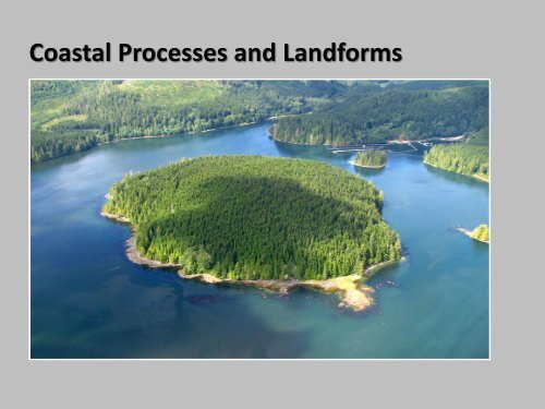
<strong>Coastal</strong> <strong>Processes</strong> <strong>and</strong> L<strong>and</strong>forms
A. <strong>Coastal</strong> <strong>Processes</strong>• where the energy of the ocean/lake meets the resistances of the l<strong>and</strong>.• very dynamic system• constantly adjusting to changes in coastal configuration, sediment budgets,offshore gradients, climate, sea level, human impacts.• fast-changing morphology of depositional features (eg: beaches), slowerchanges on rock coasts
Movements generated by tides, currents, <strong>and</strong> wave motion.
1) Tides• Bulge in surface of ocean,caused by gravitationalpull of moon <strong>and</strong> sun• Spring tides – highesttides, strong <strong>and</strong> quick.Occur when sun, moon,<strong>and</strong> Earth line up• Neap tides – lowest tides.Sun <strong>and</strong> moon at rightangles with respect toEarth
• Tidal range – difference between high <strong>and</strong> low tide
2) Surface currents
3) Waves <strong>and</strong> wave dynamics
Period – time takes two successive waves (from crest to crest,or from trough to trough) to pass a given point.
Swash Zone: The area of the nearshore zone where the beach face isalternately covered <strong>and</strong> uncovered by the incoming uprush <strong>and</strong> outgoingdownrush.
Wave refraction <strong>and</strong> longshore current• As waves reach the shore they “feel” the bottom, slow <strong>and</strong> break• The direction of eave break follows the underwater topography• Causes wave to “bend” <strong>and</strong> become more parallel to shoreline – bending called waverefraction• As it breaks from one side to the other, it creates a current called the longshore current
AnimationLongshore currentpicks up <strong>and</strong> movessediment along theshore
Longshore current:A wave-generated currentflowing parallel <strong>and</strong> close toshoreLongshore drift:The movement of sediments,usually s<strong>and</strong>, along a coastparallel to the shoreline
Groynes: A breakwaterrunning seawards fromthe l<strong>and</strong>, constructed tostop the flow of beachmaterial moved bylongshore drift.
Rip Current: A strong, narrow surface current that flows rapidly away from theshore, returning the water carried l<strong>and</strong>ward by waves.
Storm surge: A rise above normal water level on the open coast due only to the actionof wind stress on the water surface; includes the rise in sea level due to atmosphericpressure reduction as well as that due to wind stres
Tsunamis: Very long waves generated by earthquakes, volcanic eruptions, or l<strong>and</strong>slides.They are low at sea but steepen <strong>and</strong> become higher as they approach l<strong>and</strong>.
B. Types of Coasts1. fast-changing morphology ofdepositional coasts (eg: beaches)2. Slower changing rock coasts
3. Cold <strong>and</strong> frozen coasts
Thermo-erosion: Erosion caused by melting, typically the melting <strong>and</strong> subsequent erosionof ice rich sediments or ground ice along arctic coasts
Sea ice <strong>and</strong> lake ice interactions
Fast Ice: And extensive, unbroken sheet of sea ice that is l<strong>and</strong>fast. Created by the in situfreezing of sea water.Ice Floe: Floating, tabular blocks of ice that are thinner <strong>and</strong> flatter than ice bergs.Formed by the spring breakup of winter fast ice.
Pack Ice: Floating sea ice, not l<strong>and</strong>fastIce foot (Ice Dune): A l<strong>and</strong>fast, narrow strip of accumulated frozen wave spray <strong>and</strong>ice washed ashore.
Consequences of ice shore interactions• Ice Thrusting: Lateral pressure exerted on a shoreline by the expansion ofshoreward-moving ice• Ground Pressure Ridge : ridge in the ground surface that is raised up bylaterally exp<strong>and</strong>ing ice
Consequences of ice- shore interactions• Mechanical erosion: due to interaction of ice with shoreline sediments• Absence of ice leading to enhanced erosion
C. <strong>Coastal</strong> Weathering <strong>Processes</strong>
• Quarrying: Occurs when when rocks are dislodged by the direct force of waves, mainlyby compression of air pockets trapped in joints <strong>and</strong> bedding planes.
• Abrasion: weathering byrock fragments <strong>and</strong> s<strong>and</strong>being swept, rolled <strong>and</strong>dragged over rocksurfaces.PlatformPotholes
• Bioerosion: Chemical or mechanical erosion of rock by marine biota (eg: abrasion byfeeding).
• <strong>Coastal</strong> L<strong>and</strong>slide: Alternate wetting <strong>and</strong> drying, clay mineral swelling, <strong>and</strong> deepchemical weathering cause progressive slope weakening. Usually occurs followingsnowmelt or heavy precipitation
• <strong>Coastal</strong> Rock Fall: rock fall caused by the undercutting of a coastal cliff foot by waveaction, bioerosion, or other processes.
• Chemical weathering:Salt weatheringDissolution weathering
4. Coasts <strong>and</strong> Sea Level Change• Isostasy: A state of balance that is maintained in the crust of the earth.Fluctuations in this balance cause isostatic movements which act to restorethe balance (eg: glacial isostacy).• Eustasy: A global change of sea-level resulting from a rise or fall of waterlevel as opposed to a change in the level of the l<strong>and</strong>.
Sea level rise in the lower mainl<strong>and</strong>
5. <strong>Coastal</strong> L<strong>and</strong>forms
1. Depositional Features2. Rock Coast Features3. Coral <strong>Coastal</strong> Features
1. Depositional Featuresa) Dissipative <strong>and</strong> reflective beaches
1. Depositional Featuresb) Beach berm
1. Depositional Featuresb) Beach berm
1. Depositional Featuresc) Beach cusps
1. Depositional Featuresc) Beach cusps
1. Depositional Featuresd) (S<strong>and</strong>) bars
1. Depositional Featuresd) (S<strong>and</strong>) bars
1. Depositional Featuresd) (S<strong>and</strong>) bars
1. Depositional Featuresd) (S<strong>and</strong>) bars
1. Depositional Featurese) S<strong>and</strong> spits
1. Depositional Featurese) Spits
1. Depositional Featurese) Barrier spit/isl<strong>and</strong>
1. Depositional Featurese) Barrier spit/isl<strong>and</strong>
1. Depositional Featurese) Spits <strong>and</strong> bars
1. Depositional Featurese) Barrier spit/isl<strong>and</strong>
1. Depositional Featurese) Tombolo, hooked <strong>and</strong> bay barrier spits
1. Depositional Featuresf) Estuaries
1. Depositional Featuresf) EstuariesWhat are estuaries?Estuaries are semi-enclosed bodies of water where fresh water fromrivers or streams mingles with the salt water of the ocean. Estuaries canbe found in flat river deltas or steep-sided coastal fiords. They may havedifferent components, such as tidal mud flats, lagoons, salt marshes <strong>and</strong>s<strong>and</strong> dunes. Although estuaries make up only 3% of the coastline in BC,they are used by approximately 80% of all wildlife species on the coast.
1. Depositional Featuresf) EstuariesWhat is a delta?Deltas form wherever rivers encounter st<strong>and</strong>ing bodies of water such as lakesor oceans. The sudden decrease in energy causes the river to drop itssediment load. Deltaic deposits therefore become finer grained the fartherout into the lake or ocean (distal edge). Across the delta, they are coarsest inthe distributary channels <strong>and</strong> finest away from the channels.
2. Rock Coast Features
2. Rock Coast Features• Sea Caves• Sea Arches• Sea Stacks• Sea Stumps• Wave Cut Notches• Wave Cut Platforms• Blowholes
2. Rock Coast Features
2. Rock Coast Features
The force of the waves hitting a cliff compresses water <strong>and</strong> air into cracks <strong>and</strong> joints.This can be equivalent to 30,000 kg/m 2 . This increase in pressure may lead to crackswidening <strong>and</strong> pieces of rocks breaking off.
Rock fragments may be picked up bywaves <strong>and</strong> thrown against the rockface by subsequent waves.The effectiveness of the corrasiondepends on the strength of thewave, the nature of its “load” <strong>and</strong>the resistance of the rock in the cliffface.Corrasion is most effective at thebase of cliffs.
Rock fragments which have becomedetached by hydraulic action <strong>and</strong>corrasion are worn down into smaller<strong>and</strong> smaller pieces.Currents <strong>and</strong> tidal movements cause thefragments to be swirled around <strong>and</strong> togrind against each other <strong>and</strong> the cliffface.This type of erosion produces pebblebeaches <strong>and</strong> leads to potholes in rockycoasts.
Salts <strong>and</strong> acids in sea water canreact with rocks, slowly dissovlingthem.The photo shows this process ona cliff of limestone which hasbeen chemically attacked bycarbonic acid <strong>and</strong> otherchemicals in sea water.
Formation of a Sea arch <strong>and</strong> stack
Wave CutNotches <strong>and</strong>Platforms• The waves attack the base of the cliff through the process of abrasion, corrosion,hydraulic action <strong>and</strong> attrition• Over time the cliff will be undercut <strong>and</strong> a wave-cut notch is formed
• Eventually the cliff becomesunstable <strong>and</strong> collapses. Furtherretreat will form a wave-cutplatform
2. Rock Coast Features
Erosive waves may blast theirway vertically through lines ofweakness in the roofs of caves.
3. Coral <strong>Coastal</strong> Features
3. Coral <strong>Coastal</strong> FeaturesCoral l<strong>and</strong>forms represent a waveresistantlimestone structures producedby living organisms, found principally inshallow, tropical marine waters.Coral polyps are the most importantl<strong>and</strong>form building organisms. Thespecies that secrete calcium carbonateare known as hard coral polyps or,simply, stony corals.• Atoll: A ring-shaped collection of coral reefs that nearly or entirely encloses alagoon.• Barrier reef: A long, narrow ridge of coral relatively near <strong>and</strong> parallel to ashoreline, separated from it by a lagoon.
Coral reefs occupytropical <strong>and</strong> sub-tropicalwaters <strong>and</strong> accumulateas generations of coralbuild upon the "bonesof their ancestors".
3. Coral <strong>Coastal</strong> Features• Atoll
3. Coral <strong>Coastal</strong> Features• Atoll• Hypothesis 1: Coral grows atopunderwater volcano Coral C• Hypothesis 2: Coral grows upwardson a sinking volcanic isl<strong>and</strong>, or as sealevel rises
2. Rock Coast Features• Coral atolls <strong>and</strong> changing sea levelsGiven the right conditions coral are ablegrow fast enough to keep pace withmoderate rates of sea level rise.
2. Rock Coast Features• Coral atolls <strong>and</strong> changing sea levelsSchematic of atoll history through ice age sea level fluctuation.a) Sea level thous<strong>and</strong>s of years before & up to present.b) Atoll form relative to sea level.
2. Rock Coast Features• Coral atolls <strong>and</strong> changing sea levelsCoral formation on the uplifted atoll of Niue
2. Rock Coast Features• Coral atolls <strong>and</strong> changing sea levels
Tuvalu, only 4 m above sea level <strong>and</strong> threatened by sea level rise
3. Coral <strong>Coastal</strong> Features• Barrier ReefAustralia’s Great Barrier Reef
3. Coral <strong>Coastal</strong> Features• Barrier Reef
3. Coral <strong>Coastal</strong> Features• Barrier Reef
Shallow lagoons formed close to themainl<strong>and</strong> coast, providing perfectconditions for new coral growth.