Water from ponds, pans and dams - Disaster risk reduction
Water from ponds, pans and dams - Disaster risk reduction
Water from ponds, pans and dams - Disaster risk reduction

You also want an ePaper? Increase the reach of your titles
YUMPU automatically turns print PDFs into web optimized ePapers that Google loves.
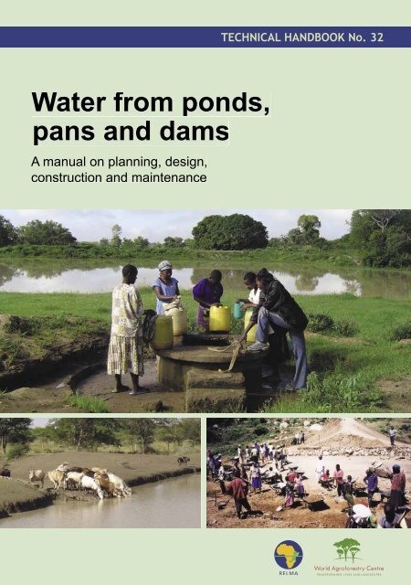
TECHNICAL HANDBOOK No. 32<strong>Water</strong> <strong>from</strong> <strong>ponds</strong>,<strong>pans</strong> <strong>and</strong> <strong>dams</strong>A manual on planning, design,construction <strong>and</strong> maintenance
Technical h<strong>and</strong>book (TH) seriesAgroforestry h<strong>and</strong>book for the montane zone of Ug<strong>and</strong>aAlex Lwakuba, Alice A. Kaudia <strong>and</strong> John Okorio. 2003. TH No. 31. ISBN 9966-896-55-4Soil fertility <strong>and</strong> l<strong>and</strong> productivityCharles K.K. Gachene <strong>and</strong> Gathiru Kimaru. 2003. TH No. 30. ISBN 9966-896-66-XSoil <strong>and</strong> water conservation manual for EritreaAmanuel Negassi, Estifanos Bein, Kifle Ghebru <strong>and</strong> Bo Tengnäs. 2002. TH No. 29. ISBN 9966-896-65-1Management of Rangel<strong>and</strong>s: Use of natural grazing resources in Southern Province, ZambiaEvaristo C. Chileshe <strong>and</strong> Aichi Kitalyi. 2002. TH No. 28. ISBN 9966-896-61-9Edible wild plants of TanzaniaChristopher K. Ruffo, Ann Birnie <strong>and</strong> Bo Tengnäs. 2002. TH No. 27. ISBN 9966-896-62-7Tree nursery manual for EritreaChris Palzer. 2002. TH No. 26. ISBN 9966-896-60-0ULAMP extension approach: a guide for field extension agentsAnthony Nyakuni, Gedion Shone <strong>and</strong> Arne Eriksson. 2001. TH No. 25. ISBN 9966-896-57-0Drip Irrigation: options for smallholder farmers in eastern <strong>and</strong> southern AfricaIsaya V. Sijali. 2001. TH No. 24. ISBN 9966-896-77-5<strong>Water</strong> <strong>from</strong> s<strong>and</strong> rivers: a manual on site survey, design, construction, <strong>and</strong> maintenance of seventypes of water structures in riverbedsErik Nissen-Petersen. 2000. TH No. 23. ISBN 9966-896-53-8Rainwater harvesting for natural resources management: a planning guide for TanzaniaNuhu Hatibu <strong>and</strong> Henry F. Mahoo (eds.). 2000. TH No. 22. ISBN 9966-896-52-XAgroforestry h<strong>and</strong>book for the banana-coffee zone of Ug<strong>and</strong>a: farmers’ practices <strong>and</strong> experiencesI. Oluka-Akileng, J. Francis Esegu, Alice Kaudia <strong>and</strong> Alex Lwakuba. 2000. TH No. 21. ISBN 9966-896-51-1L<strong>and</strong> resources management: a guide for extension workers in Ug<strong>and</strong>aCharles Rusoke, Anthony Nyakuni, S<strong>and</strong>ra Mwebaze, John Okorio, Frank Akena <strong>and</strong> Gathiru Kimaru.2000. TH No. 20. ISBN 9966-896-44-9Wild food plants <strong>and</strong> mushrooms of Ug<strong>and</strong>aAnthony B. Katende, Paul Ssegawa, Ann Birnie, Christine Holding <strong>and</strong> Bo Tengnäs. 1999. TH No. 19.ISBN 9966-896-40-6Banana production in Ug<strong>and</strong>a: an essential food <strong>and</strong> cash cropAloysius Karugaba <strong>and</strong> Gathiru Kimaru. 1999. TH No. 18. ISBN 9966-896-39-2Agroforestry extension manual for eastern ZambiaSamuel Simute, C.L. Phiri <strong>and</strong> Bo Tengnäs. 1998. TH No. 17. ISBN 9966-896-36-8Technical h<strong>and</strong>book series, continued...Agroforestry manual for extension workers in Central <strong>and</strong> Lusaka provinces, ZambiaJoseph A. B<strong>and</strong>a, Penias B<strong>and</strong>a <strong>and</strong> Bo Tengnäs. 1997. TH No. 14. ISBN 9966-896-31-7Facilitators’ manual for communication skills workshopsPamela Baxter. 1996. TH No. 13. ISBN 9966-896-25-2Useful trees <strong>and</strong> shrubs in Eritrea: identification, propagation <strong>and</strong> management for agricultural <strong>and</strong>pastoral communitiesEstifanos Bein, B. Habte, A. Jaber, Ann Birnie <strong>and</strong> Bo Tengnäs. 1996. TH No. 12. ISBN 9966-896-24-4Agroforestry extension manual for northern ZambiaHenry Chilufya <strong>and</strong> Bo Tengnäs. 1996. TH No. 11. ISBN 9966-896-23-6Useful trees <strong>and</strong> shrubs for Ug<strong>and</strong>a: identification, propagation <strong>and</strong> management for agricultural <strong>and</strong>pastoral communitiesA.B. Katende, Ann Birnie <strong>and</strong> Bo Tengnäs. 1995. TH No. 10. ISBN 9966-896-22-8The soils of Ethiopia: annotated bibliographyBerhanu Debele. 1994. TH No. 9. ISBN 9966-896-21-XCurriculum for training in soil <strong>and</strong> water conservation in KenyaStachys N. Muturi <strong>and</strong> Fabian S. Muya (eds.) 1994. TH No. 8. ISBN 9966-896-20-1Soil conservation in Arusha Region, Tanzania: manual for extension workers with emphasis on smallscalefarmersPer Assmo <strong>and</strong> Arne Eriksson. 1994. TH No. 7. ISBN 9966-896-19-8Useful trees <strong>and</strong> shrubs for Tanzania: identification, propagation <strong>and</strong> management for agricultural <strong>and</strong>pastoral communitiesL.P. Mbuya, H.P. Msanga, C.K. Ruffo, Ann Birnie <strong>and</strong> Bo Tengnäs. 1994. TH No. 6. ISBN 9966-896-16-3Agroforestry manual for extension workers in Southern Province, ZambiaJericho Mulofwa, Samuel Simute <strong>and</strong> Bo Tengnäs. 1994. TH No. 4. ISBN 9966-896-14-7Useful trees <strong>and</strong> shrubs for Ethiopia: identification, propagation <strong>and</strong> management for agricultural <strong>and</strong>pastoral communitiesAzene Bekele-Tessema, Ann Birnie <strong>and</strong> Bo Tengnäs. 1993. TH No. 5. ISBN 9966-896-15-5Guidelines on agroforestry extension planning in KenyaBo Tengnäs. 1993. TH No. 3. ISBN 9966-896-11-2Agroforestry manual for extension workers with emphasis on small-scale farmers in Eastern Province,ZambiaSamuel Simute. 1992. TH No. 2. ISBN 9966-896-07-4Curriculum for in-service training in agroforestry <strong>and</strong> related subjects in KenyaStachys N. Muturi (ed.). 1992. TH No. 1. ISBN 9966-896-03-1<strong>Water</strong> harvesting: an illustrative manual for development of microcatchment techniques for cropproduction in dry areasMwangi T. Hai. 1998. TH No. 16. ISBN 9966-896-33-3Integrated soil fertility management on small-scale farms in Eastern Province of ZambiaThomas Raussen (ed.). 1997. TH No. 15. ISBN 9966-896-32-5...continued on inside back cover
Chapter 1IntroductionThe purpose <strong>and</strong> scope of this book arepresented in this chapter, followed by adetailed description of the most commonkinds of <strong>ponds</strong> <strong>and</strong> <strong>dams</strong>. Pans used on seasonalbasis by pastoral herders are also described.
Chapter 1 • Introduction1.1 Purpose <strong>and</strong> scope of this manualBackgroundAfrica is considered a water-scarce continent with most of the countriesregularly experiencing extreme water shortage during periodic dryspells. Rapid population growth <strong>and</strong> inefficient use of resourcesincreases the deficit between available water supplies <strong>and</strong> the needs ofpeople. Many regions in East <strong>and</strong> Southern Africa are drought prone<strong>and</strong> the vulnerability of the population to drought is high with morethan 40 per cent of the region’s people living in dryl<strong>and</strong> areas.As resources dwindle <strong>and</strong> water dem<strong>and</strong> increases, large scalewater supply projects become unviable. There is a need to decentralizewater supply to household <strong>and</strong> small community level. There is greatpotential to make beer use of water resources by harvesting rainwater<strong>and</strong> storing it locally for household <strong>and</strong> productive purposes.The need for more <strong>ponds</strong> <strong>and</strong> <strong>dams</strong>The lack of water is the largest constraint to sustainable livelihoods inmany parts of Africa. Rapid runoff during the rainy season frequentlyresults in a high proportion going to waste or even becomingdestructive. Soil erosion, vegetation degradation <strong>and</strong> decreases insoil fertility are severe problems throughout the region. Harvestingrainwater where <strong>and</strong> when it falls presents opportunities to addressboth water scarcity <strong>and</strong> soil degradation at a local level. <strong>Water</strong> canbe harvested <strong>and</strong> used for many purposes but reliable water storagefacilities are required.Communities/individuals need help to identify suitable sites forwater harvesting <strong>and</strong> storage structures, which types are most suitable,how much water the catchment area gives during the rains, <strong>and</strong>the water needs for household, livestock <strong>and</strong> crops. Local knowledgeis valuable in answering these questions. Local communities must beinvolved <strong>and</strong> feel ownership <strong>from</strong> the planning stage all through theconstruction phase, if the project is to endure.Aim <strong>and</strong> scope of this bookThe purpose of this h<strong>and</strong>book is to provide a practical guideto extension workers <strong>and</strong> technicians who assist communities<strong>and</strong> farmers intending to construct a water storage structure foragricultural, livestock watering or domestic purposes. The reader willfind out how to involve the community in all steps, so they become thetrue owners of the project <strong>and</strong> ensure the sustainability of the waterstorage structures (Chapter 2). Guidance is provided on planning <strong>and</strong>feasibility study including environmental impact <strong>and</strong> legal aspects2
Chapter 1 • Introduction(Chapter 3). Various options for water storage are discussed <strong>and</strong> thedesign <strong>and</strong> construction of <strong>ponds</strong> <strong>and</strong> small earth <strong>dams</strong> are coveredin detail (Chapter 4). The h<strong>and</strong>book also deals with the operations<strong>and</strong> maintenance once the pond or dam is built (Chapter 5). The lastchapter (Chapter 6) presents several useful tools to use in the planning,design <strong>and</strong> construction stages.1.2 Types of <strong>ponds</strong> <strong>and</strong> <strong>pans</strong>Ponds <strong>and</strong> <strong>pans</strong> are naturally occurring or excavated water storagestructures without a constructed wall. They usually store surface runoff,even though there are examples of constructed <strong>ponds</strong> storing roofwater.The terms <strong>pans</strong> <strong>and</strong> <strong>ponds</strong> are oen used interchangeably withslightly indistinct meaning. In Kenya both natural <strong>and</strong> dugout structuresare called <strong>pans</strong>, while in Zambia <strong>pans</strong> are larger natural watersources <strong>and</strong> <strong>ponds</strong> are smaller excavated structures. In general, theterm pan is used to describe structures used by herders, while pondmost oen refers to structures used by farmers. There are also variouslocal terms to add to the confusion.Naturally occurring <strong>pans</strong>Natural <strong>pans</strong> have provided water for wildlife, livestock <strong>and</strong> humanssince ancient times. They form in depressions in which rainwateraccumulates during the rainy season <strong>and</strong> they do not have an outflow(see Figure 1). Today, most natural water sources are used for wateringlivestock during rains <strong>and</strong> a few months thereaer. Some people stilluse them for domestic water supply even though they are dirty <strong>and</strong>not suitable for drinking or washing.Figure 1. Natural pan in a pastoral area with livestock <strong>and</strong> wildlife.3
Chapter 1 • IntroductionIn some very dry areas such as the Kalahari Desert large natural salt<strong>pans</strong> are found. These usually hold water only for a few weeks a year<strong>and</strong> have been formed by wind action. Smaller natural <strong>pans</strong> includethe silanka ya ndovu (elephant dam) common on the eastern Africansavannah, scooped out on flat l<strong>and</strong> by elephants, digging for watermany years ago. The animals trample <strong>and</strong> compact the sediment whenthey enter to drink, making the pan’s floor watertight.Many <strong>pans</strong> suffer <strong>from</strong> high evaporation losses. As they fill withsediment over time <strong>and</strong> the water becomes shallow, the problem ofevaporation gets worse. Although it may not always be feasible tobuild new <strong>pans</strong>, it is sometimes worth deepening or enlarging existingnatural or artificial ones. Herders in particular appreciate the benefitswhich natural <strong>pans</strong> can bring even though most are seasonal <strong>and</strong> cannotstore water throughout the year.Excavated <strong>ponds</strong>Excavated <strong>ponds</strong> come in sizes <strong>from</strong> the household level of 200 to 500 m 3up to community level of 10,000 m 3 . They can easily be started witha small capacity <strong>and</strong> exp<strong>and</strong>ed over the years by digging deeper <strong>and</strong>wider. In areas with impermeable soils <strong>and</strong> a suitable site the only costof construction is the labour, so a group can dig their own pond withlile cash expense.Figure 2. Illustration of a charco pond, note silt traps <strong>and</strong> spillway.4
Chapter 1 • IntroductionPonds should be situated at a low point in the catchment area sorainwater runoff flows by gravity towards the excavated pond. Thecatchment area can consist of any type of surface such as cropl<strong>and</strong>,grassl<strong>and</strong>s or compounds around homesteads. Hard road surfacesor rock outcrops may also make suitable catchment areas. Rainwaterrunoff can be diverted <strong>from</strong> a nearby gully, provided the pond issituated at a lower elevation than the gully. Soil excavated <strong>from</strong> thepond can be used to make soil bunds for diverting runoff water to<strong>ponds</strong>.In Sudan the name hafirs describes dugout enlargements of naturaldepressions on the savannah. They range in size <strong>from</strong> 500 to 10,000 m 3<strong>and</strong> provide water for both livestock <strong>and</strong> domestic purposes. In thepast most hafirs were dug by h<strong>and</strong>. Today however, heavy machines,i.e tractors <strong>and</strong> bulldozers, are commonly used to build them.In Tanzania dugout <strong>ponds</strong> are commonly referred to as charco<strong>ponds</strong>, or malambo in Kiswahili. The charco are common in the dryl<strong>and</strong>sof Tanzania where they are used for watering livestock. In some cases,they are also used through necessity for domestic supply despite thepoor water quality. Farmers build these <strong>ponds</strong> in stages during dryseasons until they are satisfied with the capacity. The farmers do notfollow a st<strong>and</strong>ard design for their charco <strong>ponds</strong> <strong>and</strong> excavate them inmany different shapes <strong>and</strong> sizes (see Figure 2).Borrow pitsBorrow pits (also known as murram pits) are excavated to supply soil<strong>and</strong> gravel for road construction, but opportunistically used for waterstorage, usually <strong>from</strong> road runoff. As the ownership oen is unclearnobody takes proper responsibility for the borrow pits <strong>and</strong> they mayeven be sources of conflict. If proper regulations were in place to determinehow these dugouts could benefit both the road construction <strong>and</strong>the neighbouring communities, the structures would be more valuablefor a longer time.When borrow pits are dug in firm soil with lile seepage <strong>and</strong> havea large catchment area <strong>from</strong> the road runoff, even small rain showerswill fill them. If they do not normally fill this way, they can fairly easily— <strong>and</strong> at low cost — be filled by digging a trench sloping <strong>from</strong> theroad to divert rainwater runoff. This rainwater runoff may contain tar<strong>and</strong> other pollutants, making water <strong>from</strong> borrow pits unsuitable forhuman consumption.5
Chapter 1 • Introduction1.3 Types of <strong>dams</strong>Dams are water storage structures on slopes, with walls orembankments on the downhill side. They come in all shapes <strong>and</strong> sizes<strong>from</strong> the giant Kariba Dam on the Zambezi River to small check <strong>dams</strong>built across gullies. In dryl<strong>and</strong>s these include various types of earth<strong>dams</strong>, rock catchment <strong>dams</strong>, sub-surface <strong>dams</strong> <strong>and</strong> s<strong>and</strong> <strong>dams</strong>.This h<strong>and</strong>book covers the design <strong>and</strong> construction of small earth<strong>dams</strong> with storage capacities up to 10,000 m 3 <strong>and</strong> embankments of upto approximately 3 m in height. It will deal with two types of earth<strong>dams</strong> only:• Small <strong>dams</strong> in valleys built with straight embankments, whichis a common <strong>and</strong> economical type of dam.• Small earth <strong>dams</strong> on hillsides built with curved embankmentson sloping l<strong>and</strong>, a less common but practical type for individualfarmers.Site investigations, design <strong>and</strong> construction of medium <strong>and</strong> large<strong>dams</strong> require experienced engineers <strong>and</strong> cannot be constructed byfield technicians <strong>and</strong> farmers. For this reason they are beyond thescope of this h<strong>and</strong>book.A word of warning: It must be remembered that the construction ofany dam introduces a small <strong>risk</strong> of failure such as collapse of the damwall. Therefore always seek experienced technical advice to minimizesuch <strong>risk</strong>s.Earth <strong>dams</strong> in valleysIf a suitable site can be found, constructing a small earth dam at a valleysite is a cost effective way to create a water storage reservoir (see Figure3). This is because it has a high water storage capacity per cubic metreof soil moved. Nevertheless, the impact of a small earth dam beingwashed away in a flood could be very serious <strong>and</strong> endanger lives <strong>and</strong>property. This is particularly so for valley <strong>dams</strong> where a large quantityof water suddenly released would be channelled down the valley. Forthis reason experienced technical help should always be sought for thedesign <strong>and</strong> construction of any dam which might present a threat todownstream households or communities.Small earth <strong>dams</strong>, below 1,000 m 3 can be built manually, usingdraught animals, a farm tractor or a bulldozer. The medium sized,10,000 to 50,000 m 3 , <strong>and</strong> large earth <strong>dams</strong>, above 50,000 m 3 , are nearlyalways built using heavy machinery.6
Chapter 1 • IntroductionFigure 3. Illustration of a valley dam. Note sill in spillway, rock toe.Earth <strong>dams</strong> on hillsidesSmall earth <strong>dams</strong> on hillsides or sloping l<strong>and</strong> are one of the simplest<strong>and</strong> least costly type of dam to design, construct <strong>and</strong> maintain. Suitablesites can be found on almost any sloping l<strong>and</strong> that produces rainwaterrunoff. They may be built small the first year <strong>and</strong> enlarged over time(see Figure 4).Rock catchment <strong>dams</strong>Rock catchment <strong>dams</strong> store rainwater runoff collected <strong>from</strong> rock outcrops.In large rock catchments cement <strong>and</strong> stone guers are used toextend the catchment area to gather runoff <strong>from</strong> several hectares ofrock surface. Rock catchments typically have reservoirs with capacitiesof up to 5,000 m 3 .Sub-surface <strong>dams</strong> <strong>and</strong> s<strong>and</strong> <strong>dams</strong>In semi-arid areas where dry s<strong>and</strong>y riverbeds are common, their waterstorage capacity can be improved by building sub-surface or s<strong>and</strong><strong>dams</strong>. These are a kind of weir constructed across the s<strong>and</strong>y riverbedsto block flood water. <strong>Water</strong> that infiltrates into the s<strong>and</strong>y riverbed istrapped in the spaces between the s<strong>and</strong> particles. This form of waterstorage has the advantage of protecting the water <strong>from</strong> evaporation aswell as helping to protect it <strong>from</strong> contamination.7
Chapter 1 • IntroductionFigure 4. Illustration of a hillside dam.The major difference between sub-surface <strong>and</strong> s<strong>and</strong> <strong>dams</strong> is that subsurface<strong>dams</strong> can be built cheaply of soil or stone-masonry to the levelof s<strong>and</strong> in the riverbed, while a s<strong>and</strong> dam can be built to a height ofseveral metres above the s<strong>and</strong> level. Although s<strong>and</strong> <strong>dams</strong> shouldproduce more water than sub-surface <strong>dams</strong>, most of the hundredsconstructed in recent years are not functioning well.8
Chapter 1 • IntroductionOne of the oldest rock catchment <strong>dams</strong> built in Kitui, Kenya, in1956.S<strong>and</strong> dam with masonry apron in Ny<strong>and</strong>o District, western Kenya.9
Chapter 2CommunityparticipationAll development practitioners should realize by now howimportant community participation is. Many are still strugglingwith how to go about it. Chapter 2 provides clear guidelines,in a logical sequence. It begins with project identification, formingmanagement structures, <strong>and</strong> setting SMART objectives. With structuresin place, the text explains the community’s role in feasibility <strong>and</strong>planning, design <strong>and</strong> construction. Throughout, emphasis is given tothe need for capacity building, with a detailed description of thekinds of training that need to be provided. The roles of governmentdepartments are discussed, as well as the need for monitoring ofprogress by the community groups themselves. At the end, there is adiscussion on ways to manage conflicts should they arise.
Chapter 2 • Community participation2.1 IntroductionThere are many examples of community water projects that werebuilt <strong>and</strong> ended up being ab<strong>and</strong>oned or broken down soon aerthe development agency le. Such experience highlights the need toinvolve the community in all stages of a project in order to ensure thatthe community owns the project <strong>and</strong> willingly takes responsibilityfor it. Community participation is essential to ensure a genuinelysustainable project. Very small pond or dam projects may also be doneat an individual rather than community level. In order to make surethat projects are sustainable, there is need to identify clear steps in theproject implementation process. Turn to page 28 for a useful flow-chartthat shows all steps in sequence.Such steps include:• Project identification• Community social organization <strong>and</strong> management structures• Feasibility, design <strong>and</strong> planning• Construction• Capacity building• Operation <strong>and</strong> maintenance• Monitoring <strong>and</strong> evaluation2.2 Project identificationIn the past, the needs of a community were taken for granted. “Topdown approaches” meant that communities were given whateverprojects the aid agencies or government had funds for. Communitieswere not consulted <strong>and</strong> their real “felt” needs were never identified.This resulted in unwanted projects which were neglected <strong>and</strong> became“white elephants”.Pond <strong>and</strong> dam projects can be identified in many different waysbut in all cases the dem<strong>and</strong> for the project should come <strong>from</strong> thecommunity. Community needs or dem<strong>and</strong>s can be identified byassessing their development priorities using techniques such asparticipatory rural appraisal (PRA). Alternatively, there may be a directrequest to a local development agency or government department<strong>from</strong> an established community group. Establishing the nature of thegroup or individual requesting assistance should be the first part of theproject implementation.12
Chapter 2 • Community participation2.3 Community social organizations <strong>and</strong>management structuresForming a management structureIn order to implement a successful water project, the community willneed to select a suitable management structure. Possible approachesmight include:• Starting by underst<strong>and</strong>ing the existing structures, includingtraditional council of elders.• Raising awareness about the project <strong>and</strong> the need for a managementstructure with the local leadership.• Helping the community to develop the roles <strong>and</strong> responsibilitiesof the proposed commiee.Within most communities in Africa, there are traditional managementstructures for water resources that existed in the past <strong>and</strong> possiblycurrent management structures for new projects. It is important tounderst<strong>and</strong> the responsibilities of these structures with regards to usingwater resources. Analysing these structures can be done for eachtype of management structure using the following checklist to establishthe gaps in knowledge <strong>and</strong> skills:• What do you see <strong>and</strong> think should be their responsibilities?• Which of the responsibilities mentioned above can they comfortablytake on?• What reasons do you give for their inability to carry out therest of their responsibilities <strong>and</strong> what possible solutions do yousuggest?• Compare roles of the two management structures (traditional<strong>and</strong> current) <strong>and</strong> come up with important roles each can providethat cannot be provided by the other.The responsibilities that the management structure will have to takeon behalf of the community for the sustainability of the project include:• Coordinating construction <strong>and</strong> maintenance of the pond/panor dam in the community.• Operation <strong>and</strong> maintenance of the pond/pan or dam. Havingthe technical know how to carry out repairs with lile or noreliance on external support.• Charging for providing services. Establishing the best revenuecollection method. This includes a cost recovery system for operation<strong>and</strong> maintenance <strong>and</strong> managing the funds.13
Chapter 2 • Community participation• Supervising staff who work on the water supply system, i.e.operators, fee collectors.• Aending meetings <strong>and</strong> having periodic elections in acceptableformat for all community members.• Implementing decisions discussed <strong>and</strong> taken in meetings.• Equitable distribution of water resources, formulation <strong>and</strong> enforcementof by-laws to ensure effective distribution.• Engaging community members on their own terms, minimising<strong>and</strong> resolving conflict, <strong>and</strong> identifying <strong>and</strong> resolving communityproblems.Having analysed the existing management structures, it is possibleto agree with the community on the most appropriate structure for theplanned project. This is oen a commiee that combines both traditional<strong>and</strong> modern resource management structures as shown in theexample below.Formation of management structures for water projectsin M<strong>and</strong>era District, KenyaThere is a history of traditional water management in M<strong>and</strong>era Districtthrough the council of elders or aba-heriga. Stakeholders at the start of anew water project debated the strengths <strong>and</strong> weaknesses of both this <strong>and</strong> amodern, elected committee style management structure. The stakeholdersexplored methods of combining modern <strong>and</strong> traditional systems <strong>and</strong> themeasures to be taken to ensure representation <strong>and</strong> accountability, includinghow to reduce the influence of dominant personalities on the process. It wasconcluded that:• The inclusion of elders brings considerable advantages to themanagement of community water supplies, but may increase conflictwithin the committee.• Comprehensive <strong>and</strong> enforceable by-laws can play an important rolein ensuring genuine representation by committee members <strong>and</strong>, byclearly defining roles <strong>and</strong> responsibilities, can reduce the influence ofdominant individuals.Good record keeping <strong>and</strong> regular monitoring by support agencies is essentialto check the effectiveness of a committee.Ownership, l<strong>and</strong> tenure <strong>and</strong> legal issuesSuitable sites for earth <strong>dams</strong> are normally found in valleys <strong>and</strong> seasonalwater courses which are oen boundaries between two or morel<strong>and</strong>owners. In such cases, it is important that the l<strong>and</strong>owners make awrien agreement on sharing the ownership. This agreement should14
Chapter 2 • Community participationinclude construction cost, usage of water <strong>and</strong> maintenance of a pondor dam <strong>and</strong> be finalized before any survey <strong>and</strong> construction work takesplace. It is also important for the l<strong>and</strong>owners to agree on the locationof an access road to the dam site <strong>and</strong> on any soil conservation methodsto reduce soil erosion <strong>and</strong> siltation. Catchment protection can consistof digging trenches, making terraces <strong>and</strong> planting of grasses or treesin rows along the contours (lines of equal elevation). It also includesthe building of check <strong>dams</strong> <strong>and</strong> silt traps in gullies. All l<strong>and</strong>-users ina catchment area should be encouraged to participate in all the soilconservation activities including the maintenance of structures <strong>and</strong>vegetation cover.Before a pond/pan or dam project can be implemented it is importantto ensure that the ownership of the site is clear <strong>and</strong> that access toall users is guaranteed. The box below is an example of the importanceof l<strong>and</strong> ownership.Gathingi dam, Sweetwaters, Laikipia District, KenyaDuring the initial stages of a project to rehabilitate an old colonial damfor a community near Sweetwaters game reserve, the implementingagency surveyed the site <strong>and</strong> compared the boundary of the proposed damimpoundment area with l<strong>and</strong> settlement maps of the area. During this process,it became apparent that the actual location of the dam spanned both thecommunal l<strong>and</strong> set aside for the dam <strong>and</strong> private l<strong>and</strong> owned by an individualin the community. The project could not proceed because the eventualownership of the dam <strong>and</strong> the water resource was not clear <strong>and</strong> communityaccess could not be guaranteed.Following intensive facilitation by the development agency the committee<strong>and</strong> the l<strong>and</strong> owner agreed to exchange the private l<strong>and</strong> within the dam areafor alternative l<strong>and</strong> nearby. The community arranged for the legal process oftransferring title deeds <strong>and</strong> establishing the whole dam impoundment areaas public l<strong>and</strong>. This process took three months <strong>and</strong> only then could the damrehabilitation project start.Initial discussions should be held with the community, or their representatives,using this checklist:• Who owns the l<strong>and</strong>?• Who has access to the l<strong>and</strong>?• Who owns any existing water source?• Who will own this project?• Who will manage it?15
Chapter 2 • Community participation• How will the money collected be used?• Who will maintain the project?Ideally a community water project must be established on communityowned l<strong>and</strong>. If any part of the water supply passes over privatel<strong>and</strong>, it is necessary to obtain a “wayleave” which is a legal documentsigned by the l<strong>and</strong> owner that ensures access by the community membersto the water supply facilities on his/her l<strong>and</strong>.Compliance with water resource regulations on dam constructionLegal requirements will vary <strong>from</strong> one country to another. It is alwaysadvisable to ask the authorities before starting any construction workin order to avoid disappointment <strong>and</strong> legal cases.Generally, it is understood that farmers may construct <strong>ponds</strong> ontheir l<strong>and</strong> without asking for permission <strong>from</strong> anyone, provided the<strong>ponds</strong> are small <strong>and</strong> do not block water runoff to people living downstream.If in doubt of the legality, the authorities should be asked beforestarting on the construction work. In the case of earth <strong>dams</strong> builtin valleys, however, these may interfere with people’s water supplydownstream. Since <strong>dams</strong> can collapse during exceptionally heavyrainfall due to poor maintenance, incorrect design or poor constructionwork, this could endanger people <strong>and</strong> structures downstream. Forthese reasons, approval for the design <strong>and</strong> permission for the constructionworks must be obtained <strong>from</strong> the authorities.Legal aspects of community organizationDifferent countries have different laws governing associations <strong>and</strong>community based organizations. The way in which a communitygroup is registered usually dictates how they can operate <strong>and</strong> howeffective they can be at managing a communal resource such as a dam.Typical legal guidelines for different organizations in Kenya are shownin the box below.Self-help groups registered with Ministry of SocialServicesCan:• Hold meetings without license• Raise funds for the group• Open a bank account• Apply for small grants <strong>from</strong> local donors or NGOs16
Chapter 2 • Community participationCannot:• Make legal transaction (e.g. legally binding contract)• Seek legal redress against individuals or organizations (e.g. formisappropriation of funds)• Own l<strong>and</strong> on which to place project assets (e.g. dam, borehole, tanksetc.)• Own equipment (e.g. generator, pipeline, vehicles etc.)Associations registered with the Registrar of SocietiesCan:Do all the above plus:• Legal transactions• Own l<strong>and</strong>• Own assets <strong>and</strong> equipment• Go to court to seek legal redressIn addition if registered as water users association with Ministry of <strong>Water</strong>can:Have status <strong>and</strong> rights of water undertaker, i.e. right to legally sell water.It is advisable to check with the relevant government departmentto make sure the community group is properly registered <strong>and</strong> canhave the legal authority to h<strong>and</strong>le any problems that might arise.Setting project objectivesIt is important for everyone involved in a project to have a commonunderst<strong>and</strong>ing of what they are trying to achieve. Seing clear objectivesat the start of the project <strong>and</strong> making sure they are achievable ispart of the preparation for the project. Simple clear objectives shouldbe defined with the community <strong>and</strong> bearing in mind the rule that objectivesshould be SMART, i.e.:S = SpecificM = MeasurableA = AchievableR = RealisticT = Time bound17
Chapter 2 • Community participationA typical example of an objective for community water projectswhich is not SMART is “improved community health.” This is not specific,measurable, achievable, realistic or time bound because it is difficultto measure improvements in community health <strong>and</strong> even moredifficult to relate them directly to the construction of a water facilitysuch as a pond or dam. A more reasonable, SMART objective for apond or dam project would be to “reduce the time women spend collectingwater <strong>from</strong> 2 hours to 30 minutes by the end of the two yearproject”. This is very specific about what is being achieved <strong>and</strong> forwhom, by when <strong>and</strong> the achievement can be measured.2.4 Feasibility, design <strong>and</strong> planningCommunity involvement in feasibility <strong>and</strong> designThe important principle for community participation in feasibility, design<strong>and</strong> planning is to remember who owns the project. Techniciansmust ensure that the community takes part in site selection, survey, environmentalimpact assessment (EIA) <strong>and</strong> any other investigations ordiscussions forming part of the feasibility <strong>and</strong> design. This may meanspending time explaining the design to key members of the community<strong>and</strong> ensure that the project is not disowned at a later stage.The design must also consider community preferences, hygiene<strong>and</strong> water use practices. Use the following list of questions to gatherbasic social data necessary to ensure that the design meets the needsof people.1. How many people are likely to use the pond or dam? Where arethey? How are they distributed? Are they seled or nomadic?2. Are there other water <strong>and</strong> sanitation needs apart <strong>from</strong> human or domestic?(e.g. irrigation, tree nurseries, livestock) If so, what are the dem<strong>and</strong>s?3. What security factors may interfere with people’s access to the pondor dam?4. What are the current or likely water <strong>and</strong> sanitation-related diseases?How can transmission of these diseases be reduced?5. What are people’s normal household sanitation <strong>and</strong> hygienepractices, including disposal of children’s faeces?6. What are the environmental conditions, including drainage, wastedisposal, <strong>and</strong> location of defecation areas relative to water sources?7. What are the typical water use habits in the community, includingcollection practices, preferences for washing selves, clothes <strong>and</strong>utensils <strong>and</strong> sources of drinking water?18
Chapter 2 • Community participationCapacity assessmentAt this stage it may be useful to carry out a community capacity assessment.The aim of the assessment is to determine what capacity thecommunity has to sustainably manage the pond or dam aer construction.Sustainability aspects that need to be looked at include:• Technical sustainability, referring to balanced dem<strong>and</strong> <strong>and</strong>supply of water <strong>from</strong> the <strong>ponds</strong> <strong>and</strong> <strong>dams</strong>.• Institutional sustainability, referring to the capacity of the institutionswithin the community to plan, manage <strong>and</strong> operate the system.• Social sustainability, referring to the willingness of the communityto contribute to the project• Economic sustainability, referring to sustainable economic development<strong>and</strong> improvement of the welfare of the community.• Financial sustainability, referring to cost recovery.• Environmental sustainability, referring to there being no longtermnegative or irreversible effects to the environment owingto the establishment or use of the <strong>ponds</strong> <strong>and</strong> <strong>dams</strong>.An analysis of the “gaps” in knowledge <strong>and</strong> skills required to managethe water supply <strong>and</strong> maintain the structure can assist in the designof a community training component (see Section 2.6). Once the designis complete the detailed planning can take place. There is a need tofacilitate a planning exercise with the community in which community<strong>and</strong> implementing agency roles are clearly defined.Cost sharingMost development organizations have adopted a cost sharing policytowards their community projects. The reason is that if communitieshave to pay for at least part of the project cost, they are more likely tovalue the facility <strong>and</strong> feel a sense of ownership.The willingness <strong>and</strong> ability to pay a cost contribution varies <strong>from</strong>community to community <strong>and</strong> should be assessed carefully. The actualcommunity contribution should be negotiated with the community<strong>and</strong> not determined by an external agency. A fixed contribution set ata percentage of the cost of the project tends to result in unaffordablecontributions in cases where mechanical construction is required. An“in kind” contribution in the form of labour <strong>and</strong> local materials is ofteneasier for poor communities with limited cash. It is important tomonetarize “in kind” contributions to establish the actual value of thecommunity contribution.Negotiating the cost of contribution should be done alongside discussionsabout the design <strong>and</strong> construction planning of the project. It19
Chapter 2 • Community participationis important to make sure that communities underst<strong>and</strong> the full scale<strong>and</strong> cost of the project so that they can appreciate the need for theircontribution. Dem<strong>and</strong>ing a certain percentage without explainingwhere the figures come <strong>from</strong> can lead to communities feeling that theyare being asked for a “bribe” to get the project started.Where there is an option of mechanical, animal draught or manualconstruction, it may also be appropriate to give the community thechoice of technology they prefer to contribute to. It is unrealistic to expectcommunities to provide intensive labour for building a large damor pond without payment.Pan desilting in Wajir DistrictSeveral large <strong>pans</strong> were desilted following the drought of 1999—2001in Wajir. The development agency decided to use Cash for Work tohelp drought affected families to recover. Providing cash to familieswho contributed labourers for desilting did not undermine thecommunity sense of responsibility for the pan because the communityfully understood that the cash was being paid as a drought recoverymeasure. In these communities, even if the labour had been providedas a community contribution someone within the community wouldhave had to pay the workers. No-one is expected to work withoutbeing given something.For large, complex projects where considerable revenue collection,operation <strong>and</strong> maintenance will be required it is advisable to carry outan awareness raising exercise with the whole community. This willhelp the community to underst<strong>and</strong> their roles <strong>and</strong> responsibilities <strong>and</strong>to feel part of the planning <strong>and</strong> implementation process. Restrictingcommunity contact to the selected few in the management commieeoen results in conflict <strong>and</strong> confusion at later stages.2.5 ConstructionRoles of who should do what should be clear. Typical community rolesduring construction include:• Clearing the site, uprooting trees, removing stones.• Supervising earth works.• Providing labour for minor earth moving (if mechanically dug).• Organizing, supervising <strong>and</strong> monitoring work (if manually dug).20
Chapter 2 • Community participation• Providing local materials for cement works where required(s<strong>and</strong>, ballast <strong>and</strong> water).• Providing accommodation <strong>and</strong>/or food for skilled workers.• Fencing <strong>and</strong> other auxiliary works, i.e. planting grass on embankments,stone pitching the spillway.The management commiee <strong>and</strong> possibly other members of thecommunity should be involved in measuring <strong>and</strong> approving the workcarried out. This ensures that the community is in control of the project<strong>and</strong> the commiee can answer any queries that the communitymembers may have about the construction. In addition, where it is notpossible to employ manual labour, the community should decide onthe possibilities of tendering or contracting the work to establishmentswith relevant equipment.2.6 Capacity buildingRationaleHistorically, government water departments played a prominentrole in the development <strong>and</strong> rehabilitation of <strong>dams</strong>. More recently,the capacity of the water departments to undertake this work hasdiminished <strong>and</strong> very lile rehabilitation of community <strong>dams</strong> takesplace. Under new government water policies, communities have agreater role <strong>and</strong> responsibility in the management <strong>and</strong> operationof their water supplies. This responsibility is only meaningful if thecommunities genuinely have the interest <strong>and</strong> capacity to managetheir water supplies. Typically, the community has a strong interest,being the principle beneficiary of the water supply. However, theoperation <strong>and</strong> management of a water supply requires awareness,skills <strong>and</strong> experience that the communities do not necessarily have,especially if their dam is new or has not been operational for a longtime. The capacity of the community may need strengthening sothey can manage their water supply. A capacity building exercise forcommunity operation <strong>and</strong> management of water supplies involves thefollowing steps:• Training needs assessment.• Development of an appropriate training programme.• Training of management commiee <strong>and</strong> other key communitypeople.• Follow up to monitor progress on operational <strong>and</strong> managementissues.21
Chapter 2 • Community participationCapacity building should result in the following: that thecommiee selected by the community gains skills on leadership,financial management <strong>and</strong> technical operation <strong>and</strong> management;that the community gains knowledge on water related hygiene <strong>and</strong>sanitation; <strong>and</strong> that the community learns how the pond/pan or damwill be operated <strong>and</strong> learns to dem<strong>and</strong> accountability <strong>from</strong> theircommiee (community empowerment).Training needs assessmentThe training needs assessment is a detailed exercise with the communityin which participatory tools are used to:• Discuss the overall project objectives with the community.• Establish existing organizational <strong>and</strong> management structure.• Establish the capacity of existing management system to h<strong>and</strong>leexisting water supply system <strong>and</strong> rehabilitated system.• Discuss expectations <strong>and</strong> responsibilities involved in communitymanagement of the proposed dam rehabilitation <strong>and</strong> thesubsequent operation <strong>and</strong> maintenance.• Identify who should be trained.• Identify external factors that can affect the training <strong>and</strong> project.• Identify the roles of other stakeholders (e.g. <strong>Water</strong> Department).Where a comprehensive capacity assessment was carried out duringthe feasibility stage it may not be necessary to undertake a fulltraining needs assessment. However, discussions should be held withcommunity representatives to identify what training they think is necessary.The format of the training needs assessment involves discussionswith the community using PRA tools that help the communityto identify their priorities. This ensures that the opinions of differentmembers of the community (e.g. women, youths, agriculturists, pastoralists)are expressed. The community is able to identify their strengths<strong>and</strong> weaknesses, with the result that the topics covered in the trainingprogramme can clearly be identified as arising <strong>from</strong> the community.The output <strong>from</strong> the training needs assessment is a report whichprovides details on the key issues that need to be addressed during thecommunity capacity building exercise.Development of an appropriate training programmeEach community is different. It is important to adapt approaches<strong>and</strong> topics to the needs of each individual community. The generalapproach is to develop a training programme which uses participatorytools (drama, role plays, picture games) to build the capacity of the22
Chapter 2 • Community participationcommunity to operate <strong>and</strong> manage their water supply.Historically most <strong>pans</strong> have a traditional, communal ownershipbackground. This means that capacity building for community managementshould build on existing systems. The following features arerecommended for pond or dam management training:• Community mobilisation/awareness is a key part.• Training should be on-site <strong>and</strong> make use of participatory approaches.• Thorough training/capacity building in management at fewsites is preferable to partial training in many sites.• Long-term follow-up process is essential.• Training should involve <strong>and</strong> encourage women in decisionmaking.A typical training programme is divided into modules dealingwith different topics including:• Community organization <strong>and</strong> optional management structures.Other issues covered include leadership, gender, equity <strong>and</strong>conflict resolution.• Community self reliance <strong>and</strong> organizational sustainabilitywhich deals with issues of dependency, organizational records,constitutions <strong>and</strong> by-laws.• Building financial sustainability, financial records (budgeting,book keeping <strong>and</strong> accounting).• Operation <strong>and</strong> maintenance which deals with technicalsustainability <strong>and</strong> includes accessing technical services, spareparts, <strong>and</strong> routine maintenance activities. This module alsocovers catchment conservation measures <strong>and</strong> environmentalimpacts.• <strong>Water</strong>, sanitation <strong>and</strong> hygiene education. Typically, healthbenefits <strong>from</strong> improved water supplies are only obtainedthrough changes in water use habits. The managementcommiee members are generally cast in the role of communityleaders <strong>and</strong> so have a responsibility to the community to raiseawareness on good environmental health practices at thehousehold, homestead <strong>and</strong> community level.• Community action plans <strong>and</strong> community monitoring <strong>and</strong>evaluation. Indicators are discussed to help the communitymonitor their adherence to their action plans <strong>and</strong> to monitorany environmental or social impacts.23
Chapter 2 • Community participationAn additional module that is useful for dam projects would coversustainable water <strong>and</strong> l<strong>and</strong> use practises. This module would exploreways of making use of the water facility to enhance the environment(tree nurseries etc.), to create opportunities for coage industries (e.g.fisheries) <strong>and</strong> to encourage micro-irrigation.Community training approachCommunity training takes place in the community area <strong>and</strong> takes theform of a one to two week exercise in which the different training modulesare explored with the community members.Special aention is given to the possibility that individuals withinmanagement commiees may be transitional. It is therefore importantto ensure that the community as a whole is involved in the training.This helps to reduce the likelihood of generating an elite of trainedindividuals. The training has to be appropriate for the community asa whole, hence the limited use of wrien material. Additionally, thetraining may be conducted in the local language.StaffingStaffing for the community training component requires a communitytraining specialist <strong>and</strong> one or two community mobilizers. The trainingspecialist will be responsible for the content, coordination <strong>and</strong> reportingof the community training component. The community mobilizers,who speak the local language, will undertake the community training<strong>and</strong> follow-ups.2.7 Monitoring <strong>and</strong> evaluationThe community should develop a suitable system for monitoring theirperformance. In addition, the project should involve the communityin evaluation of their works. This is important for management, readjustmentor introduction of new approaches towards improvingon the existing systems or solving of problems. Tools for monitoringthe performance of the dam or pond <strong>and</strong> planning operation <strong>and</strong>maintenance work are presented in Chapter 6.2.8 Important considerations in workingwith communitiesGenderTraditional gender roles relating to water in the household areoen divided according to whether the water is for productive or24
Chapter 2 • Community participationreproductive use. For example, domestic water for cooking, drinkingor washing is the woman’s responsibility. <strong>Water</strong> for agricultureor livestock is usually the man’s responsibility. Women may beresponsible for water collection for kitchen gardens or small livestockraised for the household rather than cash income.Underst<strong>and</strong>ing gender issues within the community where thepond/pan or dam is to be constructed is an important factor in planninga sustainable project. It is useful to analyse women’s <strong>and</strong> men’swork <strong>and</strong> their control over resources to establish who is likely to havethe time, interest <strong>and</strong> authority to take on the management of a pondor dam (see box for questions for gender analysis).Questions for gender analysis• What role do women have in water issues?• Who controls water sources?• Who is responsible for maintaining water supplies?• Who is responsible for water use in the household?• If the community manages the water supply, should women beinvolved?• How should they be involved? In the committee or through women’sgroups?• What resources do women control <strong>and</strong> what decision-making powerdo they have in the community?*• Do women have time available for community activities?*• What other constraints are there to women’s involvement in watermanagement?• What steps can be taken to reduce these constraints?• Who should take these steps?* these issues can be explored using PRA tools such as “Gender access <strong>and</strong>control to resources” <strong>and</strong> “Gender activity schedule”.Women are clearly the ones who benefit <strong>from</strong> improving availabilityof water in terms of:• Reduced time spent fetching water• Improved family health• More opportunities for girls to go to school• Potential for market gardening <strong>and</strong>/or small-scale livestockproduction to increase household income <strong>and</strong>/or improve nutrition.25
Chapter 2 • Community participationWomen therefore have higher interest in improving access towater <strong>and</strong> are eager to participate in construction. However, in manycases their ability to participate in decision making concerning theplanning, operation <strong>and</strong> maintenance of the pond or dam is restrictedby traditional practices. There are obvious advantages of includingwomen in the management of water facilities because they are highlymotivated to construct new water supplies <strong>and</strong> keep them operational.It is therefore important that communities are encouraged to includewomen in the decision making. However, the presence of women in awater commiee is not always sufficient to ensure genuine participationin decision making so technicians <strong>and</strong> extension workers may need tocarry out gender awareness exercises for the whole community toempower women <strong>and</strong> encourage them to actively participate.Gender issues should also be taken into account when designingthe pond or dam <strong>and</strong> thinking about how water for domestic use willbe collected. Women’s priorities for water collection facilities may bedifferent <strong>from</strong> men’s <strong>and</strong> they should therefore be consulted. In somecommunities watering livestock is given priority over domestic watercollection. It may be necessary to provide separate abstraction facilitiesfor domestic water to ensure women have access to the water.Underst<strong>and</strong>ing of gender roles in the community is also necessarywhen designing follow on projects which make use of pond water,such as market gardens, tree nurseries or brick making. The extent towhich both women <strong>and</strong> men will benefit <strong>from</strong> these activities needs tobe considered.Conflict mitigationConflicts over access to water can undermine or even destroy a communitywater project. All potential conflict situations should be thoroughlyexplored with the communities involved <strong>and</strong> conflict mitigationmeasures agreed <strong>and</strong> put in place. This may take time <strong>and</strong>should involve traditional conflict resolution bodies to ensure that anagreement can be reached where more than one tribe or group are involved.Where conflicts over l<strong>and</strong> have not been resolved, review ofl<strong>and</strong> acts with consequent reforms should be pursued by the localleadership in conjunction with government officials. The communityshould be educated on such issues. The box below depicts an exampleof conflict mitigation in northern Kenya.26
Chapter 2 • Community participationConflict mitigation in northern KenyaUnreliable <strong>and</strong> uneven seasonal distribution of rainfall in pastoralregions of northeastern Kenya results in great differences in surfacewater availability <strong>from</strong> year to year. Dams <strong>and</strong> <strong>pans</strong> in some areas mayfill up while others go dry even in the same district. Such disparities inrainfall <strong>and</strong> available water force livestock herders to migrate in searchof water, sometimes far <strong>from</strong> traditional grazing grounds <strong>and</strong> waterpoints. In northeastern Kenya, this often means crossing internationalborders into Ethiopia or Somalia. This perennial search for water is theunderlying source of conflict between pastoral communities. The level ofconflict will vary, <strong>and</strong> can be among individuals, between clans, betweenwater management committee <strong>and</strong> the local community, or betweencommunities across national borders.Causes of conflict• Lack of defined ownership of water sources (<strong>pans</strong> <strong>and</strong> <strong>dams</strong>).• Complex clan relations which are highly heterogeneous withincommunities, leads to competition between clans for access towater.• Lack of clear by-laws for water users associations in agropastoral<strong>and</strong> pastoral communities• Absence of, or corrupt water management committees.• Disparities in water fees charged by management committees.• Individuals fencing off access to <strong>pans</strong>/<strong>dams</strong>.• Upstream water abstractionMitigation initiativesLocal communities, especially with support <strong>from</strong> the relevant authorities orexternal agencies, have taken initiatives to manage/mitigate conflict overwater at different levels. In Kenya (<strong>and</strong> other countries) the key approachhas been facilitating dialogue aimed at creating mutual underst<strong>and</strong>ingamong groups <strong>and</strong> fostering peaceful coexistence. The following are someoptions that have been used in M<strong>and</strong>era for resolving conflict.• Forming water user associations <strong>and</strong> management committees.• Ensuring such management structures have clear <strong>and</strong> enforceableby-laws.• Capacity building programmes that target both users <strong>and</strong>management committees to strengthen their ability to deal withconflict.• Forming village <strong>and</strong> cross-border peace committees to facilitatedialogue <strong>and</strong> awareness raising.27
Chapter 2 • Community participationFigure 5. Planning <strong>and</strong> design flow chart for <strong>ponds</strong> <strong>and</strong> <strong>dams</strong>Problem identification, identify project ob jec tivesCommunity mobilizationEstimate water dem<strong>and</strong>> Establish scale of projectSite identification <strong>and</strong> assessment> Site gradient, along <strong>and</strong> across valley site (if a dam)> Pond/pan or dam: is wall structural <strong>and</strong> how high?NODoessite appearfeasible?YESGeneral feasibility <strong>and</strong> planning> <strong>Water</strong> quality-health considerations?> What quantity needed vs. available?> Is it economically feasible?> What environmental impacts?Community managementstructure,Training needs assessmentPreliminary costingNOIs project stillfea si ble?YESOwnership,legal aspects, l<strong>and</strong> tenureNOIf a valley dam with wall higherthan 3 metres...YESGet technicalassistance!Planning[Manual labour, draught animal trac tion, ormech a nized excavation?]Community cost sharingFinal technical design> Detailed topographical survey> Position of the dam wall <strong>and</strong> spillway> Capacity of the water reservoir, height<strong>and</strong> length of the dam wall> Design the foundation> Design the dam wall> Design spillway> Design water extractionCommunitysocio-economic surveyLegal issues, permitscontinues to next page28
Chapter 2 • Community participationReview costs, prepare detailed plan, including:> Construction plan> Bill of quantities> Design report & drawingsNOExamineal ter na tivetech nol o gies, e.g.ground waterProject stilljustifiable,affordablesustainable?YESProject fi nanc ingCommunityApprovalCommunity contribution(in cash <strong>and</strong>/or in kind)Construction scheduleConstructionCommunity supervision,manage constructionCommunity <strong>and</strong> waterCommunity <strong>and</strong> watercommittee trainingOperation <strong>and</strong> maintenanceMonitoring <strong>and</strong>Evaluation29
Chapter 3Feasibilty <strong>and</strong>planningThis chapter tells you what to do to find out if the proposedpond/pan or dam is feasible. It provides information onestimating how much water the community uses, determiningthe quantity of runoff water a catchment can produce <strong>and</strong> how toidentify the best site for the dam, pond or pan. Following a logicalorder, there are sections dealing with examining the economic costs<strong>and</strong> benefits of the project, <strong>and</strong> which construction methods aremore or less expensive. The chapter ends with a section addressingthe potential environmental <strong>and</strong> social impacts of building <strong>pans</strong> <strong>and</strong><strong>dams</strong>. Don’t forget to use the ideas <strong>and</strong> methods in Chapter 2 toinvolve the community. After all, it is their dam or pond.
Chapter 3 • General feasibilty <strong>and</strong> planning3.1 IntroductionTo determine whether a pond or dam project is feasible requires lookingclosely at its technical <strong>and</strong> economic viability as well as the environmental<strong>and</strong> social impacts. It is important that these are shown tobe positive. A detailed format for doing a thorough feasibility reportappears in Annex 1.The most successful projects are those identified <strong>and</strong> implementedby community groups. This instils a greater sense of ownership by thecommunity who are then more likely to engage in the active maintenanceof the dam, pond, reservoir <strong>and</strong> catchment area.Key questionsThese are some of the key questions that you will need to answer at the outset:• What will the water be used for?• Will the water be clean enough for the intended purpose <strong>and</strong> ifnot, can it be improved?• How much water is needed?• How much water will the new source provide?• What will the project cost? What percentage of this can thecommunity afford?• How much will the facility cost to maintain <strong>and</strong> operate? Canthe community afford this?There are five components to the feasibility assessment. These are:1. Assessing the quality of the water that will be harvested.2. Estimating how much water will be needed, to compare withthe capacity of the catchment to supply water.3. Making a preliminary site assessment.4. Estimating the costs of constructing the pond or dam.5. Doing an Environmental Impact Assessment. This is requiredby law in most countries.3.2 <strong>Water</strong> quality <strong>and</strong> sanitationThe rainwater runoff which fills <strong>ponds</strong> <strong>and</strong> reservoirs flows overground that is usually contaminated. The ground on catchment areascan have animal droppings, human excreta (especially <strong>from</strong> youngchildren) <strong>and</strong> other rubbish on it that will pollute the water. While this32
Chapter 3 • General feasibilty <strong>and</strong> planningwater is suitable for livestock, small-scale irrigation <strong>and</strong> constructionwork it is NOT safe for drinking. When planning, be sure to surveythe catchment <strong>and</strong> identify all possible sources of contamination thatcould jeopardize water quality <strong>and</strong> users health.Catchment pollution in northeastern KenyaKorondille is a small settlement in Wajir District. The people rely on a largepan, located close to the settlement, for their water supply. There are nodraw off structures so women collect water directly <strong>from</strong> the pan. Themain catchment for the pan is on the other side of the pan, away <strong>from</strong> thesettlement but population growth <strong>and</strong> livestock coming to drink at the panhas meant that a pathway has been formed through town <strong>and</strong> into the pan.In the rainy season this pathway carries runoff into the pan, collecting all thewaste, including human faeces, <strong>from</strong> the town <strong>and</strong> depositing them into thepan. Even though care has been taken to protect the main catchment, the panis still being polluted via an unanticipated catchment.The community at Korondille are unaware of the health <strong>risk</strong>s caused by therunoff through the town <strong>and</strong> have made no attempt to correct the problem.Possible measures to reduce the pollution would be to divert town runoff away<strong>from</strong> the pan. Alternatively the temporary settlements in the new catchmentcould be moved away <strong>from</strong> the runoff path <strong>and</strong> the catchment rehabilitatedto provide better quality runoff.If the purpose of a pond or a dam is to get clean water for domesticneeds, then the water should be drawn <strong>from</strong> an enclosed h<strong>and</strong>-dugwell below the dam wall. Drinking untreated water <strong>from</strong> open watersources is not recommended (unless it has first been boiled) as it maycause water-borne diseases such as dysentery, diarrhoea or typhoid. Ifwater based diseases such as schistosomiasis (bilharzia) carried by watersnails are present in the area, people should be discouraged <strong>from</strong>entering the water.3.3 Estimating water dem<strong>and</strong>To estimate how much water is required <strong>and</strong> for how long a periodsome simple calculations are required. The dem<strong>and</strong> for water fordomestic purposes, livestock <strong>and</strong> irrigation can be estimated byfilling in the relevant rows in Table 1 below. First, determine <strong>from</strong>available rainfall data for your district, or <strong>from</strong> asking knowledgeablecommunity member, how long the typical dry season lasts or thelength of period when stored water is being used.To determine the water requirement for any particular householdor community, information on the number of people, livestock <strong>and</strong> any33
Chapter 3 • General feasibilty <strong>and</strong> planningirrigation requirements needs to be gathered. By making a copy <strong>and</strong>filling in the table below you can calculate the approximate water useof a given village or group of households (to find an average). At thedistrict level, recent census data is usually available on human <strong>and</strong>livestock populations. In Tanzania this data is available even at villagelevel.In areas where beer quality water sources are available for domesticconsumption, such as a h<strong>and</strong>-dug well or rainwater tank, water<strong>from</strong> a dam or pond will only be required for livestock or irrigation. Besure to ask about such sources when doing the feasibility study.Estimating water dem<strong>and</strong>A copy of Table 1 also appears in the feasibility report in Annex 1.Table 1 Estimating water dem<strong>and</strong>Item Population Consumption rate(litres/day)Total(litres/day)People x 20Camels x 15Cattle x 15Sheep/goats x 3.5Donkeys x 15Irrigationx 20 l/buckets/dayOther + 10%(seepage+evaporation loss)Total (litres/day)Total (m 3 /day*)*divide total litres by1,000.Livestock water dem<strong>and</strong>There are st<strong>and</strong>ard figures for the different types of livestock, as shownin Table 1. It is oen the case that once a large new water supply is builtwithin a community, people will bring their animals to drink ratherthan go to other sources further away.34
Chapter 3 • General feasibilty <strong>and</strong> planningIrrigation water dem<strong>and</strong>To estimate the water requirement for irrigation, consider the mainfactors, such as the irrigation method used (furrow, bucket, drip), thesoil type (s<strong>and</strong>y, loamy, clay), climate, type of crop <strong>and</strong> its growingperiod.See Annex 2 for a table showing typical crop-water requirements ofmajor crops. It is beer to over estimate the quantity of water neededfor irrigation than underestimate.The capacity of a catchment to supply waterUsually the runoff <strong>from</strong> a catchment will be more than sufficient tofill the pond or reservoir. Only in cases where a catchment is verysmall <strong>and</strong> there is lile sign of runoff will further investigations needto be undertaken. Usually, the descriptions <strong>from</strong> local people whohave watched rainwater runoff produce temporary streams or evenfloods during torrential downpours in the wet season should providesufficient evidence that there will be sufficient water to fill the reservoir.More details are provided under site selection below.3.4 Site investigation <strong>and</strong> selectionTopographical surveyPotential sites for <strong>dams</strong> <strong>and</strong> <strong>ponds</strong> need to be measured to establishwhat volume of water they might be able to store. For very smallreservoir areas (less than 500m 3 ) you might be able to use a simpletool such as a “line-level” or “circular level” (see Tool 1 in Chapter6). For larger <strong>dams</strong> or <strong>pans</strong> (above 3 metre dam wall height) it will benecessary to bring a survey team to site <strong>and</strong> map out the whole area.Site selection for <strong>ponds</strong>The best sites for constructing <strong>ponds</strong> are in places with deep clay, orsilty soils, where surface run-off accumulates during the rainy season.The l<strong>and</strong> surface should be fairly flat, ideally with a slope of not morethan 4 per cent (4cm per metre). A natural depression where watercollects during rainy seasons is a suitable site.The catchment area should be sufficiently large to generate adequaterunoff water to fill the pond. Ideally, a pond should be locatednear a gully or a natural waterway, which carries water during <strong>and</strong> afterrainfall events as this water can easily be diverted. Avoid digging<strong>ponds</strong> near or downstream <strong>from</strong> livestock enclosures or mines as theseare likely to suffer <strong>from</strong> organic or chemical pollution.A suitable site should have deep fine textured soils, preferably clayey.Coarse textured s<strong>and</strong>y soils should be avoided as these are highly35
Chapter 3 • General feasibilty <strong>and</strong> planningpermeable <strong>and</strong> water will drain through them easily. Soils with a lowpermeability (e.g. soils with high clay content) should be used for thefloor <strong>and</strong> sides of the pond to avoid seepage losses. If seepage is high,puddling <strong>and</strong> compacting of the floor may be necessary. Sites with underlyingstrata of s<strong>and</strong>, gravel, limestone or fractured rock at a shallowdepth may result in high seepage losses <strong>and</strong> should be avoided (seeSoil analysis on page 38). All other factors permiing, a pond shouldbe located in such a way that the stored water may be used directlywithout the need for pumping <strong>and</strong> piping.Site selection for <strong>dams</strong>When undertaking the site investigation the following points need tobe considered.• The seasonal runoff <strong>from</strong> the catchment feeding into the valleyneeds to be sufficient to fill any reservoir constructed.• The walls of the earth dam should be situated in a narrow partof the valley. Preferably at a place with a natural depressionjust up stream producing some additional storage capacity (seeFigure 6).• The dam wall needs to be built in a part of the valley whichprovides a water-tight valley floor <strong>and</strong> sides of either clay oruncracked rock.• The valley floor should not be too steep <strong>and</strong> sloping as this willreduce the storage volume of the reservoir.• The dam wall should be situated at least 100 m <strong>from</strong> any bendsin the valley to prevent currents causing erosion when heavyrunoff occurs.• Suitable clay soils for building the dam wall needs to be available.Preferably these should come <strong>from</strong> a borrow pit in thereservoir <strong>and</strong> <strong>from</strong> excavating the spillways.• Reservoirs should not contain boulders or rock outcrops becausethey might cause leakage unless covered with clayeysoil.• Natural depressions in the banks of a reservoir should, whenpresent, be used for spillways in order to reduce constructioncosts (see Figure 7).36
Chapter 3 • General feasibilty <strong>and</strong> planning635m630m625mDam site innarrow valley620mResevoir in Seasonal water coursenatural depression620mCont roulines on1:50,000 map625m630m635mFigure 6. Site selection for a valley dam. Choose a narrow point in a valleywith a natural depression upstream.Contour linesContour linesContour linesABench markEmbarkmentLowspotASpillwayA -A profile:EmbankmentspillwayFigure 7. Siting of a valley dam spillway. If possible choose natural depressionin the banks of a reservoir for the spillway to discharge surplus water.37
Chapter 3 • General feasibilty <strong>and</strong> planningSoil survey <strong>and</strong> analysisThe purpose of this exercise is to see whether the local soils aresuitable to use when constructing the dam wall, <strong>and</strong> to estimate thepermeability of the soil in the impoundment area to underst<strong>and</strong>whether the site will hold water or lose it all through seepage.Soils can be classified on the basis of their texture. The finest soilsare clayey <strong>and</strong> these are impermeable (watertight) <strong>and</strong> do not allowwater to pass through them. Silty soils are not as fine as clays <strong>and</strong> morepermeable <strong>and</strong> unstable. S<strong>and</strong>y soils are coarser still <strong>and</strong> quite permeableallowing water to pass through them easily. Gravel <strong>and</strong> soils witha high gravel content are very permeable. Most soils are made up of amixture of clay, silt, s<strong>and</strong> <strong>and</strong> gravel.The first step is to dig adequate test pits along the dam wall <strong>and</strong>throughout the floor of the dam or pond to provide soil samples fortesting (see Tool 2 in Chapter 6).There are various tests which can be carried out to determine whattype of soil is available at the site. The first analysis is to establish theseepage rate of the soil (see Tool 4 in Chapter 6). This is a comparativetest so it is helpful to compare the results with a soil with high claycontent (<strong>and</strong> low permeability) in order to establish the relative permeabilityof the soil samples.Aer testing the permeability the soil should be tested to determinethe clay content. A simple field tool for establishing the percent claycontent is described in Tool 3, Chapter 6. It is important to recognizethat some sorts of clay (e.g. black coon soil) must not be used forconstruction because it cracks badly when it dries out.In order to decide whether the available soil is suitable for storingwater or dam wall construction it is necessary to have a minimum of30 per cent clay content. Simple guidelines for dam construction are asfollows:• The soil with the highest clay content should be used for thekey (cut-off trench), core <strong>and</strong> diaphragm of the dam wall.• The soil with the next highest clay content should be used forthe upstream side of the dam wall <strong>and</strong> for a blanket to cover thewhole dam when completed.• The soil with the lowest clay content (the most s<strong>and</strong>y soil)should be used for building the downstream side of the damwall.Estimating spillway sizeThe surplus water of a small earth dam reservoir must be dischargedsafely, otherwise the dam wall will be washed away. Surplus runoffmust therefore pass over a spillway that is large enough to safely38
Chapter 3 • General feasibilty <strong>and</strong> planningdischarge the overflow water <strong>from</strong> the highest recorded rainfall plusa lile extra in case the next “El Niño” storm breaks the record. Allspillways must have a firm surface or a constructed sill to preventerosion <strong>and</strong> avoid reducing the reservoir storage capacity. The size of aspillway will depend on the volume of water running off its catchmentduring peak times. A common mistake is the belief that a small damonly needs a small spillway.If the total runoff volume is large a spillway of matching capacity isessential. It is therefore not economical to build a small dam on a largecatchment because the <strong>risk</strong> of under-estimating the spillway. On theother h<strong>and</strong> if the volume of rainwater runoff <strong>from</strong> a catchment area istoo small <strong>and</strong> the earth dam reservoir does not fill on a regular basisthe investment of building the dam will have been partly wasted.For small earth <strong>dams</strong> built in valley sites, estimating the volumeof runoff <strong>from</strong> a catchment is vital to ensure that spillways are largeenough to cope. The amount of runoff depends on the size <strong>and</strong> conditionof the catchment <strong>and</strong> other factors (rainfall intensity, soil type,slope, vegetation cover). If reliable local rainfall data <strong>and</strong>/or contourmaps 1:50,000 cannot be obtained an alternative method to estimatethe required spillway capacity can be used. This involves measuringthe maximum flood level in the valley proposed for a dam <strong>and</strong> adjustingfor the different gradient <strong>and</strong> vegetation conditions between thenatural water course <strong>and</strong> the improved spillway.Maximum flood levelsDetermining the maximum flood level may involve enquiries withlong-time residents regarding the highest flood water level they canremember. Using this information the maximum cross-sectional areaof the water in the valley at the highest flood level ever observed can beestimated. See Tool 5a <strong>and</strong> 5b in Chapter 6 for detailed instructions.3.5 Economic feasibilityMethods <strong>and</strong> costs of excavation <strong>and</strong> constructionA family or community group can build a pond or dam using eithermanual labour, draught animal power using an ox scoop or with hiredmachinery (e.g. a tractor or bulldozer). Work should be carried out inthe dry season when people have less work in the fields <strong>and</strong> whenuncompleted excavation <strong>and</strong> construction work is less likely to getwashed away.39
Chapter 3 • General feasibilty <strong>and</strong> planningManual labourPonds <strong>and</strong> small earth <strong>dams</strong> can be constructed manually in several ways:• A community can provide manual labour during a dry seasonfor construction of their pond or dam. The value of their labourmay be regarded as cash input by a donor organization willingto contribute a similar amount for payment of technicians toassist the community.• A farmer can hire people to build his pond or dam for a fixedprice, usually between Ksh 100 <strong>and</strong> Ksh 150 (US$ 1.25 to $2) forevery cubic metre of soil excavated <strong>and</strong> transported in wheelbarrowsto the dam wall. An able bodied person can excavate<strong>and</strong> transport up to three m 3 of soil in a day.• A simple way to distribute the work is to divide up the areato be excavated. Each cubic metre of soil to be removed can bemarked as a “plot” (see photo section) <strong>and</strong> given to a person oncontract basis. Plots can be pegged out in different shapes, allhaving a volume of 1 cubic metre.Draught animal powerOx scoops have been used for construction of <strong>ponds</strong> <strong>and</strong> earth <strong>dams</strong>in Machakos <strong>and</strong> Kitui districts of Kenya since the 1950s, <strong>and</strong> morerecently in Garissa. A man with two trained oxen, a plough <strong>and</strong> an oxscoop can excavate <strong>and</strong> transport up to 30 m 3 of soil in a day, or tentimes as much as could be moved manually.In areas where few households are able or willing to provide manuallabour, it might be viable to use ploughs, scoops or carts pulled byoxen, donkeys or camels. The cost of the scoops, ploughs <strong>and</strong> carts canbe covered by the need to purchase fewer h<strong>and</strong> tools <strong>and</strong> by the lowercost per cubic metre of soil.Mechanised excavationMechanised excavation using soil moving equipment can be usedin places where farm tractors are used instead of animal draught. Insome cases, particularly for the construction of larger reservoirs whereseveral hundred cubic metres of soil needs to be excavated, it mightbe economically the most viable option (see Table 2). Even if it may beslightly cheaper to hire a tractor, this needs to be balanced against theemployment opportunities <strong>and</strong> degree of ownership that will result<strong>from</strong> hiring local manual labour. Such decisions should be made withthe community <strong>and</strong> will also depend on the local economic conditionsat the time. For example, compare the cost of hiring a farm tractor orcommunity members’ willingness to provide free or subsidised labour.The most expensive option is to hire a bulldozer for earth mov-40
Chapter 3 • General feasibilty <strong>and</strong> planninging. In addition to the cost of about Ksh 5,000 per hour, a mobilisationfee of several hundred thous<strong>and</strong> shillings has to be paid plus daily allowancesfor two or three drivers <strong>and</strong> their supervisor. In all, the totalcost may be about Ksh 60,000 per working day.Estimating costsThe table below gives an example of the theoretical costs of excavatingthree different types of water storage reservoirs of volumes ranging<strong>from</strong> 500m 3 to 5,000m 3 using different methods of excavation: manual(by h<strong>and</strong> using shovels <strong>and</strong> wheelbarrows); oxen (as draught powerto pull ox scoops, ploughs <strong>and</strong> carts); tractor with plough, scoop <strong>and</strong>trailer <strong>and</strong> bulldozer. The same table can be used for estimating thesecosts, first by finding out actual local rates for each option, then fillingin the quantity of soil to be excavated.Table 2 Worksheet for estimating cost of excavatingType ofreservoirConstructionmethod*Reservoirvolume(m 3 )<strong>Water</strong>to soilratioExcavatedsoil (m 3 )Costper(m 3 )Total cost(Ksh)Cost perm 3 ofwaterstorage(Ksh)example: Tractor 500 1:1 500 x 150 = 75,000 150Pond Manual* 1:1 x ___ =Tractor* 1:1 x ___ =Oxen* 1:1 x ___ =example Tractor 500 1.5:1 333 x 150 = 49,950 100HillsidedamManual 1.5:1 x ___ =Tractor 1.5:1 x ___ =Oxen 1.5:1 x ___ =example Tractor 5,000 3:1 1,670 x 150 = 250,500 50Bulldozer 3:1 x ___ =Manual 3:1 x ___ =Tractor 3:1 x ___ =Oxen 3:1 x ___ =*This relates to whether excavation is done manually with shovels <strong>and</strong> wheel barrows,using draught animals with ox scoops, ploughs <strong>and</strong> carts or by hiring a bulldozer.41
Chapter 3 • General feasibilty <strong>and</strong> planningEstimating the benefitsThe main cost for a dam or pond is paid at the time of constructionbut the benefits can be calculated over the life of the reservoir or atleast 10 years, assuming it will eventually fill with silt <strong>and</strong> need to berehabilitated. Economic benefits will include the value of labour <strong>and</strong>time saved fetching water <strong>and</strong> watering livestock. Benefits may also result<strong>from</strong> improvements in the condition of livestock <strong>and</strong> small stock,cash <strong>from</strong> sale of irrigated farm produce <strong>and</strong> value of food grown for thehousehold.It is helpful to estimate the cash value of the benefits - especially ifa community is currently spending scarce cash on buying water. Thefeasibility study should consider additional income, time <strong>and</strong> laboursaved resulting <strong>from</strong> any project <strong>and</strong> comparing these with the cost(see Table 3).Table 3 Estimated annual value of benefits <strong>from</strong> a 1,000 m 3water reservoirExamples of annual income <strong>and</strong> savingsValue (Ksh)Labour saved on fetching water (Ksh 5,000 x 3 months) 15,000Labour saved on watering livestock (Ksh 5,000 x 3 months) 15,000Income <strong>from</strong> sale of tomatoes <strong>and</strong> kale <strong>from</strong> one quarterirrigated acreSavings <strong>from</strong> household consumption of tomatoes <strong>and</strong>kaleTotal income <strong>from</strong> a 1,000 m 3 water reservoir after a rainyseason12,00050042,50042Establish the most cost-effective optionsIf suitable sites exist the construction of valley <strong>dams</strong> is less expensiveper cubic metre of stored water than the construction of excavated tanks<strong>and</strong> <strong>ponds</strong>. This is because less material needs to be moved for eachcubic metre of storage capacity created. The most expensive option (assumingthe labour is being paid) is the manual excavation of tanks <strong>and</strong><strong>ponds</strong> because only one cubic metre of water storage capacity is createdfor each cubic metre of soil excavated.The cheapest construction method is to use oxen if available. Thecost can be as low as Ksh 20 per cubic metre of storage capacity createdin the case of valley <strong>dams</strong>. This type of dam is, however, the mostdifficult for a community, farmer <strong>and</strong>/or water technician to construct.Where feasible another option is a small hillside dam constructed
Chapter 3 • General feasibilty <strong>and</strong> planningwith a reservoir volume of 500m 3 . Although not the cheapest optionfor each cubic metre of water storage capacity created, it is the mostaffordable. It will cost about Ksh 20,000 if oxen are used. In one goodrainy season it can potentially fill <strong>and</strong> produce savings <strong>and</strong> cashincome worth about Ksh 10,000. So it could pay for itself aer just twoyears.3.6 Environmental impact <strong>and</strong> otherconsiderationsIf the answers to the questions listed at the beginning suggest thatbuilding a pond or dam is technically <strong>and</strong> economically feasible thenanother set of questions need to be asked. These relate to the possibleenvironmental <strong>and</strong> social impact of the project <strong>and</strong> the role of the communityin managing, operating <strong>and</strong> maintaining the pond or dam.These questions should include the following:• Will the project have any major impact on the environment?• What will the impacts of the project be on local people <strong>and</strong> howare they involved in its planning <strong>and</strong> management?• Does the project address gender issues, meaning those whichaffect the roles <strong>and</strong> work of men <strong>and</strong> women in the community?• Are there any laws, cultural or ownership issues associatedwith the project which need to be addressed?New legislation in Kenya <strong>and</strong> Tanzania requires an environmentalimpact assessment for <strong>ponds</strong> <strong>and</strong> <strong>dams</strong>. In Kenya, the specificlegislation is the Environment Management <strong>and</strong> Coordination Act of1999, <strong>and</strong> Environmental Impact Assessment <strong>and</strong> Audit Regulation,2003, Kenya Gazee Supplement #56. All new <strong>dams</strong> or <strong>pans</strong> mustseek approval <strong>from</strong> the National Environment Management Authority(NEMA), which may require doing an environmental impact assessment.Technicians should check with the local water authorities in yourcountry for regulations which apply to your proposed project. Smallearth <strong>dams</strong> <strong>and</strong> <strong>ponds</strong> do not individually have a major impact. Nevertheless,if many are constructed in the same catchment area theircombined effect could be significant. The larger the earth dam or pondis, the more impact it will have on the environment. The impacts can benegative or positive. If the negative impacts are significant or outweighthe positive ones, then the dam should not be constructed. The list belowcan be used as a checklist for positive <strong>and</strong> negative impacts.43
Chapter 3 • General feasibilty <strong>and</strong> planningAny environmental impact assessment should include a <strong>risk</strong> assessmentto consider the likely effects of a worst case event, such asan earth dam wall being washed away in a major flood. An alternativelocation for the dam should be found if households or downstreamselements might be put at serious <strong>risk</strong> by a washout.Checklist of impacts of earth <strong>dams</strong>, <strong>pans</strong> <strong>and</strong> <strong>ponds</strong>Positive impactsNegative impacts1. Irrigating fields <strong>and</strong> tree nurseriesfor generating income <strong>and</strong> replantingforests.2. <strong>Water</strong>ing livestock near villagessaves time <strong>and</strong> reduces erosioncaused by cattle tracks.3. Providing domestic water <strong>from</strong>a h<strong>and</strong>-dug well generatesincome <strong>and</strong> can lead to healthimprovements.4. Raising ducks, geese <strong>and</strong> fishfarming for food <strong>and</strong> income.5. Making bricks <strong>and</strong> constructionworks for income generation.6. Reducing water-borne diseases byproviding improved water supplyfor domestic use.7. Saving peoples’ time by reducedwalking distances to fetch water.8. Reduced impact of floods by storinginitial floodwaters, controllingerosion.9. Raising the water table downstreamof <strong>ponds</strong> <strong>and</strong> <strong>dams</strong>, higherwater levels in h<strong>and</strong>-dug wells.10. Increasing the value of l<strong>and</strong> nearan earth dam, because of all theabove benefits.11. Improving incomes using thewater, through the money-makingactivities described above.1. Loss of some l<strong>and</strong> taken up by thepond or reservoir <strong>and</strong> its spillway(s).2. Risk of increased cases of malaria(can be reduced by introducingTilapia nilotica to eat mosquitolarvae).3. Risk of increased cases of bilharzia(schistisomiasis), cholera, dysentery<strong>and</strong> typhoid.[Note: disease <strong>risk</strong> can be reduced byfencing reservoir <strong>and</strong> drawing water<strong>from</strong> h<strong>and</strong>-dug wells or draw-offpipes <strong>and</strong> if people do not bath <strong>and</strong>wash clothes in the reservoirs].4. Increased soil erosion along roadsdue to people <strong>and</strong> animals comingfor water at the dam or pond.5. Risk of dam wall collapse if poorlydesigned or constructed incorrectly,releasing a violent flash-flooddamaging everything in its path.6. Siltation of dam reservoirs shortensthe lifetime of <strong>dams</strong> unless propersoil conservation is implemented inthe catchment areas.7. Risk of people <strong>and</strong> animals drowningif they try to bath or swim across adam reservoir.8. Impact on downstream users whomay be deprived of water or subjectto pollution or increased sedimentload due to upstream usage.44
Chapter 4Design <strong>and</strong>constructionOnce the feasibility study has shown which type of waterstorage structure is viable, this chapter explains:• How to calculate the exact volume of the waterreservoir, the height <strong>and</strong> length of the wall for <strong>dams</strong><strong>and</strong> embankments for <strong>ponds</strong>.• How to design the foundation, dam wall orembankment <strong>and</strong> spillway.• How to prepare the bill of quantities, calculate theexact costs <strong>and</strong> develop the construction plan.• How to peg to the site <strong>and</strong> what is involved in theconstruction.
Chapter 4 • Design <strong>and</strong> construction4.1 IntroductionFor small <strong>ponds</strong> <strong>and</strong> earth <strong>dams</strong> on sloping l<strong>and</strong> of sizes not exceeding1,000 m 3 , these calculations are fairly easy <strong>and</strong> are done using simplemethods. For larger structures, always seek technical assistance for thecalculations, as small mistakes in the design phase can make the wholeproject fail <strong>and</strong> not hold water.In particular, earth <strong>dams</strong> in valleys involve advanced constructionmethods that require experienced technical assistance to design thestructures <strong>and</strong> supervise the construction. This is because valley <strong>dams</strong>are situated in seasonal water courses which flood during heavy rains.Spillways must be designed to discharge surplus water safely. Thedam wall must be strong enough to withst<strong>and</strong> several metres of waterpressure <strong>from</strong> flash-floods.4.2 Design <strong>and</strong> construction of smallearth <strong>dams</strong> in valleysThis section will lead the reader through the steps of designing <strong>and</strong>constructing a valley dam. Earth <strong>dams</strong> in valleys should always bedesigned, calculated <strong>and</strong> supervised by an experienced person, <strong>and</strong>always seek advice or a second opinion <strong>from</strong> skilled engineers if thereare any hesitations. This is because failure of a valley dam may havedisastrous consequences.DesignThrough the feasibility study we already have good information aboutthe site. We have a fair idea how the dam will look <strong>and</strong> what costsare involved. Now we need to precisely position the dam wall <strong>and</strong>spillway, design the dam in detail <strong>and</strong> make exact cost calculations,to allow us to hire contractors <strong>and</strong>/or go ahead with the constructionwork.Now we need to make a detailed topographical survey <strong>and</strong> on themap precisely locate the dam wall <strong>and</strong> the spillway, to enable us toexactly calculate its storage capacity <strong>and</strong> the height <strong>and</strong> length of thewall. Thereaer we will design the foundation, the wall <strong>and</strong> the spillway.This will give the basis for preparing the bill of quantity (the volumeof soil to be moved) <strong>and</strong> planning for <strong>and</strong> calculating the costs ofthe construction phase.46
Chapter 4 • Design <strong>and</strong> constructionEquipment needed for designing the dam is:• All the data <strong>from</strong> the previous feasibility study, including rainfalldata <strong>and</strong> the catchment area marked out on a 1:50,000 contour map.• Survey equipment: dumpy level/engineers level <strong>and</strong> accessories.• Drawing equipment: drawing paper, drawing board, drawingpens <strong>and</strong> other equipment, a calculator.Detailed topographical surveyThe detailed topographical survey should be prepared by a surveyor(engineer or technician), to produce a topographical map over the damarea of the scale 1:1,000 <strong>and</strong> a vertical interval of 0.5 m between thecontours.The topographical survey starts off positioning one or two benchmarksas reference points on a tree, rock or some stones concreted togethernear one end of the proposed dam wall. Mark the benchmarkpoint with white paint to make it visible <strong>from</strong> a distance. The positionof the bench mark is ploed onto the topographical map being created.All measurements <strong>and</strong> levels during the topographical survey,the design <strong>and</strong> the construction of the dam should be taken <strong>from</strong> thisbenchmark.Position of the dam wall <strong>and</strong> spillwayOn the 1:1,000 topographical map, indicate the exact position for thedam wall <strong>and</strong> spillway. Mark the centre line of the proposed dam wall,which is an imaginary line drawn through the centre of a dam wall atthe crest (top of the wall), (see Figure 8).Use the map to prepare a profile drawing of the dam site. Thedepth <strong>from</strong> the centre line to the floor of the valley must be indicatedat several points (see Figure 9).47
Chapter 4 • Design <strong>and</strong> constructionFigure 8. Indicate the position for the dam wall <strong>and</strong> the spillway on the map.Bench MarkHorizontal centrelineRocks1.21.74.05.15.54.84.51.81.1DistancePoint0 1.515.228.0311.7414.0517.0620.7722.0827.6941.610Figure 9. Profile of the dam site.Capacity of the water reservoir, height <strong>and</strong> length of the dam wallThe approximate capacity of the reservoir taken <strong>from</strong> the feasibilitystudy, should guide the estimation of the height <strong>and</strong> length of the damwall. This calculation will have to be repeated a couple of times untilthe height of the dam wall is finally established. First find <strong>and</strong> markout the contour line that you believe corres<strong>ponds</strong> to the approximatewater capacity. On the same topographical map, the shape of the waterreservoir is marked, which gives the maximum width, maximumdepth <strong>and</strong> the throw-back, that is the full length of the reservoir whenit is full of water, (see Figure 10). See Chapter 6, Tool 6 for two methodsof calculating the reservoir volume.48
Chapter 4 • Design <strong>and</strong> constructionThe top of the dam wall should exceed the estimated full supply level(normal water level). The distance between the full supply level <strong>and</strong>the top of the wall is called freeboard, <strong>and</strong> includes flood water level(maximum water level at heavy rain), waves generation <strong>and</strong> someallowance for selement aer the dam wall is completed (see Figure 11).FlowBench markCentre lineMax.depthMax.widthFigure 10. Plan of maximum width, depth <strong>and</strong> throw-back of a damreservoir.Crest levelMFLNWLNFMFDGFReservoirSpillway sill levelMFL - Maximum flood levelNWL -MFLNormal- Maximumwater levelflood levelNF - Net NWL freeboard - Normal water levelGF - Gross freeboardMFD - Maximum flood depthGross freeboard = Crest level - Spillway levelGF = NF + MFDFigure 11. Section of dam wall showing freeboard.49
Chapter 4 • Design <strong>and</strong> constructionDesign the foundationTo prevent seepage passing under the dam wall, it is necessary to builda key or core trench. The key consists of a trench dug immediatelybelow the centre line of the dam wall. It must extend along the damwall <strong>and</strong> include all sections that lie below the maximum water levelof the reservoir (see Figure 12).A key must be excavated through all layers of s<strong>and</strong> <strong>and</strong> graveluntil it is at least 0.6 m into watertight (impervious) soil, like clay <strong>and</strong>murram. The width of a key should be at least 2.5 m with its sidessloping at 45 degrees. The key is re-filled <strong>and</strong> compacted with the soilwith high clay content, preferably s<strong>and</strong>y clay with a higher proportionclay than s<strong>and</strong>. Avoid pure unstable soils like black coon soil.Bench markFreeboardConvex crestCentre line<strong>Water</strong> levelClay keyFigure 12. Longitudinal section of the dam wall with the key underneath,along the centre line of the wall below the highest water level.Design the dam wallWhen the height <strong>and</strong> length of the dam wall is calculated, adjust theheight of the centre line on the profile drawing of the dam site. Makesure the freeboard (difference between normal water level <strong>and</strong> crest) isincluded.Convex crest. The crest (top) of an earth dam wall should always behighest at the middle <strong>and</strong> lowest at the ends (convex). This is to avoida washout of the middle section of the dam wall in case the spillwayis blocked or cannot cope with the peak discharge in a heavy storm.Should a washout happen, it is easier to repair the end of a dam wallinstead of repairing the deep middle section. The height of a convex(upward curving) crest should be about 10 per cent of the maximumdepth <strong>from</strong> the centre to the valley floor.Selement allowance. Also allow for selement of the soil in thedam walls. No maer how much the soil is compacted, the height of anewly built dam wall will always sink when the reservoir is filled withwater for the first time. This selement occurs because the soil, madepliable <strong>and</strong> heavy by water, will press air out of the voids in the soil.Dam walls must therefore be built with at least 30 per cent allowancefor selement, to thereaer remain higher (convex) at the middle.50
Chapter 4 • Design <strong>and</strong> constructionGradient of slope of dam wallsThe gradient of the slope (also called baer) of the dam wall isdetermined by the height of the dam wall <strong>and</strong> the type of soil. Themore stable the soils are, the steeper the slopes. Usually they rangebetween 1:2 <strong>and</strong> 1:3. The slopes are used when calculating the outlineof the base <strong>and</strong> determine the amount of material to be deposited (seeFigure 13).Figure 13. Cross section with gradients of the batters for an earth dam.Pegs <strong>and</strong> strings indicate the slopes (batters) <strong>and</strong> base of the dam wall.Good soil for construction should be coarse grained material containingsufficient clay to assure reasonable imperviousness. The clay content(minimum) should be in the range of 20 to 30 per cent. Dams builtwith soils with good granular distributions should have upstream<strong>and</strong> downstream slopes of 1:2.5. Those soils which are predominantlyclay in nature should have upstream <strong>and</strong> downstream slopes of1:3 <strong>and</strong> 1:2.5 respectively. Zoned <strong>dams</strong> should have an upstream <strong>and</strong>downstream slope of 1:2 respectively while the dam core should haveslopes of 1/2:1 respectively.The outline of the base for a dam wall is determined by multiplyingthe vertical measurements <strong>from</strong> the centre line to the ground with thegradient of the upstream <strong>and</strong> downstream baer. The upstream measurementsare taken <strong>from</strong> the upstream side of the key <strong>and</strong> the downstreammeasurements are taken <strong>from</strong> the downstream side of the key(see Table 4). For each height above the base, at the measuring pointstaken earlier, indicate the depth, gradient, length <strong>from</strong> the key of boththe upstream <strong>and</strong> downstream baer.The width of the crest of a dam wall should be wide enough to allowtraffic to use the crest as a road spanning across a valley but should51
Chapter 4 • Design <strong>and</strong> constructionTable 4 Example: Calculating the outline of the base for a dam wallPointDepth <strong>from</strong>centre tothe ground(m)Gradient ofupstreambatter3:1Upstreamlength ofbase <strong>from</strong>key (m)Depth <strong>from</strong>centreline to theground(m)Gradient ofdownstreambutter 2.5 :11 1.2 X 3 = 3.6 1.2 X 2.5 = 3.0Downstreamlength of base<strong>from</strong> key (m)2 1.7 X 3 = 5.1 1.7 X 2.5 = 4.253 4.0 X 3 = 12.0 4.0 X 2.5 = 10.004 5.1 X 3 = 15.3 5.1 X 2.5 = 12.755 5.5 X 3 = 16.5 5.5 X 2.5 = 13.756 4.8 X 3 = 14.4 4.8 X 2.5 = 12.007 4.5 X 3 = 13.5 4.5 X 2.5 = 11.258 1.8 X 3 = 5.94 1.8 X 2.5 = 4.509 1.1 X 3 = 5,4 1.1 X 2.5 = 2.7552not be too wide for that will increase the volume <strong>and</strong> cost of earthworks. The minimum width of a crest should be 3 to 4 metres, for lettingvehicles pass over the dam wall. On very small <strong>dams</strong> (less than1,000 m 3 ) two metres is enough.The type of earth dam wall to construct depends on the availabilityof different types of soils. At this stage, the soil analysis <strong>from</strong> the feasibilitystudy may have to be complemented with further tests to makesure enough of the needed types are available. Three common types ofearth dam wall are as follows:Homogeneous dam wall. If the soil samples of a dam site have thesame type of stable soil with 20 to 30 per cent clay (especially clayeygravel, clayey s<strong>and</strong>s) or alternatively inorganic clay, a dam wall is builtof the same type of soil throughout. This is called a homogeneous damwall, i.e. all made of the same material (see Figure 14a). It is the easiesttype of dam wall to construct. Normally, homogeneous dam wallsshould only be built on smaller <strong>dams</strong>, at the most up to a height of 6metres. Where higher dam walls are required the design should bechanged to a zoned dam wall as described below.Zoned dam wall. This is the most common type of dam wall. Itconsists of a key <strong>and</strong> a core of clayey soil whose sides are supportedwith graded gravels <strong>and</strong> s<strong>and</strong>s or s<strong>and</strong>y soil (see Figure 14b). It is suitablewhere clayey soils are available only in limited supply. It is also amore stable <strong>and</strong> economical design than a homogenous dam wall becauseit is built with steeper slopes, thereby reducing the cost of earth
Chapter 4 • Design <strong>and</strong> constructionworks especially for higher walls. The width of the clay core at the bottomshould not be less than the height of the dam. If more clayey soilsare available, the soil with the next highest clay content should be usedfor the upstream side of the dam wall <strong>and</strong> for a blanket to cover thewhole dam when completed, while the soil with the lowest clay content(the most s<strong>and</strong>y soil) should be used for building the downstreamside of the dam wall.Diaphragm dam wall. In situations where plenty of rocks, stonesor gravel are available on site but too lile impermeable material, adiaphragm design may be used (see Figure 14c). In this case a watertightblanket (diaphragm) of clayey soils with a clay content of 12—40 percent is placed over the rocks, stones or gravel on the upstream side ofthe dam wall. This clay soil layer should be 0.6 m thick for a dam wallup to 5 m in height. It should start in the key at the front toe of the damwall to prevent seepage.ReservoirFigure 14a. Homogeneous dam wall.Reservoir Shell Core ShellCore TrenchFigure 14b. Zoned dam wall.ReservoirDiaphragmFigure 14c. A diaphragm dam wall.61
Chapter 4 • Design <strong>and</strong> constructionDesign spillwayA spillway should be sited at a distance of at least 10 m <strong>from</strong> the endsof a dam wall to avoid flood water eroding the dam wall. Furtherprotection <strong>from</strong> erosion is achieved by building a low wall of largestones set in mortar along the side of the spillway next to the damwall.Where the spillway crosses the extension of the centre line of thedam wall the depth of the spillway should be equal to the lower line ofthe freeboard. The depth of the floor for a spillway is therefore foundby measuring the depth of the gross freeboard down <strong>from</strong> the centreline.Where the floor of a spillway does not consist of weathered rock,then small walls (called sills) of stone-masonry should be constructedacross the width of the spillway to distribute water flow evenly acrossthe spillway to prevent erosion.To calculate the required size of a spillway, you need to know themaximum flood flow coming <strong>from</strong> the catchment in a heavy rainfall<strong>and</strong> the freeboard depth.First calculate the actual size of the catchment area in hectares.This is done by either using the results <strong>from</strong> the topographical survey,or alternatively find the size of the catchment area in hectares usingthe contour map on which the boundary of the catchment was tracedduring the site investigation. For example using a 1:50,000 map, eachsquare kilometre (1 km 2 ) is equal to 100 hectares. The size of a catchmentin hectares is found by counting the number of squares in thearea <strong>and</strong> multiplying them by 100.Once the height of the freeboard <strong>and</strong> catchment area have been establishedit is possible to determine the width of the spillway, providedsome basic information on soil type, soil cover, slope <strong>and</strong> mean annualrainfall are available.There are different ways to calculate the maximum flood flow (orpeak runoff) <strong>and</strong> therefore the required size of the spillway(s). Twomethods are given in Chapter 6, Tools 5a <strong>and</strong> 5b.The height of the freeboard can be reduced but that would requirea wider spillway. When the reservoir has been filled with water forsome months <strong>and</strong> the soil in a newly built dam wall has seled completely,it might be feasible to reduce the freeboard. This is done byraising the spillway by building a low wall of stones (known as a sill)embedded in mortar across it.Design water abstractionAt this stage, the water abstraction should be designed. Differentoptions are presented in Section 4.5.62
Chapter 4 • Design <strong>and</strong> constructionDesign drawingsDrawings useful to prepare for the construction are:• Α plan of the dam wall <strong>and</strong> spillway.• Α cross section of the dam wall.• Α profile of the dam site (longitudinal drawing of the dam wallincluding key <strong>and</strong> crest).An example of a plan of an earth dam with homogenous wall isshown in Figure 15. The plan compiles all data on the catchment, damwall, core trench, spillway, reservoir <strong>and</strong> water abstraction method.A spillway being lined with stone.63
Chapter 4 • Design <strong>and</strong> constructionPipeConcretecollarsDownstream batterRockCrestCentre lineUpstream batterBench markFreeboardAllowance for settlementConvex crestCentre line<strong>Water</strong> levelClay key64Figure 15. Complete plan <strong>and</strong> data for an earth dam.
Chapter 4 • Design <strong>and</strong> constructionGradientSpillwayGradientSpillwayName of dam_________________Survey by ................. Date............Drawn by ..................Date............Checked by .............. Date............Designed by ............. Date............Checked by .............. Date............65
Chapter 4 • Design <strong>and</strong> constructionBill of quantity for design <strong>and</strong> constructionIn order to work out the needs for soil for the dam construction, abill of quantity needs to be prepared (see Annex 2). It is also used forcosting the survey, design, tools, equipment, materials <strong>and</strong> labour. Itis first necessary to calculate the amount of material which needs tobe excavated (the soil works). The example below shows how this iscalculated.To get the different soil types needed for the construction, it willhave to be taken <strong>from</strong> borrow pits. It is especially important to selectthe best clay soil for making a watertight key <strong>and</strong> foundation of thedam wall.The excavation of the borrow pit within the reservoir has theadvantage of increasing the reservoir volume <strong>and</strong> also of not leavinga scar on the l<strong>and</strong>scape as the borrow pit will be submerged when thereservoir fills. If it is within the reservoir it is important that the depthof a borrow pit is never deeper than the boom of the key, otherwisewater might seep under the key. It also must be at least 10 m upstreamof the front of the dam wall to avoid seepage under the wall.In the ideal situation, the dam wall should use the same amount ofsoil that is excavated <strong>from</strong> the spillway. In most cases this is not possible,<strong>and</strong> additional labour is required for digging a borrow pit. Theborrow pit site should be as close as possible to minimize transportcost.The quantity <strong>from</strong> each source can now be worked out as shownbelow. There are also situations where the spillway has to be built up.Calculating the embankment volumeThe length of the entire dam is divided into segments of equal lengths.The volume of each segment is determined <strong>and</strong> the sum gives thevolume of the dam wall. The procedure is as follows (see also Table 5):1. Plot the layout of the embankment using a suitable scale.2. Divide the entire length into segments of equal length, e.g. 5 or10 metres.3. Calculate the cross section area of the embankment at equallyspaced distances.4. Calculate the volume of each segment by multiplying thelength with the average area of the end sections of each segment.5. The sum of the segments gives the total volume of the embankment.66
Chapter 4 • Design <strong>and</strong> constructionThe results will be more accurate if the wall is divided into several segmentsas opposed to a few segments. Use the following example as aguide.• total length of dam wall is 100 metres.• top width is 4 metres.The dam will be divided into segments each with a length of 10 metres.Total borrow material required = (embankment volume + coretrenchvolume).Table 5 Calculating volume of embankment <strong>and</strong> core trenchX sectionchainage(m)Height(m)Top width(m)Bottonwidth (m)Computedarea (m 2)0 0.5 4 6.5 2.6Computedvolume (m 3)10 1 4 9 6.5 45.620 2 4 14 18 122.530 3 4 19 34.5 262.540 4 4 24 56 452.550 6 4 34 114 85060 4.1 4 24.5 58.4 86270 2.9 4 18.5 32.6 45580 2.6 4 17 27.3 29990 2 4 14 18 226.5100 1.5 4 11.5 11.6 148Coretrenchtotalvolume1000Total vol. 4,725Detailed cost analysesWhere manual labour is being hired the cost obviously has to be calculated.Even if the labour is being provided voluntarily it is necessaryto calculate how many person days are required. It is worth estimatingthe value of this local contribution so the significance of this contributionis rightly recognized <strong>and</strong> shared with the community.Permits <strong>and</strong> approval of designsBefore the actual construction can start on the ground, make sure allpermits <strong>and</strong> necessary approvals are received. For example in Kenyapermits are obtained <strong>from</strong> the District <strong>Water</strong> Office, <strong>and</strong> they need67
Chapter 4 • Design <strong>and</strong> constructioncomplete design drawings, design reports, <strong>and</strong> must be signed by aqualified engineer.Make sure all documentation for the dam project is archived safelyfor any future extensions, repairs or other alterations.ConstructionBefore construction work begins check that the following criteria havebeen met <strong>and</strong> relevant procedures followed:1. A suitable site for the dam has been identified <strong>and</strong> its feasibilityinvestigated in terms of the issues highlighted in Chapter 3.2. A wrien agreement on the ownership of the dam site, an accessroad, usage of water <strong>from</strong> the dam <strong>and</strong> conservation of thecatchment has been completed.3. Design drawings <strong>and</strong> bill of quantity for the dam are ready.4. A decision is taken regarding the method of excavation of soilworks whether manual labour, draught power or machinery.Obtain quotations for purchases <strong>and</strong> hiring labour or machineryor make prior agreement with community regarding labourinputs.5. Any legal requirements have been addressed.6. Funds for construction of the dam have been secured.7. The community is fully aware <strong>and</strong> involved.8. A construction schedule for the project is prepared.Construction scheduleThe construction of valley <strong>dams</strong> should only be done during dryseasons when there is very lile <strong>risk</strong> of heavy rainfall because a damunder construction can easily be swept away by a thunderstorm. Ifthe water flow has been diverted, construction can be done in the wetseason, unless there is heavy rain. In the wet season, the soil is easierto h<strong>and</strong>le than in the dry season, <strong>and</strong> it does not need to be weedfor compaction, but it can be too wet for good compaction <strong>and</strong> heavymachines can get stuck.To make sure all work is done in the right order, <strong>and</strong> work isfinalized at agreed times, all activities should be listed <strong>and</strong> given atimeline in a construction schedule (see the example in Table 6). Amore detailed construction plan appears in Chapter 6, Tool 7.68
Chapter 4 • Design <strong>and</strong> constructionTable 6 Example of a construction scheduleItemdescriptionSite clearing <strong>and</strong>peggingCore trench <strong>and</strong>foundation preparationAbstraction systemSpillway excavationEmbankment/wall constructionFinishing worksincl. catchmentprotection<strong>Water</strong> points <strong>and</strong>cattle troughsWeek 1 Week 2 Week 3 Week 4 Week 5 Week 6*************** ******************************* ********* **********************Site clearing <strong>and</strong> peggingSite clearing involves excavation <strong>and</strong> disposal of the top vegetationsoil up to a depth of 0.2 to 0.30 metres. <strong>from</strong> the embankment area,borrow pits <strong>and</strong> spillway section. It also involves removal of all stones,uprooting of tree stumps <strong>and</strong> disposing the same on the downstreamside. Measure out <strong>and</strong> peg all designs on the site, always starting <strong>from</strong>the benchmark. Mark the pegs in different colours.Peg as follows:• Mark the centre line of the proposed dam wall by placing apeg at both ends of the dam wall <strong>and</strong> drawing a nylon stringbetween the pegs.• Peg the core trench.• Peg the base of the dam.• Mark the outline of the foundation.• Mark the position for the spillway. The outline of a spillway ismarked with pegs spaced about 10 m apart.Core trench <strong>and</strong> foundation preparationWhen a key has been excavated to a depth of 60 cm below any layerof s<strong>and</strong> or s<strong>and</strong>y soil, the vertical sides of the key are cut to a slopeof 45 degrees for stabilising the excavation. It is extremely important69
Chapter 4 • Design <strong>and</strong> constructionto select the best soil <strong>and</strong> compact well to get a watertight key. Thesoil is filled into an excavated core trench in layers of 15 cm depth allalong the length of the trench. If the soil is dry, water should be used tomoisten the soil before compacting it.Foundations of earth <strong>dams</strong>, as well as keys, should be made watertightto prevent seepage under the dam walls. This is achieved by removingall vegetation including the roots <strong>and</strong> all patches of s<strong>and</strong>y soilwithin the base of dam walls.<strong>Water</strong> abstraction methodWhere an outlet pipe is required it should be laid aer clearing thefoundation of vegetation, roots <strong>and</strong> s<strong>and</strong>y soil.Spillway excavationThe floor of a spillway is made level at the centre line. From there thefloor should slope 3 cm for every 100 cm towards its upstream <strong>and</strong>downstream edge. The area to be excavated is divided into plots witha volume of one cubic metre (see Figure 16).Figure 16. Determining the level of the spillway floor.To minimize the <strong>risk</strong> of a thunderstorm flooding a reservoir <strong>and</strong>destroying an incomplete dam wall, be sure to excavate a part of thespillway to its final depth before major construction work on the damwall begins, so the water can escape if necessary.Determine the height of the spillway using topographical surveyinstruments during the excavation phase to avoid digging too deep.Preferably a surveyor should be brought in to assist in supervising excavation.70
Chapter 4 • Design <strong>and</strong> constructionEmbankment constructionWhen a key has been filled with clayey soil, compacted <strong>and</strong> thefoundation cleared of vegetation, roots <strong>and</strong> s<strong>and</strong>y soil, the constructionof the dam wall can begin. It is built in layers of 20 cm <strong>and</strong> each layercompacted. If the core of the dam wall is to be constructed with adifferent soil type this has to be placed first along the centre line to itsdesign width <strong>and</strong> the sides placed thereaer, for each layer.Between each layer, the wall needs compaction. This step determinesthe future strength of the wall <strong>and</strong> must be done correctly. Ifcompaction of dam walls cannot be done with machinery (more oenthe case in remote rural areas) the allowance for selement must be increasedto 30 per cent.The construction materials should be spread uniformly to thespecified thickness (20cm). Roots, vegetation <strong>and</strong> boulders over 15cm diameter should be removed. The materials must not be allowedto dry, i.e. to lose moisture. When areas of the fill are not fullycompacted or the material is too dry to allow full compaction, thatarea will sele upon weing <strong>and</strong> weaken the dam wall. In all cases,the embankment should be built in horizontal layers which shouldbe of similar thickness. The degree of compaction is sufficient if h<strong>and</strong>excavation using a shovel is not possible otherwise the compaction isnot sufficient.The stage of constructing the wall mustn’t take too long, as there isalways a <strong>risk</strong> of an unexpected thunderstorm that may produce a floodthat could wash it away before it is completedFinishing works, including catchment protectionUpon completion of a dam wall with its convex crest <strong>and</strong> selementallowance, make its sides <strong>and</strong> crest even <strong>and</strong> smooth. Cut down <strong>and</strong>remove trees <strong>and</strong> bushes in the reservoir. Fill holes made by rodents inthe floor of the reservoir with soil <strong>and</strong> smooth the ground. Place riprapon the dam side of the wall <strong>from</strong> the boom up to the maximum heightof the water level. Riprap is a barrier of rocks to break the erosive forceof waves washing against the wall.Pack medium-sized stones at the base of the downstream side ofthe dam wall to form a rock toe (or backtoe) <strong>and</strong> grass planted betweenthe stones. This stone apron will prevent erosion of the dam wall byany water seeping out through the downstream toe (see Figure 16).To protect the sides <strong>and</strong> crest of a dam wall, plant deep-rootedgrasses with runners such as Kikuyu grass where rainfall is good, orstar grass in dry areas. Plant the grass on contour lines spaced 30 cmon both sides of the dam wall. The dam <strong>and</strong> especially the dam wallshould be fenced, <strong>and</strong> no animals allowed onto the wall.71
Chapter 4 • Design <strong>and</strong> constructionCompletion certificateWhen all work is finalized, especially if it is contracted out, it isimportant to carry out a detailed assessment to be sure it was carriedout according to the specifications. For example, the district water office(Ministry of <strong>Water</strong> or Natural Resources) can appoint a technician orengineer to issue a completion certificate.4.3 Design <strong>and</strong> construction of <strong>ponds</strong>DesignPonds or <strong>pans</strong> are excavated below the natural ground level or on inclinedslopes. These structures may be of any shape, although a circulardesign is common. They are mostly built in areas with flat slopes orinclined slopes, where construction of an earth dam will not be technicallyfeasible. The storage volume created is equal to the volume ofexcavated soil. For <strong>pans</strong> or <strong>ponds</strong> excavated using machinery, othershapes as opposed to circular ones are preferred since machines workmore efficiently in straight lines.The size of the pond will depend on the following factors:• The water dem<strong>and</strong> plus silting allowance. Normally 10 per centof the storage is le for silting.• The size of the catchment area draining into the pond <strong>and</strong> theexpected volume of runoff water <strong>from</strong> the catchment.• The area available for constructing the pond.• The soil type.• The amount of money available for excavation.If the size of the pond is small, e.g. below 1,000 m 3 , a simple designis done on site <strong>and</strong> sketched onto paper. Simple field equipment suchas tape measure, line level, strings <strong>and</strong> pegs, are sufficient.The design of larger <strong>ponds</strong> <strong>and</strong> <strong>pans</strong>, <strong>from</strong> 1,000 up to 30,000 m 3 ,follow in general the same procedures as for valley <strong>dams</strong>. Planning forsuch structures should follow the same feasibility study as outlinedin Chapter 3. A detailed topographical map (scale 1:1,000) of the proposedsite is needed <strong>and</strong> a surveyor should be assigned to prepare it.On the prepared map, first locate the position for the pond. Next indicatethe inlet channels, location of overflow channels, silt traps, <strong>and</strong>the embankment. Calculate the amount of runoff as well as the maximumflood flow to determine the size of pond or pan <strong>and</strong> the overflowchannels.Detailed design of the various components should be done to enable72
Chapter 4 • Design <strong>and</strong> constructionthe bill of quantities to be prepared (see Annex 3) as well as theconstruction plan. Normally, shallow storage depths are discourageddue to high evaporation rates. The depth of storage should not be lessthan three metres.Another way to reduce evaporation <strong>and</strong> conserve water towardsthe end of the dry season is to create a gentle slope at the bed of thepond or pan towards the inlet. As the water level drops, remainingwater accumulates in the deeper side minimizing the surface area exposedto evaporationThe slope of the sides depends on the soil types <strong>and</strong> topography.The slopes usually vary between 1:4 <strong>and</strong> 1:5 at the inlet side <strong>and</strong> 1:3 to1:2.5 for the rest of the sides. Generally, a slope of 1:2.5 is adequate forsoils with good granular distribution as well as impervious soils. Fors<strong>and</strong>y soils <strong>and</strong> heavy clay soils, a slope of 1:3 is adopted.The bed <strong>and</strong> the sloping sides of the excavated pond or pan shouldbe watertight. If the pond or pan is located in areas with porous soilssuch as s<strong>and</strong>, then lining with an impervious clay blanket of 20 to 30cm to minimize seepage should be considered. Pans <strong>and</strong> <strong>ponds</strong> canalso be lined with heavy polythene sheets if clay is unavailable, butthis is costly.Inlet design <strong>and</strong> catchment protectionA natural channel leading water into the pond may exist. If not,excavate one or two trenches to lead the water into the pond. Dig silttraps to collect sediment <strong>and</strong> minimize the silt entering the pan orpond. Their design capacity depends on the surface condition <strong>and</strong> thesediment yield of the catchment. They should be located some distanceaway <strong>from</strong> the mouth of the reservoir, between 5 <strong>and</strong> 20 metres,depending on the topography. The silt traps need to have reasonablesize <strong>and</strong> depth, depending on the expected siltation rate. Their depthis usually one to two metres.At the design stage, it is important to assess the vegetation cover/soil status of the catchment <strong>and</strong> take measures to control erosion withinthe catchment area.Embankment designThe embankment should be highest in the middle (convex), oppositethe inlet to the pond. There is no need for detailed embankmentcalculations as the construction of the embankment is a maer ofheaping the soil. The embankment will not need any compaction.The excavated soil should be placed to form an embankmentaround the pond or pan but any soil dug <strong>from</strong> the reservoir should beplaced in a way that its weight will not endanger the stability of thesides. Also rain must not be allowed to wash soil back into the pond so73
Chapter 4 • Design <strong>and</strong> constructionembankments are built up at a distance <strong>from</strong> the sides of the excavation.Embankments of large <strong>pans</strong> (1,000 to10,000 m 3 ) should be madelarge, up to seven meters. For small <strong>pans</strong> below 1,000 m 3 , embankmentscan be less. If there is space around the pond for future enlargement,place the embankment further away <strong>from</strong> the pond. If the spaceis limited <strong>and</strong> no future enlargements will take place, leave it at twometres.Embankments also help to reduce wind speed <strong>and</strong> help vegetationto re-grow at the site to protect it <strong>from</strong> erosion. Planting trees outsidethe embankment is wise, especially on the side towards the prevailingwind. These will eventually form a windbreak which will reduceevaporation losses.The overflow channelThere is need for overflow arrangements before the inlet to the pan todivert excess flow when the pan is full. If more water is permied intothe pan at this stage, the pan will act like a silt trap <strong>and</strong> overflowingwater will damage the embankments. The channel is designed in sucha way that its inlet level is slightly below the lowest edge of the pan.The peak flood (during a 20-year period) should be used to determinethe dimensions of the overflow channel.Preparation of design drawing, bill of quantity, cost calculationsFor larger <strong>ponds</strong> <strong>and</strong> <strong>pans</strong>, complete design drawings showing theconstruction details should be prepared with plans <strong>and</strong> cross-sections(see Figure 15). Bill of quantity <strong>and</strong> costing should be produced to givethe basis for hiring contractors.These drawings <strong>and</strong> supporting documentation are needed for securingpermits <strong>from</strong> the relevant government authorities. All details inSection 4.2 on valley <strong>dams</strong> also apply to <strong>ponds</strong> <strong>and</strong> hillside <strong>dams</strong>.ConstructionConstruction planThe construction plan describing activities to be done, when, <strong>and</strong> bywhom should be prepared. The plan forms the basis for procuringequipment <strong>and</strong> recruiting labour or contracting out the construction.Site clearing <strong>and</strong> peggingThe construction site should be cleared of all vegetation, tree stumps<strong>and</strong> other material which will hinder the excavation works. The outlinesof the pond <strong>and</strong> the dumping site should be pegged out withwooden pegs. The overflow channel should also be cleared <strong>and</strong>pegged.74
Chapter 4 • Design <strong>and</strong> constructionExcavationAer clearing the site, start the excavation work in strips <strong>from</strong> the lowestsection. Excavation should be carried out to the required depths.The excavated soils should be transported to the designated locationsfor the embankment. The supervisor should guide the operator to depositthe soil at the correct places to avoid long distance movements<strong>and</strong> loss of time. The pan excavations should be continued in stepsprogressively toward the inlet.The pan should be shaped according to the designed slopes oncethe correct depths have been achieved. The embankment should beprogressively shaped as the excavation work continues. Once the panis completed, construct the overflow channel to the required depth<strong>and</strong> slope.The final phase involves the completion of the abstraction structures<strong>and</strong> finishing works including silt traps, fencing, other catchmentprotection works <strong>and</strong> riprap protection of the cale ramp <strong>and</strong>silt traps.Manual excavation of <strong>pans</strong> <strong>and</strong> <strong>ponds</strong>Consider the following issues in planning <strong>and</strong> supervising construction,or when rehabilitating <strong>ponds</strong> or <strong>pans</strong>:• Provide labourers with the necessary tools so they work efficiently.• Carefully mark out the area to be manually excavated to makesure the volume of soil removed can be measured <strong>and</strong> thecost of work estimated. For smaller <strong>ponds</strong> each worker mayremove one m 3 of soil at a time. For larger constructions havethe labourers work in pairs digging 3 m 3 plots.• Check the depth of the excavation regularly to ensure the requireddepth is not exceeded <strong>and</strong> the excavation has not goneinto permeable material.• Organize labourers into teams of two people, one to dig/loosensoil <strong>and</strong> one to carry it away. Draught animal traction teamswill also need two tools, one for loosening soil <strong>and</strong> one forscooping.• Plan construction to coincide with the dry season.• Drinking water will have to be provided on site for labourers<strong>and</strong>/or draught animals.• Labourers who are going to be on site all day, for weeks at atime may need lunch provided. Make arrangements for campingat the site if necessary.• Arrange accommodation for machinery drivers <strong>and</strong> assistants.75
Chapter 4 • Design <strong>and</strong> constructionCharco <strong>ponds</strong>Charco <strong>ponds</strong>, which are commonly built in Tanzania, are usually excavatedmanually by individuals near their homesteads for watering livestock. Thewater may also be used for some domestic purposes, although, as it is easilycontaminated, it is not suitable for drinking. The size <strong>and</strong> shape of charco<strong>ponds</strong> varies depending on the owner’s preference. A preferred shape in someareas is that of a calabash used for scooping water. The “h<strong>and</strong>le” is used forthe inflow channel <strong>and</strong> for giving access to people <strong>and</strong> livestock. Farmers digtheir <strong>ponds</strong> during dry seasons <strong>and</strong> may enlarge them every year until theowner is satisfied with the capacity of the pond. The main problem with mostcharco <strong>ponds</strong> is that their storage capacities are too small to supply sufficientwater throughout the long dry season. High evaporation losses are difficultto address on the hot, windswept plains where most are located. Reducedstorage capacity due to siltation is sometimes made worse by a lack of silttraps or where the sides of <strong>ponds</strong> are so steep that they collapse.BRun-offAinflowSilt trapsSpillwaySpillwayStaircaseDam ResevoirDam WallABPLANFigure 17. Plan of charco pond with silt traps, stone sides on both spillways<strong>and</strong> staircase/cattle ramp.BermDam WallCatchmentReservoir Max. WLFigure 18. Cross section view showing cattle ramp design.Profile A-AMax. WLFigure 19. Cross section at centre of reservoir.Profile B-B76
Chapter 4 • Design <strong>and</strong> construction4.4 Design <strong>and</strong> construction of smallearth <strong>dams</strong> on sloping l<strong>and</strong>Small earth <strong>dams</strong> on sloping l<strong>and</strong> described in this section are verysmall <strong>dams</strong> <strong>and</strong> their construction does not in general need expertadvice. As the embankments must withst<strong>and</strong> the pressure of waterthey still need thorough planning as well as proper compactingduring construction.One very positive feature of this design is that it is possible to startoff constructing a relatively small earth dam <strong>and</strong> reservoir for storingwater <strong>from</strong> the first rainy season <strong>and</strong> then enlarge it during the followingdry seasons. This is done a number of times until the reservoir hasbeen significantly enlarged to the desired capacity as shown in Figure 23.DesignThe design of this dam consists of a semi-circular dam wall shapedlike a new moon as shown in Figure 20. The wall is made of compactedearth <strong>and</strong> each end, which is strengthened with rocks, is designed toact as a spillway. Because of this arrangement it is not necessary toestimate the volume of runoff flowing into the reservoir. Once full anysurplus water will simply spill over the ends <strong>and</strong> continue its normaldownhill course. It is important that the crest of the dam wall is alwayshigher in the middle than at the ends, to prevent any water spillingover the middle <strong>and</strong> washing out the earth dam wall see Figure 21 a<strong>and</strong> b). Although it is not essential to know the runoff volume for thisdesign, the runoff will need to be sufficient to fill the reservoir.ConstructionExcavation workThe excavation <strong>and</strong> soil works for a small earth dam on a hillsidesite can be done manually, with oxen or machinery. Constructioninvolves excavating soil <strong>from</strong> a central pit <strong>and</strong> placing it in a semicircularline along the downstream side of the excavation. The curvedheap of soil will become the dam wall with the excavated pit as thereservoir. The size of the dam wall <strong>and</strong> its reservoir depends on thecapacity for removing soil <strong>from</strong> the reservoir <strong>and</strong> placing it on the damwall. Initially, communities might typically build a reservoir with acapacity of about 200m 3 in the first year but continue to enlarge thereservoir over a number of years until it is large enough to store waterthroughout the year.77
Chapter 4 • Design <strong>and</strong> constructionConstructing a hillside pond in ZambiaDuring a training course in Zambia organized by RELMA/ASALCON in 2000, alocal farmer built a small hillside pond near his homestead using a farm tractorwith a plough for the earth works.The farmer’s family had previously fetched water <strong>from</strong> a h<strong>and</strong>-dug well about3 kilometres away <strong>from</strong> their homestead. The farmer wanted to save time onwatering his livestock so he decided to construct a small hillside earth damto enable him to water his livestock at home <strong>and</strong> to grow vegetables for cashincome.Rainwater running off his compound started to create a gully on his farm,eroding the l<strong>and</strong> <strong>from</strong> where his only income was generated. He felt the dammight also help to protect his l<strong>and</strong> <strong>from</strong> erosion.<strong>Water</strong> for domestic purposes would be drawn <strong>from</strong> a h<strong>and</strong> dug well situated in aseepage line downstream of his pond. In case insufficient seepage occurred, asa back up, he relied on a roof catchment tank for harvesting clean rainwater.The farmer used his tractor to plough against the pond wall repeatedly, thusmoving every line of the ploughed soil away <strong>from</strong> the excavation pit <strong>and</strong>towards the wall. This way he completed the construction of his pond withintwo weeks, while also enlarging it <strong>from</strong> the proposed storage volume of 150m 3 to about 600 m 3 (see Figure 20).DamFigure 20. Using a tractor to enlarge the reservoir of a hillside pond.78
Chapter 4 • Design <strong>and</strong> constructionBSpillwayReservoir(15m)<strong>Water</strong> reservoirDam wallASpillwayPlanBCatchment Reservoir Dam wallMax. WLProfile A-AMax. WLFigures 21, 22a <strong>and</strong> 22b. Plan <strong>and</strong> profiles for a hillside dam.Profile B-B79
Chapter 4 • Design <strong>and</strong> constructionThe gradient (slope) of the sides of the dam wall should be 2:1, that isfor every 2 m in width there is 1 metre of height. The width of a crestvaries <strong>from</strong> 1 metre for a low dam wall <strong>and</strong> up to 2 m for a high damwall. The longitudinal section of a dam wall should have a crest that ishigher in the middle than at its ends (convex) to prevent surplus waterspilling over it.Pegging the outline of the reservoirPlace a peg at the proposed centre of the reservoir. Preferably, thecentre should be in, or near, a place where run-off collects. Decidewhether the pond should be situated in the compound or at a distance<strong>from</strong> the compound. The safest option is to site the pond some 100 moutside a compound to reduce the <strong>risk</strong> of small children falling in. Tiea nylon string to the peg in the centre <strong>and</strong> draw half a circle, using thestring as a radius to mark the pond wall on the lower side of the centrepeg. The length of the radius is determined by the required size of thepond <strong>and</strong> the available space.The two ends of the dam wall must be at a horizontal level tofunction as two spillways (see Figure 21). This is measured using a linelevel or circular level (see Tool 1 in chapter 6).Building the dam wallWhether using manual labour, draught equipment or a farm tractor,the soil to be excavated should be ploughed to loosen it. Ploughingshould start along the inner side of a dam wall with the plough shareturning the soil towards the dam wall (see Figure 20).Aerial photo of a hillside dam in Kajiado District, Kenya.80
Chapter 4 • Design <strong>and</strong> constructionManual labour may be used to throw or transport the ploughed soil inwheelbarrows against the centre line of the dam wall. Whenever theploughed soil has been removed, the site is ploughed again <strong>and</strong> theloose soil thrown onto the dam wall, <strong>and</strong> so on, until a dam wall is builtto its final height.Hillside <strong>dams</strong> are structural <strong>and</strong> required to hold water so good compactionis essential to achieve a strong water-proof wall. Compactionof the soil in a dam wall with minimum water, which is usually scarce,can be done using;• A tractor while adding 10 per cent height to the dam wall forselement.• Oxen while adding 20 per cent height to the dam wall forselement.• No compacting but adding 30 per cent height to the wall forselement.Procedures for compaction by these three methods are described inChapter 6, Tool 8.Maintaining the inlet gradientThe inlet to the pond should be gently sloping to avoid erosion.Reinforcing the spillwaysThe two ends of the curved wall of hillside <strong>dams</strong> function as spillwaysto allow surplus water <strong>from</strong> a filled reservoir to overflow the damreservoir safely. Heavy rain showers on large catchments producehuge volumes of runoff water that must pass over the spillwayswithout eroding the ends of dam walls otherwise water might destroythe whole dam wall.Spillways should therefore be reinforced by placing large stonesagainst the ends of dam walls. Long-rooted grass with runners shouldbe planted between the stones to prevent overflowing water <strong>from</strong>eroding away the stones.The floor of the spillways should also be covered with stones inter-plantedwith grass to prevent erosion. If the floor of the spillways issteep a concreted stone-masonry structure may be needed.Enlarging the catchmentShould the volume of runoff water not be sufficient to fill a pond,then enlarge the catchment by diverting runoff water <strong>from</strong> anothercatchment into the pond by making a soil bund or diversion channel.81
Chapter 4 • Design <strong>and</strong> constructionEnlarging the reservoirDams having catchments with sufficient runoff can be enlarged to holdwater throughout the year by deepening the reservoir <strong>and</strong> using theexcavated soil to heighten the dam wall (see Figure 23).4m5mPhase 12m1m4.5m 6mPhase 22.5m1.5m5m7mPhase 33m2m5.5m8mPhase 43.5m2.5m6m9m3mPhase 54mFigure 23. Enlarging the capacity of a hillside pond in stages.82
Chapter 4 • Design <strong>and</strong> construction4.5 Options for water extractionThe most common options for extracting water <strong>from</strong> small earth damreservoirs are:• Direct extraction• A h<strong>and</strong>-dug well below the dam wall• An outlet pipe beneath the dam wall• A siphon pipe (where no outlet pipe was laid during construction)Drawing water directly <strong>from</strong> dam reservoirsMost <strong>ponds</strong> <strong>and</strong> <strong>dams</strong> are not equipped with any means of extractingwater <strong>from</strong> their reservoirs. People simply draw their water directly<strong>from</strong> the reservoirs <strong>and</strong> their livestock walk in when drinking. Oenthe water in these reservoirs has a soup-like consistency <strong>and</strong> muddycolour, <strong>from</strong> animal dung <strong>and</strong> mud mixing with water. Such practiceis a health hazard <strong>and</strong> shortens the lifetime of <strong>ponds</strong> <strong>and</strong> <strong>dams</strong> due tosiltation of reservoirs <strong>and</strong> erosion of dam walls. It is therefore a goodinvestment to install an extraction device.H<strong>and</strong>-dug well for domestic waterDomestic water should never be drawn directly <strong>from</strong> a reservoir but<strong>from</strong> a h<strong>and</strong>-dug well located downstream of a dam wall where seepageis found. Dirty water <strong>from</strong> a reservoir is filtered as it seeps through thesoil <strong>and</strong> is cleaner when drawn <strong>from</strong> a well. However, it should stillbe boiled before drinking. The benefits of having a h<strong>and</strong>-dug welldownstream of an earth dam are cleaner water for domestic use, <strong>and</strong>using water that would otherwise be lost by seepage, while reducingcontamination of water in the reservoir. To find the best site for digginga well look for an underground line of seepage by digging test pits,dowsing or looking for greener vegetation.Outlet pipe for watering livestock <strong>and</strong> irrigation<strong>Water</strong> for livestock <strong>and</strong> irrigation can be piped to an outlet belowthe dam reservoir by means of an underground pipe going throughthe base of a dam wall. An outlet pipe is used for draining water bygravity for watering livestock downstream of an earth dam. Two-inchdiameter (50 mm) galvanized iron (GI) pipe should be adequate.To install the draw-off pipe, lay it in a trench about 30 x 30 cm under thebase of a dam wall. To avoid seepage along the pipe, concrete collars,20 cm thick <strong>and</strong> 60 cm wide, are built around the pipe in the trenchevery five metres. Clay soil is thereaer compacted against the pipe.83
Chapter 4 • Design <strong>and</strong> constructionThe outlet pipe should reach the deepest point of a dam reservoirwhere it should be lied up without bending it to avoid blockage. Theend of the pipe should be covered with plastic mosquito mesh. A largeheap of stones are piled around the intake pipe to support it <strong>and</strong> preventdamage by people <strong>and</strong> livestock.3:1Before settlementAfter Settlement2.5:1KeyFigure 24. Cross section of a dam wall with an outlet pipe.On the downstream side of a dam wall, the pipe should extend to apoint at least two metres below the intake to allow water to flow bygravity. Fit a lockable water tap at the end of the pipe.Siphon pipe for watering livestock <strong>and</strong> irrigationWhere an outlet pipe was not installed during construction a siphonpipe can be laid in the spillway as an alternative to an outlet pipe (seeFigure 25). A siphon pipe is more complicated to use because it mustbe primed to start water flowing.Make a siphon pipe as follows:1. Lengths of two-inch (50 mm) GI pipes are joined together witha tee placed at the highest point of the spillway. The intake pipeis placed in the lowest part of a reservoir, while the tap st<strong>and</strong>is situated downstream of the dam wall at a point at least twometres below the intake.2. A 1 metre length of 2 inch GI priming pipe is joined verticallyonto the tee in the spillway <strong>and</strong> closed with a cap of G.I.3. A non-return valve, which blocks water <strong>from</strong> flowing out of thepipe, is screwed onto the end of the intake pipe.4. Plastic mosquito net is wrapped around the non-return valve tofunction as a filter to prevent blockage of the pipe.5. Stones are piled around <strong>and</strong> over the intake to prevent damage to it.6. A lockable water tap is screwed tightly onto the end of the outletpipe.84
Chapter 4 • Design <strong>and</strong> constructionThe siphon is started by closing the water tap <strong>and</strong> unscrewing the capon the primer. The primer is filled with water until it overflows <strong>and</strong> allair bubbles have emerged. The cap is then screwed on airtight. <strong>Water</strong>will now flow out of the water tap when opened.If the primer does not fill up with water the reasons may be:• Τhe water tap is not completely closed.• The non-return valve has not closed automatically as it should.• The pipe is not watertight.2 inchteeFigure 25. Cross-section through a spillway with a siphon pipe.85
Chapter 5Operation <strong>and</strong>maintenanceNow that the hardest part of the job is done — building the damor pan — the most important one begins: that of maintainingit. This chapter explains ways to control livestock, so theydon’t damage the structures or contaminate the water. It offerssuggestions for collecting fees for maintaining the dam or pan.Most important, it gives details protecting the catchment area <strong>and</strong>reservoir, to reduce the <strong>risk</strong> of soil erosion <strong>and</strong> silting up of the panor dam. As with all previous stages of the work, the more closely youinvolve the community, the better. A long life for the new pond, damor pan is the concern of everyone who benefits <strong>from</strong> it.
Chapter 5 • Operation <strong>and</strong> maintenance5.1 IntroductionDuring the operation <strong>and</strong> maintenance stage it is assumed that acommiee or individual has already taken on responsibility formanaging the pan or dam. Their m<strong>and</strong>ate is to ensure that the agreedby-laws are adhered to <strong>and</strong> that funds are h<strong>and</strong>led properly. For acommunity project, a monitoring <strong>and</strong> evaluation system should alsobe in place for the commiee to follow, <strong>and</strong> when necessary seekadvice or technical help <strong>from</strong> external sources.Operation entails balancing water dem<strong>and</strong> <strong>and</strong> supply <strong>and</strong> schedulingwithdrawal/abstraction. Maintenance entails prolonging thelifespan of <strong>dams</strong> <strong>and</strong> <strong>pans</strong> through routine maintenance, repairs <strong>and</strong>desilting.5.2 OperationControlling accessIn most <strong>ponds</strong>/<strong>pans</strong> <strong>and</strong> <strong>dams</strong> it is advisable to control access to thewater both to protect the reservoir <strong>and</strong> embankments <strong>and</strong> to reducecontamination. Where practical build a thorn fence around the reservoirto keep people <strong>and</strong> livestock away <strong>from</strong> the water <strong>and</strong> dam walls<strong>and</strong> put up a lockable gate. Open water is dangerous because smallchildren <strong>and</strong> animals can fall in <strong>and</strong> drown.In pastoral areas livestock are the primary users of water. Duringthe dry season when there may be large concentrations of thirsty animals,it is not practical to keep them out of the fenced area. However,there are ways to control where the livestock enters <strong>and</strong> how they arewatered.Dem<strong>and</strong> managementVery few <strong>pans</strong> <strong>and</strong> <strong>dams</strong> hold sufficient water to meet all dem<strong>and</strong>sthroughout the dry season, especially during droughts. There is a needfor the managers to restrict the water abstraction in order to make surethat some water remains for essential uses. To do this the managershould:• Look at the volume of water impounded.• Estimate the livestock, irrigation <strong>and</strong> domestic dem<strong>and</strong>s (seeSection 3)• As the dry season progresses, use a gauge or marker (e.g. aconcrete post set in the reservoir) to estimate the volume ofwater remaining <strong>and</strong> decide if further restrictions/rationing areneeded.88
Chapter 5 • Operation <strong>and</strong> maintenanceControlling livestock <strong>and</strong> human access to <strong>pans</strong> inM<strong>and</strong>era, KenyaPans in northeastern Kenya are normally fenced with separate <strong>and</strong> adequategates or entrances for people <strong>and</strong> livestock. Different approaches are used towater livestock inside the fence, bringing them closer to the water withoutcontaminating the reservoir. Here are two examples.Mergacho systemThis watering system avoids direct contact between the people/livestock<strong>and</strong> the water in the reservoir but allows for direct access. It involvescreation of soil bunds inside the reservoir but close to the waters edge. Asthe water recedes, the bunds are also moved back by the users. This allowsfor systematic seasonal desilting <strong>and</strong> continuous pollution control. The animalfaeces are removed by the owners as they water their animals.Daar system (portable trough)This system entails drawing water by means of small plastic containers (often20 litre jerrycans) cut in half. The water is then transferred into portabletroughs that are made of either a drum cut in half, oval shaped woodencontainers or plastic sheet placed in a raised, wooden frame. This wateringmethod is laborious but avoids direct contact between animals <strong>and</strong> thereservoir.• Look ahead to the dry season <strong>and</strong> prioritize what dem<strong>and</strong>s canbe met.Operation of abstraction devicesThe pan or dam may have abstraction devices such as pumps or pipes<strong>and</strong> taps which need to be operated efficiently. In the case of severalwells <strong>and</strong>/or pumps there may be a need to appoint an operator. In allcases the equipment should be made as durable <strong>and</strong> simple to operateas possible. During times when water is rationed the managers mayneed to prepare a schedule for water collection to minimize queuing<strong>and</strong> arguments.Revenue collectionAll <strong>pans</strong> <strong>and</strong> <strong>dams</strong> require money for maintenance whether thisis provided by an individual owner or raised in the community.Charging for the use of the water is the most common way of raisingfunds <strong>and</strong> payment can be done in several ways:• In kind — in the form of labour for maintenance.• In cash — per animal watering or per jerrican collected.• Through a monthly/annual fee.89
Chapter 5 • Operation <strong>and</strong> maintenanceFor community projects the community or dam commiee should establishby-laws to govern the sale of water <strong>and</strong> set tariffs for differentwater uses. Collection <strong>and</strong> use of funds should be transparent <strong>and</strong> accountable.Good management skillsCommunity projects require good management to ensure sustainableoperation <strong>and</strong> maintenance. Commiees <strong>and</strong> the community asa whole may require capacity building to assist them to take on newroles <strong>and</strong> responsibilities for managing <strong>and</strong> maintaining <strong>pans</strong> <strong>and</strong><strong>dams</strong>.5.3 MaintenanceCatchment protectionCatchment protection is actually another technical term for soil <strong>and</strong>water conservation. It is important to make soil conservation structureson farml<strong>and</strong> to prevent siltation of dam reservoirs, otherwiselayer upon layer of silt <strong>and</strong> soil will fill up a reservoir. Heavy silt loadsreduce the volume of water a dam reservoir can hold, <strong>and</strong> once it becomesshallow the evaporation loss increases as well.In the worst scenario, dam reservoirs will be filled to the brim withsoil <strong>and</strong> cannot hold any water at all. Since desilting of such reservoirsis more expensive than building new reservoirs, silted-up <strong>dams</strong> are oftenab<strong>and</strong>oned. However, for dam reservoirs situated on s<strong>and</strong>y soils,a thin layer of siltation is beneficial because the silt seals the floor of areservoir against seepage.Usually there is no need for protection of a catchment having perennialvegetation such as forests <strong>and</strong> evergreen grassl<strong>and</strong> providedlivestock are not watered at a dam in that catchment. However, as soonas a newly built earth dam is holding water, but has not been fencedproperly, people bring their livestock to drink which speeds up siltation.Later on, if people start building houses near the dam <strong>and</strong> clearingl<strong>and</strong> for agriculture without soil conservation, then siltation mayreduce the lifetime of an earth dam to eight years, or even less. In thesecases it is advisable to agree on a management plan for the catchmentwith all stakeholders. This is particularly necessary where the catchmentis used by several different groups (or tribes) who may not necessarilybenefit <strong>from</strong> the dam or pond/pan water.Catchment protection on farml<strong>and</strong> can be implemented in severalways. Maintaining the vegetation cover within the catchment by takingsteps to avoid overgrazing by livestock <strong>and</strong> deforestation are keyaspects in the bale against soil erosion. The adoption of agroforestry90
Chapter 5 • Operation <strong>and</strong> maintenanceis also helpful along with some of the physical measures <strong>and</strong> plantingstrategies described below.Contour lines of fodder grassesContour lines of fodder grasses, such as Napier grass or the moredrought-resistant Bana grass, can be planted at intervals dependingon the gradient of the l<strong>and</strong>. On l<strong>and</strong> sloping about 3 cm per 100 cm(such as the floor in a spillway) the distance between the contour linesshould be about 20 metres. On steeper l<strong>and</strong> the distance should be reducedaccordingly.Contour lines with multi-purpose treesContour lines planted with multi-purpose trees such as leucaena, Meliavolkensii <strong>and</strong> Azadirachta indica (neem, or mwarubaini in Swahili) makegood windbreaks for reducing wind erosion of bare cropl<strong>and</strong>. Plantingtrees, especially in contour lines, in catchment areas will:• Reduce soil erosion <strong>and</strong> siltation of dam reservoirs.• Improve rainwater infiltration into the soil for growing crops.• Provide a windbreak, firewood, charcoal, fodder, timber <strong>and</strong>shade.• Improve the overall micro-climate.Fanya juu contoursFanya juu contours are made by placing excavated soil on the uphill sideof a trench. Although digging contour trenches is heavy work (best doneby groups), the trenches increase growth of crops by improving soilmoisture retention.Silt traps made of vegetation planted in stripsSilt traps can be made of perennial vegetation planted in several stripsacross the inflow channel to <strong>ponds</strong> <strong>and</strong> earth <strong>dams</strong>. The silt trapsreduce the speed of the inflowing water thereby giving soil particlestime to sele in <strong>and</strong> above the silt traps. Aer flooding, most of theaccumulated silt should be removed <strong>and</strong> used for fertilising adjacentfarml<strong>and</strong> if possible. In areas where vegetation is scarce it may benecessary to construct reinforced silt traps.Check <strong>dams</strong>Check <strong>dams</strong> are usually made of large stones placed across inflowchannels. Perennial grasses are planted in soil packed in between thestones for “cementing” them together.91
Chapter 5 • Operation <strong>and</strong> maintenance5.4 Reservoir protection <strong>and</strong> maintenanceFence the reservoirWhere feasible it is oen appropriate to fence off reservoirs to keeplivestock out. This helps to maintain beer quality water <strong>and</strong> avoidsthe problem of cale geing stuck in the mud. Since fencing materialis expensive the planting of live fence may make beer sense. In s<strong>and</strong>ysoils it is actually beneficial to let livestock walk into <strong>ponds</strong> becausethey mix soil, silt <strong>and</strong> dung to form an almost watertight floor whichreduces seepage loss. <strong>Water</strong> mixed with urine <strong>and</strong> dung <strong>from</strong> animalsis also valuable for irrigation as a natural fertilizer. Such <strong>ponds</strong> cannotbe used for domestic water supply.Do not dig wells in reservoir floorIt is common practice in dry areas for people to dig wells in thereservoir floor to abstract water aer the pan/pond has dried up. Thisshould be discouraged as such wells are dangerous <strong>and</strong> can open upseepage paths through the reservoir floor.Control pollution/contaminationTo prevent contamination of dam reservoirs by people bathing,washing clothes, <strong>and</strong> watering livestock directly in the reservoirs,build washing st<strong>and</strong>s <strong>and</strong> bathing facilities downstream of a damwall next to the draw-off point. The waste water <strong>from</strong> washing st<strong>and</strong>s,bathing facilities <strong>and</strong> draw-off points can be diverted to irrigate a smallvegetable garden. Where the slope is sufficient , a watering trough forlivestock can be included.Build pit latrinesDuring the rainy seasons rainwater runoff washes the excrement intodam reservoirs where pathogens can multiply <strong>and</strong> transmit hum<strong>and</strong>iseases. The construction of pit latrines is therefore encouraged.The latrines should be situated well away <strong>from</strong> dam reservoirs,<strong>and</strong> downstream of h<strong>and</strong>-dug wells. The usual types of pit latrineswith walls of burnt bricks <strong>and</strong> tin roofs may be too expensive to build.Due to poor crasmanship, some latrines collapse during rainy seasons.Lack of ventilation gives latrines bad smell <strong>and</strong> flies. VIP latrinesequipped with ventilation pipes <strong>and</strong> built by experienced artisanshave been constructed at very lile cost using local materials.Plant windbreaksEvaporation losses <strong>from</strong> <strong>ponds</strong> can be high in dry, windy areas. Planta st<strong>and</strong> of trees such as neem on the windward side of the reservoir to92
Chapter 5 • Operation <strong>and</strong> maintenancereduce evaporation. To maintain the windbreak the trees have to bedensely planted.Hold a desilting harambeeRainwater transports topsoil <strong>and</strong> other light surface particles <strong>from</strong> acatchment to a dam reservoir where some of it seles to the floor of thereservoir as a layer of silt. A layer of silt that is only a few centimetresthick is good because it reduces seepage, but thicker layers of siltdecrease the water storage capacity, reducing the period during whichwater can be drawn <strong>from</strong> a dam reservoir. Catchments without soilconservation <strong>and</strong> <strong>ponds</strong> or <strong>dams</strong> without silt traps may result in damreservoirs that cannot store any water aer only ten years.Desilting can be done using any of the techniques suitable for construction(manual, draught animal traction or mechanical). Desiltingshould be done regularly, preferably once a year in areas where heavysiltation occurs. The depth of silt deposited (<strong>and</strong> hence the quantity tobe removed) can be measured easily if a marked post is installed in thereservoir floor at the time of construction. Desilting should be carefullysupervised to ensure that the very boom layer of silt, which helps sealthe reservoir, is not removed.5.5 Dam <strong>and</strong> embankment preventativemaintenance <strong>and</strong> repairPreventing dam leakageNewly built <strong>dams</strong> do not usually hold water for as long a period asexpected during the first couple of years, due to leakage. There arevarious reasons for leaks through dam walls but the most common include:• Inadequate compaction resulting in air <strong>and</strong> water filled voidswhich become water channels over time.• Old tree roots <strong>and</strong> tunnels of small animals which form channelsfor water to escape through.• Porous materials which are not sealed properly with watertight materials in the dam wall.• Dam walls which do not key into impervious rock or soil layersunder the dam wall.Preventing dam walls <strong>from</strong> washing out (breaches)There are several reasons why a dam wall gets washed out but themost common one is that the spillway becomes blocked, or was made93
Chapter 5 • Operation <strong>and</strong> maintenancetoo small <strong>and</strong> fails to discharge flood water fast enough. The waterlevel in the reservoir therefore overflows the dam wall at its lowestpoint <strong>and</strong> causes a washout of that section, or perhaps of the wholedam wall.The most common problem with pond embankments is thatblocked <strong>and</strong> silted overflows cause the water level to rise so that theembankments are acting as structural dam walls. These are not strongenough to hold water <strong>and</strong> will breach when the pan/pond gets too full.This usually damages the embankment <strong>and</strong> the excavation.There are several ways to prevent washout of dam walls <strong>and</strong> <strong>ponds</strong>:• Obstructions such as trees <strong>and</strong> bushes, carried into a reservoirby floods <strong>and</strong> block the spillway should be cleared immediately.• Dam walls must always be maintained with their crests at least10 per cent higher at the middle (convex) than at the ends toprevent a breach at the centre.• Dam walls should always be carefully compacted. The heightof dam walls must be increased 30 per cent to compensate forthe selement of soil when the reservoir is flooded.• The freeboard may reduce to 1.2 m aer a reservoir has beenflooded several times <strong>and</strong> the soil in the dam wall has seledcompletely.• Erosion of the dam wall should be controlled. This can be doneusing riprap (stones placed along the upstream face) or byplanting grass (but not trees or shrubs) along the dam wall.• Routine maintenance of dam walls should include removing roots,repairing cracks <strong>and</strong> sealing tunnels of burrowing animals.Breached <strong>dams</strong> are difficult to repair <strong>and</strong> the cause of the breach shouldbe fixed before repair work is started. Repairing a breach requires reconstructingpart or all of the dam wall <strong>and</strong> compacting it thoroughly(see the photo section for an example of a serious washout in process).94Preventing spillways <strong>from</strong> washing outSpillways can be washedout to such depths that they drain all floodwater out of their dam reservoirs either due to erosion caused byexcessive flood water, or because the floor of a spillway was not made towithst<strong>and</strong> erosion. Spillways should be designed to take the maximumpossible flood flow without damage. In some cases the runoff <strong>from</strong>the catchment is greater than originally estimated (due to erosion orchanges in l<strong>and</strong> use) <strong>and</strong> the spillway may need to be enlarged or thedesign changed to accommodate the increased flood flow.
Chapter 5 • Operation <strong>and</strong> maintenanceHere are several ways to prevent washed out spillways:• Planting drought-resistant <strong>and</strong> short perennial grasses withrunners (star grass or Kikuyu grass) in contour lines spacedabout 30 cm across the floor of spillways.• Cover the floor of spillways with stones packed closely together<strong>and</strong> inter-planted with the types of grass mentioned above.• Construct low walls of stone-masonry, called “sills”, as horizontalsteps across the floor of spillways where they will functionas a staircase for the overflowing water. The walls should bebuilt 30 cm below ground level <strong>and</strong> about two metres apart.• The slope of the spillway floor should be maintained at lessthan 3 per cent.5.6 MonitoringPreventative maintenance is the key to ensuring a long life for a pan/pond or dam. Regular monitoring of the embankments, reservoir <strong>and</strong>catchment area should be carried out to make sure that maintenanceneeds are identified early enough to take action.Monitoring should be carried out by the individual or commieeresponsible for management <strong>and</strong> needs to be more frequent in the firstyear aer construction, preferably once a month. Ideally a technicianshould assist in the monitoring for the first year. Aer the first yearmonitoring can be carried out once per year, preferably just aer therainy season.95
Chapter 6ToolsThroughout the previous sections, especially chapters 3 <strong>and</strong> 4,reference is made to several techniques <strong>and</strong> tools for assessing<strong>and</strong> surveying sites. All such tools have been gathered in thischapter, to make them easier to find <strong>and</strong> use. Before going to the field,you may wish to make a photocopy of this section to use as a reference,or as a h<strong>and</strong>out for training. Then you can make notes on the pageswithout marring the book.For more complex formulas <strong>and</strong> site or soil survey methods, there isa list of reference materials immediately after the Tools chapter.
Chapter 6 • ToolsTool 1. Equipment for surveying valleysites for small earth <strong>dams</strong>1. A 1:50,000 contour map of the catchment area if available.2. A circular water level to measure horizontal levels (described below).3. A panga for cuing pegs.4. Approximately 20 marker pegs cut <strong>from</strong> branches.5. A mason’s hammer.6. A shovel, spade <strong>and</strong> maock for digging test pits.7. Two tape measures, 30 m <strong>and</strong> 50 m long.8. Long nylon string.9. Notebook <strong>and</strong> pencils.10. Ten transparent plastic boles <strong>and</strong> plastic bags for soil samples <strong>and</strong>marker pen.How to make a circular levelUse a 1 metre length of transparent hose pipe. First, the pipe is halffilled with water, then bent into a circle. Fit the two ends of the pipetogether by heating the ends <strong>and</strong> sealing with tape (see Figure 26).Figure 26. Using a circular water level made of transparent pipe.98
Chapter 6 • ToolsTwo or more horizontal points can be located by sighting along the twowater levels in the pipe towards another person st<strong>and</strong>ing at same eyelevel. When the two persons st<strong>and</strong> on sloping ground, the gradient isfound by knowing a) the horizontal distance between the two persons<strong>and</strong> b) the vertical distance to the sighting level <strong>and</strong> the eye level ofthe person st<strong>and</strong>ing some distance <strong>from</strong> the person using the circularlevel.How to use a line level to measure slopeA simple line level can be used to estimate the slope at a site. The toolrequires three people to use it. The equipment required is:• Two graduated wooden boards (graduations at 5cm intervals)• A spirit level• 10-metre length of stringProcedure• The string is held at the same graduation mark on both woodenboards• One person moves down the slope while the other remainsupslope. The third person remains at the middle of the stringto read the spirit level.• The upslope person moves the string mark <strong>from</strong> the first graduationdownwards until the bubble of the spirit level centres.• The graduations are counted <strong>and</strong> then expressed as a percentagedrop for that part of the slope. For example: 1 graduation = 5cm= 0.5 per cent slope.99
Chapter 6 • ToolsTool 2. How to collect soil samples1. Determine the centre line of the top of the proposed dam wall. Pegout a nylon line to mark it. Dig test pits spaced 5 to 10 m apart underthe centre line. The pits should be dug deep enough to go throughall layers of s<strong>and</strong> <strong>and</strong> soil until bedrock or another impervious layeris reached.2. Take soil samples of the various types of soil in each test pit. Notecarefully the depth <strong>from</strong> the surface <strong>from</strong> which the sample is taken.The amount of soil taken in each sample should be at least sufficientto almost fill the plastic bole being used for the soil testing.3. Put the soil samples in plastic bags marked with the number of thetest pit <strong>and</strong> the depth <strong>from</strong> where it was taken in that test pit. Testthe soil texture as described in Tool 3.4. If the test pits prove that the base for a dam wall is firm <strong>and</strong> watertight, further test pits should be dug in the floor of the reservoir inrows 5 m apart. These rows should be at a distance of about 15 m<strong>from</strong> the dam wall centre line (see Figure 27). These pits will showthe best place for a borrow pit <strong>from</strong> where soil could be excavated forconstruction of the lower part of the dam wall. Soil for the upper partof the dam wall can be taken <strong>from</strong> excavation of the spillway(s).5. Draw a sketch showing the test pits <strong>and</strong> their soil profiles. Show onthis sketch the number <strong>and</strong> depth of each soil pit <strong>and</strong> their locationrelative to the proposed dam wall. For each pit, sketch the soilprofile. Show the depth of topsoil, amounts of s<strong>and</strong>y, silty or clayeysoil <strong>and</strong> the depth to the subsoil or bedrock.Figure 27. Plan of dam site with test pits <strong>and</strong> their profiles.100
Chapter 6 • ToolsTool 3. How to test soil textureMaterials needed:- Transparent plastic boles (all of equal size) with caps- Soil samples <strong>from</strong> test pits- Clean water- Salt1. Take the soil sample <strong>from</strong> the plastic bag <strong>and</strong> fill each bole onethirdfull with soil (see Figure 28).2. Add water to the boles until they are two-thirds full <strong>and</strong> add apinch of salt.3. Replace the cap <strong>and</strong> shake the bole vigorously for one minute.4. Leave the boles for one hour <strong>and</strong> then shake them again.5. Aer four hours, measure the thickness of each soil layer.6. If there are four layers the top layer will be clay, the next silt, thens<strong>and</strong> <strong>and</strong> gravel at the boom.7. By dividing the thickness of each layer by the total thickness of thesoil <strong>and</strong> multiplying by 100 per cent we can calculate the percentage(%) of each soil type according to it texture, as shown below. Clay isthe finest (top) layer <strong>and</strong> gravel the coarsest (boom).Figure 28. Texture test for soil samples using plastic bottles.101
Chapter 6 • ToolsTool 4. How to measure soil seepageMaterials needed:- Transparent plastic boles, all of equal size with booms cut off- Soil samples <strong>from</strong> test pits- Clean water1. Remove caps <strong>and</strong> cut off the base of the boles <strong>and</strong> place themupside-down in s<strong>and</strong>. Support the boles with stones if necessary(see Figure 29.2. Take the soil sample in its plastic bag <strong>and</strong> make sure the soil is brokeninto small particles.3. Fill each bole half way with soil <strong>from</strong> each sample <strong>and</strong> pour wateronto the soil until the soil is saturated, or until it can absorb no morewater.4. Fill the boles with more water <strong>and</strong> then compare the rate of seepageof water through the soil. The slower the water seeps throughthe soil the beer it is for constructing the dam.Note: A slow seepage rate suggests a high clay content. This can beverified in a separate test to determine the soil texture shown in Tool 3.BestsoilPoor soilwaterwaterwaterwaterwaterwaterSoilNo.1SoilNo.2SoilNo.3SoilNo.4SoilNo.5SoilNo.6less seepagemore seepageFigure 29. Seepage test for soil samples using plastic bottles.102
Chapter 6 • ToolsTool 5a. Calculating maximum flood levelTo determine the maximum flood level in a valley, first stretch along tape across the valley at the correct level. Next, using a shortermeasuring tape, measure the depth of the floor at 1 metre intervals.The profile of the maximum flood cross-sectional area is then drawnon a piece of graph paper. The area can be estimated <strong>from</strong> counting thesquares (see Figure 30). If a scale of 1 metre to 1 centimetre is used onst<strong>and</strong>ard 1cm graph paper, each square centimetre on the paper willequal 1 square metre. Each smaller square (millimetre squares) willequal 0.01 square metres. By adding the squares together the crosssectionalarea of the flood water in the valley at the height of the floodcan be calculated.Max. flood level 10mFigure 30. Measuring the maximum flood area of a valley.Tool 5b. Calculating approximatespillway sizeThe following is a simple way of calculating the size of spillwaysat the feasibility stage for very small <strong>dams</strong>. First, estimate what themaximum flood level is on the proposed dam site (above). For example,the illustration shows the width of the flood water in the valley atpeak flow is 10 metres, <strong>and</strong> the average depth is 0.5 metre (see Figure31). The cross-sectional area is 10m x 0.5 = 5m 2 . To estimate the crosssectionalarea of the spillway, add 20% to the cross-sectional area of themaximum flood level, or multiply the figure by 1.2. In the exampleshown, the spillway will have a cross-sectional area of 1.2 x 5m 2 = 6m 2 .1m10m5sq.m.1m6mmin 6sq.m.Minium required spillway width:Max flood area =Max. flood + 20% =10m width x 1m depth/2 = 5m sq5m sq max. flood area + 20% =6 m widthFigure 31. A spillway should be about 20% larger than the maximum flood area.103
Chapter 6 • ToolsTool 6. How to calculate requiredstorage volume: two methodsMethod AEstimating the approximate capacity of the reservoirTo estimate the approximate capacity of a reservoir use the formula:V = W x T x D /6Where V is the reservoir capacity in cubic metres.W is the maximum width of the reservoir when full in metres.T is the throw back (length) of water of a full reservoir in metres.D is the maximum depth of water of a full reservoir in metres.Example:To estimate the storage capacity of a curved dam reservoir withmaximum width of 40 metres, throw back length 150 m <strong>and</strong> maximumdepth 4.5 metres.V = W x T x D / 6Reservoir volume = 40 m x 150 m x 4.5 m / 6 = 4,500 m 3Method BUse the contour map of the dam site to determine the storage capacityof the reservoir, as follows:1. For each contour starting <strong>from</strong> the base of the dam, determine thesurface area enclosed by the contour.2. This can be obtained by using graph paper. The area is determined<strong>from</strong> the graph paper by counting the total number of squaresenclosed by the contour.3. The actual area enclosed by each contour is then obtained by multiplyingthe total area of the squares with the area scale factor <strong>from</strong>the map.4. If the scale used is 1:1,000, then 1 cm on the map represents 10m onthe ground <strong>and</strong> 1cm 2 represents 100m 2 .5. For an enclosed area of 10cm 2 <strong>from</strong> the graph paper, the actual areaenclosed by this contour will be 10 x 100 m 2 or 1000m 2 . .6. Calculate the storage volume between two contours by adding thetwo surface areas together <strong>and</strong> dividing them by 2 to get the averagearea which is then multiplied with the distance between the twoareas (which should be 1 metre).104
Chapter 6 • ToolsTable 7 shows the calculations for each contour.Table 7 Calculations for each contourContour (m)Surface areaenclosed bycontour86 0Computedvolume (m 3 )Cumulativevolume m 3 )87 39.1 19.5 19.588 234.8 136.9 159.289 778.6 506.7 665.990 1,580.6 1,184.6 1,850.591 5,871.6 3,731.0 5,581.57. From the tabulated results, plot a graph of dam height against cumulativestorage.8. From the graph determine the required dam height which will giveyou the required water storage capacity. Don’t forget to subtract asmall percentage for siltation storage.9. Add 1.5 m of free board to the dam height to establish the gross damheight.105
Chapter 6 • ToolsTool 7. Sample construction planThe construction plan details activities that will be undertaken <strong>and</strong> whowill do these activities. Note TA = Technical Assistant.Activity How it will be done Who does whatTechnical survey <strong>and</strong> designRehabilite intakeExisting water reticulation<strong>and</strong> proposed extentionsto be surveyed <strong>and</strong>designed by a team <strong>from</strong>the Ministry of <strong>Water</strong>DevelopmentTA to coordinate desilting,weir rehabilitation <strong>and</strong>bush clearingUnskilled labour (clearing etc.)CommunitySurvey teamMinistry of <strong>Water</strong>Coordination: TAManual works:CommunityMasonry works:Hired artisan <strong>and</strong> plumberConstruction of storagereservoir/dam embarkmentsTechnical team <strong>and</strong> thecommunity will undertakethe construction worksBush clearing, digging foundation:CommunityDesign <strong>and</strong> technicalsupervision: TAPipelineA qualified plumber willbe hired to install thepipelineBush clearing, trenching, backfilling<strong>and</strong> transportation of pipes:CommunityPipe laying <strong>and</strong> fixing of fittings:qualified plumberSupervision: TAConstruction of communitywater pointsThe water point willbe constructed by thecommunity, plumber <strong>and</strong>masonExcuvation <strong>and</strong> provision ofunskilled labour: CommunityMasonry works <strong>and</strong> fixing of tapst<strong>and</strong>: plumber <strong>and</strong> mason106
Chapter 6 • ToolsResources needed‣ Unskilled labour‣ Survey team‣ Meals/accommodation‣ TransportResources available(Provided bycommunity)‣ Unskilled labour‣ MealsResources <strong>from</strong>external sources‣ Survey team‣ Transport‣ Accommodation‣ Unskilled labour‣ Artisan & plumber‣ Cement‣ Reinforcementbars‣ <strong>Water</strong> proofcement‣ Gunny bags‣ Fittings‣ Transport‣ S<strong>and</strong>‣ Ballast‣ Meals‣ Manual transport‣ Supervisor‣ Unskilled labour‣ S<strong>and</strong>‣ Ballast‣ Manual transport‣ Meals‣ Cement‣ Reinforcement bars‣ <strong>Water</strong> proof cement‣ Gunny bags‣ Fittings‣ Artisan <strong>and</strong> plumber‣ Hardcore‣ Artisans‣ Unskilled labour‣ Cement‣ BRC wire‣ Reinforcementbars‣ Pipes/fittings‣ S<strong>and</strong>‣ <strong>Water</strong>‣ Ballast‣ Blocks‣ Fence supervisor‣ Storage‣ Meals‣ Unskilled labour‣ S<strong>and</strong>‣ <strong>Water</strong>‣ Ballast‣ Fence‣ Storage‣ Meals‣ Cement‣ Reinforcement bars‣ <strong>Water</strong>proof‣ Cement‣ Pipes & fittings‣ Shutters‣ Masons‣ Hardcore‣ Pipes‣ Transport‣ Plumber‣ Storage‣ Meals/accommodation‣ Supervisor‣ Unskilled labour‣ Manual transport‣ Storage‣ Unskilled labour‣ Meals‣ Manual transport‣ Pipes‣ Transport‣ Accommodation‣ Plumber‣ Hardcore‣ St<strong>and</strong> pipes‣ Concrete‣ S<strong>and</strong>‣ Artisan‣ Unskilled labour‣ Cement‣ Taps‣ Doors‣ Fittings‣ Meals/accommodation‣ Transport‣ Supervisor‣ Unskilled labour‣ S<strong>and</strong>‣ <strong>Water</strong>‣ Meals‣ Cement‣ Pipes‣ Artisans‣ Taps‣ Fittings‣ Accommodation‣ Transport‣ Supervisor107
Chapter 6 • ToolsTool 8. Options for compacting the damembankmentMotorised machineryA scraper is a specialised machine for scooping <strong>and</strong> depositing soil onan embankment (see photo section, photo 12). A scraper can compactthe soil to some extent but a “sheep foot” roller is required for fullcompaction of larger <strong>dams</strong>.Draught animal tractionEquipment required for compaction using draught animal traction:• Two 200 litre drums with a piece of pipe welded to each end.• A wooden or metal axle to join the two drums so they can rotatefreely.• Harness <strong>and</strong> rigid shas for oxen or donkeys to tow thedrums.ProcedureManual• Fill drums with water <strong>and</strong> close the bung holes.• Aer each 50cm layer of soil is applied, add sufficient water tomoisten then roll the drums across the layer several times untilfully compacted.• Oxen hooves also assist in compaction as they move across thedam.Where machines or draught animals are unavailable, small <strong>dams</strong>have been compacted manually but the compaction achieved is notadequate <strong>and</strong> should only be used for small, household <strong>ponds</strong>. Itis preferable to increase the selement allowance to 30 per cent (ofembankment height).Procedure• Where water is easily available (rarely the case in dryl<strong>and</strong>s!),apply just enough water to moisten the soil.• Use a heavy wooden plank or concrete mallet to compact eachlayer of soil.108
Chapter 6 • ToolsTool 9. Leakage problems in reservoirs <strong>and</strong>recommended solutionsProblem Reason Solution1. <strong>Water</strong> disappearsthrough the floor of adam reservoir.The floor was notprepared for beingwater-tight.• Holes made by rodents, rotten tree roots, oldant-hills, forgotten pits <strong>and</strong> trial pits drainwaterinto the underground <strong>and</strong> must therefore beclosed with clayey soil <strong>and</strong> compacted. Stones<strong>and</strong> boulders must be removed <strong>from</strong> the floorso water does not seep along them into theunderground. If some boulders are too large toremove, these should be covered with a thicklayer of clayey soil to prevent seepage.• Should a dam reservoir still leak after the floorhas been prepared as described above, the floorshould be compacted by either driving a tractoror a herd of cattle over the floor of the reservoirrepeatedly until the soil has been compactedfirmly.• Should the floor of a reservoir still leak aftercompaction, it can be sealed (puddled) with alayer of water-resistant materials, such as clay,powdered ant-hills or lime, which is compactedonto the floor.• Floors can be covered with high densitypolyethelene sheets to make them water tight.This is an expensive solution <strong>and</strong> the sheeting iseasily damaged by livestock. Desilting withoutdamaging the sheeting is also difficult.2. <strong>Water</strong> seepsthrough a newly builtdam wall.The soil in thedam wall containsair <strong>and</strong> waterfilledvoids.• The voids will be compressed <strong>and</strong> the seepagesealed by the weight of the soil in the dam wallitself, when the soil gets moist <strong>and</strong> softened bywater infiltrating <strong>from</strong> the reservoir filling withwater.• If leakage continues, further compaction of thedam should be considered3. <strong>Water</strong> seeps underthe key of a dam wallThe key does notseal — a s<strong>and</strong>ylayer is situateddeep under thekey.• The layer of s<strong>and</strong> can be sealed by placing avertical membrane or barrier made of thickplastic <strong>and</strong>/or ferro-cement along either theupstream or the downstream toe of the damwall.109
BibliographyFurther readingGould, J. <strong>and</strong> Nissen-Petersen, E. 1999. Rainwater Catchment Systems forDomestic Supply. Intermediate Technology Publications, London, UK.Hatibu, N. <strong>and</strong> Mahoo, H.F. 2000 Rainwater Harvesting for NaturalResources Management: a planning guide for Tanzania, TechnicalH<strong>and</strong>book No. 22, RELMA/Sida, Nairobi.Kenya-Belgium <strong>Water</strong> Development Programme. 1992. Guidelines forthe design, construction <strong>and</strong> rehabilitation of small earth <strong>dams</strong> <strong>and</strong> <strong>pans</strong> inKenya, Nairobi, KenyaMburu, C.N. 1995. Management of watershed <strong>and</strong> silt load. Kenya-Belgium<strong>Water</strong> Development Programme, Nairobi.M. T. Hai. <strong>Water</strong> Harvesting: An illustrative manual for development ofmicrocatchments, techniques for crop production in dry areas, TechnicalH<strong>and</strong>book No. 16, RELMA/Sida, Nairobi, Kenya.Nissen-Petersen, E. 1990. Small earth <strong>dams</strong> built by animal traction.Danida, Kenya.Norton, J. 1997. Building with Earth. Intermediate TechnologyPublications, London, U.K.Orlate, M.J. 1995. Guidelines for community participation in <strong>dams</strong> <strong>and</strong> water<strong>pans</strong> construction <strong>and</strong> rehabilitation. Kenya-Belgium <strong>Water</strong> DevelopmentProgramme, Kenya.Smout I. <strong>and</strong> Shaw R. 1996. Technical brief 48: Small earth <strong>dams</strong>,<strong>Water</strong>lines, Volume 14, No. 4, p.15-19, Intermediate TechnologyPublications, London.110
Annex 1Annex 1. Sample feasibility report fordam/panINTRODUCTIONExplain why this feasibility is being undertaken.PROJECT BACKGROUNDProject location <strong>and</strong> historyObjectives of the projectProvide SMART objectives (see p. 17) as agreed with the community.Proposed project activitiesEither construction of dam or pan or rehabilitation of pan plus any abstractionworks <strong>and</strong> follow on activities.Current water dem<strong>and</strong>Describe the beneficiary community <strong>and</strong> the likely water uses.<strong>Water</strong> dem<strong>and</strong> formItem Population Consumptionrate (l/day)People 20Camels 15Cattle 15Sheep <strong>and</strong> goats 3.5Donkeys 15IrrigationTotal (l/day)Total (m 3 /day)*Total (l/day)* divide total litres by 1,000Other water sourcesDescribe alternative water sources <strong>and</strong> their distance <strong>from</strong> the users.Health <strong>and</strong> hygiene issuesDescribe hygiene <strong>and</strong> sanitation practices <strong>and</strong> describe contamination potential<strong>from</strong> catchment. State likely water quality <strong>and</strong> propose measures to address poorquality.111
Annex 1PROJECT ORGANIZATION AND MANAGEMENTMembership <strong>and</strong> project committeeDescribe community organization <strong>and</strong> management structure. Include detailsabout by-laws <strong>and</strong>/or any proposed measures to ensure sustainability of theproject.Legal status of the l<strong>and</strong>Establish ownership of l<strong>and</strong> <strong>and</strong>/or take measures to ensure access for all users.Operation <strong>and</strong> maintenance issuesDescribe plans to ensure proper operation <strong>and</strong> maintenance.ConflictDescribe any potential conflicts that might arise over pan/dam construction<strong>and</strong> suggest ways to mitigate them.ENVIRONMENTAL AND SOCIAL/ECONOMIC IMPACTSCatchment condition <strong>and</strong> dam siltationDescribe catchment <strong>and</strong> possible erosion <strong>and</strong> siltation <strong>risk</strong>s. State proposedmeasures to control siltation.Catchment conservation measuresList proposed measures to conserve catchment <strong>and</strong> reduce erosion.Project impacts:Positive impactsList the ways that the dam/pan will benefit the community.Negative impactsList the possible problems that the project may cause.112
Annex 1Project financingItem Quantity Units Rate Cost %ProjectcoordinationCommunitytrainingManagementcommittee trainingTechnicalsupervision (8%)Civil worksTOTALProject financing Quantity Units Rate Amount %CommunitycontributionDonor contributionTotalInclude explanation of community contribution.CONCLUSIONSEnvironmental impactsDo positive impacts outweigh negative impacts?Organization <strong>and</strong> managementDoes the community have the capacity to manage the pan/dam?Technical issuesIs the dam/pan technically feasible?Project cost <strong>and</strong> financingIs the project financially feasible?113
Annex 2Annex 2. Climatic, soil <strong>and</strong> water requirementsfor selected cropsCropDays tomaturity/harvestBanana 300–365Beans Fresh: 60–90Dry: 90–120Cabbage 100–150+Citrus 240–365Temperaturere quire ment forgrowth (ºC)optimum (range)Commongrow ingal ti tude(metres aboveea level)Day-lengthre quire mentfor flow er ingSpecific cli mat iccon straints/requirements25–30 (13–38) 0 –1,800 Day neutral Sensitive to frost15–20 (10–27) Short day/dayneutralSensitive to frost; ex ces sive rain,hot weather15–20 (10–24) Long day Short periods of frost (-6 to -10ºC) not harm ful;23–30 (13–35) 0–2,000 Day neutral Sensitive to frost (dormanttrees less so), strong wind, highhu mid i ty; cool win ter or short drype ri od preferredMaize 90–15024–30 (15–35) Short: 0–1,000Medium: 1,000–1,800Long: 1,800–2,400Day neutral/short daySensitive to frost; ger mi na tiontemp. >10ºC; cool tem per a turescause problems in ripeningOnions 100–140Peas(garden)Fresh: 65–100Dry: 85–120Pepper 120–150Pineapple More than 365Potato 100–150Tomato 90–140<strong>Water</strong> melon80–11015–20 (10–25) Long day/dayneu tralTolerant of frost; low temp. ( 1,500 Short day/day Sensitive to frostneutral22–26 (18–30) 0–1,700 Short day Sensitive to frost; requireshigh RH; qual i ty affected bytemperature15–20 (10–25) 1,800–2,900 Long day/dayneu tralSensitive to frost; night temp.< 15ºC re quired for good tuberinitiation18–25 (15–28) Day neutral Sensitive to frost, high RH,strong wind; optimum night temp.10–20ºC22–30 (18–35) 0 – 1,000 Short day/dayneutralSensitive to frost114
Annex 2Annex 2 (continued)Crop Soil requirement Sensitivity tosalinity<strong>Water</strong> re quire -ment (mm/growing period)Sensitivity towa ter supplyBanana Deep well-drained loam Sensitive 1,200–2,200 Highwith out stag nant water;pH 5–7Beans Deep, friable; well drained Sensitive 300–500 Medium-high<strong>and</strong> aerated; opt. pH5.5–6.0CabbageCitrusMaizeOnionWell-drained; opt. pH6.0–6.5Deep, well-aer at ed, lightto me di um-textured soils,free <strong>from</strong> stagnant water;pH 5–8Well-drained <strong>and</strong> aeratedsoils with deep water table<strong>and</strong> without waterlogging;opt. pH 5.0–7.0Medium-textured soil; pH6.0–7.0Moderatelysensitive380–500 Medium-lowSensitive 900–1,200 Low–mediumhighModeratelysensitiveSensitive 350–550 Medium-highPeasWell-drained <strong>and</strong> aeratedsoils; pH 5.5–6.5Sensitive 350–500 Medium-highPep perLight- to me di um-tex turedsoils; pH 5.5–7.0Moderatelysensitive600–900 (1,250) Medium-highPineappleS<strong>and</strong>y loam with low limecontent; pH 4.5–6.5700–1,300 LowPotatoTomatoWa ter mel onWell-drained, aer at ed <strong>and</strong>po rous soils; pH 5–6Light loam, well drainedwithout waterlogging;pH 5–7S<strong>and</strong>y loam pre ferred; pH5.8–7.2ModeratelysensitiveModeratelysensitiveModeratelysensitiveSource: Mod i fied <strong>from</strong> Doorenbos <strong>and</strong> Kassam 1986.500–700 Medium-high400–600 Medium-high400–600 Medium-high115
Annex 3Annex 3. Bill of quantities worksheet 1(based on labour)Item Labour Quantity Units Rate(Kshs)Skilled labourA Site Foreman DaysB Mason DaysC Plumber DaysUnskilled labourA Excavation & moving soil days or m 3Cost(Kshs)B Spreading & compacting days or m 3C Grassing m 2D Miscellaneous daysEquipmentA Wheelbarrows (specify type) No.B Pick axes No.C Shovels No.D Pangas/machetes No.E 20-litre water jerry cans No.F Compaction hammers forcompacting soil (size to bespecified)No.G Crossbars No.H Rock hammers No.I Rock chisels No.J Timber for wheelbarrow ramps No.K String No.L Notebooks No.M <strong>Water</strong> pump for dewatering No.N Rakes No.O Gunny sacks for carrying rocks No.P Metal basins (karais) for mixingconcreteNo.Q Equipment for pressure testingdraw-off pipesNo.R Trowels for concrete work No.S Plumbline No.116
Annex 3Annex 3. Bill of quantities (continued)Item Labour Quantity Units Rate(Kshs)Materials (delivered on site)A No. 2” GI Class B as draw-off pipe LMB Anti-seepage collars 300 mm Dia. XNO6mm thick paddle flange to offtakepipe surroundC 2” GI pipe for pipe upst<strong>and</strong> LMD 2” GI lead in <strong>and</strong> lead out for drawoffLMpipeE 2” perforated GI pipe inlet LMF 2” GI 90 deg elbow No.G 2” water meter with all fittings No.H 2” gate valve No.I 2” union No.J 2” socket No.K S<strong>and</strong> m 3L Ballast m 3M <strong>Water</strong> m 3N BRC reinforcement for spillway sill m 2O Grass seed KgP Staff rods ItemQ Paint LitresMaterials carried to collectionCost(Kshs)ABCTransport<strong>Water</strong>Misc. materialsLabourTransport carried to collectionCollectionLabourEquipmentMaterialsTransportSubtotalAllow 5% for contingenciesGr<strong>and</strong> total117
Annex 3Item Item description Quan. Units Rate(Kshs)PreliminariesA Mobilization <strong>and</strong> de-mobilization to/<strong>from</strong> Itemsite including tidying up siteB Allow for river diversion as needed ItemABCAnnex 3. Bill of Quantities worksheet 2(based on rates)Preliminaries carried to collectionExcavations <strong>and</strong> earthworks(PROVISIONAL)Clear site <strong>and</strong> borrow area of tree/bushes/stumps <strong>and</strong> cart away (areaunder NWL <strong>and</strong> borrow area)Excavate to remove top soil average250mm deep <strong>and</strong> stack for reuse or cartto spoil as instructedExcavate in soil to depth not exceeding4.00 m for cut-off trench, stack for reuseor cart to spoil as appropriatem 2m 3m 3Cost(Kshs)D Excavate in soft rock for cut-off trench m 3E Excavate in hard rock for cut-off trench m 3F Excavate borrow material for cut-offtrenchG Place <strong>and</strong> compact material in cut-offtrenchH Allow for de-watering cut-off trenchIJExcavate approved borrow material forembankmentPlace <strong>and</strong> compact approved material inembankmentK Place 150 mm top soil on the dam crest m 3LMNPlace approved h<strong>and</strong>packed riprap300mm thick as upstream face protectionPlace 150 mm top soil on downstreamfaceProvide approved grassing to specifiedembankment slopes <strong>and</strong> dam crestO Excavate for seepage drain as specified m 3PPlace rock pile/riprap for rock toe drainas per the drawingsQ Excavate for spillway in soil as specified m 3m 3m 3m 3m 3m 3m 3m 2m 3118
Annex 3Item Item description Quan. Units Rate(Kshs)Excavations <strong>and</strong> earthworks carried tocollectionDraw-off works (PROVISIONAL)ABProvide <strong>and</strong> install 1 No. 2” GI Class B asdraw-off pipeProvide <strong>and</strong> place in anti-seepage collars300mm Dia. X 6mm thick paddle flangeto offtake pipe surroundC Provide 2” GI pipe for pipe upst<strong>and</strong> LMDProvide <strong>and</strong> install GI lead-in <strong>and</strong> leadoutfor draw-off pipe in 2” GILMNo.E Provide <strong>and</strong> install 2” perforated GI pipeLMinletF Install rock filter to pipe inlet ItemG63mm uPVC Class B drain pipe <strong>from</strong> valvechamber sumpH 2” GI 90-deg elbow No..I 2” water meter with all fittings No..J 2” gate valve No..K 2” union No..L 2” socket No..M Allow for pressure testing both pipes ItemABCDEConcrete works & reinforcement(PROVISIONAL)Provide <strong>and</strong> place 300 mm wide concreteGrade 25 as spillway sillProvide BRC reinforcement to spillwaysill concrete4 m grouted rubble stone to spillwayapronProvide <strong>and</strong> place rubble stone erosionbarriers as directedConcrete works carried to collectionF Excavations <strong>and</strong> earthworksG Draw-off pipes carried to collectionLMLMm 3m 2m 2eachH Concrete works & reinforcement -SubtotalAllow 5% for contingenciesGr<strong>and</strong> totalCost(Kshs)-119