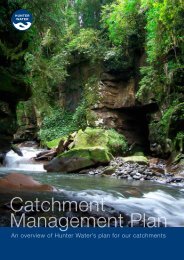
Catchment Management Plan - Hunter Water
Catchment Management Plan - Hunter Water
Catchment Management Plan - Hunter Water

Create successful ePaper yourself
Turn your PDF publications into a flip-book with our unique Google optimized e-Paper software.
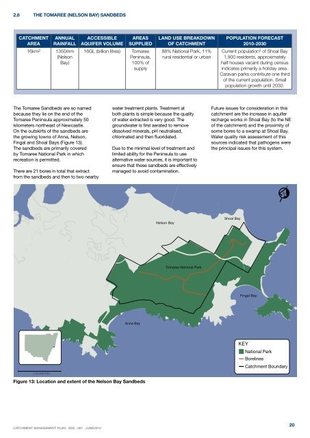
2.8 The Tomaree (Nelson Bay) Sandbeds<strong>Catchment</strong>area16km 2Annualrainfall1350mm(NelsonBay)ACCESSIBLEAQUIFER VOLUME16GL (billion litres)AreassuppliedTomareePeninsula,100% ofsupplyLand use breakdownof catchment88% National Park, 11%rural residential or urbanPopulation forecast2010-2030Current population 5 of Shoal Bay1,900 residents, approximatelyhalf houses vacant during censusindicates primarily a holiday area.Caravan parks contribute one thirdof the current population. Smallpopulation growth until 2030.The Tomaree Sandbeds are so namedbecause they lie on the end of theTomaree Peninsula approximately 50kilometers northeast of Newcastle.On the outskirts of the sandbeds arethe growing towns of Anna, Nelson,Fingal and Shoal Bays (Figure 13).The sandbeds are primarily coveredby Tomaree National Park in whichrecreation is permitted.There are 21 bores in total that extractfrom the sandbeds and then to two nearbywater treatment plants. Treatment atboth plants is simple because the qualityof water extracted is very good. Thegroundwater is first aerated to removedissolved minerals, pH neutralised,chlorinated and then fluoridated.Due to the minimal level of treatment andlimited ability for the Peninsula to usealternative water sources, it is important toensure that these sandbeds are effectivelymanaged to avoid contamination.Future issues for consideration in thiscatchment are the increase in aquiferrecharge works in Shoal Bay (to the NEof the catchment) and the proximity ofsome bores to a swamp at Shoal Bay.<strong>Water</strong> quality risk assessment of thissources indicated that pathogens werethe principal issues for this system.NNelson BayShoal BayTomaree National ParkFingal BayAnna Bay2 KILOMETRESKEYNational ParkBorelines<strong>Catchment</strong> BoundaryFigure 13: Location and extent of the Nelson Bay SandbedsCATCHMENT MANAGEMENT PLAN . ssS . 001 . JUNE201020