University of Central Florida Severe Weather Plan - UCF Facilities ...
University of Central Florida Severe Weather Plan - UCF Facilities ...
University of Central Florida Severe Weather Plan - UCF Facilities ...

You also want an ePaper? Increase the reach of your titles
YUMPU automatically turns print PDFs into web optimized ePapers that Google loves.
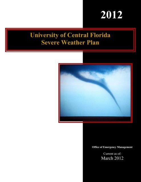
2012<strong>University</strong> <strong>of</strong> <strong>Central</strong> <strong>Florida</strong><strong>Severe</strong> <strong>Weather</strong> <strong>Plan</strong>Office <strong>of</strong> Emergency ManagementCurrent as <strong>of</strong>:March 2012
<strong>UCF</strong> <strong>Severe</strong> <strong>Weather</strong> <strong>Plan</strong> 2012This page is intentionally left blank.Page 2
<strong>UCF</strong> <strong>Severe</strong> <strong>Weather</strong> <strong>Plan</strong> 2012TABLE OF CONTENTSChapter 1: INTRODUCTION ................................................................................ 91.1. PURPOSE .............................................................................................................................. 91.2. SCOPE .................................................................................................................................. 91.3. STORMREADY UNIVERSITY ................................................................................................ 9Chapter 2: SEVERE WEATHER ALERTS .......................................................112.1 SEVERE THUNDERSTORM WATCH .................................................................................... 112.2 SEVERE THUNDERSTORM WARNING ................................................................................ 112.3 TORNADO WATCH ............................................................................................................. 112.4 TORNADO WARNING .......................................................................................................... 122.5 TROPICAL STORM WATCH ................................................................................................ 122.6 TROPICAL STORM WARNING ............................................................................................ 122.7 HURRICANE WATCH .......................................................................................................... 122.8 HURRICANE WARNING ...................................................................................................... 122.9 EXTREME WIND WARNING ............................................................................................... 12Chapter 3: THUNDERSTORMS .........................................................................143.1. GENERAL THUNDERSTORM INFORMATION ...................................................................... 143.2. LIGHTNING ........................................................................................................................ 143.3. FLOODING ......................................................................................................................... 15Chapter 4: TORNADOES .....................................................................................174.1. GENERAL TORNADO INFORMATION ................................................................................. 17Chapter 5: TROPICAL WEATHER ...................................................................18Page 3
<strong>UCF</strong> <strong>Severe</strong> <strong>Weather</strong> <strong>Plan</strong> 20125.1. GENERAL TROPICAL WEATHER INFORMATION............................................................... 185.2. OTHER TROPICAL WEATHER PRECAUTIONS .................................................................. 19Chapter 6: HIGH WINDS .....................................................................................216.1. GENERAL HIGH WIND INFORMATION .............................................................................. 21Chapter 7: EMERGENCY NOTIFICATION ....................................................227.1. CAMPUS NOTIFICATION .................................................................................................... 227.2. EXTERNAL NOTIFICATION ................................................................................................ 22Chapter 8: MINIMUM ACTIONS TO BE TAKEN ..........................................238.1 SEVERE THUNDERSTORM WATCH .................................................................................... 238.2 SEVERE THUNDERSTORM WARNING ................................................................................ 238.3 TORNADO WATCH ............................................................................................................. 238.4 TORNADO WARNING .......................................................................................................... 23Chapter 9: SEVERE WEATHER KIT ................................................................249.1. CONTENTS ......................................................................................................................... 24Chapter 10: TRAINING AND PROGRAMS .....................................................2510.1 SEVERE WEATHER TRAINING ......................................................................................... 2510.2 SEVERE WEATHER PROGRAMS ....................................................................................... 25Chapter 11: ADDITIONAL RESOURCES ........................................................2611.1. RADIO .............................................................................................................................. 2611.2. TELEVISION ..................................................................................................................... 2611.3. INTERNET ........................................................................................................................ 2611.4. OTHER RESOURCES ........................................................................................................ 26Page 4
<strong>UCF</strong> <strong>Severe</strong> <strong>Weather</strong> <strong>Plan</strong> 2012Appendix A: USER GUIDE FOR TROPICAL WEATHER REPORTS ........28Page 5
<strong>UCF</strong> <strong>Severe</strong> <strong>Weather</strong> <strong>Plan</strong> 2012This page is intentionally left blank.Page 6
<strong>UCF</strong> <strong>Severe</strong> <strong>Weather</strong> <strong>Plan</strong> 2012This plan is maintained by the <strong>University</strong> <strong>of</strong> <strong>Central</strong> <strong>Florida</strong> Office <strong>of</strong> Emergency Management.Any concerns or questions should be forwarded to <strong>Facilities</strong> and Safety, specifically:Emergency <strong>Plan</strong>s and Programs CoordinatorOffice <strong>of</strong> Emergency ManagementPhone: 407-823-0678Department Responsible for this plan: <strong>Facilities</strong> and Safetyo Office <strong>of</strong> Emergency ManagementSupersedes: September 2011 Edition July 2010 EditionPages: 28Distribution: Office <strong>of</strong> Emergency Management <strong>UCF</strong> Police General DistributionNotes:This plan is included in the Comprehensive Emergency Management <strong>Plan</strong> (CEMP),General Edition.This plan has been reviewed by the National <strong>Weather</strong> Service, Melbourne Office.Page 7
<strong>UCF</strong> <strong>Severe</strong> <strong>Weather</strong> <strong>Plan</strong> 2012This page is intentionally left blank.Page 8
<strong>UCF</strong> <strong>Severe</strong> <strong>Weather</strong> <strong>Plan</strong> 2012CHAPTER 1: INTRODUCTION1.1. Purpose1.1.1. The purpose <strong>of</strong> this <strong>Severe</strong> <strong>Weather</strong> <strong>Plan</strong> is to provide a course <strong>of</strong> action to be usedduring a severe weather event to minimize the potential for injury and loss <strong>of</strong> life that canresult during severe weather.1.1.2. For further information on severe weather and severe weather preparedness, please referto the Office <strong>of</strong> Emergency Management web site: www.emergency.ucf.edu.1.2. Scope1.2.1. This plan is designed to address response to severe weather situations during regular<strong>of</strong>fice hours (8:00 a.m. – 5:00 p.m., Monday through Friday). Outside <strong>of</strong> regular <strong>of</strong>ficehours, the <strong>University</strong> Police Department and <strong>Facilities</strong> Operations will be responsible forassessing the situation, briefing the Assistant Vice President for <strong>Facilities</strong> and Safety(Safety and Security) and the Associate Vice President for Administration and Finance(<strong>Facilities</strong> and Safety), and recommending appropriate action.1.2.2. Although the plan is primarily focused on the <strong>UCF</strong> main campus, it aims to include theregional campus locations.1.2.3. The information contained in this plan has been obtained from guidelines from theNational <strong>Weather</strong> Service (NWS) and the National Oceanic and AtmosphericAdministration (NOAA).1.2.4. It is recommended that <strong>UCF</strong> departments develop their own emergency severe weatherplans, detailing protective actions to be taken to prepare their <strong>of</strong>fices and personnel forsevere weather events. For additional information on developing department plans,please contact the <strong>UCF</strong> Office <strong>of</strong> Emergency Management.1.3. StormReady <strong>University</strong>1.3.1. The <strong>University</strong> <strong>of</strong> <strong>Central</strong> <strong>Florida</strong> has recently beenawarded the recognition <strong>of</strong> becoming a StormReady<strong>University</strong> by the National <strong>Weather</strong> Service. TheStormReady program helps communities, universitiesand other organizations safeguard its people andproperty from severe weather. It is recognized thatStormReady Universities are better prepared to savelives through better planning, education, andawareness. <strong>UCF</strong> partnered with the National<strong>Weather</strong> Service, Melbourne <strong>of</strong>fice, to work onfulfilling the six guidelines required to become aStormReady <strong>University</strong>.Page 9
<strong>UCF</strong> <strong>Severe</strong> <strong>Weather</strong> <strong>Plan</strong> 20121.3.2. To be recognized as StormReady, a university must:1.3.2.1. Establish a 24-hour warning point and emergency operations center;1.3.2.2. Have at least four redundant systems in place to receive severe weatherwarnings and forecasts at both the 24-hour warning point and the emergencyoperation center;1.3.2.3. Create a system that monitors local weather conditions and information on anongoing basis;1.3.2.4. Have at least four redundant systems in place to notify the universitycommunity <strong>of</strong> severe weather warnings;1.3.2.5. Promote the importance <strong>of</strong> community preparedness through campus weatherseminars and training on an annual basis; and1.3.2.6. Develop a formal hazardous weather plan for the entire campus and provideStorm Spotter training classes, as well as hold emergency exercises.1.3.3. The <strong>University</strong> <strong>of</strong> <strong>Central</strong> <strong>Florida</strong> submitted a preliminary application to the National<strong>Weather</strong> Service on April 21, 2010. On May 18, 2010, a representative from theMelbourne <strong>of</strong>fice conducted an on-site evaluation <strong>of</strong> the <strong>University</strong> as part <strong>of</strong> theapplication process. The <strong>University</strong> was informed that it was approved for StormReady<strong>University</strong> designation on June 4, 2010.Page 10
<strong>UCF</strong> <strong>Severe</strong> <strong>Weather</strong> <strong>Plan</strong> 2012CHAPTER 2: SEVERE WEATHER ALERTS2.1 <strong>Severe</strong> Thunderstorm Watch2.1.1. A <strong>Severe</strong> Thunderstorm Watch is issued by the National <strong>Weather</strong> Service whenconditions are favorable for the development <strong>of</strong> severe thunderstorms in, and close to, thewatch area.2.1.2. A severe thunderstorm, by definition, is a thunderstorm that produces 1” hail or larger indiameter and/or winds equal to or in excess <strong>of</strong> 58 mph. The length <strong>of</strong> the watch can varydepending on the weather situation. <strong>Severe</strong> Thunderstorm Watches are usually issued fora period <strong>of</strong> 4 to 8 hours.2.1.3. They are normally issued well in advance <strong>of</strong> the actual occurrence <strong>of</strong> severe weather.During the watch, people should review severe thunderstorm safety rules and be preparedto move to a place <strong>of</strong> safety if threatening weather approaches.2.2 <strong>Severe</strong> Thunderstorm Warning2.2.1. A <strong>Severe</strong> Thunderstorm Warning is issued when either a severe thunderstorm is indicatedby the WSR-88D radar or a spotter reports a thunderstorm producing hail 1” or larger indiameter and/or winds equal to or in excess <strong>of</strong> 58 mph; therefore, people in the affectedarea should seek safe shelter immediately. <strong>Severe</strong> thunderstorms can produce tornadoeswith little or no advanced warning.2.2.2. Lightning frequency is not criteria for issuing a <strong>Severe</strong> Thunderstorm Warning, but it isthe most imminent and dangerous threat on campus from a thunderstorm.2.2.3. <strong>Severe</strong> Thunderstorm Warnings are usually issued for a period <strong>of</strong> one hour or less. Theycan be issued without a <strong>Severe</strong> Thunderstorm Watch being already in effect.2.3 Tornado Watch2.3.1. A Tornado Watch is issued by the National <strong>Weather</strong> Service when conditions arefavorable for the development <strong>of</strong> tornadoes in and close to the watch area. Their lengthcan vary depending on the weather situation. They are usually issued for a period <strong>of</strong> 4 to8 hours.2.3.2. Tornado Watches normally are issued well in advance <strong>of</strong> the actual occurrence <strong>of</strong> severeweather. During the watch, people should review tornado safety rules and be prepared tomove a place <strong>of</strong> safety if threatening weather approaches.Page 11
<strong>UCF</strong> <strong>Severe</strong> <strong>Weather</strong> <strong>Plan</strong> 20122.4 Tornado Warning2.4.1. A Tornado Warning is issued when a tornado is indicated by the WSR-88D radar orsighted by spotters; therefore, people in the affected area should seek safe shelterimmediately.2.4.2. Tornado Warnings can be issued without a Tornado Watch being already in effect. Theyare usually issued for a period <strong>of</strong> around 30 - 45 minutes.2.5 Tropical Storm Watch2.5.1. A Tropical Storm Watch is an announcement that a tropical storm poses, or tropicalstorm conditions pose, a threat to coastal areas generally within 48 hours.2.5.2. A Tropical Storm Watch should normally not be issued if the system is forecast to attainhurricane strength.2.6 Tropical Storm Warning2.6.1. A Tropical Storm Warning is for sustained surface winds, associated with a tropicalcyclone, within the range <strong>of</strong> 34 to 63 knots (39 to 73 mph), expected within 36 hours.2.7 Hurricane Watch2.7.1. A Hurricane Watch is an announcement <strong>of</strong> specific areas, to which a hurricane or anincipient hurricane condition poses a possible threat, generally within 48 hours.2.8 Hurricane Warning2.8.1. A Hurricane Warning means that sustained winds <strong>of</strong> 64 knots (74 mph or 119 kph) orhigher associated with a hurricane are expected in 36 hours or less.2.8.2. A Hurricane Warning can remain in effect when dangerously high water, or acombination <strong>of</strong> dangerously high water and exceptionally high waves, continues, eventhough winds may be less than hurricane force.2.9 Extreme Wind Warning2.9.1. An Extreme Wind Warning means that there are hurricane winds (category 3 or higher)expected in one hour or less.2.9.2. An Extreme Wind Warning is issued by the NWS in Melbourne when a tropical cycloneis a category 3 or greater on the Saffir Simpson hurricane scale, and sustained tropicalcyclone surface winds <strong>of</strong> 100 knots (115 mph) or greater are occurring, or are expected tooccur, within one hour. This warning should be treated the same as a tornado warning,Page 12
<strong>UCF</strong> <strong>Severe</strong> <strong>Weather</strong> <strong>Plan</strong> 2012and preparations should be immediately implemented for life-threatening, destructivewinds.Page 13
<strong>UCF</strong> <strong>Severe</strong> <strong>Weather</strong> <strong>Plan</strong> 2012CHAPTER 3: THUNDERSTORMS3.1. General Thunderstorm Information3.1.1. Thunderstorms may develop at any time <strong>of</strong> the year. Although thunderstorms occur mostfrequently during the summer months, the more violent storms occur in the winter andearly spring. The Orlando area experiences thunderstorms approximately 90 days out <strong>of</strong>every year.3.1.2. Thunderstorms can be single cell, multicell cluster, multicell line, and super cell.Supercells usually form severe thunderstorms. Thunderstorms typically consist <strong>of</strong> veryhigh winds, rain, lightning, and in many cases, hail. Typically, the larger the hail is, thestronger the thunderstorm is. Hail 1” in diameter or more with winds in excess <strong>of</strong> 58 mphindicate a severe thunderstorm where tornadoes are also possible.3.1.3. Every year, central <strong>Florida</strong> experiences approximately 90 days with thunderstorms. <strong>Plan</strong>in advance.3.1.3.1. All persons are advised to monitor the weather daily during the summerthunderstorm season and to plan their work around any threatening weatherconditions. <strong>Severe</strong> weather information can be obtained via local radio stationsor the Internet. The <strong>University</strong> has placed NOAA weather radios throughout thecampus to help with monitoring local severe weather.3.1.3.2. All supervisors should be aware <strong>of</strong> their responsibility to advise any employeesor students vulnerable to thunderstorms. Vulnerability to thunderstormsincludes, but is not limited to, persons outside and persons in portable trailers.Such persons should be warned to take cover when storms approach.3.1.3.3. Instructors and supervisors in portable trailers or modular facilities should beaware such facilities might not be safe in high winds. All persons in portablesshould learn which permanent (brick or block) facilities are nearest to theirportable, and should plan an escape route to the permanent facility.3.2. Lightning3.2.1. The most dangerous aspect <strong>of</strong> a thunderstorm is lightning. The best protection fromlightning is to seek shelter in a nearby building.3.2.2. Cloud-to-ground lightning density in this area is approximately 28 strikes per square mileper year, meaning lightning could possibly hit around the <strong>UCF</strong> main campusapproximately 50 times each year.3.2.3. When thunderstorms threaten, seek shelter in a fully enclosed building or car. Avoidwater, metal objects, and open spaces. Note that golf carts, trees, tents and boats areunsafe places.Page 14
<strong>UCF</strong> <strong>Severe</strong> <strong>Weather</strong> <strong>Plan</strong> 20123.2.4. If caught outdoors away from enclosed shelter, avoid contact with other people; removeall metal objects from your person, and crouch down on the balls <strong>of</strong> your feet with handsover your ears.3.2.5. Avoid water, open windows and electrical appliances. This includes staying <strong>of</strong>f thetelephone.3.2.6. <strong>UCF</strong> uses a Thor Guard lightning detection system.3.2.6.1. The Recreation and Wellness Center (RWC) has installed a lightning predictionsystem called Thor Guard. The system, when lightning is predicted, activates aseries <strong>of</strong> horns and strobe lights to warn those working outside to seek shelterimmediately.3.2.6.2. The system will be used for the RWC aquatic facilities (leisure pools), tenniscourts, volleyball courts, recreational fields, and the Challenge Course. Staffmembers have been trained to know when to instruct users to evacuate the areasand when the areas are safe.3.2.6.3. The Thor Guard Lightning system is also used by <strong>UCF</strong> Athletics to detectlightning during <strong>UCF</strong> football games at the Bright House Networks Stadium.3.2.6.4. One long horn blast along with a continuous flashing strobe light will activatewhen the system predicts lightning.3.2.6.5. Three, five-second horn blasts are activated when the areas are safe.3.2.6.6. The system is active seven days a week from 10:00 a.m. to 12:00 a.m.3.3. Flooding3.3.1. Flooding can occur in low areas and in areas where storm drains are blocked.3.3.2. Due to its location, the main <strong>UCF</strong> campus is not likely to flood. However, regionalcampuses may experience flood conditions.3.3.3. Pooling <strong>of</strong> water poses a significant risk, not as much from swift moving water, but morefrom one’s inability to judge water depth. Water only inches deep can be next to waterthat is several feet deep.3.3.4. During flooding conditions, colonies <strong>of</strong> fire ants are capable <strong>of</strong> floating in clusters or"rafts," posing a threat to anything encountering them.3.3.5. Before the flood:Page 15
<strong>UCF</strong> <strong>Severe</strong> <strong>Weather</strong> <strong>Plan</strong> 20123.3.5.1. Have a NOAA weather radio, with tone alert, on hand, and during heavy rains,monitor it for flood warnings, watches or statements. Stay tuned to radio ortelevision stations.3.3.5.2. Keep materials on hand like sandbags, plywood, plastic sheeting, a supply <strong>of</strong>plastic garbage bags, and lumber.3.3.6. During the flood:3.3.6.1. Avoid driving into water <strong>of</strong> unknown depth, especially in periods <strong>of</strong> lowvisibility. Moving water can quickly sweep your vehicle away. Standing waterdeep enough to cover wheels can cause cars to float.3.3.6.2. If asked by local <strong>of</strong>ficials, quickly evacuate to avoid being cut <strong>of</strong>f by floodwater. Turn <strong>of</strong>f all utilities at the main switch if time permits.3.3.6.3. If time permits, move furnishings to safe ground.3.3.7. After the flood:3.3.7.1. Test drinking water for potability.3.3.7.2. Do not walk through flooded areas. Hidden sharp objects and open storm drainsare safety hazards.3.3.7.3. Do not handle live electrical equipment in wet areas; electrical equipmentshould be checked and dried before returning it to service.3.3.7.4. Use flashlights, not lanterns or torches, to examine buildings; flammables maybe inside.3.3.7.5. Report broken utility lines to appropriate authorities.3.3.7.6. Open windows and doors to let the air circulate. This will help remove foulodors and protect you from escaping gas. It will also help dry out the house.Take pictures <strong>of</strong> the damage.Page 16
<strong>UCF</strong> <strong>Severe</strong> <strong>Weather</strong> <strong>Plan</strong> 2012CHAPTER 4: TORNADOES4.1. General Tornado Information4.1.1. A tornado is a violently rotating column <strong>of</strong> air in contact with the ground with speeds <strong>of</strong>approximately 50-200 mph. It is only visible due to water droplets mixed with dust anddebris. Doppler radar will not "see" tornadoes. The radar only detects precipitation, andlight rain in the center <strong>of</strong> heavy rain indicates tornado potential. Contrary to popularbelief, tornadoes do not leave the ground; only the intensity changes, causing them toappear to "jump." Tornadoes can be categorized into three groups based on the"Enhanced Fujita" scale.4.1.1.1. Weak (EF0 – EF1)- 80% <strong>of</strong> all tornadoes, 65-110 mph winds, path 3 mileslong, lasting 1-10 minutes. Cause less than 5% <strong>of</strong> all tornado-related deaths.4.1.1.2. Strong (EF2 - EF3)- 19% <strong>of</strong> all tornadoes, 111-165 mph winds, path less than5 miles, lasting 10-20 minutes. Cause 30% <strong>of</strong> all tornado-related deaths.4.1.1.3. Violent (EF4 – EF5)- 1% <strong>of</strong> all tornadoes, winds greater than 166 mph, canhave a 50 mile path, lasting up to 60 minutes. Cause 70% <strong>of</strong> all tornado-relateddeaths.4.1.2. The most common direction <strong>of</strong> a tornado path is from the southwest to the northeast, buttornadoes can come from any direction. Tornadoes are most likely to occur during theafternoon and evening. The most violent storms occur in March, April, May, Novemberand December. The peak hours are from 3:00 p.m. until 8:00 p.m.4.1.3. A Tornado Warning means a tornado has been detected either by sight or by radar withina two- or three-county area. Official Tornado Warnings from the National <strong>Weather</strong>Service always state the county and the time frame for the warning, so you can knowwhen it expires.4.1.4. If you are in a portable and a Tornado Warning is issued for the area, suspend allactivities and relocate to a permanent facility.4.1.5. Since tornadoes are relatively spontaneous within the warning area, the <strong>University</strong> maynot be able to issue a timely evacuation notification.Page 17
<strong>UCF</strong> <strong>Severe</strong> <strong>Weather</strong> <strong>Plan</strong> 2012CHAPTER 5: TROPICAL WEATHER5.1. General Tropical <strong>Weather</strong> Information5.1.1. Dangerous hurricanes and tropical storms can affect the entire <strong>Central</strong> <strong>Florida</strong> area. TheNational Hurricane Center (NHC) models project the following winds for hurricaneswhich make landfall:HurricaneCategoryCoastal WindSpeedInland 30milesInland 60miles1 2 3 4 574 – 95 mph 96 – 110 mph111 – 130mph131 – 155mph155+ mph71 mph 83 mph 102 mph 118 mph 146 mph68 mph 80 mph 98 mph 113 mph 141 mph5.1.2. If a hurricane is approaching central <strong>Florida</strong>, all department heads should monitor thestorm via local radio, TV broadcasts, or the Internet. <strong>UCF</strong> News and Information has ahurricane information page and posts notices <strong>of</strong> campus closing at:http://www.ucf.edu/info/hurricane.php.5.1.3. Directors <strong>of</strong> the departments classified as essential personnel should pay special attentionto <strong>of</strong>ficial forecasts from the NHC. These forecasts give projected storm paths, as well ascoastal city strike probabilities, for a wide region.5.1.4. When any, or the entire central <strong>Florida</strong> region falls within the three-day cone <strong>of</strong>probability on the NHC’s “Warnings and Three-Day Cone” map, all departments need toplan how they will protect their assets.5.1.5. When a Hurricane Watch for surrounding coastal areas is issued, all departments need tosecure any sensitive or vulnerable records and equipment. A Hurricane Watch meanshurricane conditions may threaten the watch area within 48 hours, which is usuallyseveral hundred miles in length.5.1.6. If a Hurricane Warning is issued for our area, the <strong>University</strong> or branch campuses may beclosed. If so, classes will be canceled and <strong>of</strong>fices closed until the danger is over. AHurricane Warning means hurricane conditions may occur within 36 hours.5.1.7. <strong>UCF</strong>’s regional campuses located at area community colleges follow the closingdirectives issued by the host community college. These campuses may have differentclosing or opening schedules than <strong>UCF</strong>’s Orlando campuses. Please listen for theseannouncements before calling the campus information line. If you are in doubt, thecampus information line at (407) 823-2000 will have a recording <strong>of</strong> specific <strong>UCF</strong>Page 18
<strong>UCF</strong> <strong>Severe</strong> <strong>Weather</strong> <strong>Plan</strong> 2012closings. Only those faculty, staff or students who are specifically designated to workduring the storm, or those who live in <strong>UCF</strong> or <strong>UCF</strong>-affiliated housing, are expected to beon campus when the campus is closed for a hurricane emergency.5.1.8. All non-essential personnel on campus should be sent to their homes. All residents <strong>of</strong>residence halls, including Greek Park and other on-campus housing, should be sent totheir permanent homes. Those who are unable to leave campus will be relocated todesignated shelter areas.5.1.9. <strong>UCF</strong> administrators, together with essential personnel department heads, will makedecisions on the possible need for on-campus shelters to open and essential personnel towork during the storm. This typically occurs when <strong>UCF</strong> lies in the Three-Day Cone <strong>of</strong>probability on NHC maps, or when a hurricane watch is issued for our area.5.2. Other Tropical <strong>Weather</strong> Precautions5.2.1. Other specific tropical weather precautions that may need to be taken:5.2.1.1. Departments with outdoor equipment should secure all loose or fragile objectsthat may become a missile hazard in high winds.5.2.1.2. Contractors must secure their construction sites so as to prevent high windsfrom picking up debris or knocking down scaffolding. Crane booms should belowered to prevent being blown over.5.2.1.3. Departments with valuable records, computers, or scientific instrumentationshould secure such items by covering them with plastic, moving them awayfrom windows, or by other means. Computers can be best protected byunplugging them, sealing them in large plastic garbage bags, and elevating them<strong>of</strong>f the floor in case <strong>of</strong> flooding. Computer files and disks should be backed-upand moved to a safe location before bagging.5.2.1.4. A campus Emergency Operations Center (EOC) may be activated. For moreinformation, refer to the Emergency Operations Center <strong>Plan</strong>.5.2.1.5. Emergency instructions to on-campus residents may need to be delivered inperson by door-to-door visits. The Housing Resident Assistants will assist withthis, if necessary.5.2.1.6. Other <strong>University</strong> resources include:5.2.1.6.1. Air Force Reserve Officer Training Corps (AFROTC) and ArmyReserve Officer Training Corps (AROTC) students may be calledupon for assistance in any emergency situation. Tasking andassistance authorization will follow established Air Force andArmy guidelines and procedures;Page 19
<strong>UCF</strong> <strong>Severe</strong> <strong>Weather</strong> <strong>Plan</strong> 20125.2.1.6.2. The <strong>UCF</strong> Campus Emergency Response Team (CERT) iscomprised <strong>of</strong> students trained in disaster response, first aid, andradio communications. The CERT team may be activated by theOffice <strong>of</strong> Emergency Management to assist overwhelmed firstresponders on the <strong>UCF</strong> main campus; and5.2.1.6.3. The <strong>UCF</strong> American Red Cross Club (ARCC) is a RegisteredStudent Organization (RSO) with <strong>UCF</strong>. These students receivetraining on shelter management from the American Red Cross andmay assist <strong>UCF</strong> with shelter opertaions.5.2.1.7. <strong>Facilities</strong> Operations personnel will supply plastic to the occupants <strong>of</strong> buildingsfor the purpose <strong>of</strong> protecting items <strong>of</strong> concern, and in covering sensitiveequipment and furniture. <strong>Facilities</strong> Operations also has a limited ability toprovide sandbags at certain buildings to protect against flood. Requestersanticipating a need for sandbags should make such requests well in advance.Sandbags can be obtained by calling (407) 823-5223.5.2.2. The following may be implemented as determined by the President or his or her designee:5.2.2.1. Food Service should procure those provisions necessary to provide food toessential personnel, their families, and the remaining resident and affiliatedstudents. This is the responsibility <strong>of</strong> the Director <strong>of</strong> Business Services.5.2.2.2. All campus roadways except those used for emergency preparation activitieswill be closed. This is the responsibility <strong>of</strong> the <strong>University</strong> Police Department.5.2.2.3. The <strong>University</strong>’s Health Center should be prepared to assist individuals who areinjured or ill. This is the responsibility <strong>of</strong> Health Services.5.2.2.4. A staging area for the news media will be established. This will be a joint effortbetween the <strong>University</strong> Police and News and Information departments.Page 20
<strong>UCF</strong> <strong>Severe</strong> <strong>Weather</strong> <strong>Plan</strong> 2012CHAPTER 6: HIGH WINDS6.1. General High Wind Information6.1.1. The causes <strong>of</strong> damage to buildings by a tornado may be classified in one <strong>of</strong> threecategories, which include: extreme winds, missiles, collapse.6.1.2. All buildings have at least one undesirable structural feature relating to the effects <strong>of</strong> atornado. Examples are: large areas <strong>of</strong> glass, long ro<strong>of</strong>/ceiling spans, wind tunnels, andload-bearing wall construction. The areas designated in this report are not to beconsidered "tornado-pro<strong>of</strong>", but rather the best available areas for sheltering duringtornado and severe thunderstorm warnings.6.1.3. Shelter areas were selected by Environmental Health and Safety personnel, inconjunction with Orange County Emergency Management and the American Red Cross.The selections were made after conducting an American Red Cross Emergency MassCare Shelter Survey (ARC 6564), which evaluates attributes <strong>of</strong> a building to determinewhether it is suitable to serve as a hurricane shelter. As much as possible, the shelterswere selected to:6.1.3.1. Avoid glass;6.1.3.2. Avoid interior and exterior doors;6.1.3.3. Utilize interior spaces with short spans;6.1.3.4. Keep occupants as far away as possible from entrances;6.1.3.5. Avoid areas expected to become wind tunnels;6.1.3.6. Distribute locations throughout the building to facilitate rapid access;6.1.3.7. Avoid areas where chemicals are stored;6.1.3.8. Provide occupants with sanitation facilities; and6.1.3.9. Put as many walls as possible between you and the exterior <strong>of</strong> the building.Page 21
<strong>UCF</strong> <strong>Severe</strong> <strong>Weather</strong> <strong>Plan</strong> 2012CHAPTER 7: EMERGENCY NOTIFICATION7.1. Campus Notification7.1.1. Perhaps the most important aspect <strong>of</strong> this plan is ensuring all those present on campus arenotified <strong>of</strong> an emergency weather situation. When the determination has been made that anatural disaster is imminent, <strong>UCF</strong> Police and News and Information should ensureappropriate personnel are notified, in accordance with <strong>UCF</strong> Alert.7.1.2. During emergencies, <strong>UCF</strong>’s Emergency Notification System <strong>Plan</strong> and Protocol calls forimmediate notification <strong>of</strong> emergency responders and all members <strong>of</strong> the campuscommunity. For more information, refer to the Emergency Notification Systems <strong>Plan</strong>sand Protocol <strong>Plan</strong>.7.2. External Notification7.2.1. Damage assessment teams will be assembled, as necessary. They will report damage tothe EOC, after which the EOC Director or the Office <strong>of</strong> Emergency Management willnotify the National <strong>Weather</strong> Service Office in Melbourne.Page 22
<strong>UCF</strong> <strong>Severe</strong> <strong>Weather</strong> <strong>Plan</strong> 2012CHAPTER 8: MINIMUM ACTIONS TO BE TAKEN8.1 <strong>Severe</strong> Thunderstorm Watch8.1.1. Be aware that conditions may be ripe for the development <strong>of</strong> high winds, large hail, andpossibly an isolated tornado.8.2 <strong>Severe</strong> Thunderstorm Warning8.2.1. Review your severe weather action plan. Usual activities can continue safely indoors, butbe prepared to seek shelter. Avoid going outside, if possible, and stay away fromwindows.8.3 Tornado Watch8.3.1. Review your severe weather action plan. Usual activities can continue, but be prepared toseek shelter.8.4 Tornado Warning8.4.1. When a Tornado Warning is issued, activating the sirens and broadcasting a TornadoWarning via the severe weather radios, all supervisors and instructors shall immediatelylead their employees and students to their building's designated shelter area. Personsresponsible for severe weather radios in the building should unplug them and take themto the shelter area to monitor for additional warnings. All persons located outdoors shallseek shelter indoors immediately.8.4.2. Exterior doors should not be opened. Under no circumstances should persons leavebuildings during a warning. During a warning, persons should take one <strong>of</strong> two positions:1) the preferred position is kneeling with one’s head between his or her knees, facing thewall, 2) the other is seated on the floor with one’s back to the wall. In either case, personsshould be as low as possible to reduce their potential for injuries from flying missiles,glass, or debris. If available, some form <strong>of</strong> covering should be used to protect heads,arms, and legs.8.4.3. The warnings will last for an hour from the last siren, unless a shorter time is indicated bythe National <strong>Weather</strong> Service. Building occupants should remain in the shelter area for atleast that long, unless a new warning is issued.8.4.4. Remember, you typically have only three minutes to reach a shelter so do not delay.Waiting can mean the difference between life and death. Everyone must be familiar withthe location <strong>of</strong> the severe weather shelter area(s) in their buildings and should be briefedon what actions to take when the sirens have sounded. Persons in the shelter should tuneto local radio stations, their severe weather radio, and/or a NOAA weather radio foradditional information.Page 23
<strong>UCF</strong> <strong>Severe</strong> <strong>Weather</strong> <strong>Plan</strong> 2012CHAPTER 9: SEVERE WEATHER KIT9.1. Contents9.1.1. Every building will have at least one <strong>Severe</strong> <strong>Weather</strong> Kit. Some buildings will have morethan one. The kit should include at least the following items:9.1.1.1. Water, at least a three-day supply, 1 gallon per person per day9.1.1.2. Food, at least a three-day supply <strong>of</strong> non-perishable food9.1.1.3. Can opener9.1.1.4. Flashlight(s), with extra batteries9.1.1.5. Battery-operated radio, with extra batteries9.1.1.6. NOAA weather radio, if available9.1.1.7. First-aid kit9.1.1.8. An A-B-C-type fire extinguisher9.1.1.9. Several blankets9.1.1.10. Important documents, ie: insurance, medical records, bank account numbers,social security cards9.1.1.11. Extra clothes, including rain gear9.1.1.12. Cash and credit cards9.1.1.13. Identification cards9.1.1.14. Whistle to signal for help9.1.1.15. Prescription medications and prescription paperwork9.1.1.16. Toiletries9.1.1.17. Pet planPage 24
<strong>UCF</strong> <strong>Severe</strong> <strong>Weather</strong> <strong>Plan</strong> 2012CHAPTER 10: TRAINING AND PROGRAMS10.1 <strong>Severe</strong> <strong>Weather</strong> Training10.1.1. The <strong>University</strong> <strong>of</strong> <strong>Central</strong> <strong>Florida</strong> <strong>of</strong>fers the following severe weather training:10.1.1.1. Storm Spotter Training10.2 <strong>Severe</strong> <strong>Weather</strong> Programs10.1.1.1.1. The <strong>UCF</strong> Office <strong>of</strong> Emergency Management and the National<strong>Weather</strong> Service will train storm spotters and maintain a list <strong>of</strong>trained spotters for activation in the event <strong>of</strong> severe weather.10.2.1. The <strong>University</strong> <strong>of</strong> <strong>Central</strong> <strong>Florida</strong> <strong>of</strong>fers the following severe weather programs:10.2.1.1. <strong>Severe</strong> <strong>Weather</strong> Awareness Week10.2.1.2. <strong>UCF</strong> Preparedness Fair10.2.1.3. Annual Safety Talks10.2.1.3.1. <strong>Severe</strong> <strong>Weather</strong> Emergencies10.2.1.3.2. Extreme Temperature <strong>Weather</strong> Emergencies10.2.1.3.3. Hurricanes, Storms and FloodingPage 25
<strong>UCF</strong> <strong>Severe</strong> <strong>Weather</strong> <strong>Plan</strong> 2012CHAPTER 11: ADDITIONAL RESOURCES11.1. Radio12.1.1. W<strong>UCF</strong> 89.9 FM12.1.2. WMFE FM 90.712.1.3. WTKS FM 104.112.1.4. WDBO AM 58012.1.5. WWNZ AM 74011.2. Television12.2.1. WESH TV—Channel 212.2.2. WCPX TV—Channel 612.2.3. WFTV TV—Channel 911.3. Internet12.3.1. Federal Emergency Management Agency (FEMA)— http://www.fema.gov12.3.2. <strong>UCF</strong> OEM Website – http://www.emergency.ucf.edu12.3.3. National <strong>Weather</strong> Service: Melbourne, FL – www.srh.noaa.gov/mlb11.4. Other Resources12.4.1. <strong>UCF</strong> OEM recommends these references for tracking tropical waves, storms andhurricanes. National Hurricane Center (NHC) bulletins and outlooks are issued four timesdaily—2 a.m., 8 a.m., 2 p.m., and 8 p.m.—during hurricane season.12.4.2. If the NHC is down or busy, try these alternate resources:12.4.2.1. The <strong>Weather</strong> Channel: Check this as a back-up site for NHC bulletins or as aprimary resource for satellite views <strong>of</strong> storms.12.4.2.2. Atlantic Tropical <strong>Weather</strong> Center: Check this as a back-up site for NHCadvisories and their “Tropical Outlook,” or as a primary resource to viewsatellite pictures <strong>of</strong> storms.Page 26
<strong>UCF</strong> <strong>Severe</strong> <strong>Weather</strong> <strong>Plan</strong> 201212.4.3. To report storm damage, call the National <strong>Weather</strong> Center in Melbourne at 1-800-683-4468, extension 241.Page 27
<strong>UCF</strong> <strong>Severe</strong> <strong>Weather</strong> <strong>Plan</strong> 2012APPENDIX A: USER GUIDE FOR TROPICAL WEATHER REPORTSPage 28
A Reference Guide <strong>of</strong> Hurricane ProductsIssued by the National <strong>Weather</strong> ServiceNWS Melbourne, <strong>Florida</strong> - 2011 EditionPurpose: The purpose <strong>of</strong> this guide is to allow you to become familiar with theproducts issued during the hurricane season by the National Hurricane Center(NHC) and the National <strong>Weather</strong> Service (NWS) Forecast Office in Melbourne,<strong>Florida</strong>.1. 2011 Edition IntroductionTABLE OF CONTENTS1.1 Basic Tropical Definitions............................................................................31.2 Saffir Simpson Hurricane Wind Scale..........................................................51.3 Storm Names for the 2011 Atlantic Season................................................72. National Hurricane Center (NHC) Products2.1 Tropical <strong>Weather</strong> Outlook...........................................................................82.2 Graphical Tropical <strong>Weather</strong> Outlook...........................................................92.3 Special Tropical <strong>Weather</strong> Outlook.............................................................102.4 Tropical Cyclone Public Advisory...............................................................102.5 Tropical Cyclone Forecast and Advisory (Marine).....................................112.6 Tropical Cyclone Discussion.......................................................................112.7 Tropical Cyclone Wind Speed Probabilities................................................122.8 Special Tropical Cyclone Update.................................................................141
2.9 Tropical Cyclone Position Estimate.............................................................152.10 Tropical Cyclone Valid Time Event Code..................................................152.11 Tropical Cyclone Track Forecast Cone & Watches and Warning Map…...162.12 Tropical Cyclone Surface Wind Speed Probabilities.................................172.13 Tropical Cyclone Surface Wind Field........................................................182.14 Cumulative Wind Field.............................................................................192.15 Maximum 1 Minute Wind Speed Probability Table.................................202.16 Tropical Cyclone Storm Surge Probabilities.............................................213. National <strong>Weather</strong> Service (NWS) Melbourne Tropical Products3.1 Text Hurricane Local Statement................................................................223.2 Graphical Hurricane Local Statement........................................................243.3 Extreme Wind Warning.............................................................................253.4 Terms <strong>of</strong> Uncertainty in Forecasts.............................................................272
1.1 Basic Tropical Definitions1. 2011 EDITION INTRODUCTIONTropical Depression: A tropical cyclone with maximum sustained winds between25 mph and 38 mph.Tropical Storm: A tropical cyclone with maximum sustained winds between 39mph and 73 mph. A cyclone with sustained winds reaching 39 mph will be named.Hurricane: A tropical cyclone with maximum sustained winds <strong>of</strong> 74 mph orgreater.Post Tropical Cyclone: A former tropical cyclone. This generic term describes acyclone that no longer possesses sufficient tropical characteristics. Two types <strong>of</strong>Post Tropical Cyclones are extratropical cyclones and remnant lows.Extratropical Cyclone: A cyclone <strong>of</strong> any intensity that possesses frontalcharacteristics.Remnant Low: An area <strong>of</strong> low pressure that no longer possesses convection nearthe center <strong>of</strong> circulation, as would be expected <strong>of</strong> a tropical cyclone. This lowmust also have sustained winds less than 39 mph.Hurricane Watch: A hurricane watch means that hurricane conditions are possiblewithin the watch area, generally within the next 48 hours.Hurricane Warning: A hurricane warning means that hurricane conditions areexpected within the warning area, generally within the next 36 hours.Tropical Storm Watch: A tropical storm watch means that tropical stormconditions are possible within the watch area, generally within the next 48 hours.Tropical Storm Warning: A tropical storm warning means that tropical stormconditions are expected within the warning area, generally within the next 36hours.3
Saffir-Simpson Hurricane Wind Scale: A rating scale with five categories that isbased on the maximum sustained wind speed <strong>of</strong> a tropical cyclone. The scale nolonger is related to any predicted storm surge height.Funnel Cloud: A rotating, funnel shaped cloud extending downward from ashower or thunderstorm base. A funnel cloud does not come in contact with theground.Tornado: A violently rotating column <strong>of</strong> air extending from the shower orthunderstorm base to the ground.Storm Surge: The rise in sea water caused by the meteorological parameters only(high winds associated with a landfalling cyclone, and to a lesser extent, by thelow pressure <strong>of</strong> the storm). “Storm Surge” is not the total water level realizedalong the coast - that is the “Storm Tide” (see next definition).Storm Tide: The total rise <strong>of</strong> sea or lake water caused by the high windsassociated with a land-falling cyclone, low pressure <strong>of</strong> the storm, astronomicaltide, water level anomalies, geography, and local bathymetry. This water rise canvary significantly from “Storm Surge” values.Coastal Areas: Areas along the coast susceptible to the effects <strong>of</strong> storm surge.4
1.2 Saffir Simpson Hurricane Wind ScaleCategoryWind Speed (mph)1 74-952 96-1103 111-1304 131-1555 >155“Storm Surge” has been removed as a component from the Saffir SimpsonHurricane Wind Scale as it was misapplied and popularly used as an indicator <strong>of</strong>Storm Tide. Although “storm surge” was connected to the scale for many years,this caused confusion as the actual “storm tide” is more than just a function <strong>of</strong>wind. Factors like coastline shape, bathymetry, size <strong>of</strong> the storm, and even angle<strong>of</strong> approach to the coastline are all important factors for the actual storm tide.The most recent examples to explain the separation <strong>of</strong> storm surge/tide from thescale is explained in the image below: Hurricane Ike(Category 2 wind) Hurricane Charley(Category 4 wind)5
Hurricane Ike was a very large storm that spread tropical storm force winds acrossmuch <strong>of</strong> the central and western Gulf <strong>of</strong> Mexico. It produced a large anddestructive storm tide across Galveston Island and the Bolivar Peninsula prior toand during landfall. This “storm tide” was much larger than the theoretical“Storm Surge” values indicated on the Saffir Simpson Scale Above.In 2004, when Hurricane Charley made landfall as a strong category 4 hurricane inSouthwest <strong>Florida</strong>, the actual storm tide heights were much lower than indicatedfor a storm with category 4 winds. This was primarily attributed to Charley being asmaller diameter storm and approaching the Southwest <strong>Florida</strong> coast at a moreoblique angle.While these are just two recent examples <strong>of</strong> how storm tide within tropicalcyclones deviates from the “Storm Surge” previously indicated on the Saffir-Simpson Scale, there is more that shows why we must treat each landfallingstorm differently when considering storm surge.In addition to the size <strong>of</strong> the storm there are important geographical andbathymetric aspects <strong>of</strong> storm tide which cause generic “Storm Surge” values to bedangerous. For example due the shape <strong>of</strong> the coastline and bathymetry <strong>of</strong> eastcentral <strong>Florida</strong>, this coast can realize a lower storm tide in a category fivehurricane than northeast <strong>Florida</strong> could realize in a category two event.To take the above example a bit further, a category two storm making landfall inthe Fort Lauderdale area could produce 3 to 4 feet <strong>of</strong> storm tide, about one half<strong>of</strong> the Saffir-Simpson Scale “Storm Surge” values illustrated above, while the samestorm in the Jacksonville area could produce 11 to 15 feet <strong>of</strong> storm tide, nearlytwice the values indicated in the old Saffir-Simpson Scale.It is important to note that even with surge no longer being connected to theSaffir Simpson Hurricane Wind Scale; the National <strong>Weather</strong> Service will continueto provide predicted storm surge values in many <strong>of</strong> its products. Users can consultmany <strong>of</strong> the products contained within this guide for more information onpredicted storm surge, including the hurricane local statement and graphicalhurricane local statement issued by the National <strong>Weather</strong> Service in Melbourne.6
1.3 2011 Atlantic Hurricane Season Storm NamesArleneCindyEmilyGertIreneKatiaMariaOpheliaRinaTammyWhitneyBretDonFranklinHarveyJoseLeeNatePhilippeSeanVinceNote that storm names highlighted by red represent replacement names from the2005 Atlantic Hurricane Season (Dennis, Katrina, Rita, Stan, and Wilma,respectively).In the event that more than 21 named tropical cyclones occur in the Atlantic basinin a season, additional storms will take on names from the Greek alphabet: Alpha,Beta, Gamma, Delta, and so on. The use <strong>of</strong> the Greek Alphabet last occurred in2005, when 28 named storms formed, and ended with Tropical Storm Zeta, whichformed on December 29, 2005. Were a storm to form after December 31, 2011, itwould take the first name on the 2012 list.7
2. NATIONAL HURRICANE CENTER PRODUCTS2.1 Tropical <strong>Weather</strong> OutlookBeginning on June 1 and continuing through November 30, the National HurricaneCenter produces a tropical weather outlook that discusses the potential for thedevelopment <strong>of</strong> tropical systems in the Atlantic out to 48 hours. These outlooksare issued four times throughout the day. Probability <strong>of</strong> tropical cycloneformation is listed within this product in increments <strong>of</strong> 10 percent.An example <strong>of</strong> this outlook appears below:ZCZC MIATWOAT ALLTTAA00 KNHC DDHHMMTROPICAL WEATHER OUTLOOKNWS NATIONAL HURRICANE CENTER MIAMI FL200 AM EDT TUE JUN 7 2011FOR THE NORTH ATLANTIC...CARIBBEAN SEA AND THE GULF OF MEXICO...A LARGE LOW PRESSURE AREA IS CENTERED OVER THE NORTHWESTERNCARIBBEAN SEA ABOUT 100 MILES SOUTH-SOUTHWEST OF GRAND CAYMAN. THEASSOCIATED SHOWER AND THUNDERSTORM ACTIVITY IS CURRENTLYDISORGANIZED...AND UPPER-LEVEL WINDS ARE BECOMING LESS FAVORABLEFOR DEVELOPMENT OF THIS SYSTEM. THERE IS A MEDIUM CHANCE...30PERCENT...OF THIS SYSTEM BECOMING A TROPICAL CYCLONE DURING THENEXT 48 HOURS. AN AIR FORCE RESERVE RECONNAISSANCE AIRCRAFT ISSCHEDULED TO INVESTIGATE THE SYSTEM THIS AFTERNOON...IF NECESSARY.REGARDLESS OF DEVELOPMENT...HEAVY RAINS COULD CAUSE FLASH FLOODSAND MUD SLIDES OVER PORTIONS OF HAITI...DOMINICAN REPUBLIC...JAMAICA...AND CUBA AS THE SYSTEM MOVES SLOWLY TOWARD THE NORTHWESTOR NORTH DURING THE NEXT COUPLE OF DAYS.ELSEWHERE...TROPICAL CYCLONE FORMATION IS NOT EXPECTED DURING THENEXT 48 HOURS.$$FORECASTER BEVENThis product references the probability <strong>of</strong> development <strong>of</strong> an area <strong>of</strong> disturbedweather within the next 48 hours. These probability statements correspond tothe graphical tropical weather outlook.This product can be found on the NHC home page at http://www.nhc.noaa.govand are issued at 8 pm EDT, 2 am EDT, 8 am EDT, 2 pm EDT.8
2.2 Graphical Tropical <strong>Weather</strong> OutlookThis product complements the text version <strong>of</strong> the tropical weather outlook byshowing graphically where areas <strong>of</strong> interest are located across the Atlantic.Moreover, this graphic also indicates, by the color <strong>of</strong> the circle around thedisturbance, the likelihood it develops into a tropical depression or tropical storm.Finally, placing your mouse over a circle on the map will display importantforecast information on the disturbance or active tropical system.9
2.3 Special Tropical <strong>Weather</strong> OutlookSpecial Tropical <strong>Weather</strong> Outlooks will be issued when significant changes requirean update to a previously issued tropical weather outlook. In the past, thesesignificant updates were issued as a Special Tropical Disturbance Statement.When a Special Tropical <strong>Weather</strong> Outlook is issued, it will also be accompanied byan update to the Graphical Tropical <strong>Weather</strong> Outlook.Tropical Cyclone Specific ProductsThe remaining products in this guide are only issued when there is an activetropical system in the Atlantic. When a tropical depression, tropical storm, orhurricane forms in the Atlantic, the National Hurricane Center issues numerousproducts on the current position and future movement <strong>of</strong> the tropical system.These advisories on active tropical systems are issued routinely at 5 am EDT, 11am EDT, 5 pm EDT, and 11 pm EDT. When systems are closer to land,intermediate advisories are issued half way between the routine advisory times.2.4 Public AdvisoryThe tropical cyclone public advisory will change significantly for the 2010 season.This product will now be divided into five separate sections containing importantinformation on the current and future path <strong>of</strong> the tropical cyclone. These fivesections are: Summary- The summary section <strong>of</strong> the advisory includes a tabular outline<strong>of</strong> the current location, movement, and intensity <strong>of</strong> the tropical cyclone. Italso includes the distance <strong>of</strong> the tropical cyclone from well-knownlocations. Watches and Warnings- When watches or warnings are in effect for anyportion <strong>of</strong> the Atlantic, they will be included in this section. Any newwatches or warnings issued or changes made to any already in effect, willbe listed at the top <strong>of</strong> this section. A summary <strong>of</strong> all watches and warningsin effect will then be included below.10
Discussion and 48 hour outlook – This section <strong>of</strong> the public advisoryrepeats the current location and movement <strong>of</strong> the tropical cyclone andincludes a discussion on the expected movement <strong>of</strong> the system over thenext 48 hours. The discussion will also focus on the current intensity <strong>of</strong> thesystem and the potential for intensification over the next 48 hours. If anyrecent wind observations are available from land-based stations, they willbe included in this section. Hazards Affecting Land – Impacts from storm surge, wind, rainfall andtornadoes will be included in this section. Information will be provided in ageneral overview format with more focus given to storm surge impacts. Next Advisory – This section will list the time <strong>of</strong> the next advisory issued bythe National Hurricane Center.An example <strong>of</strong> the new public advisory can be found at this website:http://www.nhc.noaa.gov/tcp_example.shtml2.5 Tropical Cyclone Forecast and Advisory (Marine)The Tropical Cyclone Forecast/Advisory contains a list <strong>of</strong> all current watches andwarnings on a tropical or subtropical cyclone, as well as the current latitude andlongitude coordinates, intensity, and system motion. The advisory containsforecasts <strong>of</strong> the cyclone positions, intensities, and wind radii for 12, 24, 36, 48,and 72 hours from the current synoptic time. The advisory may also includeinformation on any pertinent storm tides associated with the cyclone. All windspeeds in the forecast advisory are given in knots (nautical miles per hour).For an example <strong>of</strong> this product, visit the following website:http://www.nhc.noaa.gov/help/tcm.shtml2.6 Tropical Cyclone DiscussionThe Tropical Cyclone Discussion explains the reasoning behind the forecast for atropical or subtropical cyclone. It includes a table <strong>of</strong> the forecast track and11
intensity. These products are very similar to area forecast discussions issued bylocal weather <strong>of</strong>fices. They may include meteorological terminology or discussion<strong>of</strong> available model data.You can find an example <strong>of</strong> this product at the following website:http://www.nhc.noaa.gov/tcd_example.shtml2.7 Tropical Cyclone Wind Speed ProbabilitiesThe Tropical Cyclone Surface Wind Speed Probabilities text product providesprobabilities, in percent, <strong>of</strong> sustained wind speeds equal to or exceeding 34-, 50-,and 64-knot wind speed thresholds. These wind speed probabilities are based onthe track, intensity, and wind structure forecasts and uncertainties from theNational Hurricane Center and are computed for coastal and inland cities as wellas <strong>of</strong>fshore locations (e.g., buoys). Two types <strong>of</strong> probability values are producedin this text product: cumulative probabilities <strong>of</strong> occurrence, and individual periodprobabilities <strong>of</strong> onset.Cumulative probabilities are provided in the text product for the following timeperiods: 0-12 hours, 0-24 hours, 0-36 hours, 0-48 hours, 0-72 hours, 0-96 hours,and 0-120 hours (0-5 days). These cumulative probabilities indicate the overallchances that the stated wind speed will occur at each location during the periodbetween hour 0 (the beginning <strong>of</strong> the forecast) and each listed forecast hour.Individual period probabilities are provided for each <strong>of</strong> the following timeintervals: 0-12 hours, 12-24 hours, 24-36 hours, 36-48 hours, 48-72 hours, 72-96hours, and 96-120 hours. These individual period probabilities indicate thechances that the stated wind speed will start during each individual period ateach location. Cumulative probabilities through each forecast time period are alsojust the sum <strong>of</strong> the individual period probabilities up to that time.In other words, cumulative probabilities tell decision-makers the chances that theevent will happen at all. The individual period probabilities tell decision-makerswhen the event is most likely to start.12
When reading this product you will see a description key that looks something likethis:II. WIND SPEED PROBABILITY TABLE FOR SPECIFIC LOCATIONSCHANCES OF SUSTAINED (1-MINUTE AVERAGE) WIND SPEEDS OF AT LEAST...34 KT (39 MPH... 63 KPH)......50 KT (58 MPH... 93 KPH)......64 KT (74 MPH...119 KPH)...FOR LOCATIONS AND TIME PERIODS DURING THE NEXT 5 DAYSPROBABILITIES FOR LOCATIONS ARE GIVEN AS IP(CP) WHEREIP IS THE PROBABILITY OF THE EVENT BEGINNING DURINGAN INDIVIDUAL TIME PERIOD (INDIVIDUAL PROBABILITY)(CP) IS THE PROBABILITY OF THE EVENT OCCURRING BETWEEN18Z WED AND THE FORECAST HOUR (CUMULATIVE PROBABILITY)PROBABILITIES ARE GIVEN IN PERCENTX INDICATES PROBABILITIES LESS THAN 1 PERCENTPROBABILITIES FOR 34 KT AND 50 KT ARE SHOWN AT A GIVEN LOCATION WHENTHE 5-DAY CUMULATIVE PROBABILITY IS AT LEAST 3 PERCENT.PROBABILITIES FOR 64 KT ARE SHOWN WHEN THE 5-DAY CUMULATIVEThis key is used to understand the probabilities given for various sites. On thenext page, an example <strong>of</strong> this product is explained.13
- - - - WIND SPEED PROBABILITIES FOR SELECTED LOCATIONS - - - -FROM FROM FROM FROM FROM FROM FROMTIME 18Z WED 06Z THU 18Z THU 06Z FRI 18Z FRI 18Z SAT 18Z SUNPERIODS TO TO TO TO TO TO TO06Z THU 18Z THU 06Z FRI 18Z FRI 18Z SAT 18Z SUN 18Z MONFORECAST HOUR (12) (24) (36) (48) (72) (96) (120)- - - - - - - - - - - - - - - - - - - - - - - - - - - - - - - - - -LOCATION KTDAYTONA BEACH 34 X 3( 3) 4( 7) 5(12) 3(15) 1(16) X(16)ORLANDO FL 34 X 3( 3) 5( 8) 4(12) 2(14) 2(16) X(16)COCOA BEACH FL 34 2 7( 9) 7(16) 4(20) 2(22) 1(23) X(23)COCOA BEACH FL 50 X X( X) 1( 1) X( 4) 6(10) 4(14) 1(15)COCOA BEADH FL 64 X X( X) 1( 1) 2( 3) 4( 7) 2( 9) X( 9)In this example given above, the probability that Daytona Beach receives 34 knotwinds in the next 5 days is 16% (red box). However, Daytona Beach has aprobability <strong>of</strong> 5% <strong>of</strong> receiving tropical storm force winds between 06z (2 am EDT)and 18z (2 pm EDT) Friday (green box). Similarly, the cumulative probability <strong>of</strong>tropical storm force winds at Cocoa Beach for the next five days is 23%. Theprobability that Cocoa Beach receives tropical storm force winds between 06zFriday (2 am EDT) to 18z Friday (2 pm EDT) is 4%.Probabilities for a particular location and speed are provided only when the 120-hour (5-day) cumulative probability is at least 2.5% (rounded to 3%). Locations arelisted in geographic order, and data for all wind speeds (with high enoughprobabilities) at one location are grouped together.You can see an example <strong>of</strong> this product at the following link:http://www.nhc.noaa.gov/pws_example.shtml2.8 Special Tropical Cyclone UpdateTropical Cyclone Updates are brief statements issued instead <strong>of</strong> or precedingspecial advisories to inform <strong>of</strong> significant changes in a tropical cyclone or to postor cancel watches or warnings. This product is issued on an as needed basis.You can see an example <strong>of</strong> this product at the following link:http://www.nhc.noaa.gov/tcu_example.shtml14
2.9 Tropical Cyclone Position EstimateTropical Cyclone Position Estimates are issued between intermediate advisorieswhenever a tropical cyclone with a well-defined center is within 200 nauticalmiles <strong>of</strong> land-based radar in the United States. These estimates give the centerlocation in map coordinates and distance and direction from a well-known point.You can see an example <strong>of</strong> this product at the following link:http://www.nhc.noaa.gov/tce_example.shtml2.10 Tropical Cyclone Valid Time Event CodeThe Tropical Cyclone Watch/Warning text product (TCV) is based upon the ValidTime Event Code (VTEC). It summarizes all new, continued, and canceled tropicalcyclone watches and warnings issued by the National Hurricane Center (NHC) forthe U.S. Atlantic and Gulf coasts, Puerto Rico, and U.S. Virgin Islands.You can see an example <strong>of</strong> this product at the following link:http://www.nhc.noaa.gov/tcv_example.shtml15
The following graphical products are found on the home page <strong>of</strong> the NationalHurricane Center whenever advisories are being issued on a tropical cyclone.2.11 Tropical Cyclone Track Forecast Cone and Watches/WarningsThis graphic is created with each advisory issued by the National HurricaneCenter. It includes the three day forecast cone (solid white area) and the four t<strong>of</strong>ive day forecast cone (dashed white area). Any watches or warnings that are ineffect for a landmass are also included on this map. Remember; do not focus onthe black line in the center <strong>of</strong> the cone. A tropical cyclone is not a point. Rather,the effects <strong>of</strong> a tropical cyclone can spread hundreds <strong>of</strong> miles from the center.16
2.12 Tropical Cyclone Surface Wind Speed ProbabilitiesThis image is the graphical counterpart to the Tropical Cyclone Wind SpeedProbabilities Table. This example graphic above displays the probability that apoint will receive tropical storm force winds. Three different graphics are created.This image, for tropical storm force winds, a second image for winds in excess <strong>of</strong>50 knots (58 mph), and a third image for hurricane force winds in excess <strong>of</strong> 64knots (74 mph).17
2.13 Tropical Cyclone Surface Wind FieldThis graphical product is a summary <strong>of</strong> the current conditions associated with atropical cyclone. In this example, the current location <strong>of</strong> Hurricane Katrina isindicated with the white diamond. Winds <strong>of</strong> tropical storm and hurricane forceare indicated by the shaded areas. Additionally, areas under tropical storm orhurricane watches and warnings are displayed.18
2.14 Cumulative Wind HistoryThis graphic shows how the size <strong>of</strong> the storm has changed, and the areaspotentially affected so far by sustained winds <strong>of</strong> tropical storm force (in orange)and hurricane force (in red). Because the wind radii shown are based on themaximum extent <strong>of</strong> tropical storm or hurricane force winds, not all areas mayhave experienced these winds.19
2.15 Maximum 1-minute Wind Speed Probability TableThe table shows the probability that the maximum sustained surface wind speed<strong>of</strong> the tropical cyclone will be within various intensity ranges as well as the fivecategories on the Saffir-Simpson Hurricane Scale during the next 120 hours. Theseprobabilities apply to the maximum sustained surface wind associated with thecyclone, and not winds that could occur at specific locations.20
2.16 Tropical Cyclone Storm Surge ProbabilitiesThe Tropical Cyclone Storm Surge Probabilities product consists <strong>of</strong> a graphic thatshows probabilities, in percentage, <strong>of</strong> a storm surge (NOT storm tide!) from ahurricane that will exceed a particular value. For example, in the image shownabove, the probability <strong>of</strong> a storm surge exceeding 5 feet is shown. The areas inyellow indicate the probability <strong>of</strong> exceeding 5 feet is between 40 to 50 percent.This product produces probability <strong>of</strong> storm surge at one foot intervals from tw<strong>of</strong>eet to 25 feet.This product is produced by using an ensemble <strong>of</strong> SLOSH runs created by theNational Hurricane Center, and is available whenever a hurricane watch orhurricane warning is in effect for the continental U.S.NWS Melbourne advises the use <strong>of</strong> the 10% Exceedance Height Product (below)which is more representative <strong>of</strong> actual Storm Surge (NOT storm tide) heights.21
...HURRICANE WARNING REMAINS IN EFFECT......PRECAUTIONARY/PREPAREDNESS ACTIONS...PRECAUTIONARY/PREPAREDNESS ACTIONS...&&...WINDS......STORM SURGE AND STORM TIDE...This segment applies to the countieslisted above. This segment will detailspecific impacts expected in the listedcounties....INLAND FLOODING......TORNADOES...$$Hurricane local statements include headlines for any tropical watches or warningsthat may be in effect. These headlines are found right below the listing <strong>of</strong>counties as indicated in the above example.Hurricane Local Statements are an excellent resource to gain information specificto your area. Hurricane Local Statements are issued at least every six hours whena tropical storm or hurricane watch or warning is in effect for the MelbourneCounty Warning Area. These statements may be updated more frequently asnecessary.23
3.2 Graphical Hurricane Local StatementThis graphical version visually depicts the impact level to the Melbourne CountyWarning Area from four specific threats. These are: Winds, Tornadoes, InlandFlood, and Coastal Flood. Impacts from each <strong>of</strong> these threats are ranked on thefollowing scale: None, Low, Moderate, High, and Extreme. Each <strong>of</strong> these rankingshas a specific description available that has been tailored to our local area.The graphical hurricane local statement for Melbourne can be found by going to:http://www.weather.gov/ghls/php/ghls_index.php?sid=MLBFrom this main page, you can select an individual hazard map to see a largerversion complete with the associated impact description. For example, if you clickon the map for wind, you will see the wind impact map for the Melbourne CountyWarning Area. By clicking on the risk level bar across the top <strong>of</strong> the map, you willthen see the associated impact description for each risk category. A sample <strong>of</strong> thewind image appears below.24
3.3 Extreme Wind WarningTo alert the population to the onset <strong>of</strong> extremely dangerous winds associatedwith the core <strong>of</strong> a landfalling major hurricane, the National <strong>Weather</strong> Service willissue an extreme wind warning. This product is relatively new. It initially startedas a strongly worded tornado warning as a way <strong>of</strong> alerting residents <strong>of</strong> <strong>Central</strong><strong>Florida</strong> about the approach <strong>of</strong> the dangerous winds associated with the core <strong>of</strong>Hurricane Charley in 2004. Since that time, the National <strong>Weather</strong> Service hascreated the extreme wind warning product to serve exclusively for thenotification <strong>of</strong> these destructive winds.This warning is only issued under the following conditions:1. The tropical cyclone is a category 3 or greater on the Saffir Simpson hurricanescale as designated by the National Hurricane Center.2. Sustained tropical cyclone surface winds <strong>of</strong> 100 knots (115 mph) or greater areoccurring or are expected to occur within one hour.This product will generally be issued up to one hour before the onset <strong>of</strong> thesewinds, and may be valid for up to three hours. This product has prioritydissemination on NOAA <strong>Weather</strong> Radio and across the EAS network.An example <strong>of</strong> this product appears on the next page.25
Extreme Wind Warning Example:WFUS52 KMLB 260058EWWMLBFLC085-FLC011/O.NEW.KMLB.EW.W.0001.040926T0058Z-040926T0200Z/BULLETIN - EAS ACTIVATION REQUESTEDEXTREME WIND WARNINGNATIONAL WEATHER SERVICE MELBOURNE FL858 PM EDT SAT SEP 25 2004THE NATIONAL WEATHER SERVICE IN MELBOURNE HAS ISSUED AN...TEST...TEST...THIS IS ONLY A TEST...* EXTREME WIND WARNING FOR THE ONSET OF SUSTAINED WINDS OF 115 MPH ORGREATER FOR...MARTIN COUNTY IN EAST CENTRAL FLORIDAST. LUCIE COUNTY IN EAST CENTRAL FLORIDA* UNTIL 1000 PM EDT* AT 855 PM EDT...NATIONAL WEATHER SERVICE DOPPLER RADAR INDICATEDTHE LEADING EDGE OF THE HURRICANE EYEWALL APPROACHING THE WARNING AREA.SUSTAINED WINDS IN EXCESS OF 115 MPH...CAPABLE OF PRODUCING WIDESPREADDESTRUCTION...CAN BE EXPECTED AS THE EYEWALL PASSES OVERHEAD. MOVEMENT WASNORTH NORTHWEST AT 15 MPH.* THESE EXTREME WINDS WILL AFFECT...JUPITER ISLAND...NORTH RIVER SHORES...PORT SALERNO...PORT SAINT LUCIE...SAINT LUCIE WEST...NETTLES ISLAND...WHITE CITY...AND WALTON.PRECAUTIONARY/PREPAREDNESS ACTIONS...THE SAFEST PLACE TO BE DURING A MAJOR LANDFALLING HURRICANE IS IN AREINFORCED INTERIOR ROOM AWAY FROM WINDOWS. GET UNDER A TABLE OR OTHER PIECEOF STURDY FURNITURE. USE MATTRESSES...BLANKETS...OR PILLOWS TO COVER YOURHEAD AND BODY. REMAIN IN PLACE THROUGH THE PASSAGE OF THESE LIFE THREATENINGCONDITIONS.LAT...LON 2723 8019 2728 8051 2697 8051 2696 8007$$HAGEMEYER26
3.4 Terms <strong>of</strong> Uncertainty – ForecastsTo provide enhanced visibility <strong>of</strong> potential hazards from tropical systems, NWSforecasts will continue to include probabilistic terminology related to tropicalstorm or hurricane effects in a region. Forecasts from NWS Melbourne utilizewind speed products from the National Hurricane Center to provide users with anassessment <strong>of</strong> the likelihood <strong>of</strong> tropical storm or hurricane impacts, even at longranges.Depending on the confidence in the overall forecast and likelihood <strong>of</strong> effects froma tropical system, forecasts from NWS will contain the following phrases astropical systems near the region: For longer range or low probability forecasts:- Hurricane Conditions Possible- Tropical Storm Conditions Possible For shorter range or higher probability forecasts:-Hurricane Conditions Expected-Tropical Conditions Expected For immediate ongoing tropical events:-Hurricane Conditions-Tropical Storm ConditionsForecasts containing the word “possible” may appear more frequently inforecasts, especially at longer time ranges. “Expected” wording is primarilyconfined to forecasts issued for the next 36 hours. Categorical wording, orterminology like, “Hurricane Conditions,” will only appear during the first 12hours <strong>of</strong> the forecast.It should be noted that these terms will also appear on the point and clickforecast pages many people use to access forecast data from NWS Melbourne.Any example <strong>of</strong> how these terms will appear on the next page.27
Terms <strong>of</strong> Uncertainty Point and Click Forecast Example (South <strong>Florida</strong>):Note that in the image above, the “forecast at glance” icons across the top <strong>of</strong> thepage reflect the probabilistic phrasing with corresponding images.Users are encouraged to consult the detailed forecast section for moreinformation on the specific impacts <strong>of</strong> the approaching system.Note: This Reference Guide was adapted from the original version created byNWS Jacksonville for northeast <strong>Florida</strong>.28