Landscape Character Assessment
Landscape Character Assessment
Landscape Character Assessment

Create successful ePaper yourself
Turn your PDF publications into a flip-book with our unique Google optimized e-Paper software.
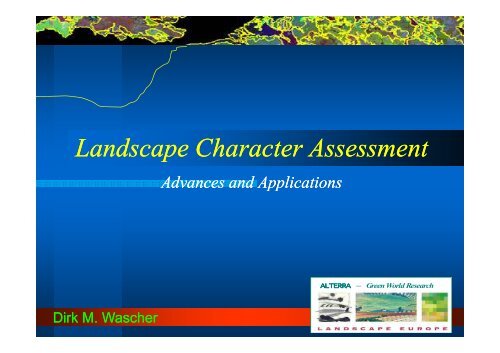
<strong>Landscape</strong> <strong>Character</strong> <strong>Assessment</strong>Advances and ApplicationsALTERRA – Green World ResearchDirk M. Wascher
Overview Introduction: reasons for landscaperesearch at the European level Research Examples LANMAP2- Tourism and Leisure- <strong>Landscape</strong> Structure <strong>Landscape</strong> visualisations Way forward
Why focus on landscapes? <strong>Landscape</strong>s are a ecological and socialexpression of human interaction with theirterritory <strong>Landscape</strong> changes affect human needs interms of living, belonging, recreation andshaping. <strong>Landscape</strong>s affect human mind in terms ofperception, connection and understanding. <strong>Landscape</strong>s are socially shaped entitiesthat offer opportunities for sustainablegovernance.
What does the EU matter? <strong>Landscape</strong>s are strongly affected byEU policy but not within EUcompetence <strong>Landscape</strong>s are still at the peripheryof EU policy and research initiatives The current (EU) policy – scienceinterface is missing the humanspatialdimension The reason is an abstract notion oflandscape in both EU research andpolicy
What are the achievements? Inclusion of a landscape chapter in the DobrisSotE Report (Stanners & Bourdeau 1995) Launching of the European <strong>Landscape</strong>Convention as the key policy instrument (CoE2000) Inclusion of <strong>Landscape</strong> Indicators as part ofIRENA (EEA 2003), LUCAS (Eurostat 2006) andGeoland2 (CEC 2008) Mentioning of “Traditional Agricultural<strong>Landscape</strong>s” in the Community StrategyGuidelines for Rural Development (CEC 2006) Development of the European landscape mapLANMAP2 based on high-resolution spatialdata (Mucher et al. 2006)
What are the obstacles? Current landscape assessments are ratherabstract, top-down, data- and expert-drivenwith focus on land cover data; Micro-structural elements and culturalaspects are missing in most internationalassessments; Resulting statistics and maps are difficult tointerpret since policy-relevant thresholds arevirtually non-existent; Public perception of landscape values islargely unknown; <strong>Landscape</strong> spatial concepts as a basis forsustainable design is not taken up in largescaleEuropean strategies
Context<strong>Landscape</strong> <strong>Character</strong> <strong>Assessment</strong> is a way of identifying,classifying and mapping areas of distinctive character on thebasis of holistic principles. As such, it can be a measure ofintegration and a reference for modeling future landscapes<strong>Landscape</strong> Resilience builds upon the concept of theadaptive capacity in ecological systems (genetic & biologicaldiversity, heterogeneity of landscape mosaics) and links itwith social systems, the existence of institutions andnetworks.<strong>Landscape</strong> Functions links with the concept of multifunctionality,addressing three groups: (1) productionfunctions (economic function) (2) regulation functions(ecological function) (3) social/human habitat functions(social function).
Context• <strong>Landscape</strong> analysis and planning has its origins at thesite and regional level, frequently related to impactmitigation, township and open space planning;• The role of landscape planning and legislation differslargely throughout Europe, so does the perception oflandscapes;• <strong>Landscape</strong> assessment tools such as classifications,indicators and scenarios are being developed at supraregional,increasingly international level;
Definition ‘landscape character’<strong>Landscape</strong> <strong>Character</strong> is a distinct and consistent pattern ofelements in the landscape that makes one landscapedifferent from another, rather than better or worse.<strong>Landscape</strong> <strong>Character</strong> <strong>Assessment</strong> is a way of identifying,classifying and mapping areas of distinctive character on thebasis of holistic principles. As such, it can be a measure ofintegration and a reference for modeling future landscapes
Global ClimateModelHierarchy ofScaleRegional climatemodelAn integrated frameworkfor bio-physical and socioeconomicvariables isrequiredDefine the appropriatespatial scale to combine allthe variables considered ina meaningful wayMake sure that the resultsof the assessmentcorresponds with thehuman scaleBio-geographicRegions<strong>Landscape</strong> <strong>Character</strong>Regions<strong>Landscape</strong>sEcosystemsBiotopes
SpatialfunctionallevelsBiotopesHierarchy of ScaleBoundaryDefinitionHabitat and linearlandscape patternsScaleSocio-politicalsystems0.01 ha- 10 ha ~ Planning zones<strong>Landscape</strong> unitsDominant land use types100s-1000s ha -(incl. historical)EcosystemsEcological, bio-physicalboundaries100s - 500,000 ha<strong>Landscape</strong><strong>Character</strong> Areas<strong>Landscape</strong>s(<strong>Character</strong> types)Homogenous naturaland land use patterns10,000s - 1.000.000haSub-RegionsMetropolitan &Meta-<strong>Landscape</strong>sClimate zones &Eco-RegionsTraditional and politicalboundaries> 1.000.000 ha Regions at sub- &intra-national level,~ NUTS 2/3Climate and geology > 1. 000.000 ha ~ Geo-politicalregions
Hierarchy of ScaleDPSIREconomic developmentDemographic trendsClimate - ChangeDriving ForcesPlanning, Mitigation & DesignSubsidies & TaxesLegislationResponse-Land use changeIntensificationPollution Pressures<strong>Landscape</strong>StateBiodiversityQuality of Life/Economic SectorsImpactErosionLoss of speciesIncrease of income
Conclusion for attention to scale:• Climate change, demography, international policies,economic trends etc act as ‘Driving Forces’ on land usechange at the regional level;• <strong>Landscape</strong>s, as products of natural and culturalactivities, are directly and indirectly affected by DrivingForces;• Response strategies (mitigation, planning, policies canonly be efficient when taking account of processes atother scales;• Human scale varies, depending on cultural, regional,individual and not temporary aspects.
Scientific Review: methodsM1: simple human (‘expert’) interpretationM2 : ‘expert’ interpretation, with support of someautomated analysisM3 : highly automated analysisM4 : automated analysis, together with someinterpretative refinement
Conclusion: landscape typologies• <strong>Landscape</strong> <strong>Character</strong> appears to be rather scaledependent• The definition is challenged by the inherent differences•between regional and national/ internationalapproaches.• British approaches link landscape character moreclosely to ‘genius loki’ – thus to rather site-specificconditions (uniqueness)• National/international approach suggest the existenceof generic characteristics
LANMAP European <strong>Landscape</strong> Map Climate(Environmental Classification, Climate Research Unit /University of East Anglia, 16x16km resolution) TopographyMethodological approach(Digital Elevation model GTOPO30, 1km res., USGS) Parent material(ESDB, vector, 1:1M, European Soil Bureau) Land cover(CORINE land cover database, vector, 1:100 000, EEA)
LANMAP European <strong>Landscape</strong> Map
Conclusions1. <strong>Landscape</strong> <strong>Character</strong> <strong>Assessment</strong>- identification of landscape types is pre-requirements forindicator interpretation;- European and national typologies can serve as a referencebase for quality and value assessment;- links withor policy implementation (e.g. ELC)2. <strong>Landscape</strong> State <strong>Assessment</strong>- environmental, ecological and cultural state important;- transparent and scale-oriented indicators3. <strong>Landscape</strong> Value <strong>Assessment</strong>- economy, aesthetics and identity require creative datamanagement- landscape dialogues to get broad view of landscape valuessupported within planning process- governmental and public commitment is part of theapproach.