Kakadu National Park Visitor Guide and Maps - Free
Kakadu National Park Visitor Guide and Maps - Free
Kakadu National Park Visitor Guide and Maps - Free

Create successful ePaper yourself
Turn your PDF publications into a flip-book with our unique Google optimized e-Paper software.
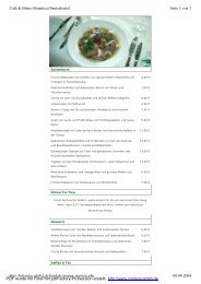
4. Nourlangie Areaprovides impressive views of <strong>Kakadu</strong>’sescarpment <strong>and</strong> Nourlangie Rock.Gubara (Goo-bar-rar) Pools walk(check wet season access)Where: After leaving the Nourlangiecarpark, take the first road to the right<strong>and</strong> travel a further 9 km.Talks: During the dry season, rangersprovide informative talks several timesa day. See the What's On guide fordetails.If you have more timeAnbangbang (Arn-barng-barng) Billabong(check wet season access)Where: After leaving the Nourlangiecarpark, take the first road to the left.Features: A 6 km return walk pasts<strong>and</strong>stone cliffs to shady monsoonforest pools. A pleasant place to spendthe heat of the day. Allow 4 hours.Bubba (Boop-bar) walk (dry season only)Where: Starts at the Muirella <strong>Park</strong>Camping Area.Burrunggui (Boor-oon-goy) is theGun-djeihmi name for the uppersection of Nourlangie Rock.Anbangbang is the name for the lowersection of the rock <strong>and</strong> surroundingarea.Places to stayMuirella <strong>Park</strong> Camping Area(check wet season access)Showers, toilets <strong>and</strong> generator zone.Camping fees (adults only) are collectedon site during the dry season. Pleasepay at the Bowali <strong>Visitor</strong> Centre duringthe wet season.Bush Camping Area(dry season only, 4WD recommended)A free camping area with basic toiletfacilities is available beyond Muirella<strong>Park</strong> at S<strong>and</strong>y Billabong.ServicesMain AttractionNourlangieWhere: Turn off the <strong>Kakadu</strong> Highway19 km south of the Bowali <strong>Visitor</strong>Centre <strong>and</strong> travel a further 12 km.Please note speed limits. Take care <strong>and</strong>drive safely.Features: A 1.5 km circular walktakes you past an ancient Aboriginalshelter <strong>and</strong> several outst<strong>and</strong>ing artsites. A moderately steep climbto Gun-warddehwardde LookoutFeatures: Several picnic tables <strong>and</strong> a2.5-km dry season circular walk. WithNourlangie Rock forming an impressivebackdrop, this is one of <strong>Kakadu</strong>’s mostattractive billabongs. Allow 1 hour.Nawurl<strong>and</strong>ja (Now-oo-larn-ja) LookoutwalkWhere: After leaving the Nourlangiecarpark, take the second road to theleft.Features: A 600 m climb up amoderately steep slope offers goodviews of the escarpment, Nourlangie<strong>and</strong> Anbangbang Billabong. Allow 40minutes.Nanguluwur (Narng-oo-loo-war) art site walkWhere: After leaving the Nourlangiecarpark, take the first road to the right.Features: A 3.4 km return walkthrough woodl<strong>and</strong>s leads to a quiet artsite with some interesting Aboriginalrock art. Allow 2 hours.Features: A 3.5 km circular walkthrough several wetl<strong>and</strong> habitats. Allow2 hours.Please read the crocodile informationon page 25.Mirrai (Mirr-eye) Lookout walkWhere: Turn south-east off the <strong>Kakadu</strong>Highway 30 km south of the Bowali<strong>Visitor</strong> Centre.Features: A moderately difficult 3.6 kmreturn walk to a platform lookout ontop of Mount Cahill. It is a steep climb.Allow 1.5 hours.Barrk bushwalkWhere: This marked walk branches offthe Nourlangie Rock lookout track, justpast the Main Gallery.Features: A difficult 12 km walkthrough the s<strong>and</strong>stone country ofNourlangie, past the Nanguluwur artgallery <strong>and</strong> back to the car park. Seethe Barrk Walk <strong>Park</strong> Note. Allow 6 to8 hours.None.Alyurr (Leichhardt’s grasshopper).1819