Los Angeles Relocation Guide - Antevia
Los Angeles Relocation Guide - Antevia
Los Angeles Relocation Guide - Antevia
- No tags were found...

Create successful ePaper yourself
Turn your PDF publications into a flip-book with our unique Google optimized e-Paper software.
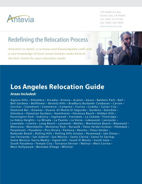
703 Radford LaneFoster City, CA 94404Tel: (650) 373-7700Fax: (650) 240-4050www.antevia.comRedefining the <strong>Relocation</strong> ProcessAttention to detail, a curteous and knowledgable staff, anda vast knowledge of local rental markets make <strong>Antevia</strong>the best choice for your relocation needs<strong>Los</strong> <strong>Angeles</strong> <strong>Relocation</strong> <strong>Guide</strong>Areas Included:Agoura Hills • Alhambra • Arcadia • Artesia • Avalon • Azusa • Baldwin Park • Bell •Bell Gardens • Bellflower • Beverly Hills • Bradbury Burbank• Calabasas • Carson •Cerritos • Claremont • Commerce • Compton • Covina • Cudahy • Culver City •Diamond Bar • Downey • Duarte •El Monte El Segundo • Gardena • Glendale •Glendora • Hawaiian Gardens • Hawthorne • Hermosa Beach • Hidden Hills •Huntington Park • Industry • Inglewood • Irwindale • La Cañada • Flintridge •La Habra Heights • La Mirada • La Puente • La Verne • Lakewood • Lancaster •Lawndale • Lomita • Long Beach • Lynwood • Malibu • Manhattan Beach • Maywood •Monrovia • Montebello • Monterey Park • Norwalk • Palos Verdes Estates • Palmdale •Paramount • Pasadena • Pico Rivera • Pomona • Rancho • Palos Verdes •Redondo Beach • Rolling Hills • Rolling Hills Estates • Rosemead • San Dimas •San Fernando • San Gabriel • San Marino • Santa Clarita • Santa Fe SpringsSanta Monica• Sierra Madre • Signal Hill • South El Monte • South Gate •South Pasadena • Temple City • Torrance Vernon • Walnut • West Covina •West Hollywood • Westlake Village • Whittier
Agoura Hills, CaliforniaFrom Wikipedia, the free encyclopedia.Agoura Hills is a city (incorporated in 1982) in <strong>Los</strong> <strong>Angeles</strong> County, California, and hasthe ZIP code 91301. The population was 20,537 at the 2000 census. This bedroomcommunity on the Ventura Freeway (U.S. Route 101) sits on the border between <strong>Los</strong><strong>Angeles</strong> and Ventura County. It is approximately 32 miles from the downtown <strong>Los</strong><strong>Angeles</strong> civic center.HistoryThe area was first settled by the Chumash Indians, and later by Spanish Franciscanmissionaries. The community of Agoura was first known as Picture City. In order for thetown to get its own post office, the residents were required to choose a one-word name,so in 1927 they chose a misspelling of the last name of Pierre Agoure, a local Basquerancher from the 1890s. Housing tracts quickly covered the land in the late 1960's. On 8December 1982, most of the city split off from the unincorporated town of Agoura andbecame the city of Agoura Hills.The historic Reyes Adobe Museum (c. 1820), from the Rancho Las Virgenes, owned bythe <strong>Los</strong> <strong>Angeles</strong> County Parks and Recreation Department, is in Agoura Hills. [1] [2]GeographyAgoura Hills is located at 34°9′12″N, 118°45′42″W (34.153365, -118.761805) GR1 .The city calls itself the "Gateway to the Santa Monica Mountains National RecreationArea". U.S. Route 101 passes from east to west through the city. Many residents of the[citation needed]city, however, refer to it as "A-Town" or "The Bubble".
The city is divided into three major zones: Old Agoura, a ranch community that formedthe earliest part of the city; Agoura Hills, a predominately suburban area of single-familyhomes that forms the majority of the city; and Agoura South, an older commercial andresidential district of the city, roughly defined as the region south of the 101 Freeway.There are a number of smaller districts in the city, including the Furniture District, theLindero Corridor, and the Reyes Adobe Business District.Two of the main streets in Agoura Hills are Kanan Road and Thousand Oaks Boulevard,which run perpendicular to one another. Agoura Hills is home to a thriving café scene,centered around the corner of Thousand Oaks Blvd. and Kanan Road.According to the United States Census Bureau, the city has a total area of 21.2 km² (8.2mi²). 21.2 km² (8.2 mi²) of it is land and 0.1 km² (0.04 mi²) of it (0.37%) is water.Agoura Hills is in the fertile crescent of alt/rap-metal music giving rise to bandsHoobastank and Linkin Park (as well as Incubus in nearby Calabasas).DemographicsAs of the census GR2 of 2000, there were 20,537 people, 6,874 households, and 5,588families residing in the city. The population density was 969.4/km² (2,511.8/mi²). Therewere 6,993 housing units at an average density of 330.1/km² (855.3/mi²). The racialmakeup of the city was 86.96% White, 1.32% Black or African American, 0.25% NativeAmerican, 6.50% Asian, 0.10% Pacific Islander, 2.09% from other races, and 2.78%from two or more races. 6.85% of the population were Hispanic or Latino of any race.
There were 6,874 households out of which 47.3% had children under the age of 18 livingwith them, 67.7% were married couples living together, 9.9% had a female householderwith no husband present, and 18.7% were non-families. 13.8% of all households weremade up of individuals and 3.0% had someone living alone who was 65 years of age orolder. The average household size was 2.98 and the average family size was 3.30.In the city the population was spread out with 30.5% under the age of 18, 6.3% from 18to 24, 27.6% from 25 to 44, 29.4% from 45 to 64, and 6.2% who were 65 years of age orolder. The median age was 38 years. For every 100 females there were 99.1 males. Forevery 100 females age 18 and over, there were 94.0 males.The median income for a household in the city was $87,008, and the median income for afamily was $95,765. Males had a median income of $72,081 versus $42,656 for females.The per capita income for the city was $39,700. About 2.8% of families and 3.5% of thepopulation were below the poverty line, including 3.8% of those under age 18 and 2.9%of those age 65 or over.EmploymentThere are 14,899 people at least 16 years old, of which 10,645 are in the civilian laborforce and 0 are in the Armed Forces. 360 are unemployed.Of 7,660 females that are at least 16 years old, 4,865 are in the civilian labor force and 0are in the Armed Forces. 4,715 are employed, and 150 are unemployed.Of 10,166 out of the 10,285 workers 16 years or older, 8,454 drive to work alone in amotor vehicle, 793 carpool, 90 use public transportation (including taxicabs), 76 walk,and 82 use other means of transportation to commute to work. 671 workers work athome.The mean time to commute to work (one-way) is 30.5 minutes.Of the 10,285 workers, 7,900 are privately employed, 1,124 are government workers,1,211 are self-employed, and 50 are unpaid family workers.Businesses• Line 6 - a manufacturer of digital modeling electric guitars, amplifiers and effectsprocessorsEducationLas Virgenes Unified School District• Sumac Elementary School
• Willow Elementary School• Yerba Buena Elementary School• A.E. Wright Middle School• Lindero Canyon Middle School• Agoura High SchoolFamous residents• Justin Berfield - actor (Malcolm in the Middle)• Rob Bourdon - Linkin Park• Brad Delson - Linkin Park• Heather Graham - actress• Jonathan Lipnicki - actor• Douglas Robb - Hoobastank• Mike Shinoda - Linkin Park• Erin Brockovich - inspiration for the film titled Erin BrockovichExternal links• Agoura Hills official website• Agoura Hills community History LA County library• Reyes Adobe Museum• Maps and aerial photos · Coordinates: 34.153365° -118.761805°o Street map from Google Maps or Yahoo! Mapso Topographic map from TopoZoneo Aerial image or topographic map from TerraServer-USAo Satellite image from Google Maps or Windows Live LocalAlhambra, CaliforniaFrom Wikipedia, the free encyclopediaAlhambra is a city (incorporated on 11 July 1903) located in the western San GabrielValley region of <strong>Los</strong> <strong>Angeles</strong> County, California which is approx. 8 miles from thedowntown <strong>Los</strong> <strong>Angeles</strong> civic center. As of the 2000 census, the city had a totalpopulation of 85,804. The city's Zip Codes are 91801 and 91803.
GeographyAlhambra is located about 8 miles northeast of downtown <strong>Los</strong> <strong>Angeles</strong> at 34°4′55″N,118°8′6″W (34.081859, -118.135052) GR1 . It is bordered by South Pasadena on thenorthwest, San Marino on the north, San Gabriel on the east, Rosemead on the southeast,Monterey Park on the south, and the <strong>Los</strong> <strong>Angeles</strong> districts of Monterey Hills and ElSereno on the west. Major thoroughfares include Atlantic and Valley Boulevards,Mission Road, and Garfield Avenue. The San Bernardino Freeway (I-10) runs throughthe city's southern portions, and the Long Beach Freeway (I-710) has its northernterminus at Valley Boulevard in the far southwestern portions of the city.According to the United States Census Bureau, the city has a total area of 19.7 km² (7.6mi²), all of which is land.HistoryAlhambra is named after Washington Irving's book Tales From The Alhambra, not afterthe Alhambra palace itself. [1] Alhambra was founded as a suburb of <strong>Los</strong> <strong>Angeles</strong> in1903. Its primarily Asian (Chinese and Korean) and white, Midwestern nature throughoutthe first 60 years of its history is reflected in the fact that even today, most SouthernCalifornians pronounce the middle syllable of the city's name as a homophone with ham,the meat.From World War II onward, Alhambra and other cities in the western San Gabriel Valleysaw a considerable influx of persons of Mexican ancestry, primarily in the form ofupwardly mobile families moving up from less affluent Latino areas such as BoyleHeights and East <strong>Los</strong> <strong>Angeles</strong>. In the 1950s, numerous Italian-American families alsosettled in largely middle-class Alhambra, having left the working-class Lincoln Heightsdistrict in inner-city <strong>Los</strong> <strong>Angeles</strong>. Since the 1970s, white flight has led to a considerabledecrease in the city's white population, and the remaining white residents arepredominantly empty-nesters and retirees.Since the 1970s and 1980s, the city's proximity to Asian American-dominated MontereyPark has attracted many East Asian immigrants (initially from Taiwan and Vietnam, butnow largely from Hong Kong and Mainland China). An active Chinese business district
has since developed on Valley Boulevard. The growing ethnic Chinese influence is alsofelt in the redevelopment of the city's Main Street area due north, although Main Streetcontinues to cater to predominantly white American tastes. The Asian immigrants settlingin Alhambra are usually considerably less affluent than those moving to places such asSan Marino, Arcadia and Diamond Bar, with the result that Alhambra has developedsome notoriety as a center of Asian-American gang activity, even though many gangmembers come from the neighboring towns of Rosemead and San Gabriel.Since the 1960s, Alhambra has suffered from traffic congestion as a result of SouthPasadena's success in blocking the completion of the Long Beach Freeway; instead ofcontinuing to the Foothill Freeway in Pasadena, as originally planned, the Long BeachFreeway instead terminates at Valley Boulevard in southwestern Alhambra, overloadingmany of the city's north-south thoroughfares. As South Pasadena is considerablywealthier and whiter than Alhambra, the impasse has led to significant friction betweenthe two municipalities, including a notable incident in which South Pasadena high schoolstudents used caustic chemicals to etch their town's name into the front lawn of AlhambraHigh School.EducationAlhambra is home to the University of Southern California's Health Sciences Alhambracampus, site of the university's Institute for Health Promotion and Disease PreventionResearch (IPR) and USC's master's degree program in public health.Alhambra is served by Alhambra Unified School District, which includes Alhambra HighSchool.Famous Natives/ResidentsDemographics• Jack Chick• Clive Cussler• James Jannard• Dorothy EmmaHowell Rodham• Phil Spector• Cheryl Tiegs• Verne Winchell• Talmage V. BurkeAs of the census GR2 of 2000, there were 85,804 people, 29,111 households, and 20,668families residing in the city. The population density was 4,347.7/km² (11,257.3/mi²).
There were 30,069 housing units at an average density of 1,523.6/km² (3,945.0/mi²). Theracial makeup of the city was 30.02% White, 1.67% Black or African American, 0.72%Native American, 47.22% Asian, 0.10% Pacific Islander, 16.25% from other races, and4.01% from two or more races. 35.49% of the population were Hispanic or Latino of anyrace.There were 29,111 households out of which 33.1% had children under the age of 18living with them, 48.3% were married couples living together, 16.4% had a femalehouseholder with no husband present, and 29.0% were non-families. 22.5% of allhouseholds were made up of individuals and 7.7% had someone living alone who was 65years of age or older. The average household size was 2.88 and the average family sizewas 3.41.In the city the population was spread out with 22.3% under the age of 18, 9.7% from 18to 24, 34.0% from 25 to 44, 20.7% from 45 to 64, and 13.2% who were 65 years of age orolder. The median age was 35 years. For every 100 females there were 89.1 males. Forevery 100 females age 18 and over, there were 84.8 males.The median income for a household in the city was $39,213, and the median income for afamily was $43,245. Males had a median income of $33,847 versus $29,122 for females.The per capita income for the city was $17,350. About 11.5% of families and 14.3% ofthe population were below the poverty line, including 18.2% of those under age 18 and10.6% of those age 65 or over.External linksAlhambra's official websiteMaps and aerial photos · Coordinates: 34.081859° -118.135052°Street map from Google Maps or Yahoo! MapsTopographic map from TopoZoneAerial image or topographic map from TerraServer-USASatellite image from Google Maps or Windows Live LocalSchools in AlhambraRestaurants in AlhambraAlhambra LibraryAlhambra Chamber of Commerce
Arcadia, CaliforniaFrom Wikipedia, the free encyclopediaArcadia is a U.S. city in <strong>Los</strong> <strong>Angeles</strong> County, California that is located about 20 milesNortheast of downtown <strong>Los</strong> <strong>Angeles</strong> It is the site of the Santa Anita Park racetrack andhome to the <strong>Los</strong> <strong>Angeles</strong> County Arboretum and Botanic Garden. As of the 2000 census,the city had a total population of 53,054.HistoryArcadia was originally inhabited by the Tongva ("Gabrielino") Indian tribe, who wereforced into slavery by Spanish colonizers at the San Gabriel Mission (in present-day SanGabriel, California). The Gabrielinos were quickly wiped out through a combination ofoverwork and exposure to "Old World" diseases. During Mexican rule of California(1821-1848), a large area of land that included the present-day borders of Arcadia wassold to a Scottish immigrant, Hugo Reid. The land holding changed owners several timesbefore being acquired by "Lucky" Baldwin, a real estate speculator and notoriouswomanizer who made millions off a silver mine in Virginia City, Nevada."Lucky" Baldwin made Arcadia into what it is today, building a racetrack and arboretum.He lobbied fiercely to ensure that there would be a railroad stop at his ranch in Arcadia,which later proved crucial for local development. He also took steps to control floodingfrom the San Gabriel River and installed modern plumbing. When Baldwin was goingthrough a personal financial crisis, he was forced to sell much of his Southern Californialand, retaining only Arcadia and establishing more or less the city's present-dayboundaries.
Japanese Americans arrive at the Internment Camp at the Santa Anita Park racetrack.During World War II, Arcadia's Santa Anita Park racetrack was at one point the largestJapanese American assembly center in the United States. Internees often experiencedappalling conditions at the racetrack, some for more than a year, before being moved topermanent "relocation" camps in Owens Valley, Utah, and Wyoming. Imprisoned solelybecause of their ethnicity, internees lived three families to a barrack (or horse-stable insome cases), took group showers, lacked private bathrooms, and lived under 24-hourarmed surveillance. At the time, Arcadia's civic leaders were very vocal in their supportof the internment policies of the Federal Government. (See: Japanese internment in theUnited States)Until a Supreme Court ruling in 1965, every property sale contract within the borders ofArcadia had to include a provision that the new owner could only sell the property to awhite Protestant, though many non-Protestant families did, in fact, own homes and live inArcadia long before that ruling.In October 1975, the Santa Anita Fashion Park was opened to the public on the corner ofBaldwin Avenue and Huntington Drive. The center court featured a gigantic blue head byRoy Lichtenstein, later removed.
James Dobson, a previous Arcadia resident, founded the nonprofit Christian ministryFocus on the Family in the city in 1977. Its original office still stands on the south side ofFoothill Blvd. Focus grew to larger quarters in the city, and in intervening yearsexpanded to Monrovia for warehouse space before moving out of Arcadia completely in1990.In the late 1990s, Native American activists threatened to sue Arcadia High School overits use of the "Apache" mascot. The high school's use of Native American symbols,including an "Apache Joe" mascot, the Pow Wow school newspaper, the "Apache News"television program, the "Smoke Signals" news bulletin boards, the school's auxilaryteam's marching "Apache Princesses" and opposing football team fans' "Scalp theApaches" signs were viewed by these Native American activists and many Arcadiacommunity members as being offensive. The school consulted with Native Americangroups and made some concessions but refused to change the mascot. Some residents ofArcadia, who are former students at the school and have Native American ancestory, donot take offense to the school's use of these symbols.In August 2000, the 1912 mansion and 19 acre (77,000 m²) estate of Anoakia, the oldestremaining private property in the city, was bulldozed to clear space for 31 luxury homes,which would come to be derided by many as McMansions. The estate, which oncebelonged to the daughter of city founder Elias "Lucky" Baldwin, featured numerous oneof-a-kindarchitectural features and a structure whose facade was a replica of ThomasJefferson's Monticello.Further reading: Pat McAdam and Sandy Snider: Arcadia: Where Ranch and City Meet.Published by "Friends of the Arcadia Public Library", 1981, ISBN 0-9606390-0-4.Online edition"Visions of Arcadia: A Centennial Anthology", 2003, ISBN 0-931995-01-9, edited andpublished by Gary Kovacic is a collection of 130 essays and over 90 historic photographsabout life in Arcadia that was unveiled on August 5, 2003, the city’s 100th birthday.Arcadia in popular cultureThe famous Route 66, immortalized in song and literature, passes through Arcadia, whereit is known as Huntington Drive. Running parallel to and about a mile south of the 210freeway, it cuts across the middle section of Arcadia.The city is mentioned by Jack Kerouac in his novel On The Road: Sal, the protagonist, isrun out of town by a group of hostile teens when he stops for food at a local drive-inrestaurant with a young Mexican woman. The vignette demonstrates the intolerance andracism prevalent in many places during 1950s America. The drive-in restaurant may bebased on Carpenter's, located on Route 66 next to Santa Anita Racetrack.In a motel located in Arcadia across the street from Santa Anita Racetrack, author HunterS. Thompson wrote much of his infamous novel, Fear and Loathing in Las Vegas in the
1970s. The 2003 true story film Seabiscuit was filmed and takes place at the Santa Anitarace track.Notable residentsJet Li, actor and martial artist. However, he has since moved.DMX, actor and rapperDemographicsArcadia has experienced a tremendous demographic shift in recent years. A city that wasalmost uniformly white Protestant 30 years ago is now 45% Asian and is expected tohave an Asian majority before the 2010 census. The transformation is linked to a rapidincrease in wealth in Asian countries such as Taiwan, China, Korea and Hong Kong. Thishas led to the immigration of many Asians to countries like the United States. Arcadiaoffers excellent public schools, which are seen by many young upper-middle class Asianimmigrant families as a ticket to a good college, and eventually desirable careers for theirchildren in America. The large, established Asian immigrant community and therelatively high quality of life are also attractive. Since the early 1990s, a growing numberof Taiwanese-oriented businesses have been appearing along and around BaldwinAvenue, due south of Huntington Drive, with a 99 Ranch Market, Arcadia Supermarket,and the especially popular Taiwan-based Din Tai Fung dumpling restaurant. Asian-American population growth has also been attributed to the exodus of established wealthyTaiwanese immigrants away from poorer Monterey Park, California to affluent Arcadiaand neighboring San Marino and Temple City.As of the census GR2 of 2000, there were 53,054 people, 19,149 households, and 14,151families residing in the city. The population density was 1,865.6/km² (4,830.0/mi²). Therewere 19,970 housing units at an average density of 702.2/km² (1,818.1/mi²). The racialmakeup of the city was 45.58% White, 1.13% Black or African American, 0.25% NativeAmerican, 45.41% Asian, 0.08% Pacific Islander, 4.16% from other races, and 3.39%from two or more races. 10.61% of the population were Hispanic or Latino of any race.There were 19,149 households out of which 35.2% had children under the age of 18living with them, 57.8% were married couples living together, 11.9% had a femalehouseholder with no husband present, and 26.1% were non-families. 22.3% of allhouseholds were made up of individuals and 9.6% had someone living alone who was 65years of age or older. The average household size was 2.74 and the average family sizewas 3.23.In the city the population was spread out with 23.3% under the age of 18, 7.5% from 18to 24, 27.2% from 25 to 44, 26.5% from 45 to 64, and 15.5% who were 65 years of age orolder. The median age was 40 years. For every 100 females there were 88.7 males. Forevery 100 females age 18 and over, there were 84.6 males.
EconomyThe median income for a household in the city was $56,100, and the median income for afamily was $66,657. Males had a median income of $50,594 versus $36,138 for females.The per capita income for the city was $28,400. About 6.7% of families and 7.9% of thepopulation were below the poverty line, including 7.8% of those under age 18 and 6.1%of those age 65 or over.The Arcadia's economy is driven by wholesale trade, retail trade, manufacturing, healthcare and social assistance, arts, entertainment, and recreation. Revenue from the SantaAnita Racetrack supports Arcadia's independent library, school system and police force.The racetrack is also a major source of tax revenue for <strong>Los</strong> <strong>Angeles</strong> County.As of 2004, the City of Arcadia has an unemployment rate of 3.0%.The Westfield Shoppingtown Santa Anita (formerly the Santa Anita Fashion Park) is amajor shopping center in the city.GovernmentThe city has a council-manager government with a five member city council (GaryKovacic, John Wuo, Roger Chandler, Gail Marshall, and Mickey Segal), including themayor (John Wuo).Public educationThe city operates its own school district, Arcadia Unified School District, outside of theLAUSD.The city has one major and prestigious high school Arcadia High School, three middleschools (First Avenue Middle, Richard Henry Dana Middle, and Foothills Middle), andsix elementary schools (Baldwin Stocker, Camino Grove, Highland Oaks, Holly Avenue,Hugo Reid and Longley Way). Arcadia's history of racial discrimination is not includedin the official curriculum of the Arcadia Unified School District.The city also operates its own Public Library separate from the County of <strong>Los</strong> <strong>Angeles</strong>Public Library system.HospitalIn the Arcadia Civic Center, Methodist Hospital, previously "Methodist Hospital ofSouthern California", sits on 22 acres of land. It has 284 beds in the facility. Methodistwas the state's first community hospital to have a psychiatric unit. Plus, its nursery schoolwas one of the first corporate daycares in the U.S. Several upgrades have been made to
the original facility. For instance, in 1998, the Berger Tower was completed and it holds169 additional beds. The hospital opened as Arcadia Methodist Hospital on May 27,1957, having moved from downtown <strong>Los</strong> <strong>Angeles</strong>.It was an Official Hospital of the 1984 Olympic Games.GeographyArcadia is located at 34°7′58″N, 118°2′11″W (34.132688, -118.036491) GR1 .According to the United States Census Bureau, the city has a total area of 28.8 km² (11.1mi²). 28.4 km² (11.0 mi²) of it is land and 0.3 km² (0.1 mi²) of it (1.08%) is water.External linksArcadia official websiteOfficial site of the arboretumPage about movies and television shows filmed at the <strong>Los</strong> <strong>Angeles</strong> State and CountyArboretumWestfield Santa AnitaMaps and aerial photos · Coordinates: 34.132688° -118.036491°Street map from Google Maps or Yahoo! MapsTopographic map from TopoZoneAerial image or topographic map from TerraServer-USASatellite image from Google Maps or Windows Live LocalBurbank, <strong>Los</strong> <strong>Angeles</strong> County, CaliforniaFrom Wikipedia, the free encyclopedia
Burbank, CaliforniaSeal of BurbankFounded May 1, 1887Incorporated July 8, 1911CountyLatitudeLongitudeArea- Total- WaterPopulation- Total (2004 est.)- DensityGeneral Information<strong>Los</strong> <strong>Angeles</strong> County,California34°10'49" N118°19'42" W45 km² (17.4 mi²)0.1 km² (0.04 mi²) 0.12%105,4005,800/mi²Climate- Avg. Temp- Avg. Rainfall- Avg. Humidity- Prevailing WindTime zoneDialing Code63 °F(17 °C)12.1 inches (307 mm)61%SW 2 to 4 mph (3 to 6km/h)Pacific: UTC-8+1 (Country code)
The city of Burbank is in theeastern corner of the SanFernando Valley, part of theGreater <strong>Los</strong> <strong>Angeles</strong> Area, in <strong>Los</strong><strong>Angeles</strong> County, California justnorth of the city of <strong>Los</strong> <strong>Angeles</strong>,USA.Billed as the "Media Capital ofthe World", many media andentertainment companies areheadquartered or have significantproduction facilities in Burbank,including NBC, The Walt DisneyCompany and Warner Bros.City of Burbank Official WebsiteThe town has come a long wayfrom the days when it wasironically referred to as "Beautiful Downtown Burbank" on Laugh-In and The TonightShow Starring Johnny Carson.Commonly believed to be named for famous horticulturalist Luther Burbank, the city ofBurbank is actually named for New Hampshire born dentist and entrepreneur DavidBurbank.The City of Burbank818 (Area Code)Postal code 91501-91526City TreeCity FlowerMayorVice MayorCity CouncilCity TreasurerCity ClerkCity ManagerCity AttorneyCrape MyrtleCalifornia Lilac(Ceanothus)City OfficialsJef Vander BorghtTodd CampbellDavid GolonskiDavid GordonMarsha RamosDonna AndersonMargarita CamposMary AlvordDennis BarlowThe town grew steadily, weathering the drought and depression that hit <strong>Los</strong> <strong>Angeles</strong> inthe 1890s and in 20 years, the community now consisted of its own bank, newspaper,high school and a thriving business district with a hardware store, livery stable, dry goodsstore, general store, and a bicycle repair shop.The population would petition the State Legislature to incorporate and formally become acity on July 8, 1911, naming Thomas Story, a local businessman, as their first mayor.By 1916, 1,500 residents claimed Burbank as home. By 1930, as First National Studios,Andrew Jergens Company, The Lockheed Company, McNeill and Libby CanningCompany, the Moreland Company, and Northrop Aircraft Corporation opened factoriesand studios there, the numbers had swelled to 16,662.The Federal government officially recognized Burbank's status in 1923 when the UnitedStates Postal Service reclassified the city from the rural village mail deliveryclassification to city postal delivery service.
In the meantime, the United States Department of Commerce recommended Burbank asthe most favorable airport location in the <strong>Los</strong> <strong>Angeles</strong> area. Dedicated on Memorial DayWeekend (May 30 - June 1), 1930, the United Airport was the largest commercial airportin the <strong>Los</strong> <strong>Angeles</strong> area until it was eclipsed in 1946 by the <strong>Los</strong> <strong>Angeles</strong> MunicipalAirport in Inglewood when that facility (the former Mines Field) commenced commercialoperations.Burbank's airport has undergone a number of name changes since its opening day in1930. It remained United Airport until 1934, when it was renamed Union Air Terminal(1934-1940). Lockheed bought the airport in 1940 and renamed it the Lockheed AirTerminal, which it was known as until 1967, when its name changed again, toHollywood-Burbank Airport. It remained Hollywood-Burbank Airport for over a decade,until 1978, when it was renamed Burbank-Glendale-Pasadena Airport (1978-2003).Most recently, in December of 2003, the facility was renamed Bob Hope Airport in honorof the famous comedian (see "Burbank Today" below).The growth of companies such as Lockheed and the burgeoning entertainment industrydrew more and more people to the area as Burbank's population doubled again between1930 and 1940 to 34,337. But Burbank saw its greatest growth during World War II dueto Lockheed's strong presence in the city, employing some 80,800 men and women tocontribute to the war effort producing aircraft such as the Hudson, P-38 Lightning, PV-1Ventura and America's first jet fighter, the P-80 Shooting Star, arriving too late toparticipate in the war, but would see service in the Korean War, logging the world's firstjet-to-jet aerial kill in history. Lockheed would go on to produce the super secret spyplanes U2, SR-71 Blackbird and the F-117 Nighthawk at its Burbank-based "SkunkWorks."Burbank companies were involved throughout the war, joining together on this P-38Disney and Warner (formerly First National Studio) contributed to the war effort byproducing training films and morale films for the armed services and cartoons promotingthe sale of war bonds. Disney artists designed more than 1000 unit mascot designs forunits from every branch of the armed forces. Walt Disney had authorized that the creationof these insignias were to be designed for free and by the end of the war was estimated tohave cost Disney over thirty thousand dollars.Burbank would also witness its first real civil strife as the culmination of a six monthlabor dispute between the Set Decorator's union and the studios resulted in the Battle ofBurbank on October 5, 1945.
Burbank's growth did not slow as war production ceased and over 7,000 new residentscreated a postwar real estate boom and real estate values soared as housing tracts sprangup on formerly vacant land in the Magnolia Park area of Burbank between 1945 and1950.As America entered the atomic age, the city's industries thrived and as the world changedaround it, Burbank continued to evolve to meet its demands ushering in the 21st centuryvastly different from the town's sheep-farm roots.Burbank todayA predominantly upper-middle class community, Burbank is home to many employees ofthe motion picture and television studios located in and around the city.Entertainment has generally replaced the defense industry as the primary employer of itscitizens, who are attracted by the relative safety and security offered by its own policeand fire departments, highly rated schools and hospital. Other reasons cited are its smalltownfeel while located only 10 minutes away by car to the hip clubs and restaurants ofHollywood.The Intersection of Olive and San Fernando in Burbank, CAThe convenience of a local airport and proximity to major freeways is crucial in today'sworld, and Burbank is no exception.The former Burbank/Glendale/Pasadena Airport (which opened in 1930 as the UnitedAirport) was renamed in December 2003 in honor of comedian Bob Hope, who lived innearby Toluca Lake for many years. The airport services 4.9 million travelers per year onseven major carriers, with more than 70 flights daily.Burbank is easily accessible by and can easily access the Southern California freewaysvia the Golden State Freeway, which bisects the city from northwest to southeast, and theVentura Freeway which connects Burbank to the U.S. Route 101 on the south and thenearby Foothill Freeway to the east.Those without cars can take advantage of the Metro which operates public transportthroughout <strong>Los</strong> <strong>Angeles</strong> County, connecting her citizens to 18,500 stops on 189 bus linesincluding those in Burbank while commuters can easily access the Metrolink and Amtrak
for service south into Downtown and Union Station, west to Ventura and north toPalmdale and all points beyond.While at home, residents enjoy the <strong>Los</strong> <strong>Angeles</strong> Equestrian Center, the Starlight Bowl,fine restaurants, the city's Downtown Burbank Mall, a burgeoning "Burbank Village"shopping district, and many theatres, parks, and libraries. Visitors to Burbank areattracted to the Warner Bros. Studio VIP tour and close proximity to all otherentertainments and attractions that <strong>Los</strong> <strong>Angeles</strong> offers.Recently, the murder of Burbank police officer Matthew Pavelka by a local gang knownas the Vineland Boys sparked an intensive investigation in conjuction with several othercities and resulted in the arrest of a number of gangmembers and other citizens in andaround Burbank. Among those arrested was Burbank city councilwoman Stacey Murphy,implicated in trading guns in exchange for drugs.Sister citiesBurbank is also affiliated with the following sister cities :Geography• Gaborone,Botswana• Incheon, SouthKorea• Ota, Japan• Solna, SwedenBurbank is located at 34°10′49″N, 118°19′42″W (34.180170, -118.328341) GR1 .According to the United States Census Bureau, the city has a total area of 45.0 km² (17.4mi²). 44.9 km² (17.4 mi²) of it is land and 0.1 km² (0.04 mi²) of it (0.12%) is water.Looking west over Burbank with Olive Ave. crossing over the I-5 in the foreground
It is bordered by Glendale to the east, Toluca Lake on the west, and Griffith Park to theSouth. Hollywood is easily accessible from Burbank by driving down Barham Blvd. (pastWarner Bros. Studios & Universal Studios) to Cahuenga Blvd., formerly known as theCahuenga Pass.DemographicsAs of the census GR2 of 2000, there were 100,316 people, 41,608 households, and 24,382families residing in the city. The population density was 2,232.4/km² (5,782.4/mi²). Therewere 42,847 housing units at an average density of 953.5/km² (2,469.8/mi²). The racialmakeup of the city was 72.18% White, 2.06% Black or African American, 0.55% NativeAmerican, 9.15% Asian, 0.14% Pacific Islander, 9.88% from other races, and 6.04%from two or more races. 24.87% of the population were Hispanic or Latino of any race.There were 41,608 households out of which 28.5% had children under the age of 18living with them, 42.8% were married couples living together, 11.5% had a femalehouseholder with no husband present, and 41.4% were non-families. 33.6% of allhouseholds were made up of individuals and 9.8% had someone living alone who was 65years of age or older. The average household size was 2.39 and the average family sizewas 3.14.In the city the population was spread out with 22.3% under the age of 18, 7.7% from 18to 24, 35.4% from 25 to 44, 21.8% from 45 to 64, and 12.8% who were 65 years of age orolder. The median age was 36 years. For every 100 females there were 94.1 males. Forevery 100 females age 18 and over, there were 90.7 males.The median income for a household in the city was $47,467, and the median income for afamily was $56,767. Males had a median income of $41,792 versus $35,273 for females.The per capita income for the city was $25,713. About 8.1% of families and 10.5% of thepopulation were below the poverty line, including 13.3% of those under age 18 and 9.0%of those age 65 or over.The number of violent crimes recorded by the FBI in its 2004 Uniform Crime Reportswas 262 of which there were 4 murders and homicides. The violent crime rate wasapproximately 2.5 per 1,000 people, well below the national average as reported by theU.S. Department of Justice in the Bureau of Justice Statistics.Economy
Looking east over Burbank from Universal StudiosMuch of Burbank's economy is based on the entertainment industry. Hollywood isconsidered a symbol of the glamorous entertainment industry, but much of the actualproduction takes place in Burbank. Many ancillary companies are also located there.Many companies have their headquarters in Burbank, including ABC, Arri, CartoonNetwork, DIC Entertainment, Dick Clark Productions, NBC, Nickelodeon, The WaltDisney Company, Warner Bros., and Warner Music Group.Burbank is also conveniently located close to CBS Studio Center, DreamWorks, andUniversal Studios in neighboring Studio City, Glendale, and Universal City, respectively.Capitol Records and Paramount are just south of Burbank in Hollywood proper.Local IATSE union offices for the Stagehands Local 33, Grips Local 80, Make-up andHairstylist Local 706 and Set Painters Local 729 also make their home in Burbank withTeamsters Local 399, IBEW Local 40 and many other IATSE locals nearby.EducationBurbank is home to several California Distinguished Schools including the confusinglynamed Luther Burbank Middle School (see history above). Both its public and private K-12 schools routinely score above state and national average test scores. A number ofcolleges are also located in Burbank including the Woodbury University with itsrenowned design program and several make up and beauty trade schools servicing theentertainment industry.Famous residentsA number of famous people have lived in Burbank at one time or another, here's a partiallist of some of people who have called Burbank home.• Wally Albright (1925-1999) actor. TheLittle Rascals
• Tim Burton (1958-)writer and director.EdwardScissorhands, TheNightmare BeforeChristmas• Rod Beck (1968-)Major LeagueBaseball player. SanFrancisco Giants,Boston Red Sox• Dick Clark (1929-)TV personality."America's oldestteenager". AmericanBandstand, NewYear's Rockin' Eve• Debbe Dunning(1966-) actress.Home Improvement• Soleil Moon Frye(1976-) actress.Punky Brewster,Sabrina the TeenageWitch• Mark Harmon (1951-)actor. St. Elsewhere,Stealing Home• Ron Howard (1954-)actor and filmdirector. A BeautifulMind, The Da VinciCode• Clint Howard (1958-)actor. Gentle Ben,Star Trek: DeepSpace Nine• James J. Jeffries(1875-1953) "TheBoilermaker" WorldHeavyweight BoxingChampion• Kelly Johnson (1910-1990) chiefaeronautical engineer
at Lockheed's Skunkworks• Patton Oswalt (1969-)comedian, actor andwriter. Magnolia,MADtv• Sean Penn (1960-)actor, director,activist. Fast Timesat Ridgemont High,Mystic River• Eve Plumb (1958-)actress. The BradyBunch• Bonnie Raitt (1949-),singer/songwriter.Luck of the Draw,Longing in TheirHearts• Debbie Reynolds(1932-) actress, MissBurbank 1948.Singin' in the Rain,The UnsinkableMolly Brown• Randy Rhoads (1956-1982) Lead guitaristand foundingmember of QuietRiot (1976-1979)and lead guitarist forOzzy Osbourne(1979-1982).• John Ritter (1948-2003) actor andcomedian of TV'sThree's Companyand 8 Simple Rules• Doug Savant (1964-)actor. Melrose Place,DesperateHousewives• Adam Schiff (1960-)Democratic U.S.Congressman from
California since2000.• Martin Scorsese(1942-) director.Taxi Driver, RagingBull, Goodfellas• Wil Wheaton (1972-)actor and writer.Stand By Me, StarTrek: The NextGenerationReferencesBrief History of Burbank, California (Burbank Chamber of Commerce, 1961)Of Men and Stars, A History of Lockheed Aircraft Corporation (Lockheed AircraftCorporation, 1957-1958)Ranchos de <strong>Los</strong> Santos, The Story of Burbank (The Burbank Branch of the Security Trustand Savings Bank, 1927)The Story of Burbank from Her Eventful Pioneer Days (The Magnolia Park Chamber ofCommerce, 1954)Your Burbank Home (Burbank Merchant’s Association, 1928)MapsMaps and aerial photos · Coordinates: 34.18017° -118.328341°Street map from Google Maps or Yahoo! MapsTopographic map from TopoZoneAerial image or topographic map from TerraServer-USASatellite image from Google Maps or Windows Live LocalGlendale, California
From Wikipedia, the free encyclopediaGlendale, CaliforniaSealNickname: "The Jewel City"LocationLocation of Glendale within <strong>Los</strong> <strong>Angeles</strong> County and the State ofCalifornia.CountryStateCountyCity CouncilGovernmentUnited StatesCalifornia<strong>Los</strong> <strong>Angeles</strong>Ara NajarianRafi ManoukianDave Weaver (mayor)Frank QuinteroBob Yousefian
Geographical characteristicsAreaCityLandWater30.7 sq. miles / 79.4 km²30.66 sq. miles / 79.3 km²0.04 sq. miles / 0.1 km²PopulationCity (2005) 207,007Density2,456.1/km²Time zoneSummer (DST)estimatedPST (UTC-8)PDT (UTC-7)Website: http://www.ci.glendale.ca.usGlendale is a city in <strong>Los</strong> <strong>Angeles</strong> County, California, United States. It lies at the easternend of the San Fernando Valley, is bisected by the Verdugo Mountains, and is animportant suburb in the Greater <strong>Los</strong> <strong>Angeles</strong> Area. The city is bordered to the southwestby the Atwater Village district of <strong>Los</strong> <strong>Angeles</strong>; to the west by Burbank; to the northwestby the Tujunga district of <strong>Los</strong> <strong>Angeles</strong>; to the northeast by the city of La CañadaFlintridge and the unincorporated La Crescenta area; and to the east by Pasadena. TheGolden State, Ventura, Glendale, and Foothill freeways run through the city.As of the 2000 census, the city population was 194,973. Since then, there have beenestimates of 201,326 by the U.S. Census Bureau in 2004 and 207,007 by the CaliforniaState government in 2005, making it the third largest city in <strong>Los</strong> <strong>Angeles</strong> County and theseventeenth largest city in the state of California.Forest Lawn Memorial Park Cemetery, located in Glendale, contains the remains of manycelebrities and local residents. It is famous as the pioneer of a new style of cemetery.The U.S. headquarters of the Swiss foods multinational Nestlé are located here. Glendaleis also home to the "southern campus" of DreamWorks SKG, the diversifiedentertainment company founded in 1994 by Steven Spielberg, Jeffrey Katzenberg andDavid Geffen.HistoryThe area was long inhabited by the Tongva people.
José María Verdugo, a corporal in the Spanish army from Baja California, received agrant of the Rancho San Rafael in 1798, an area he had been farming since 1784. In 1860His grandson Teodoro Verdugo built the Verdugo Adobe, which is the oldest building inGlendale. The property is the location of the Oak of Peace where early Californio leadersincluding Jesus Pico met in 1847 and decided to surrender to American General John C.Frémont.Verdugo's descendants sold the ranch in various parcels, some of which are included inpresent-day Atwater Village, Eagle Rock, and Highland Park neighborhoods of <strong>Los</strong><strong>Angeles</strong>.In 1884 residents gathered to form a town and chose the name "Glendale". Residents tothe southwest formed "Tropico" in 1887. The Pacific Electric Railroad brought streetcarservice in 1904.The City of Glendale was incorporated in 1906 and Tropico was annexed 12 years later.The most important civic booster of the era was Leslie C. Brand, who built in 1909 agrand estate El Miradero in a stunning blend of architectural styles. Brand built a privateairstrip in 1919 and hosted "fly-in" parties. The grounds of El Miradero are now cityownedBrand Park and the mansion is the Brand Library. One of the city's mainthoroughfares is Brand Boulevard.The city grew quickly. Its population rose from 13,756 in 1920 to 62,736 in 1930 beforeslowing down. The Forest Lawn Memorial Park opened in 1917. Pioneeringendocrinologist and entrepreneur Dr. Henry R. Harrower opened his clinic in Glendale in1920, which for many years was the largest business in the city. The American GreenCross, an early conservation and tree preservation society, was formed in 1926 (itdisbanded three years later and the current organization of that name is unrelated).
Grand Central Air Terminal, October 2005The "Grand Central Airport" was an important facility to the city and to the history ofaviation. It provided the first paved runway west of the Rocky Mountains in 1923. In1928 it opened its terminal, making it the first official airport in Greater <strong>Los</strong> <strong>Angeles</strong>. Forthe next two decades it was the main airport in the county and references to "<strong>Los</strong> <strong>Angeles</strong>Airport" from that era generally refer to the Grand Central Airport, not to <strong>Los</strong> <strong>Angeles</strong>International Airport (LAX), which was known as Mines Field at the time (commercialairline operations at LAX did not begin until 1946).Jack Northrop built his first aircraft factory here in 1927, though it was soon moved toBurbank's "United Airport" (now Bob Hope Airport). The first regularly-scheduledairline service between Southern California and New York City was initiated on July 28,1929 by Transcontinental Air Transport, with owner Charles A. Lindbergh piloting thefirst flight. Among the passengers on the 48-hour trip were Mary Pickford and DouglasFairbanks. Pioneering female aviator Laura Ingalls became the first woman to fly soloacross in the country when she landed at Glendale in 1930. The first transcontinentalflight by African American pilots, Albert Forsythe and Charles Anderson, was completedat Glendale in 1933. Howard Hughes built his innovative and record-setting "H-1 Racer"in a plant next to the airport in 1935. During World War II it became a P-38 base wherethe 319th Fighter Wing trained.After the war the airport eventually returned to private use but its runways were too shortfor jet planes and the airport was closed in 1959. The Grand Central Air Terminalbuilding, with its control tower, was designed by Henry L. Gogerty. The building iscurrently owned by The Walt Disney Company, though the terminal and tower weremade uninhabitable by the 1994 Northridge earthquake. The airport was the setting ofseveral films, including Hughes' 1930 Hell's Angels, Shirley Temple's 1934 Bright Eyes,
and the musical Hollywood Hotel with Dick Powell. The city of Glendale is also partowner of the Bob Hope Airport (formerly "Burbank-Glendale-Pasadena Airport").The Bob's Big Boy chain of hamburger restaurants started in Glendale in 1936, and theBaskin-Robbins, "31 Flavors" chain of ice cream parlors started there in 1945.In 1964, Glendale was selected by George Lincoln Rockwell to be the West Coastheadquarters of the American Nazi Party. Its offices, on Colorado Boulevard in thedowntown section of the city, remained open until the early 1980s.The Glendale Public Library contains one of the largest collections of books on cats inthe world, over 20,000 volumes. [1] It was donated to the library in the 1950s by the JewelCity Cat Fanciers Club, with the understanding that it would be made into a specialcollection and kept permanently for club members to use and enjoy. [2]The skyline of downtown Glendale.The city saw significant development in the 1970s. Completion of the Glendale Freeway(HWY 2) and the Ventura Freeway (HWY 134), redevelopment of Brand Boulevard,renovation of the 1925 Alex Theatre, and construction of the Glendale Galleria shoppingmall, all contributed to the resurgence of the city.In 1994, Steven Spielberg, Jeffrey Katzenberg and David Geffen formed DreamWorksSKG, a diversified entertainment company. The company's "southern campus" is locatedin the city's Grand Central Business Park on a tract of land formerly occupied by aSparkletts Water bottling facility.On January 26, 2005, 11 people were killed in a Metrolink train crash just south ofdowntown Glendale.GeographyGlendale is located at 34°10′15″N, 118°15′0″W (34.170939, -118.250081) GR1 at thejuncture of two large valleys, the San Fernando and the San Gabriel. According to theUnited States Census Bureau, the city has a total area of 79.4 km² (30.7 mi²). 79.4 km²(30.6 mi²) of it is land and 0.1 km² (0.04 mi²) of it (0.07%) is water. It is bordered to thenorth by the foothill communities of La Canada Flintridge, La Crescenta, and Tujunga; to
the south by the Atwater Village community incorporated by the city of <strong>Los</strong> <strong>Angeles</strong>; tothe east by Pasadena and Eagle Rock (also incorporated within <strong>Los</strong> <strong>Angeles</strong>); and to thewest by the city of Burbank.DemographicsForeign-born residents accounted for 54% of the population in 2000. Glendale has adistinctively ethnic flavor, with large Armenian, Iranian, Filipino and Arab populations,and many businesses catering to them. While it has descendants from many countries, itis most famous for its Armenian population. Census figures indicate that the ethnicheritage of city population is 40% Armenian, 20% Latino, 16% Asian, and roughly onethirdAnglo. Glendale's Armenian population is abundant and the majority of Glendale'scity council members (3 of 5) are of Armenian descent.As of the census GR2 of 2000, there were 194,973 people, 71,805 households, and 49,617families residing in the city. The population density was 2,456.1/km² (6,362.2/mi²). Therewere 73,713 housing units at an average density of 928.6/km² (2,405.3/mi²). The racialmakeup of the city was 63.58% White, 1.27% Black or African American, 0.32% NativeAmerican, 16.12% Asian American, 0.08% Pacific Islander, 8.57% from other races, and10.06% from two or more races. 19.72% of the population were Hispanic or Latino ofany race.There were 71,805 households out of which 32.9% had children under the age of 18living with them, 52.3% were married couples living together, 11.8% had a femalehouseholder with no husband present, and 30.9% were non-families. 25.7% of allhouseholds were made up of individuals and 8.7% had someone living alone who was 65years of age or older. The average household size was 2.68 and the average family sizewas 3.27.In the city the population was spread out with 22.4% under the age of 18, 8.4% from 18to 24, 32.2% from 25 to 44, 23.1% from 45 to 64, and 13.9% who were 65 years of age orolder. The median age was 38 years. For every 100 females there were 91.3 males. Forevery 100 females age 18 and over, there were 88.0 males.The median income for a household in the city was $41,805, and the median income for afamily was $47,633. Males had a median income of $39,709 versus $33,815 for females.The per capita income for the city was $22,227. About 13.6% of families and 15.5% ofthe population were below the poverty line, including 20.7% of those under age 18 and11.9% of those age 65 or over.EducationThe Glendale Unified School District operates schools in Glendale.Glendale is also home to Glendale Community College.
Community organizationsThe City of Glendale includes a variety of nonprofit organizations that enhance thequality of life in Glendale. Strong links between local residents, business owners, andgovernment have created a network of organizations that provide support in the areas ofeducation, employment, homeless services, after-school activities, and social services.Local organizations include:The Salvation Army GlendaleGlendale Community Free Health ClinicPATH Achieve Glendale (Homeless Access Center & Shelter)Notable natives• Captain Beefheart,musician• Elvin Bishop,musician• Clara Bryant, actress• Jamie Denton, actor• Nicole Eggert, actress• Erika Eleniak, actress• Robert Englund, actor• Edward Furlong,actor• Daryl Gates, formerLAPD police chief• Scott Gorham,musician• Joe Hahn, musician• Maren Jensen, actress• Daron Malakian,musician• Eva Mendes, actress• Dennis Muren,special effects artist• Paul Petersen, actor• Ron Underwood,director• Paul Walker, actor• John Wayne, actor
• John Cho, actor• Joel Madden,musicianSee alsoGlendale Community CollegeGlendale High SchoolList of cities in CaliforniaExternal linksGlendale official websiteMaps and aerial photos · Coordinates: 34.170939° -118.250081°Street map from Google Maps or Yahoo! MapsTopographic map from TopoZoneAerial image or topographic map from TerraServer-USASatellite image from Google Maps or Windows Live LocalHermosa Beach, CaliforniaFrom Wikipedia, the free encyclopediaHermosa Beach is a city in <strong>Los</strong> <strong>Angeles</strong> County, California, United States. Thepopulation was 18,566 at the 2000 census.
The municipal pier in downtown Hermosa Beach.The city is located in the South Bay region of the greater <strong>Los</strong> <strong>Angeles</strong> area and is one ofthe three Beach Cities.HistoryHermosa Beach was incorporated in 1907.GeographyHermosa BeachHermosa Beach is located at 33°51′59″N, 118°23′59″W (33.866314, -118.399681) GR1 .
According to the United States Census Bureau, the city has a total area of 15.3 km² (5.9mi²). 3.7 km² (1.4 mi²) of it is land and 11.6 km² (4.5 mi²) of it (75.80%) is water.The wide flat beach makes Hermosa Beach one of the most popular places to play beachvolleyball, from professional to amateur.DemographicsAs of the census GR2 of 2000, there were 18,566 people, 9,476 households, and 3,553families residing in the city. The population density was 5,012.8/km² (12,982.4/mi²).There were 9,840 housing units at an average density of 2,656.8/km² (6,880.7/mi²). Theracial makeup of the city was 89.58% White, 0.81% Black or African American, 0.40%Native American, 4.40% Asian, 0.22% Pacific Islander, 1.68% from other races, and2.91% from two or more races. 6.75% of the population were Hispanic or Latino of anyrace.There were 9,476 households out of which 14.1% had children under the age of 18 livingwith them, 30.6% were married couples living together, 4.5% had a female householderwith no husband present, and 62.5% were non-families. 39.4% of all households weremade up of individuals and 3.9% had someone living alone who was 65 years of age orolder. The average household size was 1.95 and the average family size was 2.65.In the city the population was spread out with 12.0% under the age of 18, 6.1% from 18to 24, 55.0% from 25 to 44, 20.1% from 45 to 64, and 6.8% who were 65 years of age orolder. The median age was 34 years. For every 100 females there were 112.9 males. Forevery 100 females age 18 and over, there were 113.8 males.The median income for a household in the city was $81,153, and the median income for afamily was $104,645. Males had a median income of $67,407 versus $50,295 forfemales. The per capita income for the city was $54,244. About 1.7% of families and4.6% of the population were below the poverty line, including 3.1% of those under age18 and 3.0% of those age 65 or over.TriviaSegments of the television show The O.C. are actually filmed in Hermosa Beach, notNewport Beach. This was necessary because of union rules that make it expensive to filmoutside of <strong>Los</strong> <strong>Angeles</strong> County.Hermosa Beach is an important center for American beach volleyball competitions.In the Spanish language, the word "hermosa" is the feminine form of beautiful.In the late 1970's the band Black Flag emerged from Hermosa Beach, and played theirfirst show in Redondo Beach.
The modern day punk band Pennywise grew up in Hermosa Beach and went to MiraCosta High School in Manhattan Beach and Redondo Union High School in RedondoBeach.Hermosa Beach has been the sister city of Loreto, Baja California Sur, since 1967.On May 9, 2006, a popular restaurant and nightclub in Hermosa Beach for 80 years,known as Baja Sharkeez, was destroyed by a fire. The building's facade was removed toget to the fire. It took firefighters from Manhattan Beach, Hermosa Beach, RedondoBeach, Torrance, El Segundo and <strong>Los</strong> <strong>Angeles</strong> County to fight the fire. Owner RonNewman has vowed to rebuild Baja Sharkeez as soon as possible and to make it biggerand better.External linksHermosa Beach official websiteMaps and aerial photos · Coordinates: 33.866314° -118.399681°Street map from Google Maps or Yahoo! MapsTopographic map from TopoZoneAerial image or topographic map from TerraServer-USASatellite image from Google Maps or Windows Live LocalLancaster, CaliforniaLancaster, CaliforniaSealLocation
Location of Lancaster in California and <strong>Los</strong> <strong>Angeles</strong> CountyCoordinates 34°41′13″N, 118°09′15″WCountryStateCountyGovernmentUnited StatesCalifornia<strong>Los</strong> <strong>Angeles</strong>Incorporated November 22, 1977MayorHenry W. HearnsAreaGeographical characteristicsCityLand243.9 km² (94.2 sq mi)243.5 km² (94.0 sq mi)Water 0.5 km² (0.2 sq mi) 0.19%PopulationCity (2000) 118,718Density487.6/km² (1,263.0/sq mi)Time zoneSummer (DST)U.S. Census, 2000PST (UTC-8)PDT (UTC-7)Website: www.cityoflancasterca.orgLancaster is a city located in the Antelope Valley in <strong>Los</strong> <strong>Angeles</strong> County, California,USA. As of the 2000 census, the city had a total population of 118,718. As of 2005, theCalifornia Finance Dept. estimates the population at 133,703.
Lancaster is the ninth-largest city in <strong>Los</strong> <strong>Angeles</strong> County and the third-fastest growing.Lancaster is located in the Palmdale / Lancaster Urbanized Area, bordering the northernedge of Palmdale. Lancaster is the second largest desert city in California after Palmdale.Lancaster, California is the largest city named Lancaster in the world, and it possiblynamed after Lancaster, Pennsylvania via Lancaster, England [1]. For a list of others, seeLancaster.Founded in 1876 along the route of the Southern Pacific Railroad (now merged into theUnion Pacific Railroad), Lancaster was originally a commercial and social centerprimarily for Antelope Valley farmers. During World War II, the city was home to thePolaris Flight Academy at War Eagle Field, the only civilian school offering basic flighttraining for army cadets. After the war, Lancaster's population saw a noticeable increasedue to its proximity to Edwards Air Force Base (formerly known as Muroc Army AirField) and U.S. Air Force Plant 42. In the 1990s and 2000s, Lancaster has seen anotherhousing boom as developers seek to build new housing in formerly undeveloped landacross the southwest U.S.The Single-A Baseball Lancaster JetHawks of the California League call the city home.Like Palmdale, Lancaster is a contract city, in which the <strong>Los</strong> <strong>Angeles</strong> County Sheriff'sDepartment provides law enforcement services. It is served by Lancaster station.GeographyLancaster is located at 34°41′13″N, 118°9′15″W (34.686980, -118.154062) GR1 .According to the United States Census Bureau, the city has a total area of 243.9 km²(94.2 mi²). 243.5 km² (94.0 mi²) of it is land and 0.5 km² (0.2 mi²) of it (0.19%) is water.DemographicsAs of the census GR2 of 2000, there were 118,718 people, 38,224 households, and 27,674families residing in the city. The population density was 487.6/km² (1,263.0/mi²). Therewere 41,745 housing units at an average density of 171.5/km² (444.1/mi²). The racialmakeup of the city was 62.82% White, 16.01% African American, 1.02% NativeAmerican, 3.81% Asian, 0.23% Pacific Islander, 11.11% from other races, and 5.00%from two or more races. Hispanic or Latino of any race were 24.13% of the population.There were 38,224 households out of which 42.8% had children under the age of 18living with them, 49.4% were married couples living together, 17.0% had a femalehouseholder with no husband present, and 27.6% were non-families. 22.1% of allhouseholds were made up of individuals and 6.9% had someone living alone who was 65years of age or older. The average household size was 2.92 and the average family sizewas 3.41.
In the city the population was spread out with 32.3% under the age of 18, 9.5% from 18to 24, 31.3% from 25 to 44, 18.2% from 45 to 64, and 8.6% who were 65 years of age orolder. The median age was 31 years. For every 100 females there were 103.1 males. Forevery 100 females age 18 and over, there were 101.9 males.The median income for a household in the city was $41,127, and the median income for afamily was $48,276 (Based on Merrit Research. Males had a median income of $40,710versus $27,619 for females ( +/- $3,000 per year). The per capita income for the city was$16,935. About 13.8% of families and 16.4% of the population were below the povertyline, including 21.9% of those under age 18 and 7.9% of those age 65 or over.External linksLancaster official websiteCurrent WeatherLancaster Chamber of CommerceMaps and aerial photos · Coordinates: 34.68698° -118.154062°Street map from Google Maps or Yahoo! MapsTopographic map from TopoZoneAerial image or topographic map from TerraServer-USASatellite image from Google Maps or Windows Live LocalLong Beach, CaliforniaLong Beach
SealLocationLocation within <strong>Los</strong> <strong>Angeles</strong> County in the state of CaliforniaCoordinates 33°48′15″N, 118°9′29″WCountryStateCountyMayorGovernmentUnited StatesCalifornia<strong>Los</strong> <strong>Angeles</strong> CountyBeverly O'Neill (D)Geographical characteristicsAreaCityLand170.6 km² (65.9 sq mi)130.6 km² (40.0 sq mi)
Water40.0 km² (15.4 sq mi)Elevation 0 m – ??? m (0 ft – ??? ft)PopulationCity (2004) 476,564Density3,533/km²Time zoneSummer (DST)PST (UTC-8)PDT (UTC-7)Website: http://www.ci.long-beach.ca.us/Long Beach is a city located in southern <strong>Los</strong> <strong>Angeles</strong> County, California, on the Pacificcoast. It borders Orange County on its southeast edge. It is about 20 miles (30 km) southof downtown <strong>Los</strong> <strong>Angeles</strong>.As of the 2000 census, the city population was 461,522. By 2006 its population isestimated to have increased to 490,166 [1]. It is the 34th-largest city in the nation, 5th inCalifornia and 2nd in <strong>Los</strong> <strong>Angeles</strong> County (after <strong>Los</strong> <strong>Angeles</strong>). Long Beach is also thelargest U.S. city that is not a county seat.According to the 2000 US Census, Long Beach is the most ethnically diverse large city inthe United States [2]. For example, Long Beach has the second-largest population ofCambodians outside of Asia (after Paris), and the area along Anaheim St. is sometimescalled "Little Phnom Penh". There are also sizable populations of African-Americans,Mexicans, Salvadorians and other Central Americans, Filipino Americans, VietnameseAmericans and other Asians. There is a small population of Pacific Islander Americans inLong Beach and the surrounding communities, especially Samoan Americans. There isalso a significant population of gays and lesbians, with many gay-owned businessesalong Broadway, 2nd Street and 4th Street between Downtown Long Beach and BelmontShore.Having an excellent harbor, it is one of the world's largest shipping ports and a yearroundresort noted for its long, wide beaches and beautiful active marina. It has thelargest municipally owned marina in the country with 3,400 slips. The city also has alarge oil industry; oil (discovered in 1921) is found both underground and offshore.Manufactures include aircraft, automobile parts, electronic and audiovisual equipment,and home furnishings. It is also home to numerous regional, national, and worldheadquarters for major corporations such as Epson America, Molina Healthcare, ScanHealth Care, and Polar Air Cargo. Long Beach grew with the development of hightechnologyand aerospace industries in the area.The city draws 5.5 million visitors annually. The R.M.S. Queen Mary has been located inLong Beach since her retirement in 1967 and now serves as a hotel, convention center,and tourist attraction. The Aquarium of the Pacific, a world-class research facility, is apopular tourist destination.
Tourists are also drawn to Long Beach by the numerous annual events held in the city,which include music festivals, sports competitions, and cultural celebrations.The Long Beach Grand Prix, an annual Champ Car race, takes place on city streets nearthe Convention Center and is one of the largest Grand Prix events in the world. It is thelargest street race in the United States with an estimated 300,000 people watching theevent in person every year over three days.Long Beach is the location of the largest California State University, CSULB, and theheadquarters of the California State University system. The city also has a VeteransAffairs hospital and is a major healthcare hub for the region.Signal Hill is an incorporated city surrounded entirely by Long Beach.HistoryThe area was originally occupied by the Tongva people who lived in a rancheria namedTibahangna. Along with other Tongva villages, it disappeared in the mid-1800s.The Rancho los Cerritos and Rancho <strong>Los</strong> Alamitos were divided from the larger Rancho<strong>Los</strong> Nietos, which had been granted by the King of Spain to a mulatto soldier, ManuelNieto. The boundary between the two ranchos ran through the center of Signal Hill at asouthwest to northeast diagonal.Rancho <strong>Los</strong> Cerritos was bought in 1843 by John Temple, a Yankee who had come toCalifornia in 1827. Soon after he built what is now known as the "<strong>Los</strong> Cerritos RanchHouse," an adobe which still stands and is a National Historic Landmark. Temple createda thriving cattle ranch and prospered, becoming the wealthiest man in <strong>Los</strong> <strong>Angeles</strong>County. Both Temple and his ranch house played important local roles in the MexicanAmerican War.Meanwhile, on an island in the San Pedro Bay, Mormon pioneers made an abortiveattempt to establish a colony (as part of Brigham Young's plan to establish a continuouschain of settlements from the Pacific to Salt Lake).In 1866 Temple sold Rancho <strong>Los</strong> Cerritos to the firm of Flint, Bixby & Co, whichconsisted of brothers Thomas and Benjamin Flint and their cousin Lewellyn Bixby, for$20,000. Later that year the company selected Lewellyn's brother Jotham Bixby, the"Father of Long Beach", to manage their southern ranch, and three years later Jothambought into the property and would later form the Bixby Land Company. It was duringthis period that the Rancho <strong>Los</strong> Cerritos was converted to sheep ranching. In the 1870s asmany as 30,000 sheep were kept at the ranch and sheared twice yearly to provide woolfor trade. In 1880, Bixby sold 4,000 acres (16 km²) of the Rancho <strong>Los</strong> Cerritos toWilliam E. Willmore, who subdivided it in hopes of creating a farm community,Willmore City. He failed and was bought out by the "Long Beach Land and WaterCompany." They changed the name of the community to "Long Beach", which was
incorporated as a city in 1888. When Bixby died in 1916 the remaining 3,500 acres(14 km²) of Rancho <strong>Los</strong> Cerritos was subdivided into the neighborhoods of Bixby Knolls,California Heights, North Long Beach and part of the city of Signal Hill.The town grew as a seaside resort (The Pike was one of the most famous beachsideamusement parks on the West coast from 1910 until the 1960's) and then as an oil, Navy,and port town. The town was once referred to as "Iowa by the sea," due to a large influxof people from that state and other states in the Midwest. Huge picnics for each statewere a popular annual event in Long Beach until the 1960s.The Long Beach earthquake of 1933 was a magnitude 6.3 earthquake that causedsignificant damage to the city and surrounding areas. Most of the damage occurred inunreinforced masonry buildings, especially schools. One hundred twenty people died inthis earthquake.Long Beach used to have a sizable Japanese-American population mostly working in thefish canneries on Terminal Island and small truck farms in the area, but withintermarriage and other factors, it is now less than 1% of the population of Long Beach.There is still a Japanese Community Center and a Japanese Buddhist Church in LongBeach.The early silent film industry in Long BeachOne of the places where the film industry started in Southern California was in LongBeach.Balboa Amusement Producing Company, also known as Balboa Studios, was located atSixth Street and Alamitos Avenue, and they used 11 acres (45,000 m²) on Signal Hill foroutdoor locations. Silent movie stars who lived in Long Beach included Fatty Arbuckleand Theda Bara. The 1917 film Cleopatra, starring Theda Bara, was filmed at theDominguez Slough just west of Long Beach, and Moses parted the Red Sea for Cecil B.DeMille's 1923 black-and-white version of "The Ten Commandments" on the flatseashore of Seal Beach, southeast of Long Beach.The current film industry in Long BeachBecause of its closeness to LA-area studios and the variety of locations, Long Beach isregularly used for movies, television shows, and advertisements. The city has filled in forlocations across the nation and the globe. [3]Long Beach Polytechnic High School is just one of the popular filming locations in LongBeach. Another popular area for movies filmed in the city is the Virginia Country Clubarea. The upscale neighborhood is home to several National Historic Landmarks and isknown for its diverse architectural styles ranging from a famous Greene & Greenedesigned American Bungalow home to modern homes designed by World-RenownedArchitect Edward Killingsworth.
Shipping and transportationAerial view of Long Beach, including Port of Long BeachLong Beach at nightThe Port of Long Beach is the second busiest seaport in the United States . The portserves shipping between the United States and the Pacific Rim. The combined operationsof the Port of Long Beach and the Port of <strong>Los</strong> <strong>Angeles</strong> are the busiest in the USA.Rail shipping is provided by Union Pacific Railroad and BNSF Railway, which carryabout half of the trans-shipments from the port. Long Beach has contributed to theAlameda Corridor project to increase the capacity of the rail lines, roads, and highwaysconnecting the port to the <strong>Los</strong> <strong>Angeles</strong> rail hub. The project, completed in 2002, created a20 mile (32 km) long, 33 ft (10 m) deep trench in order to eliminate 200 grade crossingsand cost about US$2.4 billion.Long Beach is the southern terminus for the <strong>Los</strong> <strong>Angeles</strong> Metro Blue Line light railcorridor. Blue Line trains run from Long Beach City Hall to Downtown <strong>Los</strong> <strong>Angeles</strong>.The Metro Rail Blue Line Maintenance Shops, are also located in Long Beach just southof the Del Amo Blue Line station.There is an Amtrak Thruway bus shuttle starting in San Pedro, with stops at the QueenMary and downtown Long Beach, that then goes to Union Station in downtown <strong>Los</strong><strong>Angeles</strong>, and ends in Bakersfield. The Blue Line MetroRail connects downtown LongBeach to the Staples Center and downtown <strong>Los</strong> <strong>Angeles</strong> where it connects withHollywood and Pasadena. There is also a Greyhound Lines terminal downtown.Public transportation in Long Beach is provided by Long Beach Transit. Besides thenormal bus service, which charges a fare, Long Beach has free routes, the "Pine Avenue
Link" and Passport routes, which use mini-buses to shuttle passengers within thedowntown area. The Passport "C" route between the downtown and the Queen Mary, andPassport "A" and "D" buses go East-West along Ocean Boulevard, linking the CatalinaLanding in the west with Belmont Shore in the east. (The Passport "B" has been renamedthe Pine Avenue Link.) A 90-cent fare is required when traveling east of AtlanticAvenue. Another free route, "Village Tour D'art" in the East Village, visits museums andother points of interest.Long Beach Transit also operates the 49-passenger AquaBus water taxi, which stops atthe Aquarium of the Pacific, the Queen Mary, and four other stops; and the 75-passengerAquaLink water taxi, which travels between the Aquarium, the Queen Mary, andAlamitos Bay Landing next to the Long Beach Marina.There is also limited bus service to Orange County through Orange CountyTransportation Authority buses. Route 1, from Long Beach to San Clemente is thelongest bus route in the OCTA system. Traveling along Pacific Coast Highway for mostof the route, it takes 2-2.5 hrs to complete.Torrance Transit buses go from downtown Long Beach to the South Bay. The <strong>Los</strong><strong>Angeles</strong> Department of Transportation (LADOT) has bus service from downtown to SanPedro, and the <strong>Los</strong> <strong>Angeles</strong> County Metropolitan Transportation Authority (LACMTA)has two regional bus lines that serve downtown Long Beach.Long Beach Municipal Airport serves the Long Beach, South Bay and northern OrangeCounty areas, but is relatively small, considering the area's population. It is the WestCoast hub for JetBlue Airways. It is also the site of a major Boeing (formerly Douglas,then McDonnell Douglas) aircraft production facility, which is the city's largestemployer.Several freeways run through Long Beach, connecting it with the greater <strong>Los</strong> <strong>Angeles</strong>and Orange County areas. The San Diego (405) freeway roughly bisects the city andtakes commuters northwest or southeast to the Golden State (5) freeway. The Long Beach(710) freeway runs north-south, starting at the southern end between the Port of LongBeach and downtown Long Beach, and terminating just past the intersection with SanBernardino (10) freeway on the border between El Sereno neighbor or <strong>Los</strong> <strong>Angeles</strong> andAlhambra. The eastern border of the city is traversed by the San Gabriel River (605)freeway, which joins the 405 at the Long Beach/<strong>Los</strong> Alamitos border. The ArtesiaFreeway California State Route 91 runs east-west near the northern border of LongBeach.California State Route 1 (more commonly known as Pacific Coast Highway or PCH) runsthrough Long Beach. Where it intersects with Lakewood Boulevard (California StateRoute 19) and <strong>Los</strong> Coyotes Diagonal is the "infamous" Long Beach Traffic Circle.
Long Beach has some bike paths along city streets, plus the Long Beach bicycle pathalong the ocean from Shoreline Village to Belmont Shore, plus there are bike paths alongboth the San Gabriel and <strong>Los</strong> <strong>Angeles</strong> rivers.CultureBikinis and business suits mix along a beach that a world trade center overlooks.Standing next to elegant buildings where commerce takes place, is the Pacific Ocean.Period architecture, beach expanses, unique communities such as Naples with canals andgondolas, historic adobes, ethnic restaurants and a Bohemian feel provide an allure thatmakes Long Beach a world-class destination. The downtown region of the city has trendyshops, restaurants, an art district, and a picturesque skyline that can be viewed atop manyof the towers that dot the downtown landscape. Long Beach offers many sandy beachesand coastline near downtown, Naples, Belmont Shore and Long Beach Peninsula that areenjoyed for their scenic beauty.ArtThe Long Beach Museum of Art is owned by the City of Long Beach, and operated bythe Long Beach Museum of Art Foundation. Long Beach also features the Museum ofLatin American Art, founded in 1996 by Dr. Robert Gumbiner. It is the only museum inthe western United States that exclusively features Latin American art.The University Art Museum on the Long Beach State campus (founded in 1973) has anational reputation for its high-quality and innovative programs. [4] Long Beach State isalso home to the largest publicly funded art school west of the Mississippi.In 1965, Long Beach State hosted the first International Sculpture Symposium to be heldin the United States and the first at a college or university. Six sculptors from around theworld and two from the United States created many of the monumental sculptures seenon the campus. There are now over 20 scuptures on the campus.The Southern California is known for its street art and the Long Beach area has many fineexamples. Some of the murals were created in conjuction with the city's Mural andCultural Arts Program, but many others were not. [5] [6]On the exterior of the Long Beach Sports Arena is one of environmental artist Wyland'sWhaling Walls. At 116,000 square feet (11,000 m²), it is the world's largest mural(according to the Guinness Book of Records).Shops and galleries feature their monthly art openings and artists exhibit in streetgalleries on the Last Saturday [7] in the East Village Arts District, in downtown LongBeach.Music
The Long Beach Symphony Orchestra plays numerous classical and pop music concertsthroughout the year. The symphony plays at the Terrace Theater in the Long BeachConvention and Entertainment Center. [8]KJAZZ 88.1 FM (KKJZ) broadcasts from California State University, Long Beach. Thestation features jazz and blues music exclusively and can also be listened to over theInternet. [9]Long Beach is the host to a number of long-running music festivals. They include theBob Marley Reggae Festival (February), the Cajun & Zydeco Festival (May), the AlohaConcert Jam (Hawaiian music, June), the Long Beach Jazz Festival (August), the LongBeach Blues Festival (September, since 1980), and the Brazilian Street Carnaval(Brazilian music, September).The bands Sublime, the Long Beach Dub Allstars (formed by the members of Sublimeafter their lead singer Brad Nowell died of a heroin overdose) and Long Beach Shortbus(formed after the break-up of the Allstars) are from Long Beach.New-wave punk band Le Shok hailed from Long Beach.Rappers Snoop Dogg, Warren G and Zack de la Rocha were born and raised in LongBeach. The city is also home to the VIP Records store which has been featured in musicvideos by Snoop Dogg and other rap music artists. (The corner of "21 and Lewis" thatWarren G mentions in "Regulate" is very close to VIP Records.)Melissa Etheridge got her start performing at Que Sera, a former lesbian bar in LongBeach.The Carpenters, a pop group from the 1960s and 1970s, consisted of musicians who wereall students and Calfornia State University, Long Beach. The Richard and KarenCarpenter Performing Arts Center at CSULB is named in honor of these famous alums ofthe Music Department.The Long Beach Municipal Band, founded in 1909 is the longest running, municipallysupported band in the country. In 2005, the band played 24 concerts in various parksaround Long Beach. [10]The Long Beach Community Band, including the Shoreline Concert Band and the BluePacific Swing Band, is an all volunteer group of musicians that's been performingconcerts in the Long Beach area since 1947. [11]The Vault 350, a music performance nightclub, is one of several bars and nightclubslocated on Pine Avenue in Downtown Long Beach. The popular Blues Cafe is locatednearby.Sports
Long Beach Grand PrixThe Long Beach Grand Prix in April is the single largest event in Long Beach. It startedin 1975 as a Formula 5000 race on the streets of downtown, and became a Formula Onethe following year. Since 1984 it has been a Champ Car event. During the same week asthe Grand Prix, there are also Trans-Am, and Toyota Atlantic races, plus an HistoricGrand Prix features pre-1990 cars, and the Toyota Pro/Celebrity race. The Toyota Celicawas often used as race cars in the Pro/Celebrity Race from late 1970s to 2005, andreplaced by Scion tC in 2006. The Celica All-trac Turbo was a Pace Car in the GrandPrix of Long Beach from 1988 to 1992.BaseballLong Beach Little League teams that included Sean Burroughs were back-to-back WorldSeries Champions in 1992 & 1993. Other noted Long Beach ballplayers include TonyGwynn and Bob Lemon.The Long Beach Armada of the independent Golden Baseball League plays at BlairField. Ex-Major Leaguer Darrell Evans manages the team that features former majorleague players as well as rookies looking to reach the Majors for the first time.Blair Field (built in 1958) has hosting numerous American Legion baseball, ConnieMack baseball, high school, junior college, college, minor league baseball and majorleague spring training exhibition baseball games. It has also been host of six MTV Rock& Jock softball games, and has been the filming location for numerous film, TV andcommercial productions. [12]Ice HockeyLong Beach is home to the Long Beach Ice Dogs (ECHL) hockey team. The Ice Dogsplay their home games at the Long Beach Sports Arena.Basketball
The minor league basketball team nicknamed the Long Beach Jam play in the AmericanBasketball Association (ABA). The team plays in the Pyramid (a pyramid-shaped gym)on the Long Beach State campus).The Southern California Summer Pro League is a showcase for current and prospectiveNBA basketball players, including recent draft picks, current NBA players working ontheir skills and conditioning, and international professionals hoping to become NBAplayers. The league plays in the Pyramid on the Long Beach State campus during July.[13]The Long Beach PyramidSailingSince its inception in August 1964, the Congressional Cup has grown into one of themajor international sailing events. Now held in April, it is the only grade 1 match raceregatta held in the United States. The one-on-one race format is the same as the America'sCup, and many of the winners of the Congressional Cup have gone on to win theAmerica's Cup as well.The Leeway Sailing and Aquatics Center on Alamitos Bay in Belmont Shore is a youthsailing program founded in 1929. It is recognized as one of the premier municipalinstructional sailing programs in the country. [14]Water skiingIn July, there is the annual Catalina Ski Race, which starts from Long Beach Harbor andgoes to Catalina Island and back to complete a 100 km (62 mile) circuit. This race hasbeen held annually since 1948 and features skiers from around the world. [15]GolfLong Beach has five municipal golf courses, as well as the private Virginia Country Clubin the Bixby Knolls area. Recreation Park, built in 1917, is one of the busiest golf coursesin the United States. [16] [17]Olympics
During the two Olympic Games held in <strong>Los</strong> <strong>Angeles</strong>, Long Beach has hosted a number ofthe competitions, including rowing events in the Marine Stadium, sailing events off thecoast of Long Beach, volleyball in the Long Beach Sports Arena, and archery at ElDorado Regional Park. For the 1984 Summer Olympics, Long Beach hosted yachting,volleyball, fencing and archery competitions. For the 1932 Summer Olympics, LongBeach hosted the rowing competition. The Belmont Plaza Pool has hosted U.S. Olympicswimming trials in 1968, 1976, and 2004.The USA Water Polo National Aquatic Center, where the men's and women's USOlympic water polo teams train, is located in nearby <strong>Los</strong> Alamitos.Famous Long Beach athletesLong Beach is the childhood home of tennis legend Billie Jean King and eight-timeNational League batting champion and longtime San Diego Padres outfielder TonyGwynn.2004 Summer Olympics gold medal winning beach volleyball player Misty May-Treanorgraduated from California State University, Long Beach (where she won a nationalchampionship and several other awards), and currently resides in Long Beach.Parks and recreationThe Long Beach Department of Parks, Recreation and Marine received a Gold Medalaward from the National Parks and Recreation Society in 2002, 2003, and 2004,recognizing the Department's "outstanding management practices and programs." TheDepartment manages 92 parks covering over 3,100 acres (13 km²) throughout the city,including the 815 acre (3.3 km²) El Dorado Regional Park, which features fishing lakes,an archery range, youth campground, bike trails, and picnic areas. The Department alsooperates four public swimming pools, and four launch ramps for boaters to access thePacific Ocean.The 102.5 acre El Dorado Nature Center is part of the larger El Dorado Regional Park.The center features lakes, a stream, and trails, with meadows and forested areas. [18]Rancho <strong>Los</strong> Alamitos is a 7.5 acre historical site owned by the City of Long Beach that isnear Long Beach State. The site includes five agricultural buildings, including a workingblacksmith’s shop, four acres of gardens, and a adobe ranch house dating from around1800. The Rancho is within a gated community, so you must pass through security gatesto get to it. [19]Rancho <strong>Los</strong> Cerritos is a 4.7 acre historical site owned by Long Beach in the BixbyKnolls area near the Virginia Country Club. The adobe buildings date from the 1880s.The site also includes a California history research library. [20]
The Earl Burns Miller Japanese Garden is located on the campus of California StateUniversity, Long Beach.Multicultural events• Scottish Festival andGames (QueenMary, Feb.) [21]• Annual Indian PowWow (CSULB,March)• Cambodian New YearCelebration (ElDorado Park, Marchor April)• the KaleidoscopeFestival (CSULB,April) [22]• Cinco de Mayo (at theMuseum of LatinAmerican Art, plusseveral celebrationsin city parks, May 5)• Long Beach PrideFestival (May) [23]• Juneteenth Festival(Martin Luther KingPark, mid-June)• Tafesilafa'i (PacificIslander festival,Shoreline Village,July)• E Hula Mau (Hulaand Chantcompetition, TerraceTheater, Labor Dayweekend) [24]• Annual GrecianFestival (GreekOrthodox Church ofLong Beach, LaborDay weekend)• Brazilian StreetCarnaval (Sept.)[25].
ParadesChristmas boat "parades" are a Southern California tradition, with at least one held everyweekend night from December 1st till Christmas. The "Naples Island Christmas Parade"has been held since 1946, and passes through the canals of Naples and around AlamitosBay past Belmont Shore. The "Parade of A Thousand Lights" is in the Shoreline Villagearea (near Downtown Long Beach and the HMS Queen Mary). [26] There is also aChristmas boat parade in the nearby Port of <strong>Los</strong> <strong>Angeles</strong>/San Pedro area, and another inthe Huntington Harbor community of nearby Huntington Beach.The Long Beach Lesbian & Gay Pride Parade & Festival has been held in May or Junesince 1984. It is the second largest event in Long Beach, attracting over 125,000participants over the two day celebration. It is the third largest Gay Pride Parade in theUnited States. [27]Other parades in Long Beach include:Other cultural events• the Martin LutherKing Parade (Jan.)• Cambodian NewYears Parade (Marchor April)• Brazilian StreetCarnaval (Sept.) [28]• Haute DogHowl'oween Parade(Oct.) [29]• Long Beach VeteransDay Parade (Nov.)[30]• Belmont ShoreChristmas Parade(Dec.) [31]• Daisy AvenueChristmas Tree Lane& Parade (Dec.)In October, Long Beach State hosts the CSULB Wide Screen Film Festival, at theCarpenter Performing Arts Center. The festival started in 1995 as a showcase for moviesfilmed in the widescreen format, but has since been transformed into an artist-inresidenceevent. A major film artist (such as former CSULB student Steven Spielberg)
screens and discusses their own work as well as the ten films that most influenced theircinematic vision. [32]BusinessThe top commercial businesses in Long Beach, based upon the number of employees,are: Boeing, Verizon, Gulfstream Aerospace Corporation, and The Bragg Companies(crane and heavy transport sales). Several local hospitals are major employers, including:Long Beach Memorial Medical Center, Veterans Affairs Medical Center, St. MaryMedical Center, and Pacific Hospital of Long Beach. Major government and educationalemployers include: Long Beach Unified School District, City of Long Beach, CaliforniaState University, Long Beach, Long Beach City College, United State Postal Service, andLong Beach Transit.• Douglas AircraftCompany (laterMcDonnell AircraftCorporation and nowpart of Boeing) hadplants at the LongBeach Airport wherethey built aircraft forWorld War II, andlater built DC-8s,DC-9s, DC-10s, andMD-11s.• Boeing built theBoeing 717 until2006 and continuesto build the C-17Globemaster IIIstrategic airlifter inLong Beach. Evenafter greatlyreducing the numberof local employees inrecent years, Boeingis still the largestemployer in the city.• Polar Air Cargo, aninternational cargoairline, is based inLong Beach.• TABC, INC., a part ofToyota, makes avariety of car parts,
including truck beds,steering columns,and catalyticconverters, in LongBeach.• Epson America, theU.S. affiliate ofJapan-based SeikoEpson Corporation,is headquartered inLong Beach.• SCAN Health Plan, anon-profit "MedicareAdvantage" HMOfor seniors, isheadquartered inLong Beach.• Parker Law Firm, thelegal firm of thepersonal injuryattorney Larry H.Parker (most notedfor his series oftelevisioncommercials), isheadquartered inLong Beach.(Because of thebacklash to hiscommercials, a lawwas passed inCalifornia making itillegal for law firmsto quote lawsuitaward amounts intheir commercials.)• Molina Health Care,Inc., a Medicaidmanagementhealthcare program,is headquartered inLong Beach.• Jesse James' WestCoast Chopperscustom motorcycleshop is located in
Long Beach, andmuch of the MonsterGarage cable TVshow is filmed inLong Beach.MediaThe local daily newspaper is the Long Beach Press-Telegram, which is distributedthroughout most of the Gateway Cities and South Bay areas of southwest <strong>Los</strong> <strong>Angeles</strong>County. The Press-Telegram is part of the <strong>Los</strong> <strong>Angeles</strong> Newspaper Group, which hasseveral newspapers in the Southern California area that share some resources andreporters.Long Beach also has two weekly community newspapers, the "Grunion Gazette" and"Downtown Gazette." Both highlight the city's cultural, educational and political goingson.The downtown edition features articles pertaining to the happenings in the EastVillage Arts District, Long Beach Convention Center, the Pike, Aquarium of the Pacific,etc.There is also an "on-line news agency", the LBReport (http://www.LBReport.com) thatcovers local stories in depth as they happen.Long Beach also gets distribution of the daily <strong>Los</strong> <strong>Angeles</strong> Times, Orange CountyRegister, and La Opinión newspapers, plus the weekly <strong>Los</strong> <strong>Angeles</strong> Sentinel and free OCWeekly. Business news is covered by the biweekly Long Beach Business Journal.Long Beach is part of the <strong>Los</strong> <strong>Angeles</strong> DMA radio and television markets. Although afew radio stations have had studios in Long Beach over the years, including the 80'salternative music and later hard rock station KNAC, the only remaining radio stationstudio in Long Beach is the jazz and blues station KKJZ on the Cal State Long Beachcampus.EducationPublic schoolsThe primary school district that serves Long Beach is Long Beach Unified SchoolDistrict. It is the third largest school district in California. The district is noted for startinga trend to the return to school uniforms for public schools in the 1990s. It has also wonseveral awards in recent years, including the 2003 Broad Prize for Urban Education, asthe best urban school district in the US.Other school districts, including ABC Unified School District, serve small portions ofLong Beach.
Private high schools• Cambodian ChristianSchool - K-12 -Baptist• First Baptist ChurchSchool (Long Beach,California) - PK-12 -Baptist [33]• Gethsemane BaptistChurch School - PK-12 - Baptist• Pacific ChristianSchool - K-12 -Baptist• Parkridge PrivateSchool K-12 -Private• Regency High School- 7-12 - Private• St. Anthony HighSchool - 9-12 -Roman Catholic [34]• S W LongviewPrivate School - K-12 - Private• Zinsmeyer Academy -6-12 - Private(ChildNet Youth andFamily Services)[35]Private non-high schools• Bethany LutheranSchool - K-8 -Lutheran Church -Missouri Synod• Grace ChristianSchools Long Beach- PK-6 - Brethren• Holy InnocentsElementary School -K-8 - RomanCatholic
• Light and LifeChristian School - K-6 Methodist• Long Beach AdventistSchool - K-8 -Seventh-DayAdventist• <strong>Los</strong> Altos GraceBrethren School - K-6 - Brethren• Nazarene ChristianSchool Of LongBeach - PK-8 -Christian• Oakwood Academy -K-6 - Christian nondenominational• Our Lady Of RefugeElementary School -K-8 - RomanCatholic• St. AnthonyElementary SchoolPK-8 - RomanCatholic• St. AthanasiusElementary School -K-8 - RomanCatholic• St BarnabasElementary School -K-8 - RomanCatholic• St CorneliusElementary School -K-8 - RomanCatholic• St CyprianElementary School -K-8 - RomanCatholic• St Joseph ElementarySchool - K-8 -Roman Catholic• St Lucy's School - K-8 - Roman Catholic
• St Maria GorettiElementary School -K-8 - RomanCatholic• Westerly School ofLong Beach - K-8 -Private [36]List of privateschools in LongBeachColleges and universities• California StateUniversity, LongBeach (CSULB)• Long Beach CityCollege (LBCC)Pacific Coast andLiberal Artscampuses• Brooks College, aprivate for-profitvocational schoolbest known for itsfashion design andfashion marketingprograms.GeographyLong Beach is located at 33°47' North, 118°10' West, about 20 miles (30 km) south ofdowntown <strong>Los</strong> <strong>Angeles</strong>. According to the United States Census Bureau, the city has atotal area of 170.6 km² (65.9 mi²). 130.6 km² (50.4 mi²) of it is land and 40.0 km² (15.4mi²) of it (23.42%) is water.DemographicsAs of the census GR2 of 2000, there were 461,522 people, 163,088 households, and 99,646families residing in the city. The population density was 3,532.8/km² (9,149.8/mi²). Therewere 171,632 housing units at an average density of 1,313.8/km² (3,402.6/mi²). The racialmakeup of the city was 45.16% White, 14.87% African American, 0.84% Native
American, 12.05% Asian, 1.21% Pacific Islander, 20.61% from other races, and 5.27%from two or more races. Hispanic or Latino of any race were 35.77% of the population.According to the 2000 US Census, Long Beach is the most ethnically diverse large city inthe United States [37]. Among its Asian population, Long Beach is home to a largeCambodian community, the second-largest Cambodian community outside of Asia (afterParis).There were 163,088 households out of which 35.0% had children under the age of 18living with them, 39.2% were married couples living together, 16.1% had a femalehouseholder with no husband present, and 38.9% were non-families. 29.6% of allhouseholds were made up of individuals and 7.4% had someone living alone who was 65years of age or older. The average household size was 2.77 and the average family sizewas 3.55.In the city the population was spread out with 29.2% under the age of 18, 10.9% from 18to 24, 32.9% from 25 to 44, 18.0% from 45 to 64, and 9.1% who were 65 years of age orolder. The median age was 31 years. For every 100 females there were 96.6 males. Forevery 100 females age 18 and over, there were 93.5 males.The median income for a household in the city was $37,270, and the median income for afamily was $40,002. Males had a median income of $36,807 versus $31,975 for females.The per capita income for the city was $19,040. About 19.3% of families and 22.8% ofthe population were below the poverty line, including 32.7% of those under age 18 and11.0% of those age 65 or over.Neighborhoods of Long BeachLong Beach is a mosaic of neighborhoods, with some of them well-defined, while othersblend into nearby neighborhoods. The most desirable properties in Long Beach are in theBelmont Shore and Naples areas in southeast Long Beach near Alamitos Bay and thePacific Ocean, the homes near the Virginia Country Club in Bixby Knolls and CaliforniaHeights in west-central Long Beach, the area near El Dorado Park and Long Beach Stateon the east side of Long Beach and Lakewood Village (near Long Beach City College &Lakewood Country Club). The downtown area has experienced significant gentrificationin recent years.Pine Avenue and the Linden Avenue area of the East Village in downtown Long Beach,as well as Broadway in Belmont Shore are known for their restaurants and nightlife. The4th Street Corridor is known for its funky shops, antique stores and vintage clothingstores. The Broadway Corridor between downtown and Belmont Shore has the greatestnumber of gay-owned and oriented establishments in Long Beach.• Alamitos Heights• Belmont Heights• Belmont Shore• Bixby Knolls
• Bixby Village• Bluff Park• Broadway Corridor• California Heights• Central Long Beach• College Park• Downtown LongBeach• East Village• Eastside• El Dorado Park• 4th Street Corridor• Lakewood Village• Little Phnom Penh(aka AnaheimCorridor)• Long Beach Marina• <strong>Los</strong> Altos• <strong>Los</strong> Cerritos• Naples• North Long Beach• Northside• Park Estates• Rose Park• Shoreline Village• Silverado Park• Stearns Park• Terminal Island• Traffic Circle• University ParkEstates• Westside• WrigleyNeighborhoodTwo Eastsides?There are two very different "Eastsides" in Long Beach. The traditional Eastside is on theeast side of the city. The boundaries are (roughly) Carson Blvd. (N), Interstate 605 (SanGabriel Freeway) (E), The Pacific Ocean (S), and Redondo ave (W). This is the locationof the very large El Dorado Park and the Liberal Arts Campus of Long Beach CityCollege.The second Eastside is an area on the east side of the <strong>Los</strong> <strong>Angeles</strong> River. Referred to asCentral Long Beach by city officials, it is called the East-side by many of its residentsand local gang members. This neighborhood was over 80% percent Black up until the
1980s, but with increased Hispanic and Cambodian immigration that number has droppedto somewhere between 25% and 30%. The area is associated with a number of LongBeach rap artists, such as Snoop Dogg's Eastsidaz. The boundaries for this secondEastside are (very roughly) Willow Ave. and then the Signal Hill city limits (N),Redondo ave (E), 7th street (S), and the <strong>Los</strong> <strong>Angeles</strong> River (W).Partial list of famous people born in Long Beach• James Blaylock:fantasy/sciencefiction author• Jeff Burroughs:baseball player, 1974American LeagueMVP and LittleLeague World SeriesChampionship coach• Bobby Burgess: onethe originalMouseketeers• Nicolas Cage: actor• Eva LaRue Callahan:soap opera actress• Percy Daggs III:UPN's VeronicaMars• William E.Dannemeyer: OrangeCounty politician• Zack de la Rocharapper/rocker• Bo Derek: actress• Daz Dillinger: rapper• Nate Dogg: rapper• Snoop Dogg: rapper• John Dykstra: 1978Visual Effects OscarWinner (for StarWars)• Floyd "Bud" Gaugh:drummer for bandsSublime, LongBeach Dub Allstars,and Eyes Adrift• Warren G.: rapper
• Dave Hansen: MajorLeague Baseballplayer• Spike Jones:bandleader andcomedian• Sally Kellerman:actress• Billie Jean King:tennis player• Jason Leffler:NASCAR driver• William JosephLevada, current Pro-Prefect,Congregation for theDoctrine of theFaith, RomanCatholic Church• Dan Lungren:Republican politician• Willie McGinest:NFL Linebacker• Bradley "Brad"Nowell:founder andvocalist of the bandSublime• Michelle Phillips:singer and actress• Sheldon Rampton:editor of PR Watch• Tim Salmon: MajorLeague Baseballplayer, 1993 Rookieof the Year• Tiffani-AmberThiessen: actress• Eric Wilson: bassistof the bandsSublime, LongBeach Dub Allstars,Dubcat ,and LongBeach Shortbus• Anthony Zerbe: actor
Partial list of famous residents of Long Beach• Greta Andersen:Olympic swimminggold medalist, andlong distanceswimmer, originallyfrom Denmark• Bad Azz: rapper• Fatty Arbuckle: actor• Richard Bach: authorof JonathanLivingston Seagull• Theda Bara: actress• Frank Black (akaBlack Francis):leader of the Pixiesrock group• Milton Bradley:baseball player(Long BeachPolytechnic HighSchool)• Jan Burke: Mysteryauthor, 2000 EdgarAward for BestNovel (for "Bones")• George Chakiris:Academy Awardwinningactor• Dorothy BuffumChandler: <strong>Los</strong><strong>Angeles</strong>philanthropist (wifeof Norman Chandler,publisher of the <strong>Los</strong><strong>Angeles</strong> Times) andnamesake for theDorothy ChandlerPavilion.• Nat King Cole: singerand jazz piano player• Jonathan Davis: leadsinger for KoЯn• Tray Deee: rapper
• George Deukmejian:Governor ofCalifornia• Cameron Diaz:actress (Long BeachPoly High School)• Melissa Etheridge:rock singer• Bobby Grich: baseballplayer (Wilson HighSchool)• Chris Gwynn:baseball player,(Long BeachPolytechnic HighSchool)• Tony Gwynn:baseball player(Long Beach PolyHigh School)• John Lee Hooker:Blues singer• Marilyn Horne: operasinger (Long BeachPoly High School)• Thelma Houston:R&B singer• Jesse G. James: WestCoast Choppers &Monster Garage,custom motorcycleand car builder• Long Gone John:entrepreneur, ownerand CEO ofSympathy for theRecord Industry• Paula Jones• DeForest Kelley: StarTrek actor• Vicki Lawrence:comedian• Bob Lemon: baseballplayer and baseballmanager, Baseball
Hall of Fameinductee• Camryn Manheim:actress• Misty May:professional beachvolleyball player• Mike McCready:Pearl Jam's guitarist• Robert Mitchum:actor• Bradley Nowell:singer songwriter ofSublime• Rodney AllenRippy:actor• Elizabeth Short (aka"The Black Dahlia"):famous murdervictim• Upton Sinclair: author• Dylan and ColeSprouse: teen actorsSuite Life Of Zackand Cody• Alan Stock:conservative KXNTLas Vegas radio talkshow host• Chase Utley: baseballplayer (Long BeachPoly High School)• Carl Weathers:football player &actor (Long BeachPoly High School)• Wheely Willy:celebrity dog,featured in children'sbooks, etc.• Warren G: rapper• Willie McGinest: 3Time Super BowlChampion
TriviaDouglas "Wrong Way" Corrigan used to regularly fly out of Daugherty Field (which laterbecame the Long Beach Airport). Before his infamous flight from Brooklyn, New Yorkto Ireland in 1938, he had already flown a transcontinental flight from Long Beach toNew York. He was supposed to be returning to Daugherty Field after authorities hadrefused his request to fly on to Ireland, but because of a claimed navigational error, heended up in Ireland instead. He never publicly acknowledged having flown to Irelandintentionally.The first Miss Universe contest was held in Long Beach on 29 June 1952, as well as the1953-1959 Miss Universe contests. After the Miss Universe contest moved to Miami in1960, the first Miss International contest was held in Long Beach in 1960, and continueduntil 1968 when the contest moved to Japan. The Miss International contest was againheld in Long Beach in 1971 before returning permanently to Japan.Long Beach's sister cities are (as of December 2005) [38]:• Bacolod,Philippines• Guadalajara,Mexico• Izmir, Turkey• Kolkata, India• Manta, Ecuador• Phnom Penh,Cambodia• Qingdao, China• Sochi, Russia• Valparaiso, Chile• Yokkaichi, JapanSee also• Mayor of Long Beach• Lakewood Boulevard(California StateRoute 19)• Long Beach Iced Tea- a variation on theLong Island Iced Tea
• Long Beach - forother places namedLong Beach• Barrio Longo 13,street gangExternal linksGeneral Long Beach• City of Long Beach• Historical Society ofLong Beach• Port of Long BeachMuseums and culture• Aquarium of thePacific• Long Beach Museumof Art• Museum of LatinAmerican Art• Long BeachSymphony Orchestra• KJAZZ 88.1 FM• CSULB WidescreenFilm Festival• California RepertoryCompany• Long Beach Lesbian& Gay Pride Parade& FestivalLong Beach sports• Grand Prix of LongBeach• Long Beach AramadaBaseball• Long Beach Ice Dogs• Long BeachCongressional Cup• Catalina Ski Race
Transportation• Long Beach PublicTransit• <strong>Los</strong> <strong>Angeles</strong>Metropolitan TransitAuthorityNews• Long Beach Press-Telegram• Long Beach BusinessJournal• Long BeachReport.comMapsMaps and aerial photos · Coordinates: 33.804133° -118.158028°Street map from Google Maps or Yahoo! MapsTopographic map from TopoZoneAerial image or topographic map from TerraServer-USASatellite image from Google Maps or Windows Live LocalManhattan Beach, CaliforniaFrom Wikipedia, the free encyclopediaManhattan Beach is a city located in southwestern <strong>Los</strong> <strong>Angeles</strong> County, California,USA. The population was 33,852 at the 2000 census. Of a rotating City Council of fivemembers, Joyce Fahey is the current mayor.
The municipal pier in downtown Manhattan Beach.The city is on the Pacific Ocean coast, to the south of El Segundo, and to the north ofHermosa Beach. To the east are the cities of Lawndale and Redondo Beach. It is one ofthe three Beach Cities in the South Bay.HistoryEarly inhabitants and European discoveryThe first known inhabitants of present day Manhattan Beach were the Engnovangasrancheria indians. The indians survived off of corbina fish they hunted in the shallows,along with other species of surf fish. The Engnovangas often made the 3 mile trek southto the salt flats in present day Redondo Beach, CA to harvest the mineral. The old SaltFlat is now occupied by Southern California Edison, roughly located on Herondo Streetand North Harbor Drive. The salty estuary was said to be only 150 yards from the oceanand the rough size of 120,000 square yards.In 1781, when El Pueblo de Nuestra Señora la Reina de los <strong>Angeles</strong> was established, asmall, one-lane dirt road was cleared to connect the Salt Flat and <strong>Los</strong> <strong>Angeles</strong>. AviationBoulevard now runs almost directly on top of the old Salt Flat road. Three years later, in1784, the Spanish government established "ranchos", or land parcels, all along the SouthBay. The land grants did not convey titles to the land; rather they simply gave permissionto migrant farmers to use the land as they wished. In 1822, the newly-establishedMexican government sold the land to the highest bidder. Some of the Ranchos purchasedby farmers were: Aguaje de la Centinela, La Ballona, La Tijera, and Sausal Redondo,which translates into "round clump of willows." (Note that many streets in the South Bayregion are named after these ranchos.) In 1822, Rancho Sausal Redondo (present day
Manhattan Beach) was purchased by Antonio Ygnacio Avila, who mainly used the22,500 acres for sheep grazing.Early developmentIn 1863 a Scottish immigrant, Sir Robert Burnett, purchased Rancho Sausal Redondo andRancho Aguaje De Centinela from Avila's heirs for $33,000. Ten years later in 1873,Burnett decided to leave the California sunshine and head back for Scotland. He foundCanadian Daniel Freeman to watch over the ranch and they agreed to a lease for theranch. Freeman moved his wife and three children onto the ranch and started producingvarious crops. On May 4th, 1885 Freeman bought the ranch from Burnett for $140,000.GeographyThe large, sandy beach in Manhattan Beach, as seen facing south, with the pier and thePalos Verdes Peninsula in the background.Manhattan Beach is located at 33°53′20″N, 118°24′19″W (33.888980, -118.405357) GR1 .According to the United States Census Bureau, the city has a total area of 26.8 km² (10.4mi²). 10.2 km² (3.9 mi²) of it is land and 16.7 km² (6.4 mi²) of it (62.07%) is water.Manhattan Beach features 2.1 miles (3.4 km) of ocean frontage, 40 acres (162,000 m²) ofrecreational beach, and a total of 59 acres (239,000 m²) of parkland in 10 parks, 1municipal golf course, and 1 parkway, the Valley/Ardmore "Greenbelt" [1].
Residents divide the city into several distinct neighborhoods, including the Sand Section,Hill Section, Tree Section, El Porto, East Manhattan Beach, and Liberty Village,Manhattan Heights.DemographicsAs of the census GR2 of 2000, there were 33,852 people, 14,474 households, and 8,394families residing in the city. The population density was 3,325.8/km² (8,606.7/mi²). Therewere 15,034 housing units at an average density of 1,477.0/km² (3,822.3/mi²). The racialmakeup of the city was 88.99% White, 0.61% African American, 0.21% NativeAmerican, 6.04% Asian, 0.12% Pacific Islander, 1.23% from other races, and 2.81%from two or more races. Hispanic or Latino of any race were 5.19% of the population.There were 14,474 households out of which 28.1% had children under the age of 18living with them, 49.8% were married couples living together, 5.8% had a femalehouseholder with no husband present, and 42.0% were non-families. 29.3% of allhouseholds were made up of individuals and 6.5% had someone living alone who was 65years of age or older. The average household size was 2.34 and the average family sizewas 2.98.In the city the population was spread out with 22.3% under the age of 18, 4.1% from 18to 24, 37.5% from 25 to 44, 25.7% from 45 to 64, and 10.4% who were 65 years of age orolder. The median age was 38 years. For every 100 females there were 101.5 males. Forevery 100 females age 18 and over, there were 101.6 males.The median income for a household in the city was $100,750, and the median income fora family was $122,686. Males had a median income of $84,256 versus $54,142 forfemales. The per capita income for the city was $61,136. About 2.0% of families and3.2% of the population were below the poverty line, including 2.3% of those under age18 and 4.9% of those age 65 or over.In February 2006 Manhattan Beach had a median home price of $1,925,000 [2]. In itsBest Places to Live 2005 feature, Money Magazine ranked Manhattan Beach the 4th mostexpensive town in America [3]. Additionally, in 2005 it ranked 2nd in California for thenumber of million-dollar homes sold [4]. Forbes has also ranked the local ZIP code90266 as the 29th highest ZIP code.The house in the movie Jerry Maguire is in Manhattan Beach.EducationPublic education in Manhattan Beach is provided by the Manhattan Beach UnifiedSchool District, which oversees 5 elementary schools, 1 middle school, and 1 highschool.
The district as a whole received a score of 896 on the 2005 California AcademicPerformance Index, making it one of California's best performing districts. Eachindividual school also ranks at the top of its respective category [5]:SchoolGrand View Elementary 934Meadows Avenue Elementary 940Pacific Elementary 969Pennekamp Elementary 952Robinson Elementary 960Manhattan Beach Middle 910Mira Costa High School 8462005 API ScoreUnder policy of the Manhattan Beach Unified School District, residents who live innorthern Redondo Beach may not attend schools within the MBUSD.See also: McMartin preschool trialMediaIn addition to the <strong>Los</strong> <strong>Angeles</strong> Times, Manhattan Beach is served by local daily the DailyBreeze and local weeklies the Beach Reporter and the Easy Reader.Trivia• The name of presentday ManhattanBeach was decidedby a coin-flip in1902 betweenGeorge Peck (whobranded his propertyManhattan after hishometown in NewYork) and JohnMerrell (who namedhis property ShoreAcres)
• Much of the sand onWaikiki Beach waspurchased bydevelopers fromHawaii in the late1920's, whonegotiated a dealwith the KuhnBrothersConstructionCompany to ship thecity's sand across thePacific for over 10years. The onlyremaining sand thatresembles ManhattanBeach's originallandscape can befound at Sand DunePark.• Home to the filmingof the Fox Networkseries The O.C.• Film and real lifelocation George Jungof Blow• Was home to theMetlox Potterycompany, and nowhas a mall built onthe old factory sitededicated to thepottery.Notable residents• Cobi Jones: Starplayer of the LAGalaxy• Luke Walton of the<strong>Los</strong> <strong>Angeles</strong> Lakers.• Mike Cammalleri:Professional HockeyPlayer <strong>Los</strong> <strong>Angeles</strong>Kings
• Brian Cook: Powerforward for the <strong>Los</strong><strong>Angeles</strong> Lakers• Pavol Demitra:Forward for the <strong>Los</strong><strong>Angeles</strong> Kings• Landon Donovan:Professional soccerplayer for the <strong>Los</strong><strong>Angeles</strong> Galaxy,U.S. National Teamforward• Jane Elliot: Actress,General Hospital andDays of Our Lives• Bill Engvall:Comedian with theBlue Collar Comedygroup• Nomar Garciaparra:Shortstop for the <strong>Los</strong><strong>Angeles</strong> Dodgers• Tim Gleason:Professional HockeyPlayer <strong>Los</strong> <strong>Angeles</strong>Kings• Devean George:Small forward forthe <strong>Los</strong> <strong>Angeles</strong>Lakers• Tony Gonzalez: Tightend for the KansasCity Chiefs• Mia Hamm: Soccerplayer• Jason Kendall:Catcher for theOakland Athletics• Christopher Knight:Actor, The BradyBunch, The SurrealLife, and My FairBrady• Wally Kurth: Actor,General Hospital andDays of Our Lives
• Michelle Kwan:Champion figureskater• Jim Lovell:Commander, Apollo13 (former resident)• Slava Medvedenko:Professionalbasketball player• Mike Mignola:Creator of Hellboy• Michael Olowokandi:Athlete, ProfessionalBasketball Player• Liz Phair:Singer/songwriterand guitarist• Zeljko Rebraca:Backup center forthe <strong>Los</strong> <strong>Angeles</strong>Clippers• Pat Sajak: TVpersonality• Maria Sharapova:Professional tennisplayer• Brian Shaw:Professionalbasketball player• Owen Wilson: Actor,WeddingCrashers,BehindEnemy Lines• Tiger Woods: Athlete,Professional Golfer,and part-timeresidentExternal linksManhattan Beach official websiteDowntown Manhattan BeachMaps and aerial photos · Coordinates: 33.88898° -118.405357°
Street map from Google Maps or Yahoo! MapsTopographic map from TopoZoneAerial image or topographic map from TerraServer-USASatellite image from Google Maps or Windows Live LocalPalmdale, CaliforniaFromWikipedia,thefreeencyclopediaPalmdale, the first community withinthe Antelope Valley to incorporate as acity (on August 24, 1962), is located inthe northeast reaches of <strong>Los</strong> <strong>Angeles</strong>County, California, United States,separated from <strong>Los</strong> <strong>Angeles</strong> by the SanGabriel Mountain range. As of the2000 US census, the city had a totalpopulation of 116,670. As of spring2005, the city proper has a totalpopulation estimate of 143,227,according to Palmdale municipalgovernment sources. As of the 2005population estimate, the Palmdale /Lancaster, CA Urbanized Area (a USCensus Bureau defined term) has apopulation of 480,238.Palmdale todayPopulationPalmdale, CaliforniaPalmdale City Logo, © 2004 Palmdale, CA-480,238Metropolitan City nickname:"Aerospace 143,227 (city Capital proper) of America"- Total (2005) 429.2/km²- DensityTime zone Pacific: UTC-8LatitudeLongitudeMayor:City flower:City tree:CountyArea- Total- Water34°34'52' N118°6'2' WJames C. LedfordLilacJoshua TreeCity of Palmdale Official Website<strong>Los</strong> <strong>Angeles</strong> County,California272.2 km² (105.1 mi²)0.4 km² (0.1 mi²) 0.13%
Over the last 20 years this city has consistently been ranked in the top 10 fastest growingcities in the United States (based on percentage change). As of spring 2005 thepopulation is estimated at 143,227, making Palmdale the sixth largest city in <strong>Los</strong> <strong>Angeles</strong>County. For most of its existence it has had a small population; however it now isarguably the largest "desert city" (from an Angeleno viewpoint) in California. The city –with 105 square miles (272 km²) of land in its incorporated boundaries – is in the top 100largest cities in the United States in geographic area and as of 2005 ranks 150th in theU.S. in population. The city has worked hard to maintain its image and upgrade itsinfrastructure during its rapid growth. A first class medical campus is under construction(expected to open in 2007), which will include the region's largest emergencydepartment, a helipad, medical office towers, and a senior housing complex. A newmulti-modal Transportation center, serving local and commuter bus and train serviceopened in 2005. A voter initiated and approved bond funded major park and recreationexpansions, including a 7,000 attendee capacity, earthen outdoor amphitheater, 2 newpools, recreation buildings and a water park. Downtown revitalization includes hundredsof new senior housing units, a new senior center, and expanded open space. A newSheriff station is opening, and will accommodate aditional deputies, and 2 new Firestations are being developed (one on the east side and one on the west side). In the movieBubble Boy, Palmdale was depicted as a small strip of houses and a bus stop – a 1970sview of what entertainment industry Hollywood film moguls remember Palmdale asbeing. Famous people from Palmdale include rapper Afroman, famous for his song"Because I Got High." and the music group All 4 One, known for the hit songs I Swear, ICan Love You Like That, and She's Got Skillz.While Palmdale is still a part of <strong>Los</strong> <strong>Angeles</strong> County, the urbanized centers of Palmdaleand <strong>Los</strong> <strong>Angeles</strong> are separated by the San Gabriel mountain range which spans about 40miles (60 km) wide. This mountain range forms the southern edge of the Antelope Valleyportion of the Mojave Desert. Palmdale is one of the two principal cities of the AntelopeValley, and is the third largest populated city in the Mojave Desert, outstripped only byLas Vegas and Henderson, Nevada.This satellite image, looking toward the west, shows the Palmdale / Antelope Valley areain relation to <strong>Los</strong> <strong>Angeles</strong> with the San Gabriel Mountains separating them.History
Palmenthal, the first European settlement within the limits of Palmdale, was establishedas a village in 1886 by westward travelers from the American Midwest, mostly ofGerman and Swiss descent. These travelers mistook the local Joshua Trees for PalmTrees and so called their settlement after them. The village was officially establishedupon the arrival of a post office on June 17, 1888.In the 1890s many families continued to migrate to Palmenthal and nearby Harold togrow grain and fruit. However, most of these settlers were unfamiliar with farming in adesert climate, so when the drought years occurred, most abandoned their settlement. By1899, only one family was left in the original village. The rest of the settlers, includingthe post office, moved closer to the Southern Pacific railroad tracks. This newcommunity was renamed Palmdale and was located where the present day civic center is.A railroad station was built along the tracks there. This railroad was operated by SouthernPacific and traveled between <strong>Los</strong> <strong>Angeles</strong> and San Francisco. There was also the WellsFargo stagecoach line that ran between San Francisco and New Orleans that stoppedthere as well. The only remaining pieces of evidence of the original settlements ofPalmenthal and Harold are the old cemetery located on the northeast corner of Avenue Sand 20th Street East, and the old schoolhouse now relocated to McAdam Park.As the population of Palmdale began to increase after relocation, water became scarce,until in 1914 when the California – <strong>Los</strong> <strong>Angeles</strong> Aqueduct system was completed.During the 1910s, crops of apples, pears, and alfalfa became plentiful.In 1915, Palmdale’s first newspaper, the Palmdale Post, was published. Today it is calledThe Antelope Valley Press.In 1921, the first major link between Palmdale and <strong>Los</strong> <strong>Angeles</strong> was completed, U.S.Highway 6, or Mint Canyon Road. Completion of this road caused the local agriculturalindustry to flourish and was the first major step towards defining the metropolis thatexists today. Presently this road is known as Sierra Highway.In 1924, the Littlerock Dam and the Harold Reservoir, present day Lake Palmdale, wereconstructed to assist the agricultural industry and have enough water to serve the growingcommunities.Agriculture continued to be the foremost industry for Palmdale and its northern neighborLancaster until the outbreak of World War II. In 1933, the United States governmentestablished Muroc Air Base north of Lancaster in Kern County, now known as EdwardsAir Force Base. They also bought Palmdale Airport in 1952 and established an aerospacedevelopment and testing facility called United States Air Force Plant 42. One year later,in 1953, Lockheed established a facility at the airport. After this point in time, theaerospace industry took over as the primary local source of employment, where it hasremained ever since. Today the city is even referred to as the “Aerospace Capital ofAmerica” because of its rich heritage in being the home of many of the aircraft used inthe United States military.
In 1956, Palmdale’s first high school was established, making it easier for youths to nothave to travel to Antelope Valley High School in nearby Lancaster.In August 1962, the township of Palmdale officially became the city of Palmdale with theincorporation of 2 square miles (5 km²) of land around the present day civic center.In 1963, the Antelope Valley Freeway, or State Highway 14, was completed as a linkbetween Palmdale and <strong>Los</strong> <strong>Angeles</strong>. The freeway at this time ran all the way to presentday Technology Drive. It was at this time that talk about the future PalmdaleIntercontinental Airport was seen as the way of the future. By 1965 the new city hadannexed an additional 20 square miles (52 km²) of land and industry was thriving. Talk ofthe future commercial airport had many investors buying up large quantities of land.In 1970, the City of <strong>Los</strong> <strong>Angeles</strong> went forward with buying 17,500 acres (71 km²) of landeast of the city for its proposed commercial airport. However, the United States Air Forcedesired to put a hold on the construction of this new facility until the existing airportreached its commercial capacity. So under a joint use agreement with the military, the<strong>Los</strong> <strong>Angeles</strong> Department of Airports, now called <strong>Los</strong> <strong>Angeles</strong> World Airports, built a9,000 square foot (800 m²) terminal on leased land that opened in 1971, creating presentday Palmdale Regional Airport.By 1974, the Antelope Valley Freeway was completed all the way to Mojave. In 1977,Palmdale built its first municipal building, the Palmdale City Library. This was the sameyear that its northern neighbor Lancaster incorporated itself into a city. Since the 1920s,Lancaster had been the much larger and principal community of the Antelope Valley, aswell as the rest of California's Mojave Desert, and Palmdale had always played secondfiddle to it. The 1980s and 1990s were the decades that really started to define the twoAntelope Valley cities. Affordable housing in the area caused a dramatic spike in thepopulation. The city became a bedroom community for those employed in <strong>Los</strong> <strong>Angeles</strong>.Palmdale's population continued to approach Lancaster's. Throughout the eighties andeven the nineties, Palmdale was the fastest growing city in California and second fastestgrowing city in the nation. In 1980, Palmdale's population was 12,177. By 1990, it hadsoared to 68,842. It was in 1990 that the Antelope Valley Mall opened at Rancho VistaBlvd. and 10th Street West, presently the busiest intersection in the entire Mojave Desert.In 1991, the Palmdale Auto Center complex opened. Throughout the 1990s and early2000s, central Palmdale has become the commercial center of the California High Desert.In 2000, the city's population was 116,670. In 2002, Palmdale's population finallyeclipsed its northern neighbor Lancaster, with over 137,000 residents today. The citycontinues to look forward to quality managed growth in the future.EducationK-12 SchoolsThe City of Palmdale has 3 separate elementary school districts and 1 high schooldistrict:
• The Palmdale SchoolDistrict is one of thelargest elementaryschool districts in thenation consisting of27 schools and over23,000 students. Thisschool district coversthe majority of thecity’s Kindergartenthrough 8th gradestudents.• The Westside UnionSchool Districtcovers the schools onthe far west-side ofPalmdale and itswestern suburbs.This school districthas over 7,500students and 11schools for K-8education.• The Keppel UnionSchool Districtcovers the schools onthe far east-side ofPalmdale and itseastern suburbs. Thisschool district has 6schools and nearly3,000 students for K-8 education.• The Antelope ValleyUnion High SchoolDistrict covers all ofthe 9-12th gradeeducation for theentire metropolitanarea. It has 12schools with over21,000 students.
• The public schoolsystem is belowaverage andregularly fails tomeet state andfederal standards.Colleges and universities• The Antelope ValleyCommunity CollegeDistrict currently hasa satellite campus inPalmdale with astudent population ofabout 500. Thistemporary campuswas set up until apermanentcommunity collegecampus could beestablished withinthe city, which isbeing planned for thesouth within thefoothills borderingthe San Gabrielmountain range.Local residents haveraised concernsabout the project dueto its proximity tothe San Andreasfault. The district hasone full servicecampus in nearbyLancaster with about20,000 students.• The California StateUniversity systemalso has a satellitecampus from itsBakersfield facilityin nearby Lancasterat the Antelope
Valley College maincampus.• Chapman Universityhas a satellitecampus in Palmdale.• University of LaVerne has a satellitecampus in Palmdale.• University of Phoenixhas a satellitecampus in nearbyLancaster.• The AERO Institute isa unique facility inPalmdale at the CivicCenter. It is operatedby the NationalAeronautics andSpaceAdministration(NASA), and theCalifornia SpaceGrant Foundation.This specializedschool offersgraduate andundergraduateeducation inaerospace science,engineering, andtechnical skills.Sites of interest• Big Rock CreekCamp• Devil's Punchbowl acounty protectednatural hikingpreserve along BigRock Creek similarto a miniature GrandCanyon.• Mulligan Funcenter
• Hammack ActivityCenter and RollerHockey Rink• Joshua Ranch Trail anatural preservationarea.• Littlerock Dam andRecreation Area• <strong>Los</strong> <strong>Angeles</strong> CountyRaceway• Mountain High skiresort in nearbyWrightwood.• PalmdaleAmphitheater is a7,000 seat theaterhosting the “StarlightConcert Series” withworld famousperformers onevenings in thesummer.• Palmdale CivicCenter – (PoncitlanSquare)• Palmdale Fall Festivalis an annual festivalsaid to be one of thebest in Californiaheld every Octoberat McAdam Park.• Palmdale HeritageAirpark and nextdoorBlackbirdAirpark show offdisplays of variousaircraft built ortested at PalmdaleAir Force Plant 42.• Palmdale Playhouseand Art Gallery• PalmdaleSchoolhouse atMcAdam Park. Theonly remainingbuilding of the
original village in the1800’s.• Rancho Vista GolfCourse Palmdale’sonly PGA class golfcourse.• Tippi Hedren’sShambala PreserveLaw and governmentPalmdale is a general law City governed under the council / manager form of localgovernment. The mayor is elected every two years for a two-year term. Also every twoyears, two of the four council members are elected to serve four-year terms. Palmdale hasno term limits for mayor. The current mayor James C. Ledford is serving his seventhterm in office.The city also has an appointed Planning Commission divided into four separate districts.The Planning Commission was organized to help with the planning, zoning, anddevelopment of various city areas in different districts and to give the residents of thoseparticular districts a greater voice in what is built on that land.The city provides a number of municipal services, including a Parks and RecreationDepartment, a Film Convention and Visitors Bureau, Aviation and AerospaceCommission, Public Library System, Senior Citizens Center, Cultural Center, and aPublic Works Department.The city is policed by the <strong>Los</strong> <strong>Angeles</strong> County Sheriff's Department under a formalcontract with the County of <strong>Los</strong> <strong>Angeles</strong> and has its municipal judicial systemintertwined with the <strong>Los</strong> <strong>Angeles</strong> County Superior Court.The city also contracts with the <strong>Los</strong> <strong>Angeles</strong> County Fire Department for its fire andparamedic services through the Fire District.Utility services within the city are provided by several public and private agencies. Waterservice is primarily provided by Palmdale Water District (separate public agency) and LACounty Waterworks (part of the County Public Works); sewer service is provided by theCounty Sanitation Districts of <strong>Los</strong> <strong>Angeles</strong> County (separate public agency); electricalservice is provided by Southern California Edison; natural gas service is provided bySouthern California Gas; cable television service is provided by Adelphia; telephoneservice is provided by SBC and Verizon; refuse pickup and disposal service is providedby Waste Management of the Antelope Valley under a franchise agreement with the city.Geography
Palmdale is located at 34°34′52″N, 118°06′02″W (34.581005, -118.100603). GR1 It has anelevation of 2,655 feet above sea level.According to the United States Census Bureau the city has a total area of 272.2 km²(105.1 mi²). 271.8 km² (105.0 mi²) of it is land and 0.4 km² (0.1 mi²) of it is water (thesize of man-made Lake Palmdale, the most visible and scenic part of the municipal watersupply system) . The total area is 0.13% water.Panoramic photo of Palmdale from the west, taken March 2000ZIP codesThe city currently has a total of eight ZIP codes:• 93536 – Most ofQuartz Hill (districtand adjacent town).Shared with citiesand towns ofLancaster (westside),Neenach, Del Sur,and Antelope Acres.• 93543 – Parts of SunVillage. Shared withtown of Littlerock.• 93550 – DowntownCivic Center,Harold, Vincent-Grade, and BarrelSprings.• 93551 – Central City,Anaverde, RanchoVista, City Ranch,Desert-ViewHighlands, PortalRidge, Leona Valley(district and adjacenttown), and parts of
Quartz Hill (district).Some P.O. boxes.• 93552 – Pearland,parts of PalmdaleEast, and parts ofSun Village.• 93553 – Parts of SunVillage. Shared withtown ofPearblossom. SomeP.O. boxes.• 93590 – PalmdaleRegional Airport,USAF Plant 42, andmost of Palmdale'sP.O. boxes.• 93591 – Lake <strong>Los</strong><strong>Angeles</strong> (district andadjacent town), partsof Palmdale East,and some P.O.boxes.Nearby Mojave Desert communitiesOther cities and towns in the Palmdale vicinity include:• Acton• Adelanto• Agua Dulce• Antelope Acres• Apple Valley• Barstow• Boron• California City• Daggett• Del Sur• Elizabeth Lake• Helendale• Hesperia• Hinkley• Kramer Junction• Lake Hughes• Lake <strong>Los</strong> <strong>Angeles</strong>• Lancaster• Lenwood
• Leona Valley• Littlerock• Llano• Mojave• Neenach• North Edwards• Oro Grande• Pearblossom• Phelan• Pinon Hills• Quartz Hill• Randsburg• Red Mountain• Ridgecrest• Rosamond• Tehachapi• Valyermo• Victorville• YermoNeighborhoods and districtsThe city is unofficially divided up into 11 separate areas: Downtown or Old TownPalmdale (civic center), Trade & Commerce Center (the main shopping district),Desert-View Highlands (old county area), Anaverde (west end-formerly City Ranch),Rancho Vista, Ritter Ranch (far west end),Sun Village (far east end-part County),Harold (old settlement near Lake Palmdale-part County),Quartz Hill (northwest endpartCounty), Lake <strong>Los</strong> <strong>Angeles</strong> (farthest east end-part County), and Leona Valley(farthest west end-part County).Unlike nearby Santa Clarita or <strong>Los</strong> <strong>Angeles</strong>, the residents of Palmdale do not use thename of their particular areas to have their mail addressed to for the most part. This ismostly due to the very easily navigated local street system, which is almost completelyalphabetized and numeric.ClimatePalmdale is located in the high (altitude) desert. This means that summers are very hotand dry while winters are cold and windy. Palmdale has over 300 days of sunshine peryear. The wind during winter and spring is a result of the temperature differentialbetween Palmdale and Phoenix, Arizona. Phoenix maintains a relatively warmertemperature than Palmdale's. This causes the air over Palmdale to have a higherbarometric pressure (thicker air) than the air over Phoenix (thinner air). As a result, theair over Palmdale rushes towards Phoenix, trying to balance out the air pressure. SincePhoenix rarely gets cold, the wind is steady during the winter and spring. The wind is so
eliable that wind turbines are used to generate electricity. During the summer and fallthere is little wind since Palmdale and Phoenix are usually the same temperature.Winter – Relatively cold, wet, and windy. Temperatures have gone into the single-digitsat times. The wind chill factor can be below zero. This is Palmdale's rainy season. Onoccasion, it will snow. Average day time highs are in the upper 50s to low 60s whilebeing in the low to mid 30s overnight.Spring – Moderate temperatures. Still occasionally wet. Very windy. Transitional periodfrom winter to summer temperatures is very short. Average daytime highs are in theupper 70s to low 80s while being in the upper 40s to low 50s overnight.Summer – Very hot with little or no precipitation. Temperatures frequently soar intotriple-digits. However, the high desert where Palmdale is located allows for thetemperatures to cool down at night, unlike the low desert cities of Palm Springs andBlythe. Average day time highs are in the upper 90s while droping into the mid to upper60s overnight.Fall – Moderate temperatures with little or no precipitation. Transitional period fromsummer to winter temperatures is very short. As a result, the deciduous trees in Palmdalewill lose their leaves very rapidly, seemingly overnight, without a color change. Averageday time highs are in the upper 70s and low 80s while being in the mid 40s to mid 50sovernight.Climate of Palmdalemonth : J F M A M J J A S O N DTemperature (in °F) 34 37 40 75 83 92 98 97 91 80 67 33Precipitation (in inches) 1.56 1.69 1.39 0.33 0.16 0.06 0.06 0.13 0.22 0.24 0.43 1.09• Annual Average HighTemperatures: 98°F(summer) 59°F(winter)• Annual Average LowTemperatures 65°F(summer) 33°F(winter)• Highest RecordedTemperature: 113°F(1972)• Lowest RecordedTemperature: 6°F(1963)• Warmest Month: July
• Coolest Month:December• Highest Precipitation:February• Annual Precipitation:7.36 inchesEconomyThe most important industry for Palmdale is the aerospace industry. However in recenttimes, other manufacturing companies have relocated to Palmdale seeking moreaffordable land, close proximity to Palmdale Airport, and special tax breaks.The special tax breaks granted for companies that relocate to Palmdale is due to the cityhaving the Antelope Valley Enterprise Zone and the Palmdale Federal Foreign TradeZone. These are special zoning areas within the city that are given various state andfederal tax breaks and municipal grant incentives to relocate their business there. Thesezones were put in effect to help Palmdale and nearby Lancaster draw more jobs to thearea so that they would be less dependent on the <strong>Los</strong> <strong>Angeles</strong> Basin area for employment,thus relieving pollution and traffic congestion, and stabilizing the local economy onseveral industries instead of just aerospace which is known for it’s “feast or famine”seasons.Palmdale refers to itself with the nickname the "aerospace capital of the United States",and has been the site of research, development, final assembly, flight testing and/orservicing/modifications of the Space Shuttle, X-15, B-2 Spirit & F-117 Nighthawk, F-35Joint Strike Fighter, SR-71 Blackbird, Lockheed L-1011 Tristar, and many other aircraftthat have been used in the United States Air Force, NASA and air forces and airlinesaround the world. USAF Plant 42, where the aforementioned aerospace projects occurred/ occur is home to major operations of the following aerospace companies: Boeing,Lockheed Martin and its famed Skunk Works, Northrop Grumman, and BAE Systems.The Boeing building (formerly North American Rockwell) at Plant 42 / PalmdaleRegional Airport is one of the largest buildings in the world. It was used in the TomHanks movie The Terminal to house the duplicate JFK terminal set since it was the onlybuilding in the Southland area large enough to house it.Major companies with a presence in Palmdale• Anderson Burrows• BAE Systems• Beazer Homes• Boeing• Delta Scientific• Empire Land• Forrest CityDevelopment
• Grubb & Ellis• ICS Perely & Sons• Kaiser Permanente• Kauffman & Broad• Lockheed Martin• Murphy SwitchCompany• Northrop Grumman• Senior SystemsTechnology• SR Technics• Teledyne Ryan• Tie-Tech• Universal HealthServices• United States AirForce• U.S. Pole• Wal-MartMediaNewspapersAntelope Valley PressDaily News – Antelope ValleyRadio stations• KAVL 610 AMSports• KAVR 890 AM• KTPI 1340 AMClassic Country• KWJL 1380 AMNews/Talk• KUTY 1470 AMNews/Talk• KTLW 88.9 FMReligious/Christian• KZIQ 92.7 FM TrueCountry• KLKX 93.5 FMClassic Rock
• KFXM 96.7 FMOldies• KVVS 97.7 FM TOP40 (simulcast of <strong>Los</strong><strong>Angeles</strong> KIIS 102.7)• KKZQ 100.1 FMAlternative/ModernRock• KTPI 103.1 FMCountry• KOSS 105.5 FMAdult Contemporary• KGMX 106.3 FMAdult ContemporaryTelevision stations• KAV 3Independent/News• KPDL 27 City's cablechannel• KPAL 38 HomeShoppingTransportationArea highwaysThe Antelope Valley Freeway (SR-14) is the major North-South highway connectingPalmdale to <strong>Los</strong> <strong>Angeles</strong> and Reno, Nevada.State Highway 138 (SR-138) is the major east-west highway connecting Palmdale to theInland Empire and Frazier Park.State Highway 18 (SR-18) heads eastward out of the Antelope Valley connecting it toVictorville and via I-15 the Barstow area. This road is commonly used as a route to LasVegas, Nevada. Cash-strapped Caltrans, which to date has not yet upgraded CA 138between Palmdale and I-15 into an expressway, has had plans on the table for severalyears. Due to State funding constraints, this expressway will probably not be completeduntil 2020 at the earliest (planning, design and construction process takes 10-15 years).
Public transportationThe Palmdale Transportation Center, recently completed in March 2005, is the centralmass transit center for the Antelope Valley. It serves as the transit hub for the AntelopeValley Transit Authority, the city's public bus system, as well as an Amtrak, GreyhoundBus, and commuter rail Metrolink station. A monorail between Palmdale Airport and thecenter is planned when the new commercial air terminal is finished. The station is alsodesignated a stop on the proposed California High Speed Rail System.AirportPalmdale's Airport, located upon Plant 42, is one of the largest in the world(geographically). Plant 42 has two runways, each over two miles in length. The PalmdaleRegional Airport (PMD) has a commercial air terminal owned and operated by <strong>Los</strong><strong>Angeles</strong> World Airports (LAWA), a <strong>Los</strong> <strong>Angeles</strong> municipal department, although nocommercial air service is currently provided. Originally acquired by LAWA in 1966 to bedeveloped into "Palmdale Intercontinental Airport", intended to surpass the air traffic ofLAX, LAWA has since over the decades not developed its Palmdale airport lands tothese claims. Convincing airlines of the marketability of the airport has thus far beendifficult, perhaps because of the airline industry's "hub and spoke" system which tends toshun new airports in an effort to improve airline profitability. Additionally, many SanFernando Valley LA residents believe Palmdale's airport is too far away for their tastes.In reality, considering automobile travel time on congested freeways and streets, as wellas LAX passenger unloading/parking difficulties, Palmdale may offer the airlinepassenger a quicker ground transportation travel time from Sherman Oaks than thestandard LAX airport car trip down the San Diego 405 freeway.The movie "The Terminal" was filmed at the Palmdale Regional Airport.DemographicsAs of the census GR2 of 2000, there were 116,670 people, 34,285 households, and 28,113families residing in the city. The population density was 429.2/km² (1,111.6/mi²). Therewere 37,096 housing units at an average density of 136.5/km² (353.4/mi²). The racialmakeup of the city was 54.77% White, 14.50% African American, 1.03% NativeAmerican, 3.83% Asian, 0.19% Pacific Islander, 20.45% from other races, and 5.23%from two or more races. Hispanic or Latino of any race were 37.71% of the population.There were 34,285 households out of which 54.6% had children under the age of 18living with them, 59.8% were married couples living together, 16.2% had a femalehouseholder with no husband present, and 18.0% were non-families. 13.9% of allhouseholds were made up of individuals and 3.8% had someone living alone who was 65years of age or older. The average household size was 3.40 and the average family sizewas 3.72.
In the city the population was spread out with 38.0% under the age of 18, 8.5% from 18to 24, 31.1% from 25 to 44, 16.8% from 45 to 64, and 5.6% who were 65 years of age orolder. The median age was 28 years. For every 100 females there were 96.6 males. Forevery 100 females age 18 and over, there were 92.4 males.The median income for a household in the city was $46,941, and the median income for afamily was $49,293. Males had a median income of $42,190 versus $29,401 for females.The per capita income for the city was $16,384. About 12.9% of families and 15.8% ofthe population were below the poverty line, including 20.1% of those under age 18 and8.7% of those age 65 or over.Notable residentsExternal linksMaps and aerial photos · Coordinates: 34.581005° -118.100603°• Ron Hornaday andLance Hooper,NASCAR drivers• On "Because I GotHigh," Afromanstates that he is fromeast Palmdale. In thesong, "Palmdale", hechronicles his lifeand experiencesthere, giving the cityof Palmdale creditfor his misspentadolescence. That'swhere his heartachebegan, Afromansoulfully sings.• City's official website• Palmdale Chamber ofCommerce• Palmdale RegionalAirport• Local History• Local Newspaper• Live View of City• Local Information
Street map from Google Maps or Yahoo! MapsTopographic map from TopoZoneAerial image or topographic map from TerraServer-USASatellite image from Google Maps or Windows Live LocalPasadena, CaliforniaFromWikipedia,thefreeencyclopediaPasadena, CaliforniaCity sealPasadena is a city in <strong>Los</strong> <strong>Angeles</strong>County, California, United States.As of the 2000 census, the citypopulation was 133,936. Pasadenais the main population and culturalcenter of the San Gabriel Valley. Itis the 8th largest city in <strong>Los</strong> <strong>Angeles</strong>County and famous for hosting theannual Rose Bowl football gameand Tournament of Roses Parade.GeographyPasadena is located at 34°9′22″N,118°7′55″W (34.156098, -118.131808) GR1 . The elevation is864 feet (263 meters) above sealevel. The greater Pasadena area isbounded by the Raymond Fault line,Population- Total (2000)- Metropolitan- DensityTime zone- Summer (DST)LocationMayorCity Attorney Michele Beal BagneriLocation in the <strong>Los</strong> <strong>Angeles</strong> County and the State ofCity Clerk California Jane RodriguezCity ManagerCountyArea- Total- Land- Water133,93617,545,623904.8/km²PST (UTC–8)PDT (UTC–7)34°09′22″N, 118°7′55″WBill Bogaard<strong>Los</strong> Cynthia <strong>Angeles</strong> J. Kurtz County,CityCaliforniawebsite60.0 km² (23.2 mi²)59.8 km² (23.1 mi²)0.2 km² (0.1 mi²)
the San Rafael Hills, and the San Gabriel Mountains.According to the United States Census Bureau, the city has a total area of 60.0 km² (23.2mi²). 59.8 km² (23.1 mi²) of it is land and 0.2 km² (0.1 mi²) of it (0.30%) is water.Pasadena is located 10 miles (16 kilometers) northeast of downtown <strong>Los</strong> <strong>Angeles</strong>. Thecity is bordered by ten communities—Glendale, South Pasadena, San Marino, Arcadia,Sierra Madre, La Cañada Flintridge, Eagle Rock, Garvanza and Altadena. Thecommunities of Eagle Rock and Garvanza are incorporated within the city of <strong>Los</strong><strong>Angeles</strong> and Altadena is an unincorporated part of <strong>Los</strong> <strong>Angeles</strong> County. Despite itslocation well within the Greater <strong>Los</strong> <strong>Angeles</strong> metropolis, Pasadena is a largely selfcontainedcity with a broad economic base, noted cultural, scientific, and educationalinstitutions, and shopping and dining establishments that attract customers from theregional area.DemographicsAs of the census GR2 of 2000, there were 133,936 people, 51,844 households, and 29,862families residing in the city. The population density was 2,238.7/km² (5,798.7/mi²). Therewere 54,132 housing units at an average density of 904.8/km² (2,343.6/mi²). The racialmakeup of the city was 53.36% White, 14.42% African American, 0.71% NativeAmerican, 10.00% Asian, 0.10% Pacific Islander, 16.01% from other races, and 5.39%from two or more races. Hispanic or Latino of any race were 33.40% of the population.There were 51,844 households out of which 27.1% had children under the age of 18living with them, 41.2% were married couples living together, 12.1% had a femalehouseholder with no husband present, and 42.4% were non-families. 33.7% of allhouseholds were made up of individuals and 9.3% had someone living alone who was 65years of age or older. The average household size was 2.52 and the average family sizewas 3.30.In the city the population was spread out with 23.1% under the age of 18, 9.3% from 18to 24, 34.9% from 25 to 44, 20.6% from 45 to 64, and 12.1% who were 65 years of age orolder. The median age was 34 years. For every 100 females there were 95.7 males. Forevery 100 females age 18 and over, there were 93.0 males.The median income for a household in the city was $46,012, and the median income for afamily was $53,639. Males had a median income of $41,120 versus $36,435 for females.The per capita income for the city was $28,186. About 11.6% of families and 15.9% ofthe population were below the poverty line, including 21.3% of those under age 18 and10.5% of those age 65 or over.History
The original inhabitants of Pasadena and surrounding areas was the Native AmericanHahamog-na tribe, a branch of the Tongva (part of the Shoshone language group).Pasadena is a part of the original Spanish land grant named Rancho del Rincon de SanPascual, so named because it was deeded on Easter Sunday to Eulalia Perez de GuillénMariné of the San Gabriel Mission. The Rancho comprised the lands of today'scommunities of Pasadena, Altadena and South Pasadena.Prior to the annexation of California in 1848, the last of the Spanish owners was ManuelGarfias who was allowed to retain title to the property after statehood in 1850. Garfiassold sections of the property to the first white settlers to come into the area, Dr. BenjaminEaton, and Dr. S. Griffin. Much of the property was purchased by the honorableBenjamin Wilson who established his Lake Vineyard property near the vicinity. Wilson,known as Don Benito to the local Indians, was also owner of the Rancho Jurupa(Riverside, California) and went on to become the first Anglo mayor of <strong>Los</strong> <strong>Angeles</strong>. Heis the grandfather of the famous WWII General George S. Patton and would have MountWilson, the metro-media transmission center of the greater <strong>Los</strong> <strong>Angeles</strong> area, named forhim.In 1873 Wilson was visited by one Dr. Daniel M. Berry of Indiana who was looking for aplace in the country that could offer better climate to his patient base, most of whomsuffered from severe respiratory ailments. Berry was an asthmatic himself and claimedthat he had his best three nights sleep at Rancho San Pascual. To keep the find a secret,Berry code-named the area "Muscat" after the grape that Wilson so popularly grew on theproperty. In order to raise funds to bring the company of people to San Pascual, Berryformed the Southern California Orange and Citrus Growers Association for which he soldstock. The newcomers were able to purchase a large portion of the property along theArroyo Seco and on January 31, 1874 they incorporated the Indiana Colony. As a gestureof good will, Wilson threw in the 2,000 acres of thought-to-be-useless highland propertypart of which would become Altadena.Naming PasadenaThe mail came to the Indiana Colony via <strong>Los</strong> <strong>Angeles</strong> so ear-marked. In an attempt toobtain their own Post Office, the Colony needed to change the name to something that thePostmaster General would consider more fitting. The town fathers put up three names toa vote. The first was Indianola. The second was Granada, to be in keeping with the areasSpanish heritage.The third was proposed by Dr. Thomas Elliott who had contacted an Indian missionaryfriend of his in Michigan who had worked with the Minnesota Chippewa Indians. Hesubmitted four names for translation: "Crown of the Valley," "Key of the Valley,""Valley of the Valley," and "Hill of the Valley." The names came back starting with"Weo-quan pa-sa-de-na," "Hat of the Valley" All the names ended in the "pa-sa-de-na (ofthe valley)" translation. The name was put to the vote, and due to its euphonious nature, itwas accepted, thus: Pasadena. Pasadena was incorporated — the second incorporatedmunicipality of Southern California next to <strong>Los</strong> <strong>Angeles</strong> — in March 1886.
The popularity of the region drew numbers from across country and Pasadena eventuallybecame a key stop along the Atchison, Topeka and Santa Fe Railway, which led to anexplosion in its growth. From the real estate boom of the 1880's until the GreatDepression, as great tourists hotels were developed in the city, Pasadena became a winterresort for wealthy easterners. The first of the great hotels to be established in Pasadenawas the Raymond (1886) which sat atop Bacon Hill, renamed Raymond Hill afterconstruction. The original Mansard Victorian 200-room facility burned down on EasterSunday morning of 1895 and was not rebuilt until 1903. It was lost during the GreatDepression and torn down to make way for residential development. The Maryland Hotelexisted from the early 1900's and was also lost during the Depression in 1934.Two hotel structures have survived to the present day. The Green Hotel and the Vista DelArroyo.Hotel GreenThe Hotel Green started construction on South Raymond Avenue at Kansas Street in1887 by Mr. E.C. Webster who was unable to finish it. Colonel George Gill Green, awealthy patent medicine distributor from New Jersey, finished the six-story edifice in1888. In 1898 he finished construction on a second grand edifice on the other side ofRaymond and connected the two buildings, the first now called an annex, with a bridgeand a tunnel. The magnate patrons and their families would arrive by train at the stationadjacent the annex. They would proceed to the second floor where they were trammedacross the newer section and go directly to their suites. The luggage was ferried acrossthrough the tunnel. In 1902 the hotel was extended to the P.G. Wooster building at thecorner of Fair Oaks Avenue and Green Street. In 1924 the hotel became a privateresidence. The annex was razed to its first story and sold away as private property, todayknown as Stat's Floral Supply. In 1970 the two wings of the hotel were closed off to eachother creating two separate buildings. The 1898 section remained the private residencenow called the Castle Green. The 1902 portion was taken over by the government's HUDprogram for senior residents and mentally impaired, and is called the Green Hotel. In1929 Kansas Street was widened and renamed Green Street.Vista del ArroyoThe Vista Del Arroyo Hotel on Grand Avenue, which the Navy commandeered for use asa hospital during World War II, now houses the United States Court of Appeals for theNinth Circuit.Pasadena's role as a regional hub was cemented by numerous other events, among themthe Tournament of Roses Parade which began in 1889, the construction and opening ofthe Colorado Street Bridge, also known as "Suicide Bridge" from the period of the GreatDepression, the Arroyo Parkway, now Pasadena Freeway, opened as the first freeway in
Southern California in 1941, and the completion of the <strong>Los</strong> <strong>Angeles</strong> Metro Gold Line in2003.CulturePerforming artsPasadena City Hall in Pasadena, CA.The Pasadena Symphony, founded in 1928, offers several concerts a year at the PasadenaCivic Center and the Pasadena Pops plays at nearby Descanso Gardens. The Civic Centeralso holds a few traveling Broadway shows each year. The Pasadena Playhouse puts onseven shows a season, with each show running 6 to 8 weeks. The Furious TheatreCompany is one of several small theatre companies in Pasadena. They currently use theupstairs theater adjacent to the Pasadena Playhouse. Boston Court Performing ArtsComplex, which opened in 2003, is located near Lake and Colorado. Its resident theatrecompany, the award-winning Theatre at Boston Court presents four productions a year.[1] Zebulon Projects presents numerous music concerts each year, ranging from classicalto jazz. The Friends of the Levitt organization puts on a free summer concert series inMemorial Park; the 2005 summer season marked its third year. The CaliforniaPhilharmonic [2] performs two series in Pasadena: Cal Phil at the Ambassador(Ambassador Auditorium) from November through to April and Cal Phil Music Martinis& the Maestro in the Romanesque Room at the Green Hotel, January to May. They alsoperform Cal Phil Festival on the Green at nearby <strong>Los</strong> <strong>Angeles</strong> County Arboretum &Botanic Garden in Arcadia from July to September and from July to August they haveCal Phil at Walt Disney Concert Hall in <strong>Los</strong> <strong>Angeles</strong>. Also, in conjunction with The OldMill Foundation, they perform a summer chamber concert series Cal Phil at the Mill inSan Marino.
Visual artsA number of artists of national repute, such as Alson S. Clark, Marion Wachtel andErnest A. Batchelder, made Pasadena their home in the early twentieth century. Theformation of the Pasadena Arts Institute and the Pasadena Society of Artists heralded thecity's emergence as a regional center for the visual arts.The Norton Simon Museum contains over 2000 years of art from the Western world andAsia. The Pacific Asia Museum, with its tranquil garden in the center, features art fromthe many countries of Asia. The nearby Pasadena Museum of California Art hosts manytemporary exhibits from Californian artists. The Gamble House, a National HistoricLandmark, is a masterpiece of the Arts and Crafts Movement open for tours. TheHuntington Library and its botanical garden are adjacent to Pasadena in the city of SanMarino.EducationThe world-famous California Institute of Technology is located in the southern-centralarea of Pasadena, with Pasadena City College located just to the northeast. FullerTheological Seminary , one of the largest multidenominational seminaries in the world, islocated just east of downtown Pasadena. Pacific Oaks College is located right next to thePasadena's National Historic Landmark - The Gamble House. The famous Art CenterCollege of Design is on the hills overlooking the Rose Bowl, and the Jet PropulsionLaboratory (operated by Caltech) is located in nearby La Canada Flintridge.The Pasadena Unified School District is in charge of the city's 5 high-schools, 3 middleschools, and 24 elementary schools.[3] The school district has been plagued by decliningenrollment in recent years, resulting in decreased funding. However, promise for thedistrict has been shown because the AP, Honors, and GATE programs have been metwith great success. More and more students have been enrolling at prestigious andacredited colleges over the years, including Caltech, Occidental, USC, The ClaremontColleges, the UC and Cal State systems of universities, as well as many out-of-stateprivate and public institutions.Several private college preparatory schools are located in Pasadena, including:• Polytechnic School,first private nonprofitelementaryschool in California,founded 1907• Westridge School forGirls• Maranatha HighSchool• La Salle High School
• The Waverly School• Mayfield SeniorSchoolShoppingOld Pasadena is a popular shopping and dining area for locals and tourists. PaseoColorado is a more upscale mall designed to be a modern urban village, with apartmentsabove the mall. An exclusive shopping district is located in the South Lake Avenueneighborhood.SportsThe Rose Bowl stadium, a National Historic Landmark, is host of the oldest and mostfamous college football postseason bowl game every New Year's Day. It is the homefield for the University of California, <strong>Los</strong> <strong>Angeles</strong> football team and has hosted fiveSuper Bowls. Important soccer matches include the 1984 Summer Olympics, the men'sfinal in the Football World Cup 1994, and the final in FIFA Women's World Cup 1999.For some time, <strong>Los</strong> <strong>Angeles</strong> has been seeking another National Football League team toreplace the Raiders, which played in <strong>Los</strong> <strong>Angeles</strong> from 1982-1994. There is currently apetition underway to have this team play in the Rose Bowl and call Pasadena its home.However, there are also several other cities and stadiums vying for this enviableopportunity.MiscellaneousTournament of Roses ParadeSpectators gather before the 2004 Rose Parade.Pasadena is also home to the Tournament of Roses Parade, held each year on January 1(unless that day is a Sunday, in which case the event is held on January 2). The firstparade was held in 1890 and was originally sponsored by the Valley Hunt Club, a
Pasadena social club. The impetus for holding the parade was, as stated by one of themembers, Professor Charles F. Holder, "In New York, people are buried in snow. Hereour flowers are blooming and our oranges are about to bear. Let's hold a festival to tellthe world about our paradise."By 1895, the festivities had become larger than the Valley Hunt Club could manage, andthe Tournament of Roses Association was then formed to take charge of the festival. In1902, it was decided that a football game would be added to the day's events. The game,now known as the Rose Bowl, would become the first post-season college football gameever. The first game was between Stanford University and the University of Michigan.After suffering a tremendous financial loss, the Tournament of Roses Associationdecided to hold Roman chariot races in lieu of football games. However, in 1916, footballreturned. When it became clear that the stands in Tournament Park were too small tofacilitate the crowd, the Tournament's President, William Leishman, proposed that astadium be built to house the game. The Rose Bowl was completed in 1923. The RoseBowl has since been selling out to crowds since 1947. In 1998, the Rose Bowl celebratedits 52nd anniversary and became the longest running tradition of its kind.The Rose Parade, as it is familiarly known, still features elaborate floats. According tothe organizers, "Every inch of every float must be covered with flowers or other naturalmaterials, such as leaves, seeds or bark. Volunteer workers swarm over the floats in thedays after Christmas, their hands and clothes covered with glue and petals. The mostdelicate flowers are placed in individual vials of water, which are set into the float one byone."The Rose Parade is satirized by the popular Doo Dah Parade, an annual November eventin Pasadena.South Orange Grove BoulevardOne of two primary, exclusive residential districts in Pasadena, South Orange GroveBoulevard has been a home for the rich and famous since the early 20th century. Becauseof a number of landmark mansions, the street earned the name "Millionaire's Row."However, by the early 21st Century many of these homes had been replaced by spacious,pricey condominiums.Of the residence dating back to the turn of the Century are:• Professor Thaddeus S.C. Lowe, who built a24,000 square foothome on SouthOrange Grove. Thehouse rose to a sixthstory solarium whichbecame an
observatory sinceLowe was such apatron of theastronomicalsciences. Lowe cameto Pasadena as aCivil War hero,inventor,entrepreneur, andscientist whileholding severalpatents on gasoperated equipmentand artificial icemakingmachines.He went on toestablish the MountLowe Railway inAltadena into whichhe sank all hisfortunes.• Adolphus Busch, whoestablished the firstof a series of BuschGardens adjacent toLowe's property.Busch wascofounder of theAnheuser-BuschBrewing Co., offame. Busch died athis Pasadena homeand his wife offeredthe property to theCity of Pasadena as apark, which offer theCity refused.• Henry Markham wholived adjacent toBusch and becamethe 18th Governor ofthe State ofCalifornia (1891 -1895).• Prominent among thelater historic
esidences is theWrigley Mansion,former home ofchewing gummagnate WilliamWrigley Jr., whichnow serves asheadquarters for theworld-renownedTournament ofRoses Parade.• On the north end ofthe street lies theGamble House, builtby renowned Arts &Crafts movementarchitects Greene &Greene, but oncehome to David andMary Gamble ofProcter & Gamblefame. The annualRose Parade on NewYear's Day usesSouth Orange GroveBoulevard as astaging area forflower-coveredfloats, and it is wherethe parade begins.• The Norton SimonMuseum sits at theintersection ofOrange Grove andColorado Boulevard.The intersection ofFair Oaks Avenueand ColoradoBoulevard is thecenter of Old TownPasadena.ParrotsPasadena has a population of wild parrots. The city's website identifies them asyellowhead amazon parrots, but according to the Parrot Project of <strong>Los</strong> <strong>Angeles</strong>, the
parrots fall into as many as five different groups. There is a cycle of regular public outcryabout the noise and the sheer oddity of the birds' presence, but most Pasadena's seem tohave come to accept the birds as part of the city's life. They can be seen year-round, butare especially noticeable in the winter. The birds are definitely gregarious, and theamount of disturbance their chatter creates is definitely related to the time of day theymay choose to chatter.Theories and myths abound on how these parrots came to claim Pasadena andsurrounding towns as their home. A heavily accepted story by long-time residents of thearea is that they were part of the stock at Simpson's Nursery on East Colorado Blvd. inthe Lamanda Park area. The nursery was burned down in 1969 and the parrots werethereby released to forage in the lush Pasadena area. It is also possible that some parrotsmoved northward from their normal in range in central and North Mexico as humanhabitation in the Pasadena area created artificial habitat in which the parrots couldsurvive. Among their favorite foods are the berry kernels of the cedar trees which grow ingreat abundance around Pasadena.ParkingPasadena is notorious for parking ticket citations and has a very strict parking code. Itdoes not allow overnight parking between 2am-6am on city streets, unless you pay for anovernight permit, or you must check-in your vehicle each night with the local Policedepartment for an exemption. The city only allows for 20 exemptions per vehicle, peryear.City Hall constructionThe City Hall building is currently under renovation to be seismically retrofitted. It wasclosed in July 2004 due to safety concerns and construction began in March 2005. Theretrofit is expected to be completed in Summer 2007.[4]Notable PasadenansSee also: Category:Pasadenans.• Steve Albini, audioengineer andmusician• Stacey Augmon,basketball player• Sophia Bush, actress• Octavia Butler,science fiction writer• Julia Child, televisionchef and personality
• Jeff Cirillo, baseballplayer• Michael Cooper,basketball player• Arthur Duncan,dancer• Amelia Earhart, pilot• Ryan Hollins,basketball player• Jack Parsons, rocketscientist andoccultist• Drew Pinsky, medicaldoctor and radio talkshow host• Bill Richardson,governor of NewMexico• Jackie Robinson,baseball player• David Lee Roth,rocker• Sirhan Sirhan,Palestinian, lived inPasadena when heassasinated Robert F.Kennedy.• Eddie Van Halen,guitarist from VanHalen.• Jacques Vaughn,basketball player• Jaleel White, actor,producer, and writerExternal links• Pasadena city website• Pasadena PublicLibrary• Pasadena UnifiedSchool District• The Pasadena StarNews• Pasadena 89.3 KPCCPublic Radio
• The Gamble House• Old Town Pasadena• Pasadena Doo DahParade• Rose Bowl Stadium• Pasadena Society ofArtists• Pasadena and theArroyo Culture• Tournament of RosesParade, official site• Polytechnic School• Maranatha HighSchool• Pacific Oaks College• Fuller TheologicalSeminary• Pasadena CityCollege• California Institute ofTechnology• La Salle High School• Art Center College OfDesign• Pasadena Playhouse• Furious TheatreCompany• Boston Court Theater• Levitt Pavilion• Pasadena Visitors andConvention Bureau• Pasadena Restaurants• Pasadena USGSMaps and aerial photos · Coordinates: 34.156098° -118.131808°Street map from Google Maps or Yahoo! MapsTopographic map from TopoZoneAerial image or topographic map from TerraServer-USASatellite image from Google Maps or Windows Live Local
Redondo Beach, CaliforniaFrom Wikipedia, the free encyclopediaRedondo Beach is a city in <strong>Los</strong> <strong>Angeles</strong> County, California, United States. Thepopulation was 63,261 at the 2000 census. The city is located in the South Bay region ofthe greater <strong>Los</strong> <strong>Angeles</strong> area and is one of the three Beach Cities.The city's unusually shaped pierThe city's primary attraction is its Municipal Pier, which is claimed to be one of thelongest piers in North America. Its nicknames are the "Endless Pier" and "HorseshoePier" and is moderately popular with both tourists and fishermen. However, the pier'slength is possible only because of its unusual shape (it does not go straight out to sea, butgoes out diagonally and then returns back to shore). The Redondo Beach Pier started as areinforced concrete structure in 1914, then was replaced in 1928 with a timber pier. In1988, the pier was severely battered by storms and later that year burned to the waterline(the fire was so large that a SigAlert was announced for the San Diego Freeway severalmiles away). The pier's modern reinforced concrete version was completed in 1996.
According to the local newspaper, the Daily Breeze, the pier area used to be heavilycrowded with tourists and locals during the 1970s. It began to decline after the nearbySeaport Village project failed and went into bankruptcy in 1982, and went into free fallwhen the pier burned down in 1988. Subsequent attempts to resuscitate the area's formerpopularity have been hindered by the need to comply with California CoastalConservancy regulations, and the concurrent success of redevelopment projects in thetwo other Beach Cities, Manhattan Beach and Hermosa Beach, and also in the nearby cityof Torrance.The city's territory has an unusual shape because it controls a long block of land dividingthe two other beach cities (Manhattan Beach and Hermosa Beach) from the inland city ofTorrance. This is why Redondo Beach is the western terminus of the Metro Rail GreenLine even though at first glance it appears on a map to be far from Interstate 105 (theGreen Line's main route).Redondo beach's primary High school is the Redondo Union High SchoolLifestyleRedondo Beach is the focus of many who want to be in the sun and near the ocean.Although a vibrant community in its own right, much of the Redondo Beach lifestyle is ablend of the neighborhoods, activities and people of the three Beach Cities of SouthernCalifornia's South Bay. Like its sister cities of Hermosa Beach and Manhattan Beach,Redondo's key lifestyle draw is the vast beach that links these three cities.Beach LifestyleEvidence of the Southern California beach lifestyle abounds: athletic, tanned peopleenjoying the nearly 300 unbroken days a year of sunshine; bars, restaurants, shops andparks.A wide sand beach starts below the bluffs of Palos Verdes in the south and carries northto the Redondo Pier. A paved path, called The Strand runs from South Redondo north toSanta Monica. A typical day on this path will see thousands of people on foot, bicycle,skateboard, rollerblade, wheelchair and stroller enjoying the sun and surf. The continuouspath is broken only by the massive and omnipresent Redondo Beach King Harbor Marinaand Pier complex, where it veers away from water and onto dedicated lanes of surfacestreets for about a mile before again turning to the ocean in Hermosa Beach. Continuingnorth from Manhattan Beach, this path stretches well into Marina Del Rey and beyondwith few breaks.Surfing is a key element of the South Bay lifestyle year-round; it is common to see localscatching waves on both Christmas and New Year's Day. Powerful winter storms in thePacific ocean can turn typically placid and rolling South Bay waves into large andoccasionally dangerous monsters...a natural draw for the local surfing population. Localwave heights in December 2005 were some of the largest on record and were reported to
top 15 to 20 feet in some instances; at least one surfer required resuscitation when hethrashed against the ocean bottom after trying a particularly large wave.Beach Volleyball is another important aspect of Redondo Beach's lifestyle. The wide andflat sand beaches provide the perfect venue for the sport and permanent poles and nets areplaced and maintained by the city year-round. Professional tournaments managed by theAVP take place in neighboring Hermosa and Manhattan Beach. Redondo Beach is hometo Gold Medalist Kerri Walsh and AVP Pro Casey Jennings.NeighborhoodsRedondo Beach is often divided into two logical North/South areas with 190th Street asits boundary line. South Redondo plays host to the pier and marina/harbor complex anddirectly borders active Hermosa Beach; life on the ocean side of Pacific Coast Highway(PCH) can be frenetic with restaurants and boating activities keeping people active andengaged at all times. Inland of PCH is largely residential.Bordering North/South Redondo at the Marina is a massive power plant which has beenthe source of substantial political debate in the city over the last decade, largely centeredover what to do with the land once the plant becomes inactive over the next 25 years.This power plant sports a 586ft. x 95ft. whale mural by world-famous artist Wyland titled"Gray Whale Migration".South Redondo is a bit more on the gentrified, quiet side; its wide streets, wide sandbeaches and laid-back feel make it a prime destination for those seeking a "bike to thegrocery store" community. Several close-knit neighborhoods exist; South Broadwayhosts street parties in the summer where children play on jumping gyms and the localFire Department judges the best dessert contest while kids climb their pumper truck.South Redondo is also known as the cleanest part of Redondo and is considered to be"higher-class" by many of its citizens. The homes in South Redondo cost considerablymore than homes in North Redondo.North Redondo begins north of 190th Street. As a result of Redondo Beach's geography,North Redondo is primarily an inland experience as the beachfronts form most ofHermosa Beach and part of Manhattan Beach. While primarily residential, NorthRedondo contains some of the city's major industry and commercial space, including theinland aerospace and engineering firms that are part of Southern California's long spacelegacy. It is also home to the South Bay Galleria Shopping Center and a revitalizedArtesia Boulevard. North Redondo is the home of the Redondo Beach Performing ArtsCenter, one of the South Bay's premier cultural facilities, and home to the Civic LightOpera of the South Bay Cities. North Redondo is home to nearly two-thirds of thechildren in Redondo Beach.Many original homes still stand in Redondo Beach neighborhoods, but these small Artsand Crafts style homes are quickly being bought, demolished and rebuilt to match thetastes of the modern, more affluent buyer that makes South Bay their home. Zoning
allows properties within two to three blocks of the beach to be developed as large two tothree-unit luxury townhomes; inland areas are more likely to have single-family homes.There is a city-wide height limit of 32 ft. for new homes; unlike Manhattan Beach,Redondo allows rooftop living spaces and decks.Other ActivitiesA revitalized downtown area affectionately termed "Riviera Village" (named so after theHollywood Riviera, which is the area it is in) provides locals an opportunity to eat, shopand commune in a quiet atmosphere. Since 2004 several new or newly renovatedrestaurants have made a positive impact on local options for an on-the-town experience.Downtown also supports a number of independent boutiques and shops specializing inclothing and fashion, as well as at least three wine-tasting galleries. This downtown areais in South Redondo west of PCH between Avenue I and Palos Verde Blvd.The Marina, Harbor and Pier complexes are large, planned centers of activity that hostrestaurants, bars, smaller shops and an arcade. The pier is a common spot for anglers tocast for a local catch; many residents of inland <strong>Los</strong> <strong>Angeles</strong> drive to Redondo Beach totake advantage of the long and unique shape of this pier. The large, monolithic concretestructures that make up the pier and harbor area stand in stark contrast to the venerablecozy feel of the rest of the South Bay's neighborhood-style streetfront architecture; thecity continues to consider options for the area as new entertainment and dining chooses tolocate in other areas of the Beach Cities.Cost of LivingThe beach lifestyle comes at a price: according to public data from the LA Times, RealEstate prices increased almost 20% per year between 1999 and 2005. Properties withinshort walking distance of the ocean routinely sell for well over $1 Million USD. Thosewith direct, unhindered views routinely ask in excess of $2 Million. Money Magazineranks communities in the area as some of the most expensive places to live in America.The average 3-bed 2-bath home costs about $850,000 in South Redondo as of 2006 and$750,000 in North Redondo.GeographyRedondo Beach is located at 33°51′23″N, 118°22′37″W (33.856514, -118.377081) GR1 .According to the United States Census Bureau, the city has a total area of 16.7 km² (6.4mi²). 16.3 km² (6.3 mi²) of it is land and 0.4 km² (0.1 mi²) of it (2.18%) is water.DemographicsAs of the census GR2 of 2000, there were 63,261 people, 28,566 households, and 15,254families residing in the city. The population density was 3,889.4/km² (10,065.4/mi²).
There were 29,543 housing units at an average density of 1,816.3/km² (4,700.6/mi²). Theracial makeup of the city was 78.62% White, 2.52% African American, 0.47% NativeAmerican, 9.10% Asian, 0.35% Pacific Islander, 4.37% from other races, and 4.58%from two or more races. Hispanic or Latino of any race were 13.47% of the population.There were 28,566 households out of which 23.3% had children under the age of 18living with them, 40.6% were married couples living together, 9.0% had a femalehouseholder with no husband present, and 46.6% were non-families. 33.1% of allhouseholds were made up of individuals and 5.9% had someone living alone who was 65years of age or older. The average household size was 2.21 and the average family sizewas 2.87.In the city the population was spread out with 18.8% under the age of 18, 6.1% from 18to 24, 43.1% from 25 to 44, 23.6% from 45 to 64, and 8.5% who were 65 years of age orolder. The median age was 37 years. For every 100 females there were 101.5 males. Forevery 100 females age 18 and over, there were 99.8 males.The median income for a household in the city was $69,173, and the median income for afamily was $80,543. Males had a median income of $56,796 versus $45,204 for females.The per capita income for the city was $38,305. About 4.0% of families and 5.9% of thepopulation were below the poverty line, including 6.2% of those under age 18 and 6.1%of those age 65 or over.TriviaRedondo Beach is the subject of a particularly memorable Patti Smith song.Vince Neil of the rock band Motley Crue was involved in a drunk driving accident onEsplanade Ave. on December 1984, that killed Razzle (Nicholas Dingley), the drummerof Hanoi Rocks.The well-known hardcore punk band Black Flag is from Redondo Beach.Chuck Norris opened a Martial Arts studio in Redondo Beach before his career in acting.The popular television show The O.C. uses the beach and pier when shooting on location.Popular British singer Morrissey has a song entitled redondo beach.The well-known contemporary artist Allan McCollum grew up in Redondo Beach.Redondo Beach is mentioned in the song "Surfin' USA" by The Beach Boys.Redondo Beach is home of the fictional Bird of Paradise Motel in the film The TwoJakes.
Redondo Beach is the birthplace of Jack Black (actor)External linksMaps and aerial photos · Coordinates: 33.856514° -118.377081°Street map from Google Maps or Yahoo! MapsTopographic map from TopoZoneAerial image or topographic map from TerraServer-USASatellite image from Google Maps or Windows Live LocalSanta Clarita, CaliforniaSanta Clarita, CaliforniaSanta Clarita as seen from the Santa Susana foothills.SealLocation
Location of Santa Clarita in California and <strong>Los</strong> <strong>Angeles</strong> CountyCoordinates 34°24′50″N, 118°30′23″WCountryStateCountyGovernmentUnited StatesCalifornia<strong>Los</strong> <strong>Angeles</strong>Incorporated 1987City CouncilAreaLaurene Weste (mayor)Marsha McLeanFrank FerryBob KellarCameron SmithGeographical characteristicsCityLand123.9 km² (47.8 sq mi)123.9 km² (47.8 sq mi)Water 0.1 km² (0.04 sq mi) 0.04%PopulationCity (2000) 151,088Density1,219.6/km² (3,159.1/sq mi)Time zoneSummer (DST)U.S. Census, 2000PST (UTC-8)PDT (UTC-7)Website: www.santa-clarita.com
A typical stretch of Valencia Boulevard in the Valencia part of Santa Clarita. The bridgein the distance carries a paseo (a type of dedicated pedestrian pathway unique toValencia) over the roadway.Santa Clarita is the fourth largest city in <strong>Los</strong> <strong>Angeles</strong> County, California, United States.As of the 2005 California Department of Finance estimate, the city population was167,954. It is located about 35 miles northwest of downtown <strong>Los</strong> <strong>Angeles</strong>, and occupiesmost of the Santa Clarita Valley. It is a notable example of a U.S. edge city or boomburb.The FBI rates it as the sixth safest city in the United States with at least 100,000inhabitants. (Nearby Simi Valley and Thousand Oaks, in Ventura County, traditionallyalternate between the first and second spots on the list.)Santa Clarita was incorporated in 1987 as the union of several previously existingcommunities, including Saugus, Valencia, Canyon Country, Newhall, and portions ofCastaic. Its principal boundaries are the Golden State and Antelope Valley freeways;their merger in Newhall Pass at the city's southernmost point gives Santa Clarita itsdistinctive triangular appearance on the map. Unlike many other hybrid cities' districts,communities in Santa Clarita retain a considerable degree of autonomy, to the extent thatsome of them--Valencia, most notably--are often mistaken for completely separate cities.Santa Clarita's most notable attractions are the Six Flags Magic Mountain amusementpark on the western edge of the city, and the California Institute of the Arts (CalArts),located in Valencia.As the city is hemmed in by mountains on all sides (the Tehachapis on the north, the SanGabriels on the east, and the Santa Susanas on the south and west) and is primarily relianton the automobile for transportation, it suffers from chronic smog. It is also prone towildfires, as demonstrated by the destruction of large undeveloped areas around the cityduring blazes in 2003 and 2004.GeographySanta Clarita is located at 34°24′60″N, 118°30′23″W (34.416561, -118.506443) GR1 .According to the United States Census Bureau, the city has a total area of 123.9 km²(47.8 mi²). 123.9 km² (47.8 mi²) of it is land and 0.1 km² (0.04 mi²) of it (0.04%) is water.
DemographicsAs of the census GR2 of 2000, there were 151,088 people, 50,787 households, and 38,242families residing in the city. The population density was 1,219.6/km² (3,159.1/mi²). Therewere 52,442 housing units at an average density of 423.3/km² (1,096.5/mi²). The racialmakeup of the city was 79.53% White, 2.07% African American, 0.59% NativeAmerican, 5.24% Asian, 0.15% Pacific Islander, 8.54% from other races, and 3.89%from two or more races. Hispanic or Latino of any race were 20.50% of the population.Even though it is still a predominantly middle-class white community, it has seen asubstantial increase in residents of varying ethnicities. The growth in diversity in the cityis not without problems. According to a <strong>Los</strong> <strong>Angeles</strong> Times report [1], racial crimes areincreasing in the region. Most of the recent allegations pertain to the nearby ValenciaHigh School.There were 50,787 households out of which 44.4% had children under the age of 18living with them, 61.0% were married couples living together, 9.8% had a femalehouseholder with no husband present, and 24.7% were non-families. 18.7% of allhouseholds were made up of individuals and 6.1% had someone living alone who was 65years of age or older. The average household size was 2.95 and the average family sizewas 3.38.In the city the population was spread out with 30.3% under the age of 18, 8.1% from 18to 24, 33.6% from 25 to 44, 20.8% from 45 to 64, and 7.1% who were 65 years of age orolder. The median age was 33 years. For every 100 females there were 98.0 males. Forevery 100 females age 18 and over, there were 94.4 males.The median income for a household in the city was $66,717, and the median income for afamily was $73,588. Males had a median income of $53,769 versus $36,835 for females.The per capita income for the city was $26,841. About 4.7% of families and 6.4% of thepopulation were below the poverty line, including 6.7% of those under age 18 and 5.9%of those age 65 or over.Youth involvementSanta Clarita is also known for its extensive youth-involvement programs, includingVisions in Progress (VIP), a youth advisory group to the City Council, the SCV YouthProject, which strives to increase teen involvement in the city, and the Volunteenprogram, which provides teens with the chance to perform community service in the city,such as the annual River Rally (a river cleanup project of the Santa Clara River). (VIP)seeks to better the communtity and also provide a safe and very exciting environment forthe local teens and new residents. The Santa Clarita Valley Safe Rides program,established in 1986, is a Teen Volunteer group which helps to prevent drunk driving inteens.
Television and movie productionBecause of Santa Clarita's proximity to Hollywood countless TV shows and movies havebeen filmed in Santa Clarita. From 'Pump Up the Volume' that was filmed exclusively inSaugus, to popular TV shows '24' and 'CSI'.ProblemsThere have been many recent issues regarding Mining interests who wish to create minesin the Santa Clarita and Unincorperated <strong>Los</strong> <strong>Angeles</strong> County areas. These are widelyopposed by city politicians and residents. There is a disproportionate amount of teendrinking and drug abuse. Also, recent issues with Racism at Valencia High School andother high schools in the William S. Hart High School District have led to fights,lockdowns, and media involvement.School districtsColleges and universitiesExternal links• Castaic Union SchoolDistrict [1]• Newhall SchoolDistrict [2]• Saugus Union SchoolDistrict [3]• Sulphur SpringsElementary SchoolDistrict [4]• William S. Hart HighSchool District [5]• California Institute ofthe Arts• The Master's College[6]• College of theCanyons [7]• Santa Claritahomepage• Santa Clarita ValleyResources Page
• SCVTalk.com - SantaClaritaNeighborhoodNews/CommunityJournalism Site• AM-1220 KHTS -Santa Clarita'sHometown RadioStationMaps and aerial photos · Coordinates: 34.416561° -118.506443°Street map from Google Maps or Yahoo! MapsTopographic map from TopoZoneAerial image or topographic map from TerraServer-USASatellite image from Google Maps or Windows Live LocalSanta Monica, CaliforniaFrom Wikipedia, the free encyclopediaSanta Monica beach and pierSanta Monica Pier entrance
Santa Monica is a coastal city in western <strong>Los</strong> <strong>Angeles</strong> County, California, USA. Itborders Santa Monica Bay (part of the Pacific Ocean) on the west, Pacific Palisades andBrentwood on the north, West <strong>Los</strong> <strong>Angeles</strong> and Mar Vista on the east, and Venice on thesouth. As of the late 2004 census, the city had a population of 96,500, although, an early2006 estimate has the city at 103,255 people. Santa Monica is named for Saint Monica ofHippo because it was first visited by Spaniards on her feast day. In the skateboard andsurfing communities Santa Monica's Ocean Park neighborhood and adjacent parts ofVenice are sometimes called Dogtown.Because of its agreeable weather, Santa Monica had become a famed resort town by theearly 20th century. The city has experienced a boom since the late 1980s through therevitalization of its downtown core, significant job growth, and increased tourism.Santa Monica is known for its progressive politics, including policies that address theneeds of renters, consumers, and the homeless. Residents of the city are among thelargest contributors in the nation to Democratic Party candidates. The city was wellknown for its strict rent control ordinance, which had been enacted in 1978 and waspartially overridden by state law in 1999. Santa Monica is sometimes called the"Homeless Capital of the West" due to the presence of the third largest homelesspopulation in <strong>Los</strong> <strong>Angeles</strong> County (after Downtown <strong>Los</strong> <strong>Angeles</strong> and Hollywood), alarge number of whom are teenaged runaways; satirist Harry Shearer calls it "The homeof the homeless."HistorySanta Monica Beach, 1908.Main article: History of Santa Monica, California
Attractions and cultural resourcesSanta Monica BeachSanta Monica Civic Auditorium, designed by Welton Becket in 1958. Home of theOscars award ceremony from 1961 to 1968.The Monica, on 2nd Street, remains a popular place to catch an artsy flick.The Santa Monica Looff Hippodrome (carousel) is a National Historic Landmark. It sitson the Santa Monica Pier, which was built in 1909. The La Monica Ballroom on the pierwas once the largest ballroom in the US, and the source for many New Year's Evenational network broadcasts. The Santa Monica Civic Auditorium was an importantmusic venue for several decades and hosted the Academy Awards in the 1960s.McCabe's Guitar Shop is still a leading acoustic performance space. Bergamot Station isa city-owned art gallery compound that includes the Santa Monica Museum of Art. Thecity is also home to the Santa Monica Heritage Museum.Its two hospitals are Saint Johns and the Santa Monica Medical Center. Its cemetery isWoodlawn Memorial.The oldest theater in the city is the 1912 Majestic, also known as the Mayfair Theatre,closed since the 1994 Northridge earthquake. The Aero Theater (now operated by theAmerican Cinematheque) and Criterion Theater were built in the 1930s and still showmovies. The Santa Monica Promenade alone supports more than two dozen moviescreens.Palisades Park stretches out on the crumbling bluffs overlooking the Pacific and is afavorite walking area to view the ocean. It features a camera obscura. For 48 years localchurches and the Police Association assembled a twelve-tableau story of Christmas in
Palisades Park. The sheds were open on the street side, protected by chain-link fencing.Inside were dioramas of the Holy Family made from store mannequins; critics arguedthat many of them did not resemble real people, were damaged, or were otherwiseinappropriate. In 2001 the city decided to temporarily end the practice of allowing privategroups to place displays in city parks, but in 2004 the Christmas displays returned.Santa Monica is known for having a large population of British and Irish expatriates,which accounts for the numerous pubs in the city. Some bars are as likely to showEnglish Premiership games as they are American football games.Natives and tourists alike have enjoyed the Santa Monica Rugby Club since 1972. Theclub has been very successful since its conception, most recently winning back-to-backnational championships in 2005 and 2006. Santa Monica defeated the Boston IrishWolfhounds 57-19 in the Division 1 final, convincingly claiming its second consecutiveAmerican title on June 4th, 2006, in San Diego. They offer Men's, Women's and athriving childrens programs.Every Fall the Santa Monica Chamber of Commerce hosts The Taste of Santa Monica onthe Santa Monica Pier. Visitors can sample food and drink from Santa Monicarestaurants.EducationFounded in 1929 with an enrollment of 153, Santa Monica College (SMC, informallyknown as Pico Tech or Harvard-by-the-Sea), a junior college, now occupies 35 acres (14ha) and enrolls 30,000 students annually. The two-year college is the leading source oftransfers to the University of California system. Rolling Stone magazine rated it amongthe top ten community colleges in the nation in 1998. Notable SMC alumni and dropoutsinclude: James Dean, Dustin Hoffman, Rickie Lee Jones, Arnold Schwarzenegger, andformer Microsoft chief technology officer Nathan Myhrvold. The college also serves asthe location of the studios of 89.9 KCRW, a National Public Radio affiliate known for itseclectic music programming.The Santa Monica-Malibu Unified School District provides public education at theelementary and secondary levels. Private high schools in the city include the CrossroadsSchool, New Roads School, Lighthouse Christian Academy and Saint Monica's ParochialSchool.TransportationThe Santa Monica Freeway (Interstate 10) begins in the Santa Monica near the PacificOcean and heads east from there. The Santa Monica Freeway between Santa Monica anddowntown <strong>Los</strong> <strong>Angeles</strong> has the distinction of being one of the busiest highways in all ofNorth America. After traversing <strong>Los</strong> <strong>Angeles</strong> County, I-10 continues all the way acrossthe USA, crossing seven more states, to the Atlantic Ocean at Jacksonville, Florida. At
the eastern edge of Santa Monica, there is a large road sign designating this route as theChristopher Columbus Transcontinental Highway, but it is doubtful that more of thesesigns have been erected by the states. California State Highway 1 (LincolnBoulevard/Pacific Coast Highway) passes through Santa Monica on its way from thesouthern boundary of California to the northern boundary. California State Route 2(Santa Monica Boulevard) begins in Santa Monica and continues northeast across <strong>Los</strong><strong>Angeles</strong> County, crossing the San Gabriel Mountains as the <strong>Angeles</strong> Crest Highway.Santa Monica is also the western (Pacific) terminus of historic U.S. Route 66, a road fromChicago, Illinois, to <strong>Los</strong> <strong>Angeles</strong> County. Route 66 terminates at the Santa Monica Pier, alocation that has served as the setting for numerous television shows, commercials andmovies. Close to the eastern boundary of Santa Monica the very long SepulvedaBoulevard passes on its way from southmost <strong>Los</strong> <strong>Angeles</strong> County to the San FernandoValley. Also close to the eastern boundary of Santa Monica lies Interstate-405, the SanDiego Freeway, a major north-south route in <strong>Los</strong> <strong>Angeles</strong> County. To summarize, in spiteof its relatively small land area, Santa Monica is a critical highway junction and terminus.Santa Monica is also the home for the Third Street Promenade, a major outdoorpedestrian oriented shopping district that stretches for four blocks between Wilshire Blvd.and Colorado Blvd.The City of Santa Monica runs its own award-winning bus service, the Big Blue Bus,which also serves much of <strong>Los</strong> <strong>Angeles</strong>'s Westside and UCLA. A Big Blue Bus wasfeatured prominently in the motion picture Speed.The city is also served by the <strong>Los</strong> <strong>Angeles</strong> County Metropolitan TransportationAuthority's bus lines. Metro also complements Big Blue service, as when Big Blue routesare not operational overnight, Metro buses make all Big Blue Bus stops, in addition toMTA stops. It currently has no rail service but Metro is working on bringing light rail toSanta Monica in the form of the Exposition Line. The Red Line subway is also in themidst of an extension to Santa Monica, dubbed "subway to the sea". In the past, SantaMonica had rail service operated by the Pacific Electric Railway, until it was dismantledin the 1960's.Santa Monica beach and pier
The city owns and operates a general aviation airport, Santa Monica Airport, which hasbeen the site of several important aviation achievements. Passenger flights are availableat <strong>Los</strong> <strong>Angeles</strong> International Airport just to the south of Santa Monica via SepulvedaBoulevard.Like all <strong>Los</strong> <strong>Angeles</strong> County cities, Santa Monica is dependent upon the Port of LongBeach and the Port of <strong>Los</strong> <strong>Angeles</strong> for international ship cargo. In the 1890s, SantaMonica was once in competition with Wilmington, Calif., and San Pedro for recognitionas the "Port of <strong>Los</strong> <strong>Angeles</strong>" (see History of Santa Monica, California).GeographySanta Monica Bay coast with the Pier on the right. Note that the bluff is highest at thenorth end, here exaggerated by the perspective.Santa Monica is situated at 34°1'19" North, 118°28'53" West (34.022059, -118.481336) GR1 .The city rests on a mostly flat slope that angles down towards Ocean Ave and towards thesouth. Some beautiful high bluffs separate the city from the beaches.According to the United States Census Bureau, the city has an area of 41.2 km² (15.9mi²); 21.4 km² (8.3 mi²) of it is land. Its borders extend three nautical miles (5.6 km) outto sea, and so 19.8 km² (7.7 mi²) of it is water for a total area that is 48.08% water.Weather
Palm trees line Ocean AvenueSanta Monica enjoys an average of 325 days of sunshine a year. Because of its location,nestled on a vast open bay (Santa Monica Bay), morning fog and haze is a commonphenomenon in May, June and early July (caused by ocean temperature variations andcurrents). Locals have a particular terminology for this phenomenon: the "May Gray" andthe "June Gloom". Overcast skies are common for June mornings, but usually the strongsun burns the fog off by noon. Nonetheless, it will sometimes stay cloudy and cool allday during June, even as other parts of the <strong>Los</strong> <strong>Angeles</strong> area will enjoy sunny skies andwarmer temperatures. At times, the sun shines east of 20th St while the beach area isovercast.As a general rule, the temperature is from 5 to 10 degrees Fahrenheit (3 to 5.5 degreesCelsius) cooler than it is inland. A typical spring day (Mid-April) is sunny, pleasant andabout 68 °F (20 °C). In the summer, which stretches basically from May to late October,temperatures can reach to the mid-80's Fahrenheit (about 30 °C) at the beach. Theaverage temperature for August is 71 °F (21 °C). September is the warmest month of theyear in Santa Monica, with an average of 73 °F (22 °C). It is also in September thatrecords tend to be broken. In early September 2004, temperatures of 92 °F to 98 °F (33°C to 37 °C) were recorded.In early November, it is about 68 °F (20 °C). In late January, temperatures are around 63°F (17 °C). It is winter, however, when the hot, dry winds of the Santa Anas are mostcommon. In mid-December 2004, temperatures soared to 84 °F (28 °C) in Santa Monica,for a few straight days, with perfectly sunny skies.The rainy season is from late October through late March. Winter storms usuallyapproach from the northwest and pass quickly through the Southland. There is very littlerain during the rest of the year.Santa Monica usually enjoys a cool breeze blowing in from the ocean, keeping the airfresh and clean. Therefore, smog is less a problem for Santa Monica than elsewherearound <strong>Los</strong> <strong>Angeles</strong>. However, in the autumn months of September through November,the Santa Ana winds will sometimes blow from the East, bringing smoggy inland air tothe beaches.
DemographicsThe seal of the City of Santa Monica.Santa Monica City Hall, designed by Donald Parkinson, with terrazo mosaics by StantonMacDonald-WrightPopulation grew from 417 in 1880 to 84,084 in 2000. For population statistics by decade,see History of Santa Monica, California.As of the census GR2 of 2000, there are 84,084 people, 44,497 households, and 16,775families in the city. The population density is 3,930.4/km² (10,178.7/mi²). There are47,863 housing units at an average density of 2,237.3/km² (5,794.0/mi²). The racialmakeup of the city is 78.29% White, 7.25% Asian, 3.78% African American, 0.47%Native American, 0.10% Pacific Islander, 5.97% from other races, and 4.13% from twoor more races. 13.44% of the population are Hispanic or Latino of any race. There are44,497 households, out of which 15.8% have children under the age of 18, 27.5% aremarried couples living together, 7.5% have a female householder with no husbandpresent, and 62.3% are non-families. 51.2% of all households are made up of individualsand 10.6% have someone living alone who is 65 years of age or older. The averagehousehold size is 1.83 and the average family size is 2.80.The population is diverse in age, with 14.6% under 18, 6.1% from 18 to 24, 40.1% from25 to 44, 24.8% from 45 to 64, and 14.4% 65 years or older. The median age is 39 years.For every 100 females there are 93.0 males. For every 100 females age 18 and over, thereare 91.3 males.
The median income for a household in the city is $50,714, and the median income for afamily is $75,989. Males have a median income of $55,689 versus $42,948 for females.The per capita income for the city is $42,874. 10.4% of the population and 5.4% offamilies are below the poverty line. Out of the total population, 9.9% of those under theage of 18 and 10.2% of those 65 and older are living below the poverty line.Notable people born in Santa MonicaDowntown Santa Monica• Tony Alva,skateboarder, Z-Boys• Kenneth Anger, filmmaker,author• Sean Astin, filmactor,director, andproducer• Jack Black, actor,musician• Elonka Dunin, gamedeveloperand writer• Dwight Evans, formerMajor LeagueBaseball player• Ed Fallon, Iowapolitician• Miguel Ferrer, actor• Bobbi Fiedler,congresswoman• Bonnie Franklin,actress
See also• Lynette Fromme,criminal• Sara Gilbert, actress• Anjelica Huston,actress• Tommy Kendall,NASCAR driver• Lorenzo Lamas, actor• Mark Loretta, MLBbaseball player• Lorna Luft,entertainer• Tobey Maguire, actor• Teena Marie, singer,songwriter, producer• Chris Masters,professional wrestler• Sean Penn, actor• Robert Redford,motion picture actor,director, producer,businessman, model,and philanthropist• Randy Rhoads,guitarist• Christina Ricci,actress• Mike Scott, formerMLB baseball player• Bobby Sherman,singer and actor• Amber Tamblyn,actress• Shirley Temple,diplomat and formerfilm child actress• Robert Trujillo,bassist, Metallica• Suzanne Vega,songwriter andsinger• Trifun Zivanovic,figure skater
Santa Monica Daily PressExternal linksWikimedia Commons has media related to:Santa Monica, California• City of Santa Monica• Santa MonicaChamber ofCommerce• Santa MonicaObserver• Santa Monica Mirror• Santa Monica LibraryPhoto Archives• Santa Monica travelguide fromWikitravelMaps and aerial photos · Coordinates: 34.01833° -118.49028°Street map from Google Maps or Yahoo! MapsTopographic map from TopoZoneAerial image or topographic map from TerraServer-USASatellite image from Google Maps or Windows Live LocalTorrance, CaliforniaFrom Wikipedia, the free encyclopedia
City of Torrance, CaliforniaSealLocationLocation of Torrance in the County of <strong>Los</strong> <strong>Angeles</strong>CountryStateCountyMayorGovernmentUnited StatesCalifornia<strong>Los</strong> <strong>Angeles</strong> County, CaliforniaDan WalkerAreaGeographical characteristicsCityLandWaterPopulationCity (2000)DensityTime zoneSummer (DST)20.5 mi² - 53.2 km²20.5 mi² - 53.2 km²0 km²137,946 (city proper)6,715.7 mi² - 2,593.1/km²PST ( UTC−8 )PDT ( UTC−7 )
Website: http://www.torrnet.comTorrance is a city located in southwestern <strong>Los</strong> <strong>Angeles</strong> County, California.The city is named after its founder, oilman Jared Sidney Torrance. As of the 2000 census,the city population was 137,946; a 2003 estimate puts the total population at 142,621 [1].Torrance is the 7th largest city in <strong>Los</strong> <strong>Angeles</strong> County.GeographyTorrance is located at 33°50′5″N, 118°20′29″W (33.834815, -118.341330) GR1 .According to the United States Census Bureau, the city has a total area of 53.2 km² (20.5mi²), all land.Area attractionsTypical roadside signage at Del Amo Fashion CenterDel Amo Fashion Center, at three million square feet (300,000 m²), is one of the largestmalls in the United States. Estimates vary between the second largest (after the Mall ofAmerica) and the fourth largest, depending on the measurements used. The current mallwas created when Del Amo Center, built in 1958, merged with Del Amo Fashion Square,built in 1970. Once located on opposite sides of Carson Street, a gigantic expansion ofthe mall spanning Carson Street joined the two centers by 1982, making it the longestmall in the world at the time. Del Amo Fashion Center has been used as a location forseveral motion pictures, including Jackie Brown and Bad Santa. In 2005, the east end ofthe original mall north of Carson Street was demolished to make way for a new open-airshopping center, scheduled to open in summer of 2006.One of the country's few urban wetlands can be found in Torrance. Madrona Marsh is anature preserve on undeveloped land once set aside for oil production.
Torrance Beach lies between Redondo Beach and Malaga Cove. The region shared byTorrance and Redondo Beaches are often called "Rat Beach" (short for "Right After[citation needed]Torrance").Torrance is well-known for its annual Armed Forces Parade on Armed Forces Day inmid-May every year down Torrance Boulevard. The parade features many militaryvehicles from the different branches of the Armed Forces. After the parade, the militaryvehicles are put on display at the parking lot of the Del Amo Fashion Center for twodays.Torrance High School is not only one of the oldest high schools in California, its facadeis familiar to television viewers as the setting for Beverly Hills 90210 and Buffy theVampire Slayer and to moviegoers for its appearances in She's All That.South High School, near the southern border of Torrance, was used as a location for the1999 filming of the movie American Beauty.Commerce and industryTorrance is home to the U.S. headquarters of two of the three largest Japanese automakers, Toyota Motor Sales, U.S.A. and American Honda Motor Company. RobinsonHelicopters are designed and built in Torrance as are Garrett Systems turbochargers, usedon automobile engines worldwide. California's aerospace industry began in Torrance andsurrounding communities.Torrance is also home to the main bakery facility for King's Hawaiian, the dominantbrand of Hawaiian bread in North America.As a major oil-producing region, Torrance was once dotted with thousands of oil wellsand oil derricks. Though the oil wells are not as common as they once were, theExxonMobil refinery in the north end of the city is responsible for much of SouthernCalifornia's gasoline supply. In fact, much of Southern California's gasoline supply isrefined within a few miles of Torrance. ARCO produces gasoline in Carson; Texaco hasa refinery a bit further east in Wilmington; Unocal is in San Pedro while one of the oldestrefineries in the state is the Chevron plant in El Segundo. Torrance was also an importanthub and shop site of the Pacific Electric Railway.Torrance has a busy general aviation airport, originally named simply "Torrance Airport"and since renamed Zamperini Field after local track star, World War II hero and TorranceHigh graduate Louis Zamperini. In 1990 the airport had 243,324 take-offs and landings,down from the 1974 record of 428,000 operations. Airport noise abatement is a majorlocal issue.Torrance is home to the corporate headquarters of Edelbrock, a leading manufacturer ofautomotive and motorcycle aftermarket products.
LivabilityToday, Torrance is considered to be a very desirable place to live in <strong>Los</strong> <strong>Angeles</strong> County,reflected in the ever-increasing property values and its proximity to the beachcommunities of Redondo Beach, Hermosa Beach, Manhattan Beach and the upscalecoastal communities of the Palos Verdes Peninsula.Torrance is one of the few American cities that approaches the ideal balance between thethree major types of zones. This explains its slogan: "A Balanced City, Industrial,Residential, Commercial." However, in recent years, major re-zoning of old industrialareas to residential has caused an enormous population growth and all the caveats thatcome with it, including heavy traffic congestion.Other livability factors:Education• Primary andsecondary schools:The TorranceUnified SchoolDistrict [2]encompasses fivehigh schools(Torrance High,North High, SouthHigh, West High,and Shery High) andtheir feeder schools,and the district'sstudents consistentlyscore well aboveaverage onstandardized tests. ARoman Catholic highschool (BishopMontgomery HighSchool) is alsolocated within thecity.• Colleges: Torrance ishome to an excellenttwo-year communitycollege, El CaminoCollege.
• Other schools: Thelargest English as aSecond Languageschool in California,Language Systems,has a branch in the[citation needed]city.• Libraries: The City ofTorrance has one ofthe best librarysystems in <strong>Los</strong><strong>Angeles</strong> County,including the mainKaty Geissert CivicCenter Library andfive branches [3].Health CareTwo major hospitals are located within the city -- Torrance Memorial Medical Center andLittle Company of Mary Hospital. A third hospital, <strong>Los</strong> <strong>Angeles</strong> County Harbor-UCLAMedical Center, lies just outside the city limits but also has a Torrance addressParksTorrance has 24 city parks; the focal point is 44-acre Wilson Park which has extensivepicnic and sports facilities, including a modern gymnasium, skatepark, and roller-hockeyrink. Wilson Park also hosts a Farmer's Market on Tuesdays and Saturdays, and is the siteof the city's annual Fourth of July fireworks display.Sister citiesIn 1973, Torrance established a sister-city relationship with Kashiwa, Chiba (Japan), aspart of the Sister Cities International program. Since then, citizens of Torrance haveregularly engaged in cultural exchange with Kashiwa through the guidance of theTorrance Sister City Association, which facilitates a Japanese cultural festival, a yearlystudent exchange program, and contact between officials of the two cities.DemographicsAs of the census GR2 of 2000, there were 137,946 people, 54,542 households, and 36,270families residing in the city. The population density was 2,593.1/km² (6,715.7/mi²). Therewere 55,967 housing units at an average density of 1,052.0/km² (2,724.7/mi²). The racialmakeup of the city was 59.16% White, 28.61% Asian, 4.72% from two or more races,
4.57% from other races, 2.19% Black or African American, 0.41% Native American and0.35% Pacific Islander. 12.79% of the population were Hispanic or Latino of any race.Because of the large Japanese industrial presence in Torrance, the city has one of thehighest concentrations of Japanese expatriates and Japanese-Americans in the UnitedStates. Among <strong>Los</strong> <strong>Angeles</strong> citizens, Torrance is known for its large Asian-Americanpopulation.There were 54,542 households out of which 31.1% had children under the age of 18living with them, 52.1% were married couples living together, 10.3% had a femalehouseholder with no husband present, and 33.5% were non-families. 27.5% of allhouseholds were made up of individuals and 9.1% had someone living alone who was 65years of age or older. The average household size was 2.51 and the average family sizewas 3.10.In the city the population was spread out with 23.0% under the age of 18, 6.8% from 18to 24, 32.4% from 25 to 44, 23.8% from 45 to 64, and 14.1% who were 65 years of age orolder. The median age was 39 years. For every 100 females there were 94.7 males. Forevery 100 females age 18 and over, there were 91.5 males.The median income for a household in the city was $56,489, and the median income for afamily was $67,098. Males had a median income of $51,472 versus $37,114 for females.The per capita income for the city was $28,144. About 4.5% of families and 6.4% of thepopulation were below the poverty line, including 7.0% of those under age 18 and 6.8%of those age 65 or over.Notable residents• Larry Carlton -Guitarist• Bobby East -NASCAR driver• Parnelli Jones and P.J.Jones - Indy cardrivers• Fred Kendall -Former MLBCatcher and manager• Jason Kendall -Oakland Athleticscatcher• Michelle Kwan -Figure skater• Alyson & AmandaMichalka (Aly & AJ)- Singers & actresses
• Lisa Moretti - WWE's"Ivory"• George Nakano -California politician• Daryl Sabara & EvanSabara - Actors (SpyKids)• Quentin Tarantino -FilmmakerExternal links• City of Torranceofficial website• Torrance informationpage at City-Data.comMaps and aerial photos · Coordinates: 33.834815° -118.34133°Street map from Google Maps or Yahoo! MapsTopographic map from TopoZoneAerial image or topographic map from TerraServer-USASatellite image from Google Maps or Windows Live LocalLocal organizations and businessesDel Amo Fashion CenterFriends of Madrona Marsh PreserveKing's Hawaiian official websiteWest Hollywood, CaliforniaFrom Wikipedia, the free encyclopedia
West Hollywood, CaliforniaLocationLocation of <strong>Los</strong> <strong>Angeles</strong> County in California and WestHollywood withen <strong>Los</strong> <strong>Angeles</strong> CountyCountryStateCountyGovernmentUnited StatesCalifornia<strong>Los</strong> <strong>Angeles</strong>Incorporated 1984City CouncilAreaJohn Heilman (mayor)Sal GuarrielloJohn J. DuranAbbe LandJeffrey PrangGeographical characteristicsCityLand4.9 km² (1.9 sq mi)4.9 km² (1.9 sq mi)Water 0.0 km² (0.0 sq mi) 0%PopulationCity (2000) 35,716Density7,335.1/km² (18,992.7/sq mi)U.S. Census, 2000Time zoneSummer (DST)PST (UTC-8)PDT (UTC-7)
Website: www.weho.orgWest Hollywood's logo illustrates the city's borders.West Hollywood (abbreviated WeHo) is a city in <strong>Los</strong> <strong>Angeles</strong> County, California,bordered on the north by the Santa Monica Mountains, on the north and east by theHollywood District of <strong>Los</strong> <strong>Angeles</strong>, on the west by the city of Beverly Hills and on southby the Fairfax District of <strong>Los</strong> <strong>Angeles</strong>. West Hollywood is the first city in the USA toenact a law banning cat declawing. Council member John Heilman is the city's longestserving council member and has served continuously since 1984 and is currently servinghis sixth term as mayor. The position is mostly a ceremonial post that rotates on anannual basis among the council members.HistoryFor many years, the area that is now the City of West Hollywood was an unincorporatedarea in the midst of the City of <strong>Los</strong> <strong>Angeles</strong> that was under the jurisdiction of "thecounty." It was illegal to gamble in the city of <strong>Los</strong> <strong>Angeles</strong>, but legal in the county, andin the 1920s many nightclubs and casinos went in along the Sunset Strip in WestHollywood for this reason, specifically to avoid the heavy-handed policing of the LAPD,that had no jurisdiction in WeHo. Since the time the area is not part of the city of <strong>Los</strong><strong>Angeles</strong>, the <strong>Los</strong> <strong>Angeles</strong> County Sheriff's Department is in charge of policing it.Movie people were attracted to this less restricted "county" area and a number ofarchitecturally fine apartment houses and apartment hotels were built. Movie fansthroughout the world knew that Ciro's, the Mocambo, the Trocadero, the Garden ofAllah, the Chateau Marmont, and movie stars could be seen on the Sunset Strip.Eventually, the area and its extravagant night spots lost favor with movie people. But theStrip and its restaurants, bars and clubs, continued to be an attraction for locals and outof-towntourists. In the late 1960s, the Strip was transformed again during the hippiemovement. Young people from all over the country flocked to West Hollywood clubssuch as the Whisky a Go Go and the Troubadour.In the 1960s, a club called Ciro's held the first gay dance nights on Sundays. Mendancing together was illegal in those days but as with the casinos and speakeasies thathad gone before, the laws were not strictly enforced. This tolerance led to more gay clubsafter Ciro's closed and the end of the anti-gay laws that prohibited dancing between twopersons of the same gender in <strong>Los</strong> <strong>Angeles</strong> County. Those gay nights at Ciro's were
commonly called "Tea Dances" [or "T-Dances"]. Eventually Ciro's closed and thebuilding is now the home of The Comedy Store.In the early 1970s, there was a large influx of Russian Jews from the Fairfax District andgays.In November 1984, voters passed a proposal on the ballot to incorporate and the areabecame the City of West Hollywood because of a threat that united all the tenants in thearea. That uniting factor was rent control. The county was in the process of abolishingrent control in all unincorporated areas of <strong>Los</strong> <strong>Angeles</strong> County. That factor howevergalvanized the residents of the area to band together and form the city and impose rentcontrol on all rental units built before 1979.Because of the large gay population and the large numbers of gay-oriented businesses,West Hollywood became prominently known as a gay village. The section of SantaMonica Boulevard from La Cienega Blvd to Robertson Blvd, known as "boys town," isamong the most important gay neighborhoods in the world, with numerous well-knownspots such as the nightclubs Rage and Mickys. West Hollywood was the first city in thecountry to have a majority-gay city council[1], and in 1985 it was the first city to havesame gender domestic partnership registration for its residents, and same gender domesticpartner benefits for its employees.West Hollywood has a distinctive street design scheme, with postmodern street signsfeaturing a blue map of the city. L.A. County Sheriffs Dept. vehicles that patrol WestHollywood feature the same map of the city, but in the rainbow colors of the gaycommunity.Today it contains some of the most exclusive condominium complexes on the West Coastwith "name" buildings such as Shorham Towers, Sierra Towers, and on the exclusive culdesac, Alta Loma Road, the popular buildings known as The Empire West and The ParkWellington.Alta Loma Road is also home to the exclusive hotel "The Sunset Marquis" with itsfamous 45 person Whisky Bar and a recording studio that has been the home to manyhits. Alta Loma Road was one of the main locations for the film Perfect but it was alsothe home a tragedy. In the 1970s it was the street on which Sal Mineo lived and died.GeographyWest Hollywood is located at 34°5′16″N, 118°22′20″W (34.087909, -118.372160) GR1 .According to the United States Census Bureau, the city has a total area of 4.9 km² (1.9mi²), all land.Demographics
As of the census GR2 of 2000, there were 35,716 people, 23,120 households, and 5,202families residing in the city. The population density was 7,335.1/km² (18,992.7/mi²).There were 24,110 housing units at an average density of 4,951.6/km² (12,821.0/mi²).This makes it one of the most densely populated cities in the US and the world. The racialmakeup of the city was 86.43% White, 3.78% Asian, 3.09% African American, 0.36%Native American, 0.11% Pacific Islander, 2.87% from other races, and 3.35% from twoor more races. Hispanic or Latino of any race were 8.80% of the population.There were 23,120 households out of which 5.8% had children under the age of 18 livingwith them, 16.4% were married couples living together, 4.4% had a female householderwith no husband present, and 77.5% were non-families. 60.5% of all households weremade up of individuals and 12.0% had someone living alone who was 65 years of age orolder. The average household size was 1.53 and the average family size was 2.50.In the city the population was spread out with 5.7% under the age of 18, 6.3% from 18 to24, 48.6% from 25 to 44, 22.3% from 45 to 64, and 17.0% who were 65 years of age orolder. The median age was 39 years. For every 100 females there were 123.4 males. Forevery 100 females age 18 and over, there were 125.2 males.The median income for a household in the city was $38,914, and the median income for afamily was $41,463. Males had a median income of $45,598 versus $35,750 for females.The per capita income for the city was $38,302. About 7.3% of families and 11.5% of thepopulation were below the poverty line, including 10.0% of those under age 18 and10.5% of those age 65 or over.According to the city of West Hollywood's demographic profile, gleaned from the 2000Census, the 2000 Customer Satisfaction Survey, the 1998 Community Needs AssessmentSurvey, and the 1994 Community Needs Assessment Survey, gay or bisexual menaccount for 41% of the population. Of these, 60% are between the ages of 25-44, 27% areliving with HIV/AIDS, and 8% are living with a same sex partner/spouse.Landmarks and interesting spots• Abbey Bar andRestaurant• Al & Ed's Autosound• Barney's Beanery• Beverly Center Mall• Chateau Marmont• Comedy Store• Dudley Do-Right'sEmporium• Formosa Cafe• House of Blues• Hard Rock Cafe• Here Lounge
• Hyatt WestHollywood• Pacific Design Center• Plummer Park• The Roxy Theatre• Tail O' the Pup• Tower Records• Troubadour• Samuel GoldwynStudios• The Schindler Houseby mid-centuryarchitect RudolfSchindler• Sunset Strip• Whisky a Go Go• Whisky Bar• Viper RoomWest Hollywood is also home to Sunset Plaza, a European-style shopping area on Sunset.Though only 1/2 mile long, it boasts tenants that would otherwise be on Rodeo Drive.The western stretch of Melrose Avenue, between Fairfax Avenue and Doheny Drive, isnotable for its interior design shops, restaurants and antique stores, and is more sedate ascompared to the eastern Hollywood stretch between Fairfax Avenue and HighlandAvenue. At the west end of Melrose, near the Pacific Design Center you'll find the mostexclusive furniture and interior design shops in the world.The area around Fountain Ave, Harper Ave, and Havenhurst Dr contains a highconcentration of landmark 1920s Spanish Revival and Art Deco apartment buildings bynoted architects such as Leland Bryant. The historic district has been home to manycelebrities and at one time the Sunset Tower was home to Frank Sinatra, Errol Flynn, theGabor Sisters, John Wayne and Howard Hughes.The Robertson/West 3rd Street area is home to some of the hippest stores and cafes in<strong>Los</strong> <strong>Angeles</strong> and in recent times, is known as the place where the paparazzi rent parkingspaces by the month and young up-and-coming under 30+ celebrities hang out when they"accidently" want to be seen (and then claim that they "need their privacy"). The Ivy iscurrently one of the most popular places that celebrites can hide in broad daylight.Another less auspicious locale is the 2nd floor cafe in the adjacent Cedars-Sinai MedicalCenter, where confidentiality rules are the norm.EventsWest Hollywood Halloween Carnaval
The West Hollywood Halloween Carnaval is an event that takes place anually on October31. The largest Halloween street party in the United States (spanning over one mile ofSanta Monica Boulevard from La Cienega Boulevard on the East to Doheny and theBeverly Hills border on the West), the 2005 Carnaval was reported to have more than350,000 people in attendance, with some traveling from other countries specifically forthis event.Christopher Street West ("CSW")CSW is a Gay Pride parade and festival that was first held in June of 1970 in Hollywoodto commemorate the first anniversary of Stonewall riots in New York. Afterincorporation the event moved to West Hollywood and is typically held the secondweekend in June so as not to conflict with the larger celebrations in San Francisco andNew York, and with Father's Day (because many deputies request that day off and do notwant to work overtime on that day).Frontrunners GLBT Pride Run is a 5k/10k run/walk held on the Sunday morning ofGLBT Pride.West Hollywood FolkloreLegend has it that when ZIP codes were being assigned in the 1960s, the ZIP code of thegrowing gay area of West Hollywood was designated 90069, out of sequence, becausethe person who was assigning the ZIP codes for <strong>Los</strong> <strong>Angeles</strong> County was a frequentcustomer of Ciro's on Sunday nights and thought the "69" code could be used to identify[citation needed]the area as tolerant of the gay community in the era before the Stonewall riots.External linksMaps and aerial photos · Coordinates: 34.087909° -118.37216°Street map from Google Maps or Yahoo! MapsTopographic map from TopoZone• West HollywoodOfficial Website• West HollywoodConvention &Visitors Bureau• West Hollywood CityMap & Data• Avenues of Art &Design OfficialWebsite
Aerial image or topographic map from TerraServer-USASatellite image from Google Maps or Windows Live Local