world heritage monuments and natural areas - Bellary District
world heritage monuments and natural areas - Bellary District
world heritage monuments and natural areas - Bellary District

You also want an ePaper? Increase the reach of your titles
YUMPU automatically turns print PDFs into web optimized ePapers that Google loves.
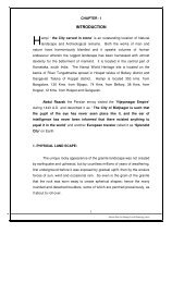
CHAPTER - 3WORLD HERITAGE MONUMENTS AND NATURAL AREAS1. WORLD HERITAGE SITE:The ‘World Heritage Sites’ are located in the Villages of Hampi, Krishnapur,Venktapur Kamalapur <strong>and</strong> Kaddirampur. Archaeological Survey of India isprotecting <strong>and</strong>preserving as manyas 56 major<strong>monuments</strong>known for their richcultural <strong>heritage</strong><strong>and</strong> historicalvalue. The group ofthese <strong>monuments</strong><strong>and</strong> other ruins ofHampi weredeclared as"WORLDHERITAGEMONUMENTS " byUNESCO in 1986 inrecognition of theiroutst<strong>and</strong>ingcontribution tohumanity in thefield of art <strong>and</strong> architecture not only in Indian context but also in the internationalsphere.15Master Plan for Hampi Local Planning Area
2. CONSERVATION AND PROTECTION EFFORTS:There are more than 1000 historical <strong>monuments</strong> in the site <strong>and</strong> out ofthese 56 <strong>monuments</strong> have been declared as protected <strong>monuments</strong> by theArcheological Survey of India <strong>and</strong> 654 are protected by the Department ofArcheology <strong>and</strong> Museums. It is believed that there are still 300 plus <strong>monuments</strong>,which are not protected by anyone.In addition to scientific preservation <strong>and</strong> conservation of these<strong>monuments</strong>, the Archeological Survey of India has carried out systematichorizontal large scale excavations from 1976 onwards <strong>and</strong> have laid bare manypalatial structures, administrative blocks, the palace of Veera Harihara, horsestable, Ranga mahal- the palace of Krishnadevaraya in the <strong>areas</strong> of Royalenclosure, Mint <strong>and</strong> Dannayak's enclosure, near rock cut temple <strong>and</strong> Octogonalbath of the core zone. In a continuous effort to protect the historical <strong>monuments</strong>the Government of India in 1976 declared three medieval sites as ‘NationalProjects’. Fathepur Sikri in U.P., Champaner in Gujarath <strong>and</strong> ‘Hampi’ inKarnataka.3. SIGNIFICANCE OF ‘WORLD HERITAGE SITE’:The Site is inscribed on the World Heritage list in 1986 on the basis ofOutst<strong>and</strong>ing Universal Values. The criteria for inscription of <strong>monuments</strong> onthe World Heritage list is as follows:I. Masterpiece of human genius: The sophistication of the varied urban,a royal <strong>and</strong> sacred system is evident from the surviving complexes, structures<strong>and</strong> remains. This represents an act of human genius – a highly developed Cityof the 16 th century with unique cultural l<strong>and</strong>scape. The recognition of thepotential of <strong>natural</strong> l<strong>and</strong>scape as the Capital <strong>and</strong> achieving it as a culturalproduct.16Master Plan for Hampi Local Planning Area
II. Exceptional testimony to a last civilization: The site today ispredominantly a vast Archeological area whose entire extents can be discerned.The capital city was planned with core area, suburbs <strong>and</strong> spatial hierarchyarticulated on the basis of its occupants accommodating the emperors,noblemen, <strong>and</strong>ordinary peoplegiving identity tovarious zones. TheSacred center,Royal center,Noblemen’sQuarters <strong>and</strong>ceremonial <strong>areas</strong>like MahanavamiDibba were where the royalty <strong>and</strong> nobility resided. There were puras for generalpublic, Central Avenue, Bazaar. These remains bear testimony to a lastCivilizationIII. Outst<strong>and</strong>ing buildings/Architectural ensemble: VijayanagarEmpire developed the Dravidan Architecture <strong>and</strong> took it to its ultimate form. TheVithala Temple undoubtedly represents its ultimate achievement. The StoneChariot in front is a Testimony of a prevalent religious system. Another uniquecontribution to Dravidan Architecture is the Rath Street. The Virupaksha Bazaaris one of the most magnificent Rath Street at a gr<strong>and</strong> scale. VijayanagarArchitecture is also known for tis adoption of Indo-Islamic Architecture for secularbuildings like Queen’s Bath <strong>and</strong> Elephants’ Stables, which is in contrast to thepure Dravidan style employed for religious Architecture. The defencearchitecture was also prevalent during Vijayanagar period with seven lines of fortwall.17Master Plan for Hampi Local Planning Area
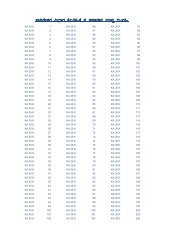
The ‘Hampi World Heritage site’ was enlisted in ‘endangered’ list in1999 just 13 years after its recognition as ‘World Heritage site’ in 1986. Theconstruction of controversial ‘suspension bridge’ near Talari ghat has beenmain reason for the site to included in the ‘Endangered list’. In addition to thismajor problem there are some other reasons which are also responsible. Thegrowing urbanization with many illegal <strong>and</strong> unauthorized developmentsespecially in Hampi village, illegal tourism related activities in‘Virupapur Gadda’which really threatens the <strong>natural</strong>, cultural <strong>and</strong> archeological environ, <strong>and</strong> poorconservation plans <strong>and</strong> government sponsored projects like Janata <strong>and</strong> Ashrayaschemes.5. PRIME ARCHEOLOGICAL AREA:This is the area that has all ASI protected <strong>and</strong> most of the state protected<strong>monuments</strong> concentrated in <strong>and</strong> around Hampi. The ‘Prime ArcheologicalArea’ covers 25 SQKMs. of area spread in 6 villages of Hospet Taluka <strong>and</strong> onevillage in Gangavathi Taluka. This area accounts for about 60% of the total theCore Zone Area. The list of villages <strong>and</strong> Sy. No.’s included in the “PrimeArcheological Area” are given below.1. Hampi :104 to 1582. Krishnapura : 10,18, 20, 22 to 623. Kaddiramapur : 1 to 9, 44, 54 to 2544. Kamalapur : 1 to 165, 170 to 174, 345 to 362, 376 to 397 <strong>and</strong> 3995. Venktapur : 1 to 2506. Nimbapur : 10, 11, 13 to 16 <strong>and</strong> hilly area on the Western side of Fortwall.7. Anegundi : 1 to 9, 192, 193 part, 194 to 219, 299 to 30518Master Plan for Hampi Local Planning Area
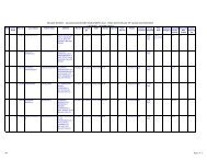
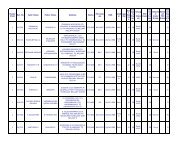
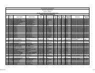
6. WORLD HERITAGE MONUMENTS AND OTHER HERITAGE BUILDINGS:A ‘Group of Archeological Monuments’ in <strong>and</strong> around Hampi havebeen inscribed in 1986 as UNESCO’s ‘World Heritage Site’ which includes 56Archeological Monuments. The Virupaksha temple, which is recently declared asASI monument, is yet to be taken over by the ASI. The following are theimportant ASI <strong>and</strong> State Archeology protected <strong>monuments</strong> in the Local PlanningArea.LIST OF ASI PROTECTED MONUMENTS - WORLD HERITAGE AREASl.Sy. Area inName of the Monument Taluka VillageNoNo. Acres2 Achyutaraya temple Hospet Venkatapuram 24 1.50Inscribed Vishnu temple near3Hospet Venkatapuram 24Vittala temple0.20Vishnu temple No.1 close to4Hospet Venkatapuram 24north end of Soole bazaar.Vishnu temple No. II close to the5Hospet Venkatapuram -“- 0.50last67Vishnu temple No.III facingSouth gateway of Vittala temple.Jain temple on the hill side closeto Vishnu temple No. II.Hospet Venkatapuram -“- 0.30Hospet Venkatapuram -“- 0.048 Two storied Mantapa Hospet Venkatapuram 24 0.029Ruined tank adjoining SoolebazaarHospet Venkatapuram 24 0.3810Fort gateway on the Talarighattaroad.Hospet Venkatapuram 139 0.3011M<strong>and</strong>apa in a field close toTalarighatta road.Hospet Venkatapuram 132 0.9012Raghunatha swami temple on the224Hospet VenkatapuramMalyavantha hill.(Part)2.213Stepped well on the road toHospet.Hospet Malapanagudi 13 0.1214Group of Sati memorials &Ch<strong>and</strong>ikeshwara temple.Hospet Kaddirampura 122 0.2615Saraswati temple next to waterchannel.Hospet Kaddirampura ? 0.0516 Monolithic Bull Hospet Hampi19PaimashNo. 06 0.0117 Narasimha Statue Hospet Krishnapuram -“- 0.03Linga temple near NarasimhaPaimash18Hospet KrishnapuramStatue.No. 070.03Master Plan for Hampi Local Planning Area
19 Krishna temple Hospet KrishnapuramP.No.663.0020 Kadalekalu Ganesha temple Hospet HampiRockyhill0.1021Sasivekalu Ganesha temple closeRockyHospet Hampito the Sl.No.20hill0.0222Group of Jain temples onHemakuta hillHospet Hampi -“- 1.0023 Vishnupad temple on rocky hill Hospet Hampi -“- 0.0124 Saraswati temple on a rocky hill. HospetSinganathanahalli-“- 0.0225 Mohammedan tomb K Daya Hospet Malapanagudi 94 -Hospet Kamalapur26 Pattabhirama temple Hospet Kamalapur 231 6.0527 Gangitti temple Hospet Kamalapur 92 0.4828 Ch<strong>and</strong>rashekhara temple Hospet Kamalapur 106 1.09Hazararamach<strong>and</strong>ra temple,29 Basement of King’s audience Hospet Kamalapur 111 62.09hall,.. Platform30Karge stibe trough, large stonedoor, stone aqueduct, small … Hospet Kamalapur -“-ground, shrine chamber.31 Basement of palace Hospet Kamalapur -“-63.00Ruined car street in front of32Hospet Kamalapur -“-Hazararamach<strong>and</strong>ra temple.33Two pillars <strong>and</strong> a group ofmortar … Zenana enclosure.Hospet Kamalapur -“-34 Queen’s bath Hospet Kamalapur 108 0.4235 Octogonal Hospet Kamalapur36 Water tower Hospet Kamalapur 107 0.5037 Lotus mahal pavilion Hospet Kamalapur 17 1.6538South east watch tower inZanana enclosureHospet Kamalapur 1639North watch tower in ZananaenclosureHospet Kamalapur -“-40Basement of Queen’s palace in HospetKamalapur -“-Zanana enclosure8.2441Water pavilion in the Zananaenclosure, guard house inZanana enclosure, wall &gateways of Zanana enclosure,Ranga temple.Hospet Kamalapur -“-42Elephant stable, guard housesclose to elephant stablesHospet Kamalapur -“- 2.3043Bhojana shala near octagonal HospetpavilionKamalapur 116 0.4020Master Plan for Hampi Local Planning Area
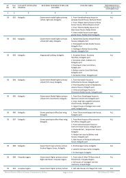
44Bhima’s gateway to the east ofGanigitti Jain temple.Hospet Kamalapur 94 1.0045Jain temple with inscriptionnorth east of elephants stableHospet Kamalapur 39 0.3046Two small Siva temples with Hospet195 &inscriptional to the east of theKamalapur194Pattabhirama temple0.5147Ruined tank in the north east ofPattabhirama temple.Hospet Kamalapur 227 0.9348Mohammaden watch tower inDonnaik’s enclosureHospet Kamalapur49B<strong>and</strong> tower in Donnaik HospetKamalapurenclosure135 A 2.6050Palace basement in DonnaikenclosureHospet Kamalapur51 Mosque in Donnaik enclosure Hospet Kamalapur52 Octagonal water pavilion Hospet Kamalapur 114 0.0553Domed gateway to the east ofcitadelHospet Kamalapur 0.0154 Large public bath or tank Hospet Kamalapur 111 0.4055 Large underground temple Hospet Kamalapur 135 2.48Basement of large mixedbuilding opp. to mohammaden56 mosque & also the platform,north east corner of Dannaik’senclosureHospet Kamalapur 111 1.0057Ruined buildings of minorimportanceHospetKamalapur49/1&49/20.15Source : ASI, KamalapuraHospet42 &Kamalapur42(1)0.40Hospet Kamalapur43 &43(1)0.01Hospet Kamalapur 42 (3) 0.01Hospet41 &Kamalapur41(2)0.20Hospet Kamalapur36 &36(2)0.20Hospet Kamalapur37 &37(1)0.20Hospet Kamalapur 38 0.10A brief description of historic <strong>monuments</strong> of both ASI <strong>and</strong> State protected<strong>monuments</strong> in the <strong>heritage</strong> area are given below.21Master Plan for Hampi Local Planning Area
1) Sasive Kalu Gaanesha: As one approaches Hampi village to visit itsruins directly from Hospet (13 kms), this is the first monumentencountered. This monolithic, four armed 2.4 meter tall Ganesha (16thcentury) is sculptured in round, is known as mustard seed (Sasivekalu)Ganesha in the local language Kannada. A plain-pillared pavilion frontsthe sculpture placed over an austere pedestal.2) Vishnupada shrine: It is located to the south east of Ganesha shrine.The shrine is built over a pair of foot prints encircled by a snakechiseled on the original rock formation <strong>and</strong> is datable to16th century.3) Kadale Kalu Ganesha: A very short walk to east leadsto this tall 4.50-meter, monolithic Ganesha (16 thcentury) in a sanctum with an elegant pillared mantapa.4) Hemakuta Group of Temples: A medieval pathway towards thenorthwest corner of the above temple leads to a group of early temples allenclosed in a large enclosure of cyclopean wall with majestic entrances atnorth <strong>and</strong> east. Built on the Hemakuta hillock, these temples, nearly 30in number of varying size are datable to c.9th – 16th century AD. Of thesetemples the one with typical Kadamba nagara super structure is ofPrasanna Virupaksha datable to 1338 AD. These temples belong to single(eka), two (dvi), <strong>and</strong> three(tri) celled classes <strong>and</strong> are theexamples of pre-Vijayanagara Architectureof the sacred Hampi.5) Vijaya Vithala Temple:The Vijaya Vithala Temple is22Master Plan for Hampi Local Planning Area
Hampi’s crowning glory with a magnificent stone chariot st<strong>and</strong>ing in thetemple courtyard. The impressive Rang Mantapa exquisitely carved with ‘56musical pillars’ that resound musical chimes when struck within thecomplex is of ingenious architectural conception. The intricate carvings ofornate architectural details are superb <strong>and</strong> just few meters away from theTemple complex there exists the ‘King’s Balance’ all in stone. Here theKings’ were weighed against gold, coins or grain which was thereafterdistributed amongst the poor <strong>and</strong> this particular religious perform was known‘Tula Bhaara’ observed by the people of all classes <strong>and</strong> status.6) VirupakshaTemple: Descending towards the north from the Hemakutahillock, the eastern entrance ofVirupaksha temple is encountered. Thisis presently protected by the Departmentof Archeology <strong>and</strong> Museums, Governmentof Karnataka, <strong>and</strong> now it is declared as a’World Heritage Monument’ which will beprotected by ASI. The Virupaksha orPampapati temple is the sacred <strong>and</strong> onlyliving <strong>monuments</strong> of Hampi. The temple,originally a small shrine, was exp<strong>and</strong>edinto a vast complex of presentdimensions in the first half of 16 lh Century. The entire temple complex iswithin a long rectangular enclosure divided into two large courts withimposing towered (gopura) gateways. Profuganti Tippa - an officer ofDevaraya II (1422-46 AD) caused the eastern entrance. The inner easternsmaller entrance gopura, painted pillared ranga mantapa were built byKrishnadeva Raya in 1510 AD. The complex has numerous subsidiary23Master Plan for Hampi Local Planning Area
shrines, <strong>and</strong> pillared cloister all along the enclosure wall. Some of theimportant subsidiary shrines of Mukti Narasimha, Pataleswara, NavadurgaSurayanarayana, Tarakeswara, Saraswati, Vidayarnaya, Paravati <strong>and</strong>Bhuvaneswari. The last two exhibit later Chalukyan (12"'Century)characters. The sanctum houses Shivalinga known as Virupaksha - thetutelary deity of the Vijayanagara kings. However the most outst<strong>and</strong>ing isthe ceiling paintings of Vijayanagara in the ranga mantapa. The noteworthypaintings are of the procession of sage Vidyaranya, story of Dikpalakas <strong>and</strong>the ten incarnations of Vishnu. Girija Kalayana, Arjuna at matysayantra <strong>and</strong>Shiva as Tripurari.7) Eduru Basavanna (Monolithic Bull): A spacious 750 meter long <strong>and</strong>35 meter wide bazar (Market) unfofds itself to the east of Virupakhsatemple running up to the foot of the Matanga hillock. At the eastern endare two storied pillared mantapas <strong>and</strong> a massive well-executed couchantbull facing the Virupaksha temple.8) Achyutaraya temple: A short climb over the foot of Matangahillock, behind the bull mantapa, using the medieval path way one canreach the famous Achyularaya pete (bazaar of Achyutaraya temple) alsoknown as ‘Soole Bazaar’ <strong>and</strong> the magnificent Acyutaraya('Thiruvengalanatha) temple built by Hiriya Tirumalaraya Wodeya aMaha m<strong>and</strong>aleswara serving under Achyuta Deva raya in 1534 AD. Thetemple facing north within double enclosure wall is known for its largedimensions <strong>and</strong> spacious courtyard fronted by a wide <strong>and</strong> long bazar.9) Bazaar: This is the widest of the bazaars also known asAchutarayapete with a series of mantapas flanking the central pathwayreaching up to the Varaha Temple at north form Achutaraya temple. Thebazaar measures 360.90 meters in length with a width of 39.90 meters.24Master Plan for Hampi Local Planning Area
There was a 22-meter wide stone paved way in the center. According to theinscriptions the market was held on Tuesdays of every week.10) Sacred Tank: Towards the northern end of Achyutarayapete, at west isthe sacred stepped tank with a water pavilion in the center.11) Varaha Temple: Towards the northern end of Achutarayapete facingeast is a Varaha temple (also known as Varaha temple) subsequentclearing have proven its Saiva affinity <strong>and</strong> has a separate enclosurewith a maadawara at east.12) Kod<strong>and</strong>a Rama Temple: From the Matanga foothill towards north onthe south bank of the river is the the temple of Kod<strong>and</strong>a Rama with thesculptures of Rama-Laksmana, Sita <strong>and</strong> Hanuman over looking, the muchfamed, Chakratirtha (sacred spot), a fairly deep formation in theme<strong>and</strong>ering Tungabhadra.13) Yantradharaka Anjaneya: Amidst the boulders of the hillock, behindKod<strong>and</strong>arama temple at south is a unique Hanuman temple known as'Yantroddharaka Anjaneya'seated Hanuman set in a mystic stellate 'Yantra'.The deity is said to have been worshipped by sage Vyasa tirtha.14) Hastagiri Ranganatha temple: As one trek beyond Kod<strong>and</strong>a Ramatemple, further to north east passing through the Varaha temple in thecorner is a west facing temple of Hastagiri Ranganatha (Vishnu Temple Aboulder inscription datable to 1560 AD, nearby, names Sheshasai Vishnu withretinue of Sridevi, Bhudevi <strong>and</strong> Nabhi Brabama as Hastagiri Ranganatha.The sculpture on a boulder is set in a sanctum with a vestibule <strong>and</strong> a sixpillaredmantapa.15) Vishnu temple 2: Further up at the right h<strong>and</strong> side as one proceedstowards VitthalaTemple the other Vishnu temple-2 facing north is found.25Master Plan for Hampi Local Planning Area
The Garuda pedestal in the sanctum, Gajalakshmi in the lintel of vestibule<strong>and</strong> the dwarapalas speak of its Vaishnava affinity. This temple also has a sixpillared mantapa to front. Near by, in the same vicinity, are two interestingtraditionally important “Siteya Seragu” (drapery imprint of Sita, wife ofRama) <strong>and</strong> 108 Shivalingas -Koti-shivalinga.16) Narasimha : At the sloping hillock nearby is a west facing temple ofNarasimha (Jaina temple) built by Hiriya Timma selti in about 1386 AD. ltis the earliest dated Narasimha temple at Hampi. The temple on plan has agarbha griha, a vestibule an ardha mantapa <strong>and</strong> a maha mantapa or mukhamantapa. The mukha mantapa on either side of its northern <strong>and</strong> southernentrance doorways have the sculptures of Hanuman <strong>and</strong> Garuda in anjalimudra. At west the mantapa has a perforated screen. The s a n c t u mhas a six t i e r e d kadambanagara super structure with a sukanasaprojection over vestibule. The mahamantapa also has Jagati all along itsinner wall <strong>and</strong> at exterior a creeper scrofl decorates the wall at the center.This later developed into a complex with an imposing two-storied gateway.Narasimha17) Two storied pavilion: Continuing in the same path towards the Vitthalatemple, are two, storied pavilions with an entrance passage set into thefortification wall serving as the south-western entrance to Vitthala templecomplex. At its southern side are two small single celled shrines.18) Kings Balance: Beyond this gate, further to north is a colossal balance,a structure meant for weighing the king against precious gems <strong>and</strong> metalsduring auspicious functions(Tulapurashadana).19) Ruined Gateway: This is another structure of importance which is locatednearly 50 meters north of Kings Balance with lofty pillars <strong>and</strong> doorjambs26Master Plan for Hampi Local Planning Area
which served as the south western entrance to the outer enclosure of Vitthalatemple <strong>and</strong> inscribed Vishnu temple complex. The plinth of this gate way istreated with the conventional sculptured mouldings. While the pada hassculpture of friezes of soldiers <strong>and</strong> horses the kumuda is of kankana type.The two doorjambs facing south are treated with creeper scrofl <strong>and</strong> makaraastride elegant female sculptures are at sides.20) Pur<strong>and</strong>ara mantapa: Nearer to the Kings balance <strong>and</strong> the ruinedgateway, right on the boulder strewn rock bed of river Tungabhadra, is apillared victorious army of Krishnadeva raya returning on its first tier. Asper the inscriptional records the bazaar was held on every Monday <strong>and</strong> wasmeant for groceries.21) Narasimha shrine : This is undoubtedly the most outst<strong>and</strong>ing workof sculptural art of Vijayanagara. The 6.70 meter sculpture was hewn out ofa massive boulder by Krishna bhatt in 1523 AD during the reign ofKrishnadevaraya. This statue of Lakshmi Narasimha is shown seated onthe coits of the Sesha with makara torana. in padmasana with yoga pattica.The image of Lakshmi seated over the left lap of the deity is mutilated.22) Badavi Linga (large Shivalinga): This is an interesting shrine with a hugemonolithic Shiva linga of nearly 3 meter high, very close to the shrine ofNarsimha. Through the lush green fields the road me<strong>and</strong>ering towardsKamalapuram, at its bottle neck corner has two shrines of :23) Ch<strong>and</strong>ikesvara <strong>and</strong> 24. Uddane Virabhadra : While Ch<strong>and</strong>ikeswaratemple at its mantapa has a proportionately well sculptured pillars of horseriders, the other temple has a image of life size Virabhadra.25) Prasanna Virupaksha (Underground Shiva) Temple: This is thewestern most extent of Dannayakas enclosure <strong>and</strong> the temple is facing east27Master Plan for Hampi Local Planning Area
<strong>and</strong> is datable to to 14"'Century. This temple is known for its seven aisledmaha mantapa <strong>and</strong> an elegant mahadwara.26) Palace of Vira Harihara : At the beginning of the inclination of theabove road <strong>and</strong> the corner of the enclosure are the excavated remainsof the 1'alace of Vira Harihara(Harihara 11,1377-1404 AD). The palace isidentified on the basis of inscriptions of Silamantapa's nearby. The palacehas a series of structures like a royal court, royal residence, well laid garden<strong>and</strong> water system, platform to alight from the back of elephants all enclosedin an independent enclosure walls of their own with screened entrances <strong>and</strong>guarded mahadwara. Further south of this palace in separate enclosureknown as Dannayaks enclosure are the remains of some more ornate highlysecured residential complexes which served as the palaces for the otherrulers. These are accessible from the southern entrance <strong>and</strong> path way fromthe Hazara Ramach<strong>and</strong>ra temple as well.27) Ch<strong>and</strong>rashekara temple: Passing through the imposing fortification, atthe curve of the main road towards north is Ch<strong>and</strong>rashekara temple datableto c.16th century known for its dravida style of super structure over thesanctums <strong>and</strong> the entrance at east .28)Saraswati temple <strong>and</strong> octagonal bath: Further a few meters north east ofthis temple is Saraswati temple facing north built on a boulder out crop.The temple in plan has a sane turn, vestibule <strong>and</strong> a mahamantapa with threeentrances. Near by at east is a subterranean octagonal bath. Further to thenorth <strong>and</strong> east of this bath are the newly excavated royal residences <strong>and</strong>accessory structures.29) Queens’s bath: Retracing the steps from Ch<strong>and</strong>rashekhara <strong>and</strong>continuing further towards Hampi the road brings one to the Queens bath28Master Plan for Hampi Local Planning Area
on the road where the metal road leads towards the ruins of the citadel. Thisis an imposing square structure set in a fenced garden. The ‘Lotus shaped’chute that once sprouted perfumedwater like a small waterfall is on theeastern side, fed with water from thewater channel on the outside of thepavilion. Apparently it was forwater sports by the members of theRoyal family. Though the building in Indo-Islamic style is austere exteriorly.Inside, around the square well of the bath are corridors with ornatebalconies with cut-plaster decoration projecting into the well. A flight ofsteps leads to the well of the bath at north. On three sides large archedopenings provide lighting necessary <strong>and</strong> an insignificant entrance at southleads to the monument. The ceiling of the corridor inside has the plasterdecorations <strong>and</strong> the recent excavations to the northwest across the road haslaid bare the accessory structure to the complex.30) Royal Enclosure: As one descends down the curve of the dirt road animposing enclosure to left of the road is encountered. This enclosurecovering an area of nearly 95,000 sq.meters is the nucleus of the royalty.The Royal Enclosure known for its elegant decorated plinths, water systems,large halls pillared shrine, <strong>and</strong> different types of water storage tanks most of29Master Plan for Hampi Local Planning Area
which have been found during excavation. Sculptured terracedplatform known as ‘Mahanavami dibba’, ornate schist stone stepped tank,large tank known as public bath underground shrine <strong>and</strong> Kingsaudience hall known as Bhuvana Vijaya are some of the important structures inthe Royal enclosure. A small entrance in the back wall (west) of theenclosure leads to the main path way on the southern side of the HazaraRamach<strong>and</strong>ra temple <strong>and</strong> to the eastern mahadwara o f structuralcomplexes known as Rangamahal located in another enclosure traditionallyknown as 'Mint',!31) Excavated remains of the mint (Rangamahal): Traditionally known as'mint'this enclosure is accessible from the southern door <strong>and</strong> a passage tothe south of the Hazara Ramach<strong>and</strong>ra temple <strong>and</strong> as well as through animposing mahadwara from the palace of Harihara. This complex in thebeginning has a series of structures in the form of rooms, large halls,terraced structures before opening into an inner enclosure through zig-zagentrances, doorways having the Residential Complexes of the royalty.Inner enclosure has a centrally located terraced structure with; guardplatforms on either side. The third terrace has rooms. This structurehad statues of royalty in its northern <strong>and</strong> southern galleries. Facing eastthis ornate terrace had independent enclosure of its own <strong>and</strong> all alongits inner side facing the main structures are series of rooms. At souththere are three more separate huge terraced plinths facing east, west<strong>and</strong> north beyond the enclosure wall. In addition there are differentstructures, pillared tanks, highlighting the importance of the structureas to the residential complex of an king of Krishna DevaRaya(1509.l529AD).30Master Plan for Hampi Local Planning Area
32) Horse Stable: Immediately to the north of the kings audience hall of theRoyal enclosure, there is a small enclosure between the two southernentrance gate of Hazara Ramach<strong>and</strong>ra temple. While the structures to thewest of the passage between these gates formed the residences those at : easthave a centrally divided rectangular stable with water troughs meant forhorse.33) Hazara Rama Temple <strong>and</strong> Pan-supari Bazar: Beyond the northernentrance gate ways of the Kings audience hall almost abutting them is thetemple of Hazara(court yard or thous<strong>and</strong>) Ramach<strong>and</strong>ra Temple built to theeast of the Palace ofHarihara. Set in itsown enclosure, thetemple facing east, onplan has a sanctum,vestibule, pillaredhall pierced with threeentrances <strong>and</strong> a spacious pillared porch.. Datable to 14th-15 th century, thisroyal temple in granite is known for its wall friezes of the great epic Ramayana<strong>and</strong> a few episodes of Bhagavata. The four pillars in the hall are of polishedblack stone with meticulous sculpturing. A separate shrine for devi <strong>and</strong> apillared mantapa at north east, south <strong>and</strong> west are the other structures here.The temple had a separate pathway for the visit of royalty at south. To the eastof this temple is a well paved bazaar measuring nearly 930 meters in lengthwith many a smaller shrines tanks <strong>and</strong> series of mantapas. According toinscriptions the street is known as pan - supari or peddangadi vidhi <strong>and</strong> wasthe popular main street of Vijayanagara marketing. ln addition to everyday Friday was a special day of marketing here. At a short distance from theHazara Ramach<strong>and</strong>ra temple on this street is the much venerated temple of31Master Plan for Hampi Local Planning Area
Goddess Durga locally known as Pattada Yellamma who was the muchworshipped deity during the Mahanavami festivals by the Vijayanagararulers.34) Zanana Enclosure: Popularly identified as the residential quarters forthe women (zanana) of royalty, this enclosure roughly measures 30,000sq.meteres <strong>and</strong> has a terraced platform (basement of queens palace), astructure identified as 'treasury', a water pavilion (jalamahall) two watchtowers with balconies.35) Lotus Mahal: The most important monument in the ‘ZananaEnclosure’ is the ‘Lotus Mahal’<strong>and</strong> only extant secular structure ofthe time that has withstood theravages of time <strong>and</strong> men. The lotusmahal also known as ‘Chitrangimahal’, is a very good example oflndo-Islamic style of architectureis a two storied structure built in rubble masonry <strong>and</strong> finely plastered. Onplan it is of indented square type with central projections in the cardinaldirections. The ornate plinth has an elegant arched super structurecrowned by nine towers of cyma recta cornice arranged one above theother in diminishing order <strong>and</strong> lopped by a fluted dome pyramidal inform. The stucco ornamentation of the cusped arches -though fragmentaryis superbly executed.32Master Plan for Hampi Local Planning Area
excavations carried out in the temple, many a tirthankara images havebeen retrieved <strong>and</strong> a few are displayed in the sculpture gallery of thetreasury building of the zanana enclosure.39) Ranga Temple: To the south east corner of the zanana enclosure behindYellamma temple is Madhava temple also known as Ranga temple. Aninscription of 1545 AD of the times of Sadashivaraya refers to the Rangamantapa of this built by Timma Raja son of Vallabha Raja wasexclusively meant for holding the concerts of dance, vocal <strong>and</strong>instrumental music. Except the main shrine <strong>and</strong> the damaged devi shrinerest of the temple is destroyed. The ranga mantapa at present has only afew pillars st<strong>and</strong>ing. However a colossal sculpture of Hanuman placedagainst the wall of east facing temple is interesting.40) Shringarada Hebbagilu (Ornate Chief Gate way): Further to the northeast of the above shrines the Pan-supari bazaar ends at an ornate liongateway known as Shringarada Hebbagilu datable to 14 lh century. Thisimportant gate consists of an east-west passage way flanked by platforms withstone column bases leading to an east facing doorway. Skirting the doorwayto the north is a recessed passage way. There are two bastions flanking thedoor way at east <strong>and</strong> are connected with the tapering walls. Several blocks onthe enclosure walls of the gateway are sculptures of bull, ascetic dancer etc.,41) Ganigitti Jaina Temple: There are some more <strong>monuments</strong>, which are alsoaccessible to the tourist such as north facing Kuntunatha jinalaya (GanagittiJain Temple). This temple (1386) is built by Irugappa D<strong>and</strong>anayaka <strong>and</strong> issimple in elevation <strong>and</strong> has a kadamba nagara terraced super structure overthe sanctum <strong>and</strong> a manastambha in front. The monument is located onHospet- Kampli road very near to Kamalapur Town..34Master Plan for Hampi Local Planning Area
42) Bhima’s gate: This is an imposing gateway to the east of GanagittiJaina temple This strong massive gateway in its inner gate facing west, hasbracketed corbels with ornate abacus. The gateway has a sculpture of Bhimaone of the P<strong>and</strong>avas of the Mahabharatha epic with a bunch of flowers.There is also a sculptured panel of him slaying Keechaka43) Domed Gateway : This is one of the well preserved eastern extremeentrance gate to the site which is characterised by an elegant domed pavillionprovided over the entrance <strong>and</strong> is located nearer to the tank of Hampi PowerHouse Camp. Nearer to Bhhnas gate a Corbelled entrance gate known asSomavarada Bagilu leads one of the citadel complex.44) Malyavantha Raghunathaswamy Temple: This is also an east facingVijayanagara edifices built on a hillock Malyavantha by name. Itssuperstructure over the entrances <strong>and</strong> the sanctum offer a gr<strong>and</strong> elevation. Thismonument is located nearly two <strong>and</strong> half kilometers from Kamalapuram onHospet- Kampli road.45) Pattabhirama Temple: This is one of the largest temples (16 th century) builtin an area of 163.70 x 93 mts. The east-facing temple is one km. east ofKamalapuram village on the way to HPC <strong>and</strong> is known for its large pillaredhalls, kalyana mantapa <strong>and</strong> a spacious courtyard. At east the entrance has atower of elegance.46) Bhojana Shala <strong>and</strong> Octagonal Water pavilion: On the way to Hampi, onKamalapur-Hampi road the <strong>monuments</strong> of Bhojana Shala a series of schist stoneplates running to a distance of nearly 10 meters laid on either side a 75centimeter, wide <strong>and</strong> 65 centimeter deep water channel meant for festiveoccasions <strong>and</strong> Octagonal water pavilion a system of water works are quiteinteresting.35Master Plan for Hampi Local Planning Area
47) Muhammadan Tombs <strong>and</strong> Dargah: On the out skirts of Kadirampur villageon way to Hampi from Hospet, are, these structures of Islamic architectureof 16 th century, contemporary to Bahamani architecture. Visit to the above<strong>monuments</strong> of Vijayanagara city is not only exciting but also exhausting by itssheer area of trek involved. The <strong>world</strong> <strong>heritage</strong> site offers all the sources ofquite enjoyable scenery for a common tourist for relaxation but also it providesan insight in to the cultural vividity of the medieval city with its impregnablefortifications, myriad of secular structures large religious edifices-allembellished to perfection. They also speak of the stupendous zeal of mankind<strong>and</strong> his venture within a short span of 225 years-a results of sheer admiration<strong>and</strong> devotion to the ruler by the ruled. Protecting, conserving <strong>and</strong> preservingthese exquisite architectural marvels for posterity is the bounden duty ofmankind.7. NATURAL AREAS:In addition to the ancient Archeological remains, the site has also anoutst<strong>and</strong>ing <strong>natural</strong> l<strong>and</strong>scape with torrential River Tungabhadra traversing the site<strong>and</strong> dividing it into two geographical units. The southern part is in Hospet taluka<strong>and</strong> northern part is in Gangavathi taluka. The entire site has an excellent <strong>and</strong>beautiful <strong>natural</strong> features like historic Kamalapur tank, Allikere <strong>and</strong> irrigation canalslike Turtha, Basava, Raya, Kalaghatta <strong>and</strong> Anegundi canals, rocky hillocks with <strong>and</strong>valley’s isl<strong>and</strong>s <strong>and</strong> rich agricultural l<strong>and</strong>s. It is this outst<strong>and</strong>ing <strong>natural</strong> feature,36Master Plan for Hampi Local Planning Area
which is responsible for having the status of the ‘World Heritage Site’.Therefore, it is equally essential to preserve <strong>and</strong> protect these <strong>natural</strong> <strong>areas</strong>along with <strong>monuments</strong>. Here an attempt is being made to identify certainenvironmentally <strong>and</strong> historically important <strong>natural</strong> <strong>areas</strong> <strong>and</strong> village wiseidentification <strong>and</strong> listing of the various <strong>natural</strong> <strong>areas</strong> is done. The list of allthese <strong>natural</strong> <strong>areas</strong> will have to be notified <strong>and</strong> protected. The details of all the<strong>natural</strong> features is given below..8. ROCKY HILLOCKS AND FORESTS:The most importantphysical <strong>and</strong> <strong>natural</strong>feature of the site is itsoutst<strong>and</strong>ing rocky hillockscharacterised by graniteboulders <strong>and</strong> forestsgiving the historicreference to the entiresite. The rocky hillockswith forest <strong>areas</strong> arespread over the entiresite. There are some hillocks of religious <strong>and</strong> mythological reference likeHemakuta, Ratnakuta <strong>and</strong> Matanga hills in Hampi <strong>and</strong> Krishnapura village,Anjanadri in Anjanhalli village. These rocky formations have to be preserved asan outst<strong>and</strong>ing <strong>natural</strong> l<strong>and</strong>scape <strong>and</strong> preserve the Heritage value of the site.The total area under rocky hillocks <strong>and</strong> forests is approximately …………. Ha.which is nearly 55 % of the total Heritage Area. Some of the rocky hillocks havehistorical reference like Hemakuta, Ratnakuta, Matanga, Rishyamukhi, <strong>and</strong>Anjanadri The Village wise list of Rocky hillocks <strong>and</strong> forests in the LocalPlanning Area <strong>and</strong> Sy.no.s are given below:37Master Plan for Hampi Local Planning Area
1. Dhanapur: 10, 38, 42, 79, 129, <strong>and</strong> 1312. Singhanathanahalli: 5, <strong>and</strong> 313. Hampi: 23,109,146 <strong>and</strong> 1564. Kaddiramapur:6, 8, 10, 57, 59, 102, 105, 117, 132, 156 <strong>and</strong> 2195. Malapanagudi:61, 72, 94,126, 150, 171 <strong>and</strong> 2186. Kalghatta: 18, 87, 218, 225, 231, 238, 241, 300, 310, 311, 312, 320,347, 348 <strong>and</strong> 3567. Gudi-Oblapur: 1, 16,17, 19, 80, 89, 95 <strong>and</strong> 998. Bukkasagar: 20, 33, 49, 85, 238, 240, 262, 488, 489, 504, 551 <strong>and</strong> 5939. Venktapur: 24, 25, 159, 224, 225, 386, 402, 437, 458, 492, 511, 637,642, 763, 854, 855, 856, 860, 861, 871, 890, <strong>and</strong> 89710. Kamalapur: 1, 7, 9, 14,20, 36, 51, 53, 58, 67, 80, 93, 94, 95, 96, 135,160, 170, 401, 672, 701, 703, 712, 736, 745, 747, 757, 809, 874, 952,961, 962, 964, 1000,1080, 1155, 1156, 1164, 1166, 1171, 1200, 1227,1303, 1325, 1326, 1356, 1378, 1383, 1381, 1389, 1405 <strong>and</strong> 143511. Virurpapur Gadda: 4912. Hanamanahalli: 1, 2013. Sanapur: 1, 13, 33 <strong>and</strong> 63414. Tirurmalapur: 3415. Laxmipur: 10, 11, 12, 13, 14, 25, 31, 34 <strong>and</strong> 4116. Chikkaramapur: 33, 62, 112 <strong>and</strong> 13617. Rangapur: 1, 3 <strong>and</strong> 418. Basanadurga: 2, 29, 31, 32, 35 <strong>and</strong> 3919. Anegundi: 193, 194 AB, 204, 210 <strong>and</strong> 23520. Anjanahalli: 11 AB, 15, 16, 17, 18, 19, <strong>and</strong> 2021. Mallapur: 28 <strong>and</strong> 3838Master Plan for Hampi Local Planning Area
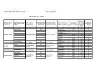
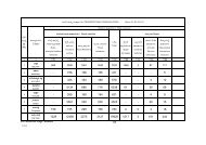
9. WATER BODIES AND HISTORIC CANALS:The Local Planning Area or the Heritage Area is rich in Agriculture. The studyof the river-anecuts discloses thegreat boldness, inguinity,expertness <strong>and</strong> judgement on thepart of the builders whoconceived, planned <strong>and</strong> executedwith darmic zeal <strong>and</strong> a sense ofsocial responsibility. The irrigationactivity in the area dates back to the Vijayanagar<strong>and</strong> even earlier times. DuringVijayanagar period there were important tanks <strong>and</strong> irrigation canals like Turtha,Basavanna, Raya, Kalaghatta <strong>and</strong> Anegundi canals. Most of these canals areold <strong>and</strong> needs proper maintenance. Among all these historic canals ‘Turtha’canal is an important right bank canal which mainly irrigates the l<strong>and</strong>s aroundHampi. ‘Turth-anecut’ <strong>and</strong> Sanapur anecut were constructed across riverTungabhadra is located to the north of Virupaksha temple. The Anegundi canalis located to the north of River Tungabhadra <strong>and</strong> starts from Sanapur anecut.This canal mainly meets the requirements of the residents of Anegundi <strong>and</strong>agriculturalists of Sanapur, Virupapur Gadda, Hanamanahalli, Ramdurga,sanganagundu<strong>and</strong> Sangapur etc., The total length of variouse historicVijayanagar canals <strong>and</strong> area irrigated by each canals are given below:Statement showing the details of Historic CanalsSl.no. Name of the canalLength inKms.Total area irrigatedIn Ha.1Raya Canal27.202,226.702Basavanna Canal16.001,240.483Kalaghatta7.20237.254Turtha18.00931.585Anegundi37.00N.A.Total 105.20 4636.0139Master Plan for Hampi Local Planning Area
In addition to the above historic Viyayanagar canals the area to the south ofRiver Tungabhadra is irrigated by Tungabhadra Right Bank canal <strong>and</strong> the area tothe north of the River is irrigated by Left Bank Canal. The Hampi Power Canal isalso passing through Kamalapur Town <strong>and</strong> goes up to HampiPower House.10. TUNGABHADRA RIVER:The torrential River Tungabhadra is traversing the entire Local Planning Areainto two parts <strong>and</strong> is a <strong>natural</strong> /administrative boundary of <strong>Bellary</strong>/Koppsldistricts. The River that has important <strong>monuments</strong> on either side has reallyadded <strong>natural</strong> beauty to the location. The excellent river front <strong>and</strong> its environhas attracted/attracting many tourism related illegal resorts/hotels etc., <strong>and</strong>spoiling the <strong>natural</strong> l<strong>and</strong>scape <strong>and</strong> polluting the waters of the river. The riverfrontnear Virupaksha Temple ischaracterized by garbagedumps <strong>and</strong> has becomeenvironmentally sensitive.Therefore, the excellent riverview all along the river hasbecome potential location forriverside recreational activities.Hence, the riverfront will have tobe preserved <strong>and</strong> protected from all kinds of developments. It is proposed tohave 45.00 m. of river front buffer on either side of the river <strong>and</strong> has to benotified.40Master Plan for Hampi Local Planning Area
11. KAMALAPUR TANK: The Kamalapur Tank is one of the oldest <strong>and</strong>Vijayanagar period tank in the <strong>heritage</strong> area <strong>and</strong> is still irrigating the l<strong>and</strong>saround Kamalapur. The tank is located in Sy. No. 879 of Kamalapur villagecovering an area of 192.72 Hectares. The tank was fed by river canal with waterdirectly from perennial river Tungabhadra. The tank receives water from ’Raya-Canal’ <strong>and</strong> was meeting the variedrequirements of the residents ofVijayanagar City. It is the biggest tankin the entire Local Planning Area orHeritage Area <strong>and</strong> is located on theHospet–Kamalapur road i.e., to thesouth of Kamalapur Town. The tank isnearly irrigating 290.00 Ha.of l<strong>and</strong>.12. ALLIKERE TANK:This tank is located to the southeast of Kamalapur town near HampiKannada University. The tank is located in Sy. No. 874 of Kamalapur village <strong>and</strong>covers an area of 2.38 Ha.41Master Plan for Hampi Local Planning Area