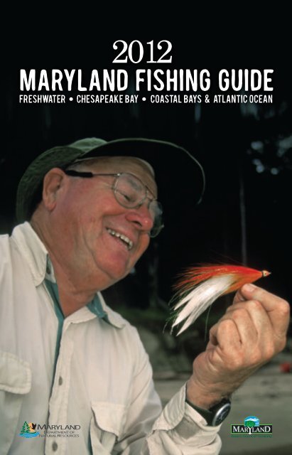
2012 Maryland FIshing Guide - Maryland Department of Natural ...
2012 Maryland FIshing Guide - Maryland Department of Natural ...
2012 Maryland FIshing Guide - Maryland Department of Natural ...

You also want an ePaper? Increase the reach of your titles
YUMPU automatically turns print PDFs into web optimized ePapers that Google loves.
<strong>2012</strong><br />
11/2/2011 11:54:31 AM
Dear <strong>Maryland</strong> Angler:<br />
Our <strong>Maryland</strong> Children’s Outdoor Bill <strong>of</strong> Rights proclaims that every child shall have the<br />
opportunity to discover and connect with their natural world, play and learn outdoors,<br />
splash and swim in the water, camp under the stars, follow a trail, catch a fish, watch<br />
wildlife, explore wild places close to home, celebrate their culture and heritage, and<br />
share nature with a great mentor or teacher. All <strong>of</strong> these invaluable childhood rites <strong>of</strong><br />
passage are embodied in the adventures and traditions <strong>of</strong> fishing in <strong>Maryland</strong>.<br />
Our State is blessed with boundless angling opportunities. Crisp mountain streams in<br />
Western <strong>Maryland</strong> <strong>of</strong>fer rainbow, brown and brook trout as well as small mouth bass.<br />
Our warm water rivers and lakes are filled with largemouth bass and panfish. The<br />
magnificent bounty <strong>of</strong> the Chesapeake Bay includes crabs, rockfish, perch and blues.<br />
And our coastal bays and ocean waters teem with flounder, marlin, tuna, sea bass and<br />
tautog.<br />
With these outstanding opportunities comes the responsibility to protect, conserve and enhance our waterways and our fish populations for<br />
young anglers – the next generation <strong>of</strong> natural resource stewards. As <strong>Maryland</strong>ers, we are fortunate to have the best biologists, technicians<br />
and managers working together with our public advisory commissions and our colleges and universities to guide fisheries management.<br />
We are also fortunate to have you, <strong>Maryland</strong>’s recreational anglers, as active and committed conservationists and advocates for a vibrant<br />
and healthy inheritance for our next generations. Your license fees support the research, enforcement, management and access that are<br />
fundamental to maintaining and enhancing our fishery resources.<br />
Thank you for being a part <strong>of</strong> <strong>Maryland</strong>’s great outdoor tradition and for your contributions to the future.<br />
Tight Lines!<br />
Martin O’Malley<br />
Governor<br />
John R. Griffin<br />
Secretary<br />
About the Cover: Lefty Kreh and his Deceiver Photo by John Bildahl, bildahlphotography.com<br />
The <strong>2012</strong> fishing season is dedicated to the Life & Times <strong>of</strong> Lefty Kreh, <strong>Maryland</strong>’s iconic angler, Frederick native, and mentor to thousands<br />
<strong>of</strong> people who have caught his boundless passion for the outdoors.<br />
In his 75-year career as a writer, journalist, and teacher, Kreh has written more than 30 books in addition to the thousands <strong>of</strong> columns and<br />
features he produced as outdoor editor <strong>of</strong> the Frederick News Post, St. Petersburg Times, Baltimore Sun and various national magazines.<br />
All the while, he has maintained a packed schedule <strong>of</strong> appearances at clubs, fishing shows, and on national television throughout the<br />
region, the country and the world to inspire and entertain aspiring anglers.<br />
Countless anglers consider him to be the mentor who inspired their joy in outdoor pursuits, particularly in salt water flyfishing.<br />
Kreh may be best known for the Lefty’s Deceiver; a practical fly pattern he designed to meet the challenge <strong>of</strong> fooling striped bass in<br />
Tangier Sound. This remarkably effective bucktail pattern quickly became, and remains, the most widely used and imitated saltwater fly<br />
in the world.<br />
In 1991 the U.S. Postal Service honored Kreh and the Lefty’s Deceiver with a commemorative stamp.<br />
In 2003, he was inducted into the International Game Fish Association Hall <strong>of</strong> Fame.<br />
Kreh continues to write and has a new book underway. He recently completed a television series for ESPN in support <strong>of</strong> fisheries science<br />
and conservation with Tom Brokaw, Yvon Chouinard, Tom McGuane, and Michael Keaton.<br />
Kreh resides in Cockeysville, with Evelyn, his wife <strong>of</strong> 64 years.<br />
Gov. Martin O’Malley and Sec. John R. Griffin<br />
Cover.indd 2 11/2/2011 11:54:47 AM
<strong>2012</strong> MARYLAND FISHING GUIDE<br />
This publication is intended as a guide only. Regulations are subject to change.<br />
It is the angler’s responsibility to know and abide by all current regulations and laws.<br />
580 Taylor Avenue, B-2<br />
Annapolis, <strong>Maryland</strong> 21401<br />
Toll free in <strong>Maryland</strong>:<br />
1-877-620-8DNR ext. 8325<br />
Out <strong>of</strong> state call: 410-260-8325<br />
Website: www.dnr.maryland.gov<br />
E-mail: customerservice@dnr.state.md.us<br />
Tell us what you think!<br />
Please write, e-mail or join us on Facebook -<br />
MD-DNR Fisheries Service<br />
For Official Law, see <strong>Maryland</strong> Code.<br />
Md Statues - http://mlis.state.md.us<br />
Md Regulations - www.dsd.state.md.us<br />
The facilities and services <strong>of</strong> the <strong>Maryland</strong><br />
<strong>Department</strong> <strong>of</strong> <strong>Natural</strong> Resources are available<br />
to all without regard to race, color, religion,<br />
sex, sexual orientation, age, national origin or<br />
physical or mental disability.<br />
This program receives Federal assistance from<br />
the U.S. Fish and Wildlife Service, and thus<br />
prohibits discrimination on the basis <strong>of</strong> race,<br />
color, national origin, disability, age, and sex;<br />
pursuant to Title VI <strong>of</strong> the Civil Rights Act <strong>of</strong><br />
1964, Section 504 <strong>of</strong> the Rehabilitation Act<br />
<strong>of</strong> 1973, Title II <strong>of</strong> the Americans with Disabilities<br />
Act <strong>of</strong> 1990, the Age Discrimination<br />
Act <strong>of</strong> 1975, and Title IX <strong>of</strong> the Educational<br />
Amendments <strong>of</strong> 1972. If you believe that<br />
you have been discriminated against in any<br />
program, activity, or service, please contact<br />
the Office <strong>of</strong> Fair Practices-MD <strong>Department</strong><br />
<strong>of</strong> <strong>Natural</strong> Resources, Tawes Building, 580<br />
Taylor Ave., D-4, Annapolis, MD, 21401. The<br />
telephone number is 410-260-8058. You may<br />
also write to the U.S. Fish and Wildlife Service,<br />
Civil Rights Coordinator for Public Access,<br />
4401 N. Fairfax Drive, Mail Stop: WSFR-4020,<br />
Arlington, VA, 22203.<br />
This document is available in alternative<br />
format upon request from a qualified<br />
individual with a disability.<br />
© 2011 <strong>Maryland</strong> <strong>Department</strong> <strong>of</strong><br />
<strong>Natural</strong> Resources<br />
DNR 17-10272011-533<br />
Printed on recycled paper<br />
Table <strong>of</strong> Contents<br />
Fishing Licenses, Fees & the<br />
National Saltwater Angler <strong>Maryland</strong> Registration .............................2<br />
Nontidal Sport Fishing<br />
License and Trout Stamp Requirements ............................................... 3<br />
Fishing <strong>Guide</strong> License ...................................................................................4<br />
Penalties, Gear Restrictions, Prohibitions & Definitions ....................4<br />
Catch a Poacher ...............................................................................................7<br />
<strong>Maryland</strong> Nontidal Hook & Line Fishing Seasons ............................8-9<br />
Lakes and Ponds Open to Public Fishing ............................................ 10<br />
Special Fishing Areas ............................................................................13-18<br />
Catch and Return Bass Fishing Areas .................................................... 19<br />
Limited Harvest Management Areas – All Species........................... 19<br />
Nontidal Striped Bass Regulations ........................................................ 20<br />
Sport Fish Advisory Commission ............................................................20<br />
River Flow Information ...............................................................................21<br />
Invasive Species ............................................................................................ 22<br />
Snakeheads .................................................................................................... 23<br />
Put-and-Take Trout Fishing Areas .....................................................24-27<br />
Tidal Sport Fishing – The Chesapeake, its Tributaries, Coastal Bays<br />
& Atlantic Ocean<br />
Tidal – Nontidal Dividing Lines .................................................... 28 & 37<br />
<strong>Maryland</strong> Fish & Crab Identification ...................................................... 31<br />
Tidal Sport Fishing Licenses, Reciprocity,<br />
Penalties & Exemptions............................................................................. 38<br />
Tidal Fishing Laws ........................................................................................ 39<br />
Striped Bass Rules & Seasons .............................................................40-41<br />
<strong>Maryland</strong> Artificial Reef Initiative & Reef Locations ...................42-43<br />
Tidal Rules Certain Fish .............................................................................. 44<br />
Recreational Crabbing Rules & Fees ................................................45-47<br />
Sea Turtle & Marine Mammal Stranding Information ......................48<br />
Recreational Oyster Rules ......................................................................... 49<br />
Coastal Bays, Coastal Tributaries & Atlantic<br />
Ocean Sport Fishing Limits .................................................................50-51<br />
Sharks .........................................................................................................52-53<br />
Coastal Bays & Coastal Tributaries Crab Season and Limits .......... 54<br />
The <strong>Maryland</strong> Fishing Challenge featuring Diamond Jim .......55-56<br />
<strong>Maryland</strong> Angler Awards – Species and Minimum Size List ......... 57<br />
Angler Award Centers................................................................................. 58<br />
My First Fish, Catch & Release Angler Awards.................................... 59<br />
Catch & Release Tips .................................................................................... 60<br />
<strong>Maryland</strong> State Records .......................................................................61-63<br />
DNR Service Centers & <strong>Natural</strong> Resources Police<br />
Contact Information ......................................................inside back cover<br />
<strong>2012</strong>FG -assembled.indd 1 11/2/2011 11:55:12 AM<br />
l 1
<strong>2012</strong> <strong>Maryland</strong> Fishing Licenses<br />
& the National Saltwater Angler Registry<br />
The National Oceanic and Atmospheric Administration (NOAA) created the National Saltwater Angler<br />
Registry in 2010. The angler registry is a survey tool to estimate recreational fishing catch in tidal waters.<br />
<strong>Maryland</strong> is an exempt State for the angler registry and anglers in <strong>Maryland</strong> do not register with NOAA.<br />
The contact information required by the angler registry is automatically provided to NOAA for <strong>Maryland</strong><br />
licensed or registered anglers.<br />
Who needs a <strong>Maryland</strong> License or <strong>Maryland</strong> Registration?<br />
Unless exempt below, anglers fishing in the Atlantic Ocean, Coastal Bays or tributaries must be licensed or<br />
registered with the State.<br />
You do not need to be licensed or registered with the State if you:<br />
• Are under 16 years <strong>of</strong> age;<br />
• Are fishing from a licensed charter boat;<br />
• Are fishing on a free fishing day – the first two Saturdays in June and July 4;<br />
• Are fishing from a licensed commercial fishing pier;<br />
• Possess a valid commercial tidal fish license; or<br />
• Possess a Potomac River Fisheries Commission recreational fishing license.<br />
Unless individually licensed, a free registration is required for waterfront property owners and immediate<br />
family members fishing on private property, those fishing in a designated free fishing area, anglers in<br />
possession <strong>of</strong> a Virginia Saltwater license, and passengers on a vessel displaying a MD Consolidated<br />
Chesapeake Bay & Coastal Sport Fishing Boat decal. Anglers may register at: www.dnr.maryland.gov/<br />
service .<br />
<strong>2012</strong> Licenses, Registration & Fees<br />
License Fee<br />
Non-Tidal (Resident) .......................................................................................................................................................$20.50<br />
7-Day Non-Tidal (resident) ............................................................................................................................................ $ 7.50<br />
Non-Tidal (Non-Resident) ............................................................................................................................................$30.50*<br />
7-Day Non-Tidal (Non-Resident) ................................................................................................................................ $7.50*<br />
3-Day Non-Tidal (Non-Redident) .............................................................................................................................. $5.00*<br />
Trout Stamp (Resident) .................................................................................................................................................... $5.00<br />
Trout Stamp (Non-Resident) .........................................................................................................................................$10.00<br />
Consolidated Senior Sport Fishing License ............................................................................................................. $5.00<br />
Chesapeake Bay & Coastal Sport Fishing License (Resident) ...........................................................................$15.00<br />
7-Day Chesapeake Bay & Coastal Sport Fishing License (Resident) ................................................................. $6.00<br />
Chesapeake Bay & Coastal Sport Fishing License (Non-Resident) .................................................................$22.50<br />
7-Day Chesapeake Bay & Coastal Sport Fishing License (Non-Resident) .....................................................$12.00<br />
Pleasure Boat Decal .........................................................................................................................................................$50.00<br />
Boat Decal passengers ............................................................................................................Free Online Registration**<br />
Free Fishing Area .......................................................................................................................Free Online Registration**<br />
Waterfront Property Owners & Family ...............................................................................Free Online Registration**<br />
In Possession <strong>of</strong> a Virginia Saltwater License...................................................................Free Online Registration**<br />
*or the same fee charged to visiting <strong>Maryland</strong> anglers by a non-resident’s home state, whichever is higher.<br />
**Free Online <strong>Maryland</strong> Saltwater Angler Registration—www.dnr.maryland.gov/service<br />
2 l <strong>Maryland</strong> <strong>Department</strong> <strong>of</strong> <strong>Natural</strong> Resources • www.dnr.maryland.gov/fisheries<br />
<strong>2012</strong>FG -assembled.indd 2 11/2/2011 11:55:59 AM
<strong>Maryland</strong> Nontidal Sport Fishing<br />
License Requirements<br />
A person may not fish the nontidal waters <strong>of</strong> <strong>Maryland</strong> without first obtaining a license. No fee is charged for licenses<br />
issued to blind persons or to former prisoners <strong>of</strong> war. The license shall be valid from January 1 through December<br />
31 <strong>of</strong> each calendar year. However, a person may fish for finfish without a license in <strong>Maryland</strong>‘s nontidal waters if the<br />
person is:<br />
1. Under 16 years <strong>of</strong> age.<br />
2. A resident <strong>of</strong> <strong>Maryland</strong> on active duty with Armed Forces, on leave with <strong>of</strong>ficial orders.<br />
3. A patient <strong>of</strong> a veterans hospital hospitalized for service connected disability (contact Fisheries<br />
Service for permit information).<br />
4. A patient under treatment by a State-approved mental health facility or an individual who attends<br />
or resides in a State-approved health and mental hygiene facility.<br />
5. A caregiver, family member or designee <strong>of</strong> a mental health care facility or private group home <strong>of</strong> a<br />
patient who is under treatment by a State-approved mental health facility (must provide a letter <strong>of</strong><br />
pro<strong>of</strong> to the <strong>Department</strong>).<br />
6. A person who fishes in nontidal waters <strong>of</strong> the State on free fishing days designated by the Secretary.<br />
(First two Saturdays in June and July 4)<br />
7. An owner or tenant, their spouse, children or the spouses <strong>of</strong> their children residing on the property<br />
may fish from their riparian shoreline on nontidal waters. Anglers should confirm riparian ownership<br />
before fishing as some impoundments and waterways are surrounded by buffers; in these areas,<br />
there are no riparian shoreline owners and fishing licenses are required. Anglers with reparian<br />
shorelines must comply with all fishing laws and regulations.<br />
8. A resident <strong>of</strong> Virginia possessing a valid Virginia fishing license issued in that resident’s name may<br />
fish in nontidal waters <strong>of</strong> the Potomac River (mainstem only) opposite the shore <strong>of</strong> Virginia.<br />
9. A resident <strong>of</strong> West Virginia possessing a valid West Virginia fishing license issued in that resident’s<br />
name may fish in nontidal waters <strong>of</strong> the Potomac River (mainstem only) opposite the shore <strong>of</strong> West<br />
Virginia, including the North Branch <strong>of</strong> the Potomac River and the Jennings Randolph Reservoir<br />
(opposite the shore <strong>of</strong> West Virginia).<br />
10. A resident <strong>of</strong> Pennsylvania possessing a valid Pennsylvania fishing license issued in that resident’s<br />
name may fish in the waters <strong>of</strong> the Conowingo and Youghiogheny Reservoirs.<br />
A Trout Stamp Is Required<br />
1. For anyone 16 years <strong>of</strong> age or older to fish in a “special catch-and-return trout<br />
management area” or possess trout taken from nontidal waters. <strong>Maryland</strong><br />
residents holding a valid Consolidated Senior Resident Sport Fishing License or<br />
lifetime service disabled veteran or former POW license are exempt.<br />
2. Trout stamps are not required to possess trout taken from privately owned<br />
lakes or ponds or licensed fee fishing lakes or ponds that are stocked with trout<br />
artificially propagated by, or purchased from, persons licensed by the State to<br />
sell fish.<br />
@mddnrfish<br />
<strong>2012</strong>FG -assembled.indd 3 11/2/2011 11:56:09 AM<br />
l 3<br />
Duane Raver, USFWS
<strong>Maryland</strong> Nontidal Sport Fishing<br />
Fishing <strong>Guide</strong> License<br />
Types Available<br />
1. NT – allows licensee to provide fishing guide services only in nontidal waters<br />
2. NTT – allows licensee to provide fishing guide services in nontidal waters and designated tidal areas<br />
3. L – allows licensee to provide fishing guide services (on foot, paddle and oar only) in all waters <strong>of</strong> the State<br />
Documents Required by Applicant<br />
• A valid freshwater angler’s license, if applicable;<br />
• A valid Chesapeake BayCoastal Sport fishing license, if applicable;<br />
• Any necessary stamps issued by the <strong>Department</strong>;<br />
• A valid license issued by the U.S. Coast Guard, if operating a vessel;<br />
• A valid copy <strong>of</strong> a Cardiopulmonary Resuscitation Certificate (CPR); and<br />
• A valid copy <strong>of</strong> an American Red Cross First Aid certificate or equivalent.<br />
Requirements differ for each license type. Contact a DNR Service Center for fees, fishing locations, and restrictions<br />
Penalties<br />
The <strong>Department</strong> may suspend an individual’s fishing license or privilege if that individual is convicted<br />
<strong>of</strong> or pays a fine for violating certain fishing laws. A full copy <strong>of</strong> suspendable fishing violations can be<br />
found in the Code <strong>of</strong> <strong>Maryland</strong> Regulation 08.02.13.05. To view this regulation visit www.dsd.state.md.us.<br />
Additionally, individuals who are suspended for violating fishing laws in <strong>Maryland</strong> may also be suspended<br />
in other states under the Interstate Wildlife Violator Compact.<br />
Gear<br />
Gear restrictions and rules for are subject to change. Please check with the <strong>Department</strong>’s website for<br />
possible changes at www.maryland.gov/fisheries.<br />
It Is Illegal<br />
1. To use more than 3 rods at one time (except for ice fishing) and to use any rod with more than 2<br />
hooks per line.<br />
2. To use more than 5 rods (hand held devices) or tip-ups for ice fishing.<br />
3. To cut a hole through the ice measuring more than ten (10) inches in any direction for the purpose<br />
<strong>of</strong> ice fishing.<br />
4. Bait Fish:<br />
a. To use a seine that exceeds 6 feet in length or 4 feet in depth to catch bait fish.<br />
b. To take bait fish <strong>of</strong> any description from any Put-and-Take Fishing Areas or Special<br />
Fisheries Management Areas for Trout.<br />
5. Spear Gun:<br />
a. To use a spear or spear gun within 100 yards <strong>of</strong> any private or public swimming areas,<br />
scuba diver’s flag, (other than that used by the spear fisherman), vessel in the water or<br />
human being without specific advance permission.<br />
b. To use a spear or spear gun in State owned ponds, lakes or Put-and-Take Fishing Areas<br />
or Special Management Areas for Trout.<br />
c. To shoot any trout, walleye, striped bass, striped bass hybrid, northern pike, large<br />
and smallmouth bass, muskellunge or tiger muskie, with a spear gun or spear in the<br />
nontidal waters <strong>of</strong> the State.<br />
6. To use a trotline:<br />
a. in nontidal waters anywhere except in the mainstems <strong>of</strong> the Potomac and Monocacy<br />
Rivers.<br />
b. In any waters during April, May and June and between 9 a.m. and 4 p.m. EST any day.<br />
c. Made <strong>of</strong> metallic material, or having more than 75 single hooks, or more than 300 feet<br />
4 l <strong>Maryland</strong> <strong>Department</strong> <strong>of</strong> <strong>Natural</strong> Resources • www.dnr.maryland.gov/fisheries<br />
<strong>2012</strong>FG -assembled.indd 4 11/2/2011 11:56:13 AM
te<br />
d<br />
e<br />
d.us.<br />
nded<br />
r<br />
n 2<br />
rpose<br />
l<br />
eas,<br />
er or<br />
reas<br />
he<br />
cacy<br />
ay.<br />
feet<br />
<strong>Maryland</strong> Nontidal Sport Fishing<br />
It is illegal to use a trotline (continued)<br />
long, or baited with scale bait<br />
d. To catch walleye, smallmouth bass or largemouth bass.<br />
e. Not identified with a metal tag securely attached to it showing the name and address<br />
<strong>of</strong> the person operating it.<br />
f. Anchored from one shore to the other.<br />
7. In Deer and Swan Creeks in Harford County:<br />
a. For a person to catch or attempt to catch fish other than by hook and line , with line<br />
held in hand, attached to a pole or rod held in hand, or attended in a manner that the<br />
fish voluntarily takes bait or lure in its mouth.<br />
b. For a person to possess or use minnows for bait while fishing.<br />
8. Bush-bobs/bank poles:<br />
a. For anyone other than a resident to use bush-bobs or bank poles.<br />
b. For residents to use more than 25 bush-bobs or bank poles, or any bush-bobs or bank<br />
poles having more than 1 hook to a pole or bob.<br />
c. To use bush-bobs or bank poles except in the mainstems <strong>of</strong> the Potomac and<br />
Monocacy Rivers within Carroll, Washington and Frederick Counties.<br />
d. To use bush-bobs or bank poles between sunrise and sunset.<br />
e. To use bush-bobs or bank poles on any streams stocked with trout.<br />
f. To use a bush bob or bank pole baited with scale bait or live bait to catch suckers,<br />
catfish, carp, eels, gudgeons and every species <strong>of</strong> sunfish, including bluegills and<br />
rockbass, commonly known as redeye.<br />
9. Dip net :<br />
a. For anyone other than a resident to use a dip net in the Susquehanna River in Cecil and<br />
Harford counties; anywhere in Allegany and Washington counties; and the Monocacy<br />
and Potomac Rivers in Carroll and Frederick counties.<br />
b. To use a dip net from April 16 to December 31 inclusive.<br />
c. To use a dip net within 50 yards <strong>of</strong> the mouth <strong>of</strong> a tributary or the breast <strong>of</strong> any dam.<br />
d. To use a dip net in nontidal waters <strong>of</strong> the State stocked with trout, any Put-and-Take<br />
Trout Fishing Area or Special Fisheries Management Area for Trout. (Landing nets used<br />
to land fish are not considered dip nets.)<br />
e. To use a dip net to fish for any trout species, walleye, striped bass, striped bass hybrid,<br />
northern pike, largemouth and smallmouth bass, muskellunge, or muskellunge<br />
hybrids (including tiger muskie).<br />
f. For anyone to use a baited dip net by attaching an attractant to the net material or<br />
frame.<br />
10. For a nonresident:<br />
a. To fish in nontidal waters <strong>of</strong> the State with nets <strong>of</strong> any description. However,<br />
nonresidents may use a net commonly known as a landing net to land fish caught by<br />
hook and line.<br />
b. To gig at any time.<br />
11. To use a gig to catch all trout species, frogs, walleye, striped bass, striped bass hybrid, northern<br />
pike, muskellunge, muskellunge hybrids including tiger muskie and largemouth and smallmouth<br />
bass. See page 7 for eel requirements.<br />
12. To snag fish with hooks, except for snakeheads.<br />
13. To use a trap in nontidal waters.<br />
14. To remove the head and tail <strong>of</strong> fish in possession while at the fishing location, except for<br />
snakeheads. The head and tail shall remain attached in such a manner as to permit identification<br />
<strong>of</strong> fish species and total length. A person may take snakehead fish from <strong>Maryland</strong> waters by any<br />
legal means provided that the head <strong>of</strong> the snakehead fish is immediately removed, or the body is<br />
gutted, or the gills are removed from both sides <strong>of</strong> the fish, or the fish is filleted upon capture.<br />
@mddnrfish MD-DNR Fisheries Service<br />
<strong>2012</strong>FG -assembled.indd 5 11/2/2011 11:56:23 AM<br />
l 5
<strong>Maryland</strong> Nontidal Sport Fishing<br />
It is illegal (continued)<br />
15. To disturb, take, destroy or possess the nest or eggs <strong>of</strong> a terrapin or snapping turtle.<br />
16. For a person to catch snapping turtles from waters <strong>of</strong> the State by hook and line, trotline, bow and<br />
arrow, net, seine, fishpot, or other fishing rig, spear, gig or iron or any device capable <strong>of</strong> piercing<br />
any part <strong>of</strong> the turtle at any time.<br />
17. To use a bow and arrow:<br />
a. To shoot or attempt to shoot any fish in a Put-and-Take Fishing Areas or Special<br />
Fisheries Management Areas for Trout.<br />
b. To shoot or attempt to shoot any fish in state-controlled community ponds or lakes.<br />
c. To shoot all trout species, walleye, striped bass, striped bass hybrid, northern pike,<br />
muskellunge, muskellunge hybrids including tiger muskie and largemouth and<br />
smallmouth bass.<br />
18. To trespass or fish any waters closed to the public for fishing by the <strong>Department</strong>.<br />
19. To operate any vehicle on any lands owned or controlled by the Freshwater Fisheries Division<br />
without written permission from the Division except on those roads, lanes or areas which are open<br />
to automobile traffic or which are specifically marked by the Division.<br />
20. To camp on lands owned and controlled by the Freshwater Fisheries Division except on designated<br />
sites or with written permission.<br />
21. To swim in any State-controlled lake except in designated areas.<br />
22. To cut any brush, trees or shrubbery on the C&O Canal National Historical Park unless authorized<br />
by the National Park Service <strong>of</strong> the Federal Government.<br />
23. Battie Mixon Fishing Hole<br />
a. To fish in Battie Mixon Fishing Hole in Allegany County between one hour after sunset<br />
and one hour before sunrise<br />
b. To use boats propelled by gasoline or diesel power on the waters <strong>of</strong> Battie Mixon<br />
Fishing Hole (electric motors only).<br />
24. To throw, dump, deposit, or cause to be thrown, dumped or deposited, any trash, junk or other<br />
refuse upon any <strong>of</strong> the waters <strong>of</strong> this State.<br />
25. To fish any streams or nontidal waters that contain trout between the hours <strong>of</strong> 10:00 p.m. and 5:30<br />
a.m. (This does not apply to freshwater impoundments <strong>of</strong> five acres or more.)<br />
26. To cull trout. “Replacing a trout in possession with another trout.” “Possession” refers to any<br />
condition where a trout cannot freely swim away.<br />
27. To use a seine:<br />
a. Within 50 yards <strong>of</strong> the mouth <strong>of</strong> any river or tributary or the base <strong>of</strong> a dam.<br />
b. In waters <strong>of</strong> the State stocked with trout, any Put-and-Take Trout Fishing Area or Special<br />
Fisheries Management Area for Trout.<br />
28. Crayfish:<br />
a. To catch any species <strong>of</strong> crayfish in the Middle Potomac River, Upper Potomac River and<br />
Susquehanna River basins unless the head is immediately removed behind the eyes<br />
upon capture.<br />
b. To use any species <strong>of</strong> crayfish as bait in the Middle Potomac River, Upper Potomac River<br />
and Susquehanna River basins unless the head is removed behind the eyes.<br />
c. To possess any species <strong>of</strong> crayfish while fishing in the Middle Potomac River, Upper<br />
Potomac River and Susquehanna River basins unless the head is removed behind the<br />
eyes.<br />
d. To catch and possess a female crayfish with eggs attached to the underside <strong>of</strong> the<br />
abdomen in the Middle Potomac River, Upper Potomac River and Susquehanna River<br />
basins.<br />
29. To buy, sell, or <strong>of</strong>fer to buy any fish harvested from the nontidal waters <strong>of</strong> the State.<br />
30. To use a cast net in nontidal waters.<br />
31. To feed any wildlife in Fisheries Management Areas.<br />
32. To use felt-soled waders or boots.<br />
6 l <strong>Maryland</strong> <strong>Department</strong> <strong>of</strong> <strong>Natural</strong> Resources • www.dnr.maryland.gov/fisheries<br />
<strong>2012</strong>FG -assembled.indd 6 11/2/2011 12:00:05 PM<br />
Cat<br />
Poachi<br />
enjoy M<br />
resourc<br />
respon<br />
It’s Ill<br />
•<br />
•<br />
•<br />
•<br />
•<br />
•<br />
Rewa<br />
Citizens<br />
and con<br />
vehicle<br />
The Cat<br />
Associa<br />
To repo<br />
to mak<br />
F
<strong>Maryland</strong> Nontidal Sport Fishing<br />
General Definitions<br />
The following definitions are included as a guide to the angler in interpreting fishing regulations<br />
contained in this booklet.<br />
a) Artificial Fly – A lure constructed by winding natural or synthetic material such as feathers, fur,<br />
hair, tinsel, thread, fiber, wire, plastic, cork, or rubber on or about the hook, and designed to be<br />
cast by means <strong>of</strong> a fly rod.<br />
b) Artificial Lure – Following is a partial list <strong>of</strong> items considered artificial lures: spinners, spoons,<br />
plugs and molded facsimiles <strong>of</strong> worms, insects and fish. For the purposes <strong>of</strong> these regulations,<br />
artificial flies and streamers are considered to be artificial lures.<br />
c) Bait – Any item that emits an odor or scent such as worms, minnows, crayfish, insects,<br />
doughballs, corn, cheese, bread, meat and marshmallows. The addition <strong>of</strong> any scent to an<br />
artificial lure or fly to make it smell like bait, makes it bait.<br />
d) Possession – refers to any condition where a fish cannot freely swim away.<br />
e) In Aggregate – A catch <strong>of</strong> related fish species counted together.<br />
Catch a Poacher<br />
Poaching deprives the public <strong>of</strong> the opportunity to use and<br />
enjoy <strong>Maryland</strong>’s natural resources. Preserving our natural<br />
resources for our present and future enjoyment is everyone’s<br />
responsibility.<br />
It’s Illegal to take:<br />
• Sportfish or game out <strong>of</strong> season<br />
• Banned sportfish or non-game wildlife<br />
• Fish exceeding the creel or possession limits<br />
• (legal quantity in possession)<br />
• Game or sportfish with illegal methods or equipment<br />
• Sportfish or game outside <strong>of</strong> established hours<br />
Reward<br />
Citizens who supply the <strong>Natural</strong> Resources Police will receive cash rewards for the information leading to the arrest<br />
and conviction <strong>of</strong> a violator. Be specific in the description <strong>of</strong> individuals. When possible, give name, addresses and<br />
vehicle descriptions. The anonymity <strong>of</strong> the information/caller is guaranteed.<br />
The Catch a Poacher Program is a cooperative program <strong>of</strong> the <strong>Maryland</strong> <strong>Department</strong> <strong>of</strong> <strong>Natural</strong> Resources, <strong>Maryland</strong><br />
Association <strong>of</strong> Wildlife Conservation, Hunting and Sport Fishing Associations, and citizens <strong>of</strong> <strong>Maryland</strong>.<br />
To report an illegal fishing situation; or to obtain additional information on the Catch a Poacher program; or<br />
to make a tax-deductible contribution to the reward fund call (800) 635-6124<br />
FOR URGENT POACHING SITUATIONS CALL: (410) 260-8888<br />
If you believe you have what it takes and the desire to serve, we’re interested in you. To<br />
begin your career as a <strong>Maryland</strong> <strong>Natural</strong> Resources Police <strong>of</strong>ficer, please contact Officer First<br />
Class Mance McCall at (866) 430-0082, (443) 534-2288, mmccall@dnr.state.md.us, or visit the<br />
<strong>Maryland</strong> <strong>Natural</strong> Resources Police Recruitment Facebook page.<br />
@mddnrfish<br />
<strong>2012</strong>FG -assembled.indd 7 11/2/2011 12:00:16 PM<br />
l 7
<strong>Maryland</strong> Nontidal Hook & Line Fishing Seasons<br />
Size, Season, Daily Creel Limits and Possession Limits <strong>of</strong> Certain<br />
Species in Nontidal Waters<br />
Possession refers to any condition where a fish cannot freely swim away.<br />
Bass (Largemouth and Smallmouth in<br />
Aggregate)<br />
Minimum Size: 12 inches or as provided for by<br />
special regulations.<br />
Creel Limit: Daily 5 and Possession 10; in<br />
aggregate.<br />
Season: Closed March 1 through June 15.<br />
Catch and release is permitted at all times.<br />
Walleye<br />
Minimum Size: 15 inches year round, and during<br />
January 1 through April 15 the minimum size is<br />
15 inches with a maximum size <strong>of</strong> 20 inches, in<br />
the Potomac River mainstem approximately 0.5<br />
miles upriver from Chain Bridge to the spillway<br />
in Cumberland.<br />
Creel Limit: Daily and Possession: 5<br />
Season: There is no closed season for<br />
Walleye, except on Deep Creek Lake and the<br />
Youghiogheny River downstream <strong>of</strong> the Route 42<br />
bridge from March 1 through April 15.<br />
Chain Pickerel<br />
Minimum Size: 14 inches<br />
Open Year Round<br />
Creel Limit: Daily and Possession: 5<br />
Northern Pike<br />
Minimum Size: 30 inches<br />
Open Year Round<br />
Creel Limit: Daily and Possession: 2<br />
Muskellunge And Hybrid (Tiger Muskie)<br />
Minimum Size: 36 inches<br />
Open Year Round<br />
Creel Limit: Daily and Possession: 1<br />
Available on your<br />
Mobile Device<br />
dnr.maryland.gov/�sheries/mobile<br />
Herring<br />
No Open Season<br />
American Eel<br />
Minimum Size: 6 inches<br />
Open Year Round<br />
Creel Limit: Daily and Possession: 25<br />
Eels may not be taken by gig in any Put-and-<br />
Take Trout Fishing Areas or Special Fisheries<br />
Management Areas for Trout.<br />
Striped Bass (Rockfish And Hybrid Striped<br />
Bass)<br />
Special Regulations – See page 20<br />
Yellow Perch – Statewide except Deep Creek<br />
Lake, Severn Run, and the Upper Magothy<br />
River<br />
Minimum Size: 9 inches Open Year Round<br />
Creel Limit: Daily and Possession: 10<br />
Deep Creek Lake<br />
Minimum Size: None Open Year Round<br />
Creel Limit: Daily 10 and Possession 20<br />
Angler<br />
Award Winner.<br />
Patrick Mattews<br />
from Frederick<br />
<strong>Maryland</strong> with<br />
an Angler<br />
Award Winning<br />
Largemouth Bass.<br />
(4lbs 13oz. -<br />
21.5in)<br />
8 l <strong>Maryland</strong> <strong>Department</strong> <strong>of</strong> <strong>Natural</strong> Resources • www.dnr.maryland.gov/fisheries<br />
<strong>2012</strong>FG -assembled.indd 8 11/2/2011 12:00:23 PM<br />
Ma<br />
Size<br />
Spec
<strong>Maryland</strong> Nontidal Hook & Line Fishing Seasons<br />
Size, Season, Daily Creel Limits and Possession Limits <strong>of</strong> Certain<br />
Species in Nontidal Waters (continued)<br />
Yellow Perch continued...<br />
Nontidal lakes and ponds - no minimum size or<br />
creel limits.<br />
Severn Run & the Upper Magothy River -<br />
Yellow perch may not be harvested from the<br />
following areas during Februray, March and<br />
April:<br />
Magothy River from the base <strong>of</strong> Lake<br />
WaterfordDam downstream for 3300<br />
feet.<br />
Severn Run from Route 3 downstream<br />
2400 feet.<br />
Note: The possesion <strong>of</strong> yellow perch eggs<br />
requires prior authorization from DNR<br />
American (White) Shad And Hickory Shad<br />
No Open Season<br />
Catch & Release is permitted<br />
White Perch<br />
Minimum Size: None Open Year Round<br />
Creel Limit: Daily and Possession: None<br />
Trout – Statewide (All Species Of Trout)<br />
Minimum Size: None – Except when otherwise<br />
noted.<br />
Creel Limit: Daily and Possession: 2 daily and<br />
possession, in aggregate. Except as provided for<br />
by special regulations.<br />
Season: Open Year Round – except when<br />
otherwise noted.<br />
Trout – Put-and-take Areas (All Species Of Trout)<br />
Minimum Size: None<br />
Creel Limit: Daily and Possession: 5 in aggregate.<br />
See pages 12 and 18 for specific requirements.<br />
@mddnrfish<br />
Crappie<br />
Minimum Size: None Open Year Round<br />
Creel Limit: Daily 15 and Possession 30; in<br />
aggregate<br />
Carp<br />
Minimum Size: None Open Year Round<br />
Creel Limit: Daily and Possession: 15 daily; 30<br />
possession<br />
Channel Catfish<br />
Minimum Size: None Open Year Round<br />
Creel Limit: Daily 5 and Possession 10<br />
Bait, including Madtoms<br />
Creel Limit: Daily and Possession: 35 in<br />
aggregate<br />
Sunfish, including Bluegills and Rock Bass<br />
(Commonly known as Red Eye or Goggle-Eye)<br />
Minimum Size: None<br />
Creel Limit: Daily 15 and Possession 30; in<br />
aggregate<br />
Open Year Round<br />
Suckers<br />
Minimum Size: None Open Year Round<br />
Creel Limit: Daily 30 and Possession 60; in<br />
aggregate<br />
Bivalve/shellfish ( Mussels & Clams)<br />
No Open Season<br />
All Other Nontidal Fish Species have no size or creel<br />
limits and no closed season. Any species caught during<br />
its closed season shall be returned to waters <strong>of</strong> the state<br />
immediately after being caught. Fish with size limits are<br />
measured from the tip <strong>of</strong> the nose to the end <strong>of</strong> the tail<br />
or caudal fin.<br />
Leave No Trace<br />
Fisherman Outdoor Ethics<br />
Take your trash and that <strong>of</strong> others with you. Pack it in – Pack it out. Do not dispose <strong>of</strong><br />
unused bait on or near the water and clean your fish at home. Be considerate <strong>of</strong> others<br />
and their outdoor experience. Avoid impacting stream banks and lake sides.<br />
<strong>2012</strong>FG -assembled.indd 9 11/2/2011 12:00:28 PM<br />
l 9
<strong>Maryland</strong> Nontidal Sport Fishing<br />
Lakes and Ponds Open To Public Fishing<br />
Boats on Ponds and Lakes<br />
The use <strong>of</strong> boats and/or motors on ponds and lakes is subject to local restrictions. Consult with local authorities<br />
before making your trip.<br />
*Designates locations with boat ramp facilities.<br />
Name <strong>of</strong> Property .......................................................................................................................................................................... (Acreage)<br />
Allegany County<br />
Battie Mixon Fishing Hole – <strong>Maryland</strong> Route 51; at Oldtown ......................................................................................................... 33<br />
Cotton Cove Pond - Lion’s Park Glendening Recreational Complex in Frostburg ...................................................................1<br />
Dan’s Mountain Pond – <strong>Maryland</strong> Route 36; two miles east <strong>of</strong> Lonaconing ..............................................................................1<br />
Evitts Creek Community Ponds – I-68, Exit 46; four miles east <strong>of</strong> Cumberland ........................................................................4<br />
Lions Park Pond - Frostburg ...............................................................................................................................................................................1<br />
Orchard Pond – <strong>Maryland</strong> Route 51; Gre en Ridge State Forest .........................................................................................................2<br />
*Rocky Gap Lake (Lake Habeeb) – I-68, Exit 50; five miles northwest <strong>of</strong> Flintstone ............................................................243<br />
White Sulphur Community Pond – I-68, Exit 62; Green Ridge<br />
State Forest, 12 miles east <strong>of</strong> Flintstone .................................................................................................................................................1<br />
Anne Arundel County<br />
Friendship Park Pond – Route 778, Friendship .........................................................................................................................................1<br />
Friendship Pond – <strong>Maryland</strong> Route 170 ..................................................................................................................................................... 1<br />
Lake Waterford – Route 648 near Severna Park .................................................................................................................................... 11<br />
Patuxent Ponds – Patuxent Road near Conoways ............................................................................................................................. 3.2<br />
Waterworks Park – by permit only .............................................................................................................................................................. 1.5<br />
Baltimore County<br />
Avalon Pond – within Patapsco Valley State Park,<br />
Glen Artney Area (entrance on South St. <strong>of</strong>f <strong>Maryland</strong> Rt.1) .................................................................................................................... 1<br />
Gwynbrook Community Pond – <strong>of</strong>f U.S. Route 140; near Owings Mills .................................................................................... 1.3<br />
Hillcrest Pond – <strong>Maryland</strong> Route 144 at Lansdowne ..............................................................................................................................4<br />
Lake Roland – <strong>Maryland</strong> Route 139; Baltimore ....................................................................................................................................98.2<br />
*Liberty Reservoir – <strong>Maryland</strong> Route 26 near Ward’s Chapel ....................................................................................................3100<br />
*Loch Raven Reservoir – <strong>Maryland</strong> Route 146; Dulaney Valley Road ....................................................................................2400<br />
*Prettyboy Reservoir – <strong>of</strong>f <strong>Maryland</strong> Route 25 and U.S. Route 111, Beckleysville Road ..............................................1500<br />
Calvert County<br />
Calvert Cliffs Park Pond – Route 4, near Lusby ..............................................................................................................................1<br />
Hutchins Pond – <strong>of</strong>f Mt. Harmony Road, <strong>of</strong>f Route 2, near Sunderland ..................................................................... 2.3<br />
Caroline County<br />
Chambers Lake – <strong>Maryland</strong> Route 306 in Federalsburg ....................................................................................................................... 6<br />
*Smithville Lake – U.S. Route 404 east to Noble Road ...................................................................................................................... 40<br />
Carroll County<br />
Bennett Cerf Pond – <strong>of</strong>f <strong>Maryland</strong> Route 27 within Random House Industrial Park ..............................................................1<br />
Farm Museum Pond – west <strong>of</strong> <strong>Maryland</strong> Route 32; near Westminster....................................................................................... 4.7<br />
Lake Hashawha – <strong>of</strong>f Rinehart Road ...............................................................................................................................................................1<br />
Liberty Reservoir – Route 26 near Wards Chapel 3,100<br />
North Carroll Community Pond – <strong>Maryland</strong> Route 30 at Manchester ....................................................................................... 1.2<br />
*Piney Run Reservoir – <strong>Maryland</strong> Route 32 near Eldersburg .......................................................................................................300<br />
Robert’s Mill Pond – east <strong>of</strong> Taneytown, north <strong>of</strong> Route 140 .............................................................................................................2<br />
Upper John Owings – John Owings Road .............................................................................................................................................. 0.5<br />
Westminster Community Pond – U.S. Route 140 at Westminster .............................................................................................. 1.3<br />
10 l <strong>Maryland</strong> <strong>Department</strong> <strong>of</strong> <strong>Natural</strong> Resources • www.dnr.maryland.gov/fisheries<br />
<strong>2012</strong>FG -assembled.indd 10 11/2/2011 12:00:32 PM
ge)<br />
.. 33<br />
.....1<br />
.....1<br />
.....4<br />
.....1<br />
.....2<br />
243<br />
.....1<br />
.....1<br />
.... 1<br />
.. 11<br />
3.2<br />
. 1.5<br />
..... 1<br />
. 1.3<br />
.....4<br />
8.2<br />
100<br />
400<br />
500<br />
.....1<br />
. 2.3<br />
..... 6<br />
.. 40<br />
.....1<br />
. 4.7<br />
.....1<br />
. 1.2<br />
300<br />
.....2<br />
. 0.5<br />
. 1.3<br />
<strong>Maryland</strong> Nontidal Sport Fishing<br />
Lakes and Ponds Open to Public Fishing<br />
Cecil County<br />
*Conowingo Reservoir – U.S. Route 1 at Conowingo 4000<br />
Elkton Community Pond – <strong>Maryland</strong> Route 281 east <strong>of</strong> <strong>Maryland</strong> Route 213 ....................................................................... 1.3<br />
Rising Sun Community Pond – <strong>Maryland</strong> Route 273 in Rising Sun .................................................................................................1<br />
*Stemmers Lake – Stemmers Run Road at<br />
<strong>Maryland</strong> Route 282 – telephone (410) 356-9272 for permission ......................................................................................... 90<br />
Charles County<br />
*Gilbert Run Park (Wheatley Lake) – <strong>Maryland</strong> Route 6; east <strong>of</strong> Oliver’s Shop ....................................................................... 75<br />
Hughesville Community Pond – <strong>Maryland</strong> Route 5 at Hughesville ..............................................................................................1<br />
*Myrtle Grove Lake – <strong>Maryland</strong> Route 225 near Ripley ..................................................................................................................... 23<br />
Dorchester County<br />
Galestown Lake – Galestown Road east <strong>of</strong> <strong>Maryland</strong> Route 313 ................................................................................................. 15<br />
Frederick County<br />
Brunswick Community Pond – U.S. Route 79 at Brunswick ................................................................................................................1<br />
*Cunningham Falls Lake – <strong>Maryland</strong> Route 77 west <strong>of</strong> Thurmont ............................................................................................... 42<br />
Emmitsburg Reservoir (Rainbow Lake) – Hampton Valley Road; near Emmitsburg................................................................8<br />
Frank Bentz Memorial Pond – <strong>Maryland</strong> Route 77 west <strong>of</strong> Thurmont ..........................................................................................2<br />
Gambrill’s Community Pond – U.S. Route 40 near Frederick ...............................................................................................................1<br />
Libertytown Community Pond – <strong>Maryland</strong> Route 75 at Libertytown ..........................................................................................1<br />
Urbana Community Pond – Dixon Road <strong>of</strong>f Route 80 at Urbana ....................................................................................................5<br />
Garrett County<br />
Accident Community Pond – U.S. Route 219; Accident .........................................................................................................................1<br />
*Broadford Lake – <strong>Maryland</strong> Route 135 at Mt. Lake Park ................................................................................................................230<br />
*Deep Creek Lake – U.S. Route 219, McHenry .....3900<br />
*Herrington Manor Lake – U.S. Route 219 five miles north <strong>of</strong> Oakland..................................................................................... 44<br />
*New Germany Lake – I-68, Exit 22; six miles south <strong>of</strong> Grantsville ............................................................................................... 10<br />
Piney Reservoir – U.S. Route 40 Alt.; north on Piney Run Road; east <strong>of</strong> Grantsville ............................................................... 18<br />
Pleasant Valley Lake – <strong>Maryland</strong> Route 495; twelve miles south <strong>of</strong> Grantsville ....................................................................... 18<br />
*Jennings Randolph Lake – <strong>Maryland</strong> Route 135; south on<br />
Mt. Zion Road; five miles from Kitzmiller on West Virginia Route 46 .........................................................................................952<br />
*Savage Reservoir – <strong>Maryland</strong> Route 135 on Savage River Road ...............................................................................................350<br />
*Youghiogheny Reservoir – <strong>Maryland</strong> Route 42; two miles north <strong>of</strong> Friendsville ..............................................................800<br />
Harford County<br />
Bynum Run Community Pond – <strong>Maryland</strong> Route 22 at Bel Air ................................................................................................... 1.1<br />
*Conowingo Reservoir .................................................................................................................................................................................4000<br />
Churchville Community Pond – <strong>Maryland</strong> Route 155 at Glenville Road .................................................................................. 1.5<br />
Dublin Dell Community Pond – <strong>Maryland</strong> Route 136 in Dublin ......................................................................................................1<br />
Forest Branch Park – Joppatowne, Foster Branch Road .......................................................................................................................1<br />
Forest Hill Community Pond – <strong>Maryland</strong> Route 23 at Forest Hill ................................................................................................. 1.3<br />
Howard County<br />
*Centennial Lake – Columbia ........................................................................................................................................................................ 50<br />
Lake Elkhorn – Columbia ................................................................................................................................................................................. 37<br />
Guilford Park Pond – <strong>Maryland</strong> Route 32 <strong>of</strong>f Interstate 95.............................................................................................................. 0.5<br />
Lake Kittamaqundi – Columbia .................................................................................................................................................................... 31<br />
Wilde Lake – Columbia ...................................................................................................................................................................................... 22<br />
Kent County<br />
Millington Wildlife Management Ponds (4) –Massey Delaware Line Road,<br />
east <strong>of</strong> Massey telephone (410) 928-3650 for permission ........................................................................................................ 3.7<br />
Sassafras NRMA Pond ............................................................................................................................................................................................2<br />
*Urieville Community Lake – <strong>Maryland</strong> Route 213 north <strong>of</strong> Chestertown ............................................................................. 35<br />
@mddnrfish<br />
l 11<br />
<strong>2012</strong>FG -assembled.indd 11 11/2/2011 12:00:39 PM
<strong>Maryland</strong> Nontidal Sport Fishing<br />
Lakes and Ponds Open to Public Fishing<br />
Montgomery County<br />
Clopper Lake – within Seneca State Park ................................................................................................................................................. 90<br />
*Duckett Reservoir – <strong>Maryland</strong> Route 198 and U.S. Route 29; Burtonsville ...........................................................................800<br />
Kings Community Pond – U.S. Route 355 and <strong>Maryland</strong> Route 121; Clarksburg.....................................................................1<br />
Lake Frank – <strong>Maryland</strong> Route 115 near Norbeck .................................................................................................................................. 54<br />
Lake Needwood – <strong>Maryland</strong> Route 115 near Norbeck...................................................................................................................... 74<br />
Little Seneca Lake – near Boyds ..................................................................................................................................................................505<br />
Martin Luther King, Jr. Park Pond ...................................................................................................................................................................5<br />
Pine Lake – <strong>Maryland</strong> Route 97 near Wheaton ........................................................................................................................................5<br />
*Triadelphia Reservoir – <strong>of</strong>f <strong>Maryland</strong> Route 650 near Brighton ................................................................................................800<br />
Prince George’s County<br />
Allens Pond – <strong>Maryland</strong> Route 197 near Bowie ................................................................................................................................... 10<br />
Bowie Town Center Pond – <strong>of</strong>f Mitchellville Road, Bowie ..................................................................................................................8<br />
Cedarville Pond – <strong>of</strong>f Cedarville Road in Cedarville State Forest .....................................................................................................4<br />
Cosca Lake – Thrift Road south <strong>of</strong> Clinton .............................................................................................................................................. 11<br />
Duck Pond – U.S. Route 193 and Adelphi Road in University Hills Park .......................................................................................1<br />
Greenbelt Lake – <strong>of</strong>f Crescent Road in Greenbelt Park ..................................................................................................................... 21<br />
Lake Artemesia – Branchville Road, Berwyn Heights ......................................................................................................................... 38<br />
Laurel Lake – Route 1 and Cherry Lane, Laurel ...................................................................................................................................... 11<br />
Melwood Community Pond – <strong>Maryland</strong> Route 223,<br />
Woodyard Road between <strong>Maryland</strong> Routes 4 and 5 ...................................................................................................................... 1.3<br />
Merkle Ponds – Merkle Wildlife Sanctuary, <strong>of</strong>f Fenno Road ...............................................................................................................2<br />
Milltown Landing Pond – Patuxent River Park, <strong>of</strong>f Milltown Landing Road ..............................................................................1<br />
Schoolhouse Pond – across from County Administration Building in Upper Marlboro ......................................................4<br />
Tucker Pond – Tucker Road near Oxon Hill ............................................................................................................................................ 1.4<br />
Queen Anne’s County<br />
Tuckahoe Lake ..................................................................................................................................................................................................... 43<br />
*Unicorn Lake – <strong>Maryland</strong> Route 313 south <strong>of</strong> Millington ............................................................................................................. 45<br />
*Wye Mills Community Lake – <strong>Maryland</strong> Route 662 south <strong>of</strong> U.S. Route 50 ........................................................................... 50<br />
St. Mary’s County<br />
*St. Mary’s Lake – <strong>Maryland</strong> Route 5, Calloway ...................................................................................................................................250<br />
Washington County<br />
Big Pool – I-70, exit 12; <strong>Maryland</strong> Route 56; east <strong>of</strong> Fort Frederick State Park ......................................................................... 88<br />
Blairs Valley Lake – Blairs Valley Road north from Clearspring ....................................................................................................... 35<br />
*Brownsville Community Pond – <strong>Maryland</strong> Route 67 at Brownsville ........................................................................................ 1.2<br />
*Greenbrier Lake – Greenbrier State Park, U.S. Route 40 near Hagerstown ............................................................................ 42<br />
Indian Springs Community Pond – Mooresville Road; eight miles west <strong>of</strong> Clear Spring ................................................. 1.3<br />
Little Pool – <strong>of</strong>f <strong>Maryland</strong> Route 615; east <strong>of</strong> Hancock....................................................................................................................... 18<br />
Wicomico County<br />
*Johnsons Lake – Isabella Street at U.S. Route 50 to Lake Street ................................................................................................108<br />
Leonards Mill Lake – U.S Route 13 north <strong>of</strong> Salisbury ........................................................................................................................ 30<br />
Powellville Pond – <strong>Maryland</strong> Route 354 in Powellville .........................................................................................................................4<br />
Shumaker Lake – <strong>Maryland</strong> Route 12 in Salisbury ............................................................................................................................... 35<br />
Worcester County<br />
Big Mills Lake – Big Mills Road west <strong>of</strong> <strong>Maryland</strong> Route 12 ............................................................................................................. 10<br />
Moore’s Pond – U.S. Route 13 near Pocomoke City ................................................................................................................................2<br />
12 l <strong>Maryland</strong> <strong>Department</strong> <strong>of</strong> <strong>Natural</strong> Resources • www.dnr.maryland.gov/fisheries<br />
<strong>2012</strong>FG -assembled.indd 12 11/2/2011 12:51:14 PM
.. 90<br />
800<br />
.....1<br />
.. 54<br />
.. 74<br />
505<br />
.....5<br />
.....5<br />
800<br />
.. 10<br />
.....8<br />
.....4<br />
.. 11<br />
.....1<br />
.. 21<br />
.. 38<br />
.. 11<br />
. 1.3<br />
.....2<br />
.....1<br />
.....4<br />
. 1.4<br />
.. 43<br />
.. 45<br />
.. 50<br />
250<br />
.. 88<br />
.. 35<br />
. 1.2<br />
.. 42<br />
. 1.3<br />
.. 18<br />
108<br />
.. 30<br />
.....4<br />
.. 35<br />
.. 10<br />
.....2<br />
Youghiogheny Reservior Special Fishing Area<br />
The portion <strong>of</strong> the Youghiogheny Reservoir lying within the State constitutes a special fishing area and is<br />
subject to the following season, minimum size limits and creel limits. These laws and regulations were set<br />
by the Pennsylvania Fish Commission in accordance with a reciprocal agreement between <strong>Maryland</strong> and<br />
the Commonwealth <strong>of</strong> Pennsylvania.<br />
All Species Of Trout And Salmon<br />
Regular Season: 8 a.m. the first Saturday after<br />
April 11 to midnight Labor Day.<br />
Minimum Size: 7 inches<br />
Daily Limit: 5 in aggregate<br />
Extended Season: All approved trout waters<br />
and downstream plus lakes and ponds. January<br />
1 through the last day <strong>of</strong> February, and the day<br />
after Labor Day through December 31.<br />
Minimum Size: 7 inches<br />
Daily Limit: 3 in aggregate<br />
Bass – Largemouth, Smallmouth And Spotted<br />
Season: January 1 through the day before<br />
opening day <strong>of</strong> regular trout season and<br />
November 1 through December 31.<br />
Minimum Size: 15 inches / Daily Limit: 4 in<br />
aggregate<br />
Season: The opening day <strong>of</strong> regular trout<br />
season through the first Friday after June 11.<br />
No Harvest – Catch and immediate release only,<br />
no tournaments permitted.<br />
Season: The first Saturday after June 11 through<br />
October 31.<br />
Minimum Size: 12 inches<br />
Daily Limit: 6 in aggregate<br />
Muskellunge And Muskellunge Hybrid<br />
Season: Open Year Round<br />
Minimum Size: 40 inches<br />
Daily Limit: 1 in aggregate<br />
Pickerel<br />
Season: Open Year Round<br />
Minimum Size: 18 inches<br />
Daily Limit: 4<br />
Pike Northern<br />
Season: Open Year Round<br />
Minimum Size: 24 inches<br />
Daily Limit: 2<br />
Walleye<br />
Season: January 1 through March 14 and the<br />
first Saturday in May through December 31.<br />
Minimum Size: 15 inches<br />
Daily Limit: 6<br />
@mddnrfish<br />
Sauger<br />
Season: January 1 through March 14 and the<br />
first Saturday in May through December 31.<br />
Minimum Size: 12 inches<br />
Daily Limit: 6<br />
Herring and Gizzard Shad<br />
Season: Open Year Round<br />
Minimum Size: None<br />
Daily Limit: 50 in aggregate<br />
Striped Bass And Striped Bass/White Bass<br />
Hybrid<br />
Season: Open Year Round<br />
Minimum Size: 20 inches<br />
Daily Limit: 2 in aggregate<br />
Sunfish, Yellow Perch, White Perch, Crappies,<br />
Catfish, Rock Bass, Suckers, Carp and White Bass<br />
Season: Open Year Round<br />
Minimum Size: None<br />
Daily Limit: 50 in aggregate<br />
Bait Fish, Fish Bait (Except Mud Bugs)<br />
Season: Open Year Round<br />
Minimum Size: None<br />
Daily Limit: 50 in aggregate<br />
Paddlefish<br />
Season: Closed Year Round<br />
Mud Bugs (Dragonfly Nymphs)<br />
Season: Open Year Round<br />
Minimum Size: None<br />
Daily Limit: Unlimited if taken from lakes,<br />
ponds, swamps and adjacent areas. 50 per<br />
day if taken from rivers and streams.<br />
American Eel (As Bait Fish)<br />
Season: Open Year Round<br />
Minimum Size: 6 inches to 8 inches<br />
Daily Limit: 50<br />
l 13<br />
<strong>2012</strong>FG -assembled.indd 13 11/2/2011 12:51:20 PM
<strong>Maryland</strong> Nontidal Sport Fishing<br />
Special Fisheries Management Areas<br />
Catch and Return Trout Fishing Areas - Limited to Use <strong>of</strong> Artificial Fly Fishing<br />
Only 1. Special provisions in effect for these areas:<br />
a. A person may not have any trout in possession while fishing in these areas. All trout<br />
which are caught shall be released and returned to the water.<br />
b. A person may fish only with artificial flies and streamers constructed in a normal fashion<br />
using natural and/or synthetic materials (which may include feathers, fur, hair, tinsel,<br />
thread, fiber, plastic, cork, wire and rubber) on a single hook with the components<br />
wound on or about the hook. Specifically prohibited are the use <strong>of</strong> molded replicas <strong>of</strong><br />
insects, earthworms, fish eggs, fish or any invertebrate or vertebrate either singly or<br />
in combination with other materials, or other lures commonly described as spinners,<br />
spoons, or plugs made <strong>of</strong> metal, plastic, wood, rubber or similar substance or a<br />
combination <strong>of</strong> these.<br />
c. A person may fish only with conventional fly fishing tackle (fly rods, fly reels, and fly<br />
line with a maximum <strong>of</strong> 18 feet <strong>of</strong> leader or mon<strong>of</strong>ilament line attached). Any method<br />
<strong>of</strong> angling when the fly is cast directly from the reel is prohibited. The use <strong>of</strong> spinning,<br />
spincast, and casting reels is prohibited.<br />
d. Except for artificial flies and streamers, a person may not use or possess any natural bait,<br />
or live bait, or any device enhanced with a scent capable <strong>of</strong> catching fish in these areas.<br />
e. The open season is Jan. 1 through Dec. 31, inclusive.<br />
2. Areas subject to provisions <strong>of</strong> this section:<br />
a. Big Hunting Creek, Frederick County. All waters <strong>of</strong> Big Hunting Creek and its tributaries<br />
within Cunningham Falls State Park and Catoctin Mountain Park except Owens Creek,<br />
Little Hunting Creek, Cunningham Falls Lake and Frank Bentz Pond.<br />
b. Beaver Creek, Washington County. From the confluence with Black Rock Creek<br />
downstream approximately 1 mile to a red post located 0.1 mile above Beaver Creek<br />
Road.<br />
c. Patuxent River, Montgomery and Howard Counties. From red bank posts located on<br />
both sides <strong>of</strong> the river, approximately 400 yards below Brighton Dam downstream to<br />
Mink Hollow Road<br />
Catch and Return Trout Fishing Areas - Limited to Use <strong>of</strong> Artificial Lures Only<br />
1. Special provisions in effect for these areas:<br />
a. A person may not have any trout in possession while fishing in these areas. All trout which are<br />
caught shall be released and returned to the water.<br />
b. A person may fish only with artificial lures, including artificial flies (See definition on Page 5).<br />
c. The use or possession <strong>of</strong> any natural bait, live bait or any device enhanced with scent capable<br />
<strong>of</strong> catching fish is prohibited.;The open season is Jan. 1 through Dec. 31, inclusive.<br />
2. Areas subject to provisions <strong>of</strong> this section:<br />
a. Patuxent River, Howard and Montgomery counties. The mainstem <strong>of</strong> the Patuxent River from<br />
the crossing <strong>of</strong> <strong>Maryland</strong> Route 97 upstream to the crossing <strong>of</strong> <strong>Maryland</strong> Route 27 and Cabin<br />
Branch from its confluence with the Patuxent River upstream to Hipsley Mill Road.<br />
b. Morgan Run, Carroll County. From bridge on London Bridges Road upstream to bridge on<br />
<strong>Maryland</strong> Route 97.<br />
c. Paint Branch and tributaries, Montgomery County. Upstream <strong>of</strong> Fairland Road.<br />
d. Gunpowder Falls, Baltimore County. Mainstem from Prettyboy Reservoir Dam downstream to<br />
14 l <strong>Maryland</strong> <strong>Department</strong> <strong>of</strong> <strong>Natural</strong> Resources • www.dnr.maryland.gov/fisheries<br />
<strong>2012</strong>FG -assembled.indd 14 11/2/2011 12:51:39 PM
<strong>Maryland</strong> Nontidal Sport Fishing<br />
Catch and Return Trout Fishing Areas - Limited to Use <strong>of</strong> Artificial Lures Only<br />
(continued)<br />
Bluemount Road.<br />
e. North Branch Potomac River from an overhead cable and red bank post located approximately<br />
510 yards below the Jennings Randolph Reservoir spillway downstream approximately<br />
one mile to a red post, located approximately 100 yards above the upstream concrete<br />
abutments at Barnum, West Virginia, and from a red post located below a pool known as<br />
Blue Hole, approximately 1/3 mile upstream <strong>of</strong> Bench Mark 1110 on the Westernport U.S.G.S.<br />
Quadrangle, downstream approximately 4 miles to the confluence <strong>of</strong> Piney Swamp Run.<br />
f. Youghiogheny River, Garrett County. Mainstem beginning at a red post approximately 100<br />
yards upstream <strong>of</strong> the Deep Creek Lake tailrace and extending downstream 4 miles to the<br />
Sang Run Bridge.<br />
g. Little Hunting Creek, Frederick County. Mainstem from a red post located approximately 0.25<br />
mile downstream <strong>of</strong> Route 806, upstream approximately 1 mile to the upper boundary <strong>of</strong><br />
Cunningham Falls State Park Manor Area.<br />
Trophy Trout Fishing Areas - Limited to Use <strong>of</strong> Artificial Lures and Flies Only<br />
1. The following provisions apply to this area:<br />
a. Open Season – There is no closed season.<br />
b. Creel Limit (all species <strong>of</strong> trout) in aggregate – 2 Daily / 2 Possession.<br />
c. Minimum Size – Brook Trout is 12 inches; Brown Trout is 18 inches; and for all other species <strong>of</strong><br />
trout there is no minimum size.<br />
d. A person may not have in possession any trout smaller than the minimum size limit in effect<br />
for this area.<br />
e. A person may fish only with artificial lures, including artificial flies. Treble hooks are prohibited.<br />
Each artificial lure is restricted to a single hook with a single hook point.<br />
f. Except for artificial lures and artificial flies, a person may not possess or use any natural bait,<br />
live bait or any device enhanced with a scent capable <strong>of</strong> catching fish while fishing in this area.<br />
2. Area subject to these provisions:<br />
a. Savage River mainstem from the downstream side <strong>of</strong> the Rt. 135 bridge upstream for a<br />
distance <strong>of</strong> approximately 2.7 miles to the lower suspension bridge (Allegany Bridge).<br />
Trophy Trout Fishing Areas - Limited to Use <strong>of</strong> Artificial Flies Only<br />
1. The following provisions apply to this area:<br />
a. Open Season – there is no closed season.<br />
b. Creel Limit (all species <strong>of</strong> trout) in aggregate – 2 Daily / 2 Possession.<br />
c. Minimum Size – Brook Trout is 12 inches; Brown Trout is 18 inches; and for all other species <strong>of</strong><br />
trout there is no minimum size.<br />
d. A person may not have in possession any trout smaller than the minimum size limit in effect<br />
for this area.<br />
e. A person may fish only with artificial flies and streamers.<br />
f. The use or possession <strong>of</strong> any natural bait, live bait, or any device enhanced with a scent<br />
capable <strong>of</strong> catching fish, other than artificial flies, is prohibited in this area.<br />
g. A person may fish only with conventional fly fishing tackle (fly rods, fly reels, and fly line with<br />
a maximum <strong>of</strong> 18 feet <strong>of</strong> leader or mon<strong>of</strong>ilament line attached). Any method <strong>of</strong> angling when<br />
the fly is cast directly from the reel is prohibited. The use <strong>of</strong> spinning, spincast, and casting<br />
reels is prohibited.<br />
2. Area subject to these provisions:<br />
a. Savage River mainstem from the Savage River Reservoir Dam downstream to the lower<br />
suspension bridge (Allegany Bridge).<br />
@mddnrfish<br />
l 15<br />
<strong>2012</strong>FG -assembled.indd 15 11/2/2011 12:51:45 PM
<strong>Maryland</strong> Nontidal Sport Fishing<br />
Delayed Harvest Trout Fishing Areas<br />
1. Group I<br />
a. Areas:<br />
i. Catoctin and Little Catoctin Creek (Frederick County) from U.S.Route 40 near its<br />
intersection with <strong>Maryland</strong> Route 17 within Doubs Meadow Park downstream to<br />
the lower park boundary near Myersville.<br />
ii. Middle Patuxent River (Howard County) from U.S.Route 29 downstream to Murray<br />
Hill Road.<br />
iii. Town Creek mainstem (Allegany County) within Green Ridge State Forest, from a<br />
red post located approximately 3/4 mile downstream <strong>of</strong> the upper ford on Lower<br />
Town Creek Road, just south <strong>of</strong> the Wagner Road intersection, downstream to a red<br />
post located just upstream <strong>of</strong> the lower ford on Lower Town Creek Road (Mallory<br />
Place), and from a post located approximately 1/2 mile downstream <strong>of</strong> Maniford<br />
Road to a red post located approximately 1 3/4 miles downstream (Bull Ring<br />
Ranch).<br />
b. Restrictions for these areas:<br />
i. From June 1 through September 30, inclusive, the daily creel limit and possession<br />
limit is five trout (all species <strong>of</strong> trout in aggregate), with no tackle restrictions.<br />
ii. From October 1 through May 31, inclusive, a person:<br />
(a.) May not have any trout in possession while fishing.<br />
(b.) Shall immediately release any trout caught to the water from which the trout<br />
was taken.<br />
(c.) Except for artificial lures, may not possess or use any natural bait, live bait, or<br />
any device enhanced with a scent capable <strong>of</strong> catching fish in these areas.<br />
2. Group II<br />
a. Areas<br />
i. Casselman River mainstem (Garrett County) from a boundary marked by two<br />
red posts on both stream banks located on the south side <strong>of</strong> the Interstate 68<br />
eastbound bridge downstream to the Pennsylvania state line.<br />
ii. North Branch Potomac River mainstem (Garrett County) from the lowermost<br />
boundary <strong>of</strong> the Potomac State Forest near Lostland Run to the uppermost<br />
boundary <strong>of</strong> the Potomac State Forest at Wallman.<br />
iii. Youghiogheny River mainstem (Garrett County) below Friendsville from a site<br />
located 50 yards downstream <strong>of</strong> Maple Street (at the confluence <strong>of</strong> Minnow Run)<br />
downstream 1.8 miles to the powerline crossing upstream <strong>of</strong> the Youghiogheny<br />
Reservoir.<br />
b. Restrictions for these areas:<br />
i. From June 16 through September 30, inclusive, the daily creel limit and possession<br />
limit is five trout (all species <strong>of</strong> trout in aggregate), with no tackle restrictions.<br />
ii. From October 1 through June 15, inclusive, a person:<br />
(a.) May not have any trout in possession while fishing in these areas.<br />
(b.) Shall immediately release any trout caught to the water from which the trout<br />
was taken.<br />
(c.) Except for artificial lures, a person may not possess or use any natural bait,<br />
live bait, or any device enhanced with a scent capable <strong>of</strong> catching fish in<br />
these areas.<br />
16 l <strong>Maryland</strong> <strong>Department</strong> <strong>of</strong> <strong>Natural</strong> Resources • www.dnr.maryland.gov/fisheries<br />
<strong>2012</strong>FG -assembled.indd 16 11/2/2011 12:51:51 PM
ts<br />
to<br />
urray<br />
m a<br />
wer<br />
a red<br />
ory<br />
ord<br />
sion<br />
trout<br />
it, or<br />
s.<br />
un)<br />
ny<br />
ssion<br />
trout<br />
it,<br />
<strong>Maryland</strong> Nontidal Sport Fishing<br />
Under Sixteen Years <strong>of</strong> Age, Sixty-Five Years Old and Older and Blind Persons<br />
Fishing Areas<br />
1. Special provisions in effect on these areas:<br />
a. Fishing in these areas is limited to persons under 16 years old, persons 65 years old and<br />
older and blind persons.<br />
b. All regulations which apply to Put-and-Take Trout Fishing Areas, shall apply to these special<br />
trout management areas.<br />
2. Areas subject to provisions <strong>of</strong> this section:<br />
a. Jones Falls, Baltimore County. That portion <strong>of</strong> Jones Falls and tributaries above Stevenson<br />
Road to their source.<br />
b. Laurel Run (Moscow) Allegany County.<br />
c. Avalon Pond, Baltimore County.<br />
d. Pangborn Pond, Washington County.<br />
e. Rising Sun Pond, Cecil County. Restrictions for 16, 65, Blind in effect from March 1 through<br />
May 15. On May 16, the area returns to limited harvest with no age restriction.<br />
f. Lion’s Park Pond, (Frostburg) Allegany County.<br />
g. Boonsboro Pond, Washington County – behind Boonsboro Free Library <strong>of</strong>f <strong>of</strong> MD<br />
Route 34.<br />
Youth and Blind Fishing Areas<br />
1. The following special regulations are in effect on these areas:<br />
a. Fishing in these areas is limited to persons under 16 years old and blind persons.<br />
b. Regulations which apply to Put-and-Take Trout Fishing Areas shall apply to these areas.<br />
Areas subject to provisions <strong>of</strong> this section:Carroll Creek, Frederick County, from a red post<br />
located 300 yards upstream <strong>of</strong> Baughmans Lane, downstream to the dam at College<br />
Avenue.<br />
c. George’s Creek, Allegany County, within Town Park in Westernport.<br />
d. Glades Park Pond, Garrett County, on Liberty Street in Oakland.<br />
e. Little Tonoloway Creek within Weidmeyer Park in Hancock.<br />
f. Little Antietam Creek, Washington County, at Keedysville, from C<strong>of</strong>fman Farms Road<br />
downstream to <strong>Maryland</strong> Route 34.<br />
g. Grantsville Parkview Pond, Garrett County, <strong>of</strong>f Hershberger Lane<br />
Put-and-Take/Catch-and-Return Trout Fishing Area<br />
1. Special requirements in effect for these areas:<br />
b. From March 1 through May 31 the daily creel limit and possession limit is 5 trout, all species<br />
in aggregate. During this period no special bait, lure, or tackle restrictions are in effect. The<br />
stream is subject to 1 and 4 Put-and-Take stream closure dates.<br />
c. From June 1 through the last day <strong>of</strong> February, a person may not keep or have any trout in<br />
possession while fishing in these areas. Except for artificial lures, a person may not possess or<br />
use any natural bait, live bait, or any device enhanced with a scent capable <strong>of</strong> catching fish in<br />
this area.<br />
2. Area subject to these provisions:<br />
a. Owens Creek, Frederick County. Mainstem from Raven Rock Road downstream to Roddy Road.<br />
@mddnrfish<br />
l 17<br />
<strong>2012</strong>FG -assembled.indd 17 11/2/2011 1:00:22 PM
<strong>Maryland</strong> Nontidal Sport Fishing<br />
Zero Creel Limit for All Trout Species<br />
1. Special requirements in effect for these areas:<br />
a. No closed season<br />
b. Zero creel and possession limits for all trout species.<br />
c. No tackle restrictions.<br />
2. Area subject to these provisions: North Branch <strong>of</strong> the Potomac River from the Upper Potomac River<br />
Commission Wastewater Treatment Plant discharge at Westernport downstream to the Route 956 bridge<br />
at Pinto.<br />
Zero Creel Limit Areas for Brook Trout<br />
1. The following provisions apply to these areas:<br />
a. Open Season - no closed season.<br />
b. Creel limit. Brook Trout - Daily 0; possession - 0. All other trout species: daily - 2, possession – 2<br />
c. Tackle is restricted to artificial flies and lures.<br />
d. A person may not possess or use any natural or live bait, or any device enhanced with a scent<br />
capable <strong>of</strong> catching fish while fishing in these areas.<br />
2. Areas subject to these provisions: Savage River mainstem and tributaries upstream <strong>of</strong> the Savage River<br />
Reservoir dam excluding impoundments and Put-and-Take Trout Fishing Areas; (Savage River Reservoir,<br />
Savage River from Savage River Reservoir upstream to Poplar Lick Run, and New Germany Lake).<br />
Trophy Largemouth Bass and Smallmouth Bass Fishing Areas<br />
1. The following special regulations are in effect for these areas during the open season for largemouth and<br />
smallmouth bass:<br />
a. A person may possess 5 bass (largemouth and smallmouth bass in aggregate) per day while fishing<br />
in these areas.<br />
b. A person may not possess any largemouth bass or smallmouth bass from 11 inches up to, but<br />
not including 15 inches total length while fishing in these areas.<br />
c. A person may possess one largemouth or smallmouth bass per day, 15 inches or over, as part<br />
<strong>of</strong> the 5 bass per day limit, in these areas.<br />
2. The areas subject to these provisions are:<br />
a. Blair Valley Lake, Washington County.<br />
b. Centennial Lake, Howard County.<br />
c. All ponds located within the Chesapeake Ranch Estates, Calvert County.<br />
d. Johnson Pond, Wicomico County.<br />
e. Leonard Mill Pond, Wicomico County.<br />
f. Little Seneca Lake, Montgomery County.<br />
g. All ponds located within the Patuxent Naval Air Test Center, St. Mary’s County.<br />
h. St. Mary’s Lake, <strong>Maryland</strong> Route 5, St. Mary’s County.<br />
Private Property Rights<br />
We urge anglers to respect property rights and seek permission before attempting to park, drive, fish or<br />
tread on private property. The privilege <strong>of</strong> fishing and right <strong>of</strong> entry to private property is at the owner’s<br />
discretion. Respect for landowners and their property helps to ensure continued fishing access; poor<br />
behavior encourages them to post their property to prevent access. Remember that every angler pays for<br />
the improper actions <strong>of</strong> a few; always be courteous and respectful.<br />
18 l <strong>Maryland</strong> <strong>Department</strong> <strong>of</strong> <strong>Natural</strong> Resources • www.dnr.maryland.gov/fisheries<br />
<strong>2012</strong>FG -assembled.indd 18 11/2/2011 1:00:46 PM
h or<br />
er’s<br />
r<br />
ys for<br />
<strong>Maryland</strong> Nontidal Sport Fishing<br />
Catch-and-Return Bass Fishing Areas<br />
1. A person:<br />
a. Who catches a largemouth or smallmouth bass shall immediately release that bass in the water<br />
where it was caught.<br />
b. May not possess largemouth or smallmouth bass while within the designated Catch-and-Return<br />
areas.<br />
2. The areas subject to these provisions are:<br />
a. Potomac River from Dam No. 2 (Seneca Breaks) upstream to the mouth <strong>of</strong> the Monocacy River.<br />
b. Monocacy River from the Potomac River upstream to Buckeystown Dam.<br />
c. North Branch Potomac River, from the spillway in Cumberland upstream approximately 25<br />
miles to U.S. Route 220 bridge at Keyser, West Virginia.<br />
d. Patapsco River from Interstate 70 downstream to <strong>Maryland</strong> Route 144 (Frederick Road).<br />
e. Wheatley Lake, Charles County.<br />
Limited Harvest Fishing Areas – All Species<br />
1. The following special requirements are in effect in these areas:<br />
a. A person may possess not more than 10 fish, only one <strong>of</strong> which can be a largemouth bass,<br />
while fishing in these areas.<br />
b. If these areas are also on the put-and-take trout fishing list, up to 5 fish <strong>of</strong> the 10 fish limit may<br />
be trout species.<br />
c. A person may possess one largemouth bass per day not to exceed 15 inches maximum size<br />
while fishing in these areas.<br />
d. There is no minimum size for largemouth bass in these areas.<br />
2. The areas subject to these provisions are:<br />
a. Allens Pond, Prince George’s County.<br />
b. Bowie Town Center Pond, Prince George’s County.<br />
c. Cosca Lake, Prince George’s County.<br />
d. Farm Museum Pond, Carroll County.<br />
e. Greenbelt Lake, Prince George’s County.<br />
f. Hughesville Pond, Charles County.<br />
g. Hutchins Pond, Calvert County.<br />
h. Lake Artemesia, Prince George’s County.<br />
i. All ponds located within the Merkle Wildlife Management Area, Prince George’s County<br />
j. Milltown Landing Pond, Prince George’s County.<br />
k. Myrtle Grove Pond, Charles County.<br />
l. Pemberton Pond, Wicomico County.<br />
m. Rising Sun Pond, Cecil County.<br />
n. Roberts Field Pond, Carroll County.<br />
o. Robert’s Mill Pond, Carroll County.<br />
p. Tucker Pond, Prince George’s County.<br />
q. Westminster Community Pond, Carroll County.<br />
r. South Germantown Park Pond, Montgomery County, in South Germantown. Park <strong>of</strong>f<br />
Schaeffer Road.<br />
@mddnrfish<br />
l 19<br />
<strong>2012</strong>FG -assembled.indd 19 11/2/2011 1:00:52 PM
<strong>Maryland</strong> Nontidal Sport Fishing<br />
Prince Georges County Impoundments Limited to Catch-and-Return Fishing<br />
A person may not possess any fish in: these areas:<br />
a. Lake Hashawha, Carroll County.<br />
b. Upper John Owings Pond, Carroll County.<br />
c. Waterworks Park, Annapolis, Anne Arundel County<br />
d. Governor’s Bridge <strong>Natural</strong> Area Pond (old Izaak Walton Pond), <strong>of</strong>f Governor’s Bridge Road,<br />
Prince George’s County.<br />
Nontidal Striped Bass<br />
Striped bass and hybrid striped bass in nontidal waters may be taken only from Liberty Reservoir, Piney Run Reservoir,<br />
Triadelphia Reservoir, Conowingo Reservoir, Broadford Lake, Jennings Randolph Reservoir and Rocky Gorge Reservoir<br />
Open Season: No closed season<br />
Minimum Size: 18 inches<br />
Creel Limit: 2 striped bass/striped bass hybrid per day, only one <strong>of</strong> which may be over 30 inches.<br />
Sport Fish Advisory Commission<br />
The Sport Fish Advisory Commission has the duty <strong>of</strong> advising the Director <strong>of</strong> Fisheries Service on matters<br />
referred to the commission by the Director. This commission is comprised <strong>of</strong> individuals from across the<br />
State who represent the interests <strong>of</strong> various recreational fishing constituencies.<br />
The meeting schedule, agenda, summaries <strong>of</strong> past meetings, member affiliations and contact are<br />
available online at www.dnr.maryland.gov/fisheries. Contact information for these commissioners is<br />
located here: www.dnr.maryland.gov/fisheries/management/?com=sfac<br />
James Gracie - Chairman<br />
Trout Unlimited<br />
William Windley - Vice<br />
Chairman<br />
<strong>Maryland</strong> Saltwater<br />
Sportfishermen’s<br />
Association<br />
Carol Stevenson<br />
Chesapeake Women<br />
Anglers<br />
Brandon White<br />
TidalFish.com<br />
Captain Greg Jetton<br />
Upper Bay Charter Boat<br />
Association<br />
David Smith<br />
<strong>Maryland</strong> Saltwater<br />
Sportfishermen’s<br />
Association<br />
Valentine Lynch<br />
Ocean City Marlin Club<br />
Larry Coburn<br />
Fishing Tackle Industry<br />
James Wommack<br />
Chesapeake Bay<br />
Recreational Fisheries<br />
Raymond P. Morgan<br />
II, PhD<br />
Appalachian<br />
Environmental Lab<br />
Frostburg State College<br />
Wiliam Goldsborough<br />
Chesapeake Bay<br />
Foundation<br />
Roger Trageser<br />
<strong>Maryland</strong> Bass Federation<br />
Nation<br />
Captain Edward O’Brien<br />
<strong>Maryland</strong> Charter Boat<br />
Association<br />
David Sikorski<br />
Coastal Conservation<br />
Association <strong>Maryland</strong><br />
Herbert Smith, PhD<br />
McDaniel College<br />
20 l <strong>Maryland</strong> <strong>Department</strong> <strong>of</strong> <strong>Natural</strong> Resources • www.dnr.maryland.gov/fisheries<br />
<strong>2012</strong>FG -assembled.indd 20 11/2/2011 1:00:59 PM
,<br />
ervoir,<br />
ervoir<br />
<strong>Maryland</strong> Nontidal Sport Fishing<br />
Contact Information for Restricted Areas<br />
Baltimore City Reservoirs<br />
For Prettyboy and Liberty (boat permits required) information, rules, and regulations, call Watershed Control<br />
Division (410) 795-6150 or Loch Raven Fishing Center (410) 887-7692.<br />
Washington Suburban Sanitary Commission Lakes<br />
Triadelphia and Rocky Gorge fishing by permit only. For permits, rules and regulations call Brighton,<br />
<strong>Maryland</strong> (301) 774-9124.<br />
River Flow Information<br />
North Branch Potomac and Savage River Flows 410-962-7687 or email: webmaster@nab02.nab-wc.usace.army.mil<br />
Potomac River Flows at Hagerstown 301-223-6377<br />
U.S. Geological Survey Flow Information on the internet at md.usgs.gov<br />
Youghiogheny River white water release schedule 315-413-2823 or email: www.deepcreekhydro.com<br />
Potomac River<br />
Regulations And Safety Tips<br />
A person aboard a vessel, raft or tube shall wear a U.S. Coast Guard Approved Type I, II, III or V personal<br />
flotation device (PFD) at all times while underway on the upper Potomac River and its tributaries, during the<br />
period beginning at 12:01 a.m. each November 15, and ending at 12 midnight each succeeding May 15. This<br />
regulation is in addition to class III, IV, and VI White Water Stream segment regulations which require PFDs to<br />
be worn at all times by persons underway.<br />
1. ALWAYS – wear an approved personal flotation device while using the Potomac.<br />
2. Leave a float plan with someone at home describing where you are going, who you’re<br />
with and when you expect to return.<br />
3. REMEMBER – the river currents are strong and unpredictable, especially after heavy<br />
rains.<br />
4. Wading should NOT be attempted when the river levels exceed the normal level.<br />
5. Know the weather predictions for the area.<br />
Hellbender<br />
Please Do Not Kill – Help<br />
Save One <strong>of</strong> <strong>Maryland</strong>’s<br />
Endangered Species<br />
The hellbender is a large, dark’, aquatic<br />
salamander that lives for more than<br />
30 years and may grow to over two<br />
feet long. Hellbenders do not have<br />
a poisonous bite, but are difficult to<br />
handle because they are covered with a coating <strong>of</strong> protective slime. To release a hellbender cut the line as close to<br />
the hook as possible.<br />
If you have seen or caught a hellbender we would like to hear from you. Please call (410) 260-8540.<br />
To learn more about hellbenders, visit www.hellbenders.org<br />
@mddnrfish<br />
John White<br />
l 21<br />
<strong>2012</strong>FG -assembled.indd 21 11/2/2011 1:01:07 PM
<strong>Maryland</strong> Nontidal Sport Fishing<br />
Put-and-Take Trout Fishing Areas<br />
Put-and Take Trout Fishing Areas are closed to all fishing from 10:00 p.m. <strong>of</strong> the first date, to 5:30 a.m. <strong>of</strong> the<br />
second date during the closure periods listed in the following schedule except as provided for by special<br />
regulation or where more restrictive fishing hours are posted.<br />
Closure Schedule<br />
• Closure 0 – No Closure<br />
• Closure 1 – March 11 to March 31<br />
• Closure 2 – March 25 to March 31<br />
• Closure 3 – April 15 to April 21<br />
• Closure 4 – April 22 to April 28<br />
Creel, Possession and Size Limits (all species <strong>of</strong> trout in aggregate) – 5 daily /5 in possession, no minimum size<br />
restriction.<br />
The following areas are subject to these regulations:<br />
Allegany County<br />
Battie Mixon Ponds ...............................................................................................................................................................................................0<br />
Cotton Cove Pond in Lion’s Park Glendening Recreational Complex at Frostburg ................................................................2<br />
Dans Mountain Pond .......................................................................................................................................................................................... 0<br />
Evitts Creek – mainstem upstream <strong>of</strong> Interstate Route 68 ............................................................................................................. 1, 3<br />
Evitts Creek Ponds ..................................................................................................................................................................................................0<br />
Fifteen Mile Creek Watershed ...................................................................................................................................................................... 1, 4<br />
Flintstone Creek Watershed .......................................................................................................................................................................... 1, 3<br />
Georges Creek – mainstem from the upper extent <strong>of</strong><br />
Town Park in Westernport upstream to Neff Run ............................................................................................................................... 1, 3<br />
Jennings Run – mainstem downstream <strong>of</strong> the confluence <strong>of</strong> North Jennings Run ......................................................... 2, 3<br />
Lake Habeeb (Rocky Gap Lake) ...................................................................................................................................................................... 0<br />
North Branch Potomac River mainstem – from Allegany County<br />
line downstream to the upper Potomac River Commission Wastewater<br />
Treatment Plant discharge in Westernport ................................................................................................................................................0<br />
North Jennings Run Watershed ................................................................................................................................................................. 1, 3<br />
Orchard Pond .......................................................................................................................................................................................................... 0<br />
White Sulfur Pond ...................................................................................................................................................................................................0<br />
Wills Creek – mainstem upstream <strong>of</strong> the US Army Corps <strong>of</strong><br />
Engineers Flood Control Project at The Narrows above Cumberland ..................................................................................... 1, 3<br />
Anne Arundel County<br />
Lake Waterford .........................................................................................................................................................................................................0<br />
Severn Run – mainstem upstream <strong>of</strong> <strong>Maryland</strong> Route 3 ................................................................................................................ 1, 4<br />
Baltimore County and Baltimore City<br />
Gunpowder Falls – mainstem from a red post located 1.6 miles downstream<br />
<strong>of</strong> Corbett Road downstream to the hiker/biker bridge located approximately<br />
one mile downstream <strong>of</strong> Phoenix Road; and from Cromwell Bridge downstream<br />
to the Interstate Route 95 bridge ............................................................................................................................................................... 1, 4<br />
Gwynn Oak Park Pond .........................................................................................................................................................................................0<br />
Gwynns Falls – mainstem below <strong>Maryland</strong> Route 140 ........................................................................................................................0<br />
Jones Falls – mainstem below Lake Roland ..............................................................................................................................................0<br />
Little Falls – mainstem from Wiseburg Road upstream to Valley Mill Road ........................................................................... 1, 4<br />
Little Gunpowder Falls – mainstem from Jericho Road upstream to Route 165 ................................................................. 1, 4<br />
Patapsco River – mainstem from the B&O Viaduct upstream to Blodes Dam ...................................................................... 1, 3<br />
Stansbury Park Pond .............................................................................................................................................................................................0<br />
Calvert and Charles Counties<br />
24 l <strong>Maryland</strong> <strong>Department</strong> <strong>of</strong> <strong>Natural</strong> Resources • www.dnr.maryland.gov/fisheries<br />
<strong>2012</strong>FG -assembled.indd 24 11/2/2011 1:10:51 PM<br />
Calv<br />
Hug<br />
Hutc<br />
Myrt<br />
Whe<br />
Carolin<br />
Tuck<br />
railro<br />
Carroll<br />
Beav<br />
Farm<br />
Sout<br />
and<br />
the N<br />
Pine<br />
Pine<br />
Robe<br />
Cecil Co<br />
Big E<br />
the P<br />
How<br />
Princ<br />
Frederi<br />
Cunn<br />
Fishi<br />
inclu<br />
Fran<br />
Frien<br />
Ham<br />
Midd<br />
Bittle<br />
Midd<br />
Owe<br />
Rodd<br />
Rain<br />
Urba<br />
Whis<br />
Whit<br />
Woo<br />
Garrett<br />
Acci<br />
Bear<br />
Broa<br />
Deep<br />
Herr<br />
Herr<br />
Jenn<br />
Little<br />
the Y<br />
Mill R<br />
Mud<br />
New<br />
Nort
e<br />
size<br />
.....0<br />
.....2<br />
.... 0<br />
1, 3<br />
.....0<br />
1, 4<br />
1, 3<br />
1, 3<br />
2, 3<br />
.... 0<br />
.....0<br />
1, 3<br />
.... 0<br />
.....0<br />
1, 3<br />
.....0<br />
1, 4<br />
1, 4<br />
.....0<br />
.....0<br />
.....0<br />
1, 4<br />
1, 4<br />
1, 3<br />
.....0<br />
<strong>Maryland</strong> Nontidal Sport Fishing<br />
Put-and-Take Trout Fishing Areas (continued)<br />
Calvert Cliffs Pond ..................................................................................................................................................................................................0<br />
Hughesville Pond ....................................................................................................................................................................................................0<br />
Hutchins Pond .........................................................................................................................................................................................................0<br />
Myrtle Grove Wildlife Management area - all ponds ............................................................................................................................0<br />
Wheatley Lake ..........................................................................................................................................................................................................0<br />
Caroline and Queen Anne’s Counties<br />
Tuckahoe Creek and impoundment above abandoned stone<br />
railroad bridge upstream <strong>of</strong> Route 404 .......................................................................................................................................................0<br />
Carroll County<br />
Beaver Run – upstream <strong>of</strong> <strong>Maryland</strong> Route 91 ................................................................................................................................... 1, 3<br />
Farm Museum Pond .............................................................................................................................................................................................2<br />
South Branch Patapsco River – mainstem from West Friendship Road (Howard County side)<br />
and Main Street (Carroll County side) at Sykesville downstream to its confluence with<br />
the North Branch Patapsco River .............................................................................................................................................................. 1, 3<br />
Piney Run – mainstem downstream from Arrington Road .......................................................................................................... 1, 3<br />
Piney Run Reservoir ..............................................................................................................................................................................................0<br />
Robert’s Mill Pond ..................................................................................................................................................................................................0<br />
Cecil County<br />
Big Elk Creek – mainstem from the bridge at <strong>Maryland</strong> Route 277 upstream to<br />
the Pennsylvania State Line ........................................................................................................................................................................... 1,4<br />
Howards Pond ..........................................................................................................................................................................................................0<br />
Principio Creek – mainstem upstream <strong>of</strong> <strong>Maryland</strong> Route 7 ....................................................................................................... 1, 4<br />
Frederick County<br />
Cunningham Falls Lake .......................................................................................................................................................................................0<br />
Fishing Creek – mainstem upstream <strong>of</strong> Fishing Creek Reservoir<br />
including left fork (Steep Creek) ................................................................................................................................................................ 1, 4<br />
Frank Bentz Pond ...................................................................................................................................................................................................2<br />
Friends Creek Watershed .............................................................................................................................................................................. 1, 4<br />
Hamburg Pond .......................................................................................................................................................................................................2<br />
Middle Creek – mainstem from the <strong>Maryland</strong> Route 17 bridge near the junction <strong>of</strong><br />
Bittle Road upstream to the confluence <strong>of</strong> Spruce Run ................................................................................................................. 1, 4<br />
Middletown Pond ..................................................................................................................................................................................................0<br />
Owens Creek – mainstem from Raven Rock Road downstream to<br />
Roddy Road (see page 27) ............................................................................................................................................................................. 1, 4<br />
Rainbow Lake ..........................................................................................................................................................................................................2<br />
Urbana Lake .............................................................................................................................................................................................................0<br />
Whiskey Springs Pond .........................................................................................................................................................................................2<br />
Whittier Lake .............................................................................................................................................................................................................0<br />
Woodsboro Community Pond ........................................................................................................................................................................0<br />
Garrett County<br />
Accident Pond ..................................................................................................................................................................................................... 1, 4<br />
Bear Creek – mainstem ................................................................................................................................................................................... 1, 3<br />
Broadford Lake .........................................................................................................................................................................................................0<br />
Deep Creek Lake .....................................................................................................................................................................................................0<br />
Herrington Creek – mainstem ..................................................................................................................................................................... 1, 4<br />
Herrington Lake .......................................................................................................................................................................................................0<br />
Jennings Randolph Lake .....................................................................................................................................................................................0<br />
Little Youghiogheny River – mainstem from <strong>Maryland</strong> Route 219 downstream to<br />
the Youghiogheny River ................................................................................................................................................................................ 1, 4<br />
Mill Run – mainstem downstream <strong>of</strong> uppermost bridge on Mill Run Road .......................................................................... 1, 4<br />
Muddy Creek – mainstem ............................................................................................................................................................................. 1, 4<br />
New Germany Lake................................................................................................................................................................................................1<br />
North Branch Potomac River mainstem – from Jennings Randolph Lake upstream<br />
@mddnrfish<br />
Follow us on Twitter @MDDNRFISH l 25<br />
<strong>2012</strong>FG -assembled.indd 25 11/2/2011 1:10:58 PM
<strong>Maryland</strong> Nontidal Sport Fishing<br />
Put-and-Take Trout Fishing Areas (continued)<br />
approximately 6 miles to the lower boundary <strong>of</strong> Potomac State Forest; from the uppermost<br />
boundary <strong>of</strong> Potomac State Forest at Wallman upstream approximately 8.5 miles to a<br />
bridge at Old Wilson Road; from a red post located approximately 100 yards above the<br />
upstream concrete abutments at Barnum, West Virginia, downstream to a red post located<br />
below a pool known as Blue Hole, approximately 1/3 mile upstream <strong>of</strong> Bench Mark 1110 on<br />
the Westernport U.S.G.S. Quadrangle, and from Piney Swamp Run downstream to the<br />
Allegany County line .............................................................................................................................................................................................0<br />
Piney Reservoir.........................................................................................................................................................................................................0<br />
Sand Run Watershed ............................................................................................................................................................................................0<br />
Savage Reservoir .....................................................................................................................................................................................................0<br />
Savage River – mainstem from Savage Reservoir upstream to Poplar Lick ................................................................................2<br />
Snowy Creek mainstem .......................................................................................................................................................................................0<br />
Youghiogheny River – mainstem upstream <strong>of</strong> the junction <strong>of</strong> Muddy Creek and from the<br />
upstream side <strong>of</strong> the <strong>Maryland</strong> Route 42 bridge downstream 0.4 miles to a site 50 yards<br />
downstream <strong>of</strong> Maple Street (at the confluence <strong>of</strong> Minnow Run) ..................................................................................................0<br />
Harford County<br />
Deer Creek – mainstem from 1 mile south <strong>of</strong> Rocks State Park upstream to<br />
the bridge at <strong>Maryland</strong> Route 23 ............................................................................................................................................................... 1, 3<br />
Forest Hill Pond ........................................................................................................................................................................................................2<br />
Little Gunpowder Falls – mainstem from Jericho Road upstream to <strong>Maryland</strong> Route 165 ........................................... 1, 4<br />
Howard County, Montgomery County and Prince George’s County<br />
Allen’s Pond ..............................................................................................................................................................................................................0<br />
Centennial Lake ......................................................................................................................................................................................................0<br />
Cosca Lake .................................................................................................................................................................................................................0<br />
Elkhorn Lake ..............................................................................................................................................................................................................0<br />
Great Seneca Creek – from <strong>Maryland</strong> Route 28 upstream to <strong>Maryland</strong> Route 355 ........................................................... 1, 3<br />
Greenbelt Lake ........................................................................................................................................................................................................0<br />
Izaak Walton Pond .................................................................................................................................................................................................2<br />
Lake Artemesia ........................................................................................................................................................................................................0<br />
Lake Needwood .....................................................................................................................................................................................................0<br />
Laurel Lakes ...............................................................................................................................................................................................................0<br />
Martin Luther King, Jr. Park Pond ....................................................................................................................................................................2<br />
Melwood Pond .......................................................................................................................................................................................................0<br />
Northwest Branch Watershed – upstream <strong>of</strong> <strong>Maryland</strong> Route 410 to Norwood Road ........................................................2<br />
Patuxent River – mainstem from base <strong>of</strong> Rocky Gorge Reservoir Dam in Laurel downstream<br />
to the B&O Railroad crossing ....................................................................................................................................................................... 1, 3<br />
Pine Lake ....................................................................................................................................................................................................................2<br />
Schoolhouse Pond ................................................................................................................................................................................................0<br />
South Branch Patapsco River – mainstem from West Friendship Road (Howard County side)<br />
and Main Street (Carroll County side) at Sykesville downstream to its confluence with the<br />
North Branch Patapsco River ...................................................................................................................................................................... 1, 3<br />
South Germantown Park Pond – in South Germantown Park <strong>of</strong>f Schaeffer Road .................................................................0<br />
Tucker Pond ..............................................................................................................................................................................................................0<br />
Washington County<br />
Antietam Creek – mainstem from upstream boundary <strong>of</strong> Devil’s Backbone Park to<br />
the mouth <strong>of</strong> Beaver Creek ................................................................................................................................................................................0<br />
Beaver Creek – from the downstream side <strong>of</strong> the bridges on the private farm lane located<br />
below the Albert Powell State Trout Hatchery downstream to Black Rock Creek, and from<br />
Beaver Creek Road downstream to the confluence with Antietam Creek ............................................................................. 1, 3<br />
Blairs Valley Lake .....................................................................................................................................................................................................0<br />
Greenbrier Lake ......................................................................................................................................................................................................0<br />
26 l <strong>Maryland</strong> <strong>Department</strong> <strong>of</strong> <strong>Natural</strong> Resources • www.dnr.maryland.gov/fisheries<br />
<strong>2012</strong>FG -assembled.indd 26 11/2/2011 1:11:04 PM
<strong>Maryland</strong> Nontidal Sport Fishing<br />
Put-and-Take Trout Fishing Areas (continued)<br />
Indian Springs Pond ..............................................................................................................................................................................................2<br />
Israel Creek ................................................................................................................................................................................................................0<br />
Licking Creek Mainstem ................................................................................................................................................................................. 1, 3<br />
Sharpsburg Community Pond .........................................................................................................................................................................0<br />
Sideling Hill Creek Watershed ..................................................................................................................................................................... 1, 4<br />
Wicomico County<br />
Beaverdam Creek - in Salisbury from Schumaker Dam downstream to the bridge crossing at<br />
Memorial Plaza Road ...........................................................................................................................................................................................0<br />
Worcester County<br />
Shad Landing Pond ...............................................................................................................................................................................................0<br />
YOUTH FISHING<br />
CLUB<br />
JOIN THE CLUB!<br />
Exciting youth events<br />
Fishing trips & videos<br />
Expert angler’s advice<br />
Fishing fun for the whole family!<br />
Fishing Information<br />
...Tips<br />
...Opportunities<br />
...Fun<br />
JOIN & GET A FREE CLUB PATCH!<br />
@mddnrfish<br />
Spring Stocking Schedule and Maps-<br />
http://dnr.maryland.gov/fisheries/stocking<br />
club open to youth ages 5-15.<br />
dnr.maryland.gov/youth�shing<br />
l 27<br />
<strong>2012</strong>FG -assembled.indd 27 11/2/2011 1:11:13 PM
Tidal— Nontidal Dividing Lines<br />
Harford County<br />
• Bynum Run – Old Philadelphia Road Bridge on<br />
<strong>Maryland</strong> Route 7<br />
• Deer Creek – railroad bridge located at the mouth<br />
<strong>of</strong> Deer Creek<br />
• Gray’s Run – CSX Railroad crossing upstream <strong>of</strong><br />
U.S.Route 40<br />
• James Run – Old Philadelphia Road Bridge on<br />
<strong>Maryland</strong> Route 7<br />
• Winter’s Run – dam located one half mile south <strong>of</strong><br />
<strong>Maryland</strong> Route 7, the Old Philadelphia Road.<br />
Baltimore County<br />
• Big Gunpowder Falls – 3/4 mile south <strong>of</strong> <strong>Maryland</strong><br />
Route 7, the Old Philadelphia Road at the B&O<br />
Railroad Bridge<br />
• Little Gunpowder Falls – 3/4 mile south <strong>of</strong><br />
<strong>Maryland</strong> Route 7, the Old Philadelphia Road at the<br />
B&O Railroad Bridge<br />
• Stansbury Park Pond – Base <strong>of</strong> dam<br />
• Stemmers Run – Golden Ring Road Bridge<br />
Baltimore and Howard Counties<br />
• Patapsco River – B&O viaduct at Relay<br />
Anne Arundel and Prince George’s Counties<br />
• Anacostia River – Northeast Branch Bridge at<br />
northbound lane <strong>of</strong> Alternate Route 1 Bladensburg<br />
Road, Northwest Branch Bridge at southbound<br />
lane <strong>of</strong> Rhode Island Avenue<br />
• Furnace Branch – <strong>Maryland</strong> Route 2<br />
• Patuxent River<br />
a. Mainstem— bridge on <strong>Maryland</strong> Route 214<br />
b. Lyons Creek— <strong>Maryland</strong> Route 4<br />
c. Stocketts Run— confluence with the river<br />
d. Rock Run— confluence with the river<br />
e. Ferry Branch— confluence with the river<br />
• Magothy River – Catherine Avenue<br />
• Marley Creek – <strong>Maryland</strong> Route 10<br />
• Severn River – bridge on <strong>Maryland</strong> Route 3<br />
• South River and its tributaries –<br />
a. North River— Rutland Road<br />
b. Bacon Ridge Branch— Chesterfield Road<br />
c. Beards Creek— <strong>Maryland</strong> Route 214<br />
d. Broad Creek— Harry S. Truman Parkway<br />
Charles, Montgomery and Prince George’s Counties<br />
• Henson Run – bridge on Old Broad Creek Road<br />
• Hoghole Run – <strong>Maryland</strong> Route 6<br />
• Mattawoman Creek – bridge on <strong>Maryland</strong> Route<br />
225<br />
• Nanjemoy Creek<br />
a. Mainstem— <strong>Maryland</strong> Route 6<br />
b. Mill Run (Burgess Creek)— <strong>Maryland</strong> Route 6<br />
c. Hill Top Fork— <strong>Maryland</strong> Route 6<br />
d. Wards Run— <strong>Maryland</strong> Route 6<br />
• Oxen Creek (Run) – <strong>Maryland</strong> Route 210<br />
• Patuxent River<br />
a. Swanson Creek— <strong>Maryland</strong> Route 381<br />
b. Mataponi Creek— St. Thomas Church<br />
Road<br />
c. Spice Creek— <strong>Maryland</strong> Route 382,<br />
Croom Road<br />
d. Full Mill Branch— <strong>Maryland</strong> Route 382,<br />
Croom Road<br />
e. Black Swamp Creek— <strong>Maryland</strong> Route 382,<br />
Croom Road<br />
• Piscataway Creek – bridge on <strong>Maryland</strong> Route<br />
224 (Livingston Road)<br />
• Pomonkey Creek – Fenwick Road<br />
• Port Tobacco Creek – bridge on <strong>Maryland</strong> Route<br />
6<br />
• Potomac River – Little Falls at man—made dam<br />
• Western Branch – bridge on <strong>Maryland</strong> Route 4<br />
• Wicomico River – Allens Fresh, bridge on<br />
<strong>Maryland</strong> Route 234<br />
Kent and Queen Anne’s Counties<br />
• Chester River – 500 yards upstream from the<br />
Pennsylvania Railroad Bridge at Millington at<br />
the point where the Cypress Branch empties<br />
into the Chester River<br />
• Herring Branch – <strong>Maryland</strong> Route 299<br />
• Morgan Creek – Wallis Road<br />
• Red Lion Branch – at its confluence with the<br />
Chester River<br />
• Sassafras River – <strong>Maryland</strong> Route 299<br />
• Unicorn Branch – U.S. Geological Survey weir<br />
just east <strong>of</strong> <strong>Maryland</strong> Route 313<br />
• Wye East River— Wye Mills Lake Dam<br />
Caroline County<br />
• Chapel Branch – <strong>Maryland</strong> Route 313 near Piney<br />
Grove Church<br />
• Choptank River – bypass on <strong>Maryland</strong> Route<br />
313 on the outskirts <strong>of</strong> Greensboro<br />
• Fowling Creek – wooden bridge on Stratum<br />
Road about one mile below <strong>Maryland</strong> Route 16<br />
• Hunting Creek – <strong>Maryland</strong> Route 331<br />
• Marshy Hope Creek – at its confluence with<br />
Faulkner Branch<br />
• Mill Creek – <strong>Maryland</strong> Route 16<br />
• Tuckahoe Creek – abandoned stone railroad<br />
bridge upstream <strong>of</strong> <strong>Maryland</strong> Route 404<br />
• Watt’s Creek – bridge on American Legion Road<br />
28 l <strong>Maryland</strong> <strong>Department</strong> <strong>of</strong> <strong>Natural</strong> Resources • www.dnr.maryland.gov/fisheries<br />
<strong>2012</strong>FG -assembled.indd 28 11/2/2011 1:11:19 PM
@mddnrfish<br />
l 29<br />
<strong>2012</strong>FishCenter.indd 1 11/3/2011 9:38:17 AM
On Beautiful<br />
Deep Creek Lake<br />
Come in or shop online at<br />
billsoutdoorcenter.com<br />
20768 Garrett Hwy<br />
Oakland, MD 21550<br />
info@billsoutdoorcenter.com<br />
877-815-1574 OR 301-387-3474<br />
Area’s #1<br />
Fishing<br />
& Hunting<br />
Outfitter<br />
Open April - October<br />
Rods & Reels<br />
Lures, Plastics,<br />
& Tackle<br />
Electronics &<br />
Accessories<br />
Live Bait, Licenses<br />
& <strong>Guide</strong> Service<br />
Family Fishing Tours<br />
30 l <strong>Maryland</strong> <strong>Department</strong> <strong>of</strong> <strong>Natural</strong> Resources • www.dnr.maryland.gov/fisheries<br />
<strong>2012</strong>FishCenter.indd 2 11/2/2011 1:12:41 PM
Northern Pike - n<br />
30” minimum, creel 2<br />
Angler Award Size 38”<br />
Smallmouth Bass - n n<br />
12” minimum, creel 5**<br />
except 15” 3/1-6/15<br />
Angler Award Freshwater Award Size 20”<br />
Angler Award Chesapeake Bay Size 20”<br />
Brook Trout - n<br />
No minimum size*, creel 2 in<br />
aggregate<br />
Angler Award Size 12”<br />
Brown Trout - n<br />
No minimum size, Creel 2* in aggregate<br />
Angler Award Size 21”<br />
* except where otherwise indicated in inland limits<br />
** smallmouth & largemouth bass in aggregate<br />
@mddnrfish<br />
<strong>Maryland</strong> Fish<br />
n Freshwater n Bay<br />
Rainbow Trout - n<br />
No minimum size*; creel 2* in aggregate<br />
Angler Award Size 20”<br />
Walleye - n<br />
15” minimum, (20” max from Jan 1-April 15),<br />
creel 5<br />
Angler Award Size 26”<br />
Largemouth Bass - n n<br />
12” minimum*, creel 5**<br />
except 15” 3/1-6/15<br />
Angler Award Freshwater Award Size 21”<br />
Angler Award Chesapeake Bay Size 22”<br />
Muskellunge - n<br />
36” minimum, Creel 1<br />
Angler Award Size 40’’<br />
For the most up-to-date <strong>Maryland</strong> fishing information:<br />
www.dnr.maryland.gov/fishinginmd/<br />
l 31<br />
<strong>2012</strong>FishCenter.indd 3 11/2/2011 1:13:15 PM
<strong>Maryland</strong> Fish<br />
n Coastal Bays & Atlantic Ocean n Freshwater n Chesapeake Bay<br />
Fish artwork by Duane Raver/USFWS<br />
Striped Bass - n n n<br />
rockfish<br />
See pages 8, 36, 37 & 42 for size, creel and season regulations<br />
Angler Award Freshwater Award Size 36”<br />
Angler Award Chesapeake & Coast Size 40”<br />
American Eel - n n n<br />
6” Minimum Creel limit 25<br />
Black Drum - n n<br />
16” minimum, creel limit 1<br />
Angler Award Size 48”<br />
Black Sea Bass - n n<br />
Check website for updates<br />
Angler Award Size 20”<br />
Chain Pickerel - n n<br />
14” minimum, creel limit 5 (inland); 10 (tidal)<br />
Angler Award Size 24”<br />
Bluefish - n n<br />
8” minimum, creel limit 10<br />
Angler Award Size 34”<br />
Channel Catfish - n n<br />
10” minimum<br />
Angler Award Size 30”<br />
Croaker - n n<br />
hardhead<br />
9” minimum, creel limit 25<br />
Angler Award Size 18”<br />
Flounder (Fluke) - n n<br />
Check website for updates<br />
Angler Award Size 24”<br />
32 l <strong>Maryland</strong> <strong>Department</strong> <strong>of</strong> <strong>Natural</strong> Resources • www.dnr.maryland.gov/fisheries<br />
<strong>2012</strong>FishCenter.indd 4 11/2/2011 1:13:27 PM
Red Drum - n n<br />
channel bass<br />
18” minimum & 27” max slot limit, creel limit 1<br />
Angler Award Any Size ONLY Catch & Release<br />
Scup - n<br />
porgy<br />
8” minimum, creel limit 50<br />
Spanish Mackerel - n n<br />
14” minimum, creel limit 15<br />
Angler Award Size 22”<br />
Yellow Perch - n n<br />
9” minimum, creel 10 (tidal); no minimum<br />
size or creel in nontidal lakes except creel<br />
<strong>of</strong> 10 in Deep Ck. Lake.<br />
Angler Award Size 14”<br />
@mddnrfish<br />
Tautog - n<br />
Check website for updates.<br />
Angler Award Size 24”<br />
Weakfish - n n<br />
13” minimum, creel limit 1<br />
Angler Award Size 24”<br />
White Perch - n n n<br />
No minimum size or limit IF caught hook &<br />
line; 8” minimum if caught with other gear<br />
Angler Award Size 13”<br />
Spotted Seatrout - n n<br />
14” minimum, creel 10<br />
Angler Award Size 24”<br />
l 33<br />
<strong>2012</strong>FishCenter.indd 5 11/2/2011 1:13:47 PM
Recreational Crabbing Rules for<br />
Chesapeake Bay<br />
LEGAL HARVEST – minimum allowable size – male only!<br />
April 1 to July 14 – 5” hard crab – 3 1/4” peeler<br />
July 15 to December 15 – 5 1/4” hard crab – 3 1/2” peeler<br />
There is NO recreational harvest <strong>of</strong> female hard or peeler crabs.<br />
S<strong>of</strong>t crabs April 1 – December 15 – 3 1/2”<br />
An immature (adolescent) female blue crab,<br />
known as a Sally or She-Crab, is easily identified<br />
as having an inverted “V” or triangular shaped<br />
apron and red-tipped claws.<br />
Steven C. Zinski (www.bluecrab.info) (3) Sally – CANNOT HARVEST<br />
Sook – CANNOT HARVEST<br />
A mature (adult) female blue crab,<br />
known as a Sook is identified as having<br />
an inverted “U” or bell-shaped apron<br />
and red-tipped claws.<br />
Jimmy – CAN HARVEST<br />
A mature male blue crab, known as a<br />
Jimmy, has a long, narrow, inverted “T”<br />
shaped apron and blue-tipped claws.<br />
Time, gear and catch restrictions are on pages 39-40 <strong>of</strong> the 2011 Fishing <strong>Guide</strong><br />
and at www.dnr.maryland.gov/fisheries/regulations/recregchrt. html<br />
34 l <strong>Maryland</strong> <strong>Department</strong> <strong>of</strong> <strong>Natural</strong> Resources • www.dnr.maryland.gov/fisheries<br />
<strong>2012</strong>FishCenter.indd 6 11/2/2011 1:13:36 PM<br />
STATE REC<br />
ANGLER’S<br />
EVENTS C<br />
ANGLER’S<br />
EVENTS C<br />
ANGLER’S<br />
EVENTS EVEN C<br />
NEWS REG<br />
FISHING C<br />
TIDE FIND<br />
FISHING FI C<br />
TIDE FIND<br />
FISHING C<br />
TIDE FIND<br />
FISHING C<br />
TIDE FIND
STATE RECORDS EVENTS CALENDAR FISHING CHALLENGE FISHING REPORTS<br />
ANGLER’S LOGS NEWS REGULATIONS TIDE FINDER MAPS STATE RECORDS<br />
EVENTS CALENDAR STAFF LOOK UP FISHING CHALLENGE FISHING REPORTS<br />
ANGLER’S LOGS NEWS REGULATIONS TIDE FINDER MAPS STATE RECORDS<br />
EVENTS CALENDAR STAFF LOOK UP FISHING CHALLENGE FISHING REPORTS<br />
ANGLER’S LOGS NEWS REGULATIONS TIDE FINDER MAPS STATE RECORDS<br />
EVENTS EVEN CALENDAR FISHING FISHERIES CHALLENGE FISHING SERVICE<br />
REPORTS ANGLER’S LOGS<br />
NEWS REGULATIONS<br />
Mobile<br />
TIDE FINDER MAPS STATE<br />
Web<br />
RECORDS<br />
App<br />
EVENTS CALENDAR<br />
FISHING CHALLENGE FISHING REPORTS ANGLER’S LOGS NEWS REGULATIONS<br />
TIDE FINDER MAPS STATE RECORDS EVENTS CALENDAR STAFF LOOK UP<br />
FISHING FISHING CHALLENGE REPORTS FISHING • REPORTS REGULATIONS ANGLER’S • TIDES LOGS • NEWS AND MORE REGULATIONS<br />
TIDE FINDER MAPS STATE RECORDS EVENTS CALENDAR STAFF LOOK UP<br />
FISHING CHALLENGE FISHING REPORTS ANGLER’S LOGS NEWS REGULATIONS<br />
TIDE FINDER MAPS STATE RECORDS EVENTS CALENDAR STAFF LOOK UP<br />
FISHING CHALLENGE FISHING REPORTS ANGLER’S LOGS NEWS REGULATIONS<br />
TIDE FINDER MAPS STATE RECORDS EVENTS CALENDAR FISHING CHALLENGE<br />
Available on your<br />
Mobile Device<br />
dnr.maryland.gov/�sheries/mobile<br />
Works on all iOS<br />
and Android<br />
devices.<br />
Visit http://dnr.<br />
maryland.gov<br />
/fisheries/mobile<br />
from your device’s<br />
web browser.<br />
<strong>2012</strong>FishCenter.indd 7 11/2/2011 1:13:45 PM
ONE TV CHANNEL<br />
ONE FOCUS<br />
24/7 FISHING<br />
WFN dELIVErS THE bEST SALTWATEr SHOWS:<br />
IGFA Saltwater Adventures with Bill Boyce (Above / Wed. @ 8:30 ET),<br />
George Poveromo’s Saltwater Fishing, Big Coast Sportfishing<br />
& Pr<strong>of</strong>essional Tarpon Tournament Series.<br />
CALL TO ASk FOr WFN:<br />
><br />
1.877.7.GET.WFN<br />
(1.877.743.8936)<br />
SUbSCrIbE<br />
TOdAy:<br />
AT&T, Bright House, Charter,<br />
Dish, Knology & Verizon<br />
WorldFishingNetwork.com<br />
36 l <strong>Maryland</strong> <strong>Department</strong> <strong>of</strong> <strong>Natural</strong> Resources • www.dnr.maryland.gov/fisheries<br />
<strong>2012</strong>FishCenter.indd 8 11/2/2011 1:13:48 PM
Tidal - Nontidal Dividing Lines<br />
Wicomico and Worcester Counties<br />
• Beaverdam Creek – dam just upstream <strong>of</strong> U.S.<br />
Route 13 (Business)<br />
• Nassawango Creek – Furnace Road<br />
• Pocomoke River – bridge on Whiton Crossing,<br />
three miles south <strong>of</strong> Powellville<br />
• Wicomico River – Isabella Street in Salisbury<br />
St. Mary’s County<br />
• Buds Creek – <strong>Maryland</strong> Route 234<br />
• Chaptico Run – Chaptico Bridge on <strong>Maryland</strong> Route<br />
234<br />
• Dynard Run – <strong>Maryland</strong> Route 242<br />
• Eastern Branch – <strong>Maryland</strong> Route 5<br />
• Gilbert Swamp Run – <strong>Maryland</strong> Route 234<br />
• Great Mills Run – bridge on <strong>Maryland</strong> Route 5<br />
• McIntosh Run – <strong>Maryland</strong> Route 5<br />
• Park Hall Run – <strong>Maryland</strong> Route 5<br />
• St. Clements Creek Creek – <strong>Maryland</strong> Route 234<br />
bridge at town <strong>of</strong> Clements<br />
• Tomakokin Creek – <strong>Maryland</strong> Route 470<br />
• Town Run – bridge on <strong>Maryland</strong> Route 5<br />
Calvert County<br />
• Battle Creek – bridge about two miles east <strong>of</strong><br />
Bowens (Sixes Road)<br />
• Fishing Creek – one and one—half miles upstream<br />
from the mouth <strong>of</strong> the creek at Chesapeake Beach<br />
• Hall’s Creek – bridge on <strong>Maryland</strong> Route 4<br />
• Hellen Creek – Mill Branch Road, near Solomons<br />
• Hunting Creek – bridge on <strong>Maryland</strong> Route 263<br />
about 100 yards west <strong>of</strong> <strong>Maryland</strong> Route 4<br />
Opening Day Rainbow Trout Angler<br />
Award Winner.<br />
Tyler Hefner sent us this photo to the Angler’s Log on<br />
March 30, 2011.<br />
The fish was caught in Principio<br />
Creek in northern <strong>Maryland</strong>.<br />
The fish measured 26inches<br />
and weighed 15lbs.<br />
Nice catch Tyler!<br />
To share your own catch email<br />
fishingreports@dnr.state.md.us<br />
or visit dnr.maryland.gov/fisheries/log<br />
@mddnrfish<br />
• Island Creek – Ross Road, near Brooms Island<br />
• Lyon’s Creek – bridge on <strong>Maryland</strong> Route 4<br />
• Mills Creek – <strong>Maryland</strong> Route 760<br />
• Parker’s Creek – <strong>Maryland</strong> Route 765<br />
• Plum Point Creek – bridge on <strong>Maryland</strong> Route<br />
263<br />
• Quaker Swamp – <strong>Maryland</strong> Routes 2/4<br />
• St. Johns Creek – <strong>Maryland</strong> Route 4<br />
• St. Leonard’s Creek – Parran Road<br />
Susquehanna River<br />
• Conowingo Dam – at U.S. Route 1<br />
Cecil County<br />
• Big Elk Creek – <strong>Maryland</strong> Route 213<br />
• Bohemia River – Telegraph Road<br />
• Happy Valley Branch – confluence with<br />
Susquehanna River<br />
• Little Elk Creek – U.S. Route 40<br />
• Mill Creek – Old Elk Neck Road<br />
• North East River – <strong>Maryland</strong> Route 7<br />
• Octoraro Creek – bridge on U.S. Route 222<br />
• Principio Creek – Amtrack crossing below<br />
<strong>Maryland</strong> Route 7<br />
• Rock Run – confluence with the Susquehanna<br />
River<br />
Dorchester County<br />
• Chicamicomico River – U.S. Route 50<br />
• Transquaking River – dam at Higgins Mill Pond<br />
<strong>Maryland</strong> – Pennsylvania Dividing Line<br />
• Cecil County – Railroad Tunnel White Marker<br />
• Harford County – Michaels Run<br />
Follow us on Twitter @MDDNRFISH l 29 37<br />
<strong>2012</strong>FG -assembled.indd 29 11/2/2011 1:17:54 PM
Tidal Sport Fishing<br />
The Chesapeake Bay, its Tributaries, Coastal Bays and Atlantic Ocean<br />
<strong>Maryland</strong> Tidal Sport Fishing Licenses<br />
<strong>Maryland</strong> Tidal Sport Fishing License Fees (includes coastal anglers)<br />
Resident ............................................................................................................................................................................................................$15<br />
Nonresident ............................................................................................................................................................................................. $22.50<br />
Consolidated Senior Resident 65 years old or older ...................................................................................................................... $5<br />
Blind Person ............................................................................................................................................................... Free license required<br />
7-day Resident ................................................................................................................................................................................................. $6<br />
7-day Nonresident license .......................................................................................................................................................................$12<br />
Consolidated Sport Boat License..........................................................................................................................................................$50<br />
1. Anglers onboard licensed boats do not need a license. However, they must register with the<br />
State at www.dnr.maryland.gov/service.<br />
2. A complimentary Tidal Sport Fishing License is issued to the boat owner who purchases this<br />
license.<br />
3. Guests must register for free online at www.dnr.maryland.gov/service<br />
Reciprocal Tidal Licenses<br />
The Commonwealth <strong>of</strong> Virginia, <strong>Maryland</strong>, and the Potomac River Fisheries Commission will honor valid recreational<br />
fishing licenses issued by any <strong>of</strong> these jurisdictions for use in tidal waters as follows:<br />
• Chesapeake Bay—any portion <strong>of</strong> the Chesapeake Bay and tidal tributaries.<br />
• Potomac River—any portion <strong>of</strong> the main stem <strong>of</strong> the Potomac River downstream <strong>of</strong> the I-95<br />
Woodrow Wilson Bridge including the tidal tributaries <strong>of</strong> <strong>Maryland</strong> and Virginia.<br />
• Atlantic Ocean—the Atlantic Ocean, coastal bays and tributaries.<br />
Penalties<br />
The <strong>Department</strong> may suspend an individual’s fishing license or privilege if that individual is convicted<br />
<strong>of</strong> or pays a fine for violating certain fishing laws. A full copy <strong>of</strong> suspendable fishing violations can be<br />
found in the Code <strong>of</strong> <strong>Maryland</strong> Regulation 08.02.13.05. To view this regulation visit www.dsd.state.md.us.<br />
Additionally, individuals who are suspended for violating fishing laws in <strong>Maryland</strong> may also be suspended<br />
in other states under the Interstate Wildlife Violator Compact.<br />
You May Fish For Finfish Without A License In Tidal Waters <strong>of</strong> the State if you:<br />
1. Are less than 16 years <strong>of</strong> age.<br />
2. Possess a valid commercial Tidal Fish License.<br />
3. Fish from private property as an owner, family member <strong>of</strong> an owner and have registered with the State.<br />
4. Fish a hook and line (rod and reel) from a public bridge or pier which has been designated by the<br />
<strong>Department</strong> as a free fishing area and have registered with the State. Go to www.dnr.maryland.gov/fisheries<br />
for a list <strong>of</strong> areas.<br />
5. Are fishing from a licensed charter boat.<br />
6. Are a resident <strong>of</strong> <strong>Maryland</strong>, on active duty with the Armed Forces, on leave with <strong>of</strong>ficial leave orders.<br />
7. Fish on a free fishing day designated by the DNR. (First two Saturdays in June and July 4)<br />
8. Are registered with the State and are fishing from a boat with a Consolidated Boat License.<br />
Gear<br />
All regulations are subject to change. Please check with the <strong>Department</strong>’s website for possible changes at<br />
www.maryland.gov/fisheries.<br />
38 l <strong>Maryland</strong> <strong>Department</strong> <strong>of</strong> <strong>Natural</strong> Resources • www.dnr.maryland.gov/fisheries<br />
<strong>2012</strong>FG -assembled.indd 30 11/2/2011 1:17:56 PM
Tidal Sport Fishing<br />
The Chesapeake Bay, its Tributaries, Coastal Bays and Atlantic Ocean<br />
It is legal<br />
1. Between June 15 and December 31 <strong>of</strong> each year, for an individual to take or shoot fish, within specific seasons<br />
and limits established by the <strong>Department</strong>, with a spear gun or spear.<br />
2. To take or shoot carp, garfish, skate, bullfish, oyster toads, swelling toads (blowfish), American eel, sea lamprey,<br />
stingrays or other ray fish with a spear gun or spear at any time.<br />
3. To take or shoot carp, garfish, skate, bullfish, oyster toads, swelling toads (blowfish), sting rays or any other ray<br />
fish with a bow and arrow (except crossbow).<br />
4. To use a seine up to 50 feet in length and 5 feet wide to obtain bait minnows.<br />
5. To use a cast net by hand with a radius <strong>of</strong> 10 feet or less to catch baitfish in any tidal water <strong>of</strong> the Chesapeake<br />
Bay or its tributaries.<br />
6. To keep any size white perch if caught by hook and line.<br />
7. To use an “umbrella rig” or any rig or fishing line that has no more than 2 hooks or 2 sets <strong>of</strong> hooks.<br />
8. To catch-and -release American or hickory shad.<br />
9. To jug fish.<br />
It is illegal<br />
1. To have in one’s possession aboard any boat on the tidal waters <strong>of</strong> <strong>Maryland</strong> any striped bass cut up or filleted<br />
at any time. Striped bass must be landed whole.<br />
2. To have in one’s possession aboard any boat on the tidal waters <strong>of</strong> <strong>Maryland</strong> more than 15 pounds <strong>of</strong> any fish<br />
cut up upon which a size or weight limit is prescribed by law or regulations.<br />
3. To have in one’s possession American or hickory shad.<br />
4. To use more than 2 hooks or 2 sets <strong>of</strong> hooks for each rod or line. Artificial lures or plugs with multiple hooks are<br />
considered 1 set <strong>of</strong> hooks.<br />
5. For a person to use eels as bait while fishing for striped bass with hook and line from December 16<br />
through May 15, inclusive.<br />
6. To cull striped bass. (To cull means that after a person is in possession <strong>of</strong> a striped bass, that person<br />
discards or exchanges that striped bass to possess another striped bass).<br />
7. To possess striped bass from 12 midnight to 5 AM while fishing on the tidal waters <strong>of</strong> the Chesapeake Bay and<br />
its tributaries.<br />
8. To use a gaff to land striped bass.<br />
9. To take or shoot striped bass with a spear gun and spear in the tidal waters <strong>of</strong> the state.<br />
10. To fish for striped bass by any means or practice catch-and-release <strong>of</strong> striped bass in designated spawning areas<br />
from March 1 through May 31.<br />
11. To intentionally snag a fish.<br />
12. To use a dip net in the Susquehanna River above the mouth <strong>of</strong> Deer Creek except to land a fish caught by hook and<br />
line.<br />
13. To operate a boat within the area 400 yards below or 400 yards above the Conowingo Dam.<br />
14. To take American shad, hickory shad, Atlanric sturgeon and shortnose sturgeon.<br />
15. To harvest clams less than 1 inch thick.<br />
16. To use felt-soled waders or boots.<br />
Be on the Lookout for Tagged Fish!<br />
The success <strong>of</strong> tagging studies relies on anglers<br />
like you. If you catch a tagged fish, please follow<br />
the instructions printed on the tag, or call Fisheries<br />
Service at 1-800-688-3467. Please record the tag<br />
number, capture date, fishing location, and total<br />
length.<br />
@mddnrfish<br />
TAG<br />
l 39<br />
<strong>2012</strong>FG -assembled.indd 31 11/2/2011 1:18:03 PM
Striped Bass Rules<br />
Definitions:<br />
• Stinger Hook means any hook which trails another hook, either by direct physical attachment<br />
to the lead hook or by a connective device such as a swivel or chain, and is part <strong>of</strong> the same bait<br />
or lure.<br />
• Trolling means the method <strong>of</strong> angling in which fish are attracted to a lure or bait being trailed<br />
from a boat which is being moved by mechanical power.<br />
• Circle hook means a non-<strong>of</strong>fset hook with the point turned perpendicularly back to the shank.<br />
Circle hooks used in bait fisheries should be “non <strong>of</strong>fset”. That is, if the hook is laid on a flat<br />
surface, all parts <strong>of</strong> the hook lie flat on the surface.<br />
To view maps <strong>of</strong> open catch and release and spring trophy season areas go to www.dnr.maryland.<br />
gov/fisheries/sbmaps.<br />
Why Eels for Bait are Prohibited in Spring<br />
The use <strong>of</strong> eels as bait is prohibited during the Pre-season Catch & Release and Spring Trophy seasons.<br />
Stripers engulf eels and swallow the hooks. Eels are not allowed in the spring to reduce deep hooking.<br />
Deep hooked fish experience about 50% mortality. Shallow hooked fish have about 3.5% mortality over<br />
the course <strong>of</strong> the year and about 0.8% mortality in March and April.<br />
Susquehanna Flats, Lower Susquehanna River & Northeast River Only<br />
Location: Susquehanna Flats, upstream <strong>of</strong> a line from Sandy Point to Turkey Point and the Susquehanna<br />
River downstream from a line connecting the Susquehanna State Park Boat Ramp at Lapidum to Twin<br />
Rocks to Tomes Wharf in Port Deposit; and the Northeast River.<br />
Jan 1 – Feb 28 inclusive: catch & release in these areas and all other areas except Liberty Reservoir, Piney<br />
Run Reservoir, Tridelphia Reservoir, Conowingo Reservoir, Broadford Lake, Jennings Randolph Reservoir,<br />
and Rocky Gorge Reservoir where there is no closed season and the minimum size is 18 inches with no<br />
more than one fish over 30 inches under a two fish creel limit.<br />
Mar 1 – May 3 inclusive: catch & release with specific gear restrictions, which are:<br />
From March 1 - April 15: the following restrictions are in effect<br />
• Stinger hooks are prohibited.<br />
• Barbless hooks are required when trolling.<br />
• Non-<strong>of</strong>fset circle or J hooks with less than 1/2 inch gap are required when using bait.<br />
• No more than six lines per boat are allowed when trolling.<br />
May 4 – May 15 inclusive: Susquehanna Flats closed to striped bass fishing for this period.<br />
May 16 – May 31 inclusive: Susquehanna Flats reopen to fishing.<br />
• Fishing Locations Allowed: Susquehanna Flats, upstream <strong>of</strong> a line from Sandy Point to Turkey<br />
Point and the Susquehanna River downstream from a line connecting the Susquehanna State<br />
Boat Ramp at Lapidum to Twin Rocks to Tomes Wharf in Port Deposit; and the Northeast<br />
River.<br />
• Creel and Size Limit: One striped bass per person per day between 18” and 26” inclusive.<br />
• Eels may not be used from December 16 through<br />
June 1 – Dec 15 inclusive: Susquehanna Flats and all Bay waters including tributaries open to striped bass<br />
fishing. Creel Limit and Size: Two striped bass per person per day between 18 and 28 inches, or one fish<br />
between 18 and 28 inches and one fish over 28 inches inclusive.<br />
40 l <strong>Maryland</strong> <strong>Department</strong> <strong>of</strong> <strong>Natural</strong> Resources • www.dnr.maryland.gov/fisheries<br />
<strong>2012</strong>FG -assembled.indd 32 11/2/2011 1:18:09 PM
ent<br />
e bait<br />
iled<br />
ank.<br />
nd.<br />
s.<br />
.<br />
er<br />
na<br />
iney<br />
ir,<br />
o<br />
rkey<br />
State<br />
t<br />
.<br />
bass<br />
sh<br />
Striped Bass Rules<br />
Chesapeake Bay Spring Gear Restrictions for Catch & Release<br />
Mar 1- 5:00 a.m., April 21 – In 2010, DNR implemented regulations to reduce the sub-lethal impacts <strong>of</strong><br />
preseason fishing on pre-spawn striped bass that move to their spawning areas in March and April. These<br />
restrictions apply in all open catch and release areas until April 21 at 5:00 a.m. when the spring trophy season<br />
begins. The catch and release fishing areas include the Chesapeake Bay from the Brewerton Channel<br />
to the Virginia line including Tangier and Pokomoke Sounds. Spawning rivers and the Upper Bay spawning<br />
area are <strong>of</strong>f limits until June 1 to striped bass fishing.<br />
The Chesapeake Bay, its Tributaries, Coastal Bays and Atlantic Ocean<br />
Preseason Catch & Release Regulations—December 16-5:00 a.m., April 21<br />
• Stinger (trailing) hooks are prohibited.<br />
• Barbless hooks are required when trolling.<br />
• Non-<strong>of</strong>fset circle hooks or J hooks with a gap <strong>of</strong> less than 1/2 inch are required when using<br />
natural bait.<br />
• No more than 6 lines may be employed while trolling regardless <strong>of</strong> the number <strong>of</strong> anglers on<br />
board.<br />
Chesapeake Bay Spring Trophy Season<br />
5:00 a.m, April 21 – May 15<br />
Fishing Locations Allowed: Chesapeake Bay from Brewerton Channel to the <strong>Maryland</strong>-Virginia Line,<br />
excluding all bays, sounds, tributaries, creeks and rivers, except Tangier Sound and Pocomoke Sound.<br />
• Creel and Size Limit: One fish per person per day over 28”.<br />
• Culling is prohibited.<br />
• Eels may not be used as bait from December 16 through May 15.<br />
May 16 – May 31<br />
Fishing Locations Allowed: Chesapeake Bay downstream from a line drawn from the south corner <strong>of</strong><br />
Hart-Miller Island Dike to the end <strong>of</strong> <strong>Maryland</strong> route 21 at Tolchester and south to the MD/VA line, excluding<br />
all bays, sounds, tributaries, creeks and rivers. EXCEPT: Tangier Sound and Pocomoke Sound; Chester<br />
River and its tributaries downstream <strong>of</strong> a line drawn from Hail Point to Long Point to Ferry Point; Patuxent<br />
River and its tributaries downstream <strong>of</strong> a line drawn from Point Patience to the west point <strong>of</strong> land at the<br />
entrance <strong>of</strong> Little Kingston Creek; and Choptank River and its tributaries downstream <strong>of</strong> a line drawn from<br />
Holland Point to a point <strong>of</strong> land at the west entrance <strong>of</strong> Chapel Creek are open. See maps at: www.dnr.<br />
maryland.gov/fisheries/sbmaps.<br />
• Main Bay Waters Creel and Size Limit: Two fish per person per day between 18 and 28 inches<br />
or one fish between 18 and 28 inches and one fish over 28 inches inclusive.<br />
Summer/Fall Season<br />
June 1 – December 15<br />
• Fishing Locations Allowed: All <strong>Maryland</strong> Chesapeake Bay<br />
waters and tributaries.<br />
• Creel and Size Limit: Two fish per person per day<br />
between 18 and 28 inches, or one fish between 18<br />
and 28 inches and one fish over 28 inches inclusive.<br />
One Mighty Striped Bass.<br />
“I felt a hit and set the hook. Then I heard a loud snap. It turns<br />
out I broke the reel setting the hook. I had a nice fish on, and<br />
it was pulling line like a beast...”<br />
Joey Smith<br />
Recreational Angler<br />
@mddnrfish<br />
Follow us on Twitter @MDDNRFISH l 41<br />
<strong>2012</strong>FG -assembled.indd 33 11/2/2011 1:28:32 PM
MARI<br />
MARYLAND ARTIFICIAL<br />
REEF INITIATIVE Chesapeake<br />
Bay<br />
ARTIFICIAL REEF LOCATIONS<br />
<strong>Maryland</strong> <strong>Department</strong> <strong>of</strong> <strong>Natural</strong> Resources - http://dnr.maryland.gov/�sheries/reefs<br />
REEF REGION ACRES COORDINATES MATERIALS<br />
Cedar Point LOWER BAY 155 38°18.43 076°22.43 Barge, concrete bridge decks,<br />
Rubble<br />
Cedarhurst MIDDLE BAY 50 38°50.40 076°27.72 Rubble<br />
Chesapeake Beach MIDDLE BAY 50 38°42.95 076°30.18 Tire units<br />
Choptank River Bridge MIDDLE BAY 38°34.69 076°03.32 Bridge rubble<br />
Cooks Point "2A" (New reef ball site) MIDDLE BAY 2 38°39.27 076°17.00 Reefballs, oyster shell<br />
Dominion Reef at the Gooses MIDDLE BAY 362 38°33.55 076°24.94 Concrete rubble, shell<br />
Dolly's Lump/Hackett's Point MIDDLE BAY 50 38°59.40 076°24.17 Reefballs, concrete pipe<br />
Gales Lumps (NW Corner) UPPER BAY 1550 39°13.78 076°16.92 Concrete pipe, rubble<br />
Gales Lumps (SE Corner) UPPER BAY 1550 39°12.72 076°15.88 Concrete pipe, rubble<br />
Holland Point MIDDLE BAY 50 38°44.60 076°29.07 Concrete rubble, monotubes<br />
Hollicutt's Noose MIDDLE BAY 50 38°50.51 076°20.57 Rubble, oyster shell, marl,<br />
concrete cubes, tire units<br />
Jane's Island LOWER BAY 50 37°57.00 075°55.00 Tire units<br />
Little Cove Point LOWER BAY 74.6 38°20.53 076°22.80 Rubble, railroad bridge caps<br />
Love Point UPPER BAY 50 39°04.08 076°17.45 Bridge decks, tire units<br />
Memorial Stadium (North end) UPPER BAY 1 39°12.472 076°18.448 Reefballs, rubble<br />
Memorial Stadium (South end) UPPER BAY 1 39°12.457 076°18.440 Reefballs, rubble<br />
Plum Point MIDDLE BAY 3443.5 38°37.19 076°29.36 Bridge sections, concrete<br />
cubes, other materials<br />
Point No Point LOWER BAY 1059 38°06.85 076°17.85 Barge, bridge decks, rubble<br />
Point Lookout LOWER BAY 50 38°02.80 076°18.63 Reefballs<br />
Pooles Island UPPER BAY 800 39°14.37 076°17.48 Concrete rubble<br />
Severn River MIDDLE BAY 38°59.63 076°29.07 Bridge remnants<br />
Sharp's Island (discontinued) MIDDLE BAY 50 38°33.95 076°24.42 Mid-water FAD (removed)<br />
Tangier Sound LOWER BAY 86 37°55.22 075°56.67 Bridge decks, rubble<br />
Taylors Island (North end) MIDDLE BAY 80.5 38°28.13 076°21.55 Railroad bridge caps, bridge<br />
sections, barge<br />
Taylors Island (South end) MIDDLE BAY 80.5 38°27.55 076°21.33 Railroad bridge caps, bridge<br />
sections, barge<br />
Tilghman Island MIDDLE BAY 84 38°41.51 076°22.65 Bridge rubble, tire units,<br />
bridge decking, granite<br />
Tolchester UPPER BAY 50 39°14.38 076°16.13 Rubble<br />
<strong>Maryland</strong> <strong>Department</strong> <strong>of</strong> <strong>Natural</strong> Resources http://dnr.maryland.gov/�sheries/reefs<br />
Available on your<br />
Mobile Device<br />
dnr.maryland.gov/�sheries/mobile<br />
42 l <strong>Maryland</strong> <strong>Department</strong> <strong>of</strong> <strong>Natural</strong> Resources • www.dnr.maryland.gov/fisheries<br />
<strong>2012</strong>FG -assembled.indd 34 11/2/2011 1:28:39 PM<br />
O.<br />
OC<br />
http://w<br />
REEF<br />
Bob Maso<br />
Purnell' s<br />
Kelly' s R<br />
Russell's<br />
Isle <strong>of</strong> Wi<br />
Research<br />
Bass Grou<br />
African Q<br />
Great Eas<br />
Jackspot<br />
USS Radf<br />
http://
S<br />
/reefs<br />
ge decks,<br />
ell<br />
ell<br />
pipe<br />
le<br />
le<br />
notubes<br />
, marl,<br />
units<br />
dge caps<br />
its<br />
crete<br />
als<br />
, rubble<br />
oved)<br />
e<br />
s, bridge<br />
s, bridge<br />
nits,<br />
nite<br />
reefs<br />
<strong>Maryland</strong> Artificial Reef<br />
Initiative<br />
Included in this year’s fishing guide are <strong>Maryland</strong> Artificial Reef<br />
Initiative (MARI) and Ocean City Reef Foundation (OCRF) reef<br />
coordinates. The Bay reef coordinates given here are approximate<br />
center points for the reef permit areas except for Gales Lumps, MARI<br />
Memorial Stadium, and Taylor’s Is. where the north and south<br />
ends <strong>of</strong> the reef area are provided. MARI includes over 60 private,<br />
state, and federal partners, and acts as a funding mechanism<br />
(using private and corporate donations) for reef development in<br />
<strong>Maryland</strong>. It is a volunteer organization dedicated to preserving,<br />
restoring and creating fish habitat in tidewater <strong>Maryland</strong>. MARI operates with a 501-C-3 funding<br />
mechanism under an agreement with CCA-MD. If you would like to donate to MARI, go to donation page<br />
at (http://www.ccamd.org/?page_id=127) , or go to http://www.ccamd.org and click on MARI Donation,<br />
under “Menu”. OCRF is a partner with MARI and they also accept donations as a non-pr<strong>of</strong>it 501-C-3. For<br />
more info on OCRF go to http://www.ocreeffoundation.com/.<br />
For more general information on artificial reef projects, go to the DNR Artificial Reef Program website at<br />
(http://www.dnr.state.md.us/fisheries).<br />
O.C. Reef Foundation<br />
OCEAN - ARTIFICIAL REEF LOCATIONS<br />
http://www.ocree�oundation.com<br />
REEF CENTER POINT DISTANCE FROM INLET ACRES<br />
Bob Mason Reef 38° 20' 09.48" 75° 05' 19.22" 1.0 4.4<br />
Purnell' s Reef 38° 21' 00.01" 75° 03' 30.00" 2.1 399.3<br />
Kelly' s Reef / Little Gull 38° 16' 36.54" 75° 04' 31.24" 3.0 463.2<br />
Russell's Reef / Great Gull 38° 16' 06.15" 75° 01' 48.20" 4.2 964.7<br />
Isle <strong>of</strong> Wight Reef ("IOW") 38° 22' 54.50" 74° 58' 42.51" 6.2 90.4<br />
Research Reef 38° 19' 24.63" 74° 56' 22.84" 7.0 305.7<br />
Bass Grounds (2 Boxes) 38° 17' 45.34" 74° 54' 39.18" 8.4 3816.6<br />
African Queen Reef 38° 09' 04.71" 74° 57' 11.71" 12.1 794.1<br />
Great Eastern Reef / Twin Wrecks 38° 12' 30.03" 74° 43' 54.03" 18.1 800.1<br />
Jackspot Reef 38° 05' 25.63" 74° 48' 43.65" 19.1 181.9<br />
USS Radford/Del-Jersey-Land 38° 30.850' 74° 30.656' 30.0 1 sq. nautical mile<br />
http://www.ocree�oundation.com<br />
@mddnrfish<br />
MARYLAND ARTIFICIAL<br />
REEF INITIATIVE<br />
Sinking <strong>of</strong> U.S.S. Radford<br />
l 43<br />
<strong>2012</strong>FG -assembled.indd 35 11/2/2011 1:28:45 PM
Tidal Rules for Certain Fish<br />
Size, season, and daily limits <strong>of</strong> certain species in Chesapeake tidal waters.<br />
Open year round unless otherwise noted.<br />
Croaker (Hardhead)<br />
Minimum Size: 9”<br />
Creel Limit: 25 per person per day<br />
Bluefish<br />
Minimum Size: 8”<br />
Creel Limit: 10 per person per day<br />
Chain Pickerel (Pike)<br />
Minimum Size: 14”<br />
Creel Limit: 10 per person per day<br />
Closed Season: March 15 – April 30<br />
Catfish<br />
Minimum Size: 10” excluding the bullhead<br />
which has no minimum size limit in <strong>Maryland</strong><br />
Largemouth and Smallmouth Bass<br />
Minimum Size: 15” March 1 thru June 15; 12”<br />
June 16 thru last day in February<br />
Creel Limit: 5 per person per day; in aggregate*<br />
Black Drum<br />
Minimum Size: 16”<br />
Creel Limit: 1 per person per day<br />
Daily Catch Limit: 6 per boat<br />
Spotted Seatrout<br />
Minimum Size: 14”<br />
Creel Limit: 10 per person per day<br />
Red Drum (Channel Bass)<br />
Minimum Size: 18” – 27” maximum<br />
Creel Limit:1 per person per day<br />
Weakfish<br />
Chesapeake Bay and its Tributaries<br />
Minimum Size: 13”<br />
Creel Limit: 1 per person per day<br />
Available on your<br />
Mobile Device<br />
dnr.maryland.gov/�sheries/mobile<br />
White Perch<br />
Minimum Size: None if caught with hook & line; 8”<br />
minimum if caught with other gear<br />
Flounder<br />
Chesapeake Bay and its Tributaries<br />
Creel, minimum size and seasons to be<br />
announced— www.dnr.maryland.gov/<br />
fisheries.<br />
Black Sea Bass<br />
Creel, minimum size and season to be<br />
announced— www.dnr.maryland.gov/fisheries<br />
Spanish Mackerel<br />
Minimum Size: 14”<br />
Creel Limit: 15 per person per day<br />
Yellow Perch<br />
Minimum Size: 9”<br />
Creel Limit: 10 per person per day<br />
Closed Areas: Magothy River from Lake Waterford<br />
dam downstream for 3,300 feet; Severn River and<br />
Severn Run from the Route 3 Bridge downstream<br />
for 2,400 feet.<br />
Walleye<br />
Minimum Size: 15”<br />
Creel Limit: 5 per person per day<br />
Eels<br />
Minimum Size: 6 “<br />
Creel Limit: 25 per person per day<br />
The taking <strong>of</strong> American shad, hickory shad,<br />
alewife herring, blueback herring and Atlantic<br />
and shortnose sturgeon is prohibited.<br />
These rules are subject to change. Check<br />
www.dnr.maryland.gov/fisheries for updates.<br />
44 l <strong>Maryland</strong> <strong>Department</strong> <strong>of</strong> <strong>Natural</strong> Resources • www.dnr.maryland.gov/fisheries<br />
<strong>2012</strong>FG -assembled.indd 36 11/2/2011 1:28:50 PM
ne; 8”<br />
eries<br />
rford<br />
and<br />
am<br />
tic<br />
s.<br />
Crabbing<br />
The Chesapeake Bay and its Tributaries<br />
Chesapeake Bay Recreational Crab Season, Size Limits & License Fees<br />
Crab Season: April 1 to December 15<br />
Minimum Size:<br />
Hard Crab - No recreational harvest <strong>of</strong> female crabs in the Chesapeake Bay and its tributaries.<br />
• 5 inches from April 1 to July 14<br />
• 5 1⁄4 inches from July 15 to December 15<br />
Peeler Crab - No recreational harvest <strong>of</strong> peeler crabs in <strong>Maryland</strong><br />
• 3 1⁄4 inches from April 1 to July 14<br />
• 3 1⁄2 inches from July 15 to December 15<br />
S<strong>of</strong>t Crab<br />
• 3 1⁄2 inches from April 1 to December 15<br />
Recreational Crab License Fees For The Chesapeake Bay<br />
• <strong>Maryland</strong> Resident $5.00<br />
• Nonresident $10.00<br />
• <strong>Maryland</strong> Resident who possesses a Chesapeake Bay Sport<br />
Fishing License or a Resident Consolidated Senior Sport<br />
Fishing License $2.00<br />
• Recreational Crab Boat License $15.00<br />
• Consolidated Chesapeake Bay Sport Boat License for<br />
<strong>Maryland</strong> Resident or Nonresident* $50.00<br />
An individual under 16 years <strong>of</strong> age may crab without a license in the Chesapeake Bay and its tributaries<br />
and is restricted to the same limits as an unlicensed crabber.<br />
* One individual complimentary crabbing license will also be issued.<br />
Time Restrictions<br />
It is illegal to set, place or fish crabbing gear prior to or after the prescribed time restrictions.<br />
Rivers, Creeks And Tributaries<br />
• April and October through December 15<br />
o One half hour after sunrise to sunset<br />
• May through September<br />
o One half hour before sunrise to sunset<br />
Chesapeake Bay<br />
• April and October through December 15<br />
o One half hour after sunrise to 5:00 p.m.<br />
• May through September<br />
o One half hour before sunrise to 5:00 p.m<br />
• No crabbing on Wednesdays except:<br />
1. when using crab pots from private piers;<br />
2. when using seines, handlines or dip nets; or<br />
3. on a Wednesday during a week when a state or federal holiday falls on a<br />
Wednesday or Thursday.<br />
• Private property:<br />
o Crabbing using crab pots, seines, dip nets, and handlines is permitted 24-hoursa-day,<br />
7 days-a-week.<br />
@mddnrfish<br />
l 45<br />
<strong>2012</strong>FG -assembled.indd 37 11/2/2011 1:28:58 PM
Crabbing<br />
The Chesapeake Bay and its Tributaries (continued)<br />
It is Illegal For A Recreational Crabber:<br />
1. To sell crabs without a commercial license.<br />
2. To possess an egg-bearing (sponge) crab or any female hard or peeler crab.<br />
3. To set or fish a trotline, collapsible trap* or crab net ring* within 100 feet <strong>of</strong> another individual’s<br />
trotline.<br />
4. To fish crab pots which belong to another person.<br />
5. To set a trap or ring without a bouy bearing the name <strong>of</strong> the owner unless attached to a pier,<br />
wharf or boat.<br />
6. To use a diving apparatus by itself or in conjunction with any other gear.<br />
*Collapsible crab traps must have a flat bottom measuring no more than 20 inches by 15 inches and<br />
have no more than four articulated sides. Crab net rings must have a rim less than or equal to 30<br />
inches in diameter.<br />
A Recreational Crabber Without A License May:<br />
1. Use any number <strong>of</strong> seines, dip nets, and handlines.<br />
2. Use not more than 10 or a combination <strong>of</strong> 10 collapsible crab traps or crab net rings per<br />
person.<br />
3. Regardless <strong>of</strong> the number <strong>of</strong> owners or lessees, set a maximum <strong>of</strong> 2 crab pots at their property<br />
that:<br />
a. Are attached by rope or line to the property or a privately owned pier or dock; or<br />
b. Are not more than 100 yards from the shore and marked with a buoy, pole or sign<br />
indicating the owner’s name and address; and<br />
c. Have 2 cull rings, one measuring at least two and 3/16 inches and one at least two and<br />
5/16 inches, located in the exterior side panel or the top panel <strong>of</strong> the pot; and<br />
d. Have a turtle excluder device attached to each entrance or funnel in the lower chamber<br />
constructed <strong>of</strong> wire or plastic, rectangular in shape with dimensions not larger than one<br />
and 3/4 inches high by four and 3/4 inches long.<br />
A Recreational Crabber With A License May Use:<br />
1. All <strong>of</strong> the gear that an unlicensed recreational crabber may use;<br />
2. Up to 1200 feet trotline with floats <strong>of</strong> the same color, size and shape attached to each end<br />
regardless <strong>of</strong> the number <strong>of</strong> licencees on board;<br />
3. Up to 30 or a combination <strong>of</strong> 30 collapsible crab traps or crab net rings per licensee or per boat<br />
regardless <strong>of</strong> the number <strong>of</strong> licensees on board;<br />
4. Up to 10 eel pots for catching your own crabbing bait. The pots must be labeled with the<br />
owner’s name and may not be set in a buoy-free channel.<br />
Recreational Crabbing Daily Catch and Possession Limits<br />
While using a seine, regardless <strong>of</strong> the number <strong>of</strong> individuals, the daily catch and possession limit is 2<br />
dozen hard crabs and 1 dozen peelers, s<strong>of</strong>t crabs, or combination <strong>of</strong> peelers and s<strong>of</strong>t crabs. Recreational<br />
crabbers may not harvest female hard crabs or peeler crabs.<br />
License = 1 individual license OR 1 Recreational Crab Boat License OR 1 Consolidated Chesapeake Bay<br />
and Coastal Sport Fishing Boat License.<br />
46 l <strong>Maryland</strong> <strong>Department</strong> <strong>of</strong> <strong>Natural</strong> Resources • www.dnr.maryland.gov/fisheries<br />
<strong>2012</strong>FG -assembled.indd 38 11/2/2011 1:40:14 PM<br />
Licen<br />
Licens<br />
Unlice<br />
Licens<br />
Licens<br />
Unlice<br />
board<br />
Unlice
Crabbing<br />
The Chesapeake Bay and its<br />
Tributaries (continued)<br />
License Hard Crabs<br />
Licensed individual or Licensed boat 1 bushel 2 dozen<br />
Unlicensed individual 2 dozen 1 dozen<br />
Licensed boat with one licensee on board 1 bushel 2 dozen<br />
Licensed boat with 2 or more licensees on board 2 bushels 2 dozen<br />
Unlicensed boat with 2 or more licensees on<br />
board<br />
2 bushels 2 dozen<br />
Unlicensed boat with no licensees on board 4 dozen 1 dozen<br />
Ikumi Kayama - National Aquarium<br />
@mddnrfish<br />
Save the Terrapin<br />
Use turtle exluders<br />
Peeler or S<strong>of</strong>t Crabs OR<br />
a Combination <strong>of</strong> Peeler<br />
and S<strong>of</strong>t Crabs<br />
To get instructions to make your own visit<br />
www.dnr.maryland.gov/fisheries/regulations/<br />
crabpot-trdcrabpottrd.html<br />
Without turtle excluders, terrapins enter the<br />
crabpot and drown.<br />
Turtle excluders are required in<br />
<strong>Maryland</strong>.<br />
Turtle excluders prevent the terrapins from entering<br />
the crabpot without hindering blue crab entry.<br />
l 47<br />
<strong>2012</strong>FG -assembled.indd 39 11/2/2011 1:40:34 PM
Volunteer Angler Survey<br />
Help DNR characterize recreational catch and harvest by submitting data<br />
from your fishing trips. We need data on:<br />
Bluefish<br />
Blue Crab<br />
Yellow Perch<br />
Bass Tournament<br />
Participation is easy! -- Visit our website:<br />
Striped Bass<br />
Summer Flounder<br />
Muskellunge<br />
www.dnr.maryland.gov/fisheries/survey<br />
<strong>Maryland</strong>’s Sea Turtle and Marine Mammal<br />
Stranding Hotline<br />
(800) 628-9944<br />
24 hours per day/7 days per week,<br />
toll free from any <strong>Maryland</strong> phone number<br />
l Call the hotline to report ALL sea turtle or marine mammal (dolphin, whale, porpoise, seals, etc)<br />
sightings!<br />
l Call the hotline to report any marine mammal or sea turtle in <strong>Maryland</strong> waters - alive or dead.<br />
l If calling from a non-<strong>Maryland</strong> phone number please use:<br />
o Live animals: (410) 373-0083 (National Aquarium, Marine Animal Rescue Program)<br />
o Dead animals: (443)758-6607 (<strong>Department</strong> <strong>of</strong> <strong>Natural</strong> Resources)<br />
If You See a Stranded Sea Turtle or Marine Mammal:<br />
• Do not touch the animal – even if it is dead<br />
• Call (800) 628-9944<br />
• Record your location using latitude/longitude, a street address, and/or a detailed description<br />
with landmarks<br />
• Estimate and record the length, size, color, noticeable body parts, and movements (if alive)<br />
• Take photos <strong>of</strong> the animal (even cell phone photos help)<br />
• Stand by the animal until a stranding staff person contacts you<br />
www.dnr.maryland.gov/fisheries/oxford/stranding.asp l www.aqua.org/oceanhealth_marp.html<br />
48 l <strong>Maryland</strong> <strong>Department</strong> <strong>of</strong> <strong>Natural</strong> Resources • www.dnr.maryland.gov/fisheries<br />
<strong>2012</strong>FG -assembled.indd 40 11/2/2011 1:40:45 PM
ata<br />
Recreational Oyster Regulation<br />
<strong>Maryland</strong> Resident<br />
• License: No license is required to harvest oysters for recreational purposes.<br />
• Minimum Size: 3 inches measured from hinge to bill along the longest part <strong>of</strong> the oyster.<br />
• Daily Limit: 1 bushel/day/person<br />
• Oyster Season: October 1st – March 31st<br />
• Permitted Times:<br />
o Monday – Friday: Sunrise to 3 pm<br />
o Saturday: Sunrise to noon<br />
• Methods <strong>of</strong> Harvesting: A person may catch oysters ONLY by:<br />
o Hand<br />
o Shaft tongs<br />
o Rakes<br />
o Diving (includes scuba)<br />
Nonresident<br />
• Only <strong>Maryland</strong> residents may harvest oysters for recreational purposes.<br />
Other restrictions<br />
• Oysters may not be taken for recreational purposes while aboard a vessel where any person is<br />
engaged in commercial oystering.<br />
• Oysters may not be recreationally harvested within a leased area, harvest reserve area, sanctuary<br />
or any other area closed by the state.<br />
Refer to maps <strong>of</strong> <strong>Maryland</strong> Shellfish Harvesting Areas for information on areas <strong>of</strong> restricted waters,<br />
closures, and coordinates <strong>of</strong> sanctuaries online at— www.mde.state.md.us.<br />
You may also call the <strong>Maryland</strong> <strong>Department</strong> <strong>of</strong> the Environment hotline (800) 541-1210 to obtain<br />
information on conditional closures due to water quality or other environmental issues.<br />
Recreational shellfish regulations for the Potomac River can be found at—www.prfc.state.va.us<br />
Oyster Love.<br />
“If you don’t love life you can’t enjoy an<br />
oyster; there is a shock <strong>of</strong> freshness to it and<br />
intimations <strong>of</strong> the ages <strong>of</strong> man, some piercing<br />
intuition <strong>of</strong> the sea and all its weeds and<br />
breezes. They shiver you for a split second.”<br />
Eleanor Clark<br />
“The Oysters <strong>of</strong> Locmariaquer”<br />
@mddnrfish<br />
l 49<br />
<strong>2012</strong>FG -assembled.indd 41 11/2/2011 1:40:55 PM
Coastal Bays, Coastal Bay Tributaries & Atlantic<br />
Ocean<br />
Size, season and daily creel limits <strong>of</strong> certain species in the Atlantic and<br />
Coastal Bays.<br />
Striped Bass (Rockfish)<br />
Minimum Size: 28 inches<br />
Creel Limit: 2 per person per day<br />
Croaker (Hardhead)<br />
Minimum Size: 9 inches<br />
Creel Limit: 25 per person per day<br />
Bluefish<br />
Minimum Size: 8 inches<br />
Creel Limit: 10 per person per day<br />
Black Sea Bass<br />
Creel, Minimum Size and Seasons to be<br />
announced.<br />
Spotted Seatrout<br />
Minimum Size: 14 inches<br />
Creel Limit: 10 per person per day<br />
Red Drum (Channel Bass)<br />
Minimum Size: 18 inches min. – 27 inches max.<br />
Creel Limit: 1 per person per day<br />
Tautog<br />
Creel, Minimum Size and Seasons to be<br />
announced.<br />
Dolphin (Fish)<br />
Minimum size: none<br />
Creel Limit: 10 per person per day<br />
Daily Catch Limit: 60 Dolphin per boat per day<br />
Flounder (Fluke)<br />
Creel, Minimum Size and Seasons to be<br />
announced.<br />
Available on your<br />
Mobile Device<br />
dnr.maryland.gov/�sheries/mobile<br />
Weakfish<br />
Minimum Size: 13 inches<br />
Creel Limit: 1 per person per day<br />
Scup (Porgy)<br />
Minimum Size: 8 inches<br />
Creel Limit: 50 per person per day<br />
Tilefish Species<br />
Creel Limit: 7 in Aggregate<br />
Grouper Species<br />
Creel Limit: 1 fish<br />
Snapper Species<br />
Creel Limit: 20 fish in Aggregate<br />
Black Drum<br />
Minumum Size: 16 inches<br />
Creel Limit: 1 per person per day<br />
Daily Catch Limit: 6 per boat<br />
American Eel<br />
Minimum size: 6 inches<br />
Creel limit: 25<br />
Spanish Mackerel<br />
Minimum size: 14 inches<br />
Creel limit: 15 per person per day<br />
Wahoo<br />
Minimum size: none<br />
Creel limit: 2 per person per day<br />
The taking <strong>of</strong> American shad, hickory shad,<br />
alewife herring, blueback herring and Atlantic<br />
and shortnose sturgeon is prohibited.<br />
50 l <strong>Maryland</strong> <strong>Department</strong> <strong>of</strong> <strong>Natural</strong> Resources • www.dnr.maryland.gov/fisheries<br />
<strong>2012</strong>FG -assembled.indd 42 11/2/2011 1:41:00 PM<br />
Size,<br />
Coas<br />
Lobste<br />
Min<br />
Mus<br />
Cree<br />
lobs<br />
Gea<br />
a.<br />
b.<br />
It is<br />
o<br />
o<br />
Bull M<br />
To read<br />
our Ang<br />
dnr.ma
Coastal Bays, Coastal Bay Tributaries & Atlantic<br />
Ocean<br />
Size, season and daily creel limits <strong>of</strong> certain species in the Atlantic and<br />
Coastal Bays (continued).<br />
Lobster<br />
Minimum/Maximum size: Three and 3/8 inch to five and 1/4 inch carapace.<br />
Must be landed whole.<br />
Creel limit: 100 lobster/person/day or 500 lobster/trip for 5 day trip when using gear other than<br />
lobster traps.<br />
Gear: A lobster trap shall have:<br />
a. A minimum <strong>of</strong> one rectangular escape vent which shall be a minimum <strong>of</strong> two inches by five<br />
and 3/4 inches; or<br />
b. A minimum <strong>of</strong> two circular escape vents which shall have a minimum diameter <strong>of</strong> two and 5/8<br />
inches<br />
It is unlawful to catch, land, possess, sell, <strong>of</strong>fer to sell, or transport any:<br />
o Lobster that is egg-bearing or from which eggs have been intentionally removed;<br />
o Female lobster bearing a V-shaped notch which is:<br />
a. A straight-sided triangular cut with or without setal hairs, at least 1/8 inch in depth and<br />
tapering to a sharp point in the flipper next to the right <strong>of</strong> the center flipper as viewed<br />
from the rear <strong>of</strong> the female lobster; or<br />
b. Mutilated in a manner which could hide, obscure, or obliterate such a mark.<br />
Bull Mahi.<br />
“Fishing the Washington Canyon on day 3 <strong>of</strong><br />
the 38th Annual 2011 White Marlin Open, the<br />
fish measured 60 inches with a 29 inch girth—<br />
41.5lbs.! He held in there and was the 1st place<br />
dolphin. He’s my first bull, and what a sweet one<br />
he was!”<br />
Gordon McNamara II<br />
Recreational Angler<br />
To read more Angler Logs like Gordon’s, visit<br />
our Angler’s Log page at<br />
dnr.maryland.gov/fisheries/log<br />
@mddnrfish<br />
l 51<br />
<strong>2012</strong>FG -assembled.indd 43 11/2/2011 1:41:11 PM
Coastal Bays, Coastal Bay Tributaries & Atlantic<br />
Ocean<br />
Sharks<br />
Species Approved for Recreational Harvest<br />
Species Closed Minimum Fork<br />
Atlantic sharpnose shark<br />
Blacknose shark<br />
Season Length<br />
Bonnethead shark<br />
Finetooth shark<br />
Smooth dogfish<br />
Spiny dogfish<br />
NONE NONE<br />
Blue shark<br />
Common thresher shark<br />
Oceanic whitetip shark<br />
Porbeagle shark<br />
Shortfin mako shark<br />
Blacktip shark<br />
Bull shark<br />
Hammerhead shark, great<br />
Hammerhead shark, scalloped<br />
Hammerhead shark, smooth<br />
Lemon shark<br />
Nurse shark<br />
Spinner shark<br />
Tiger shark<br />
NONE 54 inches<br />
May 15<br />
through July<br />
15<br />
Fork Length<br />
54 inches<br />
Authorized Recreational Gear: Handlines and rod & reel only. Speargun, spear, and bow &<br />
arrow are specifically prohibited.<br />
• No sale allowed: A recreational angler may not sell, barter, or trade sharks or shark parts.<br />
• Finning is prohibited: All sharks caught by a recreational angler shall have heads, tails<br />
and fins attached naturally to the carcass through landing.<br />
• Filleting sharks at sea is prohibited.<br />
• Prohibited Species: All species not listed in the above table are prohibited.<br />
• It is illegal to fin sharks!<br />
52 l <strong>Maryland</strong> <strong>Department</strong> <strong>of</strong> <strong>Natural</strong> Resources • www.dnr.maryland.gov/fisheries<br />
<strong>2012</strong>FG -assembled.indd 44 11/2/2011 1:41:27 PM
Coastal Bays, Coastal Bay Tributaries & Atlantic<br />
Ocean<br />
Recreational Shark Angler Possession Limits<br />
Shore Fishing<br />
Each recreational shore-angler is allowed a maximum harvest <strong>of</strong> one shark from the Shark Species<br />
Approved for Recreational Harvest List, per calendar day. In addition, each recreational shore angler may<br />
harvest one additional bonnethead, and one additional Atlantic sharpnose, and one additional smooth<br />
dogfish per calendar day.<br />
Vessel Fishing<br />
Recreational fishing vessels are allowed a maximum harvest <strong>of</strong> one shark from the Shark Species<br />
Approved for Recreational Harvest list, per trip, regardless <strong>of</strong> the number <strong>of</strong> people on board the vessel.<br />
In addition, each recreational angler fishing from a vessel may harvest one bonnethead, and1 Atlantic<br />
sharpnose shark, and one smooth dogfish per trip.<br />
Note: Sharks that are transported by a vessel are considered “boat assisted”, and regulated under the more<br />
restrictive vessel-fishing possession limits regardless <strong>of</strong> where they were caught.<br />
Shark Identification Links<br />
• http://seagrant.gso.uri.edu/z_downloads/bookstore_sharkplacard1.pdf<br />
• www.flmnh.ufl.edu/fish/education/sharkkey/sharkkeynew.htm<br />
Federal Highly Migratory Species Permits<br />
(Tunas, Shark, Swordfish, Billfish)<br />
1-888-872-8862<br />
https://hmspermits.noaa.gov<br />
Bluefin tuna, marlins, sailfish and swordfish landed in <strong>Maryland</strong> must be tagged before being removed from the<br />
boat. For information on obtaining tags, call <strong>Maryland</strong> DNR at 410-213-1531<br />
@mddnrfish<br />
Follow us on Twitter @MDDNRFISH l 53<br />
<strong>2012</strong>FG -assembled.indd 45 11/2/2011 1:41:32 PM
Crabbing <strong>Maryland</strong>’s Coastal Bays, Coastal Bay<br />
Tributaries and Atlantic Ocean<br />
Recreational Crab Seasons And Size Limits<br />
Crab Season ..............................................................................................................................................April 1 to December 31<br />
Size ...................................................................................................................................... (measured from tip to tip <strong>of</strong> spikes)<br />
Male Hard Crabs ...............................................................................................................................................5 inches<br />
S<strong>of</strong>t Crabs ................................................................................................................................................................. 3 1⁄2 inches<br />
Peeler Crabs<br />
a. 3 1/4 inches from April 1 to July 14,<br />
b. 3 1/2 inches from July 15 to December 15<br />
Mature Female Crabs .....................................no minimum size. The taking <strong>of</strong> sponge crabs is prohibited.<br />
License Requirement & Time Restrictions .......................................................................................................... None<br />
Recreational Crabbing Daily Catch Limits<br />
The daily catch limit in the waters <strong>of</strong> the coastal bays <strong>of</strong> the Atlantic Ocean and their tidal tributaries is:<br />
1. One bushel per person; and<br />
2. Two bushels per boat if two or more individuals are on the boat<br />
It is Illegal:<br />
1. To crab in the Coastal Bays <strong>of</strong> <strong>Maryland</strong>’s Atlantic Ocean and their tributaries using:<br />
a. Not more than 600 feet <strong>of</strong> baited trotline, with floats <strong>of</strong> the same color, size and shape attached to<br />
each end; or<br />
b. Not more than two 600-foot trotlines if 2 or more persons are in the boat; or<br />
c. Dip nets and any number <strong>of</strong> handlines; or<br />
d. Not more than 10 or a combination <strong>of</strong> 10 collapsible crab traps or crab net rings per person<br />
from docks, piers, bridges, boats or shoreline; or<br />
e. Not more than 25, or a combination <strong>of</strong> 25, collapsible crab traps or crab net rings, if two or more<br />
persons are in a boat.<br />
2. For waterfront property owners to set a maximum <strong>of</strong> two crab pots at their property that:<br />
a. Are attached by rope or line to the property or a privately owned pier or dock or attached to a<br />
pole in front <strong>of</strong> the property, or<br />
b. Are not more than 100 yards from the shore and marked with a buoy, pole or sign indicating the<br />
owner’s name and address; and<br />
c. Have one 2 5/16-inches cull ring on a side panel <strong>of</strong> the upper compartment and one 2<br />
5/16-inches cull ring on the lower compartment; and<br />
d. The cull ring may be closed from April 23-May 31.<br />
e. Have a turtle reduction device attached to each entrance or funnel in the lower chamber<br />
constructed <strong>of</strong> wire or plastic, rectangular in shape with dimensions not larger than 1<br />
3/4-inches high by 4 3/4-inches long.<br />
A Unique Catch.<br />
Steve Quigley submitted this photo <strong>of</strong> a triple<br />
clawed crab to our Angler’s Log<br />
(dnr.maryland.gov/fisheries/log).<br />
The crab was caught on the Wye River using a<br />
standard crab trap.<br />
Thanks Steve!<br />
54 l <strong>Maryland</strong> <strong>Department</strong> <strong>of</strong> <strong>Natural</strong> Resources • www.dnr.maryland.gov/fisheries<br />
<strong>2012</strong>FG -assembled.indd 46 11/2/2011 1:41:38 PM
<strong>2012</strong> <strong>Maryland</strong> Fishing Challenge<br />
The <strong>Maryland</strong> Fishing Challenge featuring Diamond Jim is a<br />
free, year-round tournament sponsored by the <strong>Maryland</strong> DNR<br />
Fisheries Service, 27 recreational fishing organizations, and<br />
generous prize donors from across the state.<br />
The purpose <strong>of</strong> the event is to promote the Free State’s<br />
excellent fishing opportunities and the importance <strong>of</strong> kids in<br />
the outdoors as the key to future environmental stewardship.<br />
Everyone who fishes legally in <strong>Maryland</strong> is automatically<br />
entered in the <strong>Maryland</strong> Fishing Challenge with a chance to<br />
win valuable prizes.<br />
There are three main components to the<br />
<strong>Maryland</strong> Fishing challenge:<br />
1. Youth Fishing Rodeos —Anglers under the age <strong>of</strong> 16 may be chosen to advance to the Grand<br />
Awards Celebration in September from one <strong>of</strong> the many events sponsored by local community<br />
and fishing organizations.<br />
• In 2011, youth anglers advanced to the awards event and won prizes including,<br />
sponsored fishing trips from the supporting fishing and conservation organizations,<br />
tackle packages from Bill’s Outdoor Center and Bass Pro Shops and fishing kayaks<br />
donated by Kent Island Kayaks and Bass Pro Shops.<br />
• For information on <strong>Maryland</strong> Youth Rodeos in your area go to www.dnr.maryland.<br />
gov/fisheries/keepfishing.<br />
Note: Not all youth rodeos are included in the <strong>Maryland</strong> Fishing Challenge program. Check<br />
with the organizer <strong>of</strong> the rodeo to find out if the winner will advance to the grand awards<br />
event.<br />
2. Angler Award — Anyone fishing legally in <strong>Maryland</strong> has the opportunity to catch and record<br />
an Angler Award-winning fish by landing any <strong>of</strong> the 60 eligible species above a certain<br />
minimum size in three divisions. If you catch a fish that meets or exceeds the <strong>of</strong>ficial Angler<br />
Award size, simply submit your catch at one <strong>of</strong> the <strong>of</strong>ficial Angler Award centers (tackle shops)<br />
to receive your <strong>of</strong>ficial Grand Awards Ceremony entry ticket. Complete the online registration<br />
to receive your Angler Award certificate and information on the awards event. Prize winners<br />
will be randomly selected from the attendees at the celebration, which will be held during<br />
the 45th Annual <strong>Maryland</strong> Seafood Festival on September 8, <strong>2012</strong> at Sandy Point State Park.<br />
Current <strong>Maryland</strong> Fishing Challenge Angler Award holders will enjoy free admission to the<br />
<strong>Maryland</strong> Seafood Festival for the day <strong>of</strong> the Grand Awards Celebration.<br />
• Catch and Release anglers may also participate by submitting a clear photograph<br />
<strong>of</strong> the fish and the signature <strong>of</strong> a witness to an Angler Award center where they will<br />
receive a Grand Awards Ceremony ticket.<br />
• My First Fish anglers under 16 years old may participate by bringing their fish or a<br />
photo <strong>of</strong> the fish to an Angler Award center for verification.<br />
3. The Return <strong>of</strong> Diamond Jim — Beginning in June, DNR Fisheries biologists and teams <strong>of</strong> young<br />
anglers take to the Chesapeake Bay to catch, tag and release hundreds <strong>of</strong> striped bass. Every<br />
tag has a unique number designating the striper as a potential Diamond Jim. All <strong>of</strong> the tagged<br />
fish are worth cash to the lucky angler who catches the fish. Each month until September, one<br />
fish will be designated as an <strong>of</strong>ficial Diamond Jim worth thousands <strong>of</strong> dollars. Check the DNR<br />
Fisheries website for the most current information on the values <strong>of</strong> tagged fish.<br />
@mddnrfish<br />
2011<br />
l 55<br />
<strong>2012</strong>FG -assembled.indd 47 11/2/2011 1:41:49 PM
<strong>2012</strong> <strong>Maryland</strong> Fishing Challenge<br />
<strong>Maryland</strong> Fishing Challenge Official Rules:<br />
The <strong>Maryland</strong> Fishing Challenge runs from September 6, 2011 to September 3, <strong>2012</strong>. Anyone who catches<br />
a fish matching or exceeding the minimum Angler Award size requirements and checks the fish in at an<br />
Angler Award center will be invited to attend the Grand Awards Ceremony. Angler Award recipients will<br />
receive more information via letter, by email, and with their Angler Award Certificate.<br />
Any angler is eligible except a pr<strong>of</strong>essional guide, a charter boat captain, a crewman <strong>of</strong> a for-hire fishing<br />
boat or anyone who <strong>of</strong>fers his fish for sale. No registration fee is required.<br />
All fish registered must be caught on rod and reel. No other person may touch the rod or line until the<br />
leader is within grasp or the end <strong>of</strong> the leader has reached the rod tip.<br />
Fish that have been snagged, shot, gaffed, speared, scaled, or mutilated are not eligible.<br />
The catch must be lawful. Anglers should be aware <strong>of</strong> the fishing rules and eligible fish sizes.<br />
Awards for sharks, billfish and red drum are given for released fish only. The word released must be<br />
printed on the entry blank. An exception may be allowed for a state record fish, which must be weighed.<br />
The <strong>Maryland</strong> Fishing Challenge reserves the right to refuse any application that is not complete or<br />
legible.<br />
The decisions <strong>of</strong> the <strong>Maryland</strong> Fishing Challenge <strong>of</strong>ficials will be final.<br />
Special awards may be awarded upon approval <strong>of</strong> the <strong>Maryland</strong> Fishing Challenge <strong>of</strong>ficials in the case <strong>of</strong><br />
unusual catches or extenuating circumstances.<br />
Submission <strong>of</strong> photographs authorizes DNR to use them for public promotion in any and all media<br />
including the Internet.<br />
For information about the Angler Award program and the <strong>Maryland</strong> Fishing Challenge, contact Keith<br />
Lockwood at klockwood@dnr.state.md.us , (410) 226-0078, Ext 107.<br />
Where to Fish<br />
All public <strong>Maryland</strong> waters including freshwater ponds, lakes, impoundments, reservoirs, streams,<br />
Chesapeake Bay tributaries, Chesapeake Bay, Atlantic Ocean, Chincoteague Bay, Sinepuxent Bay, Isle <strong>of</strong><br />
Wight Bay, and Assawoman Bay and their tributaries bounded by the <strong>Maryland</strong>-Delaware line and the<br />
<strong>Maryland</strong>-Virginia line are included in the <strong>Maryland</strong> Fishing Challenge. Additionally, fish caught while<br />
aboard a sport fishing vessel leaving and returning to a <strong>Maryland</strong> port will be eligible if they meet the<br />
other Angler Award criteria.<br />
<strong>Maryland</strong> Youth Rodeos<br />
To “Catch a fish” is one <strong>of</strong> the <strong>Maryland</strong> Children’s Outdoor Bill <strong>of</strong> Rights, issued by Governor Martin<br />
O’Malley in April 2009 as part <strong>of</strong> the <strong>Maryland</strong> Partnership for Children in Nature, an initiative to ensure all<br />
<strong>Maryland</strong> young people have the opportunity to connect with their natural world and grow to become<br />
informed and responsible stewards.<br />
For information on Youth Rodeos in your area go to www.dnr.maryland.gov/fisheries/keepfishing.<br />
56 l <strong>Maryland</strong> <strong>Department</strong> <strong>of</strong> <strong>Natural</strong> Resources • www.dnr.maryland.gov/fisheries<br />
<strong>2012</strong>FG -assembled.indd 48 11/2/2011 1:41:53 PM
<strong>2012</strong> <strong>Maryland</strong> Fishing Challenge<br />
Minimum Sizes For Angler Awards<br />
FRESHWATER DIVISION<br />
Bluegill 11 in.<br />
Brook Trout 12 in.<br />
Brown Trout 21 in.<br />
Carp 36 in.<br />
Catfish, Bullhead 15 in.<br />
Catfish, Channel 30 in.<br />
Chain Pickerel 24 in.<br />
Crappie 15 in.<br />
Cutthroat Trout 20 in.<br />
Largemouth Bass 21 in.<br />
Northern Pike 38 in.<br />
Rainbow Trout 20 in.<br />
Redbreast Sunfish 10 in.<br />
Redear Sunfish 11 in.<br />
Rock Bass 10 in.<br />
Smallmouth Bass 20 in.<br />
Striped Bass 36 in.<br />
Muskellunge 40 in.<br />
Tiger Muskellunge 40 in.<br />
Walleye 26 in.<br />
White Perch 13 in.<br />
Yellow Perch 14 in.<br />
CHESAPEAKE BAY DIVISION<br />
Black Drum 48 in.<br />
Bluefish 34 in.<br />
Blue Crab 9 in.<br />
Carp 30 in.<br />
Catfish, Blue*** 40 in.<br />
Catfish, Channel 30 in.<br />
Chain Pickerel 24 in.<br />
Cobia 44 in.<br />
Crappie 15 in.<br />
Croaker 18 in.<br />
Flounder 24 in.<br />
Gar 36 in.<br />
Largemouth Bass 22 in.<br />
Red Drum* any<br />
Rock Bass 10 in.<br />
Sheepshead 24 in.<br />
Smallmouth Bass 20 in.<br />
Spanish Mackerel 22 in.<br />
Spot 12 in.<br />
Spotted Seatrout 24in.<br />
Striped Bass 40 in.<br />
Walleye 26 in.<br />
Weakfish 24in.<br />
White Perch 13 in.<br />
Yellow Perch 14 in.<br />
@mddnrfish<br />
ATLANTIC COAST DIVISION<br />
Albacore (Longfin) 36 in.<br />
Amberjack 45 in.<br />
Atlantic Spadefish 24 in.<br />
Black Drum 48 in.<br />
Bluefish 34 in.<br />
Blue Marlin* any<br />
Blueline Tilefish 25 in.<br />
Cobia 44 in.<br />
Croaker 18 in.<br />
Dolphin 45 in.<br />
False Albacore 24 in.<br />
Flounder 24 in.<br />
Golden Tilefish 35 in.<br />
King Mackerel 40 in.<br />
Northern Whiting Kingfish 14 in.<br />
Red Drum* any<br />
Sailfish* any<br />
Seabass 20 in.<br />
Shark, Blue* any<br />
Shark, Hammerhead* any<br />
Shark, Mako* any<br />
Shark, Sand Tiger* any<br />
Shark, Thresher* any<br />
Shark, Tiger* any<br />
Sheepshead 20 in.<br />
Spot 12 in.<br />
Spanish Mackerel 22 in.<br />
Spotted Seatrout 24 in.<br />
Striped Bass 40 in.<br />
Swordfish* any<br />
Tautog 24 in.<br />
Tuna, Bigeye** 60 in.<br />
Tuna, Blackfin** 30 in.<br />
Tuna, Bluefin** 55 in.<br />
Tuna, Yellowfin** 50 in.<br />
Wahoo 60 in.<br />
Weakfish 24 in.<br />
White Marlin* any<br />
* Only released fish are eligible.<br />
** Use curved fork length measurements.<br />
*** Live blue catfish may be taken to an <strong>of</strong>ficial weigh in<br />
center. If they are released, it must be in the river where<br />
they were caught. MD DNR policy and regulations may<br />
change in 2013 after discussions with <strong>Maryland</strong> anglers<br />
and a review <strong>of</strong> the Chesapeake Bay Goal Implementation<br />
Team invasive catfish policy statement that is under review.<br />
l57<br />
<strong>2012</strong>FG -assembled.indd 49 11/2/2011 1:42:00 PM
<strong>2012</strong> <strong>Maryland</strong> Fishing Challenge<br />
Angler Award Centers<br />
ALLEGANY<br />
Bassin Box, Lavale<br />
Orleans Grocery, Little Orleans<br />
ANNE ARUNDEL<br />
All Tackle, Annapolis<br />
Angler’s Sport Center, Annapolis<br />
Bass Pro Shops, Hanover<br />
Cobe Sport & Marine Center, Pasadena<br />
Fishbone’s Bait & Tackle, Inc.,Pasadena<br />
Happy Harbor Inn, Deale<br />
J J’s Tackle Shop Inc., Deale<br />
Marty’s Sporting Goods, Edgewater<br />
Tri State Marine, Deale<br />
Warren’s Bait Box, Glen Burnie<br />
BALTIMORE<br />
Bluefin’s Bait & Tackle, Dundalk<br />
Bowley’s Bait & Tackle, Baltimore<br />
Clark’s Sports Shop, Baltimore<br />
Clyde’s Sport Shop, Baltimore<br />
Fearls Bait and Tackle, Baltimore<br />
Set’s Sport Shop, Towson<br />
Tochterman’s, Baltimore<br />
Trophy Bait & Tackle, Baltimore<br />
CALVERT<br />
Bay Pro Shop, Dunkirk<br />
Breezy Point, Chesapeake Beach<br />
Bunky’s Charter Boats, Solomons<br />
Rod n’ Reel Dock, Chesapeake Beach<br />
Tyler’s Tackle Shop, Chesapeake Beach<br />
CAROLINE<br />
Tuckahoe Sportsman, Denton<br />
CARROLL<br />
Piney Run Park, Sykesville<br />
CECIL<br />
Herb’s Tackle Shop, North East<br />
Sarge’s Market, Elkton<br />
CHARLES<br />
Shymansky’s Marina, Cobb Island<br />
DORCHESTER<br />
Taylor’s Island Campground, Taylor’s Island<br />
Chesapeake Classics, Cambridge<br />
Cove Bait and Tackle, Taylor’s Island<br />
FREDERICK<br />
Catfish Nation Bait & Tackle, Frederick<br />
Fox’s Sport and Bait Shop, Frederick<br />
GARRETT<br />
Bill’s Outdoor Center, Deep Creek Lake<br />
Deep Creek Outfitters, Deep Creek Lake<br />
KENT<br />
Millington Hardware, Millington<br />
River Rock Outdoors, Rock Hall<br />
Shore Country Outdoors, Worton<br />
MONTGOMERY<br />
Triadelphia Reservoir (WSSC) Brookeville<br />
QUEEN ANNE’S<br />
Chesapeake Outdoors, Chester<br />
Kentmoor Harbour, Stevensville<br />
SOMERSET<br />
Dave’s RV, Crisfield<br />
L.E.Hitch & Sons, Eden<br />
ST. MARY’S<br />
Kellum’s Seafood, Ridge<br />
The Tackle Box, Lexington Park<br />
TALBOT<br />
Gateway Marina, Trappe<br />
Harrison’s Chesapeake House, Tilghman<br />
Shore Sportsman, Easton<br />
WASHINGTON<br />
Dungan’s Sporting Goods, Hancock<br />
WICOMICO<br />
Tin Man Customs, Quantico<br />
WORCESTER<br />
All Tackle, Ocean City<br />
AKE Marine, Ocean City<br />
Assateague Market, Berlin<br />
Bahia Marina, Ocean City<br />
John Henry’s, Ocean City<br />
Ocean City Fishing Center, Ocean City<br />
Ocean City Fishing Pier, Ocean City<br />
Ocean Pines Marina Store, Ocean Pines<br />
Oceanic Pier, Ocean City<br />
Oyster Bay Tackle, Ocean City<br />
Sea Hawk Sport Center, Pocomoke City<br />
Skips Bait&Tackle, Ocean City<br />
Sunset Marine, Ocean City<br />
DELAWARE<br />
Capt. Mack’s Bait and Tackle, Selbyville<br />
VIRGINIA<br />
R.W.’s Sport Shop, Callao<br />
Complete addresses and phone numbers<br />
for Angler Award Centers are listed on the<br />
<strong>Maryland</strong> Fishing Challenge website: www.dnr.<br />
maryland.gov/fisheries/challenge<br />
58 l <strong>Maryland</strong> <strong>Department</strong> <strong>of</strong> <strong>Natural</strong> Resources • www.dnr.maryland.gov/fisheries<br />
<strong>2012</strong>FG -assembled.indd 50 11/2/2011 1:42:06 PM
<strong>2012</strong> <strong>Maryland</strong> Fishing Challenge<br />
My First Fish<br />
The <strong>Maryland</strong> My First Fish program recognizes an angler <strong>of</strong> any age that catches his or her fish in<br />
<strong>Maryland</strong> for the first time. Any species, regardless <strong>of</strong> length is eligible. However, if the fish is below the<br />
legal size, the application must be submitted as a catch and release entry, which requires the submission<br />
<strong>of</strong> a clear photograph and a witness signature at a citation award center. A special certificate will be<br />
awarded to the angler for this first fish. My First Fish anglers under 16 years old will be invited to advance<br />
to the <strong>Maryland</strong> Fishing Challenge Grand Awards Event with a chance to win a special prize. These youth<br />
anglers will also enjoy free membership in the <strong>Maryland</strong> Youth Fishing Club, sponsored by <strong>Maryland</strong> DNR.<br />
<strong>Maryland</strong> Catch and Release Award Program<br />
The <strong>Maryland</strong> Catch and Release Program rewards fishermen who release an Angler Award sized catch<br />
alive if the species is in season.<br />
Official Rules<br />
1. Fish must be caught in <strong>Maryland</strong> waters by rod and reel and released alive.<br />
2. Only one Angler Award per day per species per season.<br />
3. Fish must be measured from tip <strong>of</strong> jaw to tip <strong>of</strong> tail.<br />
4. Register the catch including a clear photo and the signature <strong>of</strong> a witness at an Angler Award<br />
center. Digital photos are acceptable. DNR will happily return your media to you after verifying<br />
the photograph.<br />
5. In order for a catch and release angler to advance to the Grand Awards Event in the <strong>Maryland</strong><br />
Fishing Challenge, the entry must include a clear photograph <strong>of</strong> the fish and the signature and<br />
contact information <strong>of</strong> a witness.<br />
6. Fish must meet or exceed the minimum Angler Award length.<br />
Thank You!<br />
The <strong>Maryland</strong> Fishing Challenge would not be possible without the support <strong>of</strong> these dedicated fishing<br />
and conservation organizations and the generous sponsors who provide excellent prizes, participation<br />
and inspiration:<br />
Assateague Mobile Sportfishermen’s Association<br />
Baltimore City Recreation & Parks<br />
Bass Pro Shops<br />
Brotherhood <strong>of</strong> the Junglecock<br />
Chesapeake Bay Foundation<br />
Chesapeake Women Anglers<br />
Coastal Conservation Association MD<br />
Living Classrooms Foundation<br />
<strong>Maryland</strong> Aquatic Resources Coalition<br />
<strong>Maryland</strong> Bass Federation Nation<br />
<strong>Maryland</strong> Fisherman’s Annual<br />
@mddnrfish<br />
<strong>Maryland</strong> Charter Boat Association<br />
<strong>Maryland</strong> Legislative Sportsman’s Foundation<br />
<strong>Maryland</strong> Saltwater Sportfishermen’s<br />
Association<br />
Mid Atlantic Council <strong>of</strong> Trout Unlimited<br />
Ocean City Marlin Club<br />
Ocean Pines Angler’s Club<br />
Pasadena Sportfishing Group<br />
Potomac/Patuxent Chapter <strong>of</strong> Trout Unlimited<br />
Upper Bay Charter Boat Captains Association<br />
Wish-A-Fish<br />
l 59<br />
<strong>2012</strong>FG -assembled.indd 51 11/2/2011 1:42:14 PM
Catch & Release Tips for Handling Fish<br />
Please be responsible and careful when handling fish that you intend to release.<br />
Basic Fish Handling Tips<br />
1. Don’t hold your fish out <strong>of</strong> the water for more than 30 seconds.<br />
2. When air temperature is greater than 85° F, reduce the time out <strong>of</strong> water.<br />
3. Don’t let your fish hit the ground or the boat deck. Hold them over the water in case they are<br />
dropped.<br />
4. Use a s<strong>of</strong>t landing net (rubber or small nylon mesh) or firmly hold the fish with a wet rag or glove<br />
while removing the hook.<br />
5. Try reviving fish that do not appear lively by opening its mouth and pulling it forward to force<br />
water over the gills.<br />
Fishing Techniques to Improve Survival<br />
1. Use a non-<strong>of</strong>fset circle hook when using bait to reduce the potential for injury to the fish.<br />
2. Use barbless hooks with artificial bait. Barbs can be pinched down with pliers or filed <strong>of</strong>f.<br />
3. Always have pliers, dehookers or hemostats handy for deeply hooked fish.<br />
4. Leave hooks in fish that have swallowed them and cut the line as close to the mouth as possible.<br />
Additional information is available at:<br />
http://dnr.maryland.gov/fisheries/articles/catch_release.html<br />
Special Tips for Bass and other Live Release Tournaments<br />
1. Use an effective culling strategy that minimizes wounding the fish.<br />
2. Wipe down live wells and transport tanks thoroughly before using them.<br />
3. Remove dead fish from live wells and store in an ice chest.<br />
4. Use ice and water exchanges to keep live well water temperatures within 5 – 7° F <strong>of</strong> ambient<br />
water temperature.<br />
5. Perform partial water exchanges at least<br />
every 3 hours using good quality water.<br />
6. Use an aerator and continuous recirculation<br />
to provide enough dissolved oxygen.<br />
7. When transporting largemouth bass by bag,<br />
be sure enough water is in bag to cover the<br />
fish.<br />
The DNR Tidal Bass program asks that bass<br />
tournament organizers register their events to allow<br />
biologists and fishery managers better opportunities<br />
to monitor angler success, assess bass populations,<br />
and to provide tips and useful information to<br />
tournament participants. Link to the Tidal Bass and<br />
Tournament Registration pages here— www.dnr.<br />
maryland.gov/fisheries/bass<br />
For more information, please call the DNR Tidal Bass<br />
Program Manager, Joe Love, Ph.D at (410) 260-8257.<br />
Photo by Garrett Cook<br />
60 l <strong>Maryland</strong> <strong>Department</strong> <strong>of</strong> <strong>Natural</strong> Resources • www.dnr.maryland.gov/fisheries<br />
<strong>2012</strong>FG -assembled.indd 52 11/2/2011 1:42:21 PM<br />
Ma
<strong>Maryland</strong> State Records<br />
State Record Rules and Procedures<br />
<strong>Maryland</strong> DNR maintains state records for sport fish and awards a special plaque to anglers whose catch<br />
exceeds the current state record for an Angler Award species.<br />
1. Entries must be submitted within two weeks <strong>of</strong> the catch.<br />
2. Fish must be listed as an Angler Award species and caught by legal methods during an open<br />
season.<br />
3. The catch must be weighed on <strong>Department</strong> <strong>of</strong> Agriculture-certified scales and confirmed by a<br />
biologist from the <strong>Department</strong> <strong>of</strong> <strong>Natural</strong> Resources.<br />
4. Call (410) 656-9526 to set up an inspection <strong>of</strong> the fish and the tackle used to catch the fish.<br />
5. Fish which are caught from pay-to-fish areas are not eligible for record consideration.<br />
6. Angler Award centers and anglers should immediately notify <strong>Maryland</strong> DNR Fisheries Service at<br />
(410) 656-9526 that a potential state record fish has been caught.<br />
7. Positive identification <strong>of</strong> the species <strong>of</strong> the fish by a MD DNR biologist is mandatory for state<br />
record applications.<br />
The <strong>Maryland</strong> <strong>Department</strong> <strong>of</strong> <strong>Natural</strong> Resources reserves the right to investigate the methods used in<br />
catching and weighing a fish and may reject an application based on the results <strong>of</strong> the investigation.<br />
Anglers Awards are bestowed based on the length <strong>of</strong> a fish. However, fish being considered for state<br />
records must be weighed because existing records have historically been determined by weight. If the<br />
Angler Award center you visit does not have a <strong>Department</strong> <strong>of</strong> Agriculture-certified scale, a biologist from<br />
the <strong>Department</strong> <strong>of</strong> <strong>Natural</strong> Resources will need to verify the weight.<br />
A potential record fish should be packed in ice in a cooler or immersed in ice water to help preserve the<br />
weight until a DNR biologist can personally verify the catch.<br />
To register a potential <strong>Maryland</strong> state record, call (410) 656-9526.<br />
How to Measure a Fish<br />
The total length <strong>of</strong> a fish is the maximum length<br />
with the mouth closed and the tail pinched together<br />
measured from the snout to the tip <strong>of</strong> the tail. The<br />
best way to obtain this straight line measurement<br />
is to push the fish’s snout against a vertical surface<br />
with the mouth closed and with the fish lying along<br />
a tape measure and then pinch the tail fin closed to<br />
determine the total length.<br />
Girth<br />
Total Length<br />
Note: Mouth should be shut and tail fin pinched closed.<br />
The girth <strong>of</strong> a fish is best measured with a fabric ruler. Measuring the girth is helpful in trying to determine<br />
if you have a possible record fish, which is determined by total weight. By using the total length and girth<br />
<strong>of</strong> a fish in inches you can get a rough estimate <strong>of</strong> the weight in pounds with this formula—<br />
(length x girth x girth) ÷ 800= approximate weight.<br />
@mddnrfish<br />
l 61<br />
<strong>2012</strong>FG -assembled.indd 53 11/2/2011 1:50:14 PM
<strong>Maryland</strong> State Records<br />
Freshwater Division<br />
SPECIES WEIGHT ANGLER WHERE CAUGHT DATE<br />
Bluegill 3 lbs., 7 oz. Sarah Brenneman Deep Creek Lake 08/09/98<br />
Brook Trout 6 lbs., 1.75 oz. Mike Fiorita, Jr. North Branch–Potomac 04/10/99<br />
Brown Trout 18 lbs., 3 oz. Gary Kuhn North Branch – Potomac 08/03/01<br />
Carp 47 lbs., 8 oz. Wayne Longenecker Farm Pond 06/11/97<br />
Cat�sh, Bullhead 3 lbs., 6 oz. Zelijko Koretic Loch Raven Reservoir 08/11/07<br />
Cat�sh, Channel 27 lbs., 0.92 oz. Steven Trent Abell Potomac R. above Seneca Cr. 07/05/04<br />
Chain Pickerel 7 lbs., 4 oz. Roy Molick, Sr. Johnson Pond 11/27/76<br />
Cutthroat Trout 7 lbs., 9 oz. David G. Martin North Branch – Potomac 05/20/00<br />
Largemouth Bass 11 lbs., 2 oz. Rodney Cockrell Farm Pond 10/04/83<br />
Muskellunge (True Strain) 31.75lbs. Kenneth Files Upper Potomac River 04/14/11<br />
Northern Pike 24 lbs., 12 oz. Shawn Jacobson Deep Creek Lake 10/16/99<br />
Rainbow Trout 14 lbs., 3 oz. Dave Schroyer Savage River Reservoir 10/21/87<br />
Redear Sun�sh 2 lbs., 5 oz. Vittie Alkocius Gilbert Run 06/04/85<br />
Rock Bass 1 lb., 8 oz. Earl W. Jenkins, IV Thurmont Farm Pond 03/17/10<br />
Smallmouth Bass 8 lbs., 4 oz. Gary Peters Liberty Reservoir 10/04/74<br />
Striped Bass 47 lbs., 2 oz. Robert Bruce Liberty Reservoir 09/14/00<br />
Tiger Muskellunge 29 lbs., 4.75 oz. Kevin Conner Dam #5 - Potomac River 02/14/97<br />
Walleye 14 lbs., 4 oz. John McCarley Jennings Randolph Lake 05/16/98<br />
Warmouth 9.76 oz. Don Parantoni Cash Lake 08/07/09<br />
White Perch 1.62 lb. John Williams Loch Raven Reservoir 04/05/08<br />
Yellow Perch 3 lbs., 5 oz. Phillip Deere, IV Harford County Farm Pond 03/12/06<br />
It’s a record!<br />
On April 14th, 2011 13 year-old<br />
Kenneth Files spotted an eddy and cast a<br />
large white plastic grub into the stained<br />
waters <strong>of</strong> the Upper Potomac River.<br />
Kenneth landed a <strong>Maryland</strong> State<br />
Record Muskellunge measuring<br />
45 inches with a massive girth <strong>of</strong><br />
24 inches.<br />
Congratulations Kenneth!<br />
62 l <strong>Maryland</strong> <strong>Department</strong> <strong>of</strong> <strong>Natural</strong> Resources • www.dnr.maryland.gov/fisheries<br />
<strong>2012</strong>FG -assembled.indd 54 11/2/2011 1:50:20 PM
<strong>Maryland</strong> State Records (continued)<br />
Chesapeake Division<br />
SPECIES WEIGHT ANGLER WHERE CAUGHT DATE<br />
*American Shad (White) 8 lbs., 2 oz. Vance Carter Wicomico River 05/03/75<br />
Atlantic Spade�sh 10 lbs. Charlie Barron Buoy 72 07/15/07<br />
Black Drum 103 lbs., 8 oz. Robert Messick, Jr. Buoy #16 09/23/73<br />
Blue�sh 22 lbs. John Davidson o� Queen Anne Marina 10/18/79<br />
Ronald Ra�o Hackett’s Point 05/31/86<br />
Thomas R. Talbott Chesapeake Beach 05/08/91<br />
Carp 44 lbs., 6 oz. Jimmy Lake Morgantown Beach 04/28/78<br />
Cat�sh, Blue 67 lbs, 1.6 oz Ronald Lewis Potomac, Ft. Washington 03/23/08<br />
Cat�sh, Channel 29 lbs., 10 oz. Kevin Kern Mattawoman Creek 04/26/97<br />
Chain Pickerel 6 lbs., 8 oz. James Grant Susquehanna River 05/19/65<br />
Cobia 97 lbs., 12 oz. John Scheifele Middle Grounds 09/12/69<br />
Crappie 4 lbs Sid Stollings Dundee Creek 03/30/07<br />
Croaker 6.52 lbs. Russell Knapp Triangle o� Point Lookout 09/04/06<br />
Gar 17lbs. Justin Kelley Pocomoke River 07/31/11<br />
*Hickory Shad 4 lbs. John Schae�er, Jr. Susquehanna River 05/05/72<br />
Largemouth Bass 11.18 lbs. Justin Riley Potomac River 01/26/08<br />
Norfolk Spot 2 lbs. Parlett Moore Tangier Sound 09/05/78<br />
*Red Drum 74 lbs., 6 oz. Earnest Hutchison Tangier Sound 05/15/77<br />
Rock Bass 1 lb. Timothy A. Adams Susquehanna River 05/04/97<br />
Sheepshead 13 lbs. Margaret L. Taylor Tangier Sound 06/11/06<br />
Smallmouth Bass 6 lbs. Charles Jones Susquehanna River 07/23/71<br />
Spanish Mackerel 12.4 lbs. Dean Mitchell Middle Grounds 10/06/07<br />
Spotted Seatrout 16 lbs., 6 oz. John Phillips Roaring Point 05/15/77<br />
Striped Bass 67 lbs., 8 oz. Devin Nolan Bloody Point 05/13/95<br />
Summer Flounder 15 lbs. Kenneth Grimes Buoy #50 10/14/78<br />
Tautog 9 lbs. Gary Halbeisen Point Lookout 10/29/05<br />
Weak�sh 16 lbs., 8 oz. Wayne Lappe Nanticoke River 05/08/79<br />
White Perch 2 lbs., 10 oz. Sid Stollings Dundee Creek 05/18/79<br />
Yellow Perch 2 lbs., 3 oz. Niles Pethel Marsh Creek 11/21/79<br />
Atlantic Coast Division<br />
SPECIES WEIGHT ANGLER WHERE CAUGHT DATE<br />
Albacore (Long�n) 74 lbs. Victor Gardner Baltimore Canyon 07/17/04<br />
Atlantic Spade�sh 11 lbs., 6.5 oz. Noel Lohr Triple Wrecks 09/02/04<br />
Black Drum 79 lbs. Stanley Ilyes Bassgrounds 09/07/85<br />
Blue�sh 23 lbs., 8 oz. Lillian Morris Assateague Island 10/30/74<br />
Blue Marlin 1062 lbs. Robert Farris Baltimore Canyon 08/07/09<br />
Follow us on Twitter @MDDNRFISH l 63<br />
Cobia @mddnrfish 72 lbs. Chris Toner Great Gull Shoal 07/25/09<br />
Dolphin 67 lbs., 8 oz. Kim Lawson 53 miles o� Ocean City 07/21/85<br />
False Albacore 22 lbs., 8 oz. Kevin Sheckells Third Lump 06/25/95<br />
<strong>2012</strong>FG Flounder -assembled.indd 55 17 lbs. Anthony Vicari Assateague Island 11/2/2011 10/03/74 1:50:30 PM<br />
Golden Tile�sh 62 lbs. Steve Doctor Baltimore Canyon 10/22/09
SPECIES WEIGHT ANGLER WHERE CAUGHT DATE<br />
Albacore (Long�n) 74 lbs. Victor Gardner Baltimore Canyon 07/17/04<br />
Atlantic Spade�sh 11 lbs., 6.5 oz. Noel Lohr Triple Wrecks 09/02/04<br />
Black Drum 79 lbs. Stanley Ilyes Bassgrounds 09/07/85<br />
Blue�sh 23 lbs., 8 oz. Lillian Morris Assateague Island 10/30/74<br />
<strong>Maryland</strong> State Records (continued)<br />
Blue Marlin 1062 lbs. Robert Farris Baltimore Canyon 08/07/09<br />
Cobia 72 lbs. Chris Toner Great Gull Shoal 07/25/09<br />
Dolphin 67 lbs., 8 oz. Kim Lawson 53 miles o� Ocean City 07/21/85<br />
False Albacore 22 lbs., 8 oz. Kevin Sheckells Third Lump 06/25/95<br />
Flounder 17 lbs. Anthony Vicari Assateague Island 10/03/74<br />
Golden Tile�sh 62 lbs. Steve Doctor Baltimore Canyon 10/22/09<br />
King�sh 2 lbs., 8 oz. Grace Walker Assateague Island 10/01/75<br />
King Mackerel 47 lbs. Gerald Kau�man Big Gulf 10/18/85<br />
Porgy 6 lbs., 3 oz. Pearl Hopple Fenwick Shoal 07/04/66<br />
*Red Drum 70 lbs. Robert Light Assateague Island 09/24/77<br />
Seabass 8 lbs. Hayward Madison Jackspot 1978<br />
Sheepshead 17 lbs., 8 oz. Raymond Daniel North Jetty, Ocean City 07/25/04<br />
Spotted Seatrout 13 lbs. Jack Miller Sinepuxent Bay 08/21/73<br />
Striped Bass 57 lbs., 2 oz. Gary Smith Assateague Island 05/06/06<br />
Tautog 20 lbs., 11 oz. Sam Beauchamp MD’s Atlantic Coast 03/11/07<br />
Tuna, Bigeye 375 lbs., 8 oz. Cecil Browne Ocean City 08/26/77<br />
Tuna, Black�n 32 lbs. Bob Zang Ocean City 09/20/98<br />
Tuna, Blue�n 625 lbs. James Daniels IV 45 miles East Ocean City 08/03/75<br />
Tuna, Yellow�n 236 lbs. 8 oz. Mark Bennett Washington Canyon 09/22/02<br />
Wahoo 111 lbs. Christian Tiller Poor Man’s Canyon 10/08/03<br />
Weak�sh 16 lbs. Donald Cannon Ocean City Inlet 09/11/76<br />
White Marlin 135 lbs. George Pierson Poor Man’s Canyon 08/29/80<br />
Winter Flounder 4 lbs. 7 oz. Jeremy Kuhn Ocean City 08/03/06<br />
Sharks<br />
SPECIES WEIGHT ANGLER WHERE CAUGHT DATE<br />
Black Tip 193 lbs. Brian Zysk Ocean City 08/04/91<br />
Blue 280 lbs. Martin Waltman Ocean City 09/13/97<br />
*Dusky 469 Lbs. Jim Liberto Ocean City 07/01/82<br />
*Great White 467 lbs. Jack Holmes Ocean City 06/11/92<br />
Hammerhead, Scalloped 254 lbs. Jamie Gill Massey’s Canyon 08/05/09<br />
Hammerhead, Smooth 375 lbs. George Wilson Ford Parking Lot 06/17/04<br />
Mako 876 lbs. Jim Hughes Poor Man’s Canyon 06/20/09<br />
*Sand Tiger 334 lbs. Billy Leidner Ocean City 09/08/83<br />
*Sandbar 235 lbs. Mark Sampson Ocean City 07/08/83<br />
Smooth Dog�sh 15 lbs., 5 oz. Gregg Bacchien Ocean City 05/22/93<br />
Spiny Dog�sh 11 lbs., 8 oz. Meyels Sampson Ocean City 05/17/93<br />
Thresher 642 lbs. Brent Applegit The Fingers 06/19/09<br />
Tiger 1,210 lbs. Grace Czerniak Ocean City, 20 Fathom Line 07/09/83<br />
* Indicates species is no longer eligible for state record consideration.<br />
64 l <strong>Maryland</strong> <strong>Department</strong> <strong>of</strong> <strong>Natural</strong> Resources • www.dnr.maryland.gov/fisheries<br />
<strong>2012</strong>FG -assembled.indd 56 11/2/2011 1:50:51 PM
<strong>Department</strong> <strong>of</strong> <strong>Natural</strong><br />
Resources Service Centers<br />
Annapolis Service Center<br />
The Annapolis Service Center has Moved<br />
1804 West Street - Suite 300<br />
Annapolis, MD 21401<br />
Hours: M-F 8:30am - 4:30pm<br />
(410) 260-3220<br />
Toll free in <strong>Maryland</strong>: (866) 344-8889<br />
Central <strong>Maryland</strong><br />
Central Service Center<br />
2 S. Bond Street - Suite 101<br />
Bel Air, MD 21014<br />
Hours: M-F 8:30am - 4:30pm<br />
(410) 836-4550<br />
Toll free in <strong>Maryland</strong>: (866) 623-3187<br />
Dundalk Service Center<br />
7701 Wise Ave<br />
Baltimore, MD 21222<br />
Hours: MWF 8:30am - 4:30pm<br />
(410) 284-1654<br />
Toll free in <strong>Maryland</strong>: (866) 535-8319<br />
Eastern <strong>Maryland</strong><br />
Eastern Service Center<br />
201 Baptist Street #22<br />
Salisbury, MD 21801<br />
Hours: M-F 8:30am - 4:30pm<br />
(410) 713-3840<br />
Toll free in <strong>Maryland</strong>: (866) 812-1678<br />
East Central <strong>Maryland</strong><br />
East Central Service Center<br />
120 Broadway Avenue<br />
Centreville, MD 21617<br />
Hours: M-F 8:30am - 4:30pm<br />
(410) 819-4100<br />
Toll free in <strong>Maryland</strong>: (866) 439-1708<br />
Southern <strong>Maryland</strong><br />
Southern Service Center<br />
6904 Hallowing Lane<br />
Prince Frederick, MD 20678<br />
Hours: M-F 8:30am - 4:30pm<br />
(410) 535-3382<br />
Toll free in <strong>Maryland</strong>: (866) 688-3823<br />
Western <strong>Maryland</strong><br />
Western Service Center<br />
3 Pershing Street, Room 103<br />
Cumberland, MD 21502<br />
Hours: M-F 8:30am - 4:30pm<br />
(301) 777-2134<br />
Toll free in <strong>Maryland</strong>: (866) 679-0906<br />
<strong>Natural</strong> Resources Police Offices<br />
Open 8 a.m. to 4 p.m Monday - Sat:<br />
Eastern Region/Area 1 - Salisbury: (410) 548-7070<br />
Eastern Region/Area 2 - Queen Anne: (410) 758-2890 or (410) 820-1314<br />
Southern Region/Area 3 - Annapolis: (800) 628-9944 or (301) 645-0062<br />
Southern Region/Area 4- Waldorf: (800) 628-9944 or (301) 645-0062<br />
Central Region/Areas 5 & 6 - Owings Mills: (800) 628-9944<br />
Western Region/Areas 7 & 8 - Flintstone: (800) 628-9944<br />
<strong>Natural</strong> Resources 24 hr Emergency/Assistance - (410) 260-8888<br />
Emergencies on Boats - VHF-CH 16<br />
Law Enforcement Division <strong>of</strong> the U. S. Fish and Wildlife Service: (410) 573-4514.<br />
Chesapeake Bay Safety & Environmental Hotline - (877) 224-7229, www.dnr.<br />
maryland.gov/hotline.asp<br />
Fisheries Management Assistance<br />
<strong>Department</strong> <strong>of</strong> <strong>Natural</strong> Resources<br />
Tawes State Office Building, B-2, 580 Taylor Avenue<br />
Annapolis, Md 21401 – 410-260-8325<br />
Inland Fisheries<br />
Tawes State Office Building<br />
580 Taylor Ave.<br />
Annapolis, Md 21401 - (410) 260-8325<br />
Central Regional Office<br />
17400 Annapolis Rock Road<br />
Woodbine, Md 21797 –(410) 442-2080<br />
Southern Regional Office<br />
Route 4, Box 106E<br />
Brandywine, Md 20613 – (301) 888-2423<br />
Albert Powell State Trout Hatchery -Hagerstown, (301) 791-4736<br />
Bear Creek Rearing Station - Accident, (301) 746-8148<br />
Lewistown Work Center - Thurmont, (301) 898-9724<br />
Western Regional Office I - Oakland, (301) 334-8218<br />
Western Regional Office II - Thurmont, (301) 898-5443<br />
Unicorn Lake and Hatchery - Millington, (410) 928-3643<br />
Eastern Regional Office - Millington, (410) 928-3604<br />
Tidal Fisheries<br />
Tawes State Office Building - (410) 260-8325<br />
Matapeake Work Center – (410) 643-6776<br />
Ocean City Work Center – (410) 213-1531<br />
Cooperative Oxford Lab - (410) 226-0078<br />
Cover.indd 3 11/2/2011 1:51:24 PM
NOW AN OFFICIAL MARYLAND DNR<br />
ANGLER AWARD CHECK-IN STATION<br />
Cover.indd 4 11/2/2011 1:51:39 PM