Vol 32 No 2 - Confederation of Bushwalking Clubs NSW
Vol 32 No 2 - Confederation of Bushwalking Clubs NSW
Vol 32 No 2 - Confederation of Bushwalking Clubs NSW
- No tags were found...

You also want an ePaper? Increase the reach of your titles
YUMPU automatically turns print PDFs into web optimized ePapers that Google loves.
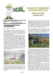
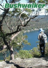
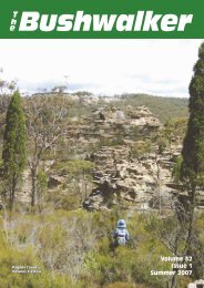
TheBushwalkerDead Snow GumsGrey Mare Range, KNP<strong>Vol</strong>ume <strong>32</strong>Issue 2Autumn 2007
The same place but separated in timeWhere and When?Answer on page 11 (no peeking!)
BushwalkerTheThe Official Publication <strong>of</strong> the<strong>Confederation</strong> <strong>of</strong> <strong>Bushwalking</strong> <strong>Clubs</strong> <strong>NSW</strong><strong>Vol</strong> <strong>32</strong> Issue 2, Winter 2006ISSN 0313 2684Editor: Roger Caffineditor@bushwalking.org.auGraphic Design: Roger Caffin(Because Barry Hanlon whonormally does it is away)<strong>Confederation</strong> OfficersPresident: Margaret Covipresident@bushwalking.org.auAdministration Officer:admin@bushwalking.org.auWebsite:www.bushwalking.org.auAddress all correspondence to:PO Box 2090, GPO, Sydney 2001The <strong>Confederation</strong> <strong>of</strong> <strong>Bushwalking</strong><strong>Clubs</strong> <strong>NSW</strong> Inc represents approximately65 <strong>Clubs</strong> with a total membership<strong>of</strong> about 10,000 bushwalkers.Formed in 19<strong>32</strong>, the <strong>Confederation</strong>provides a united voice on behalf <strong>of</strong> allbushwalkers on conservation, accessand other issues.It runs training courses for members,provides a free wilderness search andrescue organisation, and helps runsbush navigation competitions.People interested in joining a bushwalkingclub may write to the <strong>Confederation</strong>Administration (below) for a list <strong>of</strong><strong>Clubs</strong>, or to go to the <strong>Confederation</strong>website at www.bushwalking.org.au fora list <strong>of</strong> Member <strong>Clubs</strong>.Walk Safely—Walk with a ClubFrom the Editor’s Desk . . .For this issue we are continuing the tradition <strong>of</strong> having a cover photo <strong>of</strong> somewhere spectacularwith a bushwalker in the picture, but the next issue may be slightly different. I willbe overseas walking in France for four months when the next issue is being put together,and Barry will be looking after that issue. This is mentioned to illustrate the fact that weare still very much in need <strong>of</strong> volunteers to assist us with looking after and marketing themagazine. Yes, we still need someone with a bit <strong>of</strong> experience to help us with the advertisingand marketing, both for this magazine and the nascent ‘Bush Pages’ on the web site.<strong>No</strong> pay, but plenty <strong>of</strong> glory! Enquiries please to admin@bushwalking.org.au.For this issue I thought it might be appropriate to have a cover which reminds us <strong>of</strong> thehazard <strong>of</strong> bushfires to our National Parks. They swept acosss the Kosciusko National Parkin 2003, and devastated the snow gums and other vegetation. We will be living with thestark reminder <strong>of</strong> the damage for many years. In fact, you can still see the dead trees fromfires in the 1930s on Toolong Range for instance. However, as you can see, most <strong>of</strong> thesnow gums did survive at the roots, and are starting to regrow. This was on Grey MareRange, north <strong>of</strong> The Pinnacles.Sadly, I have to report that fires again swept through the Park last Xmas, and in someplaces all that hopeful young regrowth was scorched to death. The leaves were crisped,although the dead trees remained. But our trees are tough: walking through the reburntareas in March I saw the trees trying yet again to regrow. I hope they make it, but they arestruggling. If we have too many fires over the next few years we may lose our snow gumsover a huge area <strong>of</strong> Kosciusko National Park. Some parts <strong>of</strong> the farming lobby to controlburn the Park every year. An idea which would be sheer, utter, wanton, even criminal,destruction.We are still asking for good articles to print. <strong>Clubs</strong> and members are encouraged to submitrelevant articles, with a very strong preference for those with good pictures. We will alsoaccept articles from outside bodies where the articles seem relevant to members. Articlesmay be edited for length and content to help fit into our page limit. Pictures should be sentat maximum available resolution: at least 300 dpi, preferably in their original uneditedform. JPG, PDF or TIFF formats are preferred. The text should be sent if possible as aplain text file (*.txt) rather than in a Word file (*.doc). Please send the pictures separatefrom the text file; do NOT send them embedded in a Word doc file. And, <strong>of</strong> course, theEditor is always interested in receiving bushwalking books and maps for review. All enquiriesshould be sent to editor@bushwalking.org.au .Please note that opinions expressed by authors may not represent the <strong>of</strong>ficial opinions <strong>of</strong>the <strong>Confederation</strong> or any Club. The Editor’s opinions are his own.Roger Caffin, EditorSUBSCRIBE TO THE BUSHWALKERKeep up with all the news and developmentshappening in the <strong>NSW</strong> bushwalking scene foronly $7 per year. This is to cover posting andhandling: the magazine itself is free.Send your name and address and cheque ormoney order to <strong>Confederation</strong> <strong>of</strong> <strong>Bushwalking</strong><strong>Clubs</strong> <strong>NSW</strong>, PO Box 2090, GPO Sydney 2001.Make the cheque or money order payable to the<strong>Confederation</strong> as well.Also please indicate if you are a member <strong>of</strong>a bushwalking club, and if not whether youwould like a copy <strong>of</strong> the list <strong>of</strong> our clubs.IndexAn EPIRB on the Colo 4BWRS involved in Thredbo Search 5Jervis Bay Coastal Challenge 6Caleys Range and Camarthen Brook 8Why Katoomba 9Lyre Bird & Cascades Walk 11Understanding Scenery (Book Review) 13Wombat Waddles 14<strong>Vol</strong><strong>32</strong> Issue 2, Autumn 2007The Bushwalker |
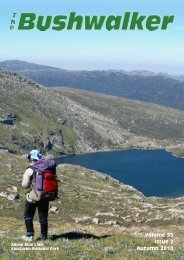
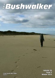
Walk Safely—Walk with a ClubAn EPIRB on the ColoPam slid down the one meter drop on toa narrow step and, pitched forward bythe momentum, she tumbled through thescreen <strong>of</strong> small bushes and head first downanother 1.5 meters. Her scream <strong>of</strong> alarmhad us looking in her direction and wewatched in horror as she tumbled like a ragdoll another 12 meters down a rocky slope,to fetch up and lie still against a small tree.She was lying on her back, legs slightlyuphill, left arm covering her head and facewhich when moved showed her eyes openbut vacant.Supporting her head I became aware <strong>of</strong>two things: she was breathing and my handwas covered in blood. Her legs and armswere in their correct positions and no majorblood flow was noted. When her packwas put under her head she made a smallmoaning sound and closed her eyes whichI took as a good sign.One <strong>of</strong> our party had gone into shock andwas assisted down the slope allowing Rosand Alison access to Pam. After an eternity- which we later decided was about 5-10minutes, Pam regained consciousness. Weasked her to move her legs and arms inturn which she did with out complaint andonly indicated a sore right shoulder whenasked. She had a confused look on her faceand asked what happened. It was decidedthat no movement and nil by mouth wasthe best policy. While first aid was beingadministered an operational test was carriedout on our new MT310 EPIRB.The accident was within 80 meters <strong>of</strong> alarge sandy stretch <strong>of</strong> the Colo River anda clear spot near the water in wet sand waschosen to site the EPIRB. A pack and gearcache was made on one end with coloured | The BushwalkerDon Finch, SBWclothing spread out, a note wasscratched into the wet sand and alarge H kicked out in the middle <strong>of</strong>the sand flat. It was about 1:30 pm.We waited.Pam was made comfortable at theaccident site and at one stage wasassisted to move into a more comfortableposition. She had memoryloss which slowly came back, nauseawhich came and went, and coldwhich was alleviated by additionalclothing, a space blanket and Alisonand Ros in turns sitting behind andThe tip <strong>of</strong> the spur where the fall happened cuddling Pam in a sitting position.The private day walk over Mt Townsend A fire was made and several aluminiumbottles <strong>of</strong> water were heated directly inand down to the Colo River via Pass 35 onAnzac Day 2006 was progressing smoothlyright up until the dead stick broke. this also helped to keep the patientthe fire, a sock was put over the bottles andwarm.About 4:30 pm we decided that a secondstring was required. Alison and Laurenvolunteered to go 4 km down the river toa marked road and another 2 km on to thehouses, where they hoped to find a phoneand raise the alarm, collect two cars andmeet us at the end <strong>of</strong> the road in the morning.With contact names, telephone numbersand car keys they set <strong>of</strong>f at the trot: itwas 4:45 pm.Preparing to send a party out for helpAbout 5:30 pm the unmistakeable and verywelcome sound <strong>of</strong> the Westpac helicopterwas heard. Within minutes it was on thesandbank and the crew were racing towardus. They quickly explained that lack <strong>of</strong>light was a real threat and that they neededto act quickly to evacuate Pam. While goingup to the accident site we explainedPam’s accident, her symptoms, her slowimprovement and our circumstances. Aftera rapid assessment they asked Pam ifshe could and would stand - which she didwithout trouble. Pam was rapidly movedto the river and loaded into the Helicopter.It was with a feeling <strong>of</strong> utter relief that Iwatched that helicopter draw effortlesslyinto the darkening sky and away. Alisonand Lauren would have also seen the Helicopterand known what that meant.We then collected ourselves and did a stockPolair to the rescuetake <strong>of</strong> food and gear. There was plenty <strong>of</strong>food (we had Pam’s food as well) for dinnerand breakfast. We were out for a daywalk and did not have over night sleepinggear with us, but we did have cold weatherclothing with fibre pile jackets and Gore-Tex parkas. Nevertheless a cold night wasspent in rotisserie mode in front <strong>of</strong> the firewith the coldest person waking occasionallyto put another log on the fire.In the morning we waited until 7:00 am asrequested by the Helicopter crew and thenstarted to walk down the river. Followingthe girls’ tracks we saw three sets <strong>of</strong>dingo prints beside their footprints all theway down the river. The Polair Helicopterpicked us up about 8:30 am about 3.5 kmsdownstream. We were taken to Colo wherethe police had set up their command post.As Lauren and Alison were still unaccountedfor we set <strong>of</strong>f in the police vehiclesback to our cars at Bob Turners Track.Arriving there we found two <strong>of</strong> our carsmissing. As expected, the girls had takenthe cars back down to the river and up tothe end <strong>of</strong> the road and were waiting andwondering what had happened to us.It turned out they had run out <strong>of</strong> daylightthe night before and had spent a cold nightsleeping on the river bank. In the morning,not 30 meters down the river, they foundthe track and the sign to the Meroo picnicarea. The kindly couple at the first househad allowed them free access to theirphone and given them a lift to the Putty<strong>Vol</strong><strong>32</strong> Issue 2, Autumn 2007
Road where my daughter Kylie pickedthem up and drove them to our cars.Finally, all together again, we gave lots <strong>of</strong>thanks to the police for worrying about usand then we set <strong>of</strong>f to ring up to find outhow Pam was getting on. A stitch in thehead wound, two cracked but not displacedBWRS in Actionribs, a bruised shoulder, a bruised backmuscle, lots <strong>of</strong> small abrasions and bruises,but nothing serious. Pam was carefullyprocessed at RNSH and released into herdaughters’ care where she stayed for fourdays until the stitch came out.Our heart-felt thanks and gratitude go toWalk Safely—Walk with a ClubGe<strong>of</strong>f Dale (for Thredbo) & Keith Maxwell (for Cloudmaker)ThredboCloudmakerOn 20th February 2007 Bushwalkers WildernessRescue Squad was put on standby.A 55 year-old, Ge<strong>of</strong>f Haiden, had not returnedfrom a day trip near Thredbo in KosciuszkoNational Park. A meeting pointwas set at Jindabyne Police Station for 6:30am. (Five BWRS members were able to attendincluding one member who was strategicallyholidaying in Jindabyne!!)At the Police briefing more details emergedAfter having lunch with his wife near TheChimneys south <strong>of</strong> Thredbo the pair madethe mistake <strong>of</strong> separating for their returnjourney. Mr Haiden had not been seensince. While he had been out for two nightsthe overnight temperatures had not been ascold as what they can be in this area.Several rescue organisations were present:BWRS, Police Rescue, SES, VRA, NPWS,and ‘Alpine Police’. The search was assistedby helicopter (PolAir), horse and threesix-wheel ‘All-Terrain Vehicles’.The BWRS team was tasked to search thearea around Smiths Gap and Mount Terrible(not as bad as it sounds!). Access wasvia the Cascade Trail and Boggy Plain.Conditions and views were pleasant – a bitmore rewarding as a day out than the slopes<strong>of</strong> Mt Solitary in December. After coveringour assigned area with some ‘contour’searching, we moved back to the northernslopes <strong>of</strong> Chimneys Ridge with the aim <strong>of</strong>joining forces with another search team.The BWRS team had just started movingagain when the good news came over thepolice radio that Ge<strong>of</strong>f Haiden had beenfound in good health - by South Coast VRA– a squad that BWRS has worked with before.Enjoy the world’s mostcomfortable wilderness: clearskies and pleasant temperatures,weather so perfect you can leaveyour tent at home.everybody involved, the people in Canberraat the RCC, the staff and crew <strong>of</strong> theWestpac Helicopter, the <strong>NSW</strong> Police Windsor,the Polair crew and the medical staff atRNSH. It is very reassuring to know thatwhen you really need help there are peopleout there listening.WILLIS’SEnjoy Summer in WinterYou see no one else, no tracks,no 4WD’s, no trail bikes, no farms– the only signs that anyone hasbeen there before are theAboriginal rock paintings thatdot the landscape.Have a swim with every break:clear tropical pools, perfect forswimming, pure enough to drink.Every night brings anotherbeautiful, spacious camp site.BWRS played an important role in theApril search for a missing man who hadbeen attempting to walk from Kanangra toKatoomba in the Kanangra Boyd NationalPark. Multiple emergency services overseveral days covered an area from GingraCreek, High Gangerangs to the Cox’s Riversearching for this walker last seen on GoodFriday near Mt Cloudmaker.Using local bushwalking knowledge BWRSdecided to search up Dex Creek from TiWilla Ck and were able to locate lost gear(presumably from the missing walker) onSunday 16th April. Using this informationPolAir were able to locate the deceased person.Other emergency services were impressedby the hard country BWRS teamswere able to search. BWRS received greatpraise from the <strong>NSW</strong> police for their efforts.WALKABOUTSEscape tothe <strong>No</strong>rthWe handle the hassle, organisethe transport, cook your eveningmeals and share the knowledgegained from 30 years <strong>of</strong> walkingin the region.Want more info?Visit our website or askfor our brochure.Plan ahead and save with ouradvance purchase discounts.Solea Falls Drysdale River NPwww.bushwalkingholidays.com.au12 Carrington St Millner NT 0810Email walkabout@ais.net.auFax 08 8985 2355Phone 08 8985 2134<strong>Vol</strong><strong>32</strong> Issue 2, Autumn 2007The Bushwalker |
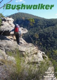
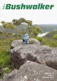
Walk Safely—Walk with a ClubOn the weekend <strong>of</strong> February 17th & 18th2007 I joined 10 other members <strong>of</strong> theShoalhaven Bushwalkers, led by Karen.This was a 2 day walk for 45 km along thecoastline <strong>of</strong> Jervis Bay, south <strong>of</strong> <strong>No</strong>wra on<strong>NSW</strong> South Coast.Ideally the walk shouldhave commenced atPoint Perpendicular,but due to the choice<strong>of</strong> a long section <strong>of</strong> eitherboring dirt roadsor inaccessible ruggedcoastline this was impractical.Instead wecommenced at HoneymoonBay on theBeecr<strong>of</strong>t Peninsula.We used a series <strong>of</strong> carshuffles, gear relocationsand kindness <strong>of</strong>friends and relativesso we could carry daypacks over the 2 days.Jervis Bay Coastal ChallengePaul EllisIt was hot and sunny and the tide was quitehigh, but this did not restrict our progress aswe left tiny Honeymoon Bay and followedthe rocky coastline northwards, crossingBindijine Beach and negotiating rock platformsto Figtree Inlet. Then we detouredthrough the scrub around the rocky pointRock Platform south <strong>of</strong> Long Beachto Long Beach where we had a break at thesouthern end, allowing some <strong>of</strong> our groupto take a quick swim. Wemade our way around MontaguePoint and across thesmall Cabbage Tree Beachand Point and then madeour way across the rockycoast towards Green Pointand Green Island. This smallisland is used as a rookeryfor many sea birds, and todaymany could still be seenroosting on the island’s northernside out <strong>of</strong> the wind. Wefollowed Chinamans Beachnorthwards to Carama Inlet.A beach is not what I wouldcall it: more like mud flats which <strong>of</strong> coursewere dominated by mangroves.We arrived at our first major obstacle onthe walk: Carama Inlet. A fellow clubmember, Colin, had paddled his tiny kayakacross the bay from his home at CallalaBay to say hello and he was to becomemost helpful with the crossing. The tidehad gone out significantly by the time wereached this 300 metre stretch <strong>of</strong> seagrassand s<strong>of</strong>t sand. Colin used his kayak to ferryseveral rucksacks across the stretch <strong>of</strong> waterwhile we braved the knee deep water.The trouble was that as soon as we reachedthe seagrass we sank to our knees in thes<strong>of</strong>t mud and sand and each energy sappingstep became an ordeal. It was a verytired bunch that gathered on the far bankto clean up, adjust footwear and packs andcontinue on.From here we followed the beaches <strong>of</strong> HareBay to the shaded platform below the cliffat Red Point, where we stopped for a wellearned lunch break and possibly even aswim. Our arrival was greeted with a show<strong>of</strong> breaching dolphins just <strong>of</strong>f the edge <strong>of</strong>the rock platform and this was only exceededby the sight <strong>of</strong> a lone Fairy Penguinat the water’s edge as we moved <strong>of</strong>f downthe beach some 30 minutes later. Then wecrossed the beach westwards towards CallalaBay, made our way around CallalaPoint and followed the 6km <strong>of</strong> sandy beachto Currambene Creek at Huskisson.Thankfully the tide was now very low andthe creek was divided by a long sandbar inthe middle, we only had a short 25 metreswim and wade across the creek. Our overnightstay in Huskisson was at the home <strong>of</strong>Alan (another club member), who kindly<strong>of</strong>fered us the use <strong>of</strong> the ground floor <strong>of</strong> hisThe final stretch <strong>of</strong> the crossing at Carama Inlet | The Bushwalker<strong>Vol</strong><strong>32</strong> Issue 2, Autumn 2007
Heading along Long Beach towards Montague Pointhome on the banks <strong>of</strong> Currambene Creekfor our overnight accommodation. Thiswas an excellent alternative to camping inthe local caravan park’s camping area orbooking a night in one <strong>of</strong> the many localMotels. We were able to shower, changeinto clean clothes and gather on Alan’s verandahoverlooking the sights <strong>of</strong> Jervis Baywith post-walk drinks and nibbles.for thewind to pick up before takingto the water.From Plantation Point ourgroup split into two, sometaking the beach and rockplatforms, others taking abush track on the clifftopsabove. We all met up againThe next morning, suitably refreshed and at Greenfields Beach andrecovered, we set <strong>of</strong>f from Alan’s place, followed the White Sandswalked through Colour Huskisson ad: 190mm and wide followed x137mm Walking high Track to Hyamsa pathway The above Bushwalker and along the April coast. 07 We Beach where we foundcrossed Moona MoonaCreek via the road bridgethen followed the bikepath behind CollingwoodBeach to Vincentia. Some<strong>of</strong> us diverted to the nearbybakery for refreshments,but we all met up again atPlantation Point for morningtea after following thecoastal rock platforms andsmall beaches. We alsopassed the very colourfulfleet fromthe HobieR e g a t t awho werew a i t i n gWalk Safely—Walk with a Cluba shady spot for lunch. Our next 3km <strong>of</strong>beach walking took us to the local NavalAcademy - HMAS Creswell, where ourleader had organised approval from thecommanding <strong>of</strong>ficer to walk through thegrounds. We still had to phone through onour approach, but were able to pass throughthe base without challenge.Some <strong>of</strong> our group were now suffering fromthe walk with the water crossings contributingto s<strong>of</strong>t feet and wet clothes. As suchblisters and chafing became items for concern,but everyone was determined to fin-Bushwalkers making their way through ‘Hole In The Wall’ duringa very low tideEXPLORANGES25yrs SA Ow ned & O peratedESTABLISHED1981<strong>Vol</strong><strong>32</strong> Issue 2, Autumn 2007The Bushwalker |
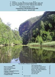
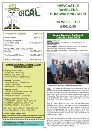
Walk Safely—Walk with a ClubCaleys Range & Camarthen Brook[Just to show that not all bushwalks aredone in fine sunny weather - Ed]Our initial group rendezvous was at Macdonald’sRichmond at 07:00 for c<strong>of</strong>fee beforesetting out. By 07:50 we were parkedat Berambing at GR 622 863. There wasa bit <strong>of</strong> rain in the air as packs were loadedand grudgingly wet weather gear wasdonned. There really is little point in wetweather gear when you do exploratorywalking. There is always a spot for waterto get in and once you are on the moveyour own perspiration has all your clothessoaking in no time. Better to relax, getwet, but be ready to put on gear when youstop, and to have some warm dry gear forthe end <strong>of</strong> the day.Fun time in the (wet) scrubBy 08:00 it was raining seriously. The threat<strong>of</strong> the recent fires further up the Grose Valleyhad had the locals grade the fire trailacross the south side <strong>of</strong> all the propertiesMost thoughts were concentrating on findinga dry overhang for lunch. Several opishthe walk. Although the group was wellspread out, with the least injured setting agreat pace, everyone eventually finished.We made our way along the beaches atIluka, Greenpatch and Bristol Point, ourfinishing point at Governor Head nowwell within our sights. We passed ScottishRocks and scrambled through ‘Hole InThe Wall’, then rock hopped the low tide toMurrays Boat Ramp and Murrays Beach.The last section saw a north-easterly windin our faces, but the cool breeze was mostJervis Bay, continuedMichael Keats, The Bush Cluband down the Caleys Range for some kilometres.Progress was easy. At 08:48 andagain at 09:00 GPS readings were taken toverify our position. We overshot the shortsouthbound fire trail <strong>of</strong>fshoot shown on themap – it is now almost indistinguishablefrom the forest. A bit <strong>of</strong> back tracking toGR 647 845 and then it was headlong SWinto the wet, wet scrub and undergrowth.Remnants <strong>of</strong> the track could be found hereand there for about 800 m, then it wasobvious from the small rock cliffs that itwent no further. We set the compass on duesouth, and following the crest <strong>of</strong> the ridgewe made excellent progress. Some greatrock platforms and stunning colours inmulti-stemmed eucalypts (Eucalyptus burgessiana)made for unforgettable photos.Prospective member Lysia was a delightfuland willing model. All prospectives pleasenote!As we pushed south there were occasionalviews <strong>of</strong> the Explorers Range through theshifting mist, and closer at hand the plummetingdepths <strong>of</strong> Tallara Brook were emphasisedby vertical cliff faces. There washardly time to take it all in before the curtain<strong>of</strong> white was again drawn. At approx10:00 and GR 644 825 we broke throughthe first cliff line <strong>of</strong> the descent and found adry overhang. Please can we have morningtea? Yes, a good idea.The dry floor had a series <strong>of</strong> very interestingfootprints. Steve speculated aboutwhat birds/animals might be using thearea. Some <strong>of</strong> the footprints appeared to befrom large birds. The usual conical pits <strong>of</strong>ant lions and the trails <strong>of</strong> surface wormswere common.Time to move on. In the next 500 m wedescended 300 m. At times it appeared thatthere was no way, but we always found aramp or chute or convenient tree and thedescent was easily accomplished. Finallyrefreshing. A short scramble took us up tothe cliff top on Governor Head where weall gathered to celebrate 2 days <strong>of</strong> greatwalking. We only had the one kilometrewalk back through coastal forest to whereseveral cars had been parked at MurraysBeach Car Park, followed bya drive backto Alan’s at Huskisson to retrieve our overnightsleeping gear.[All pictures by Brett Davis, ShoalhavenBushwalkers]we stood in the pouring rain on the bank <strong>of</strong>Carmarthen Brook at 11:15, GR 647 820.It was so hot and I was so wet that I took<strong>of</strong>f my wet weather jacket. As I was wetanyway the increased freedom <strong>of</strong> movementwas a great improvement.A little light rain in the valley?At this point the Brook is a confused mess<strong>of</strong> slippery boulders, shallow pools, smallsandy patches and heavy vegetation. Thebanks are very variable in width and continuity.The prospect <strong>of</strong> pushing through thisfor a kilometre plus to the Grose River inthe rain was not appealing, particularly asthe mist and rain prevented good lines <strong>of</strong>sight. There was quick acceptance to theidea <strong>of</strong> abandoning that extension and immediatelycontinuing upstream to TallaraBluff.Leading the charge was no different to beingat the tail. It was all wet and all thickand slow going. Our way <strong>of</strong> route variedfrom creek walking and boulder hoppingto bush bashing, some wading and a lot<strong>of</strong> under and over work with fallen trees.Good stuff. On the talus slope <strong>of</strong> MountBarranbali there is a micro- environmentwhere Birds Nest Ferns (Asplenium australasicum)and the epiphytic orchids,(Bulbophyllum shepherdii) and Dendrobiumstriolatum abound. All the usual array<strong>of</strong> mosses and ferns including Pyrrosiarupestris are also present in large quantitiesmaking the area a special place; in therain and mist it was even more so. | The Bushwalker<strong>Vol</strong><strong>32</strong> Issue 2, Autumn 2007
If there’s no riverbank to walk on ...tions on the lower cliffs <strong>of</strong> Mount Barranbaliwere considered and then abandoned- too high up and possibly with slopingfloors.As Carmarthen Brook swung from NW toW the going became easier and our rate <strong>of</strong>progress increased. Then we were on a kind<strong>of</strong> tumbled rock apron where Tallara Creekjoins Carmarthen Brook. A quick look upthe Tallara Creek showed a small pleasantwaterfall in a very steep ravine.After crossing Tallara Creek the easternnose <strong>of</strong> Tallara Bluff immediately presentedand climbing began. About 50 m upright on the bluff a cave appeared. It wasideal for lunch – dry! Unlike most caves oroverhangs it consisted <strong>of</strong> a wide cleft parallelto the nose <strong>of</strong> the bluff and toppedwith an oversize chock stone. The floorwas dubious. Kicking some leaves asideas I sat down showed a continuation <strong>of</strong>the same cleft that formed the cave spacewith little or nothing underneath but loosefill. I sat very still during lunch.We set the GPS up on a nearby rock andgained a reading: GR 639 823. Outsidethe rain eased up. However the mist continuedto swirl around giving transientviews <strong>of</strong> the cliff lines on the eastern side<strong>of</strong> Tallara Creek (70m) and the northernside <strong>of</strong> Mount Barrenbali.At 12:45 with packs a bit lighter we continuedthe upward climb, staying closeto the nose. The rocks have weathered tomake a long gentle slope with occasionalrock screes. It is a very easy climb. Wherethe rocks are well positioned to capturemoisture they are crowned with rock lilies(Dendrobium speciosium). Interspersedwith them is the Hare’s Foot Fern, Davalliasolida var.pyxidata. Matched with a particularlybrilliant lime green moss and theubiquitous grey lichen, it was like walkingin a garden.Deep and wet leaf litter slowed us downa bit as there was <strong>of</strong>ten need to secureone foot before shifting the other. Rapidprogress was still made. We knew that anold timber trail was not far away whenthe cut stumps <strong>of</strong> former forest giants appeared.We pushed on and soon were highenough to be walking in cloud all the time.Eerie quiet and wet. We joined the old firetrail at 13:30.Walk Safely—Walk with a ClubAfter a quick drink we shouldered ourpacks and set <strong>of</strong>f. At GR 6<strong>32</strong> 8<strong>32</strong> the oldroad is very close to a 90 m cliff edgeabove Tomah Creek and facing west. Ona clear day the view includes all the mainfeatures <strong>of</strong> the Explorers Range and MountHay. Today it was a wall <strong>of</strong> wet whiteness.Took some great photos here <strong>of</strong> misty bushwalkers by a rock pool. Very special.A rock pool in the mistBy 14:45 we had reached the cars, wherethe rained eased enough to changed intodry gear. After that we adjourned to ThePines for refreshments.[Grid reference given are from the NEWseries <strong>of</strong> topo maps.]In 1827 Thomas Livingstone Mitchell arrivedin Sydney and was appointed to theposition <strong>of</strong> Deputy Surveyor General. Thefollowing year, 1828, he became the SurveyorGeneral <strong>of</strong> New South Wales owingto the death <strong>of</strong> John Oxley. Mitchell heldthis position until his death in 1855. Hewas a prominent public figure and duringhis term <strong>of</strong> <strong>of</strong>fice served under five Governors,(Darling, Bourke, Gipps, FitzRoy andDenison). He was amongst other things anexplorer, surveyor and road builder(1).Mitchell had a team <strong>of</strong> over twenty SeniorAssistant Surveyors, Assistant Surveyorsand draftsmen working for him(2). Anumber <strong>of</strong> surveyors had carried out surveyingwork on the mountains initially underSurveyor General John Oxley - George<strong>Vol</strong><strong>32</strong> Issue 2, Autumn 2007Why KatoombaBrian FoxEvans, James McBrien and Robert Hoddle,and during Mitchell’s term FrederickD’Arcy, William Stapylton, Francis Rusden,Robert Dixon and William RomaineGovett were included.One ruling in which Mitchell was adamantabout was the use <strong>of</strong> Aboriginal nameswhere possible and in a letter to one <strong>of</strong> hissurveyors (Elliot) in June 1828 he wrote“that you will be particular in noting thenative names <strong>of</strong> as many places as you canin your map <strong>of</strong> that part”(3).In fact on the bottom <strong>of</strong> all standard monthlyreport sheets was the wording “NativeNames <strong>of</strong> places to be in all cases insertedwhen they can be ascertained.”Mitchell not only reiterated this theme <strong>of</strong>Govett’s CascadeThe Bushwalker |
Walk Safely—Walk with a Clubnative names but also took to task thosewho disobeyed his directions. On the 5thSeptember 1828 Mitchell issued a memoto all his surveyors to establish uniformityin spelling and pronunciation(3).William Govett in his surveying <strong>of</strong> the areaaround Blackheath In June 1831 recordedthe sight <strong>of</strong> several waterfalls as Cascades.Govett had first cited the waterfall to bearhis name either on the 1st or 2nd June (4)and his monthly report for 6 & 7 June 1831records ‘heavy rain’ and on the 10th Junehe ‘surveying the range near Cascade’(5),so Govetts Leap must have been spectacularsight to witness. Mitchell conferred thehonour <strong>of</strong> naming one <strong>of</strong> these waterfalls,Govetts Leap. As to the paragraphs aboveon the use <strong>of</strong> native names, we can only assumethat it was not possible to record anyAboriginal name for this waterfall. Just asBlaxland, Wentworth and Lawson had littleAboriginal contact on the mountain ridges,so it was for the Mitchell’s surveyors.Evidence shows that this area was frequentedby the Gundungurra people by thenumerous axe groove sites, occupationalsites and rock art sites which have been citedand recorded by many people includingmy brother and myself on our exploratorybushwalks in the Linden Ridge area.It was the well-watered fertile soils <strong>of</strong> theBurragorang Valley(13) where food andgame would have been plentiful that Govettmade contact with the local Aboriginalpeople. Here that Govett not only learnt thename <strong>of</strong> the local area but also some <strong>of</strong> thenames <strong>of</strong> the surrounding hills(6). Govetthad originally recorded the name <strong>of</strong> KedumbaRiver as Cascade Creek since one <strong>of</strong>its tributaries flowed from the ‘cascades’,the waterfall we now know as WentworthFalls. The surrounding hills were MountSolitary, ‘Munmie’, Mount Victoria,‘Gundingbla’ and the hills at the southernend <strong>of</strong> Narrow Neck Plateau which formthe major watershed between Jamison andMegalong Valleys, and ‘Mouin’.The aboriginal word for the location <strong>of</strong>the junction <strong>of</strong> the Coxs River and KedumbaRiver was ‘Godoomba’, as Govett10 | The BushwalkerLooking across the Kedumba River to Mt SolitaryQueens Cascadesrecorded it in his letter to the SurveyorGeneral 25th <strong>No</strong>vember 1833. Thisa was aderivative <strong>of</strong> what is now Katoomba. <strong>No</strong>tonly was the word Godoomba recorded byGovett, but he also used phonetic symbolsabove the letters to help in future pronunciation.Neither Govett’s letters tothe Surveyor General nor his articlesto The Saturday Magazine inLondon between the years 1836-37 (7) explain what these symbolsmean. However a requestto Indigenous Services, State Library,Sydney informed me thatGovett’s used Standard Englishphonetics. The cup shaped symbolabove the first o and a called‘breve’ indicate a short soundwhile the dash above the double ocalled ‘macron’ emphasise a longsound. When I asked about the use <strong>of</strong> theletter G and K as in Godoomba and KatoombaI was informed that the letters areinterchangeable depending on who translatedthe word.So it is with thanks to our early surveyorsthat in <strong>No</strong>vember 1833 our first spellingand name <strong>of</strong> Katoomba was recorded.However numerous other spellings <strong>of</strong> Katoombahave been seen, including, Codumbawhich appears on the Map <strong>of</strong> the County<strong>of</strong> Cook, 1843, which was compiledexpressly for the printers and publishers<strong>of</strong> the Australian Atlas by William BakerHibernian printing Office, Sydney(8).Other spelling such as Go Doom Ba andGoodomabah appear to be corruptions <strong>of</strong>Govett’s recorded name as opposed to firsthand interpretation(9).It was another Surveyor John Deering whoin a letter to Surveyor General Adams in1876 recorded the first use and spelling<strong>of</strong> the name Katoomba as we know it today(10).As well as different spellings wealso have different interpretations <strong>of</strong> thename Katoomba. One was Harry Peckmanrecalling “the late Hon. James Henry Nealewho is said to have brought an ancient gincalled Black Betty, <strong>of</strong> the Kanimbla tribe <strong>of</strong>blacks to identify and give the native nameto the locality”(11). Another is from JimSmith’s talk at the 2006 Blue MountainsHistory conference in which Jim highlightedthe misinterpretation <strong>of</strong> the Aboriginaland European cultures in identifying theAboriginal name <strong>of</strong> Katoomba Falls.The locality <strong>of</strong> Katoomba has changedover the years from Town status to thepresent status <strong>of</strong> Suburb within the LocalGovernment Area <strong>of</strong> the Blue MountainsCity Council(12). The name itself has beingtransferred from its location down inthe Kedumba Valley, has under gone variousspellings, pronunciations and originsbut still remains as a proud name in honouringour Aboriginal heritage.Fortunately Govett’s maps have survivedand can be found in the State Archivesand the Mitchell Library in Sydney. What<strong>Vol</strong><strong>32</strong> Issue 2, Autumn 2007
David Lawrence, Armidale BushwalkersA motley crew <strong>of</strong> walkers gathered at 7:00 walked in from the Robinson’sam at Armidale Visitor’s Centre, a littleKnob/Wrightssurprised at the cool morning after anearly start to avoid the heat. We caught upwith the Christmas gossip, filled in waiverforms, and sorted out cars to leave at 7:15am. (If someone hasn’t turned up by then,bad luck). Our convoy arrived at the agreedmeeting place- the information board atNew England National Park entrance.While Frank, Sharareh, Ryan and ColinLookout carpark, the restleft from Banksia Pointdown the top section <strong>of</strong>Lyrebird to its junctionwith the Treefern Valleytrack, then down itto lower Lyrebird. Themist and fog that swirledaround us encourages thegrowth <strong>of</strong> thevery attractiveS<strong>of</strong>t TreeFern (Dicksoniaantarctica)and KingFern (Todeabarbara). Theonly tree here is the AntarcticBeech (<strong>No</strong>th<strong>of</strong>agus moorei),clothed with moss and smallferns.Walk Safely—Walk with a ClubLyre Bird & Cascades Walk, New England NPHeavy Rainforest coveris unfortunate is that only two <strong>of</strong> WilliamGovett’s survey field books have beenlocated. Col King Manager <strong>of</strong> the SurveyPlan Room, Department <strong>of</strong> Lands,Sydney informed me that it was not arequirement for surveyors to hand backtheir field books. A subsequent search <strong>of</strong>the Department <strong>of</strong> Lands in Sydney andBathurst, State Records in Kingswoodand The Rocks, Victorian State Libraryand archives and an email request to theBritish Library Maps Division and UnitedKingdom National Archives have failed toturn up any other <strong>of</strong> Govett’s survey fieldbooks.References:-(1) Sir Thomas Livingstone Mitchell andhis World, 1792-1855, by William Foster,1985, pp i-ii.(2) Major Mitchell’s Map 1834, The saga<strong>of</strong> the Nineteen Counties, by Alan Andrews,1992, pp 25-28.(3) Major Mitchell’s Map 1834, The saga<strong>of</strong> the Nineteen Counties, by Alan Andrews,1992, pp 72-73.(4) Blackheath Today from Yesterday, editedby Peter Rickwood and David West,2005, pp 56-70.Why KatoombaThe track was a bit slipperyand uneven, but we soon cometo the first <strong>of</strong> three gullies withsmall waterfalls. The second(5) Surveyor General letters received fromSurveyors. Reel <strong>No</strong> 3069, Monthly ReportJune 1831, Land and Property InformationLibrary, Bathurst.(6) Surveyor General letters received fromSurveyors. Reel <strong>No</strong> 3069, Camp MountClarence 25th <strong>No</strong>vember 1833, Land andProperty Information Library, Bathurst.(7) Sketches <strong>of</strong> New South Wales Writtenand Illustrated for The Saturday Magazinein 1836-37 by William Romaine Govett,Gaston Renard publisher, 1977.(8) State Library, ML: ZM2812.17/1843/1.(9) Old Leura and Katoomba, presented byThe Rotary Club <strong>of</strong> Katoomba, 1986, p9.(10) State Records, <strong>No</strong>tes on Parks,CGS8287 item 11/22039.(11) The Blue Mountain Echo 30th May1913, p5, col 5.(12) Geographical Names Board, Registerextract for Katoomba.(13) Survey Plan C1511.1507, dated 13thDecember 1890, junction <strong>of</strong> Coxs and KedumbaRiversCascades Walk<strong>of</strong> these was the largest creek and carewas needed to negotiate the slippery rocksand some rotted steps. Rainforest trees inthese gullies include Sassafras (Doryphorasassafras), which has grey bark, and Possumwood(Quintinia sieberi), which haswrinkled brown bark. We brushed asidecurtains <strong>of</strong> the Hanging Moss (Papillaria),and sloshed through Rainforest Spinach(Elastostema reticulatum) in the wettestspots.After passing through an area <strong>of</strong> more openforest, the track emerged onto the RobinsonsKnob Fire Trail, near where severaltracks branch <strong>of</strong>f. We turned left, and about50 metres down, met the other crew makingthemselves comfortable (after negotiatingWright’s Lookout) on the new seatbuild at the entrance to the Cascades trackin honour <strong>of</strong> a botanist and environmentalistJ B Williams.The Cascades loop track descended steeplydown to Five Day Creek. As we reachedthe bottom, about an hour from the Williamsseat, the growth <strong>of</strong> ferns and mossesincreased. The creek itself was very beautiful,chuckling busily over moss-greenboulders, smooth and slippery as polishedglass. We teetered downstream about 200metres to the bay window where it surgesover vertical drop into the rainforest valleybelow. Carefully returning, we did a hur-When and WhereBlue Gum Forest <strong>of</strong> course.The first was taken in the hippy era around1972. The young girl had been helpeddown DuFaur Buttress, and was carried upthe Gordon Smith Chimney.The second was taken in 2006.<strong>Vol</strong><strong>32</strong> Issue 2, Autumn 2007The Bushwalker | 11
Walk Safely—Walk with a ClubFive Day Creekried leech check (lots!) before followingthe creek upstream. There was only theghost <strong>of</strong> a track, and it required thoughtand careful foot placement to avoid a suddensit down - or worse, a slide down intothe creek.When we paused for a break we admiredthe deep gloom <strong>of</strong> ferns pierced by the occasionalshaft <strong>of</strong> sunlight onto a little cascadehere and a mossy treetrunk there. Theprize for me was the luxuriant growth <strong>of</strong>the Cascades Silver Lily Neoastelia spectabilis.This is the new genus that John Williamshad discovered at this site. It has bigarching leaves about 120 cm long and 6 cmwide, with a brightly green upper surfacegreen and a silvery-white lower one. We’dmissed the spray <strong>of</strong> white flowers it bearsin December, but the bright green 15 mmberries were also a feature.A few more slips – we’ve written to theNational Parks asking that this be sectionbe designated a ‘route’not as presently a ‘track’- and we were back intothe solid going. Soon wewere back at John’s seat,where we ate a leisurelylunch. The 3 headedback up Robinsons andhome while the remaindertook the top loop <strong>of</strong>Lyrebird. We were especiallykeen to show Lee,a Canadian zoologistvisiting with husbandJames, one <strong>of</strong> the Lyrebirdswhose scratchingscovered the path inplaces. <strong>No</strong> sitings, butwe were lucky enough to hear one imitating5 different birds on the climb up to theplateau. Attenborough’s “Life <strong>of</strong> Birds”featured the Lyrebird as the greatest mimicin the bird kingdom, and some <strong>of</strong> the footageto support this claimwas shot just a bit furtherup the track.On reaching the plateau,we remarked on the lichen-coveredsign putup in the early 1930sby the first ranger, MrC C Moseley. The rockshows through here, andthe thin soil supports alow open forest <strong>of</strong> SnowGums (Eucalyptus pauciflora)as well as moreMessmate Stringybarks(Eucalyptus obliqua) inplaces. Shrubs includedHill Banksia (Banksia collina), MountainBaeckea (Baeckae utilis) and a pea, Eggsand Bacon (Dillwynia retorta).Many <strong>of</strong> us were disappointed that thegood viewpoint over the Upper MacleayRiver valley was blanked out by the persistentfog. (I’ve included a photo taken inclearer times, so the newcomers will knowwhat they missed).Shortly, the track dropped back down intotemperate rainforest containing AntarcticBeech, Tree Heath (Trochocarpa montana),Pepperbush (Tasmannia stipitata) and TreeFerns. After Treefern Valley junction webacktracked to Banksia Point.We drove up to the shelter shed at PointLookout (1562 m - visibility zilch) and amerry celebration <strong>of</strong> Paul’s birthday, withcake, candles, chocolate slice, and chatwith an American who had walked fromBrisbane (?) to here in a little over a month,The View from Point lookoutKahurangi National ParkNew Zealand’s second largestand most diverse parkGuided walks from wilderness coast tomountain peaks including the renownHeaphy Track & many more!and was seeking information on routeson to his destination (Melbourne!).Peter and Paul gave such good advicethat they were elected Secretaryand Walks Coordinator respectivelyduring our brief <strong>of</strong>ficial AGM. <strong>No</strong>other positions were changed, soTreasurer Kathy hastily wrote membershipreceipts while the rest <strong>of</strong> ussc<strong>of</strong>fed chocolate cake and her excellentslice. A pity about the lack <strong>of</strong>the view that gives Point Lookout itsname, but the mist brought out all therainforest greens, and makes a goodviewing day a special event. Maybenext time?Bush & Beyond Guided WalksPh/fax: +64 3 528 9054Email: info@bushandbeyond.co.nzWeb: www.bushandbeyond.co.nz12 | The Bushwalker<strong>Vol</strong><strong>32</strong> Issue 2, Autumn 2007
Walk Safely—Walk with a ClubThe winter snow around Kosciusko NPjust ain’t what it used to be. The Wombatthought it was time to try a differentapproach: instead <strong>of</strong> gracefully glidingacross the snow on skis, waddling aroundon snow shoes would be tried.Of course,when yousee what thesnow hasdegeneratedto thesedays, youw o u l d n ’ twant to riskyour skisa n y h o w .Some havereferred toYowies, and joggers it as ‘goodc o n d i -tions for hire skis’, which is a bit roughon the hire companies. Besides, travellingon snow shoes is more like ... well,bushwalking. And you don’t risk thosesmash-ups when the skis develop a mind<strong>of</strong> their own on (or under) icy crust either.Well, anyhow, some Yowie snow shoeshad been acquired and it was time to trythem out.View West from <strong>No</strong>rth Bulls PeakThe fun thing about snow shoes is that ittakes only about five minutes to learn howYoungs for both walkers and also the Park.I recommend this book as an interestingread and as an indispensable companionfor your day pack when planning walks andwalking in Royal and Heathcote NationalParks. I hope that it encourages production<strong>of</strong> similar works for other National Parks.Wombat Waddlesto walk with them while wearing a pack,rather than the five years it seems to take tolearn how to handle XC skis with a pack.They just seem so easy. In addition, theWombat found that ordinary comfortablejoggers were just fine on the Yowies.The next thing learnt was that snow shoesare much lighter than skis: either on yourfeet or on your pack. Add to that the factthat a pair <strong>of</strong> these snow shoes costs onlya fraction <strong>of</strong> what a full ski outfit costs -boots, skis, binding, poles and medicalinsurance. They do have advantages. Thenext advantage the Wombat found wasthat snow shoes go over all sorts <strong>of</strong> terrain,even mud and rocks, without any damage.Valentines Fire Trail - not for skisSo the Wombat set <strong>of</strong>f to Bulls Peaks andthen the Geehi River with great hopes, andsome speed too. The first night’s campwas at the head <strong>of</strong> Doubtful Creek, andthe second night was near Tin Hut. Thenext morning was not what the Wombatwould have called ‘sunny weather’, and atraverse over the Kerries was abandoned.After all, if you can’t see more than tenmetres ahead and the wind is knocking youover, there doesn’t seem a lot <strong>of</strong> point in it,does there?Setting up camp near Big Bend, in shelterSo the Wombat did a quick hop over to theSchlink Hilton and then around to ValentinesHut, and then to the region near theBig Bend. It has to be said that progresson snow shoes under these sorts <strong>of</strong> conditionswas noticeably faster than it wouldhave been on skis. Camping in the forestnear Mawsons was nicely sheltered, andthe next day was fine again.Bluff Tarn, not fully coveredThe rocks at Big Bend were exposed andcrossing was with dry feet. Bluff Tarn hada little bit <strong>of</strong> water showing - in previousyears you couldn’t tell where it was underthe snow. It’s a very pretty spot, and theWombat enjoyed having morning tea lookingdown on the tarn. But the water wastoo cold for a swim.Progress was good all that day, so packswere dropped low down on Toolong Rangeand the Wombat galloped up Mt Jagungalagain. The view from the top showed a lotWest Summit <strong>of</strong> Jagungal<strong>of</strong> exposed rock on the summit and grassout on the plains. There used to be snowthere, long ago. The ice on the sides <strong>of</strong> thesummit would have been horrible going upon skis, and even worse coming down,but the crampons on the undersides <strong>of</strong>the snow shoes crunched happily upand down.The weather that night was a trifle ‘<strong>of</strong>f’again, but the Wombat was shelteredbehind some trees. The next day waswet, and the snow was very thin. Rainin the snow fields is very boring, so itwas no trouble and little extra weightto put the snow shoes on the packs andhead back to the car across the snowgrass.14 | The Bushwalker<strong>Vol</strong><strong>32</strong> Issue 2, Autumn 2007
Best Brands Best Range Best AdviceSydney 491 Kent Street (02) 9264 5888 Chatswood 72 Archer Street (02) 9419 6955email: info@mountainequipment.comweb: www.mountainequipment.com
Paddy Pallinthe bushwalking specialistsMELBOURNE • RINGWOOD • HAWTHORN • HOBART • LAUNCESTON • FORTITUDE VALLEYSYDNEY • MIRANDA • PARRAMATTA • KATOOMBA • CANBERRA • PERTH • JINDABYNE • ADELAIDEMAILORDER • Customer Service & Information 1800 805 398ONLINE SHOPPING • www.paddypallin.com.au