Bushwalker - Confederation of Bushwalking Clubs
Bushwalker - Confederation of Bushwalking Clubs
Bushwalker - Confederation of Bushwalking Clubs
- No tags were found...

Create successful ePaper yourself
Turn your PDF publications into a flip-book with our unique Google optimized e-Paper software.
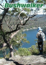
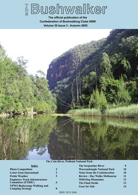
T he <strong>Bushwalker</strong>The <strong>of</strong>ficial publication <strong>of</strong> the<strong>Confederation</strong> <strong>of</strong> <strong>Bushwalking</strong> <strong>Clubs</strong> NSWVolume 30 Issue 3 : Autumn 2005IndexPhoto Competition 2Letter from Queensland 3Fickle Weather 5Engineers Track InfrastructureCommittee (ETHIC) 6NPWS Budawangs Walking andCamping Strategy 8The Colo River, Wollemi National ParkISSN 0313 2684The Serpentine River 9Warrambungle National Park 10Notes from the <strong>Confederation</strong> 10Review - Day Walks Melbourne 11Wild Dog Mountains 12The Final Stride 13Gear for Sale 14
2 Walk Safely—Walk with a ClubThe <strong>Bushwalker</strong> ‘Where Am I’ CompetitionPicture 5Picture 6Picture 7The ‘Where Am I’ Photo Competition• Each Issue has four photos taken somewhere in NSW inplaces where bushwalkers go. These will NOT be obscure places.• You have to identify the place and roughly where thephotographer was standing for any ONE <strong>of</strong> the pictures.• Send your answers (up to four) to the editor@bushwalking.org.au as quickly as possible.• Usually, only one prize per person will be awarded ineach issue <strong>of</strong> The <strong>Bushwalker</strong>.Deadline for entriesThe Editor will start allocating prizes about four weeks after theissue date for the magazine, but this will be extended if there areno correct entries for a photo. If there are multiple really correctentries for a photo, one will be picked out <strong>of</strong> a hat.Entry requirementsJust saying something like ‘Blue Gum Forest’ would not be enough.However, something like ‘Blue Gum Forest from the start <strong>of</strong> thedescent down DuFaurs Buttress’ would qualify. In short, provideenough information that someone else could navigate to that spotand take a close approximation to the photo. Of course, if you wantto give a map name and grid reference, that would be fine too.The prizes?Three companies well-known to us all have donated cash vouchersPicture 8redeemable in their stores. The Paddy Pallin group has donatedtwo $50 vouchers, Mountain Equipment has donated one $100voucher and their allied store Trek & Travel has donated one$100 voucher.Any financial member <strong>of</strong> an affiliated <strong>Bushwalking</strong> Club. canenter. So you must also include the name <strong>of</strong> the Club to whichyou belong as well. We may check with your Club membershipsecretary, so make sure you are financial!The Editor’s decision is final. After all, he took the photos.This does mean that some areas <strong>of</strong> NSW may not appear in thecompetition for a while. My apologies to <strong>Clubs</strong> in those areas.Results from last issuePhoto 1: Boorong Crags from the edge <strong>of</strong> Mt HayIdentified by Brian Corlis, NPA, CMW & Bush ClubPhoto 2: still unidentified!(Several attempts have been made, but none were close enough.)Photo 3: Junction between Colo and Wollemi Rivers fromCrawfords LookoutFirst identified by James Bevan, SUBW PresidentPhoto 4: still unidentified!Remarkable, considering how distinctive it is.)So you can still lodge entries for these pictures too.The <strong>Bushwalker</strong> Vol30 Issue 3 Autumn 2005
Walk Safely—Walk with a ClubThe <strong>Bushwalker</strong>Welcome to the second issue <strong>of</strong> the new colour version <strong>of</strong> The<strong>Bushwalker</strong>, the magazine <strong>of</strong> the <strong>Confederation</strong> <strong>of</strong> <strong>Bushwalking</strong><strong>Clubs</strong> NSW. The first issue was well received, although I have toadmit the learning curve was still in evidence. The colours weretoo dark: the difference between screen and print. Hopefully, thisedition will be better.The <strong>Bushwalker</strong> is published quarterly to provide information tomember <strong>Clubs</strong> and Club members. This will include <strong>Confederation</strong>activities, Club activities, and member activities. Relevantadvertising will be accepted.<strong>Clubs</strong> and members are encouraged to submit articles. There isa strong preference for articles with good pictures. We will alsoaccept articles from outside bodies where the articles seem relevantto members. Articles may be edited for length and content to helpfit into our page limit. Really long ones may not fit - sorry aboutthat. Contributions should be sent to editor@bushwalking.org.auPlease note that opinions expressed by authors do not alwaysrepresent the <strong>of</strong>ficial opinions <strong>of</strong> the <strong>Confederation</strong> or any <strong>of</strong> the<strong>Clubs</strong>. The Editor’s opinions don’t represent anyone at all.The <strong>Confederation</strong>The <strong>Confederation</strong> <strong>of</strong> <strong>Bushwalking</strong> <strong>Clubs</strong> NSW Inc representsapproximately 65 <strong>Clubs</strong> with a total membership <strong>of</strong> about 10,000bushwalkers. Formed in 1932, the <strong>Confederation</strong> provides a unitedvoice on behalf <strong>of</strong> all bushwalkers on conservation, access andother issues. It runs training courses for members, helps to providea free wilderness search and rescue organisation, and helps runsbush navigation competitions.People interested in joining a bushwalking club may write to the<strong>Confederation</strong> Administration (below) for a list <strong>of</strong> <strong>Clubs</strong>, but amore up-to-date version can be found on the <strong>Confederation</strong> websiteat www.bushwalking.org.au, broken up into areas.A LETTER FROM BRISBANEBARNEY REVISITEDAlex Tucker NPAQMount Barney is an isolated mighty mountain, the thirdhighest in Queensland at 1354 metres, and probably asclose to wilderness as anywhere in that state. There are fiveother named high points on the massif. Ref 1 gives briefdescriptions <strong>of</strong> 16 walks with the possibility that more willbe discovered. There are 5 other peaks in the Mt Barney NPand Mt Lindesay is just across the Border.The core <strong>of</strong> Mt Barney is a volcanic intrusion <strong>of</strong> a mediumgrained rock called granophyre which was originally createdas the Australian crustal plate drifted over a hot spot in theearth’s mantle, about 24 million years ago. The most likelyvolcanic centre is Focal Peak about 7 km west <strong>of</strong> Barney,which finally blew its top. The summit is now only about1000 metres. The subsequent eruption <strong>of</strong> the Tweed volcanocentred on Mt Warning may have resulted in Mt Barney’score being forced up to 2000 metres, dragging up thesurrounding rocks. (References 1 & 2 )3Correspondence, advertising, etcCorrespondence may be sent to the editor (email above) or to the<strong>Confederation</strong> Administration Officer at admin@bushwalking.org.au or to PO Box 2090, GPO, Sydney 2001.<strong>Confederation</strong> OfficersMargaret Covi, president@bushwalking.org.auOther <strong>of</strong>ficers may be found on the <strong>Confederation</strong> web site atwww.bushwalking.org.auSubscribe to The <strong>Bushwalker</strong>Keep up with all the news and developments happening in the NSWbushwalking scene for only $8 per year. This is to cover posting andhandling: the magazine itself is free.Send your name and address and cheque or money order to <strong>Confederation</strong><strong>of</strong> <strong>Bushwalking</strong> <strong>Clubs</strong> NSW, PO Box 2090, GPO Sydney 2001. Make thecheque or money order payable to the <strong>Confederation</strong> as well.Also please indicate if you are a member <strong>of</strong> a bushwalking club, and if notwhether you would like a copy <strong>of</strong> the list <strong>of</strong> our clubs. You do have to be amember <strong>of</strong> one <strong>of</strong> our clubs to enter the Where Am I Competition.The <strong>Bushwalker</strong> Vol30 Issue 3 Autumn 2005Barney - east faceAborigines may have once climbed Barney, but lateron it was taboo because <strong>of</strong> a legendary story <strong>of</strong> an agingchief attempting to murder his nephew and being himselfmurdered.The first recorded ascent by a European was in 1828 byCaptain Patrick Logan, Commandant <strong>of</strong> the Brisbane RiverPenal Settlement on the route now called Logans Ridge. Hewas accompanied by Allan Cunningham and the ColonialBotanist Charles Fraser, but they turned back. The previousyear Cunningham had led a party from Scone to the DarlingDowns, a journey <strong>of</strong> 1 200 Km in 13 weeks. He had climbedto Spicers Gap and identified it as a possible route toBrisbane before returning to Scone by a different route. AllanCunningham found Logans Ridge was too hard and I havebeen told that Fraser’s diary confirms this. However, afterrevictualing at Limestone (now Ipswich) Allan Cunninghamwent on to discover the gap now named for him.Reference 3 refers to explorations in the 1920s to find easierroutes to the Barney summit. About 1970 these resultedin the discovery <strong>of</strong> the south ridge which was nicknamedPeasants Ridge. “Easy” is a relative term on Barney!
4 Walk Safely—Walk with a ClubReference 4 mentions explorations by three NPAQ partiesin 1937 at the request <strong>of</strong> the Queensland Government . Theparty that made the Courier Mail headlines comprised 14men and ‘three girls’, and they ‘scaled over ice encrustedridges’ to reach the summit. NPAQ was established in 1930.The Mt Barney National Park was not proclaimed until1947!Some time in the 70s an NPA NSW party <strong>of</strong> three didLamington and Barney before slumming it in a caravan onBribie Island. Margery and I climbed the Peasants Ridgewhile Peter, our fearless Leader, did Logans. I can’t recallany <strong>of</strong> the details <strong>of</strong> our climb which suggests that we maynot have had any and that the weather was kind. Of coursewe did not carry full survival gear in our day packs. We wereback in camp (I guess at Yellow Pinch) by mid afternoon andPeter returned a couple <strong>of</strong> hours later. I do remember that MtMaroon was a perfect pyramid when viewed from the EastSummit. That peak is some 4 metres lower than the West buthas more extensive views. I now know that Maroon looksquite different from other directions.between the East and West Peaks, with a total capacity <strong>of</strong> 18.However these latter sites are closed for all <strong>of</strong> December andJanuary to allow some regeneration. Booking and contactinformation is given at the end <strong>of</strong> this letter.The Ranger’s Office is in a disused school in the village <strong>of</strong>Coulston about 7 km from Boonah on the Ipswich Road. Ifailed to see the NPWS sign but the <strong>of</strong>fice was not staffed thatday - not an unusual happening. Thanks to the InformationCentre in Boonah I got all the available bushwalkingpamphlets. Their stock also includes information for otherNPs in Southern Queensland and Northern NSW but not, Ithink, the 1:25 000 maps. Similar information is available inRathdowney but that centre does not open every day.As befits a lone (but not lonely) walker I did only a part <strong>of</strong>two “Easy” walks (Class 4 AS 2156-1). One was the CronanCreek fire trail. Immediately you leave the Yellow Pinch carpark you climb 500 metres on a steep badly eroded trail.As usual the return descent has a high risk <strong>of</strong> ankle damagefrom loose stones. After that everything is easy until at about3 km you reach the start <strong>of</strong> the Peasants Ridge route. Thepublished times for easy walks equates to about 2 kph. I onlydid about half that rate. Total time for the Peasants Ridgeand to most other peaks is 8 to 10 hours. Logans Ridge mayrequire 10 to 12 hours (6 hours up). There is no convenientcamp site other than at the Mt Barney Lodge about 1 kmfrom Yellow Pinch. Camping fees there are higher than forthe walk-in sites in the NP, but the Lodge has toilets andshowers. The Lodge also has two huts which are similar tohigh-class small Youth Hostels <strong>of</strong> the traditional type. Nocatering or provisions are available for campers but cateringcan be arranged for renters <strong>of</strong> the huts and the two largerbuildings if ordered when booking.Mt MaroonThings have changed over the years, but even in 1991 theauthors <strong>of</strong> Ref 3 were complaining <strong>of</strong> the damage doneby inexperienced or careless bushwalkers, and describedthe discovery <strong>of</strong> the Peasants Ridge as a major disaster.There were the usual stories <strong>of</strong> parties descending in midafternoon meeting ill equipped people only one third up,and <strong>of</strong> great damage to undergrowth cut down to makeshelters for the night or burnt to keep warm. Today thegreatest management problems are the walkers who becomelost, benighted or injured, and the lack <strong>of</strong> funding for trackmaintenance. Although the Peasants Ridge route is shownapproximately on the 1:25 000 Mt Lindesay map, it has beenfound necessary to define it by red triangles in the interest <strong>of</strong>controlling erosion resulting from proliferation <strong>of</strong> foot pads(Photo 2). No other routes either to the two main peaks orthe subsidiary peaks are mapped.Camping at the Yellow Pinch car park is no longer permitted,although this seems to have occurred after the map wasrevised. There are 3 walk-in campsites, each with a maximumcapacity <strong>of</strong> 12 walkers, about 2-3 km along the CronanCreek fire trail (Nos 9 & 10 on the Mt Barney NP Guideand a relocated No 8) and two on the saddle (Nos 6 & 7)The <strong>Bushwalker</strong> Vol30 Issue 3 Autumn 2005Mt LindsayIt is possible to do Mt Barney as a day trip but this probablymeans leaving Brisbane by 4 am to reach Yellow Pinchabout Piccaninny Daylight. As there is no daylight savingin Qld doing Logans Ridge could mean a torch-light returnto the cars. For all routes other than Peasants Ridge youshould contact the Ranger by phone or email (preferable)for precise directions. Reference 1 dates from 1991androute details may not now be accurate. Reference 4 gives aroute up the South East Ridge and return down the Peasantspresumably to avoid the effects <strong>of</strong> the “ crowd “ on the latter
Walk Safely—Walk with a Clubbut the authors last reviewed this route in 1997. Details likethat confirm to me their bushwalking credentialsMy second Class 4 walk was on the Lower Portals Track.It seems that the Mt Lindesay map shows the original routewhich traversed private property. The route within the NPis obvious as far as I went, but as it crosses the grain <strong>of</strong> thebase <strong>of</strong> the mountain and the lack <strong>of</strong> maintenance funding isobvious. I was about half way to the Portals when I decidedthe descent across a badly eroded gully (the worst as yet)was not worth the risk for me.Mt Maroon is on the adjoining 1:25 000 map <strong>of</strong> that name.The Mt Barney Park Guide says “The Cotswold track (class5) has been cut by a large rock fall on the north east ridgeand this section is now identified as unsafe. Penalties applyif walkers enter the closed area. A short detour takes youaround the fall. Contact the Ranger for detailsIt is possible to do a circular drive <strong>of</strong> about 300 km fromand to Rathdowney in about 4 hours and that includes quitea bit <strong>of</strong> dirt roads. However, all the views are either in Qldor, for Mt Lindesay, from it. In NSW you can’t clearly seethe mountains for the forests. The peaks <strong>of</strong> the Main RangeNP can be more easily seen by short side trips from theCunningham Highway to Maroon or Moogerah dams.The web site <strong>of</strong> the Colong Foundation for Wildernessgives details on their 1991 nomination <strong>of</strong> Mt Lindsay andMt Barney under the NSW Wilderness Act. I guess thatthe NPWS NSW have not proceeded with an Assessmentbecause there is no comparable legislation in QueenslandFor interstate bushwalkers Mt Barney deserves very muchmore than a day trip or a circular drive.REFERENCES1) Rocks and Landscapes <strong>of</strong> the Gold Coast Hinterland.Expanded 2 nd Edition, 1992, Warwick Willmont, Geological Society <strong>of</strong>Australia, Queensland Division. $9 inc postage.The Author <strong>of</strong>ten leads Geological Walks in the Brisbane Forest Park.Contact details below.2) Rocks and Landscape Notes Mount Barney – Mt Ballow.One <strong>of</strong> a series <strong>of</strong> groups <strong>of</strong> A4 sheets published by the above Society.3) Bush Peoples Guide To <strong>Bushwalking</strong> In SE Queensland.2 ND Edition, 1991, Chapter 13.4) Take A Walk In Queensland National Parks Southern Zone.John and Lyn Daly, 1998, Published by NPAQ.5) Mt Barney NP Guide. Coloured pocket size brochure issued byEnvironmental Protection Agency, July 2004.6) Sunmap Topographic Maps: MT LINDESAY 1:25k 2003, MAROON1:25k7) WOODENBONG 1:50k Royal Australian Survey Corps 1990, MTLINDESAY 1:100k, NATMAP 1967.I will seek to have these documents and this letter lodged in NPALibrary Level 9, 91 York St, SYDNEY.OTHER BOOKSa) Rocks and Landscapes <strong>of</strong> the National Parks <strong>of</strong> Southern Queensland,Geological Society <strong>of</strong> Australia Inc, Queensland Division, 2004.b) Rocks and Landscapes ---- series for other Regional areas in NorthernNSW and Queensland.CONTACTS* The Ranger, Queensland Parks & Wildlife Service, 3522 Ipswich -Boonah Road, >>>Coulson QLD 4310, ph (07) 5463 5041, fx (07) 5463 5042, emailFickle Weather!Monica ChapmanHaving been bushwalking for some years now, you mightthink there are no surprises left in our wanderings. However,despite the planning and preparations that go into eachextended trip, the unpredictability <strong>of</strong> the weather creates itsown challenges.A few years ago John and I headed down to south-westTasmania to walk the Western Arthur Range. We were therein early December. Typically, the best weather is during latesummer, and spring to early summer is more likely to bewindy with occasional storms. However, sometimes workis such that you can’t have time <strong>of</strong>f when the weather is(supposedly) at its best, so you make do.South West TasmaniaWe flew over and hopped on the bus to Scotts Peak. I’dpacked an extra thermal and two additional day’s rations incase things got a bit blowy and we needed to stay put foran extra day or so. We walked Junction Creek in sunshine,then up onto the range to camp at Lake Cygnus, still underclear skies. The next day was overcast and just as we wereapproaching the descent gully into Lake Oberon it startedto drizzle. As we down climbed the top <strong>of</strong> the gully itrained heavily. On a previous trip a few years earlier, I’dremembered this to be fairly easy and I blamed the rain formy anxiousness at the time. It rained for only two hoursbefore the skies started to clear. That evening I rememberedwhy the small cliff was easier on the previous visit. It was notthe rain, or the fact <strong>of</strong> being a few years older, or that I wasboonah@epa.qld.gov.auBush Campers in Mt Barney NP other than at Lower Portals arerequired to contact the Ranger 3 to 6 weeks in advance and completean Application to Camp which will be posted, faxed or emailed to you.There is a camping fee. Unauthorised camping anywhere in the NPattracts a heavy penalty.Camp Sites at the Lower Portals <strong>of</strong> Mt Barney Creek and in other NPscan be pre-booked through the Smart Service Queensland IntegratedContact Centre, phone 13 13 04, or www.qld.gov.au/camping but six toeight weeks notice is needed for public holidays and long weekends.* Mt Barney Lodge Country Retreat, ms 768, Rathdowney QLD4287. Managers Innes and Tracey Larkin, ph/fx (07) 5544 3233, emailmtbarneylodge@bigpond.com, www. mtbarneylodge.com.au* Warwick Willmont, Divisional Booksales, Geological Society <strong>of</strong>Australia, Queensland Division, c/o 179 Victoria Ave, Chelmer, QLD4068 ph (07) 3379 6485, email willmont@powerup.com.au5The <strong>Bushwalker</strong> Vol30 Issue 3 Autumn 2005
6 Walk Safely—Walk with a <strong>Clubs</strong>till carrying eleven day’s food and was lacking fitness. Itwas simply that last time John had carried down my pack!During the remainder <strong>of</strong> the trip we had glorious weather.Blue skies and sunshine greeted us each day. We had to takecare not to get sunburnt or heat stressed. John and I managedto walk every side trip, climbing all accessible peaks (and acouple <strong>of</strong> more difficult ones). It was a great 12-day trip withunseasonably good weather. Not really what I had expected,but I carried sufficient (just) sunscreen to last the trip.Engineers Track Heritage InfrastructureCommittee Inc (ETHIC)The Engineers Track was constructed by the Royal Engineersin 1858 - 59 and stretches from Yarramundi near the NepeanRiver, up the length <strong>of</strong> the Grose Valley to the DarlingCauseway. The total length is 61 kilometres. The Track wasconstructed as an access track for a proposed western railline across the Blue MountainsThe objects <strong>of</strong> ETHIC are to:* carry out a survey <strong>of</strong> relevant sections <strong>of</strong> the EngineersTrack to document its condition.Larapinta TrailOn the flip side John and I had a totally reversed experienceon a trip to Alice Springs last June. We intended to walk theLarapinta Track starting from Red Bank Gorge with a friendfrom Victoria and one from New York. We had been intouch with one <strong>of</strong> the rangers prior to our 18-day trip and hehad suggested that we could leave some <strong>of</strong> our “heavy-duty”southern walking gear at home. We were told that tents andrain jackets were not needed in central Australia.It was cloudy the day we met at the airport. Drizzle startedas we approached Red Bank Gorge and rain came downheavily before nightfall. All this dampness promptedground-dwelling frogs to emerge during dinner. They hoppedhappily about the soggy ground in the tent vestibule and onemanaged to find a cosy, dry spot atop a sleeping bag! Nextday it drizzled some more as we climbed Mt Sonder. Theviews from its summit were spectacular (or so we were ledto believe by many entries in the log book!). All that greetedus was the breezy inside <strong>of</strong> a cloud.Again it rained heavily again at night and the humidity washigh the next day when the sun did eventually break throughin the morning. There were sensational views lookingback to Mt Sonder as the cloud and mist evaporated. Wesuspected we were the last group to be dropped at the startas we’d been told that heavy rainfall closes the road, whichthen remains closed for three days after the rain stops.Again rain greeted us in the morning and the wind had sprungup. It was more the sort <strong>of</strong> weather we’d expect in Tasmaniathan the dry, dusty heart <strong>of</strong> central Australia. However,the waterfalls cascading down the side <strong>of</strong> the ridges werewonderful. We experienced a vastly different aspect <strong>of</strong> thisarid landscape.>>>>>The <strong>Bushwalker</strong> Vol30 Issue 3 Autumn 2005ETHIC Committee, surveying the Track (they say!)* adopt a strategy to ensure that the fabric <strong>of</strong> constructedworks, and significant identifiable items <strong>of</strong> the EngineersTrack are preserved and maintained* in consultation with NPWS, undertake or commissionrepair work to damaged stone walls and remove dead plantmaterial, common plant species and fallen rock. >>>The rest <strong>of</strong> the trip to Stanley Chasm was overcast withfrequent light showers. There were fresh waterholes tocircumnavigate, flooded streams to cross and rivers tonegotiate. The morning after we arrived at Stanley Chasmit poured.The Alice Springs papers were filled with stories about theweather. One headline that stayed in my mind was “Theday the rains came….. and stayed”. During the days wewere out walking, Alice Springs had recorded its lowestdaytime temperature, a cool 12°C and its longest period<strong>of</strong> consecutive days <strong>of</strong> rainfall. We’d been out for 13 daysexpecting to endure the heat, but this could not have beenfurther from reality.We were certainly glad to have ignored the ranger’s advicetaking tent, rain jacket and fleece as otherwise we wouldhave had to abandon the trip much earlier.So, no matter where you walk or when, or how experiencedyou might be, the weather is an unpredictable force. Alwaysgo well prepared for expected conditions, but make sureyour gear will cope with the unexpected conditions that canand do occur.[No, I have NOT got the pictures reversed! You can see Feder in the firstpic. Ed.]
Walk Safely—Walk with a ClubThe Serpentine RiverColin WoodPrologue. I have tried on two other occasions to get to thejunction <strong>of</strong> Barwick and Serpentine; this was the third.away from the river and go north west and try to cut an oldlogging track. After checking our map and getting a goodbearing we headed <strong>of</strong>f up a very steep climb through scruband rocks until we got to a high point. Then we then tookanother compass bearing and after about ½ an hour we cutthe logging track and followed this for about 3 km. We wereat this point about 1km downstream from the Trout hatcheryon the Serpentine river.We decided we would follow the river downstream back toYaraandoo. After some heavy going through tea-tree scrubwe heard a waterfall, and came out at the top <strong>of</strong> a waterfall<strong>of</strong> at least 30-40 metres. This waterfall is not named on themap and most likely very few people have ever seen it.9This walk was not for the faint hearted, it was both verystrenuous and challenging for the body and map readingskills. It started at the lower car park at Yaraandoo andstraight away we plunged into the scrub and walked downto the “wetlands” area near the pumping station on Bullockcreek. Then downstream on Bullock creek to the junction <strong>of</strong>Bullock and Serpentine rivers.Someone commented on the fact that river walking has avery sad truism that “the other side <strong>of</strong> the river always looksthe easiest”. Well, we were to find out that neither side iseasy. This short “walk” to the junction was about 1km buttook about 1 hour.We continued along the Serpentine, crossing the river acouple <strong>of</strong> times thinking that “the other side <strong>of</strong> the riveralways looks the easiest”. Sometimes the going was almosteasy crossing flat basalt and granite rock. We continued forabout 2 - 3 hours occasionally having to go up over ridgesbut keeping as close to the river as possible.The scenery was awe-inspiring with many rapids, smallgorges and waterfalls. We stopped for lunch at a spot thatwas truly beautiful, near huge granite rocks with a waterfallgoing into a small gorge.As it was about 12.15 we decided that instead <strong>of</strong> tryingto get to our destination <strong>of</strong> the junction <strong>of</strong> Serpentine andBarwick (on the map this is called Back creek) we would getThe <strong>Bushwalker</strong> Vol30 Issue 3 Autumn 2005After crossing the river again we followed the river for atime, went cross country approx north-west till we cut thepower lines that run past Yaraandoo, and followed theseback to Yaraandoo for a very welcome c<strong>of</strong>fee and smoothiesand to lick our many cuts, bruises and scratches. I supposewe covered no more than 10k on our 6.5 hour walkEpilogue. Well I still haven’t made it to the junction <strong>of</strong>Serpentine and Barwick. Maybe next time I won’t tryfollowing the river, just go cross country straight to thejunction, but this might be too easy!Photos and article by Colin Wood. This article waserroneously ascribed to another author in the print edition:our sincere apologies - Ed.Winter is coming! Trip reports and pictures wanted.Camped near Kosciosko: the brewing storm hit that night.
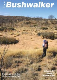
10 Walk Safely—Walk with a ClubWarrumbungle National Park12-13 March 2005We met up at Westdale at 6.30 am on Saturday and drove ina convoy to Coonabarabran and then into the national park.After setting up our accommodation at Camp Blackman anddoing the tourist thing at the information centre we set out toconquer the Breadknife and Grand High Tops Walk.The brochures warn that this is a long, steep walk and oneshould expect to take 5 – 7 hours. We found the brochureto be correct on all points! The camp custodians havetaken sensible action to preserve the area and we followedrecently-laid brick paths for considerable lengths. Whenthe going got steep we climbed the steel steps which havebeen installed for the convenience <strong>of</strong> the 20,000 visitorseach year and for the well-being <strong>of</strong> the environment. Thescenery was spectacular and well worth the effort. The mostcommon trees were the black cypress pine and the narrowleafedironbarks. The stark volcanic rock formations are awonder to see. After pausing at the top we walked past BluffMountain and returned to the starting point via the WestSpirey Creek. We spotted the odd koala and inspected thevaried plant life. The total length <strong>of</strong> the walk was 14.5 km.We (re)learned one lesson in bushwalking: take plenty water,especially on a hot day. Most <strong>of</strong> us had about 1.5 litres andall <strong>of</strong> us ran dry and finished the walk with parched mouths.VISIT THE CLOUD DWELLERS OF THE HIMALAYAWith Lyn Taylor’s Adventure TravelAn Adventure into a remote valley <strong>of</strong> Nepal and Tibet:Bhairab KundDuration: 23 days On Trek: 11 daysDeparture Date: ex Sydney Oct/Nov 2005Grade: Moderate/StrenuousGroup Size: Small Personalised GroupCost: Ex Kathmandu: $3500This Tibetan journey is staggering for its scenery andwilderness as these trails are not frequently visited byWesterners. Some companies drive or fly straight ontothe Tibetan Plateau, but trekking in gives plenty <strong>of</strong> time toacclimatize before we move on up to Everest Base CampNorth. This vast plateau, endless mountains and beautifulturquoise lakes will take your breath away. The journey ispunctuated by visits to major towns and monasteries andthe two highlights - Everest Base Camp North and Lhasa.We take a last look at Tibet before flying to Kathmandu. Thisis an experience to behold, a mystical destination that willremain in your mind forever.lyntaylor51@aol.com, www.tayloradventure.com0418 917 342, 02 9997 7442Lyn Taylor is a 12 year veteran <strong>of</strong> trekking in Nepal and Tibet.Lyn is the Australian representative <strong>of</strong> the International PorterProtection Group (IPPG) and is involved with a number <strong>of</strong>other organizations in Nepal in a voluntary capacity.The <strong>Bushwalker</strong> Vol30 Issue 3 Autumn 2005We shared an enjoyable meal on Saturday night after enjoyinga long hot shower in the very adequate facilities at the camp.The kangaroos also enjoyed our visits and they tried to priseopen the saucepans outside the tents in the middle <strong>of</strong> thenight as their natural water courses are currently very dry.Sunday saw us circumnavigate and conquer Belougery SplitRock (771m). Once again the grade was steep and the finalascent to the top <strong>of</strong> rock was made with the aid <strong>of</strong> a chainguide. From the top we had an eagle’s eye view <strong>of</strong> thecleared central area <strong>of</strong> the park and distant views up to theGrand High Tops.Members present were Cheryl, Andrew, Neta, Alison andLaurie. Michael was our intrepid leader.Notes from the <strong>Confederation</strong>St John’s Ambulance Senior First Aid Course28th/29th May 2005BWRS will be running another discounted first aid courseover the weekend <strong>of</strong> 28th - 29th May - only $100. Venue isclose to Dulwich Hill railway station. To register forwardyour cheque for the full amount <strong>of</strong> $100 to BWRS Secretary,P.O. Box 22, Canterbury 2193. Cheques made out to StJohn’s Ambulance.Full details and Online Registration available on the BWRSwebsite: www.bwrs.org.au .BWRS: Map Sale - Still On !Don’t miss the map sale <strong>of</strong> 1:25,000 maps. See the BWRSwebsite http://www.bwrs.org.au/mapsale/index.html forsales detailsEPIRBs - Important changes to Cospas-SarsatSatellites - February 2009The Australian Maritime Safety Authority (www.amsa.gov.au/beacons) states that from February 2009 the Analogue121.5 MHz distress beacons will no longer be detected bythe Cospas-Sarsat satellite system. Only the Digital 406 MHzdistress beacon will be detected - these are more accurate,are detected more quickly and identify their owner.Access via Locked Gates to Yarramunmun andMoney Gum Fire Trails, Morton National ParkFrom Shoalhaven <strong>Bushwalker</strong>s:At a recent Club Committee Meeting, we developed anapproach which will allow other bushwalking clubs (providedthey are affiliated with the <strong>Confederation</strong>) to have access viathe locked gates to the Yarramunmun and Monkey Gum firetrails, while still satisfying Shoalhaven City Council’s strictrules for access.A Sydney-based club can schedule a walk by asking us toadd it to our program. We would do so, promulgate it andhave at least one <strong>of</strong> our club members participate. He/shewould have the key to the padlocks on the access gates andwould complete the mandatory Council report followingthe activity. We would always need at least three monthsprior notice to ensure the walk was listed in our quarterlyContinued on page 14
Walk Safely—Walk with a ClubBook ReviewDay Walks MelbourneJohn Chapman, Monica Chapman & John Siseman192 pages, colour, A5 size, paperback, ISBN 0 9596129 9 8Published by John Chapman 2005, available from him at PO Box36, Kew East, Vic 3102, with an RRP <strong>of</strong> $34.95.This is a nicely laid-out little guidebook for easy to medium day walks. Itcovers quite a range <strong>of</strong> places aroundMelbourne: the Surf Coast, Geelong,the Goldfields, Melbourne itself, theDandenongs, Kinglake, Yarra Ranges,Lake Eildon, Gembrook/Powelltownand Mornington/Westernport. All upthere are 41 walks, although if you countall the variations John reckons this getsup to 94. Clearly, this book could keepyou going for some time.For each walk you get detailed tracknotes by the km, a small topo map <strong>of</strong> thewalk with 25 m or 50 m contours, anda pr<strong>of</strong>ile chart <strong>of</strong> height lost and gained.Some <strong>of</strong> the beach walks look very flat!There is a section on access: how to get there, for each walk, <strong>of</strong>tenusing the Melways street directory as a reference. Oh, <strong>of</strong> course,there are excellent pictures accompanying each walk as well.Most <strong>of</strong> the walks are fairly easy. I noticed a couple where thetotal height gain for the trip is about 10 metres!Yes, these were thebeach walks I mentioned. Mind you, I was a bit surprised at howmany bits <strong>of</strong> bushland they had found for all these walks hiddenaway among ‘suburbia’. On the otherhand, there are few walks which aredefinitely a bit more rough underfoot:through Lerderderg Gorge and over theJawbones at Cathedral Range. Hey: Iused to go rock climbing around there,and some <strong>of</strong> that is steep country! Fineviews too, and well illustrated.11The book itself is a paperbackwith aslightly glossy cover, <strong>of</strong> about A5 (halfA4) size. Definitely day pack size.The target market for this book wouldhave to be the novice end <strong>of</strong> the market,and it caters for them very well. Buteven experienced walkers lookingfor a collection <strong>of</strong> day walks to do ‘inbetween longer walks’ would find muchin here <strong>of</strong> interest. You can’t look at allthe photos <strong>of</strong> fine forest without wantingto visit a few <strong>of</strong> them. And there is evena good photo <strong>of</strong> a lyrebird in the wild:I’ve never managed to get that closewith a camera in my hand.RNCALLIANCE CLUBPHOTO: DUNCAN HENDERSONADVENTURE IS A STATE OF MIN DTHE MOUNTAIN DESIGNS ALLIANCE CLUB OFFERS MEMBERS SUBSTANTIALDISCOUNTS AND BENEFITS. JOIN UP NOW FOR FREE AND SEE WHAT IT’S LIKETO ADVENTURE BEYOND. YOU CAN SIGN UP AT www.mountaindesigns.comOR INSTORE AND ASK OUR STAFF FOR DETAILS - THEY’LL BE HAPPY TO HELP.*10% DISCOUNT C AN BE REDEEMED IN ALL AUSTRALIAN AND NEW ZEALAND STORES. † AN ADDITIONAL 5% REWARD POINT BONUS WILLBE GIVEN ON THE NET VALUE OF YOUR PURCHASE (EXCLUDES SALE ITEMS). THESE POINTS MAY ONLY BE EARNED AND REDEEMED IN THECOUNTRY YOU RESIDE, C ANNOT BE REDEEMED ON CLUB DAYS OR ON SALE ITEMS, AND EXPIRE TWO YEARS AFTER THE DATE OF PURCHASE.GEAR FOR PLACES YOU’D RATHER BE...The <strong>Bushwalker</strong> Vol30 Issue 3 Autumn 2005WHY SHOULD I JOIN THE ALLIANCE?• FREE MEMBERSHIP• 10% OFF RRP ON ALL PRODUCTS *• REWARD POINT BONUS †• EXCLUSIVE INVITATION TO SALE• DAYS FOR FURTHER DISCOUNTS• NOTIFIC ATION OF SEASONAL• C ATALOGUE LAUNCHES499 KENT STREET, SYDNEY. PH: 9267 3822
12 Walk Safely—Walk with a ClubThe Wild Dog MountainsMichael Keats, The Bush ClubNine walkers, happy to be wilderness exploring, set out at0815 from the Dunphy car park (434577). After a briefingover the essentials elements <strong>of</strong> the walk and safety issues,it was down into Carlons Ck. The bellbirds tolled awayknowingly and incessantly as ankles and legs were assaultedby the infamous stinging nettles. The experience <strong>of</strong> tinglingpain was all the more exquisite as the heavy dew seemed towash the business end <strong>of</strong> each sting deeper into the flesh. Itwas also one <strong>of</strong> the last humid days <strong>of</strong> summer 2004-5, anddehydration was going to be an issue.Breakfast Ck was heard before it was seen. It has been avery long time since the welcome sound <strong>of</strong> running waterhas been heard in Breakfast Ck. The ‘gate without a purpose’was passed at 0930 (418556). At 0933 the first big ascent<strong>of</strong> the day was started, up Cattle Dog Ridge. The sun’s rayswere well into vaporising ground moisture as each memberstarted their own ‘cooling plant’, with drops <strong>of</strong> water fallingfrom eyebrows, noses and other extremities.Ed] generally identifies this area. There is a pad along thebase <strong>of</strong> the cliff line for about 200 m.For the serious student <strong>of</strong> geology this is a textbook example<strong>of</strong> a geological time discontinuity. The Triassic conglomerateslie unconformably on the Ordovician granite. The pebbles inthe conglomerate have been identified as Devonian by fossilevidence. But no matter what the precise geological andgeomorphalogical details, it is a wonderful place to be.Conglomerate cliffs under Cattle Dog150m up the ridge it was time for refreshments - morningtea stop #1. At the top <strong>of</strong> the ridge there is a spectacularcliff line <strong>of</strong> weathered Triassic conglomerate. PreviouslyI have negotiated this from the eastern side; today we didit from the western side and what a great variation thereis. The rocks have taken on wonderful ochre colours andthe cliff pr<strong>of</strong>ile gives impossible shapes. There are caves,overhangs and orphan rocks amonst the many quixotic andbizarre formations. A line between 418544 and 411541 [?The <strong>Bushwalker</strong> Vol30 Issue 3 Autumn 2005The view from Knights Deck towards Iron PotAt 1115 we intersected with the Blue Dog Track (415537),emerging just 3m from the identifying cairn. It is a shameleadrs can’t be more precise. The climb, high humidity andvery warm temperature were beginning to take their tollon one member. On the way to the Knights Deck turn<strong>of</strong>f(402541) I spent time pondering the options for the safepassage <strong>of</strong> all, as well as keeping the program intact.At 1200 there was an inspection <strong>of</strong> the possible routes downeach <strong>of</strong> the 3 Knights Pups. All looked rather easy for theimmediate visible sections. [It gets steeper down below! - RNC]The idea <strong>of</strong> a second morning tea was changed to an earlylunch on the Deck, both to boost energy levels and to rest.Given the circumstances and various helpful suggestions,the planned exploratory route down one <strong>of</strong> the Pups wasabandonded in favour <strong>of</strong> the known route down Blue DogSpur.1230 and it was track time again. Nature turned up theheat and humidity, making the descent an energy-sappingexercise. By 1325 we were at the junction <strong>of</strong> Breakfast Ckand the Cox, rock-hopping across the now increased expanse<strong>of</strong> rocks which form a solid 1/2 m high barrier from the end<strong>of</strong> Breakfast Ck to within 3 m <strong>of</strong> the west bank <strong>of</strong> the Cox.Swimming - well, soaking in the cool water up to the neckanyhow, was the order <strong>of</strong> the day for all. Some went native,others went as far as they were comfortable. After 50 minutes<strong>of</strong> this cooling bliss it was gear on, packs on, and into themarathon climb up the infamous Ironmonger Spur.Our departure was signalled by a family <strong>of</strong> six Gang-Gangs.They squawked and carried on for some time until we werepast their territorial boundaries. Having determined to keepthe party together, numerous stops were taken during the
Walk Safely—Walk with a Clubascent. These were great opportunties to talk, get to knoweach other, indulge in philosophical discourse and appreciatethe scenery.Breakfast Ck - running water!Just below Ironmonger Hill a small red-bellied blacksnake lay across the track. Unlike most <strong>of</strong> his kind he didnot willingly move away. We were between him and hisbolthole: a hollow log. Venting his displeasure, he raised thescales on his back, elevated his head and showed an activefang. As we gave him space he retreated to his log where hecontinued eyeing us.By 1610 we were at the cairn on Ironmonger Hill at 405563.The hard part <strong>of</strong> the climb was over and the junction withIron Pot ridge was reached in 25 min at 407568. 1740 sawus back at the cars, watching the mist roll <strong>of</strong>f the westernside <strong>of</strong> Narrowneck to fill the valley below. Driving up theMegalong Valley road near the Shipley turn<strong>of</strong>f, we saw thatthe Megalong had disappeared in the mist.1830 saw most <strong>of</strong> us in the Victory Cafe enjoying food andbeverage, and most particularly enjoying the endorphins thatfollow a great day in the Wild Dogs.The Final StrideColin Paul GibsonAt last I reached the summit cairn, but in that final stride.I realised that tragically two faithful friends had died.Reminded then that life is short, and death one cannotcheat,I sorrowed for my Volley’s lying shredded at my feet.They’d crossed their final frontier; they’d made their finalpushThose warriors <strong>of</strong> the wilderness, foot sloggers <strong>of</strong> the bush.The sadness welled within me, beside that survey mast.Wandering the memories, remembering the past:Of hunting canyon monsters in chasms dark and deep,They’d bashed and bruised and crashed and cruised theirway down Crikey Creek,They’d gullied Guts-a-humble, and darkest Booneroo,They’d bowled along the Moko, and Bunggal-odoo too;They’d suffered horrors on Bolwarra’s scrub-infestedspines,And lingered longer in Kolonga’s narrow intestines;They’d crossed The Devil’s Wilderness (George Caley’sold domain)And battled Barranbali – bombarded by the rain;Had conquered high Guouogang by way <strong>of</strong> Nooroo Rocks,And bungled Krungle Bungle on the way down to the Cox;They’s rumbled on through Mumbedah, and stumbleddown the steepsAnd peekabooed inside the pit wherein The Pooken sleeps;They’s crunched the broken country, expecting no rewards,Where Wolobrai and Wollemi and Wirraba are lords;On Mirra Ridge they’d scrambled traversed the Talabon.They’d skirmished with The Geryon; the list goes on andon.No matter what conditions, barren drought or damp,Those Dunlop Volleys always took me safely to each camp.But here I had to leave them, upon the old trig post,Their uppers having ultimately given up the ghost;And on that cross their soles were free, the wild horizonscannedTo Pisgah and Elysium, the long lost Promised land.I know there gone forever now, I know that they are dead,But always in my mind will be the memory <strong>of</strong> their tread;For is it my imagination, or the wind that so deceives,Whenever I hear their ghostly steps a-rustling through theleaves?Many other poems <strong>of</strong> Colin Paul Gibson can be seen at www.greenaissance.com His work “A Wild Blue Wander” can bepurchased from the publisher at turton@austarnet.com.au “13[Shades <strong>of</strong> the DV wars on aus.bushwalking! - EdThe <strong>Bushwalker</strong> Vol30 Issue 3 Autumn 2005
14 Walk Safely—Walk with a ClubGear For Private SaleIf you have more gear than you need but don’t want to throw it out,try selling it through The <strong>Bushwalker</strong>. For club members sellingexcess gear the cost <strong>of</strong> the advertisement is zero.Descriptions should be short but complete, and the advertiserslocation and contact details should be given. No guarantees are<strong>of</strong>fered by The <strong>Bushwalker</strong> for any <strong>of</strong> the gear: that’s between thebuyer and seller.Macpac Cascade #3 pack $100 ad12-compartment internal frame, 90 litre, well used, one small patch,but still going strong. Shoulder straps replaced by Macpac recently.Suit all big trips, summer and winter.Tatonka <strong>Bushwalker</strong> pack $100 ad12-compartment internal frame pack, about 70-80 litre, waterpro<strong>of</strong>Cordura body, used a few times, in very good condition. Suit fairlybig trips.Trangia cooking pot 602515 $15 ad11.75 litre non-stick cooking pot, in original packing, never used.RRP about $29.50.Fairydown sleeping bag $200 ad1Suit winter trips down to -20 C, good condition, high l<strong>of</strong>t, centre3/4 zip, hood, medium length.Synthetic sleeping bag $50 ad1Zip right around, opens into quilt. Suit car camping or novicewalker for warm conditions.MSR Simmerlite stove $150 ad1Complete with MSR bag etc. Weighs about 325 g empty. Left overfrom stove review, only used for review tests. Goes well.SCARPA “Lady Trek” Leather Boots $150 ad2Size 37, tread as new, stitching perfect, only worn on approx. adozen day walks - leather slightly sandstone scuffed.For items under ‘ad1’ contact editor@bushwalking.org.au.For items under ‘ad2’ contact admin@bushwalking.org,auThe <strong>Bushwalker</strong> reserves the right to edit or refuse anyadvertisements. Commercial advertisements are not accepted.Send ads to editor@bushwalking.org.auWILLIS’SEnjoy the world’s mostcomfortable wilderness: clearskies and pleasant temperatures,weather so perfect you can leaveyour tent at home.You see no one else, no tracks,no 4WD’s, no trail bikes, no farms– the only signs that anyone hasbeen there before are theAboriginal rock paintings thatdot the landscape.Have a swim with every break:clear tropical pools, perfect forswimming, pure enough to drink.Every night brings anotherbeautiful, spacious camp site.Notes from <strong>Confederation</strong>Continued from page 12program. It is a Shoalhaven City Council requirement thatwalks requiring key access be publicly promulgated.Please contact Peter Dalton on:Phone: 02 4441 8256 ( all hours )Email: info@shoalhavenbushwalkers.org.auWebsite: www.shoalhavenbushwalkers.org.auLooking for Paul DriverIf there is a reader who knows the wherabouts <strong>of</strong> Paul Driver,formally member <strong>of</strong> “Rover Ramblers” club and one time president<strong>of</strong> Federation <strong>of</strong> <strong>Bushwalking</strong> <strong>Clubs</strong> NSW, please contact PeterRodger 103 The Avenue Armidale 2350 or email Colin Wood atturton@austarnet.com.auEnjoy Summer in WinterWALKABOUTSEscape tothe NorthHave a wander. Find your ownspecial flowers, plants, birds,animals, rock-art, and otherthings unique to our region.We handle the hassle, organisethe transport, cook your eveningmeals and share the knowledgegained from 30 years <strong>of</strong> walkingin the region.Want more info?Visit our website or askfor our brochure.Solea Falls Drysdale River NPwww.bushwalkingholidays.com.au12 Carrington St Millner NT 0810Email walkabout@ais.net.auFax 08 8985 2355The <strong>Bushwalker</strong> Vol30 Issue 3 Autumn 2005Phone 08 8985 2134
Best Brands Best Range Best AdviceCameron Barrie crossing the Snowy River en route to Blue Lake.Photo: MVP / Taryn MillerSydney 491 Kent Street (02) 9264 5888 Chatswood 72 Archer Street (02) 9419 6955email: info@mountainequipment.comweb: www.mountainequipment.comWalkingJourneyOutfittersHiking in the Chilime Valley on the border <strong>of</strong> Nepal and Tibet. Photo: Robin Boustead447 Kent StreetSydney NSW 2000t: 02 9261 3435f: 02 9264 2645e: sydney@trekandtravel.com.au