

Hawkesbury-Nepean River System Canoe & Kayak Trail map - Land
Hawkesbury-Nepean River System Canoe & Kayak Trail map - Land
Hawkesbury-Nepean River System Canoe & Kayak Trail map - Land
- No tags were found...

You also want an ePaper? Increase the reach of your titles
YUMPU automatically turns print PDFs into web optimized ePapers that Google loves.
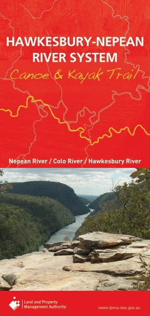
HAWKESBURY-NEPEANRIVER SYSTEM<strong>Canoe</strong> & <strong>Kayak</strong> <strong>Trail</strong><strong>Nepean</strong> <strong>River</strong> / Colo <strong>River</strong> / <strong>Hawkesbury</strong> <strong>River</strong>www.lpma.nsw.gov.au
WELCOMEWelcome to three canoeing and kayaking opportunities on the<strong>Hawkesbury</strong>-<strong>Nepean</strong> <strong>River</strong> <strong>System</strong>.The <strong>Hawkesbury</strong> <strong>River</strong> has numerous sections and tributaries whichare well suited to recreational canoeing and kayaking. It offersspectacular scenery and an abundance of wildlife.Crown and Council Reserves provide places where the public can getaccess to the river to start or finish your trip.The <strong>Hawkesbury</strong>-<strong>Nepean</strong> <strong>River</strong> <strong>System</strong>The <strong>Hawkesbury</strong> <strong>River</strong> is formed by the confluence of the Grose and<strong>Nepean</strong> <strong>River</strong>s just north of Penrith in New South Wales. The Grose<strong>River</strong> rises near Mt Victoria in the Blue Mountains, and the <strong>Nepean</strong><strong>River</strong> near Wollongong some 80 kms south of Sydney. The <strong>Nepean</strong><strong>River</strong> is joined by the Warragamba <strong>River</strong> south of Penrith. These tworivers together capture much of the water for the city of Sydney andthe Sydney Basin. The largest of the dams is Warragamba Dam on theWarragamba <strong>River</strong> just up stream from its junction with the <strong>Nepean</strong>.<strong>Canoe</strong> trailsThere are three <strong>Canoe</strong> and <strong>Kayak</strong> adventures described in this booklet• <strong>Nepean</strong> <strong>River</strong> <strong>Canoe</strong> and <strong>Kayak</strong> <strong>Trail</strong> (up to 50 kms)• Colo <strong>River</strong> <strong>Canoe</strong> and <strong>Kayak</strong> <strong>Trail</strong> (30 kms)• <strong>Hawkesbury</strong> <strong>River</strong> <strong>Canoe</strong> and <strong>Kayak</strong> <strong>Trail</strong> (83.5 kms)Each of these trips has its own characteristics and you will be sure tofind one that meets your needs.Degree of difficultySignificant falls of rain in the catchments of any of these riverscan change their water quite quickly. The changes are quite shortlived however and for most of the time these three canoe trailsare slow moving flat water with no rapids, and are quite suitedto recreational canoeists with beginner skills. Some degree ofendurance will be required on the longer reaches, particularly if ahead wind or tide is encountered.The upper reaches of the Colo can be quite shallow after dry spells,but the bottom is sandy and easy to walk towing your canoe.The <strong>Hawkesbury</strong> <strong>River</strong> is popular for speed boating and skiing. Theseactivities can create real problems for canoeists and speed boats alike.It is best to canoe the popular areas when speed boating activity is low.It is also advisable to plan canoeing on the <strong>Hawkesbury</strong> and lowerColo <strong>River</strong> to coincide with the tide.<strong>Canoe</strong> and kayak trail <strong>map</strong>sThe canoe trail <strong>map</strong>s have been prepared by the <strong>Land</strong> and PropertyManagement Authority to show the public where they can gainABOUT GPS (Global Positioning <strong>System</strong>)GPS coordinates have been used to locate critical points along theriver. These Coordinates are based on the GDA datum.• Your GPS should be set up to Datum Mode: GDA (or WGS), Position:UTM/UPS, Units: Metric, and North Reference: True.• The coordinates will only refer to the Zone you are in. You muststate the zone if contacting emergency services. The <strong>Hawkesbury</strong><strong>River</strong> Zone is 56.access to the water. With this and the other information provided,you can plan your canoe/kayak trip.Public access to the river is provided by public or Crown reserves. Someof these reserves have public facilities such as toilets and boat ramps.The location of these reserves is shown on the <strong>map</strong>s but they have alsobeen given a GPS Coordinate so that you can find them from the water.There are numerous riverside caravan parks, tourist parks and skiresorts along the river where you can also get access to the river andobtain accommodation. These are commercial businesses and dayuse fees may apply.Advice from Maritime ServicesNSW Maritime is the State Government Authority responsible formarine safety and the regulation of commercial and recreationalboating. The following information is supplied for the information ofcanoeists and kayakers on the <strong>Hawkesbury</strong> <strong>River</strong> system.• The <strong>Hawkesbury</strong> <strong>River</strong> is closed to all boating craft on four occasionseach year while aquatic events are held. The times and dates areavailable on the Maritime Services website, www.maritime.nsw.gov.au• <strong>Canoe</strong>ists should obey basic river rules and travel on the right handside of the river.• To improve visibility to speed boats canoeists should wear brightcoloured clothing, and if operating at night should carry anavigation light.• When crossing ferry cables always cross behind the ferry not infront of the ferry.• Speed boat wash will cause a problem to canoeists. Ensure yoursplash skirts are in place to avoid swamping, or chose times whenspeed boats are not operating.• <strong>Canoe</strong>ists should wear a PDF (Personal Flotation Device), andconsider carrying a V-Sheet (international distress signal) and or apressure pack air horn to attract attention if you need help.Further information• Penrith Valley Visitor Information Centre (Penrith) – Ph 1300 736 836• Sydney Hills Visitor Centre (Dural) – Ph 1300 884 881• <strong>Hawkesbury</strong> Visitor Information Centre (Windsor) – Ph 1300 362 874• www.paddlensw.org.au
HOW NEPEAN TO GET RIVER THEREThe waters of the <strong>Nepean</strong> <strong>River</strong> are best accessed from riversidereserves at Penrith. However with a bit of effort access to the rivercan be gained from the reserve at the junction of the Warragambaand <strong>Nepean</strong> <strong>River</strong>s. Between Penrith and the Junction Reserve is25kms of spectacular non tidal water that can be paddled in bothdirections. The wall of the enormous Warragamba Dam is visible justa kilometre or so upstream from the Junction ReserveDegree of difficultyExcept after significant rain, the water is flat and non tidal and suitedto beginner canoeists. The greatest difficulty will be with wind andthe water conditions it causes. Wind speed and direction on the dayshould be used to determine how far you can travel and return safely.Start/FinishTench Reserve, PenrithThe Tench Reserve is on the eastern bank of the river between theM4 and Penrith. It can be accessed from the M4 via Mulgoa Roadand Jamison Road<strong>Land</strong>ingBoat rampGDA 56 283443/6261610Public facilitiesThere are toilets, lawns, shade and shelterThe reserve is closed at nightCampingNot permitted on reserveAccommodation and mealsAvailable in PenrithStart/Finish<strong>Nepean</strong> Rowing Club or The Weir Reserve, PenrithThe rowing club and weir reserve is on the eastern bank at Penrithjust north of the old Great Western Highway bridge over the <strong>Nepean</strong>for the. From Penrith turn right just before crossing the bridge<strong>Land</strong>ingRowing Club <strong>Land</strong>ing or natural beachGDA 56 285390/6263621Public facilitiesBehind the <strong>Nepean</strong> Rowing Club is a reserve with toilets, a shelterand car park. The reserve is closed at nightAccommodation and mealsAvailable in Penrith (1 km)Alternate pullout at the boat ramp in the Tench ReserveGDA 56 283443/6261610Start/FinishJunction Reserve, WallaciaThe Junction Reserve is at the end of Nortons Basin Road. This roadis accessible off Silverdale Road at Wallacia. The road ends at a carpark, and an 800m walk down the fire trail leads to the water<strong>Land</strong>ingNatural, find a spotApprox GDA56 278996/6250930Public facilitiesNoneCampingNot permitted on reserve<strong>Nepean</strong> <strong>River</strong>
HOW COLO TO RIVER GET THEREThe lower reaches of the Colo <strong>River</strong> are tidal and can be paddled in bothdirections with the tide. However the upper reaches are best travelledwith the current ie downstream. The canoe trail is described here as ifyou were paddling down stream, starting at the Upper Colo RecreationReserve and finishing at the Skeleton Rocks Reserve at Lower Portland.Degree of difficultyAfter rain the Colo <strong>River</strong> can rise quite quickly but normally it is aslow and quite shallow in the upper reaches. The bottom is sandyand there are no rapids.The lower sections are tidal and quite suited to beginner canoeists.It pays however to paddle with the tide. For <strong>Hawkesbury</strong> Tides seehttp://www.tide-times.com.au/localtime_NSW/Sydney_Northern_Beaches/Other/<strong>Hawkesbury</strong>_<strong>River</strong>_-_Gunderman.html or just Google<strong>Hawkesbury</strong> tides.Getting to the startThe Upper Colo Recreation Reserve can be reached by vehicle fromthe Putty Road either by taking the Comleroy Road, or the UpperColo Road. Both have gravel surfaces and are narrow and winding sotake care.CAUTIONThe bridge over the Colo is a low level bridge so if there has beenrecent rain clearance under the bridge may be reduced. Please checkthis as you go across. If there is not enough clearance for you and thecanoe you should start your trip from below the bridge by launchingfrom the parking area on the northern side. Otherwise proceed tothe Upper Colo Reserve where there are excellent facilities.StartUpper Colo Reserve<strong>Land</strong>ingGDA 56 289364/6299825CampingCamping is permitted (fee payable)FacilitiesToilets, drinking water, shelter, barbeques and tablesVehicle accessVia Upper Colo Road and Hulberts RoadAccommodation and mealsNone locally, nearest Kurrajong, Richmond or WindsorColo <strong>River</strong>
HOW COLO TO RIVER GET THEREUPPER COLO TO COLO1 2COLO RIVERCOLO TO LOWER PORTLANDDestinationColo Reserve under the Putty Road bridgeDistance by river16 kmsPaddling time5-6 hrs<strong>Land</strong>ingA small ramp just downstream of reserveGDA 298237/6298639HazardsUpper Colo Bridge – At a river level of over 1.3m canoeists will havedifficulty getting under this low level bridge. Portage around or startfrom below the bridge.DifficultyAt low levels parts of this section can be shallow and you may needto drag your canoe short distances. The river bottom is sandy and thisis not difficult. The water is suited to beginnersPublic facilitiesCar park, toilets, shelter and lawnCampingNot available on the reserve. Over the river is Colo <strong>River</strong> Holiday Parkwith an excellent sandy beach and camping facilitiesDestinationSkeleton Rocks ReserveDistance by river14 kmsPaddling timeApprox. 4-5 hrs depending on the tideDifficultyDeep flat tidal water, ideal for beginners but plan the trip to go withthe tidePublic landingGDA 312773/6304891Public facilitiesBoat loading ramp, toilets and car parkCampingNot permittedVehicle accessVia west Portland RoadAccommodation and mealsWilberforce, Windsor or Wisemans FerryVehicle accessvia the Putty RoadAccommodation and mealsColo <strong>River</strong> Holiday ParkColo <strong>River</strong>
HOW HAWKESBURY TO GET THERE RIVERYarramundi to Wiseman’s FerryThis canoe trail can be travelled in any direction, but it is besttravelled with the tide.Tide times can be checked on http://www.tide-times.com.au/localtime_NSW/Sydney_Northern_Beaches/Other/<strong>Hawkesbury</strong>_<strong>River</strong>_-_Gunderman.html or just Google ‘<strong>Hawkesbury</strong> tides’For the purposes of this booklet it is be described as travellingdownstream.Degree of difficulty<strong>Hawkesbury</strong> <strong>River</strong> <strong>Canoe</strong> and <strong>Kayak</strong> <strong>Trail</strong> is rated as flat water. It issuited to beginner canoeists. However the river is tidal and can beaffected by wind, both of which can add to the difficulty of paddling.Beware of ski boatsThe <strong>Hawkesbury</strong> is the playground for Sydney water skiers andthere are times that canoeists should avoid if they want goodwater, some peace and quiet and a degree of safety. The ski boatsare most active during the summer months, particularly the schoolholidays and weekends.StartYarramundi Reserve<strong>Land</strong>ingPublic Beach access to <strong>River</strong>GDA 56 286482/6278807Public facilitiesCar park, shelters, closed at nightCampingNot permittedVehicle accessVia <strong>Hawkesbury</strong> RoadAccommodation and mealsNearest in Richmond (5.5 kms)Which section to paddleWhich section of the river you decide to paddle will depend on manyfactors. This booklet shows you the public and private access points,and the distances in between to help you plan your trip. Getting acar to the other end is also a consideration so the booklet shows thenetwork of roads along the river. Some of these roads are narrowand winding so take careGetting to the startYarramundi Reserve is at the junction of the Grose and <strong>Nepean</strong> <strong>River</strong>s.From Sydney take the Windsor Rd to Windsor and then Richmond,then the Castlereagh Rd to Agnes Banks. Take the <strong>Hawkesbury</strong> Roadacross the <strong>Nepean</strong> and turn into Yarramundi Reserve.From the Blue Mountains take the <strong>Hawkesbury</strong> Road at Springwoodand turn into the Yarramundi Reserve just before crossing the<strong>Nepean</strong> <strong>River</strong>.<strong>Hawkesbury</strong> <strong>River</strong>
HOW HAWKESBURY TO GET THERE RIVERYARRAMUNDI TO NORTH RICHMOND1 2HAWKESBURY RIVERNORTH RICHMOND TO WINDSORDestinationHanna Park at North RichmondDistance by river4.0 kmsPaddling time1-2 hrsHazards• At times there is aquatic weed in this section of the river. Ensureyou wear a PDF at all times• About 1.5 km from Yarramundi is a rock bar, where the water isshallow. Portage may be necessary to avoid damage<strong>Land</strong>ingBeach and jettyGDA 56 288848/6281648Public facilitiesCar park, toilets, shelters, BBQ, lawnsCampingNot permittedVehicle accessVia Beaumont AveAccommodation and mealsIn North Richmond (1.0 km)DestinationMacquarie Park at WindsorDistance by river13.5 kmsPaddling time4-5 hrsHazardsAt times there is aquatic weed in this section of the river. Ensure youwear a PDF at all times<strong>Land</strong>ingPublic beachGDA 56 297539/6279569Public facilitiesToilets, car park, shelter and tables.CampingNot permittedVehicle accessImmediately across bridge on Wilberforce RoadAccommodationin Windsor (1.0 km)MealsThere is a seafood restaurant at the reserve or meals over the bridgein Windsor<strong>Hawkesbury</strong> <strong>River</strong>
3HOW HAWKESBURY TO GET THERE RIVERWINDSOR TO EBENEZER4HAWKESBURY RIVEREBENEZER TO CUMBERLAND REACHDestinationEbenezer Church ReserveDistance by river15.5 kmsPaddling time4-6 hrs<strong>Land</strong>ingBeachGDA 56 304027/6287129FacilitiesToilets, sheltersCampingCamping not permittedVehicle accessVia Tizzana Road and Coromandel RoadAccommodation and mealsAt Wilberforce and WindsorAlternate landings1. Cattai National Park, Beach, GDA 56 304069/6284806Toilets and Camping available please book with NPWSPhone 4572 3100. Fees apply2. Cattai Reserve. On the Cattai Creek where the Cattai Roadcrosses the Cattai Creek. GDA 56305646/6285064. Car park,shade, no facilitiesDestinationHolmes Drive ReserveDistance by river21.5 kmsPaddling time6-7 hrsHazardsTake care crossing the Sackville Ferry cables. Pass behind the ferrywhen it is moving<strong>Land</strong>ingGDA 56 304094/6294301FacilitiesBoat rampCampingCamping not permittedVehicle accessVia Laws Farm Road and Holmes DriveAccommodation and mealsWilberforce and WindsorAlternate landings with accommodationand camping1. Sackville Ski Gardens, Beach, GDA 56 303254/6291756Phone 4579 10363. <strong>Hawkesbury</strong> <strong>River</strong>side Tourist Park, Beach, GDA 56 300082/6283531Phone 02 4572 3733<strong>Hawkesbury</strong> <strong>River</strong>
5HOW HAWKESBURY TO GET THERE RIVERCUMBERLAND REACH TO LOWER PORTLAND6HAWKESBURY RIVERLOWER PORTLAND TO WISEMAN’S FERRYDestinationSkeleton Rocks ReserveDistance by river9 kmsPaddling Time3-4 hrsHazardsTake care crossing the Lower Portland Ferry cables. Pass behind theferry when it is moving<strong>Land</strong>ingGDA 56 303452/6298287FacilitiesToilet, boat rampVehicle accessTurn right off the West Portland Road immediately after the bridgeover the Colo <strong>River</strong>CampingCamping not permittedAccommodation and mealsAt Wilberforce or WindsorDestinationWisemans FerryDistance by <strong>River</strong>20 kmsPaddling Time6-7 hrsHazardsTake care crossing the Webb’s Creek Ferry and Wiseman’s Ferrycables. Pass behind the ferry when it is moving<strong>Land</strong>ingGDA 312773/6304891FacilitiesToilets, tables, kiosk, beach landing, and shadeVehicle accessTurn left into car park just before the ferryAccommodation and mealsAvailable at Wisemans FerryAlternate landings with campingand accommodation1. Clifton Lodge Resort, beach, GDA 56 306757/6298890Phone 02 4575 52202. Leets Vale Caravan Park, beach, GDA 309271/6299246Phone 02 4566 44443. Carinya Ski Ranch, beach, GDA 56 311350/6301804Phone 02 4566 42804. Del Rio <strong>River</strong>side Resort, Beach, GDA 56 311167/6302081Phone 02 4566 4330<strong>Hawkesbury</strong> <strong>River</strong>
SAFE CANOEING CHECKLISTBefore you goAlways check the river levels BEFORE your trip.Daily river levels are available onwww.waterinfo.nsw.gov.auAlways let someone know of your trip plans and ensure yoursupport vehicle is aware of your intended rendezvous pointand how to get there<strong>Canoe</strong>ists/kayakers should be proficient in moving water.Beginners and children should become competentcanoeists/kayakers on still water before attemptingmoving waterGPS coordinates have been supplied to help you locatethe reserves. Set up your GPS for the GDA datum andenter the coordinates of the reserves in advanceEnsure you have enough fuel, food and water for the tripOn the riverMake sure you have all your gear when you set off as theriver’s flow may be too strong to paddle back upstreamAvoid travelling alone and stay in contact with othercanoes/kayaks in your groupBe alert for hazardous overhanging trees and snagsIf you capsize, hold on to your canoe or kayak until you canbeach safely. If the water is freezing leave your craft andhead for the bank immediatelyIf in doubt about a rapid or obstacle ahead pull into the bankand check on footMobile phone reception is not always reliable alongthe canoe & kayak trailsTo avoid overheating, paddle early in the morning or lateevening with a break in the hottest part of the dayTo fish in NSW waters, you must pay a fee and carry thereceipt showing payment. For more information visitwww.dpi.nsw.gov.auSafety gearA high visibility Personal Floatation Device - Type 2 with awhistle attached should be worn at all times on the waterHat and sunscreenMap, compass and GPSSpare paddle and repair kitAdequate drinking water and food for 5-8 hrsA first-aid kit and basic knowledge of CPRWaterproof containers for food and warm/dry clothingAppropriate footwear for water and rocksAll canoes/kayaks should have fixed buoyancy with securingloops at each endA rope or throw line should be carried for rescue purposesAt the campsitePractice low impact camping – take out what you take inDo not drink the river water without boiling or treating it.Carry adequate supplies of drinking water with youLight fires in fire places provided and extinguish completelybefore leaving. Observe any fire bans that are in placeBury your waste at least 50 m from the river if there areno toiletsDo not interfere with vegetation, gates, fences or stockDo not use soaps or detergents in the riverRespect other canoeists/kayakers and campers<strong>Canoe</strong> & kayak trail is published byNSW <strong>Land</strong> and Property Management AuthorityThis booklet is designed as a reference guide only and is not to beused as a teaching aid. <strong>Canoe</strong>ists/kayakers use the trail at theirown risk.
<strong>Land</strong> and Property Management AuthorityHead office1 Prince Albert RoadQueens SquareSYDNEY NSW 2000T 1300 052 63761 2 9228 6666F 61 2 9233 4357www.lpma.nsw.gov.auFor other great holiday ideas visitwww.lpma.nsw.gov.au<strong>Hawkesbury</strong> <strong>River</strong>Images have been selected for marketing and communication purposes only and may or may notbe indicative of Crown land. Information is correct at time of printing.© February 2010 NSW <strong>Land</strong> and Property Management Authority (B) P10/06/011


