Geology of the Jan Mayen Microcontinent - National Energy ...
Geology of the Jan Mayen Microcontinent - National Energy ...
Geology of the Jan Mayen Microcontinent - National Energy ...
- No tags were found...

Create successful ePaper yourself
Turn your PDF publications into a flip-book with our unique Google optimized e-Paper software.
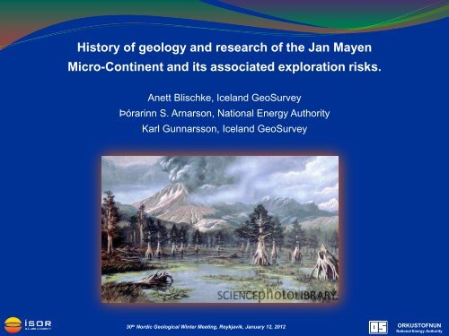
History <strong>of</strong> geology and research <strong>of</strong> <strong>the</strong> <strong>Jan</strong> <strong>Mayen</strong>Micro-Continent and its associated exploration risks.Anett Blischke, Iceland GeoSurveyÞórarinn S. Arnarson, <strong>National</strong> <strong>Energy</strong> AuthorityKarl Gunnarsson, Iceland GeoSurvey30 th Nordic Geological Winter Meeting, Reykjavík, <strong>Jan</strong>uary 12, 2012ORKUSTOFNUN<strong>National</strong> <strong>Energy</strong> Authority
The North-DrekiLicensing AreaLocation Reference‣ North Dreki is part <strong>of</strong> <strong>the</strong> <strong>Jan</strong><strong>Mayen</strong> Micro-Continent(JMMC) with indications <strong>of</strong>continental strata andsuitable structures<strong>Jan</strong> <strong>Mayen</strong>‣ Expected similarities tolicensing areas on and <strong>of</strong>fEast-Greenland and <strong>of</strong>fNorway (provenhydrocarbon provinces in<strong>the</strong> Møre and Vøring basins)North-Dreki30 th Nordic Geological Winter Meeting, Reykjavík, <strong>Jan</strong>uary 12, 2012ORKUSTOFNUN<strong>National</strong> <strong>Energy</strong> Authority
Exploration History <strong>of</strong> <strong>the</strong> <strong>Jan</strong> <strong>Mayen</strong> Area‣ Late 1970´s – 1980´s first main phase <strong>of</strong> exploration activities by Academia and <strong>the</strong> NPD / NEA, 2Dseismic reflection and refraction data acquisition, sea floor sampling and DSDP drilling program.‣ Mid 1990´s regional gravity and magnetic modeling project and ODP drilling campaigns.‣ Early 2000´s – re-activation <strong>of</strong> 2D seismic reflection and refraction data acquisitions and re-assessment<strong>of</strong> JM.‣ 2007 – SEA „Dreki - Strategic Environmental Assessment“ by <strong>the</strong> Icelandic Government to re-activate oil& gas exploration activities.‣ 2009 – 1 st Icelandic Hydrocarbon Exploration Licensing Round‣ Since 2008 – Second main phase exploration activities by NEA-ÍSOR / NGU / NPD / Academia &Industry <strong>of</strong> re-assessing <strong>of</strong> <strong>the</strong> <strong>Jan</strong> <strong>Mayen</strong> historic- and recent data (2D seismic acquisitions, reprocessingand analysis, sea floor core & ROV sampling, seep studies, high resolution bathymetry,aeromagnetic survey, gravity modeling)‣ 2011-2012 – 2 nd Icelandic Hydrocarbon Exploration Licensing Round30 th Nordic Geological Winter Meeting, Reykjavík, <strong>Jan</strong>uary 12, 2012ORKUSTOFNUN<strong>National</strong> <strong>Energy</strong> Authority
Data Control‣ Vintage, reprocessed and infill 2D seismic or refraction surveys – ongoingacquisitions and research (NPD, Spectrum, TGS).• Progress : - imaging resolution- sub-Paleocene basalt imaging improvements- very much improved igneous province interpretations• Main Questions : - basin areas still masked by Neogene volcanism- lack <strong>of</strong> deep stratigraphic pre-Paleocene ties andresulting guess-work- velocity modeling30 th Nordic Geological Winter Meeting, Reykjavík, <strong>Jan</strong>uary 12, 2012ORKUSTOFNUN<strong>National</strong> <strong>Energy</strong> Authority
2D Seismic reflection data surveys over <strong>the</strong> <strong>Jan</strong> <strong>Mayen</strong> AreaCommercial SurveysNPD-NEA SurveysTGS2009 CGG Veritas,reprocessed part <strong>of</strong><strong>the</strong> IS-JMS-01 data2011 Spectrumacquired data set2012 IS-JMR-01(2001) data setbecomes publicNPD Infill 2DJMR Survey2011-2012confidential2009 Spectrum commercial survey,reprocessed JM-85 & JM-88 data30 th Nordic Geological Winter Meeting, Reykjavík, <strong>Jan</strong>uary 12, 2012ORKUSTOFNUN<strong>National</strong> <strong>Energy</strong> Authority
Data Control‣ Magnetic and gravity surveying and modeling – ongoing acquisitions and research(NGU, NEA).• Progress : - studies; NEA 1995, Rey S. 2003 UiB- NGU compilations <strong>of</strong> magnetic and gravity data interpretations,dynamic modeling and publications focused on <strong>Jan</strong> <strong>Mayen</strong>(in press)- refining margins between oceanic plate and micro-continentupdated heat flow data estimate• Main Questions : - lack <strong>of</strong> high res surveys for detailed interpretation <strong>of</strong> complextectonic and volcanic structures, e.g. igneous vs. stratigraphicareas, possible magnetic anomalies vs. seismic interpretations, etc.30 th Nordic Geological Winter Meeting, Reykjavík, <strong>Jan</strong>uary 12, 2012ORKUSTOFNUN<strong>National</strong> <strong>Energy</strong> Authority
Magnetic Surveysafter Laurent Gernigon,2011, NGUCollaboration projectNGU, NPD & NEA -Preliminary outline <strong>of</strong> <strong>the</strong>aeromagnetic surveyJAS-11in <strong>the</strong> western NorwegianSea (green frame)planned for 2012.30 th Nordic Geological Winter Meeting, Reykjavík, <strong>Jan</strong>uary 12, 2012ORKUSTOFNUN<strong>National</strong> <strong>Energy</strong> Authority
Data Control‣ High resolution bathymetry surveys (2008 HÍ & NEA, 2010 NPD)‣ Actual “hard” data – boreholes, seafloor core, grab or dredge samples – ongoinggovernmental and commercial research (NEA-Fugro, NPD, VBPR-TGS).• Progress : - evidence for presence <strong>of</strong> pre-Tertiary strata- evidence for presence <strong>of</strong> organic rich shales- key markers to define sou<strong>the</strong>astern- and western basaltprovinces including updated heat flow data estimate- shallow seismic ties down to Middle Eocene at ridges crests• Main Question : - lack <strong>of</strong> deep stratigraphic pre-Paleocene well control withresulting necessary risk mitigating parameters, e.g. age control,reservoir-seal characteristics, basin modeling, velocity modeling,etc.30 th Nordic Geological Winter Meeting, Reykjavík, <strong>Jan</strong>uary 12, 2012ORKUSTOFNUN<strong>National</strong> <strong>Energy</strong> Authority
Borehole & Seafloor Samplesaround <strong>the</strong> <strong>Jan</strong> <strong>Mayen</strong> Area‣ DSDP : 5 wells during Leg 38 in 1974‣ ODP : 1 well during Leg 151 in 1993‣ ODP : 2 wells during Leg 162 in 1995ROV outcropsampling on steepridge flanks, NPD& University <strong>of</strong>Bergen insummer 2011 over<strong>the</strong> Noth-Drekiarea.Cores provide density and velocity measurements toenable a depth – seismic tie (TWT) to confirm <strong>the</strong> TopEocene marker for 3 wells on <strong>the</strong> Ridge.‣ Seafloor sampling (core, dredge & ROV grab)• NEA & NPD 2010• NPD 2011• VBPR 20112011 samples indicate pre-Tertiary strata withsandstone <strong>of</strong> good quality that can act as a reservoirrock. In addition, it found rocks <strong>of</strong> an age that act assource rocks in Greenland .Detailed analysis are in progress at NPD, UiB &VBPR-TGS.Reached intoBASALT18.8 ± 1.7Ma(Talwani et al,1976)approx. magneticanomaly 6,around top EarlyMioceneReached intoBASALT approx.40-44 Ma (Talwaniet al, 1976)approx. magneticanomaly 19-20,Middle Eocene30 th Nordic Geological Winter Meeting, Reykjavík, <strong>Jan</strong>uary 12, 2012ORKUSTOFNUN<strong>National</strong> <strong>Energy</strong> Authority
What do we know?‣ Best analogue comparison with East Greenland exploration examples and Møre Basin for<strong>the</strong> Norwegian side.‣ Post Paleocene sedimentary rocks <strong>of</strong> sufficient thickness and age in <strong>the</strong> ridge flank areas.‣ Indications and first preliminary evidence <strong>of</strong> pre-opening sedimentary strata <strong>of</strong> possiblyPaleozoic, Triassic-Jurassic and maybe Cretaceous age – especially underneath <strong>the</strong> westflank areas <strong>of</strong> <strong>the</strong> ridge, i.e. <strong>Jan</strong> <strong>Mayen</strong> Basin.‣ Potential reservoir rocks, focus on locally shallow marine to generally marine deposits,especially submarine fans / turbidite deposits for post Paleocene deposits, and possiblyfocus on limestone platform to continental deposits for <strong>the</strong> pre-opening formations.‣ Potential traps present, both structural and stratigraphic.‣ Hydrocarbon maturation is probably high, more gas prone if sufficient source rocks arepresent and a more detailed influence <strong>of</strong> igneous activity needs to be included.30 th Nordic Geological Winter Meeting, Reykjavík, <strong>Jan</strong>uary 12, 2012ORKUSTOFNUN<strong>National</strong> <strong>Energy</strong> Authority
Regional Correlations important for comparison to <strong>the</strong> history <strong>of</strong> <strong>the</strong> JMMCCollage based on results <strong>of</strong> recent research publications and observations at <strong>the</strong> JMMCWollastonForeland730 th Nordic Geological Winter Meeting, Reykjavík, <strong>Jan</strong>uary 12, 2012ORKUSTOFNUN<strong>National</strong> <strong>Energy</strong> Authority
Regional Correlations important for comparison to <strong>the</strong> history <strong>of</strong> <strong>the</strong> JMMCCollage based on results <strong>of</strong> recent research publications and observations at <strong>the</strong> JMMC30 th Nordic Geological Winter Meeting, Reykjavík, <strong>Jan</strong>uary 12, 2012ORKUSTOFNUN<strong>National</strong> <strong>Energy</strong> Authority
10 ms 10 kmRegional Correlations important for comparison to <strong>the</strong> history <strong>of</strong> <strong>the</strong> JMMCCollage based on results <strong>of</strong> recent research publications and observations at <strong>the</strong> JMMC7WollastonForelandDanmarkshavn & Thetis Basins?Vøring BasinModified afterHenriksen, N. etal, 2009Modified after Dinkelman, M.G. et al, 20101Modified after Brekke, H. et al, 20002Jameson Land Basin, Liverpool High & Basin50 km<strong>Jan</strong> <strong>Mayen</strong> Micro-Continent??450 kmMøre BasinModified after Henriksen, N. et al, 20083Kangerlussuaq6Modified after Brekke, H. et al, 20005Modified after Henriksen, N. et al, 200830 th Nordic Geological Winter Meeting, Reykjavík, <strong>Jan</strong>uary 12, 2012ORKUSTOFNUN<strong>National</strong> <strong>Energy</strong> Authority
Top Paleocene Structure Map(Depth Range: 170m – 6100m)Structural Compartmentalization <strong>of</strong> <strong>the</strong> JMMCEarly to Late Oligocene composite sheet<strong>of</strong> flat-lying intrusive covering subsidedcontinental crust just before oceaniccrust started to form on <strong>the</strong> KolbeinseyRidge and <strong>the</strong> Iceland Plateau.SDR (Seaward Dipping Reflectors)Important Fault / Fractures Zones thatinfluence and subdivide <strong>the</strong> JMR.Top Paleocene FaultsMinor reverse faulting visible(poss. since <strong>the</strong> Middle Miocene parallel<strong>the</strong> opening <strong>of</strong> <strong>the</strong> Kolbeinsey Ridge)30 th Nordic Geological Winter Meeting, Reykjavík, <strong>Jan</strong>uary 12, 2012ORKUSTOFNUN<strong>National</strong> <strong>Energy</strong> Authority
Conceptual model –seismic data comparisonKey line interpretation at <strong>the</strong> JMMCNPD-NEA Surveys30 th Nordic Geological Winter Meeting, Reykjavík, <strong>Jan</strong>uary 12, 2012ORKUSTOFNUN<strong>National</strong> <strong>Energy</strong> Authority
Conceptual model – seismic data comparisonNor<strong>the</strong>rn edge <strong>of</strong> <strong>the</strong> Dreki Licensing Area30 th Nordic Geological Winter Meeting, Reykjavík, <strong>Jan</strong>uary 12, 2012ORKUSTOFNUN<strong>National</strong> <strong>Energy</strong> Authority
SSWNew 2D Seismic Quality Data = More Possibilities for Data InterpretationPossible Sub Tertiary unconformities become better visible below <strong>the</strong> Top PaleoceneNNE<strong>Jan</strong> <strong>Mayen</strong> ?Trough▬▬▬SeabedLate Oligocene - MioceneBase Late Oligocene?▬Top Eocene▬UC Middle Eocene▬▬UC Top PaleoceneUC Late Paleocene poss.Data by courtesy <strong>of</strong>▬Top Mesozoic poss.▬▬Top Paleozoic poss.(or actual Basement ???)Top Basement poss.(Crystalline ??? deep reflector)30 th Nordic Geological Winter Meeting, Reykjavík, <strong>Jan</strong>uary 12, 2012ORKUSTOFNUN<strong>National</strong> <strong>Energy</strong> Authority
TWT (ms)SSWConceptual model – seismic data comparisonNor<strong>the</strong>rn edge <strong>of</strong> <strong>the</strong> Dreki Licensing AreaData by courtesy <strong>of</strong>NNE▬▬▬▬▬▬▬▬▬SeabedBase Pliocene-PleistoceneUC Late Oligocene - MioceneUC Base Late OligoceneTop EoceneUC Middle EoceneUC Top PaleoceneTop Paleozoic poss.(or actual Basement ???)Top Basement poss.(Crystalline ??? deep reflector)▬ Top Mesozoic poss. ???▬ Top Jurassic poss. ???▬ Intrusive30 th Nordic Geological Winter Meeting, Reykjavík, <strong>Jan</strong>uary 12, 2012ORKUSTOFNUN<strong>National</strong> <strong>Energy</strong> Authority
Volcanic Zones <strong>of</strong> JMMCPossible scenarioSDR (Seaward Dipping Reflectors)Poss. post break-up, larger intrusionsVolcanic complexes poss. just above<strong>the</strong> top Paleocene marker44-40Ma Anomaly 19-20 BasaltprovinceProbably oceanic ridges / transition areaPossible Rift area between Anomalies20 & 13<strong>Jan</strong> <strong>Mayen</strong> Trough shallow intrusionsEarly to Late Oligocene composite sheet<strong>of</strong> flat-lying intrusive (Anomalies >6)Important Fault / Fractures Zones thatinfluence and subdivide <strong>the</strong> JMR.30 th Nordic Geological Winter Meeting, Reykjavík, <strong>Jan</strong>uary 12, 2012ORKUSTOFNUN<strong>National</strong> <strong>Energy</strong> Authority
TWT(ms)▬SeabedSSWSeismic data – Timing <strong>of</strong> Intrusions900mData by courtesy <strong>of</strong>NNE▬Pleistocene - Pliocene▬UC Late Oligocene - Miocene▬UC Base Late Oligocene▬Top Eocene▬UC Middle Eocene▬UC Top Paleocene▬Eocene – Oligocene Intrusive30 th Nordic Geological Winter Meeting, Reykjavík, <strong>Jan</strong>uary 12, 2012ORKUSTOFNUN<strong>National</strong> <strong>Energy</strong> Authority
Exploration risk factors forprospectivity‣ Data – Interpretation certaintySDR‣ Pre-Tertiary Strata – Reservoir & Source‣ Post-Paleocene Strata – Reservoir & Seal‣ Heat Flow – Maturity <strong>of</strong> Source Rock‣ Structure & Timing – Trap & Seal‣ Depth & Location – AccessibilityTop Paleocene Structure map, shallow intrusion (green ploy.)30 th Nordic Geological Winter Meeting, Reykjavík, <strong>Jan</strong>uary 12, 2012ORKUSTOFNUN<strong>National</strong> <strong>Energy</strong> Authority
Risk mitigationfor a better understanding <strong>of</strong> <strong>the</strong> <strong>Jan</strong> <strong>Mayen</strong> Ridge area‣ More NNE-SSW 2D seismic lines and denser line grid over areas <strong>of</strong> interest for a betterstructural and facies interpretation(NPD is conducting an infill 2D seismic survey that also crosses into Icelandic waters2011 & 2012.)‣ High resolution magnetic and gravity survey across <strong>the</strong> complete area <strong>of</strong> <strong>the</strong> Sou<strong>the</strong>rnRidge complex(NGU is flying a high resolution aerial magnetic survey close east to JMR in 2012.)‣ Additional sea floor sampling campaign (core, grab or dredge sampling) along seismic lineson <strong>the</strong> western flank <strong>of</strong> <strong>the</strong> ridge, preferably on steep ridge flanks that expose older strata.(NPD has completed a ROV sampling campaign in 2011, researching presently <strong>the</strong>results. VBPR-TGS has completed <strong>the</strong>ir sampling campaign in 2011, presentlyresearching <strong>the</strong> results, open for purchase in February 2012.)30 th Nordic Geological Winter Meeting, Reykjavík, <strong>Jan</strong>uary 12, 2012ORKUSTOFNUN<strong>National</strong> <strong>Energy</strong> Authority
Risk mitigationfor a better understanding <strong>of</strong> <strong>the</strong> <strong>Jan</strong> <strong>Mayen</strong> Ridge area‣ Basin modeling study using more recent (e.g. Rey, 2003) geo<strong>the</strong>rmal gradient model,estimating degree <strong>of</strong> maturity assuming that source rocks are present, also in directcomparison with studies that have been done for <strong>the</strong> Jameson Land Basin area in EastGreenland.‣ New long <strong>of</strong>fset and low frequency 2D seismic survey along <strong>the</strong> outer coast <strong>of</strong> <strong>the</strong>“Scoresby Sund” and “Blosseville Kyst” along <strong>the</strong> East-Greenland coast, where <strong>the</strong>western end <strong>of</strong> <strong>the</strong> possible <strong>Jan</strong> <strong>Mayen</strong> Basin lies.‣ Possibly conduct a more detailed “outcrop” study at <strong>the</strong> steep <strong>Jan</strong> <strong>Mayen</strong> ridges <strong>of</strong> <strong>the</strong>sou<strong>the</strong>astern ridge complex to support analogue comparison studies between <strong>the</strong> JMMCand <strong>the</strong> Møre basin for <strong>the</strong> sub-basalt formations, especially for <strong>the</strong> Mesozoic agedformations.‣ Deep stratigraphic well in <strong>the</strong> shallower waters into <strong>the</strong> Main Ridge high, to show if aMesozoic or Paleozoic strata exists <strong>of</strong> sufficient thickness and quality – or if <strong>the</strong> complexstructures and patterns correspond to primarily intrusive complexes.30 th Nordic Geological Winter Meeting, Reykjavík, <strong>Jan</strong>uary 12, 2012ORKUSTOFNUN<strong>National</strong> <strong>Energy</strong> Authority
Thank you very much for your attention !Acknowledgements:Kristinn Einarsson, Inga Dóra Gudmundsdóttir, Lárus Ólafsson, Thorvaldur Bragason at NEASigurveig Árnadóttir, Gunnlaugur M. Einarsson, Bjarni Richter at Iceland GeosurveyBryndís Bandsdóttir, University <strong>of</strong> Iceland30 th Nordic Geological Winter Meeting, Reykjavík, <strong>Jan</strong>uary 12, 2012ORKUSTOFNUN<strong>National</strong> <strong>Energy</strong> Authority