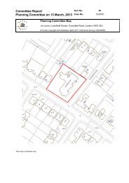
wembley-plan-app (small) , item 9. PDF 8 MB - Meetings, agendas ...
wembley-plan-app (small) , item 9. PDF 8 MB - Meetings, agendas ...
wembley-plan-app (small) , item 9. PDF 8 MB - Meetings, agendas ...
- No tags were found...

Create successful ePaper yourself
Turn your PDF publications into a flip-book with our unique Google optimized e-Paper software.
36Wembley Area Action Plan - Proposed Submission Version4 Urban Design & Place MakingThree Stations4.48 In order to create distinctive, safe andattractive arrival points into Wembley, Brent Councilhas pursued a ‘Three Stations Strategy’ that hasseen the transformation of Wembley’s three stationsto ensure visitors are able to arrive and departquickly and comfortably, whilst minimising potentialnegative impacts on local residents and businesses.4.49 Improvements include:A major refurbishment and extension ofWembley Park Station completed in 2006,increasing its capacity to 37,000 passengersper hour on Stadium event days.The iconic White Horse Bridge and a newpublic square at Wembley Stadium Station,completed in 2006, designed to link theStadium and its surrounding regeneration areawith the existing town centre.Modernisation of Wembley Central Station aspart of a large mixed use development thathas seen the creation of a new public squareand lively heart to the town centre(improvements ongoing).Picture 4.30 Wembley Park Station4.50 The work undertaken to date on the threestations has made a genuine difference to theperceptions of the area. Although there have beensignificant improvements to the three stations, therestill needs to be more work undertaken at thesearrival points, particularly Wembley StadiumStation. The council will continue to prioritise andimprove these gateways through policies such asWEM17 (Walking and Cycling) and WEM3 (PublicRealm).Arrival by foot/bicycle4.51 The strategy for walking and cycling in thearea is set out at WEM17. Gateways can helpimprove the pedestrian and cyclist experience ofthe area by providing a landmark and focal point,an aid to navigation and orientation, safe cycleparking, and areas for meeting and resting.4.52 The key focal points for pedestrians are thethree stations and the node at the junction ofOlympic Way and Engineers Way. Once theWembley Boulevard (shown on Map 13.1 and keydiagram) is complete, a pedestrian priority spinewill run through the heart of the area - fromWembley Park Station (via Olympic Way) toWembley Stadium Station (via Wembley ParkBoulevard)and on into the town centre andWembley Central station. The junction of OlympicWay and Engineers Way has been highlighted asa Principal Gateway node due to its central locationand potential role in linking together the currentlydisparate areas of Wembley. This will of courseonly be realised be reinforced if an <strong>app</strong>ropriatealternative to the Pedway pedestrian ramp isdelivered (see para 6.35).4.53 While cyclists mostly access the area byroad, there will be greater permeability into the areaalong this pedestrian and cycle priority route. Someof the key gateways will be <strong>app</strong>ropriate for cyclehubs (see WEM17) and as nodes for connectionsto the wider strategic cycle network.