SCOPING REPORT AUGUST 2008 - Transnet
SCOPING REPORT AUGUST 2008 - Transnet
SCOPING REPORT AUGUST 2008 - Transnet
- No tags were found...

Create successful ePaper yourself
Turn your PDF publications into a flip-book with our unique Google optimized e-Paper software.
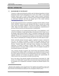
EIA FOR THE UPGRADE OF THE SISHEN - SALDANHARAILWAY LINE TO 93 MTPA IRON ORE CAPACITY<strong>SCOPING</strong> <strong>REPORT</strong><strong>AUGUST</strong> <strong>2008</strong>VOLUME 11
<strong>SCOPING</strong> <strong>REPORT</strong> – <strong>AUGUST</strong> <strong>2008</strong>TABLE OF CONTENTS1 INTRODUCTION ..........................................................................................................41.1 Background – General...........................................................................................41.2 History of the Line .................................................................................................41.3 Project Planning ....................................................................................................71.4 Basic planning alternatives....................................................................................72 ENVIRONMENTAL AUTHORISATION AND PROCESS ..........................................102.1 Approach To The Capacity Upgrade Project.......................................................102.2 Listed Activities....................................................................................................102.3 Legal Framework.................................................................................................123 PROJECT DESCRIPTION .........................................................................................133.1 Site location and extent .......................................................................................133.2 Capacity increase objectives. ..............................................................................133.3 Main capacity increase actions............................................................................164 PROJECT ACTIVITIES..............................................................................................174.1 Extension of crossings loops to 420 wagon train length–Infrastructure upgrade.174.2 Double the line (> 67MTPA requirement)............................................................194.3 Additional intermediate loops (< 67MTPA requirement)......................................204.4 Supporting infrastructure and services ................................................................234.5 Communications and data systems.....................................................................234.6 Additional lines in certain loops ...........................................................................244.7 Electrical power – traction ...................................................................................244.8 New or additional maintenance facilities..............................................................254.9 Construction materials, waste and general..........................................................254.10 Project activity - operations .................................................................................275 PROJECT ALTERNATIVES ......................................................................................295.1 The status quo – or “do nothing” alternative........................................................295.2 Inter project (macro) alternatives.........................................................................295.3 Intra project (micro) alternatives ..........................................................................296 THE EXISTING ENVIRONMENT ...............................................................................316.1 General environmental characteristics ................................................................316.2 Environmental characteristics at loop extensions (420 wagon option) ................436.3 Environmental characteristics – doubling the line................................................466.4 Environmental characteristics at proposed new intermediate loops ....................477 PUBLIC PARTICIPATION .........................................................................................507.1 Introduction..........................................................................................................507.2 Public participation process.................................................................................507.3 Process data .......................................................................................................512
<strong>SCOPING</strong> <strong>REPORT</strong> – <strong>AUGUST</strong> <strong>2008</strong>8 ENVIRONMENTAL IMPACTS AND SIGNIFICANCE................................................588.1 Methodology to determine significance ...............................................................588.2 Environmental significance matrix .......................................................................589 ENVIRONMENTAL ISSUES ......................................................................................639.1 Create infrastructure for>67mtpa-extending crossing loops : 420 wagon trains..639.2 Create infrastructure for > 67mtpa : doubling the line - general ..........................649.3 Create infrastructure for > 67mtpa : establish new intermediate loops................659.4 Terrestrial disturbance through extending crossing loops: > 67mtpa activity ......669.5 Terrestrial disturbance during extension or construction. ....................................679.6 Effect on drainage / surface hydrology from extension of culverts and drains.....689.7 Ecological disturbance – construction of loops next to existing line ....................699.8 Ecological disturbance – coastal and estuarine environments ............................709.9 Noise from increased train movement / longer trains>41mtpa ............................729.10 Increased safety hazard – road and pedestrian traffic:........................................769.11 Increased safety hazard – derailments and operational incidents.......................779.12 Effect on the landscape, community and sense of place at Elands Bay..............809.13 Construction of microwave towers and communication equipment at new loops 849.14 Upgrade of the power supply infrastructure on the line .......................................859.15 Construction and social issues at loop and building sites (> 67mtpa activity) .....859.16 Orex Road Issue between Lamberts bay and Elands Bay ..................................879.17 Liberation of ore dust from trains loaded trains ...................................................889.18 Avifauna interaction – OHTE and new 50kV electrical feeder line.......................899.19 Archaeological disturbance – new loop construction...........................................909.20 Loss of access or traffic disturbance through bridge construction.......................919.21 Loss of access through changes in level crossings.............................................9210 CONCLUSIONS AND RECOMMENDATIONS..........................................................9310.1 Conclusions.........................................................................................................9310.2 Recommendations ............................................................................................10111 ENVIRONMENTAL IMPACT ASSESSMENT ISSUES............................................10211.1 Environmental Issues fully studied and addressed at Scoping level. ................10211.2 EIA stage - Environmental issues and process. ................................................10312 GLOSSARY OF TERMS..........................................................................................10613 DEFINITIONS OF TECHNICAL TERMS..................................................................10714 PHOTOFILES...........................................................................................................10715 APPENDICES ..........................................................................................................10716 VOLUME 2: SPECIALIST <strong>REPORT</strong>S......................................................................1073
<strong>SCOPING</strong> <strong>REPORT</strong> – <strong>AUGUST</strong> <strong>2008</strong>1 INTRODUCTION1.1 Background – General<strong>Transnet</strong> Limited is conducting a feasibility study for a proposed upgrading of the Sishen-Saldanha railway line to an iron ore export capacity of 93 million tonnes per annum. SHECape Environmental CC has been appointed by <strong>Transnet</strong> as the EnvironmentalAssessment Practitioner (EAP) to conduct the Environmental Impact Assessment (EIA) ofthe proposed upgrade.In order to meet iron and manganese ore export imperatives arising from expansion ofactivities at Sishen (Kumba Resources and BKM), Khumani mine (Assamang) andpossibly Manganore (Sedibeng), the iron ore export capacity of the abovementionedexport line already needs to be increased from the current 38MTPA to an expected47MTPA by the year 2009. The Port is presently authorised to handle 47MTPA, throughthe provision of an additional tippler, stacker / reclaimers and new shiploaders. Longerterm planning is now investigating the feasibility of increase logical capacity upgradephases beyond 47MTPA to around 93MTPA.In support of primary Government objectives, <strong>Transnet</strong>’s mandate as a parastatalorganisation is to reduce the cost of doing business in South Africa, whilst remainingprofitable by reducing costs, improving efficiencies, investing in infrastructure andupgrading ageing rolling stock (State of the Nation Address, 2005).The upgrading of capacity of the rail link above 67MTPA could involve a combination ofinfrastructure expansion, traction and train handling improvements, wagon upgrading,power supply improvements, signalling technology upgrade, longer and / or more frequenttrains, expanded locomotive maintenance facilities, possible lengthened crossing loops,the provision of extra loops between the existing ones, or even doubling parts of the line.1.2 History of the Line1.2.1 Construction and OperationalIscor originally built the railway line from Sishen to Saldanha in 1974 – 76 to an axleloading of 26 tonnes. The asset was later transferred to the South African Railways andHarbours with a book value of R861m. (Source – Risk Control – Saldanha: 1995). The linewas planned to have 19 crossing loops at ±45 km intervals but during initial constructionthe rail infrastructure was completed on only the 10 even-numbered loops at 90 kmintervals, while loops 1, 3 and 19 were added shortly thereafter. The earthworks for all 19loops except loops 7, 13 and 15 were completed during initial construction of the line,which, was originally built to carry 18 million tonnes per annum (MTPA).During the past few years the demand for export iron ore has increased from 18MTPA tothe present 38MTPA, with Environmental Authorisation already gained for 41MTPA. Toenable <strong>Transnet</strong> Freight Rail to deliver on traffic demand, track was laid on the previouslyconstructed odd-numbered crossing loops 5, 7, 9, 11, 13, 15 and 17 in the period 2000 -2004, allowing crossings at 45km intervals instead of 90km. The axle loading on the linewas also increased to 30 tonnes. Table 1.2.1 shows the initial capacity components of theore line as designed for 18MTPA operations.4
<strong>SCOPING</strong> <strong>REPORT</strong> – <strong>AUGUST</strong> <strong>2008</strong>Table 1.2.1: Original design and operating criteria for the Iron Ore LineDescription: Activity / Infrastructure orRolling Stock componentOriginal design18MTPA200 wagon trainsPeriod commissioned / planned 1974 - 1976Design capacity18 MTPALength of line861 km single trackOHTE - Overhead track equipment50 kV ACNumber of crossing facilities10 loops with CTCWagons per train 200Axle load, payload per wagon26 tonnes per axleNet payload per wagon85 tonNumber of wagons 26 tonnes axle: 2252 CR 5Locomotives per train3 x 9E – 50 kV electricNumber of locomotives31 x 9E – 50 kV electricTrains per week21 iron ore trains/ weekTurn around time64 hours Sishen,104 hours BeeshoekMaintenanceDaily between trains and 1 weektotal shut downSee Appendix A for a diagrammatic layout of the original line and subsequent upgradingTrains comprising 216 wagons with a payload of 85 or 100t are currently hauled by acombination of class 9E electric and class 34 diesel-electric locomotives on the head end.This configuration is about to change when Radio Distributed Power (RDP) technology,which allows locomotives to be dispersed throughout the length of the train, isimplemented as part of the upgrading to 41MTPA. The line is electrified to 50 kV ACThe line is built as a dedicated rail transport channel, designed for heavy haul of longtrains. On this basis, the line has no formal level crossings of public roads; all such rail orroad interfaces being handled through grade separation structures. There are, however, alarge number of <strong>Transnet</strong> Freight Rail (Departmental) and private crossings for use byadjoining land owners only. Public use of the <strong>Transnet</strong> Freight Rail service road hasdeveloped at Loop 2 (Kreefbaai) on the road between Lamberts Bay and Elands Bay onthe West Coast.The entire route passes through a very sparsely settled part of the country, particularlybetween Loops 3 (Bamboesbaai) and 18 (Tomkins). There are a limited number of farmsettlements (approximately 54) within a two kilometre radius of the line in the above area,excluding the more intensive settlement at the Olifants River settlement. The line passesimmediately behind the town of Velddrif, through Elandsbaai and close to Lamberts Bay,Dwarskersbos, Strandfontein and Dooringbaai in the coastal zone. From Vredendal theline heads inland, and passes at some distance from Kenhard, Groblershoop andOlifantshoek in the Northern Cape.5
<strong>SCOPING</strong> <strong>REPORT</strong> – <strong>AUGUST</strong> <strong>2008</strong>Fig 1.2.1 – Project Area map6
1.2.2 Environmental History<strong>SCOPING</strong> <strong>REPORT</strong> – <strong>AUGUST</strong> <strong>2008</strong>Subsequent to the introduction of legislation under the Environment Conservation Act, Act73 of 1989, environmental scoping reports were compiled by <strong>Transnet</strong> Freight RailEnvironmental Management for upgrading of the capacity of the line to 38MTPA, throughthe construction of the crossing loops at the existing odd - numbered loops. Approval wasgranted by DEAT as per the records of decision dated 19 th July 2000 referenceA24/16/3/207 and 15 th February 2001, reference A24/16//3/20/7/1 respectively.Further studies were initiated to gain authorisation for an increase in iron ore handlingcapacity to 41MTPA in May 2005. Scoping reports for the Northern Cape and WesternCape Provinces were compiled and approved in a Record of Decision dated 24 April 2006,in terms of Authorisation referenced 12/12/20/702 issued by DEAT. While the study wasaimed at 41MTPA train traffic the infrastructure changes and additions approved resultedin the creation of physical rail capacity well beyond this tonnage.1.3 Project PlanningThe projected planning dates for Phase 2 of the iron ore line upgrade are provided in abrief and highly condensed form in Table 1.3.1 belowPhase 2A refers largely to measures required to upgrade iron ore export capacity beyond47MTPA to approximately 67MTPA, not requiring additional infrastructure.Phase 2B refers to measures required to increase export capacity, possibly in two phasesfrom 67MPTA to a around 93MTPA. These increases above 67MTPA will entail theconstruction of additional infrastructure in the form of crossing loops. Additional loops willbe provided according to capacity requirements, up to the stage where the distancebetween present crossing loops is halved. Source: <strong>Transnet</strong> Capital Projects / <strong>Transnet</strong>Freight Rail)Table 1.3.1: Iron Ore Line - Estimated Phase 2 programmePHASE ACTIVITY START ENDPhase 2A Engineering design and planning Mid 2007 Mid <strong>2008</strong>Phase 2A Construction and commissioning 3 rd quarter ‘08 1 st quarter ‘09Phase 2B Engineering design and planning 3 rd quarter ‘07 3 rd quarter ‘081.4 Basic Planning AlternativesThe relationship between infrastructure upgrade, operational increase and the tonnagemileposts set for the Iron Ore Export Channel as a whole is depicted in fig. 1.4.1 below.41 – 47MTPAInvestment and infrastructure upgrading to achieve the 41MTPA iron ore export includedin previous environmental approvals and using 342 wagon trains is currently in progress. Itis also technically possible to achieve 47MTPA and above to 67MTPA using all the newlylengthened loops and adjusting the existing timetable of 29 trains per week. Increasingcapacity above the 41MTPA mentioned in previous capacity increases to an estimated7
<strong>SCOPING</strong> <strong>REPORT</strong> – <strong>AUGUST</strong> <strong>2008</strong>67MTPA is thus an increase in operational activity and would not require theEnvironmental Authorisation as a listed activity, provided that no additional infrastructure isrequired.Figure 4.1.1: Capacity Upgrade and Traffic Increases – Iron Ore LineNote: Timelines are indicative only and subject to planning changes47 – 67MTPAThere are a number of options for increasing capacity beyond 47MTPA, the first of whichis to increase the number and / or length of trains running on the same infrastructure. It isplanned to increase route capacity to 67MTPA by improved timetabling and reducingturnaround time. This will require investment in rolling stock as well as enhanced tractionpower supply and signalling, but can take place on the same built track and basicinfrastructure. (Source: <strong>Transnet</strong> Freight Rail: January <strong>2008</strong>). Apart from the increase inpower supply which is being handled as a separate Basic Assessment, this increase intonnage is not subject to Environmental Authorisation, provided no further infrastructure isconstructed.8
67 – 93MTPA<strong>SCOPING</strong> <strong>REPORT</strong> – <strong>AUGUST</strong> <strong>2008</strong>Options to increase capacity above 67MTPA to a possible 93MTPA include one or acombination of the following options:Reducing the turnaround time of trains between the mines and the Port:It is not believed that the current traction, rolling stock or infrastructure will acceptthe major increase in line and operating speeds required delivering a significantdecrease in the journey time from mines to Port and this option is discounted forfurther study.Significantly increasing the length (capacity) of the trains run:Increasing the planned 342 wagon trains to a length of 420 wagons. This willrequire the lengthening of the crossing loops to accommodate longer trains andproviding additional traction power supply.Doubling the existing single line:Double the track and allow bi-directional / passing traffic where needed. Additionalpower and a new signalling system will be required.Building additional crossing loops:This option implies the provision of 20 additional intermediate loops to increase thenumber of trains the route can handle at any time. New signalling is required to addcontrol to these new loops and additional traction power will also be required.(Source: <strong>Transnet</strong> Projects – Project Report : November 2006)Further discussion on the nature and potential environmental aspects of the optionsdescribed is provided in section 5 below.9
<strong>SCOPING</strong> <strong>REPORT</strong> – <strong>AUGUST</strong> <strong>2008</strong>2 ENVIRONMENTAL AUTHORISATION AND PROCESS2.1 Approach To The Capacity Upgrade Project<strong>Transnet</strong> through its Consultants PDNA / SRK JV previously submitted an application for ajoint EIA for the expansion of the Port of Saldanha as well as the Sishen – Saldanha raillink to an iron ore export capacity of 93MTPA. On 27 th June 2006 SHE Cape submitted anapplication on behalf of <strong>Transnet</strong> to conduct a separate EIA for the rail link only (Salkor toErts - Sishen), this application being accepted by DEAT and WCDEA&DP (references12/12/20/826 and E12/2/1 – AV1 dated 12 th and 19 th July 2006 respectively.The EIA regulations under the Environment Conservation Act (1989) have been replacedby new EIA regulations promulgated under section 24 of the National EnvironmentalManagement Act, 1998 (NEMA), the latter containing completely new procedures andlisted activities under Government Notices R385, R386 and R387 respectively, cominginto force from 1 July 2006.Chapter 9 (Regulation 83) of the new NEMA regulations does, however, make provisionfor transitional arrangements whereby authorisations previously granted are still valid andit may be inferred that changes in terms of an exiting authorisation may be handled assuch. Since this application relates to an application submitted before 1 st July 2006 andhaving been approved as such under the Environment Conservation Act 1989, thisapplication will be handled under the regulations contained in GN R1183 of 5 th September1997 as directed by DEAT.2.2 Listed Activities2.2.1 Environment Conservation Act (ECA)The construction of a railway line is a listed activity in terms of the EnvironmentConservation Act (73 of 1989) and its subsequently promulgated EIA Regulations.In terms of these regulations (GN1183), DEAT acting in conjunction with therelevant provincial authorities, must grant environmental authorisation prior to suchan activity being undertaken. In this situation, where the applicant is an organ ofthe State and the project traverses more than one Provincial boundary,authorisation from DEAT at national level, is required.The project entails the following listed activities requiring approval in terms of theregulations under the Environment Conservation Act (1989), GN R 1182 and GNR1183:a. Item 1(c)ii. Manufacturing, storage, handling, treatment, or processing facilities forany hazardous substance;b. Item 1(d). The construction erection or upgrading of railways and associatedstructures;c. Item 1(g). Structures associated with communications networks, including masts,towers and reflector dishes;d. Item 2(c) The change of land use from agricultural or zoned undetermined use oran equivalent zoning to any other land use;e. Item 10. The cultivation or any other use of virgin ground – (Provisional NorthernCape and depending on project development options – doubling or deviation of theline)10
<strong>SCOPING</strong> <strong>REPORT</strong> – <strong>AUGUST</strong> <strong>2008</strong>2.2.2 National Environmental Management Act (NEMA)In terms of the Environmental Impact Assessment (EIA) Regulations (GovernmentNotice R 385) which came into effect from 3 rd July 2006, NEMA makes provision forEnvironmental Authorisation by means of either a Basic Assessment for activitieslisted in GN R386 or through an EIA for activities listed in GN R 387. Possibleproject activities falling under the respective NEMA listings are tabled below.Table 2.2.1NEMA Listed ActivitiesNEMALISTINGGNR386GNR386GNR386GNR386GNR386GNR386GNR386GNR386GNR387GNR387STUDYLEVELBABABA 2BA 3BA 4BA 5BA 6ITEMNo.1(m)1((l)BA 17EIAEIA 21(s)BRIEF DESCRIPTION OF ACTIVITYThe construction of facilities or infrastructure , including associatedstructures or infrastructure for any purpose in a one in ten year floodline of a river or stream, or within 32 metres from the bank of a river orstream where the flood line is unknown, excluding purposesassociated with existing residential use, but including:(i) canals (ii) channels (iii) bridges (iv) dams, and(v) weirsThe transmission and distribution of electricity above ground with acapacity of more than 33 kilovolts and less than 120 kilovoltsConstruction or earth moving activities in the sea or within 100 metresinland of the high-water mark of the sea, in respect of:(f) buildings, or, (g) infrastructureThe prevention of the free movement of sand, including erosion andaccretion, by means of planting of vegetation, placing syntheticmaterial on dunes and exposed sand surfaces within a distance of100 metres inland of the high-water mark of the sea.The dredging, excavation, infilling, removal or moving of soil, sand orrock exceeding 5 cubic metres from a river, tidal lagoon, tidal river,lake, in-stream dam, floodplain or wetlandThe removal or damaging of indigenous vegetation of more than 10square metres within a distance of 100 metres inland of the highwatermark of the sea.The excavation, moving, removal, depositing or compacting of soil,sand, rock or rubble covering an area exceeding 10 square metres inthe sea or within a distance of 100 metres inland of the high-watermark of the seaPhased activities where any one phase of the activity may be below athreshold specified in this schedule but where a combination of thephases, including expansions or extensions, will exceed a specifiedthreshold.The construction of facilities or infrastructure, including associatedstructures or infrastructure for rail transportation, excluding railwaylines and sidings in industrial areas and underground railway lines inmines, but including: (i) railway lines, (ii) stations or (iii) shunting yardsAny development activity, including associated structures andinfrastructure, where the total area of the development area is, or isintended to be, 20 hectares or more11
<strong>SCOPING</strong> <strong>REPORT</strong> – <strong>AUGUST</strong> <strong>2008</strong>2.3 Legal FrameworkTable 2.3.1 below indicates the major items of legislation or standards to be taken intoaccount in the planning, implementation and operational phases of the project. The list isnot exhaustive and is for indicative purposes only.Table 2.3.1: Legal Framework – outline.STANDARDAtmospheric Pollution Prevention Act, Act21 of1940(Where not amended/repealed)Conservation of Agricultural ResourcesAct, Act 43 of 1983 (CARA),Environment Conservation Act, Act 73 of1989 (ECA)Explosives Act, Act 26 of 1956National Environmental Management Act,Act 107 of 1998 (NEMA)National Environmental Management Act,Biodiversity Act, Act 10 of 2004National Veld and Forest Fire Act, Act 101of 1998APPLICATIONPrevention of atmospheric pollution by occupiers of land.(NEMA Amendment Air Quality Act)Steps to be taken to control dustProhibition of spreading weedsList of declared weedsCombating category 1, 2 and 3 plantsMethods of controlSection 19 LitterNational Noise Regulations (GN154)Prohibition of use of blasting materials without a penaltyPenalty for endangering safety and causing loss of lifeUse of blasting materialsSpecial permission for blasting within 500m of buildings,railways, public roads etc.Section 24;Regulations GN 385, 386, 387Threatened and protected ecosystems and speciesAlien species: restricted activities and duty of care relating toalien speciesInvasive species: listed species, restricted activities and duty ofcare relating to alien species, control of listed invasive speciesProhibition on fires when fire danger is highNational Water Act, Act 36 of 1998 General Authorisation no 399,Section 19: pollution on site;Section 21: defined water usesChapter 4: Water use license applications.SANS 1089:1999 Part 1The Petroleum Industry: storage of petroleum products inaboveground installationsSANS 10103 (2003)South African national Noise StandardSANS 10328 (2003)Methods for environmental noise impact assessmentsNorthern Cape Provincial NatureConservation OrdinancesNature reserves, miscellaneous conservation measures,protection of wild animals other than fish, protection of floraetc.12
<strong>SCOPING</strong> <strong>REPORT</strong> – <strong>AUGUST</strong> <strong>2008</strong>3 PROJECT DESCRIPTION3.1 Site Location and ExtentThe Sishen – Saldanha iron ore line traverses two Provinces, with five of the crossingloops lying in the Western and the remaining fourteen in the Northern Cape.Major points on the line are Erts yard at Sishen where ore is loaded at the mine’s rapidloading facility; Halfweg or loop 10, which is a crew change and rest area and Salkor yardat Saldanha, where trains are presently split into two sections (rakes) for dischargethrough a tippler operated by <strong>Transnet</strong> Port Terminals (TPT) in the Port of Saldanha. Theline has main feeder points at Sishen (Kathu) for traffic from Beeshoek, at Halfweg for leadconcentrate and loop 4 (Knersvlak) for Namakwa Sands mineral ore products.Loop extension for the 420 wagon train option would entail work at each of the 19 crossingloops presently in operation. See Appendix B – Loops and loop extension planning.The alternative and more probable option to the 420 wagon trains solution would entailmore frequent trains and the construction of 20 intermediate loops, roughly midpoint (20 –25km) between the existing loops, depending on operating and infrastructure constraints.See table 3.2.2 below.3.2 Capacity Increase ObjectivesTables 3.2.1 and 3.2.2 below indicate the possible scenarios for an increase in trainactivity from above the current levels to a possible 93MTPA iron ore export. Table 3.2.1indicates the trains required under a 420 wagon train scenario.Table 3.2.1: Possible 342 to 420 wagon trains per weekEXPECTED TRAINS PER WEEK – 67 & 93 MtpaCONCEPT: 342 Wagon Trains ramp-up to 420 Wagon Trains<strong>2008</strong> 2009 2010 2011 2012 2013Ore Trains (Sishen – Saldanha)Train slots - full direction / week 40 / 72 72 72 72 72 72Train slots - empty direction / week 40 / 72 72 72 72 72 72Trains - full direction / week 28 / 44 44 44 47 47 47Trains - empty direction / week 28 / 44 44 44 47 47 47Tonnage per annum - MTPA 45 50 65 88 88 88General Freight Trains (Loop 4 - Saldanha)Train slots - full direction / week 6 6 7 7 7 7Train slots - empty direction / week 6 6 7 7 7 7Trains - full direction / week 6 6 7 7 7 7Trains - empty direction / week 6 6 7 7 7 7Tonnage per annum - MTPA 1.5 1.5 1.7 1.7 1.7 1.7TOTAL : Full trains per week 34 / 50 50 51 54 54 54TOTAL : Empty trains per week 34 / 50 50 51 54 54 54TOTAL : TRAINS PER WEEK 68 / 100 100 102 108 108 108TOTAL : TONNAGE PER ANNUM 46 51 67 90 90 90The train dynamics involved in running 420 wagon trains is uncharted territory in thecontext of the line, with its relatively narrow gauge, topography, gradients and powerrequirements. While this is being investigated from a technical perspective indications are13
<strong>SCOPING</strong> <strong>REPORT</strong> – <strong>AUGUST</strong> <strong>2008</strong>that the 420 wagon train concept is not feasible at this stage. An alternative proposedrelated to running shorter trains but at greater frequency is also being considered.(Source: <strong>Transnet</strong> Freight Rail / <strong>Transnet</strong> Capital Projects: January <strong>2008</strong>).Table 3.2.2 shows the indicative requirements using shorter (228 wagon) but morefrequent trains to reach the same tonnages.Table 3.2.2: Possible 228 wagon trains per weekEXPECTED TRAINS PER WEEK – 67 & 93 MtpaCONCEPT: 342 Wagon Trains ramp-up to 228 Wagon Trains - 120 Slots<strong>2008</strong> 2009 2010 2011 2012 2013Ore Trains (Sishen – Saldanha)Train slots - full direction / week 40 / 72 72 72 72 72 120Train slots - empty direction / week 40 / 72 72 72 72 72 120Trains - full direction / week 28 / 44 44 44 56 56 83Trains - empty direction / week 28 / 44 44 44 56 56 83Tonnage per annum - MTPA 45 50 65 88 88 88General Freight Trains (Loop 4 - Saldanha)Train slots - full direction / week 6 6 7 7 7 7Train slots - empty direction / week 6 6 7 7 7 7Trains - full direction / week 6 6 7 7 7 7Trains - empty direction / week 6 6 7 7 7 7Tonnage per annum - MTPA 1.5 1.5 1.7 1.7 1.7 1.7TOTAL : Full trains per week 34 / 50 50 51 63 63 90TOTAL : Empty trains per week 34 / 50 50 51 63 63 90TOTAL : TRAINS PER WEEK 68 / 100 100 102 126 126 180TOTAL : TONNAGE PER ANNUM mtpa 46 51 67 90 90 90NOTE: Data used in Tables 3.2.1 and 3.2.2 is according to planning concepts inJune 2006. Subject to subsequent changes in planning, target and feasibility criteriaTable 3.2.3 below provides the latest concept train numbers, based on successful runningof 342 wagon trains already included in previous capacity increase approval forimplementation. Successful 342 wagon trains could render alternative 228 wagon trainsunnecessary or of limited use only.Table 3.2.3: Planning concept January <strong>2008</strong> – 342 wagon train conceptACTIVITY(Annual tempo of traffic at different tonnages)<strong>2008</strong> 2009 –20102011 –2013 ►Ore trains per week per direction 30 to 45 50 to 67 45 to 60Ore rains per day per direction 4 to 6 7 to 10 6 to 9Total ore trains per week 60 to 90 100 to 134 90 to 120Total ore trains per day 9 to 13 14 to 19 13 to 17Tonnage per annum - MTPA 30 to 45 50 TO 67 67 to 93Table 3.2.4 below provides a comparison of the capacity, rolling stock and operationaloptions required to meet the export tonnages required, using various train configurations.14
<strong>SCOPING</strong> <strong>REPORT</strong> – <strong>AUGUST</strong> <strong>2008</strong>Table 3.2.4: Capacity expansion history and potential planning of the Ore Line 41MTPA (authorised) – to 93MTPAPlanning Phase Phase 1A Phase 1B Phase 2A Phase 2B Phase 2BPlanned CapacityUpgrade to 39 /41MTPA AuthorisedUpgrade: 39 to 47MTPA Upgrade: 47 to 67MTPA Upgrade 67 to 93MTPA Upgrade 67 to 93MTPAActivity / Component 342 wagon solution 342 wagon solution 342 wagon solution 342 wagon solution 228 wagon solutionPeriod commissioned /planned2007 <strong>2008</strong> 2009 - 2012 2013 ► 2013 ►Design capacity 39 - 41MTPA 47 MTPA 67 MTPA 93 MTPA 93 MTPALength of line 861 km single track 861 km single track 861 km single track 861 km single track 861 km single trackOHTE - Overhead trackequipment50 kV AC 50 kV AC 50 kV AC 50 kV AC 50 kV ACNumber of crossingfacilities10 loops with CTC ableto cross 342 wagontrains19 loops with CTC >10able to cross 342 wagontrains19 loops with CTC allable to cross 342 wagontrains40l loops with CTC allable to cross 432 wagontrains40 loops with CTC allable to cross 228 wagontrainsWagons per train 342 342 342 342 228Axle load, payload perwagon30 tonnes per axle 30 tonnes per axle 30 tonnes per axle 30 tonnes per axle 30 tonnes per axleNet payload per wagon 100 ton 100 ton 100 ton 100 ton 100 tonNumber of wagons30 t/axle: 1786 CR13/1430 t/axle: 4000 CR 13/14 30 t/axle: 6632 CR 13/14 30 t/axle: 9206 CR 13/14 30 t/axle: 7900 CR 13/1426 t/axle: 1000 CR 5Locomotives per train4 x 9E and4 x 9E and2 x 34 Class Diesel2 x 34 Class Dieselelec.6 x 15 E 6 x 15 E 4 x 15 ENumber of locomotivesTrains per week31 x 9E and42 x 34 Class Dieselelec29 iron ore per week5 general freight trains /week45 x 9E and50 x 34 Class Diesel40 iron ore trains perweek6 general freight trains /week64 hours Sishen70 x 15 E 104 x 15 E 160 x 15 E44 iron ore trains perweek6 general freight trains /week75 hours Sishen58 iron ore trains perweek7 general freight trains /week75 hours Sishen83 iron ore trains perweek7 general freight trains /week64 hours Sishen75 hours SishenTurn around time104 hours Beeshoek 80 hours Beeshoek 80 hours Beeshoek 80 hours Beeshoek 80 hours BeeshoekMaintenance 1 week total shut down 2 weeks total shut down 2 weeks total shut down 2 weeks total shut down 2 weeks total shut downNote: CTC – Centralised Train Control (trains / signals controlled ex Saldanha)Source:<strong>Transnet</strong> Projects – Revised January <strong>2008</strong>. Provisional information only. Subject to ongoing planning and research15
<strong>SCOPING</strong> <strong>REPORT</strong> – <strong>AUGUST</strong> <strong>2008</strong>3.3 Main Capacity Increase ActionsFurther to section 1.4 above the possible increase to 93MTPA iron ore export is beingconsidered through a number of possible infrastructure, rolling stock and railway systemssupport upgrading initiatives, including the following:• Extend all crossing loops and associated infrastructure to allow the crossing of 420wagons trains – pre feasibility stage.• Double the line to allow totally or largely bi-directional train traffic and capacity up toand beyond 93MTPA – pre feasibility stage.• Double sections of the line and / or provide intermediate crossing loops in between theexisting crossing loops for the length of the line to allow the running and crossing ofmore frequent trains.• Provide additional communications masts and equipment to extend the total system aswell as at intermediate loops, if and where required.• Upgrade the traction power supply to allow the implementation of a 40, 72 and possibly120 slot train timetable, including additional traction feeder stations (TFS).• Provide a 50kV feeder line along the length of the route.• Provide new and additional upgraded electric locomotives as well increasing the size ofthe wagon fleet to accommodate greater tonnages.• Upgrade the support systems required for an expanded train timetable includingproviding additional maintenance facilities, upgraded train control and signalling,additional overnight accommodation / crew change facilities as well as extra lines incertain yards.16
<strong>SCOPING</strong> <strong>REPORT</strong> – <strong>AUGUST</strong> <strong>2008</strong>4 PROJECT ACTIVITIESThe project activities described below include three basic planning concepts which are to acertain extent mutually exclusive. These are all in the process of feasibility studies and theactivities and operational rationale of each option is described in order to gauge anindication of the potential environmental impact involved. The alternatives are:4.1 The running of 420 wagon trains (existing loop extensions)4.2 The doubling of the entire line, or sections thereof4.3 The building of intermediate loopsFurther project activities described thereafter are deemed generally applicable to any ofthe operating and infrastructure models proposed.4.1 Extension of crossings loops to 420 wagon train length – InfrastructureUpgrade (> 67MTPA infrastructure)4.1.1 Extend all crossing loops to 420 wagon lengthThe 19 crossing loops on the line are all in place, but are in the process of beingextended from accommodating train lengths of 216 wagons to 342 wagons. As analternative to running more trains to achieve the 93MTPA capacity now beinginvestigated, train modelling studies have shown that running even longer trains of420 wagons is one means of achieving future capacity requirements. This doesmean, however, that loops must be extended to enable two 420 wagon trains tocross each other en route.The expected loop lengthening at nineteen (19) existing crossing loops through thelength of the line will be between 400m and 500m each in extent. The new SalkorNorth yard is not affected. The extended track centres for loop extensions will bebetween 4m and 6m from the centre of the existing line and will have overheadtrack equipment (OHTE) similar in design and construction to the existinginfrastructure.Widening for loop extension purposes will, in all instances, take place within theexisting disturbed and transformed rail reserve and will entail:Extension of structures to accommodate existing / additional site drainage.Includes culverts (concrete and pipe) but no bridges.Construction (widening) of existing cuttings and embankments within the alreadytransformed rail corridor.Extension of concrete access structures such as agricultural underpasses orroad over rail bridges, the latter being unlikely at existing loop extensions.Opening new borrow pits for earthworks construction, if required after firstconsidering the use of existing / old borrow pits wherever possible.Limited loss of entirely transformed vegetation, established within the corridorsince construction of the line in 1974.4.1.2 Service / Maintenance RoadThe line is served by a dedicated, private gravel road extending through its entirelength, for maintenance purposes. At crossing loops, a smaller service road runsnext to the track, serving as a service road for track and signalling maintenancepurposes, as well as for locomotive and wagon maintenance for trains in transit,17
<strong>SCOPING</strong> <strong>REPORT</strong> – <strong>AUGUST</strong> <strong>2008</strong>when required. An extension of this existing small service road will be required ateach loop extension. The road will normally be at the same level as the new trackformation, approximately 4 - 6 metres wide. This small service road will occur in anarea not greater than 10m wide, at all times within the existing rail reserve. SeePhoto File 5 – roads and access4.1.3 Rail formation and trackThe new track will generally be at the same level and follow the same curvature asthe existing line and will have overhead track equipment (OHTE) similar in designand construction to the existing infrastructure. In some instances, it may benecessary to move existing point sets, purely to accommodate safety clearances toallow signalling for simultaneous entry of trains into the loop.The existing formation earthworks generally either level or in fill, will be widened bya maximum of approximately 20m to accommodate the new section of track and theservice road required.4.1.4 Overhead Traction Equipment (OHTE)The 50kV overhead traction equipment (OHTE) electrical equipment comprisesmasts at a maximum of 70m apart, supporting a contact wire that varies from 5m to6m above rail height. Mast height is 10m above ground level. The OHTE transferspower at 50kV from <strong>Transnet</strong> Freight Rail Traction Feeder Stations (TFS) to theelectric locomotives hauling a train, through a pantograph extending above the roofof the locomotive to be in contact with the live overhead power feed.The new OHTE structures will be a mirror of the existing masts and wiringconfiguration on the currently operational line, where parallel track is constructed forloop and yard extensions.4.1.5 Bridges and CulvertsThe existing line and loops are designed to accommodate surface water flowsarising from stormwater, as well as streams and rivers which can be perennial ornon-perennial.Water flows at existing cuttings are channelled and diverted to lower levels throughthe use of side drains, catchwater mounds and berms. Water flows atembankments are channelled through pipe or concrete culverts perpendicular to theformation at low spots, streams or drainage lines. These structures will be extendedat the same or better flow capacity in all instances along the existing level andalignment, without further disturbance to the existing drainage patterns that havebeen established over the life of the line. See Photo File 4 – culverts and structures.4.1.6 Roads and Level CrossingsThe maintenance and operation of the iron ore line as a world class heavy haul linerequires ready and reliable access to its entire 861km length, hence the presence ofa good quality, dedicated maintenance road between Sishen and Saldanha. Theroad is ostensibly a private road but is becoming increasingly popular for private(unauthorized) use due to the generally poor condition of alternative district roads aswell as inadequate access control by rightful users – TRF and landowners.The existing maintenance road is generally not affected by loop extensions since itnormally lies along the western boundary fence, some distance from the track. Inplaces where the loop extension extends beyond the loop or station emplacementinto the narrower rail reserve, or where it is presently in the path of a loop extension,18
<strong>SCOPING</strong> <strong>REPORT</strong> – <strong>AUGUST</strong> <strong>2008</strong>the position of the road will merely be realigned. It is not expected that themaintenance road will encroach into adjoining private land, or be relocated to theeastern side of the track at any point, as a result of the 420 wagon loop extension.However, the present rail reserve may be too narrow to accommodate new trackworkat proposed intermediate loops without affecting the maintenance road and shouldthis situation arise; the road may have to be relocated outside the <strong>Transnet</strong>boundary.The iron ore line is designed as a dedicated high speed, high density railway line withno significant road / rail interfaces. All major and district roads are accommodated bygrade separation structures such as bridges or underpasses. There are, however,hundreds of “private” crossings for use by adjoining land owners as stock crossings,or for access to watering points or to farmsteads, with many of these occurring inloop areas.4.1.7 BuildingsNo major buildings are planned at the 420 wagon extensions. The majority ofcrossing loops have been provided with signal relay rooms as part of the moreextensive 41MTPA Phase 1(b) upgrade. Should any relay rooms be required, theywould consist of a simple 3m x 6m brick structure placed in the rail reserve near thenew entry / exit points set.4.2 Double the Line (> 67MTPA Requirement)4.2.1 Operational background to a double lineDoubling an existing line involves more than just constructing a new adjacent trackand it also provides more than double the existing capacity.A simple, single direction doubling would mean connecting the loops and installing“cross over” points allowing trains to move from one line to the other, only formaintenance or train recovery purposes. Train will normally operate on a conveyorprinciple, with loaded trains using one line in the down direction and empty trainsusing the other line in the up direction. This is the simplest signalling solution sincesignals face in one direction only. Using a simple double line solution brings about alarge increase in capacity in the order of 106MPTA to 200MTPA, depending on thespacing of train control signals.A more complex double line model entails bi-directional signalling which uses thecrossovers to allow trains, loaded or unloaded, to travel in either direction on therunning lines between loops. This system provides flexibility and avoids delays dueto maintenance or any form of train disruption and eliminates the delay cost of anyoperations failure. Track, signals and OHTE maintenance is simplified considerablyand the system becomes more reliable and cost efficient as a result.4.2.2 Construction of a double lineAll the activities as described for the extension of a loop are typically relevant to thedoubling or construction of a new line adjacent to the existing track. However,significant additional work would be required if the entire 861km were to bedoubled.Table 4.2.1 provides indicative details of the extent of construction work that couldbe involved in doubling the length of the line.19
<strong>SCOPING</strong> <strong>REPORT</strong> – <strong>AUGUST</strong> <strong>2008</strong>Table 4.2.1: Construction elements of doubling the Iron Ore Line (order ofmagnitude quantities)Element Unit RequiredEarthworks : soft cut / fill m 3 3.80 millionEarthworks : hard cut / fill m 3 3.78 millionNew formation and track between loops Route km 773 kmBaboon Point Tunnel 34.7m 2 / metre 788 metresSignificant structures – Olifants bridge 1 off 1035 metresSignificant structures – multispan bridges 19 off 1425 metresMultispan rail over road bridges 40 off 448 metresCulverts – 2m X 2m Each 382 culvertsCulverts – 3m X 3m Each 140 culvertsNew OHTE between loops Route km 773 kmNew ballast, sleepers and rail Route km 773 kmTerrestrial disturbance (estimated) – new line 2 ha / new km 1546 haNew borrow pits (estimated) 1 borrow / 10 km 70 borrowsSource: <strong>Transnet</strong> Projects – Project Report: 3 November 20064.3 Additional Intermediate Loops (> 67MTPA Requirement).4.3.1 Operational background to intermediate loopsTable 4.3.1The concept of providing additional or intermediary loops between the existingloops is aimed at reducing the headway (time between following trains) by building20 passing loops between Salkor North and Erts at Kathu, thereby allowing trains tocross each other at approximately 20km intervals instead of the present 40km.A review of investment decisions made by international railways regardingincreases in capacity was conducted. The review indicated that similar railways aregenerally single line hauling up to and slightly above 90MTPA. They all moveminerals at around 60 - 80 km / hour and use trains between 240 and 320 wagonslong. Therefore no railway has found the need to double their line up to traffic levelsof 90MTPA, using evenly spaced passing loops instead. (Source: <strong>Transnet</strong> Projects- 3 November 2006)Table 4.3.1 indicates the possible location of additional passing loops, should thisoption be decided on. The positions are provisional at this stage and are based onpre – feasibility engineering studies. Technical and train operations studies are stillin progress and positions will be further refined.Provisional Intermediate Loop Positions (Current Planning)New Loop No.Between Existing Located between (approx. km)loop numbers South km North kmLoop (A) 1M (a) Salkor North – Loop 1 15km 20kmLoop (A) 1M (b) Salkor North – Loop 1 24km 29km20
<strong>SCOPING</strong> <strong>REPORT</strong> – <strong>AUGUST</strong> <strong>2008</strong>New Loop No.Between Existing Located between (approx. km)loop numbers South km North kmLoop (B) 2M Loop 1 – Loop 2 63km 68kmLoop (C) 3M Loop 2 – Loop 3 115km 120kmLoop (D) 4M Loop 3 – Loop 4 155km 164kmLoop (E) 5M (a) Loop 4 – Loop 5 199km 203kmLoop (E) 5M (b) Loop 4 – Loop 5 205km 211kmLoop (F) 6M (b) Loop 5 – Loop 6 252km 261kmLoop (G) 7M Loop 6 – Loop 7A 295km 300kmLoop (H) 8M Loop 7A – Loop 8 335km 343kmLoop (J) 9M Loop 8 – Loop 9 377km 388kmLoop (J) 9M (a) Loop 8 – Loop 9 386km 392kmLoop (K) 10M Loop 9 – Loop 10 426km 432kmLoop (L) 11M Loop 10 – Loop 11 462km 467kmLoop (M) 12M Loop 11 – Loop 12 504km 509kmLoop (N) 13M Loop 12 – Loop 13 545km 554kmLoop (P) 14M Loop 13 – Loop 14 596km 602kmLoop (Q) 15M Loop 14 – Loop 15 633km 639kmLoop (R) 16M Loop 15 – Loop 16 676km 683kmLoop (S) 17M Loop 16 – Loop 17 720km 725kmLoop )T) 18M Loop 17 – Loop 18 762km 767kmLoop (W) 19M Loop 18 – Loop 19 806km 811kmLoop 20M Loop 19 – Erts 845km 850km(Source: <strong>Transnet</strong> Capital Projects - Latest positions under investigation: February <strong>2008</strong>)4.3.2 Construction of additional intermediate loopsa) InfrastructureAll the activities as described for the extension of a loop are typically relevant to thedoubling or construction of a new line adjacent to the existing track. However, seeingthat the average length of a new loop is approximately 4km longer than a loopextension for 420 wagon trains (400 to 500m), a significantly greater area and impactwithin the rail reserve per loop is involved.21
<strong>SCOPING</strong> <strong>REPORT</strong> – <strong>AUGUST</strong> <strong>2008</strong>Table 4.3.2: Construction elements of building 19 or 20 new intermediate loops onthe Iron Ore Line (order of magnitude quantities only)Element Unit RequiredEarthworks : cuttings m 3 0,6 millionEarthworks : embankments m 3 1,2 millionNew formation and track extension 4,75 km / loop 95 kmBaboon Point Tunnel Nil NASignificant structures – Olifants bridge Nil NASignificant structures – Multispan bridges Nil NAMultispan rail over road bridges Nil NACulverts – 2m X 2m Each 40 culvertsCulverts – 3m X 3m Each 10 culvertsNew OHTE at loop extensions 4,75 km / loop 95 kmNew ballast, sleepers and rail 4,75 km / loop 95 kmEstimated terrestrial disturbance – loop extension 2 ha new km 190 haEstimated new / reopened borrow pits 2 borrow / loop 40 borrowsTable 4.3.2 provides indicative details of the extent of construction work that couldbe involved in providing 19 additional crossing loops on the line. Loop 20M (loop 19– Erts yard) was not included in some of the estimates of costs and quantities.The design parameters used for the site selection of new loops includes anevaluation of the presence of major items of infrastructure such as bridges, tunnelsof earthworks of significant magnitude. Wherever possible and without moving thelocation of the loop too far from the midpoint between the two adjoining loops,Intermediate loops have been placed where the doubling of major structures isavoided.b) Maintenance LinesThe new intermediate loops will also be provided with an extra section of track toaccommodate on-track maintenance machinery and defective wagons orlocomotives. This section of usually non – electrified track, known as a maintenanceline, will form part of the loop area and the constructed earthworks platform. SeeAppendix C for a typical maintenance line layout, similar to the 41MTPA planning.Maintenance loops are required from an operational perspective and ease ofmaintenance.Where the width of reserve and terrain within intermediate loops are unable toaccommodate an additional (3 rd ) track it will be necessary to acquire additional landoutside the reserve for this purpose. In the event that it is not possible engineer theloop and service road so as to remain within the confines of the reserve, additionalland may be required at some of the loops.c) Signals and CommunicationEach loop will require the signalling, communications and electrical control supportnecessary to control and allow the movement of trains. No major buildings are22
<strong>SCOPING</strong> <strong>REPORT</strong> – <strong>AUGUST</strong> <strong>2008</strong>planned at new loops except that a signal relay room and assorted small buildingshousing signal control equipment will be required.It is envisaged that a relay room will consist of a simple 3m x 6m brick structure ofneutral colour, placed in the rail reserve near the new South or North entry / exitpoints.Assorted structures housing supporting infrastructure and equipment includebuildings for:i. A signal relay room, approximately 3m x 6mii. Small communications equipment roomsiii. Small signals control roomsiv. Electrical transformers for step down power to systems support equipmentv. Building for a back – up generator for local use (not traction) with its fuelsupply tank (1500l diesel)vi. Building housing microwave equipment.Signal and communications support infrastructure kiosks are placed at both ends ofthe loop, but the larger building – type structures are usually concentrated in aservice area at one end of the loop. See Photo File 3: buildings, structures andequipment for typical details and section 4.5 below.It must be assumed at this stage that additional high mast communicationsinstallations may be required at the new intermediate loops. Since line of sight isrequired for certain microwave functions, the existing backbone may not be sufficientfor full train control functions at the intermediate locations.If communications masts are required they would generally be a lattice type structurebetween 20m and 40m high. Such a mast will generally be placed within the<strong>Transnet</strong> Freight Rail rail reserve and no additional access roads will be required.The mast will normally be placed in the same area as other electrical, signals andcommunications structures and buildings at one end of the loop. See Photo File 3 fortypical design details.Communications and data transmission systems are further discussed in section 4.5.4.4 Supporting Infrastructure and ServicesAdditional train crew accommodationThe operation of a 72 slot train timetable could lead to train crew having to worklonger hours than allowed under the relevant labour legislation. Additional rest andaccommodation facilities to allow crew changes within the prescribed periods arebeing considered at loops 6 (Kanakies) and loop 13 (Kenhardt) in order to overcomethis problem. These loops have no facilities at present and new mess, ablution andsleeping accommodation will be required. The issue is at a very early planning stageand no firm details are available.4.5 Communications and Data SystemsRailway operations consist of voice (radio to train) and data communicationsrequirements for signalling and electrical control (fixed position equipment).Investigations are underway to upgrade the present systems which are obsolete anddifficult to maintain due to the age of the equipment. This upgrading is therefore onlypartly attributable to increased demand but also has a high maintenance or efficiencycomponent.23
<strong>SCOPING</strong> <strong>REPORT</strong> – <strong>AUGUST</strong> <strong>2008</strong>Various basic alternatives are being investigated at feasibility level, which include: The Tetra system which will change equipment on existing towers and require 6(six) additional high mast sites. The system will cater for all voice to trainrequirements but will have limited data capability, insufficient for signalsrequirements. Any additional “high sites” required outside the rail reserve do notfall within the scope of this study and separate Environmental Authorization wouldbe sought.The replacement of the existing microwave system with a fibre optic backbone forfixed position equipment. This replaces the present point to point aerial datacommunication system for this purpose and is entirely a maintenance issue, sinceparts for the present obsolete system and equipment are simply not available.A GSM system working on cell phone technology. This would provide for all voiceor data requirements, probably through a third party service provider. In the eventof this option being adopted, the EIA process will be followed and implemented bythe service provider of choice and therefore falls outside the scope of this project.4.6 Additional Lines in Certain Loops4.6.1 Loop 19 – Langberg (Knapp)Planning for volumes beyond 47MTPA indicates additional lines possibly beingrequired within the confines of loop 19. The additional lines are associated with thecreation of a new link line to the Sishen South mine planned for the future and do notform part of this scope of work. Apart from the possible 420 wagon extension, amaintenance loop is also planned on the western side of the existing main line andcrossing loop as part of the 41MTPA authorizationOther route alternatives for a new link from Sishen South being considered include apossible connection to the ore line at approximately 820km between loops 19 and18.Both the options described above relating to this link will be handled as a separateproject and a separate EIA process will be instituted and implemented outside thescope of this study.4.6.2 Maintenance loops.The odd-numbered loops (1, 3, 5, 9, 11, 13, 15, 17 and 19) will also be provided withan extra section of track to accommodate on-track maintenance machinery anddefective wagons or locomotives. Maintenance loops were addressed and includedin the Phase 1(a) 41MTPA studies and approval.4.7 Electrical power – tractionUpgrade of the traction power supply required to cater for increased tonnages to betransported on the ore line is required, even for the 41MTPA authorised under thecurrent environmental dispensation. Due to the fact that increased and / or moreefficient power use is required well before the expected outcomes of this study andsuch upgrade is not dependent on its finding, the whole power supply provision hasbeen removed from this scope and project and will be handled as a BasicAssessment involving:A 50kV feeder line along the length of the line,24
<strong>SCOPING</strong> <strong>REPORT</strong> – <strong>AUGUST</strong> <strong>2008</strong> Five additional Traction Feeder Stations (TFS) to be constructed at loops 2, 6,10, 14 and 18.An increase in capacity arising from moving from a 40 loaded train slot timetable with342 wagon trains to a 72 slot timetable with 342 or 420 wagons trains, or possibly toa 120 slot timetable with 228 wagon trains will obviously require significant upgradeof the Traction power supply (potentially double) for the reliable movement of agreater number of trains or heavier trains.Table 4.7.1 indicates the electrical power usage on the line for traction purposes atpresent.Table 4.7.1: Summary electrical power usage 2004 – 2006Measurement Unit 2004 / 05 2005 / 06Megaton transported X total kilometresGross measurement including train massMegawatt hoursElectricity usage measurementWatt hours per tonne kilometreElectricity used per tonne per kmMtkm 20,500,000,000 19,500,000,000MWhr 168,815 169,220whr/tkm 8.23 8.68Source TFR : 2007The line is fed at 50kV from Eskom sub-stations named Sishen, Gariep near Loop16 (Rooilyf near Groblershoop), Aries near Loop 12 (Kolke), Helios near loop 8(Sous), Juno near Loop 4 (Knersvlak) and Aurora near Saldanha.Extensions to existing TFS, if required, will normally occur near to the existing substationsat the northern side of the loops adjacent to other services such assignalling, high mast and staff accommodation structures. Additional landrequirements estimated at ±900 m 2 are expected to occur within the rail reserve.4.8 New or Additional Maintenance FacilitiesThe main facilities for the maintenance of electric and diesel-electric locomotives aswell as the wagon fleet are located at Salkor (Saldanha). A smaller refuelling andmaintenance depot is located at the Khumba Mining facilities near Kathu. In orderto improve the turnaround time of locomotives to meet 72 train slot requirementschanges to these facilities are planned. This could entail a small daily maintenancefacility at loop 20 or Erts exchange yard where daily, in-line fit on / fit offmaintenance tasks can be carried out close to the main operational area, therebykeeping the delay between locomotive changeovers to the minimum. A larger fullmaintenance depot is also being considered and no details are presently availableas to the option to be carried forward.4.9 Construction Materials, Waste and General4.9.1 Construction materials and fuelNo additional disturbed area is involved for loop extensions for 420 wagon trains.The area immediately adjacent to the existing line at loop ends and where itextends into the single line rail reserve between loops has generally been furtherdisturbed through rail and service road maintenance activities. See Photo File foreach loop Appendix E.25
<strong>SCOPING</strong> <strong>REPORT</strong> – <strong>AUGUST</strong> <strong>2008</strong>The possible construction of new intermediate loops may require additional landoutside the present reserve for maintenance lines at certain of the sites. The loopsfall mainly within a rail corridor disturbed as part of original line construction buthave not been subject to the same amount of maintenance or constructiondisturbance in the interim as has been the case at the existing loops. See PhotoFile for new intermediate loops Appendix F.In the event that cut and fill activities do not balance, or where the material isunsuitable, good quality earthworks material will have to be gained, and borrow pitswill have to be used for this purpose. Use will be made of existing borrow pitsopened during initial construction of the line, wherever possible.Storage for materials typically associated with the construction of compactedearthworks as well as structures will be required, in secure conditions within theexisting loop and station emplacement area. Diesel fuel will be stored in a numberof above ground fuel tanks of capacity not exceeding 2,000l per tank, for use inearthmoving vehicles in the remote loops where commercial filling stations are notaccessible. Permanent way (track) material as well as OHTE mast and overheadassemblies will be stored on site.4.9.2 Solid WasteIn the event that cut and fill quantities do not balance, earthworks spoil may begenerated. Such material, comprising entirely natural soil or rock material willremain on site, either forming berms above cuttings or at the toe of embankmentsor shaped so as to prevent erosion or runoff of silt. Given the short length of the 420wagon extensions (400m) such quantities are generally expected to be small butwill increase with the 5km new loop option.Domestic solid waste associated with construction teams is estimated at 4 m 3 - 5m 3per week. This will be removed from site and disposed of at the nearest registered /municipal waste disposal site.4.9.3 EffluentEffluent may be generated from the mixing and casting of concrete. Effluent frombatching activities, if occurring, will be collected and retained in containmentfacilities and no run–off from site will be permitted. Portable chemical toilets will beused for sanitation on each site and no sewage effluents will be generated.4.9.4 Gaseous EmissionsThere are no scheduled processes involved. Temporary emissions fromconstruction and earthmoving equipment will be experienced during theconstruction period of approximately 6 - 12 months per loop. This aspect ismanaged to acceptable levels for motorised vehicles through engineering controlsand application of the EMP.4.9.5 Water Use and SupplyPotable water only will be stored on site in tanks or rail tankers of a capacity of±40,000l, for loop extensions. Potable water consumption is estimated at 20l perday for a maximum of 100 persons for a period of 9 months, or a total of 108 kl pernew loop, or approximately 2000l per day. Potable water will be obtained fromexisting <strong>Transnet</strong> Freight Rail sources where possible, or from established sourcesas close as possible to the site.26
<strong>SCOPING</strong> <strong>REPORT</strong> – <strong>AUGUST</strong> <strong>2008</strong>Water to be used for compacting earthworks will be brought to site and used directfrom road tankers, as will water for dust control on site. It is estimated that between3,3m 3 and 4m 3 water will be required per kilometer of loop construction includingcompaction and layer works as well as concrete work. This amounts to anestimated maximum of 30m 3 (19 X 0.4 X 4) and 280m 3 (20 X 3.5 X 4) beingrequired for the 19 loops extensions, and 20 new intermediate loops respectively,each 40 km apart and over a construction period of approximately 2 years.The key earthworks phases having the greatest water demand will be spread overapproximately 60 to 90 days per new intermediate loop.4.9.6 Construction Programme and Employment (> 67MTPA activity)a) Permanent employmentTrack, locomotive and wagon maintenance can be expected to increase as a resultof increased tonnage and rolling stock on the line and increases in these permanentstaff segments may be expected. Infrastructure maintenance is expected to berepresentative of more than 80% of the labour budget and the followingapproximate marginal increase in workload could be considered:41 to 47MTPA – 15%; 47 to 67MTPA – 25% and 67 to 93MTPA – 25%.b) Construction EmploymentApproximately 120 to 150 construction posts are envisaged, for Phase 2 work,being jobs associated directly with earthworks, track laying, drainage, OHTE andgeneral construction work by contractors. Local labour will be recruited as far aspossible. Contracts may overlap in time, which increases the typical employmentfigures for certain times within the overall periodConstruction employment for new intermediate loops could increase for theearthworks and structures (35 to 60), trackworks (62) and OHTE (32) phases andextend over a longer period, estimated at 12 months per loop.4.10 Project activity - operations4.10.1 Train MovementsTables 3.2.1 and 3.2.2 above indicate the possible increase in train traffic beingassessed for the ore line, under various planning scenarios. Train numbers usingthe line could therefore be expected to be between 8 and 13 trains per day in <strong>2008</strong>and move to between 13 and 24 trains per day in 2013, depending on the operatingmodel finally decided on.The establishment of new intermediate loops means that trains from both directionswill be stopping and pulling off from a stationary position, especially empty trains.This can be expected to give rise to an amended noise pattern for each new loop,which cannot be established at this stage. Train noise for passing trains at currenttraffic volumes has been measured and modelled by an appropriate specialist – seesections 6.1.15 and 9. 9 and specialist reports Appendix 1A (Vol. 2).4.10.2 Rail MaintenanceRail and OHTE maintenance is largely rail – based, using specialised on-trackequipment such as rail grinders, ultra sonic rail testing and multi purpose perwaymaintenance vehicles. Ballast is sieved, consolidated and profiled at cyclicalintervals, also making use of specialised on-track equipment. Small mobile teamsattend to routine track maintenance such as welding and restoring geometry.27
<strong>SCOPING</strong> <strong>REPORT</strong> – <strong>AUGUST</strong> <strong>2008</strong>An increase in traffic as a result of the capacity increase will proportionatelyincrease rail wear and defects arising from the dynamic aspect railway activities, i.e.the motion and stress of train movement. Track maintenance activities cantherefore be expected to increase gradually with the increase in traffic.4.10.3 Roads and Infrastructure MaintenanceMaintenance of the rail reserve includes regular repair, grading and occasionalresurfacing of the main gravel maintenance road providing access to the line andloops as a whole. Drains and low level culvert inlets or outlets where these crossthe maintenance road are regularly cleared of silt and sand deposited in theroadway by storm events. Good quality soil material has to be sourced continuallygenerally from within the <strong>Transnet</strong> Freight Rail reserve from old borrow pits.A slight increase in these current activities can be expected as a result of theincrease in maintenance and service personnel using the roads.Normal side drains and other drainage structures are cleared of silt, sand andobstructions on a programmed but irregular basis in order to maintain theiroperational efficiency. The extension of loops or the construction of new loops willentail only the extension of existing culverts and structures as opposed to creatingnew ones and operational maintenance is also not expected to increasesignificantly for this aspect.28
5 PROJECT ALTERNATIVES<strong>SCOPING</strong> <strong>REPORT</strong> – <strong>AUGUST</strong> <strong>2008</strong>5.1 The status quo – or “do nothing” alternativeThe line is currently carrying ore at a rate of 29 - 32MTPA. As a result of the previousAuthorisations, the line is approved to handle 41MTPA and, under the “do nothing”scenario, remains at this level.To reach the authorised capacity of 41MTPA, the infrastructure designed to allowthe running of 342 wagon trains will have to be completed (loop lengthening) andRadio Distributed Power implemented. Failure to respond to the demand for an increase in rail capacity greater than 41 /47MTPA will mean:o Capping the iron ore export capacity of the country, via the Port of Saldanha.o No equivalent and economically viable rail or Port infrastructure is available thatcan cater for this increase in traffic (possible 93MTPA)o The indefinite loss in iron ore export earnings to the country to equivalent to52MTPA (assuming 93MTPA maximum) at the annual average price of iron oreon the world markets.o No increase in mining expansion, capital investment and job creationassociated with the mines of supply.o Rail infrastructure created for 41MTPA but capable of carrying traffic up to67MTPA will not be utilised.5.2 Inter project (macro) alternativesThe only other rail transport corridor remotely feasible for the export of this quantity of ironore is via Sishen – Postmasburg – Kimberley (270 km) – De Aar (230 km) – Noupoort (100km) – Port Elizabeth (414 km). Total length of 1014 km.This is a route length of 1014 km, using 270 km under 3kV DC power and theremainder 25 kV AC power, which is less resource and cost efficient than the OreLine of 861 km length at 50 kV throughout.The line has a designed axle load capacity of 20t as opposed to the 30t for theIron Ore Line and would thus require a third more trains to move the same freightmass.Ore traffic on the Port Elizabeth line is expected to increase as a result of theincrease in mining activity around Sishen. Capacity constraints could arise onthis line with the addition of significant amounts of traffic.The line to Port Elizabeth was not purposely built as a heavy haul line and wouldrequire considerable upgrading to enable such an increase in tonnage to betransported. Upgrading required would be similar to, or more intensiveinfrastructural work than, envisaged on the ore line and would occur in anenvironmentally more sensitive environment.5.3 Intra project (micro) alternativesThe rail link is fixed and already fully operational as a heavy haul line of world class statusfor operations on a 1065mm (3’6” gauge) line. The potential for realistic consideration ofalternatives without massive capital expenditure is therefore highly constrained.Further to section 4 above, certain operating models (41 - 67MTPA) and infrastructuraladditions (> 67MTPA) are being considered within the same objective, namely an increasein the iron ore export capacity to 93MTPA. The key alternatives are:29
5.3.1 The running of 420 wagon trains<strong>SCOPING</strong> <strong>REPORT</strong> – <strong>AUGUST</strong> <strong>2008</strong>The running of 420 wagon trains will entail 47 full trains per week working to a 72slot timetable and assuming all loops are extended allow “ultra” long trains to cross.The entire concept is based on the effective application of Radio Distributed Power(RDP) technology. The 420 wagon alternative requires the least investment in fixedinfrastructure to meet the traffic objectives and is clearly also the most benign interms of physical environmental impact of the three options under consideration.This option would be characterised by fewer or less frequent train movements tomove 93MTPA but each movement will be of a greater magnitude and duration.However, the technical feasibility and sustainability of running 420 wagon trains issufficiently unproven / uncertain as to render this option non feasible whenconsidering the capital investment required. At this stage therefore, 420 wagontrains is not considered to be a viable option.5.3.2 Doubling the lineFurther to section 4.2 above, doubling the line could be divided into two suboptions,namely:Complete doubling as per 4.2. This option achieves the criteria for optimal useof the line to full capacity.Partial doubling whereby major structures such as the tunnel and major riverbridges are not doubled. Even this option provides greater capacity thanpotentially required at this planning level. (Source: <strong>Transnet</strong> Capital Projects –January <strong>2008</strong>)The doubling option is based on estimates for an immediately adjoining track, withno significant realignment. While this means that primary disturbance is confined tothe rail reserve it also means that significant structures such as the Baboon PointTunnel (R350m) and Olifants River bridge (R400m) have to be doubled in theirpresent position at the indicative cost shown in brackets and the present signallingsystem will need to be replaced entirely.The doubling option provides greater than required capacity and is the mostexpensive alternative by a factor of 5, based on an order of magnitudeinfrastructure replacement cost. Source: <strong>Transnet</strong> Projects – November 2006The option demonstrates a high degree of financial investment which does notwarrant the greater than required capacity gained (>200MTPA) and will not bepursued as a viable alternative.5.3.3 The building of 20 intermediate loopsThe provision of 20 additional intermediate loops as described in section 4.3 abovewill bring the line to the required capacity level (93MTPA) while maximising utility asa single line, in keeping with international infrastructural investment decisions.The related issues, advantages and disadvantages of this proposal are discussedin section 9.3 below. The single greatest advantage in this option is that therequired capacity is achieved at 20% of the projected doubling cost and thatenvironmental disturbance for additional loops, within the reserve, is also onlyapproximately 13% of the former option.30
6 THE EXISTING ENVIRONMENT<strong>SCOPING</strong> <strong>REPORT</strong> – <strong>AUGUST</strong> <strong>2008</strong>6.1 General environmental characteristics6.1.1 Topography and Land FormThe ore line has a maximum grade of 1:100 against empty trains and 1:250 againstfull trains. The line rises 100m to the Langeberg Range at a distance of 42km fromSishen, before descending to the Gariep River at an altitude of 853m above meansea level (amsl) 170km from Sishen. From this point between loops 15 and 16 itclimbs gradually to a plateau 1006m amsl near Loop 8 (Sous) before sloping downto the coast at Strandfontein, some 150 km from Saldanha. From Strandfontein theline follows the coast to Salkor.Loop extensions occur entirely within the zone of existing constructed infrastructure.Station emplacements are designed to be flat or very gently sloping, to allow safetrain operations. New loops could require additional land outside the reserve butfollowing exactly the same topography.6.1.2 Vegetation / Plant EcologyThe following are extracts from the specialist Plant Ecology Report compiled by N.Helme: January 2007. The complete report is attached as specialist report -Appendix 1B (Vol. 2).a) Overview of winter rainfall areas – Salkor to loop 7A (Loeriesfontein area)The first six loops are all located within the Cape Floristic Region (CFR), anarea defined largely by predominantly winter rainfall, and a globally uniqueflora that is quite unrelated to anything else in South Africa. Although onlycomprising about 30% of the length of the whole route the bulk of thebotanical diversity (>70%) along the route is found within the Cape FloristicRegion. Furthermore, most (>75%) of the rare and range restricted (ie.endemic) plant species along the route (eg. within 2km of the route) wouldbe expected to occur within the CFR, although none are likely to occur withinthe disturbed railway reserve. The railway traverses some extremelythreatened and/or endemic rich vegetation types in this region (eg. SaldanhaLimestone Strandveld, Knersvlakte Quartz Vygieveld), as these vegetationtypes are restricted to this small area, and occur only in the lowlands, whichhave in many cases been heavily impacted by agriculture and urbanization.One of the outstanding features crossed by the railway in the CFR is theKnersvlakte, which is regarded as a global arid zone hotspot of plantdiversity and endemism (Van Wyk & Smith 2001).The Knersvlakte is one oftwo centres of plant endemism traversed by the railway, the other beingGriqualand West, near Sishen.About thirteen national vegetation types are traversed by the railway withinthe winter rainfall region, and two biomes - Fynbos, and Succulent Karoo.b) Overview of summer rainfall area – Loop 7 (Loeriesfontein area) to SishenThe summer rainfall portion of the route cover almost two thirds of the length,and is semi-arid throughout (up to 450mm/a). The portion from Loop 7 toGroblershoop (Loop 15) is relatively monotonous Bushmanland plateau,interspersed with some large pans, and has a relatively low diversity andvery few rare species. However from Loop 15 to Sishen the geology31
<strong>SCOPING</strong> <strong>REPORT</strong> – <strong>AUGUST</strong> <strong>2008</strong>becomes a lot more complex, and low ridges and mountains appear (eg.Langberg, and the Kuruman Hills). This is the region known as theGriqualand West Centre of plant diversity, and it is biologically poorly knownunder-explored, but it is known to support a surprising diversity of plantspecies, many of which are endemic. The rocky outcrops and gravel pansare particularly important habitats in this area, and is where most endemicsoccur.Ten national vegetation types are traversed by the railway within the summerrainfall region, most of them within 200km of Sishen. Two biomes aretraversed – Nama Karoo, and Savanna.The proposed (loop) extensions all occur in partly or fully disturbed sectionsof the existing railway reserves, and thus botanical diversity within theseareas is insignificant relative to the large adjacent areas of undisturbedhabitat. Overall significance of loss of vegetation in the proposed extensionareas is thus Very Low. The railway line passes through at least 25 differentnational vegetation types, but only in the Western Cape are any of theseregarded as threatened vegetation types. (N. Helme: January 2007)The actual construction area adjacent to the existing line has, in almost allinstances, been disturbed / destroyed by track maintenance activities at existingloops, but to a much lesser extent at proposed intermediate loop sites (teamobservations).The surrounding vegetation has also, in most of the project area, been disturbedand transformed through utilisation for agricultural purposes.6.1.3 Soils and GeologyAll project activities are surface related, occurring within an area tested and foundto be geologically acceptable for the construction and operation of a railway.Geology in the sense of gaining material suitable for formation layer work, such asdolerite or calcrete will be relevant where borrow activities are necessary. Thisprocess and activity will be managed in terms of the DME authorisation andrequirements for small borrow activities in accordance with an approved EMP.The area between Salkor and approximately Loop 6 (Kanakies) is aMediterranean climate region, and soils along the route vary from coastallimestones and alkaline sands, to granitic sands, neutral sands, shalederivedclays, and deep alluvial silts. Virtually no sandstone areas (typical ofthe Cape Fold Mountains) are traversed by the railway, as the railwayspecifically avoids mountainous areas. The proposed Loop 7A at 317km to323km is the transition point from summer to winter rainfall areas. BetweenLoop 8 and 15 (Kenhardt) the reserves are partly to heavily disturbed, onloamy sands, with occasional stony patches, typical of Bushmanland.Occasional patches of Karoo sequence shales occur, but mostly thesubstrate is Quarternary sands.Just after Loop 15 patches of Gordonia Duneveld begin often backing uponto low rocky hills such as Neus se Berg, just south of the Orange River.Rocky ridges occur extensively, but the dominant substrate along thissection is deep red sands typical of this area. From Loop 16 and 17 thesered sands of the permanent dunes are home to the famous, regionallyendemic Red Lark, and the characteristic camel thorn (Acacia erioloba), butthe dunes do not occur to any degree within the railway reserve. The red32
<strong>SCOPING</strong> <strong>REPORT</strong> – <strong>AUGUST</strong> <strong>2008</strong>sands are part of the great Kalahari sand system, and become moreprominent to the north. (Source: N. Helme : December 2006 and January2007).Soils are generally shallow and poorly structured, with little or no rehabilitationpotential. Construction management at loop extensions as well as new loops will beaimed at minimum disturbance of soil areas outside the immediate constructionfootprint.Soil data per Loop is provided in Appendix E.6.1.4 Landscape FeaturesNo declared scenic landscapes are involved at the loop extensions. The line as awhole passes through a generally scenic landscape of varying forms, from coastalto inland Namaqualand / Karoo, but has already largely been assimilated into thesurroundings and sense of place.The coastal area between Lamberts Bay and Elands Bay particularly has a highlandscape sensitivity and sense of place value. The Elands Bay area reflects aunique combination of natural features, on the ore line in any event, comprising thewell known Graauwe Duynen dune system, the ocean, beaches, harbour, theVerlorenvlei RAMSAR wetland site, residential and recreational area and BaboonPoint Mountain.No significant physical change or additions, except for increased train movementsare planned in the highly sensitive Elands Bay area that will significantly affect thesurrounding landscape. Additional Loops are planned in the coastal zone south ofBaboon Point Mountain and Elands Bay but will not add to landscape disturbance,except in relief due to the presence of support services buildings and possiblymicrowave or communications equipment.6.1.5 ClimateThe weather and climate prevailing on the Ore Line is divided into four generalareas.a) General Weather: Sishen areaThis area falls in the steppe climate classification. It is characterised by good rainfallin summer, too little to support forests but enough to prevent desertification. Thereare typically wide expanses of short grass with interspersed trees. Generally thetrend is hot temperatures in summer and low temperatures during winter. Rainfall ismoderate with scattered thunderstorms in summer. This can result in heavy rains attimes resulting in probable flooding at this time. The few winter frontal systems thatreach this area cause extremely low temperatures being experienced during postfrontal conditions.b) General Weather: Kenhardt areaThis area falls on the border between the desert / semi arid and the steppeclassification. It is a transition area where grasslands known as veld are becomingmore prevalent. It is characterised by low rainfall, too little to support forests butenough to prevent desertification. There are typically large expanses of short grasswith the odd tree. Generally the trend is hot temperatures in summer and lowtemperatures during winter. Rainfall is low but the occasional thunderstorms canresult in heavy rains at times resulting in probable flooding during summer. The few33
<strong>SCOPING</strong> <strong>REPORT</strong> – <strong>AUGUST</strong> <strong>2008</strong>winter frontal systems that reach this area cause some cloudy weather but canresult in low temperatures being experienced during post frontal conditions.c) General Weather: Loeriesfontein areaIn the general area of Loeriesfontein the weather is typical of a semi arid area withrelatively low rainfall throughout the year, very high temperatures in summer andvery low temperatures during winter. Rainfall is extremely erratic because ofthunderstorms which cause heavy rains at times resulting in probable flooding. Fewwinter frontal systems reach this area causing rain but can result in lowtemperatures being experienced during post frontal conditions.d) General Weather : Vredenburg / Doringbaai Vicinity:This area falls into the Mediterranean climate classification, which experienceswarm to hot summers and mild to cool winters, while most rain falls in winter.Proximity to the coast dominates the climate. This region is far enough south to beinfluenced by the Southern Ocean circulation pattern of cold fronts. The highpressures move north during winter, allowing the North Westerlies to influence thearea during winter. During summer the Atlantic high pressure system causesupwelling in the Benguella Current and sea temperatures are low along the coastalareas. Advection fog is a regular occurrence. High maximum temperatures do occurparticularly in winter and early spring when the warm offshore flow (berg winds)blow from the mountains to the coast.See specialist report Appendix 1C (Vol. 2) for a complete weather discussion andclimate analysis for the entire line.6.1.6 Surface HydrologyAll surface water interfaces have been accommodated in the design and planningof the line 30 years ago. Culverts or bridges cater for surface water bodies or rivers,streams, and drainage lines. All stormwater flows are already accommodated inexisting yard, line and loop layouts. Proposed construction, occurring entirely as anextension of existing infrastructure, will require only the lengthening of certainculverts, with no major river bridge or other construction affecting surface waterbodies being planned.No diversion of existing streams or drainage lines is planned for Loop extensions ornew intermediate Loops, the latter being specifically chosen so as to avoid majorstructures such as river bridges.No wetlands are encountered on the areas earmarked for Loop extension. Verysignificant wetland areas are present in the area of Loop 2 (Kreefbaai) near ElandsBay, namely the Wadrifsoutpan to the north and Verlorenvlei system to the south.These systems are entirely unaffected by the Loop extensions in the area or theproposed intermediate Loop south of Elands Bay, but will in any event be protected,by avoiding any construction in the area or work that could in any way affect theirfunctionality.Some large (to very large) pans occur in the central area of the line (on shales),such as Commissioner’s Pan and Agab se Laagte (near Dagab Station), but noneof the reserves impact on these pans in any significant way. The pans have nonatural vegetation (apart from algae), and very seldom have any water in them at all(once every ten years on average). When they do have water they can beimportant for nomadic birds such as flamingos, and various smaller waders mayuse the pans as well. (Source: N. Helme – January 2007). The huge ephemeral salt34
<strong>SCOPING</strong> <strong>REPORT</strong> – <strong>AUGUST</strong> <strong>2008</strong>pans to the southwest of Kenhardt (especially Commissioner’s Pan) probablyoccasionally fill sufficiently to attract numbers of Greater and Lesser Flamingo.(Source: A. Jenkins – April 2007)6.1.7 Ground WaterNot affected at all. All work is surface related and no change in the ground waterregime is expected.Water may be abstracted from ground water sources for earthworks constructionpurposes. All water use will be governed by the requirements of the National WaterAct, Act 36 of 1998. No material effect on groundwater resources is expected at thislevel of abstraction for Loop extensions, over the extended construction periodenvisaged. The availability of water, from ground or surface sources will have to bedetermined for the construction of new intermediate loops where water demand willbe significantly higher.6.1.8 Ecological FunctioningSite inspections (team observations) over a long period indicate the presence ofanimal species normally associated with the coastal and inland areas.This includes plains game such as Steenbok (Raphicerus campestris) CommonDuiker (Sylvicapra grimmia) Grysbok (Raphicerus melanotis) and Red Duiker(Philantomba monticola) where off – site habitat supports the poplation; rodents,sand moles, mammals such as Suricate (Suricata suricatta), Bat eared fox(Otocyon megalotis) and Black – backed jackal (Canis mesomelas) often asnocturnal road kills, Porcupine (Hystrix sfricaeaustralis), Cape hare (Lepuscapensis), Rock dassie (Procavia capensis) and Aardvark (Orycteropus afer) aswell as a single Pangolin (Manis temminckii) reported on site (W. Joubert perscomm). Spoor of feline mammals such as Caracal or rooikat (Felis caracal) andothers which could be African Wild Cat (Felix lybica) or similar species are noted inmany of the culvert passages. Reptiles including tortoises mainly Angulate(Chersina angulata) and two snakes were recently encountered on the serviceroad, a large Cape Cobra (Naja nivea) in the central area as well as a large (dead)mole snake (Pseudaspis cana) in the coastal region.The terrestrial animal life is transitory through and across the reserve and has to alarge extent adapted to the presence of an active railway line. Culverts beneath theline are the most commonly used transfer route between east and west of the lineand, judging by the number of tracks in such places, are in regular use. The use ofculverts by animals does add to the freedom of movement and negates the barriereffect of the railway line to a certain extent. While still contained to within thereserve, more longitudinal movement is possible and greater opportunity forescaping through boundary fencing is created.Territorially based game such as duikers and steenbokkies have been observedusing well-known escape routes beneath the boundary fencing, thereby dispellingthe appearance of being trapped within the rail corridor.The maintenance road in the rail reserve poses a greater threat to terrestrial faunathan the railway line itself. Numerous examples of “road kills” can be noted at anygiven trip on the service road. Most common examples are small buck, meerkatte(mongoose), snakes, tortoises and low-flying small insectivorous birds.No significant permanent habitats of sensitive species are noted in the constructionarea, which is generally totally transformed. The presence of burrows formed by35
<strong>SCOPING</strong> <strong>REPORT</strong> – <strong>AUGUST</strong> <strong>2008</strong>moles is a regular sight in the rail reserve and on the flat areas at the base ofembankments and also on the drainage berms above cuttings. These constitute anuisance and in excessive numbers, pose a hazard to surface stability ofembankments.A desktop study indicates six South Africa tortoise species occurring in theSucculent Karoo Biome, with parts of their distribution range overlapping generallythe south western portion of the ore line. Of these, three endemic species areconsidered sensitive namely the Southern Speckled Padloper (Homopus signatuscafer) the Namaqualand Speckled Padloper (Homopus signatus signatus) and theCommon Padloper (Homopus areolatus), The first two species enjoy threatenedconservation status and the Speckled Padloper is at greater risk, due to the factthat 90% of its distribution range overlaps the ore line. Refer to the report of Dr. M.Mc Master : 2007 attached as specialist report Appendix 1D (Vol. 2) which is anupdated report prepared for the 93MTPA upgrade.Notwithstanding the conservation value attached to certain species and which mustbe respected, tortoises have not been observed as a significant occurrence on theore line, especially in comparison to the larger species occurring in the centralKaroo areas of the Free State and Northern Cape which are more prone to physicaldamage from trains. (Team observation)The animal life is generally transitory through and across the reserve and hasadapted to the presence of an active railway line. No significant permanent habitatsof sensitive species are noted in the construction area for extension of Loops, whichis generally totally transformed. A more detailed assessment, over and above thescreening carried out to date may be required for certain of the proposedintermediate Loops. See Appendix F.6.1.9 Avifauna InteractionsPotential for interaction with Avifauna arises from the presence of the OHTErunning the entire length of the line. OHTE aerial structures, contact and returnwires are approximately 5m to 8m above the track and could have the followingrisks to the avian environment:Electrocution from birds coming into contact with different and lethal electricalphases, or,Collision with OHTE wires from birds in flight, particularly near nesting orroosting sites.A study to address the risk of bird electrocution inherent in the ore line OHTEdesign as well as to identify any significant areas where the configuration of the<strong>Transnet</strong> Freight Rail OHTE structures and feeder lines could pose a materialcollision risk for overflying birds was undertaken by the Endangered Wildlife Trust(EWT) and a consultant Ornithologist – Dr. Andrew Jenkins.In total, 349 species are considered likely to occur within the impact area ofthe line. Of these, 28 species are Red-listed, 95 species are regionalendemics, breeding endemics or near-endemics, and seven species areRed-listed endemics. Thirteen species are considered highly susceptible tocollision with overhead lines, of which 11 species are Red-listed, and two areRed-listed endemics.In terms of threat, rarity, endemnicity and the relative conservationimportance of local populations, 12 priority bird species likely to occur in36
<strong>SCOPING</strong> <strong>REPORT</strong> – <strong>AUGUST</strong> <strong>2008</strong>significant numbers within the railway line impact area are identified (seespecialist reports Appendix 1E, (Vol. 2 Table 1).The species of conservation concern most likely to be at risk of collision withassociated power infrastructure are Ludwig’s Bustard Neotis ludwigii, KoriBustard Ardeotis kori, Secretarybird Sagittarius serpentarius, Lanner FalconFalco biarmicus, Peregrine Falcon F. peregrinus, Greater FlamingoPhoenicopterus ruber, Lesser Flamingo P. minor, Great White PelicanPelecanus onocrotalus, and possibly Black Stork Ciconia nigra. Of thesespecies, Ludwig’s Bustard is the most threatened, is also a near-endemicspecies (Barnes 2000), and is highly susceptible to collision with overheadlines (Van Rooyen & Ledger 1999).Wetland areas including the Berg River wetland system, the mouth of theVerloren Vlei, the coastal strip between Elands Bay and Lambert’s Bay, theOlifants River mouth, and the crossing point of the Orange/Gariep River areall points of concern for key species. The huge ephemeral salt pans to thesouthwest of Kenhardt (especially Commissioner’s Pan) probablyoccasionally fill sufficiently to attract numbers of Greater and LesserFlamingo. High-speed, aerial hunting species, in particular Peregrine andLanner Falcons, are prone to colliding with overhead lines where these passclose by and below their cliff nesting sites (Pers obs), such as occurs at afew points along the Sishen-Saldanha line.Sixty-one (61) sections of the entire railway line have been identified aspotentially problematic in terms of avian collision risk, of which 16 areconsidered to be of higher priority than the rest. Source: Dr. A. Jenkins –2007.The findings of these studies are discussed in section 9.18 and the entire report isattached as specialist report Appendix 1E (Vol. 2).6.1.10 Air QualityAir quality along the length of the line is generally excellent, due to the entirely ruralnature of the environment, with industrial pollutants entirely absent except at theorigin (Sishen mining area) and the destination at Saldanha.A screening level study was commissioned to identify the potential for iron ore dustor emissions from load ore trains being discharged into the environment. The studyaddressed and modelled airborne particulate emissions from the current 216 wagontrains to be expected at current traffic levels and in the immediate future, as well asfrom 342 and possible 420 wagon trains being planned for the future.The findings are discussed in section 9.17 and the entire report is discussed in theAirshed specialist report Appendix 1F (Vol. 2)6.1.11 Land Use PatternsLand use generally comprises low potential grazing or domestic livestock, alloutside of the rail reserve. No disturbance or loss of agricultural land is involved inthe loop extensions since all activities occur within the rail reserve. Potential loss ofagricultural land does exist in the event of additional land being acquired outsidethe rail reserve for additional intermediate loops.Land use is generally dictated by the arid nature of the area and is confined to smallstock farming. Watering points associated with this land use occur at irregular37
<strong>SCOPING</strong> <strong>REPORT</strong> – <strong>AUGUST</strong> <strong>2008</strong>intervals along the length of the line and near certain of the loops. Due to the lowcarrying capacity of the land, farm units are generally large. Notwithstanding the lowcarrying capacity of the land, many areas traversed by the line are renowned fortheir quality sheep production capability.Urban residential and recreational land use is encountered at certain towns, mainlyin the coastal zone. These include Lamberts Bay, Strandfontein, Doringbaai,Dwarskersbos and Velddrift in closeproximity, while the line passes directlythrough Elands Bay on the west coast. Theseareas are not necessarily affected by Loopextensions or new Loop construction butrather through any increase or decrease inthe number of train movements and theperceived disturbance attached thereto.Inland areas such as Kathu, Sishen, Kurumanand coastal areas south of Vredendal inparticular are not exempt from the explosivegrowth in property development being experienced in most parts of the country.People pressure in the latter zone particularly is introducing a greater element ofrecreational land use, with an effect on ore line operations.6.1.12 Social EnvironmentThe line traverses a predominantly sparsely settled portion of the country, with theexception of Saldanha and parts of the coastal section between Loops 1 and 4. Theclosest towns of any relevance to the Loop extensions or the intermediate Loopsare Vredenburg, Saldanha - Salkor yard; Dwarskersbos and Velddrif – Loop 1;Elandsbaai – Loop 2; Doringbaai and Strandfontein – Loop 3; Vredenal – Loop 4and Vanrhynsdorp – Loop 5, Kenhardt – Loop 13, Groblershoop – Loop 15, 16 andOlifantshoek – Loop 18.The area of the Northern and Western Cape that the Railway Line traverses is alarge and sparsely populated region. The Northern Cape has a population of 822727 (Census 2001) or 1.8 % of the population of South African although it boaststhe largest landmass of 361 830km 2 .The Northern Cape is characterised by very low population size and density, mostlyowing to the large land size of the Province and the Province's population nowconstitutes less than 2% of the total population of South Africa. (Source : NorthernCape Government website)Population statistics for some of the major towns are listed in table 6.1.1 below.Table 6.1.1: Population statisticsTOWN POPULATION TOWN POPULATIONSishen: 4 895 Vredendal: 30 398Kathu: 4 895 Lamberts bay: 6 538Groblershoop: 677 Elands bay: 2 094Kenhardt: 10 722 Sandanha: 17 412Loeriesfontein: 2 605 Langebaan: 4 667Source: population census - 200138
<strong>SCOPING</strong> <strong>REPORT</strong> – <strong>AUGUST</strong> <strong>2008</strong>By virtue of the low intensity of the farming activities in the area, no significanthosing settlements or other social infrastructure is present within the footprint of theline outside the reserve except for the towns of Elands Bay and Velddrif andsettlement at the Olifants River crossing.The sound levels or noise associated with the line is generally rural. Backgroundnoise levels include road traffic on the service, district and limited national roads,the existing train traffic, agricultural activities and the sea in coastal areas.Isolated settlement closer than 1 km occurs at some of the Loops, including aresidence at Loop 3. The nature and extent of such settlement are further describedin the assessment per Loop in Annexure E, when occurring.6.1.13 Traffic and AccessThe line is built as a dedicated rail transport channel, designed for heavy haul oflong trains with no formal level crossings of public roads in the study area. All rail orroad interfaces are handled through grade separation structures including rail overorunder road bridges, as well as agricultural over-or underpasses. An exception tothis status is present at 88,44km south of Loop 2 near loop Elands Bay, where theso-called Toll Road crosses the ore line by means of a level crossing. Seediscussion in 6.1.14 below.There are, however, a number of <strong>Transnet</strong> Freight Rail (Departmental) and privatecrossings for use by adjoining land owners only. Any traffic access complicationsarising from the Loop extensions or new intermediate Loops will largely be internalto <strong>Transnet</strong> Freight Rail and to isolated landowners who currently have small“private” crossings at some of the Loops. The existing crossings will either berelocated to a new point at the end of the extended or new Loop or left in situ, inconsultation with the landowner concerned.Road traffic on the service road comprises mainly <strong>Transnet</strong> Freight Railmaintenance personnel and local farmers making localised use of the service roadfor access to their closest town, as well as for day to day farming activities. Theservice road can also be used as a potentially better quality alternative to the districtroads, especially in the middle, more isolated inland section of the line.The coastal section of the line is also under increasing pressure as a shorter routebetween Lamberts Bay and Elands Bay and Elands Bay to Dwarskersbos. Theservice road is also being used for recreational purposes as a result of themushrooming development and population growth on the West Coast.Due to the hilly nature of portions of the inland section the service road passes overthe crest of numerous steep cuttings between Loop 3 and Loop 8, as well as Loop13 - 19 where space is often constricted towards the boundary fence side and asheer drop on the track or line side. Driving and track conditions are thereforedangerous in places, especially for heavy vehicle traffic. See Photo File: roads andaccess.The service road is generally in an excellent condition relative to the surroundingdistrict roads but is dangerous, due to its topographical layout and very constrictednature in places.6.1.14 Orex (Toll) RoadThe so – called Orex road was originally constructed and used as the maintenanceroad serving the ore line in this coastal section. In the absence of a short alternative39
<strong>SCOPING</strong> <strong>REPORT</strong> – <strong>AUGUST</strong> <strong>2008</strong>district road along the coast between Lamberts Bay and Elands Bay use of thisroad by the public and private vehicles increased over the years to the extent that<strong>Transnet</strong> Freight Rail operated it as a toll road in the period 1990 to 1999. From 1 stAugust 2001, <strong>Transnet</strong> Freight Rail rescinded a decision to close the road exceptfor restricted private use by landowners and agreed to hand the operation of theroad over to a private organisation – the ELAM Toll Road Committee. Thiscommittee comprises representatives from local civic and Municipal Authorities aswell as business and tourist organisations. Toll revenue accrues to the toll roadoperator and is used to offset cost due to <strong>Transnet</strong> Freight Rail for maintenance.This section of road is not to be confused with the district road MR538, the potentialupgrading of which has been the subject ofan Environmental Assessment process forthe past four years. Current planning isaimed at providing a low level of surfacing ofthis road service and the Orex toll road hasbeen ruled out of any possible use as analternative route and is therefore unaffectedby other road planning.This road crosses the ore line south of Loop2 at 88,44km by means of a level crossingprotected by normal level crossing warningsignage. The crossing is situated on the northern transition of a slight curve andsuffers from reduced visibility to the south for vehicles and from the south for trains(See Appendix E). The crossing is, however, entirely unaffected by proposedlengthening of the southern side of the Loop, which would end at 88,63km(approximately 190m) away, should it be decided to proceed with loop extension for420 wagon trains at this location.6.1.15 Environmental NoiseNoise measuring sitesAs described in the foregoing sections, the line is situated predominantly in a quiet,rural environment over much of its length and the residual or background noiselevel is generally low. Ambient noise is derived from current train traffic on the oreline, <strong>Transnet</strong> Freight Rail personnel and maintenance activities, farmers’ andpublic vehicles using the maintenance road and local farming activities. There arelimited point sources of noise such as rural towns, milling machines, pumps orgenerators within at 1km of the line.Noise Sensitive Areas as defined by the ruling noise management standard SANS0328-2001 Methods for Environmental Noise Impact Assessments include:(a) Educational, residential, office and health care buildings and theirsurroundings,(b) Churches and their surroundings,(c) Auditoriums and concert halls and their surroundings,(d) Recreational areas, and(e) Nature reserves.Apart from farm settlements, rural residential and noise sensitive environmentsoccur mainly in the coastal environment between 1,8km (Salkor North) and 148km(Strandfontein), including the towns of Velddrif, Elands Bay, Lamberts Bay,40
Table 6.1.2:MeasuringPoint<strong>SCOPING</strong> <strong>REPORT</strong> – <strong>AUGUST</strong> <strong>2008</strong>Dooringbaai and Dwarskersbos. Inland the route passes close to Vredendal and atsome distance from Kenhard, Groblershoop and Olifantshoek in the Northern Cape.There are a limited number of farm settlements (approximately 54) within a twokilometre radius of the line north of Loop 3 (Bamboesbaai) excluding the moreintensive settlement (approximately 20) in the Olifants River crossing area.Nature reserves within a 1km radius of the line include Rocher Pan Nature Reserve(46km), Verlorenvlei RAMSAR site (81km).Exploratory noise measurements and modelling of future noise levels have beenconducted at four (4) sites to establish broad noise measurements for the line as awhole. The complete noise study is attached as specialist report Appendix 1C andthe measurements and findings are discussed in Section 9.9 below. The fourmeasurement sites are calculated to reflect the different noise receivingenvironments generally representative of the line as a whole and are described inTable 6.1.2 below.Km1 2 - 32 8034318 -319373 -374Ore Line - Noise Measurement SitesLocalitySalkor North(Western Cape)Elands Bay(Western Cape)Loop 7A ((Northern Cape)Loop 8 – Sous(Northern Cape)OperatingEnvironmentArrival / DeparturesyardOpen lineOpen line at presentCrossing loop siteCrossing Loop exit /entranceReceiving EnvironmentSaldanha / Vredenburg urbanagricultural, isolated residentialFarm No 20, Eenzaamheid,VredenburgElands Bay residential andbusiness communityRural agricultural<strong>Transnet</strong> Freight Rail maintenancecentreRural agriculturalTrain Noise MeasurementTrain noise levels were measured at a distance of approximately 20 metres (250mat Elands Bay and 30m at Loop 8) from the track during normal railway operations.Measurements were conducted during the day time (06h00 – 22h00) and night time(22h00 – 06h00) intervals. Typical noise levels derived from these measurementsare shown in Table 6.1.3 and are used for the calculation of a noise propagationmodel to extrapolate noise from different frequency and length of trains.TABLE 6.1.3: Typical Noise Levels Emitted By Trains During Existing32 MTPA Operations: 06 December 2006.NoOperation(Number of wagons)Octave Band Centre Frequency (dB)63 125 250 500 1k 2k 4kNoiseLeveldB(A)1. 32 MTPA Operation(216 wagon train - empty2. 32 MTPA Operation(216 wagon train - loaded79 76 74 75 74 71 67 7977 76 67 73 70 70 66 76dBA decibels on the A weighting scaleNote : Measurements were taken approximately 20 metres from the railway line.Note: Octave centre41
<strong>SCOPING</strong> <strong>REPORT</strong> – <strong>AUGUST</strong> <strong>2008</strong>It can be noted that the highest noise levels were produced by the passing of anempty train (79 dBA) against 76 dBA for loaded trains.Ambient and Residual (background) NoiseNoise sources that contributed to the equivalent continuous noise rating level werethe operation of trains, wind, insects, animals, people, and motor vehicles. Ambientnoise levels (which include train operations) were established at varying distancesfrom the line as were residual noise levels measured during the absence of trainoperations during day time and night time periods. (Source : Ergosaf 2007) Themeasurement at Salkor North (270m from the line) included a busy main road andthat at Elands Bay (250m) included activities in the central area of the town as wellas the sound of breaking waves.Residual noise levels constitute background measurements, without noiseattributable to the project under evaluation, i.e. the movement of trains.Ambient and residual noise levels recorded at the sites described in Table 6.1.1and under current operation conditions, therefore at a tempo of approximately32MTPA, are detailed in Table 6.1.4 below.Table 6.1.4: Ambient and Residual Noise Measurements on the Ore Line at presentTraffic Levels (December 2006)LocationDistance of measurement point from theline (m) – ambient noiseNoise Parameter(Description)Ambient Noise LevelIncludes train and residual noiseSalkorNorthElands BayLoop 7A(Proposed)Loop 8 –Sous270 250 20 30Ambient Noise Level (dBA)Day Night Day Night Day Night Day Night53 50 ■ 51 49 65 † 64 † 58 ■ 59 ■Residual Noise LevelNoise level without train noise10 th PercentileThe level of sound exceeded for 10% of themeasurement period)90 th PercentileThe level of sound exceeded for 90% of themeasurement period)51 43 50 47 30 27 43 3854 46 52 48 33 32 41 4251 39 44 43 19 17 22 21† No noise sensitive environments in study area (500 – 1000m)■ Ambient noise level exceeds residual noise level by 7 dBA.dBA decibels on the A weighting scaleTypical measured noise produced by trains (Table 6.1.2) is combined with themeasured residual or background noise (Table 6.1.3) to form part of the noisepropagation model for each particular measurement site. The noise propagationmodel is used to calculate how far the sound pressure from a source (ore train)disperses itself into the surrounding environment. The results of the various42
<strong>SCOPING</strong> <strong>REPORT</strong> – <strong>AUGUST</strong> <strong>2008</strong>measurements and noise propagation modelling are discussed in the issues /impact section under item 9.9.6.1.16 Cultural HistoricalThe project falls within a transformed rail corridor throughout its length. While noevidence of cultural historical features are present, standard construction controlscall for a minimisation of additional disturbance and reporting of any graves,artefacts or any cultural / historic features, if encountered.A specialist archaeology report was commissioned for a proposed new Loop 7Aand the detail findings are contained in a separate report, while extracts from areport by David Morris from the Mc Gregor Museum, Kimberley on the areabetween Groblershoop (Loop 15) and Loeriesfontein (Loop 6) are reported below.The entire report is attached as specialist report Appendix 1G (Vol. 2).“Driving through the route alongside the railway line between the abovepoints indicates a low propensity for archaeological or heritage sensitivity,mainly due to the location of the line in areas of flat topography, avoidinghills, koppies and mountains likely to be associated with earlier habitation.The entire rail reserve (areas comprising the track(s) and service roadbetween the boundary fences) has been significantly disturbed as a result ofconstruction of the line more than 30 years ago. This also reduces thesensitivity of the area since no surface features were noted, albeit from acursory visit.Only very sporadic and distinctly low density occurrences of artefacts werenoted along the stretch of railway that was inspected at Loop 7a. These weremainly of a Middle Stone Age character. No other heritage / cultural traceswere noted.From a heritage perspective, the proposed upgrading of the Ore Line andconstruction of Loop 7a is expected to have a minimal impact”. (Source: D.Morris – January 2007)The loop extension areas particularly are deemed to be fully covered by this findingof low sensitivity due to the extensive disturbance of almost all the existing loopentrances / exits as a result of maintenance and construction disturbance.6.2 Environmental Characteristics at Loop Extensions (420 Wagon Option)Table 6.2.1 below contains a summary of the environmental characteristics, sensitivity,issues and preference for the direction of the proposed extension of each Loop.Environmental conditions applicable to the line as a whole as described in 6.1 above applymutatis mutandis to Loop extensions of approximately 400m to 500m long at each existingLoop, with the exception of Loop 7,which is due to be replaced by new Loop 7A.A detailed table of the proposed Loop extensions, individual site assessment, locality map,and Photo File for each Loop are attached as Annexure E.43
<strong>SCOPING</strong> <strong>REPORT</strong> – <strong>AUGUST</strong> <strong>2008</strong>Table 6.2.1: Environmental Characteristics – 420 Wagon Loop ExtensionsLOOP NO.PROPOSEDEXTENSIONENVIRONMENTALCHARACTERISTICSSalkor North None Rail reserve entirelydisturbed1Dwarskersbos2Kreefbaai3Bamboesbaai4Knersvlak5Saggiesberg6Kanakies7A7De Kop8SousNorthSouthNorthNorthSouthNorthSouthNorthSouthNoneorororTransformedvegetation, lowsensitivity in reserveRail reserve entirelydisturbedRail reserve partiallydisturbed, more so tothe northPartially disturbed(North) and totallydisturbed centralarea.Inside operating zone(S) with other linespresentPartially disturbed(North) and totallydisturbed to SouthPartially to severelydisturbed reservenorth and south.None No extension toplanned new loopNorthSouthorTotally disturbed atnorth and partial atsouth extensionsSENSITIVEASPECTSCovered in 41MTPAEMPNo new issues from41MTPA dataNone to the south,provided levelcrossing at 88,4km isnot affectedNo new issues innorth or southextensionExternal only,Knersvlakte sensitiveeco system.External only,Knersvlakte sensitiveeco system.External only forminor borrow worksFarm residence atnorth end and Sousat southISSUES AT LOOPNo additional issues sinceno expansion of this yardbeyond its presentboundaries within thereserve or extensionbeyond the planned SRJis expected to occur.South extensionimpractical due topresence of road over railbridge.No issues to extend tonorthFrom an environmentalperspective, no extensionto the north is permitted,due to potential effects onthe Wadrifsoutpanestuary / wetlands.No issues provided workis within the reserve.No objection to northextension.Remove obsoleteelectrical equipmentLevel crossing at 187,5(N)Access roads and rail forpossible south extension.External issues aroundborrow pit disturbanceExternal issues onlyaround borrow pitdisturbance.No preference for north orsouth extensionNo preference for north orsouth extension. Relayroom constrains northside. R?R not affected tosouthNo environmentalpreference north or southbut borrow available tothe north and southconstricted by relay room44
<strong>SCOPING</strong> <strong>REPORT</strong> – <strong>AUGUST</strong> <strong>2008</strong>LOOP NO.9Commissioners pan10Halfweg11Dagab12Kolke13Kenhardt14Rugseer15Oorkruis16Rooliyf17Witpan18Vrolik19LangbergPROPOSEDEXTENSIONNorthSouthNorthSouthNorthSouthorororENVIRONMENTALCHARACTERISTICSPartially disturbed atboth ends.Severely disturbedboth sides, deepcutting to the south.Partially to verydisturbed, mainly tonorthSouth South and northextensions in cutNorth Extensions in cut,becoming deep atnorth endNorthNorthSouthorExtensions mixed cutand fill, totallydisturbed at southExtensivedisturbance in bothNorth and southextensionsNorth Extension in fill tonorth, rocky aridgrasslands off site.NorthSouthNorthFlat to undulating innorth (preferred)extension, wellvegetated in reserveSouth in cutting. Alienvegetation present,especially to the northExtension in cut tonoth fill to south, wellvegetated in reserveSENSITIVEASPECTSCommissioners’ Pannearby to east(external)Pans to south of loop– beyond extensionareaFarm residence rightnext to line at northendNo major issues orsensitivityDrainage line farnorth, not affectedLevel crossing innorth extensionarea.618km. Farm1,5km to eastLevel crossing at660,5. Road / railbridge. Farm stockaccess. Kleinbeginfarm closer to southextensionNo major issues orsensitivityNo major issues orsensitivity. Allcovered in 41MTPATopography to thenorth undulating andseriously infestedwith Presopis.Excavation / cuttingextension needed,with no major issues.ISSUES AT LOOPSouth extension is theonly practical option, dueto Sout River bridge to thenorth.South extension shouldnot disturb pansNorth extension may beaffected by new relayroom.No preference for north orsouth extension.No preference for north orsouth extension thoughrelay room on cut at southmay be a constraintGreater earthworks onnorth (preferred side) butno serious environmentalissues.North extension morecomplex due to levelcrossing, drainage andstructures while southextension has no issues.Road / rail bridge may notbe affected for northextension.South extension partly indeep cut as well as fill2m culvert..Eskom sub station next toline. North extension oncurve but more benignthan south.North extension preferred,due to benign topographyand less disturbanceSouth (preferred)entrance entails onlyminor extension of41MTPA entrance cutting.just completed.North extension fairlysignificant excavation,especially for plannedBeeshoek link, should thisarise.Without exception, the extra 400m to 500m required to extend the existing loops toaccommodate 420 wagon trains occurs entirely within the rail reserve and in areas that45
<strong>SCOPING</strong> <strong>REPORT</strong> – <strong>AUGUST</strong> <strong>2008</strong>have been entirely transformed and / or disturbed by past maintenance and constructionactivities so as to reduce their environmental sensitivity to between low and insignificant.6.3 Environmental Characteristics – Doubling the LineEnvironmental conditions applicable to the line as a whole as described in 6.1 above applymutatis mutandis to doubling of the line. The nature of activities and work associated withpossible doubling of the line as an option for tonnages > 67MTPA have been described insections 4.2.1 and 5.3.2 above, as well as the basic construction activities applicable tonew Loop construction (section 4.1) which also apply mutatis mutandis to the line doublingoption.The generic environmental characteristics of the activities associated with doubling the lineare described in Table 6.3.1 below.Table 6.3.1: Typical Environmental Characteristics for the Doubling OptionACTIVITY.APPROXIMATEQUANTITYENVIRONMENTAL ASPECTSEarthworks : soft cut / fill 3.80 million m 3 Spoiling of excess, unsuitable fill materialTerrestrial disturbance through length of rail reserveCreation of new surfaces exposed to erosionEarthworks : hard cut / fill 3.78 million m 3 Spoiling of excess, unsuitable excavated materialTerrestrial disturbance through length of rail reserveBlasting needed with potential disturbance / damageNew formation and trackbetween loopsNew formation – coastalzone (loop 1 – LambertsBay)New formation – coastalzone Elands BayNew formation – coastalestuariesBaboon Point TunnelSignificant structures –Olifants bridgeSignificant structures –multispan bridges773 km100km10km2 x 1km1 x 4km788 metres1035 metres1 bridge1425 metresTotal 19 structuresTerrestrial disturbance through length of rail reserveCreation of new surfaces exposed to erosionOff – site terrestrial disturbance through borrow pits.Terrestrial disturbance within rail reserve but in ahighly sensitive coastal environmentGaining fill material in an environment sensitive toborrow activitiesTerrestrial disturbance within rail reserve but in ahighly sensitive coastal environmentGaining fill material in environment sensitive to borrowactivitiesFurther disruption of sand movement in primary duneenvironmentDoubling of formation and structures in wetlandenvironment of RAMSAR status – Grootberg River,Verlorenvlei and WadrifsoutpanTerrestrial disturbance within rail reserve but in ahighly sensitive coastal / marine environmentGaining fill material in an environment sensitive toborrow activitiesFurther disruption of sand movement in primary duneenvironment and estuariesSpoiling of excess, unsuitable excavated materialTerrestrial disturbance through length of rail reserveBlasting needed with potential for environmentaldisturbance / damagePotential discharge to environment from concrete workAesthetic and landscape disturbanceDoubling of very large structure in floodplain of amajor river of regional / national importanceDisruption of intensive farming activities in bridge areaDoubling of very large approach fills, with associatedborrow, spoil and terrestrial disturbance.Potential discharge to environment from concrete workDoubling of large structures in floodplain of rivers.Doubling of large approach fills or cuttings, with46
ACTIVITY.Multispan rail overbridgesCulverts – 2m X 2mCulverts – 3m X 3mroadNew OHTE between loopsNew ballast, sleepers andrailTerrestrial disturbance –new lineNew borrow pitsCommunications andsignalling<strong>SCOPING</strong> <strong>REPORT</strong> – <strong>AUGUST</strong> <strong>2008</strong>APPROXIMATEQUANTITY448 metres382 culverts140 culverts773 km773 km1546 ha2 ha per km70 borrows(1 borrow / 10kmSignalling at 20km or12 km intervalsNote: Quantities are order of magnitude onlyENVIRONMENTAL ASPECTSassociated borrow, spoil and terrestrial disturbancePotential discharge to environment from concretework.Doubling of large structures in floodplain of rivers.Doubling of approach fills, with associated borrow,spoil and terrestrial disturbancePotential discharge to environment from concretework.External disruption of traffic where road bridge spanshave to be extended.Doubling of large structures in reserve and part ofearthworks, with no external effects, or,in drainage lines, streams with potential disturbance ofdrainage patterns and erosion .Potential discharge to environment from concretework.Doubling of large structures in reserve and part ofearthworks, with no external effects, or,in drainage lines, streams with potential disturbance ofdrainage patterns and erosion .Potential discharge to environment from concretework.Potential avifauna interactions through electrocution(low probability) or bird strikes. Increase from single todouble structure along length of the line.Increased potential in sensitive environments such asestuaries or coastal zoneIncreased demand for resources such as ballast andconcrete stone from commercial quarry sourcesDisturbance and loss of vegetation through length ofline, generally of low significanceOff-site disturbance, preferably but not confined toexisting borrow pitsBorrowing in sensitive environments, mainly coastalzone as well as at SishenBorrow material scarce in coastal environment >120kmAdditions to microwave system or fibre optic backboneleading to disturbance mainly in rail reserve butpossibly also external high sitesAlthough the major activities related to doubling occur within the rail reserve, theenvironmental characteristics of this option have the potential for significant externalisedimpacts, due mainly to doubling of structures such as road over rail bridges, bridges inareas of intensive farm use and he highly improbable doubling of the Baboon Point tunnel.6.4 Environmental Characteristics at Proposed New Intermediate LoopsEnvironmental conditions applicable to the line as a whole as described in 6.1 above applymutatis mutandis to the construction of new intermediate Loops. The nature of activitiesand work associated with the construction of new Loops has been described in sections4.2.2 and 5.3.3 above, as well as the basic construction activities applicable to Loopextensions (section 4.1) which also apply mutatis mutandis to the new Loop option.See Appendix F for a detailed summary of environmental conditions, maps and PhotoFiles of the proposed new intermediate Loop sites.47
<strong>SCOPING</strong> <strong>REPORT</strong> – <strong>AUGUST</strong> <strong>2008</strong>The general environmental characteristics of the activities associated with construction ofnew Loops are described in table 6.4.1 below.Table 6.4.1: Typical Environmental Aspects for Intermediate LoopsACTIVITY.APPROXIMATEQUANTITYENVIRONMENTAL ASPECTSEarthworks : cuttings 0,56 million m 3 Part terrestrial disturbance over 20 X 5km length inreserveSpoiling of excess, unsuitable fill materialCreation of new surfaces exposed to erosionEarthworks :embankmentsNew formation anddouble track in loopCulverts – 2m X 2mCulverts – 3m X 3mNew OHTE at loopextensionsNew ballast, sleepersand railTerrestrial disturbance –loop extensionNew / reopened borrowpitsCommunications andsignallingLevel crossings affectedby loop constructionAgricultural underpasses/ access culverts affectedRoad over rail bridgesSpoiling of excess, unsuitable excavated material1,13 million m 3 Part terrestrial disturbance over 20 X 5km in railreserveBlasting needed with potential disturbance / damage10 km0,5 km / loop36 culverts9 culverts10 km0,5 km / loop10 km0,5 km / loop20 ha1 ha / loop40 borrows2 borrows per loopSignalling at new loops –20km between existing24 crossings at 15 of the20 loops planned11 Underpasses at 7 ofthe 20 loops plannedPossibly 3 majorstructures affected (LoopA and Loop C)Terrestrial disturbance through length of rail reserveCreation of new surfaces exposed to erosionOff – site terrestrial disturbance through borrow pits.Doubling of large structures in reserve and part ofearthworks, with no external effects, or,in drainage lines, streams with potential disturbanceof drainage patterns and erosion .Potential discharge to environment from concretework.Doubling of large structures in reserve and part ofearthworks, with no external effects, or,in drainage lines, streams with potential disturbanceof drainage patterns and erosion .Potential discharge to environment from concretework.Potential avifauna interactions through electrocution(low probability) or bird strikes.Increase from single to double structure in looplength.Increased potential in sensitive environments such asestuaries or coastal zone (2 loops)Increased demand for resources such as ballast andconcrete stone from commercial quarry sourcesDisturbance and loss of vegetation in 5km lengths ofline, generally of low significanceOff-site disturbance, preferably but not confined toexisting borrow pitsBorrowing in sensitive environments, mainly coastalzone as well as at Sishen (4 loops)Borrow material scarce in coastal environment (10km)Additions to microwave system including new towers,or fibre optic backbone lDisturbance mainly in rail reserve but possibly alsoexternal high sitesEffect on social environment and landuseTemporary loss of access during extension workTemporary effect on traffic and access duringconstruction48
<strong>SCOPING</strong> <strong>REPORT</strong> – <strong>AUGUST</strong> <strong>2008</strong>With the exception of borrow activities and additional land for maintenance Loops and / theservice road, the majority of construction work is inside the rail reserve and environmentalimpacts are largely internalised. At new Loops where additional land may be required formaintenance track (4.3.2(b)), this will be in the form of a narrow strip along the axis of, andparallel to, the existing line, as far as possible.In contrast with the doubling option, relatively few major structures are potentially involvedand the environmental characteristics are mainly related to surficial disturbance in agenerally transformed and previously disturbed environment.49
<strong>SCOPING</strong> <strong>REPORT</strong> – <strong>AUGUST</strong> <strong>2008</strong>7 PUBLIC PARTICIPATION7.1 IntroductionPublic participation for the proposed 93MTPA Scoping Phase was aimed to reach allpotential Interested and Affected Parties (I&AP’s). The methodology used was aimedto achieve:Identification of I&AP’s and notification to these parties about the proposedproject.An opportunity for I&AP’s to put forward their concerns through any one orcombination of written submissions, meeting or open days.An opportunity for I&AP’s to provide information or knowledge that maycontribute to the EIA process.7.2 Public Participation Process7.2.1 The first phase in the Public Participation Process entailed the identification of keyI&AP’s for the proposed project, including:Non-Governmental Organizations.Community based Organizations and other.Central and Provincial government.Local authorities.Affected and neighboring land owners.Potential I&AP’s were identified and a letter (Ref: No SHE 0936, included inAnnexure G) containing background information and registration form wasdistributed to 138 I&AP’s. Refer to Annexure G that contains a Copy of theRegistration Form.All I&AP’s information (including contact details) together with dates, details ofconsultation and a record of issues raised is recorded within a comprehensivedatabase of I&AP’s . This database is updated on an ongoing basis throughout theproject process. See table in Annexure G.7.2.2 Adverts informing the public about the EIA process were placed in both regionalDie Burger & Rapport (12th November 2006) and local community newspapers(Diamond Fields Advertiser, Ons Kontrei, Die Noordwester, Die Gemsbok, DieVolksblad, Kuruman Bulletin, Namakwa Weekblad, Kitsnuus and Kgalagadi (10thNovember 2006)).The primary aim of these advertisements was to ensure that the widest group ofI&AP’s possible was informed of the project.The public was given 30 days to comment from the date of advertisement thatappeared in the different media on the 10 th and 12 th of November 2006. Relevantcontact details to register as I&AP’s or to send any comments or concerns wereprovided.The registered I&AP’s are detailed in Appendix G, while the comments fromI&AP’s are captured in Table 7.1 below.DRAFT <strong>SCOPING</strong> <strong>REPORT</strong> – DECEMBER 2007 50
<strong>SCOPING</strong> <strong>REPORT</strong> – <strong>AUGUST</strong> <strong>2008</strong>It can be deduced from the comments received that:Land owners and adjacent farmers directly influenced by the current Iron OreLine formed the bulk of the registered I&AP’s.Persons using the process to seek employment opportunity were alsoregistered as I&AP’s.Registration from Elands Bay started a more intense process there.Mr. Strauss from Elands Bay registered as an I&AP and subsequently indicatedthat the home owners of Elands Bay would welcome a meeting regarding theproposed expansion of the Sishen Saldanha iron ore capacity. It was decided thata Public Meeting would be the appropriate method to inform all persons attendingabout the nature of the proposed upgrading as well as to solicit their opinions,concerns and issues regarding the proposed upgrading.Press advertising was undertaken to inform the public about the Public Meetingthat was to be held at the Elands Bay Hotel on the 26 th of January 2007. Theadverts were placed in Die Burger and Cape Argus regional papers and theregional paper, Weslander, to appear on the 12 th of January 2006.In addition, posters advertising the meeting were developed to be placed atstrategic locations in Elands Bay to ensure maximum exposure to the public. Thefollowing locations were selected:Elands Bay Poskantoor/Post Office.Elands Bay Hotel.Shane Minimark.Posters advertising the meeting were placed on 12.01.2007 at the ShaneMinimark, situated in the low income area. The Shane Minimark is a general storeand generally regarded as the local meeting place, and has therefore been chosenas the 3 rd advertising location in Elands Bay. The owner and factotum of ShaneMinimark promised to inform all and sundry about the meeting advertised on thewall of the shop.Appendix G contains the Minutes of the meeting as well as the AttendanceRegister.7.3 Process DataThe data gathered with the above processes will be used during the EIA phase ofthe application, should the Scoping Phase not suffice for an informed decision.Persons who attended the Elands Bay meeting have been added to the list ofI&AP’s. Authority details are kept on a separate database which is not shownhere.51
<strong>SCOPING</strong> <strong>REPORT</strong> – <strong>AUGUST</strong> <strong>2008</strong>Table 7.1Comments from Registered I&AP’s:NO NAME COMPANY/1 Mnr H.S.C.Steenkamp2 Izak Van DerWesthuizenORGANISATIONNooitgedachtBoerderyWest Coast DistrictMunicipalityISSUES RAISEDSupport (with comments) 1. Waak teen besoedeling en diefstal langsspoorlyn 2. Ek veteenwoordig tans ook van die boere in die area.DRAFT <strong>SCOPING</strong> <strong>REPORT</strong> – DECEMBER 2007 52DateReceivedEAP’s Response12 Jan 07 1. <strong>Transnet</strong> Freight Rail2. NotedSupport (No comments) 05 Dec 06 None3 H.T Wickens Kenhardt Hotel Support (No comments) 04 Dec 06 None4 Stefan JCompion5 Thomas GLaubsherIron OreLine(<strong>Transnet</strong>Freight Rail)6 Gerrit Burger Steenbek FonteinPrivate NatureReserve7 J.A Thom Boer/Sakeman,Eenzaamheid,VredenburgSupport ( will address comments internally) 17 Nov 06 NoneDo not support( No comments) 21 Nov 06 NoneSupport the extension of existing Loops to accommodate Longer trains atthe existing intervals longer trains would also draw more touristsEk is die eienaar van die plaas Eenzaamheid Nr 135 wat grens aan dieSishen/Saldanha sowel as die Langeenheid spoorlyne en verwelkom diebeoogde verhoogde uitvoer van die erts.Daar is egter sake waaroor ek ongelukkig is naamlik:1. <strong>Transnet</strong> Freight Rail het ‘n hek en ‘n hoop grond geplaas by die treinbrugwat na Langeenheid Stasie toe gaan. Dit beteken dat ek teerpad langs, oordie treinbrug na Vredenburg moet draai en dan weer oor die ander brug naOrex moet afdraai en dan weer links oor die dubbele treinspore moet ry ommy plaasheining na te kan gaan. Ek moes al vele kere omdraai omdattreintrokke die oorgangspad versper het, wat om die sagkens te stel, mybaie omkrap. Indien genoemde hek verwyder word kan ek grondpad soos indie verlede ry, sonder om ompad te volg en my heining inspekteer. Ek hoopregtig dat hieraan gehoor gegee sal word. Dit dien nie eintlik ‘n doel nie!2. Dit sal beslis in beide my en <strong>Transnet</strong> Freight Rail se belang wees indien‘n sekuriteitsheining opgerig word tussen my plaas en <strong>Transnet</strong> Freight Rail04 Dec 06 None27 Nov 06 1. <strong>Transnet</strong> notified.2. <strong>Transnet</strong> notified.3. <strong>Transnet</strong> notified.
NO NAME COMPANY/ORGANISATIONISSUES RAISED<strong>SCOPING</strong> <strong>REPORT</strong> – <strong>AUGUST</strong> <strong>2008</strong>aangesien heelwat van my wild deur die bestaande gebrekkige heininggesteel word. Hierdie is ‘n baie ernstige versoek en ek glo dat asb gunstig inbeide van ons belange dit oorweeg sal word.3. Wat die ertstof betref stel ek voor dat ‘n oorhoofse watersproeier om dieerts te benat voor dit by Orex kom. Dit kan maklik en goedkoop gedoen wordindien gesuiwerde rioolwater daarvoor gebruik word. Dit kan geinstalleerword onder die brug by Orex. Die gesuiwerde water is naby genoemde brugen sal die erstof tot almal se vreugde heeltemal uitskakel teen ‘n baie laekoste. Ek sien uit na u positiewe optrede in die verband.8 Kotze Theuns Boer, Vredendal Ek will graag vra vir ‘n spooroorgang van een deel van die plaas na ‘n anderwat deur die spoorlyn verdeel word.DateReceivedEAP’s Response10 Nov 06 <strong>Transnet</strong> to respond.9 Monty Coleman Prima Klipbrekers Ondersteun 16 Nov 06 None10 Manuel Cohen M.C Boerdery Support 15 Nov 06 None11 M.E Manong SAHRA The question that comes to one’s mind is whether the intended project willhave any impact on cultural heritage, graves older than 60yrs. I would highlyappreciate if our office can be provided with a copy of the scoping report forapproval as well as for record keeping purposes.12 Coen Visser Coen Visser FamilieTrust13 A.O Bester Olivier Bester FamilyTrust14 Coenrad Visser C.H.E VisserBoudery (Eds)Bpk(Support with comment) Dit sal goed wees.Support – Een van die kruisings sal by omgang op my grond geskied.Behoorlike toegang tot my grond oor die spoor word vereis. Ek will geenongemak he om vanaf my grond oor die spoor te kan kom nie. Drade moette alle tye my vee van die spoor kan keer.Support – Dit sal goed was indien met die beplanning die landbou akliviteitlangs die spoorlyn in ag geneem word.15 Nov 06 NotedNone16 Nov 06 <strong>Transnet</strong> to respond.16 Nov 07 Noted15 Willie Brand Oerwoud Support None16 Andrew Julyan <strong>Transnet</strong> Freight Rail Support- Please forward all correspondence to my email.17 Frans A (Riaan)v/d MerweVredendal EngSupport- Geen probleme met die verhoging van die kapasiteit nie maar bylus 6 vra ASB vir krag omdat die huis naby die lyn is en Spoorwee kan grondby my kry vir opvulling. Ek voel die geraas van die trein kan hulle in ruil geevir die kragpunt.15 Nov 06 <strong>Transnet</strong> to respond.53
NO NAME COMPANY/ORGANISATIONISSUES RAISED<strong>SCOPING</strong> <strong>REPORT</strong> – <strong>AUGUST</strong> <strong>2008</strong>18 A.F.C Davies Private. U advertensie in Noordwester en Oewernuus van 10 Nov 06 het betrekking:19 Andrew Hockly Kalahari AdventureCentre1. As belangstellende om as skakel te dien om aansoekvorms in te vul vanvoornemende werksoekers.2. Dit skyn ‘n groot werkskeppende projek te mag wees. Daar mag dalk baieaansoeke uit heirdie geweste wees.(Calvinia)3. Ek is n’ oud-onderwyser en sluit my ID hierby in.A.F.L Davies: 083 472 8264 Of 027 341 25601. Can the tortoises cross the line??2. Groundwater impact in Bushmanland particularly during constructionOptions: Install waterfeed for Kenhardt under the new line20 Mick Hoon Boer Ondersteun, Met Kommentaar:21 Mev. ChristinaW MeyerEienaares van PlaasAbequas Rivier22 John Yeld Cape Argus:Environment &Ek moet u komplimenteer met die wyse waarop die omgewings inpakstudiegedoen word. Vir my as bewarings bewuste Boer is hierdie studie vanuiterste belang. Gewoonlik het die foute wat op die hede gemaak word, nieso ‘n geweldige impak nie, maar kan later oor ‘n aantal jare katestrofieswees, wat dan baie keer te laat is om te herstel.Met hierdie opgradering glo ek is daar nie wesenlike veranderings nie, wantdie meeste aktiwiteite vind dan in die bestaande spoorgebied plaas.Daar is natuurlik die ander element naamlik, die gruis wat benodig word omgroot gedeeltes te vul en kompakteer. As my kennis en persoonlike meningvir u van enige waarde kan wees, sal ek voorstel dat bestaande gruisgate sover moontlik gebruik sal work. Voorkom is redelik pioneers verwant en het ‘nredelike herstelvermoë met min reen.Ek hoop dat hierdie kommentaar vir u sal kan help bydra met die uitvoeringvan die studie.DateReceivedEAP’s Response13 Nov 06 Referred to <strong>Transnet</strong>.Seeking employment.09 Nov 06 1. Refer to Appendix 1D,Indigenous TortoiseStatus.2. Noted17 Jan 07 1. Noted2. Noted3. NotedOndersteun 06 Jan 07 NonePlease register me as an I&AP in respect of this proposal, and can youplease tell me where I can access a Background Information document.08 Jan 07 BID sent and article didappear in the Cape54
NO NAME COMPANY/ORGANISATION23 Jeff Kola Potlang Construction& Ass24 E. Opperman &D Pieters25 J.A Basson & KSwartsISSUES RAISED<strong>SCOPING</strong> <strong>REPORT</strong> – <strong>AUGUST</strong> <strong>2008</strong>55DateReceivedScience Writer Thanks Argus.Die belanstellende van die verhoging can kapasiteit van studie (015) Ons wilgraag betrokke word by die verlenging van kruisingslusse en addisionelespoorlyn en instandhouding. Ons kontrakteur het bekwame mense indaardie gebied en ander dokumente sal aan u gestuur word as u onsaanbeveel(Job seekers) Graag sal ons belang stel aan die werk wat u adverteer. Ek het nie ‘nkontaknommet nie, maar ek kan gebruik maak van die (vlg) nommer: 027662 1183, Ons maak staat op u. Baie dankie(Job Seekers)As ‘n dubbel gekodeerde sweiser (Engeneering Artisan) en Semi-skilledArtisan is ons; Ek Juan Albert Basson en Kevin Christopher Swartsgeinteresseerd om as werk memers by hierdie projek werksaam te kanwees. Ons sal dit waardeer indien ons van die nodige inligting kan voorsien.U samewerking word hoog op prys gestel.26 D Pieters (Job Seekers) Graag wil ek aansoek doen vir die werk. Ons het voorheem as baan werkersby Protekon gecasual, ons is ook bereid om saam met die manne hard tewerk.27 A.J Booysen CederbergMunicipalityOns sal ook bly wees as u ons van hulp kan wees. By voorbaat dankie.Supports with Comments: The biggest foreseeable problem is heightenedintensity of train-truck traffic through Elands Bay and Lamberts Bay, whichcould lead to:High/heightened noise problems and more regularly (more often).Can it be addressed (mitigated) by a reduction in speed throughthese areas?How will noise pollution be addressed to bring it to the minimum?28 Mary Leslie SAHRA The following environmental, social and economic issues must be addressedin the EIA:1. In terms of the National Heritage Resources Act (No 25 of 1999) noarcheological or Palaeontological sites may be disturbed without a permit.This means that before such sites are disturbed by exploration or mining it isincumbent on the mining developer, if it is not to find itself in contravention ofthe legislation, to ensure that an archaeological and if applicable aEAP’s Response06 Dec 06 <strong>Transnet</strong> to respond.22 Jan 07 <strong>Transnet</strong> to respond.Employment request.15 Jan 07 <strong>Transnet</strong> to respond.Employment request.24 Jan 07 <strong>Transnet</strong> to respond.Employment request.19 Feb 07 Refer to ElandsbaaiMeeting. These issueswill be incorporated andaddressed in the EIR.22 Feb 07 Noted
<strong>SCOPING</strong> <strong>REPORT</strong> – <strong>AUGUST</strong> <strong>2008</strong>NO NAME COMPANY/ORGANISATIONISSUES RAISEDPalaeontological assessment has been done and that appropriate mitigationhas happened.DateReceivedEAP’s ResponseAn accredited specialist can be contracted to either provide a Phase 1(Archaeological) Impact Assessment Report or alternatively the specialistmay provide a letter to the heritage authority to indicate that there is nonecessity for any further assessment. This Phase 1 Impact AssessmentReport will identify the archaeological sites and assess their significances. Itwill make recommendations (as indicated in section 38 of the Act) about theprocess (for example a Phase 2 mitigation for which the specialist willrequire a permit). At the end of the process the heritage authority may givepermission for destruction of the sites.We will also need at least a letter of exemption from a Paleontologist of aPalaeontological Desk Top study to indicate whether or not the area is likelyto be palaentologically sensitive and whether the development is likely toimpact on the Palaeontological strata. If the area is not sensitive there will beno further Palaeontological requirement. If however it is a sensitive area andthe development is likely to have an impact, a full Phase 1 PalaeontologicalAssessment or survey will be required and Phase 2 rescue operation mightbe necessary. (Please see attached list of accredited Paleontologists)We attach the accredited list of professional archaeologists andPaleontology. If there are other heritage resources that may be impactedsuch as built structures over 60years old, sites of cultural significanceassociated with oral histories, burial grounds and graves, graves of victims ofconflict, and cultural landscapes or views capes that require protection,these must also be assessed. These will be addressed by the NorthernCape PHRA (except for graves which will he addressed by us).Thus it may be more appropriate to conduct the full Heritage ImpactAssessment (See Section 38 NHRA) which would include the archaeologicaland Palaeontological components.2. My comments on the public participation and technical processes is asfollows:We will comment when we receive information about the heritageassessment.56
NO NAME COMPANY/ORGANISATIONISSUES RAISED<strong>SCOPING</strong> <strong>REPORT</strong> – <strong>AUGUST</strong> <strong>2008</strong>DateReceivedEAP’s Response29 John Ndike (Job Seeker) Looking for employment 31 Jan 07 <strong>Transnet</strong> to respond.30 McebisiMhlawulisi31 Bongani ASokuyeka32 Sidwell MSkwatsha33 Herman Roux ALS Rentals (WestCape)34 Jacques Strauss Stompneus Steeg,Elandsbaai35 JAR Botes Rep of Futuristic fuelcompany(Job Seeker) Looking for employment 31 Jan 07 <strong>Transnet</strong> to respond.(Job Seeker) Looking for employment 31 Jan 07 <strong>Transnet</strong> to respond.(Job Seeker) Looking for employment 31 Jan 07 <strong>Transnet</strong> to respond.Expressed interest in being a sub-contractor 13 Nov 06 <strong>Transnet</strong> to respond.Registering on behalf of the home owners of Elandsbaai 30 Nov 06 Noted and resulted inMeeting.Requests 10million tons capacity on line. 05 Dec 06 <strong>Transnet</strong> to respond.57
<strong>SCOPING</strong> <strong>REPORT</strong> – <strong>AUGUST</strong> <strong>2008</strong>8 ENVIRONMENTAL IMPACTS AND SIGNIFICANCE8.1 Methodology to Determine SignificanceThe activities associated with the project have been described, in section 4 above. The pre- development environment relevant to the scope and nature of the project has also beendescribed, in section 6 above. In this section the potential impacts the project could haveon the environment are described and considered. The range of potential impacts isderived from professional evaluation, specialist reports as well as from issues andconcerns raised during the public and authority scoping and participation process.The significance of each environmental issue is accorded a rating of high, medium or low.The rating is derived from a composite or synthesis of the elements comprisingsignificance, namely: Magnitude (extent, size), Duration (length or frequency of impact)Sensitivity (of the environment) and the Probability of the impact arising – Table 8.1.1.Table 8.1.1List of measures denoting Significance of Environmental ImpactSIGNIFICANCE High (H) Medium (M) Low (L)MagnitudeMajorRegionalModerateSub – regionalDuration PermanentIrreversibleLong termReversibleMitigation potential NoneGoodLowEasily controlledSensitivity Unknown effects Predictable outcomeSecondary effects Small footprintLow adaptability Adaptable systemFragile systemsProbability Certain ProbableUncertainMinorLocalisedInsignificantShort termTransientHighMinimal effortInsignificant effectLocalised footprintHighly adaptableUnlikelyThe potential impacts related to the various aspects of the project as they could beexpected to arise during the construction and operational phases of the capacity upgradeoptions are listed in Table 8.2 below. Since the ore line is already an operational entity thepre – construction or decommissioning phases are not addressed in any detail.The significance of a potential environmental impact is directly related to the extent towhich the impact can be mitigated or managed, as well as the certainty attached to theimplementation and reliability of such mitigation measures. Table 8.2 therefore alsoindicates how the significance rating of potential impacts can be altered as a result of theinclusion of mitigatory measures having a high degree of reliability.Significant environmental issues and the management thereof are thereafter discussed insection 9. A composite of the sensitivity rating of each issue is also provided in the section.8.2 Environmental Significance MatrixTables 8.2.1 and 8.2.2 below indicate the environmental significance of each potentialimpact identified, rated according to the criteria described in Table 8.1 above for theconstruction and operational phases of the project.58
a) Construction phaseTable 8.2.1<strong>SCOPING</strong> <strong>REPORT</strong> – <strong>AUGUST</strong> <strong>2008</strong>Environmental Significance Matrix – Construction Phase (> 67MTPA).ACTIVITYSIGNIFICANCE RATING OF POTENTIAL IMPACTSListed RailwaySignificance SignificanceConstructionMitigationProbabilityMagnitude DurationSensitivitywithout withActivities per EIASignificanceof impactmitigation mitigationregulationsSite Site clearing camps & storage: disturbance L M L L L L LEstablishment Survey work – disturbance L L L L L L L(all options) Site accommodation L L M L M M LWaste generation, storage and disposal L L H M M M MDispersal of litter and waste L L H M M M MSanitation – pollution: base and veld sites L L M M M M LSite camps – workshops L L M M M M LSocial disturbance – staff on site M L M M M H MRestriction in road access to site M L M H H L LTraffic on public roads – rural areas M L M M M L LRoad transport of materials L L M M L L LRail transport of materials L L M L L L LStorage of hazardous material L L M L L L LStorage of fuel (diesel) : pollution, hazard L L M L L L LLoop extensions - Earthworks construction420 wagon trains Survey work – terrestrial disturbance L L L L L L LEarthworks Site clearing in reserve – strip topsoil L M H M H M LSite / borrow clearing – disturb archaeology L H M L L M LNew construction disturb wetland / pan L L M M L M LBorrow pits: old - terrestrial disturbance L M M M H M LBorrow pits; new – disturb landform M M H M M H MSpoil excess earthworks material L M M M M M LConstruct haul roads – on site: disturbance L L M M M M LConstruct haul roads – off site: disturbance M M H H M H MUse of haul roads – dump trucks etc L L M L M M LConstruct / widen embankments – disturb L M M M H M LExcavate / widen cuttings - disturb land L M M M H M L59
ACTIVITYListed RailwayConstructionActivities per EIAregulations<strong>SCOPING</strong> <strong>REPORT</strong> – <strong>AUGUST</strong> <strong>2008</strong>MagnitudeDurationSIGNIFICANCE RATING OF POTENTIAL IMPACTSMitigationSignificanceSensitivityProbabilityof impactSignificancewithoutmitigationBlasting in cuttings – noise, safety L L M M L M LStabilise earthworks (add road lime/cement) L L M L M L LStabilise earthworks – add water L L M L M M LSurface water disturbance L L M M L L LLoop extensions Concrete workBridges and Extend culverts: reserve – disturbance L L M L M L LStructures Extend pipe drains reserve - disturbance L L M L M L LChange to waterways / streambed L L M M M M LPollution discharge to environment L L M M L M LConstruction of Earthworks constructionNew intermediate Survey work – terrestrial disturbance L L L L L L Lloops Site clearing in reserve – strip topsoil M M H M M M LSite / borrow clearing – disturb archaeology M H M L L M LNew construction disturb wetland / pan L L M M L M LBorrow pits: old - terrestrial disturbance L M M M H M LBorrow pits; new – disturb landform M M H H H H MSpoil excess earthworks material L M M M M M LConstruct haul roads – on site: disturbance L L M M M M LConstruct haul roads – off site: disturbance M M H H M H MUse of haul roads – dump trucks etc M L M L M M LConstruct / widen embankments H M M M H H MExcavate / widen cuttings H M M M H H MBlasting in cuttings L L M M L M LStabilise earthworks (add road lime/cement) L L M L M L LStabilise earthworks – add water L L M L M M LSurface water disturbance M M M M M M LConstruct new loops Concrete workBridges and Extend culverts: reserve – disturbance L L M L M M LStructures Extend Road over rail bridges M L M M M H MSignificancewithmitigation60
ACTIVITYListed RailwayConstructionActivities per EIAregulations<strong>SCOPING</strong> <strong>REPORT</strong> – <strong>AUGUST</strong> <strong>2008</strong>MagnitudeDurationSIGNIFICANCE RATING OF POTENTIAL IMPACTSMitigationSignificanceSensitivityProbabilityof impactSignificancewithoutmitigationExtend pipe drains reserve - disturbance L L M L M L LChange to waterways / streambed L L M M M M LPollution discharge to environment L L M M L M LConstruct loops Track layingPermanent way Storage of perway material – rails etc L L L L L L LCommunications Transport and lay skeleton tack L L L L L L LAnd signals On-site welding of rails – fire hazards L L L L M L LSystems Lay, consolidate and profile ballast – dust L L M L M L LLay, consolidate and profile ballast – noise L L M L M L L Overhead Traction Equipment (OHTE)Storage of masts, OHTE material L L L L L L LConstruct mast pole foundations L L L L L L LErect mast poles, overhead wires L M M L L L LConstruct pole foundations 50kV feeder line L L M L L L LErect 50kV feeder line H L M L L M LConstruct new Signalling - communicationsloops Trackside signal masts & equipment L M L L L L LConstruct signals / communication rooms L M L L M L LSignificancewithmitigationConstruct microwave masts and buildings M M H M H H M ElectricalStandby generators and fuel tanks L M L L L M LConstruct electrical control buildings L M L L L L L61
<strong>SCOPING</strong> <strong>REPORT</strong> – <strong>AUGUST</strong> <strong>2008</strong>b) Operational PhaseTable 8.2.2Environmental Significance Matrix – Operational Phase (41, 47 to 67MTPA and above)ACTIVITYSIGNIFICANCE RATING OF POTENTIAL IMPACTSActivities enabled bySignificance SignificanceMitigationProbabilityinfrastructure builtMagnitude DurationSensitivitywithout withsignificanceof impactfor >67mtpamitigation mitigationRunning 342 wagon Increased noise from longer trains 342 H M H M H M MOr 420 wagon trains Increased noise from longer trains 420 H M H H H H Hand more frequent Increased noise from more trains 228 H M H M H H Htrains Increased disturbance from more trains H M H M H H HLiberation of dust from trains in transit L L H L L L LIncreased accident potential – derailments M M H M M H MIncreased accident potential – road traffic L M H M L H MAir pollution – long trains in transit L L H L L L LPollution from diesel-electric traction M M M M M M LTrains using new Increased noise from trains in / out loop L M H L H M MIntermediate loops Access blocked by longer trains in loop L M M M M M LIncreased accident potential – farm users L M H H M M LIncreased maintenance activity – waste L M M M L M LIncreased use of service / access road L M H H M M MMaintenance and Increased maintenance - track & OHTE L M H M M M LSupport systems at Increased maintenance – support equip L M M M M M LNew loops electrical, Standby generators – noise L M M M L M LSignals, Standby generators – fuel spillage L M M L L M LCommunications Increased operational activity – staff L M M L M M LOHTE – electrocution and bird strikes H M M L L M L50kV feeder line – electrocution & strikes H M M L L M LIncreased maintenance activity – waste L M M M L M LIncreased use of service / access road L M H H M M M62
<strong>SCOPING</strong> <strong>REPORT</strong> – <strong>AUGUST</strong> <strong>2008</strong>9 ENVIRONMENTAL ISSUES9.1 Create infrastructure for > 67mtpa - extending crossing loops for 420 wagontrains IssueExtending all 20 Loops by a distance of 400m to 500m each will have a limited impacton the bio-physical and social environment.Discussion of issue / impactsFrom detail site inspections certain common issues relative to Loop extensions haveemerged, including:o As long as construction disturbance remains within the rail reserve, any effect onthe physical environment is low.o The environment is in almost all instances highly to totally disturbed, especiallywhere the 420 extension occurs on the same end as the 41MTPA (342 wagon)upgrade.o No vegetation of significant value is expected to be found in the reserve. (See 9.4).o The limited expansion (400m) is an almost irrelevant addition to extensions alreadyapproved for 342 wagon trains.o The limited length of expansion means that no new farmsteads / settlements aresignificantly affected by additional operational impacts such as noise.o The effect on drainage structures is minimal, due to the small number of structuresinvolved.o With the exception of Loop 2 (Kreefbaai) the direction of extension is irrelevant froman environmental perspective. The presence of the Wadrifsoutpan is a fatal flaw toany expansion of this Loop to the North (Sishen) side of Loop 2.o External impacts can be expected in the form of borrow activities including haulroads. However, due to the limited volumes of earthworks material, the impact isrelatively small.From noise studies conducted at scoping level, the running of 420 wagon trains,emerges as the highest noise generating option considered.The feasibility of the technology required for the sustained running of such ultra longtrains under ore line operating conditions still has to be confirmed.Management and MitigationConstruction disturbance must be kept to the absolute minimum, through proper andcontrolled implementation of a thorough and site-specific EMP.Working and storage areas must be selected and demarcated so as to avoid anyaccidental or unnecessary damage to residual natural vegetation.Disturbed areas should be rehabilitated in a practical manner, bearing the prevailingarid and harsh climatic conditions in mind.Significance of ImpactsIn view of the highly transformed nature of the environment in question, the limitednature of the expansion (400m), the absence of sensitive vegetation in the reserve aswell as the high mitigation potential, the significance of this issue is rated low. This63
<strong>SCOPING</strong> <strong>REPORT</strong> – <strong>AUGUST</strong> <strong>2008</strong>finding must be considered in conjunction with questions related to the successful andsustainable running of trains of this length.ImpactProbability Significance SignificanceMagnitude DurationTypeOf impact without mitigation With mitigationConfidenceNegative Localised Permanent Certain Medium Low High9.2 Create infrastructure for > 67MTPA : doubling the line - generalDiscussion of Issue / ImpactsDoubling of the entire line, including structures, will result in significant environmentaldisturbance out of proportion to the benefit gained.DiscussionDoubling the entire line (full length assumed since any lesser scope defeats the objectbecause single sections remain in the system) will result in the following environmentalimpacts, among others:o Destruction of vegetation and established habitat over the open route length ofapproximately 780km, which although transformed, has returned to some form ofenvironmental stability within the reserve.o Extensive external impact from the doubling of 19 major structures, such as theOlifants, Gariep, Grootberg River bridges. Terrestrial and ecological disturbance,road traffic disturbance during extended construction period, loss of productive landand widespread (although transient) disturbance of surface water sources duringand after the construction period.o Constructing a twin tunnel through Baboon Point along the alignment of the existingtunnel will comprise a major construction activity in a confined and populated areadisplaying considerable environmental, ecological and social sensitivity.o Traffic disruption due to traffic diversion / road closures to accommodate wideningof road bridges (40) or 140 access culverts beneath the line.o Doubling the track (including OHTE structures) in a highly sensitive coastal zoneover a length of approximately 100km, including RAMSAR wetland sites andestuaries.Management and MitigationMany of the construction related issues can be managed and mitigated through properconstruction management and control. Construction of some 780 km of new railwayline, however, places this option among some of the largest rail projects underconsideration in Africa, if not the world and managing the associated footprint willalways be a daunting task.Considerable off site disturbance related to the opening of borrow pits for the largequantities of soil material required will be created. Although rehabilitation is possible,the harsh and arid climate over 90% of the route will make sustainable revegetation offormation earthworks and disturbed areas difficult to manage and achieve.64
<strong>SCOPING</strong> <strong>REPORT</strong> – <strong>AUGUST</strong> <strong>2008</strong>Doubling the 19 major structures as well as the Baboon Point tunnel constitutes anenvironmental impact of such magnitude as to render the project not feasible.Options that exclude the doubling of major structures likewise reduce the ratio ofbenefit to environmental cost to the extent that this alternative also constitutes a fatalflaw to the proposal.Significance of IssueThe potential option of doubling the length of the route between existing loops, with orwithout the doubling of major structures is a significant environmental issue, especiallyin the coastal zone, of a magnitude sufficient to render the proposal a fatal flaw orenvironmental “show stopper”.ImpactTypeNegativeMagnitudeMajorRegionalDurationProbabilityOf impactSignificancewithout mitigationSignificanceWith mitigationConfidencePermanent Certain High High High9.3 Create infrastructure for > 67MTPA : establish new intermediate loops –general.IssueThe provision of additional crossing Loops as an alternative means of increasingcapacity of the ore line above 67MTPA will impact on the environment.DiscussionThis option entails constructing 20 intermediate Loops of between 4km and 5km longbetween existing Loops, mainly within the existing rail reserve, with exceptionsoccurring where an additional maintenance line cannot be accommodated.Where additional land is required, this will always be along the present route and axisof the line, thereby limiting additional land loss or sterilisation.The option allows traffic movement at the optimistic demand capacity required(93MTPA) at less than 12 % spatial disturbance than the doubling option (100km vs.,788km new construction) and at approximately 25% of the order of magnitude cost.The intermediate Loops entail mainly earthworks and the extension of existingstandard concrete structures such as access and drainage culverts. This work is of aroutine construction nature and capable of being managed and implemented withminimal external disturbance.Management and MitigationFurther study is required at proposed Loop extension areas, both inside and outsidethe reserve, to confirm that no vegetation, habitats or places / items of culturalhistorical value or socially sensitive areas are present within the locality likely to beimpacted by new permanent infrastructure and / or construction work.SignificanceThe impact of additional intermediate Loops is positive in the sense that the optioncomprises only 20% of the spatial impact of the doubling alternative while stillachieving the desired capacity result. However, the disturbance of approximately 80km65
<strong>SCOPING</strong> <strong>REPORT</strong> – <strong>AUGUST</strong> <strong>2008</strong>- 100km of rail reserve, with certain sections outside then reserve is significant and willbring about a greater disturbance, both visual and operational to an extensive sectionof the environment.ImpactTypeNegativeMagnitudeMajorRegionalDurationProbabilityOf impactSignificancewithout mitigationSignificanceWith mitigationConfidencePermanent Certain High Medium High9.4 Terrestrial disturbance through extending crossing Loops: > 67MTPA activityIssueConstructing Loop extensions within the existing rail reserve will result in terrestrialdisturbance, with possible impacts on vegetation and habitat.Discussion of Issue / ImpactsIn most places the construction area is already highly transformed and disturbed fromoriginal construction work, the 41MTPA expansion work and subsequent railmaintenance activities. Minor exceptions occur at places, mainly in the coastal areasbetween Loops 1 and 3 where residual vegetation cover is present.The proposed extensions all occur in partly or fully disturbed sections of the existingrailway reserves, and thus botanical diversity within these areas is insignificant relativeto the large adjacent areas of undisturbed habitat. Overall significance of loss ofvegetation in the proposed extension areas is thus Very Low. The railway line passesthrough at least 25 different national vegetation types, but only in the Western Capeare any of these regarded as threatened vegetation types. (N. Helme : 2007)There is no evidence of habitat or permanent animal life which will be impaired to agreater extent than present or that cannot reinstate itself after construction.The extent of disturbance is relatively small (approximately 1ha) compared to thenormal Loop area of 30ha. The greatest portion of this disturbance includes the sideslopes of existing cuttings and embankments which are generally devoid of significantvegetation or habitat potential.Management and MitigationConstruction disturbance must be kept to the absolute minimum, through proper andcontrolled implementation of a thorough and site-specific EMP.Working and storage areas must be selected and demarcated so as to avoid anyaccidental or unnecessary damage to residual natural vegetation.Disturbed areas should be rehabilitated in a practical manner, bearing the prevailingarid and harsh climatic conditions in mind.• Significance of ImpactsIn view of the highly transformed nature of the environment in question, the absence ofsensitive vegetation in the reserve as well as the high mitigation potential, thesignificance of this issue is rated low.ImpactProbability Significance SignificanceMagnitude DurationTypeOf impact without mitigation With mitigationConfidenceNegative Localised Permanent Certain Medium Low High66
<strong>SCOPING</strong> <strong>REPORT</strong> – <strong>AUGUST</strong> <strong>2008</strong>9.5 Terrestrial disturbance during extension of existing Loops or construction ofintermediate Loops – borrow pits and spoil heaps.IssueThe construction of new formation earthworks for traffic >67MTPA will require earth fillor good quality layer work material, which will entail borrow activities, or may generateexcess material to be spoiled.Discussion / SignificanceDue to the nature of the terrain it is unlikely that cut and fill quantities will balancethroughout the length of the line and the gaining of fill and layer work material fromborrow pits will be required.The line has existing borrow pits associated with the original construction of the line, orsubsequent upgrading. In all instances, the first priority will be to try and make use ofan existing / old borrow before sourcing new sites, provided sufficient material of thecorrect quality can be gained from the former source.Borrow requirements and hence off – site disturbance will obviously be less for Loopextensions (0,5km long) vs. 4 to 5km earthworks for new Loops) and significancereduces accordingly for the former. The Loop extensions may have off-site impacts dueto borrow pit establishment for earthworks materials. A large proportion (>80%) ofthese occur in vegetation identified as being of Low or Low to Moderate sensitivity atplant community level Given the relatively small scale of the 93MTPA extensions(400m – 500m per Loop) there should be little need to establish entirely new borrowpits for this extension only. (N. Helme : Feb. 2007) Five Loops occur in areas wherethe adjacent vegetation and/or plant ecology is classified as more sensitive to off – siteimpacts.Borrow requirements for new Loops are significant; especially since open line sectionsgenerally have fewer old borrow sites than at the larger Loop emplacement areas.In cases where excess material is generated, spoil will be placed, shaped and left inthe most aesthetically and environmentally benign manner possible, leaving the bestpossible conditions for natural rehabilitation over time, in accordance with therehabilitation provisions of the EMP.Management and MitigationAll borrow activities, including the identification, assessment, operation andrehabilitation thereof must be treated strictly in accordance with the requirements of theMinerals and Petroleum Resources Development Act, Act 28 of 2002 and to theapproval of the lead authority, namely the Department of Minerals and Energy, as wellas the relevant Departments of Environmental Affairs, Agriculture and Water Affairs.Opening of borrow pits will be strictly on a hierarchical basis, starting with old orexisting borrows on <strong>Transnet</strong> property, thereafter to existing borrow pits outside but inclose proximity to the reserve, before proceeding to new borrow areas on Transportproperty and with new borrows outside the reserve being the last alternative.Significance of ImpactsCreation / expansion of borrow pits is a highly negative impact only partly mitigatedthrough proper management measures. Mitigation relating to proper location, approvalprocesses, use and rehabilitation are also highly management dependent and exposed67
<strong>SCOPING</strong> <strong>REPORT</strong> – <strong>AUGUST</strong> <strong>2008</strong>to the risk of failure or being ignored. The issue is therefore deemed of high sensitivitywith limited mitigation potential.ImpactProbability Significance SignificanceMagnitude DurationTypeOf impact without mitigation With mitigationConfidenceNegative Localised Permanent Certain Medium Low High9.6 Effect on drainage / surface hydrology from extension of culverts and drainsIssueNumerous culverts will have to be extended to accommodate an additional track inareas prone to erosion and infrequent but potentially high flow storm events.Discussion of Issue and ImpactsThe existing line traverses a large number of drainage lines accommodated by pipe orbox culverts of varying dimensions in Loop extensions or new Loop areas. SeeAnnexures E and F. The structures allow the passage of predominantly non-perennialwatercourses while others accommodate less significant drainage lines or function ascattle creeps as well.The drainage measures were all constructed as part of the original line, including floodprotection works in places and can generally be described as functional inaccommodating infrequent water flows carrying a high sediment load. The culverts aregenerally placed at low spots, depressions and non – defined drainage lines and notonly river or stream beds in the conventional sense. Structures are thereforeembedded in the raised railway embankment and in many cases do not bridge or affectthe sides of a stream or waterway.As a result of its narrow, linear nature, the line is subject to high levels of erosion andsand or silt movement arising from off-site sources and outside the direct area ofinfluence of the line. Culverts in potential Loop extension or new intermediate Loopareas show high levels of sand deposits, scour and erosion on both sides of the lineand therefore carry the effects of scour and erosion while not being the cause thereof.Management and Mitigation<strong>Transnet</strong> Freight Rail should, wherever possible and justified, participate on broadererosion and scour control measures off-site so as to reduce the problem of erosion ingeneral and at railway culverts in sensitive areas in particular.Culvert extension must in no way change or divert the drainage lines or waterways andmust follow the level and alignment of the existing structures.Riverine conditions, where these occur at sandy stream crossings, as well as alldisturbed areas must be rehabilitated after construction of culvert extensions.All culverts (including the non-doubled end) should be provided with proper erosionand scour control measures where these are lacking, including at inlets, outlets andwhere the culvert discharges from the reserve to the adjoining farmland.68
• Significance of Impacts<strong>SCOPING</strong> <strong>REPORT</strong> – <strong>AUGUST</strong> <strong>2008</strong>The extension of the existing culverts, which are generally of suitable capacity anddesign to accommodate water flows, is not expected to create any additional impact onsurface hydrology provided they are built at the same level and follow the samealignment as the present structures. This aspect is deemed of low to mediumsignificance.The effect of off-site erosion and scour upstream but particularly at the outlets anddownstream of culverts does affect their functionality, as does the apparent absence ofregular clearing and maintenance. This aspect has a medium to high sensitivity.Provided the situation at culverts is improved through the provision of proper erosionand scour control measures as part of the extension, the lengthening of drainagestructures could be a positive impact.ImpactProbability Significance SignificanceMagnitude DurationTypeOf impact without mitigation with mitigationConfidencePositive Sub-regional Long term Certain High / Medium Medium High9.7 Ecological Disturbance – construction of Loops next to existing lineIssueThe presence of the existing line and construction of adjoining tracks at Loopextensions and new intermediate Loops could impact negatively on the broader or localecological systems.Discussion / SignificanceThe railway line in existence for almost 30 years obviously poses a barrier / hindranceto certain ecological functions, for example the free movement of small mammals andreptiles such as tortoises. The barrier effect is aggravated by boundary fences on bothsides of the line. Site observations show that animals are highly adaptive to thepresence of the line and fences and numerous examples of “escape” burrows, holesbeneath fences and extensive use of culverts as passages are noted.Photo 9.7.1 Photo 9.7.2Steenbok escape route to veld Burrows beneath fencesThe topography of the Loop areas, which contains flat and level sections, as well asthe regular placement of culverts and underpasses appears to mitigate against69
<strong>SCOPING</strong> <strong>REPORT</strong> – <strong>AUGUST</strong> <strong>2008</strong>separation of communities. New construction work at Loops is in any event limited toan extension or parallel doubling of existing structures and no significant additional riskor change in the ecological status of the line as a whole is envisaged.The ecological effects of traffic on the service road are potentially greater than therailway line itself. Numerous examples of road kills can be noted at any given time nextto the line, with apparently increasing frequency. This can be coupled to increased useof the service road by different classes of users – including the general public.The construction of intermediate Loops will affect the localised ecology severely, sincethese areas occur within the narrow portion of the rail reserve and the entire servitudewidth can be expected to be taken up with fixed road or rail infrastructure and train orvehicle movement.Management and MitigationThe EMP must make provision for a search and rescue operation by trained staff toremove sensitive species of wildlife, especially tortoises, from directly affectedconstruction areas.Measures to train staff in environmental awareness and inform them of the threatenedand legally protected nature of endemic tortoise species should be implemented.Specific awareness programmes regarding the presence of animals within the roadreserve should be included in ongoing environmental training, green areas discussionsamong staff and general induction training for <strong>Transnet</strong> Freight Rail personnel, as wellas Contractors and suppliers making use of the service road.Significance of ImpactsEcological disturbance over and above the barrier effect of the existing line is rated ashigh significance, and the addition of 20 sections of 4 - 5km of double track duplicatingthe existing railway and structures at intermediate Loops is deemed of mediumsignificance.ImpactProbability Significance SignificanceMagnitude DurationTypeOf impact without mitigation With mitigationConfidenceNegative Localised Permanent Probable Medium Medium High9.8 Ecological Disturbance – coastal and estuarine environments – doubling orloop extensions: > 67MTPA capacity increase activitiesIssueThe line traverses a sensitive coastal environment which could be negatively impactedthrough possible doubling of the line or the construction of intermediate Loops.DiscussionThe coastal zone of the line extends from Saldanha Bay (0km) to approximately 148kmwhere it swings inland just north of Standfontein. Places where the line is within 1km ofthe coastline include:73km to approximately 96km (Elands Bay)110 to 113km North of Lamberts Bay, and,141 to 148km near Strandfontein.70
<strong>SCOPING</strong> <strong>REPORT</strong> – <strong>AUGUST</strong> <strong>2008</strong>The line is between 1km and 2km from the coastline between:55km and 73km,96km and 110km, and129km to 141kmEstuarine, large river systems or wetland conditions occur at:the Groot Bergrivier (20km),Rocher Pan (46km),Verlorenvlei RAMSAR site (81km)Wadrifsoutpan (94km), and,Lamberts Bay (107km)Doubling the line would therefore impinge on at least 34km of direct coastal land ( 1km from the coastline behindthe primary dune system and at 114km to 118km (Loop 3M) which is betweenapproximately 1,5km and 3km inland. While all these locations could be studied forsuitability in a EIA stage, only the proposed Loop 1M North of the Grootbergrivierindicates significant issues of a magnitude liable to render the site environmentallyunsuitable.Management and MitigationUnacceptable environmental disturbance in the immediate coastal zone which couldresult from doubling the line should be avoided by allocating a “no-go” status to thisoption in this location.Should the option to extend Loops for 420 wagon trains materialise, very stringentconstruction controls and a limitation on off site disturbance from borrow pits or otheractivities should be adopted.The possible establishment of intermediate Loops should be taken forward for furtherstudy, in view of the complex vegetation and plant ecology prevailing generally in thecoastal zone.SignificanceThe doubling option is deemed a fatal flaw in this zone.The loop extensions at Loops 2 and 3 are of low significance due to the totallydisturbed conditions prevailing there.All three new Loop sites are deemed of high sensitivity, especially the Grootbergriviercrossing at Velddrif.71
Double the line (>67MTPA only)<strong>SCOPING</strong> <strong>REPORT</strong> – <strong>AUGUST</strong> <strong>2008</strong>ImpactProbability Significance SignificanceMagnitude DurationTypeOf impact without mitigation With mitigationConfidenceNegative Regional Permanent Certain High High HighExtend Loops (420 wagon trains : >67MTPA only)ImpactProbability Significance SignificanceMagnitude DurationTypeOf impact without mitigation With mitigationConfidenceNegative Localised Permanent Probable Medium Low HighConstruct Intermediate Loops (>67MTPA only)ImpactProbability Significance SignificanceMagnitude DurationTypeOf impact without mitigation With mitigationConfidenceNegative Localised Permanent Certain High Medium Medium9.9 Noise from increased train movement / longer trains: > 41MTPA operationalactivities IssueAn increase above the presently authorised 41MTPA could involve running longer (420wagon) and / or more frequent trains with an associated increase in noise from railoperationsDiscussion of issuesModelling of noise using typical actual train noise measurement at 32MTPA traffic levelsextrapolated to the various proposed scenarios is shown in Table 9.9.1 below.TABLE 9.9.1:PREDICTED NOISE LEVELS EMITTED BY TRAIN OPERATIONSDURING THE 41 AND 93 MTPA OPERATIONS. 06 DECEMBER2006.NoOperation(Number of wagons)Sound Level (dB) at Octave Band Centre Frequency (Hz)63 125 250 500 1k 2k 4kNoise LeveldB(A)1. 41 MTPA – 67MTPA(342 wagons)2. 67 - 93 MTPA(420 wagons)3. 67 - 93 MTPA(228 wagons)81 79 74 77 75 74 70 8082 80 75 78 76 75 71 8179 77 72 75 73 72 68 78k: × 1000dBA decibels on the A weighting scaleNote : Predicted noise levels for a position that is approximately 20 metres from therailway line.72
<strong>SCOPING</strong> <strong>REPORT</strong> – <strong>AUGUST</strong> <strong>2008</strong>Typical current train noise from Table 6.1.3 and the modelled increase per table 9.9.1were used to calculate the increase in ambient noise levels at 20m from the railway line–see table 9.9.2 below.TABLE 9.9.2LocationSalkorNorthOperation(Number ofwagons)32 MTPA(216)41 MTPA(342)93 MTPA(420)93 MTPA(228)Calculated Increase in Ambient Noise Levels above the ResidualNoise Level at a position that is 20 or 30 metres from the Sishen-Saldanha Ore Line. December 2006CalculatedAmbient NoiseLevels (dBA)DayTimeNightTimeCalculated AmbientMinus ResidualNoise Level (dBA)DayTimeNight TimeDifference betweenPredicted Ambient NoiseLevels and 32 MTPAOperations (dBA)Day Night TimeTime53 50 2 7 ■ 0 055 54 4 11 ■ 2 457 56 6 13 ■ 4 655 54 4 11 ■ 2 4Elands BayLoop 7Loeriesfontein32 MTPA(216)41 MTPA(342)93 MTPA(420)93 MTPA(228)32 MTPA(216)41 MTPA(342)93 MTPA(420)93 MTPA(228)52 51 2 4 0 055 54 4 6 2 456 55 6 8 ■ 4 454 53 4 6 2 260 60 33 † 33 † 0 064 64 34 † 37 † 4 467 67 37 † 41 † 7 764 64 34 † 36 † 4 4Loop 8Sous32 MTPA(216)41 MTPA(342)93 MTPA(420)93 MTPA(228)60 60 17 ■ 22 ■ 0 064 64 21 ■ 26 ■ 4 467 67 24 ■ 29 ■ 7 764 64 21 ■ 26 ■ 4 4■ Calculated ambient noise level exceeds residual noise level by 7 dBA or more.Note 1: Day time is from 06h00 to 22h00 and night time from 22h00 to 06h00.Note 2: Current residual noise levels were:Salkor North: 51 dBA (day) and 43 dBA (night).Elands Bay: 50 dBA (day) and 47 dBA (night).Loop 7A: 30 dBA (day) and 27 dBA (night).73
<strong>SCOPING</strong> <strong>REPORT</strong> – <strong>AUGUST</strong> <strong>2008</strong>Loop 8:43 dBA (day) and 38 dBA (night).Note 3: † No noise sensitive environments present at loop 7A, LoeriesfonteinThe propagation of noise from the Sishen-Saldanha Ore Line during the 32, 41 and93 MTPA operations is reflected in Table 5.5 of the relevant Appendices .TABLE 9.9.3:Distances from the Sishen-Saldanha Ore Line where AmbientNoise Levels may exceed the Residual Noise Level by 7 dBA ormore during 32, 41 And 93 MTPA Operations. December 2006.Location Operation) Train lengthPredicted Distance (metres)Day TimeNight Time32 MTPA 216) wagons < 60 < 290Salkor North41 MTPA 342 wagons < 140 < 60093 MTPA 420 wagons < 340 < 95093 MTPA 228 wagons < 130 < 57032 MTPA 216) wagons < 50 m < 100 mElands Bay41 MTPA 342 wagons < 120 m < 210 m93 MTPA 420 wagons < 200 m < 350 m93 MTPA 228 wagons < 110 m < 200 m32 MTPA 216) wagons < 2000 m < 2000 mLoop 7 Loeriesfontein41 MTPA 342 wagons < 2000 m < 2000 m93 MTPA 420 wagons < 2000 m < 2000 m93 MTPA 228 wagons < 2000 m < 2000 m32 MTPA 216) wagons < 290 m < 680 mLoop 8 Sous41 MTPA 342 wagons < 570 m < 1330 m93 MTPA 420 wagons < 910 m N/A93 MTPA 228 wagons < 540 m < 1250 m< less thanN/A Not Applicable, since the limit for the prediction of noise by means of SANS Code ofPractice 0357-2004 is 2000 metres.Note: The influence of barriers such as hills was not taken into account with the predictionof noise levels.74
(a)(b)(c)(d)(e)(f)<strong>SCOPING</strong> <strong>REPORT</strong> – <strong>AUGUST</strong> <strong>2008</strong>The farm Eenzaamhied at Salkor North (two residences), residential areas atElandsbaai and Loop 8 (<strong>Transnet</strong> Freight Rail working area) and farmhousewere identified as noise sensitive areas that may be affected by the capacityexpansion of the Sishen-Saldanha Ore Line from 41 to 93 MTPA, while nosuch area was identified 7dBA in all instances at loop 7A aswell as Loop 8. However, Loop 7 has no noise sensitive environmentsnearby while the location used at Loop 8 is within the ore line working areaand is an overnight or temporary <strong>Transnet</strong> Freight Rail accommodationfacility.(g) The operation of shorter trains, namely 26 trains per day comprising of 228wagons each is likely to have less of an impact than the operation of longertrains comprising of 420 wagons. It should be noted that the predictedambient noise levels are relevant for trains that have an electrical to diesellocomotive ratio of approximately 2:3 and are representative of conditions aswas found during the assessment.(h)(i)Future ambient noise levels can subsequently increase or decrease due tofactors such as the electrical to diesel locomotive ratio and the use of newlocomotives fitted with the latest technology for noise attenuation.The proposed capacity expansion is likely to cause disturbance at areasbetween 50m and up to 2000m from the railway line, without takingattenuation from natural features into account. The greatest distances(Loops 7A and 8) are associated with very low residual or background noiselevels. The highest impact was generally associated with the 93MTPAoperations with trains comprising of 420 wagons.Some response during operation of the proposed 93MTPA capacities maybe expected from the noise sensitive areas.Management and MitigationThe intended move towards greater / total use of electric traction on the Ore Line willreduce the noise footprint of <strong>Transnet</strong> Freight Rail operations and should thus beencouraged and implemented as soon as possible, from a noise reduction perspective.75
<strong>SCOPING</strong> <strong>REPORT</strong> – <strong>AUGUST</strong> <strong>2008</strong>The noise measurements gained include in all instances a combination diesel – electric/ 9E electric locomotive traction combination. Results achieved at this level of studycould be expected to change (reduce) as diesel – electric locomotives are phased outwith new generation electric units. Trial noise measurement and modelling using onlyelectric locomotives should be carried out to establish potential noise levels and theneed for mitigation under future operations, where traction is mainly electric andpotentially quieter.Particularly noise sensitive areas, such as Elands Bay and Possibly Salkor Northshould be studied in greater depth so as to confirm the actual disturbing noise contoursand investigate possible mitigation or attenuation measures.The increase in traffic volumes and associated train activity and will be a gradualprocess, occurring over a period of years. Any noise increase will be similarly gradual,with a high potential for natural assimilation into the surrounding environment.Significance of ImpactsTrain noise has been identified as significant at this level of study, especially in the veryquiet, inland rural areas. The issue can be mitigated by action at source (traction types)but is more difficult off site, in the receiving environment. The confidence level of noisepredictions can only be improved with the benefit of more study in sensitive areas.ImpactTypeNegativeMagnitudeSub regionalLocalisedDurationProbabilityOf impactSignificancewithout mitigationSignificanceWith mitigationConfidencePermanent Certain High Medium Medium9.10 Increased Safety Hazard – road and pedestrian traffic:IssueIncreased train and road traffic will increase the accident risk at level crossings and onthe maintenance road respectively,Discussion of Issues / ImpactsAll major road / rail crossings, including relatively minor district roads in the NorthernCape hinterland are accommodated by means of grade separation structures such asbridges or underpasses. There are no major level crossings exposed to high densityroad traffic, except in certain yards (non – public traffic) and the Orex Road at Loop 2.The curvature and open topography of the line, as well as the absence of tall or thickvegetation means that visibility for both train and vehicle drivers is generally very good.There are, however, approximately 200 level crossings along the entire 861km route.These comprise mainly farm or “private” crossings. In all instances, crossings areprotected by height gauges to prevent contact with live overhead wires and havewarning signboards for both vehicle and train drivers. Such roads have extremelylimited usage by local inhabitants, farmers and their workers, all of whom are wellacquainted with local visibility and train movement characteristics. In Loop crossingstrain speeds may generally be considered lower than in open line conditions. Theabove contribute to a presently low risk environment in Loop areas. However, riskexposure will increase with increased frequency of trains (228 wagon option) and to alesser extent with longer trains (420 wagon option).76
<strong>SCOPING</strong> <strong>REPORT</strong> – <strong>AUGUST</strong> <strong>2008</strong>The line passes through an area of low to minimal pedestrian traffic along the routeespecially through the Northern Cape. This includes places where the line passesclose to or through towns, where Velddrif, Elands Bay, Lamberts Bay, Kenhardt andSishen may be considered the only areas anywhere near potential pedestrian traffic.The line is well fenced and protected against accidental pedestrian access throughoutits length and pedestrian related incidents are relatively scarce (See Table 9.11.1).The maintenance road is, however, being used increasingly for unauthorisedrecreational purposes along the west coast, especially Dwarskersbos – Lamberts Bayand Strandfontein. Due to the generally poorer condition of district roads as well as thebenefit of a more direct route, the <strong>Transnet</strong> Freight Rail maintenance road is alsoattracting more private vehicles not related to immediate land owners (teamobservation). Ongoing construction work associated with the upgrading to the ore linewill also add to the traffic hazard on the maintenance road over the next 3 – 4 years.Management and MitigationThe present level crossing maintenance programme that caters for providing andmaintaining legally compliant line of sight conditions, warning and other signage as wellas crossing blocks and infrastructure at all level crossings must be continued andrevised on a continuous basis, to cater for increasing accident and collision risk.<strong>Transnet</strong> Freight Rail must engage with all their neighbours and users of private levelcrossings regarding safety issues and should communicate with them specifically once342 wagon trains (or longer) start running, even on a pilot basis.Addressing the unauthorised use of the <strong>Transnet</strong> Freight Rail maintenance road is anarduous task with little chance of success, short of placing manned barriers at criticalpoints along the lines of the Orex road. <strong>Transnet</strong> Freight Rail should, as part of currentoperations, identify high risk areas of greatest concern and reduce unwanted traffic byamong others, locking critical gates, improving prohibitive signage and an enhancedpublic awareness campaign.Significance of ImpactsLevel crossing and maintenance road safety in an increased train or road vehicle trafficscenario is deemed of medium to high significance, with a medium mitigation potential.ImpactProbability Significance SignificanceMagnitude DurationConfidenceTypeof impact without mitigation With mitigationNegative Regional Permanent Certain High Medium High9.11 Increased Safety Hazard – derailments and operational incidents.IssueAn increased volume of ore traffic and the running of longer trains could increase thepotential for derailments or train related operational incidents.Discussion of Issue / ImpactsTable 9.11.1 gives an indication of some of the key performance areas related to trainoperations as a whole on the ore line. The ore line, as one of the leading heavy haullines in the world, especially one operating on a 1065mm gauge, has a very goodsafety record related to train movement and tonnage transported.77
<strong>SCOPING</strong> <strong>REPORT</strong> – <strong>AUGUST</strong> <strong>2008</strong>The Ore Line is ISO 9001 certified and has a well developed Safety, Health,Environment and Quality Management Programme in place. The line has a relativelylow accident trend and history but significantly longer and / or more frequent trains andtherefore more wagon movement per train will exert upward pressure on some forms ofincidents.The safety control systems and technology on the line are continually being upgradedand expanded. Ultrasonic testing of the track for rail breaks, dragging equipmentdetectors, hot axle box detectors, advanced signalling systems, and the introduction of1:20 points sets at Loops are some of the initiatives aimed at safer running of trainsand enhancing early warning and detection systems for operating and infrastructuredefects. Radio controlled distributed power means that automatic monitoring of thetrain in motion by unmanned, dispersed locomotives will be improved.A Safety Management System and extensive contingency planning govern operation ofthe line. The contingency plan makes provision for environmental control measures inany incident involving spillage or loss of product to the environment. In such cases,rehabilitation of the site is conducted, to the approval of the authorities, where relevant.Management and MitigationOngoing attention to the further development of the Safety Management System, drivertraining and awareness programmes must be ensured.The development of train safety measures should be preceded by a formal riskassessment as new technology is introduced (distributed power / 342 wagon trains) aswell as being reviewed at regular intervals as train traffic increases gradually over time.An increase in the volume of ore in transit, as well as the potentially increased volumeof diesel fuel in transit in locomotives must be included in present and updated safetyand derailment contingency planning to ensure appropriate response to any incident,should this occur.• Significance of ImpactsThe potential or significance of any form of train accident is rated high and is regardedwith the utmost seriousness. The potential for any significant increase in train-relatedaccidents attributable to an increase in train traffic >100% is deemed medium to high,based on a high mitigation potential.ImpactTypeNegativeMagnitudeModerate /LocalisedDurationProbabilityof impactSignificancewithout mitigationSignificanceWith mitigationConfidenceShort term Probable High Medium High78
<strong>SCOPING</strong> <strong>REPORT</strong> – <strong>AUGUST</strong> <strong>2008</strong>TABLE 9.11.1: TRAIN – RELATED OPERATING SAFETY INFORMATIONNo.PERIOD Apr 02-March 03 Apr 03 – Mar. 04 Apr 04 – March 05 Apr 05 – to date Apr 02 – Mar 05INCIDENTSNo. ofIncidentsNo. ofTrainsNo. ofIncidentsNo. ofTrainsNo. ofIncidentsNo. ofTrainsNo. ofIncidentsNo. ofTrainsAverageincidentsAveragetrains%Incidents/ Train1 Mainline Derailments 0 3688 2 3833 1 4088 2 2076 1 3870 0.0262 Yard Derailments 17 3688 14 3833 13 4088 5 2076 11 3870 0.2843ETMAs (Exceed train movement authority)SPADs (Signals passed at danger)0 3688 1 3833 3 4088 1 2076 1 3870 0.0264 Collisions 0 3688 1 3833 0 4088 0 2076 0.25 3870 0.0065 Operating, Shunting irregularities 0 3688 1 3833 4 4088 0 2076 1.25 3870 0.0326 Level Crossing Incidents 3 3688 0 3833 0 4088 0 2076 0.75 3870 0.0197 Third Parties injured/killed (Train Related) 0 3688 0 3833 1 4088 0 2076 0.25 3870 0.0068<strong>Transnet</strong> Freight Rail Personnel injured/killed(Train Related)0 3688 1 3833 0 4088 0 2076 0.25 3870 0.0069 Points run through 0 3688 7 3833 8 4088 2 2076 3.75 3870 0.09710 Broken axles: excluding derailments 0 3688 0 3833 0 4088 0 2076 0 3870 0.00011Damage to <strong>Transnet</strong> Freight Rail property –locomotives, wagons, rail infrastructure10 3688 7 3833 5 4088 0 2076 5.5 3870 0.14212 Vehicle related incidents 0 3688 1 3833 0 4088 0 2076 0.25 3870 0.006Source: SHE Cape / <strong>Transnet</strong> Freight Rail : Scoping Report for Increased capacity of the Ore Line to 41MTPA – 2006)NOTES:Train movements refer to open / main line movementsItems 2, 3 and 9 include yard movements and more actual train movements are involved than the open line figure quoted79
<strong>SCOPING</strong> <strong>REPORT</strong> – <strong>AUGUST</strong> <strong>2008</strong>9.12 Effect on the landscape, community and sense of place at Elands BayIssueThe ore line is perceived as a negative intrusion into the natural and socialenvironment and a source of nuisance and disturbance to the community of ElandsBay, which will increase above already unacceptable levels with any further increase intrain activity.Discussion of ImpactsElands Bay is without doubt a unique combination of natural and landscape elementswhich together form a community setting of singular beauty and diversity. The ore linehas, however, been a part of this setting since approximately 1974 – 1976 and in aphysical (landscape) sense can be expected to have been assimilated into the builtenvironment, the latter expanding continually.Train activity at current traffic levels is perceived by I & AP’s / Sections of the public tobe the source of a variety of negative / environmentally disturbing impacts on the life ofthe community. These perceived impacts, drawn from the public meeting held atElands Bay on as well as team observations are set out on an activity – aspect –impact basis in table 9.12.2 below. The table merely documents the perceived impactsand does not confirm that such impacts are in fact being realised.Main environmental issues of concern can be grouped under:Train noiseThe calculated ambient noise levels at Elands Bay were 52 dBA during the day timeand 51 dBA for the night time. The difference between the calculated ambient noiselevels and the actual residual noise level that was measured was less than 7 dBAand therefore complied with the statutory limit. However, this is applicable to aposition that is 250 meters from the railway line. Noise sensitive areas that are incloser proximity to the railway line may have differences in ambient noise levels andresidual levels that are equal to or greater than 7 dBA.From the results and findings of a noise impact assessment conducted by Ergosaf(specialist reports Appendix 1A (Vol. 2) for the capacity expansion of the Sishen-Saldanha Ore Line from 41 to 93MTPA, the following may be concluded:(j)(k)(l)(m)Residential areas at Elands Bay were identified as noise sensitive areas thatmay be affected by increased train activity and the capacity expansion of theSishen-Saldanha Ore Line from 67 - 93MTPA, should this go ahead.The current 32MTPA operations produced ambient noise levels during theday time and night time intervals that complied with the statutory limit at adistance of 250 metres from the railway line.The operation of trains comprising of more wagons than the existing 216 islikely to produce more noise that can result in a larger noise impact.The increase in ambient noise levels due to potential increase in traffic onthe Sishen-Saldanha Ore Line from 41 - 93MTPA was calculated to bebetween 2 - 4 dBA. The highest increase in ambient noise levels is expectedduring the night time interval with trains comprising of 420 wagons.(n) The operation of shorter trains, namely 26 trains per day comprising of 228wagons each is likely to have less of an impact than the operation of longertrains comprising of 420 wagons. It should be noted that the predicted80
(o)TABLE 9.12.1:<strong>SCOPING</strong> <strong>REPORT</strong> – <strong>AUGUST</strong> <strong>2008</strong>ambient noise levels are relevant for trains that have an electrical to diesellocomotive ratio of approximately 2:3 and are representative of conditions aswas found during the assessment.Future ambient noise levels can subsequently increase or decrease due tofactors such as the electrical to diesel locomotive ratio and the use of newlocomotives fitted with the latest technology for noise attenuation.The proposed capacity expansion is likely to cause disturbance at areas upto 350 meters from the railway line. The highest impact was calculated forthe 93MTPA operations with trains comprising of 420 wagons, per table9.12.1 below.DISTANCES FROM THE SISHEN-SALDANHA ORE LINE WHEREAMBIENT NOISE LEVELS MAY EXCEED THE RESIDUAL NOISELEVEL BY 7 dBA OR MORE DURING 32, 41 AND 93 MTPAOPERATIONS. 06 DECEMBER 2006.No Operation Train lengthPredicted Distance(metres)Day TimeNight Time1. 32 MTPA Operation 342 wagons < 50 m < 100 m2. 41 MTPA Operation 342 wagons < 120 m < 210 m3. 93 MTPA Operation 420 wagons < 200 m < 350 m4. 93 MTPA Operation 228 wagons < 110 m < 200 m< less thanm metersNote: Distances from the Sishen-Saldanha Ore Line where ambient noise levels mayexceed the residual noise level by 7 dBA or more for the different capacityoperations are shown on Maps E to H Appendix A.The affected distance reduces considerably for all other operating scenarios.(p)Some response during operation of the proposed 93 MTPA capacities maybe expected from the noise sensitive areas. The community response fromnoise sensitive areas can be characterized by sporadic and/or widespreadcomplaints.Vibration from trainsNo data for this aspect exists for ore line operations and will be gained duringthe later stage of the study.Aesthetic effect of railway structures and trains on the landscape and sense ofplace.Nuisance (combination of the above) from train operationsEffect of trains and freight on marine, estuarine (wetland) and avifaunal ecologyfrom vibration and pollution.81
<strong>SCOPING</strong> <strong>REPORT</strong> – <strong>AUGUST</strong> <strong>2008</strong>Airborne pollution from ore dust dispersed in transit is a low probability impact,based on the specialist findings further described in section 9.17 and specialistreports Annexure F (Vol. 2). According to this study airborne dust measured asPM10 is predicted at about 37µg/m 2 even for increased tonnages, this levelbeing well below the proposed SANS level of 75 µg/m 2 and the 50 µg/m 2guideline level published by the World Heath Organisation (Airshed – 2006).However, the possibility of pollution of sensitive water bodies in the vicinityshould be established by water quality / aquatic health studies in the area.A summary of the environmental issues identified at Elands Bay is contained in table9.12.2 below. The table is a summary of the public opinions expressed, the findings ofthe specialist studies as well as team observations and does not verify the existence orotherwise of the impacts described.Management and MitigationIn the absence of definitive information regarding key issues, further specialist studiesmay be required:o Vibration studies between the northern portal of the Baboon point tunnel andapproximately 88km to determine vibration levels generated by train movement andany realised impact on marine and wetland ecology, as well as on structuralsoundness of buildings in the Elands Bay residential area.o Detailed noise studies between the northern portal of the Baboon point tunnel andapproximately 82km or the potential extremity of the development of the Elands Bayresidential area, including modelling of future noise levels in the specificenvironment.The study must include the feasibility and design of noise attenuation structures ormeasures, should this be shown to be necessary in the interests of legalcompliance or community satisfaction.o An engineering and environmental feasibility study of an alternative route for thecoastal section of the iron ore line, in order to avoid increased (or any) future traintraffic through Elands Bay.o Conduct a quantitative and objective visual assessment to determine the effect ofthe iron ore line, its structures and its activities on the landscape and sense of placeprevailing at Elands Bay.o Basic aquatic health assessment including inshore water quality sampling as wellas at the Verlorenvlei and Wadrifsoutpan estuaries / wetlands to quantify thepresence or absence of iron ore deposits which could have accumulated from ore intransit over the life of the line.82
<strong>SCOPING</strong> <strong>REPORT</strong> – <strong>AUGUST</strong> <strong>2008</strong>Table 9.12.2 Summary of Environmental Issues Identified at Elands Bay12345678ActivityPosition and construct ironore export line throughElands Bay / West coastOperate ore export line –train movementOperate ore export line –train movementOperate ore export line –train movementOperate ore export line –train movementOperate ore export line –train movementOperate ore export line –train movementOperate ore export line –train movement9 Rail transport of iron ore1011121415Operate ore export line –freight movementOperate ore line –increased capacity(93MTPA)Operate ore line –increased capacity(93MTPA)Operate ore line –increased capacity(93MTPA)Operate ore line –increased capacity(93MTPA)Aspect (part of activitycausing an impact)Earthworks, track andOHTE in sensitive areaTrain noise – traction(locomotives) andwagonsTrain noise - wheel onrail interactionVibration from loadedtrains (30 tonne peraxle)Vibration from loadedtrains (30 tonne peraxle)Vibration from loadedtrains (30 tonne peraxle)Train movement within arural and sensitiveenvironmentTrain movement withinhigh value tourist /recreational areaDischarge of dust fromiron ore in transitDerailments andspillagesIncreased frequencyand / or length of trainmovementsIncreased frequencyand / or length of trainmovementsIncreased frequencyand / or length of trainmovementsIncreased frequencyand / or length of trainmovementsEnvironmentalelementAestheticAestheticSocialAestheticSocialBiophysicalBiophysicalSocio –economicSocialSocialSocialSocio –economicBiophysicalair,waterBiophysicalSoil andwaterAestheticSocialAestheticSocialAestheticSocio –economicSocio –economicEnvironmentalimpactLandscape / scenicdisturbanceDisturbing noiseDisturbing noiseDisturbance –aquatic and avianecology VerlorenvleiwetlandDisturbance –marine ecology, fishand crayfishpopulationsCracks andstructural damage tobuildingsDisturbance –community andresidential lifeLoss of tourism &recreational value.Disturbance ofsense of placeContamination ofwater bodies –ocean andVerlorenvleiSoil and waterpollution – iron orecontaminationIncreased noise:traction and wheel /railIncreased vibration– effects onecology, marine andaquatic and avianecologyIncreasedlandscapedisturbance, loss oftourism and senseof placeIncreased vibrationaffecting fishingand crayfishindustriesMitigationpossibilities – ifimpact is occurringNone / low.Re-route entiresectionNoise attenuationstructuresUse electric tractioniso dieselsTrack lubricationNoise attenuationstructuresNone, if occurringNone, if occurringNone / low.StructuralreinforcementNone / low.Re-route entiresectionNone / low, ifoccurringLow, if occurring.Apply sealant to oresurfaceHigh. Lowprobability and highrehabilitationpotentialNoise attenuationstructuresUse electric tractioniso dieselsRail lubricationNone / low ifoccurringNone / low, ifoccurringNone, if occurring83
<strong>SCOPING</strong> <strong>REPORT</strong> – <strong>AUGUST</strong> <strong>2008</strong>SignificanceThe external nature of the issues at Elands Bay, as well as the sensitivity of the naturaland social environment to current or any increase in rail traffic is highly significant atthis level of study and without the benefit of quantitative information, the level ofmitigation required or possible is uncertain.ImpactProbability Significance SignificanceMagnitude DurationTypeOf impact without mitigation With mitigationConfidenceNegative Sub regional Long term Certain High High High9.13 Construction of microwave towers and communication equipment at newLoops IssueUpgraded and additional microwave or communications equipment including mastsand antennae will be required for train control and communications purposes.Discussion of Issue and Impacts.The present rail operation already has an extensive VHF / UHF communication andtrain control system, which is in the process of being upgraded for maintenancepurposes and does not form part of the project study.However, it is anticipated that additional lattice type masts or cell type single poles willbe required to enable control over the signalling and communications equipmentrequired for the operation of trains at new intermediate loops.The exact requirements are dependent upon the technology of the system still to bedecided on and are not known at present. However, in the event that the Tetra systemis adopted six additional sites may be required, as well as new sites at intermediateLoops. In the event that GSM or satellite technology is adopted this will be arranged viaa third party service provider and all environmental assessment and authorisationmatters will be handled by that body.When used, a microwave or communications tower is normally placed among otherelectrical, signals and communications equipment rooms grouped at one end of theLoop. The addition of this structure within the operations and infrastructureenvironment associated with OHTE, signalling, and other physical structures serve tomitigate the aesthetic or visual effect of a lattice tower. In general, no additionalaccess roads or disturbance are involved.Management and MitigationAny additional microwave or communications mast for train control andcommunications should be placed in the existing rail maintenance and controlequipment zone adjoining the existing track at the entrance or exit of a Loop.Further study and site assessment may be required once the position of any new siteswithin the rail reserve is known.Third party services provided must follow the standard EIA procedures for authorisationof the listed activities applicable.84
<strong>SCOPING</strong> <strong>REPORT</strong> – <strong>AUGUST</strong> <strong>2008</strong>Significance of ImpactThe environmental significance of new low to medium height microwave towers fortrain control and communications is rated as medium, provided that no additional roadsor off –site access will be required for such structures. External structures, which wouldnot be covered in this study, are deemed of high significance.ImpactProbability Significance SignificanceMagnitude DurationTypeOf impact without mitigation With mitigationConfidenceNegative Localised Long term Certain Medium Medium High9.14 Upgrade of the power supply infrastructure on the lineIssueUpgrading the power supply to the line is critical to current approved capacity andexpansion phases and will result in additional Traction Feeder Stations (TFS) as wellas a 50kV feeder line potentially running the length of the line.Discussion of Issues / ImpactsThe upgraded power supply (or sections thereof) are required for implementation of342 wagon trains planned as part of the 41MTPA capacity expansion, as well as anygreater tonnages and is not dependent the feasibility of the 93MTPA forming part ofthis study.This activity comprises an activity listed in GN R 386 which requires a BasicAssessment as opposed to an EIA and due to the differing timescales and studyprocess required it has been decided to separate this issue from the present study.Management and MitigationThe Basic Assessment procedure contained in GN R 385 and R 386 (item 1(l) issufficient to adequately address the environmental impact of the proposed new TFS(excluding the Eskom 50kV power supply) provided they are sited within the railreserve.Significance of ImpactThe general significance of the power upgrade, comprising new TFS as well as thenew feeder line is deemed of medium significance.ImpactTypeNegativeMagnitudeRegionalLocalisedDurationProbabilityOf impactSignificancewithout mitigationSignificanceWith mitigationConfidencePermanent Certain Medium Low High9.15 Construction and Social Issues at Loop and Building Sites (> 67MTPA activity)IssueThe construction processes and staff associated with the Loop extensions or theconstruction of new Loops could impact negatively on the external physical and socialenvironment.85
<strong>SCOPING</strong> <strong>REPORT</strong> – <strong>AUGUST</strong> <strong>2008</strong>Discussion of Issue / ImpactsAlthough construction work generally occurs within the reserve, interfaces with thesurrounding environment are present, arising from the communal use of roads, haulroads from external borrow pits and water sources where approved on private property,the generation of dust from construction vehicles and activities, possible temporaryremoval of fencing and contaminated run-off from concrete construction sites.Water will be required for drinking as well as construction purposes, the latter forcompaction of earthworks and mixing concrete. Should such water be abstracted froma surface water source, this constitutes a listed water use and the necessary license interms of the National Water Act, Act 36 of 1998 will be required to DWAF approval.A total of 120 people, estimated at a maximum of 50 at any given phase or time in theconstruction programme, will be involved at the Loop extensions. While it is notintended that the construction crews will be accommodated on site, access difficultiesdo make this a possibility. The potential for domestic waste generation, littering anddispersal of plastic and other material hazardous to farming activities is high.Similarly, the potential for poaching, stock theft and illegal access to private land andnegative social impact on a predominantly rural social environment is perceived asbeing highly significant to adjoining or affected landowners.Management and MitigationDevise and implement a sound EMP to cater fully for management of all potentiallyexternalised construction impacts, both physical and social.Entrench controls in contract agreements and rigorously apply regular audit andfeedback from a competent and independent environmental control person.Devise and implement direct communication and complaints systems with all affectedlandowners.Ensure compliance with the National Water Act, Act 36 of 1998 with regard to anyactivities requiring a water use license or permit from DWAF.Significance of ImpactDue to its externalised nature, the issue is rated of high significance. The managementpotential is also high, by proper site control and management through a specific andenforceable EMP, provided it is implemented, controlled and regularly audited.The issue also has a high potential for management failure, due to the isolated natureof the work and is therefore rated of medium significance after mitigation.ImpactTypeMagnitudeDurationNegative Localised Short termProbabilityOf impactProbable /UncertainSignificancewithout mitigationSignificancewith mitigationConfidenceHigh Medium High86
<strong>SCOPING</strong> <strong>REPORT</strong> – <strong>AUGUST</strong> <strong>2008</strong>9.16 Orex Road Issue between Lamberts Bay and Elands BayIssueThe Orex road crossing at 88,443km near Elands Bay is the greatest (external) levelcrossing risk in open line traffic conditions and while it will not be physically affected bypossible Loop extensions for 420 wagon trains, increased train and road traffic willincrease the inherent risk of collisions.Description of ImpactThe possible extension of Loop 2 (Kreefbaai) for 420 wagon trains will end at 88,633 km,some 190m North (inland) of the level crossing, in terms of present planning.At full 93MTPA capacity vehicles using the toll road crossing will be subjected to eitherdelays of 14 trains at approximately 7 minutes per train or 24 trains at 7 minutes per trainfor the 420 wagon and 228 wagon operating scenario respectively, per 24 hours.Table 9.13.1 provides a simplistic risk analysis based on the increase (or decrease) in thenumber of trains across the level crossing as well as the time taken for each potentialconfiguration to pass over the crossing, up to the planned 93MTPA capacity. Theprobability factor (P) is taken as a constant for all the options.Table 9.16.1 Risk Assessment for increased train trafficTrains operating /capacity modelTrainlength(wagons)Ore trainsonlyFrequencyTrains perday(F)Magnitude(Duration)train passingtime (mins)(M)CollisionProbabilityFactor = 1(P)RiskProbabilityfactor(FxMxP)% Increase/ decreaseper optionovercurrentCurrent 216 12 4 1 44 0Authorised 41MTPA 342 7 6 1 41 -9Ramp up – 67MTPA 342 8 6 1 46 5Possible – 93MTPA 420 14 7 1 98 121Possible – 93MTPA 228 24 4 1 94 111A risk factor increase of 121% for the proposed train lengths of 420 wagons and slightlyless (111%) for the shorter more frequent 228 wagon length trains is indicated.The level crossing is currently protected by standard road and train driver warning signand a height gauge for vertical clearance limits under the OHTE.Management and MitigationThe overall growth in road traffic arising from greater population of this section of the coastis expected to increase use of this crossing.Given the unavoidable increase in risk arising from increased road / train traffic, it isrecommended that the crossing be provided with additional protection in the form ofautomatic booms and flashing lights, normally used in high road / rain traffic situations.Significance of ImpactGiven the direct external nature of a potential incident and the undoubted risk increase,the issue is regarded as highly sensitive and of high significance.87
<strong>SCOPING</strong> <strong>REPORT</strong> – <strong>AUGUST</strong> <strong>2008</strong>ImpactTypeMagnitudeDurationNegative Localised Short termProbabilityOf impactProbable /UncertainSignificancewithout mitigationSignificancewith mitigationConfidenceHigh Medium High9.17 Liberation of Ore Dust from Trains Loaded TrainsIssueLoaded ore trains in transit on the ore line have the potential to liberate ore dust to theenvironment, resulting in pollution or health hazards.Discussion or Issue and ImpactsAirshed Planning Professionals (Pty) Ltd studied and modelled airborne particulateemissions from the current 216 wagon trains as well as the 342 and possible 420 wagontrains being planned for the future.Fugitive emissions falling within the resparable particle size of 10 µm or less (PM10) wereestimated and assessed for:(a)(b)the initial section of the line, where maximum emissions may be expected due toreadily availability of erodable material,The impact of fugitive air dust was shown to be significant only during theinitial stages of the journey. Using the proposed (stricter) South AfricanNational Standards (SANS) limit value of 75 µm/m 3 , the impact distancewould increase from the current 71 m to 248 m (near future train lengths) and372m (possible future). It was not possible to estimate the length of linewhich would result with this impact.once the top layer has been depleted in transit.Once the top layer has been eroded, significantly lower daily average PM10concentrations were predicted. The predicted concentrations were wellbelow the proposed SANS limit value of 75 µm/m 3 . The maximumconcentration predicted for the proposed increased capacity is about37µm/m 3 , which is lower than the 50 µm/m 3 guideline published by the WorldHealth Organisation. This impact level is expected to represent most of therailway line. (Source – Airshed Planning Professionals : 2007)Management and MitigationExcept for the immediate mining, loading and immediate departure lines close to theorigin (Sishen and Beeshoek) the majority of the line can be expected to fall underscenario (b) above, where no significant emissions above any limits may be expected.Tolerance levels used in the study are also more stringent than currently applicablelevels and the actual risk level in present regulatory terms in areas of potential noncomplianceis reduced as a result.Dust levels at point of loading and in the mining area could be investigated, usingexisting data sources if available, to confirm the finding that the loose / erodable layeris discharged to atmosphere very close to the loading point.88
Significance of Impact<strong>SCOPING</strong> <strong>REPORT</strong> – <strong>AUGUST</strong> <strong>2008</strong>Particulate emissions outside the loading and mining area are expected to be wellwithin strict environmental limits and the significance of this issue is low.ImpactProbability Significance SignificanceMagnitude DurationTypeOf impact without mitigation With mitigationConfidenceNegative Regional Permanent Unlikely Low Low High9.18 Avifauna Interaction – OHTE and New 50kV Electrical Feeder LineIssueThe additional OHTE structure for the second line increases the risk of electrocution ofbirds, as well as the risk in-flight of collision with wires, as does the 50kV feeder lineplanned for the length of the line.Discussion of Issues and ImpactsThe configurations of both the proposed OHTE structures as well as the 50kV feederline were assessed for inherent electrocution risk to birds.It is unlikely that the existing OHTE design will have a material risk of electrocution forbirds along the alignment. The only birds that might be at risk on such a structurewould be large, gregarious species, specifically vultures when the birds jostle forspace. However, in my opinion, this scenario is highly unlikely for the followingreasons:Only the first approximate 140km from Sishen towards the Orange River iswithin vulture habitat, with densities reducing as one goes South from Sishen. The vertical phase-earth clearance from the pole top to the live components isover 2m, which makes accidental phase-earth contact highly unlikely.The proposed (50kv feeder line structures should not pose a material electrocution riskto the majority of birds. It is envisaged that larger, electrocution sensitive species willperch at the top of the pole and on the cross-arm away from the potentially dangerouslive parts. (Source: Chris van Rooyen EWT 2006)Neither the general configuration of the existing OHTE structures along the line, theproposed doubling of the OHTE at existing or new Loop extensions, nor the addition ofnew feeder line structures, are likely to pose a high collision risk for overflying birdsunder any circumstances. Hence, even in the areas considered to be most sensitive,the risk of collision is only considered to be ‘Moderate’ – (specialist report Appendix 1EVol. 2; Appendix 2), and the required mitigation is fairly subtle and minimal. (Source:Dr. A. Jenkins)Management and MitigationThe incidence of electrocution of birds on either of the structures evaluated isinherently mitigated by the design configurations, as well as the level of train activityacting against the roosting of naturally shy bird species, especially vultures.The inherently low risk posed by railway electrical structures can be further reduced byaggregating all the OHTE and the feeder line infrastructure into the immediate vicinityof the line – thereby merging all the structures and lines into a single, conspicuousobstacle, easily picked up and avoided by approaching, low-flying birds.89
Significance of Impacts<strong>SCOPING</strong> <strong>REPORT</strong> – <strong>AUGUST</strong> <strong>2008</strong>The electrocution risk to birds is allocated a low significance due to the low inherentrisk of the configuration of the structures. Doubling the existing OHTE at Loopextensions or possible new intermediate Loops is not likely to pose any additional riskof collision to overflying birds provided that the mitigation principles established in theEWT specialist report are adhered to throughout and is therefore also allocated a lowsignificance.ImpactProbability Significance SignificanceMagnitude DurationTypeOf impact without mitigation With mitigationConfidenceNegative Regional Permanent Unlikely Low Low High9.19 Archaeological Disturbance – New Loop ConstructionIssueConstruction work at new intermediate Loops could result in off-site archaeologicaldisturbance.Discussion of Issue and ImpactsThe majority of construction work will take place within the rail reserve, which is alreadyhighly disturbed from the original building of the line. However, additional land required tobuild the maintenance line and / or realign the service road will fall outside the reserve, inundisturbed land. Terrestrial disturbance will also be occur where borrow pits are requiredoff site in the event that old borrow sites are not available.Although the route and topography of the line generally excludes landscape features likelyto be of archaeological or cultural historical significance the presence of sensitive sitescannot be excluded.Management and MitigationIntermediate Loop areas and borrow pits must be subjected to a specialist archaeologicalstudy to establish the presence of any sensitive or significant features.The EMP developed for the construction of new Loops must make provision forconstruction management procedures to cater for the discovery of artefacts, graves orpotentially sensitive items after work has commenced.Significance of ImpactsPrevious studies indicate a low probability or significance inside the reserve, but the issueis of medium to high significance in undisturbed areas. Mitigation potential is high, throughprior studies and construction controls.ImpactProbability Significance SignificanceMagnitude DurationTypeOf impact without mitigation With mitigationConfidenceNegative Localised Short term Unlikely Medium Low High90
<strong>SCOPING</strong> <strong>REPORT</strong> – <strong>AUGUST</strong> <strong>2008</strong>9.20 Loss of Access or Traffic Disturbance through Bridge ConstructionIssueRoad over / under rail bridges may have to beextended / doubled to accommodate a secondtrack, leading to disruption of road traffic andpossibly stock movement through temporaryclosure or diversion of the road.Discussion / significancePhoto 9.20.1. Typical roadover rail bridge at 321,9kmExtension of a road over / under rail bridge will mean constructing a similar concretestructure next to the present bridge and running the Loop line through this secondconcrete section or extending the bridge as a single span structure. The road will notnormally be widened or lengthened to any significant extent. The existing road willhave to be closed for the entire construction period of approximately six months,requiring the diversion of present road traffic and livestock movement.Where the road in question carries very low road traffic and only occasional use forpurposes of moving stock (sheep) from summer to winter pastures, inconvenience toroad users may be expected to be relatively minor in the six month construction period.This condition is true for many inland, district road structures.No road bridge extensions are planned for 420 wagon Loop extensions. The extensionof three (3) road over rail bridges is possible for the planned intermediate Loops,depending on the final locations chosen.Management and MitigationOptions to accommodate possible road bridge closures include:a) Constructing a temporary level crossing adjacent to the present bridgealignment,b) Making use of existing level crossings, where possible or available,c) Closing the road and diverting traffic to alternative routes, where possible,d) Provide alternative crossing places for movement of stock to summer / winterpastures, where applicable.In the event that the provision of a temporary level crossing is deemed to be too riskyby <strong>Transnet</strong> Freight Rail (Option a) and the road has to be closed (Option c), properconsultation with the community and Roads Authorities must be carried out and propernotification, advertising and signage provided to road users in the broader district.• Significance of ImpactsPossible closure of a road over rail bridge is a negative external environmental impact,especially on main routes and is of high significance. A rating of medium significanceafter mitigation is dependent on a thorough and extensive campaign to notify the91
<strong>SCOPING</strong> <strong>REPORT</strong> – <strong>AUGUST</strong> <strong>2008</strong>community and re-direct road users with the aim of reducing public inconvenience tothe minimum.ImpactProbability Significance SignificanceMagnitude DurationTypeOf impact without mitigation With mitigationConfidenceNegative Sub-regional Short term Certain High Medium High9.21 Loss of Access through changes in Level CrossingsIssueLandowners could be affected by loss of access over existing level crossings as aresult of new intermediate Loops.Discussion of Issues and ImpactsConstruction of additional tracks at intermediate Loops means that existing levelcrossings could be blocked for extended periods due to trains waiting to cross.Additional hazard is created through the presence of two active lines instead of one asis the case at present.Level crossings will usually be moved to a point outside the Loop, which could entail anadditional distance to be travelled by the land owner or over which stock has to bemoved when being driven to different pastures.There are possibly twenty – four (24) level crossings and eleven (11) access culverts /underpasses that could be affected by the provision of 20 intermediate Loops.The possibility also exists that certain farm crossings may no longer be required, inwhich case their removal from the operating corridor would be a positive impact.Management and MitigationDisruption of access can be a sensitive issue and each case must be addressed on itsmerits, through prior negotiation with the land owner.Where the situation warrants it, e.g. cases where the diversion is excessive or where acrossing is frequently used, grade separation structures such as an access culvert mayhave to be investigated to replace the level crossing.Standard level crossing signage and accessories such as cattle grids must be providedfor protection and safe movement of trains and road vehicles.An appropriate awareness campaign must be initiated with the land owners involvedonce new loops become operational.The effect on individual level crossings must be further assessed in the EIA stage.Temporary loss of access due to the extension of access culverts or underpasses mustbe negotiated with the land owner concerned and alternative arrangements made inadvance of construction work.Significance of ImpactLoss of customary access is sensitive and significant on an individual basis. Mitigationpotential is high provided consultation and thorough consideration of alternatives arecarried out.92
<strong>SCOPING</strong> <strong>REPORT</strong> – <strong>AUGUST</strong> <strong>2008</strong>ImpactProbability Significance SignificanceMagnitude DurationTypeOf impact without mitigation With mitigationConfidenceNegative Localised Permanent Certain Medium - High Medium High10 CONCLUSIONS AND RECOMMENDATIONSSummary of Significant FindingsTable 10.1.1 below provides a summary of the significance determination and ratings ofthe environmental issues determined for the project. The summary has not been ranked orweighted in order of importance or for the potentially positive or negative nature of theimpact.10.1 ConclusionsCapacity Increase - General10.1.1 The infrastructure additions requiring environmental authorisation become relevantonly at traffic levels above 67MTPA, which are aligned with Port Master PlanMilestones for planning purposes only.10.1.2 An increase in operational activity above 41MTPA to a potential maximum of67MTPA is possible on rail capacity already approved and provided as part of the41MTPA upgrade (Source: <strong>Transnet</strong> Freight Rail).10.1.3 Activities that do not require specific environmental approval as a listed activityhave been assessed for the sake of completeness but are not dependent upon93MTPA approval, the latter being concept and feasibility in nature.10.1.4 Approval for possible listed activities occurring as part of an increase in tonnagecarried on built infrastructure (41 - 67MTPA), such as microwave towers etc. will berequested in their own right but are not dependent upon approval of 93MPTAcapacity, since this level is at the feasibility stage and lower tonnage scenarios mayemerge.93
<strong>SCOPING</strong> <strong>REPORT</strong> – <strong>AUGUST</strong> <strong>2008</strong>Extend Crossing Loops – Running 420 Wagon Trains (> 67MTPA Activity)10.1.5 The bio-physical environmental issues associated with Loop extensions are minorand manageable compared to the other rail infrastructure alternatives proposed toachieve the same capacity requirements for tonnages between 67MPTA and93MTPA.10.1.6 The impacts related to extending Loops within the present rail reserve are confinedto an already highly disturbed rail transportation corridor and are therefore largelyinternalised to <strong>Transnet</strong> Freight Rail, provided the necessary controls are properlyapplied.10.1.7 Train noise is the greatest area of concern relating to the running of 420 wagontrains (enabled by longer loops), since all modelling indicates the generation ofdisturbing noise.10.1.8 The effective implementation of the 420 wagon train concept is generally favourablefrom an environmental perspective, except for noise generation. Therefore,feasibility and effective implementation of the 420 wagon train concept is dependenton other factors such as train dynamics, control systems, power requirements andoperational constraints in handling ultra – long trains.10.1.9 No issues or impacts of any consequence have been identified relating to theextension of Loops to accommodate 420 wagon trains. This aspect is consideredaddressed in full at scoping level and does not need to be carried forward to a EIRstage, should the proposal still be under consideration from a planning andoperational perspective.94
<strong>SCOPING</strong> <strong>REPORT</strong> – <strong>AUGUST</strong> <strong>2008</strong>Table 10.1.1 : Summary of Significance FindingsIssueImpactTypeMagnitudeDurationProbabilityof impactSignificancewithoutmitigationSignificancewithmitigationConfidence1Environmental issues : extending crossing loops for420 wagon trains – general2 Environmental issues: doubling the line – general Negative3Environmental issues: establish new intermediateloops – generalNegative Localised Permanent Certain Medium Low HighNegativeMajorRegionalMajorRegionalPermanent Certain High High HighPermanent Certain High Medium High4Terrestrial disturbance through extending crossingloopsNegativeLocalisedPermanentLong termCertain Medium Low High5Terrestrial disturbance during extension of existingloops or construction of intermediate loops – borrowpits and spoil heaps.NegativeLocalisedPermanentLong termCertain Medium Low High6788Effect on drainage / surface hydrology from extensionof culverts and drainsEcological disturbance – construction of loopextensions or loop next to existing lineEcological disturbance – coastal and estuarineenvironments – double the lineEcological disturbance – coastal and estuarineenvironments – extend loops for 420 wagon trainsPositive Sub-regional Long term Certain High / Medium Medium HighNegative Localised Permanent Probable Medium Medium HighNegative Regional Short term Certain Medium Medium HighNegative Localised Permanent Probable Medium Low High8Ecological disturbance – coastal and estuarineenvironments – establish new intermediate loops9 Noise from increased train movement i / longer trains Negative Sub regionalLocalisedNegative Localised Permanent Certain High Medium MediumPermanentLong termCertain High Medium Medium10 Increased safety hazard – road and pedestrian traffic Negative Regional Permanent Certain High Medium High11Increased safety hazard – derailments and operationalincidents.NegativeModerateLocalisedShort term Probable High Medium High12Effect on the landscape, community and sense ofplace at Elands BayNegative Sub regional Long term Certain High High High95
<strong>SCOPING</strong> <strong>REPORT</strong> – <strong>AUGUST</strong> <strong>2008</strong>IssueImpactTypeMagnitudeDurationProbabilityof impactSignificancewithoutmitigationSignificancewithmitigationConfidence13Construction of microwave towers and communicationequipment at new loops14 Upgrade of the power supply infrastructure to the line Negative1516Construction and social issues at loop and buildingsitesIncreased risk at OREX Road crossing betweenLamberts bay and Elands Bay17 Liberation of ore dust from loaded trains Negative18Avifauna interaction – OHTE and new 50kV electricalfeeder line.Negative Localised Long term Certain Medium Medium HighRegionalLocalisedNegative Localised Short termNegative Localised Long termRegionalLocalisedLong term Unlikely Medium Low HighProbable /UncertainProbableUncertainHigh Medium HighHigh Medium HighPermanent Unlikely Low Low HighNegative Regional Permanent Unlikely Low Low High192021Archaeological disturbance – construction of newintermediate loopsLoss of access or traffic disturbance through bridgeconstructionLoss of access through changes in level crossings –new loopsNegative Localised Short term Unlikely Medium Low HighNegative Sub-regional Short term Certain High Medium HighNegative Localised Permanent Certain Medium - High Medium High96
<strong>SCOPING</strong> <strong>REPORT</strong> – <strong>AUGUST</strong> <strong>2008</strong>Doubling the Ore Line – General (> 67MTPA Activity)10.1.10 The option indicates fatal flaws or environmental impacts of such significance asto render the project unacceptable in its planned scope and extent.10.1.11 Significant impacts or “show stoppers” include:10.1.12 The effect on the coastal zone (148km section) and construction of 34km of linewithin 1km of the sea.10.1.13 The environmental disturbance associated with doubling major structures, suchas the Gariep, Olifants and Grootberg River bridges, as well as Baboon Pointtunnel.10.1.14 Doubling the line is no longer being considered as a viable planning oroperational option at this stage. Environmental studies are therefore deemedcomplete at the Scoping Stage..Establish New Intermediate Loops – General (> 67MTPA Activity)10.1.15 The provision of 20 extra intermediate Loops (100km) is an environmentally costeffective option, since it achieves the desired operational output (93MTPA) at afraction of the environmental cost when compared to doubling the line (860km),and uses known technology in the form of 216 or 228 wagon trains.10.1.16 Impacts related to constructing 20 crossing Loops within the present rail reserveare mainly confined to an already disturbed rail transportation corridor and aretherefore largely internalised to <strong>Transnet</strong> Freight Rail, provided the necessarycontrols are properly applied.10.1.17 The need to gain land outside the rail reserve at some of the proposed Loops toaccommodate a maintenance line and / or realign the maintenance line is themost significant issue arising from this option.10.1.18 Construction of 5km of new (doubled) formation will contribute to theexternalised effect of the option, requiring thorough assessment andmanagement of borrow and spoil activities which is entirely possible under therelevant DME procedures.10.1.19 A change in the sense of place is expected to arise from the provision ofinfrastructure, buildings, microwave tower and support equipment at the newLoops, although no particularly sensitive areas are involved except possibly inthe coastal zone.10.1.20 While the railway line constitutes an ecological barrier in a physical sense, theaddition of 5 km of directly parallel track every 40km is not expected to addmaterially to the existing impact.10.1.21 The primary external operational impact relates to noise from trains alreadyusing the section of line comprising a new Loop area. The addition of new Loopsmay change but not necessarily add to that level.10.1.22 The provision of intermediate Loops may be carried forward to the EIR stage formore detailed study of the <strong>Transnet</strong> Freight Rail rail reserve as well as theimmediate external environment in respect of, among others:Plant ecologyArchaeologySurface hydrology97
<strong>SCOPING</strong> <strong>REPORT</strong> – <strong>AUGUST</strong> <strong>2008</strong>Water supply – construction requirementsSocial / land useSocial – level crossings affectedSocial – district roads affectedSocial – noiseSocial – I and AP’sPublic ParticipationConstruction Work – New Loops10.1.23 Construction impacts such as site disturbance, movement of vehicles, dust andnoise are not excessive and are capable of being managed and mitigated toreasonable levels, provided that the management system is properlyimplemented and is robust enough to achieve the required standards.10.1.24 Blasting of hard rock cuttings may be required for new Loops and possibly themaintenance road realignment. The amount of blasting may be limited butremains a sensitive issue that can be managed through proper site andengineering controls.10.1.25 The realignment of the service road to make way for additional track in confinedsections of the reserve will require fairly extensive earthworks and lead tosurface disturbance and an increase in road traffic hazard and disruption.10.1.26 The availability of water may be a constraint to the project, bearing the isolatedand arid nature of the project area in mind. Gaining of water must at all timescomply with the permitting and license requirement of DWAF, where applicable.10.1.27 The creation of off-site borrow pits is a significant external impact that is onlypartly mitigated through the use of old / previously disturbed borrow pits orlocating new borrow pits in an area of low ecological sensitivity. Sensitivity of thebroader environment to borrow activities should be established.10.1.28 Construction activity will be of medium intensity, phased over an extendedperiod of time (12 months per loop) and dispersed over 5 kilometres every40km. This has the potential for significant physical and social environmentalimpact if not properly and rigorously managed.Operational Issues (>41MTPA Activities)10.1.29 The operation of more trains to achieve the proposed 93MTPA will generateroughly the same noise propagation levels as the 41MTPA operation andsignificantly less than the proposed 420 wagon train option.98
<strong>SCOPING</strong> <strong>REPORT</strong> – <strong>AUGUST</strong> <strong>2008</strong>10.1.30 The operation of more trains to achieve the proposed 93MTPA will generateroughly the same noise propagation levels as the 41MTPA operation andsignificantly less than the proposed 420 wagon train option.10.1.31 The removal by mutual consent of minor / unused level crossings as part of newloop construction, wherever possible, is a positive impact that will remove therisk of train / vehicle collisions in the new loop area.10.1.32 The <strong>Transnet</strong> Freight Rail maintenance road will come under considerable strainduring the construction period. Additional, more intensive maintenance andattention to road safety issues will be required.Elands Bay10.1.33 The coastal section and the town of Elands Bay has surfaced as the mostsensitive section of the line, from both a current operational perspective as wellas in terms of increased activity from existing (41 - 67MTPA) and increasedcapacity.10.1.34 Elands Bay is one of the reasons for determination of a “fatal flaw” in thepossible doubling of the ore line as a capacity increase option.10.1.35 The construction of additional intermediate Loops North (at 115km) and South(at 65km) of Elands Bay at 82km (>67MTPA infrastructure additions) will haveno terrestrial or physical effect on the town or settlement in the immediate areaper se.10.1.36 The primary issues relate to perceived externalised environmental disturbancein the form of disturbing noise (found at scoping level to be possible at adistance < 250m from the line), train movement affecting the sense of place andquality of life, vibration affecting the built and natural environment as well aspollution of marine and inland water bodies (the latter impacts unlikely butunsupported at this level of study)10.1.37 The perceived problems are founded on the routing of the line planned some 40years ago and which, based on significant topographical and geographicalconstraints, cannot easily be re-routed or materially realigned so as to avoid thisundoubtedly sensitive area.10.1.38 Insufficient information is available to provide definitive answers or solutions tosome of the issues surfaced during the Scoping Phase. More detailed studies,public participation and meaningful involvement of all the stakeholders acrossthe entire section of the Elands Bay community would be necessary and shouldbe carried forward in the EIA stage should it be required. See item 11.2.1(b).10.1.39 The potential for mitigation of some of the most annoying factors, mainly noise ispossible.10.1.40 Elands Bay is entirely typical of an environmental externality, where thecommunity is subjected to the environmental effect or cost of an activity, whilenot deriving any “direct” benefit from such an activity. The benefits to the countrycan be measured on a macro scale (foreign exchange, taxation, royalties) andat the mines of origin (employment, services provided) and at the point of export(Port of Saldanha and Shipping) and this benefit permeates to a greater or99
<strong>SCOPING</strong> <strong>REPORT</strong> – <strong>AUGUST</strong> <strong>2008</strong>lesser extent throughout the country, but not in any measurable and directmanner to the affected community.External Issues, Noise, Roads and Access10.1.41 While residual (background) levels can be determined theoretically, the ambientlevel, which includes train noise, has been present along the length of the linefor 30 years and in that sense is already part of the aesthetic backgroundenvironment.10.1.42 All the noise modeling and evaluation has been on the basis of an increase inambient levels > the measured residual – the latter excluding the present levelof train activity. This could, to an extent, be argued as an unrealistic basis formeasurement since the ore line and train movement has been in place for > 30years and is therefore already a part of the background and ongoing noiselevels prevailing next to the line. Measuring an increase in ambient levelassociated with the capacity increase compared to current ambient levels, i.e.where both measurements include train noise, results in an increase of onlybetween 2 and 6dBA, with increase of 7BA being measured only at Loops 7 and8, which are the least / non – sensitive noise environments involved.10.1.43 The increase in train traffic and train noise has been shown to be significant inrural areas with very low residual or background noise levels.10.1.44 The greatest potential for mitigation of environmental noise lies in the use ofelectric traction and removal of diesel –electric locomotives from the ore trafficfleet.10.1.45 The current risk and hazards to road vehicles using the service road willincrease along its length during the construction period, due to road andtopographical conditions and will require increased attention to trafficmanagement.10.1.46 The drainage structures provided along the length of the line are adequate butshow the effects of off-site scour and erosion not attributable to the railway itself.Improved scour and erosion control measures, if applied to all structures nowbeing extended, will be a positive impact on the surface hydrology of the area.10.1.47 Temporary closure of the road over rail bridges, where occurring, will causedisruption to movement of traffic and livestock for individual periods of at leastsix months. Alternative access arrangements can be made and the impactreduced through thorough consultation with authorities, adjoining land ownersand the community at large.10.1.48 The provision of alternative access structures or level crossings as well as thetraffic disruption associated with extending road over / under rail bridges is apotentially sensitive issue, which will require more detailed study in the EIAstage.10.1.49 Studies have shown that the liberation of iron ore dust from trains passingthrough the ore line after leaving the immediate loading / mining vicinity(distance still to be determined) is an insignificant and improbable externalenvironmental impact.10.1.50 External studies show that the OHTE and 50kV feeder lines have a low inherentelectrocution risk to birds likely to occur in the area. Sixteen bird sensitive sites100
<strong>SCOPING</strong> <strong>REPORT</strong> – <strong>AUGUST</strong> <strong>2008</strong>have been identified for further study, only with a view to identifying medium riskareas where the line is in higher relief than the surroundings for managementmeasures (bird flappers). This aspect will be addressed in the separate BasicAssessment planned for this element of the ore line upgrade.Public Participation10.1.51 An appropriate public participation programme has been conducted and thepublic response to the project has been small and generally positive, with theexception of Elands Bay.10.1.52 Issues that have been raised have been taken into account in the findings of thestudy and subsequent management recommendations.10.1.53 Thorough and on-going liaison mechanisms with land owners should be devisedand implemented in order to manage the external effects of blasting on site fornew loops, if occurring.10.1.54 The PPP should aim to be fully inclusive and representative of all sections of theaffected public in the directly affected area of the railway line.10.2 RecommendationsIt is recommended that:10.2.1 This Scoping Report for the project be considered and approved timeously by therelevant departments.10.2.2 The Environmental Authorities consider those aspects deemed complete or fullyassessed at this level of study (section 11.1 below) and confirm the assumption thatno further study is necessary or indicate areas where more information on thesespecific aspects is required.10.2.3 A comprehensive and binding EMP for the project should be compiled andapproved prior to commencement of physical work on the project that may affectthe environment. The EMP should be enforceable on Contractors and Subcontractorsand should contain site specific as well as general control measures formanagement of all aspects of the construction work envisaged.10.2.4 The implementation of the EMP should be included in contract documentation forthe project, with a clear mandate and accountability for its effective implementation.The implementation should be audited regularly for effectiveness and compliancewith the conditions contained therein.10.2.5 Previous operational (not necessarily construction related) non-compliances in thefields of waste management and plastic litter affecting adjoining farming shouldreceive greater attention by maintenance and supervisory staff.10.2.6 <strong>Transnet</strong> and <strong>Transnet</strong> Freight Rail should address the operational issues related tocurrent and possibly increased operations (41 - 67MTPA) that are of concern to theElands Bay community, as raised by Public Scoping.10.2.7 This includes the possibility of amended maintenance practices with a view toreducing train noise, clearing alleged sources of pollution, proceeding with thereduction / elimination of (noisy) diesel – electric traction and instituting101
<strong>SCOPING</strong> <strong>REPORT</strong> – <strong>AUGUST</strong> <strong>2008</strong>environmental management planning measures such as air and water qualitymonitoring.10.2.8 Even more importantly, appropriate mechanisms should be established to fostercloser and more frequent communication between the parties.11 ENVIRONMENTAL IMPACT ASSESSMENT ISSUES11.1 Environmental Issues Fully Studied and Addressed at Scoping LevelThe Scoping Study has identified certain key issues where the extent,environmental complexity and / or impacts are of a minor or internalised nature tothe extent that no further study is deemed necessary. These include:Extension of 19 crossing Loops by a distance of 400 to 500m each.Due to technical and operational constraints associated with the running of420 wagon trains, this option is unlikely to be pursued.Specialist studies show that Loop extensions have no plant ecologysensitivity and low propensity of any archaeological significance.Doubling the line, including or excluding major structures.This alternative displays negative issues and impacts of such significance asto render the proposal fatally flawed from an environmental perspective.For this and other financial and planning reasons, doubling of the line hasnot be taken forward as a serious option for the capacity increase to93MTPAThe construction of additional OHTE at Loops and a 50kV feeder line.Specialist studies at Scoping Level indicate no significant risk to bird life,from electrocution or in-flight collision, except at 16 possible locations wherethe relief of the line within the surrounding environment should beestablished and mitigation applied, if necessary.The feeder line and additional TFS element of the study have beenwithdrawn from the scope of this project and will be handled as a separateBasic Assessment authorisation.Airborne dispersion of iron ore dustA specialist study indicates that air pollution from iron ore trains in transit isunlikely to have any effect other than in the immediate vicinity of the loadingpoint, and modelled levels are well within all recognized standards for themajority of the line. Detailed assessment of the length of the line is thereforenot required.Ecological effects tortoise speciesAn updated specialist report has described the habits and physiology oftortoises occurring in the area of the ore line, for improved identification andmanagement. Concept management measures are provided forinvestigation and implementation by <strong>Transnet</strong> Freight Rail.102
<strong>SCOPING</strong> <strong>REPORT</strong> – <strong>AUGUST</strong> <strong>2008</strong>Additional infrastructure – locomotive maintenance buildingsNew buildings / structures are required at Kathu for daily maintenance oflocomotives, within the present rail or mine operating environment. Minorbuildings with no environmental impact that cannot be managed throughstandard engineering practice are involved and this is not a listed activity assuch and it is not deemed necessary to carry this aspect forward for anyfurther specialist study.11.2 EIA Stage - Environmental Issues and Process11.2.1 Environmental issues to the EIA stage.The Scoping study has also identified certain issues or project options that mayrequire further detailed and / or specialist study to be included in a EIA phase andprocess applicable to the project. These include the items described below.a) Construct and operate 20 additional passing LoopsThe construction and operation of 20 X 4km – 5km long crossing Loops may arequire study in respect of:o Plant ecology – off site borrow and spoil areas as well as any sensitive riverineor wetland environments.o Archaeology – for possible sensitivity to borrow, spoil and additional formationworks outside the present rail reserve.o Surface hydrology – off site effects of extended drainage structures.o Social / land use – loss of access through closure of level crossings.o Social – temporary loss of use of district roads during the extension of roadover / under rail bridges or culverts.o Land use – loss of productive land or sterilization of land through extra landrequirements.o Social – the presence of noise sensitive environments affected by an amendednoise footprint.o Social – consent and / or issues from immediately affected land owners,especially where additional land take is involved.o Public Participation – broad consultation and advertisement of the proposednew Loops, in view of the increased external footprint associated with theoption.b) Elands Bay – ecology and social issues.The presence of the ore line and its current operations as well any form ofincreased train activity is perceived by (sections) of the community asunacceptable within the community and ecological environment and further studymay be required in respect of:o The effect of train movement on aquatic and estuarine ecology form noise andvibration.o The effect of vibration from train movement on the marine environment.o The effect of vibration from train movement on structures and buildings inElands Bay.103
<strong>SCOPING</strong> <strong>REPORT</strong> – <strong>AUGUST</strong> <strong>2008</strong>o The effect of train movement on the landscape, sense of place and tourismpotential of Elands Bay.o Detailed assessment of the nature and effect of current and future noise levelsin the residential / business area.o Assessment of buildings and structures allegedly affected by train vibration.o Water quality - pollution of aquatic environment from iron ore dust deposits insensitive water bodies.o Environmental feasibility assessment of alternative route options, devised andpresented by <strong>Transnet</strong>, for re-routing the existing line inland of the sensitivecoastal zone south of Lamberts Bay.c) Additional microwave – communications equipment.Apart from maintenance upgrades currently in progress, the voice and datacommunications systems should be expanded at proposed new intermediateLoops as well as other new sites. The exact technological and systemrequirements are unknown at present, as are the potential sites, which could belocated outside the rail reserve.In the event that a third party service provider does not undertake theenvironmental authorisation process and external sites are involved, specialiststudies could extend to:o Plant ecologyo Archaeologyd) Additional crew accommodation facilitiesNew crew changeover facilities are required at Loops 5 and 15 if future trainrunning times and higher tonnages are to be maintained. No details of thesefacilities are available and the sites may require detailed studies, given thepotential for externalised biophysical or social impacts.11.2.2 Feasible alternative for further studyThe only feasible alternative carried forward for further study is the provision oftwenty (20) intermediate crossing Loops, spaced at regular intervals between theexisting Loops.Both main intra project alternatives, namely the running of 420 wagon trainsnecessitating the extension of existing crossing Loops as well as the doubling ofthe line have been withdrawn from the scope of the project.11.2.3 Additional information requiredThe following specialist information may be required in order to determine thepotential impacts of the proposed activity on the environment:o Plant ecology – conservation significance and sensitivity at new Loops as wellas possible microwave tower sites, where not placed within the Loopemplacement.o Archaeology / Cultural Historical Assessment – identify sensitive sites orconditions, locations as above.104
<strong>SCOPING</strong> <strong>REPORT</strong> – <strong>AUGUST</strong> <strong>2008</strong>o Marine and Wetland Health Assessment – Elands Bay. Only to a levelsufficient to determine any iron ore pollution of sensitive water resources in thearea.o Noise – In depth specialist noise modelling only within the Elands Bayresidential area and possible attenuation measures, if required.o Vibration levels at Elands Bay to ascertain propensity for environmentaldisturbance or structural damage to buildings, if required.11.2.4 Methods of Identifying ImpactsSpecialist studies by accredited professionals.Authority Scoping, e.g. Department of Sea Fisheries regarding Marine, Fish andCrayfish issues at Elands Bay.Team Assessment, Site Inspections and Impact Identification.Public and I & AP comments.Professional experience gained from extensive involvement in previousenvironmental studies on the line, including Loop Extensions, Capacity Increaseand New Loop Construction.11.2.5 Methods for Assessing Significance of ImpactsThe range of potential impacts is derived from professional evaluation andknowledge of the environmental and construction processes involved, specialistreports as well as from issues and concerns raised during the public and authorityscoping and participation process.The significance of each environmental issue is accorded a rating of high, mediumor low. The rating is derived from a composite or synthesis of the elementscomprising significance, namely: Magnitude (extent, size), Duration (length orfrequency of impact) Sensitivity (of the environment) and the Probability of theimpact arising. Each element (Magnitude, Duration, and Probability) is judgedagainst laid down criteria in order to add objectivity to the allocation of ratings ofhigh, medium or low.Should this project extend to the EIA stage, the greatest weight would be attachedto the specific findings of the specialists per field of study, where the terms ofreference would include the need for specific findings and recommendationsconcerning the significance of impacts identified.105
12 GLOSSARY OF TERMSAmslBIDBTSDTECDEA & DPDEATDMEDWAFEIA<strong>SCOPING</strong> <strong>REPORT</strong> – <strong>AUGUST</strong> <strong>2008</strong>above mean sea levelBackground information documentBulk Terminal Saldanha, a business unit of <strong>Transnet</strong> Port TerminalsNorthern Cape Department of Tourism, Environment and ConservationWestern Cape Department of Environmental Affairs and DevelopmentPlanning.Department of Environmental Affairs and TourismDepartment of Minerals and EnergyDepartment of Water AffairsEnvironmental Impact AssessmentECA Environment Conservation Act, Act 73 of 1989ELCEMPFSRGFBI&AP’sSAPOTRANSNETRAILIOLMTPAFREIGHTEnvironmental Liaison CommitteeEnvironmental Management ProgrammeFinal Scoping Report<strong>Transnet</strong> Freight Rail General Freight Business sectorInterested & Affected Parties<strong>Transnet</strong> Port Terminals (<strong>Transnet</strong>)A division of <strong>Transnet</strong>Iron Ore Line between Sishen (Erts yard and Saldanha (Salkor yard)million tonnes per annumNEMA National Environmental Management Act, 1998 (Act No. 107 of 1998)NPAOHTEPOSSPPPRODSRSHE CapeSRJTFRTFSTRFTPTTNational Ports Authority (<strong>Transnet</strong>)Overhead Traction Equipment – power supply to locomotivesPlan of Study for ScopingPublic Participation ProcessRecord of DecisionScoping ReportSHE Cape Environmental (CC)Stock Rail Joint – fixed part of points used to describe linear position inthe line<strong>Transnet</strong> Freight RailTraction feeder station – step down sub station for locomotive powersupply<strong>Transnet</strong> Rail Freight<strong>Transnet</strong> Port TerminalsMetric tonne106
13 DEFINITIONS OF TECHNICAL TERMSIron Ore:Ore:Points, set:<strong>SCOPING</strong> <strong>REPORT</strong> – <strong>AUGUST</strong> <strong>2008</strong>The naturally occurring mineral deposit from which iron products areobtained.A solid naturally occurring mineral deposit from which one or moreeconomically valuable substances, especially metals, can beextracted, and for which it is mined.Track mechanism used to divert train movement to a different line ortrackRolling Stock: The movable component of railway infrastructure comprisinglocomotives and wagons.Tippler:Yard:Loop:14 PHOTOFILESAn automated piece of equipment, contained within a buildingstructure that is used to invert the iron ore cargo railway wagons tooffload the ore into bins which feed the conveyor system.Multi track railway node where trains are made up, staged prior todeparture or on arrival and where rolling stock maintenance or recrewactivities may take place.Point on a single track railway line where an additional track or tracksbranch from and rejoin the main line (known as loop lines), so as toallow trains from opposite directions to pass or cross each other.Photofile 1 - LOOPS - GENERAL LAYOUTPhotofile 2 - CONSTRUCTION GENERALPhotofile 3 - BUILDINGS, STRUCTURES AND EQUIPMENTPhotofile 4 - CULVERTS AND STRUCTURESPhotofile 5 - ROADS AND ACCESS15 APPENDICESAppendix A - UPGRADE PHASES OF THE ORE LINEAppendix B - LOOP AND LOOP EXTENSION DATAAppendix C - TYPICAL MAINTENANCE LOOP LAYOUT – 41MTPAAppendix D - TYPICAL 50 kV FEEDER LINE LAYOUTAppendix E - LOOP EXTENSIONS – 420 WAGON TRAINSAppendix F - NEW INTERMEDIATE LOOPSAppendix G - PUBLIC PARTICIPATION DOCUMENTATIONAppendix H - I&AP NOTIFICATION CONFIRMATION16 VOLUME 2: SPECIALIST <strong>REPORT</strong>SAppendix 1A - NOISE - ERGOSAFAppendix 1B - PLANT ECOLOGY – N. HELMEAppendix 1C - CLIMATE AND WEATHER INFORMATION – SHE CAPEAppendix 1D - INDIGENOUS TORTOISE STATUS – M. Mc MASTERAppendix 1E - AVIFAUNA INTERACTIONS – EWT, and A. JENKINSAppendix 1F - AIR QUALITY - AIRSHED107
<strong>SCOPING</strong> <strong>REPORT</strong> – <strong>AUGUST</strong> <strong>2008</strong>Appendix 1G - SPECIALIST <strong>REPORT</strong> - ARCHAEOLOGY108
PHASE 2 EXPANSION OF THE IRON ORE EXPORT CHANNEL<strong>SCOPING</strong> <strong>REPORT</strong> FOR THE UPGRADE OF THE SISHEN - SALDANHA RAILWAY LINE TO93 MTPA IRON ORE CAPACITY.BACKGROUND – GENERALEXECUTIVE SUMMARY<strong>Transnet</strong> Limited is conducting a feasibility study for a proposed upgrading of the Sishen-Saldanharailway line to achieve capacity of around 93 Million Tonnes Per Annum (MTPA), to match Iron OreChannel planning milestones.The railway line from Sishen to Saldanha is an 861 km long, purpose-built single, heavy haul line,to carry export iron ore from mines in the Sishen area. The line has progressed from having 10crossing loops at ± 90 km intervals to the current 19 loops, generally at ± 45 km apart. The line iselectrified to 50 kV AC. Trains comprising 216 wagons with a payload of 85t or 100t are hauled bya combination of Class 9E electric and Class 34 diesel-electric locomotives on the head end.Investment and infrastructure upgrading to achieve 41MTPA iron ore export using 342 wagontrains and lengthened crossing loops is currently in progress. However, it is technically possible toachieve 47MTPA or even 67MTPA using the same built track and basic infrastructure, throughimproved timetabling and reducing turnaround time. This increase in tonnage is not subject toEnvironmental Authorisation, provided no further infrastructure is constructed. Ore traffic on theline can be expected to be between 8 and 12 trains per day in <strong>2008</strong> and move to between 13 and24 trains per day beyond 2013, depending on the operating model chosen.The construction of railway lines is a listed activity in terms of the Environment Conservation Act73 of 1989 as amended, under which legislation the project has been registered. Similarly, theerection of structures associated with communications networks, change in land use or any otheruse of virgin land could be applicable, while activities listed under the National EnvironmentalManagement Act 107 of 1998 (NEMA) are relevant. This Scoping Report has been prepared forthe National Department of Environmental Affairs and Tourism (DEAT) as the lead authority.MAIN CAPACITY INCREASE OPTIONS AND INFRASTRUCTUREThe possible increase beyond 67MPTA to 93MTPA iron ore export is being considered through anumber of possible infrastructure, rolling stock and railway system upgrading activities describedbelow. Certain options, for example doubling the line and the running of 420 wagon trains havebeen shown to be unlikely to be carried forward.Extend all Crossing Loops to allow the crossing of 420 Wagons TrainsExtend existing loops by 400m to 500m, drainage structures (culverts but no bridges) andElectrical Overhead Traction Equipment (OHTE), widening of existing cuttings andembankments within the rail corridor and extend access structures such as agriculturalunderpasses.Double the Line (or sections thereof)Allow totally or largely bi-directional train traffic by connecting the Loops and installing “crossover” points. Construction of complete railway infrastructure as for Loop extensions butincluding all road and rail and river bridges as well as a single tunnel.
Ore Line Upgrade to 93MTPA Scoping Report – Executive Summary 2Provide Intermediate Crossing LoopsBuild up to 20 additional intermediate Loops, approximately halfway between existing crossingLoops. Widen and extend existing cuttings and embankments, drainage structures and accessculverts for a length of generally 4km to 5km long each.New signalling, communications structures and traction power installations will be required.Upgrade the 50kV Traction Power SupplyConstruct a 50kV feeder line along the route and provide five additional traction feederstations. Since this is required irrespective of the feasibility of traffic > 67MTPA, this activity isbeing addressed in a separate Basic Assessment under the NEMA Environmental Regulations.Upgrade the Railway Support SystemsIncreased train movement and operational needs may require the provision of additionalmaintenance facilities at Kathu (Sishen) and overnight facilities en route for crew changes.THE EXISTING ENVIRONMENTMajor points on the line are Erts Yard near Sishen where ore is loaded at the mine’s rapid loadingfacility, Halfweg or Loop 10, which is a crew change area and Salkor Yard at Saldanha, wheretrains are split into two sections for discharge through tipplers in the Port of Saldanha.The ore line has a maximum grade of 1:100 against empty trains and 1:250 against full trains. Theline rises to the Langeberg range at a distance of 42km from Sishen, before descending to theGariep River near Groblershoop. From this point between Loops 15 and 16 the line climbsgradually to a plateau 1006m amsl near Loop 8 (Sous) before sloping down to the coast atStrandfontein, reaching Salkor some 150km further.All surface water interfaces have been accommodated in the design and planning of the line 30years ago. Culverts or bridges cater for surface water bodies or rivers, streams, and drainagelines. No wetlands are encountered on the areas earmarked for possible intermediate Loops,except near the Grootbergrivier. The line passes through very sensitive wetland systems in thecoastal zone, particularly Verlorenvlei, Wadrifsoutpan and near Rocher Pan, as well as nearsignificant pans in the interior around Brandvlei and Kenhardt. However, no construction likely toaffect these locations is planned.The vegetation within the rail reserve and particularly near existing Loops is generally highlydisturbed and of little to no conservation value, with few exceptions where unspoiled conditions areencountered. The surrounding vegetation has also, in most of the project area, been disturbedthrough utilization for agricultural purposes. Animal life is transitory through and across the reserveand has adapted to the presence of an active railway line.The entire route passes through a very sparsely settled part of the country, particularly betweenLoop 3 (Bamboesbaai) and Loop 18 (Tomkins). The most populous zone occurs where the linepasses through Elands Bay and close to Lamberts Bay and Velddrif in the coastal zone, Vredendalwhere the line swings inland and some distance from Kenhard, Groblershoop and Olifantshoek inthe Northern Cape.
Ore Line Upgrade to 93MTPA Scoping Report – Executive Summary 3CONSTRUCTION ACTIVITIESNo additional disturbed area would be involved for 420 train Loop extensions but additional landmay be required at intermediate Loops to allow for a maintenance track and service road. In theevent that cut and fill activities do not balance over the 4km to 5km new Loop lengths, borrow pitshave to be used for this purpose.Domestic solid waste associated with construction teams is estimated at 8m 3 per week.Temporary accommodation on site is not planned, although this may occur. Solid waste or liquideffluent generated by accommodation facilities, if occurring, will be carefully managed in terms ofstandard <strong>Transnet</strong> specifications. Temporary emissions from construction and earthmovingequipment will be experienced during the construction period of ± 12 months per Loop.It is expected that approximately 120 to 150 construction workers will be required per constructionsite, not necessarily at the same time. Water will be sourced where available from existingMunicipal sources, local farm boreholes or surface sources authorised per water use permit, whereavailable and applicable.ENVIRONMENTAL ISSUESCreate Infrastructure for > 67MTPA - extending crossing Loops for 420 wagon trainsExtending all 20 Loops by a distance of 400m to 500m each will have a limited impact on the biophysical and social environment, in view of the highly transformed nature of the environment inquestion. The option is no longer being considered at this stage.Create Infrastructure for > 67MTPA: doubling the line - generalDoubling of the entire line, including structures, will result in significant environmental disturbanceout of proportion to the benefit gained and of a magnitude sufficient to render the proposal a fatalflaw or environmental “show stopper”.Create Infrastructure for > 67MTPA: establish new intermediate LoopsThe provision of 20 additional crossing Loops as an alternative means of increasing capacity of theore line above 67MTPA will impact on the environment. The disturbance of approximately 80km -100km of rail reserve, with certain sections possibly outside then reserve, is significant and willbring about a greater disturbance to an extensive section of the environment.Terrestrial Disturbance during Extension of Existing Loops or Construction of IntermediateLoops – borrow pits and spoil heapsThe construction of new formation earthworks for traffic >67MTPA will entail borrow activities, ormay generate excess material to be spoiled. Creation of borrow pits is a negative impact partlymitigated through proper management measures.Effect on Drainage / Surface Hydrology from Extension of Culverts and DrainsNumerous culverts will have to be extended to accommodate additional track in areas prone toerosion and infrequent but potentially high flow storm events. The extension of the existing culvertsis not expected to create any additional impact on surface hydrology.Ecological Disturbance – construction of Loops next to existing lineConstruction of adjoining tracks at new intermediate Loops could impact negatively on the localecological systems. Ecological disturbance over and above the barrier effect of the existing line israted as high significance, and additional track at intermediate Loops is of medium significance.
Ore Line Upgrade to 93MTPA Scoping Report – Executive Summary 4Ecological Disturbance – Coastal and Estuarine Environments – doubling or loopextensions: > 67MTPA capacity increase activitiesThe line traverses a complex and sensitive coastal environment which could be negativelyimpacted through the construction of intermediate Loops. The doubling option is deemed a fatalflaw in this zone and the possible establishment of intermediate Loops must be studied further.Noise from Increased Train Movement / Longer Trains: > 41MTPA operational activitiesAn increase above the presently authorised 41MTPA could involve running longer (from 342 to 420wagons) and / or more frequent trains with an associated increase in noise. Train noise is identifiedas a significant issue especially in the very quiet, inland rural areas and needs further study.Increased Safety Hazard – road and pedestrian trafficIncreased train and road traffic will increase the accident risk at level crossings and on themaintenance road respectively, especially the “Orex Road” crossing at Loop 2. The issue isdeemed of medium to high significance.Increased safety hazards – derailments and operational incidentsAn increased volume of ore traffic and the running of longer trains could increase the potential forderailments or train related operational incidents. This aspect is managed through the SafetyManagement System / Contingency Planning, as well as Risk Assessment for new generationtrains.Effect on the Landscape, Community and Sense of Place at Elands BayThe ore line is perceived as a negative intrusion into the natural and social environment and asource of nuisance and disturbance to the community of Elands Bay. Main environmental concernsinclude train noise, vibration, aesthetic effect of railway structures and trains, nuisance from trainoperations and the effect of trains and freight on marine, estuarine (wetland) and avifaunal ecologyfrom vibration and pollution.The externalised issues at Elands bay, as well as the sensitivity of the natural and socialenvironment to current or increased rail traffic is highly significant.Construction of Microwave Towers and Communication Equipment at New LoopsUpgraded and additional microwave or communications equipment including masts and antennaewould be required for train control and voice communication. At this stage the position of any newsites within the rail reserve is not known. External structures, which are not covered in this study,are deemed of high significance.Upgrade of the Power Supply Infrastructure on the LineUpgrading the power supply to the line is critical to current approved capacity as well as expansionphases and will result in additional Traction Feeder Stations (TFS) and a 50kV feeder line runningthe length of the line. This is being handled as a separate Basic Assessment Study.Construction and Social Issues at Loop and Building Sites (> 67MTPA Activity)The construction processes and staff associated with Loop construction could impact negatively onthe external Physical and Social Environment. The issue is rated of high significance but also hasa high management potential.Orex Road Issue between Lamberts Bay and Elands BayThe “Orex” road crossing near Elands Bay is the greatest level crossing risk in open line trafficconditions and increased train and road traffic will increase the inherent risk of collisions. Mitigationis possible through providing additional protection.
Ore Line Upgrade to 93MTPA Scoping Report – Executive Summary 5Liberation of Ore Dust from Trains Loaded TrainsLoaded ore trains in transit on the ore line have the potential to liberate ore dust to theenvironment, resulting in pollution or health hazards. A specialist study indicates that except for theimmediate mining and loading areas no significant emissions above limits may be expected.Avifauna Interaction – OHTE and New 50kV Electrical Feeder LineThe additional OHTE structures for the additional Loops increases the risk of electrocution of birds,as well as the risk in-flight of collision with wires. Specialist studies show this to be a low risk.Archaeological Disturbance at New Loop ConstructionConstruction work at new intermediate Loops could result in off-site archaeological disturbance.Intermediate Loop areas and borrow pits would be subjected to specialist archaeological studies.Loss of Access or Traffic Disturbance through Bridge ConstructionRoad over / under rail bridges may have to be extended / doubled, leading to disruption of roadtraffic through temporary closure or diversion of the road. Possible closure of a bridge is a negativeexternal environmental impact and is of high significance.Loss of Access through Changes in Level CrossingsLandowners could be affected by loss of access over existing level crossings as a result of newintermediate Loops. Loss of customary access is sensitive and significant on an individual basis.PUBLIC PARTICIPATIONAn appropriate Public Participation Programme (PPP) has been conducted and the project hasbeen extensively advertised in local, as well as the national press. The public response to theproject has been small and generally positive, with the exception of significant concerns at ElandsBay.CONCLUSIONS AND RECOMMENDATIONSThe option of Doubling the Ore Line indicates fatal flaws or Environmental Impacts of suchsignificance as to render the project unacceptable in its planned scope and extent.The provision of 20 extra intermediate Loops (±100km total) is an environmentally cost effectivemeans of increasing capacity beyond 67MTPA but requires further, detailed study.The availability of water for new Loops may be a constraint and construction work has the potentialfor significant Physical and Social Environmental Impact if not properly managed.The operation of more trains to achieve tonnages >67MTPA will generate roughly the same noisepropagation levels as the 41MTPA (342 wagon trains) operation and significantly less than the 420wagon train option (the latter no longer under consideration).The coastal section and the town of Elands Bay has surfaced as the most sensitive section of theline, from both a current operational perspective as well as in terms of increased activity: Elands Bay is one of the reasons for determination of a “fatal flaw” in the possible doubling ofthe ore line as a capacity increase option. The possible construction of additional Loops (>67MTPA infrastructure additions) North (at115km) and South (at 65km) of Elands Bay (82km) should have no physical effect on thetown. The main issues relate to perceived externalised environmental impacts in the form of
Ore Line Upgrade to 93MTPA Scoping Report – Executive Summary 6disturbing noise, train movement affecting the sense of place and quality of life, vibrationaffecting the built and natural environment and pollution of marine and inland water bodiesThe perceived problems are founded on the routing of the line planned some 40 years agoand which, based on significant topographical and geographical constraints, cannot easily bere-routed or realigned so as to avoid this undoubtedly sensitive area.The increase in train traffic and train noise has been shown to be significant in rural areas with verylow residual or background noise levels. Potential for mitigation of environmental noise will beenhanced through greater use of electric traction and removal of diesel –electric locomotives.The current risk and hazards to road vehicles using the service road will increase during theconstruction period.The drainage structures provided along the length of the line are adequate but show the effects ofoff-site scour and erosion not attributable to the railway itself.Temporary closure of the road over rail bridges, where occurring, will cause disruption tomovement of traffic and livestock for individual periods of six to twelve months.Studies have shown that the liberation of iron ore dust from trains along the ore line after leavingthe immediate loading / mining vicinity is an insignificant / improbable external environmentalimpact.The report recommends, among others that:A comprehensive and binding EMP for the project should be compiled and approved prior tocommencement of physical work that may affect the environment.Previous operational non-compliances in the fields of waste management and plastic litteraffecting adjoining farming should receive greater attention in future.<strong>Transnet</strong> and <strong>Transnet</strong> Freight Rail should address the operational issues related to currentand possibly increased operations (41 to 67MTPA and beyond) that are of concern to theElands Bay community, as raised by public scoping. This includes the possibility of amendedmaintenance practices with a view to reducing train noise, clearing alleged sources ofpollution, proceeding with the reduction / elimination of (noisy) diesel – electric traction andinstituting environmental management planning measures such as air and water qualitymonitoring.ENVIRONMENTAL IMPACT ASSESSMENT ISSUESThe Scoping Study has identified certain key issues where the extent, environmental complexityand / or impacts are of a minor or internalised nature to the extent that no further study in the EIAphase of the study is considered necessary. These include:Extension of 19 crossing Loops for running 420 wagon trains (Unlikely to be pursued).Doubling the line, including or excluding major structures. Will not be taken forward as aserious option for the capacity increase to 93MTPAThe construction of additional OHTE at Loops and a 50kV feeder line. This is being handled asa separate Basic Assessment authorisation.Airborne dispersion of iron ore dust.
Ore Line Upgrade to 93MTPA Scoping Report – Executive Summary 7Ecological effects on tortoises. An updated study aids identification of species and conceptmanagement measures are provided for further investigation and implementation by TFR.Additional infrastructure – locomotive maintenance buildings / structures required at Kathu fordaily maintenance of locomotives, within the present rail or mine operating environment, arenot a listed activity as suchThe Scoping Study has identified certain issues or project options that may require further detailedand / or specialist study, including:Construct and operate 20 additional passing Loops - studies in respect of plant ecology,archaeology, surface hydrology, social / land use and noise sensitive environments could beconsidered.Elands Bay – including effects on aquatic and estuarine ecology from noise and vibration, theeffect of train movement on the landscape, sense of place and tourism potential of Elands Baydetailed noise assessment, water quality – possible pollution of aquatic environment from ironore dust and environmental feasibility assessment of alternative route options,Voice and data communications systems at proposed new intermediate Loops or other siteswithin the reserve.Additional crew accommodation facilities, if required
APPENDIX A:Upgrade Phases of theOre Line
EXISTING SALKOR YARDSISHEN - SALDANHA RAIL LINEPROPOSED LOOP LENGTHENING FOR CAPACITY EXPANSION TO 71mtpa(AMENDED 20/11/06 Vic Muller)DEPARTURESNEW SALKOR NORTHYARDSRJ 38.438kmSRJ 39.907kmSRJ 41.689km4.4kmLOOP 1DWARSKERSBOSSRJ 42.689kmSRJ 42.838kmSRJ 89.033kmSRJ 90.354km4.416kmLOOP 2KREEFBAAISRJ 93.449kmProp. SRJ139.542kmSRJ 140.907km4.4kmLOOP 3BAMBOESBAAISRJ 143.942kmSRJ 182.410kmSRJ 182.425km4.834kmSRJ185.496kmLOOP 4KNERSVLAKTESRJ 187.259kmSRJ 225.902kmProp. SRJ227.484km5.148kmProp. SRJSRJ228.789km228.928kmLOOP 5SAGGIESBERGProp. SRJ231.050kmSRJ 272.544kmSRJ 272.579km6.410kmLOOP 6KANAKIESSRJ275.660kmSRJ 278.954kmProp. SRJ 317.647km5.280kmNEW LOOP 7`Prop. SRJ 322.927kmSRJ 367.506kmSRJ 370.296km5.899kmLOOP 8SOUSSRJ373.376kmSRJ373.405kmProp. SRJ 405.447kmSRJ407.448kmProp. SRJ 407.587km5.026kmProp. SRJ408.750kmLOOP 9COMMISSIONERSPANSRJ 410.473kmSRJ 444.810km5.395kmLOOP 10HALFWEGSRJ 450.205kmProp.SRJ.480.117kmProp.SRJ.482.094kmProp.SRJ.483.436km5.003kmLOOP 11DAGABProp. SRJ484.780kmSRJ 485.120kmSRJ 528.953kmSRJ 530.271km4.427kmLOOP 12KOLKESRJ 533.350kmSRJ 533.380kmSRJ 574.011kmProp. SRJ575.559km4.4.kmProp. SRJ 576.898kmLOOP 13KENHARTSRJ 577.037kmProp. SRJ 578.411kmSRJ 612.874kmSRJ 612.910km4.439kmLOOP 14RUGSEERSRJ 615.991kmSRJ 617.313kmProp. SRJ 655.261kmProp. SRJ 657.452km5.217kmSRJ 658.456kmLOOP 15OORKRUISSRJ 660.339kmSRJ 660.478km4.494km4.400km4.426km4.400kmHOTAZELSRJ 696.430kmSRJ 697.0264kmLOOP 16ROOILYFSRJ 700.106kmSRJ 700.924kmSRJ 739.458kmSRJ 739.597kmLOOP 17SRJ741.096kmWITPANSRJ742.484kmSRJ 743.858kmSRJ 788.691kmSRJ 790.005kmLOOP18VROLIKSRJ 793.117kmProp. SRJ829.990kmSRJ 830.995kmSRJ 832.471kmLOOP 19LANGBERGSRJ 833.010kmSRJ 834.390kmSISHENERTSSRJ 617.3kmDIAGRAMMATIC LAYOUT (AMENDED 20/11/06 G.V. MULLER)BEESHOEKH.J.C. 22/08/06
APPENDIX B:Loop & Loop ExtensionData
South SRJ(41 MTPA)Old-South Old-NorthAPPENDIX B - LOOP AND LOOP EXTENSION DATANorth SRJ(4!MTPA)ExtensionSouthExtensionNorthTotalExtensionTotallengthProposedextensionProposedextensionkm point km point km point km point metres metres km km South North South NorthSALKOR NORTH SRJ 5,928DWARSKERSBOS Loop 1 38,438 39,907 42,838 42,838 1,469 0 1,469 4,400 0 400 38,438 43,238 4,800KREEFBAAI Loop 2 89,033 90,354 93,430 93,449 1,321 19 1,340 4,416 -400 0 88,633 93,449 4,816BAMBOESBAAI Loop 3 139,542 140,907 143,942 143,942 1,365 0 1,365 4,400 0 400 139,542 144,342 4,800KNERSVLAK Loop 4 182,425 182,410 185,496 187,259 -15 1,763 1,748 4,834 0 0 182,425 187,259 4,834SAGGIESBERG Loop 5 225,902 225,902 228,928 231,050 0 2,122 2,122 5,148 0 0 225,902 231,050 5,148KANAKIES Loop 6 272,544 272,579 275,660 278,954 35 3,294 3,329 6,410 0 0 272,544 278,954 6,410Loop 7A 317,647 322,927 5,280 0 0 317,647 322,927 5,280DE KOP Loop 7 334,459 338,285 3,826SOUS Loop 8 367,506 370,296 373,376 373,405 2,790 29 2,819 5,899 0 0 367,506 373,405 5,899COMMISSIONERSPAN Loop 9 405,447 407,448 410,473 410,473 2,001 0 2,001 5,026 0 0 405,447 410,473 5,026HALFWEG Loop 10 444,810 444,810 448,926 450,205 0 1,279 1,279 5,395 0 0 444,810 450,205 5,395DAGAB Loop 11 480,117 482,094 485,120 485,120 1,977 0 1,977 5,003 0 0 480,117 485,120 5,003KOLKE Loop 12 528,953 530,271 533,350 533,380 1,318 30 1,348 4,427 -400 0 528,553 533,380 4,827KENHARDT Loop 13 574,011 574,011 577,037 578,411 0 1,374 1,374 4,400 0 400 574,011 578,811 4,800RUGSEER Loop 14 612,874 612,910 615,991 617,313 36 1,322 1,358 4,439 0 400 612,874 617,713 4,839OORKRUIS Loop 15 655,261 657,452 660,478 660,478 2,191 0 2,191 5,217 0 0 655,261 660,478 5,217ROOILYF Loop 16 696,430 697,026 700,106 700,924 596 818 1,414 4,494 0 400 696,430 701,324 4,894WITPAN Loop 17 739,458 739,458 742,484 743,858 0 1,374 1,374 4,400 0 400 739,458 744,258 4,800VROLIK Loop 18 788,691 790,005 793,117 793,117 1,314 0 1,314 4,426 -400 0 788,291 793,117 4,826LANGBERG Loop 19 829,990 829,990 833,010 834,390 0 1,380 1,380 4,400 0 400 829,990 834,790 4,800ERTSLOOP NAME / NUMBERLOOP DIMENSIONS INCLUDED IN PHASE 1(B) - 41 MTPA AUTHORISATIONPOSSIBLE EXTENSION FOR 420 WAGONTRAINSSRJSRJTotallengthSRJ toSRJ
NOTE:APPENDIX B - LOOP AND LOOP EXTENSION DATAINDICATES POSSIBLE DIRECTION OF EXTENSION, STILL SUBJECT TO FEASIBILITY INVESTIGATION
APPENDIX C:Typical MaintenanceLoop Layout – 41MTPA
APPENDIX C: DIAGRAM OF A TYPICAL LOOP EXTENSION (INDICATIVE LAYOUT ONLY SHOWING MAINTENANCE LOOP)
APPENDIX D:Typical 50kV FeederLine Layout
APPENDIX E:Loop Extensions – 420Wagon Trains
Loop 1
Loop 2
Loop 3
Loop 4
Loop 5
Loop 6
Loop 7
Loop 8
Loop 9
Loop 10
Loop 11
Loop 12
Loop 13
Loop 14
Loop 15
Loop 16
Loop 17
Loop 18
Loop 19
Loop 20
APPENDIX F:New Intermediate Loops
APPENDIX G:Public ParticipationDocumentation
Table 7.1List of Registered I&AP’sNONAMECOMPANY/ORGANISATIONDateRegisteredContact Details1Mnr H.S.C.SteenkampNooitgedacht Boerdery 12 Jan 07Nooitgedacht, Posbus 88,Vredenburg , 73802Izak Van DerWesthuizenWest Coast DistrictMunicipality05 Dec 06 58 Long St, Moorreesburg, 73103 H.T Wickens Kenhardt Hotel 04 Dec 06 Posbus 50, Kenhardt, 89004 Stefan J CompionIron Ore Line(<strong>Transnet</strong>Freight Rail)17 Nov 06Private Bag X11, Vredenburg,73805Thomas GLaubsher21 Nov 06Bessiehuewel, Posbus 766,Vredenburg, 73806 Gerrit BurgerSteenbek Fontein PrivateNature Reserve04 Dec 06PO Box 190, Lambert’s Bay,81307 J.A ThomBoer/Sakeman, Eenzaamheid,Vredenburg27 Nov 06 Posbus 589, Vredenburg, 73808 Theunis Kotze Boer, Vredendal 10 Nov 06Posbus 486, Namies, Vredendal,81609 Monty Coleman Prima Klipbrekers 16 Nov 06 Posbus 505, Worcester, 684910 Manuel Cohen M.C Boerdery 15 Nov 06 PO Box 97, Vredendal, 816011 M.E Manong SAHRA 15 Nov 061 Robb St, Kimberley North,830112 Coen Visser Coen Visser Familie Trust 16 Nov 06 Posbus 473, Piketburg, 732013 A.O Bester Olivier Bester Family Trust 16 Nov 06 Posbus 164, Langebaan, 735714 Coenrad VisserC.H.E Visser Boudery(Eds)Bpk16 Nov 07 Posbus 473, Piketburg, 732015 Willie Brand Oerwoud 13 Nov 06 Posbus 261, Vredendal, 816016 Andrew Julyan <strong>Transnet</strong> Freight Rail 14 Nov 06Private Bag X11, Vredenburg,738017 Frans A v/d Merwe Vredendal Eng 15 Nov 06 PO Box 967, Vredendal, 816018 A.F.C Davies 13 Nov 06 027 341 2560 / 083 472 826419 Andrew Hockly Kalahari Adventure Centre 09 Nov 06 info@kalahari.co.za20 Mick Hoon Boer 17 Jan 07Brandekraal, Posbus 119,Loeriesfontein, 818521Mev. Christina WMeyerEienaares van Plaas AbequasRivier06 Jan 07 Posbus 29, Loeriesfontein, 818522 John YeldCape Argus: Environment &Science Writer08 Jan 07Cape Argus, PO Box 56, CapeTown, 800023 Jeff Kola Potlang Construction & Ass 06 Dec 06 PO Box 411, Tweespruit, 977024E. Opperman & DPieters(Job seekers) 22 Jan 07150 Namakwa St,Loeriesfontein, 8185
NONAMECOMPANY/ORGANISATIONDateRegisteredContact Details25J.A Basson & KSwarts(Job Seekers) 15 Jan 07Grugby Road, Loeriesfonteing,818526 D Pieters (Job Seekers) 24 Jan 0727 A.J Booysen Cederberg Municipality 19 Feb 07102 Opperman St,Loeriesfontein, 8185Private Bag X2, Clanwilliam,813028 Mary Leslie SAHRA 22 Feb 07 PO Box 4637, Cape Town, 800029Abby Collinson-MilesChancellor OppenheimerLibrary, UCT13 Feb 07 Abby.collinson@uct.ac.za30 John Ndike (Job Seeker) 31 Jan 07 No Details Available31 Mcebisi Mhlawulisi (Job Seeker) 31 Jan 07 No Details Available32Bongani ASokuyeka(Job Seeker) 31 Jan 07 No Details Available33 Sidwell M Skwatsha (Job Seeker) 31 Jan 07 No Details Available34 Herman Roux ALS Rentals (West Cape) 13 Nov 06ALS Rentals, Posbus 683,Suider Paarl, 762435 Jacques Strauss Stompneus Steeg, Elandsbaai 30 Nov 06 Posbus 104, Saldanha, 739536 Jurgen Streit Adjunk Streek Direkteur 15 Nov 06 0538308800/ 82806341137 PD Papapetros Interested Party 01 Dec06 5 Foregate St, Woodstock, 800538 LJ Topley Interested Party 01 Dec 06 5 Foregate St, Woodstock, 800539Anneli van derWesthuizenMatzikama Municipality 06 Dec 06 PO Box 98, Vredendal, 816040Kobus Kritzinger /Elbe CloeteCape Nature 06 Dec 06henri@oge.co.za /ejcloete@xsinet.co.za41 Paul Herselman Departement Landbou WK 06 Dec 06 paulh@elsenburg.com42 Christo PaulseKnersvlakte BiostreekVereniging06 Dec 06vanrhynsdorp@matzikamamun.co.za43MartinLangenhovenWeskus Distriksmunisipaliteit 06 Dec 06 mlangenhoven@wcdm.co.za44 JAR BotesRep of Futuristic fuelcompany05 Dec 06brits@postnet.co.za / 082 5727021
Table 7.3: Attendance Register, Public Meeting at Elandsbaai Hotel, 26 January2007Attendance Register, Public Meeting at Elandsbaai Hotel, 26 January 2007, Proposed Sishen-Saldanha93 MTPA UpgradeNO NAME SURNAME ORGANISATION1 JACQUES STRAUSS EIENAAR2 P.W BURGER BURGER EIENAAR3 T.E.C LOUW ELANDSBAAI4 W.J. COETZER COETZER EIENAAR5 EMMA TRUTER EIENAAR6 DR MVAN DERVELDE7 ELLEN BEHRENS EIENAAR8 MARINA CRONJECONTACTNUMBEREMAIL ADDRESSEIENAAR 083 675 3537 alexiavh@mweb.co.za9 JONNY KOTZE ELANDSBAAI 082 656 8055 jonnykotze@yahoo.ie10 ARNO OLDSEN E.D.D.V11 ELDINE ADAMSTRANSNETPROJECTS12 NOMANDITHINI NARWELE 078 695 989513 MZONKE MYOLI RESIDENT 073 726 960514 MELIKHAYA MYOLI RESIDENT15 THOHINCEBA JAM JAM 073 072 590916 GERALDINE BOOIZ ELANDSBAAI17 DINA MUGGELS ELANDSBAAI 073 438 531218 ANELIZE MIGGELS ELANDSBAAI 022 972 167719BUYELWAVERONICAMTAYISE ELANDSBAAI 078 608 652820 PATRICIA NQUMA ELANDSBAAI21 SIDWELL KWATSHA ELANDSBAAI22 MEETZIZI MHLAWULI ELANDSBAAI23 CYNTHIA NDIKE083 469 3163 eadams@cphmg.co.za
Attendance Register, Public Meeting at Elandsbaai Hotel, 26 January 2007, Proposed Sishen-Saldanha93 MTPA UpgradeNO NAME SURNAME ORGANISATION24 FLORINA SIMONS ELANDSBAAI25 ANZULA MUGGELS ELANDSBAAI26 PETRUS SWARTZ ELANDSBAAI27 JAN WESTCONTACTNUMBER28 IRIS LUKAS ELANDSBAAI 079 268 049329 IAN JOUBERT ELANDSBAAI30 WILLIE BARNARD ELANDSBAAI31 NOKUZOLA PITOYI ELANDSBAAI32 NONTEMBISO PHETSHE ELANDSBAAI33 THEMBEKA SONGELWA ELANDSBAAI34 SYLVIA LUKAS ELANDSBAAI35 VICTORIA NDIKE ELANDSBAAI36SYLVIANOLITAMASOYISIELANDSBAAI37 S.N MAYOSI 078 401 283638 N PITOYI 078 603 015739 N PHOTSHE 072 269 029940 P. NQUMA 073 370 274541 M.M MYOLI MYOLI 078 282 129142 SYLVIA 076 288 1513EMAIL ADDRESS43 VICTORIA 072 776 798544 CHRISTELLEVAN DERMERWE45 CONRAD STEENKAMP46 Frikkie Potgieter47 Bill GardenTRANSNETPROJECTSTRANSNETPROJECTSSHE CapeEnvironmentalSHE CapeEnvironmentalChristelle.VanDerMerwe@transnet.netc.steenkamp@lantic.netfrikkie@shecape.co.zagardenb@absamail.co.za
APPENDIX H:I&AP NotificationConfirmation(Please note this Annexure relates to the proof that theDSR was made available to I&AP’s for review from 30June to 05 August <strong>2008</strong>)