Plan 3 - Cairns Central Swamp - Cairns Regional Council
Plan 3 - Cairns Central Swamp - Cairns Regional Council
Plan 3 - Cairns Central Swamp - Cairns Regional Council
- No tags were found...
Create successful ePaper yourself
Turn your PDF publications into a flip-book with our unique Google optimized e-Paper software.
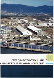
DEVELOPMENT CONTROL PLAN 3CAIRNS CENTRAL SWAMP=PF
(00010)DEVELOPMENT CONTROL PLAN - 3CAIRNS CENTRAL SWAMPThis Development Control <strong>Plan</strong> applies to the area shown on the Development Control<strong>Plan</strong> map marked Development Control <strong>Plan</strong> 3 <strong>Cairns</strong> <strong>Central</strong> <strong>Swamp</strong> and to any otherareas included by way of amendment. This <strong>Plan</strong> should be read in conjunction with the<strong>Plan</strong>ning Scheme for part of the City of <strong>Cairns</strong> and is supplementary to that Scheme.Nothing in this Development Control <strong>Plan</strong> should be construed to confer any rights to useland for any purpose. Such rights remain vested in the provisions of the Zoning Maps andthe <strong>Plan</strong>ning Scheme Provisions for part of the City of <strong>Cairns</strong>.The Development Control <strong>Plan</strong> includes the map described as Development Control <strong>Plan</strong> 3<strong>Cairns</strong> <strong>Central</strong> <strong>Swamp</strong> and is divided into the following :1. Introduction2. Aim3. Objectives and Implementation Criteria4. PrecinctsPLANNING STUDYThe <strong>Plan</strong>ning Study provides supporting information which is contained in that documentmarked Development Control <strong>Plan</strong> 3 - <strong>Plan</strong>ning Study, copies of the Study signed foridentification by the Clerk of the Executive <strong>Council</strong> are held at the office of the Director ofHousing, Local Government and <strong>Plan</strong>ning and at the office of the <strong>Cairns</strong> City <strong>Council</strong>.The <strong>Plan</strong>ning Study can be found in Part B of the <strong>Plan</strong>ning Scheme.December 1996
DEVELOPMENT CONTROL PLAN 3CAIRNS CENTRAL SWAMPCONTENTS1. INTRODUCTION2. AIM3. OBJECTIVES AND IMPLEMENTATION CRITERIA3.1 Obiective 13. i.1 Implementation Criteria3.2 Objective 23.2.1 Implementation Criteria3.3 Objective 33.3.1 Imdementation Criteria3.4 Objectivd 43.4.1 Implementation Criteria4. PRECINCTS4.1 Precinct 14.1.1 Intent4.1.2 Performance Criteria4.2 Precinct 24.2.1 Intent4.2.2 Performance Criteria4.3 Precinct 34.3.1 Intent4.3.2 Performance Criteria4.4 Precinct 44.4.1 Intent4.4.2 Performance Criteria4.5 Precinct 54.5.1 Intent4.5.2 Performance Criteria4.6 Precinct 64.6.1 Intent4.6.2 Performance Criteria4.7 Precinct 74.7.1 Intent4.7.2 Performance Criteria5. SPECIAL PROVISIONS5.1 Drainage5.1.1 Intent5.1.2 Performance Criteria5.2 Guidelines for Development Applications and Site Evaluation5.2.1 Site EvaluationPAGE1122444555577888888999111111111111DEVELOPMENT CONTROL PLAN MAP
-1-1. INTRODUCTIONThe <strong>Plan</strong> Area constitutes examples of the original landscape and landform of much of the[former] <strong>Cairns</strong> City area. It has been the subject of past investigations by localauthorities, government agencies and community groups. This level of interest in the finaluse of the <strong>Plan</strong> Area, the <strong>Plan</strong> Area's location within the <strong>Cairns</strong> City environs, and thechanged community perceptions of the value of natural areas, all combine to make thepreparation of this <strong>Plan</strong> of particular importance in the history of land use planning controlin the <strong>Cairns</strong> City <strong>Council</strong> local authority area.The document has been prepared by both the <strong>Council</strong> and the Lands Department. This, initself, highlights the uniqueness of the <strong>Plan</strong> and, despite statutory limitations to the level oftown planning control applicable to Crown Lands, highlights the level of certainty thatshould be attributed to the <strong>Plan</strong>'s recommendations.Supported by an Environmental Study, prepared in association with this DevelopmentControl <strong>Plan</strong>, the <strong>Plan</strong> indicates the preferred dominant land use activities for the <strong>Central</strong><strong>Swamp</strong> areas. The <strong>Plan</strong> establishes guidelines for the future management of those parts ofthe <strong>Plan</strong> Area of environmental significance. The <strong>Plan</strong> also provides clear guidelines forthe type of development identified as appropriate in those parts of the <strong>Plan</strong> Area of lesserenvironmental significance.2. AIMThe aim of this Development Control <strong>Plan</strong> is to provide for the management of the futureland use of all areas contained within the <strong>Plan</strong> Area. The management shall facilitate themaintenance andor enhancement of the biological diversity and ecological integrity of theecosystems occurring within the <strong>Plan</strong> Area. The natural areas and associated ecosystemsare to be protected through the management of development and other activities whichhave the potential to impact on the <strong>Cairns</strong> <strong>Central</strong> <strong>Swamp</strong>.The Aim is based on a number of principals which are as follows :-(a)@)(c)The <strong>Cairns</strong> <strong>Central</strong> <strong>Swamp</strong> has significant conservation value and is representativeof the pre-European environment of the area. The protection of the area is importantfor ecological, social, cultural, aesthetic, scientific and historical reasons;To outline an approach to the management and maintenance of the <strong>Plan</strong> Area whichis appropriate to the <strong>Plan</strong> Area's environmental significance and its proximity to amajor urban area;Facilitate the maintenance andor enhancement of the natural environment of the<strong>Plan</strong> Area while providing for appropriate land use and activities on designated lowconservation value areas.
-2-3. OBJECTIVES AND IMPLEMENTATION CRITERIA3.1 Objective 1To protect the ecological, visual and recreational values of the <strong>Plan</strong> Area.3.1.1 Implementation Criteria(a)(b)(c)(d)(e)The <strong>Council</strong> and the Lands Department acknowledge the need tomaintain and rehabilitate those parts of the <strong>Plan</strong> Area designated"Preservation" on the Development Control <strong>Plan</strong> Map and will pursuethe inclusion of those parts of the <strong>Plan</strong> Area into an appropriate tenureensuring environmental protection.The <strong>Council</strong> and the Lands Department acknowledge the need for, andsupport the preparation of, an Environmental Management <strong>Plan</strong> for the<strong>Plan</strong> Area and its environs. A programme will be initiated to effect thepreparation of this plan.The <strong>Council</strong> and the Lands Department acknowledge the need for, andsupport the preparation of, a Hydrology and Drainage <strong>Plan</strong> for the <strong>Plan</strong>Area and its drainage systems. A programme will be initiated to effectthe preparation of this plan.The <strong>Council</strong> and the Lands Department will allow access to those partsof the <strong>Plan</strong> Area to be set aside for environmental protection, providedsuch access does not have the potential to adversely affect theenvironmental values of the <strong>Plan</strong> Area. Access to and use of the <strong>Plan</strong>Area will only be supported for activities which are directly associatedwith the <strong>Cairns</strong> <strong>Central</strong> <strong>Swamp</strong> and are consistent with the objectives ofthis <strong>Plan</strong>.Where appropriate, the <strong>Council</strong> will encourage the incorporation of the<strong>Plan</strong> Area into the existing urban and recreational structure of the <strong>Cairns</strong>City local authority area, by facilitating linkages to the Centenary Lakesand Botanic Gardens and where practicable, to the <strong>Cairns</strong> <strong>Central</strong>Business District, tourist accommodation areas and also to campus' ofeducation.This will be facilitated by the improvement of circulation corridors, byappropriate landscape and engineering treatment. Contributions forthese works may be imposed as conditions of approval of developmentor lease applications, subject to this <strong>Plan</strong>.(f)(8)The <strong>Council</strong> and the Lands Department acknowledge the importance ofthe interface of the <strong>Plan</strong> Area to the surrounding and adjoining landuses. The <strong>Council</strong> and the Lands Department may impose appropriateconditions at the time of approval of development applications or leaseapplications, subject to the provisions of this <strong>Plan</strong>, to ensure that theimportance of the interface is protected.Contributions towards the funding of implementation programmes ofthe plans, the subject of clauses (b) and (c) andor specific works, maybe imposed as conditions of approval of development or leaseapplications, made subject to this <strong>Plan</strong>.
-3-(h)(i)The <strong>Council</strong> and the Lands Department support the closure of all roadscontained within the <strong>Plan</strong> Area and adjoining road reserves, identified inthe <strong>Plan</strong>ning Study. In association with the Lands Department, the<strong>Council</strong> is pursuing the appropriate statutory course of action tofacilitate such closures and to incorporate any closed roads within the"Preservation" designation in an appropriate tenure, ensuringenvironmental protection.The <strong>Council</strong> and the Lands Department recognise the environmentalimportance of the Department of Transport Reserve, adjoining Precinct3, and will negotiate with the Department of Transport for the inclusionof any land, in excess of that required by the Department of Transport,in an appropriate tenure ensuring environmental protection. Aconservation agreement may be an appropriate means of protection theunused portion of the land.3.2 Objective 2To identify development opportunities within the <strong>Plan</strong> Area subject to the need toprotect the environmental values of the <strong>Plan</strong> Area.3.2.1 Implementation Criteria(a)@)(c)(d)The <strong>Council</strong> and the Lands Department will consider appropriatedevelopment or lease applications for the use of those parts of the <strong>Plan</strong>Area designated "Limited Development" on the Development Control<strong>Plan</strong> Map.The <strong>Council</strong> and the Lands Department will refuse developmentapplications or lease applications which do not comply with theobjectives of this <strong>Plan</strong>. In particular, applications which, in the opinionof the <strong>Council</strong> or the Lands Department, are unsympathetic to thelandscape and environmental signiEcance of the <strong>Plan</strong> Area, will not beapproved.The <strong>Council</strong> and the Lands Department will not approve anydevelopment or lease applications which will detrimentally affect theenvironmental values of the <strong>Plan</strong> Area. These values include itsbiological diversity, ecological integrity, habitat, landscape, visualamenity, hydrological, drainage and any other relevant values.The <strong>Council</strong> and the Lands Department will impose conditions ofapproval on development or lease applications, that will ensure that theuse subject of the development or lease application, complies with theother objectives of this <strong>Plan</strong>.3.3 Obiective 3To provide a clear indication of the preferred dominant land use activities for the<strong>Plan</strong> Area.The elements of the designations displayed on the Development Control <strong>Plan</strong> mapare summarised as follows:OPreservation Land Use Designation - The intent of this designation is torecognise those areas which are of greatest ecological importance and are tobe given the highest level of protection. These areas will be retained in theirnatural state. Where appropriate, rehabilitation and restoration of disturbedareas will be undertaken.
-4-Subject to the protection of environmental values, limited passive recreationaland educatiodinterpretive activities which are directly related to the <strong>Cairns</strong><strong>Central</strong> <strong>Swamp</strong> may be undertaken. Any activities which have the potential toadversely affect this designation will not be permitted.OLimited Development Land Use Designation - The intent of this designation isto identify areas appropriate for community purposes or active recreationalpurposes. Such purposes should not have any adverse impact on the <strong>Plan</strong>Area with particular regard to the biological diversity, ecological integrity,hydrology, drainage, landscape and visual amenity.3.3.1 Implementation CriteriaThe <strong>Council</strong> and the Lands Department will only approve development orlease applications for community purposes or active recreational purposes, inthose parts of the <strong>Plan</strong> Area designated "Limited Development", on theDevelopment Control <strong>Plan</strong> Map.The <strong>Council</strong> and the Lands Department ivill not approve development or leaseapplications for community purposes; active recreational purposes; or anyother urban purposes, in those parts of the <strong>Plan</strong> Area designated"Preservation", on the Development Control <strong>Plan</strong> Map.The possible siting of an interpretive centre within the <strong>Plan</strong> Area shall beassessed in association with the preparation of an Environmental Management<strong>Plan</strong> for the <strong>Plan</strong> Area. In determining a possible location, only the degradedareas of the <strong>Plan</strong> Area shall be considered. The development of aninterpretive centre shall only be considered if the centre and any ancillaryfacilities, such as car parbng, are sited and constructed in harmony with thesurrounding environment.3.4 Objective 4To recognise the need for differing performance criteria having regard to thelocalised planning context of parts of the <strong>Plan</strong> Area.This will be achieved by dividing the <strong>Plan</strong> Area into precincts. The precincts areidentified on the Development Control <strong>Plan</strong> Map.3.4.1 Implementation Criteria(a)The use of land in the <strong>Plan</strong> Area will only be considered, and developmentapplications or lease applications will only be approved, if the proposed use ineither case is :-- in accordance with the intent of each precinct, herein described, and theparticular criteria appropriate to that precinct;-complies with the relevant provisions of the <strong>Council</strong>'s <strong>Plan</strong>ningScheme, Local Laws and Policies; and- in accordance with sound town planning principles and soundenvironmental planning principles.The <strong>Council</strong> and the Lands Department shall refuse any proposal that does notcomply with these criteria.
-5-4. PRECINCTSSeven precincts have been delineated within the <strong>Plan</strong> Area. Five precincts havebeen designated for preservation and two precincts have been designated for limiteddevelopment.4.1 Precinct 14.1.1 IntentIt is intended that Precinct 1 be retained and rehabilitated as a Reserve forPark, excluding the existing drain, and the principal function of the precinct bethat associated with its preservation designation. Some minimal recreationalactivities or facilities, such as a walking track or interpretive signage, may beencouraged, in accordance with an Environmental Management <strong>Plan</strong>. Theemphasis on the use of this precinct will be upon the enhancement of thenatural environment.4.1.2 Performance CriteriaThe location of any recreational activities and/or facilities, shall berestricted to disturbed areas within the precinct;Public comment shall be sought by <strong>Council</strong>, prior to the introduction ofany recreational activities and/or facilities within the precinct.Any recreational activities or facilities proposed for the precinct shall beminimal, and undertaken only after issues of siting, scale and type ofactivity and/or facility have been approved by <strong>Council</strong> and any otherrelevant authority;The design of any recreational facilities shall reflect the tropicallandscape character of <strong>Cairns</strong>;Any intact vegetation located adjacent to a disturbed area, which isintended to be developed for recreational activities and/or facilities,shall be protected and maintained in its existing condition;All pedestrian access points and circulation areas shall be landscaped insympathy with the intact vegetation within the precinct;All pedestrian access points, circulation areas and recreation areas shallbe landscaped, in accordance with a landscape plan, prepared by aprofessional landscape architect and approved by <strong>Council</strong>;<strong>Council</strong> shall encourage physical and environmental linkages betweenPrecincts 1 and 2.4.2 Precinct 24.2.1 IntentIt is intended that Precinct 2 be retained and rehabilitated as a Reserve forPark, excluding the existing drain, and the principal function of the precinct bethat associated with its preservation designation. Some minimal recreationalactivities and/or facilities, such as a walking track or interpretive signage, maybe encouraged, in accordance with an Environmental Management <strong>Plan</strong>. Theemphasis on the use of this precinct will be upon the enhancement of thenatural environment.
-6-4.2.2 Performance CriteriaThe location of any recreational activities and/or facilities, shall berestricted to disturbed areas within the precinct;Public comment shall be sought by <strong>Council</strong>, prior to the introduction ofany recreational activities and/or facilities within the precinct.Any recreational activities or facilities proposed for the precinct shall beminimal, and undertalcen only after issues of siting, scale and type ofactivity and/or facility have been approved by <strong>Council</strong> and any otherrelevant authority;The design of any recreational facilities shall reflect the tropicallandscape character of <strong>Cairns</strong>;Any intact vegetation located adjacent to a disturbed area, which isintended to be developed for recreational activities and/or facilities,shall be protected and maintained in its existing condition;All pedestrian access points and circulation areas shall be landscaped insympathy with the intact vegetation within the precinct;All pedestrian access points, circulation areas and recreation areas shallbe landscaped, in accordance with a landscape plan, prepared by aprofessional landscape architect and approved by <strong>Council</strong>;<strong>Council</strong> shall encourage physical and environmental linkages betweenPrecincts 1,2 and 3.4.3 Precinct 34.3.1 IntentIt is intended that Precinct 3 be retained and rehabilitated as a Reserve forPark, excluding the existing drain, and the principal function of the precinct bethat associated with its preservation designation. Some minimal recreational,educational and interpretive activities and/or facilities may be permitted, on asmall part of the precinct, in accordance with an Environmental Management<strong>Plan</strong>. The emphasis on the use of this precinct will be upon the enhancementof the natural environment.4.3.2 Performance CriteriaThe location of any recreational, educational or interpretive activitiesand/or facilities, including ancillary facilities, shall be restricted todisturbed areas within the precinct;Public comment shall be sought by <strong>Council</strong>, prior to the introduction ofany recreational, educational or interpretive activities and/or facilitieswithin the precinct.Any development proposed for the precinct shall be minimal, andundertalcen only after issues of siting, scale and type of activity and/orfacility have been approved by <strong>Council</strong> and any other relevantauthority;The design of any recreational, educational or interpretive activitiesand/or facilities, including any ancillary facilities, shall reflect thetropical landscape character of <strong>Cairns</strong>;
-7-(e)Any intact vegetation located adjacent to a disturbed area, which isintended to be developed for recreational educational or interpretiveactivities and/or facilities, including any ancillary facilities, shall beprotected and maintained in its existing condition;(9 All pedestrian access points and circulation areas shall be landscaped insympathy with the intact vegetation within the precinct;(g)(h)(i)(j)(k)All pedestrian access points, circulation areas, recreation areas,interpretive or educational activities and/or facilities, including anyancillary facilities, shall be landscaped in accordance with a landscapeplan, prepared by a professional landscape architect and approved by<strong>Council</strong>;<strong>Council</strong> shall encourage physical and environmental linkages betweenPrecincts 2 and 3;Any recreational, interpretive or educational facilities and activitiesandor any ancillary facilities, such as carparking, shall be restricted todisturbed areas within the precinct;The design of any educational or interpretive facility, shall reflect thetropical landscape character of <strong>Cairns</strong> and be designed and sited inharmony with the surrounding landscape;Access to any educational or interpretive facility shall be fromWillunson Street.4.4 Precinct 44.4.1 IntentIt is intended that Precinct 4 be used for commnnity/community residentialpurposes. Uses associated with community interest groups may beconsidered, provided such uses are sympathetic to the environmentalresources of adjoining Precinct 5.4.4.2 Performance Criteria(a)(b)(c)(d)(e)(f)g)Community facilities such as meeting halls, training facilities,community centres and residential uses associated with communityorganisations are considered appropriate.A variable building alignment is favoured, together with an architecturaldesign that reflects the tropical landscape character of <strong>Cairns</strong>.The design of any structure shall be sympathetic to the proximity of thisprecinct to Precinct 5.Relocation of vegetation to assist in the rehabilitation of other precinctswill be encouraged and may be imposed as a condition of approval, ofdevelopment applications or lease applications.Residential density shall not exceed 200 persons per hectare.Vehicular access to the precinct shall be limited to the north-eastern ornorth-western corners of the precinct.Any development proposal shall be accompanied by a landscape planprepared by a professional landscape architect.
-8-4.5 Precinct 54.5.1 IntentIt is intended that Precinct 5 be retained and rehabilitated as a Reserve forPark, excluding the existing drain, and the principal function of the precinct bethat associated with its preservation designation. Some minimal recreationalactivities and/or facilities, such as a walking track or interpretive signage, maybe encouraged in accordance with an Environmental Management <strong>Plan</strong>. Theemphasis on the use of this precinct will be upon the enhancement of thenatural environment.4.5.2 Performance Criteria(a)(b)(c)(d)(e)(0(g)(h)The location of any recreational activities and/or facilities, shall berestricted to disturbed areas within the precinct;Public comment shall be sought by <strong>Council</strong>, prior to the introduction ofany recreational activities and/or facilities within the precinct.Any recreational activities or facilities proposed for the precinct shall beminimal, and undertaken only after issues of siting, scale and type ofactivity and/or facility have been approved by <strong>Council</strong> and any otherrelevant authority;The design of any recreational facilities shall reflect the tropicallandscape character of <strong>Cairns</strong>;Any intact vegetation located adjacent to a disturbed area, which isintended to be developed for recreational activities and/or facilities,shall be protected and maintained in its existing condition;All pedestrian access points and circulation areas shall be landscaped insympathy with the intact vegetation within the precinct;All pedestrian access points, circulation areas and recreation areas shallbe landscaped, in accordance with a landscape plan, prepared by aprofessional landscape architect and approved by <strong>Council</strong>;<strong>Council</strong> shall encourage physical and environmental linkages betweenPrecincts 5,6 and 7.4.6 Precinct 64.6.1 IntentIt is intended that Precinct 6 be used for active recreational purposes,preferably in association with sporting club activities, occurring on landadjacent to the precinct. The development of the precinct for activerecreational purposes, shall in no way be allowed to negatively impact onadjacent precincts designated for preservation. It is intended that the precinctbe included in a Reserve for Recreation.4.6.2 Performance Criteria(a)The predominant land use of the precinct shall be restricted torecreational activities and/or facilities, preferably in association withadjacent sporting club activities. Ancillary facilities associated withadjoining active recreational uses shall be permitted with <strong>Council</strong>approval;
-9-Public comment shall be sought by <strong>Council</strong>, prior to the introduction ofany recreational activities and/or facilities within the precinct.Any recreational development or ancillary facilities, proposed for theprecinct shall be undertaken only after issues of siting, scale and type ofdevelopment have been approved by <strong>Council</strong> and any other relevantauthorities;The design of any recreational facilities, including any ancillaryfacilities, shall reflect the tropical landscape character of <strong>Cairns</strong>;A 10 metre wide landscape buffer shall be provided, to extend along thewestern boundary of the precinct along the McCormack Street drain, toenhance the environmental amenity of the adjacent Precinct 5 which isdesignated for preservation;The existing bike path which extends along the McCormack Street drainshall be realigned, east of the landscape buffer;Any development within the precinct shall be setback from theMcCormack Street drain, for a distance of at least 15 metres;Built development associated with an active recreational activity withinthe precinct, shall be setback 10 metres from [final] road alignments;Any development proposal shall be accompanied by a landscape planprepared by a professional landscape architect.Setback areas within the precinct shall be included in leased ordevelopment areas;Landscaped areas, setback and buffer areas within the precinct, shall belandscaped, in accordance with a landscape plan, prepared by aprofessional landscape architect and approved by <strong>Council</strong>;Landscaping within the precinct shall be sympathetic to, and in keepingwith, the vegetation of the adjacent Precinct 5;<strong>Council</strong> shall encourage physical and environmental linkages betweenPrecincts 5.6 and 7.4.7 Precinct 74.7.1 IntentIt is intended that Precinct 7 be retained and rehabilitated as a Reserve forPark, and its principal function be that associated with its preservationdesignation. Some minimal recreational, educational and interpretiveactivities and/or facilities may be permitted, on a small part of the precinct, inaccordance with an Environmental Management <strong>Plan</strong>. The emphasis on theuse of this precinct will be upon the enhancement of the natural environment.4.7.2 Performance Criteria(a)(b)The location of any recreational, educational or interpretive activitiesand/or facilities, including any ancillary facilities, shall be restricted todisturbed areas within the precinct;Public comment shall be sought by <strong>Council</strong>, prior to the introduction ofany recreational, educational or interpretive activities and/or facilitieswithin the precinct.
-10-Any development proposed for the precinct shall be minimal, andundertaken only after issues of siting, scale and type of activity and/orfacility have been approved by <strong>Council</strong> and any other relevantauthority;The design of any recreational, educational or interpretive facilities,including any ancillary facilities, shall reflect the tropical landscapecharacter of <strong>Cairns</strong>;Any intact vegetation located adjacent to a disturbed area, which isintended to be developed for recreational educational or interpretiveactivities and/or facilities, including any ancillary facilities, shall beprotected and maintained in its existing condition;All pedestrian access points and circulation areas shall be landscaped insympathy with the intact vegetation within the precinct;All pedestrian access points, circulation areas, recreation areas,interpretive or educational activities and/or facilities, including anyancillary facilities, shall be landscaped in accordance with a landscapeplan, prepared by a professional landscape architect and approved by<strong>Council</strong>;<strong>Council</strong> shall encourage physical and environmental linkages betweenPrecincts 5 and 7;Any recreational, interpretive or educational activities and/or facilitiesand any ancillary facilities such as carparling, shall be restricted todisturbed areas within the precinct;The design of any educational or interpretive facility, shall reflect thetropical landscape character of <strong>Cairns</strong> and be designed and sited inharmony with the surrounding landscape;Access to any educational or interpretive facility shall be fiom RussellStreet.
-11-5. SPECIAL PROVISIONS5.1 Drainage5.1.1 IntentExisting drainage in Precincts 1, 2, 3, 5 and 7 will be maintained by <strong>Council</strong> inorder to manage the hydrological function of the <strong>Cairns</strong> <strong>Central</strong> <strong>Swamp</strong>. Thiswill require an area covered by the bed and banks of each drain and an areabeyond each bank to accommodate <strong>Council</strong> maintenance vehicles along the fulllength of the drains.5.1.2 Performance CriteriaThe natural roles of the <strong>Cairns</strong> <strong>Central</strong> <strong>Swamp</strong> as a retention area for run-offstorage and as providing drainage subject to tidal flux shall not contribute toany inundation of urban areas;The existing drains and associated cleared lands shall be maintainedaccording to <strong>Council</strong>’s Drainage Waterway Management <strong>Plan</strong> Best PracticeGuidelines;Vegetation in the existing drainage shall encourage fauna habitat withoutinhibiting the hydrological function of the <strong>Cairns</strong> <strong>Central</strong> <strong>Swamp</strong>;The existing drains and cleared lands present opportunities for recreationaland educationalhnterpretational uses by the public and shall accommodatethese uses without inhibiting the hydrological function of the <strong>Cairns</strong> <strong>Central</strong>swamp;Saltwater intrusions shall be limited as far as is possible in accordance withthe provisions of the Hydrology and Drainage <strong>Plan</strong>.Treatment of the drains will be in accordance with Department of PrimaryIndustries Fisheries <strong>Plan</strong> Best Practice for Drainage Waterways whereverpractical subject to maintenance of drainage flows and flood prevention.Where installed, tidal flaps and water control structures will be designed inaccordance to Department of Primary Industries Fisheries advice relating torequirements for enhancement or limitation of marine biota access.5.2 Guidelines for Development Applications and Site EvaluationTo ensure the maintenance and/or enhancement of the biological diversity and ecologicalintegrity of the <strong>Cairns</strong> <strong>Central</strong> <strong>Swamp</strong> the following information will be required as partof any application to <strong>Council</strong> for development with the DCP area.5.2.1 Site Evaluation(a) Describe the existing environment :-
-12-- Identify important species and communities. Importance relates to:---* stability of the ecosystem* threatened species* area of distribution* social/culturalIdentify the condition of the existing environmentQuantify the diversity of the existing environmentDescribe the environment in terms of the significance criteria [referto (e) below]Identify the types of natural communities and their extent within the area.Describe the key features of the physical environment (eg hydrology) thatrelate to the area.Describe the area in relation to surrounding landscape in terms of ecology.Assess the significance of the ecological communities in terms of :- other natural areas within the ecological districtcatchment boundaries- the region, State of nation if appropriateThe following criteria should be used in making the assessment :-Threatened Species - endangered, rare, vulnerable, indeterminate.Special Features - bird colonies, geographic limit of range, rarity orabundance of particular features, breeding grounds, etc.Diversity- special richness- community and habitat richness- endemismNaturalness - extent of modification from natural condition; potentialnaturalness.Representativeness--Uniqueness-characteristic of an ecological districtrepresents diversity of a district (or former diversity)unusual combinations of species, physical features, etc.
****Long-term sustainability- ability to self-sustain- resilienceSpatial context- buffer zones- shape- surrounding landscapeArea of natural community.Cultural value-13-- scientific and educational value- recreational- economic- archaeological(9Assess the nature and extent of likely impacts :- the type and extent of impact of the ecological system- the type and extent of impact on each natural community (orhabitat).
IIElc3?3(Dax0namSUL1c3W083aYm60zmm-l7


