12MB PDF - Association for Mexican Cave Studies
12MB PDF - Association for Mexican Cave Studies 12MB PDF - Association for Mexican Cave Studies
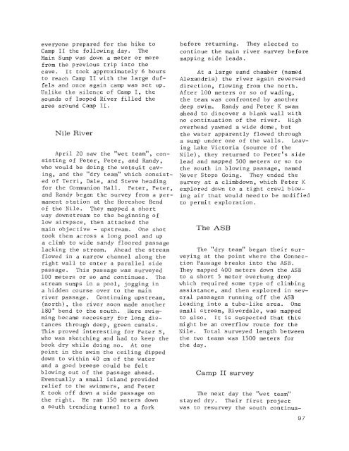
Surface surveying above Valhalla.(Paul Fambro)columns reminiscent of Carlsbad Caverns.It was too nice a place tocall Carlsbad, so it was named theCarlsgood Room. Several other leadswere pushed to no avail.The next couple of days werespent by most of the group doing surfacesurveys and mapping in some ofthe smaller caves around Conrado Castillo.Terri headed two separateteams which mapped Cueva de Tecoloteand most of Cueva de Desmontes.Cueva de Los Sierpes was pushed andall the cave entrances in the areawere tied together with a surfacesurvey. One more trip was taken intoValhalla by Peter, Randy and Peterwhere they wound up partially exploringand mapping what they hoped to bea new, easier route to the ValkyrieRiver, discovered last July.Infiernillo - Camp IISix cavers were to camp in Infiernillofor another week. Blake,Gill, and Mark drove Terri, Peter,Randy, Dale, Peter, and Steve downto the trailhead to Infiernillo. Onthe drive down, several caves werediscovered at Galindo, including onethat was basically one large roomwith a low, flat ceiling. Blakedropped the six off and returned toConrado Castillo after stopping atthe sawmill for lumber. Everyoneelse headed down the trail and bythe time the arroyo was reached, ithad begun to rain as it had for thepast few afternoons in Conrado Castillo.People climbed into the caveand hauled gear up. Camp I wasreached with no difficulties and96
everyone prepared for the hike toCamp II the following day. TheMain Sump was down a meter or morefrom the previous trip into thecave. It took approximately 6 hoursto reach Camp II with the large duffelsand once again camp was set up.Unlike the silence of Camp I, thesounds of Isopod River filled thearea around Camp II.Nile RiverApril 20 saw the "wet team", consistingof Peter, Peter, and Randy,who would be doing the wetsuit caving,and the "dry team" which consistedof Terri, Dale, and Steve headingfor the Communion Hall. Peter, Peter,and Randy began the survey from a permanentstation at the Horeshoe Bendof the Nile. They mapped a shortway downstream to the beginning oflow airspace, then attacked themain objective - upstream. One shottook them across a long pool and upa climb to wide sandy floored passagelacking the stream. Ahead the streamflowed in a narrow channel along theright wall to enter a parallel sidepassage. This passage was surveyed100 meters or so and continues. Thestream sumps in a pool, jogging ina hidden course over to the mainriver passage. Continuing upstream,(north), the river soon made another180 0 bend to the south..Here swimmingbecame necessary for long distancesthrough deep, green canals.This proved interesting for Peter S,who was sketching and had to keep thebook dry while doing so. At onepoint in the swim the ceiling dippeddown to within 40 cm of the waterand a good breeze could be feltblowing out of the passage ahead.Eventually a small island providedrelief to the swimmers, and PeterK took off down a side passage onthe right. He ran 150 meters downa south trending tunnel to a forkbefore returning. They elected tocontinue the main river survey beforemapping side leads.At a large sand chamber (namedAlexandria) the river again reverseddirection, flowing from the north.After 100 meters or so of wading,the team was confronted by anotherdeep swim. Randy and Peter K swamahead to discover a blank wall withno continuation of the river. Highoverhead yawned a wide dome, butthe water apparently flowed througha sump under one of the walls. LeavingLake Victoria (source of theNile), they returned to Peter's sidelead and mapped 500 meters or so tothe south in blowing passage, namedNever Stops Going. They ended thesurvey at a climbdown, which Peter Kexplored down to a tight crawl blowingair that would need to be modifiedto permit exploration.The ASBThe "dry team" began their surveyingat the point where the ConnectionPassage breaks into the ASB.They mapped 400 meters down the ASBto a short 5 meter overhung dropwhich required some type of climbingassistance, and then explored in severalpassages running off the ASBleading into a tube-like area. Onesmall stream, Riverdale, was mappedto also. It is suspected that thismight be an overflow route for theNile. Total surveyed length betweenthe two teams was 1500 meters forthe day.Camp II surveyThe next day the "wet team"stayed dry. Their first projectwas to resurvey the south continua-97
- Page 63: -f//'~:;San,Agustin,,~~~:= ']--="~-
- Page 67: translated from the Mazatecby Cathy
- Page 70 and 71: Ateschalla Norte ySurThe following
- Page 73: CUEVA DE TASALOLPANcuetzalan, puebl
- Page 76 and 77: CuetzalanSteve KnutsonSpring 1979Ma
- Page 78: Thirty meter pitch into canal secti
- Page 81: ENTRADACANONACUEVATECOLOESTADA DE P
- Page 85 and 86: S6tano del BuqueRobert JefferysSota
- Page 87 and 88: the rope. What John had been trying
- Page 89: METERSo50NmICEBERG ROOM100-506500
- Page 92 and 93: CUEVA DE XOCOTLATintroduction by Ge
- Page 94: was a sizable horizontal sectionwhi
- Page 97: Cueva de XocotlatMunicipio de San P
- Page 101 and 102: 1979 SPRINGDale PatePROJECTPlans we
- Page 103 and 104: were the only ones left at the fiel
- Page 105 and 106: to 4 hours exploring and sketchingv
- Page 107 and 108: persons working on this mapping tea
- Page 109 and 110: Fifteen meter drop in Moria.(Thomas
- Page 111 and 112: French delegationarrivesAfter sever
- Page 113: French ConnectionFriday the 13th sa
- Page 117 and 118: Terri t Dale t and Steve returned t
- Page 119: SISTEMAPURIFICACIONMunicipio Villa
- Page 122 and 123: Letters to the EditorTothe Editor:B
- Page 124: ATLAS DES GRANDES GOUFFRES DU MONDE
everyone prepared <strong>for</strong> the hike toCamp II the following day. TheMain Sump was down a meter or morefrom the previous trip into thecave. It took approximately 6 hoursto reach Camp II with the large duffelsand once again camp was set up.Unlike the silence of Camp I, thesounds of Isopod River filled thearea around Camp II.Nile RiverApril 20 saw the "wet team", consistingof Peter, Peter, and Randy,who would be doing the wetsuit caving,and the "dry team" which consistedof Terri, Dale, and Steve heading<strong>for</strong> the Communion Hall. Peter, Peter,and Randy began the survey from a permanentstation at the Horeshoe Bendof the Nile. They mapped a shortway downstream to the beginning oflow airspace, then attacked themain objective - upstream. One shottook them across a long pool and upa climb to wide sandy floored passagelacking the stream. Ahead the streamflowed in a narrow channel along theright wall to enter a parallel sidepassage. This passage was surveyed100 meters or so and continues. Thestream sumps in a pool, jogging ina hidden course over to the mainriver passage. Continuing upstream,(north), the river soon made another180 0 bend to the south..Here swimmingbecame necessary <strong>for</strong> long distancesthrough deep, green canals.This proved interesting <strong>for</strong> Peter S,who was sketching and had to keep thebook dry while doing so. At onepoint in the swim the ceiling dippeddown to within 40 cm of the waterand a good breeze could be feltblowing out of the passage ahead.Eventually a small island providedrelief to the swimmers, and PeterK took off down a side passage onthe right. He ran 150 meters downa south trending tunnel to a <strong>for</strong>kbe<strong>for</strong>e returning. They elected tocontinue the main river survey be<strong>for</strong>emapping side leads.At a large sand chamber (namedAlexandria) the river again reverseddirection, flowing from the north.After 100 meters or so of wading,the team was confronted by anotherdeep swim. Randy and Peter K swamahead to discover a blank wall withno continuation of the river. Highoverhead yawned a wide dome, butthe water apparently flowed througha sump under one of the walls. LeavingLake Victoria (source of theNile), they returned to Peter's sidelead and mapped 500 meters or so tothe south in blowing passage, namedNever Stops Going. They ended thesurvey at a climbdown, which Peter Kexplored down to a tight crawl blowingair that would need to be modifiedto permit exploration.The ASBThe "dry team" began their surveyingat the point where the ConnectionPassage breaks into the ASB.They mapped 400 meters down the ASBto a short 5 meter overhung dropwhich required some type of climbingassistance, and then explored in severalpassages running off the ASBleading into a tube-like area. Onesmall stream, Riverdale, was mappedto also. It is suspected that thismight be an overflow route <strong>for</strong> theNile. Total surveyed length betweenthe two teams was 1500 meters <strong>for</strong>the day.Camp II surveyThe next day the "wet team"stayed dry. Their first projectwas to resurvey the south continua-97


