You also want an ePaper? Increase the reach of your titles
YUMPU automatically turns print PDFs into web optimized ePapers that Google loves.
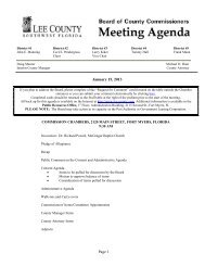
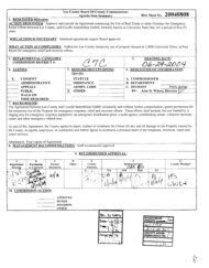
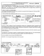
<strong>Lee</strong> <strong>County</strong> Board of <strong>County</strong> Commissioners<br />
Agenda Item Summary<br />
DATE CRITICAL<br />
Blue Sheet No. 20050060<br />
1. REOUESTED MOTION:<br />
ACTION REQUESTED: Approve proposed IDD Canal D2b Realignment Agreement between CentexHomes and<strong>Lee</strong> <strong>County</strong><br />
providing for an exchange of a portion of IDD Canal D2b for an easement over and across a portion of Coca Bay Subdivision;<br />
adopt a Resolution of Exchange in accordance with F.S. 5 125.37; accept deed for grant of an easement from Centex Homes in<br />
accordance with the agreement; execute the Quit Claim deed to Centex Homes for a portion of IDD Canal D2b easement area;<br />
and authorize <strong>County</strong> staff to process the documents necessary to fully comply with the terms of the agreement.<br />
WHY ACTION IS NECESSARY: Board approval is necessary to enter into an agreement contemplating exchange ofcounty<br />
property and to accept easemrnts and execute deeds necessary to accomplish the transfer of the real property interest.<br />
WHAT ACTION ACCOMPLISHES: Serves to allow development of the Coca Bav Subdivision as contemolated while<br />
maintaining the <strong>County</strong>’s ability to provide for drainage needs along Kelly Cove Road. .<br />
2. DEPARTMENTAL CATEGORY:<br />
3. MEETING DATE:<br />
COMMISSION DISTRICT #<br />
la&<br />
42,3- ~/-JOlQ5<br />
4. AGENDA: 5. REQUIREMENT/PURPOSE: 6. REOUESTOR OF INFORMATION:<br />
(Spe2)<br />
X CONSENT STATUTE A. COMMISSIONER<br />
ADMINISTRATIVE ORDINANCE B. DEPARTMENT <strong>County</strong> Attorney<br />
APPEALS ADMIN. CODE C. DIVISION<br />
PUBLIC OTHER BY: :k?& :.:j. :bj<br />
WALK ON Dawn E. Perry-Lehnert<br />
TIME REQUIRED: Assistant <strong>County</strong> Attorney<br />
7. BACKGROUND: Centex Homes recorded the Coca Bay Subdivision Plat at Plat Book 78, Page 44 in May 2004, based ;,;<br />
upon approval of local development order DOS2003-00176. Subsequent to construction of the infrastructure supporting the<br />
subdivision and prior to issuance of a <strong>County</strong> Certificate of Compliance, it became apparent that project improvements had been<br />
placed within IDD Canal D2b easement area. In order to address this situation in an expeditious and cost effective manner for<br />
both Centex and the <strong>County</strong>, the parties have reached an agreement, which is embodied in the attached IDD Canal D2b<br />
Realignment Agreement.<br />
(Continued on Page 2)<br />
8. MANAGEMENT RECOMMENDATIONS:<br />
9. RECOMMENDED APPROVAL:<br />
A B C D E F G<br />
Department Purchasing HUman Other <strong>County</strong> Budget Services <strong>County</strong> Manager<br />
Director or<br />
Contracts<br />
Resources Attorney<br />
l$Y\ qc; /<br />
N/A N/A N/A N/A<br />
,+s’+&<br />
;.,. -* -,,.,<br />
OM RISK<br />
/ C> ’ -
Blue Sheet #: 20050060<br />
Page No.: 2<br />
Subject: Coca Bay Exchange of ITID Canal for Easement<br />
The Realignment Agreement:<br />
1. Contemplates the exchange of a 12’ wide ship of IDD Canal D2b along the western boundary of Coca Bay<br />
Subdivision (adjacent to Kelly Cove Drive) for a 12’ easement strip along the northern boundary of Coca Bay<br />
Subdivision (adjacent to Kelly Brooke Subdivision). This exchange will allow the 0x0 Bay Subdivision<br />
improvements located within the existing IDD Canal area to remain; and<br />
2. Provides the <strong>County</strong> with a maintenance easement, along the southern boundary of the Kelly Brooke<br />
Subdivision, sufficient to maintain the 20’ drainage easement; and<br />
3. Allows Centex Homes to install a landscape buffer along the southern boundary of Coca Bay while providing<br />
the <strong>County</strong> with a culvert access to the IDD Canal area adjacent to Coca Bay’s southern boundary for<br />
maintenance of the existing IDD Canal 02.<br />
<strong>County</strong> staff has reviewed the proposed agreement and accompanying documents and recommends that the Board<br />
approve the Resolution of Exchange and the IDD Canal D2b Realignment Agreement.<br />
Attachments: 1, IDD Canal D2b Realignment Agreement including<br />
a. Resolution of Exchange<br />
b. Executed Perpetual Drainage and Access Easement<br />
c. Alternative Materials Construction Maintenance and Hold Harmless Agreement<br />
2. Quit Claim Deed from <strong>County</strong> to Centex Homes<br />
cc: Steven C. Hartsell, Esquire<br />
Donald Chamblee, DOT Operations Manager<br />
Pete Eckenrode, Director, Development Services<br />
S:UU\DPL\Bluesheet\Coco Bay Exchange of IDD Canal for Easement.wpd
Return documents to:<br />
Dawn E. Pen-y-Lehnert<br />
<strong>Lee</strong> <strong>County</strong> Attorney’s Office<br />
BOX 34<br />
THIS INSTRUMENT PREPARED BY:<br />
Steven C. Hartsell, Esq.<br />
Pavese Law Firm<br />
P.O. Drawer 1507<br />
Fort Myers, FL 33902-I 507<br />
Strap No.: 06-46-24-32-00000.0010 thru<br />
.0140; .0990 and .OOOOC.OOCE<br />
IDD CANAL D2b REALIGNMENT AGREEMENT<br />
This Agreement is entered into this day of January, 2005, between<br />
CENTEX HOMES, a Nevada General Partnership, whose address is 5801 Pelican Bay<br />
Boulevard, Suite 600, Naples, <strong>Florida</strong> 34108 (Developer); and <strong>Lee</strong> <strong>County</strong>, a political<br />
subdivision of the State of <strong>Florida</strong>, whose address is Post Office Box 398, Fort Myers,<br />
<strong>Florida</strong> 33902 (<strong>County</strong>).<br />
WHEREAS, Developer has platted the Coca Bay subdivision (Plat Book 78, Pages<br />
44-48) located in Section 36, Township 48 South, Range 24 East, <strong>Lee</strong> <strong>County</strong>, <strong>Florida</strong> and<br />
more specifically depicted in attached Exhibit “A”; and<br />
WHEREAS, the <strong>County</strong> holds an easement interest in IDD Canal D2b as recorded<br />
in the <strong>Lee</strong> <strong>County</strong> Public Records; and<br />
WHEREAS, a portion of IDD Canal D2b, as legally described and depicted in<br />
attached Exhibit “B”, is located within the boundaries of the Coca Bay platted subdivision;<br />
and<br />
WHEREAS, IDD Canal D2b was created to serve as part of the lona Drainage<br />
District facilities necessary to accommodate stormwater runoff from the surrounding area;<br />
and<br />
WHEREAS, <strong>Lee</strong> <strong>County</strong> intends to exercise its rights to use the IDD Canal D2b<br />
easement to accommodate stormwater runoff from the surrounding development; and<br />
WHEREAS, the Developer desires to develop the Cow Bay subdivision in a manner<br />
that requires the proposed realignment and reconfiguration of a portion of IDD Canal D2b<br />
substantially as depicted in attached Exhibit “B” and local development order application<br />
DOS 2003-00176: and
WHEREAS, in order to facilitate the design of Coca Bay as proposed by the<br />
Developer, the parties propose to realign and replace a portion of the IDD Canal D2b<br />
easement area; and<br />
WHEREAS, the exchange of real property interests necessary to accomplish the<br />
realignment and replacement of a portion of IDD Canal D2b is the subject of the Resolution<br />
of Exchange attached as Exhibit “c”, which is executed in accordance with FS 5125.37 and<br />
in conjunction with this Agreement; and<br />
WHEREAS, the purpose of this Agreement is to set forth the terms acceptable to the<br />
parties to accomplish both objectives; and<br />
WHEREAS, the parties believe this Agreement will facilitate county drainage needs<br />
and adequately serve to protect the public interest.<br />
NOW, THEREFORE, in consideration of the covenants contained in this Agreement,<br />
the parties agree as follows:<br />
1. Recitals. The recitals set forth above are true and correct and incorporated<br />
into this Agreement.<br />
2. Putpose. The purpose of this Agreement is to provide <strong>Lee</strong> <strong>County</strong> with a<br />
drainage and maintenance access easement on the north line of Coca Bay to maintain the<br />
adjacent Kelly Brooke Subdivision drainage canal, and to accommodate the realignment and<br />
replacement of the rights and capacity enjoyed by the <strong>County</strong> in the original configuration<br />
of IDD Canal D2b along the west side of Coca Bay.<br />
3. Perpetual Drainage and Access Easement. A fully executed Perpetual<br />
Drainage and Maintenance Access Easement is attached as Exhibit “D”. This document<br />
has been reviewed and approved by the <strong>County</strong> staff. In conjunction with this review, the<br />
Developer has provided the <strong>County</strong> with a title opinion, meeting the requirements of<br />
paragraph 8, substantiating the right and authority of Developer to grant this property<br />
interest, Upon execution of this Agreement by the Board, the original Perpetual Drainage<br />
and Maintenance Access Easement will be recorded in the public records. No impact fee<br />
credits or other remuneration will be paid for this land. Developer agrees to pay any<br />
property taxes due on the parcel. The purpose of this Easement is to provide the <strong>County</strong><br />
with perpetual drainage and maintenance access easement rights needed to maintain the<br />
adjacent drainage canal for Kelly Brooke Subdivision.<br />
The <strong>County</strong> has agreed to relinquish and exchange its rights in the existing<br />
IDD Canal D2b easement area described herein based upon the Developers agreement to<br />
grant this Perpetual Drainage and Maintenance Access Easement.<br />
The Perpetual Drainage and Maintenance Access Easement to be recorded<br />
in accordance with the above is intended to provide a permanent drainage easement, along<br />
with access right for maintenance purposes, as contemplated by paragraph 3.
4. IDD Canalalong southern Coca Bayboundary. A fully executed Hold Harmless<br />
and Maintenance Agreement is attached as Exhibit “E”, which has been reviewed and<br />
approved by <strong>County</strong> Staff. This Agreement pertains to IDD Canal D2 located along the<br />
south boundary of Coca Bay Subdivision and allows Centex Homes to place a IO’ wide<br />
landscape buffer along and within the north side of the IDD Canal area. The IO’ wide buffer<br />
is not a code required buffer. Placement of the IO’ wide buffer as contemplated by the Hold<br />
Harmless Agreement will leave a * 20’ strip for IDD Canal maintenance.<br />
In order to provide the <strong>County</strong> with direct access to the IDD Canal area along<br />
the southern boundary of Coca Bay Subdivision, Centex Homes has agreed to construct a<br />
culvert crossing for the benefit of <strong>Lee</strong> <strong>County</strong>. Centex will permit and install the culvert<br />
across IDD Canal D2b from Kelly Cove Drive to the f 20’ maintenance strip area at no cost<br />
to <strong>Lee</strong> <strong>County</strong>. Construction will be complete by December 31, 2005.<br />
5. Drainage System Maintenance. The Developer has primary responsibility<br />
for maintenance of the Coca Bay System but has no responsibility for maintenance of the<br />
adjacent Kelly Brooke Subdivision drainage system.<br />
6. Resolution ofExchange. This Agreement was considered by the Board of<br />
<strong>County</strong> Commissioners in conjunction with the Resolution of Exchange, presented to the<br />
Board in accordance with the requirements of <strong>Florida</strong> Statutes 5125.37, and attached as<br />
Exhibit “c”. Execution of this Agreement is contingent on the transfer set forth in the<br />
Resolution of Exchange such that approval of one requires and contemplates approval of<br />
the other. If the Resolution of Exchange is not adopted by the Board, then this Agreement<br />
will be deemed null and void.<br />
7. impact Fee Credits. The parties understand and agree that no impact fee<br />
credits or other payment will be issued for the right-of-way transfer, drainage and<br />
maintenance access easement or drainage improvements contemplated by this Agreement.<br />
8. Tit/e Opinion. In conjunction with the review and approval of the easements<br />
and right-of-way grant, and prior to acceptance of these documents, the Developer must<br />
submit assurance, acceptable to the <strong>County</strong> Attorney’s Office, that the Developer holds<br />
sufficient right, title and interest to convey the subject easement. Assurance may take the<br />
form of either~an attorney opinion of title, prepared in accordance with the standards for<br />
opinions promulgated by the <strong>Florida</strong> Bar, a Certificate of Title (certified to <strong>Lee</strong> <strong>County</strong>)<br />
prepared by a title company acceptable to <strong>Lee</strong> <strong>County</strong>, or title insurance. The purpose of<br />
this provision is to establish that the <strong>County</strong> will receive an interest in the easement areas<br />
superior to all rights and interests except that of the fee title holder, and clear title to the<br />
right-of-way.<br />
9. Costs. The Developer is responsible for the advertising costs associated with<br />
the approval of the Resolution of Exchange under FS §125.37. The Developer is also<br />
responsible for the costs of recoding the easements and other documents identified in this<br />
Agreement. The <strong>County</strong> is responsible for processing the documents for recording.
10. Venue. This Agreement will be construed in accordance with the laws of the<br />
State of <strong>Florida</strong>. The venue for any action arising from this Agreement lies in <strong>Lee</strong> <strong>County</strong>,<br />
<strong>Florida</strong>.<br />
11. Assignabilify. The parties agree that the rights and obligations provided to<br />
the Developer under this Agreement are freely assignable to a purchaser for value.<br />
12. Complete Agreement. This Agreement, including all exhibits, constitutes the<br />
entire agreement of the parties and may be modified only by a written instrument executed<br />
with the same formality.<br />
13. Counterparts. This Agreement may be executed in counterparts.<br />
14. Binding Effect. This Agreement is binding upon and inures to the benefit of<br />
the parties, their successors and assigns.<br />
Witnesses:<br />
Centex Homes, a Nevada General<br />
Partnership<br />
By: Centex Real Estate Corporation,<br />
a Nevada General Corporation, Its<br />
Managing General Partner of Centex<br />
Timothy J. Ruemler,<br />
Di i ion President<br />
Date: 3 1 &r<br />
The foregoing instrument was acknowledged before me this ldayof hb.<br />
2005, by Timothy J. Ruemler, Division President of Centex<br />
Real Estate Corporation, Managing General Partner<br />
Partnership, on behalf of the partnership. He<br />
,;& “.i’f<br />
# DC 064708<br />
COMMlSSiOhi<br />
2: EXPIRES: Decemberz, 2005<br />
ATTEST: BOARD OF COUNTY COMMISSIONERS<br />
CHARLIE GREEN, CLERK OF LEE COUNTY, FLORIDA<br />
By: By:<br />
Deputy Clerk Chairman
APPROVED AS TO FORM:<br />
By:<br />
Dawn E. Perry-Lehnert<br />
Office of <strong>County</strong> Attorney<br />
Exhibit A - Copy of Coca Bay Plat<br />
Exhibit B - Legal Description and Sketch of Existing IDD Canal DZb area within<br />
Coca Bay to be quitclaimed by <strong>County</strong><br />
Exhibit C - Draft Resolution of Exchange<br />
Exhibit D - Copy of Executed Perpetual Drainage and Maintenance Access<br />
Easement<br />
Exhibit E - Executed Hold Hamless and Maintenance Agreement
EXHIBIT “A”<br />
(Page 1 of 5)<br />
-.-.--1- ” - .r”c.-lm,m...- .” “,.” -._<br />
m-,--/r-.* -..=<br />
..a<br />
.--.-~-.-. ----<br />
-_ . - -.~ _<br />
I
EXHIBIT “A”<br />
(Page 2 of 5)
6:<br />
COCO BAY<br />
A SUBDIVlSION M<br />
TOWNSHIP 46 SOUTH, RANGE 24 EAST<br />
LEE COLINTY, FLORID*<br />
EXHIBIT “A”<br />
(Page 3 of 5)
SECTION 6, TOWNSHLP 46 SOUTH, RANGE 24 EAST<br />
LEE COUNTY, nom*<br />
EXHIBIT “A”<br />
(Page 4 of 5)<br />
,
EXHIBIT “A”<br />
(Page 5 of 5)
January 14,2005<br />
SHEET 2 OF 2<br />
(NOT VALID WITHOUT SHEET 1)<br />
DESCRIPTION<br />
EXHIBIT -B” L & L<br />
12’ STRIP OF LAND<br />
LYING IN COCO BAY<br />
PLAT BOOK 78, PAGES 44-48<br />
SECTION 6, TOWNSHIP 46 SOUTH, RANGE 24 EAST<br />
LEE COUNTY, FLORIDA<br />
A strip of land (12’ wide) lying in Section 6, Township 46 South, Range 24 East, <strong>County</strong> of <strong>Lee</strong>,<br />
State of <strong>Florida</strong>, being a part of Tract “B”, Tract “c” and a part of Tract RD-1 (Coca Hammock<br />
Way) as shown on the plat of Coca Bay as recorded in Plat Book 78 at Pages 44 through 48,<br />
Public Records of <strong>Lee</strong> <strong>County</strong>, <strong>Florida</strong>, which strip is described as follows:<br />
Commencing at the northwest caner of said Coca Bay plat run N 88” 56’ 02” E<br />
along the north line of said plat for 38.00 feet; thence run S 00” 54’ 55” E for<br />
12.00 feet to the Point of Beginning.<br />
From said begjnning point run N 88” 56’ 02” E for 12.00 feet to an intersection<br />
with the east line of the Iona Drainage District Canal “D2b”; thence run<br />
S 00” 54’ 55” E along the east line of said canal for 1907.78 feet to an intersection<br />
with the north line of the Iona Drainage District Canal “D2bl”; thence run<br />
S 89O 03’ 04” W along said north line for 12.00 feet; thence run N 00” 54’ 55” W<br />
for 1907.76 feet to the Point ofBeginning.<br />
Parcel contains 0.526 acres, mm.? or less.<br />
SUBJECT TO easements, restrictions and reservations of records.<br />
Bearings hereinabove mentioned are based on the north line of said Coca Bay plat as recorded in<br />
Plat Book 78 at Pages 44 though 48, Public Records of <strong>Lee</strong> <strong>County</strong>, <strong>Florida</strong> to bear<br />
N 88” 56’ 02” E.<br />
(for the &&LB-642)<br />
Professi&zi%and Surveyor and Mapper<br />
<strong>Florida</strong> Certificate No. 4500<br />
Exhibit B Page 2 Of 2<br />
I
LEE COUNTY RESOLUTION NO.<br />
RESOLUTION OF EXCHANGE<br />
WHEREAS, Centex Homes, as the Developer of a project known as Coca Bay<br />
desires to exchange a portion of the IDD Canal D2b Easement held by the <strong>County</strong> for an<br />
easement over, across and through the Coca Bay Subdivision (Plat Book 78, Page 44);<br />
and<br />
WHEREAS, the Board of <strong>County</strong> Commissioners entered into the IDD Canal “D2b”<br />
Realignment Agreement on ,2005, and<br />
WHEREAS, based upon the terms of this agreement, <strong>County</strong> staff has determined<br />
a portion of the IDD Canal D2b easement area will not be necessary for <strong>County</strong> purposes;<br />
and<br />
WHEREAS, this exchange would provide the <strong>County</strong> with adequate drainage and<br />
access rights to serve the needs of the public; and<br />
WHEREAS, an exchange is of mutual benefit to the Developer and the public; and<br />
WHEREAS, the proposed exchange was advertised and approved after full<br />
consideration by the Board of <strong>County</strong> Commissioners.<br />
NOW, THEREFORE, BE IT RESOLVED BY THE BOARD OF COUNTY<br />
COMMISSIONERS that:<br />
1. An exchange will be accomplished by the execution and recording of<br />
documents as indicated below:<br />
a. Warranty deed from Centex Homes to <strong>Lee</strong> <strong>County</strong>, a political<br />
subdivision of the State of <strong>Florida</strong>, for an easement for drainage and<br />
maintenance access purposes over the Coca Bay project, more<br />
particularly described as follows:<br />
A strip of land (12’ wide) lying in Section 6, Township 46 South,<br />
Range 24 East, <strong>County</strong> of <strong>Lee</strong>, State of <strong>Florida</strong>, being a part of Lots<br />
1 through 14, Lot 99, Tract “C” and a part of Tract RD-1 (Coca<br />
Hammock Way) as shown on the plat of Coca Bay as recorded in Plat<br />
Book 78 at Pages 44 through 48, Public Records of <strong>Lee</strong> <strong>County</strong>,<br />
<strong>Florida</strong>, which strip is described as follows:<br />
From the northwest corner of said Coca Bay plat run N 88” 56<br />
02” E along the north line of said Coca Bay plat for 38.00 feet
to an intersection with a line that is 38.00 feet east of (as<br />
measured on a perpendicular) and parallel with the west line<br />
of said plat and the Point of Begmning.<br />
From said Point of Beginning continue N 88” 56’ 02” E along<br />
said plat line for 1288.11 feet to the northeast corner of said<br />
plat; thence run S 01” 07’ 39” E along the east line of said<br />
Coca Bay plat or 12.00 feet; thence run S 88’ 56’ 02” W for<br />
1288.15 feet to an intersection with the hereinabove mentioned<br />
parallel line; thence run N 00” 54’ 52” W along said parallel line<br />
~forU.O&feet #he Pointof Beginning- ~~~ -- -<br />
Parcel contains 0.355 acres, more or less.<br />
Bearings hereinabove mentioned are based on the north line of said<br />
Coca Bay plat as recorded in Plat Book 78 at Pages 44 through 48,<br />
Public Records of <strong>Lee</strong> <strong>County</strong>, <strong>Florida</strong>, to bear N 88’ 56’ 02” E.<br />
b. <strong>County</strong> deed to Centex Homes for a portion of the IDD Canal D2b<br />
easement area, more particularly described as follows:<br />
A strip of land (12’ wide) lying in Section 6, Township 46 South,<br />
Range 24 East, <strong>County</strong> of <strong>Lee</strong>, State of <strong>Florida</strong>, being a part of Tract<br />
“B”, Tract “C” and a part of Tract RD-1 (Coca Hammock Way) as<br />
shown on the plat of Coca Bay as recorded in Plat Book 78 at Pages<br />
44 through 48, Public Records of <strong>Lee</strong> <strong>County</strong>, <strong>Florida</strong>, which strip is<br />
described as follows:<br />
Commencing at the northwest corner of said Coca Bay plat run<br />
N 88’ 56’ 02” E along the north line of said plat for 38.00 feet;<br />
thence run S 00” 54’ 55” E for 12.00 feet to the Point of<br />
Beginning.<br />
From said beginning point run N 88” 56’ 02” E for 12.00 feet to<br />
an intersection with the east line of the lona Drainage District<br />
Canal “D2b”; thence run S 00” 54’ 55” E along the east line of<br />
said canal for 1907.78 feet to an intersection with the north line<br />
of the lona Drainage District Canal “D2bl”; thence run S 89”<br />
03’ 04” W along said north line for 12.00 feet; thence run N 00”<br />
54’ 55” W for 1907.76 feet to the Point of Beginning.<br />
Parcel contains 0.526 acres, more or less.<br />
Bearings hereinabove mentioned are based on the north line of said Coca<br />
Bay plat as recorded in Plat Book 78 at Pages 44 through 48, Public Records<br />
of <strong>Lee</strong> <strong>County</strong>, <strong>Florida</strong>, to bear N 88” 56’ 02” E.<br />
2
2. <strong>Lee</strong> <strong>County</strong> staff has the authority to take all action necessary to complete<br />
the exchange and to close the transaction. The Chairman may execute the<br />
necessary documents on behalf of the Board.<br />
The foregoing Resolution was offered by Commissioner<br />
who moved its adoption. The motion was seconded by Commissioner<br />
and, being put to a vote, the vote was as follows:<br />
DOUGLAS ST. CERNY<br />
TAMMY HALL<br />
ROBERT P. JANES<br />
RAY JUDAH<br />
JOHN E. ALBION<br />
DULY PASSED AND ADOPTED this day of , 2005,<br />
ATTEST BOARD OF COUNTY COMMISSIONERS<br />
CHARLIE GREEN, CLERK OF LEE COUNTY, FLORIDA<br />
By:<br />
Deputy Clerk<br />
By:<br />
Chairman<br />
APPROVED AS TO FORM<br />
By:<br />
EXHIBIT C<br />
Dawn E. Perry-Lehnert<br />
Office of the <strong>County</strong> Attorney<br />
3
THIS INSTRUMENT PREPARED BY:<br />
Dawn E. Perry-Lehnert<br />
<strong>Lee</strong> <strong>County</strong> Attorney’s Office<br />
Post Office Box 398<br />
Fort Myers, <strong>Florida</strong> 33902<br />
Strap No.: 06-46-24-32-00000.0010 thru<br />
.0140; and .0990<br />
PERPETUAL DRAINAGE and MAINTENANCE ACCESS EASEMENT<br />
This indenture is made this day of January, 2005, between CENTEX<br />
HOMES, a Nevada General Partnership, whose address is 5801 Pelican Bay Boulevard,<br />
Suite 600 Naples, <strong>Florida</strong> 34108, (Grantor) and <strong>Lee</strong> <strong>County</strong>, a political subdivision of the<br />
State of <strong>Florida</strong>, whose address is P.O. Box 398, Fort Myers, <strong>Florida</strong> 33902 (Grantee) as<br />
follows:<br />
For good and valuable consideration, receipt of which is hereby acknowledged,<br />
Grantor grants to Grantee, its successors and assigns, a perpetual drainage and<br />
maintenance access easement over that portion of the CoCo Bay property more<br />
particularly described in attached Exhibit A.<br />
Grantor specifically gives Grantee the right and authority to maintain the Kelly<br />
Brooke Subdivision water management system from the easement area. Under this<br />
Agreement, maintenance of the 20’ drainage ditch, recorded at Plat Book 32, Page 33, is<br />
Grantee’s responsibility.<br />
Grantor warrants that subject to existing easements, if any, for public highways,<br />
roads, railroads, laterals, ditches, pipelines and electrical transmission and/or distribution<br />
F:\WPDATA\SCH\CLIENTS\CENTEX\CaCo<br />
Easem”t.wpd<br />
Bay 00(I\Exchmge Agreement Documerds~perpet~l Drainage and Mainma<br />
?!%hibit D<br />
CA0 Draft I-27-05 Page 1 of 3
lines and telephone and cable television lines covering the land described above, Grantor<br />
is lawfully possessed of the land and has good and lawful right and power to convey, and<br />
that the property is free and clear of all liens and encumbrances except as recorded in the<br />
public records.<br />
Witnesses:<br />
This easement is binding on the parties, their successors and assigns.<br />
IN WITNESS of the above this instrument is executed.<br />
STATE OF %r;d~ .<br />
COUNTYOF c,(t;te<br />
Centex Homes, a Nevada General<br />
Partnership<br />
By: Centex Real Estate Corporation,<br />
a Nevada General Corporation, Its<br />
Managing General Partner of Centex<br />
2ii$g+-<br />
Date:<br />
The foregoing instrument was acknowledged before me this - 1” day of&<br />
Real Estate Corporation,<br />
2005, by Timothy J. Ruemler, Division President of Centex<br />
Managing General Partner of<br />
Partnership, on behalf of the partnership. He<br />
ai<br />
IS ersonally known to m<br />
0<br />
or has produced<br />
Nevada General<br />
ATTEST: BOARD OF COUNTY COMMISSIONERS<br />
CHARLIE GREEN, CLERK OF LEE COUNTY, FLORIDA<br />
By: By:<br />
\ 1<br />
Deputy Clerk Chairman<br />
F:\WPDATA\SCH\CLIENTS\CENTEX\CoCo Bay COSiExchange Agv?emti Documents~wpetual Dminqe and Mairdma<br />
?%hibit D<br />
kmnent.wpd<br />
CAD Draft 1.2765<br />
Page 2 of 3
APPROVED AS TO FORM:<br />
By:<br />
Dawn E. Perry-Lehnert<br />
OfFice of <strong>County</strong> Attorney<br />
Attachments:<br />
Exhibit A - Legal Description and Sketch of Easement Area<br />
?%hibit D<br />
F:\WPDATA\SCH\CLIENTS\CENTEX\CoGo Say 033Exchange Agreement DcamenkPerpetual Drainage and Mainkena<br />
Easement.wpd<br />
CA0 Draft l-2705 3 Page 3 of 3
&--.-C-.,-d
-H<br />
ENGINEERING I<br />
January 14,200s<br />
SHEET 2 OF 2<br />
(NOT VALID WITHOUT SHEET I)<br />
DESCRIPTION<br />
EXHIBIT “A” 2 .F L<br />
12’ STRIP OF LAND<br />
LYING IN COCO BAY<br />
PLAT BOOK 78, PAGES 44-48<br />
SECTION 6, TOWNSHIP 46 SOUTH, RANGE 24 EAST<br />
LEE COUNTY, FLORIDA<br />
A strip of land (12’ wide) lying in Section 6, Township 46 South, Range 24 East, <strong>County</strong> of <strong>Lee</strong>,<br />
State of <strong>Florida</strong>, being a part of Lots 1 through 14, Lot 99, Tract “C” and a part of Tract RD-1<br />
(Cm Hammock Way) as shown on the plat of Coca Bay as recorded in Plat Book 78 at Pages<br />
44 through 48, Public Records of <strong>Lee</strong> <strong>County</strong>, <strong>Florida</strong>, which strip is described as follows:<br />
From the northwest comer of said Coca Bay plat run N 88” 56’ 02” E along the<br />
north line of said Coca Bay plat for 38.00 feet to an intersection witb a line that is<br />
38.00 feet east of (as measured on a perpendicular) and parallel with the west line<br />
of said plat and the Point of Begitming.<br />
From said Point of Beginning continue N 88” 56’ 02” E along said plat line for<br />
1288.11 feet t” the northeast comer of said plat; thence run S 01” 07’ 39” E along<br />
the east line of said Coca Bay plat for 12.00 feet; thence IX” S 88” 56’ 02” W for<br />
1288.15 feet to a” intersection with the hereinabove mentioned parallel line;<br />
thence run N 00’ 54’ 52” W along said parallel line for 12.00 feet to the Point of<br />
Beginning.<br />
Parcel contains 0.355 acres, “lore or less.<br />
SUBJECT TO easements, restrictions and reservations of records.<br />
Bearings hereinabove mentioned are based on the north line of said Coca Bay plat as recorded in<br />
PM Book 78 at Pages 44 through 48, Public Records of <strong>Lee</strong> <strong>County</strong>, <strong>Florida</strong> to bear<br />
N 88” 56’ 02” E.<br />
Profess&an&and<br />
<strong>Florida</strong> Certificate No. 4500
THIS INSTRUMENT PREPARED BY AND<br />
RETURN TO:<br />
Department of Transportation<br />
15cQ Monroa straet<br />
Fort Myers, <strong>Florida</strong> 33001<br />
Strap No.:<br />
ALTERNATNE MATERI<br />
MAINTENANC<br />
HARMLESS P<br />
,LS CONSTRUCTION<br />
AND HOLD<br />
iREEMENT<br />
This Agreement is made by and between <strong>Lee</strong> <strong>County</strong>, a polkcal<br />
subdivision of the State of <strong>Florida</strong>. Post Office Sex 399, Fort Myers, <strong>Florida</strong><br />
33990 (<strong>County</strong>), and CentexH es<br />
,_ whose address is<br />
b60? Pelican Sav Boulevard. Sutto 900. Nan:. Ftotida 34166 (Owner).<br />
WHEREAS, Owner k the fee titk holder to tha properly located in <strong>Lee</strong> <strong>County</strong> arid<br />
specifically described in Exhtbit “As; and<br />
WHEREAS, <strong>County</strong> has maintenance jurlsdictlon over the road bordering Owner’s<br />
property described In Exhibit “‘A”. This road is commonly known es IDDCenal D-ZB :end<br />
WHEREAS, Owner has obtained <strong>County</strong> approval for constructton on the property<br />
described in Exhibit “A” in accordance with permit number DOSZW3-99176: and<br />
WHEREAS, In order to improve the aesthattc appearance of the construction approved<br />
under the <strong>County</strong> permit and enhance the property marketablty, the Owner desires to use<br />
Sac Exhlblt Vu rather than the standard construction matertats required by the <strong>Lee</strong> <strong>County</strong> Land<br />
Development Code: and<br />
WHEREAS, the ~<strong>County</strong> does not object to the Cwners use of aHemative construction<br />
malarfak, as long as the Owner agrees to maintain, repair and replace the alternative<br />
constructior materiik In perpetuhy and at no cost to the <strong>County</strong>.<br />
NOW, THEREFORE, in consideration of the mutual covenents contained In this<br />
Agreement and such other good and vatuable constderatkn, the receipt of which is<br />
acknowledged. the parties agree as follows:<br />
1. Owner will install Improvements ustng attematka constructfon materials within<br />
the <strong>County</strong> maintained right-of-way adjacent to the property described in Exhibit “A’, In<br />
accordance wtth the plans and spactftcattons depicted In attached Exhibit “B”, as approved by the<br />
<strong>County</strong> through the appropriate permitting pt-ccess. Exhibit 11611 identhks the affected right-of-<br />
way and type ofaltemetive materials that will be installed.<br />
I<br />
FORM H<br />
Exhibit E<br />
Page 1 of 6
-<br />
2. Owner agrees to perpetuaky maintain the Improvements installed as indicated on<br />
Exhibit “B” at no cost to the <strong>County</strong>. This trtrzfudes tknely reptacament of damaged or broken<br />
materials snd the avoidance of uneven pavement s&aces. Ownar is requfmd to perform ati<br />
maintenance at hii expense.<br />
3. In the event the Owner falls to make timely repairs,. the part@ agree that the<br />
<strong>County</strong> may revoke the undartylng <strong>County</strong> approval for the Improvements. The <strong>County</strong> agrees to<br />
provide the Owner with 30 days wrkten notioe, idenying the repairs necessary, before revoking<br />
the permit.<br />
4. Owner may aBer the imprwements within the right-of-way area, provided prior<br />
approval for the alteratkm Is obtatned from the <strong>Lee</strong> <strong>County</strong> Department of Transportatton (OOT).<br />
Approval to alter the Improvements wht not dlmhish the Owners responsibility for continued<br />
maintenance. Upon approval of the alteration, Exhtblt “6” will also be deemed modified. However,<br />
DOT is under no obligation to approve a pmposed aheratii.<br />
5. Owner agrees to prevent the meatian of any obstmctlons or conditions that may<br />
be dangerous to the public.<br />
6. Owner agrees to ‘mdemnlfy, hotd harmless and defend the <strong>County</strong> and ail of Its<br />
officers agents, consuttants and employees from and agatnst ail losses, claims, demands,<br />
payments, suits, actions, recoveries and judgments of every nature and description brought or<br />
recwerabk against tt or them by reason of any act or omission of the Owner. or the Owners’.<br />
agents, consultants, emptoyees of su tzonha&rs durtng the instattabon or maintenance of the<br />
improvements identtted in Gchlbk “B” or as contemptated by thts Agreement Thtt includes any<br />
costs related to these actions.<br />
7. CWnar agrees to assume all nsk and bear any toss or injury to property or<br />
persons occasioned by neglect or accident.<br />
6. Owner agrees to assume atl responslMlky for k8s.s beceuaa of neglect or violation<br />
of any state or federal law or focal govemment rule, reguMton or order. The Owner will give all -<br />
required notices relating to the impmvement or its maintenance wntamptated by this Agreement<br />
to the proper authorities. In addition, Owner will obtain all necessary parmks and licenses and<br />
pay air appropriate fees.<br />
9. Owner agrees to repair any damage that may occur to any adjoining building,<br />
structure, utility easement, roadway, <strong>County</strong> properly or p+tvata property during the course of this<br />
work. Owner also agrees to repak. restore or rebuitd any damage to <strong>County</strong> property caused by<br />
the insWatiin, constructtt or maintenance of the knprovements contemp4at& by this<br />
Agreement.<br />
10. If the rtght-of-way adjacent to the Owner’s property is widened, repaired,<br />
replaced or reoonstmcted. then the Owner agrees to remove. retocate or replace the<br />
improvements as determined appropriate by the cwnty, upon 30 days vn’ttten notice The cost of<br />
relocation, removal or replacement of the Owners improvements will be borne entirely by the<br />
Owner.<br />
11. If the <strong>County</strong>, or its contractor, needs to make any roadwey improvements on an<br />
expedited basis, where the normal period of 30 days notice Is not appmprlate or possible, then<br />
Owner agrees to allow Abe <strong>County</strong> to remove the Improvements. However Owner understands<br />
and agrees that replacement of the improvements will bs at Owners expense.<br />
2<br />
Exhibit E<br />
Page 2 of 6
12. If any public utility, tnduding water, sawage, gas, eleotrio, telephone or cable, is<br />
Ochedulad for ptacarnent. lepkernan~ repair or r%onstnIctton wtthtn the right-of-way adjacent to<br />
the property described In Exhibit “A”, and this actlvlty requires the removal w rebcatbn of the<br />
Improvements Idenllffed in WM “B”, then Owner agrass to ramova and replace ths<br />
improvements at his sole expense within 30 days of taoshAng wrttten notice.<br />
13. This Agreement will continue in full force and effect until either the ~card of<br />
<strong>County</strong> Commissionars adopt a twolution vacating the road right-of-way adjacent to the Owner’s<br />
property or a written notice terminattng this Agraament is datiiared to each party. If the Owner<br />
terminates this Agreement than the <strong>County</strong> may, by written notice delivered within 30 days after<br />
receipt of Owners terminatton notice, require Owner to remove, at Own&s sola expense, all<br />
improvements pked within the right-of-way in accordance with (his Agreement,<br />
14. This Agreement runs wfth the property desorbd in Exhibit “A”.<br />
15. This Agraemant is binding upon and Inures to the benefft of the parties, their<br />
respective legal representatives, successors and assigns.<br />
16. Owner may asstgn the rights and obligatkms set forth In this Agreement. Owner<br />
understands Owner will remah responsible for compiffnca with the tarms of this Agreement until<br />
the assignee provides wrlttan documentatton. zcaptabla to tba <strong>County</strong> AUome$s Ofttce,<br />
accepting responsibility for compfianca with the tenas and condiins of mif Agreement including<br />
indemnification. However, a transfer in tha tltk to the property described In Exhibit “A” can@<br />
with it the rasponslbility for compfrance with this Agreement as though the Agraament were a<br />
covenant on the property, with no further actbn by the suazssor titleholder.<br />
17. This Agraament will be construed and enforced in accordance with <strong>Florida</strong> law.--<br />
18. This Agraemti constftutas the entire Agmament batwean the parks and may<br />
not be modifkl except by written agreement executed with the same fornwiifty.<br />
In witness of tha above. the parties execute this Agreement<br />
WITNESSES: OWNER<br />
&&et rl uo ccl<br />
Printed Name<br />
Centex Homes, a Nevada general partnership<br />
3<br />
Exhibit E<br />
Page 3 of 6<br />
Centax Real Estate Corporatton, a<br />
Nevada corporation. sole managing
STATE OF FLORIDA<br />
COUNTY OF tiku<br />
A’TTEST:<br />
CHARLIE GREEN, CLERK<br />
By:<br />
Deputy Clerk<br />
CC: DOT Operations<br />
DOT ROW Section<br />
Exhibit E<br />
Page 4 of 6<br />
LEE COUNTY, FLORIDA<br />
dayof spf.<br />
has produced the.<br />
Scott M. Giltmtson. P.E., Director<br />
DeParGnent of Tramportation<br />
APPROVED AS TO FORM<br />
<strong>Lee</strong> <strong>County</strong> Attorney
EXHIBIT “A”<br />
.-<br />
---. ,~.~.~<br />
Iona Drainage District Canal “D2b” less and cseypt the easterly 12 feet, located<br />
within the overall Con, Bay Sobdivision as recorded in the <strong>Lee</strong> <strong>County</strong> Public<br />
Records, Plat Book 78, Pages 44 tbougb 48.<br />
Exhibit E<br />
Page 5 of 6<br />
2158 johnmn Sneet. Post ORice Box 1550. Fan Myem, <strong>Florida</strong> 33901-1550<br />
(239) 334-0046. Fax (239) 334*3661<br />
I
\<br />
I I<br />
F<br />
,qg.<br />
L-<br />
-2 0 -- - _ _<br />
-1<br />
_ _ - _<br />
Exhibit E<br />
Page 6 of 6<br />
\
This instrument Prepared by:<br />
<strong>Lee</strong> <strong>County</strong> Attorney’s Office<br />
Post Office Box 398<br />
Fort Myers, FL 33902-0398<br />
Strap No.: 06-46-24-32-OOOOC.OOCE<br />
COUNTY DEED<br />
THIS DEED, executed this _ day of 2005, by LEE COUNTY, FLORIDA, a political<br />
subdivision of the State of <strong>Florida</strong>, whose address is Post’Office Box 398, Fort Myers, <strong>Florida</strong> 33902-0398<br />
Grantor, to CENTEX HOMES, a Nevada General Partnership, whose address is 5801 Pelican Bay<br />
Boulevard, Ste. 600, Naples, <strong>Florida</strong> 34108, Grantee.<br />
Grantor, for and in consideration of the sum of Ten ($10.00) Dollars to it in hand paid by Grantee,<br />
receipt whereof is hereby acknowledged, has granted, bargained and sold to Grantee, its heirs and assigns<br />
forever, the following described land, lying and being in <strong>Lee</strong> <strong>County</strong>, <strong>Florida</strong>:<br />
See attached Exhibit “A<br />
In accordance with <strong>Florida</strong> Statutes $270.1 I, the COUNTY hereby reserves an undivided three-<br />
fourths interest in, and title in and to an undivided three-fourths interest in, all the phosphate, minerals, and<br />
metals that are or may be in, on, or under the subject land and an undivided one-half interest in all the<br />
petroleum that is or may be in, on, or under the subject land with the privilege to mine and develop each<br />
interest. Provided, however, the right of entry with respect to any interest in phosphate, minerals, metals or<br />
petroleum reserved in favor of the <strong>County</strong> is hereby released if the subject parcel being conveyed is or has<br />
always been a contiguous tract of less than 20 acres in the aggregate under the same ownership.<br />
This grant conveys only the interest of the <strong>County</strong> and its Board of <strong>County</strong> Commissioners in the<br />
property herein described, and is not be deemed to warrant the title or to represent any state of facts<br />
concerning the same.<br />
IN WITNESS WHEREOF Grantor has caused these presents to be executed in its name by its Board<br />
of <strong>County</strong> Commissioners acting by the Chairman or Vice Chairman of said Board, the day and year<br />
aforesaid.<br />
ATTEST:<br />
CHARLIE GREEN, CLERK<br />
By:<br />
Deputy Clerk<br />
LEE COUNTY, FLORIDA, BY ITS<br />
BOARD OF COUNTY COMMISSIONERS<br />
By:<br />
Chairman<br />
APPROVED AS TO LEGAL FORM:<br />
Office of <strong>County</strong> Attorney
ENGINEERING<br />
January 14,200s<br />
SHEET 2 OF 2<br />
(NOT VALID WITHOUT SHEET 1)<br />
DESCRIPTION<br />
EXHIBIT “R” 2 eE z<br />
12’ STBIP OF LAND<br />
LYING IN COCO BAY<br />
PLAT BOOK 78, PAGES 44-48<br />
SECTION 6, TOWNSHIP 46 SOUTH, RANGE 24 EAST<br />
LEE COUNTY, FLORIDA<br />
A strip of land (12’ wide) lying in Section 6, Township 46 South, Range 24 East, <strong>County</strong> of <strong>Lee</strong>,<br />
State of <strong>Florida</strong>, being a part of Tract “B”, Tract “c” and a part of Tract m-1 (Coca Hammock<br />
Way) as shown on the plat of Coca Bay as recorded in Plat Book 78 at Pages 44 through 48,<br />
Public Records of <strong>Lee</strong> <strong>County</strong>, <strong>Florida</strong>, which strip is described as follows:<br />
Commencing at the northwest comer of said Coca Bay plal run N 88” 56’ 02” E<br />
along the north line of said plat for 38.00 feet; thence run S 00” 54’ 55” E for<br />
12.00 feet to the Point of Beginning.<br />
From said beginning point run N 88” 56’ 02” E for 12.00 feet to an intersection<br />
with the east line of the Iona Drainage District Canal “D2b”; thence run<br />
S 00” 54’ 55” E along the east line of said canal for 1907.78 feet to an intersection<br />
with the north line of the Iona Drainage District Canal “DZbl”; thence run<br />
S 89O 03’ 04” W along said north line for 12.00 feet; thence run N 00” 54’ 55” W<br />
for 1907.76 feet to the Point of Beginning.<br />
Parcel contains 0.526 acres, more or less.<br />
SUBJECT TO easements, restrictions and reservations of records.<br />
Bearings hereinabove mentioned are based on the north line of said Coca Bay plat as recorded in<br />
Plat Book 78 at Pages 44 through 48, Public Records of <strong>Lee</strong> <strong>County</strong>, <strong>Florida</strong> to bear<br />
N 88” 56’ 02” E.<br />
<strong>Florida</strong> Certificate No. 4500