Storm Data and Unusual Weather Phenomena - CIG
Storm Data and Unusual Weather Phenomena - CIG
Storm Data and Unusual Weather Phenomena - CIG
- No tags were found...
Create successful ePaper yourself
Turn your PDF publications into a flip-book with our unique Google optimized e-Paper software.
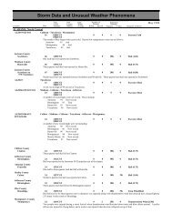
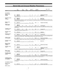
MAINEMEZ014-020>021Franklin CountyCountywideOxford CountyCountywideFranklin CountyFarmingtonMARYLAND, CentralMDZ004-007MDZ005>006Southern Somerset - Androscoggin - Kennebec30 0100EST31 2359EST31<strong>Storm</strong> <strong>Data</strong> <strong>and</strong> <strong>Unusual</strong> <strong>Weather</strong> <strong>Phenomena</strong>TimePath PathNumber ofEstimatedLocal/ Length WidthPersonsDamageLocation DateSt<strong>and</strong>ard (Miles) (Yards) Killed Injured Property Crops Character of <strong>Storm</strong>M39IW0200EST2359EST0131 0200EST0 0Flood2359ESTRapidly melting snow caused by record-breaking warmth combined with rainfall to cause flooding on the Kennebec <strong>and</strong>Androscoggin Rivers <strong>and</strong> their tributaries. Many roads were closed due to the flooding. One drowning death occurred in northernFranklin County when a 39-year old man drove his truck onto a flooded Route 27. The Kennebec River at Skowhegan reached floodflow on the 30th <strong>and</strong> reached flood stage at Augusta on the 31st. The Androscoggin River at Auburn reached flood stage on the31st. Both rivers continued to rise through the end of the month <strong>and</strong> crested in April as the flooding continued.30 2015EST0 0 100KLightningA large warehouse near Farmington was heavily damaged when it was struck by lightning <strong>and</strong> caught fire. Lightning also damaged<strong>and</strong> set fire to power company equipment <strong>and</strong> caused many homes in <strong>and</strong> near the Chesterfield/New Sharon area to lose power forthe night.Frederick - Harford03 0200EST1300ESTCarroll - Northern Baltimore003 0700EST1300EST0 0Winter <strong>Storm</strong>A strong upper-level disturbance combined with a weak surface trough to produce a small swath of moderate to heavy snow acrossthe northern tier of Maryl<strong>and</strong> during the morning of the 3rd. Accumulations varied with elevation; in general hilly areas (500 feetabove mean sea level) received between 4 <strong>and</strong> 6 inches (MDZ005>006) while lower terrain in the same counties received 1 to 3inches.Isolated areas in Carroll Co (MDZ005) received 7 to 8 inches. Surrounding counties received around 2 inches, though locationsalong the Catoctin Ridge (separating northwest MDZ004 <strong>and</strong> northeast MDZ003) received up to eight inches. Effects on residentswere limited; school was cancelled for the day in Carroll Co. there were at least 50 minor automobile accidents, but no injuries orfatalities occurred.000FloodFloodSnowMarch 1998Charles CountyWest PortionAnne Arundel CountyWest PortionCarroll CountySoutheast PortionPrince George'SCountyNorthwest Portion0909090400EST0900EST0500EST1000EST0500EST1000EST000000Flash FloodFlash FloodFlash Flood09 0500EST0 0 2KFlash Flood1000ESTA thin b<strong>and</strong> of showers <strong>and</strong> thunderstorms with torrential rains moved across the eastern <strong>and</strong> southern suburbs of Washington,weakening as it moved north into the western suburbs of Baltimore. Observed rainfall of 1 1/2 to 2 inches in two hours, with radarestimates of over 2 1/2 inches, produced flash flooding that brought the Monday morning commute to a st<strong>and</strong>still over the easternsuburbs.Six roads were closed in Charles Co; an additional 5 roads had high st<strong>and</strong>ing water covering them. Along the Prince George's/AnneArundel Co line, a bus overturned on Brock Bridge Road where the Little Patuxent River overspilled its banks. There were noinjuries; all passengers, including 23 children, were evacuated. Other incidents included a temporary road closure at the intersectionof federal highway 50 <strong>and</strong> Kenilworth Avenue (Prince George's Co) due to high st<strong>and</strong>ing water; in L<strong>and</strong>over, early morning76 70


