Storm Data and Unusual Weather Phenomena - CIG
Storm Data and Unusual Weather Phenomena - CIG
Storm Data and Unusual Weather Phenomena - CIG
- No tags were found...
Create successful ePaper yourself
Turn your PDF publications into a flip-book with our unique Google optimized e-Paper software.
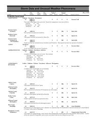
<strong>Storm</strong> <strong>Data</strong> <strong>and</strong> <strong>Unusual</strong> <strong>Weather</strong> <strong>Phenomena</strong>TimePath PathNumber ofEstimatedLocal/ Length WidthPersonsDamageLocation DateSt<strong>and</strong>ard (Miles) (Yards) Killed Injured Property Crops Character of <strong>Storm</strong>KENTUCKY, CentralAllen CountySettle08 1925ESTNickel size hail reported by a spotter.Allen CountyScottsville08 1925ESTDispatch reported nickel size hail.KENTUCKY, Eastern0 0Hail (0.88)0 0Hail (0.88)March 1998KENTUCKY, NortheastKYZ101>103-105KYZ101>103-105KENTUCKY, NorthernKENTUCKY, SouthwestKYZ008-012NONE REPORTED.Greenup - Carter - Boyd - Lawrence10130600EST0900EST0 0ColdThe coldest temperatures of the 97-98 winter were delayed until March for much of northeast Kentucky. Afternoon readings in the20s were common. The overnight low temperatures were 10 to 15 degrees near the rivers, with 5 to 10 degrees in outlying rurallocations.Greenup - Carter - Boyd - Lawrence26 1200EST0 0Record Warmth31 2100ESTA spell of early spring heat last an unusual 6 consecutive days. Afternoon readings were in the 80s.NONE REPORTED.Marshall - Trigg26 1030CST1400CST0 0 20KHigh Wind (G50)South winds averaged 20 to 30 MPH with higher gusts. On some hilltops in the Kentucky Lake region, gusts up to 58 MPH wereobserved. These strong gusts blew down some signs <strong>and</strong> stop lights. A few tree branches fell on power lines. The strong winds werecaused by low pressure over the Plains interacting with high pressure on the Atlantic coast.KYZ004Ballard27 2035CST0 0 3KHigh Wind (G50)Strong south winds in advance of a cold front briefly gusted to near 60 MPH. A large tree about 35 feet tall <strong>and</strong> 4 feet in diameterwas blown down near Wickliffe. Shortly thereafter, a thunderstorm moved across the same general area, bringing more strongwinds.Ballard County2 E Wickliffe 27 2245CST0 0 3KThunderstorm Wind (G50)Thunderstorm winds blew a large tree down across power lines on Highway 121. Some smaller trees were down.LOUISIANA, NortheastRichl<strong>and</strong> ParishMangham05 2042CST0 0 250KHail (2.75)Baseball size hail damaged many houses <strong>and</strong> automobiles.Richl<strong>and</strong> Parish5 W Alto 05 2045CST0 0 100KHail (2.75)Baseball size hail damaged houses <strong>and</strong> automobiles.Richl<strong>and</strong> Parish4 SW Mangham 05 2054CST0 0 50KThunderstorm WindStrong wind damaged the roofs of several houses. One out building was destroyed <strong>and</strong> an antenna was blown down.Franklin ParishBaskin05 2104CST0 0 100KHail (2.75)Baseball size hail damaged the roofs of houses <strong>and</strong> automobiles.Franklin ParishWinnsboro05 2120CST0 0 80KThunderstorm WindA framed post office was destroyed. A mobile home was blown off its foundation. Many trees <strong>and</strong> power lines were blown down.Morehouse ParishBonita07 0110CST0 0Hail (1.00)70 64


