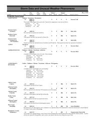
INDIANA, CentralINZ028>029-035-043>044-051-060-067INZ053>054-061-067>068INZ071Johnson CountyPrinces LakesJohnson CountySmith ValleyINDIANA, NortheastKosciusko CountyOswegoMiami County(Gus)Grissom Afb PerMiami County(Gus)Grissom Afb PerWhitley CountyLaudAllen CountyFt WayneAllen CountyHarlanINDIANA, NorthwestINZ001>004-010>011Rainfall of one to three inches on march 9 <strong>and</strong> March 10 brought the Wabash River above bankful to effect some local river roads<strong>and</strong> bottoml<strong>and</strong> agricultural areas before planting season.Warren - Tippecanoe - Fountain - Vermillion - Parke - Vigo - Sullivan - Knox19 0700EST0 0Flood31 0700ESTRainfall of 1 to 3 inches mainly falling on the 18th of March renewed flooding again on the Wabash River. The flooding againimpacted mainly river roads <strong>and</strong> bottoml<strong>and</strong> agricultural areas before spring planting season. The river exceeded flood stages by oneto four feet. The flooding continued through the end of March <strong>and</strong> into early April. These same counties will be listed again in April<strong>Storm</strong> <strong>Data</strong> to show the ending of the flooding episode.Owen - Morgan - Greene - Knox - Daviess21270700EST2359EST0 0FloodRainfall of 1 to 2 inches around the 20th combined with a relatively wet March brought the White River in central <strong>and</strong> southwestIndiana out of its banks. Flood stages in most cases were exceeded by several feet but the impact was felt mainly on river roads <strong>and</strong>bottomlannd areas prior to spring plantings.Jackson21 0700EST0 0Flood24 0700ESTOne to two inches of rain on the 20th brought a small stretch of the East Fork White River several feet above flood stage. Thisimpacted mainly local river roads <strong>and</strong> bottoml<strong>and</strong> agricultural areas prior to spring planting in the Seymour area.28 0430EST0432ESTThunderstorm winds blew down trees <strong>and</strong> power lines.28 0430EST0433ESTThunderstorm winds blew down trees <strong>and</strong> power lines.28 0840ESTtrees blown down in town. shed destroyed.2828<strong>Storm</strong> <strong>Data</strong> <strong>and</strong> <strong>Unusual</strong> <strong>Weather</strong> <strong>Phenomena</strong>TimePath PathNumber ofEstimatedLocal/ Length WidthPersonsDamageLocation DateSt<strong>and</strong>ard (Miles) (Yards) Killed Injured Property Crops Character of <strong>Storm</strong>0905EST0918EST00000000001.5K1.5K28 1005EST 0.1 10 0 0small tornado touched down in Laud causing tree damage <strong>and</strong> moderate damage to one home.1KThunderstorm WindThunderstorm WindThunderstorm WindThunderstorm Wind (G65)Thunderstorm Wind (G65)Tornado (F0)28 1015EST0 0 5KThunderstorm Wind1030ESTnumerous trees blown down up to 12 inches in diameter in southern part of town. Many power lines down as well. Trees up to 2feet in diameter 3 miles south of Baer Field at US 27 <strong>and</strong> Thompson Road.28 1021EST 0.3 50 0 0 25KTornado (F1)1023ESTsmall tornado touched down in Harlan. It damaged a cabinet factory <strong>and</strong> completely destroyed a mobile home.March 1998Lake - Porter - La Porte - St. Joseph - Newton - Jasper09 0800EST0 0Heavy Snow11 1600ESTA strong low pressure system brought a late winter storm to northwest Indiana the morning of March 9th. The low, which originatedin the southwestern U.S., took an east-northeast track, reaching central Illinois by the evening of the 8th. Precipitation in the form ofrain began out ahead of this system, <strong>and</strong> changed over to a heavy, wet snow between 7am <strong>and</strong> 8am (est). The snow continued intothe middle of the afternoon on the 9th, dropping around a foot of snow in some places. Lake induced snow showers followed thismain storm event <strong>and</strong> causing additional snowfall accumulations of 2 to 6 inches.60 54
<strong>Storm</strong> <strong>Data</strong> <strong>and</strong> <strong>Unusual</strong> <strong>Weather</strong> <strong>Phenomena</strong>TimePath PathNumber ofEstimatedLocal/ Length WidthPersonsDamageLocation DateSt<strong>and</strong>ard (Miles) (Yards) Killed Injured Property Crops Character of <strong>Storm</strong>INDIANA, NorthwestMarch 1998INDIANA, South CentralThe combination of strong winds <strong>and</strong> heavy snowfall brought traffic to a st<strong>and</strong>still on stretches of I-65 <strong>and</strong> Interstate 80/94 inIndiana. Some drivers were str<strong>and</strong>ed for as long as 18 hours. Many homes were without electricity, as numerous power lines weredowned due to the weight of the heavy, wet snow. Also, tree limbs <strong>and</strong> branches were downed.Total snowfall storm totals reported:Lake County: Merriville-18 inches, <strong>and</strong> Crown Point-12 inches.Porter: Valparaiso-15 inches.LaPorte County: Rolling Prarie-18 inches, Stillwell-16 inches, LaPorte-between 13-16 inches, MIchigan City 13.5 inches, <strong>and</strong>Westville-13.5 inches.Elkhart County: Elkhart-10.5 inches, <strong>and</strong> Goshen-between 6-8 inches.St. Joseph County: South Bend-16.5 inches, Walkerton-14 inches, <strong>and</strong> in Mishawaka-12 inches.INDIANA, SoutheastNONE REPORTED.INDIANA, SouthwestINZ085IOWA, CentralIAZ024>028-033>039-044>050-057>062-070>075-081>085-092>096NONE REPORTED.Posey26300900CST1900CST0 0FloodThe Wabash River crested less than a foot above flood stage at New Harmony, causing very minor flooding of low lyingbottoml<strong>and</strong>s.Humboldt - Wright - Franklin - Butler - Bremer - Sac - Calhoun - Webster - Hamilton - Hardin - Grundy -Black Hawk - Crawford - Carroll - Greene - Boone - Story - Marshall - Tama - Audubon - Guthrie - Dallas -Polk - Jasper - Poweshiek - Cass - Adair - Madison - Warren - Marion - Mahaska - Adams - Union - Clarke -Lucas - Monroe - Taylor - Ringgold - Decatur - Wayne - Appanoose07 2100CST1 0 2MHeavy Snow08 2359CSTA powerful storm system developed over the southern Rockies <strong>and</strong> advanced into the southern Plains. The storm moved northeastacross Missouri into Illinois leaving Iowa in the deformation zone for an extended period of time. While the low was advancingnortheast, a strong Arctic high pressure cell located over northern Canada dropped southeast toward the U.S. The high was near1055 mb, while the low pressure was near 990 mb. This resulted in a tight pressure gradient over Iowa through the storm. Aninitial area of light snow advanced across the state <strong>and</strong> changed to freezing rain <strong>and</strong> sleet over the southwest <strong>and</strong> central countiesduring the evening of the 7th. The ice accumulation was not very significant however. The precipitation changed over to snowduring the late evening <strong>and</strong> early morning hours. By the predawn hours of the 8th, significant snow was falling over a large part ofsouthwest into central Iowa. During the late night hours into the early morning of the 8th, the snow became convective withthundersnow reported as far north as central Iowa. Winds increased on the 8th with north winds of 30 to 50 MPH reported over allof Iowa on the 8th into the 9th. The snow was very wet in consistency. As a result, there was considerable drifting <strong>and</strong> someblowing. True blizzard conditions did not occur over a widespread area, but were reported locally. The winds caused huge driftswhich blocked most east to west highways in the state. Snowfall over the area affected ranged from 8 to 12 inches in most areas.Heavier amounts were reported over central into southwest Iowa. Numerous reports of 12 to 14 inches were received in a 30 milewide area extending from Des Moines, southwest to the southwest Iowa border. One of the heaviest storm total snowfall reportscame from Windsor Heights with 15.4 inches. Indianola <strong>and</strong> Perry both reported between 13.5 <strong>and</strong> 14 inches of snow. Someunofficial reports from around the Creston area were received in the 20 inch range. Sixteen inches was reported in Clarke County<strong>and</strong> also in Carroll County. With the large amounts of snow <strong>and</strong> the winds, drifts of 15 to 20 feet in depth were common. Theheavy drifts closed most highways in the state on the 8th. One death occurred. An 81 year old Female died of exposure when sheattempted to travel from the Osceola Nursing <strong>and</strong> Rehabilitation Center to the Calvery Bible Church. Churches were closed over alarge part of Iowa. Shopping malls were closed for the entire day Sunday. School districts were already closing on Sunday forMondays classes. Many schools remained closed for 2 to 3 days. Hundreds of people were str<strong>and</strong>ed by the snow <strong>and</strong> forced to stayput for one to two days. Spotty power outages occurred, but there were no reports of widespread power outages. With conditions asthey were, a few areas were without power for 4 days. The storm was costly in terms of snow removal. The State of Iowa estimatedthe storm cost $4 million to clear highways. Four days after the snow fell, the Iowa D.O.T. reported in excess of 1000 miles ofhighway still blocked by snow. The National Guard was called out to help rescue people as well. Eleven counties were declareddisaster areas by the State of Iowa. They were Polk, Adams, Madison, Warren, Mills, Montgomery, Adams, Union, Clarke, Page,<strong>and</strong> Taylor. Following the storm, Arctic air swept into the state to make matters worse. Temperatures dipped to -24 at Bedford <strong>and</strong>61 55
- Page 1:
MARCH 1998VOLUME 40NUMBER 3STORMDAT
- Page 5 and 6:
OUTSTANDING STORMS OF THE MONTH1. T
- Page 7 and 8:
ALABAMA, North CentralLamar CountyS
- Page 9 and 10: ALABAMA, North CentralMadison Count
- Page 11 and 12: ALABAMA, SoutheastALZ065-068Coffee
- Page 13 and 14: Storm Data and Unusual Weather Phen
- Page 15 and 16: ALASKA, SouthernAKZ011-018>019AKZ02
- Page 17 and 18: ARIZONA, NorthwestMohave County20 N
- Page 19 and 20: ARKANSAS, Central and North Central
- Page 21 and 22: ARKANSAS, NorthwestMadison CountyHu
- Page 23 and 24: CALIFORNIA, NorthwestCAZ003-076Nort
- Page 25 and 26: CALIFORNIA, South CentralKern Count
- Page 27 and 28: CALIFORNIA, SouthwestSan Bernardino
- Page 29 and 30: CALIFORNIA, West South CentralVentu
- Page 31 and 32: COLORADO, South Central and Southea
- Page 33 and 34: Storm Data and Unusual Weather Phen
- Page 35 and 36: Storm Data and Unusual Weather Phen
- Page 37 and 38: Storm Data and Unusual Weather Phen
- Page 39 and 40: FLORIDA, NorthwestBay CountyMexico
- Page 41 and 42: FLORIDA, West CentralDe Soto County
- Page 43 and 44: FLORIDA, West CentralManatee County
- Page 45 and 46: FLORIDA, West CentralPasco CountySt
- Page 47 and 48: FLORIDA, West Panhandlecaused sand
- Page 49 and 50: GEORGIA, LowerGEORGIA, North and Ce
- Page 51 and 52: GEORGIA, Southwestroads were closed
- Page 53 and 54: Storm Data and Unusual Weather Phen
- Page 55 and 56: IDAHO, SouthwestTwin Falls County2
- Page 57 and 58: ILLINOIS, CentralMoultrie CountyLov
- Page 59: ILLINOIS, SouthILZ087-092>094ILZ084
- Page 63 and 64: IOWA, CentralWapello County2 W Ottu
- Page 65 and 66: KANSAS, EastMarshall CountyMarysvil
- Page 67 and 68: KANSAS, NorthwestHail accompanied b
- Page 69 and 70: KANSAS, SouthwestRush County14 WSW
- Page 71 and 72: LOUISIANA, NortheastCatahoula Paris
- Page 73 and 74: LOUISIANA, SoutheastSt. John The Ba
- Page 75 and 76: MAINEHancock CountyCountywidePenobs
- Page 77 and 78: Storm Data and Unusual Weather Phen
- Page 79 and 80: MARYLAND, WestBlustery northwest wi
- Page 81 and 82: MASSACHUSETTS, Central and EastMAZ0
- Page 83 and 84: MICHIGAN, EastMacomb CountyUticaSag
- Page 85 and 86: MICHIGAN, WestMIZ074MIZ037-043-056-
- Page 87 and 88: MINNESOTA, Central and South Centra
- Page 89 and 90: MINNESOTA, SoutheastOlmsted CountyS
- Page 91 and 92: MISSISSIPPI, CentralSmith CountyMiz
- Page 93 and 94: MISSISSIPPI, NorthYalobusha CountyW
- Page 95 and 96: MISSOURI, EastJefferson CountyCount
- Page 97 and 98: Storm Data and Unusual Weather Phen
- Page 99 and 100: Storm Data and Unusual Weather Phen
- Page 101 and 102: Storm Data and Unusual Weather Phen
- Page 103 and 104: MISSOURI, SouthwestPulaski County2
- Page 105 and 106: MISSOURI, SouthwestMaries CountyCou
- Page 107 and 108: MONTANA, EastMTZ016>017-021>023-025
- Page 109 and 110: NEBRASKA, CentralMcpherson CountyFl
- Page 111 and 112:
NEBRASKA, WestGolf ball size hail f
- Page 113 and 114:
NEW HAMPSHIRE, North and CentralNHZ
- Page 115 and 116:
NEW JERSEY, South and NorthwestCumb
- Page 117 and 118:
Storm Data and Unusual Weather Phen
- Page 119 and 120:
NEW MEXICO, SoutheastLea CountyHobb
- Page 121 and 122:
NEW YORK, CoastalNYZ069NEW YORK, Ea
- Page 123 and 124:
Storm Data and Unusual Weather Phen
- Page 125 and 126:
NORTH CAROLINA, CentralDime size ha
- Page 127 and 128:
NORTH CAROLINA, CentralGolfball siz
- Page 129 and 130:
NORTH CAROLINA, Northwest and North
- Page 131 and 132:
NORTH CAROLINA, SouthwestDeep low p
- Page 133 and 134:
OHIO, NorthOHZ009>014-019>023-028>0
- Page 135 and 136:
Storm Data and Unusual Weather Phen
- Page 137 and 138:
OKLAHOMA, PanhandleOKZ002TexasOKZ00
- Page 139 and 140:
OKLAHOMA, Western, Central and Sout
- Page 141 and 142:
OKLAHOMA, Western, Central and Sout
- Page 143 and 144:
PENNSYLVANIA, CentralAdams CountyCo
- Page 145 and 146:
PENNSYLVANIA, Easta couple of inche
- Page 147 and 148:
RHODE ISLANDKent CountyWest Warwick
- Page 149 and 150:
SOUTH CAROLINA, North CoastalREPORT
- Page 151 and 152:
SOUTH DAKOTA, WestSDZ001-012-012>01
- Page 153 and 154:
TEXAS, CentralConcho CountyPaint Ro
- Page 155 and 156:
TEXAS, NorthStorm Data and Unusual
- Page 157 and 158:
TEXAS, NorthTarrant County1 W Crowl
- Page 159 and 160:
TEXAS, NortheastHarrison County1 W
- Page 161 and 162:
TEXAS, South CentralMedina CountySt
- Page 163 and 164:
TEXAS, Western NorthWichita CountyW
- Page 165 and 166:
Storm Data and Unusual Weather Phen
- Page 167 and 168:
Storm Data and Unusual Weather Phen
- Page 169 and 170:
VIRGINIA, NorthCulpeper CountyCount
- Page 171 and 172:
VIRGINIA, SouthwestPittsylvania Cou
- Page 173 and 174:
WEST VIRGINIA, EastA mudslide affec
- Page 175 and 176:
WISCONSIN, NortheastWaushara County
- Page 177 and 178:
Storm Data and Unusual Weather Phen
- Page 179 and 180:
WISCONSIN, SouthwestLa Crosse Count
- Page 181 and 182:
Storm Data and Unusual Weather Phen
- Page 186:
To change your address, please retu


