Storm Data and Unusual Weather Phenomena - CIG
Storm Data and Unusual Weather Phenomena - CIG
Storm Data and Unusual Weather Phenomena - CIG
- No tags were found...
You also want an ePaper? Increase the reach of your titles
YUMPU automatically turns print PDFs into web optimized ePapers that Google loves.
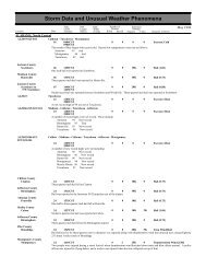
ILLINOIS, SouthILZ087-092>094ILZ084ILZ076-084<strong>Storm</strong> <strong>Data</strong> <strong>and</strong> <strong>Unusual</strong> <strong>Weather</strong> <strong>Phenomena</strong>TimePath PathNumber ofEstimatedLocal/ Length WidthPersonsDamageLocation DateSt<strong>and</strong>ard (Miles) (Yards) Killed Injured Property Crops Character of <strong>Storm</strong>March 1998Gallatin - Alex<strong>and</strong>er - Pulaski - Massac22 0600CST0 0Flood31 2359CSTThe Ohio River crested just above flood stage at several locations. This resulted in some minor flooding of agricultural bottoml<strong>and</strong>s<strong>and</strong> river access roads. The river crested right at the 37 foot flood stage at Brookport, 3 feet above the 33-foot flood stage atShawneetown, <strong>and</strong> 4.6 feet above the 40-foot flood stage at Cairo.Jackson22 0800CST0 0Flood31 2359CSTThe Big Muddy River crested almost 10 feet above its 16-foot flood stage at Murphysboro. The flooding was aggravated by highwater on the Mississippi River, which backed up the Big Muddy River. Moderate flooding of some agricultural areas <strong>and</strong> riveraccess roads occurred.Wayne - Jackson26 1100CST0 0 10KHigh Wind (G50)1500CSTStrong south winds averaged 20 to 30 MPH with higher gusts. Gusts were estimated near 58 MPH on the higher elevations fromMarion <strong>and</strong> Carbondale northeast to Fairfield in Wayne County. Limbs, branches, <strong>and</strong> a few power lines were blown down in theseareas. No significant or widespread damage occurred. The strong winds were caused by low pressure over the Plains interactingwith high pressure over the Atlantic coast.Franklin County5 S Benton 28 0030CST0 0Strong thunderstorm winds snapped trees along Interstate 57 between Benton <strong>and</strong> West Frankfort.Thunderstorm Wind (G52)ILLINOIS, SouthwestILZ058>059-095>097- Greene - Macoupin - Adams - Brown - Pike - Jersey - Madison099>10008092300CST1300CST0 0Winter <strong>Storm</strong>A late winter snow storm dropped between 1 to 6 inches of snow across west central <strong>and</strong> southwest Illinois. The heaviest snow fellacross west central Illinois, with up to 8 inches reported in a few locations in Adams County. Traffic tie-ups <strong>and</strong> slowdowns werethe major problems caused by the storm.Calhoun CountyHardin27 1736CST0 0Thunderstorm Wind (G50)Thunderstorm wind gusts downed trees in Hardin.Brown CountyMt Sterling27 1740CST0 0Thunderstorm Wind (G56)Brown CountyTimewell27 1747CST0 0Thunderstorm Wind (G56)A tractor trailer truck was blown over on Highway 24 near Timewell. Skywarn spotters reported wind gusts from 60 to 70 mph.Jersey CountyJerseyville27 1750CST0 0Thunderstorm Wind (G52)Thunderstorm wind gusts downed trees <strong>and</strong> power lines.Macoupin County14 W Carlinville 27 1800CST0 0Thunderstorm Wind (G55)Thunderstorm wind gusts destroyed a storage building <strong>and</strong> blew part of the roof off a barm.Greene CountyCarrollton28 0208CST0 0Hail (0.75)INDIANA, CentralBartholomew County5 W Columbus 08 2158EST0Marion CountyLawrence08 2224EST0INZ028>029-035- Warren - Tippecanoe - Fountain - Vermillion - Parke043>04410180700EST0700EST0000Hail (0.75)Hail (0.88)Flood59 53


