Storm Data and Unusual Weather Phenomena - CIG
Storm Data and Unusual Weather Phenomena - CIG
Storm Data and Unusual Weather Phenomena - CIG
- No tags were found...
You also want an ePaper? Increase the reach of your titles
YUMPU automatically turns print PDFs into web optimized ePapers that Google loves.
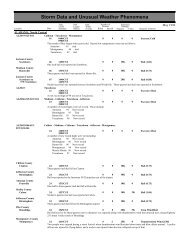
<strong>Storm</strong> <strong>Data</strong> <strong>and</strong> <strong>Unusual</strong> <strong>Weather</strong> <strong>Phenomena</strong>TimePath PathNumber ofEstimatedLocal/ Length WidthPersonsDamageLocation DateSt<strong>and</strong>ard (Miles) (Yards) Killed Injured Property Crops Character of <strong>Storm</strong>March 1998VERMONT, North <strong>and</strong> CentralAn area of low pressure moved across northern New York <strong>and</strong> northern New Engl<strong>and</strong> during Saturday (March 14) <strong>and</strong> then into theCanadian maritimes Sunday (March 15). A complex pattern of snow accumulations resulted across Vermont, with the heaviestsnowfall in <strong>and</strong> east of the Green Mountains. A number of traffic accidents were reported. Some of the heavier accumulationswere:VTZ004VTZ001>002-005-009VTZ001>012Franklin CountyCountywideLamoille CountyCountywideWaitsfield (Washington county).........14.0 inchesTyson (Windsor county)...............11.0 inchesBrookfield (Orange county).................10.0 inchesEden (Lamoille county)...............10.0 inchesJay Peak (Orleans county).................. 9.0 inchesSutton (Caledonia county)..............9.0 inchesEast Wallingford (Rutl<strong>and</strong> county)...................9.0 inchesAlbany (Orleans county)...................7.0 inches.Essex14 1100EST0 0Light Snow15 0800ESTAn area of low pressure moved across northern New York <strong>and</strong> northern New Engl<strong>and</strong> during Saturday (March 14) <strong>and</strong> then into theCanadian maritimes Sunday (March 15). A complex pattern of snow accumulations resulted in generally 3 to 6 inches across farnortheast Vermont in Essex county.Gr<strong>and</strong> Isle - Franklin - Chittenden - Addison14 1100EST0 0 10KLight Snow15 0600ESTAn area of low pressure moved across northern New York <strong>and</strong> northern New Engl<strong>and</strong> during Saturday (March 14) <strong>and</strong> then into theCanadian maritimes Sunday (March 15). A complex pattern of snowfall resulted in accumulations of generally 3 to 6 inches in thechamplain Valley of Vermont. Several traffic accidents were reported in Addison county.Gr<strong>and</strong> Isle - Franklin - Orleans - Essex - Chittenden - Lamoille - Caledonia - Washington - Addison - Orange- Rutl<strong>and</strong> - Windsor21 1000EST0 0 115KHeavy Snow22 1600ESTA storm system along the Virginia coast on Saturday (March 21) moved slowly northeast into the Gulf of Maine late Sunday <strong>and</strong>Sunday night (March 22) . Snow was heavy Saturday night into Sunday morning with a number of traffic accidents reported <strong>and</strong>brief power outages. The snow tapered off to snow showers Sunday night. Snow accumulations were generally 15 to 20 inchesacross northwest <strong>and</strong> north central Vermont with around a foot elsewhere across the area. The heaviest report was 25 inches at JayPeak near the border of the Vermont counties of Franklin <strong>and</strong> Orleans. The following are a few snow accumulations from across thearea:AlbanyEdenEssexSheldon SpringsWaitsfieldBrookfieldSouth LincolnRochesterSuttonRutl<strong>and</strong>Isl<strong>and</strong> Pond(Orleans county)..............19.2 inches(Lamoille county).............18.0 inches(Chittenden county).........16.0 inches(Franklin county)..............16.0 inches(Washington county)........14.0 inches(Orange county)...............14.0 inches(Addison county)..............12.5 inches(Windsor county).............12.0 inches(Caledonia county)..........12.0 inches(Rutl<strong>and</strong> county)..............11.5 inches(Essex county).................10.0 inches.28 2223EST0 0 250KFlood31 2359ESTUnseasonably warm weather resulted in dramatic snowmelt with rapid rises on rivers the last few days of March. In addition,showers <strong>and</strong> thunderstorms with heavy downpours moved across the area on the 30th enhancing the runoff into the rivers. Amongthe streams <strong>and</strong> rivers flooding were the Missisquoi from Richford to Swanton <strong>and</strong> the Trout River in <strong>and</strong> around Montgomery. Afew houses were flooded in Swanton on March 28th <strong>and</strong> 29th. A number of roads were also closed due to flood waters. These riverscontinued to exceed flood stage through the end of the month.29310700EST2359EST0 0 10KFloodUnseasonably warm weather resulted in dramatic snowmelt with rapid rises on rivers the last few days of March. Specifically, theLamoille River began flooding from Morrisville to Johnson to Cambridge early on the 29th of March flooding portions of Route 15.165 159


