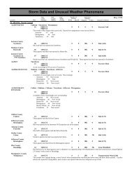
<strong>Storm</strong> <strong>Data</strong> <strong>and</strong> <strong>Unusual</strong> <strong>Weather</strong> <strong>Phenomena</strong>TimePath PathNumber ofEstimatedLocal/ Length WidthPersonsDamageLocation DateSt<strong>and</strong>ard (Miles) (Yards) Killed Injured Property Crops Character of <strong>Storm</strong>PENNSYLVANIA, EastMarch 1998<strong>Storm</strong> precipitation totals included 3.29 inches in Tobyhanna (Monroe County), 2.90 inches in Mount Pocono (Monroe County),2.79 inches in Long Pond (Monroe County), 2.20 inches in Phoenixville (Chester County), 2.09 inches in Lehighton (CarbonCounty), 2.08 inches in Hamburg (Berks County), 2.05 inches in Easton (Northampton County) <strong>and</strong> East Stroudsburg (MonroeCounty), 2.00 inches in Green Lane (Montgomery County), 1.93 inches at the Lehigh Valley International Airport, 1.91 inches inGlenmoore (Chester County), 1.88 inches in Springtown (Bucks County), 1.44 inches in Valley Forge (Montgomery County),1.37 inches in Neshaminy Falls (Bucks County), 1.34 inches at the Willow Grove NAS, 1.31 inches in Crum Creek (DelawareCounty) <strong>and</strong> 1.1 inches at the Philadelphia International Airport.Berks County2 S Sinking Spg to 09 1912EST0 00 Thunderstorm WindKutztown1940ESTBerks CountyBl<strong>and</strong>on 09 1933EST 2 50 0 0 100K 0 Tornado (F1)1937ESTA line of severe thunderstorms moved through Berks County Pennsylvania the evening of March 9th <strong>and</strong> knocked down tree limbs<strong>and</strong> power lines from Spring Township northeast through Kutztown. The worst damage occurred when the thunderstorm dropped aweak tornado (F1 on the Fujita Scale) in Bl<strong>and</strong>on located in southern Maiden Creek Township a little after 730 p.m. EST. Thetornado touched down on Pennsylvania State Route 73 (Main Street) in Bl<strong>and</strong>on. It moved northeast nearly along Willow Creek <strong>and</strong>parallel to U.S. Route 222. Homes along Cornerstone Drive in the Maiden Creek Estates development were nearest the path <strong>and</strong>had the most widespread damage. The tornado lifted as it passed over Pleasant Hill Road. More than half of its two mile pathlength was through wooded areas <strong>and</strong> this reduced the damage that was done. No injuries were reported.Two houses (one on Main Street <strong>and</strong> one on Pleasant Hill Road) lost sections of their roofs. The house on Pleasant Hill Road alsohad its front door knocked out <strong>and</strong> its garage crushed by a fallen tree. The tornado tore out an entire section of a second story wallfrom a house on Cornerstone Drive <strong>and</strong> embedded its siding into the ground <strong>and</strong> <strong>and</strong> sides of other homes. About an additional 30houses mainly on the east side of Cornerstone Drive suffered minor to moderate damage as the tornado leveled sheds, tossedplayhouses <strong>and</strong> swing sets <strong>and</strong> ripped siding <strong>and</strong> shingles. Storage sheds were seen bouncing through backyards. Numerous trees,including fruit trees, evergreens <strong>and</strong> maples were either snapped or uprooted. Traffic signs were ravaged <strong>and</strong> twisted.PAZ054>055PAZ054>055PAZ060>062About 700 customers throughout the county lost power because of the tornado, severe thunderstorms <strong>and</strong> lightning strikes. Theywere concentrated in Bl<strong>and</strong>on, Kutztown, Richmond Township <strong>and</strong> Wyomissing. There were also at least five separate reports ofsmall hail with the line of thunderstorms.Carbon - Monroe18 0100EST0 0Wintry Mix1000ESTLight sleet <strong>and</strong> freezing rain overspread the sheltered valleys of Carbon <strong>and</strong> Monroe Counties during the first half of the day on the18th. Precipitation started shortly after midnight as sleet <strong>and</strong> freezing rain <strong>and</strong> slowly changed over to plain rain as the morningprogressed. The rain ended by noon across the Poconos. <strong>Storm</strong> totals were generally under two tenths of an inch. Untreatedroadways were hazardous. A low pressure system in the Mississippi Valley pumped moisture eastward into the Middle AtlanticStates. Unfortunately while it was warm enough for rain above the ground, the cold air near the surface left by a departing highpressure system made precipitation fall as sleet <strong>and</strong>/or freezing rain.Carbon - Monroe21 0700EST0 0Winter <strong>Storm</strong>22 0700ESTA winter storm dropped around six inches of snow over the higher terrain of Carbon <strong>and</strong> Monroe Counties from daybreak on the21st through sunrise on the 22nd. Precipitation started as rain before dawn on the 21st, but as cold air was drawn into the Poconosfrom New York State <strong>and</strong> Canada, precipitation slowly changed over from rain to sleet <strong>and</strong> then snow, starting first in the higherelevations. Periods of snow persisted through the night of the 21st until the upper level low guiding the surface low pressure system(near Cape Cod the morning of the 22nd) moved through the region. Accumulations included 6 inches at Indian Mountain Lakes(Carbon County) <strong>and</strong> 3.5 inches in East Stroudsburg. The low pressure system that caused the heavy snow moved northeast fromNorth Carolina early in the morning on the 21st, to just east of Delaware the evening of the 21st to Cape Cod the morning of the22nd. The upper level low steering the surface system moved through New Jersey during the early morning on the 22nd.Berks - Lehigh - Northampton21 1300EST0 0Wintry Mix22 0800ESTA coastal low pressure system dropped a mixture of sleet <strong>and</strong> snow across Berks County <strong>and</strong> the Lehigh Valley from the afternoonof the 21st through sunrise on the 22nd. Precipitation started as rain before dawn on the 21st, but as cold air was drawn into theregion from New York State <strong>and</strong> Canada, precipitation slowly changed over from rain to sleet in the afternoon <strong>and</strong> then to snow bythe evening, starting first in the higher elevations. Periods of light snow persisted through the night of the 21st until the upper levellow guiding the surface low pressure system (near Cape Cod the morning of the 22nd) moved through the region. The heaviestprecipitation fell as rain earlier in the day <strong>and</strong> thus accumulations were on the light side, generally around an inch in the valleys <strong>and</strong>144 138
PENNSYLVANIA, Easta couple of inches over the higher terrain. Accumulations included 1 inch at Hamburg <strong>and</strong> 0.5 inches at the Lehigh ValleyInternational Airport. The low pressure system that caused the wintry mix moved northeast from North Carolina early in themorning on the 21st, to just east of Delaware the evening of the 21st to Cape Cod the morning of the 22nd. The upper level lowsteering the surface system moved through New Jersey during the early morning on the 22nd.Carbon - Monroe - Berks - Lehigh - Northampton - Chester - Montgomery - Bucks - Delaware - PhiladelphiaPAZ054>055-060>062-067>071PENNSYLVANIA, NortheastPAZ039>040-044-048PENNSYLVANIA, NorthwestPAZ001PAZ002>003PAZ002>003<strong>Storm</strong> <strong>Data</strong> <strong>and</strong> <strong>Unusual</strong> <strong>Weather</strong> <strong>Phenomena</strong>TimePath PathNumber ofEstimatedLocal/ Length WidthPersonsDamageLocation DateSt<strong>and</strong>ard (Miles) (Yards) Killed Injured Property Crops Character of <strong>Storm</strong>March 199827 1000EST0 0Unseasonably Warm31 1800ESTAn unseasonably warm air mass for late March brought record breaking high temperatures across Eastern Pennsylvania from March27th through March 31st. The warmest days were the 30th around the Philadelphia Metropolitan Area <strong>and</strong> either the 30th or 31st inBerks County, the Lehigh Valley <strong>and</strong> the Poconos. Several locations across the Middle Atlantic States established new Marchmonthly high temperature records including the Lehigh Valley International Airport on the 30th with a high of 87 degrees.The previous March monthly record was 86 degrees set on March 29, 1945. Daily high temperature records were broken at theLehigh Valley International Airport on the 27th, 30th <strong>and</strong> 31st <strong>and</strong> on the 30th (one degree shy of the monthly record) at thePhiladelphia International Airport. The high of 81 degrees on the 31st tied the record high for the day in Philadelphia. AcrossEastern Pennsylvania, the highest temperatures included 89 degrees in King of Prussia (Montgomery County), <strong>and</strong> Crum Creek(Delaware County), 88 degrees in Reading (Berks County), New Hope (Bucks County), the Willow Grove NAS (MontgomeryCounty), East Stroudsburg (Monroe County) <strong>and</strong> the Northeast Philadelphia Airport, 87 degrees in Easton (Northampton County)<strong>and</strong> the Lehigh Valley International Airport, 86 degrees at the Philadelphia International Airport <strong>and</strong> 84 degrees in Mount Pocono(Monroe County). Cloudiness <strong>and</strong> a cold frontal passage on April 1st slowly brought temperatures back to seasonal levels in earlyApril.Susquehanna - Wayne - Lackawanna - Pike20 1900EST0 0Heavy Snow22 0900ESTA low pressure system slowly intensified over the Carolinas from the evening of the 20th through much of the day on the 21st.A notable spoke of upper level energy rotated around this storm <strong>and</strong> affected parts of northeastern Pennsylvania from late in th eevening on the 20th into the early morning hours on the 21st. A burst of heavy snow resulted, which was mixed with sleet an dfreezing rain. This round of mixed precipitation brought an ice coating up to a quarter of an inch thick on exposed surfaces acrossthe higher elevations just outside of the Wilkes-Barre/Scranton metropolitan area. Also, 2 to 5 inches of snow fell within roughly a6 hour period in areas north of Scranton.From the evening of the 21st through the 22nd, the storm center began to move northeastward off the Mid-Altantic coast whilestrengthening further. As this occurred, narrow b<strong>and</strong>s of very heavy snowfall developed overnight into the early morning of the22nd across the northern tier <strong>and</strong> Pocono regions.Snowfall totals for this entire event were heaviest to the north <strong>and</strong> east of Scranton. Accumulations of 6 to 10 inches werecommon. Equinunk <strong>and</strong> Dyberry township in Wayne county picked up 8 to 10 inches of snow while Bushkill in Pike county <strong>and</strong>Great Bend in Susquehanna county received 6 to 7 inches of fresh powder.Northern Erie08 1600EST1700EST0 0 50KHigh WindNortheast winds up to 60 miles per hour along the lakeshore downed a tree on a house in Fairview <strong>and</strong> another tree fell on a hous ein Erie. Cablevision <strong>and</strong> power lines were downed.Southern Erie - Crawford10 0415EST0 0Heavy Snow12 0645ESTHeavy lake effect snow developed during the early morning hours on the 10th <strong>and</strong> continued on <strong>and</strong> off (mainly inl<strong>and</strong>) for threedays before tapering off to a few snow showers. Temperatures near or above freezing each day <strong>and</strong> the warm March sunshine kep troadways mainly wet <strong>and</strong> travel problems were confined mainly to the night time <strong>and</strong> early morning hours. Winds gusted to 40miles per hour at times on the 10th, <strong>and</strong> diminished a bit each day, but drifting snow was a problem throughout the event. Snowdepths reached six inches by 11 AM on the 10th. Total snow fall amounts generally ranged from six to eight inches, with highe ramounts of 24 inches in Edinboro, 22 inches at Franklin Center <strong>and</strong> 12 inches at Corry, all in Erie County; <strong>and</strong> 22 inches a tSpartansburg in Crawford County.Southern Erie - Crawford14 0415EST0 0Heavy Snow1915EST145 139
- Page 1:
MARCH 1998VOLUME 40NUMBER 3STORMDAT
- Page 5 and 6:
OUTSTANDING STORMS OF THE MONTH1. T
- Page 7 and 8:
ALABAMA, North CentralLamar CountyS
- Page 9 and 10:
ALABAMA, North CentralMadison Count
- Page 11 and 12:
ALABAMA, SoutheastALZ065-068Coffee
- Page 13 and 14:
Storm Data and Unusual Weather Phen
- Page 15 and 16:
ALASKA, SouthernAKZ011-018>019AKZ02
- Page 17 and 18:
ARIZONA, NorthwestMohave County20 N
- Page 19 and 20:
ARKANSAS, Central and North Central
- Page 21 and 22:
ARKANSAS, NorthwestMadison CountyHu
- Page 23 and 24:
CALIFORNIA, NorthwestCAZ003-076Nort
- Page 25 and 26:
CALIFORNIA, South CentralKern Count
- Page 27 and 28:
CALIFORNIA, SouthwestSan Bernardino
- Page 29 and 30:
CALIFORNIA, West South CentralVentu
- Page 31 and 32:
COLORADO, South Central and Southea
- Page 33 and 34:
Storm Data and Unusual Weather Phen
- Page 35 and 36:
Storm Data and Unusual Weather Phen
- Page 37 and 38:
Storm Data and Unusual Weather Phen
- Page 39 and 40:
FLORIDA, NorthwestBay CountyMexico
- Page 41 and 42:
FLORIDA, West CentralDe Soto County
- Page 43 and 44:
FLORIDA, West CentralManatee County
- Page 45 and 46:
FLORIDA, West CentralPasco CountySt
- Page 47 and 48:
FLORIDA, West Panhandlecaused sand
- Page 49 and 50:
GEORGIA, LowerGEORGIA, North and Ce
- Page 51 and 52:
GEORGIA, Southwestroads were closed
- Page 53 and 54:
Storm Data and Unusual Weather Phen
- Page 55 and 56:
IDAHO, SouthwestTwin Falls County2
- Page 57 and 58:
ILLINOIS, CentralMoultrie CountyLov
- Page 59 and 60:
ILLINOIS, SouthILZ087-092>094ILZ084
- Page 61 and 62:
Storm Data and Unusual Weather Phen
- Page 63 and 64:
IOWA, CentralWapello County2 W Ottu
- Page 65 and 66:
KANSAS, EastMarshall CountyMarysvil
- Page 67 and 68:
KANSAS, NorthwestHail accompanied b
- Page 69 and 70:
KANSAS, SouthwestRush County14 WSW
- Page 71 and 72:
LOUISIANA, NortheastCatahoula Paris
- Page 73 and 74:
LOUISIANA, SoutheastSt. John The Ba
- Page 75 and 76:
MAINEHancock CountyCountywidePenobs
- Page 77 and 78:
Storm Data and Unusual Weather Phen
- Page 79 and 80:
MARYLAND, WestBlustery northwest wi
- Page 81 and 82:
MASSACHUSETTS, Central and EastMAZ0
- Page 83 and 84:
MICHIGAN, EastMacomb CountyUticaSag
- Page 85 and 86:
MICHIGAN, WestMIZ074MIZ037-043-056-
- Page 87 and 88:
MINNESOTA, Central and South Centra
- Page 89 and 90:
MINNESOTA, SoutheastOlmsted CountyS
- Page 91 and 92:
MISSISSIPPI, CentralSmith CountyMiz
- Page 93 and 94: MISSISSIPPI, NorthYalobusha CountyW
- Page 95 and 96: MISSOURI, EastJefferson CountyCount
- Page 97 and 98: Storm Data and Unusual Weather Phen
- Page 99 and 100: Storm Data and Unusual Weather Phen
- Page 101 and 102: Storm Data and Unusual Weather Phen
- Page 103 and 104: MISSOURI, SouthwestPulaski County2
- Page 105 and 106: MISSOURI, SouthwestMaries CountyCou
- Page 107 and 108: MONTANA, EastMTZ016>017-021>023-025
- Page 109 and 110: NEBRASKA, CentralMcpherson CountyFl
- Page 111 and 112: NEBRASKA, WestGolf ball size hail f
- Page 113 and 114: NEW HAMPSHIRE, North and CentralNHZ
- Page 115 and 116: NEW JERSEY, South and NorthwestCumb
- Page 117 and 118: Storm Data and Unusual Weather Phen
- Page 119 and 120: NEW MEXICO, SoutheastLea CountyHobb
- Page 121 and 122: NEW YORK, CoastalNYZ069NEW YORK, Ea
- Page 123 and 124: Storm Data and Unusual Weather Phen
- Page 125 and 126: NORTH CAROLINA, CentralDime size ha
- Page 127 and 128: NORTH CAROLINA, CentralGolfball siz
- Page 129 and 130: NORTH CAROLINA, Northwest and North
- Page 131 and 132: NORTH CAROLINA, SouthwestDeep low p
- Page 133 and 134: OHIO, NorthOHZ009>014-019>023-028>0
- Page 135 and 136: Storm Data and Unusual Weather Phen
- Page 137 and 138: OKLAHOMA, PanhandleOKZ002TexasOKZ00
- Page 139 and 140: OKLAHOMA, Western, Central and Sout
- Page 141 and 142: OKLAHOMA, Western, Central and Sout
- Page 143: PENNSYLVANIA, CentralAdams CountyCo
- Page 147 and 148: RHODE ISLANDKent CountyWest Warwick
- Page 149 and 150: SOUTH CAROLINA, North CoastalREPORT
- Page 151 and 152: SOUTH DAKOTA, WestSDZ001-012-012>01
- Page 153 and 154: TEXAS, CentralConcho CountyPaint Ro
- Page 155 and 156: TEXAS, NorthStorm Data and Unusual
- Page 157 and 158: TEXAS, NorthTarrant County1 W Crowl
- Page 159 and 160: TEXAS, NortheastHarrison County1 W
- Page 161 and 162: TEXAS, South CentralMedina CountySt
- Page 163 and 164: TEXAS, Western NorthWichita CountyW
- Page 165 and 166: Storm Data and Unusual Weather Phen
- Page 167 and 168: Storm Data and Unusual Weather Phen
- Page 169 and 170: VIRGINIA, NorthCulpeper CountyCount
- Page 171 and 172: VIRGINIA, SouthwestPittsylvania Cou
- Page 173 and 174: WEST VIRGINIA, EastA mudslide affec
- Page 175 and 176: WISCONSIN, NortheastWaushara County
- Page 177 and 178: Storm Data and Unusual Weather Phen
- Page 179 and 180: WISCONSIN, SouthwestLa Crosse Count
- Page 181 and 182: Storm Data and Unusual Weather Phen
- Page 186: To change your address, please retu


