Storm Data and Unusual Weather Phenomena - CIG
Storm Data and Unusual Weather Phenomena - CIG
Storm Data and Unusual Weather Phenomena - CIG
- No tags were found...
Create successful ePaper yourself
Turn your PDF publications into a flip-book with our unique Google optimized e-Paper software.
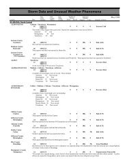
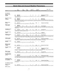
OKLAHOMA, EasternCherokee CountyTahlequah30 1928CSTHaskell CountyTamaha30 1930CSTPushmataha CountyClayton30 1930CSTSequoyah County1 SW Sallisaw 30 1931CSTCar blown off Interstate 40Muskogee CountyBraggs30 1932CSTMuskogee CountyBraggs30 1932CSTAdair CountyProctor30 1940CSTSequoyah CountyGans30 1950CSTSeveral large tree limbs downPushmataha CountyCloudy30 2000CSTOttawa County3 SE Quapaw 30 2010CSTCar blown off Will Rogers TurnpikeLe Flore CountySpiro30 2016CSTDelaware County8 ENE Grove 30 2020CSTPower pole snappedLe Flore County5 SW Wister 30 2025CSTLe Flore CountyWisterOKLAHOMA, Extreme SoutheastMccurtain CountyTomMccurtain CountyTomMccurtain CountyTomMccurtain CountyPickens000000000000000000000000000.10K0.50KThunderstorm Wind (G52)Hail (0.75)Hail (0.75)Thunderstorm Wind (G52)Hail (0.75)Thunderstorm Wind (G61)Thunderstorm Wind (G52)Thunderstorm WindHail (0.88)Thunderstorm Wind (G50)Thunderstorm Wind (G52)Thunderstorm WindHail (0.75)30 2045CST0 0Hail (0.88)A wave of low pressure <strong>and</strong> a cold front moving across Oklahoma brought a solid line of thunderstorms to all of eastern Oklahomaon the afternoon <strong>and</strong> evening of March 30. While the line covered the entire north-south length of eastern Oklahoma, the vastmajority of the severe weather remained to the south of Hwy. 412. Bow echo signatures appeared along the line in eastcentralOklahoma. Rotation was indicated at the north end of the bow echo as it moved from near Eufaula to the Arkansas state line atWest Siloam Springs. Quite a few reports of severe tstm winds <strong>and</strong> funnel clouds were common with this part of the line, but therewere no known tornado touchdowns in Oklahoma.05 1518CST0Reports of golf ball size hail received from Idabel Sheriffs Office.05 1524CSTReport received from Skywarn spotter.0530OKLAHOMA, Panh<strong>and</strong>leOKZ001>003<strong>Storm</strong> <strong>Data</strong> <strong>and</strong> <strong>Unusual</strong> <strong>Weather</strong> <strong>Phenomena</strong>TimePath PathNumber ofEstimatedLocal/ Length WidthPersonsDamageLocation DateSt<strong>and</strong>ard (Miles) (Yards) Killed Injured Property Crops Character of <strong>Storm</strong>1533CST2025CST0000000Hail (1.75)Hail (0.75)Hail (1.75)Hail (0.75)March 1998Cimarron - Texas - Beaver07 1700CST0 0Blizzard08 0600CSTA low pressure system in the upper levels of the atmosphere over the Texas South Plains along with very cold <strong>and</strong> moist air acrossthe Oklahoma Panh<strong>and</strong>le produced blizzard conditions with sustained wind speeds of 35 mph to 40 mph <strong>and</strong> visibilities near zero.Snowfall amounts ranged from one to three inches across Beaver county to four to six inches across Texas <strong>and</strong> Cimarron counties.Roads <strong>and</strong> highways were closed during the blizzard Saturday night through Sunday morning.136 130


