Storm Data and Unusual Weather Phenomena - CIG
Storm Data and Unusual Weather Phenomena - CIG
Storm Data and Unusual Weather Phenomena - CIG
- No tags were found...
Create successful ePaper yourself
Turn your PDF publications into a flip-book with our unique Google optimized e-Paper software.
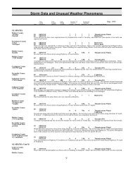
NORTH CAROLINA, SouthwestDeep low pressure moved through the Tennessee <strong>and</strong> Ohio River Valleys on the 20th, pushing a strong cold front east acrosswestern North Carolina. Severe thunderstorms developed in a very unstable airmass during the morning in the mountains <strong>and</strong> thepiedmont during the mid-afternoon. Straight-line wind damage resulted in several downed trees. A weak, short-lived tornado wasobserved by a woman in Mint Hill to briefly touchdown in front of her stopped car. Tornado damage was confined to trees <strong>and</strong>power lines. Hail up to 2 inches in diameter did quite a bit of damage - especially in the Mint Hill area where dollar amounts wereunknown, but considered very high. Hail piled up to a depth of 2 feet in Pineville <strong>and</strong> twin rope funnel clouds were observed aswell. A couple of roads were washed out in western Caldwell county as excessive rain fell on the higher elevations of the county.NORTH DAKOTA, Central <strong>and</strong> WestNORTH DAKOTA, EastNDZ006>008-014>016-024-026>030-038>039NDZ039-049-053NDZ053OHIO, East<strong>Storm</strong> <strong>Data</strong> <strong>and</strong> <strong>Unusual</strong> <strong>Weather</strong> <strong>Phenomena</strong>TimePath PathNumber ofEstimatedLocal/ Length WidthPersonsDamageLocation DateSt<strong>and</strong>ard (Miles) (Yards) Killed Injured Property Crops Character of <strong>Storm</strong>NONE REPORTED.March 1998Towner - Cavalier - Pembina - Benson - Ramsey - Walsh - Eddy - Nelson - Gr<strong>and</strong> Forks - Griggs - Steele -Traill - Barnes - Cass13 0900CST0 0Blizzard1200CSTA strong cold front moved south from Canada across eastern North Dakota <strong>and</strong> northwest Minnesota, creating ground blizzardconditions. The front moved quickly from north to south, driven by a strong pressure gradient, but dropped little snow. Near zerovisibilities were created as the wind picked up the top crust of snow. After the initial burst of intense wind, visibilities slowlyimproved. Devils Lake had a gust to 48 mph <strong>and</strong> Fargo had a gust to 53 mph.Cass - Ransom - Richl<strong>and</strong>15 0200CST0 0Heavy Snow0900CSTHeavy snow fell across southeast North Dakota early Sunday morning. Although the snow was light <strong>and</strong> fluffy, Fort Ransom inRansom county reported 7 inches of snow. Wyndmere, in Richl<strong>and</strong> county, reported 6.5 inches, <strong>and</strong> Alice in Cass county reported6 inches.Richl<strong>and</strong>31 1700CST0 0Heavy Snow2359CSTB<strong>and</strong>s of heavy snow fell as wrap-around precipitation from a low pressure system tracking toward the Great Lakes. Several b<strong>and</strong>sbecame nearly stationary, extending from southeast Richl<strong>and</strong> county in North Dakota to southern Clearwater county in Minnesota.Heavy snow fell across this line, with a sharp cutoff to little snow on either side of the line. The snow finally let up around 10 amon April 1st. Hankinson reported 14 inches of snow, Lidgerwood reported 12 inches, <strong>and</strong> Wahpeton reported 7 inches.OHIO, NorthKnox CountyCountywideMorrow CountyCountywideRichl<strong>and</strong> CountyCountywideAshl<strong>and</strong> CountyCountywideHolmes CountyKillbuckOHZ011-013>014-021NONE REPORTED.090909090530EST0545EST0555EST0610EST0600EST0615EST0615EST0630EST09 0630EST0647ESTTrees <strong>and</strong> power lines were downed.Cuyahoga - Geauga - Ashtabula - Summit10 0345EST12 1200EST0000000000003K3K3K3K3KThunderstorm WindThunderstorm WindThunderstorm WindThunderstorm WindThunderstorm WindHeavy Snow131 125


