Storm Data and Unusual Weather Phenomena - CIG
Storm Data and Unusual Weather Phenomena - CIG
Storm Data and Unusual Weather Phenomena - CIG
- No tags were found...
You also want an ePaper? Increase the reach of your titles
YUMPU automatically turns print PDFs into web optimized ePapers that Google loves.
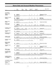
NEW YORK, CoastalNYZ069NEW YORK, EastNYZ043NYZ040-047>048NYZ033-058-063NYZ032>033-039-041>043-047>048-051-058NYZ032>033-038>043-047>054-058>061-063>066NYZ033NYZ042<strong>Storm</strong> <strong>Data</strong> <strong>and</strong> <strong>Unusual</strong> <strong>Weather</strong> <strong>Phenomena</strong>TimePath PathNumber ofEstimatedLocal/ Length WidthPersonsDamageLocation DateSt<strong>and</strong>ard (Miles) (Yards) Killed Injured Property Crops Character of <strong>Storm</strong>Rockl<strong>and</strong>22 0400EST1130EST00Heavy SnowMarch 1998A low pressure system developed off the Mid-Atlantic Coast early Sunday morning <strong>and</strong> moved northeast, passing east of LongIsl<strong>and</strong> during early afternoon. Heavy snow formed <strong>and</strong> spread northeast over the area, Snowfall amounts ranged from 4 to 8 inchesacross Rockl<strong>and</strong> County.Washington09111500EST0200EST0 0FloodFrom March 9 to March 11, the Mettawee River in Washington County flooded. The flooding was mainly confined to low l<strong>and</strong>salong the river. At Granville the river crested at seven feet during the morning of March 10. Flood stage at Granville is six feet.Montgomery - Schoharie - Western Schenectady10 0700EST0 0Flood2100ESTOn March 10, minor flooding occurred along the Schoharie Creek from Central Bridge in Schoharie County to the Mohawk River.At Burtonsville, the creek crested at 6.2 feet during the early afternoon. Flood stage at Burtonsville is 6 feet.Hamilton - Western Greene - Western Ulster14 0300EST0 0Winter <strong>Storm</strong>15 0000ESTDuring March 14 <strong>and</strong> 15, an Alberta Clipper produced locally heavy snow over parts of eastern New York. The greatest snowfalloccurred in the higher elevations of the Catskills <strong>and</strong> Adirondacks. Some specific snowfall totals included: 9 inches at Platte Covein Greene County, 10 inches at Slide Mountain in Ulster County <strong>and</strong> 8 inches at Piseco Lake in Hamilton County. Over theremainder of the area snow totals generally ranged from 2 to 5 inches. The heavy wet snow caused numerous traffic accidents.Northern Herkimer - Hamilton - Fulton - Northern Saratoga - Warren - Washington - Schoharie - WesternSchenectady - Western Albany - Western Greene21 0200EST0 0Winter <strong>Storm</strong>22 1200ESTDuring March 21 <strong>and</strong> 22, a coastal storm produced a mix of snow, sleet <strong>and</strong> freezing rain across eastern New York. Theprecipitation fell mainly as snow in the southern Adirondacks, upper Hudson Valley <strong>and</strong> northern Catskills. Snow totals in thisregion generally ranged from 6 to 10 inches. Snowfall was much lighter over the remainder of the region due to the snow frequentlymixing with <strong>and</strong> changing to sleet <strong>and</strong> freezing rain. Interstate 88 in Schoharie County was closed for several hours due tonumerous accidents. Some specific snowfall totals included: 12 inches at Whitehall in Washington County, 7 inches at Berne inwestern Albany County, 8 inches at Saratoga Springs in Saratoga County, 10 inches at Stillwater Reservoir in northern HerkimerCounty, 9 inches at Bolton L<strong>and</strong>ing in Warren County <strong>and</strong> 6 inches at Piseco Lake in Hamilton County.Northern Herkimer - Hamilton - Southern Herkimer - Fulton - Montgomery - Northern Saratoga - Warren -Washington - Schoharie - Western Schenectady - Eastern Schenectady - Southern Saratoga - Western Albany- Eastern Albany - Western Rensselaer - Eastern Rensselaer - Western Greene - Eastern Greene - WesternColumbia - Eastern Columbia - Western Ulster - Eastern Ulster - Western Dutchess - Eastern Dutchess27 1200EST0 0Excessive Heat31 1900ESTThe end of March was a period of record heat across eastern New York as strong high pressure off the Mid-Atlantic coast produceda persistent southerly flow. Record high temperatures were set at Albany on March 27 <strong>and</strong> 31. On March 31, the mercury rose to89 degrees which is the highest temperatures ever recorded in Albany during the month of March.Hamilton29 1600EST0 0Flood31 2359ESTRapid snowmelt during the end of March caused flooding along the Sac<strong>and</strong>aga River in Hamilton County. Flooding occurred fromjust south of Wells to Northville. Most of the flooding was confined to low l<strong>and</strong> areas near route 30. The river crested at Hope onApril 1, with a reading of 7.57 feet. Flood stage at Hope is 7 feet.Warren31 0800EST0 0Flood2359ESTRapid snowmelt during the end of March caused flooding along the Schroon River in Warren County. During the initial stages o fflooding the flood waters were confined to low l<strong>and</strong> areas near the river. The Schroon River continued to flood until April 6. Se ethe April <strong>Storm</strong> <strong>Data</strong> Report for further details <strong>and</strong> damage amounts.121 115


