

King Barrow Ridge - English Heritage
King Barrow Ridge - English Heritage
King Barrow Ridge - English Heritage

Create successful ePaper yourself
Turn your PDF publications into a flip-book with our unique Google optimized e-Paper software.
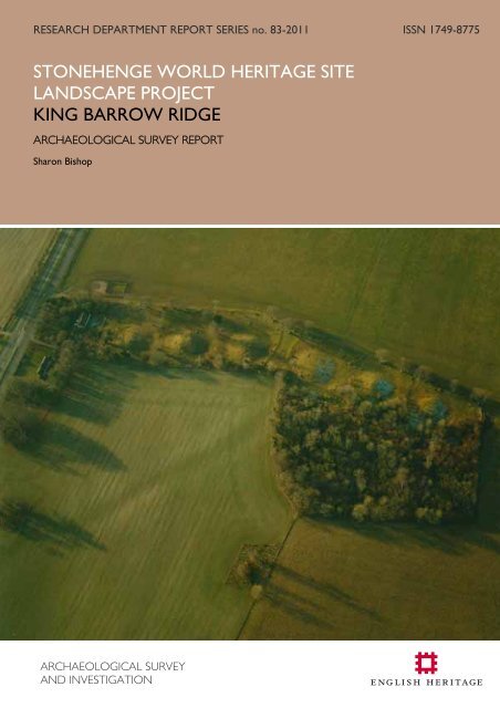
RESEARCH DEPARTMENT REPORT SERIES no. 83-2011 ISSN 1749-8775STONEHENGE WORLD HERITAGE SITELANDSCAPE PROJECTKING BARROW RIDGEARCHAEOLOGICAL SURVEY REPORTSharon BishopARCHAEOLOGICAL SURVEYAND INVESTIGATION
Research Department Report Series 83-2011STONEHENGE WORLD HERITAGE SITELANDSCAPE PROJECTKING BARROW RIDGEARCHAEOLOGICAL SURVEY REPORTSharon Bishop© <strong>English</strong> <strong>Heritage</strong>ISSN 1749-8775The Research Department Report Series incorporates reports from all the specialist teamswithin the <strong>English</strong> <strong>Heritage</strong> Research Department: Archaeological Science; ArchaeologicalArchives; Historic Interiors Research and Conservation; Archaeological Projects; Aerial Surveyand Investigation; Archaeological Survey and Investigation; Architectural Investigation; Imaging,Graphics and Survey, and the Survey of London. It replaces the former Centre for ArchaeologyReports Series, the Archaeological Investigation Report Series and the Architectural InvestigationReport Series.Many of these are interim reports which make available the results of specialist investigationsin advance of full publication. They are not usually subject to external refereeing, and theirconclusions may sometimes have to be modified in the light of information not available at thetime of the investigation. Where no final project report is available, readers are advised toconsult the author before citing these reports in any publication. Opinions expressed inResearch Department reports are those of the author(s) and are not necessarily those of<strong>English</strong> <strong>Heritage</strong>.Requests for further hard copies, after the initial print run, can be made by emailing:Res.reports@english-heritage.org.ukor by writing to:<strong>English</strong> <strong>Heritage</strong>, Fort Cumberland, Fort Cumberland Road, Eastney, Portsmouth PO4 9LDPlease note that a charge will be made to cover printing and postage.© ENGLISH HERITAGE 83 - 2011
SUMMARYA rapid field investigation (Level 1 survey) along the <strong>King</strong> <strong>Barrow</strong> <strong>Ridge</strong> has identifiedpreviously unrecorded earthworks relating to the post-medieval aesthetic development ofthe landscape and 20th century military activity. The survey complements earlier moredetailed analytical Level 3 surveys of the barrows and other Level 1 surveys around theStonehenge World <strong>Heritage</strong> Site.CONTRIBUTORSThe Level 1 survey of <strong>King</strong> <strong>Barrow</strong> <strong>Ridge</strong> was conducted by Mark Bowden, David Fieldand Sharon Bishop. The Level 3 survey of the New <strong>King</strong> <strong>Barrow</strong>s was conducted byHazel Riley, David Field and Deborah Cunliffe of the Royal Commission on the HistoricMonuments of England (RCHME) and the Level 3 survey of Amesbury 42 was conductedby David Field and Deborah Cunliffe of <strong>English</strong> <strong>Heritage</strong>. This report was produced bySharon Bishop, incorporating comments from David Field and Mark Bowden.ACKNOWLEDGEMENTS<strong>English</strong> <strong>Heritage</strong> is grateful to Mike Dando of the National Trust for facilitating access andto Mike Parker Pearson (Stonehenge Riverside Project), Henry Chapman (StonehengeHidden Landscapes Project) and Tim Darvill (Stonehenge Landscape Project) for sharinginformation.Ordnance Survey maps were acquired under licence number 100019088 ©Crowncopyright. All rights reserved. Unauthorised reproduction infringes Crown Copyright andmay lead to prosecution or civil proceedings.Height Data: Licensed to <strong>English</strong> <strong>Heritage</strong> for PGA, through Next Perspectives.The aerial photograph on the front cover was taken from the east. It shows the New<strong>King</strong> <strong>Barrow</strong>s and soilmarks of the re-routed Amesbury to Market Lavington public road.Image: SU 1342/89 NMR 21917/21 19th December 2002 © <strong>English</strong> <strong>Heritage</strong>.ARCHIVE LOCATIONThe project archive is held at:<strong>English</strong> <strong>Heritage</strong>The Engine HouseFirefly AvenueSwindonSN2 2EHDATE OF SURVEYSThe New <strong>King</strong> <strong>Barrow</strong>s were surveyed by the RCHME in September 1990.Amesbury 42 was surveyed by <strong>English</strong> <strong>Heritage</strong> in January and February 2010 and therapid field investigation along the <strong>Ridge</strong> took place on 21st April 2011 and 10th August2011.© ENGLISH HERITAGE 83 - 2011
CONTACT DETAILSTel: 01793 414600Email: nmrinfo@english-heritage.org.ukThe Engine House, Firefly Avenue, Swindon, SN2 2EH© ENGLISH HERITAGE 83 - 2011
CONTENTSIntroduction .......................................................................................................................................................................... 1Landscape history.............................................................................................................................................................. 5Archaeological and historical background........................................................................................................... 7The excavations............................................................................................................................................................. 8The Earthworks ................................................................................................................................................................11The New <strong>King</strong> <strong>Barrow</strong>s...........................................................................................................................................11The Old <strong>King</strong> <strong>Barrow</strong>s.............................................................................................................................................14Amesbury 42.................................................................................................................................................................16Discussion .............................................................................................................................................................................. 1Discussion ............................................................................................................................................................................18The prehistoric landscape......................................................................................................................................18The designed landscape..........................................................................................................................................21The military landscape .............................................................................................................................................24Conclusion...........................................................................................................................................................................25Methodology......................................................................................................................................................................26References ...........................................................................................................................................................................27Documents at Wiltshire & Swindon History Centre (WHC).........................................................32Documents in the Bodleian Library.................................................................................................................32Abbreviations used in this report......................................................................................................................32Appendix..............................................................................................................................................................................33© ENGLISH HERITAGE 83 - 2011
ILLUSTRATIONSFig 1: The location of the survey areas within the Stonehenge World <strong>Heritage</strong> Site (WHS)............................................................................................................................................................................................ 3Fig 2: The <strong>King</strong> <strong>Barrow</strong> <strong>Ridge</strong>..................................................................................................................................... 4Fig 3: Combined surveys of the New <strong>King</strong> <strong>Barrow</strong>s...................................................................................12Fig 4: The Old <strong>King</strong> <strong>Barrow</strong>s.....................................................................................................................................15Fig 5: The survey of Amesbury 42 ........................................................................................................................17Fig 6: Mid-19th century land use............................................................................................................................22Fig 7: The gunpost on Amesbury 37. ..................................................................................................................23© ENGLISH HERITAGE 83 - 2011
INTRODUCTIONLevel 1 surveys were conducted over several areas within the Stonehenge World<strong>Heritage</strong> Site (WHS) during the spring and summer of 2011 (Bishop 2011). Theycomplement the more detailed surveys conducted by the Stonehenge WHS LandscapeProject, which is designed to provide fresh information and up to date mapping for theplanned new Stonehenge visitor centre; to improve understanding of the WHS necessaryfor its appropriate management (Young et al 2009, Aim 6), and to supplementinformation from recent university interventions in the area.The Level 1 survey, or rapid field investigation (Ainsworth et al 2007, 23), described inthis report was conducted in areas of woodland and pasture along the <strong>King</strong> <strong>Barrow</strong> <strong>Ridge</strong>,Amesbury, Wiltshire. The results are combined here with those from more detailedLevel 3 analytical surveys of the New <strong>King</strong> <strong>Barrow</strong>s and the Neolithic long barrow knownas Amesbury 42. The A303 crosses the <strong>Ridge</strong>, forming an artificial division of thelandform that is nevertheless useful in defining the southern extent of features describedin this report.All of the barrows are Scheduled Ancient Monuments and are referred to here by theirGrinsell numbers (1957), which are generally accepted in the literature. Table 1 providesa concordance of the various numbering systems applied to each monument. It includesthe National Monuments Record’s (NMR’s) archaeological database, the WiltshireHistoric Environment Record (HER) and the Register of Scheduled Monuments (RSM)number for each barrow. The appendix presents the measurements of the surveyedfeatures (Table 3).Table 1: A concordance for the monuments recorded© ENGLISH HERITAGE 1 83 - 2011
The survey area extends for about 1.25km along a north to south plateaux of CretaceousUpper Chalk which is overlain with shallow well drained calcareous silty soils of theAndover soil association (SSEW 1983). The <strong>Ridge</strong> is part of the characteristic convex,smoothly rounded downland landforms common across southern England. It extendsbetween the Upper Stonehenge Bottom dry valley in the west and the slopes of the RiverAvon valley in the east. It is one of the ridgelines and horizons that visually encloseStonehenge itself (Young et al 2009, map 9). Amesbury 26 is the southernmost barrow,next to the A303, and the long barrow of Amesbury 42 is the northernmost (Fig 2).The barrows occupy the summit of the <strong>Ridge</strong> at about 110m above sea level, with a slightsaddle between Amesbury 32 and Amesbury 33 where the Stonehenge Avenue crossesthe <strong>Ridge</strong>. Most of the <strong>Ridge</strong> is owned and managed by the National Trust, with the fieldimmediately north of the A303 and east of the New <strong>King</strong> <strong>Barrow</strong>s forming part of WestAmesbury Farms. The <strong>Ridge</strong> marks the eastern limit of open access grassland immediatelyaround Stonehenge, east of which much of the land is arable.© ENGLISH HERITAGE 2 83 - 2011
Fig 1: The location of the survey areas within the Stonehenge World <strong>Heritage</strong> Site (WHS)The Level 3 survey areas are darker blue. Height Data: Licensed to <strong>English</strong> <strong>Heritage</strong> for PGA,through Next Perspectives.© ENGLISH HERITAGE 3 83 - 2011
Fig 2: The <strong>King</strong> <strong>Barrow</strong> <strong>Ridge</strong>NMP mapping of the <strong>Ridge</strong> is shown at 1:7500 against a lidar hillshade background. Ditchesare shown in green and banks in red. The base map is © Crown Copyright 2011. All rightsreserved. Ordnance Survey Licence number 100024900. Lidar © Environment Agency(December 2001).© ENGLISH HERITAGE 4 83 - 2011
LANDSCAPE HISTORYEnvironmental evidence suggests that large natural clearings or glades of grassland, scruband some trees were a natural part of an extensive open forest which stretched acrossthe southern <strong>English</strong> chalklands in the early post-glacial period (Allen & Scaife 2007, 25).This openness, with the opportunities for hunting and gathering it provided, attractedMesolithic communities who constructed what is perhaps the first monument in theStonehenge landscape: the post holes in what was later to become the Stonehenge carpark (Vatcher & Vatcher 1973; Young et al 2009, 155).It may also be a contributing factor to the density of later, Neolithic and Bronze Agemonuments. Soils buried beneath Amesbury 42 probably supported grassland for sometime prior to construction of the long barrow (Richards 1990, 98). The buried soils alongthe <strong>Ridge</strong> indicate a predominantly open landscape by the later Neolithic, probably lightlygrazed or browsed and including some shrubs (Cleal & Allen 1994, 82). Some shade orwoodland is also suggested by molluscan evidence from the Coneybury henge (Richards1990, 157). The large number of round barrows constructed in an open establisheddownland landscape indicates that any remaining woodland was probably cleared byaround 2000BC (Allen & Scaife 2007). The degree of land-use on the <strong>Ridge</strong> appears tohave intensified during the Early Bronze Age, when molluscan evidence suggests morecontrol of stock within a managed grazing regime (Cleal & Allen 1994, 82).More diverse activities are visible in the Stonehenge landscape by the Middle Bronze Age.Large areas of Salisbury Plain were converted to agriculture and ‘Celtic’ fields becamewidespread over large areas of Salisbury Plain (McOmish et al 2002, 52; Allen & Scaife2007). The early soils were fertile and easily tilled but subject to erosion throughrainsplash, soil creep and occasional but recurrent mass erosion events (Allen & Scaife2007, 29). Erosion changes the soil and the shape of the landscape, eroding hilltops andinfilling valleys. Dry valleys usually act as environmental catchment areas and have a highpotential for buried prehistoric sites, however, test pits excavated in the centre of theUpper Stonehenge Bottom dry valley found a profile only 35cm deep over a Pleistocenecoombe deposit (Richards 1990, 210).Throughout the Iron Age farming based on the Till and Avon valleys appears to havebeen the predominant activity in the Stonehenge landscape (Young et al 2009, 156),although it has left little evidence other than perhaps re-use and modification of the Celticfields (Yates 2007). The impressive hillfort known as Vespasian’s Camp was constructednear the River Avon but tree cover has prevented its full archaeological investigation(Young et al 2009, 156). Roman period farmsteads and small unenclosed villages, whichalso reused earlier fields, are known across Salisbury Plain (McOmish et al 2002, 88-104).The nearest are those to the west along the Till, on High Down and Winterbourne StokeDown (Freeman 1995, 276). Corresponding activity along the Avon valley in this periodis poorly represented although Amesbury itself might be expected to mask traces ofRoman settlement.© ENGLISH HERITAGE 5 83 - 2011
Little is known of how the landscape was used in the early medieval period, althoughAmesbury had become the centre for a widespread royal estate (Young et al 2009, 156).During the medieval period settlement continued to focus on the two rivers, the Till andthe Avon, which flow north to south. Extensive meadows, some of which were watered,were located beside the rivers, arable was concentrated on the lower slopes andextensive pasture covered the downs further to the east and west (Crowley 1995, 13;Freeman 1995, 275; Stevenson 1995). This pattern of strip tithings, which provided eachcommunity with access to water and a range of soil types, is typical of chalkland areaswhere open field sheep and corn husbandry, with common meadows and pasture,dominated the landscape well into the post-medieval period.The growth of the cloth trade associated with the sheep’s wool helped to maintain thelords of the manors’ income during the medieval period. According to Hare (1981, 146),examination of the rental agreements and court rolls reveals the growing scale ofchalkland agriculture during the 15th and 16th centuries, with some consolidation ofholdings and the emergence of large-scale gentlemen farmers. Later documents showhow provision was made for penning sheep to manure various parts of the land; the costsof digging a sheep pond were defrayed, and a Hayward appointed with responsibility forthe common flock (Tankins 1975).Cultivation east of the <strong>King</strong> <strong>Barrow</strong> <strong>Ridge</strong> was intensive, with even Vespasian’s Campunder the plough by the late 14th century (RCHME 1979, xvi). The Old and New <strong>King</strong><strong>Barrow</strong>s appear to have formed the western boundary to the medieval fields ofAmesbury Countess and West Amesbury Manors, with open down to their west untilblocks were taken as burnbake in the early 18th century (ibid; Bond 1991, fig H2). Theacquisition of these two manors in the mid-18th century allowed the 3rd Duke ofQueensbury to extend Amesbury Park to include the New <strong>King</strong> <strong>Barrow</strong>s: they wereprobably planted with Scots Firs around this time. The full extent of the Park was shortlived:after the Duke’s death in 1778 land was disparked and returned to arable. In 1823the two blocks of land immediately west of the New and Old <strong>King</strong> <strong>Barrow</strong>s were againcultivated (WHC 283/202) and by 1846 beeches and yews had been added to formplantations around the New <strong>King</strong> <strong>Barrow</strong>s and the southernmost two of the Old <strong>King</strong><strong>Barrow</strong>s, with a ‘Keeper’s house’ inserted between Amesbury 26 and Amesbury 27(WHC TA Amesbury).Aerial photographs show that the area west of the <strong>Ridge</strong> was cultivated for much of the20th century although only a strip immediately south of the eastern half of the Cursus wasavailable for field walking in the early 1980s (Richards 1990, fig 8). By the end of the 20thcentury the area west of the <strong>Ridge</strong> was open access grassland owned and managed bythe National Trust whilst land to the east continued as arable. An additional areacovering part of the Stonehenge Avenue was restored to grassland in 2000 (Young et al2009, map 3).© ENGLISH HERITAGE 6 83 - 2011
ARCHAEOLOGICAL AND HISTORICAL BACKGROUNDThe <strong>King</strong> <strong>Barrow</strong> <strong>Ridge</strong> has long received the notice and interest of antiquarians andarchaeologists. In the 17th century the barrows on the <strong>Ridge</strong> were simply but confusinglyknown as ‘seven barrows’ (Aubrey et al 1980, 708). Aubrey was sceptical of accountsthat one was called ‘Pan <strong>Barrow</strong>’ and that chronicles recorded names for the otherbarrows. He suggested that these barrows were not erected on account of any greatperson slain in battle, but were for members of the same family, likening the arrangementto that of kings in Westminster Abbey (ibid, 704). Aubrey noted that there was a placecalled ‘the <strong>King</strong>’s Graves’ where stones from the end of the graves had recently [about1650] been removed (ibid, 698), however, these were located further south in WestAmesbury Penning (RCHME 1979, xxi).The idea of the mounds marking the graves of kings clearly stuck and William Stukeley,recognising two groups of seven barrows ‘as wings’ to the Stonehenge Avenue, dividedthem between the ‘Old’ and ‘New <strong>King</strong>s’ (1740, 38). He excavated one of the barrows,Amesbury 28 (Burl & Mortimer 2005, 104), and noted a ‘long bank’ [Amesbury 42] eastof the Cursus, which he suggested was for the judges and chief spectators (ibid 90; Long1876, 90). These ideas were subsequently adopted by Sir Richard Colt Hoare, who didnot open any of the round barrows because they were already covered with Scots Firs(1812, 157). John Thurnam was the first to consider the long mound as a real longbarrow but regarded his excavations of 1866 as unsuccessful because he found onlysecondary interments (Thurnam 1868, table 1).The various barrows were listed by the Reverend E H Goddard (1913) with commentson the physical condition of the barrows added by Maud Cunnington, who also compiledthe appendix list of long barrows published the following year (Cunnington 1914). Theselists were later revised by Leslie Grinsell (1957). The barrows were inspected forOrdnance Survey mapping revision in 1969 and 1970 and were included in the RoyalCommission on the Historical Monuments of England’s survey of the Stonehenge environs(RCHME 1979) and the subsequent archaeological assessment of the WHS (Blore et al1995).An extensive Neolithic surface flint industry was identified through pioneering surfacecollection survey of the <strong>Ridge</strong> carried out in the 1930s (Laidler & Young 1938).Conversion of several fields back to pasture meant that extensive surface collection forthe Stonehenge Environs Project in the early 1980s was more restricted and mostlyconfined to the fields east of the <strong>Ridge</strong> (Richards 1990, fig 8). The density of a flint scatter[W59] on the <strong>Ridge</strong> immediately north of the Stonehenge Avenue prompted a moreintensive surface collection survey, magnetometry and sampling by excavation (ibid, figs 74& 75). Part of the eastern ditch of Amesbury 42 was also excavated (ibid, W58 fig 64).An electricity cable trench had been cut across the <strong>Ridge</strong> in 1968 (Vatcher & Vatcher1969) and a water pipe cut through the ditch of Amesbury 26 in 1980 (Pitts 1981).© ENGLISH HERITAGE 7 83 - 2011
Winter storms uprooted a large number of trees along the <strong>Ridge</strong> in 1987 and 1990,providing an unprecedented opportunity for detailed analysis of environmental data.Tree-throw holes on ten of the round barrows were examined (Anon 1992) althoughonly nine made it to publication (Cleal & Allen 1994). These were the New <strong>King</strong><strong>Barrow</strong>s; Amesbury 34 of the Old <strong>King</strong> <strong>Barrow</strong>s, and Amesbury 18 and 19 inLuxenborough Plantation to the south (see Bishop 2011). Amesbury 33 was alsoexamined. The National Trust requested a survey of the storm damaged barrows andthe New <strong>King</strong> <strong>Barrow</strong>s were therefore surveyed by the Royal Commission on theHistorical Monuments of England (RCHME) in 1990 (Fig 3; Cleal & Allen 1994, 57).The <strong>Ridge</strong> provided three potential sites for the new Stonehenge Visitor Centre.Accordingly geophysical surveys were conducted along the eastern side of the barrows,over Amesbury 42 and the eastern end of the Cursus (Payne & White 1988; Darvill 2005,map Q). The <strong>Ridge</strong> also falls within the area of the Stonehenge Riverside Project andmagnetometry and resistivity surveys were carried out at the east end of the GreaterCursus in 2007, in preparation for excavations planned the following year (SRP 2007,excavation VI). An analytical survey of the surviving earthworks of Amesbury 42 wasconducted in early 2010 as part of the Stonehenge WHS Landscape Project (Fig 5).Further geophysical surveys form part of recent university projects, including theStonehenge Hidden Landscapes Project (Howarth 2010).The wider landscape was mapped from aerial photographs at 1:10,000 scale as part of theRCHME Salisbury Plain Training Area National Mapping Project (NMP; Crutchley 2000),and the mapping subsequently revised at 1:2500 scale for the <strong>English</strong> <strong>Heritage</strong>Stonehenge WHS Mapping Project (Crutchley 2002). Prior interpretation ofarchaeological features from aerial photographs was piecemeal (eg RCHME 1979) andthe NMP mapping is currently being enhanced further from Lidar data captured in 2001(Simon Crutchley, pers comm). The NMP projects mapped the round barrows, Avenueand former road but any other details such as the wood banks and Second World Wargunpost were obscured by trees. A desk based assessment of military installations wasconducted by Wessex Archaeology (1998) but is far from comprehensive.The excavationsDespite the prominence of these barrows in the landscape there are only four accountsof antiquarian excavation. In 1649 Aubrey was told of an excavation of one of the Seven<strong>Barrow</strong>s in which coals [presumably charcoal], pieces of goat’s horns and stag’s hornswere found (Aubrey et al 1980, 698), and that the Duke of Buckingham’s men had founda ‘bugle horn tipt with silver at both ends’ in another (Hoare 1812, 155). In neither caseis it clear which barrow was opened. In 1723 Stukeley’s excavation of Amesbury 28revealed a large course of flints at the top ‘a good yard deep’ and ‘conformable to theexternal curve of the barrow’ (Atkinson 1985, 246; Burl & Mortimer 2005, 104). Belowthe flints they found the scattered and burnt bones of oxen and dogs in ‘good earth’.They dug to about 6ft [1.8m] and found nothing more, perhaps because the mound© ENGLISH HERITAGE 8 83 - 2011
stands 4.4m high and they were still some distance off the floor. Amesbury 42, the longbarrow, was excavated by Thurnam in 1866, who found the secondary inhumations oftwo infants and a crouched adult, as well as animal bones including an ox skull (Thurnam1868, table 1; Cunnington 1914).More recently, the only excavations of the round barrows have been associated withutility pipelines and storm damage. Two Neolithic post holes, between <strong>King</strong> <strong>Barrow</strong>Wood and Amesbury 39, were located during digging of an electric cable trench (Vatcher& Vatcher 1969; Cleal & Allen 1994, fig 1), near a pit containing Neolithic or Bronze Agecarved chalk plaques (Harding 1988). Further south along the <strong>Ridge</strong> an early Neolithic pit,colloquially known as the ‘Coneybury anomaly’, was excavated in 1980 and 1981(Richards 1990, 40) and the nearby henge evaluated by excavation in the autumn of 1980(ibid, 123). Some of the internal pits may have pre-dated the henge enclosure andpottery suggests activity at the site spanned the early Neolithic to Middle Bronze Ageperiods. No finds were recovered from the water pipe cut through the ditch ofAmesbury 26, but the ditch appeared to be of two distinct phases: one with a flatbottomed ditch, the other with more sloping sides (Pitts 1981, 183).Thirty-nine tree-throw holes were examined following storm damage in October 1987and January 1990 (Cleal & Allen 1994). The exposed deposits were recorded, anyartefacts they contained recovered and environmental samples taken. Traces of buriedsoil horizons were identified beneath six of the barrows, which provided valuablemolluscan samples. Few finds were recorded: from Amesbury 30 a range of LateNeolithic and Early Bronze Age pottery sherds and worked flint; from Amesbury 31 threesherds of Peterborough Ware plus some flints, mostly flakes, blades and cores; fromAmesbury 32 a few sherds of Peterborough Ware and Grooved Ware, plus a smallcollection of flints, mainly flakes and blades, and in Amesbury 34 some Grooved Waresherds. The tree-throw holes provided some insight into the construction of the barrowsand located a possible pre-barrow hollow beneath Amesbury 32.Small trenches have been dug at Amesbury 42 for two important recent researchprojects. A trench over its eastern ditch was dug as part of the Stonehenge EnvironsProject and produced evidence of two phases: an earlier round bottomed andcausewayed ditch superseded by a considerably larger flat bottomed ditch just beyond it.Finds included in-situ flint knapping debris and pottery sherds representing Beakers,Collared Urns and Late Bronze Age vessels, plus some Roman period sherds (Richards1990, 99). Removal of the ploughsoil of the sampled flint scatter W59 nearby revealedseveral pits and stakeholes. They were interpreted as representing sedentary activity inthe Neolithic, with a range of domestic tasks indicated by the flint tools, pottery andanimal bones from the ploughsoil and sealed deposits (ibid, 116).A subsequent excavation of the long barrow’s eastern side by the Stonehenge RiversideProject revealed the sequence was actually the opposite (Thomas 2008, 87). The largecausewayed pits had been cut into the inside lip of the long barrow’s ditch once© ENGLISH HERITAGE 9 83 - 2011
secondary silts were forming there. An augur survey was conducted at the same timeand revealed remarkably well-preserved mound material up to 27cm deep over a buriedsoil up to 37cm deep. This is almost unprecedented in the Stonehenge area and has ahigh potential for paleaoenvironmental evidence and information on the structure anddating of the long barrow, with minimal intrusion (Allen 2008, 92).© ENGLISH HERITAGE 10 83 - 2011
THE EARTHWORKSThe earthworks comprise the Neolithic long barrow of Amesbury 42, the New and Old<strong>King</strong> <strong>Barrow</strong>s, post-medieval wood banks and a probable Second World War gunpost.They are described from south to north.The New <strong>King</strong> <strong>Barrow</strong>sAmesbury 26Amesbury 26 comprises a roughly circular mound of at least two phases which standsabout 1.9 metres high. There is no sign of any surrounding ditch or bank and theearthworks are usually listed as a bowl barrow (Grinsell 1957, 150). The base of themound measures 20m in diameter and the summit is about 6m across. A break in slopewas observed around the mound at around 5m from its approximate centre [SU 1344942033]: at 5m to the north; 5m to the east; 4.6m to the south, and 5.3m to the west.The upper mound is 0.6m high and the break is berm-like in places. There are hints ofanother break in slope at a lower level, together with animal and tree disturbance.Amesbury 27The surviving earthworks of Amesbury 27 measure 47m in overall diameter and take abell form. The barrow comprises a circular mound of two phases that stands about 4.2mhigh and sits on a circular platform defined by a partly filled in ditch. The summit of themound measures 10m and the base 31m in diameter; a berm, about 3m wide, is visible tothe north-east and south-west of the mound, which sits on a platform about 35m indiameter. The ditch is 0.3m deep to the south of the mound and 0.2m deep to its north;it measures between 6 and 7m wide but is truncated by the edge of the post-medievalplantation to the east. There is also a break in the ditch to the north-north-west. Thebarrow suffered just one tree-throw in 1987 and 1990, at the south-eastern foot of themound.Amesbury 28The surviving earthworks of Amesbury 28 measure 49m in overall diameter but aretruncated to the east by the edge of the overlying post-medieval plantation. They take abell form, comprising a roughly circular mound of two phases which stands 4.4m high andsits on a platform of between 35m and 39m in diameter, defined by an incomplete ditch0.6m deep and measuring between 8m and 10m wide. A berm of between 3.5m and4.5m separates the foot of the mound from the ditch. The summit of the moundmeasures 9.5m and the base about 32m in diameter. It suffered at least four areas ofdamage from wind-blown trees in 1987 and 1990.© ENGLISH HERITAGE 11 83 - 2011
Fig 3: Combined surveys of the New <strong>King</strong> <strong>Barrow</strong>s.The surveys are shown at 1:2500 against a lidar hillshade background, which includes trees.The base map is © Crown Copyright 2011. All rights reserved. Ordnance Survey Licencenumber 100024900. Lidar © Environment Agency (December 2001).© ENGLISH HERITAGE 12 83 - 2011
Amesbury 29The surviving earthworks of Amesbury 29 measure 51m in overall diameter but areoverlain to the north and east by part of the post-medieval plantation wood bank andtruncated to the east at the edge of the plantation. The round barrow takes a bowl form,comprising a circular mound of two phases which stands 4.2m high and is surrounded bya ditch. The summit of the mound measures 8.5m and the base 40m in diameter; theditch is 0.7m deep north of the mound but only 0.4m deep to its south and measuresbetween 6m and 8m wide. The mound suffered at least four areas of damage from windblowntrees in 1987 and 1990.Wood bankA post-medieval wood bank survives as earthworks delineating four sides of a roughlyrectangular tree plantation. It comprises a linear bank, about 0.3m high and between 4mand 5m wide, which encloses an area centred at SU 1344 4215 that extends north /south for at least 170m and is about 60m wide. It is more fragmentary along the easternside and its southern end has been damaged by the widening of the A303 road. Thewood bank encloses four of the New <strong>King</strong> <strong>Barrow</strong>s round barrows (Amesbury 26 to 29).Amesbury 30The surviving earthworks of Amesbury 30 measure 54m in diameter. They take a bowlform, comprising a roughly circular mound of two phases which stands 3.2m high; itssummit measures about 9.5m and its base 41m in diameter. Several slight scarps, facingthe mound, suggest it was surrounded by a shallow ditch [0.2m deep], however, thisappears to be overlain to the south by part of the post-medieval wood bank. The ditchcannot be traced east of the mound. The mound suffered at least three areas of damagefrom wind-blown trees in 1987 and 1990.Amesbury 31Amesbury 31 is a bowl barrow measuring 47m in diameter. It comprises a circularmound, 3.7 metres high and of two phases, surrounded by a ditch. The summit of themound measures 6m and the base 35m in diameter. The ditch is 0.3m deep andmeasures between 6m and 8.5m wide, with a gap to the south-west. The moundsuffered at least 3 areas of storm damage in 1987 and 1990, with three more tree-throwholes in the ditch.Amesbury 32Amesbury 32 is a bowl barrow measuring 44m in diameter. It comprises a roughlycircular mound, 2.6m high and of two phases, surrounded by a ditch measuring up to 8mwide. The summit of the mound measures 11m and the base 33m is in diameter. The© ENGLISH HERITAGE 13 83 - 2011
ditch is 0.2m deep to the north of the mound and 0.4m deep to its south. The moundsuffered at least five areas of storm damage in 1987 and 1990.Wood bankA post-medieval wood bank survives as earthworks defining an irregular polygonal treeplantation containing the northernmost three of the New <strong>King</strong> <strong>Barrow</strong>s (Amesbury 30 to32). A linear bank also extends west-north-west to east-south-east through theplantation, to its eastern edge, and may represent an earlier boundary. The wood bankseach comprise a linear bank, about 0.3m high and between 4m and 5m wide.The Old <strong>King</strong> <strong>Barrow</strong>sAmesbury 33The bowl barrow known as Amesbury 33 comprises a roughly circular mound of threephases; the lower mound is about 0.6m high, the middle 0.3m and the upper mound0.3m high, giving a combined height of 1.2m. The approximate centre of the barrow is atSU 13474 42636: the summit measures about 9.5m and its base about 32m in diameter.There is a wide berm between phases on the north-western side. Beyond the mound onthis side is a dump of relatively recent domestic debris.Amesbury 34Amesbury 34 is also a bowl barrow, comprising a roughly circular mound of two phases;the upper mound stands 1m high and the lower mound is 1m high, giving a combinedheight of 2m. Its approximate centre is at SU 13482 42739: the summit measures about10.5m and its base 36m in diameter. There is no sign of any surrounding ditch or bank,which was presumably ploughed away.Amesbury 35A low bowl or platform barrow, Amesbury 35 comprises a roughly circular mound whichstands about 1.1m high; its summit measures about 14.5m and its base 27m in diameter.The approximate centre of the barrow is at SU 13572 42803. There is no sign of anysurrounding ditch or bank, which was presumably ploughed away.Amesbury 36Amesbury 36 comprises a roughly circular mound which stands about 1.8m high; itssummit measures about 10m and its base 21m in diameter. The approximate centre ofthis bowl barrow is at SU 13643 42861. The mid-20th century water tank has beenremoved leaving a slight divot on the summit in which bluebells have been planted.© ENGLISH HERITAGE 14 83 - 2011
Fig 4: The Old <strong>King</strong> <strong>Barrow</strong>s.The survey is shown at 1:2500 against a lidar hillshade background, which includes trees. Thebase map is © Crown Copyright 2011. All rights reserved. Ordnance Survey Licence number100024900. Lidar © Environment Agency (December 2001).© ENGLISH HERITAGE 15 83 - 2011
Amesbury 37Amesbury 37 is a large bowl barrow comprising a roughly circular mound with only veryslight traces of a surrounding ditch. Its approximate centre is at SU 13710 42941. Themound stands about 2.2m high, with an additional 0.2m of spoil from a hole dug on thesummit. The summit of the mound measures about 11m and the base between 22.5mand 28m in diameter. The ditch is 0.3m deep and about 6m wide. The lower slopesaround the northern half of the mound are mutilated by trees, including one hollow trunkused as a geocache site. An early to mid-20th century gunpost has been constructed onthe south-western quadrant, near the top of the mound.GunpostAn early to mid-20th century gunpost survives as earthworks, centred at SU 1370 4293,constructed on Amesbury 37. It comprises a narrow bank which extends in an arcaround the south-western quadrant of the mound, about two-thirds of the way up. Ateach end the bank turns a sharp right angle and returns to the mound. The bank definesthree sides of a hollow about 0.3m deep and 10m long, between it and the barrowmound (Fig 7).Amesbury 42The Neolithic long barrow known as Amesbury 42 survives only as very slight earthworks;it has been nearly flattened by ploughing and is overlain by a byway. It comprises a linearbank that extends roughly north to south for about 62m and is flanked by a ditch toeither side. The bank measures 20m wide and the ditches about 11m wide. Thesouthernmost 30m of the mound is most prominent at barely 0.3m high. The westernditch is very shallow and overgrown with trees. The eastern ditch is 0.2m deep: acauseway and breaks in slope near its northern end hint at its being recut (Fig 5).Immediately north of the long barrow is the southern rounded end of a low mound,possibly the remnant of another barrow although more probably the result of backfillingof the ditch around Larkhill Camp, which extended to this point (RCHME 1979, plate 11).© ENGLISH HERITAGE 16 83 - 2011
Fig 5: The survey of Amesbury 42The survey is shown at 1:1250© ENGLISH HERITAGE 17 83 - 2011
DISCUSSIONThe prehistoric landscapeThe cluster of late Mesolithic worked flints found on <strong>King</strong> <strong>Barrow</strong> <strong>Ridge</strong> (Darvill 2005,map F) imply that this location was already being visited repeatedly by the end of theMesolithic period. The soil buried beneath Amesbury 42 shows that the long barrow wasconstructed in a landscape that was being opened up with blocks of grassland (Richards1990, 98) and the re-cutting of the ditch and presence of several secondary intermentsshows that construction and use of the long barrow was not a single one-off event. Thiswas a place that people came back to, to bury their dead and modify the earth; a place oflasting significance.Amesbury 42 has an interesting spatial relationship with the eastern portion of theStonehenge Cursus, which appears to be aligned on it (Fig 2; Pearson forthcoming). Thewestern end of the Cursus extends east to west, apparently aligned on a notch in BeaconHill, but after about 600m a kink directs it slightly further north, onto Amesbury 42. Thischange in direction is most noticeable along the southern side of the Cursus, which isgenerally the best preserved. Long barrows are usually ascribed to the early Neolithic (egRichards 1990, 263; Darvill 1997, fig 4) and it is therefore assumed that Amesbury 42 predatesthe Cursus, however, radiocarbon dates from the eastern end of the Cursus andthe primary fill of the long barrow ditch are very similar, at around 3630 to 3375 BC(Mike Parker Pearson, pers comm).Some form of monument was probably present on the <strong>Ridge</strong> in the mid-4th MillenniumBC when the Cursus was constructed, although perhaps it was only the earlier form ofthe long barrow (Thomas et al 2009, 49). Causewayed ditches around long barrows arerelatively rare (Field 2006, 70) although another potential example has been mappedfrom cropmarks near Woodhenge (Bishop 2011, fig 8). The causewayed pits weredeliberately dug into fresh chalk which may have been used to resurface the mound andenhance its visibility. This activity may form part of wider changes in the landscape aroundthe time of the first stone settings at Stonehenge (Thomas 2008, 90).Stukeley and later Hoare observed that a long bank extended across the full width of theCursus. Stukeley described the bank as terminating the eastern end of the Cursus (Burl &Mortimer 2005, 90) and some of his original sketches appear to show small ditchesalmost connecting the two earthworks (Bodleian Library: MS Gough Maps 229, Folio 128)although Stukeley generally drew them as two completely separate features (ibid, Folio125). Hoare also described the bank as marking the head of the Cursus but recognisedthat it stopped short, stating that the course was rounded off 55yds [49.5m] away (1812,158). Much of the eastern end of the Cursus is virtually obliterated as an earthwork,largely as a result of post-medieval and subsequent cultivation: it was burnbake in 1726(Bond 1991, fig H2). The survival of some of the chalk mound of Amesbury 42 suggeststhat it served as a plough headland and this is confirmed by the tithe award which shows© ENGLISH HERITAGE 18 83 - 2011
the long barrow marking the boundary between arable plots (Thomas 2008, 82; WHCTA Amesbury). The eastern end of the Cursus and its physical relationship withAmesbury 42 can now only be traced as cropmarks on historic aerial photographs and bygeophysical survey, which show both ends of the Cursus to be squared off with roundedcorners (see RCHME 1979, plate 11).The combined flint and ceramic assemblages suggest that the <strong>Ridge</strong> was the focus ofvarious intermittent activities over perhaps two millennia (Cleal & Allen 1994, 81). Theresulting palimpsest contains higher proportions of later Neolithic implements and suchextensive scatters, with denser clusters, characterise the later Neolithic occupation ofmany areas. Together with the excavated pits the picture is one of frequent relocation ofdomestic activity within a relatively restricted area (Richards 1990, 116; Cleal & Allen1994, 75). The domestic interpretation of surface flint scatters and pits on the <strong>Ridge</strong>contrast with features on its western flank such as the chalk plaque pit (Harding 1988),nearby early Neolithic post holes (Cleal & Allen 1994, 60) and the conspicuously ‘clean’and massive enclosed open place of the Cursus (Thomas et al 2009, 52).The comparability of material recovered from the mounds and from surface collectionnearby [W59] indicates that domestic material along the <strong>Ridge</strong> was incorporated with theturf and topsoil when the round barrows were built (Cleal & Allen 1994, 74). With atleast 1ha of topsoil and turf required for each round barrow, large surface areas of the<strong>Ridge</strong> would have been stripped over a period of generations (ibid, 82): each of the newlyformed barrows and surrounding stripped areas perhaps glaring white until recolonised.On analogy with excavated barrow cemeteries elsewhere within the WHS it isreasonable to assume that the round barrows were finally constructed during the EarlyBronze Age, despite the lack of firm dating evidence (Richards 1990, 273; Cleal & Allen1994, 72). Beaker sherds only occur in Amesbury 30 and are not closely datable. Thesoils buried beneath them indicate that established long term grassland existed when thebarrows were constructed. Slight differences in the samples may indicate some temporaland spatial variation concerning levels of grazing, with patches of scrub and tallervegetation. Contemporary occupation no longer focussed on the <strong>Ridge</strong> itself and therewas probably some formalised land management system in operation (ibid, 82).As with the long barrow, the round barrows along <strong>King</strong> <strong>Barrow</strong> <strong>Ridge</strong> are probably theproduct of multiple phases of activity. This is most evident in the earthworks as changesin the gradient of the central mound displayed by all of the New <strong>King</strong> <strong>Barrow</strong>s and someof the Old <strong>King</strong> <strong>Barrow</strong>s (Fig 3; Table 3). Round barrows are often observed to clusternear earlier monuments (eg Exon et al 2000, 76). The eastern end of the Cursus,Amesbury 42 and further south the Coneybury henge may have provided monumentalfoci, although the round barrows are slightly removed.The topography may have provided the most important setting. Unusually, these roundbarrows actually occupy the summit of the <strong>Ridge</strong>: they are strategically placed either sideof the Stonehenge Avenue in a zone of high visibility to be as prominent as possible from© ENGLISH HERITAGE 19 83 - 2011
Stonehenge (Peters 2000, fig 1; Tilley et al 2007, 198) and the Avon valley. The Old <strong>King</strong><strong>Barrow</strong>s veer north-eastwards, mimicking the course of a natural valley to their west onwhich the initial Stonehenge Avenue is almost aligned. It is unlikely that there has beenany substantial alteration of the valley’s topography and it may have been seen as asignificant element of the landscape in its own right (Parker Pearson & Teather 2008,100).Hoare commented that the Old <strong>King</strong> <strong>Barrow</strong>s are lower and flatter and that the New<strong>King</strong> <strong>Barrow</strong>s increase in height towards the south (1812, 157). This is not quite correct:Amesbury 28 is the highest at 4.4m but the Old <strong>King</strong> <strong>Barrow</strong>s are indeed lower, furtherapart and less strictly in alignment. Amesbury 27 to 32 are unique in the Stonehengelandscape as a group of massive and regularly spaced barrows which would haveappeared in silhouette on the near horizon, perhaps mimicking the form of the BeaconHill ridge and Sidbury Hill in the distance (Cleal et al 1995, fig 22; Tilley et al 2007, 198).Although excavation has been very limited, examination of the tree-throw holes providessome insight into the construction of the barrows (Cleal & Allen 1994, 57). Most of theditches had flat bottoms and steep sides, with few finds. The only evidence of potentialre-cutting comes from Amesbury 26 (Pitts 1981, 183), although further south a localisedrecut was observed in Amesbury 19 (Cleal & Allen 1994, 57). The mounds wereconstructed as a stack of turves and soil and most were capped with a thick layer ofhomogenous chalk rubble, probably from the ditch. Amesbury 30 completely lacked thischalk capping and only a very thin layer was observed in Amesbury 34. Stukeley’sdescription implies a flint capping for Amesbury 28 (Burl & Mortimer 2005, 104) butdespite several tree-throw holes near its summit it is barely mentioned in the publishedanalysis (Cleal & Allen 1994). The lack of variation throughout the mound of Amesbury32 suggests that the turves were all taken from the same place. The only suggestion ofmore than one phase of construction from the mound material was found in Amesbury31, where a layer of mixed loam and chalk was suggested to represent the addition of soilfrom the de-turfed area after the initial phase of construction (ibid, 57).The arrangement of the round barrows on the <strong>Ridge</strong> has a strong linear element. TheNew <strong>King</strong> <strong>Barrow</strong>s form a slight arc which extends south to north whereas the Old <strong>King</strong><strong>Barrow</strong>s are slightly more dispersed and aligned south-west to north-east, following the<strong>Ridge</strong> (Fig 2). This linear trend is particularly common around Stonehenge and may implyterritoriality, with barrows placed along a boundary on land that is marginal to anysettlement. These boundaries may have had a range of physical and spiritual meanings(Field 1998).A linear barrow cemetery (Amesbury 100 to 102 and 130 to 133) extends roughlyperpendicularly to the east of the New <strong>King</strong> <strong>Barrow</strong>s but is largely ploughed out. To thewest of the <strong>Ridge</strong> are several more dispersed barrows (Amesbury 39 to 41 and 125 to128). A group of 6 circular marks immediately west of <strong>King</strong> <strong>Barrow</strong> Wood, initiallyidentified as potential barrows (RCHME 1979, 2), have since been reinterpreted as© ENGLISH HERITAGE 20 83 - 2011
agricultural marks. Other features may yet be identified: initial results from recentgeophysical surveys suggest the presence of several potential hengiforms immediatelywest of the <strong>Ridge</strong> (Henry Chapman, pers comm; Tim Darvill, pers comm). South of theA303, on West Amesbury Down, the round barrows sit more on the flanks of the <strong>Ridge</strong>,those to the west overlooking Stonehenge Bottom (Bishop 2011).Perhaps the next change in the prehistoric landscape is the imposition of a linearboundary or field system. This is indicated by cropmarks of a long ditch withperpendicular off-shoots which extends in a broad arc across the <strong>Ridge</strong>, from just beyondLuxenborough Plantation to the south-west, passing between Amesbury 26 andAmesbury 27 and continuing eastwards for about 400m (Fig 2).The designed landscapeIn 1725 Charles Douglas, the 3rd Duke of Queensberry, inherited the Amesbury estatefrom his uncle. This marks the beginning of a period of improvement and expansionlasting until his death in 1778 (RCHME 1979, xx; Darvill 2005, 88). Henry Flitcroft’ssurvey of 1726 shows the Abbey house with enclosed formal gardens to the north-east,all surrounded by a Park of about 30 acres (WHC 944/1, 2). A double avenue extendedbetween the house and the church, east of which were plantations in geometric blocks.The Park was bounded to the north-west by an earlier, perhaps medieval, canal which cutoff a meander in the River Avon. The new symmetrical blocks either side of the househave also been attributed to Flitcroft (Crowley 1995, 33).New gates to the east were erected between 1720 and 1725, beyond which a newentrance avenue, later named ‘Lord’s Walk’, was planted to provide private access fromthe London road. The formal gardens were removed and a ha-ha around the houseconstructed in 1733. His purchase of West Amesbury manor in 1735 allowed the Duketo expand the Park west across the river into Vespasian’s Camp. Charles Bridgeman’splan of 1738 (Bodleian Library: MS Gough Drawings a3* Folio 32) accordingly shows alarger scheme which included clearings for pavilions, grottos and terraces but it does notappear to have been carried out in its entirety: perhaps because Bridgeman died in thesame year (RCHME 1979, xx). The grotto, known as ‘Gay’s Cave’, was constructed intothe eastern side of the hillfort’s ramparts, a formal garden laid out in front and a Chinesepavilion erected spanning one of the watercourses through the Park (Lane 2011, 28).Andrews and Dury’s map of 1773 (WAHNS 1952) shows formal rides and avenues inVespasian’s Camp in a similar arrangement to Bridgeman’s plan, but features such as thekite-shaped kitchen garden were not completed by 1748 and were left unexecuted(Crowley 1995, 33).The purchase of Countess Court manor in 1760 allowed further expansion and in 1773the Park was about 360 acres (ibid). A field book of 1771 records the Park beyond thePleasure Ground as pasture (WHC 944/3) and Andrews and Dury’s map shows the Parkextended to include the New <strong>King</strong> <strong>Barrow</strong>s, which are shown as part of the wider© ENGLISH HERITAGE 21 83 - 2011
parkland dotted with trees (WANHS 1952). Some of these are presumably the ScotsFirs planted on top of the barrows (Hoare 1812, 157). The pattern of trees east of the<strong>Ridge</strong> are popularly known as the ‘Battle of the Nile’ clumps, however, these too wereprobably planted within the Park by 1778, twenty years before the great naval battle tookplace (RCHME 1979, xxi; Crowley 1995, 15).Fig 6: Mid-19th century land use.Land use mapping is based on the 1846 Tithe Award (WHC TA Amesbury) and shown at1:20,000. The base map is © Crown Copyright 2011. All rights reserved. Ordnance SurveyLicence number 100024900.Extension of the Park necessitated the re-routing of the Amesbury to Market Lavingtonpublic road, which can now only be traced as a cropmark (Fig 2; RCHME 1979, 32). TheDuke was the principal creditor of the Amesbury Turnpike Trust and in 1775 he built theQueensberry Bridge to carry the main London road (Chandler 1979, 2). A new coursewas dug for the River Avon at the same time and the ornamental Balluster Bridge to thenorth of the Park was constructed within the next few years. The earlier canal may havebeen filled in at the same time, although a watercourse through the Park is still marked onHoare’s map of the Stonehenge environs (1812).© ENGLISH HERITAGE 22 83 - 2011
The full extent of the Park was short-lived: on the death of the 3rd Duke in 1778 someland was disparked (Crowley 1995, 33). By 1823 much of this land had returned toarable although the barrows were still topped with trees (WHC 283/202). The sheersize of the barrows and the presence of established trees must have deterred anyattempts to plough them flat (RCHME 1979, xviii). Twenty years later beeches, yews andother species had been added to create plantations and a Keeper’s house built betweenAmesbury 26 and Amesbury 27 (WHC TA Amesbury).The plantation banks were probably constructed in the third or fourth decade of the 19thcentury, around the same time as more trees were planted. The presence of banksaligned with the division of arable plots east of the plantations probably reflects a periodof cultivation prior to their creation. The west-north-west to east-south-east alignment isapproximately the same as a boundary marked in 1823 that probably reflects the divisionbetween the medieval manors of Countess Court and West Amesbury, both by then partof the Amesbury Estate (WHC 283/202). Several of the arable plots east of theplantations retained the name ‘park land’ in the Tithe Award (Fig 6; WHC TA Amesbury)and are still cultivated today.Fig 7: The gunpost on Amesbury 37.© ENGLISH HERITAGE 23 83 - 2011
The military landscapeEven this relatively small area has not escaped the attention of the military based atLarkhill in the 20th century. Although the slight divot on top of Amesbury 37 could bethe result of the removal of a concrete holdfast for a heavy anti-aircraft gun, the site wasprobably a temporary soft installation for one or more light machine guns used in antiaircraftand ground defence (Lowry 1996, 61). The earthen bank may have beensupplemented with sand bags to protect the gunners. The gunpost may have beenconstructed to defend the nearby siding of the Larkhill Military Light Railway (Fig 2),although a Second World War date is perhaps more likely given the presence of othergunposts, including that on Winterbourne Stoke 48, and lines of barbed wire forming adefensive circuit around Larkhill (Bishop 2010, fig 12; Bishop 2011). The round barrowsprovided convenient elevated defensive positions for the duration.© ENGLISH HERITAGE 24 83 - 2011
CONCLUSIONThe rapid survey was most successful in adding post-medieval and later features to thearchaeological record and defining their impact on the earlier round barrows. Itcomplements other Level 1 surveys conducted across the WHS (Bishop 2011), providingan enhanced landscape context for the Level 3 surveys of specific monuments. The moredetailed Level 3 surveys highlight that each of the barrows was probably constructed in atleast two phases and record the location of the storm damage in the late 20th century.© ENGLISH HERITAGE 25 83 - 2011
METHODOLOGYRapid field investigations, or Level 1 surveys (Ainsworth et al 2007, 23), were conductedin areas of woodland and open access grassland along <strong>King</strong> <strong>Barrow</strong> <strong>Ridge</strong>. Theycomprised roughly parallel transects, about 20m apart. Field data was collected using aTrimble GeoXt mapping grade receiver using GPS and a differential measurementsupplied in real time from EGNOS and transformed to OSTN02, giving an accuracy of0.5m-1m. Attribute forms compiled in Korec’s FastMap Workflow software were loadedon to the GeoXt and used to gather data on the features surveyed.Additional observations and taped measurements were gathered in a field notebook andmembers of the survey team took photographs using digital cameras. The mapping andattribute data forms were downloaded from the GeoXt using Korec’s FastMap Workflowsoftware and converted to .shp file format for enhancement in AutoCAD Map 2011 priorto loading into the Stonehenge Landscape project GIS.Monument records for each site surveyed have been added to the <strong>English</strong> <strong>Heritage</strong>National Monuments Record’s archaeological database and existing records enhanced.The main elements of the monument record comprise location, indexed interpretation,textual description and main sources.Table 2: NMR’s archaeological database records.Event: UID: 1539451<strong>English</strong> <strong>Heritage</strong>: Stonehenge WHS LandscapeProject – Level 1 surveyEvent: UID: 971712 RCHME: New <strong>King</strong> <strong>Barrow</strong>s - Level 3 surveyArchive: AF0884415 RCHME: <strong>King</strong> <strong>Barrow</strong> <strong>Ridge</strong>, WiltshireMonuments: Existing Amended NewRevisedtotal<strong>King</strong> <strong>Barrow</strong> <strong>Ridge</strong> 13 13 3 16In compliance with <strong>English</strong> <strong>Heritage</strong> guidelines (Dickinson 2008) the project archive hasbeen deposited in <strong>English</strong> <strong>Heritage</strong>'s public archive, at: The Engine House, Firefly Avenue,Swindon, SN2 2EH, where it can be consulted.© ENGLISH HERITAGE 26 83 - 2011
REFERENCESAinsworth, S, Bowden, M, McOmish, D & Pearson, T 2007 Understanding the Archaeologyof Landscapes: a guide to good recording practice. Swindon: <strong>English</strong> <strong>Heritage</strong>.Allen, M 2008 ‘Appendix for Amesbury 42: auguring of the Neolithic Long <strong>Barrow</strong> moundand buried soil’, in Parker Pearson, M, Allen, M, Bayer, O, Casswell, C, Chan, B, French, C,Garwood, P, Nunn, B, Pitts, M, Pollard, J, Pullen, R, Richards, C, Richards, J, Robinson, D,Rylatt, J, Shaw, D, Teather, A & Thomas, J Stonehenge Riverside Project 2008: InterimReport. 90-99.Allen, M J & Scaife, R 2007 ‘A new downland prehistory: long term environmental changeon the southern <strong>English</strong> chalklands’ in Fleming, A & Hingley, R (eds) Prehistoric and RomanLandscapes. Landscape History after Hoskins Volume 1. Macclesfield: Windgather.Anon 1992 ‘Excavation and Fieldwork in Wiltshire 1990’ Wiltshire Archaeological andNatural History Magazine 85 156-162Atkinson, R J C 1985 ‘<strong>Barrow</strong>s excavated by William Stukeley near Stonehenge 1723-1724’ Wiltshire Archaeological and Natural History Magazine (WAM) 79, 244-246Aubrey, J, Fowles, J & Legg, R (eds) 1980 Monumenta Britannica. John Aubrey (1626-97),parts one and two. Milborne Port: Dorset Publishing Co.Aubrey, J, Fowles, J & Legg, R (eds) 1982 Monumenta Britannica. John Aubrey (1626-97),part three and Index. Milborne Port: Dorset Publishing Co.Bishop, S 2010 Durrington Firs. Stonehenge World <strong>Heritage</strong> Site Landscape Project.Archaeological survey report: RDRS 86-2010. Swindon: <strong>English</strong> <strong>Heritage</strong>.Bishop, S 2011 Level 1 field investigations. Stonehenge World <strong>Heritage</strong> Site LandscapeProject. Archaeological survey report: RDRS 82-2011. Swindon: <strong>English</strong> <strong>Heritage</strong>.Blore, F, Hitchen, M, Vallender, J & Canham, R 1995 Archaeological Assessment of theStonehenge World <strong>Heritage</strong> Site and its surrounding landscape. London: <strong>English</strong> <strong>Heritage</strong>,Central Archaeology Service.Bond, J 1991 ‘Appendix H: landscape regression’, in Darvill, T Stonehenge conservation andmanagement project: environmental statement. For Debenham, Tewson and Chinnocks onbehalf of <strong>English</strong> <strong>Heritage</strong> and the National Trust.Burl, A & Mortimer, N 2005 Stukeley's Stonehenge: an unpublished manuscript, 1721-1724.New Haven: Yale University Press.© ENGLISH HERITAGE 27 83 - 2011
Chandler, J H 1979 The Amesbury Turnpike Trust. South Wiltshire IndustrialArchaeology Society Monograph 4.Cleal, R M J, Walker, K E & Montague, R 1995 Stonehenge in its landscape: Twentiethcenturyexcavations. Archaeological Report 10. London: <strong>English</strong> <strong>Heritage</strong>.Cleal, R M J & Allen, M J 1994 ‘Investigation of tree-damaged barrows on <strong>King</strong> <strong>Barrow</strong><strong>Ridge</strong> and Luxenborough Plantation, Amesbury’ Wiltshire Archaeological and NaturalHistory Magazine (WAM) 87 . 54-84Crowley, D A 1995 ‘Amesbury’ in Crowley, D (ed) The Victoria History of the Counties ofEngland: A History of Wiltshire volume 15: Amesbury hundred, Branch and Dole hundred.Oxford University Press/University of London Institute Historical Research. 13-55.Crutchley, S 2000 Salisbury Plain Training Area: a report for the National MappingProgramme. Aerial Survey Report Series. Swindon: <strong>English</strong> <strong>Heritage</strong>.Crutchley, S 2002 Stonehenge World <strong>Heritage</strong> Site Mapping Project: Management Report.Aerial Survey Report Series AER/14/2002. Swindon: <strong>English</strong> <strong>Heritage</strong>Cunnington, M E 1914 ‘List of Long <strong>Barrow</strong>s in Wiltshire’ Wiltshire Archaeological andNatural History Magazine 38 379-414Cunnington, W 1801-9 Notebooks. Devizes Museum. DVSWS: MSS.2594-6.Darvill, T 2005 Stonehenge World <strong>Heritage</strong> Site: an archaeological research framework.London and Bournemouth: <strong>English</strong> <strong>Heritage</strong> and Bournemouth University.Darvill, T 2006 Stonehenge: the biography of a landscape. Stroud: Tempus.Dickinson, R 2008 Guidance for archiving Archaeological Survey and Investigation archiveoutputs at the National Monuments Record. Internal document. Swindon: <strong>English</strong> <strong>Heritage</strong>.Exon, S, Gaffney, V, Woodward, A & Yorston, R 2000 Stonehenge Landscapes. Oxford:Archaeopress.Field, D 2006 Earthen Long <strong>Barrow</strong>s. Stroud: Tempus.Freeman, J 1995 ‘Winterbourne Stoke' in Crowley D A (ed) A History of the County ofWiltshire 15: Amesbury hundred, Branch and Dole hundred. Oxford UniversityPress/University of London Institute Historical Research. 275-284.Gingell, C 1988 ‘Twelve Wiltshire Round <strong>Barrow</strong>s. Excavations in 1959 and 1961 by F deM and H L Vatcher’ Wiltshire Archaeological & Natural History Magazine (WAM) 82 19-76© ENGLISH HERITAGE 28 83 - 2011
Goddard, E H 1913 ‘A list of Prehistoric, Roman and pagan Saxon antiquities in thecounty of Wiltshire’ Wiltshire Archaeological & Natural History Magazine (WAM) 58 (1913-1914) CXX, 150-378.Gover, J E B, Mawer, A & Stenton, F M 1939 The place-names of Wiltshire. <strong>English</strong> Place-Name Society: the survey of <strong>English</strong> place-names. Cambridge: Cambridge UniversityPress.Grinsell, L V 1957 ‘Archaeological Gazetteer’ in Pugh, R B (ed) Victoria County History:Wiltshire 1 part 1. Oxford: Oxford University Press. 21-279.Hare, J N 1981 ‘Durrington: a chalkland village in the later middle ages’ WiltshireArchaeological & Natural History Magazine (WAM) 74/75 (for 1979/1980). 137-147.Hoare, R C 1812 The Ancient History of Wiltshire. vol 1. London: William Miller (Facsimileedition 1975 EP Publishing/Wiltshire County Library).Howarth, J 2010 A new henge discovered at Stonehenge. University of Birmingham pressrelease: 22nd July 2010.James, N D G 1987 Plain Soldiering: a history of the armed forces on Salisbury Plain.Salisbury: Hobnob Press.Komar, A & Bishop, S Fargo South. Stonehenge World <strong>Heritage</strong> Site Landscape Project.Archaeological Survey Report: RDRS 96-2010. Swindon: <strong>English</strong> <strong>Heritage</strong>.Komar, A M & Field, D 2010 Stonehenge, Amesbury, Wiltshire: The archaeology of the A344corridor: Level 1 survey. Stonehenge World <strong>Heritage</strong> Site Landscape Project. ArchaeologicalSurvey Report: RDRS 8-2010. Swindon: <strong>English</strong> <strong>Heritage</strong>.Laidler, B & Young, W E V 1938 ‘A surface flint industry from a site near Stonehenge’Wiltshire Archaeological & Natural History Magazine (WAM) 48. 150-60Lane, R 2011 Architectural Assessment. Stonehenge World <strong>Heritage</strong> Site Landscape Project.Architectural survey report: RDRS 42-2011. Swindon: <strong>English</strong> <strong>Heritage</strong>.Long, W 1876 ‘Stonehenge and its barrows’ Wiltshire Archaeological & Natural HistoryMagazine (WAM) 16. 1-244.Lowry, B (ed) 1996 20th century defences in Britain: an introductory guide. Council forBritish Archaeology Practical Handbooks in archaeology 12. York: CBA.McOmish, D, Field, D & Brown, G 2002 The Field Archaeology of the Salisbury Plain TrainingArea. Swindon: <strong>English</strong> <strong>Heritage</strong>.© ENGLISH HERITAGE 29 83 - 2011
Parker Pearson, M & Teather, A 2008 ‘The Stonehenge Avenue’s northern branch: trench56’, in Parker Pearson, M, Allen, M, Bayer, O, Casswell, C, Chan, B, French, C, Garwood,P, Nunn, B, Pitts, M, Pollard, J, Pullen, R, Richards, C, Richards, J, Robinson, D, Rylatt, J,Shaw, D, Teather, A & Thomas, J Stonehenge Riverside Project 2008: Interim Report. 100-105.Payne, A & White, D 1988 Stonehenge Cursus, Wiltshire: Report on Magnetometer survey atthe eastern end of the Cursus. AML 174/88. Portsmouth: <strong>English</strong> <strong>Heritage</strong>.Pearson, T forthcoming The Stonehenge Cursus. Stonehenge World <strong>Heritage</strong> Site LandscapeProject. Archaeological survey report: RDRS 103-2011. York: <strong>English</strong> <strong>Heritage</strong>.Peters, F 2000 ‘Two traditions of Bronze Age burial in the Stonehenge landscape’ OxfordJournal of Archaeology 19(4), 343-358.Pitts, M 1981 ‘Notes: on two barrows near Stonehenge’ Wiltshire Archaeological & NaturalHistory Magazine (WAM) 74/75 (for 1979/1980). 181-184.RCHME 1979 Stonehenge and its environs: monuments and land use. Royal Commission onthe Historical Monuments of England. Edinburgh: Edinburgh University Press.Richards, J 1990 The Stonehenge Environs Project. Archaeological Report 16. London:HBMC.SRP 2007 http://www.sheffield.ac.uk/archaeology/research/stonehenge/intro.html[Accessed 14th September 2011]SSEW 1983 Map and Legend, Soil map of England and Wales. 1:250,000. Sheet 5. SoilSurvey England & Wales / Lawes Agricultural Trust.Stevenson, J H 1995 ‘Durrington’ in Crowley, D A (ed) Victoria County History of theCounty of Wiltshire: Volume 15: Amesbury Hundred, Branch and Dole Hundred. OxfordUniversity Press/University of London Institute of Historical Research, 93-105.Stukeley, W 1740 Stonehenge: A Temple Restor’d to the British Druids. London: Innys &Manby.Tankins, C M 1975 Farming changes in two Wiltshire villages: Durrington and Shrewton(1760-1860). Individual study for B Ed degree, College of Sarum, St Michael. WHCDUR630.Thomas, J 2008 ‘The Greater Stonehenge Cursus and Amesbury 42 Long <strong>Barrow</strong>’, inParker Pearson, M, Allen, M, Bayer, O, Casswell, C, Chan, B, French, C, Garwood, P,Nunn, B, Pitts, M, Pollard, J, Pullen, R, Richards, C, Richards, J, Robinson, D, Rylatt, J, Shaw,D, Teather, A & Thomas, J Stonehenge Riverside Project 2008: Interim Report. 77-90.© ENGLISH HERITAGE 30 83 - 2011
Thomas, J, Marshall, P, Parker Pearson, M, Pollard, J, Richards, C, Tilley, C, & Welham, K2009 ‘The date of the Greater Stonehenge Cursus’ Antiquity 83, 40-53.Thurnam, J 1868 ‘On ancient British barrows, especially those of Wiltshire and theadjoining counties (Part I – Long <strong>Barrow</strong>s)’ Archaeologia 42(1). 161-244Tilley, C, Richards, C, Bennett, W & Field, D 2007 ‘Stonehenge – its landscape andarchitecture: a reanalysis’, in Larsson, M & Parker Pearson, M (eds) From Stonehenge to theBaltic: living with cultural diversity in the 3rd Millennium BC. BAR International Series 1692.Oxford: Archaeopress.Vatcher, F de M & Vatcher, H L 1973 ‘Excavation of three postholes in Stonehenge carpark’ Wiltshire Archaeological & Natural History Magazine (WAM) 68. 57-63.Vatcher, F de M & Vatcher, H L 1969 ‘Amesbury: <strong>King</strong> <strong>Barrow</strong> Wood to Stonehenge (SU123423 – SU 134421)’ Wiltshire Archaeological & Natural History Magazine (WAM) 64. 123WANHS 1952 Andrews & Dury’s Map of Wiltshire 1773. Devizes: WiltshireArchaeological and Natural History Society. Wiltshire Record Society 8. Reducedfacsimile.Wessex Archaeology 1998 Stonehenge Military Installations: a desk based study. (for <strong>English</strong><strong>Heritage</strong>). Salisbury: Wessex Archaeology.Young, C, Chadburn, A & Bedu, I 2009 Stonehenge World <strong>Heritage</strong> Site: management plan2009. London: <strong>English</strong> <strong>Heritage</strong>.© ENGLISH HERITAGE 31 83 - 2011
Documents at Wiltshire & Swindon History Centre (WHC)944/1 'A Book of Mapps containing Surveys of the Town and several CommonFields in the Mannor of Ambresbury, as also Bentley Woods etc. in the Parish of WestDean in the County of Wilts., belonging to his Grace the Duke of Queensberry andDover. Survey'd Anno 1726 by Henry Flitcroft.'944/2 Book of reference to 944/1283/188 Expence of New Bridge on Turnpike Road and altering course of River, 1775283/202 Amesbury Estate particulars, 1823Documents in the Bodleian LibraryCharles Bridgeman 1638 map of Amesbury Park [MS Gough Drawings a3* Folio 32]William Stukeley’s sketches and plates [MS Gough Maps 229, various folios]Abbreviations used in this reportEGNOSGISGNSSGPSHBMCNMRRCHMESPTASRPSSEWWHCWANHSEuropean geostationary navigation overlay serviceGeographical Information SystemGlobal Navigation Satellite SystemGlobal Positioning SystemHistoric Buildings & Monuments CommissionNational Monuments RecordRoyal Commission on the Historic Monuments of EnglandSalisbury Plain Training AreaStonehenge Riverside ProjectSoil Survey of England and WalesWiltshire & Swindon History CentreWiltshire Archaeological & Natural History Society© ENGLISH HERITAGE 32 83 - 2011
APPENDIXTable 3: Measurements of the surveyed barrows.© ENGLISH HERITAGE 33 83 - 2011
ENGLISH HERITAGE RESEARCH AND THE HISTORIC ENVIRONMENT<strong>English</strong> <strong>Heritage</strong> undertakes and commissions research into the historicenvironment, and the issues that affect its condition and survival, in order toprovide the understanding necessary for informed policy and decision making, forthe protection and sustainable management of the resource, and to promote thewidest access, appreciation and enjoyment of our heritage. Much of this work isconceived and implemented in the context of the National <strong>Heritage</strong> ProtectionPlan. For more information on the NHPP please go to http://www.english-heritage.org.uk/professional/protection/national-heritage-protection-plan/.The <strong>Heritage</strong> Protection Department provides <strong>English</strong> <strong>Heritage</strong> with this capacityin the fields of building history, archaeology, archaeological science, imagingand visualisation, landscape history, and remote sensing. It brings together fourteams with complementary investigative, analytical and technical skills to provideintegrated applied research expertise across the range of the historic environment.These are:* Intervention and Analysis (including Archaeology Projects, Archives,Environmental Studies, Archaeological Conservation and Technology,and Scientific Dating)* Assessment (including Archaeological and Architectural Investigation,the Blue Plaques Team and the Survey of London)* Imaging and Visualisation (including Technical Survey, Graphicsand Photography)* Remote Sensing (including Mapping, Photogrammetry and Geophysics)The <strong>Heritage</strong> Protection Department undertakes a wide range of investigativeand analytical projects, and provides quality assurance and management supportfor externally-commissioned research. We aim for innovative work of the highestquality which will set agendas and standards for the historic environment sector.In support of this, and to build capacity and promote best practice in the sector,we also publish guidance and provide advice and training. We support communityengagement and build this in to our projects and programmes wherever possible.We make the results of our work available through the Research Report Series,and through journal publications and monographs. Our newsletter Research News,which appears twice a year, aims to keep our partners within and outside <strong>English</strong><strong>Heritage</strong> up-to-date with our projects and activities.A full list of Research Reports, with abstracts and information on how to obtaincopies, may be found on www.english-heritage.org.uk/researchreportsFor further information visit www.english-heritage.org.ukISSN 2046-9799 (Print)ISSN 2046-9802 (Online)


