Fifth-Sixth grade Flip Charts
Fifth-Sixth grade Flip Charts
Fifth-Sixth grade Flip Charts
You also want an ePaper? Increase the reach of your titles
YUMPU automatically turns print PDFs into web optimized ePapers that Google loves.
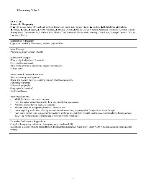
Elementary SchoolSS.5.3.1.2kStandard: Geography2. (K) locates major physical and political features of Earth from memory (e.g., Boston, Philadelphia, England,France, Italy, Spain, North America, Atlantic Ocean, Pacific Ocean, Yucatan Peninsula, Germany, Aleutian Islands,Bering Strait, Chesapeake Bay, Hudson Bay, Mexico City, Montreal, Netherlands, Norway, Ohio River, Portugal, Quebec City, St.Lawrence River).Explanation of Indicator:Cognitive Level (K); Three story Intellect (1) identifiesMain Concept:Physical/political features of earthEmbedded Concepts:What a physical/political feature isCity, country, continentAtlas work specific to delta items specific to standardsEurope mapInstructional Examples/Resources:Atlas work (map development)Black line masters from s.s. series/to support embedded conceptsNational geographicDaily oral geographyGeography bee (online)Nystrom atlas co.Item Specifications:• Multiple choice, one correct answer• Only the terms with deltas next to them are eligible for assessment.• All items should have a map as a stimulus.• Modern maps are acceptable; historical maps are not.• Items requiring students to identify shaded countries on a map are acceptable for questions about Europe.• Item stems cannot refer to geographic locations not listed as eligible to provide students geographic relative location clues,e.g., “The Appalachian Mountains are located on which continent?”Formative Performance Suggestions:Completed map using delta items from geography benchmark (1)Identifying locations of delta items (Boston, Philadelphia, England, France, Italy, Spain North America, Atlantic ocean, pacificocean)7


