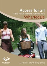
Access for all - Yorkshire Dales National Park
Access for all - Yorkshire Dales National Park
Access for all - Yorkshire Dales National Park
- No tags were found...
Create successful ePaper yourself
Turn your PDF publications into a flip-book with our unique Google optimized e-Paper software.
<strong>Access</strong> <strong>for</strong> <strong>all</strong>in the <strong>Yorkshire</strong> <strong>Dales</strong> <strong>National</strong> <strong>Park</strong>A guide to access opportunities <strong>for</strong> visitorswho are less mobile, are wheelchair usersor who have young children
IntroductionThe <strong>Yorkshire</strong> <strong>Dales</strong> has outstanding scenery, an amazing diversityof wildlife habitats and a rich cultural heritage. There are manyopportunities to enjoy the unique qualities the area has to offer andin 1954, the <strong>Yorkshire</strong> <strong>Dales</strong> was designated a <strong>National</strong> <strong>Park</strong> inrecognition of these special qualities.This guide has been produced to provide in<strong>for</strong>mation about accessopportunities in the <strong>Yorkshire</strong> <strong>Dales</strong> <strong>National</strong> <strong>Park</strong> <strong>for</strong> visitors whoare less mobile, are wheelchair users or have young children. Theguide is not definitive, but offers a selection of natural and heritageattractions <strong>for</strong> mixed ability parties as well as essential in<strong>for</strong>mationsuch as the location of in<strong>for</strong>mation centres, car parks and toilets.We have also suggested a number of trails, describing the terrainand any potential obstacles along the route.If you have any comments to make about this guide, please contactthe <strong>Yorkshire</strong> <strong>Dales</strong> <strong>National</strong> <strong>Park</strong> Authority’s <strong>Access</strong> DevelopmentOfficer on 01969 652363.Public transportFor in<strong>for</strong>mation on public transport in the area, c<strong>all</strong> Travel Line on0870 608 2 608 or visit www.traveldales.org.uk. Some bus and trainservices in the <strong>Yorkshire</strong> <strong>Dales</strong> run wheelchair accessible services.Car parkingMany of the parking areas detailed within this booklet are in<strong>for</strong>malwith space <strong>for</strong> a few vehicles only and no specific facilities <strong>for</strong>people with disabilities. Please give consideration to where and howvehicles are parked so as not to cause inconvenience to others.RADAR toiletsThe <strong>National</strong> Key Scheme (NKS) was set up to <strong>all</strong>ow independententry by disabled key holders to accessible public toilets fitted withthe NKS lock. There are around 8,000 toilets fitted with the NKSlock throughout the UK.For more in<strong>for</strong>mation or to obtain a RADAR key, please c<strong>all</strong>0207 250 3222, visit www.radar.org.uk or write toRADAR, 12 City Forum, 250 City Road London EX1V 8AF.Further in<strong>for</strong>mationTo find out more about opportunities to relax and enjoy the peaceand quiet of the beautiful <strong>Yorkshire</strong> <strong>Dales</strong>, where to stay, howto get here and more, please contact a <strong>National</strong> <strong>Park</strong> or TouristIn<strong>for</strong>mation Centre (see pages 28 to 30 <strong>for</strong> details).Gayle Beck in Gayle2 3
SettlementsSedbergh SD 661921Sedbergh in Cumbria is the largest town in the <strong>Yorkshire</strong> <strong>Dales</strong><strong>National</strong> <strong>Park</strong>. There is a mix of old and new building styles, withthe main street retaining much of its original character. The townsits at the foot of Winder, one of the high and rolling Howgill Fells.ToiletsThere are public toilets, including RADAR facility toilets, on MainStreet, adjacent to Joss Lane car park.<strong>Park</strong>ingFormal parking is on tarmac at the Joss Lane and Loftus Hill carparks, where designated parking bays <strong>for</strong> blue badge holders areavailable. <strong>Park</strong>ing can be difficult on market day (Wednesday).General<strong>Access</strong> within Sedbergh is on pavements which are narrow inplaces. Pavements do extend to join some of the improved routeson public rights of way. Wheelchair users will require assistance onsome gradients.Hawes with Gayle SD 876898The busy town of Hawes in Wensleydale received its market charterin 1700. A coach road from Richmond to Lancaster was completedin 1795 and the arrival of the railway in 1878 confirmed it as the‘capital of Wensleydale’.ToiletsThere are public toilets, including RADAR facility toilets, in theHawes <strong>National</strong> <strong>Park</strong> Centre & <strong>Dales</strong> Countryside Museum car parkand in the town centre.<strong>Park</strong>ingThere are public parking facilities - including designated bays <strong>for</strong>blue badge holders - in the Hawes <strong>National</strong> <strong>Park</strong> Centre & <strong>Dales</strong>Countryside Museum car park, and in the town centre, but it can beparticularly busy on market days (Tuesday) – so get there early!GeneralThere are many accessible features, but access is via roads whichare steep in places.Crook of Lune BridgeHawes Church4 5
West BurtonSE019867West Burton is a beautiful <strong>Dales</strong> village, with a large central green,in the quiet v<strong>all</strong>ey of Walden.West Burton Waterf<strong>all</strong>s (also known loc<strong>all</strong>y as Cauldron F<strong>all</strong>s) canbe easily viewed from the car park. Both waterf<strong>all</strong> and woodlandare peaceful and scenic (although access is difficult following flooddamage) – a good place to relax and enjoy a picnic.ToiletsThe nearest public toilets, including RADAR facility toilets, are inthe Aysgarth F<strong>all</strong>s <strong>National</strong> <strong>Park</strong> Centre car park.<strong>Park</strong>ingThere is no public parking area in the village; parking tends to beon the roadside. There is an in<strong>for</strong>mal parking area at the waterf<strong>all</strong>s.GeneralVehicular access to the village and waterf<strong>all</strong>s is via narrow roadswhich are steep in places.MalhamSD899626Malhamdale is quite simply a place of outstanding natural beauty,with the tiny <strong>Dales</strong> village of Malham nestling under the greatnatural limestone feature of Malham Cove.Mentioned in the Domesday Book as ‘Malgun’, Malham has beena settlement <strong>for</strong> at least a thousand years. Traces of Iron Ageboundaries are still visible today.ToiletsThere are public toilets, including RADAR facility toilets, in theMalham <strong>National</strong> <strong>Park</strong> Centre car park.<strong>Park</strong>ingThere are public parking facilities – including designated bays <strong>for</strong>blue badge holders – in the Malham <strong>National</strong> <strong>Park</strong> Centre car park.General<strong>Access</strong> to the village and Cove is via narrow roads which aresteep in places.An audio landscape trail is available from Malham <strong>National</strong><strong>Park</strong> Centre. The trail follows a barrier-reduced route withsome steep gradients.West Burton F<strong>all</strong>sMalham Cove6 7
Places of interest1. Bolton Abbey SE 077553This country estate in Wharfedale has a café and visitor facilities,with extensive open moorland, riverside and a <strong>for</strong>estry trail amongother features.ToiletsWheelchair accessible toilets are available at the Strid, BoltonAbbey village and Sandholme car parks.<strong>Park</strong>ingThere are public parking facilities – including designated bays<strong>for</strong> blue badge holders – at the Strid, Bolton Abbey village andSandholme car parks.GeneralAll the stiles along the riverside and woodland paths from BoltonAbbey to Barden Bridge have been removed and replaced with gates.Wheelchairs and electric scooters are available <strong>for</strong> visitors to usebetween April and October giving access to the Priory Church andRuins, riverside, Strid Wood, the Strid and the Cumberland Trail.Please contact 01756 718009 to reserve one.There is a hire charge per vehicle.2. Hesketh Farm <strong>Park</strong>, Bolton Abbey SE 060537Hesketh Farm <strong>Park</strong> is part of a 600 acre working farm situatedin one of the most picturesque areas of the <strong>Yorkshire</strong> <strong>Dales</strong>,Bolton Abbey.ToiletsThere are public toilets, including wheelchair accessible toilets,at Hesketh Farm <strong>Park</strong>.<strong>Park</strong>ing<strong>Park</strong>ing is permitted near the entrance to the Farm <strong>Park</strong>.GeneralEverywhere on the farm is accessible to <strong>all</strong> visitors, as well as thetractor and trailer tour.Opening times vary <strong>for</strong> the Farm <strong>Park</strong>. There is an admission charge.Contact detailsTelephone 01756 710444.Swaledale lamb8 9
3. <strong>Dales</strong> Countryside Museum, Hawes SD 877898At the <strong>Dales</strong> Countryside Museum you can experience what life wasonce like in the beautiful, but sometimes harsh, landscape of the<strong>Yorkshire</strong> <strong>Dales</strong>.The Museum has been adapted <strong>for</strong> visitors with disabilities throughout,with wide aisles, lifts, ramps and a two-level in<strong>for</strong>mation counter.(Please note: there is an admission charge into the Museum exhibitionareas; carers enter free of charge.)ToiletsThere are public toilets, including RADAR facility toilets, in the car park.Adapted toilets are also available in the entrance h<strong>all</strong> of the Museum.<strong>Access</strong> is via a ramp from the main lobby to the lower ground floor.<strong>Park</strong>ingThere are public parking facilities – including designated bays <strong>for</strong> bluebadge holders – in the <strong>Dales</strong> Countryside Museum car park.Contact detailsTelephone 01969 666211.4. Ribblehead Station Visitor Centre SD 765789This sm<strong>all</strong> visitor centre at Ribblehead Station in Ribblesdale hasexhibitions with in<strong>for</strong>mation about the history of the famous Settle-Carlisle railway line and the fight to keep it open.ToiletsThere are public toilets, including wheelchair accessible toilets,available <strong>for</strong> centre visitors.<strong>Park</strong>ingThere is free parking outside the station <strong>for</strong> centre visitors and railusers only.GeneralEntry to the visitor centre is free.Contact detailsTelephone 015242 42584.<strong>Dales</strong> Countryside MuseumRibblehead Viaduct10 11
5. Haylands Bridge, SD 876904Fishing Plat<strong>for</strong>ms, HawesTwo adapted fishing plat<strong>for</strong>ms suitable <strong>for</strong> wheelchair users aresituated on the River Ure at Hawes. While fishing <strong>for</strong> brown troutand grayling, look out <strong>for</strong> various birds, such as dippers, greywagtails, kingfishers and sand martins.ToiletsThe nearest public toilets, including RADAR facility toilets, are at theHawes <strong>National</strong> <strong>Park</strong> Centre & <strong>Dales</strong> Countryside Museum, Hawes.<strong>Park</strong>ingThere is wheelchair accessible, off-road car parking at HaylandsBridge <strong>for</strong> four cars.GeneralDay tickets are available from the Hawes <strong>National</strong> <strong>Park</strong> Centre& <strong>Dales</strong> Countryside Museum in Hawes.Contact detailsTelephone 01969 666211.6. Hazel Brow Open Farm, Low Row SD 984979Enjoy guided tours of this organic farm in Swaledale with tea room,museum exhibition area and children’s play area. In the spring,you can watch lambs being born and help feed them. Take a selfguidedwalk along the river bank footpaths or join in the specialactivities and demonstrations of rural skills and crafts.ToiletsThere are public toilets, including wheelchair accessible toilets,at the farm centre.<strong>Park</strong>ing<strong>Park</strong>ing is available at the farm centre.GeneralThere is wheelchair access to the main farm and lower level of themuseum. An admission charge applies. The farm is open from 1April to 30 September.Contact detailsTelephone 01748 886199.Fishing plat<strong>for</strong>ms, HawesSwaledale12 13
7. Wainwath F<strong>all</strong>s, near Keld NY 884015There is a sm<strong>all</strong> viewing area <strong>for</strong> these pretty f<strong>all</strong>s on the River Swale.ToiletsThe nearest public toilets, including wheelchair accessible toilets,are in Muker.<strong>Park</strong>ing<strong>Park</strong>ing is on the roadside.General<strong>Access</strong> to the riverbank is possible on foot.8. B<strong>all</strong>owfields, Wensleydale SD 988898B<strong>all</strong>owfields is one of six Local Nature Reserves owned andmanaged by the <strong>Yorkshire</strong> <strong>Dales</strong> <strong>National</strong> <strong>Park</strong> Authority.ToiletsThe nearest public toilets, including RADAR facility toilets, are inthe Aysgarth F<strong>all</strong>s <strong>National</strong> <strong>Park</strong> Centre car park.<strong>Park</strong>ingThere is a sm<strong>all</strong> car parking area at the Local Nature Reserve.9. Semer Water, Wensleydale SD 920875Just south of Bainbridge lies Semer Water, one of <strong>Yorkshire</strong>’s fewnatural lakes. According to legend, a town once stood where thewater now runs deep, but it was doomed to a watery grave after aweary traveller was refused shelter from a raging storm. As he lefthe cursed the town, decreeing that it should be drowned underrushing waters.Semer Water is a great place to relax and enjoy a picnic, with goodviews of the lake and Raydale from the parking area.Take your binoculars and you may see over-wintering ducks,oystercatchers, great crested grebes, wigeon, buzzard and sandpipers.ToiletsThe nearest public toilets, including RADAR facility toilets, are inthe Aysgarth F<strong>all</strong>s <strong>National</strong> <strong>Park</strong> car park.<strong>Park</strong>ingThere is an in<strong>for</strong>mal parking area on the northern shore of the lake.A sm<strong>all</strong> car parking charge is made by nearby Low Blean Farm.Grey wagtailWigeon14 15
Trails and pathsA. Cotter Force SD 850915Known as ‘the v<strong>all</strong>ey of the waterf<strong>all</strong>s’, Wensleydale harbours manydelights <strong>for</strong> the visitor. Cotter Force, west of Hawes, is a lovelysecluded waterf<strong>all</strong> in a wooded setting. It is a series of about half adozen waterf<strong>all</strong>s with the largest single drop being about 1.5m. The<strong>for</strong>ce widens as it descends being only a couple of feet wide at thetop and about 4.5m wide at the bottom.TrailThis 490m level footpath runs alongside the beck. The surface isconstructed of compacted stone with a general width of 110cm.There are three seating areas evenly spaced along the footpath.While walking the route, look out <strong>for</strong> dippers, grey wagtails,redstarts, long-tailed tits and kingfishers.ToiletsThe nearest public toilets, including RADAR facility toilets, are atthe <strong>Dales</strong> Countryside Museum, Hawes.<strong>Park</strong>ingThere is a pull-in <strong>for</strong> three cars, but with limited width <strong>for</strong> wheelchairs.B. Aysgarth F<strong>all</strong>s and SE 012888Freeholders’ WoodAysgarth F<strong>all</strong>s in Wensleydale is a series of cascading f<strong>all</strong>s separatedinto three <strong>for</strong>ces, Higher, Middle and Lower. Higher F<strong>all</strong>s is the mostvigorous of the group whereas Middle F<strong>all</strong>s has the largest singledrop of around 2m. Lower F<strong>all</strong>s is in the most serene setting.The nearby <strong>National</strong> <strong>Park</strong> Centre café is wheelchair-accessible andcan cater <strong>for</strong> specific dietary requirements.Trail to Freeholders’ WoodA level footpath runs through Freeholders’ Wood with great viewsof the Middle F<strong>all</strong>s. All gates are accessible and there are seatingareas along the route. A flight of seventy steps provide access tothe Lower F<strong>all</strong>s. A further route can be followed along a muddytrack through the woodland.ToiletsThere are public toilets, including RADAR facility toilets, in theAysgarth F<strong>all</strong>s <strong>National</strong> <strong>Park</strong> Centre car park.<strong>Park</strong>ingThere are public parking facilities – including designated bays <strong>for</strong> bluebadge holders – in the Aysgarth F<strong>all</strong>s <strong>National</strong> <strong>Park</strong> Centre car park.Cotter ForceFreeholders’ Wood16 17
C. Burns<strong>all</strong> SE 029612Burns<strong>all</strong> in Wharfedale is one of the <strong>Yorkshire</strong> <strong>Dales</strong> prettiestvillages situated by the River Wharfe, famous <strong>for</strong> its beautiful views,scenery and picturesque bridge.TrailA 700m length of a popular section of the <strong>Dales</strong> Way runs betweenthe village of Burns<strong>all</strong> and Loup Scar. The route is well surfacedand level. There are three gates along the length.ToiletsThe nearest public toilets, including RADAR facility toilets, are inthe Grassington <strong>National</strong> <strong>Park</strong> Centre car park.<strong>Park</strong>ingBurns<strong>all</strong> has a private car park with parking fee.D. Cumberland Trail, Bolton Abbey SD 059563The ancient woodland of Strid Wood in Wharfedale is a Site ofSpecial Scientific Interest and one of the largest areas of acidic oakwoodland in the <strong>Yorkshire</strong> <strong>Dales</strong>. It is renowned <strong>for</strong> its flora andfauna, particularly the carpets of bluebells in spring.TrailAn 850m trail starts from the Strid Wood car park behind the visitorcentre. The route is very well surfaced with few short sh<strong>all</strong>owgradients.Ramped access is also available to the barn exhibition which has avideo and live camera action of birds’ nests.ToiletsThe nearest public toilets, including wheelchair accessible toilets,are at Strid Barn (ramped access).<strong>Park</strong>ingThere are public parking facilities – including designated bays <strong>for</strong>blue badge holders – at the Strid Wood car park.Burns<strong>all</strong>20 21
E. Gordale Scar, Malhamdale SD 913634A great limestone gorge near Malham, some 400 feet (150 m)deep, Gordale Scar is a spectacular feature of the Craven Fault.It is believed by many geologists to be the remains of a hugeunderground cavern the roof of which collapsed around the time ofthe last Ice Age.TrailA 500m route leads you along this dramatic limestone gorge,alongside Gordale Beck, to a spectacular waterf<strong>all</strong>. The routeconsists of well-compacted gravel with gradients of no more than1:10. The general width of the route is 1m with a sm<strong>all</strong> section of90cm.ToiletsThe nearest public toilets, including RADAR facility toilets, are inthe Malham <strong>National</strong> <strong>Park</strong> Centre car park.<strong>Park</strong>ing<strong>Park</strong>ing is available at Gordale Bridge.F. Malham boardwalk SD 882672Malham Tarn <strong>National</strong> Nature Reserve is part of the MalhamTarn Estate which is owned and managed by the <strong>National</strong> Trustin partnership with local farmers. The reserve is also designatedas part of a Site of Special Scientific Interest, a Special Areaof Conservation and it is a wetland of international importancedesignated under the Ramsar Convention. The reserve is 147hectares and is one of the best places to see a natural lime-richlake (the tarn), blanket bog, fen, willow carr, purple moor-grassand rush pasture in the <strong>Yorkshire</strong> <strong>Dales</strong> <strong>National</strong> <strong>Park</strong>.TrailA 500m section of boardwalk runs through the reserve. <strong>Access</strong>is by permit only (costing £1) which can be obtained from the<strong>National</strong> Trust on 01729 830416. During weekends/high seasonit is advisable to book.ToiletsThe nearest public toilets, including RADAR facility toilets, are inthe Malham <strong>National</strong> <strong>Park</strong> Centre car park.<strong>Park</strong>ingThere is a parking area just off the road.Boardwalk, Malham22 23
G. Malham Cove <strong>Park</strong>ing SD 900628start of walk SD 898634Malham Cove is a huge natural limestone cliff just north of Malhamwhich was <strong>for</strong>med by the Craven Fault and was once the sceneof a spectacular prehistoric waterf<strong>all</strong>. The v<strong>all</strong>ey above the cove isnow dry, with the river having found an alternative route through anundiscovered cave system deep underground.TrailA 1.5km route follows this popular section of the Pennine Wayto Malham Cove. The route is well-compacted aggregate and isa minimum width of 1m <strong>for</strong> the complete length. There are someshort stretches of gradient up to 1:8. Please note, however,surfacing work will be completed on this route during 2008.ToiletsThe nearest public toilets, including RADAR facility toilets, are inthe <strong>National</strong> <strong>Park</strong> Centre car park.<strong>Park</strong>ingThe nearest public parking facilities – including designated bays <strong>for</strong>blue badge holders – is at the Malham <strong>National</strong> <strong>Park</strong> Centre car park.GeneralFrom Easter until the end of July, the RSPB set up free, fullyadjustable telescopes at the cove <strong>for</strong> amazing views of theperegrines that nest on the limestone cliff.H. Killington New Bridge, SD 622907Local Nature ReserveThis reserve is accessed through a wheelchair-friendly kissinggate and along 600m of path. The hedgerow alongside most ofthe path’s length is managed using the traditional method c<strong>all</strong>ed‘laying’. The hedge trees are <strong>all</strong>owed to grow t<strong>all</strong> stems, and theseare then part cut through and bent, or laid, horizont<strong>all</strong>y along theline of the hedge and woven in and out of short upright stakes. Theresult is a strong, stock-proof hedge, which will last centuries, ifproperly maintained.ToiletsThe nearest public toilets, including RADAR facility toilets, arein Sedbergh.<strong>Park</strong>ingThere is limited parking on rough ground on the roadside vergeby the bridge.GeneralThe reserve is 1.9 miles (3km) from Sedbergh. Take the A683 toKirkby Lonsdale, turning right towards Kendal and the M6. Afterless than 5/8 mile (1km), park just be<strong>for</strong>e a bridge and take thepublic footpath on the right. In 1999, the path was re-laid <strong>for</strong> betterwheelchair access; it is level but can be muddy.24 25
ViewpointsRibblehead Viaduct (SD 766793)Some <strong>for</strong>mal parking is available near the road junction of theB6255 and B6479 in Ribblesdale with views of the viaduct andWhernside (the highest peak in <strong>Yorkshire</strong> at 736m). Please do notpark on the road verges or drive down the access track to theviaduct.Hesleden Bergh (SD 877745)In<strong>for</strong>mal roadside parking with great views of the classic sceneryof Littondale.Fleet Moss (SD 859837)In<strong>for</strong>mal parking area in Langstrothdale with views over themoorland towards the famous ‘Three Peaks’ (Ingleborough,Whernside and Pen-y-ghent) and Wharfedale.Malham Tarn (SD 895658)In<strong>for</strong>mal parking area in Malhamdale with views over Malham Tarn,the highest natural limestone lake in the country.Scosthrop Moor (SD 864616)In<strong>for</strong>mal parking area in Ribblesdale with views over the openmoorland and limestone scenery.Redmire road junction (SE 046977)In<strong>for</strong>mal roadside parking area with views over lower Swaledale.Redmire Road, Grinton Moor (SE 038963)In<strong>for</strong>mal roadside parking with Swaledale moorland views.Surrender Bridge (SD 989998)In<strong>for</strong>mal roadside parking with views of moorland and remains ofSurrender lead mill in Arkengarthdale.Foregill Gate water splash (NY 992008)In<strong>for</strong>mal roadside parking with views of TV vet James Herriott’sfamous water splash from the programme’s opening sequence andsurrounding moorland.Tan Hill (NY 992008)In<strong>for</strong>mal roadside parking adjacent to the famous Tan Hill Innin Swaledale – the highest inn in England - with views over thePennine Moors and towards the Cumbrian fells.Longstone Common (SD 694912)<strong>Park</strong>ing area with interpretative panel and view of the Howgill Fells.Malham Tarn26 27
Tourist In<strong>for</strong>mation Centres in and around the <strong>Yorkshire</strong> <strong>Dales</strong> <strong>National</strong> <strong>Park</strong>Aysgarth F<strong>all</strong>s <strong>National</strong> <strong>Park</strong> CentreAysgarth F<strong>all</strong>s, Aysgarth, Leyburn DL8 3TH01969 662910E-mail: aysgarth@yorkshiredales.org.ukGrassington <strong>National</strong> <strong>Park</strong> CentreHebden Road, Grassington, Skipton BD23 5LB01756 751690E-mail: grassington@yorkshiredales.org.ukHarrogate Tourist In<strong>for</strong>mation CentreRoyal Baths, Crescent Road, Harrogate HG1 2RR0845 389 3223E-mail: tic@harrogate.gov.ukHawes <strong>National</strong> <strong>Park</strong> CentreStation Yard, Hawes DL8 3NT01969 666210E-mail: hawes@yorkshiredales.org.ukHorton-in-Ribblesdale Tourist In<strong>for</strong>mation CentrePen-y-ghent Cafe, Horton-in-Ribblesdale, Settle,North <strong>Yorkshire</strong> BD24 0HE01729 860333E-mail: horton@ytbtic.co.ukIngleton Tourist In<strong>for</strong>mation CentreCommunity Centre car park, Main Street, Ingleton,Carn<strong>for</strong>th LA6 3HJ015242 41049E-mail: ingleton@ytbtic.co.ukIlkley Tourist In<strong>for</strong>mation CentreStation Road, Ilkley LS29 8HA01943 602319E-mail: ilkey@ytbtic.co.ukKirkby Lonsdale Tourist In<strong>for</strong>mation Centre24 Main Street, Kirkby Lonsdale LA6 2AE015242 71437E-mail: kltic@southlakeland.gov.ukKirkby Stephen Tourist In<strong>for</strong>mation CentreMarket Square, Kirkby Stephen CA17 4QN017683 71199E-mail: ks.tic@eden.gov.ukLeyburn Tourist In<strong>for</strong>mation Centre4 Central Chambers, Market Place, Leyburn,North <strong>Yorkshire</strong> DL8 5BB01969 623069E-mail: leyburn@ytbtic.co.ukMalham <strong>National</strong> <strong>Park</strong> CentreMalham, Skipton BD23 4DA01969 652380E-mail: malham@yorkshiredales.org.ukPateley Bridge Tourist In<strong>for</strong>mation Centre8 High Street, Pateley Bridge HG3 5AW0845 389 0179E-mail: pbtic@harrogate.gov.uk28 29
Reeth <strong>National</strong> <strong>Park</strong> CentreHudson House, Reeth, Richmond DL10 6QY01748 884059E-mail: reeth@yorkshiredales.org.ukRichmond TouristIn<strong>for</strong>mation CentreFriary Gardens, Victoria Road,Richmond, North <strong>Yorkshire</strong> DL10 4AJ01748 850252/825994E-mail: richmond@ytbtic.co.ukRipon TouristIn<strong>for</strong>mation CentreMinster Road, Ripon HG4 1QT0845 389 0178E-mail: ripontic@harrogate.gov.ukSedbergh Tourist In<strong>for</strong>mation Centre72 Main Street, Sedbergh LA10 5AD015396 20125E-mail: kltic@southlakeland.gov.ukSettle Tourist In<strong>for</strong>mation CentreTown H<strong>all</strong>, Cheapside, Settle,North <strong>Yorkshire</strong> BD24 9EJ01729 825192E-mail: settle@ytbtic.co.ukSkipton Tourist In<strong>for</strong>mation Centre35 Coach Street, Skipton,North <strong>Yorkshire</strong> BD23 1LQ01756 792809E-mail: skipton@ytbtic.co.ukPublic toilets with facilities <strong>for</strong> peoplewith disabilitiesRADAR keys are required, unless otherwise stated.To obtain a RADAR key use the contact details on page 3.Askrigg village h<strong>all</strong>Aysgarth F<strong>all</strong>s <strong>National</strong> <strong>Park</strong>Centre car parkBolton Abbey Sandholme carpark (not RADAR)Bolton Abbey Strid Wood carpark (not RADAR)Bolton Abbey village car park(not RADAR)Bradley Mathew Lanerecreation groundBuckden <strong>National</strong> <strong>Park</strong> car parkClapham <strong>National</strong> <strong>Park</strong> car parkCowling north end lay-by,Colne RoadCross Hills H<strong>all</strong> StreetDent car parkGargrave High StreetGrassington <strong>National</strong> <strong>Park</strong>Centre car parkGunnerside next to the KingsArms Pub (not RADAR)Hawes <strong>National</strong> <strong>Park</strong> Centrecar park and town centreHorton-in-Ribblesdale <strong>National</strong><strong>Park</strong> car parkIngleton Community Centrecar park, Main StreetKettlewell <strong>National</strong> <strong>Park</strong> car parkLeyburn Railway StreetMalham <strong>National</strong> <strong>Park</strong> Centrecar parkMuker opposite the village shopReeth village greenRichmond Victoria RoadRichmond Nuns CloseRichmond The F<strong>all</strong>sRichmond Ronaldshay <strong>Park</strong>Richmond Round HouseSedbergh Main StreetSettle Whitefriars car parkSkipton bus stationSkipton Coach Street car parkSkipton High Street car parkSkipton railway stationSkipton Town H<strong>all</strong>Stain<strong>for</strong>th <strong>National</strong> <strong>Park</strong> car parkSutton-in-Craven High Street30 31
Useful in<strong>for</strong>mationThe <strong>Yorkshire</strong> <strong>Dales</strong> <strong>National</strong> <strong>Park</strong> Authority has publishedtwo other booklets - ‘<strong>Access</strong> <strong>for</strong> All in Garsdale, Dentdale andSedbergh’ and ‘<strong>Access</strong> <strong>for</strong> All in Wensleydale’. These detail accessopportunities in these areas <strong>for</strong> visitors with disabilities, as well asthe location of facilities such as toilets and car parking.For a free copy contact the <strong>Access</strong> Development Officer on01969 652363.For more detail of the area and routes described in this leaflet,refer to these Ordnance Survey Explorer maps:Explorer OL19 – Howgill Fells & Upper Eden V<strong>all</strong>ey– 1: 25,000 scaleExplorer OL2 – <strong>Yorkshire</strong> <strong>Dales</strong> Southern & Western Areas– 1: 25,000 scaleExplorer OL30 – <strong>Yorkshire</strong> <strong>Dales</strong> Northern & Central Areas– 1: 25,000 scaleYou can view maps and details of the routes in this leaflet whenyou visit the ‘Rangers’ pages in the Looking After section of ourwebsite www.yorkshiredales.org.ukCountryside Codel Be safe – plan ahead and follow any signsl Leave gates and property as you find theml Protect plants and animals, and take yourlitter homel Keep dogs under close controll Consider other people.View the full Countryside Code at www.countrysideaccess.gov.ukUseful contacts and further in<strong>for</strong>mationThe <strong>Yorkshire</strong> <strong>Dales</strong> <strong>National</strong> <strong>Park</strong> Authority is committedto providing opportunities <strong>for</strong> enjoyment and understandingthroughout the area.If you have any comments on the content of this leaflet, or <strong>for</strong>further in<strong>for</strong>mation about access opportunities, please contact the<strong>Access</strong> Development Officer Rachel Briggs on01969 652363 or rachel.briggs@yorkshiredales.org.ukYou can also write to us at <strong>Yorkshire</strong> <strong>Dales</strong> <strong>National</strong> <strong>Park</strong> Authority,FREEPOST BD625, Grassington, Skipton, BD23 1BR.A new section of the Authority’s website – ‘The countryside <strong>for</strong>everyone’ – offers advice on accessible services, attractions,accommodation, trails, toilets and viewpoints.Visit the ‘Enjoying’ section of www.yorkshiredales.org.uk to findout more.The Learning in Limestone Country Project works with communitygroups and schools to increase access to the <strong>Dales</strong> <strong>for</strong> youngpeople from urban areas, ethnic minorities and those with mentaland physical disabilities.Contact <strong>Yorkshire</strong> <strong>Dales</strong> Millennium Trust on judy.rogers@ydmt.orgor c<strong>all</strong> 01524 251002.Open Country is a Harrogate-based organisation that seeks toenable anyone with any disability to access the countryside,providing advice, transport, and volunteer support. Open Countryhas produced three Breakfree packs which are great <strong>for</strong> shortwalks, nature trails, children, cycles, and people with disabilities.Contact David Shaftoe on 01423 507227 or visitwww.opencountry.org.uk to find out more.32 33
Help us safeguard our precious landscapeNotesDid you know that over 98% of land in the <strong>National</strong> <strong>Park</strong> isprivately owned?<strong>National</strong> <strong>Park</strong> Authority Area Rangers have an important role to playin maintaining the balance between the needs of residents who liveand work in the <strong>National</strong> <strong>Park</strong> and the desire of visitors to share inthe beauty of this special place.Help them maintain that balance by following the Ranger Code:l Keep your dogs under close control, preferably on a leadl Keep to public rights of way and access areasl Avoid trampling meadow grass by staying in single file throughmeadows in summer – grass is winter food <strong>for</strong> sheep and cattlel Leave livestock, crops and machinery alonel Take only memories home, not wild flowers or plantsl Dress and equip yourself to suit the weather, the location, thewalking conditions and length of time you are going to be outl Always take the clothing and equipment you might needl <strong>Park</strong> thoughtfully, and try to use designated car parkswhere availablel Take special care when driving on narrow roads, especi<strong>all</strong>yduring lambing time in April and Mayl Give your car a break – leave the car at home and useenvironment<strong>all</strong>y-friendly public transport where possiblel Enjoy the countryside and respect its life and work.34 35
We would like to thank the <strong>Yorkshire</strong> <strong>Dales</strong> <strong>Access</strong> Forum and OpenCountry <strong>for</strong> their help and advice in the compilation of this guide.The publication can be supplied in other <strong>for</strong>mats on request.Please contact the <strong>Access</strong> Development Officer on 01969 652363.Other guides available:l <strong>Access</strong> <strong>for</strong> All in Garsdale, Dentdale and Sedberghl <strong>Access</strong> <strong>for</strong> All in Wensleydale© <strong>Yorkshire</strong> <strong>Dales</strong> <strong>National</strong> <strong>Park</strong> Authority, May 2008Printed onto environment<strong>all</strong>y friendly paper, obtained from a managed, sustainable source.Designed and printed by room<strong>for</strong>design.co.uk


