N O T E F R O M T H E E D I T O R - Otter Specialist Group
N O T E F R O M T H E E D I T O R - Otter Specialist Group
N O T E F R O M T H E E D I T O R - Otter Specialist Group
- No tags were found...

Create successful ePaper yourself
Turn your PDF publications into a flip-book with our unique Google optimized e-Paper software.
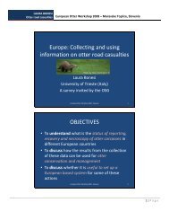
IUCN <strong>Otter</strong> Spec. <strong>Group</strong> Bull. 25(1) 2008MATERIAL AND METHODSFieldwork was carried out in two localities of the river Tormes, one of themajor tributaries of the Duero basin, in the province of Salamanca, central Spain (Fig.1). Herein the occurrence of otter is well know on the basis of large monitoringsurveys using spraints but also registered by direct observations from the later 1980s(Delibes, 1990; Ruiz-Olmo and Delibes, 1998; Pérez-Alonso, 1999).Figure 1. Study area. A. Location on the Iberian Peninsula. B. Digital Elevation Model of the studyarea. C. Digital Elevation Model and hydrographic web of the two localities surveyed; 1: Santa Teresadam; 2: Salamanca.The first set of stretches studied is located downstream from the Santa Teresadam (GPS coordinates of the medium area point: 30T 280849, 4508295; 820 m. high)in a sedimentary plain intensively used as croplands surrounded by oak forest(Quercus ilex), managed with extensive livestock (called “dehesas”). The riparianforest is structured in gallery where Salix sp., Populus sp., Ulmus sp. and Fraxinus sp.are the dominant species, and with high shrub cover in the inferior strata. Punctually,this forest is removed and replaced for monospecific plantations of Populus nigra.The water network is well developed, mainly by the beds of the rivers Tormes andAlhandiga, which drains the flow of numerous rivers and irrigation ditches. Moreover,gravel extraction activities create some new lakes.The second area studied was in the vicinity of the city of Salamanca situatedon the river Tormes and two of itd tributaries (GPS coordinates of the medium areapoint: 30T 276181, 4537213; 800 m.). Here the riparian habitat is largely degradedbecause the influence of the human pressure on the river due to population size of thecity and recreational activities. Currently the forest is mainly reduced to a series ofislands in the middle of the river while banks are used as a “river street” and parks forhuman activities.- 33 -