MobileMapper® 120 - Canal Geomatics
MobileMapper® 120 - Canal Geomatics
MobileMapper® 120 - Canal Geomatics

You also want an ePaper? Increase the reach of your titles
YUMPU automatically turns print PDFs into web optimized ePapers that Google loves.
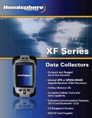
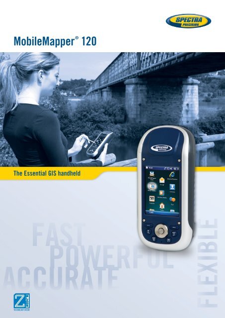
MobileMapper ® <strong>120</strong>The Essential GIS handheld
MobileMapper Field and Office SoftwareComplete solution:The MobileMapper software suite includes all GIS features that professionals really need without the burdenof complicated and rarely used functions. It also provides a direct interface to external sensors such as laserrange-finders.Versatile application:MobileMapper Field is the perfect solution for GIS data collection, asset management, area measurements,map creation and update.Easy to learn, Easy to use:Spectra Precision software is very intuitive, requiring a minimum of user training. It enables rapid deploymentacross the workforce for large scale GIS data collection or maintenance.Tune MobileMapper <strong>120</strong> to your ApplicationsOpen Software Platform:With Windows Embedded Handheld you may upload any necessary utility or software on yourMobileMapper <strong>120</strong>, whatever suits your next job. You can collect GIS/GPS points and maps viathe GIS application of your choice, either a third party software such as ESRI ® ArcPad ® or theproprietary Spectra Precision application.Software Choice:Take advantage of the solutions that Spectra Precision Business Partners are offering. Either inForestry, Agriculture, Utility asset management, Underground cable location, etc… the applicationchoice is large. Combine GIS software or hardware accessories with your MobileMapper <strong>120</strong> tocreate an accurate, all-in-one mobile GIS solution.
MobileMapper <strong>120</strong> Technical Specifications *Physical CharacteristicsSoftware OptionsLAN 802.11b/g (SDIO slot)GNSS Characteristics■■WirelessOther■■Microphone■■45 parallel all-in-view channelsSize■■MobileMapper Field and Office Software- GPS■■Receiver: 190x90x43 mm (7.5x3.5x1.7 in)■■Post-processing feature available for- GLONASSWeightMobileMapper Field software- L1 C/A■■Receiver only: 0,48 kg (1.06 lb)■■ESRI®ArcPad ® software bundle (USA only)- SBAS: WAAS/EGNOS/MSAS■■Z-Blade technology powered by Ashtech for■■Receiver with battery: 0,62 kg (1.43 lb) Standard Accessories■■optimal performance.Integrated stylusUser Interface■■DGPS and post processing with■■Docking station:KeyboardMobileMapper Office software- Unit charging■■Alphanumeric virtual keyboard■■Up to 20 Hz GPS, GLONASS, SBAS position- RS232 Interface■■4 ways navigation, Ok, menu, escape, zoomoutput and raw data (code and carrier)- USB Host and Devicein/out, contextual keys■■NMEA 183 messages output- Additional battery charging slot■■Illuminated keyboard■■RTCM2.3, RTCM3.1, CMR and CMR+, ATOM■■Universal A/C adapter(Ashtech Optimized Messaging)Display■■USB data cable■■Colour TFT High resolution display sunlight■■Real time Network: VRS, FKP, MACreadable with touch screen, LED backlight. Optional AccessoriesAccuracy Specifications (Horizontal RMS) 1 ■■Size: 3.5” portrait■■ASH-660, L1 GPS/GLONASS externalantenna with cable■■Real-time SBAS: < 50 cm typicalMemory■■■■ASH-661, L1/L2 GNSS externalReal-time DGPS: < 30 cm typical■■256 MB SDRAMantenna with cable■■Post-processing: < 30 cm down to sub dm■■User data storage: 2 GB Nand Flash■■Pole bracketProcessor(non volatile)■■Automotive external antenna■■SDHC memory card■■Carrying case■■Marvell®PXA 320■■Frequency clock 806 MHzEnvironmental Characteristics*Including all available options.■■Operating temperature: -20° to +60°COperating System(-4 to 140°F)■■Microsoft Windows Embedded Handheld■■Storage temperature: -25° to +70°C■■Languages available: English, French,(-13 to 158°F)2Selected at first switch on– no further OS languageSpanish, German, Portuguese, Italian,■■Humidity: 10 to 90% non condensingmodification is possible.Simplified Chinese, Japanese, Korean 2■■Waterproof3No BT or WLAN. Backlight as default settings.■■Software package includes:■■Vibration and Shock: ETS300 019, vibration- GNSS Toolbox to control GNSSMIL-STD-810 method 514.5- Internet Explorer■■Free drop: 1.2 m on concrete- Microsoft Office Mobile- ActiveSyncPower Characteristics- Transcriber (handwriting recognition)■■Removable battery: Li-Ion, 6600mAh■■Battery life: > 8 hrs @ 20 ºC with GNSS on3Communications■■Charging time: 3 hoursCellular■■External power: 9-28 VDC■■Built in GPRS, EDGE class 12modem Cinterion MC 75iMultimedia & Sensors■■Quad band 850/900 MHz, 1800/1900 MHz■■Camera 3MPixelsBluetooth■■E-Compass■■Bluetooth 2.1 (class 2) with DER■■G-Sensor■■Profiles: SPP, DUN, FTP, OPP, HSP, A2DP■■Speaker■■RS232, USB through docking station1Handheld accuracy performance achieved in good conditions withPDOP