Google Earth Application
Google Earth Application
Google Earth Application
- No tags were found...

You also want an ePaper? Increase the reach of your titles
YUMPU automatically turns print PDFs into web optimized ePapers that Google loves.
<strong>Google</strong> <strong>Earth</strong> <strong>Application</strong>Managing and Displaying Data in <strong>Google</strong> <strong>Earth</strong>Data Management: Field to Central Storage
Agenda•<strong>Google</strong> <strong>Earth</strong> overview• Display of mapping data elements• Transfer of near real-time data•Customizing in <strong>Google</strong> <strong>Earth</strong>• Custom place marks• Network links• SketchUp•EPA Region 7 project highlights• Iowa Flood Response 2008• Washington County Lead District - Furnace Creak
Overview• Display of point, line, and polygonmapping data• Data efficiently transferred from GISto <strong>Google</strong> <strong>Earth</strong>• Viewing of georeferenced photos• Overlay of georeferenced aerialphotos• Draping and stretching of images• Data can be shared with any <strong>Google</strong><strong>Earth</strong> user via .kml or .kmz• Data can be secured via passwordprotected network links
Customizing in <strong>Google</strong> <strong>Earth</strong>• Custom place marks• Build using HTML editor• Add formatting and graphics forimproved presentation of data• Network links• Store data on website for accessvia internet connection• Allows for securing of data• 3D modeling using SketchUp• Add realistic 3D models of featuresfor better representation• Animate models for realistic effect
Custom Place Marks•Layout custom place mark on paper• Determine fields to be added• Add graphics and text accordingly•Develop place mark using HTML editor•Create ESRI ArcMap shapefile from data source•Use ArcMap ‘Export to KML’ extension• Export data by choosing fields• Paste HTML code into ‘Feature Description Field’•Launch KML in <strong>Google</strong> <strong>Earth</strong>
Network Links• Provides centralized storage of data• Allows access of data through internet• Data can be updated on the fly• Steps to create Network Link1. Create .kml files to network linked2. Move .kml files to a web storage location3. From <strong>Google</strong> <strong>Earth</strong> click Add => Network Link4. Enter the address to the .kml file5. Click OK
<strong>Google</strong> SketchUp•Free software used to create 3D models•Easy-to-use conceptual tool with a simple interface•Can import CAD, GIS, and multiple image formats•Includes features to facilitate the placement of models in<strong>Google</strong> <strong>Earth</strong>•Models can beanimated for a morerealistic affect.
Data Management Approach1. Data collected in field• Hard copy field sheet• <strong>Google</strong> <strong>Earth</strong> .kml / .kmz• Handheld electronic data2. Field and lab data input into Scribe• Imported via Custom Importand/or manual entry3. ODBC connection to ArcMap• Queries written to access data• Shapefiles created• Data exported to .kml or .kmz4. <strong>Google</strong> <strong>Earth</strong> file created• Base mapping and site dataadded• .kmz deliverable created anddistributed
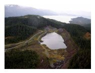
EPA Region 7 Project HighlightsIowa Flood Response 2008
Iowa Flood Response 2008 – Base Map Elements
Iowa Flood Response 2008 – River Features
Iowa Flood Response 2008 – Recon Targets
Iowa Flood Response 2008 – Collection Site
Iowa Flood Response 2008 – Air Monitoring/Sampling
Iowa Flood Response 2008 – Photos
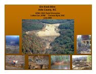
EPA Region 7 Project HighlightsWashington County Lead District - Furnace Creak
Furnace Creek – Base Map Elements
Furnace Creek – Security Enabled Data
Furnace Creek – Overlain Historical Plat Maps
Furnace Creek – Customized Place Marks