

Download - NASA Airborne Science Program
Download - NASA Airborne Science Program
Download - NASA Airborne Science Program
- No tags were found...

You also want an ePaper? Increase the reach of your titles
YUMPU automatically turns print PDFs into web optimized ePapers that Google loves.
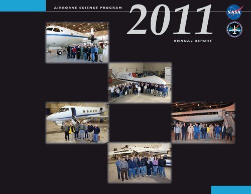
Pictured on the front cover are the support teams for ASP Core Aircraft. Names of personnel are listed on the following pages:P-3 (p. 33), Global Hawk (p. 37), DC-8 (p. 30), ER-2 (p. 31), DFRC G-III (p. 35).
AIRBORNE SCIENCE PROGRAM2011ANNUAL REPORTNational Aeronautics and Space Administration
Table of Contents1. Leadership Comments . . . . . . . . . . . . . . . . . . . . . . . . 12. In Memoriam . . . . . . . . . . . . . . . . . . . . . . . . . . . . . . . . 33. <strong>Program</strong> Overview ...........................4Structure of the <strong>Program</strong> ..................4FY2011 Major Improvements ..............5Flight Request System ....................54. <strong>Science</strong>: Mission Accomplished . . . . . . . . . . . . . . . . 6<strong>Science</strong> Flight statistics. . . . . . . . . . . . . . . . . . . . 6Major Mission highlights. . . . . . . . . . . . . . . . . . 8MACPEX ...........................8Operation IceBridge . . . . . . . . . . . . . . . . . 10ASCENDS .........................12Supporting <strong>NASA</strong> <strong>Science</strong> –the <strong>Airborne</strong> <strong>Science</strong> role . . . . . . . . . . . . . . . . . 12Support to ESD Satellite Missions,including Decadal Survey Missions. . . . . . . . 14Support to Instrument Development. . . . . . . 15Support to R&A process studies. . . . . . . . . . . 16Earth Venture-1 (EV-1) activities andaccomplishments. . . . . . . . . . . . . . . . . . . . . . . . 18DISCOVER-AQ. . . . . . . . . . . . . . . . . . . . . 18CARVE . . . . . . . . . . . . . . . . . . . . . . . . . . . . 20HS3 ...............................20ATTREX . . . . . . . . . . . . . . . . . . . . . . . . . . . 21AirMOSS ..........................22Support to Applied <strong>Science</strong> . . . . . . . . . . . . . . . 23Upcoming Missions .....................24UAS Enabled Earth <strong>Science</strong> ..........24SEAC4RS ..........................255. Aircraft ....................................26Capabilities. . . . . . . . . . . . . . . . . . . . . . . . . . . . . 27Aircraft Activities and Modificationsin 2011 . . . . . . . . . . . . . . . . . . . . . . . . . . . . . . . . . 30New Platforms ..........................496. Aircraft Cross-Cutting Support andIT Infrastructure ............................52Onboard Data NetworkInfrastructure . . . . . . . . . . . . . . . . . . . . . . . . . . . 52Satellite CommunicationsSystems . . . . . . . . . . . . . . . . . . . . . . . . . . . . . . . . 53Irridium SATCOM ......................54XM Radio ..............................54Facility Instruments .....................55New Sensor: PRISM .....................57iii
Onboard Data Displays ..................577. Strategic Planning ..........................60Satellite support requirements. . . . . . . . . . . . . 615-yr plan ...............................628. Education, Outreach and Partnerships ........63SARP ..................................63Outreach: International Symposium onRemote Sensingof the Environment (ISRSE) . . . . . . . . . . . . . . . 64Partnerships . . . . . . . . . . . . . . . . . . . . . . . . . . . . 65Appendix A: Historical Perspective:Earl Peterson ..............................67Appendix B: Appendix: 5-yr plan ................71Appendix C: SARP Students andtheir Colleges . . . . . . . . . . . . . . . . . . . . . . . . . . . . . . . . . 75Appendix D: Aircraft Flight Profiles .............77Appendix E: Acronyms . . . . . . . . . . . . . . . . . . . . . . . . . 85Table of FiguresFigure 1:Figure 2:Figure 3:<strong>Airborne</strong> <strong>Science</strong><strong>Program</strong> Organization ................4ASP science flight hours overthe past 14 years.. . . . . . . . . . . . . . . . . . . . . . 6Locations of airborne campaigns duringFY11. . . . . . . . . . . . . . . . . . . . . . . . . . . . . . . . . 8Figure 4: MACPEX team .......................9Figure 5: Flight lines for Fall 2010Antarctic OIB mission ................10Figure 6: Flight tracks of Spring 2011OIB Arctic mission ...................11Figure 7:Figure 8:Figure 9:ASCENDS II <strong>Science</strong>flight tracks .........................12MASTER imagery acquired on the ER28 June 2011 over Ivanpah playa.. . . . . . . . 14Data gathered during MC3Eon the ER-2.. ........................15Figure 10: G-LiHT on the Cessna 206. . . . . . . . . . . . . 15Figure 11: Interferograms of Kilaueavolcano generated fromthe UAVSAR. .......................17Figure 12: Pollutant measurementsmade during Discover AQ . . . . . . . . . . . . 19iv
viFigure 52: Screen shot of Google Earth ...........59Figure 53: <strong>Airborne</strong> support to futuresatellite missions. . . . . . . . . . . . . . . . . . . . . 62Figure 54: 2011 SARP students with the DC-8 .....63Figure 55: Locations of colleges representedin 2011 SARPprogram ............................64Figure C.1: SARP student numbers andschools for 2009 ......................75Figure C.2: SARP student numbers andschools for 2010 ......................76Figure C.3: SARP student numbers andschools for 2011 ......................76Figure D.1: DC-8 flight profile ...................77Figure D.2: ER-2 flight profile ...................78Figure D.3: P-3 Orion flight profile ...............78Figure D.4: WB-57 flight profile ..................79Figure D.5: G-III with UAVSAR flight profile ......79Figure D.6: Global Hawk flight profile . . . . . . . . . . . . 80Figure D.7: SIERRA flight profile. . . . . . . . . . . . . . . . . 80Figure D.8: Cessna 206-H flight profile. . . . . . . . . . . . 81Figure D.9: LaRC & DFRC B-200 flight profile .....81Figure D.10: Learjet 25 flight profile ..............82Figure D.11: GRC Twin Otter flight profile ........82Figure D.12: GRC S3-B flight profile ..............83Figure D.13: T-34C flight profile ..................83Table of TablesTable 1:Table 2:Table 3:FY2011 Flight Requests andFlight Hours by Aircraft ..................7ESD Satellite MissionSupport FY2011......................... 13Instrument developmentflights . .. . . .. . . .. . . .. . . .. . . .. . . .. . . .. . . . 16Table 4: <strong>Science</strong> process studies . . . . .. . . .. . . .. . . ..17Table 5:Table 6:Earth Venture 1 FlightActivities . . .. . . .. . . .. . . .. . . .. . . .. . . .. . . . 18ESD Applied <strong>Science</strong>support................................. 23Table 7: A.40 missions . .. . . .. . . .. . . .. . . .. . . .. . . ..24Table 8: <strong>NASA</strong> ASP Aircraft ..................... 26Table 9: ASP Platform capabilities. . .. . . .. . . .. . . . 29Table 10: ASP Satcom types . .. . . .. . . .. . . .. . . .. . . ..55Table 11:Table 12:Table 13:<strong>Airborne</strong> <strong>Science</strong> SupportInstruments. . . .. . . .. . . .. . . .. . . .. . . .. . . ..55EOS <strong>Airborne</strong> <strong>Science</strong>Instruments. . . .. . . .. . . .. . . .. . . .. . . .. . . ..55SARP student numbersand schools ............................. 75
2In MemoriamMichael T. FitzgeraldIt is with great sadness that the MASinstrument team announces the passing ofMichael Fitzgerald, one of the original dataanalysts and a driving force behind thesuccessful development and operation of anumber of major <strong>NASA</strong> airborne instruments,including the MAS, MASTER, and TIMS. Fornearly 20 years, from its first deployment tothe Azores in 1992, Mike spearheaded MASdata processing, software development,and field operations. His boundless energy,imperturbable optimism, and good spirits willbe remembered fondly by all who knew him.He died peacefully at his home in BoulderCreek with family on the 12th of February,2012. He was only 52 years old and a 4thgeneration native of San Mateo, California. Hedied of ALS (Lou Gehrig’s disease) seven yearsafter being diagnosed.Prior to coming to <strong>NASA</strong>, Mike worked forseven years as a union electrician (IBEW 617)until he suffered several disabling injuries.He then received his BS in Geography fromSan Francisco State University under a careerrehabilitation program, and came to AmesResearch Center as a student intern. He quicklybecame fascinated with Earth science andremote sensing, and over the next 20 yearswent on to become a leading member of thetechnical staff at the <strong>Airborne</strong> Sensor Facility.He led the MAS and MASTER deploymentteams on major field experiments from Alaska,to Brazil, Costa Rica, and South Africa, to namebut a few; and his contagious good natureand technical skills together were a big part oftheir collective success. His motto after beingstruck down by ALS became “Faith, Not Fear,”exemplifying the indomitable spirit which willremain forever an inspiration to friends andcolleagues alike.33
3<strong>Program</strong> Overview4ARC ASP Lead:Matt FladelandFunctions:SIERRA, Earth <strong>Science</strong>Project OfficeStudies and Reports<strong>Airborne</strong> Sensor Facility,<strong>Science</strong> Mission Mgmt.GRC ASP Lead:Alan MicklewrightS-3Twin OtterLear JetThe <strong>Airborne</strong> <strong>Science</strong> <strong>Program</strong> (ASP) serves toenable scientists to achieve <strong>NASA</strong> Earth scienceobjectives and goals that require the use ofairborne platforms and infrastructure.DFRC ASP Lead:Mike ThomsonFunctions:DC-8/NSERC, ER-2,Ikhana, Global Hawk,G-III, Dryden AircraftOperations FacilityActing <strong>Airborne</strong> <strong>Science</strong><strong>Program</strong> Director: Bruce TaggDeputy Director: Randy AlbertsonASP provides limitedsupport to GRC and LaRCFigure 1: <strong>Airborne</strong> <strong>Science</strong> <strong>Program</strong> Organization.WFF ASP Lead:Shane DoverFunctions:P-3, Catalog Mgmt, MissionMgmt, Reports, BudgetMgmt. supportLaRCFrank JonesB-200UC-12Cessna 205HU-25AJSC ASP Lead:Scott GahringKen CockrellFunctions:WB-57, G-III Mission SupportThe ASP <strong>Program</strong> objectives are to providethe capability to:• Accomplish the essential calibrationmeasurements for the <strong>NASA</strong> Earthobserving satellites and the validationof data retrieval algorithms• Obtain variable high-resolutiontemporal and spatial measurementsof complex local processes to facilitatea physics based understanding of theEarth system.• Test and refine instrument technologies/algorithms,as well as innovativeobserving techniques, and reducerisk prior to committing sensors forlaunch into space.• Foster the development of our futureworkforce with the hands-on involvementof graduate students and youngscientists/engineers in all aspects ofongoing Earth <strong>Science</strong> investigations.Structure of the <strong>Program</strong>The Center <strong>Airborne</strong> <strong>Science</strong> Leads or theirdesignated representatives report to theASP Director in all matters pertaining to the<strong>Airborne</strong> <strong>Science</strong> <strong>Program</strong>. An organizationalchart is shown in Figure 1.
FY2011 Major ImprovementsThe ASP made a number of investments andimprovements to enhance capabilities forthe Earth science community. On the DrydenC-20/G-III, engine hush kits were procuredand installed; these will enable UAVSARmissions at more airports worldwide.Antiquated seats on the P-3B were replaced,the electrical convertors in the load centerwere replaced and a new galley andlavatory were procured for installation inthe next maintenance cycle. The JohnsonSpace Center G-III, N992NA, startedits modification to become a UAVSARplatform, principally for the EV-1 AirMOSSmission. Numerous investments were madeto the program’s web presence, such asthe platform tracker feature. A substantialinvestment was also made to increase sensorportability between platforms by procuringthe material to build more <strong>NASA</strong> <strong>Airborne</strong><strong>Science</strong> Data and Telemetry (NASDAT)modules and Experimenter Interface Panels(EIPs).access to unique <strong>NASA</strong> aircraft, as well ascommercial aircraft with which <strong>NASA</strong> hasmade contracting arrangements. The onlyway to schedule the use of <strong>NASA</strong> SMDplatforms and instrument assets is to submita Flight Request for approval through SOFRS((http://airbornescience.nasa.gov).)The SOFRS team strives for continuousimprovement by improving the interfacewith users and the data products. In 2011,the focus was on making reports availableto <strong>NASA</strong> headquarters from the datacollected in the Flight Requests and to makemodification in the flight request template tocollect additional requested data.Flight Request SystemThe flight request system manages andtracks the allocation of the ASP aircraft andfacility sensors. The <strong>Science</strong> OperationsFlight Request System (SOFRS) is a webbaseddatabase to facilitate the review andapproval process for every airborne sciencemission using <strong>NASA</strong> SMD funds, personnel,instruments or aircraft. Requests for theseassets and the scheduling of their use areaccomplished through SOFRS. This systemwas designed to allow researchers that arefunded by <strong>NASA</strong> or other agencies to have55
Table 1: FY2011 Flight Requests and Flight Hours by Aircraft.Aircraft Total FRs Total Approved Total Completed Total Hours FlownDC-8 16 10 8 228.3ER-2 31 20 11 143.7P-3 17 7 5 533.3WB-57 7 5 3 79.7Twin Otter 20 10 8 281.6B-200 20 14 9 304.5Cessna 206 4 3 2 87.2Gulfstream G-3 34 27 17 448.4Ikhana 4 1 0 0.0Learjet 25 1 0 0 0.0SIERRA 9 2 2 17.0Other 19 14 10 363.7TOTALS: 185 115 77 2605.4Table notes:These totals are based on the flight request’s lognumber, and therefore include all flight requestswhose log number starts with “11”.The “Total FRs” column includes all flightrequests that were submitted and whose lognumber starts with “11”.The “Total Approved column includes flightrequests that were set to a status of Approved orInternally Approved at some point.The “Total Completed” column includes onlyflight requests whose final status is Completed.The “Total Hours Flown” column includes all“Flight Hours Flown” for flight requests with astatus of Completed or Partial for 2011. For multiyearmissions, this may include hours flown inyears prior to 2011.Other Aircraft includes: Alpha Jet, BT-67, Cessna172, F-18, FS King Air, H211 Alpha Jet, NRL 0-3,Otter DHC-3, Piper Cherokee PA-32, PNNL G-1,Purdue University’s Beechcraft Duchess <strong>Airborne</strong>laboratory for Atmospheric Research, SDSUSky-Arrow, Twin Otter - Twin Otter International,UTSI Piper Navajo PA-31, Viking 300, ZeppelinNT.77
Flight requests were submitted for 15 aircraftplatforms and flew more than 2600 flighthours in all. Several large campaigns weresuccessfully conducted this year (MACPEX,Operation ICE Bridge, HS3, ATTREX andmore). The locations of flights in FY2011 areindicated in Figure 3.Figure 3: Locations of airborne campaigns during FY11.Major Mission highlightsMACPEXThe Mid-latitude <strong>Airborne</strong> Cirrus PropertiesExperiment (MACPEX) focused on investigatingthe properties of mid-latitude cirrus clouds, theprocesses affecting these properties and theirimpact on the earth’s radiation. The campaigntook place during spring 2011 (March andApril) over central North America with specialemphasis in the vicinity of the Departmentof Energy ARM SGP site in Oklahoma.Based from Ellington Field, TX, theMACPEX mission integrated 24 scienceinstruments on board the WB-57 to makecritical measurements needed for themission objectives. The main focus of themeasurements were the aerosol and cloudmicrophysical properties, including particlesize distribution, composition, extinction,8
Figure 4: MACPEX Team. Front Row (L to R): John Bain, Bill RiekeRow 2 (L to R): Ru-shan Gao, Karen Rosenlof, Chris Yost, Eric Jensen, Paul Bui, Martina Kraemer,Tim Klostermann, Tom Slate, Jim Alexander, Marilyn Vasques, Dom Del Rosso, Glenn Diskin, GaoChen, Yi-wen Huang, Lance Christensen, Dave Natzic, Robert Troy, Robert Herman, Marco RiveroRow 3 (L to R): Allen Jordan, Mike Carrithers, Carl Schmitt, Anne Perring, Drew Rollins, HermannGerber, Rabi Palikonda, Brad Baker, Daniel Cziczo, Karl Froyd, Mike Reeves, Hal Maring, DaleHurst, Rick Stimpfle, Jay MaceBy Aircraft (L to R): Luther Levan, Don Hanselman, John Hazelhurst, Dave Hendrickson, DavidWyckoff, Don Greenwayice water content, and ice crystal habitat.In addition other instruments providedmeasurements of water vapor, water isotopes,chemical tracers (CO, CH4, O3), and thedynamics including pressure, temperature,vertical and horizontal winds.Flights were planned with an emphasizeon ground based and satellite observationsincluding the EOS/ A-Train satellites Aqua,Aura, CALIPSO, CloudSat, PARASOL, andTerra for the purposes of scientific utilization,as well as, satellite validation. In addition,the field measurements should provide thecirrus microphysical information neededfor improvement and evaluation of remotesensingretrievals and climate model cloudparameterizations. The MACPEX scienceteam is shown with the WB-57 in Figure 4.99
Operation Ice BridgeOperation IceBridge continued in FY2011 withmajor campaigns in the Arctic and Antarctic.The fall Antarctic campaign involved the DC-8aircraft carrying seven instruments. Missionmanagers reported that the science instrumentsfunctioned well during the campaign, whichincluded 10 dedicated science flights totalingalmost 115 hours of flight time, not includingcheckout and transit flights. Flight lines coveredAntarctica and its environs, including ThwaitesGlacier and Pine Island Bay, as shown in Figure5. The mission measured the ice thickness andsurface elevations of the numerous tributariesfeeding into the main Pine Island Glacier. Newflight destinations beyond those flown inFY2010 included West Antarctica’s Getz IceShelf and an arc-shaped flight path aroundthe South Pole. In addition to the DC-8, wewere joined by the NSF GV aircraft.The IceBridge mission also visited the Arcticbetween March and May of 2011. Based outof Thule and Kangerlussuaq, Greenland,this field campaign focused on re-surveyingareas that are undergoing rapid change andembarking on new lines of investigation, suchas surveys of Canadian ice caps. <strong>NASA</strong>’s P-3Band King Air B200 (IceBridge newcomer)aircraft were used on this campaign. Theextensive flight coverage is shown in Figure 6.Figure 5: Flight lines for Fall 2010 Antarctic OIB mission.10
Figure 6: Flight tracks of Spring 2011 OIB Arctic mission.The following quote from the OIB blog indicatesthe extensive coordination with other agenciesduring this mission.“Over the past 67 days, the P-3 hasbeen in the air 325 hours. It is difficultto comprehend the magnitude ofairborne activities that have takenplace over Greenland, the CanadianArctic, and the Arctic Ocean [during]the past couple of weeks. IceBridgedeployed two aircraft that havecollected a tremendous amount ofdata, but we were not alone. Ourcolleagues from the European SpaceAgency had an extremely successfulCryoVEx campaign with two surveyaircraft involved and many groundactivities. A UK-US project surveyedthe Greenland Ice Sheet as well, andso did a team from CReSIS. In theBeaufort Sea, the US Navy and itspartners conducted ICEX 2011, withsurvey aircraft and measurementson the sea ice. The scope and levelof coordination between all theseairborne and ground campaignsmakes the International Polar Yearlook small. Thank you all for theexcellent coordination!”11 11
ASCENDS IIThe objective of the 2011 ASCENDS DC-8<strong>Airborne</strong> Campaign, also known as ASCENDSII, was to measure CO2 columns over a varietyof topographic targets and under varyingatmospheric conditions with developmentalLIDAR and in situ sensors under considerationfor the ASCENDS satellite mission. Thesimultaneous flight of four LIDAR candidatesallows for comparison of technologies.Measurements were made over extensive andvaried surface and meteorological conditions.The wide-ranging flight tracks are shown inFigure 7.Figure 7: ASCENDS II science flight tracks.Supporting <strong>NASA</strong> <strong>Science</strong> – the <strong>Airborne</strong><strong>Science</strong> role<strong>NASA</strong> ESD objective is to detect andunderstand environmental change fromregional to global scale. This necessarilyrequires regional to global scale monitoring ofcritical parameters and process studies.Since it is not possible to measureeverything, everywhere, all the timeand because <strong>NASA</strong> has unique ability toexecute space borne measurements, <strong>NASA</strong>emphasizes space based observations ofthe earth system. From an observationalperspective, <strong>NASA</strong> makes long-termobservations (e.g., satellite observations,surface/subsurface-based network12
Table 2: ESD Satellite Mission support in FY2011.<strong>Airborne</strong> MissionNameSatellite MissionName Aircraft flown LocationsASCENDS II ASCENDS DC-8 CONUSAID for ASCENDS 4 ASCENDS Cessna 206 LaRCOperation IceBridge ICESat 2 P-3, Otter, B-200 Arctic, GreenlandOperation IceBridge ICESat 2 DC-8, BT-67 Chile, AntarcticaCalipso Night Cal/Val CALIPSO UC-12B LaRCMC3E GPM ER-2 CONUSGOSAT / OCO2 GOSAT, OCO2 SIERRA, Alpha Jet NVSoil Moisture SMAP G-III CONUSForest Conditions andStructure DESDynI G-III CONUSAVIRIS / MASTER HypsIRI ER-2, Twin Otter CONUSMABEL ICESat 2 ER-2 CONUSALIST LIST Learjet 25 CONUSSweepSAR DESDynI DC-8 CONUSmeasurements, and, to a lesser degree,repeated aircraft observations) and shorttermobservations (e.g., field campaigns,both airborne and surface/subsurfacebased).From an observational platform basis,ESD develops and performs satelliteobservations as well as developing andperforming airborne and surface/subsurfacemeasurements. To develop satelliteobservational capabilities, we design andbuild remote sensing instruments as well asalgorithms. These activities typically (butnot always) involve airborne and surface/subsurface-based measurements.After a satellite is launched, the calibrationand validation of the measurements madeby the satellite typically involve airborneand surface/subsurface-based networkobservations.Since the understanding of some criticalearth system processes cannot becompletely accomplished by satelliteobservations, <strong>NASA</strong> augments satelliteobservations with more detailed, higherfrequency, greater spatial resolutionmeasurements from aircraft and/orsurface/subsurface platforms.13 13
Support to ESD Satellite Missions,including Decadal Survey MissionOne of the primary activities of the<strong>Airborne</strong> <strong>Science</strong> <strong>Program</strong> is to supportthe development and implementationof <strong>NASA</strong>’s space satellite missions. Thisincludes not only flights to collect calibrationand validation data once a satellite hasbeen launched, but also to collect data foralgorithm development prior to launch.Thus, many ASP missions make fieldmeasurements to build relevant databases.Others carry instruments that are prototypesof satellite payload instruments. Still otherscarry instruments that are simulators, butnot necessarily prototypes.While there are a large number of Earthsatellites currently in orbit, there are evenmore Earth satellites planned for launch inthe near term. Many of these were initiallydefined in the 2008 “Decadal Survey.” Sincethe release of the Decadal Survey and initialscience mission developments, the <strong>Airborne</strong><strong>Science</strong> <strong>Program</strong> has been assisting in thedevelopment of support plans for all aspectsof these missions. Table 2 (page 13) lists theFY2011 ASP activities, which supported ESDsatellite missions. Most of these are relatedto algorithm developmentor validation. An exampleof MASTER data acquired insupport of HyspIRI algorithmdevelopment is shown in Figure8. The mission concept forMC3E on the ER-2 supportingGPM is shown in Figure 9.14Figure 8: MASTER imagery acquired on the ER2 8 June 2011 over Ivanpahplaya. Center swath depicts vis/swir spectral data, while backgroundshows pseudo-colored thermal response.
Figure 9 (left): Data gathered duringMC3E on the ER-2 support GPM algorithmdevelopment and cal/val planning.Support to Instrument DevelopmentASP flights also support the testing of manydifferent instruments. <strong>NASA</strong>’s Earth <strong>Science</strong>Technology Office (ESTO) develops many of thenew payloads for upcoming satellite missionsthrough the Instrument Incubator <strong>Program</strong> andhas focused in recent years on instruments forthe Decadal Survey missions. Table 3 (page16) lists FY2011 instrument flight test activitiesperformed by ASP. An example of instrumenttest is the G-LiHT instrument, which wasflown on the Cessna 206. Pictures from thatactivity are shown in Figure 10.Figure 10: G-LiHT on the Cessna 206.15 15
Table 3: Instrument development flights: satellite simulator and prototype instruments.<strong>Airborne</strong> MissionName Instruments Aircraft flown LocationsG-LiHT G-LiHT Cessna 206 LaRCECO-3D LIDAR / RADAR P-3 New EnglandASCENDS II 3 CO2 systems DC-8 CONUSAMIGA-Carb G-LiHT Cessna 206 CONUSCH4 Sounder Methane LIDAR DC-8 CONUSSweepSAR simulation JPL SAR DC-8 CONUSAirMSPI Polarimeter ER-2 CONUSTWiLiTE Doppler LIDAR ER-2 CONUSMABELICESat 2 LIDARsimulator ER-2 CONUSOAWL Wind LIDAR WB-57 CONUSBroadband LIDAR CO2 LIDAR DC-8 So. Cal.WISPARSAMS checkoutDEVOTEDropsondes anddispenser Global Hawk Pacific, ArcticMulti-spectralscanner B-200 So. CalAerosolinstruments(Nephelometer,DLH, CAPS) B-200 LaRCDEVOTE HSRL and RSP UC-12 LaRCSupport to R&A process studiesIn addition to supporting satellite missions,ASP carries out major field campaigns forscience process studies in all the science areasof the Earth <strong>Science</strong> Research and Analysis(R&A) program. These contribute greatlyto our understanding of climate and climatechange, atmospheric composition, weatherand precipitation, the carbon cycle and Earthecosystems, the oceans and vegetation, thewater and energy cycle, the dynamics ofthe Earth surface and its interior. All of theASP core platforms were involved in majorfield campaigns in 2011. Interferograms fromvolcano studies using the UAVSAR on theG-III are shown in Figure 11.16
Table 4: <strong>Science</strong> process studies.<strong>Airborne</strong> MissionName<strong>Science</strong> programarea Aircraft flown LocationsOperation IceBridge Cryosphere P-3, Otter, B-200 Arctic, GreenlandOperation IceBridge Cryosphere DC-8 Chile, AntarcticaMACPEXForest conditions andstructureFault linesVolcano studiesAtmosphericComposition WB-57 CONUSCarbon cycle andecosystems G-III CONUSEarth surface andInteriorEarth surface andinteriorG-IIIG-IIIHispaniola,CaliforniaSea Eddies Climate variability G-III PacificHawaii, CentralAmerica, AlaskaWISPARS Weather Global Hawk Pacific, ArcticSARPAtmosphericCompositionDC-8SouthernCaliforniaFigure 11: Interferograms of Kilauea volcano generated from theUAVSAR show lava flows.17 17
Earth Venture-1 (EV-1) activities andaccomplishmentsThe five EV-1 projects selected in 2010 were allunderway in 2011. The list of projects, aircraftbeing used, and flight locations are includedin Table 5. (As a reminder, the solicitationfor Earth Venture-3 suborbital and airbornemissions will be released in 2013 for awards in2014.)Table 5: Earth Venture 1 Flight Activities.EV-1 Mission Aircraft flown LocationsDeriving Information on Surface Conditions fromCOlumn and VERtically Resolved ObservationsRelevant to Air Quality (DISCOVER-AQ)P-3, UC-12BCarbon in Arctic Reservoirs Vulnerability Experiment(CARVE) Twin Otter AlaskaHurricane and Severe Storm Sentinel (HS3) Global Hawk Pacific<strong>Airborne</strong> Tropical Tropopause Experiment (ATTREX) Global Hawk Pacific<strong>Airborne</strong> Microwave Observatory of Subcanopy andSubsurface (AirMOSS)New G-III withSAR pod inpreparationBaltimore /Washington areaJSC18DISCOVER-AQIn July, <strong>NASA</strong> researchers and partners providedan unprecedented view of air pollution overthe Baltimore-DC metropolitan area. Thiswas the first of four field campaigns for theDISCOVER-AQ mission. Satellite observationsof atmospheric pollutants generally provide“column” amounts, meaning that they candiagnose the total abundance of a constituentfrom the surface to the top of the atmosphere,but regulators concerned about high levels ofozone and particulate matter are interested inwhat resides at the surface where populationsand ecosystems are exposed to poor air quality.Differentiating between pollution near thesurface and aloft is a particularly difficultproblem for current satellites.With two <strong>NASA</strong> aircraft and an extensiveground network, DISCOVER-AQ operatedas a complex observing system, providingmultiple perspectives on the factors thatcontrol air quality and influence ourability to monitor pollution events fromspace. <strong>NASA</strong>’s UC-12 King Air flying atan altitude of 27,000 feet was used to collectremote sensing observations of particulatematter and gaseous pollutants. Profilingunderneath, <strong>NASA</strong>’s P-3B used in situsampling to provide detailed informationon the distribution of pollutants from
1000 to 10,000 feet where most pollutionresides. (See Figure 12.) These flights wereanchored to a network of ground siteswhere particulate and trace gas pollutantswere measured at the surface with in situinstruments, from the surface to 1000feet with tethered balloons, and for theatmospheric column with lidars, passiveremote sensors, and ozonesondes.During the month of July, aircraft tookto the skies on 14 flight days, samplingrepeatedly over the ground sites to observethe distribution and diurnal evolution ofpollutants. Low altitude flight by the P-3Bprovided the biggest challenge as profilingover ground sites was conducted in some ofthe nation’s busiest airspace and transectsat 1000 feet over the I-95 traffic corridorwere highly visible to commuters. FAAsupport through air traffic control and publicannouncement of flights was critical to themission’s success.Figure 12: This July 2 image shows smoke over theChesapeake Bay drifting north from wildfires in NorthCarolina and Georgia as viewed by High SpectralResolution Lidar (HSRL) aboard <strong>NASA</strong> Langley’s UC-12research aircraft.19 19
CARVEThe CARVE mission is investigating Arcticcarbon cycling and the release of greenhousegases from permafrost. Deployments willoccur during the spring, summer and early fallwhen Arctic carbon fluxes are large and changerapidly. Further, at these times, the sensitivitiesof ecosystems to external forces such as fireand anomalous variability of temperatureand precipitation are maximized. Continuousground-based measurements provide temporaland regional context as well as calibration forCARVE airborne measurements. The payloadfor the Twin Otter includes PALS, Picarro (CO2and CH4), and sample flasks.CARVE successfully completed its Integrationand Test, Flight Readiness Review, and fourengineering flights in the Alaskan Arcticexperimental domain. The locations are shownin Figure 13. Phase 1 of the Engineering TestFlights was completed in June 2011 with flightsFigure 13: CARVE spring 2011 flight tracks.over the Oklahoma ARM site (in conjunctionwith the SMAP Cal-Val team).Hurricane and Severe Storm Sentinel (HS3)The <strong>NASA</strong> Global Hawk UASs are idealplatforms for investigations of hurricanes,capable of flight altitudes greater than 55,000ft and flight durations of up to 30 h. HS3will utilize two Global Hawks, one with aninstrument suite geared toward measurement ofthe environment and the other with instrumentssuited to inner-core structure and processes. Theenvironmental payload includes the scanningHigh-resolution Interferometer Sounder (HIS),dropsondes, the TWiLiTE Doppler wind lidar,and the Cloud Physics Lidar (CPL) while theover-storm payload includes the HIWRAPconically scanning Doppler radar, the HIRADmulti-frequency interferometric radiometer,and the HAMSR microwave sounder. Fieldmeasurements will take place for one montheach during the hurricane seasons of 2012-2014.The HS3 project performed a series of rangeand instrument comparison test flights duringsummer 2011 on the Global Hawk from20
DFRC, first over the Pacific and then tothe Gulf of Mexico. These test flights werein preparation for the hurricane researchflights that will take place over the nextthree years (2012-2014) over the Atlantichurricane region from Wallops FlightFacility. The ESPO team is shown in theGlobal Hawk Operation Center (GHOC) inFigure 14.Figure 14: ESPO Team in the GHOC duringHS3.ATTREX<strong>Airborne</strong> Tropical Tropopause Experiment(ATTREX) will perform a series ofmeasurement campaigns using the longrange<strong>NASA</strong> Global Hawk (GH) unmannedaircraft system (UAS) to directly gaps inour understanding of physical processesoccurring in the Tropical TropopauseLayer (TTL, ~13-18 km), the region of theatmosphere that controls the composition ofthe stratosphere. Specifically, the experimentis designed to measure stratospherichumidity and other chemical components ofthe TTL.During FY2011 the ATTREX team preparedfor its upcoming missions by taking majorsteps to:- Identify payload instruments,their locations and operation onthe Global Hawk. The eleven -instrument configuration is thelargest and heaviest payload suiteever flown on a <strong>NASA</strong> GlobalHawk.- Identify deployment sites atGuam and Darwin and addressremote basing issues. ATTREXrepresents the first deployment ofthe <strong>NASA</strong> GH.- Address flight clearances in theAsian Pacific region.- Form cooperation with NOAAto fly their GV jointly at loweraltitude.Continued on page 2221 21
Test flights were flown in late 2011.Because of the extensive activity generated forthe <strong>NASA</strong> Global Hawks by HS3 and ATTREX,a large science / instrument laboratory areahas been built within the DFRC GH hangar.Complete with internet, telephone, andinstrument test stations, it is shown in Figure 15.Figure 15: Global Hawk payload scientists’instrument and data laboratory.<strong>Airborne</strong> Microwave Observatory of Subcanopy andSubsurface (AirMOSS)The AirMOSS mission is designed with thegoal of improving the estimates of the NorthAmerican net ecosystem exchange (NEE)through high-resolution observations of rootzone soil moisture (RZSM). To obtain estimatesof RZSM and assess its heterogeneities,AirMOSS will fly a P-band (430 MHz) syntheticaperture radar (SAR) over 2500 km2 areaswithin nine major biomes of North America. Theflights will cover areas containing flux towersites in regions from the boreal forests in centralCanada to the tropical forests in Costa Rica.The AirMOSS radar is currently underconstruction at the Jet Propulsion Laboratory(JPL), with first science flights expectedin June 2012. The SAR will be housed in apod more or less identical to the UAVSARpod that flies on the DFRC G-III and will beinstalled on a JSC G-III being modified atJohnson Space Center. (See Section 5 – NewPlatforms). In-situ soil sensing profiles arecurrently being deployed at the AirMOSSsites, and test flights for atmospheric carbonmeasurements are also planned.22
Support to Applied <strong>Science</strong>In addition to supporting the Earth <strong>Science</strong>R&A program, ASP activities also directlyor indirectly support the Earth <strong>Science</strong>Applied <strong>Science</strong>s program and partneragencies. Table 6 lists 2011 ASP activitiesthat supported objectives of the Applied<strong>Science</strong> program.Table 6: ESD Applied <strong>Science</strong> support.<strong>Airborne</strong> MissionNameApplied <strong>Science</strong> area/partner agency Aircraft flown LocationsEPA EMVIS Air quality/EPA Cessna 206 LaRCEPA standards mission Air quality/EPA UC-12B VAOil spill impact Disasters G-III Gulf CoastMississippi Riverlevees and Gulf Coastsubsidence Disasters G-III Mississippi DeltaSacramento Delta levees Disasters G-III Sacramento DeltaLos Conchas BAER Disasters/USFS B-200 So. Cal.Wildfire disastersupport Disasters/CalFire B-200 So. Cal.23 23
Upcoming MissionsUAS Enabled Earth <strong>Science</strong>In 2011, the ROSES A.40 solicitation “<strong>Airborne</strong><strong>Science</strong>: UAS Enabled Earth <strong>Science</strong>” collectedover 30 responses to utilize unmanned aircraftsystems (UAS) for earth science studies. Theproposers to A.40 were required to proposethe use of two different UAS in their studies,one of which was to be a <strong>NASA</strong> platform.Most proposed either the <strong>NASA</strong> Ikhana longenduranceUAS or the SIERRAmid-size UAS. Figure 16 showsthe range of science topicsproposed.Three projects were awarded inlate FY2011, with flight activitiesto take place primarily in 2012.The three projects are listed inTable 7.Figure 16: Histogram of proposed UAS mission types.Table 7: A.40 missions.<strong>Airborne</strong> Mission Name<strong>Science</strong> supportedUAS Aircraft to beflownLocationsEarthquake fault study Earth surface and interior SIERRA and Swift Surprise Valley, CASea Grass and Coralstudy Ecosystem science SIERRA and MLB BatMIZOPEXCryosphereIkhana and ScanEagleFlorida Keys andTobagoOliktok, Alaska24
SEAC4RS South East Asia Composition, Cloudand Climate Coupling Regional StudiesSoutheast Asia Composition,Cloud, Climate Coupling RegionalStudy (SEAC4RS) will take placein August and September of 2012.This deployment will address keyquestions regarding the influenceof Asian emissions on clouds,climate, and air quality as well asfundamental satellite observabilityof the system. <strong>Science</strong> observationswill focus specifically on the role ofthe Asian monsoon circulation andconvective redistribution in governingupper atmospheric composition andchemistry. Satellite observationssuggest a strong impact of theAsian Summer Monsoon on TropopauseTransition Layer (TTL) composition anda direct relationship to surface sourcesincluding pollution, biogenic emissions,and biomass burning. Attention will also begiven to the influence of biomass burningand pollution, their temporal evolution,and ultimately impacts on meteorologicalprocesses which in turn feed back intoregional air quality. With respect tometeorological feedbacks, the opportunityto examine the impact of polluting aerosolson cloud properties and ultimatelydynamics will be of particular interest.To accomplish the goals of SEAC4RS,multiple aircraft are required. The <strong>NASA</strong>DC-8 will provide observations from nearthe surface to 12 km, and the <strong>NASA</strong> ER-2will provide high altitude observationsreaching into the lower stratosphereas well as important remote sensingobservations connecting satellites withobservations from lower flying aircraft andsurface sites. A critical third aircraft neededto sample convective outflow and slowascent of air above the main convectiveoutflow level (~12 km) has been identifiedas the NSF/NCAR GV (HIAPER).Basing the aircraft in Thailand is optimalfor achieving science objectives with apreferred base in U-Tapao, Thailand.25 25
AircraftThe <strong>Airborne</strong> <strong>Science</strong> <strong>Program</strong> operates the<strong>NASA</strong> aircraft, consisting of unique highlymodified “science-ready” platforms, as well asan aircraft catalog program, which consists ofother government, university and commercial<strong>NASA</strong> aircraft that have completed <strong>NASA</strong>safety reviews. The supported aircraft are thosesubsidized by the <strong>Airborne</strong> <strong>Science</strong> <strong>Program</strong>.The costs per flight hour to the scientist areestablished yearly and published in the annual“call letter.” Other aircraft in the <strong>NASA</strong> fleet areoperated by individual <strong>NASA</strong> centers at hourlyrates established at those centers. The <strong>NASA</strong>aircraft are listed in Table 8 below. Note that<strong>NASA</strong> includes unmanned aircraft systems (UAS)among both the supported and catalog aircraft.Table 8: <strong>NASA</strong> ASP Aircraft.26ASP Supported AircraftOther <strong>NASA</strong> AircraftDC-8B-200 - DFRCER-2B-200 - DOEG-IIIB-200 - LARCGlobal Hawk (UAS)Cessna 206HP-3 Orion IkhanaWB-57Ikhana (UAS)SIERRA (UAS)Learjet 25S-3BT-34CTwin Otter - GRCUC-12B - LaRC
CapabilitiesThe capabilities of each aircraft are describedin detail on the <strong>Airborne</strong> <strong>Science</strong> webpage athttp://airbornescience.nasa.gov. They rangein altitude and endurance performance asindicated in Figures 17 through 19 and Table9.8000070000(2) WB-57(2) ER-221km(2) Global Hawk60000Altitude (feet)500004000030000(1) Lear 25(2) G-III(1) Falcon(3) B-200/UC12(1) S-3B(1) DC-8(1) Ikhana15km9km(1) P-3B20000(1) Twin Otter10000(1) Sherpa3km0(1) SIERRA0 5 10 15 20 25 30Endurance (hours)Figure 17: Altitude v. duration.27 27
8000070000(2) WB-57(2) ER-2(2) Global Hawk60000Altitude (feet)500004000030000(1) Lear 25(1) Falcon(2) G-III(1) DC-820000(3) B-200/UC12(1) Twin Otter(1) S-3B(1) Ikhana(1) P-3B10000(1) Sherpa(1) SIERRA00 1000 2000 3000 4000 5000 >6000Range (nm)1Figure 18: Altitude v. range.800007000060000Altitude (feet)500004000030000(1) Falcon(1) DC-8(1) P-3B20000(1) Twin Otter10000(1) Sherpa2800 1000 2000 3000 4000 5000 >6000Range (nm)Figure 19: Altitude v. range for manned science aircraft with nadir ports and room towork for 4+ people.1
Table 9: ASP Platform capabilities.<strong>Airborne</strong><strong>Science</strong> <strong>Program</strong>Resources Platform Name CenterDuration(Hours)UsefulPayload(lbs.)GTOW(lbs.)MaxAltitude(ft.)Airspeed(knots)Range(Nmi)ASP SupportedAircraft ER-2 <strong>NASA</strong>-DFRC 12 2,900 40,000 >70,000 410 >5,000<strong>NASA</strong> CatalogAircraftWB-57 <strong>NASA</strong>-JSC 6 6,000 63,000 65,000 410 2,172DC-8 <strong>NASA</strong>-DFRC 12 30,000 340,000 41,000 450 5,400Internet and DocumentReferenceshttp://www.nasa.gov/centers/dryden/research/AirSci/ER-2/http://jsc-aircraft-ops.jsc.nasa.gov/wb57/http:///.nasa.gov/centers/dryden/research/AirSci/DC-8/P-3B <strong>NASA</strong>-WFF 12 16,000 135,000 30,000 330 3,800 http://wacop/wff.nasa.govGulfstreamIII (G-III)(mil: C-20A) <strong>NASA</strong>-DFRC 7 2,610 45,000 45,000 459 3,400Global Hawk <strong>NASA</strong>-DFRC 31 1500 25,600 65,000 335 11,000King Air B-200AND UC-12B <strong>NASA</strong>-LARC 6.2 4,100 12,500 35,000 260 1250DHC-6 TwinOtter <strong>NASA</strong>-GRC 3.5 3,600 11,000 25,000 140 450Learjet 25 <strong>NASA</strong>-GRC 3 3,200 15,000 45,000350/.81Mach 1,200S-3B Viking <strong>NASA</strong>/GRC >6 12,000 52,500 40,000 450 2,300Ikhana(Predator-B) <strong>NASA</strong>-DFRC 30 3,000 10,000 52,000 171 3,500SIERRA <strong>NASA</strong>-ARC 11 100 445 12,000 60 550Cessna 206H <strong>NASA</strong>-LARC 5.7 1,175 3600 15,700 150 700http://airbornescience.nasa.gov/platforms/aircraft/g3.htmlhttp://airbornescience.nasa.gov/platforms/aircraft/globalhawk.htmlhttp://airbornescience.nasa.gov/platforms/aircraft/b-200.htmlhttp://www.grc.nasa.gov/WWW/AircraftOps/http://www.grc.nasa.gov/WWW/AircraftOps/http://www.grc.nasa.gov/WWW/AircraftOps/http://airbornescience.nasa.gov/platforms/aircraft/predator-b.htmlhttp://airbornescience.nasa.gov/platforms/aircraft/sierra.htmlhttp://www.nasa.gov/centers/langley/pdf/70892main_FS-2004-07-92-LaRC.pdf29 29
Aircraft Activities and Modifications in 2011DC-8 Flying LaboratoryAircraft manager: DFRCWebsite: http://airbornescience.nasa.gov/aircraft/DC-8<strong>Science</strong> Flight hours in FY11: 227.1 hoursFigure 21: <strong>NASA</strong> DC-8.30Figure 20: DC-8 Team in Bangor, Maine. From leftto right: Ron Wilcox, Tom Ryan (<strong>NASA</strong> G2 Pilot), PatLloyd, Denis Steele, Greg Schaeffer, Tim Sandon,Trevor Haupt, Paul Aristo, Marty Trout, Scott Zinn(<strong>NASA</strong> G2 Pilot), Donny Bailes, Joe Niquette, LarryPhillips, Brad Grantham.Names and locations of missions flown:• ASCENDSII (CO2 lidar instrumentdevelopment) flown western andmidwest US and Canada.• Broadband Lidar (CO2 lidar instrumentdevelopment) flown in California.• Methane Sounder (Methane lidarinstrument development) flown inCalifornia.• Glory Launch Support (launchtelemetry retrieval) flown Pacificequator region.• Operation IceBridge Antarctic(Antarctic ice studies) flown fromPunta Arenas, Chile.• SARP 2011 (Student Missions) flownin California.• DESDynl SweepSAR (JPL radarsystem development) flown inCalifornia.Aircraft status, modifications made in FY11,impact of those improvements:Aircraft status – airworthyModifications:Data system and communicationmodifications to enhance systemperformance.1) Installed Bose Noise CancelingHeadsets throughout cockpit andcabin
P-3 OrionAircraft manager: WFFWebsite: http://airbornescience.nasa.gov/aircraft/P-3_OrionFigure 24: The P-3 in Thule.• ECO-3D – WFF local; Bangor, ME;Homestead, FLAircraft status, modifications made in FY11,impact of those improvements:No modifications to the aircraft wereperformed in FY11 however newexperimenter seats, power converters, galleyand lavatory equipment were purchased to beinstalled in FY12.Planned or expected short and longmaintenance periods in upcoming 5 years:• FY12 – annual phase maintenance(typically scheduled in November andDecember each year for 4-6 weeks,can be moved to support missions)• FY16 – aircraft unavailable mid FY16for 12-18 months for re-wing effortNames and locations ofmissions flown:• Data System TestFlight – WFF local• Operation Ice Bridge– Kangerlussauqand Thule,Greenland andFairbanks, Alaska• DISCOVER-AQ – WFF local,and flown overWashington D.C./Baltimore metro areasFigure 25: P-3 Team. Front Row (L to R): Barbara LaBarge, Sylvia Bell,Mark Russell, Martin Nowicki, Cate Easmunt, Freddie Bynum. Back Row(L to R): David McNaught, John Doyle, Mike Cropper, Brian Yates, PetePeyton, Mellissa Cold, Mike Terrell, Alan Sturgis, Alan Barringer, JeffSigrist. Absent: Shane Dover, Rich Rogers, Todd Brophy, Wayne Jester,Mike Singer, Karalyn Springle.33 33
WB-57<strong>NASA</strong> currently operates two WB-57 aircraft –N926 and N928.Aircraft manager: JSCWebsite: http://airbornescience.nasa.gov/aircraft/WB-57<strong>Science</strong> Flight hours in FY11: 102.7 hoursNames and locations of missions flown: All of thefollowing were flown on N926.34• Mid-Latitude <strong>Airborne</strong> Cirrus PropertiesExperiment (MACPEX), Ellington FieldTX.• Optical Autocovariance Wind Lidar(OAWL) payload, Ellington Field TX.• NPOESS <strong>Airborne</strong> Sounder Testbed –Interferometer (NAST-I) and Cosmic DustCollector (CDC) payloads each flown aspiggybacks from Ellington Field TX.Aircraft status, modifications made in FY11,impact of those improvements:• N926 currently deployed on areimbursable mission through Dec 2011.• N928 currently in Long MX inspection,expected completion Jan 2012.• N927 is the new third WB-57 aircraftcurrently being regenerated to flyingstatus, expected completion Oct 2012.• Modifications to the fleet in FY11 includea new Keyboard Video Mouse (KVM)system for increased capacity andreliability (N926);Figure 26: <strong>NASA</strong> WB-57.• Installation of new communicationssystems to support payloadoperations (N926)• Installation of a Garmin 696 GPSin both cockpits for enhancednavigation and weather capability;• Development of a standard externalstores rack similar to the BRU-15to easily accommodate variouspayloads without additionalengineering effort;• Development of an adapter ring andrelated hardware to allow mountinga spearpod forebody on a superpodpylon, providing more flexibility inpayload mounting options.• In addition, we obtained oneadditional 6 ft pressurized pallet,
two additional 6 ft unpressurizedpallets, and four additional3 ft unpressurized palletsto accommodate additionalcustomers.Planned or expected short and longmaintenance periods in upcoming 5 years:• N926: Short MX inspection (3weeks) in 2012, 2014, 2016; LongMX inspection (4 months) in 2013,2015.• N928: Short MX inspection (3weeks) in 2012, 2014, 2016; LongMX inspection (4 months) in 2013,2015.• N927: Short MX inspection (3weeks) in 2013, 2015; Long MXinspection (4 months) in 2014, 2016.DFRC G-III with UAVSARAircraft manager: DFRC operates theaircraft; JPL operates the UAVSAR system.Figure 28: <strong>NASA</strong> G-III.Figure 27: DFRC G-III team. Front row, left toright: Glenda Almeida, Michelle Haupt, AnneOdenthal, Brittany Wells, Richard Hang, VinceMoreno, Carlos Meza. Back row: Trevor Haupt,John McGrath, Kirk Caldwell, Dick Ewers, TimMoes, Tim Williams, Tim Miller, Chris Miller, MikeThomson.Website: http://airbornescience.nasa.gov/aircraft/G-IIIFlight hours in FY11: 395.8 hours35 35
Names and locations of missions flown:G-III UAVSAR Deployments• Volcano Study - Hawaii• Volcano Study - Central America• Oil Spill Impact - Gulf Coast• Mississippi River Levees and GulfCoast Subsidence• Fault Lines - Hispaniola• Volcano Study - AlaskaG-III Local Missions – based at Palmdale• San Andreas and Hayward Faults• Sea Eddies• Soil Moisture• Sacramento Delta Levees• Forest Conditions & StructureAircraft status, modifications made in FY11,impact of those improvements:Aircraft status: operationalModifications in FY11:• Stage III noise compliant hush kitinstalled – opens many domestic andinternational airports to UAVSARmissions• Improved robustness platformprecision autopilot (PPA) installed– improved system reliability andreduced long-term supportabilitycosts• Added DGPS antenna to the upperfuselage – improved RADAR dataprocessing accuracyPlanned or expected short and longmaintenance periods in upcoming 5 years:• Feb 2012 - Ops 1 & 3 inspection/maintenance (4 weeks)• Feb 2013 - Ops 1 & 2 inspection/maintenance (3 weeks)• Feb 2014 - Ops 1 & 3 inspection/maintenance (4 weeks)• Feb 2015 - Ops 1 & 2 inspection/maintenance (3 weeks)• Feb 2016 - Ops 1 & 3 inspection/maintenance (4 weeks)36
Global Hawk<strong>NASA</strong> currently operates two GlobalHawks – TN871 and TN872.Aircraft manager: DFRCWebsite: http://airbornescience.nasa.gov/aircraft/Global_Hawk<strong>Science</strong> Flight hours in FY11: 130.5 hoursNames and locations of missions flown: Allmissions were conducted from EAFB.• Winter Storms and PacificAtmospheric Rivers (WISPAR):Missions covered the Pacific andArctic regions; 6 missions, includingdropsonde system checkout flights.• Hurricane and Severe Storm Sentinel(HS3): Missions covered the Pacificand Gulf of Mexico regions; 3Figure 29: The Global Hawk team. From left to right: Steve Madison,Mark Shanks, Phil Kerschner, Ralph Doull, Mark Griffiths, Ken Wilson,Gina Patrick, Steve Sipprell, Ryan Dibley, Dorothy Patterson, Wesley Li,Bill Stanfield, Mike Yandell, Dan Long, Kent Fuller, Mark Bushbacher, BethHagenauer, Abby Ruvalcaba, Robert Medina, Mark Browder, Linda Soden,Loc Bui, Chris Naftel, William Fredriksen, Dave Fratello, Robert Rivera,Caitlin Barnes, Loc Pham, Chris Lavin, Michael Young, David Stafford, ClintNelson, Sammy McKeehan, Tim Williams, Tom Cronauer, Dennis Pitts,James Reynolds, Rich Weaver, Jerry Cousins, Don Sessions, Randy Button,Tom Ripley.37 37
missions, including the instrumentcheckout flight.Aircraft status, modifications made in FY11,impact of those improvements:• Aircraft status: TN871 is currentlysupporting KQ-X through July 2012.Modifications in FY11:• The payload support system wiring andattachment hardware was installed.• Rear ballast capability was added toaircraft.Aircraft status: TN872 is currently supportingKQ-X through July 2012.38Modifications in FY11:• Aircraft ATC system was separated fromthe aircraft C2 system. This improvesATC voice capability.• Ku payload data modem was procuredand added to the aircraft.Planned or expected short and long maintenanceperiods in upcoming 5 years:TN871:• 500 flight hour inspections/maintenance,October 2013, 1 week• 1000 flight hour inspections/maintenance, September 2015, 1 week• 75 cycles inspections/maintenance, 2016,3 weeksTN872:• 500 flight hour inspections/maintenance,April 2012, 1 weekFigure 30: The <strong>NASA</strong> Global Hawk (top) withdropsonde dispenser (middle) for WISPARmission.• 75 cycles inspections/maintenance,March 2013, 3 weeks• 1000 flight hour inspections/maintenance, June 2013, 1 week• 2000 flight hour inspections/maintenance, January 2015, 1 weekThe dates included above are based onknown missions and will need to be adjustedas new missions are added for <strong>Airborne</strong><strong>Science</strong> and/or Northrop Grumman.
Ikhana UASAircraft manager: DFRCWebsite: http://airbornescience.nasa.gov/aircraft/IkhanaFigure 32: The Ikhana team. (L-R) Mauricio Rivas,James Smith, Joe Kinn, Don Johnson, Terry Bishop,Kathleen Howell, Kelly Snapp, Systems Safety, GregBuoni, Trevor Haupt, Andy Gutierrez.Figure 31: The Ikhana.<strong>Science</strong> Flight hours in FY11: 0Names and locations of missions flown:All Ikhana missions in FY11 were flown fromDFRC, all for non-<strong>NASA</strong> customers.Aircraft status, modifications made in FY11,impact of those improvements:Aircraft is undergoing integration of ADS-Bsystem in support of <strong>NASA</strong>’s UAS Integration inthe NAS Project.In 2012 the Ikhana will be prepared for theMIZOPEX mission.Planned or expected short and longmaintenance periods in upcoming 5 years:The Ikhana UAS will be down for betweensix to nine months beginning in April of2012 for a major upgrade to USAF Block 1configuration.39 39
SIERRA UASAircraft manager: ARCWebsite: http://airbornescience.nasa.gov/aircraft/SIERRA<strong>Science</strong> Flight hours in FY11: 17Figure 34: The SIERRA.Aircraft status: operational, in mission prep.Figure 33: The SIERRA team. From left to right: RandyBerthold, Don Herlth, Mark Sumich, Steve Patterson,Tom Lynn, Phil Schuyler, Rick Kolyer, Rich Hirata.Names and locations of missions flown:• An <strong>Airborne</strong> UHF/L-Bandbroadband SAR for SMAP/DESDynI cal/val: Crow’s Landing• JAXA/JPL GOSAT and OCO-2science team support: RailroadValley, NVAircraft status, modifications made in FY11,impact of those improvements:Modifications made in FY11:• Installed new electrical bus fornose payloads; new plugs enableadditional upgrades.• Installed new electrical feedthroughfor the wings and hardpoints forwing mounted sensors; this enablesintegration of payloads on thewingtips and wingtip anti-collisionlights.• Re-wired control panel; this providesbetter external control of payloadpower.• Consolidated internal components;this makes more room for payloadcomponents such as data systems inthe fuselage.• Installed Mode C Transponderto satisfy FAA requirements forintegration into NAS for upcoming FLmission.• Began work on a mini-NASDAT toenable telemetry of navigation data aswell as providing some payload datastorage.40
• We also fabricated an engine teststand to enable engine tuning andoptimization to improve efficiencyfor longer-range flight.Future missions include hyperspectral andcarbon flux surveys over sea grass and coralreefs, magnetometer surveys in northernCalifornia, and volcanic plume sampling inCosta Rica. Planned or expected short and longmaintenance periods in upcoming 5 years:• Completed first 100 hour inspection andfound no major structural discrepancies.• Cylinder inspection is conducted afterevery flight.• Ongoing inspections every 50 hrsincluding engine.Cessna 206HAircraft manager: LaRCWebsite: http://airbornescience.nasa.gov/aircraft/Cessna_206H<strong>Science</strong> Flight hours in FY11: 101.5Names and locations of missions flown:• AMerican Icesat Glas Assessmentof Carbon (AMIGA-Carb): LaRC,N. Myrtle Beach, SC, Bradford, PA,Huntington, WV, Windsor Locks, CT,Bangor, ME, Augusta, GA, DeKalb,GA, W. Lafayette, IN, Marquette, MI,Cuyahoga, OH• EPA EMVIS: NE North Carolina fromLaRC• Goddard’s LiDAR, Hyperspectral, andThermal airborne imager (G-LiHT)Mid-Atlantic Campaign: LaRCFigure 35: The Cessna 206H.Aircraft status, modifications made in FY11,impact of those improvements:Aircraft status: operationalModifications in FY11: Designed,fabricated and installed removable podunder right wing and removable leadingedgecuff to right wing. This enablesaircraft to conduct low-speed/low-altituderemote sensing missions. It also providesadditional research volume to thatprovided by the existing removable bellypod.41 41
Planned or expected short and longmaintenance periods in upcoming 5 years:Aircraft requires annual inspectionsand periodic inspections based onaccumulated flight hours. The annualinspections typically require fourweeks. The periodic inspections aretypically completed in a few days. Allinspections are performed in houseat <strong>NASA</strong> LaRC. There are no firmschedules for these inspections.UC-12BAircraft manager: LaRCWebsite: http://airbornescience.nasa.gov/aircraft/UC-12B_-_LARCFlight hours in FY11: 163.8Continued, page 42Figure 37: The UC-12B .Figure 36: The <strong>NASA</strong> Langley support teamfor the ASP aircraft (all catalog) is shown infront of the Hawker Beech UC-12B Huron.These personnel also support the B200,Cessna 206H and the new HU-25C.Left to right: Noel J. West, Dale A. Clark,Michael S. Wusk, Dale R. Bowser, Ted Wilz,Robert T. White, Annie P. Wright, Ashton D.Brown, Cecil D. Mellanson, Carey D. Smith, J.Dean Riddick, Michael A. Basnett, and MarkR. Hinton.42
UC-12B: Continued from page 41Names and locations of missions flown:• AID for ASCENDS 4: LaRC• CALIPSO Night Cal/Val: LaRC• Development and Evaluation ofsatellite Validation Tools by Experimenters(DEVOTE) on UC-12B:LaRC• DISCOVER-AQ: Washington/Baltimorefrom LaRC• EPA on UC-12B: LaRCAircraft status, modifications made in FY11,impact of those improvements:Aircraft status: operationalModifications in FY11: Transferred High SpectralResolution Lidar (HSRL) from B200. Thisallows HSRL to be used on either B200 or UC-12B. Therefore, UC-12B can perform remotesensing as well as in situ sampling.Planned or expected short and long maintenanceperiods in upcoming 5 years:Aircraft requires annual inspections andperiodic inspections based on accumulatedflight hours. The annual inspections typicallyrequire four weeks. The periodic inspectionsare typically completed in a few days. Allinspections are performed in house at <strong>NASA</strong>LaRC. There are no firm schedules for theseinspections.B-200 - LaRCAircraft manager: LaRCWebsite: http://airbornescience.nasa.gov/aircraft/B-200_-_LARCFlight hours in FY11: 98.7Names and locations of missions flown:• Development and Evaluationof satellite Validation Tools byExperimenters (DEVOTE) on B200:LaRC• Operation IceBridge (OIB):Kangerlussuag, GreenlandFigure 38: LaRC B-200.43 43
Aircraft status, modifications made in FY11,impact of those improvements:Aircraft status: operationalModifications made in FY11:• Installed removable isokinetic airinlet to top of fuselage.• Transferred Aux. Meas. System fromUC-12B.• Installed optical window blanks intwo aft windows.• Installed removable venturis underthe fuselage.• Installed removable pylon undereach wing.These allow B200 to be used as complete insitu sampling platform or as a remote sensingplatform.Planned or expected short and longmaintenance periods in upcoming 5 years:Aircraft requires annual inspections andperiodic inspections based on accumulatedflight hours. The annual inspections typicallyrequire four weeks. The periodic inspectionsare typically completed in a few days. Allinspections are performed in house at <strong>NASA</strong>LaRC. There are no firm schedules for theseinspections.B-200 - DFRCAircraft manager: DFRCWebsite: http://airbornescience.nasa.gov/aircraft/B-200_-_DFRCFlight hours in FY11: 25 hours.Names and locations of missions flown:All flights flown from DFRC.• Autonomous Modular Sensor(AMS) integration and checkout• Thermal imaging of Caves, Mojave• Los Conchas Burned AreaEmergency Rehabilitation (BAER)flights• Western States Fire Mission(WSFM), Wildfires Disaster SupportFigure 39: DFRC B-200.44
Aircraft status, modifications made in FY11, impactof those improvements:No SMD modifications were made in FY11.Planned or expected short and longmaintenance periods in upcoming 5 years:Fall FY12 Phase 3-4 MonthsLearjet 25Aircraft manager: GRCWebsite: http://airbornescience.nasa.gov/aircraft/Learjet_25<strong>Science</strong> Flight hours in FY11: 11.7Names and locations of missions flown:<strong>Airborne</strong> Lidar Surface TopographySimulator (ALISTs) – Cleveland, OHAircraft status, modifications made inFY11, impact of those improvements:Aircraft status: operational, currentlyflying <strong>NASA</strong> Aeronautics projectPlanned or expected short and longmaintenance periods in upcoming 5 years:Annual phase maintenance, 4-6weeks, typically in Jan-Feb, can bemoved.Figure 40: Learjet 25.45 45
Twin Otter - GRCAircraft manager: GRCWebsite: http://airbornescience.nasa.gov/aircraft/Twin_Otter_-_GRC<strong>Science</strong> Flight hours in FY11: 43.1Names and locations of missions flown:PRISM modifications check flights;flown from GRC.Aircraft status, modifications made inFY11, impact of those improvements:Aircraft status: Maintenance completedin December 2011.Figure 41: GRC Twin Otter.Modifications made in FY11:Nadir port mod, avionics upgrade;modifications allow for greaterinstrument/sensor carriage capability.Planned or expected short and longmaintenance periods in upcoming 5 years:100 hour phase inspection, 3-4 weeks,varies with flight hours flown, can bemoved.46
S3-B VikingAircraft manager: GRCWebsite: http://airbornescience.nasa.gov/aircraft/S-3B<strong>Science</strong> Flight hours in FY11: 0Names and locations of missions flown:No science missions flown in FY11.Aircraft status, modifications made inFY11, impact of those improvements:Aircraft status: operational, currentlyflying <strong>NASA</strong> Aeronautics project.Planned or expected short and longmaintenance periods in upcoming 5 years:Annual phase maintenance, 4-6weeks, typically in Feb-Mar, can bemoved.Figure 42: GRC S3-B.47 47
T-34CAircraft manager: GRCWebsite: http://airbornescience.nasa.gov/aircraft/T-34C<strong>Science</strong> Flight hours in FY11: 0Names and locations of missions flown:Aircraft status, modifications made in FY11,impact of those improvements:Aircraft status: currently down formaintenance.Modifications in FY11:Auto-pilot modification was performed toimprove repeat path track capability.Figure 43: GRC T-34C.Planned or expected short and longmaintenance periods in upcoming 5 years:100 hour phase inspection, 3-4 weeks,varies with flight hours flown, can bemoved.48
New PlatformsG-III (JSC) with P-band radarFollowing the Earth Venture Initiative 1selection of the AirMOSS mission, <strong>NASA</strong>ESD determined that access to anotherG-III aircraft was needed because it wasnot possible to reduce the number andduration of missions using and planningfor the L-band UAVSAR on the DFRCC-20/G-III. The AirMOSS mission willcarry a P-band radar and is projecting a 350hour per year flight schedule; thus anotherplatform was required. After lookinginto a few options, the <strong>Program</strong> acceptedthe JSC proposal to co-utilize the JSCG-III N992NA. This N992NA primarilyFigure 45: JSC G-III during installation of P-bandSAR.Figure 44: JSC’s G-III UAVSAR aircraft TN992with JSC, Dryden, and JPL team. Front Row (L-R): Richard Hang, Mike Robinson, Johnny Scott,Scott Leonard, Brittany Martin, Mike Brown,Carlos Meza, Roger Chao, Back Row (L-R): MattRedifer, Bob Warren, Sean Clarke, Brian Strovers,John McGrath, Derek Rutovik, Mike Vandewalle,Tim Moes, Kean Tham.supports the Astronaut Direct Returnmission, but could be modified to supportAirMOSS in between the direct returnmissions. (The direct return missions returnUS astronauts for medical processing afterthey return from the International SpaceStation on Soyuz spacecraft.) The G-IIIwill be configured the same as the DFRCC-20 except where needed to enable easierreconfiguration back to the direct returnmission. In 2011, the G-III team workedwith the JPL UAVSAR and DFRC C-20project teams to develop plans and designsfor the AirMOSS mission on N992NA,seen in Figure 45. In late 2011 actualmodifications were started with a plan tostart flying the AirMOSS P-band UAVSARin early 2012.49 49
Other new aircraftIn FY2011, ASP added two new reimbursableaircraft for Earth <strong>Science</strong>. <strong>NASA</strong> LaRC tookpossession of a Falcon derivative from theUS Coast Guard, while <strong>NASA</strong> WFF obtainedfour Sherpa aircraft, one has been approvedby SMD for activation for science missions.“Falcon Aircraft” is a Dassault HU-25CGuardianThe HU-25C arrived at <strong>NASA</strong> Langleyon October 20, 2011 following transferFigure 46 shows a Guardian in USCG liverywith all of the external stores (none of whichwere provided by the USCG), as well as theplans for painting the aircraft in <strong>NASA</strong> colors.The closest civilian equivalent is the DassaultFalcon 20G.The data for the Dassault HU-25C Guardian areas follows:Service Ceiling = 41,000 ftMax gross weight = 32,000 lbsBest range speed = 415 KTASDistance traveled at cruise altitude = 2075n.mi.Figure 46: Falcon aircraft and planned paint scheme.from the U.S. Coast Guard. The aircraftis now undergoing a <strong>NASA</strong> acceptanceinspection in preparation for participatingin Operation IceBridge with the <strong>NASA</strong>Goddard Land, Vegetation and Ice Sensor(LVIS) as the research payload. This aircraftwill have more capability than the B-200,which flew Operation IceBridge in 2011.Best endurance speed = 360 KTASDuration = 5 hrResearch payload = ~4000 lbsResearchers = 2-450
“C-23 Sherpa”The <strong>NASA</strong> Goddard Space Flight Center’sWallops Flight Facility received four C-23Sherpa aircraft, which are available tosupport airborne science research andother flight activities. At this time onlyone aircraft will be activated for use by the<strong>Airborne</strong> <strong>Science</strong> <strong>Program</strong>. The C-23 can beused to perform scientific research, providelogistics support on an as-needed basis toother airborne science or <strong>NASA</strong> missions,and can be used as a technology test bed fornew airborne and satellite instrumentation.The C-23 is also able to support rangesurveillance and recovery operations asneeded. The C-23 is a self-sufficient aircraftthat can operate from short field civilianand military airports to remote areas of theworld in support of scientific studies andother operations.The C-23 is a two-engine turboprop aircraftdesigned to operate efficiently, under themost arduous conditions, in a wide rangeof mission configurations. The large squaresectioncargo hold, with excellent access atboth ends (4 side fuselage doors and aft cargoramp), and a 7000-pound payload, offers readyflexibility to perform a variety of missions. Theaircraft also has 22 cabin windows as well as anose cargo area available for installations. TheSherpa aircraft is shown in Figure 47.C-23 Sherpa Specifications:Duration: 7 hours (payload and weatherdependent)Useful Payload: 7,000 lbsGross Take-off Weight: 27,100 lbsOnboard Operators: 10Max Altitude: 20,000 MSLAir Speed: 190 KIASRange: 1,800 nmDuring FY12 the Jet Propulsion Labratory willbe using a C-23 to support the Earth Venture-1 CARVE (Carbon in Arctic ReservoirsVulnerability Experiment) mission.Figure 47: Sherpa aircraft.51 51
Aircraft Cross-Cutting Support and IT InfrastructureAircraft support entails aircraft facility instrumentoperations and management, engineering supportfor payload integration, flight planning and missionmanagement tools, flight navigation data hardwareand software support, and flight data archivingand distribution In FY2011 the <strong>Program</strong> centralizedcross-cutting aircraft support at the Ames ResearchCenter with personnel at Ames and DFRC partnersat the University of California (Santa Cruz), and theUniversity of North Dakota (Grand Forks).Onboard Data Network InfrastructureA state-of-the-art real-time datacommunications network is beingimplemented across the <strong>Airborne</strong> <strong>Science</strong><strong>Program</strong> core platforms. Ethernet networkupgrades and improved interfaces to satellitecommunications systems will maximize thescience return from both single-platformThe <strong>Airborne</strong> <strong>Science</strong> <strong>Program</strong> provides facilityinstrumentation and science support systems foruse by <strong>NASA</strong> investigators. Facility instrumentsinclude stand-alone precision navigation systems,digital tracking cameras, video systems, and suiteof aircraft state parameter instruments includingtemperature, pressure, winds and more than 100other variables. The <strong>Program</strong> also supports multispectralinfrared sensors (jointly supported bythe EOS Project <strong>Science</strong> Office) and other imagingdevices that support multidisciplinary researchapplications.Figure 48: NASDAT, the new navigation data recorder,network server, and Iridium gateway forall ASP platforms.52
missions and complex multi-aircraftscience campaigns. The sensor networkarchitecture includes standardizedinstrument interface protocols, a newcommon Experimenter Interface Panel,and an airborne network server andsatellite communication gateway knownas the NASDAT (<strong>NASA</strong> <strong>Airborne</strong> <strong>Science</strong>Data and Telemetry system - the followonto the prototype REVEAL system,shown in Figure 48.) These capabilitiesbecame operational this year on the GlobalHawk UAS, and are being incrementallyimplemented on the DC-8, P-3B, ER-2, andthe WB-57 aircraft in 2012.Early this year, a new data recordingsystem was integrated with the P-3 aircraftsystems, including avionics, satcomand facility instrumentation. Significantupgrades were also made to the facilityinstrumentation, including new camerascapable of higher resolution recording,a three-stage hygrometer capable ofoperating at extremely low temperaturesand a new pyrometer for IR measurementsof cloud tops and surface temperature.Tests were successful, allowing intercomparisonof data from the new systemwith data from the legacy PDS (P-3 DataSystem), and the first airborne checkout ofthe aircraft satcom systems.Satellite Communications SystemsSeveral types of airborne satellitecommunications (satcom) systems arecurrently operational on the core scienceplatforms. High bandwidth Ku-Bandsystems, which use a large steerable dishantenna, are installed on the Global Hawkand Ikhana UAS. New Inmarsat BGAN(Broadband Global Area Network) multichannelsystems, using electronically-steeredflat panel antennas, are now installed onmany of the core aircraft. Data-enabledIridium satellite phone modems are also inuse on most of the science platforms as well.Although these have a relatively low datarate, unlike the larger systems, they operateat high polar latitudes and are lightweightand inexpensive to operate. Satcom systemsare listed in Table 10.Table 10: ASP Satcom types.Satcom System Type Data Rate (nominal) Equipped PlatformsKu-Band (single channel) > 1 Mb/sec Global Hawk & Ikhana UASInmarsat BGAN (two channelsystems)Iridium (1 -4 channel systems)432 Kb/sec per channel2.8 Kb/sec per channelDC-8, WB-57, P-3B, S-3B,DFRC, B200 (ER-2 in 2013)Global Hawk, DC-8, P-3B,ER-2, WB-57, G-3, SIERRA,others53 53
Significant benefits were realized from satcomupgrades made the DC-8 and P-3 over the lasttwo years, in particular the INMARSAT BGANsystems. With the first check flight of the BGANsystem on the P-3B conducted in January, thesystem was used extensively throughout theDISCOVER-AQ campaign. Although transmittingrelatively low data rates, the significantincrease in reliability from the high-power directionalINMARSAT system over past Iridiumbased systems allowed for a much greaterreliance on in-flight tracking and text-basedchat systems than has been possible on previouscampaigns. This reliability was particularimpressive in light of the large percentage ofthe DISCOVER-AQ campaign spent in verticalprofiles.The INMARSAT was also used effectivelyaboard the <strong>NASA</strong> DC-8, and played a significantrole in relaying rocket telemetry duringthe Glory launch. The availability of the systemallowed for an easy transition for the K-Tech engineeringteam when their primary aircraft wasunavailable due to launch delays. The BGANsystem was also used for the first time this yearto transmit the DC-8 track and telemetry datathat has traditionally gone via Iridium. A dualsystemapproach has allowed network staff toroute around infrastructure problems and providea higher level of communication reliabilityin the air.Iridium SATCOMA new Iridium modem bank was installed at<strong>NASA</strong> Ames to support existing multi-channelIridium systems and the new NASDATs.This modem bank was used for the first timeduring the fall Operation IceBridge deploymentfor tracking of both the <strong>NASA</strong> DC-8 andNCAR G-V during Antarctic operations. Theinstallation includes a data storage and accesssystem similar to what was designed for the<strong>NASA</strong> Global Hawks, allowing for easy integrationof data into ASP Mission Tools andthird party software. Existing multi-channelIridium systems were also upgraded withnewer modems to improve system reliabilityand failure detecting.XM RadioThe <strong>NASA</strong> DC-8 and P-3B have both beenequipped with XM Radio Antennas andreceivers allowing for reception of aviationrelated weather products including satelliteimages, NexRAD radar data, winds aloft andMETAR data when located over the continentalUnited States. Although not a fundamentallynew capability, the use of XM Radioprovides a wide array of products at a considerablylower cost than would be involvedwith retrieving them through other two-waysatcom systems.54
Facility InstrumentsAdditional facility instruments as well asHigh Definition cameras have been addedto airborne science platforms this year. Highaccuracy AIMMS-20 3-dimensional windsand air data systems have been purchased forthe P-3B as well as two of the Global Hawks.3-stage hygrometers have been rigorouslytested and implemented into the data systemson both the DC-8 and P-3B platforms. Datafrom the DC-8 pyrometer became of largeinterest to the sea ice community during IceBridge this year. The ability of the pyrometerto be sampled at higher frequencies will aidresearchers in detecting leads or stretches ofopen water in the sea ice.In addition, high definition cameras werepurchased for both the DC-8 and P-3B; over250 hours of full frame rate, high definitionvideo was recorded on the DC-8 duringthe IceBridge 2011 campaign in Antarctica.This system is currently scheduled to beimplemented on the P-3 for the Spring 2012OIB Campaign. The complete complement ofASP facility instruments is listed in Table 11.Table 12 lists EOS instruments that are jointlymanaged by ASP.Table 11: <strong>Airborne</strong> <strong>Science</strong> Support Instruments.Instrument / DescriptionDCS (Digital Camera System)16 MP natural color or color infrared camerasSupported PlatformsB200, DC-8, ER-2,TwinOtter, WB-57DMS (Digital Mapping System)21 MP natural color cameras DC-8, P-3BP O S A V 5 1 0 ( 3 ) P o s i t i o n a n d O r i e n t a t i o n S y s t e m sDGPS w/ precision IMUP O S A V 6 1 0 ( 2 ) P o s i t i o n a n d O r i e n t a t i o n S y s t e m sDGPS w/ precision IMUHDVISHigh Definition Time-lapse Video SystemB200, DC-8, ER-2,Ikhana UAS, P-3BDC-8, P-3BGlobal Hawk UASLowLight VISLow Light Time-lapse Video SystemGlobal Hawk UASTable 12: EOS <strong>Airborne</strong> <strong>Science</strong> InstrumentsInstrument / DescriptionSupported PlatformsMASTER (MODIS/ASTER <strong>Airborne</strong> Simulator)50 ch multispectral line scanner V/SWIR-MW/LWIR B200, DC-8, ER-2, WB-57Enhanced MAS (MODIS <strong>Airborne</strong> Simulator)38 ch multispectral line scanner V/SWIR-MW/LWIR ER-2 (4Q FY2012)55 55
The MASTER and AVIRIS sensors wereused extensively in 2011 to map recoveryin the Gulf of Mexico, as shown in Figure 49.Figure 49: Compilation of all ER-2 MASTER, AVIRIS, and DMS flight tracks for the Gulf Coast OilSpill recovery study flown in August 2011.56
New Sensor - PRISMThe Portable Remote Imaging Spectrometer(PRISM) completed its second year ofdevelopment in October 2011. PRISM is anairborne instrument specially designed for thechallenges of coastal ocean research, intendedto become a <strong>NASA</strong> facility instrument. PRISMcomprises an imaging spectrometer covering thea lithographically formed slit on low-scattersubstrate. At the end of the second year, theinstrument entered the final integration andtesting phase. Optomechanical subassemblieswere completed and integrated withelectronics and thermal control. Laboratorycharacterization takes place in January 2012,followed by first calibration flight in March,and a science investigation over the MontereyBay area in July 2012. The laboratoryinstrument is shown in Figure 50.On-board Data DisplaysNew touch screen display systems have beenacquired for the DC-8 and P-3B, replacingolder, lower resolution systems with singlepiece, lightweight, low cost units. A twoprongedapproach was taken, purchasingboth large 15-inch units and smaller androidbased tablets with rack mount hardware.The tablets have the ability to be mounted inexperimenter racks, taking up considerablyless space then the 15-inch units, allowing formounting in space and weight constrainedinstallations.ASP Mission Software ToolsetFigure 50: PRISM.350-1050 nm range and a separate two-channelshort-wavelength infrared (SWIR) radiometer at1240 nm and 1610 nm to aid with atmosphericcorrection. PRISM will be the first high-throughputand high-uniformity Dyson imaging spectrometerto operate in the visible near IR spectral range. Itincorporates unique JPL technologies including abroadband, concave, low-polarization grating, andThe <strong>Airborne</strong> <strong>Science</strong> <strong>Program</strong> has built asuite of web-based enterprise managementcapabilities and improved situationalawareness tools to freely support <strong>Airborne</strong><strong>Science</strong> Missions of any size. The ASPmission toolset presents the companionground segment to the upgraded networkand computing hardware, which togetherenables enable high-speed satcom of aircraftparameter and instrument data during flightmissions.57 57
The ASP mission tools target a number of keyobjectives based upon user requirements.• First, deliver a common operatingpicture for improved shared situationalawareness to all participants in<strong>NASA</strong>’s <strong>Airborne</strong> <strong>Science</strong> missions.These participants might includescientists, engineers, managers, and thegeneral public.• Second, encourage more responsiveand collaborative measurementsbetween instruments on multipleaircraft, satellites, and on the surface inorder to increase the scientific value ofthese measurements.• Third, provide flexible entry pointsfor data providers to supply dataproducts and model runs to missionteam members before and during amission while providing a mechanismto ingest, search and display relateddata products.• Lastly, embrace an open andtransparent platform where commondata products, services, and end usercomponents can be shared with thebroader scientific community.Core components now include an enterpriseportal, a tool for tracking aircraft and foraccessing and displaying data products,communication and collaboration tools, andtools for file sharing.The early introduction of mission toolssupported a strategic objective to involvethe user community early in the product’sdevelopment lifecycle. Early feedback fromseveral members of the Earth <strong>Science</strong> ProjectOffice (ESPO) and Goddard Earth <strong>Science</strong>sand Technology (GEST) Center advanced therelease of an early beta, which was successfullyintroduced into operations supporting both theHurricane and Severe Storm Sentinel (HS3) andthe <strong>Airborne</strong> Tropical Tropopause Experiment(ATTREX) for their 2011 campaigns.Figure 51 shows real-time aircraft tracking withNOTAM information overlay, along with thelive Global Hawk high definition camera feed.As illustrated in Figure 52, the toolset providesthree-dimensional views (Google Earth) andtwo-dimensional tools to support a wide rangeof browsers and operating platforms.58
Figure 51: Real-time aircraft tracking with NOTAM informationoverlay, along with the live Global Hawk highdefinition camera feed.Figure 52: Screen shot showing GoogleEarth, tracking map, and camera view.59 59
Strategic PlanningThe <strong>Airborne</strong> <strong>Science</strong> <strong>Program</strong> maintains andoperates a diverse fleet of aircraft, people andinfrastructure that support a varied and evolvingstakeholder community. ASP leadership conductsa yearly strategic planning meeting in order toensure the program maintains currently requiredcapabilities, renews these assets and as newtechnologies become available, and extend theobservational envelope to enable new earth sciencemeasurements. The program also plans strategicallyby looking at past experiences through formalmeetings to discuss lessons learned followingall major campaigns.Requirements for <strong>Program</strong> assets are collectedand communicated through the program flightrequest system (http://airbornescience.nasa.gov/sofrs) the annual 5-yr schedule update,and through ongoing discussions with Missionand <strong>Program</strong> managers and scientists.ASP Vision:Building on our <strong>Airborne</strong> <strong>Science</strong> <strong>Program</strong> foundation, tocontinually increase our relevance and responsiveness to provideairborne access to the Earth <strong>Science</strong> community.<strong>Program</strong> Mission Statement:ASP enables Earth <strong>Science</strong> researchers and scientists to improvesociety’s understanding of Earth system science by providing apre-eminent suite of airborne capabilities that meet <strong>NASA</strong> Earthscience requirements.60
Strategic planning in the program is focusedon the following areas:• Core Aircraft – maintenance,upgrades, determining futurecomposition;• Observatory management -improved tools for managing assetsand requirements while improvingthe service to science investigators;and• New Technology – bringing newtechnologies to observationalchallenges including application ofadvanced telemetry systems, onboardprocessing, IT mission tools,and new platforms.ASP accomplishes its mission by:• Fostering a team of energetic, safetyconscious, and customer-focusedexperts;• Ensuring the capabilities it offers aresafe, affordable, robust, modern, andmeet the needs of the Earth sciencecommunity;• Continuously improving therelevance and responsiveness ofairborne capabilities for the Earth<strong>Science</strong> community.In FY2011 the program focused on severalimportant strategic goals to achieve balanceduring uncertain environment. The firstwas to continue to provide the capability tocollect data at varying suborbital conditions.Refine baseline estimates of personnelrequired for different levels of operation,especially given longer endurance missionson unmanned systems. The <strong>Program</strong>launched a new initiative to increase cross-Center sharing of aircraft and ground supportequipment. Personnel from other agenciesare also being sought to fill critical roles inthe program as they evolve on a missionby-missionbasis. The other important goalis to improve our direct service to sciencethrough integration engineering support andimproved instrument accommodations on theaircraft including data and telemetry systems.Satellite support requirementsThe ASP requirements analysis teammaintains a database of known and projectedairborne support requirements for Earth<strong>Science</strong> satellite missions. ASP flies calibrationand validation (cal/val) flights for ongoingsatellite missions, especially the A-Train andCalipso, and recently launched satellites suchas Aquarius and Suomi NPP. Foundationalmissions and decadal survey missionsscheduled for launch between now and 2020have ongoing algorithm development andcal/val requirements, which will drive ASPairborne activities and strategic planning. Inaddition, satellite instrument developmentrequirements (prototypes and/or simulators),as well as new instruments for processstudies will drive ASP strategic planningand requirements to fly on ASP assets. Anoverview of the known requirements isshown in Figure 53 (page 62).61 61
Five-Year PlanA five-year plan is also maintained by the<strong>Program</strong>. A graphical copy is shown inAppendix B (page 71), depicting plans byscience area and aircraft platform.Significant maintenance periods for thevarious aircraft are also indicated.<strong>NASA</strong> <strong>Airborne</strong> <strong>Science</strong><strong>Program</strong> supporting upcomingfoundational and DecadalSurvey MissionsAquariusNPPLDCMOCO-2GPMSAGE-IIIGOES-RCLARREOSMAPICESat-IIEarth RadarMissionHyspiriASCENDSSWOTGEO-CAPEPACEACELISTPATHGRACE-IISCLPGACM3D-WindsDC-8ER-2WB-57P-3G-III / UAVSARLear 25B-200Global HawkIkhanaSIERRATwin Otter- Instrumnet Incubator <strong>Program</strong> 07-fundedinstruments- <strong>Airborne</strong> Instrument Technology Transitionfundedinstruments- Instrumnet Incubator <strong>Program</strong> 10-fundedinstruments62Figure 53: This matrix shows how ASP aircraft support various future satellite missions as wellas the testing of new instruments that are aligned with these missions.
Education, Outreach, and PartnershipsSARPThe third <strong>NASA</strong>/NSERC Student <strong>Airborne</strong>Research <strong>Program</strong> (SARP) was heldduring June and July 2011. The 6-weekprogram was designed to expose andengage advanced undergraduate and earlygraduate students to <strong>NASA</strong> research andairborne science and engineering. Theprogram was based at both the Universityof California Irvine, for the lectures anddata analysis, and at the <strong>NASA</strong> DrydenAircraft Operations Facility in Palmdale,CA for the preparation and execution offour 3-hour research data flights.programs, the <strong>Airborne</strong> <strong>Science</strong><strong>Program</strong>, instrumentation,meteorology, atmosphericchemistry research, remotesensing techniques, oceanography,agricultural practices, instrumentintegration, airborne data systems,and sustainability and theenvironment.The program contained the followingelements:• An introductory student postersession. The 29 participants (shownin Figure 54) from 28 differentuniversities in 20 states (shown inFigure 55, page 64) presented theirvaried research interests to otherparticipants, lecturers, and SARPfaculty and staff.• Lectures on <strong>NASA</strong> researchFigure 54: 2011 SARP Students with the DC-8.63 63
• Evapotranspiration from almondorchards and row crops in theCalifornia Central Valley.• Multispectral remote sensing andin situ sampling techniques wereemployed.• Field trips for ground truthvalidation of the airbornemeasurements.Outreach: International Symposium onRemote Sensing of the Environment(ISRSE)Figure 55: Locations of Colleges Represented in the2011 SARP <strong>Program</strong>.• Experiences with instrument integration,flight planning, and data collection onfour three-hour science flights on the<strong>NASA</strong> DC-8.• Research projects included atmosphericscience, oceanography, and land usetopics.• Atmospheric effects of emissions fromwaste-water treatment plants in theLos Angeles basin and from largecommercial dairies in the CaliforniaCentral Valley• Distribution and abundance of giantkelp and algal blooms in Santa BarbaraChannelAs in previous years, <strong>NASA</strong> providedsupport to the premier internationalconference on remote sensing thatcombines airborne activities with spacebasedscience. The 34th ISRSE was heldin Sydney, Australia in April 2011. <strong>NASA</strong>SMD set up an exhibit that included ahyperwall, scheduled talks, and displayand hand-out information from allprograms within Earth <strong>Science</strong>.The <strong>Airborne</strong> <strong>Science</strong> program supportedthe symposium with numerous presentersand session chairs, as well as participantsin side meetings of the ISPRS and othergroups.In addition to hearing what others aredoing the symposium provided a venuefor telling others about airborne science.64
There could be no better illustration thatpeople are listening to airborne than thefact that a paper on <strong>Airborne</strong> <strong>Science</strong>(“<strong>Airborne</strong> Remote Sensing in AustraliaUsing Small Modern, Highly EfficientPlatforms-Capabilities and Examples.”By Jorg Hacker, Flinders University,Australia.) was judged the best Oral Paperat the symposium (selected by a committeeof predominately space remote sensingresearchers).PartnershipsISPRS WGl-1 Standardization of <strong>Airborne</strong>Platform Interface<strong>NASA</strong> <strong>Airborne</strong> <strong>Science</strong> is a long-timemember of the International Societyfor Photogrammetry and RemoteSensing (ISPRS). The primary mission ofWorking Group I/1 seeks to promote thestandardization of instrument interfaces,data formats, and aircraft accommodations,to facilitate more efficient, flexible, andcost-effective international science flightoperations.The Working Group has now completedover 2 1/2 years of activity with goodprogress overall in building internationalrelationships for the airborne sciencecommunities. We have expanded orcombined some of the standards orguidance that is used in the differentagencies that operate airborne scienceprograms. The subgroups, workingunder 11 “Terms of Reference” (TORs),have participated in over 15 internationalmeetings and conferences during thisperiod. Our most recent combined meetingwas in April 2011 at ISRSE34, SydneyAustralia.ICCAGRA, TFUS, AMAPThe <strong>Airborne</strong> <strong>Science</strong> <strong>Program</strong> (ASP)continued its involvement in manyinteragency committees and forums in2011. Of particular note are the InteragencyCoordinating Committee for <strong>Airborne</strong>Geoscience Research Applications(ICCAGRA), the Task Force for UnmannedSystems (TFUS), and the Arctic Monitoringand Assessment <strong>Program</strong>’s (AMAP) UASExpert Group, in each of which ASP hastaken a leadership role.Co-led by the United States (<strong>NASA</strong> ASP)and Norway (NORUT), the AMAP UASExpert Group continues to make progresstowards improved access to Arctic airspacefor UAS science research and environmental65 65
Appendix A:ASP Historical PerspectiveBy Earl PetersonIn a continuing effort to capture and share the evolution of the <strong>NASA</strong>’s<strong>Airborne</strong> <strong>Science</strong> <strong>Program</strong>, we are compiling the historical highlights andperspectives that molded our history.Pursuant to that goal, Jim Weber, with Matt Fladeland and Randy Albertsoncaught up with, and interviewed long time airborne science operationsstalwart Earl Peterson at AGU in December 2009.This summary, contributed by Steve Wegener,attempts to highlight some of the importantactivities and contributions that occurredduring Earl’s tenure at Ames. The Interview is35 pages long, and it is tricky to distill such arich history into these few pages. Fortunatelymany of the readers of this ASP Annual Reporthave an understanding of the scope of the<strong>Airborne</strong> <strong>Science</strong> <strong>Program</strong>, and can appreciatemany of Earl’s challenges in context. Besidesthe content of the interview, I was fortunateto work with Earl starting shortly after hereturned from the first ozone mission to theAntarctic. Earl was a friend, and a smart andresourceful colleague, with a really dry senseof humor, who was a tireless advocate for safeand productive airborne science missions. I’vesupplemented the material in the interviewwith my personal perspective to provide someadditional context. I encourage you visit theASP history page to download Jim’s interviewand enjoy a more intimate insight into theprogram than I’m able to capture here.67 67
68Earl’s tenureEarl Peterson came to Ames in 1967 to helpdevelop sensor systems for the Convair 990(later named Galileo), and retired as the lastAmes aircraft was consolidated at Dryden in1998. During his tenure Earl was a key playerin the development and operation of the Amesairborne science activities over thirty years.He did almost everything, including; sensordevelopment, integration, test and operation;mission planning, mission management;growing into flight operations managementcoordinating aircraft, pilots, maintenance andflight operations. Earl wasn’t load or pushy, buthe did represent the institution that providedsafe, efficient and productive airborne sciencemissions for <strong>NASA</strong> (both Earth and spacescience) and fostered a healthy reimbursableactivity). Earl’s organizational skills, richoperational heritage, and personal tenacityshaped the evolution the Ames aircraft activities,and many aspects of the larger <strong>Airborne</strong> <strong>Science</strong><strong>Program</strong>.As <strong>NASA</strong> focused on new and evolving sciencepriorities in the 1960s, the value of airbornemissions became apparent. From an astronomyperspective, high flying platforms provideobservations largely unencumbered by Earth’satmospheric effects. It became apparent thatairborne platforms provided great observationalopportunities, and were versatile and costeffective platforms for new satellite sensordevelopment. The emerging Earth <strong>Science</strong>community, striving to understand the ourplanet as a system, from the unique vantagepoint of space, embraced observations fromaircraft as a means to better understand thephysical processes driving our ecosystem. Earthscientists also found flying senor prototypes onaircraft lower the cost and risk of developingnew satellite payloads.Ames has always been a leader in airbornescience. Ames led early airborne investigationsin space science, in particular, high altitudeastronomy missions studying solar eclipses asearly as 1963. The mission was so successful,space scientists pressed Ames managementand headquarters for the purchase of ascience laboratory aircraft resulting in theacquisition of the two Convair 990 aircraft.This foundation evolved into an institutionalexpertise in organizing and conducting safe,successful and productive airborne scienceinvestigations for space and Earth sciencecommunities. Earl Peterson played a key partin the creation of that capability at Ames.Earl came to Ames in 1967, working withAmes astronomer Dr Mike Bader andMeteorologist Dr Bill Nordberg at Goddard.This work with the Convair 990 laboratorylaid the foundation for an airborne sciencecapability that grew into a sizeable fleetthat included the early Convair 990s, theDC-8, 6 U-2s, a C130B, a T-38 for pilotproficiency flights, and the astronomyaircraft including Lear jets, the C141 Kuiper<strong>Airborne</strong> Observatory (KAO) and 747 SOFIA- Stratospheric Observatory for InfraredAstronomy.The Convair 990 flew many solarinvestigations, in addition to imaging comets,meteor showers, and planets. The CV-990 wasactive from 1965 to 1973, when tragically theaircraft and everyone onboard were lost in amid-air collision with a P-3 while attemptingto land at Moffett Field, CA. <strong>NASA</strong> replacedthe Galileo with another CV-990, called Galileo
II, which was used very little for airborneastronomy, as by then, the Learjet andthe Kuiper <strong>Airborne</strong> Observatory were inoperation.<strong>NASA</strong>’s DC-8 came on in a white heat in1978, outfitted in a hurry to support the<strong>Airborne</strong> Antarctic Ozone Experiment(AAOE) to help characterize ozone loss overthe South Pole. This included convertingthe newly acquired DC-8-62 to the -72 forextended range and higher altitude. Thepayload integration was a challenge withall new instruments, many systems needingaccess to free stream air. The extended rangeof the DC8 brought challenges with ten totwelve hour flight time. The duty day neededto be extended to fourteen hours, allowingtwo crews to do back-to-back eleven-hourmissions from Punta Arenas, Chile.Ames hosted testing on a considerableamount of shuttle hardware, much of itthrough the <strong>Airborne</strong> <strong>Science</strong> <strong>Program</strong>.Prototypes of many of <strong>NASA</strong>’s Earthobserving instruments were test flown onASP aircraftAs the <strong>NASA</strong> Earth <strong>Science</strong> program begandeveloping research activities focusing onEarth systems, the demand for airborneobservations increased to the point wherethe scheduling of missions required a moresystematic approach. Earl’s solution wasinstituting a flight request system, theprecursor of our present day system.Under firm direction from the <strong>NASA</strong>administrator, the Ames aircraft wereconsolidated down to Dryden. As Earl pointsout, there was an earlier consolidation whenthe JSC aircraft went to Ames and Wallops.Earl was a good soldier and facilitated themove to Dryden as everybody struggledthrough the logistics, personnel issues andpolitics.Earl retired upon the last aircraft (DC-8)transferring to Dryden. Earl is doing well andcontinues to follow the ASP activities withinterest. Earl’s contributions have providedboth the Earth and Space science airborneresearch programs with an enduring legacyof safety, professionalism and productivitythat continue to underpin our success today.69 69
Appendix B: Five-Year Plan71
Appendix C: SARP Studentsand their CollegesThe third annual <strong>NASA</strong>/NSERC Student<strong>Airborne</strong> Research <strong>Program</strong> (SARP) washeld during June and July 2011. This6-week program is designed to exposeand engage advanced undergraduate andearly graduate students to <strong>NASA</strong> researchand airborne science and engineering.The number of students in each of the threepast years is shown in Table 12 and the widebreadth of participation is indicated in themaps in Figures C.1, C.2 and C.3. The programis planned to continue in 2012.Table 13: SARP student numbers and schools.Year / Number of Students Schools2009 / 29 262010 / 28 242011 / 29 28Figure C.1: SARP student numbers and schools for 2009.75 75
Figure C.2: SARP student numbers and schools for 2010.Figure C.3: SARP student numbers and schools for 2011.76
Appendix D:Aircraft Flight ProfilesFigure D.1: DC-8 Flight Profiles for payloads of 20,000 and 30,000 lbs. Aircraft details onpages 30-31.77 77
Figure D.2: ER-2 Flight Profile. Aircraft details are on pages 31-32.78Figure D.3: P-3B Flight profiles. Aircraft details are on page 33.
Figure D.4: WB-57 Flight Profiles. Aircraft details are on pages 34.Figure D.5: <strong>NASA</strong> G-III flight profile. Aircraft details are on pages 35-36.79 79
Figure D.6: Global Hawk nominal flight profile. Aircraft details are on pages 37-38.80Figure D.7: SIERRA flight profiles. Aircraft details are on pages 40.
Figure D.8: Flight profile for the Langley Cessna 206-H and the UC-12aircraft. Aircraft details for the Cessna are on pages 41-42, and for theUC-12 are on pages 42-43.Figure D.9: Flight profile for the Langley and Dryden B-200 aircraft.Aircraft details are on pages 43-44.81 81
Figure D.10: Learjet 25 flight profile. Details are on page 45.82Figure D.11: Twin Otter profiles. Details are on page 46.
Figure D.12: S-3 Viking flight profile. Aircraft details are on page 47.Figure D.13: T-34C flight profiles. Details are on page 48.83 83
Appendix E: AcronymsADS-BAGUAIDAirMOSSAirMOSSAirMSPIAirMSPIALISTAMAPAMIGA-CarbAMSAMSARCARM SGPASCENDSASFASPATTREXBAERBGANAutomatic dependent surveillance-broadcastAmerican Geophysical Union<strong>Airborne</strong> Instrument Demonstrator<strong>Airborne</strong> Microwave Observatory of Subcanopy and Subsurface<strong>Airborne</strong> Microwave Observatory of Subcanopy and Subsurface<strong>Airborne</strong> Multiangle SpectroPolarimetric Imager<strong>Airborne</strong> Multiangle Spectro-Polarimetric Imager<strong>Airborne</strong> Lidar Surface Topography SimulatorArctic Monitoring and Assessment <strong>Program</strong>AMerican Icesat Glas Assessment of CarbonAlpha Magnetic SpectrometerAutonomous Modular SensorAmes Research CenterAtmospheric Radiation Measurement, Southern Great Plains (site)Active Sensing of CO2 Emissions over Nights, Days and Seasons<strong>Airborne</strong> Sensor Facility<strong>Airborne</strong> <strong>Science</strong> <strong>Program</strong><strong>Airborne</strong> Tropical Tropopause ExperimentBurned Area Emergency RehabilitationsBroadband Global Area Network85 85
CALIPSOCARCARVECAVESCDCCERESCH4CICCICMSCOCO2COMPASSCONUSCoSSIRCPLCReSISCryoVExDAOFDESDynIDEVOTEDFRCDGPSDISCOVER-AQDoEECO-3DEIPsCloudSat and the Cloud-Aerosol Lidar and Infrared Pathfinder SatelliteObservationCloud Aerosol RadiometerCarbon in Arctic Reservoirs Vulnerability Experiment[Can’t find server]Cosmic Dust CollectorClouds and the Earth’s Radiant Energy SystemMethaneCoordinated Investigations of Climate-Cryosphere InteractionsCarbon Monitoring SystemCarbonCarbon dioxideCommon Operations and Management Portal for <strong>Airborne</strong> <strong>Science</strong>SystemsContinental United StatesCompact Scanning Submillimeter-wave Imaging RadiometerCloud Physics LidarCenter for Remote Sensing of Ice SheetsCryoSat Validation ExperimentDryden Aircraft Operations FacilityDeformation, Ecosystem Structure and Dynamics of IceDevelopment and Evaluation of satellite ValidatiOn Tools by ExperimentersDryden Flight Research CenterDigital GPSDeriving Information on Surface Conditions from COlumn and VERticallyResolved Observations Relevant to Air QualityDepartment of Energy[Mission to develop instruments for determining biomass structure]Experimenter Interface Panels86
EPAESAESPOESTOFAAG-LiHTGESTGFRCGOSATGRCHAMSRHIAPERHSRLHIRADHISHS3HyspIRIICCAGRAICESat2Environmental Protection AgencyEuropean Space AgencyEarth <strong>Science</strong> Projects OfficeEarth <strong>Science</strong> Technology OfficeFederal Aviation AdministrationGoddard’s LiDAR, Hyperspectral, and Thermal airborne imagerGoddard <strong>Science</strong> and TechnologyGoddard Flight Research CenterGreenhouse Gas Observing SatelliteGlenn Research CenterHigh Altitude MMIC Sounding RadiometerHigh-performance Instrumented <strong>Airborne</strong> Platform for EnvironmentalResearchHigh Spectral Resolution LidarHurricane Imaging RadiometerHigh-resolution Interferometer SounderHurricane and Severe Storm SentinelHyperspectral InfraRed ImagerICEX 2011 Ice Exercise 2011ISPRSISRSEIWG-FIJAXAJSCKTASKVMLaRCInteragency Coordinating Committee for <strong>Airborne</strong> Geoscience ResearchApplicationsIce, Cloud and Land Elevation SatelliteInternational Society for Photogrammetry and Remote SensingInternational Symposium on Remote Sensing of the EnvironmentInteragency Working Group for Facilities and InfrastructureJapan Aerospace Exploration AgencyJohnson Space CenterKnots True Air SpeedKeyboard Video MouseLangley Research Center87 87
LIDARLISTMABELMACPEXMASTERMC3EMC3EMIZOPEX<strong>NASA</strong>NASDATNASDATNAST-INEENexRADNOAANOOPNORUTNOTAMNPOESSNSERCNSERCO3OAWLLight Detection And RangingLidar Surface TechnologyMultiple Altimeter Beam Experimental LidarMid-latitude <strong>Airborne</strong> Cirrus Properties ExperimentModis / Aster <strong>Airborne</strong> SimulatorMidlatitude Continental Convective Clouds ExperimentMid-latitude Continental Convective Clouds ExperimentThe Marginal Ice Zone Observations and Processes ExperimentNational Aeronautics and Space Administration<strong>NASA</strong> <strong>Airborne</strong> <strong>Science</strong> Data and Telemetry system<strong>NASA</strong> <strong>Airborne</strong> <strong>Science</strong> Data Acquisition and TransmissionNPOESS <strong>Airborne</strong> Sounder Testbed – InterferometerNet ecosystem exchangeNext generation radarNational Oceanic and Atmospheric AdministrationNational Oceanographic Partnership <strong>Program</strong>Northern Research Institute (Norway)Notice to AirmenNational Polar-orbiting Operational Environmental Satellite SystemNational Suborbital Education and Research CenterNational Suborbital Education and Research CenterOzoneOptical Autocovariance Wind LidarOCO-2 Orbiting Carbon Observatory 2OIBPALSPARASOLPPAOperation Ice BridgePassive-Active L-Band SensorPolarization & Anisotropy of Reflectances for Atmospheric <strong>Science</strong>scoupled with Observations from a LidarPlatform precision autopilot88
PRISMREVEALRZSMS-HISSARPSATCOMSEAC4RSSIERRASIMPLSMDSOFRSSWIRTFUSTORTTLTWiLiTEUAVUAVSARUNDWFFWISPARWISPARSWSFMPortable Remote Imaging SpectroMeterResearch Environment for Vehicle-Embedded Analysis on LinuxRoot zone soil moistureScanning High-resolution Interferometer SounderStudent <strong>Airborne</strong> Research <strong>Program</strong>Satellite communicationsSoutheast Asia Composition, Cloud, Climate Coupling Regional StudySensor Integrated Environmental Remote Research AircraftSlope Imaging Multi-polarization Photon-counting Lidar<strong>Science</strong> Mission Directorate<strong>Science</strong> Operations Flight Request SystemShort-wavelength infraredTask Force for Unmanned SystemsTerms of ReferenceTropical Tropopause LayerTropospheric Wind Lidar Technology ExperimentUnmanned Aerial VehicleUAV Synthetic Aperture RadarUniversity of North DakotaWallops Flight FacilityWinter Storms and Pacific Atmospheric RiversWinter Storms and Pacific Atmospheric RiversWestern States Fire Mission89 89
Pictured on the back cover are the support teams for ASP Catalog Aircraft. Names of personnel are listed on the following pages:(clockwise from top) JSC G-III (p. 49), LaRC Aircraft (p. 42), Earth <strong>Science</strong> Projects Office*, SIERRA (p. 40), Ikhana (p. 39).*Back row: Quincy Allison, Bernadette Luna, Erin Justice, Mike Craig, Dave Jordan. Middle row: Katja Drdla, Marilyn Vasques, SueTolley, Dan Chirica. Front row: Stacy Stuart, Kent Shiffer. Not in picture: Jhony Zavaleta, Erin Czech and Marshal Chaidez.
91 91


