PPT - IHO
PPT - IHO
PPT - IHO
- No tags were found...

You also want an ePaper? Increase the reach of your titles
YUMPU automatically turns print PDFs into web optimized ePapers that Google loves.
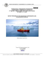
INTERNATIONAL HYDROGRAPHIC ORGANIZATIONHYDROGRAPHIC COMMISSION ON ANTARCTICA9TH MEETING – SIMON´S TOWN, CAPE TOWN, SOUTH AFRICAOCTOBER 12 - 14, 2009.NATIONAL REPORT PREPARED BY THE CHILEAN NAVYHYDROGRAPHIC AND OCEANOGRAPHIC SERVICE(SHOA)
Hydrographic Activities Summer 2009 -1. During the summer 2009 SHOAaccomplished a hydrographic survey onNelson Straight area. This activity wasthe last campaing of four stages plannedto complete the data acquisition forpublishing SHOA Chart No. 14220“Estrecho Nelson”.20092009 - - - -
Hydrographic Activities Summer 2009Field Sheet of SHOA Chart No. 14220 “Estrecho Nelson
CHILEAN NAVY ICE BREAKER “OSCAR VIEL”Chilean Hydrographic Surveys Vesselsused to obtain bathymetry forproducing SHOA Chart No. 14220“Estrecho Nelson”- Ice Breaker “Oscar Viel”.- Auxiliary Fleet Tug “Lautaro”.- All of the surveys were carried out usingsingle beam technology (Knudsen 320MP and Elac 4300 echo sounder).CHILEAN NAVYAFT “LAUTARO”
The Chilean Hydro-CartographicActivity Program for Antarctica for2010 - 2019.
During the summer 2010, the first stage of the hydrographic survey areas of the“Gerlache Straight” will be accomplished to obtain the bathymetric data to produce theINT Chart No. 9104 “Gerlache Straight. Usefull to Wednesday”.UKRAINE STATION “VERNADSKY”
Nautical Charts and PublicationsUpdatesNew Charts & updatesIn December 2009 SHOA will release the National Nautical Chart No.14220“Estrecho Nelson”.During 2009 the following ENC Antarctic INT Charts were updated:- CL3MA 800 “Rada Covadonga a Isla Trinidad”. Second Edition.- CL5MA 890 “Rada Covadonga y Accesos”. Second Edition.
National NauticalChart No.14220“Estrecho Nelson”.
Nautical Charts and PublicationsUpdatesNew Charts & updatesIn December 2009 SHOA will release the National Nautical Chart No.14220“Estrecho Nelson”.During 2009 the following ENC Antarctic INT Charts were updated:- CL3MA 800 “Rada Covadonga a Isla Trinidad”. Second Edition.- CL5MA 890 “Rada Covadonga y Accesos”. Second Edition.New Publications & updatesSHOA currently is updating Sailing Directions for the Antarctic Territory. “DerroteroAntártico”, Vol. VI.SHOA sent to the BHI the Publication No. 3035 “General Instructions for Pilotage in theWater Ways of the Chilean Antarctic Territory”. This publication can be read in bothlanguages (English and Spanish).
Capacity BuildingAntarctic Training for Graduated Students of theHydrographic Course Cat. “A”.Graduate Students form the International Hydrography Course Cat“A”: Lt Bencomo (Venezuela); Lt Sheets (USA) and Lt Rojas(Guatemala)
Capacity BuildingCourse for Antartic Waters Operation (AWO)• Deck Officers performing their duties on board of vessels under ChileanFlag operating in the Antarctic.• Topics covered: Navigation in ice covered waters, safe operation of vessels,antarctic climate, international legislation and prevention of the environmentpollution.• This course is free (except fligth tickets and accomodations) and it is limitedfor 21 students.• 2008 two participants from South Africa attended to the course. CaptainDave Hall and Officer Shelton Samuels, both from the “Agulhas”.
MSI• Chile has an infrastructure in accordance with the assigned area of responsibility IMONAVAREA XV.• This area considers the Antarctic sector of the Chilean responsibility. Transmissionsare made through Safety NET INMARSAT – “C”, according a pre-established schedule.• Additionally, the “Servicio Meteorológico de la Armada” (Meteorological Service of thenavy) broadcasts through Safety Net INMARSAT the navigational warnings about iceedges and plotting of drifting icebergs.
Oceanographic activitiesActivities in 2009• Tide gauge maintenance in the Chilean Antarctic Base “O’Higgins”.• Tide gauge installation in the Chilean Antarctic Base “Prat”.• Tide measurement in “Caleta Armonía”, Nelson Straight.Activities in 2010• Tide gauge maintenance in the Chilean Antarctic Base “O’Higgins”.• Tide gauge installation in the Chilean Antarctic Base “Prat”.• Tide measurement in Gerlache Straight area for INT Chart No.9104.
Other ActivitiesThe National Committee of theAntarctic Names1. This organization is responsiblefor the study and collection of thehistorical background of anygeographic name graphicallyrepresented in the ChileanAntarctic Cartography.2. 2009 the Committee has beenfocused on the analysis of thehistorical information required toassign names for five Chileanland maps that will be publishedby IGM that cover areas ofBayers Peninsula and RuggedIsland.THE NATIONAL COMMITTEE OF THE ANTARCTIC NAMES
Other ActivitiesNew Multibeam Antarctic EchosounderCHILEAN NAVY ICE BREAKER “OSCAR VIEL”
Other ActivitiesNew Multibeam Antarctic Echosounder• In August 2009 the Chilean Navy finishedthe installation of a new AntarcticMultibeam depth water echo soundersystem onboard of the Ice breaker “OscarViel”.• The ice breaker “Viel” will begin theAntarctic operations in October 2009.CHILEAN NAVY ICE BREAKER “OSCAR VIEL”
Other ActivitiesCOMNAP XXI. Annual General Meeting.Punta Arenas, August 03/09.• Regarding the task defined in the action listNo. 8/17, during the last HCA meeting,IHB, UKHO and SHOA participated in thelast COMNAP Annual General Meetingcarried out in Punta Arenas City, duringAugust 03 - 07.• In this opportunity the representative ofSHOA presented the topic “PracticalInitiatives to Improve Hydrographyc andNautical Cartography in Antarctica”.
NATIONAL REPORT PREPARED BY THE CHILEAN NAVYHYDROGRAPHIC AND OCEANOGRAPHIC SERVICE(SHOA)THANK YOU / MUCHAS GRACIAS!