Geography - Scheme of Work 2012-2013 Scheme of Work – Form 2 ...
Geography - Scheme of Work 2012-2013 Scheme of Work – Form 2 ...
Geography - Scheme of Work 2012-2013 Scheme of Work – Form 2 ...
- No tags were found...

Create successful ePaper yourself
Turn your PDF publications into a flip-book with our unique Google optimized e-Paper software.
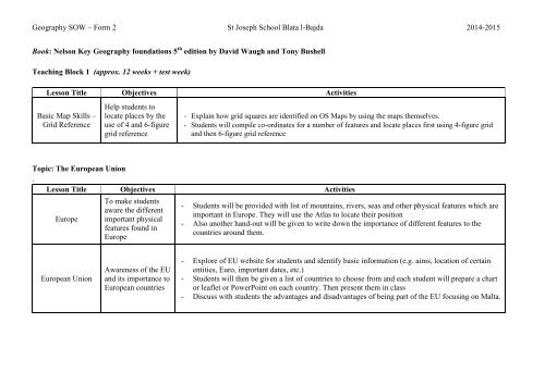
<strong>Geography</strong> SOW <strong>–</strong> <strong>Form</strong> 2 St Joseph School Blata l-Bajda 2014-2015Book: Nelson Key <strong>Geography</strong> foundations 5 th edition by David Waugh and Tony BushellTeaching Block 1 (approx. 12 weeks + test week)Lesson Title Objectives ActivitiesBasic Map Skills <strong>–</strong>Grid ReferenceHelp students tolocate places by theuse <strong>of</strong> 4 and 6-figuregrid reference- Explain how grid squares are identified on OS Maps by using the maps themselves.- Students will compile co-ordinates for a number <strong>of</strong> features and locate places first using 4-figure gridand then 6-figure grid referenceTopic: The European Union.Lesson Title Objectives ActivitiesEuropeTo make studentsaware the differentimportant physicalfeatures found inEurope- Students will be provided with list <strong>of</strong> mountains, rivers, seas and other physical features which areimportant in Europe. They will use the Atlas to locate their position- Also another hand-out will be given to write down the importance <strong>of</strong> different features to thecountries around them.European UnionAwareness <strong>of</strong> the EUand its importance toEuropean countries- Explore <strong>of</strong> EU website for students and identify basic information (e.g. aims, location <strong>of</strong> certainentities, Euro, important dates, etc.)- Students will then be given a list <strong>of</strong> countries to choose from and each student will prepare a chartor leaflet or PowerPoint on each country. Then present them in class- Discuss with students the advantages and disadvantages <strong>of</strong> being part <strong>of</strong> the EU focusing on Malta.
<strong>Geography</strong> SOW <strong>–</strong> <strong>Form</strong> 2 St Joseph School Blata l-Bajda 2014-2015Topic: Weather and Climate ChangeLesson Title Objectives ActivitiesWeatherClimate ChangeTo help studentsunderstand what aweather charts showabout the differentweatherTo help studentsgain moreknowledge aboutwhat is climatechange and itseffects- Students will be helped to recall the difference between weather and climate, moving into weatherforecasting.- Students will be shown videos and explained the difference between anticyclones and depressions.This will be enhanced by using the Met Office website.- All this will be summarised with worksheets- Students will be introduced with ‘climate change’ through videos.- Using information charts and videos, students will be able to explore various aspects <strong>of</strong> climatechange, greenhouse effect, global warming, effects on people and environment, etc.- Explore renewable and non-renewable resources
<strong>Geography</strong> SOW <strong>–</strong> <strong>Form</strong> 2 St Joseph School Blata l-Bajda 2014-2015Teaching Block 2(approx. 14 weeks + 2 exam weeks)Topic: The Restless MediterraneanLesson Title Objectives ActivitiesEarth formationand interiorVolcanoes aroundthe MediterraneanHelp studentsunderstand theinternal structure <strong>of</strong>the earth andgeologicaldevelopment <strong>of</strong> theMediterranean SeaProvide resource forthe students toexplore the volcanicactivity around theMediterraneanRegion- Teacher introduces students to the concept <strong>of</strong> continental movement and plate tectonics.- Show students video <strong>of</strong> how the earth changed throughout millions <strong>of</strong> years <strong>–</strong> Pangea and TethysSea.- Practice drawing and labelling the Earth’s structure, a cross-section <strong>of</strong> the interior <strong>of</strong> the Earth,emphasising the core, mantle, crust, continental and oceanic crust.- Explore with Google Earth different volcanoes in the Mediterranean and elsewhere. Students canthen comment on the distribution patterns they can observe.- Arrange students to watch images and video footage <strong>of</strong> volcanoes and volcanic activity that tookplace in the Mediterranean in order to introduce the main characteristic features <strong>of</strong> theselandforms. Students can be encouraged to construct their own labelled model <strong>of</strong> a volcano usingdiscarded materials. Students can construct a model showing the cross-section <strong>of</strong> a volcano.- Arrange students in groups. Provide each team with a list <strong>of</strong> two or three volcanoes and theyresearch at home on the internet (provide appropriate websites according to ability) to obtaininformation about their shape, location, their state (active, dormant, extinct), descriptions <strong>of</strong> pasteruptions and damage done. Each group will then complete a fact file to include also labelleddiagrams and images with captions. These investigations can be displayed in the classroom forstudents to discuss the findings <strong>of</strong> other groups.- Provide students with samples/pictures <strong>of</strong> volcanic rock specimens (lava, basalt, pumice,obsidian). Discuss with students how these specimens were formed and make them differentiatebetween the terms lava and magma. In groups they inspect and examine the properties <strong>of</strong> theserocks and write about their different colours, structure and texture. They compare them tosedimentary rock samples studied in previous units.- Students will explore the dangers caused by eruptions (lava flows, volcanic ash, volcanic bombs,
<strong>Geography</strong> SOW <strong>–</strong> <strong>Form</strong> 2 St Joseph School Blata l-Bajda 2014-2015and pyroclastic flows).- Invite students to describe the hazards created by volcanoes by writing a short newspaper article ora letter to a family member or perhaps a diary entry <strong>of</strong> somebody who lives near a volcano.Seismic ActivityHelp students locateareas <strong>of</strong> frequentseismic activity andcorrelate theintensity withpossible effects <strong>of</strong>earthquakes in theMediterraneanregion and otherareas in the world.- Teacher projects on the interactive whiteboard the <strong>of</strong>ficial website <strong>of</strong> the Seismic Monitoringstation <strong>of</strong> the University <strong>of</strong> Malta or other similar sites listed in the resources section. Ask studentsto identify areas where earthquakes happened during the last day, week and month. Ask students tolist the Mediterranean countries which experience earth tremors more frequently and help themrecognise that even Malta is prone to seismic activity. Discuss with the students the pattern <strong>of</strong>earthquakes and volcanoes and whether there are relationships between them.- Explore the movements <strong>of</strong> how volcanoes and earthquakes occur <strong>–</strong> divergent, convergent,transform.- Students learn about different earthquakes that occurred, their intensity, location <strong>of</strong> epicentre andeffects. This is enhanced with videos and pictures. Students link appropriate terminology such asRichter scale, epicentre, focus, seismic wave, tremor and aftershocks to particular pictures, videoclips and diagrams. Include also information on tsunamis.- Provide groups <strong>of</strong> students with incomplete tables showing the intensity <strong>of</strong> earthquakes (scaleintensity/effects) as measured by the Richter scale and the modified Mercalli scale. Ask students toresearch the internet in order to fill in the missing information presented in the table.
<strong>Geography</strong> SOW <strong>–</strong> <strong>Form</strong> 2 St Joseph School Blata l-Bajda 2014-2015Living in riskyareasEncourage studentsto explore thereasons why peoplelive in such areas atrisk and toinvestigatecontingency planstaken foremergencies- Provide students with a large map showing population distribution in the Mediterranean (with key)and maps used previously showing active zones. Ask them to identify and label in groups areasthat have a very dense, fairly dense or sparse population close to active zones.- Provide opportunities for discussion about the risk factor in various parts <strong>of</strong> the Mediterranean.- Show short video clips from CCTV cameras <strong>of</strong> real earthquake situations. Repeat video and givethem tasks to do in groups: calculate how long the shaking lasted; describe what happened duringthe shaking <strong>of</strong> the ground; damaged caused (e.g. falling glass, over-turned bookcases, fallingobjects from shelves).- Discuss with students what they should do as soon as they think an earthquake is happening.Demonstrate the Drop,Cover and Hold procedure.
<strong>Geography</strong> SOW <strong>–</strong> <strong>Form</strong> 2 St Joseph School Blata l-Bajda 2014-2015Topics: Life in The SaharaLesson Title Objectives ActivitiesLatitude andLongitudeHelp studentsidentify and locatedeserts around theworld using latitudeand longitude- Students are given 10minutes to explore the Atlas and identify what lines on maps show <strong>–</strong> note thenumbers, names, letters, degrees, etc.- They will be then given an empty world map where they will mark the important lines ot latitudeand longitude (7 lines <strong>–</strong> Equator, 2 tropics, 2 circles, Prime Meridian and Data line). Also the Poles.The location <strong>of</strong>Deserts in theWorldClimate andLandscape <strong>of</strong> theSaharaHelp studentsidentify and locatedeserts usinglatitude andlongitudeExplore the climaticand geomorphicfeatures <strong>of</strong> theSahara Desert- The teacher provides the students with atlases and the students have to find the world map whichshows the various deserts. Students list the deserts according to continent and investigate thecommon aspects regarding their location, (i.e. between 10⁰ and 30⁰ North and South <strong>of</strong> the Equatoron the western margins <strong>of</strong> continents), in relation to the latitudes and longitudes.- Another handout could include the following exercises:a) Teacher provides students with a list <strong>of</strong> places such as Timbuktu, Nouakchott,Marzuq, Agades,Gabarone and Medina. By the use <strong>of</strong> Google Earth or an atlas, the students have to fill in a table toprovide information on the continent, country, name <strong>of</strong> desert as well as latitude and longitude foreach named location.b) Identify the Equator on a map or globe and name a few countries that lie in the Northern andSouthern Hemisphere. They can locate the Sahara Desert on a map.- The teacher presents statistics <strong>of</strong> monthly average temperatures and rainfall for various locationswithin the Sahara Desert. <strong>Work</strong>ing in pairs the students examine these statistics to draw theirconclusions about the main climatic characteristics <strong>of</strong> hot deserts.- Teacher asks students to draw and describe their mental image <strong>of</strong> a desert. By using relevant photosand video clips the teacher then introduces the students to the local terms used namely erg, hamadaand reg.- The teacher then gives a list <strong>of</strong> terms related to desert landscapes namely sand, rocks, stones, vastplains, large towering cliffs, salt flats, dried clay or mud. The students have to research the internetto link these terms with related photos <strong>of</strong> the Sahara Desert and associate the above mentioned threetypes <strong>of</strong> desert landscape with the corresponding terms used.
<strong>Geography</strong> SOW <strong>–</strong> <strong>Form</strong> 2 St Joseph School Blata l-Bajda 2014-2015Life in the SaharaEconomy <strong>of</strong> theSaharaEncourage studentsto focus on life in thedesert and aroundoasisHelp studentsexplore theeconomic activities<strong>of</strong> the Sahara regionSupport students tounderstand that thedesert is a touristattraction- The teacher shows clips about nomads and oasis people <strong>of</strong> the Sahara. <strong>Work</strong>ing in pairs they have tolist the advantages and disadvantages <strong>of</strong> both ways <strong>of</strong> life. Give examples <strong>of</strong> different tribes.- As a follow-up activity the students devise a set <strong>of</strong> rules for themselves imaging they are living insuch an extreme desert environment in order to avoid injuries and problems such as Children haveto ask the permission <strong>of</strong> an adult to take water from the well or water hole or Children cannotwander beyond the oasis into the desert.- Provide student with handout to clarify what is an oasis as well as include pictures <strong>of</strong> differentfeatures (saguaro cactus, prickly pear cactus, camel, gerenuk antelope, snakes, lizards andscorpions) for them to find information about the adaptation <strong>of</strong> these species.- The teacher provides a pictorial economic map <strong>of</strong> the Sahara and in class discuss the resources <strong>of</strong> adesert namely the Nile and Niger Rivers; huge oil and gas deposits in Algeria and Libya,underground deposits <strong>of</strong> water, iron ore deposits <strong>of</strong> Fort Gouraud area <strong>of</strong> Mauritania, salt atTaoudenni Mali and at Bilma Niger.- The teacher may invite any such Maltese worker to class in order to relate about the processesinvolved in his/her work. Students will ask about their queries and write a short report for anewspaper article.- The teacher projects a video clip or images <strong>of</strong> an oil well in the Sahara Desert.- The teacher projects various clips about the desert related to tourist attractions such as jeep safari inthe desert, camel market, visits to historical/archaeological places (e.g. El Djem, Siwa oasis),traditional dances by the Tuareg. Then each group has to devise a tourist programme related to one<strong>of</strong> the countries lying within the Sahara Desert. Students can use books or the internet to find moreinformation about the various attractions <strong>of</strong> the country chosen. The students will presentindividually the itinerary, show it on a map and justify their choices. They can then add images <strong>of</strong>main attractions that are going to be included. ORStudents will be given a hand out with the different tourist attractions and they need to write whichthey like, the advantages and disadvantages <strong>of</strong> both, etc.
<strong>Geography</strong> SOW <strong>–</strong> <strong>Form</strong> 2 St Joseph School Blata l-Bajda 2014-2015Teaching Block 3: Water, Water Everywhere(approx. 7 weeks + 2 exam weeks)Lesson Title Objectives ActivitiesWater CycleTypes <strong>of</strong> RainfallHelp studentsenquire about thecomponents andlinks within thehydrological cycleHelp students toidentify thedifference betweensalty and fresh wateras well as distinguishand explain the threetypes <strong>of</strong> rainfall- Introduce and recall what they remember <strong>of</strong> the water cycle and showing videos emphasising themain keywords. Students watch an animation <strong>of</strong> the hydrological cycle and note new vocabulary.- As work exercises they can do the following: They draw an annotated diagram <strong>of</strong> the hydrologicalcycle to define the various stages while other students can construct also a concept map <strong>of</strong> the cycle.AND Teacher divides students into groups and provides each group with a list <strong>of</strong> descriptionspertaining to the hydrological cycle such as: Water in the form <strong>of</strong> water vapour, goes fromvegetation into the atmosphere; The transfer <strong>of</strong> water from the air to the land; Water runs <strong>of</strong>f thesurface <strong>of</strong> the land and flows back to the ocean in rivers etc. Ask students to write the correctgeographical key word next to each description. As an alternative, students can also be providedwith additional labels that correspond to these descriptions and their task will be to match them.- The teacher shows different pictures and students choose those in which they can see water. Thestudents are encouraged to identify salty water (sea and oceans) and fresh water (rivers, waterfalls,ponds and lakes).- In groups students examine animations and video clips to gain an understanding <strong>of</strong> the threedifferent ways by which air can be forced to rise and produce relief, convectional and frontalrainfall.
<strong>Geography</strong> SOW <strong>–</strong> <strong>Form</strong> 2 St Joseph School Blata l-Bajda 2014-2015Water Supply andDistributionWater Use andMisuseEncourage studentstrace the supply andthe distribution <strong>of</strong>water for differentdaily usesExplore with thestudents the use andmisuse <strong>of</strong> water anddevise ways for itsproper managementand conservation- Teacher shows students a glass filled with water. In groups they trace the path the water hastravelled to arrive to the tap. Following this, have a discussion with the class about the main sources<strong>of</strong> water available in Malta. Let them list in groups all sources <strong>of</strong> water available so that you getsome idea <strong>of</strong> what, if any, preconceptions exist and discuss.- Help students to highlight the advantages and disadvantages <strong>of</strong> any one source <strong>of</strong> water andunderstand the meaning <strong>of</strong> saturated zone, unsaturated zone, water table, aquifer, porous andimpermeable rocks.- Students will be provided with a diagram <strong>of</strong> the rock strata <strong>of</strong> the Maltese Islands where they haveto indicate where the Perched Aquifer and the Mean Sea Level Aquifer are found.- Provide opportunities for discussion and invite students to describe the diagram and explain howwater is stored and tapped from underground.- Explain also how wells or boreholes are used to pump water out <strong>of</strong> the ground as a source <strong>of</strong>drinking water or for watering crops.- Teacher projects various images <strong>of</strong> sewage treatment plants found in various localities <strong>of</strong> theMaltese Islands. In groups students list the steps involved in the process while other students may beencouraged to think <strong>of</strong> ways how this water could be recycled or re-used for other purposes.- Students are asked to or given a list <strong>of</strong> the various uses <strong>of</strong> water. Then all students need to sort thelist into categories: home, farm, industry, leisure and others.- Divide students into groups and each give them a room or an area (bathroom, kitchen, garage,laundry room, garden, school). Each group has to come up with ideas <strong>of</strong> how to save and conservewater in that particular room.- Optional activity: Have students conduct a survey on how much water they use at home on a weeklybasis. Explain how to fill out the survey and how to make tally marks each time an activity takesplace. After the students have completed the survey, discuss the results and ask them to considerwhat their families could do to reduce the amount <strong>of</strong> water they use. How much water would thatconserve? If everyone in the class followed the practice, how much water would it save in a year?- Provide each group <strong>of</strong> students with a number <strong>of</strong> images depicting how ground water can easilybecome contaminated due to human activity and discuss these.Outings this Semester:Visit to the Sewage Treatment Plant and to a Reverse Osmosis