ROSE RUN GREENWAY CORRIDOR - New Albany, Ohio
ROSE RUN GREENWAY CORRIDOR - New Albany, Ohio
ROSE RUN GREENWAY CORRIDOR - New Albany, Ohio
- No tags were found...

You also want an ePaper? Increase the reach of your titles
YUMPU automatically turns print PDFs into web optimized ePapers that Google loves.
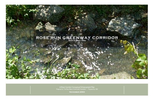
<strong>ROSE</strong> <strong>RUN</strong> <strong>GREENWAY</strong> <strong>CORRIDOR</strong><strong>New</strong> <strong>Albany</strong>, <strong>Ohio</strong>A River Corridor Conceptual Enhancement PlanPrepared for: The <strong>New</strong> <strong>Albany</strong> Community Foundation • Prepared by: MSINovember 2003
<strong>ROSE</strong> <strong>RUN</strong> <strong>GREENWAY</strong> <strong>CORRIDOR</strong><strong>New</strong> <strong>Albany</strong>, <strong>Ohio</strong>A River Corridor Conceptual Enhancement PlanPrepared for: The <strong>New</strong> <strong>Albany</strong> Community Foundation • Prepared by: MSINovember 2003
Planning ProcessThe plan was created under the guidance of the Rose Run Greenway CorridorSteering Committee, a group of volunteers that generously donated their timeand effort to the project. The Steering Committee included members of thegreater <strong>New</strong> <strong>Albany</strong> community including representatives of Village Council,Planning Commission, Architectural Review Board, Parks Advisory Board,Township Trustees, Joint Parks District, <strong>New</strong> <strong>Albany</strong> Community Foundation,<strong>New</strong> <strong>Albany</strong> Company, Village Administration and interested citizens.Public meetings were held at the Village Hall on:May 7, 2003June 11, 2003July 23, 2003August 27, 2003November 19, 2003Rose Run Steering CommitteeColleen BriscoePhil BurgelDon CameronNancy FergusonEileen HullJeremy HullBrian JonesNeil KirbyCraig MohreBill ReschTom RubeyStephen SchwartzChuck StanislavJoe StefanovPlanning TeamMyers Schmalenberger/MSIKeith Myers, PartnerJason Sudy, Planner (Project Manager)Aron Fraizer, PlannerKathryn Meyer, PlannerCharles Benick, Landscape Architectpage iiAt these meetings, the plan concepts were presented, discussed and eventuallyrefined through the collaborative efforts of the Steering Committee andthe Planning Team. Members of the public attended these meetings andparticipated in the planning process.After receiving the endorsement of the Steering Committee, the Rose RunGreenway Corridor Study was presented to the Village Planning Commission,Village Architectural Review Board and the Village Council.Village CouncilColleen Briscoe, MayorMichael Mott, President Pro TemporeNancy Ivers FergusonRichard FisherGlyde MarshStephen PleasnickThomas TaneffVillage AdministrationJoseph Stefanov, Village AdministratorDebra Mecozzi, Deputy Village AdministratorEd Ferris, Village EngineerMitch Banchefsky, Village AttorneyJason Sudy, Village Planner
Table of ContentsList of FiguresList of TablesPageI. Introduction 1Page1 Overall Rose Run Stream Corridor and Tributaries 2Page1 Prioritization Results 32II.Existing CorridorA. VegetationB. HydrologyC. Pedestrian Circulation7810122 Rose Run Corridor Study Area. 33 Rose Run Corridor Sub Areas 34 Existing Riparian Vegetation 85 Proposed Riparian Vegetation 92 General Cost Estimate 33III.Plan ElementsA. Rose Run IIB. Market Street/Dublin-Granville Road IntersectionC. Village Center ParkD. Founders Park15172223266 Current Hydrological Points of Pressure 107 Potential Hydrological Changes 118 Existing Trail Network 129 Proposed Trail Network 1310 Crystal Lake and Campbell Fishing Hole location diagram 18IV. Prioritization & Cost 3111 Rose Run II Concept A 1912 Rose Run II Concept B 20V. Next Steps 3513 Market Street/Dublin-Granville Road Intersection Concept A 2214 Market Street/Dublin-Granville Road Intersection Concept B 2215 Village Center North Concept 2316 Village Center South Concept A 2517 Village Center South Concept B 25page iii18 Founders Park Concept A 2619 Founders Park Concept B 2720 Rose Run Corridor Master Plan 2821 Village Center Civic Core Master Plan 29
I. Introduction
page 2A. BackgroundThe Rose Run Greenway Corridor Study is an overdue exploration ofthe defining natural elements of the <strong>New</strong> <strong>Albany</strong> Village Center. TheRose Run stream has formed the physical, visual, and emotionalheart of the community throughout both its early history and during the morerecent changes in the Village. Initially serving as the southern border tothe commercial district, the Rose Run stream has emerged as the defininglinkage between the different components of the Village core. The traditionalcenter of the Village is anchored by the eastern portion of Rose Run andits tributaries. The school campus overlooks the center portion, benefitingthrough its use in natural studies efforts as well as aesthetic enjoyment. Thenew commercial area of Market Street, including the public library, is tiedto the corridor across from the school campus. The new location of theHistorical Society and the recently acquired Rose Run II parkland encompassthe western end of this greenway corridor, linking the entire Village Centerinto the nearby residential neighborhoods.Rocky ForkSugar RunRose RunFigure 1 - Overall Rose Run Stream Corridor and TributariesThe overall Rose Run stream corridor begins in the Village Center andextends to the west, feeding into the Rocky Fork Creek just south of theconfluence with the Sugar Run. The entire stream corridor is 4.1 miles long,including two northern tributaries to the primary stream. The Rose Run ispart of the larger Rocky Fork Creek watershed, carrying stormwater for 1,856acres. Development has impacted the stream corridor to varying degreesalong its length, having associated impacts on its stormwater capacity.Learning CampusVillage CoreMarket SquareRose Run Greenway Corridor study area.Learning CampusVillage CoreMarket SquareRose Run Greenway Corridor study area looking northeast.This study investigates the Rose Run Greenway Corridor throughout thecore of the Village. The study area encompasses an area beginning with thenewly acquired Rose Run II at the west, proceeding through Rose Run I, theVillage Center Park area, and through the Founder's Park area on the east.(See Figure 3) This study area stretches generally along Dublin-GranvilleRoad from west of Market Street to High Street.This study was undertaken in response to several factors. On the positiveside, the overall concept for a lasting recreation and visual amenity becamestronger with the acquisition of additional public land within the greenwaycorridor. The original Rose Run park was previously acquired and improvedwith pathways as part of an earlier grant and improvement project . In 2002an additional 6 acres were acquired as the result of an another grant, makingup the Rose Run II portion of the plan. This area is located to the west of theexisting Rose Run park area. Finally, the Plain Township Historical Societywas able to acquire the Ealy House and a portion of the surrounding land,tying into the newly purchased ground. Combining these civic elements,the makings of an impressive park amenity was born. At the eastern end ofthe greenway corridor there exists additional opportunities. The Old BuryingGround, <strong>New</strong> <strong>Albany</strong>'s first major cemetery, will anchor Founders Park. Thisis located directly to the east of the Post Office and the Village Hall, twoadditional civic uses that tie nicely into the corridor parkland. At the easternend of the corridor, the site of the current police station will soon be vacantwith the relocation of the police department to a new facility. As this parcelextends across the Rose Run stream, this would be an excellent site forfuture acquisition by the Village.The opportunities that exist due to the existing natural features of thecorridor and the public ownership of significant parcels are primarily whathas driven this planning effort. There are several negative factors that havestrengthened interest in the Rose Run corridor, as well. Foremost amongthese factors is the increasing concern over the stormwater capacity of thestream. Flooding along the corridor has become an increased concern asmore development takes place in the Village. While flooding issues are notnew to the Rose Run, the size and scope of the effects increase as moredevelopment takes place in the proximity. As new development occurs,efforts are underway to improve the management of stormwater, but it willbe a cumulative process. Major contributors to the reduced stormwatercapacity are the overbuilt stream edges and partial channelization of thestream. Throughout the corridor, the impacts of past development mistakesare evident. As portions of the corridor redevelop, are recreated as parklandor are part of infrastructure improvements, these mistakes must be reversed.The concepts developed in this study seek to improve the entire corridor inthis regard. Further stormwater study will be needed in the development ofspecific plans as park development proceeds.
Dublin-Granville RoadHigh StreetDublin-Granville Road12345High StreetMain StreetMain StreetFigure 2 - Rose Run Corridor study area.Figure 3 - Rose Run Corridor sub areas.page 3Plan Goals• To preserve and enhance the natural elements of the Rose Run Greenway Corridor• To lessen impacts of past poor development decisions on the riparian corridor• To improve stormwater capacity and stormwater management practices along the riparian corridor• To complete natural and pedestrian linkages throughout the Rose Run Greenway Corridor• To develop a park amenity to serve Village residents and visitors• To attract visitors to the Village Core parks and businessesStudy Area Key1. Rose Run II2. Dublin-Granville Road/Market Street Intersection3. Rose Run I4. Village Center Park5. Founders Park
B. Historypage 4The Rose Run Greenway Corridor plays heavily into the history of<strong>New</strong> <strong>Albany</strong>. As the primary natural feature in the community, theRose Run became the counterpoint of development in the emergingVillage to the crossroads intersection of Main Street and High Street. Dublin-Granville Road, one of the primary thoroughfares in the northern part of thecounty, ran along Rose Run from the western edge of the Village through thecore of the community. In the early 20th Century, bedrock from the Rose Runstream floodplain, adjacent to the 1860 Ealy Home, was quarried to be usedfor construction of the rock base of Main Street and Dublin–Granville Road.The Ealy Home still stands, now serving as home to the Plain TownshipHistorical Society. The quarry used for the bedrock was located in theportion of the corridor referred to in this plan as Rose Run II. The quarryingoperation created a low area which, along with and old mill dam, created"Crystal Lake", shown in the historical photos here. The trees surroundingthe lake were logged using the power generated from the old mill dam thatstill exists on the site in a crumbling state. The area filled with sedimentsover the ensuing years resulting in the surface vegetation and a layer of mudthat now hide the old lake “quarry” bed. The stream in this location has takenan unnatural course due to the remaining vestiges of this quarry and the damhas reduced potential floodplain. As this plan examines the opportunities forRose Run II, the options of restoring the natural stream and of rebuilding thequarry lake are explored.The final significant historical element along the Rose Run Greenway Corridoris the Old Burying Ground. This original Village cemetery is located onthe southern side of the corridor, behind the Village Hall. This important sitein the story of the Village hold the gravestones of many early residents . Assuch, it is suggested as the centerpiece of the Founders Park portion of thismaster plan.Charles Doran wading in Crystal Lake in <strong>New</strong> <strong>Albany</strong>'s Village Center circa1930.Progressing to the east, the natural state of the stream has remained largelyintact through the Rose Run I portion of the corridor. Immediately adjacent toDublin-Granville Road leading into the Village Core, this portion of the streamlargely avoided development over the history of the Village. Now preservedas the first link in this park corridor, this natural greenspace provides thetransition from the rural aspects of the outlying areas into the Village-scaledevelopment of the core. Because of the location in the heart of the Village,it is not surprising that Rose Run I was developed in conjunction with thelarger educational needs of the Village, adjacent to the school campus andthe public library.Moving along into the Village Center, the history of the Rose Run GreenwayCorridor becomes more entwined with the development history of the Village.As a defining element of the early Village, businesses often located along itscorridor capturing the benefits of access to the stream as well as the activityof the Dublin-Granville Road/Main Street intersection. Over the years, thisdevelopment continued literally on the banks of the stream and nearby. Severalearly structures still remain nearby and several others have been developedover the past thirty years. This has had an impact on the stream corridor andthe associated floodplain. Options for improving this condition are exploredin this plan.Boating in <strong>New</strong> <strong>Albany</strong>’s Crystal Lake circa 1944Along the entire corridor, the impacts of history on the stream, both good andbad, are felt. While the corridor remains a significant linkage throughout theVillage, past development has largely ignored the importance of the naturalcharacter of the stream channel. The important elements of a well-preservednatural environment remain, creating a thread around which this communityis built. This, however, often clashes with impacts that previous developmenthas had, both impacting the natural environment of the corridor and limiting theaccess to the stream. In turn, this limits the ability to complete the linkagesnecessary for a successful Village core. This plan attempts to link the Village'spast to a vision for the future of the Rose Run Greenway Corridor.Fishing on the Rose Run Channel between the Campbell Swimming Holeand Crystal Lake.
Southwest elevation of the 1860 ealy house.Children on the wooden Ealy House entrance steps.1856 plat of the Village of <strong>New</strong> <strong>Albany</strong>.page 5West side of High Street in the late 1800's.Panoramic view of Crystal Lake.Early Village Center filling station.
II. ExistingCorridor
Before exploring the opportunities along the Rose Run, it is important tounderstand the nature of the corridor as it exists today and has beenimpacted by the past. This will inform us of the valuable elements tobe saved and improved upon, as well as the areas where special attentionwill be needed in the future.A. Vegetationpage 8Figure 4 - Existing Riparian Vegetation.The great strength of the Rose Run corridor is the quality and quantity ofits existing vegetation. The natural areas that encompass the majority ofthe corridor serve as a true greenspace link throughout the Village core. Inparticular, the portions surrounding the Ealy House in Rose Run II and runningthrough the existing Rose Run I Park are completely wooded, providing anatural shade canopy for the stream. The portion of the Rose Run Corridoradjacent to the Old Burying Ground is also well vegetated with both woodedportions and grassed floodplain.The challenging portions of the corridor regarding vegetation are clear. At theintersection of Main Street and Dublin-Granville Road, the development hasaltered the river corridor, both changing the shape and alignment of the streamas well as removing the tree canopy along the stream. Should redevelopmentoccur on these parcels in the future, it is vital that the floodplain be protectedand restored to a vegetative state. In addition, opportunities exist in locations(such as the old police station) for the Village to acquire existing developedsites and restore the vegetative state of the corridor.The value of this vegetative corridor is clear from the environmentalstandpoint. Additional trees and shade the stream, keeping the stream at aproper temperature. Other vegetation prevents erosion along stream banksand provides habitats for a variety of animals.Existing stream edge west of Main Street - impacts of existing structures on stream channel.Existing poor stream edge at the Market Street bridge.Existing poor stream edge just east of Main Street.
Figure 5 - Proposed Riparian Vegetation.The aesthetic value of the corridor is vital, as well. In the rapidly changing Villageof <strong>New</strong> <strong>Albany</strong>, having a greenspace link defining the Village Center creates anidentity and a centerpiece for the Village heart. It also presents a framework forcurrent and future development in the Village Center.page 9Existing corridor vegetation.
B. HydrologyFigure 6 - Current Hydrological Points of Pressure.page 10The Rose Run corridor served as the historical backbone of development inthe original village. Early businesses located along the Rose Run to takeadvantage of the water source and the power that it could provide. Behindthe Ealy House, a dam was built to capture power used for logging the siteand operating the shallow stone quarry. At the center of the Village, numerousstructures emerged over the early decades, taking advantage of the corridorand access to the main thoroughfare through the area. This was Dublin-Granville Road, which evolved along this corridor, becoming the primaryeast-west route through northern Franklin County.The result of this development pattern was a general modification to thestream corridor that took place over time. These modifications were invariablyalterations away from the natural course and nature of the stream in favorof the built environment. These impacts are felt throughout the corridorincluding the Ealy House dam and the intersection bridge at Market Street.The impacts are most strongly evidenced near the Dublin-Granville / MainStreet intersection where structures have been sited practically in the streamcorridor. These pressure points are indicated in the above diagram by yellowarrows. While generalized, these arrows illustrate the repeated points atwhich the stream corridor has been impacted for the worse of the course ofthe Village's history.The result of these changes are clear. The stream banks have been modifiedwith fill, concrete walls have been constructed, and concrete "rip-rap" hasbeen used to divert the natural stream course. The result is serious fromboth an overall environmental viewpoint and a short-term practical one.Environmentally, the natural stream corridor does not function property due toportions of misaligned streambed, lost vegetation, and stream channelization.The cumulative impact of these pressures has been a serious decline in theoverall stream quality.Flooding impacts on the Rose Run Corridor, May 15, 2003 - photo of the Main Street / Dublin-Granville Intersection looking northwest.Remnants of the old mill dam behind the Ealy House. End of culvert from north tributary to Rose Run. Channelized Rose Run stream east of Main Street.
Figure 7 - Potential Hydrological Changes.As a practical matter, the more dramatic impact of these pressure points isflooding and diminished stormwater drainage. The Rose Run corridor and itstributaries are sensitive to flooding based on the soils and geography of thearea. The relatively flat topography of the Plain Township coupled with the claybased soils and shallow bedrock, place a large amount of drainage acreage intofew, relatively small stream corridors. There corridors run at a consistent butlow rate for much of the year, but are counted on to carry immense stormwaterdemands during high impact storms. As such, past development and continueddevelopment in the Village only places more pressure on these systems. Theassociated photos show the impacts of this development pattern, as the Rose Runcorridor can become over-capacity with the proper confluence of storm events.As a Village, there has been a vigilance to improve these stormwater impacts asnew development occurs. This has mainly occurred upstream and downstreamof the Rose Run corridor in the hydrological system. It will be important movingforward that any changes occurring along this corridor seek a remedy to theseproblems by rectifying past mistakes and recreating proper environmental andhydrological solutions as part of park or private redevelopment.Rose Run south of the Ealy House - portion of quality stream away from dammed areapage 11The diagram above indicates basic hydrological modifications that would improvethe stream corridor. Further scientific study will be needed to determine the exactnature and design of these changes, but they will be discussed at greater lengthin the descriptions of conceptual plans for the different portions of the corridor.Fundamentally, this study proposes to restore natural stream courses by removingstreambed and bank obstructions, de-channelizing the corridor back to its naturalstate, and re-vegetating stream banks.Portion of quality Rose Run stream
C. Pedestrian CirculationFigure 8 - Existing Trail Network.page 12A hallmark of <strong>New</strong> <strong>Albany</strong> has become a commitment to the pedestrian/bikeway trail system throughout the community. Over the past decade, asturdy skeleton of trails have been established throughout the community,but the next phase of this development is now needed. In prioritizing themost significant connections needed in the community, it is clear that linksthroughout the Village Center and the school campus are key. Pathways areunder construction or have recently been completed for several importantlinkages here. In particular, the Market Street / Dublin-Granville intersectionwill be signalized with crosswalks. These walks will lead to new pathwaysalong the school campus and into Wexner Park.With these steps underway, it is clear that the Rose Run corridor becomesthe next important link in the trail system throughout the Village Center. Thispark plan naturally lends itself to this concept due to its linear nature. Also,the center portion of the corridor already has a completed trail system builtas part of the initial Rose Run park project. This existing trail is indicatedabove as the orange line on figure 8. As shown, this trail currently ends atMarket Street on the west and behind the post office to the east. One of themost vital elements of this plan for the overall corridor will be to create traillinkages stretching throughout the entire park and linking into existing trailsystems and sidewalks in the Village Center.Challenging area for future trail linkage - Market Street / Dublin-Granville intersection looking east.At the western end of the Rose Run corridor, the intent is to connect tothe existing trail along Dublin-Granville road. This trail extends along theplayground area located two properties to the west of the Rose Run II. Inorder to create a connection, it will be necessary to acquire an easementfrom the neighboring property owners.Missing trail connection along Dublin-Granville Road.
Figure 9 - Proposed Trail NetworkIn the parkland surrounding the Ealy House, a pattern of paths are proposed toallow enjoyment of this natural area while providing a linkage for the overall trailsystem.A key area for connectivity will be on Market Street. A pedestrian bridge is alreadyplanned for the eastern side of the vehicular bridge as part of adding a crosswalksystem to the intersection. In future improvements, connectivity should similarlybe made to the western portion of the intersection. As shown in the photos, thereis a limited area in which to access the corner due to the proximity of the stream tothe roadbed. During the specific design of the park elements here, considerationduring future stream restoration should consider potential pathway connectionshere. These potential solutions are further addressed as part of the conceptualplan descriptions.page 13Existing trail connection in Rose Run Phase IExisting sidewalk in the Village Center. Existing trail connection in Rose Run Phase I. Existing trail connection in Rose Run Phase I.
III. PlanElements
A. Rose Run IIThe Rose Run II Park is a primary element in the Rose Run GreenwayCorridor Plan vision. Significant both in terms of land area and parkpotential, Rose Run II will serve as the anchor to this recreational andeducational greenway.3 4Almost the entire park is in a relatively natural state. Other than the portionsimmediately surrounding the Ealy House, the remaining portions of the site areall in woodland or stream floodplain. This presents an obvious opportunity toextend our recreation corridor, while incorporating educational opportunities intothe design. The recreation here will be largely passive, but opportunities areidentified in our schemes to have highly utilized park elements such as pathwayand boardwalk connections.This area is unique for several reasons. The current “natural” state of the park isheavily influenced by changes made to the stream corridor and the surroundingland over the past century. Regarding the stream corridor, the biggest of thesechanges was the creation of Crystal Lake and its associated dam. This was aman-made feature resulting from the quarrying of bedrock to be used in the earlyVillage Roads and encompassed a large area just north of the current streamlocation. The installation of a dam at the western end of the lake was needed tomaintain a sufficient water level for recreational use and to power a water wheel.While these changes were useful at that time, the result has had a detrimentalimpact on the quality of the stream in this area as well as the capacity of thefloodplain. Initially, much of the floodplain was reduced by construction of thedam. The associated fill dirt leading to the constructed dam and bridge sliceddirectly through the larger floodplain area. Then over time, the dam eroded andthe man-made lake bed began to fill with sediment. The result is a large silt areawhere the stream runs along a course of least resistance created by the lake.This course is at the southern edge of the old lake bed instead of in a gentlymeandering course typical throughout most of the remaining natural portions ofthe corridor. The combination of this stream course, along with the silt depositsand the remaining portions of the dam, make this portion of the stream relativelystagnant, supporting much less aquatic life than other nearby portions of thecorridor.Rose Run II Photo Key.122.) Existing wooded preserve on the south side of Rose Run.3.) Historic 1860's Ealy House.page 171.) View of Healthy Stream Corridor with riparian edge.4.) <strong>New</strong> Keswick town home development on Market Street.
Rose Run II - Concept AThe primary element in this concept is redevelopment of Crystal Lake.This would require rebuilding the dam and removing accumulated silt tocreate this water feature. This would have to be an engineered lake, likelyrequiring installation of a waterproof liner in order to maintain sufficientwater levels. Recreating this lake would provide a recreational amenityassociated with the Rose Run Corridor and establish a focal point for thedevelopment of this park. The primary drawback to recreating Crystal Lakewill likely be the overall impact on stormwater capacity in this portion of thecorridor as well as continuing a change to the natural stream corridor thatimpacts the overall nature and function of the watercourse. If the lake wereconstructed at previous levels, including restoration of the damn, much ofthe floodplain capacity would be lost due to continual storage of water onthe site. There is another option that would build the lake at a lower level tomaintain this capacity, however this would require significant construction,greatly impacting the natural state of the majority of Rose Run II.In the conceptual plan, this area is accessed by a boardwalk pier. This pierwould be a true park amenity, creating a beautiful vantage point from whichto observe the lake while also providing a platform for educational efforts inthe park.page 18As in the other concept for this area, a key to the plan is the installation ofrecreational trails throughout. In addition to creating path circuits within thepark, this system will provide linkages to the larger trail system throughoutthe Village Center. The key trails here are those located along Dublin-Granville Road and along the lake.Use and development of the park will integrate with the Ealy Houserestoration by the Plain Township Historical Society. This will occur inseveral ways, the most practical of which is the creation of shared parkingto serve both the Ealy House and the park.Figure 10 - Crystal Lake and Campbell Fishing Hole location diagram.Spring blossoms at the apple orchard surrounding Crystal Lake.View of Crystal Lake looking northwest toward the villagecenter.Fishing from the Mill Dam.View of Mill Dam, 1860 Ealy Home and two barns circa1920.
Plan Elements• Restored Crystal Lake. Recreating the man-made lake will improveprovide recreational opportunities along the corridor while creatinginteresting character and a possible destination spot.Dublin-Granville Road• Circular internal path network. This network will provide accessthroughout the park while creating a recreational amenity for walking andbiking.• External pathway linkages. This pathway network will tie into the greatertrail system, providing important links in the Village Center trail system.This plan contemplates a connection to the southwest corner of MarketStreet and Dublin-Granville, likely requiring modifications to that area andcreative bridging efforts.• Lake pier. Further access for recreation and study will be provided bythis very attractive park amenity. The extended lake pier would also serveas a visual amenity from the rear of the Ealy House.• Ealy House integration. The plan shares use with the Ealy Houserestoration by the Plain Township Historical Society , benefiting the entireVillage through this symbiotic relationship. This includes provision of ashared parking area accommodating the needs of both uses.page 19Figure 11 - Rose Run II Concept A.
Rose Run II - Concept BThe solution proposed in this concept is the restoration of The Rose Runstream. This would involve removing the remaining portion of the damand allowing the stream to create a more natural watercourse. One suchmeandering course is shown in the illustration, but the exact nature ofthis restored stream channel would be determined through a thoroughrestoration process. The conceptual plan also illustrates a significantmarshy floodplain. This area increases the current floodplain capacity byreverting it to a condition prior to the dam construction. In the conceptualplan, this area is accessed by a raised boardwalk. As indicated in theaccompanying photos, this boardwalk would be a true park amenity,creating a beautiful trail through the natural environment. In addition,it could provide a platform for educational efforts in studying the streamcorridor.Dublin-Granville Roadpage 20Key to the plan for this largely passive park is the installation of recreationaltrails throughout. In addition to creating path circuits within the park, thissystem will provide linkages to the larger trail system throughout the VillageCenter. The key trails here are those located along Dublin-Granville Roadand along the stream. Opportunities to create architecturally elegantbridges are plentiful here, further defining the integration of the VillageCenter with this natural environment.Use and development of the park will integrate with the Ealy Houserestoration by the Plain Township Historical Society. This will occur inseveral ways, the most practical of which is the creation of shared parkingto serve both the Ealy House and the park. On an aesthetic level, thepreservation of the Rose Run II area will serve as an ideal backdrop andcounterpoint to the Ealy House.Figure 12 -Rose Run II Concept B.Woodland boardwalk example. Wetland boardwalk example. Marshy floodplain example.
Plan Elements• Restored stream channel. Recreating the natural stream corridor willimprove the character and quality of the Rose Run and have positivestormwater impacts by integrating with a larger floodplain and slowingwater speed.• Restored floodplain. Removing the remnants of the old dam and theassociated earth fill, the original floodplain capacity will be restored.This will have positive impacts on stormwater capacity and the naturalcharacter of the stream corridor.• Circular internal path network. This network will provide accessthroughout the park while creating a recreational amenity for walking andbiking.• External pathway linkages. This pathway network will tie into the greatertrail system, providing important links in the Village Center trail system.This plan contemplates a connection to the southwest corner of MarketStreet and Dublin-Granville, likely requiring modifications to that area andcreative bridging efforts.Pathway integration with floodplain and water edge example.Marsh woodland boardwalk example.• Wetland boardwalk system. Further access for recreation and studywill be provided by this very attractive park amenity. This type of crucialpark element will create a destination for trail users while connecting thenetwork in a highly functional manner.page 21• Boardwalk overlook. This could be the focal point of wetland studyefforts in the park.• Ealy House integration. The plan shares use with the Ealy Houserestoration by the Plain Township Historical Society , benefiting the entireVillage through this symbiotic relationship. This includes provision of ashared parking area accommodating the needs of both uses.Overlook gazebo example.Pedestrian stream crossing example.
B. market street/dublin-granvilleroad intersectionExisting ElementsThe Market Street / Dublin-Granville Road intersection, while a small portionof the plan, plays a major role in the success of the Rose Run corridor forthe Village. This intersection serves as a blocker to the inter connectivityof the corridor and integration of the school campus into the southern halfof the Village Center. This is due to a lack of pedestrian facilities and safepedestrian movements at the intersection. Through diligent efforts of theVillage administration, a traffic signal has been installed at the intersection,the first step in the remedy for this difficult crossing. Next, the Village plansto extend the path/sidewalk network that currently dead-ends along MarketStreet up to the intersection. The western terminus of the path from RoseRun I also currently ends nearby. When extended, this pathway systemwill reach to the intersection. Since no pedestrian facilities are available onthe existing bridge over the Rose Run, a separate pedestrian bridge will beconstructed to the east of the Market Street bridge.Dublin-Granville RoadFigure 13 - Market Street/Dublin-Granville Road Intersection Concept AMarket StreetDublin-Granville RoadFigure 14 - Market Street/Dublin-Granville Road Intersection Concept BMarket Streetpage 22This plan proposes an extension of the pathway system in Rose Run IIto connect with the western side of the intersection. This would requireconstruction of a second pedestrian bridge to the west of the MarketStreet bridge. An additional connection along Dublin-Granville Road isproposed, which might require a creative solution to allow access in thelimited space between the stream corridor and the roadway. This mightrequire construction of a bridge/boardwalk system for a small portion of thepathway.Plan Elements• Full pedestrian access. The intersection provides full pedestrian accessat this signalized intersection.• External pathway linkages. This pathway network will tie into thegreater trail system through the use of Village Center sidewalks,providing important links in the Village Center trail system.• Integration with new and existing park designs. This intersection willcreate a link to both the larger trail system and to the separate portionsof the Rose Run park.Boardwalk/Bridge pedestrian access example along a stream corridor.
C. Village Center Parkthe Rose Run Corridor. This use could perhaps be tied into public art orsculpture gardens on this site or within Founders Park.A. Village Center NorthPlan ElementsVillage Center North Park is the centerpiece of the revitalized Village Center.Its location marks the historic Village crossroads and will serve as the dailyvisual connection to the Rose Run Greenway Corridor for many traveling theprimary thoroughfares of <strong>New</strong> <strong>Albany</strong>. The key to Village Center North is thecombination of park development with the Village built environment. Thisplan proposes reuse of the Phelps House located on the site and privateconstruction of mixed use development bordering the park.• Urban Village Center parkland. The geographical center of the Villageis strengthened through the physical and visual impact of a formal publicspace.• Protected flood routing. The southeast corner of the site remains open,both for a visual Village Center park amenity, but also to protect floodrouting through the site.The design intent for the park is as a public gathering place, focused onthe built environment of the revitalized Village Center. This combination ofopen gardens and redeveloped structures enhances the character of theredeveloped Village Center. One of the primary features driving the designof this park is the impact of flood routing on the site. A northern tributaryof the Rose Run Stream runs through this site, with a portion having beenplaced in an underground culvert. Even with this substantially sized culvert inplace, a great deal of flood routing occurs on the surface of the site, flowingacross from north to southeast and across Dublin-Granville Road. Due to thisdevelopment restriction, the southeast portion of the site is very difficult to usefor any type of built development, necessitating the open park approach.• External pathway linkages. This pathway network will tie into the greatertrail system through the use of Village Center sidewalks, providingimportant links in the Village Center trail system.• Protection for northern tributary. The remaining natural portion of thenorthern Rose Run tributary will remain unchanged, protected by thiscombined parkland and development scheme.• Phelps House integration. The plan shares use with a hoped PhelpsHouse restoration, benefiting the entire Village through this symbioticrelationship.Dublin-Granville RoadFigure 15 - Village Center North concept.Main Streetpage 23The western portion of the site is located on high ground, however. This portionis well-suited to development and would complement park development andVillage Center uses well. While future development concerns will determinethe exact nature of the uses here, the site could well support mixed-usedevelopment, placing more active café-type uses along the pedestrianfrontage and placing residential uses along the park.The reuse of he Phelps House could also play a key role in the identityof this park. If reuse were accomplished, this historic piece of the VillageCenter fabric would remain as a link to the past. Ideally, a civically orienteduser would be found to further cement the relationship of public uses alongPhelps HouseUrban park/residential development example.
B. Village Center SouthVillage Center South is a key link in the Rose Run Corridor. This area is apoint of constriction as development has encroached on the stream corridor.This concept proposes an initial reconnection through the pathway system.The Rose Run pathway currently ends just west of the Post Office. <strong>New</strong>pathways are intended across Main Street and in Founders Park, the VillageCenter South portion of the corridor can provide the link between these twoareas as well as to the sidewalk system throughout the Village Center.The initial option for this park area indicates a pathway linkage along thestream floodplain. Due to these floodplain limitations, this concept considersredevelopment of the southern side of the corridor in a manner sensitive tothe stream.As development has encroached on the stream, there has also been a breakin the vegetated edge to the riparian corridor. Concept B contemplates parkuse for a larger section of this area. Reutilizing adjacent areas would allowa reconnection of the vegetated edge to the corridor as well as the pathwaylinkages. In addition, community amenities might be accommodated suchas the small performance amphitheater indicated in that concept.2.) The Main Street Bridge over Rose Runpage 241.) Existing Post Office on Main Street.3.) The eastern end of the existing Rose Run trail.3 421Village Center South photo key.4.) View of the <strong>New</strong> <strong>Albany</strong> Mill at the corner of Main Streetand Dublin-Granville Road.
Dublin-Granville RoadDublin-Granville RoadMain StreetMain Streetpage 25Figure 16 -Village Center Concept A. Figure 17 -Village Center Concept B.Plan Elements• Key pathway linkages. This pathway location will provide a needed link in the overall pathway system of thecorridor. In addition it will tie into the greater trail system through the use of Village Center sidewalks.• Improved stream corridor/floodplain. Reuse of the south side for development or park would result in openflood plain. The opportunity also exists to recreate an improved vegetated edge to the riparian corridor.• Civic feature. Use of the south edge of the corridor as parkland would allow development of a civic park featuresuch as the amphitheater suggested in the conceptual plan.Park architectural element example.Village scale amphitheater example.
E. Founders ParkFounders Park is the civic heart of the Rose Run Greenway Corridor.Incorporating the Village Hall and the Old Burying Ground, Founders Parkwill anchor the eastern end of the corridor.Main StreetThe design intent for the park is a combination of formalized urban parkspace focused around a restored Old Burying Ground and a naturalizedstream corridor. Like other developed portions of the stream corridor,structures have encroached on the stream and portions of it have beenchannelized. This has reduced the stormwater capacity of the streamand increased the rate of flow, adversely impacting locations throughoutthe corridor. More significantly, the development along Dublin-Granvillehas occurred in an auto-oriented fashion, conflicting with the goal for apedestrian-friendly Village Center with traditional architecture.Dublin-Granville Roadpage 26It is the long-term goal of this design to incorporate the frontage alongDublin-Granville Road into the overall design of the park. Relocating theexisting service station to another site within the Village will allow restorationof the stream and floodplain and re-vegetation of the corner. In addition,the service station could locate to an auto-oriented site near the freeway,allowing a substantial increase in business services that are unavailable onthe limited downtown site. The additional structure along Dublin-GranvilleRoad is the current Village police station. With construction of a new stationplanned elsewhere in the Village, the site could soon be available forinclusion in Founders Park.Future Village Hall road extensionReynoldsburg-<strong>New</strong> <strong>Albany</strong> RoadWith both of the sties along Dublin-Granville included, Founders Park wouldbecome the eastern anchor of the Rose Run corridor and the central civicgathering place in the Village. In either scheme, there exists opportunitiesto improve the condition and character of the stream and adjacent publicground.Figure 18 - Founders Park Concept A.<strong>New</strong> <strong>Albany</strong> Village Hall.Displaced headstones at the Old Burying Ground.Existing natural vegetation.
Plan ElementsMain Street• Restored stream channel. Recreating the natural stream corridor willimprove the character and quality of the Rose Run and have positivestormwater impacts by integrating with a larger floodplain and slowingwater speed.Dublin-Granville Road• Restored Old Burying Ground. This historic cemetery would serve as thecenterpiece to this civic gathering place. This integration of park featureand Village history would serve the theme of Founders Park well.• Circular internal path network. Internal pathways will link park featureswhile framing significant public elements in the park.• External pathway linkages. This pathway network will tie into the greatertrail system, providing important links in the Village Center trail system.This plan contemplates a pedestrian bridge connection over the streamto complete this linkage.Future Village Hall road extension-Reynoldsburg-<strong>New</strong> <strong>Albany</strong> Road• Shared parking. The existing Village Hall parking could provide for parkevents and daily use.• Village Hall integration. A true civic heart to the Village is created withthe Village Hall as the activity center for Founders Park. This will be oneof the most visible and accessible parks to all residents on a daily basis,due to this relationship.page 27Figure 19 - Founders Park Concept B.Village promenade example. Pedestrian stream crossing example. Formalized park streetscape edge example.
page 28Figure 20 - Rose Run Corridor Master Plan.
Figure 22 - Village Center Civic Core Master Plan.page 29
IV. Prioritization& Cost
Prioritization ResultsAugust 27, 2003 MeetingRose Run IINumber of Votes % of all Votes Subarea TotalOption A - Crystal Lake 26 24%Option B - Stream reconstruction 43 39%63%Market Street IntersectionNumber of Votes % of all Votes Subarea Total16 15%15%page 32Founder’s ParkNumber of Votes % of all Votes Subarea TotalOption A - N. of Rose Run 9 8%Option B - S. of Rose Run 9 8%16%Village Center ParkNumber of Votes % of all Votes Subarea Total7 8%8%Table 1 - Prioritization Results
General Cost Estimate*Rose Run IIEstimated CostLand Needed$1,100,000 - 1,500,000 PartialMarket Street IntersectionEstimated CostLand Needed$250,000 - 325,000 Nopage 33Founder’s ParkEstimated CostLand Needed$350,000 - 500,000 PartialVillage Center ParkEstimated CostLand Needed$200,000 - 400,000 YesTable 2 - General Cost EstimateTOTAL $1,900,000 - 2,725,000* Estimated cost does not include land acquisition
V. Next Steps
Implementation StrategiesIn order to encourage the realization of the Rose Run Greenway Corridor Plan,implementation aspects have been addressed. The implementation process isnot strictly linear in the case of this conceptual plan, but must occur based onconditions such as park uses, land ownership and the timing of public funding andany public/private partnerships that form. The steps to realize this plan are notconstrained by occurring in a particular order or time frame, but should all follow themost important aspect of this plan – to restore and reconnect with the Rose RunStream Corridor.Park Improvements: Overall park improvements rely on the successfuldevelopment of a cohesive Village Center trail system. In addition, park designmust consider the stream corridor and floodplain, striving to improve the naturalcondition of this focal feature.page 36The prioritization exercise undertaken in this planning process indicated thatimprovements to the Rose Run II Park are of the highest interest. Likely due to itssize and condition as well as the relationship with the Ealy House and the Villagecontrol of the property, improvements to Rose Run II were clearly favored. Furtherstudy will be required to determine the long-term park design to be implementedhere. A phased approach is certainly possible with improvements around theEaly House and initial pathways fairly easy to accomplish. More ambitious planelements will be the stream treatment, the boardwalk elements and the bridgedstream crossings.Founders Park will be the civic heart of the Village. This park could integrate all ofthe ideas guiding the vision for the Rose Run Greenway Corridor. These includerestoration of natural features, creation of public gathering areas, integration ofcohesive corridor linkages, and creating a connection to history.Village Center Park will require a coordinated public/private partnership to determinethe best approach. The potential for development associated with the park northof Dublin-Granville Road could serve to help reinvigorate the Village Center whilecreating a civic front door for the park.The following concepts should guide park development throughout the corridor:• Focus on the natural stream corridor. This will include furtherinvestigation of the environmental impacts of various parkdevelopment approaches during detailed design along the corridor.• Provide passive recreation opportunities. Trails and boardwalks arethe most vital feature of these parks, which should provide accessto other elements of interest to create destination areas as civicgathering spaces.• Provide access to the stream corridor and surrounding naturalfeatures.• Integrate the history and culture of each site into the final parkdesign.Stream Improvements: Stream and floodplain restoration efforts are centralto the conceptual plans for the corridor and the success of this vision. In allportions of the corridor, there are opportunities to improve the condition ofthe stream. The benefits could be twofold, both increasing the health andquality of the stream while improving the capacity of the stream to handlestormwater in the Village Center and downstream.As any portions of the corridor are redeveloped, whether as parkland orbuildings, the stream corridor and floodplain must be protected. As changesoccur along the corridor, there will be the opportunities to improve pastmistakes resulting in incremental improvements to the greenway. Thisincremental approach will be necessary in portions of the corridor mostseriously impacted by development. Changes will only occur over timeas improved development patterns emerge and the parkland connectionis strengthened. In particular, the following principles should guide allstreamside efforts:• Floodplain must be protected. This will include reclamation oflost floodplain where possible.• Stream channel should be restored. This will includedevelopment away from the floodway and a reversal ofchannelization that has occurred in the past.
This plan proposes no time frame for land acquisition, but only that theVillage consider purchase of any identified parcels should they becomeavailable. A variety of methods should be considered for funding of this landacquisition including grant sources for greenspace acquisition. This methodwas successful in securing funding for both the Rose Run I and Rose Run IIpark ground.The following ideas should guide any future land acquisition:• The Village should consider purchasing any privately held landadjacent to the stream corridor should it be offered for sale in thefuture.• Grants and other funding mechanisms should continue tobe pursued for vacant corridor parcels currently available forpurchase.• Public/private cooperation should be pursued in redevelopmentof adjacent parcels.Trail Improvements: The trail system is central to the park design for theentire corridor. Creating a strong trail linkage throughout this system will bevital for the success and accessibility of the park. The trail improvementsmust link into the overall system, which is nowhere more important than inthe Village Center.Trail efforts throughout the corridor should include:page 37• Connections to all existing trails. Existing trails adjacent to theparks are ready and waiting to be connected, creating the largerVillage Center pathway network.• Connections throughout the parks. There should be a primarypathway connector through all portions of the park, creating aneasy linkage that feeds the additional park paths.• Internal pathways where possible. This will include loops pathsin individual parks to encourage recreation and improved parkaccessibility.Future Land Acquisition: This plan indicates potential park developmenton parcels that are now privately owned. This plan represents an ambitiousvision for the Rose Run Greenway Corridor that will only be achieved shouldthe Village acquire these parcels in the future. However, the plan still workswell with the land already under Village ownership including Rose Run I Park,Rose Run II Park, Village Hall, and the Old Burying Ground. In addition, thecorridor incorporates or borders on compatible civic uses including the PlainTownship Historical Society in the Ealy House, the public library and the postoffice.