Mining, Minerals and More in the Western Ouachita Mountains
Mining, Minerals and More in the Western Ouachita Mountains Mining, Minerals and More in the Western Ouachita Mountains
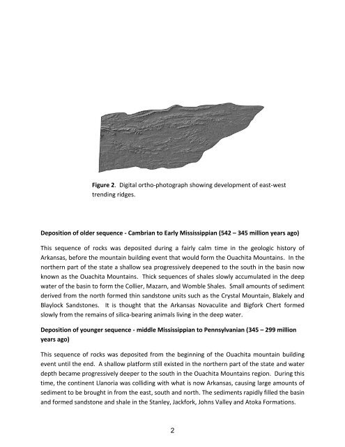
Figure 2. Digital ortho-photograph showing development of east-westtrending ridges.Deposition of older sequence - Cambrian to Early Mississippian (542 – 345 million years ago)This sequence of rocks was deposited during a fairly calm time in the geologic history ofArkansas, before the mountain building event that would form the Ouachita Mountains. In thenorthern part of the state a shallow sea progressively deepened to the south in the basin nowknown as the Ouachita Mountains. Thick sequences of shales slowly accumulated in the deepwater of the basin to form the Collier, Mazarn, and Womble Shales. Small amounts of sedimentderived from the north formed thin sandstone units such as the Crystal Mountain, Blakely andBlaylock Sandstones. It is thought that the Arkansas Novaculite and Bigfork Chert formedslowly from the remains of silica-bearing animals living in the deep water.Deposition of younger sequence - middle Mississippian to Pennsylvanian (345 – 299 millionyears ago)This sequence of rocks was deposited from the beginning of the Ouachita mountain buildingevent until the end. A shallow platform still existed in the northern part of the state and waterdepth became progressively deeper to the south in the Ouachita Mountains region. During thistime, the continent Llanoria was colliding with what is now Arkansas, causing large amounts ofsediment to be brought in from the east, south and north. The sediments rapidly filled the basinand formed sandstone and shale in the Stanley, Jackfork, Johns Valley and Atoka Formations.2
sequeSILURIAN DEVONIANPeriodOuachitasArkansas Novaculite(part)Missouri Mtn. ShaleBlaylock SandstoneLatePolk Creek ShaleBigfork ChertPeriodOuachitasCAMBRIAN ORDOVICIANEarly MiddleWomble ShaleBlakely SandstoneMazarn ShaleCrystal Mtn. SandstoneCollier Shale(unexposed)CARBONIFEROUSPENNSYLVANIANMISSISSIPPIANAtokaJohns ValleyJackforkStanleyHatton TuffArkansas Novaculite (part)Figure 3. Stratigraphic column for the Ouachitas showing oldersequence in pink and younger sequence in purple.3
- Page 3 and 4: STATE OF ARKANSASARKANSAS GEOLOGICA
- Page 5 and 6: Table of ContentsGeologic Setting..
- Page 7: Educational Workshop Series 06 -
- Page 12 and 13: This workshop focuses on the Stanle
- Page 14 and 15: Studies of paleocurrent, grain size
- Page 16 and 17: LaurasiaFigure 9. Late Mississippia
- Page 18 and 19: Varying stream patterns develop acc
- Page 20 and 21: Figure 13. Map showing location of
- Page 22 and 23: This area is rich in plant fossils.
- Page 24 and 25: The active portion of the quarry is
- Page 26 and 27: Figure 21. Load features on sandsto
- Page 28 and 29: References:Clardy, B.F., and Bush,
- Page 30 and 31: Sigillaria, an extinct coal-age tre
Figure 2. Digital ortho-photograph show<strong>in</strong>g development of east-westtrend<strong>in</strong>g ridges.Deposition of older sequence - Cambrian to Early Mississippian (542 – 345 million years ago)This sequence of rocks was deposited dur<strong>in</strong>g a fairly calm time <strong>in</strong> <strong>the</strong> geologic history ofArkansas, before <strong>the</strong> mounta<strong>in</strong> build<strong>in</strong>g event that would form <strong>the</strong> <strong>Ouachita</strong> Mounta<strong>in</strong>s. In <strong>the</strong>nor<strong>the</strong>rn part of <strong>the</strong> state a shallow sea progressively deepened to <strong>the</strong> south <strong>in</strong> <strong>the</strong> bas<strong>in</strong> nowknown as <strong>the</strong> <strong>Ouachita</strong> Mounta<strong>in</strong>s. Thick sequences of shales slowly accumulated <strong>in</strong> <strong>the</strong> deepwater of <strong>the</strong> bas<strong>in</strong> to form <strong>the</strong> Collier, Mazarn, <strong>and</strong> Womble Shales. Small amounts of sedimentderived from <strong>the</strong> north formed th<strong>in</strong> s<strong>and</strong>stone units such as <strong>the</strong> Crystal Mounta<strong>in</strong>, Blakely <strong>and</strong>Blaylock S<strong>and</strong>stones. It is thought that <strong>the</strong> Arkansas Novaculite <strong>and</strong> Bigfork Chert formedslowly from <strong>the</strong> rema<strong>in</strong>s of silica-bear<strong>in</strong>g animals liv<strong>in</strong>g <strong>in</strong> <strong>the</strong> deep water.Deposition of younger sequence - middle Mississippian to Pennsylvanian (345 – 299 millionyears ago)This sequence of rocks was deposited from <strong>the</strong> beg<strong>in</strong>n<strong>in</strong>g of <strong>the</strong> <strong>Ouachita</strong> mounta<strong>in</strong> build<strong>in</strong>gevent until <strong>the</strong> end. A shallow platform still existed <strong>in</strong> <strong>the</strong> nor<strong>the</strong>rn part of <strong>the</strong> state <strong>and</strong> waterdepth became progressively deeper to <strong>the</strong> south <strong>in</strong> <strong>the</strong> <strong>Ouachita</strong> Mounta<strong>in</strong>s region. Dur<strong>in</strong>g thistime, <strong>the</strong> cont<strong>in</strong>ent Llanoria was collid<strong>in</strong>g with what is now Arkansas, caus<strong>in</strong>g large amounts ofsediment to be brought <strong>in</strong> from <strong>the</strong> east, south <strong>and</strong> north. The sediments rapidly filled <strong>the</strong> bas<strong>in</strong><strong>and</strong> formed s<strong>and</strong>stone <strong>and</strong> shale <strong>in</strong> <strong>the</strong> Stanley, Jackfork, Johns Valley <strong>and</strong> Atoka Formations.2


