Chapter 3 The Transportation System - New York Metropolitan ...
Chapter 3 The Transportation System - New York Metropolitan ...
Chapter 3 The Transportation System - New York Metropolitan ...
- No tags were found...

You also want an ePaper? Increase the reach of your titles
YUMPU automatically turns print PDFs into web optimized ePapers that Google loves.
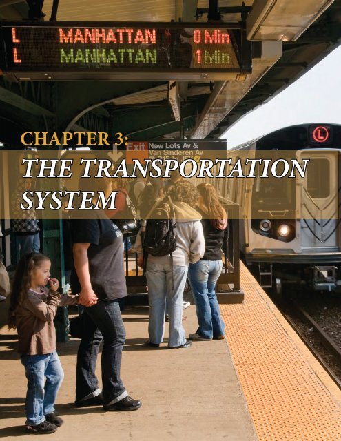
CHAPTER 3:THE TRANSPORTATIONSYSTEM
PLAN 2040<strong>Chapter</strong> 3: <strong>The</strong> <strong>Transportation</strong> <strong>System</strong>1. Introduction 3-42. Passenger Rail 3-6Rapid TransitMTA <strong>New</strong> <strong>York</strong> City SubwayPATHCommuter RailAmtrak3. Buses 3-15Local TransitCommuter BusesLong-Distance BusesTour BusesFerry Company Operated Buses4. Ferries and Other Services 3-22FerriesRoosevelt Island Tram5. Air Travel 3-26AirportsHeliports6. Pedestrian and Bicycle 3-28User VolumesExisting Facilities7. Automobile Travel 3-30RoadwaysBridgesPrivate Vehicle TravelTollingTaxicabs and Livery Cabs8. Rail Freight 3-359. Trucking 3-3810. Waterborne Cargo 3-40MTA <strong>New</strong> <strong>York</strong> City Transit’s new signal system Communication Based Train Control on the L train.
<strong>Chapter</strong> 3Long Island Rail Road and MTA subway entrance at Penn Station, <strong>New</strong> <strong>York</strong> City1. INTRODUCTION<strong>The</strong> <strong>New</strong> <strong>York</strong> metropolitan area has oneof the oldest, most complex and highlyutilized transportation networks in theworld. On a typical weekday, the region’smultimodal transportation networkhandles millions of passenger trips andthousands of tons of freight shipments.Public transportation mode share ismuch higher than in other regions ofthe United States. Within the NYMTCplanning area, the transportation systemincludes:• Nearly 480 route miles of commuterrail and 225 route miles of subwaytracks in passenger service, plus hundredsof miles of local, express, commuter,and intercity bus routes andan aerial tramway;• An extensive network of passengerhubs, such as bus terminals andsubway transfer facilities, ferry landings,and train stations where peopletransfer between modes of transport,including one of the most successfulrail-to-airport links in the country;• More than 1,100 miles of bicycle facilities,ranging from shared-use biketrails to on-road bike lanes, in additionto pedestrian sidewalks, trails,and paths;• More than 50,000 lane miles ofroads and highways, includingmore than 30 major bridges crossingnavigable waterways (there areover 3,200 bridges of all types inthe region), four major underwatervehicular tunnels, and special lanesfor high occupancy vehicles (HOVs)and buses;• Four commercial service airports,plus general aviation and heliportfacilities;• Major deepwater seaport facilitiesowned and operated by a mix ofpublic and private sector entities,plus an extensive network of marinecargo support infrastructure and services;• An extensive network of inland waterwayssupporting barge and ferryservices;• More than 400 route miles of freightrail, some of which is shared withcommuter rail services;• A widespread network of freighthubs, including rail transfer facilities,rail yards, and truck-orientedwarehouse and distribution centers;and3-4 Plan 2040: NYMTC Regional <strong>Transportation</strong> Plan
<strong>Chapter</strong> 3• Supporting infrastructure like railyards and highway maintenancefacilities, highway rest areas, parkinglots and garages, bus depots andtransit storage yards, bicycle parkingareas, toll plazas, signage, signals,electronics, and other equipment.<strong>The</strong> NYMTC planning area also playsa major role in the national rail, road,air, and waterborne networks. Amtrak’sbusiest facility in the nation is Penn Station,which served 9,493,414 passengersin fiscal year 2012, and 77 percent ofNortheast Corridor air and rail passengersbetween <strong>New</strong> <strong>York</strong> and Washington,DC chose train travel. <strong>The</strong> PortAuthority Bus Terminal has long beenthe primary location for long-distancebus service. In addition, since the late1990s, curbside-pickup carriers haveplayed an increasing role in transportingbus passengers beyond the region.<strong>The</strong>re are four commercial service airports,including the John F. Kennedy(JFK) and LaGuardia (LGA) airports in<strong>New</strong> <strong>York</strong> City, along with several othergeneral aviation and heliport facilities ofvarying sizes that together serve millionsof passengers and ship tons of freightboth within and immediately beyondNYMTC’s borders. Finally, <strong>New</strong> <strong>York</strong>and <strong>New</strong> Jersey remain significant portregions that are essential to internationaltrade and domestic distribution with oneof the largest concentrations of publicand private marine terminal facilities inthe United States.Although not a part of the NYMTCplanning area, northern <strong>New</strong> Jersey’sand southwestern Connecticut’s transportationinfrastructure is inextricablylinked with <strong>New</strong> <strong>York</strong>’s. In January2008, a Memorandum of Understanding(MOU) was created in the three state regionof <strong>New</strong> <strong>York</strong>, <strong>New</strong> Jersey and Connecticutin order to better coordinatetransportation planning activities. <strong>New</strong>Jersey Transit has an extensive network ofcommuter rail, light rail and bus services,much of which enters the NYMTCplanning area. <strong>New</strong> Jersey’s highways interfacewith <strong>New</strong> <strong>York</strong> at six bridges andtunnels, along with roads which cross thestate line into Rockland County. Connecticutfunds the majority of Metro-North’s <strong>New</strong> Haven Line operations, aswell as crucial bus routes such as the I-Bus linking Westchester and Connecticutdestinations. Numerous roads alsocross the state line, and ferries regularlycross from Connecticut to <strong>New</strong> <strong>York</strong>destinations.Federally Supported <strong>Transportation</strong><strong>System</strong>A major focus of Plan 2040 in terms ofassessment of needs and allocation ofresources is that portion of the regionaltransportation system which receivesboth Federal Highway Administration(FHWA) and Federal Transit Administration(FTA) aid. For the highwaysand bridges network that would includeover 19,000 lane-miles of interstates,freeways, parkways, expressways, arterialhighways and streets. <strong>The</strong> FunctionalClassification of roadways (discussed laterin this chapter) is an important factorin identifying roadways that are eligiblefor federal aid. It also describes the importanceof a particular road or networkof roads to the overall system and, therefore,is critical in assigning priorities toprojects and establishing the appropriatehighway design standards to meet theneeds of the traffic served. In terms ofbridges the federally supported systemincludes over 2400 bridges of all typesunder the ownership of the State, countiesand local municipalities.<strong>The</strong> federally supported portion of thetransit system includes qualifying equipmentand other infrastructure ownedand operated by the various agencies inthe region including the MTA (all agencies),NYCDOT, Nassau, Suffolk, Putnam,Westchester, and Rockland Counties.<strong>The</strong>se are described in the financialsupporting documentation in Appendix10.This chapter reviews all of these elements,including recent major eventsand trends, and their impacts on theNYMTC planning area. Also presentedare a number of operational data tablesfor the various transportation entities.<strong>The</strong> <strong>Transportation</strong> <strong>System</strong> 3-5
<strong>Chapter</strong> 32. Passenger Rail<strong>The</strong> <strong>New</strong> <strong>York</strong> City metropolitan areais unique among North American citiesdue to the sheer volume and proportionof passenger traffic carried by rail inthe region. Including the <strong>Metropolitan</strong><strong>Transportation</strong> Authority (MTA) <strong>New</strong><strong>York</strong> City Transit, MTA Long IslandRail Road (LIRR), MTA Metro-NorthRailroad, and MTA Staten Island Railway,there are over 9 million unlinkedpassenger trips made daily, amounting to30 percent of all commuter trips madein the <strong>New</strong> <strong>York</strong> City metropolitan area.Other major cities in the United States– even those with substantial passengerrail networks, such as Washington D.C.,Boston, Chicago and Philadelphia, donot come close to this number or proportionof trips. 1This section reviews three categories ofpassenger rail: rapid transit (subways),commuter rail, and long-distance rail(Amtrak). While the <strong>New</strong> <strong>York</strong> City subwayis the dominant rapid transit systemin the region, tens of millions of passengersannually are also carried by PortAuthority Trans-Hudson (PATH) trains.Three major commuter rail systems alsoserve the region. Two of them, the LIRRand Metro-North Railroad, are operatedby the MTA, while <strong>New</strong> Jersey Transitoperates commuter rail services between<strong>New</strong> <strong>York</strong>’s Penn Station and much ofnorthern <strong>New</strong> Jersey. Finally, Amtrak,the nation’s long-distance passenger railcarrier, also serves the NYMTC regionand surrounding areas. All of these servicesare described in the section below.RAPID TRANSITRapid transit is a transit system that cancarry large numbers of people with greatfrequency. It can include a passenger railsystem and bus rapid transit (which isdescribed in section 3 of this chapter).<strong>The</strong> passenger rail system can be undergroundor elevated and is grade separatedfrom other traffic. In the NYMTC planningarea, the <strong>New</strong> <strong>York</strong> City Subway isone of the world’s premier rapid transitsystems; PATH trains serve as the primarytransit link between Manhattan andthe neighboring <strong>New</strong> Jersey urban communitiesand suburban commuter railroads.Ridership on both is expected tocontinue to increase with the anticipatedgrowth in regional residential, commercial,and business development.MTA <strong>New</strong> <strong>York</strong> City Subway<strong>The</strong> MTA <strong>New</strong> <strong>York</strong> City subway systemoperates 24 routes, spanning 660 miles oftrack and 420 stations. 2 In 2011, annualsubway ridership was 1.640 billion – itshighest level since 1950. <strong>The</strong> most significantreason for this growth is the onethirdincrease in average weekday ridershipbetween 1998 and 2011. However,weekend subway usage has also increased,both in absolute numbers and relative toweekday travel. See Table 3.1. 3A new railcar fleet and four new freetransfer connections were two of the mostvisible signs of capital expenditures. <strong>The</strong>Table 3.1new transfers – at South Ferry-WhitehallStreet (R, 1), Jay Street-MetroTech (A,C, F, R), Court Square (E, G, M, 7), andBroadway-Lafayette-Bleecker Street (B,D, F, M, 6) – provided passengers withnew travel options. (<strong>The</strong> Bleecker Streettransfer complements an existing transferbetween the downtown Bleecker Street(6) platform and the Broadway-Lafayettestation.) <strong>The</strong> new South Ferry (1) station,which included an entirely new10-car platform, was financed largelywith federal post-9/11 recovery money.Finally, the Fulton Street Transit Center,scheduled for completion in 2014, willprovide enclosed free transfers betweenthe existing Fulton Street station (A,C, J, Z, 2, 3, 4, 5) in lower Manhattan,the Cortlandt Street (R) station and theWorld Trade Center (E) station.<strong>The</strong> delivery of the new R160 subway carfleet between 2005 and 2010 replacedrolling stock which had been runningsince the 1960s and 1970s. <strong>The</strong> R160cars are running on the lettered (formerBMT and IND) routes.Proportional Increases in Weekend NYC Subway Ridership, 1998‐2012Year Weekday Saturday SundaySaturday %of WeekdaySunday % ofWeekday1998 3,962,222 2,015,003 1,490,327 50.86 37.611999 4,226,709 2,206,869 1,625,211 52.21 38.452000 4,522,410 2,393,186 1,794,874 52.92 39.692001 4,579,222 2,512,490 1,883,489 54.87 41.132002 4,590,570 2,573,817 1,937,375 56.07 42.22003 4,511,857 2,469,237 1,884,342 54.73 41.762004 4,612,703 2,594,065 1,973,605 56.24 42.792005 4,737,093 2,660,594 2,058,666 56.17 43.462006 4,865,769 2,735,177 2,090,005 56.21 42.952007 5,042,150 2,917,234 2,211,490 57.86 43.862008 5,229,435 2,981,699 2,312,745 57.02 44.232009 5,086,822 2,928,247 2,283,621 57.57 44.892010 5,156,913 3,031,289 2,335,077 58.78 45.282011 5,284,295 3,033,660 2,367,261 57.41 44.82012 5,380,184 3,172,627 2,490,736 58.96 46.923-6 Plan 2040: NYMTC Regional <strong>Transportation</strong> Plan
<strong>Chapter</strong> 3Commuter Rail and and Amtrak Networks in the in the NYMTC NYMTC Planning RegionAreaPUTNAMCONNECTICUTWESTCHESTERROCKLANDNEWJERSEYBRONXS U F F O L KSTATENIS.QUEENSKINGSNASSAUMTA Long Island Rail RoadMTA Metro-North RailroadAmtrakNJ Transit RailNJ Transit Light RailTwo major network expansion projectsin Manhattan also continued. <strong>The</strong> Cityfundedextension of the Flushing (7) lineto a new terminal at 11 th Avenue and 34 thStreet continued, with an anticipatedopening date of June 2014. However,lack of funds caused an intermediate stationat 10 th Avenue and 41 st Street to beeliminated from the project. 4 Work alsocontinued to progress on Phase 1 of the2 nd Avenue Subway with the MTA projectingthe opening in December 2016. 5Major station rehabilitations also continuedthroughout the MTA network,along with the introduction of the newcomponent-based rehabilitation programin 2010. Prior to this, station workwas delayed until undertaking full-stationrehabilitation projects in order fordeficiencies to be addressed, but this newprogram emphasizes repairing and replacingindividual elements of a stationas they need attention.<strong>The</strong>re were a number of new technologicaldevelopments that also appearedthroughout the MTA network. <strong>The</strong> Canarsie(L) Line, which was the first in theCity to receive Communications-BasedTrain Control and active train arrivaltime displays, also became the first tohave flat-panel video screens installed atone station showing train locations inreal time along a route map. While CanarsieLine passengers had already beenusing the arrival time screens (calledPublic Address Customer InformationScreens, or PA/CIS) since January 2007,a larger rollout of the technology beganon most of the numbered subway routesstarting in February 2010. By December2012, active PA/CIS screens, which includeautomated audio announcements,were installed in 179 stations. On mostof the lettered routes, which were notfitted with the same technology, NYCTpersonnel developed an in-house solutionallowing less specific but still viableinformation to reach passengers; by theend of 2012, 44 stations had this system.A pilot station communications systemcalled Help Point, which provides pushbuttonaccess to personnel who can provideinformation and emergency services,was launched at two stations in April2011; multiple Help Point stations werelocated at each station, and each of themwere equipped with both informationand emergency buttons. An additional102 stations are receiving Help Point aspart of the 2010-2014 Capital Plan.PATHOperated by the Port Authority of <strong>New</strong><strong>York</strong> and <strong>New</strong> Jersey, PATH is a rapidtransit system which is comprised offour routes and 13 stations located inManhattan, Hoboken, Jersey City, Harrisonand <strong>New</strong>ark. Manhattan stationsare located at the World Trade Center,the West Village, and along 6 th Avenuefrom 9 th to 33 rd streets. Connections are3-8 Plan 2040: NYMTC Regional <strong>Transportation</strong> Plan
<strong>Chapter</strong> 3available to the <strong>New</strong> <strong>York</strong> City subwaysystem at the World Trade Center, 14 thStreet, 23 rd Street, and 33 rd Street. <strong>The</strong>PATH system also serves <strong>New</strong>ark PennStation, a major transportation hub indowntown <strong>New</strong>ark. (See Table 3.2 forannual ridership.)<strong>New</strong> fare media and new railcars figuredprominently in PATH’s developmentsince 2008. Although PATH acceptednon-NYCT-compatible MetroCardswhen it introduced its contactless SmartLinkcard in 2007, within 2 years halfof all PATH customers had switchedto SmartLink. In 2010, PATH tested across-jurisdictional, contactless farecardwhich could be used on three connectingNJTransit bus routes, eight MTA NYCTbus routes, and the Lexington Avenue(4,5,6) Line.PATH’s rolling stock has recently beenentirely replaced by 340 new PA5 cars,with the first train of new cars enteringservice in July 2009, and the entirefleet of older cars – some of which datedback to the mid-1960s – being replacedby October 2011. Less visible but ofequal significance was the October 2009awarding of $340 million in contractsto replace PATH’s entire signal networkwith an electronically-managed automatictrain control system.Construction continued on the WorldTrade Center <strong>Transportation</strong> Hub whichincludes a new entrance to the temporaryPATH terminal that opened inMarch 2008. <strong>The</strong> hub’s last major contractwas awarded in February 2011 andthe hub station is expected to open inearly 2015. 6COMMUTER RAIL<strong>The</strong> region has three commuter rail entities– the MTA Long Island Rail Road(LIRR), MTA Metro-North Railroad(Metro-North), and <strong>New</strong> Jersey Transit(NJ Transit). <strong>The</strong> LIRR and Metro-North are subsidiaries of <strong>New</strong> <strong>York</strong>State’s MTA. Compared to subwayservice, commuter rail services generallyoffer greater distances between stations,wider coverage areas, zoned fares,and a greater emphasis on rider comfort.<strong>The</strong>re are also regulatory differences asall three agencies fall under Federal RailroadAdministration jurisdiction becausetheir tracks are connected to the nationalrailroad network. Generally, commuterrail operations are separated from rapidtransit, which is regulated by the FederalTransit Administration. 7From April 2012 to March 2013, theLIRR carried a rolling 12-month averageof approximately 6.8 million passengertrips per month on 735 daily trains.<strong>The</strong> LIRR system is comprised of over700 miles of track situated on 11 differentbranches, stretching 120 miles fromMontauk – on the eastern tip of LongIsland – to Penn Station in the heart ofManhattan, and to Atlantic Terminal inBrooklyn.Metro-North recently surpassed theLIRR as the busiest commuter railroadin North America, servicing 120 stationsdistributed across five lines in sevencounties in <strong>New</strong> <strong>York</strong> State – Dutchess,Putnam, Westchester, Bronx, Manhattan,Rockland, and Orange, as well astwo counties in the state of Connecticut– <strong>New</strong> Haven and Fairfield. From April2012 to March 2013, Metro-North carrieda rolling 12-month average of approximately6.9 million passenger tripsper month on 697 daily trains.Although <strong>New</strong> Jersey Transit’s rail operationsare primarily outside the NYMTCregion, most of its rail routes indirectlyor directly serve <strong>New</strong> <strong>York</strong>’s Penn Station.From April 2012 to March 2013,NJT’s rail operations carried a rolling12-month average of approximately 6.0million passenger trips, nearly equalingthe LIRR’s and Metro-North’s ridershiplevels. (<strong>The</strong> impacts of Hurricane Sandy,along with more severe winter weather,reduced this average by approximately200,000 from 6 months earlier.)NJ Transit is <strong>New</strong> Jersey’s public transportationcorporation which serves anarea of 5,325 square miles and operates acommuter rail network (along with fleetsof buses and light rail vehicles) – includingfive rail lines that link directly into<strong>New</strong> <strong>York</strong> Penn Station in Manhattan.Railroad ridership generally continuedto climb to levels not seen in recent history.In, 2008, its 25 th anniversary year,Metro-North set a ridership record,while the LIRR attracted over 87 millionpassengers. However, system-wideusage declined in 2009 before stabilizingin 2010.By April 2013, <strong>The</strong> LIRR East Side Accessproject, a plan to construct a LIRRterminal beneath Grand Central Terminal,had completed all blasting in thetunnels and caverns, and the project hadspent 52.4 percent of its $245 billionbudget. <strong>The</strong> MTA estimated that theproject would be completed in August2019.In September 2009, Metro-North <strong>New</strong>Haven Line trains began through serviceto the Meadowlands for football gamesand special events. In May 2009, Metro-Northalso opened a new train stationon the Hudson Line, located near YankeeStadium. By the 2012 baseball season,game-day ridership averaged nearly3,100 on weekdays and 4,100 on weekends.11In January 2009 the LIRR and Metro-North entered into a $257 million jointprocurement contract with multipleparts suppliers – the largest mutual effortbetween the two railroads yet.Transit-oriented development (TOD)also began to play a more visible rolein the relationship between commuterrail and land use, as the MTA and itsNYMTC partners sought to encouragemore use of walkable communities nearsome of its stations, such as Harrison,<strong>The</strong> <strong>Transportation</strong> <strong>System</strong> 3-9
<strong>Chapter</strong> 3Table 3.2Rapid Transit and Railroad Annual Ridership and Usage, 2008‐2012NYCT Subway PATH SI Railway LIRR Metro‐North NJ Transit2008 1,623,881,370 74,955,660 4,379,855 87,358,476 83,555,228 84,508,2792009 1,579,866,601 72,281,310 4,127,137 82,950,847 79,899,148 83,586,3122010 1,604,070,666 73,911,746 4,370,233 81,507,851 81,095,849 82,223,5342011 1,640,434,672 76,555,644 4,583,389 80,983,003 82,037,786 79,632,0212012 1,562,515,065 72,563,052 4,445,112 81,745,989 82,953,628 81,353,894Poughkeepsie, Wyandanch, Farmingdale,Patchogue, and Ronkonkoma.NJ Transit runs numerous trains intoand out of <strong>New</strong> <strong>York</strong> Penn Station daily.Presently, there are four NJ Transit linesaccessing the station; these lines servemore than 77,000 passengers daily. 12 In2009, NJ Transit opened a new rotundafor its passengers at <strong>New</strong> <strong>York</strong> Penn Station.Located at the corner of West 31 stStreet and 7 th Avenue, the new rotundafeatures new stairs, elevators and escalatorsthat connect directly to the NJ Transitconcourse.A rail spur at Secaucus Junction in <strong>New</strong>Jersey allows one-transfer trips to theMetLife Sports Complex from <strong>New</strong> <strong>York</strong>Penn Station on days where events expectmore than 50,000 patrons. Service inJuly through September 2012 averagednearly 15,700 people per event, up fromits first year in 2009. 13 Metro-North providesround-trip through-service frommajor <strong>New</strong> Haven Line stations to SecaucusJunction on game days, wherepassengers can connect to NJ Transit railservice directly to the Meadowlands via anew rail spur.<strong>The</strong> MTA and the Connecticut Departmentof <strong>Transportation</strong> (ConnDOT)have introduced the new M8 railcarfor Metro-North’s <strong>New</strong> Haven Line. 14Manufactured by Kawasaki, the new carswill be phased in, with the last railcar expectedto be in service by 2014. <strong>The</strong>reare 405 rail cars in the entire order, costingabout $3 million each. As of April2013, 156 M8 cars had been deliveredand 200 were in revenue service. MTAand ConnDOT are working togetherto maintain and update catenary wireon the <strong>New</strong> Haven Line. Currently beingcompleted in multiple phases, thenew catenary wire will be able to withstandchanges in temperature and higherspeeds. Five bridges along the route arealso being replaced. Funding is comingfrom a combination of MTA CapitalConstruction and ConnDOT funds.Table 3.3 summarizes vital statistics forrapid transit and commuter rail serviceproviders in the NYMTC planning area,along with services to and within <strong>New</strong>Jersey.AMTRAKSince its creation in 1971, Amtrak hasbeen the provider of long-distance passengerrail service to the NYMTC area.Amtrak operates three groups of servicesthrough the region:• Acela/Northeast Regional Service:Frequent service along the NortheastCorridor between Boston and Washington(Recently through service toVirginia has been added.) Acela serviceuses a dedicated fleet of trains toprovide higher-speed express serviceGrand Central Stationalong the corridor, while NortheastRegional trains use standard Amtrakequipment and generally make morestops.• Empire Corridor Service: Frequentservice between <strong>New</strong> <strong>York</strong> City andAlbany with more limited but dailyservice to Buffalo. An additionaltrain, the Ethan Allen Express, servesthe <strong>New</strong> <strong>York</strong>-Albany corridor andcontinues north to Rutland, VT.• Long distance routes: Other servicesoriginating or passing through<strong>New</strong> <strong>York</strong> Penn Station includetrains to northern Vermont, Montreal,Toronto, Chicago, Pittsburgh,<strong>New</strong> Orleans, North Carolina, andFlorida.Both regionally and nationally, Amtrakridership has increased in recent years,setting ridership records in 2010 and2011, and continuing to set recordsthroughout 2012. <strong>The</strong> railroad carried3-10 Plan 2040: NYMTC Regional <strong>Transportation</strong> Plan
<strong>Chapter</strong> 3Table 3.3Vital Statistics for Rapid Transit and Commuter Rail Providers in the NYMTC Region and in the <strong>Metropolitan</strong> Area (2012)Agency/ Entity/Transport TypeRoutemilesRoutesStationsFixed routefleet sizeAverage weekdayunlinked tripsGeographic reachRapid TransitMTA NYCT(subway)MTA Staten IslandRailway660 track 25 420* 6,375 5,156,913 Bronx, Brooklyn, Queens,Manhattan29 track 1 22 63 28,054 Staten IslandPATH 13.8 4 13 375 281,764 Manhattan, Jersey City,Hoboken, <strong>New</strong>ark<strong>New</strong> Jersey OnlyNJ Transit Hudson‐Bergen Light RailNJ Transit <strong>New</strong>arkCity Subway36.5 3 24 52 40,975 Bayonne, Jersey City,Hoboken, Union City, West<strong>New</strong> <strong>York</strong>13.9 1 17 21 18,807 <strong>New</strong>ark, BloomfieldCommuter RailMTA LIRR 594 track 11 124 1,185 333,683 Manhattan, Brooklyn,Queens, Nassau, SuffolkMTA Metro‐North774 track 5 110 1,101 277,171 Manhattan, Bronx,RailroadWestchester, Putnam,Dutchess, Rockland, SWConnecticutNJ Transit Railroad 536 track 9 164 1,332 276,459 Manhattan, <strong>New</strong> Jersey*Many of the system’s 468 stations are linked by free transfers.All data compiled from member agencies and agency websites, American Public <strong>Transportation</strong> Association, National Transit Institute 2010 National TransitDatabase.<strong>The</strong> <strong>Transportation</strong> <strong>System</strong> 3-11
<strong>Chapter</strong> 3over 30 million passengers for the firsttime in its 40-year history in 2011. 15 <strong>The</strong>increase occurred against a backdrop ofa national recession, shrinking vacationbudgets, and increasing gasoline prices.In the NYMTC planning area four commuterrail stations are served by Amtraktrains: <strong>New</strong> <strong>York</strong> City, <strong>New</strong> Rochelle,Yonkers, and Croton-Harmon. Additionalstations immediately surroundingthe NYMTC planning area are in Stamford,CT; Bridgeport, CT; <strong>New</strong> Haven,CT; Poughkeepsie, NY; <strong>New</strong>ark, NJ;<strong>New</strong>ark Airport, NJ, Elizabeth, NJ; andMetroPark, NJ. Limited service is alsoprovided to <strong>New</strong> Brunswick, NJ. Table3.4 displays ridership data for these stationssince 2008.Population growth and increase intransportation demand expected inthe Northeast for the next decades hasplaced increasing pressure on the saturatedNortheast Corridor (NEC), the country’sbusiest rail artery, and present challengesin terms of accommodating moretrains, reducing trip time, and increasingtrain speed and service reliability. Amtrak’sNEC Capital Investment Programidentifies funding options and prioritiesfor improving service in the existing railnetwork (the NEC Upgrade program)and developing a dedicated high-speedrail system (the NEC Next-GenerationHigh-Speed Rail program). At an earlyplanning stage as of 2012, the implementationof both overlapping programsis expected to occur in incremental stepsover the next 30 years. Funding and implementationpriority would be given tothe elements of the program that wouldhave the largest impact on improving reliability,increasing capacity, and reducingtrip times, in order to generate therevenue and capital needed for additionalelements of the program. 16Major infrastructure work on the railroadnetwork that Amtrak uses withinand beyond the NYMTC planning areahas significant implications for the metropolitanarea. For example, multiple railbridges over Connecticut’s coastal waterwayswere replaced, or were in the processof being replaced, over the past fewyears – some as far away as <strong>New</strong> London,i.e. the replacement of the Niantic Bridgedue to be completed in May 2013. Asidefrom causing temporary service changes,these bridge repairs were needed to maintainand upgrade Amtrak-owned infrastructurealong the Northeast Corridor. 17Federal stimulus money helped rebuildout-of-commission railcars, 18 while thePassenger Rail Investment and ImprovementAct of 2008 authorized additionalfederal support of state grants to upgradedesignated high-speed rail corridors. 19Parts of Amtrak’s aging Northeast Corridorconstant tension catenary electricpower supply system are also being rehabilitated– a need demonstrated by incidentssuch as an unplanned May 2006power outage, which stranded numerouspassengers. 20 Amtrak also began the processof purchasing new electric locomotives.21Within the NYMTC planning area, asettlement between <strong>New</strong> <strong>York</strong> State andAmtrak in 2007 paid for upgrading theTable 3.4Amtrak Ridership, Fiscal Years 2008‐2012*(Fiscal years run October through September.)2007‐2008 2008‐2009 2009‐2010 2010‐2011 2011‐20122007‐2012Change %Stations Serving the NYMTC Region<strong>New</strong> <strong>York</strong>, NY 8,739,345 7,832,874 8,377,944 8,995,551 9,493,414 7.94<strong>New</strong> Rochelle, NY 87,463 79,674 78,876 79,264 84,777 ‐3.17Yonkers, NY 18,720 18,850 20,433 20,987 22,187 15.63Croton‐Harmon, NY 39,893 42,003 41,570 42,562 45,578 12.47Stations Serving the Surrounding <strong>Metropolitan</strong> Area<strong>New</strong>ark, NJ 679,279 630,939 658,089 683,626 680,803 0.22<strong>New</strong>ark Airport, NJ 116,979 109,517 116,526 120,428 126,705 7.68Metropark, NJ 406,287 369,477 388,371 396,902 393,713 ‐3.19<strong>New</strong> Brunswick, NJ** 7,538 7,204 6,609 6,678 8,470 11Stamford, CT 368,918 337,674 355,232 385,069 393,703 6.3Bridgeport, CT 75,487 70,765 72,809 76,653 84,446 10.61<strong>New</strong> Haven, CT 705,458 661,656 723,287 740,902 755,669 6.64Poughkeepsie, NY 65,860 67,492 75,775 84,236 88,354 25.46*Amtrak State Fact Sheets**limited service3-12 Plan 2040: NYMTC Regional <strong>Transportation</strong> Plan
<strong>Chapter</strong> 3Empire Corridor tracks located beneaththe George Washington Bridge, improvingboth safety and train speeds in upperManhattan. 22 A 2010 USDOT TIGER(<strong>Transportation</strong> Investment GeneratingEconomic Recovery) grant, disbursedunder the American Recovery and ReinvestmentAct of 2009, provided $83 millionto improve access to and within <strong>New</strong><strong>York</strong> Penn Station and laid the groundworkfor the conversion of the FarleyPost Office to Moynihan Station. 23Amtrak’s largest project in the NYMTCplanning area is a $295 million commitmentto a $368 million bypass of HaroldInterlocking, a section of track withinSunnyside Yards in Queens used by Amtrak,the LIRR and NJ Transit. Whencompleted, the bypass will divert Amtraktrains from the interlocking, increasingspeeds and reliability for all three railroads.<strong>The</strong> grant money was divertedfrom Florida after that state rejected federalhigh-speed rail funds. 24On the technology front, Amtrak beganproviding wireless internet service to itspassengers in early 2010, and expandedthe service through the rest of 2010 andinto 2011. 25 Passengers also began receivingNortheast Corridor service disruptionnotifications via Twitter as partof a pilot program launched in March2011. 26Despite the numerous Northeast Corridor-relatedinfrastructure upgradespreviously mentioned, the issue of highspeedrail in the region and nationwideremains a compelling topic. In 2010and 2011, Amtrak devoted resources todeveloping a vision for high-speed rail,even enacting a departmental reorganizationto focus more intently on its developmentand potential. 27 However, Congressremoved all funding for high speedrail from the federal 2012 transportationbudget. 28After the cancellation of the Access to theRegion’s Core project, Amtrak began topursue an alternative called the Gatewaytunnel, which would be located underthe Hudson River and connect Secaucus,NJ to the south side of <strong>New</strong> <strong>York</strong>’s PennStation via two single-track tunnels parallelingthe current North (aka Hudson)River tunnels. <strong>The</strong> new tunnels wouldlead to an expansion of Penn Station,currently referred to as “Penn South.” 29It is estimated to cost $10 billion and isproposed to open in 2020, depending onfunding. 30 In November 2011, Amtrakreceived $15 million to begin engineeringwork on the tunnels. 31In May 2013, Amtrak received $185million in federal post-Sandy recoverymoney to construct an 800-foot tunnelsection beneath Hudson Yards, thus preservinga right-of-way for the Gatewayproject through the new neighborhood.<strong>The</strong> <strong>Transportation</strong> <strong>System</strong> 3-13
<strong>Chapter</strong> 3DRAFT, LOW-RESOLUTIONPPPMajor Local Bus Transit <strong>System</strong>s in in the the NYMTC Planning Region AreaPutnam TransitWestchester Bee LineCold SpringPPUTNAMPBrewsterTransport of RocklandNYCT & MTA BusAtlantc ExpressNassau Inter County ExpressSuffolk TransitBuchananPWESTCHESTERWestHaverstrawPCroton-on-Mount KiscoPomonaPPPHudsonPHaverstrawSloatsburgOssiningP ROCKLANDPMontebelloHillburnP <strong>New</strong> SquarePleasantvillePPPPP Spring ValleySuffernNyackPChestnutPRidgeTarrytownPElmsfordPiermontPPDobbsHarrisonFerryArdsleyPP PPort ChesterPHastings-on-HudsonPCONNECTICUTNEW JERSEYRICHMONDNEW NEW YORK YORKKINGSBronxvilleMamaroneckPPP LarchmontPelham ManorPSea CliffBRONXManorhavenPPKings PointPBrookvillePGreat NeckP PlazaNASSAUWestburyPPMineolaQUEENSPFloralPark ParkP HempsteadLynbrookPP FreeportPCedarhurstP Island ParkPAtlantic BeachHuntington BayPNorthportPSUFFOLKVillage ofthe BranchPIslandiaPFarmingdalePPBrightwatersMassapequaPark ParkPPP BabylonLindenhurstPAmityvillePort JeffersonPPLake GroveP BellportPatchoguePGreenportPPPPSag HarborSUFFOLKPPBellportPSouthampton3-14 Plan 2040: NYMTC Regional <strong>Transportation</strong> Plan
<strong>Chapter</strong> 33. BusesThis section primarily focuses on localtransit operators in each county includingMTA Bus, Nassau Inter CountyExpress (NICE; formerly, MTA Long IslandBus), Suffolk Transit, the WestchesterBee-Line <strong>System</strong>, Transport of Rockland,and other providers. Also includedis information on the various commuterbuses and long-distance buses in the region.LOCAL TRANSITTable 3.5 provides total annual ridershipfor the major local bus transit providersin the NYMTC planning area. <strong>New</strong> <strong>York</strong>City’s MTA bus services, NICE Bus, andWestchester Bee-Line all accept Metro-Card fare payment; passengers can transferbetween any of the three services andto <strong>New</strong> <strong>York</strong> City subways.MTA <strong>New</strong> <strong>York</strong> City Bus <strong>System</strong>MTA <strong>New</strong> <strong>York</strong> City Bus provides busservice throughout <strong>New</strong> <strong>York</strong> City 24hours a day, 7 days a week, via over15,000 bus stops served by 253 localand 71 express routes. (However, not allservices run at all times, or on Saturdaysand Sundays.)<strong>The</strong> launch of Select Bus Service (SBS),which incorporates several elements ofTable 3.5bus rapid transit, was a recent developmentfor local bus transit in <strong>New</strong> <strong>York</strong>City. SBS generally uses a proof-ofpaymentsystem; customers prepay theirfares using ticket machines at bus stops,allowing them to board buses throughany door, reducing dwell times. Signalprioritization and designated bus lanesalso reduce travel times.<strong>The</strong> first SBS route was launched in2008 along the heavily-used Bx12 route,which begins in the Inwood section ofManhattan and traverses the Bronx.(Local Bx12 service also remains in operation.)In its first year of service, Bx12speeds increased by 20 percent along theroute, with 98 percent of riders satisfiedor very satisfied with the new service. InOctober 2010, <strong>New</strong> <strong>York</strong> City Transit(NYCT) and <strong>New</strong> <strong>York</strong> City Departmentof <strong>Transportation</strong> (NYCDOT)added SBS – along with a new, dedicatedfleet of three-door articulated buses –along its busiest route, the M15 routewhich travels along 1 st and 2 nd Avenuesin Manhattan, leading to a 9 percent increasein M15 ridership and 15-18 percentimprovement in travel times in thefirst year of operation. A modified versionof SBS was introduced along 34 thStreet in Manhattan in November 2011,in order to speed crosstown travel, andthe S79 route between Bay Ridge Brooklynand the Staten Island Mall via HylanBoulevard was launched in September2012.Other SBS routes are currently underdesign or implementation. <strong>The</strong> NostrandAvenue/Rogers Avenue B44 SBSin Brooklyn is scheduled to start servicein the latter half of 2013. B44 SBS buseswill make stops approximately every ½mile. Local B44 bus service will continueto operate 24 hours a day. implementationof a Webster Avenue (Bronx)route is scheduled to start in 2013-2014.Potential SBS corridors for improved accessto LaGuardia Airport/East Elmhurstin Queens are also under study. In addition,NYCT and NYCDOT identifiedadditional potential SBS improvementsand extensions in the 2009 Phase II BRTStudy after having identified as potentialcandidates for SBS service areas that areeither not served by the subway or seeingsignificant population growth, and corridorsalong which trips are long and slow,or subway crowding is heavy. Subsequentpublic workshops led to the selectionof 16 potential future SBS corridors in2010. Further potential improvementsto SBS service include enhanced transitsignal priority and off-board fare payment,offset or physically separated buslanes, and camera-assisted enforcementof bus lane rules.Major Bus Transit Providers, Annual Ridership, 2008‐2012*Year MTA NYC Bus NICE BusSuffolkTransitWestchesterBee‐LinePART (PutnamCounty)Transport ofRockland2008 868,005,155 32,649,109 6,699,354 32,256,000 250,300 3,884,1002009 846,464,099 30,787,662 6,462,628 31,979,682 177,600 3,682,9002010 817,137,824 30,816,889 6,531,849 32,264,688 186,867 3,534,2312011 790,079,732 30,327,226 6,708,021 31,557,909 172,781 3,405,6322012 781,978,816 29,545,079 6,538,326 32,069,161 168,331 3,390,268*"2010 NTD Data Tables." American Public <strong>Transportation</strong> Association. N.p., 2010. Web. 23 Aug. 2012. <strong>The</strong> <strong>Transportation</strong> <strong>System</strong> 3-15
<strong>Chapter</strong> 3Table 3.6MTA NYC Bus: Vital Statistics as of December 31, 2012# Route miles Routes Operated # Stations/ stops # passenger fleet # paratransit fleet# passengers: Averageweekday usage2,895 324 15,226 5,908 2,348 2,623,766In September 2007, NYCT introducedthe peak-only S89 Limited bus routefrom Staten Island to NJ Transit’s 34 thStreet Hudson-Bergen Light Rail stationin Bayonne – the first NYCT route everto make stops in <strong>New</strong> Jersey. <strong>The</strong> serviceproved popular enough to be expandedslightly within less than a year.As part of an increased focus on employeeand rider safety, 32 MTA/NYCTannounced in late 2010 that it would beoutfitting 400 of its buses with video surveillanceequipment.MTA/NYCT began providing its customerswith real-time bus tracking, usingBrooklyn’s B63 route as a pilot, startingin February 2011. <strong>The</strong> application, calledBusTime, was a harbinger of much largerdevelopments in bus tracking. 33 By April2013, the locations of all Staten Islandand Bronx buses also became viewablein real time, along with most express busroutes and a handful of routes in Brooklyn,Manhattan and Queens.In addition to operating the subway systemand bus network, NYCT administers<strong>New</strong> <strong>York</strong> City’s paratransit service,known as Access-A-Ride. <strong>The</strong> service isavailable to individuals deemed unableto use the public transportation system.At present individuals age 65 and overand those with a qualifying disability areeligible for a reduced-fare MetroCard,which costs $1.25 per ride (full fare is$2.50 per ride). <strong>The</strong> reduced-fare benefitsare available on all MTA <strong>New</strong> <strong>York</strong> CityTransit subways, local and MTA buses.NYCT and MTA express buses offer reducedfares during non-rush hours only,and the LIRR, and Metro-North offerreduced fares anytime except weekdayrush hours to <strong>New</strong> <strong>York</strong> City terminals.Smaller <strong>New</strong> <strong>York</strong> City Bus <strong>System</strong>sA handful of smaller service providersoperate other bus service within <strong>New</strong><strong>York</strong> City. Atlantic Express, a bus companywhich primarily owns and operatesschool and charter buses, also operatestwo peak-period express bus routes fromsouthern Staten Island to Midtown Manhattan.34 <strong>The</strong> Roosevelt Island OperatingCorporation runs that island’s ubiquitousred buses; service operates 21 to 23hours a day and is coordinated with tramarrivals and departures. <strong>The</strong> one-way fareis 25 cents. 35Other bus services have developed mainlyto connect ethnic groups which are locatedin multiple communities. Private<strong>Transportation</strong> Corp. runs a single busroute that connects the Orthodox Jewishcommunities living in Borough Park andSouth Williamsburg. 36 In addition, severalprivate van companies provide serviceconnecting some of the City’s majorpopulations of Chinese immigrants:Chinatown in Manhattan, Sunset Parkin Brooklyn, and both Flushing and Elmhurstin Queens. 37<strong>The</strong>re are other small <strong>New</strong> <strong>York</strong> City bussystems. For example, <strong>New</strong> <strong>York</strong> University’s(NYU) Department of PublicSafety operates three bus routes duringthe fall and spring semesters (and oneduring summers) for NYU faculty, staff,students, administrators and alumni.NYU also operates an on-demand overnightservice.<strong>The</strong> following sections discuss Long Island’sbus operations. Table 3.7 providesa statistical overview of each system.Nassau County: From MTA Long IslandBus to Nassau Inter County Express(NICE)On January 1, 2012, Nassau Countytransferred operation of its bus system,both fixed route and paratransit, fromthe MTA to Veolia <strong>Transportation</strong> Services.<strong>The</strong> system was renamed the NassauInter-County Express or NICE. <strong>The</strong>bus service runs 48 fixed route bus linesthroughout Nassau County, and extendsservice into eastern Queens and westernSuffolk counties. MetroCard is acceptedon the fixed route system, and the basefare is $2.25. <strong>The</strong> fare for the Able-RideADA paratransit service is $3.75. NICEoperates a fleet of 298 wheelchair-accessible,Compressed Natural Gas (CNG)powered, 40-foot fixed route buses, anda fleet of 93 paratransit vehicles that areused for the Able-Ride service.NICE serves 96 communities, 47 MTALong Island Rail Road stations and fiveMTA <strong>New</strong> <strong>York</strong> City Transit (NYCT)subway stations in addition to shoppingcenters, colleges, museums, parks, theaters,and beaches, with fixed route serviceprovided seven days a week.Suffolk TransitSuffolk Transit provides bus servicethroughout Suffolk County, with serviceinto southeastern Nassau County at theSunrise Mall. Suffolk Transit does not acceptMetroCards as payment. <strong>The</strong> basefare is generally $2.00, and service doesnot run on Sundays or during major holidays,but a 2012 fare increase to $2.25for two eastern Long Island routes wasaccompanied by Sunday service on theseroutes at least through the summer. SuffolkTransit also provides Suffolk County3-16 Plan 2040: NYMTC Regional <strong>Transportation</strong> Plan
<strong>Chapter</strong> 3Accessible <strong>Transportation</strong> (SCAT), acurb-to-curb paratransit service.Suffolk operates 158 fixed route busesconsisting of 30-, 35-, and 40-foot dieseland hybrid diesel buses. <strong>The</strong> paratransitfleet consists of 143 gasoline and dieselpowered wheelchair lift equipped buses.Bus service and route planning is doneby Suffolk Transit itself (which is anagency of Suffolk County), and SuffolkTransit maintains a single brand identity.However, actual operations and maintenanceof the buses is provided by privatecompanies. Suffolk Transit provides service6 days per week with limited Sundayservice on the eastern portion of theCounty during the summer season and isanticipating operating additional Sundaybus service in late 2013 or early 2014.Smaller Long Island Bus <strong>System</strong>s<strong>The</strong> City of Long Beach’s Departmentof <strong>Transportation</strong> owns and operates aseparate bus system from that of NassauCounty. <strong>The</strong> five-route system serves theCity of Long Beach, with one route operatingeast to the hamlet of Point Lookout.<strong>The</strong> N15 (departing from RooseveltField) and N33 (departing from FarRockaway, Queens) NICE routes alsoserve Long Beach.For a city of its size (with a 2010 populationof 33,275), 38 Long Beach is unusualin that at least some part of its bus systemruns 24 hours a day, five days out of theweek. A special late-night route runs approximatelyonce an hour, and the buscan deviate from its route upon requestfrom a departing or arriving passengerwho calls in advance. 39 <strong>The</strong> base fare formost of the system is $2.00; the N69bus to Point Lookout is $2.50. 40 <strong>The</strong> systemdoes not accept MetroCards. LongBeach also runs a 7-day-a-week paratransitservice. 41<strong>The</strong> Town of Huntington in northwestSuffolk owns and operates its own bussystem, called Huntington Area RapidTransit, or HART. As of January 2013the base fare is $2.00 with no service onSundays or major holidays. Transfers areavailable to Suffolk Transit and NICE.<strong>The</strong> Village of Patchogue also ran a localbus system, but this was discontinued inlate 2010 or early 2011. 42<strong>The</strong> following sections discuss the LowerHudson Valley’s bus operations. Table3.8 provides a statistical overview of eachsystem.Westchester County Bee-LineBus <strong>System</strong>Westchester County holds a contractwith Liberty Lines Transit to operate themajority of its public bus system, knownas the Bee-Line. Westchester Countyowns all Bee-Line buses along with therelated maintenance facilities and is responsiblefor route planning and farepolicy. 43 Three routes in the northwestpart of the county are operated by PTLAEnterprise, another bus company. With59 bus routes in 2012, consisting of localand express service, the Bee-Line servicearea extends from the northern and centralBronx through Westchester, and intoBee-Line Hybrid Electric Bus, Westchester CountyTable 3.7Bus Operators on Long Island: Vital Statistics as of December 31, 2012Operational ElementsNICE(Nassau County)City of LongBeach BusSuffolkTransitHART (Town ofHuntington)# Route Miles 740.5 5 1,087.20 64.8# Routes Operated 49 25 52 5# Stations / Stops 51/2200 67 3,100 Hail Stops# Passenger Fleet 310 11 158 12# Paratransit Fleet 95 4 132 12# Maintenance Fleet 59 2 NA 2# Passengers: AverageWeekday Usage99,735 857 22,434 832<strong>The</strong> <strong>Transportation</strong> <strong>System</strong> 3-17
<strong>Chapter</strong> 3Putnam County. A number of Bee-Lineroutes serving the Bronx connect with<strong>New</strong> <strong>York</strong> City subway stations. Severalroutes within the county operate as feedersto Metro-North Stations and othersprovide access from the White PlainsMetro-North Station to office parks inthe I-287 corridor. An express route, theBxM4C, provides service to Manhattanfrom White Plains, operating along 5 thand Madison Avenues in Manhattan,terminating at 23 rd Street. <strong>The</strong> entireBee-Line fleet accepts MetroCard, and isADA compliant. <strong>The</strong> base fare for localbuses as of March 2013 was $2.50. Serviceoperates 7 days a week, though notall routes operate on all days.Unlike most other localities in the region,Bee-Line ParaTransit service operateson two different types of schedules.Service is available Monday through Fridayfrom 6:00am to 7:00pm and Saturdayfrom 8:00am to 7:00pm. However,paratransit users whose trips begin andend within three-quarters of a mile of aBee-Line bus route have expanded servicehours which generally correspondwith those of the parallel Bee-Line route.In 2011, Ford Transit Connect vehicleswere added to the paratransit fleet inorder to help achieve operational andcost efficiencies. Prior to that, the fleetwas comprised solely of standard liftequipped paratransit vans that are morecostly to purchase and operate than thesmaller new vehicles. <strong>The</strong> Ford TransitConnect vehicles are not lift equipped,but are able to serve the approximately80 percent of paratransit eligible riderswho are ambulatory. In May of 2012,Bee-Line ParaTransit launched a oneyear“Bee-Line Taxi” pilot program inWhite Plains to help reduce costs andmake service more convenient for users.ParaTransit riders may now opt touse a taxi service for trips within WhitePlains. Given the success of this program,Westchester launched similar programsin Peekskill and <strong>New</strong> Rochelle andis pursuing opportunities to expand thetaxi program to other parts of the county.In 2009, Westchester County released itsCentral Avenue Bus Rapid Transit AssessmentStudy Final Report, which analyzedthe potential for a 14.4-mile BRT routefrom downtown White Plains to theBedford Park Boulevard stations of the4, B and D subway routes in the Bronx.Over 10 percent of the Bee-Line system’stotal ridership traveled this corridor asof 2012. <strong>The</strong> proposed BRT route isseen as not just a way to decrease bustravel times and increase ridership, butas a possible engine for future transitorienteddevelopment. 44 Improvementsare being phased in, due to the varyingtimeframes required for implementationand different jurisdictions with responsibilityfor the roadway and traffic signals.<strong>The</strong> development of transit signal priorityin the Central Avenue Corridor is inprogress. 45PART (Putnam Transit)Putnam County’s bus system, PART, ismade up of four fixed routes and a seasonaltrolleybus that operates in the ColdSpring area. Aside from the seasonalroute, which runs Fridays through Sundaysand on some holidays, from Maythrough December, all of PART’s servicesare in the western half of the county.One route crosses the border into northernWestchester County. <strong>The</strong> PutnamCounty Department of Planning, Developmentand Public <strong>Transportation</strong>administers the system while First Transit,Inc., a private company, operates thesystem.As of September 2011, the base fare was$2.50. MetroCards are not accepted onPART. Except for the system’s centraltransfer point at Putnam Plaza, there areno fixed stops – passengers can flag downa bus anywhere along its routes. Somestops are also “on-call,” which means thatpassengers need to phone in advance toschedule a pickup. Service does not operateon Sundays. PART Paratransit operatesonly when the rest of the systemis running, and only in locations withinthree-quarters of a mile of a PART route.It is not a countywide service.Rockland County –Transport of Rockland/TappanZEExpressRockland County holds a contract witha Coach USA for the operations andmaintenance of Transport of Rockland(TOR) and TAPPAN ZEExpress (TZx)inter-county bus service. Fixed schedulesare posted, but passengers can flagdown a bus at any safe location alongeach route.Rockland County is responsible for theTOR fixed-route intra county bus systemwhich serves 11 local routes with 41 vehicles,and for the TZx inter-county busservice, which uses 21 vehicles. <strong>The</strong> TZxbus service runs from Suffern to selectedlocations in Rockland County, thenacross the Tappan Zee Bridge to Tarrytownand White Plains in WestchesterCounty. TZx buses stop at the Metro-North station in both of these localities,along with other major destinationsalong the I-287 corridor. Numerouspark-and-ride lots also exist throughoutthe county.<strong>The</strong> county operates the demand-responsivesystem called TRIPS (<strong>Transportation</strong>Resources Intra-County for PhysicallyHandicapped and Senior Citizens).TRIPS is a curbside-to-curbside, sharedrideparatransit service for Rockland residentswith physical or mental disabilitiesor senior citizens over the age of 60 whofind it difficult or impossible to use municipalfixed-route service. <strong>The</strong> TRIPSbus system has 25 buses.Transport of Rockland (TOR), Rockland County3-18 Plan 2040: NYMTC Regional <strong>Transportation</strong> Plan
<strong>Chapter</strong> 3In May 2011, TOR raised its base farefrom $1.50 to $2.00 and eliminatedsome trips on five of its routes. However,a strip of 10 “SuperSaver” tickets costs$11.00. (<strong>The</strong> TZx base fare is $3.00, ortwo SuperSaver tickets.) Fixed schedulesare posted, but passengers can flag downa bus at any safe location along eachroute.Municipal Bus Routes in RocklandMini-Trans, which is operated by thetown of Clarkstown, has five routeswhich operate Mondays through Saturdays.<strong>The</strong> base fare is $1.50. Passengerscan flag down a bus at any safe locationalong each route. 46Spring Valley Jitney, a publicly run busservice, runs a single fixed bus route witha $1.50 base fare. Service runs Mondaythrough Saturday. 47COMMUTER BUSES<strong>New</strong> <strong>York</strong> City acts as a hub for commuterbuses, attracting passengers fromas close as Hudson County, <strong>New</strong> Jersey,and as far as Montauk and western Pennsylvania.Commuter buses remain an alternativeto driving into the city duringrush hour. Most commuter buses operateinto the Port Authority Bus Terminal onWest 42 nd Street and the George WashingtonBridge Bus Station on West 178 thStreet, both in Manhattan. NJ Transitalso provides commuter bus service tothe Port Authority Bus Terminal and theGeorge Washington Bridge Station. Serviceis frequent, and serves destinationsthroughout <strong>New</strong> Jersey and RocklandCounty.Several commuter bus routes bypass themajor bus terminals and operate alongcity streets, especially in Lower Manhattan.<strong>The</strong> largest such presence is AcademyBus, which offers commuter busservices between Lower Manhattan andmultiple locations in <strong>New</strong> Jersey such asBurlington, Mercer, Middlesex, Monmouth,and Ocean counties. 48 Singleride tickets range between $14 and$21. 49 Taking advantage of federal funds,Academy Bus has increased the numberof stops it provides, expanding its abilityto serve passengers in Ocean County,<strong>New</strong> Jersey. 50 Passengers are allowed totransfer between routes at certain stops,allowing for increased mobility into<strong>New</strong> <strong>York</strong>. Sussex County, <strong>New</strong> Jersey,has also received federal funds to operatea local van service that connects toNJ Transit. 51 <strong>The</strong> service, which costs $1,operates between Route 515 and Route23, where customers transfer to anotherbus into <strong>New</strong> <strong>York</strong>, with two morningtrips and two evening trips.NJ Transit’s Route 120 also operatespeak-directional bus service betweenLower Manhattan and Bayonne, <strong>New</strong>Jersey, 52 and Trans-Bridge Lines operatespeak-directional service between LowerManhattan and the Bethlehem/Allentown/Eastonregion of Pennsylvania. 53In addition, Martz Trailways providesservice to the Poconos and Scranton andWilkes-Barre, PA, primarily from thePort Authority Bus Terminal. However,Martz also provides limited service toLower Manhattan central and easternMidtown, and points in between. 54In June 2011, a $183 million publicprivatepartnership, guided by the PortAuthority of <strong>New</strong> <strong>York</strong> and <strong>New</strong> Jersey,launched the rehabilitation of the GeorgeWashington Bridge Bus Station. <strong>The</strong> stationwill feature a modernized waitingarea, create a new 21-gate station, andattract major retailers to its commercialspaces.A major bus holding company, CoachUSA, operates numerous commuter busservices into <strong>New</strong> <strong>York</strong> City. Coach USAalso operates the Orange WestchesterLink (OWL) which provides bus servicebetween Orange County and WhitePlains, NY. Rockland Coaches, which isTable 3.8Bus Operators in Lower Hudson Valley: Vital Statistics as of December 31, 2012Operational Elements Westchester Bee‐Line PART (Putnam Transit)Rockland TOR& TZxClarkstown Mini‐Trans# Route Miles 831.9 NA 154 17# Routes Operated 59 4 11 5# Stations / MajorTerminals3,300+ stations;4 terminalsHail Stops 2 Hail Stops# Passenger Fleet 329 12 63 10# Paratransit Vehicles 81 12 25 0# Maintenance Fleet 0 1 0 0<strong>The</strong> <strong>Transportation</strong> <strong>System</strong> 3-19
<strong>Chapter</strong> 3owned by Coach USA, operates about20 bus routes in Rockland County, <strong>New</strong><strong>York</strong>, and Bergen County, <strong>New</strong> Jersey,with service to both the George WashingtonBridge Bus Station and Port AuthorityBus Terminal. 55 Some serviceoperates consistently throughout theday, while other services are more commuter-oriented.Depending on distancetraveled, fares ranged between $1.50 and$9.80 as of September 2011. LeprechaunLines provides bus service between variouspoints in Dutchess County andWhite Plains.More intercity buses are enforcing rulesabout quiet commutes, similar to “quietcars” on trains. Lakeland Bus Lines, servingvarious destinations in <strong>New</strong> Jersey,has responded to passenger and drivercomplaints about loud cell phone usersby restricting phone calls to emergenciesonly. Signs within the buses instructpassengers of the rule, while drivers canalso instruct passengers. 56 Meanwhile,Lakeland Bus Lines increased its farefor routes traveling to <strong>New</strong> <strong>York</strong> City inJune 2010 by roughly 9 percent.Hampton Jitney, in existence since 1974,operates a fleet of luxury motor coachesand limousines providing all-year servicebetween Eastern Long Island (includingthe North and South forks and theWesthampton areas) and <strong>New</strong> <strong>York</strong> City.Hampton Jitney’s Ambassador Class providesa premium service offering morespace and amenities. Fares on the HamptonJitney range between $22-$30 oneway and $44-$53 round trip, and on theAmbassador Class between $45 one wayand $80 round trip. 57In order to provide additional options tocommuters in Danbury, CT, the MTAbegan a shuttle bus between <strong>New</strong> Fairfield,CT and the Metro-North Railroadstation in Southeast, NY. <strong>The</strong> serviceprovides five morning trips and eightevening trips. Funding is provided byNYSDOT and ConnDOT. Connecticut’sHousatonic Area Regional Transit(HART) provides similar service to tworail stations in <strong>New</strong> <strong>York</strong>. Bus serviceis provided in both directions betweenFederal Road Park-and-Ride in Danburyand Brewster station in <strong>New</strong> <strong>York</strong>throughout the day. Service to Metro-North’s Katonah station in <strong>New</strong> <strong>York</strong>is provided from Ridgefield, CT duringpeak hours. 58 CT Transit operates the I-Bus Express service between Stamford,CT and White Plains, NY. 59Various inter- and intrastate bus routeshave installed geographic positioningsystem (GPS) technology on their busesas a precaution in case of a bus hijacking.60 Using GPS, dispatchers can findthe location of the bus, remotely controlits speed, and also stop the bus from beingrestarted. Gray Line, Coach USA,DeCamp Bus Lines and NJ Transit haveall installed the GPS system on their buses.Funds were provided by the Departmentof Homeland Security.LONG-DISTANCEBUSES<strong>New</strong> <strong>York</strong> City is also a major hub forlong-distance buses from destinationssuch as Boston and Washington, DC,but also from more distant cities suchas Toronto and Atlanta. Many intercitybuses operate into the Port AuthorityBus Terminal and the George WashingtonBridge Bus Station. <strong>New</strong>er intercitybus routes allow the boarding and alightingof passengers along city streets.Leading the resurgence in intercity bustravel has been the introduction of discountoperators like Megabus, a CoachUSA brand, and BoltBus, a joint ventureof Greyhound Lines and Peter Pan Bus.Megabus and BoltBus offer discount expresscity travel between <strong>New</strong> <strong>York</strong> andvarious destinations throughout the easternUnited States and into Canada. Withsome tickets costing as little as $1, thebuses serve major destinations includingWashington, D.C., Boston, Philadelphia,Albany and Toronto. Both ofthese companies started in 2008, andtheir service continues to expand. 61Other bus companies offer less varietyin destinations but the same quality ofservice, including Vamoose Bus, whichoperates to Lorton, VA via Bethesda,MD and Arlington, VA, and LimoLiner,which operates to Boston Back Bay Stationvia Framingham, MA. 62 All of thesediscounted services arrive in MidtownManhattan, instead of the Port Authorityor George Washington Bridge BusStation.“Chinatown” buses, which began providingintercity service in the late 1990s,also operate often and at competitiveprices. Such major bus companies includeFung Wah and Lucky Star, whichboth provide service to Boston, MA,from local streets in the Chinatown area.Both buses cost $15 per ride, which isslightly cheaper than Megabus and BoltBus. 63 <strong>The</strong>se buses make Wi-Fi available,another perk for customers.<strong>The</strong> allocation of curb space and the designationof bus stops has also been an issuefor curbside pickup and drop off serviceswithin <strong>New</strong> <strong>York</strong> City. NYCDOTworks closely with companies that wishto have dedicated areas on the sidewalkfor their services, and applications mustbe approved by community boards in orderto be signed.Recent accidents involving intercitybuses have led to a push for more regulations,along with increased enforcementof already existing guidelines. OnMay 31, 2012, USDOT’s Federal MotorCarrier Safety Administration shutdown 26 intercity bus operations largelycontrolled by three companies, citingthem as “imminent hazards to publicsafety.” Most of these companies werelocated in the eastern United States, andtransported over 1,800 passengers a dayalong the I-95 corridor, including <strong>New</strong><strong>York</strong>. 64 Three of these companies had alreadybeen ordered to cease service butwere continuing to operate anyway; nu-3-20 Plan 2040: NYMTC Regional <strong>Transportation</strong> Plan
<strong>Chapter</strong> 3merous other violations such as lack ofvehicle inspections, failure to use commerciallylicensed drivers, and failureto implement drug and alcohol testingprograms were also cited. <strong>The</strong> three buscompanies’ complicated ownership andmanagement structures also contributedto their ability to stay in service despiteseveral of their carriers having had theiroperating authority revoked. 65TOUR BUSESWith the exception of chartered buses,tour buses are distinct in that they generallystay confined to <strong>New</strong> <strong>York</strong> City.<strong>The</strong>ir passengers are not commuters, butrather tourists who are either riding ina closed loop or using a system of “hopon-hop off” routes to visit specific attractionsor neighborhoods. <strong>The</strong>refore, thesebuses often occupy road space withouttheir motor coaches or passengers beingcounted in standard baseline trafficcounts.Although bus tourism has historicallybeen confined to the Manhattan CentralBusiness District with the occasionalforay into Brooklyn, tour buses are nowa more common sight in upper Manhattan,Brooklyn and the Bronx. Both GrayLine and City Sights tours’ uptown loopsnow include Harlem, and each has a separateloop serving Brooklyn. 66 At leasttwo tour operators now provide regularBronx tours. 67<strong>The</strong> burgeoning bus tour industry hasexpanded not just to other boroughs, butto topic-specific tours, often centered onpopular TV shows, local foods, or specificcultural sites. For example, in July2012, one website advertised separatetours catering to tourists interested inHarlem gospel performances, pizza, andfans of the television show “Sex and theCity.” 68<strong>The</strong> question of where to store inactivetour buses in Lower Manhattan has alsobecome more pressing as tours visit theWorld Trade Center site. A new VehicleSecurity Center is being built, which willhave the capacity to store 80 buses. 69FERRY COMPANYOPERATED BUSESNY Waterway also operates a network offree bus routes in Manhattan providingconnecting service to its West 39 th Streetterminal. Five peak-period routes providecrosstown service to locations as fareast as 3 rd Avenue via 57 th Street, 49 th /50 thstreets, 42 nd Street, 34 th Street and 23 rdStreet; the 23 rd Street route loops southto the West Village. 70 A separate, morecondensed network of routes serveswestern Manhattan during off-peak periods.71 An additional peak-period busroute connects the company’s ferry serviceat East 34 th Street to a Midtownloop via East 34 th Street, 6 th Avenue, East48 th Street and Lexington Avenue. 72 NYWaterway also operates free bus servicesin <strong>New</strong> Jersey.<strong>The</strong> <strong>Transportation</strong> <strong>System</strong> 3-21
<strong>Chapter</strong> 3World Financial Center Ferry Terminal - south view in the evening, <strong>New</strong> <strong>York</strong> City4. Ferries and Other ServicesFERRIES<strong>The</strong> island of Manhattan is well-connectedto its surroundings by ferries, whichaccess locations as far south as Middlesexand Monmouth counties in <strong>New</strong> Jersey.Long Island and Connecticut are alsoconnected via two ferry routes. Within<strong>New</strong> <strong>York</strong> City, the major ferry operatorsinclude NYCDOT, which operatesthe Staten Island Ferry; NY Waterway,BillyBey and SeaStreak. Major terminalsinclude St. George Terminal in StatenIsland, Whitehall Terminal, the BatteryPark City Terminal at the World FinancialCenter, and various other piers alongthe East and West sides of Manhattan.<strong>The</strong> Staten Island Ferry, the busiest andmost frequent water transportation servicein the <strong>New</strong> <strong>York</strong> City area, operatesan extensive peak and off-peak schedule,connecting St. George Terminal onStaten Island to Whitehall Terminal atthe southern tip of Manhattan. In 2011,the Staten Island Ferry carried almost22 million passengers, its highest ridershipever, making 110 weekday tripsbetween the two terminals, 77 trips onSaturdays and 68 trips on Sundays. Inrecent years, the Staten Island Ferry hastransitioned to burning ultra-low sulfurfuel and embarked upon a fleet-wideemissions reductions program with theinstallation of various technologies. Subsequentto this endeavor, the <strong>New</strong> <strong>York</strong>City Council passed local laws that mirrorNYCDOT’s emission initiatives. 73 Inaddition, in 2012 the Staten Island Ferryreceived a $3 million grant under theFerryboat Discretionary Fund to retrofitLNG-powered engines on one of thesmaller ferryboats. 74In 2011, <strong>New</strong> <strong>York</strong> City introduced a3-year pilot for an East River Ferry serviceas an alternative to the other modesof transit that currently cross the riverbetween Brooklyn, Queens and Manhattan.<strong>The</strong> <strong>New</strong> <strong>York</strong> City EconomicDevelopment Corporation currentlycontracts with NY Waterway to runthe service, while providing $9 millionfrom the city. 75 <strong>The</strong> new ferry servicemakes stops at Pier 11 near Wall Streetin Downtown Manhattan and FultonLanding in Brooklyn, then makes multiplestops along the Brooklyn waterfrontand Long Island City, Queens beforereaching East 34 th Street in Manhattan.Here, a <strong>New</strong> <strong>York</strong> Waterway connectingbus provides access along East 34 th Streetto 48 th Street. 76 Ferries run approximate-3-22 Plan 2040: NYMTC Regional <strong>Transportation</strong> Plan
<strong>Chapter</strong> 3Ferry Services in in the the NYMTC NYMTC Planning Region AreaPUTNAMCONNECTICUTH<strong>New</strong> London, CTWESTCHESTERHFishers Island, NYNEWJERSEYHHaverstrawROCKLANDHOssiningHBridgeport, CTHPort JeffersonGreenportOrient PointHHShelter IslandHHNorth HavenHMontaukBlock Island, RIHJersey City, NJEdgewater, NJSee InsetHHBRONXQUEENSNASSAUBay ShoreHSayvilleHHS U F F O L KPatchogueHSt. GeorgeSTATENIS.KINGSFire Island DestinationsBelford, NJHHAtlanticHighlands, NJHHighlands, NJLower ManhattanPort ImperialFerry TerminalNEW JERSEYLincoln Harbor,WeehawkenHHoboken at14th StreetHHHPier 79, West 39th StreetEast 34th StreetHRooseveltIsland TramHQUEENSHunters PointHoboken, SouthHH<strong>New</strong>port, Jersey CityMANHATTANPaulus HookHLibertyHarbor MarinaHHWorld FinancialCenterHHHHFulton Street LandingSchaefer LandingPier 17, South Street SeaportPier 11, Wall StreetWhitehall TerminalKINGS / BROOKLYNHIKEA LandingStaten Island Ferry<strong>The</strong> <strong>Transportation</strong> <strong>System</strong> 3-23
<strong>Chapter</strong> 3ly every 30 minutes between the hoursof 6:40am and 7:50pm. In the first fourmonths of operation, weekend ridershipwas six times higher than the cityprojected, and average weekday ridershipwas about twice as high as expected.Though Ferry ridership declined slightlyduring the winter months, the numberof riders continued to be higher than expected.77<strong>The</strong>re are a number of tourist ferries inthe <strong>New</strong> <strong>York</strong> City area. <strong>The</strong> Circle Lineis one of the oldest and largest tour companiesto offer sightseeing cruises. <strong>The</strong>yoffer 3-hour and 2-hour cruises as well asshorter ones around the city. <strong>The</strong> <strong>New</strong><strong>York</strong> Water Taxi has been a <strong>New</strong> <strong>York</strong>fixture since 2002, beginning with afleet of five distinctive black and yellowcheckered vessels. Some of the tours thatthey have provided are hop-on/hop offservice to many attractions for the priceof one pass. <strong>The</strong>y also provide service tothe Statue of Liberty, Ellis Island, andIKEA in Red Hook, Brooklyn. StatueCruises is the concessioner authorized bythe National Park Service, Departmentof the Interior, to serve the public at theStatue of Liberty National Monumentand Ellis Island. In addition, while theStaten Island Ferry is a passenger serviceferry operated by NYCDOT, the 5-mile,25-minute ride serves as a free sightseeingvehicle. However, it is not possibleto know what percent of its users aretourists.Ferries usually operate to Mets and Yankeesbaseball games during the season,but this service tends to fluctuate bythe season and operator. Seastreak offersticket packages as well as boat onlyseating to both Yankee Stadium and CitiField for weekend home games fromApril to September. Also, Seastreak hasbegun offering summertime service fromLower Manhattan and Midtown to Martha’sVineyard, MA. 78On the West Side of Manhattan, a newferry terminal was incorporated intothe World Financial Center in March2009. 79 <strong>The</strong> new terminal can accommodatefive ferryboats allowing multiplevessels to come and go simultaneously.<strong>The</strong> new facility is expected to boostridership to and from Downtown Manhattan,with its passenger amenities andincreased space. 80<strong>The</strong> recent and ongoing financial downturnhas caused ferry companies to reevaluatetheir services. SeaStreak, one ofthe major companies ferrying customersbetween Monmouth County and Manhattan,was bought several years ago bya <strong>New</strong> England company after its originalowners filed for bankruptcy. 81 Afterthe sale, fares were increased for the service.82 Around the same time, NY WaterTaxibought Circle Line Downtown, alarge tourist ferry, expanding its servicesbeyond just daily commuters, and hassince removed itself from the commutermarket. 83 Between 2008 and 2010, <strong>New</strong><strong>York</strong> Water Taxi ran a ferry service ranbetween the Rockaways and Lower Manhattan.However, after a governmentsubsidy ended, the service ceased running.84 In November 2012, NYCEDCand Seastreak relaunched a temporaryferry to the Rockaways in the aftermathof Hurricane Sandy. 85 <strong>New</strong> <strong>York</strong> WaterTaxi service between Yonkers and LowerManhattan also ceased at the end of2009 after funding from a Lower ManhattanDevelopment Corporation grantended. 86South Amboy, in Middlesex County, NJ,is also working to bring a ferry serviceto Lower Manhattan. 87 NY Waterwayincreased service between Jersey Cityand <strong>New</strong> <strong>York</strong>’s World Financial Centerin November 2009. 88 In March 2011NYCEDC released its ComprehensiveCitywide Ferry Study, which examined,inventoried and prioritized over 40 sitescitywide and discussed potential servicecorridors.On Long Island, numerous improvementshave occurred recently. A newterminal is under construction in GlenCove, which could house a possible ferryservice to Manhattan. 89 In Patchogue,a new terminal welcomed its first passengersin April 2010, providing ferriesto Fire Island. 90 Improvements will bemade at the Bay Shore Terminal, whilethe Ocean Beach Terminal on Fire Islandwill be completely replaced. 91Ferry service also operates between OrientPoint, on Long Island’s North Fork,and <strong>New</strong> London, CT. <strong>The</strong> ferry servicebetween Port Jefferson on Long Islandand Bridgeport, CT became the first inthe nation to hire a fully-trained K-9team for heightened security. 92 OtherLong Island ferries connect Shelter Islandwith Greenport and North Island,and (seasonally) Montauk with BlockIsland, RI, <strong>New</strong> London, CT and MarthasVineyard, MA. An additional ferryserves Fishers Island, NY from <strong>New</strong> London,CT. 93In Rockland County, the ferry connectingHaverstraw to Ossining’s Metro-North railroad station has seen increasedridership since its introduction in 2001.This service is operated by NY Waterwayfor Metro-North Railroad, and allowsthe distance from Haverstraw to GrandCentral Terminal to be covered in approximately70 minutes. On weekdays,there are fourteen trips leaving Haverstrawand 15 leaving Ossining. A monthlyUniticket (Metro-North and the ferry)costs $328. Haverstraw Ferry Terminalhas free parking for up to 300 vehicles. 94ROOSEVELT ISLANDTRAMSupplementing the Roosevelt Island subwaystation is the Roosevelt Island aerialtram, which operates between the islandand a station located at East 59 th Streetand 2 nd Avenue on Manhattan. Originallyopened in 1976 as a compromisefor islanders waiting for the subway stationto be built, the tram, operated bythe state-run Roosevelt Island Operating3-24 Plan 2040: NYMTC Regional <strong>Transportation</strong> Plan
<strong>Chapter</strong> 3Table 3.10Ferry and Tram Operators in the NYMTC Region: Vital Statistics as of December 31, 2012Agency/ Entity/Transport TypeRoute milesRoutesStations(landing)Fixed routefleet sizeAverage weekdayunlinked tripsGeographic reachFerryStaten Island Ferry 5.2 1 2 8 67,238Staten Island,ManhattanNY Waterway(East River)5.1 1 7 2 3,500Manhattan,Brooklyn, QueensHudson RiverFerries46.4 15 1325 ferry;47 bus23,500Manhattan, <strong>New</strong>JerseyNY Water Taxi 3.1 1 2 2 400Manhattan,BrooklynRaritan Bay (NYWaterway; SeaStreak)HaverstrawOssining Ferry70.8 3 8 8 4,9005.5 1 2 1 490Manhattan,MonmouthRockland,WestchesterPort Jefferson‐Bridgeport Ferry15 1 2 3800,000AnnualSuffolk;Bridgeport, CTOrient Point‐<strong>New</strong>London FerryNA 1 2 9 NASuffolk; <strong>New</strong>London CTFishers Island Ferry NA 1 2 NA NASuffolk; <strong>New</strong>London CTShelter IslandNorth FerryShelter IslandSouth FerryNA 1 2 NA NA SuffolkNA 1 2 NA NA SuffolkTramRooseveltIsland Tram3,140 ft 1 2 2 NA ManhattanCorporation (RIOC), now carries over6,400 people per day between the twostations. 95 <strong>The</strong> tram operates at 7.5-minuteheadways during peak hours, 7:00amto 9:30am and 3:30pm to 8:00pm, andat 15-minute headways otherwise, whilethe overall trip takes 4 to 5 minutes. Atthe Roosevelt Island station, the tramconnects to the Red Bus Service providedby RIOC, while the 2 nd Avenuetram station is within walking distanceof the 59 th Street-Lexington Avenue subway(N,Q,R,4,5,6) station, as well as theM15 local bus and Select Bus Service,which runs southbound on 2 nd Avenueand northbound on 1 st Avenue.From March to November 2010, thetram closed for $25 million worth ofrenovations. 96 Service improvements includenew and sturdier tram cars withwider windows, two cars that run independentlyof each other, and a faster ride.<strong>The</strong> system’s expected lifespan was alsoextended by 30 years. Future renovationswill now be easier because of the abilityof the two cars to run independently ofeach other. 97Table 3.10 summarizes vital statistics forferry and tram service providers in theNYMTC planning area.<strong>The</strong> <strong>Transportation</strong> <strong>System</strong> 3-25
<strong>Chapter</strong> 3TWA Flight Center designed by Eero Saarinen, JFK Airport, <strong>New</strong> <strong>York</strong> City5. Air TravelAIRPORTSIn 2010, over 104 million air passengerspassed through the Port Authorityof <strong>New</strong> <strong>York</strong> and <strong>New</strong> Jersey’s major airports– John F. Kennedy International(JFK), LaGuardia and <strong>New</strong>ark LibertyInternational (<strong>New</strong>ark) – in 2010. JFKInternational Airport was used by over46.5 million commercial passengers in2010, while LaGuardia Airport was usedby nearly 24 million passengers. In August2010, JFK and LaGuardia airportshad an average of nearly 1,100 scheduleddaily nonstop departures.Commercial air travel is available at fourairports within the NYMTC planningarea: JFK Airport and LaGuardia Airport,both in <strong>New</strong> <strong>York</strong> City and bothoperated by the Port Authority of <strong>New</strong><strong>York</strong> & <strong>New</strong> Jersey; Westchester CountyAirport near White Plains, operated byWestchester County; and Long IslandMacArthur Airport in Suffolk County,operated by the Town of Islip. Althoughoutside the NYMTC planning area,<strong>New</strong>ark Liberty International Airportin <strong>New</strong> Jersey is the metropolitan area’sother major airport. Stewart InternationalAirport, near <strong>New</strong>burgh in OrangeCounty, serves areas to the northand west of the NYMTC planning area.Teterboro Airport in <strong>New</strong> Jersey is perhapsthe region’s best-known general andcorporate aviation airport. General aviationreliever airports service smaller andslower aircraft and thus relieve congestionat the major commercial airports. Inaddition, Republic Airport, BrookhavenAirport, Gabreski Airport and SpadaroAirport in Suffolk County also servegeneral aviation traffic. Taken together,these airports are among the busiest inthe nation.Air freight facilities are available to privatecarriers at JFK and <strong>New</strong>ark airports.Both FedEx and UPS operate parcel hubsat <strong>New</strong>ark Airport, but JFK maintains itsprominence as one of the nation’s largestair cargo facilities by volume. Located inone of the busiest regions in the worldfor goods transport by air, these airportsprovide intermodal freight facilities tohandle and transfer goods to and fromother cities, and to local distributioncenters, warehouses, and customers.AirTrain / JFK is an automated rapidtransit system serving JFK airline terminals,parking lots, hotel shuttle areasand rental car facilities, and connectingthe airport to the MTA transit system.AirTrain / JFK set an annual record forridership in 2011, carrying approximately5.5 million passengers – more thandouble the 2.6 million passengers carriedby the system in 2004, its first full yearof operation. This rail line provides connectionsto the NYC Subway system andthe LIRR at Jamaica.Although outside the NYMTC planningarea, in November 2007 the Port3-26 Plan 2040: NYMTC Regional <strong>Transportation</strong> Plan
<strong>Chapter</strong> 3Authority also assumed responsibility forStewart International Airport, 60 milesnorth of <strong>New</strong> <strong>York</strong> City and immediatelywest of <strong>New</strong>burgh. Terminal and accessimprovements were undertaken by boththe Port Authority and the <strong>New</strong> <strong>York</strong>State Department of <strong>Transportation</strong>. InDecember 2007, the Port Authority earmarked$500 million for improvementsto Stewart in its 10-year capital plan. ByNovember 2010, the airport had receiveda Federal Inspection Service, allowing itto process international travelers. Limitedbus service to the Beacon Metro-North railroad station provides a connectionto the regional transit network.<strong>The</strong> Port Authority is continuing effortsto entice additional carriers and destinationsto the airport flight schedule.HELIPORTS<strong>New</strong> <strong>York</strong> City has three main publicheliports – Downtown Manhattan/WallStreet, East 34 th Street owned by the<strong>New</strong> <strong>York</strong> City Economic DevelopmentCorporation (NYCEDC), and West 30 thStreet, owned by the Hudson River ParkTrust, generating over 106,000 flightsfrom fall 2011 to fall 2012. 98 <strong>The</strong> majorityof these flights were for air-taxi service,followed by commercial, itinerantand military operations. <strong>The</strong>re are also anumber of heliports serving medical andpolice purposes.Sightseeing in the city by helicopteris appealing to tourists. In April 2010NYCEDC announced a new HelicopterSightseeing Plan to minimize the noiseand reduce the impact that sightseeingflights have on surrounding neighborhoods.99 Helicopter sightseeing toursgenerate approximately $45 million eachyear for the City’s economy and employover 300 people. 100Several publicly- and privately-ownedheliports are located throughout theNYMTC planning area. Some are connectedwith corporations such as IBM inWestchester and Cablevision in Suffolk,and others are for private and public use.<strong>The</strong> Haverstraw Heliport in RocklandCounty and the Southampton Heliportin Suffolk County are the only two publicheliports outside of <strong>New</strong> <strong>York</strong> City,reporting nearly 2200 and 400 flights respectivelyduring the 2009-2010 year. 101Within the Nassau, Suffolk, Westchester,Rockland and Putnam counties there areover 50 heliports for private and publicuse. 102Air Travel Facilities in in the NYMTC Planning Region Areae !e !OrangeCountye !e !StewartInternationalPUTNAMCONNECTICUTe !WarwickMunicipalWESTCHESTERHaverstraw!f HeliportElizabethe !NEWJERSEYe !ROCKLANDe !e !e !e !WestchesterCountyFrancis S.S U F F O L KTeterboroSpadaro/ GabreskiLong IslandSouthamptonBRONXBrookhaven Lufker!fMac ArthurHeliportLa Guardia InternationalEast 34th Street Heliport!f fRepublic! West 30th Street VIP HeliportBayport!f QUEENSNASSAUDowntown-* <strong>New</strong>ark-Liberty Manhattan Heliport ! Commercial AirportsInternational KINGS* John F. Kennedy International* Commercial Airports with AirTrain connectionsSTATENIS.General Aviation Airports!f Heliportse !e !e !e !ee !e !e !Mattitucke !e !East HamptonMontauke !<strong>The</strong> <strong>Transportation</strong> <strong>System</strong> 3-27
<strong>Chapter</strong> 3In July of 2012 the City of Long Beachkicked-off a bicycle share program withthe opening of at least 16 kiosks with400 bicycles that can be rented. <strong>The</strong>re isan estimated 47 miles of sidewalks alongstate roads in Nassau County and 188miles of sidewalks along state roads inSuffolk County. This does not includesidewalks along local roads and streets.Lower Hudson ValleyBike share station in Lower ManhattanWalking and bicycling are among themost sustainable forms of transportation,providing residents in the area withthe means for commuting and recreation.Nearly half of the commuters inthe NYMTC planning area rely on walkingor bicycling as a means of travel towork, in whole or in part.USER VOLUMESAccording to 2010 U.S. Census, theNYMTC planning area has a total populationof 12,368,525 residents, an increaseof 2.5 percent from 2000; withthe total number of workers increasingby 8.6 percent. Table 3.11 shows theMeans of <strong>Transportation</strong> data which areone-year estimates obtained through theAmerican Community Survey (ACS).<strong>The</strong> ACS one-year estimates capture themost current data and analyzes populationsof 65,000 or more. Bicycle commutinghas seen substantial growth witha 73 percent increase (18,575 to 32,118)from 2000 to 2010, however, regionalbicycle commuting is less than a halfpercent of all commuters. <strong>The</strong> numberof people walking to work increased 8.7percent (381,714 to 415,000) though asa percentage of workers, it remained thesame at 7.5 percentBike lane, downtown White Plains6. Pedestrian and BicycleEXISTING FACILITIESLong Island<strong>The</strong>re are 434 miles of existing on-roadand off-road bicycle facilities on LongIsland. <strong>The</strong> bicycle facilities fall undermultiple jurisdictions and include NYS-DOT Region 10, <strong>New</strong> <strong>York</strong> State Parks,Recreation, and Historic Preservation,the State University at Stony Brook, andlocal municipalities. Region 10 encompassesNassau and Suffolk Counties.Approximately 40 percent of Long Island’sbicycle facilities are under NYS-DOT Region 10’s jurisdiction, whichincludes 159 miles of on-road bicyclefacilities and 31 miles of off-road shareduse paths. <strong>New</strong> <strong>York</strong> State Parks and HistoricPreservation has another 20 milesof mostly off-road bicycle facilities whichconstitutes nearly 5 percent of Long Island’sbicycle facilities. <strong>The</strong> State Universityof <strong>New</strong> <strong>York</strong> has 4.6 miles of shareduse paths constituting 1 percent of theLong Island bicycle network. <strong>The</strong> localmunicipalities as identified above havea combined total of 199 miles of onroadfacilities and 27 miles of off-roadfacilities, which comprise 51 percent ofthe bicycling facilities on Long Island.NYSDOT has established approximately338 miles of bicycle routes in Region8 which consists of the Lower HudsonValley and encompasses: Westchester,Ulster, Rockland, Putnam, Dutchess,Orange and Columbia counties.Region 8 is developing several greenway/pathwayextensions. NYSDOTcontinues to work with the East CoastGreenway effort to assist in extendinga greenway from Florida to Mainethrough Westchester County. RocklandCounty has been actively working withthe Hudson River Valley Greenway effort,and has dedicated over 34 milesof the Greenway Trail. Region 8 is alsoinstalling bicycle racks at park and ridelocations where there is a significant bicyclingcommunity, and is also workingto encourage multi-modal connectionsin the region.<strong>The</strong> existing regional bicycle and pedestriantrailways and pathways in WestchesterCounty consist of off-road paths,road shoulders and bicycle routes alongselected roads. Most off-road paths aremulti-use, though some are restricted forpedestrian only. Paths along major roadsand corridors are primarily intendedfor bicycle use. Pedestrian facilities alsoinclude extensive sidewalk networksin many Westchester communities. In2012, the City of White Plains designateda 1.6 mile one way pair of onstreetbike lanes on Martin Luther KingBoulevard and South Lexington Avenue,linking residential areas of the city withthe downtown, Metro-North Railroadstation and Bronx River pathway.3-28 Plan 2040: NYMTC Regional <strong>Transportation</strong> Plan
<strong>Chapter</strong> 3<strong>New</strong> <strong>York</strong> CityNYSDOT, Region 11 has establishedpolicies and procedures to ensure thatpedestrian/bicycle needs are accommodatedat the early stages of a project development.This strategy by NYSDOThas enhanced <strong>New</strong> <strong>York</strong> City’s pedestrian/bicyclenetwork over the years withfor example the Bronx River Greenwayand the Route 9A Walkway/Bikewayprojects.For over a decade, <strong>New</strong> <strong>York</strong> City hasbeen expanding its network of bicyclelanes, shared lanes and on-and-off streetbicycle paths. In June 2009, NYCDOTaccomplished the goal of building 200miles of bicycle facilities in all five boroughswithin three years, nearly doublingthe citywide on-street network.By the end of 2011, more than 539 lanemiles of on-street and bridge bicycle facilitieshad been installed or upgradedthroughout the city. Of this total, morethan 21 lane miles are on-street bicycleTable 3.11paths physically separated from vehiculartraffic. Currently in <strong>New</strong> <strong>York</strong> City thereare over 160 miles of greenway paths.In 2011, NYCDOT’s CityRacks Programinstalled over 13,000 bicycle racks(26,000 parking spaces) since the programbegan. In addition, since 2007, 19sheltered bicycle parking structures havebeen installed, which protect parked bicyclesfrom the elements. <strong>New</strong> <strong>York</strong> Cityalso launched Citi Bike, a bike shareprogram, in the spring of 2013. It is aself-service transportation system thatprovides access to a network of 10,000bicycles distributed in 600 stations inManhattan, Brooklyn and Queens.<strong>New</strong> <strong>York</strong> City is one of the nation’s greatwalking cities, with its walking opportunitiesand robust transit system. Eachyear almost 2,000,000 square feet ofsidewalk gets repaired by NYCDOT. Inaddition, many of the 787 bridge structuresmaintained by NYCDOT haveamenities for pedestrians and bicyclists.Ongoing street furniture programs helpenliven the city streets, such as the installationof 3,300 bus shelters throughoutthe five boroughs as part of the consolidatedstreet furniture franchise contract;the construction of newsstands at no costto the stand operator (funded by advertisingpanels); a bench program, whichoffers seating at bus stops and along retailcorridors; a new wayfinding system thathelps pedestrians navigate various neighborhoods;an art program that installstemporary creations on city streets; andstreetlights that add to the illuminationof the building facades along the citystreets. In addition the <strong>New</strong> <strong>York</strong> CityDepartment of Parks and Recreation hascommitted to planting 1 million treesand greatly expanding the number ofstreet trees that bring shade and otherenvironmental benefits to pedestrians.A full discussion of pedestrian and bicycleinitiatives appears in Plan 2040:Appendix 2.Means of <strong>Transportation</strong> to Work by County of Residence:2000 Journey to Work Census Data and 2010 American Community Survey (ACS)One‐Year Estimates DataCountiesPercentage of Percentage ofWalked Bicycled Total Workers Workers Walking Workers Bicycling2000 2010 2000 2010 2000 2010 2000 2010 2000 2010Nassau 16,760 17,610 1,345 1,573 619,586 626,842 2.7 2.8 0.2 0.3Suffolk 11,081 9,582 1,457 1,793 670,406 704,250 1.7 1.4 0.2 0.3Total:Long Island 27,841 27,192 2,802 3,366 1,289,992 1,331,092 2.2 2 0.2 0.3Westchester 17,180 19,383 472 739 425,052 444,428 4 4.4 0.1 0.2Putnam 770 n/a 80 n/a 48,167 n/a 1.6 n/a 0.2 n/aRockland 3,659 4,152 197 96 132,302 137,430 2.8 3 0.1 0.1Total: 21,609 23,535 749 835 605,521 581,858 3.6 4 0.1 0.1Lower Hudson ValleyBronx 30,076 38,166 987 1,997 415,075 507,594 7.2 7.5 0.2 0.4Kings 78,933 91,334 4,846 12,130 901,027 1,067,431 8.8 8.6 0.5 1.1Queens 52,776 55,220 2,417 5,083 931,709 1,019,618 5.7 5.4 0.3 0.5<strong>New</strong> <strong>York</strong> 164,934 173,499 6,410 8,707 753,114 823,612 21.9 21.1 0.9 1.1Richmond 5,545 6,054 364 n/a 191,145 197,333 2.9 3.1 0.2 n/aTotal:NYC332,264 364,273 15,024 27,917 3,192,070 3,615,588 10.4 10.1 0.5 0.8TOTAL 381,714 415,000 18,575 32,118 5,087,583 5,528,538 7.5 7.5 0.4 0.6<strong>The</strong> <strong>Transportation</strong> <strong>System</strong> 3-29
<strong>Chapter</strong> 3<strong>The</strong> George Washington Bridge at night spanning the Hudson River from <strong>New</strong> Jersey to Upper Manhattan.7. Automobile TravelROADWAYSFunctional classification is the processby which roads, streets, and highwaysare grouped into classes according to thecharacter of service they provide. In <strong>New</strong><strong>York</strong> State there are currently seven functionalclassifications which are furtherdistinguished as urban and rural yieldingfourteen distinct designations. All ofthe classifications are Federal Aid eligibleexcept three: Urban Local, Rural MinorCollector, and Rural Local (codes 19,08, and 09, respectively). <strong>The</strong> respectiveclasses and codes are shown below (theFHWA codes do not contain the urban/rural distinction).<strong>The</strong> NYMTC planning area has 32,172.6lane-miles of arterials, collector roadwaysand local roadways that serve visitors andthe 12 million residents of the region.Many of those roadways see heavy trafficdaily, and are part of the aging infrastructurethat the NYMTC region is dealingwith as it works to upgrade and repairthe system.Local roadways are unique in that peopleuse them by all modes – whether by bus,on foot, on bicycle, or in a vehicle. Localroadways make up 80 percent of thepublic space available in the NYMTC region,and adjacent land uses depend onparking, bus stops and foot and bicycletraffic to support commerce.NYMTC member agencies work to meetmultiple goals pertaining to the rightsof-wayon local roadways in the region.<strong>The</strong> projects they fund with federal supportreflect these multiple goals, such asreducing congestion, improving air quality,improving the quality of life, andincreasing safety. In <strong>New</strong> <strong>York</strong> City forexample, NYCDOT resurfaces 1,000lane-miles of local roads each year, in additionto regularly maintaining all roadwaysin cooperation with the <strong>New</strong> <strong>York</strong>City Department of Sanitation. NYC-DOT also inspects all pedestrian bridgesregularly as part of its asset maintenanceplanning.Fourteen Interstate highways serve theregion, linking to major cities in all directions.In particular, I-95 connects theregion to the rest of the eastern seaboard.I-80 and I-78 connect the <strong>New</strong> <strong>York</strong>metropolitan area to the Midwest, I-84and the future I-86 connect the NYMTCregion to <strong>New</strong> <strong>York</strong>’s Southern Tier andnorthern Pennsylvania, and I-87 (the<strong>New</strong> <strong>York</strong> State Thruway) reaches northto upstate <strong>New</strong> <strong>York</strong> and Canada.3-30 Plan 2040: NYMTC Regional <strong>Transportation</strong> Plan
<strong>Chapter</strong> 3Table 3.12Functional Classification Codes NYS Codes Urban NYS Codes Rural FHWA CodesPrincipal Arterial ‐ Interstate 11 1 1Principal Arterial ‐ Other Freeway/Expressway 12 2 2Principal Arterial ‐ Other 14 4 3Minor Arterial 16 6 4Major Collector 17 7 5Minor Collector 18 8 6Local 19 9 7<strong>The</strong>se major highways are vital to the region’seconomy, providing access to bothraw material producers and finishedgoods suppliers across the nation. Interstatehighways also link the NYMTCregion to foreign trading partners inCanada, Mexico, and the Pacific Rim(via West Coast ports). On a regionalscale, these Interstate highways combinewith 14 expressways and 36 parkways tosupport regional automobile and trucktravel, including commuter trips by carand bus, shopping and recreational trips,business-related trips, and distributionof freight and consumer goods by trucksand delivery vans. High OccupancyVehicle (HOV) lanes in the NYMTCDynamic message sign in Suffolk County.region such as along I-278 in Staten Islandand Brooklyn offer carpoolers traveltime savings and help improve regionalair quality by incentivizing a reductionin single-occupancy vehicles. A comprehensivelocal street network serves as thefinal link in long-distance and regionaltrips while supporting local travel bybuses, trucks, bicycles, taxis, and privateautomobiles. I-287 has been undergoinga 10-year update by NYSDOT. Localtraffic is being separated from highwaytraffic by means of service roads parallelingthe highway, and exits 8 and 8E arealso being reconfigured to improve trafficflow.<strong>New</strong> signs have been installed on theLong Island Expressway (LIE) informingdrivers of the estimated time it takes toget to the next exit, and whether or notto expect delays. <strong>The</strong> signs were addedto 19 locations on the expressway. Meanwhile,a seven-mile stretch of the road betweenexits 35 and 41 averages between169,000 and 222,000 drivers per dayand, as a result, requires improved lighting,increased pull-off areas, and betterconditions for police officers. Portionsof the LIE within Suffolk County willalso see the addition of steel cable barrierssuch as those being installed on an11-mile stretch in Brookhaven. <strong>The</strong> townof Riverhead will receive them by 2015.<strong>New</strong> <strong>York</strong> City received federal TIGERfunds to study the 1.3-mile Sheridan Expresswayin the Bronx. <strong>The</strong> multi-agencyeffort involves working with residents,elected officials, and area businesses todevelop recommendations for a moreviable relationship between vehicular accessand the needs of the surroundingcommunity. Results from the study willfeed into NYSDOT’s study of the stateownedexpressway. In addition to analyzingthe transportation network, <strong>New</strong><strong>York</strong> City’s study looks at potential landuse development in the area. <strong>The</strong> goalof <strong>New</strong> <strong>York</strong> City’s study is to chart a wayforward with <strong>New</strong> <strong>York</strong> State that willbalance the needs for community infrastructure,revitalization and open spacewith those for better commercial vehicleaccess and improved infrastructure forthe Hunts Point Market and other businesses.BRIDGESMillions of vehicles per day within theNYMTC region travel on bridges, rangingfrom small crossings to larger bridgessuch as Tappan Zee Bridge, which connectsRockland and Westchester counties.None of the bridges in the 10-countyregion are rated among the worst inthe country. Suffolk, Richmond andNassau counties maintain the lowest percentageof deficient bridges in the state,while the Bronx has the highest in theregion (18.5 percent).Bringing both I-87 and I-287 over theHudson River, the Tappan Zee Bridge isan important link on the <strong>New</strong> <strong>York</strong> StateThruway system. However, the bridgecarries more traffic now than was expectedwhen it was first built, while maintenanceis becoming costly. To remedythese increasing costs, the bridge replacementwas nominated for an expeditedfederal environmental review in 2011.Construction of the replacement bridgecould start as soon as 2013 and will takeabout 4 years to complete.<strong>The</strong> <strong>Transportation</strong> <strong>System</strong> 3-31
<strong>Chapter</strong> 3<strong>The</strong> Henry Hudson Bridge, which connectsthe Bronx and Manhattan, is currentlyundergoing a three-year, $33 millionreplacement project. <strong>The</strong> projectreplaces steel curb stringers (longitudinalbeams that support the bridge deck) onthe upper roadway in several phases, allowingcars continuous use of the bridge.One side of the bridge will be done at atime, maintaining passenger movement;the pedestrian walkway will also stayopen through construction. <strong>The</strong> constructionis expected to be complete in2015.A new ramp between Randall’s Island(which lies between East Harlem inManhattan, the South Bronx, and Astoriain Queens) and the Robert F. Kennedy(Triborough) Bridge opened onApril 5, 2010. <strong>The</strong> ramp is connectedto the south- and eastbound lanes, allowingdrivers from the Bronx access to theisland. <strong>The</strong> goal is to reduce congestionon other parts of the bridge while improvingoverall traffic flow and providingincreased access to parkland.In order to improve traffic flow on theThrogs Neck Bridge, connecting Queensand the Bronx, a new traffic pattern wasconstructed on the Bronx-bound ramp.<strong>The</strong> new pattern is a trial project beingtested as the $100 million approachroadway deck replacement project comesto a close. By adding a second lane andmoving the merge point, the MTA hopesto reduce crashes as well as to keep trafficmoving.Four new designs have been releasedfor the replacement of the KosciuszkoBridge, which connects Brooklyn andQueens via the Brooklyn-Queens Expressway.<strong>The</strong> new bridge, no matterwhich design is chosen, will have greatercapacity than the existing bridge by providingfive Brooklyn-bound lanes andthree Queens-bound lanes. <strong>The</strong> bridgewill also include a pedestrian walkwayand a bike path. Construction is expectedto start in 2014, and may cost up to$1.7 billion.<strong>The</strong> Alexander Hamilton Bridge RehabilitationProject is the largest singlecontractconstruction project in the historyof the <strong>New</strong> <strong>York</strong> State Departmentof <strong>Transportation</strong> and is being fundedalmost entirely by federal funding. <strong>The</strong>bridge spans the Harlem River and connectsManhattan and the Bronx. Constructionbegan in the spring of 2009and is scheduled to continue until theend of 2013. <strong>The</strong> bridge rehabilitationinvolves many different elements of construction.<strong>The</strong> deck of the bridge will becompletely replaced with a new concretedeck. <strong>The</strong> project also involves retrofitting(strengthening) the steel arch spanand steel support beams that make upthe substructure of the bridge. <strong>The</strong> steelwill additionally be painted in orderto protect it from the weather and thesupport piers and foundation will be replacedor repaired. Furthermore, park areasaround the bridge will be redesignedand improved.<strong>The</strong> Willis Avenue Bridge, which connects1st Avenue at 125th Street inManhattan with Willis Avenue in theBronx, was completely replaced in July2010 by NYCDOT. This marks the endof a $612 million project to replace thebridge, put out to bid in 2007. Replacementwas necessary because of years ofwear and tear due to the high volume ofcars that use the bridge every day. <strong>The</strong>bridge was built near Albany and floateddown the Hudson River before being setin place.PRIVATE VEHICLETRAVEL<strong>The</strong> NYMTC region is home to approximately6,371,000 licensed drivers,4,749,000 registered private vehicles andover 204,000 commercial vehicles. Populationand employment trends, as wellas other socioeconomic conditions withinthe region play an important role inprivate vehicular travel. As populationand employment grow, so does the needto facilitate the movement of people andgoods.NYMTC forecasts significant growth inemployment for the year 2040, over 23percent. <strong>The</strong> Lower Hudson Valley isexpected to have the largest percentageof employment growth in the NYMTCplanning area. Furthermore, <strong>New</strong> <strong>York</strong>City’s strong economic output will producean increase in commuting andtransport of goods. Vehicular travel isTable 3.12Summary of Toll Rates at MTA Crossings, 2008‐2013Before July 12, 2009 12‐Jul‐09 30‐Dec‐10 3‐Mar‐13Verrazano‐Narrows Bridge*Major crossingsHenry Hudson BridgeRockaways bridges**CarsCarsCarsCars$10.00/$8.30$5.00/$4.15$2.75/$1.90$2.50/$1.55$11.00/$9.14$5.50/$4.57$3.00/$2.09$2.75/$1.71$13.00/$9.60$6.50/$4.80$4.00/$2.20$3.25/$1.80$15.00/$10.66$7.50/$5.33$NO CASH/$2.44$3.75/$2.00TrucksTrucksTrucksTrucks$20.00/$15.30$10.00/$7.50No Trucks Allowed$5.00/$3.75$22.00/$16.50$11.00/$8.25No Trucks Allowed$5.50/$4.13$26.00/$17.32$13.00/$8.66No Trucks Allowed$6.50/$4.33$30.00/$19.24$15.00/$9.62No Trucks Allowed$7.50/$4.813-32 Plan 2040: NYMTC Regional <strong>Transportation</strong> Plan
<strong>Chapter</strong> 3expected to rise throughout the region,with Putnam County and Staten Islandseeing the greatest increases.TOLLING<strong>Transportation</strong> infrastructure fundinghas come under increasing pressure inrecent years, leading to a search for newfunding streams. One option, which hasbeen proposed numerous times but neverimplemented, is to toll the NYCDOTownedEast River bridges. 103Two sets of toll increases at Port Authoritycrossings have occurred over the past 5years. In March 2008, the E-ZPass toll onPort Authority crossings increased from$4.00 to $6.00 during off-peak hoursand from $5.00 to $8.00 during peakhours. Low-emission vehicles, however,were able to register for a “GreenPass”which kept their tolls at $4.00. Facedwith decreased revenue and a lengthy listof critical infrastructure needs, the PortAuthority approved the following ratehikes: a $1.50 E-ZPass toll hike in September2011, followed by an additional$0.75 increase each year through 2015;a $2.00 per axle toll increase for trucksin September 2011, followed by an additional$2.00 increase each year through2015. (Additional surcharges appliedto cash fares, but in February 2010 thePort Authority authorized buying newtoll collection equipment which wouldaccommodate cashless tolling in the future.)In 2013, the E-ZPass toll for cars is$8.25 during off-peak hours and $10.25during peak hours, while the cash toll is$13.00.Toll increases on MTA crossings have occurredthree times over the past 5 years.Exhibit 3-7 summarizes these changesbelow.TAXICABS ANDLIVERY CABSTaxis and livery vehicles are an importantpart of the region’s transportationsystem, both in Manhattan, where theyare a primary mode of transportation formany trips, and in outlying areas wherethey provide important links to and fromtrain stations and offer mobility to populationsegments that cannot or do notwish to drive such as the elderly. Recentdevelopments related to taxis and liverycabs may reshape and expand their transportationroles within <strong>New</strong> <strong>York</strong> City.Taxis also operate outside <strong>New</strong> <strong>York</strong> Citywithin the NYMTC region, althoughnot with the same degree of frequency.Present in great numbers throughout<strong>New</strong> <strong>York</strong> City, especially Manhattan,the yellow taxicab is a vital mode of intracitytransportation. <strong>The</strong>re are morethan 13,000 taxicab medallions in <strong>New</strong>Interstate and Limited-Access Highways in in the the NYMTC Planning RegionArea§¨¦691395§¨¦PUTNAM§¨¦84§¨¦91CONNECTICUTWESTCHESTER§¨¦95§¨¦87ROCKLAND287§¨¦684§¨¦287§¨¦280§¨¦NEWJERSEY§¨¦80§¨¦95§¨¦78STATENIS.278§¨¦KINGSBRONX295§¨¦678§¨¦§¨¦95QUEENSNASSAU495§¨¦S U F F O L KInterstate highwaysOther limited-access highwaysMajor surface roads<strong>The</strong> <strong>Transportation</strong> <strong>System</strong> 3-33
<strong>Chapter</strong> 3<strong>York</strong> City, providing service at all hours.Due to the consistent wear and tearon the taxis as a result of long hours ofcontinuous driving, start-and-stop trafficand overall heavy usage, about 3,000taxicabs are replaced every year. 104<strong>New</strong> <strong>York</strong> City’s mayor announced acontest to design the “Taxicab of theFuture,” with three main manufacturerscompeting. <strong>The</strong> van-style taxi by Nissan(NV200 model) was selected and willbegin to enter service in 2013. As partof the mayor’s push for a “greener” city,these taxis are more fuel efficient, includebetter passenger safety features, and areexpected to have a smoother ride for thepassenger. Efforts are also being made tomake taxis more ADA (Americans withDisabilities Act) compliant.A recent a plan to launch new streethailtaxi service for northern Manhattanand the four other boroughs, by allowinglivery cabs to be hailed as are traditionaltaxis, was halted in June 2012 bya <strong>New</strong> <strong>York</strong> State judge, who ruled thatthe city and state Legislature violated theso-called home rule provision of the stateconstitution. (<strong>The</strong> clause says the statemay pass a law directly affecting the affairsof a single municipality only if thatcity’s legislative body has voted to allowit.) 1053-34 Plan 2040: NYMTC Regional <strong>Transportation</strong> Plan
<strong>Chapter</strong> 3This Genset train was purchased with CMAQ funds and is used by CSX out of the Oak Point Yard in the Bronx.8. Rail FreightHistory and geography have combinedto limit rail freight access between theNYMTC planning area and pointssouth and west (for more information onfreight please see Plan 2040: Appendix 8for the Regional Freight Plan - InterimPlan Summary Report). Six of the 10NYMTC counties are on islands east ofthe Hudson River and Arthur Kill; onlyRockland lies west of the Hudson. Whileeight vehicular bridges and tunnels spanthe Kill Van Kull and the Hudson Riverwithin the NYMTC planning area, onlythe Arthur Kill Lift Bridge brings railfreight traffic to Staten Island from thenational rail network in <strong>New</strong> Jersey andbeyond and that rail service is limited toStaten Island. In 1974 a fire closed thePoughkeepsie railroad bridge which wasthe only rail crossing between <strong>New</strong> <strong>York</strong>City and Albany. 106 Since then, to reachanyplace in the NYMTC planning areaexcept Staten Island, freight trains havetraveled north up the West side of theHudson, across the Hudson using theCastleton Cutoff, and then back downthe East side of the Hudson (sharingcommuter rail track), a detour of 240miles.East of the Hudson much the regionalrail network is primarily dedicated topassenger service. This contributes to theNYMTC planning area shipping onlyapproximately one percent of its freightby rail. However, the PANYNJ has takensteps to encourage more freight. InSeptember 2008, PANYNJ bought <strong>New</strong><strong>York</strong> <strong>New</strong> Jersey Rail LLC, a companythat transfers rail cars by barge betweenthe Greenville Yards in Jersey City andthe 65th Street Yard in Brooklyn. <strong>The</strong>Port Authority also embarked upon a$118.1 million expansion of the facilityto allow it to handle significantly highervolumes, including foodstuffs, lumberand construction materials, biodiesel,and plastics eastbound and scrap metals,autofluff, and municipal solid wastewestbound. Planned improvements includenew, larger carfloats, a replacementtransfer bridge, new locomotives, newfendering in Greenville and Brooklyn,and new supporting track. <strong>The</strong> project isprojected to take 360,000 trucks off theroad annually, freeing up space in trans-Hudson tunnels and bridges.Staten Island has also played a large partin converting truck freight to rail freight.Following the creation of ExpressRailat the <strong>New</strong> <strong>York</strong> Container Terminal innorthwest Staten Island, the terminal sawan increase from 451 containers movedby rail per month in 2007 to more than5,000 per month in 2008. Capacity forthe new facility is 100,000 containersa year. Five tracks in the facility (withplans to expand to eleven) connect to thereactivated Staten Island Railroad, whichconnects to the Conrail Main Line inElizabeth, NJ <strong>New</strong> <strong>York</strong> Economic DevelopmentCorporation, on behalf of the<strong>New</strong> <strong>York</strong> Container Terminal in StatenIsland, also received $1.55 million inorder to replace one locomotive with anew, environmentally friendly model. 107Less than one percent of freight on LongIsland is shipped by rail. 108 However, ef-<strong>The</strong> <strong>Transportation</strong> <strong>System</strong> 3-35
<strong>Chapter</strong> 3forts are being undertaken to increasethat percentage. In September 2011,Suffolk County saw its first new rail yardin Yaphank, called the Brookhaven RailTerminal. <strong>The</strong> $40 million facility acceptsrail freight, which is then transferredto trucks for local delivery. <strong>The</strong>goal of the facility is to reduce traffic andemissions from 40,000 trucks annuallyby reducing truck trips to short-haul andlocal trips originating at the terminal. 109Space at the facility exists for expansion.A restored spur off the Long Island RailRoad Main Line to the western edge ofEnterprise Park at Calverton also openedin September 2011. Future phases couldbring the spur through the business parkto connect to more businesses. 110Rail freight on Long Island is carriedby the <strong>New</strong> <strong>York</strong> & Atlantic Railway, asubsidiary of Anacostia & Pacific Company,Inc., or trucks owned by LIRR. 111In order to cut down on idling enginesin Glendale, the <strong>New</strong> <strong>York</strong> & AtlanticRailway will spend $1 million to installdevices that reduce emissions and makethe trains quieter by cutting down onidling time. 112Meanwhile, a CSX Corporation freighttrain facility situated in Middle Village,Queens will be moved to a less residentialarea, which is several hundred feetsouthwest of 69 th Street near All FaithsCemetery. <strong>The</strong> trains carry municipalsolid waste, and occasionally idle in theneighborhood. After complaints by residentsabout noise and odors, NYSDOTand CSX reached an agreement to moveand divide the facility. 113 One stagingarea will be moved closer to the All FaithsCemetery while the second staging areawill be relocated less than 500 feet fromits current location.Fourteen grade crossings will be examinedby CSX, <strong>New</strong> <strong>York</strong> State andRockland County in order to improvesafety. <strong>The</strong> $8 million project will installcrossing gates and other safety measuresto create a “Quiet Zone”; without thesegates, CSX is required by law to soundits horns as it passes through the intersection.<strong>The</strong> goal of the project is to improverail freight movement through thecounty, and also keep pedestrians anddrivers safe while improving quality oflife. 114Along with track improvements, CSXbought four Generator Set (gen-set) locomotivesfor its Oak Point Yard in theBronx using NYMTC Congestion MitigationAir Quality (CMAQ) funding.<strong>The</strong>se locomotives reduce nitrous oxideand particulate matter emissions by 80percent while also reducing carbon dioxideemissions. 115 This is part of a CSXsystemwide locomotive upgrade. Also atthe Oak Point Yard, CSX will rebuildtrack and increase clearances by usingfunds from NYSDOT. 116In June 2011, NYSDOT and the CUNYInstitute for Urban <strong>System</strong>s released itsConsideration of Potential Intermodal Sitesfor Long Island report. <strong>The</strong> documentconsiders various locations throughoutLong Island for a rail/truck freight facility.Thirteen locations were studied inboth Nassau and Suffolk counties. Criteriaranged from necessity to amount offree space to accessibility to the LIRR.Ultimately, the report recommends thePilgrim State Hospital site due to its centrallocation on Long Island, its connectionto the LIRR, and its large size. 117Another notable project is the developmentof freight villages in the NYMTCplanning area. As the volume of freightincreases in the NYMTC planning area,efforts are being made to utilize existingolder industrial sites as staging areas forimproved and more efficient distributionareas. <strong>The</strong>se areas, commonly referred toas freight villages, will include not onlythe more traditional distribution functionsbut also facilities for taking semifinishedgoods and creating customizedfinished products. This complete approachto distribution and product developmentwill promote the rational andefficient use of land, relieve traffic congestionamong freight vehicles and promoteeconomic development by increasingjob opportunities.3-36 Plan 2040: NYMTC Regional <strong>Transportation</strong> Plan
<strong>Chapter</strong> 3Freight <strong>Transportation</strong> Networks in the NYMTC Planning Region Area! ! !! !!PUTNAMCONNECTICUT!! !!! !! !!!!ROCKLAND!!!!WESTCHESTER! ! ! ! !!! !!! !!!!!!!! ! !! !!!NEWJERSEY!! !! !!!!!! ! !!!! ! ! ! ! ! ! !!!! ! !!! !!! !!!! ! !! ! !! !! ! !!!! !! !!!!! !!! !!!! !! !KINGS!!! ! !!! ! !!!! ! ! ! !!!!!o!!! ! !!! !!!! ! !!!!!RICHMOND!!NEW NEW YORK YORK! ! !!BRONX!! !!!!! !QUEENS!o!!!!!! !!NASSAU! ! !! !! !SUFFOLK!! !o!Air freight facilities!Major publicly-operated marinecargo terminalsPrivate marine terminalsTruck routesFreight rail networkPANYNJ Float service!!!SUFFOLK<strong>The</strong> <strong>Transportation</strong> <strong>System</strong> 3-37
<strong>Chapter</strong> 3Brooklyn-Queens Expressway in Downtown Brooklyn9. TruckingTrucks carry the vast majority of freightin the NYMTC planning area, transportingup to 80 percent of all freighttonnage (please see Plan 2040: Appendix8 for the Regional Freight Plan - InterimPlan Summary Report). Truck traffic isexpected to grow, with estimates rangingfrom a 39 percent increase by 2035 toa 47 percent increase from 1998 levelsby 2025. Improving freight access acrossthe region is a key initiative for NYC-DOT and its regional partners. <strong>The</strong>reare approximately 5,800 miles of streetswithin the five boroughs of <strong>New</strong> <strong>York</strong>City, including approximately 930 milesof truck routes. To help truck driversnavigate to their destinations in the City,NYCDOT produces a truck route mapand a parkways guide which identify thelegal routes for trucks in <strong>New</strong> <strong>York</strong> City.Additionally, regulatory and guidancesignage are provided to direct trucks tothese routes.Trucks are restricted in many parts of theNYMTC planning area. For example,trucks are not allowed on most parkwaysin <strong>New</strong> <strong>York</strong> State, due to the relativelylow clearance of the bridges and roadways.This restriction causes trucks torely on already congested roads in theNYMTC planning area. In 2006, congestionwas estimated to cost the <strong>New</strong><strong>York</strong> City economy $13 billion annuallyas people and goods were stuck in slowmovingtraffic. A lot of that daytime congestionis created by trucks utilizing thestreets while making deliveries.NEW YORK CITYSUSTAINABLEDELIVERY INITITIVESTo facilitate truck mobility by reducingthe impact of goods movement duringthe most congested periods of the day,NYCDOT has implemented two programsto address congestion related totruck deliveries: Delivery Windows andNYC deliverEASE.Delivery Windows establishes dedicatedtruck loading and unloading zones dur-3-38 Plan 2040: NYMTC Regional <strong>Transportation</strong> Plan
<strong>Chapter</strong> 3ing peak delivery hours in the morningand allows passenger vehicles to parkoutside of the Delivery Window hours.Delivery Windows are typically installedalongside other NYCDOT efforts tomanage curb access and traffic congestionsuch as: bus rapid transit (i.e. SelectBus Service), curbside bike lanes, ParkSmart peak-rate parking programs, andcongested corridors programs. In 2010,a Delivery Windows program was implementedon a section of Church Avenuein Brooklyn to address congestionfrom double parking. Before the programwas implemented, double parkedtrucks blocked traffic for more than threehours a day and travel speeds were lessthan 10 miles per hour along much ofthe corridor. <strong>The</strong> corridor experienced a21 percent improvement in travel timewithin four months of the project beinginstalled. <strong>The</strong> Delivery Windows programhas also been implemented in locationsin Manhattan and the Bronx andis being explored for congested corridorscitywide.NYC deliverEASE, a program fundedby USDOT and initiated by NYCDOTand Rensselaer Polytechnic Institute(RPI), is an off-hour delivery programfocused on reducing congestion duringthe day. By shifting deliveries to the offhours,between 10:00pm and 6:00am,this program increases the competitivenessof the businesses located at the coreof the city while also easing traffic congestionduring the most congested hoursof the day. In 2010, NYCDOT served asthe lead coordinating agency for the US-DOT Research and Innovative TechnologyAdministration-funded Off-HourDelivery Pilot. <strong>The</strong> Manhattan Off-Hour Delivery Pilot research team wasled by RPI and included Rutgers University,the Rudin Center at <strong>New</strong> <strong>York</strong>University’s Wagner School, and ALKTechnologies. Participating businessesagreed to shift their deliveries to between7:00pm and 6:00am. Businesses foundthat fewer deliveries during normal businesshours allowed them to focus moreon their customers, and improved staffproductivity. Carriers found that theirtrucks could make more deliveries in thesame amount of time, they saved moneyon fuel costs, they used a smaller fleet bybalancing daytime and nighttime deliveries,and legal parking was more readilyavailable. <strong>The</strong>ir drivers reported feelingsafer and less stressed. <strong>The</strong> pilot alsodemonstrated the viability for permanentimplementation of off-hour deliveries onan expanded scale.TRUCK PARKINGTruck parking is an important aspectof goods movement. A NYMTC studyfound that peak demand for truck parkingoften exceeds 100 percent of availablecapacity, meaning there are notenough spots for trucks within the region.If nothing is done to reduce parkingdemand, NYMTC anticipates thatpeak demand will more than double by2030. When parking areas lack space,many trucks park along the shoulders ofhighways like I-84 or NY303 in RocklandCounty.<strong>The</strong> same study found that nearly 60percent of truck drivers interviewed hadstarted their trips in <strong>New</strong> <strong>York</strong> and <strong>New</strong>Jersey, while 50 percent of their destinationswere in either <strong>New</strong> <strong>York</strong> or <strong>New</strong>Jersey. <strong>The</strong> most cited starting points includeElizabeth and <strong>New</strong>ark, NJ; and theBronx, and Farmingdale, while the mostcited endpoints include Plattsburgh, theBronx, <strong>New</strong>burgh, and Brooklyn.<strong>The</strong> <strong>Transportation</strong> <strong>System</strong> 3-39
<strong>Chapter</strong> 3Cargo ship at port facilities in Howland Hook, Staten Island.10. Waterborne Cargo<strong>New</strong> <strong>York</strong> Harbor and its tributariesare home to one of the largest concentrationsof public and private marineterminal facilities in the United States.<strong>The</strong>se facilities serve containerized cargo,petroleum and chemicals, automobiles,and other critical commodities, as well aspassengers utilizing the region’s extensiveferry networks. Within this larger Port of<strong>New</strong> <strong>York</strong>/<strong>New</strong> Jersey (PONYNJ) district– which includes facilities in <strong>New</strong><strong>York</strong> City, <strong>New</strong> <strong>York</strong> State, and Northern<strong>New</strong> Jersey –the Port Authority of <strong>New</strong><strong>York</strong> & <strong>New</strong> Jersey (PANYNJ) and theCity of <strong>New</strong> <strong>York</strong> are the main public facilityoperators, with private companiesoffering port services related to crude oiltransport and passenger cruises (pleasesee Plan 2040: Appendix 8 for the RegionalFreight Plan - Interim Plan SummaryReport).In <strong>New</strong> <strong>York</strong> City, there are three majorpublicly-owned port facilities, includingthe Howland Hook Marine Terminal(including the <strong>New</strong> <strong>York</strong> ContainerTerminal and Port Ivory rail yard), theBrooklyn-Port Authority Marine Terminal(including the Red Hook ContainerTerminal, Brooklyn Piers, and BrooklynCruise Terminal), and the South BrooklynMarine Terminal. Hempstead in NassauCounty and Port Jefferson in SuffolkCounty also handle significant volumesof freight, while several passenger ferryterminals mentioned above accommodatepassenger traffic. Facilities outsidethe NYMTC planning area include thelarge terminals at Port <strong>New</strong>ark/Elizabethas well as smaller niche and reliever portsat Port Jersey and <strong>The</strong> Peninsula at BayonneHarbor in northern <strong>New</strong> Jersey;and the Ports of Stamford, Bridgeport,<strong>New</strong> Haven, and <strong>New</strong> London on LongIsland Sound in Connecticut. In additionto these publicly-operated marinecargo terminals, a large number of privateterminals operate along the waterfrontin the region.As economic conditions stabilized somewhatin 2010, the Port Authority reporteda 16 percent increase in cargo trafficfrom 2009, bringing Port of <strong>New</strong> <strong>York</strong>and <strong>New</strong> Jersey activity nearly back to itsrecord levels of 2007. Total cargo volumeincreased from 28.2 million metrictons in 2009 to 32.2 million metric tonsin 2010. Twenty percent of the port’straffic is discretionary – that is, its cargocould be handled by other ports since itsultimate destination is not the <strong>New</strong> <strong>York</strong>metropolitan area.<strong>The</strong> Port Authority has undertaken severalinitiatives to expand waterborne port3-40 Plan 2040: NYMTC Regional <strong>Transportation</strong> Plan
<strong>Chapter</strong> 3commerce and capacity. One major initiativein Staten Island was the June 2007reactivation of the western portion of theStaten Island Railroad’s North ShoreLine under the name ExpressRail StatenIsland. <strong>The</strong> rail link, which required rehabilitatingthe Arthur Kill Lift Bridge,connects the <strong>New</strong> <strong>York</strong> Container Terminalin Staten Island and the <strong>New</strong> Jersey’sChemical Coast Line, which in turnconnects to the national rail network.By the end of its first year of operation,monthly container volume on Express-Rail Staten Island had grown from 451to over 5,000, removing 70,000 trucksfrom the Goethals Bridge in its inauguralyear. By 2009, the Port Authority wasoffering financial incentives to shippersusing any of the ExpressRail networkwhich includes trackage in <strong>New</strong>ark andElizabeth, as well as Staten Island.In late 2008, PANYNJ assumed responsibilityfor resuming the long-dormantCross Harbor Freight Movement EIS,and also bought <strong>New</strong> <strong>York</strong> <strong>New</strong> JerseyRail LLC and its rail carfloat assets.<strong>The</strong> agency secured FHWA approval tocommit federal-earmark and PANYNJmatching funds to modernizing the service.Damage from Superstorm Sandy inlate 2012 briefly set back steady progressin rebuilding car float volumes, butPANYNJ is advancing capital improvementsin both states under a revisedagreement with FHWA. In October2009, PANYNJ extended its leases atthe Howland Hook Marine Terminal (to2058) and the Brooklyn cruise-ship terminal(for 20 years).A more physical challenge faces the PortAuthority at the Bayonne Bridge, whichhas a clearance of 151 to 156 feet abovethe Kill Van Kull. <strong>The</strong> next, taller generationof container ships, which areexpected to access port facilities west ofthe bridge once an expansion of the PanamaCanal is complete in 2014, wouldnot be able to pass under the bridge. InSeptember 2009, the Port Authority releaseda study by the U.S. Army Corpsof Engineers, analyzing potential solutionsto this problem. After a $1 billioncommitment in September 2010, the authorityannounced that it had decided toincrease the existing bridge’s clearance to215 feet by rebuilding the existing bridgedeck, approaches and ramps at a higherelevation while preserving the span’siconic arch.<strong>The</strong> Port Authority hopes to replace theexisting span, which has four 10-footwidelanes, no shoulders, and no bicyclepedestrianaccess, with a span that hassix 12-foot-wide lanes, full shoulders, asidewalk/bikeway, and separate room fora future transit service. A final environmentalimpact statement for the projectwas completed in August 2010, and theUnited States Coast Guard signed off onthe project in January 2011.Along with major expansion plans in<strong>New</strong> Jersey in 2008, the authority undertookseveral other port-related initiatives,many of them having to do with improvingair quality. In 2008, the authorityset an ambitious goal to be carbonneutralby 2010 by making operationalimprovements and investing in low- orzero-emission energy-efficient infrastructure.Over the next two years, the authorityprovided financial incentives tofreight operators who purchase new orretrofitted trucks with emission controltechnologies; replaced the most pollutingolder trucks; completed the docksideExpressRail system; incentivized the useof low-sulfur fuel by oceangoing vesseloperators, and provided onshore powerfor vessels docked at the Brooklyn CruiseTerminal.<strong>The</strong> <strong>Transportation</strong> <strong>System</strong> 3-41
<strong>Chapter</strong> 3Endnotes1 Public <strong>Transportation</strong> Ridership Report: Fourth Quarter 2011. Rep.American Public <strong>Transportation</strong> Association (APTA), 24 Feb. 2012. Web.23 Aug. 2012. 2 While the subway system serves 468 individual stations, many ofthese are connected by free transfers. As of January 2012, there were420 stations or multistation complexes joined by such transfers.3 Historical average weekday ridership data provided courtesy of NYCTOffice of Management and Budget.4 Neuman, William. “No. 7 Extension Won’t Include 10th Ave. Station.”<strong>New</strong> <strong>York</strong> Times (2009): n. pag. 19 Sept. 2009. Web. 23 Aug. 2012.5 Beja, Marc. “MTA behind Schedule, over Budget on Two Mega Projects,Feds Say.” AM <strong>New</strong> <strong>York</strong> n.d.: n. pag. 21 Aug. 2011. Web. 21 Aug.2011. 6 “World Trade Center <strong>Transportation</strong> Hub.” Lower Manhattan ConstructionCommand Center. N.p., 10 Aug. 2012. Web. 23 Aug. 2012. 7 Even if it were legal, carbody dimensions, power supply systems andthe subway system’s tighter turning radii would make joint service nextto impossible.8 Calculated from ridership figures on p. XI-41, MTA Finance CommitteeMeeting, March 2013. Web. Apr 30, 2013.9 Calculated from ridership figures on p. XI-42, MTA Finance CommitteeMeeting, March 2013. Web. Apr 30, 2013.10 Conversation with Jeff Olwell, Metro-North Market Research, Apr 30,2013. Does not include 10 Port Jervis Line and four Pascack Valley Linetrains which primarily run express through <strong>New</strong> Jersey en route to <strong>New</strong><strong>York</strong> state.11 Conversation with Jeff Olwell, Metro-North Market Research, Apr 30,2013.12 NJ Transit Facts at a Glance: Fiscal Year 2011. Issue brief. N.p.: <strong>New</strong>Jersey Transit, 2012. Web. 23 Aug. 2012. 13 NJ Transit Quarterly Ridership Tends Analysis, First Quarter, FiscalYear 2013, p. 39. Web. Apr 30, 2013.14 Kabak, Benjamin. “After Delays, Metro-North’s M8 Finally Debut.” AfterDelays, Metro-Northa’s M8 Finally Debut. N.p., 2 Mar. 2011. Web. 23Aug. 2012. 15 National Railroad Passenger Corporation (Amtrak). Amtrak Downeasterand Empire Service Show Dramatic Increases in Ridership andRevenue. Amtrak. N.p., 3 Nov. 2008. Web. 23 Aug. 2012. ; Ibid. AmtrakSets <strong>New</strong> Ridership Record, Thanks Passengers for Taking the Train. N.p.:n.p., 2011. Print; ibid. mtrak Ridership Rolls Up Best-Ever Records. N.p.:n.p., 2011. Print.16 <strong>The</strong> Amtrak Vision for the Northeast Corridor 2012 Update Report.Rep. N.p.: National Railroad Passenger Corporation (Amtrak), n.d. July2012. Web. 23 Aug. 2012. http://www.amtrak.com/ccurl/453/325/Amtrak-Vision-for-the-Northeast-Corridor.pdf17 National Railroad Passenger Corporation (Amtrak). ThamesRiver Bridge Rail Service Outage Set for June 24-27. Amtrak. N.p., 20June 2008. Web. 23 Aug. 2012. ;Ibid. Amtrak to Begin Major BridgeProject in <strong>New</strong> <strong>York</strong>. N.p.: n.p., 2009. Print; ibid. Niantic Bridge ChannelClosure Agreement. N.p.: n.p., 2010. Print; Ibid. Amtrak Is Working onthe Railroad in 2010. N.p.: n.p., 2010. Print.18 Ibid. Amtrak Details Stimulus Project. N.p.: n.p., 2009. Print.19 Ibid. Amtrak National Route Network Benefits from <strong>New</strong> FederalInvestment in Passenger Rail: Over Half of $8 Billion in Grants for StateProjects Will Improve Current or Future Amtrak Routes. Amtrak. N.p.,28 Jan. 2010. Web. 23 Aug. 2012. 20 Ibid. Northeast Corridor Tracks Re-Energized. N.p.: n.p., 2009. Print;Ibid. Amtrak Awarded $450 Million to Upgrade <strong>New</strong> <strong>York</strong>-WashingtonHigh-Speed Rail Service. N.p.: n.p., 2011. Print;21 Ibid. Amtrak Awarded $466 Million Contract for 70 <strong>New</strong> ElectricLocomotives. N.p.: n.p., 2010. Print; Ibid. Amtrak to Add 40 Coach Carsto Acela Express Under FY 2012 Budget Plan. N.p.: n.p., 2011. Print; Ibid.Amtrak Receives $562.9 Million RRIF Loan to Fund <strong>New</strong> Generation ofElectric Locomotives. N.p.: n.p., 2011. Print.22 Ibid. <strong>New</strong> <strong>York</strong> and Amtrak Resolve Empire Corridor High-SpeedRail Project Dispute. Amtrak. N.p., 12 Dec. 2007. Web. 23 Aug. 2012.23 United States Department of <strong>Transportation</strong>. <strong>Transportation</strong> InvestmentGenerating Economic Recovery (TIGER) Grants. N.p., 17 Feb. 2010.Web. 23 Aug. 2012. 24 National Railroad Passenger Corporation (Amtrak). Amtrak Awarded$450 Million to Upgrade <strong>New</strong> <strong>York</strong>-Washington High-Speed Rail Service.N.p.: n.p., 2011. Print; Rafter, Domenick. “Queens Wins $295M AmtrakProject.” Queens Tribune. N.p., 12 May 2011. Web. 23 Aug. 2012.25 National Railroad Passenger Corporation (Amtrak). Amtrak LaunchesWi-Fi Service. N.p.: n.p., 2010. Print; Ibid. More Amtrak Trains to GetFree Wi-Fi in 2011. N.p.: n.p., 2011. Print; Ibid. Amtrak Adds Free Wi-Fito More Trains. N.p.: n.p., 2011. Print.26 Ibid. Amtrak to Notify Northeast Corridor Passengers of Major ServiceDisruption Via Twitter. N.p.: n.p., 2011. Print.27 Ibid. Amtrak Reorganizing to Advance High-Speed Rail in America.N.p.: n.p., 2010. Print; Ibid. Amtrak Envisions World Class High-SpeedRail. N.p.: n.p., 2010. Print; Ibid. Amtrak Integrates Northeast CorridorDevelopment Efforts in <strong>New</strong> Business Line. N.p.: n.p., 2011. Print.28 Tumulty, Brian. “Budget Deal Eliminates Funds for High-speed Rail.”USA Today. N.p., 15 Nov. 2011. Web. 23 Aug. 2012. 3-42 Plan 2040: NYMTC Regional <strong>Transportation</strong> Plan
<strong>Chapter</strong> 329 Lautenberg, Menendez Join Amtrak to Announce <strong>New</strong> Trans-HudsonGateway Tunnel Project. Frank R. Lautenberg, United States Senator for<strong>New</strong> Jersey. Lautenberg Press Office, 7 Feb. 2011. Web. 23 Aug. 2012.30 Freemark, Yonah. “ARC Revived as the Amtrak Gateway Project.”<strong>The</strong> Transport Politics. N.p., 7 Feb. 2011. Web. 23 Aug. 2012. 31 Frassinelli, Mike. “Engineering Work to Begin on Gateway Train Tunnelunder Hudson River, Congress Approves $15M for Project | NJ.com.”NJ.com. N.p., 18 Nov. 2011. Web. 23 Aug. 2012. 32 Naanes, Marlene. “Brooklyn Bus Driver Killed.” AM <strong>New</strong> <strong>York</strong> 1Dec. 2008: n. pag. Web. 23 Aug. 2012. 33 Kabak, Benjamin. “B63 BusTime Pilot Officially Live.” Second Ave. Sagas.N.p., 1 Feb. 2011. Web. 23 Aug. 2012. 34 “Coach & Commuter Services.” Atlantic Express <strong>Transportation</strong> Corp.N.p., n.d. Web. 23 Aug. 2012. http://www.mta.info/accessibility/transit.htm35 Roosevelt Island Operating Corp. Roosevelt Island Tram and BusSchedule. N.p.: Roosevelt Island Operating, 2012. Web. 23 Aug. 2012.36 Blau, Reuven. “Bus Gets a Gentile Push.” <strong>New</strong> <strong>York</strong> Post 21 Mar.2012: n. pag. Web. 23 Aug. 2012. 37 As of 2011, most Chinese-American intracity van services do nothave an Internet presence. For further background on these services,see: Chao, Loretta. <strong>The</strong> Villager [<strong>New</strong> <strong>York</strong> City] 9 Mar. 2005: n. pag.Web. 23 Aug. 2012. http://www.thevillager.com/villager_97/whatsdriversthechinatown.html;Tsai, Michelle. “<strong>The</strong> Chinatown Shuttle: BetterThan <strong>New</strong> <strong>York</strong>’s Subway.” Chinatown Stories. N.p., 1 June 2010. Web.23 Aug. 2012. ;Riordan Seville, Lisa. “Commuter “Van Wars” Heat Up in Sunset Park.”Sunset Park Chronicled. N.p., 16 Oct. 2009. Web. 23 Aug. 2012. 38 United States Department of Commerce. United States CensusBureau. State & County QuickFacts: Long Beach (city), <strong>New</strong> <strong>York</strong>. N.p.,16 Aug. 2012. Web. 23 Aug. 2012. 39 City of Long Beach. Long Beach Bus Schedules. N.p.: City of LongBeach, 2011. Web. 23 Aug. 2012. 40 “Fares (Pasajes).” City of Long Beach. N.p., n.d. Web. 23 Aug. 2012.41 City of Long Beach. Department of <strong>Transportation</strong>. Para TransitRider Information. N.p.: n.p., 2010. Web. 23 Aug. 2012. 42 Conversation with employee, Patchougue Village Department ofPublic Works, November 2, 2011.43 See Liberty Lines website.44 Link to report here.45 Conversation with Naomi Klein, Principal Planner, WestchesterCounty DOT, September 1, 2011.46 “Mini Trans.” Town of Clarkstown, NY Official Website. Town ofClarkstown, NY, n.d. Web. 24 Aug. 2012. ; “Clarkstown Mini Trans <strong>System</strong> Map.”Map. Town of Clarkstown, NY Official Website. Town of Clarkstown, NY,n.d. Web. 24 Aug. 2012. 47 Village of Spring Valley. Spring Valley Jitney Bus. Spring Valley, NY:Village of Spring Valley, n.d. Village of Spring Valley. Web. 24 Aug. 2012.48 “Academy Bus Commuter Map.” Map. Academy Bus. N.p., 2012.Web. 24 Aug. 2012. 49 Academy Bus. Wall Street Fares. Hoboken, NJ: Academy Bus, 2012.Academy Bus. 2 Apr. 2012. Web. 24 Aug. 2012. 50 “Bus Firm Adds Local Stop.” Tri-Town <strong>New</strong>s [Manalapan, NJ] 15 Sept.2011: 1. Tri-Town <strong>New</strong>s. Web. 24 Aug. 2012. 51 Moszcynski, Joe. “Sussex County $1 Commuter Bus to ManhattanSlowly Gains Riders | NJ.com.” NJ.com. N.p., 12 June 2012. Web. 24 Aug.2012. 52 <strong>New</strong> Jersey Transit. 120 Bus Bayonne-Downtown <strong>New</strong> <strong>York</strong> Schedule.N.p.: <strong>New</strong> Jersey Transit, 2012. <strong>New</strong> Jersey Transit. 14 Jan. 2012. Web.24 Aug. 2012. 53 “Daily Services.” Trans-Bridge Lines. N.p., n.d. Web. 24 Aug. 2012.54 “Martz Trailways Bus Service Locations in <strong>New</strong> <strong>York</strong>.” Martz Trailways.N.p., 2012. Web. 24 Aug. 2012. 55 “Welcome to Coach USA.” Coach USA. N.p., n.d. Web. 24 Aug. 2012.56 Richard, Mike. “On <strong>The</strong>se Commuter Buses, the Passengers Hold AllCalls, or Else.” <strong>New</strong> <strong>York</strong> Times 4 Sept. 2008: n. pag. <strong>New</strong> <strong>York</strong> Times. 3Sept. 2008. Web. 24 Aug. 2012. 57 “Hampton Jitney - Home.” Hampton Jitney. Hampton Jitney, 2012.Web. 24 Aug. 2012. 58 “Routes, Times and Destinations.” HARTransit - Housatonic AreaRegional Transit. HARTransit, 2007. Web. 24 Aug. 2012. 59 Stacom, Don. “DOT’s Next Stop: Higher Fares.” Hartford Courant30 Sept. 2011: n. pag. Hartford Courant. 2011. Web. 24 Aug.2012. 60 Edelman, Susan, and Reuven Blau. “’Busting Coach Lines Install Anti-Hijacker Tech.” <strong>New</strong> <strong>York</strong> Post 8 June 2008: n. pag. <strong>New</strong> <strong>York</strong> Post. 8 June2008. Web. 24 Aug. 2012. 61 Wong, Nicole C. “MegaBus Joins Carriers Offering Cheap NYC Trips.”Boston Globe 20 Mar. 2008: n. pag. Boston Globe. Globe <strong>New</strong>spaperCompany, 2008. Web. 24 Aug. 2012.
<strong>Chapter</strong> 3ness/articles/2008/03/20/megabus_joins_carriers_offering_cheap_nyc_trips/>62 DePillis, Lydia. “<strong>The</strong> Bus Wars Escalate.” Washington City Paper. N.p.,18 June 2010. Web. 24 Aug. 2012. 63 “Fung Wah Bus.” Fung Wah Bus. Fung Wah Bus., n.d. Web. 24 Aug.2012. ; “Lucky Star Bus -Purchase ETicket.” Lucky Star Bus. Lucky Star Bus, 2012. Web. 24 Aug.2012. 64 United States Department of <strong>Transportation</strong>. Federal Motor CarrierSafety Administration. U.S. Department of <strong>Transportation</strong> Shuts Down26 Bus Operations in Unprecedented Sweep. United States Departmentof <strong>Transportation</strong>. N.p., 31 May 2012. Web. 24 Aug. 2012. <strong>The</strong> press release contains hyperlinks to the out-of-service orders forthe three primary companies: Apex Bus, Inc.; I-95 Coach, Inc.; and <strong>New</strong>Century Travel, Inc.65 Ibid.66 “Freestyle <strong>New</strong> <strong>York</strong> Double Decker Bus Tour - With Entrance to 3Attractions.” Gray Line. Gray Line Worldwide, 2012. Web. 24 Aug. 2012.67 “Hush Tours: Home.” Hush Hip Hop Tours. N.p., 2011. Web. 24 Aug.2012. ; “About Us.” Real Bronx Tours.N.p., 2011. Web. 24 Aug. 2012. 68 “Bus Tours of <strong>New</strong> <strong>York</strong>.” All <strong>New</strong> <strong>York</strong> Tours. Viator, Inc., n.d. Web.24 Aug. 2012. 69 Shapiro, Julie. “A Few W.T.C. Bus Ideas, Even More Problems.”Downtown Express [<strong>New</strong> <strong>York</strong> City, NY] 12 Mar. 2010: n. pag. DowntownExpress. Community Media LLC, 2010. Web. 24 Aug. 2012. 70 “NY Waterway Peak Buses Master Map.” NY Waterway. N.p., 2012.Web. 15 Oct. 2012.71 “NY Waterway Off Peak Buses Master Map.” NY Waterway. N.p.,2012. Web. 15 Oct. 2012.72 “NY Waterway Free Connecting Midtown Shuttle Bus.” NY Waterway.N.p., 2012. Web. 15 Oct. 2012. 73 Michael Sedon, “LNG to power a Staten Island Ferry, saving a boatloadon fuel costs.” Staten Island Advance, Dec 31, 2012. Web. Apr 30,2013.74 Lombardi, Frank. “Staten Island Ferries to Use Clean Fuel.” <strong>New</strong><strong>York</strong> Daily <strong>New</strong>s 18 Feb. 2008: n. pag. <strong>New</strong> <strong>York</strong> Daily <strong>New</strong>s. 18 Feb.2008. Web. 24 Aug. 2012. 75 Grynbaum, Michael M. “Ferries to Ply East River Far More RegularlySoon.” <strong>New</strong> <strong>York</strong> Times 2 Feb. 2011, sec. A: 20. <strong>New</strong> <strong>York</strong> Times. 1 Feb.2011. Web. 24 Aug. 2012. 76 “NY Waterway’s East River Ferry.” Map. NY Waterway. NY Waterway,n.d. Web. 24 Aug. 2012. 77 Short, Aaron. “Ferry Good <strong>New</strong>s — Ridership Soaring on EastRiver Boats.” Brooklyn Paper [<strong>New</strong> <strong>York</strong> City, NY] 18 Oct. 2011: n. pag.Brooklyn Paper. Community <strong>New</strong>spaper Group, 2011. Web. 24 Aug.2012. 78 Seastreak Website, Web 30 Jan. 2013, http://www.seastreakusa.com/events.aspx.79 Dunlap, David W. “This Ferry Terminal Will Come to You.” <strong>New</strong><strong>York</strong> Times. N.p., 6 June 2008. Web. 24 Aug. 2012. 80 “<strong>New</strong> Battery Park City Ferry Terminal Opens.” Lower ManhattanConstruction Command Center. N.p., 20 Mar. 2009. Web. 24 Aug.2012. 81 Associated Press. “<strong>New</strong> Owner to Keep SeaStreak Ferries Afloat.”NJ.com. N.p., 18 Mar. 2008. Web. 24 Aug. 2012. 82 Fickenscher, Lisa. “SeaStreakers See Ferry Fare Hike.” Crain’s<strong>New</strong> <strong>York</strong> Business. Crain Communications, 2 Apr. 2008. Web. 24Aug. 2012. 83 Grace, Melissa. “<strong>New</strong> <strong>York</strong> Water Taxi Buys Circle Line Downtown,Two Boats.” <strong>New</strong> <strong>York</strong> Daily <strong>New</strong>s. N.p., 3 Nov. 2008. Web. 24 Aug. 2012.84 McGeehan, Patrick. “Rockaway Ferry to Sail Into Sunset.” <strong>New</strong> <strong>York</strong>Times. N.p., 23 Feb. 2010. Web. 24 Aug. 2012. 85 “<strong>New</strong> Rockaway Ferry Service.” NYCEDC blog, last updated Jan 13,2013. Web. May 1, 2013. See also Seastreak’s Rockaway Ferry page86 Valenti, Ken. “Yonkers-Manhattan Ferry Never Got the Riders Needed| Going Places.” LoHud.com. N.p., 23 Dec. 2009. Web. 24 Aug. 2012.87 “South Amboy Ferry Update,” Mayor’s blog, City of South Amboy, NJ,Apr 24, 2013. Web. May 1, 2013.88 Moses, Claire. “<strong>New</strong> Ferry Route from Liberty Harbor to LowerManhattan | NJ.com.” NJ.com. N.p., 18 Nov. 2009. Web. 24 Aug. 2012.89 “Project Overview.” Glen Cove Ferry. Glen Cove CDA, n.d. Web. 24Aug. 2012. 90 “Planning Patchogue Ferry Terminal.” National Parks Service. U.S.Department of the Interior, 12 July 2012. Web. 24 Aug. 2012. 91 Associated Press. “<strong>New</strong> Funding for FI Ferry Terminals.” Long IslandPress. N.p., 24 Aug. 2009. Web. 24 Aug. 2012. 92 “Bomb Sniffing Dogs Deployed to Long Island Ferry | HomelandSecurity <strong>New</strong>s Wire.” Homeland Security <strong>New</strong>s Wire. <strong>New</strong>s Wire Publications,LLC, 6 June 2011. Web. 24 Aug. 2012. 3-44 Plan 2040: NYMTC Regional <strong>Transportation</strong> Plan
<strong>Chapter</strong> 393 Port Jefferson-Bridgeport service is run by <strong>The</strong> Bridgeport & PortJefferson Steamboat Company, while the Cross Sound Ferry operatesthe Orient Point to <strong>New</strong> London service. For ferries to Shelter Island,see www.northferry.com and www.southferry.com. Seasonal Montaukservice is run by Viking Fleet, and the Fishers Island Ferry District runsservice to <strong>New</strong> London.94 Haverstraw-Ossining ferry schedule, effective Apr 8, 2013, p. 2. Web.May 1, 2013.95 “Report From Acting RIOC President Don Lewis - Roosevelt IslandTram Ridership Statistics At Record High Numbers, Outdoor Movie Selections& More.” Roosevelt Islander, Feb 11, 2013. Web. May 1, 2013.96 Grynbaum, Michael M. “Quirky Tram Runs Again, Delighting Its Riders.”<strong>New</strong> <strong>York</strong> Times 1 Dec. 2010, sec. A: 27. <strong>New</strong> <strong>York</strong> Times. 30 Nov.2010. Web. 24 Aug. 2012. 97 “Roosevelt Tram Modernization Project.” Roosevelt Island OperatingCorporation. N.p., 2010. Web. 24 Aug. 2012. 98 AirNav.com data for Downtown, West 30th Street and East 34thStreet heliports. Web. May 1, 2013. An average of 290 combined flightsa day were multiplied by 366 to get a total of 106,140 flights. Data forDowntown Manhattan Heliport covers Sep 12, 2011 through Sep 11,2012, while data for West 30th Street and East 34th Street is for Nov 10,2011 through Nov 9, 2012.99 Davis, Ali R. “Shushing the Helicopters.” NYCEDC. <strong>New</strong> <strong>York</strong> CityEconomic Development Corporation, 24 Mar. 2011. Web. 24 Aug. 2012.100 Ibid.101 AirNav.com data for Haverstraw and Southampton heliports. Web.May 1, 2013. An average of 42 flights a week from Haverstraw and 33flights a month from Southampton were multiplied by 52 and 12 respectivelyto get these toals. Data for Haverstraw Heliport covers Sep 15,2009 through Sep 14, 2010, while data for Southampton is for Sep 29,2009 through Sep 28, 2010.102 Ibid.103 “Senate Dems Consider Toll Over East River Bridges -.” NY1.com.NY1 <strong>New</strong>s and Time Warner Cable Inc, 1 Mar. 2009. Web. 24 Aug. 2012.104 Squatriglia, Chuck. “<strong>New</strong> <strong>York</strong> Names Nissan Van ‘Taxi of Tomorrow’.”Wired.com. Conde Nast Digital, 03 May 2011. Web. 24 Aug. 2012.105 Christine Haughney, “Angering Taxi Drivers, Panel Adopts Plan onHailing Livery Cabs,” Wall Street Journal 19 April 2012.106 In 2009 this bridge was restored as a pedestrian crossing, and becameWalkway across the Hudson State Historic Park.107 “<strong>New</strong> <strong>York</strong> Allocates Funds for Freight-, Passenger-rail Projects.”Progressive Railroading. Rail <strong>New</strong>s, 30 Sept. 2010. Web. 24 Aug. 2012.108 Rumsey, Spencer. “Pols Cheer <strong>New</strong> Yaphank Rail Terminal Debut.”Long Island Press. N.p., 28 Sept. 2011. Web. 24 Aug. 2012. 109 “Long Island Short Line Terminal Set to Open.” Railway Age.Simmons-Boardman Publishing Inc, 26 Sept. 2011. Web. 24 Aug. 2012.By June 2012, the terminal was handling,food, stone and biodiesel shipments; “<strong>New</strong> Rail Terminal On Long IslandHelping Private Companies Trade In Trucks For Trains.” CBS <strong>New</strong> <strong>York</strong>.CBS Radio Inc, 1 June 2012. Web. 24 Aug. 2012. http://newyork.cbslocal.com/2012/06/01/new-rail-terminal-on-long-island-helping-privatecompanies-trade-in-trucks-for-trains/110 Gannon, Tim. “EPCAL Rail Spur Ready to Roll at End of Month.”North Shore Sun. Times Review Publications, 3 Aug. 2011. Web. 24 Aug.2012. 111 “<strong>New</strong> <strong>York</strong> & Atlantic Railway.” Anacostia & Pacific Company, Inc.N.p., 14 May 2012. Web. 24 Aug. 2012. 112 Colangelo, Lisa C. “<strong>New</strong> <strong>York</strong> & Atlantic Railway to Spend $1 Millionto Curb Train Emissions in Glendale.” <strong>New</strong> <strong>York</strong> Daily <strong>New</strong>s. N.p., 27 Apr.2010. Web. 24 Aug. 2012. 113 Kurre, Katherine. “No More Foul-smelling Freight Trains for Residents.”Queens Ledger. N.p., 23 Aug. 2011. Web. 24 Aug. 2012. 114 Demarest, William. “Plan for Safer, Quieter Railroad Crossings onTrack - <strong>New</strong> City, NY Patch.” <strong>New</strong> City Patch. Patch Network, 21 June2010. Web. 24 Aug. 2012. 115 “CSX <strong>Transportation</strong> Brings Cleaner Air to City of <strong>New</strong> <strong>York</strong> - CSX.”CSX <strong>Transportation</strong>. CSX Corporation Inc., 29 June 2009. Web. 24 Aug.2012. 116 “<strong>New</strong> <strong>York</strong> State Fact Sheet.” CSX <strong>Transportation</strong>. CSX CorporationInc., 2012. Web. 24 Aug. 2012. 117 Passwell, Robert E., and Penny Eickemeyer. NYSDOT Considerationof Potential Intermodal Sites for Long Island. Rep. <strong>New</strong> <strong>York</strong> City, NY:CUNY Institute for Urban <strong>System</strong>s, 2011. CUNY Institute for Urban<strong>System</strong>s: University <strong>Transportation</strong> Research Center, 2011. Web. 24 Aug.2012. <strong>The</strong> <strong>Transportation</strong> <strong>System</strong> 3-45