

Sikkim 25 K - Ministry of Environment and Forests
Sikkim 25 K - Ministry of Environment and Forests
Sikkim 25 K - Ministry of Environment and Forests
- No tags were found...

Create successful ePaper yourself
Turn your PDF publications into a flip-book with our unique Google optimized e-Paper software.
This publication deals with the updated database <strong>and</strong>status <strong>of</strong> wetl<strong>and</strong>s, compiled in Atlas format. Increasingconcern about how our wetl<strong>and</strong>s are being influenced hasled to formulation <strong>of</strong> a project entitled “National Wetl<strong>and</strong>Inventory <strong>and</strong> Assessment (NWIA)” to create an updateddatabase <strong>of</strong> the wetl<strong>and</strong>s <strong>of</strong> India. The wetl<strong>and</strong>s arecategorised under 19 classes <strong>and</strong> mapped using satelliteremote sensing data from Indian Remote SensingSatellite: IRS P6- LISS III sensor. The results areorganised at 1: 50, 000 scales at district, state <strong>and</strong>topographic map sheet (Survey <strong>of</strong> India reference) levelusing Geographic Information System (GIS). Thispublication is a part <strong>of</strong> this national work <strong>and</strong> deals withthe wetl<strong>and</strong> status <strong>of</strong> a particular State/Union Territory <strong>of</strong>India, through text, statistical tables, satellite images,maps <strong>and</strong> ground photographs.The atlas comprises wetl<strong>and</strong> information arranged intonine sections. How the NWIA project work has beenexecuted highlighted in the first six sections viz:Introduction, NWIA project, Study area, Data used,Methodology, <strong>and</strong> Accuracy. This is the first time that highresolution digital remote sensing data has been used tomap <strong>and</strong> decipher the status <strong>of</strong> the wetl<strong>and</strong>s at nationalscale. The methodology highlights how the four spectralb<strong>and</strong>s <strong>of</strong> LISS III data (green, red, near infra red <strong>and</strong> shortwave infra red) have been used to derive various indices<strong>and</strong> decipher information regarding water spread,turbidity <strong>and</strong> aquatic vegetation. Since, the aim was togenerate a GIS compatible database, details <strong>of</strong> thest<strong>and</strong>ards <strong>of</strong> database are also highlighted in themethodology.The results <strong>and</strong> finding are organised in three sections;viz: Maps <strong>and</strong> Statistics, Major wetl<strong>and</strong> types, <strong>and</strong>Important Wetl<strong>and</strong>s <strong>of</strong> the area. The Maps <strong>and</strong> Statisticsare shown for state <strong>and</strong> district level. It gives details <strong>of</strong>what type <strong>of</strong> wetl<strong>and</strong>s exists in the area, how manynumbers in each type, their area estimates in hectare.Since, the hydrology <strong>of</strong> wetl<strong>and</strong>s are influenced bymonsoon performance, extent <strong>of</strong> water spread <strong>and</strong> theirturbidity (qualitative) in wet <strong>and</strong> dry season (postmonsoon<strong>and</strong> pre-monsoon period) are also given.Similarly the status <strong>of</strong> aquatic vegetation (mainly floating<strong>and</strong> emergent types) in two seasons is also accounted for.Status <strong>of</strong> small wetl<strong>and</strong>s are also accounted as numbers<strong>and</strong> depicted in maps as points. Wetl<strong>and</strong> map also showimportant ancillary information like roads/rail, relevanthabitations. False Colour Composite (FCC) <strong>of</strong> the satelliteimage used (any one season) is shown along with thederived wetl<strong>and</strong> map to give a feeling <strong>of</strong> manifestation <strong>of</strong>wetl<strong>and</strong>s in remote sensing data <strong>and</strong> synoptic view <strong>of</strong> thearea. The status <strong>of</strong> some <strong>of</strong> the important wetl<strong>and</strong>s likeRamsar sites, National Parks are shown with recent fieldphotographs.For further details contact:Director,Space Applications Centre, ISRO,Ambawadi Vistar (P.O.)Ahmedabad – 380 015director@sac.isro.gov.in
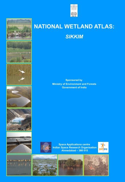
AtlasSAC/EPSA/AFEG/NWIA/ATLAS/36/2011NATIONAL WETLAND ATLASSIKKIMSponsored by<strong>Ministry</strong> <strong>of</strong> <strong>Environment</strong> <strong>and</strong> <strong>Forests</strong>, Government <strong>of</strong> IndiaAs a part <strong>of</strong> the project on National Wetl<strong>and</strong> Inventory <strong>and</strong> Assessment (NWIA)Space Applications Centre (ISRO)AhmedabadFebruary 2011
First Publication: February 2011, Space Applications Centre (ISRO), AhmedabadCopyright:2011, SAC, ISROThis publication may be produced in whole or in part <strong>and</strong> in any form for education or non-pr<strong>of</strong>it uses,without special permission from the copyright holder, provided acknowledgement <strong>of</strong> source is made.SAC will appreciate a copy <strong>of</strong> any publication which uses this publication as a source.Citation:Available from:Production:National Wetl<strong>and</strong> Atlas: <strong>Sikkim</strong>, SAC/EPSA/ABHG/NWIA/ATLAS/36/2011 Space Applications Centre(ISRO), Ahmedabad, India, 84p.Space Applications Centre, ISRO, Ahmedabad – 380 015, IndiaSAC, Ahmedabad carried out the work, Sponsored by <strong>Ministry</strong> <strong>of</strong> <strong>Environment</strong> <strong>and</strong> <strong>Forests</strong>, Govt. <strong>of</strong>India.
MESSAGEIt gives me great pleasure to introduce this Atlas, the latest in a series, prepared by Space ApplicationsCentre, Ahmedabad in connection with the National Wetl<strong>and</strong> Inventory <strong>and</strong> Assessment Project.This Atlas maps <strong>and</strong> catalogues information on Wetl<strong>and</strong>s across India using the latest in satellite imaging,one <strong>of</strong> the first <strong>of</strong> its kind. Wetl<strong>and</strong>s are areas <strong>of</strong> l<strong>and</strong> critical ecological significance that support a largevariety <strong>of</strong> plant <strong>and</strong> animal species adapted to fluctuating water levels. Their identification <strong>and</strong> protectionbecomes very important.Utility-wise, wetl<strong>and</strong>s directly <strong>and</strong> indirectly support millions <strong>of</strong> people in providing services such as food,fiber <strong>and</strong> raw materials. They play important roles in storm <strong>and</strong> flood control, in supply <strong>of</strong> clean water, alongwith other educational <strong>and</strong> recreational benefits. Despite these benefits, wetl<strong>and</strong>s are the first target <strong>of</strong>human interference <strong>and</strong> are among the most threatened <strong>of</strong> all natural resources. Around 50% <strong>of</strong> theearth’s wetl<strong>and</strong>s are estimated to already have disappeared worldwide over the last hundred years throughconversion to industrial, agricultural <strong>and</strong> residential purposes. Even in current scenario, when theecosystem services provided by wetl<strong>and</strong>s are better understood - degradation <strong>and</strong> conversion <strong>of</strong> wetl<strong>and</strong>scontinues.Aware <strong>of</strong> their importance, the Government <strong>of</strong> India has formulated several policies <strong>and</strong> plans for theconservation <strong>and</strong> preservation <strong>of</strong> these crucial ecosystems. Realising the need <strong>of</strong> an updated geospatialdata base <strong>of</strong> these natural resources as the pre-requisite for management <strong>and</strong> conservation planning,National Wetl<strong>and</strong> Inventory <strong>and</strong> Assessment (NWIA) project was formulated as a joint vision <strong>of</strong> <strong>Ministry</strong> <strong>of</strong><strong>Environment</strong> & Forestry, Govt. India, <strong>and</strong> Space Applications Centre (ISRO). I am told that the latestremote sensing data from Indian Remote Sensing satellite (IRS P6) have been used to map the wetl<strong>and</strong>s.The present atlas is part <strong>of</strong> this project <strong>and</strong> highlights the results <strong>of</strong> the study state in terms <strong>of</strong> statistics <strong>of</strong>various types <strong>of</strong> wetl<strong>and</strong>s, extent <strong>of</strong> water, aquatic vegetation <strong>and</strong> turbidity in pre <strong>and</strong> post monsoon period.I also note that special efforts are made to provide detailed information <strong>of</strong> important wetl<strong>and</strong>s like Ramsarsites, National Parks etc.I am certain that this Atlas will raise the bar in developing such database <strong>and</strong> will be <strong>of</strong> great use forresearchers, planners, policy makers, <strong>and</strong> also members <strong>of</strong> the general public.
FOREWORDWetl<strong>and</strong>s defined as areas <strong>of</strong> l<strong>and</strong> that are either temporarily or permanently covered by water exhibitenormous diversity according to their genesis, geographical location, water regime <strong>and</strong> chemistry. Wetl<strong>and</strong>sare one <strong>of</strong> the most productive ecosystems <strong>and</strong> play crucial role in hydrological cycle. Utility wise, wetl<strong>and</strong>sdirectly <strong>and</strong> indirectly support millions <strong>of</strong> people in providing services such as storm <strong>and</strong> flood control, cleanwater supply, food, fiber <strong>and</strong> raw materials, scenic beauty, educational <strong>and</strong> recreational benefits. TheMillennium Ecosystem Assessment estimates conservatively that wetl<strong>and</strong>s cover seven percent <strong>of</strong> the earth’ssurface <strong>and</strong> deliver 45% <strong>of</strong> the world’s natural productivity <strong>and</strong> ecosystem services. However, the veryexistence <strong>of</strong> these unique resources is under threat due to developmental activities, <strong>and</strong> population pressure.This calls for a long term planning for preservation <strong>and</strong> conservation <strong>of</strong> these resources. An updated <strong>and</strong>accurate database that will support research <strong>and</strong> decision is the first step towards this. Use <strong>of</strong> advancedtechniques like Satellite remote sensing, Geographic Information System (GIS) is now essential for accurate<strong>and</strong> timely spatial database <strong>of</strong> large areas. Space Applications Centre (ISRO) took up this challenging taskunder the project “NWIA” (National Wetl<strong>and</strong> Inventory <strong>and</strong> Assessment) sponsored by <strong>Ministry</strong> <strong>of</strong><strong>Environment</strong> & <strong>Forests</strong>. To account for numerous small yet important wetl<strong>and</strong>s found in the country, mappingat 1:50,000 scales has been taken up. Two date IRS LISS III data acquired during pre <strong>and</strong> post monsoonseason are used for inventory to account for wet <strong>and</strong> dry season hydrology <strong>of</strong> wetl<strong>and</strong>s. The map outputsinclude the status <strong>of</strong> water spread, aquatic vegetation <strong>and</strong> turbidity. Ancillary layers like road/rail, habitationsare also created. Very small wetl<strong>and</strong>s below the mappable unit are also identified <strong>and</strong> shown points. Theresults are complied as Atlases <strong>of</strong> wetl<strong>and</strong>s for states/Union Territories <strong>of</strong> India. This Atlas highlights resultsfor a particular state/UT <strong>and</strong> hopes to improve our underst<strong>and</strong>ing <strong>of</strong> the dynamics <strong>and</strong> distribution <strong>of</strong> wetl<strong>and</strong>s<strong>and</strong> their status in the area.I congratulate the team for bringing out this informative atlas <strong>and</strong> sincerely hope that this will serve as auseful source <strong>of</strong> information to researchers, planners <strong>and</strong> general public.January <strong>25</strong>, 2010
ACKNOWLEDGEMENTSThe project “National Wetl<strong>and</strong> Inventory & Assessment (NWIA)”, is sponsored by <strong>Ministry</strong> <strong>of</strong> <strong>Environment</strong> &Forestry (MoEF), Govt. <strong>of</strong> India <strong>and</strong> executed by Space Applications Centre, ISRO, Ahmedabad. We aregrateful to Dr. Ranganath R. Navalgund, Director, Space Applications Centre, for his encouragement to takeup this challenging task <strong>and</strong> formulation <strong>of</strong> the project team for timely implementation. Earnest thanks are alsodue to Dr. Jai Singh Parihar, Dy. Director, Earth, Ocean, Atmosphere, Planetary Sciences <strong>and</strong> ApplicationsArea, Space Applications Centre, for providing overall guidance <strong>and</strong> support to the project. The present Atlasfor the state <strong>of</strong> <strong>Sikkim</strong> is a part <strong>of</strong> the “National Wetl<strong>and</strong> Atlas”. We thank Shri M. L. Arratiwati, IFS, Secretary,Department <strong>of</strong> Science & Technology cum Member secretary, <strong>Sikkim</strong> State Council <strong>of</strong> Science <strong>and</strong>Technology for his support <strong>and</strong> guidance to the state team in this project.This project has benefited from the wisdom <strong>of</strong> many people. It is a pleasure to acknowledge the contributionsmade by the wetl<strong>and</strong> experts especially to Pr<strong>of</strong>. C.K. Varshney, Former Dean, School <strong>of</strong> <strong>Environment</strong>alSciences, Jawaharlal Nehru University, New Delhi, Pr<strong>of</strong>. A.R. Yousuf, The University <strong>of</strong> Kashmir, Srinagar,Pr<strong>of</strong>. Pradeeep Shrivastava, Head, Wetl<strong>and</strong> Research Centre, Barakatullah University, Bhopal, Dr. PrikshitGautam, Director, WWF-India, Dr. S. Narendra Prasad, Salim Ali Centre for Ornithology <strong>and</strong> Nature,Coimbtore <strong>and</strong> Dr. R.K. Suri, Additional Director, <strong>Ministry</strong> <strong>of</strong> <strong>Environment</strong> <strong>and</strong> <strong>Forests</strong>, Govt. <strong>of</strong> India, NewDelhi, <strong>and</strong> the database experts from ISRO who participated in the peer Review meeting to finalise the“Wetl<strong>and</strong> Classification System” followed in this projectWe acknowledge the positive role played by 16 th SC-B (St<strong>and</strong>ing Committee on Bioresources <strong>and</strong><strong>Environment</strong>) <strong>of</strong> NNRMS (National Natural Resources Management System) meeting in formulating thisproject. We are extremely thankful to the members <strong>of</strong> the“Steering Committee” <strong>of</strong> the project, under thechairmanship <strong>of</strong> Dr E J James, Director – Water Institute, Karunya University, for their periodical review,critical comments <strong>and</strong> appreciation <strong>of</strong> the efforts by the project team. We are thankful to SC-B under thechairmanship <strong>of</strong> Secretary, MoEF, for periodic review <strong>of</strong> the progress <strong>of</strong> the project <strong>and</strong> guidance towardstimely completion <strong>of</strong> the work. We acknowledge the valuable contributions made by Dr J K Garg, the thenscientist <strong>of</strong> SAC for his active role in formulation <strong>of</strong> this project, co-authoring the procedure manual document.We are grateful to Dr G V Subramanyam, Adviser, MoEF for his very active <strong>and</strong> positive role forimplementation <strong>of</strong> the project. We are thankful to Dr Jag Ram, Director, MoEF <strong>and</strong> Dr Harendra Kharwal,MoEF for their support. We acknowledge the support received from Dr P S Roy, Dy Director, NRSC <strong>and</strong>Dr S Sudhakar, Head, LRD, NRSC in terms <strong>of</strong> valuable suggestions <strong>and</strong> providing the geo-referenced image<strong>of</strong> NRC-LU&LC project for use as master image in this project. We are thankful to the “Technical Review”team <strong>of</strong> SAC for critical comments <strong>and</strong> suggestion to finalise the Atlas. We thank Mr Pragnesh KumarVaishnav <strong>and</strong> Ms Yatisha P Vaishnav, Geology Department, M G Science Institute, Ahmedabad <strong>and</strong> Shri N MSuthar, SAC for their support in Quality Check <strong>and</strong> finalization <strong>of</strong> GIS database.Project team from State Remote Sensing Applications Centre, <strong>Sikkim</strong> express specific gratitude toDr. S<strong>and</strong>eep Tambee, Mr. Nima Bhutia <strong>and</strong> Mr. Laku Bhutia for support in field photographs <strong>of</strong> high-altitudelakes (wetl<strong>and</strong>) <strong>and</strong> all other <strong>of</strong>ficers <strong>and</strong> staff <strong>of</strong> Department <strong>of</strong> Science <strong>and</strong> Technology <strong>and</strong> Council for theirco-operation <strong>and</strong> support during the execution <strong>of</strong> this project.
PROJECT TEAMProject Director: Dr. (Mrs) Sushma PanigrahySpace Applications Centre, ISRO, AhmedabadShri T. V. R. MurthyShri J. G. PatelShri N. M. Suthar<strong>Sikkim</strong> State Council <strong>of</strong> Science & Technology, GangtokShri D.G ShresthaShri N.P. SharmaShri Benoy Kr. Pradhan
CONTENTS1.0 INTRODUCTION1.1 Wetl<strong>and</strong>s1.2 Mapping <strong>and</strong> Geospatial Technique1.3 Wetl<strong>and</strong> Inventory <strong>of</strong> India2.0 NATIONAL WETLAND INVENTORY AND ASSESSMENT2.1 Wetl<strong>and</strong> Classification System2.2 Spatial framework <strong>and</strong> GIS database contents3.0 STUDY AREA3.1 Physiography <strong>and</strong> Surface Drainage3.2 Geology3.3 Climate3.4 Important Wetl<strong>and</strong>s4.0 DATA USED4.1 Remote sensing data4.2 Ground truth data4.3 Other data5.0 METHODOLOGY5.1 Creation <strong>of</strong> Spatial Framework5.2 Geo-referencing <strong>of</strong> Satellite Data5.3 Mapping <strong>of</strong> Wetl<strong>and</strong>s5.4 Conversion <strong>of</strong> Raster (indices) into a Vector Layer5.5 Generation <strong>of</strong> Reference Layers5.6 Coding <strong>and</strong> Attribute Scheme5.7 Map Composition <strong>and</strong> Output6.0 ACCURACY ASSESSMENT6.1 Data Verification <strong>and</strong> Quality Assurance <strong>of</strong> Output Digital Data Files7.0 WETLANDS OF SIKKIM: MAPS AND STATISTICS7.1 DISTRICT-WISE WETLAND MAPS AND STATISTICS7.1.1 North7.1.2 West7.1.3 South7.1.4 East8.0 MAJOR WETLAND TYPES OF SIKKIM9.0 IMPORTANT WETLANDS OF SIKKIM9.1 Khechodpalri Lake9.2 Gurudongmar Lake9.3 Tsomgo LakeREFERENCESAnnexure–I: Definitions <strong>of</strong> wetl<strong>and</strong> categories used in the project.Annexure–II: Details <strong>of</strong> district information followed in the atlas
List <strong>of</strong> FiguresFigure 1: Spectral Signature <strong>of</strong> various targetsFigure 2: Various l<strong>and</strong> features as they appear in three spectral b<strong>and</strong>s <strong>and</strong> in a typical threeb<strong>and</strong> FCCFigure 3: Location mapFigure 4: Spatial framework <strong>of</strong> <strong>Sikkim</strong>Figure 5: IRS P6 LISS-III coverage <strong>of</strong> <strong>Sikkim</strong>Figure 6: IRS LISS-IV FCC (Early winter <strong>and</strong> midwinter), Part <strong>of</strong> <strong>Sikkim</strong> stateFigure 7: Flow chart <strong>of</strong> the methodology usedFigure 8: Steps in the extraction <strong>of</strong> wetl<strong>and</strong> componentsFigure 9: Various combinations <strong>of</strong> the indices/spectral b<strong>and</strong>s used to identify wetl<strong>and</strong> componentsFigure 10: Type-wise wetl<strong>and</strong> distribution in <strong>Sikkim</strong>Figure 11: District-wise graphical distribution <strong>of</strong> wetl<strong>and</strong>sList <strong>of</strong> TablesTable 1: Wetl<strong>and</strong> Classification System <strong>and</strong> codingTable-2: Satellite data usedTable 3: Qualitative turbidity based on Mean <strong>and</strong> St<strong>and</strong>ard deviation observed in the NDWI imageTable 4: Area estimates <strong>of</strong> wetl<strong>and</strong>s in <strong>Sikkim</strong>Table-5: District-wise wetl<strong>and</strong> areaTable 6: Area estimates <strong>of</strong> wetl<strong>and</strong>s in NorthTable 7: Area estimates <strong>of</strong> wetl<strong>and</strong>s in WestTable 8: Area estimates <strong>of</strong> wetl<strong>and</strong>s in SouthTable 9: Area estimates <strong>of</strong> wetl<strong>and</strong>s in EastList <strong>of</strong> PlatesPlate 1: Major wetl<strong>and</strong> types <strong>of</strong> <strong>Sikkim</strong>Plate-2a, 2b: Field photographs <strong>and</strong> ground truth data <strong>of</strong> pertaining to High altitude lakesPlate 3: Khechodpalri LakePlate 4: Wetl<strong>and</strong> map - 5 km buffer area <strong>of</strong> Khechodpalri LakePlate 5: Khechodpalri Lake as seen on IRS P6 LISS-IV image with 5 km buffer areaPlate 6: Gurudongmar LakePlate 7: Wetl<strong>and</strong> map - 5 km buffer area <strong>of</strong> Gurudongmar LakePlate 8: Gurudongmar Lake as seen on IRS P6 LISS-III image with 5 km buffer areaPlate 9: Tsomgo LakePlate 10: Wetl<strong>and</strong> map - 5 km buffer area <strong>of</strong> Tsomgo LakePlate 11: Tsomgo Lake as seen on IRS P6 LISS-IV image with 5 km buffer area
1.0 INTRODUCTIONIt is increasingly realised that the planet earth is facing grave environmental problems with fast depletingnatural resources <strong>and</strong> threatening the very existence <strong>of</strong> most <strong>of</strong> the ecosystems. Serious concerns are voicedamong scientists, planners, sociologists, politicians, <strong>and</strong> economists to conserve <strong>and</strong> preserve the naturalresources <strong>of</strong> the world. One <strong>of</strong> the constraints most frequently faced for decision making is lack <strong>of</strong> scientificdata <strong>of</strong> our natural resources. Often the data are sparse or unauthentic, rarely in the form <strong>of</strong> geospatialdatabase (map), thus open to challenges. Hence, the current emphasis <strong>of</strong> every country is to have anappropriate geospatial database <strong>of</strong> natural resources based on unambiguous scientific methods. The wetl<strong>and</strong>atlas <strong>of</strong> <strong>Sikkim</strong>, which is part <strong>of</strong> the National Wetl<strong>and</strong> Atlas <strong>of</strong> India, is an attempt in this direction.1.1 Wetl<strong>and</strong>sWetl<strong>and</strong>s are one <strong>of</strong> the crucial natural resources. Wetl<strong>and</strong>s are areas <strong>of</strong> l<strong>and</strong> that are either temporarily orpermanently covered by water. This means that a wetl<strong>and</strong> is neither truly aquatic nor terrestrial; it is possiblethat wetl<strong>and</strong>s can be both at the same time depending on seasonal variability. Thus, wetl<strong>and</strong>s exhibitenormous diversity according to their genesis, geographical location, water regime <strong>and</strong> chemistry, dominantplants <strong>and</strong> soil or sediment characteristics. Because <strong>of</strong> their transitional nature, the boundaries <strong>of</strong> wetl<strong>and</strong>sare <strong>of</strong>ten difficult to define. Wetl<strong>and</strong>s do, however, share a few attributes common to all forms. Of these,hydrological structure (the dynamics <strong>of</strong> water supply, throughput, storage <strong>and</strong> loss) is most fundamental tothe nature <strong>of</strong> a wetl<strong>and</strong> system. It is the presence <strong>of</strong> water for a significant period <strong>of</strong> time which is principallyresponsible for the development <strong>of</strong> a wetl<strong>and</strong>. One <strong>of</strong> the first widely used classifications systems, devised byCowardin et al, 1979, was associated to its hydrological, ecological <strong>and</strong> geological aspects, such as: marine(coastal wetl<strong>and</strong>s including rock shores <strong>and</strong> coral reefs, estuarine (including deltas, tidal marshes, <strong>and</strong>mangrove swamps), lacustarine (lakes), riverine (along rivers <strong>and</strong> streams), palustarine ('marshy'- marshes,swamps <strong>and</strong> bogs). Given these characteristics, wetl<strong>and</strong>s support a large variety <strong>of</strong> plant <strong>and</strong> animal speciesadapted to fluctuating water levels, making the wetl<strong>and</strong>s <strong>of</strong> critical ecological significance. Utility wise,wetl<strong>and</strong>s directly <strong>and</strong> indirectly support millions <strong>of</strong> people in providing services such as food, fiber <strong>and</strong> rawmaterials, storm <strong>and</strong> flood control, clean water supply, scenic beauty <strong>and</strong> educational <strong>and</strong> recreationalbenefits. The Millennium Ecosystem Assessment estimates conservatively that wetl<strong>and</strong>s cover seven percent<strong>of</strong> the earth’s surface <strong>and</strong> deliver 45% <strong>of</strong> the world’s natural productivity <strong>and</strong> ecosystem services <strong>of</strong> which thebenefits are estimated at $20 trillion a year (Source: www.MAweb.org). The Millennium Assessment (MA)uses the following typology to categorise ecosystem services:Provisioning services:Regulating services:Cultural <strong>and</strong> Amenity services:Supporting services:The resources or products provided by ecosystems, such as food, rawmaterials (wood), genetic resources, medicinal resources, ornamentalresources (skin, shells, flowers).Ecosystems maintain the essential ecological processes <strong>and</strong> life supportsystems, like gas <strong>and</strong> climate regulation, water supply <strong>and</strong> regulation,waste treatment, pollination, etc.Ecosystems are a source <strong>of</strong> inspiration to human culture <strong>and</strong> educationthroughout recreation, cultural, artistic, spiritual <strong>and</strong> historic information,Science <strong>and</strong> education.Ecosystems provide habitat for flora <strong>and</strong> fauna in order to maintainbiological <strong>and</strong> genetic diversity.Despite these benefits, wetl<strong>and</strong>s are the first target <strong>of</strong> human interference <strong>and</strong> are among the mostthreatened <strong>of</strong> all natural resources. Around 50% <strong>of</strong> the earth’s wetl<strong>and</strong> area is estimated to already havedisappeared over the last hundred years through conversion to industrial, agricultural <strong>and</strong> residentialdevelopments. Even in current scenario, when the ecosystem services provided by wetl<strong>and</strong>s are betterunderstood - degradation <strong>and</strong> conversion <strong>of</strong> wetl<strong>and</strong>s continues. This is largely due to the fact that the‘full value’ <strong>of</strong> ecosystem functions is <strong>of</strong>ten ignored in policy-making, plans <strong>and</strong> corporate evaluations <strong>of</strong>development projects.1.2 Mapping <strong>and</strong> Geospatial TechniqueTo conserve <strong>and</strong> manage wetl<strong>and</strong> resources, it is important to have inventory <strong>of</strong> wetl<strong>and</strong>s <strong>and</strong> theircatchments. The ability to store <strong>and</strong> analyse the data is essential. Digital maps are very powerful tools toachieve this. Maps relate the feature to any given geographical location has a strong visual impact. Maps arethus essential for monitoring <strong>and</strong> quantifying change over time scale, assist in decision making.The technique used in the preparation <strong>of</strong> map started with ground survey. The Survey <strong>of</strong> India (SOI)topographical maps are the earliest true maps <strong>of</strong> India showing various l<strong>and</strong> use/cover classes includingwetl<strong>and</strong>s. Recent years have seen advances in mapping technique to prepare maps with much moreinformation. Of particular importance is the remote sensing <strong>and</strong> geographic information system (GIS)1
techniques. Remote sensing is now recognised as an essential tool for viewing, analyzing, characterising,<strong>and</strong> making decisions about l<strong>and</strong>, water <strong>and</strong> atmospheric components.From a general perspective, remote sensing is the science <strong>of</strong> acquiring <strong>and</strong> analyzing information aboutobjects or phenomena from a distance (Jensen, 1986; Lilles<strong>and</strong> <strong>and</strong> Keifer, 1987). Today, satellite remotesensing can be defined as the use <strong>of</strong> satellite borne sensors to observe, measure, <strong>and</strong> record theelectromagnetic radiation (EMR) reflected or emitted by the earth <strong>and</strong> its environment for subsequent analysis<strong>and</strong> extraction <strong>of</strong> information. EMR sensors includes visible light, near-, mid- <strong>and</strong> far-infrared (thermal),microwave, <strong>and</strong> long-wave radio energy. The capability <strong>of</strong> multiple sources <strong>of</strong> information is unique toremote sensing. Of specific advantage is the spectral, temporal, <strong>and</strong> spatial resolution. Spectral resolutionrefers to the width or range <strong>of</strong> each spectral b<strong>and</strong> being recorded. Since each target affects differentwavelengths <strong>of</strong> incident energy differently, they are absorbed, reflected or transmitted in different proportions.Currently, there are many l<strong>and</strong> resource remote sensing satellites that have sensors operating in the green,red, near infrared <strong>and</strong> short wave Infra red regions <strong>of</strong> the electromagnetic spectrum giving a definite spectralsignature <strong>of</strong> various targets due to difference in radiation absorption <strong>and</strong> reflectance <strong>of</strong> targets. Thesesensors are <strong>of</strong> common use for l<strong>and</strong> cover studies, including wetl<strong>and</strong>s. Figure 1 shows typical spectralsignature <strong>of</strong> few targets from green to SWIR region. Converted to image, in a typical false colour composite(FCC) created using NIR, red <strong>and</strong> green b<strong>and</strong>s assigned as red, green <strong>and</strong> blue colour, the features becomevery distinct as shown in Figure 2. In FCC, the vegetation thus appears invariably red (due to high reflectionin NIR from green leaves).Since the early 1960s, several satellites with suitable sensors have been launched into orbit to observe <strong>and</strong>monitor the earth <strong>and</strong> its environment. Most early satellite sensors acquired data for meteorological purposes.The advent <strong>of</strong> earth resources satellite sensors (those with a primary objective <strong>of</strong> mapping <strong>and</strong> monitoringl<strong>and</strong> cover) occurred, when the first L<strong>and</strong>sat satellite was launched in July 1972. Currently, more than adozen orbiting satellites <strong>of</strong> various types provide data crucial to improving our knowledge <strong>of</strong> the earth’satmosphere, oceans, ice <strong>and</strong> snow, <strong>and</strong> l<strong>and</strong>. Of particular interest to India is the indigenous series <strong>of</strong>satellites called Indian Remote Sensing satellites (IRS-Series). Since the launch <strong>of</strong> the first satellite IRS 1A in1988, India has now a number <strong>of</strong> satellites providing data in multi-spectral b<strong>and</strong>s with different spatialresolution. IRS P6/RESOURCESAT 1 is the current generation satellite that provides multi-spectral images inspatial resolution <strong>of</strong> 5.8 m (LISS IV), 23.5 m (LISS III) <strong>and</strong> 56m (AWiFS). Over the past few decades, Indianremote sensing data has been successfully used in various fields <strong>of</strong> natural resources (Navalgund et al,2002).Development <strong>of</strong> technologies like Geographic Information System (GIS) has enhanced the use <strong>of</strong> RS data toobtain accurate geospatial database. GIS specialises in h<strong>and</strong>ling related, spatially referenced data, combiningmapped information with other data <strong>and</strong> acts as analytical tool for research <strong>and</strong> decision making. During thepast few decades, technological advances in the field <strong>of</strong> satellite remote sensing (RS) sensors, computerizedmapping techniques, global positioning system (GPS) <strong>and</strong> geographic information system (GIS) hasenhanced the ability to capture more detailed <strong>and</strong> timely information about the natural resources at variousscales catering to local, regional, national <strong>and</strong> global level study.Figure 1: Spectral Signature <strong>of</strong> various targets2
BAND-1: GREENBNAD2: REDBAND-3: NIRLISS-IV FCC: Green Red NIRFigure 2: Various l<strong>and</strong> features as they appear in three spectral b<strong>and</strong>s <strong>and</strong> in a typical three b<strong>and</strong> FCC3
1.3 Wetl<strong>and</strong> Inventory <strong>of</strong> IndiaIndia with its large geographical spread supports large <strong>and</strong> diverse wetl<strong>and</strong> classes, some <strong>of</strong> which areunique. Wetl<strong>and</strong>s, variously estimated to be occupying 1-5 per cent <strong>of</strong> geographical area <strong>of</strong> the country,support about a fifth <strong>of</strong> the known biodiversity. Like any other place in the world, there is a looming threat tothe aquatic biodiversity <strong>of</strong> the Indian wetl<strong>and</strong>s as they are <strong>of</strong>ten under a regime <strong>of</strong> unsustainable humanpressures. Sustainable management <strong>of</strong> these assets therefore is highly relevant. Realising this, Govt. <strong>of</strong> Indiahas initiated many appropriate steps in terms <strong>of</strong> policies, programmes <strong>and</strong> plans for the preservation <strong>and</strong>conservation <strong>of</strong> these ecosystems. India is a signatory to the Ramsar Convention for management <strong>of</strong>wetl<strong>and</strong>, for conserving their biodiversity <strong>and</strong> wise use extending its scope to a wide variety <strong>of</strong> habitats,including rivers <strong>and</strong> lakes, coastal lagoons, mangroves, peat-l<strong>and</strong>s, coral reefs, <strong>and</strong> numerous human-madewetl<strong>and</strong>, such as fish <strong>and</strong> shrimp ponds, farm ponds, irrigated agricultural l<strong>and</strong>, salt pans reservoirs, gravelpits, sewage farms, <strong>and</strong> canals. The <strong>Ministry</strong> <strong>of</strong> <strong>Environment</strong> <strong>and</strong> <strong>Forests</strong> has identified a number <strong>of</strong> wetl<strong>and</strong>sfor conservation <strong>and</strong> management under the National Wetl<strong>and</strong> Conservation Programme <strong>and</strong> some financialassistance is being provided to State Governments for various conservation activities through approval <strong>of</strong> theManagement Action Plans. The need to have an updated map database <strong>of</strong> wetl<strong>and</strong>s that will support suchactions has long been realized.Mapping requires a st<strong>and</strong>ard classification system. Though there are many classification systems forwetl<strong>and</strong>s in the world, the Ramsar classification system is the most preferred one. The 1971 RamsarConvention on Wetl<strong>and</strong>s <strong>of</strong> International Importance especially as Waterfowl Habitat is the oldestconservation convention. It owes its name to its place <strong>of</strong> adoption in Iran. It came into being due to seriousdecline in populations <strong>of</strong> waterfowl (mainly ducks) <strong>and</strong> conservation <strong>of</strong> habitats <strong>of</strong> migratory waterfowl.Convention provides framework for the conservation <strong>and</strong> ‘wise use’ <strong>of</strong> wetl<strong>and</strong> biomes. Ramsar convention isthe first modern global intergovernmental treaty on conservation <strong>and</strong> wise use <strong>of</strong> natural resources(www.ramsar.org). Ramsar convention entered into force in 1975. Under the text <strong>of</strong> the Convention (Article1.1) wetl<strong>and</strong>s are defined as:“areas <strong>of</strong> marsh, fen, peat-l<strong>and</strong> or water, whether natural or artificial, permanent or temporary, with water thatis static or flowing, fresh, brackish or salt, including areas <strong>of</strong> marine water the depth <strong>of</strong> which at low tide doesnot exceed six meters”.In addition, the Convention (Article 2.1) provides that wetl<strong>and</strong>s:“may incorporate riparian <strong>and</strong> coastal zones adjacent to the wetl<strong>and</strong>s, <strong>and</strong> isl<strong>and</strong>s or bodies <strong>of</strong> marine waterdeeper than six meters at low tide lying within the wetl<strong>and</strong>s”.The first scientific mapping <strong>of</strong> wetl<strong>and</strong>s <strong>of</strong> India was carried out during1992-93 by Space Applications Centre(ISRO), Ahmedabad, at the behest <strong>of</strong> the <strong>Ministry</strong> <strong>of</strong> <strong>Environment</strong> <strong>and</strong> <strong>Forests</strong> (MoEF), Govt. <strong>of</strong> India usingremote sensing data from Indian Remote Sensing satellites (IRS-Series). The mapping was done at1:<strong>25</strong>0,000 scale using IRS 1A LISS-I/II data <strong>of</strong> 1992-93 timeframe under the Nation-wide Wetl<strong>and</strong> MappingProject. Since, no suitable wetl<strong>and</strong> classification existed for comprehensive inventory <strong>of</strong> wetl<strong>and</strong>s in thecountry at that time; the project used a classification system based on Ramsar Convention definition <strong>of</strong>wetl<strong>and</strong>s. The classification considers all parts <strong>of</strong> a water mass including its ecotonal area as wetl<strong>and</strong>. Inaddition, fish <strong>and</strong> shrimp ponds, saltpans, reservoirs, gravel pits were also included as wetl<strong>and</strong>s. Thisinventory put the wetl<strong>and</strong> extent (inl<strong>and</strong> as well as coastal) at about 8.26 million ha (Garg et al, 1998). Theseestimates (24 categories) do not include rice/paddy fields, rivers, canals <strong>and</strong> irrigation channels.Further updating <strong>of</strong> wetl<strong>and</strong> maps <strong>of</strong> India was carried out by SAC using IRS P6/Resourcesat AWiFS data <strong>of</strong>2004-05 at 1:<strong>25</strong>0000 scale. In recent years, a conservation atlas has been brought out by Salim Ali Centre forOrnithology <strong>and</strong> Natural History (SACON, 2004), which provide basic information required by stakeholders inboth wetl<strong>and</strong> habitat <strong>and</strong> species conservation. Space Applications Centre has carried out many pilot projectsfor development <strong>of</strong> GIS based wetl<strong>and</strong> information system (Patel et al, 2003) <strong>and</strong> Lake Information system(Singh et al, 2003).4
2.0 NATIONAL WETLAND INVENTORY AND ASSESSMENT (NWIA) PROJECTRealising the importance <strong>of</strong> many small wetl<strong>and</strong>s that dot the Indian l<strong>and</strong>scape, it has been unanimously feltthat inventory <strong>of</strong> the wetl<strong>and</strong>s at 1:50,000 scale is essential. The task seemed challenging in view <strong>of</strong> the vastgeographic area <strong>of</strong> our country enriched with diverse wetl<strong>and</strong> classes. Space Applications Centre with itsexperience in use <strong>of</strong> RS <strong>and</strong> GIS in the field <strong>of</strong> wetl<strong>and</strong> studies, took up this challenging task. This is furtherstrengthened by the fact that guidelines to create geospatial framework, codification scheme, data basestructure etc. for natural resources survey has already been well established by the initiative <strong>of</strong> ISRO undervarious national level mapping projects. With this strength, the National Wetl<strong>and</strong> Inventory <strong>and</strong> Assessment(NWIA) project was formulated by SAC, which was approved <strong>and</strong> funded by MoEF.The main objectives <strong>of</strong> the project are:• To map the wetl<strong>and</strong>s on 1:50000 scale using two date (pre <strong>and</strong> post monsoon) IRS LISS III digital datafollowing a st<strong>and</strong>ard wetl<strong>and</strong> classification system. (<strong>Sikkim</strong> state was mapped on 1:<strong>25</strong>,000 scale usingIRS LISS-IV <strong>and</strong> LISS-III data)• Integration <strong>of</strong> ancillary theme layers ( road, rail, settlements, drainage, administrative boundaries)• Creation <strong>of</strong> a seamless database <strong>of</strong> the states <strong>and</strong> country in GIS environment.• Preparation <strong>of</strong> State-wise wetl<strong>and</strong> atlases.The project was initiated during 2007. The first task was to have a classification system that can be used bydifferent types <strong>of</strong> users while amenable to database. An expert/peer group was formed <strong>and</strong> the peer reviewwas held at SAC on June 2007 where wetl<strong>and</strong> experts <strong>and</strong> database experts participated <strong>and</strong> finalized theclassification system. It was agreed to follow the classification system that has been used for the earlierproject <strong>of</strong> 1:<strong>25</strong>0,000 scale, with slight modification. Modified National Wetl<strong>and</strong> Classification system forwetl<strong>and</strong> delineation <strong>and</strong> mapping comprise 19 wetl<strong>and</strong> classes which are organized under a Level IIIhierarchical system. The definition <strong>of</strong> each wetl<strong>and</strong> class <strong>and</strong> its interpretation method was finalized.The technical/procedure manual was prepared as the st<strong>and</strong>ard guideline for the project execution across thecountry (Garg <strong>and</strong> Patel, 2007). The present atlas is part <strong>of</strong> the national level data base <strong>and</strong> deals with thestate <strong>of</strong> <strong>Sikkim</strong>.2.1 Wetl<strong>and</strong> Classification SystemIn the present project, Modified National Wetl<strong>and</strong> Classification system is used for wetl<strong>and</strong> delineation <strong>and</strong>mapping comprising 19 wetl<strong>and</strong> classes which are organized under a Level III hierarchical system (Table 1).Level one has two classes: inl<strong>and</strong> <strong>and</strong> coastal, these are further bifurcated into two categories as: natural <strong>and</strong>man-made under which the 19 wetl<strong>and</strong> classes are suitably placed. Two-date data pertaining to pre-monsoon<strong>and</strong> post-monsoon was used to confirm the classes. Wetl<strong>and</strong>s put to agriculture use in any <strong>of</strong> the two datesare not included as wetl<strong>and</strong> class. Definitions <strong>of</strong> wetl<strong>and</strong> categories used in the project is given in Annexure-I.2.2 Spatial Framework <strong>and</strong> GIS DatabaseThe National Spatial Framework (NSF) has been used as the spatial framework to create the database(Anon. 2005a). The database design <strong>and</strong> creation st<strong>and</strong>ard suggested by NRDB/NNRMS guidelines isfollowed. Feature codification scheme for every input element has been worked out keeping in view thenationwide administrative as well as natural hierarchy (State-district- within the feature class for each <strong>of</strong> thetheme. All data elements are given a unique name, which are self explanatory with short forms.Following wetl<strong>and</strong> layers are generated for each inl<strong>and</strong> wetl<strong>and</strong>:• Wetl<strong>and</strong> extent: As wetl<strong>and</strong>s encompass open water, aquatic vegetation (submerged, floating <strong>and</strong>emergent), the wetl<strong>and</strong> boundary should ideally include all these. Satellite image gives a clear signature<strong>of</strong> the wetl<strong>and</strong> extent from the imprint <strong>of</strong> water spread over the years.• Water spread: There are two layers representing post-monsoon <strong>and</strong> pre-monsoon water spread duringthe year <strong>of</strong> data acquisition.5
• Aquatic vegetation spread: The presence <strong>of</strong> vegetation in wetl<strong>and</strong>s provides information about itstrophic condition. As is known, aquatic vegetation is <strong>of</strong> four types, viz. benthic, submerged, floating<strong>and</strong> emergent. It is possible to delineate last two types <strong>of</strong> vegetation using optical remote sensing data.A qualitative layer pertaining to presence <strong>of</strong> vegetation is generated for each season (as manifested onpre-monsoon <strong>and</strong> post-monsoon imagery).• Turbidity <strong>of</strong> open water: A layer pertaining to a qualitative turbidity rating is generated.Three qualitative turbidity ratings ( low, medium <strong>and</strong> high) is followed for pre- <strong>and</strong> post-monsoonturbidity <strong>of</strong> lakes, reservoirs, barrages <strong>and</strong> other large wetl<strong>and</strong>s.• Small wetl<strong>and</strong>s (smaller than minimum mappable unit: < 0.50 ha) are mapped as point features.• Base layers like major road network, railway, settlements, <strong>and</strong> surface drainage are created (either fromthe current image or taken from other project data base).Table 1: Wetl<strong>and</strong> Classification System <strong>and</strong> codingWettcode* Level I Level II Level III1000 Inl<strong>and</strong> Wetl<strong>and</strong>s1100 Natural1101 Lakes1102 Ox-Bow Lakes/ Cut-Off Me<strong>and</strong>ers1103 High altitude Wetl<strong>and</strong>s1104 Riverine Wetl<strong>and</strong>s1105 Waterlogged1106 River/stream1200 Man-made1201 Reservoirs/ Barrages1202 Tanks/Ponds1203 Waterlogged1204 Salt pans2000 Coastal Wetl<strong>and</strong>s2100 Natural2101 Lagoons2102 Creeks2103 S<strong>and</strong>/Beach2104 Intertidal mud flats2105 Salt Marsh2106 Mangroves2107 Coral Reefs2200 Man-made2201 Salt pans2202 Aquaculture ponds* Wetl<strong>and</strong> type code6
3.0 STUDY AREAThe Himalayan state <strong>of</strong> <strong>Sikkim</strong> is surely one <strong>of</strong> the mystic places on earth. The rugged terrain, pristine rivers,eye-soothing lakes, majestic mountains <strong>and</strong> rich cultural heritage makes it a paradise, yet to be explored.Physiographically it has a dynamic variety in its altitude ranging from one <strong>of</strong> the highest places on earth to aslow as 240 m above MSL (mean sea level). On May 16 th , 1975 <strong>Sikkim</strong> <strong>of</strong>ficially became the 22 nd state <strong>of</strong> theIndian Union. <strong>Sikkim</strong> is situated in the North Eastern region <strong>of</strong> India. The state borders Nepal in the west,China to the north <strong>and</strong> the east <strong>and</strong> Bhutan in the southeast. The Indian state <strong>of</strong> West Bengal borders <strong>Sikkim</strong>to its south. It lies between 27°04’46’’ N to 28°07’48’’N latitude <strong>and</strong> 88°00’58’’ to 88°55’<strong>25</strong>’’E longitude(Figure 3). The total geographical area <strong>of</strong> the state is 7,096 km 2 occupying an area <strong>of</strong> 0.67% <strong>of</strong> the totalgeographical area <strong>of</strong> the country. It is the second smallest state after Goa.3.1 Physiography <strong>and</strong> Surface DrainageOn the basis <strong>of</strong> geographical features, the state is divided into four physiographical units; i) Lower hills,ii) Upper hills, iii) Alpine zones, <strong>and</strong> iv) Snow l<strong>and</strong>Among the four districts, North district is covered mainly by snow covered mountains, having the leastpopulation. World’s 3 rd highest mountain, Mount Khangchendzonga, (8598 m) gives a st<strong>and</strong>ing guard to thistiny though majestic state <strong>of</strong> <strong>Sikkim</strong> which has only 7096 sq. km area. <strong>Sikkim</strong> is a place <strong>of</strong> both religiousbeliefs <strong>and</strong> practices on the one h<strong>and</strong>, <strong>and</strong> environmental restoration <strong>and</strong> conservation on the other.<strong>Sikkim</strong> has a very rugged <strong>and</strong> formidable topography <strong>and</strong> flat l<strong>and</strong>s. The towering mountains that define thisparadise <strong>of</strong> nature also create a barrier to efficient agriculture. These mountains fall directly in the path <strong>of</strong> themonsoon clouds making the state one <strong>of</strong> the wettest in the country. Most <strong>of</strong> the peaks above 6100 m lietowards the western border <strong>of</strong> <strong>Sikkim</strong>. The main mountains other than Khangchendzonga are Kabru,Siniolchu, P<strong>and</strong>im, Rathong, Kokthang, Talung, Kanglakhang, Simvo <strong>and</strong> Jonsang. The central <strong>Sikkim</strong>traversed by another mountain ridge in the north to south direction. This mountain ridge separates the Tista<strong>and</strong> Rangit valley, <strong>and</strong> ends at the confluence <strong>of</strong> these two rivers. The gnarled topography tends, tosmoothen out in the upper reaches <strong>of</strong> the Tista River in the Lachen valley where the Tibetian Plateau juts into<strong>Sikkim</strong>. The state <strong>of</strong> <strong>Sikkim</strong> also shelters many Glaciers (slow moving river <strong>of</strong> ice), mainly Zemu Glacier,Rathong Glacier <strong>and</strong> Lhonak Glacier. The status <strong>of</strong> these Glaciers has become a measuring stick <strong>of</strong> climatechange. The mountain ranges are interspersed with passes which can be used to cross from one side toanother. The important passes in east district are Nathula, Jelepla, Bhutan la <strong>and</strong> Chola. The western part <strong>of</strong>the state has Chiwabhanjang <strong>and</strong> Kangla. In the North district <strong>of</strong> <strong>Sikkim</strong>, Chorten Nyimala, Kongra-la,Lungnala <strong>and</strong> Donkiala are important pass.Along with the mountains, Glaciers <strong>and</strong> passes, the state <strong>of</strong> <strong>Sikkim</strong> also have many lakes though not <strong>of</strong> verylarge size. These lakes are both spring fed as well as river fed. The premier lakes <strong>of</strong> the state are Changu(Tsomgo), Khechodpalri, Gurudongmar, Cholamu, Memencho, Lampokhari, Samiti etc. These lakes also formthe source <strong>of</strong> many rivers. The main river <strong>of</strong> <strong>Sikkim</strong> is Tista which originates from Lake Cholamu. Its maintributary is Rangit which originates from Rathong Glacier <strong>and</strong> meets Tista at the border between <strong>Sikkim</strong> <strong>and</strong>West Bengal. The river Ramam a tributary <strong>of</strong> Rangit, a part <strong>of</strong> Rangit itself <strong>and</strong> Rangpoo chu, a tributary <strong>of</strong>Tista define the southern border between <strong>Sikkim</strong> <strong>and</strong> West Bengal. The other smaller tributaries <strong>of</strong> the TistaRiver are Zemu chu, Lonak chu, Lachung chu, Talung chu <strong>and</strong> Bakcha chu. The state <strong>of</strong> <strong>Sikkim</strong> has manyhot-springs known for their medicinal <strong>and</strong> therapeutic value. The most important are the ones located atPhurchachu (Reshi), Yumthang, Borang, Ralang, Taram-chu <strong>and</strong> Yumey Samdung. All these hot-springshave high sulphur content <strong>and</strong> are located near the river banks.3.2 GeologyGeologically, <strong>Sikkim</strong> state belongs to the young folded mountains <strong>of</strong> the Himalayan system. Half-schistose,gneissose <strong>and</strong> Precambrian are the three major rock constituents <strong>of</strong> the geology <strong>of</strong> <strong>Sikkim</strong>. Precambrian rockis found in a big part <strong>of</strong> the state <strong>of</strong> <strong>Sikkim</strong> <strong>and</strong> hence is a significant part <strong>of</strong> <strong>Sikkim</strong> geology. The region takenup by this rock has a relatively smaller age than the hilly regions <strong>of</strong> the state. The Precambrian rock is madeup <strong>of</strong> schists <strong>and</strong> phyllites. The presence <strong>of</strong> schists <strong>and</strong> phyllites makes the slopes <strong>of</strong> the region prone toerosion <strong>and</strong> weathering. The possibility <strong>of</strong> erosion <strong>of</strong> soil <strong>and</strong> the reduction <strong>of</strong> mineral content is increased byexcessive rainfall. Such geology is susceptible to natural disasters like l<strong>and</strong>slides. The hilly regions <strong>of</strong> <strong>Sikkim</strong>mainly constitutes <strong>of</strong> two kinds <strong>of</strong> rocks - half-schistose <strong>and</strong> gneissose. These two kinds <strong>of</strong> rocks form crucialconstituents <strong>of</strong> the geology in <strong>Sikkim</strong>. The kind <strong>of</strong> soil prevalent in the north-eastern state <strong>of</strong> <strong>Sikkim</strong> is suitablefor deciduous <strong>and</strong> evergreen forests.The soil does not have a high content <strong>of</strong> organic matter <strong>and</strong> is not rich in minerals. The texture <strong>of</strong> this soil iscoarse. The presence <strong>of</strong> these two kinds <strong>of</strong> rocks has turned the soil <strong>of</strong> these regions brown <strong>and</strong> clayey.7
Numerous snow-fed streams in <strong>Sikkim</strong> have carved out river valleys in the west <strong>and</strong> south <strong>of</strong> the state. Thesestreams combine into the Teesta <strong>and</strong> its tributary, the Rangeet. These are the two main drainage basins. TheTeista, described as the "lifeline <strong>of</strong> <strong>Sikkim</strong>", flows through the state from north to south.<strong>Sikkim</strong> is covered by nineteen 1:50,000 scale SOI topographical maps <strong>and</strong> sixty 1:<strong>25</strong>,000 scale maps thatform the spatial frame work for mapping (Figure 4).A detail <strong>of</strong> district information followed in the atlas is given in Annexure-II.Figure 3: Location mapFigure 4: Spatial framework <strong>of</strong> <strong>Sikkim</strong>8
3.3 ClimateThe climate ranges from sub-tropical in the south to tundra in the northern parts. The tundra-type region in thenorth is clad by snow for four months a year though the temperature drops below 0 °C (32 °F) almost everynight. Most <strong>of</strong> the inhabited regions <strong>of</strong> <strong>Sikkim</strong>, however, witness a temperate climate, with the temperaturesseldom exceeding 28 °C (82.4 °F) in summer or dropping below 0 °C (32 °F) in winter. The mean monthlytemperature in summer is 15 °C. The average annual temperature for most <strong>of</strong> <strong>Sikkim</strong> is around18 °C(64.4 °F). The record for the longest period <strong>of</strong> continuous rain is 11 days. In the northern region, because <strong>of</strong>high altitude, temperatures drop below −40 °C (−40 °F) in winter. The maximum rainfall <strong>of</strong> the state isrecorded in the month <strong>of</strong> July <strong>and</strong> August. During the monsoon, heavy rains that increase the possibility <strong>of</strong>l<strong>and</strong>slides.3.4 Important wetl<strong>and</strong>sAlong with the mountains, Glaciers <strong>and</strong> passes, the state <strong>of</strong> <strong>Sikkim</strong> also have many lakes though not in verylarge size. The lakes are both spring fed as well as river fed. The premier lakes <strong>of</strong> the state are Changu(Tsomgo), Khechodpalri, Gurudongmar, Cholamu, Memencho, Lampokhari, Samiti etc. The Tsomgo lakecovering <strong>and</strong> area <strong>of</strong> 24.47 ha is one <strong>of</strong> the important tourist sites in the state .The lake is about 15 m deep<strong>and</strong> is a home for brahiminy ducks. These ecosystems are ideal habitat for Red P<strong>and</strong>a, Rhododendrons <strong>and</strong>various species <strong>of</strong> birds. To, preserve such biosphere the Kanchenjunga National Park <strong>and</strong> reserve has beenestablished in 1977.4.0 DATA USED4.1 Remote sensing dataIRS P6 LISS IV <strong>and</strong> LISS III data have been used to map the wetl<strong>and</strong>s. The spatial resolution <strong>of</strong> LISS-IV datais suitable for 1:<strong>25</strong>,000 scale mapping. The state <strong>of</strong> <strong>Sikkim</strong> is covered in 2 IRS LISS III scene (Figure 5). Twodate data, were used to capture the pre-monsoon <strong>and</strong> post-monsoon hydrological variability <strong>of</strong> the wetl<strong>and</strong>srespectively (Table-2). Figure 6 shows the overview <strong>of</strong> the part <strong>of</strong> <strong>Sikkim</strong> as seen in the LISS IV FCC <strong>of</strong> postmonsoonpre-monsoon data respectively.Table-2: Satellite data usedSr. No. Path-Raw orbit Date <strong>of</strong> AcquisitionLISS-IV1 101-052 021924 07-January-20082 101-053 021924 07-January-20083 101-054 021924 07-January-20084 101-055 021924 07-January-20085 101-057 022393 09-February-20086 101-060 022393 09-February-20087 102-006 022663 28-February-20088 102-022 026073 <strong>25</strong>-October-20089 102-023 026073 <strong>25</strong>-October-200810 102-033 028801 05-May-200911 102-038 031529 13-November-200912 102-038 031188 20-October-200913 102-039 031529 13-November-200914 102-039 031600 18-November-200915 102-040 026826 17-December-200816 102-040 031600 18-November-200917 102-041 026826 17-December-200818 102-042 026826 17-December-200819 102-043 030918 01-October-200920 102-043 026826 17-December-200821 102-045 031941 12-December-200922 102-046 031941 12-December-200923 102-049 031870 07-December-200924 102-050 031870 07-December-2009<strong>25</strong> 102-051 031<strong>25</strong>9 <strong>25</strong>-October-200926 102-052 031<strong>25</strong>9 <strong>25</strong>-October-200927 102-053 031<strong>25</strong>9 <strong>25</strong>-October-200928 102-055 027167 10-January-2009LISS-III107-51 Nov 15, 2005, Jan 26, 2006, <strong>and</strong> Apr 13, 2005107-52 Nov 15, 2005, Jan 26, 2006, <strong>and</strong> Apr 13, 20059
Figure 5: IRS P6 LISS-III coverage <strong>of</strong> <strong>Sikkim</strong>4.2 Ground truth dataRemote sensing techniques require certain amount <strong>of</strong> field observation called “ground truth” in order toconvert into meaningful information. Such work involves visiting a number <strong>of</strong> test sites, usually taking thesatellite images. The location <strong>of</strong> the features is recorded using the GPS. The st<strong>and</strong>ard pr<strong>of</strong>orma as per theNWIA manual was used to record the field data. Field photographs are also taken to record the water quality(subjective), status <strong>of</strong> aquatic vegetation <strong>and</strong> water spread. All field verification work has been done duringOctober <strong>and</strong> November 2008.4.3 Other dataSurvey <strong>of</strong> India topographical maps (SOI) were used for reference purpose. Lineage data <strong>of</strong> National Wetl<strong>and</strong>Maps at 1:<strong>25</strong>0,000 scale was used for reference.5.0 METHODOLOGYThe methodology to create the state level atlas <strong>of</strong> wetl<strong>and</strong>s is adhered to NWIA technical guidelines <strong>and</strong>procedure manual (Garg <strong>and</strong> Patel, 2007). The overview <strong>of</strong> the steps used is shown in Figure 7. Salientfeatures <strong>of</strong> methodology adopted are• Generation <strong>of</strong> spatial framework in GIS environment for database creation <strong>and</strong> organisation.• Geo-referencing <strong>of</strong> satellite data• Identification <strong>of</strong> wetl<strong>and</strong> classes as per the classification system given in NWIA Manual <strong>and</strong> mapping <strong>of</strong>the classes using a knowledge based digital classification <strong>and</strong> onscreen interpretation• Generation <strong>of</strong> base layers (rail, road network, settlements, drainage, administrative boundaries) fromsatellite image <strong>and</strong> ancillary data.• Mosaicing/edge matching to create district <strong>and</strong> state level database.• Coding <strong>of</strong> the wetl<strong>and</strong>s following the st<strong>and</strong>ard classification system <strong>and</strong> codification as per NWIAmanual.• Preparation <strong>of</strong> map compositions <strong>and</strong> generation <strong>of</strong> statistics• Outputs on A3 size prints <strong>and</strong> charts for atlas.Work was carried out using ERDAS Imagine, Arc/Info <strong>and</strong> Arcgis s<strong>of</strong>twares.5.1 Creation <strong>of</strong> Spatial FrameworkThis is the most important task as the state forms a part <strong>of</strong> the national frame work <strong>and</strong> covered in multiplemap sheets. To create NWIA database, NNRMS/NRDB st<strong>and</strong>ards is followed <strong>and</strong> four corners <strong>of</strong> the1:50,000 (15’ x 15’) grid is taken as the tics or registration points to create each map taking master grid as thereference. Spatial framework details are given in NWIA manual (Patel <strong>and</strong> Garg, 2007). The spatialframework for <strong>Sikkim</strong> state is shown in Figure 4.10
Early winter (September 2009)Mid winter (December 2009)Figure 6: IRS LISS-IV FCC (Early winter <strong>and</strong> midwinter), Part <strong>of</strong> <strong>Sikkim</strong> state11
5.2 Geo-referencing <strong>of</strong> Satellite DataIn this step the raw satellite images were converted to specific map projection using geometric correction.This is done using archive geometrically corrected LISS III data (ISRO-NRC-l<strong>and</strong> use / l<strong>and</strong> cover project).St<strong>and</strong>ard image processing s<strong>of</strong>tware was used for geo-referencing. First one date data was registered withthe archive image. The second date data was then registered with the first date data.5.3 Mapping <strong>of</strong> Wetl<strong>and</strong>sThe delineation <strong>of</strong> wetl<strong>and</strong>s through image analysis forms the foundation for deriving all wetl<strong>and</strong> classes <strong>and</strong>results. Consequently, a great deal <strong>of</strong> emphasis has been placed on the quality <strong>of</strong> the image Interpretation. Inthe present study, the mapping <strong>of</strong> wetl<strong>and</strong>s was done following digital classification <strong>and</strong> onscreen visualinterpretation. Wetl<strong>and</strong>s were identified based on vegetation, visible hydrology <strong>and</strong> geography. There arevarious methods for extraction <strong>of</strong> water information from remote sensing imagery, which according to thenumber <strong>of</strong> b<strong>and</strong>s used, are generally divided into two categories, i.e. Single-b<strong>and</strong> <strong>and</strong> multi-b<strong>and</strong> methods.Single-b<strong>and</strong> method usually involves choosing a b<strong>and</strong> from multi-spectral image to distinguish water froml<strong>and</strong> by subjective threshold values. It may lead to over- or under-estimation <strong>of</strong> open water area. Multi-b<strong>and</strong>method takes advantage <strong>of</strong> reflective differences <strong>of</strong> each b<strong>and</strong>.In this project, five indices known in literature that enhances various wetl<strong>and</strong> characteristics were used exceptNDPI <strong>and</strong> MNDWI due to lack <strong>of</strong> SWIR/MIR b<strong>and</strong> in LISS-IV (McFeetres, 1986; Xu Hanqiu, 2006; Lacaux etal, 2007; Townshend <strong>and</strong> Justice, 1986; Tucker <strong>and</strong> Sellers, 1986) as given below:i) Normalised Difference Water Index (NDWI) = (Green-NIR) / (Green + NIR)ii)iii)iv)Modified Normalised Difference Water Index (MNDWI) = (Green-MIR) / (Green + MIR)Normalised Difference Vegetation Index (NDVI) = (NIR - Red) / (NIR + Red)Normalised Difference Pond Index (NDPI) = (MIR – Green / MIR + Green)v) Normalised Difference Turbidity Index (NDTI) = (Red – Green) / (Red + Green)IRS P6 LISS III(pre- <strong>and</strong> post-monsoon data)Spatial frame workLegacy dataGeo-referenced imagesAdmin. Boundaries(State, District)On-screen interpretation/Digital analysisSOI topographic mapsGround truthMorphometric(Wetl<strong>and</strong> extent)Physical(Wetl<strong>and</strong> type)Biological(Wetl<strong>and</strong> vegetation)Base layers(Road, Settlement, drainage)Quality CheckGIS DATABASE(Wetl<strong>and</strong> layers, Base layers)NWIA Database Organisation(District, State, Country)Accuracy Assessment/Quality CheckAnalysisAtlases/ReportFigure 7: Flow chart <strong>of</strong> the methodology used12
The indices were generated using st<strong>and</strong>ard image processing s<strong>of</strong>tware, stacked as layers (Figure 8). Variouscombinations <strong>of</strong> the indices/spectral b<strong>and</strong>s were used to identify the wetl<strong>and</strong> features as shown in Figure 9.The following indices were used for various layer extractions:• Extraction <strong>of</strong> wetl<strong>and</strong> extent :NDWI, NDVI <strong>and</strong> NDTI image was used to extract the wetl<strong>and</strong> boundary through suitable hierarchicalthresholds.• Extraction <strong>of</strong> open water :NDWI was used with in the wetl<strong>and</strong> mask to delineate the water <strong>and</strong> no-water areas.• Extraction <strong>of</strong> wetl<strong>and</strong> vegetation :NDVI image was used to generate the vegetation <strong>and</strong> no-vegetation areas within a wetl<strong>and</strong> using asuitable threshold.• Turbidity information extraction :NDWI image was used to generate qualitative turbidity level (high, moderate <strong>and</strong> low) based onfollowing steps:a) Conversion <strong>of</strong> post <strong>and</strong> pre-monsoon water spread polygons into Area <strong>of</strong> Interest (AoI).b) Grouping <strong>of</strong> all AoIs excluding all non-wetl<strong>and</strong> areas into a single entity.c) Generate a signature statistics like minimum, maximum, mean <strong>and</strong> st<strong>and</strong>ard deviations.d) Generate a raster turbidity image through a model for AoI only with conditional categorisation.e) Convert the raster into vector <strong>and</strong> update the attributes or edit the water spread layer (copied asturbidity layer) in polygon mode so as to retain all the attributes.f) Assign turbidity classes as per the Table 3.Figure 8: Steps in the extraction <strong>of</strong> wetl<strong>and</strong> componentsTable 3: Qualitative turbidity based on Mean <strong>and</strong> St<strong>and</strong>ard deviation observed in the NDWI imageSr. No. Conditional criteria Qualitative Turbidity1. -1σ to +1σ Low13
NDWI NDTI NDTIUseful for delineation <strong>of</strong> wetl<strong>and</strong> boundaryNDWI NDVI NDTIABIRS P6 LISS-IV FCC G R NIRA: Open-waterB: Semi-frozen waterUseful for delineation <strong>of</strong> open-water <strong>and</strong> vegetationσ -BASED CLASIFED NDWI IMAGEUseful for qualitative turbidity ratingFigure 9: Various combinations <strong>of</strong> the spectral b<strong>and</strong>s/ indices used to identify wetl<strong>and</strong> components14
5.4 Conversion <strong>of</strong> the Raster (indices) into a Vector LayerThe information on wetl<strong>and</strong> extent, open water extent, vegetation extent <strong>and</strong> turbidity information wasconverted into vector layers using regional growing properties or on-screen digitization.5.5 Generation <strong>of</strong> Reference LayersBase layers like major road network, settlements, drainage are interpreted from the current image or takenfrom other project data base. The administrative boundaries (district, state) are taken from the knownreference data.5.6 Coding <strong>and</strong> Attribute SchemeFeature codification scheme for every input element has been worked out keeping in view the nationwideadministrative as well as natural hierarchy (State-district-taluka) within the feature class for each <strong>of</strong> the theme.All data elements are given a unique name/code, which are self explanatory with short forms.5.7 Map composition <strong>and</strong> outputMap composition for atlas has been done at district <strong>and</strong> state level. A st<strong>and</strong>ard color scheme has been usedfor the wetl<strong>and</strong> classes <strong>and</strong> other layers. The digital files are made at 1:50,000 scale. The hard copy outputsare taken in A3 size.6.0 ACCURACY ASSESSMENTA comprehensive accuracy assessment protocol has been followed for determining the quality <strong>of</strong> informationderived from remotely sensed data. Accuracy assessment involves determination <strong>of</strong> thematic (classification)as well as location accuracy. In addition, GIS database(s) contents have been also evaluated for accuracy.To ensure the reliability <strong>of</strong> wetl<strong>and</strong> status data, the project adhered to established quality assurance <strong>and</strong>quality control measures for data collection, analysis, verification <strong>and</strong> reporting.This study used well established, time-tested, fully documented data collection conventions. It employedskilled <strong>and</strong> trained personnel for image interpretation, processing <strong>and</strong> digital database creation. All interpretedimagery was reviewed by technical expert team for accuracy <strong>and</strong> code. The reviewing analyst adhered to allst<strong>and</strong>ards, quality requirements <strong>and</strong> technical specifications <strong>and</strong> reviewed 100 percent <strong>of</strong> the work. Thevarious stages <strong>of</strong> quality check include:1. Image-Image Geo-referencing/Data generation2. Reference layer preparation using NWIA post monsoon <strong>and</strong> pre-monsoon LISS-IV <strong>and</strong> LISS-III data.3. Wetl<strong>and</strong> mapping using visual/digital interpretation techniques.4. Geo-data base creation <strong>and</strong> organization5. Output products.6.1 Data verification <strong>and</strong> quality assurance <strong>of</strong> output digital data filesAll digital data files were subjected to rigorous quality control inspections. Digital data verification includedquality control checks that addressed the geospatial correctness, digital integrity <strong>and</strong> some cartographicaspects <strong>of</strong> the data. Implementation <strong>of</strong> quality checks ensured that the data conformed to the specified15
criteria, thus achieving the project objectives. There were tremendous advantages in using newertechnologies to store <strong>and</strong> analyze the geographic data. The geospatial analysis capability built into this studyprovided a complete digital database to better assist analysis <strong>of</strong> wetl<strong>and</strong> change information. All digital datafiles were subjected to rigorous quality control inspections. Automated checking modules incorporated in thegeographic information system (Arc/GIS) were used to correct digital artifacts including polygon topology.Additional customized data inspections were made to ensure that the changes indicated at the imageinterpretation stage were properly executed.16
MAPS AND STATISTICS17
7.0 WETLANDS OF SIKKIM: MAPS AND STATISTICSArea estimates <strong>of</strong> various wetl<strong>and</strong> categories for <strong>Sikkim</strong> have been carried out using GIS layers <strong>of</strong> wetl<strong>and</strong>boundary, water-spread, aquatic vegetation <strong>and</strong> turbidity. Total 451 wetl<strong>and</strong>s have been mapped at 1:<strong>25</strong>,000scale in the state. In addition, 245 wetl<strong>and</strong>s (smaller than 0.50 ha) have also been identified. Total wetl<strong>and</strong>area estimated is 8463 ha accounting for about 1.19 per cent <strong>of</strong> the geographic area <strong>of</strong> stateThe major wetl<strong>and</strong> types are High altitude lakes accounting for 35.48 per cent <strong>of</strong> the wetl<strong>and</strong>s (3003 ha),river/stream (5097 ha) <strong>and</strong> Lake/ponds (118 ha). Graphical distribution <strong>of</strong> wetl<strong>and</strong> type is shown in Figure 10.For assessment <strong>of</strong> qualitative turbidity based on signature statistics <strong>of</strong> NDWI image for open water featureshas been considered as explained in the methodology. Accordingly, wetl<strong>and</strong>s where open water featureshave not been manifested on satellite data were excluded in spite <strong>of</strong> the fact that these wetl<strong>and</strong>s areassociated with water. Overall three wetl<strong>and</strong> types are assessed for turbidity namely Lake/Pond, Highaltitude lake <strong>and</strong> River/Stream. Aquatic vegetation seen in lake/pond category having 7 ha in post- <strong>and</strong>pre-monsoon seasonsThe extent <strong>of</strong> open water in post-monsoon <strong>of</strong> the year 2006 is 7092 ha which comprised 2380 ha <strong>of</strong> low <strong>and</strong>4712 ha <strong>of</strong> moderate turbidity. The extent under turbidity classes changed considerably in the pre-monsoon <strong>of</strong>2005 which is estimated as 885 ha <strong>of</strong> low <strong>and</strong> 4136 ha <strong>of</strong> moderate turbidity out <strong>of</strong> 5021 ha <strong>of</strong> open waterfeatures based on LISS-III data. Details <strong>of</strong> the wetl<strong>and</strong> statistics <strong>of</strong> the district is given in Table 4.Table 4: Area estimates <strong>of</strong> wetl<strong>and</strong>s in <strong>Sikkim</strong>Area in haSr.No.WettcodeWetl<strong>and</strong> CategoryNumber<strong>of</strong>wetl<strong>and</strong>sTotalwetl<strong>and</strong>area% <strong>of</strong>wetl<strong>and</strong>areaOpen WaterPostmonsoonareaPremonsoonarea1100 Inl<strong>and</strong> Wetl<strong>and</strong>s - Natural1 1101 Lakes/Ponds 45 118 1.40 8 82 1103 High altitude wetl<strong>and</strong>s 405 3003 35.48 2953 8823 1106 River/Stream 1 5097 60.22 4131 4131Sub-Total 451 8218 97.11 7092 5021Wetl<strong>and</strong>s (
High Altitude Wetl<strong>and</strong>s occupy an important place in terms <strong>of</strong> their ecological character <strong>and</strong> conservationvalue. Analysis <strong>of</strong> these wetl<strong>and</strong>s falling three altitudinal zones has been carried out with the aid <strong>of</strong> a DigitalElevation Model (SRTM-DEM). Accordingly, three altitudinal zones were identified <strong>and</strong> distribution along withextent has been estimated. There are 10 wetl<strong>and</strong>s <strong>of</strong> this category with an extent <strong>of</strong> 108 ha in 3000-4000 maltitude zone. While the zone between 4000-5000 m, there are 130 wetl<strong>and</strong>s with an extent <strong>of</strong> 920 ha <strong>and</strong> inthe zone > 5000 m, there are 119 wetl<strong>and</strong>s with an extent <strong>of</strong> 2022 ha.7.1 DISTRICT-WISE WETLAND MAPS AND STATISTICSThe state has four districts. District-wise distribution <strong>of</strong> wetl<strong>and</strong>s showed that three districts can be called aswetl<strong>and</strong> rich. North has highest concentration with around 60.40 percent <strong>of</strong> total wetl<strong>and</strong> area in state <strong>and</strong> itshare 1.21% <strong>of</strong> geographic area <strong>of</strong> district. This is mainly due to the location <strong>of</strong> the famous GurudongmarLake. The other two districts are: East <strong>and</strong> West comprise 14.43 <strong>and</strong> 14.23 per cent <strong>of</strong> area under wetl<strong>and</strong>respectively. South district has the lowest area under wetl<strong>and</strong> (10.94 %) out <strong>of</strong> the total wetl<strong>and</strong> extract.Wetl<strong>and</strong> category <strong>of</strong> High altitude was observed only in three districts. District-wise wetl<strong>and</strong> area estimates isgiven in Table-5. District-wise graphical distribution <strong>of</strong> wetl<strong>and</strong>s is depicted in Figure 11. The districts withvery high concentration <strong>of</strong> small wetl<strong>and</strong>s (< 0.50 ha) is North with 171 followed by West <strong>and</strong> East Districtwith 41 <strong>and</strong> 30 respectively, while south district has lowest with 3 such wetl<strong>and</strong>s.Wetl<strong>and</strong> statistics followed by wetl<strong>and</strong> map <strong>and</strong> corresponding satellite data for each district is given to havea fairly good idea about the distribution pattern <strong>and</strong> density <strong>of</strong> wetl<strong>and</strong>s in the district.Table-5: District-wise wetl<strong>and</strong> areaGeographic Wetl<strong>and</strong>% <strong>of</strong>Sr.% <strong>of</strong> totalDistrict Area AreageographicNo.wetl<strong>and</strong> area(sq. km) (ha)area1 North 4226 5112 60.40 1.212 West 1166 1204 14.23 1.033 South 750 926 10.94 1.234 East 954 1221 14.43 1.28Total 7096 8463 100.00 1.19Figure 11: District-wise graphical distribution <strong>of</strong> wetl<strong>and</strong>s20
7.1.1 NorthThe North district with its headquarter at Mangan (72 Km from Gangtok) lies between 88°07’00” E to88°31’48” E Longitudes <strong>and</strong> 27°04’12” N <strong>and</strong> 27°33’00” N Latitudes <strong>and</strong> the total geographical area <strong>of</strong> theDistrict is 4226 Sq. Km. It is bounded on the North by China, on the South by South West <strong>and</strong> East District,on the East by China. The total population <strong>of</strong> the district is 41030 (census 2001). The District is divided intotwo Sub-Divisions, viz (1) Mangan Sub-Division with its HQ at Mangan, <strong>and</strong> (2) Chungthang Sub-Division withits HQ at Chungthang. This district can be termed as the wetl<strong>and</strong> district <strong>of</strong> the state as the wetl<strong>and</strong> areaestimated is 5112 ha, accounting for 1.21 per cent <strong>of</strong> geographic area. The wetl<strong>and</strong> types found are Highaltitude lakes (wetl<strong>and</strong>) <strong>and</strong> River/Stream. Small wetl<strong>and</strong>s, which are less than minimum mapable units(MMU), are 171 in the district. The dominant type <strong>of</strong> wetl<strong>and</strong> found in the North district is high altitude lakes(wetl<strong>and</strong>) which account for around 52.70 per cent <strong>of</strong> the total wetl<strong>and</strong> area <strong>of</strong> the district. Major part <strong>of</strong> thefamous Gurudogmar Lake lies in this district. All the wetl<strong>and</strong>s <strong>of</strong> this district come under open water <strong>and</strong>there is no aquatic vegetation found in this district. The turbidity rating <strong>of</strong> the open water is observed to bemainly moderate following low. Details <strong>of</strong> the wetl<strong>and</strong> statistics <strong>of</strong> the district is given in Table 6.For assessment <strong>of</strong> qualitative turbidity based on signature statistics <strong>of</strong> NDWI image for open water featureshas been considered as explained in the methodology. Accordingly, wetl<strong>and</strong>s where open water featureshave not been manifested on satellite data were excluded in spite <strong>of</strong> the fact that these wetl<strong>and</strong>s areassociated with water. Overall two wetl<strong>and</strong> types are assessed for turbidity namely High altitude wetl<strong>and</strong>s<strong>and</strong> River/Stream. The extent <strong>of</strong> open water in post-monsoon <strong>of</strong> 2006 is 4543 ha which comprised 2171 ha <strong>of</strong>low <strong>and</strong> 2372 ha <strong>of</strong> moderate. The extent under turbidity classes changed considerably in the pre-monsoon <strong>of</strong>2005 which is estimated as 598 ha <strong>of</strong> low <strong>and</strong> 1987 ha <strong>of</strong> moderate turbidity out <strong>of</strong> <strong>25</strong>85 ha <strong>of</strong> open waterfeatures.Table 6: Area estimates <strong>of</strong> wetl<strong>and</strong>s in NorthArea in haSr.No.WettcodeWetl<strong>and</strong> CategoryNumber<strong>of</strong>wetl<strong>and</strong>sTotalwetl<strong>and</strong>area% <strong>of</strong>wetl<strong>and</strong>areaOpen WaterPostmonsoonareaPremonsoonarea1100 Inl<strong>and</strong> Wetl<strong>and</strong>s - Natural1 1101 Lakes/Ponds 15 19 0.37 - -2 1103 High altitude wetl<strong>and</strong>s 321 2694 52.70 2674 7163 1106 River/Stream 1 2228 43.59 1869 1869Sub-Total 337 4941 96.65 4543 <strong>25</strong>85Wetl<strong>and</strong>s (
7.1.2 WestThe West district <strong>and</strong> its district headquarter Gayzing lies in the western part <strong>of</strong> <strong>Sikkim</strong> at <strong>and</strong> 88°01’00” E to88°21’00” E Longitude <strong>and</strong> 27°06’00” N to 27°36'00” N Latitude. It is the border district <strong>of</strong> the state. Itsneighbors are Nepal in west, south district in the east, West Bengal on the south <strong>and</strong> North district <strong>of</strong> <strong>Sikkim</strong>on the north. The district headquarter is about 95 km away from Gangtok. The famous lake Khechodpalri liesin this district <strong>and</strong> Yaksum the first capital <strong>of</strong> the state <strong>and</strong> Rabdesi the second capital <strong>of</strong> state also lies in thisdistrict. The total geographical area <strong>of</strong> the district is 1166 sq. km. The district is divided into two subdivisionviz. Gayzing <strong>and</strong> Soreng. As per Census 2001, the population <strong>of</strong> the district is 1, 23,<strong>25</strong>6 with the density <strong>of</strong>population per sq. km. being 84. The wetl<strong>and</strong> area estimated is 1204 ha. Small wetl<strong>and</strong>s, which are less thanminimum mapable units (MMU), are 41 in the district. The major wetl<strong>and</strong> type is river/stream <strong>and</strong>Lakes/Ponds, which account for 81.83 % <strong>and</strong> 8.08 % (Table 7). There is only one lake/pond with 97 ha <strong>of</strong>extent. Till the date <strong>of</strong> data acquisition (November 15, 2005) freezing has taken place <strong>and</strong> on the other h<strong>and</strong>in pre-monsoon (April 13, 2005) melting has not occurred which resulted in lower pre-monsoon open waterextent compared to post-monsoon open water extent. Details <strong>of</strong> the wetl<strong>and</strong> statistics <strong>of</strong> the district is given inTable 7.For assessment <strong>of</strong> qualitative turbidity based on signature statistics <strong>of</strong> NDWI image for open water featureshas been considered as explained in the methodology. Accordingly, wetl<strong>and</strong>s where open water featureshave not been manifested on satellite data were excluded in spite <strong>of</strong> the fact that these wetl<strong>and</strong>s areassociated with water. Overall three wetl<strong>and</strong> types are assessed for turbidity namely lakes, High altitudewetl<strong>and</strong>s <strong>and</strong> River/Stream. The extent <strong>of</strong> open water in post-monsoon <strong>of</strong> 2005 is 949 ha which comprised158 ha <strong>of</strong> low <strong>and</strong> 791 ha <strong>of</strong> moderate. The extent under turbidity classes has shown a change in the premonsoon<strong>of</strong> 2005 which is estimated as 235 ha <strong>of</strong> low <strong>and</strong> 714 ha <strong>of</strong> moderate turbidity out <strong>of</strong> 949 ha <strong>of</strong> openwater features.Table 7: Area estimates <strong>of</strong> wetl<strong>and</strong>s in WestArea in haSr.No.WettcodeWetl<strong>and</strong> CategoryNumber<strong>of</strong>Wetl<strong>and</strong>sTotalWetl<strong>and</strong>Area% <strong>of</strong>wetl<strong>and</strong>areaOpen WaterPostmonsoonAreaPremonsoonArea1100 Inl<strong>and</strong> Wetl<strong>and</strong>s - Natural1 1101 Lakes/Ponds 1 97 8.08 8 82 1103 High altitude wetl<strong>and</strong>s 17 81 6.69 81 813 1106 River/Stream 1 985 81.83 860 860Sub-Total 19 1163 96.59 949 949Wetl<strong>and</strong>s (
7.1.3 SouthSouth district with its district headquarter at Namchi (85km from Gangtok), has the total geographic area <strong>of</strong>750 sq km. Its location is 88°15’00” E to 88°32’00” E longitude <strong>and</strong> 27°04’00” N to 27°32’00” N latitude. Thedistrict is bounded by Tista River in the East, Rangit River in the south <strong>and</strong> west, Dzongu area <strong>of</strong> North districtin the North. There are two subdivision viz. Namchi <strong>and</strong> Ravongla. Namchi is the fast growing town <strong>of</strong> <strong>Sikkim</strong>with the development <strong>of</strong> various tourist spots <strong>and</strong> other small scale industries. Agriculture is the mainoccupation <strong>of</strong> the people in the district. The total population <strong>of</strong> the district is 1, 31,5<strong>25</strong> (census 2001).The district receives least rainfall in comparison with the other district hence regarded as the driest district <strong>of</strong><strong>Sikkim</strong>. The district has least presence <strong>of</strong> wetl<strong>and</strong>s excepting river/stream. The wetl<strong>and</strong> area estimated is926 ha, which is only due to the presence <strong>of</strong> river/stream. Small wetl<strong>and</strong>s, which are less than minimummapable units (MMU), are 3 in the district. Due to perennial nature, the open water extents (737 ha) <strong>of</strong>river/stream have remained unchanged irrespective <strong>of</strong> seasons. Details <strong>of</strong> the wetl<strong>and</strong> statistics <strong>of</strong> the districtis given in Table 8.As mentioned earlier, wetl<strong>and</strong>s where open water features have not been manifested on satellite data wereexcluded in spite <strong>of</strong> the fact that these wetl<strong>and</strong>s are associated with water. Only wetl<strong>and</strong> type is assessed forturbidity namely River/Stream. The extent <strong>of</strong> open water in post-monsoon <strong>of</strong> 2005 is 737 ha which comprised<strong>of</strong> moderate turbidity. The turbidity <strong>of</strong> open water remained moderately turbid in both seasons.Table 8: Area estimates <strong>of</strong> wetl<strong>and</strong>s in SouthArea in haSr.No.WettcodeWetl<strong>and</strong> CategoryNumber<strong>of</strong>wetl<strong>and</strong>sTotalwetl<strong>and</strong>area% <strong>of</strong>wetl<strong>and</strong>areaOpen WaterPostmonsoonareaPremonsoonarea1100 Inl<strong>and</strong> Wetl<strong>and</strong>s - Natural1 1101 Lakes/Ponds - - - - -2 1103 High altitude wetl<strong>and</strong>s - - - - -3 1106 River/Stream 1 923 99.68 737 737Sub-Total 1 923 99.68 737 737Wetl<strong>and</strong>s (
7.1.4 EastEast district, with headquarter at Gangtok, located in the south eastern corner <strong>of</strong> <strong>Sikkim</strong>. Its location is88°26 ' 00 ” E to 88°55 ' 00” E <strong>and</strong> 27°08 ’ 00” N to 27°<strong>25</strong> ' 00”N <strong>and</strong> has an area <strong>of</strong> 954 sq. km. According to 2001census, the total population <strong>of</strong> the district is 2, 45,040. The district is divided into 3 revenue Sub-divisions,namely Gangtok subdivision, Pakyong subdivision <strong>and</strong> Rongli subdivision. The district is mainly drained bytributaries <strong>of</strong> Tista River, Rangpo chu, Ronghichu. Tshangu Lake is the important lake <strong>of</strong> the East Districtwhich attracts many tourists to the state. The wetl<strong>and</strong> area estimated is 1221 ha. Small wetl<strong>and</strong>s, which areless than minimum mapable units (MMU), are 30 in the district. This is mainly due to presence <strong>of</strong>river/streams <strong>and</strong> high altitude lakes. River/stream dominates the wetl<strong>and</strong> area comprising 78.64 % <strong>of</strong> areawith perennial nature. High altitude lakes show reduction in extent <strong>of</strong> open water from post-monsoon to premonsoonowing to non-melting. Details <strong>of</strong> the wetl<strong>and</strong> statistics <strong>of</strong> the district is given in Table 9.For assessment <strong>of</strong> qualitative turbidity based on signature statistics <strong>of</strong> NDWI image for open water featureshas been considered as explained in the methodology. Accordingly, wetl<strong>and</strong>s where open water featureshave not been manifested on satellite data were excluded in spite <strong>of</strong> the fact that these wetl<strong>and</strong>s areassociated with water. Overall two wetl<strong>and</strong> types are assessed for turbidity namely lakes, High altitudewetl<strong>and</strong>s <strong>and</strong> River/Stream. The extent <strong>of</strong> open water in post-monsoon <strong>of</strong> 2005 is 863 ha which comprised 51ha <strong>of</strong> low <strong>and</strong> 812 ha <strong>of</strong> moderate turbidity. The extent under turbidity classes changed marginally in the premonsoon<strong>of</strong> 2005 which is estimated as 52 ha <strong>of</strong> low <strong>and</strong> 698 ha <strong>of</strong> moderate turbidity out <strong>of</strong> 750 ha <strong>of</strong> openwater features.Table 9: Area estimates <strong>of</strong> wetl<strong>and</strong>s in EastArea in haSr.No.WettcodeWetl<strong>and</strong> CategoryNumber<strong>of</strong>wetl<strong>and</strong>sTotalwetl<strong>and</strong>area% <strong>of</strong>wetl<strong>and</strong>areaOpen WaterPostmonsoonareaPremonsoonarea1100 Inl<strong>and</strong> Wetl<strong>and</strong>s - Natural1 1101 Lakes/Ponds 2 2 0.18 - -2 1103 High altitude wetl<strong>and</strong>s 67 229 18.73 198 853 1106 River/Stream 1 960 78.64 665 665Sub-Total 70 1191 97.54 863 750Wetl<strong>and</strong>s (
MAJOR WETLAND TYPES41
8.0 MAJOR WETLAND TYPES OF SIKKIMMajor wetl<strong>and</strong> types observed in the state are Lakes, High-altitude lakes, Rivers <strong>and</strong> lake with aquavegetation(Plate 1). Ground truth data was collected for selected wetl<strong>and</strong> sites. A st<strong>and</strong>ard pr<strong>of</strong>orma wasused to record the field data. Field photographs are also taken to record the water quality (subjective), status<strong>of</strong> aquatic vegetation <strong>and</strong> water spread. The location <strong>of</strong> the features was recorded using GPS.Field photographs <strong>of</strong> different wetl<strong>and</strong> types are shown in Plate 2a, <strong>and</strong> 2b.IRS P6 LISS-IV FCC (G R NIR)FCC <strong>of</strong> Indices (NDWI NDVI NDTI)Glaciated LakeHigh Altitude wetl<strong>and</strong>High Altitude wetl<strong>and</strong>River/StreamPlate 1: Major wetl<strong>and</strong> types <strong>of</strong> <strong>Sikkim</strong>43
Plate-2a: Field photographs <strong>and</strong> ground truth data <strong>of</strong> pertaining to High altitude lakes44
Plate-2b: Field photographs <strong>and</strong> ground truth data <strong>of</strong> pertaining to High altitude lakes in <strong>Sikkim</strong>45
IMPORTANT WETLANDS OF SIKKIM47
9.0 IMPORTANT WETLANDS OF SIKKIM<strong>Sikkim</strong> has many lakes even though they are not very big in volume. The Lakes are spring fed as well as riverfed <strong>and</strong> most <strong>of</strong> the lakes in sikkim are considered sacred <strong>and</strong> are revered by the people.The North <strong>Sikkim</strong> plateau adjoining Tibet has a number <strong>of</strong> mountain lakes <strong>of</strong> which Gurudongmar <strong>and</strong> Chholamo are the most famous. Chho lamo is the source <strong>of</strong> the Teesta river. The Tsomgo Lake in east <strong>Sikkim</strong> isthe most popular with tourists while Khecheopalri in West <strong>Sikkim</strong> is one <strong>of</strong> the most beautiful <strong>and</strong> sacred.On the Gangtok <strong>and</strong> Nathu la highway, 34 kms from Gangtok lies the serene Tsomgo (Changu) lake at analtitude <strong>of</strong> about 11,000 feet. Khecheopalri lake is another well known lake that lies on a bifurcation <strong>of</strong> theroute between Gyalshing <strong>and</strong> yuksom. Menmecho lake, green lake <strong>and</strong> Samiti lake are some other beautifullakes. Lakshmi Pokhari <strong>and</strong> Bidan Chu Lake are the graceful lakes <strong>of</strong> <strong>Sikkim</strong>.Extensive field work was carried out for these wetl<strong>and</strong> areas. Wetl<strong>and</strong> maps have been prepared for 5kmbuffer area <strong>of</strong> wetl<strong>and</strong> site. Details <strong>of</strong> each wetl<strong>and</strong> <strong>and</strong> wetl<strong>and</strong> map <strong>of</strong> 5 km buffer area are shown in plates.9.1 KHECHEOPALRI LAKEKhecheopalri Lake (also called Khachoedpaldri Lake <strong>and</strong> Chhejo pokhari) in <strong>Sikkim</strong> is also known as thewishing lake <strong>and</strong> it can be easily reached from Geyzing via Pemayangtse at about 30 km <strong>and</strong> locatedbetween 27 0 21’ 10.13” N <strong>and</strong> 88 0 11’ <strong>25</strong>.23” E at about 1820 m altitude. At an altitude <strong>of</strong> 1820 m amsl(above mean sea level), this unusually tranquil lake is surrounded by blooming forest <strong>and</strong> is considered asone <strong>of</strong> the sacred lakes <strong>of</strong> <strong>Sikkim</strong>. It is in the fact worshipped both by the Buddhists as well as the Hindus.The real name <strong>of</strong> the lake is Sho Dzo Sho, meaning “Oh Lady, Sit Here”, but is commonly known asKhachoedpaldri Lake because it sits on the lap <strong>of</strong> Khachoedpaldri, a very sacred hill.The origin <strong>of</strong> the lake as narrated in the sacred scriptures <strong>of</strong> <strong>Sikkim</strong>ese Buddhism starts after the Nepaliinvasion <strong>of</strong> the medieval kingdom in the 1780s. The Nepali army destroyed the original (third) palace <strong>of</strong> theNamgyal Dynasty situated at Rabdentse. They also desecrated a holy lake at Yosum, West <strong>Sikkim</strong>.The lake is enveloped in a dense forest cover <strong>of</strong> temperate vegetation <strong>and</strong> bamboo. The placid waters <strong>of</strong> thelake are visited by many pilgrims <strong>and</strong> tourists. The closest town is Pelling. From the main gate, where aresmall shops <strong>and</strong> the road ends, to the lake is about a ten to fifteen minutes walk through a lovely tropicalforest.It is gaining popularity within the tourism sector due to its l<strong>and</strong>scape <strong>and</strong> rich biodiversity, in addition to thevarious ethnic religio-cultural aspects <strong>and</strong> sacred beliefs associated with it. Studies show that the lake isfacing immense pressure from the surrounding catchments <strong>and</strong> its longevity is under threat mainly because <strong>of</strong>anthropogenic pressure. By promoting traditional sacred beliefs <strong>and</strong> its folklores <strong>and</strong> linking ecotourism withsocial <strong>and</strong> economic development <strong>of</strong> the local populace, it may be possible to conserve the natural <strong>and</strong>cultural heritage <strong>of</strong> the lake <strong>and</strong> the Himalayan region as a whole.The significance <strong>of</strong> Khecheopalri Lake the serene waters <strong>of</strong> this lake appear to comprise a celestial charisma.Hence, no water sport or other activities besides prayers are allowed around the lake. It is believed that birdsdo not permit even a single leaf to float on the Lake’s surface. This is explained by the duck population whichare known to remove the leaves as soon as they fall on the surface, giving it a clear <strong>and</strong> smooth surface.It is believed that the deity <strong>of</strong> the lake one day appeared to a monk <strong>and</strong> beseeched to be taken out <strong>of</strong> thedesecrated lake, <strong>and</strong> she would guide him to the right place. The monk took a vessel <strong>of</strong> water from the lake49
<strong>and</strong> through divine guidance, reached Khachoedpaldri hill. Finally, the deity, Goddess Tara, directed him to aplace below the hill, where he prayed <strong>and</strong> in a shallow depression <strong>of</strong> the lake, poured the water. Gradually<strong>and</strong> miraculously, the lake filled up.Today there is pier that leads to the front <strong>of</strong> the lake <strong>and</strong> one can pray <strong>and</strong> <strong>of</strong>fer incense. An annual Buddhistritual from the readings <strong>of</strong> the Naysul prayer book describes the origin <strong>of</strong> <strong>Sikkim</strong> <strong>and</strong> has several tantric secretprayers, is <strong>of</strong>fered at the Lake.Long time back this place used to be a grazing ground, troubled by nettle. Then on a certain day, conchshellswere seen falling on the ground. This was followed by severe shaking <strong>of</strong> the ground <strong>and</strong> water emerged frombelow. This lake was then termed as the footprints <strong>of</strong> Goddess Tara. From a high enough vantage point thecontours <strong>of</strong> the lake look like a footprint - believers hold that it is situated in Shiva's footmarks. Thesurrounding <strong>of</strong> the lake is an ideal place to find the Lepcha Houses <strong>and</strong> their communities. Pilgrims <strong>and</strong>tourists from all parts <strong>of</strong> the world come to visit this placid lake.The lake represents the original névé (that is, compact granular snow that eventually forms a glacier) region<strong>of</strong> an ancient hanging glacier <strong>and</strong> the depression is formed by the scooping action <strong>of</strong> the glacier. A moraineridge forms the southern bank <strong>of</strong> the Lethang valley. The lake has been estimated to be more than 3500years old. Khecheopalri Lake is surrounded by the forested Ramam watershed (named after RamamMountain) <strong>and</strong> covers an area <strong>of</strong> 12 square kilometers. It falls on the southern boundary <strong>of</strong> theKhangchendzonga Biosphere Reserve (Buffer Zone IV), limiting on the reserved forest boundaries <strong>of</strong>Khecheopalri Village. It has an open water surface area <strong>of</strong> 3.79 hectares with a mean water depth <strong>of</strong> 7.2meters. The lake is well drained from the watershed with internal seepage flows from 2 perennial <strong>and</strong> 5seasonal inlets <strong>and</strong> is drained out through a major perennial outlet. The lake drainage area constitutes <strong>of</strong> 91hectares from the total area <strong>of</strong> the Ramam watershed. The lake is a halting place for Trans-Himalayanmigratory birds. In addition to being a pilgrimage site, the lake provides recreational tourism opportunities. Alarge number <strong>of</strong> religious festivals are performed every year <strong>and</strong> these attract pilgrims (7,800 in 1998) fromwithin the state as well as the nearby countries <strong>of</strong> Nepal <strong>and</strong> Bhutan. About 8,000 national <strong>and</strong> 2,000international tourists visit the lake annually. Khecheopalri Lake as seen on satellite image as well as in thefield is depicted in the plate 3 along with specific information on the lake. Wetl<strong>and</strong> map for 5 km buffer area <strong>of</strong>Khechodpalri Lake <strong>and</strong> corresponding satellite image are shown in plate 4 <strong>and</strong> 5 respectively.9.2 GURUDONGMAR LAKEGurudongmar Lake (also known as Gurudogmar Lake) is the largest, perhaps the highest lake in <strong>Sikkim</strong>,India lies between 28 0 02’ 07.88” <strong>and</strong> 88 0 42’ 44.36” E at altitude <strong>of</strong> 5148 m. The very appearance <strong>of</strong> serenewaters <strong>of</strong> the lake brings a sense <strong>of</strong> relief to the beholder. Situated at an elevation <strong>of</strong> 17,100 feet (5,148 m),Gurudogmar Lake rests on the northern side <strong>of</strong> the Khangchengyao Range, close to the Indo-China Border inthe province <strong>of</strong> North <strong>Sikkim</strong>, <strong>Sikkim</strong>, India in a high plateau area next to the Tibetan Plateau. GurudongmarLake is a watercourse <strong>of</strong> high reverence for the <strong>Sikkim</strong>ese <strong>and</strong> Buddhists the stream emerging from the lakeis one <strong>of</strong> the source-streams <strong>of</strong> the Tista River <strong>and</strong> is revered by both Buddhists <strong>and</strong> Hindus as a sacred lake.The lake is named after Padmasambhava, the Indian tantric Buddhist who conducted rituals here. It is saidthat this is why even at the height <strong>of</strong> winter one portion <strong>of</strong> the lake never freezes. Guru Nanak, also known asNanak Lama, who was a devotee <strong>of</strong> Padmasambhava, visited many <strong>of</strong> the places where Padmasambhavaprayed at, including this lake in North <strong>Sikkim</strong>.The lake is highly revered by the <strong>Sikkim</strong>ese <strong>and</strong> Buddhists <strong>and</strong> the waters are supposed to have curativeproperties. The Indian Army got into a conflict with the <strong>Sikkim</strong> Government when they erected a Gurdwara (aSikh temple) near the lake in the 1990s: the Gurudwara has now become a 'Sarva Dharma Sthal' (House <strong>of</strong>worship for All Religions), <strong>and</strong> ruffled feathers have been smoothened.50
Due to the extremely inhospitable terrain <strong>and</strong> the difficulties associated with reaching the place, the lake seesonly a h<strong>and</strong>ful <strong>of</strong> visitors each year. Access is strictly controlled at the Army check post at Giagong. Due tothe altitude, there is a scarcity <strong>of</strong> oxygen. Visitors are advised to acclimatise overnight at Lachen, carrymedicines like Coca 10, Deryphyllin etc., <strong>and</strong> to descend quickly in case <strong>of</strong> acute or persistent discomfort.Over-excitement <strong>and</strong> loud, stressful talking should be avoided.Encircled all around by snow-covered mountains the lake freezes during the winter, except at one spot said tobe blessed by Guru Rimpoche. The water <strong>of</strong> the lake is believed to have the miraculous power <strong>of</strong> grantingchildren to issueless couples. Gurudongmar Lake as seen on satellite image as well as in the field is depictedin the plate 6 along with specific information on the lake. Wetl<strong>and</strong> map for 5 km buffer area <strong>of</strong> GurudongmarLake <strong>and</strong> corresponding satellite image are shown in plate 7 <strong>and</strong> 8 respectively.9.3 TSOMGO LAKE:Tsomgo Lake (also called Changu Lake or Tsongmo Lake) is located between 27 0 21’ 28.36” N <strong>and</strong> 88 0 46’00.40” E at an altutude <strong>of</strong> 3780 m in the north eastern part <strong>of</strong> <strong>Sikkim</strong>. Etymologically "Tso" means lake <strong>and</strong>"Mgo" means head, thus literally meaning "source <strong>of</strong> the lake" in the Bhutia language. The cerulean lake isabout 40 kilometres away from the capital Gangtok at an altitude <strong>of</strong> 3,780 m (12,400 feet). It is oval-shaped,with a length <strong>of</strong> nearly a kilometre <strong>and</strong> has an average depth <strong>of</strong> fifteen metres. The tarn with its refulgentwaters is situated on the Gangtok-Nathula highway, which makes a role <strong>of</strong> the erstwhile trade route from Indiato China. This lake has been worshipped as a holy lake by <strong>Sikkim</strong>ese. During the winter season, the lakewould be in frozen condition up to mid-May. A moderate-sized temple <strong>of</strong> lord Shiva is present on thelakeshore.It falls in the restricted area <strong>and</strong> hence an inner line permit is required by Indians to visit this place. Foreignnationals are not permitted to visit this lake without special permission. It is also a home <strong>of</strong> brahminy ducks.It's cool, placid water harmonizes with the scenic beauty around.Between May <strong>and</strong> August it is possible to see a variety <strong>of</strong> flowers in blooms, including the Rhododendrons,various species <strong>of</strong> Primulas, blue <strong>and</strong> yellow Poppies, <strong>and</strong> Irises etc. It is also an ideal habitat for the RedP<strong>and</strong>a <strong>and</strong> various species <strong>of</strong> birds. Due to the heavy promotion <strong>of</strong> tourism in the state, many locals have setup shop here <strong>of</strong>fering yak rides, yak cheese, trinkets, <strong>and</strong> local curios. Indian Postal Service released acommemorative stamp on the lake on 6 November 2006.Many tributary glaciers feed the trunk glacier. The side valleys, in which these glaciers lie, open into the mainZemu Valley from different directions. Icefalls <strong>and</strong> waterfalls have formed at the junction <strong>of</strong> the tributaryglaciers with the Zemu glacier. Tsomgo Lake as seen on satellite image as well as in the field is depicted inthe plate 9 along with specific information on the lake. Wetl<strong>and</strong> map for 5 km buffer area <strong>of</strong> Tsomgo Lake <strong>and</strong>corresponding satellite image are shown in plate 10 <strong>and</strong> 11 respectively.51
NameLocationAreaKhechodpalri LakeUpper left: 27 0 21’ 11.04” N, 88 0 11’ 09.13” ELower right: 27 0 20’ 53.12” N, 88 0 11’ 22.61” E15.08 haThe lake has 7.11 ha <strong>of</strong> clear water area <strong>and</strong> 7.97 ha <strong>of</strong>aqua- vegetation area, which is marshy l<strong>and</strong>.Aquatic vegetationAltitudeClimate1820 mAverage annual rainfall: 1183 mmTemperature: 15 o to 28 o C.MorphometricfeaturesTurbidityVegetationMaximum length: 547mMaximum breadth: 352mMaximum depth: 9 mAverage depth: 7.2 mModerateThe Important vegetation <strong>of</strong> the around the lake arearecorded are Symplocos thaefolia, Eurya acuminataClear waterIRS P6 LISSIV, October 2009FaunaA great diversity <strong>of</strong> invertebrate <strong>and</strong> vertebrate fauna areassociated with khechodpalri lake.The lake is enveloped in a dense forest cover <strong>of</strong>temperate vegetation <strong>and</strong> bamboo. Various ethnic religioculturalaspects <strong>and</strong> sacred beliefs associated with it.Studies show that the lake is facing immense pressurefrom the surrounding catchments <strong>and</strong> its longevity is underthreat mainly because <strong>of</strong> anthropogenic pressure.FIELD PHOTOGRAPHNDWI NDVI NDTI from LISS-IV dataPlate 3: Khechodpalri Lake52
Plate 4: Wetl<strong>and</strong> map - 5 km buffer area <strong>of</strong> Khechodpalri Lake53
Plate 5: Khechodpalri Lake as seen on IRS P6 LISS-IV image with 5 km buffer area55
NameLocationAreaAltitudeClimateMorphometricfeaturesTurbidityVegetationGurudongmar LakeUpper left: 28 0 02’ 07.05” N, 88 0 42’ 18.15” ELower right: 28 0 01’ 04.61” N, 88 0 42’ 52.62” E118 ha5,148 MThe lake is encircled all around by snow-coveredmountains <strong>and</strong> freezes during the winter except one spotbelieved <strong>of</strong> having curative properties.Average annual rainfall : 1183 mmTemeperature : 0 o to 35 o C.Maximum lengh : 1954mMaximum breadth : 963mMaximum depth : 4.58 mAverage depth : 2.07 mLowSparse alpine vegetation aroud the lake.GurudongmarIRS P6 LISSIII, 15 November 2005FaunaFew or no fauna is associated with the lake.The lake is situated at very high elevation <strong>and</strong> rests on thenorthern side <strong>of</strong> the Khangchengyao Range, close to theIndo-China Border in the province <strong>of</strong> North <strong>Sikkim</strong>, in ahigh plateau area next to the Tibetan Plateau. The lake ishighly revered by both Buddhists <strong>and</strong> Hindus as a sacredlake.MNDWI NDPI NDVI from LISS-III dataPlate 6: Gurudogmar Lake56
Plate 7: Wetl<strong>and</strong> map - 5 km buffer area <strong>of</strong> Gurudogmar Lake57
Plate 8: Gurudogmar Lake as seen on IRS P6 LISS-III image with 5 km buffer area59
NameLocationAreaAltitudeTsomgo LakeUpper left: 27 0 22’ 36.68” N, 88 0 45’ 28.24” ELower right: 27 0 22’ 22.47” N, 88 0 45’ 58.85” E24.47 ha3,759 MThe lake is nearly oval-shaped <strong>and</strong> freezes during thewinter season up to mid-May.ClimateMorphometricfeaturesTurbidityVegetationAverage annual rainfall : 1183 mmTemeperature : 0 o to 35 o C.Maximum length : 836mMaximum breadth: 427mMaximum depth: 4.58 mAverage depth : 15 mModerateMainly Alpine vegetation includig Rhododendrons,Primula species, blue <strong>and</strong> yellow Poppies, IrisesTsomgo LakeIRS P6 LISS IV, January 07, 2008FaunaA great diversity <strong>of</strong> invertebrate <strong>and</strong> vertebrate fauna isassociated with Tsomgo Lake. Red P<strong>and</strong>a, Brahminyducks <strong>and</strong> various species <strong>of</strong> birds are found.Indian Postal Service released a commemorative stampon the lake on 6 November 2006.The lake falls in restricted area <strong>and</strong> hence permit isrequired to visit the place. It is a major hotspot for tourismin <strong>Sikkim</strong> hence anthropogenic pressure is mounting onthe lake.NDWI NDVI NDTI from LISS-IV dataPlate 9: Tsomgo Lake60
Plate 10: Wetl<strong>and</strong> map - 5 km buffer area <strong>of</strong> Tsomgo Lake61
Plate 11: Tsomgo Lake as seen on IRS P6 LISS-IV image with 5 km buffer area63
SOI MAP SHEET-WISE WETLAND MAPS(SELECTED)65
REFERENCES1. Anon. 2005, NNRMS St<strong>and</strong>ards. A National St<strong>and</strong>ards for EO images, thematic & cartographicmaps, GIS databases <strong>and</strong> spatial outputs. ISRO: NNRMS: TR: 112:2005. A Committee Report:National Natural Resources Management System, Bangalore2. Anon. 1993. Directory <strong>of</strong> Indian Wetl<strong>and</strong>s, 1993. WWF India, New Delhi <strong>and</strong> AWB Kuala Limpur,xvi+264pp., 32 maps.3. Clark, John R. (1977). Coastal Ecosystem Management, A Wiley Interscience Publication, JohnWiley & Sons, New York.4. Cowardin, L.M., Carter, V., Golet, E.C. <strong>and</strong> La Roe (1979). Classification <strong>of</strong> wetl<strong>and</strong>s <strong>and</strong> deep waterhabitats. USFWS/085-79/31, Office <strong>of</strong> the Biological Services, U.S. Fish <strong>and</strong> Wildlife Service,Washington, D.C.5. Encyclopaedic Directory <strong>of</strong> <strong>Environment</strong> (1988). (Ed. By G.R. Chatwal, D.K. P<strong>and</strong>ey, <strong>and</strong> K.K.N<strong>and</strong>a). Vol. I-IV, Anmol Publications, New Delhi.6. Garg, J.K., Singh, T.S. <strong>and</strong> Murthy, T.V.R. (1998). Wetl<strong>and</strong>s <strong>of</strong> India. Project Report:RSAM/sac/resa/pr/01/98, June 1998, 240 p. Space Applications Centre, Ahmedabad,7. Garg J.K. <strong>and</strong> Patel J. G., 2007. National Wetl<strong>and</strong> Inventory <strong>and</strong> Assessment, Technical Guidelines<strong>and</strong> Procedure Manual, Technical Report, SAC/EOAM/AFEG/NWIA/TR/01/2007, June 2007, SpaceApplications Centre, Ahmedabad,8. Glossary <strong>of</strong> Geology (1974). (Ed. By Margarate G., Robbert, M. Jr. <strong>and</strong> Wolf, C.L), AmericanGeological Institute, Washington, D.C.9. Jensen, J.R. (1986). Introductory Digital Image Processing: A Remote Sensing Perspective, PrenticeHall, Englewoods Cliff, NJ.10. Lacaux, J.P., Tourre, Y.M., Vignolles, C., Ndione, J.A. <strong>and</strong> Lafaye, M. 2007. Classification <strong>of</strong> pondsfrom high-spatial resolution remote sensing: Application to Rift valley fever epidemics in Senegal.Remote Sensing <strong>of</strong> <strong>Environment</strong>, 106, pp. 66-7411. Lilles<strong>and</strong>, T.M. <strong>and</strong> Keifer, R.W. 1987. Remote Sensing <strong>and</strong> Image Interpretation. John Wliey <strong>and</strong>Sons, New York.12. Manorama Yearbook 200713. McGraw - Hill Encyclopaedia <strong>of</strong> <strong>Environment</strong>al Science (1974). (Ed. Sybil P. Parkar), McGraw-HillBook Company, New York.14. McFeeters, S.K. 1996. The use <strong>of</strong> Normalised Difference Water Index (NDWI) in the delineation <strong>of</strong>open water features. International Journal <strong>of</strong> remote Sensing, 7, pp. 14<strong>25</strong>-1432.15. Millennium Ecosystem Assessment. 2005, Ecosystems <strong>and</strong> Human Well-being: A Framework forAssessment, http://www.MAweb.org16. Mitsch, William J. <strong>and</strong> Gosselink, James G. (1986). Wetl<strong>and</strong>s, Van Nostr<strong>and</strong> Reinhold Company,New York.17. Navalgund, R.R., Nayak, S.R., Sudarshana, R., Nagaraja, R. <strong>and</strong> Ravindran, S. 2002. Proceedings<strong>of</strong> the ISPRS Commission VII. Symposium on Resource <strong>and</strong> <strong>Environment</strong>al Monitoring, IAPRS &SIS, Vol.35, Part-7, NRSA, Hyderabad.18. Patel J.G., Singh T.S., Garg J.K. et al, 2003. Wetl<strong>and</strong> Information System, West Bengal,SAC/RSAM/RESA/FLPG/WIS/01/2003, A Technical report: Space Applications Centre, Ahmedabad19. Ramsar Convention (2007). www.ramsar.org20. Reid, George K <strong>and</strong> Wood, Richard D. (1976). Ecology <strong>of</strong> Inl<strong>and</strong> Waters <strong>and</strong> Estuaries. D. VanNostr<strong>and</strong> Company, New York.21. SACON, 2004, Inl<strong>and</strong> Wetl<strong>and</strong>s <strong>of</strong> India: Conservation Atlas. Coimbatore, Salim Ali Centre forOrnithology <strong>and</strong> Natural History, 2004, ISBN 81-902136-1-X. ,Vedams eBooks (P) Ltd. VardhamanCharve Plaza IV, Building # 9, K.P Block, Pitampura,22. Singh T.S., Patel J.G., Garg J.K. et al, 2003. Loktak Lake Resources Information System (LRIS),SAC/RSAM/RESIPA/FLPG/WIS/02/2003, A Technical report: Space Applications Centre,Ahmedabad23. Townshend, J.R., <strong>and</strong> Justice, C.O. 1986. Analysis <strong>of</strong> dynamics <strong>of</strong> African vegetation using theNormalised difference Vegetation Index. International Journal <strong>of</strong> Remote Sensing, 7, pp. 1435-1445.24. Tucker, C.J. <strong>and</strong> Sellers, P.J. 1986. Satellite remote sensing <strong>of</strong> primary productivity. InternationalJournal <strong>of</strong> Remote Sensing, 7, pp. 1395-1416.<strong>25</strong>. Xu Hanqiu, 2006. Modification <strong>of</strong> normalised difference water index (NDWI) to enhance open waterfeatures in remotely sensed imagery. International Journal <strong>of</strong> Remote Sensing, 7, pp. 30<strong>25</strong>-3033.79
Annexure IDefinitions <strong>of</strong> wetl<strong>and</strong> categories used in the projectFor ease <strong>of</strong> underst<strong>and</strong>ing, definitions <strong>of</strong> wetl<strong>and</strong> categories <strong>and</strong> their typical appearance on satellite imagery is givenbelow:Wetl<strong>and</strong>Definition <strong>and</strong> descriptiontype code1000 Inl<strong>and</strong> Wetl<strong>and</strong>s1100 Natural1101 Lakes: Larger bodies <strong>of</strong> st<strong>and</strong>ing water occupying distinct basins (Reid et al, 1976). These wetl<strong>and</strong>soccur in natural depressions <strong>and</strong> normally fed by streams/rivers. On satellite images lakes appear indifferent hues <strong>of</strong> blue interspersed with pink (aquatic vegetation), isl<strong>and</strong>s (white if unvegetated, red incase <strong>of</strong> terrestrial vegetation). Vegetation if scattered make texture rough.1102 Ox-bow lakes/ Cut <strong>of</strong>f me<strong>and</strong>ers: A me<strong>and</strong>ering stream may erode the outside shores <strong>of</strong> its broadbends, <strong>and</strong> in time the loops may become cut-<strong>of</strong>f, leaving basins. The resulting shallow crescentshapedlakes are called oxbow lakes (Reid et al, 1976). On the satellite image Ox-bow lakes occurnear the rivers in plain areas. Some part <strong>of</strong> the lake normally has aquatic vegetation (red/pink incolour) during pre-monsoon season.1103 High Altitude lakes: These lakes occur in the Himalayan region. L<strong>and</strong>scapes around high lakes arecharacterized by hilly topography. Otherwise they resemble lakes in the plain areas. For keepinguniformity in the delineation <strong>of</strong> these lakes contour line <strong>of</strong> 3000 m above msl will be taken as reference<strong>and</strong> all lakes above this contour line will be classified as high altitude lakes.1104 Riverine Wetl<strong>and</strong>s: Along the major rivers, especially in plains water accumulates leading t<strong>of</strong>ormation <strong>of</strong> marshes <strong>and</strong> swamp. Swamps are ‘Wetl<strong>and</strong> dominated by trees or shrubs’ (U.S.Definition). In Europe, a forested fen (a peat accumulating wetl<strong>and</strong> that has no significant inflows oroutflows <strong>and</strong> supports acidophilic mosses, particularly Sphagnum) could be called a swamp. In someareas reed grass - dominated wetl<strong>and</strong>s are also called swamps). (Mitsch <strong>and</strong> Gosselink, 1986).Marsh: A frequently or continually inundated wetl<strong>and</strong> characterised by emergent herbaceousvegetation adapted to saturated soil conditions. In European terminology a marsh has a mineral soilsubstrate <strong>and</strong> does not accumulate peat (Mitsch <strong>and</strong> Gosselink, 1986). Tone is grey blue <strong>and</strong> textureis smooth.Comment: Using satellite data it is difficult to differentiate between swamp <strong>and</strong> marsh. Hence, bothhave been clubbed together.1105 Waterlogged: Said <strong>of</strong> an area in which water st<strong>and</strong>s near, at, or above the l<strong>and</strong> surface, so that theroots <strong>of</strong> all plants except hydrophytes are drowned <strong>and</strong> the plants die (Margarate et al, 1974). Floodsor unlined canal seepage <strong>and</strong> other irrigation network may cause water-logging. Spectrally, during theperiod when surface water exists, waterlogged areas appear more or less similar to lakes/ponds.However, during dry season large or all parts <strong>of</strong> such areas dry up <strong>and</strong> give the appearance <strong>of</strong>mud/salt flats (grey bluish).1106 River/stream: Rivers are linear water features <strong>of</strong> the l<strong>and</strong>scape. Rivers that are wider than themapping unit will be mapped as polygons. Its importance arises from the fact that many stretches <strong>of</strong>the rivers in Indo-Gangetic Plains <strong>and</strong> peninsular India are declared important national <strong>and</strong>international wetl<strong>and</strong>s (Ex. The river Ganga between Brajghat <strong>and</strong> Garh Mukteshwar, is a Ramsar site,Ranganthattu on the Cavery river is a bird sanctuary etc.). Wherever, rivers are wide <strong>and</strong> features likes<strong>and</strong> bars etc. are visible, they will be mapped.1200 Man-made1201Reservoir: A pond or lake built for the storage <strong>of</strong> water, usually by the construction <strong>of</strong> a dam across ariver (Margarate et al, 1974). On RS images, reservoirs have irregular boundary behind a prominentdyke. Wetl<strong>and</strong> boundary in case <strong>of</strong> reservoir incorporates water, aquatic vegetation <strong>and</strong> footprint <strong>of</strong>water as well. In the accompanying images aquatic vegetation in the reservoir is seen in bright pinktone. Tone is dark blue in deep reservoirs while it is ink blue in case <strong>of</strong> shallow reservoirs or reservoirswith high silt load. These will be annotated as Reservoirs/Dam.Barrage: Dykes are constructed in the plain areas over rivers for creating Irrigation/water facilities.Such water storage areas develop into wetl<strong>and</strong>s (Harike Barrage on Satluj – a Ramsar site, Okhlabarrage on the Yamuna etc. – a bird sanctuary). Water appears in dark blue tone with a smoothtexture. Aquatic vegetation appears in pink colour, which is scattered, or contiguous depending on thedensity. Reservoirs formed by barrages will be annotated as reservoir/barrage.81
1202 Tanks/Ponds: A term used in Ceylon <strong>and</strong> the drier parts <strong>of</strong> Peninsular India for an artificial pond, poolor lake formed by building a mud wall across the valley <strong>of</strong> a small stream to retain the monsoon(Margarate et al, 1974). Ponds Generally, suggest a small, quiet body <strong>of</strong> st<strong>and</strong>ing water, usuallyshallow enough to permit the growth <strong>of</strong> rooted plants from one shore to another (Reid et al, 1976).Tanks appear in light blue colour showing bottom reflectance.In this category Industrial ponds/mining pools mainly comprising Ab<strong>and</strong>oned Quarries are alsoincluded (Quarry is defined as “An open or surface working or excavation for the extraction <strong>of</strong> stone,ore, coal, gravel or minerals." In such pits water accumulate (McGraw Hill Encyclopaedia <strong>of</strong><strong>Environment</strong>al Sciences, 1974), Ash pond/Cooling pond (The water body created for dischargingeffluents in industry, especially in thermal power plants (Encyclopaedic Directory <strong>of</strong> <strong>Environment</strong>,1988) <strong>and</strong> Cooling pond: An artificial lake used for the natural cooling <strong>of</strong> condenser-cooling waterserving a conventional power station (Encyclopaedic Directory <strong>of</strong> <strong>Environment</strong>, 1988). These pondscan be <strong>of</strong> any shape <strong>and</strong> size. Texture is rough <strong>and</strong> tonal appearance light (quarry) to blue shade(cooling pond).1203 Waterlogged: Man-made activities like canals cause waterlogging in adjacent areas due to seepageespecially when canals are unlined. Such areas can be identified on the images along canal network.Tonal appearance is in various hues <strong>of</strong> blue. Sometimes, such waterlogged areas dry up <strong>and</strong> leavewhite scars on the l<strong>and</strong>. Texture is smooth.1204 Salt pans: Inl<strong>and</strong> salt pans in India occur in Rajasthan (Sambhar lake). These are shallow rectangularman-made depressions in which saline water is accumulated for drying in the sun for making salt.2000 Coastal Wetl<strong>and</strong>s2100 Natural2101 Lagoons/Backwaters: Such coastal bodies <strong>of</strong> water, partly separated from the sea by barrierbeaches or bass <strong>of</strong> marine origin, are more properly termed lagoons. As a rule, lagoons are elongate<strong>and</strong> lie parallel to the shoreline. They are usually characteristic <strong>of</strong>, but not restricted to, shores <strong>of</strong>emergence. Lagoons are generally shallower <strong>and</strong> more saline than typical estuaries (Reid et al, 1976).Backwater: A creek, arm <strong>of</strong> the sea or series <strong>of</strong> connected lagoons, usually parallel to the coast,separated from the sea by a narrow strip <strong>of</strong> l<strong>and</strong> but communicating with it through barred outlets(Margarate et al, 1974).2102 Creek: A notable physiographic feature <strong>of</strong> salt marshes, especially low marshes. These creeksdevelop as do rivers “with minor irregularities sooner or later causing the water to be deflected intodefinite channels” (Mitsch <strong>and</strong> Gosselink, 1986). Creeks will be delineated, however, their area will notbe estimated.2103 S<strong>and</strong>/Beach: Beach is an unvegetated part <strong>of</strong> the shoreline formed <strong>of</strong> loose material, usually s<strong>and</strong>that extends from the upper berm (a ridge or ridges on the backshore <strong>of</strong> the beach, formed by thedeposit <strong>of</strong> material by wave action, that marks the upper limit <strong>of</strong> ordinary high tides <strong>and</strong> wave wash tolow water mark(Clark,1977).Beach comprising rocky material is called rocky beach.2104 Intertidal mudflats: Most unvegetated areas that are alternately exposed <strong>and</strong> inundated by thefalling <strong>and</strong> rising <strong>of</strong> the tide. They may be mudflats or s<strong>and</strong> flats depending on the coarseness <strong>of</strong> thematerial <strong>of</strong> which they are made (Clark, 1977).2105 Salt Marsh: Natural or semi-natural halophytic grassl<strong>and</strong> <strong>and</strong> dwarf brushwood on the alluvialsediments bordering saline water bodies whose water level fluctuates either tidally or non- tidally(Mitsch <strong>and</strong> Gosselink, 1986). Salt marshes look in grey blue shade when wet.2106 Mangroves: The mangrove swamp is an association <strong>of</strong> halophytic trees, shrubs, <strong>and</strong> other plantsgrowing in brackish to saline tidal waters <strong>of</strong> tropical <strong>and</strong> sub-tropical coastlines (Mitsch <strong>and</strong> Gosselink,1986). On the satellite images mangroves occur in red colour if in contiguous patch. When mangroveassociations are scattered or are degraded then instead <strong>of</strong> red colour, brick red colour may be seen.2107 Coral reefs: Consolidated living colonies <strong>of</strong> microscopic organisms found in warm tropical waters. Theterm coral reef, or organic reef is applied to the rock- like reefs built-up <strong>of</strong> living things, principallycorals. They consist <strong>of</strong> accumulations <strong>of</strong> calcareous deposits <strong>of</strong> corals <strong>and</strong> corraline algae with theintervening space connected with s<strong>and</strong>, which consists largely <strong>of</strong> shells <strong>of</strong> foraminefera. Present reefsare living associations growing on this accumulation <strong>of</strong> past (Clark, 1977). Reefs appear in light blueshade.2200 Man-made2201 Salt pans: An undrained usually small <strong>and</strong> shallow rectangular, man-made depression or hollow inwhich saline water accumulates <strong>and</strong> evaporates leaving a salt deposit (Margarate et al, 1974). Saltpans are square or rectangular in shape. When water is there appearance is blue while salt is formedtone is white.2202 Aquaculture ponds: Aquaculture is defined as "The breeding <strong>and</strong> rearing <strong>of</strong> fresh-water or marinefish in captivity. Fish farming or ranching". The water bodies used for the above are called aquacultureponds (Encyclopaedic Directory <strong>of</strong> <strong>Environment</strong>, 1988). Aquaculture ponds are geometrical in shapeusually square or rectangular. Tone is blue.82
Annexure – IIDetails <strong>of</strong> District information followed in the atlasSource : Survey <strong>of</strong> India (Surveyed in 2004 <strong>and</strong> published in 2005)83
Space Applications Centre (SAC) is one <strong>of</strong> the majorcentres <strong>of</strong> the Indian Space Research Organisation(ISRO). It is a unique centre dealing with a wide variety <strong>of</strong>disciplines comprising design <strong>and</strong> development <strong>of</strong>payloads, societal applications, capacity building <strong>and</strong>space sciences, thereby creating a synergy <strong>of</strong>technology, science <strong>and</strong> applications. The Centre isresponsible for the development, realisation <strong>and</strong>qualification <strong>of</strong> communication, navigation, earth &planetary observation, meteorological payloads <strong>and</strong>related data processing <strong>and</strong> ground systems. Severalnational level application programmes in the area <strong>of</strong>natural resources, weather <strong>and</strong> environmental studies,disaster monitoring/mitigation, etc are also carried out. Itis playing an important role in harnessing spacetechnology for a wide variety <strong>of</strong> applications for societalbenefits.SAC is a host institution for the training programmesrelated to Satellite Communication, Satellite Meteorology<strong>and</strong> global change under the Centre for Space Science &Technology Education in Asia <strong>and</strong> the Pacific (CSSTEAP)affiliated to the United Nations (UN).http://www.isro.org
Space Applications centreIndian Space Research OrganisationAhmedabad – 380 015


